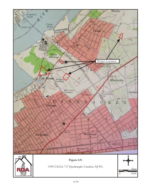
completion of the Delaware River Bridge (now the Benjamin Franklin Bridge) in 1926. The new automobile bridge precipitated extensive residential development in the Township of Pennsauken (Cranston 1931: 139-140; Corotis 1944:65; Dorwart 2001: 123-124). Between the close of World War I in 1918 and the onset of the Great Depression in 1929, the population of Pennsauken Township tripled (Martin/DePallo Group 1998). After an economic slowdown during the 1930s, wartime industries associated with World War II again drew workers to Pennsauken. Between 1940 and 1950, the population rose from 17,745 to 22,767. After World War II, the expansion of existing highways and the completion of the Walt Whitman Bridge (1957) and Betsy Ross Bridge (1976) created new connections between Camden County and Philadelphia. This precipitated more intensive land development, including industrial parks, shopping malls, and housing projects. The towns of Pennsauken and Merchantville, located southwest of Delair began to expand rapidly, with new residential developments and associated roads compensating for the post-war increase in population. Delair nearly doubled in size during the post-war period, expanding southeast to the Burlington Turnpike (Route 130), and to the northeast north of Pochack Creek (U.S.G.S. 1949; see Figure 4.9). By 1949, only the SGL Surrounding Property portion of the APE had been developed. During the early-twentieth century a chrome plating factory was constructed on the SGL Surrounding Property portion of the APE. This facility consisted of a large metal factory building, a large concrete building, and a cinder block building. Portions of the concrete building were razed during the second half of the twentieth century (Nationwide <strong>Environmental</strong> Title Research 1940, 1956, 1957, 1963, 1970, 1995, 2002). This section of the APE was bounded to the north by an asphalt manufacturing plant, constructed between 1940 and 1956 (Historic Aerials 1940, 1956). Between 1957 and 1963, a light industrial building was erected in the Penler Anodizing section of the APE on Union Avenue, which had previously been utilized as farmland (Historic Aerials 1957, 1963). Between 1963 and 1970, the King Arthur and Advance Process Supply portions of the APE, which had previously been farm land, were developed (Historic Aerials 1963, 1970). These portions of the APE currently contain light industrial facilities. 4-18
����������� ��������������������������������������������� ���� ���������������� � ���� ����