Multimedia Navigation New York 800 Truck - Blaupunkt
Multimedia Navigation New York 800 Truck - Blaupunkt
Multimedia Navigation New York 800 Truck - Blaupunkt

Create successful ePaper yourself
Turn your PDF publications into a flip-book with our unique Google optimized e-Paper software.
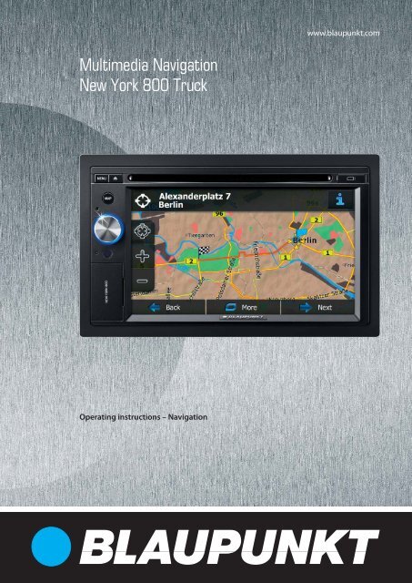
<strong>Multimedia</strong> <strong>Navigation</strong><br />
<strong>New</strong> <strong>York</strong> <strong>800</strong> <strong>Truck</strong><br />
Operating instructions – <strong>Navigation</strong><br />
www.blaupunkt.com
Thank you for choosing the <strong>Blaupunkt</strong> <strong>Navigation</strong> as your navigator. Start using <strong>Blaupunkt</strong><br />
<strong>Navigation</strong> right away. This document is the detailed description of the navigation software.<br />
You can easily discover <strong>Blaupunkt</strong> <strong>Navigation</strong> while you are using it; however, we still<br />
recommend that you read this manual to fully understand the screens and features.<br />
Easy navigation map updates<br />
It is easy to keep the navigation system up to date. Simply run the Toolbox application with<br />
your product connected and download new map data.<br />
2
Table of contents<br />
1 Warnings and Safety information ......................................................................... 6<br />
2 Getting started ......................................................................................................... 7<br />
2.1 Buttons and other controls on the screen ....................................................................... 8<br />
2.1.1 Using keyboards .................................................................................................................. 9<br />
2.1.2 Beyond single screen tap ................................................................................................... 10<br />
2.2 Map screen ................................................................................................................... 11<br />
2.2.1 Navigating on the map ....................................................................................................... 11<br />
2.2.2 Position markers ................................................................................................................ 13<br />
2.2.2.1 Vehimarker and Lock-on-Road .................................................................................................. 13<br />
2.2.2.2 Selected map location (Cursor) and selected map object .......................................................... 13<br />
2.2.3 Objects on the map ............................................................................................................ 13<br />
2.2.3.1 Streets and roads ....................................................................................................................... 13<br />
2.2.3.2 Turn preview and Next street ..................................................................................................... 13<br />
2.2.3.3 Lane information and Signposts................................................................................................. 15<br />
2.2.3.4 Junction view ............................................................................................................................. 15<br />
2.2.3.5 Motorway exit services .............................................................................................................. 15<br />
2.2.3.6 3D object types........................................................................................................................... 16<br />
2.2.3.7 Elements of the active route ....................................................................................................... 16<br />
2.2.3.8 Traffic events ............................................................................................................................. 17<br />
2.2.4 Manipulating the map ........................................................................................................ 18<br />
2.2.5 Quick menu ........................................................................................................................ 19<br />
2.2.6 Checking the details of the current position (Where Am I?) ............................................. 22<br />
2.3 <strong>Navigation</strong> menu .......................................................................................................... 23<br />
3 On-road navigation ............................................................................................... 24<br />
3.1 Selecting the destination of a route .............................................................................. 24<br />
3.1.1 Entering an address or a part of the address ....................................................................... 24<br />
3.1.1.1 Entering an address ................................................................................................................... 25<br />
3.1.1.2 Entering the midpoint of a street as the destination ................................................................... 27<br />
3.1.1.3 Selecting an intersection as the destination ............................................................................... 28<br />
3.1.1.4 Selecting a city/town centre as the destination........................................................................... 30<br />
3.1.1.5 Entering an address with a postal code ..................................................................................... 31<br />
3.1.1.6 Tips on entering addresses quickly ............................................................................................ 33<br />
3.1.2 Selecting the destination from the Places of Interest ......................................................... 33<br />
3.1.2.1 Quick search for a Place of Interest........................................................................................... 34<br />
3.1.2.2 Searching for a Place of Interest using preset categories .......................................................... 35<br />
3.1.2.3 Searching for a Place of Interest by category ............................................................................ 37<br />
3.1.2.4 Searching for a Place of Interest by name ................................................................................. 39<br />
3.1.2.5 Selecting nearby assistance from 'Where Am I?' ....................................................................... 42<br />
3.1.3 Selecting a map location as the destination ....................................................................... 43<br />
3.1.4 Selecting the destination from your Favourites ................................................................. 44<br />
3
3.1.5 Selecting one of the most likely destinations (Smart History) ........................................... 45<br />
3.1.6 Selecting a recent destination from the History ................................................................. 46<br />
3.1.7 Entering the coordinate of the destination ......................................................................... 47<br />
3.1.8 Building a route from the list of destinations (Create Route) ............................................ 48<br />
3.2 Viewing the entire route on the map ............................................................................ 49<br />
3.3 Checking route parameters and accessing route related functions ............................. 49<br />
3.4 Modifying the route ...................................................................................................... 50<br />
3.4.1 Selecting a new destination when already having a route: <strong>New</strong> Route, Waypoint or Final<br />
Destination .................................................................................................................................... 50<br />
3.4.2 Setting a new starting position for the route ...................................................................... 51<br />
3.4.3 Editing the list of destinations (Edit Route) ....................................................................... 52<br />
3.4.4 Pausing the active route ..................................................................................................... 53<br />
3.4.5 Cancelling the active route ................................................................................................ 53<br />
3.4.6 Checking route alternatives when planning the route ........................................................ 54<br />
3.4.7 Checking route alternatives for an existing route .............................................................. 55<br />
3.4.8 Changing the vehicle used in route planning ..................................................................... 56<br />
3.4.9 Changing the road types used in route planning ................................................................ 56<br />
3.5 Saving a location as a Favourite destination ............................................................... 57<br />
3.6 Watching the simulation of the route ........................................................................... 58<br />
4 Off-road navigation ............................................................................................... 60<br />
4.1 Selecting the destination of the route ........................................................................... 60<br />
4.2 Navigating in off-road mode ........................................................................................ 60<br />
5 Lorry navigation .................................................................................................... 61<br />
5.1 Setting up vehicle parameters ...................................................................................... 61<br />
5.2 Setting up waiting time at waypoints ........................................................................... 63<br />
5.3 Setting up driving time alerts ....................................................................................... 63<br />
6 Reference Guide .................................................................................................... 65<br />
6.1 Concepts ....................................................................................................................... 65<br />
6.1.1 Smart Zoom ....................................................................................................................... 65<br />
6.1.2 Daytime and night colour themes ...................................................................................... 65<br />
6.1.3 Route calculation and recalculation ................................................................................... 65<br />
6.1.4 Green routing ..................................................................................................................... 67<br />
6.1.5 Road safety cameras and other proximity alert points ....................................................... 68<br />
6.1.6 Speed limit warning ........................................................................................................... 69<br />
6.1.7 GPS position quality indicator and current time ................................................................ 69<br />
6.1.8 Traffic information in route planning ................................................................................ 70<br />
6.1.8.1 Historical traffic ........................................................................................................................ 70<br />
6.1.8.2 Real-time traffic information (TMC) .......................................................................................... 70<br />
6.2 'More' menu .................................................................................................................. 72<br />
6.3 Settings menu ............................................................................................................... 73<br />
4
6.3.1 Sound and Warnings .......................................................................................................... 74<br />
6.3.2 Customise Quick menu ...................................................................................................... 77<br />
6.3.3 Lorry settings ..................................................................................................................... 77<br />
6.3.4 Driving time management.................................................................................................. 77<br />
6.3.5 Traffic settings ................................................................................................................... 78<br />
6.3.6 Route settings ..................................................................................................................... 78<br />
6.3.7 Map settings ....................................................................................................................... 82<br />
6.3.8 Visual guidance settings .................................................................................................... 83<br />
6.3.9 Display settings .................................................................................................................. 84<br />
6.3.10 Regional settings .............................................................................................................. 84<br />
6.3.11 Trip monitor settings ........................................................................................................ 85<br />
6.3.12 Log collection settings ..................................................................................................... 85<br />
7 Glossary .................................................................................................................. 86<br />
8 Copyright note ....................................................................................................... 88<br />
5
1 Warnings and Safety information<br />
The navigation system helps you find your way to your destination with the built-in GPS<br />
receiver. <strong>Blaupunkt</strong> <strong>Navigation</strong> does not transmit your GPS position; others cannot track you.<br />
If you accept it when first using the application, <strong>Blaupunkt</strong> <strong>Navigation</strong> collects usage<br />
information and GPS logs that may be used for improving the application and the quality and<br />
coverage of maps. The data is processed anonymously; no one will be able to track any<br />
personal information. If you change your mind later, you can enable or disable the log<br />
collection in Settings (page 85).<br />
It is important that you look at the display only when it is safe to do so. If you are the driver of<br />
the vehicle, we recommend that you operate <strong>Blaupunkt</strong> <strong>Navigation</strong> before you start your<br />
journey. Plan the route before your departure and stop if you need to change the route.<br />
You must obey the traffic signs and follow the road geometry. If you deviate from the<br />
recommended route, <strong>Blaupunkt</strong> <strong>Navigation</strong> changes the instructions accordingly.<br />
6
2 Getting started<br />
<strong>Blaupunkt</strong> <strong>Navigation</strong> is optimised for in-car use. You can use it easily by tapping the screen<br />
buttons and the map with your fingertips.<br />
When using the navigation software for the first time, an initial setup process starts<br />
automatically. Do as follows:<br />
1. Select the written language of the application interface. Later you can change it in<br />
Regional settings (page 84).<br />
2. Read the End User Licence Agreement. Tap to continue.<br />
3. The Configuration wizard starts. Tap to continue.<br />
4. Select the language and speaker used for voice guidance messages. Later you can<br />
change it in Sound and Warnings settings (page 84).<br />
5. If needed, modify the time format and unit settings. Later you can change them in<br />
Regional settings (page 84).<br />
6. If needed, modify the default route planning options. Later you can change them in<br />
Route settings (page 78).<br />
7
7. The initial setup is now complete. The Configuration wizard can be restarted later from<br />
the Settings menu (page 73).<br />
8. You are now asked whether you allow the software to collect usage information and<br />
GPS logs that may be used for improving the application and the quality and coverage<br />
of maps. Tap to allow the anonymous statistics or disable this<br />
function. Later you can turn them on or off individually in Log collection settings (page<br />
85).<br />
After the initial setup, the Map screen appears and you can start using <strong>Blaupunkt</strong> <strong>Navigation</strong>.<br />
2.1 Buttons and other controls on the screen<br />
When you are using <strong>Blaupunkt</strong> <strong>Navigation</strong>, you usually tap buttons on the touch screen.<br />
You only need to confirm selections or changes if the application needs to restart, it needs to<br />
perform a major reconfiguration, or you are about to lose some of your data or settings.<br />
Otherwise, <strong>Blaupunkt</strong> <strong>Navigation</strong> saves your selections and applies the new settings without<br />
confirmation as soon as you use the controls.<br />
Type Example Description How to use it<br />
Button<br />
Button<br />
with value<br />
Icon<br />
List<br />
Tap it to initiate a function, to<br />
open a new screen, or to set<br />
a parameter.<br />
Some buttons display the<br />
current value of a field or<br />
setting. Tap the button to<br />
change the value. After the<br />
change, the new value is<br />
shown on the button.<br />
Shows status information.<br />
When you need to select<br />
from several options, they<br />
appear in a list.<br />
8<br />
Tap it once.<br />
Tap it once.<br />
Some icons also<br />
function as a button.<br />
Tap them once.<br />
Grab the list anywhere<br />
and slide your finger<br />
up or down.<br />
Depending on the<br />
speed of the sliding,<br />
the list will scroll fast<br />
or slow, only a bit or<br />
till the end.<br />
Alternatively, move<br />
between pages with<br />
the and<br />
buttons and tap the<br />
value that you want.
Radio<br />
button<br />
Switch<br />
When there are only a few<br />
choices, radio buttons may<br />
be used instead of lists. Only<br />
one value can be selected.<br />
When there are only two<br />
choices, a checkmark shows<br />
whether the feature is<br />
enabled.<br />
Slider When a feature can be set to<br />
different values in a range,<br />
<strong>Blaupunkt</strong> <strong>Navigation</strong> shows<br />
an indicator on a gauge that<br />
displays and sets the value.<br />
Virtual<br />
keyboard<br />
Alphabetic and<br />
alphanumeric keyboards to<br />
enter text and numbers.<br />
9<br />
Tap one of the buttons<br />
to select a new value.<br />
Tap it to turn the<br />
switch on or off.<br />
• Drag the<br />
handle to move<br />
the slider to its<br />
new position.<br />
• Tap the slider<br />
where you want<br />
the handle to<br />
appear; the<br />
thumb jumps<br />
there.<br />
Each key is a touch<br />
screen button.<br />
2.1.1 Using keyboards<br />
You only need to enter letters or numbers when you cannot avoid it. You can type with your<br />
fingertips on the full-screen keyboards and you can switch between various keyboard layouts,<br />
for example English, Greek or numerical.<br />
Task Instruction<br />
Switching to another keyboard layout, for<br />
example from an English keyboard to a<br />
Greek keyboard Tap the button and select<br />
the new keyboard layout from the list.<br />
Correcting your entry on the keyboard<br />
Tap to remove the unneeded character(s).<br />
Tap and hold the button to delete several<br />
characters or the entire input string.<br />
Entering a space, for example between a<br />
first name and a family name or in multiword<br />
street names Tap the button at the bottom centre of the<br />
screen.
Entering numbers and symbols<br />
Finalising the keyboard entry (accepting<br />
the suggested search result) Tap .<br />
Finalising the keyboard entry (opening the<br />
list of search results)<br />
Finalising the keyboard entry (saving your<br />
input)<br />
Cancelling the keyboard entry (returning<br />
to the previous screen)<br />
Tap to switch to a keyboard offering<br />
numeric and symbol characters.<br />
Tap .<br />
Tap .<br />
Tap .<br />
2.1.2 Beyond single screen tap<br />
You usually need to tap the screen only once. However, some useful features can be<br />
accessed with combined touch screen tapping. Those are the following:<br />
Action Details<br />
Tapping and holding<br />
the screen<br />
Gestures<br />
(drag&drop)<br />
Tap and keep pressing the following buttons to reach extra functions:<br />
• Tap and hold on list and menu screens:<br />
the Map screen appears.<br />
• Tap and hold any of the , , , , , and<br />
buttons on the Map screen: you can rotate, tilt or scale<br />
the map continuously.<br />
• Tap and hold on keyboard screens: you can delete<br />
several characters quickly.<br />
• Tap and hold or in long lists: you can scroll pages<br />
continuously.<br />
You need to drag and drop the screen only in cases like:<br />
• Moving the handle on a slider.<br />
• Scrolling the list: grab the list anywhere and slide your finger up<br />
or down. Depending on the speed of the sliding, the list will<br />
scroll fast or slow, only a bit or till the end.<br />
• Moving the map in map browsing mode: grab the map, and<br />
move it in the desired direction.<br />
10
2.2 Map screen<br />
2.2.1 Navigating on the map<br />
The Map screen is the most frequently used screen of <strong>Blaupunkt</strong> <strong>Navigation</strong>.<br />
A small live map is displayed on the <strong>Navigation</strong> menu, as a part of the<br />
button.<br />
To enlarge this small map and open the Map screen, tap .<br />
This map shows the current position (the Vehimarker, a blue arrow by default), the<br />
recommended route (an blue line), and the surrounding map area.<br />
When there is no GPS position, the Vehimarker is transparent. It shows your last known<br />
position.<br />
You see coloured dots circling around a satellite symbol in the top left corner. The more green<br />
dots you see, the closer you are to get the valid GPS position.<br />
When GPS position is available, the Vehimarker is displayed in full colour, now showing your<br />
current position.<br />
There are screen buttons and data fields on the screen to help you navigate. During<br />
navigation, the screen shows route information.<br />
By default, only one data field is displayed in the bottom right corner. Tap this field to see all<br />
route data fields.<br />
11
Tap any of the data fields to suppress others and display only the selected one. The data<br />
fields are different when you are navigating an active route and when you have no specified<br />
destination (the blue line is not displayed).<br />
Default data fields when cruising without a destination (tap and hold any of the fields to<br />
change its value):<br />
Field Description<br />
Shows your current speed given by the GPS receiver.<br />
Shows the speed limit of the current road if the map contains it.<br />
Shows the current time corrected with time zone offset. The accurate<br />
time comes from the GPS satellites, and the time zone information<br />
comes from the map or it can be set manually in Regional settings.<br />
(The current time is always displayed in the top left corner of menu<br />
screens.)<br />
Default data fields when navigating a route (tap and hold any of the fields to change its value):<br />
Field Description<br />
Shows the distance you need to travel on the route before reaching<br />
your final destination.<br />
Shows the time needed to reach the final destination of the route<br />
based on information available for the remaining segments of the<br />
route.<br />
If <strong>Blaupunkt</strong> <strong>Navigation</strong> is capable of receiving live traffic information,<br />
the calculation takes into account traffic delays affecting your route if<br />
they are received. However, this calculation is rarely accurate.<br />
Historical traffic data can also be taken into account if data is<br />
available.<br />
Shows the estimated arrival time at the final destination of the route<br />
based on information available for the remaining segments of the<br />
route.<br />
If <strong>Blaupunkt</strong> <strong>Navigation</strong> is capable of receiving live traffic information,<br />
the calculation takes into account traffic delays affecting your route if<br />
they are received. However, this calculation is rarely accurate.<br />
Historical traffic data can also be taken into account if data is<br />
available.<br />
12
2.2.2 Position markers<br />
2.2.2.1 Vehimarker and Lock-on-Road<br />
When your GPS position is available, <strong>Blaupunkt</strong> <strong>Navigation</strong> marks your current position with<br />
the Vehimarker. By default, this marker is a blue arrow, but you can change this icon in<br />
Settings.<br />
When on-road navigation is selected, the Vehimarker may not show your exact GPS position<br />
and heading. If roads are near, it is aligned to the nearest road to suppress GPS position<br />
errors, and the direction of the icon is aligned to the direction of the road.<br />
If you select off-road navigation: The Vehimarker is at your exact GPS position. The direction<br />
of the icon shows your current heading.<br />
2.2.2.2 Selected map location (Cursor) and selected map object<br />
You can mark a map location in the following ways:<br />
• Tap the map when navigating,<br />
• Tap the map when you are asked to confirm the destination at the end of a search, or<br />
• Tap the map in Find on Map (page 43)<br />
When a map location is selected, the Cursor appears at the selected point on the map. The<br />
Cursor is displayed with a radiating red dot ( ) to make it visible at all zoom levels.<br />
The location of the Cursor can be used as the destination of the route, you can search for<br />
Places around it, or you can save this location as one of your Favourite destinations.<br />
You can also select some of the objects on the map. If you tap the map at the icon of a Place<br />
of Interest, the Place will be selected (you see a red circling border around the object), and<br />
you can get information about this object or use it as a route point.<br />
2.2.3 Objects on the map<br />
2.2.3.1 Streets and roads<br />
<strong>Blaupunkt</strong> <strong>Navigation</strong> shows the streets in a way that is similar to how the paper road maps<br />
show them. Their width and colours correspond to their importance: you can easily tell a<br />
motorway from a small street.<br />
2.2.3.2 Turn preview and Next street<br />
When navigating a route, the top section of the Map screen shows information about the next<br />
route event (manoeuvre) and the next street or the next city/town.<br />
13
There is a field in the top left corner that displays the next manoeuvre. Both the type of the<br />
event (turn, roundabout, exiting motorway, etc.) and its distance from the current position are<br />
displayed.<br />
A smaller icon shows the type of the second next manoeuvre if it is near the first one.<br />
Otherwise, only the next manoeuvre is displayed.<br />
Most of these icons are very intuitive. The following table lists some of the frequently shown<br />
route events. The same symbols are used in both fields:<br />
Icon Description<br />
Turn left.<br />
Turn right.<br />
Turn back.<br />
Bear right.<br />
Turn sharp left.<br />
Keep left.<br />
Continue straight in the intersection.<br />
Go left on the roundabout, 3rd exit (next<br />
manoeuvre).<br />
Enter roundabout (second next manoeuvre).<br />
Enter motorway.<br />
Exit motorway.<br />
Board ferry.<br />
Leave ferry.<br />
Approaching a waypoint.<br />
Approaching the destination.<br />
14
2.2.3.3 Lane information and Signposts<br />
When navigating on multilane roads, it is important to take the appropriate lane in order to<br />
follow the recommended route. If lane information is available in the map data, <strong>Blaupunkt</strong><br />
<strong>Navigation</strong> displays the lanes and their directions using small arrows at the bottom of the<br />
map. Highlighted arrows represent the lanes you need to take.<br />
Where additional information is available, signposts substitute arrows. Signposts are<br />
displayed at the top of the map. The colour and style of the signposts are similar to the real<br />
ones you can see above road or by the roadside. They show the available destinations and<br />
the number of the road the lane leads to.<br />
All signposts look similar when cruising (when there is no recommended route). When<br />
navigating a route, only the signpost that points to the lane(s) to be taken is displayed in vivid<br />
colours; all others are darker.<br />
If you want to hide the currently displayed signposts, tap any of them and the normal Map<br />
screen returns until new signpost information is received.<br />
2.2.3.4 Junction view<br />
If you are approaching a motorway exit or a complex intersection and the needed information<br />
exists, the map is replaced with a 3D view of the junction. The lanes you need to take are<br />
displayed with arrows. Signposts can also be present if information is available.<br />
If you want to hide the currently displayed junction, tap the picture and the Map screen<br />
returns.<br />
2.2.3.5 Motorway exit services<br />
You may need a petrol station or a restaurant during your journey. This feature displays a<br />
new button on the map when you are driving on motorways.<br />
Tap this button to open a panel with the details of the next few exits or service stations.<br />
15
Tap any of them to display it on the map and add it as a waypoint to your route if needed.<br />
If you want to display other types of Places for the exits, you can change the icons in Visual<br />
Guidance settings (page 83).<br />
2.2.3.6 3D object types<br />
<strong>Blaupunkt</strong> <strong>Navigation</strong> supports the following 3D object types:<br />
Type Description<br />
3D terrain 3D terrain map data shows changes in terrain, elevations or depressions in<br />
the land when you view the map in 2D, and use it to plot the route map in<br />
3D when you navigate. Hills and mountains are shown in the background of<br />
the 3D map, and illustrated by colour and shading on the 2D map.<br />
Elevated roads Complex intersections and vertically isolated roads (such as overpasses or<br />
bridges) are displayed in 3D.<br />
3D landmarks Landmarks are 3D artistic or block representations of prominent or wellknown<br />
objects.<br />
3D buildings<br />
3D block representation of full city building data containing actual building<br />
size and position on the map.<br />
2.2.3.7 Elements of the active route<br />
<strong>Blaupunkt</strong> <strong>Navigation</strong> shows the route in the following way:<br />
Symbol Name Description<br />
Current GPS position and<br />
Start point<br />
Waypoint (intermediate<br />
destination)<br />
Your current position displayed on the map. If<br />
roads are near, it is aligned to the nearest road.<br />
Normally if GPS position is available, the route<br />
starts from the current position. If there is no valid<br />
GPS position, <strong>Blaupunkt</strong> <strong>Navigation</strong> uses the last<br />
known position as the start point.<br />
An intermediate destination of the route before<br />
reaching the final destination.<br />
Destination (end point) The final destination of the route.<br />
Route colour<br />
The route always stands out with its colour on the<br />
map, both in daytime and in night colour mode.<br />
16
Streets and roads that are<br />
excluded from the navigation<br />
Streets and roads that are<br />
affected by traffic events<br />
2.2.3.8 Traffic events<br />
You can choose whether you want to use or<br />
avoid certain road types (page 78). However,<br />
when <strong>Blaupunkt</strong> <strong>Navigation</strong> cannot avoid such<br />
roads, the route will include them and it will show<br />
them in a colour that is different from the route<br />
colour.<br />
Road segments may be affected by traffic events<br />
received. These streets and roads are displayed<br />
in an alternate colour, and small symbols<br />
displayed along the route show the type of the<br />
traffic event.<br />
Road segments affected by traffic events are displayed with an alternate colour on the map,<br />
and small symbols above the road show the nature of the event:<br />
Tap to open the Traffic Summary screen.<br />
Tap to open the list of traffic events:<br />
Now tap any of the list items to see its details, and to display the affected road segment in its<br />
full length on the map:<br />
Note! If there are traffic events on the recommended route that the application has not<br />
bypassed, the icon will open the list of significant traffic events to let you<br />
quickly check them.<br />
17
2.2.4 Manipulating the map<br />
Tap the map anywhere to browse it during navigation. The map stops following the current<br />
position (the Vehimarker, a blue arrow by default, is not locked in a fix position on the screen<br />
any more) and control buttons appear to help you modify the map view.<br />
Action Button(s) Description<br />
Moving the map<br />
with drag&drop<br />
Zooming in and out<br />
Tilting up and down<br />
Rotating left and<br />
right<br />
2D or 3D view<br />
Compass in 2D<br />
map view mode<br />
No buttons<br />
,<br />
,<br />
,<br />
,<br />
,<br />
You can move the map in any direction: tap<br />
and hold the map, and move your finger<br />
towards the direction you want to move the<br />
map.<br />
Changes how much of the map is displayed on<br />
the screen.<br />
<strong>Blaupunkt</strong> <strong>Navigation</strong> uses high-quality vector<br />
maps that let you examine the map at various<br />
zoom levels, always with optimised content. It<br />
always displays street names and other text<br />
with the same font size, never upside-down,<br />
and you only see the streets and objects that<br />
you need.<br />
Map scaling has a limit in 3D map view mode.<br />
If you zoom out further, the map switches to<br />
2D view mode.<br />
Tap the button once to modify the view in large<br />
steps, or tap and hold the button to modify it<br />
continuously and smoothly.<br />
Changes the vertical view angle of the map in<br />
3D mode.<br />
Tap the button once to modify the view in large<br />
steps, or tap and hold the button to modify it<br />
continuously and smoothly.<br />
Changes the horizontal view angle of the map.<br />
Tap the button once to modify the view in large<br />
steps, or tap and hold the button to modify it<br />
continuously and smoothly.<br />
Tap this button to switch between the 3D<br />
perspective and 2D top-down map view<br />
modes.<br />
The direction of the compass shows North.<br />
Tap the button to switch to North-up view, and<br />
then tap again to rotate the map in the<br />
previous direction.<br />
18
Compass in 3D<br />
map view mode<br />
Location<br />
information<br />
Return to normal<br />
navigation<br />
Additional options<br />
Select destination<br />
,<br />
The direction of the compass shows North.<br />
Tap the button to switch to North-up view, and<br />
then tap again to rotate the map in the<br />
previous direction.<br />
Tap this button to open a new screen with<br />
information about the selected map point, the<br />
Cursor.<br />
Tap this button to move the map back to follow<br />
the current GPS position. Automatic map<br />
rotation is also re-enabled.<br />
The map manipulation buttons disappear and<br />
navigation continues.<br />
Tap this button to open a list of additional<br />
features like saving the Cursor as a Favourite<br />
destination, or searching for Places around the<br />
Cursor.<br />
Tap this button to select the Cursor as a new<br />
destination. The route is automatically<br />
calculated.<br />
2.2.5 Quick menu<br />
The Quick menu is a selection of controls and functions that are frequently needed during<br />
navigation. It can be opened directly from the Map screen by tapping .<br />
The menu will close after a few seconds of inactivity or if you tap .<br />
The menu will also close if you initiate simple controls like muting the device. In other cases<br />
tapping a button will open a new screen with options.<br />
Most of these functions are shortcuts. They are accessible from the menu system.<br />
There are more functions available than the number of buttons in the menu. In Settings, you<br />
can choose the function of each button (page 77). The following options are available:<br />
Button Description Shortcut for<br />
Master<br />
Volume slider<br />
This slider adjusts the sound volume of the device. All<br />
sounds of the application are affected.<br />
19<br />
More / Settings /<br />
Sound and Warnings<br />
/ Volume / Master<br />
slider
,<br />
This switch mutes all sounds of the device. Tap again<br />
to re-enable sounds.<br />
This function lets you search for a Place along your<br />
route or around your current location if there is no<br />
route calculated.<br />
This button opens the list of your Favourite<br />
destinations.<br />
This button opens the History list. You can select one<br />
of your previous destinations.<br />
This button opens the route editing function.<br />
This button opens the route related settings.<br />
This button opens the map related settings.<br />
This button opens a special screen with information<br />
about the current position and a button to search for<br />
nearby emergency or roadside assistance. For details,<br />
see the next chapter.<br />
This button cancels the route and stops navigation.<br />
The button is replaced with the next one if waypoints<br />
are given.<br />
This button skips the next waypoint from the route.<br />
This button opens a 2D map scaled and positioned to<br />
show the entire route.<br />
This button opens the Visual Guidance settings<br />
screen.<br />
20<br />
More / Settings /<br />
Sound and Warnings<br />
/ Volume / Master<br />
switch<br />
Find / Find Places /<br />
Quick Search (page<br />
34)<br />
Find / Favourite (page<br />
44)<br />
Find / History (page<br />
46)<br />
My Route / Edit Route<br />
More / Settings /<br />
Route Settings (page<br />
78)<br />
More / Settings / Map<br />
Settings (page 82)<br />
Tap the Current<br />
Street field on the<br />
Map screen<br />
My Route / Cancel<br />
Route (page 53)<br />
n/a<br />
My Route / Overview<br />
(page 49)<br />
More / Settings /<br />
Visual Guidance<br />
(page 83)
This button opens the Traffic Summary screen.<br />
This button lets you bypass parts of the recommended<br />
route.<br />
This button opens the Trip Monitor screen where you<br />
can manage your previously saved trip logs and track<br />
logs.<br />
This button opens the list of manoeuvres (the<br />
itinerary).<br />
With this function you can save the active route for<br />
later use.<br />
With this function you can replace the active route with<br />
a previously saved route.<br />
With this function you can search for Places of Interest<br />
in various different ways.<br />
This button opens the Map screen and starts<br />
simulating the active route.<br />
This button opens the GPS Information screen with<br />
satellite position and signal strength information.<br />
This button opens the parameters of the selected<br />
Vehicle profile.<br />
This button opens the Lorry settings screen.<br />
This button opens the Driving timer configuration<br />
screen.<br />
21<br />
Tap the Traffic icon in<br />
the <strong>Navigation</strong> menu<br />
or on the Map screen<br />
My Route /<br />
Avoidances<br />
More / Trip Monitor<br />
(page 72)<br />
Tap the top of the<br />
Map screen during<br />
navigation.<br />
My Route / More /<br />
Save Route<br />
My Route / More /<br />
Load Route<br />
Find / Find Places<br />
(page 33)<br />
My Route / More /<br />
Simulate <strong>Navigation</strong><br />
(page 58)<br />
Tap the top of the<br />
Map screen when<br />
there is no GPS<br />
reception<br />
More / Settings /<br />
Route (page 78)<br />
More / Settings / Lorry<br />
(page 77)<br />
More / Settings / Lorry<br />
/ Configure Driving<br />
Timers (page 63)
2.2.6 Checking the details of the current position (Where Am I?)<br />
This screen contains information about the current position (or about the last known position if<br />
GPS reception is not available) and a button to search for useful Places nearby.<br />
.<br />
You can access this screen from the map in one of the following ways:<br />
• If the current street is displayed below the Vehimarker (the current position on the<br />
map), tap it to open the Where Am I? screen.<br />
• Open the Quick menu and tap the button.<br />
Information on this screen:<br />
• , : Latitude and Longitude (coordinate of the current position in WGS84<br />
format).<br />
• : Altitude (elevation information coming from the GPS receiver - often<br />
inaccurate).<br />
• : House number on the left.<br />
• : House number on the right.<br />
• In the middle of the screen you can see whether the position is current, or the time left<br />
since it was last updated.<br />
• Address details (when available) of the current position are also displayed at the<br />
bottom.<br />
You can also perform some actions on this screen:<br />
Tap to save the current position as a Favourite destination.<br />
You can also search for assistance near your current position. Tap to<br />
open a new screen for the Quick search:<br />
The following services can be searched around the current position or the last known position:<br />
22
• : Car repair and roadside assistance services<br />
• : Medical and emergency services<br />
• : Police stations<br />
• : Petrol stations<br />
Tap any of the buttons, select a Place from the list, and navigate to it.<br />
2.3 <strong>Navigation</strong> menu<br />
You can reach all parts of <strong>Blaupunkt</strong> <strong>Navigation</strong> from the <strong>Navigation</strong> menu.<br />
You have the following options:<br />
• Tap to select your destination by entering an address or selecting<br />
a place of interest, a location on the map or one of your Favourite destinations. You<br />
can also look up your recent destinations from the Smart History or enter a coordinate.<br />
• Tap to display the route parameters and the route in its full length<br />
on the map. You can also perform route-related actions such as editing or cancelling<br />
your route, setting a start point for the route, picking route alternatives, avoiding parts<br />
of the route, simulating navigation or adding the destination to your Favourites.<br />
• Tap to customise the way the navigation software works, to<br />
simulate demo routes or to run some additional applications.<br />
• Tap to start navigating on the map. The button itself is a miniature<br />
live map that shows your current position, the recommended route and the surrounding<br />
map area. Tap the button to enlarge the map to the full screen.<br />
• Tap to open the Traffic Summary screen.<br />
• Tap to stop navigation and exit the software.<br />
23
3 On-road navigation<br />
When first started, <strong>Blaupunkt</strong> <strong>Navigation</strong> calculates routes using the road network of the high<br />
quality vector maps provided with the product.<br />
You can set up your route in different ways:<br />
• If you need a route for immediate navigation, you can select the destination and start<br />
navigating to it right away (normal navigation).<br />
• You can also plan a route independently of your current GPS position or even without<br />
GPS reception (to achieve this, you need to turn off the GPS receiver and set a new<br />
starting point in My Route / Edit Route by tapping the flag icon at the current position).<br />
You can plan routes with multiple destinations. Select the first destination. Then select a<br />
second destination and add it to your route to create a multi-point route. You can add as<br />
many destinations to your route as you like.<br />
You can also use <strong>Blaupunkt</strong> <strong>Navigation</strong> for off-road navigation. For details, see page 60.<br />
3.1 Selecting the destination of a route<br />
<strong>Blaupunkt</strong> <strong>Navigation</strong> offers you several ways of choosing your destination:<br />
• Enter a full address or a part of an address, for example a street name without a house<br />
number or the names of two intersecting streets (page 24).<br />
• Enter an address with postal code (page 31). This way you do not need to select the<br />
name of the city/town and the search for street names might be faster as well.<br />
• Use a built-in Place of Interest as your destination (page 33).<br />
• Select a location on the map with the Find on Map feature (page 43).<br />
• Use a previously saved Favourite destination (page 44).<br />
• Select a location from the History of previously used destinations (page 46).<br />
• Enter the coordinate of the destination (page 47).<br />
3.1.1 Entering an address or a part of the address<br />
If you know at least a part of the address, it is the quickest way to select the destination of the<br />
route.<br />
Using the same screen, you can find an address by entering:<br />
• the exact address, including house number<br />
• the centre of a city/town<br />
• an intersection<br />
• the midpoint of a street<br />
• any of the above, starting the search with the postal code (page 31)<br />
24
3.1.1.1 Entering an address<br />
To enter an address as the destination, do as follows:<br />
1. If you are on the Map screen, tap to return to the <strong>Navigation</strong><br />
menu.<br />
2. In the <strong>Navigation</strong> menu, tap the following buttons: , .<br />
3. By default, <strong>Blaupunkt</strong> <strong>Navigation</strong> proposes the country and city/town where you are. If<br />
needed, tap , enter the first few letters of the country name on the<br />
keyboard, and select one country from the list of results.<br />
4. If needed, select a new city/town:<br />
a. Tap .<br />
b. Start entering the name of the city/town on the keyboard.<br />
c. Find the city/town you need:<br />
5. Enter the street name:<br />
• The most likely city/town name is always shown in the input field. To<br />
accept it, tap .<br />
• If the desired name does not show up, the names that match the string<br />
appear in a list after entering a couple of characters (to open the list of<br />
results before it appears automatically, tap ). Select<br />
the city/town from the list.<br />
a. Tap .<br />
b. Start entering the street name on the keyboard.<br />
c. Find the street you need:<br />
25
• The most likely street name is always shown in the input field. To accept<br />
it, tap .<br />
• If the desired name does not show up, the names that match the string<br />
appear in a list after entering a couple of characters (to open the list of<br />
6. Enter the house number:<br />
results before it appears automatically, tap ). Select<br />
the street from the list.<br />
a. Tap .<br />
b. Enter the house number on the keyboard. (To enter letters, tap ).<br />
c. Tap to finish entering the address. (If the entered house<br />
number cannot be found, the midpoint of the street is selected as the<br />
destination.)<br />
7. A full screen map appears with the selected point in the middle. If necessary, tap the<br />
map somewhere else to modify the destination. The Cursor ( ) appears at the<br />
new location. Tap to confirm the destination, or tap<br />
to select a different destination.<br />
8. After a short summary of the route parameters, the map appears showing the entire<br />
route. The route is automatically calculated. Tap to modify route<br />
parameters, or tap and start your journey.<br />
26
Tip! If you know that you will use this destination frequently, before tapping<br />
to confirm the destination, put it on the list of your<br />
Favourites first: tap then , give a<br />
name for the new Favourite, and tap to save the location.<br />
The map with the destination returns automatically. Now you can start your<br />
journey.<br />
3.1.1.2 Entering the midpoint of a street as the destination<br />
You can navigate to the midpoint of a street if the house number is not available:<br />
1. If you are on the Map screen, tap to return to the <strong>Navigation</strong><br />
menu.<br />
2. In the <strong>Navigation</strong> menu, tap the following buttons: , .<br />
3. If necessary, modify the country and city/town as described earlier (page 25).<br />
4. Enter the street name:<br />
a. Tap .<br />
b. Start entering the street name on the keyboard.<br />
c. Find the street you need:<br />
• The most likely street name is always shown in the input field. To accept<br />
it, tap .<br />
• If the desired name does not show up, the names that match the string<br />
appear in a list after entering a couple of characters (to open the list of<br />
results before it appears automatically, tap ). Select<br />
the street from the list.<br />
27
5. Instead of entering the house number, tap . The midpoint of the<br />
street is selected as the destination.<br />
6. A full screen map appears with the selected point in the middle. If necessary, tap the<br />
map somewhere else to modify the destination. The Cursor ( ) appears at the<br />
new location. Tap to confirm the destination, or tap<br />
to select a different destination.<br />
7. After a short summary of the route parameters, the map appears showing the entire<br />
route. The route is automatically calculated. Tap to modify route<br />
parameters, or tap and start your journey.<br />
3.1.1.3 Selecting an intersection as the destination<br />
To enter an address as the destination, do as follows:<br />
1. If you are on the Map screen, tap to return to the <strong>Navigation</strong><br />
menu.<br />
2. In the <strong>Navigation</strong> menu, tap the following buttons: , .<br />
3. If necessary, modify the country and city/town as described earlier (page 25).<br />
4. Enter the street name:<br />
a. Tap .<br />
b. Start entering the street name on the keyboard.<br />
c. Find the street you need:<br />
• The most likely street name is always shown in the input field. To accept<br />
it, tap .<br />
28
• If the desired name does not show up, the names that match the string<br />
appear in a list after entering a couple of characters (to open the list of<br />
results before it appears automatically, tap ). Select<br />
the street from the list.<br />
5. Enter the intersecting street name:<br />
1. Tap .<br />
• If only a few intersecting streets exist, their list appears immediately.<br />
• In case of a longer street, the keyboard screen appears. Start entering<br />
the name of the intersecting street on the keyboard. As soon as the street<br />
names that match the entered string can be shown on one screen, their<br />
list appears automatically. Select from the list.<br />
6. A full screen map appears with the selected point in the middle. If necessary, tap the<br />
map somewhere else to modify the destination. The Cursor ( ) appears at the<br />
new location. Tap to confirm the destination, or tap<br />
to select a different destination.<br />
7. After a short summary of the route parameters, the map appears showing the entire<br />
route. The route is automatically calculated. Tap to modify route<br />
parameters, or tap and start your journey.<br />
29
3.1.1.4 Selecting a city/town centre as the destination<br />
The city/town centre is not the geometric centre of the city/town but an arbitrary point the map<br />
creators have chosen. In towns and villages, it is usually the most important intersection; in<br />
larger cities, it is one of the important intersections.<br />
1. If you are on the Map screen, tap to return to the <strong>Navigation</strong><br />
menu.<br />
2. In the <strong>Navigation</strong> menu, tap the following buttons: , .<br />
3. If necessary, modify the country as described earlier (page 25).<br />
4. Select the destination city/town:<br />
a. Tap .<br />
b. Start entering the name of the city/town on the keyboard.<br />
c. Find the city/town you need:<br />
• The most likely city/town name is always shown in the input field. To<br />
accept it, tap .<br />
• If the desired name does not show up, the names that match the string<br />
appear in a list after entering a couple of characters (to open the list of<br />
results before it appears automatically, tap ). Select<br />
the city/town from the list.<br />
5. Instead of entering the street name, tap . This way the centre of<br />
the displayed city/town becomes the destination of the route.<br />
6. A full screen map appears with the selected point in the middle. If necessary, tap the<br />
map somewhere else to modify the destination. The Cursor ( ) appears at the<br />
30
new location. Tap to confirm the destination, or tap<br />
to select a different destination.<br />
7. After a short summary of the route parameters, the map appears showing the entire<br />
route. The route is automatically calculated. Tap to modify route<br />
parameters, or tap and start your journey.<br />
3.1.1.5 Entering an address with a postal code<br />
All of the above address searching possibilities can be performed with entering the postal<br />
code instead of the city/town name. Find below an example with a full address:<br />
1. If you are on the Map screen, tap to return to the <strong>Navigation</strong><br />
menu.<br />
2. In the <strong>Navigation</strong> menu, tap the following buttons: , .<br />
3. If necessary, modify the country as described earlier (page 25).<br />
4. Enter a new city/town using its postal code:<br />
a. Tap .<br />
b. Tap to open the numeric keypad.<br />
c. Start entering the postal code.<br />
d. Find the city/town you need:<br />
• The most likely postal code is always shown in the input field. To accept<br />
it, tap .<br />
• If the desired number does not show up, open the list of results by<br />
tapping . Select the postal code from the list.<br />
31
5. Enter the street name:<br />
a. Tap .<br />
b. Start entering the street name on the keyboard.<br />
c. Find the street you need:<br />
• The most likely street name is always shown in the input field. To accept<br />
it, tap .<br />
• If the desired name does not show up, the names that match the string<br />
appear in a list after entering a couple of characters (to open the list of<br />
6. Enter the house number:<br />
results before it appears automatically, tap ). Select<br />
the street from the list.<br />
a. Tap .<br />
b. Enter the house number on the keyboard. (To enter letters, tap ).<br />
c. Tap to finish entering the address. (If the entered house<br />
number cannot be found, the midpoint of the street is selected as the<br />
destination.)<br />
7. A full screen map appears with the selected point in the middle. If necessary, tap the<br />
map somewhere else to modify the destination. The Cursor ( ) appears at the<br />
new location. Tap to confirm the destination, or tap<br />
to select a different destination.<br />
8. After a short summary of the route parameters, the map appears showing the entire<br />
route. The route is automatically calculated. Tap to modify route<br />
parameters, or tap and start your journey.<br />
32
3.1.1.6 Tips on entering addresses quickly<br />
• When you are entering the name of a city/town or a street:<br />
• Only those letters are offered on the keyboard that appear in possible search<br />
results. All other characters are greyed out.<br />
• As you are typing, the most likely result is always displayed in the input field. If<br />
the guess is correct, tap to select it.<br />
• After entering a couple of letters, tap to list the items that<br />
contain the specified letters.<br />
• You can speed up finding an intersection:<br />
• Search first for the street with a less common or less usual name; fewer letters<br />
are enough to find it.<br />
• If one of the streets is shorter, search for that one first. You can then find the<br />
second one faster.<br />
• You can search for both the type and the name of a road. If the same word appears in<br />
several names, for example in the name of streets, roads and avenues, you can obtain<br />
the result faster if you enter the first letter of the street type: For example, enter 'PI A' to<br />
obtain Pine Avenue and skip all Pine Streets and Pickwick Roads.<br />
• You can also search in postal codes. As postal codes consist of only a few characters,<br />
this is usually faster than entering the name of the city/town.<br />
3.1.2 Selecting the destination from the Places of Interest<br />
You can select your destination from the Places of Interest included with <strong>Blaupunkt</strong><br />
<strong>Navigation</strong>.<br />
Using the same screen, you can find a Place in different ways:<br />
• with the Quick search feature, you can quickly find a nearby Place by its name<br />
• with the Preset search feature, you can find frequently searched types of Places with<br />
only a few screen taps<br />
• you can search for a Place by its category<br />
• you can search for a Place by its name<br />
In addition, you can search for special services from the 'Where Am I?' screen.<br />
33
3.1.2.1 Quick search for a Place of Interest<br />
The Quick search feature lets you quickly find a Place by its name. The search is always<br />
carried out<br />
• along the recommended route if it exists or<br />
• around your current location if there is no destination given.<br />
1. Start the Quick search function:<br />
• If you are on the Map screen, tap and then tap .<br />
• If you are in the <strong>Navigation</strong> menu, tap , and then<br />
tap .<br />
2. Using the keyboard, start entering the name of the Place.<br />
3. After entering a few letters, tap to open the list of Places with<br />
names containing the entered character sequence.<br />
4. (optional) The Places in the list are ordered by the length of the necessary detour<br />
(when navigating a route) or by their distance from the current position (when no<br />
destination is given). If you need to reorder the list, tap .<br />
5. Browse the list if necessary and tap one of the list items. A full screen map appears<br />
with the selected point in the middle. The name and address of the Place is displayed<br />
at the top of the screen.<br />
6. (optional) Tap to see the details of the selected Place. Tap<br />
to return to the map.<br />
34
7. If necessary, tap the map somewhere else to modify the destination. The Cursor<br />
( ) appears at the new location. Tap to confirm the<br />
destination, or tap to select a different destination.<br />
8. After a short summary of the route parameters, the map appears showing the entire<br />
route. The route is automatically calculated. Tap to modify route<br />
parameters, or tap and start your journey.<br />
3.1.2.2 Searching for a Place of Interest using preset categories<br />
The Preset search feature lets you quickly find the most frequently selected types of Places.<br />
1. If you are on the Map screen, tap to return to the <strong>Navigation</strong><br />
menu.<br />
2. In the <strong>Navigation</strong> menu, tap the following buttons: , .<br />
3. The preset search categories appear:<br />
• :<br />
• If an active route exists, petrol stations are searched along the route.<br />
• If there is no active route (destination is not selected), they are searched<br />
around the current position.<br />
• If the current position is not available either (no GPS signal), they are<br />
searched around the last known position.<br />
• :<br />
• If an active route exists, parking lots are searched around the destination<br />
of the route.<br />
35
• If there is no active route (destination is not selected), they are searched<br />
around the current position.<br />
• If the current position is not available either (no GPS signal), they are<br />
searched around the last known position.<br />
• :<br />
• If an active route exists, restaurants are searched along the route.<br />
• If there is no active route (destination is not selected), they are searched<br />
around the current position.<br />
• If the current position is not available either (no GPS signal), they are<br />
searched around the last known position.<br />
• :<br />
• If an active route exists, accommodation is searched around the<br />
destination of the route.<br />
• If there is no active route (destination is not selected), they are searched<br />
around the current position.<br />
• If the current position is not available either (no GPS signal), they are<br />
searched around the last known position.<br />
4. Tap any of the quick search buttons to get an instant list of Places.<br />
5. (optional) The Places in the list are ordered by their distance from the current or last<br />
known position, from the destination or by the length of the necessary detour. If you<br />
need to reorder the list, tap .<br />
6. Browse the list if necessary and tap one of the list items. A full screen map appears<br />
with the selected point in the middle. The name and address of the Place is displayed<br />
at the top of the screen.<br />
7. (optional) Tap to see the details of the selected Place. Tap<br />
to return to the map.<br />
8. If necessary, tap the map somewhere else to modify the destination. The Cursor<br />
( ) appears at the new location. Tap to confirm the<br />
destination, or tap to select a different destination.<br />
9. After a short summary of the route parameters, the map appears showing the entire<br />
route. The route is automatically calculated. Tap to modify route<br />
parameters, or tap and start your journey.<br />
36
3.1.2.3 Searching for a Place of Interest by category<br />
You can search for Places of Interest by their categories and subcategories.<br />
1. If you are on the Map screen, tap to return to the <strong>Navigation</strong><br />
menu.<br />
2. In the <strong>Navigation</strong> menu, tap the following buttons: , .<br />
3. Tap .<br />
4. Select the area around which the Place should be searched for:<br />
• Tap to search around the current position or if it is not<br />
available, around the last know position. (The result list will be ordered by the<br />
distance from this position.)<br />
• Tap to search for a place within a selected city/town. (The<br />
result list will be ordered by the distance from the centre of the selected<br />
city/town.)<br />
• Tap to search for a place around the destination of the<br />
active route. (The result list will be ordered by the distance from the destination.)<br />
• Tap to search along the active route, and not around a<br />
given point. This is useful when you search for a later stopover that results in a<br />
minimal detour only, such as searching for upcoming petrol stations or<br />
restaurants. (The result list will be ordered by the length of the necessary<br />
detour.)<br />
5. (optional) If you have selected , select the city/town to search in.<br />
37
6. Select one of the main Place categories (e.g. Accommodation) or tap<br />
to list all Places around the selected location or along the route.<br />
7. Select one of the Place subcategories (e.g. Hotel or Motel) or tap<br />
to list all Places in the selected main category around the selected location or along the<br />
route.<br />
8. Sometimes the list of brands in the selected Place subcategory appears. Select one<br />
brand or tap to list all Places in the selected subcategory around<br />
the selected location or along the route.<br />
9. Finally, the results appear in a list.<br />
10. (optional) The Places in the list are ordered by their distance from the current or last<br />
known position, from the selected city/town, from the destination or by the length of the<br />
necessary detour. If you need to reorder the list, tap .<br />
38
11. Browse the list if necessary and tap one of the list items. A full screen map appears<br />
with the selected point in the middle. The name and address of the Place is displayed<br />
at the top of the screen.<br />
12. (optional) Tap to see the details of the selected Place. Tap<br />
to return to the map.<br />
13. If necessary, tap the map somewhere else to modify the destination. The Cursor<br />
( ) appears at the new location. Tap to confirm the<br />
destination, or tap to select a different destination.<br />
14. After a short summary of the route parameters, the map appears showing the entire<br />
route. The route is automatically calculated. Tap to modify route<br />
parameters, or tap and start your journey.<br />
3.1.2.4 Searching for a Place of Interest by name<br />
You can search for Places of Interest by their names. You can search around different<br />
locations or along your route in the whole Place database or in one Place category or<br />
subcategory only.<br />
1. If you are on the Map screen, tap to return to the <strong>Navigation</strong><br />
menu.<br />
2. In the <strong>Navigation</strong> menu, tap the following buttons: , .<br />
3. Tap .<br />
4. Select the area around which the Place should be searched for:<br />
• Tap to search around the current position or if it is not<br />
available, around the last know position. (The result list will be ordered by the<br />
distance from this position.)<br />
• Tap to search for a place within a selected city/town. (The<br />
result list will be ordered by the distance from the centre of the selected<br />
city/town.)<br />
39
• Tap to search for a place around the destination of the<br />
active route. (The result list will be ordered by the distance from the destination.)<br />
• Tap to search along the active route, and not around a<br />
given point. This is useful when you search for a later stopover that results in a<br />
minimal detour only, such as searching for upcoming petrol stations or<br />
restaurants. (The result list will be ordered by the length of the necessary<br />
detour.)<br />
5. (optional) If you have selected , select the city/town to search in.<br />
6. Select one of the main Place categories (e.g. Accommodation) to search in or tap<br />
to search among all Places.<br />
7. Select one of the Place subcategories (e.g. Hotel or Motel) to search in or tap<br />
to search in the selected Place category.<br />
8. Tap if you have not done it before.<br />
40
9. Using the keyboard, start entering the name of the Place.<br />
10. After entering a few letters, tap to open the list of Places with<br />
names containing the entered character sequence.<br />
11. (optional) The Places in the list are ordered by their distance from the current or last<br />
known position, from the selected city/town, from the destination or by the length of the<br />
necessary detour. If you need to reorder the list, tap .<br />
12. Browse the list if necessary and tap one of the list items. A full screen map appears<br />
with the selected point in the middle. The name and address of the Place is displayed<br />
at the top of the screen.<br />
13. (optional) Tap to see the details of the selected Place. Tap<br />
to return to the map.<br />
14. If necessary, tap the map somewhere else to modify the destination. The Cursor<br />
( ) appears at the new location. Tap to confirm the<br />
destination, or tap to select a different destination.<br />
15. After a short summary of the route parameters, the map appears showing the entire<br />
route. The route is automatically calculated. Tap to modify route<br />
parameters, or tap and start your journey.<br />
41
3.1.2.5 Selecting nearby assistance from 'Where Am I?'<br />
You can quickly search for nearby assistance from the 'Where Am I?' screen.<br />
1. On the Map screen, tap to open the Quick menu.<br />
2. Tap , and then .<br />
3. Preset search categories appear, all for searching around the current position (or<br />
around the last known position if the current position is not available):<br />
• : Car repair and roadside assistance services<br />
• : Medical and emergency services<br />
• : Police stations<br />
• : Petrol stations<br />
4. Tap any of the quick search buttons to get an instant list of that type of Places.<br />
42
5. (optional) The Places in the list are ordered by their distance from the current or last<br />
known position, from the selected city/town, from the destination or by the length of the<br />
necessary detour. If you need to reorder the list, tap .<br />
6. Browse the list if necessary and tap one of the list items. A full screen map appears<br />
with the selected point in the middle. The name and address of the Place is displayed<br />
at the top of the screen.<br />
7. (optional) Tap to see the details of the selected Place. Tap<br />
to return to the map.<br />
8. If necessary, tap the map somewhere else to modify the destination. The Cursor<br />
( ) appears at the new location. Tap to confirm the<br />
destination, or tap to select a different destination.<br />
9. After a short summary of the route parameters, the map appears showing the entire<br />
route. The route is automatically calculated. Tap to modify route<br />
parameters, or tap and start your journey.<br />
3.1.3 Selecting a map location as the destination<br />
1. If you are on the Map screen, tap to return to the <strong>Navigation</strong><br />
menu.<br />
2. In the <strong>Navigation</strong> menu, tap the following buttons: , .<br />
3. Locate your destination on the map: move and scale the map as needed.<br />
4. Tap the location that you want to select as your destination. The Cursor ( )<br />
appears.<br />
43
5. Tap to select the Cursor as the destination.<br />
6. After a short summary of the route parameters, the map appears showing the entire<br />
route. The route is automatically calculated. Tap to modify route<br />
parameters, or tap and start your journey.<br />
3.1.4 Selecting the destination from your Favourites<br />
You can select a location that you have already saved as a Favourite to be your destination.<br />
Adding a location to the list of Favourite destinations is described on page 57.<br />
1. Access the list of Favourites:<br />
• If you are on the Map screen, tap and then tap .<br />
• If you are in the <strong>Navigation</strong> menu, tap and then tap<br />
.<br />
2. The list of Favourite destinations is displayed.<br />
3. Tap the Favourite that you want to set as your destination. If necessary, browse down<br />
to see more of the list or tap and enter a few letters from the<br />
name of the Favourite destination.<br />
4. A full screen map appears with the selected point in the middle. If necessary, tap the<br />
map somewhere else to modify the destination. The Cursor ( ) appears at the<br />
new location. Tap to confirm the destination, or tap<br />
to select a different destination.<br />
44
5. After a short summary of the route parameters, the map appears showing the entire<br />
route. The route is automatically calculated. Tap to modify route<br />
parameters, or tap and start your journey.<br />
3.1.5 Selecting one of the most likely destinations (Smart History)<br />
The destinations that you have set earlier appear in the History list. Two of those recent<br />
destinations are shown in the Destination menu for easy access. Smart History offers these<br />
locations based on your navigation habits, using parameters like the current time of day, the<br />
day of week, and the current location. The more you use the navigation software, the better it<br />
can guess your desired destination.<br />
1. If you are on the Map screen, tap to return to the <strong>Navigation</strong><br />
menu.<br />
2. In the <strong>Navigation</strong> menu, tap .<br />
3. Tap the or the destination in the History field.<br />
4. A full screen map appears with the selected point in the middle. If necessary, tap the<br />
map somewhere else to modify the destination. The Cursor ( ) appears at the<br />
new location. Tap to confirm the destination, or tap<br />
to select a different destination.<br />
5. After a short summary of the route parameters, the map appears showing the entire<br />
route. The route is automatically calculated. Tap to modify route<br />
parameters, or tap and start your journey.<br />
45
3.1.6 Selecting a recent destination from the History<br />
The destinations that you have set earlier appear in the History.<br />
1. Access the History:<br />
• If you are on the Map screen, tap and then tap .<br />
• If you are in the <strong>Navigation</strong> menu, tap and then tap<br />
.<br />
2. The list of recent destinations appears. Smart History promotes three destinations to<br />
the first page based on your previous routes (most likely destinations). The rest of the<br />
destinations are ordered by time they were last selected. If necessary, scroll the list to<br />
see earlier destinations.<br />
3. Select a destination from the list.<br />
4. A full screen map appears with the selected point in the middle. If necessary, tap the<br />
map somewhere else to modify the destination. The Cursor ( ) appears at the<br />
new location. Tap to confirm the destination, or tap<br />
to select a different destination.<br />
5. After a short summary of the route parameters, the map appears showing the entire<br />
route. The route is automatically calculated. Tap to modify route<br />
parameters, or tap and start your journey.<br />
46
3.1.7 Entering the coordinate of the destination<br />
You can also select a destination by entering its coordinate. Do as follows:<br />
1. If you are on the Map screen, tap to return to the <strong>Navigation</strong><br />
menu.<br />
2. In the <strong>Navigation</strong> menu, tap .<br />
3. Open the menu and tap .<br />
4. You can enter the latitude and longitude values in any of the following formats: decimal<br />
degrees; degrees and decimal minutes; or degrees, minutes and decimal seconds.<br />
5. (optional) If necessary, tap then and enter<br />
the coordinate in UTM format.<br />
6. When finished, tap .<br />
7. A full screen map appears with the selected point in the middle. If necessary, tap the<br />
map somewhere else to modify the destination. The Cursor ( ) appears at the<br />
new location. Tap to confirm the destination, or tap<br />
to select a different destination.<br />
47
8. After a short summary of the route parameters, the map appears showing the entire<br />
route. The route is automatically calculated. Tap to modify route<br />
parameters, or tap and start your journey.<br />
3.1.8 Building a route from the list of destinations (Create Route)<br />
You can also build your route destination by destination from the My Route menu.<br />
1. If you are on the Map screen, tap to return to the <strong>Navigation</strong><br />
menu.<br />
2. In the <strong>Navigation</strong> menu, tap .<br />
3. Tap .<br />
4. There is only one line in the list of route points, the start point of the route, normally the<br />
current GPS position.<br />
5. Tap to select the destination.<br />
6. The Destination menu appears and you can select the destination of the route the<br />
same way as described in the previous sections.<br />
7. When the new destination is selected, the list returns.<br />
48
8. To add more destinations, tap where you want to insert the new route point in<br />
the list, and repeat the above procedure.<br />
3.2 Viewing the entire route on the map<br />
It is easy to get a map overview of the active route. Do as follows:<br />
1. If you are on the Map screen, tap to return to the <strong>Navigation</strong><br />
menu.<br />
2. In the <strong>Navigation</strong> menu, tap .<br />
3. Tap . The active route is displayed in its full length on the map<br />
together with additional information and controls.<br />
3.3 Checking route parameters and accessing route related functions<br />
You can check different parameters of the route recommended by <strong>Blaupunkt</strong> <strong>Navigation</strong>.<br />
1. If you are on the Map screen, tap to return to the <strong>Navigation</strong><br />
menu.<br />
2. In the <strong>Navigation</strong> menu, tap .<br />
3. The following pieces of information are displayed:<br />
• The name and/or address of the destination.<br />
• Warning icons (if any). They provide extra information about your route (e.g.<br />
unpaved roads or toll roads to be taken).<br />
• The total time of the route.<br />
49
• The total length of the route.<br />
• Estimated delay calculated from traffic events on your route.<br />
• The symbol of the vehicle type used in route calculation.<br />
• The route planning method (e.g. Fast).<br />
4. You have the following options on this screen (for detailed instructions on how to use<br />
them, see the next chapter):<br />
• Tap to edit the route: to add or remove destinations or<br />
change their sequence. You can also set a route start point other than your<br />
current location. This can be useful to plan and save a future trip.<br />
• Tap to display the entire route on the map.<br />
• Tap to bypass a part of the route.<br />
• Tap to delete the active route.<br />
• Tap to open a list with more options like selecting from<br />
route alternatives, changing route parameters, simulating the route, saving the<br />
active route or loading a previously saved route.<br />
• Tap to return to the <strong>Navigation</strong> menu.<br />
3.4 Modifying the route<br />
When navigation is already started, there are several ways to modify the active route. The<br />
following sections show some of those options.<br />
3.4.1 Selecting a new destination when already having a route: <strong>New</strong> Route,<br />
Waypoint or Final Destination<br />
If you already have a recommended route and you select a new destination as described in<br />
the above sections, the application will ask you whether to start a new route, add a new<br />
waypoint (intermediate destination) to the route or append the newly selected destination at<br />
the end of the current route.<br />
50
• Tap to plan a new route to the newly selected location. The previous<br />
destination and waypoint(s) are deleted.<br />
• Tap to add the newly selected location as an intermediate destination to your<br />
route. The other destinations of the route remain intact. Note: the new waypoint is<br />
placed among destinations to keep the route optimal. To decide where a waypoint to<br />
appear, use the Edit Route feature.<br />
• Tap to append the newly selected destination at the end of the route. The<br />
other destinations of the route remain intact. The previous final destination is now the<br />
last waypoint.<br />
3.4.2 Setting a new starting position for the route<br />
For normal navigation, all routes are planned from the current position. In order to check<br />
future routes, simulate them or see their length in time and distance, you can turn off the GPS<br />
receiver. Then you can set the starting point of the route to a different location than the<br />
current GPS position.<br />
1. If you are on the Map screen, tap to return to the <strong>Navigation</strong><br />
menu.<br />
2. In the <strong>Navigation</strong> menu, tap .<br />
3. If you already have a route, tap . If you are starting a new route,<br />
tap .<br />
51
4. The first line is the start of the route, normally the current GPS position. Tap and<br />
confirm your action at the warning message.<br />
5. The Destination menu appears and you can select the start point of the route the same<br />
way you select a destination.<br />
6. When the new start point is set, tap .<br />
7. The map returns with a transparent Vehimarker (showing that there is no GPS<br />
reception). If an active route already existed, it is now recalculated starting from the<br />
selected location.<br />
8. To return to normal navigation, tap .<br />
3.4.3 Editing the list of destinations (Edit Route)<br />
You can edit the route by modifying the list of destinations. You can add or remove<br />
destinations, modify the start position or reorder the list.<br />
1. If you are on the Map screen, tap to return to the <strong>Navigation</strong><br />
menu.<br />
2. In the <strong>Navigation</strong> menu, tap .<br />
52
3. Tap .<br />
4. You have the following options:<br />
• Tap to add a new destination.<br />
• Tap to delete a destination.<br />
• Tap to modify the start point of the route.<br />
• Tap to reorder the list. You can do it manually or you can<br />
let the application optimise the route for you.<br />
3.4.4 Pausing the active route<br />
You do not need to pause the active route: when you start driving again, <strong>Blaupunkt</strong><br />
<strong>Navigation</strong> restarts the voice instructions from your position.<br />
3.4.5 Cancelling the active route<br />
To cancel the navigated route, do one of the following:<br />
• If you are on the Map screen, tap and then tap . (If you have a route<br />
with waypoints, you need to tap until all waypoints are deleted.)<br />
• In the <strong>Navigation</strong> menu, tap and then tap ..<br />
The active route is deleted with all its waypoints.<br />
53
3.4.6 Checking route alternatives when planning the route<br />
You can select from different route alternatives or change the route planning method after you<br />
have selected a new destination. Do as follows:<br />
1. Select a destination as explained earlier, and get to the route confirmation screen.<br />
2. Tap .<br />
3. Tap .<br />
4. You see the basic details of three route alternatives with the selected route planning<br />
method. Tap any of them to see it on the map.<br />
5. Or if you cannot find a good alternative, tap and scroll down for<br />
routes with different routing methods.<br />
6. Select one of the route alternatives and tap to return to the<br />
previous screen. <strong>Blaupunkt</strong> <strong>Navigation</strong> recalculates the route. The blue line now shows<br />
the new recommended route.<br />
54
3.4.7 Checking route alternatives for an existing route<br />
To recalculate the active route with a different route planning method, you can modify the<br />
Route settings (page 78). There is another way to do this and to compare different route<br />
alternatives with the same route planning method. Do as follows:<br />
1. If you are on the Map screen, tap to return to the <strong>Navigation</strong><br />
menu.<br />
2. In the <strong>Navigation</strong> menu, tap .<br />
3. Tap .<br />
4. Tap .<br />
5. You see the basic details of three route alternatives with the selected route planning<br />
method. Tap any of them to see it on the map.<br />
6. Or if you cannot find a good alternative, tap and scroll down for<br />
routes with different routing methods.<br />
7. Select one of the route alternatives then tap and hold for a few<br />
seconds to return to the Map screen. <strong>Blaupunkt</strong> <strong>Navigation</strong> recalculates the route. The<br />
blue line now shows the new recommended route.<br />
55
3.4.8 Changing the vehicle used in route planning<br />
To recalculate the active route for a different vehicle, do as follows. These changes can also<br />
be made in Settings (page 78).<br />
1. On the Map screen, tap and then tap .<br />
2. Tap and then tap one of the following:<br />
•<br />
•<br />
•<br />
•<br />
•<br />
3. <strong>Blaupunkt</strong> <strong>Navigation</strong> recalculates the route optimised for the new vehicle type. The<br />
blue line now shows the new recommended route.<br />
3.4.9 Changing the road types used in route planning<br />
To recalculate the active route with different road type preferences, do as follows. These<br />
changes can also be made in Settings (page 78).<br />
1. On the Map screen, tap and then tap .<br />
2. Tap any of the listed road types to modify the route. If needed, scroll the list for all road<br />
types. You have the following options (their order depends on the selected vehicle<br />
type):<br />
56
• - You might need to avoid motorways when you are driving<br />
a slow car or you are towing another vehicle.<br />
• - Charge roads are pay roads where you can purchase a<br />
pass or vignette to use the road for a longer period of time. They can be<br />
enabled or disabled separately from toll roads.<br />
• - <strong>Blaupunkt</strong> <strong>Navigation</strong> includes toll roads (pay roads<br />
where there is a per-use charge) in the routes by default. If you disable toll<br />
roads, <strong>Blaupunkt</strong> <strong>Navigation</strong> plans the best toll-free route.<br />
• - <strong>Blaupunkt</strong> <strong>Navigation</strong> includes ferries in a planned route<br />
by default. However, a map does not necessarily contain information about the<br />
accessibility of temporary ferries. You might also need to pay a fare on ferries.<br />
• - <strong>Blaupunkt</strong> <strong>Navigation</strong> excludes unpaved roads by default:<br />
unpaved roads can be in a bad condition and usually you cannot reach the<br />
speed limit on them.<br />
3. Tap to confirm the changes. <strong>Blaupunkt</strong> <strong>Navigation</strong> recalculates<br />
the route. The blue line now shows the new recommended route.<br />
3.5 Saving a location as a Favourite destination<br />
You can add any location to Favourites, the list of frequently used destinations. Planning a<br />
route to one of the Favourite destinations is described on page 44.<br />
1. Select a destination as described before. It can be an address, a Place, any location<br />
on the map, a previously used destination from History, a coordinate.<br />
2. When the full screen map appears with the selected location in the middle, tap<br />
3. Tap .<br />
.<br />
4. (optional) Using the keyboard, you can change the name offered for the Favourite. Tap<br />
to enter numbers or symbols.<br />
57
5. Tap to save the location as a new Favourite destination.<br />
3.6 Watching the simulation of the route<br />
You can run a simulated navigation that demonstrates the active route. Do as follows:<br />
1. If you are on the Map screen, tap to return to the <strong>Navigation</strong><br />
menu.<br />
2. In the <strong>Navigation</strong> menu, tap .<br />
3. Tap .<br />
4. Scroll down the list and tap . The simulation starts from the starting<br />
point of the route, and using a realistic speed, it leads you through the whole<br />
recommended route.<br />
1. (optional) You have the following controls during the simulation (the control buttons<br />
disappear after a few seconds but you can open them again if you tap the map):<br />
58
• : Jump to the next route event (manoeuvre).<br />
• : Pause the simulation.<br />
• : Jump to the previous route event (manoeuvre).<br />
• : Tap to increase the speed of the simulation to 4, 8 or 16 times faster.<br />
Now tap again to return to the normal speed.<br />
2. Tap to stop the simulation.<br />
59
4 Off-road navigation<br />
When first started, <strong>Blaupunkt</strong> <strong>Navigation</strong> calculates routes using the road network of the high<br />
quality vector maps provided with the product. You can switch the application to off-road<br />
mode in <strong>Navigation</strong> settings in one of the following ways:<br />
• From the Main menu, tap , , and then<br />
.<br />
• From the Map screen, tap , and then .<br />
Most of the procedures described for on-road navigation also apply to off-road navigation.<br />
However, there are some that are not available in this navigation mode (for example you<br />
cannot open the itinerary as you have no manoeuvres just route points and straight lines<br />
between them).<br />
4.1 Selecting the destination of the route<br />
Selecting the start point or a destination (waypoint or final destination) is the same as<br />
described at on-road navigation. The only difference is that route points are linked to form a<br />
route with straight lines regardless of the road network and traffic regulations.<br />
4.2 Navigating in off-road mode<br />
The real difference between the on-road and off-road modes is the navigation itself. When<br />
you are on the Map screen with an off-road route:<br />
• your position and heading is not aligned with the nearest road and<br />
• there is no turn by turn navigation just a recommended direction.<br />
You see a blue line drawn between your current position and the next destination to reach.<br />
The Turn Preview field in the top left corner shows a compass with your bearing and the<br />
distance of the next destination.<br />
When you reach a waypoint, the blue line will show the direction to the next destination.<br />
(Future legs of the route are shown with blue lines.)<br />
When you reach the final destination, navigation ends.<br />
60
5 Lorry navigation<br />
The navigation software gives more options for lorry drivers:<br />
• You can enter the parameters of your vehicle and <strong>Blaupunkt</strong> <strong>Navigation</strong> calculates<br />
your routes with taking available weight, height, etc. restrictions into account (this<br />
feature is accurate only if restrictions are available for all roads between your position<br />
and the destination)<br />
• Based on the dimensions and other entered parameters of your vehicle, <strong>Blaupunkt</strong><br />
<strong>Navigation</strong> warns you when you are approaching a restricted road segment or such<br />
roads must be used in your route.<br />
• You can set a waiting (loading) time for each destination of the route. This way the<br />
arrival time calculation can take into account the idle times at intermediate<br />
destinations. In addition, time dependent restrictions and statistical traffic information<br />
can also be considered for the whole route.<br />
• When selecting lorry as the vehicle type, U-turns are disabled from routes as much as<br />
possible.<br />
• You can use countdown timers to alert you when compulsory breaks must be taken<br />
(timers can be set for one driver or two alternate drivers)<br />
Warnings are both visual and audible. There are different kinds of warnings:<br />
• When approaching a restricted road segment without a route, you are warned that<br />
there is a restricted area ahead.<br />
• Restricted road segments are excluded from your routes but in some cases some<br />
restricted roads need to be used to reach the given destination. In this case you<br />
receive a warning and you must accept that you have restricted roads in your route or<br />
you can stop the navigation and continue without an active route.<br />
Note! Please note that lorry navigation is only as accurate and comprehensive as the<br />
restrictions received with the map. Restrictions may not cover lower priority<br />
roads and in most cases the coverage changes as you move around your map<br />
region. You are obliged to always obey the restrictions displayed on the road.<br />
5.1 Setting up vehicle parameters<br />
When you use <strong>Blaupunkt</strong> <strong>Navigation</strong> with a lorry, you need to select a lorry type vehicle profile<br />
in Route settings and enter the parameters of your vehicle. These parameters are used in<br />
route calculation to bypass roads that are restricted for your lorry. Do as follows:<br />
1. If you are on the Map screen, tap to return to the <strong>Navigation</strong><br />
menu.<br />
2. In the <strong>Navigation</strong> menu, tap , and then .<br />
3. Tap .<br />
61
4. Tap .<br />
5. There is one Default Lorry profile at the end of the list. You can either:<br />
• tap the button at the Default Lorry profile or<br />
• create a new profile by tapping then<br />
and selecting Lorry as the vehicle type.<br />
6. The list of vehicle profile parameters appear. Scroll the list and tap any of the lines to<br />
change the parameters. The parameters are intuitive. In addition, you have the<br />
following options:<br />
• : When enabled, the list of vehicle parameters always<br />
appears before route calculation. This helps you quickly adjust the parameters<br />
when some of them (the actual weight for instance) often change.<br />
7. When finished with the vehicle parameters:<br />
• tap if you have modified an existing vehicle profile or<br />
• tap if you have created a new profile.<br />
While this profile is selected, the parameters of your vehicle are taken into account when<br />
planning routes. Note that this leads to a safe route for your lorry only if map data contains the<br />
weight, height, etc. restrictions of the road network in your area.<br />
Tip! Speed limits for lorries may not be available for all roads. It is advised to enter<br />
the maximum allowed speed in your area for your vehicle instead of the<br />
maximum speed your lorry is capable of.<br />
62
Tip! When you often use your vehicle with typical configurations of parameters (for<br />
example with or without a trailer that also affects the length, the height, the<br />
number of axles and the weight), it is better to create different vehicle profiles<br />
for the typical setups and change between the profiles instead of always<br />
modifying parameters.<br />
5.2 Setting up waiting time at waypoints<br />
In order to receive a better arrival time estimation and to be able to use time restrictions and<br />
statistical traffic information for future legs of the route, you can enable this feature and<br />
specify a waiting time for each stop on your route.<br />
If you enable the feature as described below, the application will ask you to enter the time you<br />
will spend at a stopover every time you enter a new destination.<br />
1. If you are on the Map screen, tap to return to the <strong>Navigation</strong><br />
menu.<br />
2. In the <strong>Navigation</strong> menu, tap , and then .<br />
3. Tap .<br />
4. Tap to enable or disable this option.<br />
5. When finished, tap and hold to return to the Map screen.<br />
5.3 Setting up driving time alerts<br />
In order to obey the regulations regarding continuous and daily driving, you can set<br />
countdown timers to alert you when you need a break or a sleep. This feature can be set for<br />
one driver or two alternate drivers.<br />
1. If you are on the Map screen, tap to return to the <strong>Navigation</strong><br />
menu.<br />
63
2. In the <strong>Navigation</strong> menu, tap , and then .<br />
3. Tap .<br />
4. Tap and set the driving timer defaults for the driver.<br />
5. (optional) Tap the switch to use the vehicle with two drivers. The timer defaults are the<br />
same but the timers will count down for each driver individually.<br />
6. When finished, tap and hold to return to the Map screen.<br />
Whenever the vehicle stops, the current driver receives a message a few minutes later<br />
whether this stop means a break.<br />
When a break is initiated, the continuous driving timer stops and it is reset to its default value,<br />
the daily driving timer also stops, and the break timer starts counting down (the break starts<br />
from the moment when the vehicle stopped). When the vehicle is in motion again, the break<br />
timer is reset, and both driving timers start counting down again.<br />
64
6 Reference Guide<br />
On the following pages you will find the description of the different concepts and menu<br />
screens of <strong>Blaupunkt</strong> <strong>Navigation</strong>.<br />
6.1 Concepts<br />
6.1.1 Smart Zoom<br />
Smart Zoom provides much more than just a usual automatic zoom feature:<br />
• While following a route: when approaching a turn, it will zoom in and raise the view<br />
angle to let you easily recognise your manoeuvre at the next junction. If the next turn is<br />
at a distance, it will zoom out and lower the view angle to be flat so you can see the<br />
road in front of you.<br />
• While driving without an active route: Smart Zoom will zoom in if you drive slowly<br />
and zoom out when you drive at high speed.<br />
6.1.2 Daytime and night colour themes<br />
<strong>Blaupunkt</strong> <strong>Navigation</strong> uses different colour themes during the day and during the night for<br />
both the map and the menu screens.<br />
• Daytime colours are similar to paper road maps, and the menus are bright.<br />
• The night colour themes use dark colours for large objects to keep the average<br />
brightness of the screen low.<br />
<strong>Blaupunkt</strong> <strong>Navigation</strong> offers different daytime and night colour profiles. It can also switch<br />
automatically between the daytime and the night schemes based on the current time and<br />
GPS position a few minutes before sunrise, when the sky has already turned bright, and a few<br />
minutes after sunset, before it becomes dark.<br />
6.1.3 Route calculation and recalculation<br />
<strong>Blaupunkt</strong> <strong>Navigation</strong> calculates the route based on your preferences:<br />
• Route planning methods:<br />
• : Gives a quick route if you can travel at or near the speed<br />
limit on all roads. Usually the best selection for fast and normal cars.<br />
• : Gives a route that has the smallest total distance of all<br />
possible routes. It can be practical for slow vehicles.<br />
• : Gives a quick but fuel efficient route based on the fuel<br />
consumption data given in Route settings (page 78). Travel cost and CO2<br />
65
emission calculations are estimations only. They cannot take elevations, curves<br />
and traffic conditions into account.<br />
• : Results in a route with fewer turns and no difficult<br />
manoeuvres. With this option, you can make <strong>Blaupunkt</strong> <strong>Navigation</strong> to take, for<br />
example, the motorway instead of a series of smaller roads or streets.<br />
• Vehicle types:<br />
When creating a new vehicle profile, select one of the below vehicle types. Besides<br />
the below mentioned conditions, dimension, weight and freight hazard restrictions<br />
can also be taken into account when planning a route.<br />
• :<br />
• Manoeuvre restrictions and directional constraints are taken into account<br />
when planning a route.<br />
• Roads are used only if access for cars is allowed.<br />
• Private roads and resident-only roads are used only if they are inevitable<br />
to reach the destination.<br />
• Walkways are excluded from routes.<br />
• :<br />
• All manoeuvres are available in intersections.<br />
• Directional constraints are taken into account the way that opposite<br />
direction is allowed with a low speed.<br />
• A private road is used only if the destination is there.<br />
• Walkways are excluded from routes.<br />
• :<br />
• Manoeuvre restrictions and directional constraints are taken into account<br />
when planning a route.<br />
• Roads are used only if access for buses is allowed.<br />
• Private roads, resident-only roads and walkways are excluded from<br />
routes.<br />
• :<br />
• Manoeuvre restrictions and directional constraints are taken into account<br />
when planning a route.<br />
• Roads are used only if access for taxis is allowed.<br />
• Private roads, resident-only roads and walkways are excluded from<br />
routes.<br />
• :<br />
• Manoeuvre restrictions and directional constraints are taken into account<br />
when planning a route.<br />
• Roads are used only if access for lorries is allowed.<br />
66
• Private roads, resident-only roads and walkways are excluded from<br />
routes.<br />
• U-turns are excluded from routes (turning back on a divided road is not<br />
considered as a U-turn).<br />
• Dimension, weight and freight hazard restrictions are also taken into<br />
account when planning a route.<br />
• Road types used or avoided in route calculation:<br />
•<br />
•<br />
•<br />
•<br />
•<br />
Whenever data exist, route calculation takes into account statistical traffic data for the given<br />
day of week and time of day (page 70).<br />
Real-time Traffic events are also taken into account and sometimes greatly modify the route.<br />
<strong>Blaupunkt</strong> <strong>Navigation</strong> automatically recalculates the route if you deviate from the proposed<br />
itinerary or if a newly received Traffic event concerns a part of the recommended route.<br />
For further information about Route settings, see page 78.<br />
6.1.4 Green routing<br />
Route calculation is not only about finding the quickest or shortest route. For some of the<br />
vehicle types, you can also check the fuel consumption and CO2 emission when planning a<br />
route, and you can create cost effective routes with less effect on the environment.<br />
In Route settings, you can edit the parameters of the selected vehicle. Enter the fuel<br />
consumption values and the price of the fuel. You can also select whether you want to see<br />
the difference between your route and the green route even if the selected routing method is<br />
not Green.<br />
After the above parameters are set, select as route planning method to<br />
get a fast but also fuel efficient route. Note that travel cost and CO2 emission calculations are<br />
estimations only. They cannot take elevations, turns, curves and traffic conditions into<br />
account. Also, this routing is not meant to give you the "greenest" route of all. It is still<br />
important to travel quickly so the result is a fast route with low fuel consumption and CO2<br />
emission.<br />
With a vehicle type where green routing is selectable, whichever route planning method is<br />
selected, the Green details are also shown when you confirm the route:<br />
67
If the selected route planning method is not Green, and you have allowed the application to<br />
show the green alternative, the price, fuel consumption and CO2 emission differences<br />
between your selected route and the Green route are also shown on this screen:<br />
Tap the field with these details to switch the route to Green immediately.<br />
6.1.5 Road safety cameras and other proximity alert points<br />
There is a special proximity warning for road safety cameras (like speed or red light cameras)<br />
and other proximity alert points (like schools or railroad crossings). These alert points are not<br />
part of <strong>Blaupunkt</strong> <strong>Navigation</strong>. You can download them from www.naviextras.com or you can<br />
upload points in a specific text file if needed.<br />
The application can warn you when you approach road safety cameras like speed cameras or<br />
dangerous areas like school zones or railroad crossings. You can set up the different alert<br />
types individually in Sound and Warning settings (page 74).<br />
The following alert types are available:<br />
• Audio warning: beeps or the spoken type of the alert can be played while you are<br />
approaching one of these points, or extra alert sounds if you exceed the given speed<br />
limit while approaching.<br />
• Visual warning: the type of the alert point, its distance and the related speed limit<br />
appear on the Map screen while you are approaching one of these cameras.<br />
For some of the alert points, the enforced or expected speed limit is available. For these<br />
points, the audio alert can be different if you are below or above the given speed limit.<br />
• Only when speeding: The audio alert is only played when you exceed the given speed<br />
limit.<br />
• When approaching: The audio alert is always played. In order to draw your attention,<br />
the alert can be different if you exceed the speed limit.<br />
Note! The warning for road safety cameras is disabled when the GPS position is not<br />
yet available or if you are in certain countries where road safety camera warning<br />
is prohibited.<br />
68
6.1.6 Speed limit warning<br />
Maps may contain information about the speed limits of the road segments. <strong>Blaupunkt</strong><br />
<strong>Navigation</strong> is able to warn you if you exceed the current limit. This information may not be<br />
available for your region (ask your local dealer), or may not be fully correct for all roads in the<br />
map. Speed warning can be fine-tuned in Sound and Warning settings (page 74).<br />
You can set the relative speed above which the application initiates the warning.<br />
The following alert types are available:<br />
• Audio warning: you receive a verbal warning when you exceed the speed limit with the<br />
given percentage.<br />
• Visual warning: the current speed limit is shown on the map when you exceed it (for<br />
example: ).<br />
You can also choose to see the speed limit sign on the map all the time.<br />
6.1.7 GPS position quality indicator and current time<br />
You can find useful information in the top corners of menu screens.<br />
The current time is displayed in the top left corner.<br />
In the top right corner, the GPS reception quality icon shows the current accuracy of the<br />
position information.<br />
Icon Description<br />
<strong>Blaupunkt</strong> <strong>Navigation</strong> has no connection to the GPS receiver: GPS<br />
navigation is not possible.<br />
Devices with a built-in GPS receiver are permanently connected.<br />
On such devices, the icon does not appear in normal<br />
circumstances.<br />
<strong>Blaupunkt</strong> <strong>Navigation</strong> is connected to the GPS receiver, but the<br />
signal is too weak and the receiver cannot determine the GPS<br />
position.<br />
GPS navigation is not possible.<br />
Only a few satellites are received. Position information is available,<br />
but elevation (altitude) cannot be calculated.<br />
GPS navigation is possible, but the position error may be<br />
significant.<br />
Altitude information is available, the position is a 3D position.<br />
GPS navigation is possible.<br />
69
6.1.8 Traffic information in route planning<br />
The recommended route is not always the same between two points. Offline statistical traffic<br />
information (historical speed information or traffic patterns) can be taken into account in the<br />
route calculation based on the time of day and the day of week whenever suitable data exists.<br />
In addition, real-time traffic information can help you avoid current traffic events like temporary<br />
road closures or a traffic jam caused by an accident. Both functions are subject to data<br />
availability.<br />
You can display the historical traffic information on the map if you browse the map and select<br />
this option from the More menu. A 2D map is displayed with road segments coloured by the<br />
density of the traffic in the given period. The current information is shown when you open the<br />
screen. Modify the day of week and the time of day to see the desired period.<br />
You can display the live traffic information on the map if you browse the map and select this<br />
option from the More menu. A 2D map is displayed with road segments coloured by the<br />
severity of traffic events. Tap the event type icon at the road segment and then tap the<br />
button to get information about the traffic event.<br />
6.1.8.1 Historical traffic<br />
If statistical traffic information is stored with the map data, <strong>Blaupunkt</strong> <strong>Navigation</strong> can take<br />
them into account when planning a route. In normal cases, these statistics help you avoid<br />
usual traffic jams on the given day of week in the given hour but in some cases like on public<br />
holidays that fall on normal weekdays, they can be misleading. You can disable this feature in<br />
Traffic settings (page 78).<br />
You can display statistical traffic information on the map if you browse the map and select this<br />
option from the More menu.<br />
6.1.8.2 Real-time traffic information (TMC)<br />
TMC (Traffic Message Channel) can provide you with the real-time status of the traffic. Route<br />
calculation can avoid road blocks or unexpected traffic jams caused by an accident.<br />
TMC is a specific application of the FM Radio Data System (RDS) used for broadcasting realtime<br />
traffic and weather information.<br />
Using traffic information is enabled by default in <strong>Blaupunkt</strong> <strong>Navigation</strong>.<br />
Note! TMC is not a global service. It may not be available in your country or region.<br />
Ask your local dealer for coverage details.<br />
<strong>Blaupunkt</strong> <strong>Navigation</strong> contains the TMC receiver that is needed to receive Traffic events.<br />
70
If public Traffic data is broadcast at your location, <strong>Blaupunkt</strong> <strong>Navigation</strong> automatically takes<br />
into account the traffic events received. You do not need to set anything in the program. The<br />
receiver will automatically search the FM radio stations for TMC data, and the decoded<br />
information will immediately be used in route planning. When <strong>Blaupunkt</strong> <strong>Navigation</strong> receives<br />
traffic information that may affect your route, the program will warn you that it is recalculating<br />
the route, and navigation will continue with a new route that is optimal considering the most<br />
up-to-date traffic conditions.<br />
To fine-tune this recalculation, you can set the minimum delay that can trigger a route<br />
recalculation, or you can instruct <strong>Blaupunkt</strong> <strong>Navigation</strong> to have you confirm the new<br />
recommended route before it takes effect. You can do these in Traffic settings (page 78).<br />
A special icon ( ) is displayed on the Map screen to show you whether traffic events are<br />
received. The icon shows the status of the traffic receiver when there are no traffic events on<br />
your route, otherwise it shows the type of the next traffic event on your route.<br />
Road segments affected by traffic events are displayed with an alternate colour on the map,<br />
and small symbols above the road show the nature of the event:<br />
Tap to open the Traffic Summary screen:<br />
Tap to open the list of traffic events:<br />
Now tap any of the list items to see its details, and to display the affected road segment in its<br />
full length on the map:<br />
71
Note! If there are traffic events on the recommended route that the application has not<br />
6.2 'More' menu<br />
bypassed, the icon will open the list of significant traffic events to let you<br />
quickly check them.<br />
The 'More' menu provides you with various options and additional applications. Tap the<br />
following buttons: , .<br />
Button Description<br />
You can configure the program settings, and modify the behaviour of<br />
<strong>Blaupunkt</strong> <strong>Navigation</strong>. Fine-tune route planning options, change the<br />
look of the Map screen, turn on or off warnings, or restart the<br />
Configuration wizard, etc.<br />
See the next chapter for details.<br />
Visit www.naviextras.com to get additional content, such as new maps<br />
or 3D landmarks and useful applications.<br />
The scientific calculator helps you in all your calculation needs. Tap the<br />
Mode button for additional functions and use the memory to save your<br />
results.<br />
The Fuel consumption monitor helps you keep track of the consumption<br />
of your car even if you do not use navigation for all your journeys. Set<br />
the initial odometer value and then record the distance taken and fuel<br />
filled in whenever you fill your car. You can also set reminders for<br />
regular car maintenance.<br />
Tap this button to see the sunlit and dark areas of the world. Your<br />
current location and route points are marked on the map. Tap the<br />
Details button to see the exact sunrise and sunset times for all your<br />
route points (your current location, all waypoints and the final<br />
destination).<br />
If you save your trip logs when you arrive at some of your destinations<br />
or let the application automatically save the trip logs for you, those logs<br />
are all listed here. Tap one of the trips to see the trip statistics, speed<br />
and altitude profile. If track log has also been saved, you can display it<br />
on the map with the selected colour. Track logs can be exported to GPX<br />
files for later use.<br />
72
6.3 Settings menu<br />
Select a country from the list and see useful driving information about<br />
the selected country. Information may include speed limits on different<br />
road types, the maximum blood alcohol level and any compulsory<br />
equipment you need to show when stopped by the police.<br />
Run the Demo to watch sample route simulations to see how navigation<br />
works.<br />
The About section provides you with product information. Read the<br />
Software and Database End User License Agreement, or check the<br />
map and other contents of the application. You can also access<br />
program usage statistics.<br />
You can configure the program settings, and modify the behaviour of <strong>Blaupunkt</strong> <strong>Navigation</strong>.<br />
Tap the following buttons: , , .<br />
The Settings menu has several options. Tap or scroll with your finger to see the full list.<br />
Button Description<br />
Adjust the sound volume, mute your device or change the voice<br />
guidance language. In addition, you can enable and set up different<br />
warnings and alerts.<br />
The content of the Quick menu (page 19) is fully customisable. Tap<br />
the button you want to change, and select its new function from the<br />
list.<br />
To calculate a better arrival time, it is necessary to include the waiting<br />
or loading times spent at each waypoint. Driving timers allow you to be<br />
warned when you need a rest or you have driven enough for the day.<br />
The recommended route is not always the same between two points.<br />
Whenever suitable data exists, traffic information can be taken into<br />
account in the route calculation.<br />
73
These settings determine how routes will be calculated. Select the<br />
type of vehicle you are driving, the road types used in route planning,<br />
and the route planning method.<br />
You can fine-tune the appearance of the Map screen. Adjust the map<br />
view to your needs, choose suitable colour themes from the list for<br />
both daytime and night use, change the blue arrow to a 3D car model,<br />
show or suppress 3D buildings, turn track logging on or off, and<br />
manage you Place visibility sets (which Places to show on the map).<br />
Adjust how the software helps you navigate with different kinds of<br />
route related information on the Map screen.<br />
Display related settings include menu animations, separate skins for<br />
daytime and night use and the brightness of the display.<br />
These settings allow you to customise the application for your local<br />
language, measurement units, time and date settings and formats, as<br />
well as to choose the time zone.<br />
Trip logs and track logs contain useful information about your trips.<br />
Trip logs can be saved manually when you reach your destination or<br />
you can turn on the automatic saving here.<br />
The application collects usage information and GPS logs that may be<br />
used for improving the application and the quality and coverage of<br />
maps. Here you can enable or disable collecting these logs.<br />
Modify the basic software parameters set during the initial setup<br />
process. For details, see page 7.<br />
Delete all saved data and reset all settings to their factory defaults.<br />
6.3.1 Sound and Warnings<br />
Adjust the sound volume, mute your device or change the voice guidance language. In<br />
addition, you can enable and set up different warnings and alerts.<br />
Button Description<br />
Tap this button to adjust the volume of the different sounds in the<br />
application. A new screen shows the different sound types and their<br />
controls. See below for details.<br />
This button shows the current voice guidance profile. By tapping the<br />
button, you can select a new profile from the list of available<br />
languages and speakers. Tap any of these to hear a sample voice<br />
prompt. Just tap when you have selected the<br />
new spoken language.<br />
74
Tap this button to adjust the enhanced TTS features. The following<br />
settings are available:<br />
• You can set the feature to read out traffic messages.<br />
• Whenever a route is calculated, the software can read out the<br />
quick summary of the route.<br />
• When you cross country borders, the application can read out<br />
the information about the country you have just entered.<br />
• All system messages can also be announced.<br />
Tap this button to set the verbosity of the voice instructions: how<br />
much they tell and how often they speak.<br />
Maps may contain information about the speed limits of the road<br />
segments. <strong>Blaupunkt</strong> <strong>Navigation</strong> is able to warn you if you exceed the<br />
current limit. This information may not be available for your region<br />
(ask your local dealer), or may not be fully correct for all roads in the<br />
map. This setting lets you decide whether you wish to receive visible<br />
and/or audible warnings.<br />
Adjust the slider to set the relative speed above which the application<br />
initiates the warning.<br />
The following alert types are available:<br />
• Audio warning: you receive a verbal warning when you exceed<br />
the speed limit with the given percentage.<br />
• Visual warning: the current speed limit is shown on the map<br />
when you exceed it.<br />
If you prefer to see the speed limit sign on the map all the time<br />
(normally it is shown only if your speed exceeds it), you can set it<br />
here.<br />
75
This feature allows you to receive a warning when approaching a<br />
Road Safety Camera or other alert points like school zones or railroad<br />
crossings. You must ensure on your own liability that using this<br />
feature is legal in the country where you intend to use it.<br />
You can choose what alert point sources you want to use.<br />
• Provider alert points come with the application or can be<br />
updated dynamically like the community alert points. These<br />
point are refreshed less frequently but they are usually more<br />
accurate and reliable.<br />
You can set the different alert point categories individually. The<br />
following alert types are available:<br />
• Audio warning: beeps or the name of the alert type can be<br />
played while you are approaching the camera, or extra alert<br />
sounds if you exceed the speed limit while approaching one of<br />
these cameras.<br />
• Visual warning: the type of the alert point, its distance and the<br />
related speed limit appear on the Map screen while you are<br />
approaching one of these cameras.<br />
For some of the alert points, the enforced or expected speed limit is<br />
available. For these points, the audio alert can be different if you are<br />
below or above the given speed limit.<br />
• Only when speeding: The audio alert is only played when you<br />
exceed the given speed limit.<br />
• When approaching: The audio alert is always played. In order<br />
to draw your attention, the alert can be different if you exceed<br />
the speed limit.<br />
Maps may contain driver alert information. Tap this button to turn on<br />
or off these warnings and to set the distance from the hazard to<br />
receive the warning at. These can be set individually for the different<br />
warning types.<br />
You can control the volume of the following sound types:<br />
Button Description<br />
This is the main volume control. These controls affect all below<br />
sounds. They can also be accessed from the Quick menu.<br />
These controls affect the volume of the guidance sounds (verbal<br />
instructions).<br />
These controls affect the volume of the alert sounds (beeps).<br />
These controls affect the volume of the background music.<br />
Key sounds provide audible confirmation of either pressing hardware<br />
buttons or tapping the touch screen. These controls affect key<br />
sounds.<br />
76
Controls for each sound type:<br />
Button Description<br />
Volume slider<br />
Adjusts the volume of the related sound.<br />
Use the switch to mute the related sound. The slider becomes inactive.<br />
Tap again to re-enable.<br />
6.3.2 Customise Quick menu<br />
The content of the Quick menu (page 19) is fully customisable. Tap the button you want to<br />
change, and select its new function from the list.<br />
The list of available functions and their descriptions are on page 19.<br />
6.3.3 Lorry settings<br />
When selecting a Lorry profile as the Vehicle type used in route calculation, you can use the<br />
following features.<br />
Button Description<br />
Turn this switch on to set the waiting time for all waypoints of the route.<br />
This way your ETA calculation will take into account the idle times and<br />
time dependent restrictions and traffic patterns can also be considered<br />
for the whole route.<br />
Set up and use countdown timers to monitor the continuous and daily<br />
driving times as described on page 63.<br />
6.3.4 Driving time management<br />
To calculate a better arrival time, it is necessary to include the waiting or loading times spent<br />
at each waypoint. Driving timers allow you to be warned when you need a rest or you have<br />
driven enough for the day. You have the following options:<br />
Button Description<br />
Turn this switch on to be able to set the waiting time for all waypoints of<br />
the route. This way the arrival time calculation can take into account the<br />
idle times at intermediate destinations. In addition, time dependent<br />
restrictions and statistical traffic information can also be considered for<br />
the whole route.<br />
Set up and use countdown timers to monitor the continuous and daily<br />
driving times as described on page 63.<br />
77
6.3.5 Traffic settings<br />
The recommended route is not always the same between two points. Whenever suitable data<br />
exists, traffic information can be taken into account in the route calculation.<br />
Button Description<br />
Use this switch to enable or disable historical traffic data and traffic<br />
patterns. This locally stored information can be very useful in normal<br />
circumstances but for example on public holidays it may be better to<br />
turn off in order not to take into account normal weekday traffic jams.<br />
Use this switch to enable or disable the TMC receiver that can receive<br />
real-time traffic information. The rest of the buttons below are all related<br />
to the TMC function and are available only if the receiver is enabled.<br />
This setting determines how <strong>Blaupunkt</strong> <strong>Navigation</strong> uses the received<br />
real-time traffic information in route calculation. When calculating a new<br />
route, or when recalculation becomes necessary based on the received<br />
Traffic events, <strong>Blaupunkt</strong> <strong>Navigation</strong> avoids traffic events if it makes<br />
sense.<br />
You can also set the minimum delay that triggers route recalculation,<br />
and you can instruct the application if you want to confirm every<br />
recalculation.<br />
Tap this button to open the list of traffic event types, and select which<br />
events to take into account in route calculation.<br />
6.3.6 Route settings<br />
These settings determine how routes will be calculated.<br />
Button Description<br />
You can set the type of vehicle you will use to navigate the route. Based<br />
upon this setting, some of the road types can be excluded from the<br />
route, or some of the restrictions may not be taken into account in route<br />
calculation.<br />
You can edit the parameters of the selected vehicle profile, or you can<br />
even create new vehicle profiles if you tap More.<br />
On-road navigation creates a turn by turn itinerary using the road<br />
network on the map. Switch to off-road navigation to navigate between<br />
destinations in a straight line.<br />
The route calculation can be optimised for different situations and<br />
vehicle types by changing the planning method. See below for details.<br />
If the selected routing method is not Green, you can have your route<br />
compared to the best green alternative on the screen when confirming<br />
the route. If this alternative is much better than the selected method, you<br />
can quickly switch to Green mode.<br />
78
To let the route fit your needs, you can also set which road types are to be considered for or<br />
to be excluded from the route if possible.<br />
Excluding a road type is a preference. It does not necessarily mean total prohibition. If your<br />
destination can only be accessed using some of the excluded road types, they will be used<br />
but only as much as necessary. In this case a warning icon will be shown on the My Route<br />
screen, and the part of the route not matching your preference will be displayed in a different<br />
colour on the map.<br />
In the list of road types you can see in how many segments and what total length of the road<br />
type is used in the current route.<br />
Button Description<br />
You might need to avoid motorways when you are driving a slow car or<br />
you are towing another vehicle.<br />
Vehicle profiles:<br />
Charge roads are pay roads where you can purchase a pass or vignette<br />
to use the road for a longer period of time. They can be enabled or<br />
disabled separately from toll roads.<br />
<strong>Blaupunkt</strong> <strong>Navigation</strong> includes toll roads (pay roads where there is a<br />
per-use charge) in the routes by default. If you disable toll roads,<br />
<strong>Blaupunkt</strong> <strong>Navigation</strong> plans the best toll-free route.<br />
<strong>Blaupunkt</strong> <strong>Navigation</strong> includes ferries in a planned route by default.<br />
However, a map does not necessarily contain information about the<br />
accessibility of temporary ferries. You might also need to pay a fare on<br />
ferries.<br />
<strong>Blaupunkt</strong> <strong>Navigation</strong> excludes unpaved roads by default: unpaved<br />
roads can be in a bad condition and usually you cannot reach the speed<br />
limit on them.<br />
When you first tap , you see the list of default vehicle profiles. You have<br />
the following options:<br />
Button Description<br />
You can edit the parameters of the vehicle profile.<br />
Tap this button to reveal the below options.<br />
Tap this button to create your own vehicle profile.<br />
Tap this button to reset all vehicle profiles to their default settings.<br />
When creating a new vehicle profile, first you need to select the vehicle type. Then you need<br />
to set the following parameters (some of them may not exist for the selected vehicle type).<br />
You can modify the same parameters when you edit an existing profile:<br />
79
Button Description<br />
Vehicle types:<br />
Tap this button to rename the profile for something meaningful.<br />
Enter the average consumption of your vehicle when used in built-up<br />
areas. The unit for consumption can be set in Regional Settings.<br />
Enter the average consumption of your vehicle when used on highways.<br />
The unit for consumption can be set in Regional Settings.<br />
Select the engine and fuel type of your vehicle. This helps in estimating<br />
the CO2 emission.<br />
Enter the average fuel price for travel cost calculation. The currency can<br />
be set in Regional Settings.<br />
Set the maximum speed you travel with the vehicle.<br />
Check this box to enable more settings for the below parameters.<br />
Set the total length of the vehicle.<br />
Set the width of the vehicle.<br />
Set the height of the vehicle.<br />
Set if there is a trailer attached to the vehicle.<br />
Set the maximum allowed weight of the vehicle.<br />
Set the actual weight of the vehicle.<br />
Select one or more hazard types if the vehicle carries dangerous<br />
material.<br />
When creating a new vehicle profile, select one of the below vehicle types. Besides the below<br />
mentioned conditions, dimension, weight and freight hazard restrictions can also be taken into<br />
account when planning a route.<br />
• :<br />
• Manoeuvre restrictions and directional constraints are taken into account when<br />
planning a route.<br />
• Roads are used only if access for cars is allowed.<br />
80
• Private roads and resident-only roads are used only they are inevitable to reach<br />
the destination.<br />
• Walkways are excluded from routes.<br />
• :<br />
• All manoeuvres are available in intersections.<br />
• Directional constraints are taken into account the way that opposite direction is<br />
allowed with a low speed.<br />
• A private road is used only if the destination is there.<br />
• Walkways are excluded from routes.<br />
• :<br />
• Manoeuvre restrictions and directional constraints are taken into account when<br />
planning a route.<br />
• Roads are used only if access for buses is allowed.<br />
• Private roads, resident-only roads and walkways are excluded from routes.<br />
• :<br />
• Manoeuvre restrictions and directional constraints are taken into account when<br />
planning a route.<br />
• Roads are used only if access for taxis is allowed.<br />
• Private roads, resident-only roads and walkways are excluded from routes.<br />
• :<br />
• Manoeuvre restrictions and directional constraints are taken into account when<br />
planning a route.<br />
• Roads are used only if access for lorries is allowed.<br />
• Private roads, resident-only roads and walkways are excluded from routes.<br />
• U-turns are excluded from routes (turning back on a divided road is not<br />
considered as a U-turn).<br />
Route Planning Method types:<br />
Button Description<br />
Gives a quick route if you can travel at or near the speed limit on all<br />
roads. Usually the best selection for fast and normal cars.<br />
Gives a short route to minimise the distance to travel. It can be practical<br />
for slow vehicles. Searching for a short route regardless of the speed,<br />
this route type is rarely practical for normal vehicles.<br />
81
Gives a quick but fuel efficient route based on the fuel consumption data<br />
given in Route settings (page 78). Travel cost and CO2 emission<br />
calculations are estimations only. They cannot take elevations, curves<br />
and traffic conditions into account.<br />
Results in a route with fewer turns and no difficult manoeuvres. With this<br />
option, you can make <strong>Blaupunkt</strong> <strong>Navigation</strong> to take, for example, the<br />
motorway instead of a series of smaller roads or streets.<br />
6.3.7 Map settings<br />
You can fine-tune the appearance of the Map screen. Adjust the map view to your needs,<br />
choose suitable colour themes from the list for both daytime and night use, change the blue<br />
arrow to a 3D car model, show or hide 3D buildings, turn track logging on or off, and manage<br />
you Place visibility sets (which Places to show on the map).<br />
The map is always shown on the screen so that you can see the effect when you change a<br />
setting.<br />
Button Description<br />
Switch the map view between a 3D perspective view and a 2D top-down<br />
view.<br />
Adjust the basic zoom and tilt levels to your needs. Three levels are<br />
available.<br />
When selected, the map zooms out to show an overview of the<br />
surrounding area if the next route event (manoeuvre) is far. When you<br />
get close to the event, the normal map view returns.<br />
Switch between daytime and night colour modes or let the software<br />
switch between the two modes automatically a few minutes before<br />
sunrise and a few minutes after sunset.<br />
Select the colour scheme used in daytime mode.<br />
Select the colour scheme used in night mode.<br />
Replace the default position marker to one of the 3D vehicle models.<br />
You can select separate icons for different vehicle types selected for<br />
route planning. Separate icons can be used for car, pedestrian and the<br />
other vehicles.<br />
82
Show or suppress 3D landmarks, 3D artistic or block representations of<br />
prominent or well-known objects.<br />
Show or suppress 3D city models, 3D artistic or block representation of<br />
full city building data containing actual building size and position on the<br />
map.<br />
Turn on or off track log saving, that is, saving the sequence of the<br />
locations your journeys go through.<br />
Select which Places to show on the map while navigating. Too many<br />
Places make the map crowded so it is a good idea too keep as few of<br />
them on the map as possible. For this, you have the possibility to save<br />
different Place visibility sets. You have the following possibilities:<br />
• Tap the checkbox to show or hide the Place category.<br />
• Tap the name of the Place category to open the list of its<br />
subcategories.<br />
• Tap to save the current Place visibility set or<br />
to load a previously saved one. Here you can also revert to the<br />
default visibility settings.<br />
6.3.8 Visual guidance settings<br />
Adjust how the software helps you navigate with different kinds of route related information on<br />
the Map screen.<br />
The data fields in the corner of the Map screen can be customised. Tap<br />
this button and select the values you want to see. The values can be<br />
different when you navigate a route from when you are just cruising<br />
without a given destination. You can select general trip data like your<br />
current speed or the altitude, or route data related to your final<br />
destination or the next waypoint on your route.<br />
You may need a petrol station or a restaurant during your journey. This<br />
feature displays a new button on the map when you are driving on<br />
motorways. Tap this button to open a panel with the details of the next<br />
few exits or service stations. Tap any of them to display it on the map<br />
and add it as a waypoint to your route if needed.<br />
Select the service types displayed for the motorway exists. Choose from<br />
the POI categories.<br />
Whenever adequate information is available, lane information similar to<br />
the real ones on road signs above the road is displayed at the top of the<br />
map. You can turn this feature on or off.<br />
83
If you are approaching a motorway exit or a complex intersection and<br />
the needed information exists, the map is replaced with a 3D view of the<br />
junction. You can turn this feature on or let the map be displayed for the<br />
whole route.<br />
Turn on the route progress bar to see your route as a straight line on the<br />
left side of the map. The blue arrow represents your current position and<br />
moves up as you travel. Waypoints and Traffic events are also<br />
displayed on the line.<br />
6.3.9 Display settings<br />
Display related settings include menu animations, separate skins for daytime and night use<br />
and the brightness of the display.<br />
When animation is turned on, buttons on menus and keyboard screens<br />
appear in an animated way. Screen transitions are also animated.<br />
Select the style and colours of the application used in daytime mode.<br />
Select the style and colours of the application used in night mode.<br />
Adjust the display backlight.<br />
6.3.10 Regional settings<br />
These settings allow you to customise the application for your local language, measurement<br />
units, time and date settings and formats, as well as to choose the time zone.<br />
Button Description<br />
This button displays the current written language of the user interface.<br />
By tapping the button, you can select a new language from the list of<br />
available languages. The application will restart if you change this<br />
setting; you are asked to confirm this.<br />
You can set the distance units to be used by the program. <strong>Blaupunkt</strong><br />
<strong>Navigation</strong> may not support all the listed units in some voice guidance<br />
languages.<br />
Select between 12 and 24 hours time display and the various<br />
international date display formats.<br />
You can also set other country specific units used to display different<br />
values in the application.<br />
By default, time zone is taken from the map information and adjusted by<br />
your current location. Here you can set time zone and daylight saving<br />
manually.<br />
84
6.3.11 Trip monitor settings<br />
Trip logs contain useful information about your trips. Trip logs can be saved manually when<br />
you reach your destination or you can turn on the automatic saving here. You can access<br />
these logs in the Trip monitor. Trip monitor is available from the More menu.<br />
Trip monitor can record statistical data of your trips. If you need these<br />
logs later, you can let the application save them automatically for you.<br />
This is not a button. This line shows the current size of the trip<br />
database, the sum of all trip and track logs saved.<br />
Track logs, the sequence of the positions given by the GPS receiver,<br />
can be saved together with trip logs. They can later be displayed on the<br />
map. You can let the application save the track log whenever it saves a<br />
trip.<br />
6.3.12 Log collection settings<br />
If you accept this when first using the application, it collects usage information and GPS logs<br />
that may be used for improving the application and the quality and coverage of maps. The<br />
data is processed anonymously; no one will be able to track any personal information.<br />
Here you can enable or disable collecting these logs.<br />
Anonymous statistical information on using the navigation software is<br />
collected for later development purposes. Understanding how different<br />
people use the application can help us improve the user interface and<br />
the program workflow.<br />
Anonymous track logs are collected for later development purposes.<br />
Your trips can help us improve the quality and coverage of maps.<br />
85
7 Glossary<br />
2D/3D GPS reception<br />
The GPS receiver uses satellite signals to calculate its (your) position and needs at least four<br />
signals to give a three-dimensional position, including elevation. Because the satellites are<br />
moving and because objects can block the signals, your GPS device might not receive four<br />
signals. If three satellites are available, the receiver can calculate the horizontal GPS position<br />
but the accuracy is lower and the GPS device does not give you elevation data: only 2D<br />
reception is possible.<br />
Active route<br />
The currently navigated route. Whenever the destination is set, the route is active until you<br />
delete it, reach your destination or you quit <strong>Blaupunkt</strong> <strong>Navigation</strong>. See also: Route.<br />
City Centre<br />
The city/town centre is not the geometric centre of the city/town but an arbitrary point the map<br />
creators have chosen. In towns and villages, it is usually the most important intersection; in<br />
larger cities, it is one of the important intersections.<br />
Colour theme<br />
<strong>Blaupunkt</strong> <strong>Navigation</strong> comes with different colour themes for daytime or night use of the map<br />
and menu screens. Themes are custom graphic settings and they can have different colours<br />
for streets, blocks or surface waters in 2D and 3D modes, and they display shades or<br />
shadows in different ways in 3D mode.<br />
One daytime scheme and one night scheme is always selected for the map and for the<br />
menus. <strong>Blaupunkt</strong> <strong>Navigation</strong> uses them when it switches from day to night and back.<br />
GPS accuracy<br />
Several factors have impact on the deviation between your real position and the one given by<br />
the GPS device. For example, signal delay in the ionosphere or reflecting objects near the<br />
GPS device have a different and varying impact on how accurately the GPS device can<br />
calculate your position.<br />
Map<br />
<strong>Blaupunkt</strong> <strong>Navigation</strong> works with digital maps which are not simply the computerised versions<br />
of traditional paper maps. Similarly to the paper road maps, the 2D mode of digital maps<br />
show you streets, roads, and elevation is also shown by colours.<br />
In 3D mode, you can see the altitude differences, for example valleys and mountains,<br />
elevated roads, and in selected cities 3D landmarks and 3D buildings are also displayed.<br />
You can use digital maps interactively: you can zoom in and out (increase or decrease the<br />
scale), you can tilt them up and down, and rotate them left and right. In GPS-supported<br />
navigation, digital maps facilitate route planning.<br />
86
North-up map orientation<br />
In North-up mode the map is rotated so its top always faces North. This is the orientation for<br />
example in Find on Map.<br />
Road Safety Camera<br />
Special alert points for speed, red light or bus lane cameras. Different data sources are<br />
available. You can configure <strong>Blaupunkt</strong> <strong>Navigation</strong> to warn you when you approach one of<br />
these cameras.<br />
Detecting the location of Road Safety Cameras is prohibited in certain countries. It is the sole<br />
responsibility of the driver to check whether this feature can be used during the trip.<br />
The software is capable of showing and warning for more than just cameras. Various other<br />
types of proximity alert points like school zones and railway crossings are also available.<br />
Route<br />
A sequence of route events, i.e. manoeuvres (for example, turns and roundabouts) to reach<br />
the destination. The route contains one start point and one or more destinations. The start<br />
point is the current (or last known) position by default. If you need to see a future route, the<br />
start point can be replaced with any other given point.<br />
Track-up map orientation<br />
In Track-up mode the map is rotated so its top always points in the current driving direction.<br />
This is the default orientation in 3D map view mode.<br />
Vehimarker<br />
The current position is shown with a blue arrow on the map by default. The direction of the<br />
blue arrow shows the current heading. This position marker can be replaced with different 3D<br />
vehicle symbols. You can even specify different Vehimarkers for different route types<br />
(depending on which vehicle type is selected for route calculation).<br />
87
8 Copyright note<br />
The product and the information contained herein are subject to change without prior<br />
notification.<br />
This manual may not, in whole or in part, be reproduced or transmitted in any form either<br />
electronically or mechanically, including photocopying and recording, without the express<br />
written consent of <strong>Blaupunkt</strong>.<br />
© 2011 - <strong>Blaupunkt</strong><br />
Data Source © 2006-2010 Tele Atlas. All rights reserved. This material is proprietary and the<br />
subject of copyright protection, database right protection and other intellectual property rights<br />
owned by Tele Atlas or its suppliers. The use of this material is subject to the terms of a<br />
license agreement. Any unauthorised copying or disclosure of this material will lead to<br />
criminal and civil liabilities.<br />
All rights reserved.<br />
88
04/11<br />
<strong>Blaupunkt</strong> AudioVision GmbH & Co. KG<br />
Robert-Bosch-Straße 200<br />
D-31139 Hildesheim<br />
http://www.blaupunkt.com