IN WESTERN AUSTRALIA - Department of Mines and Petroleum
IN WESTERN AUSTRALIA - Department of Mines and Petroleum
IN WESTERN AUSTRALIA - Department of Mines and Petroleum

You also want an ePaper? Increase the reach of your titles
YUMPU automatically turns print PDFs into web optimized ePapers that Google loves.
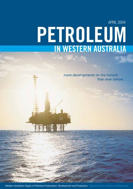
APRIL 2004<br />
PETROLEUM<br />
<strong>IN</strong> <strong>WESTERN</strong> <strong>AUSTRALIA</strong><br />
more developments on the horizon<br />
than ever before...<br />
Western Australia’s Digest <strong>of</strong> <strong>Petroleum</strong> Exploration, Development <strong>and</strong> Production. <strong>Department</strong> <strong>of</strong> Industry <strong>and</strong> Resources
april 2004<br />
<strong>Petroleum</strong> <strong>and</strong> Royalties Division - Mineral House<br />
100 Plain Street, East Perth, Western Australia 6004<br />
Tel +61 8 9222 3273 Fax +61 8 9222 3799<br />
www.doir.wa.gov.au<br />
Publisher - RIU Resource Information Unit<br />
Tel +61 8 9382 3955 Fax +61 8 9388 1025<br />
www.riu.com.au<br />
Design & Artwork - Triton Corporate<br />
Tel +61 8 9325 1644 Fax +61 8 9325 1644<br />
www.tritoncorporate.com.au<br />
Editor - Darren Ferdin<strong>and</strong>o<br />
Email darren.ferdin<strong>and</strong>o@doir.wa.gov.au<br />
Cover Photo:<br />
Goldwyn ‘A’ Platform<br />
(Photo Courtesy <strong>of</strong> Woodside Energy).<br />
All expressions <strong>of</strong> opinion are published here on the basis that they are not<br />
to be regarded as expressing the <strong>of</strong>ficial views <strong>of</strong> the <strong>Department</strong> <strong>of</strong><br />
Industry <strong>and</strong> Resources. The <strong>Department</strong> accepts no responsibility for the<br />
accuracy <strong>of</strong> any <strong>of</strong> the opinions or information contained herein <strong>and</strong> readers<br />
should rely on their own enquiries in making any decisions touching<br />
upon their own interests.<br />
Contents<br />
PWA April Edition - Contents<br />
International Contacts 2<br />
Minister’s Message 3<br />
Director’s Comment 5<br />
Review <strong>of</strong> 2003 - Exploration, Production <strong>and</strong> Development Activities in Western Australia 7<br />
Resource Branch’s Recent Activities 22<br />
Magnetotelluric Surveys for <strong>Petroleum</strong> Exploration in Western Australia 24<br />
State Acreage Release March 2004 28<br />
Diving Regulations 32<br />
Coal Seam Methane - what’s the gas? 34<br />
International Risk Consultancy - Company Focus 37<br />
Table 1. Reserves as at 31 December 2003 - Developed Fields 39<br />
Table 2. Reserves as at 31 December 2003 - Undeveloped Fields 39<br />
Table 3. Unbooked Resources as at 31 December 2003 40<br />
Table 4. Cumulative Production to 2003 40<br />
Table 5. Production by Field to 2003 41<br />
Table 6. Seismic Surveys in Western Australia 2003 Calendar Year 42<br />
Table 7. <strong>Petroleum</strong> Wells in Western Australia 2003 Calendar Year 42<br />
Table 8. Seismic Surveys in Western Australia Operating 2003 Calendar Year 43<br />
Table 9. <strong>Petroleum</strong> Wells in Western Australia Operating 2003 Calendar Year 44<br />
Table 10. Western Australia list <strong>of</strong> <strong>Petroleum</strong> Titles <strong>and</strong> Holders as at 15 April 2004 45<br />
<strong>Department</strong> <strong>of</strong> Industry <strong>and</strong> Resources - Key Contacts 57<br />
<strong>Department</strong> <strong>of</strong><br />
Industry <strong>and</strong> Resources<br />
Western Australia’s Digest <strong>of</strong> <strong>Petroleum</strong> Exploration, Development <strong>and</strong> Production.<br />
<strong>Department</strong> <strong>of</strong> Industry <strong>and</strong> Resources.<br />
1
2<br />
PWA April Edition - International Contacts<br />
International<br />
Contacts<br />
CH<strong>IN</strong>A - Shanghai<br />
Mr BJ Zhuang, Regional Director<br />
Western Australian Trade & Investment Promotion<br />
Shanghai Representative Office<br />
Room 2208 CITIC Square<br />
1168 Nanjing Road West<br />
SHANGHAI 200041<br />
PEOPLES REPUBLIC OF CH<strong>IN</strong>A<br />
Tel: +86 21 5292 5899<br />
Mobile: +86 1390 175 8192 (for BJ Zhuang)<br />
Fax: +86 21 5292 5889<br />
E-mail: bj.zhuang@doir.wa.gov.au<br />
CH<strong>IN</strong>A - Hangzhou<br />
Ms Stella Bu, Manager<br />
Western Australian Trade & Investment Promotion<br />
Hangzhou Representative Office<br />
Room 910, World Trade Office Plaza<br />
Zhejiang World Trade Centre<br />
15 Shuguang Road<br />
HANGZHOU 310007<br />
PEOPLES REPUBLIC OF CH<strong>IN</strong>A<br />
Tel: +86 571 8795 0296<br />
Fax: +86 571 8795 0295<br />
E-mail: stella.bu@doir.wa.gov.au<br />
EUROPE - London<br />
Mr Robert Fisher, Agent General<br />
Government <strong>of</strong> West. Aust. - European Office<br />
5th Floor, Australia Centre<br />
Corner <strong>of</strong> Str<strong>and</strong> & Melbourne Place<br />
LONDON WC2B 4LG<br />
UNITED K<strong>IN</strong>GDOM<br />
Tel: +44 20 7240 2881<br />
Fax: +44 20 7240 6637<br />
E-mail: agent_general@wago.co.uk<br />
Website: www.wago.co.uk<br />
<strong>IN</strong>DIA - Mumbai<br />
Ms Sonia Grinceri, Regional Director<br />
Western Australian Trade Office<br />
93, Jolly Maker Chambers No2<br />
9th Floor, Nariman Point<br />
MUMBAI 400 021<br />
<strong>IN</strong>DIA<br />
Tel: +91 22 5630 3973/74 & 78<br />
Fax +91 22 5630 3977<br />
E-mail: sonia.grinceri@doir.wa.gov.au<br />
<strong>IN</strong>DIA - Chennai (Madras)<br />
Mr K.V. Rajan Senior Trade Advisor<br />
1 Doshi Regency<br />
876 Poonamallee High Road Kilpauk<br />
CHENNAI 600 084 <strong>IN</strong>DIA<br />
Tel: +91 44 2640 0407<br />
Tel/Fax: +91 44 2643 0064<br />
Mobile: +91 098 410 4364<br />
E-mail: KVV.RAJAN@doir.wa.gov.au<br />
<strong>IN</strong>DONESIA - Jakarta<br />
Mr Trevor Boughton, Regional Director<br />
Western Australia Trade Office<br />
Australian Trade Commission<br />
Australian Embassy<br />
Jl H R Rasuna Said Kav C15-16<br />
Kuningan JAKARTA 12940 <strong>IN</strong>DONESIA<br />
Tel: +6221 2550 5331<br />
Fax: +6221 522 7103<br />
Mobile: +62 81 2301 4891<br />
Email: trevor.boughton@austrade.gov.au<br />
<strong>IN</strong>DONESIA - Surabaya<br />
Ms Lydia Agam, Manager<br />
Western Australia Trade Office<br />
Graha Pena, 17th Floor<br />
Jl. Ahmad Yani 88<br />
SURABAYA 60234 <strong>IN</strong>DONESIA<br />
Tel: +6231 829 9979<br />
Fax: +6231 829 9975<br />
Mobile: 62 81 2301 4892<br />
Email: lydia.agam@doir.wa.gov.au<br />
JAPAN - Tokyo<br />
Mr Craig Peacock, Official Representative<br />
North Asia<br />
Government <strong>of</strong> Western Australia Office<br />
Australian Business Centre<br />
28th Floor, New Otani Garden Court<br />
4-1 Kioicho, Chiyoda-Ku<br />
TOKYO 102-0094 JAPAN<br />
Tel: +81 3 5214 0791<br />
Fax: +81 3 5214 0796<br />
Email: tokyo@wajapan.net<br />
Web: www.wajapan.net<br />
JAPAN - Kobe<br />
Ms Noriko Hirata, Manager<br />
Government <strong>of</strong> Western Australia Office<br />
6th Floor Golden Sun Building<br />
3-6 Nakayamate-dori<br />
4-Chome Chuo-Ku<br />
KOBE 650-0004 JAPAN<br />
Tel: +81 78 242 7705<br />
Fax: +81 78 242 7707<br />
Email: kobe@wajapan.net<br />
MALAYSIA<br />
Ms Elaine Yong, Regional Director<br />
Western Australian Trade Office<br />
4th Floor, UBN Tower<br />
10 Jalan P Ramlee<br />
KUALA LUMPUR 50250 MALAYSIA<br />
Tel: +603 2031 8175/6<br />
Fax: +603 2031 8177<br />
Mobile: 012 2388 174<br />
E-mail: elaine.yong@doir.wa.gov.au<br />
MIDDLE EAST - Dubai<br />
Mr Chris Heysen, Regional Director<br />
Western Australian Trade Office<br />
Suite 106, Emarat Atrium Blg.<br />
PO Box 58007 DUBAI<br />
UNITED ARAB EMIRATES<br />
Tel: +971 4 343 3226<br />
Fax: +971 4 343 3238<br />
Mobile: +971 50 4567 448<br />
E-mail: chris.heysen@wato.ae<br />
TAIWAN- Taipei<br />
Mr Nicholas McKay,<br />
WA Business Development Manager<br />
Australian Commerce & Industry Office<br />
Australian Business Centre<br />
Suite 2606, International Trade Building<br />
#333 Keelung Road Section 1<br />
TAIPEI 110 TAIWAN R.O.C.<br />
Tel: +886 2 8725 4280<br />
Fax: +886 2 2757 6707<br />
Mobile: +886 937 455 431<br />
E-Mail: nicholas.mckay@austrade.gov.au<br />
THAILAND - Bangkok<br />
Mr Siraphop Apilertvorakorn, WA Business<br />
Development Manager<br />
Australian Trade Commission<br />
Australian Embassy<br />
37 South Sathorn Road<br />
BANGKOK 10120 THAILAND<br />
Tel: +662 287 2680 Ext 3307<br />
Fax: +662 287 2589 or<br />
+662 679 2090<br />
E-mail: siraphop@austrade.gov.au<br />
<strong>Department</strong> <strong>of</strong><br />
Industry <strong>and</strong> Resources<br />
PETROLEUM AND ROYALTIES DIVISION<br />
Mineral House<br />
100 Plain Street, East Perth<br />
Western Australia 6004<br />
Telephone +61 8 9222 3333<br />
Facsimile +61 9222 3430<br />
www.doir.wa.gov.au
The oil <strong>and</strong> gas industry is a significant contributor<br />
to the economic development <strong>of</strong> Western Australia<br />
<strong>and</strong> is the State’s largest resource sector, with total<br />
petroleum sales in 2002–03 <strong>of</strong> more than $10<br />
billion, or 37 per cent <strong>of</strong> the total value <strong>of</strong> the<br />
State’s mineral <strong>and</strong> petroleum sales, <strong>and</strong> annual<br />
exports <strong>of</strong> $7.8 billion in 2002–03 (Figure 1).<br />
The industry directly employs over 13,000 people in<br />
Australia. Around 900 Western Australian service<br />
<strong>and</strong> contracting companies are involved in the<br />
industry.<br />
The oil <strong>and</strong> gas industry has enormous potential,<br />
with increasing dem<strong>and</strong> for LNG in the USA, China,<br />
Korea <strong>and</strong> Japan, as well as opportunities for<br />
further downstream processing in WA. Gas is also a<br />
major source <strong>of</strong> energy for the State in electricity<br />
generation, minerals processing <strong>and</strong> service<br />
provision.<br />
Gold<br />
12%<br />
Iron ore<br />
20%<br />
Alumina<br />
11%<br />
Nickel<br />
9%<br />
Others<br />
11%<br />
<strong>Petroleum</strong><br />
37%<br />
Minister’s Message<br />
Western Australia is increasingly becoming a major<br />
player in the global oil <strong>and</strong> gas industry. This<br />
position is predicated on a number <strong>of</strong> strategic<br />
advantages.<br />
First, WA has significant petroleum reserves, with<br />
our already world-class natural gas reserves<br />
expected to increase substantially with further<br />
exploration <strong>and</strong> advances in technology.<br />
Second, WA has a strong record <strong>of</strong> meeting supply<br />
commitments, led by Woodside’s faultless record in<br />
the export <strong>of</strong> LNG to Japan over the last two<br />
decades. This record contributes to Western<br />
Australia’s reputation as a low sovereign risk<br />
environment.<br />
Third, WA is proximate to many <strong>of</strong> the world’s<br />
fastest growing economies, making us ideally<br />
placed to both meet their energy needs <strong>and</strong> assist<br />
them in developing their own oil <strong>and</strong> gas industries.<br />
Crude Oil<br />
41%<br />
Natural Gas<br />
6%<br />
Condensate<br />
19%<br />
LPG - Butane<br />
2%<br />
LNG<br />
30%<br />
LPG - Propane<br />
2%<br />
Figure 1. Western Australia Resources Sales 2002-03 - $A27.9 billion (Graphic source: DoIR)<br />
PWA April Edition - Minister’s Message<br />
Hon. Clive Brown,<br />
Minister for State Development Western Australia<br />
Fourth, WA has a high quality <strong>and</strong> diverse skills<br />
base, with our traditional trades skills<br />
complemented by growing expertise in engineering<br />
design, engineering construction <strong>and</strong> fabrication.<br />
Fifth, WA is a wonderful place in which to live <strong>and</strong><br />
do business. We have a high <strong>and</strong> affordable<br />
st<strong>and</strong>ard <strong>of</strong> living <strong>and</strong> a warm <strong>and</strong> welcoming<br />
society.<br />
The challenge for WA is to take advantage <strong>of</strong> these<br />
strategic advantages <strong>and</strong> continue to become a<br />
major player in all levels <strong>of</strong> the oil <strong>and</strong> gas industry.<br />
We have to utilise WA’s strategic advantages <strong>and</strong><br />
the current boom in projects to develop local service<br />
<strong>and</strong> supply capabilities. It is for this reason that I<br />
organised the Summit on Maximising Western<br />
Australian Business <strong>and</strong> Employment Opportunities,<br />
which was held on Friday 27 February 2004 in the<br />
Legislative Assembly <strong>of</strong> the Western Australian<br />
Parliament.<br />
My vision is for a local support industry that will be<br />
able to provide competitively priced services <strong>and</strong><br />
supplies not only to our local Western Australia<br />
projects but also to the Asia Pacific region.<br />
Over 60 representatives <strong>of</strong> Industry, Government<br />
<strong>and</strong> the Unions attended the Summit to discuss<br />
ways to maximise the benefits to Western<br />
Australians from the State’s major oil <strong>and</strong> gas<br />
projects. It was a common view <strong>of</strong> those who<br />
attended that all parties should work together to<br />
maximise the business <strong>and</strong> employment<br />
opportunities. It was also a common view that<br />
ongoing communication <strong>and</strong> the building <strong>of</strong> trust<br />
between the key stakeholders were essential if<br />
progress was to continue.<br />
The major outcome <strong>of</strong> the Summit was the<br />
establishment <strong>of</strong> a new Coordinating Council which I<br />
3
4<br />
PWA April Edition - Minister’s Message<br />
will chair. The Tripartite Council will consist <strong>of</strong><br />
Industry, Government <strong>and</strong> Union movement leaders<br />
<strong>and</strong> will, for the first time, facilitate ongoing<br />
communication between the oil <strong>and</strong> gas industry’s<br />
major stakeholders.<br />
Early focus is to be on strategies to:<br />
• address barriers <strong>and</strong> impediments to accessing<br />
resources;<br />
• address <strong>and</strong> overcome barriers <strong>and</strong><br />
impediments to the successful participation <strong>of</strong><br />
local companies in the oil <strong>and</strong> gas industry;<br />
• urgently address current <strong>and</strong> future skill<br />
requirements in the industry <strong>and</strong> develop <strong>and</strong><br />
coordinate an oil <strong>and</strong> gas industry <strong>and</strong><br />
associated service industries training plan.<br />
I look forward to working with the new<br />
Coordinating Council to maximise business <strong>and</strong><br />
employment opportunities throughout the State. DoIR<br />
Linda oilfield’s jacket <strong>and</strong> deck, which were fabricated at the Australian Marine Complex.
2004 - It’s going to be a busy year<br />
<strong>Petroleum</strong> exploration in Western Australia has<br />
recovered to 2001 levels <strong>and</strong> there are more<br />
upstream developments on the horizon than we<br />
have ever had. About $11 billion in upstream oil<br />
<strong>and</strong> gas developments are either committed to or<br />
being evaluated prior to final commitment. The<br />
<strong>Petroleum</strong> <strong>and</strong> Royalties Division has a higher<br />
than ever base workload. In addition to this<br />
increased base load activity, the Division is<br />
implementing change on a number <strong>of</strong> fronts:<br />
NOPSA Transition<br />
The National Offshore <strong>Petroleum</strong> Safety Authority<br />
(NOPSA) is to start operation on the 1st <strong>of</strong> January<br />
2005. Western Australia has to prepare for the<br />
transfer <strong>of</strong> responsibility through amending State<br />
legislation <strong>and</strong> providing a seamless h<strong>and</strong>over. The<br />
State is unique in being the only State/Territory with<br />
Safety Offshore<br />
State<br />
7%<br />
PETROLEUM DIVISION WORK FUNCTIONS<br />
Onshore Pipelines<br />
Safety Onshore<br />
State<br />
Safety Offshore<br />
Cwlth<br />
15%<br />
5%<br />
5%<br />
Environment<br />
10%<br />
* 22% to NOPSA 1-1-05<br />
* Prior to Royalties joining the Division<br />
*<br />
*<br />
significant oil <strong>and</strong> gas operations <strong>of</strong>fshore in State<br />
waters <strong>and</strong> this has complicated arrangements.<br />
Detailed transition plans are being developed to<br />
identify interfaces between the continuing role <strong>of</strong><br />
the <strong>Department</strong> <strong>of</strong> Industry <strong>and</strong> Resources (DoIR) as<br />
the Designated Authority (DA) <strong>and</strong> NOPSA. DoIR will<br />
continue to provide regulatory services both <strong>of</strong>fshore<br />
<strong>and</strong> onshore for petroleum titles, resource<br />
management, <strong>and</strong> environment. Additionally, DoIR<br />
will provide regulatory services for onshore safety<br />
including drilling <strong>and</strong> production <strong>and</strong> pipelines as<br />
well as for some <strong>of</strong>fshore activities. An estimated<br />
split <strong>of</strong> resources necessary for these functions is<br />
shown in Figure 1. DoIR will effectively h<strong>and</strong> over<br />
22% <strong>of</strong> its responsibilities to NOPSA. A seminar is<br />
planned for later in the year (sponsored by NOPSA,<br />
DoIR, APPEA <strong>and</strong> the ACTU) to broadcast<br />
arrangements for the transition.<br />
Titles<br />
22%<br />
Admin/Exec<br />
10%<br />
Figure 1. Split <strong>of</strong> resources between DoIR <strong>and</strong> NOPSA<br />
Resources<br />
26%<br />
PWA April Edition - Director’s Comment<br />
Bill Tinapple,<br />
Director, <strong>Petroleum</strong> <strong>and</strong> Royalties Division<br />
Legislation Amendments<br />
There are currently two petroleum legislation<br />
amendment bills <strong>of</strong> major significance being<br />
drafted:<br />
• NOPSA Amendments:<br />
These amendments to the WA petroleum<br />
legislation (<strong>Petroleum</strong> (Submerged L<strong>and</strong>s) Act<br />
1982, <strong>Petroleum</strong> Act 1967, <strong>and</strong> <strong>Petroleum</strong><br />
Pipelines Act 1969) will enable NOPSA to<br />
regulate safety in all the State’s coastal waters<br />
<strong>and</strong> under certain circumstances onshore, for<br />
example, where a pipeline development extends<br />
from <strong>of</strong>fshore to onshore. On those occasions,<br />
NOPSA will be contracted by way <strong>of</strong> a service<br />
level agreement. This package will also include<br />
the consequential amendments to the State’s<br />
submerged l<strong>and</strong>s legislation to allow for the<br />
Commonwealth’s plain English rewrite <strong>of</strong> the<br />
<strong>Petroleum</strong> (Submerged L<strong>and</strong>s) Act 1967.<br />
• Common Mining Code/Gorgon CO 2<br />
sequestration/Environmental<br />
Regulations/National Competition Policy<br />
Amendments:<br />
These amendments provide for the common<br />
mining code changes since 1994, changes to<br />
the <strong>Petroleum</strong> Act 1967 <strong>and</strong> the <strong>Petroleum</strong><br />
Pipelines Act 1969 to provide coverage <strong>of</strong> CO 2<br />
sequestration in the State’s onshore petroleum<br />
legislation to cater for the Gorgon gas<br />
development on Barrow Isl<strong>and</strong>, provision for the<br />
drafting <strong>of</strong> environmental regulations in all State<br />
petroleum legislation <strong>and</strong> minor National<br />
Competition Policy amendments.<br />
Workshop Outcomes<br />
Following the successful feedback received from the<br />
three breakfast workshops held by DoIR late in<br />
5
6<br />
PWA April Edition - Director’s Comment<br />
2003, the <strong>Department</strong> is following up to implement<br />
the recommendations made at the workshops.<br />
Topics presented <strong>and</strong> recommended actions were<br />
as follows.<br />
• Simplifying the <strong>Petroleum</strong> Act<br />
The <strong>Department</strong> is continuing to refine<br />
amendments. A discussion paper is being<br />
developed. Further consultation will be<br />
organised.<br />
• Greenfield/Frontier Exploration<br />
The APPEA Exploration Subcommittee proposals<br />
for a cascade title gazettal system to determine<br />
which acreage should be classified as frontier<br />
acreage has now been endorsed by the APPEA<br />
Council <strong>and</strong> is being evaluated by Government.<br />
An Exploration Working Group has been<br />
established by the Upstream <strong>Petroleum</strong><br />
Subcommittee.<br />
• Early Access to Data<br />
Industry placed a high priority on gaining early<br />
access to basic data <strong>and</strong> requested that<br />
Government endeavour to get more information<br />
out sooner. Data transcription <strong>and</strong> reprocessing <strong>of</strong><br />
seismic data is being given a high priority by DoIR.<br />
• Aquifer Depletion Studies<br />
DoIR has carried out aquifer depletion studies<br />
for the Barrow <strong>and</strong> Dampier Sub-basins, which<br />
indicated significant resources are potentially<br />
being lost. The <strong>Department</strong> is proposing that a<br />
national government <strong>and</strong> industry working group<br />
be established under the auspices <strong>of</strong> the<br />
Ministerial Council on Mineral <strong>and</strong> <strong>Petroleum</strong><br />
Resources to assess the implications <strong>of</strong> the<br />
issue <strong>and</strong> develop policies to address prevention<br />
<strong>and</strong> corrective measures.<br />
WA Acreage Releases<br />
In a continuing effort to maintain exploration,<br />
acreage releases are planned as follows:<br />
• WA State release opens on 30 March 2004 <strong>and</strong><br />
bids close 23 September 2004 with 3 blocks in<br />
State Waters in the Northern Carnarvon Basin, 2<br />
blocks onshore in the Perth Basin, <strong>and</strong> 1 block<br />
in the Officer Basin; <strong>and</strong><br />
• Commonwealth acreage release 2004 to be<br />
announced 29 March 2004, with the 1st round<br />
closing 30 September 2004. This round has 3<br />
blocks in the outer northern Rankin Platform, 3<br />
blocks in the Barrow Sub-basin <strong>and</strong> Rankin<br />
Platform, 3 blocks in the Exmouth <strong>and</strong> Barrow<br />
Sub-basins <strong>and</strong> 1 block in the Vlaming Subbasin,<br />
Perth Basin. The 2nd round, closing 31<br />
March 2005, has 1 block in the Bonaparte<br />
Basin, 4 blocks in the Exmouth Plateau <strong>and</strong> 2<br />
blocks in the Houtman Sub-basin, Perth Basin.<br />
A re-release <strong>of</strong> the 2003 areas not taken up is<br />
planned for both the Commonwealth <strong>and</strong> State<br />
areas.<br />
Electronic <strong>Petroleum</strong> Register<br />
The Electronic <strong>Petroleum</strong> Register (EPR) upgrade<br />
from an old database system to a modern webbased<br />
system is reaching completion. In conjunction<br />
with this will be the pro<strong>of</strong> <strong>of</strong> concept testing <strong>of</strong> Eforms,<br />
which is the electronic update <strong>of</strong> information<br />
on the register from forms forwarded from<br />
companies electronically to the <strong>Petroleum</strong> <strong>and</strong><br />
Royalties Division.<br />
2004 Direction<br />
Whale investigating the Legendre Production Facility (image courtesy <strong>of</strong> Woodside)<br />
The <strong>Department</strong> is committed to completing these<br />
activities in an effective manner, which will maintain<br />
the emphasis on stakeholder satisfaction that we<br />
have set as a benchmark. DoIR
Review <strong>of</strong> 2003<br />
Exploration, Production <strong>and</strong> Development Activities in Western Australia<br />
During the 2003 calendar year, 77 petroleum<br />
wells were drilled in Western Australia;<br />
comprising 14 development wells, 21 extension<br />
wells, <strong>and</strong> 42 new field wildcat wells. This level <strong>of</strong><br />
activity marks a significant increase on the<br />
previous year, where 51 wells were drilled. This<br />
has brought the State back to the high level <strong>of</strong><br />
drilling activity seen in 2000 <strong>and</strong> 2001 where 75<br />
wells were drilled in each <strong>of</strong> those years. The<br />
current level <strong>of</strong> activity is partly attributable to the<br />
continuing high oil price <strong>and</strong> improvements in the<br />
gas sales market. On a national level, Western<br />
Australia has attracted over 70% <strong>of</strong> Australia’s<br />
petroleum exploration expenditure during the<br />
year, indicating the State remains the most<br />
prospective area <strong>of</strong> Australia for new petroleum<br />
finds (Figure 1).<br />
Activity in the Perth Basin, particularly the northern<br />
portion <strong>of</strong> the basin, remains high, buoyed by the<br />
Cliff Head, Hovea <strong>and</strong> Jingemia discoveries in 2002<br />
(Figure 2). During 2003, three onshore <strong>and</strong> three<br />
<strong>of</strong>fshore exploration wells were drilled, along with<br />
10 development <strong>and</strong> extension wells drilled onshore<br />
<strong>and</strong> two extension wells drilled <strong>of</strong>fshore as part <strong>of</strong><br />
the Cliff Head project. Of the onshore exploration<br />
wells, Eremia 1 proved to be a success for ARC<br />
Energy just to the northwest <strong>of</strong> their Hovea<br />
discovery, while Eclipse 1 <strong>and</strong> Leafcutter 1 had<br />
some interesting gas shows, but were ab<strong>and</strong>oned<br />
as non-economic. The Northern Carnarvon Basin<br />
continues to be the centre <strong>of</strong> exploration <strong>and</strong><br />
development activity, with 31 <strong>of</strong> the 42 wildcat wells<br />
drilled in 2003 located in that basin, <strong>and</strong> 22<br />
development <strong>and</strong> extension wells spudded in the<br />
basin. A number <strong>of</strong> significant discoveries were<br />
made, including oil pools discovered by the BHP<br />
Billiton <strong>Petroleum</strong> (BHPBP) wells Stybarrow 1,<br />
Ravensworth 1 <strong>and</strong> Crosby 1 (Figure 3). Four<br />
exploration wells were spudded in the Browse<br />
Basin, two <strong>of</strong> these discovering gas in Inpex’s<br />
WA-285-P permit, with the Ichthys 2 extension well<br />
drilled in November to assess the gas discovery<br />
made by Ichthys 1 in June. The sole exploration well<br />
in the <strong>of</strong>fshore Bonaparte Basin, Woodside’s Weasel<br />
1, was plugged <strong>and</strong> ab<strong>and</strong>oned as a dry hole.<br />
The wave <strong>of</strong> drilling predicted last year in response<br />
to higher oil prices <strong>and</strong> an increase in gas contract<br />
availability appears to be occurring, with a mix <strong>of</strong><br />
exploration in both brownfields <strong>and</strong> greenfields<br />
areas. While some <strong>of</strong> the greenfields exploration<br />
results have been disappointing, for example the<br />
Maginnis <strong>and</strong> Strumbo wells in the Browse Basin,<br />
there is still a large amount <strong>of</strong> prospective acreage<br />
that is largely unexplored by modern techniques <strong>and</strong><br />
play concepts. Perhaps the most exciting <strong>of</strong> the<br />
upcoming greenfields exploration is the drilling <strong>of</strong><br />
the Sally May prospect (formerly known as the<br />
WA Exploration Expenditure ($ million)<br />
250<br />
200<br />
150<br />
100<br />
50<br />
0<br />
136.3<br />
141.7<br />
119.7<br />
82<br />
85.3<br />
PWA April Edition - 2003 Review<br />
Darren Ferdin<strong>and</strong>o<br />
Research Geologist, Resources Branch<br />
Cetus prospect) in the central Canning Basin by<br />
Kingsway Resources 2001 later this year. If<br />
successful, this prospect has the potential to<br />
completely rewrite current thinking on the Canning<br />
Basin <strong>and</strong> introduce a number <strong>of</strong> new play targets<br />
to the region. In the coming year a number <strong>of</strong><br />
critical wells are also planned for the onshore<br />
northern Perth Basin, <strong>and</strong> success with these will<br />
help push the boundary <strong>of</strong> the region deemed<br />
prospective for liquid hydrocarbons further south.<br />
This, in turn will help spur on further exploration in<br />
the central Perth Basin region.<br />
The Whicher Range 5 well, drilled in the southern<br />
Perth Basin during the second half <strong>of</strong> the year,<br />
proved to be a mixed result for Amity Oil. While<br />
there is no question that there is a large gas<br />
resource in the Whicher Range field, the extraction<br />
<strong>of</strong> the gas from tight s<strong>and</strong>stone units affected by<br />
170.2<br />
191.5<br />
151.3<br />
177.9<br />
Sep-01 Dec-01 Mar-02 Jun-02 Sep-02 Dec-02 Mar-03 Jun-03 Sep-03<br />
Figure 1. <strong>Petroleum</strong> exploration expenditure in WA <strong>and</strong> % <strong>of</strong> total exploration expenditure in Australia.<br />
90%<br />
80%<br />
70%<br />
60%<br />
50%<br />
40%<br />
30%<br />
20%<br />
10%<br />
0%<br />
7<br />
Percentage <strong>of</strong> Australian Exploration Expenditure
8<br />
PWA April Edition - 2003 Review<br />
swelling clays is proving to be a technological<br />
challenge. Work is currently being undertaken by<br />
Amity Oil to look at stimulating the reservoir so that<br />
commercial quantities <strong>of</strong> gas may be obtained from<br />
the field. As the Whicher Range field is situated at the<br />
southern end <strong>of</strong> the Dampier to Bunbury gas pipeline,<br />
it is strategically located to provide gas to a large<br />
number <strong>of</strong> electricity-intensive industries in the South<br />
West, such as the Alcoa aluminium operations.<br />
Looking at other greenfields locations likely to be<br />
explored in the coming year, the <strong>of</strong>fshore northern<br />
Perth Basin will again see significant activity.<br />
Despite the disappointment associated with the<br />
drilling <strong>of</strong> Twin Lions, Vindara <strong>and</strong> Mentelle in<br />
February 2003 <strong>and</strong> Morangie in 2002, some<br />
interesting results were obtained. Residual oil<br />
columns were recorded in a number <strong>of</strong> these wells<br />
in Late <strong>and</strong> Early Permian s<strong>and</strong>stones, with followup<br />
drilling expected to occur soon in the Apache<br />
Energy <strong>and</strong> ROC Oil operated permits between<br />
Dongara <strong>and</strong> the Abrolhos Isl<strong>and</strong>s.<br />
Continued exploration in the Exmouth Sub-basin on<br />
targets found using the 2D <strong>and</strong> 3D seismic<br />
coverage acquired over the last few years paid<br />
dividends this year for BHPBP. The play fairway they<br />
modelled in the centre <strong>of</strong> the sub-basin came up<br />
trumps for Stybarrow with 18.6 m <strong>of</strong> net oil pay <strong>and</strong><br />
this was followed-up by successful drilling <strong>of</strong> the<br />
Ravensworth prospect, with the well encountering a<br />
37 m oil column overlain by a 7 m gas cap. Even<br />
the Eskdale prospect, which appears to be<br />
subcommercial, was a technical success for BHPBP<br />
with oil shows in tight s<strong>and</strong>stone confirming the<br />
presence <strong>of</strong> a valid trap <strong>and</strong> oil migration. BHPBP<br />
were not as successful in the Browse Basin<br />
however, with their first well in the region, Maginnis<br />
1, penetrating a thick pile <strong>of</strong> volcanic sediment <strong>and</strong><br />
basalt in what was interpreted to be Plover<br />
S<strong>and</strong>stone. While this is a set-back for BHPBP <strong>and</strong><br />
its Joint Venture partners in these permits, the size<br />
<strong>of</strong> some <strong>of</strong> the possible traps <strong>and</strong> the presence <strong>of</strong><br />
source <strong>and</strong> migration to the east <strong>and</strong> possibly the<br />
west, mean that work here will continue. BHPBP are<br />
currently re-evaluating their data on the region so<br />
the extent <strong>and</strong> impact <strong>of</strong> Jurassic volcanic activity<br />
on the petroleum prospectivity is fully understood.<br />
Exploration activity in the Barrow Sub-basin was<br />
once again dominated by Apache Energy operated<br />
Joint Ventures, assisted by Tap Oil <strong>and</strong> Woodside<br />
Energy operated Joint Ventures. While no significant<br />
new discoveries were made in the sub-basin, a<br />
number <strong>of</strong> small discoveries were made in permits<br />
under Apache operatorship, which are likely to be<br />
put into production in the near future. The Apache<br />
philosophy <strong>of</strong> drilling many, low-cost wells over<br />
relatively small prospects in an area where it has a<br />
strong underst<strong>and</strong>ing <strong>of</strong> the petroleum system,<br />
instead <strong>of</strong> focussing on finding high-risk, highreward<br />
targets, appears to be paying <strong>of</strong>f. The<br />
Blackdragon prospect, which will be drilled early in<br />
2004, is perhaps the exception to this, but all<br />
indications from Apache are that this prospect looks<br />
extremely good.<br />
The level <strong>of</strong> exploration activity seen in Western<br />
Australia at present appears to be sustainable over<br />
the medium term based on the number <strong>of</strong> wells that<br />
are to be drilled as part <strong>of</strong> permit commitments for<br />
the next 5 years. The acreage in both<br />
Commonwealth <strong>and</strong> State areas that was released<br />
over the last two years have now in almost all cases<br />
either successfully negotiated Native Title<br />
Agreements or are in the final stages <strong>of</strong> reaching<br />
Native Agreement <strong>and</strong> exploration will soon<br />
commence. Future release areas, with<br />
accompanying pre-competitive prospectivity<br />
packages <strong>and</strong> data, are underway with acreage in<br />
the Northern Carnarvon, Perth <strong>and</strong> Officer Basins<br />
<strong>and</strong> a future release <strong>of</strong> further Canning Basin areas<br />
in the planning stage. While the farmin market at<br />
present is sluggish, it is hoped that as interest in<br />
the exploration ‘hot spots’ <strong>of</strong> the Perth <strong>and</strong> Northern<br />
Carnarvon Basins increases, a number <strong>of</strong><br />
multinational <strong>and</strong> larger Australian ‘junior’ explorers<br />
will take the opportunity to invest in the prospective<br />
Western Australian acreage that will be on <strong>of</strong>fer in<br />
the coming year.<br />
On the production <strong>and</strong> development side, further<br />
development at the Hovea <strong>and</strong> Eremia oilfields,<br />
including drilling <strong>of</strong> water injector wells to assist in<br />
maintaining pressure support for the field continued<br />
with 4 development wells drilled there during 2003.<br />
Testing <strong>of</strong> the Jingemia oilfield in preparation for<br />
submission <strong>of</strong> a field development plan in 2004<br />
continued during the second half <strong>of</strong> 2003. In the<br />
<strong>of</strong>fshore Perth Basin, the Cliff Head oilfield was<br />
declared commercial by the Joint Venture <strong>and</strong> they<br />
have commenced front-end engineering <strong>and</strong> design<br />
studies <strong>and</strong> submitted a field development plan to<br />
DoIR. It is expected that first oil will come from the<br />
field in late 2005. Apache Energy drilled a number<br />
<strong>of</strong> development <strong>and</strong> appraisal wells, with two fields<br />
brought online as one or two well producers: Hoover<br />
<strong>and</strong> North Pedirka. The Enfield development, due to<br />
commence production in 2006, gained<br />
environmental approvals for the development <strong>and</strong><br />
were in the final stages <strong>of</strong> obtaining approval for<br />
their field development plan from the State <strong>and</strong><br />
Commonwealth upstream petroleum regulators.<br />
DoIR granted a retention lease over the Blacktip<br />
gasfield in late 2003 as one <strong>of</strong> the initial steps in<br />
bringing the field on-stream to supply gas to the<br />
Alcan aluminium refinery in Gove. During the year<br />
approval was also granted in principle by the State<br />
Government for the Gorgon gasfield development to<br />
commence, including the use <strong>of</strong> l<strong>and</strong> on Barrow<br />
Isl<strong>and</strong> (an ‘A’ class nature reserve) to house gas<br />
processing facilities.<br />
ACTIVITY BY BAS<strong>IN</strong><br />
Perth Basin<br />
Within the Perth Basin, three onshore <strong>and</strong> three<br />
<strong>of</strong>fshore exploration wells were drilled. The <strong>of</strong>fshore<br />
wells were follow-up wells to the Cliff Head<br />
discovery <strong>and</strong> all were plugged <strong>and</strong> ab<strong>and</strong>oned,<br />
with Twin Lions 1 <strong>and</strong> Vindara 1 classified as dry<br />
<strong>and</strong> Mentelle 1 having indications <strong>of</strong> a 50 m<br />
residual oil column. Of the onshore wells, Leafcutter<br />
1 intersected some interesting residual oil<br />
indications <strong>and</strong> Eclipse 1, drilled in the central Perth<br />
Basin, penetrated some minor oil shows in the<br />
Cattamarra Coal Measures. In October the OD&E<br />
Rig 28, brought in from SE Asia, spudded the<br />
Whicher Range 5 well. The well has been<br />
suspended after air-drilling operations failed to go<br />
as planned after water break-through. While<br />
elevated gas shows were recorded, further study is<br />
being undertaken by Amity Oil to assess whether a<br />
commercial flow can be obtained through a ‘dry’<br />
fracc process.<br />
The major success for 2003 in the Perth Basin was<br />
Eremia 1, drilled to the northwest <strong>of</strong> the Hovea<br />
oilfield. Development drilling for the Cliff Head<br />
oilfield saw Cliff Head 3 <strong>and</strong> 4 drilled early in 2003,<br />
<strong>and</strong> development <strong>of</strong> the Hovea oilfield saw Hovea<br />
wells 4 through to 10 drilled in 2003, with Hovea<br />
10 drilled as a water injector well to maintain<br />
pressure support for the Hovea field.<br />
Eremia 1<br />
ARC Energy drilled Eremia 1 in their L1 production<br />
permit, roughly 2 km to the north-northwest <strong>of</strong> the<br />
Hovea oilfield in a similar style <strong>of</strong> fault-bounded trap<br />
to that found in Hovea. The well intersected a 15 m<br />
oil column in the Upper Permian Dongara<br />
S<strong>and</strong>stone. The field has been production tested<br />
<strong>and</strong> is currently online <strong>and</strong> producing into the Hovea<br />
facility at a rate <strong>of</strong> 238 kL/d (1500 bbl/d). A followup<br />
horizontal well, Eremia 2 was drilled in November<br />
<strong>and</strong> completed as a producer.<br />
Northern Carnarvon Basin<br />
During the 2003 calendar year, 33 exploration <strong>and</strong><br />
22 development/extension wells were drilled in the<br />
Northern Carnarvon Basin. A number <strong>of</strong> oil <strong>and</strong> gas<br />
discoveries were made, the most significant <strong>of</strong><br />
which are Stybarrow, Ravensworth <strong>and</strong> Crosby.<br />
North Perdirka 1<br />
The North Perdirka oilfield is located approximately<br />
15 km east <strong>of</strong> Barrow Isl<strong>and</strong> in Apache operated<br />
licence TL/6. The well intersected an 8 m oil column<br />
in the Flag S<strong>and</strong>stone <strong>and</strong> was brought into<br />
production immediately through the Victoria Platform.<br />
Stybarrow 1<br />
The Stybarrow oilfield, operated by BHP Billiton<br />
<strong>Petroleum</strong> is located in WA-255-P. Stybarrow 1<br />
intersected a 23 m gross (18.6 m net) oil column in<br />
the top Macedon Member.<br />
Cyrano 1<br />
Cyrano 1 targeted a rollover anticline in the Tap Oil<br />
operated permit EP 364 (R1), 4 km to the southwest<br />
<strong>of</strong> the Nasutus oilfield. The well intersected a 29 m<br />
gross hydrocarbon column comprising a 19 m gas<br />
column in the Lower Cretaceous Mardie Greens<strong>and</strong>
GASCOYNE<br />
SIGNIFICANT<br />
HYDROCARBON DISCOVERIES<br />
CUVIER<br />
ABYSSAL<br />
PLA<strong>IN</strong><br />
<strong>IN</strong>DIAN<br />
ABYSSAL<br />
OCEAN<br />
Refer to Figure 3<br />
EXMOUTH<br />
PLATEAU<br />
CARNARVON<br />
PERTH<br />
NATURALISTE<br />
PLATEAU<br />
in <strong>WESTERN</strong> <strong>AUSTRALIA</strong><br />
ABYSSAL<br />
PLA<strong>IN</strong><br />
PLA<strong>IN</strong><br />
Oil<br />
GERALDTON<br />
ONSLOW<br />
EXMOUTH<br />
FREMANTLE<br />
ARGO ABYSSAL PLA<strong>IN</strong><br />
0 100 400<br />
<strong>Department</strong> <strong>of</strong><br />
Industry <strong>and</strong> Resources<br />
112^<br />
as at February 2004<br />
114^<br />
Gas<br />
Oil <strong>and</strong> Gas<br />
Kilometres<br />
DAMPIER - BUNBURY NATURAL GAS PIPEL<strong>IN</strong>E<br />
PARMELIA PIPEL<strong>IN</strong>E<br />
DAMPIER<br />
PORT HEDLAND<br />
KARRATHA ROEBOURNE<br />
PERTH<br />
BUNBURY<br />
BUSSELTON<br />
NORTH<br />
MEEKATHARRA<br />
Whicher Range<br />
116^<br />
MIDWEST PIPEL<strong>IN</strong>E<br />
See Enlargement<br />
Gingin<br />
ALBANY<br />
118^<br />
WEST<br />
Sumba<br />
NEWMAN<br />
<strong>IN</strong>DIAN<br />
OCEAN<br />
SCOTT<br />
PLATEAU<br />
SHELF<br />
Sawu<br />
Scott Reef<br />
Brecknock<br />
Brecknock South<br />
GOLDFIELDS<br />
NATURAL GAS<br />
SOUTHERN<br />
120^<br />
PIPEL<strong>IN</strong>E<br />
BROOME<br />
Roti<br />
Dinichthys<br />
Point Torment<br />
KALGOORLIE<br />
DERBY<br />
ESPERANCE<br />
Timor<br />
Territory <strong>of</strong> Ashmore<br />
<strong>and</strong><br />
Cartier Isl<strong>and</strong>s (N.T.)<br />
Titanichthys<br />
Ichthys<br />
Gorgonichthys<br />
Yulleroo<br />
Cudalgarra<br />
OCEAN<br />
Figure 2. Significant Hydrocarbon discoveries in Western Australia.<br />
122^<br />
Pictor<br />
124^<br />
PWA April Edition - 2003 Review 9<br />
Laminaria<br />
Saratoga<br />
Prometheus<br />
Cornea<br />
Lennard Shelf<br />
Oilfields<br />
Looma<br />
Joint <strong>Petroleum</strong><br />
Development Area<br />
Buffalo<br />
Proposed Bayu-Undan<br />
Pipeline<br />
Petrel<br />
Tern<br />
Blacktip<br />
Waggon Creek<br />
WYNDHAM<br />
St George Range<br />
GERALDTON<br />
Dongara<br />
Jingemia<br />
Cliff Head<br />
Beharra<br />
Springs<br />
Woodada<br />
126^<br />
MIDWEST PIPEL<strong>IN</strong>E<br />
Mt Horner<br />
Eremia<br />
Hovea<br />
Beharra<br />
Springs<br />
PARMELIA PIPEL<strong>IN</strong>E<br />
North<br />
GEOCENTRIC DATUM <strong>of</strong> <strong>AUSTRALIA</strong><br />
NTv2 GRID FILE TRANSFORMATION<br />
128^<br />
-12^<br />
-14^<br />
-16^<br />
-18^<br />
-20^<br />
-22^<br />
-24^<br />
-26^<br />
-28^<br />
-30^<br />
-32^<br />
-34^<br />
pwawellsGDA_Jan03.lat
10<br />
PWA April Edition - 2003 Review<br />
114^ 116^<br />
<strong>Department</strong> <strong>of</strong><br />
Industry <strong>and</strong> Resources<br />
Norfolk<br />
Pitcairn<br />
Mutineer<br />
Exeter<br />
Egret<br />
Talisman<br />
Lambert/Hermes<br />
Angel<br />
Cossack<br />
Eaglehawk<br />
Athena<br />
Capella<br />
Perseus<br />
Significant North West Shelf<br />
Hydrocarbon Discoveries<br />
Legendre<br />
Legendre South<br />
Wanaea<br />
North<br />
Rankin<br />
Goodwyn<br />
Gaea<br />
Echo/Yodel<br />
Keast<br />
Tidepole<br />
Rankin Dockrell<br />
West Dixon Dixon<br />
HYDROCARBON DISCOVERIES<br />
Urania<br />
Io<br />
FEBRUARY 2004<br />
Gas<br />
Oil<br />
Oil & Gas<br />
Jansz<br />
Scarborough<br />
Sage<br />
Iago<br />
Geryon<br />
PRODUCTION FACILITIES<br />
20^<br />
Reindeer/Caribou<br />
Wilcox<br />
Dionysus<br />
Orthrus<br />
A<br />
W<strong>and</strong>oo<br />
Corvus<br />
Maenad<br />
B<br />
Chrysaor<br />
West Tryal Rocks<br />
Stag<br />
Commonwealth Jurisdiction<br />
State Jurisdiction<br />
Burrup Peninsula<br />
KARRATHA<br />
North Gorgon<br />
Central Gorgon<br />
Gorgon<br />
C<br />
Spar<br />
Barrow Isl<strong>and</strong><br />
B<br />
Montebello Isl<strong>and</strong>s<br />
Thomas Bright John Brookes<br />
Campbell<br />
Wonnich Linda Sinbad<br />
Montgomery<br />
Bambra Rose/Lee<br />
Maitl<strong>and</strong><br />
Harriet A Gipsy/North Gipsy<br />
Agincourt<br />
Monty<br />
Rosette<br />
Josephine/Baker<br />
East Spar Little S<strong>and</strong>y/Pedirka Alkimos/Tanami/Simpson<br />
Double Isl<strong>and</strong> Varanus Isl<strong>and</strong><br />
Gibson/South Plato<br />
Barrow Isl<strong>and</strong><br />
Victoria<br />
Woollybutt<br />
Pasco<br />
<strong>IN</strong>DIAN<br />
DAMPIER<br />
OCEAN<br />
Conventional platform<br />
Mini platform<br />
Jack-up rig<br />
Monopod/Minipod<br />
Subsea completion, well<br />
Navigation, Comm<strong>and</strong>,<br />
<strong>and</strong> Control Buoy<br />
Floating Production Storage<br />
<strong>and</strong> Offloading vessel<br />
LNG carrier<br />
Oil carrier<br />
Pipeline, possible pipeline route<br />
ROEBOURNE<br />
LNG storage tanks<br />
Oil storage tanks<br />
Onshore production facility<br />
Under construction<br />
Proposed development<br />
South Pepper<br />
North Herald<br />
Chinook/Scindian<br />
Griffin<br />
Chervil<br />
Coniston Airlie Isl<strong>and</strong><br />
Novara<br />
Skiddaw Vincent<br />
Crest<br />
Thevenard Isl<strong>and</strong><br />
A<br />
Stybarrow<br />
Ravensworth<br />
B Saladin<br />
Enfield Crosby<br />
Corowa Yammaderry<br />
C<br />
Macedon/<br />
Cowle<br />
Laverda<br />
Scafell Pyrenees<br />
Roller Skate<br />
A<br />
C<br />
B ONSLOW<br />
Figure 3. North West Shelf production facilities <strong>and</strong> significant hydrocarbon discoveries.<br />
Ab<strong>and</strong>oned field<br />
Onslow<br />
Tubridgi<br />
EXMOUTH<br />
Rivoli<br />
22^<br />
22^<br />
Yardie East<br />
Cape Range<br />
LOCALITY<br />
MAP<br />
Rough Range<br />
Parrot Hill<br />
<strong>WESTERN</strong><br />
50 km<br />
<strong>AUSTRALIA</strong><br />
Map produced by <strong>Petroleum</strong> Division, <strong>Department</strong> <strong>of</strong> Industry <strong>and</strong> Resources WA.<br />
Maritime boundary data supplied by Geoscience Australia <strong>and</strong> is AMBIS 2001 data.<br />
116^<br />
114^
underlain by a 10 m gross oil column at the top <strong>of</strong><br />
the Birdrong S<strong>and</strong>stone.<br />
Crosby 1<br />
The Crosby field, located in WA-12-R <strong>and</strong> operated<br />
by BHP Billiton <strong>Petroleum</strong>, is situated 106 km westnorthwest<br />
<strong>of</strong> Onslow. Crosby 1 penetrated 7 m <strong>of</strong><br />
gas overlying 36 m <strong>of</strong> oil in the Pyrenees Member<br />
<strong>of</strong> the Lower Barrow Group in a complex structural<br />
trap between the Scafell Trend <strong>and</strong> the Novara Arch<br />
in the Exmouth Sub-basin.<br />
Ravensworth 1<br />
Ravensworth 1 was drilled in WA-155-P,<br />
approximately 108 km west-northwest <strong>of</strong> Onslow.<br />
The well encountered a 44 m gross hydrocarbon<br />
column consisting <strong>of</strong> 7 m <strong>of</strong> gas <strong>and</strong> 37 m <strong>of</strong> oil in<br />
the Pyrenees Member s<strong>and</strong>s.<br />
Browse Basin<br />
Within the Browse Basin, four exploration wells were<br />
drilled: Ichthys 1, Ichthys Deep 1, Maginnis 1 <strong>and</strong><br />
Strumbo 1, with Ichthys <strong>and</strong> Ichthys Deep both<br />
intersecting thick zones <strong>of</strong> gas pay. Neither<br />
Maginnis nor Strumbo intersected any<br />
hydrocarbons. An appraisal well, Ichthys 2, was<br />
drilled to assist in determining the extent <strong>of</strong> the<br />
Ichthys gasfield.<br />
Ichthys 1 <strong>and</strong> Ichthys Deep 1<br />
These wells were drilled by Inpex in their 100%<br />
owned permit WA-285-P. The wells encountered<br />
excellent gas shows in their target horizons <strong>and</strong><br />
follow-up gas discoveries at Gorgonichthys,<br />
Dinichthys <strong>and</strong> Titanichthys made in 2002.<br />
Bonaparte Basin<br />
The only well drilled in the Bonaparte Basin was<br />
Weasel 1 by Woodside Energy in WA-279-P. The<br />
well did not intersect any hydrocarbons <strong>and</strong> was<br />
plugged <strong>and</strong> ab<strong>and</strong>oned.<br />
PETROLEUM RESERVES AND RESOURCES<br />
<strong>Petroleum</strong> reserves in Western Australia have been<br />
compiled under two main headings – ‘developed<br />
fields’ <strong>and</strong> ‘undeveloped fields’. Developed fields are<br />
those currently producing fields that are located<br />
either <strong>of</strong>fshore in Commonwealth or State Waters or<br />
onshore within Western Australia. The reserves<br />
quoted are remaining reserves as at 31 December<br />
2003. Undeveloped fields have reserves associated<br />
with the static petroleum resources that may be<br />
developed in the future.<br />
In all <strong>of</strong> the above categories, reserves or resources<br />
have been quoted at the 90% <strong>and</strong> 50% probability<br />
<strong>of</strong> recovery levels (P90 <strong>and</strong> P50).<br />
The reserves for undeveloped fields are the<br />
reserves associated with the static petroleum<br />
resources that may be developed in the future.<br />
Undeveloped fields have been subdivided into three<br />
categories as follows:<br />
• Category 1, Potential for early development<br />
• Category 2, Expected medium to long term<br />
development<br />
• Category 3, Not currently viable; subject to<br />
Retention Lease<br />
The overall reserves <strong>and</strong> production figures for<br />
Western Australia up to 31 December are listed<br />
in Table 1.<br />
EXPLORATION ACTIVITY<br />
(Compiled from data provided by companies; where<br />
there is no report for a company, it is due to them<br />
not submitting a report)<br />
Apache Energy<br />
In the calendar year 2003, Apache operated 18<br />
exploration wells, 11 appraisal wells <strong>and</strong> 4<br />
development wells. Three field discoveries were<br />
confirmed <strong>and</strong> all appraisal wells but two <strong>and</strong> all<br />
development wells were successful.<br />
Taunton 3 <strong>and</strong> 3ST (TL/2) were to confirm the<br />
easterly extent <strong>of</strong> the field. Both wells encountered<br />
oil-bearing reservoir section <strong>of</strong> similar thickness <strong>and</strong><br />
quality to the discovery well, Taunton 1 drilled in<br />
1991.<br />
Thomas Bright 1 <strong>and</strong> 2 (WA-214-P) were drilled to<br />
establish the presence <strong>of</strong> gas-bearing s<strong>and</strong>s over<br />
the southern portion <strong>of</strong> the John Brookes-Tryal<br />
Rocks Anticline. Both wells encountered the main<br />
pay section seen at John Brookes 1 <strong>and</strong> both were<br />
gas bearing. Deeper gas-bearing s<strong>and</strong>s were also<br />
encountered at Thomas Bright 1. The outcome <strong>of</strong><br />
these wells in combination with John Brookes 1 has<br />
led the WA-214-P participants to proceed with the<br />
development <strong>of</strong> the field.<br />
North Pedirka 1 (TL/1) was drilled from the Victoria<br />
Platform <strong>and</strong> encountered an 8 m gross oil column<br />
in the massive Flag S<strong>and</strong>stone. The well was<br />
immediately completed <strong>and</strong> brought on production.<br />
Ginger 1 well was drilled to evaluate a Biggada<br />
prospect identified by bright seismic amplitudes.<br />
Table 1. 2003 Production <strong>and</strong> reserves for Western Australia<br />
PWA April Edition - 2003 Review 11<br />
The well encountered a 21 m gross gas column<br />
within a tight s<strong>and</strong>stone reservoir. No gas/water<br />
contact was encountered. The commercial viability<br />
<strong>of</strong> Ginger remains uncertain pending the analysis <strong>of</strong><br />
reprocessed seismic data.<br />
Apache expects to drill more than 35 wells during<br />
2004. Exploration activities will comprise more than<br />
20 wells <strong>and</strong> be mainly concentrated in the Varanus<br />
Isl<strong>and</strong> <strong>and</strong> Dampier areas. A highlight <strong>of</strong> the year will<br />
be Blackdragon 1 in the Exmouth Sub-basin (WA-<br />
335-P). This well is situated in over 1400 m <strong>of</strong> water<br />
<strong>and</strong> is Apache’s first deep water well in Australia.<br />
Arc Energy<br />
ARC Energy participated in the drilling <strong>of</strong> 14 <strong>of</strong> the<br />
77 wells drilled in Western Australia in 2003 <strong>and</strong><br />
operated seven <strong>of</strong> these.<br />
2003 Exploration Highlights<br />
Exploration drilling at Eremia 1, in the onshore<br />
resulted in a commercial oil discovery at Eremia.<br />
Offshore, the Twin Lions 1, Mentelle 1 <strong>and</strong> Vindara<br />
1 wells were unsuccessful.<br />
The Hibbertia 3D seismic survey identified a number<br />
<strong>of</strong> gas prospects east <strong>of</strong> the Hovea oilfield <strong>and</strong> north<br />
<strong>of</strong> the Beharra Springs gasfield that will be drilled in<br />
2004. Preparations are underway for the acquisition<br />
<strong>of</strong> the Denison 3D seismic survey over the eastern<br />
oil fairway in L1/L2, <strong>and</strong> l<strong>and</strong> gravity data has<br />
already been acquired over this oil fairway.<br />
BHP Billiton <strong>Petroleum</strong><br />
Outer Browse Area<br />
BHP Billiton regards the deep water Outer Browse<br />
Basin as a frontier basin with high potential <strong>and</strong><br />
little prior exploration.<br />
In 2000, the company was awarded five blocks:<br />
WA-301-P, WA-302-P, WA-303-P, WA-304-P <strong>and</strong><br />
WA-305-P. These blocks comprise around<br />
25 000 km 2 <strong>and</strong> lie in water depths ranging from<br />
1000 to 3000 metres.<br />
Category Oil (GL) Condensate (GL) Gas (Gm 3 )<br />
Developed Fields<br />
2003 Production 14.054 6.606 27.435<br />
Remaining Reserves P90 33.449 51.968 462.253<br />
P50 60.015 75.757 592.933<br />
Undeveloped Reserves<br />
Category 1 P90 36.681 38.295 214.656<br />
P50 54.057 55.871 304.145<br />
Category 2 P90 8.900 3.400 31.750<br />
P50 13.300 7.500 62.190<br />
Category 3 P90 4.980 87.509 1530.892<br />
P50 8.660 141.275 2385.666
12<br />
In 2002, a major remote sensing programme<br />
including a geotechnical piston core survey was<br />
undertaken in the five blocks to help underst<strong>and</strong> the<br />
likelihood <strong>of</strong> a working petroleum system.<br />
Early in 2003, BHP Billiton drilled the Maginnis 1<br />
well in WA-302-P. Maginnis 1 was located in<br />
approximately 1300 m <strong>of</strong> water <strong>and</strong> was drilled by<br />
the Jack Ryan dynamically positioned drill ship. BHP<br />
Billiton, on behalf <strong>of</strong> the respective Joint Venture<br />
partners, also acquired a combined 510 km 2 <strong>of</strong> 3D<br />
seismic data over permits WA-303-P <strong>and</strong> WA-304-P.<br />
The focus has been to incorporate the Maginnis 1<br />
results <strong>and</strong> data <strong>and</strong> interpret the seismic data.<br />
BHP Billiton is the operator in all five blocks. The<br />
ownership interests are:<br />
• WA-301-P, Kerr McGee, 50%; BHP Billiton, 50%<br />
• WA-302-P, Texaco, 33%; Kerr McGee, 33%;<br />
BHP Billiton, 33%<br />
• WA-303-P, Texaco, 33%; Kerr McGee, 33%;<br />
BHP Billiton, 33%<br />
• WA-304-P, Kerr McGee, 50%; BHP Billiton, 50%<br />
• WA-305-P, Texaco, 33%; Kerr McGee, 33%;<br />
BHP Billiton, 33%.<br />
Carnarvon Basin<br />
PWA April Edition - 2003 Review<br />
BHP Billiton <strong>Petroleum</strong> is the operator <strong>of</strong> exploration<br />
permits WA-255-P, WA-155-P(1) as well as<br />
retention lease WA-12-R (Macedon-Pyrenees fields)<br />
<strong>and</strong> production licences WA-10-L <strong>and</strong> WA-12-L<br />
(Griffin-Chinook-Scindian complex), all located<br />
within the <strong>of</strong>fshore Carnarvon Basin, Western<br />
Australia.<br />
During the second half <strong>of</strong> 2003, our Western<br />
Australian exploration focus was on the Exmouth<br />
Sub-basin <strong>of</strong> the Carnarvon Basin, with drilling<br />
activity in permits WA-155-P(1) <strong>and</strong> WA-12-R, <strong>and</strong><br />
exploration studies following an active drilling<br />
programme in WA-255-P.<br />
In WA-255-P (BHP Billiton 50%, operator), data<br />
gathered from a 4-well programme undertaken from<br />
February to June 2003 were analysed <strong>and</strong> results<br />
interpreted in preparation for a renewed drilling<br />
campaign proposed for the first half <strong>of</strong> 2004.<br />
Our exploration activity in WA-155-P(1) (BHP Billiton<br />
39.999%, operator) focused on extension <strong>of</strong> the<br />
Pyrenees-Vincent heavy oil play. An exploration well,<br />
Ravensworth 1, was drilled in July 2003 using the<br />
Sedco 703, approximately 10 km southeast <strong>of</strong> the<br />
Vincent oil <strong>and</strong> gas field. The well encountered a 37<br />
m oil column with a 7 m gas cap in high quality<br />
s<strong>and</strong>stones <strong>and</strong> after sidetracking to acquire core<br />
across the reservoir, Ravensworth 1 was plugged<br />
<strong>and</strong> ab<strong>and</strong>oned, as planned.<br />
The Ravensworth discovery was followed up in<br />
ChevronTexaco’s Greater Gorgon Area (Image courtesy <strong>of</strong> ChevronTexeco)<br />
October 2003 by an exploration well on the<br />
adjacent Crosby feature in WA-12-R. Ravensworth<br />
<strong>and</strong> Crosby are currently being evaluated, along<br />
with several undrilled prospects in WA-12-R inbetween<br />
Crosby 1 <strong>and</strong> West Muiron 5.<br />
The Van Gogh 1ST well was drilled in WA-155-P(1)<br />
to test the northern part <strong>of</strong> the Vincent field,<br />
discovered by Vincent 1 (Woodside, 1999). The<br />
results <strong>of</strong> BHP Billiton <strong>Petroleum</strong>’s Van Gogh 1ST<br />
<strong>and</strong> Woodside’s Vincent 1 <strong>and</strong> 2 wells are currently<br />
being evaluated.<br />
ChevronTexaco<br />
Barrow Isl<strong>and</strong> / Thevenard Isl<strong>and</strong> Licences<br />
ChevronTexaco continued to develop its exploration<br />
portfolio within the exploration <strong>and</strong> production<br />
licences <strong>of</strong> the Barrow <strong>and</strong> Thevenard areas.<br />
Exploration focus was on oil plays close to existing<br />
production facilities. No exploration drilling was<br />
undertaken in the Barrow <strong>and</strong> Thevenard Isl<strong>and</strong><br />
regions during 2003.<br />
The renewal <strong>of</strong> Barrow Isl<strong>and</strong> onshore exploration<br />
permits EP61 <strong>and</strong> EP62 was granted in 2003.<br />
Exploration permit TP/2 is currently subsisting<br />
awaiting formal renewal approval.<br />
In the Thevenard area, the only activity was the<br />
assignment <strong>of</strong> ChevronTexaco Australia’s interest in<br />
exploration permit TP/3 to Santos.<br />
There are no planned exploration activities for 2004<br />
in the Barrow Isl<strong>and</strong> or Thevenard Isl<strong>and</strong> regions.<br />
Greater Gorgon Area Gas Assets<br />
There were no exploration drilling activities in 2003<br />
within the Greater Gorgon Area exploration permits in<br />
the area including <strong>and</strong> to the west <strong>of</strong> the Gorgon field.<br />
Activities during the last twelve months in the<br />
Greater Gorgon Area were focused on retaining the<br />
recently discovered gas in WA-267-P <strong>and</strong> WA-25-P<br />
<strong>and</strong> extensions <strong>of</strong> these resources into WA-253-P.<br />
Ten retention leases have been awarded to<br />
ChevronTexaco Australia <strong>and</strong> their partners during<br />
the last two years covering the Iago, Geryon,<br />
Orthrus-Maenad, Urania, Io-South, <strong>and</strong> Io-Eurytion<br />
gasfields (from WA-25-P, WA-267-P, <strong>and</strong> WA-253-<br />
P). The remaining WA-267-P <strong>and</strong> WA-25-P<br />
graticular blocks were surrendered during 2003.<br />
In addition, <strong>and</strong> concurrent to this, marketing efforts<br />
for the sale <strong>of</strong> the Gorgon Area gas (which includes<br />
Spar, West Tryal Rocks <strong>and</strong> the Gorgon gasfields) was<br />
the main focus for ChevronTexaco Australia Pty Ltd<br />
during 2003. These three Gorgon Area gasfields were<br />
renewed for a further five years in August 2003.<br />
Seismic acquisition was undertaken in WA-253-P<br />
(Wheatstone 2D MSS), WA-268-P (Champagne 2D<br />
MSS) <strong>and</strong> WA-205-P (Acme 3D MSS) to fulfil their<br />
respective work commitments. Wheatstone 2D MSS<br />
comprised 625 line km while Champagne 2D MSS<br />
2430 line km <strong>and</strong> Acme 3D MSS 220 km 2 . The
acquisition had incident free operations.<br />
Texaco Australia Pty Ltd participated in the drilling <strong>of</strong><br />
the Mobil operated Jansz 3 well. The well was<br />
successfully production tested, with a peak rate <strong>of</strong> 2<br />
Mm 3 /d (72.6 MMcf/d).<br />
A major event during 2003 was the announcement<br />
<strong>of</strong> the ratification <strong>of</strong> the State legislation that will<br />
allow Gorgon limited access to Barrow Isl<strong>and</strong> for the<br />
construction <strong>of</strong> a gas processing plant. Many other<br />
approvals are required before Gorgon can start<br />
construction <strong>of</strong> the plant notwithst<strong>and</strong>ing the<br />
stringent environmental approvals.<br />
Two large seismic programs have been planned for<br />
2004 in the Greater Gorgon Area. The Ch<strong>and</strong>on 3D<br />
MSS will focus on the Ch<strong>and</strong>on Prospect in WA-<br />
268-P <strong>and</strong> the Io-Jansz 3D MSS will further<br />
delineate the large gas resource discovered by the<br />
Io <strong>and</strong> Jansz wells over the last several years.<br />
Acquisition is scheduled to start in February 2004.<br />
The major focus in 2004 for the Gorgon Area Gas<br />
Team will be the continued commercialisation effort<br />
for the Gorgon gas. To this, numerous positions<br />
have been advertised in the national newspapers<br />
looking for engineers <strong>and</strong> other project experienced<br />
personnel.<br />
Eni Australia<br />
In 2003, Eni Australia was actively involved in 11<br />
exploration permits in <strong>of</strong>fshore Australian waters<br />
<strong>and</strong> eight <strong>of</strong> these were in Western Australian<br />
waters. As operator, Eni acquired 5300 km <strong>of</strong> 2D<br />
seismic in the Houtman Sub-basin <strong>and</strong> reprocessed<br />
a further 5000 km <strong>of</strong> 2D seismic. As non-operator,<br />
Eni participated in two exploration wells, Wigmore 1<br />
<strong>and</strong> Weasel 1.<br />
Activity planned for 2004 as operator includes the<br />
acquisition <strong>of</strong> 600 km 2 <strong>of</strong> 3D seismic <strong>and</strong> the<br />
drilling <strong>of</strong> one exploration well on the Woollybutt<br />
production licence. The company also intends to<br />
participate in at least two other exploration wells<br />
during the year.<br />
Kimberley Oil<br />
Due to the forthcoming granting <strong>of</strong> Application Area<br />
2/96-7, which contains the oil <strong>and</strong> gas-bearing<br />
Pictor anticline, the company commissioned an<br />
engineering appraisal <strong>of</strong> the economic viability <strong>of</strong><br />
horizontal drilling into the oil <strong>and</strong> gas-bearing zone.<br />
The study concluded that horizontal drilling into the<br />
Pictor Anticline is likely to achieve economic oil<br />
production rates <strong>and</strong> that estimated recoverable oil<br />
reserves total 6.4 GL (40 MMbbl).<br />
Kimberley Oil will be seeking a farm-in into the<br />
exploration permit, subsequent to the granting <strong>of</strong><br />
Application Area 2/96-7, so that a horizontal well is<br />
drilled into the Pictor Anticline.<br />
A commitment exploration well is due in EP129, <strong>and</strong><br />
the company is seeking a farm-in partner for the<br />
drilling <strong>of</strong> Boundary Southeast 1. A commitment<br />
exploration well is due in EP391, <strong>and</strong> the company<br />
is seeking a farm-in partner for the drilling <strong>of</strong> a test<br />
well on the crest <strong>of</strong> the Yulleroo Anticline.<br />
Nexen Energy<br />
On the exploration front, Nexen had been seeking<br />
partners to participate in the exploration <strong>of</strong> WA-239-<br />
P, in the Browse Basin, <strong>of</strong>fshore Western Australia.<br />
The block is situated on the Yampi Shelf on the<br />
eastern margin <strong>of</strong> the basin, approximately 730 km<br />
southwest <strong>of</strong> Darwin. It has an area <strong>of</strong><br />
approximately 4700 km 2 <strong>and</strong> only two wells have<br />
been drilled in the permit. However, the farm-out<br />
efforts were unsuccessful <strong>and</strong> Nexen surrendered<br />
the permit.<br />
Roc Oil<br />
Permit Interests<br />
As at 31 December 2003, Roc Oil (WA) Pty Ltd<br />
(ROC) is the operator <strong>of</strong> four permits in the Perth<br />
Basin <strong>and</strong> participates in another permit, as detailed<br />
in Table 2. Effective 1 April 2003, ROC acquired Arc<br />
Nexen’s Buffalo oilfield (Image courtesy <strong>of</strong> Nexen Energy)<br />
Table 2: ROC’s W.A. Permit Interests as at 31 December 2003<br />
PWA April Edition - 2003 Review 13<br />
Energy’s 7.5% interest in WA-286-P (which<br />
includes the Cliff Head oilfield). ROC farmed into<br />
EP413 effective 1 April 2003, by acquiring Victoria<br />
<strong>Petroleum</strong>’s 0.25% equity in the permit, which<br />
contains the Jingemia oilfield. In mid-2003, ROC<br />
acquired an option to acquire Norwest Energy’s<br />
7.5% equity in WA-226-P. This option may be<br />
exercised pending the review <strong>of</strong> Macallan 3D<br />
seismic data.<br />
In addition, ROC announced on 18 December 2003<br />
that it will exercise an option with Voyager Energy<br />
Limited to acquire a 50% interest in, <strong>and</strong><br />
operatorship <strong>of</strong>, the gazettal block WO3-14, which<br />
is contiguous with three licences in which ROC<br />
already hold interests, <strong>and</strong> is on the same<br />
geological trend as the Cliff Head oilfield.<br />
Drilling Activity<br />
In 2003, ROC participated in three exploration <strong>and</strong><br />
four appraisal wells in the Perth Basin. The<br />
exploration wells did not encounter significant<br />
hydrocarbons, while all appraisal wells were<br />
successful.<br />
Permit Basin ROC Interest Operator<br />
WA-286-P Perth (Offshore) 37.5% Roc Oil (WA) Pty Ltd<br />
TP/15 Perth (Offshore) 20.0% Roc Oil (WA) Pty Ltd<br />
WA-325-P Perth (Offshore) 37.5% Roc Oil (WA) Pty Ltd<br />
WA-327-P Perth (Offshore) 37.5% Roc Oil (WA) Pty Ltd<br />
EP413 Perth (Onshore) 0.25% Origin Energy<br />
Developments Pty Ltd<br />
WA-226-P (Option to acquire) Perth (Offshore) 7.5% Origin Energy<br />
Developments Pty Ltd
14<br />
Two wildcat wells in WA-286-P (Mentelle 1 <strong>and</strong><br />
Vindara 1) encountered minor oil shows in sidewall<br />
cores, but were assessed to be non-commercial<br />
<strong>and</strong> were plugged <strong>and</strong> ab<strong>and</strong>oned. The Twin Lions 1<br />
wildcat in TP/15 encountered good quality<br />
reservoirs, which were water-wet, <strong>and</strong> the well was<br />
plugged <strong>and</strong> ab<strong>and</strong>oned.<br />
Seismic Activity<br />
PWA April Edition - 2003 Review<br />
During 2003, ROC as operator recorded four marine<br />
seismic surveys; 687 km 2 <strong>of</strong> 3D data <strong>and</strong> 1554 km<br />
<strong>of</strong> 2D data.<br />
The Veritas Pacific Sword completed the Cliff Head<br />
3D seismic survey <strong>of</strong> 30.4 km 2 over the Cliff Head<br />
oil discovery in WA-286-P on 1 November 2003.<br />
The survey was designed to support development<br />
planning, in particular optimisation <strong>of</strong> development<br />
well design.<br />
This was followed by acquisition <strong>of</strong> the Lilian 2D<br />
seismic survey <strong>of</strong> 729 km (644 km in WA-286-P<br />
<strong>and</strong> 85 km in TP/15), completed on 11 November.<br />
The Pacific Sword then acquired the MaryAnn 2D<br />
seismic survey (825 km) in WA-325-P. In the WA-<br />
327-P <strong>and</strong> WA-325-P permits, the Nordic Explorer<br />
acquired the 657 km 2 Vicki/Angela 3D seismic<br />
survey in late November–December 2003.<br />
The WA-226-P JV (operated by Origin Energy)<br />
acquired the 522 km 2 Macallan 3D seismic survey<br />
over the major leads in the block. ROC acquired an<br />
option over Norwest Energy’s (NWE) 5% equity in<br />
WA-226-P, by funding NWE’s share <strong>of</strong> the survey.<br />
The option may be exercised pending review <strong>of</strong> the<br />
seismic data, which was ongoing at the end <strong>of</strong><br />
2003.<br />
Other Geophysical Activity<br />
During 2003, ROC as operator recorded two<br />
aeromagnetic surveys. The East Abrolhos<br />
Aeromagnetic Survey was acquired in WA-325-P in<br />
September to October 2003. A total <strong>of</strong> 31 338 line<br />
km were recorded (including 3204 km in the<br />
adjacent W03-14 gazettal block), covering an area<br />
<strong>of</strong> 3521 km 2 (including 353 km 2 in W03-14).<br />
The Offshore Dongara Aeromagnetic Survey was<br />
acquired in WA-286-P <strong>and</strong> TP/15 in September<br />
2003, to provide structural detail in areas <strong>of</strong> sparser<br />
seismic coverage <strong>and</strong> where shallow water makes<br />
seismic data difficult to acquire. A total <strong>of</strong> 11 876<br />
line km were recorded (7508 km in WA-286-P <strong>and</strong><br />
4368 km in TP/15), covering an area <strong>of</strong> 1375 km 2 .<br />
In 2004, ROC plans to participate in the drilling <strong>of</strong><br />
one firm <strong>and</strong> one contingent wildcat well; a<br />
commitment well in WA-325-P, operated by ROC<br />
<strong>and</strong> possibly one well in WA-226-P, operated by<br />
Origin Energy. No appraisal wells are planned.<br />
No seismic acquisition is planned, however,<br />
processing <strong>and</strong> interpretation <strong>of</strong> seismic acquired in<br />
late 2003 continues into 2004.<br />
Victoria <strong>Petroleum</strong><br />
Victoria <strong>Petroleum</strong>’s North West Shelf permits <strong>and</strong> prospects. (Image courtesy <strong>of</strong> Victoria <strong>Petroleum</strong>)<br />
During 2003, Victoria <strong>Petroleum</strong> N.L. participated in<br />
exploration <strong>and</strong> production activities in its Western<br />
Australian permits in the North Perth Basin <strong>and</strong> the<br />
Carnarvon Basin.<br />
The North Perth Basin permit EP413 was <strong>of</strong><br />
particular significance to Victoria <strong>Petroleum</strong> as this<br />
onshore permit provided the company’s first<br />
commercial onshore oil production in Australia.<br />
During 2003, continued production testing <strong>of</strong> the<br />
Jingemia 1 discovery well at rates <strong>of</strong> up to 318 kL<br />
<strong>of</strong> oil per day (2000 bbl/d) with no water, confirmed<br />
the commercial nature <strong>of</strong> the Jingemia oilfield, with<br />
all production being trucked to the BP Oil refinery at<br />
Kwinana.<br />
The Jingemia 2 <strong>and</strong> Jingemia 3 development wells
were drilled in 2003 <strong>and</strong> defined the southern limits<br />
<strong>of</strong> the field. The Jingemia 3 well was converted to a<br />
water injection well for pressure maintenance with<br />
water injecting starting in late 2003.<br />
Exploration in Victoria <strong>Petroleum</strong>’s <strong>of</strong>fshore <strong>and</strong><br />
onshore Carnarvon Basin permits in 2003 focused<br />
on the evaluation <strong>of</strong> the drilling results from the<br />
2002 drilling programme, to generate drilling<br />
targets for 2004. Victoria <strong>Petroleum</strong> has an interest<br />
in seven permits in the Carnarvon Basin, with four<br />
permits operated by Victoria. The remaining permits<br />
are operated by Apache Energy <strong>and</strong> Strike Oil.<br />
2004<br />
North Perth Basin Permit EP413<br />
A 3D seismic survey <strong>and</strong> follow up development<br />
well, Jingemia 4, to increase production from the<br />
Jingemia oilfield is planned for 2004.<br />
Carnarvon Basin Permits<br />
Exploration drilling is planned for WA-261-P with<br />
drilling <strong>of</strong> the 3.6 GL (23 MMbbl) <strong>of</strong> recoverable oil<br />
potential Vesta Prospect in late February 2004.<br />
Exploration drilling is also planned for the Exmouth<br />
Gulf permit EP325 with the drilling <strong>of</strong> the 4.3 GL<br />
(27 MMbbl) <strong>of</strong> recoverable oil Champion Prospect in<br />
the second half <strong>of</strong> 2004.<br />
Victoria <strong>Petroleum</strong> is currently seeking farm-in<br />
partners to participate in the drilling <strong>of</strong> Champion 1<br />
on favourable farm-in terms.<br />
Woodside Energy<br />
Woodside continues to focus its Australian<br />
exploration on hydrocarbons adjacent to existing or<br />
planned production facilities <strong>and</strong> testing prospective<br />
new frontier provinces.<br />
During the period, Woodside farmed in to WA-255-P<br />
in Western Australia with 50% equity. In northern<br />
Australia, Woodside strengthened its position around<br />
the Blacktip gasfield by acquiring Shell’s interests in<br />
WA-279-P, WA-313-P <strong>and</strong> NT/P57. These interests<br />
were partially on-sold to Agip (Eni) leaving Woodside<br />
with 53.85% <strong>of</strong> WA-279-P, 50% <strong>of</strong> WA-313-P <strong>and</strong><br />
66.67% <strong>of</strong> NT/P57.<br />
During the first half <strong>of</strong> 2003, the company<br />
participated in 14 exploration <strong>and</strong> appraisal wells in<br />
Australian acreage. Seven <strong>of</strong> these wells<br />
encountered hydrocarbons. In WA-255-P, Stybarrow<br />
1 discovered a 23 m gross oil column. This was<br />
appraised by Stybarrow 2, which encountered a 22<br />
Victoria <strong>Petroleum</strong>’s northern Perth Basin permits <strong>and</strong> prospects. (Image courtesy <strong>of</strong> Victoria <strong>Petroleum</strong>)<br />
PWA April Edition - 2003 Review 15<br />
m oil column. The Skiddaw 1 sidetrack encountered<br />
a 22 m column <strong>of</strong> oil <strong>and</strong> gas <strong>and</strong> successfully<br />
appraised the northern extent <strong>of</strong> the Laverda field.<br />
Eskdale 1, also in WA-255-P, penetrated noncommercial<br />
hydrocarbon shows. The Egret 3 well<br />
successfully appraised the Egret field in WA-10-R,<br />
encountering a 50 m gross hydrocarbon column (5<br />
m <strong>of</strong> net gas pay plus 24 m <strong>of</strong> net oil). The well also<br />
encountered hydrocarbons in the deeper exploration<br />
objective, making a sub-commercial gas discovery.<br />
Sub-commercial hydrocarbons were also<br />
encountered in the Guilford 1 well drilled in WA-<br />
269-P.<br />
The Weasel 1 exploration well was drilled to test a<br />
four-way dip closure in the hanging wall <strong>of</strong> a<br />
northeast-southwest trending basin margin fault<br />
approximately 35 km south <strong>of</strong> Blacktip 1. The<br />
primary objective <strong>of</strong> Weasel 1 was to evaluate the<br />
hydrocarbon potential <strong>of</strong> the Early Permian Keyling<br />
Formation s<strong>and</strong>stones with the Carboniferous<br />
Kuriyippi Formation s<strong>and</strong>stones providing a<br />
secondary objective.<br />
Weasel 1 was spudded on 9 March 2003 <strong>and</strong><br />
drilled to a total depth <strong>of</strong> 1776 mRT in s<strong>and</strong>stones<br />
<strong>of</strong> the secondary objective Kuriyippi Formation. Both<br />
objective intervals were interpreted to be water-
16<br />
bearing. No significant hydrocarbons were<br />
encountered. Weasel 1 was plugged <strong>and</strong> ab<strong>and</strong>oned<br />
as a dry hole on 19 March 2003. The drilling <strong>of</strong><br />
Weasel 1 fulfilled the Year 5 work commitment for<br />
permit WA-279-P.<br />
Seven other wells drilled in WA-1-P, WA-248-P, WA-<br />
279-P, WA-296-P, WA-299-P, NT/P57 <strong>and</strong> EPP29<br />
failed to encounter hydrocarbons.<br />
During the period, the company farmed out 35% <strong>of</strong><br />
its equity in WA-248-P to MIMI, leaving a residual<br />
interest <strong>of</strong> 45%.<br />
DEVELOPMENT AND PRODUCTION OVERVIEW<br />
(Compiled from data provided by companies; where<br />
there is no report for a company, it is due to them<br />
not submitting a report)<br />
Apache Energy<br />
Simpson (TL/1 & TL/6)<br />
At Simpson, four development wells, Simpson 7,<br />
West Simpson 1, South Simpson 2 <strong>and</strong> Simpson 6<br />
were drilled <strong>and</strong> completed during 2003.<br />
Hoover<br />
Hoover 2 (TL/6) was successfully drilled <strong>and</strong><br />
completed from the Victoria Platform. The Hoover<br />
field is located over 3 km from the Victoria Platform.<br />
Gipsy<br />
PWA April Edition - 2003 Review<br />
Gipsy 3 was located 1.2 km south <strong>of</strong> Gipsy 1 <strong>and</strong><br />
successfully proved a southern extension <strong>of</strong> the<br />
Gipsy field confirming 13 m <strong>of</strong> net oil pay <strong>and</strong> an<br />
extension <strong>of</strong> the Gipsy oilfield to the south within the<br />
North Rankin Formation. The well also discovered a<br />
new pool <strong>of</strong> oil within the deeper Mungaroo ‘B’<br />
s<strong>and</strong>stones not penetrated by previous drilling<br />
within the Gipsy oilfield. Gipsy 4 was drilled <strong>and</strong><br />
completed to produce the oil encountered in both<br />
intervals.<br />
Linda<br />
Linda Development fabrication took place during<br />
2003 with installation <strong>and</strong> development drilling<br />
expected in February/March 2004.<br />
During 2004, Apache will finish the development <strong>of</strong><br />
the Linda field <strong>and</strong> the upgrade <strong>of</strong> the gas<br />
processing facilities on Varanus Isl<strong>and</strong> (VGEP). VGEP<br />
will exp<strong>and</strong> the capacity <strong>of</strong> the Harriet Joint Venture<br />
gas plant <strong>and</strong> compression to around 220 TJ/d<br />
(currently 100 TJ/d). Development activities will<br />
commence for John Brookes gasfield (WA-214-P)<br />
<strong>and</strong> Bambra gas- <strong>and</strong> oilfield (TL/1) with first<br />
production expected in mid 2005 <strong>and</strong> late 2004<br />
respectively. Further appraisal drilling will take place<br />
at the Taunton field in TL/2 <strong>and</strong> TP/7.<br />
Arc Energy<br />
Checking the welhead at Eremia 1<br />
(image courtesy <strong>of</strong> Arc Energy)<br />
During the year ARC enjoyed exploration success at<br />
Eremia, appraisal <strong>and</strong> development success at<br />
Hovea, Jingemia <strong>and</strong> Cliff Head <strong>and</strong> commissioned<br />
its permanent oil production facility at Hovea only<br />
nine months after field appraisal was completed.<br />
The company is now firmly established as the<br />
dominant acreage holder <strong>and</strong> operator in the<br />
onshore Perth Basin, a position under-pinned by its<br />
net production <strong>of</strong> approximately 413 kL (2600 bbl)<br />
<strong>of</strong> oil per day <strong>and</strong> 8 TJ/day <strong>of</strong> gas. The Perth Basin<br />
now supplies up to 10% <strong>of</strong> WA’s crude oil<br />
requirements.<br />
In 2004, ARC is undertaking an aggressive oil <strong>and</strong><br />
gas exploration programme in addition to<br />
consolidating <strong>and</strong> improving its production from the<br />
Hovea, Eremia <strong>and</strong> Jingemia fields. It will also be<br />
aggressively increasing its gas business in the area,<br />
which has very high strategic value for gas supply<br />
to Perth.<br />
2003 Development Highlights<br />
• Successful appraisal/development drilling at<br />
Hovea 5, 6, 7, 8, 9 <strong>and</strong> 10 enabled field<br />
production to increase to in excess <strong>of</strong> 794 kL/d<br />
(5000 bbl/d)<br />
• First use <strong>of</strong> auto-trak rotary steerable drilling<br />
system onshore WA<br />
• First commercially successful horizontal oil<br />
development well (Hovea 8) in onshore WA<br />
• Appraisal/development drilling at Jingemia 2 <strong>and</strong><br />
3 confirming a commercial field <strong>and</strong> extended<br />
production testing commenced<br />
• Appraisal drilling at Cliff Head 3 <strong>and</strong> 4<br />
progressing the field towards a declaration <strong>of</strong><br />
commerciality<br />
2003 Production Highlights<br />
• Test production commenced from Eremia 1, six<br />
weeks after the well was completed<br />
• Production from Hovea <strong>and</strong> Eremia increased to<br />
in excess <strong>of</strong> 874 KL/d (5500 bbl/d)<br />
• One millionth barrel <strong>of</strong> oil produced from Hovea<br />
• Continued gas production from the Dongara<br />
gasfield<br />
• Highly successful road transport system for<br />
crude export commissioned<br />
2003 Corporate Highlights<br />
ARC consolidated its position as the principal<br />
acreage holder <strong>and</strong> operator in the northern Perth<br />
Basin<br />
• ARC awarded EP2/02-3 to the north <strong>of</strong> L1/L2 as<br />
operator subject to native title determination<br />
• ARC sold its 7.5% interest in <strong>of</strong>fshore permit<br />
WA-286-P to ROC Oil<br />
• ARC purchased AWE’s interests in EP413,<br />
EP368, EP320 <strong>and</strong> L11<br />
• On 10 February 2004, purchased a 100%<br />
interest in L7 (Mt Horner)<br />
• Posted a 2002/03 financial year after tax pr<strong>of</strong>it<br />
<strong>of</strong> $8.97 million <strong>and</strong> a 31 December 2003 halfyear<br />
pr<strong>of</strong>it <strong>of</strong> $8.5 million<br />
BHP Billiton <strong>Petroleum</strong><br />
BHP Billiton <strong>Petroleum</strong> holds a 45% interest <strong>and</strong> is<br />
the operator <strong>of</strong> the Griffin field, WA-10-L. Joint<br />
venture partners in WA-10-L are Mobil Exploration<br />
& Producing Australia (35%) <strong>and</strong> Inpex Alpha (20%).<br />
The Griffin oil <strong>and</strong> gas project is located<br />
approximately 60 km <strong>of</strong>fshore Western Australia. Oil<br />
<strong>and</strong> gas from the Griffin, Chinook <strong>and</strong> Scindian<br />
fields are produced via the Griffin Venture, a floating<br />
production, storage <strong>and</strong> <strong>of</strong>floading facility (FPSO).<br />
The Griffin Venture is a disconnectable vessel<br />
(which allows it to relocate in the event <strong>of</strong> a cyclone)<br />
with gas processing facilities on board.<br />
Griffin gas is exported directly into the Dampier to
Bunbury Natural Gas Pipeline <strong>and</strong> blended with<br />
North West Shelf gas. The produced oil is stored on<br />
board <strong>and</strong> <strong>of</strong>f-loaded to tankers periodically.<br />
Griffin crude <strong>and</strong> condensate production for the<br />
period from July – December 2003 was 465.8 ML<br />
(2.93 MMbbl) gross (206.7 ML (1.3 MMbbl) net to<br />
BHP Billiton), or an average <strong>of</strong> 2.5 ML/d (16 016<br />
bbl/d). Also during the 3rd quarter <strong>of</strong> 2003 the<br />
Griffin Venture reached the milestone <strong>of</strong> achieving a<br />
total oil production <strong>of</strong> 23.85 ML (150 MMbbl). The<br />
cumulative oil production from the Griffin Venture to<br />
31 December 2003 is 24.25 ML (152.5 MMbbl).<br />
Griffin total sales gas production for the period from<br />
July – December 2003 was 118.6 m 3 (4.19 Bcf)<br />
gross (53.24 Mm 3 (1.88 Bcf) net to BHP Billiton), or<br />
an average <strong>of</strong> 648 km 3 /d (22.89 MMcf/d).<br />
ChevronTexaco<br />
Barrow Isl<strong>and</strong><br />
Total oil production for Barrow Isl<strong>and</strong> during 2003<br />
was 525 710 kL (Table 3). The total production had<br />
decreased compared to previous annual production<br />
volumes <strong>of</strong> 569 043 kL in 2002 <strong>and</strong> 610 427 kL in<br />
2001. The volume <strong>of</strong> water produced during 2003<br />
was 3 598 924 kL <strong>and</strong> the volume <strong>of</strong> gas was<br />
59 569 m 3 (Table 3).<br />
Drilling<br />
No new wells were drilled in 2003.<br />
Other Well Work<br />
All activities on Barrow Isl<strong>and</strong> during 2003 were<br />
related to normal oilfield operations <strong>and</strong> ensuring<br />
operations have minimal impact on the fauna <strong>and</strong><br />
flora <strong>of</strong> the isl<strong>and</strong>.<br />
Thevenard Isl<strong>and</strong><br />
Total oil production from the Thevenard production<br />
licences during 2003 was 315 006 kL (Table 4).<br />
Total production had decreased compared to<br />
previous annual production volumes <strong>of</strong> 406 364 kL<br />
in 2002 <strong>and</strong> 459 746 kL in 2001 due to natural<br />
depletion. The volume <strong>of</strong> water produced during<br />
2003 was 2 956 629 kL <strong>and</strong> the volume <strong>of</strong> gas<br />
was 50 237 km 3 (Table 4). The majority <strong>of</strong> all water<br />
produced is reinjected back into the source<br />
reservoir.<br />
Saladin Field Activities<br />
No new wells were drilled.<br />
Cowle Field Activities<br />
No new wells were drilled <strong>and</strong> no well interventions<br />
were undertaken during the year.<br />
Skate <strong>and</strong> Roller Fields Activities<br />
No new wells were drilled during the year. Skate 2<br />
was re-entered <strong>and</strong> then plugged <strong>and</strong> suspended.<br />
Skate 4 underwent additional perforations in the<br />
Barrow Group gas cap <strong>and</strong> then suspended. This<br />
operation was to ensure future gas supplies would<br />
be available for the Thevenard Isl<strong>and</strong> gas processing<br />
plant.<br />
Crest Oilfield<br />
Mardie Greens<strong>and</strong> oil production recommenced<br />
from the Crest oilfield, in early December 2002,<br />
after the native title negotiations were finalised. The<br />
exploration permit EP65, which covered the<br />
Thevenard Isl<strong>and</strong> <strong>and</strong> the Crest oilfield, has been<br />
converted to two production licences L12 <strong>and</strong> L13.<br />
Table 3: Chevron Texaco’s Barrow Isl<strong>and</strong> production in 2003<br />
In December 2002, initial oil production started at<br />
45 kL/d but has as <strong>of</strong> December 2003 declined to 9<br />
kL/d.<br />
Eni Australia<br />
Table 4: Chevron Texaco’s Thevenard Isl<strong>and</strong> leases production in 2003<br />
PWA April Edition - 2003 Review 17<br />
Eni Australia started production from the Woollybutt<br />
field (WA-25-L, Eni 65% operator, ExxonMobil 20%,<br />
Tap West 15%) at the end <strong>of</strong> April 2003.<br />
The field is located in 100 m water depth about<br />
100 km west <strong>of</strong> Dampier, in the Carnarvon Basin.<br />
Month Oil Production Water Production Gas Production<br />
(kL) (kL) (km 3 )<br />
Jan - 03 44 530 313 437 4 312<br />
Feb - 03 43 587 307 889 4 201<br />
Mar - 03 43 469 306 123 4 119<br />
Apr - 03 38 456 280 402 3 629<br />
May - 03 48 383 336 539 4 590<br />
Jun - 03 45 938 316 631 5 033<br />
Jul - 03 44 087 306 878 5 145<br />
Aug - 03 48 385 307 814 5 817<br />
Sep - 03 44 695 290 527 5 677<br />
Oct - 03 43 551 289 284 5 924<br />
Nov - 03 36 837 248 597 5 277<br />
Dec - 03 42 792 294 803 5 845<br />
Total 525 710 3 598 924 59 569<br />
Nb: km 3 is one kilometre cubed which equals one thous<strong>and</strong> metres cubed<br />
Month Oil Production Water Production Gas Production<br />
(kL) (kL) (km 3 )<br />
Jan - 03 30 828 266 819 4 146<br />
Feb - 03 26 581 219 612 3 511<br />
Mar - 03 25 318 211 107 4 051<br />
Apr - 03 22 086 180 647 3 708<br />
May - 03 27 579 254 699 4 722<br />
Jun - 03 25 591 241 569 4 086<br />
Jul - 03 25 493 240 252 4 609<br />
Aug - 03 26 989 268 000 4 511<br />
Sep - 03 26 813 269 466 4 355<br />
Oct - 03 27 083 278 632 4 175<br />
Nov - 03 24 529 253 390 4 219<br />
Dec - 03 26 116 272 436 4 144<br />
Total 315 006 2 956 629 50 237<br />
Nb: km 3 is one kilometre cubed which equals one thous<strong>and</strong> metres cubed
18<br />
The oil is a good quality 49.2° API <strong>and</strong> is produced<br />
from two wells. A total <strong>of</strong> 1.2 GL (8 MMbbl) have<br />
been produced since the start up in 2003.<br />
The oil is processed <strong>and</strong> stored onboard the FPSO<br />
Four Vanguard. This ship exhibits a double hull <strong>and</strong><br />
an internal turret, quickly disconnectable, mooring<br />
system. A number <strong>of</strong> <strong>of</strong>ftakes have been<br />
successfully performed in the year.<br />
ExxonMobil<br />
PWA April Edition - 2003 Review<br />
ExxonMobil, through its subsidiaries, operated the<br />
Jansz 3 appraisal well <strong>and</strong> participated in two<br />
development wells at Woollybutt.<br />
The Jansz 3 well spudded on the 3rd <strong>of</strong> June <strong>and</strong><br />
was drilled in 1340 m <strong>of</strong> water to a depth <strong>of</strong><br />
approximately 2900 m below sea level. Jansz 3<br />
confirmed the high reservoir quality continuity with a<br />
successful well test flowing a maximum 2 Mm 3 /d<br />
(72.6 MMcf/d) for a period <strong>of</strong> 30 minutes. The<br />
successful production test demonstrates that it can<br />
be produced at rates that will allow a range <strong>of</strong><br />
commercial developments. The WA-18-R joint<br />
venturers are currently conducting a study to assess<br />
these development options.<br />
Plans are currently being finalised for a 2600 km 2<br />
3D survey over the Jansz gasfield with acquisition<br />
due to commence mid February 2004. The field<br />
covers an area in excess <strong>of</strong> 2000 km 2 <strong>and</strong> has an<br />
interpreted 400 m gross gas column. Including an<br />
extension into the adjacent WA-25-R <strong>and</strong> WA-26-R<br />
blocks, it is estimated that the field contains<br />
approximately 566 Gm 3 (20 Tcf) <strong>of</strong> recoverable<br />
sales gas, believed to be the largest gas discovery<br />
ever to have been made in Australian waters.<br />
The WA-1-R joint venturers reviewed concepts for<br />
development <strong>of</strong> the Scarborough gasfield with<br />
additional appraisal activity consisting <strong>of</strong> a 3D<br />
seismic survey commencing Q1, 2004.<br />
W<strong>and</strong>oo production averaged 1621 kL/d (10 200<br />
bbl/d) in 2003 with reservoir decline being partially<br />
<strong>of</strong>fset by well cycling <strong>and</strong> optimisation programs.<br />
Two scheduled shutdowns occurred for general<br />
maintenance including replacement <strong>of</strong> the WNB<br />
production riser <strong>and</strong> the submarine hose. Other<br />
activities included work carried out on the fitness for<br />
service assessment <strong>of</strong> the test riser <strong>and</strong> an upgrade<br />
to the blanket gas system.<br />
During 2003, ExxonMobil subsidiaries withdrew<br />
from WA-255-P, WA-155-P, WA-12-R, TL/2, TP/7,<br />
WA-25-P, WA-214-P <strong>and</strong> WA-298-P. Retention<br />
leases were granted over WA-267-P discovered<br />
gasfields, including the extension to Jansz, Orthrus,<br />
Geryon, Maenad <strong>and</strong> Urania <strong>and</strong> the remaining<br />
portion <strong>of</strong> WA-267-P was relinquished by the joint<br />
venture.<br />
ExxonMobil’s current focus in WA is on working with<br />
our co-venturers to develop the large gas resources<br />
<strong>of</strong> the deep water Carnarvon Basin.<br />
Kimberley Oil<br />
During the 2002-2003 fiscal year, the company<br />
produced 4.8 ML (30 362 bbl) <strong>of</strong> oil from its five<br />
oilfields in the Canning Basin: Blina, Boundary,<br />
Lloyd, Sundown <strong>and</strong> West Terrace.<br />
Nexen Energy<br />
In July 2001, Nexen <strong>Petroleum</strong> Australia Pty Limited<br />
(Nexen), (formerly Canadian <strong>Petroleum</strong> Australia<br />
(Operations) Pty Limited), became 100% owner <strong>and</strong><br />
operator <strong>of</strong> the Buffalo field in WA-19-L <strong>and</strong> WA-<br />
Location <strong>of</strong> Nexen’s WA-239-P permit. (Image courtesy <strong>of</strong> Nexen Energy)<br />
21-L in the Timor Sea. Prior to assuming the<br />
operatorship, Nexen had been a 50/50 joint venture<br />
partner, as non-operator, with BHP <strong>Petroleum</strong>.<br />
Facilities in the Buffalo field currently consist <strong>of</strong> an<br />
unmanned wellhead platform (WHP) with four wells,<br />
which st<strong>and</strong>s in 27 m <strong>of</strong> water on the<br />
environmentally sensitive Big Bank; <strong>and</strong> the ‘Buffalo<br />
Venture’ floating production, storage, <strong>and</strong> <strong>of</strong>floading<br />
(FPSO) facility, which is permanently moored 2.5 km<br />
from the WHP, in 300 m <strong>of</strong> water.<br />
During 2002, Nexen undertook <strong>and</strong> completed a<br />
two well development drilling programme in the<br />
Buffalo field, to double the production well count to<br />
four. The jackup drilling rig Ocean Heritage arrived<br />
in the field on March 9, 2002 <strong>and</strong> moved away from<br />
the WHP on June 13, 2002. The first <strong>of</strong> the new<br />
wells, Buffalo 7, was placed on production in the<br />
middle <strong>of</strong> April 2002 <strong>and</strong> had a demonstrated<br />
production capability <strong>of</strong> 4000 kL <strong>of</strong> oil per day<br />
(25 000 bbl/d). The well produced approximately<br />
140 ML (880 Mbbl) prior to producing any water<br />
<strong>and</strong> is currently producing 365 kL <strong>of</strong> oil per day (2<br />
300 bbl/d) at an 83% water cut.<br />
The second well in the programme, Buffalo 8, came<br />
in structurally low to prognosis <strong>and</strong> was<br />
subsequently sidetracked up structure into another<br />
fault block. Buffalo 9, as the sidetrack is designated,<br />
encountered the top Elang reservoir (RAB 6 zone in<br />
Nexen informal terminology) at 3242 m (TVDSS),<br />
the highest location encountered in wells in the<br />
field, thereby confirming the presence <strong>of</strong> the<br />
western attic. Despite being 74 m above the field<br />
oil/water contact, however, the RAB 3, 4, 5 <strong>and</strong> 6<br />
units <strong>of</strong> the reservoir proved to be water-wet.<br />
Subsequent petrophysical analyses indicated oil<br />
saturations up to 35%. Adding to the enigma, the<br />
well encountered oil in the lower Elang s<strong>and</strong>s,<br />
informally designated RAB 1 <strong>and</strong> 2. Oil was also<br />
encountered in the underlying W. digitata<br />
palynozone (WD) zone <strong>of</strong> the Elang Formation. This<br />
was the first time that oil had been encountered in<br />
the WD zone in the field; all other production is from<br />
the RAB zone. The well was completed in the RAB 2<br />
<strong>and</strong> WD zones.<br />
Buffalo 9 was placed on production in June 2002<br />
on a co-mingled basis from the WD <strong>and</strong> RAB 2<br />
s<strong>and</strong>s <strong>and</strong> was subsequently suspended in March<br />
2003 because <strong>of</strong> a very high water cut (greater than<br />
95%). In May 2003, a bridge plug was set in the<br />
well above the WD perforations <strong>and</strong> the upper RAB<br />
section was perforated to test the possibility <strong>of</strong><br />
moveable oil in these s<strong>and</strong>s. This was unsuccessful<br />
<strong>and</strong> the well remains suspended.<br />
The current (December 2003) oil production<br />
capability <strong>of</strong> the field is approximately 795 kL/d<br />
(5000 bbl/d) <strong>and</strong> averaged 96.4 kL/d (6064 bbl/d)<br />
in 2003. Production for 2004 is expected to<br />
average approximately 55.6 kL/d (3500 bbl/d) <strong>and</strong><br />
it is expected that the economic limit for the field
will be reached in the fourth quarter <strong>of</strong> 2004. At<br />
that time, the Buffalo Venture FPSO will be released,<br />
the existing wellbores will be ab<strong>and</strong>oned, <strong>and</strong> the<br />
wellhead platform will be recovered <strong>and</strong> towed away<br />
for onshore salvage.<br />
The safety <strong>and</strong> environmental performance <strong>of</strong> the<br />
entire Buffalo operation has been outst<strong>and</strong>ing. There<br />
were no lost time incidents or reportable<br />
environmental incidents during the 97-day drilling<br />
programme in 2002, some <strong>of</strong> which involved<br />
simultaneous activities (drilling, production,<br />
<strong>of</strong>floading <strong>and</strong> construction). The operations were a<br />
complex sequence <strong>of</strong> activities executed under the<br />
simultaneous operations (SIMOPS) constraints<br />
developed specifically for Buffalo <strong>and</strong> included in<br />
the Safety Case documentation. The Ocean Heritage<br />
drilling rig was also new to Australia <strong>and</strong> therefore<br />
required the development <strong>of</strong> a st<strong>and</strong>-alone Safety<br />
Case by the drilling contractor (Diamond Offshore<br />
Drilling, Inc.), <strong>and</strong> Bridging <strong>and</strong> SIMOPS documents,<br />
which were developed by Nexen. The operations<br />
also demonstrated Nexen’s commitment to protect<br />
the environment through the successful use <strong>of</strong> drill<br />
cuttings re-injection sub-sea, when possible, <strong>and</strong><br />
the use <strong>of</strong> a water based sodium silicate drilling<br />
fluid that reduced the impact <strong>of</strong> the remaining<br />
drilling cuttings on the sensitive Big Bank<br />
environment.<br />
Further to this, the Buffalo Venture FPSO achieved<br />
four years without an LTI (Lost Time Incident) on 29<br />
December 2003. This outst<strong>and</strong>ing safety record,<br />
which commenced at the start <strong>of</strong> production from the<br />
field in December 1999, has continued into 2004.<br />
Roc Oil<br />
The Cliff Head field, discovered in 2001 by ROC,<br />
was successfully appraised with the drilling <strong>of</strong> two<br />
wells in January <strong>and</strong> March 2003. Cliff Head 3 was<br />
sidetracked to core <strong>and</strong> was production tested at a<br />
stabilised rate, constrained by surface facilities, <strong>of</strong><br />
477 kL (3000 bbl) <strong>of</strong> oil per day via an 11 mm<br />
(28/64”) choke <strong>and</strong> a down hole electrical<br />
submersible pump. The second appraisal well, Cliff<br />
Head 4, was drilled <strong>and</strong> also cored for reservoir<br />
information.<br />
The EP413 JV conducted an extended production<br />
test on Jingemia 1 (drilled in October 2002) over<br />
the period May to August 2003, to determine the<br />
commerciality <strong>of</strong> the oil discovery <strong>and</strong> development<br />
strategy. During the test, rates in excess <strong>of</strong> 286<br />
kL/d (1800 bbl/d) were recorded.<br />
Jingemia 2 <strong>and</strong> its sidetrack Jingemia 3 were<br />
successfully drilled in August to September 2003,<br />
primarily to provide water injection for the field. A<br />
second extended production test was underway on<br />
Jingemia 1 at year-end.<br />
Detailed engineering <strong>and</strong> design work for the Cliff<br />
Head oil development was undertaken in 2003, <strong>and</strong><br />
ROC established an <strong>of</strong>fice in Perth to manage the<br />
project. On 14 October 2003, the Joint Venture took<br />
a major step towards commercial production with a<br />
unanimous declaration <strong>of</strong> commerciality <strong>and</strong><br />
agreement to move forward to the Front End<br />
Engineering <strong>and</strong> Design review stage (FEED). The<br />
FEED contract was awarded to Worley Pty Ltd. The<br />
decision to proceed towards FEED was based on a<br />
proved <strong>and</strong> probable reserve estimate <strong>of</strong> 3.3 GL (21<br />
MMbbl) <strong>of</strong> recoverable oil.<br />
The cost <strong>of</strong> the development is yet to be<br />
determined, but it is expected to be in the order <strong>of</strong><br />
$140 million, with a final decision on the investment<br />
expected in 2004. An application for the declaration<br />
<strong>of</strong> a location <strong>of</strong> one block was made over the Cliff<br />
Head field on 19 December 2003.<br />
A location <strong>of</strong> one graticular block over the Jingemia<br />
oilfield in EP413 was gazetted in January 2003, <strong>and</strong><br />
in July 2003, the JV made an application for a<br />
production licence.<br />
Work continues on progressing the Cliff Head oilfield<br />
towards commercial production. Subject to<br />
satisfactory completion <strong>of</strong> FEED <strong>and</strong> receipt <strong>of</strong><br />
regulatory <strong>and</strong> JV approvals, it is anticipated that a<br />
final investment decision for the project will be<br />
made during the second quarter <strong>of</strong> 2004 <strong>and</strong> that<br />
first oil will be produced from Cliff Head during the<br />
second half <strong>of</strong> 2005.<br />
Woodside Energy<br />
Development Activities 2003<br />
WA-271-P<br />
Development <strong>of</strong> the Enfield oilfield has progressed<br />
according to plan in 2003 with the project<br />
commencing the Front End Engineering Phase in<br />
May 2003. Contractors for the FPSO Hull, EPCm<br />
<strong>and</strong> Turret & Mooring facilities have been awarded.<br />
Environmental approval for the development was<br />
given by the Commonwealth Minister for<br />
Environment <strong>and</strong> Heritage in July. The development<br />
is planned to come on stream in late 2006 <strong>and</strong> will<br />
accommodate future area tie-backs such as<br />
Laverda as ullage becomes available.<br />
Following the disappointing appraisal result <strong>of</strong><br />
Laverda 2 (drilled in December 2002), Woodside<br />
participated in the drilling <strong>of</strong> Skiddaw 1 in May<br />
2003 in WA-255-P to appraise the northern extent<br />
<strong>of</strong> the Laverda field. Gas <strong>and</strong> oil columns were<br />
penetrated in Skiddaw 2 (a sidetrack to Skiddaw 1).<br />
Feasibility studies with respect to future<br />
development <strong>of</strong> the technically challenging Vincent<br />
field are continuing.<br />
WA-279-P<br />
Development <strong>of</strong> the Blacktip gasfield progressed<br />
into the concept selection phase in March 2003. In<br />
June 2003, the Blacktip JV signed a Heads <strong>of</strong><br />
Agreement with Alcan for the supply <strong>of</strong> gas to<br />
underpin Alcan’s planned expansion <strong>of</strong> its Gove<br />
alumina production <strong>and</strong> bauxite mining facilities.<br />
PWA April Edition - 2003 Review 19<br />
First gas is currently scheduled for January 2007.<br />
Following a further review in December, the Blacktip<br />
development will commence Basis <strong>of</strong> Design (BOD)<br />
studies in January 2004.<br />
Production Activities 2003<br />
Laminaria <strong>and</strong> Corallina<br />
In November 1999, the Northern Endeavour FPSO<br />
commenced production from the Laminaria <strong>and</strong><br />
Corallina fields in production licence AC/L5 located<br />
in the Timor Sea.<br />
The Laminaria <strong>and</strong> Corallina reservoirs have<br />
performed above expectation. The onset <strong>and</strong> rate <strong>of</strong><br />
increase in water production <strong>and</strong> the associated<br />
decline in productivity has been broadly in-line with<br />
reservoir model predictions. Total produced oil to the<br />
North end Rankin <strong>of</strong> June A platform 2003 was (image 24.13 courtesy GL. <strong>of</strong> Woodside)<br />
Legendre<br />
Development studies carried out in Q4, 2002<br />
resulted in an infill drilling opportunity to develop the<br />
poorly swept southwestern flank <strong>of</strong> the Legendre<br />
North field. The infill well, Legendre North 4H was<br />
drilled in April 2003 using the Ensco 56 <strong>and</strong><br />
commenced production on 10 June 2003.<br />
The performance <strong>of</strong> the Ocean Legend has been<br />
good with an annual average production rate <strong>of</strong><br />
4370 kL/d, with almost all gas re-injected <strong>and</strong><br />
minimal flaring. The maximum rate achieved during<br />
2003 followed the drilling <strong>of</strong> Legendre North 4H <strong>and</strong><br />
optimisation <strong>of</strong> gas h<strong>and</strong>ling facilities. Cumulative<br />
total produced oil to end 2003 was 4.429 GL.<br />
North Rankin<br />
The North Rankin gasfield lies 23 km northeast <strong>of</strong><br />
the Goodwyn field <strong>and</strong> approximately 140 km<br />
<strong>of</strong>fshore from Karratha in approximately 125 m <strong>of</strong><br />
water. The field was discovered in 1971 when the<br />
NRX-01 well penetrated 565 m <strong>of</strong> gross<br />
hydrocarbon column in Triassic, fluvio-estuarine<br />
reservoir quality s<strong>and</strong>s. The trap is structural,<br />
comprising a large horst block complex in the main<br />
body <strong>of</strong> the field with a zone <strong>of</strong> westerly dipping<br />
fault blocks in the northwest part <strong>of</strong> the field.<br />
Reservoir units gently dip northwards <strong>and</strong> sub-crop<br />
sealing Cretaceous shales over the crest <strong>of</strong> the<br />
field. At the northern end <strong>of</strong> the field, the top <strong>of</strong> the<br />
North Rankin reservoir is defined by depositionally<br />
conformable Triassic to Early Jurassic shales.<br />
During 2003, the field produced 3.79 Gm 3 <strong>of</strong> raw<br />
gas <strong>and</strong> 429 ML <strong>of</strong> condensate. During 2003/04,<br />
the NRA life extension <strong>and</strong> North Rankin ‘B’ platform<br />
will be studied to determine an optimum<br />
development infrastructure <strong>and</strong> functionality <strong>of</strong> the<br />
assets.<br />
Perseus<br />
The Perseus gasfield is located approximately 135<br />
km northwest <strong>of</strong> Karratha in 131 m water depth.<br />
The field lies in a graben bounded by the North<br />
Rankin field to the east <strong>and</strong> the Goodwyn field to<br />
the west.
20<br />
PWA April Edition - 2003 Review<br />
The Cossack Pioneer FPSO at the Wanaea - Cossack oilfield (image courtesy <strong>of</strong> Woodside)<br />
The phased development <strong>of</strong> the Perseus field<br />
progressed with production commencing in 2001<br />
from the PEN02 <strong>and</strong> PEN03 ‘Big Bore’ wells drilled<br />
from the NRA platform in 2000. Medium term plans<br />
include the drilling <strong>of</strong> a further three ‘Big Bore’ wells<br />
from the NRA platform during 2005. Future phases<br />
are envisaged to include satellite development <strong>and</strong><br />
the introduction <strong>of</strong> gas compression. In 2003/04 the<br />
potential development <strong>of</strong> some Perseus reserves via<br />
the Goodwyn Alpha (Goodwyn A) platform will be<br />
studied.<br />
During 2003, the Perseus field produced a total <strong>of</strong><br />
7.367 Gm 3 <strong>of</strong> raw gas <strong>and</strong> 1.507 GL <strong>of</strong> condensate.<br />
Goodwyn<br />
The Goodwyn gasfield was discovered in 1972 <strong>and</strong><br />
is centred 23 km southwest <strong>of</strong> North Rankin field.<br />
The multiple Goodwyn reservoirs are contained in<br />
highly permeable dipping s<strong>and</strong>stones in the Upper<br />
Triassic Mungaroo Formation. They are truncated<br />
<strong>and</strong> sealed by the Lower Cretaceous Muderong<br />
Shale within a large northward-tilted Jurassic horst<br />
structure.<br />
Recycle volumes during 2003 were at similar levels<br />
to 2002 rates with a total <strong>of</strong> 5.25 Gm 3 dry gas<br />
injected to maintain optimum condensate<br />
production. The start up <strong>of</strong> the Echo Yodel field in<br />
early 2002 has preserved production from the<br />
Goodwyn field. During 2003, the field produced<br />
9.659 Gm 3 <strong>of</strong> raw gas <strong>and</strong> 2.467 GL <strong>of</strong> condensate.<br />
Four well interventions, mostly perforations, are<br />
planned for 2004 (GWA12, 08, 04 or 05 <strong>and</strong><br />
GWA13). A blow down strategy based on field CGR<br />
will be devised during 2004 to optimise condensate<br />
recovery. Work is continuing on future tiebacks <strong>of</strong><br />
satellite fields to the Goodwyn A platform.<br />
Echo/Yodel (gas & condensate)<br />
The Echo/Yodel field lies 25 km southwest <strong>of</strong> the<br />
Goodwyn A platform in 140 m water depth. The<br />
Echo field was discovered in 1988 by Echo 1, which<br />
penetrated a 19 m gross hydrocarbon column in<br />
fluvio-deltaic s<strong>and</strong>stones <strong>of</strong> the Triassic Mungaroo<br />
Formation. The northwesterly dipping reservoir units<br />
subcrop the regional unconformity (MU), which also<br />
dips to the northwest. Overlying Cretaceous shales<br />
provide the seal to the accumulation.<br />
The Yodel field was discovered in 1990 <strong>and</strong><br />
production is continuing from the Yodel 3 <strong>and</strong> Yodel<br />
4 wells at expectation levels. During 2003, the field<br />
produced approximately 2.436 Gm 3 <strong>of</strong> raw gas <strong>and</strong><br />
1.758 GL <strong>of</strong> condensate.<br />
Wanaea <strong>and</strong> Cossack<br />
The Wanaea field was discovered in June 1989 with<br />
the Wanaea 1 exploration well. It is located 30 km<br />
east <strong>of</strong> the North Rankin field in 80 m water depth.<br />
In 2000, the Cossack 1 well discovered the Cossack<br />
field situated northeast <strong>of</strong> the Wanaea field.<br />
Currently, there are five deviated wells producing<br />
from the Wanaea field <strong>and</strong> one horizontal well<br />
producing from the Cossack field. Reservoir quality<br />
in both the Wanaea <strong>and</strong> Cossack fields is good <strong>and</strong><br />
typical production rates <strong>of</strong> about 3.18 ML/d (20 000<br />
bbl/d) have been achieved from the deviated wells<br />
in Wanaea with rates up to 6.36 ML/d (40 000<br />
bbl/d) from the Cossack horizontal well.<br />
Oil production from the Wanaea field in 2003 was<br />
4.187 GL while production from the Cossack field<br />
was 821 ML. The Cossack Pioneer also exported<br />
927 Mm 3 <strong>of</strong> raw gas via the inter-field line to North<br />
Rankin A platform. Future developments for the<br />
Wanaea-Cossack area are being evaluated, with<br />
new 3D seismic acquisition planned to be followed<br />
by further development in 2004/05 currently<br />
expected to include gas lift <strong>and</strong> new infill wells.<br />
Lambert <strong>and</strong> Hermes<br />
The Lambert <strong>and</strong> Hermes structures form two<br />
separate oil accumulations that are located in 125<br />
m <strong>of</strong> water, 15 km to the north <strong>of</strong> the Wanaea <strong>and</strong><br />
Cossack fields <strong>and</strong> 145 km north <strong>of</strong> Karratha. The<br />
Lambert accumulation was discovered in 1973 by<br />
the Lambert 1 exploration well, which intersected<br />
11 m net <strong>of</strong> oil-bearing s<strong>and</strong>stone at the top <strong>of</strong> the<br />
Tithonian Angel Formation. The Hermes field was<br />
discovered in 1996.<br />
Oil production from the Lambert <strong>and</strong> Hermes fields<br />
in 2003 was 429 ML <strong>and</strong> 808 ML, respectively.<br />
Future developments for the Lambert-Hermes area<br />
are being evaluated, with new 3D seismic<br />
acquisition planned to be followed by further<br />
development in 2004/05 including gas lift <strong>and</strong> new<br />
infill wells.<br />
Future Developments<br />
LNG Expansion<br />
Commitment to the NWSV $2.4 billion 4th LNG<br />
expansion <strong>and</strong> second trunkline projects were<br />
approved by the boards <strong>of</strong> the North West Shelf<br />
Joint Venture Partners in March 2001 after<br />
successful negotiations with LNG customers.<br />
Train 4<br />
Australian companies are on target to win 66% <strong>of</strong><br />
contracts on the Train 4 Project. When items that<br />
are not available in Australia are deducted from the<br />
total project value, the project’s “achievable”<br />
Australian Content, is 95% (* “Achievable” excludes<br />
specialist equipment not built in Australia eg:<br />
cryogenic heat exchangers, compressors, turbines<br />
etc <strong>and</strong> not tendered for by Australian companies).<br />
So far Australian companies have won A$1030<br />
million out <strong>of</strong> A$1482 million in contracts let.<br />
Second Trunkline<br />
Australian companies are on target to win 54%, or<br />
A$292 million <strong>of</strong> total contracts, against an original<br />
forecast <strong>of</strong> 51%. So far Australian companies have<br />
won A$252.8 million <strong>of</strong> manufacturing <strong>and</strong><br />
construction contracts out <strong>of</strong> a total project value <strong>of</strong><br />
A$489 million.<br />
The second trunkline is forecasting an “achievable”<br />
rate for Australian industry <strong>of</strong> 94%. Assessment <strong>and</strong><br />
concept selection work for a fifth LNG Processing<br />
Train on the Burrup Peninsula is also progressing in<br />
support <strong>of</strong> prospective customers in Asia.
Angel<br />
The Angel field is a gas/condensate discovery<br />
located approximately 50 km east <strong>of</strong> North Rankin<br />
platform. The discovery is currently being assessed<br />
for future development potential, with the possibility<br />
<strong>of</strong> development being undertaken for a 2007/08<br />
startup.<br />
Searipple<br />
The Searipple field was discovered in 1996 by the<br />
deepened Perseus 3A appraisal well. Development<br />
plans are in progress in conjunction with the further<br />
development <strong>of</strong> the Perseus field.<br />
Egret<br />
Egret is a small oilfield approximately 12 km<br />
northwest <strong>of</strong> the Wanaea field <strong>and</strong> is currently under<br />
appraisal. The most recent (Egret 3) appraisal well<br />
was drilled in June 2003 finding a gas <strong>and</strong> oil<br />
column. The decision on future development will be<br />
taken in 2004/05, post acquisition <strong>of</strong> new seismic.<br />
Dockrell<br />
The Dockrell field is located 6 km southeast <strong>of</strong> the<br />
Echo/Yodel field <strong>and</strong> 20 km southwest <strong>of</strong> the<br />
Goodwyn A platform, in 110 m water depth. The<br />
field was discovered in 1973 by Dockrell 1, which<br />
encountered gross gas <strong>and</strong> oil columns <strong>of</strong> 88 m <strong>and</strong><br />
14 m respectively, in the Jurassic Brigadier (D Unit)<br />
<strong>and</strong> Triassic Mungaroo (E Unit) Formations. The<br />
Brigadier Formation is a dominantly shaly interval<br />
with thinly interbedded s<strong>and</strong>s, deposited in a<br />
shallow marine delta front setting. The E Unit is a<br />
high energy, s<strong>and</strong> dominated, fluvio-deltaic,<br />
sequence. Reservoir units dip towards the northeast<br />
<strong>and</strong> are truncated by MU. Regionally extensive<br />
Cretaceous shales provide the seal to the<br />
accumulation. Two additional thin hydrocarbon<br />
zones were encountered within Unit F <strong>of</strong> the<br />
Mungaroo Formation some 300 <strong>and</strong> 550 m below<br />
the base <strong>of</strong> the Unit E. Dockrell 2 was drilled in<br />
1998 to test the reservoir units to the north <strong>of</strong> the<br />
Dockrell field. Two oil-bearing reservoir units, the E<br />
s<strong>and</strong> (Dockrell 1) <strong>and</strong> D s<strong>and</strong> (Dockrell 2), have<br />
been penetrated.<br />
The field is covered by the Keast 3D seismic survey<br />
acquired in 1997, which provided improved<br />
structural <strong>and</strong> fault definition. Reprocessing <strong>of</strong> the<br />
Keast 3D data was conducted during 2003.<br />
Timing <strong>of</strong> the development <strong>of</strong> the Dockrell field,<br />
which is located within the Goodwyn field<br />
production licence, is dictated by gas supply<br />
dem<strong>and</strong> <strong>and</strong> is anticipated for a later date.<br />
Development is likely to consist <strong>of</strong> a sub-sea<br />
development tied-back to GWA.<br />
Keast<br />
The Keast field is located 4 km southeast <strong>of</strong> the<br />
Echo/Yodel field <strong>and</strong> 20 km southwest <strong>of</strong> the<br />
Goodwyn A platform, in 125 m water depth. Keast 1<br />
was drilled in January 1997 <strong>and</strong> encountered a<br />
gross gas column <strong>of</strong> 32 m in the Jurassic Unit D<br />
(Brigadier Formation). Gas was also encountered in<br />
Unit E, Intra E, <strong>and</strong> Lower E s<strong>and</strong>s <strong>of</strong> the Triassic<br />
Mungaroo Formation. Both the D <strong>and</strong> E Unit s<strong>and</strong>s<br />
dip northwards <strong>and</strong> sub-crop below the regional<br />
unconformity (MU). Cretaceous shales above MU<br />
seal the accumulation. The Intra E <strong>and</strong> Lower E<br />
s<strong>and</strong>s are structurally trapped beneath intraformational<br />
shales.<br />
Unit D is a claystone-dominated interval with<br />
occasional interbedded s<strong>and</strong>s, deposited in a<br />
shallow marine, delta front setting. The E Unit is a<br />
high energy, s<strong>and</strong>-dominated, fluvio-deltaic<br />
sequence. Unit E s<strong>and</strong>s are thick <strong>and</strong> are<br />
interpreted to be really extensive. Keast 2 was<br />
drilled in March 1997, to test the hydrocarbonbearing<br />
potential <strong>of</strong> the Lower Jurassic C Unit <strong>and</strong> D<br />
Unit to the north. The well intersected a shaly, nonreservoir<br />
D Unit beneath MU. S<strong>and</strong>s deeper withithe<br />
D Unit, structurally lower than the gas column<br />
encountered in the sub-cropping D Unit at Keast 1,<br />
were water bearing. The current seismic (Keast 3D<br />
survey) provides reliable structural definition <strong>and</strong><br />
further improvements may be realised through<br />
interpretation <strong>of</strong> the Keast 3D reprocessed data.<br />
Development timing for the Keast field, which is<br />
located within the Goodwyn field production licence,<br />
is anticipated at a later date <strong>and</strong> will be dictated by<br />
gas supply dem<strong>and</strong>. Development will most likely<br />
rely upon a depletion-drive recovery <strong>and</strong> is likely to<br />
consist <strong>of</strong> a sub-sea development tied-back to GWA.<br />
Wilcox<br />
The Wilcox field is located approximately 55 km<br />
southwest <strong>of</strong> the Goodwyn A platform in 70 m water<br />
depth. Wilcox 1 was drilled in March 1983 <strong>and</strong><br />
discovered a 500 m gross column within thick<br />
fluvio-deltaic beds <strong>of</strong> the Triassic Mungaroo<br />
PWA April Edition - 2003 Review 21<br />
Formation. The field lies within a large Triassic fault<br />
block bound to the northwest by a steeply dipping<br />
fault. There are four gas-bearing s<strong>and</strong>s in the E, F,<br />
<strong>and</strong> G Units. Wilcox 2 was drilled down-flank in<br />
June 1985 to prove additional reserves, but all<br />
s<strong>and</strong>s were found to be water bearing.<br />
First production from Wilcox is not expected until a<br />
later date. Development will most likely rely upon a<br />
depletion-drive recovery <strong>and</strong> is likely to consist <strong>of</strong> a<br />
sub-sea development tied-back to GWA.<br />
In 2000, the retention lease WA-7-R was renewed<br />
over the block where the field is located.<br />
Sculptor<br />
The Sculptor field comprises <strong>of</strong> several fault blocks<br />
<strong>and</strong> encompasses both the Lower-E <strong>and</strong> F Units <strong>of</strong><br />
the Triassic Mungaroo Formation.<br />
The field is covered by the Keast 3D seismic data,<br />
which was acquired in 1997. A volumetric update to<br />
reflect 3D seismic data was completed during 2002.<br />
Development timing for Sculptor is anticipated at a<br />
later date <strong>and</strong> will be dictated by gas supply<br />
dem<strong>and</strong>. Development will most likely rely upon a<br />
depletion-drive recovery <strong>and</strong> is likely to consist <strong>of</strong> a<br />
sub-sea development tied-back to GWA.<br />
In 2001, the production licence WA-24-L was<br />
granted over the field area thus changing the blocks<br />
status from retention lease (WA-11-R) to production<br />
licence. DoIR<br />
Laying the second trunkline for Burrup gas processing facilities (Image courtesy <strong>of</strong> Woodside)
22<br />
PWA April Edition - Resources Branch Activities<br />
Reza Malek, Manager Resources Branch,<br />
<strong>Petroleum</strong> <strong>and</strong> Royalties Division<br />
The Resources Branch provides a broad spectrum<br />
<strong>of</strong> services to the industry <strong>and</strong> undertakes an<br />
important regulatory role to facilitate the upstream<br />
petroleum industry development. This review hopes<br />
to provide a better underst<strong>and</strong>ing <strong>of</strong> the Resources<br />
Branch roles <strong>and</strong> activities.<br />
There is a significant decision making process<br />
involved in approving field development plans,<br />
production licences, declarations <strong>of</strong> location, wells,<br />
seismic surveys <strong>and</strong> retention leases. The<br />
Resources Branch is effectively the custodian <strong>of</strong> the<br />
natural resources involved in a petroleum field’s<br />
development <strong>and</strong> must ensure that the proposed<br />
development strategy is optimal to maximise<br />
hydrocarbon recovery <strong>and</strong> expedite the project in<br />
the best interests <strong>of</strong> the citizens <strong>of</strong> WA. Thus an<br />
experience-based assessment <strong>of</strong> such proposals is<br />
a prerequisite to a good outcome.<br />
During the past few years the Branch has taken<br />
ambitious <strong>and</strong> creative steps forward <strong>and</strong> has<br />
accomplished a number innovative projects such as<br />
the Atlas <strong>of</strong> <strong>Petroleum</strong> Fields <strong>and</strong> prospectivity<br />
enhancement packages, as well as being the driving<br />
force behind the Division’s <strong>Petroleum</strong> in WA journal.<br />
New projects such as the Barrow <strong>and</strong> Dampier<br />
aquifer depletion studies <strong>and</strong> Gorgon CO 2<br />
sequestration studies have been so important that<br />
they have made milestones in Australia’s regulatory<br />
scene <strong>and</strong> demonstrated the tangible role the<br />
Branch has for the responsible production <strong>of</strong> WA<br />
petroleum resources for the long term benefit <strong>of</strong> all<br />
Western Australians.<br />
Approval Processes<br />
The need for technical assessment for numerous<br />
seismic surveys, well approvals <strong>and</strong> development<br />
plans continued throughout 2003, reflecting the<br />
continued interest in the development <strong>of</strong> the<br />
Resources Branch’s Recent Activities<br />
Commonwealth <strong>and</strong> State’s petroleum resources.<br />
They included the assessment <strong>of</strong>: three production<br />
licence renewal applications, <strong>and</strong> three field<br />
development plans, 15 location applications, 12<br />
retention lease applications or renewals <strong>and</strong> 69 well<br />
approvals including 15 development well<br />
applications, 16 appraisal well applications <strong>and</strong> 38<br />
exploration well applications. In addition, WA hosted<br />
a meeting between the Commonwealth <strong>and</strong><br />
State/Territory Designated Authorities to agree on<br />
uniform protocols for the granting <strong>of</strong> Production<br />
Licences <strong>and</strong> approval <strong>of</strong> Field Development Plans<br />
within Commonwealth Waters.<br />
Acreage Releases<br />
During 2003, the Resources Branch coordinated the<br />
release <strong>of</strong> a number <strong>of</strong> blocks for petroleum<br />
exploration both onshore <strong>and</strong> <strong>of</strong>fshore. Perhaps the<br />
most significant was the release <strong>of</strong> four Canning<br />
Basin blocks that included a prospectivity package<br />
identifying leads <strong>and</strong> prospects in the released blocks<br />
as well as the petroleum systems within the area.<br />
Bids for these areas closed on the 11 March 2004.<br />
As part <strong>of</strong> the overall promotion <strong>of</strong> Western<br />
Australian acreage, the Resources Branch was<br />
involved in a number <strong>of</strong> conferences <strong>and</strong><br />
presentations throughout 2003. These included the<br />
APPEA conference held in Melbourne, the North<br />
American Prospect Expo (NAPE), The Good Oil<br />
Conference <strong>and</strong> DoIR’s <strong>Petroleum</strong> Open Day. The<br />
Branch also produced the Western Australian<br />
<strong>Petroleum</strong> Opportunities farm-out booklet <strong>and</strong><br />
heavily contributed to two editions <strong>of</strong> the <strong>Petroleum</strong><br />
in Western Australia journal in 2003.<br />
Production monitoring <strong>and</strong> metering<br />
<strong>Petroleum</strong> is Western Australia’s golden egg, as the<br />
most important revenue source for the State from<br />
resources is generated from royalties associated<br />
with petroleum production. These royalties, for 2001<br />
<strong>and</strong> 2002, amounted to $494.5 <strong>and</strong> $438.5 million<br />
respectively. Although there is a decline in the WA<br />
petroleum royalties associated with decline in<br />
hydrocarbon production, petroleum is still the most<br />
valuable commodity produced in WA, surpassing<br />
iron ore in 1994 <strong>and</strong> gold in 1996. A critical first<br />
step in royalty collection for petroleum is<br />
determining the production from each active field<br />
within the State.<br />
According to the requirement <strong>of</strong> the Schedule <strong>of</strong> the<br />
Specific Requirements for Offshore Exploration <strong>and</strong><br />
Production 1997, the Division must audit petroleum<br />
producers in Commonwealth Offshore <strong>and</strong> State<br />
Water areas. This process involves a review <strong>of</strong> their<br />
data sheets, procedures <strong>and</strong> equipment<br />
specifications to determine whether their<br />
measurement systems in place conform to the<br />
above schedule. During 2003 the Resources Branch<br />
continued to update its hydrocarbon accounting<br />
systems manual <strong>and</strong> it is hoped that the final<br />
product will be use by the middle <strong>of</strong> 2004. Officers<br />
from Resources Branch conducted a number <strong>of</strong> site<br />
visits during the year to audit the measurement<br />
systems in place at production facilities.<br />
Research<br />
The Resources Branch was also actively involved in<br />
research aimed at enhancing the petroleum<br />
prospectivity <strong>of</strong> the State. This research included an<br />
overview <strong>of</strong> the petroleum systems in the central<br />
Canning Basin, potential areas for coal bed methane<br />
exploration <strong>and</strong> production, <strong>and</strong> geological <strong>and</strong><br />
engineering analyses <strong>of</strong> the Wonnich, Barrow Isl<strong>and</strong><br />
<strong>and</strong> Egret fields.
Barrow <strong>and</strong> Dampier Sub-basin Aquifer<br />
Depletion Studies<br />
Australia is potentially incurring loss <strong>of</strong> oil as<br />
petroleum production continues. Aquifer pressure<br />
decline is occurring not only in Western Australia<br />
but also in the Gippsl<strong>and</strong> Basin <strong>of</strong> Victoria <strong>and</strong> the<br />
portion <strong>of</strong> the Bonaparte Basin in the Territory <strong>of</strong><br />
Ashmore <strong>and</strong> Cartier (administered by the Northern<br />
Territory Government).<br />
The Barrow <strong>and</strong> Dampier Sub-basins lie in the<br />
Carnarvon Basin <strong>of</strong>f the northwest coast <strong>of</strong> WA. First<br />
oil from the Barrow Sub-basin came on-stream in<br />
1986 <strong>and</strong> production from the fields in this area has<br />
been continuous since 1986. The value <strong>of</strong><br />
petroleum royalties from the Barrow Sub-basin was<br />
$56 million in 2002/03.<br />
First oil from the Dampier Sub-basin came onstream<br />
from the Talisman oilfield in July 1989. The<br />
value <strong>of</strong> petroleum royalties from the Dampier Subbasin<br />
was $262 million in 2002/03. These subbasins<br />
lie both in WA State waters <strong>and</strong> the<br />
Commonwealth Adjacent Area.<br />
Originally, it was believed that the reservoirs in the<br />
Barrow <strong>and</strong> Dampier Sub-basins had infinite aquifer<br />
pressure support with no regional draw-down effect.<br />
Recent observations from newly discovered fields in<br />
the Barrow <strong>and</strong> Dampier Sub-basins, however,<br />
indicated that there has been a significant pressure<br />
draw down in some parts <strong>of</strong> these sub-basins. Also,<br />
petrophysical logs from some <strong>of</strong> these discoveries<br />
indicated a few metres <strong>of</strong> residual oil below the oil<br />
water contact.<br />
As a result <strong>of</strong> pressure draw down <strong>and</strong> subsequent<br />
gas cap expansion, oil accumulations in these<br />
reservoirs may have been forced down into the<br />
aquifer <strong>and</strong>, where this migration extended below<br />
spill point, it is possible that some oil may have<br />
been lost. This, in turn, means that millions <strong>of</strong><br />
dollars worth <strong>of</strong> royalties could have been lost. The<br />
conclusions that can be drawn from the above<br />
observations would have serious implications for the<br />
conservation <strong>of</strong> as yet undiscovered <strong>and</strong>/or<br />
undeveloped hydrocarbon resources in the region as<br />
well as known <strong>and</strong> developed fields.<br />
It is crucial for the regulatory bodies to fully<br />
underst<strong>and</strong> the implications <strong>of</strong> draw down <strong>and</strong><br />
subsequent possible loss <strong>of</strong> oil <strong>and</strong> its impact on<br />
State <strong>and</strong> Commonwealth revenues. To assist in this<br />
investigation, the <strong>Petroleum</strong> Division <strong>of</strong> DoIR<br />
engaged the services <strong>of</strong> OPES International <strong>and</strong><br />
CSIRO between 2000 <strong>and</strong> 2003. The main objective<br />
was to determine the extent at which hydrocarbons<br />
are potentially being lost in the region <strong>and</strong> possible<br />
future losses <strong>and</strong> the affect on royalty income to the<br />
State <strong>and</strong> Commonwealth.<br />
Based on the results <strong>of</strong> the Barrow Sub-basin study<br />
by the year 2030, the total oil loss can be as high<br />
as 83 GL. At current oil prices (approximately A$50<br />
per barrel), a loss in royalty due to oil loss amounts<br />
to $5 per barrel <strong>and</strong> therefore the WA community<br />
could lose as much as $2.6 billion by 2030 if<br />
corrective measures are not taken against aquifer<br />
depletion in the Barrow Sub-basin. Similarly, based<br />
on the results <strong>of</strong> the Dampier Sub-basin study by<br />
the year 2030, the total oil loss can be as high as<br />
42 GL. Once again, this could mean a potential loss<br />
<strong>of</strong> up to $1.33 billion to the WA community.<br />
These studies revived the interest in industry to<br />
implement their investigations. Major WA operators<br />
such as Woodside Energy Limited, Santos <strong>and</strong><br />
Apache Energy have already recognized aquifer<br />
depletion <strong>and</strong> its possible impact. There is increased<br />
interest within the WA petroleum industry to take<br />
part in a joint Government/Industry task force to deal<br />
with the issue in a constructive manner. WA<br />
<strong>Department</strong> <strong>of</strong> Industry <strong>and</strong> Resources has already<br />
taken a number <strong>of</strong> initiatives to share the results <strong>of</strong><br />
these studies in the Barrow <strong>and</strong> Dampier Sub-basins<br />
with the petroleum industry <strong>and</strong> Commonwealth.<br />
Feasibility Study <strong>of</strong> Gorgon CO 2 Sequestration<br />
at Barrow Isl<strong>and</strong><br />
The Gorgon gasfield is situated 130 km <strong>of</strong>f the<br />
northwest coast <strong>of</strong> Western Australia in 200 metres<br />
<strong>of</strong> water <strong>and</strong> was discovered in 1981. The Gorgon<br />
field has certified proven hydrocarbon gas reserves<br />
<strong>of</strong> 272.69 Gm 3 (9.63 Tcf). Carbon dioxide comprises<br />
about 14 mole % <strong>of</strong> the raw gas resource. The<br />
Gorgon Venture asked the WA Government to<br />
consider whether it could be acceptable, in<br />
principle, for a gas processing plant to be located<br />
on Barrow Isl<strong>and</strong>.<br />
According to Chevron Texaco, l<strong>and</strong>ing <strong>and</strong><br />
processing gas from Gorgon on Barrow Isl<strong>and</strong> is the<br />
most economically viable option for the project. The<br />
field development concept consists <strong>of</strong> sub-sea wells<br />
arranged in several production centres over the<br />
field, tied back to gas processing facilities on<br />
Barrow Isl<strong>and</strong> via a 70 km pipeline. Later on, a gas<br />
connection will be installed from Barrow Isl<strong>and</strong> to<br />
the mainl<strong>and</strong> connecting Gorgon gas to the existing<br />
domestic pipeline.<br />
DoIR <strong>and</strong> ChevronTexaco Australia agreed to<br />
regularly review the technical work being<br />
performed. To assist in the assessment, DoIR<br />
engaged the services <strong>of</strong> Curtin University. The Phase<br />
1 review was completed in June 2003 <strong>and</strong> provided<br />
technical assurance on the feasibility <strong>of</strong> CO 2 storage<br />
beneath Barrow Isl<strong>and</strong>. This provided one <strong>of</strong> the<br />
criteria for the WA State Government’s decision to<br />
grant in-principle access to Barrow Isl<strong>and</strong> for the<br />
project. The in-principle approval for access to<br />
Barrow Isl<strong>and</strong> was granted on September 8, 2003<br />
after rigorous reviews <strong>and</strong> careful consideration.<br />
The Phase 1 review provided a comparative risk<br />
analysis, which compared most <strong>of</strong> the injection <strong>and</strong><br />
storage parameters <strong>of</strong> the Utsira Formation -<br />
Sleipner West (a site where the injection <strong>and</strong><br />
PWA April Edition - Resources Branch Activities 23<br />
storage process is considered a success by the<br />
Norwegian Government) with the proposed injection<br />
<strong>and</strong> storage parameters <strong>of</strong> the Dupuy Formation -<br />
Barrow Isl<strong>and</strong>. The key findings <strong>of</strong> the DoIR review<br />
concluded that injection <strong>of</strong> Gorgon reservoir CO 2<br />
into the Dupuy Formation at Barrow Isl<strong>and</strong> was<br />
technically feasible, <strong>and</strong> the acknowledged risks<br />
were to be expected <strong>and</strong> manageable. However it<br />
was also concluded that long term monitoring <strong>of</strong><br />
CO 2 migration needs to be addressed.<br />
The Phase 1 general recommendations were related<br />
to improving the subsurface definition <strong>of</strong> the earth<br />
model, further assessment <strong>of</strong> seal <strong>and</strong> fault<br />
integrity, injectivity, near-well bore reactions <strong>and</strong><br />
CO 2 surveillance <strong>and</strong> monitoring technologies. Key<br />
DoIR recommendations included the need for<br />
additional geological data <strong>and</strong> a long-term<br />
monitoring strategy for reservoir management <strong>and</strong><br />
contingency planning.<br />
More specifically the study recommended that at<br />
least one pilot well must be drilled at injection site to<br />
acquire the necessary core <strong>and</strong> geological<br />
information, acquire further seismic surveys in<br />
northern Barrow Isl<strong>and</strong>, perform further mapping <strong>of</strong><br />
the seal, application <strong>of</strong> CO 2 , simulators for future<br />
Dupuy aquifer studies, identify the optimum long term<br />
monitoring methodology <strong>and</strong> drill an inclined injection<br />
well with 3 km reach into the <strong>of</strong>fshore areas.<br />
Development <strong>of</strong> this world-class resource is <strong>of</strong><br />
national importance <strong>and</strong> will benefit Australia with<br />
employment opportunities <strong>and</strong> infrastructure<br />
development. It is important to note, that Gorgon may<br />
also provide the foundation development on which<br />
the Greater Gorgon area fields can be advanced. DoIR
24<br />
PWA April Edition - Magnetotelluric Surveys<br />
Peter Kirk, <strong>Petroleum</strong> Geophysicist<br />
Peter Kirk Geophysical Consultancy Pty Ltd<br />
Of all the geophysical techniques used in<br />
petroleum exploration in Australia over the last 50<br />
years or more, the magnetotelluric or MT method<br />
has been used the least frequently <strong>and</strong> is probably<br />
the least familiar method to explorationists. There<br />
have, in fact, been five MT surveys conducted in<br />
WA, one conventional MT survey <strong>and</strong> four audio<br />
frequency MT (AMT) surveys, all <strong>of</strong> which have<br />
been conducted onshore.<br />
Although to date the technique has not resulted in<br />
any major discoveries, it has produced some<br />
interesting results <strong>and</strong> in the case <strong>of</strong> one survey it<br />
accurately predicted the results <strong>of</strong> two<br />
unsuccessful wells. It deserves to be used more<br />
frequently, particularly in areas where the seismic<br />
technique has significant problems (mainly due to<br />
shallow limestone) or where seismic acquisition is<br />
restricted due to environmental problems.<br />
The Magnetotelluric Method<br />
Magnetotellurics (MT) is a division <strong>of</strong> geophysics<br />
which studies the earth’s naturally occurring<br />
electromagnetic field <strong>and</strong> the telluric (from the<br />
Greek Tellus meaning earth) currents caused by<br />
fluctuations therein. Many researchers say that this<br />
source is “many orders <strong>of</strong> magnitude greater than<br />
the strengths <strong>of</strong> fields that can be generated with<br />
man-made sources on the surface <strong>of</strong> the earth”.<br />
The primary energy source is naturally occurring<br />
electromagnetic waves that are confined to the<br />
space between the ionosphere <strong>and</strong> the earth’s<br />
surface, these circumnavigate the globe <strong>and</strong> are<br />
consequently known as ‘spherics’. The frequencies<br />
<strong>of</strong> these waves cover a spectrum from 10 -3 Hz to<br />
10 4 Hz (about 22 octaves). The low to mid<br />
frequencies are caused by the interaction <strong>of</strong> the<br />
natural solar wind with the earth’s magnetic field,<br />
whilst the higher frequencies are generally<br />
Magnetotelluric Surveys for <strong>Petroleum</strong><br />
Exploration in Western Australia<br />
attributed to distant lightning strikes. Nearby<br />
lightning strikes, powerful man-made transmitters<br />
<strong>and</strong> highly irregular solar activity due to solar flares<br />
all produce levels <strong>of</strong> unwanted noise that prevent the<br />
recording <strong>of</strong> useful signal <strong>and</strong> also introduce<br />
spurious ‘static’ delays or depth shifts. Constant<br />
monitoring <strong>of</strong> sunspot activity or ‘space weather’ is<br />
necessary but this is greatly facilitated by the<br />
availability <strong>of</strong> reliable online data compiled by solar<br />
observatories, including the one at Learmonth in WA.<br />
Since the bulk <strong>of</strong> the useful energy is generated by<br />
the interaction with the solar wind, it is normally only<br />
possible to record during daylight hours.<br />
The primary energy source induces telluric currents<br />
just below the earth’s surface in large sheets,<br />
preferentially through conducting layers such as<br />
brine filled sedimentary rocks <strong>and</strong> certain mineral<br />
deposits. These currents flow more slowly through<br />
resistive layers such as dense limestone, volcanics<br />
such as basalt, tight non-porous rocks <strong>and</strong><br />
evaporites including salt (although salt in solution is<br />
highly conductive, solid salt is highly resistive). The<br />
currents can be readily measured as a result <strong>of</strong> the<br />
horizontal potential gradients <strong>and</strong> the horizontal <strong>and</strong><br />
vertical magnetic gradients that they produce at the<br />
surface. A modern recording instrument normally<br />
incorporates two electrical antennae horizontally at<br />
right angles <strong>and</strong> three magnetic coiled antennae<br />
horizontally <strong>and</strong> vertically at right angles. These<br />
signals may be recorded separately or the magnetic<br />
<strong>and</strong> electrical signal may be combined <strong>and</strong> recorded<br />
in stereo on digital magnetic tape. A high sampling<br />
rate is required for the higher frequency<br />
components <strong>and</strong> this is provided by modern DAT<br />
recorders, principally used by the music industry.<br />
The depth <strong>of</strong> penetration <strong>of</strong> the induced currents<br />
within the earth depends upon the frequency <strong>of</strong> the<br />
primary source with lower frequencies necessary to<br />
induce currents at greater depths. In order to<br />
measure currents kilometres below the surface, we<br />
need frequencies with periods <strong>of</strong> several minutes.<br />
Typically the length <strong>of</strong> each individual recording is<br />
20 minutes for petroleum exploration. The digitally<br />
recorded signals, which contain information for all<br />
depths, are demodulated by analogue or digital<br />
computer to final form for analysis. The recorded<br />
signal contains frequency-phase vs. amplitude<br />
information relating to the incoming field at the<br />
surface, the decaying earth carrier field, <strong>and</strong> the<br />
modulation resulting from the earth’s resistivity<br />
reflection coefficients. The former two fields are<br />
extracted using least square methods. Only the<br />
earth’s resistivity pr<strong>of</strong>ile remains as a function <strong>of</strong><br />
frequencies. The depth <strong>of</strong> investigation is a result <strong>of</strong><br />
the frequency <strong>of</strong> the data <strong>and</strong> the resistivity, <strong>and</strong> this<br />
is approximately described by the well known ‘skin<br />
depth equation’ - skin depth (m) = 500 p/f.<br />
Simplification <strong>of</strong> the “skin depth” equation is used to<br />
convert the pr<strong>of</strong>iles to depth. The result <strong>of</strong> this<br />
process is a series <strong>of</strong> electric <strong>and</strong> magnetic<br />
reflection coefficients. These are then combined to<br />
form the apparent resistivity series defined by<br />
Z = E/H as a function <strong>of</strong> depth. In addition phase<br />
values with depth are also obtained. The depths<br />
derived from the skin depth equation can then be<br />
corrected at a calibration well within the survey<br />
area. However, changes in the overburden<br />
composition, irregular variations in the earth’s<br />
magnetic field <strong>and</strong> accelerated solar activity can<br />
affect the depth accuracy. This can occur from dayto-day<br />
or from one survey area to another. These<br />
inaccuracies can be reduced by recording at a<br />
known calibration point at least every day <strong>and</strong><br />
sometimes continuously throughout the day.<br />
Sophisticated inversion algorithms can also be used<br />
to produce 2D <strong>and</strong> even 3D plots <strong>of</strong> apparent<br />
resistivity using all 5 recorded signals at each
station. However, for conventional MT recording<br />
these models generally lack the resolution needed<br />
for accurate prospect delineation.<br />
In addition to the primary frequencies induced in the<br />
telluric currents, higher order harmonic energy is<br />
also generated. The audio frequency magnetotelluric<br />
(AMT) technique varies from conventional MT by<br />
attempting to analyse the higher frequency<br />
harmonics <strong>of</strong> the recognised lower frequency carrier<br />
waves that propagate within the earth. As with<br />
conventional MT, the final output is a pseudoresistivity<br />
curve but with greater vertical resolution.<br />
These plots, when compared to wireline data from<br />
wellbores, <strong>of</strong>ten show a good correlation with a self<br />
potential (SP) log. In addition, the phase component<br />
within low resistivity (i.e. porous) zones may be<br />
further analysed for phase distortions considered<br />
typical <strong>of</strong> hydrocarbon pore saturation. Because the<br />
frequencies <strong>of</strong> the data are in the audio frequency<br />
range, the analogue signal can be listened to by an<br />
experienced operator in the same manner as used<br />
by a trained sonar operator <strong>and</strong> then categorised as<br />
being strongly or weakly typical <strong>of</strong> water, gas or oil.<br />
Computer s<strong>of</strong>tware to try to perform this task<br />
digitally has been written but it is currently not as<br />
good. The scientific validity <strong>of</strong> this technique is not<br />
theoretically proven but even where these ‘shows’<br />
are not definitive they are <strong>of</strong>ten useful in correlating<br />
responses from one station to another.<br />
The Canning Basin<br />
The first MT survey for petroleum exploration in WA<br />
was conducted in the central Canning Basin for Elf<br />
Aquitaine in 1968. It was a fairly extensive<br />
conventional MT survey, which provided useful<br />
information about the basin structure <strong>and</strong> sediment<br />
thickness in the area <strong>of</strong> the survey.<br />
The second survey in the Canning Basin was an<br />
AMT survey conducted by Digital Magneto-telluric<br />
Technologies (DMT) for Kingsway Resources 2001<br />
to help evaluate the Sally May prospect (formerly<br />
known as Cetus) in 2003. This prospect is a large<br />
Ordovician sub-salt play with 4-way dip closure<br />
previously identified from both a seismic grid <strong>and</strong><br />
from an aeromagnetic survey. The MT survey<br />
comprised approximately 20 recordings over the<br />
prospect plus calibration recordings at two <strong>of</strong>fset<br />
wells; Looma 1, which discovered oil at the main<br />
prospective reservoir levels <strong>and</strong> Fruitcake 1, which<br />
is the closest well to the prospect. The survey<br />
produced results that closely matched data from the<br />
wells <strong>and</strong> provided information on the depth<br />
structure <strong>of</strong> the prospect, likely reservoir quality,<br />
thickness <strong>and</strong> fluid fill. Looma 1 encountered oil in<br />
six zones, 3 zones in the Nita Formation carbonate<br />
section <strong>and</strong> 3 in the deeper Acacia Formation<br />
s<strong>and</strong>stone. All zones correctly were predicted from<br />
analysis <strong>of</strong> the MT data without detailed prior<br />
knowledge. Looma 1 did not flow oil to surface due<br />
to very poor permeability in the reservoir sections.<br />
Fruitcake 1 was an unsuccessful test <strong>of</strong> a shallow<br />
(post-salt) play type.<br />
The crest <strong>of</strong> the structure identified from two<br />
perpendicular lines <strong>of</strong> MT recordings more closely<br />
matched the result predicted from the aeromagnetic<br />
survey than that previously interpreted from the<br />
seismic survey. The seismic data interpretation was<br />
severely affected by velocity variations due to<br />
varying salt thickness <strong>and</strong> also infilled eroded<br />
channels at the top <strong>of</strong> the salt. The MT data predicts<br />
a 45 m oil column at the structurally highest point<br />
recorded. The Sally May prospect is likely to be<br />
drilled in 2004.<br />
The Carnarvon Basin<br />
Three separate MT surveys were carried out in this<br />
basin, mainly focussed on the Rough Range <strong>and</strong><br />
Giralia anticlines.<br />
In 1999-2000, Empire Oil & Gas carried out<br />
technical work to appraise the Rough Range oilfield,<br />
culminating in the drilling <strong>of</strong> Rough Range 1B <strong>and</strong><br />
Central Rough Range 1. The Rough Range anticline<br />
was formed by Miocene aged compressional<br />
reactivation <strong>of</strong> the Rough Range fault (a major<br />
Jurassic fault). A small oil accumulation exists within<br />
the Early Cretaceous Birdrong S<strong>and</strong>stone at the<br />
crest <strong>of</strong> the anticline. Since the accumulation is far<br />
from being filled to spill, it is likely to have remigrated<br />
from a nearby accumulation following the<br />
Miocene compression. The anticline is easily<br />
observable at the surface that comprises weathered<br />
Miocene aged Trealla Limestone. The recent<br />
weathering <strong>of</strong> the Trealla carbonates has resulted in<br />
rapid near-surface velocity variations, which badly<br />
affect the seismic data recorded over the anticline.<br />
PWA April Edition - Magnetotelluric Surveys 25<br />
A Brief History <strong>of</strong> the Magnetotelluric Method<br />
1939 First documented experiments with MT reported by Schlumberger in France.<br />
1953 Cagniard discovered that the ratio <strong>of</strong> E/H as a function <strong>of</strong> frequency could yield a plot <strong>of</strong><br />
resistivity with depth. This was also discovered independently by Russian researchers.<br />
1960’s MT becomes main technique for evaluating new basins in Europe <strong>and</strong> North Africa. Extensive<br />
use <strong>of</strong> MT in Siberia results in the discovery <strong>of</strong> many giant oilfields.<br />
1968 First MT survey in Australia carried out by Elf in the Canning Basin.<br />
1980’s Development <strong>of</strong> AMT technique. Improvements in instrumentation. Used for prospect<br />
evaluation as well as regional studies. Used in many in-house research groups for<br />
companies like Shell, Chevron, Amoco, Arco, Sohio, etc.<br />
1990’s First use <strong>of</strong> MT on seafloor to evaluate sub-salt <strong>and</strong> sub-basalt plays. Further improvements<br />
in instrumentation result in very lightweight portable systems <strong>and</strong> better sampling accuracy.<br />
Constant monitoring <strong>of</strong> solar activity possible. GPS surveying.<br />
Empire commissioned additional work to try to<br />
address this problem including the use <strong>of</strong> pre-stack<br />
depth migration (PSDM). Unfortunately, Central<br />
Rough Range 1 came in low to prognosis <strong>and</strong><br />
proved to be on the edge <strong>of</strong> the field. A post mortem<br />
<strong>of</strong> the well results concluded that the PSDM method<br />
could not determine seismic velocities with sufficient<br />
accuracy to define the small accumulation present.<br />
Following the drilling <strong>of</strong> Central Rough Range 1, the<br />
Rough Range field was now surrounded by<br />
unsuccessful wells – Rough Range 4, 5, 6, 10, 11<br />
<strong>and</strong> Central Rough Range 1. It was now possible to<br />
determine a very accurate velocity field using well<br />
data alone. This was done <strong>and</strong> a revised map <strong>of</strong> the<br />
field produced. Immediately following this, the<br />
results <strong>of</strong> a magnetotelluric survey carried out in<br />
1987 were discovered. This survey was carried out<br />
for Nomeco who were one <strong>of</strong> the participants in the<br />
Ampolex led joint venture. The MT survey was<br />
recorded <strong>and</strong> analysed following the acquisition <strong>of</strong><br />
the 1986 seismic survey but prior to the drilling <strong>of</strong><br />
Rough Range 11. The map <strong>of</strong> the top Birdrong<br />
S<strong>and</strong>stone then obtained from the survey matched<br />
exactly with that derived from the seismic data<br />
corrected with the velocity field derived post Central<br />
Rough Range 1 (totally independently). In addition,<br />
the MT survey would have accurately predicted the<br />
results <strong>of</strong> Rough Range 11 <strong>and</strong> Central Rough<br />
Range 1 to within 2 m. A close examination <strong>of</strong> the<br />
results <strong>of</strong> the survey also showed that the top <strong>of</strong> the<br />
Birdrong S<strong>and</strong>stone could be picked unambiguously<br />
with a high degree <strong>of</strong> accuracy. In addition, the<br />
method allowed prediction <strong>of</strong> the fluid content <strong>of</strong> the<br />
reservoir <strong>and</strong> column heights predicted over the<br />
field area also proved to be accurate.
26<br />
PWA April Edition - Magnetotelluric Surveys<br />
Empire decided to contact the company responsible<br />
for carrying out the survey <strong>and</strong> contracted DMT, to<br />
carry out a new MT survey starting in November<br />
2000 to evaluate a number <strong>of</strong> other prospects that<br />
had been identified from the re-interpretation <strong>of</strong> the<br />
seismic data. The prospects identified included<br />
small four-way dip closures on the Rough Range<br />
anticline, (the largest named Brooke); a large fault<br />
dependent closure at the northern end <strong>of</strong> the<br />
anticline updip <strong>of</strong> Lefroy Hill 1 (Tess); a fault<br />
dependent closure to the east <strong>of</strong> the Rough Range<br />
fault (Jennifer); <strong>and</strong> updip <strong>of</strong> Parrot Hill 1 (Elysia).<br />
The survey was carried out between 10 November<br />
<strong>and</strong> 4 December 2000 by DMT technologies under<br />
the supervision <strong>of</strong> Empire Oil & Gas. Field<br />
operations went very smoothly with very few hitches<br />
<strong>and</strong> overall productivity was on average 30% higher<br />
than expected, which enabled additional programme<br />
to be recorded. After the first two days recording,<br />
Empire undertook the acquisition programme<br />
leaving the DMT operator, Bob Mecionis, to<br />
concentrate on the analysis <strong>of</strong> the data. The main<br />
advantage <strong>of</strong> this method <strong>of</strong> operation to Empire<br />
was the flexibility to be able to change the<br />
programme as preliminary results were obtained.<br />
The ability to be able to record data on any<br />
particular day was subject to the vagaries <strong>of</strong> solar<br />
weather. A total <strong>of</strong> 165 points were recorded –<br />
approximately 60 more than was originally planned.<br />
The Rough Range area is well suited to the MT<br />
method due to the sharp contrast between the<br />
saline Birdrong reservoir <strong>and</strong> the overlying shales<br />
<strong>and</strong> also due to the ideal ground conditions.<br />
DMT were provided with log data from the Rough<br />
Range 1A well. Analysis <strong>of</strong> all other points was done<br />
without prior knowledge <strong>of</strong> any existing<br />
interpretation or <strong>of</strong> the results <strong>of</strong> the other wells<br />
recorded. The initial test programme consisted <strong>of</strong> a<br />
line across the Rough Range field including the<br />
Rough Range 1A well plus points recorded at the<br />
following wells – Rough Range 6, Rough Range 10,<br />
Rough Range 11, Central Rough Range 1, Rough<br />
Range 2 <strong>and</strong> Rough Range 7. Interpretation <strong>of</strong> the<br />
line over the field confirmed the existing<br />
interpretation within expected margins <strong>of</strong> error for<br />
both structure <strong>and</strong> fluid content. For the additional<br />
well points the Z-scan plots accurately identified the<br />
top <strong>of</strong> the Birdrong to an accuracy <strong>of</strong> +/- 3 m <strong>and</strong><br />
identified fluid content <strong>and</strong> column heights with<br />
complete accuracy. The author can personally<br />
confirm that these results were obtained in strict<br />
‘blind test’ conditions. In addition, the top reservoir<br />
was an unambiguous pick on all the analysed plots,<br />
thin zones within the Windalia Radiolarite typically<br />
gave a weak oil responses followed by a bl<strong>and</strong><br />
medium to high electromagnetic (EM) impedance<br />
response through the Muderong Shale followed by a<br />
sharp kick to a low EM impedance zone<br />
corresponding to the Birdrong S<strong>and</strong>stone, which<br />
gave either a strong water response sometimes<br />
preceded by a few metres <strong>of</strong> an oil response. It was<br />
concluded that the method appeared to be working<br />
to better than expectations <strong>and</strong> that the remainder<br />
<strong>of</strong> the survey should proceed as planned <strong>and</strong><br />
possibly exp<strong>and</strong>ed.<br />
The main results <strong>of</strong> the remainder <strong>of</strong> the survey,<br />
were that the Brooke, Tess, Elysia <strong>and</strong> Jennifer<br />
prospects all yielded encouraging results in terms <strong>of</strong><br />
picked depths <strong>and</strong> predicted oil columns.<br />
Recordings over a number <strong>of</strong> other minor leads <strong>and</strong><br />
prospects (e.g. a lead updip <strong>of</strong> Roberts Hill 1) all<br />
gave negative results. A number <strong>of</strong> other wells were<br />
analysed <strong>and</strong> these mostly gave consistently good<br />
correlations although the oil column <strong>of</strong> 3-6 m (from<br />
logs) in Parrot Hill was not identified <strong>and</strong> there was<br />
a depth error <strong>of</strong> 12 m at Lefroy Hill 1. The updip<br />
Parrot Hill prospect, Elysia, was affected by steep<br />
dip <strong>and</strong> it was found to be necessary to h<strong>and</strong><br />
migrate the results using shallow dips derived from<br />
the seismic data to obtain a more meaningful map.<br />
It was subsequently decided to test the most<br />
promising prospect, Brooke, identified from the MT<br />
survey. This prospect was relatively small in size but<br />
predicted to be about twice as large as the Rough<br />
Range field. It was about 400 m from Rough Range<br />
7 which had good oil shows but was poorly<br />
controlled by seismic <strong>and</strong> what seismic there was,<br />
was affected by a strong velocity field. Unfortunately,<br />
Brooke 1 came in low to prognosis <strong>and</strong> was dry. It is<br />
interpreted that the well was just on the wrong side<br />
<strong>of</strong> a normal fault running perpendicular to the Rough<br />
Range fault <strong>and</strong> sub-parallel to the nearby 2D<br />
Drilling operations at Rough Range (image courtesy <strong>of</strong> Empire Oil <strong>and</strong> Gas)
seismic line <strong>and</strong> that both the nearby MT points <strong>and</strong><br />
the 2D seismic line were imaging the upthrown side<br />
<strong>of</strong> the fault. A fault was interpreted from the MT<br />
results but was placed about 100 m to the north <strong>of</strong><br />
the well location. Steep shallow dips are believed to<br />
be responsible for the data not being imaged in the<br />
correct place. There was no seismic line running in<br />
this direction <strong>and</strong> the shallow data from the MT<br />
survey was not initially analysed.<br />
At the same time as the well Brooke 1 was being<br />
drilled, the third MT survey to be acquired in the<br />
Carnarvon Basin, the S<strong>and</strong>alwood MT survey, was<br />
being acquired in the adjacent permits EP359 <strong>and</strong><br />
EP412. This survey was conducted in June 2001<br />
<strong>and</strong> comprised 88 recordings, many <strong>of</strong> which were<br />
in very remote <strong>and</strong> difficult locations. A large<br />
number <strong>of</strong> leads <strong>and</strong> prospects were tested. The<br />
most encouraging results came from a sizeable<br />
prospect in EP359 on the east side <strong>of</strong> the<br />
Learmonth fault adjacent to Learmonth 2 <strong>and</strong><br />
opposite Trealla 1. An additional 5 wells were<br />
analysed in this survey <strong>and</strong> all had depth accuracies<br />
<strong>of</strong> less than 5 m with the exception <strong>of</strong> Trealla 1,<br />
which was out by 18 m <strong>and</strong> this was attributed to<br />
unusual ground conditions.<br />
It was next decided to test the potentially largest<br />
prospect, Tess. This prospect had previously been<br />
identified from the seismic data <strong>and</strong> was located on<br />
a seismic line, so it was not purely a test <strong>of</strong> the MT<br />
method. As this well was being drilled, depths were<br />
on prognosis until near the base <strong>of</strong> the Muderong<br />
Shale, a thrust fault was intersected <strong>and</strong> a repeat<br />
Muderong Shale section was encountered. The<br />
location on the seismic line appeared to be well<br />
back from the main fault <strong>and</strong> the fault intersected<br />
was essentially subhorizontal <strong>and</strong> almost impossible<br />
to see on the seismic line. Empire did try to<br />
reprocess this line but the tapes were unreadable.<br />
However, it would probably have required 3D<br />
seismic in order to image the fault in question.<br />
Again, the MT data that supported the seismic<br />
interpretation were probably imaging data from the<br />
other side <strong>of</strong> a fault.<br />
The Perth Basin<br />
Empire acquired a small MT survey comprising 13<br />
points in April 2001. This consisted <strong>of</strong> a number <strong>of</strong><br />
points in the Gingin area, the Bullsbrook 1 well <strong>and</strong><br />
a number <strong>of</strong> points over the Eclipse prospect. The<br />
results <strong>of</strong> this survey gave an excellent correlation<br />
between the log data at Bullsbrook 1 <strong>and</strong> the MT<br />
plot, the correlation at the Gingin wells was not as<br />
good although some <strong>of</strong> the gas zones at Gingin 1<br />
were correctly identified. The survey also predicted<br />
depths at Eclipse close to that predicted from the<br />
seismic data <strong>and</strong> also predicted gas saturation in<br />
the main target reservoir. Eclipse was defined by a<br />
2D seismic grid <strong>and</strong> exhibited a well-defined AVO<br />
anomaly, which appeared to closely match the<br />
mapped structure. Eclipse 1 was drilled in 2003<br />
with disappointing results, although there was a 3<br />
m oil column in the upper s<strong>and</strong>. The AVO anomaly<br />
was probably due to very clean, high porosity s<strong>and</strong>.<br />
Depth predictions from both the seismic <strong>and</strong> MT<br />
data were quite accurate.<br />
Summary <strong>and</strong> Conclusions<br />
Although to date, the MT method has not resulted in<br />
a commercial discovery in WA, the vast majority <strong>of</strong><br />
exploration wells based on seismic data have also<br />
failed this test. However, the AMT technique has<br />
given prediction.<br />
The major advantages <strong>of</strong> the MT method are:<br />
1. The ability to record data in areas with poor or<br />
uninterpretable seismic signal, e.g. areas with<br />
surface basalt or weathered near surface<br />
PWA April Edition - Magnetotelluric Surveys 27<br />
carbonates.<br />
2. The ability to more precisely predict depths<br />
where the seismic data is affected by changes<br />
in velocity caused by thick layers <strong>of</strong> carbonates<br />
or salt.<br />
3. The ability to record data in environmentally<br />
sensitive areas with restricted or no vehicular<br />
access.<br />
4. It provides information about electrical rock<br />
properties in addition to acoustic rock properties.<br />
Disadvantages <strong>of</strong> the MT method are:<br />
1. In areas <strong>of</strong> complex stratigraphy it may be<br />
difficult to accurately correlate events. However,<br />
recording more closely spaced points may solve<br />
this problem.<br />
2. It can only be used in dry surface conditions –<br />
although it can be used over shallow salt water<br />
or on the seabed.<br />
3. Recording is not possible during unfavourable<br />
periods <strong>of</strong> solar activity or in culturally noisy<br />
areas (i.e. close to radio transmitters, power<br />
lines, etc.).<br />
4. Some depth shifting occurs due to diurnal <strong>and</strong><br />
seasonal changes in the earth’s magnetic field –<br />
recording frequent calibration points can<br />
substantially reduce these inaccuracies.<br />
Worldwide, both conventional MT <strong>and</strong> AMT continue<br />
to be used in oil <strong>and</strong> gas exploration. The most<br />
recent developments include the recording <strong>of</strong><br />
seabed surveys for sub-salt <strong>and</strong> sub-basalt<br />
imaging. Conventional MT has been used<br />
successfully in Papua New Guinea to image beneath<br />
overthrust carbonates. DoIR<br />
image courtesy <strong>of</strong> Paul Cartwright
28<br />
PWA April Edition - State Acreage Release<br />
Richard Bruce<br />
Exploration Geologist, Resources Branch<br />
State Acreage Release March 2004<br />
Figure 1. Location <strong>of</strong> Northern Carnarvon Basin release areas (in blue).<br />
In March 2004 the Western Australian <strong>Department</strong><br />
<strong>of</strong> Industry <strong>and</strong> Resources released six petroleum<br />
exploration areas at the APPEA Conference <strong>and</strong><br />
Exhibition, in Canberra.<br />
The Acreage<br />
Applications are invited for the grant <strong>of</strong> Exploration<br />
Permits for areas as in the table below.<br />
The location <strong>of</strong> the application areas is shown in<br />
figures 1, 2 <strong>and</strong> 3.<br />
Key Dates<br />
Release date: Tuesday 30 March 2004<br />
Closing date: 4pm Thursday 30 September 2004<br />
Release package<br />
The CD package includes non-geotechnical<br />
information such as investment background,<br />
applying for acreage <strong>and</strong> l<strong>and</strong> access.<br />
Northern Carnarvon Basin Acreage<br />
The Northern Carnarvon Basin, <strong>and</strong> particularly the<br />
Barrow <strong>and</strong> Dampier Sub-basins, is one <strong>of</strong> the more<br />
intensively explored areas <strong>of</strong> Australia. Isl<strong>and</strong>s (such<br />
as Barrow, Airlie, Varanus <strong>and</strong> Thevenard) provide<br />
excellent locations for production facilities <strong>and</strong><br />
bases (Fig. 1).<br />
Area L04-1 is situated some 10 km to the east <strong>of</strong><br />
the Varanus Production Area <strong>and</strong> less than 25 km<br />
southwest from the Stag (oil) Production Licence.<br />
Combined Areas L04-2 <strong>and</strong> T04-1 lie to the west <strong>of</strong>
<strong>and</strong> immediately adjacent to the Airlie Isl<strong>and</strong><br />
Production Facility, as well as immediately north <strong>of</strong><br />
the Thevenard Production Facility. Area L04-3 is<br />
situated immediately adjacent to this facility. Water<br />
depths are less than 50 m in the release areas<br />
making jackup drilling rigs practical to use in these<br />
areas. There is a good coverage <strong>of</strong> 2D seismic <strong>and</strong><br />
partial coverage <strong>of</strong> 3D seismic in the release areas.<br />
The <strong>of</strong>fshore Northern Carnarvon Basin is Australia’s<br />
leading producer <strong>of</strong> both liquid hydrocarbons <strong>and</strong><br />
gas. To date, most oil production has come from the<br />
Barrow Sub-basin. Key factors leading to this<br />
success include good Mesozoic source rocks, which<br />
have generated over a long period <strong>of</strong> time; Lower<br />
Cretaceous reservoir rocks with excellent porosity<br />
<strong>and</strong> permeability; <strong>and</strong> a thick <strong>and</strong> effective regional<br />
seal (Muderong Shale; Baillie <strong>and</strong> Jacobson, 1997).<br />
Most <strong>of</strong> the oilfields discovered in the Barrow Subbasin<br />
rely on fault closure where the Winning Group<br />
shales (Muderong Shale <strong>and</strong> Gearle Siltstone)<br />
provide a seal for accumulations in the Barrow<br />
Group, Windalia S<strong>and</strong>stone Member <strong>and</strong> Birdrong<br />
S<strong>and</strong>stone (West Australian <strong>Petroleum</strong> Ltd, 1995).<br />
Perth Basin Acreage<br />
The two Perth Basin release areas (L04-4 <strong>and</strong> L04-<br />
5) are situated east <strong>and</strong> southeast <strong>of</strong> the Woodada<br />
gasfield respectively, in the northern part <strong>of</strong> the basin<br />
(Fig. 2). The area is readily accessible, consisting <strong>of</strong><br />
undulating farm <strong>and</strong> shrub l<strong>and</strong>s. Access from main<br />
roads is relatively simple, <strong>and</strong> petroleum-industry<br />
infrastructure includes two major gas pipelines <strong>and</strong><br />
good roads to an oil refinery 30 km south <strong>of</strong> Perth.<br />
The logistics <strong>and</strong> economics <strong>of</strong> potential oil <strong>and</strong> gas<br />
discoveries are very positive given the proximity <strong>of</strong><br />
existing infrastructure <strong>and</strong> an exp<strong>and</strong>ing market,<br />
particularly since the deregulation <strong>of</strong> Western<br />
Australian gas markets in 1988.<br />
Twelve commercial hydrocarbon fields <strong>and</strong> numerous<br />
additional significant discoveries have been made in<br />
the onshore northern Perth Basin. The largest <strong>of</strong><br />
these by far is the Dongara field, with 14.3 Gm 3<br />
(508 Bcf) <strong>of</strong> original in-place gas <strong>and</strong> 16.6 GL (104<br />
million barrels) <strong>of</strong> original in-place oil. Other notable<br />
discoveries are the Woodada gasfield, the Mount<br />
Horner oilfield <strong>and</strong> the Beharra Springs gasfield. In<br />
recent years, exploration in the Perth Basin has been<br />
revitalised by the discovery <strong>of</strong> the Hovea oilfield by<br />
ARC Energy, the Beharra Springs North gasfield <strong>and</strong><br />
the Jingemia oilfield by Origin Energy, <strong>and</strong> the<br />
<strong>of</strong>fshore Cliff Head oilfield by Roc Oil.<br />
<strong>Petroleum</strong>-system analysis indicates that mature<br />
source rocks are widespread, reservoirs are<br />
abundant, <strong>and</strong> structures are well timed for<br />
hydrocarbon entrapment. A critical factor is<br />
considered to be the seal, due to the intense<br />
faulting <strong>and</strong> high s<strong>and</strong>-to-shale ratio <strong>of</strong> the post-<br />
Lower Triassic succession.<br />
The main source for oil is a basal marine facies in<br />
the Lower Triassic Kockatea Shale, with reservoirs in<br />
Lower Triassic <strong>and</strong> Permian s<strong>and</strong>stones. The main<br />
source for gas is the Permian Irwin River Coal<br />
Measures, with reservoirs in the Upper Permian <strong>and</strong><br />
Jurassic strata. Carbonaceous horizons within the<br />
Cattamarra Coal Measures may also contribute gas<br />
from the central part <strong>of</strong> the D<strong>and</strong>aragan Trough<br />
where the unit is up to 6000 m deep.<br />
Major play types include Permian–Triassic <strong>and</strong><br />
Jurassic anticlines as well as Permian–Triassic tilted<br />
fault blocks <strong>and</strong> stratigraphic traps. There are many<br />
untested hydrocarbon prospects in the Perth Basin.<br />
Structures on the upthrown side <strong>of</strong> the Eneabba<br />
Fault are considered the most prospective untested<br />
plays in the release areas, especially where a<br />
reservoir is juxtaposed against sealing units such as<br />
the Cadda Formation <strong>and</strong> shale in the Cattamarra<br />
Coal Measures <strong>and</strong> Eneabba Formation. Strong<br />
PWA April Edition - State Acreage Release 29<br />
Tectonic element Application area 5’ x 5’ Approximate<br />
graticular blocks square kilometres<br />
Northern Carnarvon L04-1 9 720<br />
Basin (<strong>of</strong>fshore) L04-2* & T04-1* 3 & 4 240<br />
L04-3 1 80<br />
Perth Basin (onshore) L04-4 13 1040<br />
L04-5 15 1200<br />
Officer Basin (onshore) L04-6 297 23760<br />
* Combined areas<br />
flows <strong>of</strong> wet gas were encountered within fractured<br />
zones <strong>of</strong> the Kockatea Shale in Eneabba 1 in a<br />
similar structural position (Crostella, 1995),<br />
suggesting that the top Permian level could be an<br />
attractive target where sufficiently shallow. Other<br />
plays include fault plays on the eastern margin <strong>of</strong><br />
L04-4 with a deeply buried Kockatea Shale source,<br />
<strong>and</strong> stratigraphic pinchouts within the Cattamarra<br />
Coal Measures on the western flank <strong>of</strong> the<br />
D<strong>and</strong>aragan Trough with an intra-formational<br />
source.<br />
Officer Basin Acreage<br />
The frontier Officer Area L04-6 is being released at<br />
the request <strong>of</strong> industry who consider it has some<br />
potential for oil. The basin is under-explored<br />
probably because <strong>of</strong> its age <strong>and</strong> its remoteness.<br />
Figure 2. Location <strong>of</strong> Perth Basin release areas (in blue).
30<br />
PWA April Edition - State Acreage Release<br />
However, the Goldfields Gas Transmission Pipeline<br />
runs south from the North West Shelf to Kambalda,<br />
about 200 km west <strong>of</strong> the Officer Basin. Potential<br />
markets or delivery points for discoveries include<br />
mining centres along this pipeline, Alice Springs in<br />
central Australia, <strong>and</strong> coastal ports.<br />
Thin but good source rocks have been identified<br />
through the succession, <strong>and</strong> s<strong>and</strong>stone intervals<br />
with excellent reservoir characteristics are present.<br />
Seals include salt, evaporite, shale, <strong>and</strong> siltstone.<br />
Potential traps formed from the mid-Neoproterozoic<br />
to the Palaeozoic, <strong>and</strong> were in place before the<br />
main phase <strong>of</strong> hydrocarbon generation (Ghori,<br />
1998, 2002).<br />
Mineral exploration drillhole NJD 1 lies on the<br />
Western Platform. NJD 1 intersected a section <strong>of</strong><br />
probable Kanpa <strong>and</strong> Hussar Formation<br />
(Neoproterozoic) beneath 108 m <strong>of</strong> Cainozoic lake<br />
fill, <strong>and</strong> steeply dipping, slightly cleaved<br />
?Mesoproterozoic s<strong>and</strong>stone <strong>and</strong> siltstone at 377 m<br />
(Hocking, 2002). Migrated hydrocarbons are present<br />
in NJD 1 as staining (originally reported as oozing)<br />
in the Neoproterozoic interval, <strong>and</strong> bitumen in the<br />
?Mesoproterozoic interval. Shaly siltstone near the<br />
base <strong>of</strong> the Neoproterozoic succession has good<br />
source-rock potential (Ghori, 1998). However, none<br />
<strong>of</strong> the hydrocarbons from NJD 1 have been charged<br />
from the source rocks intersected by the drill hole,<br />
underlying ?Mesoproterozoic succession.<br />
Acreage release Area L04-6 lies at the western<br />
margin <strong>of</strong> the basin, <strong>and</strong> includes parts <strong>of</strong> the<br />
Western Platform <strong>and</strong> a thin Phanerozoic<br />
succession (Gunbarrel Basin) that rests directly on<br />
Archaean crystalline basement. Linked deep seismic<br />
lines 01AGSNY-01 <strong>and</strong> 01AGSNY-03 (Cassidy,<br />
2002) extend from the Yilgarn Craton<br />
northeastwards through the area. 01AGSNY-03 was<br />
located to pass through NJD 1, <strong>and</strong> appears to<br />
show shallowly dipping, westward-thinning Officer<br />
Basin rocks overlying variably dipping older<br />
sedimentary <strong>and</strong> unbedded rocks.<br />
Exploration drilling in the Amadeus Basin in the<br />
Northern Territory <strong>and</strong> in the Officer Basin in South<br />
Australia has demonstrated the prospectivity <strong>of</strong><br />
Australia’s Neoproterozoic section. Several oil <strong>and</strong><br />
gas shows were encountered <strong>and</strong> the Dingo gasfield<br />
discovery in the Northern Territory was made.<br />
Results to date have identified reservoirs with<br />
porosities greater than 20% <strong>and</strong> permeabilities<br />
ranging from hundreds <strong>of</strong> millidarcies to more than<br />
a darcy, particularly in the Hussar Formation. Halite<br />
beds greater than 10 m thick in the Browne<br />
Formation <strong>and</strong> shales greater than 10 m thick in the<br />
Browne, Hussar, Kanpa, <strong>and</strong> Lupton Formations<br />
provide potentially effective seals. Thin, but goodquality<br />
source rocks have been found in the<br />
indicating an effective migration pathway from<br />
Figure 3. Location <strong>of</strong> Officer Basin Browne, release Kanpa, area <strong>and</strong> (in blue).<br />
Hussar Formations. The close<br />
elsewhere in the Officer Basin <strong>and</strong> possibly in the<br />
association <strong>of</strong> laminae-scale source rocks with<br />
good-quality reservoir <strong>and</strong> seal horizons indicates<br />
the presence <strong>of</strong> at least the basic physical elements<br />
<strong>of</strong> a petroleum system, <strong>and</strong> the widespread, though<br />
minor shows indicate that hydrocarbons have<br />
moved through the system. Maturity modelling<br />
indicates that substantial hydrocarbon traps had<br />
formed before most <strong>of</strong> the potential source rocks in<br />
the Officer Basin first entered the oil window, <strong>and</strong><br />
much <strong>of</strong> the section remains in the oil-maturation<br />
window today (Ghori, 1998, 2002).<br />
Further Geological Information<br />
For further information on the Perth Basin contact<br />
Arthur Mory (+61 8 9222 3327), or on the Officer<br />
<strong>and</strong> Northern Carnarvon Basins contact Roger<br />
Hocking (+61 8 9222 3590).<br />
To Apply<br />
Western Australia has a work programme bidding<br />
system, details <strong>of</strong> which are available in the release<br />
CD package available on request. Contact:<br />
<strong>Petroleum</strong> <strong>and</strong> Royalties Division<br />
Telephone +61 8 9222 3273<br />
Fax +61 8 9222 3799<br />
References<br />
BAILLIE, P.W. <strong>and</strong> JACOBSON, E.P., 1997,<br />
Prospectivity <strong>and</strong> Exploration History <strong>of</strong> the Barrow<br />
Sub-basin, Western Australia, APPEA Journal 1997,<br />
117–135.<br />
CASSIDY, K. F. (editor), 2002, Geology,<br />
geochronology <strong>and</strong> geophysics <strong>of</strong> the north eastern<br />
Yilgarn Craton, with an emphasis on the Leonora-<br />
Laverton transect area: Geoscience Australia Record<br />
2002/18, 118p.<br />
CROSTELLA, A., 1995, An evaluation <strong>of</strong> the<br />
hydrocarbon potential <strong>of</strong> the onshore northern Perth<br />
Basin, Western Australia: Western Australia<br />
Geological Survey, Report 43, 67p.<br />
GHORI, K. A. R., 1998, <strong>Petroleum</strong> source rock<br />
potential <strong>and</strong> thermal history <strong>of</strong> the Officer Basin,<br />
Western Australia: Western Australia Geological<br />
Survey, Record 1998/3, 52p.<br />
GHORI, K. A. R., 2002, Modelling the hydrocarbon<br />
generative history <strong>of</strong> the Officer Basin, Western<br />
Australia: PESA Journal, no. 29, p. 29–43.<br />
HOCK<strong>IN</strong>G, R. M. (compiler), 2002, Drillhole WMC<br />
NJD 1, western Officer Basin, Western Australia:<br />
Stratigraphy <strong>and</strong> petroleum geology: Western<br />
Australia Geological Survey, Record 2002/18, 26p.<br />
WEST <strong>AUSTRALIA</strong>N PETROLEUM, 1995, Annual<br />
<strong>Petroleum</strong> Exploration Appraisal <strong>of</strong> the Offshore<br />
Carnarvon Basin Permits WA-24-P <strong>and</strong> TP/3 from<br />
22 June 1994 to 21 June 1995, Western Australian<br />
Geological Survey, S-series, S7003 R1 A2<br />
(unpublished). DoIR
32<br />
PWA April Edition - Diving Regulations<br />
Andrew Pearce<br />
Senior Safety Assessor, Safety <strong>and</strong> Environment Branch<br />
Diving is regarded as a relatively high-risk activity<br />
<strong>and</strong> is one <strong>of</strong> the industries associated with oil<br />
<strong>and</strong> gas exploration <strong>and</strong> production that has been<br />
regulated by Direction for many years. The move<br />
away from reliance on prescriptive Directions to<br />
objective based regulations is ongoing.<br />
Prior to the introduction <strong>of</strong> the Commonwealth<br />
<strong>Petroleum</strong> (Submerged L<strong>and</strong>s) (Diving Safety)<br />
Regulations 2002 (Diving Safety Regulations) in<br />
May last year, diving operations in both<br />
Commonwealth <strong>and</strong> State areas were regulated<br />
by Direction under Part 8 – Diving <strong>of</strong> the Schedule<br />
<strong>of</strong> Specific Requirements as to Offshore<br />
<strong>Petroleum</strong> Exploration <strong>and</strong> Production 1995 (the<br />
Offshore Schedule).<br />
Part 8 Diving <strong>of</strong> the Offshore Schedule was<br />
revoked for Commonwealth areas following the<br />
introduction <strong>of</strong> the Diving Safety Regulations;<br />
however, diving in WA State waters is still under<br />
the requirements <strong>of</strong> the Offshore Schedule. It is<br />
anticipated that WA will mirror the Diving Safety<br />
Regulations before the introduction <strong>of</strong> NOPSA<br />
(National Offshore <strong>Petroleum</strong> Safety Authority) in<br />
January 2005; these will apply in State waters<br />
<strong>and</strong> the diving section <strong>of</strong> the Offshore Schedule<br />
will be revoked.<br />
Diving Safety Regulations<br />
The <strong>Petroleum</strong> (Submerged L<strong>and</strong>s) (Diving Safety)<br />
Regulations 2002 - Diving Safety Regulations) were<br />
developed by a tripartite working group (diving<br />
contractors, oil industry <strong>and</strong> State <strong>and</strong><br />
Commonwealth regulators).<br />
Diving Regulations<br />
These are objective based regulations with a<br />
minimum <strong>of</strong> prescription. The main regulations<br />
require:<br />
• diving contractors to develop <strong>and</strong> implement<br />
their own Diving Safety Management System<br />
(DSMS);<br />
• diving contractors <strong>and</strong> operators to develop a<br />
Diving Project Plan (DPP) to identify hazards <strong>and</strong><br />
control risks for the specific project; <strong>and</strong><br />
• involvement <strong>of</strong> employees in both the DSMS<br />
<strong>and</strong> DPP.<br />
There are other regulations covering reporting,<br />
recording, notification, responsibilities <strong>and</strong><br />
qualifications for diving personnel.<br />
The diving contractor’s DSMS must be submitted to<br />
the Designated Authority (DA) for review <strong>and</strong><br />
assessment <strong>and</strong> have the acceptance <strong>of</strong> the<br />
regulator before the diving contractor can operate in<br />
the upstream petroleum industry.<br />
In addition to the DSMS, the diving contractor in<br />
conjunction with the Operator (client) prepare a Diving<br />
Project Plan (DPP). The Operator accepts the DSMS<br />
<strong>and</strong> must approve the DPP for use in the execution <strong>of</strong><br />
works by/for the Operator before diving operations<br />
can begin. The DPP does have to be submitted to the<br />
DA for acceptance or approval; however, the DA can<br />
request a copy for review <strong>and</strong> auditing.<br />
The DSMS <strong>and</strong> the DPP are the rules by which the<br />
diving project must be executed. Works conducted<br />
in breach <strong>of</strong> the diving contractor’s DSMS <strong>and</strong> the<br />
diving project plans are in breach <strong>of</strong> the diving<br />
safety regulations.<br />
Diving Safety Management Systems<br />
Submissions<br />
Many contractors were daunted by the prospect <strong>of</strong><br />
documenting their management systems <strong>and</strong><br />
revising their current documentation to ensure<br />
compatibility with their revamped systems <strong>and</strong><br />
submitting them to the authorities. However, after<br />
going through the process the overwhelming<br />
response from the contractors was positive, with the<br />
general acknowledgement that they wished they<br />
had done this sooner.<br />
Operators <strong>and</strong> the DA may audit the diving<br />
contractor to ensure the DSMS is implemented <strong>and</strong><br />
they are complying with it. The DA audits operators<br />
diving projects against the requirements <strong>of</strong> their DPP.<br />
By the end <strong>of</strong> last year DoIR (as the Western<br />
Australian DA) had assessed <strong>and</strong> accepted DSMS<br />
from 5 diving contractors <strong>and</strong> provided advice to the<br />
Victorian DA on a submission there.<br />
There are 7 contractors with their DSMS accepted<br />
by the DA in Australia. This represents the majority<br />
<strong>of</strong> <strong>of</strong>fshore diving contractors operating in the oil<br />
<strong>and</strong> gas industry.<br />
What diving approvals are required?<br />
In WA there are 2 areas <strong>of</strong> jurisdiction: WA State<br />
waters, where the diving requirements in the Offshore<br />
Schedule apply <strong>and</strong> the Commonwealth Adjacent<br />
Area where the Diving Safety Regulations apply.<br />
Commonwealth Adjacent Area<br />
From a DoIR perspective, operators are required to<br />
review <strong>and</strong> accept or approve the management<br />
systems <strong>of</strong> their subcontractors. With diving<br />
contractors, operators are obliged to review <strong>and</strong><br />
approve their DSMS before developing <strong>and</strong><br />
approving the DPP. Operators need to ensure that
the contractors they select have their DSMS<br />
accepted by the regulator. Operators are required to<br />
notify the DA <strong>of</strong> diving operations at least 14 days<br />
before they start.<br />
WA State waters<br />
Diving operations in State areas are still regulated<br />
under Part 8 - Diving <strong>of</strong> the Schedule <strong>of</strong> Specific<br />
Requirements as to Offshore <strong>Petroleum</strong> Exploration<br />
<strong>and</strong> Production 1995 (the Offshore Schedule).<br />
The requirements under the Offshore Schedule are<br />
prescriptive. Where there are deviations from the<br />
requirements <strong>of</strong> the Schedule exemptions must be<br />
sought <strong>and</strong> justified before being submitted to the<br />
DA for consideration. The operator is obliged to<br />
obtain approvals from the DA for diving operations<br />
<strong>and</strong> any exemptions required.<br />
The approval for operation in State waters can be<br />
managed in 2 ways, by requesting approval:<br />
• under the requirements <strong>of</strong> the Offshore<br />
Schedule or<br />
• by complying with the requirements <strong>of</strong> the Diving<br />
Safety Regulations.<br />
Option 1 - Under the Offshore Schedule<br />
Under the existing requirements <strong>of</strong> the Offshore<br />
Schedule, the operator must request approval for<br />
the diving operation <strong>and</strong> provide details <strong>of</strong> the<br />
operation to the DA.<br />
Option 2 - In conjunction with Commonwealth<br />
Diving Safety Regulations<br />
With the intention <strong>of</strong> having consistency across<br />
Commonwealth <strong>and</strong> State jurisdictions, DoIR believe<br />
that where the operator uses a diving contractor<br />
who has their DSMS accepted by both the operator<br />
<strong>and</strong> the DA, then the request for approval can be<br />
granted on the basis that the diving contractor <strong>and</strong><br />
the operator comply with the intent <strong>of</strong> the Diving<br />
Safety Regulations. The operator requests approval<br />
for the operation <strong>and</strong> agrees to conduct the<br />
operation under the DSMS <strong>and</strong> DPP.<br />
The subsequent approval from the DA will contain a<br />
general dispensation from the prescriptive hardware<br />
requirements <strong>of</strong> the Offshore Schedule <strong>and</strong> the<br />
differences in diving contractor’s DSMS.<br />
The advantages <strong>of</strong> option 2 are that the operator<br />
<strong>and</strong> diving contractor can maintain a systematic<br />
approach to their operations in both State <strong>and</strong><br />
Commonwealth waters. It allows the diving<br />
contractor <strong>and</strong> the operator to focus on areas <strong>of</strong> risk<br />
associated with the project rather than complying<br />
with specific prescriptive diving requirements <strong>of</strong> the<br />
Offshore Schedule.<br />
The more prescriptive aspects <strong>of</strong> the Offshore<br />
Schedule are managed by having the diving operation<br />
controlled under the diving contractor’s DSMS <strong>and</strong><br />
the DPP, which is approved by the operator.<br />
We would encourage operators <strong>and</strong> diving<br />
contractors to discuss these options so that a<br />
consultative process can occur <strong>and</strong> agreement<br />
reached on the appropriate application <strong>of</strong> the diving<br />
safety regulations.<br />
PWA April Edition - Diving Regulations 33<br />
For additional information <strong>and</strong> links to diving<br />
legislation <strong>and</strong> guidelines please see our web site:<br />
www.doir.wa.gov.au/safetyhealth<strong>and</strong>environment/<br />
petroleumdiving.asp DoIR<br />
Divers on the Woodside Trunkline System Expansion Project. This project was the first major diving project<br />
completed under the Diving Safety Regulations in WA. Photo courtesy <strong>of</strong> Technip Oceania Pty Ltd, operators<br />
<strong>of</strong> the CSO Venturer, the diving support vessel from which the diving operations were carried out.
34<br />
PWA April Edition - Coal Seam Methane<br />
Darren Ferdin<strong>and</strong>o<br />
Research Geologist, Resources Branch<br />
Coal seam methane (CSM; also known as coal<br />
bed methane - CBM, <strong>and</strong> coal seam gas - CSG),<br />
is a naturally occurring hydrocarbon that is<br />
generated <strong>and</strong> reservoired within coal seams. The<br />
methane gas is generated either through biogenic<br />
activity in near-surface coals or through<br />
thermogenic activity for deeper coal bodies. The<br />
generated methane is held within the coal by<br />
burial <strong>and</strong> hydrostatic pressure in a process<br />
known as adsorption.<br />
Coal seam methane over the last ten years has<br />
become a significant source <strong>of</strong> sales gas across<br />
eastern Australia. In Queensl<strong>and</strong> for example, nearly<br />
80% <strong>of</strong> the petroleum wells drilled last year were<br />
for CSM operations. Total Queensl<strong>and</strong> CSM<br />
production in 2002/03 is estimated at 25 PJ, which<br />
equates to almost 25% <strong>of</strong> Queensl<strong>and</strong>’s current gas<br />
dem<strong>and</strong> - this is an increase from 2 PJ in 1998 <strong>and</strong><br />
11 PJ in 2001. In New South Wales, CSM<br />
operations accounted for all the petroleum wells<br />
drilled in the State. In 1999/00 the gross value <strong>of</strong><br />
CSM operations in NSW was reported by the NSW<br />
<strong>Department</strong> <strong>of</strong> Mineral Resources at $18.56 million<br />
<strong>and</strong> the value <strong>of</strong> production is expected to increase<br />
to increase by at least 5% annually for the next ten<br />
years, with a new CSM operation well at Camden<br />
due to be commissioned soon. By 2020 it is<br />
estimated that CSM will account for 100 PJ/annum<br />
<strong>of</strong> energy production in eastern Australia, with<br />
Queensl<strong>and</strong> accounting for 60% <strong>of</strong> this <strong>and</strong> New<br />
South Wales the remaining 40%. ABARE has<br />
estimated a 3% annual growth in natural gas<br />
consumption until 2020, increasing from 521 PJ<br />
(17% <strong>of</strong> Australia’s total energy consumption) to<br />
974 PJ in 2020 equating to nearly 20% <strong>of</strong><br />
Australia’s energy consumption. CSM operations<br />
have the potential to contribute to an increasing<br />
proportion <strong>of</strong> this natural gas consumption.<br />
Coal Seam Methane - what’s the gas?<br />
At present there are no commercial CSM operations<br />
in Western Australia; however, the level <strong>of</strong> CSM<br />
exploration in the State has increased over the last<br />
two years. In response to this, the <strong>Petroleum</strong> <strong>and</strong><br />
Royalties Division <strong>of</strong> DoIR is commencing a study<br />
into the CSM potential <strong>of</strong> Western Australia to assist<br />
explorers in this field find appropriate acreage in the<br />
State. This article intends to provide a broad<br />
overview <strong>of</strong> CSM operations <strong>and</strong> the regions <strong>of</strong> the<br />
State that may be prospective for CSM.<br />
Differences between conventional gas <strong>and</strong> CSM<br />
All the gas currently produced in Western Australia<br />
comes from ‘conventional’ gas plays where gas has<br />
been generated at depth in organic-rich claystones<br />
or shales <strong>and</strong> migrated along permeable rock beds<br />
into an area that has effectively trapped the gas; for<br />
example, through sealing the permeable rock<br />
against impermeable rock by faulting; or in creation<br />
<strong>of</strong> domal structures through folding <strong>of</strong> the<br />
permeable rocks that the gas is then trapped in.<br />
Coal seam methane operations involve extracting<br />
methane gas from subsurface coal accumulations.<br />
While it is possible to extract methane from shallow<br />
coals, such as those mined from the Collie coalfields<br />
in the southwest <strong>of</strong> Western Australia, the production<br />
rates from these deposits tend to be noncommercial.<br />
For optimal methane production rates,<br />
coal seams generally need to be at a depth <strong>of</strong><br />
between 500 to 1200 m. The maximum depth <strong>of</strong><br />
burial for coal seam methane production (at<br />
commercial rates) appears to be about 1200 to 1500<br />
m, although some wells produce methane at greater<br />
depths. The minimum depth <strong>of</strong> burial is about 200 to<br />
300 m, depending on the sealing efficiency <strong>of</strong> the<br />
overburden. These are depths at which coal mining is<br />
uneconomic – thus these two uses <strong>of</strong> coal for energy<br />
are not competing for the same resource.<br />
Coal has an extremely large internal surface area<br />
due to its enormous micropore surface area, <strong>and</strong> as<br />
such it can store surprisingly large volumes <strong>of</strong><br />
methane-rich gas; six or seven times as much gas<br />
as a conventional natural gas reservoir <strong>of</strong> equal rock<br />
volume can hold.<br />
One <strong>of</strong> the greatest advantages associated with the<br />
coal seam methane resource relative to<br />
conventional gas is that the size <strong>and</strong> extent <strong>of</strong> the<br />
coal deposits, along with the gas content <strong>of</strong> the<br />
coal, can be estimated with a reasonable degree <strong>of</strong><br />
accuracy before major investments are made.<br />
Technical issues for CSM exploration <strong>and</strong><br />
production<br />
The technical considerations in determining whether<br />
a CSM prospect will be commercially viable are<br />
quite different than those used in making such<br />
determination for conventional gas prospects. Key<br />
factors that affect gas flow rates in coal seam<br />
methane projects include the absorption properties<br />
<strong>of</strong> the gas, presence <strong>of</strong> fracturing <strong>and</strong> permeability.<br />
Biogenic vs thermogenic methane<br />
Coal seam methane can be generated through two<br />
distinct mechanisms. The first is generation <strong>of</strong><br />
methane through thermogenic breakdown <strong>of</strong> the<br />
carbon-rich material in the coal due to burial <strong>of</strong> the<br />
coal seam. Thermogenic methane generation<br />
usually occurs at depths <strong>of</strong> greater than 300 m. The<br />
second mechanism for methane generation from<br />
coal seams relies on methane being generated from<br />
bacteria found within the coal at generally shallow<br />
depths (up to 500 m). Research has indicated that<br />
biological methane generation can be very rapid in<br />
low-rank coals such as those found in Western<br />
Australia. This biological gas generation is so rapid<br />
that it is technically feasible to generate usable gas
y introducing appropriate organisms into suitable<br />
coals. This process <strong>of</strong> in-situ biogasification is at the<br />
conceptual stage at present, but has important longterm<br />
implications. Further refinement <strong>of</strong> this process<br />
may be provided by the use <strong>of</strong> genetic engineering<br />
to optimise the organisms for gas generation.<br />
There is some difference <strong>of</strong> opinion regarding the<br />
nature <strong>of</strong> biogenically generated gas in coal seams<br />
- some authorities consider that there is little, if any,<br />
adsorbed gas, <strong>and</strong> that the gas is present in a ‘free’<br />
form in the cleats (small fractures in the coal) <strong>and</strong><br />
other openings, as well as in formation waters. It is<br />
probable that both biogenic <strong>and</strong> thermogenic<br />
scenarios embrace adsorbed, ‘free’ <strong>and</strong> dissolved<br />
gas, but in different proportions. In both scenarios,<br />
the retention <strong>of</strong> gas is almost totally dependant<br />
upon hydrostatic pressure <strong>and</strong> commercial<br />
production, thus involving the production <strong>of</strong><br />
significant water to lower the hydrostatic pressure to<br />
permit the gas to flow.<br />
Coal quality<br />
Increasing ash content causes coal strength to<br />
increase, thereby decreasing the potential for<br />
fracturing/cleating. Coals with lesser amounts <strong>of</strong> ash<br />
are, therefore, the most likely to have the greatest<br />
cleat development - <strong>and</strong> thus the highest<br />
permeabilities. Also, as the ash component <strong>of</strong> coal<br />
cannot absorb methane, it reduces the volume <strong>of</strong><br />
gas that can be contained in a unit volume <strong>of</strong> coal.<br />
The maximum ash content before a coal becomes<br />
non-commercial has not been determined, but<br />
probably varies according to other parameters such<br />
as maturation level. Additionally, the cleat density is<br />
greater in the brighter coal types - such as vitrain<br />
<strong>and</strong> bright clarain <strong>and</strong> substantially less in the dull<br />
coals - like durain.<br />
The process <strong>of</strong> gas flow from the solid coal to the<br />
cleats is one <strong>of</strong> diffusion. Usually the cleats are filled<br />
with water <strong>and</strong> the desorption <strong>of</strong> gas within the cleats<br />
leads to the two phases existing within the cleats. If a<br />
secondary major fracture system exists, flow may<br />
then take place from the cleats to the major fractures<br />
(Figure 1). Both the cleats <strong>and</strong> major fractures exhibit<br />
their own phase dependant permeabilities.<br />
Diagenesis may cause deposition <strong>of</strong> mineral matter<br />
in the coal cleats, significantly reducing coal<br />
permeability. Carbonate infilling is the most<br />
common form <strong>of</strong> diagenesis in coals, but silica,<br />
pyrite, illite, smectite, kaolinite <strong>and</strong> other clays have<br />
also been observed as cleat infillings. Prospective<br />
gas coals should thus be relatively free <strong>of</strong> such<br />
cleat-filling substances.<br />
The gas content <strong>of</strong> any prospective coal should be<br />
greater than 8.5 cc/g (300 scf/t). The coals also<br />
need to reach a certain level <strong>of</strong> thermal maturity in<br />
order to generate gas <strong>and</strong> to produce the structure<br />
<strong>and</strong> chemistry necessary for storing commercial<br />
quantities <strong>of</strong> methane within the coal. The vitrinite<br />
reflectance should be in the range <strong>of</strong> R O <strong>of</strong> 0.7% to<br />
R O <strong>of</strong> 2.0%. In general, the higher the maturity, the<br />
greater the adsorption capability <strong>of</strong> any coal. From<br />
looking at coal seam methane operations in the US,<br />
where the industry is approaching a mature stage, it<br />
appears that the minimum thickness <strong>of</strong> coal<br />
required to produce commercial quantities <strong>of</strong> gas is<br />
5 to 6 metres in no more than 3 or 4 seams.<br />
The gas content <strong>of</strong> coal is usually determined by<br />
gas desorption procedures, which means gas is<br />
desorbed from coal by placing a sample <strong>of</strong> the coal<br />
(usually from drillcore) in a sealed container, <strong>and</strong><br />
measuring the amount <strong>of</strong> released gas over periods<br />
which may range from days to months. This<br />
procedure requires the gas to be desorbed from the<br />
coal’s micropore structure (ie the thermogenic<br />
scenario); however, the predominantly ‘free’ gas <strong>of</strong><br />
the biogenic scenario (or a significant component <strong>of</strong><br />
it) may not be detected by this desorption method<br />
<strong>and</strong>, hence, the resulting low to non-existent gas<br />
contents may give a quite false portrayal <strong>of</strong> gas<br />
producibility from a formation.<br />
Pressure <strong>and</strong> permeability<br />
In thermogenic situations, gas is adsorbed onto the<br />
coal’s micropore surfaces <strong>and</strong> held in place by the<br />
reservoir (water) pressure. The methane within a<br />
coal seam is released when the hydrostatic<br />
pressure is reduced, allowing the cleats in the coal<br />
to exp<strong>and</strong>, increasing permeability <strong>and</strong> commencing<br />
the process <strong>of</strong> desorption <strong>of</strong> the methane gas from<br />
the coal. Most coals show a significant relationship<br />
between effective stress (total stress minus<br />
hydrostatic pressure) <strong>and</strong> permeability. The cleats<br />
being closed by increasing effective stress cause a<br />
reduction in permeability. If fluid pressure is high, it<br />
tends to open the cleats <strong>and</strong> as pressure decreases<br />
with fluid withdrawal the cleats close. The reduction<br />
in permeability may be <strong>of</strong> an order <strong>of</strong> magnitude for<br />
anything between 2 <strong>and</strong> 10 MPa <strong>of</strong> increasing<br />
effective stress. The s<strong>of</strong>ter the coal the more<br />
pronounced this effect is.<br />
As water <strong>and</strong> gas are produced from the seam, the<br />
effective stress increases leading generally to a<br />
reduction in permeability. Many coals, however,<br />
exhibit an increase in permeability with production.<br />
Figure 1. Flow through cleats in coal<br />
PWA April Edition - Coal Seam Methane 35<br />
This is caused by an effect that tends to de-stress<br />
the seam. This de-stressing is a result <strong>of</strong> the fact<br />
that most coals shrink as gas is desorbed. The<br />
shrinkage reduces the lateral stress on the seam<br />
<strong>and</strong> shifts that stress into the surrounding rocks.<br />
These two opposing effects on the effective stress<br />
mean that the permeability <strong>of</strong> the seam may either<br />
decrease or increase with the removal <strong>of</strong> gas <strong>and</strong><br />
water from the seam, depending on the<br />
characteristics <strong>of</strong> the coal <strong>and</strong> associated gas.<br />
Frequently both these effects are present, with an<br />
initial permeability decrease in the reservoir<br />
pressure around the producing well, followed by an<br />
increase as significant desorption-induced<br />
shrinkage occurs within the coal.<br />
Depending on the nature <strong>of</strong> the coal <strong>and</strong> depth <strong>of</strong><br />
burial, this release <strong>of</strong> methane varies from negligible<br />
gas flow to commercial rates <strong>of</strong> gas flow, although<br />
in all cases a significant amount <strong>of</strong> time is required<br />
to dewater the coal bed before any gas is<br />
recovered. Timing <strong>of</strong> water h<strong>and</strong>ling is one <strong>of</strong> the<br />
major differences between CSM <strong>and</strong> convention<br />
gas. With conventional gas, gas is trapped under<br />
pressure <strong>and</strong> overlies water. This pressure is then<br />
used to allow the gas to flow to surface through the<br />
well casing until the rising water level in the trap<br />
increases to the point where the amount <strong>of</strong> gas<br />
produced relative to water becomes uneconomic<br />
because the rate <strong>of</strong> gas production is so low. In<br />
CSM operations, the water, which is holding the gas<br />
to the coal through hydrostatic pressure, is drained<br />
first <strong>and</strong> as the water pressure (measured in terms<br />
<strong>of</strong> hydrostatic pressure on the gasfield) decreases,<br />
adsorbed gas is released from the coal seam <strong>and</strong><br />
then produced through the well bore over a long<br />
period (Figure 2). Over time, the rate <strong>of</strong> gas<br />
desorption decreases until the flow rates become<br />
uneconomic to continue to produce from the bore.<br />
The water, which is commonly saline but in some<br />
areas can be potable, must be disposed <strong>of</strong> in an<br />
environmentally acceptable manner. Surface<br />
disposal <strong>of</strong> large volumes <strong>of</strong> potable water can<br />
affect streams <strong>and</strong> other habitats, <strong>and</strong> subsurface<br />
reinjection makes production more costly.
36<br />
PWA April Edition - Coal Seam Methane<br />
Other considerations<br />
Figure 2. Rate <strong>of</strong> methane production against produced water over time,<br />
water production shown in blue, methane in orange.<br />
The processing <strong>of</strong> CSM is in many cases simpler<br />
than that required <strong>of</strong> conventional gas. Conventional<br />
gas can have a highly variable composition, from<br />
‘dry’ (where the dominant hydrocarbon in the gas is<br />
methane) to ‘wet’ (where the heavier hydrocarbons<br />
such as butane, ethane <strong>and</strong> pentane are present in<br />
the gas in addition to methane). The ‘wet’ gases<br />
need to be stripped <strong>of</strong> the heavier hydrocarbons<br />
(which are sold separately as condensate). In<br />
addition, extraneous gases such as nitrogen, carbon<br />
dioxide <strong>and</strong> hydrogen sulphide may be present in<br />
the gas <strong>and</strong> these must be removed during<br />
processing, as well as water vapour, which must be<br />
stripped from the gas. Once the extraneous<br />
components <strong>of</strong> the conventional gas have been<br />
removed, the gas is then compressed <strong>and</strong> piped to<br />
users. In CSM, the gas is predominantly methane,<br />
<strong>and</strong> impurities such as carbon dioxide are generally<br />
localised <strong>and</strong> comprise a small portion <strong>of</strong> the gas.<br />
The major steps for processing <strong>of</strong> coal seam gas<br />
include removal <strong>of</strong> water vapour from the gas <strong>and</strong><br />
compression <strong>of</strong> the gas to pipeline pressure<br />
conditions. Gas plants for CSM operations therefore<br />
tend to be less complex than those used to process<br />
conventional gas.<br />
To assist the flow <strong>of</strong> gas from the coal to the<br />
producing well, the coal is hydraulically fractured.<br />
This is accomplished by pumping large volumes <strong>of</strong><br />
water <strong>and</strong> s<strong>and</strong> at high rates down the well <strong>and</strong> into<br />
the coal seam. This operation either produces new<br />
fractures or forces the pre-existing cracks <strong>and</strong><br />
fractures in the coal seam to enlarge <strong>and</strong> extend.<br />
The fractures begin at the well bore <strong>and</strong> then<br />
extend for distances <strong>of</strong> up to several hundred<br />
metres away from the well. Fractures deep in the<br />
coal seam are less than one centimetre wide, <strong>and</strong><br />
have no effect on the ground surface.<br />
Producing coal seams must be isolated from flowing<br />
aquifers in order that they may be successfully<br />
dewatered. This is necessary because coal seam<br />
methane is produced from a seam after the water is<br />
allowed to flow in the well, producing a lowered<br />
pressure regime suitable for desorption <strong>of</strong> the methane<br />
from the coal. Paradoxically, too high a permeability in<br />
the coal can allow too much water flow, thus inhibiting<br />
the methane desorption <strong>and</strong> recovery.<br />
In recent years there has been a growing increase<br />
in interest by both the coal industry <strong>and</strong> the<br />
petroleum industry in CSM resources. There are<br />
considerable commercial advantages <strong>of</strong>fered by<br />
methane, that has been drained from coal seams,<br />
as an energy resource. These advantages include a<br />
relatively low “finding cost”, <strong>and</strong>, <strong>of</strong>ten a convenient<br />
location close to major markets.<br />
Potential sources <strong>of</strong> CSM in WA<br />
Perth Basin<br />
Cattamarra Coal Measures<br />
Jurassic coals found in the northern Perth Basin in<br />
1961 on the western flank <strong>of</strong> the D<strong>and</strong>aragan<br />
Trough show potential for CSM production. The<br />
extent <strong>of</strong> high quality coal is estimated at 800 km 2<br />
from Eneabba down to Wongonderrah Spring. A<br />
number <strong>of</strong> CRAE exploration programmes have<br />
covered the near-surface area <strong>of</strong> the coals <strong>and</strong> will<br />
form the basis <strong>of</strong> future studies by DoIR on the<br />
potential for CSM generation from these coals.<br />
Irwin River Coal Measures<br />
Low-grade Lower Permian coals are found in the<br />
northern Perth Basin, <strong>and</strong> were the first coal beds to<br />
be recorded in Western Australia in 1846. The coal<br />
measures extend <strong>of</strong> over 600 km 2 <strong>and</strong> CRAE<br />
undertook a systematic study <strong>of</strong> the region during<br />
the late 1980s <strong>and</strong> early 1990s. Coal resources for<br />
the Irwin River Coal Measures are estimated at<br />
1180 Mt <strong>of</strong> inferred in situ coal. The coals have an<br />
ash content <strong>of</strong> 11 to 31%, are sub-bituminous <strong>and</strong><br />
generally dull. At a depth <strong>of</strong> 145 m, the vitrinite<br />
reflectance ranges from 0.5 to 0.6 <strong>and</strong> the coals<br />
have a medium to low sulphur content.<br />
Sue Coal Measures<br />
Low-moderate grade Lower Permian coals <strong>of</strong> the<br />
Sue Coal Measures are found in the southern Perth<br />
Basin in the graben between the Darling <strong>and</strong><br />
Dunsborough Faults. Up to 17 coal seams with a<br />
maximum recorded seam thickness <strong>of</strong> 5.5 m are<br />
present, varying in rank from lignitic to bituminous,<br />
with the most economically attractive seams near<br />
the base <strong>of</strong> the Permian strata.<br />
Collie Basin<br />
The Collie Basin is a sedimentary outlier on the<br />
southwest Yilgarn Craton <strong>and</strong> hosts Western<br />
Australia’s most significant coalfield. The coal<br />
sequence has a maximum thickness <strong>of</strong> 700 m <strong>and</strong><br />
individual seams vary in thickness, with a maximum<br />
<strong>of</strong> 13 m recorded. The vitrinite reflectance <strong>of</strong> coals<br />
mined from the Collie coalfields is approximately<br />
0.65 at 130 m.<br />
Canning Basin<br />
Coal-bearing areas <strong>of</strong> the Canning Basin are mainly<br />
confined to the Fitzroy Trough <strong>and</strong> occur in Upper<br />
Permian sediments. The coal is thin <strong>and</strong> sparse, <strong>and</strong><br />
the resource appears to be limited <strong>and</strong> highly<br />
faulted. Upper Jurassic coals have also been<br />
recorded in the Canning Basin in petroleum wells,<br />
but no specific details on these coals are known at<br />
present.<br />
Carnarvon Basin<br />
Thin Permian coals have been recorded from the<br />
southern Carnarvon Basin, notably within the Byro<br />
<strong>and</strong> Merlinleigh Sub-basins <strong>and</strong> along the<br />
W<strong>and</strong>agee Ridge. Limited data is available on these<br />
coals, <strong>and</strong> comes from both petroleum well data<br />
<strong>and</strong> mineral exploration programmes.<br />
Bremer <strong>and</strong> Eucla Basins<br />
Cainozoic brown coals are found within the Bremer<br />
<strong>and</strong> Eucla Basins <strong>and</strong> the deposits cover a<br />
significant area <strong>of</strong> the basins including<br />
contemporaneous drainage channels. The coal<br />
generally occurs as a single seam up to 12 m thick<br />
within the Werillup Formation. Exploration drilling <strong>of</strong><br />
these coals has occurred on a limited basis, <strong>and</strong> the<br />
coal has higher ash, salt <strong>and</strong> sulphur content than<br />
brown coals from Victoria.<br />
Conclusion<br />
The capacity <strong>of</strong> coal to hold gas is dependent on<br />
porosity, which in turn is related to coal quality, gas<br />
composition <strong>and</strong> gas pressure. A general<br />
relationship has been established that adsorptive<br />
capacity (<strong>and</strong> therefore potential total gas content)<br />
increases with rank <strong>of</strong> the coal <strong>and</strong> with depth.<br />
Permeability <strong>of</strong> coal decreases with depth.<br />
Within Western Australia, there does appear to be<br />
some potential for coal seam methane production,<br />
generally confined to the southwestern portion <strong>of</strong><br />
the State in the northern <strong>and</strong> southern Perth Basin.<br />
The subsurface extents <strong>of</strong> the Lower Permian Irwin<br />
River <strong>and</strong> Sue Coal Measures <strong>and</strong> the Lower<br />
Jurassic Cattamarra Coal Measures, where the coal<br />
seams lie between 300 <strong>and</strong> 1200 m are the areas<br />
that at this stage <strong>of</strong> the <strong>Department</strong>’s CSM<br />
prospectivity study appear to show the most<br />
potential. DoIR
International Risk Consultancy<br />
It was the hot summer <strong>of</strong> 1997. Air-conditioning<br />
systems crashed <strong>and</strong> burned without warning <strong>and</strong><br />
the sweat dripped <strong>of</strong>f the goannas that basked in<br />
the midday sun. Inside a Perth suburban house,<br />
three dedicated engineers were faced with a<br />
difficult decision. To cave in to temptation <strong>and</strong> head<br />
to the beach, or to start a risk management<br />
consultancy?<br />
As Morris Burch, Managing Director <strong>and</strong> founder <strong>of</strong><br />
IRC explains, they chose the latter, <strong>and</strong> the decision<br />
was nothing more than a calculated risk.<br />
“We went forward with blind faith, optimism <strong>and</strong><br />
naivety,” he said.<br />
It was almost exactly opposite to the philosophy <strong>of</strong><br />
risk management for which IRC is now<br />
internationally renowned, but an optimism that<br />
appears to have worked. The consultancy now<br />
employs 70 full time staff, runs five business units,<br />
has an established <strong>of</strong>fice in Houston, Texas <strong>and</strong> is<br />
currently launching an Aberdeen <strong>of</strong>fice.<br />
Morris attributes IRC’s success to three competitive<br />
“obsessions” – people, innovation <strong>and</strong> quality. He<br />
believes that it takes exceptional individuals to drive<br />
an exceptional business. So the focus is on<br />
acquiring, retaining, <strong>and</strong> developing talent.<br />
Recruitment has attracted c<strong>and</strong>idates from UK,<br />
Europe, North America <strong>and</strong> the Asia-Pacific regions,<br />
as well as Australia. He describes the organisation<br />
as young, energetic <strong>and</strong> enthusiastic consultants<br />
supported by principals with substantial experience.<br />
“It’s the best bunch <strong>of</strong> people I have ever worked<br />
with,” he said.<br />
While he sees being part <strong>of</strong> a world-leading<br />
organisation as an objective for some members <strong>of</strong><br />
his team, he underst<strong>and</strong>s that personal career<br />
development <strong>and</strong> training may be more <strong>of</strong> a priority<br />
for them. What is clear, he says, is that highly skilled<br />
people want to work together with others <strong>of</strong> similar<br />
talent, in an environment where their skills interlink.<br />
Each <strong>of</strong> IRC’s five business units: Safety <strong>and</strong> Risk,<br />
Environment, Asset Optimisation, People <strong>and</strong><br />
Information <strong>of</strong>fers services directed at assisting<br />
energy organisations to set new benchmarks in their<br />
health, safety <strong>and</strong> environmental performance, while<br />
maximising the value <strong>of</strong> their assets. IRC has<br />
tailored its services so that it is single point <strong>of</strong><br />
contact for a HSE department within any<br />
organisation.<br />
“We assist all <strong>of</strong> our clients in developing, <strong>and</strong><br />
retaining ownership <strong>of</strong>, their risk management<br />
process,” said Morris.<br />
The Safety <strong>and</strong> Risk group carries out studies from<br />
the provision <strong>of</strong> ad-hoc safety advice to the<br />
complete management <strong>of</strong> safety <strong>and</strong> risk on major<br />
projects. The Environment group specialises in<br />
environmental management <strong>and</strong> monitoring<br />
services. The Asset Optimisation group undertakes<br />
studies in system availability, reliability <strong>and</strong><br />
maintainability, <strong>and</strong> performance optimisation. IRC<br />
also provides programmes focussed on optimising<br />
the performance <strong>of</strong> an organisation’s workforce<br />
through its People group, whose services are<br />
designed to promote corporate health <strong>and</strong><br />
organisational culture.<br />
As part <strong>of</strong> ongoing change management, IRC<br />
encourages all groups to participate in improving<br />
services. ‘Innovation meetings’ are regularly held<br />
within business units to harvest ideas <strong>and</strong> concepts,<br />
to arrive at a better risk management service. Such<br />
an initiative is rare in consulting, particularly where<br />
there is <strong>of</strong>ten emphasis on time <strong>and</strong> budget<br />
constraints.<br />
PWA April Edition - Company Focus<br />
Grant O’Connell,<br />
IRC<br />
The Information Technology group provide the tools<br />
<strong>and</strong> thinking required to automate aspects <strong>of</strong> IRC’s<br />
services <strong>and</strong> provide innovative risk management<br />
solutions. Recently IRC has developed two new <strong>and</strong><br />
exciting ‘<strong>of</strong>f-the-shelf’ s<strong>of</strong>tware packages for risk<br />
management – RiskNet <strong>and</strong> Optimize.<br />
RiskNet is an online risk management system. Its<br />
strength as an action tracking <strong>and</strong> close-out tool<br />
makes it ideal for monitoring hazards, risks, <strong>and</strong><br />
incidents arising from an organisation’s day-to-day<br />
operations, as well as larger projects. It represents a<br />
streamlined, easy to use <strong>and</strong> inexpensive way <strong>of</strong><br />
managing HSE processes.<br />
RiskNet is designed for deployment across multiple<br />
sites, promoting the sharing <strong>of</strong> knowledge <strong>and</strong><br />
information across the enterprise. It is also targeted<br />
at those organisations that require a practical,<br />
keenly priced solution.<br />
RiskNet is a new product, but already customer<br />
feedback has been excellent. IRC has endeavoured<br />
to keep the system interface easy to use as we<br />
consider this vital for effective user-take up. The<br />
system’s flexibility means that we can align<br />
processes <strong>and</strong> naming conventions to our clients<br />
requirements, which also facilitates user adoption<br />
<strong>and</strong> eases implementation.<br />
The s<strong>of</strong>tware is modular. Functionality includes:<br />
37<br />
• action tracking;<br />
• incident reporting <strong>and</strong> investigations;<br />
• hazard/risk registers, with safeguards <strong>and</strong> risk<br />
ranking;<br />
• process mapping;<br />
• key performance indicators (KPI) <strong>and</strong> legislative<br />
reporting <strong>and</strong> analysis;<br />
• audit <strong>and</strong> inspections (particularly Behavioural<br />
Based Safety);<br />
• emergency response;
38<br />
PWA April Edition - Company Focus<br />
• safety <strong>and</strong> environmental information<br />
management; <strong>and</strong><br />
• workers’ compensation.<br />
Optimize was developed to carry out reliability,<br />
availability <strong>and</strong> maintainability (RAM) analysis. The<br />
s<strong>of</strong>tware was developed by IRC engineers who<br />
required a more powerful modelling tool for their<br />
calculations than was available on the market. The<br />
solution – develop their own.<br />
While lowest cost is seen as being an important<br />
dimension in remaining competitive in the<br />
consulting market, Morris also cites quality <strong>of</strong><br />
product as an equally important aspect.<br />
“The emphasis continues to be on producing<br />
outputs <strong>of</strong> the highest technical quality.”<br />
Establishing an <strong>of</strong>fice in Houston was a recent<br />
challenge to IRC, <strong>and</strong> an interesting learning<br />
experience. Citing new opportunities <strong>and</strong> growth as<br />
their reasons for choice <strong>of</strong> location, the initial stages<br />
<strong>of</strong> the set up were difficult but rewarding. They<br />
intend to apply the model to establishing other<br />
overseas locations to serve the energy industry’s<br />
risk management requirements.<br />
Their commitment to the Australian market,<br />
however, continues to remain a priority. While giving<br />
IRC staff opportunities to gain overseas work<br />
experience, Morris recognises that returning to<br />
Australia is just a fact <strong>of</strong> life for Australians.<br />
“There is no beach in Houston,” he said. DoIR<br />
(Image courtesy <strong>of</strong> Woodside)
Table 1. Reserves as at 31 December 2003 - Developed Fields<br />
FIELD TENEMENT Oil 90% Oil 50% Cond. 90% Cond. 50% Gas 90% Gas 50%<br />
GL GL GL GL Gm 3 Gm 3<br />
Agincourt TL/1 0.131 0.154 0.001 0.001 0.006 0.007<br />
Barrow Isl<strong>and</strong> L1H 3.580 5.800 0.000 0.000 0.000 0.000<br />
Beharra Springs L11 0.000 0.000
Category 2: Expected Medium to Long Term Development<br />
FIELD Oil 90% Oil 50% Cond. 90% Cond. 50% Gas 90% Gas 50%<br />
GL GL GL GL Gm 3 Gm 3<br />
Dockrell WA-5-L 0.000 0.000 1.200 2.500 8.880 17.160<br />
Gaea WA-1-L 0.000 0.000 0.300 0.500 1.950 3.680<br />
Goodwyn S/Pueblo WA-5-L 0.100 0.400 0.000 0.000 2.640 8.200<br />
Keast WA-6-L 0.000 0.000 0.700 1.600 5.420 9.940<br />
Lambert Deep WA-16-L 0.000 0.000 0.200 0.400 5.660 7.360<br />
Saffron WA-1-P 0.000 0.000 0.000 0.000 0.460 0.570<br />
Tidepole WA-5-L 0.400 1.500 1.000 2.500 6.230 14.720<br />
Vincent WA-271-P 8.400 11.400 0.000 0.000 0.510 0.560<br />
Total 8.900 13.300 3.400 7.500 31.750 62.190<br />
Category 3: Not currently viable; Held under Retention Lease<br />
FIELD Oil 90% Oil 50% Cond. 90% Cond. 50% Gas 90% Gas 50%<br />
GL GL GL GL Gm3 Gm3 Brecknock WA-33-P 0.000 0.000 8.270 16.380 104.770 150.080<br />
Brecknock South WA-33-P 0.000 0.000 9.500 13.800 79.010 112.410<br />
Blencathra TP/6 0.390 0.640 0.000 0.000 0.020 0.030<br />
Capella WA-28-P 0.000 0.000 0.800 2.100 5.920 15.830<br />
Chrysaor/Dionysus WA-15-R 0.000 0.000 5.405 6.287 94.860 112.940<br />
Dixon/W.Dixon WA-9-R 2.900 4.100 0.900 1.300 3.140 4.350<br />
Egret WA-10-R 0.700 1.800 0.000 0.000 0.140 0.390<br />
Flinders Shoal TR/1 0.060 0.290 0.000 0.000 0.430 0.740<br />
Geryon WA-267-P 0.000 0.000 10.720 13.800 73.000 94.000<br />
Gorgon WA-2-R 0.000 0.000 17.011 20.986 436.500 520.430<br />
Iago WA-25-P 0.000 0.000 1.208 2.512 17.518 27.667<br />
Io/Eurythion WA-267-P 0.000 0.000 3.150 4.920 105.160 164.860<br />
Io South WA-267-P 0.000 0.000 0.660 0.990 21.890 33.900<br />
Jansz WA-18-R 0.000 0.000 4.680 13.170 156.309 439.479<br />
Macedon WA-12-R 0.000 0.000 0.000 0.000 10.000 18.000<br />
Orthrus/Meanad WA-267-P 0.000 0.000 2.210 4.960 15.000 33.950<br />
Petrel WA-6-R 0.000 0.000 0.000 0.000 0.000 0.000<br />
Prometheus/Rubicon WA-278-P 0.000 0.000 0.000 0.000 6.909 10.449<br />
Pyrenees WA-12-R 0.100 0.600 0.000 0.000 0.200 1.100<br />
Rankin/Sculptor WA-11-R 0.000 0.000 0.200 2.200 0.850 11.040<br />
Scarborough WA-1-R 0.000 0.000 0.000 0.000 133.000 170.000<br />
Scott Reef WA-33-P 0.000 0.000 10.020 19.240 172.730 325.640<br />
Spar WA-4-R 0.000 0.000 0.588 1.844 1.690 9.910<br />
Tern WA-18-P 0.000 0.000 0.355 0.899 9.910 11.761<br />
Turtle WA-13-R 0.830 1.230 0.000 0.000 0.000 0.000<br />
Urania WA-267-P 0.000 0.000 1.006 1.240 6.136 7.544<br />
West Tryal Rocks WA-5-R 0.000 0.000 8.426 11.447 68.800 99.476<br />
Wilcox WA-7-R 0.000 0.000 2.400 3.200 7.000 9.690<br />
Total 4.980 8.660 87.509 141.275 1530.892 2385.666<br />
Gr<strong>and</strong> Total 84.010 136.032 181.172 280.403 2239.551 3344.934<br />
PWA April Edition - Reserves Tables 40<br />
Table 3. Unbooked Resources as at 31 December 2003<br />
Field Oil in place Cond in place Gas in place<br />
GL GL Gm 3<br />
Baker TL/1 1.860 0.000 0.000<br />
Cadell TP/7 0.000 0.030 1.440<br />
Chamois WA-265-P 0.650 0.000 0.000<br />
Crosby WA-12-R 19.200 0.000 0.100<br />
Eaglehawk WA-28-P 0.160 0.000 0.000<br />
Gwydion WA-239-P 0.950 0.000 0.000<br />
Ishmael WA-1-L 0.000 0.620 2.260<br />
Jingamia EP413 1.110 0.000 0.000<br />
Josephine TL/1 0.000 0.000 0.060<br />
Leatherback EP342 0.330 0.000 0.000<br />
Maitl<strong>and</strong> WA-149-P 0.000 0.000 5.000<br />
Mardie EP137 0.000 0.000 17.710<br />
Montague WA-10-R 0.000 0.400 2.790<br />
Nimrod WA-155-P 0.000 0.000 0.765<br />
Oryx WA-209-P 5.040 0.000 0.000<br />
Outtrim WA-155-P 1.900 0.000 0.300<br />
Point Torment EP104 0.000 0.000 0.250<br />
Ravensworth WA-155-P 17.500 0.000 0.300<br />
Scafell WA-155-P 0.000 0.000 7.079<br />
Skiddaw WA-155-P 1.600 0.000 0.000<br />
South Chervil TL/2 0.770 0.000 0.510<br />
Stybarrow WA-255-P 17.800 0.000 0.000<br />
Tusk WA-249-P 3.700 0.000 0.000<br />
Ulidia TL/1 0.000 0.000 0.406<br />
Whicher Range EP 408 0.000 0.000 45.000<br />
Total 72.570 1.050 83.970<br />
Table 4. Cumulative Production to 2003<br />
Field Oil kL Gas km3 Condensate kL<br />
Agincourt 505,504 25,273 3,816<br />
Alkimos 4,923 157,757 24,770<br />
Barrow Isl<strong>and</strong> 47,670,583 4,943,353 0<br />
Beharra Springs 0 2,057,738 22,128<br />
Beharra Springs N 0 106,414 1,106<br />
Blina 288,459 0 0<br />
Boundary 19,466 0 0<br />
Buffalo 3,097,380 70,851 0<br />
Campbell 3,887 2,366,777 293,718<br />
Chervil 764,676 191,903 0<br />
Chinook/Scindian 4,019,514 1,201,572 0<br />
Cossack 9,591,640 300,192 0<br />
Cowle 501,609 74,701 1,748<br />
Crest 267,158 41,891 108<br />
Dongara 185,799 12,503,366 47,997<br />
Double Isl<strong>and</strong> 350,203 17,626 1,966<br />
East Spar 0 5,789,385 1,984,785<br />
Echo/Yodel 0 5,074,920 3,750,276<br />
Endymion 0 231,426 34,965<br />
Gibson 27,291 2,063 61
Gingin 0 48,545 3,169<br />
Gipsy 315,750 66,375 2,307<br />
Goodwyn 0 77,920,819 32,894,563<br />
Griffin 20,144,294 1,682,015 0<br />
Harriet 8,015,894 1,440,409 59,500<br />
Hermes 4,547,960 311,502 0<br />
Hoover 31,786 2,040 205<br />
Hovea 272,603 16,636 0<br />
Jingemia 29,189 1,039 0<br />
Lambert 2,028,159 107,214 0<br />
Laminaria East 1,333,902 17,214 69,697<br />
Legendre North 3,766,933 733,005 0<br />
Legendre South 662,456 153,218 0<br />
Little S<strong>and</strong>y 54,559 3,024 362<br />
Lloyd 29,351 0 0<br />
Mondarra 0 667,563 9,184<br />
Mount Horner 284,130 0 0<br />
North Gipsy 104,452 78,733 5,658<br />
North Herald 653,189 77,521 0<br />
North Pedirka 10,590 595 58<br />
North Rankin 0 167,644,334 21,912,878<br />
North Yardanogo 295 0 0<br />
Pedirka 187,443 7,385 841<br />
Perseus 0 35,476,687 7,008,881<br />
Roller 6,592,628 632,748 0<br />
Rosette 1,100 309,723 44,735<br />
Rough Range 9,390 0 0<br />
Saladin 14,835,099 1,565,741 0<br />
Simpson 701,946 43,955 5,133<br />
Sinbad 0 1,992,519 230,964<br />
Skate 266,884 81,246 11,106<br />
South Pepper 2,634,632 692,860 0<br />
South Plato 410,218 20,810 552<br />
Stag 5,134,986 270,557 0<br />
Sundown 63,657 0 0<br />
Talisman 1,229,512 12,897 0<br />
Tanami 460,124 82,662 12,885<br />
Tubridgi 0 1,938,808 951<br />
Victoria 35,825 2,807 329<br />
Walyering 0 7,377 237<br />
Wanaea 24,335,720 5,172,696 0<br />
W<strong>and</strong>oo 9,630,694 658,807 0<br />
West Kora 3,659 0 0<br />
West Terrace 33,060 0 0<br />
Wonnich 0 1,809,400 199,431<br />
Woodada 0 1,374,281 10,001<br />
Woollybutt 1,170,138 34,400 0<br />
Yammaderry 849,601 94,525 0<br />
Yardarino 1,567 143,390 771<br />
Total 178,171,467 338,555,290 68,651,846<br />
Table 5. Production by Field to 2003<br />
Field Oil kL Gas km 3 Condensate kL<br />
Agincourt 18,846 2,753 228<br />
Barrow Isl<strong>and</strong> 525,710 59,569 0<br />
Beharra Springs 0 40,965 379<br />
PWA April Edition - Production Table 41<br />
Beharra Springs N 0 67,323 623<br />
Blina 1,953 0 0<br />
Boundary 426 0 0<br />
Buffalo 363,950 11,335 0<br />
Campbell 3,887 138,012 18,937<br />
Chinook/Scindian 452,889 246,870 0<br />
Cossack 821,100 25,227 0<br />
Cowle 8,556 649 0<br />
Crest 4,373 6,265 0<br />
Dongara 471 31,790 235<br />
Double Isl<strong>and</strong> 350,203 17,626 1,966<br />
East Spar 0 984,967 303,544<br />
Echo/Yodel 0 2,436,480 1,758,320<br />
Endymion 0 210,341 31,641<br />
Gibson 464 553 22<br />
Gipsy 25,138 3,246 3<br />
Goodwyn 0 9,659,360 2,467,570<br />
Griffin 579,575 44,151 0<br />
Harriet 62,448 10,714 7<br />
Hermes 807,950 51,387 0<br />
Hoover 31,786 2,040 205<br />
Hovea 244,710 15,060 0<br />
Jingemia 29,189 1,039 0<br />
Lambert 429,020 21,422 0<br />
Laminaria East 107,686 2,289 19,164<br />
Legendre North 1,566,265 288,088 0<br />
Legendre South 31,716 34,358 0<br />
Little S<strong>and</strong>y 42,859 2,414 286<br />
Lloyd 319 0 0<br />
Mount Horner 4,506 0 0<br />
North Pedirka 10,590 595 58<br />
North Rankin 0 3,793,810 429,200<br />
Pedirka 155,461 6,305 713<br />
Perseus 0 7,367,670 1,507,790<br />
Roller 168,157 25,032 0<br />
Saladin 129,222 22,066 0<br />
Simpson 109,324 16,201 1,846<br />
Skate 0 1,521 2,233<br />
South Plato 258,479 13,923 370<br />
Stag 699,572 28,850 0<br />
Sundown 347 0 0<br />
Tanami 36,602 5,377 563<br />
Tubridgi 0 80,590 0<br />
Victoria 24,220 1,774 203<br />
Wanaea 4,187,670 902,020 0<br />
W<strong>and</strong>oo 582,640 96,952 0<br />
West Terrace 1,823 0 0<br />
Wonnich 0 576,391 60,192<br />
Woodada 0 43,884 193<br />
Woollybutt 1,170,138 34,400 0<br />
Yammaderry 4,698 1,169 0<br />
Yardarino 0 833 0<br />
Total 14,054,939 27,435,652 6,606,492
Table 6. Seismic Surveys in Western Australia 2003 Calendar Year<br />
2D (line km) 3D (km2 )<br />
Bonaparte Basin Onshore 0 0<br />
Offshore 668 0<br />
Browse Basin Onshore 0 0<br />
Offshore 1044 510<br />
Carnarvon Basin Onshore 0 0<br />
Offshore 6191 3761<br />
Perth Basin Onshore 6 0<br />
Offshore 8991 551<br />
Sub Total Onshore 6 0<br />
Offshore 16914 4822<br />
Total 116920 4822<br />
Table 7. <strong>Petroleum</strong> Wells in Western Australia 2002/03 Fiscal Year<br />
The below table lists the number <strong>of</strong> wells spudded <strong>and</strong> metres drilled (subsurface) during the 2003 calendar year. For wells spudded before 1.1.2003 only metres drilled during calendar year are included.<br />
➢<br />
The above table lists the quantity <strong>of</strong><br />
2D seismic (line km) <strong>and</strong> 3D seismic (sq km) acquired during the<br />
calendar year. For survey that commenced before 1.1.2003 only<br />
acquisition after this date is included.<br />
Non-seismic surveys for the year include:<br />
43214 km Aeromagnetic<br />
2991 Gravity stations <strong>and</strong><br />
17 Magnetotelluric stations<br />
The attached listing <strong>of</strong> surveys operating in the calendar year<br />
includes all data gathered prior to 31.12.2003<br />
PWA April Edition - Surveys <strong>and</strong> Wells 42<br />
NFW EXT DEV Sub Total Total<br />
Wells Metres Wells Metres Wells Metres Wells Metres Wells Metres<br />
Bonaparte Basin Onshore 0 0 0 0 0 0 0 0 1 1709<br />
Offshore 1 1709 0 0 0 0 1 1709<br />
Browse Basin Onshore 0 0 0 0 0 0 0 0 5 20614<br />
Offshore 4 15455 1 5159 0 0 5 20614<br />
Canning Basin Onshore 0 0 0 0 0 0 0 0 0 0<br />
Offshore 0 0 0 0 0 0 0 0<br />
Carnarvon Basin Onshore 0 0 0 0 0 0 0 0 53 118644<br />
Offshore 31 66139 (a) 14 31609 8 20896 53 118644<br />
Perth Basin Onshore 3 7541 4 11741 (b) 6 (c) 12809 13 32091 18 39930<br />
Offshore 3 4694 2 3145 0 0 5 7839<br />
Sub Total Onshore 3 7541 4 11741 6 12809 13 32091 77 180897<br />
Offshore 39 87997 17 39913 8 20896 64 148806<br />
Total 42 95538 21 51654 14 33705 77 180897<br />
(a) Includes Dawn 1 <strong>and</strong> Wigmore 1 spudded 2002. (b) Includes Hovea 4/ 4ST 1 Spudded 2002. (c) Includes Hovea 10 Water Injection Well.
KEY: Classification 2D: 2D Reflection, 3D: 3D Reflection, MT: Magnetotelluric<br />
Table 8. Seismic Surveys in Western Australia Operating 2003 Calendar Year<br />
PWA April Edition - Seismic Surveys 43<br />
Survey Name Class On Off Title Operator Commenced Completed 2D Line km @ 3D Sq km @ Aeromag Line km MT/ Gravity<br />
31/12/2003 31/12/2003 @ 31/12/2003 Stations<br />
Bonaparte Basin<br />
Seahorse 2D M.S.S. 2D Off WA-18-L, WA-21-L Woodside 6-May-03 18-May-03 668<br />
Browse Basin<br />
Floreana 2D M.S.S. 2D Off WA-306-P Magellan 24-Apr-03 6-May-03 532<br />
Plazas 2D M.S.S. 2D Off WA-307-P Magellan 24-Apr-03 6-May-03 512<br />
HBR03A M.S.S. 3D Off WA-303-P BHP Billiton 31-May-03 13-Jun-03 510<br />
Canning Basin<br />
SPA 2/02-3 MT On SPA 2/02-3 AO Kingsway 23-Aug-03 26-Aug-03 17<br />
Carnarvon Basin<br />
Champagne 2D M.S.S. 2D Off WA-268-P Chevron Texaco 27-Mar-03 22-Apr-03 2546<br />
Chimaera 2D M.S.S. 2D Off WA-335-P Apache 19-May-03 1-Jun-03 1259<br />
Klammer 2D M.S.S. 2D Off WA-320-P OMV 11-Mar-03 17-Mar-03 765<br />
Munmorah 2D M.S.S. 2D Off WA-308-P, WA-309-P OMV 13-Apr-03 24-Apr-03 838<br />
Posiedon 2D M.S.S. 2D Off WA-2-R R2 Chevron Texaco 18-Feb-03 20-Mar-03 58<br />
Wheatstone 2D M.S.S. 2D Off WA-253-P R1 Chevron Texaco 20-Mar-03 27-Mar-03 725<br />
Demeter 3D M.S.S. 3D Off WA-1-P R6, WA-17-L, Woodside 10-Apr-03 3114<br />
WA-191-P R3, WA-208-P R2,<br />
WA-248-P R1,<br />
WA-28-P R6, WA-330-P<br />
Viper 3D M.S.S. 3D Off WA-335-P Apache 15-Apr-03 27-Apr-03 647<br />
Perth Basin<br />
Fulfillment 2D M.S.S. 2D Off WA-336-P Petroz 17-Jan-03 8-Mar-03 2005<br />
Jovian 2D M.S.S. 2D Off WA-337-P Kerr-McGee 21-Nov-03 1-Dec-03 1368<br />
Lilian TP/15 2D M.S.S. 2D Off TP/15 Strike Oil 2-Nov-03 11-Nov-03 85<br />
Lilian WA-286-P 2D M.S.S. 2D Off WA-286-P ROC Oil 2-Nov-03 11-Nov-03 644<br />
Mary Ann 2D M.S.S. 2D Off WA-325-P ROC Oil 11-Nov-03 17-Nov-03 825<br />
Moon Part 1 <strong>and</strong> 2 2D M.S.S. 2D Off WA-326-P AGIP 29-Nov-02 16-Feb-03 4794<br />
Ramsgate 2D M.S.S. 2D Off WA-339-P Santos 2-Dec-03 18-Dec-03 1570<br />
Wildwood S.S. 2D On SPA 1/01-2 Red Mt Energy 29-Sep-02 10-Mar-03 6<br />
Cliff Head WA-286-P 3D M.S.S. 3D Off WA-286-P ROC Oil 23-Oct-03 1-Nov-03 30<br />
Macallan 3D M.S.S. 3D Off WA-226-P R2 Apache 2-May-03 24-May-03 521<br />
Perth Basin<br />
East Abrolhos Aeromagnetic Survey AEROMAG Off WA-325-P ROC Oil 31-Aug-03 5-Oct-03 31338<br />
Offshore Dongara Aeromagnetic Survey TP/15 AEROMAG Off TP/15 ROC Oil 31-Aug-03 18-Sep-03 4368<br />
Offshore Dongara Aeromagnetic Survey WA-286-P AEROMAG Off WA-286-P ROC Oil 1-Sep-03 18-Sep-03 7508<br />
Denison Gravity Survey GRAVITY On L 1 R1 Arc 26-Jul-03 1-Sep-03 2441<br />
Denison Gravity Survey 413 GRAVITY On EP 413 R1 Origin 24-Aug-03 7-Sep-03 550
Table 9. <strong>Petroleum</strong> Wells in Western Australia Operating 2003 Calendar Year<br />
PWA April Edition - <strong>Petroleum</strong> Wells 44<br />
Well Name Class On / Off Tenament Operator Lattitude Longitude Gnd Elev RT KB Spud Date TD Date Rig Rel Depth @ Metres Status @<br />
Date 30 June Drilled 30 June<br />
2003 Subsurf 2003<br />
Bonaparte Basin<br />
Weasel 1 NFW OFF WA-279-P Woodside 14 13 21.48 128 28 44.54 38 29 9-Mar-03 16-Mar-03 20-Mar-03 1776 1709 P&A<br />
Browse Basin<br />
Ichthys 2/ 2A/ 2A ST1 EXT OFF WA-285-P <strong>IN</strong>PEX Browse 13 54 0.60 123 9 28.18 268 25 29-Nov-03 4006 5159 DRILL<strong>IN</strong>G<br />
Ichthys 1/ 1A NFW OFF WA-285-P <strong>IN</strong>PEX Browse 13 56 45.30 123 11 29.11 274 25 19-Jun-03 5-Sep-03 7-Oct-03 4826 6664 P&A GS<br />
Ichthys Deep 1 NFW OFF WA-285-P <strong>IN</strong>PEX Browse 13 52 3.23 123 13 27.15 285 25 8-Oct-03 21-Nov-03 27-Nov-03 4956 4646 P&A GS<br />
Maginnis 1/ 1A/ 1A<br />
ST1/ 1A ST2 NFW OFF WA-302-P BHP Billiton 13 42 20.31 121 43 56.28 1304 26 24-Jan-03 31-Mar-03 4-Apr-03 4643 3497 P&A<br />
Strumbo 1 NFW OFF WA-288-P Magellan 13 13 40.94 125 29 52.13 59 22 24-Jan-03 30-Jan-03 1-Feb-03 728 648 P&A<br />
Carnarvon Basin<br />
Gibson 2H/ 2H BHC1 DEV OFF TL/6 Apache 20 41 57.45 115 33 51.82 8 30 16-Feb-03 18-Feb-03 25-Feb-03 2543 1583 O<br />
Gipsy 4 DEV OFF TL/1 Apache 20 38 6.97 115 43 43.49 30 33 20-Oct-03 24-Oct-03 9-Nov-03 3911 3848 O<br />
Hoover 2 DEV OFF TL/6 Apache 20 44 22.43 115 34 18.23 7 32 11-Aug-03 23-Aug-03 29-Aug-03 3604 3565 O<br />
Legendre North 4H/<br />
4H ST1/ 4H ST2 DEV OFF WA-20-L Woodside 19 42 14.20 116 42 31.45 52 44 5-May-03 2-Jun-03 5-Jun-03 3112 3802 O<br />
Simpson 7 DEV OFF TL/1 Apache 20 40 20.03 115 35 7.94 8 28 28-Feb-03 8-Mar-03 17-Mar-03 2064 2029 O<br />
South Plato 3/ 3H DEV OFF TL/6 Apache 20 41 57.62 115 33 51.96 8 30 31-Jan-03 4-Feb-03 25-Feb-03 2356 2962 O<br />
Stag 25H DEV OFF WA-15-L Apache 20 17 23.91 116 16 31.06 49 53 26-Jun-03 28-Jun-03 1-Jul-03 1285 905 O<br />
West Simpson 1 DEV OFF TL/1 Apache 20 40 24.69 115 35 7.90 8 28 27-Feb-03 11-Mar-03 17-Mar-03 2237 2202 O<br />
Campbell 6 EXT OFF TL/5 Apache 20 24 50.85 115 43 49.08 40 41 3-Sep-03 10-Sep-03 15-Sep-03 3232 3152 P&A GS<br />
Campbell 7 EXT OFF TL/5 Apache 20 24 50.85 115 43 49.08 40 41 11-Sep-03 13-Sep-03 15-Sep-03 2385 1080 P&A GS<br />
East Spar 6/ 6 ST1 EXT OFF WA-13-L Apache 20 43 49.35 114 59 23.94 95 26 29-Jul-03 6-Sep-03 19-Sep-03 3150 3762 G<br />
Egret 3 EXT OFF WA-10-R R1 Woodside 19 29 54.00 116 21 27.65 119 26 27-Mar-03 20-May-03 29-May-03 4881 4736 P&A OGS<br />
Gipsy 3 EXT OFF TL/1 Apache 20 39 4.04 115 43 19.05 28 32 3-Aug-03 9-Aug-03 14-Aug-03 2483 2423 P&A OGS<br />
Jansz 3 EXT OFF WA-18-R Mobil Australia 19 49 12.66 114 34 39.03 1340 25 4-Jun-03 16-Jun-03 10-Jul-03 2966 1601 P&A G<br />
Simpson 6 EXT OFF TL/1 Apache 20 40 24.14 115 35 5.61 8 29 4-Dec-03 5-Dec-03 10-Dec-03 2681 1328 O<br />
Simpson 8/ 8 BHC1 EXT OFF TL/1 Apache 20 40 24.14 115 35 5.61 8 28 29-Nov-03 1-Dec-03 10-Dec-03 2080 964 P&A OS<br />
Skiddaw 2 EXT OFF WA-255-P R1 BHP Billiton 21 28 49.62 113 52 18.85 769 22 21-May-03 26-May-03 4-Jun-03 2248 1457 P&A OGS<br />
South Simpson 2 EXT OFF TL/1 Apache 20 40 24.44 115 35 5.79 9 29 16-Nov-03 18-Nov-03 10-Dec-03 3231 1710 O<br />
Stybarrow 2 EXT OFF WA-255-P R1 BHP Billiton 21 29 33.03 113 51 19.99 873 22 6-Jun-03 16-Jun-03 23-Jun-03 2380 1485 P&A OS<br />
Tanami 7 EXT OFF TL/1 Apache 20 40 24.14 115 35 5.61 8 29 3-Dec-03 4-Dec-03 10-Dec-03 2739 2702 P&A<br />
Taunton 3/ 3 L1 EXT OFF TL/2 Apache 21 19 8.17 115 6 51.02 15 32 16-Aug-03 20-Aug-03 24-Aug-03 1433 2320 P&A OS<br />
Thomas Bright 2 EXT OFF WA-214-P R2 Apache 20 27 14.66 115 4 11.62 82 32 12-Dec-03 19-Dec-03 26-Dec-03 3003 2889 P&A GS<br />
Ajax 1/ 1 ST1 NFW OFF WA-1-P R6 Woodside 19 37 -0.19 116 41 58.85 55 32 28-Dec-03 684 561 DRILL<strong>IN</strong>G<br />
B<strong>and</strong>era 1 NFW OFF WA-256-P R1 Apache 20 21 59.33 115 50 4.05 47 32 8-Jan-03 11-Jan-03 13-Jan-03 2187 2108 P&A<br />
Banjo 1 NFW OFF EP 397 Tap Oil 21 3 35.71 115 33 55.71 12 35 30-Mar-03 2-Apr-03 9-Apr-03 971 923 P&A<br />
Bob 1 NFW OFF EP 363 R2 Apache 20 43 3.65 115 40 35.12 24 32 14-Jan-03 25-Jan-03 29-Jan-03 3140 3085 P&A GS<br />
Carteret 1 NFW OFF WA-4-L R1 Woodside 19 20 1.04 116 32 56.07 145 26 26-Jun-03 6-Jul-03 13-Jul-03 3515 3344 P&A<br />
Cerberus 1 NFW OFF WA-202-P R2 Apache 19 47 54.42 116 45 50.59 73 33 25-Sep-03 30-Sep-03 3-Oct-03 2182 2076 P&A<br />
Chiru 1 NFW OFF WA-209-P R2 Apache 20 10 6.11 116 17 32.50 56 32 23-Jul-03 31-Jul-03 2-Aug-03 1779 1691 P&A<br />
Crackling South 1 NFW OFF EP 341 R2 Tap Oil 21 12 25.92 115 33 7.76 14 32 27-Mar-03 28-Mar-03 30-Mar-03 503 457 P&A OGS<br />
Crosby 1 NFW OFF WA-12-R BHP Billiton 21 31 46.95 114 6 8.23 197 26 3-Oct-03 6-Oct-03 10-Oct-03 1226 1003 P&A OS<br />
Cyrano 1 NFW OFF EP 364 R1 Tap Oil 21 12 34.15 115 17 9.43 16 31 21-Mar-03 23-Mar-03 25-Mar-03 769 722 P&A OGS<br />
Dawn 1 NFW OFF TL/1 Apache 20 31 15.61 115 43 22.77 39 31 20-Dec-02 1-Jan-03 7-Jan-03 2711 2641 P&A GS<br />
Eskdale 1 NFW OFF WA-255-P R1 BHP Billiton 21 21 49.01 113 49 36.57 798 22 14-Mar-03 30-Mar-03 13-Apr-03 3127 2307 P&A OS
PWA April Edition - <strong>Petroleum</strong> Wells 45<br />
Felicia 1 NFW OFF TL/1 Apache 20 43 1.36 115 35 26.00 8 26 4-Aug-03 7-Aug-03 10-Aug-03 1877 1843 P&A<br />
Ginger 1/ 1 CH1 NFW OFF TL/1 Apache 20 40 17.73 115 39 7.80 26 32 20-Jul-03 26-Jul-03 3-Aug-03 2497 2564 P&A GS<br />
Carnarvon Basin<br />
Guilford 1 NFW OFF WA-269-P Woodside 19 39 11.07 115 15 21.47 1032 22 17-Apr-03 27-Apr-03 5-May-03 4272 3218 P&A<br />
Herdsman 1 NFW OFF WA-299-P Shell 22 52 15.67 113 17 30.49 553 22 29-Jan-03 3-Feb-03 8-Feb-03 2010 1435 P&A<br />
Hyssop 1 NFW OFF TP/7 R2 Santos 21 13 58.98 115 26 30.41 12 32 25-Aug-03 27-Aug-03 28-Aug-03 756 712 P&A<br />
Karangi 1 NFW OFF TP/8 R2 Apache 20 39 17.35 115 25 38.61 11 32 16-Sep-03 21-Sep-03 24-Sep-03 2463 2420 P&A<br />
Kilauea 1 NFW OFF WA-257-P Apache 20 14 5.74 115 57 22.50 53 32 3-Jul-03 14-Jul-03 18-Jul-03 3426 3341 P&A GS<br />
Montgomery 1 NFW OFF WA-149-P R3 Apache 20 31 17.62 115 15 7.19 58 32 1-Apr-03 16-Apr-03 24-Apr-03 2965 2875 P&A GS<br />
Mosman 1 NFW OFF TL/2 Apache 21 7 29.37 115 14 37.88 19 32 29-Aug-03 9-Mar-03 13-Sep-03 2705 2654 P&A OS<br />
Nickol 1 NFW OFF WA-1-P R6 Woodside 19 53 47.98 116 27 19.87 67 30 7-Jun-03 12-Jun-03 17-Jun-03 2690 2592 P&A OS<br />
North Pedirka 1 NFW OFF TL/6 Apache 20 44 22.16 115 34 18.26 7 32 13-Aug-03 17-Aug-03 1-Sep-03 2927 2888 O<br />
Ravensworth 1/ 1CH NFW OFF WA-155-P R3 BHP Billiton 21 31 39.10 114 5 1.79 205 26 15-Jul-03 20-Jul-03 27-Jul-03 1432 1345 P&A OGS<br />
Skiddaw 1 NFW OFF WA-255-P R1 BHP Billiton 21 28 49.62 113 52 18.85 769 22 8-May-03 14-May-03 4-Jun-03 2192 1401 P&A OS<br />
Stybarrow 1/ 1 CH1 NFW OFF WA-255-P R1 BHP Billiton 21 28 40.15 113 50 3.55 825 22 12-Feb-03 20-Feb-03 11-Mar-03 2477 1861 P&A OS<br />
Thomas Bright 1 NFW OFF WA-214-P R2 Apache 20 27 2.96 115 5 57.81 75 32 21-Mar-03 27-Mar-03 31-Mar-03 3044 2937 P&A GS<br />
Tigger 1 NFW OFF WA-248-P R1 Woodside 19 20 55.15 116 23 54.24 142 26 30-May-03 21-Jun-03 29-Jun-03 3650 3482 P&A<br />
Toobada 1 NFW OFF WA-192-P R3 Tap Oil 20 21 14.07 115 24 58.49 35 32 19-Sep-03 26-Sep-03 1-Oct-03 3120 3053 P&A OS<br />
Twickenham 1 NFW OFF TL/9 Apache 20 45 21.33 115 30 17.77 8 26 3-Oct-03 10-Oct-03 12-Oct-03 3410 3376 P&A<br />
Van Gogh 1/ 1 ST1 NFW OFF WA-155-P R3 BHP Billiton 21 23 22.68 114 4 57.12 357 26 20-Sep-03 28-Sep-03 2-Oct-03 1526 1384 P&A OS<br />
Whitetail 1 NFW OFF WA-296-P Woodside 17 39 7.85 118 15 5.98 953 22 1-Jan-03 8-Jan-03 13-Jan-03 2504 1529 P&A<br />
Wigmore 1 NFW OFF WA-295-P Kerr-McGee 18 17 9.71 117 7 45.78 1247 27 28-Nov-02 11-Jan-03 23-Jan-03 5395 4121 P&A<br />
Perth Basin<br />
Cliff Head 3/ 3 CH1 EXT OFF WA-286-P ROC Oil 29 26 11.56 114 51 50.46 25 18 6-Jan-03 12-Jan-03 1-Feb-03 1408 1599 P&A O<br />
Cliff Head 4 EXT OFF WA-286-P ROC Oil 29 26 45.81 114 52 2.48 21 31 3-Mar-03 10-Mar-03 15-Mar-03 1598 1546 P&A OS<br />
Mentelle 1 NFW OFF WA-286-P ROC Oil 29 26 9.31 114 53 21.02 19 32 11-Feb-03 14-Feb-03 18-Feb-03 1509 1459 P&A<br />
Twin Lions 1 NFW OFF TP/15 AWE 29 22 10.45 114 53 11.38 14 31 1-Feb-03 7-Feb-03 10-Feb-03 1570 1525 P&A<br />
Vindara 1 NFW OFF WA-286-P ROC Oil 29 29 57.40 114 56 3.50 12 32 19-Feb-03 24-Feb-03 28-Feb-03 1755 1710 P&A<br />
Eremia 2/ 2H/ 2H ST1 DEV ON L 1 R1 Arc 29 18 36.39 115 1 38.14 31 39 20-Nov-03 2-Dec-03 2497 5607 DRILL<strong>IN</strong>G<br />
Hovea 5 DEV ON L 1 R1 Arc 29 19 8.77 115 2 30.00 59 67 30-Jan-03 6-Feb-03 24-Feb-03 2105 2097 P&A OS<br />
Hovea 6 DEV ON L 1 R1 Arc 29 19 8.77 115 2 30.00 59 67 9-Feb-03 14-Feb-03 24-Feb-03 2126 970 P&A OS<br />
Hovea 7 DEV ON L 1 R1 Arc 29 19 8.77 115 2 30.00 59 67 16-Feb-03 21-Feb-03 24-Feb-03 2245 562 O<br />
Hovea 8 DEV ON L 1 R1 Arc 29 19 5.78 115 2 41.23 60 68 20-Jul-03 10-Aug-03 14-Aug-03 2352 2344 O<br />
Hovea 4/ 4 ST1 EXT ON L 1 R1 Arc 29 19 8.33 115 2 28.20 59 67 20-Nov-02 8-Dec-02 13-Jan-03 2530 3307 O<br />
Hovea 9/ 9 ST1 EXT ON L 1 R1 Arc 29 19 41.56 115 2 39.00 55 63 9-Oct-03 26-Oct-03 12-Nov-03 2102 2750 P&A OS<br />
Jingemia 2 EXT ON EP 413 R1 Origin 29 20 21.48 114 59 23.71 6 14 24-Aug-03 9-Sep-03 29-Sep-03 2781 2773 P&A OS<br />
Jingemia 3 EXT ON EP 413 R1 Origin 29 20 21.48 114 59 23.71 6 14 19-Sep-03 21-Sep-03 29-Sep-03 2625 1885 SUSP OS<br />
Whicher Range 5/ 5 ST1EXT ON EP 408 R1 Amity 33 50 54.35 115 21 36.83 125 134 11-Oct-03 4060 4221 DRILL<strong>IN</strong>G<br />
Eclipse 1 NFW ON EP 389 R1 Empire 31 25 53.53 115 52 41.73 70 78 18-Apr-03 10-May-03 13-May-03 3660 3652 P&A OGS<br />
Eremia 1 NFW ON L 1 R1 Arc 29 18 32.35 115 1 5.10 27 35 6-Mar-03 27-Mar-03 31-Mar-03 2550 2542 O<br />
Leafcutter 1 NFW ON L 4 Hardman 29 51 8.43 115 3 15.25 20 5 1-Sep-03 17-Sep-03 20-Sep-03 1332 1347 P&A<br />
Hovea 10 WIW ON L 1 R1 Arc 29 19 41.56 115 2 39.00 55 63 28-Oct-03 2-Nov-03 12-Nov-03 2233 1229 SERVICE<br />
STATUS<br />
Drilling Drilling<br />
G&C Producing Gas & Condensate Well<br />
O Producing Oil Well<br />
O&G Producing Oil & Gas Well<br />
P&A Plugged & Ab<strong>and</strong>oned Dry Nonproducing, No Shows<br />
P&A G Plugged & Ab<strong>and</strong>oned Gas Producer<br />
P&A GC Plugged & Ab<strong>and</strong>oned Gas & Condensate Producer<br />
P&A GS Plugged & Ab<strong>and</strong>oned Dry/Non Producing Gas Shows<br />
P&A O Plugged & Ab<strong>and</strong>oned Oil Producer<br />
P&A OGS Plugged & Ab<strong>and</strong>oned Dry/Non Producing Oil & Gas Shows<br />
P&A OS Plugged & Ab<strong>and</strong>oned Dry/Non Producing Oil Shows<br />
P&S Plugged & Suspended<br />
Service Service Well<br />
SUSP Shut In/Suspended nonproducing Well, No Shows<br />
SUSP G Shut In/Suspended Gas Well<br />
SUSP O Shut In/Suspended Oil Well
Table 10. Western Australia list <strong>of</strong> <strong>Petroleum</strong> Titles <strong>and</strong> Holders as at 15 April 2004.<br />
(Issued for Guidance <strong>and</strong> information purposes only, The legal status <strong>of</strong> the <strong>Petroleum</strong> tenements listed may be verified by conducting a search <strong>of</strong> the register at the <strong>Petroleum</strong> Division)<br />
STATUS KEY<br />
ACT Active<br />
SPEN Surrender Pending<br />
EREN Renewed extension<br />
SUBS Subsisting<br />
Title Status Map ReferExpiry Registered Holders (* denotes Nominee)<br />
PETROLEUM (SUBMERGED LANDS) ACT, 1967 - Exploration Permit<br />
WA-1-P R6 Active K 11 16 Nov 2007 Apache Northwest Pty Ltd<br />
K 12 Santos Limited<br />
* Woodside Energy Ltd<br />
WA-18-P R5 Pending Renewal W 5 01 Jun 2004 Bonaparte Gas & Oil Pty Limited<br />
Santos Offshore Pty Ltd<br />
* Santos Limited<br />
WA-28-P R6 Active J 11 13 Feb 2007 BHP Billiton <strong>Petroleum</strong> (North West Shelf) Pty Ltd<br />
K 11 BP Developments Australia Pty Ltd<br />
ChevronTexaco Australia Pty Ltd<br />
Japan Australia LNG (MIMI) Pty Ltd<br />
Shell Development (Australia) Proprietary Limited<br />
* Woodside Energy Ltd<br />
WA-149-P R3 Active J 12 09 May 2005 Pan Pacific <strong>Petroleum</strong> (South Aust) Pty Ltd<br />
Santos (Bol) Pty Ltd<br />
Tap (Shelfal) Pty Ltd<br />
* Apache Oil Australia Pty Ltd<br />
WA-155-P R4 Active H 13 23 Feb 2009 Apache Northwest Pty Ltd<br />
Inpex Alpha Ltd<br />
* BHP Billiton <strong>Petroleum</strong> (Australia) Pty Ltd<br />
WA-191-P R3 Pending Renewal K 11 01 Jun 2004 Kufpec Australia Pty Ltd<br />
L 11 Nippon Oil Exploration (Dampier) Pty Ltd<br />
Woodside Energy Ltd<br />
* Santos Limited<br />
WA-192-P R3 Pending Renewal J 12 08 Jul 2004 Apache Harriet Pty Limited<br />
Apache Lowendal Pty Limited<br />
Apache Miladin Pty Ltd<br />
Apache Nasmah Pty Ltd<br />
Apache Northwest Pty Ltd<br />
Kufpec Australia Pty Ltd<br />
* Tap (Harriet) Pty Ltd<br />
WA-202-P R2 Active K 11 03 Aug 2004 AWE <strong>Petroleum</strong> Pty Ltd<br />
K 12 W<strong>and</strong>oo <strong>Petroleum</strong> Pty Ltd<br />
* Apache Northwest Pty Ltd<br />
WA-205-P R2 Active H 12 03 Dec 2005 Mobil Australia Resources Company Pty Limited<br />
Shell Development (Australia) Proprietary Limited<br />
Texaco Australia Pty Ltd<br />
* ChevronTexaco Australia Pty Ltd<br />
WA-208-P R2 Active K 11 03 Jun 2007 Eni Australia Limited<br />
Mosaic Oil NL<br />
STATUS KEY<br />
EXTN Extended<br />
SUS Suspended Conditions<br />
RPEN Renewal Pending<br />
* Operator<br />
PWA April Edition - Titles <strong>and</strong> Holders 46<br />
Santos Offshore Pty Ltd<br />
* Woodside Energy Ltd<br />
WA-209-P R2 Active J 12 09 Nov 2005 Globex Far East Pty Ltd<br />
K 11 Santos Offshore Pty Ltd<br />
K 12 * Apache Northwest Pty Ltd<br />
WA-214-P R2 Active H 12 06 Mar 2008 Santos (Bol) Pty Ltd<br />
J 12 * Apache Northwest Pty Ltd<br />
WA-226-P R2 Active F 19 05 Mar 2008 Apache Northwest Pty Ltd<br />
G 19 Dana <strong>Petroleum</strong> (E&P) Limited<br />
Dana <strong>Petroleum</strong> (WA) LLC<br />
Norwest Energy NL<br />
Planet Resources Limited<br />
Voyager (PB) Limited<br />
* Origin Energy Developments Pty Limited<br />
WA-242-P R1 Pending Surrender Q 7 14 Nov 2004 Santos (Bol) Pty Ltd<br />
R 7 * Woodside Energy Ltd<br />
S 7<br />
WA-246-P R1 Active K 12 23 Oct 2005 Globex Far East Pty Ltd<br />
Kufpec Australia Pty Ltd<br />
Pan Pacific <strong>Petroleum</strong> (South Aust) Pty Ltd<br />
Tap (Harriet) Pty Ltd<br />
* Apache Northwest Pty Ltd<br />
WA-248-P R1 Suspension with extn K 10 11 Dec 2005 Japan Australia LNG (MIMI) Pty Ltd<br />
K 11 Kufpec Australia Pty Ltd<br />
* Woodside Energy Ltd<br />
WA-253-P R1 Active H 11 21 Feb 2007 Texaco Australia Pty Ltd<br />
H 12 * ChevronTexaco Australia Pty Ltd<br />
J 11<br />
WA-254-P R1 Active K 11 02 May 2006 First Australian Resources Limited<br />
K 12 Pan Pacific <strong>Petroleum</strong> NL<br />
Sun Resources NL<br />
Victoria <strong>Petroleum</strong> NL<br />
Woodside Energy Ltd<br />
* Apache Northwest Pty Ltd<br />
WA-255-P R1 Active G 12 01 Aug 2005 Woodside Energy Ltd<br />
G 13 * BHP Billiton <strong>Petroleum</strong> (Australia) Pty Ltd<br />
H 13<br />
WA-256-P R1 Active J 12 15 Oct 2007 W<strong>and</strong>oo <strong>Petroleum</strong> Pty Ltd<br />
* Apache Northwest Pty Ltd<br />
WA-257-P R1 Active J 12 18 Jan 2009 Kufpec Australia Pty Ltd<br />
Sun Resources NL
W<strong>and</strong>oo <strong>Petroleum</strong> Pty Ltd<br />
* Apache Northwest Pty Ltd<br />
WA-261-P R1 Active K 12 11 Jul 2007 Arrow Energy NL<br />
Strike Oil NL<br />
Sun Resources NL<br />
Victoria <strong>Petroleum</strong> NL<br />
* Apache Northwest Pty Ltd<br />
WA-264-P R1 Suspension with extn H 13 03 Feb 2009 Kufpec Australia Pty Ltd<br />
* Santos Offshore Pty Ltd<br />
WA-268-P Extended G 10 04 Dec 2004 Texaco Australia Pty Ltd<br />
G 11<br />
G 12<br />
H 10<br />
H 11<br />
H 12<br />
WA-269-P Pending Renewal H 10 04 Sep 2003 Japan Australia LNG (MIMI) Pty Ltd<br />
H 11 * Woodside Energy Ltd<br />
J 10<br />
J 11<br />
K 10<br />
K 11<br />
WA-271-P R1 Active G 13 24 Nov 2008 Mitsui E&P Australia Pty Limited<br />
H 13 * Woodside Energy Ltd<br />
WA-274-P Active R 5 18 Feb 2005 * Coveyork Pty Limited<br />
S 5<br />
WA-275-P Pending Renewal Q 6 18 Aug 2004 BHP Billiton <strong>Petroleum</strong> (North West Shelf) Pty Ltd<br />
Q 7 BP <strong>Petroleum</strong> Developments (NWS) Pty Ltd<br />
ChevronTexaco Australia Pty Ltd<br />
Shell Development (Australia) Proprietary Limited<br />
* Woodside Energy Ltd<br />
WA-278-P Pending Surrender V 4 18 May 2007 Encana Corporation<br />
Kerr-McGee NW Shelf Australia Energy Pty Ltd<br />
SK Corporation<br />
Tap Oil Limited<br />
WA-279-P Pending Renewal X 5 18 Aug 2004 Eni Australia B.V.<br />
X 6 * Woodside Energy Ltd<br />
WA-280-P Active 6 18 Aug 2004 Eni Australia B.V.<br />
W 6<br />
X 6<br />
WA-281-P Active R 5 18 Feb 2005 Beach <strong>Petroleum</strong> Limited<br />
R 6 Oil Search (Australia) Pty Ltd<br />
* Santos Offshore Pty Ltd<br />
WA-285-P Pending Renewal S 5 18 Aug 2004 Inpex Browse Ltd<br />
S 6<br />
WA-286-P Active G 21 21 Apr 2005 AWE Oil (Western Australia) Pty Ltd<br />
H 20 Cieco Exploration <strong>and</strong> Production (Australia) Pty Ltd<br />
H 21 Voyager (PB) Limited<br />
H 22 W<strong>and</strong>oo <strong>Petroleum</strong> Pty Ltd<br />
* Roc Oil (WA) Pty Limited<br />
WA-287-P Pending Surrender T 4 21 Feb 2005 Magellan <strong>Petroleum</strong> (WA) Pty Ltd<br />
T 5<br />
U 4<br />
U 5<br />
WA-288-P Pending Surrender U 4 21 Feb 2005 Inpex Alpha Ltd<br />
PWA April Edition - Titles <strong>and</strong> Holders 47<br />
U 5 * Magellan <strong>Petroleum</strong> (WA) Pty Ltd<br />
WA-290-P Suspension with extn H 12 25 Jul 2005 OMV Barrow Pty Ltd<br />
WA-291-P Active L 11 03 Feb 2006 Tap (Shelfal) Pty Ltd<br />
M 11 * Magellan <strong>Petroleum</strong> (WA) Pty Ltd<br />
WA-293-P Active M 9 03 Aug 2005 Japan Australia LNG (MIMI) Pty Ltd<br />
M 10 * Woodside Energy Ltd<br />
M 11<br />
N 9<br />
N 10<br />
N 11<br />
WA-294-P Active K 9 16 Aug 2005 BHP Billiton <strong>Petroleum</strong> (North West Shelf) Pty Ltd<br />
K 10 BP Exploration (Alpha) Ltd<br />
ChevronTexaco Australia Pty Ltd<br />
Japan Australia LNG (MIMI) Pty Ltd<br />
Shell Development (Australia) Proprietary Limited<br />
* Woodside Energy Ltd<br />
WA-296-P Active L 9 16 Feb 2006 BHP Billiton <strong>Petroleum</strong> (North West Shelf) Pty Ltd<br />
L 10 BP Exploration (Alpha) Ltd<br />
M 8 ChevronTexaco Australia Pty Ltd<br />
M 9 Japan Australia LNG (MIMI) Pty Ltd<br />
M 10 Shell Development (Australia) Proprietary Limited<br />
* Woodside Energy Ltd<br />
WA-297-P Active M 8 16 Aug 2005 BHP Billiton <strong>Petroleum</strong> (North West Shelf) Pty Ltd<br />
M 9 BP Exploration (Alpha) Ltd<br />
N 8 ChevronTexaco Australia Pty Ltd<br />
N 9 Japan Australia LNG (MIMI) Pty Ltd<br />
Shell Development (Australia) Proprietary Limited<br />
* Woodside Energy Ltd<br />
WA-301-P Active P 5 24 Jul 2006 BHP Billiton <strong>Petroleum</strong> (North West Shelf) Pty Ltd<br />
P 6 Kerr-McGee NW Shelf Australia Energy Pty Ltd<br />
Q 5<br />
Q 6<br />
WA-302-P Active Q 5 24 Jul 2006 BHP Billiton <strong>Petroleum</strong> (North West Shelf) Pty Ltd<br />
Q 6 Kerr-McGee Australia Exploration <strong>and</strong> Production Pty<br />
Ltd<br />
Kerr-McGee NW Shelf Australia Energy Pty Ltd<br />
Texaco Copernicus Pty Ltd<br />
WA-303-P Active P 6 24 Jul 2006 BHP Billiton <strong>Petroleum</strong> (North West Shelf) Pty Ltd<br />
Kerr-McGee NW Shelf Australia Energy Pty Ltd<br />
Texaco Barcoo Pty Ltd<br />
WA-304-P Active P 6 24 Jul 2006 BHP Billiton <strong>Petroleum</strong> (North West Shelf) Pty Ltd<br />
Q 6 Kerr-McGee NW Shelf Australia Energy Pty Ltd<br />
WA-305-P Active P 6 24 Jul 2006 BHP Billiton <strong>Petroleum</strong> (North West Shelf) Pty Ltd<br />
P 7 Kerr-McGee NW Shelf Australia Energy Pty Ltd<br />
Texaco Barcoo Pty Ltd<br />
WA-306-P Active P 7 24 Jul 2006 Magellan <strong>Petroleum</strong> (WA) Pty Ltd<br />
* Antrim Energy Australia Pty Limited<br />
WA-307-P Active P 8 22 Aug 2006 Magellan <strong>Petroleum</strong> (WA) Pty Ltd<br />
* Antrim Energy Australia Pty Limited<br />
WA-308-P Pending Surrender H 12 11 Jun 2007 OMV <strong>Petroleum</strong> Pty Ltd<br />
J 12 * OMV Timor Sea Pty Ltd<br />
WA-309-P Pending Surrender J 12 11 Jun 2007 OMV <strong>Petroleum</strong> Pty Ltd<br />
J 13 * OMV Timor Sea Pty Ltd<br />
WA-310-P Active K 11 20 Aug 2007 * West Oil (Carnarvon) Pty Ltd
L 11<br />
WA-311-P Active U 5 02 Sep 2007 Inpex Alpha Ltd<br />
* Magellan <strong>Petroleum</strong> (WA) Pty Ltd<br />
WA-312-P Active K 12 17 Sep 2007 Pancontinental Oil & Gas NL<br />
L 12 Strike Oil NL<br />
Sun Resources NL<br />
* Victoria <strong>Petroleum</strong> (WA-209P) Pty Ltd<br />
WA-313-P Active X 5 24 Sep 2007 Eni Australia B.V.<br />
* Woodside Energy Ltd<br />
WA-314-P Suspension with extn Q 5 11 Nov 2008 Liberty <strong>Petroleum</strong> Corporation<br />
R 5<br />
WA-315-P Suspension with extn Q 5 11 Nov 2008 Liberty <strong>Petroleum</strong> Corporation<br />
R 5<br />
WA-316-P Active U 2 05 Dec 2007 Ashmore Oil Pty Ltd<br />
U 3<br />
WA-317-P Suspension with extn W 5 12 Dec 2008 Drillsearch Energy Limited<br />
WA-318-P Suspension with extn W 5 12 Dec 2008 Drillsearch Energy Limited<br />
X 5<br />
WA-319-P Suspension with extn X 5 12 Dec 2008 Drillsearch Energy Limited<br />
X 6<br />
WA-320-P Active H 13 13 Mar 2008 OMV <strong>Petroleum</strong> Pty Ltd<br />
OMV Timor Sea Pty Ltd<br />
WA-321-P Active J 11 21 Mar 2008 Strata Resources N.L.<br />
J 12 * Octanex N.L.<br />
K 11<br />
WA-322-P Suspension with extn H 12 21 Sep 2008 BHP Billiton <strong>Petroleum</strong> (North West Shelf) Pty Ltd<br />
H 13<br />
WA-323-P Active J 11 21 Mar 2008 Octanex N.L.<br />
J 12 Strata Resources N.L.<br />
WA-324-P Active W 4 04 Jul 2008 Bounty Oil & Gas NL<br />
W 5<br />
WA-325-P Active G 20 23 Jul 2008 Apache Northwest Pty Ltd<br />
G 21 Bounty Oil & Gas NL<br />
H 20 Voyager (PB) Limited<br />
H 21 * Roc Oil (WA) Pty Limited<br />
WA-326-P Active F 20 23 Jul 2008 Eni Australia B.V.<br />
G 20<br />
WA-327-P Active G 19 23 Jul 2008 Apache Northwest Pty Ltd<br />
Bounty Oil & Gas NL<br />
Voyager (PB) Limited<br />
* Roc Oil (WA) Pty Limited<br />
WA-328-P Active F 19 24 Jul 2008 Santos Offshore Pty Ltd<br />
F 20 * Eni Australia B.V.<br />
G 19<br />
G 20<br />
WA-329-P Active H 13 04 Sep 2008 "Rocky Mountain Minerals, Inc "<br />
Strata Resources N.L.<br />
* Octanex N.L.<br />
WA-330-P Active J 11 04 Sep 2008 Strata Resources N.L.<br />
J 12 * Octanex N.L.<br />
WA-331-P Active T 5 04 Sep 2008 Eagle Bay Resources NL<br />
T 6 Icon Energy Ltd<br />
U 5 Rough Range Oil Pty Ltd<br />
U 6 * Rawson Resources NL<br />
PWA April Edition - Titles <strong>and</strong> Holders 48<br />
WA-332-P Active S 5 30 Sep 2008 Alpha Oil & Natural Gas Pty Ltd<br />
S 6 Goldsborough Energy Pty Ltd<br />
T 5 Hawkestone Oil Pty Ltd<br />
T 6 * Batavia Oil & Gas Pty Ltd<br />
WA-333-P Active T 5 30 Sep 2008 Alpha Oil & Natural Gas Pty Ltd<br />
T 6 Goldsborough Energy Pty Ltd<br />
Hawkestone Oil Pty Ltd<br />
* Batavia Oil & Gas Pty Ltd<br />
WA-334-P Active J 12 16 Dec 2008 Tap (Harriet) Pty Ltd<br />
* Apache Northwest Pty Ltd<br />
WA-335-P Active G 12 16 Dec 2008 Apache Northwest Pty Ltd<br />
G 13<br />
H 12<br />
WA-336-P Active E 18 17 Dec 2008 Petroz N.L.<br />
E 19<br />
F 18<br />
F 19<br />
WA-337-P Active F 20 14 Jan 2009 Kerr-McGee NW Shelf Australia Energy Pty Ltd<br />
G 20<br />
G 21<br />
WA-338-P Active T 5 14 Jan 2009 SK Corporation<br />
U 5 * Santos Offshore Pty Ltd<br />
WA-339-P Active E 19 14 Jan 2009 Kerr-McGee NW Shelf Australia Energy Pty Ltd<br />
F 19 * Santos Offshore Pty Ltd<br />
G 19<br />
WA-340-P Active K 12 05 Mar 2009 Pancontinental Oil & Gas NL<br />
Sun Resources NL<br />
Victoria <strong>Petroleum</strong> (WA-209P) Pty Ltd<br />
* Strike Oil NL<br />
WA-341-P Active S 5 28 May 2009 Alpha Oil & Natural Gas Pty Ltd<br />
T 5 Batavia Oil & Gas Pty Ltd<br />
Goldsborough Energy Pty Ltd<br />
Hawkestone Oil Pty Ltd<br />
WA-342-P Active T 5 28 May 2009 Alpha Oil & Natural Gas Pty Ltd<br />
Batavia Oil & Gas Pty Ltd<br />
Goldsborough Energy Pty Ltd<br />
Hawkestone Oil Pty Ltd<br />
WA-343-P Active S 5 10 Jun 2009 National Gas Australia Pty Ltd<br />
WA-344-P Active S 5 10 Jun 2009 National Gas Australia Pty Ltd<br />
WA-345-P Active H 13 10 Jul 2009 OMV <strong>Petroleum</strong> Pty Ltd<br />
OMV Timor Sea Pty Ltd<br />
WA-346-P Active G 11 15 Jul 2009 BHP Billiton <strong>Petroleum</strong> (North West Shelf) Pty Ltd<br />
WA-347-P Active G 10 25 Sep 2009 Woodside Energy Ltd<br />
H 10<br />
WA-348-P Active G 10 25 Sep 2009 Woodside Energy Ltd<br />
G 11<br />
WA-349-P Active H 20 05 Jan 2010 Voyager (PB) Limited<br />
* Roc Oil (WA) Pty Limited<br />
WA-350-P Active J 11 22 Dec 2009 Woodside Energy Ltd<br />
J 12<br />
WA-351-P Active G 12 05 Jan 2010 BHP Billiton <strong>Petroleum</strong> (North West Shelf) Pty Ltd<br />
G 13<br />
WA-352-P Active K 11 08 Jun 2010 Drillsearch Energy Limited<br />
L 11
PETROLEUM (SUBMERGED LANDS) ACT, 1967 - Pipeline Licence<br />
WA-1-PL Extended 05 Jan 3002 BHP Billiton <strong>Petroleum</strong> (North West Shelf) Pty Ltd<br />
BP Developments Australia Pty Ltd<br />
ChevronTexaco Australia Pty Ltd<br />
Japan Australia LNG (MIMI) Pty Ltd<br />
Shell Development (Australia) Proprietary Limited<br />
* Woodside Energy Ltd<br />
WA-2-PL Active 01 Feb 2093 BHP Billiton <strong>Petroleum</strong> (North West Shelf) Pty Ltd<br />
BP Developments Australia Pty Ltd<br />
ChevronTexaco Australia Pty Ltd<br />
Japan Australia LNG (MIMI) Pty Ltd<br />
Shell Development (Australia) Proprietary Limited<br />
* Woodside Energy Ltd<br />
WA-3-PL Active 17 Nov 2093 Inpex Alpha Ltd<br />
Mobil Exploration & Producing Australia Pty Ltd<br />
* BHP Billiton <strong>Petroleum</strong> (Australia) Pty Ltd<br />
WA-4-PL Active 16 Mar 2095 BHP Billiton <strong>Petroleum</strong> (North West Shelf) Pty Ltd<br />
BP Developments Australia Pty Ltd<br />
ChevronTexaco Australia Pty Ltd<br />
Japan Australia LNG (MIMI) Pty Ltd<br />
Shell Development (Australia) Proprietary Limited<br />
* Woodside Energy Ltd<br />
WA-5-PL Active 18 Mar 2096 Apache East Spar Pty Limited<br />
Apache Kersail Pty Limited<br />
Santos (Bol) Pty Ltd<br />
* Apache Oil Australia Pty Ltd<br />
WA-6-PL Active 25 Aug 2097 Globex Far East Pty Ltd<br />
Santos Offshore Pty Ltd<br />
* Apache Northwest Pty Ltd<br />
WA-7-PL Active 07 Jan 3001 Apache Northwest Pty Ltd<br />
Santos Limited<br />
Woodside Energy Ltd<br />
WA-8-PL Active 26 Apr 3001 ConocoPhillips Pipeline Australia Pty Ltd<br />
Eni Gas & Power LNG Australia B.V.<br />
Inpex DLNGPL Pty Ltd<br />
Petroz LNG Pty Ltd<br />
Santos Timor Sea Pipeline Pty Ltd<br />
TEPCO Darwin LNG Pty Ltd<br />
Tokyo Gas Darwin LNG Pty Ltd<br />
WA-9-PL Active 28 Oct 3001 BHP Billiton <strong>Petroleum</strong> (North West Shelf) Pty Ltd<br />
BP Developments Australia Pty Ltd<br />
ChevronTexaco Australia Pty Ltd<br />
Japan Australia LNG (MIMI) Pty Ltd<br />
Shell Development (Australia) Proprietary Limited<br />
* Woodside Energy Ltd<br />
WA-10-PL Active 12 Dec 2102 BHP <strong>Petroleum</strong> (North West Shelf) Pty Ltd<br />
BP Developments Australia Pty Ltd<br />
ChevronTexaco Australia Pty Ltd<br />
Japan Australia LNG (MIMI) Pty Ltd<br />
Shell Development (Australia) Proprietary Limited<br />
* Woodside Energy Ltd<br />
PETROLEUM (SUBMERGED LANDS) ACT, 1967 - Production Licence<br />
WA-1-L R1 Active K 11 29 Sep 2022 BHP Billiton <strong>Petroleum</strong> (North West Shelf) Pty Ltd<br />
PWA April Edition - Titles <strong>and</strong> Holders 49<br />
BP Developments Australia Pty Ltd<br />
ChevronTexaco Australia Pty Ltd<br />
Japan Australia LNG (MIMI) Pty Ltd<br />
Shell Development (Australia) Proprietary Limited<br />
* Woodside Energy Ltd<br />
WA-2-L R1 Active K 11 29 Sep 2022 BHP Billiton <strong>Petroleum</strong> (North West Shelf) Pty Ltd<br />
BP Developments Australia Pty Ltd<br />
ChevronTexaco Australia Pty Ltd<br />
Japan Australia LNG (MIMI) Pty Ltd<br />
Shell Development (Australia) Proprietary Limited<br />
* Woodside Energy Ltd<br />
WA-3-L R1 Active K 11 29 Sep 2022 BHP Billiton <strong>Petroleum</strong> (North West Shelf) Pty Ltd<br />
BP Developments Australia Pty Ltd<br />
ChevronTexaco Australia Pty Ltd<br />
Japan Australia LNG (MIMI) Pty Ltd<br />
Shell Development (Australia) Proprietary Limited<br />
* Woodside Energy Ltd<br />
WA-4-L R1 Active K 11 29 Sep 2022 BHP Billiton <strong>Petroleum</strong> (North West Shelf) Pty Ltd<br />
BP Developments Australia Pty Ltd<br />
ChevronTexaco Australia Pty Ltd<br />
Japan Australia LNG (MIMI) Pty Ltd<br />
Shell Development (Australia) Proprietary Limited<br />
* Woodside Energy Ltd<br />
WA-5-L R1 Active J 11 29 Sep 2022 BHP Billiton <strong>Petroleum</strong> (North West Shelf) Pty Ltd<br />
BP Developments Australia Pty Ltd<br />
ChevronTexaco Australia Pty Ltd<br />
Japan Australia LNG (MIMI) Pty Ltd<br />
Shell Development (Australia) Proprietary Limited<br />
* Woodside Energy Ltd<br />
WA-6-L R1 Active J 11 29 Sep 2022 BHP Billiton <strong>Petroleum</strong> (North West Shelf) Pty Ltd<br />
BP Developments Australia Pty Ltd<br />
ChevronTexaco Australia Pty Ltd<br />
Japan Australia LNG (MIMI) Pty Ltd<br />
Shell Development (Australia) Proprietary Limited<br />
* Woodside Energy Ltd<br />
WA-7-L Active J 12 03 Feb 2009 Mobil Australia Resources Company Pty Limited<br />
Santos Offshore Pty Ltd<br />
Texaco Australia Pty Ltd<br />
* ChevronTexaco Australia Pty Ltd<br />
WA-8-L Active K 11 16 Aug 2009 Kufpec Australia Pty Ltd<br />
Tap (Shelfal) Pty Ltd<br />
* Santos Limited<br />
WA-9-L Active K 11 11 Apr 2012 BHP Billiton <strong>Petroleum</strong> (North West Shelf) Pty Ltd<br />
BP Developments Australia Pty Ltd<br />
ChevronTexaco Australia Pty Ltd<br />
Japan Australia LNG (MIMI) Pty Ltd<br />
Shell Development (Australia) Proprietary Limited<br />
Woodside Energy Ltd<br />
WA-10-L Active H 13 18 Feb 2014 Inpex Alpha Ltd<br />
Mobil Exploration & Producing Australia Pty Ltd<br />
* BHP Billiton <strong>Petroleum</strong> (Australia) Pty Ltd<br />
WA-11-L Active K 11 30 Sep 2014 BHP Billiton <strong>Petroleum</strong> (North West Shelf) Pty Ltd<br />
BP Developments Australia Pty Ltd<br />
ChevronTexaco Australia Pty Ltd
Japan Australia LNG (MIMI) Pty Ltd<br />
Shell Development (Australia) Proprietary Limited<br />
Woodside Energy Ltd<br />
WA-12-L Active H 13 13 Feb 2015 Mobil Australia Resources Company Pty Limited<br />
* BHP Billiton <strong>Petroleum</strong> (Australia) Pty Ltd<br />
WA-13-L Active H 12 18 Feb 2017 Apache East Spar Pty Limited<br />
J 12 Apache Kersail Pty Limited<br />
Santos (Bol) Pty Ltd<br />
* Apache Oil Australia Pty Ltd<br />
WA-14-L Active K 12 19 Mar 2017 W<strong>and</strong>oo <strong>Petroleum</strong> Pty Ltd<br />
* MOBIL (LEGENDRE) PTY LTD<br />
WA-15-L Active K 12 25 Aug 2018 Globex Far East Pty Ltd<br />
Santos Offshore Pty Ltd<br />
* Apache Northwest Pty Ltd<br />
WA-16-L Active K 11 11 Sep 2018 BHP Billiton <strong>Petroleum</strong> (North West Shelf) Pty Ltd<br />
BP Developments Australia Pty Ltd<br />
ChevronTexaco Australia Pty Ltd<br />
Japan Australia LNG (MIMI) Pty Ltd<br />
Shell Development (Australia) Proprietary Limited<br />
* Woodside Energy Ltd<br />
WA-17-L Active K 11 14 Jan 2099 ConocoPhillips Australia Gas Holdings Pty Ltd<br />
* Mobil Australia Resources Company Pty Limited<br />
WA-18-L Active V 2 12 May 2099 BHP Billiton <strong>Petroleum</strong> (North West Shelf) Pty Ltd<br />
WA-19-L Active V 2 05 Sep 2099 Nexen <strong>Petroleum</strong> Australia Pty Limited<br />
WA-20-L Active K 11 15 Nov 2099 Apache Northwest Pty Ltd<br />
Santos Limited<br />
* Woodside Energy Ltd<br />
WA-21-L Active V 2 25 Nov 2099 Nexen <strong>Petroleum</strong> Australia Pty Limited<br />
WA-22-L Active H 12 28 Feb 3000 Mobil Australia Resources Company Pty Limited<br />
Tap West Pty Ltd<br />
* Eni Australia Limited<br />
WA-23-L Active J 11 12 Sep 3001 BHP Billiton <strong>Petroleum</strong> (North West Shelf) Pty Ltd<br />
BP Developments Australia Pty Ltd<br />
ChevronTexaco Australia Pty Ltd<br />
Japan Australia LNG (MIMI) Pty Ltd<br />
Shell Development (Australia) Proprietary Limited<br />
* Woodside Energy Ltd<br />
WA-24-L Active J 11 12 Sep 3001 BHP Billiton <strong>Petroleum</strong> (North West Shelf) Pty Ltd<br />
BP Developments Australia Pty Ltd<br />
ChevronTexaco Australia Pty Ltd<br />
Japan Australia LNG (MIMI) Pty Ltd<br />
Shell Development (Australia) Proprietary Limited<br />
* Woodside Energy Ltd<br />
WA-25-L Active H 12 20 Jun 3002 Mobil Australia Resources Company Pty Limited<br />
H 13 Tap West Pty Ltd<br />
* Eni Australia Limited<br />
WA-26-L Active K 11 23 Mar 2104 Kufpec Australia Pty Ltd<br />
Nippon Oil Exploration (Dampier) Pty Ltd<br />
Santos Limited<br />
Woodside Energy Ltd<br />
WA-27-L Active K 11 23 Mar 2104 Kufpec Australia Pty Ltd<br />
Nippon Oil Exploration (Dampier) Pty Ltd<br />
Santos Limited<br />
Woodside Energy Ltd<br />
PWA April Edition - Titles <strong>and</strong> Holders 50<br />
WA-28-L Active G 13 28 Mar 2104 Mitsui E&P Australia Pty Limited<br />
H 13 * Woodside Energy Ltd<br />
PETROLEUM (SUBMERGED LANDS) ACT, 1967 - Retention Lease<br />
WA-1-R R2 Pending Renewal G 11 03 Aug 2004 BHP Billiton <strong>Petroleum</strong> (North West Shelf) Pty Ltd<br />
* Esso Australia Resources Pty Ltd<br />
WA-2-R R2 Active H 12 28 May 2008 Mobil Australia Resources Company Pty Limited<br />
Shell Development (Australia) Proprietary Limited<br />
Texaco Australia Pty Ltd<br />
* ChevronTexaco Australia Pty Ltd<br />
WA-3-R R2 Active H 12 28 May 2008 Mobil Australia Resources Company Pty Limited<br />
Shell Development (Australia) Proprietary Limited<br />
Texaco Australia Pty Ltd<br />
* ChevronTexaco Australia Pty Ltd<br />
WA-4-R R2 Active H 12 28 May 2008 Mobil Australia Resources Company Pty Limited<br />
Shell Development (Australia) Proprietary Limited<br />
Texaco Australia Pty Ltd<br />
* ChevronTexaco Australia Pty Ltd<br />
WA-5-R R2 Active J 12 28 May 2008 Mobil Australia Resources Company Pty Limited<br />
Shell Development (Australia) Proprietary Limited<br />
Texaco Australia Pty Ltd<br />
* ChevronTexaco Australia Pty Ltd<br />
WA-6-R R1 Active X 4 31 Jan 2005 Bonaparte Gas & Oil Pty Limited<br />
Origin Energy Bonaparte Pty Limited<br />
Santos Offshore Pty Ltd<br />
* Santos Limited<br />
WA-7-R R1 Active J 11 05 Dec 2005 BHP Billiton <strong>Petroleum</strong> (North West Shelf) Pty Ltd<br />
J 12 BP Developments Australia Pty Ltd<br />
ChevronTexaco Australia Pty Ltd<br />
Japan Australia LNG (MIMI) Pty Ltd<br />
Shell Development (Australia) Proprietary Limited<br />
* Woodside Energy Ltd<br />
WA-9-R R1 Active J 11 05 Aug 2007 BHP Billiton <strong>Petroleum</strong> (North West Shelf) Pty Ltd<br />
BP Developments Australia Pty Ltd<br />
ChevronTexaco Australia Pty Ltd<br />
Japan Australia LNG (MIMI) Pty Ltd<br />
Shell Development (Australia) Proprietary Limited<br />
* Woodside Energy Ltd<br />
WA-10-R R1 Active K 11 11 Jul 2007 BHP Billiton <strong>Petroleum</strong> (North West Shelf) Pty Ltd<br />
BP Developments Australia Pty Ltd<br />
ChevronTexaco Australia Pty Ltd<br />
Japan Australia LNG (MIMI) Pty Ltd<br />
Shell Development (Australia) Proprietary Limited<br />
* Woodside Energy Ltd<br />
WA-12-R R1 Active H 13 05 Oct 2008 Apache Northwest Pty Ltd<br />
* BHP Billiton <strong>Petroleum</strong> (Australia) Pty Ltd<br />
WA-13-R Active X 6 18 Oct 2005 Basin Oil Pty Ltd<br />
Frontier Bonaparte Pty Ltd<br />
OMV Timor Sea Pty Ltd<br />
* OMV <strong>Petroleum</strong> Pty Ltd<br />
WA-14-R Active H 12 08 Nov 2005 Mobil Australia Resources Company Pty Limited<br />
Shell Development (Australia) Proprietary Limited<br />
Texaco Australia Pty Ltd<br />
* ChevronTexaco Australia Pty Ltd
WA-15-R Active H 11 19 Apr 2006 Texaco Australia Pty Ltd<br />
H 12 * ChevronTexaco Australia Pty Ltd<br />
WA-16-R Active J 11 22 Aug 2007 Mobil Australia Resources Company Pty Limited<br />
Shell Development (Australia) Proprietary Limited<br />
Texaco Australia Pty Ltd<br />
* ChevronTexaco Australia Pty Ltd<br />
WA-17-R Active J 11 01 Oct 2007 Texaco Australia Pty Ltd<br />
* ChevronTexaco Australia Pty Ltd<br />
WA-18-R Active H 11 29 Oct 2007 Texaco Australia Pty Ltd<br />
* Mobil Exploration & Producing Australia Pty Ltd<br />
WA-19-R Active H 12 17 Aug 2008 Texaco Australia Pty Ltd<br />
* ChevronTexaco Australia Pty Ltd<br />
WA-20-R Active H 12 17 Aug 2008 Texaco Australia Pty Ltd<br />
* ChevronTexaco Australia Pty Ltd<br />
WA-21-R Active J 11 17 Aug 2008 Texaco Australia Pty Ltd<br />
* ChevronTexaco Australia Pty Ltd<br />
WA-22-R Active H 11 17 Aug 2008 BP Exploration (Alpha) Ltd<br />
Mobil Australia Resources Company Pty Limited<br />
Shell Development (Australia) Proprietary Limited<br />
Texaco Australia Pty Ltd<br />
* ChevronTexaco Australia Pty Ltd<br />
WA-23-R Active J 11 17 Aug 2008 BP Exploration (Alpha) Ltd<br />
Mobil Australia Resources Company Pty Limited<br />
Shell Development (Australia) Proprietary Limited<br />
Texaco Australia Pty Ltd<br />
* ChevronTexaco Australia Pty Ltd<br />
WA-24-R Active H 12 17 Aug 2008 BP Exploration (Alpha) Ltd<br />
Mobil Australia Resources Company Pty Limited<br />
Shell Development (Australia) Proprietary Limited<br />
Texaco Australia Pty Ltd<br />
* ChevronTexaco Australia Pty Ltd<br />
WA-25-R Active H 11 17 Aug 2008 BP Exploration (Alpha) Ltd<br />
Mobil Australia Resources Company Pty Limited<br />
Shell Development (Australia) Proprietary Limited<br />
Texaco Australia Pty Ltd<br />
* ChevronTexaco Australia Pty Ltd<br />
WA-26-R Active H 11 17 Aug 2008 BP Exploration (Alpha) Ltd<br />
H 12 Mobil Australia Resources Company Pty Limited<br />
Shell Development (Australia) Proprietary Limited<br />
Texaco Australia Pty Ltd<br />
* ChevronTexaco Australia Pty Ltd<br />
WA-27-R Active X 5 28 Oct 2008 Bonaparte Gas & Oil Pty Limited<br />
Santos Offshore Pty Ltd<br />
* Santos Limited<br />
WA-28-R Active Q 6 29 Dec 2008 BHP Billiton <strong>Petroleum</strong> (North West Shelf) Pty Ltd<br />
BP <strong>Petroleum</strong> Developments (NWS) Pty Ltd<br />
ChevronTexaco Australia Pty Ltd<br />
Shell Development (Australia) Proprietary Limited<br />
* Woodside Energy Ltd<br />
WA-29-R Active Q 6 29 Dec 2008 BHP Billiton <strong>Petroleum</strong> (North West Shelf) Pty Ltd<br />
BP <strong>Petroleum</strong> Developments (NWS) Pty Ltd<br />
ChevronTexaco Australia Pty Ltd<br />
Shell Development (Australia) Proprietary Limited<br />
* Woodside Energy Ltd<br />
PWA April Edition - Titles <strong>and</strong> Holders 51<br />
WA-30-R Active Q 5 29 Dec 2008 BHP Billiton <strong>Petroleum</strong> (North West Shelf) Pty Ltd<br />
Q 6 BP Developments Australia Pty Ltd<br />
R 5 ChevronTexaco Australia Pty Ltd<br />
R 6 Shell Development (Australia) Proprietary Limited<br />
* Woodside Energy Ltd<br />
WA-31-R Active Q 6 29 Dec 2008 BHP Billiton <strong>Petroleum</strong> (North West Shelf) Pty Ltd<br />
BP Developments Australia Pty Ltd<br />
ChevronTexaco Australia Pty Ltd<br />
Shell Development (Australia) Proprietary Limited<br />
* Woodside Energy Ltd<br />
WA-32-R Active Q 6 29 Dec 2008 BHP Billiton <strong>Petroleum</strong> (North West Shelf) Pty Ltd<br />
BP Developments Australia Pty Ltd<br />
ChevronTexaco Australia Pty Ltd<br />
Shell Development (Australia) Proprietary Limited<br />
* Woodside Energy Ltd<br />
WA-33-R Active J 12 04 Apr 2009 Pan Pacific <strong>Petroleum</strong> (South Aust) Pty Ltd<br />
Santos (Bol) Pty Ltd<br />
Tap (Shelfal) Pty Ltd<br />
* Apache Oil Australia Pty Ltd<br />
PETROLEUM (SUBMERGED LANDS) ACT, 1982 - Exploration Permit<br />
TP/2 R2 Pending Renewal J 12 09 May 2003 Mobil Australia Resources Company Pty Limited<br />
Santos Offshore Pty Ltd<br />
Texaco Australia Pty Ltd<br />
* ChevronTexaco Australia Pty Ltd<br />
TP/6 R2 Pending Renewal H 13 12 Oct 2003 * Apache Northwest Pty Ltd<br />
TP/7 R2 Active ? 16 Apr 2005 Ampolex (PPL) Pty Ltd<br />
J 12 Pan Pacific <strong>Petroleum</strong> (South Aust) Pty Ltd<br />
J 13 Santos (Bol) Pty Ltd<br />
* Apache Oil Australia Pty Ltd<br />
TP/8 R2 Active J 12 14 Nov 2004 Apache Harriet Pty Limited<br />
J 13 Apache Lowendal Pty Limited<br />
Apache Miladin Pty Ltd<br />
Apache Nasmah Pty Ltd<br />
Kufpec Australia Pty Ltd<br />
Tap (Harriet) Pty Ltd<br />
* Apache Northwest Pty Ltd<br />
TP/9 R2 Active H 13 09 Jul 2006 * Apache Northwest Pty Ltd<br />
TP/15 Suspended Condition H 20 21 Apr 2005 AWE (Perth Basin) Pty Ltd<br />
H 21 Arc Energy Limited<br />
Hardman Oil And Gas Pty Ltd<br />
Voyager (PB) Limited<br />
Westranch Holdings Pty Ltd<br />
* Roc Oil (WA) Pty Limited<br />
TP/17 Extension Renewal J 12 25 Dec 2004 Strike Oil NL<br />
K 12<br />
TP/18 Active H 13 11 Oct 2007 Strike Oil NL<br />
J 13 * Tap Oil Limited<br />
TP/19 Active K 12 20 Mar 2008 Strike Oil NL<br />
TP/20 Active J 12 02 Apr 2008 Tap (Shelfal) Pty Ltd<br />
TP/21 Active K 12 02 Jan 2009 Eagle Bay Resources NL<br />
Icon Energy Ltd<br />
Rough Range Oil Pty Ltd<br />
Victoria <strong>Petroleum</strong> (Middle East) Pty Ltd<br />
* Rawson Resources NL
TP/22 Active 6 11 Jan 2010 Eni Australia B.V.<br />
W 6<br />
X 6<br />
PETROLEUM (SUBMERGED LANDS) ACT, 1982 - Pipeline Licence<br />
TPL/1 Active 29 Aug 2006 Apache Harriet Pty Limited<br />
Apache Lowendal Pty Limited<br />
Apache Miladin Pty Ltd<br />
Apache Nasmah Pty Ltd<br />
Kufpec Australia Pty Ltd<br />
Tap (Harriet) Pty Ltd<br />
* Apache Northwest Pty Ltd<br />
TPL/2 Active 29 Aug 2006 Apache Harriet Pty Limited<br />
Apache Lowendal Pty Limited<br />
Apache Miladin Pty Ltd<br />
Apache Nasmah Pty Ltd<br />
Kufpec Australia Pty Ltd<br />
Tap (Harriet) Pty Ltd<br />
* Apache Northwest Pty Ltd<br />
TPL/3 Active 09 Nov 2008 Ampolex (PPL) Pty Ltd<br />
Pan Pacific <strong>Petroleum</strong> (South Aust) Pty Ltd<br />
Santos (Bol) Pty Ltd<br />
* Apache Oil Australia Pty Ltd<br />
TPL/4 Active 09 Nov 2008 Ampolex (PPL) Pty Ltd<br />
Pan Pacific <strong>Petroleum</strong> (South Aust) Pty Ltd<br />
Santos (Bol) Pty Ltd<br />
* Apache Oil Australia Pty Ltd<br />
TPL/5 Active 09 May 2010 Apache Harriet Pty Limited<br />
Apache Lowendal Pty Limited<br />
Apache Miladin Pty Ltd<br />
Apache Nasmah Pty Ltd<br />
Kufpec Australia Pty Ltd<br />
Tap (Harriet) Pty Ltd<br />
* Apache Northwest Pty Ltd<br />
TPL/6 Active 19 Jan 2010 Mobil Australia Resources Company Pty Limited<br />
Santos Offshore Pty Ltd<br />
Texaco Australia Pty Ltd<br />
* ChevronTexaco Australia Pty Ltd<br />
TPL/7 R1 Active 09 Dec 2022 Ampolex (PPL) Pty Ltd<br />
Pan Pacific <strong>Petroleum</strong> (South Aust) Pty Ltd<br />
Santos (Bol) Pty Ltd<br />
* Apache Oil Australia Pty Ltd<br />
TPL/8 Active 25 Jul 2012 Apache Harriet Pty Limited<br />
Apache Lowendal Pty Limited<br />
Apache Miladin Pty Ltd<br />
Apache Nasmah Pty Ltd<br />
Kufpec Australia Pty Ltd<br />
Tap (Harriet) Pty Ltd<br />
* Apache Northwest Pty Ltd<br />
TPL/9 Active 09 Feb 2009 Mobil Australia Resources Company Pty Limited<br />
Santos Offshore Pty Ltd<br />
Texaco Australia Pty Ltd<br />
* ChevronTexaco Australia Pty Ltd<br />
TPL/10 Active 01 Nov 2014 Inpex Alpha Ltd<br />
Mobil Exploration & Producing Australia Pty Ltd<br />
PWA April Edition - Titles <strong>and</strong> Holders 52<br />
* BHP Billiton <strong>Petroleum</strong> (Australia) Pty Ltd<br />
TPL/11 Active 30 Dec 2014 Mobil Australia Resources Company Pty Limited<br />
Santos Offshore Pty Ltd<br />
Texaco Australia Pty Ltd<br />
* ChevronTexaco Australia Pty Ltd<br />
TPL/12 Active 14 Mar 2017 Apache East Spar Pty Limited<br />
Apache Kersail Pty Limited<br />
Santos (Bol) Pty Ltd<br />
* Apache Oil Australia Pty Ltd<br />
TPL/13 Active 20 Sep 2019 Apache East Spar Pty Limited<br />
Apache Harriet Pty Limited<br />
Apache Kersail Pty Limited<br />
Apache Lowendal Pty Limited<br />
Apache Miladin Pty Ltd<br />
Apache Nasmah Pty Ltd<br />
Apache Oil Australia Pty Ltd<br />
Kufpec Australia Pty Ltd<br />
Santos (Bol) Pty Ltd<br />
Tap (Harriet) Pty Ltd<br />
* Apache Northwest Pty Ltd<br />
TPL/14 Active 26 Nov 2019 Apache Harriet Pty Limited<br />
Apache Lowendal Pty Limited<br />
Apache Miladin Pty Ltd<br />
Apache Nasmah Pty Ltd<br />
Kufpec Australia Pty Ltd<br />
Tap (Harriet) Pty Ltd<br />
* Apache Northwest Pty Ltd<br />
TPL/15 Active 05 Jan 2023 BHP Billiton <strong>Petroleum</strong> (North West Shelf) Pty Ltd<br />
BP Developments Australia Pty Ltd<br />
ChevronTexaco Australia Pty Ltd<br />
Japan Australia LNG (MIMI) Pty Ltd<br />
Shell Development (Australia) Proprietary Limited<br />
* Woodside Energy Ltd<br />
TPL/16 Active 17 Oct 2023 BHP Billiton <strong>Petroleum</strong> (North West Shelf) Pty Ltd<br />
BP Developments Australia Pty Ltd<br />
ChevronTexaco Australia Pty Ltd<br />
Japan Australia LNG (MIMI) Pty Ltd<br />
Shell Development (Australia) Proprietary Limited<br />
* Woodside Energy Ltd<br />
PETROLEUM (SUBMERGED LANDS) ACT, 1982 - Production Licence<br />
TL/1 Active J 12 06 Nov 2006 Apache Harriet Pty Limited<br />
Apache Lowendal Pty Limited<br />
Apache Miladin Pty Ltd<br />
Apache Nasmah Pty Ltd<br />
Kufpec Australia Pty Ltd<br />
Tap (Harriet) Pty Ltd<br />
* Apache Northwest Pty Ltd<br />
TL/2 Active J 13 25 Nov 2008 Ampolex (PPL) Pty Ltd<br />
Pan Pacific <strong>Petroleum</strong> (South Aust) Pty Ltd<br />
Santos (Bol) Pty Ltd<br />
* Apache Oil Australia Pty Ltd<br />
TL/3 Active J 12 03 Feb 2009 Mobil Australia Resources Company Pty Limited<br />
Santos Offshore Pty Ltd<br />
Texaco Australia Pty Ltd
* ChevronTexaco Australia Pty Ltd<br />
TL/4 Active H 13 14 Nov 2010 Mobil Australia Resources Company Pty Limited<br />
J 13 Santos Offshore Pty Ltd<br />
Texaco Australia Pty Ltd<br />
* ChevronTexaco Australia Pty Ltd<br />
TL/5 Active J 12 03 Nov 2012 Apache Harriet Pty Limited<br />
Apache Lowendal Pty Limited<br />
Apache Miladin Pty Ltd<br />
Apache Nasmah Pty Ltd<br />
Kufpec Australia Pty Ltd<br />
Tap (Harriet) Pty Ltd<br />
* Apache Northwest Pty Ltd<br />
TL/6 Active J 12 03 Nov 2012 Apache Harriet Pty Limited<br />
Apache Lowendal Pty Limited<br />
Apache Miladin Pty Ltd<br />
Apache Nasmah Pty Ltd<br />
Kufpec Australia Pty Ltd<br />
Tap (Harriet) Pty Ltd<br />
* Apache Northwest Pty Ltd<br />
TL/7 Active H 13 15 Dec 2014 Mobil Australia Resources Company Pty Limited<br />
Santos Offshore Pty Ltd<br />
Texaco Australia Pty Ltd<br />
* ChevronTexaco Australia Pty Ltd<br />
TL/8 Active J 12 20 Sep 2019 Apache Harriet Pty Limited<br />
Apache Lowendal Pty Limited<br />
Apache Miladin Pty Ltd<br />
Apache Nasmah Pty Ltd<br />
Kufpec Australia Pty Ltd<br />
Tap (Harriet) Pty Ltd<br />
* Apache Northwest Pty Ltd<br />
TL/9 Active J 12 28 Nov 2023 Apache Harriet Pty Limited<br />
Apache Lowendal Pty Limited<br />
Apache Miladin Pty Ltd<br />
Apache Nasmah Pty Ltd<br />
Kufpec Australia Pty Ltd<br />
Tap (Harriet) Pty Ltd<br />
* Apache Northwest Pty Ltd<br />
PETROLEUM (SUBMERGED LANDS) ACT, 1982 - Retention Lease<br />
TR/1 Pending Renewal J 13 31 Jan 2004 Apache Harriet Pty Limited<br />
Apache Lowendal Pty Limited<br />
Apache Miladin Pty Ltd<br />
Apache Nasmah Pty Ltd<br />
Kufpec Australia Pty Ltd<br />
Tap (Harriet) Pty Ltd<br />
* Apache Northwest Pty Ltd<br />
TR/2 Pending Renewal J 12 31 Jan 2004 Apache Harriet Pty Limited<br />
Apache Lowendal Pty Limited<br />
Apache Miladin Pty Ltd<br />
Apache Nasmah Pty Ltd<br />
Kufpec Australia Pty Ltd<br />
Tap (Harriet) Pty Ltd<br />
* Apache Northwest Pty Ltd<br />
TR/3 Active H 13 19 Nov 2006 Apache Northwest Pty Ltd<br />
TR/4 Active J 13 28 Jul 2007 Mobil Australia Resources Company Pty Limited<br />
PWA April Edition - Titles <strong>and</strong> Holders 53<br />
Santos Offshore Pty Ltd<br />
Texaco Australia Pty Ltd<br />
* ChevronTexaco Australia Pty Ltd<br />
TR/5 Active Q 5 29 Dec 2008 BHP Billiton <strong>Petroleum</strong> (North West Shelf) Pty Ltd<br />
Q 6 BP Developments Australia Pty Ltd<br />
R 6 ChevronTexaco Australia Pty Ltd<br />
Shell Development (Australia) Proprietary Limited<br />
* Woodside Energy Ltd<br />
PETROLEUM ACT, 1967 - Access Authority to Deviated Well<br />
ADW 8/90-1 Active 23 Jun 2009 Mobil Australia Resources Company Pty Limited<br />
Santos Offshore Pty Ltd<br />
Texaco Australia Pty Ltd<br />
* ChevronTexaco Australia Pty Ltd<br />
ADW 10/92-3 Active 08 May 2006 Apache Harriet Pty Limited<br />
Apache Lowendal Pty Limited<br />
Apache Miladin Pty Ltd<br />
Apache Nasmah Pty Ltd<br />
Kufpec Australia Pty Ltd<br />
Tap (Harriet) Pty Ltd<br />
* Apache Northwest Pty Ltd<br />
ADW 12/91-2 Active 19 Dec 2004 Apache Harriet Pty Limited<br />
Apache Lowendal Pty Limited<br />
Apache Miladin Pty Ltd<br />
Apache Nasmah Pty Ltd<br />
Kufpec Australia Pty Ltd<br />
Tap (Harriet) Pty Ltd<br />
* Apache Northwest Pty Ltd<br />
PETROLEUM ACT, 1967 - Exploration Permit<br />
EP 23 R6 Active J 21 09 Jun 2007 Ausam Resources Limited<br />
EP 41 R6 Active G 14 13 May 2008 Pace <strong>Petroleum</strong> Pty Ltd<br />
H 14 Rough Range Oil Pty Ltd<br />
* Lansvale Oil & Gas Pty Ltd<br />
EP 61 R6 Active J 12 11 Dec 2007 Mobil Australia Resources Company Pty Limited<br />
Santos Offshore Pty Ltd<br />
Texaco Australia Pty Ltd<br />
* ChevronTexaco Australia Pty Ltd<br />
EP 62 R6 Active J 12 28 Oct 2008 Mobil Australia Resources Company Pty Limited<br />
Santos Offshore Pty Ltd<br />
Texaco Australia Pty Ltd<br />
* ChevronTexaco Australia Pty Ltd<br />
EP 104 R4 Active S 8 09 Nov 2004 First Australian Resources Limited<br />
S 9 Indigo Oil Pty Ltd<br />
Kimberley Oil NL<br />
Pancontinental Oil & Gas NL<br />
Pelsoil Limited<br />
Voyager (PB) Limited<br />
* Gulliver Productions Pty Ltd<br />
EP 110 R4 Active H 13 23 Jan 2006 Carnarvon <strong>Petroleum</strong> NL<br />
J 13 Euro Pacific Energy Pty Ltd<br />
Hardman Oil And Gas Pty Ltd<br />
Pan Pacific <strong>Petroleum</strong> (South Aust) Pty Ltd<br />
"Radford, Roy Antony "<br />
EP 129 R4 Active S 9 08 Jul 2006 * Terratek Drilling Tools Pty Limited<br />
T 9
EP 137 R4 Active J 13 22 May 2005 JED North West Shelf Pty Ltd<br />
* Tap (Shelfal) Pty Ltd<br />
EP 307 R3 Active J 12 17 Sep 2005 Apache Harriet Pty Limited<br />
Apache Lowendal Pty Limited<br />
Apache Miladin Pty Ltd<br />
Apache Nasmah Pty Ltd<br />
Kufpec Australia Pty Ltd<br />
Tap (Harriet) Pty Ltd<br />
* Apache Northwest Pty Ltd<br />
EP 320 R3 Active J 21 23 Jul 2007 AWE (Perth Basin) Pty Ltd<br />
J 22 * Origin Energy Developments Pty Limited<br />
EP 321 R3 Active J 22 05 Apr 2009 Capital Consultant Services Pty Ltd<br />
* Ausam Resources Limited<br />
EP 325 R2 Extension Renewal H 13 03 Feb 2005 Sun Resources NL<br />
H 14 * Victoria <strong>Petroleum</strong> NL<br />
EP 341 R2 Active J 12 22 May 2005 Strike Oil NL<br />
J 13 West Oil (Carnarvon) Pty Ltd<br />
* Tap (Shelfal) Pty Ltd<br />
EP 342 R2 Active H 13 19 Apr 2005 * Apache Northwest Pty Ltd<br />
EP 357 R2 Active H 13 29 Apr 2007 Mobil Australia Resources Company Pty Limited<br />
Santos Offshore Pty Ltd<br />
Texaco Australia Pty Ltd<br />
* ChevronTexaco Australia Pty Ltd<br />
EP 358 R1 Active J 12 14 Nov 2004 Apache Harriet Pty Limited<br />
Apache Lowendal Pty Limited<br />
Apache Miladin Pty Ltd<br />
Apache Nasmah Pty Ltd<br />
Kufpec Australia Pty Ltd<br />
Tap (Harriet) Pty Ltd<br />
* Apache Northwest Pty Ltd<br />
EP 359 R1 Pending Renewal G 14 06 Apr 2004 Pace <strong>Petroleum</strong> Pty Ltd<br />
H 13 Rough Range Oil Pty Ltd<br />
H 14 Sun Resources NL<br />
* Lansvale Oil & Gas Pty Ltd<br />
EP 363 R2 Active J 12 11 Aug 2007 Kufpec Australia Pty Ltd<br />
Tap (Harriet) Pty Ltd<br />
* Apache Northwest Pty Ltd<br />
EP 364 R1 Active J 13 14 Nov 2004 Westranch Holdings Pty Ltd<br />
* Tap (Shelfal) Pty Ltd<br />
EP 368 R2 Active J 21 10 Feb 2008 Arc Energy Limited<br />
Hardman Oil And Gas Pty Ltd<br />
Origin Energy Developments Pty Limited<br />
Voyager (PB) Limited<br />
Westranch Holdings Pty Ltd<br />
EP 369 R2 Active H 15 25 Mar 2009 Longreach Oil Limited<br />
EP 371 R1 Active T 9 04 May 2005 Kimberley Oil NL<br />
T 10<br />
U 10<br />
EP 374 R1 Suspension with extn S 13 16 Jul 2004 Nerdlihc Company Inc<br />
T 13<br />
T 14<br />
EP 375 R1 Suspension with extn S 13 16 Jul 2004 Nerdlihc Company Inc<br />
S 14<br />
T 13<br />
PWA April Edition - Titles <strong>and</strong> Holders 54<br />
T 14<br />
EP 376 R1 Suspension with extn T 14 16 Jul 2004 Nerdlihc Company Inc<br />
T 15<br />
U 14<br />
U 15<br />
EP 380 R1 Pending Renewal Q 15 13 Jan 2004 Jagen Nominees Pty Ltd<br />
R 15 * Amadeus <strong>Petroleum</strong> NL<br />
R 16<br />
S 16<br />
EP 381 R1 Pending Renewal J 25 10 Dec 2003 Geopetro Resources Company<br />
J 26 * Southern Amity Inc.<br />
EP 386 R1 Pending Renewal X 6 11 Jul 2004 Kimberley Energy Group Pty Ltd<br />
X 7<br />
EP 389 R1 Active J 23 24 Sep 2005 * Empire Oil Company (WA) Limited<br />
K 23<br />
EP 390 R1 Active R 10 28 Jun 2006 Kimberley Oil NL<br />
R 11<br />
S 10<br />
S 11<br />
EP 391 R1 Active R 9 28 Jun 2006 Kimberley Oil NL<br />
R 10<br />
S 9<br />
S 10<br />
EP 395 R1 Active J 12 11 Feb 2007 First Australian Resources Limited<br />
Goodrich <strong>Petroleum</strong> Company<br />
Sun Resources NL<br />
Tap (Shelfal) Pty Ltd<br />
* Apache Northwest Pty Ltd<br />
EP 397 R1 Active J 12 27 Aug 2008 First Australian Resources Limited<br />
J 13 Goodrich <strong>Petroleum</strong> Company<br />
* Tap (Shelfal) Pty Ltd<br />
EP 403 R1 Active J 12 10 Dec 2007 Tap (Shelfal) Pty Ltd<br />
K 12<br />
EP 405 R1 Active H 16 25 Mar 2009 Longreach Oil Limited<br />
J 16<br />
EP 406 Pending Renewal G 16 28 Nov 2002 Euro Pacific Energy Pty Ltd<br />
G 17 * Victoria Diamond Exploration Pty Ltd<br />
EP 407 R1 Active J 22 13 Apr 2009 Capital Consultant Services Pty Ltd<br />
* Ausam Resources Limited<br />
EP 408 R1 Active J 25 28 Jul 2008 Geopetro Resources Company<br />
Korea National Oil Corp.<br />
SCGAU Pty Limited<br />
* Southern Amity Inc.<br />
EP 409 R1 Active J 13 13 May 2009 OMV Barrow Pty Ltd<br />
* Apache Oil Australia Pty Ltd<br />
EP 410 R1 Active H 15 25 Mar 2009 Longreach Oil Limited<br />
EP 411 Pending Surrender J 24 26 Aug 2004 * Empire Oil Company (WA) Limited<br />
EP 412 Extension Renewal G 14 18 Jun 2004 Bounty Oil & Gas NL<br />
G 15 * Rough Range Oil Pty Ltd<br />
H 14<br />
H 15<br />
EP 413 R1 Active H 21 25 Aug 2004 Arc Energy Limited<br />
J 21 "Geary, John Kevin "<br />
Hardman Oil And Gas Pty Ltd
Norwest Energy NL<br />
Roc Oil (WA) Pty Limited<br />
Victoria <strong>Petroleum</strong> Offshore Pty Ltd<br />
Voyager (PB) Limited<br />
* Origin Energy Developments Pty Limited<br />
EP 414 R1 Active J 22 25 Aug 2004 "Burns, Alan Robert "<br />
Empire Oil Company (WA) Limited<br />
Euro Pacific Energy Pty Ltd<br />
"Geary, John Kevin "<br />
"Hughes, Dan Allen "<br />
"Hughes, Dudley Joe "<br />
Springfield Oil <strong>and</strong> Gas Limited<br />
* Ausam Resources Limited<br />
EP 415 Active J 20 25 Aug 2005 * Empire Oil Company (WA) Limited<br />
J 23<br />
EP 416 Active J 24 25 Aug 2005 Empire Oil Company (WA) Limited<br />
J 25<br />
J 26<br />
EP 417 Active V 11 21 Feb 2006 New St<strong>and</strong>ard Exploration NL<br />
V 12<br />
W 11<br />
W 12<br />
EP 419 Active J 21 18 Oct 2006 Black Rock Resources Australia NL<br />
Norwest Energy NL<br />
EP 420 Active J 13 11 Oct 2007 Strike Oil NL<br />
* Tap Oil Limited<br />
EP 421 Active K 12 20 Mar 2008 Strike Oil NL<br />
EP 422 Active P 11 21 Mar 2008 Ausoil Exploration Pty Ltd<br />
P 12<br />
Q 11<br />
R 11<br />
R 12<br />
EP 423 Active K 12 02 Jan 2009 Eagle Bay Resources NL<br />
Icon Energy Ltd<br />
Rough Range Oil Pty Ltd<br />
Victoria <strong>Petroleum</strong> (Middle East) Pty Ltd<br />
* Rawson Resources NL<br />
EP 424 Active J 13 13 Apr 2010 West Oil NL<br />
EP 425 Active H 22 16 Jun 2010 Amity Oil NL<br />
J 22<br />
J 23<br />
PETROLEUM ACT, 1967 - Production Licence<br />
L 1 R1 Active J 21 17 May 2014 Origin Energy Developments Pty Limited<br />
* Arc Energy Limited<br />
L 2 R1 Active H 21 17 May 2014 Origin Energy Developments Pty Limited<br />
J 21 * Arc Energy Limited<br />
L 4 Pending Renewal J 21 24 Mar 2004 Bounty Oil & Gas NL<br />
* Hardman Oil And Gas Pty Ltd<br />
L 5 Active J 21 28 Dec 2004 Bounty Oil & Gas NL<br />
* Hardman Oil And Gas Pty Ltd<br />
L 6 Active T 9 22 Sep 2004 * Terratek Drilling Tools Pty Limited<br />
L 7 Active J 21 13 May 2005 Arc Energy Limited<br />
L 8 Active T 9 21 Oct 2005 * Terratek Drilling Tools Pty Limited<br />
L 9 Active H 13 03 Jun 2008 Origin Energy Amadeus NL<br />
PWA April Edition - Titles <strong>and</strong> Holders 55<br />
Origin Energy <strong>Petroleum</strong> Pty Limited<br />
Pan Pacific <strong>Petroleum</strong> NL<br />
Tubridgi <strong>Petroleum</strong> Pty Ltd<br />
* Sagasco South East Inc.<br />
L 10 Active J 12 03 Feb 2009 Mobil Australia Resources Company Pty Limited<br />
Santos Offshore Pty Ltd<br />
Texaco Australia Pty Ltd<br />
* ChevronTexaco Australia Pty Ltd<br />
L 11 Active J 21 14 May 2013 AWE (Perth Basin) Pty Ltd<br />
* Origin Energy Developments Pty Limited<br />
L 12 Active J 13 28 Jul 2023 Mobil Australia Resources Company Pty Limited<br />
Santos Offshore Pty Ltd<br />
Texaco Australia Pty Ltd<br />
* ChevronTexaco Australia Pty Ltd<br />
L 13 Active H 13 28 Jul 2023 Mobil Australia Resources Company Pty Limited<br />
Santos Offshore Pty Ltd<br />
Texaco Australia Pty Ltd<br />
* ChevronTexaco Australia Pty Ltd<br />
L 1H R1 Active J 12 09 Feb 2009 Mobil Australia Resources Company Pty Limited<br />
Santos Offshore Pty Ltd<br />
Texaco Australia Pty Ltd<br />
* ChevronTexaco Australia Pty Ltd<br />
PETROLEUM ACT, 1967 - Retention Lease<br />
R 1 Active S 9 28 Aug 2008 First Australian Resources Limited<br />
Indigo Oil Pty Ltd<br />
Kimberley Oil NL<br />
Pancontinental Oil & Gas NL<br />
Pelsoil Limited<br />
Voyager (PB) Limited<br />
* Gulliver Productions Pty Ltd<br />
R 2 Active Q 6 29 Dec 2008 BHP Billiton <strong>Petroleum</strong> (North West Shelf) Pty Ltd<br />
BP Developments Australia Pty Ltd<br />
ChevronTexaco Australia Pty Ltd<br />
Shell Development (Australia) Proprietary Limited<br />
* Woodside Energy Ltd<br />
PETROLEUM PIPEL<strong>IN</strong>E ACT, 1969 - Pipeline Licence<br />
PL 1 R1 Active 01 Dec 2012 CMS Gas Transmission <strong>of</strong> Australia<br />
PL 2 R1 Active 01 Dec 2012 CMS Gas Transmission <strong>of</strong> Australia<br />
PL 3 R1 Active 01 Dec 2012 CMS Gas Transmission <strong>of</strong> Australia<br />
PL 5 R1 Active 01 Dec 2012 CMS Gas Transmission <strong>of</strong> Australia<br />
PL 6 R2 Active 28 Dec 2004 Bounty Oil & Gas NL<br />
* Hardman Oil And Gas Pty Ltd<br />
PL 7 Pending Renewal 08 May 2004 Terratek Drilling Tools Pty Limited<br />
PL 8 Pending Renewal 13 Oct 2004 Mitsui Iron Ore Development Pty Ltd<br />
Nippon Steel Australia Pty Limited<br />
Peko-Wallsend Operations Ltd<br />
Sumitomo Metal Australia Pty Ltd<br />
* Robe River Mining Co Pty Ltd<br />
PL 12 Active 08 May 2006 Apache Harriet Pty Limited<br />
Apache Lowendal Pty Limited<br />
Apache Miladin Pty Ltd<br />
Apache Nasmah Pty Ltd<br />
Kufpec Australia Pty Ltd<br />
Tap (Harriet) Pty Ltd
* Apache Northwest Pty Ltd<br />
PL 14 Active 26 Nov 2008 Ampolex (PPL) Pty Ltd<br />
Pan Pacific <strong>Petroleum</strong> (South Aust) Pty Ltd<br />
Santos (Bol) Pty Ltd<br />
* Apache Oil Australia Pty Ltd<br />
PL 15 Active 23 Jun 2009 Mobil Australia Resources Company Pty Limited<br />
Santos Offshore Pty Ltd<br />
Texaco Australia Pty Ltd<br />
* ChevronTexaco Australia Pty Ltd<br />
PL 16 Active 17 Nov 2011 Origin Energy Amadeus NL<br />
Origin Energy <strong>Petroleum</strong> Pty Limited<br />
Pan Pacific <strong>Petroleum</strong> NL<br />
Tubridgi <strong>Petroleum</strong> Pty Ltd<br />
* Sagasco South East Inc.<br />
PL 17 Active 25 Jul 2012 Apache Harriet Pty Limited<br />
Apache Lowendal Pty Limited<br />
Apache Miladin Pty Ltd<br />
Apache Nasmah Pty Ltd<br />
Kufpec Australia Pty Ltd<br />
Tap (Harriet) Pty Ltd<br />
* Apache Northwest Pty Ltd<br />
PL 18 Active 22 Apr 2013 AWE (Perth Basin) Ltd<br />
* Origin Energy Developments Pty Limited<br />
PL 19 Active 08 Jun 2014 Origin Energy Amadeus NL<br />
Origin Energy <strong>Petroleum</strong> Pty Limited<br />
Pan Pacific <strong>Petroleum</strong> NL<br />
Tubridgi <strong>Petroleum</strong> Pty Ltd<br />
* Sagasco South East Inc.<br />
PL 20 Active 28 Sep 2014 Inpex Alpha Ltd<br />
Mobil Exploration & Producing Australia Pty Ltd<br />
* BHP Billiton <strong>Petroleum</strong> (Australia) Pty Ltd<br />
PL 21 Active 23 Dec 2014 Chevron Asiatic Limited<br />
Mobil Australia Resources Company Pty Limited<br />
Santos Offshore Pty Ltd<br />
Shell Development (Australia) Proprietary Limited<br />
Texaco Australia Pty Ltd<br />
* ChevronTexaco Australia Pty Ltd<br />
PL 22 Active 06 Apr 2009 Epic Energy (Pilbara Pipeline) Pty Ltd<br />
PL 23 Active 01 Dec 2012 CMS Gas Transmission <strong>of</strong> Australia<br />
PL 24 Active 26 Jan 2016 Duke Energy WA Power Pty Ltd<br />
Southern Cross Pipelines (NPL) Australia Pty Ltd<br />
* Southern Cross Pipelines Australia Pty Limited<br />
PL 25 Active 01 Apr 2017 Southern Cross Pipelines Australia Pty Limited<br />
PL 26 Active 01 Apr 2017 Southern Cross Pipelines Australia Pty Limited<br />
PL 27 Active 01 Apr 2017 Southern Cross Pipelines Australia Pty Limited<br />
PL 28 Active 09 Apr 2017 Southern Cross Pipelines (NPL) Australia Pty Ltd<br />
PL 29 Active 12 Sep 2016 Apache East Spar Pty Limited<br />
Apache Kersail Pty Limited<br />
Santos (Bol) Pty Ltd<br />
* Apache Oil Australia Pty Ltd<br />
PL 30 Active 14 Mar 2017 Apache East Spar Pty Limited<br />
Apache Kersail Pty Limited<br />
Santos (Bol) Pty Ltd<br />
* Apache Oil Australia Pty Ltd<br />
PWA April Edition - Titles <strong>and</strong> Holders 56<br />
PL 31 Active 11 Sep 2017 Epic Energy (Pilbara Pipeline) Pty Ltd<br />
PL 32 Active 26 Nov 2017 APT Pipelines (WA) Pty Limited<br />
PL 33 Active 16 Mar 2018 APT Pipelines (WA) Pty Limited<br />
PL 34 Active 06 Apr 2018 Newmont Y<strong>and</strong>al Operations Pty Ltd<br />
PL 35 Active 13 May 2018 Plutonic Operations Limited<br />
PL 36 Active 06 Jul 2018 Origin Energy Pipelines Pty Limited<br />
PL 37 Active 23 Dec 2018 Centaur Nickel Pty Limited<br />
PL 38 Active 05 Feb 2019 Epic Energy (Pilbara Pipeline) Pty Ltd<br />
PL 39 Active 10 Mar 2019 Origin Energy Pipelines Pty Limited<br />
PL 40 Active 24 Mar 2019 Epic Energy (WA) Nominees Pty Ltd<br />
PL 41 Active 12 Aug 2019 Epic Energy (WA) Transmission Pty Ltd<br />
PL 42 Active 13 Oct 2019 Apache East Spar Pty Limited<br />
Apache Harriet Pty Limited<br />
Apache Kersail Pty Limited<br />
Apache Lowendal Pty Limited<br />
Apache Miladin Pty Ltd<br />
Apache Nasmah Pty Ltd<br />
Apache Oil Australia Pty Ltd<br />
Kufpec Australia Pty Ltd<br />
Santos (Bol) Pty Ltd<br />
Tap (Harriet) Pty Ltd<br />
* Apache Northwest Pty Ltd<br />
PL 43 Active 31 Jan 2020 Western Power Corporation<br />
* APT Pipelines (WA) Pty Limited<br />
PL 44 Active 02 Feb 2020 CMS Gas Transmission <strong>of</strong> Australia<br />
PL 45 Active 16 Feb 2020 CMS Gas Transmission <strong>of</strong> Australia<br />
PL 46 Active 21 Jun 2020 CMS Gas Transmission <strong>of</strong> Australia<br />
PL 47 Active 24 Mar 2019 Epic Energy (WA) Transmission Pty Ltd<br />
PL 48 Active 26 Oct 2020 Statewest Power Pty Ltd<br />
PL 52 Active 21 May 2021 CMS Gas Transmission <strong>of</strong> Australia<br />
PL 53 Active 22 May 2021 CMS Gas Transmission <strong>of</strong> Australia<br />
PL 54 Active 08 Mar 2022 Western Power Corporation<br />
* APT Pipelines (WA) Pty Limited<br />
PL 55 Active 29 Jul 2022 Gwalia Tantalum Pty Ltd<br />
PL 56 Active 29 Jul 2022 Epic Energy (WA) One Pty Ltd<br />
PL 57 Active 14 Oct 2022 Australian Gold Reagents Pty Ltd<br />
PL 58 Active 17 Oct 2023 BHP Billiton <strong>Petroleum</strong> (North West Shelf) Pty Ltd<br />
BP Developments Australia Pty Ltd<br />
ChevronTexaco Australia Pty Ltd<br />
Japan Australia LNG (MIMI) Pty Ltd<br />
Shell Development (Australia) Proprietary Limited<br />
* Woodside Energy Ltd<br />
PL 59 Active 23 Feb 2024 Esperance Pipeline Co. Pty Limited<br />
PL 60 Active 16 Oct 2024 Gas Transmission Services WA (Operations) Pty Ltd<br />
PL 61 Active 25 Nov 2024 CMS Gas Transmission <strong>of</strong> Australia
EXECUTIVE<br />
Director General<br />
Jim Limerick (08) 9327 5488<br />
PETROLEUM AND ROYALTIES DIVISION<br />
Telephone (08) 9222 3273<br />
Facsimile (08) 9222 3515 / 3799<br />
EXECUTIVE<br />
Director<br />
Bill Tinapple (08) 9222 3291<br />
RESOURCES BRANCH<br />
Manager Resources<br />
Reza Malek (08) 9222 3759<br />
Senior Production Geologist<br />
Rod Dedman (08) 9222 3311<br />
Senior <strong>Petroleum</strong> Technologist<br />
Steve Walsh (08) 9222 3267<br />
Reservoir Geologist<br />
Lisa Gibbons (08) 9222 3284<br />
Research Geologist<br />
Darren Ferdin<strong>and</strong>o (08) 9222 3445<br />
Exploration Geologist<br />
Richard Bruce (08) 9222 3314<br />
POLICY, LEGISLATION & TITLES BRANCH<br />
Manager Policy, Legislation <strong>and</strong> Titles<br />
Bill Mason (08) 9222 3133<br />
<strong>Petroleum</strong> Registrar<br />
Stephen Hill (08) 9222 3140<br />
Work Commitments Monitoring Officer<br />
Stephen Collyer (08) 9222 3318<br />
Legislation <strong>and</strong> Special Projects Officer<br />
Colin Harvey (08) 9222 3315<br />
SAFETY & ENVIRONMENT BRANCH<br />
General Manager Safety <strong>and</strong> Environment<br />
Richard Craddock (08) 9222 3254<br />
Manager <strong>Petroleum</strong> Pipelines<br />
Khalil Ihdayhid (08) 9222 3270<br />
Manager Environment<br />
Kim Anderson (08) 9222 3142<br />
Manager Operations Safety<br />
Zbigniew Lambert (08) 9222 3313<br />
Acting Manager Risk Assessment<br />
Brendon French (08) 9222 3488<br />
ADM<strong>IN</strong>ISTRATION BRANCH<br />
Manager Administration <strong>and</strong> IT<br />
Mark Gabrielson (08) 9222 3010<br />
GEOLOGICAL SURVEY DIVISION<br />
Telephone (08) 9222 3222 / 3168<br />
Facsimile (08) 9222 3633<br />
EXECUTIVE<br />
Executive Director<br />
Tim Griffin (08) 9222 3160<br />
General Manager Resources<br />
Rick Rogerson (08) 9222 3170<br />
STATUTORY EXPLORATION<br />
<strong>IN</strong>FORMATION GROUP<br />
Manager <strong>Petroleum</strong> Data<br />
Jeff Haworth (08) 9222 3214<br />
PETROLEUM SYSTEMS STUDIES<br />
Terraine Custodian - Basins<br />
Roger Hocking (08) 9222 3590<br />
Acting Manager<br />
Arthur Mory (08) 9222 3327<br />
<strong>IN</strong>VESTMENT SERVICES<br />
Telephone (08) 9327 5555<br />
Facsimile (08) 9327 5500<br />
EXECUTIVE<br />
Deputy Director General<br />
Noel Ashcr<strong>of</strong>t (08) 9327 5469<br />
<strong>IN</strong>DUSTRIAL <strong>IN</strong>FRASTRUCTURE COORD<strong>IN</strong>ATION DIVISION<br />
Acting Director<br />
Roger Dean (08) 9327 5506<br />
<strong>IN</strong>VESTMENT FACILITATION DIVISION<br />
PWA April Edition - Key Contacts 57<br />
<strong>Department</strong> <strong>of</strong> Industry <strong>and</strong> Resources<br />
Key Contacts<br />
Director<br />
Ross Marshall (08) 9327 5410<br />
<strong>Department</strong> <strong>of</strong><br />
Industry <strong>and</strong> Resources