IN WESTERN AUSTRALIA - Department of Mines and Petroleum
IN WESTERN AUSTRALIA - Department of Mines and Petroleum
IN WESTERN AUSTRALIA - Department of Mines and Petroleum

Create successful ePaper yourself
Turn your PDF publications into a flip-book with our unique Google optimized e-Paper software.
seismic line <strong>and</strong> that both the nearby MT points <strong>and</strong><br />
the 2D seismic line were imaging the upthrown side<br />
<strong>of</strong> the fault. A fault was interpreted from the MT<br />
results but was placed about 100 m to the north <strong>of</strong><br />
the well location. Steep shallow dips are believed to<br />
be responsible for the data not being imaged in the<br />
correct place. There was no seismic line running in<br />
this direction <strong>and</strong> the shallow data from the MT<br />
survey was not initially analysed.<br />
At the same time as the well Brooke 1 was being<br />
drilled, the third MT survey to be acquired in the<br />
Carnarvon Basin, the S<strong>and</strong>alwood MT survey, was<br />
being acquired in the adjacent permits EP359 <strong>and</strong><br />
EP412. This survey was conducted in June 2001<br />
<strong>and</strong> comprised 88 recordings, many <strong>of</strong> which were<br />
in very remote <strong>and</strong> difficult locations. A large<br />
number <strong>of</strong> leads <strong>and</strong> prospects were tested. The<br />
most encouraging results came from a sizeable<br />
prospect in EP359 on the east side <strong>of</strong> the<br />
Learmonth fault adjacent to Learmonth 2 <strong>and</strong><br />
opposite Trealla 1. An additional 5 wells were<br />
analysed in this survey <strong>and</strong> all had depth accuracies<br />
<strong>of</strong> less than 5 m with the exception <strong>of</strong> Trealla 1,<br />
which was out by 18 m <strong>and</strong> this was attributed to<br />
unusual ground conditions.<br />
It was next decided to test the potentially largest<br />
prospect, Tess. This prospect had previously been<br />
identified from the seismic data <strong>and</strong> was located on<br />
a seismic line, so it was not purely a test <strong>of</strong> the MT<br />
method. As this well was being drilled, depths were<br />
on prognosis until near the base <strong>of</strong> the Muderong<br />
Shale, a thrust fault was intersected <strong>and</strong> a repeat<br />
Muderong Shale section was encountered. The<br />
location on the seismic line appeared to be well<br />
back from the main fault <strong>and</strong> the fault intersected<br />
was essentially subhorizontal <strong>and</strong> almost impossible<br />
to see on the seismic line. Empire did try to<br />
reprocess this line but the tapes were unreadable.<br />
However, it would probably have required 3D<br />
seismic in order to image the fault in question.<br />
Again, the MT data that supported the seismic<br />
interpretation were probably imaging data from the<br />
other side <strong>of</strong> a fault.<br />
The Perth Basin<br />
Empire acquired a small MT survey comprising 13<br />
points in April 2001. This consisted <strong>of</strong> a number <strong>of</strong><br />
points in the Gingin area, the Bullsbrook 1 well <strong>and</strong><br />
a number <strong>of</strong> points over the Eclipse prospect. The<br />
results <strong>of</strong> this survey gave an excellent correlation<br />
between the log data at Bullsbrook 1 <strong>and</strong> the MT<br />
plot, the correlation at the Gingin wells was not as<br />
good although some <strong>of</strong> the gas zones at Gingin 1<br />
were correctly identified. The survey also predicted<br />
depths at Eclipse close to that predicted from the<br />
seismic data <strong>and</strong> also predicted gas saturation in<br />
the main target reservoir. Eclipse was defined by a<br />
2D seismic grid <strong>and</strong> exhibited a well-defined AVO<br />
anomaly, which appeared to closely match the<br />
mapped structure. Eclipse 1 was drilled in 2003<br />
with disappointing results, although there was a 3<br />
m oil column in the upper s<strong>and</strong>. The AVO anomaly<br />
was probably due to very clean, high porosity s<strong>and</strong>.<br />
Depth predictions from both the seismic <strong>and</strong> MT<br />
data were quite accurate.<br />
Summary <strong>and</strong> Conclusions<br />
Although to date, the MT method has not resulted in<br />
a commercial discovery in WA, the vast majority <strong>of</strong><br />
exploration wells based on seismic data have also<br />
failed this test. However, the AMT technique has<br />
given prediction.<br />
The major advantages <strong>of</strong> the MT method are:<br />
1. The ability to record data in areas with poor or<br />
uninterpretable seismic signal, e.g. areas with<br />
surface basalt or weathered near surface<br />
PWA April Edition - Magnetotelluric Surveys 27<br />
carbonates.<br />
2. The ability to more precisely predict depths<br />
where the seismic data is affected by changes<br />
in velocity caused by thick layers <strong>of</strong> carbonates<br />
or salt.<br />
3. The ability to record data in environmentally<br />
sensitive areas with restricted or no vehicular<br />
access.<br />
4. It provides information about electrical rock<br />
properties in addition to acoustic rock properties.<br />
Disadvantages <strong>of</strong> the MT method are:<br />
1. In areas <strong>of</strong> complex stratigraphy it may be<br />
difficult to accurately correlate events. However,<br />
recording more closely spaced points may solve<br />
this problem.<br />
2. It can only be used in dry surface conditions –<br />
although it can be used over shallow salt water<br />
or on the seabed.<br />
3. Recording is not possible during unfavourable<br />
periods <strong>of</strong> solar activity or in culturally noisy<br />
areas (i.e. close to radio transmitters, power<br />
lines, etc.).<br />
4. Some depth shifting occurs due to diurnal <strong>and</strong><br />
seasonal changes in the earth’s magnetic field –<br />
recording frequent calibration points can<br />
substantially reduce these inaccuracies.<br />
Worldwide, both conventional MT <strong>and</strong> AMT continue<br />
to be used in oil <strong>and</strong> gas exploration. The most<br />
recent developments include the recording <strong>of</strong><br />
seabed surveys for sub-salt <strong>and</strong> sub-basalt<br />
imaging. Conventional MT has been used<br />
successfully in Papua New Guinea to image beneath<br />
overthrust carbonates. DoIR<br />
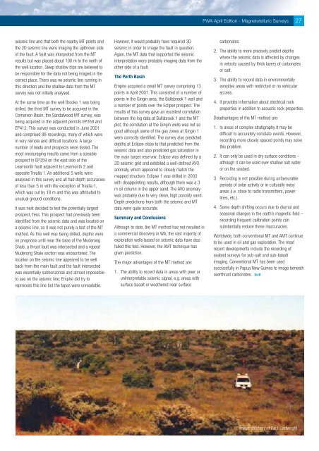
image courtesy <strong>of</strong> Paul Cartwright