eaton conservation area appraisal - Norwich City Council
eaton conservation area appraisal - Norwich City Council
eaton conservation area appraisal - Norwich City Council

Create successful ePaper yourself
Turn your PDF publications into a flip-book with our unique Google optimized e-Paper software.
INTRODUCTION<br />
The <strong>appraisal</strong> provides an assessment<br />
of the character and appearance of<br />
Eaton <strong>conservation</strong> <strong>area</strong>, and includes<br />
proposals for management and<br />
enhancement. This fulfils section 69 &<br />
71 of the Planning (Listed Buildings<br />
and Conservation Areas) Act 1990.<br />
The <strong>appraisal</strong> was subject to public<br />
consultation in February 2008, and<br />
was approved by the city council’s<br />
executive on 19 March 2008. It should<br />
be read in conjunction with the <strong>City</strong> of<br />
<strong>Norwich</strong> Local Plan 2004 (in particular<br />
Chapter 3 ‘Heritage and the Built<br />
Environment’), detailed guidance<br />
and site specific development briefs.<br />
PAGE 4 // CONSERVATION AREA APPRAISAL // EATON<br />
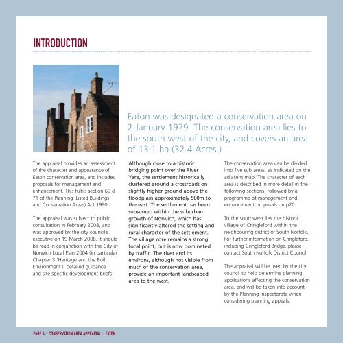
Eaton was designated a <strong>conservation</strong> <strong>area</strong> on<br />
2 January 1979. The <strong>conservation</strong> <strong>area</strong> lies to<br />
the south west of the city, and covers an <strong>area</strong><br />
of 13.1 ha (32.4 Acres.)<br />
Although close to a historic<br />
bridging point over the River<br />
Yare, the settlement historically<br />
clustered around a crossroads on<br />
slightly higher ground above the<br />
floodplain approximately 500m to<br />
the east. The settlement has been<br />
subsumed within the suburban<br />
growth of <strong>Norwich</strong>, which has<br />
significantly altered the setting and<br />
rural character of the settlement.<br />
The village core remains a strong<br />
focal point, but is now dominated<br />
by traffic. The river and its<br />
environs, although not visible from<br />
much of the <strong>conservation</strong> <strong>area</strong>,<br />
provide an important landscaped<br />
<strong>area</strong> to the west.<br />
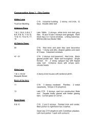
The <strong>conservation</strong> <strong>area</strong> can be divided<br />
into five sub <strong>area</strong>s, as indicated on the<br />
adjacent map. The character of each<br />
<strong>area</strong> is described in more detail in the<br />
following sections, followed by a<br />
programme of management and<br />
enhancement proposals on p20.<br />
To the southwest lies the historic<br />
village of Cringleford within the<br />
neighbouring district of South Norfolk.<br />
For further information on Cringleford,<br />
including Cringleford Bridge, please<br />
contact South Norfolk District <strong>Council</strong>.<br />
The <strong>appraisal</strong> will be used by the city<br />
council to help determine planning<br />
applications affecting the <strong>conservation</strong><br />
<strong>area</strong>, and will be taken into account<br />
by the Planning Inspectorate when<br />
considering planning appeals.