eaton conservation area appraisal - Norwich City Council
eaton conservation area appraisal - Norwich City Council
eaton conservation area appraisal - Norwich City Council

Create successful ePaper yourself
Turn your PDF publications into a flip-book with our unique Google optimized e-Paper software.
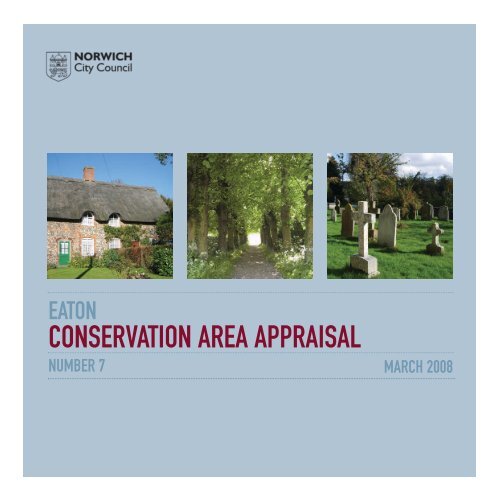
EATON<br />
CONSERVATION AREA APPRAISAL<br />
NUMBER 7 MARCH 2008
CONSERVATION AREAS IN NORWICH:<br />
1. CITY CENTRE<br />
2. BRACONDALE<br />
3. NEWMARKET ROAD<br />
4. HEIGHAM GROVE<br />
5. THORPE<br />
6. SEWELL<br />
7. EATON<br />
8. EARLHAM<br />
9. OLD LAKENHAM<br />
10.BOWTHORPE<br />
11.MILE CROSS<br />
12.THORPE HAMLET<br />
13.THORPE RIDGE<br />
14.UNTHANK & CHRISTCHURCH<br />
15.HELLESDON VILLAGE<br />
16.ST MATTHEW’S<br />
PAGE 2 // CONSERVATION AREA APPRAISAL // EATON
CONTENTS:<br />
INTRODUCTION<br />
04<br />
HISTORIC<br />
DEVELOPMENT<br />
06<br />
URBAN DESIGN &<br />
STREETSCAPE<br />
11<br />
ARCHITECTURE<br />
13<br />
NATURAL CHARACTER<br />
18<br />
MANAGEMENT &<br />
ENHANCEMENT<br />
20<br />
FURTHER READING<br />
24<br />
LISTED BUILDINGS<br />
REGISTER<br />
24<br />
LOCAL LIST REGISTER<br />
24<br />
PAGE 3 // CONSERVATION AREA APPRAISAL // EATON
INTRODUCTION<br />
The <strong>appraisal</strong> provides an assessment<br />
of the character and appearance of<br />
Eaton <strong>conservation</strong> <strong>area</strong>, and includes<br />
proposals for management and<br />
enhancement. This fulfils section 69 &<br />
71 of the Planning (Listed Buildings<br />
and Conservation Areas) Act 1990.<br />
The <strong>appraisal</strong> was subject to public<br />
consultation in February 2008, and<br />
was approved by the city council’s<br />
executive on 19 March 2008. It should<br />
be read in conjunction with the <strong>City</strong> of<br />
<strong>Norwich</strong> Local Plan 2004 (in particular<br />
Chapter 3 ‘Heritage and the Built<br />
Environment’), detailed guidance<br />
and site specific development briefs.<br />
PAGE 4 // CONSERVATION AREA APPRAISAL // EATON<br />
Eaton was designated a <strong>conservation</strong> <strong>area</strong> on<br />
2 January 1979. The <strong>conservation</strong> <strong>area</strong> lies to<br />
the south west of the city, and covers an <strong>area</strong><br />
of 13.1 ha (32.4 Acres.)<br />
Although close to a historic<br />
bridging point over the River<br />
Yare, the settlement historically<br />
clustered around a crossroads on<br />
slightly higher ground above the<br />
floodplain approximately 500m to<br />
the east. The settlement has been<br />
subsumed within the suburban<br />
growth of <strong>Norwich</strong>, which has<br />
significantly altered the setting and<br />
rural character of the settlement.<br />
The village core remains a strong<br />
focal point, but is now dominated<br />
by traffic. The river and its<br />
environs, although not visible from<br />
much of the <strong>conservation</strong> <strong>area</strong>,<br />
provide an important landscaped<br />
<strong>area</strong> to the west.<br />
The <strong>conservation</strong> <strong>area</strong> can be divided<br />
into five sub <strong>area</strong>s, as indicated on the<br />
adjacent map. The character of each<br />
<strong>area</strong> is described in more detail in the<br />
following sections, followed by a<br />
programme of management and<br />
enhancement proposals on p20.<br />
To the southwest lies the historic<br />
village of Cringleford within the<br />
neighbouring district of South Norfolk.<br />
For further information on Cringleford,<br />
including Cringleford Bridge, please<br />
contact South Norfolk District <strong>Council</strong>.<br />
The <strong>appraisal</strong> will be used by the city<br />
council to help determine planning<br />
applications affecting the <strong>conservation</strong><br />
<strong>area</strong>, and will be taken into account<br />
by the Planning Inspectorate when<br />
considering planning appeals.
CONSERVATION AREA MAP<br />
©Crown Copyright 2007<br />
PAGE 5 // CONSERVATION AREA APPRAISAL // EATON
HISTORIC DEVELOPMENT<br />
The Parish of Eaton is today recognised as a largely modern 20th century<br />
suburb, however the original village has a much earlier history, originating<br />
as a settlement that grew around the crossroads close to the River Yare on<br />
the main road linking the historic towns of <strong>Norwich</strong> and Thetford.<br />
The parish of Eaton is recorded in<br />
several ancient records, including the<br />
Domesday Book where it is stated as<br />
being the Kings Land held by Edric of<br />
Laxfield. It was later passed to the<br />
Church of <strong>Norwich</strong> (which became<br />
the Convent and Prior of <strong>Norwich</strong><br />
and then the Dean and Chapter in<br />
1538) and was formerly part of the<br />
historic Hundred of Humbleyard, lying<br />
outside the city boundaries. The<br />
earliest reference to activity in Eaton<br />
is a Title Deed dated 14 September<br />
1473 which refers to a “Lease by<br />
prior Thomas Bozoun to John<br />
Boydon, fuller, of Eaton, of fulling mill<br />
with house and appurtenances in the<br />
town of Eaton, including the dam of<br />
the said mill, a meadow lying at the<br />
south side of the mill and another by<br />
the churchyard of Eaton, prior and<br />
convent to find timber except that<br />
John shall find workmanship of<br />
timber at Eaton wood, for 10 years.”<br />
PAGE 6 // CONSERVATION AREA APPRAISAL // EATON<br />
By the 19th century all traces of the<br />
mill had disappeared, but it is<br />
thought to have occupied a site on<br />
the opposite bank to Cringleford Mill.<br />
The great wood at Eaton is also<br />
referred to in a copy of a lease from<br />
Elizabeth I to Henry Ryce in 1573 for<br />
the term of 100yrs for land in Eaton.<br />
The lease specifically reserves for the<br />
Dean and Chapter “the great wood<br />
called Eaton Wood”.<br />
Although it is unclear how long a<br />
track has passed through Eaton and<br />
over the Yare to Cringleford, it is<br />
likely to have had ancient origins.<br />
<strong>Norwich</strong> has maintained strong<br />
eccliesiastical links with both<br />
Wymondham and Thetford since at<br />
least the 11th century and the<br />
Cringleford crossing provided easy<br />
fording of the river.<br />
The present Cringleford bridge dates<br />
back to 1520 when a stone bridge was<br />
built to replace an earlier wooden<br />
bridge destroyed by flooding in 1519.<br />
How long the former bridge had been<br />
in place is unknown. The road which<br />
passes through Eaton, now known as<br />
Eaton Street, was formerly Eaton Lane,<br />
and before that Freeman’s Lane or<br />
Half-mile Lane. In 1779 the <strong>Norwich</strong> to<br />
Thetford Turnpike Trust was formed to<br />
improve the road for travellers and this<br />
was paid for by tolls. The stone bridge<br />
was in turn widened in 1780. A toll<br />
gate was erected on Cringleford Bridge<br />
in order to collect money for the<br />
Cringleford to Hethersett section and<br />
the first <strong>Norwich</strong> to London stagecoach<br />
passed through the village in 1784.<br />
The road through Eaton remained the<br />
main road from <strong>Norwich</strong> to London<br />
until the village was bypassed in 1975.
HISTORIC DEVELOPMENT<br />
The crossroads c1900<br />
(© Norfolk County <strong>Council</strong>)<br />
The crossroads is historically the<br />
focal point for many of the local<br />
community’s services.<br />
The buildings around the crossroads<br />
included the Parish Hall, a bakery at 20<br />
Eaton Street (sold at auction as a Bakers<br />
house and shop in 1922), the post<br />
office, and a smithy located behind 18<br />
Eaton street. The stepped gable of the<br />
Parish Hall is likely to date from the 17th<br />
century, although this may have been<br />
a later addition to the timber framed<br />
section of the building situated to the<br />
rear. The building was located on the<br />
corner of the Eaton Street and the<br />
much narrower Bluebell Lane, and<br />
appears to have been demolished<br />
sometime between 1913 and 1928<br />
as part of a road widening scheme.<br />
The former Parish Hall, now demolished<br />
(© Norfolk County <strong>Council</strong>)<br />
Historic activities associated with<br />
the village included agriculture,<br />
brewing, chalk mining and market<br />
gardening.<br />
Eaton was very well known for its<br />
beer. It is recorded that Robert Holmes,<br />
who was sheriff of <strong>Norwich</strong> in 1646,<br />
first operated a brewery during the<br />
early to mid 17th century. His initials<br />
with the date 1643 were carved on<br />
the door of the Red Lion Public House.<br />
The chalk workings were to the north<br />
east of the settlement, now filled in<br />
and crossed by the A11. The former<br />
Mayor of <strong>Norwich</strong>, Walter Rye, states<br />
in his History of the Hamlet (1915)<br />
that the chief trade of the village was<br />
growing fruit trees and roses for<br />
<strong>Norwich</strong> market and the map of 1882<br />
Former door on the Red Lion dated 1643<br />
(© George Plunkett)<br />
shows extensive nurseries surrounding<br />
the settlement.<br />
The map of 1882 shows a cluster of<br />
buildings around the crossroads,<br />
with larger houses and<br />
outbuildings further out.<br />
Many of the smaller terrace houses<br />
around the crossroads have now been<br />
demolished, partly due to road<br />
widening schemes, and also because<br />
they were probably considered to be<br />
poor accommodation. Further along<br />
Church Lane and Eaton Street historic<br />
properties remain, but many of the<br />
outbuildings, such as those associated<br />
with Church Farm, have been<br />
demolished. Even further out to the<br />
east was Eaton Hall. Built c.1800 it<br />
PAGE 7 // CONSERVATION AREA APPRAISAL // EATON
O.S. MAP 1880-1889 EATON HISTORIC MAP<br />
PAGE 8 // CONSERVATION AREA APPRAISAL // EATON
O.S. MAP 1955-1968 EATON HISTORIC MAP<br />
PAGE 9 // CONSERVATION AREA APPRAISAL // EATON
HISTORIC DEVELOPMENT<br />
was used as the Judge’s lodgings<br />
during the late 19th century (hence<br />
the name of Judges Drive). It now lies<br />
within a large <strong>area</strong> of suburban<br />
development isolated from the village.<br />
During the 20th century the village<br />
has undergone significant changes<br />
with the growth of <strong>Norwich</strong>. The<br />
only barrier to further development<br />
has been the river and its floodplain.<br />
The road has been widened on at<br />
least two occasions. The building of<br />
the supermarket has had a significant<br />
impact on the settlement, both in<br />
terms of the size of buildings, and<br />
through creating additional traffic.<br />
The village sign on the green has<br />
occupied its position since 1956<br />
and is a play on words; the ‘E’ for<br />
elephant and ‘tun’, another word<br />
for a barrel (see photo page 16).<br />
Changes in the levels of traffic and subsequent<br />
road widening since 1900.<br />
(top two photos © Norfolk County <strong>Council</strong>)<br />
PAGE 10 // CONSERVATION AREA APPRAISAL // EATON<br />
c1900<br />
c1960<br />
2007
URBAN DESIGN AND STREETSCAPE<br />
The flyover has become a modern day landmark Enclosed walls to the south, Church Lane Glimpsed views of the church from Church Lane<br />
Although the character of the settlement has seen significant<br />
changes, the settlement still retains a village core around<br />
which historic buildings cluster.<br />
Sub <strong>area</strong> A comprises the historic<br />
settlement core where the majority of<br />
buildings are set tightly to the back of<br />
the pavement. Originally the crossroads<br />
would have been an ‘informal’ public<br />
space, however heavy traffic now<br />
dominates. Pedestrians are pushed<br />
onto narrow pavements and hemmed<br />
in by steel barriers, and although a<br />
small patch of lawn remains in front<br />
of 18 Eaton Street, the space has<br />
become cluttered with traffic signage,<br />
which detracts from the village sign, a<br />
potential landmark. Although it may be<br />
viewed as an eyesore, the flyover over<br />
Bluebell Road has become a modern<br />
landmark and has in effect become<br />
a ‘gateway’ to the village. This <strong>area</strong><br />
presents an opportunity to recreate<br />
a better sense of place for the village.<br />
The yard adjacent to 18 Eaton street<br />
and the neighbouring Barclays Bank<br />
building also present opportunities<br />
for enhancement.<br />
Sub <strong>area</strong> B is characterised by the<br />
spacious earlier housing now set<br />
behind high walls, together with some<br />
late 20th century infill housing. Within<br />
this <strong>area</strong> the church tower provides<br />
the most historic landmark in the<br />
settlement, However, because the<br />
church is set back from the road, it is<br />
only visible from Church Lane. The<br />
church is connected to Church Lane<br />
via a tree lined vista, which provides<br />
an attractive gateway.<br />
Sub <strong>area</strong> C is characterised by the large<br />
supermarket complex and its adjacent<br />
car park, whereas sub <strong>area</strong> D is<br />
interwar suburban housing comprising<br />
detached and semi detached houses<br />
set back from the road with hedges<br />
and low walls as boundary treatment.<br />
Sub <strong>area</strong> E is the river’s floodplain that<br />
remains undeveloped.<br />
PAGE 11 // CONSERVATION AREA APPRAISAL // EATON
URBAN DESIGN & STREETSCAPE MAP<br />
PAGE 12 // CONSERVATION AREA APPRAISAL // EATON<br />
©Crown Copyright 2007
ARCHITECTURE<br />
The village retains a rich variety of historic<br />
buildings, including a number of buildings dating<br />
from 17th century, many of which are listed.<br />
St Andrew’s Church (1) is the<br />
earliest surviving building in the<br />
village and dates from the 13th<br />
century, although there have been<br />
numerous phases of alteration.<br />
The church is constructed with knapped<br />
flint, Caen stone dressings and a<br />
thatched roof. The tower dates from the<br />
15th century and has an interesting cut<br />
stone and lozenge detail. In 1860-1<br />
the church was extensively restored by<br />
Thomas Jeckyll and in 1992-3 a new<br />
extension of cut flint and stone was<br />
added (see photo above). A memorial<br />
lychgate was also erected at the<br />
entrance to the churchyard during<br />
the early 20th century.<br />
There are a number of surviving<br />
17th century buildings in the<br />
village and these have flint work<br />
and thatched roofs, or in the case<br />
of the Red Lion, early brickwork.<br />
15 and 17 Eaton Street (2) retain much<br />
of their original appearance, although the<br />
two ‘eyebrow’ windows are unlikely to<br />
be original features. Further along Eaton<br />
Street the Red Lion (3) public house has<br />
also remained little altered. Photographic<br />
evidence of a door surround, now<br />
removed, possibly dates the building to<br />
1643. It is constructed almost entirely of<br />
brick with ‘Dutch gables’ at each end and<br />
plain red tiles. The mullion and transom<br />
windows are not original, replacing sash<br />
windows, which in turn are likely to have<br />
been put in during the 18th century.<br />
Many buildings in the village are<br />
older than they appear, having<br />
been re-fronted. In some cases a<br />
small part of the original structure<br />
is still visible externally.<br />
31-33 Church Lane (4) dates from<br />
the 17th century with 18th and 19th<br />
century alterations. It is constructed<br />
in red brick with an English bond, the<br />
west façade has been rendered and the<br />
gables mostly rebuilt. 30 and 32 Eaton<br />
Street (5) date from the 17th century<br />
but have been re-fronted in brick and<br />
painted. No 2, the Cellar House, (6)<br />
has an early 19th century rendered<br />
classically proportioned façade with<br />
a slate roof, but may internally have<br />
earlier origins. Church Farm (7) has a<br />
19th century front range, but the rear<br />
wing has low ceilings and chamfered<br />
ceiling beams, and is likely to date<br />
from the 17th or earlier.<br />
PAGE 13 // CONSERVATION AREA APPRAISAL // EATON
ARCHITECTURE<br />
5 & 7 Eaton Street 18 Eaton Street The Cellar House, Eaton Street<br />
25 Eaton Street (8) is a mid 18th<br />
century house, rendered, with a<br />
hipped pantile roof and two red<br />
brick chimneys. The house has a<br />
pedimented doorway, a symmetrical<br />
fenestration of sash windows, the<br />
central first floor window with a<br />
flattened segmental head and Gibbs<br />
surround, and a bracket cornice for<br />
the eaves. No. 18 (9) is a much<br />
simpler building, single storey with<br />
an attic, simple pilasters and an<br />
open pediment, large paned sashes<br />
throughout, and a thatched roof.<br />
PAGE 14 // CONSERVATION AREA APPRAISAL // EATON<br />
A number of the buildings have<br />
features typical of the 19th century<br />
47 & 49 (The Old House) Church Lane<br />
(10) both date from the early 19th<br />
century (there is a 1822 datestone on<br />
the inside of an entrance pillar). 47 &<br />
49 Church Lane is three storeys with<br />
five bays, sash windows with<br />
rusticated lintels on the ground and<br />
first floors. The six panelled (two<br />
glass) front door is set within panelled<br />
reveals with a moulded and rusticated<br />
architrave with a keyblock under an<br />
open pediment with consoles.<br />
1 & 3 Eaton Street (11) also date<br />
from the early 19th century. The<br />
building is rendered with rusticated<br />
quoins and a pantilled roof. The six<br />
panelled front door is flanked by two<br />
pilasters with plain cornice and<br />
simple hood. Also of note are the<br />
decorative bargeboards with finials<br />
on each gable.<br />
Church Farm (7), remodelled in the<br />
early 19th century, has a simple<br />
rendered front elevation with large<br />
paned sash windows, but has an<br />
imposing entrance porch with ionic half<br />
columns supporting a high level hood.
ARCHITECTURE<br />
47 & 49 Church Lane Church Farm, Church Lane<br />
Along Eaton Street there are a<br />
number of mid to late 19th century<br />
brick built cottages, but these have<br />
been much altered. Of more interest<br />
is 7 Eaton Street (12), constructed<br />
with close set flints on the ground<br />
floor, and larger flint rubble to the<br />
1st floor. The house is rendered to<br />
the left where it was once adjoined<br />
by cottages. The building has two<br />
red brick chimneys in a 17th century<br />
dutch style, with moulded white<br />
brick dentilled pediments around the<br />
casement windows and front door.<br />
Also of note are 2,4, and 6 Bluebell<br />
Road (13) which are also<br />
constructed with flint and redbrick<br />
dressing, although these have been<br />
much altered.<br />
20th century development is of little<br />
interest and generally detrimental to<br />
the character and appearance of the<br />
<strong>conservation</strong> <strong>area</strong>. The only exceptions<br />
are the suburban interwar ‘mock<br />
tudor’ semi detached houses on the<br />
north side of Eaton Street (14).<br />
Pics over leaf:<br />
From left to right<br />
1. Mock timber framing –<br />
Eaton Street<br />
2. Dutch gable –<br />
Red Lion PH<br />
3. 19th Century window –<br />
3 Eaton Street<br />
4. Eyebrow window –<br />
17 Eaton Street<br />
5. Village Sign<br />
6. Lych Gate –<br />
St Andrews Church<br />
7. Gravestone –<br />
St Andrews Church<br />
8. Pedimented door canopy –<br />
18 Eaton Street<br />
9. Door surround –<br />
7 Eaton Street<br />
PAGE 15 // CONSERVATION AREA APPRAISAL // EATON
1. 2. 3.<br />
4. 5. 6.<br />
7. 8. 9.<br />
PAGE 16 // CONSERVATION AREA APPRAISAL // EATON
HISTORIC BUILDINGS MAP<br />
©Crown Copyright 2007<br />
PAGE 17 // CONSERVATION AREA APPRAISAL // EATON
NATURAL CHARACTER<br />
The river<br />
The open spaces to the west provide<br />
an important gap between the two<br />
settlements of Eaton and Cringleford.<br />
Because of the low lying nature of the<br />
floodplain the river banks have<br />
remained relatively undeveloped with<br />
the exception of the large<br />
supermarket car park. This part of the<br />
river valley is protected from<br />
development; however the <strong>area</strong> also<br />
needs to be well managed because it<br />
provides both an important natural<br />
habitat and a recreational resource (a<br />
riverside walk crosses through the<br />
<strong>area</strong>). The trees at the western end of<br />
Eaton Street are also of landscape<br />
value but need maintaining.<br />
The former curtilage of 47 & 49<br />
Church Lane contains a significant<br />
number of mature trees protected by<br />
PAGE 18 // CONSERVATION AREA APPRAISAL // EATON<br />
The River Yare and its accompanying water meadows<br />
comprise a large part of the <strong>conservation</strong> <strong>area</strong> and<br />
demarcate its boundary and separation from the<br />
settlement of Cringleford to the west. In contrast the<br />
landscape quality around the crossroads at the centre of<br />
the settlement is poor, however there is significant<br />
landscaping along the streets leading away from the<br />
crossroads, particularly along Church Lane. The avenue of<br />
trees leading to St Andrew’s Church is also noteworthy.<br />
a Tree Preservation Order. The tree<br />
coverage on the opposite side of the<br />
road within the curtilage of Church<br />
Farm also contributes to the<br />
significant landscape quality of this<br />
part of the <strong>conservation</strong> <strong>area</strong>.<br />
The other important natural feature is<br />
the avenue of trees that leads to St<br />
Andrew’s Churchyard. The churchyard<br />
provides an important enclosed and<br />
secluded <strong>area</strong> of public open space<br />
within the settlement.<br />
Avenue of trees leading to St Andrew’s Church St Andrew’s Churchyard
NATURAL CHARACTER MAP<br />
the informal village feel of the <strong>area</strong>.<br />
©Crown Copyright 2007<br />
PAGE 19 // CONSERVATION AREA APPRAISAL // EATON
MANAGEMENT AND ENHANCEMENT<br />
The city council has a duty to enhance<br />
the character and appearance of the<br />
<strong>conservation</strong> <strong>area</strong> where possible. The<br />
following table highlights opportunities<br />
to improve the management of the<br />
<strong>conservation</strong> <strong>area</strong> and to carry out<br />
enhancement. Inclusion on the list is<br />
not a commitment by the council to<br />
undertake the work and further work<br />
will be required to establish the<br />
feasibility of these proposals. Each<br />
opportunity has been identified as a<br />
short, medium or long term goal<br />
reflecting its cost and complexity.<br />
No. Location Issue Action Term Responsibility<br />
1<br />
Eaton<br />
Street/Church<br />
Lane/Bluebell<br />
Road junction.<br />
PAGE 20 // CONSERVATION AREA APPRAISAL // EATON<br />
Enhancement of the <strong>conservation</strong><br />
<strong>area</strong> also depends on the care that<br />
individual owners take with the<br />
maintenance and repair of their<br />
properties and due consideration<br />
to preserving and enhancing the<br />
<strong>conservation</strong> <strong>area</strong> when carrying out<br />
alterations to their properties. The list<br />
therefore also identifies opportunities<br />
for private owners.<br />
After five years the <strong>appraisal</strong> will<br />
be reviewed to see whether the<br />
character and appearance of the<br />
<strong>conservation</strong> <strong>area</strong> has been successfully<br />
enhanced and to assess whether<br />
new opportunities are available.<br />
Heavy traffic<br />
dominates the<br />
junction and<br />
restricts pedestrian<br />
movement.<br />
The junction needs to<br />
be redesigned to give<br />
more priority to<br />
pedestrians. Footpaths<br />
should be widened.<br />
(S) Short Term<br />
Straightforward enhancement<br />
proposals, which should be<br />
relatively easy to achieve or<br />
are included in existing work<br />
programmes<br />
(M)Medium Term<br />
Involves some expenditure<br />
and/or complexity<br />
(L) Long Term<br />
Complex proposals involving larger<br />
financial commitments<br />
L Transportation<br />
Policy &<br />
Landscape<br />
Design.
MANAGEMENT AND ENHANCEMENT<br />
No. Location Issue Action Term Responsibility<br />
2<br />
3<br />
4<br />
5<br />
Eaton<br />
Street/Church<br />
Lane corner.<br />
Church<br />
Lane/<strong>area</strong><br />
adjacent to 18<br />
Church Lane.<br />
Eaton Street.<br />
Eaton Street.<br />
Poor streetscape<br />
and signage<br />
clutter.<br />
Existing use of<br />
the site appears<br />
temporary.<br />
Position of bus<br />
stop makes it<br />
diffcult to walk<br />
past.<br />
Bench slats are<br />
broken and<br />
vegetation is<br />
encroaching.<br />
Rationalise street<br />
signage and enhance<br />
landscaping.<br />
Seek enhancement<br />
and/or appropriate<br />
redevelopment of<br />
<strong>area</strong>.<br />
Investigate wheter<br />
footpath can be<br />
widenend.<br />
Repair bench and<br />
ensure vegetation is<br />
kept clear.<br />
M-L<br />
L<br />
S-L<br />
S<br />
Transportation<br />
Policy &<br />
Landscape<br />
Design.<br />
Owner and/or<br />
occupier.<br />
Transportation<br />
Highways.<br />
PAGE 21 // CONSERVATION AREA APPRAISAL // EATON
MANAGEMENT AND ENHANCEMENT<br />
No. Location Issue Action Term Responsibility<br />
6<br />
7<br />
Eaton Street.<br />
Eaton Street.<br />
PAGE 22 // CONSERVATION AREA APPRAISAL // EATON<br />
Vegetation often<br />
grows over paths.<br />
Vegetation has<br />
spread over path<br />
and is particularly<br />
dangerous at the<br />
crossing point.<br />
Ensure footpaths<br />
are kept clear of<br />
vegetation.<br />
Ensure vegetation is<br />
cut back from<br />
footpath – particularly<br />
around crossing.<br />
S-M<br />
S-L<br />
Green Spaces.<br />
Highways.
MANAGEMENT & ENHANCEMENT MAP<br />
©Crown Copyright 2007<br />
PAGE 23 // CONSERVATION AREA APPRAISAL // EATON
FURTHER READING<br />
Walter Rye “Hamlet of Eaton”<br />
available in the Local Studies Section,<br />
Millennium Library, <strong>Norwich</strong><br />
LISTED BUILDINGS<br />
The following buildings have been<br />
listed Grade II (St Andrew’s Grade II*)<br />
either because of their architectural<br />
interest, their historic interest, their<br />
close historical association or because<br />
they form part of an important group.<br />
Church Lane<br />
31-33 (including attached boundary<br />
wall), Church Farm, Church of St<br />
Andrew, The Old House<br />
Eaton Street<br />
1 & 3, 2 (The Cellar Public House), 7,<br />
15 & 17, 16, 25 (St. Margarets), 30 &<br />
32, 52 (The Red Lion Public House)<br />
PAGE 24 // CONSERVATION AREA APPRAISAL // EATON<br />
LOCAL LIST<br />
The following buildings within the<br />
<strong>conservation</strong> <strong>area</strong> are included on the<br />
local list for their architectural and/or<br />
historical importance. These buildings<br />
are valued for their contribution to<br />
the local scene, or for local historical<br />
associations, but do not merit full<br />
statutory protection.<br />
Bluebell Road<br />
2, 4 & 6<br />
The following buildings have been<br />
added to the Local List:<br />
29-35 Eaton Street (odd)<br />
C20. Interwar semi detached<br />
suburban houses in the mock tudor<br />
style with decorative projecting<br />
gables. Rendered with red brick<br />
detailing. Pantiles. Replacement<br />
uPVC windows match original style.<br />
Importance: Good example of an<br />
interwar suburban bulding.<br />
A full list can be viewed at<br />
www.norwich.gov.uk
NOTES<br />
PAGE 25 // CONSERVATION AREA APPRAISAL // EATON
NOTES<br />
PAGE 26 // CONSERVATION AREA APPRAISAL // EATON
NOTES<br />
PAGE 27 // CONSERVATION AREA APPRAISAL // EATON
CONTACT DETAILS<br />
PLANNING SERVICES<br />
CITY HALL<br />
NORWICH NR2 1NH<br />
TEL: 0844 980 3333<br />
IF YOU NEED THIS APPRAISAL IN ANOTHER FORMAT OR LANGUAGE<br />
PLEASE PHONE 0844 980 3333, FAX 01603 213000 OR EMAIL INFO@NORWICH.GOV.UK