Saltwood Conservation Area Appraisal part 1 - Shepway District ...
Saltwood Conservation Area Appraisal part 1 - Shepway District ...
Saltwood Conservation Area Appraisal part 1 - Shepway District ...

Create successful ePaper yourself
Turn your PDF publications into a flip-book with our unique Google optimized e-Paper software.
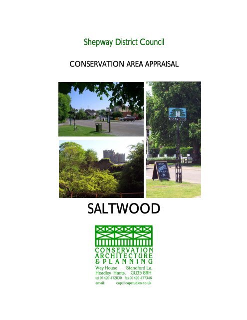
<strong>Shepway</strong> <strong>District</strong> Council<br />
CONSERVATION AREA APPRAISAL<br />
SALTWOOD
ACKNOWLEDGEMENTS<br />
The authors of this Study are:<br />
<strong>Conservation</strong> Architecture & Planning<br />
Jack Warshaw RIBA, MRTPI, IHBC, FRSA Project Director<br />
Sue Beech BARCH (HONS) MSC IHBC Assessor / Historian / Mapping<br />
Liz Cartell BA (HONS) HIDIP ADMIN Coordinator/Production<br />
The authors gratefully acknowledge the contributions and assistance of the following<br />
individuals and organisations:<br />
<strong>Shepway</strong> <strong>District</strong> Council<br />
John Gabbé Planning and Environment<br />
Sue Yates Planning and Environment<br />
Lisette Patching Planning and Environment<br />
Chris Beech GIS Technician<br />
The Heritage <strong>Conservation</strong> Group at Kent County Council Archives<br />
The stakeholders who contributed feedback for this appraisal<br />
This Study is Copyright 2006 by <strong>Conservation</strong> Architecture & Planning Ltd. <strong>Shepway</strong> <strong>District</strong> Council<br />
and its authorised Partners are hereby licensed to copy and disseminate the study in whole or <strong>part</strong> in<br />
connection with the purpose for which it was prepared. No other intellectual property rights are granted<br />
to any other individual or body.
CONTENTS<br />
INTRODUCTION 1<br />
PLANNING POLICY CONTEXT 1<br />
DEVELOPMENT CONTROL 3<br />
BOUNDARY 3<br />
SUMMARY of SPECIAL INTEREST 4<br />
page<br />
Historic Connections: <strong>Saltwood</strong> Castle &<br />
the Church of St Peter & St Paul 4<br />
Landscape 4<br />
Location & context 4<br />
General character and plan form 4<br />
Landscape setting & geology 5<br />
Topography of the CA and wider environment 6<br />
Historic development 6<br />
Archaeological significance 10<br />
Historic maps 10<br />
CHARACTER ANALYSIS<br />
<strong>Area</strong> 1 – <strong>Saltwood</strong> Castle 12<br />
Spatial analysis 12<br />
Key views & vistas 12<br />
Listed buildings 13<br />
Building materials 13<br />
General condition 13<br />
Problems & pressures 14<br />
<strong>Area</strong> 2 – Rectory Lane 14<br />
Spatial analysis 14<br />
Key views & vistas 15<br />
Character analysis 15<br />
Listed buildings 15<br />
Unlisted buildings of local merit 16<br />
Local details 17<br />
Building materials 17<br />
Greenspace 18<br />
Hard landscaping & public realm 19<br />
Negative factors 19<br />
Negative areas 20<br />
General condition 20<br />
Problems & pressures 21
page<br />
<strong>Area</strong> 3 – Grange Farm & Open Space 21<br />
Spatial analysis 21<br />
Key views & vistas 22<br />
Character analysis 22<br />
Listed buildings 22<br />
Unlisted buildings of local merit 23<br />
Local details 23<br />
Building materials 23<br />
Greenspace 24<br />
Hardlandscape & public realm 25<br />
Negative factors 25<br />
Negative areas 25<br />
General condition 25<br />
Problems & pressures 25<br />
INVOLVING THE COMMUNITY<br />
Summary of issues raised by stakeholders 26<br />
SUGGESTED BOUNDARY REVISIONS<br />
Boundary additions 27<br />
Boundary reduction 27<br />
Summary of problems in the CA 27<br />
LOCAL GENERIC GUIDANCE<br />
Design brief 28<br />
Design guidance 28<br />
USEFUL INFORMATION<br />
Contact Details 29<br />
Bibliography 29<br />
Appendices<br />
Appendix 1 Historic Maps<br />
Appendix 2 Analysis Maps<br />
Appendix 3 Unlisted Buildings of Local Merit<br />
Appendix 4 Stakeholder Consultation Feedback
SALTWOOD CONSERVATION AREA APPRAISAL<br />
INTRODUCTION<br />
1 A <strong>Conservation</strong> <strong>Area</strong> (CA) is defined in law as an area of special architectural and<br />
historic interest. The purpose of this appraisal is to help us understand why<br />
<strong>Saltwood</strong> is special and provide a framework for keeping it that way. Its character,<br />
or specialness, needs to be defined. What is happening to it needs to be<br />
documented and analysed. What should happen in the future needs to be<br />
celebrated, guided and well managed.<br />
2 This appraisal forms one of a series of 21 CA appraisals commissioned by<br />
<strong>Shepway</strong> <strong>District</strong> Council. The original CA designation for <strong>Saltwood</strong> came into<br />
effect on 14 August 1974. It has been undertaken using the methodology of the<br />
English Heritage consultative ‘Guidance on conservation area appraisals’, 2005. A<br />
companion guide, ‘Guidance on the management of conservation areas’,<br />
recommends a procedure to follow the appraisal.<br />
PLANNING POLICY CONTEXT<br />
3 The Planning (Listed Buildings and <strong>Conservation</strong> <strong>Area</strong>s) Act 1990 sets out the<br />
process of assessment, definition or revision of boundaries as well as the<br />
formulation of proposals for CA’s and the identification and protection of listed<br />
buildings. Authorities are required to pay special attention to the desirability of<br />
preserving or enhancing the character or appearance of a CA, or in the case of<br />
listed buildings, to have special regard for their preservation in the exercise of their<br />
powers under the Planning Acts.<br />
4 Planning Policy Guidance (PPG) Note 15, for local and other public authorities,<br />
property owners, developers, amenity bodies and the public, sets out Government<br />
policies for the identification and protection of historic buildings, CA’s and other<br />
elements of the historic environment. <strong>Shepway</strong> Council’s Local Plan/Local<br />
Development Framework includes its statutory policies for implementing the Acts<br />
and applying the PPG. This <strong>Appraisal</strong> should be taken into account when<br />
considering, applying for or determining planning or listed building applications<br />
within the CA.<br />
5 The underlying objective of the relevant legislation and guidance is the preservation<br />
or enhancement of character or appearance of CA’s. Any proposed development<br />
that conflicts with that objective should normally expect to be refused. PPG 15 and<br />
local policy support a presumption in favour of preservation of any building or<br />
object that is considered to make a positive contribution to the character of a CA.<br />
At the same time, the need to accommodate change that respects or reinforces the<br />
character of the area in order to maintain its vitality is recognised. Regard must<br />
also be had to the requirements of other national guidance, including PPG16<br />
covering archaeology and PPS 1, which includes policies on sustainable<br />
development and urban design.<br />
<strong>Conservation</strong> Architecture & Planning 1
SALTWOOD CONSERVATION AREA APPRAISAL<br />
6 Many local planning policies, not just design and conservation, can affect what<br />
happens in a CA. For example, policies on sustainable development, meeting<br />
housing needs, affordable housing, landscape, biodiversity, energy efficiency,<br />
transport, people with disabilities, employment, town centres and many others all<br />
influence development and the quality of the environment in CA’s. However,<br />
policies concerned with design quality and character take on greater importance<br />
in CA’s. The adopted <strong>District</strong> Plan’s chapter on Built Environment covers<br />
conservation and design matters. The key policies of this chapter state:<br />
7 POLICY BE3<br />
When considering new CA’s or reviewing existing CA’s the following criteria will be<br />
taken into account.<br />
The area:<br />
8 POLICY BE4<br />
a. is of special architectural or historic interest, the character of which it is<br />
desirable to preserve and enhance;<br />
b. includes sufficient buildings of historic and/or architectural interest, listed<br />
or unlisted, to give a strong character;<br />
c. includes sufficient good quality hard and/or soft landscape;<br />
d. shows strong relationships between buildings, and buildings and open<br />
spaces that create a sense of place;<br />
e. is one which either illustrates local architectural development or an area of<br />
one architectural period which remains largely in its original condition.<br />
The <strong>District</strong> Planning Authority will:<br />
a. refuse CA Consent for the demolition of buildings which contribute to the<br />
character or appearance of a CA;<br />
b. refuse proposals for infill or backland development which would adversely<br />
affect the character of a CA;<br />
c. require the height, scale, form and materials of new development,<br />
including alterations or extensions to existing buildings, to respect the<br />
character of CA’s;<br />
d. seek to retain materials, features and details of unlisted buildings or<br />
structures which preserve or enhance the character or appearance of<br />
CAs;<br />
e. seek to retain the historic patterns, plot boundaries, building lines, open<br />
spaces, footways, footpaths and kerblines which are essential to the<br />
character or appearance of CA’s;<br />
f. protect trees and hedgerows which enhance both the setting and<br />
character of CA’s<br />
9 Other policies dealing the historic or built environment are BE 1, 2 and 5-19.<br />
<strong>Conservation</strong> Architecture & Planning 2
SALTWOOD CONSERVATION AREA APPRAISAL<br />
DEVELOPMENT CONTROL<br />
10 Greater restrictions on permitted development apply in CA’s areas than elsewhere.<br />
Anyone contemplating alterations, extensions or new building should familiarise<br />
themselves with the policies set out above and consult the Council’s Planning<br />
De<strong>part</strong>ment for advice on how to apply for permission and whether the proposal is<br />
likely to be acceptable.<br />
BOUNDARY<br />
11 The boundary of the <strong>Saltwood</strong> CA was adopted in the 1993 appraisal and is<br />
appended to this document. The CA includes <strong>Saltwood</strong> Castle, Grange Farm,<br />
Village Green and Rectory Lane. Amendments to the boundary are proposed in<br />
this 2006 appraisal. The existing boundary map is to be found in the historic map<br />
appendices.<br />
SUMMARY OF SPECIAL INTEREST<br />
12 The special interest of <strong>Saltwood</strong> is twofold:<br />
1 The historic links between the dominant built elements of <strong>Saltwood</strong> Castle<br />
and the church of St Peter and St Paul.<br />
2 The landscape and farmland which covers almost two thirds of the CA, which<br />
has changed little over a millennium.<br />
Historic Connections - <strong>Saltwood</strong> Castle and the Church of St Peter and St Paul<br />
13 Before the Norman invasion, <strong>Saltwood</strong> Castle was within the See of Canterbury.<br />
The Church of St Peter and St Paul was the mother church of St Leonard’s Hythe<br />
and under the Normans it became the residence of the Archbishops of Canterbury.<br />
Thomas Becket was exiled from there by Henry II, and his murder plotted from the<br />
castle.<br />
14 <strong>Saltwood</strong> Castle became the administrative centre of The Manor of <strong>Saltwood</strong> and<br />
together with Lympne Castle protected the Cinque Port of Hythe. Following the<br />
dissolution of the monasteries it became Crown property before being passed into<br />
private hands. In the C20 it was the home of Lord Kenneth Clarke, the author of<br />
Civilisation and finally to his son Alan Clark, the MP and diarist.<br />
Landscape<br />
15 <strong>Saltwood</strong> lies within an ancient landscape. Ancient footpaths cross the farmland<br />
and traffic in <strong>part</strong>s of the area is almost absent. Country lanes and footpaths lie<br />
between banks of broadleaf trees and wild flowers. The historic landscape setting<br />
remains intact.<br />
16 The area around The Green and The Village Hall is busier. Gradual development<br />
has taken place mostly to south.<br />
<strong>Conservation</strong> Architecture & Planning 3
SALTWOOD CONSERVATION AREA APPRAISAL<br />
Location and context<br />
17 <strong>Saltwood</strong> sits on high ground approx 1 km north of St Leonard’s Church Hythe, two<br />
kilometers from the Kent coast. To the east lies Folkestone, on a high point where<br />
the cliffs of the North Downs, the White Cliffs of Dover, meet the sea. Romney<br />
Marsh lies to the south west. The local roads between the villages on Romney<br />
Marsh form a network of picturesque routes.<br />
18 The area, some 20 miles from the French coast, has always played a key <strong>part</strong> in<br />
the defence of the nation against naval invasion. The natural barrier of the sea has<br />
been reinforced in every period by numerous shore fortifications, along with<br />
protective walls, drainage and irrigation channels.<br />
19 <strong>Saltwood</strong> has good connections to national and international travel. To the north<br />
the M20 motorway connects with Ashford International Station, The Channel<br />
Tunnel at Folkestone, the M25 and London. The Channel Tunnel High Speed Rail<br />
Link (CTRL) will bring the Kent coast and Northern France within commuting<br />
distance of London. Development pressure arising from this is increasing<br />
dramatically.<br />
20 The A259, connecting Hythe with Sandgate and Folkestone lies approximately 1km<br />
to the south of <strong>Saltwood</strong>. Stone Street (B2068) follows a Roman Road built from<br />
Hythe to Canterbury and its World Heritage Site.<br />
General character and plan form<br />
21 The North Downs form a natural boundary to <strong>Shepway</strong> <strong>District</strong>. The escarpment<br />
slopes away to the south west of Hythe into Romney Marsh, one of only three<br />
wetland marshes in England. This area of coastal marshland is lower than sea<br />
level, protected by the Rhee Wall, a significant southern boundary. To the south is<br />
the English Channel and The Straits of Dover. The area requires water<br />
management to both irrigate and protect it from flooding.<br />
<strong>Conservation</strong> Architecture & Planning 4
SALTWOOD CONSERVATION AREA APPRAISAL<br />
22 <strong>Saltwood</strong> is approx 65 metres above sea level and developed between the cusps<br />
of the folding upland. This setting provides many picturesque views into an out of<br />
the CA. The topography varies from level to gently undulating. This provides a<br />
soft enclosed landscape often the views are terminated by a band of trees, which<br />
form the boundaries of fields and lanes.<br />
23 The immediate landscape is dominated by Grange Farm, which, together with<br />
<strong>Saltwood</strong> Castle, occupies almost half the CA. The farm field system is crossed<br />
by a network of public footpaths.<br />
24 The north east CA boundary is formed by the disused former South-Eastern &<br />
Chatham Railway (SE & CR) Sandgate branch line. There is little evidence of the<br />
railway track, which is now the route of a picturesque footpath through a narrow<br />
strip of light broadleaf woodland. To the north of this natural area boundary the<br />
land steeply drops into a level apple orchard.<br />
25 To the North West the footpath drops into a railway cutting between a gentle fold in<br />
the hills. Here some large houses have been built half way up the hillside. Their<br />
boundaries are lightly wooded. At the bottom of the hill a brook meanders between<br />
a track and public footpath.<br />
26 The proposed CA boundary follows the bridle path north west of the houses to its<br />
junction with Rectory Lane leading to the village centre. Rectory Lane provides<br />
varied local views of St Peter’s and St Paul’s Church, Grange Farm and <strong>part</strong> of<br />
<strong>Saltwood</strong> Castle.<br />
27 The Green and the village centre are all built on level land in the south west of the<br />
CA. Grange Road forms a boundary of Grange Farm. It descends gently towards<br />
the farm house and farm buildings and the former moat of <strong>Saltwood</strong> Castle. The<br />
castle curtain wall is almost obscured from view by trees.<br />
Landscape setting and geology<br />
28 The rocks at the surface are of Cretaceous and Tertiary age (from about 140 to 50<br />
million years ago). They are a thick sequence of sands, clays and limestone gently<br />
folded into an upfold known as the Weald Dome.<br />
29 Three sandstone/clay cycles can be recognised. The London Platform was<br />
repeatedly uplifted and eroded. As the uplift cycles waned an extensive mud plain<br />
developed, preserved as the Weald Clay. Because sandstones predominate in the<br />
first and second cycle their low resistance to weathering creates the rolling,<br />
wooded High Weald. The softer overlying Weald Clay forms the low-lying Low<br />
Weald.<br />
30 Ragstone was quarried on the escarpment overlooking Romney Marsh. The<br />
ragstone bearing bed runs along the line from Hythe to Maidstone to Westerham.<br />
This stone was widely used by the Romans in preference to timber and can be<br />
found in buildings and walls throughout the CA.<br />
31 The geological strata have provided the materials for locally manufactured red brick<br />
and clay tiles, which are found in many of the buildings. These are used freely on<br />
many of the local buildings often combined with the Kentish Ragstone.<br />
<strong>Conservation</strong> Architecture & Planning 5
SALTWOOD CONSERVATION AREA APPRAISAL<br />
Topography of the conservation area and wider environment<br />
32 <strong>Saltwood</strong> is set in a landscape which displays a variety of features associated with<br />
the underlying strata i.e. rolling meadows, tree topped hillsides and sunken valleys.<br />
Historic development<br />
33 Records of 833AD indicate that <strong>Saltwood</strong> had to provide wood for the fires used for<br />
salt extraction on Romney Marsh. A salt works is illustrated on the 1821 map on<br />
the present site of the school.<br />
34 <strong>Saltwood</strong> has been variously been spelt as Sealtwada, but by the first map in the<br />
map series 1565 it is spelt <strong>Saltwood</strong>. The name <strong>Saltwood</strong> derives from its past of<br />
salt production, in which large wood fires were used to evaporate the water off the<br />
salt marsh flats.<br />
35 <strong>Saltwood</strong> Castle dates from C5 when a Roman fort occupied <strong>part</strong> of the site. In<br />
1026 the Manor of <strong>Saltwood</strong> was granted to the monks of Christ Church<br />
Canterbury.<br />
Aerial view of <strong>Saltwood</strong> Castle<br />
36 Following the Norman Conquest, William I implemented a castle building<br />
programme to symbolise power, control the defeated English and billet his troops.<br />
William gave <strong>Saltwood</strong> to Archbishop Lanfranc.<br />
37 In the Domesday Book (1086) it was held by Hugo de Montfort who began fortifying<br />
it. The occupants of <strong>Saltwood</strong> Castle controlled the Manor of <strong>Saltwood</strong>, Hythe also<br />
fell under its control. During its early history this control alternated between the<br />
church and the king.<br />
<strong>Conservation</strong> Architecture & Planning 6
SALTWOOD CONSERVATION AREA APPRAISAL<br />
38 In the reign of Henry II the castle was rebuilt by the Lord Warden of the Cinque<br />
Ports Henry d’Essex who undertook further fortification. Essex fell out of favour<br />
with Henry in 1163. His estates were confiscated and <strong>Saltwood</strong> Castle passed to<br />
Ranulf de Broc, opponent of Thomas Becket, Archbishop of Canterbury.<br />
39 The death of Becket was plotted at <strong>Saltwood</strong> Castle. Henry II had appointed<br />
Becket Archbishop, expecting him to take the king’s <strong>part</strong> with the Church. Instead,<br />
Becket assumed devout Christian principles. Henry reacted by giving <strong>Saltwood</strong> to<br />
Becket’s enemy Ranulf de Broc and exiling Becket to France. Despite being<br />
allowed to return, Becket’s independent thought continued to incur Henry’s wrath.<br />
40 Meanwhile, in France, four Knights, Reginald Fitz Urse, Hugo de Moreville, William<br />
de Tracy, and Richard le Breton overheard Henry’s outburst of anger at the<br />
behaviour of Becket. Henry uttered his famous words “of the caitiffs who eat my<br />
bread are there none to free me of this turbulent priest?” The knights crossed from<br />
France and stayed as a guest of de Broc at <strong>Saltwood</strong>, where they plotted Beckets’<br />
murder. Leaving <strong>Saltwood</strong>, they travelled along Stone Street, calling at Lympne<br />
Castle, where they believed Becket was staying. Finding him not at home, they<br />
continued to Canterbury, murdered Becket and returned to <strong>Saltwood</strong>.<br />
41 <strong>Saltwood</strong> returned into ecclesiastical ownership when Archbishop Courtney took up<br />
residence. He implemented a costly rebuilding programme comprising the outer<br />
bailey and the gatehouse which bears his Coat of Arms. Following damage caused<br />
by an earthquake in 1380 it was restored. State rooms and keep were added. The<br />
gateway was modeled on Westgate in Canterbury. When he was in residence the<br />
Archbishop of Canterbury had a suite of rooms in the main Gate House. Priests<br />
who lived permanently at <strong>Saltwood</strong> were lodged on the south and west side where<br />
the great hall, library and secret garden are now situated.<br />
42 Thomas Cranmer was the last ecclesiastical occupant. He was known as the<br />
scholar who produced the Book of Common Prayer, presided over the fate of some<br />
of Henry VIII’s wives and was eventually burned alive for heresy by Mary I in 1556.<br />
43 <strong>Saltwood</strong> was given to Henry VIII by Archbishop Cranmer following the dissolution<br />
of the monasteries. From then it passed into private hands as a gift to the<br />
Knatchbull family from Queen Elizabeth 1.<br />
44 The castle fell into bad repair and following the Civil War the gardens were set out<br />
by a rector James Croft who imported many plants and shrubs. For most of the<br />
C19 it was the home of the Deedes family. The gate house forms the residential<br />
unit. The journalist Bill Deedes was born there and describes it as austere and<br />
unfriendly.<br />
45 In the latter <strong>part</strong> of the C20 the castle became the home of art historian Lord<br />
Kenneth Clark who wrote the book ‘Civilisation’. Following his death it became the<br />
home of his son Alan Clark, MP and diarist, who is buried in the grounds.<br />
46 The church of St Peter and St Paul was mother church to St Leonard’s in Hythe<br />
before their separation in 1844. The chancel and nave date from 1100, the tower<br />
was built in 1220 and the chancel was added to in C13. Together the church,<br />
<strong>Saltwood</strong> Castle, Lympne Castle, St Leonard’s and ecclesiastical buildings in Hythe<br />
belonged to the See of Canterbury and their histories are a linked.<br />
<strong>Conservation</strong> Architecture & Planning 7
SALTWOOD CONSERVATION AREA APPRAISAL<br />
47 The lych gate was built in memory of John and George Deedes in 1886. Members<br />
of the Deedes family represented Hythe and <strong>Saltwood</strong> in Parliament for five<br />
centuries and were respected in the community. They have C16 to C18<br />
connections with Hythe Church, where they donated substantial amounts of money<br />
for church repair. In the C16 they lived in the Manor House, Captain Deedes<br />
House, Hythe.<br />
Church of St Peter and St Paul The lych gate<br />
48 The original lych gate roof tiles were crinkle ridged. Damage caused by the<br />
October Storms of 1987 necessitated their replacement. They have been replaced<br />
with modern smooth topped tiles.<br />
49 The original rectory is now called <strong>Saltwood</strong> House, it has a medieval core and was<br />
built in 1770 by the Rev Thomas Randolph. It has C20 additions and is Grade II<br />
listed.<br />
<strong>Saltwood</strong> House viewed from the graveyard<br />
<strong>Conservation</strong> Architecture & Planning 8
SALTWOOD CONSERVATION AREA APPRAISAL<br />
50 Grange Farm forms significant <strong>part</strong> of the CA. It surrounds the church, churchyard<br />
and castle walls. The farmhouse is to be found on the Mudge map and on the<br />
Andrews, Dury and Herbert Map 1769 for Hythe. The present farmhouse is shown<br />
in plan form on the 1872 OS map. The configuration of the farm buildings on this<br />
map and their presence on the previous maps indicates a long uninterrupted<br />
history of farming on this site.<br />
51 <strong>Saltwood</strong> was required to provide trees for salt extraction by the evaporation<br />
process on Romney Marsh, therefore a history of tree coppicing and management<br />
created some of the present landscape.<br />
52 There are no great estates in this <strong>part</strong> of Kent because the practice of Gavalkind<br />
divided a deceased’s lands equally between sons and when there were no sons,<br />
between daughters. This has resulted in small farmsteads and estates throughout<br />
the area.<br />
53 <strong>Saltwood</strong> village developed around The Green. It is illustrated on the 1769<br />
Andrews Drury and Herbert map with isolated scattered buildings around the<br />
junction of four roads, the main road between Sandling and Hythe, Rectory Lane,<br />
and Grange Road. The Mudge map, 1801 shows an additional road, Old <strong>Saltwood</strong><br />
Lane. The street plan and names remain the same as in the C19 but the village<br />
pond has been lost.<br />
The Green early C20<br />
54 Most of the development around The Green is late C19 and early C20 houses, with<br />
isolated C18 cottages. The later buildings include the Castle Hotel. The Village Hall<br />
and the Alms Houses, given to the village by Robert Thomson.<br />
55 Old <strong>Saltwood</strong> Lane is lined with terraced cottages. On the 1872 map a brickworks<br />
is situated to the north west of these cottages.<br />
<strong>Conservation</strong> Architecture & Planning 9
SALTWOOD CONSERVATION AREA APPRAISAL<br />
56 Development along Rectory Lane, north of the development around the junction<br />
with The Green, is restricted to large houses in large, secluded grounds, including<br />
3 former and present rectories: <strong>Saltwood</strong> House, The Rectory and The Old<br />
Rectory. Rectory Lane terminates at a bridleway off which are two houses by early<br />
C20 architect M H Baillie Scott, in contrasting styles but both listed Grade II.<br />
57 The disused railway line which forms the boundary to the CA connected Hythe and<br />
Sandgate with Ashford via Sandling. Originally <strong>part</strong> of the SE & CR Railway, it was<br />
taken over in the 1923 grouping by the Southern Railway. Diminishing passenger<br />
numbers saw the closure of the line in 1951 between Sandling and Hythe. The<br />
overgrown railway tracks now form a picturesque footpath, <strong>part</strong> of a circular walk<br />
round the village.<br />
Archeological significance<br />
58 <strong>Saltwood</strong> Castle is a scheduled monument. There is considerable evidence in the<br />
wider area of Saxon burial grounds and therefore there is high archaeological<br />
potential.<br />
Historic maps<br />
59 A large number of maps describing the area’s development exist. These are<br />
reproduced in the map appendices:<br />
16 th Century<br />
60 Map sources: 1575 Saxton Map, 1596 Symonson Map<br />
61 The Symonson map illustrates most clearly all the topographic and morphological<br />
features. It shows the early ecclesiastical relationship between St Leonard’s<br />
Church at Hythe with the St Peter’s and St Paul’s Church and <strong>Saltwood</strong> Castle.<br />
18 th Century<br />
62 Map sources: 1719 Parker; 1769 Andrews, Drury and Herbert; 1778 Hasted<br />
63 The 1769 Andrews, Dury and Herbert illustrates <strong>Saltwood</strong> in the most detail<br />
illustrating <strong>Saltwood</strong> Castle, St Peter’s and St Paul’s church, and a farm in the<br />
approximate location of Grange Farm. The village road layout is exactly as it is to<br />
be found today, with the principal routes radiating from The Green. Castle Road<br />
extends directly north from Castle Hill in Hythe to <strong>Saltwood</strong> Castle. <strong>Saltwood</strong> has<br />
connections Pedling Green, Sandling and Folkestone. The Rectory and isolated<br />
buildings around The Green make up the built environment.<br />
19 th Century<br />
64 Map Sources: The Mudge Map (1801), Greenwood 1821, First edition OS 1872<br />
Second Edition OS 1899<br />
65 The Mudge Map (1801) is important because it was the first Ordnance survey map<br />
commissioned in England. Kent was the first county to be surveyed. The<br />
topography is clearly illustrated. The road from Hythe leads directly north into<br />
<strong>Conservation</strong> Architecture & Planning 10
SALTWOOD CONSERVATION AREA APPRAISAL<br />
Castle Road. The Green is illustrated with its main roads leading from it. Rectory<br />
Lane terminates at the church.<br />
66 Development in <strong>Saltwood</strong> is still sparse. A track in the location of Old <strong>Saltwood</strong><br />
Lane is illustrated. There has been little further development since the mid C18<br />
and sparse development is still loosely arranged around The Green.<br />
67 Greenwood’s map shows the same structure but a salt works (in ruins) is illustrated<br />
in a location occupied in the late C19 by the National School.<br />
68 The first edition OS 1872 map shows the main development still centered around<br />
The Green. A pond is shown in the fork between Bartholomew Lane and Old<br />
<strong>Saltwood</strong> Lane, which leads to a brickworks. Old <strong>Saltwood</strong> Lane adjacent to The<br />
Green has a terrace of houses. The northwest side of Bartholomew Lane is fully<br />
developed with terraces and pairs of houses. A track in the location of Brockhill<br />
Road leads south east from The Green. The National School occupies the old salt<br />
works site. Little change has occurred in the remainder of the CA.<br />
69 In the second Edition OS 1899 map the railway line is the most significant addition<br />
to the map, cutting across northeast of The Castle, it’s now used as a footpath and<br />
forms the CA boundary. Development of Old <strong>Saltwood</strong> Lane increases with two<br />
further terraces of cottages. Several footpaths cross Grange Farm fields. A single<br />
house, Hawthorns in built on the east side of Grange Road. The Castle Hotel<br />
occupies its current site.<br />
20 th Century<br />
70 In the third Edition 1907 map the Alms houses and the village hall are built in the<br />
fork between Grange Road and Rectory Lane. The Village Hall looks across the<br />
village green, whilst The Alms Houses overlook Grange Farm from their back<br />
gardens. Development is still concentrated around The Green. Rectory Lane<br />
extends north to the bridle way and Hemminge a substantial detached house is<br />
illustrated.<br />
71 The 1929 - 1952 Landmark Survey illustrates the CA almost as it is found today.<br />
The grounds west of <strong>Saltwood</strong> House are now developed with detached houses in<br />
large gardens; these extend the village envelope but have not been included in the<br />
CA. Houses are built around the triangle of land formed by Castle Road, Grange<br />
Road and School Lane. The village development extends west and south of The<br />
Green<br />
21 st Century<br />
72 The 2006 OS survey map shows C20 residential development extending from The<br />
Green southwards but there is little change within the CA. The village appears to<br />
be almost continuous with Hythe.<br />
73 Adjacent to the western edges of The Green C20 development on the edge of the<br />
CA is mainly terraced housing. Density reduces as development becomes further<br />
from the village centre along Rectory Lane, within the CA.<br />
74 To the west and north of the CA further from <strong>Saltwood</strong> Castle, St Peters and St<br />
Paul’s Church and Grange Farm are little changed over several centuries. The<br />
disused railway line now a footpath has left little trace of its presence and the<br />
landscape has returned to nature.<br />
<strong>Conservation</strong> Architecture & Planning 11
SALTWOOD CONSERVATION AREA APPRAISAL<br />
CHARACTER ANALYSIS<br />
75 Three character areas have been identified in <strong>Saltwood</strong>. Their boundaries are<br />
shown on the Character <strong>Area</strong> Map in the Mapping Analysis Appendices.<br />
1 <strong>Saltwood</strong> Castle<br />
2 Rectory Lane and The Green<br />
3 Grange Farm and surrounding landscape.<br />
CHARACTER AREA 1 - SALTWOOD CASTLE<br />
Spatial analysis<br />
76 The character is derived from the relationship of the evolved castle with its setting.<br />
This comprises the curtain walls of the Norman castle, additional fortifications of the<br />
outer and inner bailey and the east gatehouse, the present residential wing.<br />
<strong>Saltwood</strong> castle gatehouse and curtain wall from the footpath north of the moat<br />
77 It is set between the folds of hills, but largely concealed from public view by trees<br />
which have filled in the ancient moat. Many visible walls are semi-ruinous. A<br />
country lane separates it from Grange Farm. The fences, gates and footpaths<br />
reinforce the rural setting an ancient, rural quality predominates.<br />
78 This area includes the castle buildings, castle walls and moat which comprise the<br />
scheduled monument. The curtain wall, mostly hidden by trees which have grown<br />
inside the now empty moat, appears as a surprise because the trees, when in leaf,<br />
form a veil masking the walls of the inner bailey when approached from Castle<br />
Road. An unmade track leads up to the north gate.<br />
<strong>Conservation</strong> Architecture & Planning 12
SALTWOOD CONSERVATION AREA APPRAISAL<br />
Key views and vistas<br />
79 These are illustrated and referenced to the Views and Vistas map in Appendix 2<br />
and include views of the castle from the road and footpath.<br />
Listed buildings<br />
80 The site is a Scheduled Monument and Grade I listed.<br />
Building materials<br />
81 Boundaries: The castle is surrounded by a moat overgrown with shrubs and trees.<br />
Inside the moat the castle is protected by the curtain wall built of ragstone. At the<br />
roadside the low wall is ragstone. The footpath to the north of the castle is<br />
separated from the moat by metal post and rail fences. The entrance to the castle<br />
is closed by plain rusty iron gates.<br />
Trees in moat as viewed from Castle Road Gates to the Castle<br />
82 Walls: The castle walls are all built of Kentish ragstone.<br />
83 Green space: The wider landscape is formed by the fields of Grange Farm. An<br />
iron fence separates the private castle from a public footpath. The Castle garden is<br />
registered in the Kent Gardens Compendium as Grade 2, described as mid C20<br />
formal and informal gardens and surrounding parkland. It is in private ownership<br />
and not open to the public. The castle is surrounded by agricultural land and a<br />
network of public footpaths.<br />
84 Negative factors: The general condition of the monument, as it appears from the<br />
public domain is one of a romantic ruin, which shields the inhabited large house.<br />
The entrance gates in Castle Road would benefit from upgrading.<br />
General condition<br />
85 The castle appears on English Heritage’s Buildings at Risk Register.<br />
<strong>Conservation</strong> Architecture & Planning 13