Saltwood Conservation Area Appraisal part 1 - Shepway District ...
Saltwood Conservation Area Appraisal part 1 - Shepway District ...
Saltwood Conservation Area Appraisal part 1 - Shepway District ...

You also want an ePaper? Increase the reach of your titles
YUMPU automatically turns print PDFs into web optimized ePapers that Google loves.
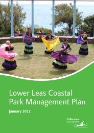
SALTWOOD CONSERVATION AREA APPRAISAL<br />
Location and context<br />
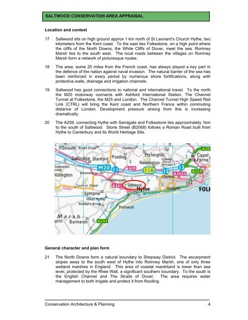
17 <strong>Saltwood</strong> sits on high ground approx 1 km north of St Leonard’s Church Hythe, two<br />
kilometers from the Kent coast. To the east lies Folkestone, on a high point where<br />
the cliffs of the North Downs, the White Cliffs of Dover, meet the sea. Romney<br />
Marsh lies to the south west. The local roads between the villages on Romney<br />
Marsh form a network of picturesque routes.<br />
18 The area, some 20 miles from the French coast, has always played a key <strong>part</strong> in<br />
the defence of the nation against naval invasion. The natural barrier of the sea has<br />
been reinforced in every period by numerous shore fortifications, along with<br />
protective walls, drainage and irrigation channels.<br />
19 <strong>Saltwood</strong> has good connections to national and international travel. To the north<br />
the M20 motorway connects with Ashford International Station, The Channel<br />
Tunnel at Folkestone, the M25 and London. The Channel Tunnel High Speed Rail<br />
Link (CTRL) will bring the Kent coast and Northern France within commuting<br />
distance of London. Development pressure arising from this is increasing<br />
dramatically.<br />
20 The A259, connecting Hythe with Sandgate and Folkestone lies approximately 1km<br />
to the south of <strong>Saltwood</strong>. Stone Street (B2068) follows a Roman Road built from<br />
Hythe to Canterbury and its World Heritage Site.<br />
General character and plan form<br />
21 The North Downs form a natural boundary to <strong>Shepway</strong> <strong>District</strong>. The escarpment<br />
slopes away to the south west of Hythe into Romney Marsh, one of only three<br />
wetland marshes in England. This area of coastal marshland is lower than sea<br />
level, protected by the Rhee Wall, a significant southern boundary. To the south is<br />
the English Channel and The Straits of Dover. The area requires water<br />
management to both irrigate and protect it from flooding.<br />
<strong>Conservation</strong> Architecture & Planning 4