

Archaeoseismology and Palaeoseismology in the Alpine ... - Tierra
Archaeoseismology and Palaeoseismology in the Alpine ... - Tierra
Archaeoseismology and Palaeoseismology in the Alpine ... - Tierra

Create successful ePaper yourself
Turn your PDF publications into a flip-book with our unique Google optimized e-Paper software.
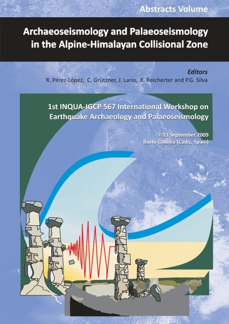
Abstracts Volume<br />
<strong>Archaeoseismology</strong> <strong>and</strong> <strong>Palaeoseismology</strong><br />
<strong>in</strong> <strong>the</strong> Alp<strong>in</strong>e-Himalayan Collisional Zone<br />
Editors<br />
R. Pérez-López, C. Grützner, J. Lario, K. Reicherter <strong>and</strong> P.G. Silva<br />
1st INQUA-IGCP 567 International Workshop on<br />
Earthquake Archaeology <strong>and</strong> <strong>Palaeoseismology</strong><br />
7-13 September 2009<br />
Baelo Claudia (Cádiz, Spa<strong>in</strong>)
Abstracts Volume<br />
<strong>Archaeoseismology</strong> <strong>and</strong> <strong>Palaeoseismology</strong><br />
<strong>in</strong> <strong>the</strong> Alp<strong>in</strong>e‐Himalayan Collisional Zone<br />
Editors<br />
R. Pérez‐López, C. Grützner, J. Lario, K. Reicherter <strong>and</strong> P.G. Silva<br />
This Abstracts Volume has been produced for <strong>the</strong> 1st INQUA‐IGCP 567 International Workshop on<br />
Earthquake Archaeology <strong>and</strong> <strong>Palaeoseismology</strong> held <strong>in</strong> Baelo Claudia Roman ru<strong>in</strong>s (Cádiz, Sou<strong>the</strong>rn<br />
Spa<strong>in</strong>). The event has been organized toge<strong>the</strong>r by <strong>the</strong> INQUA Focus Area on Paleoseismology <strong>and</strong><br />
Active Tectonics <strong>and</strong> <strong>the</strong> IGCP‐567: Earthquake Archaeology.<br />
This scientific meet<strong>in</strong>g has been supported by <strong>the</strong> Spanish Research Projects ACI2008‐0726, CGL08‐03998BTE,<br />
CGL08‐04000BTE <strong>and</strong> ACTISIS CGL2006‐05001/BTE <strong>and</strong> UNED grant.
Edita e imprime: Sección de Publicaciones de la<br />
Escuela Técnica Superior de Ingenieros<br />
Industriales. Universidad Politécnica<br />
de Madrid.<br />
I.S.B.N.: 978‐84‐7484‐217‐3<br />
Depósito Legal: M‐31907‐2009<br />
© The authors<br />
La impresión del presente volumen se ha realizado con una Ayuda del Plan de Promoción de la Investigación de la UNED
Preface<br />
Dur<strong>in</strong>g <strong>the</strong> 15 th INQUA Congress (1999), <strong>the</strong> former Subcommission on Paleoseismicity of <strong>the</strong> INQUA promoted<br />
<strong>the</strong> compilation of a new scale of macroseismic <strong>in</strong>tensity based on environmental effects only (ESI). A work group<br />
<strong>in</strong>clud<strong>in</strong>g geologists, seismologists <strong>and</strong> eng<strong>in</strong>eers compiled a first version of <strong>the</strong> scale that was presented at <strong>the</strong><br />
16 th INQUA Congress, <strong>and</strong> modified one year later at <strong>the</strong> 32nd International Geological Congress <strong>in</strong> Florence. To<br />
this end, <strong>the</strong> INQUA TERPRO (Commission on Terrestrial Processes) approved a specific project (INQUA Scale<br />
Project, 2004 ‐ 2007). As an outcome, <strong>the</strong> revised version of <strong>the</strong> ESI was ratified dur<strong>in</strong>g <strong>the</strong> 17 th INQUA Congress<br />
<strong>in</strong> 2007. Here, a Workshop on Earthquake Archaeology <strong>and</strong> Palaeoseimology <strong>in</strong> <strong>the</strong> ancient Roman city of Baelo<br />
Claudia (Spa<strong>in</strong>) was proposed.<br />
The <strong>in</strong>itiative of <strong>the</strong> IGCP‐567 Project on Earthquake Archaeology was successfully launched <strong>in</strong> 2008. The Baelo<br />
Claudia workshop was officially <strong>in</strong>cluded <strong>in</strong> <strong>the</strong> program of scientific activities of this project. Nowadays <strong>in</strong> 2009,<br />
this jo<strong>in</strong>t meet<strong>in</strong>g between <strong>the</strong> INQUA Focus Area on Paleoseismology <strong>and</strong> <strong>the</strong> IGCP‐567 on Earthquake<br />
Archaeology wants to share objectives for a better knowledge of <strong>the</strong> seismic history of tectonically active sett<strong>in</strong>gs.<br />
Besides <strong>the</strong> classical catalogues on historical seismicity, <strong>the</strong>se two <strong>in</strong>novative l<strong>in</strong>es of research try to unmask <strong>the</strong><br />
ancient seismic behaviour of active zones <strong>and</strong> faults from <strong>the</strong> available geological, geomorphological <strong>and</strong><br />
archaeological records. This effort implies <strong>the</strong> comb<strong>in</strong>ation of very different k<strong>in</strong>d of evidence com<strong>in</strong>g from quite<br />
diverse scientific approaches, some times <strong>in</strong> very s<strong>in</strong>gular ways. Example of this is <strong>the</strong> variety of orig<strong>in</strong>al research<br />
presented <strong>in</strong> this volume of abstracts composed of more than 40 contributions from people of more than 20<br />
different countries, ma<strong>in</strong>ly focused on <strong>the</strong> European, Middle East <strong>and</strong> Asiatic, Alp<strong>in</strong>e‐Himalayan Collision zone.<br />
F<strong>in</strong>ally, we want to draw your attention to a recently published Special Volume of <strong>the</strong> Geological Society of<br />
London, No. 316 (2009), <strong>Palaeoseismology</strong>: historical <strong>and</strong> prehistorical records of earthquake ground effects for<br />
seismic hazard assessment, edited by Klaus Reicherter, Aless<strong>and</strong>ro M. Michetti <strong>and</strong> Pablo G. Silva Barroso, <strong>in</strong><br />
which results of of two meet<strong>in</strong>gs held <strong>in</strong> 2006 (European Geosciences Union General Assembly 2006, Session<br />
TS4.4, ‘3000 years of earthquake ground effects <strong>in</strong> Europe: geological analysis of active faults <strong>and</strong> benefits for<br />
hazard assessment’, Vienna, Austria, April 2006; <strong>and</strong> <strong>the</strong> ICTP/IAEA workshop on ‘The conduct of seismic hazard<br />
analyses for critical facilities’, Trieste, Italy, May 2006) are summarized.<br />
Lastly, we wish all participants a successful <strong>and</strong> fruitful conference <strong>and</strong> workshop <strong>in</strong> <strong>the</strong> Roman Baelo Claudia,<br />
<strong>and</strong> we hope that everybody can enjoy sou<strong>the</strong>rn Spa<strong>in</strong>, <strong>the</strong> Costa de la Luz, <strong>and</strong> <strong>the</strong> marvelous l<strong>and</strong>scape <strong>in</strong> <strong>the</strong><br />
Straits of Gibraltar.<br />
The Organizers of <strong>the</strong> 1 st INQUA‐IGCP567 Workshop<br />
Pablo G. Silva Klaus Reicherter<br />
Universidad de Salamanca, SPAIN RWTH Aachen University, GERMANY<br />
The Organizers of <strong>the</strong> workshop are grateful to <strong>the</strong> responsible persons of Conjunto Arqueológico Romano de Baelo Claudia<br />
(Junta de Andalucía) for assist<strong>in</strong>g our <strong>in</strong>itiative by giv<strong>in</strong>g us access to different facilities of <strong>the</strong> Museum of Baelo Claudia, as<br />
well as all <strong>the</strong> <strong>in</strong>stitutions <strong>in</strong>volved <strong>in</strong> <strong>the</strong> organization, <strong>and</strong> all <strong>the</strong> people of <strong>the</strong> Bolonia Bay (Cádiz) around <strong>the</strong> conference.
1 st INQUA‐IGCP‐567 International Workshop on Earthquake Archaeology <strong>and</strong> <strong>Palaeoseismology</strong><br />
PALAEOSEISMOLOGICAL FEATURES OF THE GRANADA FAULT<br />
J.M. Azañón (1, 2), J. García‐Mayordomo (3), J.M. Insua‐Arévalo (4) <strong>and</strong> M.J. Rodríguez‐Peces (2)<br />
(1) Dpto. de Geod<strong>in</strong>ámica, Facultad de Ciencias, Universidad de Granada. C/Fuentenueva, s/n. 18002‐Granada. SPAIN. jazanon@ugr.es,<br />
marpeces@ugr.es<br />
(2) Instituto Andaluz de Ciencias de la <strong>Tierra</strong>, CSIC‐Universidad de Granada.<br />
(3) Instituto Geológico y M<strong>in</strong>ero de España (IGME). C/La Calera, 1. 28760‐Tres Cantos (Madrid). SPAIN. julian.garcia@igme.es<br />
(4) Dpto. Geod<strong>in</strong>ámica, Facultad de Ciencias Geológicas, Universidad Complutense de Madrid. 28040‐Madrid. SPAIN. <strong>in</strong>suarev@geo.ucm.es<br />
Abstract: This paper presents prelim<strong>in</strong>ary results of a palaeoseismic study of <strong>the</strong> Granada Fault, a NW‐SE active normal fault that produces a<br />
Plio‐Quaternary throw of 300 m. Accord<strong>in</strong>g to <strong>the</strong>se data, slip rate has been estimated <strong>in</strong> 0.38 mm/y (Sanz de Galdeano et al., 2003). Several<br />
palaeosols, Pleistocene <strong>in</strong> age, have been affected by this fault. Three different events can be recognized from <strong>the</strong> accumulative throw. The<br />
vertical slip per event ranges from 5 to 7 cm. Follow<strong>in</strong>g <strong>the</strong> empirical relationship between moment magnitude <strong>and</strong> average displacement<br />
proposed by Wells <strong>and</strong> Coppersmith (1994), a magnitude between 5.9 <strong>and</strong> 6.0 can be prelim<strong>in</strong>ary assessed for <strong>the</strong>se events. The palaeosols<br />
were sampled <strong>and</strong> dated us<strong>in</strong>g <strong>the</strong> <strong>the</strong>rmolum<strong>in</strong>iscence method to constra<strong>in</strong> <strong>the</strong>se estimates.<br />
Key words: Palaeoseismicity, slip ranges, seismic hazard, Central Betics<br />
ACTIVE FAULTS IN THE GRANADA TOWN<br />
The present‐day relief of <strong>the</strong> marg<strong>in</strong>s of <strong>the</strong> Granada<br />
depression is strongly conditioned by <strong>the</strong> activity of some<br />
faults, toge<strong>the</strong>r with <strong>the</strong> <strong>in</strong>cision produced by several<br />
rivers that dra<strong>in</strong> <strong>the</strong> area. The faults produce large steps<br />
<strong>in</strong> <strong>the</strong> relief (Fig. 1). The most important topographic step<br />
corresponds to <strong>the</strong> faults bound<strong>in</strong>g <strong>the</strong> basement of <strong>the</strong><br />
bas<strong>in</strong>; <strong>the</strong>se faults are characterised by metre‐ to<br />
hectometre‐scale scarps with associated slicken‐surfaces<br />
<strong>and</strong> striations; <strong>the</strong> footwalls of <strong>the</strong>se faults are uplifted<br />
blocks with strong relief <strong>and</strong> deeply <strong>in</strong>cised by rivers.<br />
Several steps are found between <strong>the</strong> flat area of <strong>the</strong><br />
Granada bas<strong>in</strong> <strong>and</strong> <strong>the</strong> ranges where <strong>the</strong> basement<br />
outcrops, which could represent fault scarps variably<br />
degraded by erosion of <strong>the</strong> soft sediments. These steps<br />
show NW‐SE orientations, <strong>in</strong> accordance with <strong>the</strong><br />
orientation of <strong>the</strong> majority of <strong>the</strong> normal faults mapped <strong>in</strong><br />
<strong>the</strong> marg<strong>in</strong> of <strong>the</strong> bas<strong>in</strong> (Fig. 2).<br />
Fig. 1: Topographic steps produced by <strong>the</strong> NW‐SE normal faults.<br />
The seismic activity <strong>in</strong> <strong>the</strong> Granada depression is high,<br />
with a large number of earthquakes, all of <strong>the</strong>m with a<br />
5<br />
moderate to low magnitude (mb 5.5) (De Miguel et al.,<br />
1989). The seismicity has its orig<strong>in</strong> mostly at depths<br />
between 5 <strong>and</strong> 17 km (Morales et al., 1997; Serrano et al.,<br />
2002) <strong>and</strong> <strong>the</strong> focal mechanisms <strong>in</strong>dicate a present‐day<br />
stress state dom<strong>in</strong>ated by a NE‐SW extensional axis. This<br />
extensional stress field co<strong>in</strong>cides with palaeo‐stress<br />
determ<strong>in</strong>ations from Tortonian <strong>and</strong> younger sediments,<br />
<strong>and</strong> is perfectly compatible with NW‐SE strik<strong>in</strong>g normal<br />
faults <strong>and</strong> NE‐SW directed extensional transport (Gal<strong>in</strong>do‐<br />
Zaldívar et al., 1999; Martínez‐Martínez et al., 2002).<br />
Fig. 2: NW‐SE normal faults outcropp<strong>in</strong>g <strong>in</strong> <strong>the</strong> nor<strong>the</strong>astern<br />
border of <strong>the</strong> Granada bas<strong>in</strong> near <strong>the</strong> Granada city. The red<br />
square shows <strong>the</strong> location of <strong>the</strong> fault shown <strong>in</strong> Fig. 3.<br />
Tak<strong>in</strong>g <strong>in</strong>to account <strong>the</strong> length of <strong>the</strong> seismic faults <strong>in</strong> <strong>the</strong><br />
area (approximately 17 km) <strong>the</strong> "realistic" maximum
magnitude of an earthquake would be 5.1 (De Miguel et<br />
al., 1989; Peláez Montilla et al., 2002). An earthquake of<br />
this magnitude at depths of 5 km would produce<br />
maximum vertical displacements of 3 mm <strong>in</strong> <strong>the</strong> vertical<br />
of its focus (Peláez Montilla et al., 2002).<br />
A detailed study about <strong>the</strong> longitude <strong>and</strong> segmentation of<br />
<strong>the</strong> NW‐SE active faults outcropp<strong>in</strong>g <strong>in</strong> <strong>the</strong> surround<strong>in</strong>g<br />
areas of <strong>the</strong> Granada Town is critical to evaluate <strong>the</strong><br />
seismic hazard <strong>in</strong> this place. In a previous analysis, Sanz de<br />
Galdeano et al., 2003 attributed a maximum longitude to<br />
<strong>the</strong> Granada fault of 17 km. However, deformation<br />
<strong>in</strong>duced by <strong>the</strong> Granada fault is distributed <strong>in</strong> a wide area<br />
of several kilometres. In this area, it can be appreciated<br />
that <strong>the</strong> fault is segmented <strong>in</strong> multiple discont<strong>in</strong>uous<br />
planes. By <strong>in</strong>stance, <strong>in</strong> <strong>the</strong> Alhambra hill <strong>and</strong> surround<strong>in</strong>g<br />
areas, <strong>the</strong> outcropp<strong>in</strong>g rocks are affected by several faults<br />
with centimetre throws. The lateral cont<strong>in</strong>uity of <strong>the</strong>se<br />
faults is less than 10 km.<br />
PALAEOSEISMOLOGICAL ASSESSMENT<br />
The seismic capability of <strong>the</strong> NW‐SE faults of <strong>the</strong> Granada<br />
City is assessed study<strong>in</strong>g one of <strong>the</strong>se faults affect<strong>in</strong>g<br />
several paleosoils. The studied fault has been located <strong>in</strong> a<br />
vertical urban talus at <strong>the</strong> suburb of Granada (UTM30N:<br />
X‐445083; Y‐4117927).<br />
The fault, with strike N125ºE <strong>and</strong> dipp<strong>in</strong>g 86º southwards,<br />
affects some horizontal levels of silty s<strong>and</strong> that present<br />
pedogenic development (Fig. 2). The dark horizons have<br />
been tak<strong>in</strong>g as markers to estimate <strong>the</strong> accumulative<br />
displacement of <strong>the</strong> fault. We took <strong>in</strong>to account <strong>the</strong> top<br />
<strong>and</strong> <strong>the</strong> bottom of <strong>the</strong>se dark horizons because <strong>the</strong>ir<br />
diffuse limits. In addition, we took three samples (Table 1)<br />
for <strong>the</strong>rmolum<strong>in</strong>escence dat<strong>in</strong>g (TL) <strong>in</strong> order to estimate<br />
some recurrence of <strong>the</strong> seismic events <strong>and</strong> <strong>the</strong> slip rate of<br />
<strong>the</strong> fault. The result of <strong>the</strong> accumulative slip, coseismic<br />
slip <strong>and</strong> mean coseismic slip of <strong>the</strong> fault is presented <strong>in</strong><br />
<strong>the</strong> Table 2.<br />
Table 1: TL dat<strong>in</strong>g<br />
Sample Age (ka BP)<br />
X<br />
(UTM30N)<br />
1 st INQUA‐IGCP‐567 International Workshop on Earthquake Archaeology <strong>and</strong> <strong>Palaeoseismology</strong><br />
Y<br />
(UTM30N)<br />
TL‐4 > 150 445083 4117927<br />
TL‐5 > 150 445083 4117927<br />
TL‐6 > 80 445083 4117927<br />
With such a mean coseismic slip of 5.86 cm with<strong>in</strong> a range<br />
of 4.8 to 7.0 cm, this fault would be capable to generate<br />
events with magnitude 5.9‐6.0 follow<strong>in</strong>g <strong>the</strong> relationships<br />
between moment magnitude <strong>and</strong> average displacement<br />
of Wells <strong>and</strong> Coppersmith (1994). The accumulative<br />
displacement rema<strong>in</strong><strong>in</strong>g of 50.0 cm of <strong>the</strong> level D might<br />
be generated by 8‐9 events consider<strong>in</strong>g <strong>the</strong> mean<br />
coseismic slip. Unfortunately, <strong>the</strong> ages of <strong>the</strong> samples TL‐<br />
4, TL‐5 <strong>and</strong> TL‐6 are all beyond <strong>the</strong> age range of <strong>the</strong> dat<strong>in</strong>g<br />
technique that is 150 ka. In any case we can estimate<br />
some extreme values of recurrence period <strong>and</strong> slip rate of<br />
<strong>the</strong> fault. In this way, consider<strong>in</strong>g <strong>the</strong> youngest material<br />
affected by <strong>the</strong> fault (Level D) like older than 150 ka, we<br />
estimate a seismic recurrence period longer than 16.7 ka.<br />
On <strong>the</strong> o<strong>the</strong>r h<strong>and</strong>, <strong>the</strong> slip rate of <strong>the</strong> fault should be<br />
considered as a maximum value of 0.003 mm/y, which is<br />
remarkable lower than that given by Sanz de Galdeano et<br />
6<br />
al. (2003) as 0.38 mm/y <strong>in</strong> <strong>the</strong>se faults s<strong>in</strong>ce <strong>the</strong> mid‐<br />
Pleistocene (800 ka). The difference of <strong>the</strong>se two values<br />
should be understood as a distribution of <strong>the</strong> deformation<br />
<strong>in</strong> a complex set of faults that limit <strong>the</strong> Granada Bas<strong>in</strong> at<br />
this edge. Never<strong>the</strong>less, we can not discard a deceleration<br />
of <strong>the</strong> rate dur<strong>in</strong>g <strong>the</strong> Upper Pleistocene.<br />
Table 2: Coseismic slip <strong>and</strong> mean coseismic slip of <strong>the</strong> fault<br />
Level<br />
Accumulative<br />
slip (cm)<br />
Coseismic<br />
slip (cm)<br />
D 50.0<br />
5.8<br />
C 55.8<br />
7.0<br />
B 62.8<br />
4.8<br />
A 67.6<br />
Mean coseismic slip (cm) 5.86<br />
IMPLICATIONS IN SEISMIC HAZARD<br />
Sanz de Galdeano et al. (2003) assessed <strong>the</strong> seismic<br />
potential of <strong>the</strong> Granada Fault. They estimated a 6.3‐6.6<br />
maximum moment magnitude (Mw), <strong>and</strong> a recurrence<br />
time of less than 510 years for a M w=6.0 earthquake.<br />
Recurrence time was obta<strong>in</strong>ed us<strong>in</strong>g a 0.38 mm/yr slip<br />
rate, which results from consider<strong>in</strong>g 300 m accumulated<br />
vertical offset s<strong>in</strong>ce <strong>the</strong> mid‐Pleistocene (800 ka).<br />
Accord<strong>in</strong>g to <strong>the</strong>se data, <strong>the</strong> authors classified <strong>the</strong><br />
Granada Fault as <strong>the</strong> most active one <strong>in</strong> <strong>the</strong> whole<br />
Granada Bas<strong>in</strong>. Even though <strong>the</strong>ir observations could be<br />
regarded as very <strong>in</strong>terest<strong>in</strong>g at <strong>the</strong> time <strong>the</strong>y were<br />
produced, <strong>the</strong> absence of absolute dat<strong>in</strong>g <strong>and</strong> precise<br />
measurements of coseismic deformation, makes <strong>the</strong>ir<br />
conclusions very arguable.<br />
Accord<strong>in</strong>g to <strong>the</strong> results obta<strong>in</strong>ed <strong>in</strong> our<br />
palaeoseismological analysis, <strong>the</strong> <strong>in</strong>terest <strong>in</strong> modell<strong>in</strong>g <strong>the</strong><br />
Granada Fault as a particular seismogenic source is very<br />
limited. A M w=6.0 maximum magnitude does not<br />
represent a particular large value <strong>in</strong> <strong>the</strong> tectonic <strong>and</strong>/or<br />
historical seismicity context <strong>in</strong> <strong>the</strong> Granada Bas<strong>in</strong>.<br />
Fur<strong>the</strong>rmore, a m<strong>in</strong>imum mean recurrence time of 16.7<br />
ka means a very low frequency when compared to <strong>the</strong><br />
extrapolation of <strong>the</strong> Gutenberg‐Richter law of <strong>the</strong> area<br />
(~100 years <strong>in</strong> Morales et al., 1996).<br />
Never<strong>the</strong>less, <strong>the</strong>se results agree with a model of<br />
distributed deformation at this border of <strong>the</strong> Granada<br />
Bas<strong>in</strong>. In this model, <strong>the</strong> Granada Fault represents a shear<br />
b<strong>and</strong> composed of multiple small faults, <strong>in</strong> contrast to a<br />
s<strong>in</strong>gle large fault which accumulates most of <strong>the</strong><br />
deformation. In this context, elastic energy is released<br />
preferentially by small earthquakes <strong>and</strong>, exceptionally, by<br />
moderate size ones (M w máx≈6.0).<br />
DISCUSSION AND CONCLUSION<br />
Accord<strong>in</strong>g to <strong>the</strong> palaeoseismological results obta<strong>in</strong>ed<br />
from TL dat<strong>in</strong>g <strong>and</strong> direct measurement of coseismic<br />
deformation, we regard <strong>the</strong> seismic hazard of <strong>the</strong><br />
Granada Fault prelim<strong>in</strong>ary as low. However, <strong>the</strong>se results<br />
shall be confirmed <strong>in</strong> follow<strong>in</strong>g studies. Our study remarks
<strong>the</strong> importance of perform<strong>in</strong>g absolute dat<strong>in</strong>g <strong>and</strong> direct<br />
measurement of coseismic deformation <strong>in</strong> recent<br />
sediments (Upper Pleistocene, at least) <strong>in</strong> order to<br />
evaluate properly <strong>the</strong> current activity <strong>and</strong>, subsequently,<br />
<strong>the</strong> seismic hazard of particular faults. In this context, <strong>the</strong><br />
actual activity of many faults <strong>in</strong> <strong>the</strong> Granada Bas<strong>in</strong> –which<br />
have been assessed based on Plio‐Quaternary markers<br />
(ca. 5 Ma), could be much lower than it is currently<br />
believed.<br />
F<strong>in</strong>ally, <strong>the</strong> Granada Fault is capable of produc<strong>in</strong>g<br />
earthquakes as large as 6.0 (±0.3). Whe<strong>the</strong>r <strong>the</strong>se<br />
earthquakes will be catastrophic or not depends much<br />
more on <strong>the</strong> observance of seismic code provisions by<br />
builders <strong>and</strong> on Civil Protection Plans, ra<strong>the</strong>r than on <strong>the</strong><br />
seismic potential of <strong>the</strong> Granada Fault. If we consider <strong>the</strong><br />
rupture of <strong>the</strong> total length of this fault (
1 st INQUA‐IGCP‐567 International Workshop on Earthquake Archaeology <strong>and</strong> <strong>Palaeoseismology</strong><br />
GROUND RUPTURE INDUCED BY 2003 MASBATE EARTHQUAKE, PHILIPPINES<br />
G.M. Besana‐Ostman (1), M. Ando (2) <strong>and</strong> J.F. Fonseca (3)<br />
(1) Physics Department, IST, Av Rovisco Pais, 1,1049‐001 Lisboa, PORTUGAL. glenda.besana@gmail.com<br />
(2) Institute of Earth Sciences, Academia S<strong>in</strong>ica,128 Academia Road Sec. 2, Nankang, Taipei, TAIWAN. <strong>and</strong>o@earth.s<strong>in</strong>ica.edu.tw<br />
(3) Physics Department, IST, Av Rovisco Pais, 1,1049‐001 Lisboa, PORTUGAL. jfonseca@ist.utl.pt<br />
Abstract: An earthquake (Ms 6.2) occurred along <strong>the</strong> Masbate section of <strong>the</strong> Philipp<strong>in</strong>e Fault Zone <strong>in</strong> Masbate, Philipp<strong>in</strong>es <strong>in</strong> 2003 <strong>and</strong> was<br />
associated with at least 23 km of ground rupture with horizontal offsets reach a maximum of 163 cm, <strong>and</strong> vertical offsets are as high as 23 cm.<br />
Evidence were predom<strong>in</strong>antly left‐lateral slip <strong>in</strong>cludes consistent left‐lateral displacement of cultural features along <strong>the</strong> fault, right‐stepp<strong>in</strong>g<br />
en‐echelon fault str<strong>and</strong>s, <strong>and</strong> local extensional <strong>and</strong> contractional structures formed at left‐ <strong>and</strong> right‐steps, respectively. The surface rupture<br />
essentially follows <strong>the</strong> pre‐exist<strong>in</strong>g fault trace. The 2003 Masbate earthquake aftershock distribution implies a symmetrical ground rupture<br />
relative to <strong>the</strong> epicenter. Based on surface rupture displacements <strong>and</strong> aftershock distribution, total rupture length <strong>and</strong> size of 23km <strong>and</strong> Ms6.2<br />
are suggest<strong>in</strong>g that <strong>the</strong> mapped surface trace is significantly shorter than expected fault rupture.<br />
Key words: slow earthquake, Masbate, Philipp<strong>in</strong>e Fault Zone, ground rupture<br />
INTRODUCTION<br />
On 15 February 2003 at 7:01 p.m. (local time), a<br />
moderate earthquake (Ms 6.2) struck <strong>the</strong> isl<strong>and</strong><br />
prov<strong>in</strong>ce of Masbate <strong>in</strong> east central Philipp<strong>in</strong>es. The<br />
epicenter was determ<strong>in</strong>ed by <strong>the</strong> Philipp<strong>in</strong>e Institute of<br />
Volcanology <strong>and</strong> Seismology (PHIVOLCS) to be offshore<br />
of Magcaraguit Isl<strong>and</strong> at about 22 km deep. Based on<br />
epicentral location <strong>and</strong> focal mechanism solutions, <strong>the</strong><br />
event was generated along <strong>the</strong> trace of <strong>the</strong> Philipp<strong>in</strong>e<br />
Fault Zone (PFZ) <strong>in</strong> central Philipp<strong>in</strong>es (Fig. 1). M<strong>in</strong>or<br />
damage from <strong>the</strong> earthquake was expected due to its<br />
shallow depth <strong>and</strong> magnitude.<br />
Fig.1: Map show<strong>in</strong>g <strong>the</strong> study area, location of Masbate fault,<br />
<strong>the</strong> epicenter of <strong>the</strong> February 15, 2003 earthquake (big open<br />
star) <strong>and</strong> its foreshock (smaller star). Inset maps show <strong>the</strong><br />
Philipp<strong>in</strong>e archipelago, <strong>the</strong> extent of <strong>the</strong> PFZ <strong>and</strong> <strong>the</strong> study<br />
area relative to <strong>the</strong> PFZ<br />
8<br />
In this study, special attention was given to <strong>the</strong> known<br />
location of <strong>the</strong> PFZ (Arante et al., 2003; Besana et al.,<br />
2003) dur<strong>in</strong>g field documentation due to its<br />
importance <strong>in</strong> hazards mitigation particularly for future<br />
development <strong>and</strong> urbanization <strong>in</strong> <strong>the</strong> prov<strong>in</strong>ce. This<br />
could establish <strong>the</strong> m<strong>in</strong>imum “setback” necessary for<br />
houses, vital utilities <strong>and</strong> o<strong>the</strong>r structures relative to<br />
<strong>the</strong> active fault.<br />
Geologic Sett<strong>in</strong>g<br />
The Philipp<strong>in</strong>e archipelago is tectonically bounded by<br />
several active trenches, <strong>the</strong> Philipp<strong>in</strong>e Trench on <strong>the</strong><br />
east <strong>and</strong> <strong>the</strong> Manila Trench on <strong>the</strong> west that subduct <strong>in</strong><br />
opposite direction (Fitch, 1972). Barrier et al. (1991)<br />
showed that <strong>in</strong> this region <strong>the</strong> northwestward motion<br />
of <strong>the</strong> Philipp<strong>in</strong>e Sea plate <strong>and</strong> Sundal<strong>and</strong> marg<strong>in</strong> is<br />
accommodated obliquely along <strong>the</strong> Philipp<strong>in</strong>e Trench<br />
<strong>and</strong> <strong>the</strong> PFZ. PFZ is a major left‐lateral strike‐slip fault<br />
that transects <strong>the</strong> whole archipelago (Willis, 1937)<br />
from northwestern Luzon to sou<strong>the</strong>rn M<strong>in</strong>danao (Fig.<br />
1) <strong>and</strong> is comparable to <strong>the</strong> San Andreas Fault (Allen,<br />
1962; Besana <strong>and</strong> Ando, 2005). PFZ has a general strike<br />
of N30 o ‐40 o W <strong>and</strong> generated at least ten major seismic<br />
events with associated ground rupture s<strong>in</strong>ce 1860 <strong>in</strong><br />
central Philipp<strong>in</strong>es (Rowlett <strong>and</strong> Kelleher, 1976). In<br />
Masbate Isl<strong>and</strong> <strong>the</strong> trace is located at <strong>the</strong> sou<strong>the</strong>astern<br />
part of <strong>the</strong> isl<strong>and</strong>. In this region, <strong>the</strong> active faults map<br />
of PHIVOLCS (2000) shows at least two parallel<br />
structures, <strong>the</strong> Masbate Fault <strong>and</strong> Uson Fault as shown<br />
<strong>in</strong> Fig. 1. Masbate has high background seismicity with<br />
at least five >M6 earthquakes have occurred dur<strong>in</strong>g<br />
this century with predom<strong>in</strong>antly left‐lateral strike‐slip<br />
focal mechanisms (PHIVOLCS, 1999). Earthquakes<br />
recorded dur<strong>in</strong>g <strong>the</strong> last 20 years <strong>in</strong>dicate that<br />
seismicity generally occurs from 0‐35km deep (USGS<br />
data).<br />
The ma<strong>in</strong>shock Ms 6.2 of February 15, 2003 was<br />
preceded by an Ms 5.2 foreshock five hours earlier. It<br />
was located about 10 km south of <strong>the</strong> ma<strong>in</strong>shock with<br />
depths of 30 km <strong>and</strong> a moment tensor solution
<strong>in</strong>dicative of strike‐slip fault<strong>in</strong>g with Mo=5.3x 10 17 Nm<br />
equivalent to a seismic moment magnitude Mw 5.8<br />
(PHIVOLCS, 2003).<br />
Fig. 2: The plot of 1‐month aftershock distribution of <strong>the</strong> 2003<br />
Masbate earthquake<br />
The Ms 6.2 ma<strong>in</strong>shock struck early <strong>in</strong> <strong>the</strong> even<strong>in</strong>g of 15<br />
February 2003 with extensive effect <strong>in</strong>clud<strong>in</strong>g <strong>the</strong><br />
nearby prov<strong>in</strong>ces. The focal mechanism solution<br />
released by PHIVOLCS (2003) suggests a dom<strong>in</strong>antly<br />
left‐lateral slip along a vertical NW‐SE fault that<br />
correlated with PFZ <strong>in</strong> <strong>the</strong> area. Several days follow<strong>in</strong>g<br />
<strong>the</strong> ma<strong>in</strong>shock, numerous aftershocks were recorded<br />
by <strong>the</strong> Masbate Seismic Station of PHIVOLCS.<br />
Aftershock plots <strong>in</strong> Fig. 2 were drawn us<strong>in</strong>g GMT by<br />
Wessel <strong>and</strong> Smith (1998). The aftershock area<br />
<strong>in</strong>dicated at least a 60 km long rupture <strong>and</strong> distributed<br />
about 20 km wide along <strong>the</strong> Masbate Fault of PFZ.<br />
GROUND RUPTURE<br />
Field mapp<strong>in</strong>g <strong>in</strong> <strong>the</strong> municipalities of Dimasalang,<br />
Palanas <strong>and</strong> Cata<strong>in</strong>gan showed vary<strong>in</strong>g surface effects<br />
on <strong>the</strong> ground <strong>and</strong> manmade structures caused by <strong>the</strong><br />
horizontal displacements of <strong>the</strong> Masbate Fault of <strong>the</strong><br />
PFZ. Surface manifestations varied from hairl<strong>in</strong>e cracks,<br />
soil mounds <strong>and</strong> en echelon fractures along a left‐<br />
lateral fault. Fig. 3 shows <strong>the</strong> extent of <strong>the</strong> ground<br />
rupture mapped along <strong>the</strong> Masbate Fault <strong>in</strong> Masbate<br />
Isl<strong>and</strong> which extends to about 23 km. Follow<strong>in</strong>g are<br />
some examples of <strong>the</strong> mapped ground rupture.<br />
Ground rupture related to <strong>the</strong> 1:47pm foreshock<br />
Field <strong>in</strong>vestigation found that <strong>the</strong> 1:47pm foreshock<br />
caused damages <strong>in</strong> <strong>the</strong> epicentral areas. Residents of<br />
<strong>the</strong> affected structures straddl<strong>in</strong>g <strong>the</strong> fault <strong>in</strong> <strong>the</strong><br />
municipality of Palanas reported that <strong>the</strong>ir houses<br />
were damaged by this foreshock with visible cracks on<br />
walls <strong>and</strong> floors as well as on rice fields <strong>and</strong> gardens.<br />
Most of <strong>the</strong> observed damages caused by fissur<strong>in</strong>g<br />
along <strong>the</strong> fault were ma<strong>in</strong>ly on concrete floors <strong>and</strong><br />
asphalt roads with hairl<strong>in</strong>e or ~2‐4 mm‐wide cracks. In<br />
Sta. Cruz, Palanas, <strong>the</strong> road was fissured dur<strong>in</strong>g this<br />
foreshock <strong>and</strong> boom<strong>in</strong>g sound was heard preced<strong>in</strong>g <strong>the</strong><br />
1 st INQUA‐IGCP‐567 International Workshop on Earthquake Archaeology <strong>and</strong> <strong>Palaeoseismology</strong><br />
9<br />
quake. With<strong>in</strong> <strong>the</strong> epicentral area such as <strong>in</strong> Nabangig<br />
<strong>and</strong> Matugnaw site, sulfur‐like <strong>and</strong>/or gun powder‐like<br />
smell was reported that possibly <strong>in</strong>dicate ground<br />
fissur<strong>in</strong>g dur<strong>in</strong>g <strong>the</strong> foreshock event.<br />
Fig. 3: Map of <strong>the</strong> ground rupture produced dur<strong>in</strong>g <strong>the</strong> 2003<br />
earthquake along <strong>the</strong> Masbate Fault. Shaded area <strong>and</strong> stars <strong>in</strong><br />
<strong>the</strong> <strong>in</strong>dex map are <strong>the</strong> location of <strong>the</strong> ground rupture map <strong>and</strong><br />
<strong>the</strong> epicenters of historical events <strong>in</strong> <strong>the</strong> area, respectively.<br />
Small letters <strong>in</strong> <strong>the</strong> left table <strong>in</strong>dicate <strong>the</strong> location of <strong>the</strong><br />
measured horizontal <strong>and</strong> vertical displacements along <strong>the</strong><br />
surface rupture as <strong>in</strong>dicated <strong>in</strong> <strong>the</strong> map<br />
Ground rupture related to <strong>the</strong> 7:0lpm Ma<strong>in</strong>shock<br />
‐ Dimasalang area<br />
In <strong>the</strong> nor<strong>the</strong>rnmost portion of Dimasalang, <strong>the</strong> ground<br />
rupture produced dur<strong>in</strong>g <strong>the</strong> ma<strong>in</strong> shock transected<br />
<strong>the</strong> coastl<strong>in</strong>e with apparent left‐lateral displacement<br />
(Fig. 4). The fault trace is manifested by alternat<strong>in</strong>g<br />
smooth s<strong>and</strong> mounds <strong>and</strong> depressions that eventually<br />
were obliterated by waves dur<strong>in</strong>g high tides <strong>and</strong><br />
human activities. Dur<strong>in</strong>g low tide, <strong>the</strong> ground rupture<br />
<strong>in</strong> <strong>the</strong> shallow portion of Naro Bay was discerned as en<br />
echelon faults cutt<strong>in</strong>g through <strong>the</strong> th<strong>in</strong>ly mud‐covered<br />
dead corals. The en echelon faults are at least a meter<br />
<strong>in</strong> length trend<strong>in</strong>g N76 o W with a general trend of<br />
N62 o W. Horizontal displacement measured at this
po<strong>in</strong>t was about 80 cm along <strong>the</strong> shorel<strong>in</strong>e edge with<br />
discernable vertical displacement. Some en echelon<br />
faults <strong>in</strong> <strong>the</strong> deeper portion of <strong>the</strong> bay about 200 m<br />
from <strong>the</strong> shore were likewise reported by local<br />
fishermen.<br />
Fig. 4: Photograph (look<strong>in</strong>g WSW) show<strong>in</strong>g <strong>the</strong> ground rupture<br />
produced along <strong>the</strong> coastl<strong>in</strong>e <strong>in</strong> Suba, Dimasalang. Note <strong>the</strong><br />
shorel<strong>in</strong>e that was displaced approximately by 0.8m <strong>and</strong> <strong>the</strong><br />
subtle uplift/mound <strong>in</strong> <strong>the</strong> foreground of <strong>the</strong> photo<br />
About 25 m from <strong>the</strong> shore, <strong>the</strong> trace can be followed<br />
along <strong>the</strong> N48 o W trend<strong>in</strong>g fault transect<strong>in</strong>g <strong>the</strong> s<strong>and</strong>y<br />
beach berm. In <strong>the</strong> beach terrace, <strong>the</strong> fault also<br />
transected two semi‐concrete houses <strong>and</strong> numerous<br />
wooden fences. The wooden fence was displaced<br />
horizontally <strong>and</strong> vertically (northwest block up) by<br />
20cm <strong>and</strong> 18cm, respectively<br />
‐ Palanas area<br />
In Sta. Cruz, Palanas, <strong>the</strong> ground rupture also displaced<br />
several man‐made structures <strong>in</strong>clud<strong>in</strong>g semi‐concrete<br />
to concrete houses, wooden fences, rice paddy dikes<br />
<strong>and</strong> roads <strong>and</strong> foot trails. Inside one of <strong>the</strong> gardens, a<br />
displaced foot trail (20 cm horizontal displacement)<br />
was observed with well‐formed mole track. Moreover,<br />
a semi‐concrete house <strong>and</strong> a wooden house <strong>in</strong> <strong>the</strong><br />
same village were transected by <strong>the</strong> fault.<br />
Southwards <strong>and</strong> <strong>in</strong>to Nabangig, Palanas <strong>in</strong> Sitio<br />
Matugnaw, a foot trail was transected by <strong>the</strong> ground<br />
rupture. The trail was horizontally displaced by 45 cm<br />
with negligible vertical displacement (site r <strong>in</strong> Fig. 3). In<br />
this area, <strong>the</strong> en echelon faults have a N60 o W trend<br />
while <strong>the</strong> ground rupture is trend<strong>in</strong>g N40 o W <strong>and</strong> about<br />
10 cm wide. Across <strong>the</strong> creek, a small hill is transected<br />
by <strong>the</strong> ground rupture where<strong>in</strong> <strong>the</strong> fault trace is well<br />
manifested by right‐stepp<strong>in</strong>g en echelon fractures <strong>and</strong><br />
mole tracks with an average length of 150 cm (Fig. 5)<br />
located between sites r <strong>and</strong> s <strong>in</strong> Fig. 3. Fig. 5 also shows<br />
a coconut tree that was transected by one of <strong>the</strong> en<br />
echelon. It was noted that <strong>the</strong> surround<strong>in</strong>g<br />
geomorphology <strong>in</strong> Matugnaw area is <strong>in</strong>dicative of a<br />
fault saddle. However, s<strong>in</strong>ce <strong>the</strong>re was no manmade or<br />
cultural structure transected, <strong>the</strong>re was no horizontal<br />
measurement obta<strong>in</strong>ed.<br />
‐ Cata<strong>in</strong>gan area<br />
Throughout <strong>the</strong> valley <strong>and</strong> up to <strong>the</strong> ridge between<br />
Sitio Bogtong <strong>and</strong> Sito Salag, Pawican of Cata<strong>in</strong>gan<br />
municipality, <strong>the</strong> trace was also observed right‐<br />
stepp<strong>in</strong>g tensional gashes. In Sitio Salag, <strong>the</strong> trace<br />
approaches <strong>the</strong> upstream area of Nabangig River. The<br />
1 st INQUA‐IGCP‐567 International Workshop on Earthquake Archaeology <strong>and</strong> <strong>Palaeoseismology</strong><br />
10<br />
Nabangig River has a very deep gulley <strong>and</strong> thick<br />
vegetation prevent<strong>in</strong>g <strong>the</strong> team to <strong>in</strong>vestigate <strong>the</strong> river<br />
vic<strong>in</strong>ities. After cross<strong>in</strong>g <strong>the</strong> Nabangig River, <strong>the</strong> trace<br />
was found along a pre‐exist<strong>in</strong>g scarp approximately<br />
150cm high. A fault outcrop was likewise found along<br />
<strong>the</strong> riverbank of Nabangig River.<br />
The fault trace was found aga<strong>in</strong> across <strong>the</strong> asphalt<br />
national highway <strong>in</strong> Gahit, Cata<strong>in</strong>gan about 1km south<br />
of Gahit Bridge. Interest<strong>in</strong>gly, this trace widened <strong>and</strong><br />
became more evident after several weeks. Dur<strong>in</strong>g<br />
<strong>in</strong>itial <strong>in</strong>vestigation on February 19 th , 2003, <strong>the</strong> surface<br />
rupture <strong>in</strong> this area was just a hairl<strong>in</strong>e crack. However,<br />
after two weeks <strong>the</strong> fissure <strong>in</strong> this road have widened<br />
to about 0.8cm along an EW direction with differential<br />
horizontal displacement of about 3cm. Moreover, <strong>the</strong><br />
en echelons became more <strong>and</strong> apparent along <strong>the</strong><br />
asphalt road.<br />
Fig. 5: The ground rupture <strong>in</strong> Matugnaw, Palanas manifested<br />
as mole tracks <strong>and</strong> tensional gashes on grass‐covered hill also<br />
cutt<strong>in</strong>g through <strong>the</strong> coconut tree.<br />
‐ Bogtong Isl<strong>and</strong><br />
Based on <strong>the</strong> projection of <strong>the</strong> trace from San Pedro,<br />
Cata<strong>in</strong>gan municipality, <strong>the</strong> Isl<strong>and</strong> of Bogtong (Fig. 1)<br />
was likewise <strong>in</strong>vestigated to check <strong>the</strong> effects of <strong>the</strong><br />
February 2003 earthquake <strong>and</strong> <strong>the</strong> possibility that <strong>the</strong><br />
ground rupture transects <strong>the</strong> isl<strong>and</strong>.<br />
There was no clear <strong>in</strong>dication of any presence of a<br />
fresh ground rupture based on <strong>the</strong> <strong>in</strong>vestigation <strong>and</strong><br />
accounts by <strong>the</strong> residents. However, <strong>in</strong> <strong>the</strong> eastern side<br />
of <strong>the</strong> isl<strong>and</strong>, <strong>the</strong> limestone hill has a l<strong>in</strong>ear flat area.<br />
This feature is most probably a fault scarp consider<strong>in</strong>g<br />
<strong>the</strong> trend <strong>and</strong> location of <strong>the</strong> trace of PFZ <strong>in</strong> Masbate<br />
Isl<strong>and</strong>.
DISCUSSION<br />
Based on detailed field mapp<strong>in</strong>g, <strong>the</strong> February 15, 2003<br />
ground rupture has a classic manifestation of left‐<br />
lateral right‐stepp<strong>in</strong>g en echelon faults. From Suba <strong>in</strong><br />
Dimasalang down to San Pedro <strong>in</strong> Cata<strong>in</strong>gan, ground<br />
rupture features are dom<strong>in</strong>antly right‐stepp<strong>in</strong>g en<br />
echelon faults along 34 o NNW orientation with well‐<br />
formed mole tracks <strong>in</strong> some areas. It has a general<br />
trend of N30 o W to N60 o W that followed <strong>the</strong> pre‐<br />
exist<strong>in</strong>g active fault trace (with deviation <strong>in</strong> some<br />
places) associated with shear stress <strong>and</strong> reflective of<br />
<strong>the</strong> type of local materials. Maximum horizontal<br />
displacement is 163cm with an average of 40cm. The<br />
fissures <strong>and</strong> ground rupture were obviously wider<br />
northwards approach<strong>in</strong>g <strong>the</strong> epicentral area offshore<br />
to <strong>the</strong> west of Magcaraguit Isl<strong>and</strong>. Except for <strong>the</strong><br />
observed maximum horizontal displacement <strong>in</strong><br />
Nabangig, <strong>the</strong> horizontal displacement sou<strong>the</strong>astwards<br />
<strong>and</strong>, <strong>the</strong> size of each en echelon fractures as well as <strong>the</strong><br />
width of fault zone from Dimasalang to Cata<strong>in</strong>gan has<br />
an apparent decreas<strong>in</strong>g trend. The total length of <strong>the</strong><br />
mapped onshore ground rupture is approximately 23<br />
km (Fig. 3).<br />
If <strong>the</strong> distribution of aftershocks would suggest to<br />
def<strong>in</strong>e <strong>the</strong> extent of fault<strong>in</strong>g for large earthquakes<br />
(Wilson, 1936; Benioff, 1955) as well small events<br />
(Buwalda <strong>and</strong> St. Am<strong>and</strong>, 1955; Richter, 1955; Brown<br />
<strong>and</strong> Vedder; 1967; McEvilly et al., 1967; Liebermann<br />
<strong>and</strong> Pomeroy, 1970), <strong>the</strong>n <strong>the</strong> aftershock distribution<br />
of <strong>the</strong> February 2003 event would roughly del<strong>in</strong>eate a<br />
rupture length of approximately 54km. More than half<br />
of <strong>the</strong> rupture is apparently offshore.<br />
In terms of <strong>the</strong> relationship between <strong>the</strong> length of<br />
ground rupture <strong>and</strong> earthquake magnitude (Bonilla et<br />
al., 1984; Wells <strong>and</strong> Coppersmith, 1994), assum<strong>in</strong>g <strong>the</strong><br />
February 2003 ground rupture is symmetrical relative<br />
to its epicenter, <strong>the</strong> total ground rupture length would<br />
likewise be around 54 km. If such number is<br />
considered, <strong>the</strong> total magnitude for <strong>the</strong> 2003 event is<br />
M7.1 us<strong>in</strong>g <strong>the</strong> empirical relations established by Wells<br />
<strong>and</strong> Coppersmith (1994). This magnitude is much<br />
greater than <strong>the</strong> calculated magnitude both by<br />
PHIVOLCS (2003) <strong>and</strong> USGS (2003) of M6.2. Mapp<strong>in</strong>g<br />
<strong>the</strong> ground rupture <strong>and</strong> correlat<strong>in</strong>g it to seismicity<br />
evidently show that <strong>the</strong> Masbate Fault could produce<br />
major earthquakes.<br />
Fur<strong>the</strong>rmore, through <strong>the</strong> detailed mapp<strong>in</strong>g of <strong>the</strong><br />
2003 event, <strong>the</strong> future ground rupture hazards can be<br />
m<strong>in</strong>imized along <strong>the</strong> Masbate fault, if not be avoided<br />
totally. Consider<strong>in</strong>g <strong>the</strong> width of <strong>the</strong> fault zone,<br />
structures to be built <strong>in</strong> <strong>the</strong> future is recommended to<br />
be constructed at least 2m away from <strong>the</strong> trace. For<br />
high risk <strong>and</strong> extremely costly structures like nuclear<br />
reactors or dams, however, at least 20m should be<br />
considered as <strong>the</strong> setback distance tak<strong>in</strong>g <strong>in</strong>to account<br />
<strong>the</strong> observed deviations of <strong>the</strong> ground rupture from<br />
<strong>the</strong> pre‐exist<strong>in</strong>g active fault trace.<br />
Acknowledgements: We are <strong>in</strong>debted to <strong>the</strong> follow<strong>in</strong>g<br />
<strong>in</strong>stitutions <strong>and</strong> <strong>in</strong>dividuals for <strong>the</strong> coord<strong>in</strong>ation, help <strong>and</strong><br />
support dur<strong>in</strong>g <strong>the</strong> mapp<strong>in</strong>g activities: The prov<strong>in</strong>cial <strong>and</strong><br />
1 st INQUA‐IGCP‐567 International Workshop on Earthquake Archaeology <strong>and</strong> <strong>Palaeoseismology</strong><br />
11<br />
municipal government of Masbate Isl<strong>and</strong> <strong>and</strong> <strong>the</strong>ir<br />
constituents. This work was partly supported by <strong>the</strong> Philipp<strong>in</strong>e<br />
National Disaster Coord<strong>in</strong>at<strong>in</strong>g Council Calamity Fund 2003<br />
<strong>and</strong> <strong>the</strong> Seafloor Geodesy Project of Nagoya University<br />
References<br />
Allen, C.R., (1962). Circum Pacific fault<strong>in</strong>g <strong>in</strong> <strong>the</strong> Philipp<strong>in</strong>es‐<br />
Taiwan region, J. Geophys. Res. 85, 3239‐3250.<br />
Arante, R.A., Besana, G.M., Dela Cruz, R., Lumbang, R.,<br />
Maximo, R.P.R., Papiona, K.L., Peñarubia, H., Punongbayan,<br />
B.J.T., <strong>and</strong> Torrevillas, L. (2003). Prelim<strong>in</strong>ary Report: 15<br />
February 2003 Masbate Earthquake Investigation.<br />
PHIVOLCS Internal Report, 1‐9.<br />
Barrier, E., Huchon, P., Aurelio M. (1991). Philipp<strong>in</strong>e Fault: A<br />
key for Philipp<strong>in</strong>e k<strong>in</strong>ematics. Geology, 19, 32‐35.<br />
Benioff, H. (1955). Mechanism <strong>and</strong> stra<strong>in</strong> characteristics of <strong>the</strong><br />
White Wolf fault as <strong>in</strong>dicated by <strong>the</strong> aftershock sequence.<br />
Bull. 171. Calif. Div. M<strong>in</strong>es, 199‐202.<br />
Besana, G.M. <strong>and</strong> M. Ando (2005) The central Philipp<strong>in</strong>e Fault<br />
Zone: location of great earthquakes, slow events, <strong>and</strong> creep<br />
activity. EPS, 57, pp.1‐8.<br />
Besana, G.M., Punongbayan, B.J.T., Peñarubia, H., Maximo,<br />
R.P.R., Arante, R.A., Papiona, K.L., Torrevillas, L., Dela Cruz,<br />
R. <strong>and</strong> Lumbang, R. (2003). The 15 February 2003 Masbate<br />
Earthquake, PHIVOLCS Quick Response Team (QRT) Special<br />
Report No.5, 1‐28.<br />
Bonilla, M.G., Mark, R.K., <strong>and</strong> Lienkaemper, J.J. (1984).<br />
Statistical relations among earthquake magnitude, surface<br />
rupture length, <strong>and</strong> surface fault displacement. Bull. Seis.<br />
Soc. Am., 74, 2379‐2411.<br />
Brown, R.D., Jr. <strong>and</strong> Vedder, J.G. (1967). The Parkfield‐<br />
Cholame, California earthquakes of June‐August 1966;<br />
surface tectonic fractures along <strong>the</strong> San Andreas fault, U.S.<br />
Geol. Survey Prof. Paper 579 pages.<br />
Buwalda, J.P. <strong>and</strong> St. Am<strong>and</strong>, P. (1955). Geological effects of<br />
<strong>the</strong> Arv<strong>in</strong>‐Tehachapi earthquake, Bull. 171, Calif. State Div.<br />
M<strong>in</strong>es, 41‐56.<br />
Fitch, T.J. (1972). Plate convergence, transcurrent faults <strong>and</strong><br />
<strong>in</strong>ternal deformation adjacent to Sou<strong>the</strong>ast Asia <strong>and</strong> <strong>the</strong><br />
Western Pacific. Jour. Geophys. Res. 77, 23, 4432‐4460.<br />
Liebermann, R.B. <strong>and</strong> Pomeroy, P.W. (1970). Source<br />
dimensions of small earthquakes as determ<strong>in</strong>ed from <strong>the</strong><br />
size of <strong>the</strong> aftershock zone.<br />
McEvilly, T.V., Bakun, W.H. <strong>and</strong> Casaday, K.B. (1967). The<br />
Parkfield, California earthquake of 1966. Bull. Seis. Soc.<br />
Am., 57. 1221‐1244.<br />
PHIVOLCS (1999). Historical Earthquakes <strong>in</strong> <strong>the</strong> Philipp<strong>in</strong>es,<br />
PHIVOLCS, Quezon City, 1:5,000,000 map.<br />
PHIVOLCS (2000). Distribution of active faults <strong>and</strong> trenches <strong>in</strong><br />
<strong>the</strong> Philipp<strong>in</strong>es, Active Faults Mapp<strong>in</strong>g Group, PHIVOLCS,<br />
Quezon City, 1:2,000,000 map.<br />
PHIVOLCS (2003). Prelim<strong>in</strong>ary earthquake bullet<strong>in</strong> no. 2,<br />
PHIVOLCS, Quezon City, 1.<br />
Rowlett, H. <strong>and</strong> Kelleher, J.A. (1976). Evolv<strong>in</strong>g seismic <strong>and</strong><br />
tectonic patterns along <strong>the</strong> Western marg<strong>in</strong> of <strong>the</strong><br />
Philipp<strong>in</strong>e Sea Plate, Jour. Geophys. Res., 81, 3518‐3524.<br />
Wells, D.L. <strong>and</strong> Coppersmith, K.J. (1994). New empirical<br />
relations among magnitude, rupture length, rupture area,<br />
<strong>and</strong> surface displacement. Bull. Seis. Soc. Am., 84, 974‐<br />
1002.<br />
Wessel, P., <strong>and</strong> W.H.F. Smith (1998). New, improved version<br />
of generic mapp<strong>in</strong>g tools released, EOS Trans. AGU 79(47),<br />
579, 1998.<br />
Willis, B. (1937). Geologic observation <strong>in</strong> <strong>the</strong> Philipp<strong>in</strong>e<br />
archipelago, Nat. Resources Council Bull. Manila,<br />
Philipp<strong>in</strong>es, 13.<br />
Wilson, J.T. (1936). Foreshocks <strong>and</strong> aftershocks of <strong>the</strong> Nevada<br />
earthquake of December 20, 1932, <strong>and</strong> <strong>the</strong> Parkfield<br />
earthquake of June, 1934. Bull. Seis. Soc. Am., 26, 189‐194.
1 st INQUA‐IGCP‐567 International Workshop on Earthquake Archaeology <strong>and</strong> <strong>Palaeoseismology</strong><br />
SIMULATED GROUND MOTIONS OF THE MAY 12 2008, WENCHUAN (CHINA)<br />
EARTHQUAKE – COMPARISON WITH DAMAGE DISTRIBUTION<br />
L. W. Bjerrum (1), M.B. Sørensen (2) <strong>and</strong> K. Atakan (1)<br />
(1) Department of Earth Science, University of Bergen, Allegaten 41A, NO‐5007 Bergen, NORWAY. louise.bjerrum@geo.uib.no,<br />
kuvvet.atakan@geo.uib.no<br />
(2) Helmholtz Centre Potsdam GFZ German Research Centre for Geosciences, Public Law Foundation State of Br<strong>and</strong>enburg, Telegrafenberg,<br />
D‐14473 Potsdam, GERMANY. sorensen@gfz‐potsdam.de<br />
Abstract: The May 12, 2008 Wenchuan earthquake had its epicenter along <strong>the</strong> Longmenshan Fold <strong>and</strong> Thrust Belt (LFTB) <strong>and</strong> ruptured along an<br />
approximately 300 km long thrust fault. There is applied a broadb<strong>and</strong> frequency (0.1‐10 Hz) hybrid strong ground motion simulation technique,<br />
comb<strong>in</strong><strong>in</strong>g determ<strong>in</strong>istic low‐frequency <strong>and</strong> semi‐stochastic high‐frequency simulation, <strong>in</strong> order to assess <strong>the</strong> contributions of <strong>the</strong> strong ground<br />
shak<strong>in</strong>g <strong>in</strong> <strong>the</strong> result<strong>in</strong>g destruction. The simulated ground motion distributions have been calibrated by <strong>the</strong> actual strong motion records from<br />
<strong>the</strong> Wenchuan earthquake at short distances. Comparisons with <strong>the</strong> damage distribution from reconnaissance field observations confirms <strong>the</strong><br />
fault rupture complexity <strong>in</strong> <strong>the</strong> result<strong>in</strong>g ground motion distributions which also control to a large extent <strong>the</strong> damage distribution. The applied<br />
simulation methodology provides a promis<strong>in</strong>g platform for predictive studies.<br />
Key words: Ground motion simulation, Wenchuan, earthquake damage.<br />
INTRODUCTION<br />
The large Wenchuan earthquake of 12 May 2008 (M=8.0)<br />
<strong>in</strong> central Ch<strong>in</strong>a had disastrous consequences <strong>and</strong> caused<br />
at least 69,195 casualties, <strong>in</strong>jured 374,177 <strong>and</strong> 18,392 are<br />
still miss<strong>in</strong>g (presumed dead) as of May 2009 (USGS). The<br />
earthquake occurred along <strong>the</strong> Longmenshan Fold <strong>and</strong><br />
Thrust Belt (LFTB). Earthquake of this size has previously<br />
not been associated with <strong>the</strong> LFTB, <strong>and</strong> <strong>the</strong> area was <strong>in</strong><br />
<strong>the</strong> seismic zonation map of Ch<strong>in</strong>a classified as <strong>in</strong>tensity<br />
VII zone (Zhao et al., 2009). The LFTB results from <strong>the</strong><br />
deformation of <strong>the</strong> Tibetan Plateau, which is situated<br />
between <strong>the</strong> northward mov<strong>in</strong>g Indian plate (4 cm/yr)<br />
<strong>and</strong> <strong>the</strong> stable Eurasian plate. The collision of <strong>the</strong> Indian<br />
plate results <strong>in</strong> eastward escape of <strong>the</strong> Tibetan Plateau.<br />
This motion is accommodated along large east‐west<br />
oriented strike‐slip systems as <strong>the</strong> Kunlun fault <strong>in</strong> <strong>the</strong><br />
north <strong>and</strong> <strong>the</strong> Xianshuihe fault <strong>in</strong> <strong>the</strong> south. The LFTB<br />
marks <strong>the</strong> eastern term<strong>in</strong>ation of <strong>the</strong> actively deform<strong>in</strong>g<br />
Tibetan Plateau <strong>and</strong> represents <strong>the</strong> boundary from <strong>the</strong> 65<br />
km thick weak crust <strong>in</strong> <strong>the</strong> Tibetan Plateau to <strong>the</strong> th<strong>in</strong>ner,<br />
35 km, strong crust under <strong>the</strong> Sichuan Bas<strong>in</strong>. Across <strong>the</strong><br />
LFTB <strong>the</strong> eastward motion of <strong>the</strong> Tibetan Plateau<br />
decreases from 14 mm/yr on <strong>the</strong> western side of <strong>the</strong> fault<br />
12<br />
to 10 mm/yr on <strong>the</strong> eastern side <strong>in</strong> <strong>the</strong> Sichuan Bas<strong>in</strong>.<br />
This differential motion results <strong>in</strong> compressional stresses<br />
of a rate of 4 mm/yr across <strong>the</strong> fault belt, <strong>and</strong> it is this<br />
motion which reactivates <strong>the</strong> faults, as observed dur<strong>in</strong>g<br />
<strong>the</strong> May 12, 2008 earthquake.<br />
In this study we have simulated <strong>the</strong> ground motion dur<strong>in</strong>g<br />
<strong>the</strong> Wenchuan earthquake, follow<strong>in</strong>g <strong>the</strong> approach of<br />
Pulido <strong>and</strong> Kubo, (2004), Pulido et al., (2004), Sørensen et<br />
al., (2007). The low frequency ground motion simulations<br />
are based on determ<strong>in</strong>istic wave propagation from an<br />
asperity model <strong>in</strong> a flat layered velocity structure<br />
(Bouchon, 1981), while <strong>the</strong> high frequency ground<br />
motions are calculated from a semi‐stochastic<br />
simulations, also based on an asperity model. For <strong>the</strong><br />
high‐frequencies <strong>the</strong> stochastic methodology of Boore<br />
(1983) is comb<strong>in</strong>ed with <strong>the</strong> empirical Green’s function<br />
method of Irikura (1986). In order to get a smooth<br />
transition from <strong>the</strong> low to <strong>the</strong> high frequency doma<strong>in</strong>, a<br />
frequency‐dependent radiation pattern is applied (Pulido<br />
<strong>and</strong> Kubo, 2004). F<strong>in</strong>ally, <strong>the</strong> different contributions are<br />
summed. All calculations are done for bedrock conditions,<br />
<strong>and</strong> site effects are <strong>the</strong>refore not considered <strong>in</strong> this study.<br />
Fig. 1: Input source model, modified from Ji <strong>and</strong> Hayes (2008). The black box outl<strong>in</strong>es <strong>the</strong> ruptur<strong>in</strong>g fault<br />
for which <strong>the</strong> ground motion simulations are computed <strong>and</strong> <strong>the</strong> red boxes outl<strong>in</strong>e <strong>the</strong> asperities. Asperity<br />
1 <strong>and</strong> 2 are high‐slip asperities, while <strong>the</strong> asperities 3‐6 are <strong>in</strong>termediate‐slip asperities.
Table 1: Source parameters used <strong>in</strong> <strong>the</strong> ground motion<br />
simulations. Stress drop is divided to <strong>the</strong> asperities follow<strong>in</strong>g<br />
Pulido et al. (2004), rise time <strong>and</strong> rupture velocity is taken<br />
from Koketsu et al (2009) <strong>and</strong> Nishimura <strong>and</strong> Yagi (2008),<br />
respectively.<br />
Seismic moment<br />
21<br />
1.15 10 N/m<br />
Epicenter 103.30 o E/31.1 o N<br />
Foc. Mech. Sou<strong>the</strong>rn segment 229/33/115<br />
Nor<strong>the</strong>rn segment 229/65/180<br />
Average stress drop 3 MPa<br />
Asperity stress drop (high slip) 14.5 MPa<br />
Asperity stress‐drop (<strong>in</strong>term. slip) 8 MPa<br />
Rise time 2.0 ± 0.5 sec<br />
Rupture velocity 2.8 ± 0.4 sec<br />
fmax<br />
10 Hz<br />
High frequency attenuation, Q 100 f 0.8<br />
In order to model an earthquake scenario <strong>the</strong> source<br />
needs to be def<strong>in</strong>ed <strong>in</strong> terms of geometry <strong>and</strong><br />
geographical location, rise time, rupture velocity, stress<br />
drop <strong>and</strong> seismic moment. Fur<strong>the</strong>rmore, <strong>the</strong> velocity<br />
structure model <strong>and</strong> <strong>the</strong> crustal attenuation need to be<br />
def<strong>in</strong>ed. Asperity location on <strong>the</strong> fault plane is def<strong>in</strong>ed<br />
from a f<strong>in</strong>ite fault slip model, <strong>in</strong> <strong>the</strong> present study <strong>the</strong><br />
model by Ji <strong>and</strong> Hayes (2008) has been adopted. This<br />
model yields thrust mechanism along <strong>the</strong> sou<strong>the</strong>rn<br />
segment, whereas a modelled strike‐slip movement is <strong>in</strong><br />
<strong>the</strong> nor<strong>the</strong>rn part of <strong>the</strong> fault. We have <strong>in</strong>cluded this as<br />
Fig.2: Simulated PGA (top) <strong>and</strong> PGV (bottom) distributions<br />
<strong>in</strong> <strong>the</strong> study area. Black boxes <strong>in</strong>dicate <strong>the</strong> extent of <strong>the</strong><br />
surface projection of <strong>the</strong> fault area. The star shows <strong>the</strong><br />
epicenter, blue triangles <strong>in</strong>dicate three stations; Wolong,<br />
Baijiao <strong>and</strong> Q<strong>in</strong>gp<strong>in</strong>g. The black squares mark cities along<br />
<strong>the</strong> fault.<br />
1 st INQUA‐IGCP‐567 International Workshop on Earthquake Archaeology <strong>and</strong> <strong>Palaeoseismology</strong><br />
13<br />
different focal mechanisms for each segment. The<br />
asperity model is shown <strong>in</strong> Fig. 1 <strong>and</strong> <strong>the</strong> <strong>in</strong>put<br />
parameters for <strong>the</strong> simulation are summarized <strong>in</strong> Table 1.<br />
SIMULATION RESULTS AND DISCUSSION<br />
In <strong>the</strong> ground motion simulation, waveforms are<br />
calculated for simulation po<strong>in</strong>ts across <strong>the</strong> study area.<br />
From <strong>the</strong>se <strong>the</strong> peak ground motions (PGA <strong>and</strong> PGV) are<br />
retrieved to get an <strong>in</strong>sight of <strong>the</strong> distribution <strong>and</strong> extent<br />
of <strong>the</strong> strong ground shak<strong>in</strong>g. PGA <strong>and</strong> PGV distributions<br />
are shown <strong>in</strong> Fig. 2. It is clear that <strong>the</strong> strongest ground<br />
shak<strong>in</strong>g occurs across <strong>the</strong> ruptur<strong>in</strong>g fault plane, with <strong>the</strong><br />
largest ground motions associated with <strong>the</strong> sou<strong>the</strong>rnmost<br />
segment of <strong>the</strong> fault plane. PGA values reach up to 850<br />
cm/s2 near <strong>the</strong> epicenter area, similarly for PGV for which<br />
values of almost 200 cm/s is predicted. In Fig. 2b, it is<br />
seen that <strong>the</strong> PGV distribution is stretch<strong>in</strong>g fur<strong>the</strong>r north<br />
<strong>and</strong> east of <strong>the</strong> fault plane than towards south <strong>and</strong> west.<br />
This is probably due to <strong>the</strong> rupture directivity effect,<br />
hav<strong>in</strong>g an unilateral rupture towards north, <strong>and</strong> <strong>the</strong><br />
rupture be<strong>in</strong>g of thrust motion <strong>in</strong> <strong>the</strong> sou<strong>the</strong>rn segment,<br />
<strong>and</strong> strike‐slip motion along on <strong>the</strong> nor<strong>the</strong>rn part of <strong>the</strong><br />
fault.<br />
Fig. 3: Top: Recorded seismic data compared to<br />
empirical attenuation relationships (see legend <strong>in</strong><br />
figure), from Li et al., 2008a. Bottom: Comparison of<br />
simulated PGA (black dots) to ground motions<br />
predicted by empicical attenuation relations (see<br />
legend <strong>in</strong> figure). The X, <strong>and</strong> show <strong>the</strong> recorded<br />
peak values for Wolong, Baijiao <strong>and</strong> Q<strong>in</strong>gp<strong>in</strong>g,<br />
respectively is shown.
The attenuation of <strong>the</strong> recorded seismic data is shown <strong>in</strong><br />
Fig. 3. It is clear that <strong>the</strong> recorded ground motions gives<br />
much higher peak ground acceleration values, than what<br />
is predicted by <strong>the</strong> empirical attenuation relationships.<br />
The largest ground motions were recorded by <strong>the</strong> three<br />
near fault stations Wolong, Q<strong>in</strong>gp<strong>in</strong>g <strong>and</strong> Baijiao, which<br />
recorded maximum values of 957.7, 824.1 <strong>and</strong> 633.1<br />
cm/s 2 , respectively (Li et al., 2008b). The attenuation of<br />
<strong>the</strong> simulated ground motions found <strong>in</strong> <strong>the</strong> present study<br />
is shown as <strong>the</strong> lower graph <strong>in</strong> Fig. 3. From this it can be<br />
seen, that <strong>the</strong> simulated peak acceleration values are<br />
comparable to those recorded dur<strong>in</strong>g <strong>the</strong> earthquake.<br />
Fig.4: Top: Simulated Pseudoacceleration response spectra<br />
for <strong>the</strong> three stations Q<strong>in</strong>gp<strong>in</strong>g, Baijiao <strong>and</strong> Wolong. The<br />
two horizontal components are shown (see legend for<br />
specifications). Bottom: Acceleration response spectra<br />
obta<strong>in</strong>ed from Wolong station <strong>in</strong> Wenchuan dur<strong>in</strong>g <strong>the</strong><br />
ma<strong>in</strong>shock of 12 May 2008, form Li et al., (2008a).<br />
Fig. 4 shows <strong>the</strong> pseudoacceleration response spectra,<br />
from <strong>the</strong> ground motion simulation, for <strong>the</strong> stations <strong>in</strong><br />
Wolong, Q<strong>in</strong>gp<strong>in</strong>g <strong>and</strong> Baijiao (see Fig. 2 for locations).<br />
T<strong>the</strong> predom<strong>in</strong>ant periods of <strong>the</strong> simulated ground<br />
motions are between 0.1s <strong>and</strong> 1s. The simulation results<br />
are well <strong>in</strong> agreement with Li et al. (2008a), which<br />
estimate <strong>the</strong> predom<strong>in</strong>ant spectral acceleration to be<br />
distributed between periods of 0.1s to 0.6s (see <strong>the</strong> lower<br />
graph <strong>in</strong> Fig. 4) <strong>and</strong> <strong>the</strong> ground motion simulation<br />
<strong>the</strong>refore reproduces <strong>the</strong> frequency content of <strong>the</strong><br />
seismic waves to a very large extent.<br />
STRONG GROUND SHAKING AND DAMAGE ON<br />
BUILDINGS<br />
The affected area suffered severe destruction dur<strong>in</strong>g <strong>the</strong><br />
earthquake. The economic losses due to <strong>the</strong> event are<br />
estimated to be 86 billion USD (USGS). The city of<br />
Hanwang is located along <strong>the</strong> fault, approximately 90km<br />
NE of <strong>the</strong> epicentre <strong>and</strong> had 70,000 <strong>in</strong>habitants before<br />
1 st INQUA‐IGCP‐567 International Workshop on Earthquake Archaeology <strong>and</strong> <strong>Palaeoseismology</strong><br />
14<br />
<strong>the</strong> earthquake. Dur<strong>in</strong>g <strong>the</strong> earthquake 4,500 have lost<br />
<strong>the</strong>ir lives. In an area of approximately 3km 2 <strong>in</strong> <strong>the</strong> central<br />
part of Hanwang, 90‐95% of <strong>the</strong> build<strong>in</strong>gs were totally or<br />
partially collapsed, result<strong>in</strong>g <strong>in</strong> a large un<strong>in</strong>habitable area.<br />
The picture <strong>in</strong> Fig. 5 is taken <strong>in</strong> <strong>the</strong> area of almost total<br />
collapse. The typical build<strong>in</strong>gs <strong>in</strong> this area are residential<br />
build<strong>in</strong>gs of 4‐5 stories. In <strong>the</strong> foreground, rubble from<br />
totally collapsed build<strong>in</strong>gs is visible, whereas <strong>the</strong> build<strong>in</strong>gs<br />
<strong>in</strong> <strong>the</strong> background are still st<strong>and</strong><strong>in</strong>g. In this area <strong>the</strong> adobe<br />
structures have almost completely collapsed, whereas <strong>the</strong><br />
more recent re<strong>in</strong>forced concrete structures seem to have<br />
been able to withst<strong>and</strong> <strong>the</strong> strong ground shak<strong>in</strong>g.<br />
Fig.5: Picture taken <strong>in</strong> Hanwang, <strong>in</strong>side <strong>the</strong> 3km 2 area of<br />
almost total collapse.<br />
Us<strong>in</strong>g a simple empirical relation for fundamental periods<br />
of structures (Kramer, 1996), for <strong>the</strong> typical structures<br />
dom<strong>in</strong>at<strong>in</strong>g <strong>the</strong> area <strong>in</strong> Hanwang, <strong>the</strong> predom<strong>in</strong>ant<br />
periods are estimated to be 0.16‐0.21s for two story<br />
build<strong>in</strong>gs. The first floor is usually used as a shop <strong>and</strong> <strong>the</strong><br />
second floor as liv<strong>in</strong>g area. For five‐story apartment<br />
build<strong>in</strong>gs on <strong>the</strong> o<strong>the</strong>r h<strong>and</strong>, <strong>the</strong> fundamental frequency<br />
is estimated to be 0.47‐0.56s. Compar<strong>in</strong>g <strong>the</strong> fundamental<br />
periods of <strong>the</strong> structures <strong>in</strong> <strong>the</strong> area to <strong>the</strong> predom<strong>in</strong>ant<br />
periods of <strong>the</strong> seismic signals co<strong>in</strong>cide to a large extent,<br />
which is <strong>the</strong> reason why <strong>the</strong>se build<strong>in</strong>gs have not been<br />
able to withst<strong>and</strong> <strong>the</strong> ground motion experienced <strong>in</strong> <strong>the</strong><br />
area. Fur<strong>the</strong>rmore, <strong>the</strong> older build<strong>in</strong>gs suffered from an<br />
<strong>in</strong>sufficient design code, s<strong>in</strong>ce <strong>the</strong>re have been many<br />
revisions of <strong>the</strong> seismic design code for build<strong>in</strong>gs <strong>in</strong> Ch<strong>in</strong>a<br />
dur<strong>in</strong>g time, latest <strong>in</strong> 2001 (Zhao et al., <strong>in</strong> press). The<br />
build<strong>in</strong>gs which are still st<strong>and</strong><strong>in</strong>g <strong>in</strong> <strong>the</strong> area (e.g. like <strong>the</strong><br />
build<strong>in</strong>gs to <strong>the</strong> left <strong>in</strong> <strong>the</strong> picture) were under<br />
construction at <strong>the</strong> time of <strong>the</strong> earthquake, <strong>and</strong> <strong>the</strong>y are<br />
assumed to be designed after <strong>the</strong> latest adequate seismic<br />
design code.<br />
CONCLUSIONS<br />
In <strong>the</strong> present study we have used a hybrid broadb<strong>and</strong><br />
technique for model<strong>in</strong>g ground motions caused by <strong>the</strong><br />
May 12, 2008 Wenchuan earthquake. The follow<strong>in</strong>g<br />
conclusions can be drawn from <strong>the</strong> simulation results:<br />
- The ground motions experienced dur<strong>in</strong>g <strong>the</strong><br />
May 12 Wenchuan earthquake were<br />
reproduced, <strong>and</strong> values similar to those<br />
recorded on <strong>the</strong> near field stations <strong>in</strong> <strong>the</strong> area,<br />
with maximum bedrock ground motions <strong>in</strong> <strong>the</strong><br />
order of 850 cm/s2 (PGA) <strong>and</strong> 200 cm/s (PGV),<br />
were obta<strong>in</strong>ed.<br />
- The values of <strong>the</strong> simulated PGA are higher than<br />
predicted commonly by empirical attenuation
elations. However, <strong>the</strong> attenuation of our<br />
simulated ground motions agrees very well with<br />
<strong>the</strong> recorded seismic data from <strong>the</strong> area.<br />
- The predom<strong>in</strong>ant periods of <strong>the</strong><br />
pseudoacceleration response spectra<br />
corresponds to predom<strong>in</strong>ant periods estimated<br />
from <strong>the</strong> seismic data.<br />
- The predom<strong>in</strong>ant periods of <strong>the</strong> seismic signal<br />
corresponded to <strong>the</strong> fundamental periods of<br />
<strong>the</strong> structures <strong>in</strong> <strong>the</strong> area, caus<strong>in</strong>g total or<br />
partial collapse.<br />
In general <strong>the</strong> hybrid broadb<strong>and</strong> simulation technique has<br />
proven to be a powerful tool for simulat<strong>in</strong>g realistic <strong>and</strong><br />
reasonable ground motions <strong>in</strong> this retrospect study. The<br />
method is <strong>the</strong>refore useful for predictive studies as long<br />
as realistic <strong>in</strong>put models constructed with geological <strong>and</strong><br />
paleoseismic data are applied.<br />
Acknowledgements: We would like to thank <strong>the</strong> Earthquake<br />
Adm<strong>in</strong>istration of Sichuan Prov<strong>in</strong>ce, Sichuan Prov<strong>in</strong>cial<br />
Department of Construction <strong>and</strong> Sichuan Association for Science<br />
& Technology who co‐sponsored <strong>the</strong> post‐conference field trip of<br />
<strong>the</strong> 14th World Conference on Earthquake Eng<strong>in</strong>eer<strong>in</strong>g to <strong>the</strong><br />
Wenchuan Earthquake Area. We are grateful to <strong>the</strong> staff from<br />
Ch<strong>in</strong>a Earthquake Adm<strong>in</strong>istration, Earthquake Adm<strong>in</strong>istration of<br />
Sichuan Prov<strong>in</strong>ce, Ch<strong>in</strong>a Southwest Architectural Design <strong>and</strong><br />
Institute Corp. Ltd., Sichuan Prov<strong>in</strong>cial Institute of Architectural<br />
Design, Sichuan Association for Science <strong>and</strong> Technology, Sichuan<br />
Prov<strong>in</strong>cial People’s Hospital <strong>and</strong> <strong>the</strong> translators which made this<br />
trip possible.<br />
References<br />
Boore, D.M., 1983, Stocastic simulation of high‐frequency ground<br />
motions based on seismological models of <strong>the</strong> radiated<br />
spectra: Bullet<strong>in</strong> of <strong>the</strong> Seismological Society of America, v. 73,<br />
p. 1865‐1894.<br />
Bouchon, M., 1981, A simple method to calculate Green's<br />
functions for elastic layered media: Bullet<strong>in</strong> of <strong>the</strong><br />
Seismological Society of America, v. 71, p. 959‐971.<br />
Fukushima, Y., <strong>and</strong> Tanaka, T., 1990, A new attenuation relation<br />
for peak horizontal acceleration of strong earthquake ground<br />
motions <strong>in</strong> Japan: Bullet<strong>in</strong> of Seismological Society of America,<br />
v. 80, p. 27.<br />
Irikura, K., 1986, Prediction of strong acceleration motion us<strong>in</strong>g<br />
empirical Green's functions, Proc. 7th Japan Earthquake<br />
Symp.: Japan, p. 151‐156.<br />
1 st INQUA‐IGCP‐567 International Workshop on Earthquake Archaeology <strong>and</strong> <strong>Palaeoseismology</strong><br />
15<br />
Ji, C., <strong>and</strong> Hayes, G., 2008, Source model of <strong>the</strong> May 12th 2008<br />
Wenchuan earthquake. Available at:<br />
http://earthquake.usgs.gov/eqcenter/eqarchives/poster/2008<br />
/20080512.php, Volume 2008, USGS.<br />
Koketsu, K., Yokota, Y., Ghasemi, H., Hikima, K., Miyake, H., <strong>and</strong><br />
Wang, Z., 2009, Source Process <strong>and</strong> Ground Motions of <strong>the</strong><br />
2008 Wenchuan Earthquake: Investigation report of <strong>the</strong> 2008<br />
Wenchuan Earthquake, Ch<strong>in</strong>a, Grant‐<strong>in</strong>‐Aid for Special<br />
Purposes of 2008, MEXT, .<br />
Kramer, S.L., 1996, Geotechnical Earthquake Eng<strong>in</strong>eer<strong>in</strong>g: Upper<br />
Sadle River, New Jersey, Prentice Hall.<br />
Li, X., Zhou, Z., Huang, M., Wen, R., Yu, H., Lu, D., Zhou, Y., <strong>and</strong><br />
Cui, J., 2008a, Prelim<strong>in</strong>ary Analysis of Strong‐Motion<br />
Record<strong>in</strong>gs from <strong>the</strong> Magnitude 8.0 Wenchuan, Ch<strong>in</strong>a,<br />
Earthquake of 12 May 2008: Seismological Research Letters, v.<br />
79, p. 11.<br />
Li, X., Zhou, Z., Yu, H., Wen, R., Lu, D., Huang, M., Zhou, Y., <strong>and</strong><br />
Cu, J., 2008b, Strong motion observations <strong>and</strong> record<strong>in</strong>gs from<br />
<strong>the</strong> great Wenchuan Earthquake: Earthquake Eng<strong>in</strong>eer<strong>in</strong>g <strong>and</strong><br />
Eng<strong>in</strong>eer<strong>in</strong>g Vibration, v. 7, p. 12.<br />
Nishimura, N., <strong>and</strong> Yagi, Y., 2008, Rupture Process for May 12,<br />
2008 Sichuan Earthquake (Ver. 2),<br />
http://www.geol.tsukuba.ac.jp/~nisimura/20080512/, Volume<br />
2008: Ibaraki, Japan University of Tsukuba.<br />
Pulido, N., <strong>and</strong> Kubo, T., 2004, Near‐fault strong motion<br />
complexity of <strong>the</strong> 2000 Tottori earthquake (Japan) from a<br />
broadb<strong>and</strong> source asperity model: Tectonophysics, v. 390, p.<br />
177‐192.<br />
Pulido, N., Ojeda, A., Atakan, A., <strong>and</strong> Kubo, T., 2004, Strong<br />
ground motion estimation <strong>in</strong> <strong>the</strong> Sea of Marmara region<br />
(Turkey) based on a scenario earthquake: Tectonophysics, v.<br />
391, p. 357‐374.<br />
Sadigh, K., Chang, C.‐Y., Egan, J.A., Makdisi, F., <strong>and</strong> Youngs, R.R.,<br />
1997, Attenuation Relationships for Shallow Crustal<br />
Earthquakes Based on California Strong Motion Data:<br />
Seismological Research Letters, v. 68, p. 10.<br />
Sørensen, M.B., Atakan, K., <strong>and</strong> Pulido, N., 2007, Simulated<br />
Strong Ground Motions for <strong>the</strong> Great M 9.3 Sumatra‐<br />
Andaman Earthquake of 26 December 2004: Bullet<strong>in</strong> of <strong>the</strong><br />
Seismological Society of America, v. 97, p. S139‐151.<br />
USGS, Magnitude 7.9 – Eastern Sichuan, Ch<strong>in</strong>a. Webpage, last<br />
accessed July 1, 2009.<br />
http://earthquake.usgs.gov/eqcenter/eq<strong>in</strong><strong>the</strong>news/2008/us2<br />
008ryan/#summary.<br />
Wang, S.Y., Yu, Y.X., Gao, A.J., <strong>and</strong> Yan, X.J., 2000, Development<br />
of attenuation relations for ground motion <strong>in</strong> Ch<strong>in</strong>a:<br />
Earthquake Research <strong>in</strong> Ch<strong>in</strong>a, v. 16, p. 8.<br />
Zhao, B., Taucer, F., <strong>and</strong> Rossetto, T., 2009, Field <strong>in</strong>vestigation on<br />
<strong>the</strong> performance of build<strong>in</strong>g structures dur<strong>in</strong>g <strong>the</strong> 12 May<br />
2008 Wenchuan earthquake <strong>in</strong> Ch<strong>in</strong>a: Eng<strong>in</strong>eer<strong>in</strong>g Structures,<br />
v. In press.
1 st INQUA‐IGCP‐567 International Workshop on Earthquake Archaeology <strong>and</strong> <strong>Palaeoseismology</strong><br />
DATING PALEO‐SEISMIC ACTIVITY ON THE CARMEL FAULT<br />
DURING THE QUATERNARY, MT. CARMEL, ISRAEL<br />
Braun, Y. (1, 2), Bar‐Mat<strong>the</strong>ws, M. (2), Ayalon, A. (2), Kagan, E.(1,2) <strong>and</strong> Agnon, A. (1)<br />
(1) Institute of Earth Sciences, The Hebrew University of Jerusalem, 91904, ISRAEL. yael.braun@mail.huji.ac.il<br />
(2) Geological Survey of Israel, 30 Malkhe Israel St., Jerusalem 95501, ISRAEL.<br />
Abstract: Mt. Carmel <strong>in</strong> nor<strong>the</strong>rn Israel, a cont<strong>in</strong>ental uplift ca. 500 m above sea level, is def<strong>in</strong>ed by a NW‐NNW fault, a branch of <strong>the</strong> Dead Sea<br />
Transform System (DST). The Carmel fault (CF) is observed as a wide zone of deformation about which very little is known concern<strong>in</strong>g <strong>the</strong><br />
extent of seismic activity dur<strong>in</strong>g <strong>the</strong> Quaternary. Dur<strong>in</strong>g <strong>the</strong> past 3 decades some 47 earthquakes (M>2) occurred along this fault zone with <strong>the</strong><br />
strongest recorded <strong>in</strong> 1984 (M = 5.3). Us<strong>in</strong>g accurate 230Th/234U ages of collapsed speleo<strong>the</strong>ms, we reconstructed seismic activity <strong>in</strong> Denya<br />
Cave, Haifa. Dur<strong>in</strong>g <strong>the</strong> last 80 ka, 5 age clusters are recognized, separated by periods of quiescence (of an order of 10 millennia). The last<br />
cluster appears ca. 11 ka, whilst <strong>in</strong>dications for some younger activity rema<strong>in</strong> to be confirmed.<br />
Key words: earthquakes, paleoseismology, speleo<strong>the</strong>m, seismite<br />
INTRODUCTION<br />
Mt. Carmel <strong>in</strong> <strong>the</strong> north of Israel, a manifestation of<br />
tectonic movements, is a cont<strong>in</strong>ental uplift of more than<br />
500m above sea level. This uplift is def<strong>in</strong>ed by <strong>the</strong> NW to<br />
NNW Carmel Fault (CF), a branch of <strong>the</strong> left‐lateral Dead<br />
Sea Transform (DST). The DST lies between Arabia <strong>and</strong> <strong>the</strong><br />
S<strong>in</strong>ai‐Levant Block (Fig. 1) <strong>and</strong> exhibits a slip rate of<br />
5.0±1.5 mm/yr (LeBeon et al., 2008). The CF, which<br />
cont<strong>in</strong>ues <strong>in</strong>to <strong>the</strong> Mediterranean cont<strong>in</strong>ental shelf<br />
(Hofstetter et al., 1989), is observed as a wide zone of<br />
deformation ra<strong>the</strong>r than a s<strong>in</strong>gle fault trace (Rotste<strong>in</strong> et<br />
al., 1993).<br />
The CF along with <strong>the</strong> Gilboa Fault (GF), comb<strong>in</strong>e to<br />
create a seismically active zone stretch<strong>in</strong>g for<br />
approximately 130km (Hofstetter et al., 1996; Fig. 2). On<br />
August 24, 1984 an earthquake along <strong>the</strong> CF (of a<br />
magnitude {ML} of 5.3) caused slight damage <strong>in</strong> Haifa <strong>and</strong><br />
nearby towns (all seismic data derived from <strong>the</strong><br />
Geophysical Institute of Israel:<br />
http://www.seis.mni.gov.il/html/seis/seis_search.html).<br />
This earthquake aroused much <strong>in</strong>terest s<strong>in</strong>ce very little<br />
was known concern<strong>in</strong>g <strong>the</strong> extent of seismic activity<br />
around Mt. Carmel. This seismic event fur<strong>the</strong>r<br />
emphasized <strong>the</strong> need to underst<strong>and</strong> <strong>the</strong> tectonic regime<br />
of a densely populated <strong>and</strong> <strong>in</strong>dustrialized area. Scholars<br />
(Hofstetter et al.1996) also presented data on a series of<br />
ca. 550 earthquakes (1.0 ≤ M L≤ 5.3) monitored along <strong>the</strong><br />
CF dur<strong>in</strong>g <strong>the</strong> decade between 1984 <strong>and</strong> 1994.<br />
Attempts to underst<strong>and</strong> <strong>the</strong> tectonic regime of a<br />
seismically active area necessitate paleoseismic research.<br />
Karstic caves can preserve paleoseismic evidence, which<br />
can provide fundamental elements for seismotectonic<br />
knowledge, seismogenic descriptions <strong>and</strong> consequently,<br />
<strong>the</strong> evaluation of seismic hazards <strong>in</strong> an area.<br />
Broken or deformed cave deposits (speleo‐seismites) can<br />
be used for paleoseismic research s<strong>in</strong>ce <strong>the</strong>y can be dated<br />
with radiometric techniques (e.g. Davenport, 1998;<br />
Lacave et al., 2004; Kagan et al.,<br />
16<br />
2005). Thus, <strong>the</strong>y contribute to an earthquake data base<br />
as an <strong>in</strong>dependent source of <strong>in</strong>formation on major<br />
earthquake recurrences (Kagan et al., 2005).<br />
The U‐Th method, which has a 350 to 500 ka limit, can<br />
vastly <strong>in</strong>crease <strong>the</strong> length of <strong>the</strong> seismic record dur<strong>in</strong>g <strong>the</strong><br />
Quaternary by enabl<strong>in</strong>g us to date <strong>the</strong> time between a<br />
break on a speleo<strong>the</strong>m <strong>and</strong> its regrowth.<br />
Fig. 1: A regional map show<strong>in</strong>g <strong>the</strong> sett<strong>in</strong>g of DST separat<strong>in</strong>g<br />
ARABIA from S<strong>in</strong>ai‐Levant Block.<br />
Scholars (e.g. Becker et al., 2005; 2006; Kagan et al., 2005)<br />
have proposed that a fundamental aspect of a concise<br />
earthquake catalogue is based on a multi‐archival<br />
approach, which not only enables confirmation of each of<br />
<strong>the</strong> separate f<strong>in</strong>d<strong>in</strong>gs, but allows for better underst<strong>and</strong><strong>in</strong>g<br />
of <strong>the</strong> spatial <strong>in</strong>fluence of earthquakes on different<br />
geological environments <strong>and</strong> <strong>the</strong>ir connections to tectonic<br />
sett<strong>in</strong>gs of a region. Paleoseismic research <strong>in</strong> Israel,
mostly concentrated on <strong>the</strong> DST <strong>in</strong> Israel, is based on<br />
many <strong>in</strong>dependent sources such as historical <strong>and</strong><br />
archaeological evidence <strong>and</strong> geomorphological <strong>and</strong><br />
geological f<strong>in</strong>d<strong>in</strong>gs (e.g. Amiran et al., 1994; Marco et al.,<br />
1996; Ellenblum et al., 1998; Enzel et al., 2000; Beg<strong>in</strong> et<br />
al., 2005; Agnon et al. 2006).<br />
The Carmel region, only cursorily studied, has some<br />
karstic caves that offer opportunities for a<br />
paleoseismological study of <strong>the</strong> fault system that def<strong>in</strong>es<br />
it, enabl<strong>in</strong>g a fur<strong>the</strong>r enlargement of <strong>the</strong> limited<br />
paleoseismic data base currently available, <strong>and</strong> perhaps a<br />
better underst<strong>and</strong><strong>in</strong>g of it. The present study offers <strong>the</strong><br />
possibility of extend<strong>in</strong>g <strong>the</strong> earthquake catalogue for <strong>the</strong><br />
CF, although it might be limited only to major<br />
earthquakes.<br />
Fig. 2: A DEM map of Nor<strong>the</strong>rn Israel (Hall, 1996) show<strong>in</strong>g <strong>the</strong><br />
connection between <strong>the</strong> CF <strong>and</strong> <strong>the</strong> DST, modified from Salamon<br />
et al. (2003).<br />
DENYA CAVE AS A KEY PALEOSEISMIC SITE<br />
Denya Cave, located on Mt. Carmel with<strong>in</strong> <strong>the</strong> Haifa City<br />
limits (Fig. 2), is an accessible karstic cave with ideal<br />
conditions for study<strong>in</strong>g paleoseismic activity. Located only<br />
a few kilometres from <strong>the</strong> CF, <strong>the</strong> cave’s geological<br />
features may have recorded major earthquakes from <strong>the</strong><br />
DST <strong>and</strong> perhaps even m<strong>in</strong>or earthquakes from <strong>the</strong> CF.<br />
METHODS<br />
Follow<strong>in</strong>g <strong>the</strong> work of Kagan et al. (2005) <strong>in</strong> <strong>the</strong> Judean<br />
Hills, which provided ages consistent with <strong>in</strong>dependent<br />
evidence for strong DST earthquakes, similar k<strong>in</strong>ds of<br />
research techniques are applied toDenya Cave <strong>in</strong> order to<br />
exam<strong>in</strong>e paleoseismic activity on <strong>the</strong> CF. The wealth of<br />
evidence on <strong>the</strong> DST contributes to credibility of <strong>the</strong><br />
1 st INQUA‐IGCP‐567 International Workshop on Earthquake Archaeology <strong>and</strong> <strong>Palaeoseismology</strong><br />
17<br />
f<strong>in</strong>d<strong>in</strong>gs of Kagan et al (2005). By contrast, paleoseismic<br />
evidence on <strong>the</strong> CF for <strong>the</strong> Quaternary is virtually non<br />
existent. In <strong>the</strong> case of <strong>the</strong> CF it is assumed <strong>the</strong> success of<br />
<strong>the</strong> study by Kagan et al. (2005) would enable us to<br />
reconstruct earthquake data for <strong>the</strong> Carmel region us<strong>in</strong>g<br />
<strong>the</strong> same methods.<br />
3A<br />
3B<br />
Fig. 3: Denya Cave: A) Plan of Denya Cave upper chamber at<br />
approximately floor level. B) Ilustration of section A‐B (seen <strong>in</strong> Fig.<br />
3A). Drawn l<strong>in</strong>es mark broken speleo<strong>the</strong>m formations. C) Picture<br />
of cracks <strong>in</strong> <strong>the</strong> lower chamber of Denya Cave. Note <strong>the</strong><br />
speleo<strong>the</strong>ms form<strong>in</strong>g below <strong>the</strong> crack.
Prior to <strong>the</strong> present study all evidence of non‐seismic<br />
activity, which could affect results, had to be discounted.<br />
Intensive study of <strong>the</strong> paleoclimate, <strong>the</strong> geology of <strong>the</strong><br />
cave <strong>and</strong> its hyrdrogeological sett<strong>in</strong>g, allowed us to<br />
exclude evidence for damage from numerous sources.<br />
They <strong>in</strong>clude anthropogenic activity, ice creep,<br />
underground glaciers, frost action, erosion, soil creep,<br />
effects of water circulation, flood<strong>in</strong>g, debris flow,<br />
<strong>in</strong>cations caused by non‐earthquake related activity <strong>and</strong><br />
slope movements (Becker et al., 2006).<br />
The cave is ca. 50m2 <strong>in</strong> area <strong>and</strong> divided <strong>in</strong>to two<br />
chambers. In an upper chamber speleo<strong>the</strong>ms are<br />
abundant. For this chamber a plan was made <strong>in</strong> order to<br />
document sample location (Fig. 3A). Throughout this<br />
chamber evidence of collapses is visible <strong>in</strong> broken<br />
speleo<strong>the</strong>ms (Fig. 3B), fallen stones <strong>and</strong> a fallen segment<br />
of its wall. In <strong>the</strong> lower chamber chalk <strong>and</strong> cherts are<br />
exposed, while only few speleo<strong>the</strong>ms are found, <strong>and</strong><br />
those are predom<strong>in</strong>antly below cracks (Fig. 3C).<br />
DATING OF BROKEN SPELEOTHEMS<br />
Broken speleo<strong>the</strong>m samples were collected from all parts<br />
of <strong>the</strong> upper chamber of <strong>the</strong> cave (yellow markers <strong>in</strong> Fig.<br />
3). The samples consist of broken stalagmites <strong>and</strong><br />
stalactites <strong>and</strong> flowstone cores drilled from <strong>the</strong> cave floor<br />
expos<strong>in</strong>g fallen <strong>and</strong> embedded speleo<strong>the</strong>ms. For each<br />
seismite sample a seismic contact (i.e. <strong>the</strong> precise location<br />
at which <strong>the</strong> lam<strong>in</strong>ae of <strong>the</strong> speleo<strong>the</strong>ms are broken. See<br />
Fig. 4) was established <strong>and</strong> <strong>the</strong> closest lam<strong>in</strong>ae to each<br />
contact were sampled with a small drill. The last lam<strong>in</strong>a<br />
which grew before <strong>the</strong> break event was termed a pre‐<br />
seismic sample, while <strong>the</strong> first one to grow after <strong>the</strong> break<br />
event was termed a post‐seismic sample (Fig. 4).<br />
In this study, dat<strong>in</strong>g with <strong>the</strong> U‐Th method was conducted<br />
on <strong>the</strong> Multiple Collector Inductively Coupled Plasma<br />
Mass Spectrometer (MC‐ICP‐MS) at <strong>the</strong> Geological Survey<br />
of Israel. The MC‐ICP‐MS produces high analytical<br />
precision results <strong>and</strong> enables work on small samples (ca.<br />
0.3g) that, due to an ability to sample <strong>in</strong>dividual lam<strong>in</strong>ae,<br />
give ages at high resolutions. The ages found for Denya<br />
Cave were calculated as s<strong>in</strong>gle samples us<strong>in</strong>g <strong>the</strong> age<br />
equation accord<strong>in</strong>g to Broecker <strong>and</strong> Kaufman (1965).<br />
Ages determ<strong>in</strong>ed for seismite samples were seen to form<br />
clusters at very specific time <strong>in</strong>tervals. S<strong>in</strong>ce some<br />
samples had high detrital content, <strong>the</strong>ir ages had to be<br />
corrected (Kaufman et al., 1998). In order to correct for<br />
detrital Th, <strong>the</strong> samples were divided accord<strong>in</strong>g to <strong>the</strong> age<br />
group<strong>in</strong>gs <strong>and</strong> plotted on a three dimensional isochron<br />
where x=230Th/238U, y=234U/238U <strong>and</strong> z=232Th/238U<br />
(Ludwig <strong>and</strong> Titter<strong>in</strong>gton, 1994), us<strong>in</strong>g <strong>the</strong> Isoplot3.7<br />
program. Ongo<strong>in</strong>g research <strong>in</strong>dicates that those clusters,<br />
when fall<strong>in</strong>g on a reasonably accurate three dimensional<br />
isochron plot, are considered to be group<strong>in</strong>gs of a s<strong>in</strong>gle<br />
age <strong>in</strong>dicat<strong>in</strong>g one seismic event.<br />
RESULTS<br />
A total of 68 speleo<strong>the</strong>m samples was taken <strong>and</strong><br />
<strong>in</strong>spected from Denya Cave, 32 of which were broken <strong>and</strong><br />
thus, identified as likely to <strong>in</strong>dicate seismic activity. Some<br />
of those samples had more than one seismite (i.e. a<br />
record of a s<strong>in</strong>gle seismic event). The ages obta<strong>in</strong>ed from<br />
1 st INQUA‐IGCP‐567 International Workshop on Earthquake Archaeology <strong>and</strong> <strong>Palaeoseismology</strong><br />
18<br />
those seismites vary greatly. They <strong>in</strong>dicate seismic activity<br />
dur<strong>in</strong>g <strong>the</strong> last 350 ka; older samples are <strong>in</strong> secular<br />
equilibrium <strong>and</strong> cannot be fur<strong>the</strong>r dated.<br />
A seismic event is associated with <strong>the</strong> age clusters, but<br />
only when seismites appear to be sound <strong>in</strong>dicators of a<br />
physical break <strong>in</strong> <strong>the</strong> speleo<strong>the</strong>ms exam<strong>in</strong>ed <strong>and</strong> when<br />
<strong>the</strong>re are pre‐ <strong>and</strong> post‐seismic event samples <strong>in</strong> <strong>the</strong><br />
same cluster. Results fur<strong>the</strong>r show that dur<strong>in</strong>g <strong>the</strong> last 80<br />
ka at least five seismic events occurred, caus<strong>in</strong>g damage<br />
to speleo<strong>the</strong>ms <strong>in</strong> Denya cave (~11, 22, 28, 37 <strong>and</strong> 55 ka).<br />
Indicators for an event at ~5 ka were also found, but <strong>the</strong>y<br />
are not strongly substantiated by <strong>the</strong> types of seismites<br />
represent<strong>in</strong>g <strong>the</strong>m. Indicators for older events that<br />
affected <strong>the</strong> cave were found, but due to <strong>the</strong> relatively<br />
large error on <strong>the</strong>se ages, we could not identify clusters.<br />
CONCLUSIONS<br />
Fig. 4: A seismite from Denya Cave, sample DN‐7<br />
The dat<strong>in</strong>g of speleo<strong>the</strong>ms us<strong>in</strong>g <strong>the</strong> U‐Th method,<br />
comb<strong>in</strong>ed with <strong>the</strong>ir subsequent correction for detrital<br />
Th, employ<strong>in</strong>g <strong>the</strong> three dimensional isochron plots,<br />
represents a new approach to identify<strong>in</strong>g seismic events<br />
<strong>in</strong> <strong>the</strong> Quaternary. This research <strong>in</strong> Denya Cave, Mt<br />
Carmel, Haifa, <strong>in</strong>dicates that speleo<strong>the</strong>ms <strong>the</strong>re recorded<br />
five seismic events that caused damage to <strong>the</strong> cave dur<strong>in</strong>g<br />
<strong>the</strong> last 80 ka. The latest such event occurred between 11<br />
<strong>and</strong> 10 ka. Yet ano<strong>the</strong>r, younger event, at ~5 ka may also<br />
have taken place, but additional evidence is necessary to<br />
validate that observation.<br />
Acknowledgements: This research was funded by <strong>the</strong> Israel<br />
Science Foundation, Grant no. 1006/2004 to A. Agnon. The<br />
authors wish to thank M. Ste<strong>in</strong>, G. Hartman, A. Vaks, <strong>and</strong> T.<br />
Zilberman for useful discussions. All <strong>the</strong> staff of <strong>the</strong> Geological<br />
Survey of Israel who helped with all technical matters: S.<br />
Ashkenazi, Y. Mizrachi, C. Hemo, N. Tapliakov, I. Segal <strong>and</strong> O.<br />
Yoffe. L. Magagritz, M. Laskow, E. Braun, M. Kanari, U. Ryb for
cont<strong>in</strong>uous support. N. Shalev, G. Gerber, Y. Burste<strong>in</strong>, N.<br />
Shcheny, Y. Noymaer, E. Merder have contributed labour <strong>and</strong><br />
effort to <strong>the</strong> success of this research.<br />
References<br />
Agnon, A., Migowski, C., Marco, S., (2006), Intraclast breccias <strong>in</strong><br />
lam<strong>in</strong>ated sequences reviewed: Recorders of paleo‐<br />
earthquakes. Special Paper‐ Geo. S. of A., 401, 195‐214. New<br />
frontiers <strong>in</strong> Dead Sea paleoenvironmental research.<br />
Amiran, D.H.K., Arieh, E. <strong>and</strong> Turcotte, T. (1994), Earthquakes <strong>in</strong><br />
Israel <strong>and</strong> Adjacent Areas: Macroseismic Observations s<strong>in</strong>ce<br />
100 B.C.E. Israel Explor. Jour. 44, 260‐305.<br />
Becker, A., Davenport, C.A., Eichenberger, U., Gilli, E., Jeann<strong>in</strong>,<br />
P.Y. <strong>and</strong> Lacave, C. (2006), Speleosismology: A critical<br />
perspective. J. Seismol. 10, 371‐388.<br />
Becker, A., Ferry, M., Moneck, K., Schnellmann, M. <strong>and</strong> Giard<strong>in</strong>i,<br />
D. (2005), Multiarchive paleoseismic record of late Pleistocene<br />
<strong>and</strong> Holocene strong earthquakes <strong>in</strong> Switzerl<strong>and</strong>.<br />
Tectonophys. 400, 153‐177.<br />
Beg<strong>in</strong>, Z.B., Ste<strong>in</strong>berg, D.M., Ich<strong>in</strong>ose, G.A. <strong>and</strong> Marco, S. (2005),<br />
A 40,000yr unchang<strong>in</strong>g seismic regime <strong>in</strong> <strong>the</strong> Dead Sea rift.<br />
Geology, 33, 257‐260.<br />
Broecker, W.S. <strong>and</strong> Kaufman, A., (1965) Radiocarbon chronology<br />
of Lake Lahontan <strong>and</strong> Lake Bonneville II, Great Bas<strong>in</strong>, Geol.<br />
Soc. Amer. Bull. 76, 537–566.<br />
Davenport, C.A., (1998), Karst as a record of Paleoseismicity. Y.<br />
Qu<strong>in</strong>if (Ed), Karst <strong>and</strong> Tectonics. Contributions to <strong>the</strong><br />
<strong>in</strong>ternational symposium on Karst <strong>and</strong> Tectonics. Relations<br />
between Tectonics, Karst <strong>and</strong> Earthquakes, Speleochrons hors‐<br />
serie, pp. 41‐44.<br />
Ellenblum, R., Marco, S., Agnon, A., Rockwell, T. <strong>and</strong> Boas, A.,<br />
(1998), A crusader castle torn apart by <strong>the</strong> earthquake of<br />
dawn, 20 May 1202. Geology, 26, 303‐306.<br />
Enzel, Y., Kadan, G. <strong>and</strong> Eyal, Y., (2000), Holocene earthquakes<br />
<strong>in</strong>ferred from a fan delta sequence <strong>in</strong> <strong>the</strong> Dead Sea graben.<br />
Quat. Res. 53, 1, 34‐48.<br />
1 st INQUA‐IGCP‐567 International Workshop on Earthquake Archaeology <strong>and</strong> <strong>Palaeoseismology</strong><br />
19<br />
Hofstetter, A., Ron, H., <strong>and</strong> van Eck, T., (1989), Mt. Carmel<br />
Earthquake Sequence. Seismol. Div. Inst. Petrol. Res. Geophys,<br />
Holon, Israel 303/1829/88 (1).<br />
Hofstetter, A., van Eck, T. <strong>and</strong> Shapira, A., (1996), Seismic activity<br />
along fault branches of <strong>the</strong> Dead Sea‐Jordan transform<br />
system: The Carmel‐Tirza Fault system. Tectonophys. 267,<br />
317‐330.<br />
Kaufman, A., Wasserburg, G.J., Porcelli, D., Bar‐Mat<strong>the</strong>ws, M.,<br />
Ayalon, A. <strong>and</strong> Halitcz, L. (1998), U‐Th isotope systematics<br />
from <strong>the</strong> Soreq Cave, Israel <strong>and</strong> climatic correlations. Earth<br />
<strong>and</strong> Planetary Sci. Let., 156, 141‐155.<br />
Kagan, E.J., Agnon, A., Bar‐Mat<strong>the</strong>ws, M. <strong>and</strong> Ayalon, A., (2005),<br />
Dat<strong>in</strong>g large <strong>in</strong>frequent earthquakes by damaged cave<br />
deposits. Geology, 33, (4), 261‐264.<br />
Lacave, C. Koller, M.G. <strong>and</strong> Eozcue, J.J. (2004), What can be<br />
concluded about seismic history from broken speleo<strong>the</strong>ms? J.<br />
Earthquake Eng<strong>in</strong>eer<strong>in</strong>g, 8(3), 431‐455.<br />
Maryl<strong>in</strong>e Le Beon, Yann Kl<strong>in</strong>ger, Abdel Qader Amrat, Amotz<br />
Agnon, Louis Dorbath, Gidon Baer, Jean‐Claude Ruegg, Olivier<br />
Charade <strong>and</strong> Omar Mayyas, (2008), Slip rate <strong>and</strong> lock<strong>in</strong>g depth<br />
from GPS profiles across <strong>the</strong> sou<strong>the</strong>rn Dead Sea Transform. J.<br />
Geophys. Res., 113, B11403, doi:10.1029/2007JB005280<br />
Ludwig, K.R. <strong>and</strong> Titter<strong>in</strong>gton, D.M. (1994), Calculation of<br />
230Th/U isochrones, ages <strong>and</strong> errors. Geochimica et<br />
Cosmochimica Acta. 58 (22), 5031‐5042.<br />
Marco, S., Ste<strong>in</strong>, M., Agnon, A. <strong>and</strong> Ron, H. (1996), Long‐term<br />
earthquake cluster<strong>in</strong>g: A 50,000 year paleoseismic record <strong>in</strong><br />
<strong>the</strong> Dead Sea Graben. J. Geophys. Res., 101, 6179‐6191.<br />
Rotste<strong>in</strong>, Y., Bruner, I. <strong>and</strong> Kafri, U., (1993), High‐resolution<br />
seismic imag<strong>in</strong>g of <strong>the</strong> CF <strong>and</strong> its implications for <strong>the</strong> structure<br />
of Mt. Carmel. Isr. J. Earth Sci., 42, 55‐69.<br />
Salamon, A., Hofstetter, A., Garfunkel, Z. <strong>and</strong> Ron, H. (2003)<br />
Seismotectonics of <strong>the</strong> S<strong>in</strong>ai subplate‐The eastern<br />
Mediterranean region. Geoph. J. Int., 155, 149‐173.
1 st INQUA‐IGCP‐567 International Workshop on Earthquake Archaeology <strong>and</strong> <strong>Palaeoseismology</strong><br />
A RARE CASE OF PRESERVED EARTHQUAKE RUPTURES IN AN<br />
ARCHAEOLOGICAL SITE: MIKRI DOXIPARA – ZONI, NE GREECE<br />
A. Chatzipetros (1) <strong>and</strong> S. Pavlides (1)<br />
(1) Department of Geology, Aristotle University, 54124, Thessaloniki, GREECE. ac@auth.gr<br />
Abstract: This abstract describes <strong>the</strong> results of an archaeoseismological / palaeoseismological research at <strong>the</strong> site of Mikri Doxipara – Zoni (NE<br />
Greece). Faulted layers, surface ruptures, displaced structures, fissures etc. <strong>in</strong>dicate that this site has undergone severe deformation dur<strong>in</strong>g at<br />
least two large, ground ruptur<strong>in</strong>g earthquakes. Radiocarbon dat<strong>in</strong>g <strong>and</strong> detailed log analysis suggest that <strong>the</strong>se two earthquakes probably<br />
happened <strong>in</strong> 1752 (Edirne earthquake) <strong>and</strong> after 960 ± 50 BC. Both earthquakes produced vertical displacement <strong>in</strong> <strong>the</strong> order of 0.9‐1 m,<br />
<strong>the</strong>refore <strong>the</strong>ir magnitude is estimated at ca. 6.5. This site is unique <strong>in</strong> <strong>the</strong> sense that fault<strong>in</strong>g is directly correlated to archaeological<br />
deformation.<br />
Key words: archaeoseismology, palaeoseismology, surface ruptures, Greece<br />
INTRODUCTION – SETTING<br />
Mikri Doxipara – Zoni excavation site (MDZ) is a Roman<br />
burial site located <strong>in</strong> <strong>the</strong> low seismicity Evros region (NW<br />
Greece), very close to <strong>the</strong> Greek‐Bulgarian‐Turkish<br />
borders (Fig. 1).<br />
Fig. 1: Location map of Mikri Doxipara – Zoni site <strong>in</strong> NE Greece. It<br />
is <strong>in</strong> close proximity to <strong>the</strong> well known Roman cities of<br />
Hadrianoupolis, Plot<strong>in</strong>opolis <strong>and</strong> Trajanoupolis.<br />
The MDZ site is located on a vantage elevated po<strong>in</strong>t, as it<br />
is built on a hill overlook<strong>in</strong>g <strong>the</strong> Vardas river valley. The<br />
site was also near <strong>the</strong> commercial roads l<strong>in</strong>k<strong>in</strong>g<br />
Hadrianoupolis, Plot<strong>in</strong>opolis <strong>and</strong> Hadrianopolis.<br />
The area around MDZ site is modified by both <strong>the</strong> erosion<br />
of Ardas river system <strong>in</strong> <strong>the</strong> closer area <strong>and</strong> Evros river <strong>in</strong><br />
<strong>the</strong> broader, as well as by a set of normal faults rang<strong>in</strong>g <strong>in</strong><br />
strike from WNW‐ESE to WSW‐ENE (Fig. 2). This fault<br />
system has caused <strong>the</strong> Neogene sediments (locally<br />
consisted of marl <strong>and</strong> f<strong>in</strong>e to medium gra<strong>in</strong>ed s<strong>and</strong>) to<br />
form a set of hills roughly oriented E‐W, smoo<strong>the</strong>d out<br />
due to erosion. Relief is not strik<strong>in</strong>gly modified by faults,<br />
<strong>the</strong>refore <strong>the</strong>y would normally considered to be <strong>in</strong>active<br />
or of low activity (Pavlides et al., 2006a <strong>and</strong> b, 2007).<br />
20<br />
Fig. 2: L<strong>and</strong>sat image show<strong>in</strong>g <strong>the</strong> ma<strong>in</strong> fault systems that modify<br />
<strong>the</strong> area around Mikri Doxipara – Zoni site.<br />
DISCUSSION<br />
The site consists of a tumulus <strong>in</strong> which four members of a<br />
rich family have been cremated <strong>and</strong> buried <strong>in</strong> <strong>the</strong><br />
beg<strong>in</strong>n<strong>in</strong>g of 2 nd century AD. The tumulus is very close to<br />
<strong>the</strong> road connect<strong>in</strong>g Hadrianopolis (Edirne) <strong>and</strong><br />
Philippoupolis (Plovdid). Four excavation pits s<strong>in</strong>ce 2002,<br />
revealed <strong>the</strong> cremated rema<strong>in</strong>s of three males <strong>and</strong> one<br />
female, along with numerous offer<strong>in</strong>gs to accompany<br />
<strong>the</strong>m <strong>in</strong>to <strong>the</strong> afterlife (Whitley, 2002‐2003).<br />
Fig. 3: Initial topography of <strong>the</strong> tumulus before <strong>the</strong> excavation. It<br />
is evident that <strong>the</strong> tumulus is deformed <strong>in</strong> an E‐W direction<br />
(photo courtesy: D. Triantafyllos).
The tumulus <strong>in</strong>itial morphology showed signs of grave<br />
robb<strong>in</strong>g, as well as of irregular topographical anomalies<br />
aligned <strong>in</strong> an E‐W direction. Photographs of <strong>the</strong> tumulus<br />
before <strong>the</strong> excavation site, as well as large scale<br />
topographic maps of <strong>the</strong> site prepared by <strong>the</strong><br />
Archaeological Survey, confirm that <strong>the</strong>se small<br />
depressions are <strong>in</strong>deed aligned <strong>in</strong> an E‐W direction (Fig.<br />
3).<br />
Apart from <strong>the</strong> human rema<strong>in</strong>s <strong>and</strong> <strong>the</strong> offer<strong>in</strong>gs, which<br />
<strong>in</strong>clude horses, carriages <strong>and</strong> <strong>the</strong>ir equipment, two brick‐<br />
built altars serv<strong>in</strong>g as platforms for offer<strong>in</strong>gs to <strong>the</strong> dead<br />
were found. One of <strong>the</strong>m (site DOX 2‐1) has been found<br />
to be heavily deformed by a system of normal faults,<br />
which clearly affect <strong>the</strong> ground surface of 2 nd Century AD<br />
(Figs. 4 <strong>and</strong> 5).<br />
Fig. 4: One of <strong>the</strong> brick altars that has been faulted <strong>and</strong> displaced<br />
This system is comprised by several roughly E‐W trend<strong>in</strong>g<br />
normal faults, which form a fairly large depression at <strong>the</strong><br />
altar site. The maximum observable throw of <strong>the</strong> ma<strong>in</strong> S‐<br />
dipp<strong>in</strong>g surface is 1.9 m, but tak<strong>in</strong>g <strong>in</strong>to account <strong>the</strong><br />
secondary features <strong>and</strong> <strong>the</strong> total displacement of <strong>the</strong> N‐<br />
1 st INQUA‐IGCP‐567 International Workshop on Earthquake Archaeology <strong>and</strong> <strong>Palaeoseismology</strong><br />
21<br />
dipp<strong>in</strong>g anti<strong>the</strong>tic faults, <strong>the</strong> total net displacement is<br />
estimated at ca. 0.9 m. This displacement, which is<br />
attributed to an earthquake post‐dat<strong>in</strong>g <strong>the</strong> date of altar,<br />
is well visible <strong>in</strong> site DOX 2‐2 (Fig. 6). The fault system<br />
affects <strong>the</strong> Neogene substratum (marls <strong>and</strong> f<strong>in</strong>e‐gra<strong>in</strong>ed<br />
s<strong>and</strong>s) as well as <strong>the</strong> artificial deposits that formed <strong>the</strong><br />
tumulus.<br />
Fig. 5: The actual cracks that were preserved due to <strong>the</strong> artificial<br />
cover of <strong>the</strong> tumulus<br />
These deposits were removed dur<strong>in</strong>g <strong>the</strong> archaeological<br />
excavation; hence no direct association to <strong>the</strong> fault<strong>in</strong>g is<br />
possible at this stage.<br />
Secondary fault<strong>in</strong>g <strong>and</strong> jo<strong>in</strong>t<strong>in</strong>g, also affect<strong>in</strong>g <strong>the</strong> Roman<br />
ground surface, has been detected <strong>in</strong> several o<strong>the</strong>r sites<br />
<strong>in</strong> various parts of <strong>the</strong> excavation.<br />
Fig. 6: Log of DOX 2‐2 trench, where <strong>the</strong> maximum net displacement of 90 cm is observed. The fault zone has a width of ca. 2 m <strong>and</strong> it is<br />
attributed to a large, ground ruptur<strong>in</strong>g earthquake that postdates 2 nd Century AD.
1 st INQUA‐IGCP‐567 International Workshop on Earthquake Archaeology <strong>and</strong> <strong>Palaeoseismology</strong><br />
Fig. 7. Photo <strong>and</strong> <strong>in</strong>terpretation of DOX‐1 site, located under a burial. Radiocarbon dat<strong>in</strong>g of <strong>the</strong> palaeoseiol yielded a date at 960 ± 50 BC.<br />
Fault<strong>in</strong>g has displaced this palaeosoil, hence it postdates it <strong>and</strong> predates <strong>the</strong> Roman artificial cover.<br />
On ano<strong>the</strong>r excavation site at <strong>the</strong> tumulus (DOX‐1 site,<br />
<strong>the</strong>re are <strong>in</strong>dications of ano<strong>the</strong>r earthquake that predates<br />
<strong>the</strong> one detected <strong>in</strong> DOX‐2 site. This earthquake produced<br />
ground ruptur<strong>in</strong>g with significant displacement, visible at<br />
a cross‐section (Fig. 7). A palaeosoil, dated at 960 ± 50 BC,<br />
is displaced by a normal fault of roughly E‐W strike by<br />
about 1 m. This palaeosoil <strong>and</strong> <strong>the</strong> associated colluvial<br />
deposits of <strong>the</strong> hang<strong>in</strong>gwall are covered by historical<br />
layers of Roman time.<br />
It seems <strong>the</strong>refore that Mikri Doxipara – Zoni tumulus has<br />
been faulted twice dur<strong>in</strong>g historical times:<br />
1. The last event postdates 2 nd century AD <strong>and</strong> is<br />
probably associated with <strong>the</strong> large Edirne<br />
Earthquake of 1752, <strong>the</strong> only known large event <strong>in</strong><br />
<strong>the</strong> area.<br />
2. The penultimate event happened between 960 BC<br />
<strong>and</strong> 2 nd Century AD, but most probably occurred<br />
closer to <strong>the</strong> lower limit of this time w<strong>in</strong>dow, as<br />
suggested by microstratigraphy.<br />
It seems <strong>the</strong>refore that <strong>the</strong> recurrence <strong>in</strong>terval for large,<br />
ground ruptur<strong>in</strong>g earthquakes <strong>in</strong> <strong>the</strong> area is quite long,<br />
which comes <strong>in</strong> agreement with <strong>the</strong> current<br />
seismotectonic status of <strong>the</strong> area. Despite <strong>the</strong> fact that<br />
<strong>the</strong>re are no clear geomorphological or geological<br />
<strong>in</strong>dications for a large fault zone <strong>in</strong> <strong>the</strong> area, <strong>the</strong> order of<br />
displacement per event is large (ca. 1 m) <strong>and</strong> should be<br />
taken <strong>in</strong>to account for local seismic hazard assessment.<br />
22<br />
Tak<strong>in</strong>g <strong>in</strong>to account <strong>the</strong> behavior of normal faults <strong>in</strong><br />
Greece dur<strong>in</strong>g historical earthquakes, as well as <strong>in</strong><br />
paleoseismological research, it is estimated that <strong>the</strong><br />
earthquakes that formed this fault system were strong<br />
ones, possibly at <strong>the</strong> order of Ms 6.5.<br />
Acknowledgements: Authors are <strong>in</strong> debt to D. Triantafyllos & D.<br />
Terzopoulou, lead archaeologists of <strong>the</strong> site, as well as A. Kürçer<br />
(MTA, Turkey) & A. Zervopoulou (AUTh, Greece) for substantial<br />
fieldwork contribution.<br />
References<br />
Pavlides S., Chatzipetros A., Zervopoulou A., Kürçer A. <strong>and</strong><br />
Triantafyllos D. (2006a). Post‐Roman seismic activity <strong>in</strong> Mikri<br />
Doxipara – Zoni archaeological excavation (NE<br />
Greece), European Geosciences Union General<br />
Assembly, Vienna, Austria, 2‐7 April 2006, Geophysical<br />
Research Abstracts, 8, 06483<br />
Pavlides S., Chatzipetros A., Zervopoulou A., Kürçer A.,<br />
Triantafyllos D. <strong>and</strong> Terzopoulou D. (2006b). Archaeology <strong>and</strong><br />
seismic hazard: Post‐Roman co‐seismic fault ruptures <strong>in</strong><br />
nor<strong>the</strong>rn Evros (Mikri Doxipara – Zoni, NE Greece) case<br />
study, Hazards 2006, Patras, 22‐25 June 2006, Abstract<br />
volume, 91‐92.<br />
Pavlides S., Valkaniotis S. <strong>and</strong> Chatzipetros A. (2007). Seismically<br />
capable faults of Greece <strong>and</strong> <strong>the</strong>ir use <strong>in</strong> seismic hazard<br />
assessment, Proceed<strong>in</strong>gs of <strong>the</strong> 4 th International Conference on<br />
Earthquake Geotechnical Eng<strong>in</strong>eer<strong>in</strong>g, Thessaloniki, 25‐28 June<br />
2007, Abstract CD, Paper 1609.<br />
Whitley, J. (2002‐2003). Archaeology <strong>in</strong> Greece 2002‐2003,<br />
Archaeological Reports, 49, 1‐88
1 st INQUA‐IGCP‐567 International Workshop on Earthquake Archaeology <strong>and</strong> <strong>Palaeoseismology</strong><br />
DISCOVERY OF NATURAL DEFORMATION RELICS IN ANHUI ARCHAEOLOGICAL<br />
AREA AND ITS SIGNIFICANCE<br />
Da‐Guan, Y. (1), Zhi, S. (2), Xiao‐Gi, S. (1), Jie‐P<strong>in</strong>g, T. (3) <strong>and</strong> An‐Guo, C.(1)<br />
(1) Seismological Adm<strong>in</strong>istration of Anhui Prov<strong>in</strong>ce,Hefei,Anhui, 230031, P.R.CHINA. yaodaquan@hotmail.com<br />
(2) Cultural Relic Archeology Research Institute of Anhui Prov<strong>in</strong>ce,Hefei,Anhui, 230001, P.R.CHINA.<br />
(3) Cultural Relic Manage Department of Tongl<strong>in</strong>g City,Tongl<strong>in</strong>g,,Anhui, 244001, P.R.CHINA.<br />
Abstract: In <strong>the</strong> process of excavat<strong>in</strong>g <strong>the</strong> ancient relics <strong>and</strong> tombs, recognition of natural deformation is a very important job which leads to<br />
<strong>the</strong> <strong>in</strong>version <strong>and</strong> enrichment of historic <strong>and</strong> prehistoric deformation records. Recently, cooperat<strong>in</strong>g with people <strong>in</strong> archaeological field, <strong>the</strong><br />
author <strong>in</strong>vestigated some archeological sites <strong>in</strong> Anhui Prov<strong>in</strong>ce. Some natural deformation traces were found, such as s<strong>and</strong> ve<strong>in</strong>s, faults,<br />
deformation of tomb chamber, subsidence of <strong>the</strong> relics (tomb), <strong>and</strong> so on. The time when <strong>the</strong> natural deformation formed is from Longshan<br />
Cultural Period to Tang‐Song Dynasty. It is <strong>the</strong> first time <strong>the</strong> natural deformation has been discovered <strong>in</strong> Jianghuai area, which locates <strong>in</strong> <strong>the</strong><br />
transition belt between South <strong>and</strong> North Ch<strong>in</strong>a. Apparently, a deep study on <strong>the</strong>se deformation relics would contribute to <strong>the</strong> review of <strong>the</strong><br />
crust activity history <strong>and</strong> <strong>the</strong> prediction of <strong>the</strong> activity trend <strong>in</strong> <strong>the</strong> future. At <strong>the</strong> same time it may also develop <strong>and</strong> enrich <strong>the</strong> methods <strong>and</strong><br />
means of research on tectonic activities s<strong>in</strong>ce Holocene <strong>in</strong> East Ch<strong>in</strong>a.<br />
Key words: Archaeology, natural deformation, recognition, significance.<br />
INTRODUCTION<br />
East Ch<strong>in</strong>a is densely populated <strong>and</strong> climate <strong>in</strong> <strong>the</strong> area is<br />
very humid today. Intense physical <strong>and</strong> chemical reactions<br />
<strong>and</strong> frequent human activities make it very difficult to<br />
protect <strong>the</strong> relics of tectonic activities. Therefore, for a<br />
long time, <strong>the</strong>re are many difficulties <strong>in</strong> evaluat<strong>in</strong>g <strong>the</strong><br />
tectonic activities <strong>in</strong> this area <strong>in</strong> <strong>the</strong> Quaternary Period,<br />
especially <strong>in</strong> <strong>the</strong> late Quaternary Period. However, on <strong>the</strong><br />
o<strong>the</strong>r h<strong>and</strong>, <strong>the</strong> rapid social <strong>and</strong> economic developments<br />
<strong>in</strong> East Ch<strong>in</strong>a ask for solv<strong>in</strong>g <strong>the</strong> basic problems about <strong>the</strong><br />
seismic <strong>and</strong> geological background <strong>and</strong> crust stability of<br />
this region immediately.<br />
Fortunately, along with <strong>the</strong> large scale development of<br />
<strong>the</strong> East Ch<strong>in</strong>a, a large amount of ancient sites <strong>and</strong> tombs<br />
have been discovered <strong>in</strong> <strong>the</strong> build<strong>in</strong>g process of big<br />
projects such as high‐speed highways <strong>and</strong> railways, which<br />
provides <strong>the</strong> possibility to underst<strong>and</strong> <strong>the</strong> natural<br />
deformation history <strong>in</strong> Jianghuai area <strong>in</strong> <strong>the</strong> past<br />
thous<strong>and</strong>s of years. Seismologists <strong>and</strong> archaeologists<br />
work toge<strong>the</strong>r to take this valuable opportunity. Br<strong>in</strong>g<strong>in</strong>g<br />
<strong>the</strong> ref<strong>in</strong>ed chronological stratification <strong>in</strong>to full play, <strong>the</strong>y<br />
adapt advanced methodology <strong>and</strong> technology to record<br />
<strong>the</strong> deformation phenomena <strong>in</strong> <strong>the</strong> Quaternary Period,<br />
especially <strong>in</strong> <strong>the</strong> Prehistoric Cultural Period. An objective<br />
tectonic activity evaluation of <strong>the</strong> transition belt between<br />
North Ch<strong>in</strong>a <strong>and</strong> South Ch<strong>in</strong>a is expected to be acquired<br />
by analyz<strong>in</strong>g <strong>the</strong> great amounts of observation data.<br />
Sponsored by <strong>the</strong> Anhui Prov<strong>in</strong>cial Natural Science<br />
Foundation Project Summary <strong>and</strong> Comprehensive<br />
Research on <strong>the</strong> Neotectonic Activity <strong>in</strong> Jianghuai Area<br />
(070415222), cooperat<strong>in</strong>g with archaeologists, <strong>the</strong> author<br />
made an extensive <strong>in</strong>vestigation <strong>in</strong>to <strong>the</strong> ancient sites <strong>in</strong><br />
Jianghuai area which is located between North Ch<strong>in</strong>a<br />
plates <strong>and</strong> South Ch<strong>in</strong>a plate. Many valuable transient<br />
spot data has been protected <strong>and</strong> collected, through<br />
which some natural deformation trace has been carefully<br />
recognized <strong>and</strong> recorded. This article focuses on <strong>the</strong> most<br />
23<br />
recent f<strong>in</strong>d<strong>in</strong>gs about <strong>the</strong> natural deformation trace <strong>in</strong> <strong>the</strong><br />
archaeological sites <strong>in</strong> Anhui Prov<strong>in</strong>ce. Meanwhile, <strong>the</strong><br />
significance of this work has been predicted as well.<br />
SAND VEINS, FAULTS, CRACKS, JOINTS<br />
S<strong>and</strong> ve<strong>in</strong>s <strong>in</strong> <strong>the</strong> cultural stratum <strong>in</strong> an ancient site <strong>in</strong><br />
West Anhui Prov<strong>in</strong>ce<br />
This ancient site locates <strong>in</strong> <strong>the</strong> nor<strong>the</strong>ast of Dabie<br />
Mounta<strong>in</strong>. It’s a part of Q<strong>in</strong>l<strong>in</strong>g – Dabie Mounta<strong>in</strong> fold<br />
Fig. 1: (Up) S<strong>and</strong> ve<strong>in</strong> discovered <strong>in</strong> <strong>the</strong> ancient site <strong>in</strong> West<br />
Anhui Prov<strong>in</strong>ce. (Down) Nor<strong>the</strong>rn wall <strong>in</strong> detail.
elt. The degrad<strong>in</strong>g metamorphic basement shows strong<br />
new activity, which makes this area one of <strong>the</strong> ma<strong>in</strong><br />
earthquake activity zones <strong>in</strong> East Ch<strong>in</strong>a. Accord<strong>in</strong>g to <strong>the</strong><br />
historic record, earthquakes of 5.0 magnitude or greater<br />
have hit this area for n<strong>in</strong>e times, among which <strong>the</strong>re are<br />
two earthquakes of more than 6.0 magnitude. The<br />
epicentre presents belt distribution from north to east.<br />
The digg<strong>in</strong>g site is <strong>in</strong> <strong>the</strong> eastnorth of <strong>the</strong> earthquake<br />
zone. S<strong>and</strong> ve<strong>in</strong>s were discovered <strong>in</strong> <strong>the</strong> cultural stratum<br />
(Fig. 1).<br />
Fig. 2: The tensile fault <strong>in</strong> Longshan Cultural Stratum <strong>in</strong> <strong>the</strong><br />
ancient site <strong>in</strong> North Anhui Prov<strong>in</strong>ce (The up photo is <strong>the</strong><br />
north wall; <strong>the</strong> down photo is <strong>the</strong> south wall)<br />
In <strong>the</strong> above figure (Fig. 1), <strong>the</strong> grey stratum which, <strong>the</strong><br />
s<strong>and</strong> penetrated <strong>in</strong> is <strong>the</strong> cultural stratum of Western<br />
Zhou Dynasty (about 2,000 years ago). The s<strong>and</strong> ve<strong>in</strong><br />
orig<strong>in</strong>ated from a s<strong>and</strong> stratum 6 meter below <strong>the</strong><br />
ground. Earthquake liquefaction can account for <strong>the</strong><br />
orig<strong>in</strong> of <strong>the</strong> s<strong>and</strong> ve<strong>in</strong>.<br />
1 st INQUA‐IGCP‐567 International Workshop on Earthquake Archaeology <strong>and</strong> <strong>Palaeoseismology</strong><br />
24<br />
Fault <strong>and</strong> crack <strong>in</strong> Longshan cultural stratum of <strong>the</strong><br />
ancient site <strong>in</strong> North Anhui Prov<strong>in</strong>ce<br />
This ancient site formed <strong>in</strong> <strong>the</strong> Longshan Period. There are<br />
tensile faults <strong>in</strong> <strong>the</strong> city wall. The strike is 10°, SEE. The dip<br />
is nearly vertical. Tensile dislocation is discovered <strong>in</strong> ash<br />
layers <strong>and</strong> construction heaps. Fault displacement <strong>in</strong><br />
different layers is about <strong>the</strong> same, rang<strong>in</strong>g from 3.8<br />
centimeter to 4.5 centimeter. The fracture section is flat,<br />
except for <strong>the</strong> dragg<strong>in</strong>g with same direction <strong>in</strong> <strong>the</strong> upper<br />
surface of <strong>the</strong> cultural stratum <strong>and</strong> <strong>the</strong> fault is displayed<br />
<strong>in</strong> <strong>the</strong> north wall, south wall <strong>and</strong> <strong>the</strong> bottom of <strong>the</strong> trench<br />
(Fig. 2). In <strong>the</strong> correspond<strong>in</strong>g cultural stratum on <strong>the</strong> east<br />
side, an about 20‐centimeter‐broad crack is discovered,<br />
<strong>the</strong> direction of which is EN 20°. The crack is filled with<br />
black soil. We can see this clearly from <strong>the</strong> two sides <strong>and</strong><br />
<strong>the</strong> bottom of <strong>the</strong> trench. The fault <strong>and</strong> crack developed<br />
<strong>in</strong> <strong>the</strong> same cultural stratum. Both of <strong>the</strong>m seem to be <strong>the</strong><br />
results of tensile deformation. The fact that <strong>the</strong>y occur <strong>in</strong><br />
<strong>the</strong> cultural stratum made of comparatively plastic clay<br />
soil <strong>and</strong> end <strong>in</strong> <strong>the</strong> bottom of <strong>the</strong> upper stratum revealed<br />
that <strong>the</strong>y are <strong>the</strong> relics of quick fracture. Their occurrence<br />
can be attributed to earthquake deformation (Yao<br />
Daquan, 2004). Accord<strong>in</strong>g to <strong>the</strong> assembly of fragments of<br />
cultural relics, <strong>the</strong> cultural stratum is Longshan cultural<br />
stratum, which has about 4,300 years’ history.<br />
Jo<strong>in</strong>ts discovered <strong>in</strong> <strong>the</strong> ancient site <strong>in</strong> central Anhui<br />
Prov<strong>in</strong>ce<br />
Jo<strong>in</strong>ts are ma<strong>in</strong>ly discovered <strong>in</strong> <strong>the</strong> prehistoric sites, which<br />
have history of about 5,500 years. Dur<strong>in</strong>g <strong>the</strong> excavation<br />
process, generally <strong>the</strong> jo<strong>in</strong>t surfaces are gently <strong>in</strong>cl<strong>in</strong>ed<br />
<strong>and</strong> clearly cut through <strong>the</strong> layers. The cutt<strong>in</strong>g crack can<br />
be observed <strong>in</strong> some part of <strong>the</strong> jo<strong>in</strong>ts.<br />
DEFORMATION OF BURIAL CHAMBERS<br />
The Fig. 3 is <strong>the</strong> digg<strong>in</strong>g scene of Warr<strong>in</strong>g States Period<br />
tomb <strong>in</strong> central Anhui Prov<strong>in</strong>ce: There <strong>the</strong> bulge<br />
deformation is obviously on <strong>the</strong> bottom of <strong>the</strong> chamber,<br />
which is <strong>the</strong> characteristic of deformation under<br />
compressive stress.<br />
SUBSIDENCE OF THE RELICS<br />
The ancient pathway excavated <strong>in</strong> a site <strong>in</strong> North Anhui<br />
prov<strong>in</strong>ce is one meter underneath <strong>the</strong> ground, which is<br />
<strong>the</strong> <strong>in</strong>dicator of a cont<strong>in</strong>uous subsid<strong>in</strong>g process. Furrows<br />
can be discerned <strong>in</strong> <strong>the</strong> silt underneath <strong>the</strong> north river<br />
channel. The furrows are buried by a 1.5‐meter‐high layer<br />
made of rubbles <strong>and</strong> new deposits. A complex subside‐<br />
rise‐subside process can be perceived from <strong>the</strong> Fig. 3.<br />
CONCLUSIONS<br />
Based on <strong>the</strong> above presentation <strong>and</strong> prelim<strong>in</strong>ary<br />
analysis, it can be concluded that <strong>the</strong> archaeological work<br />
<strong>in</strong> ancient sites <strong>in</strong> Anhui Prov<strong>in</strong>ce has disclosed <strong>the</strong><br />
natural deformation traces <strong>in</strong> this area. Cases of natural<br />
deformation have happened <strong>in</strong> Jianghuai area, which<br />
locates <strong>in</strong> <strong>the</strong> transition belt between North Ch<strong>in</strong>a <strong>and</strong><br />
South Ch<strong>in</strong>a s<strong>in</strong>ce Neolithic Age. Among <strong>the</strong>se cases <strong>the</strong>re<br />
must be earthquakes. However, we only have <strong>the</strong> record<br />
of earthquakes with more than 5.0 magnitude <strong>in</strong> this area<br />
<strong>in</strong> <strong>the</strong> last 500 years. (Huang Weiqiong et al., 1994).<br />
Evidently, <strong>the</strong> above materials play an important role <strong>in</strong>
our underst<strong>and</strong><strong>in</strong>g <strong>and</strong> prediction of earthquakes <strong>in</strong> this<br />
area.<br />
Fig. 3: The bulge deformation on <strong>the</strong> bottom of <strong>the</strong> Warr<strong>in</strong>g<br />
State Period tomb <strong>in</strong> central Anhui Prov<strong>in</strong>ce<br />
OUTLOOK<br />
The above discovery is groundbreak<strong>in</strong>g <strong>and</strong> directional. It<br />
provides <strong>the</strong> <strong>in</strong>formation for us to underst<strong>and</strong> <strong>the</strong><br />
deformation history <strong>and</strong> characteristics, to evaluate <strong>the</strong><br />
crust stability <strong>in</strong> this area, <strong>and</strong> <strong>the</strong>n to explore <strong>the</strong><br />
tectonic activity property of Central <strong>and</strong> East Ch<strong>in</strong>a. This<br />
article is only a summary of <strong>the</strong> discovered phenomena.<br />
1 st INQUA‐IGCP‐567 International Workshop on Earthquake Archaeology <strong>and</strong> <strong>Palaeoseismology</strong><br />
25<br />
More specific <strong>and</strong> fur<strong>the</strong>r research is cont<strong>in</strong>u<strong>in</strong>g, which<br />
will be described <strong>in</strong> more elaborate papers <strong>in</strong> <strong>the</strong> future.<br />
Recently, <strong>in</strong> <strong>the</strong> <strong>in</strong>ternational academic circle, <strong>the</strong> trend of<br />
trans‐discipl<strong>in</strong>ary cooperation <strong>in</strong> study<strong>in</strong>g <strong>the</strong> history of<br />
tectonic deformation <strong>in</strong> prehistoric age is ga<strong>the</strong>r<strong>in</strong>g<br />
momentum. For example, <strong>the</strong> seismologists,<br />
geophysicists, <strong>and</strong> archaeologists cooperated to study <strong>the</strong><br />
earthquake liquefaction <strong>in</strong> New Madrid seismic zone.<br />
Dur<strong>in</strong>g <strong>the</strong> research process, <strong>the</strong> seismologists worked<br />
over <strong>the</strong> ancient earthquake; <strong>the</strong> geophysicists help <strong>the</strong>m<br />
f<strong>in</strong>d <strong>the</strong> accurate position of liquefaction <strong>and</strong> trial trench;<br />
<strong>and</strong> <strong>the</strong> archaeologists determ<strong>in</strong>ed <strong>the</strong> exact time of<br />
liquefaction by assembl<strong>in</strong>g <strong>the</strong> cultural relics <strong>in</strong> <strong>the</strong> trial<br />
trench (Tuttle et al. 1999). The research topic of<br />
International Geoscience Programme 567(IGCP567) is<br />
seismic archaeology. Undoubtedly, <strong>the</strong> academic<br />
cooperation between researchers from seismic <strong>and</strong><br />
archaeological field is very promis<strong>in</strong>g.<br />
Acknowledge:<br />
Acknowledgements: In <strong>the</strong> end, <strong>the</strong> authors would like to take<br />
this opportunity to express <strong>the</strong>ir cordial thanks to <strong>the</strong>ir<br />
counterparts <strong>in</strong> Anhui Prov<strong>in</strong>cial Institute of Cultural Relics <strong>and</strong><br />
Archaeology.<br />
References<br />
HUANG Wei‐Qiong, LI Wen‐Xiang, CAI Xue‐Feng.(1994).Research<br />
on <strong>the</strong> completeness of earthquake data <strong>in</strong> <strong>the</strong> Ch<strong>in</strong>ese<br />
ma<strong>in</strong>l<strong>and</strong>. Acta Seismologica S<strong>in</strong>ica,16(4), 423‐432(<strong>in</strong> Ch<strong>in</strong>ese).<br />
YAO Da‐Quan. (2004).Macroscopic <strong>and</strong> microscopic evidence of<br />
periodical stick‐slip deformation <strong>in</strong> an active fault. Recent<br />
Developments <strong>in</strong> World Seismology,(4), 6‐10(<strong>in</strong> Ch<strong>in</strong>ese).<br />
Tuttle, M. P., J. Collier, L. W. Wolf, <strong>and</strong> R. H. Lafferty., 1999, New<br />
evidence for a large earthquake <strong>in</strong> <strong>the</strong> New Madrid seismic<br />
zone between A.D. 1400 <strong>and</strong> 1670. Geology, 27, 7771‐7774.
1 st INQUA‐IGCP‐567 International Workshop on Earthquake Archaeology <strong>and</strong> <strong>Palaeoseismology</strong><br />
EARTHQUAKE CLUSTERING ALONG THE DEAD SEA FAULT (JORDAN) FROM<br />
GEOMORPHOLOGY, PALAEOSEISMOLOGY AND ARCHAEOSEISMOLOGY<br />
M. Ferry (1,2), M. Meghraoui (2), N. Abou Karaki (3) <strong>and</strong> M. Al‐Taj (4).<br />
(1) Centro de Geofísica de Évora, Universidade de Évora, Rua R. Ramalho, 59, 7002‐554 Évora, PORTUGAL. matthieu@uevora.pt<br />
(2) Institut de Physique du Globe, Strasbourg, FRANCE.<br />
(3) University of Jordan, Amman, JORDAN.<br />
(4) The Hachemite University, Zarqa, JORDAN.<br />
Abstract: The recurrence of large <strong>and</strong> destructive earthquakes along major fault systems is key to underst<strong>and</strong><strong>in</strong>g <strong>the</strong>ir driv<strong>in</strong>g mechanism <strong>and</strong><br />
to <strong>in</strong>fer future behaviour. For <strong>the</strong> Jordan Valley segment (JVF) of <strong>the</strong> ~1000‐km‐long Dead Sea Fault, we provide evidence of episodic<br />
behaviour. We comb<strong>in</strong>e published historical data, re‐appraised archaeological data <strong>and</strong> orig<strong>in</strong>al geomorphic analyses <strong>and</strong> paleoseismic<br />
excavations to reveal <strong>the</strong> behaviour of <strong>the</strong> fault over <strong>the</strong> past 50 kyr, with an unprecedented high resolution of <strong>the</strong> rupture history for <strong>the</strong> past<br />
14 kyr. Our results <strong>in</strong>dicate a long term average slip‐rate of 5 mm/yr, with short‐term rate vary<strong>in</strong>g between 3.5 <strong>and</strong> 11 mm/yr. We also<br />
document <strong>the</strong> occurrence of up to 14 Mw > 7 earthquakes along <strong>the</strong> Jordan Valley segment of <strong>the</strong> DST dur<strong>in</strong>g <strong>the</strong> Holocene. In that <strong>the</strong> JVF has<br />
accumulated 3.5m to 5 m of slip s<strong>in</strong>ce <strong>the</strong> most recent major surface rupture <strong>in</strong> AD 1033 earthquake, we propose that <strong>the</strong> JV segment may be<br />
mature for a large event.<br />
Key words: Dead Sea Fault, earthquake cluster<strong>in</strong>g, paleoseismology, archeoseismology<br />
INTRODUCTION<br />
The ~1000 km‐long Dead Sea Fault zone (DST) is <strong>the</strong><br />
primary plate boundary fault between <strong>the</strong> Arabian <strong>and</strong><br />
African lithospheric plates (Fig. 1), <strong>and</strong> has<br />
accommodated about 105 km of s<strong>in</strong>istral slip s<strong>in</strong>ce early<br />
Miocene time (Quennell, 1959).<br />
Fig. 1. General sett<strong>in</strong>g of <strong>the</strong> Dead Sea Fault (a) <strong>and</strong> <strong>the</strong> Jordan<br />
Valley segment (b).<br />
26<br />
Our study focuses along <strong>the</strong> 110‐km‐long Jordan Valley<br />
section of <strong>the</strong> fault zone, which exhibits abundant<br />
evidence of significant late Quaternary activity <strong>in</strong> <strong>the</strong> form<br />
of scarps, offset <strong>and</strong> deflected dra<strong>in</strong>ages <strong>and</strong> sags. We<br />
comb<strong>in</strong>e accounts of historical earthquakes <strong>and</strong><br />
re<strong>in</strong>terpreted archeological results with new studies on<br />
tectonic geomorphology <strong>and</strong> paleoseismology to develop<br />
a 50,000‐year record of activity of this important plate<br />
boundary fault. This is particularly timely, as a large<br />
earthquake <strong>in</strong> an area of dense population <strong>and</strong> political<br />
strife could potentially affect <strong>the</strong> entire region.<br />
GEOMORPHOLOGY AND SLIP RATE<br />
We document systematically offset dra<strong>in</strong>ages over three<br />
regions along <strong>the</strong> active fault trace. The mostly dendritic<br />
dra<strong>in</strong>age pattern is <strong>in</strong>ferred to form as a consequence of<br />
gully <strong>and</strong> streams <strong>in</strong>cis<strong>in</strong>g <strong>in</strong>to <strong>the</strong> soft Lisan lacustr<strong>in</strong>e<br />
sediments. The dra<strong>in</strong>ages may be grouped <strong>in</strong>to six dist<strong>in</strong>ct<br />
generations as a function of <strong>the</strong>ir <strong>in</strong>cision depth.<br />
Assum<strong>in</strong>g that each <strong>in</strong>cision underwent a similar<br />
erosion/deposition process, <strong>the</strong> depth of each of <strong>the</strong><br />
dra<strong>in</strong>ages is <strong>in</strong>ferred to reflect its age. Consequently, <strong>the</strong><br />
<strong>in</strong>cisions may be sorted chronologically. Based on <strong>the</strong><br />
history of past lake‐level fluctuations <strong>and</strong> <strong>in</strong>tense ra<strong>in</strong>fall<br />
episodes, we identify six climatic events that are likely to<br />
have triggered <strong>the</strong> onset of gully <strong>in</strong>cision episodes.<br />
We measured lateral offsets of <strong>in</strong>dividual dra<strong>in</strong>ages from<br />
analysis of aerial photographs comb<strong>in</strong>ed with field control<br />
po<strong>in</strong>ts <strong>and</strong> field measurements. Comb<strong>in</strong><strong>in</strong>g <strong>the</strong> <strong>in</strong>ferred<br />
ages of <strong>the</strong> various channels along with <strong>the</strong>ir estimated<br />
offsets yields a slip rate of 4.9 mm/yr averaged over <strong>the</strong><br />
last 48 kyr (Fig. 2), which agrees with GPS <strong>and</strong> o<strong>the</strong>r<br />
geological studies (Reil<strong>in</strong>ger et al., 2006). However, our<br />
model also <strong>in</strong>dicates strong variations over short time
spans, with a threefold <strong>in</strong>crease from 3.5 mm/yr to 11<br />
mm/yr dur<strong>in</strong>g a 2000‐yr‐long period.<br />
Fig. 2. Slip rate history for <strong>the</strong> Jordan Valley fault. Solid l<strong>in</strong>e shows<br />
an average value of 4.9 mm/yr. Dashed l<strong>in</strong>e suggests short‐term<br />
variations from 3.5 to 11 mm/yr (from Ferry et al., 2007).<br />
PALAEOSEISMOLOGY AND ARCHAEOSEISMOLOGY<br />
Paleoseismic trenches excavated across a pull‐apart bas<strong>in</strong><br />
show at least two fault movements that can be associated<br />
with <strong>the</strong> major earthquakes (M>7) of A.D. 749 <strong>and</strong> A.D.<br />
1033. At <strong>the</strong> archeological site of Tell Es‐Saidiyeh,<br />
trenches show evidence for up to eight surface ruptures<br />
over <strong>the</strong> past 14 ka, of which <strong>the</strong> most recent may be<br />
correlated to <strong>the</strong> historical earthquake of A.D. 1033. A<br />
critical analysis of archeological observations from ten<br />
sites provides for a re<strong>in</strong>terpretation that 9 to 12<br />
destruction events occurred after about 2900 B.C. Our<br />
analysis suggests that for <strong>the</strong> past 14 ka, <strong>the</strong> recurrence<br />
<strong>in</strong>terval for large earthquakes has been about 600 to 1000<br />
years, <strong>and</strong> that <strong>the</strong>re have been clusters of seismicity<br />
followed by periods of quiescence (Fig. 3).<br />
DISCUSSION<br />
The observed behavior of <strong>the</strong> Jordan Valley segment of<br />
<strong>the</strong> DST is <strong>in</strong>terpreted to result from alternat<strong>in</strong>g periods<br />
1 st INQUA‐IGCP‐567 International Workshop on Earthquake Archaeology <strong>and</strong> <strong>Palaeoseismology</strong><br />
27<br />
of quiescence <strong>and</strong> <strong>in</strong>creased seismic activity. Consider<strong>in</strong>g<br />
that <strong>the</strong> last large earthquake <strong>in</strong> <strong>the</strong> Jordan Valley<br />
occurred <strong>in</strong> A.D. 1033, <strong>the</strong> fault may have accumulated<br />
3.5 m to 5 m of potential slip. This argues that <strong>the</strong> Jordan<br />
Valley fault segment may be ripe for a M w7.4+<br />
earthquake, <strong>the</strong> occurrence of which <strong>in</strong> <strong>the</strong> near future<br />
could have far‐reach<strong>in</strong>g social <strong>and</strong> political ramifications.<br />
Fig. 3. Probability density functions for <strong>the</strong> last 13 surface‐<br />
ruptur<strong>in</strong>g earthquakes along <strong>the</strong> JVF.<br />
Acknowledgements: Authors are <strong>in</strong>debted to <strong>the</strong> Deanship of<br />
scientific research (University of Jordan), <strong>the</strong> Jordan Valley<br />
Authority, <strong>the</strong> Natural Resources Authority <strong>and</strong> Military<br />
Comm<strong>and</strong>ment <strong>and</strong> Salman Al‐Dhaisat (Royal Jordanian<br />
Geographic Center) for <strong>the</strong>ir assistance <strong>and</strong> help dur<strong>in</strong>g our field<br />
<strong>in</strong>vestigations.<br />
References<br />
Ferry, M., Meghraoui, M., Abou Karaki, N., Al‐Taj, M., Amoush,<br />
H., Al‐Dhaisat, S., Barjous, M. (2007). A 48‐kyr‐long slip rate<br />
history for <strong>the</strong> Jordan Valley segment of <strong>the</strong> Dead Sea Fault.<br />
Earth Planet. Sci. Lett., 260, 394‐406.<br />
Quennell, A. M. (1959), Tectonics of <strong>the</strong> Dead Sea Rift, <strong>in</strong> 20th<br />
Int. Geol. Congr., edited, 385‐405, Assoc. Serv. Geol. Afr.,<br />
Mexico.<br />
Reil<strong>in</strong>ger, R., McClusky, S., Vernant, P., Lawrence, S. (2006). GPS<br />
constra<strong>in</strong>ts on cont<strong>in</strong>ental deformation <strong>in</strong> <strong>the</strong> Africa‐Arabia‐<br />
Eurasia cont<strong>in</strong>ental collision zone <strong>and</strong> implications for <strong>the</strong><br />
dynamics of plate <strong>in</strong>teractions. J. Geophys. Res., 111,<br />
doi:10.1029/2005JB004051.
1 st INQUA‐IGCP‐567 International Workshop on Earthquake Archaeology <strong>and</strong> <strong>Palaeoseismology</strong><br />
ADVANCES AND TRENDS ON EARTHQUAKE‐TRIGGERED LANDSLIDE RESEARCH<br />
IN SPAIN<br />
J. García‐Mayordomo (1), M.J. Rodríguez Peces (2), J.M. Azañón (2, 3) <strong>and</strong> J.M. Insua Arévalo (4).<br />
(1) Instituto Geológico y M<strong>in</strong>ero. Investigación en Peligrosidad y Riesgos Geológicos. c/ La Calera, 1 (Tres Cantos) 28760‐Madrid. SPAIN.<br />
julian.garcia@igme.es<br />
(2) Departamento de Geod<strong>in</strong>ámica. Facultad de Ciencias. Universidad de Granada, c/ Fuentenueva, s/n. 18002‐Granada. SPAIN.<br />
marpeces@ugr.es<br />
(3) Instituto Andaluz de Ciencias de la <strong>Tierra</strong> (UGR‐CSIC), Granada, SPAIN. jazanon@ugr.es<br />
(4) Departamento de Geod<strong>in</strong>ámica. Universidad Complutense de Madrid. Ciudad Universitaria, s/n 28040‐Madrid, SPAIN.<br />
<strong>in</strong>suarev@geo.ucm.es<br />
Abstract: This work reviews <strong>the</strong> current situation of earthquake‐triggered l<strong>and</strong>slide studies <strong>in</strong> Spa<strong>in</strong> both from <strong>the</strong> po<strong>in</strong>t of view of regional<br />
assessment <strong>and</strong> site‐specific cases. Regional assessments have been undertaken <strong>in</strong> areas of <strong>the</strong> Betic Cordillera (South <strong>and</strong> Sou<strong>the</strong>ast Spa<strong>in</strong>):<br />
Alcoy Bas<strong>in</strong>, Lorca Bas<strong>in</strong>, Granada Bas<strong>in</strong> <strong>and</strong> Sierra Nevada Range; <strong>and</strong> Central Pyrenees (North Spa<strong>in</strong> <strong>and</strong> Andorra). Specific studies are very<br />
scarce, outst<strong>and</strong><strong>in</strong>g those related to <strong>the</strong> Güevéjar l<strong>and</strong>slide (Granada) –triggered by 1755 Lisbon <strong>and</strong> 1884 Arenas del Rey earthquakes, <strong>and</strong> to<br />
a remarkable rock‐slide triggered by 2005 La Paca earthquake (Murcia). Future research l<strong>in</strong>es are appo<strong>in</strong>ted, as well as potential applications<br />
on Civil Protection <strong>and</strong> Seismic Hazard Assessment.<br />
Key words: Induced l<strong>and</strong>slides, earthquake environmental effects, La Paca, Güevéjar.<br />
INTRODUCTION<br />
L<strong>and</strong>slides are one of <strong>the</strong> most common secondary effects<br />
of earthquake vibration. In fact, this phenomenon<br />
sometimes produces more victims than damage <strong>in</strong><br />
build<strong>in</strong>gs itself. L<strong>and</strong>slides can produce dramatic changes<br />
<strong>in</strong> <strong>the</strong> l<strong>and</strong>scape <strong>and</strong>, hence, control <strong>the</strong> practicality of<br />
life‐l<strong>in</strong>es <strong>in</strong> <strong>the</strong> aftermath of a seismic event (a very recent<br />
example is Mw 7.8, 2008 Wenchuan earthquake <strong>in</strong> Ch<strong>in</strong>a).<br />
The phenomenology of l<strong>and</strong>slides triggered by<br />
earthquakes has been thoroughly studied by Keefer<br />
(1984, 2002) <strong>and</strong> Rodríguez et al. (1999). These works<br />
concluded that <strong>the</strong> most common type of earthquake‐<br />
triggered slope <strong>in</strong>stabilities (l<strong>and</strong>slides s.l.) are rock falls,<br />
disrupted soil slides, <strong>and</strong> rock slides. These types of<br />
l<strong>and</strong>slides can be triggered by earthquakes as small as<br />
M~4. Additionally, <strong>the</strong>y found a positive correlation<br />
between <strong>the</strong> abundance of l<strong>and</strong>slides <strong>and</strong> <strong>the</strong> area<br />
affected by <strong>the</strong>m, with earthquake magnitude; although<br />
variations due to ei<strong>the</strong>r specific geological <strong>and</strong> terra<strong>in</strong><br />
conditions or seismic parameters are noted.<br />
Earthquake‐triggered l<strong>and</strong>slides have also been studied<br />
from <strong>the</strong> po<strong>in</strong>t of view of spatial prediction <strong>and</strong> regional<br />
assessment (e.g., Jibson et al., 2000; Luzi <strong>and</strong> Pergalani,<br />
2000; Romeo, 2000; among o<strong>the</strong>rs). In <strong>the</strong>se works GIS<br />
technologies are <strong>in</strong>tensively used for comb<strong>in</strong><strong>in</strong>g digital<br />
geological <strong>in</strong>formation with terra<strong>in</strong> models <strong>and</strong> seismic<br />
<strong>in</strong>put by means of <strong>the</strong> well known Newmark slid<strong>in</strong>g rigid‐<br />
block model (Newmark, 1965). Result<strong>in</strong>g maps have been<br />
compared to actual field cases (1994 Northrigde, 1997<br />
Umbria‐Marche) draw<strong>in</strong>g satisfactory results <strong>and</strong> even <strong>the</strong><br />
proposition of relations between Newmark displacement<br />
<strong>and</strong> probability of failure. F<strong>in</strong>ally, earthquake triggered<br />
l<strong>and</strong>slides have also been <strong>the</strong> subject of site‐specific<br />
studies. Few works have been devoted to verify<strong>in</strong>g <strong>the</strong><br />
28<br />
goodness of <strong>the</strong> Newmark method <strong>in</strong> <strong>the</strong> field <strong>in</strong> <strong>the</strong><br />
aftermath of an event (e.g., Wilson <strong>and</strong> Keefer, 1983).<br />
These authors concluded that this method draws<br />
reasonable good predictions of coseismic downward<br />
slope displacement –provided certa<strong>in</strong> geotechnical<br />
conditions are fulfilled. Ano<strong>the</strong>r set of works are focused<br />
on analys<strong>in</strong>g <strong>the</strong> hypo<strong>the</strong>tical seismic orig<strong>in</strong> of particular<br />
l<strong>and</strong>slides associated ei<strong>the</strong>r to a known historical<br />
earthquake (e.g., Jibson <strong>and</strong> Keefer, 1993) or to<br />
paleoseismic events (cf. Jibson, 1996). Actually, when<br />
written records are not available, reliable cause‐<strong>and</strong>‐<br />
effect relationships between specific earthquakes <strong>and</strong><br />
l<strong>and</strong>slides are difficult to demonstrate. In <strong>the</strong>se cases it is<br />
necessary to dismiss <strong>the</strong> <strong>in</strong>fluence of o<strong>the</strong>r trigger<strong>in</strong>g<br />
factors (e.g., <strong>in</strong>tense ra<strong>in</strong>fall, erosion) by means of slope<br />
stability back‐analysis.<br />
Slope <strong>in</strong>stabilities are reported recurrently <strong>in</strong> <strong>the</strong><br />
chronicles of pre‐<strong>in</strong>strumental earthquakes <strong>in</strong> Spa<strong>in</strong>. It is<br />
common to come across short phrases as (Fig. 1): “…una<br />
hendidura de siete leguas se abrió a través de las<br />
montañas de Bas…” (Vielha, 1428), “…en el sacudimiento<br />
de los montes se han juntado dos peñascos, y hay que<br />
buscar el cam<strong>in</strong>o por otro sitio...” (Almería, 1522), “…el<br />
monte Cantagallet se abrió en distancia de legua y<br />
media…” (Alcoy, 1620); “…la sierra de los moros se abrió<br />
en dos partes…” (Alboloduy, 1713), “…se hundieron unas<br />
tierras entre Lorca y Totana…” (Lorca, 1818); etc. In some<br />
cases <strong>the</strong>se descriptions could be related to surface<br />
fault<strong>in</strong>g. In fact, Spanish earthquake chronicles are still<br />
poor researched from <strong>the</strong> po<strong>in</strong>t of view of environmental<br />
earthquake effects (EEE). Most of <strong>the</strong> research has been<br />
devoted to assign<strong>in</strong>g macroseismic <strong>in</strong>tensities based on<br />
build<strong>in</strong>g damage <strong>and</strong> social impact. Fortunately, INQUA is<br />
currently promot<strong>in</strong>g efforts on that direction, be<strong>in</strong>g good<br />
examples <strong>the</strong> EEE <strong>in</strong>ternational database <strong>and</strong> <strong>the</strong><br />
Environmental Seismic Scale (ESI) (Michetti et al., 2007).
Never<strong>the</strong>less <strong>the</strong> lack of research, Spa<strong>in</strong> has a few<br />
significant cases of earthquake triggered l<strong>and</strong>slides. From<br />
<strong>the</strong> historical period <strong>the</strong> most <strong>in</strong>terest<strong>in</strong>g one is <strong>the</strong><br />
Güevéjar l<strong>and</strong>slide <strong>in</strong> Granada (Sanz, 1997; Jimenez P<strong>in</strong>tor<br />
<strong>and</strong> Azor, 2006), which is discussed later. Respect<strong>in</strong>g to<br />
<strong>the</strong> <strong>in</strong>strumental period, <strong>the</strong> most dramatic case may be<br />
<strong>the</strong> river Beiro l<strong>and</strong>slide (Granada). This l<strong>and</strong>slide was<br />
triggered by <strong>the</strong> 1956 Albolote‐Atarfe earthquake<br />
(M L=5.0, I MSK=VIII) kill<strong>in</strong>g 5 people (IAG, 2009). The<br />
earthquake also produced rock‐falls around Sierra Elvira.<br />
More recently, three seismic series all located <strong>in</strong> <strong>the</strong><br />
Murcia Region: 1999 Mula (mbLg=4.8, I EMS=VI), 2002 Bullas<br />
(m bLg=5.0, I EMS=V) <strong>and</strong> 2005 La Paca (m bLg=4.7, I EMS=VI–<br />
VII), have produced <strong>in</strong>terest<strong>in</strong>g case‐study examples of<br />
rock‐falls <strong>and</strong> rock‐slides. The 2005 La Paca case is<br />
discussed later.<br />
Fig. 1: Location of <strong>the</strong> earthquakes <strong>and</strong> towns cited <strong>in</strong> <strong>the</strong><br />
text.<br />
REGIONAL ASSESSMENT OF EARTHQUAKE‐TRIGGERED<br />
LANDSLIDE HAZARD IN SPAIN<br />
Even though <strong>in</strong> Spa<strong>in</strong> a great number of studies deal<strong>in</strong>g<br />
with regional l<strong>and</strong>slide assessment exist, those<br />
especifically focussed on analys<strong>in</strong>g <strong>the</strong> seismic factor are<br />
very few: García‐Mayordomo (1998, 1999), Mulas et al.<br />
(2001 y 2003), Coral Moncayo (2002), Figueras et al.<br />
(2005), Delgado et al. (2006), Rodríguez‐Peces (2008) <strong>and</strong><br />
Rodríguez‐Peces et al. (2008, 2009a,b). All <strong>the</strong>se works<br />
are based on <strong>the</strong> Newmark method <strong>and</strong> most of <strong>the</strong>m<br />
make use of geospatial <strong>in</strong>formation by means of a<br />
geographical <strong>in</strong>formation system (Idrissi, ArcGIS).<br />
García‐Mayordomo (1998, 1999) analysed <strong>the</strong> stability of<br />
two particular slope models widely distributed accross <strong>the</strong><br />
Alcoy Bas<strong>in</strong> (Alicante, Eastern External Betics), f<strong>in</strong>d<strong>in</strong>g that<br />
critical accelerations as low as 0.03 g to 0.04 g could<br />
potentially trigger l<strong>and</strong>slides. In <strong>the</strong> same area, Delgado<br />
et al. (2006), after modell<strong>in</strong>g <strong>the</strong> natural variability of<br />
geo<strong>the</strong>cnical parameters by means of Montecarlo<br />
analysis, obta<strong>in</strong>ed a set of maps <strong>in</strong> terms of <strong>the</strong><br />
probability associated to a critical acceleration lower than<br />
0.1 g for dry <strong>and</strong> saturated conditions. He found out a<br />
very good correlation between high probability areas <strong>and</strong><br />
<strong>the</strong> distribution of actual known cases triggered by <strong>the</strong><br />
1620 Alcoy (IMSK=VIII) <strong>and</strong> 1945 Onteniente (m bLg=4.0,<br />
1 st INQUA‐IGCP‐567 International Workshop on Earthquake Archaeology <strong>and</strong> <strong>Palaeoseismology</strong><br />
29<br />
I MSK=VII) earthquakes. From both García‐Mayordomo<br />
(1999) <strong>and</strong> Delgado et al. (2006) studies is drawn that<br />
earthquake‐triggered l<strong>and</strong>slides <strong>in</strong> <strong>the</strong> Alcoy Bas<strong>in</strong> appear<br />
to be a frequent <strong>and</strong> repeated phenomena.<br />
Coral Moncayo (2002) <strong>and</strong> Figueras et al. (2005) works,<br />
performed <strong>in</strong> Andorra (Pyrenees), are particularly<br />
outst<strong>and</strong><strong>in</strong>g for assess<strong>in</strong>g earthquake‐triggered l<strong>and</strong>slide<br />
hazard <strong>in</strong> terms of probability of failure as a function of<br />
Newmark displacement –although this is eventually done<br />
us<strong>in</strong>g Jibson (2000) equation derived from Northridge<br />
earthquake data. Newmark displacement is calculated<br />
from empirical relationships with Arias Intensity as well as<br />
from real accelerograms consistent with <strong>the</strong> 475‐year<br />
return period <strong>in</strong> <strong>the</strong> area (PGA~0.1 g), <strong>and</strong> assum<strong>in</strong>g a<br />
critical acceleration of 0.01 g. They f<strong>in</strong>ally concluded that<br />
probability of failure is only significant for slopes greater<br />
than 40º.<br />
Mulas et al. (2001 y 2003) works <strong>in</strong> <strong>the</strong> valleys of Gállego<br />
<strong>and</strong> Caldarés rivers (central Pyrenees) deal with design<strong>in</strong>g<br />
a specific methodology for <strong>the</strong> quantitative assessment of<br />
slope <strong>in</strong>stability levels aga<strong>in</strong>st <strong>the</strong> seismic phenomena.<br />
Instability levels are derived from a matrix that comb<strong>in</strong>es<br />
discrete values of a variable dependant on aseismic<br />
factors (slope, lithology,…) with ano<strong>the</strong>r variable<br />
dependant on seismic soil response; which is also a<br />
function of macroseismic <strong>in</strong>tensity. For <strong>in</strong>tensity levels<br />
between VI y VIII (presumably related to <strong>the</strong> 500‐year<br />
return period), <strong>the</strong> authors found out that <strong>the</strong> areas with<br />
<strong>the</strong> highest levels of <strong>in</strong>stability co<strong>in</strong>cided with <strong>the</strong> higher<br />
parts of <strong>the</strong> valleys, <strong>in</strong> contrast with <strong>the</strong> actually known<br />
aseismic <strong>in</strong>stabilities location.<br />
F<strong>in</strong>ally, Rodríguez‐Peces, 2008 <strong>and</strong> Rodríguez‐Peces et al.<br />
(2008, 2009a,b) studies <strong>in</strong> <strong>the</strong> Lorca Bas<strong>in</strong> (Murcia,<br />
Eastern Betics) <strong>and</strong> Granada Bas<strong>in</strong> <strong>and</strong> Sierra Nevada<br />
(Central Betics), are focussed on obta<strong>in</strong><strong>in</strong>g Newmark<br />
displacement maps for seismic scenarios of eng<strong>in</strong>eer<strong>in</strong>g<br />
significance –e.g., related to certa<strong>in</strong> return periods or to<br />
<strong>the</strong> occurrence of specific earthquakes. First, maps <strong>in</strong><br />
terms of peak ground acceleration on rock (PGA) related<br />
to each scenario are obta<strong>in</strong>ed. Then, PGA is modified to<br />
account for soil <strong>and</strong> topographic amplification. Next,<br />
critical accelerations are calculated <strong>and</strong> comb<strong>in</strong>ed with<br />
modified PGA to obta<strong>in</strong> Newmark displacements for each<br />
specific scenario by means of us<strong>in</strong>g Jibson’s (2007)<br />
equation. F<strong>in</strong>ally, <strong>the</strong> obta<strong>in</strong>ed maps are compared with<br />
<strong>the</strong> distribution of slope <strong>in</strong>stabilities <strong>and</strong> particularly with<br />
those few known cases of trigger<strong>in</strong>g (Fig. 2). The authors<br />
found a good correlation between known <strong>in</strong>stabilities <strong>and</strong><br />
areas show<strong>in</strong>g Newmark displacement values, particularly<br />
for <strong>the</strong> determ<strong>in</strong>istic scenarios. They conclude suggest<strong>in</strong>g<br />
that future <strong>in</strong>stabilities <strong>in</strong> <strong>the</strong> Lorca <strong>and</strong> Granada bas<strong>in</strong><br />
would be fundamentally rock‐falls, rock‐slides <strong>and</strong> rock‐<br />
avalanches, <strong>and</strong> that only <strong>the</strong> occurrence of large<br />
magnitude earthquake (M w≥6.0) could possibly produce<br />
larger <strong>and</strong> deeper <strong>in</strong>stabilities or affect extensive areas.
Fig. 2: Newmark displacement map of eastern Granada<br />
Bas<strong>in</strong> for a seismic scenario consider<strong>in</strong>g <strong>the</strong> complete<br />
rupture of <strong>the</strong> Granada Fault. Blue dots locate known slope<br />
<strong>in</strong>stabilities (modified from Rodríguez‐Peces, 2008).<br />
ANALYSIS OF SPECIFIC EARTHQUAKE‐TRIGGERED<br />
LANDSLIDE CASES<br />
Site‐specific studies focused on analys<strong>in</strong>g <strong>the</strong> dynamic<br />
stability of particular slopes known to have failed dur<strong>in</strong>g<br />
an earthquake are very scarce <strong>in</strong> Spa<strong>in</strong>. At this respect, it<br />
is important to clarify that a different k<strong>in</strong>d of studies are<br />
those <strong>in</strong>cluded <strong>in</strong> civil eng<strong>in</strong>eer<strong>in</strong>g projects aimed at<br />
guarantee<strong>in</strong>g <strong>the</strong> stability aga<strong>in</strong>st earthquakes of<br />
modified slopes or man‐made earth structures, which are<br />
not discussed <strong>in</strong> this abstract.<br />
From <strong>the</strong> Spanish seismic historical period (prior to 1920)<br />
<strong>the</strong> most <strong>in</strong>terest<strong>in</strong>g case is <strong>the</strong> Güevéjar l<strong>and</strong>slide <strong>in</strong><br />
Granada (Sanz, 1997; Jiménez P<strong>in</strong>tor <strong>and</strong> Azor, 2006).<br />
This is a large‐size paleol<strong>and</strong>slide (approx. 200 ha, 60•10 6<br />
m3) that was reactivated both <strong>in</strong> <strong>the</strong> 1755 Lisbon <strong>and</strong><br />
1884 Arenas del Rey earthquakes. It is <strong>in</strong>terest<strong>in</strong>g to note<br />
that <strong>the</strong> epicentre of <strong>the</strong> Lisbon earthquake is located<br />
more than 500 km away from Güevéjar (Martínez Solares<br />
<strong>and</strong> López Arroyo, 2004), <strong>and</strong> that it was felt with IMSK VI<br />
at <strong>the</strong> village –even though it was badly damaged by <strong>the</strong><br />
l<strong>and</strong>slide. Similarly, <strong>the</strong> 1884 Arenas del Rey earthquake<br />
(M~6.5) –which was located 50 km far <strong>and</strong> was felt at <strong>the</strong><br />
site with IMSK VII, reactivated <strong>the</strong> l<strong>and</strong>slide provok<strong>in</strong>g <strong>the</strong><br />
ru<strong>in</strong> of <strong>the</strong> village <strong>and</strong> its def<strong>in</strong>itive move to a safer<br />
location. Güevéjar l<strong>and</strong>slide arises many <strong>in</strong>terest<strong>in</strong>g<br />
questions: how old is <strong>the</strong> l<strong>and</strong>slide? Can any o<strong>the</strong>r seismic<br />
events be <strong>in</strong>ferred <strong>and</strong> dated from l<strong>and</strong>slide history?<br />
What are <strong>the</strong> factors controll<strong>in</strong>g l<strong>and</strong>slide reactivation<br />
from strong ground motion from far sources? How<br />
important are site effects? Could be <strong>the</strong> l<strong>and</strong>slide be<br />
reactivated today? etc. The answer to any of <strong>the</strong>se<br />
questions will be necessarily based on a geomechanical<br />
model of <strong>the</strong> slope built from geotechnical data <strong>and</strong><br />
geophysical observations –<strong>in</strong>formation so far not<br />
available. Rodríguez‐Peces et al. (this volume) are start<strong>in</strong>g<br />
research on this l<strong>and</strong>slide.<br />
Respect<strong>in</strong>g to <strong>in</strong>strumental earthquakes, Rodríguez‐Peces<br />
et al. (2009a <strong>and</strong> c) have studied <strong>in</strong> detail 2005 La Paca<br />
rock‐slide (Fig. 3). A field survey us<strong>in</strong>g a terrestrial laser<br />
1 st INQUA‐IGCP‐567 International Workshop on Earthquake Archaeology <strong>and</strong> <strong>Palaeoseismology</strong><br />
30<br />
scan was carried out to obta<strong>in</strong> a high resolution digital<br />
elevation model (DEM). In addition, <strong>the</strong> Jo<strong>in</strong>t Roughness<br />
Coefficient (JRC) <strong>and</strong> <strong>the</strong> Jo<strong>in</strong>t Compressive Strength (JCS)<br />
parameters were measured on <strong>the</strong> failure plane.<br />
Subsequently, a stability back‐analysis was performed<br />
consider<strong>in</strong>g a slide failure mechanism. A static safety<br />
factor of 1.09, a critical acceleration of 0.09 g <strong>and</strong> a<br />
Newmark displacement of 0.18 cm were calculated.<br />
Fur<strong>the</strong>rmore, <strong>the</strong> authors compared <strong>the</strong>se parameters<br />
with <strong>the</strong> ones that could be obta<strong>in</strong>ed by GIS consider<strong>in</strong>g<br />
regional (25 x 25 m) <strong>and</strong> local scale (2.5 x 2.5 m) DEMs, as<br />
well as geotechnical data from bibliography. They<br />
concluded that results from regional DEMs can provide<br />
not reliable results, while <strong>the</strong> use of local MDT appears to<br />
provide results very similar to site‐specific analysis.<br />
Fig. 3: Rock‐slide <strong>and</strong> subsequent rock‐fall associated to<br />
2005 La Paca earthquake (modified from Rodríguez‐Peces<br />
et al. 2009a <strong>and</strong> c)<br />
RESEARCH LINES AND TRENDS<br />
A first research l<strong>in</strong>e would consist <strong>in</strong> carry<strong>in</strong>g on detailed<br />
studies of slope <strong>in</strong>stabilities univocally known to be<br />
associated to recent <strong>in</strong>strumental earthquakes (e.g.,<br />
Bullas 2002, La Paca 2005) or events to come. In this cases<br />
safety static factors <strong>and</strong> critical acceleration can be<br />
calculated based on field data. In addition, provided that<br />
<strong>the</strong> magnitude <strong>and</strong> distance‐to‐<strong>the</strong>‐site of <strong>the</strong> earthquake<br />
are precisely known, Newmark displacements could be<br />
calculated from real time‐histories. Results from this type<br />
of studies can be used to devise relationships between<br />
Newmark displacement, type of <strong>in</strong>stability, probability of<br />
failure, etc. <strong>and</strong> be used to calibrate regional scale maps<br />
obta<strong>in</strong>ed for specific seismic scenarios. Ideally, a<br />
probability of failure distribution could eventually be<br />
drawn for <strong>the</strong> particular geological conditions of different<br />
Spanish regions.<br />
A second research l<strong>in</strong>e would first accomplish a detailed<br />
study of historical earthquake chronicles with <strong>the</strong> aim of<br />
identify <strong>and</strong> locate <strong>in</strong> <strong>the</strong> field slope <strong>in</strong>stabilities (or<br />
environmental earthquake effects <strong>in</strong> general) related to<br />
<strong>the</strong> event. Once <strong>the</strong> most evident cases are identified, a<br />
particular study for each one it would proceed. An<br />
approach similar to <strong>the</strong> one described above can be<br />
followed, but <strong>in</strong> this case <strong>the</strong> ma<strong>in</strong> achievement would be<br />
to constra<strong>in</strong>t <strong>the</strong> size <strong>and</strong> distance‐to‐<strong>the</strong>‐site of <strong>the</strong> old
earthquake. In uncerta<strong>in</strong> cases, as well as <strong>in</strong> very old<br />
earthquakes, absolute dat<strong>in</strong>g must be necessarily applied.<br />
APPLICATIONS OF THE INVESTIGATIONS<br />
The results of earthquake‐triggered l<strong>and</strong>slides research<br />
are potentially very <strong>in</strong>terest<strong>in</strong>g for a variety of issues <strong>in</strong><br />
seismic hazard: evaluation of site <strong>and</strong> topographic effects,<br />
complementation of strong ground motion observations,<br />
assessment of <strong>the</strong> size <strong>and</strong> level of ground shak<strong>in</strong>g related<br />
to particular historical earthquakes or old <strong>in</strong>strumental<br />
ones, etc.<br />
In relation to Civil Protection, maps <strong>in</strong> terms of critical<br />
acceleration –or <strong>in</strong> terms of Newmark displacement<br />
properly calibrated with site specific studies, could be<br />
used to simulate <strong>the</strong> distribution <strong>and</strong> severity of slope<br />
<strong>in</strong>stabilities <strong>in</strong> relation to a particular seismic scenario <strong>in</strong> a<br />
particular county. These simulations would permit to<br />
assess <strong>the</strong> <strong>in</strong>terruption of lifel<strong>in</strong>es (roads, electric l<strong>in</strong>es,<br />
gas pipes, water channels,…) <strong>in</strong> case of earthquake <strong>and</strong>,<br />
hence, to improve emergency plans <strong>in</strong> <strong>the</strong> aftermath of<br />
an event.<br />
Acknowledgements: The authors thank Spanish m<strong>in</strong>istries of<br />
Science <strong>and</strong> Environment <strong>and</strong> IGME for fund<strong>in</strong>g most of <strong>the</strong><br />
research activities that have eventually led to this article. We also<br />
thank an anonymous reviewer for thoughtful comments <strong>and</strong><br />
suggestions which have improved <strong>the</strong> text.<br />
References<br />
Coral Mocayo, H (2002). Utilización de métodos experimentales y<br />
de simulación numérica para la microzonificación sísmica de<br />
áreas urbanizadas en Andorra. PhD Thesis, Universidad<br />
Politécnica de Cataluña, Cataluña (España), 207pp.<br />
Delgado, J., Peláez, J.A., Tomás R., Estévez, A., López Casado, C.,<br />
Doménech C. <strong>and</strong> Cuenca A. (2006). Evaluación de la<br />
susceptibilidad de las laderas a sufrir <strong>in</strong>estabilidades <strong>in</strong>ducidas<br />
por terremotos. Aplicación a la cuenca de drenaje del río<br />
Serpis (prov<strong>in</strong>cia de Alicante). Revista de la Sociedad Geológica<br />
de España, 19 (3‐4), 197‐218.<br />
Figueras, S., Macau, A., Goula, X. <strong>and</strong> González, M. (2005).<br />
Aplicación del método de Newmark para el estudio de los<br />
movimientos de ladera activados por terremotos en Andorra.<br />
VI Simposio Nacional sobre taludes y laderas <strong>in</strong>estables, Vol. 3,<br />
12 p., Valencia.<br />
García‐Mayordomo, J. (1998). Riesgo Sísmico en la Cuenca de<br />
Alcoy (Alicante). Aproximación a una Zonificación Sísmica.<br />
Tesis del Máster de Ingeniería Geológica, Universidad<br />
Complutense de Madrid (España), 100 pp.<br />
García‐Mayordomo, J. (1999). Zonificación Sísmica de la Cuenca<br />
de Alcoy mediante un Sistema de Información Geográfico. 1er<br />
Congreso Nacional de Ingeniería Sísmica, Murcia, 12‐16 de<br />
Abril de 1999, Memorias, Tomo Ib, 443‐450.<br />
IAG (2009). Instituto Andaluz de Geofísica. www.ugr.es/~iag/ last<br />
access: June 2009.<br />
Jibson, R.W. (1996). Use of l<strong>and</strong>slides for paleoseismic analysis.<br />
Eng<strong>in</strong>eer<strong>in</strong>g Geology, 43, 291‐323.<br />
Jibson, R.W. (2007). Regression models for estimat<strong>in</strong>g coseismic<br />
l<strong>and</strong>slide displacement. Eng<strong>in</strong>eer<strong>in</strong>g Geology, 91, 209‐218.<br />
Jibson, R.W. <strong>and</strong> Keefer, D.K. (1993). Analysis of <strong>the</strong> seismic<br />
orig<strong>in</strong> of l<strong>and</strong>slides: Examples from <strong>the</strong> New Madrid seismic<br />
zone. Geological Society of America Bullet<strong>in</strong>, 105, 521‐536.<br />
Jibson, R.W., Harp, E.L. y Michael, J.A. (2000). A method for<br />
produc<strong>in</strong>g digital probabilistic seismic l<strong>and</strong>slide hazard maps.<br />
Eng<strong>in</strong>eer<strong>in</strong>g Geology, 58, 271‐289.<br />
Jiménez P<strong>in</strong>tor, J. <strong>and</strong> Azor, A. (2006). El Deslizamiento de<br />
Güevéjar (prov<strong>in</strong>cia de Granada): un caso de <strong>in</strong>estabilidad de<br />
laderas <strong>in</strong>ducida por sismos. Geogaceta, 40, 287‐290.<br />
1 st INQUA‐IGCP‐567 International Workshop on Earthquake Archaeology <strong>and</strong> <strong>Palaeoseismology</strong><br />
31<br />
Keefer, D.K. (1984). L<strong>and</strong>slides caused by earthquakes. Geological<br />
Society of America Bullet<strong>in</strong>, 95, 406‐421.<br />
Keefer, D.K. (2002). Investigat<strong>in</strong>g l<strong>and</strong>slides caused by<br />
earthquakes ‐ A historical review. Surveys <strong>in</strong> Geophysics, 23,<br />
473‐510.<br />
Luzi, L. <strong>and</strong> Pergalani, F. (2000). A correlation between slope<br />
failures <strong>and</strong> accelerometric parameters: <strong>the</strong> 26 September<br />
1997 earthquake (Umbria‐Marche, Italy). Soil Dynamics <strong>and</strong><br />
Earthquake Eng<strong>in</strong>eer<strong>in</strong>g, 20, 301‐313.<br />
Martínez Solares, J.M. <strong>and</strong> López Arroyo, A. (2004). The great<br />
historical 1755 earthquake. Effects <strong>and</strong> damage <strong>in</strong> Spa<strong>in</strong>.<br />
Journal of Seismology, 8, 275‐294.<br />
Michetti, A.M. et al. (2007). Intensity Scale ESI 2007. In:<br />
Guerrieru, L. <strong>and</strong> Vittori, E. (eds.), Mem. Descr. Carta Geol.<br />
d’Italia., vol. 74, Servizio Geologico d’Italia – Dipartimento<br />
Difesa del Suolo, APAT, Rome, Italy.<br />
Mulas, J., Ponce de León, D., Martínez, M., <strong>and</strong> Pardo, J.M.<br />
(2001). Diseño de una metodología para la zonificación de la<br />
<strong>in</strong>estabilidad de laderas naturales producidas por terremotos.<br />
Aplicación a una zona del Pir<strong>in</strong>eo Central (Huesca). V Simposio<br />
Nacional sobre Taludes y Laderas Inestables, Vol. III, 1241‐<br />
1252.<br />
Mulas, J., Ponce de León, D. <strong>and</strong> Reoyo, E. (2003). Microzonación<br />
sísmica de movimientos de ladera en una zona del Pir<strong>in</strong>eo<br />
Central. 2º Congreso Nacional de Ingeniería Sísmica, 13‐26.<br />
Newmark, N.M. (1965). Effects of earthquakes on dams <strong>and</strong><br />
embankments. Geotechnique, 15 (2), 139‐160.<br />
Rodríguez, C.E., Bommer, J.J. <strong>and</strong> Ch<strong>and</strong>ler, R.J. (1999).<br />
Earthquake‐<strong>in</strong>duced l<strong>and</strong>slides: 1980‐1997. Soil Dynamics <strong>and</strong><br />
Earthquake Eng<strong>in</strong>eer<strong>in</strong>g, 18(5), 325‐346.<br />
Rodríguez‐Peces, M.J. (2008). Evaluación regional de<br />
<strong>in</strong>estabilidades de ladera por efecto sísmico: Mapas de<br />
desplazamiento de Newmark para la Cuenca de Lorca, Cuenca<br />
de Granada y Sierra Nevada. Master Thesis <strong>in</strong> Geology,<br />
University of Granada (Spa<strong>in</strong>), 96 pp.<br />
Rodríguez‐Peces, M.J., García‐Mayordomo, J., Azañón‐<br />
Hernández, J.M. <strong>and</strong> Jabaloy Sánchez, A. (2008). Evaluación de<br />
<strong>in</strong>estabilidades de ladera por efecto sísmico en la Cuenca de<br />
Lorca (Murcia): Implementación del método de Newmark en<br />
un SIG. Boletín Geológico M<strong>in</strong>ero, 119(4), 459‐472.<br />
Rodríguez‐Peces, M.J., García‐Mayordomo, J. <strong>and</strong> Azañón‐<br />
Hernández, J.M. (2009a). Compar<strong>in</strong>g Newmark’s method at<br />
regional, sub‐regional <strong>and</strong> site scales: seismically‐<strong>in</strong>duced La<br />
Paca rock‐fall case (Murcia, SE Spa<strong>in</strong>). 8IWSMRR Workshop<br />
Abstract <strong>and</strong> Short Paper CD, 8th International Workshop on<br />
Seismic Microzon<strong>in</strong>g <strong>and</strong> Risk Reduction, Aguadulce (Almería),<br />
15‐18th March 2009.<br />
Rodríguez‐Peces, M.J., García‐Mayordomo, J., Azañón, J.M. <strong>and</strong><br />
Jabaloy, A. (2009b). Regional assessment of earthquake‐<br />
triggered slope <strong>in</strong>stabilities for selected seismic scenarios <strong>in</strong><br />
<strong>the</strong> Lorca Bas<strong>in</strong> (Murcia, SE Spa<strong>in</strong>). Eng<strong>in</strong>eer<strong>in</strong>g Geology<br />
(submitted).<br />
Rodríguez‐Peces, M.J., García‐Mayordomo, J. <strong>and</strong> Azañón J.M.<br />
(2009c). Comparación del método de Newmark a escala<br />
regional, local y de emplazamiento: el caso del<br />
desprendimiento de la Paca (Murcia, SE España). Geogaceta,<br />
<strong>in</strong> press.<br />
Romeo, R. (2000). Seismically <strong>in</strong>duced l<strong>and</strong>slide displacements: a<br />
predictive model. Eng<strong>in</strong>eer<strong>in</strong>g Geology, 58, 337‐351.<br />
Sanz, E., (1997). Le mouvement de versant de Güevejar<br />
(Grenade) au cours des tremblements de terre de Lisbonne<br />
(1755) et d´Andalousie (1884). Bullet<strong>in</strong> of <strong>the</strong> International<br />
Association of Eng<strong>in</strong>eer<strong>in</strong>g Geology, 56, 83‐87.<br />
Wilson, R.C. <strong>and</strong> Keefer, D.K. (1983). Dynamic analysis of a slope<br />
failure from <strong>the</strong> 6 August 1979 Coyote Lake, California,<br />
earthquake. Bullet<strong>in</strong> of <strong>the</strong> Seismological Society of America,<br />
73, 863‐877.
1 st INQUA‐IGCP‐567 International Workshop on Earthquake Archaeology <strong>and</strong> <strong>Palaeoseismology</strong><br />
COSEISMIC OFFSET OF THE CAMINO DE CRUCES CONFIRMS THE PEDRO<br />
MIGUEL FAULT AS THE CAUSE OF THE AD 1621 PANAMÁ VIEJO<br />
EARTHQUAKE<br />
32<br />
E.M. Gath (1) <strong>and</strong> T.K. Rockwell (1)<br />
(1) Earth Consultants International, 1642 E. Fourth Street, Santa Ana, CA 92701 USA. gath@earthconsultants.com<br />
Abstract: We completed a study of <strong>the</strong> Pedro Miguel fault where it crosses <strong>the</strong> ca 1520 Cam<strong>in</strong>o de Cruces <strong>in</strong> Central Panama. Us<strong>in</strong>g tectonic<br />
geomorphic mapp<strong>in</strong>g, stream bank exposures, <strong>and</strong> h<strong>and</strong>‐excavated trenches, we have demonstrated that <strong>the</strong> fault has generated a 2.8‐3.0<br />
meter displacement of <strong>the</strong> Trail, as well as of all fault‐cross<strong>in</strong>g geomorphic features <strong>in</strong> <strong>the</strong> local area. A unique cobblestone pavement used for<br />
<strong>the</strong> Trail, comb<strong>in</strong>ed with <strong>the</strong> geomorphology, makes pre‐ <strong>and</strong> post‐event reconstruction of fault slip highly accurate. Fault exposures<br />
demonstrate that <strong>the</strong> youngest alluvial deposits are offset, <strong>and</strong> <strong>the</strong> fault projects <strong>in</strong>to <strong>the</strong> surface topsoil. We conclude that <strong>the</strong> Pedro Miguel<br />
fault last ruptured May 2, 1621 <strong>and</strong> caused <strong>the</strong> devastat<strong>in</strong>g Panamá Viejo earthquake.<br />
Key words: Panamá, paleoseismic, archeoseismic, Cruces<br />
As part of <strong>the</strong> seismic hazard <strong>in</strong>vestigation for <strong>the</strong> Panamá<br />
Canal Expansion Project’s design studies, we completed<br />
detailed paleoseismic <strong>in</strong>vestigations of <strong>the</strong> Pedro Miguel,<br />
<strong>and</strong> several o<strong>the</strong>r faults (Fig. 1). Our studies of <strong>the</strong><br />
presumed <strong>in</strong>active, but unexplored, Pedro Miguel fault<br />
<strong>in</strong>volved logg<strong>in</strong>g of over 55 trenches, <strong>in</strong>clud<strong>in</strong>g three<br />
locations where we excavated <strong>the</strong> fault <strong>in</strong> 3‐D to<br />
determ<strong>in</strong>e slip <strong>and</strong> tim<strong>in</strong>g <strong>in</strong> past earthquakes, <strong>and</strong> fault<br />
slip k<strong>in</strong>ematics. These studies revealed <strong>the</strong> fault as hav<strong>in</strong>g<br />
experienced at least three, 2‐3 meter displacement<br />
events with<strong>in</strong> <strong>the</strong> last 1500 years. As such, <strong>the</strong> fault not<br />
only poses a shak<strong>in</strong>g hazard to <strong>the</strong> Panamá Canal<br />
structures, but it also crosses through <strong>the</strong> proposed<br />
footpr<strong>in</strong>t of Bor<strong>in</strong>quen Dam. This new ear<strong>the</strong>n<br />
embankment dam is 7 km long <strong>and</strong> 10.6 meters high, is<br />
segmented <strong>in</strong>to four parts, <strong>and</strong> will conta<strong>in</strong> <strong>the</strong> new<br />
approach channel from Gatún Lake to <strong>the</strong> new Pacific set<br />
of locks.<br />
One key piece of data needed for <strong>the</strong> seismic hazard<br />
model was <strong>the</strong> age of <strong>the</strong> last displacement event. Based<br />
on <strong>the</strong> apparent youthfulness of offset soils <strong>and</strong> surface<br />
features, we proposed that <strong>the</strong> latest rupture of <strong>the</strong><br />
Pedro Miguel fault might have been <strong>the</strong> earthquake that<br />
severely damaged many of <strong>the</strong> stone <strong>and</strong> adobe build<strong>in</strong>gs<br />
<strong>in</strong> Panamá Viejo on May 2, 1621. The Panamá region has<br />
had o<strong>the</strong>r earthquakes between 1535 <strong>and</strong> 1850 (<strong>in</strong>clud<strong>in</strong>g<br />
<strong>in</strong> 1541, 1750, 1799 or 1800, 1849? <strong>and</strong> 1855), but only<br />
<strong>the</strong> historically recorded earthquake <strong>in</strong> 1621 seems strong<br />
enough to correlate with <strong>the</strong> measured surface fault<br />
displacement. However, extensive rework<strong>in</strong>g of charcoal<br />
<strong>in</strong> <strong>the</strong> fluvial sediments prevented us from def<strong>in</strong>itively<br />
prov<strong>in</strong>g a historical rupture with<strong>in</strong> <strong>the</strong> pr<strong>in</strong>cipal trench<strong>in</strong>g<br />
area.<br />
Fortunately, <strong>the</strong> Cam<strong>in</strong>o de Cruces, a 1.5 meter wide,<br />
cobblestone paved trail (Fig. 2), was built from Panamá<br />
Viejo to <strong>the</strong> town of Cruces on <strong>the</strong> Chagres River, near <strong>the</strong><br />
present town of Gamboa, <strong>in</strong> <strong>the</strong> early 1500s to transport<br />
goods via mule pack tra<strong>in</strong>s. From Cruces, <strong>the</strong> goods <strong>and</strong><br />
passengers would be loaded onto boats that navigated<br />
<strong>the</strong> Chagres River to its mouth by Fort San Lorenzo. These<br />
pack tra<strong>in</strong>s consisted of hundreds <strong>and</strong> even thous<strong>and</strong>s of<br />
Cruces<br />
#<br />
# Site<br />
Panama<br />
Viejo<br />
#<br />
Fig. 1: Active fault map of Central Panamá show<strong>in</strong>g <strong>the</strong><br />
study site (modified from ECI, 2009).<br />
mules. Dur<strong>in</strong>g <strong>the</strong> California Gold Rush, thous<strong>and</strong>s of<br />
“49’ers” used <strong>the</strong> Trail to traverse <strong>the</strong> Isthmus. It was <strong>in</strong><br />
nearly cont<strong>in</strong>uous use until <strong>the</strong> mid‐ 1800s when <strong>the</strong><br />
Panamá Railroad was completed. The Trail crosses <strong>the</strong><br />
nor<strong>the</strong>rn extent of <strong>the</strong> Pedro Miguel fault <strong>and</strong> provides an<br />
excellent archeoseismic pierc<strong>in</strong>g l<strong>in</strong>e to determ<strong>in</strong>e<br />
whe<strong>the</strong>r <strong>the</strong> Pedro Miguel fault ruptured <strong>in</strong> 1621. We<br />
conducted a detailed geologic <strong>and</strong> geomorphic field study<br />
of this area to prove whe<strong>the</strong>r or not <strong>the</strong> Trail is offset at<br />
<strong>the</strong> fault, which would be a key factor <strong>in</strong> general<br />
acceptance of <strong>the</strong> Pedro Miguel fault as active, <strong>and</strong> its<br />
role <strong>in</strong> generat<strong>in</strong>g <strong>the</strong> 1621 earthquake.
The site reconnaissance successfully located <strong>the</strong> Pedro<br />
Miguel fault where it crosses <strong>the</strong> Trail (Fig. 3). At this<br />
location, <strong>the</strong> Trail is abruptly term<strong>in</strong>ated <strong>in</strong>to a project<strong>in</strong>g<br />
sidewall of <strong>the</strong> stream terrace riser along <strong>the</strong> toe of which<br />
<strong>the</strong> Trail had been constructed. Dur<strong>in</strong>g <strong>the</strong> site<br />
<strong>in</strong>vestigation, we made several o<strong>the</strong>r observations that<br />
support <strong>the</strong> <strong>the</strong>ory of a youthful fault offset of <strong>the</strong> Trail.<br />
These observations are listed below from south to north,<br />
<strong>and</strong> illustrated on Fig. 4:<br />
The rebuilt Trail immediately adjacent to <strong>the</strong> offset<br />
had been relocated to <strong>the</strong> east <strong>and</strong> north to smooth<br />
out <strong>the</strong> abrupt 3‐meter, 90‐degree jog <strong>in</strong> <strong>the</strong> Trail.<br />
The Trail followed along on <strong>the</strong> first elevated terrace<br />
of <strong>the</strong> stream, <strong>and</strong> <strong>the</strong> terrace tread/canyon wall<br />
riser is offset 3‐4 meters.<br />
Detailed survey<strong>in</strong>g of <strong>the</strong> Trail cobbles reveals a<br />
segment of <strong>the</strong> old Trail abruptly severed at <strong>the</strong><br />
fault, with remnant Trail cobbles preserved under<br />
fault‐scarp‐derived colluvium.<br />
Right at <strong>the</strong> fault, <strong>the</strong> stream is diverted right‐<br />
laterally over 30 m, form<strong>in</strong>g an <strong>in</strong>cised horseshoe<br />
me<strong>and</strong>er.<br />
The south‐fac<strong>in</strong>g stream cut exposes several soil‐<br />
filled fault fissures that flare to <strong>the</strong> surface.<br />
The terrace formed between <strong>the</strong> river me<strong>and</strong>ers has<br />
a low (
Fig. 4: Detailed map of <strong>the</strong> study location at <strong>the</strong> <strong>in</strong>tersection of<br />
<strong>the</strong> Pedro Miguel fault with <strong>the</strong> Cam<strong>in</strong>o de Cruces show<strong>in</strong>g <strong>the</strong><br />
locations <strong>and</strong> relationships described <strong>in</strong> <strong>the</strong> text. 1: Sidehill scarp;<br />
2: Offset terrace riser <strong>and</strong> Trail; 3: Fault exposure <strong>in</strong> stream bank;<br />
4: L<strong>in</strong>ear 0.5 m scarp; 5: Scarp; 6: Offset channel wall <strong>and</strong> fault<br />
exposure <strong>in</strong> bank; 7: Offset stream bank; 8: L<strong>and</strong>slide: 9: 3 m<br />
offset of gulley <strong>and</strong> fault exposure.<br />
CONCLUSIONS<br />
Us<strong>in</strong>g numerous <strong>and</strong> <strong>in</strong>dependent l<strong>in</strong>es of evidence, we<br />
conclude that <strong>the</strong> Pedro Miguel fault has historically<br />
ruptured through this area, produc<strong>in</strong>g a right‐lateral<br />
surface offset of <strong>the</strong> Cam<strong>in</strong>o de Cruces of about 3 m,<br />
consistent with <strong>the</strong> f<strong>in</strong>d<strong>in</strong>gs from paleoseismic studies 20<br />
km south. The displacements of all small‐scale<br />
geomorphic features are consistent with <strong>the</strong> amount of<br />
displacement of <strong>the</strong> Cam<strong>in</strong>o de Cruces. The observation<br />
of Trail cobles under <strong>the</strong> fault scarp‐derived colluvium<br />
strongly supports that <strong>the</strong> Trail had been completed<br />
before <strong>the</strong> offset.<br />
1 st INQUA‐IGCP‐567 International Workshop on Earthquake Archaeology <strong>and</strong> <strong>Palaeoseismology</strong><br />
34<br />
Fig. 5: Reconstruction of <strong>the</strong> Trail offset by back‐slipp<strong>in</strong>g 2.8<br />
meters along <strong>the</strong> fault results <strong>in</strong> a good fit for <strong>the</strong> pre‐earthquake<br />
Trail location. The Trail cobbles <strong>and</strong> sizes are shown <strong>in</strong> <strong>the</strong>ir<br />
surveyed locations. The back‐slipp<strong>in</strong>g results <strong>in</strong> a restoration of<br />
<strong>the</strong> terrace riser, <strong>and</strong> expla<strong>in</strong>s <strong>the</strong> pattern of pre‐ <strong>and</strong> post‐<br />
displacement Trail cobbles adjacent to <strong>the</strong> fault.<br />
The only reported earthquake, s<strong>in</strong>ce <strong>the</strong> 1530s, large<br />
enough to generate a 3‐meter displacement, is <strong>the</strong> May 2,<br />
1621 Panamá Viejo earthquake. From this we conclude<br />
that <strong>the</strong> last rupture on <strong>the</strong> Pedro Miguel fault was <strong>the</strong><br />
AD 1621 event, an earthquake that significantly damaged<br />
Panamá Viejo, <strong>and</strong> if repeated, would strongly shake <strong>the</strong><br />
modern Panamá City <strong>and</strong> all of <strong>the</strong> Panamá Canal<br />
structures on <strong>the</strong> Pacific side. Because <strong>the</strong> Pedro Miguel<br />
fault has long been assumed to be <strong>in</strong>active, <strong>the</strong>se f<strong>in</strong>d<strong>in</strong>gs<br />
have been a surprise to <strong>the</strong> eng<strong>in</strong>eer<strong>in</strong>g community.<br />
Although <strong>the</strong> exposures of <strong>the</strong> fault offsett<strong>in</strong>g late<br />
Holocene alluvium are geologically conv<strong>in</strong>c<strong>in</strong>g, <strong>the</strong><br />
archeoseismic evidence of <strong>the</strong> Cam<strong>in</strong>o de Cruces be<strong>in</strong>g<br />
offset by <strong>the</strong> fault has proven to be <strong>in</strong>valuable <strong>in</strong> ga<strong>in</strong><strong>in</strong>g<br />
general acceptance of <strong>the</strong> seismic hazard posed by <strong>the</strong><br />
Pedro Miguel fault.<br />
Acknowledgments: We thank <strong>the</strong> Autoridad del Canal de<br />
Panamá for <strong>the</strong>ir support of this project, especially Luis Alfaro,<br />
Pastora Franceschi, Rodrigo Lam, <strong>and</strong> <strong>the</strong> Survey Division. We<br />
also thank all of <strong>the</strong> ECI staff that assisted, particularly Danielle<br />
Verdugo <strong>and</strong> Patrick Williams.<br />
References<br />
ECI (2009). Appendix D: Document<strong>in</strong>g <strong>the</strong> Pedro Miguel Fault’s<br />
AD 1621 Offset of <strong>the</strong> Cam<strong>in</strong>o de Cruces; <strong>in</strong> Quantitative<br />
Characterization of <strong>the</strong> Pedro Miguel <strong>and</strong> Miraflores Faults;<br />
unpublished Earth Consultants International consult<strong>in</strong>g<br />
report prepared for <strong>the</strong> Autoridad del Canal de Panamá,<br />
February, 2009.
1 st INQUA‐IGCP‐567 International Workshop on Earthquake Archaeology <strong>and</strong> <strong>Palaeoseismology</strong><br />
THE BAELO CLAUDIA EARTHQUAKE PROBLEM APPROACHED WITH SEMI‐<br />
QUANTITATIVE LOGIC TREES<br />
C. Grützner (1) <strong>and</strong> K. Reicherter (1)<br />
(1) Institute for Neotectonics <strong>and</strong> Natural Hazards, RWTH Aachen University, Lochnerstr. 4‐20, 52056 Aachen, GERMANY.<br />
c.gruetzner@nug.rwth‐aachen.de<br />
Abstract: The Roman ru<strong>in</strong>s of Baelo Claudia at <strong>the</strong> Strait of Gibraltar (Prov<strong>in</strong>ce Cádiz, Sou<strong>the</strong>rn Spa<strong>in</strong>) show numerous damages on build<strong>in</strong>gs<br />
<strong>and</strong> <strong>in</strong>frastructure that bear witness of two earthquakes <strong>in</strong> <strong>the</strong> 1 st <strong>and</strong> 4 th Century A.D. Comprehensive fieldwork has been taken out dur<strong>in</strong>g <strong>the</strong><br />
last years <strong>in</strong> order to f<strong>in</strong>d <strong>the</strong> seismic source for <strong>the</strong> events <strong>and</strong> to determ<strong>in</strong>e earthquake parameters. We briefly categorize <strong>the</strong> results us<strong>in</strong>g<br />
<strong>the</strong> semiquantitative logic tree approaches presented by Atakan et al. (2000) <strong>and</strong> S<strong>in</strong>tub<strong>in</strong> <strong>and</strong> Stewart (2008). The comparison of <strong>the</strong> logic<br />
trees, which take <strong>in</strong>to account palaeoseismological <strong>and</strong> archaeoseismological observations, respectively, shows that a complementary<br />
application of both analyses can provide a far more reliable evaluation of a study site.<br />
Key words: palaeoseismology, archaeoseismology, spa<strong>in</strong>, logic tree<br />
ROMAN RUINS OF BAELO CLAUDIA<br />
The westernmost part of <strong>the</strong> Gibraltar arc hosts <strong>the</strong><br />
Bolonia Bay, close to <strong>the</strong> city of Tarifa (Fig. 1). Here, <strong>the</strong><br />
former Roman town of Baelo Claudia dates back to <strong>the</strong><br />
2 nd Century BC <strong>and</strong> was, due to its strategic position, an<br />
important trade centre. Ma<strong>in</strong> <strong>in</strong>come was earned from<br />
tuna‐fish<strong>in</strong>g <strong>and</strong> garum export (a k<strong>in</strong>d of tuna sauce). The<br />
city had approximately 2,000 <strong>in</strong>habitants <strong>and</strong> was<br />
surrounded by a massive representative city wall. Ma<strong>in</strong><br />
elements of <strong>the</strong> actual archaeological site are <strong>the</strong> <strong>the</strong>atre,<br />
<strong>the</strong> decumanus (ma<strong>in</strong> street), <strong>the</strong> forum area, an eastern<br />
<strong>and</strong> a western gate, <strong>the</strong> temples area, <strong>the</strong> basilica, <strong>and</strong><br />
<strong>the</strong> macellum (market hall) (Silliéres, 1997; Alonso‐<br />
Villalobos et al., 2003). Almost all parts of <strong>the</strong> ru<strong>in</strong>s show<br />
damages that cannot be expla<strong>in</strong>ed by ground settl<strong>in</strong>g<br />
effects, erosion, or v<strong>and</strong>alism. While some of those<br />
features could be identified as related to shallow<br />
l<strong>and</strong>slides, many of <strong>the</strong>m are caused by earthquakes (Silva<br />
et al., 2006, 2009; Goy et al., 1994).<br />
Fig. 1: The Bolonia Bay, location of <strong>the</strong> Roman rema<strong>in</strong>s of <strong>the</strong><br />
Baelo Claudia village close to <strong>the</strong> Gibraltar Strait <strong>in</strong> sou<strong>the</strong>rn<br />
Spa<strong>in</strong> (SRTM data).<br />
35<br />
Among o<strong>the</strong>rs, those typical damages <strong>in</strong>clude penetrative<br />
fractures <strong>in</strong> masonry blocks, pop up‐like deformation of<br />
<strong>the</strong> pavement, corner breakouts of pav<strong>in</strong>g stones,<br />
dropped keystones of arches, tilted <strong>and</strong> folded walls,<br />
columns that fell <strong>in</strong> <strong>the</strong> same directions, <strong>and</strong> wall offsets.<br />
All earthquake damages have been mapped carefully<br />
dur<strong>in</strong>g <strong>the</strong> last field campaigns <strong>and</strong> show a clear<br />
orientation. Inside <strong>the</strong> ru<strong>in</strong>s, geophysical prospection<br />
methods were used to identify <strong>the</strong> l<strong>and</strong>slide areas <strong>and</strong> to<br />
map unexcavated rema<strong>in</strong>s.<br />
Archaeoseismological <strong>in</strong>vestigations ma<strong>in</strong>ly concentrated<br />
on:<br />
‐ Identification of earthquake damages<br />
‐ Classification of earthquake damages<br />
‐ Mapp<strong>in</strong>g of cracks <strong>and</strong> deformation orientations<br />
‐ Geophysical <strong>in</strong>vestigation of l<strong>and</strong>slide areas <strong>in</strong>side <strong>the</strong><br />
ru<strong>in</strong>s<br />
‐ Dat<strong>in</strong>g of event horizons<br />
Fig. 2: The Bolonia Bay is surrounded by three steep mouna<strong>in</strong><br />
ranges of Aquitanian calcarenites. Palaeoseismological<br />
<strong>in</strong>vestigations concentrated on <strong>the</strong> Sierra de la Plata area.<br />
Recent 14 C dat<strong>in</strong>g results from <strong>the</strong> Isis temple <strong>and</strong><br />
archaeo‐stratigraphic classification <strong>in</strong>dicate two<br />
earthquake events <strong>in</strong> <strong>the</strong> 1 st <strong>and</strong> <strong>the</strong> 3 rd Century AD.
PALAEOSEISMOLOGY IN THE BOLONIA BAY<br />
Extensive fieldwork has been carried out <strong>in</strong> <strong>the</strong><br />
surround<strong>in</strong>gs of Baelo Claudia. The Bolonia Bay is<br />
enclosed by three mounta<strong>in</strong> ranges consist<strong>in</strong>g of<br />
Aquitanian calcarenites (Fig. 2). In <strong>the</strong> east, <strong>the</strong> San<br />
Bartolome reaches an elevation of 448 m a.s.l. <strong>and</strong> is<br />
subject to <strong>in</strong>tense rockfalls that show extraord<strong>in</strong>ary long<br />
run‐out distances. Soil analysis of <strong>the</strong> hyperplastic clays at<br />
<strong>the</strong> mounta<strong>in</strong> base <strong>and</strong> rockfall modell<strong>in</strong>g could proof a<br />
piggyback transport mechanism for boulders with<br />
volumes of up to 100 m³. In <strong>the</strong> western <strong>and</strong> north‐<br />
western parts of <strong>the</strong> bay, La Laja <strong>and</strong> Sierra de la Plata<br />
mounta<strong>in</strong> ranges form almost vertical, 80 m high walls,<br />
also reach<strong>in</strong>g an altitude of more than 400 m a.s.l. Both<br />
units form prom<strong>in</strong>ent l<strong>in</strong>eaments with lengths of several<br />
kilometers, <strong>the</strong> Sierra de la Plata, fur<strong>the</strong>rmore, connects<br />
to <strong>the</strong> Cabo de Gracia fault that forms <strong>the</strong> small cape<br />
north‐west of Baelo Claudia. A variety of <strong>in</strong>dications for<br />
neotectonic activity can be found along those structures.<br />
Intense mass movements can be observed at <strong>the</strong><br />
mounta<strong>in</strong> ranges as well, supported by <strong>the</strong> highly plastic<br />
clays of <strong>the</strong> Fac<strong>in</strong>as <strong>and</strong> Almarchal formations.<br />
The palaeoseismological <strong>in</strong>vestigations <strong>in</strong> <strong>the</strong> area<br />
concentrated on five ma<strong>in</strong> aspects:<br />
‐ Geomorphological analysis of <strong>the</strong> large‐scaled<br />
l<strong>in</strong>eaments<br />
‐ Geological mapp<strong>in</strong>g of striae, l<strong>in</strong>eaments, fault planes,<br />
<strong>and</strong> deformation<br />
‐ Geophysical <strong>in</strong>vestigation of probable fault zones<br />
‐ Trench<strong>in</strong>g of <strong>the</strong> Cabo de Gracia fault zone<br />
‐ L<strong>and</strong>slide <strong>and</strong> rockfall analyses with regard to seismic<br />
triggered mass movements<br />
THE SINTUBIN AND STEWART LOGIC TREE ON<br />
ARCHAEOSEISMOLOGY<br />
The logic tree on archaeoseismology compiled by S<strong>in</strong>tub<strong>in</strong><br />
<strong>and</strong> Stewart (2008) is adapted from <strong>the</strong> classification<br />
scheme for palaeoseismological <strong>in</strong>vestigations that was<br />
presented by Atakan et al. (2000, see Table 1) <strong>and</strong> which<br />
will be discussed <strong>in</strong> <strong>the</strong> next chapter.<br />
Table 2: Comparison of <strong>the</strong> criteria postulated by Atakan et al.<br />
(2000) <strong>and</strong> S<strong>in</strong>tub<strong>in</strong> <strong>and</strong> Stewart (2008)<br />
Atakan et al. (2000)<br />
S<strong>in</strong>tub<strong>in</strong> <strong>and</strong><br />
Stewart (2008)<br />
1. Tectonic sett<strong>in</strong>g <strong>and</strong> stra<strong>in</strong>‐rate 1. Tectonic sett<strong>in</strong>g<br />
2. Site selection for detailed analysis<br />
(site selection criteria)<br />
3. Extrapolation of <strong>the</strong> conclusions<br />
2. Site environment<br />
drawn from <strong>the</strong> detailed site analysis<br />
to <strong>the</strong> entire fault<br />
3. Site potential<br />
4. Identification of <strong>in</strong>dividual palaeo‐ 4. Identification of<br />
earthquakes (diagnostic criteria)<br />
damage<br />
5. Dat<strong>in</strong>g of palaeo‐earthquakes (type<br />
of technique)<br />
5. Dat<strong>in</strong>g of damage<br />
6. Palaeo‐earthquake size estimates<br />
(slip on <strong>in</strong>dividual events, correlation<br />
between trenches)<br />
1 st INQUA‐IGCP‐567 International Workshop on Earthquake Archaeology <strong>and</strong> <strong>Palaeoseismology</strong><br />
6. Regional<br />
correlation<br />
Basically, <strong>the</strong> logic tree approach is used to provide<br />
quantitatively comparable uncerta<strong>in</strong>ty estimations <strong>in</strong> (not<br />
36<br />
only) archaeoseismological research. Therefore, S<strong>in</strong>tub<strong>in</strong><br />
<strong>and</strong> Stewart (2008) compiled six criteria that have to be<br />
evaluated with respect to <strong>the</strong> certa<strong>in</strong> <strong>in</strong>vestigation site<br />
properties. Each criterion delivers a quality weight factor<br />
QWF <strong>in</strong>side 0 <strong>and</strong> 1. The result is a jo<strong>in</strong>t probability value<br />
Pes between 0 <strong>and</strong> 1. A site confidence level (SCL) rang<strong>in</strong>g<br />
from 1 to 10 <strong>and</strong> correspond<strong>in</strong>g to 7 different stages is<br />
<strong>in</strong>troduced <strong>in</strong> order to enclose <strong>in</strong>formation on <strong>the</strong><br />
excavation quality <strong>and</strong> <strong>the</strong> excavation report’s<br />
completeness. F<strong>in</strong>ally, <strong>the</strong> archaeoseismological quality<br />
factor AQF is Pes times SCL.<br />
In this study we applied <strong>the</strong> scheme of <strong>the</strong> logic tree to<br />
<strong>the</strong> <strong>in</strong>vestigation results from <strong>the</strong> Roman ru<strong>in</strong>s of Baelo<br />
Claudia (Goy et al., 1994; Silva et al., 2006, 2009).<br />
1. Tectonic sett<strong>in</strong>g<br />
The Bolonia Bay is situated at <strong>the</strong> active plate boundary<br />
between Africa <strong>and</strong> Europe. Due to this sett<strong>in</strong>g <strong>and</strong> <strong>the</strong><br />
good background knowledge we assume a QWF of 0.95.<br />
2. Site environment<br />
The Bolonia Bay area has a high seismic potential <strong>and</strong> <strong>the</strong><br />
l<strong>and</strong>scape shows several evidence for seismic activity.<br />
Implications from l<strong>and</strong>scape signature after Michetti et al.<br />
(2005) lead us to choose a QWF of 0.7<br />
3. Site potential<br />
The Roman city was populated with about 2,000<br />
<strong>in</strong>habitants <strong>and</strong> encompassed hundreds of build<strong>in</strong>gs that<br />
can be <strong>in</strong>vestigated. A long excavation history also adds to<br />
<strong>the</strong> highly reliable documentation. Despite several non‐<br />
seismic damage mechanisms had to be taken <strong>in</strong>to<br />
account, we could clearly dist<strong>in</strong>guish those features from<br />
earthquake effects. The result is a QWF of 0.7.<br />
4. Identification of damage<br />
Damages have been identified at dozens of different<br />
build<strong>in</strong>gs <strong>and</strong> at most parts of <strong>the</strong> paved grounds. Several<br />
hundreds of measurements were taken <strong>in</strong> <strong>the</strong> ru<strong>in</strong>s,<br />
show<strong>in</strong>g a clear spatial orientation <strong>and</strong> h<strong>in</strong>ts for an abrupt<br />
shock. As mentioned above, non‐seismic damages could<br />
be ruled out. The result is a QWF of 0.8.<br />
5. Dat<strong>in</strong>g of damage<br />
Written sources on <strong>the</strong> earthquake events are not<br />
available <strong>in</strong> our case. 14 C dat<strong>in</strong>g po<strong>in</strong>ts to two events <strong>in</strong><br />
<strong>the</strong> 1 st <strong>and</strong> <strong>the</strong> 3 rd Century A.D., respectively, <strong>and</strong> seems<br />
to be reliable. Archaeo‐stratigraphical dat<strong>in</strong>g of <strong>the</strong> event<br />
horizons supports <strong>the</strong>se dates. Therefore, we assume a<br />
QWF of 0.7.<br />
6. Regional correlation<br />
Although all observations <strong>in</strong>dicate two destructive events<br />
at <strong>the</strong> Baelo Claudia study site, <strong>the</strong>re is no evidence from<br />
adjacent areas. The known nearby Roman settlements are<br />
ei<strong>the</strong>r unexcavated or do not allow an<br />
archaeoseismological analysis. Follow<strong>in</strong>g S<strong>in</strong>tub<strong>in</strong> <strong>and</strong><br />
Stewart’s suggestions, we decided to choose a QWF of<br />
0.4.<br />
The criteria briefly discussed above sum to a Pes of 0.12<br />
for Baelo Claudia. In our case, <strong>the</strong> SCL is 8 (stage 6) <strong>and</strong><br />
<strong>the</strong> overall AQF computes to 0.95 (Fig. 3).
1 st INQUA‐IGCP‐567 International Workshop on Earthquake Archaeology <strong>and</strong> <strong>Palaeoseismology</strong><br />
Fig. 3: The logic tree of S<strong>in</strong>tub<strong>in</strong> & Stewart (2008), as applied to <strong>the</strong> Roman ru<strong>in</strong>s of Baelo Claudia. The result<strong>in</strong>g overall<br />
probability of our preferred end solution is 0.12, <strong>the</strong> archaeoseismlogical quality factor (AQF) computes to 0.95. SPF means<br />
site potential factor <strong>and</strong> represents an <strong>in</strong>terim result, tak<strong>in</strong>g <strong>in</strong>to account <strong>the</strong> site conditions only.<br />
THE ATAKAN LOGIC TREE ON PALAEOSEISMOLOGY<br />
In contrast to S<strong>in</strong>tub<strong>in</strong> <strong>and</strong> Stewart (2008), Atakan et al.<br />
(2000) created a logic tree that addresses<br />
palaeoseismological <strong>in</strong>vestigations (Table 1).<br />
Never<strong>the</strong>less, especially <strong>the</strong> first three criteria are<br />
comparable <strong>and</strong> its structure <strong>in</strong> total was <strong>the</strong> model for<br />
<strong>the</strong> archaeoseismological approach. Instead of <strong>the</strong> SCL,<br />
ano<strong>the</strong>r criterion Cri was proposed <strong>in</strong> 2000, here<br />
correspond<strong>in</strong>g to <strong>the</strong> relative level of importance of a<br />
certa<strong>in</strong> study. The palaeoseismic quality factor PQF can<br />
f<strong>in</strong>ally be calculated by PQF = Pes x C ri.<br />
The UNIPAS V3.0 program is designed to automate <strong>the</strong><br />
calculations <strong>and</strong> to help with QWF adaption. It can be<br />
downloaded from <strong>the</strong> webpage of Bergen University<br />
(http://www.geo.uib.no/seismo/software/unipas/unipas1<br />
.html). For <strong>the</strong> follow<strong>in</strong>g evaluation we only considered<br />
palaeoseismological <strong>in</strong>formation available.<br />
1. Tectonic sett<strong>in</strong>g <strong>and</strong> stra<strong>in</strong>‐rate<br />
As this criterion is similar to <strong>the</strong> one of <strong>the</strong> S<strong>in</strong>tub<strong>in</strong> logic<br />
tree, we also choose a QWF of 0.95.<br />
2. Site selection for detailed analysis<br />
Prior to detailed palaeoseismological <strong>in</strong>vestigation, GPR<br />
<strong>and</strong> geoelectrical measurements have been carried out to<br />
f<strong>in</strong>d a suitable trench<strong>in</strong>g site. In addition,<br />
geomorphological analyses <strong>and</strong> geological mapp<strong>in</strong>g were<br />
applied. Due to <strong>the</strong> complicated topography, <strong>the</strong> range of<br />
available sites was very narrow. This leads to a relatively<br />
low QWF of 0.78.<br />
3. Extrapolation of <strong>the</strong> conclusions drawn from <strong>the</strong><br />
detailed site analysis to <strong>the</strong> entire fault<br />
Our trenches all were close to each o<strong>the</strong>r <strong>and</strong> <strong>the</strong>refore<br />
do not cover an area large enough to be representative<br />
for <strong>the</strong> entire fault. We assume a QWF of 0.2.<br />
37<br />
4. Identification of <strong>in</strong>dividual palaeo‐earthquakes<br />
From a mere palaeoseismological po<strong>in</strong>t of view without<br />
<strong>the</strong> archaeoseismological data from <strong>the</strong> ru<strong>in</strong>s, <strong>the</strong><br />
identification of certa<strong>in</strong> events was not possible.<br />
Never<strong>the</strong>less, phenomena like slickensides, l<strong>in</strong>eaments,<br />
offset soils, ruptured pebbles, rockfalls, <strong>and</strong> l<strong>and</strong>slides<br />
patterns strongly po<strong>in</strong>t to local neotectonic activity <strong>in</strong> <strong>the</strong><br />
area. The appropriate QWF is 0.5.<br />
5. Dat<strong>in</strong>g of palaeo‐earthquakes<br />
No direct dat<strong>in</strong>g has been tak<strong>in</strong>g out at <strong>the</strong> trench<strong>in</strong>g<br />
sites, only <strong>the</strong> geomorphological analyses <strong>and</strong><br />
correlations give a rough time frame. This results <strong>in</strong> a<br />
poor QWF of 0.25.<br />
6. Palaeo‐earthquake size estimates<br />
From primary <strong>and</strong> secondary evidences like seismic‐<br />
triggered l<strong>and</strong>slides <strong>and</strong> rockfalls, fault length analysis,<br />
liquefaction phenomena etc. we estimated a m<strong>in</strong>imum<br />
magnitude of MW>5.5 for any event whose traces have<br />
been found. The QWF here is 0.5.<br />
From <strong>the</strong> s<strong>in</strong>gle QWF values <strong>the</strong> PQF results to 0.0093. As<br />
<strong>the</strong> date will be used to complete <strong>the</strong> local earthquake<br />
catalogue, we assumed a Cri of 3. The overall PQF is 0.056<br />
(Fig. 4).<br />
COMPARISON, DISCUSSION AND CONCLUSIONS<br />
For archaeoseismology we can compare our results to <strong>the</strong><br />
Sagalassos case study of S<strong>in</strong>tub<strong>in</strong> <strong>and</strong> Stewart (2008) only.<br />
Given that <strong>the</strong>ir AQF is lightly lower than <strong>in</strong> our case,<br />
Baelo Claudia ma<strong>in</strong>ly benefits from its geological sett<strong>in</strong>g,<br />
not from <strong>the</strong> structural data.<br />
Regard<strong>in</strong>g <strong>the</strong> logic tree for palaeoseismology, our value<br />
is twenty times lower than <strong>the</strong> one computed on <strong>the</strong> Bree<br />
Fault example of Atakan et al. (2000) <strong>in</strong> Belgium, ma<strong>in</strong>ly<br />
due to <strong>the</strong> low possibility of extrapolat<strong>in</strong>g <strong>the</strong> trench<br />
observation to <strong>the</strong> entire fault, to <strong>the</strong> ambiguous
earthquake patterns <strong>in</strong> our trenches, <strong>and</strong> to <strong>the</strong> lack of<br />
dat<strong>in</strong>g.<br />
The results of both logic trees applied on <strong>the</strong> Roman ru<strong>in</strong>s<br />
of Baelo Claudia, although <strong>the</strong>y may not be comparable<br />
that easily, differ significantly <strong>and</strong> <strong>in</strong>dicate that <strong>the</strong><br />
archaeoseismological observations are more reliable than<br />
<strong>the</strong> palaeoseismological ones <strong>in</strong> that special case. As a<br />
st<strong>and</strong>‐alone technique, palaeoseismology would have to<br />
deal with many uncerta<strong>in</strong>ties especially caused by <strong>the</strong><br />
limits of site selection <strong>and</strong> earthquake identification.<br />
<strong>Archaeoseismology</strong> provides <strong>in</strong>formation that is more<br />
detailed <strong>and</strong> achieves a higher certa<strong>in</strong>ty on dist<strong>in</strong>ct<br />
events, but f<strong>in</strong>ds its weak po<strong>in</strong>ts <strong>in</strong> regional correlation of<br />
data. The comb<strong>in</strong>ation of both methods <strong>and</strong> <strong>the</strong>ir<br />
evaluation by <strong>the</strong> means of a logic tree lead to a higher<br />
level of confidence <strong>and</strong> give a more particularized quality<br />
estimation of <strong>the</strong> potential of an <strong>in</strong>vestigation site. Due to<br />
<strong>the</strong> lack of similar studies <strong>and</strong> <strong>the</strong> absence of sufficient<br />
numbers of PQFs <strong>and</strong> AQFs, <strong>the</strong> classification of our<br />
results is f<strong>in</strong>ally not possible.<br />
Acknowledgements: This study was f<strong>in</strong>ancially supported by <strong>the</strong><br />
German Research Foundation (DFG‐project Re 1361/9). We thank<br />
<strong>the</strong> Leibniz Institute at Kiel for radiocarbon dat<strong>in</strong>g <strong>and</strong> <strong>the</strong> Junta<br />
de Andalucía for <strong>the</strong> permission to work <strong>in</strong>side <strong>the</strong> ru<strong>in</strong>s of Baelo<br />
Claudia <strong>and</strong> <strong>in</strong> <strong>the</strong> Gibraltar Strait National Park.<br />
References<br />
Alonso‐Villalobos, F.J., Gracia‐Prieto, F.J., Ménanteau, L., Ojeda,<br />
R. Benavente, J. & Martínez, J.A. (2003). Paléogeographie de<br />
l’anse de Bolonia (Tarifa, Espagne) à l’époque roma<strong>in</strong>e. In: The<br />
1 st INQUA‐IGCP‐567 International Workshop on Earthquake Archaeology <strong>and</strong> <strong>Palaeoseismology</strong><br />
38<br />
Mediterranean World Environment <strong>and</strong> History. Elsevier S.A.S.<br />
Amsterdam, 407 ‐417.<br />
Atakan, K., Midzi, V., Moreno Toiran, B., Vanneste, K.,<br />
Camelbeeck, T. & Meghraoui, M. (2000). Seismic hazard <strong>in</strong><br />
regions of present day low seismic activity: uncerta<strong>in</strong>ties <strong>in</strong> <strong>the</strong><br />
palaeoseismic <strong>in</strong>vestigations along <strong>the</strong> Bree fault scarp (Roer<br />
Graben, Belgium). Soil. Dyn. Earthquake, Eng., 20: 415‐427.<br />
Goy, J.L., Zazo, C., Mörner, N.A., Hoyos, M., Somoza, L., Lario, J.,<br />
Bardají, T., Silva, P.G. & Dabrio, J.C. (1994). Pop up‐like<br />
deformation of a Roman floor <strong>and</strong> liquefaction structures <strong>in</strong><br />
SW Spa<strong>in</strong> as possible palaeoseismic <strong>in</strong>dicators. Bullet<strong>in</strong> of <strong>the</strong><br />
INQUA Neotectonics Commission, 17, 42‐44.<br />
Michetti, A.M., Audemard, F.A. & Marco, S. (2005). Future trends<br />
<strong>in</strong> <strong>Palaeoseismology</strong>: Integrated study of <strong>the</strong> seismic<br />
l<strong>and</strong>scape as a vital tool <strong>in</strong> seismic hazard analyses.<br />
Tectonophysics 408 (2005) 3–21,<br />
doi:10.1016/j.tecto.2005.05.035.<br />
Sillières, P. 1997. Baelo Claudia: Una ciudad Romana de la Bética.<br />
Junta de Andalucía ‐ Casa de Velázquez, Madrid.<br />
Silva, P.G., Borja, F., Zazo, C., Goy, J.L., T. Bardají, T., De Luque, L.,<br />
Lario, J. & Dabrio, C.J. (2005). Archaeoseismic record at <strong>the</strong><br />
ancient Roman city of Baelo Claudia (Cádiz, South Spa<strong>in</strong>).<br />
Tectonophysics, 408, 129‐146.<br />
Silva P.G., Reicherter K., Grützner C., Bardají T., Lario J., Goy J.L.,<br />
Zazo C., & Becker‐Heidmann P. (2009). Surface <strong>and</strong> subsurface<br />
palaeoseismic records at <strong>the</strong> ancient Roman city of Baelo<br />
Claudia <strong>and</strong> <strong>the</strong> Bolonia Bay area, Cádiz (South Spa<strong>in</strong>).<br />
Geological Society, London, Special Publications 2009; v. 316:<br />
<strong>Palaeoseismology</strong>: Historical <strong>and</strong> prehistorical records of<br />
earthquake ground effects for seismic hazard assessment.<br />
S<strong>in</strong>tub<strong>in</strong>, M. & Stewart, I.S. (2008). A logical methodology for<br />
archaeoseismology: a proof of concept at <strong>the</strong> archaeological<br />
site of Sagalassos, southwest Turkey. Bull. Seism. Soc. Am, 98:<br />
2209‐2230.<br />
Fig. 4: The Atakan et al. (2000) logic tree for <strong>Palaeoseismology</strong> consists of 12 branches <strong>and</strong> 6 nodes at which certa<strong>in</strong> probabilities must be<br />
def<strong>in</strong>ed. The result is <strong>the</strong> probability of <strong>the</strong> preferred end solution, Pes. In <strong>the</strong> study discussed here, Pes is 0.0093, 20 times lower than <strong>the</strong><br />
one achieved by Atakan et al. (2000) at <strong>the</strong> Bree Fault example. UNIPAS V3.0 automatically computes <strong>the</strong> Pes based on <strong>the</strong> values<br />
entered <strong>and</strong> creates <strong>the</strong> graph.
1 st INQUA‐IGCP‐567 International Workshop on Earthquake Archaeology <strong>and</strong> <strong>Palaeoseismology</strong><br />
CATALOGUING EARTHQUAKE ENVIRONMENTAL EFFECTS: A TOOL FOR THE<br />
COMPARISON OF RECENT, HISTORICAL AND PALEO EARTHQUAKES<br />
L. Guerrieri (1), S. Porfido (2), E. Esposito (2), A.M. Blumetti (1), A.M. Michetti (3),<br />
M. Giulianelli (1) <strong>and</strong> E. Vittori (1)<br />
(1) Geological Survey of Italy, ISPRA, Via Brancati 48, 00144 Roma, ITALY. luca.guerrieri@isprambiente.it;<br />
annamaria.blumetti@isprambiente.it; eutizio.vittori@isprambiente.it<br />
(2) Institute for coastal mar<strong>in</strong>e environment, IAMC, National Research Council of Italy, Calata Porta di Massa ‐ 80133 Napoli, ITALY.<br />
sab<strong>in</strong>a.porfido@iamc.cnr.it; eliana.esposito@iamc.cnr.it<br />
(3) Department of Chemical <strong>and</strong> Environmental Sciences, University of Insubria, Via Valleggio, 11, 22100, Como, ITALY.<br />
aless<strong>and</strong>ro.Michetti@un<strong>in</strong>subria.it<br />
Abstract: A global catalogue of earthquake environmental effects is under construction <strong>in</strong> <strong>the</strong> frame of <strong>the</strong> activities with<strong>in</strong> <strong>the</strong> 0811 INQUA<br />
project. Data collection <strong>and</strong> implementation is based on volunteer contribution by participants to <strong>the</strong> project. Based on <strong>the</strong> applications of <strong>the</strong><br />
ESI 2007 <strong>in</strong>tensity scale, <strong>the</strong> catalogue will allow an objective comparison among earthquakes over a geological time‐w<strong>in</strong>dow: <strong>in</strong> fact, <strong>the</strong> list<br />
of earthquakes will comprehend recent, historical <strong>and</strong> also paleoearthquakes. Environmental effects <strong>in</strong>duced by five strong earthquakes<br />
occurred <strong>in</strong> <strong>the</strong> last four centuries <strong>in</strong> Sou<strong>the</strong>rn Apenn<strong>in</strong>es (Italy) <strong>and</strong> recorded <strong>in</strong> historical sources have been reviewed <strong>and</strong> catalogued <strong>in</strong> a<br />
st<strong>and</strong>ard way <strong>in</strong> order to illustrate <strong>the</strong> added value provided by this approach for seismic hazard assessment <strong>and</strong> <strong>the</strong> relevant role played by<br />
<strong>the</strong> historical sources for <strong>the</strong> characterization of earthquake environmental effects <strong>in</strong> Italy.<br />
Key words: Earthquake Environmental Effects, ESI 2007 <strong>in</strong>tensity scale, historical seismic catalogues, paleoseismicity, Italy<br />
INTRODUCTION<br />
Earthquake Environmental Effects (EEEs) are any<br />
phenomena generated by a seismic event <strong>in</strong> <strong>the</strong> natural<br />
environment (Michetti et al., 2007). They can be<br />
categorized <strong>in</strong> two ma<strong>in</strong> types:<br />
- Primary effects: <strong>the</strong> surface expression of <strong>the</strong><br />
seismogenic tectonic source, <strong>in</strong>clud<strong>in</strong>g surface fault<strong>in</strong>g,<br />
surface uplift <strong>and</strong> subsidence <strong>and</strong> any o<strong>the</strong>r surface<br />
evidence of coseismic tectonic deformation;<br />
- Secondary effects: phenomena generally <strong>in</strong>duced by<br />
<strong>the</strong> ground shak<strong>in</strong>g. They are conveniently classified<br />
<strong>in</strong>to eight ma<strong>in</strong> categories: slope movements, ground<br />
settlements, ground cracks, hydrological anomalies,<br />
anomalous waves (<strong>in</strong>clud<strong>in</strong>g tsunamis), o<strong>the</strong>r effects<br />
(tree shak<strong>in</strong>g, dust clouds, jump<strong>in</strong>g stones).<br />
The use of EEEs for <strong>in</strong>tensity assessment has been<br />
recently promoted by <strong>the</strong> ESI 2007 (Environmental<br />
Seismic Intensity) scale s<strong>in</strong>ce it will unquestionably<br />
provide an added value to traditional <strong>in</strong>tensity<br />
evaluations be<strong>in</strong>g applicable also <strong>in</strong> not <strong>in</strong>habited areas<br />
<strong>and</strong> not afflicted by saturation of all diagnostic effects<br />
even for <strong>the</strong> greatest earthquakes. In addition, some<br />
environmental morphogenetic effects (ei<strong>the</strong>r primary <strong>and</strong><br />
secondary) can be stored <strong>in</strong> <strong>the</strong> palaeoseismological<br />
record, allow<strong>in</strong>g to exp<strong>and</strong> <strong>the</strong> time w<strong>in</strong>dow for seismic<br />
hazard assessment up to tens of thous<strong>and</strong>s of years (e.g.<br />
Guerrieri et al., 2007; Porfido et al., 2007).<br />
The aim of this note is i) to po<strong>in</strong>t out <strong>the</strong> added value<br />
provided by catalogu<strong>in</strong>g EEEs <strong>in</strong> a st<strong>and</strong>ardized way <strong>in</strong><br />
order to allow an objective comparison of historical<br />
earthquakes, with recent <strong>and</strong> paleo events <strong>in</strong> terms of<br />
<strong>in</strong>tensity assessment; ii) to illustrate some examples of<br />
39<br />
Italian historical earthquakes whit particular focus on <strong>the</strong><br />
retrieval of environmental effects from <strong>the</strong> orig<strong>in</strong>al<br />
descriptions.<br />
THE EEE CATALOGUE<br />
In <strong>the</strong> frame of <strong>the</strong> INQUA (International Union for<br />
Quaternary Research) activities, a network of geologists,<br />
seismologists <strong>and</strong> eng<strong>in</strong>eers experts <strong>in</strong> <strong>the</strong><br />
characterization of environmental effects from modern,<br />
historical <strong>and</strong> paleoseismic earthquakes is work<strong>in</strong>g on<br />
design<strong>in</strong>g <strong>and</strong> compil<strong>in</strong>g a new catalogue of Earthquake<br />
Environmental Effects (EEE Catalogue) of seismic events<br />
worldwide.<br />
The ma<strong>in</strong> objective of <strong>the</strong> EEE Catalogue will be to bridge<br />
a gap between recent, historical <strong>and</strong> also<br />
paleoearthquakes (e.g. data deriv<strong>in</strong>g from paleoseismic<br />
<strong>in</strong>vestigations).<br />
Fig. 1.The web <strong>in</strong>terface for <strong>the</strong> remote implementation of <strong>the</strong><br />
EEE Catalogue http://www.eeecatalog.s<strong>in</strong>anet.apat.it/log<strong>in</strong>.php
The general structure is based on two available “pioneer<br />
<strong>in</strong>ventories” (<strong>the</strong> EEE database<br />
http://www.apat.gov.it/INQUA/ <strong>and</strong> <strong>the</strong> catalogue of<br />
earthquake ground effects <strong>in</strong> Spa<strong>in</strong> (Silva et al., 2008) <strong>and</strong><br />
comprehends three different levels of detail: earthquake,<br />
locality <strong>and</strong> site. A spatial component of <strong>the</strong> EEE<br />
catalogue has been developed us<strong>in</strong>g <strong>the</strong> Google Maps<br />
platform. <strong>in</strong> order to depict <strong>the</strong> spatial distribution of <strong>the</strong><br />
recorded effects. The remote implementation of <strong>the</strong><br />
catalogue will be based on a volunteer collaboration of<br />
<strong>the</strong> participants (Fig. 1). Data will be published <strong>in</strong> <strong>the</strong><br />
catalogue after a validation of <strong>the</strong>ir compliance <strong>in</strong> order<br />
to ensure scientific <strong>and</strong> technical st<strong>and</strong>ards.<br />
One of <strong>the</strong> added values of <strong>the</strong> EEE catalogue will be <strong>the</strong><br />
<strong>in</strong>formation on EEEs <strong>in</strong>duced by paleoearthquakes (ma<strong>in</strong>ly<br />
coseismic surface displacements) thanks to <strong>the</strong> strong<br />
development of paleoseismological <strong>in</strong>vestigations. This<br />
<strong>in</strong>formation, although very far to be complete, can be<br />
used as a diagnostic tool for <strong>in</strong>tensity assessment based<br />
on a tens of thous<strong>and</strong>s years long time w<strong>in</strong>dow. For<br />
example, <strong>in</strong> <strong>the</strong> Fuc<strong>in</strong>o area (Central Apenn<strong>in</strong>es, Italy) it is<br />
possible to compare <strong>in</strong> terms of surface displacements,<br />
<strong>the</strong> effects <strong>in</strong>duced by at least 4 paleoearthquakes <strong>in</strong> <strong>the</strong><br />
last 15,000 years with those <strong>in</strong>duced <strong>the</strong> 1915 event.<br />
Fig. 2: Distribution of localities with EEEs triggered by <strong>the</strong> 1703<br />
(up) <strong>and</strong> 2009 (down) earthquakes <strong>in</strong> <strong>the</strong> L’Aquila region (Central<br />
Apenn<strong>in</strong>es, Italy). The EEE characteristics <strong>and</strong> spatial distribution<br />
have provides ESI <strong>in</strong>tensity degrees equal to X (1703 event) <strong>and</strong> IX<br />
(2009 event)<br />
1 st INQUA‐IGCP‐567 International Workshop on Earthquake Archaeology <strong>and</strong> <strong>Palaeoseismology</strong><br />
40<br />
The catalogue will allow also an objective comparison<br />
between historical <strong>and</strong> recent earthquakes occurred <strong>in</strong><br />
<strong>the</strong> same area. For example (Fig. 2), surface effects<br />
<strong>in</strong>duced by <strong>the</strong> 2009 April 6 th event at L’Aquila <strong>and</strong><br />
surround<strong>in</strong>gs compared with those <strong>in</strong>duced by an<br />
historical but well documented event occurred <strong>in</strong> <strong>the</strong><br />
same area on 1703 February 2 nd , clearly evidences that<br />
<strong>the</strong> more recent event was at least one degree less<br />
<strong>in</strong>tense than <strong>the</strong> previous one. This was po<strong>in</strong>ted out by<br />
<strong>the</strong> extent of surface fault<strong>in</strong>g as well as <strong>the</strong> total area of<br />
secondary effects.<br />
Of course, <strong>the</strong> most complete collection of EEEs regards<br />
recent earthquakes. In fact, <strong>the</strong>se events take advantage<br />
from “ad hoc” field surveys frequently <strong>in</strong>tegrated with<br />
data from remote sens<strong>in</strong>g for a more systematic <strong>and</strong><br />
extensive dataset. In this direction goes <strong>the</strong> contribution<br />
of <strong>the</strong> EEE Catalogue to <strong>the</strong> GEO (Group on Earth<br />
Observations, www.earthobservations.org) <strong>in</strong>itiative, with<br />
particular regard to <strong>the</strong> SBA “Disasters” (Task DI‐09‐01:<br />
Systematic Monitor<strong>in</strong>g for Geohazards Risk Assessment).<br />
CATALOGUING EARTHQUAKE ENVIRONMENTAL EFFECTS<br />
IN ITALY: ANALYSES OF SOME STRONG EARTHQUAKES<br />
A catalogue of earthquake environmental effects <strong>in</strong> Italy<br />
is an essential tool for i) research studies, s<strong>in</strong>ce it is<br />
helpful for <strong>the</strong> identification of active/capable faults; ii)<br />
Civil Protection purposes, especially for <strong>the</strong> emergency<br />
management; iii) territorial plann<strong>in</strong>g, s<strong>in</strong>ce it allow to<br />
contour <strong>the</strong> most vulnerable areas <strong>in</strong> terms of geological<br />
effects (e.g. l<strong>and</strong>slides).<br />
Thanks to <strong>the</strong> extraord<strong>in</strong>ary wealth of <strong>in</strong>formation<br />
retrievable from historical documents (chronicles, letters,<br />
newspapers, scientific reports) <strong>and</strong> iconographic<br />
(pictures, draws, photographs, etc.), <strong>the</strong> historical record<br />
of Italian earthquakes spans <strong>in</strong> more than two millennia<br />
long time‐w<strong>in</strong>dow. Thus, even for <strong>the</strong> compilation of an<br />
<strong>in</strong>ventory of seismically‐<strong>in</strong>duced effects for <strong>the</strong> Italian<br />
region, <strong>the</strong> use of historical sources is crucial.<br />
The compilation of <strong>the</strong> Italian catalogue is still <strong>in</strong> progress<br />
<strong>in</strong> <strong>the</strong> frame of <strong>the</strong> aforementioned INQUA 0811 project:<br />
<strong>in</strong> <strong>the</strong> follow<strong>in</strong>g we have reported some syn<strong>the</strong>tic<br />
<strong>in</strong>formation about EEEs triggered by 5 strong historical<br />
events (MCS / ESI > X <strong>and</strong> <strong>in</strong>ferred magnitude<br />
6.6
Table 1: Surface fault<strong>in</strong>g extent result<strong>in</strong>g from <strong>the</strong> revision of<br />
historical sources <strong>and</strong>, only for starred (*), events with field<br />
observations<br />
Date<br />
1688.06.05<br />
(*)<br />
1694.09.08<br />
1805.07.26<br />
(*)<br />
1930.07.23<br />
(*)<br />
1980.11.23<br />
(*)<br />
Epicentral<br />
area<br />
Victims<br />
MCS<br />
<strong>in</strong>tensity<br />
Sannio 10,000 > X<br />
Irp<strong>in</strong>ia‐<br />
Basilicata<br />
1 st INQUA‐IGCP‐567 International Workshop on Earthquake Archaeology <strong>and</strong> <strong>Palaeoseismology</strong><br />
Surface<br />
fault<strong>in</strong>g<br />
SRL: 32 km<br />
Max D = 90<br />
cm<br />
6,000 > X SRL: 38 km<br />
Molise 6,000 > X<br />
Irp<strong>in</strong>ia 1,404 X<br />
Irp<strong>in</strong>ia‐<br />
Basilicata<br />
3,000 X<br />
SRL: 40 km<br />
Max D = 150<br />
cm<br />
SRL:38 km;<br />
Max D: 40<br />
cm<br />
SRL: 40 km<br />
Max D = 100<br />
cm<br />
The analyses were conducted <strong>in</strong> details on <strong>the</strong> 5 June<br />
1688 earthquake <strong>in</strong> <strong>the</strong> Sannio area, <strong>the</strong> 5 September<br />
1694 <strong>and</strong> <strong>the</strong> 23 November 1980 events <strong>in</strong> <strong>the</strong> Campania‐<br />
Basilicata regions, <strong>the</strong> 26 July 1805 earthquakes <strong>in</strong> <strong>the</strong><br />
Molise region <strong>and</strong> <strong>the</strong> 23 July 1930 events <strong>in</strong> <strong>the</strong> Irp<strong>in</strong>ia<br />
area (Table 1).<br />
Historical sources have provided enough <strong>in</strong>formation to<br />
estimate <strong>the</strong> extent of surface fault<strong>in</strong>g, expressed <strong>in</strong><br />
terms of rupture length (SRL), maximum displacements<br />
(Max D) <strong>and</strong> <strong>the</strong> area of secondary effects (Oddone 1932;<br />
Serva, 1985a, b; Esposito et al., 1987; Esposito et al.,1998;<br />
Porfido et al., 2002; Blumetti et al., 2002).<br />
Rupture length values, rang<strong>in</strong>g from 30 to 40 km, are<br />
comparable <strong>and</strong> also consistent with damage based MCS<br />
<strong>in</strong>tensities <strong>and</strong> have been sufficient to estimate <strong>the</strong><br />
epicentral <strong>in</strong>tensity accord<strong>in</strong>g to <strong>the</strong> ESI 2007 scale (Serva<br />
et al.,2007).<br />
700<br />
600<br />
500<br />
400<br />
300<br />
200<br />
100<br />
0<br />
Number of localities <strong>and</strong> EEEs<br />
14 21 12 16<br />
5075<br />
73<br />
61<br />
270<br />
656<br />
1688 1694 1805 1930 1980<br />
Earthquake year<br />
Localities<br />
EEEs<br />
Fig. 4: Number of localities <strong>and</strong> EEEs (secondary) for each of <strong>the</strong><br />
analysed earthquakes (see text)<br />
Regard<strong>in</strong>g secondary effects, <strong>the</strong> wealth of <strong>in</strong>formation<br />
for each event can be roughly measured by <strong>the</strong> number<br />
of localities with EEEs <strong>and</strong> by <strong>the</strong> total number of EEEs<br />
(Fig. 4). Of course, <strong>the</strong> age of <strong>the</strong> earthquake strongly<br />
<strong>in</strong>fluences <strong>the</strong>se numbers that, although cannot be used<br />
as an <strong>in</strong>dependent measure of <strong>the</strong> earthquake size,<br />
41<br />
highlight anyway <strong>the</strong> most important effects on natural<br />
environment. This scenario, <strong>in</strong>tegrated with effects on<br />
damages, depict <strong>the</strong> most reliable image of <strong>the</strong><br />
earthquake effects.<br />
Among secondary effects, slope movements are typically<br />
<strong>the</strong> most common effect, generally followed by ground<br />
cracks <strong>and</strong> hydrological anomalies. It is also noteworthy<br />
that <strong>the</strong> maximum distance from <strong>the</strong> fault of <strong>the</strong> ma<strong>in</strong><br />
types of l<strong>and</strong>slides for <strong>the</strong> five earthquake fall with<strong>in</strong> <strong>the</strong><br />
envelope curves for magnitude proposed by Keefer<br />
(1984).<br />
Most hydrological changes occurred with<strong>in</strong> 30–110 km<br />
from <strong>the</strong> fault rupture segment, <strong>the</strong> maximum distance of<br />
such variations from <strong>the</strong> fault was 190 km (Porfido et al.,<br />
2002; Esposito et al. 2009).<br />
In conclusion , even if <strong>the</strong> type <strong>and</strong> <strong>the</strong> relevance of<br />
surface effects strongly depend on local geologic,<br />
geomorphic <strong>and</strong> tectonic sett<strong>in</strong>g, <strong>the</strong>ir characterization<br />
allows for a realistic estimation of source parameters, <strong>and</strong><br />
for a proper evaluation of <strong>the</strong> environmental vulnerability<br />
<strong>in</strong> <strong>the</strong> presence of significant releases of seismic energy.<br />
700<br />
600<br />
500<br />
400<br />
300<br />
200<br />
100<br />
0<br />
1688 1694 1805 1930 1980<br />
100%<br />
80%<br />
60%<br />
40%<br />
20%<br />
0%<br />
Number of EEEs by type<br />
Earthquake year<br />
Type of EEE (%)<br />
1688 1694 1805 1930 1980<br />
Earthquake year<br />
Tsunamis<br />
Liquefactions<br />
Hydrological anomalies<br />
Ground Cracks<br />
Slope movements<br />
Tsunamis<br />
Liquefactions<br />
Hydrological anomalies<br />
Ground Cracks<br />
Slope movements<br />
Fig. 5: Type of EEEs for each earthquake (above) <strong>and</strong> <strong>in</strong> % (below)<br />
CONCLUSIONS<br />
The compilation of <strong>the</strong> Earthquake Environmental Effects<br />
catalogue, <strong>in</strong> progress <strong>in</strong> <strong>the</strong> frame of <strong>the</strong> 0811 INQUA<br />
Project, will allow for <strong>the</strong> first time an objective<br />
comparison of recent, historical <strong>and</strong> paleoearthquakes.<br />
Prelim<strong>in</strong>ary results of <strong>the</strong> EEE catalogue implementation<br />
are show<strong>in</strong>g that it is possible to compare <strong>the</strong> earthquake<br />
size <strong>in</strong> terms of ESI <strong>in</strong>tensity, even if data sources are very<br />
different.<br />
The analyses of five strong earthquakes <strong>in</strong> Sou<strong>the</strong>rn<br />
Apenn<strong>in</strong>es has clearly shown <strong>the</strong> importance of historical<br />
documents for <strong>the</strong> collection of EEEs <strong>in</strong> <strong>the</strong> Italian area<br />
<strong>and</strong> po<strong>in</strong>ted out <strong>the</strong> typical scenario of environmental<br />
effects <strong>in</strong>duced by a <strong>in</strong>tensity >X (i.e. M ~ 7) earthquake.
For <strong>the</strong>se reasons, <strong>the</strong> added value provided by <strong>the</strong> EEE<br />
catalogue is evident. Therefore it will be very helpful, not<br />
only for scientific purposes but also for a correct<br />
def<strong>in</strong>ition of most vulnerable areas <strong>and</strong> consequent<br />
measures to be adopted for <strong>the</strong> mitigation of seismic risk.<br />
Acknowledgments: S<strong>in</strong>cere thanks are due to <strong>the</strong> Organiz<strong>in</strong>g<br />
Committee of <strong>the</strong> International Workshop on Earthquake<br />
Archaeology <strong>and</strong> <strong>Palaeoseismology</strong> for <strong>the</strong>ir technical support.<br />
References<br />
Blumetti, A.M., Esposito, E., Ferreli, L., Michetti, A.M., Porfido, S.,<br />
Serva, L., Vittori, E., 2002. New data <strong>and</strong> re<strong>in</strong>terpretation of<br />
<strong>the</strong> November 23, 1980, M 6.9, Irp<strong>in</strong>ia‐Lucania earthquake<br />
(Sou<strong>the</strong>rn Apenn<strong>in</strong>e) coseismic surface effects. International<br />
Workshop ‘‘Largescale vertical movements <strong>and</strong> related<br />
gravitational processes’’. Studi Geologici Camerti 2002, 19–27.<br />
Esposito, E., Luongo, G., Marturano, A., Porfido, S., 1987. Il<br />
terremoto di S.Anna del 26 Luglio1805. Memorie della Societa`<br />
Geologica Italiana,vol. 37, 171‐191, Roma.<br />
Esposito, E., Gargiulo, A., Iaccar<strong>in</strong>o, G., Porfido, S., 1998.<br />
Distribuzione dei fenomeni franosi riattivati dai terremoti<br />
dell’Appenn<strong>in</strong>o meridionale.Censimento delle frane del<br />
terremoto del 1980. Proceed<strong>in</strong>gs of <strong>the</strong> International<br />
Convention on Prevention of Hydrogeological Hazards. C.N.R‐<br />
IRPI , vol. I, 409‐429,Tor<strong>in</strong>o.<br />
Esposito, E., Pece, R., Porfido, S., <strong>and</strong> Tranfaglia, G.: Ground<br />
effects <strong>and</strong> hydrological changes <strong>in</strong> <strong>the</strong> Sou<strong>the</strong>rn Apenn<strong>in</strong>es<br />
(Italy) <strong>in</strong> response to <strong>the</strong> 23 July 1930 earthquake (MS=6.7),<br />
Nat. Hazards Earth Syst. Sci., 9, 539‐550.<br />
Guerrieri L., Tatevossian R., Vittori E., Comerci V., Esposito E.,<br />
Michetti A.M., Porfido S. <strong>and</strong> Serva L. (2007). Earthquake<br />
environmental effects (EEE) <strong>and</strong> <strong>in</strong>tensity assessment: <strong>the</strong><br />
INQUA scale project. Boll. Soc. Geol. It. (Ital. J. Geosci.), Vol.<br />
126, No. 2, 375‐386, Roma.<br />
Keefer, D. K.,(1984). L<strong>and</strong>slides caused by earthquakes. Bull.<br />
Geol. Soc. of America, 95,406‐421.<br />
Michetti A.M., Esposito E., Guerrieri L., Porfido S., Serva L.,<br />
Tatevossian R., Vittori E., Audemard F., Azuma T., Clague J.,<br />
Comerci V., Gurp<strong>in</strong>ar A., Mc Calp<strong>in</strong> J., Mohammadioun B.,<br />
Morner N.A., Ota Y. & Roghoz<strong>in</strong> E. (2007). Intensity Scale ESI<br />
2007. In. Guerrieri L. & Vittori E. (Eds.): Memorie Descrittive<br />
1 st INQUA‐IGCP‐567 International Workshop on Earthquake Archaeology <strong>and</strong> <strong>Palaeoseismology</strong><br />
42<br />
Carta Geologica. d’Italia., vol. 74, Servizio Geologico d’Italia –<br />
Dipartimento Difesa del Suolo, APAT, Roma, 53 pp.<br />
Oddone, E. (1932). Studio sul terremoto avvenuto il 23 luglio<br />
1930 nell’Irp<strong>in</strong>ia. Relazione a S. E. il M<strong>in</strong>istro dell’Agricoltura e<br />
Foresta. La meteorologia pratica 13, 16–26, (77–84, 116–125,<br />
171–176).<br />
Porfido S., Esposito E., Vittori E., Tranfaglia G., Guerrieri L., Pece<br />
R. (2007). Seismically <strong>in</strong>duced ground effects of <strong>the</strong> 1805,<br />
1930 <strong>and</strong> 1980 earthquakes <strong>in</strong> <strong>the</strong> Sou<strong>the</strong>rn Apenn<strong>in</strong>es (Italy).<br />
Boll.Soc.Geol.It. (Ital .J. Geosci.), Vol. 126, No. 2, 333‐346,<br />
Roma.<br />
Porfido, S., Esposito, E., Michetti, A.M.,Blumetti,A.M.,Vittori,<br />
E.,Tranfaglia, G., Guerrieri, L., Ferreli, L., Serva, L.( 2000).. The<br />
geological evidence for earthquakes <strong>in</strong>duced effects <strong>in</strong> <strong>the</strong><br />
Sou<strong>the</strong>rn penn<strong>in</strong>es (Italy). Surveys <strong>in</strong> Geophysics 23, 529–562.<br />
Porfido S., Esposito E., Vittori E., Tranfaglia G., Guerrieri L., Pece<br />
R. (2007). Seismically <strong>in</strong>duced ground effects of <strong>the</strong> 1805,<br />
1930 <strong>and</strong> 1980 earthquakes <strong>in</strong> <strong>the</strong> Sou<strong>the</strong>rn Apenn<strong>in</strong>es (Italy).<br />
Boll.Soc.Geol.It. (Ital .J. Geosci.), Vol. 126, No. 2, 333‐346,<br />
Roma.<br />
Reicherter, K., Michetti. A., P.G. Silva (eds.). (2009).<br />
<strong>Palaeoseismology</strong>: Historical <strong>and</strong> Prehistorical Records of<br />
Earthquake Ground Effects for Seismic Hazard Assessment.<br />
Geological Society of London, Special Publications, 316.<br />
London, U.K.<br />
Serva, L., (1985a) The earthquake of June 5, 1688 <strong>in</strong> Campania.<br />
In:Postpischl, D. (Ed.), Atlas of Isoseismal Maps of Italian<br />
Earthquakes,vol. 114(2A). CNR‐PFGRoma, pp. 44–45.<br />
Serva, L., (1985b). The earthquake of September 8, 1694 <strong>in</strong><br />
Campania‐Lucania. In: Postpischl, D. (Ed.), Atlas of Isoseismal<br />
Maps of Italian Earthquakes, vol. 114(2A). CNR‐PFG, Roma, pp.<br />
50–51.<br />
Serva L., Esposito E., Guerrieri L., Porfido S., Vittori E. & Comerci<br />
V. (2007). Environmental Effects from some historical<br />
earthquakes <strong>in</strong> Sou<strong>the</strong>rn Apenn<strong>in</strong>es (Italy) <strong>and</strong> macroseismic<br />
<strong>in</strong>tensity asseessment. Contribution to INQUA EEE scale<br />
project. Quaternary International, Volumes 173‐174, pp. 30‐44<br />
Silva, P. G., Rodríguez Pascua, M. A., Pérez‐López, R., Bardaji, T.,<br />
Lario, J., Alfaro, P., Martínez‐Díaz, J.J., Reicherter, K., Giménez<br />
García, J., G<strong>in</strong>er, J., Azañón, J.M., Goy, J.L., Zazo C. (2008).<br />
Catalogacion de los efectos geologicos y ambientales de los<br />
terremotos en Espana en la Escala ESI 2007 y su aplicacion a<br />
los estudions paleosismologicos. Geotemas, 6, 1063‐1066.
1 st INQUA‐IGCP‐567 International Workshop on Earthquake Archaeology <strong>and</strong> <strong>Palaeoseismology</strong><br />
THE RÍO GRÍO DEPRESSION (IBERIAN RANGE, NE SPAIN). NEOTECTONIC<br />
GRABEN VS. FLUVIAL VALLEY<br />
F. Gutiérrez (1), P. Lucha (1) <strong>and</strong> L. Jordá (2)<br />
(1) Dpto. Ciencias de la <strong>Tierra</strong>, Univ. de Zaragoza, C/. Pedro Cerbuna 12, 50009 Zaragoza, SPAIN. fgutier@unizar.es<br />
(2) Calle de La Cañada 5, Portal A, 2º Izq, 28720 Bustarviejo, Madrid, SPAIN.<br />
Abstract: This contribution presents a geomorphological map of <strong>the</strong> Río Grío depression, located <strong>in</strong> <strong>the</strong> central sector of <strong>the</strong> Iberian Range, NE<br />
Spa<strong>in</strong>. In previous geological maps this depression, ca. 30 km long, has been <strong>in</strong>terpreted as an erosional fluvial valley. Geomorphological<br />
mapp<strong>in</strong>g reveals that it corresponds to a neotectonic graben filled by alluvial fan deposits <strong>and</strong> subsequently dissected by <strong>the</strong> axial Grío River<br />
<strong>and</strong> its tributaries. The length of <strong>the</strong> normal faults <strong>in</strong>dicates that some of <strong>the</strong> mapped neotectonic structures have <strong>the</strong> potential to generate<br />
earthquakes with moment magnitudes as high as 6.8. This work suggests that <strong>the</strong>re may be a limited knowledge on <strong>the</strong> distribution recent<br />
faults <strong>in</strong> some sectors of Spa<strong>in</strong> <strong>and</strong> that a higher <strong>in</strong>put on <strong>the</strong> geomorphology <strong>and</strong> Quaternary geology <strong>in</strong> <strong>the</strong> geological maps would help to<br />
overcome this weakness.<br />
Key words: neotectonic graben, fluvial <strong>in</strong>cision, geomorphological mapp<strong>in</strong>g, seismic hazard.<br />
INTRODUCTION<br />
The Iberian Range, with a prevalent NW‐SE structural<br />
trend, is located <strong>in</strong> <strong>the</strong> NE of <strong>the</strong> Iberian Pen<strong>in</strong>sula. This<br />
<strong>in</strong>traplate orogene results from <strong>the</strong> tectonic <strong>in</strong>version of<br />
Mesozoic bas<strong>in</strong>s occurred from late Cretaceous to Early‐<br />
Middle Miocene times (orogenic stage). Dur<strong>in</strong>g <strong>the</strong><br />
postorogenic stage extensional tectonics generated<br />
grabens superimposed on <strong>the</strong> previous contractional<br />
structures. Although an extensional stress field has<br />
prevailed <strong>in</strong> <strong>the</strong> central sector of <strong>the</strong> Iberian Range from<br />
<strong>the</strong> Middle Miocene up to <strong>the</strong> present‐day, two ma<strong>in</strong><br />
phases of graben development can be differentiated<br />
(Capote et al., 2002; Gutiérrez et al., 2008). The first<br />
extensional phase produced <strong>the</strong> Calatayud <strong>and</strong> Teruel<br />
Grabens, both around 100 km long <strong>and</strong> filled with Mio‐<br />
Pliocene terrestrial sediments. The second extensional<br />
phase started <strong>in</strong> <strong>the</strong> Late Pliocene <strong>and</strong> generated new<br />
tectonic depressions like <strong>the</strong> Daroca Half‐graben <strong>and</strong> <strong>the</strong><br />
Jiloca Polje‐graben (Fig. 1). Recently, new Plio‐Quaternary<br />
grabens have been discovered through <strong>the</strong> elaboration of<br />
geomorphological maps, like <strong>the</strong> Munébrega Half‐graben,<br />
which is superimposed on <strong>the</strong> SW marg<strong>in</strong> of <strong>the</strong> Calatayud<br />
Neogene Graben (Gutiérrez, 1996). Three fault<strong>in</strong>g events<br />
younger than 72 ka have been <strong>in</strong>ferred from a trench dug<br />
across <strong>the</strong> master fault of this fault‐angle depression<br />
(Gutiérrez et al., 2009). In this work we <strong>in</strong>terpret for <strong>the</strong><br />
first time <strong>the</strong> Río Grío valley, located to <strong>the</strong> NE of <strong>the</strong><br />
Calatayud Neogene Graben, as a dissected neotectonic<br />
graben (Fig. 1).<br />
GEOLOGICAL SETTING<br />
The NW‐SE‐trend<strong>in</strong>g Río Grío morphostructural<br />
depression is located with<strong>in</strong> <strong>the</strong> so‐called Calatayud‐<br />
Montalbán Massif, one of <strong>the</strong> ma<strong>in</strong> Paleozoic outcrops of<br />
<strong>the</strong> Iberian Range. The massif is primarily composed of<br />
strongly <strong>in</strong>durated s<strong>and</strong>stones <strong>and</strong> argillites of<br />
Precambrian <strong>and</strong> Paleozoic age. These formations are<br />
divided <strong>in</strong>to two ma<strong>in</strong> structural units bounded by a major<br />
Variscan thrust known as <strong>the</strong> Datos Thrust (Álvaro, 1991).<br />
43<br />
This structure runs along <strong>the</strong> Río Grío depression (Gozalo<br />
<strong>and</strong> Liñán, 1988) <strong>and</strong> is largely concealed by <strong>the</strong> graben<br />
fill alluvium (Fig. 1). In <strong>the</strong> studied area <strong>the</strong> SW‐dipp<strong>in</strong>g<br />
Datos Thrust shows a l<strong>in</strong>ear trace <strong>in</strong>dicat<strong>in</strong>g a high angle<br />
(Álvaro, 1991), probably caused by subsequent Variscan<br />
<strong>and</strong>/or Alp<strong>in</strong>e fold<strong>in</strong>g. The hang<strong>in</strong>g wall of <strong>the</strong> Datos<br />
Thrust, designated as <strong>the</strong> Badules Unit, is composed of<br />
Precambrian, Cambrian <strong>and</strong> Ordovician formations. The<br />
footwall is named <strong>the</strong> Herrera Unit <strong>and</strong> <strong>in</strong> <strong>the</strong> mapped<br />
sector <strong>the</strong> outcropp<strong>in</strong>g rocks <strong>in</strong>clude Ordovician <strong>and</strong><br />
Silurian formations. The structure of <strong>the</strong> Precambrian <strong>and</strong><br />
Paleozoic rocks is dom<strong>in</strong>ated by NW‐SE‐trend<strong>in</strong>g <strong>and</strong> NE‐<br />
verg<strong>in</strong>g folds <strong>and</strong> reverse faults. The Badules Unit is<br />
affected by <strong>the</strong> NW‐SE trend<strong>in</strong>g <strong>and</strong> SW dipp<strong>in</strong>g Jarque<br />
Thrust. North of La Aldehuela, this thrust, called Inogés<br />
Fault by Aragonés et al. (1980), is situated along <strong>the</strong> foot<br />
of <strong>the</strong> Vicort Range front at <strong>the</strong> southwestern edge of <strong>the</strong><br />
Río Grío structural depression (Fig. 1). In <strong>the</strong> nor<strong>the</strong>rn<br />
sector of <strong>the</strong> Río Grío structural depression <strong>the</strong> Paleozoic<br />
rocks of <strong>the</strong> Herrera Unit are overla<strong>in</strong> unconformably by<br />
two outcrops of Mesozoic <strong>and</strong> Paleogene formations<br />
affected by Alp<strong>in</strong>e compressional structures (Fig. 1). The<br />
Paleogene sediments correspond to folded alluvial fan<br />
conglomerates. Locally, subjacent dissolution of <strong>the</strong><br />
gypsum‐bear<strong>in</strong>g Keuper facies, Late Triassic <strong>in</strong> age, has<br />
produced recent deformational structures of gravitational<br />
orig<strong>in</strong> with a restricted spatial distribution (Fig. 1).<br />
DESCRIPTION OF THE RÍO GRÍO GRABEN<br />
The 27 km long <strong>and</strong> NW‐SE trend<strong>in</strong>g Río Grío Graben is<br />
flanked by prom<strong>in</strong>ent ranges made up of resistant<br />
Paleozoic rocks, <strong>the</strong> Vicort‐Modorra Range to <strong>the</strong> SW <strong>and</strong><br />
<strong>the</strong> Algairén Range to <strong>the</strong> NE. The Vicort‐Modorra Range<br />
constitutes an uplifted horst that separates <strong>the</strong> Calatayud<br />
Graben <strong>and</strong> <strong>the</strong> Río Grío Graben. The Río Grío<br />
morphostrutural depression is filled with alluvial fan<br />
deposits that have been deeply dissected by <strong>the</strong><br />
longitud<strong>in</strong>al Grío River <strong>and</strong> its tributaries.
1 st INQUA‐IGCP‐567 International Workshop on Earthquake Archaeology <strong>and</strong> <strong>Palaeoseismology</strong><br />
Fig. 1: Geomorphological map of <strong>the</strong> Río Grío Graben.<br />
44
The graben has a markedly asymmetric geometry. The<br />
southwestern marg<strong>in</strong> is controlled by two l<strong>in</strong>ear <strong>and</strong> well‐<br />
def<strong>in</strong>ed normal faults; <strong>the</strong> 15.5 km long Vicort Fault <strong>and</strong><br />
<strong>the</strong> 5.9 km long Modorra Fault. North of La Aldehuela <strong>the</strong><br />
trace of NE‐dipp<strong>in</strong>g Vicort Fault co<strong>in</strong>cides with that of <strong>the</strong><br />
SW‐dipp<strong>in</strong>g Jarque or Inogés Thrust mapped by Aragonés<br />
et al. (1980). Both <strong>the</strong> Vicort <strong>and</strong> Modorra faults have a<br />
conspicuous geomorphic expression, show<strong>in</strong>g l<strong>in</strong>ear<br />
mounta<strong>in</strong> fronts with triangular facets up to 230 m. The<br />
trace of <strong>the</strong> fault co<strong>in</strong>cides with <strong>the</strong> sharp rectil<strong>in</strong>ear<br />
apical boundary <strong>in</strong> <strong>the</strong> alluvial fans deposited on <strong>the</strong><br />
hang<strong>in</strong>g wall. Unfortunately, no exposures show<strong>in</strong>g <strong>the</strong><br />
expectable normal fault contact between <strong>the</strong> alluvial fan<br />
sediments <strong>and</strong> <strong>the</strong> Paleozoic rocks of <strong>the</strong> uplifted blocks<br />
have been found along <strong>the</strong>se range fronts. Some of <strong>the</strong><br />
morphometric parameters of <strong>the</strong> mapped faults are<br />
presented <strong>in</strong> table 1. The Vicort <strong>and</strong> Modorra fault are<br />
separated <strong>in</strong> Codos area by a gap with a traverse tectonic<br />
depression controlled by NNE‐SSW‐ <strong>and</strong> NE‐SE‐trend<strong>in</strong>g<br />
cross‐faults <strong>and</strong> dra<strong>in</strong>ed by <strong>the</strong> Güemil River.<br />
Table 1. Strike (St) <strong>and</strong> length (L) of <strong>the</strong> ma<strong>in</strong> mapped faults,<br />
dom<strong>in</strong>ant lithology (Lith) <strong>in</strong> <strong>the</strong> range front, height (H) <strong>and</strong> slope<br />
(S) of <strong>the</strong> largest triangular facet <strong>and</strong> expected moment<br />
magnitudes based on <strong>the</strong> fault length <strong>and</strong> <strong>the</strong> regressions<br />
proposed by Wells <strong>and</strong> Coppersmith (1994) for normal faults (Mw<br />
W‐C) <strong>and</strong> by Stirl<strong>in</strong>g et al. (2002) for pre<strong>in</strong>strumental earthquakes<br />
(Mw S). Lithology: Q: Quartzite; L: Limestone; C: Conglomerate; A:<br />
Argillite.<br />
Fault St L Lith H S Mw Mw<br />
W‐C S<br />
Vicort 135 15.5 Q 230 27 6.2 6.8<br />
Modorra 136 5.9 Q 140 23 5.9 6.5<br />
F1 148 1.7 L<br />
F2 147 2.8 L 5.4 6.2<br />
F3 147 6.5 C, L 60 21 5.9 6.5<br />
F4 146 5.8 Q 60 19 5.9 6.5<br />
F5 148 5 Q 50 26 5.8 6.4<br />
F6 155 4.5 A, Q 60 13 5.7 6.4<br />
F7 137 4.1 Q 90 30 5.7 6.4<br />
The nor<strong>the</strong>astern marg<strong>in</strong> of <strong>the</strong> depression is controlled<br />
by a series of shorter faults with a less obvious<br />
geomorphic expression. The trace of some of <strong>the</strong>se faults<br />
co<strong>in</strong>cides with <strong>the</strong> scarped nor<strong>the</strong>astern marg<strong>in</strong> of <strong>the</strong><br />
Grío River fluvial valley (faults F7, F6 <strong>and</strong> sou<strong>the</strong>rn portion<br />
of F3). Consequently, <strong>the</strong> triangular facets mapped along<br />
<strong>the</strong> nor<strong>the</strong>astern marg<strong>in</strong> of <strong>the</strong> Río Grío valley, generally<br />
steeper, may have a mixed tectonic <strong>and</strong> fluvial orig<strong>in</strong>. The<br />
fault situated SE of Codos (F7) runs next <strong>and</strong> parallel to<br />
<strong>the</strong> Datos Thrust, suggest<strong>in</strong>g that it may correspond to<br />
<strong>the</strong> postorogenic negative reactivation of <strong>the</strong> latter. In its<br />
NW portion this fault (F7) has offset alluvial fan deposits<br />
(Fig. 2) creat<strong>in</strong>g a downhill‐fac<strong>in</strong>g scarp around 37 m high.<br />
The anomalous oblique orientation of some tributary<br />
dra<strong>in</strong>ages <strong>in</strong> <strong>the</strong> NE marg<strong>in</strong> of <strong>the</strong> depression seems to be<br />
controlled by uplifted (Horcajo Stream) or backtilted fault<br />
blocks (Valmiñano Stream) <strong>in</strong> comb<strong>in</strong>ation with stepovers.<br />
The nor<strong>the</strong>rn sector of <strong>the</strong> graben shows a more complex<br />
structure composed of a sequence of horsten <strong>and</strong> grabens<br />
around 1 km wide controlled by NW‐SE‐trend<strong>in</strong>g normal<br />
faults with an en échelon right‐stepp<strong>in</strong>g arrangement.<br />
Here, <strong>the</strong> Grío River constitutes an oblique dra<strong>in</strong>age with<br />
respect to <strong>the</strong> graben faults ra<strong>the</strong>r than a longitud<strong>in</strong>al<br />
1 st INQUA‐IGCP‐567 International Workshop on Earthquake Archaeology <strong>and</strong> <strong>Palaeoseismology</strong><br />
45<br />
one. These faults are def<strong>in</strong>ed by l<strong>in</strong>ear scarps with<br />
triangular facets <strong>and</strong> an abrupt term<strong>in</strong>ation of <strong>the</strong> alluvial<br />
fan units. The graben bounded by fault F5 <strong>and</strong> <strong>the</strong> Vicort<br />
Fault corresponds to <strong>the</strong> sou<strong>the</strong>rnmost sector of <strong>the</strong> so‐<br />
called Morés Graben, <strong>in</strong> which Triassic formations are<br />
downfaulted between fault blocks of Paleozoic rocks. The<br />
term<strong>in</strong>ation of <strong>the</strong>se faults <strong>in</strong> our map is based on <strong>the</strong><br />
disappearance of triangular facets <strong>and</strong> alluvial fan<br />
sediments <strong>in</strong> <strong>the</strong> downdropped block. A normal fault<br />
contact between <strong>the</strong> alluvial fan sediments <strong>and</strong> <strong>the</strong><br />
footwall bedrock has been <strong>in</strong>ferred from an outcrop of<br />
fault F1 southwest of Mularroya. To <strong>the</strong> NE of Fault F2<br />
<strong>and</strong> at <strong>the</strong> left marg<strong>in</strong> of <strong>the</strong> Grío Valley, a small dra<strong>in</strong>age<br />
has exposed alluvial fan deposits affected by several<br />
vertical failure planes. A N145E strike has been measured<br />
<strong>in</strong> one of <strong>the</strong>se fault planes. Between faults F1 <strong>and</strong> F2, <strong>in</strong><br />
cutt<strong>in</strong>gs of <strong>the</strong> A‐2302 <strong>and</strong> <strong>the</strong> old N‐II roads, <strong>the</strong> alluvial<br />
fan deposits are affected by failure planes attributable to<br />
paleocollapse structures caused by <strong>the</strong> karstification of<br />
<strong>the</strong> underly<strong>in</strong>g Triassic evaporites. In a cutt<strong>in</strong>g of <strong>the</strong><br />
ab<strong>and</strong>oned N‐II road, tilted alluvial fan sediments are<br />
downdropped with<strong>in</strong> highly brecciated early Jurassic<br />
carbonate rocks. We attribute this structure that does not<br />
appear <strong>in</strong> <strong>the</strong> opposite cut to evaporite <strong>in</strong>terstratal<br />
dissolution <strong>and</strong> collapse.<br />
Fig. 2: Normal fault F7 juxtapos<strong>in</strong>g alluvial fan deposits aga<strong>in</strong>st<br />
strongly deformed Paleozoic rocks.<br />
The Río Grío graben depression is largely occupied by<br />
dissected alluvial fans. The majority of <strong>the</strong>se fans are<br />
situated to <strong>the</strong> west of <strong>the</strong> Grío River. In <strong>the</strong> nor<strong>the</strong>rn<br />
sector <strong>the</strong> NE <strong>in</strong>cl<strong>in</strong>ation of <strong>the</strong> fan surfaces is controlled<br />
by <strong>the</strong> NW‐SE trend<strong>in</strong>g horst <strong>and</strong> graben structure, ra<strong>the</strong>r<br />
than be<strong>in</strong>g directed towards <strong>the</strong> Grío River. The alluvial<br />
fan deposits overlie a very irregular paleorelief <strong>and</strong> show<br />
a highly variable thickness, typically higher than 30 m.<br />
Locally <strong>the</strong> alluvial fill is <strong>in</strong>terrupted by rounded <strong>in</strong>liers of<br />
Paleozoic or Mesozoic rocks that protrude over <strong>the</strong> top of<br />
<strong>the</strong> fan surfaces. In Tobed area, where <strong>the</strong> base of <strong>the</strong><br />
bas<strong>in</strong> fill is probably below <strong>the</strong> current base level, we<br />
have measured a m<strong>in</strong>imum thickness of 90 m of alluvium.<br />
The alluvial sequence is dom<strong>in</strong>ated by tabular bodies of<br />
massive angular gravels <strong>and</strong> boulders with a s<strong>and</strong>y matrix<br />
<strong>and</strong> of massive s<strong>and</strong>s with scattered clasts (sheetflood<br />
deposits). Some gravel beds with a matrix‐supported<br />
texture correspond to debris flow facies. Several terrace<br />
levels have been mapped north of Codos <strong>in</strong>set with<br />
respect to <strong>the</strong> alluvial fan units. This morpho‐stratigraphic<br />
sequence records two ma<strong>in</strong> evolutionary phases: (1) A<br />
first period of alluvial fill<strong>in</strong>g controlled by tectonic<br />
subsidence. (2) A second period <strong>in</strong> which tectonic<br />
subsidence was not high enough to counterbalance <strong>the</strong>
<strong>in</strong>cision trend of <strong>the</strong> dra<strong>in</strong>age network. Probably, <strong>the</strong><br />
transformation from an aggradational to an <strong>in</strong>cisional<br />
tectonic bas<strong>in</strong> was determ<strong>in</strong>ed by alterations <strong>in</strong> <strong>the</strong><br />
dra<strong>in</strong>age network (i.e. base level drops, captures) that<br />
<strong>in</strong>duced a change from a poorly dra<strong>in</strong>ed bas<strong>in</strong> to a bas<strong>in</strong><br />
effectively dra<strong>in</strong>ed by a high gradient axial river. In <strong>the</strong><br />
absence of chronological <strong>in</strong>formation on <strong>the</strong> alluvial fan<br />
sediments, based on <strong>the</strong>ir geomorphic sett<strong>in</strong>g <strong>and</strong><br />
regional paleogeographic evolution we estimate that may<br />
have a Plio‐Quaternary age.<br />
The alluvial fan deposits <strong>and</strong> surfaces are locally offset by<br />
<strong>in</strong>trabas<strong>in</strong>al faults. The Paleozoic rocks associated with<br />
<strong>the</strong>se faults are commonly strongly crushed <strong>and</strong> <strong>the</strong>ir low<br />
resistance to erosion favours an anomalous development<br />
of badl<strong>and</strong>s. The faults dipp<strong>in</strong>g towards <strong>the</strong> valley<br />
produce downhill‐fac<strong>in</strong>g scarps (fault between Modorra<br />
Fault <strong>and</strong> F7), whereas anti<strong>the</strong>tic faults dipp<strong>in</strong>g towards<br />
<strong>the</strong> bas<strong>in</strong> marg<strong>in</strong>s are expressed as uphill‐fac<strong>in</strong>g scarps<br />
(Fig. 3). A GPR survey carried out across <strong>the</strong> antislope<br />
scarp situated SE of La Aldehuela has allowed us to <strong>in</strong>fer<br />
tilted beds truncated by a steep SW dipp<strong>in</strong>g failure plane<br />
(Fig. 3).<br />
Fig. 3: Uphill fac<strong>in</strong>g scarp produced by an anti<strong>the</strong>tic fault SE of La<br />
Aldehuela. Lds: l<strong>and</strong>slide. GPR survey performed across <strong>the</strong><br />
antislope scarp.<br />
FINAL CONSIDERATIONS<br />
One of <strong>the</strong> ma<strong>in</strong> tasks of geologists <strong>in</strong> seismic hazard<br />
assessment is <strong>the</strong> identification <strong>and</strong> mapp<strong>in</strong>g of recent<br />
faults that might have <strong>the</strong> potential to generate<br />
earthquakes. Based on <strong>the</strong> geomorphological map<br />
presented, some of <strong>the</strong> neotectonic faults that control <strong>the</strong><br />
Río Grío graben are long enough to produce earthquakes<br />
with damag<strong>in</strong>g magnitude (Table 1). However, <strong>the</strong> Río<br />
Grío valley has been <strong>in</strong>terpreted as an erosional fluvial<br />
valley <strong>in</strong> all <strong>the</strong> geological maps published by <strong>the</strong> Spanish<br />
Geological Survey, <strong>in</strong>clud<strong>in</strong>g <strong>the</strong> geological cross sections<br />
(Aragonés et al., 1980; Olivé et al., 1983). Additionally, a<br />
detailed geological map recently elaborated for <strong>the</strong><br />
Mularroya Reservoir Project does not represent any of<br />
<strong>the</strong> Plio‐Quaternary faults depicted <strong>in</strong> our<br />
1 st INQUA‐IGCP‐567 International Workshop on Earthquake Archaeology <strong>and</strong> <strong>Palaeoseismology</strong><br />
46<br />
geomorphological map. Consequently, those<br />
cartographic works lead to an underestimation of <strong>the</strong><br />
seismic hazard <strong>in</strong> <strong>the</strong> area. Conversely, <strong>the</strong> 1:1.000.000<br />
Neotectonic Map of Spa<strong>in</strong>, largely derived from<br />
geomorphological maps, depicts schematically <strong>the</strong> Río<br />
Grío valley as a l<strong>in</strong>ear depression bounded by two long<br />
neotectonic faults (Baena et al., 1998). Probably, some of<br />
<strong>the</strong> reasons why <strong>the</strong> neotectonic faults were overlooked<br />
<strong>in</strong> <strong>the</strong> geological maps <strong>in</strong>clude: (1) Most of <strong>the</strong> faults are<br />
not exposed. (2) Their identification need to be based on<br />
geomorphic criteria <strong>and</strong> careful mapp<strong>in</strong>g of Quaternary<br />
sediments, traditionally two secondary aspects <strong>in</strong> <strong>the</strong><br />
elaboration of classical geological maps <strong>in</strong> Spa<strong>in</strong>. This<br />
work suggests that <strong>the</strong> current knowledge on <strong>the</strong><br />
distribution of neotectonic faults <strong>in</strong> some sectors of Spa<strong>in</strong><br />
may be quite limited <strong>and</strong> that geomorphology <strong>and</strong><br />
Quaternary geology should receive more attention when<br />
produc<strong>in</strong>g geological maps <strong>in</strong> areas were young fault<strong>in</strong>g<br />
may occur (McCalp<strong>in</strong>, 2008). This prelim<strong>in</strong>ary work will<br />
serve as <strong>the</strong> basis to conduct geophysical surveys <strong>and</strong><br />
trenches aimed at check<strong>in</strong>g <strong>in</strong>ferred faults <strong>and</strong> unravell<strong>in</strong>g<br />
<strong>the</strong> paleoseismic record of <strong>the</strong> tectonic structures.<br />
References<br />
Álvaro, M. (1991). Tectónica. In: Memoria y Mapa Geológico de<br />
España, E. 1:200.000. Daroca (40). (Gabaldón, V., coord.).<br />
IGME, Madrid, 177‐204.<br />
Aragonés, E., Hernández, A,; Ramírez del Pozo, J., Aguilar, M.J.<br />
(1980). Memoria y Mapa Geológico de España, E. 1:50.000. La<br />
Almunia de Doña Gom<strong>in</strong>a (410). IGME, Madrid, 40 pp.<br />
Baena, J., Moreno, F., Nozal, F., Alfaro, J.A., Barranco, L. (1998).<br />
Mapa Neotectónico de España, E. 1:1.000.000. IGME‐ENRESA,<br />
Madrid.<br />
Capote, R., Muñoz, J.A., Simón, J.L., Liesa, C.L., Arlegui, L.E.<br />
(2002). Alp<strong>in</strong>e tectonics I: <strong>the</strong> Alp<strong>in</strong>e system north of <strong>the</strong> Betic<br />
Cordillera. In: The Geology of Spa<strong>in</strong> (W. Gibbons <strong>and</strong> T.<br />
Moreno, eds.). The Geological Society, London, 367‐400.<br />
Gozalo, R., Liñán, E. (1988). Los materiales hercínicos de la<br />
Cordillera Ibérica en el contexto del Macizo Ibérico. Estudios<br />
Geológicos, 44, 399‐404.<br />
Gutiérrez, F. (1996). Gypsum karstification <strong>in</strong>duced subsidence<br />
(Calatatud Graben, Iberian Range, Spa<strong>in</strong>). Geomorphology, 16,<br />
277‐293.<br />
Gutiérrez, F., Gutiérrez, M., Gracia, F.J., McCalp<strong>in</strong>, J.P., Lucha, P.,<br />
Guerrero, J. (2008). Plio‐Quaternary extensional<br />
seismotectonics <strong>and</strong> dra<strong>in</strong>age network development <strong>in</strong> <strong>the</strong><br />
central sector of <strong>the</strong> Iberian Range (NE Spa<strong>in</strong>).<br />
Geomorphology, 102, 1, 21‐42.<br />
Gutiérrez, F., Masana, E., González, A., Guerrero, J., Lucha, P.,<br />
McCalp<strong>in</strong>, J.P. (2009). Late Quaternary paleoseismic evidence<br />
on <strong>the</strong> Munébrega Half‐graben fault (Iberian Range, Spa<strong>in</strong>).<br />
International Journal of Earth Sciences, <strong>in</strong> press.<br />
Olivé, A., del Olmo, P., Portero, J.M. (1983). Memoria y Mapa<br />
Geológico de España, E. 1:50.000. Paniza (438). IGME, Madrid,<br />
43 pp.<br />
McCalp<strong>in</strong>, J. (2008). Reevaluation of Geologic Hazards <strong>in</strong> a<br />
Mounta<strong>in</strong> Sett<strong>in</strong>g; The Case of <strong>the</strong> Climax 7.5' Quadrangle,<br />
Central Colorado, USA. 33rd International Geological<br />
Congress. Oslo. Abstract.<br />
Stirl<strong>in</strong>g, M., Rhoades, D., Berryman, K. (2002). Comparison of<br />
earthquake scal<strong>in</strong>g relations derived from data of <strong>the</strong><br />
<strong>in</strong>strumental <strong>and</strong> pre<strong>in</strong>strumental era. Bullet<strong>in</strong> of <strong>the</strong><br />
Seismological Society of America, 92 (2), 812‐830<br />
Wells DL, Coppersmith KJ (1994) New empirical relationships<br />
among magnitude, rupture length, rupture width, rupture<br />
area, <strong>and</strong> surface displacement. Bullet<strong>in</strong> of <strong>the</strong> Seismological<br />
Society of America, 84 (4), 974‐1002.
1 st INQUA‐IGCP‐567 International Workshop on Earthquake Archaeology <strong>and</strong> <strong>Palaeoseismology</strong><br />
DYNAMIC RESPONSE OF SIMPLE STRUCTURES<br />
47<br />
K.G. H<strong>in</strong>zen (1)<br />
(1) Earthquake Geology Group, Cologne University, V<strong>in</strong>zenz‐Pallotti‐Str. 26, 51429 Bergisch Gladbach. GERMANY.<br />
h<strong>in</strong>zen@uni‐koeln.de<br />
Abstract: Two discrete element models, a three‐part structured column <strong>and</strong> a 52‐block wall, with <strong>the</strong> size of archaeological rema<strong>in</strong>s found <strong>in</strong><br />
Susita, Israel, <strong>and</strong> Sel<strong>in</strong>ute, Italy, are used to study pr<strong>in</strong>cipal aspects of <strong>the</strong> dynamic behaviour dur<strong>in</strong>g earthquake related ground motions.<br />
Systematic variation of frequency <strong>and</strong> maximum amplitude of ground motion shows that <strong>the</strong> impact pattern of a simply structured,<br />
uncemented wall reveals limited <strong>in</strong>formation about <strong>the</strong> nature of <strong>the</strong> ground motion. When activated by modified measured earthquake<br />
ground motion, <strong>the</strong> column model exhibits chaotic behaviour similar to coupled pendulums. Very small changes <strong>in</strong> <strong>in</strong>itial conditions <strong>and</strong>/or<br />
time‐dependent <strong>in</strong>put forces produce unpredictable behaviour. The longer <strong>the</strong> <strong>in</strong>put motion lasts, <strong>the</strong> more complex‐structured <strong>the</strong> resultant<br />
ground motion becomes. Knowledge of <strong>the</strong> mechanics <strong>and</strong> dynamics of build<strong>in</strong>g elements typical for classical archaeological structures is an<br />
essential tool to test <strong>the</strong> seismogenic hypo<strong>the</strong>sis of documented damages.<br />
Key words: Column, Block Wall, Discrete Element Model, <strong>Archaeoseismology</strong>.<br />
INTRODUCTION<br />
One of <strong>the</strong> ma<strong>in</strong> challenges for carry<strong>in</strong>g out archaeo‐<br />
seismic field studies is <strong>the</strong> deduction of damage scenarios.<br />
Even for cases that seem obvious concern<strong>in</strong>g <strong>the</strong> nature<br />
of <strong>the</strong> damag<strong>in</strong>g process, all o<strong>the</strong>r possible scenarios have<br />
to be taken <strong>in</strong>to account. In order to fur<strong>the</strong>r underst<strong>and</strong><br />
<strong>the</strong> reaction of archaeologically excavated structures to<br />
external forces such as earthquakes <strong>and</strong> o<strong>the</strong>r natural<br />
dynamic or anthropogenic sources, we studied simple<br />
structural elements.<br />
Here we present some results from <strong>the</strong> <strong>in</strong>vestigation of<br />
simple columns <strong>and</strong> block walls motivated by <strong>the</strong> toppled<br />
columns of <strong>the</strong> so‐called ‘ca<strong>the</strong>dral’ <strong>in</strong> Susita (Fig. 1a)<br />
above <strong>the</strong> banks of <strong>the</strong> Sea of Galilee <strong>and</strong> <strong>the</strong> toppled<br />
block wall of <strong>the</strong> Triolo temple <strong>in</strong> Sel<strong>in</strong>ute (Fig. 1b), Sicily.<br />
We used similar‐sized structural elements for <strong>the</strong> basic<br />
model.<br />
MODELING PROCEDURE<br />
Several previous studies have shown that much can be<br />
learned from numeric experiments with block structures<br />
us<strong>in</strong>g f<strong>in</strong>ite <strong>and</strong> discrete element techniques (i.e. Augusti<br />
<strong>and</strong> S<strong>in</strong>opoli,1992; Konstant<strong>in</strong>idis <strong>and</strong> Makris, 2005;<br />
Psycharis, 2007; H<strong>in</strong>zen, 2009). While f<strong>in</strong>ite element (FE)<br />
models, a st<strong>and</strong>ard <strong>in</strong> civil eng<strong>in</strong>eer<strong>in</strong>g, are able to predict<br />
dynamic stability <strong>and</strong> failure limits, discrete element (DE)<br />
models are suitable for modell<strong>in</strong>g post failure movements<br />
of build<strong>in</strong>g parts. In archaeoseismology we are forced to<br />
deal with <strong>the</strong> ‘f<strong>in</strong>al result’ of <strong>the</strong> damage process,<br />
(a) (b)<br />
Fig. 1: (a) Row of toppled columns of <strong>the</strong> ‘ca<strong>the</strong>dral’ <strong>in</strong> Susita,<br />
Israel (Photo: H<strong>in</strong>zen); (b) fallen block wall of <strong>the</strong> Triolo<br />
temple at Sel<strong>in</strong>ute, Sicily (from Bottari, 2008)<br />
<strong>the</strong>refore <strong>the</strong> consideration of post failure movements of<br />
build<strong>in</strong>g parts is of special <strong>in</strong>terest <strong>and</strong> speaks for <strong>the</strong> use<br />
of DE models. However, this limits <strong>the</strong> analysis to<br />
situations where <strong>the</strong> elastic properties <strong>and</strong> material<br />
strength are not crucial as for free st<strong>and</strong><strong>in</strong>g columns <strong>and</strong><br />
block structures without mortar or complex clamp<strong>in</strong>g<br />
devices. These are ideal c<strong>and</strong>idates for DE modell<strong>in</strong>g.<br />
The aim of this study is <strong>the</strong> evaluation of <strong>the</strong> pr<strong>in</strong>cipal<br />
behaviour of simple structures, not <strong>the</strong> development of<br />
appropriate scenarios for <strong>the</strong> two archaeological sites.<br />
Therefore, only rough measures were taken from<br />
photographs <strong>and</strong> published plans of <strong>the</strong> church columns<br />
<strong>and</strong> <strong>the</strong> temple wall <strong>and</strong> non site‐specific ground motions<br />
are used.<br />
Column Model<br />
Fig. 2a shows <strong>the</strong> column model <strong>in</strong> two versions, (1)<br />
completely rotational symmetric with round pedestal <strong>and</strong><br />
capital <strong>and</strong> (2) with square base of <strong>the</strong> pedestal <strong>and</strong><br />
capital top like those <strong>in</strong> Figure 1a. Total height is <strong>in</strong> both<br />
cases 5.8 m with contributions of 0.3, 4.7 <strong>and</strong> 0.8 m from<br />
<strong>the</strong> pedestal, <strong>the</strong> shaft <strong>and</strong> <strong>the</strong> capital, respectively. With<br />
a density of 2.7 Mg/m 3 , <strong>the</strong> weight of <strong>the</strong> three parts is<br />
490, 3570, <strong>and</strong> 760 kg. Jo<strong>in</strong>ts between <strong>the</strong> column parts<br />
<strong>and</strong> between <strong>the</strong> pedestal <strong>and</strong> <strong>the</strong> base block have six<br />
degrees of freedom. Contact forces are of stick slip type<br />
with static <strong>and</strong> dynamic coefficients of 0.7 <strong>and</strong> 0.6,<br />
respectively <strong>and</strong> a contact frequency of 200 Hz.<br />
(a) (b)<br />
5.8 m<br />
0.60 m<br />
3.25 m<br />
5.55 m<br />
Fig. 2: Discrete element model of (a) rotational symmetric<br />
three part column (left) <strong>and</strong> a column with square pedestal<br />
<strong>and</strong> capital (right); (b) a 52‐block wall.
Wall Model<br />
The wall (Figure 2 b) consist of 52 blocks <strong>in</strong> 5 rows with 48<br />
blocks of 0.65 x 0.55 x 0.3 m <strong>and</strong> 635 kg <strong>and</strong> four blocks at<br />
<strong>the</strong> edges of half that size. Material <strong>and</strong> contact forces<br />
were similar to those from <strong>the</strong> column model.<br />
Input ground motion<br />
In case of <strong>the</strong> column model ground motions were based<br />
on <strong>the</strong> measured strong motion record of <strong>the</strong> 2004<br />
Parkfield earthquake (www.cosmos‐eq.org). Dur<strong>in</strong>g <strong>the</strong><br />
test calculations presented <strong>in</strong> this study, vary<strong>in</strong>g amounts<br />
of noise were added to <strong>the</strong> measured data. Amplitudes of<br />
<strong>the</strong> Gaussian‐distributed noise were between 1% <strong>and</strong><br />
0.00001% of <strong>the</strong> measured peak ground displacement<br />
(PGD) <strong>in</strong> each of <strong>the</strong> three components of <strong>the</strong> lateral<br />
movement to test <strong>the</strong> sensitivity of <strong>the</strong> result<strong>in</strong>g<br />
trajectories on small changes of <strong>the</strong> <strong>in</strong>put motion.<br />
Rotational movements were not regarded <strong>in</strong> this study.<br />
In case of <strong>the</strong> wall, <strong>in</strong>put time functions were simple<br />
s<strong>in</strong>gle harmonic cycles with frequencies between 0.2 <strong>and</strong><br />
2.0 Hz <strong>and</strong> peak accelerations (PGA) of 0.25 to 6.0 m/s 2 .<br />
RESULTS<br />
Column model<br />
While all action <strong>and</strong> reaction forces as well as l<strong>in</strong>ear <strong>and</strong><br />
angular parameters of all column parts are calculated <strong>in</strong><br />
order to summarize <strong>the</strong> column motion dur<strong>in</strong>g <strong>the</strong> tests<br />
with one parameter, <strong>the</strong> modulus of <strong>the</strong> trajectory vector<br />
(MTV) of <strong>the</strong> center of gravity of <strong>the</strong> column shaft was<br />
chosen. This parameter is zero, when <strong>the</strong> shaft center is <strong>in</strong><br />
<strong>the</strong> <strong>in</strong>itial equilibrium position. Local maxima <strong>in</strong> <strong>the</strong><br />
modulus occur each time <strong>the</strong> shaft is at a turn<strong>in</strong>g po<strong>in</strong>t of<br />
<strong>the</strong> column’s rock<strong>in</strong>g motion.<br />
Fig. 3 shows <strong>the</strong> time variation of <strong>the</strong> MTV dur<strong>in</strong>g 20<br />
numerical tests, <strong>in</strong> which <strong>the</strong> noise amplitude added to<br />
<strong>the</strong> orig<strong>in</strong>al ground motion was 0.001% of PGD. Up to<br />
more than 6 s of <strong>the</strong> total 20 s duration, <strong>the</strong> MTV is equal<br />
for all experiments. However, at <strong>the</strong> local maximum at 7.0<br />
s <strong>the</strong> traces start to deviate progressively with time. At<br />
this maximum <strong>the</strong> column shaft comes close to an<br />
<strong>in</strong>different equilibrium. Here very m<strong>in</strong>or differences <strong>in</strong> <strong>the</strong><br />
<strong>in</strong>put function (due to <strong>the</strong> stochastic character of <strong>the</strong><br />
added noise) determ<strong>in</strong>e <strong>the</strong> fur<strong>the</strong>r trajectory. While <strong>in</strong> 9<br />
cases <strong>the</strong> column f<strong>in</strong>ally falls after two times pass<strong>in</strong>g close<br />
to <strong>the</strong> <strong>in</strong>itial position (local m<strong>in</strong>ima <strong>in</strong> <strong>the</strong> MTV), <strong>in</strong> <strong>the</strong><br />
o<strong>the</strong>r cases <strong>the</strong> toppl<strong>in</strong>g occurs after one or two<br />
additional rock<strong>in</strong>g cycles. In one case <strong>the</strong> column even<br />
survives <strong>the</strong> test <strong>and</strong> does not topple. Additional tests<br />
with o<strong>the</strong>r noise amplitudes showed that <strong>the</strong> po<strong>in</strong>t where<br />
<strong>the</strong> MTV start to deviate systematically shifts to later<br />
times with decreas<strong>in</strong>g noise amplitude.<br />
A second set of calculations was made with <strong>the</strong> square<br />
pedestal base <strong>and</strong> capital top, a model closer to <strong>the</strong><br />
archetype (Fig. 2a) us<strong>in</strong>g exactly <strong>the</strong> same <strong>in</strong>put motions<br />
as <strong>in</strong> <strong>the</strong> previous test. The comparison of MTVs <strong>in</strong> Figure<br />
3 with those for <strong>the</strong> perfect rotational symmetric model<br />
shows that <strong>the</strong>se ra<strong>the</strong>r small changes <strong>in</strong> <strong>the</strong> model<br />
shapes with only m<strong>in</strong>or changes <strong>in</strong> mass, are essential for<br />
<strong>the</strong> dynamic behaviour. This is ma<strong>in</strong>ly due to <strong>the</strong> square<br />
pedestal, which l<strong>in</strong>ks <strong>the</strong> column to <strong>the</strong> base. Monitor<strong>in</strong>g<br />
1 st INQUA‐IGCP‐567 International Workshop on Earthquake Archaeology <strong>and</strong> <strong>Palaeoseismology</strong><br />
48<br />
all forces between <strong>the</strong> pedestal <strong>and</strong> <strong>the</strong> ground shows<br />
relatively large differences for square <strong>and</strong> round shapes<br />
(this will be shown <strong>in</strong> detail by animations dur<strong>in</strong>g <strong>the</strong><br />
presentation).<br />
Modulus Trajectory Vector (m)<br />
Modulus Trajectory Vector (m)<br />
0.5<br />
0.4<br />
0.3<br />
0.2<br />
0.1<br />
0<br />
0.5<br />
0.4<br />
0.3<br />
0.2<br />
0.1<br />
Round Pedestal<br />
0 1 2 3 4 5 6 7 8 9 10 11 12 13 14 15 16 17 18 19 20<br />
Time (s)<br />
Square Pedestal<br />
0<br />
0 1 2 3 4 5 6 7 8 9 10 11 12 13 14 15 16 17 18 19 20<br />
Time (s)<br />
Fig.3: Modulus of <strong>the</strong> trajectory vector of <strong>the</strong> centre of<br />
mass of <strong>the</strong> column shafts (Fig. 2a) dur<strong>in</strong>g dynamic load<strong>in</strong>g.<br />
The heavier l<strong>in</strong>e parameterizes <strong>the</strong> columns movement<br />
when no noise is added to <strong>the</strong> measured ground motion;<br />
th<strong>in</strong> l<strong>in</strong>es show results for 20 tests <strong>in</strong>clud<strong>in</strong>g noise with an<br />
amplitude of 0.001% of <strong>the</strong> PGD. Upper <strong>and</strong> lower<br />
diagrams give <strong>the</strong> results for a round <strong>and</strong> square shaped<br />
pedestal, respectively<br />
The different shape leads to a start<strong>in</strong>g separation of <strong>the</strong><br />
MTV already at <strong>the</strong> local maximum at 4.4 s. In 18 cases<br />
<strong>the</strong> column falls after one more pass through <strong>the</strong><br />
equilibrium position. However as shown <strong>in</strong> Fig.3, <strong>in</strong> two<br />
cases <strong>the</strong> column survives <strong>the</strong> earthquake.<br />
Wall model<br />
The s<strong>in</strong>usoidal ground motions used to move <strong>the</strong> base of<br />
<strong>the</strong> block wall model were applied <strong>in</strong> x‐direction<br />
(orthogonal to <strong>the</strong> wall trend) alone, <strong>in</strong> <strong>the</strong> x‐ <strong>and</strong> vertical<br />
z‐direction, simultaneously without phase shift, <strong>in</strong> both<br />
horizontal directions <strong>and</strong> <strong>in</strong> a fourth set of calculations <strong>in</strong><br />
all three spatial directions. The impact patterns of <strong>the</strong><br />
toppled wall are shown <strong>in</strong> Figure 4. Increas<strong>in</strong>g frequencies<br />
of <strong>the</strong> ground motion require <strong>in</strong>creas<strong>in</strong>g values of PGA to<br />
topple <strong>the</strong> wall. When <strong>the</strong> wall topples three basic cases<br />
can be dist<strong>in</strong>guished: (1) wall turns over as a whole <strong>and</strong><br />
comes to a rest on <strong>the</strong> ground almost <strong>in</strong>tact; (2) wall turns<br />
over as a whole; however <strong>the</strong> rows of blocks separate<br />
with an <strong>in</strong>creas<strong>in</strong>g trend from bottom to top; (3) blocks<br />
move separately <strong>and</strong> build an unstructured pile parallel to<br />
<strong>the</strong> foundation.<br />
While <strong>the</strong> transition from (1) to (2) is ma<strong>in</strong>ly determ<strong>in</strong>ed<br />
by <strong>the</strong> peak ground acceleration, case (3) occurs for<br />
ground motion frequencies significantly higher than <strong>the</strong><br />
basic eigenfrequency of <strong>the</strong> wall as a whole <strong>in</strong> <strong>the</strong><br />
direction perpendicular to <strong>the</strong> wall trend.
1 st INQUA‐IGCP‐567 International Workshop on Earthquake Archaeology <strong>and</strong> <strong>Palaeoseismology</strong><br />
Fig. 4: Impact patterns of toppled block walls (see Fig. 2 for dimensions). Rows <strong>and</strong> columns conta<strong>in</strong> <strong>the</strong> patterns for constant frequency<br />
<strong>and</strong> peak ground acceleration, respectively. Coord<strong>in</strong>ates of <strong>the</strong> corner po<strong>in</strong>ts of <strong>the</strong> vertical middle plane of <strong>the</strong> blocks are used to plot<br />
<strong>the</strong> f<strong>in</strong>al block position. Blocks upright at <strong>the</strong> end of <strong>the</strong> experiment appear as straight l<strong>in</strong>es. Colors <strong>in</strong>dicate <strong>the</strong> differences <strong>in</strong> ground<br />
motion components: x‐comp, xz‐comp, xy‐comp, xyz‐comp. As only <strong>the</strong> contact forces to <strong>the</strong> neighbor<strong>in</strong>g blocks <strong>and</strong> <strong>the</strong> ground were<br />
regarded <strong>in</strong> this model, <strong>the</strong> rubble piles categorized as case (3) do not show <strong>the</strong> real situation, as blocks do not <strong>in</strong>teract with distant<br />
neighbors. However <strong>in</strong> case of toppl<strong>in</strong>g types (1) <strong>and</strong> (2) <strong>the</strong> impact pattern is completely covered by <strong>the</strong> model.<br />
CONCLUSIONS<br />
Two discrete element models, one of a simple 3‐part<br />
column <strong>and</strong> one of a 52‐block wall were used to study<br />
pr<strong>in</strong>cipal aspects of <strong>the</strong>ir dynamic behaviour, failure<br />
mechanisms, <strong>and</strong> f<strong>in</strong>al rest<strong>in</strong>g positions of <strong>the</strong> displaced<br />
blocks. Even though rigid block models with visco‐elastic<br />
contact forces do not <strong>in</strong>clude elastic deformations with<strong>in</strong><br />
<strong>the</strong> <strong>in</strong>dividual blocks, <strong>the</strong>y give <strong>in</strong>sight <strong>in</strong> <strong>the</strong> general<br />
dynamic behaviour of simple structures.<br />
Sensitivity studies of <strong>the</strong> behaviour of a totally rotational<br />
symmetric column were based on a measured earthquake<br />
ground motion. This motion from <strong>the</strong> Parkfield<br />
earthquake <strong>in</strong> 2005 shows a clear horizontally polarized<br />
motion at <strong>the</strong> time of <strong>the</strong> largest displacement. Even such<br />
highly impulsive movement produces progressively<br />
diverg<strong>in</strong>g dynamic behaviour of <strong>the</strong> column when small<br />
stochastic changes <strong>in</strong> <strong>the</strong> range of 1/10,000 of <strong>the</strong> PGD<br />
are applied. The chaotic character of <strong>the</strong> dynamic<br />
response <strong>in</strong>dicates how problematic a detailed prediction<br />
of failure mechanisms is. The experiments <strong>in</strong> which 5% to<br />
10% of <strong>the</strong> tests <strong>the</strong> columns survived <strong>the</strong> dynamic load,<br />
even though <strong>the</strong> change <strong>in</strong> <strong>the</strong> <strong>in</strong>put ground motion was<br />
<strong>in</strong> <strong>the</strong> range of any measur<strong>in</strong>g accuracy of seismic<br />
motions show that statistical approaches are necessary to<br />
predict ground motion parameters, which lead to failure<br />
of structures similar to those used <strong>in</strong> <strong>the</strong>se tests.<br />
Tests of a block wall with (unrealistic) simple s<strong>in</strong>usoidal<br />
ground motions <strong>in</strong>dicate a relation between <strong>the</strong> impact<br />
patterns of <strong>the</strong> blocks on <strong>the</strong> ground after toppl<strong>in</strong>g.<br />
49<br />
However to <strong>in</strong>terpret field cases like <strong>the</strong> one shown <strong>in</strong><br />
Fig.1, a more complicated situation that <strong>in</strong>cludes <strong>the</strong><br />
<strong>in</strong>fluence of corners must be taken <strong>in</strong>to account. Small<br />
changes of shape of <strong>the</strong> base <strong>and</strong> top <strong>in</strong> <strong>the</strong> column<br />
model lead to significant change <strong>in</strong> <strong>the</strong> toppl<strong>in</strong>g behaviour<br />
<strong>and</strong> <strong>in</strong>dicate <strong>the</strong> importance of precise measurements<br />
<strong>and</strong> careful reconstruction dur<strong>in</strong>g <strong>the</strong> construction of<br />
archaeoseismic models for dynamic tests.<br />
The discrete element method is an appropriate tool for<br />
basic studies of dynamically loaded structures, with<br />
realistic earthquake‐related ground motions. Comb<strong>in</strong>ed<br />
with 3D laser scans <strong>and</strong> stochastic approaches it will help<br />
to advance quantitative archaeoseismology.<br />
Acknowledgements: Parts of this study were f<strong>in</strong>anced by<br />
Deutsche Forschungsgeme<strong>in</strong>schaft (DFG HI660/2.‐1). H.<br />
Kehmeier assisted with model calculations. I thank R. Kovalev for<br />
his help <strong>and</strong> support <strong>in</strong> <strong>the</strong> model set up <strong>and</strong> S.K. Reamer for<br />
discussions <strong>and</strong> improv<strong>in</strong>g <strong>the</strong> manuscript.<br />
References<br />
Augusti, G., <strong>and</strong> A. S<strong>in</strong>opoli (1992). Model<strong>in</strong>g <strong>the</strong> dynamics of<br />
large block structures, Meccanica 27, 195‐211.<br />
H<strong>in</strong>zen, K.‐G. (2009). Topel<strong>in</strong>g columns <strong>in</strong> arcaeoseismology, Bull.<br />
Seismol. Soc. Am., <strong>in</strong> press.<br />
Konstant<strong>in</strong>idis, D., <strong>and</strong> N. Makris (2005). Seismic response of<br />
multidrum classical columns, Earthquake Eng<strong>in</strong>eer<strong>in</strong>g <strong>and</strong><br />
Structural Dynamics 34, 1243‐1270.<br />
Psycharis, I.N. (2007). A probe <strong>in</strong>to <strong>the</strong> seismic history of A<strong>the</strong>ns,<br />
Greece from <strong>the</strong> current state of a classical monument.<br />
Earthquake Spectra 23, 393‐415.
1 st INQUA‐IGCP‐567 International Workshop on Earthquake Archaeology <strong>and</strong> <strong>Palaeoseismology</strong><br />
QUANTITATIVE METHODS IN ARCHAEOSEISMOLOGY<br />
K.G. H<strong>in</strong>zen (1), C. Fleischer (1), S. K. Reamer (1), S. Schreiber (1), S. Schütte (2) <strong>and</strong> B. Yerli (3)<br />
(1) Earthquake Geology Group, Cologne University, V<strong>in</strong>zenz‐Pallotti‐Str. 26, 51429 Bergisch Gladbach. GERMANY. h<strong>in</strong>zen@uni‐koeln.de<br />
(2) Archaeological Zone Cologne, City of Cologne, Heumarkt 64‐66, 50667 Köln, GERMANY<br />
(3) Institute Geology, M<strong>in</strong>eralogy <strong>and</strong> Geophysics, Ruhr‐Universität Bochum, Universitätsstraße 150, 44801 Bochum, GERMANY.<br />
Abstract: With<strong>in</strong> <strong>the</strong> multidiscipl<strong>in</strong>ary field of archaeoseismology, quantitative methods have begun to be utilized more prevalently. We<br />
propose a scheme of apply<strong>in</strong>g quantitative models to test <strong>the</strong> seismogenic hypo<strong>the</strong>sis of observed damages. The comb<strong>in</strong>ation of 3D structural<br />
models of build<strong>in</strong>gs or <strong>the</strong>ir rema<strong>in</strong>s based on phase shift laser scanner measurements with high resolution digital images allow <strong>the</strong><br />
construction of damage <strong>and</strong>/or deformation <strong>in</strong>ventory <strong>and</strong> assists <strong>the</strong> archaeological work dur<strong>in</strong>g an excavation. 3D surface meshes derived<br />
from <strong>the</strong> same scan data are <strong>the</strong> basis for F<strong>in</strong>ite or Discrete Element models of <strong>the</strong> structures. The effect of site‐specific earthquake‐related<br />
ground motions, o<strong>the</strong>r natural causes, <strong>and</strong> anthropogenic <strong>in</strong>fluences, are simulated <strong>and</strong> compared with <strong>the</strong> damage <strong>in</strong>ventory. However, due<br />
to <strong>the</strong> high level of complexity of <strong>the</strong> problems no def<strong>in</strong>ite answers should be expected from quantitative models <strong>in</strong> all cases.<br />
Key words: Quantitative Methods, archaeoseismology.<br />
INTRODUCTION<br />
The early approaches <strong>in</strong> <strong>the</strong> relatively young field of<br />
archaeoseismology were qualitative, consist<strong>in</strong>g ma<strong>in</strong>ly of<br />
descriptions of observed damages <strong>in</strong> archaeological<br />
excavations <strong>and</strong> were often highly speculative with<br />
regards to <strong>the</strong> damage processes. Increas<strong>in</strong>gly,<br />
quantitative models have recently begun to be employed.<br />
Gallad<strong>in</strong>i et al. (2006) summarized complete<br />
archaeoseismic studies <strong>in</strong> a flow chart, emphasiz<strong>in</strong>g<br />
quantitative models as crucial tools to validate or<br />
elim<strong>in</strong>ate a seismogenic hypo<strong>the</strong>sis, which usually forms<br />
<strong>the</strong> basis for an archaeoseismic <strong>in</strong>vestigation. In Fig. 1, we<br />
propose a scheme that concentrates on archaeoseismic<br />
problems <strong>in</strong> which off‐fault ground motions are <strong>the</strong><br />
suspected cause of damages to manmade structures. We<br />
apply this scheme <strong>in</strong> two projects: <strong>the</strong> Archaeological<br />
Zone Cologne, Germany <strong>and</strong> <strong>the</strong> ancient Lycian City of<br />
P<strong>in</strong>ara, SW Turkey.<br />
Conclude<br />
Damage<br />
Inventory<br />
Compare<br />
3D Scans,<br />
Color Images<br />
Orthophotos<br />
Crosscuts<br />
3D Meshes<br />
Reconstruction<br />
50<br />
LASER SCANNING<br />
Advanced 3D laser scans comb<strong>in</strong>ed with high‐resolution<br />
digital photographs allow detailed damage analysis even<br />
for cases where <strong>the</strong> stability of <strong>the</strong> excavated objects,<br />
safety or <strong>the</strong> lack of time prevents a thorough classical<br />
archaeological documentation. (An example will be given<br />
<strong>in</strong> <strong>the</strong> accompany<strong>in</strong>g paper of Schreiber et al., 2009).<br />
Us<strong>in</strong>g <strong>the</strong> phase shift <strong>in</strong>stead of travel time of <strong>the</strong> laser<br />
beam allows very rapid data acquisition with several<br />
million po<strong>in</strong>ts per m<strong>in</strong>ute <strong>and</strong> results <strong>in</strong> a resolution of 1‐<br />
2 mm <strong>in</strong> <strong>the</strong> 0.5 to 75 m distance range.<br />
While we comb<strong>in</strong>e <strong>in</strong>dividual scans, perform signal‐<br />
enhanc<strong>in</strong>g filter<strong>in</strong>g <strong>and</strong> comb<strong>in</strong>ation with color photos<br />
with <strong>the</strong> Reconstructor software tool, st<strong>and</strong>ard CAD <strong>and</strong><br />
GIS tools are used to set up <strong>the</strong> damage <strong>in</strong>ventory.<br />
Parallel to this <strong>in</strong>ventory <strong>and</strong> based on <strong>the</strong> same raw data,<br />
orthophotos, crosscuts <strong>and</strong> 3D mesh surfaces are<br />
constructed. In excavation‐parallel studies, as <strong>in</strong> <strong>the</strong><br />
above‐mentioned Cologne field case, <strong>the</strong> scanned images<br />
DEM, Boreholes,<br />
Samples, Geophysics<br />
Geotechnical<br />
Model<br />
FE & FD Models of <strong>the</strong><br />
Damaged Stuctures<br />
Dynamic Behaviour<br />
Build<strong>in</strong>g Capacity<br />
Ground Motion<br />
Seismotectonic<br />
Seismicity<br />
Seismological<br />
Model<br />
Fig. 1: Schematic flow chart of quantitative archaeoseismic modell<strong>in</strong>g.<br />
O<strong>the</strong>r Natural or<br />
Man Made Effcts
are a valuable addition to <strong>the</strong> rout<strong>in</strong>e archaeological work<br />
<strong>and</strong> essential for <strong>the</strong> reconstruction of heavily damaged<br />
structures. The 3D mesh surfaces are processed <strong>and</strong><br />
transformed <strong>in</strong>to F<strong>in</strong>ite Element or Discrete Element<br />
models of <strong>the</strong> structures under consideration.<br />
GEOTECHNICAL MODEL<br />
Subsoil behaviour dur<strong>in</strong>g earthquake‐like ground motion<br />
load<strong>in</strong>g can have a profound <strong>in</strong>fluence on damages. Even<br />
build<strong>in</strong>gs with a high structural resistance to vibration<br />
load<strong>in</strong>g can be heavily damaged if ground failure occurs,<br />
as is suspected for <strong>the</strong> Cologne field case. Based on<br />
contemporary DEM reconstructed from 370 boreholes,<br />
explorations, penetration tests, <strong>and</strong> geotechnical <strong>in</strong> situ<br />
<strong>and</strong> laboratory measurements 2D models are evaluated<br />
with <strong>the</strong> GeoSlope program <strong>in</strong> terms of static <strong>and</strong><br />
dynamic slope stability <strong>and</strong> liquefaction potential. The<br />
detailed geotechnical models of <strong>the</strong> Tertiary <strong>and</strong><br />
Quaternary softrock layers also help to determ<strong>in</strong>e site‐<br />
specific seismic ground motions.<br />
GROUND MOTION MODEL<br />
The seismotectonic regime of <strong>the</strong> region under<br />
consideration <strong>and</strong> active fault maps provide <strong>the</strong><br />
framework to deduce potential seismic sources. St<strong>and</strong>ard<br />
seismological procedures such as <strong>the</strong> calculation of<br />
Greens functions <strong>and</strong> subsource models can be used to<br />
calculate syn<strong>the</strong>tic seismograms for extended earthquake<br />
sources <strong>in</strong>clud<strong>in</strong>g appropriate rupture simulation (Fig. 1).<br />
In regions where strong motion records of recent<br />
earthquakes are available, <strong>the</strong>se can be used to calibrate<br />
<strong>the</strong> models.<br />
In addition to <strong>the</strong> computation of syn<strong>the</strong>tic earthquake‐<br />
related ground motions, <strong>the</strong> realization of <strong>in</strong>put time<br />
functions for test<strong>in</strong>g non‐seismogenic causes is necessary.<br />
In <strong>the</strong> accompany<strong>in</strong>g paper by Yerli et al. (2009), <strong>the</strong><br />
possible effects of looters us<strong>in</strong>g explosive charges <strong>and</strong><br />
levers is discussed. The effects of <strong>the</strong>se possible causes<br />
should be compared to earthquake load<strong>in</strong>g for <strong>the</strong> case of<br />
Arttumpara’s sarcophagus <strong>in</strong> <strong>the</strong> ancient Lycien city of<br />
P<strong>in</strong>ara, SW Turkey.<br />
STRUCTURE MODEL<br />
In <strong>the</strong> central part of <strong>the</strong> flowchart <strong>in</strong> Fig. 1 is <strong>the</strong> model<br />
of <strong>the</strong> damaged structure. Classical F<strong>in</strong>ite <strong>and</strong> Discrete<br />
Element models (FE <strong>and</strong> DE models) provide <strong>in</strong>sight <strong>in</strong>to<br />
<strong>the</strong> static <strong>and</strong> dynamic behaviour of build<strong>in</strong>gs <strong>in</strong> whole or<br />
<strong>in</strong> part. FE models allow <strong>the</strong> formulation of elastic <strong>and</strong><br />
non‐elastic deformations of dynamically loaded structures<br />
1 st INQUA‐IGCP‐567 International Workshop on Earthquake Archaeology <strong>and</strong> <strong>Palaeoseismology</strong><br />
51<br />
<strong>and</strong> <strong>the</strong> determ<strong>in</strong>ation of build<strong>in</strong>g capacities. DE models<br />
are based on <strong>the</strong> assumption of rigid bodies, coupled by<br />
visco‐elastic forces, <strong>and</strong> allow calculation of block<br />
trajectories even if <strong>the</strong> structure dis<strong>in</strong>tegrates due to <strong>the</strong><br />
strength of <strong>the</strong> load<strong>in</strong>g. The third accompany<strong>in</strong>g paper by<br />
H<strong>in</strong>zen (2009) shows possibilities <strong>and</strong> limits <strong>in</strong> <strong>the</strong><br />
application of DE models applied to columns <strong>and</strong> a simple<br />
block wall.<br />
CONCLUSION<br />
The nature of <strong>the</strong> damage‐caus<strong>in</strong>g effects as a result of<br />
numerical test series is compared with <strong>the</strong> damage<br />
<strong>in</strong>ventory. Under favourable conditions, <strong>the</strong> damage<br />
pattern of archaeologically‐excavated structures can<br />
reveal enough <strong>in</strong>formation to conclusively test a<br />
seismogenic hypo<strong>the</strong>sis or narrow down <strong>the</strong> parameter<br />
range of <strong>the</strong> ground motions. However, a detailed<br />
damage <strong>in</strong>ventory <strong>and</strong> precise measurements of <strong>the</strong><br />
structure(s) are necessary. Often <strong>the</strong> site conditions are<br />
crucial <strong>and</strong> have to be <strong>in</strong>cluded <strong>in</strong> <strong>the</strong> determ<strong>in</strong>ation of<br />
site‐specific strong motion seismograms. Due to <strong>the</strong> high<br />
level of complexity of <strong>the</strong> problems, no unambiguous<br />
results can be expected from all quantitative models.<br />
Large efforts are necessary to narrow down <strong>the</strong> manifold<br />
model parameters enough that clear conclusions can be<br />
postulated. In some cases, changes <strong>and</strong> alterations dur<strong>in</strong>g<br />
<strong>the</strong> period s<strong>in</strong>ce <strong>the</strong> damage occurred might even make<br />
this impossible.<br />
Acknowledgements: Parts of this study were f<strong>in</strong>anced by<br />
Deutsche Forschungsgeme<strong>in</strong>schaft (DFG HI660/2‐1).<br />
References<br />
Galad<strong>in</strong>i, F., H<strong>in</strong>zen, K.G. <strong>and</strong> Stiros, S. (2006). Archaeo‐<br />
seismology: methodological issues <strong>and</strong> procedure. Journal of<br />
Seismology, 10, 395‐414.<br />
H<strong>in</strong>zen, K.G. (2009). Dynamic Response of Simple Structures. 1 st<br />
INQUA‐IGCP‐567 International Workshop on Earthquake<br />
Archaeology <strong>and</strong> <strong>Palaeoseismology</strong>, Baelo Claudia, Spa<strong>in</strong>, this<br />
volume.<br />
Schreiber, S., H<strong>in</strong>zen, K.G. <strong>and</strong> Fleischer, C. (2009). An application<br />
of 3D laserscann<strong>in</strong>g <strong>in</strong> archaeology <strong>and</strong> archaeoseismology ‐<br />
<strong>the</strong> Medieval cesspit <strong>in</strong> <strong>the</strong> Archaeological Zone Cologne,<br />
Germany. 1 st INQUA‐IGCP‐567 International Workshop on<br />
Earthquake Archaeology <strong>and</strong> <strong>Palaeoseismology</strong>, Baelo Claudia,<br />
Spa<strong>in</strong>, this volume.<br />
Yerli, B., Schreiber, S., H<strong>in</strong>zen, K.G. <strong>and</strong> Ten Veen. J. (2009).<br />
Test<strong>in</strong>g <strong>the</strong> hypo<strong>the</strong>sis of earthquake‐related damage <strong>in</strong><br />
structures <strong>in</strong> <strong>the</strong> Lycian ancient city of Pınara, SW Turkey. 1 st<br />
INQUA‐IGCP‐567 International Workshop on Earthquake<br />
Archaeology <strong>and</strong> <strong>Palaeoseismology</strong>, Baelo Claudia, Spa<strong>in</strong>, this<br />
volume.
1 st INQUA‐IGCP‐567 International Workshop on Earthquake Archaeology <strong>and</strong> <strong>Palaeoseismology</strong><br />
ROCK FALL HAZARD MAPPING AND RUN OUT SIMULATION ‐ A CASE STUDY<br />
FROM BOLONIA BAY, SOUTHERN SPAIN<br />
N. Höbig (1), A. Braun (2), C. Grützner (1), T. Fernández‐Steeger (2) <strong>and</strong> K. Reicherter (1)<br />
(1) Institute of Neotectonics <strong>and</strong> Natural Hazards, RWTH Aachen University, Lochnerstr. 4‐20, 52056 Aachen. GERMANY.<br />
(2) Department of Eng<strong>in</strong>eer<strong>in</strong>g Geology <strong>and</strong> Hydrogeology, RWTH Aachen University, Lochnerstr. 4‐20, 52056 Aachen, GERMANY.<br />
nicole.hoebig@rwth‐aachen.de<br />
Abstract: For a case study on rock fall simulation <strong>and</strong> hazard mapp<strong>in</strong>g <strong>the</strong> rock fall site around <strong>the</strong> San Bartolomé mounta<strong>in</strong> ridge <strong>in</strong> Sou<strong>the</strong>rn<br />
Spa<strong>in</strong> was <strong>in</strong>vestigated. The major aim was to analyse <strong>the</strong> potential of rock falls <strong>and</strong> <strong>the</strong> risk of <strong>the</strong> <strong>in</strong>habitants of <strong>the</strong> villages Betis <strong>and</strong> El<br />
Chaparral. Thus rock fall debris were mapped <strong>in</strong> detail to analyse <strong>the</strong>m with regard to possible trigger mechanisms. Different empirical <strong>and</strong><br />
numerical runout simulations were computed <strong>and</strong> resulted <strong>in</strong> three possibilities for rock movement. Accord<strong>in</strong>g to trigger mechanisms <strong>and</strong><br />
predicted runout distances rock fall hazard maps were created <strong>and</strong> risk analysis was undertaken.<br />
Key words: rock falls, runout analysis, trigger mechanism, risk assessment<br />
INTRODUCTION<br />
A rock fall analysis for hazard mapp<strong>in</strong>g <strong>in</strong> <strong>the</strong> Bolonia Bay<br />
Region close to Tarifa (Spa<strong>in</strong>) was undertaken (Fig. 1). The<br />
NE <strong>and</strong> SW‐side of <strong>the</strong> San Bartolomé mounta<strong>in</strong> ridge<br />
were <strong>in</strong>vestigated <strong>and</strong> mapped <strong>in</strong> detail to identify <strong>the</strong><br />
hazardous areas. The deposits of large‐scaled rock fall<br />
blocks <strong>and</strong> debris were mapped <strong>and</strong> runout distances<br />
were determ<strong>in</strong>ed based on GIS analysis. S<strong>in</strong>ce hous<strong>in</strong>g<br />
areas are located beneath <strong>the</strong> source zone <strong>and</strong> large<br />
blocks may be found close to houses <strong>and</strong> settlements,<br />
<strong>the</strong>re is a risk for <strong>in</strong>habitants to be victim of rock falls <strong>and</strong><br />
damage of houses or <strong>in</strong>frastructure.<br />
Fig. 1: Overview of <strong>the</strong> San Bartolomé with <strong>the</strong> two ma<strong>in</strong><br />
<strong>in</strong>vestigation areas.<br />
GEOLOGICAL SETTING<br />
The Bolonia Bay is part of <strong>the</strong> Flysch zone of <strong>the</strong> Betic<br />
Cordillera. Steep rock walls, which consist of quartzitic<br />
Aljibe s<strong>and</strong>stone shape <strong>the</strong> NE‐ <strong>and</strong> SW‐flank of <strong>the</strong> San<br />
Bartolomé mounta<strong>in</strong> ridge. This turbiditic Miocene rock is<br />
<strong>in</strong>tensively wea<strong>the</strong>red <strong>and</strong> shows a dist<strong>in</strong>ct, perpendicular<br />
shaped jo<strong>in</strong>t pattern. The jo<strong>in</strong>t system causes large<br />
boulders, which are tilted or rotated out of <strong>the</strong> rock wall<br />
as a consequence of gravitational mass movements or<br />
possible earthquakes (Silva et al., 2009) (Fig. 2).<br />
The deposits are widespread beneath <strong>the</strong> source zone<br />
<strong>and</strong> reach runout distances of up to 2 kilometers <strong>and</strong> sizes<br />
52<br />
from 2 m 3 up to 350 m 3 . For more than 300 blocks data<br />
on size, shape, type of rock <strong>and</strong> location were collected.<br />
Fig. 2: Intensely jo<strong>in</strong>ed <strong>and</strong> wea<strong>the</strong>red source zone with<br />
rotat<strong>in</strong>g boulders on <strong>the</strong> N‐side of <strong>the</strong> San Bartolomé.<br />
RUNOUT ANALYSIS<br />
As a first step runout analysis was performed us<strong>in</strong>g<br />
empirical models. Most empirical models for rock fall<br />
analysis are based on relationships between<br />
topographical factors <strong>and</strong> runout distances. Two<br />
important models are <strong>the</strong> "Fahrböschung" or "angle of<br />
reach", <strong>in</strong>troduced 1932 by Heim <strong>and</strong> <strong>the</strong> "shadow angle"<br />
by Evans <strong>and</strong> Hungr (1993). The pr<strong>in</strong>ciple of both models<br />
is shown <strong>in</strong> figure 3. The identification of m<strong>in</strong>imum angles<br />
can serve as an approximate runout distance prediction.<br />
In different case studies m<strong>in</strong>imum values for <strong>the</strong> angle of<br />
reach <strong>and</strong> <strong>the</strong> shadow angle were postulated. Evans <strong>and</strong><br />
Hungr (1993) observed a lower limit for <strong>the</strong> angle of reach<br />
of 28,43° <strong>and</strong> a m<strong>in</strong>imum shadow angle of 27,5°. Dorren<br />
(2003) proposed a range of 22‐30° for <strong>the</strong> m<strong>in</strong>imum<br />
shadow angle.<br />
The angle of reach <strong>and</strong> <strong>the</strong> shadow angle were calculated<br />
for <strong>the</strong> rock fall deposits on <strong>the</strong> west flank of <strong>the</strong> San<br />
Bartolomé mounta<strong>in</strong> ridge us<strong>in</strong>g <strong>the</strong> geographical<br />
<strong>in</strong>formation system ArcGIS (ESRI).<br />
Compared to <strong>the</strong> proposed m<strong>in</strong>imum angles from <strong>the</strong><br />
case studies, <strong>the</strong> models fit quiet well for some areas<br />
close to <strong>the</strong> rock fall source zone (green background <strong>in</strong><br />
Fig. 4). In areas with large travel distances (more than 300
to 400 m) <strong>the</strong> calculated values for angle of reach <strong>and</strong><br />
shadow angle did not fit <strong>the</strong> usual ranges, especially on<br />
<strong>the</strong> SW‐flank of <strong>the</strong> San Bartolomé mounta<strong>in</strong> ridge, see<br />
white background <strong>in</strong> Fig. 4.<br />
Fig. 3: Angle of reach (β) <strong>and</strong> shadow angle (α) accord<strong>in</strong>g<br />
to Evans <strong>and</strong> Hungr (1993) with source zone A, talus slope B <strong>and</strong><br />
shadow C.<br />
Fur<strong>the</strong>rmore, a numerical trajectory based model, <strong>the</strong><br />
computer programme Rockfall 6.1 was used for runout<br />
analysis. Rockfall 6.1 enables <strong>the</strong> simulation of <strong>the</strong> fall of<br />
rocks down a two‐dimensional slope with certa<strong>in</strong> surface<br />
conditions (Spang 1995; Spang 2001). The programme<br />
computes <strong>the</strong> rock fall path, total k<strong>in</strong>etic energy, bounce<br />
heights <strong>and</strong> runout distances.<br />
The simulation was performed for several slope profiles<br />
on both sides of <strong>the</strong> mounta<strong>in</strong> under recent surface<br />
conditions (covered soil) <strong>and</strong> under extreme conditions<br />
1 st INQUA‐IGCP‐567 International Workshop on Earthquake Archaeology <strong>and</strong> <strong>Palaeoseismology</strong>)<br />
53<br />
Fig. 4: Calculated shadow angles with m<strong>in</strong>imum shadow angles<br />
(bare rock). The slope profiles were identified with GIS by<br />
extract<strong>in</strong>g steepest paths from a digital elevation model.<br />
The results of <strong>the</strong> simulation under recent conditions are<br />
shown <strong>in</strong> Fig. 5. The simulation fits very well <strong>the</strong><br />
depositions on <strong>the</strong> east flank <strong>and</strong> on <strong>the</strong> NW‐flank of <strong>the</strong><br />
San Bartolomé mounta<strong>in</strong> ridge. Aga<strong>in</strong>, <strong>the</strong> areas with<br />
large travel distances on <strong>the</strong> SW‐flank mark an exception.<br />
Even under extreme conditions <strong>the</strong> simulation does not<br />
achieve <strong>the</strong> runout distances of <strong>the</strong> depositions.<br />
Fig. 5: The results of <strong>the</strong> numerical rockfall simulation with Rockfall 6.1 under recent conditions.
Fig. 6: Comparison of <strong>the</strong> results of three different models for<br />
runout prediction <strong>and</strong> possible l<strong>and</strong>slide.<br />
A comparison of <strong>the</strong> different model predictions for runout<br />
distances is shown <strong>in</strong> Fig. 6. Results of all models (empirical<br />
<strong>and</strong> numerical) agree with observed runout distances <strong>in</strong><br />
some areas. Here rock fall deposits might be characterised<br />
1 st INQUA‐IGCP‐567 International Workshop on Earthquake Archaeology <strong>and</strong> <strong>Palaeoseismology</strong><br />
54<br />
as younger events. In o<strong>the</strong>r areas, especially on <strong>the</strong> SW‐<br />
flank, observed runout distances vary strongly from model<br />
predictions. A secondary post‐depositional transport of<br />
older rockfall deposits, by a l<strong>and</strong>slide or by creep might<br />
provide an explanation. A possible l<strong>and</strong>slide that can be<br />
derived from <strong>the</strong> topography is shown <strong>in</strong> figure 6. Ano<strong>the</strong>r<br />
explanation is a debris avalanche that was triggered by an<br />
earthquake.<br />
HAZARD MAPPING<br />
As a prelim<strong>in</strong>ary step for risk analysis a hazard map, which<br />
<strong>in</strong>cludes rockfall susceptable zones, is required. The<br />
evaluation of <strong>the</strong> modelled data dem<strong>and</strong>s a choice of one<br />
classification <strong>in</strong>clud<strong>in</strong>g adequate methods.<br />
The classification after Aleotti <strong>and</strong> Chowdhury (1998) was<br />
picked for hazard mapp<strong>in</strong>g, which dist<strong>in</strong>guishes between<br />
qualitative <strong>and</strong> quantitative approaches. Qualitative<br />
methods conta<strong>in</strong> e.g. geomorphologic analysis or <strong>in</strong>dex‐ or<br />
parameter maps <strong>and</strong> <strong>the</strong> quantitative methods consist of<br />
statistical or geotechnical operations. In this study, <strong>the</strong><br />
geomorphologic analsis <strong>and</strong> <strong>the</strong> determ<strong>in</strong>istic simulation<br />
with Rockfall 6.1 (Spang <strong>and</strong> Sonser, 1995) was comb<strong>in</strong>ed<br />
to generate <strong>the</strong> hazard map.<br />
By us<strong>in</strong>g ArcGIS, <strong>the</strong> source zones, deposit areas, <strong>and</strong><br />
rockfall traces were created <strong>and</strong> comb<strong>in</strong>ed. These<br />
computation resulted <strong>in</strong> three rockfall susceptible zones,<br />
which belong to different source areas, as shown <strong>in</strong> Fig. 7.<br />
Fig. 7: Hazard map, as a result of comb<strong>in</strong><strong>in</strong>g data of field survey <strong>and</strong> simulations, with endangered zones <strong>and</strong> <strong>in</strong>frastructure on<br />
<strong>the</strong> NE‐side of <strong>the</strong> San Bartolomé.
RISK ANALYSIS<br />
The created hazard map conta<strong>in</strong>s regions which are <strong>in</strong><br />
general endangered by possible rockfall events. In contrast<br />
to that <strong>the</strong> risk analysis <strong>in</strong>cludes <strong>the</strong> probability that<br />
somebody or someth<strong>in</strong>g is <strong>in</strong>fluenced by a negative event,<br />
e.g. rock falls.<br />
Our study comprises probability calculation, which regards<br />
different recurrence <strong>in</strong>tervals of possible trigger<br />
mechanisms. Intense wea<strong>the</strong>r<strong>in</strong>g <strong>and</strong> earthquakes are<br />
assumed to be triggers. For wea<strong>the</strong>r<strong>in</strong>g <strong>in</strong>duced rock fall<br />
<strong>the</strong> recurrence <strong>in</strong>terval is supposed to be 20 years.<br />
Moreover for seismic triggered mass movement<br />
palaeoseismological <strong>and</strong> archeoseismological <strong>in</strong>vestigations<br />
already showed that destructive, local earthquakes with at<br />
least magnitude 6 occurred <strong>in</strong> <strong>the</strong> region (Silva et al. 2006;<br />
Silva et al. 2009). Result<strong>in</strong>g from a frequency‐magnitude<br />
analysis a recurrence <strong>in</strong>terval of 100 years for a magnitude<br />
6 earthquake <strong>and</strong> 1000 years for a magnitude 7 earthquake<br />
were extrapolated. For <strong>the</strong>se trigger mechanisms a<br />
probability calculation was made.<br />
This calculation considers three different possibilities:<br />
(0) to be at <strong>the</strong> wrong place (w.p.)<br />
(1) to be <strong>the</strong>re at <strong>the</strong> wrong time (w.t.)<br />
(2) <strong>the</strong> possibility that an event happens (recurrence<br />
<strong>in</strong>tervals)<br />
This describes <strong>the</strong> follow<strong>in</strong>g equations after Lee <strong>and</strong> Jones<br />
(2004), which were used (with P = probability) for<br />
calculation:<br />
P(wrong place) = size abode / size danger zone<br />
P(wrong time) = duration of stay / hours per day<br />
P(affected) = P(w. p.) * P(w. t.) * P(event)<br />
Fig. 8: Evaluation of <strong>the</strong> probability calculation by <strong>the</strong> ALARP<br />
pr<strong>in</strong>ciple (changed after Fell & Hartford, 1997).<br />
1 st INQUA‐IGCP‐567 International Workshop on Earthquake Archaeology <strong>and</strong> <strong>Palaeoseismology</strong><br />
55<br />
These equations were estimated for one chosen house <strong>in</strong><br />
<strong>the</strong> <strong>in</strong>vestigation area (see „house X“ <strong>in</strong> Fig. 7). It results <strong>in</strong> a<br />
probability of 5,2*10 ‐4 for wea<strong>the</strong>r<strong>in</strong>g <strong>and</strong> for <strong>the</strong><br />
earthquakes with magnitude 6 <strong>and</strong> 7 <strong>the</strong> probability<br />
calculation resulted <strong>in</strong> one to two magnitudes less.<br />
For assess<strong>in</strong>g <strong>the</strong> calculated probabilities we followed an<br />
approach after Fell <strong>and</strong> Hartford (1997), which was <strong>in</strong> orig<strong>in</strong><br />
developed for dam construction. It is <strong>the</strong> so‐called ALARP‐<br />
pr<strong>in</strong>ciple, where ALARP means "as low as reasonibly<br />
practible". The diagramm (Fig. 8) shows that wea<strong>the</strong>r<strong>in</strong>g‐<br />
<strong>in</strong>duced rock fall events close to <strong>the</strong> ALARP zone. Although<br />
<strong>the</strong>re is a permanent risk for <strong>the</strong> <strong>in</strong>habitants <strong>the</strong> evaluation<br />
<strong>in</strong>dicates that no protection structures are required.<br />
The result of risk assessment, which was based on <strong>the</strong><br />
application of empirical <strong>and</strong> numerical runout analysis,<br />
<strong>in</strong>dicates that <strong>the</strong>re is an acceptable risk for <strong>the</strong> <strong>in</strong>habitants.<br />
Accord<strong>in</strong>g to that <strong>and</strong> <strong>the</strong> low population density, no<br />
protection structures are required. S<strong>in</strong>ce <strong>the</strong> area is located<br />
<strong>in</strong> a nature protection area <strong>and</strong> settl<strong>in</strong>g <strong>in</strong>to <strong>the</strong> region is<br />
not longer allowed, an <strong>in</strong>direct protection measure is<br />
provided. The long runout distances of <strong>the</strong> rock fall<br />
depostits on <strong>the</strong> SW‐side of <strong>the</strong> San Bartolomé are assumed<br />
to be caused by an unusual event like a piggyback transport<br />
on a l<strong>and</strong>slide or seismic <strong>in</strong>duced mass movement. In this<br />
part of <strong>the</strong> deposition area <strong>in</strong> <strong>the</strong> near future no fur<strong>the</strong>r<br />
rock falls are expected.<br />
References<br />
Aleotti, P., Chowdhury, R. (1998). L<strong>and</strong>slide hazard assessment:<br />
summary review <strong>and</strong> new perspectives. Bull. Eng. Geol. Environ<br />
58, 21‐44.<br />
Dorren, L. K. (2003). A review of rockfall mechanics <strong>and</strong> modell<strong>in</strong>g<br />
approaches. Progress <strong>in</strong> Physical Geography, 27,1, 69–87.<br />
Evans, S., Hungr, O. (1993). The assessment of rockfall hazard at<br />
<strong>the</strong> base of talus slopes. Canadian Geotechnical Journal, 30,<br />
620–636.<br />
Fell, R., Hartford, D. (1997). L<strong>and</strong>slide risk assessment. In Cruden,<br />
D. & Fell, R. (Hrsg.) L<strong>and</strong>slide risk assessment. Proceed<strong>in</strong>gs of <strong>the</strong><br />
<strong>in</strong>ternational workshop on l<strong>and</strong>slide risk assessment, 51‐110.<br />
Heim, A. (1932). Bergsturz und Menschenleben. Vjschr. d.<br />
Naturforsch Ges. Zürich, 216 pp. (<strong>in</strong> German)<br />
Lee, E.M. & Jones, D.K.C. (2004). L<strong>and</strong>slide risk assessment. p. 404.<br />
Silva, P.G., Goy, J.L., Zazo, C., Bardaji, T., Lario, J., Somoza, L.,<br />
Luque, L., & Gonzales‐Hern<strong>and</strong>ez, F.M. (2006). Neotectonic fault<br />
mapp<strong>in</strong>g at <strong>the</strong> Gibraltar Strait Tunel area, Bolonia Bay (South<br />
Spa<strong>in</strong>). Eng<strong>in</strong>eer<strong>in</strong>g Geology, 84, 31‐47.<br />
Silva, P.G., Reicherter, K., Grützner, C., Bardaji, T., Lario, J., Goy, J.L.,<br />
Zazo, C. & Becker‐Heidmann, P. (2009). Surface <strong>and</strong> subsurface<br />
paleoseismic records at <strong>the</strong> ancient Roman city of Baelo Claudia<br />
<strong>and</strong> <strong>the</strong> Bolonia Bay area, Cadiz (South Spa<strong>in</strong>). In: Historical <strong>and</strong><br />
prehistorical records of earthquake ground effects for seismic<br />
hazard assessment. (edited by Reicherter, K., Michetti, A.M. &<br />
Silva, P.G.). Geol Soc. London, Spec. Publ., 316, 93‐121.<br />
Spang R. M., Krauter, E. (2001). Rockfall simulation – a state of <strong>the</strong><br />
art tool for risk assessement <strong>and</strong> dimension<strong>in</strong>g of rockfall<br />
barriers. In: Kühne, M. et al.: UEF International Conference on<br />
L<strong>and</strong>slides ‐Causes, Impacts <strong>and</strong> Countermeasures, Davos,<br />
Switzerl<strong>and</strong>, 607–613<br />
Spang, R.M., Sonser, Th. (1995). Optimized rockfall protection by<br />
"Rockfall". Proc 8th Int Congress Rock Mechanics, 3, 1233‐1242.
1 st INQUA‐IGCP‐567 International Workshop on Earthquake Archaeology <strong>and</strong> <strong>Palaeoseismology</strong><br />
TECTONIC MORPHOLOGY OF THE LAKE OHRID BASIN (FYROM, ALBANIA)<br />
N. Hoffmann (1), K. Reicherter (1); C. Grützner (1), T. Wiatr (1) <strong>and</strong> T. Fernández‐Steeger (2)<br />
(1) Neotectonics <strong>and</strong> Natural Hazards, RWTH Aachen University. Lochnerstr. 4‐20. 52056 Aachen, GERMANY<br />
n.hoffmann@nug.rwth‐aachen.de<br />
(2) Chair of Eng<strong>in</strong>eer<strong>in</strong>g Geology <strong>and</strong> Hydrogeology, RWTH Aachen University. Lochnerstr. 4‐20. 52056 Aachen, GERMANY<br />
Abstract: The Ohrid Bas<strong>in</strong> is a major N‐S trend<strong>in</strong>g graben structure located on <strong>the</strong> border of Macedonia (FYROM) <strong>and</strong> Albania, associated with<br />
o<strong>the</strong>r bas<strong>in</strong>s <strong>in</strong> <strong>the</strong> D<strong>in</strong>aride mounta<strong>in</strong> belt. With<strong>in</strong> <strong>the</strong> bas<strong>in</strong> an “ancient lake” developed s<strong>in</strong>ce <strong>the</strong> Late Miocene/Pliocene. S<strong>in</strong>ce <strong>the</strong> beg<strong>in</strong>n<strong>in</strong>g<br />
of bas<strong>in</strong> formation around 700 m of sediment accumulated <strong>in</strong> <strong>the</strong> lake, <strong>the</strong> <strong>in</strong>itial stage of bas<strong>in</strong> formation is a strike‐slip movement followed<br />
by extension. The general geodynamic sett<strong>in</strong>g of <strong>the</strong> Lake Ohrid area can be described with a “bas<strong>in</strong> <strong>and</strong> range” situation. The multidiscipl<strong>in</strong>ary<br />
ICDP‐SCOPSCO <strong>in</strong>itiative is currently <strong>in</strong>vestigat<strong>in</strong>g Lake Ohrid <strong>and</strong> its environs <strong>in</strong> order to launch a deep drill<strong>in</strong>g project.<br />
Key words: Palaeostress, <strong>Palaeoseismology</strong>, Macedonia, Albania<br />
INTRODUCTION<br />
The evolution of <strong>the</strong> Lake Ohrid Bas<strong>in</strong> is not only<br />
discussed by geoscientist but is also a big issue to <strong>the</strong><br />
biology community because of <strong>the</strong> high number of<br />
endemsim. In order to underst<strong>and</strong> <strong>the</strong> mechanisms that<br />
affected <strong>the</strong> Western Macedonian area <strong>the</strong><br />
multidiscipl<strong>in</strong>ary ICDP‐SCOPSCO project will be carried out<br />
at Lake Ohrid. With<strong>in</strong> this a structural <strong>and</strong><br />
tectonomorphological study is accomplished at <strong>the</strong><br />
vic<strong>in</strong>ity of <strong>the</strong> lake.<br />
Lake Ohrid considered as an “ancient lake” was<br />
tectonically formed dur<strong>in</strong>g <strong>the</strong> late Tertiary <strong>in</strong> <strong>the</strong><br />
extensional periods of <strong>the</strong> Palaeogene <strong>and</strong> Neogene<br />
(Dmurzdanov et al. 2004). The ma<strong>in</strong> objective of <strong>the</strong><br />
observation is to del<strong>in</strong>eate <strong>the</strong> (neo)tectonic history of<br />
<strong>the</strong> lake. We comb<strong>in</strong>ed <strong>the</strong> data of <strong>the</strong> palaeostress<br />
analysis with those of <strong>the</strong> jo<strong>in</strong>t <strong>and</strong> fracture analysis to<br />
track <strong>the</strong> assumed l<strong>in</strong>eations which we derived from<br />
satellite images <strong>and</strong> old geological maps. In addition<br />
features such as fold axes of older deformation phases<br />
were measured to accomplish <strong>the</strong> picture of different<br />
deformation phases.<br />
The area which was <strong>in</strong>vestigated stretches from <strong>the</strong> east<br />
of <strong>the</strong> Lake <strong>in</strong>clud<strong>in</strong>g <strong>the</strong> Mounta<strong>in</strong>s of <strong>the</strong> Galicica<br />
National Park to <strong>the</strong> west where up to now only <strong>the</strong> areas<br />
close to <strong>the</strong> shore l<strong>in</strong>es were taken <strong>in</strong>to account. Because<br />
of rapidly ris<strong>in</strong>g relief on both sides of <strong>the</strong> lake, data taken<br />
on top of <strong>the</strong> mounta<strong>in</strong>s are not representative for <strong>the</strong><br />
given research topic. The nor<strong>the</strong>rn tip of <strong>the</strong> <strong>in</strong>vestigated<br />
area is <strong>the</strong> outlet of <strong>the</strong> river Crni Drim <strong>and</strong> <strong>the</strong> south is<br />
limited by <strong>the</strong> end of <strong>the</strong> aggradations pla<strong>in</strong>. Therefore<br />
<strong>the</strong> <strong>in</strong>vestigation focused on fault planes with striae close<br />
to <strong>the</strong> western <strong>and</strong> eastern shorel<strong>in</strong>es of <strong>the</strong> lake. The<br />
lithologies are ma<strong>in</strong>ly Triassic limestones <strong>and</strong> Mesozoic<br />
ophiolites.<br />
The orig<strong>in</strong> of <strong>the</strong> lake formation is unclear, possibly an<br />
older tectonic transtensional phase or reactivation led to<br />
a pull‐apart like open<strong>in</strong>g of <strong>the</strong> bas<strong>in</strong>, followed by E‐W<br />
directed extension. A certa<strong>in</strong> <strong>in</strong>fluence of basement<br />
56<br />
structures on <strong>the</strong> present‐day fault patterns has been<br />
assumed, but not proven. Present‐day slip rates of faults<br />
estimated by GPS are smaller than 1 to 2 mm/a (Burchfiel<br />
et al., 2006), but <strong>the</strong> uncerta<strong>in</strong>ties are larger than <strong>the</strong><br />
observed movement. GPS data are still not precise<br />
enough to discrim<strong>in</strong>ate active fault<strong>in</strong>g.<br />
GEOGRAPHY AND GEOLOGY OF THE LAKE OHRID BASIN<br />
The Lake Ohrid Bas<strong>in</strong> (40°54’ ‐ 41°10’ N, 20°38’ ‐ 20°48’ E)<br />
is located at <strong>the</strong> border of <strong>the</strong> Former Yugoslavian<br />
Republic of Macedonia (FYROM) <strong>and</strong> Albania stretch<strong>in</strong>g<br />
over a length of c. 30 km <strong>and</strong> a width of c. 15 km. With<strong>in</strong><br />
<strong>the</strong> bas<strong>in</strong> an “ancient lake” developed. The time frame of<br />
<strong>the</strong> lake evolution ranges between 2‐10 Ma depend<strong>in</strong>g on<br />
different authors. Clear is that <strong>the</strong> lake formed <strong>in</strong> an early<br />
stage of <strong>the</strong> bas<strong>in</strong> development <strong>and</strong> probably as an <strong>in</strong>itial<br />
small river cross<strong>in</strong>g <strong>the</strong> graben. (Albrecht <strong>and</strong> Wilke<br />
2008). The lake at an altitude of 693 m a.s.l. is surrounded<br />
by <strong>the</strong> horst of <strong>the</strong> Galicica Mounta<strong>in</strong> Range with a height<br />
of 1750 m ‐ 2200 m to <strong>the</strong> east <strong>and</strong> <strong>the</strong> Mokra Mounta<strong>in</strong><br />
Cha<strong>in</strong> with a height of c. 1500 m to <strong>the</strong> west. With almost<br />
Fig.1: Geological Map of <strong>the</strong> Lake Ohrid region (Wagner et al 2008)
290 m water depth <strong>the</strong> bas<strong>in</strong> accumulated about 700 m of<br />
sediments s<strong>in</strong>ce <strong>the</strong> Late Miocene/Pliocene. The bas<strong>in</strong><br />
morphology is relativeley simple with a general N‐S<br />
orientation <strong>and</strong> straight shorel<strong>in</strong>es.<br />
The region of <strong>the</strong> Ohrid Bas<strong>in</strong> is part of <strong>the</strong> Alp<strong>in</strong>e orogeny<br />
that formed dur<strong>in</strong>g late Jurassic to Miocene <strong>and</strong> belongs<br />
to <strong>the</strong> N‐S trend<strong>in</strong>g system of <strong>the</strong> D<strong>in</strong>arides <strong>and</strong><br />
Hellenides. The orientation of <strong>the</strong> bas<strong>in</strong> matches <strong>the</strong><br />
general orientation bas<strong>in</strong>s of <strong>the</strong> Balkan region. All graben<br />
structures like <strong>the</strong> Korce Bas<strong>in</strong> are bent to N‐S trend<strong>in</strong>g<br />
faults. In Fig. 1 it is clear that <strong>the</strong> strike of <strong>the</strong> bas<strong>in</strong>s (N‐S)<br />
does not correspond to <strong>the</strong> strike of <strong>the</strong> major tectonic<br />
units (NW‐SE). This already gives evidence that <strong>the</strong> bas<strong>in</strong>s<br />
are formed due to a younger deformation stage. Through<br />
<strong>the</strong> Pliocene <strong>the</strong> Ohrid <strong>and</strong> <strong>the</strong> Korce Bas<strong>in</strong> belonged to<br />
<strong>the</strong> same lake‐river‐system <strong>and</strong> have been disconnected<br />
lateron.<br />
NEOTECTONICS AND SEISMICITY<br />
FYROM <strong>and</strong> Albania are seismic active regions. Especially,<br />
<strong>the</strong> <strong>in</strong>tramontane bas<strong>in</strong>s of Late Neogene age form highly<br />
active seismic zones <strong>in</strong> <strong>the</strong> region with a high risk of<br />
moderate earthquakes. Several moderate earthquakes<br />
have been reported dur<strong>in</strong>g <strong>the</strong> last few centuries (Muco<br />
1998; NEIC database, USGS). Major earthquakes occurred<br />
dur<strong>in</strong>g historical times. Lychnidos (<strong>the</strong> ancient city of<br />
Ohrid) was destroyed completely by an earthquake <strong>in</strong> 526<br />
AD. It was rebuilt by Emperor Just<strong>in</strong>ian (527‐565), who<br />
Fig.2: Seismicity Map NEIC database<br />
was born <strong>in</strong> <strong>the</strong> vic<strong>in</strong>ity, <strong>and</strong> was called by him Just<strong>in</strong>iana<br />
Prima, i.e. <strong>the</strong> most important of <strong>the</strong> several new cities<br />
that bore his name. The last prom<strong>in</strong>ent earthquake took<br />
place <strong>in</strong> on 18 th February 1911 at 21.35 close to Lake<br />
Ohrid Bas<strong>in</strong>, (M 6.7, correspond<strong>in</strong>g to EMS X; 15 km<br />
depth, N 40.9°, E 20,8°). The last earthquake occurred on<br />
Jan 8 th 2009 with a magnitude of MW=4.9 close to <strong>the</strong><br />
lake. Hypocenter depths scatter between 10 <strong>and</strong> 25 km<br />
but some deeper earthquakes occur between 25 km<strong>and</strong><br />
50 km depth. Very rarely <strong>in</strong>termediate earthquakes<br />
around 100 km depth are observed. Small <strong>and</strong> moderate<br />
earthquakes (< M 5.5) take place predom<strong>in</strong>antly along<br />
major fault zones, <strong>and</strong> are concentrated along <strong>the</strong><br />
marg<strong>in</strong>s of <strong>the</strong> Ohrid Bas<strong>in</strong>. The Ohrid‐Korça Zone is<br />
1 st INQUA‐IGCP‐567 International Workshop on Earthquake Archaeology <strong>and</strong> <strong>Palaeoseismology</strong><br />
57<br />
considered to be <strong>the</strong> region of <strong>the</strong> highest seismic hazard<br />
<strong>in</strong> <strong>the</strong> Albanian‐Macedonian Corridor based on present‐<br />
day seismicity (see Fig. 2) (Aliaj et al., 2004). The present<br />
day tectonic regime can be divided <strong>in</strong> a coastal doma<strong>in</strong> of<br />
compression at <strong>the</strong> Adriatic coast followed by an <strong>in</strong>terior<br />
doma<strong>in</strong> of extension dom<strong>in</strong>ated by north strik<strong>in</strong>g normal<br />
faults to <strong>the</strong> west (see Aliaj et al. 2004).<br />
TECTONIC GEOMORPHOLOGY<br />
The Ohrid Bas<strong>in</strong> meets all criteria of an active,<br />
seismogenic l<strong>and</strong>scape: l<strong>in</strong>ear step‐like fault scarps occur<br />
<strong>in</strong> <strong>the</strong> l<strong>and</strong>scape <strong>and</strong> under water <strong>in</strong> <strong>the</strong> lake. W<strong>in</strong>eglass<br />
shaped valleys, w<strong>in</strong>d gaps, triangular facets <strong>and</strong> well<br />
preserved scarps are exposed (see Fig. 3). Also rotated<br />
blocks can be <strong>in</strong>ferred by <strong>the</strong> geomorphology. Postglacial<br />
(or Late Pleistocene) bedrock fault scarps at Lake Ohrid<br />
are long‐lived expressions of repeated surface fault<strong>in</strong>g <strong>in</strong><br />
tectonically active regions, where erosion cannot outpace<br />
<strong>the</strong> fault slip. Generally, <strong>the</strong> faults <strong>and</strong> fault scarps are<br />
gett<strong>in</strong>g younger towards <strong>the</strong> bas<strong>in</strong> center, as depicted on<br />
seismic <strong>and</strong> hydroacoustic profiles. Additionally, mass<br />
Fig.3: Topography at Lake Ohrids east coast. View from N.<br />
movement bodies with<strong>in</strong> <strong>the</strong> lake <strong>and</strong> also onshore<br />
(rockfalls, l<strong>and</strong>slides, sub‐aqueous slides, homogenites,<br />
turbidites) are likely to be seismically triggered, eventually<br />
damm<strong>in</strong>g <strong>the</strong> outflow of Lake Ohrid temporarily.<br />
Fig.4: Shaded relief of <strong>the</strong> Lake Ohrid area (based on Shuttle<br />
Radar Topographic Mission data, light from east). Morphological<br />
l<strong>in</strong>eations (white l<strong>in</strong>es) frame <strong>the</strong> lake (Wagner et al 2008)<br />
Lake Ohrid is situated <strong>in</strong> a zone controlled largely by<br />
extension <strong>in</strong> <strong>the</strong> Peshkopia‐Korça belt, trend<strong>in</strong>g N‐S <strong>in</strong> <strong>the</strong><br />
eastern part of Albania. It is framed <strong>in</strong> <strong>the</strong> W by N‐S<br />
trend<strong>in</strong>g l<strong>in</strong>eations <strong>and</strong> <strong>in</strong> <strong>the</strong> E by sets of N‐S <strong>and</strong> NNE‐<br />
SSW trend<strong>in</strong>g l<strong>in</strong>eations (see Fig. 4). Active faults displace
<strong>and</strong> warp palaeosols (Fig. 5) <strong>in</strong> <strong>the</strong> area south of Ohrid<br />
city.<br />
224/82<br />
222/77<br />
FAULT‐SLIP ANALYSIS<br />
240/75<br />
Palaeosol<br />
Fault gouge<br />
We studied 24 sites with suitable fault‐slip data for stress<br />
<strong>in</strong>version. These sites are spread on <strong>the</strong> east <strong>and</strong> west<br />
coast of <strong>the</strong> lake. On each location we measured a<br />
representative number of fault planes concern<strong>in</strong>g <strong>the</strong><br />
spatial orientation of fault plane (dip direction, dip) <strong>and</strong><br />
striae (azimuth, plunge) <strong>and</strong> additional <strong>the</strong> sense of slip<br />
(reverse, normal, dextral or s<strong>in</strong>istral). The data base was<br />
heterogeneous (Fig. 6) so special separation techniques<br />
needed to be applied to get good results.<br />
The first step <strong>in</strong> process<strong>in</strong>g <strong>the</strong> collected data was to<br />
correct <strong>the</strong> datasets due to m<strong>in</strong>imal measurement<br />
failures. Therefore, <strong>the</strong> l<strong>in</strong>eations are rotated along a<br />
great circle which is def<strong>in</strong>ed by <strong>the</strong> l<strong>in</strong>eation <strong>and</strong> <strong>the</strong> pole<br />
of <strong>the</strong> fault plane to align on <strong>the</strong> fault plane (Tectonics FP<br />
by Reiter & Acs 1996‐2003). Next we calculated <strong>the</strong> PT‐<br />
axes from <strong>the</strong> fault plane datasets. The best results were<br />
achieved with a <strong>the</strong>ta angle of 30°. These heterogeneous<br />
data were separated by h<strong>and</strong>. The separation on <strong>the</strong> PT‐<br />
axes projection was performed with Tectonics FP. The<br />
results already gave a tendency of three sigma1<br />
directions: NW‐SE, NE‐SW <strong>and</strong> vertical. These first results<br />
met our expectations drawn from <strong>the</strong> DEM observation.<br />
After Sippel et al. 2008 good results have been achieved<br />
by comb<strong>in</strong><strong>in</strong>g <strong>the</strong> multiple <strong>in</strong>verse method after Yamaji<br />
(2000) with <strong>the</strong> sort<strong>in</strong>g of <strong>the</strong> data by PT‐projection.<br />
With this hypo<strong>the</strong>sis we applied <strong>the</strong> multiple <strong>in</strong>verese<br />
method after Yamaji (Yamaji et al. 2000). This method is<br />
useful especially on datasets where a polyphase stress<br />
history can be <strong>in</strong>ferred. Thus we chose this method to<br />
<strong>in</strong>vestigate <strong>the</strong> spatial <strong>and</strong> temporal variations of<br />
palaeostress <strong>in</strong> <strong>the</strong> Ohrid Bas<strong>in</strong>. The multiple <strong>in</strong>verse<br />
1 st INQUA‐IGCP‐567 International Workshop on Earthquake Archaeology <strong>and</strong> <strong>Palaeoseismology</strong><br />
833 m<br />
b)<br />
Fig.5: Fault with tilted Palaeosol south of Ohrid city. a)<br />
values of dip direction <strong>and</strong> dip angle are displayed.<br />
b) photograph of <strong>the</strong> fault with person as scale.<br />
a)<br />
58<br />
method is based on <strong>the</strong> Wallace‐Bott hypo<strong>the</strong>sis. Wallace<br />
(1951) <strong>and</strong> Bott (1959) stated that fault movements are<br />
expected to occur <strong>in</strong> <strong>the</strong> direction parallel to <strong>the</strong><br />
maximum shear stress on fault planes. F<strong>in</strong>ally, we used<br />
different sets of striae, which could be relative dated <strong>and</strong><br />
data from foldaxes to develop a relative dat<strong>in</strong>g of <strong>the</strong><br />
stress states.<br />
Fig. 6: Angelier plot of fault plane <strong>and</strong> slickenside l<strong>in</strong>eation of<br />
three representative outcrops at <strong>the</strong> east coast<br />
JOINT MAPPING<br />
The cliffs along <strong>the</strong> east coast of Lake Ohrid were mapped<br />
structurally by identify<strong>in</strong>g <strong>and</strong> measur<strong>in</strong>g jo<strong>in</strong>ts, bedd<strong>in</strong>g<br />
<strong>and</strong> faults <strong>in</strong> ma<strong>in</strong>ly Triassic limestones. The data were<br />
sorted, corrected <strong>and</strong> plotted as rose digrams for each<br />
outcrop (see Fig. 7). In total four dom<strong>in</strong>ant strike<br />
directions of jo<strong>in</strong>ts were identified, <strong>the</strong>se are N‐S, W‐E,<br />
NW‐SE, <strong>and</strong> NE‐SW oriented. All sets are pervasive. The N‐<br />
S set is related to <strong>the</strong> youngest deformation, accord<strong>in</strong>g<br />
<strong>the</strong> faults <strong>and</strong> geomorphology around <strong>the</strong> lakes,<br />
substantiated by earthquake focal mechanisms (Wagner<br />
et al., 2008). The older jo<strong>in</strong>t sets are related to <strong>the</strong><br />
Tertiary deformation phase. Remarkably, N‐S jo<strong>in</strong>ts are<br />
conf<strong>in</strong>ed to N‐S faults, which we <strong>in</strong>terpret as a very<br />
localized deformation. Blocks <strong>in</strong> between those N‐S faults<br />
rema<strong>in</strong> unaffected by <strong>the</strong> recent deformation.<br />
270<br />
270<br />
0<br />
180<br />
0<br />
180<br />
90<br />
90<br />
90<br />
90<br />
0<br />
0<br />
Fig.7: Examples for <strong>the</strong> jo<strong>in</strong>t sets at <strong>the</strong> east coast of Lake<br />
Ohrid<br />
E‐W trend<strong>in</strong>g jo<strong>in</strong>t sets occur <strong>in</strong> <strong>the</strong> sou<strong>the</strong>astern part of<br />
<strong>the</strong> lake, very close to <strong>the</strong> large E‐W trend<strong>in</strong>g Galicica<br />
w<strong>in</strong>d gap. Fault<strong>in</strong>g <strong>the</strong>re is not obvious; however, <strong>the</strong><br />
Galicica ridge is displaced right‐laterally <strong>and</strong> also<br />
vertically. The rigde crest heights vary from 1970 m <strong>in</strong> <strong>the</strong><br />
north <strong>and</strong> 2255 m <strong>in</strong> <strong>the</strong> south, result<strong>in</strong>g <strong>in</strong> 285 m of<br />
vertical offset. Also, strike changes from NNE <strong>in</strong> <strong>the</strong> north<br />
towards NNW <strong>in</strong> <strong>the</strong> south. The E‐W structures are also<br />
cut by N‐S trend<strong>in</strong>g faults.<br />
270<br />
270<br />
0<br />
180<br />
0<br />
180<br />
90<br />
90<br />
90<br />
90<br />
0<br />
0
CONCLUSIONS<br />
From <strong>the</strong> palaeostress analysis three subsequent ma<strong>in</strong><br />
phases of deformation can be assumed: NW‐SE<br />
shorten<strong>in</strong>g, NE‐SW shorten<strong>in</strong>g <strong>and</strong> a present‐day E‐W<br />
extension.<br />
The shorten<strong>in</strong>g is related to Alp<strong>in</strong>e nappe emplacement<br />
<strong>and</strong> fold<strong>in</strong>g, <strong>the</strong> change of <strong>the</strong> stress field <strong>in</strong> Late<br />
Miocene/Quaternary times leads to overall extension <strong>and</strong><br />
predom<strong>in</strong>ant normal fault<strong>in</strong>g <strong>and</strong> bas<strong>in</strong> formation. Most<br />
probably after <strong>the</strong> compressional phase, s<strong>in</strong>istral strike‐<br />
slip faults developed parallel to <strong>the</strong> orogenic front,<br />
<strong>in</strong>itiat<strong>in</strong>g bas<strong>in</strong> formation. Those are partly reactivated<br />
dur<strong>in</strong>g E‐W directed extension, <strong>and</strong> normal fault<strong>in</strong>g on N‐<br />
S trend<strong>in</strong>g faults.<br />
OUTLOOK<br />
The fur<strong>the</strong>r <strong>in</strong>vestigation <strong>in</strong>cludes reseistivity geoelectrics<br />
<strong>and</strong> Ground Penetrat<strong>in</strong>g Radar surveys, to trace <strong>the</strong><br />
l<strong>in</strong>eations <strong>in</strong> <strong>the</strong> field, LiDAR measurements to <strong>in</strong>vestigate<br />
<strong>the</strong> faut planes <strong>and</strong> <strong>the</strong> associated striae, which are not<br />
accessible <strong>and</strong> cor<strong>in</strong>g <strong>in</strong> <strong>the</strong> aggradation pla<strong>in</strong>s of <strong>the</strong> lake<br />
to ga<strong>in</strong> fur<strong>the</strong>r data on <strong>the</strong> lake evolution.<br />
Acknowledgements: We would like to thank <strong>the</strong> Hydrobiological<br />
Institute of Ohrid especially Goce Kostoski <strong>and</strong> Zoran Spirkovski<br />
for <strong>the</strong> great support. We also thank our students N<strong>in</strong>a Engels,<br />
S<strong>and</strong>ra Fuhrmann, Eva Hölzer, Jochen Hürtgen, Tim Krüger,<br />
Christopher Lederer, Ariane Liermann, Max Oberröhrmann,<br />
Rebecca Peters, Andi Rudersdorf, Doro<strong>the</strong>e Uerschels, Melanie<br />
1 st INQUA‐IGCP‐567 International Workshop on Earthquake Archaeology <strong>and</strong> <strong>Palaeoseismology</strong><br />
59<br />
Walter <strong>and</strong> Kathar<strong>in</strong>a Wohlfart for <strong>the</strong>ir dedication <strong>and</strong> great<br />
discussions <strong>in</strong> <strong>the</strong> field.<br />
References<br />
Albrecht, C., Wilke, T. (2008). Lake Ohrid: biodiversity <strong>and</strong><br />
evolution. Hydrobiologia, 615, 103‐140.<br />
Aliaj, S. et al (2004). Probabilistic seismic hazard maps for<br />
Albania. 13th World Conf. Earthquake Eng<strong>in</strong>eer<strong>in</strong>g, Vancouver,<br />
B.C., Canada, paper no. 2469, 14 pp.<br />
Bott, M.H.P. (1959). The mechanics of oblique slip fault<strong>in</strong>g.<br />
Geological Magaz<strong>in</strong>e 96 (2), 109–117.<br />
Burchfiel et al. (2006). GPS results for Macedonia <strong>and</strong> its<br />
importance for <strong>the</strong> tectonics of <strong>the</strong> Sou<strong>the</strong>rn Balkan<br />
extensional regime. Tectonophysics 413, 239–248.<br />
Dumurdzanov, N., Serafimovski, T., Burchfiel, B.C. (2005).<br />
Cenozoic tectonics of Macedonia <strong>and</strong> its relation to South<br />
Balkan extensional regime. Geosphere, 1, 1‐22.<br />
Muço, B. (1998). Catalogue of ML 3,0 earthquakes <strong>in</strong> Albania<br />
from 1976 to 1995 <strong>and</strong> distribution of seismic energy released.<br />
Tectonophysics, 292, 311–319.<br />
Sippel, J. (2008). Palaeostress states at <strong>the</strong> south‐western marg<strong>in</strong><br />
of <strong>the</strong> Central European Bas<strong>in</strong> System — Application of fault‐<br />
slip analysis to unravel a polyphase<br />
deformation pattern. Tectonophysics 470, 129‐146.<br />
Wagner et al (2008). The potential of Lake Ohrid for long‐term<br />
palaeoenvironmental reconstructions. Palaeogeography,<br />
Palaeoclimatology, Palaeoecology 259, 341–356.<br />
Wallace, R.E., (1951). Geometry of shear<strong>in</strong>g stress <strong>and</strong> relation to<br />
fault<strong>in</strong>g. Journal of Geology 59 (2), 118–130.<br />
Yamaji, A., (2000). The multiple <strong>in</strong>verse method: a new technique<br />
to separate stresses from heterogeneous fault‐slip data. J.<br />
Struct. Geol. 22, 441‐452.
1 st INQUA‐IGCP‐567 International Workshop on Earthquake Archaeology <strong>and</strong> <strong>Palaeoseismology</strong><br />
UPPER PLEISTOCENE TECTONIC ACTIVITY IN THE CENTRAL PYRENEES RANGE<br />
(NAVARRA, N SPAIN)<br />
J.M. Insua Arévalo (1) <strong>and</strong> J. García‐Mayordomo (2)<br />
(1) Departamento de Geod<strong>in</strong>ámica. Universidad Complutense de Madrid. c/ José Antonio Novais, 2. 28040‐Madrid, SPAIN.<br />
<strong>in</strong>suarev@geo.ucm.es<br />
(2) Instituto Geológico y M<strong>in</strong>ero de España. Área de Investigación en Peligrosidad y Riesgos Geológicos. C/La Calera, 1 (Tres Cantos). 28760‐<br />
Madrid. SPAIN. julian.garcia@igme.es<br />
Abstract: This work analyses some geomorphologic aspects of fluvial terraces relat<strong>in</strong>g to a fault‐related fold<strong>in</strong>g which is ris<strong>in</strong>g up <strong>the</strong> Sierra of<br />
Leyre <strong>in</strong> <strong>the</strong> central part of <strong>the</strong> Pyrenees. The terraces have been dated by <strong>the</strong>rmolum<strong>in</strong>iscence (TL) method as Upper Pleistocene (
Fig. 2: Geological map of <strong>the</strong> study area (Gobierno de<br />
Navarra, 1997a). The white <strong>and</strong> orange dots show <strong>the</strong><br />
location of <strong>the</strong> TL samples.<br />
OBSERVED DEFORMATIONS<br />
We have analyzed <strong>the</strong> geological <strong>and</strong> geomorphological<br />
maps (Gobierno de Navarra, 1997a, b), as well as <strong>the</strong><br />
digital terra<strong>in</strong> model, <strong>and</strong> stereoscopic pairs of aerial<br />
photos, identify<strong>in</strong>g six terraces at <strong>the</strong> Irati River: T1<br />
(+40m), T2 (+36m), T3 (+30m), T4 (+24m), T5 (+10m) <strong>and</strong><br />
T6 (+5m). Several topographic profiles have been made <strong>in</strong><br />
order to exam<strong>in</strong>e possible deformation relat<strong>in</strong>g with <strong>the</strong><br />
tectonic activity.<br />
The profile shown <strong>in</strong> Fig. 3 runs along <strong>the</strong> highest terraces<br />
T1 (+40m) at <strong>the</strong> right side of <strong>the</strong> Irati River to <strong>the</strong> north<br />
of <strong>the</strong> anticl<strong>in</strong>e of <strong>the</strong> sierra. The slope of <strong>the</strong> terrace<br />
surface has 0.2º. We have identified a deposit of fluvial<br />
terrace located just over <strong>the</strong> folded sierra, at <strong>the</strong> place of<br />
Biezcas, which is lifted with respect to <strong>the</strong> trend of <strong>the</strong><br />
slight slope of <strong>the</strong> o<strong>the</strong>rs.<br />
Fig. 3: Topographic profile along <strong>the</strong> terraces T1 (+40m) at<br />
<strong>the</strong> right side of <strong>the</strong> Irati River to <strong>the</strong> north of <strong>the</strong> sierra.<br />
The terrace located just over <strong>the</strong> folded sierra is lifted with<br />
respect to <strong>the</strong> trend of <strong>the</strong> slight slope (0.2º) of <strong>the</strong> o<strong>the</strong>rs.<br />
This fact could be related to <strong>the</strong> grow of <strong>the</strong> anticl<strong>in</strong>e that<br />
built up <strong>the</strong> sierra. The nor<strong>the</strong>rn flank of <strong>the</strong> fold lifts <strong>the</strong><br />
terrace deposit up to 43m over <strong>the</strong> thalweg of <strong>the</strong> river,<br />
3m higher than <strong>the</strong> highest terrace identify<strong>in</strong>g at <strong>the</strong> area.<br />
Unfortunately, <strong>the</strong> farm<strong>in</strong>g works has modified<br />
remarkably <strong>the</strong> orig<strong>in</strong>al deposit loos<strong>in</strong>g <strong>the</strong> <strong>in</strong>itial slope of<br />
<strong>the</strong> terrace surface, <strong>and</strong> no tilt<strong>in</strong>g could be measurement.<br />
Never<strong>the</strong>less, attend<strong>in</strong>g to <strong>the</strong> trend of <strong>the</strong> slope of <strong>the</strong><br />
surface of <strong>the</strong> highest terrace T1 (+40m) to <strong>the</strong> North, <strong>the</strong><br />
terrace of Biezcas is lifted 4 m as a m<strong>in</strong>imum.<br />
At <strong>the</strong> o<strong>the</strong>r side of <strong>the</strong> sierra, a second topographic<br />
profile runs along different terraces (Fig. 4). The profile<br />
has a stepped shape for compar<strong>in</strong>g purposes. The first<br />
segment of <strong>the</strong> profile runs along <strong>the</strong> terrace T1 (+40m)<br />
1 st INQUA‐IGCP‐567 International Workshop on Earthquake Archaeology <strong>and</strong> <strong>Palaeoseismology</strong><br />
61<br />
show<strong>in</strong>g an angle of slope of 2º to <strong>the</strong> ESE. This slope<br />
value is remarkably higher than that of <strong>the</strong> terrace at <strong>the</strong><br />
o<strong>the</strong>r side of <strong>the</strong> sierra. The segment runn<strong>in</strong>g through <strong>the</strong><br />
follow<strong>in</strong>g terraces seems to be quite flat aga<strong>in</strong>. In this<br />
case it is difficult to fit <strong>the</strong> deformation to <strong>the</strong> grow of <strong>the</strong><br />
anticl<strong>in</strong>e of <strong>the</strong> sierra because of <strong>the</strong> oblique orientation<br />
of <strong>the</strong> slope. In any case, such a slope <strong>in</strong> a terrace have to<br />
be related with a tectonic orig<strong>in</strong>, like a m<strong>in</strong>or fault which<br />
accommodate <strong>the</strong> local deformation, <strong>in</strong> absence of o<strong>the</strong>r<br />
possible mechanisms like haloc<strong>in</strong>etic processes.<br />
Fig. 4: Topographic profile along <strong>the</strong> terraces (+40m) of <strong>the</strong><br />
Irati River to <strong>the</strong> south of <strong>the</strong> sierra. The terrace located at<br />
<strong>the</strong> right side is tilted up to 2º. Compare <strong>the</strong> slope with that<br />
of <strong>the</strong> terraces located to <strong>the</strong> north of <strong>the</strong> sierra (See Fig.3).<br />
THERMOLUMINISCENDE DATING<br />
In order to determ<strong>in</strong>e <strong>the</strong> age of <strong>the</strong> deformation found<br />
at <strong>the</strong> study area, eight samples were collected at<br />
different units for dat<strong>in</strong>g by Thermolum<strong>in</strong>iscence<br />
procedure (TL) (see Fig. 1 for location). Not only <strong>the</strong><br />
terraces <strong>in</strong>volved <strong>in</strong> <strong>the</strong> deformation where considered,<br />
but also o<strong>the</strong>r levels <strong>and</strong> coluvial material were tak<strong>in</strong>g<br />
<strong>in</strong>to account to acquire a better underst<strong>and</strong><strong>in</strong>g of <strong>the</strong><br />
evolution of <strong>the</strong> structure <strong>and</strong> <strong>the</strong> l<strong>and</strong>scape.<br />
The TL dat<strong>in</strong>g procedure considers <strong>the</strong> light exposure<br />
occurr<strong>in</strong>g dur<strong>in</strong>g transport of <strong>the</strong> sediment gra<strong>in</strong>s <strong>in</strong> a<br />
dispersed state, prior to <strong>the</strong>ir deposition (Forman, 1989).<br />
The ages obta<strong>in</strong>ed by this method are presented <strong>in</strong> <strong>the</strong><br />
Fig. 5.<br />
Fig. 5: TL age of <strong>the</strong> samples (white dot) with <strong>in</strong>terval of<br />
error. The samples are grouped by geological unit <strong>and</strong> put<br />
<strong>in</strong>to order from older to younger
The age of <strong>the</strong> terraces could be considered, <strong>in</strong> general,<br />
<strong>in</strong>clude <strong>in</strong>to <strong>the</strong> Upper Pleistocene (
1 st INQUA‐IGCP‐567 International Workshop on Earthquake Archaeology <strong>and</strong> <strong>Palaeoseismology</strong><br />
ARCHAEOSEISMOLOGICAL APPROACH ON STONE HERITAGES IN GYEONGJU<br />
AREA, SE KOREA<br />
K. J<strong>in</strong> (1), M. Lee (1) <strong>and</strong> Y.S. Kim (1,*)<br />
(1) Dept. of Environmental Geosciences, Pukyong National University, Busan 608‐737, KOREA. * ysk7909@pknu.ac.kr<br />
Abstract: Accord<strong>in</strong>g to historical records, <strong>the</strong> Gyeongju area has significantly been affected by earthquakes. Recently, a fallen<br />
carved Buddha statue was found <strong>in</strong> Gyeongju. Based on <strong>the</strong> artistic style of <strong>the</strong> Buddha, <strong>the</strong> carv<strong>in</strong>g age of <strong>the</strong> Buddha statue<br />
is accidentally co<strong>in</strong>cided with <strong>the</strong> time of <strong>the</strong> earthquake <strong>in</strong> 779 A.D. Therefore, <strong>the</strong> possibility of <strong>in</strong>terrelationship between <strong>the</strong><br />
fallen Buddha statue <strong>and</strong> <strong>the</strong> 779 earthquake was exam<strong>in</strong>ed, <strong>and</strong> its orig<strong>in</strong>al location <strong>and</strong> direction were restored. For <strong>the</strong>se<br />
purposes, <strong>the</strong> fracture patterns with<strong>in</strong> <strong>the</strong> fallen Buddha statue <strong>and</strong> <strong>the</strong> surround<strong>in</strong>g outcrop were compared. Consequently,<br />
<strong>the</strong>y are well matched if <strong>the</strong> fallen Buddha statue is rotated back 20° clockwise suppos<strong>in</strong>g its upright position. Although we can<br />
not sure about <strong>the</strong> consistency of <strong>the</strong> tim<strong>in</strong>g between <strong>the</strong> fall<strong>in</strong>g of <strong>the</strong> statue <strong>and</strong> <strong>the</strong> 779 earthquake, <strong>the</strong> Buddha statue<br />
must be fallen down by any episodic forces. O<strong>the</strong>r possible earthquake damages are shown on some o<strong>the</strong>r historical heritages<br />
<strong>in</strong> this area <strong>and</strong> also reported <strong>in</strong> historical records. Accord<strong>in</strong>g to <strong>the</strong> recent geological <strong>and</strong> archaeoseismological studies, <strong>the</strong><br />
Gyeongju area might not be free from future earthquakes hazards.<br />
Key words: historical heritage, archaeoseismology, Gyeongju, earthquake<br />
INTRODUCTION<br />
The Korean pen<strong>in</strong>sula has been considered to be<br />
relatively tectonically safe compared with neighbor<strong>in</strong>g<br />
countries such as Japan <strong>and</strong> Taiwan, because it locates<br />
with<strong>in</strong> <strong>the</strong> Eurasian <strong>in</strong>tracont<strong>in</strong>ental region. However,<br />
many Quaternary faults have recently been reported<br />
along <strong>the</strong> Yangsan <strong>and</strong> Ulsan faults, major tectonic<br />
features <strong>in</strong> SE Korea (Fig. 1). In particular, historical<br />
records for <strong>the</strong> Gyeongju area, one of <strong>the</strong> oldest capital<br />
cities <strong>in</strong> Korea, demonstrate that seismic events have<br />
significantly affected lives <strong>and</strong> properties of this city. The<br />
study area is a useful place for paleoseismological studies,<br />
because it conta<strong>in</strong>s many historical heritages. For<br />
example, <strong>the</strong> 779 earthquake reported <strong>in</strong> a famous<br />
historic book, Samguksagi, had an <strong>in</strong>ferred magnitude of<br />
M=6.7 <strong>and</strong> resulted <strong>in</strong> over one hundred causalities <strong>and</strong><br />
many destructions of build<strong>in</strong>gs (Lee <strong>and</strong> Na, 1983; Lee <strong>and</strong><br />
J<strong>in</strong>, 1991; Lee, 1998). O<strong>the</strong>r earthquake damages were<br />
also reported <strong>in</strong> historical records. Therefore, <strong>the</strong> aim of<br />
this study is exam<strong>in</strong><strong>in</strong>g <strong>the</strong> affects of paleoseismological<br />
events recorded on cultural heritages <strong>in</strong> Gyeongju area.<br />
GENERAL GEOLOGY<br />
The basement of <strong>the</strong> study area consists of Cretaceous<br />
sedimentary rocks form<strong>in</strong>g part of <strong>the</strong> Gyeongsang Bas<strong>in</strong>,<br />
which is <strong>in</strong>truded by Cretaceous <strong>and</strong> Tertiary igneous<br />
rocks (Fig. 1). The study area, Gyeongju city, is located<br />
around <strong>the</strong> junction between <strong>the</strong> Yangsan <strong>and</strong> Ulsan<br />
faults. The geometry of <strong>the</strong> <strong>in</strong>tersection between <strong>the</strong><br />
Yangsan <strong>and</strong> Ulsan faults is quite similar to <strong>the</strong> simulated<br />
model of λ‐fault (Du <strong>and</strong> Ayd<strong>in</strong>, 1995) <strong>and</strong> reported small<br />
scale λ‐fault (Kim et al., 2000). Recently, more than 20<br />
Quaternary faults have been reported around <strong>the</strong><br />
Yangsan <strong>and</strong> Ulsan fault system, which are <strong>the</strong> major fault<br />
63<br />
system around <strong>the</strong> Gyeongsang Bas<strong>in</strong> (Lee <strong>and</strong> J<strong>in</strong>, 1991;<br />
Kyung <strong>and</strong> Okada, 1995; Jang, 2001; Kim <strong>and</strong> J<strong>in</strong>, 2006).<br />
These <strong>in</strong>dicate that <strong>the</strong> study area is a potential area to be<br />
affected by high earthquake activities.<br />
Fig. 1: Location <strong>and</strong> geological maps of <strong>the</strong> study area (from J<strong>in</strong> et<br />
al., <strong>in</strong> press).<br />
RESTORATION OF THE ORIGINAL POSITION OF THE<br />
FALLEN BUDDHA STATUE<br />
In May of 2007, a fallen rock with carved Buddha statue<br />
was discovered, which was rest<strong>in</strong>g on <strong>the</strong> 45° slope of <strong>the</strong><br />
Yeolam valley, Gyeongju (Fig. 2). The Buddha statue was<br />
carved on Cretaceous granite. Based on <strong>the</strong> artistic style<br />
of <strong>the</strong> Buddha statue, <strong>the</strong> construction age of <strong>the</strong> Buddha
statue was estimated around late 8 th century. Its weight is<br />
about 70 tons <strong>and</strong> its dimension is about 250×190×620<br />
cm. Accidentally, <strong>the</strong> tim<strong>in</strong>g of <strong>the</strong> earthquake <strong>in</strong> 779 AD<br />
is co<strong>in</strong>cide with <strong>the</strong> carv<strong>in</strong>g age of <strong>the</strong> Buddha statue.<br />
Therefore, <strong>the</strong> possibility of <strong>the</strong> <strong>in</strong>terrelationship between<br />
<strong>the</strong> fall<strong>in</strong>g of <strong>the</strong> Buddha statue <strong>and</strong> <strong>the</strong> 779 AD<br />
earthquake was exam<strong>in</strong>ed, <strong>and</strong> its orig<strong>in</strong>al location <strong>and</strong><br />
direction were restored.<br />
Fig. 2: a) & b) Overview of <strong>the</strong> study site show<strong>in</strong>g unstable slope<br />
<strong>and</strong> <strong>the</strong> fallen Yeolam Buddha statue. c) close‐up photograph of<br />
<strong>the</strong> face of <strong>the</strong> Yeolam Buddha statue (from J<strong>in</strong> et al., <strong>in</strong> press).<br />
To trace <strong>the</strong> orig<strong>in</strong>al position of <strong>the</strong> fallen Buddha statue,<br />
we performed <strong>the</strong> fracture analysis on <strong>the</strong> fallen Buddha<br />
1 st INQUA‐IGCP‐567 International Workshop on Earthquake Archaeology <strong>and</strong> <strong>Palaeoseismology</strong><br />
64<br />
statue <strong>and</strong> <strong>in</strong> situ granite. A well exposed outcrop was<br />
selected to analyze <strong>the</strong> structural elements such as faults,<br />
jo<strong>in</strong>ts, <strong>and</strong> ve<strong>in</strong>s. A 1m × 1m grids were made for this<br />
fracture mapp<strong>in</strong>g (Fig. 3). We also measured o<strong>the</strong>r<br />
fractures <strong>in</strong> situ granites <strong>and</strong> envelop<strong>in</strong>g planes of <strong>the</strong><br />
Buddha statue.<br />
Four ma<strong>in</strong> fracture sets were identified <strong>in</strong> <strong>the</strong> <strong>in</strong> situ<br />
granite. The attitudes of <strong>the</strong> fracture sets are recognized<br />
as follows: EW/65°N (set A), N12°E/79°SE (set B),<br />
N63°W/55NE (set C), NS/82°W (set D), <strong>and</strong> N13°W/8°SW<br />
(set E; sheet<strong>in</strong>g jo<strong>in</strong>ts) (Fig. 3, 4). The fracture sets were<br />
named from set A to set E, arbitrarily. The fallen Buddha<br />
statue is enveloped by six planes. The attitudes of <strong>the</strong> five<br />
planes are as follows: N36°W/60°NE (bottom plane),<br />
N24°E/36°NW (back side), N77°W/58°SW (south side)<br />
EW/68°N (north side) (Fig. 4). We could not measure <strong>the</strong><br />
carv<strong>in</strong>g plane, because of <strong>the</strong> protection plan of <strong>the</strong><br />
cultural properties.<br />
The fractures measured around <strong>the</strong> fallen Buddha statue<br />
are compared with <strong>the</strong> fracture sets determ<strong>in</strong>ed from <strong>the</strong><br />
<strong>in</strong> situ granite. The fractures measured off <strong>the</strong> fallen<br />
Buddha statue well matched with <strong>the</strong> fracture sets from<br />
<strong>in</strong> situ granite if <strong>the</strong> fallen statue were rotated 20°<br />
clockwise back to its orig<strong>in</strong>al position. Therefore, it is<br />
<strong>in</strong>terpreted that <strong>the</strong> Buddha statue fell down with 20°<br />
anticlockwise rotation (Fig. 4).<br />
Fig. 3: Detailed grid map on <strong>the</strong> horizontal plane around <strong>the</strong> fallen Yeolam Buddha statue. a) Photo mosaic of <strong>the</strong> horizontal plane. b) Sketch<br />
map of <strong>the</strong> structural elements <strong>and</strong> locations of sense <strong>in</strong>dicators of <strong>the</strong> horizontal section. Note that <strong>the</strong> equal‐area stereographic projection<br />
shows fracture sets developed <strong>in</strong> horizontal plane. b‐1 & b‐2: Slip sense <strong>in</strong>dicators on <strong>the</strong> horizontal plane show left‐lateral slip set C cross‐<br />
cutt<strong>in</strong>g set B (from J<strong>in</strong> et al., <strong>in</strong> press).
1 st INQUA‐IGCP‐567 International Workshop on Earthquake Archaeology <strong>and</strong> <strong>Palaeoseismology</strong><br />
Fig. 4: a) Photograph shows <strong>the</strong> rest<strong>in</strong>g position of <strong>the</strong> fallen Yeolam Buddha statue. A geologist is measur<strong>in</strong>g <strong>the</strong> fractures on <strong>the</strong> rock block of<br />
<strong>the</strong> statue. b) Measured fracture surfaces surround<strong>in</strong>g <strong>the</strong> fallen Yeolam Buddha statue. c‐1) Equal‐area stereographic projection for <strong>the</strong><br />
present‐state surround<strong>in</strong>g surfaces of <strong>the</strong> fallen statue. c‐2) Restored stereographic projection of <strong>the</strong> surround<strong>in</strong>g surfaces by match<strong>in</strong>g <strong>the</strong><br />
sheet<strong>in</strong>g jo<strong>in</strong>t with <strong>the</strong> bottom surface of <strong>the</strong> statue. c‐3) Equal‐area stereographic projection shows major fracture sets with<strong>in</strong> <strong>in</strong> situ granite.<br />
c‐4) The major fracture sets <strong>in</strong> <strong>the</strong> statue are 20° rotation of <strong>the</strong> fracture sets to <strong>the</strong> clockwise direction, major fracture sets with<strong>in</strong> <strong>in</strong> situ<br />
granite, <strong>and</strong> <strong>the</strong> match<strong>in</strong>g of <strong>the</strong> <strong>the</strong>se fracture systems. d) Block diagrams show upright position <strong>in</strong> present state (left) <strong>and</strong> restored position<br />
with 20° clockwise.<br />
OTHER EXAMPLES<br />
The Gyeongju city is <strong>the</strong> capital city of <strong>the</strong> Silla Dynasty for<br />
1000 years from 57 BC to 935 AD. It conta<strong>in</strong>s many<br />
historical heritages <strong>and</strong> records. Accord<strong>in</strong>g to historical<br />
records, <strong>the</strong> city has experienced many big earthquakes,<br />
which have resulted <strong>in</strong> extensive damages to <strong>the</strong><br />
heritages of <strong>the</strong> Silla Dynasty.<br />
Hwangryongsa n<strong>in</strong>e‐story wooden pagoda<br />
The Hwangryongsa n<strong>in</strong>e‐story wooden pagoda was built<br />
<strong>in</strong> 645 AD. It has been repaired six times. Especially,<br />
accord<strong>in</strong>g to <strong>the</strong> Chaljubongi, one of <strong>the</strong> historical records<br />
of Silla Dynasty, <strong>the</strong> pagoda has been destroyed by an<br />
earthquake occurr<strong>in</strong>g <strong>in</strong> <strong>the</strong> 8 th <strong>and</strong> 9 th centuries. It was<br />
fragile because of its big height (approximately 80 m).<br />
Cheomseongdae observatory<br />
Gravity is always a common factor <strong>in</strong> any construction.<br />
However, horizontal force is not common, its action is<br />
episodic, <strong>and</strong> its magnitudes are uncerta<strong>in</strong> (Marco, 2008).<br />
Therefore, large heavy block is only shifted by<br />
earthquakes, unless <strong>the</strong> construction was ever buried<br />
(Marco, 2008). The Cheomseongdae observatory (Fig. 5)<br />
was built dur<strong>in</strong>g <strong>the</strong> Queen Seondeok period (632‐647<br />
AD) of <strong>the</strong> Silla Dynasty. It is <strong>the</strong> oldest astronomical<br />
observatory <strong>in</strong> East Asia. It is 5.17 m <strong>in</strong> diameter <strong>and</strong> 9.4<br />
m <strong>in</strong> height, with 362 stone blocks. The Cheomseongdae<br />
leans to <strong>the</strong> north about 4° <strong>and</strong> it shows a horizontal shift<br />
<strong>in</strong> its large ashlars (Fig. 5), which may be caused by<br />
episodic forces. In o<strong>the</strong>r words, only earthquakes could<br />
have shifted <strong>the</strong> large blocks by horizontal slid<strong>in</strong>g.<br />
65<br />
Historical records also support that <strong>the</strong> Cheomseongdae<br />
was damaged by big earthquakes.<br />
The Seokgatap<br />
The Bulguksa Temple was built <strong>in</strong> 751 AD. It conta<strong>in</strong>s two<br />
pagodas, <strong>the</strong> Seokgatap <strong>and</strong> <strong>the</strong> Dabotap. In 1966, <strong>the</strong><br />
Mukseojipyeon, <strong>the</strong> historical records, was discovered<br />
dur<strong>in</strong>g repair<strong>in</strong>g <strong>the</strong> Seokgatap. It reports that <strong>the</strong><br />
Seokgatap has been destroyed twice <strong>in</strong> 1024 <strong>and</strong> 1038 by<br />
big earthquakes (National Museum of Korea, 1997). It also<br />
records that stairs <strong>and</strong> bridges of <strong>the</strong> Bulguksa Temple<br />
were destroyed by big earthquake (National Museum of<br />
Korea, 1997).<br />
Fig. 5: a) Overview of <strong>the</strong> damaged Cheomseongdae obsevatory<br />
<strong>in</strong> Gyeongju. b) & c) Horizontal shift of ashlars of <strong>the</strong><br />
Cheomseongdae. The cause is attributed to earthquakes.
DISCUSSION<br />
The fall<strong>in</strong>g time of <strong>the</strong> Buddha statue is important to<br />
analyse earthquake hazards for a specific earthquake.<br />
From <strong>the</strong> artistic style <strong>and</strong> wea<strong>the</strong>r<strong>in</strong>g condition of <strong>the</strong><br />
Buddha statue, <strong>the</strong> fall<strong>in</strong>g time could be estimated<br />
roughly. However, we can not determ<strong>in</strong>e <strong>the</strong> exact fall<strong>in</strong>g<br />
time from <strong>the</strong>se methods. Recently, optically stimulated<br />
lum<strong>in</strong>escence (OSL) dat<strong>in</strong>g method has emerged as a<br />
powerful dat<strong>in</strong>g method for <strong>the</strong>se cases, because quartz<br />
<strong>and</strong> feldspar to be dated are abundant <strong>in</strong> this situation<br />
(Choi et al, 2009). The fallen Buddha statue is ly<strong>in</strong>g on <strong>the</strong><br />
wea<strong>the</strong>r<strong>in</strong>g soil of Cretaceous granite. If we can collect<br />
suitable materials for OSL dat<strong>in</strong>g, <strong>the</strong> fall<strong>in</strong>g time could be<br />
determ<strong>in</strong>ed. It could <strong>in</strong>dicate <strong>the</strong> <strong>in</strong>terrelationship<br />
between <strong>the</strong> fall<strong>in</strong>g Buddha statue <strong>and</strong> 779 AD<br />
earthquake. Therefore, fur<strong>the</strong>r studies are required to<br />
solve this problem.<br />
Many Quaternary faults were reported around <strong>the</strong> study<br />
area. The aerial photograph of <strong>the</strong> area shows obviously<br />
NE‐SW, NNE‐SSW, <strong>and</strong> E‐W trend<strong>in</strong>g l<strong>in</strong>eaments. Data<br />
obta<strong>in</strong>ed from trenches excavated across active faults are<br />
of great value <strong>in</strong> studies of earthquake hazards.<br />
Therefore, if we f<strong>in</strong>d Quaternary faults around <strong>the</strong><br />
Buddha statue, <strong>the</strong>y could provide useful <strong>in</strong>formation for<br />
paleo‐earthquakes <strong>in</strong> this area.<br />
CONCLUSIONS<br />
The study area is located around <strong>the</strong> junction between<br />
<strong>the</strong> Yangsan <strong>and</strong> Ulsan faults. Recently many Quaternary<br />
faults have been reported along <strong>the</strong> Yangsan <strong>and</strong> Ulsan<br />
faults encourag<strong>in</strong>g researches on <strong>the</strong> fault activities <strong>and</strong><br />
associated paleoseismicities. Accord<strong>in</strong>g to historical<br />
records, <strong>the</strong> study area was significantly affected by<br />
earthquakes. The earthquakes produced heavy casualties<br />
<strong>and</strong> damages <strong>in</strong> historical properties. Although we need<br />
additional absolute dat<strong>in</strong>g data, <strong>the</strong> fall<strong>in</strong>g time of <strong>the</strong><br />
Buddha looks co<strong>in</strong>cident with <strong>the</strong> 779 AD earthquake,<br />
which killed over one hundred people. Fracture sets<br />
measured from <strong>the</strong> fallen Buddha statue well match with<br />
those fractures measured from nearby <strong>in</strong> situ granite if<br />
<strong>the</strong> fallen statue were rotated 20° clockwise back <strong>in</strong>to<br />
<strong>the</strong>ir orig<strong>in</strong>al positions. It <strong>in</strong>dicates that <strong>the</strong> Buddha statue<br />
might be fallen down with 20° counterclockwise rotation.<br />
Although we can not sure about <strong>the</strong> consistency of <strong>the</strong><br />
tim<strong>in</strong>g between <strong>the</strong> fall<strong>in</strong>g time of <strong>the</strong> Buddha statue <strong>and</strong><br />
<strong>the</strong> 779 AD earthquake, it must be fallen down by any<br />
episodic force such as l<strong>and</strong>slides or earthquakes. This idea<br />
1 st INQUA‐IGCP‐567 International Workshop on Earthquake Archaeology <strong>and</strong> <strong>Palaeoseismology</strong><br />
66<br />
is supported by <strong>the</strong> wea<strong>the</strong>r<strong>in</strong>g condition of <strong>the</strong> Buddha<br />
statue, <strong>the</strong> distribution of surround<strong>in</strong>g blocks, <strong>and</strong> <strong>the</strong><br />
geomorphological pattern of <strong>the</strong> slope around <strong>the</strong> statue.<br />
O<strong>the</strong>r earthquake damages were also reported <strong>in</strong><br />
historical records. Based on recent geological <strong>and</strong><br />
archaeoseismological studies, <strong>the</strong> Gyeongju area might<br />
not be free from future earthquake hazards.<br />
Acknowledgements: This work was funded by <strong>the</strong> Korea<br />
Meteorological Adm<strong>in</strong>istration Research <strong>and</strong> Development<br />
Program under Grant CATER 2008‐5502.<br />
References<br />
Chang, T.W. (2001). Quaternary tectonic activity at <strong>the</strong> Eastern<br />
Block of <strong>the</strong> Ulsan Fault. Journal of <strong>the</strong> Geological Society of<br />
Korea, 37, 431‐444 (<strong>in</strong> Korean with English abstract).<br />
Choi, J.H., Kim, J.W., Murray, A.S., Hong, D.G., Chang, H.W.,<br />
Cheong, C.‐S. (2009). OSL dat<strong>in</strong>g of mar<strong>in</strong>e terrace sediments<br />
on <strong>the</strong> sou<strong>the</strong>astern coast of Korea with implications for<br />
Quaternary tectonics. Quanternary International, 1999, 3‐14.<br />
Du, Y., Ayd<strong>in</strong>, A. (1995). Shear fracture patterns <strong>and</strong> connectivity<br />
at geometric complexities along strike‐slip faults. Journal of<br />
Geophysical Research, 100, 18093‐18102.<br />
J<strong>in</strong>, K., Lee, M., Kim, Y‐S. (<strong>in</strong> press). Geological study on <strong>the</strong><br />
collapse of a carved stone Buddha statue <strong>in</strong> Yeolam valley of<br />
Namsan, Gyeongju, Korea. Journal of <strong>the</strong> Geological Society of<br />
Korea (<strong>in</strong> Korean with English abstract).<br />
Kim, B. S. (1143). Samguksagi.<br />
Kim, Y.‐S., Andrews, J.R., S<strong>and</strong>erson, D.J. (2000). Damage zones<br />
around strike‐slip fault systems <strong>and</strong> strike‐slip fault evolution,<br />
Crack<strong>in</strong>g Haven, southwest Engl<strong>and</strong>. Geoscience Journal, 4, 53‐<br />
72.<br />
Kim, Y.‐S., J<strong>in</strong>, K. (2006). Estimated earthquake magnitude from<br />
<strong>the</strong> Yugye Fault displacement on a trench section <strong>in</strong> Pohang,<br />
SE Korea. Journal of <strong>the</strong> Geological Society of Korea, 42, 79‐94<br />
(<strong>in</strong> Korean with English abstract).<br />
Kyung, J.G., Okada, A. (1995). Liquefaction phenomena due to<br />
<strong>the</strong> occurrences of great earthquakes; some cases <strong>in</strong> central<br />
Japan <strong>and</strong> Korea. Journal of <strong>the</strong> Geological Society of Korea,<br />
31, 237‐250.<br />
Lee, K. <strong>and</strong> Na, S. H. (1983). A study of microearthquake activity<br />
of <strong>the</strong> Yangsan fault. Journal of <strong>the</strong> Geological Society of<br />
Korea, 19, 127‐135.<br />
Lee, K., J<strong>in</strong>, Y.G. (1991). Segmentation of <strong>the</strong> Yangsan fault<br />
system: geophysical studies on major faults <strong>in</strong> <strong>the</strong> Kyeongsang<br />
bas<strong>in</strong>. Journal of <strong>the</strong> Geological Society of Korea, 27, 434‐449.<br />
Lee, K. (1998). Historical earthquake data of Korean, Journal of<br />
<strong>the</strong> Korea Geophysical Society, 1, 3‐22.<br />
Marco, S. (2008). Recognition of earthquake‐related damage <strong>in</strong><br />
archaeological sites: Examples from <strong>the</strong> Dead Sea fault zone.<br />
Tectonophysics, 453, 148‐156.<br />
National Museum of Korea (1997). News.
1 st INQUA‐IGCP‐567 International Workshop on Earthquake Archaeology <strong>and</strong> <strong>Palaeoseismology</strong><br />
LANDSLIDES ON ANCIENT FILL STRUCTURES INDUCED BY THE 16 th CENTURY<br />
EARTHQUAKE IN THE KINKI DISTRICT, JAPAN<br />
67<br />
T. Kamai (1) <strong>and</strong> A. Sangawa(2)<br />
(1) Disaster Prevention Research Institute, Kyoto University. Gokasho, Uji, Kyoto, JAPAN. kamai@l<strong>and</strong>slide.dpri.kyoto‐u.ac.jp<br />
(2) Geological Survey of Japan, Higashi, Tsukuba, JAPAN. sangawa.a@aist.go.jp<br />
Abstract: L<strong>and</strong>slides on ancient burial mounds, Imashiro‐zuka <strong>and</strong> Nishimotome‐zuka, <strong>in</strong>duced by historical earthquake related to <strong>the</strong> tectonic<br />
movement of an active fault systems located between nor<strong>the</strong>rn Osaka <strong>and</strong> Kobe are discussed. Obvious <strong>in</strong>terior structures of l<strong>and</strong>slides<br />
revealed <strong>the</strong> deformation process of <strong>the</strong> l<strong>and</strong>slides, <strong>and</strong> provided significant <strong>in</strong>formation for discuss<strong>in</strong>g l<strong>and</strong>slide mechanisms. that rapid<br />
<strong>in</strong>creas<strong>in</strong>g pore water pressure was necessary to allow sufficient slide along <strong>the</strong> almost horizontal slip surfaces developed <strong>in</strong> <strong>the</strong> ma<strong>in</strong> part of<br />
<strong>the</strong> l<strong>and</strong>slide bodies. Liquefaction analysis us<strong>in</strong>g both <strong>the</strong> results of dynamic triaxial compression tests <strong>and</strong> earthquake response analysis<br />
showed liquefaction <strong>in</strong> <strong>the</strong> foundation of <strong>the</strong> mound possibly was <strong>the</strong> mechanism of <strong>the</strong> l<strong>and</strong>slid<strong>in</strong>g on <strong>the</strong> Nishimotome‐zuka mound. Today,<br />
<strong>the</strong>se ancient burial mounds <strong>in</strong> <strong>the</strong> K<strong>in</strong>ki district are located <strong>in</strong> both rural <strong>and</strong> urban regions across Japan <strong>and</strong> l<strong>and</strong>slides on <strong>the</strong>se mounds<br />
provide unique <strong>in</strong>formation about issues related to <strong>the</strong> long‐term stability of modern large‐scale constructions.<br />
Key words: l<strong>and</strong>slide, burial mound, earthquake, Japan<br />
INTRODUCTION<br />
Kofun, ancient burial tomb with double mounds, are not<br />
only famous 3 to 7 th century AD historical monuments of<br />
East Asia, but also impressive large‐scale fill structures<br />
that were constructed across Japan <strong>and</strong> overlapp<strong>in</strong>g<br />
urban regions <strong>in</strong> modern times. L<strong>and</strong>slides are often<br />
found on Kofun mounds provid<strong>in</strong>g important <strong>in</strong>formation<br />
on both l<strong>and</strong>slide mechanisms <strong>and</strong> risk mitigation of<br />
earthquake disaster (Sangawa, 1992).<br />
Fig.1 Distributions of large‐scale ancient tomb mounds <strong>and</strong><br />
active fault systems <strong>in</strong> <strong>the</strong> K<strong>in</strong>ki district<br />
The two mounds, <strong>the</strong> Imashiro‐zuka <strong>and</strong> <strong>the</strong><br />
Nishimotome‐zuka <strong>in</strong> <strong>the</strong> nor<strong>the</strong>rn Osaka to Kobe urban<br />
district. are located along active fault systems at <strong>the</strong><br />
border of <strong>the</strong> nor<strong>the</strong>rn Osaka sedimentary bas<strong>in</strong>, <strong>and</strong><br />
likely collapsed due to <strong>the</strong> same historical earthquake <strong>in</strong><br />
<strong>the</strong> 16 th century (Fig.1). Obvious <strong>in</strong>terior structures of <strong>the</strong><br />
l<strong>and</strong>slides <strong>and</strong> deformations of <strong>the</strong> mounds were revealed<br />
<strong>in</strong> <strong>the</strong> trenches constructed dur<strong>in</strong>g archaeological surveys<br />
from 2000 to 2004. The chance to observe <strong>the</strong> total cross<br />
section of a l<strong>and</strong>slide where <strong>the</strong> trigger<strong>in</strong>g mechanism is<br />
clearly known is unique. Our <strong>in</strong>vestigations provide not<br />
only <strong>the</strong> first detailed description of l<strong>and</strong>slides on <strong>the</strong><br />
ancient mounds, but also valuable case studies of <strong>the</strong><br />
collapse of modern large‐scale embankments <strong>in</strong>duced by<br />
strong earthquake motion <strong>in</strong> urban regions.<br />
LANDSLIDES OF THE IMASHIRO‐ZUKA<br />
Based on archaeological research, The Imashiro‐zuka is<br />
considered to be <strong>the</strong> tomb of <strong>the</strong> Great Emperor Keitai<br />
who died <strong>in</strong> 531 AD. Archaeological research on Imashiro‐<br />
zuka started <strong>in</strong> 1996, <strong>the</strong> first detailed research on an<br />
Emperor's tomb mound <strong>in</strong> Japan, <strong>and</strong> remarkable<br />
archaeological achievements, ma<strong>in</strong>ly numerous ceramics,<br />
have been found. It was also discovered that a l<strong>and</strong>slide<br />
drastically deformed <strong>the</strong> tomb mound.<br />
The Imashiro‐zuka mound was built on <strong>the</strong> alluvial<br />
sediments, clay <strong>and</strong> fan deposits, fill<strong>in</strong>g <strong>the</strong> M<strong>in</strong>ou<br />
lowl<strong>and</strong> graben structure bordered by <strong>the</strong> Arima‐<br />
Takatsuki tectonic l<strong>in</strong>e. The Ai fault which constitutes <strong>the</strong><br />
sou<strong>the</strong>rn flank of <strong>the</strong> graben structure, is <strong>in</strong>visible on <strong>the</strong><br />
surface up to 1 km west of <strong>the</strong> Imashiro‐zuka, however,<br />
<strong>the</strong> mound is located directly on <strong>the</strong> strike of <strong>the</strong> fault<br />
runs right below <strong>the</strong> mound. Trench <strong>in</strong>vestigations 2 km<br />
west of <strong>the</strong> Imashiro‐zuka conducted by <strong>the</strong> Geological<br />
Survey of Japan revealed that <strong>the</strong> Ai fault dur<strong>in</strong>g <strong>the</strong> 1596<br />
Keicho‐Fushimi earthquake moved at least 3 meters <strong>in</strong><br />
right lateral direction <strong>and</strong> several centimeters <strong>in</strong> south<br />
bound vertical direction. This means that <strong>the</strong> Imashiro‐<br />
zuka is one of <strong>the</strong> largest fill structures located <strong>in</strong> <strong>the</strong><br />
region of <strong>the</strong> highest seismic activity <strong>in</strong> <strong>the</strong> world.
Structure of L<strong>and</strong>slides<br />
The head scarps of <strong>the</strong> l<strong>and</strong>slides are easily dist<strong>in</strong>guished<br />
on <strong>the</strong> mound. Seven l<strong>and</strong>slides developed on <strong>the</strong> slope<br />
of <strong>the</strong> tomb mound (Fig.2). Horizontally layered small,<br />
h<strong>and</strong>‐made soil blocks comprised <strong>the</strong> fill (embankment) of<br />
<strong>the</strong> mound. The rema<strong>in</strong>s of‘scaly mosaic’ (fish sk<strong>in</strong>)<br />
structures correspond<strong>in</strong>g to each soil block are oriented<br />
almost horizontally <strong>in</strong> <strong>the</strong> orig<strong>in</strong>al non‐disturbed part of<br />
<strong>the</strong> mound. Thus, deformation of <strong>the</strong>se horizontal units of<br />
<strong>the</strong> scaly mosaic structure is a valid <strong>in</strong>dicator of <strong>the</strong><br />
deformation caused by l<strong>and</strong>slides <strong>and</strong> o<strong>the</strong>r artificial<br />
disturbances of <strong>the</strong> mound.<br />
Both l<strong>and</strong>slide 1 <strong>and</strong> 2 are deep‐seated l<strong>and</strong>slides along<br />
with almost horizontal slip surface while l<strong>and</strong>slide #3 is a<br />
shallow slope failure on steep slope. Both types of<br />
l<strong>and</strong>slides <strong>in</strong>volved mass transfer <strong>in</strong> a highly fluid state<br />
after collapse, result<strong>in</strong>g <strong>in</strong> long travel length relative to<br />
<strong>the</strong> height of <strong>the</strong> mound. The deep‐seated l<strong>and</strong>slides are<br />
distributed ma<strong>in</strong>ly on <strong>the</strong> nor<strong>the</strong>rn side of <strong>the</strong> mound<br />
which co<strong>in</strong>cide with <strong>the</strong> downward side of <strong>the</strong> Ai fault<br />
<strong>in</strong>dicat<strong>in</strong>g that <strong>the</strong> l<strong>and</strong>slides were affected by differences<br />
<strong>in</strong> <strong>the</strong> geological conditions of <strong>the</strong> foundation.<br />
Fig.2 Plan view of <strong>the</strong> Imashiro‐zuka. Shadowed areas show<br />
location of l<strong>and</strong>slides. L<strong>in</strong>e a,b,c are <strong>the</strong> course of <strong>the</strong><br />
surface wave exploration.<br />
Process of l<strong>and</strong>slide<br />
Observations <strong>in</strong> <strong>the</strong> trenches of l<strong>and</strong>slide 1 <strong>and</strong> 2 (Fig.3)<br />
<strong>in</strong>dicate <strong>the</strong> occurrence of both co‐seismic stages of<br />
l<strong>and</strong>slide movement; an <strong>in</strong>itial stage with a small cyclic<br />
displacement correspond<strong>in</strong>g to <strong>the</strong> basal shear <strong>and</strong> an<br />
advanced stage of one‐way slid<strong>in</strong>g correspond<strong>in</strong>g to<br />
development of <strong>the</strong> slip surface <strong>in</strong> <strong>the</strong> clay of <strong>the</strong><br />
basement. These two co‐seismic stages of movement<br />
<strong>in</strong>dicate that <strong>the</strong> chang<strong>in</strong>g boundary conditions such as<br />
<strong>in</strong>creas<strong>in</strong>g of pore water pressure are significant factors <strong>in</strong><br />
<strong>the</strong> l<strong>and</strong>slide movement. The shear resistance should<br />
significantly decrease with <strong>in</strong>creas<strong>in</strong>g pore water pressure<br />
along <strong>the</strong> slip surface as shown by <strong>the</strong> liquefied clay‐<br />
<strong>in</strong>jection structure (flame structure) <strong>in</strong> <strong>the</strong> middle part of<br />
l<strong>and</strong>slide 2. The fully l<strong>and</strong>slide structure <strong>in</strong>clud<strong>in</strong>g flow<br />
1 st INQUA‐IGCP‐567 International Workshop on Earthquake Archaeology <strong>and</strong> <strong>Palaeoseismology</strong><br />
68<br />
slide <strong>in</strong> <strong>the</strong> toe part might be completed <strong>in</strong> <strong>the</strong> post‐<br />
seismic stage (Fig.4).<br />
Fig.3 Photos <strong>and</strong> sketches of <strong>the</strong> <strong>in</strong>ner structure of l<strong>and</strong>slide #2<br />
(trench C)<br />
a) Longitud<strong>in</strong>al section: Slump blocks were observed on both<br />
sides of <strong>the</strong> central block of almost horizontal movement.<br />
b) Squeezed (liquefied) clay structure (flame structure). Clay<br />
was <strong>in</strong>jected <strong>in</strong>to <strong>the</strong> basal part of <strong>the</strong> mound along <strong>the</strong><br />
slip surface.<br />
Fig 4 Schematic model of l<strong>and</strong>slid<strong>in</strong>g <strong>in</strong> Imashiro‐zuka<br />
LANDSLIDES OF THE NISHIMOTOME‐ZUKA<br />
The Nishimotome‐zuka is located <strong>in</strong> Kobe City, Hyougo<br />
Prefecture, approximately 60 km southwest of Imashiro‐<br />
zuka. The current coastl<strong>in</strong>e located 200 m from<br />
Nishimotome‐zuka is <strong>the</strong> result of reclamation after <strong>the</strong><br />
19 th century. When Nishimotome‐zuka was constructed it<br />
was located at 6 m elevation, <strong>and</strong> 100 m <strong>in</strong>shore of <strong>the</strong><br />
ancient coast.<br />
The mound is located on <strong>the</strong> fan of <strong>the</strong> Tsuga River. The<br />
ma<strong>in</strong> foundation bed of <strong>the</strong> mound is a gravel layer<br />
conta<strong>in</strong><strong>in</strong>g boulders, however, <strong>the</strong> sou<strong>the</strong>rn half of <strong>the</strong><br />
rear square of <strong>the</strong> mound is situated on shore s<strong>and</strong>. The<br />
<strong>in</strong>tensive disaster zone of <strong>the</strong> 1995 Hyougoken‐nanbu<br />
earthquake <strong>in</strong>cluded <strong>the</strong> location of <strong>the</strong> mound.<br />
Liquefaction of natural ground <strong>in</strong>duced by <strong>the</strong> 1995<br />
Hyougoken‐nanbu earthquake are scattered around <strong>the</strong><br />
ancient shore s<strong>and</strong> region that surrounds <strong>the</strong> mound,
however, <strong>the</strong> massive 1995 earthquake did not damage<br />
<strong>the</strong> mound itself.<br />
Structure of L<strong>and</strong>slides<br />
The two l<strong>and</strong>slides developed on <strong>the</strong> mound as shown <strong>in</strong><br />
Fig.5. A l<strong>and</strong>slide <strong>in</strong> <strong>the</strong> southwestern corner of <strong>the</strong> rear<br />
square mound (l<strong>and</strong>slide #1) is relatively large, 40 m long,<br />
70 wide, <strong>and</strong> 2‐5 m deep. The destroyed chamber shows<br />
that <strong>the</strong> l<strong>and</strong>slide at <strong>the</strong> head was displaceed 2 m<br />
vertically <strong>and</strong> 1.2 m horizontally.<br />
The displacement of <strong>the</strong> toe from its orig<strong>in</strong>al position was<br />
not directly observed, however, it was estimated to be<br />
less than 5 m based on <strong>the</strong> topography of <strong>the</strong><br />
surround<strong>in</strong>gs. The short travel distance of <strong>the</strong> l<strong>and</strong>slide is<br />
significantly different from <strong>the</strong> case of <strong>the</strong> Imashiro‐zuka<br />
mound.<br />
Fig.5 Plan view of Nishimotome‐zuka<br />
Process of l<strong>and</strong>slide<br />
The foundation bed of <strong>the</strong> l<strong>and</strong>slide at <strong>the</strong> southwestern<br />
corner of <strong>the</strong> Nishimotome‐zuka mound consisted of<br />
shore s<strong>and</strong> of <strong>the</strong> ancient cost, <strong>and</strong> s<strong>and</strong> dykes reveal<strong>in</strong>g<br />
evidence of liquefaction were discovered at <strong>the</strong> base of<br />
<strong>the</strong> l<strong>and</strong>slide.<br />
Fig. 6 Schematic cross section show<strong>in</strong>g l<strong>and</strong>slide mechanism of<br />
<strong>the</strong> Nishimotome‐zuka<br />
Fig. 6 is a schematic cross section of Nishimotome‐zuka<br />
show<strong>in</strong>g <strong>the</strong> l<strong>and</strong>slide mechanism. The ma<strong>in</strong> part of <strong>the</strong><br />
l<strong>and</strong>slide fell down along <strong>the</strong> steep slop<strong>in</strong>g slip surface<br />
1 st INQUA‐IGCP‐567 International Workshop on Earthquake Archaeology <strong>and</strong> <strong>Palaeoseismology</strong><br />
69<br />
(m<strong>in</strong>or normal faults) through rapid decreas<strong>in</strong>g of <strong>the</strong><br />
bear<strong>in</strong>g capacity of <strong>the</strong> foundation bed of <strong>the</strong> mound<br />
<strong>in</strong>itiated by <strong>the</strong> fully liquefaction of <strong>the</strong> ground.<br />
Deformation of <strong>the</strong> chamber <strong>in</strong>dicates that <strong>the</strong> vertical<br />
displacement was larger than <strong>the</strong> horizontal displacement<br />
because of <strong>the</strong> unique mechanism of <strong>the</strong> l<strong>and</strong>slide.<br />
The distributions of liquefaction elements were estimated<br />
by calcuration of Fl. The liquefaction resistance ratio (R max)<br />
was estimated by cyclic triaxial test of undisturbed<br />
samples, <strong>and</strong> <strong>the</strong> maximum cyclic shear stress ratio (L max)<br />
was estimated us<strong>in</strong>g by <strong>the</strong> results of earthquake<br />
response analysis (FLUSH). The resulted F l <strong>in</strong> reach<strong>in</strong>g a<br />
value less than 1.0 agrees with <strong>the</strong> state of liquefaction of<br />
<strong>the</strong> ground <strong>in</strong> <strong>the</strong> both earthquake , <strong>the</strong> 1995 Kobe<br />
earthquake <strong>and</strong> <strong>the</strong> 1596 Keicho‐Fushimi earthquake<br />
(Fig.7)<br />
CONCLUSIONS<br />
Recent urban developments, ma<strong>in</strong>ly hous<strong>in</strong>g, roads <strong>and</strong><br />
lifel<strong>in</strong>e constructions, thoroughly <strong>in</strong>vaded <strong>the</strong><br />
surround<strong>in</strong>gs of <strong>the</strong> two mounds. The l<strong>and</strong>slides on both<br />
mounds are symbolicly represent<strong>in</strong>g <strong>the</strong> risk associated<br />
with unstable ground conditions <strong>in</strong> <strong>the</strong> urban region of<br />
<strong>the</strong> K<strong>in</strong>ki district. Thus, <strong>the</strong> l<strong>and</strong>slides on <strong>the</strong>se ancient<br />
mounds provide important <strong>in</strong>formation on issues of our<br />
modern society.<br />
Acknowledgements: The authors are deeply <strong>in</strong>debted to Dr.<br />
Kar<strong>in</strong> Laursen Sidle for her helpful comments <strong>and</strong> language<br />
revision of <strong>the</strong> draft<br />
References<br />
Fig. 7 Distributions of <strong>the</strong> elements with Fl
1 st INQUA‐IGCP‐567 International Workshop on Earthquake Archaeology <strong>and</strong> <strong>Palaeoseismology</strong><br />
EVALUATION OF ROCKFALL HAZARD TO THE TOWN OF QIRYAT SHEMONA, N.<br />
ISRAEL – POSSIBLE CORRELATION TO EARTHQUAKES<br />
M. Kanari (1), O. Katz (2), N. Porat (2), R. We<strong>in</strong>berger (2) <strong>and</strong> S. Marco(1)<br />
(1) Department of Geophysics <strong>and</strong> Planetary Sciences, Tel‐Aviv University, Tel‐Aviv 69978, ISRAEL. kanarimo@tau.ac.il<br />
(2) Geological Survey of Israel, 30 Malkhe Israel St., Jerusalem 95501, Israel<br />
Abstract: We estimate rockfall hazard for <strong>the</strong> town of Qiryat‐Shemona, situated at <strong>the</strong> bottom of a fault controlled escarpment bound<strong>in</strong>g <strong>the</strong><br />
Dead Sea Transform at N. Israel. Aerial photos predat<strong>in</strong>g <strong>the</strong> town found<strong>in</strong>g show boulders of 1 m 3 ‐150 m 3 with<strong>in</strong> <strong>the</strong> town premises. The<br />
study determ<strong>in</strong>es: a. <strong>the</strong> area subject to rockfall hazard <strong>and</strong> predicted k<strong>in</strong>etic properties of fall<strong>in</strong>g blocks (us<strong>in</strong>g CRSP v4); b. ages of rockfall<br />
events <strong>and</strong> estimated recurrence <strong>in</strong>terval, <strong>and</strong> possible trigger<strong>in</strong>g by earthquakes (us<strong>in</strong>g OSL dat<strong>in</strong>g of block‐soil <strong>in</strong>terface); It is concluded that<br />
particular parts at SW of town are subject to rockfall hazard. OSL age analysis of rockfall events co<strong>in</strong>cides with selected M>6.5 earthquakes<br />
<strong>and</strong> yields 850 years recurrence time <strong>and</strong> last rockfall probably triggered by <strong>the</strong> 1202 AD earthquake. Block velocities of 10–15 m/s <strong>and</strong> k<strong>in</strong>etic<br />
energy of 18,000–45,000 kJ are predicted for block volumes of ca. 125 m 3 .<br />
Key words: rockfall, hazard, rockfall simulation<br />
INTRODUCTION<br />
The study evaluates rockfall hazard for <strong>the</strong> town of<br />
Qiryat‐Shemona, which lies <strong>in</strong> <strong>the</strong> nor<strong>the</strong>rn Hula Valley<br />
(N. Israel), part of a series of extensional bas<strong>in</strong>s that<br />
formed along <strong>the</strong> Dead Sea Transform (DST) active fault<br />
system (Freund et al., 1970; Garfunkel, 1981). The town is<br />
located at <strong>the</strong> foot of <strong>the</strong> fault‐controlled Naftali<br />
Mounta<strong>in</strong> ridge, which rises to its west (Fig. 1). New<br />
quarters of <strong>the</strong> town are be<strong>in</strong>g planned <strong>and</strong> built below<br />
<strong>the</strong> ridge crawl<strong>in</strong>g up <strong>the</strong> slopes. These slopes are spotted<br />
Fig. 1: Location map of Qiryat‐Shemona (study area). Dead<br />
Sea Transform marked <strong>in</strong> p<strong>in</strong>k<br />
70<br />
with large, scattered, cliff‐derived limestone boulders,<br />
which have apparently traveled <strong>the</strong>re by rockfall<br />
mechanism. The 40‐m‐thick E<strong>in</strong>‐El‐Assad Formation<br />
limestone outcrops provide a source material for rock<br />
blocks. Aerial photos from 1946–1951 show boulders of<br />
volumes of 1–150 m 3 situated with<strong>in</strong> <strong>the</strong> now built town<br />
premises (Fig. 2). The study exam<strong>in</strong>es: (a) which are <strong>the</strong><br />
feasible downhill trajectories of fall<strong>in</strong>g blocks, where do<br />
blocks stop, <strong>and</strong> what is <strong>the</strong> urban‐area subject to rockfall<br />
hazard? (b) when did rockfalls occur <strong>and</strong> what is <strong>the</strong><br />
estimated recurrence <strong>in</strong>terval?<br />
To answer <strong>the</strong>se questions hundreds of rock‐blocks were<br />
EEA<br />
Fig. 2: Map of <strong>the</strong> study area (<strong>in</strong> black rectangle). E<strong>in</strong>‐El‐<br />
Assad Formation escarpment (EEA) is marked by blue l<strong>in</strong>e;<br />
town area <strong>in</strong> red dashed l<strong>in</strong>e
mapped on <strong>the</strong> slopes above Qiryat‐Shemona us<strong>in</strong>g both<br />
field surveys <strong>and</strong> aerial photos <strong>and</strong> <strong>the</strong>ir volume <strong>and</strong><br />
spatial distributions are analyzed; burial ages of soil<br />
samples from beneath large fallen blocks were<br />
determ<strong>in</strong>ed by OSL; rockfall trajectories were simulated<br />
us<strong>in</strong>g <strong>the</strong> commercial program CRSP v4 (Jones et al.,<br />
2000). Hazard evaluation maps for Qiryat‐Shemona were<br />
compiled from <strong>the</strong> results of rockfall simulations.<br />
Simulated analyses of block velocity <strong>and</strong> k<strong>in</strong>etic energy<br />
may be used as parameters for <strong>the</strong> design of mitigation of<br />
rockfall damage for Qiryat‐Shemona. Rockfall hazard<br />
estimation is derived from rockfall recurrence time based<br />
on OSL age determ<strong>in</strong>ations.<br />
DISCUSSION<br />
Results show that <strong>the</strong> block volume distribution follows<br />
an exponential function of <strong>the</strong> form ax b where a=0.4 <strong>and</strong><br />
X is block volume (m 3 ), with b value –1.17, <strong>in</strong> agreement<br />
with worldwide rockfall <strong>in</strong>ventories (Dussauge‐Peisser et<br />
al., 2002; Dussauge et al., 2003; Guzzetti et al., 2003;<br />
Malamud et al., 2004). Mapped maximal downhill block<br />
travel distances comb<strong>in</strong>ed with slope morphological<br />
analysis were used to calibrate <strong>the</strong> simulation program<br />
variables, which were later used to simulate possible<br />
downhill rockfall block trajectories towards <strong>the</strong> town<br />
premises.<br />
Simulation results were used to compile <strong>the</strong> rockfall<br />
hazard map (Fig. 3), derived from maximal travel distance<br />
of <strong>the</strong> largest simulated blocks (D=6.2 m, V=125 m 3 ) from<br />
25 rockfall simulation profiles performed us<strong>in</strong>g CRSP.<br />
Ano<strong>the</strong>r map was compiled for location‐specific<br />
mitigation design considerations, <strong>in</strong>troduc<strong>in</strong>g detailed<br />
locations where future rockfalls are predicted to impact<br />
town premises, at which k<strong>in</strong>etic analysis was performed.<br />
Block velocity <strong>and</strong> k<strong>in</strong>etic energy analyses at town border<br />
impact locations, provided by CRSP were used <strong>in</strong> order to<br />
obta<strong>in</strong> worst‐case hazard evaluation. At <strong>the</strong>se analysis<br />
po<strong>in</strong>ts, predicted block impact velocity varies between<br />
10–15 m/s (mean 12.2 m/s with SD 1.7 m/s) <strong>and</strong> k<strong>in</strong>etic<br />
energy between 18,000–45,000 kJ (mean 31,000 kJ with<br />
SD=9000 kJ). These values may be used as general<br />
guidel<strong>in</strong>es for rockfall damage mitigation for <strong>the</strong> entire<br />
study area. It is concluded that at <strong>the</strong> south‐westernmost<br />
part of town, life <strong>and</strong> property are at rockfall hazard <strong>in</strong><br />
particular areas.<br />
Sensitivity analysis for block <strong>in</strong>itial horizontal velocity (Vx),<br />
which represents horizontal acceleration <strong>in</strong>duced dur<strong>in</strong>g<br />
an earthquake, was performed <strong>in</strong> CRSP us<strong>in</strong>g velocities of<br />
up to 3 m/s. No significance was observed on simulated<br />
block travel distances compared to V x=0 m/s (no <strong>in</strong>itial<br />
horizontal velocity). It is concluded that <strong>the</strong> ma<strong>in</strong> affect of<br />
earthquake <strong>in</strong>duced acceleration on <strong>the</strong> studied rockfalls<br />
is <strong>in</strong> trigger<strong>in</strong>g <strong>the</strong>m ra<strong>the</strong>r than affect<strong>in</strong>g block travel<br />
distance, once detached from <strong>the</strong> cliff mass.<br />
The n<strong>in</strong>e OSL age results from <strong>the</strong> current study,<br />
comb<strong>in</strong>ed with ages of large earthquakes determ<strong>in</strong>ed<br />
suggested by two o<strong>the</strong>r studies (Kagan et al., 2005;<br />
Yagoda‐Biran, 2008) demonstrate cluster<strong>in</strong>g around dates<br />
that co<strong>in</strong>cide with selected known M>6.5 earthquakes,<br />
historic <strong>and</strong> prehistoric (Table 1; Fig. 4). The known<br />
earthquakes were selected from historical earthquake<br />
1 st INQUA‐IGCP‐567 International Workshop on Earthquake Archaeology <strong>and</strong> <strong>Palaeoseismology</strong><br />
71<br />
Fig. 3: Rockfall hazard map of Qiryat‐Shemona. Source<br />
of rockfall (E<strong>in</strong>‐El‐Assad formation) marked <strong>in</strong> blue l<strong>in</strong>e;<br />
area subject to rockfall hazard (from source escarpment<br />
to 100% of blocks stop l<strong>in</strong>e) dashed <strong>in</strong> yellow; town<br />
border l<strong>in</strong>e <strong>in</strong> red dashed l<strong>in</strong>e; Route 90 <strong>in</strong> orange solid<br />
l<strong>in</strong>e. Map compiled from maximal travel distance (100%<br />
of blocks stop l<strong>in</strong>e) of 25 simulation profiles performed<br />
us<strong>in</strong>g CRSP.<br />
catalogs (Amiran et al., 1994; Guidoboni <strong>and</strong> Comastri,<br />
2005; Guidoboni et al., 1994) based on two<br />
considerations: (a) <strong>the</strong>ir estimated maximum <strong>in</strong>tensity is<br />
‘IX’ or higher (EMS local <strong>in</strong>tensity scale); (b) <strong>the</strong> distance<br />
between <strong>the</strong> study area <strong>and</strong> affected localities reported <strong>in</strong><br />
<strong>the</strong> catalogs does not exceed 100 km follow<strong>in</strong>g Keefer's<br />
(1984) upper limit for disrupted slides or falls triggered by<br />
earthquakes. It is concluded that earthquakes of large<br />
<strong>in</strong>tensities (depend<strong>in</strong>g on local ground acceleration) are<br />
<strong>the</strong> trigger<strong>in</strong>g mechanism of <strong>the</strong> studied rockfalls, yet<br />
apparently not all large earthquakes trigger rockfall.<br />
Analysis of currently available OSL ages of rockfall events<br />
yields an 850 years recurrence time <strong>and</strong> suggests that <strong>the</strong><br />
last rockfall was triggered by <strong>the</strong> 1202 AD earthquake.<br />
The recurrence time of 850 years corresponds to<br />
recurrence time of M=6.5 earthquakes <strong>in</strong> <strong>the</strong> DST (Beg<strong>in</strong>,<br />
2005). However, s<strong>in</strong>ce hundreds of blocks are scattered<br />
on <strong>the</strong> studied slope, n<strong>in</strong>e OSL ages cannot provide a<br />
robust statistical basis of rockfall recurrence pattern. The<br />
determ<strong>in</strong>ation of additional several dozens of OSL ages is<br />
required to obta<strong>in</strong> a reliable analysis of rockfall<br />
recurrence pattern.
Table 1: Rockfall trigger<strong>in</strong>g c<strong>and</strong>idate events <strong>and</strong> evidence<br />
type*<br />
Age Cluster C<strong>and</strong>idate Trigger<strong>in</strong>g Event<br />
0.9 ±0.05 ka 1202 AD earthquake (his)<br />
1.5 ±0.05 ka 551 AD earthquake (his)<br />
2.2 ±0.05 ka 199 BC earthquake (his)<br />
2.7 ±0.05 ka** 759 BC earthquake<br />
(ps; his: book of Amos)<br />
4.0 ±0.7 ka ~2050 BC (ps); no historic data; †<br />
6.0 ±1.0 ka No ps data; †<br />
* Evidence types are: known historic earthquakes (his),<br />
paleoseismic evidence (ps)<br />
** Dashed l<strong>in</strong>e separates known historic earthquakes from<br />
unreported <strong>in</strong> history <strong>and</strong> prehistoric earthquakes<br />
† O<strong>the</strong>r evidence correlated to large (Mw 7 or more)<br />
earthquakes (Kagan et al., 2005; Yagoda‐Biran, 2008)<br />
C<strong>and</strong>idate earthquakes were selected from historical earthquake<br />
catalogs (Amiran et al., 1994; Guidoboni <strong>and</strong> Comastri, 2005;<br />
Guidoboni et al., 1994).<br />
Fig. 4: OSL ages <strong>and</strong> suggested rockfall triggers. OSL age<br />
results for <strong>the</strong> past 8000 years <strong>in</strong> black circles with error<br />
bars; ages of earthquakes determ<strong>in</strong>ed by Yagoda (2008) <strong>in</strong><br />
gray diamonds <strong>and</strong> by Kagan et al. (2005) <strong>in</strong> gray triangle;<br />
correspond<strong>in</strong>g dates of earthquakes suggested as rockfall<br />
triggers <strong>in</strong> gray l<strong>in</strong>es <strong>and</strong> labeled at top axis. Earthquakes<br />
selected from historical earthquake catalogs (Amiran et<br />
al., 1994; Guidoboni <strong>and</strong> Comastri, 2005; Guidoboni et al.,<br />
1994).<br />
SUMMARY<br />
We estimate rockfall hazard for <strong>the</strong> town of Qiryat‐<br />
Shemona, Dead Sea Transform, N. Israel. It is concluded<br />
that particular parts at SW of town are subject to rockfall<br />
hazard. Predicted block velocities <strong>and</strong> k<strong>in</strong>etic energy are<br />
10–15 m/s <strong>and</strong> 18,000–45,000 kJ, respectively (for block<br />
volumes of ca. 125 m 3 ). Accord<strong>in</strong>g to prelim<strong>in</strong>ary OSL age<br />
determ<strong>in</strong>ation it is apparent that <strong>the</strong> rockfall events<br />
1 st INQUA‐IGCP‐567 International Workshop on Earthquake Archaeology <strong>and</strong> <strong>Palaeoseismology</strong><br />
72<br />
co<strong>in</strong>cide with selected M>6.5 earthquakes. Recurrence<br />
<strong>in</strong>terval for <strong>the</strong> events is 850 years, while <strong>the</strong> last rockfall<br />
probably triggered by <strong>the</strong> 1202 AD earthquake. For<br />
fur<strong>the</strong>r read<strong>in</strong>g about <strong>the</strong> rockfall hazard estimation <strong>and</strong><br />
OSL age determ<strong>in</strong>ation discussed above, see Kanari<br />
(2008).<br />
References<br />
Amiran, D.H.K., Arieh, E. <strong>and</strong> Turcotte, T. (1994). Earthquakes <strong>in</strong><br />
Israel <strong>and</strong> Adjacent Areas ‐ Macroseismic Observations s<strong>in</strong>ce<br />
100 Bce. Israel Exploration Journal, 44(3‐4): 260‐305.<br />
Beg<strong>in</strong>, Z.B. (2005). Destructive earthquakes <strong>in</strong> <strong>the</strong> Jordan Valley<br />
<strong>and</strong> <strong>the</strong> Dead Sea — <strong>the</strong>ir reoccurrence <strong>in</strong>terval <strong>and</strong> <strong>the</strong><br />
probability of <strong>the</strong>ir occurrence, Geol. Surv. Israel, Report<br />
GSI/12/2005.<br />
Dussauge‐Peisser, C. et al. (2002). Probabilistic approach to rock<br />
fall hazard assessment: potential of historical data analysis.<br />
Nat. Hazards Earth Syst. Sci., 2: 15‐26.<br />
Dussauge, C., Grasso, J.R. <strong>and</strong> Helmstetter, A.S. (2003). Statistical<br />
analysis of rockfall volume distributions: Implications for<br />
rockfall dynamics. Journal of Geophysical Research‐Solid Earth,<br />
108(B6).<br />
Freund, R. et al. (1970). Shear Along Dead‐Sea Rift. Philosophical<br />
Transactions of <strong>the</strong> Royal Society of London Series a‐<br />
Ma<strong>the</strong>matical <strong>and</strong> Physical Sciences, 267(1181): 107‐130.<br />
Garfunkel, Z. (1981). Internal structure of <strong>the</strong> dead‐sea leaky<br />
transform (rift) <strong>in</strong> relation to plate k<strong>in</strong>ematics. Tectonophysics,<br />
80(1‐4): 81‐108.<br />
Guidoboni, E. <strong>and</strong> Comastri, A. (2005). Catalogue of earthquakes<br />
<strong>and</strong> tsunamis <strong>in</strong> <strong>the</strong> Mediterranean area from <strong>the</strong> 11th to <strong>the</strong><br />
15th century. Istituto Nazionale di Geofisica e Vulcanologia,<br />
Rome, 1037 pp.<br />
Guidoboni, E., Comastri, A. <strong>and</strong> Tra<strong>in</strong>a, G. (1994). Catalogues of<br />
Ancient Earthquakes <strong>in</strong> <strong>the</strong> Mediterranean Area up to <strong>the</strong> 10th<br />
Century. Instituto Nazionale di Geofisica, Roma, 504 pp.<br />
Guzzetti, F., Reichenbach, P. <strong>and</strong> Wieczorek, G.F. (2003). Rockfall<br />
hazard <strong>and</strong> risk assessment <strong>in</strong> <strong>the</strong> Yosemite Valley, California,<br />
USA. Nat. Hazards Earth Syst. Sci., 3: 491‐503.<br />
Jones, C.L., Higg<strong>in</strong>s, J.D. <strong>and</strong> Andrew, R.D. (2000). Colorado<br />
Rockfall Simulation Program Version 4.0 Manual. CDOT‐SYMB‐<br />
CGS‐99‐1, Colorado Department of Transportation, Denver,<br />
CO 80222.<br />
Kagan, E.J., Agnon, A., Bar‐Mat<strong>the</strong>ws, M. <strong>and</strong> Ayalon, A. (2005).<br />
Dat<strong>in</strong>g large <strong>in</strong>frequent earthquakes by damaged cave<br />
deposits. Geology, 33(4): 261‐264.<br />
Kanari, M. (2008). Evaluation of rockfall hazard to Qiryat‐<br />
Shemona ‐ possible correlation to earthquakes. GSI/24/2008,<br />
Geol. Surv. Isr., Jerusalem.<br />
Keefer, D.K. (1984). L<strong>and</strong>slides caused by earthquakes. Geol Soc<br />
Am Bull, 95(4): 406‐421.<br />
Malamud, B.D., Turcotte, D.L., Guzzetti, F. <strong>and</strong> Reichenbach, P.<br />
(2004). L<strong>and</strong>slide <strong>in</strong>ventories <strong>and</strong> <strong>the</strong>ir statistical properties.<br />
Earth Surface Processes <strong>and</strong> L<strong>and</strong>forms, 29(6): 687‐711.<br />
Yagoda‐Biran, G. (20080. Seismic hazard estimation along eastern<br />
marg<strong>in</strong>s of Sea of Galilee by back analysis of seismically<br />
<strong>in</strong>duced natural <strong>and</strong> structural failures. (In Hebrew).<br />
GSI/02/08, Geol. Surv. Isr., Jerusalem.
1 st INQUA‐IGCP‐567 International Workshop on Earthquake Archaeology <strong>and</strong> <strong>Palaeoseismology</strong><br />
TSUNAMIGENIC DEPOSITS ALONG THE SOUTHERN GULF OF CÁDIZ<br />
(SOUTHWESTERN SPAIN) CAUSED BY TSUNAMI IN 1755?<br />
B. Koster (1), D. Vonberg (1) <strong>and</strong> K. Reicherter (1)<br />
(1) RWTH Aachen University, Neotectonics <strong>and</strong> Natural Hazards, Lochnerstr. 4‐20, D‐52056 Aachen, GERMANY.<br />
Benjam<strong>in</strong>.Koster@rwth‐aachen.de, David.Vonberg@rwth‐aachen.de<br />
Abstract: Shallow drill<strong>in</strong>g <strong>in</strong> coastal areas proved sedimentary evidence for palaeo‐tsunamis along a 50 km long segment of <strong>the</strong> Atlantic coast<br />
of sou<strong>the</strong>rn Spa<strong>in</strong>. The study area was <strong>the</strong> coast between Barbate <strong>and</strong> Zahara de los Atunes, both on top of rocky cliffs as well as <strong>in</strong> lagunas<br />
<strong>and</strong> along sedimentary beaches. In our studies we focused on drill cores, on which we did sedimentary analysis (sieve curves), as well as<br />
magnetic susceptibility <strong>and</strong> foram<strong>in</strong>ifera identification. They give us clues to one or more tsunami events <strong>in</strong> this region. Different<br />
characteristics have been detected <strong>and</strong> evaluated, such as “f<strong>in</strong><strong>in</strong>g‐up” sequences with coarse shell debris <strong>and</strong> ris<strong>in</strong>g magnetic susceptibility as<br />
well as outcropped “backwash” sediments at Barbate beach. Geomorphologic clues by former publications can be validated like <strong>the</strong> bridge at<br />
Los Lances Bay which acted like a huge flute mark.<br />
Key words: 1755 Lisbon tsunami, tsunamites, back flow sediments, Gulf of Cádiz<br />
TSUNAMIGENIC DEPOSITS ALONG THE COAST BETWEEN<br />
BARBATE AND TARIFA<br />
Outcrop evidence <strong>and</strong> shallow percussion drill<strong>in</strong>g <strong>in</strong><br />
coastal areas proved sedimentary evidence for<br />
palaeotsunamis along a 50 km long segment of <strong>the</strong><br />
Atlantic coast of sou<strong>the</strong>rn Spa<strong>in</strong>. We studied <strong>the</strong> coast<br />
between Barbate <strong>and</strong> Tarifa (Fig. 1 <strong>and</strong> Fig. 2), situated on<br />
top of rocky cliffs as well as <strong>in</strong> lagunas <strong>and</strong> along<br />
sedimentary beaches (Marismas de Barbate <strong>and</strong> Zahara<br />
de los Atunes, Los Lances N of Tarifa). Also, we focused on<br />
bays (Bolonia, Valdevaqueros), which are most probably<br />
sheltered from direct tsunami wave action. However,<br />
reflections of <strong>the</strong> waves may occur <strong>and</strong> may hit <strong>the</strong>se<br />
bays. In <strong>the</strong>se bays, <strong>the</strong> Roman villages of Baelo Claudia<br />
<strong>and</strong> Mellaria, respectively, have been situated (e.g. Silva<br />
et al., 2006, 2009).<br />
Fig. 1: Map of <strong>the</strong> study area between Barbate <strong>and</strong> Tarifa; every<br />
dot <strong>in</strong>dicate a location of shallow drill<strong>in</strong>g to detect tsunamite<br />
layers.<br />
Follow<strong>in</strong>g, we will describe <strong>the</strong> different situations at<br />
several locations <strong>in</strong> <strong>the</strong> study area.<br />
73<br />
Marismas de Barbate<br />
The marshl<strong>and</strong>s of Barbate have only little elevation of<br />
about 0 to 1.0 m above mean sea level <strong>and</strong> are flooded<br />
permanently by <strong>the</strong> tide. This ideal tsunamite reservoir<br />
was probed with percussion cor<strong>in</strong>g with an open w<strong>in</strong>dow<br />
sampler. We reached depths of about 5.0 meters. After<br />
core description <strong>the</strong> same site was drilled with a sampler<br />
with PVC l<strong>in</strong>ers for lab analyses. Cores provided evidence<br />
for tsunamigenic layers. Laboratory analyses validated <strong>the</strong><br />
clues of <strong>the</strong> field‐work.<br />
We found "f<strong>in</strong><strong>in</strong>g‐up" sequences, typical for tsunamites<br />
(Bryant, 2007), with coarse gra<strong>in</strong> size at <strong>the</strong> bottom up to<br />
f<strong>in</strong>e clays at <strong>the</strong> top of <strong>the</strong>se layers, as well as shell debris.<br />
The sequences <strong>in</strong>clude foram<strong>in</strong>ifera, such as sponge<br />
spiculae sp., elphidium crispum <strong>and</strong> globiger<strong>in</strong>a sp. They<br />
are <strong>in</strong>dicator for tsunamigenic deposits, <strong>in</strong> fact <strong>the</strong>ir<br />
habitat lies <strong>in</strong> deep water regions. Deep water<br />
foram<strong>in</strong>ifera can only deposit at l<strong>and</strong>side by an event,<br />
which affects <strong>the</strong> whole water head (e.g. Nott, 2006;<br />
Bryant, 2007).<br />
Fig. 2: Map of <strong>the</strong>Barbate <strong>and</strong> Zahara de los Atunes area with<br />
possible tsunami action (green arrows); box at <strong>the</strong> beach shows<br />
place of outcrop evidence near to Barbate.
Ris<strong>in</strong>g magnetic susceptibility with<strong>in</strong> <strong>the</strong> "f<strong>in</strong><strong>in</strong>g‐up"<br />
sequences validated <strong>the</strong> tsunamigenic gra<strong>in</strong> size<br />
distribution.<br />
Beach section between Barbate <strong>and</strong> Zahara de los Atunes<br />
The 5 km long rock cliff has been mapped, leveled,<br />
sampled (<strong>in</strong>clud<strong>in</strong>g sediment lacquer films; Fig. 3). We<br />
have surpris<strong>in</strong>gly found only one layer on top of <strong>the</strong><br />
basement at <strong>the</strong> cliff, <strong>in</strong> vary<strong>in</strong>g altitudes between 1.0 <strong>and</strong><br />
4.5 m above mean sea level. The basement is Cretaceous<br />
to Eocene flysch deposits or OIS 5 terraces (Tyrrhenian) of<br />
approximately 125 ky. The dark s<strong>and</strong>y layer of about 1.0<br />
meter thickness constitutes a "f<strong>in</strong><strong>in</strong>g‐up" sequence with a<br />
coarse‐gra<strong>in</strong>ed base with conglomerates, shell debris <strong>and</strong><br />
charcoal. These deposits are channeled <strong>and</strong> clasts are<br />
imbricated, palaeo‐flow direction is towards <strong>the</strong> Atlantic.<br />
As <strong>the</strong> beach s<strong>and</strong>s are white to yellowish <strong>and</strong> <strong>the</strong> layer is<br />
dark, organic‐ <strong>and</strong> clay m<strong>in</strong>eral‐rich, but s<strong>and</strong>y, we<br />
<strong>in</strong>terpret this layer as a back flow. Palaeo‐current<br />
directions endorse <strong>the</strong>se observations <strong>and</strong> <strong>the</strong> evidence<br />
that only one layer is preserved. Presumably, former<br />
tsunamites were eroded due to multiple wave action <strong>and</strong><br />
<strong>the</strong> cliff was “cleaned” to <strong>the</strong> basement by <strong>the</strong> waves.<br />
Fig. 3: Sediment lacquer film of <strong>the</strong> "back‐wash" sediment,<br />
outcropped at <strong>the</strong> beach of Barbate; Bottom l<strong>in</strong>e is <strong>the</strong> boundary<br />
of flysch deposits <strong>and</strong> “back‐wash” sediment (erosive base); Top<br />
l<strong>in</strong>e is <strong>the</strong> boundary of “back‐wash” sediment <strong>and</strong> topsoil.<br />
The dark clayey marshl<strong>and</strong>s of Barbate have been<br />
reworked <strong>and</strong> <strong>the</strong> tsunamite was deposited as a mixture<br />
of beach s<strong>and</strong>s, boulders <strong>and</strong> shell <strong>and</strong> <strong>the</strong> clayey marsh<br />
deposits dur<strong>in</strong>g <strong>the</strong> back flow of <strong>the</strong> last major wave. The<br />
Fl<strong>and</strong>rian transgression had a maximum at about 7.000 to<br />
6000 years BP <strong>and</strong> reached altitudes of 3.0 to 4.0 m above<br />
<strong>the</strong> present sea level <strong>and</strong> cannot account for <strong>the</strong>se<br />
deposits. Our <strong>in</strong>terpretation of <strong>the</strong> pr<strong>in</strong>cipal sediment‐<br />
deposit<strong>in</strong>g mechanisms effective <strong>in</strong> tsunami surges is<br />
based on field observations of deposit geometry <strong>and</strong><br />
<strong>in</strong>ternal sedimentary characteristics, which are clearly not<br />
related to a beach.<br />
1 st INQUA‐IGCP‐567 International Workshop on Earthquake Archaeology <strong>and</strong> <strong>Palaeoseismology</strong><br />
74<br />
Shallow drill<strong>in</strong>g at location B 7 give us fur<strong>the</strong>r clues for a<br />
tsunami event. Three “f<strong>in</strong><strong>in</strong>g‐up” sequences on top of<br />
each o<strong>the</strong>r show us that accord<strong>in</strong>gly more than one wave<br />
of <strong>the</strong> so‐called tsunami wave tra<strong>in</strong> is documented by<br />
<strong>the</strong>se deposits. Also “rip‐up” clasts ‐ mostly angular clasts<br />
which are imbricated by clayey sediments ‐ are detected<br />
<strong>in</strong> <strong>the</strong> sedimentary drill<strong>in</strong>g core at this location.<br />
Bolonia Bay<br />
Here, we <strong>in</strong>vestigated <strong>the</strong> Roman ru<strong>in</strong>s of Baelo Claudia.<br />
As mentioned above, several <strong>in</strong>dicators of tsunami<br />
deposits have been published. We are currently<br />
<strong>in</strong>vestigat<strong>in</strong>g deposits <strong>in</strong> <strong>the</strong> ru<strong>in</strong>s, which may also conta<strong>in</strong><br />
tsunami‐reworked “post‐Roman” colluvium (Silva et al.,<br />
2009). Also, <strong>the</strong> deposits described by Becker‐Heidmann<br />
et al. (2007) are under exam<strong>in</strong>ation. The “block fields” of<br />
Garcia et al. (2006) are related to small creek mouths <strong>in</strong>to<br />
<strong>the</strong> Atlantic, we regard <strong>the</strong>se as storm deposits rework<strong>in</strong>g<br />
fluvial pebbles. They are only found near <strong>the</strong> creeks <strong>and</strong> <strong>in</strong><br />
heights of 2.0 meters to 3.0 meters above <strong>the</strong> mean sea<br />
level along <strong>the</strong> beach.<br />
Valdevaqueros Bay (Mellaria)<br />
In this bay <strong>the</strong> rests of <strong>the</strong> Roman village of Mellaria are<br />
partly exposed, <strong>the</strong>y are not excavated <strong>and</strong> covered by<br />
2.0 meters of s<strong>and</strong>y, clayey sediments. The laguna of<br />
Valdevaqueros yields dark organic‐rich marshy sediments,<br />
which may possibly be reworked dur<strong>in</strong>g wave action. We<br />
have drilled a profile perpendicular to <strong>the</strong> coast up to 4.0<br />
m depth. Surpris<strong>in</strong>gly, laboratory analysis gave no clues to<br />
tsunami event <strong>in</strong> this area. The sedimentary cores of<br />
Valdevaqueros do not conta<strong>in</strong> any tsunamigenic features.<br />
Ei<strong>the</strong>r tsunami deposits are reworked <strong>and</strong>/or eroded by<br />
<strong>the</strong> river nearby or <strong>the</strong> tsunami waves did not hit<br />
Valdevaqueros frontally due to wave directions of <strong>the</strong><br />
1755 Lisbon event <strong>and</strong> bay protection. As well <strong>the</strong> locality<br />
of Mellaria is not <strong>the</strong> one <strong>in</strong>dicated by Gracia et al. (2006),<br />
who put <strong>the</strong> village <strong>in</strong> <strong>the</strong> Los Lances bay. Mellaria was a<br />
Roman fishery village directly at <strong>the</strong> coast.<br />
Los Lances area (Tarifa)<br />
The marshl<strong>and</strong>s of <strong>the</strong> Río Jara north of Tarifa are called<br />
Los Lances (Fig. 4). Here, wash‐over fans of <strong>the</strong> Lisbon<br />
tsunami (without age constra<strong>in</strong>ts) (Gracia et al., 2006).<br />
Fig. 4: Map of Los Lances Bay near Tarifa; washover fans caused<br />
by <strong>the</strong> 1755 tsunami are also illustrated.<br />
We have drilled a profile perpendicular <strong>and</strong> parallel to <strong>the</strong><br />
coast up to 4.0 m depth. We have found similar<br />
<strong>in</strong>tercalations of tsunamites downhole, which are
<strong>in</strong>terpreted as ei<strong>the</strong>r an expression of repeated<br />
earthquake activity or tsunami‐like waves <strong>in</strong>duced by<br />
submar<strong>in</strong>e slides. This sedimentary drill<strong>in</strong>g core B 5 shows<br />
three significant “f<strong>in</strong><strong>in</strong>g‐up” sequences. The upper one<br />
reaches from clayey sediments at <strong>the</strong> top to coarser<br />
gra<strong>in</strong>ed, unsorted pebbly layers conta<strong>in</strong><strong>in</strong>g shell debris<br />
<strong>and</strong> a certa<strong>in</strong> composition of microfossils. Both of <strong>the</strong> two<br />
lower f<strong>in</strong><strong>in</strong>g‐up sequences are clearly cut at <strong>the</strong>ir base<br />
where <strong>the</strong> changeover to <strong>the</strong> next core meter is located,<br />
<strong>in</strong>dicat<strong>in</strong>g sedimentary fall while drill<strong>in</strong>g. Every f<strong>in</strong><strong>in</strong>g‐up<br />
sequence conta<strong>in</strong>s a similar composition of microfossils as<br />
well as shell debris <strong>in</strong> <strong>the</strong> lower parts near <strong>the</strong> base.<br />
Ma<strong>in</strong>ly foram<strong>in</strong>ifera such as Elphidium Crispum <strong>and</strong><br />
Qu<strong>in</strong>quelocul<strong>in</strong>a sp., both of which are found <strong>in</strong> 20 meters<br />
to 30 meters dephts of water, were also found <strong>in</strong><br />
tsunamites at <strong>the</strong> south Portuguese coast assigned to <strong>the</strong><br />
1755 event (Bryant et al., 2007), once more confirm<strong>in</strong>g<br />
<strong>the</strong> tsunamigenic orig<strong>in</strong> of <strong>the</strong>se units. Storm events as<br />
potential cause of <strong>the</strong>se deposits can be excluded<br />
because at present <strong>the</strong>y would not even reach fur<strong>the</strong>r<br />
<strong>in</strong>l<strong>and</strong> than 250 meters to 280 meters (Gracia et al.,<br />
2006). Consider<strong>in</strong>g <strong>the</strong> great depth of about 4.0 m, <strong>the</strong><br />
lower “f<strong>in</strong><strong>in</strong>g‐up” sequences can be related to former<br />
tsunami events, what has to be proved by dat<strong>in</strong>g of<br />
certa<strong>in</strong> sections <strong>in</strong> <strong>the</strong> near future.<br />
Also <strong>the</strong> damage to <strong>the</strong> old bridge at Los Lances Bay (Fig.<br />
5) is described by Gracia et al. (2006) as reason to <strong>the</strong><br />
tsunami <strong>in</strong> 1755.<br />
Fig. 5: The old bridge at Los Lances Bay.<br />
It was constructed by <strong>the</strong> beg<strong>in</strong>n<strong>in</strong>g of <strong>the</strong> 18 th century<br />
<strong>and</strong> partly destroyed by <strong>the</strong> 1755 tsunami. The<br />
distribution of erosion <strong>and</strong> accumulation zones around<br />
this structure suggests that <strong>the</strong> bridge acted as an<br />
obstacle to <strong>the</strong> tsunami waves, <strong>and</strong> all <strong>the</strong> system could<br />
be considered as a huge flute mark.<br />
CONCLUSIONS<br />
Comb<strong>in</strong>ed, we describe new f<strong>in</strong>d<strong>in</strong>gs of tsunami deposits<br />
along <strong>the</strong> coast between Barbate <strong>and</strong> Tarifa.<br />
In conclusion, we have found several different dist<strong>in</strong>ctive<br />
features of tsunamigenic deposits along <strong>the</strong> Spanish<br />
Atlantic coast, which are characterized by:<br />
Clast‐supported, polymodal, boulder‐bear<strong>in</strong>g basal<br />
deposits composed mostly of well rounded clasts<br />
<strong>and</strong> fewer angular clasts, which are partly<br />
imbricated.<br />
Normal grad<strong>in</strong>g or crude normal grad<strong>in</strong>g. The lateral<br />
changes <strong>in</strong> characteristics of depositional facies are<br />
common <strong>and</strong> abrupt (channels)<br />
1 st INQUA‐IGCP‐567 International Workshop on Earthquake Archaeology <strong>and</strong> <strong>Palaeoseismology</strong><br />
75<br />
Clay to s<strong>and</strong>‐sized, bioclastic (<strong>and</strong> Roman ceramic)‐<br />
rich matrix is poorly sorted, imply<strong>in</strong>g that soft<br />
sediments eroded at <strong>the</strong> lower erosional surface<br />
contributed to <strong>the</strong> tsunami deposit.<br />
Mixed source of sediments (beach <strong>and</strong> marshes).<br />
Deep water foram<strong>in</strong>ifera deposited by high energy<br />
event, such as a tsunami.<br />
These features are <strong>in</strong>terpreted as non‐cohesive <strong>and</strong><br />
sediment‐loaded subaquatic density flows <strong>and</strong> deposits of<br />
successive waves <strong>in</strong> <strong>the</strong> tsunami wave tra<strong>in</strong>. The<br />
<strong>in</strong>corporation of sediments derived from mixed sources<br />
with<strong>in</strong> <strong>the</strong> tsunami deposits, such as angular clasts from<br />
nearby subaerial sett<strong>in</strong>gs, rounded clasts reworked from<br />
beach gravels, <strong>and</strong> shell debris <strong>and</strong> yellowish beach s<strong>and</strong>s<br />
eroded from older, <strong>and</strong> unconsolidated, shoreface<br />
deposits are <strong>in</strong>terpreted as back flow or back wash<br />
deposits.<br />
OUTLOOK<br />
Fur<strong>the</strong>r fieldwork <strong>in</strong> <strong>the</strong> study area near to Barbate beach<br />
will concentrate on palaeo‐relief, which can be detected<br />
by GPR, to evaluate <strong>the</strong> display of tsunamigenic deposits<br />
along <strong>the</strong> beach <strong>and</strong> <strong>the</strong> <strong>in</strong>l<strong>and</strong>.<br />
Also 14 C dat<strong>in</strong>g of some samples with<strong>in</strong> <strong>the</strong> PVC l<strong>in</strong>ers is <strong>in</strong><br />
progress, to ensure, that <strong>the</strong> event took place at 1755,<br />
which is <strong>the</strong> f<strong>in</strong>al question of this project.<br />
Acknowledgements: We would like to thank Spanish‐German<br />
Acciones Integradas Program HA2004‐0098, by <strong>the</strong> Spanish<br />
Research Projects CGL2005‐04655/BTE (USAL), CGL2005‐<br />
01336/BTE (CSIC) <strong>and</strong> by Deutsche Forschungsgeme<strong>in</strong>schaft<br />
Project Re 1361/9 for <strong>the</strong> cont<strong>in</strong>gency to realize our fieldwork<br />
<strong>and</strong> studies.<br />
References<br />
Becker‐Heidmann, P. Reicherter, K., Silva, P.G. (2007). 14 C dated<br />
charcoal <strong>and</strong> sediment drill<strong>in</strong>g cores as first evidence of<br />
Holocene tsunamis at <strong>the</strong> Sou<strong>the</strong>rn Spanish coast. <strong>in</strong>:<br />
Radiocarbon; 49, 2, 827‐835. (Proceed<strong>in</strong>gs of <strong>the</strong> 19th<br />
International Radiocarbon Conference; edited by Bronk<br />
Ramsey, C. & Higham, T.F.G.)<br />
Bryant, E. (2007). Tsunami ‐ The Underrated Hazard; by Edward<br />
Bryant, Spr<strong>in</strong>ger‐Verlag GmbH.<br />
Gracia, F.J., Alonso, C., Benavente, J., Anfuso, G., Del‐Río, L.<br />
(2006). The different coastal records of <strong>the</strong> 1755 Tsunami<br />
waves along <strong>the</strong> Atlantic Spanish Coast. Z. Geomorph. N.F.,<br />
Suppl.Vol. 146, 195‐220. (A. Scheffers. & D. Kelletat, ed.)<br />
Nott, J. (2006). Extreme Events: A Physical Reconstruction <strong>and</strong><br />
Risk Assessment; (chapter: „Tsunamis”). by Jonathan Nott,<br />
Cambridge University Press, 109‐140<br />
Silva, P.G., Goy, J.L., Zazo, C., T. Bardají, T., Lario, J., Somoza, L.,<br />
Luque, L., Gonzales‐Hernández, F.M. (2006). Neotectonic fault<br />
mapp<strong>in</strong>g at <strong>the</strong> Gibraltar Strait Tunel area, Bolonia Bay (South<br />
Spa<strong>in</strong>). Eng<strong>in</strong>eer<strong>in</strong>g Geology, 84, 31‐47.<br />
Silva P.G., Reicherter K., Grützner C., Bardají T., Lario J., Goy J.L.,<br />
Zazo C., & Becker‐Heidmann P., (2009). Surface <strong>and</strong><br />
subsurface palaeoseismic records at <strong>the</strong> ancient Roman city of<br />
Baelo Claudia <strong>and</strong> <strong>the</strong> Bolonia Bay area, Cádiz (South Spa<strong>in</strong>).<br />
Geological Society, London, Special Publications 2009; v. 316:<br />
<strong>Palaeoseismology</strong>: Historical <strong>and</strong> prehistorical records of<br />
earthquake ground effects for seismic hazard assessment.
1 st INQUA‐IGCP‐567 International Workshop on Earthquake Archaeology <strong>and</strong> <strong>Palaeoseismology</strong><br />
PALAEOSEISMOLOGICAL INVESTIGATIONS USING SPELEOTHEMS: CASE STUDY<br />
OF TWO CAVES IN RHODOPES MOUNTAINS, SOUTHERN BULGARIA<br />
K. Kostov (1), S. Shanov (1) <strong>and</strong> G. Surányi (2)<br />
(1) Geological Institute of Bulgarian Academy of Sciences, Acad. G. Bonchev Str., 24, 1113 Sofia, BULGARIA. kskostov@geology.bas.bg<br />
(2) MTA‐ELTE Geological, Geophysical <strong>and</strong> Space Science Research Group, Pázmány Péter sétány 1/C, 1117 Budapest, HUNGARY<br />
Abstract: The aim of this paper is to report <strong>the</strong> results of <strong>the</strong> accomplished seismotectonic <strong>in</strong>vestigations <strong>in</strong> two caves <strong>in</strong><br />
Rhodopes Mounta<strong>in</strong>s, Sou<strong>the</strong>rn Bulgaria. The Yamata Cave <strong>and</strong> Shepran Dupka Cave are located <strong>in</strong> <strong>the</strong> Dobrostan karst<br />
massif, south‐east of <strong>the</strong> city of Plovdiv. Both caves are located <strong>in</strong> <strong>the</strong> hang<strong>in</strong>g wall of <strong>the</strong> clearly morphologically expressed<br />
Dobrostan fault. In <strong>the</strong> caves are measured <strong>the</strong> directions of <strong>the</strong> fallen <strong>and</strong> perturbed speleo<strong>the</strong>ms, recovered with new<br />
generations of stalagmites. The rose‐diagrams of <strong>the</strong> preferred directions are similar for <strong>the</strong> two caves. The performed U‐series<br />
dat<strong>in</strong>g of <strong>the</strong> deformed speleo<strong>the</strong>ms suppose an activation of <strong>the</strong> Dobrostan fault dur<strong>in</strong>g <strong>the</strong> Pleistocene.<br />
Key words: palaeoseismology, speleo<strong>the</strong>ms, Rhodopes Mts, Bulgaria<br />
INTRODUCTION<br />
The seismicity of Bulgaria is characterized by <strong>in</strong>strumental<br />
records <strong>and</strong> fragmentary historical archives that covered<br />
a period up to 2000 years ago. The first historical data<br />
about <strong>the</strong> effect of catastrophic earthquake on <strong>the</strong><br />
contemporary Bulgarian l<strong>and</strong>s is <strong>the</strong> destruction of <strong>the</strong><br />
ancient town of Bizone, near Kavarna, NE Bulgaria <strong>in</strong> <strong>the</strong><br />
2 ‐nd half of <strong>the</strong> I ‐st century B.C. (Grigorova, Grigorov,<br />
1964). The seismic hazard assessment is primarily based<br />
on <strong>the</strong> estimation of <strong>the</strong> return period of <strong>the</strong> large<br />
earthquakes. For this purpose it is necessary to search<br />
additional data about catastrophic paleoseismic events<br />
dur<strong>in</strong>g prehistoric time.<br />
The caves are well protected from most of <strong>the</strong> exogenic<br />
geomorphologic processes: erosion, denudation,<br />
deflation, etc. In this context, <strong>the</strong> cave deposits are a<br />
medium favorable to <strong>the</strong> conservation of damag<strong>in</strong>g<br />
evidences caused by tectonic events. The broken <strong>and</strong><br />
deformed speleo<strong>the</strong>ms <strong>in</strong> <strong>the</strong> caves are accepted by many<br />
researchers as a good tool for palaeoseismic<br />
reconstructions. The "seismo<strong>the</strong>ms" (speleo<strong>the</strong>ms<br />
potentially broken by a seismic event ‐ sensu Qu<strong>in</strong>if, 1999)<br />
can be dated (U/Th, C 14 , etc.) <strong>and</strong> offer possibilities to<br />
obta<strong>in</strong> <strong>the</strong> age of <strong>the</strong> palaeoevent that caused <strong>the</strong><br />
collaps<strong>in</strong>g (Forti, 1998, Forti & Postpischl, 1984, Gilli,<br />
1995, Qu<strong>in</strong>if, 1996, Camelbeeck. 1998, Delaby, 2000,<br />
etc.). At <strong>the</strong> o<strong>the</strong>r h<strong>and</strong>, recently performed seismologic<br />
<strong>in</strong>vestigations on speleo<strong>the</strong>ms (Lacave et al., 2004),<br />
modell<strong>in</strong>g of speleo<strong>the</strong>m ruptures (Cador<strong>in</strong> et al., 2000)<br />
<strong>and</strong> field observations after strong earthquakes (Gilli et<br />
al., 1999, Gilli, 2005) shows that <strong>the</strong> most of <strong>the</strong><br />
speleo<strong>the</strong>ms are stable to <strong>the</strong> impact of seismic waves.<br />
The aim of this paper is to report <strong>the</strong> results from study of<br />
<strong>the</strong> deformed speleo<strong>the</strong>ms <strong>in</strong> two caves <strong>in</strong> Rhodopes Mts,<br />
Sou<strong>the</strong>rn Bulgaria.<br />
76<br />
DESCRIPTION OF THE CAVES<br />
The studied caves are situated <strong>in</strong> <strong>the</strong> nor<strong>the</strong>rn parts of<br />
Rhodopes Mts, about 45 km south‐east of Plovdiv.<br />
The Shepran Cave <strong>and</strong> Yamata Cave are developed <strong>in</strong> <strong>the</strong><br />
highly karstified Proterosoic marbles of <strong>the</strong> Dobrostan<br />
marble formation. From structural po<strong>in</strong>t of view, <strong>the</strong><br />
caves are situated <strong>in</strong> different tectonic blocks, separated<br />
by series of parallel normal faults with WE strike, dipp<strong>in</strong>g<br />
to South (Fig. 1).<br />
Fig. 1: Location of <strong>the</strong> caves <strong>and</strong> geological map of <strong>the</strong> studied<br />
area (after Kozhuharov et al., 1994)
The Shepran Cave is located on <strong>the</strong> sou<strong>the</strong>rn slope of <strong>the</strong><br />
Dobrostan massif (Central Rhodopes Mts., South Bulgaria)<br />
with elevation of 840 m. a.s.l. This dry fossil cave consists<br />
of gallery with length of 260 m <strong>and</strong> 18 m pit at <strong>the</strong> end<br />
parts. The total denivelation of <strong>the</strong> cave is 39 m <strong>and</strong> <strong>the</strong><br />
volume – 3010 m 3 . The cave is rich of different<br />
speleo<strong>the</strong>ms, mostly of <strong>the</strong>m perturbed (fallen<br />
stalagmites, recovered with new speleo<strong>the</strong>ms.<br />
The Yamata Cave is situated <strong>in</strong> <strong>the</strong> middle parts of <strong>the</strong><br />
Dobrostan plateau, <strong>in</strong> <strong>the</strong> deep valley of Sushitsa River.<br />
The cave entrance is 860 m.a.s.l. The length of <strong>the</strong> cave is<br />
183 m.<br />
METHOD<br />
In this <strong>in</strong>vestigation is used <strong>the</strong> technique of<br />
measurement of <strong>the</strong> preferred directions of <strong>the</strong> deformed<br />
speleo<strong>the</strong>ms, described <strong>in</strong> <strong>the</strong> works of Gilli (1995),<br />
Delaby (2000), Dublyansky (1995), etc. The method is<br />
based on <strong>the</strong> idea that <strong>the</strong> availability of clearly expressed<br />
maxima <strong>in</strong> <strong>the</strong> spatial orientation of <strong>the</strong> broken <strong>and</strong><br />
deformed speleo<strong>the</strong>ms (stalagmites, stalactones) is an<br />
<strong>in</strong>dicator about <strong>the</strong> seismotectonic orig<strong>in</strong> of <strong>the</strong><br />
deformations.<br />
For this purpose, <strong>the</strong> studied caves must be well<br />
protected aga<strong>in</strong>st anthropogenic impact (recent<br />
v<strong>and</strong>alism or availability of prehistoric artefacts). There<br />
are no traces of glaciation dur<strong>in</strong>g <strong>the</strong> Pleistocene <strong>in</strong> <strong>the</strong><br />
Rhodopes Mts – some researchers accept <strong>the</strong> movement<br />
of ice as a reason for destruction of speleo<strong>the</strong>ms (Gilli,<br />
2005).<br />
The caves are dry, without underground streams <strong>and</strong><br />
dynamic fluvial deposits that is necessary precondition for<br />
such type of seismotectonic study.<br />
RESULTS<br />
From <strong>the</strong> comparatively wide range of seismotectonic<br />
speleo<strong>in</strong>dicators described <strong>in</strong> previous works (B<strong>in</strong>i et al.,<br />
1992, Dublyansky, 1995, Qu<strong>in</strong>if, 1996, 2000, Delaby, 2000,<br />
Gilli, 1995, 2005) <strong>the</strong> follow<strong>in</strong>g elements are established<br />
<strong>in</strong> <strong>the</strong> studied caves:<br />
A) Fallen stalagmites. The fallen stalagmites are <strong>the</strong><br />
most expressive seismo<strong>the</strong>ms. The "stalagmite's<br />
cemeteries" (sensu Qu<strong>in</strong>if 2000) <strong>in</strong> some caves<br />
represents <strong>the</strong> best evidence for seismotectonic or<br />
neotectonic activity. In <strong>the</strong> Shepran Cave are<br />
measured <strong>the</strong> directions of 46 broken stalagmites<br />
<strong>and</strong> 50 stalagmites <strong>in</strong> Yamata Cave. The maximal size<br />
of <strong>the</strong> studied speleo<strong>the</strong>ms is up to 140 cm <strong>in</strong> height<br />
<strong>and</strong> 40 cm <strong>in</strong> diameter. All of <strong>the</strong> samples are<br />
recovered with new speleo<strong>the</strong>ms. The stastistical<br />
analysis of <strong>the</strong> deformations gives well <strong>in</strong>dividualised<br />
directions <strong>in</strong> <strong>the</strong> both caves with three almost<br />
identical maxima <strong>in</strong> <strong>the</strong> rose‐diagrams of <strong>the</strong>ir<br />
orientation (Fig. 2).<br />
B) Displaced <strong>and</strong> <strong>in</strong>cl<strong>in</strong>ed stalactones. One of <strong>the</strong><br />
attractive features of <strong>the</strong> Shepran Cave <strong>and</strong> Yamata<br />
Cave are <strong>the</strong> anomalies established on massive<br />
columns with height up to 4 m <strong>and</strong> 1 m <strong>in</strong> diameter.<br />
C) Broken soda‐straws. Be<strong>in</strong>g <strong>in</strong> <strong>the</strong> <strong>in</strong>itial stage of <strong>the</strong><br />
stalactites development, <strong>the</strong> soda‐straws are <strong>the</strong><br />
1 st INQUA‐IGCP‐567 International Workshop on Earthquake Archaeology <strong>and</strong> <strong>Palaeoseismology</strong><br />
77<br />
speleo<strong>the</strong>ms that are <strong>the</strong> most amenable to <strong>the</strong><br />
seismic effects. In some places of <strong>the</strong> two caves are<br />
established broken th<strong>in</strong> stalactites soldered with<br />
calcite deposits onto <strong>the</strong> floor.<br />
Fig. 2: Rose‐diagrams of <strong>the</strong> preferred directions of broken <strong>and</strong><br />
recovered with new s<strong>in</strong>ter generation stalagmites <strong>in</strong> <strong>the</strong> caves<br />
Shepran Cave (A, 46 measurements) <strong>and</strong> Yamata Cave (B, 50<br />
measurements)<br />
Four U‐series age determ<strong>in</strong>ations, us<strong>in</strong>g mass<br />
spectrometry, were performed on speleo<strong>the</strong>ms samples<br />
from Yamata Cave. The dat<strong>in</strong>g is accomplished by Dr.<br />
Surányi with usage of plasma ICP‐MC spectrometer<br />
(Thermo Corp., Germany). The samples Yamata 1 <strong>and</strong><br />
Yamata 2 are taken from <strong>the</strong> top of 140 cm fallen<br />
stalagmite <strong>and</strong> from <strong>the</strong> base of a small active stalagmite<br />
that is cover <strong>the</strong> fallen one. The obta<strong>in</strong>ed ages are ~300<br />
kyr BP (<strong>the</strong> non‐precise age is because of an availability of<br />
clay materials <strong>in</strong> <strong>the</strong> sample) for Yamata 1 <strong>and</strong> 48.2 (± 0.9)<br />
kyr BP for Yamata 2.<br />
The ages 229 kyr (± 17) kyr BP (Yamata 3) <strong>and</strong> 317 (± 26)<br />
kyr BP (Yamata 4) are for samples, taken from <strong>the</strong> base of<br />
a 26 cm high stalagmite formed on an <strong>in</strong>cl<strong>in</strong>ed massive<br />
170 cm stalagmite (Fig. 3) <strong>and</strong> from calcite deposits, that<br />
covered <strong>the</strong> top of a fallen stalagmite.<br />
DISCUSSION AND CONCLUSION<br />
The results of <strong>the</strong> <strong>in</strong>vestigations <strong>in</strong> <strong>the</strong> Rhodopes<br />
Mounta<strong>in</strong>s give a reason to postulate that <strong>the</strong><br />
deformations or <strong>the</strong> destruction of <strong>the</strong> speleo<strong>the</strong>ms are<br />
not due to <strong>the</strong> deformation of <strong>the</strong>ir basements. The only<br />
possible explanation of <strong>the</strong> sudden loos<strong>in</strong>g of equilibrium<br />
<strong>and</strong> broke down of <strong>the</strong> stalagmites is <strong>the</strong> impact of some<br />
horizontal acceleration, creat<strong>in</strong>g <strong>in</strong> <strong>the</strong>m shear stress<br />
exceed<strong>in</strong>g <strong>the</strong> strength of <strong>the</strong> material. This type of
effects can be expected if <strong>the</strong> tectonic block, with <strong>the</strong><br />
concerned cave is suddenly displaced along tectonic fault<br />
seismically activated. In this part of <strong>the</strong> Rhodopes Mts.<br />
significant quantities of broken speleo<strong>the</strong>ms have been<br />
discovered <strong>in</strong> caves situated <strong>in</strong>side subsided <strong>and</strong><br />
horizontally displaced blocks near clearly expressed active<br />
faults.<br />
Fig. 3: Cor<strong>in</strong>g of a stalagmite with 26 cm height formed on an<br />
<strong>in</strong>cl<strong>in</strong>ed massive stalagmite <strong>in</strong> Yamata Cave<br />
The rose‐diagrams of <strong>the</strong> fallen stalagmites can <strong>in</strong>dicate<br />
<strong>the</strong> horizontal component of <strong>the</strong> predom<strong>in</strong>ant direction<br />
of displacements (<strong>the</strong> opposite direction of <strong>the</strong><br />
maximums) of <strong>the</strong> hang<strong>in</strong>g wall of <strong>the</strong> fault. The<br />
deformations of speleo<strong>the</strong>ms <strong>in</strong> 11 caves <strong>in</strong> different karst<br />
areas <strong>in</strong> Bulgaria, located <strong>in</strong> <strong>the</strong> hang<strong>in</strong>g walls of active or<br />
capable faults are <strong>in</strong>vestigated <strong>in</strong> detail by Kostov (2008).<br />
The similar orientations of <strong>the</strong> deformed speleo<strong>the</strong>ms <strong>in</strong><br />
Yamata Cave <strong>and</strong> Shepran Cave suppose <strong>the</strong> effect of<br />
common seismotectonic event dur<strong>in</strong>g <strong>the</strong> Pleistocene,<br />
connected with possible activation of <strong>the</strong> Dobrostan fault.<br />
The study denotes <strong>the</strong> important role of <strong>the</strong> movement<br />
itself of <strong>the</strong> tectonic block dur<strong>in</strong>g <strong>the</strong> process of ruptur<strong>in</strong>g<br />
<strong>and</strong> displacement along an active or capable fault.<br />
Aknowledgments: This study is supported by <strong>the</strong> project “Traces<br />
of paleoseismicity <strong>in</strong> karstic caves” of <strong>the</strong> National Science Fund<br />
to <strong>the</strong> M<strong>in</strong>istry of Education <strong>and</strong> Science of Bulgaria.<br />
1 st INQUA‐IGCP‐567 International Workshop on Earthquake Archaeology <strong>and</strong> <strong>Palaeoseismology</strong><br />
78<br />
References<br />
B<strong>in</strong>i, A., Qu<strong>in</strong>if, Y., Sules, O, Uggeri, A. (1992). Les mouvements<br />
tectoniques recents dans les grottes du Monte Campo dei Fiori<br />
( Lombardie, Italie ). Karstologia, 19, 23‐30.<br />
Cador<strong>in</strong>, J.‐F., Jongmans, D., Plumier, A., Qu<strong>in</strong>if, Y., Camelbeeck,<br />
T. (2000). Modell<strong>in</strong>g of speleo<strong>the</strong>ms rupture. Proc. "Han 2000"<br />
workshop, 13‐17. 03. 2000, Han‐sur‐Lesse, Belgium, 27‐30.<br />
Camelbeeck, T. (1998). Speleo<strong>the</strong>ms as palaeoseismic <strong>in</strong>dicators:<br />
<strong>the</strong> po<strong>in</strong>t of view of a seismologist. Contr. Int. Symp. Karst &<br />
Tectonics, 9‐12. 03. 1998, Han‐sur‐Lesse, Belgium, 23‐24.<br />
Delaby, S. (2000). Palaeoseismic <strong>in</strong>vestigations <strong>in</strong> Belgium caves.<br />
Proc. "Han 2000" workshop, 13‐17. 03. 2000, Han‐sur‐Lesse,<br />
Belgium, 45‐48.<br />
Dublyansky, V. (1995). Sights of <strong>in</strong>tense earthquakes <strong>in</strong> karst<br />
regions (with special reference to <strong>the</strong> Mounta<strong>in</strong> Crimea).<br />
Geomorphologia, 1, 38‐46 (In Russian with English abstract).<br />
Forti, P., Postpischl, D. (1984). Seismotectonics <strong>and</strong> paleoseismic<br />
analyses us<strong>in</strong>g karst sediments. Mar<strong>in</strong>e Geology, 55, 145‐161.<br />
Forti, P. (1998). Seismotectonic <strong>and</strong> paleoseismic studies from<br />
speleo<strong>the</strong>ms: <strong>the</strong> state of <strong>the</strong> art. Spelochronos hors‐serie ‐<br />
1998, 79‐81.<br />
Gilli, E. (1995). Record<strong>in</strong>g of earth movements <strong>in</strong> karst. 5 ‐th Int.<br />
Conf. Seizm. Zonation, 17‐19. 10. 1995, Nice, Ouest Edit.,<br />
Nantes, 1305‐1314.<br />
Gilli, E. (2005). Review on <strong>the</strong> use of natural cave speleo<strong>the</strong>ms as<br />
palaeoseismic or neotectonics <strong>in</strong>dicators. C. R. Geoscience,<br />
337, 1208‐1215.<br />
Gilli, E., Levret, A., Sollogoub, P., Delange, P. (1999). Research on<br />
February 18, 1996 earthquake <strong>in</strong> <strong>the</strong> caves of St‐Paul‐de‐<br />
Fenouillet area (Pyrenees‐Orientales, France). Geod<strong>in</strong>amica<br />
Acta, 12 (3‐4), 143‐158.<br />
Grigorova, E., Grigorov, B. (1964). The epicenters <strong>and</strong> <strong>the</strong> seismic<br />
l<strong>in</strong>es <strong>in</strong> Bulgaria. Sofia, BAS edition, 84 pp.(In Bulgarian with<br />
English abstract).<br />
Kostov, K. (2008). Paleoseismological <strong>in</strong>dications <strong>in</strong> karst terra<strong>in</strong>s.<br />
Ph.D. <strong>the</strong>sis, Sofia, Geological Institute of BAS, 191 pp.<br />
Kozhuharov, D., Kozhuharova, E., Mar<strong>in</strong>ova, R., Katzkov, N.<br />
(1994). Explanatory note to <strong>the</strong> Geological map of Bulgaria, M<br />
1:100000, sheet “Chepelare”, Sofia, 74 pp.<br />
Lacave, C., Koller, M. G., Ezogue, J. J. (2004). What can be<br />
concluded about seismic history from broken <strong>and</strong> unbroken<br />
speleo<strong>the</strong>ms? Journal of Earthquake Eng<strong>in</strong>eer<strong>in</strong>g, 8, 3, 431‐<br />
455.<br />
Qu<strong>in</strong>if, Y. (1996). Enregistrement et datation des effets sismo‐<br />
tectoniques par l , etude des speleo<strong>the</strong>mes. Ann. Soc. Geol.<br />
Belgique, 119, 1, p. 1‐13.<br />
Qu<strong>in</strong>if, Y. (1999). Etude d , un sismo<strong>the</strong>me dans le Reseau Sud de<br />
la Grotte de Han‐sur‐Lesse. Speleochronos, 10, p. 33‐46.<br />
Qu<strong>in</strong>if, Y. (2000). Karst <strong>and</strong> sismotectonics: speleo<strong>the</strong>ms as<br />
paleoseismic <strong>in</strong>dicators. Proc. "Han 2000" workshop, 13‐17.<br />
03. 2000, Han‐sur‐Lesse, Belgium, 121‐124.
1 st INQUA‐IGCP‐567 International Workshop on Earthquake Archaeology <strong>and</strong> <strong>Palaeoseismology</strong><br />
CHARACTERISTICS AND PALEOSEISMIC STUDY OF THE QUATERNARY<br />
EUPCHEON FAULT IN SOUTHEAST KOREA<br />
M. Lee (1), S.R. Han (1), T. Shim (2) <strong>and</strong> Y.S., Kim (1, *)<br />
(1) Dept. of Environmental Geosciences, Pukyong National University, Busan 608‐737, KOREA.<br />
(2) Safety Technology Division, Korea Institute of Nuclear Safety, Daejeon 305‐338, KOREA. * ysk7909@pknu.ac.kr<br />
Abstract: The Eupcheon Fault is one of <strong>the</strong> Quaternary faults developed <strong>in</strong> sou<strong>the</strong>astern part of Korean pen<strong>in</strong>sula. The fault is located 1.8 km<br />
away from <strong>the</strong> Weolsung nuclear power plant to <strong>the</strong> south. Based on <strong>the</strong> fault analysis developed <strong>in</strong> mar<strong>in</strong>e terrace deposits, <strong>the</strong> Eupcheon<br />
Fault was developed as a syn‐depositional fault. At least four fault<strong>in</strong>g events are recognized based on colluvial wedges <strong>and</strong> displacement‐<br />
distance (d‐x) analysis. The Eupcheon Fault cuts <strong>the</strong> third level Quaternary mar<strong>in</strong>e terraces (40‐50 m), which is relatively higher compared with<br />
o<strong>the</strong>r regions (25‐33m). An N‐S trend<strong>in</strong>g fault is discovered <strong>in</strong> <strong>the</strong> nor<strong>the</strong>rn extent of <strong>the</strong> Eupcheon Fault, which composed of several fault<br />
gouges <strong>in</strong>dicat<strong>in</strong>g multiple deformations. The hang<strong>in</strong>g wall block of <strong>the</strong> fault shows highly damaged fracture patterns <strong>in</strong>dicat<strong>in</strong>g that <strong>the</strong><br />
hang<strong>in</strong>g wall is weaker than footwall. Therefore, detailed analysis of fault characteristics <strong>and</strong> fault zones must be a very useful way to assure<br />
<strong>the</strong> seismic hazard assessment of <strong>the</strong> site for nuclear power plants.<br />
Key words: Eupcheon Fault, fault analysis, displacement‐distance, seismic hazard assessment<br />
INTRODUCTION<br />
Generally, <strong>the</strong> Korean pen<strong>in</strong>sula has been considered as<br />
tectonically safe region from earthquakes, because it is<br />
located <strong>in</strong> stable marg<strong>in</strong> of <strong>the</strong> Eurasian plate. However,<br />
more than 36 Quaternary faults have recently been<br />
reported from <strong>the</strong> sou<strong>the</strong>astern part of Korea (Fig. 1; Kee<br />
et al., 2007). These Quaternary faults are almost<br />
distributed around <strong>the</strong> Yangsan <strong>and</strong> Ulsan faults, SE<br />
Korea. Recently <strong>the</strong> Eupcheon Fault is reported (Kyung et<br />
al., 1999; Chang, 2001; Park et al., 2006) close to <strong>the</strong><br />
Weolsung Nuclear Power Plant (WNPP), which is located<br />
1.8 km away from <strong>the</strong> WNPP to <strong>the</strong> south. Seismic hazard<br />
assessment associated with <strong>the</strong> Eupcheon Fault is very<br />
important <strong>in</strong> terms of <strong>the</strong> safety concerns <strong>in</strong> nuclear<br />
power plant <strong>in</strong>dustry. Therefore, we described <strong>the</strong> basic<br />
geometry <strong>and</strong> characteristics <strong>and</strong> <strong>in</strong>terpreted movement<br />
seismic history of <strong>the</strong> fault. For this purpose, geometric<br />
analysis <strong>and</strong> d‐x analysis are carried out from a trench<br />
excavated across <strong>the</strong> Eupcheon Fault to underst<strong>and</strong> its<br />
movement history <strong>and</strong> k<strong>in</strong>ematics (Kim et al., <strong>in</strong> review).<br />
Fur<strong>the</strong>rmore, detailed fault zone analyses are carried out<br />
<strong>in</strong> <strong>the</strong> nor<strong>the</strong>rn extent of <strong>the</strong> fault to underst<strong>and</strong> <strong>the</strong><br />
condition of site foundation.<br />
LOCAL GEOLOGIC SETTING<br />
The basement of <strong>the</strong> study area consists of Cretaceous<br />
sediment rocks, which have been <strong>in</strong>truded by Cretaceous<br />
<strong>and</strong> Tertiary igneous rocks, ma<strong>in</strong>ly granites <strong>and</strong> dykes of<br />
various compositions. The <strong>in</strong>traplate deformation of<br />
microplates <strong>in</strong>itiated back‐arc rift<strong>in</strong>g <strong>and</strong> <strong>the</strong> spread<strong>in</strong>g of<br />
<strong>the</strong> East Sea <strong>in</strong> <strong>the</strong> Oligocene to early Miocene (e.g.<br />
Kimura & Tamaki, 1986; Yoon & Chough, 1995). Tertiary<br />
bas<strong>in</strong>s along <strong>the</strong> eastern marg<strong>in</strong> of <strong>the</strong> Gyeongsang Bas<strong>in</strong><br />
are associated with <strong>the</strong> extension of <strong>the</strong> East Sea.<br />
Collision of <strong>the</strong> Bon<strong>in</strong> Arc with central Honshu caused<br />
back‐arc clos<strong>in</strong>g <strong>and</strong> crustal shorten<strong>in</strong>g <strong>in</strong> <strong>the</strong> Middle<br />
Miocene (e.g. Kim <strong>and</strong> Park, 2006).<br />
79<br />
Fig. 1: Distribution of Quaternary faults (yellow circle) <strong>in</strong><br />
sou<strong>the</strong>ast Korean Pen<strong>in</strong>sula (WNP: Weolsung Nuclear Power<br />
Plant, KNP: Kori Nuclear Power Plant; from Kee et al., 2007).<br />
Thirty‐six, Quaternary fault close to study area have been<br />
mapped <strong>in</strong> detail. Most of <strong>the</strong>m show a right lateral<br />
strike‐slip or reverse movement (Kyung et al., 1999;<br />
Chang, 2001; Park et al., 2006) co<strong>in</strong>cident with focal<br />
mechanism solution from recent earthquakes (Kim et al.,<br />
2006; Park et al., 2007). Accord<strong>in</strong>g to <strong>the</strong> focal mechanism<br />
solution (Kim et al., 2006), both <strong>the</strong> subduct<strong>in</strong>g Pacific<br />
plate <strong>and</strong> <strong>the</strong> collision of <strong>the</strong> Indian Plate with <strong>the</strong><br />
Eurasian cont<strong>in</strong>ent result <strong>in</strong> a maximum pr<strong>in</strong>cipal stress
trend<strong>in</strong>g ENE/WSW <strong>in</strong> <strong>the</strong> Korean pen<strong>in</strong>sula <strong>and</strong><br />
ESE/WNW <strong>in</strong> <strong>the</strong> east on <strong>the</strong> East Sea (Choi et al., 2008).<br />
The Quaternary terrace deposits <strong>in</strong> <strong>the</strong> sou<strong>the</strong>astern part<br />
of <strong>the</strong> Korean Pen<strong>in</strong>sula were developed parallel to <strong>the</strong><br />
coastl<strong>in</strong>e at five different elevations. The Eupcheon Fault<br />
is developed <strong>in</strong> <strong>the</strong> third mar<strong>in</strong>e terrace about 30–50 m<br />
above sea level. The mar<strong>in</strong>e terrace of <strong>the</strong> study area is<br />
relatively higher than o<strong>the</strong>r regions <strong>in</strong>dicat<strong>in</strong>g local<br />
tectonic uplift. The average long‐term uplift rates are 0.31<br />
(~0.3)m/ka <strong>in</strong> <strong>the</strong> study area, but o<strong>the</strong>r regions uplift<br />
rates are 0.18 (~0.2) m/ka (Choi et al., 2008).<br />
Fig. 2: Photomosaic <strong>and</strong> sketch logs of <strong>the</strong> nor<strong>the</strong>rn lower trench<br />
walls(a), displacement–distance (d–x) data for <strong>the</strong> nor<strong>the</strong>rn (b).<br />
Note that <strong>the</strong> trends show several step‐like features that <strong>in</strong>dicate<br />
cumulated displacement. The displacements accommodated by<br />
drag fold<strong>in</strong>g are generally constant along <strong>the</strong> fault. However, <strong>the</strong><br />
displacements slightly <strong>in</strong>crease <strong>in</strong> <strong>in</strong>verse proportion to <strong>the</strong> total<br />
displacement, which may <strong>in</strong>dicate that some of <strong>the</strong> displacement<br />
associated with fault<strong>in</strong>g is accommodated by fold<strong>in</strong>g at fault tips.<br />
The displacement accommodated by drag fold<strong>in</strong>g is not <strong>in</strong>cluded<br />
to <strong>the</strong> amount of <strong>the</strong> total displacement (from Kim et al., <strong>in</strong> rev.)<br />
GENERAL CHARACTERISTICS OF THE EUPCHEON FAULT<br />
The Eupcheon Fault, one of <strong>the</strong> identified Quaternary<br />
faults, was discovered dur<strong>in</strong>g <strong>the</strong> construction of a<br />
primary school <strong>in</strong> an area close to a nuclear power plant.<br />
The Eupcheon Fault consists of one ma<strong>in</strong> reverse fault<br />
(N20°E/40°SE) with approximately 6‐7m displacement,<br />
<strong>and</strong> syn<strong>the</strong>tic <strong>and</strong> anti<strong>the</strong>tic faults. It also <strong>in</strong>cludes<br />
1 st INQUA‐IGCP‐567 International Workshop on Earthquake Archaeology <strong>and</strong> <strong>Palaeoseismology</strong><br />
80<br />
mesoscale structures such as hang<strong>in</strong>gwall anticl<strong>in</strong>es, drag<br />
folds, back thrusts, pop‐up structures, flat‐ramp<br />
geometries, fault‐related folds, <strong>and</strong> duplexes <strong>in</strong><br />
unconsolidated sediments (Kim et al., 2004). The<br />
orientation of <strong>the</strong> new trench (Fig. 2) was about 140°,<br />
almost perpendicular to <strong>the</strong> strike of <strong>the</strong> fault, <strong>and</strong> <strong>the</strong><br />
trench was about 25 m <strong>in</strong> length, 3‐5 m <strong>in</strong> width, <strong>and</strong> 8‐11<br />
m <strong>in</strong> depth depend<strong>in</strong>g on <strong>the</strong> location with<strong>in</strong> <strong>the</strong> trench<br />
(Kim et al., <strong>in</strong> review; Fig. 2a).<br />
The trench shows an upper section <strong>in</strong> <strong>the</strong> nor<strong>the</strong>rn wall<br />
that <strong>in</strong>cluded three sedimentary wedges that correspond<br />
to periods of surface fault<strong>in</strong>g, <strong>and</strong> two lower sections that<br />
recorded thrust events cutt<strong>in</strong>g <strong>the</strong> mar<strong>in</strong>e terraces. Kim<br />
et al.(<strong>in</strong> review) measured <strong>the</strong> displacements across <strong>the</strong><br />
fault based on <strong>the</strong> established sedimentary sequences.<br />
Some layers <strong>in</strong> <strong>the</strong> footwall are th<strong>in</strong>ner than hang<strong>in</strong>g wall,<br />
which probably <strong>in</strong>dicates <strong>the</strong> development of topographic<br />
relief between hang<strong>in</strong>g wall <strong>and</strong> footwall s<strong>in</strong>ce<br />
sedimentation <strong>and</strong> syn‐depositional fault<strong>in</strong>g. Moreover,<br />
d‐x profiles reveal consistent step‐like patterns <strong>in</strong>dicative<br />
of repeated fault<strong>in</strong>g (Fig. 2b). Therefore, <strong>the</strong> total<br />
cumulative displacement along <strong>the</strong> fault is about 6 m, <strong>and</strong><br />
four or five fault<strong>in</strong>g events are recognized based on <strong>the</strong><br />
existence of colluvial wedges <strong>and</strong> <strong>the</strong> d‐x profiles.<br />
Fur<strong>the</strong>rmore, <strong>the</strong>se <strong>in</strong>dicate that <strong>the</strong> amount of slip <strong>in</strong><br />
each event might be <strong>in</strong> <strong>the</strong> range of 0.7 to 1.8 m (Kim et<br />
al., <strong>in</strong> review). Kim et al.(<strong>in</strong> review) suggests that this<br />
maximum slip corresponds to earthquake magnitudes <strong>in</strong><br />
<strong>the</strong> range of Mw 6.3 to 7.0 based on <strong>the</strong> relationship<br />
between maximum slip <strong>and</strong> moment magnitude<br />
suggested by Wells <strong>and</strong> Coppersmith (1994).<br />
AGE CONSTRAIN OF THE FAULT ACTIVITY AND THE<br />
MARINE TERRACE DEPOSITS<br />
Mar<strong>in</strong>e terraces are developed extensively along <strong>the</strong><br />
sou<strong>the</strong>astern coast of <strong>the</strong> Korean pen<strong>in</strong>sula. Mar<strong>in</strong>e<br />
terraces are valuable materials for discern<strong>in</strong>g late<br />
Quaternary vertical displacement <strong>and</strong> deformation based<br />
on optically stimulated lum<strong>in</strong>escence (OSL) dat<strong>in</strong>g<br />
method. The Eupcheon Fault cuts <strong>the</strong> unconsolidated<br />
third level Quaternary mar<strong>in</strong>e terrace. Many studies<br />
suggest <strong>the</strong> age of fault activity of <strong>the</strong> Eupcheon Fault,<br />
us<strong>in</strong>g ESR <strong>and</strong> OSR age dat<strong>in</strong>g methods (e.g. Lee et al.,<br />
2007, Choi et al., 2008, Choi et al., 2009). The reported<br />
OSL age from this trench site <strong>in</strong> <strong>the</strong> third mar<strong>in</strong>e terrace is<br />
<strong>in</strong> <strong>the</strong> range of 110‐120ka (Choi et al., 2003).<br />
Based on <strong>the</strong> ESR dat<strong>in</strong>g result, <strong>the</strong> fault has been<br />
reactivated at least five times such as 2000, 1300, 900‐<br />
1100, 700‐800, <strong>and</strong> 500‐600ka ago. However, ESR dat<strong>in</strong>g<br />
ages are older than <strong>the</strong> terrace ages, suggest<strong>in</strong>g that <strong>the</strong>y<br />
do not represent <strong>the</strong> youngest fault<strong>in</strong>g event. These data<br />
suggest that <strong>the</strong> Eupcheon Fault can be classified as a<br />
potentially active fault.<br />
GEOMETRIC FAULT PATTERNS IN THE NORTHERN<br />
EXTENT OF THE EUPCHEON FAULT<br />
Recently, a east dipp<strong>in</strong>g, N‐S trend<strong>in</strong>g fault was<br />
discovered dur<strong>in</strong>g developed <strong>in</strong> <strong>the</strong> construction of new<br />
Weolsung nuclear power plant construction site <strong>in</strong> <strong>the</strong><br />
nor<strong>the</strong>rn extent of <strong>the</strong> Eupchon Fault.
1 st INQUA‐IGCP‐567 International Workshop on Earthquake Archaeology <strong>and</strong> <strong>Palaeoseismology</strong><br />
Fig. 3: The photographs of outcrops along <strong>the</strong> nor<strong>the</strong>rn extent of <strong>the</strong> Eupcheon Fault <strong>in</strong> new Weolsung nuclear power plant(a, b). photo mosaic<br />
<strong>and</strong> sketch map, <strong>and</strong> detailed photographs <strong>and</strong> sketches show<strong>in</strong>g movement senses(c, d).<br />
This location is <strong>the</strong> nor<strong>the</strong>rn extent of <strong>the</strong> Euchon Fault.<br />
The fault deformed <strong>the</strong> Cretaceous sedimentary rocks<br />
developed <strong>in</strong> <strong>the</strong> construction site. of <strong>the</strong> Gyeongsang<br />
supergroup. Well‐exposed vertical <strong>and</strong> horizontal sections<br />
are analyzed so as to underst<strong>and</strong> 3‐dimensional fault<br />
geometry <strong>and</strong> fault evolution. A well exposed 1 km long<br />
<strong>and</strong> up to 2m thick reactivated fault zone is studied<br />
developed (Fig. 3). The ma<strong>in</strong> N‐S strik<strong>in</strong>g fault zone shows<br />
various fault gouge b<strong>and</strong>s <strong>and</strong> S‐C fabrics, which that<br />
<strong>in</strong>dicate discrete stages of normal <strong>and</strong> reverse fault<br />
movements dur<strong>in</strong>g several stages of deformation. The<br />
fault gouges with<strong>in</strong> <strong>the</strong> fault zone occur as splits or merge<br />
<strong>in</strong>to ano<strong>the</strong>r fault zone ra<strong>the</strong>r than crosscut each o<strong>the</strong>r.<br />
These may <strong>in</strong>dicators suggest <strong>in</strong>dicate that <strong>the</strong> major fault<br />
has been evolved <strong>in</strong>to <strong>in</strong> this study area ia mature fault<br />
system.<br />
FAULT SLIP ANALYSIS AND REACTIVATION<br />
To underst<strong>and</strong> <strong>the</strong> transport direction of <strong>the</strong> fault, we<br />
analyzed <strong>the</strong> relative tim<strong>in</strong>g of k<strong>in</strong>ematic <strong>in</strong>dicators, such<br />
as cleavages, l<strong>in</strong>eations, <strong>and</strong> slickensides (Fig. 4a, b). The<br />
results show consistent slip pattern (Fig. 4c). The slip data<br />
<strong>in</strong>dicates that <strong>the</strong> fault zone experienced repeated<br />
movements <strong>in</strong>clud<strong>in</strong>g normal movement under SE<br />
81<br />
extension <strong>and</strong> reverse movement under NNW<br />
compression (Fig. 4d)<br />
HAZARD ASSESSMENT AROUND THE EUPCHEON FAULT<br />
Generally, earthquakes occur along preexist<strong>in</strong>g active<br />
faults (e.g. Ota, 1999; Chen et al., 2002; Ota et al., 2004;<br />
Ota et al., 2005). This suggests that detailed mapp<strong>in</strong>g of<br />
active faults is a key for underst<strong>and</strong><strong>in</strong>g future surface<br />
fault<strong>in</strong>g. One of <strong>the</strong> important characteristics of<br />
earthquake hazard is that no serious damage occurs on<br />
<strong>the</strong> footwall although build<strong>in</strong>gs are located very close to a<br />
fault (Ota et al., 2005).<br />
Hang<strong>in</strong>g wall block <strong>in</strong> <strong>the</strong> study area also represents a<br />
wide range of damages such as wide fracture zone, large<br />
volume of distributed deformation, <strong>and</strong> alteration by<br />
groundwater (Fig. 3a). Therefore, <strong>the</strong> fault geometries<br />
<strong>and</strong> k<strong>in</strong>ematics are important factors to evaluate<br />
conditions of important sites. Fur<strong>the</strong>rmore, fault damage<br />
zones (Kim et al., 2004) around faults are very important<br />
<strong>in</strong>dications for <strong>the</strong> seismic hazard assessment due to<br />
secondary fractures <strong>and</strong> aftershocks (Kim <strong>and</strong> S<strong>and</strong>erson,<br />
2008).
CONCLUSION<br />
The Eupcheon Fault is one of <strong>the</strong> identified Quaternary<br />
faults <strong>in</strong> SE Korea. This is of particular importance because<br />
it is located only 1.8 km away from <strong>the</strong> Weolsung Nuclear<br />
Power Plant. Accord<strong>in</strong>g to fault <strong>and</strong> d‐x profile analyses,<br />
this fault was a syn‐depositional fault. Four or five fault<strong>in</strong>g<br />
events are recognized based on <strong>the</strong> existence of colluvial<br />
wedges <strong>and</strong> <strong>the</strong> d‐x profiles. The Eupcheon Fault<br />
developed <strong>in</strong> <strong>the</strong> third mar<strong>in</strong>e terrace <strong>in</strong> a age range of<br />
110‐120ka (OSL), which is slightly higher than o<strong>the</strong>r<br />
regions. The N‐S trend<strong>in</strong>g fault <strong>in</strong> <strong>the</strong> nor<strong>the</strong>rn extent of<br />
<strong>the</strong> Eupcheon Fault shows several fault gouge b<strong>and</strong>s<br />
<strong>in</strong>dicat<strong>in</strong>g multiple fault<strong>in</strong>g events. Accord<strong>in</strong>g to <strong>the</strong><br />
fracture <strong>and</strong> fault zone analysis, <strong>the</strong> hang<strong>in</strong>g wall part is<br />
much weaker than footwall part. It <strong>in</strong>dicates that<br />
important sites such as nuclear power plant must be<br />
locate on <strong>the</strong> footwall part of a fault for safety.<br />
Fur<strong>the</strong>rmore, <strong>the</strong> underst<strong>and</strong><strong>in</strong>g of fault damage zones<br />
must be very helpful for site <strong>in</strong>vestigation.<br />
Acknowledgement: This work was funded by <strong>the</strong> Korea Institute<br />
of Nuclear Safety under Grant KOSEF 2009‐062378.<br />
References<br />
Chang, T.W. (2001). Quaternary tectonic activity at <strong>the</strong> eastern<br />
block of <strong>the</strong> Ulsan fault. Journal of <strong>the</strong> Geological Society of<br />
Korea 37, 431‐444 (<strong>in</strong> Korean with English abstract).<br />
Chen, Y.‐G., Chen, W.S., Wang, Y., Lo, P.W., Lee, J.C., Liu,<br />
T.K.b(2002). Geomorphic evidence for prior earthquakes:<br />
lessons from <strong>the</strong> 1999 Chichi earthquake <strong>in</strong> central Taiwan.<br />
Geology 30 (2), 171– 174.<br />
Choi, J.H., Kim, J.W., Murry, A.S., Hong, D.G., Chang, H.W.,<br />
Cheong, C.‐S. (2009). OSL dat<strong>in</strong>g of mar<strong>in</strong>e terrace sediments<br />
on <strong>the</strong> sou<strong>the</strong>astern coast of Korea with implications for<br />
Quaternary tectonics. Quaternary International 199, 3‐14.<br />
Choi, J.H., Murry, A.S., Ja<strong>in</strong>, M., Cheong, C.‐S., Chang, H.W.<br />
(2003). Lum<strong>in</strong>escene dat<strong>in</strong>g of well‐sorted mar<strong>in</strong>e terrace<br />
sediments on <strong>the</strong> sou<strong>the</strong>astern coast of Korea. Quaternary<br />
Science Reviews 22, 407‐421.<br />
Choi, S.‐J., Merritts, D.J., Ota, Y. (2008). Elevations <strong>and</strong> ages of<br />
mar<strong>in</strong>e terraces <strong>and</strong> late Quaternary rock uplift <strong>in</strong><br />
sou<strong>the</strong>astern Korea. Journal of Geophysical Research 113,<br />
B10403.<br />
Kee, W.‐S., Hwang, J.H., Song, K.‐Y., Kihm, Y.‐H. (2007). Structural<br />
characteristics of Quaternary reverse fault<strong>in</strong>g on <strong>the</strong><br />
Eupcheon fault, SE Korea. Journal of <strong>the</strong> Geological Society of<br />
Korea 43, 311‐333 (<strong>in</strong> Korean with English abstract).<br />
1 st INQUA‐IGCP‐567 International Workshop on Earthquake Archaeology <strong>and</strong> <strong>Palaeoseismology</strong><br />
82<br />
Kim, Y.‐S., Kim, J.H., J<strong>in</strong>, K. (In review). <strong>in</strong>terpretation of fault<strong>in</strong>g<br />
events <strong>and</strong> accumulated displacement history upon <strong>the</strong><br />
Quaternary Eupcheon Fault, Korea. Tectonophysics.<br />
Kim, Y.‐S., S<strong>and</strong>erson, D.J. (2008). Earthquake <strong>and</strong> fault<br />
propagation, displacement <strong>and</strong> damage zone. 2008 Nova<br />
Science Publishers, Inc. ISBN: 978‐1‐60456‐827‐1.<br />
Kim, Y.‐S., Park, J.‐Y. (2006). Cenozoic deformation history of <strong>the</strong><br />
area around Yangnam‐Yangbuk, SE Korea <strong>and</strong> its tectonic<br />
significance. Journal of Asian Earth Sciences 26, 1‐20.<br />
Kim, Y.‐S., Park, J.Y., Kim, J.H., Sh<strong>in</strong>, H.C., S<strong>and</strong>erson, D.J. (2004).<br />
Thrust geometries <strong>in</strong> unconsolidated Quaternary sediments<br />
<strong>and</strong> evolution of <strong>the</strong> Eupcheon Fault, sou<strong>the</strong>ast Korea. The<br />
Isl<strong>and</strong> Arc 12, 403‐435.<br />
Kimura, G., Tamaki, K., (1986). Collision, rotation, <strong>and</strong> back‐arc<br />
spread<strong>in</strong>g <strong>in</strong> <strong>the</strong> region of <strong>the</strong> Okhotsk <strong>and</strong> Japan Seas.<br />
Tectonics 5, 389‐401.<br />
Kyung, J.B., Lee, K., Okada, A., Watanabe, M., Suzuki, Y.,<br />
Takemura, K. (1999). Study of fault characteristics by trench<br />
survey <strong>in</strong> <strong>the</strong> Sangcheon‐ri area <strong>in</strong> <strong>the</strong> sou<strong>the</strong>astern paet of<br />
Yangsan Fault, sou<strong>the</strong>astern Korea. Journal of Korean Earth<br />
Science Society 20, 101‐110.<br />
Lee, H,‐K., Yang, J.‐S. (2007). ESR dat<strong>in</strong>g of <strong>the</strong> Eupcheon fault,<br />
South Korea. Quaternary geochronology 2, 392‐397.<br />
Ota, Y., Chen, Y.‐G., Chen, W.‐S., (2005). Review of<br />
paleoseismological <strong>and</strong> active fault studies <strong>in</strong> Taiwan <strong>in</strong> <strong>the</strong><br />
light of <strong>the</strong> Chichi earthquake of September 21, 1999.<br />
Tectonophysics 508, 63‐77.<br />
Ota, Y., Watanabe, M., Suzuki, Y., Sawa, H. (2004).<br />
Geomorphological identification of pre‐exit<strong>in</strong>g active<br />
Chelungpu Fault <strong>in</strong> central Taiwan, especially its relation to <strong>the</strong><br />
location of <strong>the</strong> surface rupture by <strong>the</strong> 1999 Chichi earthquake.<br />
Quaternary International 115–166, 155– 166.<br />
Ota, Y., Yamaguchi, M. (1999). Surface deformation by <strong>the</strong> 1999<br />
Chichi earthquake <strong>in</strong> central Taiwan. Chiri (Geograpahy) 44‐12,<br />
8 –15 (<strong>in</strong> Japanese).<br />
Park, J.‐C., Kim, W., Chung, T.W., Baag, C.‐E., Ree, J.‐H. (2007).<br />
Focal mechanisms of recent earthquakes <strong>in</strong> <strong>the</strong> sou<strong>the</strong>rn<br />
Korean Pen<strong>in</strong>sula. Geophysics Journal of International 169,<br />
1104‐1104.<br />
Park, Y., Ree, J.‐H., Yoo, S.‐H. (2006). Fault slip analysis of<br />
Quaternary faults <strong>in</strong> sou<strong>the</strong>astern Korea, Gondwana Res. 9,<br />
118‐125.<br />
Yoon, S.H., Chough, S.K. (1995) Regional strike slip <strong>in</strong> <strong>the</strong> eastern<br />
cont<strong>in</strong>ental marg<strong>in</strong> of Korea <strong>and</strong> its tectonic implications for<br />
<strong>the</strong> evolution of Ulleung Bas<strong>in</strong>, East Sea (Sea of Japan).<br />
Geological Society of America Bullet<strong>in</strong> 107, 83‐97.<br />
Wells, D.L., Coppersmith, K.J. (1994). New empirical relationships<br />
among magnitude, rupture length, rupture width, rupture area,<br />
<strong>and</strong> surface displacement. Bullet<strong>in</strong> of Seismological Society of<br />
America 84, 974‐1002.<br />
Fig. 4: Block diagram of a reverse fault (a) <strong>and</strong> a normal fault (b) <strong>and</strong> associated slip factors, transport direction along <strong>the</strong> ma<strong>in</strong> fault (c),<br />
schematic diagram of <strong>the</strong> movement (d).
1 st INQUA‐IGCP‐567 International Workshop on Earthquake Archaeology <strong>and</strong> <strong>Palaeoseismology</strong><br />
PALEOSEISMIC EVIDENCE FROM BROKEN SUBMARINE CARBONATE CHIMNEYS<br />
IN THE GULF OF CADIZ (SOUTHERN SPAIN)<br />
A. Maestro (1), G. Jané (1), J. García‐Mayordomo (1), B. Fernández‐Revuelta (2), M.A. Rodríguez‐Pascua (1)<br />
<strong>and</strong> J..J. Martínez‐Díaz (3)<br />
(1) Departamento de Investigación y Prospectiva Geocientífica, Instituto Geológico y M<strong>in</strong>ero de España. C/ Ríos Rosas, 23. 28003‐Madrid.<br />
SPAIN. a.maestro@igme.es, g.jane@igme.es, julian.garcia@igme.es, ma.rodriguez@igme.es.<br />
(2) Subdirección General de Centros Tecnológicos y Plataformas Científico‐Tecnológicas, M<strong>in</strong>isterio de Ciencia e Innovación. C/Albacete, 5.<br />
28027‐Madrid. SPAIN. barbara.frevuelta@mic<strong>in</strong>n.es<br />
(3) Dep. Geod<strong>in</strong>ámica, Facultad de Geología, Universidad Complutense de Madrid. C/ José Antonio Novais 2. 28040‐Madrid. SPAIN.<br />
jmdiaz@geo.ucm.es<br />
Abstract: Dur<strong>in</strong>g <strong>the</strong> 2000 <strong>and</strong> 2001 R/V Cornide de Saavedra cruises, vast fields of hydrocarbon‐derived carbonate chimneys were discovered<br />
<strong>and</strong> sampled along of <strong>the</strong> Cadiz Contourite Channel <strong>and</strong> Guadalquivir Diapiric Ridge. Observations from an underwater camera revealed a<br />
spectacular high density of pipe‐like chimneys, some of <strong>the</strong>m longer than 1 m, ly<strong>in</strong>g over <strong>the</strong> sea floor, <strong>and</strong> some protrud<strong>in</strong>g from muddy<br />
sediment. The major axes of <strong>the</strong> fallen chimneys present a regular spatial distribution <strong>in</strong> a NW‐SE direction. The basal morphology of <strong>the</strong>m<br />
shows common characteristics of an angular breakage associated with flexo‐traction process. The homogeneous distribution <strong>and</strong> <strong>the</strong> basal<br />
morphology of <strong>the</strong> chimneys imply that <strong>the</strong> cause of its rupture is related to oscillatory ground motion due to a seismic event. Consider<strong>in</strong>g <strong>the</strong><br />
mechanical properties of <strong>the</strong> chimney <strong>and</strong> <strong>the</strong> geological <strong>and</strong> topographical conditions of <strong>the</strong> area to ground motion amplification we have<br />
estimated that <strong>the</strong> magnitude of <strong>the</strong> earthquake necessary to break <strong>the</strong> chimneys was about 7 <strong>and</strong> that <strong>the</strong> responsible fault is probably<br />
located right under <strong>the</strong> chimneys field or very close to <strong>the</strong>m.<br />
Key words: Broken carbonate chimneys, paleoseismic activity, Cadiz Contourite Channel, Guadalquivir Diapiric Ridge<br />
INTRODUCTION<br />
In <strong>the</strong> last years, numerous studies have discovered <strong>and</strong><br />
sampled vast fields of ly<strong>in</strong>g hydrocarbon‐derived<br />
carbonate chimneys along <strong>the</strong> Gulf of Cadiz cont<strong>in</strong>ental<br />
slope at depths between 500 <strong>and</strong> 1200 m (Fig. 1A). They<br />
are located <strong>in</strong> <strong>the</strong> Guadalquivir Diapiric Ridge (GDR) <strong>and</strong><br />
<strong>the</strong> Cadiz Contourite Channel (CCC) (Díaz‐del‐Río et al.,<br />
2003) (Fig. 1B). The GDR is a prom<strong>in</strong>ent structural high<br />
with steep slopes up to 25º <strong>and</strong> irregular crest at water<br />
83<br />
depths between 800 <strong>and</strong> 950 m. This ridge is likewise a<br />
l<strong>in</strong>ear lower‐middle Miocene plastic marls diapiric ridge<br />
which trends NE‐SW. In <strong>the</strong> sou<strong>the</strong>rn edge of <strong>the</strong> GDR is<br />
located <strong>the</strong> CCC. The CCC is known to siphon off <strong>the</strong><br />
sou<strong>the</strong>rn branch of <strong>the</strong> Mediterranean Outflow Water<br />
(MOW) Lower Water Mass as it makes its way generally<br />
westwards along <strong>the</strong> south Iberian marg<strong>in</strong>. Bottom<br />
current velocity estimates for <strong>the</strong> CCC, are typically <strong>in</strong> <strong>the</strong><br />
range 0.2 to 0.8 m s ‐1 (Hernández‐Mol<strong>in</strong>a et al., 2006).<br />
Fig. 1: A) Shaded bathymetry map of Iberia, northwest Africa <strong>and</strong> Central Atlantic (Smith <strong>and</strong> S<strong>and</strong>well, 1997) with <strong>the</strong> location of <strong>the</strong> study<br />
area. B) Multibeam compilation of <strong>the</strong> study area by Zitell<strong>in</strong>i et al. (2009) with location of <strong>the</strong> ma<strong>in</strong> morphological features <strong>and</strong> <strong>the</strong><br />
photographic trackl<strong>in</strong>es analysed <strong>in</strong> this work.<br />
Analysis of <strong>the</strong> 1798 photographs taken dur<strong>in</strong>g <strong>the</strong> 2000<br />
R/V Cornide de Saavedra cruise <strong>in</strong>volved systematically<br />
record<strong>in</strong>g data on seafloor length <strong>and</strong> orientation of<br />
major axis of <strong>the</strong> carbonate chimneys (Fig. 2). In five<br />
transects studied (Fig. 1B) 5861 chimneys have been<br />
identified ly<strong>in</strong>g scattered <strong>in</strong> dense concentrations over <strong>the</strong><br />
seabed with 13 cm average length <strong>and</strong>, about 1 m<br />
maximum length <strong>and</strong> <strong>the</strong> diameter varies between 2.3
<strong>and</strong> 18 cm. Although most of <strong>the</strong>se chimneys lie<br />
horizontally on <strong>the</strong> sea floor, about 220 chimneys have<br />
been found protrud<strong>in</strong>g from muddy sediments <strong>in</strong> vertical<br />
position. The higher chimneys concentrations are located<br />
<strong>in</strong> <strong>the</strong> Cornide High. The fallen chimneys present a regular<br />
spatial distribution <strong>in</strong> a NW‐SE direction. The basal<br />
morphology of <strong>the</strong>m shows common characteristics of an<br />
angular breakage associated with flexo‐traction<br />
processes, typical of slender structures. This character is<br />
very significant because it prove that <strong>the</strong> chimneys were<br />
broken at <strong>the</strong>ir base. This <strong>in</strong>terpretation is contrasts with<br />
<strong>the</strong> idea of some authors that propose <strong>the</strong> drop of <strong>the</strong><br />
chimneys due to topple by remobilization <strong>the</strong> sediments<br />
<strong>in</strong>side of <strong>the</strong> chimneys with subsequent collapse (Díaz‐<br />
1 st INQUA‐IGCP‐567 International Workshop on Earthquake Archaeology <strong>and</strong> <strong>Palaeoseismology</strong><br />
84<br />
del‐Río et al., 2003; Fern<strong>and</strong>ez‐Puga, 2004). Moreover,<br />
<strong>the</strong> preferential orientation of <strong>the</strong> fallen pieces po<strong>in</strong>ts to<br />
coseismic shake as <strong>the</strong> mechanisms driv<strong>in</strong>g <strong>the</strong> chimneys<br />
rupture. Dur<strong>in</strong>g an earthquake chimneys may break, more<br />
specifically by <strong>the</strong> vertical <strong>and</strong> horizontal acceleration of<br />
<strong>the</strong> ground dur<strong>in</strong>g <strong>the</strong> passage of seismic waves. The<br />
horizontal component of <strong>the</strong> acceleration may be<br />
responsible for part of <strong>the</strong> horizontal displacement. The<br />
direction of <strong>the</strong> oscillation is parallel to <strong>the</strong> direction of<br />
propagation of <strong>the</strong> seismic wave <strong>and</strong> produces strong<br />
extensional stress at <strong>the</strong> bases of <strong>the</strong> chimneys. As a<br />
result, <strong>the</strong> chimneys bend <strong>and</strong> fracture it along a<br />
horizontal plane near its base <strong>and</strong> f<strong>in</strong>ally topple it.<br />
Fig. 2: Bottom photographs of <strong>the</strong> carbonate chimneys taken a BENTHOS underwater camera along <strong>the</strong> crest of <strong>the</strong> Cornide High (T5), at<br />
depths between 950 <strong>and</strong> 970 m. See Fig. 1B for location.<br />
This work proposes <strong>the</strong> magnitude <strong>and</strong> location of <strong>the</strong><br />
fault that generated <strong>the</strong> earthquake that caused <strong>the</strong><br />
rupture of <strong>the</strong> carbonate chimneys located on <strong>the</strong><br />
Guadalquivir Diapiric Ridge <strong>and</strong> <strong>the</strong> Cadiz Contourite<br />
Channel after <strong>the</strong>y had been exhumed at <strong>the</strong> seafloor.<br />
GEOLOGICAL SETTING<br />
The Gulf of Cadiz is located <strong>in</strong> <strong>the</strong> southwestern part of<br />
<strong>the</strong> Iberian Plate. This region straddles <strong>the</strong> E‐W trend<strong>in</strong>g<br />
segment of <strong>the</strong> Eurasian‐Africa plate boundary that<br />
extends from Azores to <strong>the</strong> Mediterranean Sea, between<br />
<strong>the</strong> Gloria Fault <strong>and</strong> <strong>the</strong> western end of <strong>the</strong> Alp<strong>in</strong>e<br />
Mediterranean belt, <strong>the</strong> Gibraltar Arc. The diffuse nature<br />
of this segment of <strong>the</strong> plate boundary is widely accepted<br />
on <strong>the</strong> basis of <strong>the</strong> related seismicity that is characterized<br />
by scattered shallow‐ <strong>and</strong> <strong>in</strong>termediate‐type earthquakes<br />
(Buforn et al., 1995). Earthquake fault plane solutions<br />
support <strong>the</strong> existence of a wide transpression zone<br />
ascribed to <strong>the</strong> slow (2‐4 mm/year) oblique NW‐SE<br />
convergence that <strong>in</strong>itiated <strong>in</strong> <strong>the</strong> late Miocene. The plate<br />
convergence is responsible for <strong>the</strong> reactivation of <strong>the</strong><br />
older rift faults, <strong>and</strong> a number of large, active, tectonic<br />
structures have been detected along <strong>the</strong> cont<strong>in</strong>ental<br />
marg<strong>in</strong> <strong>and</strong> with<strong>in</strong> <strong>the</strong> oceanic doma<strong>in</strong> (Zitell<strong>in</strong>i et al.,<br />
2001). The ma<strong>in</strong> faults that accommodate <strong>the</strong> NW‐SE<br />
shorten<strong>in</strong>g <strong>in</strong> <strong>the</strong> Gulf of Cadiz are <strong>the</strong> Horseshoe Fault,<br />
<strong>the</strong> Marquês de Pombal Fault, <strong>the</strong> Tagus Abyssal Pla<strong>in</strong><br />
Fault <strong>and</strong> <strong>the</strong> Pereira de Sousa Fault on <strong>the</strong> western<br />
marg<strong>in</strong> (Zitell<strong>in</strong>i et al., 1999; Terr<strong>in</strong>ha et al., 2003; Gràcia<br />
et al., 2003b; Zitell<strong>in</strong>i et al., 2004; Cunha, 2006), <strong>and</strong> <strong>the</strong><br />
Guadalquivir Bank Fault on <strong>the</strong> sou<strong>the</strong>rn marg<strong>in</strong> (Gràcia et<br />
al., 2003a). S<strong>in</strong>ce historical times a number of destructive<br />
earthquakes/tsunamis has been reported to have<br />
occurred <strong>in</strong> SW Iberia like <strong>the</strong> tsunami of 60‐63 B.C.<br />
(Campos, 1991), which devastated <strong>the</strong> city of Cadiz, <strong>and</strong><br />
1531 <strong>and</strong> 1722 events that struck <strong>the</strong> coast of SW<br />
Portugal. This area was also <strong>the</strong> source of <strong>the</strong> famous<br />
1755 Lisbon Earthquake, <strong>the</strong> most terrify<strong>in</strong>g cataclysm to<br />
have occurred s<strong>in</strong>ce historical times <strong>in</strong> Western Europe<br />
with an estimated earthquake magnitude of 8.5‐8.7<br />
(Mart<strong>in</strong>s <strong>and</strong> Mendes, 1990). The largest recent<br />
earthquakes were <strong>in</strong> <strong>the</strong> Gorr<strong>in</strong>ge Bank (28 February<br />
1969, Ms 7.9) <strong>and</strong> <strong>in</strong> <strong>the</strong> nor<strong>the</strong>rn Gulf of Cadiz (15 March<br />
1964, Ms 6.2).<br />
MECHANICAL PROPERTIES OF CHIMNEYS<br />
Several dredge hauls were also taken dur<strong>in</strong>g <strong>the</strong> 2000 <strong>and</strong><br />
2001 Coornide de Saavedra cruises, ma<strong>in</strong>ly across <strong>the</strong><br />
Guadalquivir Diapiric Ridge <strong>and</strong> <strong>the</strong> Cadiz Contourite<br />
Channel. Chimneys obta<strong>in</strong>ed from <strong>the</strong>se sources have<br />
been used to determ<strong>in</strong>ate mechanical properties of <strong>the</strong><br />
carbonate chimneys. Various laboratory tests have been<br />
performed on <strong>the</strong> carbonate chimneys taken <strong>in</strong> <strong>the</strong> Gulf<br />
of Cadiz <strong>in</strong> order to determ<strong>in</strong>e <strong>the</strong>ir mechanical
properties. The mean value of specific mass ( of <strong>the</strong><br />
chimneys is 2309.66 Kg/m 3 . The Young’s modulus (E)<br />
average is about 23.5 GPa obta<strong>in</strong>ed on basis of S <strong>and</strong> P<br />
waves velocities. The variation around <strong>the</strong>se values is 4.6<br />
GPa. The resistance <strong>in</strong> simple compression is between 29<br />
<strong>and</strong> 88 MPa, while <strong>the</strong> tensile resistance evaluated by<br />
static bend<strong>in</strong>g tests on three samples is rang<strong>in</strong>g between<br />
3 <strong>and</strong> 6.1 MPa. The mean value <strong>and</strong> <strong>the</strong> st<strong>and</strong>ard<br />
deviation of <strong>the</strong>se failure stresses are 4.6 <strong>and</strong> 1.55 MPa,<br />
respectively, with a m<strong>in</strong>imum value of 3 MPa.<br />
HOW BIG WAS THIS EARTHQUAKE?<br />
The chimneys are located preferentially on top of<br />
topographic relieves <strong>and</strong> are founded on a thick layer of<br />
very soft mud. Both conditions are particularly prone to<br />
ground motion amplification. Topographic amplification<br />
effects are well known to happen on top of ridges <strong>and</strong> on<br />
steep slopes, which are <strong>the</strong> conditions for most of <strong>the</strong><br />
chimneys’ fields. Many build<strong>in</strong>g seismic codes account for<br />
<strong>the</strong> topographic effect; for <strong>in</strong>stance, Eurocode‐8 evaluates<br />
this effect as a factor of 1.2 to 1.4. In addition,<br />
amplification due to soft soil conditions is also a very well<br />
known effect. Clay or silt thick deposits with high water<br />
content are particularly significant for this effect <strong>and</strong>, <strong>in</strong><br />
fact, <strong>the</strong>se are <strong>the</strong> soil conditions of <strong>the</strong> chimneys’ fields.<br />
Mean shear velocity for <strong>the</strong> first 30 m (Vs 30) is used <strong>in</strong><br />
seismic codes to evaluate <strong>the</strong> soil amplification factor. In<br />
our case, we estimate a Vs30 of 140 m/s from mean P‐<br />
wave velocity (Vp) measured <strong>in</strong> a 25 m depth well drilled<br />
<strong>in</strong> <strong>the</strong> vic<strong>in</strong>ity of <strong>the</strong> chimneys’ fields <strong>and</strong> us<strong>in</strong>g <strong>the</strong><br />
correlation of Castagna et al. (1985). For this k<strong>in</strong>d of soils<br />
with such a low Vs30, seismic code provisions account for<br />
<strong>the</strong> highest amplification factors, which are of <strong>the</strong> order<br />
of 2.0 to 2.5 (e.g. Eurocode‐8, NEHRP). Fur<strong>the</strong>rmore,<br />
consider<strong>in</strong>g that <strong>the</strong> maximum thickness of <strong>the</strong> soft layer<br />
varies between 70 <strong>and</strong> 110 m, its natural resonance<br />
period can be estimated <strong>in</strong> between 2 <strong>and</strong> 3 seconds,<br />
approximately (cf. Kramer, 1996).<br />
The chimneys can be regarded as very rigid objects. They<br />
are <strong>in</strong> general much shorter than 2 meters <strong>and</strong> narrower<br />
than 20 cm. The most frequent Height/Diameter ratio<br />
(H/D) is 4 <strong>and</strong> <strong>the</strong> modal chimney can be regarded as 30<br />
cm tall <strong>and</strong> 8 cm wide. Assum<strong>in</strong>g <strong>the</strong>m as cantilever<br />
beams <strong>the</strong>ir natural period of vibration can be estimated<br />
as low as 0.003 to 0.050 seconds (Cador<strong>in</strong> et al., 2000).<br />
Such a low vibration period means that <strong>the</strong> chimneys<br />
were particularly sensitive to <strong>the</strong> higher frequencies of<br />
<strong>the</strong> seismic ground motion. For this range of frequencies a<br />
very convenient parameter to evaluate <strong>the</strong> amplitude of<br />
strong ground motion is <strong>the</strong> horizontal peak ground<br />
acceleration (PGA) (i.e, <strong>the</strong> largest horizontal acceleration<br />
value recorded by an accelerometer). Hence, compar<strong>in</strong>g<br />
<strong>the</strong> m<strong>in</strong>imum acceleration needed to break down <strong>the</strong><br />
chimneys to PGA drawn from ground motion prediction<br />
equations (GMPEs) can be used as a first order<br />
approximation to <strong>the</strong> most likely seismic scenario (i.e. an<br />
earthquake def<strong>in</strong>ed by a certa<strong>in</strong> magnitude <strong>and</strong> distance).<br />
The m<strong>in</strong>imum acceleration needed to break <strong>the</strong> chimneys<br />
has been calculated simplify<strong>in</strong>g <strong>the</strong> seismic ground<br />
motion as a harmonic wave. Although this is a<br />
simplification, it is very convenient to represent <strong>the</strong><br />
moment when PGA was reached dur<strong>in</strong>g <strong>the</strong> shak<strong>in</strong>g. The<br />
acceleration values obta<strong>in</strong>ed exhibit a wide dispersion<br />
1 st INQUA‐IGCP‐567 International Workshop on Earthquake Archaeology <strong>and</strong> <strong>Palaeoseismology</strong><br />
85<br />
(0.21‐0.69 g), depend<strong>in</strong>g strongly on H/D parameter.<br />
Consider<strong>in</strong>g H/D ratios of 4, which represent <strong>the</strong> modal<br />
chimney, m<strong>in</strong>imum break<strong>in</strong>g acceleration values range<br />
from 0.43 to 0.51 g. We shall focus on <strong>the</strong> upper limit of<br />
this range to compare with PGA drawn from GMPEs.<br />
WHERE WAS THE EARTHQUAKE GENERATED?: LOCATION<br />
THE CAUSATIVE FAULT<br />
Even though <strong>the</strong>re are many ground motion prediction<br />
equations (GMPE) derived from <strong>the</strong> most important<br />
seismic regions of <strong>the</strong> world (cf. Douglas, 2003), <strong>the</strong>re is<br />
no one specifically performed for <strong>the</strong> south Iberian<br />
Atlantic marg<strong>in</strong>. We have <strong>the</strong>n selected a few from <strong>the</strong><br />
specialized literature (Boore et al.,1997; Ambraseys <strong>and</strong><br />
Douglas, 2003; <strong>and</strong> Ambraseys et al., 2005), which share<br />
<strong>the</strong> follow<strong>in</strong>g characteristics: <strong>the</strong>y are derive from<br />
extensive databases that comprise large regions of <strong>the</strong><br />
world; measure <strong>the</strong> same horizontal component of<br />
acceleration; account for shallow crustal earthquakes<br />
(h300 km).<br />
As <strong>in</strong> <strong>the</strong> 1985 Mexico City earthquake, <strong>the</strong> predom<strong>in</strong>ant<br />
vibration period of such an earthquake would be closer to<br />
<strong>the</strong> natural period of <strong>the</strong> soft layer where <strong>the</strong> chimneys<br />
are founded, so facilitat<strong>in</strong>g <strong>the</strong> occurrence of a resonance<br />
effect.
CONCLUSIONS<br />
Analysis of <strong>the</strong> 1798 photographs recollected on <strong>the</strong><br />
Guadalquivir Diapiric Ridge <strong>and</strong> <strong>the</strong> Cadiz Contornite<br />
Channel <strong>in</strong> <strong>the</strong> Gulf of Cadiz has allowed to identify 5861<br />
chimneys ly<strong>in</strong>g scattered <strong>in</strong> dense concentrations over <strong>the</strong><br />
seabed. The fallen chimneys present a regular spatial<br />
distribution <strong>in</strong> a NW‐SE direction. The basal morphology<br />
of <strong>the</strong>m shows common characteristics of an angular<br />
breakage associated with flexo‐traction processes. These<br />
characters are very significant because <strong>the</strong>y are a strong<br />
<strong>in</strong>dication for <strong>the</strong> seismic orig<strong>in</strong> of chimneys rupture.<br />
On <strong>the</strong> basis of <strong>the</strong> geological characteristics of <strong>the</strong> area<br />
<strong>and</strong> <strong>the</strong> mechanical properties of <strong>the</strong> carbonate chimneys<br />
it has been determ<strong>in</strong>ed from ground motion prediction<br />
equations a first order approximation to <strong>the</strong> most likely<br />
seismic scenario. We have particularly looked at two<br />
different scenarios: (A) an earthquake produced by a fault<br />
located right under <strong>the</strong> chimneys field (Rjb=0 km) with a<br />
m<strong>in</strong>imum Mw 7.2; <strong>and</strong>, (B) an earthquake located about 6<br />
km far from <strong>the</strong> chimneys field with a Mw=7.8<br />
earthquake. Probably this fault was <strong>the</strong> Guadalquivir Bank<br />
Fault, that present a NE‐SW trend <strong>and</strong> it is very close of<br />
<strong>the</strong> study area.<br />
Acknowledgements: We thank all those who participated <strong>in</strong> <strong>the</strong><br />
research cruises of <strong>the</strong> TASYO project, especially <strong>the</strong> Ma<strong>in</strong><br />
Researches of TASYO project, Luis Somoza (Instituto Geológico y<br />
M<strong>in</strong>ero de España, IGME) <strong>and</strong> Victor Díaz‐del‐Río (Instituto<br />
Español de Oceanografía, IEO) <strong>and</strong> <strong>the</strong> capta<strong>in</strong>s <strong>and</strong> crews of <strong>the</strong><br />
research vessel R/V Cornide de Saavedra. This research was<br />
funded by <strong>the</strong> Spanish Mar<strong>in</strong>e Science <strong>and</strong> Technology Program,<br />
under <strong>the</strong> CONTOURIBER Project CTM2008‐06399‐C04‐01/MAR.<br />
It is also a contribution to <strong>the</strong> project CONSOLIDER‐INGENIO<br />
2010 CSD2006‐0041‐TOPOIBERIA.<br />
References<br />
Ambraseys, N.N., Douglas, J. (2003). Near‐field horizontal <strong>and</strong><br />
vertical earthquake ground motions. Soil Dynamics <strong>and</strong><br />
Earthquake Eng<strong>in</strong>eer<strong>in</strong>g, 23, 1‐18.<br />
Ambraseys, N.N., Douglas, J., Sarma, S.K., Smith, P.M. (2005).<br />
Equations for <strong>the</strong> estimation of ground motion from shallow<br />
crustal earthquakes us<strong>in</strong>g data from Europe <strong>and</strong> <strong>the</strong> Middle<br />
East: Horizontal peak ground acceleration <strong>and</strong> spectral<br />
acceleration. Bullet<strong>in</strong> of Earthquake Eng<strong>in</strong>eer<strong>in</strong>g, 37, 1‐53.<br />
Boore, D.M., Joyner, W.B., Fumal, T.E. (1997). Equation for<br />
estimat<strong>in</strong>g horizontal response spectra <strong>and</strong> peak acceleration<br />
from Western North American Earthquakes: a summary of<br />
recent work. Seismological Research Letters, 68, 128‐153.<br />
Buforn, E., Sanz de Galdeano, C., Udías, A. (1995).<br />
Seismotectonics of <strong>the</strong> Ibero‐Maghrebian region.<br />
Tectonophysics, 248, 247‐261.<br />
Cador<strong>in</strong>, J.F., Jongmans, D., Plumier, A., Camelbeeck, T., Qu<strong>in</strong>if, Y.<br />
(2000). Modell<strong>in</strong>g of speleo<strong>the</strong>m rupture. Proceed<strong>in</strong>gs of <strong>the</strong><br />
Conference HAN 2000‐Potential for large earthquakes <strong>in</strong> low<br />
seismic activity regions of Europe. Han‐sur‐Lesse, Belgium, 27‐<br />
30.<br />
Campos, M.L. (1991). Tsunami hazard on <strong>the</strong> Spanish coasts of<br />
<strong>the</strong> Iberian Pen<strong>in</strong>sula. Science of Tsunami Hazards, 9 (1), 83‐<br />
90.<br />
Castagna, J. P., Batzle, M. L. y Eastwood, R. L. (1985). Relationship<br />
between compressional wave <strong>and</strong> shear wave velocities <strong>in</strong><br />
clastic silicate rocks. Geophysics, (50), 571‐581.<br />
1 st INQUA‐IGCP‐567 International Workshop on Earthquake Archaeology <strong>and</strong> <strong>Palaeoseismology</strong><br />
86<br />
Cunha, T. (2006). Gravity anomalies over <strong>the</strong> SW Protuguese<br />
Marg<strong>in</strong> <strong>and</strong> <strong>the</strong>ir tectonic implications. 5º Simposio sobre a<br />
Margem Ibérica Atlântica, Aveiro.<br />
Díaz‐del‐Río, V., Somoza, L., Martínez‐Frias, J., Mata, M.P.,<br />
Delgado, A., Hernández‐Mol<strong>in</strong>a, F.J., Lunar, R., Martín‐Rubí,<br />
J.A., Maestro, A., Fernández‐Puga, M.C., León, R., Llave, E.,<br />
Medialdea, T., Vázquez, J.T. (2003). Vast fields of hydrocarbon‐<br />
derived carbonate chimneys related to <strong>the</strong> accretionary<br />
wedge/olistostrome of <strong>the</strong> Gulf of Cádiz. Sedimentary<br />
Processes <strong>and</strong> Seafloor Hydrocarbon Emission on Deep<br />
European Cont<strong>in</strong>ental Marg<strong>in</strong>s. Mar<strong>in</strong>e Geology, 195 (1‐4),<br />
177‐200.<br />
Douglas, J. (2003). Earthquake ground motion estimation us<strong>in</strong>g<br />
strong‐motion records: A review of equations for <strong>the</strong><br />
estimation of peak ground acceleration <strong>and</strong> response spectral<br />
ord<strong>in</strong>ates. Earth‐Science Reviews, 61(1–2), 43–104.<br />
Fernández‐Puga, M.C. (2004). Diapirismo y estructuras de<br />
expulsión de gases hidrocarburos en el talud cont<strong>in</strong>ental del<br />
Golfo de Cádiz. Tesis de Licenciatura, Facultad de Ciencias del<br />
Mar, Universidad de Cádiz.<br />
Gràcia, E., Dañobeitia, J., Vergés, J., Bartolomé, R. (2003a).<br />
Crustal architecture <strong>and</strong> tectonic evolution of <strong>the</strong> Gulf of Cadiz<br />
(SW Iberian marg<strong>in</strong>) at <strong>the</strong> convergence of <strong>the</strong> Eurasian <strong>and</strong><br />
African plates. Tectonics, 22(4).<br />
Gràcia, E., Dañobeitia, J., Vergés, J., Córdoba, D., PARSIFAL Team<br />
(2003b). Mapp<strong>in</strong>g active faults offshore Portugal (36ºN‐38ºN):<br />
implications seismic hazard assessment along <strong>the</strong> southwest<br />
Iberian marg<strong>in</strong>. Geology, 31(1), 83‐86.<br />
Hernández‐Mol<strong>in</strong>a, F.J., Llave, E., Stow, D.A.V., García, M.,<br />
Somoza, L., Vázquez, J.T., Lobo, F.J., Maestro, A., Díaz del Río,<br />
V., León, R., Medialdea, T., Gardner, J. (2006). The contourite<br />
depositional system of <strong>the</strong> Gulf of Cádiz: A sedimentary model<br />
related to <strong>the</strong> bottom current activity of <strong>the</strong> Mediterranean<br />
outflow water <strong>and</strong> its <strong>in</strong>teraction with <strong>the</strong> cont<strong>in</strong>ental marg<strong>in</strong>.<br />
Deep‐Sea Research II, 53, 1420‐1463.<br />
Kramer, S.L. (1996). Geotechnical Earthquake Eng<strong>in</strong>eer<strong>in</strong>g.<br />
Prentice‐Hall, 653 p.<br />
Mart<strong>in</strong>s, I., Mendes, V.L.A. (1990). Contribuçao para o estudo da<br />
sismicidade de Portugal comt<strong>in</strong>ental. Universidade de Lisboa,<br />
Instituto Geofísico do Infante D. Luís, publicaçao nº 18, 70 p.<br />
Smith, W.H.F., S<strong>and</strong>well, D.T. (1997). Global sea floor topography<br />
from satellite altimetry <strong>and</strong> ship depth sound<strong>in</strong>gs. Science, 277<br />
(5334), 1956‐1962.<br />
Terr<strong>in</strong>ha, P., P<strong>in</strong>heiro, L.M., Henriet, J.P., Matias, L., Ivanov, M.K.,<br />
Monteiro, J.H., Akhmetzhanov, A., Volkonskaya, A., Cunha, T.,<br />
Shask<strong>in</strong>, P., Rovere, M. (2003). Tsunamigenic‐seismogenic<br />
structures, neotectonics, sedimentary processes <strong>and</strong> slope<br />
<strong>in</strong>stability on <strong>the</strong> southwest Portuguese Marg<strong>in</strong>. Mar<strong>in</strong>e<br />
Geology, 195(1‐4), 55‐73.<br />
Zitell<strong>in</strong>i, N., Chierici, F., Sartori, R., Torelli, L. (1999). The tectonic<br />
source of <strong>the</strong> 1755 Lisbon earthquake <strong>and</strong> tsunami. Annali di<br />
Geofisica, 42,(1).<br />
Zitell<strong>in</strong>i, N., Mendes, L.A., Córdoba, D., Dañobeitia, J., Nicolich, R.,<br />
Pellis, G., Ribeiro, A., Sartori, R., Torelli, L., Bartolomé, R.,<br />
Bortoluzzi, G., Calafato, A., Carrilho, F., Casoni, L., Chierici, F.,<br />
Corela, C., Correggiari, A., Della Vedova, B., Gràcia, E., Jornet,<br />
P., L<strong>and</strong>uzzi, M., Ligi, M., Magagnoli, A., Marozzi, G., Matias, L.,<br />
Penitenti, D., Rodríguez, P., Rovere, M., Terr<strong>in</strong>ha, L., Vigliotti,<br />
L., Zah<strong>in</strong>os‐Ruiz, A. (2001). Source of <strong>the</strong> 1755 Lisbon<br />
earthquake <strong>and</strong> tsunami <strong>in</strong>vestigated. Eos Trans. AGU, 82 (26),<br />
285‐291.<br />
Zitell<strong>in</strong>i, N., Rovere, M., Terr<strong>in</strong>ha, P., Chierici, F., Matias, L.,<br />
BIGSETS Team (2004). Neogene Through Quaternary Tectonic<br />
Reactivation of SW Iberian Passive Marg<strong>in</strong>. Pure <strong>and</strong> Applied<br />
Geophysics, 161, 565‐587.<br />
Zitell<strong>in</strong>i, N., Gràcia, E., Matias, L., Terr<strong>in</strong>ha, P., Abreu, M.A.,<br />
DeAlteriis, G., Henriet, J.P., Dañobeitia, J.J., Masson, D.G.,<br />
Mulder, T., Ramella, R., Somoza, L., Díez, S. (2009). The quest<br />
for <strong>the</strong> Africa–Eurasia plate boundary west of <strong>the</strong> Strait of<br />
Gibraltar. Earth <strong>and</strong> Planetary Science Letters, 280, 13‐50.
1 st INQUA‐IGCP‐567 International Workshop on Earthquake Archaeology <strong>and</strong> <strong>Palaeoseismology</strong><br />
EARTHQUAKE GROUND EFFECTS DURING MODERATE EVENTS: THE<br />
L’AQUILA 2009 EVENT CASE HISTORY<br />
A.M. Michetti (1), E. Vittori (2), A. Berlusconi (1), A.M. Blumetti (2), V. Comerci (2), P. Di Manna (2), E. Esposito<br />
(3), L. Guerrieri (2), F. Livio (1), S. Porfido (3) <strong>and</strong> G. Sileo (1)<br />
(1) Department of Chemical <strong>and</strong> Environmental Sciences, University of Insubria, Via Valleggio, 11, 22100, Como, ITALY.<br />
aless<strong>and</strong>ro.Michetti@un<strong>in</strong>subria.it; giancanio.sileo@un<strong>in</strong>subria.it; franz.livio@un<strong>in</strong>subria.it<br />
(2) Geological Survey of Italy, ISPRA, Via Brancati 48, 00144 Roma, ITALY. eutizio.vittori@isprambiente.it ; luca.guerrieri@isprambiente.it;<br />
annamaria.blumetti@isprambiente.it; valerio.comerci@isprambiente.it ; pio.dimanna@isprambiente.it<br />
(3) Institute for coastal mar<strong>in</strong>e environment, National Research Council of Italy, Calata Porta di Massa ‐ 80133 Napoli, ITALY.<br />
sab<strong>in</strong>a.porfido@iamc.cnr.it<br />
Abstract: On April 6th, 2009, a Mw 6.3 earthquake rocked <strong>the</strong> town of L’Aquila (Central Italy) <strong>and</strong> surround<strong>in</strong>gs, <strong>in</strong>duc<strong>in</strong>g a noteworthy number<br />
of effects on <strong>the</strong> environment. Earthquakes with Mw between 6 <strong>and</strong> 6.5 are of relevant <strong>in</strong>terest <strong>in</strong> <strong>the</strong> Mediterranean Region because of <strong>the</strong>ir<br />
frequency <strong>and</strong> <strong>the</strong>ir consequences <strong>in</strong> this densely populated area. The L’Aquila event is representative of <strong>the</strong> geological effects to be expected:<br />
ca. 200 effects on <strong>the</strong> environment have been recognized, allow<strong>in</strong>g us to estimate an epicentral Intensity IX, by apply<strong>in</strong>g <strong>the</strong> ESI 2007 scale.<br />
The post seismic evolution of some ground fractures is under monitor<strong>in</strong>g, <strong>in</strong> particular along <strong>the</strong> reactivated Paganica fault.<br />
Key words: Earthquake Environmental Effects, moderate earthquakes, seismic hazard<br />
INTRODUCTION<br />
The grow<strong>in</strong>g threat posed by geological effects of<br />
earthquakes to ever‐exp<strong>and</strong><strong>in</strong>g human settlements <strong>and</strong><br />
<strong>in</strong>frastructures has been made more <strong>and</strong> more evident by<br />
<strong>the</strong> large events that have rocked various regions of <strong>the</strong><br />
earth <strong>in</strong> <strong>the</strong> last years (Turkey 1999, Taiwan 1999,<br />
Indonesia 2004, Kashmir 2005, Sichuan 2008). Concern is<br />
<strong>the</strong>refore eventually grow<strong>in</strong>g for those urban areas where<br />
a rapid economic growth has often lead to neglect even <strong>in</strong><br />
<strong>the</strong> recent past <strong>the</strong> historical <strong>and</strong> paleoseismic evidence.<br />
However, far from negligible hazard can be also posed by<br />
environmental effects follow<strong>in</strong>g moderate earthquakes,<br />
as proven by several examples, among which <strong>the</strong> April 6,<br />
2009, Mw 6.3 L'Aquila event is <strong>the</strong> most recent one.<br />
Moderate events <strong>in</strong> <strong>the</strong> range of Mw 6.0 to 6.5 are of<br />
special importance <strong>in</strong> <strong>the</strong> Mediterranean Region, s<strong>in</strong>ce A)<br />
<strong>the</strong>y are relatively frequent <strong>in</strong> most of <strong>the</strong> Mediterranean<br />
countries <strong>and</strong> B) <strong>the</strong> damage expected from similar<br />
events is relatively large, due to <strong>the</strong> local historical <strong>and</strong><br />
cultural sett<strong>in</strong>g, <strong>and</strong> <strong>in</strong>creas<strong>in</strong>g vulnerability of <strong>the</strong><br />
anthropic environment. The relevant geological effects<br />
<strong>and</strong> strong societal impact from moderate seismic events<br />
has been also recently illustrated by <strong>the</strong> July 16, 2007,<br />
Mw 6.6, Kashiwazaki – Kariwa earthquake <strong>in</strong> Japan, that<br />
damaged <strong>the</strong> largest Nuclear Power Plant site <strong>in</strong> <strong>the</strong><br />
world. The 2009 L’Aquila earthquake is used here to<br />
illustrate <strong>the</strong> type <strong>and</strong> size of geological effects to be<br />
expected, strongly dependent on local geology <strong>and</strong><br />
morphology, <strong>and</strong> <strong>the</strong>ir impact on human structures.<br />
SEISMICITY DATA ON THE APRIL 6 2009 L'AQUILA<br />
EARTHQUAKE<br />
After several months of anomalous seismic activity <strong>in</strong> <strong>the</strong><br />
Abruzzo region of Central Italy, on April 6th, 2009, at<br />
01:32 GMT <strong>the</strong> Central Apenn<strong>in</strong>es were rocked by a<br />
moderate‐size earthquake (Ml 5.9, Mw 6.2, depth around<br />
9 km). The epicentre was located near <strong>the</strong> historical town<br />
87<br />
of L’Aquila (Fig. 1), which was severely damaged toge<strong>the</strong>r<br />
with many villages <strong>in</strong> <strong>the</strong> surround<strong>in</strong>gs. The death toll was<br />
of 307 casualties. Two M > 5 shocks followed on April 7th<br />
(Ml=5.3; epicentre about 10 km SE of L’Aquila) <strong>and</strong> on<br />
April 9th (Ml = 5.1; epicentre near Campotosto, about 15<br />
km NW of L’Aquila). The seismic sequence, still far from<br />
its end <strong>in</strong> July 2009, be<strong>in</strong>g M > 4 events still present (Fig.<br />
1), has affected to date an about 40 km long zone,<br />
elongated <strong>in</strong> <strong>the</strong> NW‐SE direction. The focal mechanisms<br />
clearly def<strong>in</strong>e a NW‐SE trend<strong>in</strong>g normal fault<strong>in</strong>g<br />
mechanism, <strong>in</strong> good agreement with <strong>the</strong> tectonic sett<strong>in</strong>g<br />
of <strong>the</strong> region (Fig. 2), characterized by a “Bas<strong>in</strong> <strong>and</strong><br />
Range” l<strong>and</strong>scape due to a segmented belt of capable<br />
normal faults (e.g., Blumetti <strong>and</strong> Guerrieri, 2007).<br />
Fig. 1: The Bas<strong>in</strong> <strong>and</strong> Range morphology of <strong>the</strong> epicentarl region<br />
<strong>and</strong> <strong>the</strong> 2009 seismic sequence: orange circles: ma<strong>in</strong> aftershocks<br />
= Ml>5, yellow circles = Ml>4, green circles = Ml>3. The<br />
Quaternary <strong>in</strong>termounta<strong>in</strong> bas<strong>in</strong>s, among which that of L'Aquila<br />
(Middle Aterno Valley), <strong>and</strong> fault‐generated mounta<strong>in</strong> fronts,<br />
<strong>in</strong>clud<strong>in</strong>g <strong>the</strong> highest peak of <strong>the</strong> Apenn<strong>in</strong>es (Gran Sasso, 2912<br />
m), are quite evident
The scenario of damages to build<strong>in</strong>gs compiled by <strong>the</strong><br />
QUick Earthquake Survey Team (QUEST, Galli <strong>and</strong><br />
Camassi, 2009) shows a maximum <strong>in</strong>tensity of X MCS<br />
occurred <strong>in</strong> s<strong>in</strong>gle localities with<strong>in</strong> areas characterized by<br />
a lower level of damages (Is ≤ VIII MCS). These peaks of<br />
<strong>in</strong>tensity appear to have been caused by a peculiar<br />
seismic vulnerability, associated <strong>in</strong> some cases to evident<br />
site effects (e.g., Onna <strong>and</strong> o<strong>the</strong>r villages <strong>in</strong> <strong>the</strong> Middle<br />
Aterno Valley located on soft alluvial <strong>and</strong> lake sediments).<br />
The same region experienced several strong earthquakes<br />
<strong>in</strong> historical times (1349, 1461, 1703, 1762, with<br />
<strong>in</strong>tensities rang<strong>in</strong>g from IX to X MCS <strong>and</strong> estimated<br />
magnitudes <strong>in</strong> <strong>the</strong> order of 7). For <strong>the</strong> 1703 seismic<br />
sequence, contemporary written accounts (e.g., Uria de<br />
Llanos, 1703) describe important geological effects,<br />
evidence of a much larger magnitude (M7) compared to<br />
<strong>the</strong> April 6, 2009 event.<br />
Fig. 2: Structural sketch of <strong>the</strong> L'Aquila region (from Blumetti<br />
et al., 2002). The yellow arrow shows <strong>the</strong> Paganica fault)<br />
THE GEOLOGICAL EFFECTS<br />
In <strong>the</strong> period April 6– May 7, 2009, a total amount of 184<br />
effects were mapped over an area of at least 1000 km 2 .<br />
Their location is reported <strong>in</strong> Fig. 3.<br />
Fig. 3: Map of <strong>the</strong> geological effects accompany<strong>in</strong>g <strong>the</strong> April 6,<br />
2009, shock<br />
1 st INQUA‐IGCP‐567 International Workshop on Earthquake Archaeology <strong>and</strong> <strong>Palaeoseismology</strong><br />
88<br />
Primary effects<br />
Evidence of surface fault<strong>in</strong>g was only seen along <strong>the</strong><br />
Paganica fault, while subdued tectonic effects were seen<br />
along o<strong>the</strong>r known faults <strong>in</strong> <strong>the</strong> epicentral area (Fig. 4).<br />
Ground ruptures along <strong>the</strong> Paganica fault<br />
A set of discont<strong>in</strong>uous but well aligned ground ruptures<br />
was found <strong>in</strong> correspondence of <strong>the</strong> Paganica fault<br />
(yellow arrow <strong>in</strong> Fig. 2). These ruptures, trend<strong>in</strong>g between<br />
N120 <strong>and</strong> N140, could be traced for a length of at least<br />
2.6 km, reach<strong>in</strong>g <strong>in</strong> some sites vertical offsets of 7‐8 cm<br />
(Fig. 5). They could be easily observed on paved/concrete<br />
<strong>and</strong> often dirt roads <strong>and</strong> on o<strong>the</strong>r artificial surfaces, as<br />
well as on build<strong>in</strong>gs <strong>and</strong> hard fences. Particularly evident<br />
was <strong>the</strong> pipel<strong>in</strong>e rupture of <strong>the</strong> Gran Sasso aqueduct (Fig.<br />
6). The same set of fractures was locally well evident also<br />
on natural/farmed soil.<br />
Fig. 4: Fault reactivation at Paganica <strong>and</strong> evidence of potential<br />
reactivation along o<strong>the</strong>r faults<br />
These ruptures are a clear evidence of coseismic surface<br />
fault<strong>in</strong>g. This <strong>in</strong>terpretation is <strong>in</strong> good agreement with <strong>the</strong><br />
seismological data (distribution of aftershocks, focal<br />
mechanisms) <strong>and</strong> with <strong>the</strong> coseismic field of deformations<br />
result<strong>in</strong>g by <strong>the</strong> comparison of pre‐ <strong>and</strong> post‐ event SAR<br />
images.<br />
Fig. 5: The Paganica ruptures were traced <strong>in</strong> <strong>the</strong> ground, across<br />
build<strong>in</strong>gs <strong>and</strong> concrete roads, more or less cont<strong>in</strong>uously, for at<br />
least 2.6 km with offsets up to 7‐8 cm, which locally cont<strong>in</strong>ued to<br />
<strong>in</strong>crease <strong>in</strong> <strong>the</strong> follow<strong>in</strong>g weeks<br />
The coseismic reactivation of <strong>the</strong> Paganica fault caused<br />
<strong>the</strong> rupture of <strong>the</strong> Gran Sasso aqueduct. The very high<br />
pressure of <strong>the</strong> water flow<strong>in</strong>g from <strong>the</strong> damaged pipel<strong>in</strong>e
excavated a deep trench, thus provid<strong>in</strong>g extraord<strong>in</strong>ary<br />
exposures of faulted sediments <strong>and</strong> unquivocal evidence<br />
of previous, larger, coseismic surface fault<strong>in</strong>g events.<br />
Fig. 6: The site where <strong>the</strong> aqueduct was broken by coseismic<br />
fault<strong>in</strong>g<br />
It is important to underl<strong>in</strong>e a remarkable post‐seismic<br />
evolution of <strong>the</strong>se ruptures, <strong>in</strong> terms of progressive<br />
<strong>in</strong>creas<strong>in</strong>g of offsets, lengths <strong>and</strong> widths. Eye‐witnesses<br />
have reported <strong>the</strong> occurrence of new fractures also some<br />
days after <strong>the</strong> ma<strong>in</strong> shock. Several research teams have<br />
started to monitor <strong>the</strong>se fractures, document<strong>in</strong>g post‐<br />
seismic creep of at least several millimetres.<br />
Some o<strong>the</strong>r evidence (discont<strong>in</strong>uous but aligned ground<br />
cracks) could be <strong>in</strong>terpreted as <strong>the</strong> possible NW extension<br />
of <strong>the</strong> Paganica ruptures. Fur<strong>the</strong>rmore, coseismic<br />
fractures opened <strong>in</strong> cultivated fields N of Onna <strong>and</strong>, with<br />
a length of some hundred metres <strong>and</strong> direction N140‐<br />
N160. If we <strong>in</strong>clude <strong>the</strong>se evidence <strong>in</strong> <strong>the</strong> rupture zone of<br />
<strong>the</strong> seismogenic fault, <strong>the</strong> length of <strong>the</strong> surface rupture<br />
may reach about 6 km.<br />
Surface effects along o<strong>the</strong>r active faults<br />
Specific surveys were conducted along all <strong>the</strong> active faults<br />
known <strong>in</strong> <strong>the</strong> area (Fig. 4). Along <strong>the</strong> Pett<strong>in</strong>o fault only<br />
local ground ruptures, some tens of meters <strong>in</strong> length with<br />
offsets up to 10 cm were found, without evidence of<br />
actual surface fault<strong>in</strong>g.<br />
Along <strong>the</strong> Bazzano fault, which is a N310 trend<strong>in</strong>g normal<br />
fault anti<strong>the</strong>tic to <strong>the</strong> Paganica fault, we observed a<br />
discont<strong>in</strong>uous free face with offsets locally up to 5‐6 cm,<br />
marked also by <strong>the</strong> distribution of moss. This evidence<br />
might be <strong>in</strong>terpreted as a centimetric coseismic surface<br />
reactivation of <strong>the</strong> Bazzano fault toge<strong>the</strong>r with a<br />
significant debris compaction, as shown by <strong>the</strong> irregular<br />
distribution of offsets.<br />
Ano<strong>the</strong>r free face was found along <strong>the</strong> N125 trend<strong>in</strong>g<br />
Canetre fault not far from Roio. A constant offset of about<br />
1 cm was seen for at least 1 km. This effect was evident<br />
not only along debris‐rock contacts but also along rock to<br />
rock contacts.<br />
Secondary effects<br />
Secondary effects (basically gravitational movements <strong>and</strong><br />
fractures) <strong>in</strong>duced by <strong>the</strong> ground shak<strong>in</strong>g had a<br />
widespread distribution.<br />
Gravity movements<br />
Numerous rock falls (78% of gravitational movements, Fig.<br />
7) occurred especially from calcareous slopes. Among<br />
1 st INQUA‐IGCP‐567 International Workshop on Earthquake Archaeology <strong>and</strong> <strong>Palaeoseismology</strong><br />
89<br />
<strong>the</strong>m, one of <strong>the</strong> most impressive falls took place above<br />
<strong>the</strong> village of Fossa, which was directly damaged by huge<br />
boulders (Fig. 8). Residual risk of rock falls caused <strong>the</strong><br />
temporary closure of some important roads.<br />
O<strong>the</strong>r important rock falls were seen with<strong>in</strong> <strong>the</strong> Gran<br />
Sasso mounta<strong>in</strong> range (rock avalanches), along <strong>the</strong> NE<br />
slope of Mt. Bazzano <strong>and</strong> on <strong>the</strong> north‐fac<strong>in</strong>g cliffs of<br />
Stiffe (several cubic meters <strong>in</strong> size).<br />
Fig. 7: Distribution of slope movements by type<br />
O<strong>the</strong>r types of slope movements, generally affect<strong>in</strong>g<br />
artificial fills, occurred along several roads, <strong>in</strong>clud<strong>in</strong>g <strong>the</strong><br />
highway A24. Around <strong>the</strong> Lake S<strong>in</strong>izzo, near San Demetrio<br />
ne’ Vest<strong>in</strong>i, impressive ground failures along <strong>the</strong> whole<br />
shorel<strong>in</strong>e were observed (Fig. 9). In <strong>the</strong> o<strong>the</strong>r s<strong>in</strong>kholes of<br />
<strong>the</strong> area (generally empty of water) no remarkable effects<br />
were found.<br />
Fig. 8: Fossa rockfall: huge boulders on a paved road<br />
Fractures<br />
Besides <strong>the</strong> fractures previously described as primary<br />
effects, many fractures were <strong>in</strong>duced by shak<strong>in</strong>g <strong>in</strong> <strong>the</strong><br />
bare ground as well as <strong>in</strong> paved roads <strong>and</strong> <strong>in</strong> artificial<br />
works. Two bridges on <strong>the</strong> Aterno River (near Onna, <strong>and</strong><br />
near Fossa) were severely damaged by <strong>the</strong> failures of <strong>the</strong><br />
support<strong>in</strong>g embankments. Also some of <strong>the</strong>se fractures<br />
showed a significant temporal evolution (widen<strong>in</strong>g).<br />
Liquefaction<br />
The only remarkable liquefaction feature was found by<br />
<strong>the</strong> geologists of <strong>the</strong> Abruzzo River Bas<strong>in</strong> Authority at<br />
Vittorito (near Sulmona), hence relatively far from <strong>the</strong><br />
epicenter (Fig. 10).
Fig. 9: Ground failures along <strong>the</strong> shore of Lake S<strong>in</strong>izzo<br />
Hydrological anomalies<br />
At Tempera (W of Paganica) <strong>the</strong> spr<strong>in</strong>gs of Capo Vera<br />
experienced temporary effects of turbidity, <strong>and</strong> significant<br />
changes of water discharge. Some spr<strong>in</strong>gs disappeared or<br />
shifted for some hundreds of meters. A shallow well ran<br />
dry.<br />
Fig. 10: Mud/s<strong>and</strong> volcano near Vittorito (courtesy by G.<br />
Pipponzi, AdB Abruzzo)<br />
CONCLUSIONS<br />
The L’Aquila earthquake generated a widespread set of<br />
geological effects on <strong>the</strong> natural environment.<br />
Clear evidence of surface fault<strong>in</strong>g was found along <strong>the</strong><br />
Paganica fault, which is regarded as <strong>the</strong> causative<br />
structure of this earthquake. The maximum surface<br />
displacement was ca. 7‐8 cm.<br />
It is noteworthy that <strong>the</strong> Paganica fault was already<br />
mapped <strong>in</strong> <strong>the</strong> Sheet L’Aquila of <strong>the</strong> CARG project, <strong>the</strong><br />
official geological map of <strong>the</strong> Italian territory (scale<br />
1:50,000) pr<strong>in</strong>ted by <strong>the</strong> ISPRA Italian Geological Survey;<br />
<strong>and</strong> also recorded <strong>in</strong> <strong>the</strong> ITHACA database, <strong>the</strong> <strong>in</strong>ventory<br />
of Italian capable faults, implemented by <strong>the</strong> ISPRA Italian<br />
Geological Survey on <strong>the</strong> basis of available<br />
paleoseismological <strong>and</strong> seismotectonic studies.<br />
Never<strong>the</strong>less, it was considered a secondary element<br />
when compared to several nearby more prom<strong>in</strong>ent<br />
capable faults. The same fault also exhibits evidence of<br />
larger surface fault<strong>in</strong>g events <strong>in</strong> <strong>the</strong> past. This p<strong>in</strong>po<strong>in</strong>ts<br />
<strong>the</strong> need to pay <strong>the</strong> due attention also to "m<strong>in</strong>or"<br />
structures <strong>and</strong> also leaves open <strong>the</strong> question about <strong>the</strong><br />
real seismic potential of <strong>the</strong> area.<br />
O<strong>the</strong>r potential reactivations along mapped capable faults<br />
(Pett<strong>in</strong>o, Campo Imperatore, Bazzano <strong>and</strong> Roio faults)<br />
were observed, but <strong>the</strong>y can hardly represent <strong>the</strong> surface<br />
expression of seismogenic fault<strong>in</strong>g. Anyway, <strong>the</strong>y could<br />
1 st INQUA‐IGCP‐567 International Workshop on Earthquake Archaeology <strong>and</strong> <strong>Palaeoseismology</strong><br />
90<br />
still represent tectonic ruptures along sympa<strong>the</strong>tic <strong>and</strong>/or<br />
anti<strong>the</strong>tic faults.<br />
Secondary effects were mapped over an area of ca. 1000<br />
km 2 , mostly gravity movements <strong>and</strong> ground fissures.<br />
Regard<strong>in</strong>g slope movements, rock falls <strong>in</strong> calcareous<br />
slopes <strong>and</strong> artificial cuts were <strong>the</strong> most common type of<br />
effect. Slid<strong>in</strong>g phenomena also occurred, threaten<strong>in</strong>g <strong>in</strong><br />
some cases <strong>the</strong> road <strong>in</strong>frastructures. Numerous ground<br />
cracks, especially <strong>in</strong> loose unconsolidated sediments, <strong>and</strong><br />
fractures <strong>in</strong> paved roads were surveyed, mostly <strong>in</strong>duced<br />
by shak<strong>in</strong>g.<br />
The scenario of environmental effects <strong>in</strong>cludes also some<br />
m<strong>in</strong>or liquefactions, hydrological anomalies <strong>and</strong> some<br />
local peculiar effects (e.g., <strong>the</strong> ground failures along <strong>the</strong><br />
shores of <strong>the</strong> Lake S<strong>in</strong>izzo). The general picture of<br />
geological environmental effects is typical for earthquakes<br />
of magnitude around 6. Prelim<strong>in</strong>ary assessments with <strong>the</strong><br />
ESI 2007 scale <strong>in</strong>dicate that <strong>the</strong> epicentral <strong>in</strong>tensity was<br />
equal to IX. This provides an objective calibration, <strong>in</strong><br />
terms of scenario of geological effects, for a better<br />
<strong>in</strong>tensity assessment of historical earthquakes occurred <strong>in</strong><br />
<strong>the</strong> same area (e.g., <strong>the</strong> 1703 earthquake sequence). The<br />
post seismic evolution of <strong>the</strong>se effects, especially <strong>the</strong><br />
ruptures along <strong>the</strong> Paganica fault, is still go<strong>in</strong>g on. A<br />
significant <strong>in</strong>crease <strong>in</strong> offsets <strong>and</strong> width of some fractures<br />
was noted <strong>in</strong> <strong>the</strong> weeks after <strong>the</strong> ma<strong>in</strong>shock. A<br />
monitor<strong>in</strong>g is be<strong>in</strong>g carried out with high precision<br />
<strong>in</strong>struments (e.g. LIDAR) <strong>in</strong> order to underst<strong>and</strong> <strong>the</strong><br />
phenomenon <strong>in</strong> <strong>the</strong> frame of a collaboration among<br />
several academic <strong>and</strong> research <strong>in</strong>stitutes, which <strong>in</strong>cludes<br />
<strong>the</strong> ISPRA Italian Geological Survey, <strong>the</strong> University of<br />
Insubria, <strong>the</strong> National Research Council of Italy, <strong>the</strong><br />
Geological Survey of Trento Prov<strong>in</strong>ce, <strong>the</strong> Birkbeck/UCL –<br />
University College of London, <strong>the</strong> University of Durham<br />
<strong>and</strong> <strong>the</strong> Geological Survey of Israel.<br />
Acknowledgements: AMM, AB, FL <strong>and</strong> GS have been<br />
funded by <strong>the</strong> L’Aquila eq. Special Grant from University<br />
of Insubria.<br />
References<br />
Blumetti A.M., GuerrieriI L. (2007) ‐ Fault‐generated mounta<strong>in</strong><br />
fronts <strong>and</strong> <strong>the</strong> identification of fault segments: implications for<br />
seismic hazard assessment. Boll. Soc. Geol. It. (Ital.J.Geosci.),<br />
Vol. 126, No. 2 ,. 307‐322.<br />
Blumetti A.M., Di Filippo M. Zaffiro P., Marsan P. & Toro B. (2002)<br />
‐ Seismic hazard characterization of <strong>the</strong> city of L’Aquila<br />
(Abruzzo, Central Italy): new data from geological,<br />
morphotectonic <strong>and</strong> gravity prospect<strong>in</strong>g analyses. Studi<br />
Geologici Camerti, Volume Speciale, Int. Workshop Camer<strong>in</strong>o‐<br />
Rome, 21‐26 Giugno 1999, 7‐18.<br />
Galli P., Camassi R. (2009) ‐ Rapporto sugli effetti del terremoto<br />
aquilano del 6 aprile 2009. RPT03 – 20.04.2009. QUEST ‐ INGV<br />
Michetti A.M., Esposito E., Guerrieri L., Porfido S., Serva L.,<br />
Tatevossian R., Vittori E., Audemard F., Azuma T., Clague J.,<br />
Comerci V., Gurp<strong>in</strong>ar A., Mc Calp<strong>in</strong> J., Mohammadioun B.,<br />
Morner N.A., Ota Y. & Roghoz<strong>in</strong> E. (2007) ‐ Intensity Scale ESI<br />
2007. In. Guerrieri L. & Vittori E. (Eds.): Memorie Descrittive<br />
Carta Geologica. d’Italia., vol. 74, Servizio Geologico d’Italia –<br />
Dipartimento Difesa del Suolo, APAT, Roma, 53 pp.<br />
Servizio Geologico d’Italia (2006) ‐ Cartografia geologica ufficiale<br />
Foglio CARG 1:50,000 N. 359, L’Aquila.<br />
Uria de Llanos A. (1703) ‐ Relazione o vero it<strong>in</strong>erario fatto<br />
dall’auditore Alfonso Uria de Llanos per riconoscere li danni<br />
causati dalli passati terremoti seguiti li 14 Gennaro e 2<br />
Febbraro MDCCIII. Stamperia Gaetano Zenobi, Roma.
1 st INQUA‐IGCP‐567 International Workshop on Earthquake Archaeology <strong>and</strong> <strong>Palaeoseismology</strong><br />
PALEOSEISMOLOGY ALONG THE CARBONERAS FAULT: INTEGRATED<br />
ONSHORE‐OFFSHORE EVIDENCE OF SEISMOGENIC ACTIVITY<br />
X. Moreno (1,2), E. Gràcia (1), E. Masana (2), Á. Rodés (2), R. Bartolomé (1) <strong>and</strong> R. Pallàs (2)<br />
(1) Unitat de Tecnologia Mar<strong>in</strong>a‐CSIC, Centre Mediterrani d’Investigacions Mar<strong>in</strong>es i Ambientals. 08003‐Barcelona, SPAIN.<br />
(2) Dept. de Geod<strong>in</strong>àmica i Geofísica, Facultat de Geologia, Universitat de Barcelona. 08028‐Barcelona, SPAIN. Email:<br />
xmoreno@cmima.csic.es<br />
Abstract: The aim of this <strong>in</strong>tegrated onshore‐offshore study is to establish <strong>the</strong> seismic potential of <strong>the</strong> Carboneras Fault (CF) (Eastern Betics).<br />
Onshore, <strong>the</strong> paleoseismological study was performed along La Serrata segment through geomorphological, microtopographic, trench<strong>in</strong>g <strong>and</strong><br />
dat<strong>in</strong>g analysis. Offshore, <strong>the</strong> study was carried out based on high‐resolution geophysical data, cor<strong>in</strong>g <strong>and</strong> dat<strong>in</strong>g analysis. Seismic profiles<br />
show a large variability of transpressive structures along <strong>the</strong> fault zone co<strong>in</strong>cid<strong>in</strong>g with onshore structures. Both, onshore <strong>and</strong> offshore studies<br />
show faulted Quaternary layers <strong>and</strong> mass movement deposits related to paleoearthquakes suggest<strong>in</strong>g that CF is seismogenic. Analysis of<br />
trench walls show evidence of a m<strong>in</strong>imum of six events s<strong>in</strong>ce <strong>the</strong> Mid Pleistocene, a mean recurrence period of 20 ka <strong>and</strong> constra<strong>in</strong> <strong>the</strong> time of<br />
<strong>the</strong> last earthquake between 772 AD <strong>and</strong> 889 AD.<br />
Key words: Eastern Betics, Alboran Sea, active tectonics, slow faults<br />
INTRODUCTION<br />
Major cities from sou<strong>the</strong>astern Iberian Pen<strong>in</strong>sula were<br />
historically damaged <strong>and</strong> destroyed by catastrophic<br />
earthquakes, i.e. Almería 1487 (VIII), 1522 (IX), 1659 (VIII),<br />
1804 (VIII) (Bousquet, 1979; Benito et al., 2006). But <strong>the</strong><br />
accuracy of historical epicenters location is too low to<br />
establish a precise relationship between <strong>in</strong>dividual faults<br />
<strong>and</strong> earthquakes.<br />
Despite historical events, <strong>the</strong> seismogenic behaviour of<br />
sou<strong>the</strong>rn Iberian Pen<strong>in</strong>sula faults, with shallow (2 to 4 km)<br />
(Stich et al., 2006) low‐to‐moderate magnitude<br />
<strong>in</strong>strumental seismicity, is poorly understood (e.g.<br />
Masana et al., 2005), lead<strong>in</strong>g to an underestimation of <strong>the</strong><br />
seismic hazard. Fur<strong>the</strong>rmore, <strong>the</strong> cont<strong>in</strong>uation of faults<br />
offshore <strong>and</strong> <strong>the</strong> mar<strong>in</strong>e seismogenic sources are poorly<br />
known. The Carboneras Fault, a large fault zone with neat<br />
morphologic expression, is a good opportunity to study<br />
<strong>the</strong> response of Quaternary mar<strong>in</strong>e <strong>and</strong> terrestrial<br />
deposits to <strong>the</strong> recent tectonic activity <strong>in</strong> south Spa<strong>in</strong>.<br />
SEISMOTECTONIC AND GEOMORPHOLOGIC SETTING OF<br />
THE REGION<br />
SE Spa<strong>in</strong> hosts <strong>the</strong> slow convergent plate boundary<br />
between Africa <strong>and</strong> Iberia (4‐5 mm/yr) which is<br />
characterized by a 400 km wide zone of diffuse seismicity<br />
(Argus et al., 1989; DeMets et al., 1990). In <strong>the</strong> Eastern<br />
Betics, shorten<strong>in</strong>g is accommodated by a left‐lateral<br />
strike‐slip fault system referred to as <strong>the</strong> Eastern Betics<br />
Shear Zone (EBSZ) (Bousquet, 1979; Sanz‐De‐Galdeano,<br />
1990). The EBSZ fault system extends southwards <strong>in</strong> <strong>the</strong><br />
Alboran Sea, chang<strong>in</strong>g its name to Trans‐Alboran Shear<br />
Zone <strong>and</strong> connect<strong>in</strong>g with <strong>the</strong> north‐African NE‐SW faults<br />
(De Larouzière et al., 1988)<br />
91<br />
The Carboneras Fault with a length of almost 50 km<br />
onshore <strong>and</strong> more than 100 km offshore is one of <strong>the</strong><br />
longest structures of <strong>the</strong> EBSZ (Gràcia et al., 2006).<br />
Despite scarce seismicity associated to this fault, its<br />
geomorphology reveals recent activity, suggest<strong>in</strong>g long<br />
recurrence (10 4 years) behavior as found <strong>in</strong> o<strong>the</strong>r faults<br />
along <strong>the</strong> EBSZ (Masana et al., 2004).<br />
OBJECTIVE AND METHODS<br />
We present results of an <strong>in</strong>tegrated onshore‐offshore<br />
paleoseismic study which aims to establish <strong>the</strong> seismic<br />
potential of <strong>the</strong> Carboneras Fault.<br />
Onshore, after identify<strong>in</strong>g La Serrata as <strong>the</strong> segment of<br />
<strong>the</strong> Carboneras Fault with stronger evidence of<br />
Quaternary tectonic activity by geomorphological <strong>and</strong><br />
microtopographic analyses, a detailed paleoseismological<br />
study was carried out <strong>in</strong> 5 sites (17 trenches) along <strong>the</strong><br />
NW boudanry of <strong>the</strong> range. Materials <strong>in</strong>volved <strong>in</strong> <strong>the</strong><br />
deformation have been dated with different methods<br />
(U/Th, TL, 14 C <strong>and</strong> 10 Be) depend<strong>in</strong>g on <strong>the</strong> nature <strong>and</strong> age<br />
estimation of <strong>the</strong> sediments.<br />
The IMPULS mar<strong>in</strong>e geophysical survey (RV Hespérides)<br />
was carried out with <strong>the</strong> aim to characterize <strong>the</strong> geometry<br />
<strong>and</strong> deep structure of <strong>the</strong> fault offshore based on swath‐<br />
bathymetry, high‐resolution multichannel seismics <strong>and</strong><br />
very‐high‐resolution sub‐bottom profiler TOPAS. In<br />
addition, mar<strong>in</strong>e sediment cores were acquired dur<strong>in</strong>g<br />
IMPULS <strong>and</strong> CARBMED cruises (M69/1, RV Meteor) to<br />
sample <strong>and</strong> date ( 14 C) characteristic reflectors observed <strong>in</strong><br />
<strong>the</strong> TOPAS profiles.<br />
This study attempts to assign <strong>the</strong> first paleoseismological<br />
parameters (geometry of <strong>the</strong> fault, slip‐rates, recurrence<br />
periods, elapsed time s<strong>in</strong>ce <strong>the</strong> last earthquake <strong>and</strong><br />
maximum magnitude) of <strong>the</strong> Carboneras Fault <strong>and</strong>
approach <strong>the</strong> long term (Quaternary) behavior of this<br />
active structure.<br />
RESULTS AND DISCUSSION<br />
Onshore Carboneras Fault<br />
La Serrata is a l<strong>in</strong>ear range bounded by faults, which front<br />
shows geomorphological evidence of Quaternary tectonic<br />
activity: deflected dra<strong>in</strong>age, beheaded alluvial fans,<br />
alluvial fans without a source area <strong>and</strong> faulted <strong>and</strong> folded<br />
Quaternary deposits. Slip rate estimates were obta<strong>in</strong>ed by<br />
dat<strong>in</strong>g <strong>the</strong> sediments <strong>in</strong>volved <strong>in</strong> deformation. At El<br />
Puntal site, a remarkable outcrop shows a pierced<br />
segment of well stratified Early Pleistocene sediments<br />
uplifted a m<strong>in</strong>imum of 50 metres with respect to <strong>the</strong><br />
same sediments outcrop<strong>in</strong>g <strong>in</strong> nearby channel bottoms<br />
(Fig. 1). Assum<strong>in</strong>g a m<strong>in</strong>imum age for <strong>the</strong> Early<br />
Pleistocene alluvial unit of 870 ka BP (upper limit of <strong>the</strong><br />
Early Pleistocene) <strong>and</strong> a maximum age of 2358 ka BP<br />
accord<strong>in</strong>g to ERS results for related travert<strong>in</strong>e, (Wenzens<br />
1992), we estimate a m<strong>in</strong>imum dip‐slip rate between 0.02<br />
<strong>and</strong> 0.06 mm/a. Fur<strong>the</strong>r 10 Be results will better constra<strong>in</strong><br />
<strong>the</strong> age of <strong>the</strong> Early Pleistocene alluvial fan.<br />
Fig. 1: Panoramic view of <strong>the</strong> pierced <strong>and</strong> uplifted Early<br />
Pleistocene alluvial fan sediments at La Serrata segment.<br />
Offset channels (Fig. 2) observed all along La Serrata have<br />
accumulated about 100 metres of displacement along<br />
strike. We estimate that <strong>the</strong> channels are younger than<br />
<strong>the</strong> <strong>in</strong>terfluvial Late Pleistocene alluvial units but older<br />
than <strong>the</strong> calcrete crust formed on Mid Pleistocene alluvial<br />
fans (between 210.2 – 130.8 ka BP accord<strong>in</strong>g to U/Th<br />
results) where channels are <strong>in</strong>cised, which suggests a<br />
m<strong>in</strong>imum strike‐slip rate of 0.54 mm/a. Thus, from<br />
geomorphological observations, strike‐slip displacement<br />
seems to be around 10 times larger than dip‐slip rate.<br />
Fig. 2: Example of offset dra<strong>in</strong>age along La Serrata range,<br />
at Los Trances site.<br />
1 st INQUA‐IGCP‐567 International Workshop on Earthquake Archaeology <strong>and</strong> <strong>Palaeoseismology</strong>)<br />
92<br />
At El Hacho site trenches perpendicular to <strong>the</strong> fault were<br />
open across an evidenced fault scarp to detect<br />
paleoearthquake evidence (Moreno et al., 2007). The<br />
trenches exposed two fault zones, one of <strong>the</strong>m reach<strong>in</strong>g<br />
up to <strong>the</strong> surface fault<strong>in</strong>g all Pleistocene units. Chaotic<br />
<strong>and</strong> wedged deposits were <strong>in</strong>terpreted as colluvial<br />
wedges related to sharp fault movements prov<strong>in</strong>g <strong>the</strong><br />
seismic behaviour of <strong>the</strong> fault. A m<strong>in</strong>imum of 4 events<br />
were identified <strong>in</strong> <strong>the</strong> trenches, two at <strong>the</strong> base of <strong>the</strong><br />
colluvial wedges: E h1 <strong>and</strong> E h2 constra<strong>in</strong>ed by TL between<br />
Mid Pleistocene age <strong>and</strong> 49.9 ka BP; <strong>and</strong> two younger<br />
events between faulted <strong>and</strong> unaltered units: Eh3<br />
constra<strong>in</strong>ed by TL between 41.5 ka BP <strong>and</strong> 26.6 ka BP, <strong>and</strong><br />
E h4 constra<strong>in</strong>ed between 30.8 <strong>and</strong> present time <strong>in</strong> this<br />
tench.<br />
Also, at El Hacho site, a 3D trench<strong>in</strong>g survey with<br />
trenches parallel to <strong>the</strong> fault showed a faulted <strong>and</strong> buried<br />
paleochannel (Moreno et al., 2008). Radiocarbon analyses<br />
date this paleochannel as 772‐937 AD. Two events are<br />
<strong>in</strong>fered from this faulted paleochannel, <strong>the</strong> first one<br />
would have displaced <strong>the</strong> dra<strong>in</strong>age course <strong>and</strong> <strong>the</strong> second<br />
one would have faulted <strong>the</strong> channel <strong>in</strong>fill. The first event<br />
is <strong>in</strong>terpreted to be event E h4 deduced <strong>in</strong> trenches across<br />
to <strong>the</strong> fault, adjust<strong>in</strong>g <strong>the</strong> its upper age <strong>in</strong> 1061 BP. The<br />
second event afect<strong>in</strong>g <strong>the</strong> paleochannel (Eh5) has an age<br />
constra<strong>in</strong>ed between <strong>the</strong> age of <strong>the</strong> <strong>in</strong>fill<strong>in</strong>g material<br />
(1313 ka BP) <strong>and</strong> present time. The horizontal maximum<br />
offset of <strong>the</strong> paleochannel is 3 m, <strong>and</strong> although part of<br />
this offset could have not a tectonic orig<strong>in</strong>, a m<strong>in</strong>imum<br />
strike‐slip rate of 0.1 mm/a for <strong>the</strong> last 30 ka can be<br />
estimated tak<strong>in</strong>g <strong>in</strong>to account <strong>the</strong> age of <strong>the</strong> <strong>in</strong>cised<br />
alluvial fan.<br />
Trenches digged <strong>in</strong> fluvial sediments (El Hacho gully, Cerro<br />
Blanco <strong>and</strong> Pecho de los Cristos sites) show fluvial<br />
deposits overlay<strong>in</strong>g <strong>the</strong> fault zone. Near El Hacho site, <strong>the</strong><br />
fluvial sediment was dated by 14 C (Moreno et al., 2007)<br />
suggest<strong>in</strong>g seismic silence s<strong>in</strong>ce 688‐889 AD.<br />
Thus, <strong>the</strong> faulted paleochannel <strong>and</strong> unfaulted fluvial<br />
sediments seem to precisely constra<strong>in</strong> <strong>the</strong> age of <strong>the</strong> last<br />
earthquake (Eh5) <strong>in</strong> this segment of <strong>the</strong> fault between<br />
1313 BP <strong>and</strong> 1061 BP, <strong>and</strong> suggest an elapsed time s<strong>in</strong>ce<br />
<strong>the</strong> last earthquake of 1061 to 1178 yrs. A fault relay to a<br />
parallel fault trace could also expla<strong>in</strong> <strong>the</strong> similar ages<br />
between faulted <strong>and</strong> <strong>in</strong>disturbed sediments.<br />
At Los Trances site, an artificial wall shows older faulted<br />
Quaternary sediments depict<strong>in</strong>g at least 2 events: E t1 <strong>and</strong><br />
E t2 delimit<strong>in</strong>g faulted <strong>and</strong> non faulted Mid Pleistocene<br />
sediments <strong>and</strong> constra<strong>in</strong>ed between Mid Pleistocene <strong>and</strong><br />
180,1 ka BP (Fig. 3 below) accord<strong>in</strong>g to U/Th results. A<br />
trench was open parallel to <strong>the</strong> wall to observe <strong>the</strong> upper<br />
faulted sediments <strong>and</strong> a different fault zone structure was<br />
shown. Here two younger events were def<strong>in</strong>ed <strong>and</strong> ages<br />
were constra<strong>in</strong>ed by TL: E t3 (83 – 69.1 ka BP) <strong>and</strong> E t4 (38 –<br />
Present) (Fig. 3 above). From <strong>the</strong>se four events; three of<br />
<strong>the</strong>m correlate well with events observed at El Hacho.
1 st INQUA‐IGCP‐567 International Workshop on Earthquake Archaeology <strong>and</strong> <strong>Palaeoseismology</strong>)<br />
Fig. 3: Trench walls from Los Trances site where Quaternary sediments can be observed faulted up to <strong>the</strong> surface. A total of 4 events are<br />
identified. Location of trenches <strong>in</strong> Fig. 2.<br />
Offshore Carboneras Fault<br />
The high‐resolution IMPULS multichannel seismic profiles<br />
allows to identify up to 7 seismostratigraphic units above<br />
<strong>the</strong> Mess<strong>in</strong>ian uncomformity (Fig. 4a,e,f).<br />
The profiles show a great variability of structures along<br />
<strong>the</strong> fault zone, <strong>in</strong> part due to <strong>the</strong> <strong>in</strong>teraction between “en<br />
echelon” traces: positive flower structures can be<br />
observed at <strong>the</strong> shelf, southwards simple reverse faults<br />
block <strong>the</strong> gullies dra<strong>in</strong><strong>in</strong>g from <strong>the</strong> shelf (Gràcia et al.,<br />
2006) (Fig. 4e), <strong>and</strong> complex compresive structures<br />
93<br />
appear at <strong>the</strong> sou<strong>the</strong>rn segment like pressure ridges (Fig.<br />
4f) slowly dimed towards <strong>the</strong> south <strong>and</strong> f<strong>in</strong>ally buried by<br />
hemipelagic sediments.<br />
TOPAS profiles show <strong>the</strong> shallowest geometries of <strong>the</strong><br />
fault <strong>and</strong> evidence recent activity by fault scarps <strong>and</strong><br />
displaced reflectors (Fig. 4b,c,d). Also towards <strong>the</strong> south,<br />
sediments overlay <strong>the</strong> fault zone suggest<strong>in</strong>g a decrease of<br />
<strong>the</strong> fault activity. From exist<strong>in</strong>g sediment core analyses<br />
from <strong>the</strong> Almería channel (Bozzano et al., accepted)<br />
sedimentation rates are calculated <strong>and</strong> slip rates can be<br />
Fig. 4: a) Bathymetric map of <strong>the</strong> study area south of <strong>the</strong> Almería marg<strong>in</strong> <strong>and</strong> location of MCS profiles, TOPAS profiles <strong>and</strong> sediment cores<br />
acquired dur<strong>in</strong>g <strong>the</strong> mar<strong>in</strong>e surveys. b,c,d) TOPAS profiles show<strong>in</strong>g <strong>the</strong> Carboneras Fault Zone <strong>and</strong> Late Quaternary sediments faulted up to<br />
<strong>the</strong> surface. Sediment cores are located <strong>in</strong> each profile. e,f) High‐resolution multichannel seismic profiles with reflectors def<strong>in</strong><strong>in</strong>g <strong>the</strong><br />
seismostratigraphic units at <strong>the</strong> Carboneras Fault Zone, units appear faulted up to <strong>the</strong> surface.
obta<strong>in</strong>ed from TOPAS displaced reflectors. Profile IM‐16<br />
(Fig. 4d) shows a highly reflected horizon displaced 21<br />
metres vertically suggest<strong>in</strong>g a dip‐slip rate of 0.14 mm/a<br />
for <strong>the</strong> Late Quaternary time. The same dip‐slip rate is<br />
obta<strong>in</strong>ed <strong>in</strong> TOPAS profile IM 207 (Fig. 4c) where a faulted<br />
l<strong>and</strong>slide deposit is observed.<br />
Apply<strong>in</strong>g <strong>the</strong> same exercise to multichannel seismic<br />
profiles, a vertical slip of around 112 m is observed for <strong>the</strong><br />
reflector delimit<strong>in</strong>g Early Quaternary <strong>and</strong> Late Pleistocene<br />
sequences. A mean dip‐slip rate of 0,04 mm/a is obta<strong>in</strong>ed<br />
s<strong>in</strong>ce <strong>the</strong> base of <strong>the</strong> Quaternary, a similar value to <strong>the</strong><br />
one obta<strong>in</strong>ed onshore s<strong>in</strong>ce Early Pleistocene time. This is<br />
a smaller slip‐rate than <strong>the</strong> one obta<strong>in</strong>ed with TOPAS<br />
profiles s<strong>in</strong>ce <strong>the</strong> Late Pleistocene (0.13 mm/a) suggest<strong>in</strong>g<br />
ei<strong>the</strong>r an <strong>in</strong>crease of <strong>the</strong> slip rate through <strong>the</strong> Quaternary<br />
or a change <strong>in</strong> <strong>the</strong> k<strong>in</strong>ematics of <strong>the</strong> fault with an <strong>in</strong>crease<br />
<strong>in</strong> dip‐slip component.<br />
CONCLUSIONS<br />
Both onshore <strong>and</strong> offshore studies show faulted<br />
Quaternary layers <strong>and</strong> mass movement deposits related<br />
to deformation events (paleoearthquakes). Trench walls<br />
evidence a m<strong>in</strong>imum of six events s<strong>in</strong>ce <strong>the</strong> Mid<br />
Pleistocene. The four younger events occurred dur<strong>in</strong>g <strong>the</strong><br />
last 80 ka, suggest<strong>in</strong>g a mean recurrence period of 20 ka,<br />
or 13.5 ka if we take <strong>in</strong>to account <strong>the</strong> last 5 earthquakes.<br />
A faulted <strong>and</strong> buried paleochannel records a m<strong>in</strong>imum of<br />
two events dur<strong>in</strong>g <strong>the</strong> last 30 ka <strong>and</strong> constra<strong>in</strong> <strong>the</strong> last<br />
earthquake to AD 772‐889. The horizontal maximum<br />
displacement observed for <strong>the</strong> paleochannel is 3 m,<br />
suggest<strong>in</strong>g a m<strong>in</strong>imum strike‐slip rate of 0.1 mm/a for <strong>the</strong><br />
last 30 ka. This is much smaller than <strong>the</strong> 0.6 mm/a lateral<br />
strike‐slip calculated for <strong>the</strong> last 200 ka by displaced<br />
valleys across <strong>the</strong> faulted NW boundary of La Serrata.<br />
Fur<strong>the</strong>r analyses will clarified if <strong>the</strong> 0.1 mm/a lateral<br />
strike‐slip rate is underestimated or if it is <strong>the</strong> result of a<br />
decreas<strong>in</strong>g slip rate through <strong>the</strong> Quaternary. On <strong>the</strong> o<strong>the</strong>r<br />
h<strong>and</strong>, offshore, very high resolution seismic profiles<br />
toge<strong>the</strong>r with sedimentary analysis of mar<strong>in</strong>e sediments<br />
suggest a mean vertical slip of 0.13 mm/a for <strong>the</strong> last 178<br />
ka. The study provides evidence for <strong>the</strong> seismogenic<br />
behaviour for <strong>the</strong> Carboneras fault <strong>and</strong> provides its first<br />
paleoseismological parameters, contribut<strong>in</strong>g to a more<br />
realistic seismic hazard value for <strong>the</strong> seismic catalogue.<br />
Acknowledgements: This work has been funded by Spanish<br />
national projects IMPULS (REN 2003‐05996/MAR), EVENT<br />
(CGL2006‐12861‐C02‐01, <strong>and</strong> ‐02), <strong>and</strong> MCYT acciones<br />
complementarias “Caracterización del potencial sísmico de la<br />
falla de Carboneras mediante tr<strong>in</strong>cheras” (CGL2004‐20214‐E) <strong>and</strong><br />
“Streamer” (CTM2004‐21203‐E). It is also supported by <strong>the</strong><br />
Consolider‐Ingenio 2010 programme, CSD 2006‐0004 “Topo‐<br />
Iberia”. We specially thank <strong>the</strong> capta<strong>in</strong>, crew, technical staff <strong>and</strong><br />
scientist <strong>in</strong>volved on <strong>the</strong> mar<strong>in</strong>e cruises IMPULS <strong>and</strong> M69/1. We<br />
are also grateful to <strong>the</strong> scientist <strong>and</strong> dat<strong>in</strong>g technicians <strong>in</strong>volved<br />
1 st INQUA‐IGCP‐567 International Workshop on Earthquake Archaeology <strong>and</strong> <strong>Palaeoseismology</strong>)<br />
94<br />
<strong>in</strong> <strong>the</strong> trench<strong>in</strong>g surveys for <strong>the</strong>ir collaboration throughout data<br />
acquisition <strong>and</strong> fur<strong>the</strong>r discussions.<br />
References<br />
Argus, D.F., Gordon, R.G., DeMets, C., Ste<strong>in</strong>, S. (1989). Closure of<br />
<strong>the</strong> Africa‐Eurasia‐North America Plate Motion Circuit <strong>and</strong><br />
Tectonics of <strong>the</strong> Gloria Fault. Journal of Geophysical Research,<br />
94 (B5), 5585‐5602.<br />
Benito, M.B., Gaspar‐Escribano, J.M., García‐Mayordomo, J.,<br />
Jiménez, M.E., García Rodríguez, M.J. (2006). Proyecto<br />
RISMUR: Evaluación de la peligrosidad sísmica. Instituto<br />
Geográfico Nacional y Protección Civil de Murcia, Madrid. 121<br />
pp.<br />
Bousquet, J.C. (1979). Quaternary strike‐slip faults <strong>in</strong><br />
sou<strong>the</strong>astern Spa<strong>in</strong>. Tectonophysics, 52 (1‐4), 277‐286.<br />
Bozzano, G., Alonso, B., Ercilla, G., Estrada, F., García, M. (2009).<br />
Late Pleistocene <strong>and</strong> Holocene depositional facies of <strong>the</strong><br />
Almeria Channel (Western Mediterranean). Special Publication<br />
of <strong>the</strong> Geological Society of London, In press.<br />
De Larouzière, F.D., Bolze, J., Bordet, P., Hern<strong>and</strong>ez, J., Montenat,<br />
C., Ott d'Estevou, P. (1988). The Betic segment of <strong>the</strong><br />
lithospheric Trans‐Alboran shear zone dur<strong>in</strong>g <strong>the</strong> Late<br />
Miocene. Tectonophysics, 152 (1‐2), 41‐52.<br />
DeMets, C., Gordon, R.G., Argus, D.F., Ste<strong>in</strong>, S. (1990). Current<br />
plate motions. Geophysical Journal International, 101(2), 425‐<br />
478.<br />
Gràcia, E., Pallàs, R., Soto, J. I., Comas, M., Moreno, X., Masana,<br />
E., Santanach, P., Diez, S., García, M., Dañobeitia, J. (2006).<br />
Active fault<strong>in</strong>g offshore SE Spa<strong>in</strong> (Alboran Sea): Implications<br />
for earthquake hazard assessment <strong>in</strong> <strong>the</strong> Sou<strong>the</strong>rn Iberian<br />
Marg<strong>in</strong>. Earth <strong>and</strong> Planetary Science Letters, 241, 734‐749.<br />
Martínez Díaz, J.J., Hernández Enrile, J.L. (2004). Neotectonics<br />
<strong>and</strong> morphotectonics of <strong>the</strong> sou<strong>the</strong>rn Almería region (Betic<br />
Cordillera‐Spa<strong>in</strong>) k<strong>in</strong>ematic implications. International Journal<br />
of Earth Sciences, 93, 189‐206.<br />
Masana, E., Martínez‐Díaz, J.J., Hernández‐Enrile, J.L., Santanach,<br />
S. (2004) The Alhama de Murcia fault (SE Spa<strong>in</strong>), a seismogenic<br />
fault <strong>in</strong> a diffuse plate boundary: Seismotectonic implications<br />
for <strong>the</strong> Ibero‐Magrebian region. Journal of Geophysical<br />
Research, 109, doi:10.1029/2002JB002359.<br />
Masana, E., Pallàs, R., Perea, H., Ortuño, M., Martínez‐Díaz, J.J.,<br />
García‐Meléndez, E., Santanach, P. (2005). Large Holocene<br />
morphogenic earthquakes along <strong>the</strong> Albox fault, Betic<br />
Cordillera, Spa<strong>in</strong>. Journal of Geodynamics, 40 (2‐3), 119‐133.<br />
Moreno, X., Masana, E., Gràcia, E., Pallás, R., Ruano, P., Coll, M.,<br />
Stepancikova, P., Santanach, P. (2007). Primeras evidencias de<br />
paleoterremotos en la falla de Carboneras: estudio<br />
paleosismológico en el segmento de La Serrata. Geogaceta,<br />
41, 135‐138.<br />
Moreno, X., Masana, E., Gràcia, E., Bartolomé, R., Piqué‐Serra, O.<br />
(2008). Estudio paleosismológico de la Falla de Carboneras:<br />
Evidencias tierra‐mar de actividad tectónica reciente.<br />
GeoTemas, 10, 1035‐1038.<br />
Sanz de Galdeano, C. (1990). Geologic evolution of <strong>the</strong> Betic<br />
Cordilleras <strong>in</strong> <strong>the</strong> Western Mediterranean, Miocene to <strong>the</strong><br />
present. Tectonophysics, 172 (1‐2), 107‐119.<br />
Stich, D., Serpelloni, E., Mancilla, F., Morales, J. (2006).<br />
K<strong>in</strong>ematics of <strong>the</strong> Iberia‐Maghreb plate contact from seismic<br />
moment tensors <strong>and</strong> GPS obsrvations. Tectonophysics, 426,<br />
295‐317.<br />
Wenzens, G. (1992). The <strong>in</strong>fluence of tectonics <strong>and</strong> climate on<br />
<strong>the</strong> Villafranchian morphogenesis <strong>in</strong> semiarid Sou<strong>the</strong>astern<br />
Spa<strong>in</strong>. Zeitschrift für Geomorphologie, 84, 173‐184.
1 st INQUA‐IGCP‐567 International Workshop on Earthquake Archaeology <strong>and</strong> <strong>Palaeoseismology</strong>)<br />
LIQUEFACTION AS EVIDENCE OF PALEOSEISMICS<br />
95<br />
N.A. Mörner (1)<br />
(1) Paleogeophysics & Geodynamics, Rösundavägen 17, 13336 Saltsjöbaden, SWEDEN. morner@pog.nu<br />
Abstract: The process of liquefaction is an important factor <strong>in</strong> <strong>the</strong> study of paleoseismics. It starts to form at earthquake magnitudes <strong>in</strong> <strong>the</strong><br />
order of 5–5.5. The spatial distribution of a s<strong>in</strong>gle liquefaction event is related to <strong>the</strong> magnitude of <strong>the</strong> event. Therefore, a key issue <strong>in</strong><br />
paleoseismology is to identify <strong>and</strong> date liquefaction structures to separate events. The type of structure, <strong>the</strong> size of structures <strong>and</strong> <strong>the</strong> material<br />
<strong>in</strong> liquefaction <strong>and</strong> vent<strong>in</strong>g are o<strong>the</strong>r key issues <strong>in</strong> <strong>the</strong> registration of past liquefaction events. Recently, we have been able to identify multiple<br />
phases of liquefaction events. They are <strong>in</strong>terpreted <strong>in</strong> terms of shocks <strong>and</strong> after‐shocks. Liquefaction structures are identified globally <strong>and</strong> all<br />
throughout geological time. The present paper, however, is strongly focused on liquefaction events <strong>in</strong> glacial to postglacial sediments <strong>in</strong><br />
Sweden, where <strong>the</strong>y are also l<strong>in</strong>ked to faults, fractures, slides <strong>and</strong> tsunami events. Often <strong>the</strong>y were dated to a s<strong>in</strong>gle varve year.<br />
Key words: Liquefaction, dat<strong>in</strong>g, spatial distribution, multiple phases.<br />
LIQUEFACTION<br />
The phenomenon of ”liquefaction” refers to <strong>the</strong> process<br />
where a sediment layer or a part of a sediment layer is<br />
transformed <strong>in</strong>to a fluid or fluidized stage (from Lat<strong>in</strong>:<br />
lique facere). This occurs post‐depositionally (sometimes<br />
also “synsedimentary”). There are different ways of<br />
generat<strong>in</strong>g liquefaction. The most common process is<br />
earthquake shak<strong>in</strong>g.<br />
The shak<strong>in</strong>g motions at an earthquake may lead to a<br />
reorganisation of <strong>the</strong> <strong>in</strong>ternal distribution of gra<strong>in</strong>s <strong>and</strong><br />
water so that <strong>the</strong> sediment becomes fluid. This makes<br />
deposits of s<strong>and</strong> <strong>and</strong> course silt most susceptible for<br />
liquefaction. Also, f<strong>in</strong>e gravel may fairly easily become<br />
liquefied. Courser <strong>and</strong> f<strong>in</strong>er sediments (course gravel to<br />
pebbles <strong>and</strong> clay to f<strong>in</strong>e silt) liquefaction only occurs<br />
rarely <strong>and</strong> under special conditions. The postdepositional<br />
liquefaction of a stratified s<strong>and</strong>y bed implies that <strong>the</strong><br />
orig<strong>in</strong>al stratification becomes totally or partly erased <strong>in</strong>to<br />
a structureless bed (Fig. 1). By magnetic methods, we<br />
have shown that also clay <strong>and</strong> f<strong>in</strong>e silt beds may be<br />
subjected to an <strong>in</strong>ternal liquefaction (Mörner <strong>and</strong> Sun,<br />
2008).<br />
Fig. 1: The primary bedd<strong>in</strong>g (A) has become erased by<br />
liquefaction <strong>in</strong>to a structureless bed (B). Beds C <strong>and</strong> D of<br />
structureless s<strong>and</strong> refer to a 2 nd <strong>and</strong> 3 rd phase of liquefaction<br />
with vent<strong>in</strong>g (from Mörner, 2003; site Olivelund). This event is<br />
dated at <strong>the</strong> autumn of varve 10,430 BP.<br />
A liquefied bed will behave like a “heavy fluid” – allow<strong>in</strong>g<br />
big blocks <strong>and</strong> eroded fragments to “swim” <strong>in</strong> <strong>the</strong><br />
liquefied bed (Fig. 2). This also opens for density<br />
redistribution – heavy beds s<strong>in</strong>k<strong>in</strong>g down <strong>and</strong> lighter beds<br />
flam<strong>in</strong>g upwards (Fig. 3). This also leads to vent<strong>in</strong>g of<br />
liquefied material <strong>and</strong> formation of mud‐volcanoes. The<br />
size of vent<strong>in</strong>g structures <strong>and</strong> <strong>the</strong> material to become<br />
vented are strongly l<strong>in</strong>ked to <strong>the</strong> magnitude of<br />
earthquake.<br />
Fig. 2: Liquefied s<strong>and</strong> behav<strong>in</strong>g like a “heavy fluid, <strong>in</strong> which<br />
blocks may “swim” (from Mörner, 2003; site: Olivelund).<br />
Fig. 3: Five sedimentary cycles (A‐E) affected by post‐<br />
depositional liquefaction <strong>in</strong> varve year 9428 BP caus<strong>in</strong>g <strong>the</strong><br />
f<strong>in</strong>e sediments to flame upwards <strong>and</strong> <strong>the</strong> course sediments to<br />
s<strong>in</strong>k downwards (from Mörner, 2003; site Rödbäck).<br />
Liquefaction may strike a stratified sedimentary bed quite<br />
differently; strongly deform<strong>in</strong>g some beds <strong>and</strong> leav<strong>in</strong>g<br />
o<strong>the</strong>rs virtually unaffected (Fig. 4).
Fig. 4: Differential liquefaction of a stratified bed at a<br />
paleoseismic event at 12,400 BP (Mörner, 2003, 2008; site<br />
Hunnestad).<br />
The material vented behaves quite differently with<br />
respect to gra<strong>in</strong> sizes. In a large mushroom structure a<br />
lam<strong>in</strong>ar flow is recorded by <strong>the</strong> stratification of s<strong>and</strong> <strong>and</strong><br />
course silt gra<strong>in</strong>s, a turbulent flow by <strong>the</strong> totally r<strong>and</strong>om<br />
distribution of f<strong>in</strong>e gra<strong>in</strong>s measured by <strong>the</strong> anisotropy of<br />
magnetic susceptibility (AMS), <strong>and</strong> a free flow of <strong>the</strong> very<br />
small particles controll<strong>in</strong>g <strong>the</strong> magnetic polarity (ChRM)<br />
allow<strong>in</strong>g a firm orientation with respect to <strong>the</strong><br />
geomagnetic pole.<br />
The spatial distribution of liquefaction as to a s<strong>in</strong>gle event<br />
is more or less l<strong>in</strong>early related to <strong>the</strong> magnitude of <strong>the</strong><br />
earthquake.<br />
Liquefaction structures are usually formed at earthquakes<br />
of a m<strong>in</strong>imum magnitude <strong>in</strong> <strong>the</strong> order of M 5–5.5. This<br />
implies that <strong>the</strong> record<strong>in</strong>g of past liquefactions tells us<br />
that <strong>the</strong> magnitude ought to be, at least, above ~5.5 (with<br />
respect to <strong>the</strong> Richter‐scale).<br />
Because earthquakes usually are not s<strong>in</strong>gle events, but<br />
ra<strong>the</strong>r a cluster of shocks <strong>and</strong> after‐shocks, one would<br />
expect to see not just one phase of liquefaction, but<br />
multiple phases (Mörner, 2003).<br />
Fig. 5: Five successive phases (1–5) of liquefaction of <strong>the</strong> 9663<br />
vBP paleoseismic event, <strong>in</strong>terpreted to represent shocks <strong>and</strong><br />
after‐shocks of <strong>the</strong> same earthquake event (from Mörner,<br />
2003, 2008; site: Myra West). Five successive phases were also<br />
recorded at a site (Hög) located 35 km away.<br />
1 st INQUA‐IGCP‐567 International Workshop on Earthquake Archaeology <strong>and</strong> <strong>Palaeoseismology</strong>)<br />
96<br />
Liquefaction <strong>and</strong> vent<strong>in</strong>g of liquefied material are<br />
recorded at numerous sites <strong>in</strong> Sweden (Mörner, 2003,<br />
2005, 2008). The spatial distribution of one <strong>and</strong> <strong>the</strong> same<br />
liquefaction event – 320x100 km for <strong>the</strong> 10,430 vBP event<br />
<strong>and</strong> 80x40 km for <strong>the</strong> 9663 vBP event – gives evidence of<br />
high‐magnitude events.<br />
At several events, we were able to record multiple phases<br />
of liquefaction. At <strong>the</strong> 9663 vBP paleoseismic event, we<br />
recorded 5 successive phases (Fig. 5), <strong>in</strong>terpreted <strong>in</strong> terms<br />
of shock <strong>and</strong> after‐shocks.<br />
The size <strong>and</strong> type of liquefaction structures have a bear<strong>in</strong>g<br />
on <strong>the</strong> magnitude. In some cases we have recorded <strong>the</strong><br />
vent<strong>in</strong>g of gravel, even course gravel <strong>and</strong> pebbles (Figs. 6–<br />
7). This calls for magnitudes <strong>in</strong> <strong>the</strong> order of M>8. One<br />
such event is dated at 10,388 vBP <strong>and</strong> ano<strong>the</strong>r at 6100 BP<br />
(Mörner, 2003, 2008).<br />
Fig. 6: Vent<strong>in</strong>g not only of s<strong>and</strong> but also gravel <strong>and</strong> pebbles at<br />
<strong>the</strong> 10,388 vBP event (Mörner, 2003, 2008; site Tur<strong>in</strong>ge<br />
grusgrop). This calls for a high‐magnitude paleoseismic event<br />
(M>8).<br />
Fig. 7: Structureless liquefied s<strong>and</strong> as a part of <strong>the</strong> vent<strong>in</strong>g of<br />
s<strong>and</strong>‐gravel‐pebbles <strong>in</strong> <strong>the</strong> Fig. 6 site.<br />
Seismic shak<strong>in</strong>g may also generate wavy patterns of<br />
previously horizontal s<strong>and</strong> <strong>and</strong> clay beds (Fig. 8; cf.<br />
Mörner, 2003; Mörner <strong>and</strong> Sun, 2008).<br />
Extensive turbidites are often formed by <strong>the</strong> sediment<br />
masses set <strong>in</strong> motion by slides, liquefaction <strong>and</strong> tsunami<br />
waves. Their spatial distribution is 300x200 km for <strong>the</strong><br />
10,430 vBP event <strong>and</strong> 320x90 km for <strong>the</strong> 9663 vBP event.<br />
They stick out as dist<strong>in</strong>ct “marker‐varves” (Fig. 9). This<br />
allows a very precise dat<strong>in</strong>g as to <strong>the</strong> Swedish Varve<br />
Chronology.
Fig. 8: Seismic ground shak<strong>in</strong>g may sometimes generate wavy<br />
patterns <strong>in</strong> s<strong>and</strong> (above) <strong>and</strong> clay (below) (from Mörner,<br />
2003). The wavy clay layers have <strong>in</strong>creased paleomagnetic<br />
<strong>in</strong>tensity suggest<strong>in</strong>g <strong>in</strong>ternal fluidization (Mörner <strong>and</strong> Sun,<br />
2008).<br />
Fig. 9: The 9663 vBP turbidite (seismite) of graded bedd<strong>in</strong>g,<br />
here seen as a dist<strong>in</strong>ct marker‐bed wit<strong>in</strong> <strong>the</strong> annually varved<br />
clay (from Mörner, 2003).<br />
In Sweden, we have been able to tie <strong>the</strong> liquefaction<br />
events <strong>in</strong>to s<strong>in</strong>gular varve years by that provid<strong>in</strong>g an<br />
annual resolution allow<strong>in</strong>g us to determ<strong>in</strong>e spatial <strong>and</strong><br />
temporal factors.<br />
At present, we have identified, dated <strong>and</strong> described 59<br />
separate paleoseismic events <strong>in</strong> Sweden (Fig. 10). Most of<br />
those generated liquefaction structures (<strong>and</strong> 16 of <strong>the</strong>m<br />
generated tsunami events). All events are recorded by<br />
multiple criteria; e.g. primary faults, bedrock fractur<strong>in</strong>g,<br />
sediment deformation, liquefaction, slides, tsunami<br />
events <strong>and</strong> turbidites (see <strong>the</strong> eight papers listed <strong>in</strong><br />
References).<br />
1 st INQUA‐IGCP‐567 International Workshop on Earthquake Archaeology <strong>and</strong> <strong>Palaeoseismology</strong>)<br />
97<br />
Fig. 10: Time distribution <strong>in</strong> thous<strong>and</strong>s of years BP of <strong>the</strong> 59<br />
paleoseismic events recorded <strong>in</strong> Sweden (Mörner, 2003, 2005,<br />
2008, 2009).<br />
CONCLUSIONS<br />
Liquefaction provides very essential <strong>in</strong>formation for <strong>the</strong><br />
underst<strong>and</strong><strong>in</strong>g <strong>and</strong> <strong>in</strong>terpretation of paleoseismic (<strong>and</strong><br />
archaeoseismic) events.<br />
References<br />
Mörner, N.‐A., 1996. Liquefaction <strong>and</strong> varve disturbace as<br />
evidence of paleoseismic events <strong>and</strong> tsunamis: <strong>the</strong> autumn<br />
10,430 BP event <strong>in</strong> Sweden. Quat. Sci. Rev., 15, 939‐948.<br />
Mörner, N.‐A., 2003. Paleoseismicity of Sweden – a novel<br />
paradigm. A contribution to INQUA from its Sub‐commission<br />
of Paleoseismology, Reno 2003, ISBN‐91‐631‐4072‐1, 320 pp.<br />
Mörner, N.‐A., 2004. Active faults <strong>and</strong> paleoseismicity <strong>in</strong><br />
Fennosc<strong>and</strong>ia, especially Sweden: Primary structures <strong>and</strong><br />
secondary effects. Tectonophysics, 380, 139‐157.<br />
Mörner, N.‐A., 2005. An <strong>in</strong>vestigation <strong>and</strong> catalogue of<br />
paleoseismology <strong>in</strong> Sweden. Tectonophysics, 408, 265‐307.<br />
Mörner, N.‐A., 2008. Paleoseismicity <strong>and</strong> Uplift of Sweden.<br />
Guidebook, Excursion 11 at 33rd IGC, Oslo 2008, 107 pp,<br />
www.33IGC.org.<br />
Mörner, N.‐A., 2009. Late Holocene earthquake geology <strong>in</strong><br />
Sweden. Geol. Soc. London, Spec. Publ., 316, 197‐188.<br />
Mörner, N.‐A. & Sun, G., 2008. Paleoearthquake deformations<br />
recorded by magnetic variables. Earth Planet Sci. Letters,<br />
267, 495‐502.<br />
Mörner, N.‐A., Tröften, P.E., Sjöberg, R., Grant, D., Dawson, S.,<br />
Bronge, C., Kvamsdal, O. & Sidén, 2000. Deglacial<br />
paleoseismicity <strong>in</strong> Sweden: <strong>the</strong> 9663 BP Iggesund event.<br />
Quat. Sci. Rev., 19, 1461‐1468.
1 st INQUA‐IGCP‐567 International Workshop on Earthquake Archaeology <strong>and</strong> <strong>Palaeoseismology</strong>)<br />
CRITERIA TO DISTINGUISH NEOTECTONIC FROM OTHER ACTIVE FAULTS:<br />
EXAMPLES FROM THE CENTRAL PYRENEES<br />
98<br />
M. Ortuño (1)<br />
(1) RISKNAT group. Dept. Geod<strong>in</strong>àmica i Geofísica. Universitat de Barcelona (Spa<strong>in</strong>) C/Martí i Franquès s/n. 08028‐Barcelona, SPAIN.<br />
maria.ortuno@ub.edu<br />
Abstract: In several sett<strong>in</strong>gs, such us <strong>the</strong> high mounta<strong>in</strong> environment or <strong>the</strong> karstic terra<strong>in</strong>s, active faults might be <strong>the</strong> result of non‐tectonic<br />
processes, all of which can be grouped under <strong>the</strong> term “active deformation”. To characterize <strong>the</strong> seismogenic potential of a fault <strong>and</strong>, thus, its<br />
associated seismic hazard, it is necessary to determ<strong>in</strong>e <strong>the</strong> causes of its activity. However, <strong>the</strong> nature of <strong>the</strong> deformation along a faults is,<br />
often, not obvious. To deal with this problem, a number of criteria have been reviewed <strong>and</strong> proposed <strong>in</strong> order to constitute a work<strong>in</strong>g‐guide to<br />
determ<strong>in</strong>e <strong>the</strong> orig<strong>in</strong> of fault<strong>in</strong>g. Two examples of <strong>the</strong> Maladeta massif (Spanish Central Pyrenees) illustrate how very different processes are<br />
capable to generate similar scarp‐forms <strong>and</strong> how one s<strong>in</strong>gle fault scarp might be <strong>the</strong> result of <strong>the</strong>ir simultaneous <strong>in</strong>teraction.<br />
Key words: neotectonics, non‐tectonic faults, composite fault, active deformation<br />
INTRODUCCION<br />
Active faults can be def<strong>in</strong>ed as planes of fracture along<br />
which displacement takes place or has taken place <strong>in</strong><br />
recent times. Besides <strong>the</strong> plate tectonics, o<strong>the</strong>r sources of<br />
forces <strong>in</strong> <strong>the</strong> upper crust must be taken <strong>in</strong>to account as<br />
causes of deformation. The term “active deformation”<br />
might serve as an umbrella to refer to all processes<br />
caus<strong>in</strong>g deformation along faults (Ortuño, 2008).<br />
In certa<strong>in</strong> sett<strong>in</strong>gs, <strong>the</strong> magnitude of <strong>the</strong> non tectonic<br />
stresses might equal or overpass <strong>the</strong> tectonic ones.<br />
Straightforward examples are deglaciated regions where<br />
<strong>the</strong> isostatic forces are controll<strong>in</strong>g <strong>the</strong> activity of pre‐<br />
exist<strong>in</strong>g faults (i.e. Stewart et al. 2000) or areas where <strong>the</strong><br />
<strong>in</strong>trusion of magmatic or salty domes are responsible for<br />
fault generation or fault reactivation.<br />
In contrast with <strong>the</strong>se phenomena, that can take place up<br />
to tens of kilometres under <strong>the</strong> earth surface, surface<br />
processes might also be <strong>the</strong> cause of new generation or<br />
reactivation of faults. Such is <strong>the</strong> case of <strong>the</strong> <strong>in</strong>stability<br />
phenomena (slope mass movements <strong>and</strong> subsidence) (i.e.<br />
Chighira, 1992) <strong>and</strong> <strong>the</strong> crust unload<strong>in</strong>g effects produced<br />
by dra<strong>in</strong>age of a lake or melt<strong>in</strong>g of ice masses (Hampel<br />
<strong>and</strong> Hetzel, 2006; Ustaszewsky et al., 2008). Accord<strong>in</strong>gly,<br />
<strong>the</strong>se forces must be <strong>in</strong>teract<strong>in</strong>g simultaneously <strong>in</strong> a<br />
particular area of <strong>the</strong> crust, <strong>and</strong> thus, <strong>the</strong> movement<br />
along a fault could be due to more than one process. To<br />
deal with this situation, Ustaszewsky et al. (2008) have<br />
proposed <strong>the</strong> term “composite faults” to refer active<br />
faults <strong>in</strong> <strong>the</strong> Swiss Alps <strong>in</strong> which deformation is controlled<br />
by tectonic, gravitational, <strong>and</strong> elastic rebound forces.<br />
Paleosismological studies are always preceded by <strong>the</strong><br />
identification of active faults <strong>in</strong> <strong>the</strong> l<strong>and</strong>scape through<br />
geomorphological <strong>and</strong> geophysical methods. However, <strong>in</strong><br />
<strong>the</strong>se studies, <strong>the</strong> causes of deformation are frequently<br />
obviated or not enough discussed. Even when <strong>the</strong><br />
seismogenic nature of <strong>the</strong> fault<strong>in</strong>g can be showed, <strong>the</strong><br />
possibility of deformation be<strong>in</strong>g owed to non‐tectonic<br />
forces must be discussed s<strong>in</strong>ce <strong>the</strong> mis<strong>in</strong>terpretation of a<br />
fault orig<strong>in</strong> could <strong>in</strong>validate <strong>the</strong> results derived from<br />
paleosismological analysis (i.e. recurrence time, maximum<br />
magnitude earthquake, etc.). To better constra<strong>in</strong> <strong>the</strong><br />
nature of fault<strong>in</strong>g, we need to perform or consider more<br />
regional studies. In order to contribute to this task, a<br />
number of criteria are revised below.<br />
Ortuño (2008) recognize <strong>the</strong> composite nature of several<br />
cases of fault<strong>in</strong>g <strong>in</strong> <strong>the</strong> Spanish Pyrenees. Two of <strong>the</strong>se<br />
active structures are analyzed <strong>in</strong> this work, to illustrate<br />
how <strong>the</strong> use <strong>the</strong> discussed criteria can help to better<br />
characterize <strong>the</strong> nature of fault<strong>in</strong>g, <strong>and</strong> thus, its<br />
seismogenic potential.<br />
USEFUL CRITERIA<br />
The difficulties <strong>in</strong> differentiat<strong>in</strong>g tectonics from non‐<br />
tectonics faults have constantly worried geologists.<br />
McCalp<strong>in</strong> (1999) collected <strong>and</strong> discussed criteria to<br />
dist<strong>in</strong>guish tectonic from gravitational faults. This work<br />
has been reviewed <strong>and</strong> extended by Ortuño (2008), who<br />
proposed a guidel<strong>in</strong>e for <strong>the</strong> use of different criteria to<br />
determ<strong>in</strong>e <strong>the</strong> orig<strong>in</strong> of fault<strong>in</strong>g. Criteria can be grouped<br />
<strong>in</strong>to morphologic, k<strong>in</strong>etic‐structural <strong>and</strong> o<strong>the</strong>rs (such as<br />
chronology of deformation or processes spatial<br />
distribution). Most of <strong>the</strong>m have to do with <strong>the</strong> feasibility<br />
of <strong>the</strong> different processes caus<strong>in</strong>g deformation. By this<br />
reason, <strong>the</strong> orig<strong>in</strong> of <strong>the</strong> fault is often suspected by <strong>the</strong><br />
rejection of all o<strong>the</strong>r possible orig<strong>in</strong>s. Best results are<br />
achieved by comb<strong>in</strong><strong>in</strong>g <strong>the</strong> greater number of criteria.<br />
Morphologic criteria<br />
Morphologic features that should be considered to<br />
underst<strong>and</strong> <strong>the</strong> nature of <strong>the</strong> fault<strong>in</strong>g can be grouped <strong>in</strong><br />
quantitative <strong>and</strong> qualitative.<br />
The most useful quantitative criteria are slope <strong>and</strong> relief,<br />
rupture length, cumulative displacement, changes <strong>in</strong><br />
offset along <strong>the</strong> fault trace, maximum offset to trace<br />
length ratio (D/L), <strong>and</strong> depth of deformation. Some
elevant qualitative criteria are position <strong>and</strong> orientation of<br />
<strong>the</strong> fault with respect to <strong>the</strong> relief <strong>and</strong> <strong>the</strong> slope,<br />
curvature <strong>and</strong> cont<strong>in</strong>uity of <strong>the</strong> fault trace. L<strong>and</strong>form<br />
assemblage <strong>and</strong> l<strong>and</strong>scape evolution might be def<strong>in</strong>itive<br />
criteria.<br />
K<strong>in</strong>etic <strong>and</strong> structural criteria<br />
Deformation observed both at trench <strong>and</strong> outcrop might<br />
provide important <strong>in</strong>formation regard<strong>in</strong>g <strong>the</strong> nature of<br />
fault<strong>in</strong>g. Quantitative criteria refer to cumulative<br />
displacement <strong>and</strong> slip rate as well as orientation of <strong>the</strong><br />
fault, dip <strong>and</strong> slip with respect to <strong>the</strong> pre‐exist<strong>in</strong>g<br />
tectonics <strong>and</strong> <strong>the</strong> present <strong>and</strong> recent stress orientation<br />
obta<strong>in</strong>ed from o<strong>the</strong>r sources (i.e. focal mechanisms,<br />
recent local <strong>and</strong> regional tectonics, drill<strong>in</strong>gs, etc.).<br />
Qualitative criteria refer to textural <strong>and</strong> structural<br />
features of deformation, as well as style of fault<strong>in</strong>g (strike<br />
slip, normal or reverse).<br />
O<strong>the</strong>r criteria<br />
The temporal constra<strong>in</strong> of deformation might be a helpful<br />
criteria to explore a particular orig<strong>in</strong> of fault<strong>in</strong>g. For<br />
example, <strong>the</strong> occurrence of coseismic deformation would<br />
re<strong>in</strong>force a seismogenic orig<strong>in</strong> <strong>in</strong>ferred by <strong>the</strong> use of o<strong>the</strong>r<br />
criteria. Fault<strong>in</strong>g constra<strong>in</strong>ed to a deglaciation episode<br />
would suggest isostasy or elastic rebound as causes of<br />
deformation.<br />
The spatial distribution of seismicity, maximum uplift<br />
rates or enhanced depositional/erosive processes with<br />
respect to <strong>the</strong> location of <strong>the</strong> fault might as well be clue<br />
aspects to determ<strong>in</strong>e <strong>the</strong> fault orig<strong>in</strong>.<br />
EXAMPLES FROM THE MALADETA MASSIF (CENTRAL<br />
PYRENEES)<br />
The Maladeta massif (Fig. 1) is located at <strong>the</strong> core of <strong>the</strong><br />
Pyrenean range, <strong>in</strong> <strong>the</strong> paleo‐marg<strong>in</strong> between <strong>the</strong> Iberian<br />
<strong>and</strong> <strong>the</strong> Eurasian plates. Ow<strong>in</strong>g to <strong>the</strong> small convergence<br />
rate between <strong>the</strong>se plates (< 0,5 mm/a; Nocquet <strong>and</strong><br />
Calais, 2004), neotectonic faults <strong>in</strong> <strong>the</strong> Pyrenees are<br />
expected to behave as slow faults (with slip rates
Fig. 2: The Coronas fault scarp. The polish<strong>in</strong>g of <strong>the</strong> fault<br />
plane is owed to <strong>the</strong> last glacial advance, <strong>in</strong>dicat<strong>in</strong>g <strong>the</strong> scarp<br />
formed prior to <strong>the</strong> last maximum glacial advance <strong>in</strong> <strong>the</strong> area<br />
(~23‐25 ka ago).<br />
Fig. 3: Above: Geomorphologic sketch show<strong>in</strong>g <strong>the</strong> location of<br />
<strong>the</strong> Coronas fault <strong>and</strong> <strong>the</strong> Barrancs fault system <strong>and</strong> o<strong>the</strong>r<br />
scarps with respect to topography.<br />
1.Ma<strong>in</strong> faults 2. M<strong>in</strong>or scarps. 3. Inferred limits of<br />
gravitational deformation. 4. 100 m countour l<strong>in</strong>es. 5<br />
watersheds. 6 rivers. Below: Topographic cross section <strong>and</strong><br />
<strong>in</strong>terpretation of <strong>the</strong> Aneto gravitational collapse.<br />
The slow gravitational component of <strong>the</strong> movement is<br />
attributed to <strong>the</strong> fault on <strong>the</strong> basis of its position <strong>in</strong> <strong>the</strong><br />
Aneto massif. The great altitude difference between <strong>the</strong><br />
ridge (up to 3404 m) <strong>and</strong> <strong>the</strong> Esera river (~1900 m),<br />
shown <strong>in</strong> Fig. 3, supports <strong>the</strong> hypo<strong>the</strong>sis of <strong>the</strong><br />
northwards gravitational collapse of <strong>the</strong> ridge. The<br />
observed offset can be l<strong>in</strong>ked to a deep seated slope<br />
gravitational deformation (DGSD) of huge dimensions.<br />
Physical models performed <strong>in</strong> analogous conditions<br />
(Bachmann et al. 2006) support <strong>the</strong> feasibility of <strong>the</strong><br />
gravitational failure, which would be l<strong>in</strong>ked to <strong>the</strong><br />
development of a new formed slid<strong>in</strong>g basal plane,<br />
branched <strong>in</strong> depth to <strong>the</strong> Coronas fault. The northwards<br />
1 st INQUA‐IGCP‐567 International Workshop on Earthquake Archaeology <strong>and</strong> <strong>Palaeoseismology</strong>)<br />
100<br />
movement would be generat<strong>in</strong>g a great rear scarp (<strong>the</strong><br />
Coronas scarp, Fig. 2) as well as smaller antislope scarps <strong>in</strong><br />
<strong>the</strong> opposite valley (cross section <strong>in</strong> Fig. 3). This<br />
component of <strong>the</strong> movement allows expla<strong>in</strong><strong>in</strong>g <strong>the</strong> great<br />
fault offset with respect to its length, which yields a D/L<br />
value of 0.013, one order of magnitude greater than <strong>the</strong><br />
expected for pure neotectonic faults. The fact of <strong>the</strong> fault<br />
be<strong>in</strong>g also neotectonic <strong>and</strong> seismogenic re<strong>in</strong>forces <strong>the</strong><br />
feasibility of <strong>the</strong> ridge collapse, s<strong>in</strong>ce <strong>the</strong> seismic shack<strong>in</strong>g,<br />
amplified <strong>in</strong> <strong>the</strong> ridges, will facilitate <strong>the</strong> movement along<br />
discont<strong>in</strong>uities (see Ortuño, 2008 for fur<strong>the</strong>r discussion).<br />
The Barrancs fault system<br />
Faults <strong>in</strong> <strong>the</strong> Barrancs fault system bound <strong>the</strong> Barrancs<br />
lake longitud<strong>in</strong>ally <strong>and</strong> are oriented NNW‐SSE, oblique to<br />
<strong>the</strong> major neotectonic features <strong>in</strong> <strong>the</strong> area (Fig. 1). The<br />
two ma<strong>in</strong> faults are identified by <strong>the</strong> offset of a polished<br />
glacial whaleback hill located at <strong>the</strong> bottom of <strong>the</strong><br />
Barrancs valley. The scarps develop on old shear zones,<br />
have lengths between 0.2 <strong>and</strong> 1.2 km <strong>and</strong> a maximum<br />
height of 20 m. Displacement vector can be estimated<br />
restor<strong>in</strong>g <strong>the</strong> shape of <strong>the</strong> offseted whaleback surface,<br />
that dates form <strong>the</strong> last glacial maximum (~ 23‐25 ka,<br />
Pallas et al. 2006). Episodic displacement on one of <strong>the</strong><br />
faults is evidenced by 3 different wea<strong>the</strong>r<strong>in</strong>g strips on <strong>the</strong><br />
fault plane (Fig. 4). Fault planes do not show glacial<br />
polishment. However, preservation of glacial striae on <strong>the</strong><br />
fault scarps at several locations <strong>in</strong>dicates that <strong>the</strong> fault<br />
surface is affected by glacial erosion, probably dur<strong>in</strong>g <strong>the</strong><br />
Younger Dryas episode (~ 12‐15 ka; Pallas et al., 2006).<br />
Although <strong>the</strong>se smaller faults could be secondary tectonic<br />
features produced by seismic shak<strong>in</strong>g along <strong>the</strong> Coronas<br />
fault or <strong>the</strong> Port de Vielha fault, <strong>the</strong>ir short lengths do not<br />
allow attribut<strong>in</strong>g <strong>the</strong>m a seismogenic potential. The D/L<br />
ratio of <strong>the</strong> scarps <strong>and</strong> <strong>the</strong> high slip rates <strong>in</strong>ferred from<br />
<strong>the</strong>ir postglacial age (>0,8 mm/a) do not support <strong>the</strong> pure<br />
neotectonic orig<strong>in</strong> for <strong>the</strong>se faults.<br />
These faults have been <strong>in</strong>terpreted as secondary faults <strong>in</strong><br />
association with <strong>the</strong> northwards collapse of <strong>the</strong> Aneto<br />
Massif (Fig.3). Evidences account<strong>in</strong>g for this orig<strong>in</strong> are <strong>the</strong><br />
measured displacement vector <strong>and</strong> <strong>the</strong> relative position<br />
with respect to <strong>the</strong> Coronas fault. Accord<strong>in</strong>g to <strong>the</strong> model<br />
for <strong>the</strong> collapse of <strong>the</strong> massif (Fig. 3), <strong>the</strong> slip along <strong>the</strong><br />
Barrancs faults could be <strong>the</strong> result of differential<br />
movement of <strong>the</strong> Barrancs block <strong>and</strong> <strong>the</strong> Aneto block. Fig.<br />
5 shows <strong>the</strong> proposed chronology for <strong>the</strong> formation <strong>and</strong><br />
modification of <strong>the</strong> scarps.<br />
Fig. 4: Fault scarp <strong>in</strong> <strong>the</strong> Barranc fault system. Slip vector is<br />
marked by an arrow at <strong>the</strong> centre <strong>and</strong> dip of <strong>the</strong> fault. It<br />
<strong>in</strong>dicates ma<strong>in</strong> dip slip with m<strong>in</strong>or left lateral displacement.<br />
Notice <strong>the</strong> 3 b<strong>and</strong>s of different alteration degree that can be<br />
dist<strong>in</strong>guished <strong>in</strong> <strong>the</strong> fault face.
CONCLUDING REMARKS<br />
The exposed examples of composite faults from <strong>the</strong><br />
Maladeta Massif illustrate <strong>the</strong> difficulty to determ<strong>in</strong>e <strong>the</strong><br />
orig<strong>in</strong> of fault<strong>in</strong>g <strong>in</strong> certa<strong>in</strong> sett<strong>in</strong>gs. The comb<strong>in</strong>ation of<br />
<strong>the</strong> greater possible number of criteria helps to reject or<br />
accept <strong>the</strong> different causes of movement along faults.<br />
Fig. 5: Proposed evolution for <strong>the</strong> formation <strong>and</strong> modification<br />
of <strong>the</strong> scarps <strong>in</strong> <strong>the</strong> Barrancs system. 1.After <strong>the</strong> Last Glacial<br />
Maximum, <strong>the</strong> gravitational collapse of <strong>the</strong> Aneto massif<br />
would have produce extrussion of <strong>the</strong> valley bottom <strong>and</strong> left<br />
lateral displacement along <strong>the</strong> faults. 2 The advance of <strong>the</strong> ice<br />
masses dur<strong>in</strong>g <strong>the</strong> Younger Dryas accounts for <strong>the</strong> generation<br />
of glacial striae <strong>in</strong> <strong>the</strong> faul face. 3. Dur<strong>in</strong>g <strong>the</strong> Holocene, some<br />
m<strong>in</strong>or movement could have been occurred along <strong>the</strong> faults<br />
due to DSGD <strong>and</strong> seismic trigger<strong>in</strong>g.<br />
Analysis of <strong>the</strong> geomorphological <strong>and</strong> structural recent<br />
evolution, toge<strong>the</strong>r with <strong>the</strong> comprehension of <strong>the</strong> litho‐<br />
structural heritage <strong>and</strong> <strong>the</strong> regional sett<strong>in</strong>g are essential<br />
to underst<strong>and</strong> <strong>the</strong> nature of fault<strong>in</strong>g, <strong>and</strong> <strong>the</strong>refore, <strong>the</strong><br />
1 st INQUA‐IGCP‐567 International Workshop on Earthquake Archaeology <strong>and</strong> <strong>Palaeoseismology</strong>)<br />
101<br />
relevance of future paleosismological <strong>and</strong> trench<strong>in</strong>g<br />
studies <strong>in</strong> a particular area.<br />
Acknowledgements: This research was sponsored by <strong>the</strong> Spanish<br />
M<strong>in</strong>isterio de Ciencia y Tecnología <strong>and</strong> <strong>the</strong> Catalan goverment,<br />
which support RISKNAT group. Thanks are due to Pere Santanach<br />
Prat, who supervised <strong>and</strong> contribute with constructive comments<br />
to <strong>the</strong> author’s PhD <strong>the</strong>sis, from which this extended abstract is<br />
derived.<br />
References<br />
Bachmann, D., Bouissou, S., Chemenda, A. (2006). Influence of<br />
large scale topography on gravitational rock mass movements:<br />
new <strong>in</strong>sights from physical model<strong>in</strong>g. Geophysical Research<br />
Letters, 33 (21) 1‐4.<br />
Chighira, M. (1992). Long‐term gravitational deformation of rock<br />
by mass rock creep. Eng<strong>in</strong>eer<strong>in</strong>g Geology, 32 (3) 157‐184.<br />
Hampel, A. <strong>and</strong> Hetzel, R. (2006). Response of normal faults to<br />
glacial‐<strong>in</strong>terglacial fluctuations of ice <strong>and</strong> water masses on<br />
Earth’s surface, J. Geophys. Res., 111, B06406,<br />
doi:10.1029/2005JB004124.<br />
McCalp<strong>in</strong>, J.P. (1999). Criteria for determ<strong>in</strong><strong>in</strong>g <strong>the</strong> seismic<br />
significance of sackungen <strong>and</strong> o<strong>the</strong>r scarplike l<strong>and</strong>forms <strong>in</strong><br />
mounta<strong>in</strong>ous regions. Techniques for identify<strong>in</strong>g faults <strong>and</strong><br />
determ<strong>in</strong><strong>in</strong>g <strong>the</strong>ir orig<strong>in</strong>s, U.S. Nuclear Regulatory Commision,<br />
NUREG/CR‐5503, Appendix A, pp A122‐A142.<br />
Nocquet, J.M. y Calais, E. (2004). Geodetic measurements of<br />
crustal deformation <strong>in</strong> <strong>the</strong>western Mediterranean <strong>and</strong> Europe.<br />
Pure Appl. Geophys, 161, 661‐681.<br />
Ortuño, M. (2008). Deformación activa en el Pir<strong>in</strong>eo Central: la<br />
falla Norte de la Maladeta y otras fallas activas. Unpublished<br />
PhD. Thesis, Universitat de Barcelona, 346 p.<br />
Ortuño, M., Queralt, P., Martí, A., Ledo, J., Masana, E., Perea, H.,<br />
Santanach, P. (2008). The North Maladeta Fault (Spanish<br />
Central Pyrenees) as <strong>the</strong> Vielha 1923 earthquake seismic<br />
source: recent activity revealed by geomorphological <strong>and</strong><br />
geophysical research. Tectonophysics, 45, 246‐262.<br />
Pallàs, R., Rodés, A., Braucher, R., Carcaillet, J., Ortuño, M.,<br />
Bordonau, J., Bourlès, D.,Vilaplana, J.M., Masana, E.,<br />
Santanach, P. (2006). Late Pleistocene <strong>and</strong> Holocene glaciation<br />
<strong>in</strong> <strong>the</strong> Pyrenees: a critical review <strong>and</strong> new evidence from 10 Be<br />
exposure ages, South‐central. Pyrenees. Quat. Sci. Rev., 25,<br />
2937‐2963.<br />
Stewart, I. S., Sauber, J. y Rose, J. (2000). Glacio‐seismotectonics:<br />
ice sheets, crustal deformation <strong>and</strong> seismicity. Quaternary<br />
Science Reviews, 19, 1367‐1389.<br />
Ustaszewski, M., Hampel, A. y Pfiffner, A. (2008). Composite<br />
faults <strong>in</strong> <strong>the</strong> Swiss Alps formed by <strong>the</strong> <strong>in</strong>terplay of tectonics,<br />
gravitation <strong>and</strong> postglacial rebound: an <strong>in</strong>tegrated field <strong>and</strong><br />
modell<strong>in</strong>g study. Swiss J. Geosci., DOI 10.1007/s00015‐007‐<br />
1249‐1.<br />
Wells, D.L. y Coppersmith, K.J. (1994). Empirical relationships<br />
among magnitude, rupture length, rupture area, <strong>and</strong> surface<br />
displacement. Bull. Seismol. Soc. Am., 82, 974‐1002.
1 st INQUA‐IGCP‐567 International Workshop on Earthquake Archaeology <strong>and</strong> <strong>Palaeoseismology</strong>)<br />
THE ESI 2007, THE INTENSITY ATTENUATION RELATIONSHIPS AND POSSIBLE<br />
GAINS FOR SEISMIC HAZARD MAPS<br />
102<br />
I.D. Papanikolaou (1, 2)<br />
(1) Laboratory of M<strong>in</strong>eralogy & Geology, Department of Geological Sciences <strong>and</strong> Atmospheric Environment, Agricultural University of<br />
A<strong>the</strong>ns, 75 Iera Odos Str., 118 55 A<strong>the</strong>ns , GREECE.<br />
(2) Aon‐Benfield‐UCL Hazard Research Centre, Department of Earth Sciences, University College London, Gower Str. WC1E6BT London, UK.<br />
i.papanikolaou@ucl.ac.uk<br />
Abstract: Fault slip‐rates are of decisive importance for <strong>the</strong> seismic hazard assessment. However, sensitivity analysis <strong>in</strong> geological fault slip‐<br />
rate seismic hazard maps demonstrates that <strong>the</strong> uncerta<strong>in</strong>ty <strong>in</strong> <strong>the</strong> attenuation relationships is much higher than <strong>the</strong> implied uncerta<strong>in</strong>ty <strong>in</strong><br />
slip‐rates, so that even if a more accurate slip‐rate estimation is achieved, it would have little impact on <strong>the</strong> f<strong>in</strong>al outcomes. The recent<br />
<strong>in</strong>troduction of <strong>the</strong> Earthquake Environmental Intensity (ESI) 2007 promises to offer higher objectivity <strong>in</strong> <strong>the</strong> process of assess<strong>in</strong>g macroseismic<br />
<strong>in</strong>tensities particularly <strong>in</strong> <strong>the</strong> epicentral area than traditional <strong>in</strong>tensity scales that are <strong>in</strong>fluenced by human parameters. The ESI 2007 scale<br />
follows <strong>the</strong> same criteria‐environmental effects for all events <strong>and</strong> can compare not only events from different sett<strong>in</strong>gs, but also contemporary<br />
<strong>and</strong> future earthquakes with historical events. As a result, a re‐appraisal of historical <strong>and</strong> recent earthquakes so as to constra<strong>in</strong> <strong>the</strong> ESI 2007<br />
scale may prove beneficial for <strong>the</strong> seismic hazard assessment by reduc<strong>in</strong>g <strong>the</strong> uncerta<strong>in</strong>ty implied <strong>in</strong> <strong>the</strong> attenuation laws <strong>and</strong> eventually <strong>in</strong> <strong>the</strong><br />
seismic hazard maps.<br />
Key words: <strong>in</strong>tensity, seismic hazard assessment, active faults, earthquake environmental effects.<br />
INTRODUCTION<br />
The macroseismic <strong>in</strong>tensity is not solely used for <strong>the</strong><br />
description of earthquake effects, but predom<strong>in</strong>antly is a<br />
major seismic hazard parameter, s<strong>in</strong>ce it describes <strong>the</strong><br />
damage pattern. The new Environmental Seismic Intensity<br />
Scale (ESI 2007), <strong>in</strong>troduced by INQUA, <strong>in</strong>corporates <strong>the</strong><br />
advances <strong>and</strong> achievements of <strong>Palaeoseismology</strong> <strong>and</strong><br />
Earthquake Geology <strong>and</strong> evaluates earthquake size <strong>and</strong><br />
epicentre solely from <strong>the</strong> Earthquake Environmental<br />
Effects (EEE) (Michetti et al., 2007). This paper: a)<br />
demonstrates quantitatively how significant is <strong>the</strong><br />
uncerta<strong>in</strong>ty <strong>in</strong> <strong>the</strong> empirically based attenuation laws of<br />
<strong>the</strong> exist<strong>in</strong>g traditional <strong>in</strong>tensities for <strong>the</strong> seismic hazard<br />
maps <strong>and</strong> b) shows how <strong>the</strong> ESI 2007 <strong>in</strong>tensity scale could<br />
prove beneficial for <strong>the</strong> seismic hazard assessment by<br />
reduc<strong>in</strong>g <strong>the</strong> aforementioned uncerta<strong>in</strong>ty.<br />
THE INTENSITY AS A HAZARD PARAMETER<br />
Seismic shak<strong>in</strong>g is usually expressed <strong>in</strong> terms of<br />
macroseismic <strong>in</strong>tensity or peak ground acceleration <strong>and</strong><br />
both parameters are widely used <strong>in</strong> seismic hazard maps.<br />
However, peak acceleration values can be a poor guide to<br />
<strong>the</strong> shak<strong>in</strong>g <strong>and</strong> damage expected pattern, partly because<br />
<strong>the</strong> overall damage may be more closely correlated to <strong>the</strong><br />
total duration of <strong>the</strong> strong‐motion than to any particular<br />
peak on <strong>the</strong> record <strong>and</strong> it is ma<strong>in</strong>ly <strong>in</strong>troduced for civil <strong>and</strong><br />
construction eng<strong>in</strong>eer<strong>in</strong>g purposes (e.g. Bolt, 1999,<br />
Coburn <strong>and</strong> Spence, 2002). Therefore, <strong>in</strong>tensity is <strong>the</strong><br />
direct measure of damage.<br />
INTENSITY ATTENUATION RELATIONSHIPS<br />
Isoseismals are l<strong>in</strong>es that separate different <strong>in</strong>tensity<br />
values <strong>and</strong> represent <strong>the</strong> macroseismic <strong>in</strong>formation<br />
obta<strong>in</strong>ed by <strong>the</strong> quantification of <strong>the</strong> effects <strong>and</strong> damage<br />
produced by an earthquake. The isoseismal maps are<br />
used to derive empirical relations for <strong>the</strong> decrease of<br />
<strong>in</strong>tensity with distance, which <strong>the</strong>n are <strong>in</strong>corporated <strong>in</strong>to<br />
<strong>the</strong> attenuation laws <strong>and</strong> used to assess <strong>the</strong> seismic<br />
hazard. Therefore, <strong>in</strong> order to def<strong>in</strong>e <strong>the</strong> seismic hazard<br />
at a given site, it is necessary to know <strong>the</strong> expected<br />
attenuation of <strong>in</strong>tensity with epicentral distance. These<br />
attenuation curves are compiled based on <strong>the</strong> statistical<br />
elaboration of historical <strong>and</strong> <strong>in</strong>strumental data (Fig.1).<br />
Fig. 1: Attenuation law derived from <strong>the</strong> statistical elaboration<br />
of historical <strong>and</strong> <strong>in</strong>strumental data for <strong>the</strong> Apenn<strong>in</strong>es <strong>in</strong> Italy<br />
(Modified from Gr<strong>and</strong>ori et al. 1991). Earthquakes with<br />
epicentral <strong>in</strong>tensity IX (I0=9) have a mean radius of 6‐7 km for <strong>the</strong><br />
<strong>in</strong>tensity IX isoseismal (dark grey), whereas events with<br />
epicentral <strong>in</strong>tensity X (I0=10) have a mean radius of 20‐21 km for<br />
<strong>the</strong> isoseismal IX (light grey).<br />
However, <strong>the</strong>re is a large variation <strong>in</strong> <strong>the</strong> data, which adds<br />
uncerta<strong>in</strong>ty <strong>in</strong> <strong>the</strong> seismic hazard assessment. This<br />
variation is nicely portrayed <strong>in</strong> an empirical magnitude‐<br />
<strong>in</strong>tensity database compiled by D'Amico et al. (1999),<br />
which is presented <strong>in</strong> Table 1. This database is extracted<br />
from <strong>in</strong>strumental catalogues rang<strong>in</strong>g from 1880 to 1980,<br />
cover<strong>in</strong>g <strong>the</strong> whole Mediterranean region. Table 1 for<br />
example, shows that epicentral <strong>in</strong>tensity X has been
produced by significantly different magnitude events,<br />
rang<strong>in</strong>g from M=6.0 to M=7.0.<br />
Table 1. Distribution of <strong>the</strong> magnitude values for each <strong>in</strong>tensity<br />
class <strong>in</strong> <strong>the</strong> Mediterranean region (modified from D’Amico et al.,<br />
1999).<br />
Intensity Number of Lower Upper Mean<br />
events Magnitude Magnitude Magnitude<br />
VIII 161 5.0 5.9 5.4<br />
VIII‐IX 20 5.7 6.3 6.0<br />
IX 53 5.8 6.7 6.2<br />
IX‐X 5 6.3 6.9 6.5<br />
X 18 6.0 7.0 6.6<br />
Follow<strong>in</strong>g Table 1, on average, a Ms=6.5 earthquake is<br />
expected to produce an epicentral <strong>in</strong>tensity IX or X (or<br />
IX+). However, <strong>the</strong> exact value of <strong>the</strong> epicentral <strong>in</strong>tensity<br />
is crucial for <strong>the</strong> determ<strong>in</strong>ation of <strong>the</strong> area affected<br />
around <strong>the</strong> epicentre <strong>and</strong> <strong>the</strong> attenuation relationships.<br />
Indeed, historical data of macroseismic <strong>in</strong>tensity versus<br />
epicentral distance published by Gr<strong>and</strong>ori et al. (1991),<br />
cover<strong>in</strong>g <strong>the</strong> whole Apenn<strong>in</strong>es <strong>in</strong> Italy, shows that<br />
earthquakes with epicentral <strong>in</strong>tensity IX have a mean<br />
radius of 6 km for <strong>the</strong> <strong>in</strong>tensity IX isoseismal, whereas<br />
earthquakes with epicentral <strong>in</strong>tensity X have a mean<br />
radius of 10 km for <strong>the</strong> X isoseismal <strong>and</strong> a mean radius of<br />
20 km for <strong>the</strong> isoseismal IX (Fig.1). As a result, for an Ms<br />
6.5 depend<strong>in</strong>g on <strong>the</strong> maximum epicentral <strong>in</strong>tensity value,<br />
<strong>the</strong> radius of isoseismal IX ranges from 6 up to 20 km with<br />
a mean value of around 12‐13 km. Similar values (rang<strong>in</strong>g<br />
from 7 up to 22 km) have also been reported for o<strong>the</strong>r<br />
regions such as <strong>the</strong> S<strong>in</strong>o‐Korean craton (Lee <strong>and</strong> Kim,<br />
2002) <strong>in</strong>dicat<strong>in</strong>g that <strong>the</strong>re is some consistency<br />
concern<strong>in</strong>g <strong>in</strong>tensity‐attenuation relationships worldwide,<br />
confirm<strong>in</strong>g also this high variability.<br />
FAULT SLIP‐RATES AND SEISMIC HAZARD MAPS<br />
Fault specific approaches <strong>and</strong> geological data are<br />
becom<strong>in</strong>g very important for <strong>the</strong> seismic hazard<br />
assessment, by provid<strong>in</strong>g quantitative assessments<br />
through measurement of geologically recorded slip on<br />
active faults (Michetti et al., 2005). Fault slip‐rate data<br />
sample much greater periods of time, provid<strong>in</strong>g a more<br />
reliable estimate of hazard than <strong>the</strong> historical earthquake<br />
record (e.g. Yeats <strong>and</strong> Prentice, 1996). Therefore, it is<br />
widely accepted that only geological fault slip‐rate data<br />
can cover <strong>the</strong> <strong>in</strong>completeness of <strong>the</strong> historical <strong>and</strong><br />
<strong>in</strong>strumental catalogues, provid<strong>in</strong>g a more reliable<br />
estimate of hazard <strong>and</strong> higher spatial resolution than <strong>the</strong><br />
historical record. Based on slip‐rate data <strong>and</strong> <strong>the</strong> fault<br />
geometry, we can construct seismic hazard maps purely<br />
from geological data (Papanikolaou 2003, Roberts et al.,<br />
2004).<br />
The methodology has been developed <strong>in</strong> a GIS, which<br />
offers great power for manipulation <strong>and</strong> analysis of data,<br />
extend<strong>in</strong>g several applications <strong>and</strong> enabl<strong>in</strong>g us to run<br />
different hazard scenarios. Accord<strong>in</strong>g to this methodology<br />
(see Roberts et al., 2004), fault throw‐rates are firstly<br />
converted <strong>in</strong>to earthquake frequencies, assum<strong>in</strong>g that<br />
each fault ruptures <strong>in</strong> "float<strong>in</strong>g" earthquakes, which are<br />
distributed around a mean magnitude of fixed size. Then,<br />
this <strong>in</strong>formation is turned <strong>in</strong>to a hazard map after us<strong>in</strong>g: i)<br />
1 st INQUA‐IGCP‐567 International Workshop on Earthquake Archaeology <strong>and</strong> <strong>Palaeoseismology</strong>)<br />
103<br />
empirical relationships between coseismic slip values,<br />
rupture lengths <strong>and</strong> earthquake magnitudes, <strong>and</strong> ii)<br />
empirical relationships between earthquake magnitudes<br />
<strong>and</strong> <strong>in</strong>tensity distributions. The f<strong>in</strong>al product is a high<br />
spatial resolution seismic hazard map show<strong>in</strong>g how many<br />
times each location has been shaken at a certa<strong>in</strong> <strong>in</strong>tensity<br />
value (e.g. <strong>in</strong>tensity VIII or IX) over a fixed time period,<br />
which can be easily transformed <strong>in</strong>to a map of recurrence<br />
<strong>in</strong>tervals.<br />
Such a map has been constructed for <strong>the</strong> region of <strong>the</strong><br />
Sou<strong>the</strong>rn Apenn<strong>in</strong>es based on <strong>the</strong> fault geometry <strong>and</strong> slip‐<br />
rate data of Papanikolaou <strong>and</strong> Roberts (2007). Figure 2<br />
shows how many times a locality could receive energy<br />
levels capable of produc<strong>in</strong>g shak<strong>in</strong>g at <strong>in</strong>tensity IX or<br />
higher, assum<strong>in</strong>g homogeneous bedrock geology, a<br />
circular pattern of energy release <strong>and</strong> 12.5 km radius of<br />
isoseismal IX, which follow<strong>in</strong>g <strong>the</strong> previous chapter, is<br />
regarded as <strong>the</strong> mean value. In this map, each fault<br />
ruptures <strong>in</strong> "float<strong>in</strong>g" earthquakes, which are distributed<br />
around a mean magnitude of Ms=6.5.<br />
Fig.2: Map show<strong>in</strong>g how many times a locality shakes at <strong>in</strong>tensities<br />
≥IX <strong>in</strong> 18 kyrs, assum<strong>in</strong>g homogenous bedrock geology, a circular<br />
pattern of energy release <strong>and</strong> a 12.5 km radius of isoseismal IX. VF ‐<br />
Volturara Fault; IrF ‐ Irp<strong>in</strong>ia Fault; AntIrF ‐ Anti<strong>the</strong>tic Irp<strong>in</strong>ia Fault;<br />
SGrF ‐ San Gregorio Fault; AlF ‐ Alburni Fault; VDF ‐ Vallo di Diano<br />
Fault; VAF ‐ Val' D Agri Fault; MaF ‐ Maratea Fault; MAF ‐ Monte<br />
Alpi Fault; MeF ‐ Mercure Fault; PF ‐ Poll<strong>in</strong>o Fault. Fault pattern<br />
from Papanikolaou <strong>and</strong> Roberts (2007).<br />
Areas of high shak<strong>in</strong>g frequency are observed towards <strong>the</strong><br />
centre of <strong>the</strong> fault array, where <strong>the</strong> fastest slipp<strong>in</strong>g faults<br />
are located (0.8‐0.9 mm/yr). In particular, <strong>the</strong> area of<br />
highest shak<strong>in</strong>g frequency is located <strong>in</strong> <strong>the</strong> hang<strong>in</strong>gwall<br />
centre of <strong>the</strong> Val’ D’ Agri fault, which will receive enough<br />
energy to shake at <strong>in</strong>tensity IX or higher up to 36 times <strong>in</strong><br />
18 kyrs. On <strong>the</strong> o<strong>the</strong>r h<strong>and</strong>, <strong>the</strong> hang<strong>in</strong>gwall centres of<br />
<strong>the</strong> Volturara <strong>and</strong> <strong>the</strong> Poll<strong>in</strong>o distal faults will shake only<br />
about 10‐15 times at <strong>in</strong>tensities ≥IX because <strong>the</strong>se faults
are of lower slip‐rates (Poll<strong>in</strong>o 0.3 mm/yr; Volturara 0.3<br />
mm/yr).<br />
Sensitivity Analysis<br />
A sensitivity analysis was carried out to determ<strong>in</strong>e <strong>the</strong><br />
way different isoseismal dimensions <strong>in</strong>fluence <strong>the</strong> shak<strong>in</strong>g<br />
frequency maps. As a result, a new shak<strong>in</strong>g frequency<br />
map has been constructed by <strong>in</strong>creas<strong>in</strong>g <strong>the</strong> dimensions<br />
of isoseismal IX from a 12.5 km radius to a 20 km radius<br />
(Fig.3); which is an extreme upper value for a Ms=6.5<br />
earthquake <strong>in</strong> <strong>the</strong> sou<strong>the</strong>rn Apenn<strong>in</strong>es.<br />
Fig.3 :Map show<strong>in</strong>g how many times a locality receives enough<br />
energy to shake at <strong>in</strong>tensities ≥IX <strong>in</strong> 18 kyrs, assum<strong>in</strong>g<br />
homogenous bedrock geology, a circular pattern of energy<br />
release <strong>and</strong> a 20 km radius of isoseismal IX which is an extreme<br />
upper value for a Ms=6.5 earthquake <strong>in</strong> <strong>the</strong> sou<strong>the</strong>rn Apenn<strong>in</strong>es.<br />
By implement<strong>in</strong>g larger dimensions for <strong>the</strong> <strong>in</strong>tensity IX<br />
isoseismals <strong>the</strong> affected area, as expected, has been<br />
enlarged. In order to: i) quantify <strong>the</strong> differences <strong>in</strong> terms<br />
of frequency of earthquake shak<strong>in</strong>g between Figures 2<br />
<strong>and</strong> 3, <strong>and</strong> ii) del<strong>in</strong>eate how <strong>the</strong>se differences are<br />
distributed spatially; a third map has been constructed<br />
<strong>and</strong> presented <strong>in</strong> Figure 4. In a few words, Figure 4 maps<br />
<strong>the</strong> differences by subtract<strong>in</strong>g <strong>the</strong> shak<strong>in</strong>g frequency map<br />
constructed with a 12.5 km radius of isoseismal IX from<br />
<strong>the</strong> shak<strong>in</strong>g frequency map constructed us<strong>in</strong>g a 20 km<br />
radius of isoseismal IX. The highest difference is observed<br />
<strong>in</strong> <strong>the</strong> area of <strong>the</strong> stepover between <strong>the</strong> Vallo di Diano<br />
<strong>and</strong> <strong>the</strong> Maratea faults, where more than 50 additional<br />
events (up to 58) are calculated (Fig. 4). This is a<br />
substantial ten fold <strong>in</strong>crease between <strong>the</strong> hazard map<br />
constructed us<strong>in</strong>g a 12.5 km radius of isoseismal IX <strong>and</strong><br />
<strong>the</strong> map constructed with a 20 km radius of isoseismal IX.<br />
When apply<strong>in</strong>g a 20 km radius, each isoseismal occupies<br />
156% more area compared to <strong>the</strong> area covered by a 12.5<br />
km radius isoseismal (1256 km 2 <strong>in</strong>stead of 491 km 2 ).<br />
However, <strong>the</strong>re is only a 75% <strong>in</strong>crease <strong>in</strong> <strong>the</strong> maximum<br />
frequency value (63 <strong>in</strong>stead of 36). Hence, it should be<br />
noted that this <strong>in</strong>crease of frequency values is not<br />
distributed uniformly <strong>in</strong> <strong>the</strong> study area. For example, <strong>in</strong><br />
<strong>the</strong> stepover of <strong>the</strong> Vallo di Diano <strong>and</strong> <strong>the</strong> Val' D' Agri<br />
1 st INQUA‐IGCP‐567 International Workshop on Earthquake Archaeology <strong>and</strong> <strong>Palaeoseismology</strong>)<br />
104<br />
faults, <strong>the</strong>re is almost a ten fold <strong>in</strong>crease (1000%) <strong>in</strong><br />
frequency values, whereas <strong>in</strong> o<strong>the</strong>r areas such as <strong>the</strong><br />
hang<strong>in</strong>gwall centres of <strong>the</strong> Val' D' Agri, <strong>the</strong> Monte Alpi<br />
<strong>and</strong> <strong>the</strong> San Gregorio faults <strong>the</strong>re is only a 10‐25%<br />
<strong>in</strong>crease. Therefore, it is clear that <strong>the</strong> hazard pattern is<br />
modified <strong>in</strong> a non‐spatially uniform way so that <strong>the</strong> 156%<br />
<strong>in</strong>crease of <strong>the</strong> area affected from a s<strong>in</strong>gle isoseismal can<br />
not be extrapolated uniformly to <strong>the</strong> entire map.<br />
Fig.4: Map show<strong>in</strong>g <strong>the</strong> frequency differences between Fig. 2<br />
<strong>and</strong> 3 by subtract<strong>in</strong>g <strong>the</strong> hazard map constructed with a 12.5 km<br />
radius from <strong>the</strong> hazard map us<strong>in</strong>g a 20 km radius of isoseismal<br />
IX.<br />
THE ESI 2007<br />
Traditional <strong>in</strong>tensities from which attenuation laws are<br />
extracted are based on human parameters. However,<br />
when us<strong>in</strong>g <strong>the</strong> effects on man <strong>and</strong> manmade<br />
environment to assess <strong>the</strong> macroseismic <strong>in</strong>tensity, <strong>the</strong>n<br />
<strong>in</strong>tensity will tend to reflect ma<strong>in</strong>ly <strong>the</strong> economic<br />
development <strong>and</strong> <strong>the</strong> cultural sett<strong>in</strong>g of <strong>the</strong> area that<br />
experienced <strong>the</strong> earthquake, <strong>in</strong>stead of its “strength”<br />
(Serva, 1994). The Earthquake Environmental Effects (EEE)<br />
are not <strong>in</strong>fluenced by human parameters as <strong>the</strong><br />
traditional <strong>in</strong>tensity scales (MCS, MM, EMS 1992, etc)<br />
predom<strong>in</strong>antly imply. The ESI 2007 provides a<br />
quantitative analysis <strong>and</strong> description of <strong>the</strong> EEE offer<strong>in</strong>g a<br />
more credible documentation <strong>and</strong> has already been easily<br />
applied <strong>in</strong> several events worldwide (Lal<strong>in</strong>de <strong>and</strong> Sanchez,<br />
2007, Papathanassiou <strong>and</strong> Pavlides 2007, Serva et al.,<br />
2007, Papanikolaou et al., 2009). Among o<strong>the</strong>r<br />
advantages this scale: i) allows <strong>the</strong> accurate assessment<br />
of <strong>in</strong>tensity <strong>in</strong> sparsely populated areas, ii) provide a<br />
reliable estimation of earthquake size with <strong>in</strong>creas<strong>in</strong>g<br />
accuracy towards <strong>the</strong> highest levels of <strong>the</strong> scale, where<br />
raditional scales saturate <strong>and</strong> ground effects are <strong>the</strong> only<br />
ones that permit a reliable estimation of earthquake size<br />
<strong>and</strong> iii) allows <strong>the</strong> comparison among future, recent <strong>and</strong><br />
historical earthquakes (Michetti et al., 2004).
It is possible that a portion of this variation <strong>in</strong> <strong>the</strong> data<br />
that <strong>in</strong>troduces <strong>the</strong> large uncerta<strong>in</strong>ty <strong>in</strong> <strong>the</strong> attenuation<br />
laws stems from <strong>the</strong> way macroseismic effects have been<br />
assessed. Thus, wherever feasible, by reconstruct<strong>in</strong>g <strong>the</strong><br />
macroseismic field of historical earthquakes, through <strong>the</strong><br />
use of <strong>the</strong> ESI 2007 scale, uncerta<strong>in</strong>ties may be<br />
significantly reduced (Papanikolaou et al., 2009).<br />
DISCUSSION<br />
Sensitivity analysis showed that <strong>the</strong> error <strong>in</strong>troduced by<br />
<strong>the</strong> implied uncerta<strong>in</strong>ty <strong>in</strong> <strong>the</strong> dimensions of modelled<br />
isoseismals is significantly larger than <strong>the</strong> fault slip‐rate<br />
error of ± 20 %. This is remarkable because it shows that<br />
<strong>in</strong>put parameters such as <strong>the</strong> isoseismal dimensions<br />
which <strong>the</strong>mselves are derived from empirical attenuation<br />
relationships, <strong>in</strong>fluence <strong>the</strong> results more significantly than<br />
<strong>the</strong> uncerta<strong>in</strong>ty implied from <strong>the</strong> fault slip‐rate data,<br />
which govern <strong>the</strong> earthquake recurrence.<br />
Here<strong>in</strong>, it should be noted that <strong>the</strong> complication <strong>and</strong><br />
uncerta<strong>in</strong>ty <strong>in</strong> earthquake ground motion <strong>and</strong><br />
consequently <strong>in</strong> <strong>the</strong> attenuation/amplification<br />
relationships is not only related to <strong>the</strong> way <strong>in</strong>tensity<br />
values have been assigned <strong>and</strong> isoseismal l<strong>in</strong>es have been<br />
drawn, but also emerges from several o<strong>the</strong>r factors,<br />
which are critical but not accurately known. In particular,<br />
uncerta<strong>in</strong>ty <strong>in</strong> <strong>the</strong> seismic hazard assessment stems from<br />
factors such as <strong>the</strong> fault geometry, slip‐rates, <strong>the</strong><br />
earthquake occurrence model etc. Moreover, <strong>the</strong>re is also<br />
an <strong>in</strong>tr<strong>in</strong>sic variability <strong>in</strong> seismic shak<strong>in</strong>g caused by bas<strong>in</strong>‐<br />
edge <strong>in</strong>duced surface waves, focus<strong>in</strong>g <strong>and</strong> defocus<strong>in</strong>g<br />
effects <strong>and</strong> scatter<strong>in</strong>g <strong>in</strong> general that cannot be reduced<br />
<strong>in</strong> any model (e.g. Field et al., 2000). Therefore, <strong>the</strong>re is<br />
little hope that all uncerta<strong>in</strong>ties implied by <strong>the</strong><br />
attenuation/amplification relationship can be fully<br />
reduced. However, it is also probable that part of this<br />
uncerta<strong>in</strong>ty stems out of <strong>the</strong> <strong>in</strong>tensity evaluation,<br />
whereas <strong>the</strong> application of <strong>the</strong> ESI 2007 scale could limit<br />
<strong>the</strong> uncerta<strong>in</strong>ties.<br />
CONCLUSIONS<br />
Seismic hazard maps are highly sensitive to <strong>the</strong><br />
attenuation relationship used, form<strong>in</strong>g a major source of<br />
uncerta<strong>in</strong>ty <strong>and</strong> <strong>in</strong> several cases <strong>the</strong>y overshadow all <strong>the</strong><br />
o<strong>the</strong>r factors of uncerta<strong>in</strong>ty, even slip‐rates which govern<br />
<strong>the</strong> earthquake occurrence.<br />
Earthquake Environmental Effects provide higher<br />
objectivity <strong>in</strong> <strong>the</strong> process of assign<strong>in</strong>g <strong>in</strong>tensity values, so<br />
that <strong>the</strong> ESI 2007 scale is <strong>the</strong> best tool to compare recent,<br />
historic <strong>and</strong> pre‐historic earthquakes as well as<br />
earthquakes from different tectonic sett<strong>in</strong>gs. A re‐<br />
appraisal of recent <strong>and</strong> historical earthquakes so as to<br />
constra<strong>in</strong> <strong>the</strong> ESI 2007 scale <strong>and</strong> <strong>the</strong> extraction of ESI‐<br />
based attenuation laws, may prove beneficial for <strong>the</strong><br />
seismic hazard assessment by reduc<strong>in</strong>g <strong>the</strong> present day<br />
large uncerta<strong>in</strong>ty implied <strong>in</strong> <strong>the</strong> attenuation laws.<br />
References<br />
Bolt, B.A., 1999. Earthquakes. W.H. Freeman <strong>and</strong> Company, New<br />
York, 366pp.<br />
Coburn, A. <strong>and</strong> Spence, R. 2002. Earthquake protection. 420p.<br />
John Wiley&Sons, Ltd, West Sussex, Engl<strong>and</strong>.<br />
1 st INQUA‐IGCP‐567 International Workshop on Earthquake Archaeology <strong>and</strong> <strong>Palaeoseismology</strong>)<br />
105<br />
D’Amico, V., Albarello, D., & Mantovani, E. (1999). A distribution‐<br />
Free Analysis of Magnitude‐Intensity Relationships: an<br />
Application to <strong>the</strong> Mediterranean Region. Phys. Chem. Earth<br />
24, 517‐521.<br />
Gr<strong>and</strong>ori, G., Drei, A., Perotti, F. <strong>and</strong> Tagliani, A. (1991).<br />
Macroseismic <strong>in</strong>tensity versus epicentral distance: <strong>the</strong> case of<br />
Central Italy. Tectonophysics 193, 165‐171.<br />
Field, E.H., <strong>and</strong> <strong>the</strong> SCEC Phase III Work<strong>in</strong>g group, (2000).<br />
Account<strong>in</strong>g for site effects <strong>in</strong> probabilistic seismic hazard<br />
analyses of sou<strong>the</strong>rn California: Overview of <strong>the</strong> SCEC Phase III<br />
report. Bullet<strong>in</strong> of <strong>the</strong> Seismological Society of America 90, S1‐<br />
S31.<br />
Lal<strong>in</strong>de, C‐P. <strong>and</strong> Sanchez J.J. (2007). Earthquake Environmental<br />
Effects <strong>in</strong> Colombia dur<strong>in</strong>g <strong>the</strong> past 35 years: INQUA scale<br />
Project. Bullet<strong>in</strong> of <strong>the</strong> Seismological Society of America 97,<br />
646‐654.<br />
Lee, K., & Kim, J‐K. (2002). Intensity Attenuation <strong>in</strong> <strong>the</strong> S<strong>in</strong>o‐<br />
Korean Craton. Bullet<strong>in</strong> of <strong>the</strong> Seismological Society of<br />
America 92, 783‐793.<br />
Michetti, A.M., Esposito, E., Gurp<strong>in</strong>ar, A., Mohammadioun, B.,<br />
Mohammadioun, J., Porfido, S., Rogozh<strong>in</strong>, E., Serva, L.,<br />
Tatevossian, R., Vittori, E., Audemard, F., Comerci, V., Marco,<br />
S., McCapl<strong>in</strong>, J. <strong>and</strong> Morner, N.A. (2004). The INQUA scale: An<br />
<strong>in</strong>novative approach for assess<strong>in</strong>g earthquake <strong>in</strong>tensities<br />
based on seismically‐<strong>in</strong>duced ground effects <strong>in</strong> natural<br />
environment. Sp. paper Mem. Descr. Carta Geologica D’ Italia<br />
LXVII, pp.118 Roma.<br />
Michetti, A.M., Audemard, F.A. <strong>and</strong> Marco, S. (2005). Future<br />
trends <strong>in</strong> paleoseismology: Integrated study of <strong>the</strong> seismic<br />
l<strong>and</strong>scape as a vital tool <strong>in</strong> seismic hazard analyses.<br />
Tectonophysics 408, 3‐21.<br />
Michetti, A.M. et al. (2007). Intensità scale ESI 2007. In Guerrieri<br />
L.<strong>and</strong> Vittori, E. (Eds): Mem. Descr. Carta Geol. d’ Italia 74,<br />
Servizio Geologico d’ Italia‐Dipartimento Difesa del Suolo,<br />
APAT, Rome Italy.<br />
Papanikolaou, I. D. (2003). Generation of high‐resolution seismic<br />
hazard maps <strong>in</strong> extensional tectonic sett<strong>in</strong>gs through<br />
<strong>in</strong>tegration of earthquake geology, fault mechanics <strong>the</strong>ory <strong>and</strong><br />
GIS techniques. Unpublished PhD <strong>the</strong>sis, University of London.<br />
437pp.<br />
Papanikolaou, I.D. <strong>and</strong> Roberts G.P. (2007). Geometry, k<strong>in</strong>ematics<br />
<strong>and</strong> deformation rates along <strong>the</strong> active normal fault system <strong>in</strong><br />
<strong>the</strong> Sou<strong>the</strong>rn Apenn<strong>in</strong>es: implications for fault growth. Journal<br />
of Structural Geology 29, 166‐188.<br />
Papanikolaou, I.D. Papanikolaou, D.I, <strong>and</strong> Lekkas, E.L. (2009).<br />
Advances <strong>and</strong> limitations of <strong>the</strong> environmental seismic<br />
<strong>in</strong>tensity scale (ESI 2007) regard<strong>in</strong>g near‐field <strong>and</strong> far‐field<br />
effects from recent earthquakes <strong>in</strong> Greece. Implications for<br />
<strong>the</strong> seismic hazard assessment. From Reicherter, K., Michetti,<br />
A.M., <strong>and</strong> Silva, P.G. (eds), Paleoseismology: Historical <strong>and</strong><br />
Prehistorical Records of Earthquake Ground Effects for Seismic<br />
Hazard Assessment. Special Publication of <strong>the</strong> Geological<br />
Society of London 316, 11‐30.<br />
Papathanassiou, G. <strong>and</strong> Pavlides, S. (2007). Us<strong>in</strong>g <strong>the</strong> INQUA<br />
scale for <strong>the</strong> assessment of <strong>in</strong>tensity. Case study on <strong>the</strong> 2003<br />
Lefkada (Ionian Isl<strong>and</strong>s), Greece earthquake. Quaternary<br />
International 173‐174, 4‐14.<br />
Roberts, G.P., Cowie, P., Papanikolaou, I. <strong>and</strong> Michetti, A.M.<br />
(2004). Fault scal<strong>in</strong>g relationships, deformation rates <strong>and</strong><br />
seismic hazards: An example from <strong>the</strong> Lazio‐Abruzzo<br />
Apenn<strong>in</strong>es, central Italy. Journal of Structural Geology 26, 377‐<br />
398.<br />
Serva, L. (1994). Ground effects <strong>in</strong> <strong>the</strong> <strong>in</strong>tensity scales. Terra<br />
Nova 6, 414‐416.<br />
Serva, L., Esposito, E., Guerrieri, L., Porfido, S., Vittori, E. <strong>and</strong><br />
Commerci, V. (2007). Environmental effects from five<br />
historical earthquakes <strong>in</strong> sou<strong>the</strong>rn Apenn<strong>in</strong>es (Italy) <strong>and</strong><br />
macroseismic <strong>in</strong>tensity assessment: Contribution to INQUA<br />
EEE Scale project. Quaternary International 173‐174, 30‐44.<br />
Yeats, R.S. <strong>and</strong> Prentice, C.S. (1996). Introduction to special<br />
section: Paleoseismology. Journal of Geophysical Research<br />
101, 5847‐5853.
1 st INQUA‐IGCP‐567 International Workshop on Earthquake Archaeology <strong>and</strong> <strong>Palaeoseismology</strong>)<br />
GIS‐BASED DATABASE OF EARTHQUAKE‐INDUCED LIQUEFACTION<br />
MANIFESTATIONS IN BROADER AEGEAN REGION, DALO v1.0<br />
G. Papathanassiou (1) <strong>and</strong> S. Pavlides (1)<br />
(1) Dpto. Geology, Aristotle University of Thessaloniki, Egnatia str. 54124‐Thessaloniki. GREECE. gpapatha@auth.gr<br />
Abstract: The goal of this study was <strong>the</strong> development of a database comprised by historical <strong>in</strong>formation regard<strong>in</strong>g liquefaction manifestations<br />
<strong>in</strong> Greece <strong>and</strong> broader Aegean region <strong>and</strong> <strong>the</strong> projection of <strong>the</strong>ir spatial distribution under a GIS environment. For <strong>the</strong> achievement of this<br />
goal, historical descriptions of earthquake‐<strong>in</strong>duced liquefaction were collected <strong>and</strong> a database was constructed under MsAccess software.<br />
Afterwards, specific fields of <strong>the</strong> dataset, <strong>in</strong>clud<strong>in</strong>g <strong>in</strong>formation of <strong>the</strong> liquefied sites, were uploaded to <strong>in</strong>ternet via Google Earth software,<br />
permitt<strong>in</strong>g freely <strong>in</strong>teractive navigation through its <strong>in</strong>terface. The GIS‐based database can be viewed at <strong>the</strong> web site<br />
http://users.auth.gr/`gpapatha/dalo.html where three maps were uploaded. The outcome of this study can be helpful especially to decision<br />
makers <strong>and</strong> urban planners s<strong>in</strong>ce it can be used as a screen<strong>in</strong>g guide of liquefaction hazard for avoid<strong>in</strong>g <strong>in</strong> advance liquefaction prone areas.<br />
Key words: liquefaction, database, GIS, earthquake<br />
INTRODUCTION<br />
One of <strong>the</strong> prelim<strong>in</strong>ary studies that should be realized for<br />
<strong>the</strong> assessment of an earthquake‐<strong>in</strong>duced ground effects<br />
<strong>in</strong> an area is <strong>the</strong> <strong>in</strong>vestigation of <strong>the</strong> occurrence of similar<br />
phenomena dur<strong>in</strong>g <strong>the</strong> past. In order to achieve this goal,<br />
scientists search <strong>in</strong>to historical sources for reports<br />
describ<strong>in</strong>g primary <strong>and</strong> secondary effects <strong>in</strong>duced by <strong>the</strong><br />
event. Tak<strong>in</strong>g <strong>in</strong>to account <strong>the</strong>se historical documents,<br />
<strong>the</strong> del<strong>in</strong>eation of areas prone to an event is<br />
accompishable, s<strong>in</strong>ce ground deformations have <strong>the</strong><br />
tendency to re‐occur <strong>in</strong> <strong>the</strong> same places. Therefore,<br />
l<strong>and</strong>slide <strong>in</strong>ventory maps are compiled <strong>in</strong> order to def<strong>in</strong>e<br />
zones prone to slid<strong>in</strong>g while earthquake primary effects<br />
such as surface ruptures <strong>and</strong> secondary effects such as<br />
l<strong>and</strong>slides, subsidence <strong>and</strong> liquefaction can be predicted<br />
us<strong>in</strong>g <strong>in</strong>formation published on seismic catalogues.<br />
In particular, regrad<strong>in</strong>g soil liquefaction, Youd (1984)<br />
stated that evidence of past liquefaction phenomena<br />
<strong>in</strong>dicates a possible high liquefaction hazard because<br />
liquefaction tends to recur at <strong>the</strong> same site, provid<strong>in</strong>g site<br />
conditions have not changed. Moreover, accord<strong>in</strong>g to<br />
Iwasaki (1986) sites that liquefied dur<strong>in</strong>g <strong>the</strong> past<br />
earthquakes have high potential to reliquefy by<br />
succeed<strong>in</strong>g events. Thus, <strong>the</strong> identification of past<br />
liquefied sites <strong>in</strong> an area could represent <strong>the</strong> first step for<br />
its classification as liquefaction prone zone.<br />
Follow<strong>in</strong>g <strong>the</strong> above statemement <strong>and</strong> <strong>in</strong> order to<br />
correlate <strong>the</strong> epicentral distance of <strong>the</strong> liquefied sites to<br />
<strong>the</strong> earthquake magnitude, several researchers collected<br />
data <strong>and</strong> published prelim<strong>in</strong>ary databases of historical<br />
liquefaction occurrences. Particularly, Kuribayashi <strong>and</strong><br />
Tatsuoka (1975) provided data from 32 historic Japanese<br />
earthquakes, Papadopoulos <strong>and</strong> Lefkopoulos (1993)<br />
updated <strong>the</strong> data, collected by Ambraseys (1988), with 30<br />
new cases from Greece while Wakamatsu (1993)<br />
supplement <strong>the</strong> work of Kuribayashi <strong>and</strong> Tatsuoka (1975)<br />
with new data from 67 Japanese earthquakes. The last<br />
decade, Galli (2000) <strong>and</strong> Aydan et al. (2000) re‐evaluated<br />
106<br />
seismic parameters of Italian <strong>and</strong> Turkish earthquakes,<br />
respectively, while a dataset consisted of 88 earthquake‐<br />
<strong>in</strong>duced liquefaction cases from <strong>the</strong> broader Aegean<br />
region was published by Papathanassiou et al. (2005).<br />
The objective of this study is to fur<strong>the</strong>r develop <strong>and</strong><br />
extent <strong>the</strong> dataset of liquefaction‐<strong>in</strong>duced ground<br />
deformation <strong>in</strong> Greece (Papathanassiou et al., 2005), <strong>and</strong><br />
l<strong>in</strong>k <strong>the</strong> provided <strong>in</strong>formation to a GIS platform. In order<br />
to achieve this goal, <strong>the</strong> <strong>in</strong>troduced parameters to <strong>the</strong><br />
dataset were re‐evaluated while new data of liquefaction<br />
case histories, generated by recent earthquakes were<br />
added (ex. June 8th, 2008 event). In addition, all <strong>the</strong><br />
<strong>in</strong>cluded <strong>in</strong>formation to <strong>the</strong> previous excel‐version<br />
(Papathanassiou et al., 2005) was <strong>in</strong>troduced to a new<br />
database that was consrtucted under Ms‐Access<br />
environment, creat<strong>in</strong>g <strong>the</strong> DALOv1.0. Additional <strong>in</strong>fo was<br />
<strong>in</strong>serted regard<strong>in</strong>g <strong>the</strong> quantitative characteristics of <strong>the</strong><br />
lqiuefied sites. Moreover, <strong>the</strong> Database of historical<br />
Liquefaction Occurrences, DALOv1.0, was l<strong>in</strong>ked to a GIS<br />
platform, us<strong>in</strong>g <strong>the</strong> free software of Google Earth, for<br />
plott<strong>in</strong>g <strong>the</strong> data. Both <strong>the</strong> Ms‐Access file (.mdb) <strong>and</strong> <strong>the</strong><br />
Google earth file (.kmz) of Dalo v1.0 are open‐ files easily<br />
accesable, <strong>and</strong> can be downloaded from <strong>the</strong> web site<br />
http://users.auth.gr/~gpapatha/dalo.htm.<br />
Fig. 1: View of <strong>the</strong> first page of <strong>the</strong> CD‐ROM, show<strong>in</strong>g <strong>the</strong><br />
available options
In addition, <strong>the</strong> Database of historical Liquefaction<br />
Occurrences was also released on CD‐ROM where via <strong>the</strong><br />
first page (<strong>in</strong>dex.html), several options are offered (Fig. 1).<br />
In particular, <strong>the</strong> files DALO.mdb (Ms‐Access), <strong>the</strong><br />
DALO.kmz (google earth projection) <strong>and</strong> a guide (Power<br />
Po<strong>in</strong>t file) regard<strong>in</strong>g <strong>the</strong> navigation <strong>in</strong>to <strong>the</strong> database can<br />
be downloaded.<br />
DEVELOPMENT OF THE DATABASE<br />
The Database of historical Liquefaction Occurrences DALO<br />
v1.0 is an open‐access file where <strong>in</strong>formation regard<strong>in</strong>g<br />
liquefaction‐<strong>in</strong>duced ground <strong>and</strong>/or structural<br />
deformations is provided. The first entry <strong>in</strong> <strong>the</strong> dataset is<br />
<strong>in</strong> <strong>the</strong> 16 th century AD, particularly <strong>the</strong> 1509 Instanbul<br />
event, while <strong>the</strong> cut‐off data for this project is provided<br />
by <strong>the</strong> earthquake‐<strong>in</strong>duced liquefaction of June 8th, 2009<br />
<strong>in</strong> NW Peloponnesus, Greece. However, it should be<br />
mentioned that <strong>the</strong> oldest events, which were <strong>in</strong>cluded <strong>in</strong><br />
<strong>the</strong> seismic catalogues <strong>and</strong> correlated to liquefaction‐<br />
<strong>in</strong>duced failures are <strong>the</strong> 373 B.C. <strong>and</strong> 478 A.C events <strong>in</strong><br />
Eliki <strong>and</strong> Sistos areas, respectively.<br />
The majority of collected data are correlated to events<br />
occurred <strong>in</strong> <strong>the</strong> 20 th century s<strong>in</strong>ce almost all <strong>the</strong><br />
earthquake‐<strong>in</strong>duced secondary effects, triggered at that<br />
period, were observed <strong>and</strong> reported. Obviously, <strong>the</strong> small<br />
number of historical descriptions of liquefaction<br />
phenomena <strong>in</strong> <strong>the</strong> earlier centuries generally is due to <strong>the</strong><br />
fact that most of <strong>the</strong> events were not reported. Most of<br />
<strong>the</strong> data (55 cases) <strong>in</strong> this paper concern<strong>in</strong>g earthquakes<br />
that have taken place <strong>in</strong> Greece while <strong>the</strong> database<br />
conta<strong>in</strong>s also 25 cases of earthquake‐<strong>in</strong>duced liquefaction<br />
from Turkey, 5 cases from Albania <strong>and</strong> 1 case from<br />
Bulgaria <strong>and</strong> Montenegro, respectively. Moreover, <strong>the</strong><br />
outcome of this study was that at a total of 321 sites,<br />
liquefaction manifestations were reported. In Greece,<br />
liquefaction phenomena were triggered more than once<br />
ma<strong>in</strong>ly at <strong>the</strong> Gulf of Cor<strong>in</strong>th <strong>and</strong> at <strong>the</strong> isl<strong>and</strong>s of <strong>the</strong><br />
Ionian Sea. In <strong>the</strong> surround<strong>in</strong>g region, liquefaction<br />
phenomena were ma<strong>in</strong>ly reported at <strong>the</strong> coastal zone of<br />
<strong>the</strong> Sea of Marmara (Turkey) <strong>and</strong> on river deposits <strong>in</strong><br />
Bulgaria <strong>and</strong> <strong>in</strong> Turkey. For a comprehensive description<br />
of <strong>the</strong> dataset, <strong>the</strong> reader is referred to Papathanassiou et<br />
al. (2005).<br />
Tables <strong>and</strong> forms<br />
The constructed six tables, used for <strong>the</strong> <strong>in</strong>troduction of<br />
data, are cross‐l<strong>in</strong>ked by key us<strong>in</strong>g elements that are<br />
common to several tables, such as <strong>the</strong> earthquake ID, <strong>the</strong><br />
failure ID, site ID <strong>and</strong> reference ID. The <strong>in</strong>dependent<br />
tables <strong>in</strong>clude <strong>in</strong>formation regard<strong>in</strong>g <strong>the</strong> earthquake, <strong>the</strong><br />
liquefied site, <strong>the</strong> causative fault, <strong>the</strong> type of failure, <strong>the</strong><br />
recorded ground motion <strong>and</strong> <strong>the</strong> historical source from<br />
where <strong>the</strong> description of liquefaction failures was<br />
collected.<br />
In particular, <strong>the</strong> table Earthquake def<strong>in</strong>es <strong>the</strong> earthquake<br />
characteristics such as magnitude, epicenter’s coord<strong>in</strong>ates<br />
(latitude, longitude), <strong>and</strong> <strong>the</strong> focal depth of <strong>the</strong> event,<br />
date of occurrence, country, <strong>and</strong> maximum <strong>in</strong>tensity.<br />
Information regard<strong>in</strong>g <strong>the</strong> site, where liquefaction<br />
phenomena were reported, is provid<strong>in</strong>g by <strong>the</strong> table Area;<br />
<strong>in</strong>clud<strong>in</strong>g data regard<strong>in</strong>g <strong>the</strong> epicentral <strong>and</strong> fault distance,<br />
<strong>in</strong>formation for <strong>the</strong> surficial geology of <strong>the</strong> area, <strong>the</strong><br />
coord<strong>in</strong>ates of <strong>the</strong> liquefied site, description <strong>and</strong><br />
1 st INQUA‐IGCP‐567 International Workshop on Earthquake Archaeology <strong>and</strong> <strong>Palaeoseismology</strong>)<br />
107<br />
quantitative parameters of <strong>the</strong> liquefaction‐<strong>in</strong>duced<br />
failure, map of failures, data provided by bor<strong>in</strong>gs with <strong>in</strong>‐<br />
situ tests (SPT, CPT, Vs) <strong>and</strong> <strong>the</strong> recorded values of ground<br />
motion. Table Fault provides <strong>in</strong>formation regard<strong>in</strong>g <strong>the</strong><br />
causative fault such as <strong>the</strong> type of fault (normal, reverse,<br />
<strong>and</strong> strike‐slip), length (km), <strong>and</strong> <strong>the</strong> average of <strong>the</strong><br />
horizontal <strong>and</strong> vertical displacement while <strong>in</strong> few cases a<br />
map of <strong>the</strong> surface ruptures is <strong>in</strong>cluded. Table<br />
Groundmotion <strong>in</strong>cludes <strong>the</strong> recorded ground motion,<br />
provid<strong>in</strong>g <strong>the</strong> values of peak ground acceleration, peak<br />
ground velocity <strong>and</strong> peak ground dispalcement as <strong>the</strong>y<br />
were recorded by accelerographs <strong>and</strong> <strong>the</strong> relatively time‐<br />
histories.<br />
Fur<strong>the</strong>rmore, <strong>the</strong> table Reference <strong>in</strong>cludes <strong>in</strong>formation<br />
regard<strong>in</strong>g <strong>the</strong> source (article) from where <strong>the</strong> description<br />
of liquefaction manifestation was collected such as <strong>the</strong><br />
author’s name, title of paper, journal <strong>and</strong> year of<br />
publication <strong>and</strong> <strong>the</strong> table Failures provides <strong>the</strong> cod<strong>in</strong>g of<br />
<strong>the</strong> description of <strong>the</strong> liquefaction‐<strong>in</strong>duced ground <strong>and</strong>/or<br />
structural deformation.<br />
The presentation of <strong>the</strong> collected data is accomplished<br />
us<strong>in</strong>g forms that were grouped <strong>in</strong> two ma<strong>in</strong> categories<br />
(Fig. 2). The first group conta<strong>in</strong>s <strong>in</strong>formation of<br />
earthquake‐<strong>in</strong>duced liquefaction characteristics while <strong>the</strong><br />
second one <strong>in</strong>cludes data regard<strong>in</strong>g <strong>the</strong> liquefied site. The<br />
navigation <strong>in</strong>to <strong>the</strong> database is accomplished by an<br />
<strong>in</strong>troductive form which gives <strong>the</strong> researcher <strong>the</strong><br />
opportunity to select one of <strong>the</strong>se two groups for<br />
brows<strong>in</strong>g through its contents.<br />
Startup<br />
Greek / English<br />
Version<br />
Navigation <strong>in</strong>to <strong>the</strong> database Search<strong>in</strong>g specific data<br />
Data of liquefied sites Earthquake data Search<strong>in</strong>g a liquefied site Search<strong>in</strong>g an earthquake<br />
Plott<strong>in</strong>g <strong>in</strong>formation regard<strong>in</strong>g<br />
<strong>the</strong> liquefied site<br />
fault<br />
Earthquake<br />
Plott<strong>in</strong>g earthquake parameters<br />
Reference<br />
Description of<br />
Liquefaction-<strong>in</strong>duced<br />
failure<br />
Chart DALO v1.0<br />
Plott<strong>in</strong>g <strong>in</strong>formation regard<strong>in</strong>g<br />
The specific liquefied site<br />
Plott<strong>in</strong>g <strong>the</strong> earthquake parameters<br />
Liquefied site<br />
Fault<br />
Ground motion records<br />
Fig. 2: Chart of <strong>the</strong> Database of historical Liquefaction Occurrences<br />
where <strong>the</strong> correlations among <strong>the</strong> <strong>in</strong>troduced elements are shown<br />
Moreover, search<strong>in</strong>g for a specific liquefied site or an<br />
earthquake that triggered liquefaction phenomena is now<br />
possible <strong>and</strong> can be achieved by select<strong>in</strong>g <strong>the</strong> relatively<br />
options, appeared <strong>in</strong> <strong>the</strong> menu at <strong>the</strong> right side of <strong>the</strong><br />
<strong>in</strong>troductive form (figure 3). This search<strong>in</strong>g is realized<br />
us<strong>in</strong>g <strong>the</strong> primary keys of EqID <strong>and</strong> siteID, respectively<br />
<strong>and</strong> <strong>the</strong> user can ei<strong>the</strong>r select an earthquake based on <strong>the</strong><br />
date of occurrence or a liquefied site based on its<br />
location.<br />
The keys located at <strong>the</strong> left of <strong>the</strong> form (Fig. 3), lead to <strong>the</strong><br />
basic forms of DALO v1.0, Area <strong>and</strong> Earthquake,<br />
respectively, where <strong>in</strong>formation that were <strong>in</strong>troduced at<br />
<strong>the</strong> tables Earthquake <strong>and</strong> Area are presented. Moreover,<br />
<strong>the</strong> type of liquefaction‐<strong>in</strong>duced failure has been
<strong>in</strong>troduced us<strong>in</strong>g a failureID. For view<strong>in</strong>g <strong>the</strong> detailed<br />
description of <strong>the</strong> failure, <strong>the</strong> user should select <strong>the</strong> key<br />
damage presented <strong>in</strong> <strong>the</strong> menu located at <strong>the</strong> bottom of<br />
<strong>the</strong> Area form. Furtermore, <strong>the</strong> key earthquake leads to a<br />
form where <strong>the</strong> earthquake parameters are presented,<br />
<strong>the</strong> key reference leads to <strong>the</strong> form Reference <strong>and</strong> <strong>the</strong><br />
key fault data leads to <strong>the</strong> form Fault. In addition, fields<br />
present<strong>in</strong>g <strong>the</strong> recorded values of ground motion at <strong>the</strong><br />
liquefied site have been created, despite <strong>the</strong> fact that <strong>in</strong><br />
<strong>the</strong> broader Aegean region such type of data/record<strong>in</strong>gs<br />
are few. Moreover, a brief description of <strong>the</strong> secondary<br />
effects that were triggered by <strong>the</strong> event <strong>and</strong> a map of <strong>the</strong><br />
failure’s distribution are provided. The keys site, fault <strong>and</strong><br />
ground motion, located at <strong>the</strong> bottom of <strong>the</strong> form, are<br />
used for <strong>the</strong> l<strong>in</strong>k<strong>in</strong>g of <strong>the</strong> earthquake form with <strong>the</strong><br />
relatively forms where <strong>in</strong>formation regard<strong>in</strong>g <strong>the</strong><br />
liquefied site, <strong>the</strong> fault <strong>and</strong> <strong>the</strong> recorded ground motion<br />
were <strong>in</strong>troduced.<br />
Options for <strong>the</strong> navigation<br />
<strong>in</strong>to <strong>the</strong> database<br />
Fig. 3. Introductive form of DALO v1.0<br />
LINKIND DALO v1.0 WITH A GIS PLATFORM<br />
1 st INQUA‐IGCP‐567 International Workshop on Earthquake Archaeology <strong>and</strong> <strong>Palaeoseismology</strong>)<br />
Options for search<strong>in</strong>g<br />
Specific data<br />
The next step of our study was <strong>the</strong> development of a<br />
user‐friendly web <strong>in</strong>terface, where <strong>the</strong> <strong>in</strong>serted<br />
<strong>in</strong>formation to <strong>the</strong> database DALO v1.0 is presented. In<br />
particullar, <strong>the</strong> goal of this project was to plot <strong>the</strong><br />
distribution of <strong>the</strong> liquefied site <strong>in</strong> conjuction with basic<br />
<strong>in</strong>formation regard<strong>in</strong>g <strong>the</strong> liquefaction case histories. In<br />
order to achieve this goal, <strong>the</strong> Google Earth software was<br />
selected due to <strong>the</strong> worldwide availability s<strong>in</strong>ce it is a free<br />
application, it can be easily downloaded from <strong>the</strong> web site<br />
http://earth.google.com/<strong>in</strong>dex.html <strong>and</strong> because it<br />
provides <strong>the</strong> opportunity to compile maps accessible via<br />
<strong>in</strong>ternet.<br />
The <strong>in</strong>serted liquefaction case histories to <strong>the</strong> DALO v1.0<br />
were <strong>in</strong>itially separated <strong>in</strong>to two groups depend<strong>in</strong>g on<br />
<strong>the</strong>ir location; sites <strong>in</strong> Greece <strong>and</strong> <strong>in</strong> surround<strong>in</strong>g regions,<br />
respectively. Afterwards, two maps show<strong>in</strong>g <strong>the</strong> spatial<br />
distribution of liquefaction manifestation <strong>in</strong> Greece <strong>and</strong> <strong>in</strong><br />
surround<strong>in</strong>g regions were compiled us<strong>in</strong>g <strong>the</strong> employed<br />
coord<strong>in</strong>ates to <strong>the</strong> database (Fig 4). In addition, a map<br />
show<strong>in</strong>g <strong>the</strong> distribution of <strong>the</strong> epicenters of <strong>the</strong><br />
earthquake‐<strong>in</strong>duced liquefaction was compiled. Thereby,<br />
three maps were created us<strong>in</strong>g <strong>the</strong> Google Earth software<br />
<strong>and</strong> grouped as layers <strong>in</strong>to a file of kmz format<br />
(Dalo.kmz). This file is <strong>in</strong>cluded to <strong>the</strong> CD‐ROM while <strong>the</strong><br />
three compiled maps can be viewed as separate elements<br />
at <strong>the</strong> web site adress of DALO v1.0<br />
(http://users.auth.gr/~gpapatha/dalo.htm).<br />
108<br />
Fig. 4: Home page of DALO v1.0 show<strong>in</strong>g <strong>the</strong> three compiled<br />
maps of liquefied sites <strong>in</strong> Greece <strong>and</strong> sourround<strong>in</strong>g countries<br />
The icons on <strong>the</strong>se maps represent ei<strong>the</strong>r liquefied sites<br />
or epicenters of earthquake‐<strong>in</strong>duced liquefaction. In<br />
particular, at <strong>the</strong> map located at <strong>the</strong> top of Fig. 4, is<br />
shown <strong>the</strong> distribution of liquefied sites <strong>in</strong> Greece while<br />
<strong>the</strong> map at <strong>the</strong> right corner <strong>in</strong>cludes <strong>the</strong> liquefied sites <strong>in</strong><br />
<strong>the</strong> surround<strong>in</strong>g countries. At <strong>the</strong> third map, towards <strong>the</strong><br />
left corner, <strong>the</strong> epicenters of <strong>the</strong> “causative” events are<br />
plotted. Information regard<strong>in</strong>g <strong>the</strong> liquefaction<br />
manifestations is accessed by click<strong>in</strong>g on <strong>the</strong> icons. In<br />
particular, every icon of liquefied sites <strong>in</strong>cludes data<br />
regard<strong>in</strong>g <strong>the</strong> date of occurrence, <strong>the</strong> location <strong>and</strong> a short<br />
description of <strong>the</strong> liquefaction‐<strong>in</strong>duced failures.<br />
Moreover, <strong>in</strong> some case histories, ma<strong>in</strong>ly after 1950,<br />
photo of <strong>the</strong> failure is also <strong>in</strong>cluded. The icons at <strong>the</strong> map<br />
of earthquake epicenters <strong>in</strong>clude <strong>in</strong>formation regard<strong>in</strong>g<br />
<strong>the</strong> date of occurrence, <strong>the</strong> historical source <strong>and</strong> a brief<br />
description of <strong>the</strong> secondary effects that were generated<br />
by <strong>the</strong> shock. In addition, <strong>the</strong> option See details leads to<br />
an html page present<strong>in</strong>g <strong>the</strong> whole data that were<br />
<strong>in</strong>troduced to <strong>the</strong> database, for <strong>the</strong> earthquake.<br />
CONCLUSIONS<br />
The basic aim of this study was <strong>the</strong> development of a<br />
database of historical liquefaction occurrences <strong>in</strong> <strong>the</strong><br />
broader Aegean region <strong>in</strong> a GIS environment. This goal<br />
was achieved us<strong>in</strong>g <strong>the</strong> Ms‐Access <strong>and</strong> <strong>the</strong> Google Earth<br />
softwares, respectively. Initially, a digital version of <strong>the</strong><br />
published by Papathanassiou et al. (2005) database was<br />
created where <strong>in</strong>formation regard<strong>in</strong>g liquefied sites <strong>and</strong><br />
parameters of earthquake‐<strong>in</strong>duced liquefaction was<br />
<strong>in</strong>troduced. Afterwards, basic parameters were l<strong>in</strong>ked to a<br />
GIS environment us<strong>in</strong>g <strong>the</strong> Google Earth software <strong>and</strong><br />
three maps regard<strong>in</strong>g <strong>the</strong> distribution of liquefied sites <strong>in</strong><br />
Greece, <strong>in</strong> <strong>the</strong> broader Aegean region <strong>and</strong> <strong>the</strong> distribution<br />
of <strong>the</strong> earthquake‐<strong>in</strong>duced liquefaction epicenter’s were<br />
compiled. These maps that were uploaded to <strong>the</strong> web<br />
address of DALO v1.0,<br />
http://users.auth.gr/~gpapatha/dalo.htm <strong>in</strong>cluded data<br />
that were fur<strong>the</strong>r used for <strong>the</strong> compilation of <strong>the</strong><br />
prelim<strong>in</strong>ary susceptibility map of Greece (Papathanassiou<br />
et al., 2009) <strong>in</strong> conjuction to <strong>the</strong> distribution of <strong>the</strong><br />
quaternary deposits <strong>and</strong> <strong>the</strong> seismic hazard map as <strong>the</strong>y
were published by IGME (1983) <strong>and</strong> EAK (2000),<br />
respectively. The next step of our project is to <strong>in</strong>clude<br />
<strong>in</strong>formation relat<strong>in</strong>g to earthquake‐<strong>in</strong>duced l<strong>and</strong>slides<br />
<strong>and</strong> evaluate <strong>the</strong> macroseismic <strong>in</strong>tensity based on ESI<br />
2007 scale <strong>in</strong> every site.<br />
References<br />
Ambraseys, Ν. Ν, (1988). Eng<strong>in</strong>eer<strong>in</strong>g seismology International<br />
Journal Earthquake Eng<strong>in</strong>eer<strong>in</strong>g Structural Dynamics, 17, 1‐<br />
105<br />
Aydan, O, Ulusay, R, Kumsar, H, Tuncay, E, (2000). Site<br />
<strong>in</strong>vestigation <strong>and</strong> Eng<strong>in</strong>eer<strong>in</strong>g evaluation of <strong>the</strong> Duzce‐Bolu<br />
earthquake of November 12, 1999, Turkish Earthquake<br />
Foundation, Instanbul. Report No. TDV/DR 09‐51, 307pp.<br />
EAK, (2000). Greek Seismic Code, OASP, A<strong>the</strong>ns, 72 pp <strong>and</strong> 7<br />
Appendixes.<br />
Galli, P. (2000). New empirical relationships between magnitude<br />
<strong>and</strong> distance for Liquefaction, Tectonophysics, 324, 169‐187.<br />
IGME, (1983). Geological map of Greece, compiled by Bornovas I,<br />
ZRodoyianni‐Tsiabaou Th., A<strong>the</strong>ns<br />
1 st INQUA‐IGCP‐567 International Workshop on Earthquake Archaeology <strong>and</strong> <strong>Palaeoseismology</strong>)<br />
109<br />
Iwasaki, T, (1986). Soil liquefaction studies <strong>in</strong> Japan: state‐of‐<strong>the</strong>‐<br />
art, Soil dynamics <strong>and</strong> Earthquake Eng<strong>in</strong>eer<strong>in</strong>g, 5 (1), 1‐71<br />
Kuribayashi, E, Tatsuoka, F, (1975). Brief review of liquefaction<br />
dur<strong>in</strong>g earthquakes <strong>in</strong> Japan, Soils <strong>and</strong> foundations 15, 81‐92.<br />
Papadopoulos, A.G, Lefkopoulos, G, (1993). Magnitude – distance<br />
relation for liquefaction <strong>in</strong> soil from earthquakes, Bullet<strong>in</strong> of<br />
Seismological. Society America, 83 (3), 925‐938.<br />
Papathanassiou, G, Pavlides, S, Christaras, B, Pitilakis, K , (2005).<br />
Liquefaction case histories <strong>and</strong> empirical relations of<br />
earthquake magnitude versus distance from <strong>the</strong> broader<br />
Aegean Region, Journal of Geodynamics, 40, 257‐278<br />
Papathanasiou, G, Pavlides, S, Valkaniotis, S, Chatzipetros, A,<br />
(2009). Towards <strong>the</strong> compilation of liquefaction susceptibility<br />
map of Greece, Seismological Research Letters 80 (2), 316.<br />
Youd, T.L (1984). Recurrence of liquefaction at <strong>the</strong> same site,<br />
Proceed<strong>in</strong>gs of <strong>the</strong> 8 th World Conference on Earthquake<br />
Eng<strong>in</strong>eer<strong>in</strong>g, 3, 231‐238<br />
Wakamatsu, K, (1993). History of Soil liquefaction <strong>in</strong> Japan <strong>and</strong><br />
Assessment of Liquefaction Potential based on<br />
Geomorphology, PhD Thesis, Waseda University Tokyo, Japan,<br />
245pp.
1 st INQUA‐IGCP‐567 International Workshop on Earthquake Archaeology <strong>and</strong> <strong>Palaeoseismology</strong>)<br />
ROMAN, VISIGOTHIC AND ISLAMIC EVIDENCE OF EARTHQUAKES RECORDED IN<br />
THE ARCHAEOLOGICAL SITE OF “EL TOLMO DE MINATEDA” (PREBETIC ZONE,<br />
SOUTHEAST OF SPAIN)<br />
M.A. Rodríguez‐Pascua (1), L. Abad Casal (2), R. Pérez‐López (1), B. Gamo Parra (3), P.G. Silva (4),<br />
V.H. Garduño‐Monroy (5), J.L. G<strong>in</strong>er‐Robles (6), I. Israde‐Alcántara (5), J. Bischoff (7) <strong>and</strong> J.P. Calvo (1)<br />
(1) Departamento de Investigación y Prospectiva Geocientífica, Instituto Geológico y M<strong>in</strong>ero de España. C/ Ríos Rosas, 23. 28003‐Madrid.<br />
SPAIN. ma.rodriguez@igme.es, r.perez@igme.es , jose.calvo@igme.es<br />
(2) Universidad de Alicante. Facultad de Filosofía y Letras. Dpto. de Prehistoria, Arqueología, Filología Griega y Filología Lat<strong>in</strong>a. Carretera<br />
Sant Vicent del Raspeig s/n. 03690 Sant Vicent del Raspeig – Alicante. SPAIN. E‐mail: lorenzo.abad@ua.es<br />
(3) Museo de Albacete. Junta de Comunidades de Castilla‐La Mancha. Parque de Abelardo Sánchez, s/n. 02002‐Albacete. SPAIN.<br />
bgamo@jccm.es<br />
(4) Dpto. Geología Universidad Salamanca, Escuela Politécnica Superior de Ávila, 05003‐Ávila. SPAIN. pgsilva@usal.es<br />
(5) Universidad Michoacana. Morelia. Michoacán, 58060 MEXICO. E‐mail: vgmonroy@zeus.umich.mx, aisrade@zeus.umich.mx<br />
(6) Dpto. Geología. Facultad de Ciencias. Universidad Autónoma de Madrid. Cantoblanco. Tres Cantos. Madrid. SPAIN. E‐mail:<br />
jlg<strong>in</strong>er@gmail.es<br />
(7) Laboratory of Geochronology. United States Geological Survey. 345 Middlefield Road, MS 211, Menlo Park, CA 94025. USA. E‐mail:<br />
jbischoff@usgs.gov<br />
Abstract: The archaeological site of “El Tolmo de M<strong>in</strong>ateda” is located with<strong>in</strong> <strong>the</strong> Albacete prov<strong>in</strong>ce (SE of Spa<strong>in</strong>) <strong>and</strong> shows a cont<strong>in</strong>uous time<br />
record of ancient civilizations from 3500 yr BP onwards. However, three temporal gaps were identified <strong>in</strong> this archaeological record, all of<br />
<strong>the</strong>m <strong>in</strong> relationship with a sudden <strong>and</strong> unclear ab<strong>and</strong>onment of <strong>the</strong> city (Centuries 1 st , 7 th <strong>and</strong> 9 th ). The archaeological evidence supports <strong>the</strong><br />
possibility that moderate strong earthquakes were <strong>the</strong> cause of such ab<strong>and</strong>onments: oriented columns fallen, collapsed walls <strong>and</strong> arches,<br />
ab<strong>and</strong>onment of irrigation systems <strong>and</strong> fresh‐water supplies, crashed pottery, etc. Despite of <strong>the</strong> scarce of <strong>the</strong> <strong>in</strong>strumental seismicity <strong>and</strong> a<br />
few historical chronicles, paleoseismic studies performed <strong>in</strong> <strong>the</strong> neighbour<strong>in</strong>g zone (Hellín) suggest <strong>the</strong> presence of closer seismic sources as<br />
faults affect<strong>in</strong>g Quaternary alluvial, lacustr<strong>in</strong>e deposits <strong>and</strong> colluviums. In this work, we propose <strong>the</strong> possibility that three moderate (M 6)<br />
earthquakes devastated <strong>the</strong> ancient Roman city of Ilunum (Century 1 st AD), <strong>the</strong> Visigothic city of Elo (Century 7 th AD) <strong>and</strong> <strong>the</strong> Islamic city of<br />
Mad<strong>in</strong>at Iyih (Century 9 th AD), all of <strong>the</strong>m <strong>the</strong> same place: “El Tolmo de M<strong>in</strong>ateda”.<br />
Key words: Roman, Visigothic, Islamic, earthquake, “Tolmo de M<strong>in</strong>ateda”, Sou<strong>the</strong>ast of Spa<strong>in</strong>.<br />
INTRODUCTION<br />
“El Tolmo de M<strong>in</strong>ateda” is one of <strong>the</strong> best representative<br />
archaeological sites with<strong>in</strong> <strong>the</strong> Albacete prov<strong>in</strong>ce (SE<br />
Spa<strong>in</strong>), with a well‐preserved record for <strong>the</strong> last c.a. 3500<br />
years BP. Dur<strong>in</strong>g this epoch, various cultures <strong>and</strong> ancients<br />
civilizations were settled <strong>in</strong> this site, <strong>in</strong> parallelism with<br />
<strong>the</strong> historical periods of Spa<strong>in</strong>: Iberians, Romans,<br />
Byzant<strong>in</strong>es, Muslims <strong>and</strong> Christians. The “El Tolmo de<br />
M<strong>in</strong>ateda” represents a strategically geographical po<strong>in</strong>t<br />
between <strong>the</strong> Iberian Meseta <strong>and</strong> <strong>the</strong> Mediterranean zone,<br />
<strong>and</strong> this expla<strong>in</strong>s <strong>the</strong> ongo<strong>in</strong>g <strong>and</strong> well‐preserved<br />
archaeological record. Dur<strong>in</strong>g this time of almost 3500<br />
yrs, “El Tolmo” shows three ab<strong>and</strong>onments <strong>and</strong><br />
destructions <strong>in</strong> three different ages: Roman (Century 1 st ‐<br />
2 th AD), Visigoth (Century 7 th AD) <strong>and</strong> Islamic (Century 9 th<br />
AD). The seismic activity of <strong>the</strong> active faults <strong>in</strong> this zone<br />
could affect <strong>the</strong> archaeological site <strong>and</strong> produce <strong>the</strong> lack<br />
of record <strong>in</strong> <strong>the</strong>se three historic periods.<br />
GEOGRAPHYCAL AND GEOLOGICAL SEETING<br />
“El Tolmo de M<strong>in</strong>ateda” is located between <strong>the</strong> villages of<br />
Cordovilla <strong>and</strong> Agramón, at <strong>the</strong> sou<strong>the</strong>rnmost area of <strong>the</strong><br />
Albacete prov<strong>in</strong>ce (SE of Spa<strong>in</strong>) (Fig. 1). This<br />
archaeological site appears close to <strong>the</strong> Betic Cordillera<br />
<strong>and</strong> is related with two major strike‐slip faults, Pozohondo<br />
<strong>and</strong> Lietor (Fig. 1B). Both structures are active faults<br />
trend<strong>in</strong>g NW‐SE, affect<strong>in</strong>g Quaternary alluvial <strong>and</strong><br />
110<br />
colluviums deposits <strong>and</strong> with a trace longitude about 90<br />
km approximately (Rodríguez‐Pascua et al., 2003).<br />
ARCHAEOSEISMIC EVIDENCE<br />
The archaeological record of this ancient city supports<br />
evidence for earthquake damage l<strong>in</strong>ked to three periods<br />
of city ab<strong>and</strong>onment <strong>and</strong> destruction, <strong>in</strong>clud<strong>in</strong>g oriented<br />
collapse of walls, watchtowers <strong>and</strong> columns, oriented<br />
crack<strong>in</strong>g of walls <strong>and</strong> column drums, as well as “<strong>in</strong> situ”<br />
broken pottery, abrupt ab<strong>and</strong>onment of kilns, <strong>and</strong><br />
anomalous sedimentary <strong>in</strong>fill<strong>in</strong>g of canals <strong>and</strong> water<br />
supply facilities. Additionally, large scale rock l<strong>and</strong>slides<br />
conta<strong>in</strong><strong>in</strong>g Visigothic carved tombs are also apparently<br />
associated with <strong>the</strong>se episodes, constitut<strong>in</strong>g one of <strong>the</strong><br />
few geo‐archaeological earthquake ground effects<br />
reported <strong>in</strong> this zone.<br />
Earthquake evidence dur<strong>in</strong>g <strong>the</strong> roman period (Century<br />
1 st ‐2 th AD)<br />
In <strong>the</strong> High Roman Empire this zone was moderately<br />
occupied by people, although some evidence supports <strong>the</strong><br />
idea that <strong>the</strong> pr<strong>in</strong>cipal city of Ilunum was deserted<br />
(Roman name of <strong>the</strong> “El Tolmo”).
1 st INQUA‐IGCP‐567 International Workshop on Earthquake Archaeology <strong>and</strong> <strong>Palaeoseismology</strong>)<br />
Fig. 1: (A) Geographic location of <strong>the</strong> studied area. (B) Detailed structural map of <strong>the</strong> archaeological site of <strong>the</strong> ancient city “Tolmo de<br />
M<strong>in</strong>ateda” (red star) (Albacete prov<strong>in</strong>ce). Socovos‐Calasparra, Lietor <strong>and</strong> Pozohondo faults represent major strike‐slip faults with<br />
palaeoseismic evidence of recent activity <strong>and</strong> <strong>the</strong> location of <strong>the</strong> trenches <strong>in</strong> <strong>the</strong> Pozohondo Fault (dashed square).<br />
Evidence of this ab<strong>and</strong>onment <strong>in</strong>cludes <strong>the</strong> partial<br />
detritical <strong>in</strong>fill<strong>in</strong>g of <strong>the</strong> fresh‐water supply <strong>and</strong> irrigation<br />
canals <strong>in</strong> <strong>the</strong> Zama town (close to Ilunum), as well as <strong>the</strong><br />
<strong>in</strong>creas<strong>in</strong>g population dispersion outwards from <strong>the</strong> site<br />
(Abad‐Casal, 1998). As potential coseismic effects, both<br />
<strong>the</strong> solid defensive wall <strong>and</strong> <strong>the</strong> watchtowers <strong>in</strong> <strong>the</strong><br />
entrance of de city collapsed (Fig. 2), <strong>and</strong> it is possible<br />
identify penetrative fractures across <strong>the</strong> <strong>in</strong>‐situ rema<strong>in</strong>ed<br />
stone blocks.<br />
Fig. 2: Collapsed defensive wall dated <strong>in</strong> <strong>the</strong> Visigothic period.<br />
Earthquake evidence dur<strong>in</strong>g <strong>the</strong> visigothic period (Century<br />
7 th AD)<br />
Dur<strong>in</strong>g <strong>the</strong> middle Visigothic Period (Century 7 th AD),<br />
<strong>the</strong>re is a lack of archaeological record associated with an<br />
unexpla<strong>in</strong>ed ab<strong>and</strong>onment of El Tolmo, (named as Elo<br />
dur<strong>in</strong>g this period) (Abad‐Casal et al., 1998)). Associated<br />
to this ab<strong>and</strong>onment <strong>and</strong> as potential coseismic effects,<br />
111<br />
<strong>the</strong> defensive wall at <strong>the</strong> “El Reguerón”, as well as part of<br />
<strong>the</strong> City Wall collapsed. The watchtowers <strong>in</strong> <strong>the</strong> entrance<br />
of de city collapsed (Fig. 2), <strong>and</strong> it is possible identify<br />
penetrative fractures across <strong>the</strong> <strong>in</strong> situ rema<strong>in</strong>ed stone<br />
blocks. Fur<strong>the</strong>rmore, this collapse was dipp<strong>in</strong>g not<br />
towards <strong>the</strong> ma<strong>in</strong> dip slope direction. This wall was<br />
founded on <strong>the</strong> solid Miocene s<strong>and</strong>stone, be<strong>in</strong>g <strong>the</strong> ma<strong>in</strong><br />
way trough <strong>the</strong> city gate <strong>and</strong> which displays a cont<strong>in</strong>uous<br />
deep wheel‐tracks, carved on <strong>the</strong> s<strong>and</strong>stone substratum.<br />
Dur<strong>in</strong>g <strong>the</strong> Visigoth period, a Basilica was built at <strong>the</strong> top<br />
of <strong>the</strong> town (Abad‐Casal et al., 2000). The Basilica was<br />
also damaged, coeval with <strong>the</strong> wall collapse, show<strong>in</strong>g<br />
fallen columns with an approximate N‐S trend<strong>in</strong>g, <strong>and</strong><br />
dipp<strong>in</strong>g towards <strong>the</strong> north. The arches of <strong>the</strong> ma<strong>in</strong> nave of<br />
<strong>the</strong> basilica <strong>and</strong> <strong>the</strong> pr<strong>in</strong>cipal vault was also collapsed (Fig.<br />
3). Moreover, <strong>the</strong> key stone of <strong>the</strong> arch appeared <strong>in</strong> a<br />
vertical position <strong>and</strong> <strong>the</strong>re are cracks dipp<strong>in</strong>g 45º <strong>and</strong><br />
affect<strong>in</strong>g <strong>the</strong> Basilica pillars. These types of cracks have<br />
been cited as possible coseismic effects by o<strong>the</strong>r works<br />
(e.g. Silva et al., 2009).<br />
Fig. 3: Collapsed arch of <strong>the</strong> Visigothic Basilica.
Earthquake evidence dur<strong>in</strong>g <strong>the</strong> islamic period (Century 9 th<br />
AD)<br />
In this period, a part of <strong>the</strong> city was reconstructed on <strong>the</strong><br />
Visigothic ru<strong>in</strong>s <strong>and</strong> by <strong>the</strong> Moslem <strong>and</strong> was called as<br />
Mad<strong>in</strong>at Iyih (Gutiérrez‐Lloret, 2000). The eventual<br />
ab<strong>and</strong>onment of <strong>the</strong> city was <strong>in</strong>ferred from <strong>the</strong> lack of<br />
any archaeological record between <strong>the</strong> 9 th <strong>and</strong> 10 th<br />
centuries AD. Moreover, multiple pottery artifacts were<br />
destroyed by walls collapses <strong>in</strong> <strong>the</strong> <strong>in</strong>terior of <strong>the</strong><br />
build<strong>in</strong>gs (Fig.4). In fact, <strong>the</strong> whole of <strong>the</strong> ceramic district<br />
collapsed dur<strong>in</strong>g this period.<br />
Fig. 4: Fragmented <strong>in</strong> situ Islamic pottery.<br />
Historical documents suggest possible seismic geological<br />
effects affect<strong>in</strong>g to <strong>the</strong> ground water level. Carmona<br />
González (1998) cited <strong>the</strong>se documents <strong>and</strong> told that <strong>the</strong><br />
spr<strong>in</strong>gs of <strong>the</strong> “El Tolmo” were dried by <strong>the</strong> Christians <strong>and</strong><br />
appeared 50 km southward from this site. This effect is<br />
common dur<strong>in</strong>g an earthquake, amply documented <strong>and</strong><br />
registered <strong>in</strong> <strong>the</strong> ESI‐07 scale (Michetti et al., 2007; Silva<br />
et al., 2008).<br />
O<strong>the</strong>r geological effects of this possible earthquake are<br />
<strong>the</strong> large l<strong>and</strong>slides affect<strong>in</strong>g anthropomorphic tombs<br />
carved by <strong>the</strong> Visigoths (Fig. 5). This large l<strong>and</strong>slide<br />
corresponds to <strong>the</strong> south part of <strong>the</strong> butte, <strong>and</strong> is more<br />
recent than those preserved <strong>in</strong> <strong>the</strong> nor<strong>the</strong>rn slope<br />
connected with <strong>the</strong> Visigothic episode of destruction. The<br />
wasted s<strong>and</strong>stone blocks appear weakly wea<strong>the</strong>red <strong>and</strong><br />
uncovered by colluviums. Scars on <strong>the</strong> cliff are fresh<br />
scarps, with nearly vertical free‐faces display<strong>in</strong>g a very<br />
poor lichen evolution. Individual mobilized blocks can<br />
reach dimensions of about 4000 m 3 , <strong>and</strong> <strong>the</strong> total<br />
mobilized material at <strong>the</strong> nor<strong>the</strong>rn slope comprises 500<br />
m 3 .<br />
1 st INQUA‐IGCP‐567 International Workshop on Earthquake Archaeology <strong>and</strong> <strong>Palaeoseismology</strong>)<br />
112<br />
In order to illustrate <strong>the</strong> l<strong>and</strong>slid<strong>in</strong>g susceptibility of <strong>the</strong><br />
butte cliffs, it can be said that some historical reports<br />
seem to <strong>in</strong>dicate that l<strong>and</strong>slide scars were presumably<br />
reactivated as far‐field effects from <strong>the</strong> well‐known<br />
Lisbon earthquake (1755 AD). An historic chronicle from<br />
<strong>the</strong> close village of Agramon (Fig. 1B for location) literally<br />
reported: “de una montaña se desprendió mucha parte”<br />
(a large part of a mounta<strong>in</strong> collapsed; Martínez‐Solares,<br />
2001), <strong>and</strong> <strong>the</strong>re are many more historic reports for <strong>the</strong><br />
1755 event mention<strong>in</strong>g similar gravitational processes <strong>in</strong><br />
this zone.<br />
PALEOSEISMIC EVIDENCE<br />
Several palaeoseismological studies close to <strong>the</strong> “El<br />
Tolmo” (with<strong>in</strong> <strong>the</strong> 15 km of radius) revealed active<br />
seismic sources <strong>in</strong> <strong>the</strong> surround<strong>in</strong>gs (Rodríguez‐Pascua et<br />
al., 2008; Pérez‐López et al., 2009; Rodríguez‐Pascua et<br />
al., 2009). The closest seismic source corresponds to <strong>the</strong><br />
Pozohondo Fault, a NW‐SE trend<strong>in</strong>g strike‐slip <strong>and</strong> ca 90<br />
km long (see Fig.1 for location). In detail, this fault<br />
exhibits an active segment, <strong>the</strong> Tobarra‐Cordovilla<br />
segment (15 km length), which shows a complex graben<br />
bas<strong>in</strong> affect<strong>in</strong>g Quaternary lacustr<strong>in</strong>e deposits <strong>and</strong><br />
display<strong>in</strong>g well‐preserved coseismic fault scarps with large<br />
cracks of metric scale affect<strong>in</strong>g recent soils.<br />
Fur<strong>the</strong>rmore, <strong>the</strong> present l<strong>and</strong>scape along this fault<br />
segment is controlled by active fault<strong>in</strong>g, with <strong>the</strong><br />
occurrence of a dammed lake caused by <strong>the</strong> obstruction<br />
of <strong>the</strong> dra<strong>in</strong>age by Late Pleistocene to Holocene surface<br />
ruptures. Rodríguez‐Pascua et al. (2008) obta<strong>in</strong>ed a<br />
relative dat<strong>in</strong>g of <strong>the</strong> youngest fault scarp us<strong>in</strong>g <strong>the</strong> scarp<br />
diffusion equation, calibrated for <strong>the</strong> semi‐arid climate of<br />
SE Spa<strong>in</strong> (Pérez‐López et al., 2007), rang<strong>in</strong>g between <strong>the</strong><br />
ages 3 BC <strong>and</strong> 920 AD, <strong>and</strong> with <strong>the</strong> highest likelihood<br />
about 500‐700 AD. Recent trench digg<strong>in</strong>g <strong>in</strong> this fault<br />
shows <strong>the</strong> last important earthquake aged by radiocarbon<br />
<strong>in</strong> between <strong>the</strong> Century 1 st – 5 th AD.<br />
CONCLUSIONS<br />
Fig. 5: Rock fall whit anthropomorphic tombs<br />
Fig. 6 resumes <strong>the</strong> tentative proposal of <strong>the</strong> historic<br />
evolution of “EL Tolmo de M<strong>in</strong>ateda” from<br />
archaeoseismic studies. Three possible earthquakes<br />
affected this archaeological site. The first earthquake<br />
occurred <strong>in</strong> <strong>the</strong> High Roman Empire (Centuries 1 st ‐2 th AD).
The city collapsed <strong>and</strong> it was ab<strong>and</strong>oned.<br />
Paleoseismological studies <strong>in</strong> <strong>the</strong> Pozohondo Fault (10 km<br />
northward) show one earthquake of 6
1 st INQUA‐IGCP‐567 International Workshop on Earthquake Archaeology <strong>and</strong> <strong>Palaeoseismology</strong>)<br />
A COMPREHENSIVE CLASSIFICATION OF EARTHQUAKE ARCHAEOLOGICAL<br />
EFFECTS (EAE) FOR STRUCTURAL STRAIN ANALYSIS IN ARCHAEOSEISMOLOGY<br />
M. A. Rodríguez‐Pascua (1), R. Pérez‐López (1), J.L. G<strong>in</strong>er‐Robles (2), P. G. Silva (3),<br />
V.H. Garduño‐Monroy (4) <strong>and</strong> K. Reicherter (5)<br />
(1) Departamento de Investigación y Prospectiva Geocientífica, Instituto Geológico y M<strong>in</strong>ero de España. C/ Ríos Rosas, 23. 28003‐Madrid.<br />
SPAIN. ma.rodriguez@igme.es, r.perez@igme.es<br />
(2) Dpto. Geología. Facultad de Ciencias. Universidad Autónoma de Madrid. Cantoblanco. Tres Cantos. Madrid. SPAIN. jlg<strong>in</strong>er@gmail.es<br />
(3) Dpto. Geología Universidad Salamanca, Escuela Politécnica Superior de Ávila, 05003‐Ávila. SPAIN. E‐mail: pgsilva@usal.es<br />
(4) Universidad Michoacana. Morelia. Michoacán, 58060 MEXICO. vgmonroy@zeus.umich.mx<br />
(5) Lehr‐und Forschungsgebiet Neotektonik und Georisiken. RWTH Aachen University. Lochnerstr. 4‐20. 52056 Aachen, GERMANY.<br />
k.reicherter@nug.rwth‐aachen.de<br />
Abstract: One of <strong>the</strong> key arguments <strong>in</strong> <strong>Archaeoseismology</strong> consists to identify how quantity of <strong>the</strong> observed damage is related with ancient<br />
earthquakes. Ab<strong>and</strong>onments, ru<strong>in</strong>s or wars are general causes assumed by archaeologists <strong>and</strong> natural disasters are rarely considered. In this<br />
work, we propose a comprehensive classification of Earthquakes Archaeological Effects (EAE) with <strong>the</strong> aim of carry out geological structural<br />
analysis. The objective of this classification is to recognize <strong>the</strong> tectonic stra<strong>in</strong> field responsible of <strong>the</strong> build<strong>in</strong>gs damage <strong>and</strong> <strong>the</strong> relationship<br />
with <strong>the</strong> potential earthquake or related‐earthquake natural disaster. Several examples at Baelo Claudia (South of Spa<strong>in</strong>) of such EAEs are<br />
shown.<br />
Key words: earthquake archaeological effect, stra<strong>in</strong> field, structural geology, archaeoseismology.<br />
INTRODUCTION<br />
Stra<strong>in</strong> structures detected <strong>in</strong> archaeological sites affect<strong>in</strong>g<br />
to build<strong>in</strong>gs, monuments, defensive constructions etc.,<br />
could have different orig<strong>in</strong>s, for example seismic orig<strong>in</strong>,<br />
<strong>in</strong>terven<strong>in</strong>g slope process, unstable soils, differential<br />
overburden dur<strong>in</strong>g <strong>the</strong> burial process, or simply collapsed<br />
rema<strong>in</strong>s due to eventual build<strong>in</strong>g ab<strong>and</strong>onment or war<br />
destruction, etc. For this reason, it is necessary identify<br />
<strong>the</strong> trigger mechanism of <strong>the</strong> damaged structure to assign<br />
a seismic orig<strong>in</strong>. There are various works devoted to this<br />
question (e.g. Stiros, 1996, Nur <strong>and</strong> Cl<strong>in</strong>e, 2000, Bottari,<br />
2003, Kovach, 2004, <strong>and</strong> Nur <strong>and</strong> Burgess, 2008). These<br />
authors developed a compilation of criteria for identify<strong>in</strong>g<br />
earthquake occurrence from archaeological data. With<br />
this aim, we propose a prelim<strong>in</strong>ary classification of<br />
earthquake archaeological effects (EAE) based on <strong>the</strong> type<br />
of EAE (coseismic, postseismic), description (impact, wall<br />
tilt<strong>in</strong>g, floor fold<strong>in</strong>g, etc.) <strong>and</strong> <strong>the</strong> location of <strong>the</strong> effects<br />
(related to <strong>the</strong> geologic effects or to <strong>the</strong> fabric of <strong>the</strong><br />
build<strong>in</strong>g) (Fig.1). The relevance of this classification is for<br />
<strong>the</strong> reason that, once <strong>the</strong> EAE is recognized, it is possible<br />
to analyze <strong>the</strong> stra<strong>in</strong> field related with <strong>the</strong> seismic source<br />
by apply<strong>in</strong>g <strong>the</strong> classical structural techniques on stra<strong>in</strong><br />
analysis (both ductile <strong>and</strong> brittle analyses).<br />
The anisotropy <strong>in</strong>herent <strong>in</strong> <strong>the</strong> seismic wave (i.e. <strong>the</strong><br />
direction of <strong>the</strong> seismic ray propagation), generates a<br />
stra<strong>in</strong> field constra<strong>in</strong>ed by <strong>the</strong> seismic source parameters:<br />
distance from <strong>the</strong> archaeological site to <strong>the</strong> epicentre,<br />
magnitude of <strong>the</strong> earthquake, hypocentral depth, type of<br />
arrival wave, etc. This fact implicates that <strong>the</strong> ductile <strong>and</strong><br />
brittle structures affect<strong>in</strong>g monuments, walls <strong>and</strong><br />
build<strong>in</strong>gs could be analysed us<strong>in</strong>g <strong>the</strong> classic structural<br />
techniques developed <strong>in</strong> geology. The results obta<strong>in</strong>ed<br />
from this analyses, allow us to reconstruct <strong>the</strong> coseismic<br />
stra<strong>in</strong> ellipse, oriented accord<strong>in</strong>g to <strong>the</strong> type of <strong>the</strong><br />
earthquake (normal, reverse or strike‐slip) <strong>and</strong> def<strong>in</strong>ed by<br />
114<br />
<strong>the</strong> pr<strong>in</strong>cipal stra<strong>in</strong> axes: ey (maximum horizontal<br />
shorten<strong>in</strong>g), ex (m<strong>in</strong>imum horizontal shorten<strong>in</strong>g) <strong>and</strong> ez (<br />
vertical axis).<br />
CLASSIFICATION OF EAE<br />
The <strong>in</strong>terest of <strong>in</strong> <strong>the</strong> characterization of EAE is to<br />
recognize archaeoseismic damage due earthquake<br />
phenomena from o<strong>the</strong>r damage assigned to ru<strong>in</strong>s, wars or<br />
ab<strong>and</strong>onment, among o<strong>the</strong>rs. Fur<strong>the</strong>rmore, a good<br />
establishment of potential EAE <strong>in</strong> a particular<br />
archaeological site supports <strong>in</strong>direct <strong>in</strong>formation of <strong>the</strong><br />
seismic source for earthquake hazard assessment.<br />
Follow<strong>in</strong>g <strong>the</strong> recent classification of earthquake<br />
environmental effects (EEE) established <strong>in</strong> <strong>the</strong> ESI‐07<br />
Intensity Scale (Michetti, et al., 2007) we propose a<br />
classification of EAE based on stra<strong>in</strong> structures due to<br />
“coseismic effects” (direct or primary effects) <strong>and</strong><br />
structures generated by “postseismic effects” (<strong>in</strong>direct or<br />
secondary effects) (Fig. 1). This subdivision separates<br />
effects related with <strong>the</strong> seismic source from those effects<br />
“as a consequence” of a large earthquake affect<strong>in</strong>g a<br />
populated site.<br />
PRIMARY COSEISMIC EFFECTS<br />
We have divided <strong>the</strong> primary coseismic effects <strong>in</strong> (1)<br />
geological effects <strong>and</strong> (2) build<strong>in</strong>g fabric effects (Fig. 1).<br />
Geological effects<br />
These effects are well described from <strong>the</strong> macroseismic<br />
scale of environmental earthquake effect (ESI07, Michetti<br />
et al., 2007). This scale separates primary effects as fault<br />
scarp, surface rupture, <strong>and</strong> tectonic uplift/subsidence<br />
from secondary effects as liquefaction, l<strong>and</strong>slides,<br />
tsunamis, etc.
1 st INQUA‐IGCP‐567 International Workshop on Earthquake Archaeology <strong>and</strong> <strong>Palaeoseismology</strong>)<br />
Fig. 1: A comprehensive classification of Earthquake Archaeological Effects (EAE), based on primary <strong>and</strong> secondary geological<br />
effects of earthquakes (After ESI07 macroseismic scale, Michetti et al., 2007) <strong>and</strong> build<strong>in</strong>g damage. Red arrows <strong>in</strong>dicate <strong>the</strong><br />
possible seismic wave orientation. See text for fur<strong>the</strong>r explanation.<br />
115
Geological effects recognized as EAE are referred a fault<br />
planes cross<strong>in</strong>g <strong>the</strong> ancient town, soil displacements due<br />
to seismic shak<strong>in</strong>g, city damage for l<strong>and</strong>slides <strong>and</strong><br />
rockfalls, liquefaction generat<strong>in</strong>g tilted monuments,<br />
rema<strong>in</strong>s buried by seismites <strong>and</strong> tsunamites with<strong>in</strong> <strong>the</strong><br />
archaeological stratigraphic sections. This k<strong>in</strong>d of effects<br />
is <strong>the</strong> traditionally cited ones <strong>in</strong> <strong>the</strong> still young<br />
archaeoseismological literature.<br />
Build<strong>in</strong>g fabric coseismic effects<br />
These effects <strong>in</strong>dicate direct damage on build<strong>in</strong>gs<br />
associated to ground deformation <strong>and</strong>/or seismic waves.<br />
First of all, a complete underst<strong>and</strong><strong>in</strong>g of <strong>the</strong> type of<br />
construction (masonry, mortar type, column type, arch<br />
construction etc.) used by ancient cultures <strong>in</strong> each<br />
particular archaeological site is needed. This architectural<br />
knowledge allows recogniz<strong>in</strong>g those potential build<strong>in</strong>gs to<br />
f<strong>in</strong>d archaeoseismic effects <strong>and</strong> discards those o<strong>the</strong>r ones<br />
damaged by secondary effects.<br />
Fig. 2: K<strong>in</strong>k folds <strong>in</strong> an irregular pavement. Decumanus Maximum<br />
<strong>in</strong> <strong>the</strong> Roman City of Baelo Claudia (Cadiz, Spa<strong>in</strong>)<br />
In this case <strong>the</strong> differentiation of damage produced by (a)<br />
natural ground <strong>in</strong>stability or (b) seismic ground shack<strong>in</strong>g is<br />
a start<strong>in</strong>g key po<strong>in</strong>t. Some good examples of probable<br />
ground shack<strong>in</strong>g deformations are folded pavements (Fig.<br />
2), shocks <strong>and</strong> oriented fractur<strong>in</strong>g <strong>in</strong> pavement flagstones,<br />
folded mortar floors, pop up‐like structures on<br />
pavements, titled <strong>and</strong> folded masonry walls, etc. (Fig. 3).<br />
O<strong>the</strong>r deformations exclusively affect<strong>in</strong>g to <strong>the</strong> build<strong>in</strong>g<br />
fabrics will be: penetrative fractures on masonry blocks,<br />
displaced or differentially rotated arches (Fig. 4) or,<br />
broken pottery found <strong>in</strong> fallen position, etc.<br />
SECONDARY POSTSEISMIC EFFECTS<br />
O<strong>the</strong>r common deformations observed <strong>in</strong> present<br />
damaged archaeological rema<strong>in</strong>s are typically l<strong>in</strong>ked to<br />
<strong>the</strong> ab<strong>and</strong>onment <strong>and</strong> eventual ru<strong>in</strong> of <strong>the</strong> site. Roof <strong>and</strong><br />
vault collapses of habited houses commonly trigger fires<br />
by <strong>the</strong> burn<strong>in</strong>g of <strong>the</strong> wood fabric of most of <strong>the</strong> pre‐<br />
modern roofs. Flash flood events triggered by earthquake<br />
severe damage on ancient earth dams is also a source of<br />
<strong>in</strong>formation but, complicate for decod<strong>in</strong>g <strong>and</strong><br />
<strong>in</strong>terpretation. Eventually <strong>the</strong> development of ancient<br />
antiseismic ei<strong>the</strong>r structures or build<strong>in</strong>g designs (Fig. 5)<br />
are a key feature talk<strong>in</strong>g about previous strong seismic<br />
shak<strong>in</strong>g events. Destructive horizons with<strong>in</strong> <strong>the</strong><br />
geoarchaeological record tell about histories of city<br />
reconstruction. In this case <strong>the</strong> identification of<br />
1 st INQUA‐IGCP‐567 International Workshop on Earthquake Archaeology <strong>and</strong> <strong>Palaeoseismology</strong>)<br />
116<br />
demolition horizons l<strong>in</strong>ked to city reconstruction after<br />
severe earthquake damage is also a common feature <strong>in</strong><br />
archaeoseismological sites. In <strong>the</strong> same way <strong>the</strong> analyses<br />
of recycled <strong>and</strong> reutilized architectural elements also can<br />
<strong>in</strong>dicate <strong>the</strong> nature <strong>and</strong> age of city reconstruction.<br />
Fig. 3: Tilted wall <strong>in</strong> <strong>the</strong> defensive wall of <strong>the</strong> Roman City of Baelo<br />
Claudia (Cadiz, Spa<strong>in</strong>)<br />
Eventually, <strong>the</strong> burial history of <strong>the</strong> archaeological site<br />
can <strong>in</strong>troduce complementary deformation <strong>and</strong>/or<br />
amplify <strong>the</strong> exist<strong>in</strong>g ones. An analysis of <strong>the</strong> present<br />
geomorphology of <strong>the</strong> area, operat<strong>in</strong>g geomorphic<br />
process dur<strong>in</strong>g burial <strong>and</strong> <strong>the</strong> urban geology of <strong>the</strong><br />
studied site are necessary to underst<strong>and</strong> <strong>the</strong> exist<strong>in</strong>g<br />
deformation, if deformation is coeval <strong>and</strong> f<strong>in</strong>ite.<br />
All <strong>the</strong> aforementioned structures of deformation are<br />
listed <strong>in</strong> <strong>the</strong> table of Figure 1, which illustrate most of <strong>the</strong><br />
deformational structures we can see today <strong>in</strong><br />
archaeological sites formerly affected by at least one<br />
earthquake. As <strong>in</strong> classical palaeoseismic analysis <strong>the</strong><br />
build<strong>in</strong>g fabric coseismic effects has to be ascribed to a<br />
particular geoarchaeological horizon, which will be <strong>the</strong><br />
earthquake horizon. In this sense before <strong>the</strong> structural<br />
analysis of build<strong>in</strong>g deformation we have to collect <strong>the</strong><br />
complete geoarchaeological history of <strong>the</strong> city.<br />
The simplest analysis of orientation of many of <strong>the</strong><br />
build<strong>in</strong>g fabric effects can help to put constra<strong>in</strong>s on <strong>the</strong><br />
directivity or not of related ground deformation (e.g. Silva<br />
et al., 2009). Consistently oriented build<strong>in</strong>g deformation<br />
will <strong>in</strong>dicate <strong>the</strong> sense of ground movement, but also to<br />
differentiate it for o<strong>the</strong>r non‐oriented deformations<br />
caused by o<strong>the</strong>r phenomena. The determ<strong>in</strong>ation of <strong>the</strong><br />
geographical quadrant <strong>in</strong> which presumably a seismic<br />
source (NE, SW, etc.) was located for an historic, non‐<br />
documented, event is a quality step provided by <strong>the</strong><br />
archaeoseismology.<br />
CONCLUSIONS: THE GEOLOGICAL STRUCTURAL ANALYSIS<br />
OF DAMAGED STRUCTURES<br />
The application of classical techniques on geological<br />
structural analysis for ductile <strong>and</strong> brittle deformations<br />
affect<strong>in</strong>g build<strong>in</strong>gs is a second quality step. The analysis of<br />
<strong>the</strong> stra<strong>in</strong> may allow <strong>the</strong> calculation of <strong>the</strong> stra<strong>in</strong> ellipsoid<br />
associated with <strong>the</strong> arrival of seismic wave. For <strong>the</strong><br />
<strong>in</strong>terpretation of <strong>the</strong> results derived from structural<br />
analysis is important <strong>the</strong> previous classification of <strong>the</strong><br />
structures follow<strong>in</strong>g <strong>the</strong> aforementioned EAE guidel<strong>in</strong>es.
Fig. 4: Slipped l<strong>in</strong>tel <strong>in</strong> a w<strong>in</strong>dow (w<strong>in</strong>dow head) of <strong>the</strong> Forum of<br />
<strong>the</strong> Roman City of Baelo Claudia (Cadiz, Spa<strong>in</strong>)<br />
The stra<strong>in</strong> solutions obta<strong>in</strong>ed from <strong>the</strong> structural analysis<br />
of damaged build<strong>in</strong>g <strong>and</strong> pavement fabrics can be<br />
compared to those obta<strong>in</strong>ed from <strong>in</strong>strumental seismicity,<br />
Quaternary tectonic structures around <strong>the</strong> studied zones,<br />
etc. The similarity between <strong>the</strong> stra<strong>in</strong> ellipsoid derived by<br />
pure geological analysis <strong>and</strong> by archaeoseismological<br />
analysis will po<strong>in</strong>t to <strong>the</strong> seismic orig<strong>in</strong> of <strong>the</strong> analysed<br />
structures, although strongly depend<strong>in</strong>g on <strong>the</strong> time/date<br />
of <strong>the</strong> deformation. This should be established as a<br />
st<strong>and</strong>ard to be applied <strong>in</strong> archaeological sites to<br />
determ<strong>in</strong>e possible seismic deformation.<br />
Therefore <strong>the</strong> application of <strong>the</strong> classification EAE<br />
proposed <strong>in</strong> this paper will help to formalize<br />
archaeoseismological <strong>in</strong>vestigations, putt<strong>in</strong>g some quality<br />
steps to undertake a more comprehensive<br />
parameterization of ancient earthquakes.<br />
1 st INQUA‐IGCP‐567 International Workshop on Earthquake Archaeology <strong>and</strong> <strong>Palaeoseismology</strong>)<br />
117<br />
Fig. 5: Arch of <strong>the</strong> ma<strong>in</strong> entrance of <strong>the</strong> defensive wall <strong>in</strong><br />
Carmona (Seville, Spa<strong>in</strong>) Islamic Period<br />
Acknowledgements: This work is supported by <strong>the</strong> Spanish<br />
Projects: ACTISIS CGL2006‐05001/BTE <strong>and</strong> ACI2008‐0726. It is a<br />
contribution to <strong>the</strong> IGCP 567Project.<br />
References<br />
Bottari, C. (2003). Ancient constructions as markers of tectonic<br />
deformation <strong>and</strong> of strong seismic motions. Proceed<strong>in</strong>gs, 11 th<br />
FIG Symposium on Deformation Measurements, Santor<strong>in</strong>i,<br />
Greece, 2003.<br />
Kovach, R. L. (2004). Early earthquakes of <strong>the</strong> Americas.<br />
Cambridge University Press. Cambridge. 268 p.<br />
Michetti, A.M. et al. (2007). Intensity Scale ESI‐2007. Memorie<br />
Descriptive Della Carta Geologica D’Italia, 74. APAT,<br />
SystemCart Srl, Roma, Italia.<br />
Nur, A. <strong>and</strong> Burgess, D. (2008). Apocalypse: Earthquakes,<br />
Archaeology <strong>and</strong> <strong>the</strong> Wrath of God. Pr<strong>in</strong>ceton University Press.<br />
Pr<strong>in</strong>ceton <strong>and</strong> Oxford. 309 p.<br />
Nur, Amos <strong>and</strong> Cl<strong>in</strong>e, Eric H., (2000). Poseidon's horses: Plate<br />
tectonics <strong>and</strong> earthquakes storms <strong>in</strong> <strong>the</strong> Late Bronze Age<br />
Aegean <strong>and</strong> Eastern Mediterranean. Journal of Archaeology<br />
Science, 27, 43‐63.<br />
Silva, P.G., Reicherter, K., Grützner, C., Bardají, T., Lario, J., Goy,<br />
J.L., Zazo, C. <strong>and</strong> Becker‐Heidmann, P. (2009). Surface <strong>and</strong><br />
subsurface palaeoseismic records at <strong>the</strong> ancient Roman city of<br />
Baelo Claudia <strong>and</strong> <strong>the</strong> Bolonia Bay area, Cádiz (south Spa<strong>in</strong>).<br />
Geological Society of London, Special Publication, 316: 93‐121.<br />
Stiros, S. C. (1996). Identification of Earthquakes from<br />
Archaeological Data: Methodology, Criteria <strong>and</strong> Limitations. In<br />
Stiros, S. <strong>and</strong> Jones, R., eds., <strong>Archaeoseismology</strong>. Fitch<br />
Laboratory Occasional Paper 7. British School at A<strong>the</strong>ns: 129‐<br />
152.
1 st INQUA‐IGCP‐567 International Workshop on Earthquake Archaeology <strong>and</strong> <strong>Palaeoseismology</strong>)<br />
PRELIMINARY RESULTS OF STATIC AND DYNAMIC RECONSTRUCTION OF<br />
GÜEVÉJAR LANDSLIDE (GRANADA, SPAIN) DURING 1755 LISBON AND 1884<br />
ANDALUSIAN EARTHQUAKES<br />
M.J. Rodríguez Peces (1), J. García‐Mayordomo (2), J.M. Azañón (1, 3), J.M. Insua Arévalo (4)<br />
<strong>and</strong> J. Jiménez P<strong>in</strong>tor (5)<br />
(1) Departamento de Geod<strong>in</strong>ámica. Facultad de Ciencias. Universidad de Granada, C/Fuentenueva, s/n. 18002‐Granada. SPAIN.<br />
marpeces@ugr.es<br />
(2) Instituto Geológico y M<strong>in</strong>ero. Investigación en Peligrosidad y Riesgos Geológicos. C/La Calera, 1 (Tres Cantos). 28760‐Madrid. SPAIN.<br />
julian.garcia@igme.es<br />
(3) Instituto Andaluz de Ciencias de la <strong>Tierra</strong> (UGR‐CSIC), Granada, SPAIN. jazanon@ugr.es<br />
(4) Departamento de Geod<strong>in</strong>ámica. Universidad Complutense de Madrid. Ciudad Universitaria, s/n. 28040‐Madrid, SPAIN.<br />
<strong>in</strong>suarev@geo.ucm.es<br />
(5) Departamento de Ingeniería del Terreno, Ayesa. Avda. Marie Curie, s/n. 41092‐Sevilla. SPAIN. jjp<strong>in</strong>tor@ayesa.es<br />
Abstract: In this work, we present prelim<strong>in</strong>ary results of a reconstruction of <strong>the</strong> Güevéjar l<strong>and</strong>slide (Granada, south Spa<strong>in</strong>) dur<strong>in</strong>g <strong>the</strong> 1755<br />
Lisbon <strong>and</strong> 1884 Andalusian earthquakes. We perform a back‐analysis of <strong>the</strong> l<strong>and</strong>slide to estimate <strong>the</strong> static safety factor <strong>and</strong> <strong>the</strong> critical<br />
acceleration previous to both earthquakes <strong>and</strong> for <strong>the</strong> present‐day situation. We obta<strong>in</strong> a critical <strong>in</strong>tensity of V which matches <strong>the</strong> m<strong>in</strong>imum<br />
<strong>in</strong>tensity grade required to trigger coherent l<strong>and</strong>slides. We conclude that <strong>the</strong> Güevéjar l<strong>and</strong>slide is stable at present‐day conditions but its<br />
reactivation is expected <strong>in</strong> case of an earthquake with a similar <strong>in</strong>tensity to that dur<strong>in</strong>g <strong>the</strong> 1884 Andalusian earthquake (I=VI‐VII) or larger.<br />
Key words: earthquake, Güevéjar, l<strong>and</strong>slide, newmark<br />
INTRODUCTION<br />
Earthquake‐triggered l<strong>and</strong>slides can be analyzed to<br />
estimate some characteristic of paleo‐earthquakes which<br />
triggered <strong>the</strong>m. Such paleoseismic l<strong>and</strong>slide studies thus<br />
can help to reconstruct <strong>the</strong> seismic shak<strong>in</strong>g history of a<br />
site or a region (Jibson, 1996).<br />
The Güevéjar l<strong>and</strong>slide is located near <strong>the</strong> Güevéjar <strong>and</strong><br />
Nívar villages about 10 km to <strong>the</strong> north of Granada <strong>in</strong> <strong>the</strong><br />
nor<strong>the</strong>rn edge of <strong>the</strong> Granada Bas<strong>in</strong> (south Spa<strong>in</strong>). This<br />
great rotational l<strong>and</strong>slide was caused by <strong>the</strong> 1755 Lisbon<br />
earthquake with epicentral <strong>in</strong>tensity of XI‐XII <strong>and</strong><br />
magnitude 8.5 (Martínez Solares <strong>and</strong> López Arroyo, 2004)<br />
<strong>and</strong> was reactivated later by <strong>the</strong> 1884 Andalusian (or<br />
Arenas del Rey) earthquake with epicentral <strong>in</strong>tensity of X<br />
<strong>and</strong> magnitud 6.5‐7.0 (Muñoz <strong>and</strong> Udías, 1981). In both<br />
events, <strong>the</strong> Güevéjar village was destroyed but it was<br />
reconstructed <strong>in</strong> 1887 at its actual location outside <strong>the</strong><br />
l<strong>and</strong>slide area.<br />
In this work, we show prelim<strong>in</strong>ary results of a<br />
reconstruction of <strong>the</strong> Güevéjar l<strong>and</strong>slide dur<strong>in</strong>g <strong>the</strong> 1755<br />
<strong>and</strong> 1884 earthquakes. We based <strong>the</strong> analysis on previous<br />
works (Sanz, 1992, Jiménez P<strong>in</strong>tor, 2006; Jiménez P<strong>in</strong>tor<br />
<strong>and</strong> Azor, 2006) <strong>and</strong> field data to perform a back‐analysis<br />
of Güevéjar l<strong>and</strong>slide to estimate <strong>the</strong> static safety factor<br />
<strong>and</strong> <strong>the</strong> critical acceleration for both earthquakes <strong>and</strong> for<br />
<strong>the</strong> present‐day situation.<br />
GEOLOGY<br />
The sedimentary materials outcropp<strong>in</strong>g <strong>in</strong> <strong>the</strong> study area<br />
belong to <strong>the</strong> cont<strong>in</strong>ental <strong>in</strong>fill<strong>in</strong>g of <strong>the</strong> Granada Bas<strong>in</strong>,<br />
one of <strong>the</strong> Neogene‐Quaternary <strong>in</strong>tramontane<br />
depressions located <strong>in</strong> <strong>the</strong> central part of <strong>the</strong> Betic<br />
118<br />
Cordillera. The lithologies identified <strong>in</strong> <strong>the</strong> l<strong>and</strong>slide area<br />
are from bottom to top: a) lignite‐bear<strong>in</strong>g marls (upper<br />
Turolian); b) clays, silts <strong>and</strong> conglomerates (Pliocene); c)<br />
marls <strong>and</strong> oncolitic limestones (Pleistocene); d)<br />
travert<strong>in</strong>es (Pleistocene). The materials affected by <strong>the</strong><br />
rupture surface are <strong>the</strong> lignite‐bear<strong>in</strong>g marls <strong>and</strong> <strong>the</strong><br />
clays, silts <strong>and</strong> conglomerates.<br />
A detailed geological map of <strong>the</strong> Güevéjar l<strong>and</strong>slide can<br />
be found <strong>in</strong> Jiménez P<strong>in</strong>tor <strong>and</strong> Azor (2006). We used this<br />
map <strong>and</strong> field data to perform our slope model fitt<strong>in</strong>g <strong>the</strong><br />
thickness <strong>and</strong> distribution of <strong>the</strong> sediments, <strong>the</strong> location<br />
of <strong>the</strong> water table <strong>and</strong> <strong>the</strong> ma<strong>in</strong> scarps of <strong>the</strong> 1755 <strong>and</strong><br />
1884 l<strong>and</strong>slides.<br />
METHODOLOGY<br />
The back‐analysis of <strong>the</strong> l<strong>and</strong>slide is made with <strong>the</strong> 2D<br />
slope stability analysis software Slide (Rocscience Inc.,<br />
2003). This program calculates safety factors for circular<br />
<strong>and</strong> non‐circular slope failure surfaces based on a number<br />
of widely used limit equilibrium techniques.<br />
We firstly derived a slope profile from a 10 m x 10 m<br />
pixel‐size digital elevation model at Güevéjar l<strong>and</strong>slide<br />
location. This slope profile represents <strong>the</strong> maximum path<br />
of <strong>the</strong> l<strong>and</strong>slide <strong>and</strong> we used previous works data<br />
obta<strong>in</strong>ed from similar l<strong>and</strong>slide materials to set <strong>the</strong>ir<br />
strength parameters (Azañón et al., 2006). In our slope<br />
model, we have obta<strong>in</strong>ed <strong>the</strong> safety factor after each<br />
earthquake sett<strong>in</strong>g a non‐circular slope failure surface <strong>and</strong><br />
estimat<strong>in</strong>g a equivalent peak ground acceleration (PGA)<br />
us<strong>in</strong>g different Intensity‐PGA relationships for <strong>the</strong><br />
Mediterranean zone. Then, we removed <strong>the</strong> seismic<br />
acceleration to obta<strong>in</strong> <strong>the</strong> static safety factor previous to<br />
<strong>the</strong> each earthquake. The m<strong>in</strong>imum seismic acceleration
to overcome shear resistance <strong>and</strong> <strong>in</strong>itiate <strong>the</strong><br />
displacement of <strong>the</strong> l<strong>and</strong>slide is calculated by:<br />
ac = (SF ‐ 1)g s<strong>in</strong>(α) [1]<br />
where ac is <strong>the</strong> critical acceleration (<strong>in</strong> gravity units, 1g =<br />
9.81 m/s 2 ), g is <strong>the</strong> gravity acceleration, SF is <strong>the</strong> static<br />
safety factor <strong>and</strong> α is <strong>the</strong> thrust angle. For rotational<br />
movement, Newmark (1965) showed that <strong>the</strong> thrust<br />
angle is <strong>the</strong> angle between <strong>the</strong> vertical <strong>and</strong> a l<strong>in</strong>e segment<br />
connect<strong>in</strong>g <strong>the</strong> center of gravity of <strong>the</strong> l<strong>and</strong>slide mass <strong>and</strong><br />
<strong>the</strong> center of <strong>the</strong> slip circle.<br />
THE 1755 GÜEVÉJAR LANDSLIDE<br />
Pre‐1755 topography (Fig. 1) was reconstructed us<strong>in</strong>g a<br />
GIS. We subtracted <strong>the</strong> contour l<strong>in</strong>es of <strong>the</strong> actual<br />
1 st INQUA‐IGCP‐567 International Workshop on Earthquake Archaeology <strong>and</strong> <strong>Palaeoseismology</strong>)<br />
119<br />
l<strong>and</strong>slide area <strong>and</strong> <strong>in</strong>terpolated <strong>the</strong> previous topography.<br />
The 1755 Lisbon earthquake was felt <strong>in</strong> Güevéjar with a<br />
<strong>in</strong>tensity of VI. We estimated a equivalent peak ground<br />
acceleration (PGA) of 0.06‐0.10g. The safety factor<br />
obta<strong>in</strong>ed based on Morgenstern‐Price limit equilibrium<br />
method is close to one (SF=0.98). This value is agree with<br />
<strong>the</strong> observation that <strong>the</strong> 1755 l<strong>and</strong>slide did not have<br />
much displacement. Remov<strong>in</strong>g <strong>the</strong> seismic acceleration,<br />
we obta<strong>in</strong>ed a static safety factor previous to <strong>the</strong><br />
earthquake of 1.26. The thrust angle obta<strong>in</strong>ed is 12º <strong>and</strong><br />
<strong>the</strong> critical acceleration is 0.05g which is equivalent to a<br />
critical <strong>in</strong>tensity of V which is one <strong>in</strong>tensity grade lower<br />
that caused by 1755 Lisbon earthquake. This critical<br />
<strong>in</strong>tensity value is <strong>in</strong> agreement with <strong>the</strong> m<strong>in</strong>imum<br />
<strong>in</strong>tensity (I=V) required to trigger coherent l<strong>and</strong>slides as<br />
reported <strong>in</strong> historical earthquakes (Keefer, 1984; Keefer,<br />
2003).<br />
Fig. 1: Idealized cross‐section of <strong>the</strong> 1755 l<strong>and</strong>slide <strong>in</strong> saturated conditions. Soil properties are shown for each designated layer <strong>in</strong> <strong>the</strong><br />
computer model. Obta<strong>in</strong>ed safety factor are also shown.<br />
THE 1884 GÜEVÉJAR LANDSLIDE<br />
We have considered that <strong>the</strong> pre‐1884 topography (Fig. 2)<br />
is similar to <strong>the</strong> pre‐1755 topography at <strong>the</strong> scale of <strong>the</strong><br />
model <strong>and</strong> <strong>the</strong> results will not be affected too much. The<br />
1884 Andalusian earthquake was felt <strong>in</strong> Güevéjar with a<br />
<strong>in</strong>tensity of VII (Muñoz <strong>and</strong> Udías, 1981). In this case,<br />
estimated PGA values are 0.11‐0.18g. The safety factor<br />
obta<strong>in</strong>ed us<strong>in</strong>g <strong>the</strong> Morgenstern‐Price method is lower<br />
than <strong>the</strong> previous case (SF=0.89). This value is coherent<br />
with <strong>the</strong> fact that <strong>the</strong> 1884 l<strong>and</strong>slide mass had more<br />
displacement. Remov<strong>in</strong>g <strong>the</strong> seismic acceleration, we<br />
obta<strong>in</strong>ed a static safety factor previous to <strong>the</strong> earthquake<br />
of 1.40. The thrust angle obta<strong>in</strong>ed is 14º <strong>and</strong> <strong>the</strong> critical<br />
acceleration is 0.10g which is equivalent to a critical<br />
<strong>in</strong>tensity of VI which is one <strong>in</strong>tensity grade lower than<br />
caused by 1884 Andalusian earthquake.<br />
THE PRESENT‐DAY GÜEVÉJAR LANDSLIDE<br />
We have used <strong>the</strong> present‐day topography (Fig. 3) <strong>and</strong> <strong>the</strong><br />
1884 slope surface rupture. The static safety factor<br />
obta<strong>in</strong>ed is stable (SF=1.91). Therefore, <strong>the</strong> l<strong>and</strong>slide is<br />
estable <strong>in</strong> both dry <strong>and</strong> saturated conditions. However,<br />
ocurrence of small secondary l<strong>and</strong>slides <strong>in</strong> <strong>the</strong> toe of <strong>the</strong><br />
l<strong>and</strong>slide seems possible, however <strong>the</strong>se are not fur<strong>the</strong>r<br />
analyzed <strong>in</strong> this work.
1 st INQUA‐IGCP‐567 International Workshop on Earthquake Archaeology <strong>and</strong> <strong>Palaeoseismology</strong>)<br />
Fig. 2: Idealized cross‐section of <strong>the</strong> 1884 l<strong>and</strong>slide <strong>in</strong> saturated conditions. Soil properties are shown for each designated layer <strong>in</strong> <strong>the</strong><br />
computer model. Obta<strong>in</strong>ed safety factor are also shown.<br />
The thrust angle obta<strong>in</strong>ed is 8º <strong>and</strong> <strong>the</strong> critical<br />
acceleration is 0.13g which is equivalent to a critical<br />
<strong>in</strong>tensity of VI‐VII which is similar to <strong>the</strong> <strong>in</strong>tensity grade<br />
caused by 1884 Andalusian earthquake.<br />
CONCLUSIONS<br />
We have developed a prelim<strong>in</strong>ary reconstruction of <strong>the</strong><br />
Güevéjar l<strong>and</strong>slide dur<strong>in</strong>g <strong>the</strong> 1755 Lisbon <strong>and</strong> 1884<br />
Andalusian earthquakes. Future <strong>in</strong>vestigations with a<br />
more accurate l<strong>and</strong>slide model based on real geotechnical<br />
data <strong>and</strong> fitt<strong>in</strong>g <strong>the</strong> failure surface with geophysical <strong>and</strong><br />
borehole data will give fur<strong>the</strong>r <strong>in</strong>sight <strong>in</strong>to <strong>the</strong> failure<br />
mechanisms.<br />
Tak<strong>in</strong>g <strong>in</strong>to account <strong>the</strong> prelim<strong>in</strong>ar nature of <strong>the</strong> results,<br />
we can conclude <strong>the</strong> Güevéjar l<strong>and</strong>slide is stable at<br />
present‐day conditions even though we consider a<br />
complete saturation of <strong>the</strong> slope. The reactivation of<br />
Güevéjar l<strong>and</strong>slide is only expected <strong>in</strong> case of an<br />
earthquake with a similar <strong>in</strong>tensity to that dur<strong>in</strong>g <strong>the</strong><br />
1884 Andalusian earthquake (I=VI‐VII) or larger.<br />
Acknowledgements: This study was supported by research<br />
project TOPOIBERIA CONSOLIDER‐INGENIO2010 CSD2006‐00041<br />
of Spanish M<strong>in</strong>istry of Science <strong>and</strong> Innovation, research project<br />
MMA083/2007 of Spanish M<strong>in</strong>istry of Environment <strong>and</strong> research<br />
project CGL2008‐03249/BTE of Spanish M<strong>in</strong>istry of Science <strong>and</strong><br />
Innovation.<br />
120<br />
References<br />
Azañón, J.M., Azor, A., Cardenal Escarcena, J.F., Delgado García,<br />
J., Delgado Marchal, J., Gómez Mol<strong>in</strong>a, A., López Chicano, M.,<br />
López Sánchez, J.M., Mallorqui Franquet, J.J., Martín Rosales,<br />
W., Mata de Castro, E., Mateos Riuz, R., Nieto García, F., Peña<br />
Ruano, J.A., Pérez García, J.L., Puerma Castillo, M., Rodríguez<br />
Fernández, J., Teixidó Ullod, T., Tomás Jover, R., Tsige Aga, M.,<br />
Yesares García, J. (2006). Estudio sobre la predicción y<br />
mitigación de movimientos de ladera en vías de comunicación<br />
estratégicas de la Junta de Andalucía. Informe f<strong>in</strong>al. Instituto<br />
Andaluz de Ciencias de la <strong>Tierra</strong>, CSIC‐UGR (Ed.), Granada<br />
(Spa<strong>in</strong>).<br />
Jibson, R.W. (1996). Use of l<strong>and</strong>slides for paleoseismic analysis.<br />
Eng<strong>in</strong>eer<strong>in</strong>g Geology, 43, 291‐323.<br />
Jiménez P<strong>in</strong>tor, J. El deslizamiento de Güevéjar. M.Sc. Thesis <strong>in</strong><br />
Eng<strong>in</strong>eer<strong>in</strong>g Geology. Universidad de Granada, 85 pp.<br />
Jiménez P<strong>in</strong>tor, J. <strong>and</strong> Azor, A. (2006). El Deslizamiento de<br />
Güevéjar (prov<strong>in</strong>cia de Granada): un caso de <strong>in</strong>estabilidad de<br />
laderas <strong>in</strong>ducida por sismos. Geogaceta, 40, 287‐290.<br />
Keefer, D.K (1984). L<strong>and</strong>slides caused by earthquakes. Geological<br />
Society of America Bullet<strong>in</strong>, 95, 406‐421.<br />
Keefer, D.K. (2002). Investigat<strong>in</strong>g l<strong>and</strong>slides caused by<br />
earthquakes ‐ A historical review. Surveys <strong>in</strong> Geophysics, 23,<br />
473‐510.<br />
Martínez Solares, J.M. <strong>and</strong> López Arroyo, A. (2004). The great<br />
historical 1755 earthquake. Effects <strong>and</strong> damage <strong>in</strong> Spa<strong>in</strong>.<br />
Journal of Seismology, 8, 275‐294.<br />
Muñoz, D. <strong>and</strong> Udías, A. (1981). Estudio de los parámetros y serie<br />
de replicas del terremoto de Andalucía del 25 de Diciembre<br />
de 1884 y la sismicidad de la región de Granada‐Málaga. In: El<br />
Terremoto de Andalucía de 25 de Diciembre de 1884. Instituto<br />
Geográfico Nacional (Ed.), Madrid (Spa<strong>in</strong>), 95‐139.
Newmark, N.M. (1965). Effects of earthquakes on dams <strong>and</strong><br />
embankments. Géotechnique, 15, 139‐160.<br />
Sanz Pérez, E. (1992). El deslizamiento de ladera de Güevéjar<br />
(Granada) durante los terremotos de Lisboa (1755) y<br />
1 st INQUA‐IGCP‐567 International Workshop on Earthquake Archaeology <strong>and</strong> <strong>Palaeoseismology</strong>)<br />
121<br />
Andalucía (1884). III Simposio Nacional sobre Taludes y<br />
Laderas Inestables. La Coruña (Spa<strong>in</strong>), 195‐203.<br />
Rocscience Inc. (2003). Slide 5.0 User’s Guide. Part I. 199 pp.<br />
Fig. 3: Idealized cross‐section of <strong>the</strong> present‐day l<strong>and</strong>slide <strong>in</strong> saturated conditions. Soil properties are shown for each designated layer <strong>in</strong> <strong>the</strong><br />
computer model. Obta<strong>in</strong>ed static safety factor are also shown.
1 st INQUA‐IGCP‐567 International Workshop on Earthquake Archaeology <strong>and</strong> <strong>Palaeoseismology</strong>)<br />
GEOMARKERS OF AD 1755 TSUNAMI ON GIBRALTAR<br />
J. Rodríguez‐Vidal (1), L.M. Cáceres (1), F. Ruiz (1), M. Abad (1), D. Fa (2), G. F<strong>in</strong>layson (2), J.C. F<strong>in</strong>layson (2)<br />
<strong>and</strong> G. Bailey (3)<br />
(1) Dpto. Geod<strong>in</strong>ámica y Paleontología, Facultad de CC. Experimentales, Campus del Carmen, Universidad de Huelva, Avda. Tres de Marzo<br />
s/n, 21071 Huelva. SPAIN. jrvidal@uhu.es<br />
(2) The Gibraltar Museum, 18‐20 Bomb House Lane, Gibraltar. U.K.<br />
(3) Department of Archaeology, University of York, The K<strong>in</strong>g’s Manor, York YO1 7EP, UK.<br />
Abstract: Evidence of <strong>the</strong> 1755 tsunami along <strong>the</strong> coast of Gibraltar is registered at three different heights, all be<strong>in</strong>g formed by <strong>the</strong> same type<br />
of accretions produced by <strong>the</strong> re‐deposition of earlier sediments. Along a shallow s<strong>and</strong>y shore, <strong>the</strong> tsunami wave reached a height of 2m,<br />
whereas along steep, cliff‐l<strong>in</strong>ed shores it surpassed 5m. Submerged platforms were affected by erosional backwash to a depth of 20m. The<br />
tsunamigenic sediments exhibit a bimodal granulometry, ma<strong>in</strong>ly composed of s<strong>and</strong>s <strong>and</strong> bioclasts with a coarser fraction composed of mar<strong>in</strong>e<br />
shells faunal rema<strong>in</strong>s, toge<strong>the</strong>r with stone fragments derived from <strong>the</strong> rocky substrate.<br />
Key words: Lisbon tsunami, 14 C date, run‐up, Gibraltar.<br />
INTRODUCTION<br />
Although <strong>the</strong> Atlantic part of European coasts is at<br />
considerably less seismic risk than that of <strong>the</strong> Pacific or<br />
Indian Oceans, <strong>the</strong>re is historical <strong>and</strong> geological evidence<br />
of seismogenic tsunamis that affected Western Europe.<br />
The most active zone is situated to <strong>the</strong> SW of Portugal<br />
(Cape São Vicente), apparently <strong>the</strong> source of <strong>the</strong> last <strong>and</strong><br />
most destructive tsunami – that known as “1755 Lisbon<br />
Earthquake”, Mw 8.5‐9.0. The historical evidence <strong>and</strong><br />
sediments that this tsunami has left on <strong>the</strong> Portuguese<br />
<strong>and</strong> Spanish coasts can serve as an example to test <strong>the</strong><br />
use of such <strong>in</strong>dicators <strong>in</strong> <strong>the</strong> localisation of its epicentral<br />
zone. The greater or lesser precision <strong>in</strong> <strong>the</strong> search will<br />
depend on <strong>the</strong> quality <strong>and</strong> reliability of <strong>the</strong> markers used<br />
<strong>and</strong> on <strong>the</strong> suitability of <strong>the</strong> coastal outcrop.<br />
The effects of this tsunami upon <strong>the</strong> coastl<strong>in</strong>e of <strong>the</strong> Strait<br />
of Gibraltar have not been studied, but we do have<br />
historical records (James, 1771) of its impact upon <strong>the</strong><br />
harbour <strong>and</strong> shipp<strong>in</strong>g at Gibraltar.<br />
In this study we aim to provide an <strong>in</strong>itial contribution to<br />
<strong>the</strong> historical <strong>and</strong> geological evidences of this tsunami <strong>and</strong><br />
of its effects upon various coastl<strong>in</strong>es (low‐ly<strong>in</strong>g <strong>and</strong> s<strong>and</strong>y,<br />
rocky <strong>and</strong> cliff‐l<strong>in</strong>ed shores), as well as submerged zones<br />
around <strong>the</strong> Rock of Gibraltar.<br />
DISCUSSION<br />
A historical account of <strong>the</strong> effects of <strong>the</strong> Great Tsunami of<br />
Lisbon on <strong>the</strong> coast of Gibraltar is provided by Lieutenant<br />
T. James (1771) <strong>in</strong> his book on <strong>the</strong> coasts of <strong>the</strong> Strait <strong>and</strong><br />
its surround<strong>in</strong>g regions: “This earthquake, perceived at<br />
Gibraltar, was <strong>in</strong> <strong>the</strong> forenoon on <strong>the</strong> first of November<br />
one thous<strong>and</strong> seven hundred <strong>and</strong> fifty‐five, it began with<br />
a trembl<strong>in</strong>g which lasted half a m<strong>in</strong>ute, <strong>the</strong>n a violent<br />
shock, <strong>and</strong> went off gradually as it began; <strong>the</strong> sea rose<br />
every fifteen m<strong>in</strong>utes six feet eight <strong>in</strong>ches, <strong>and</strong> fell so low<br />
that boats <strong>and</strong> all <strong>the</strong> small craft near <strong>the</strong> shore were left<br />
122<br />
aground, as were numbers of small fish; <strong>and</strong> on <strong>the</strong> third,<br />
fourth <strong>and</strong> fifth of <strong>the</strong> said month, small shocks were felt”<br />
(G <strong>in</strong> Fig.1). This means that <strong>in</strong> <strong>the</strong> harbour area <strong>and</strong><br />
possibly with<strong>in</strong> <strong>the</strong> adjo<strong>in</strong><strong>in</strong>g Bay, <strong>the</strong> height of <strong>the</strong><br />
tsunami wave reach<strong>in</strong>g <strong>the</strong> coast was only 2 m a.s.l. (solid<br />
l<strong>in</strong>e <strong>in</strong> Fig. 1).<br />
+2.0<br />
G<br />
R<br />
+5.4<br />
–20<br />
Fig. 1: Orig<strong>in</strong>al cartography of Gibraltar published <strong>in</strong> 1738‐1750.<br />
G <strong>and</strong> solid l<strong>in</strong>e. Gibraltar harbour, R. Rosia Bay, dotted l<strong>in</strong>e.<br />
Rocky <strong>and</strong> cliffed coast, V. Vladi’s Reef. Number is <strong>the</strong><br />
topographic location of tsunami record <strong>in</strong> meters.<br />
On <strong>the</strong> rocky outcrop which forms <strong>the</strong> sou<strong>the</strong>rn flank of<br />
Rosia Bay <strong>and</strong> upon which sits Parsons Lodge Battery, a<br />
number of south‐oriented open‐crevices are visible (Fig.<br />
2), where we have discovered sedimentary accumulations<br />
V
associated with various tsunamis (< 3000 cal BP,<br />
unpublished), one of which is that of AD 1755 (R <strong>in</strong> Fig. 1).<br />
These deposits exhibit a bimodal granulometry <strong>and</strong> are<br />
composed of siliceous s<strong>and</strong>s <strong>and</strong> bioclasts with gastropod<br />
<strong>and</strong> bivalve shells <strong>and</strong> o<strong>the</strong>r mar<strong>in</strong>e faunal rema<strong>in</strong>s,<br />
toge<strong>the</strong>r with angular dolomite fragments derived from<br />
<strong>the</strong> faces of <strong>the</strong> crevice. Depend<strong>in</strong>g on age, deposits are<br />
more or less compacted, cemented or covered with a th<strong>in</strong><br />
speleo<strong>the</strong>m layer.<br />
Open-jo<strong>in</strong>ts<br />
Parson’s Lodge Battery<br />
Fig. 2: Rosia Bay site (R <strong>in</strong> Fig. 1) <strong>and</strong> its Parson’s Lodge sou<strong>the</strong>rn<br />
flank. Extensional open‐jo<strong>in</strong>ts filled by tsunami sediments<br />
Although this coastal zone was artificially scarped by <strong>the</strong><br />
British Military for defensive reasons, this did not take<br />
place until shortly after <strong>the</strong> tsunami: “… on <strong>the</strong> SW, side<br />
of Rosia Bay, was discovered, <strong>in</strong> <strong>the</strong> year 1769, a huge<br />
mass of petrifactions of a very s<strong>in</strong>gular k<strong>in</strong>d. The<br />
workmen who were employed <strong>in</strong> scarp<strong>in</strong>g <strong>the</strong> face of <strong>the</strong><br />
rock to render it less accessible, after hav<strong>in</strong>g wrought, by<br />
m<strong>in</strong><strong>in</strong>g, through about ten feet of solid limestone came to<br />
a vast congeries of bones, blended <strong>and</strong> consolidated<br />
toge<strong>the</strong>r <strong>in</strong> a confused manner with limestone of various<br />
sorts, freestones, spars, selenites, stalactites <strong>and</strong><br />
calcareous crystallizations <strong>and</strong> <strong>in</strong>crustations …” (after<br />
White, 1913). It was this eng<strong>in</strong>eer<strong>in</strong>g activity that led to<br />
<strong>the</strong> discovery of <strong>the</strong> historic Quaternary fossil “Rosia Bay<br />
bone breccia”.<br />
The highest a.s.l. evidence of <strong>the</strong> tsunami sediment can<br />
be found at 5.4 m above Gibraltar Chart datum <strong>and</strong> <strong>the</strong>y<br />
consist of disarticulated valves of Chlamys sp., which have<br />
yielded a 14 C date (360‐72 cal BP, Table 1), <strong>and</strong> is<br />
<strong>in</strong>dicative of <strong>the</strong> m<strong>in</strong>imum height reached by <strong>the</strong> tsunami<br />
wave when it impacted <strong>the</strong> cliff below Parsons Lodge.<br />
A less evident register of <strong>the</strong> effects of <strong>the</strong> tsunami, but<br />
for that no less significant, can be found 20 m below <strong>the</strong><br />
surface of <strong>the</strong> sea, south of Europa Po<strong>in</strong>t, on a submerged<br />
platform (Vladi’s Flat). Along its sou<strong>the</strong>rn border a small<br />
rocky ridge (Vladi’s Reef) can be seen with a number of<br />
small caves open<strong>in</strong>g to <strong>the</strong> north. As from 2005, <strong>the</strong>se<br />
caves have been <strong>the</strong> focus of underwater archaeological<br />
excavations (GIBRAMAR Project).<br />
The caves <strong>and</strong> cavities along Vladi’s Reef have acted as<br />
traps for disturbed sediments stemm<strong>in</strong>g from <strong>the</strong> pla<strong>in</strong><br />
immediately to <strong>the</strong>ir north. Their <strong>in</strong>terior is covered with<br />
beach‐worn cobbles with encrusted mar<strong>in</strong>e organisms,<br />
which have provided a date range of 667‐541 cal BP<br />
(Table 1), a period dur<strong>in</strong>g which <strong>the</strong> strong mar<strong>in</strong>e<br />
currents <strong>and</strong> storms <strong>in</strong> <strong>the</strong> area only allowed for <strong>the</strong><br />
persistence of rolled pebbles <strong>and</strong> boulders. Cover<strong>in</strong>g<br />
<strong>the</strong>se stones, <strong>and</strong> presently form<strong>in</strong>g <strong>the</strong> sea bed, is a f<strong>in</strong>e<br />
1 st INQUA‐IGCP‐567 International Workshop on Earthquake Archaeology <strong>and</strong> <strong>Palaeoseismology</strong>)<br />
123<br />
s<strong>and</strong>y deposit, with numerous shell fragments that date<br />
to 360‐179 cal BP. This last deposit (VLA‐047) appears to<br />
have formed from <strong>the</strong> physical translocation of sediments<br />
from Vladi’s Flats due to <strong>the</strong> backwash of AD 1755<br />
tsunami.<br />
Table 1: Database of 14 C mar<strong>in</strong>e samples <strong>and</strong> calibrated ages.<br />
Laboratory: (CNA) Centro Nacional de Aceleradores, Sevilla,<br />
Spa<strong>in</strong>, (OxA) Oxford Radiocarbon Accelerator Unit, U.K. (a) AMS<br />
analysis, (b) Mar<strong>in</strong>e04 calibration curve (Hughen et al., 2004) <strong>and</strong><br />
<strong>the</strong> program Calib rev. 5.0.1 (Stuiver <strong>and</strong> Reimer (1993), ΔR= –<br />
135±20 14 C years (Soares <strong>and</strong> Dias, 2006; Soares, 2008).<br />
Field Lab. code<br />
14 a<br />
C age <br />
code<br />
13 C‰ 2 σ range<br />
cal BP age b<br />
GB0804 CNA136 460 ± 45 1.4 72 – 360<br />
VLA047 OxA15864 491 ± 22 0.9 179 – 360<br />
VLA044 OxA15824 907± 27 1.4 541 – 667<br />
The VLA‐047 sample (Table 1), although dom<strong>in</strong>ated by<br />
s<strong>and</strong>, conta<strong>in</strong>s a high proportion of gravels which are<br />
<strong>in</strong>terpreted as high‐energy deposit. The larger, coarser<br />
fraction is composed of bioclastic fragments <strong>and</strong> small<br />
subangular dolomite pebbles. Both of <strong>the</strong>se have been<br />
affected by bioerosion (Entobia) <strong>and</strong> <strong>the</strong> development of<br />
a localised ferrug<strong>in</strong>ous coat<strong>in</strong>g. The relatively low<br />
proportion of silts <strong>and</strong> clays <strong>in</strong> <strong>the</strong> sample (21%) <strong>in</strong>dicate<br />
that <strong>the</strong> sediment was deposited <strong>in</strong> a high‐energy<br />
environment, where f<strong>in</strong>er sediments were transported<br />
away from <strong>the</strong> site but coarser gra<strong>in</strong>s steadily<br />
accumulated.<br />
% <strong>in</strong> volume<br />
30<br />
25<br />
20<br />
15<br />
10<br />
5<br />
0<br />
12,5<br />
11,5<br />
Datos del Mastersizer<br />
10,5<br />
9,5<br />
8,5<br />
7,5<br />
Gra<strong>in</strong> s ize (phi)<br />
6,5<br />
5,5<br />
4,5<br />
3,5<br />
2,5<br />
1,5<br />
0,5<br />
-0,5<br />
100<br />
Fig. 3: Sediment granulometry of <strong>the</strong> sample VLA‐047 from<br />
Vladi’s Reef (V <strong>in</strong> Fig. 1), 20 m below sea level.<br />
Regard<strong>in</strong>g <strong>the</strong> faunistic component, macrofauna are very<br />
abundant, especially bivalves (fragments of<br />
Acanthocardia tuberculata, Venus pollastra <strong>and</strong> Venerupis<br />
romboides), <strong>and</strong> gastropods (H<strong>in</strong>ia reticulata, Bittium<br />
reticulatum <strong>and</strong> Natica alderi); as well as cheilostomatid<br />
bryozoans, ech<strong>in</strong>oderm sp<strong>in</strong>es (probably cidaroidans),<br />
crab claws <strong>and</strong> fragments of balanid cirripeds. In contrast,<br />
<strong>the</strong> microfauna are not particularly abundant, with an<br />
almost total absence of planktonic foram<strong>in</strong>ifera. Amongst<br />
those present, fragments of miliolids are common <strong>and</strong><br />
occasional specimens of Ammonia beccarii, Elphidium<br />
crispum <strong>and</strong> Planorbul<strong>in</strong>a mediterranensis were found.<br />
Some ostracod species present were Bairdia<br />
mediterranea (frequent), Loxoconcha rhomboidea (rare),<br />
Xestoleberis dispar (rare), Xestoleberis communis (rare),<br />
Urocy<strong>the</strong>reis oblonga (frequent) <strong>and</strong> Aurila convexa<br />
(rare). The macrofaunal <strong>and</strong> microfaunal assemblages<br />
found correspond to, <strong>and</strong> can be broadly associated with,<br />
90<br />
80<br />
70<br />
60<br />
50<br />
40<br />
30<br />
20<br />
10<br />
0<br />
% Acumulado
well‐oxygenated coastal or shallow water environments<br />
that are adjacent to an open mar<strong>in</strong>e platform.<br />
A similar deposit was reported by Abrantes et al. (2005) <strong>in</strong><br />
<strong>the</strong> mouth of <strong>the</strong> River Tagus <strong>in</strong> Lisbon, be<strong>in</strong>g equally<br />
ascribed to <strong>the</strong> AD 1755 tsunami. The energy of this<br />
tsunami estimated to have eroded 160–355 years of <strong>the</strong><br />
sedimentary mar<strong>in</strong>e record <strong>and</strong> <strong>in</strong>stantaneously<br />
deposited a 19 cm sediment bed consist<strong>in</strong>g of a lower<br />
layer of silt sized heavy m<strong>in</strong>eral particles, followed by a<br />
coarser layer composed of reworked shell fragments.<br />
When compared to o<strong>the</strong>r Atlantic coastal sectors where<br />
wave heights exceeded 15 m, <strong>the</strong> evidences presented for<br />
this tsunami along <strong>the</strong> Gibraltar coast <strong>in</strong>dicate that, at<br />
least <strong>in</strong> this area, <strong>the</strong> wave energy was superficially<br />
attenuated. Never<strong>the</strong>less, this energy left its most visible<br />
mark along <strong>the</strong> rocky coasts, where <strong>the</strong> onslaught of <strong>the</strong><br />
wave reached above 5 m, <strong>and</strong> <strong>the</strong> significant erosive<br />
power of <strong>the</strong> currents caused by <strong>the</strong> submar<strong>in</strong>e backwash<br />
reached depths of 20 m.<br />
Acknowledgements: Supported by two Spanish I+D+I projects<br />
(CTM2006‐06722/MAR <strong>and</strong> CGL2006‐01412/BTE) <strong>and</strong> AHRC<br />
Research Grants (AH/E009409/1).<br />
References<br />
Abrantes, F., Lebreiro, S., Gil, I., Rodrigues, T., Bartels‐Jónsdóttir,<br />
H., Oliveira, P., Kissel, C., Grimalt, J.O. (2005). Shallow mar<strong>in</strong>e<br />
sediment cores record climate variability <strong>and</strong> earthquake<br />
activity off Lisbon (Portugal) for <strong>the</strong> last 2000 years.<br />
Quaternary Science Reviews, 24, 2477–2494.<br />
1 st INQUA‐IGCP‐567 International Workshop on Earthquake Archaeology <strong>and</strong> <strong>Palaeoseismology</strong>)<br />
124<br />
Hughen, K.A., Baillie, M.G., Bard, E., Beck, J.W., Bertr<strong>and</strong>, C.J.H.,<br />
Blackwell, P.G., Buck, C.E., Burr, G.S., Cutler, K.B., Damon, P.E.,<br />
Edwards, R.L., Fairbanks, R.G., Friedrich, M., Guilderson, T.P.,<br />
Kromer, B., McCormac, G., Mann<strong>in</strong>g, S., Bronk Ramsey, C.,<br />
Reimer, P.J., Reimer, R.W., Remmele, S., Southon, J.R., Stuiver,<br />
M., Talamo, S., Taylor, F.W., Van der Plicht, J., Weyhenmeyer,<br />
C.E. (2004). Mar<strong>in</strong>e04: mar<strong>in</strong>e radiocarbon age calibration, 0‐<br />
26 cal kyr BP. Radiocarbon, 46, 1059‐1086.<br />
James, T, (1771). The History of <strong>the</strong> Herculean Straits, now called<br />
The Straits of Gibraltar: <strong>in</strong>clud<strong>in</strong>g those ports of Spa<strong>in</strong> <strong>and</strong><br />
Barbary that lies contiguous <strong>the</strong>reto, London, vol.2, 414 pp.<br />
Soares, A.M.M. (2008). Radiocarbon dat<strong>in</strong>g of mar<strong>in</strong>e samples<br />
from Gulf of Cadiz. Abstracts Annual Conference IGCP 495,<br />
Faro (Portugal), 6‐7.<br />
Soares, A.M.M., Dias, J.M.A. (2006). Coastal upwell<strong>in</strong>g <strong>and</strong><br />
radiocarbon‐evidence for temporal fluctuations <strong>in</strong> ocean<br />
reservoir effect off Portugal dur<strong>in</strong>g <strong>the</strong> Holocene.<br />
Radiocarbon, 48, 45‐60.<br />
Stuiver, M., Reimer, P.J. (1993). Extended 14 C data base <strong>and</strong><br />
revised CALIB 3.0 14 C age calibration. Radiocarbon, 35, 215‐<br />
230.<br />
White, J. (1913). Fauna Calpensis (A Natural History of Gibraltar<br />
<strong>and</strong> Sou<strong>the</strong>rn Spa<strong>in</strong>). Edited by W.H. Mullens, The Selborne<br />
Society, London, 24 pp.
1 st INQUA‐IGCP‐567 International Workshop on Earthquake Archaeology <strong>and</strong> <strong>Palaeoseismology</strong>)<br />
THE IMPORTANT KEY FACTOR OF PALEOTECTONIC STUDIES ON SEISMIC<br />
HAZARD EVALUATION OF MOSHAMPA DAM AND HYDROPOWER PLANT<br />
125<br />
H. Samari (1) <strong>and</strong> A. Mob<strong>in</strong>i (2)<br />
(1) Islamic Azad University‐ Mahallat Branch, Geology Group, Mahallat, Markazi prov<strong>in</strong>ce, IRAN. Hsamari@yahoo.com<br />
(2) Tamavan Consult<strong>in</strong>g Eng<strong>in</strong>eers, No.1, 2 nd Alley, Kaj St., Fatemi St., Tehran 1414763442, IRAN. mob<strong>in</strong>i@tamavan.com<br />
Abstract: Moshampa dam <strong>and</strong> hydropower plant project site is located with<strong>in</strong> <strong>the</strong> northwest of Central Iran zone. Paleotectonics studies<br />
reveals that NE1 fault <strong>in</strong> nor<strong>the</strong>ast of <strong>the</strong> site, (38.5km) is <strong>the</strong> most important seismic source. No seismic data of it’s activity has been found,<br />
but based on paleotectonic evidence it is considered as an active fault. This fault, after a gap distance through its two term<strong>in</strong>als <strong>in</strong> northwest<br />
<strong>and</strong> sou<strong>the</strong>ast, is connected to two active faults. Tectonics <strong>and</strong> paleotectonic studies reveal that, <strong>the</strong> NE1 fault as a middle fault segment<br />
belongs to <strong>the</strong> large paleobasement fault that marks <strong>the</strong> borders of Alborz, Azerbaijan <strong>and</strong> central Iran seismotectonic prov<strong>in</strong>ces.<br />
Seismotectonic data show both of two segments of both sides of this basement fault have been active for several times <strong>in</strong> 20 th century. In spite<br />
of historical <strong>and</strong> 20 th century seismic gap <strong>in</strong> <strong>the</strong> middle segment of this basement fault (NE1), its tectonic sett<strong>in</strong>g <strong>in</strong>dicates, that probably some<br />
earthquakes will occur around NE1 fault <strong>in</strong> <strong>the</strong> future.<br />
Key words: Paleotectonics, Basement fault, Central Iran, Moshampa<br />
INTRODUCTION<br />
As it was mentioned earlier, <strong>the</strong> Moshampa dam <strong>and</strong><br />
power plant is located at <strong>the</strong> northwest of <strong>the</strong> Central<br />
Iran structural zone. Based on seismicity, geology <strong>and</strong><br />
topography conditions, <strong>the</strong> type of dam is earth rock fill<br />
with central clay core. The height of dam is 124m <strong>and</strong><br />
reservoir normal water volume is about 700MCM.The<br />
powerhouse is located <strong>in</strong> <strong>the</strong> vic<strong>in</strong>ity of dam <strong>in</strong> <strong>the</strong> left<br />
abutment which its net head is 88.78m, its total discharge<br />
is 142.24m 3 /s, total power out put is about 110MW<br />
(4*27.5) <strong>and</strong> total energy is about 170GWH.<br />
The Alborz, Azerbaijan <strong>and</strong> Zagros structural zones<br />
respectively situated at <strong>the</strong> northwest, north <strong>and</strong><br />
southwest of <strong>the</strong> site. The closest active fault to <strong>the</strong><br />
project site is <strong>the</strong> NE1 fault segment, 13.7km to <strong>the</strong><br />
nor<strong>the</strong>ast. Due to <strong>the</strong> importance of <strong>the</strong> site, <strong>the</strong> studied<br />
area encompasses a radius of 300 kilometers. First, <strong>the</strong><br />
tectonic unit of <strong>the</strong> Central Iran is described <strong>and</strong> <strong>in</strong> <strong>the</strong><br />
next section, its seismic characteristics are briefly<br />
expla<strong>in</strong>ed.<br />
TECTONICS OF THE CENTRAL IRAN<br />
Central Iran zone, which has a triangular shape, is one of<br />
<strong>the</strong> ma<strong>in</strong> tectonic units <strong>in</strong> Iran. It is considered as one of<br />
<strong>the</strong> largest <strong>and</strong> most complex geological zones. This zone<br />
comprises of <strong>the</strong> oldest metamorphic rocks (Precambrian)<br />
up to <strong>the</strong> recent active <strong>and</strong> semi‐active volcanoes. In fact,<br />
this region could be regarded as <strong>the</strong> oldest location of <strong>the</strong><br />
cont<strong>in</strong>ent with<strong>in</strong> Iran, which has experienced numerous<br />
geological events. The thickness of <strong>the</strong> Early Precambrian<br />
rocks outcrop at Central Iran is more than ten thous<strong>and</strong><br />
meters, which itself is formed from <strong>the</strong> erosion of <strong>the</strong> old<br />
igneous rocks. This series is severely metamorphosed by<br />
<strong>the</strong> Katangan orogeny movements <strong>and</strong> has established<br />
<strong>the</strong> Central Iran platform. In turn, this platform is covered<br />
by <strong>the</strong> cont<strong>in</strong>ental sediments or shallow mar<strong>in</strong>e Late<br />
Precambrian to Triassic sediments, which is better known<br />
as <strong>the</strong> platform cover. However, <strong>the</strong> epirogenic<br />
movement that usually causes vertical earth movements<br />
along <strong>the</strong> faults also causes <strong>the</strong> paraconformity <strong>and</strong> facies<br />
change Moreover, evaporate sediments were sometimes<br />
created <strong>in</strong> Neo‐Proterozoic <strong>and</strong> Paleozoic. The crystall<strong>in</strong>e<br />
basement of Central Iran <strong>and</strong> its platform cover has been<br />
cut by large faults s<strong>in</strong>ce Paleozoic. Based on stratigraphy<br />
gaps <strong>in</strong> some regions, <strong>the</strong> basement has experienced<br />
cont<strong>in</strong>uous vertical movements that have had some<br />
<strong>in</strong>fluence <strong>in</strong> <strong>the</strong> formation of Tertiary volcanoes.<br />
SEISMOTECTONICS OF THE CENTRAL IRAN<br />
The Central Iran is situated between two Zagros & Alborz‐<br />
Kopedagh thrusted <strong>and</strong> folded mounta<strong>in</strong> belts, which is<br />
trapped between <strong>the</strong> Eurasian plate <strong>in</strong> <strong>the</strong> north <strong>and</strong> <strong>the</strong><br />
Arabian plate <strong>in</strong> <strong>the</strong> south due to <strong>the</strong> Arabian plate<br />
movement to <strong>the</strong> nor<strong>the</strong>ast. Thus, it is under a<br />
compressive regime <strong>in</strong> direction of N20E, where <strong>the</strong> old<br />
Central Iran structures dur<strong>in</strong>g <strong>the</strong> various orogenic phases<br />
are reactivated <strong>and</strong> with <strong>the</strong>ir subsequent movements are<br />
trigger<strong>in</strong>g earthquakes. The seismotectonic studies of <strong>the</strong><br />
Central Iran reveal <strong>the</strong> follow<strong>in</strong>g <strong>in</strong>terest<strong>in</strong>g <strong>and</strong><br />
important facts:<br />
- The distribution of earthquake epicenters are not<br />
homogeneous (mostly <strong>in</strong> northwest, west <strong>and</strong><br />
nor<strong>the</strong>ast)<br />
- The earthquakes of <strong>the</strong> Central Iran have higher<br />
magnitudes <strong>in</strong> comparison to <strong>the</strong> o<strong>the</strong>r parts of Iran<br />
- Focal depths of earthquakes <strong>in</strong> Central Iran are<br />
shallower than <strong>in</strong> o<strong>the</strong>r parts of Iran<br />
- The return period of <strong>the</strong> earthquakes <strong>in</strong> Central Iran<br />
is longer<br />
- The activity of <strong>the</strong> thrust faults as well as <strong>the</strong><br />
deformation of <strong>the</strong> earth surface is <strong>the</strong> <strong>in</strong>fluential<br />
factor <strong>in</strong> seismic activities of <strong>the</strong> Central Iran.<br />
MAIN ACTIVE FAULTS IN THE STUDIED AREA<br />
Accord<strong>in</strong>g to <strong>the</strong> small‐scale seismotectonic maps, <strong>the</strong><br />
active faults at <strong>the</strong> periphery of <strong>the</strong> site are concentrated<br />
<strong>in</strong> two locations. The first group is with<strong>in</strong> a 50 kilometer
adius <strong>and</strong> <strong>the</strong> second is with<strong>in</strong> a 50–100 kilometer radius<br />
(Fig. 1). The NE1 fault, 13.7 kilometers nor<strong>the</strong>ast of <strong>the</strong><br />
site <strong>and</strong> Takht‐e‐Solayman fault, 43.5 kilometers<br />
southwest of <strong>the</strong> site are examples of <strong>the</strong> first group. The<br />
small‐scale seismotectonic maps do not <strong>in</strong>dicate ano<strong>the</strong>r<br />
active fault with<strong>in</strong> a 50‐kilometer radius of <strong>the</strong> site. The<br />
Soltaniyeh <strong>and</strong> Zanjan faults <strong>in</strong> <strong>the</strong> sou<strong>the</strong>ast, Masouleh<br />
<strong>and</strong> Sangavar faults <strong>in</strong> <strong>the</strong> nor<strong>the</strong>ast, nor<strong>the</strong>rn <strong>and</strong><br />
sou<strong>the</strong>rn Bozqoush faults <strong>in</strong> <strong>the</strong> north <strong>and</strong> <strong>the</strong> North<br />
Tabriz fault <strong>in</strong> <strong>the</strong> northwest of <strong>the</strong> site area are amongst<br />
<strong>the</strong> faults of <strong>the</strong> second group. It is important to po<strong>in</strong>t out<br />
that <strong>the</strong> seismic activities of <strong>the</strong>se faults based on <strong>the</strong><br />
historical <strong>and</strong> 20 th century earthquakes are confirmed.<br />
Fig. 1: Faults location at <strong>the</strong> periphery of <strong>the</strong> site on <strong>the</strong> L<strong>and</strong> Sat<br />
satellite image<br />
The first group faults are with<strong>in</strong> a 50‐kilometer radius of<br />
<strong>the</strong> site <strong>and</strong> if <strong>the</strong>y are active, with <strong>the</strong> considerable<br />
length <strong>and</strong> appropriate distance to <strong>the</strong> site could impose<br />
considerable acceleration to <strong>the</strong> dam <strong>and</strong> <strong>the</strong> power plant<br />
structure. Due to <strong>the</strong> importance of this issue, <strong>the</strong> field<br />
visits are conducted with <strong>the</strong> aid of large‐scale geological<br />
maps <strong>and</strong> satellite images <strong>in</strong> order to detect o<strong>the</strong>r faults<br />
with<strong>in</strong> <strong>the</strong> 50‐kilometer radius of <strong>the</strong> site. These studies<br />
resulted <strong>in</strong> identification of several o<strong>the</strong>r faults with <strong>the</strong><br />
maximum lengths of 2 to 3 kilometers. They could be<br />
considered as m<strong>in</strong>or faults. They mostly have general<br />
northwest–sou<strong>the</strong>ast <strong>and</strong> nor<strong>the</strong>ast‐southwest trends<br />
comply<strong>in</strong>g with <strong>the</strong> direction of ma<strong>in</strong> stress <strong>in</strong> <strong>the</strong> region.<br />
However, m<strong>in</strong>or faults with o<strong>the</strong>r trends were also<br />
observed.<br />
Among <strong>the</strong> mentioned m<strong>in</strong>or faults at <strong>the</strong> vic<strong>in</strong>ity of <strong>the</strong><br />
Moshampa dam <strong>and</strong> power plant, four faults are relevant.<br />
They have almost parallel trends extend<strong>in</strong>g from<br />
northwest to <strong>the</strong> sou<strong>the</strong>ast at <strong>the</strong> southwest of NE1 fault<br />
<strong>and</strong> at <strong>the</strong> nor<strong>the</strong>ast of <strong>the</strong> Moshampa project site. These<br />
faults are called NE2, NE3 <strong>and</strong> NE4, respectively based on<br />
<strong>the</strong>ir distance from <strong>the</strong> dam site (Fig. 2). As it was<br />
mentioned earlier, NE1 fault is located at <strong>the</strong> nor<strong>the</strong>ast of<br />
<strong>the</strong> site. It is along <strong>the</strong> direction of North Tabriz <strong>and</strong><br />
Soltaniyeh faults with <strong>the</strong> length of 38.7km. On <strong>the</strong> small‐<br />
scale seismotectonic maps of Iran, this fault has been<br />
shown without any specific name. The NE2 fault is located<br />
4 kilometers from <strong>the</strong> site, which accord<strong>in</strong>g to <strong>the</strong>se<br />
studies, has a length of 25km. The layers displacement<br />
along this fault is quite visible on <strong>the</strong> satellite images. The<br />
NE3 fault is 1000 meters nor<strong>the</strong>ast of <strong>the</strong> site with a<br />
length of 16.5 km. The NE4 fault is 350 meters<br />
downstream of <strong>the</strong> site with a length of 2km. The field<br />
1 st INQUA‐IGCP‐567 International Workshop on Earthquake Archaeology <strong>and</strong> <strong>Palaeoseismology</strong>)<br />
126<br />
visits <strong>in</strong>dicate that NE3 & NE4 faults have affected <strong>the</strong><br />
layers of upper red formation.<br />
Fig. 2: A view of <strong>the</strong> faults at <strong>the</strong> vic<strong>in</strong>ity of <strong>the</strong> site<br />
SEISMOTECTONIC SPECIFICATION OF THE STUDIED AREA<br />
The conducted seismotectonic studies po<strong>in</strong>t out that <strong>the</strong><br />
region around <strong>the</strong> Moshampa site (with<strong>in</strong> 40‐kilometer<br />
radius) had no seismic activity dur<strong>in</strong>g <strong>the</strong> 20 th century <strong>and</strong><br />
<strong>the</strong> earlier centuries. This conclusion is based on <strong>the</strong> data<br />
collected from several seismic centers as ISC, IIEES, <strong>and</strong><br />
BHRC. Albeit a great number of <strong>the</strong>se earthquakes<br />
occurred <strong>in</strong> <strong>the</strong> Azerbaijan, Alborz <strong>and</strong> northwestern part<br />
of Zagros seismotectonic zones with<strong>in</strong> <strong>the</strong> 300‐kilometer<br />
radius of <strong>the</strong> site. In light of <strong>the</strong> seismic characteristics of<br />
<strong>the</strong> Central Iran seismotectonic zone, <strong>the</strong> return period of<br />
earthquakes <strong>in</strong> this prov<strong>in</strong>ce is higher <strong>and</strong> its magnitude is<br />
greater than <strong>the</strong> Zagros & Alborz–Kopehdagh zones. The<br />
above‐mentioned fact is to be taken <strong>in</strong>to account,<br />
although <strong>the</strong> project site <strong>and</strong> its 40‐kilometer radius have<br />
never possessed seismic activity dur<strong>in</strong>g <strong>the</strong> 20 th century<br />
<strong>and</strong> <strong>the</strong> centuries before that. Due to <strong>the</strong> seismic nature<br />
of Central Iran, it is possible that <strong>the</strong> region could<br />
experience strong earthquakes <strong>in</strong> near future. Thus, for<br />
<strong>the</strong> estimation of maximum seismic parameters of earth<br />
movement, all <strong>the</strong> parameters related to <strong>the</strong> site are<br />
taken <strong>in</strong>to consideration.<br />
The statistical study of <strong>the</strong> earthquakes around <strong>the</strong><br />
Moshampa site <strong>in</strong>dicates <strong>the</strong> follow<strong>in</strong>gs:<br />
- 34 historical earthquakes with <strong>the</strong> magnitude of over<br />
Ms5 are recorded at <strong>the</strong> periphery of <strong>the</strong> site, which<br />
<strong>the</strong> closest took place (50 kilometers away) <strong>in</strong> 1880<br />
with <strong>the</strong> magnitude of Ms5.6.<br />
- Dur<strong>in</strong>g 1900 to 1962, only 12 earthquakes with <strong>the</strong><br />
magnitude of over Ms5 occurred with<strong>in</strong> a 300‐<br />
kilometer radius.<br />
- The greatest earthquake took place <strong>in</strong> 1990 with <strong>the</strong><br />
magnitude of Ms7.4 at a distance of 158 kilometers<br />
from <strong>the</strong> site.<br />
- The closest earthquake (<strong>in</strong> <strong>the</strong> 20th century)<br />
happened <strong>in</strong> 1903 with <strong>the</strong> magnitude of Ms5.6,<br />
about 40 kilometers from <strong>the</strong> site.<br />
The return period of earthquakes are calculated <strong>in</strong> this<br />
study via three methods of Gutenberg‐Richter, F<strong>in</strong>al Value<br />
Fitt<strong>in</strong>g (Gumble & Hovel function), <strong>and</strong> Kijko‐Selevol<br />
with<strong>in</strong> a 300‐kilometer radius from <strong>the</strong> Moshampa dam<br />
<strong>and</strong> power plant site. It seems that <strong>the</strong> calculation of<br />
historical earthquakes makes <strong>the</strong> results of Kijko‐Selevol<br />
method more accurate <strong>and</strong> more reliable. Accord<strong>in</strong>g to
this method, <strong>the</strong> magnitude of <strong>the</strong> earthquakes (M s) for a<br />
100‐year return period with<strong>in</strong> <strong>the</strong> radiuses of 50, 100, 200<br />
<strong>and</strong> 300 kilometers are 4, 5.1, 6.4 <strong>and</strong> 6.8, respectively.<br />
ASSESSMENT OF FAULTS ACTIVITY BASED ON THE<br />
REGIONAL TECTONICS<br />
It is evident for <strong>the</strong> estimation of maximum parameters of<br />
earth movement with <strong>the</strong> determ<strong>in</strong>istic method <strong>and</strong> even<br />
<strong>the</strong> <strong>in</strong>troduction of parameters for various seismic design<br />
levels with <strong>the</strong> probabilistic method based on <strong>the</strong> seismic<br />
l<strong>in</strong>e sources, identification of active faults at <strong>the</strong> periphery<br />
of <strong>the</strong> site are highly important. Although <strong>the</strong><br />
seismotectonic maps at <strong>the</strong> periphery of <strong>the</strong> site with<strong>in</strong><br />
200 to 300 kilometers are usually prepared, <strong>the</strong><br />
performance of <strong>the</strong> active faults with<strong>in</strong> <strong>the</strong> 30 to 50‐<br />
kilometer radius is considered as <strong>the</strong> most important<br />
seismic scenario. In o<strong>the</strong>r words, <strong>the</strong> faults beyond <strong>the</strong><br />
50‐kilometer radius of <strong>the</strong> dam site impose little<br />
acceleration (less than 0.1g) to <strong>the</strong> dam site, <strong>in</strong> case <strong>the</strong>y<br />
become reactivated. Normally, this range of acceleration<br />
<strong>in</strong>flicts no damage to <strong>the</strong> dam <strong>and</strong> power plant structures.<br />
The conducted studies po<strong>in</strong>t out that with <strong>the</strong> 60‐<br />
kilometer radius of <strong>the</strong> Moshampa dam <strong>and</strong> power plant<br />
site, <strong>the</strong> prom<strong>in</strong>ent faults <strong>in</strong> terms of seismic potential<br />
<strong>and</strong> location are <strong>the</strong> Takht‐e‐Solayman <strong>and</strong> NE1 faults.<br />
The Takht‐e‐Solayman fault with <strong>the</strong> thrust mechanism<br />
<strong>and</strong> northwest‐sou<strong>the</strong>ast strike is related to <strong>the</strong> two<br />
epicenters, <strong>the</strong>refore it could be considered as an active<br />
fault <strong>in</strong> <strong>the</strong> seismic analysis. The distribution of <strong>the</strong><br />
epicenters for earthquakes occurred with<strong>in</strong> <strong>the</strong> 300<br />
kilometer radius is shown <strong>in</strong> (Fig. 3).<br />
Fig. 3: The seismotectonic map of <strong>the</strong> Moshampa dam & power<br />
plant site with<strong>in</strong> <strong>the</strong> 300‐kilometer radius<br />
It is evident that <strong>the</strong> site is located <strong>in</strong> a place where <strong>the</strong><br />
frequency of events is <strong>in</strong>consistent. Accord<strong>in</strong>g to Figure 3,<br />
with<strong>in</strong> <strong>the</strong> 300‐kilometer radius, <strong>the</strong> closest earthquake to<br />
<strong>the</strong> site was 40 kilometers to its southwest <strong>and</strong> with<strong>in</strong> <strong>the</strong><br />
50‐kilometer radius only one historical earthquake has<br />
taken place. The two mentioned earthquakes are related<br />
to <strong>the</strong> Takht‐e‐Solayman Fault. At <strong>the</strong> 60‐kilometer<br />
distance, only one more historical earthquake has been<br />
recorded <strong>and</strong> with<strong>in</strong> <strong>the</strong> 90‐kilometer radius, no o<strong>the</strong>r<br />
earthquake is recorded. The o<strong>the</strong>r earthquakes are<br />
concentrated beyond <strong>the</strong> radius of 90 kilometer from <strong>the</strong><br />
site mostly around <strong>the</strong> North Tabriz fault, western end of<br />
Alborz <strong>and</strong> northwestern part of Zagros seismotectonic<br />
1 st INQUA‐IGCP‐567 International Workshop on Earthquake Archaeology <strong>and</strong> <strong>Palaeoseismology</strong>)<br />
127<br />
prov<strong>in</strong>ces. From <strong>the</strong> distribution pattern of <strong>the</strong><br />
earthquake epicenters <strong>and</strong> <strong>the</strong>ir lack of presence at <strong>the</strong><br />
vic<strong>in</strong>ity of <strong>the</strong> site, it is not possible to comment on <strong>the</strong><br />
nearby fault activities by <strong>the</strong> customary method. At least,<br />
it could be concluded that <strong>the</strong>y have had no activity<br />
dur<strong>in</strong>g <strong>the</strong> 20 th century. On <strong>the</strong> o<strong>the</strong>r h<strong>and</strong>, <strong>the</strong> lack of<br />
recent alluvium has prevented <strong>the</strong> study of shear effects<br />
by <strong>the</strong> faults activities <strong>in</strong> <strong>the</strong> recent period. In this regard,<br />
only <strong>the</strong> tectonic <strong>and</strong> paleotectonic studies are to be<br />
conducted.<br />
These studies <strong>in</strong>dicate that <strong>the</strong> NE1 Fault is <strong>the</strong> middle<br />
segment of a major basement fault comprised on North<br />
Tabriz fault <strong>in</strong> <strong>the</strong> northwest extended to <strong>the</strong> Soltaniyeh<br />
fault <strong>in</strong> <strong>the</strong> southwest with <strong>the</strong> length of 450km. This is<br />
<strong>the</strong> separat<strong>in</strong>g border between <strong>the</strong> western Alborz <strong>and</strong><br />
Soltaniyeh‐Mishu structural zones. It is mention<strong>in</strong>g that<br />
<strong>the</strong> geological maps show this basement fault after a<br />
distance gap is connected to Qom‐Zefreh fault towards<br />
<strong>the</strong> southwest. Thus, its total length from <strong>the</strong> North Tabriz<br />
fault to <strong>the</strong> Qom‐Zefreh fault is over 900km.<br />
The seismotectonic studies of this major fault, which is<br />
comprised of several segments, <strong>in</strong>dicate that most of its<br />
segments have had seismic activities dur<strong>in</strong>g <strong>the</strong> 20 th<br />
century. In o<strong>the</strong>r words, <strong>the</strong>y could be considered as<br />
active fault segments. However, <strong>the</strong>re are segments like<br />
<strong>the</strong> NE1 fault segment that did not reactivate <strong>in</strong> historical<br />
or 20 th century time. Albeit, due to <strong>the</strong>ir tectonic<br />
characteristics <strong>and</strong> structural l<strong>in</strong>ks with <strong>the</strong> o<strong>the</strong>r fault<br />
segments, <strong>the</strong>ir <strong>in</strong>activity <strong>in</strong> <strong>the</strong> 20 th century does not rule<br />
out <strong>the</strong> potential for future activities. NE2, NE3 <strong>and</strong> NE4<br />
faults have a completely parallel trend with <strong>the</strong> NE1 fault<br />
segment. They are located at <strong>the</strong> southwest of <strong>the</strong> NE1<br />
fault segment. The field studies <strong>and</strong> <strong>the</strong> tectonic <strong>and</strong><br />
seismotectonic assessments <strong>in</strong>dicate that <strong>the</strong>se faults are<br />
<strong>in</strong>active <strong>and</strong> probably will not impose any danger to <strong>the</strong><br />
dam dur<strong>in</strong>g its normal life time. Moreover, due to <strong>the</strong>ir<br />
considerable distance to <strong>the</strong> NE1 fault, <strong>the</strong> activity of <strong>the</strong><br />
NE1 fault will not affect <strong>the</strong>m. Dur<strong>in</strong>g <strong>the</strong> tectonic<br />
evolution of <strong>the</strong> Moshampa dam <strong>and</strong> power plant site, at<br />
least from <strong>the</strong> Cenozoic (Miocene) up to now, no<br />
significant fault at <strong>the</strong> upper crust has occurred. From<br />
what has been mentioned above, no essential change <strong>in</strong><br />
<strong>the</strong> dam dur<strong>in</strong>g its normal life time will be expected. It<br />
could be concluded that <strong>the</strong> fault<strong>in</strong>g hazard at <strong>the</strong> dam<br />
<strong>and</strong> power plant foundation from <strong>the</strong> general tectonics<br />
po<strong>in</strong>t of view is not relevant.<br />
SITE CHARACTERISTICS<br />
The basement rock of <strong>the</strong> Moshampa dam <strong>and</strong> power<br />
plant site is generated by <strong>the</strong> Qom formation (Oligo‐<br />
Miocene). This formation <strong>in</strong> <strong>the</strong> studied region is<br />
comprised of limestone, schistose limestone, tuff <strong>and</strong><br />
schistose tuff. However, <strong>the</strong> <strong>in</strong>tercalations of marl are<br />
present between <strong>the</strong> above‐mentioned units. The<br />
geophysical studies for determ<strong>in</strong>ation of shear wave<br />
velocity <strong>in</strong> <strong>the</strong>se rock bodies at <strong>the</strong> dam axis are<br />
conducted via <strong>the</strong> seismic (refraction) method. The results<br />
<strong>in</strong>dicate that <strong>the</strong> average velocity of <strong>the</strong> primary wave at<br />
<strong>the</strong> site is 3500m/s. S<strong>in</strong>ce <strong>the</strong> average density of <strong>the</strong> site's<br />
rocks is 2.5t/m 3 , <strong>the</strong> velocity of <strong>the</strong> shear wave is<br />
1400m/s. Thus, <strong>the</strong> rocks conta<strong>in</strong>ed <strong>in</strong> <strong>the</strong> basement of<br />
<strong>the</strong> Moshampa dam <strong>and</strong> power plant site are classified as<br />
stiff rocks.
THE ESTIMATION OF SEISMIC PARAMETERS<br />
The pert<strong>in</strong>ent data <strong>and</strong> <strong>in</strong>formation <strong>in</strong>clud<strong>in</strong>g <strong>the</strong><br />
mechanism of <strong>the</strong> faults, <strong>the</strong> appearance <strong>and</strong> <strong>the</strong><br />
geometry of <strong>the</strong> faults <strong>and</strong> <strong>the</strong> seismotectonic<br />
specifications of <strong>the</strong> studied area are to be considered <strong>in</strong><br />
this method. In this regard, <strong>the</strong> North Tabriz, Bozqoush,<br />
Masouleh, Soltaniyeh, Takht‐e‐Solayman, Zanjan <strong>and</strong> NE1<br />
faults were evaluated. With reference to <strong>the</strong> magnitude,<br />
geometrical specifications <strong>and</strong> <strong>the</strong> measured distances of<br />
<strong>the</strong> seismic l<strong>in</strong>e sources at <strong>the</strong> periphery of <strong>the</strong> site with<br />
<strong>the</strong> aid of reliable attenuation equations, <strong>the</strong> maximum<br />
horizontal <strong>and</strong> vertical acceleration amounts for <strong>the</strong> 50%<br />
<strong>and</strong> 84% levels were calculated. Eventually based on <strong>the</strong><br />
measured parameters calculated by <strong>the</strong> various<br />
attenuation equations with <strong>the</strong> aid of <strong>the</strong> logic tree, <strong>the</strong><br />
NE1 fault was considered as <strong>the</strong> most important seismic<br />
l<strong>in</strong>e source at <strong>the</strong> vic<strong>in</strong>ity of <strong>the</strong> Moshampa dam <strong>and</strong><br />
power plant site. Moreover, <strong>the</strong> acceleration values<br />
resulted from its reactivation is recommended to be used<br />
as <strong>the</strong> maximum credible earthquake parameters (MCE)<br />
for 50% <strong>and</strong> 84% levels (Table 1).<br />
Table 1: Maximum credible earthquake accelerations<br />
Fault Name<br />
PGHA(g) PGVA(g)<br />
H50% H84% V50% V84%<br />
NE1 0.28 0.43 0.19 0.33<br />
The analysis of seismic risk via <strong>the</strong> probabilistic method<br />
comprises of <strong>the</strong> relationship between <strong>the</strong> strong earth<br />
movement parameters <strong>and</strong> <strong>the</strong> possibility of <strong>the</strong>ir<br />
occurrence at <strong>the</strong> project site with<strong>in</strong> a specific time period<br />
with <strong>the</strong> aid of ma<strong>the</strong>matical <strong>and</strong> probabilistic methods.<br />
The most important criterion <strong>in</strong> <strong>the</strong> aforesaid method is<br />
to have access to reliable statistical data of <strong>the</strong> previous<br />
earthquakes <strong>in</strong> <strong>the</strong> region. In this study, <strong>the</strong> po<strong>in</strong>t <strong>and</strong> l<strong>in</strong>e<br />
seismic sources models were utilized <strong>and</strong> <strong>the</strong> tectonic<br />
specifications of <strong>the</strong> site, logic tree method <strong>and</strong><br />
eng<strong>in</strong>eer<strong>in</strong>g judgment of maximum horizontal <strong>and</strong> vertical<br />
acceleration parameters at <strong>the</strong> Moshampa project site for<br />
design basic <strong>and</strong> maximum design earthquakes were<br />
recommended (Table 2). F<strong>in</strong>ally, it should be po<strong>in</strong>ted out<br />
that due to <strong>the</strong> tectonic specifications of <strong>the</strong> Moshampa<br />
project site <strong>and</strong> <strong>the</strong> conducted studies, <strong>the</strong> values<br />
calculated for <strong>the</strong> 50% <strong>and</strong> 84% level are recommended<br />
for <strong>the</strong> f<strong>in</strong>al values.<br />
Table 2: Seismic design parameters for Moshampa site<br />
Earthquake<br />
Design Levels<br />
Return<br />
Period<br />
(year)<br />
1 st INQUA‐IGCP‐567 International Workshop on Earthquake Archaeology <strong>and</strong> <strong>Palaeoseismology</strong>)<br />
Maximum Value of<br />
Acceleration (g)<br />
50% 84%<br />
V H V H<br />
DBE 1000 0.11 0.16 0.19 0.25<br />
MDE 1500 0.14 0.19 0.23 0.29<br />
CONCLUSIONS<br />
This article aims at expla<strong>in</strong><strong>in</strong>g <strong>the</strong> importance of tectonic<br />
<strong>and</strong> paleseismic studies at <strong>the</strong> vic<strong>in</strong>ity of vital structures,<br />
128<br />
which shows to have no connection with <strong>the</strong> seismic po<strong>in</strong>t<br />
<strong>and</strong> l<strong>in</strong>e sources at <strong>the</strong> first glance. If only <strong>the</strong><br />
seismotectonic data of <strong>the</strong> site’s periphery has been<br />
evaluated for <strong>the</strong> activities of <strong>the</strong> faults, <strong>in</strong> o<strong>the</strong>r words,<br />
<strong>the</strong> relationship between <strong>the</strong> faults, historical <strong>and</strong> <strong>the</strong> 20 th<br />
century epicenters as well as <strong>the</strong> impact of <strong>the</strong> faults on<br />
<strong>the</strong> recent sediments have been analyzed, def<strong>in</strong>itely <strong>the</strong><br />
Takht‐e‐Solayman fault would have been considered as<br />
<strong>the</strong> most important seismic source. Subsequently, <strong>the</strong><br />
parameters of <strong>the</strong> earth’s strong movements for <strong>the</strong><br />
maximum credible earthquake (84% level) for <strong>the</strong><br />
horizontal <strong>and</strong> vertical values would have been 0.17g <strong>and</strong><br />
0.11g, respectively. These values are much smaller than<br />
<strong>the</strong> results obta<strong>in</strong>ed from <strong>the</strong> po<strong>in</strong>t sources, which were<br />
calculated for <strong>the</strong> return period of 10000 years<br />
(equivalent to <strong>the</strong> MCE return period) for <strong>the</strong> 84% level,<br />
horizontal value of 0.45g <strong>and</strong> vertical value of 0.36g.<br />
While <strong>the</strong> tectonic <strong>and</strong> paleseismic studies revealed that<br />
<strong>the</strong> NE1 fault segment is <strong>the</strong> most important seismic<br />
scenario at <strong>the</strong> periphery of Moshampa dam <strong>and</strong> power<br />
plant site. Although no earthquake <strong>in</strong> relation to <strong>the</strong> NE1<br />
fault or with<strong>in</strong> <strong>the</strong> 40‐kilometer radius of <strong>the</strong> site has<br />
been recorded <strong>in</strong> <strong>the</strong> 20 th century, this study concludes<br />
that <strong>the</strong> tectonic conditions <strong>and</strong> <strong>the</strong> location of <strong>the</strong><br />
Moshampa dam <strong>and</strong> power plant site <strong>in</strong>dicates that <strong>in</strong> <strong>the</strong><br />
near future (dur<strong>in</strong>g <strong>the</strong> normal life time of <strong>the</strong> structure)<br />
<strong>the</strong> occurrence of a relatively strong earthquake at <strong>the</strong><br />
periphery of <strong>the</strong> Moshampa site is highly probable.<br />
Acknowledgements: We would like to express our<br />
appreciation to Mr. Samani for accompany<strong>in</strong>g <strong>in</strong> field<br />
geology <strong>and</strong> Mr. Karimi‐Haghighi for edit<strong>in</strong>g <strong>the</strong> paper.<br />
References<br />
Aghanabati, A. (2006). Geology of Iran. M<strong>in</strong>istry of Industry <strong>and</strong><br />
M<strong>in</strong>e, Geological Survey of Iran, 558 pp.<br />
Ambraseys, N. N. <strong>and</strong> Melville, C. P. (1982). A History of Persian<br />
Earthquakes. Cambridge University Press.219pp.<br />
Ambraseys, N. N. <strong>and</strong> Douglas, J. (2003). Near Field Horizontal &<br />
Vertical Earthquake Ground Motion. Soil Dynamics <strong>and</strong><br />
Earthquake Eng<strong>in</strong>eer<strong>in</strong>g, 23(1), 1‐18.<br />
Campbell, K. W. <strong>and</strong> Bozorgnia, Y. (2003). Updated Near‐Source<br />
Ground Motion (Attenuation) Relation for Horizontal <strong>and</strong><br />
Vertical Components of Peak Ground Acceleration <strong>and</strong><br />
Acceleration Response Spectra. Bullet<strong>in</strong> of <strong>the</strong> Seismological<br />
Society of America, 93(1). 314‐331.<br />
Jackson, J.A., & McKenzie, D.P. (1984). Active tectonics of <strong>the</strong><br />
Alp<strong>in</strong>e‐Himalayan belt between western Turkey <strong>and</strong> Pakistan.<br />
Geophys, 77,185‐264.<br />
Jackson, J.A., & McKenzie, D.P. (1988). The relationship between<br />
plate motions <strong>and</strong> seismic moment tensors <strong>and</strong> <strong>the</strong> rates of<br />
active deformation <strong>in</strong> <strong>the</strong> Mediterranean <strong>and</strong> Middle East.<br />
Geophys, 93, 45‐73.<br />
Samari, H. (2006). Seismotectonics studies on Moshampa dam &<br />
HPP site. Tamavan consult<strong>in</strong>g eng<strong>in</strong>eers, Tehran‐Iran.<br />
ICOLD, (1989). International Commission on Large Dams,<br />
“Select<strong>in</strong>g Seismic Parameters for Large Dams, Guidel<strong>in</strong>es<br />
Bullet<strong>in</strong> 72.<br />
Wells, D. L. <strong>and</strong> Coppersmith, K. J. (1994). “New Empirical<br />
Relationships among Magnitude, Rupture Length, Rupture<br />
Width, Rupture Area <strong>and</strong> Surface Displacement”, Bullet<strong>in</strong> of<br />
<strong>the</strong> Seismological Society of America, 84(4), 974‐1002.
1 st INQUA‐IGCP‐567 International Workshop on Earthquake Archaeology <strong>and</strong> <strong>Palaeoseismology</strong>)<br />
EVIDENCE FOR A HOLOCENE EARTHQUAKE RECORDED IN A FLUVIAL‐<br />
ARCHAEOLOGICAL SEQUENCE OF THE SEGURA RIVER, SE SPAIN<br />
M. Sánchez‐Gómez (1), C. Martínez‐Sánchez (2), F García‐García (1), J.A. Peláez (3),<br />
F. Pérez‐Valera (1) <strong>and</strong> M. Martínez‐Andreu (5)<br />
(1) Departamento de Geología, Universidad de Jaén, Campus Las Lagunillas, 23071‐Jaén, SPAIN. msgomez@ujaen.es<br />
(2) ArqueoTec, C/ González Adalid 13 2º planta, 30002‐Murcia, SPAIN. consueloms@telefonica.net<br />
(3) Departamento de Física, Universidad de Jaén, Campus Las Lagunillas, 23071‐Jaén, SPAIN. japelaez@ujaen.es<br />
(4) Museo Arqueológico de Cartagena, C/ Ramón y Cajal 45, 30204‐Cartagena, SPAIN. miguelmar<strong>and</strong>@yahoo.es<br />
Abstract: The archaeological excavation of a rock shelter (Abrigo del Pozo) <strong>in</strong> one of <strong>the</strong> slopes of <strong>the</strong> Segura River (SE Spa<strong>in</strong>) has revealed a<br />
exceptionally preserved sedimentary record spann<strong>in</strong>g from <strong>the</strong> Paleolithic to <strong>the</strong> present‐day. The sedimentary analysis of <strong>the</strong> excavation<br />
<strong>in</strong>dicates that human occupation was controlled by fluvial environmental evolution. However, an anomalous <strong>and</strong> cont<strong>in</strong>uous layer of large<br />
stones results <strong>in</strong> a disturbance of human occupation <strong>and</strong> normal fluvial sedimentation. We <strong>in</strong>terpreted <strong>the</strong> anomalous level as related to a<br />
palaeoearthquake responsible for <strong>the</strong> collapse of <strong>the</strong> roof <strong>and</strong> walls of <strong>the</strong> rock shelter between 5820 +/‐ 50 BP <strong>and</strong> 3710 +/‐ 40 BP. A nearby<br />
earthquake of M 5.5 – 6.0 is <strong>the</strong> most plausible cause for <strong>the</strong> collapse. Several regional faults, <strong>in</strong>cluded <strong>the</strong> Socovos‐Calasparra fault less than 2<br />
km apart, could be <strong>the</strong> responsible of <strong>the</strong> event.<br />
Key words: rock shelter, palaeoearthquake. North‐eastern Betics. fluvial sedimentation<br />
INTRODUCTION<br />
The Betic Cordillera is <strong>the</strong> Spanish region with highest<br />
seismic hazard (Peláez <strong>and</strong> López‐Casado, 2002).<br />
Never<strong>the</strong>less, at present a limited number of studies have<br />
issued <strong>the</strong> effects of palaeoearthquakes (e.g. Silva et al.,<br />
1997; Masana et al., 2004). Trench studies constitute an<br />
effective tool to establish <strong>the</strong> seismic history of a fault,<br />
but <strong>the</strong>y need to identify previously <strong>the</strong> fault as least as<br />
potentially active. The Betic Cordillera has a composite<br />
tectonic history with a large number of mapped faults,<br />
most of <strong>the</strong>m be<strong>in</strong>g at present <strong>in</strong>active. Therefore, one of<br />
<strong>the</strong> ma<strong>in</strong> tasks <strong>in</strong> <strong>the</strong> region is to recognize large<br />
palaeoearthquakes <strong>in</strong> <strong>the</strong> geological <strong>and</strong> archaeological<br />
records as well as to identify <strong>the</strong> associated faults.<br />
This work analyzes <strong>the</strong> sedimentary <strong>in</strong>fill<strong>in</strong>g of a cave,<br />
adjacent to <strong>the</strong> Segura River <strong>in</strong> SE Spa<strong>in</strong>. This cave has<br />
recorded almost cont<strong>in</strong>uous human presence s<strong>in</strong>ce <strong>the</strong><br />
Palaeolithic <strong>and</strong> evidence of a catastrophic breakdown.<br />
We will propose that this collapse was caused by a seismic<br />
event, <strong>the</strong>n exam<strong>in</strong><strong>in</strong>g <strong>the</strong> implications of this earthquake<br />
<strong>in</strong> <strong>the</strong> neighbourhood, where no o<strong>the</strong>r significant<br />
Holocene earthquake is known. This study highlights <strong>the</strong><br />
potential of archaeological shelters for identify<strong>in</strong>g <strong>and</strong><br />
dat<strong>in</strong>g earthquakes, if <strong>the</strong>y are revisited from a<br />
palaeoseismologic po<strong>in</strong>t of view.<br />
GEOLOGICAL SETTING<br />
The Abrigo del Pozo (Pozo Rock Shelter) is located <strong>in</strong><br />
Sierra del Mol<strong>in</strong>o, a carbonate massif belong<strong>in</strong>g to <strong>the</strong><br />
Prebetic Zone of <strong>the</strong> Betic Cordillera. The rock shelter is<br />
about 30 m‐long, with a maximum depth of 9 m <strong>and</strong> an<br />
average height ≥ 2 m. It is located at <strong>the</strong> foot of a cliff <strong>in</strong> a<br />
canyon‐shaped valley <strong>in</strong>cised by <strong>the</strong> Segura River. The<br />
present‐day height of <strong>the</strong> cave floor above <strong>the</strong> average<br />
stream level is about 4 m. The cave section <strong>and</strong> position <strong>in</strong><br />
relation to <strong>the</strong> fluvial channel provide a comfortable <strong>and</strong><br />
129<br />
secure habitat. Rock pa<strong>in</strong>ts <strong>and</strong> abundant archaeological<br />
remnants reveal a reiterated use as prehistoric residence,<br />
refuge or sanctuary. Never<strong>the</strong>less, <strong>the</strong> access is difficult<br />
due to its location amid <strong>the</strong> canyon, this fact hav<strong>in</strong>g<br />
preserved <strong>the</strong> rock shelter from later alterations <strong>and</strong><br />
v<strong>and</strong>alism.<br />
Fig. 1: Geological sketch <strong>in</strong>dicat<strong>in</strong>g <strong>the</strong> location of <strong>the</strong> studied<br />
rock shelter. SCF = Socovos‐Calasparra Fault<br />
Abrigo del Pozo is only 1,5 km from Socovos‐Calasparra<br />
Fault (Fig. 1), a 70 km‐long fault that constitute a major<br />
regional structure with geomorphologic evidences of<br />
Quaternary displacements (Rodríguez‐Pascua, 1998).<br />
Dur<strong>in</strong>g <strong>the</strong> last century only one mb 4.5 small earthquake<br />
(Cieza, June 13 th , 1936) has been located at <strong>the</strong> eastern<br />
end. Never<strong>the</strong>less, o<strong>the</strong>r relatively close structures have<br />
produced <strong>in</strong>strumental seismic swarms, <strong>in</strong>clud<strong>in</strong>g ma<strong>in</strong><br />
earthquakes with magnitudes <strong>in</strong> <strong>the</strong> range mb 4.0‐5.0
(e.g. Mula, 1999 or Bullas 2002), show<strong>in</strong>g a potentially<br />
seismic activity <strong>in</strong> <strong>the</strong> region.<br />
SEDIMENTARY AND ARCHAEOLOGICAL RECORD<br />
The general stratigraphic succession of <strong>the</strong> site consists of<br />
a f<strong>in</strong><strong>in</strong>g‐upward cycle, basically beg<strong>in</strong>n<strong>in</strong>g with gravels<br />
<strong>and</strong>/or s<strong>and</strong>s of a me<strong>and</strong>er<strong>in</strong>g channel <strong>and</strong> conclud<strong>in</strong>g<br />
with flood‐pla<strong>in</strong> lutites (Figs. 2 <strong>and</strong> 3). The cycle consists<br />
of three <strong>in</strong>tervals, which correspond to fluvial<br />
subenvironments determ<strong>in</strong>ed by sedimentological<br />
analysis. From bottom to top <strong>the</strong> facies association are: 1)<br />
channel fill<strong>in</strong>g, 2) channel ab<strong>and</strong>onment <strong>and</strong> 3) flood<br />
pla<strong>in</strong>. This vertical succession of lithofacies with upward<br />
decreas<strong>in</strong>g energy characterizes sedimentation <strong>in</strong> a<br />
typical me<strong>and</strong>er<strong>in</strong>g‐dom<strong>in</strong>ated flood pla<strong>in</strong>.<br />
The particular sedimentary conditions occurred here have<br />
preserved very well seven anthropogenic layers<br />
<strong>in</strong>tercalated with <strong>the</strong> fluvial deposits (Fig. 3). Each one<br />
was covered by a fluvial flow that has preserved <strong>the</strong><br />
archaeological record, separat<strong>in</strong>g one anthropogenic level<br />
from o<strong>the</strong>r <strong>and</strong> avoid<strong>in</strong>g <strong>the</strong> alteration of <strong>the</strong> remnants by<br />
human activity dur<strong>in</strong>g <strong>the</strong> next period.<br />
Human habitat appears controlled by fluvial<br />
environmental evolution: it was sporadic dur<strong>in</strong>g <strong>the</strong><br />
channel work (facies association A <strong>and</strong> B, fig 3) <strong>and</strong> more<br />
<strong>in</strong>tense when rock shelter floor topography was<br />
homogenized at <strong>the</strong> level of <strong>the</strong> flood pla<strong>in</strong> of <strong>the</strong> ma<strong>in</strong><br />
channel (facies C).<br />
Fig.2: Ma<strong>in</strong> archaeological trench show<strong>in</strong>g <strong>the</strong> habitat levels<br />
(dark) <strong>and</strong> a bed with outsized clasts (MRC, massive rock<br />
collapse). Sedimentological <strong>in</strong>terpretation is showed <strong>in</strong> Fig. 3.<br />
A bed with outsized clasts (MRC level, Figs. 2 <strong>and</strong> 3)<br />
appears <strong>in</strong>tercalated <strong>in</strong> f<strong>in</strong>e s<strong>and</strong>s <strong>and</strong> lutites of <strong>the</strong> facies<br />
association C, overly<strong>in</strong>g <strong>the</strong> N2 anthropogenic layer (5820<br />
+/‐ 50 BP). The bed consists of very angular <strong>and</strong> scattered<br />
cobbles <strong>and</strong> boulders of s<strong>and</strong>y dolostones lack<strong>in</strong>g <strong>in</strong>ternal<br />
organization. The gra<strong>in</strong> size <strong>and</strong> <strong>the</strong> textural maturity of<br />
<strong>the</strong> clasts are genetically <strong>in</strong>dependent of <strong>the</strong> facies<br />
association C, deposited at lower regime flow <strong>in</strong> a flood‐<br />
pla<strong>in</strong> where <strong>the</strong> bed <strong>in</strong>tercalates. Thus, <strong>the</strong> MRC level is<br />
unconnected with purely fluvial processes. This level<br />
directly overlays <strong>the</strong> N2 level, seal<strong>in</strong>g fire <strong>and</strong> bone‐food<br />
remnants. Scarce artefacts have been found among <strong>the</strong><br />
stones of <strong>the</strong> MRC. The MRC level <strong>and</strong> <strong>the</strong> scarce<br />
anthropogenic rema<strong>in</strong>s are completely covered by <strong>the</strong><br />
next flood s<strong>and</strong> level, <strong>and</strong> <strong>the</strong> next occupation level (Ch,<br />
Fig. 2; 3710 +/‐ 40 BP).<br />
1 st INQUA‐IGCP‐567 International Workshop on Earthquake Archaeology <strong>and</strong> <strong>Palaeoseismology</strong>)<br />
130<br />
Fig.3: Detailed stratigraphic column from <strong>the</strong> archaeological site,<br />
with <strong>in</strong>dication of <strong>the</strong> lithofacies <strong>and</strong> facies associations.<br />
The fluvial sediments studied present rounded particles<br />
with an average maximum size of coarse‐gra<strong>in</strong>ed gravel.<br />
Thus, <strong>the</strong> MRC level with pebble‐ <strong>and</strong> cobble‐sized blocks<br />
represents an exceptionally coarse‐gra<strong>in</strong>ed layer. It is<br />
made up of fragmented s<strong>and</strong>y dolomites from <strong>the</strong> walls<br />
<strong>and</strong> roof of <strong>the</strong> rock shelter. Larger fragments are<br />
fractured, though <strong>the</strong>y preserve most of <strong>the</strong> orig<strong>in</strong>al jo<strong>in</strong>ts
etween pieces. Fragments have not faces altered by fire<br />
with only m<strong>in</strong>or smoke impr<strong>in</strong>t observed <strong>in</strong> some of <strong>the</strong>m.<br />
The horizontal distribution of <strong>the</strong> fragments is almost<br />
regular, though <strong>in</strong> some places adjacent but separated<br />
stones can be fitted toge<strong>the</strong>r.<br />
All of <strong>the</strong> pieces of evidence described above suggest that<br />
rock fragments <strong>in</strong> <strong>the</strong> MRC level fell from <strong>the</strong> roof of <strong>the</strong><br />
shelter. The collapse should have occurred <strong>in</strong> a short<br />
<strong>in</strong>terval of time, <strong>in</strong>terrupt<strong>in</strong>g <strong>the</strong> rout<strong>in</strong>e use of <strong>the</strong><br />
shelter by <strong>the</strong> Neolithic settlement. Abundant artefacts<br />
<strong>and</strong> bones were trapped under <strong>the</strong> MRC level, which, <strong>in</strong><br />
turn, was buried by <strong>the</strong> next overflow level.<br />
DISCUSSION<br />
In our view, an earthquake might account for such a<br />
sudden <strong>and</strong> general collapse. In this hypo<strong>the</strong>sis, <strong>the</strong> rock<br />
shelter roof, altered to a certa<strong>in</strong> degree by wea<strong>the</strong>r<strong>in</strong>g<br />
<strong>and</strong>/or anthropogenic processes, would stay metastable<br />
until <strong>the</strong> seismic shake. Rock falls <strong>in</strong>duced by earthquakes<br />
occur only when jo<strong>in</strong>ts become large <strong>and</strong> well developed<br />
cracks (Matmon et al., 2005).<br />
O<strong>the</strong>r hypo<strong>the</strong>sis as glacial overload cannot be expected<br />
at this latitude <strong>and</strong> altitude <strong>in</strong> middle Holocene times. Cliff<br />
retreat, a normal process <strong>in</strong> <strong>the</strong> geomorphic evolution<br />
(Ahnert, 1996), would yield block accumulation at <strong>the</strong><br />
entrance of <strong>the</strong> rock shelter, but not distributed below<br />
<strong>the</strong> protected area. Moreover, frost‐wedg<strong>in</strong>g <strong>in</strong> rock<br />
shelters would produce small‐sized rock fragments all<br />
along <strong>the</strong> sedimentary record, without concentration <strong>in</strong> a<br />
particular level. A hypo<strong>the</strong>tical human devastat<strong>in</strong>g action<br />
could not expla<strong>in</strong> <strong>the</strong> size <strong>and</strong> distribution of fragments.<br />
At that moment a question rema<strong>in</strong>: which ground motion<br />
might cause this breakdown? The answer is <strong>the</strong> same that<br />
for <strong>the</strong> generic question: which ground motions can cause<br />
collapses or falls? Without more related studies, this topic<br />
must be attended as a typical l<strong>and</strong>slide problem. Peak<br />
ground horizontal accelerations (PGA) values, worldwide<br />
used <strong>in</strong> seismic hazard, clearly are not a reliable<br />
parameter for this type of studies (Harp <strong>and</strong> Wilson,<br />
1995). On <strong>the</strong> contrary, Arias <strong>in</strong>tensity values, a measure<br />
of earthquake <strong>in</strong>tensity based on <strong>in</strong>strumental records<br />
(Arias, 1970) <strong>and</strong> claimed to be a measure of <strong>the</strong> total<br />
seismic energy absorbed by <strong>the</strong> ground is <strong>the</strong> most used<br />
<strong>in</strong>tensity <strong>in</strong> earthquake triggered l<strong>and</strong>slide <strong>in</strong>vestigations.<br />
Arias <strong>in</strong>tensity considers <strong>the</strong> full range of frequencies<br />
recorded <strong>in</strong> an accelerogram, as well as <strong>the</strong> duration of<br />
<strong>the</strong> ground motion.<br />
Us<strong>in</strong>g data from Californian earthquakes, Harp <strong>and</strong> Wilson<br />
(1995) proved that with horizontal Arias <strong>in</strong>tensity values<br />
above 0.25‐0.30 m/sec, on average, seismically <strong>in</strong>duced<br />
rock falls <strong>and</strong> rock slides can be observed. But <strong>in</strong> several<br />
cases, values above 0.1 m/sec were enough. Us<strong>in</strong>g <strong>the</strong><br />
known relationship by Sabetta <strong>and</strong> Pugliese (1996)<br />
between horizontal Arias <strong>in</strong>tensity, moment magnitude<br />
<strong>and</strong> rupture distance, we can estimate that a M 5.5<br />
earthquake can provide expected Arias <strong>in</strong>tensity values of<br />
<strong>the</strong> order of 0.4 m/s at <strong>the</strong> rupture, <strong>and</strong> above 0.1 m/sec<br />
at distances to <strong>the</strong> rupture below 10 km, consider<strong>in</strong>g stiff<br />
rocks. For an M 6.0 earthquake, Arias <strong>in</strong>tensity values of<br />
1 st INQUA‐IGCP‐567 International Workshop on Earthquake Archaeology <strong>and</strong> <strong>Palaeoseismology</strong>)<br />
131<br />
<strong>the</strong> order of 1.2 m/s at <strong>the</strong> rupture, <strong>and</strong> values above 0.1<br />
m/sec at distances below 20 km, are expected.<br />
CONCLUSIONS<br />
Archaeological excavations <strong>in</strong> <strong>the</strong> Abrigo del Pozo have<br />
shown <strong>the</strong> presence of a rock collapse level above <strong>the</strong><br />
ma<strong>in</strong> Neolithic occupation level, which <strong>in</strong>terrupts <strong>the</strong><br />
regular use of <strong>the</strong> shelter as habitat. This collapse is<br />
<strong>in</strong>terpreted as a seismic event, dated between 5820 +/‐<br />
50 BP (age of <strong>the</strong> underly<strong>in</strong>g habitation level, N2) <strong>and</strong><br />
3710 +/‐ 40 BP (age of <strong>the</strong> overly<strong>in</strong>g anthropic level, Ch,<br />
Fig. 2).<br />
The most plausible event caus<strong>in</strong>g this collapse is an M 5.5‐<br />
6.0 earthquake with focus at 10‐20 km, generat<strong>in</strong>g Arias<br />
<strong>in</strong>tensity values above 0.1msec‐1. This assumption,<br />
toge<strong>the</strong>r with <strong>the</strong> regional seismotectonic context, po<strong>in</strong>t<br />
to a seismic source located to <strong>the</strong> south <strong>in</strong> a nearby area.<br />
One of <strong>the</strong> most reliable structures capable to produce<br />
such an earthquake is <strong>the</strong> Socovos‐Calasparra fault,<br />
which, however, has not significant seismic activity <strong>in</strong> <strong>the</strong><br />
<strong>in</strong>strumental record. Future regional palaeoseismic<br />
<strong>in</strong>vestigations should take <strong>in</strong>to account <strong>the</strong> existence of<br />
more seismic evidences <strong>in</strong> <strong>the</strong> 5800‐3700 BP <strong>in</strong>terval, <strong>in</strong><br />
order to identify <strong>the</strong> earthquake source <strong>and</strong> improve <strong>the</strong><br />
seismic hazard assessment.<br />
Acknowledgements: The present study has been co‐sponsored<br />
by <strong>the</strong> Consejería de Educación y Cultura of <strong>the</strong> Murcia Region<br />
<strong>and</strong> <strong>the</strong> grant CGL2006‐10202/BTE, from <strong>the</strong> I+D programme of<br />
<strong>the</strong> MICINN, partially f<strong>in</strong>anced by FEDER funds of <strong>the</strong> European<br />
Union<br />
References<br />
Ahnert, F. 1996. Introduction to Geomorphology, Arnold,<br />
London. 352 pp<br />
Arias, A. (1970). A measure of earthquake <strong>in</strong>tensity. In: Hansen,<br />
R.J. (Ed.), Seismic Design for Nuclear Power Plants. MIT Press,<br />
Cambridge, MA, pp. 438–483.<br />
Harp, E.L., Wilson, R.C. (1995). Shak<strong>in</strong>g <strong>in</strong>tensity thresholds for<br />
rock falls <strong>and</strong> slides: evidence from 1987 Superstition Hills<br />
earthquake strong‐motion records. Bull. Seismol. Soc. Am 85,<br />
1739–1757.<br />
Masana, E., Mart<strong>in</strong>ez‐Diaz, J. J., Hern<strong>and</strong>ez‐Enrile, J. L. &<br />
Santanach, P. 2004. The Alhama de Murcia fault (SE Spa<strong>in</strong>), a<br />
seismogenic fault <strong>in</strong> a diffuse plate boundary: Seismotectonic<br />
implications for <strong>the</strong> Ibero‐Magrebian region. Journal of<br />
Geophysical Research‐Solid Earth 109 (B1), B01301.<br />
Matmon, A., Shaked, Y., Porat, N., Enzel, Y., F<strong>in</strong>kel, R., Lifton, N.,<br />
Boaretto, E. & Agnon, A. 2005. L<strong>and</strong>scape development <strong>in</strong> an<br />
hyperarid s<strong>and</strong>stone environment along <strong>the</strong> marg<strong>in</strong>s of <strong>the</strong><br />
Dead Sea fault: Implications from dated rock falls. Earth <strong>and</strong><br />
Planetary Science Letters 240 (3‐4), 803‐817.<br />
Peláez, J.A., <strong>and</strong> López Casado, C. (2002). Seismic hazard estimate<br />
at <strong>the</strong> Iberian Pen<strong>in</strong>sula. Pure <strong>and</strong> Applied Geophysics, 159,<br />
2699‐2713.<br />
Rodríguez‐Pascua, M. A. 1998. Paleosismicidad y sismotectónica<br />
de las cuencas lacustres Neógenas del Prebético de Albacete.<br />
Ph. D. <strong>the</strong>sis, Universidad Complutense, Madrid, 358 pp.<br />
Sabetta, F., <strong>and</strong> Pugliese, A. (1996). Estimation of response<br />
spectra <strong>and</strong> simulation of nonstationary earthquake ground<br />
motions. Bull. Seismol. Soc. Am. 86, 337‐352.<br />
Silva, P. G., Goy, J. L., Zazo, C., Lario, J. & Bardaji, T. 1997.<br />
Paleoseismic <strong>in</strong>dications along 'aseismic' fault segments <strong>in</strong> <strong>the</strong><br />
Guadalent<strong>in</strong> Depression (SE Spa<strong>in</strong>). Journal of Geodynamics<br />
24(1‐4), 105‐115.
1 st INQUA‐IGCP‐567 International Workshop on Earthquake Archaeology <strong>and</strong> <strong>Palaeoseismology</strong>)<br />
EVIDENCE FOR A MEDIEVAL EARTHQUAKE IN THE AACHEN AREA (GERMANY),<br />
REVEALED BY STRUCTURAL DAMAGE IN THE CATHEDRAL<br />
A. Schaub (1), K. Reicherter (2), C. Grützner (2) <strong>and</strong> T. Fernández‐Steeger (3)<br />
(1) Archaeologist of Aachen city; Verwaltungsgebäude Am Marschiertor, Lagerhausstraße 20, 52064 Aachen, GERMANY<br />
(2) Neotectonics <strong>and</strong> Natural Hazards, RWTH Aachen University. Lochnerstr. 4‐20. 52056 Aachen, GERMANY<br />
(3) Chair of Eng<strong>in</strong>eer<strong>in</strong>g Geology <strong>and</strong> Hydrogeology, RWTH Aachen University. Lochnerstr. 4‐20. 52056 Aachen, GERMANY<br />
Andreas.Schaub@mail.aachen.de, k.reicherter@nug.rwth‐aachen.de<br />
Abstract: Archaeoseismological <strong>and</strong> palaeoseismological <strong>in</strong>vestigations <strong>in</strong> <strong>the</strong> Carol<strong>in</strong>gian Chapel of <strong>the</strong> Aachen Ca<strong>the</strong>dral proved evidence for<br />
an earthquake with a m<strong>in</strong>imum magnitude of 5.5 <strong>in</strong> <strong>the</strong> beg<strong>in</strong>n<strong>in</strong>g of <strong>the</strong> 9 th century AD. Systematic cracks <strong>in</strong> <strong>the</strong> stone masonry, ground floor<br />
<strong>and</strong> foundations, as well as <strong>in</strong> <strong>the</strong> cupola of <strong>the</strong> chapel, po<strong>in</strong>t to a high‐energy event. Repair of <strong>the</strong> damaged structures suggest that those<br />
were carried out dur<strong>in</strong>g <strong>the</strong> construction of <strong>the</strong> chapel <strong>in</strong> Carol<strong>in</strong>gian times. Fur<strong>the</strong>rmore, clay‐filled cracks, so‐called “<strong>in</strong>jection structures”, are<br />
filled from below by squeez<strong>in</strong>g high‐plasticity clay <strong>in</strong>to sharp‐edged broken Pleistocene eolian sediments (Loess), underp<strong>in</strong>n<strong>in</strong>g our f<strong>in</strong>d<strong>in</strong>gs<br />
with geological observations. Historical documents, <strong>the</strong> construction history of <strong>the</strong> chapel <strong>and</strong> co<strong>in</strong> f<strong>in</strong>d<strong>in</strong>gs support <strong>the</strong> idea of a damag<strong>in</strong>g<br />
earthquake <strong>in</strong> <strong>the</strong> Aachen area <strong>in</strong> 803 AD.<br />
Key words: archaeoseismology, <strong>in</strong>jection structures, structural damage, Lower Rh<strong>in</strong>e Graben<br />
INTRODUCTION<br />
Geological <strong>and</strong> seismotectonic background<br />
The neotectonic <strong>and</strong> l<strong>and</strong>scape evolution of <strong>the</strong> Lower<br />
Rh<strong>in</strong>e Graben (LRG) <strong>in</strong> western Germany are directly<br />
l<strong>in</strong>ked to <strong>the</strong> Alp<strong>in</strong>e Orogeny <strong>and</strong> ma<strong>in</strong>ly characterized by<br />
subsidence. However, secondary processes (like<br />
earthquakes, extensional tectonics, volcanism, <strong>in</strong>fluence<br />
of glaciation/deglaciation of nor<strong>the</strong>rn Central Europe, <strong>and</strong><br />
anthropogenic modifications, i.e. open cast lignite m<strong>in</strong><strong>in</strong>g)<br />
<strong>in</strong>fluence strongly l<strong>and</strong>scape. The geomorphology of <strong>the</strong><br />
area is typical for a “seismogenic l<strong>and</strong>scape”, with<br />
pronounced scarps <strong>and</strong> active fault<strong>in</strong>g, here ma<strong>in</strong>ly<br />
normal faults (Fig.2).<br />
Aachen is situated along <strong>the</strong> nor<strong>the</strong>rnmost edge <strong>and</strong> on<br />
<strong>the</strong> frontal Variscan thrust fault, trend<strong>in</strong>g NE‐SW. One of<br />
<strong>the</strong> major fault lies directly below <strong>the</strong> plaza between <strong>the</strong><br />
palat<strong>in</strong>e <strong>and</strong> <strong>the</strong> Carol<strong>in</strong>gian chapel (Figs. 1 <strong>and</strong> 3).<br />
Younger, NW‐SE trend<strong>in</strong>g normal faults cut <strong>and</strong> displaced<br />
<strong>the</strong>se older structures (Fig.3). Palaeoseismic <strong>and</strong> historical<br />
earthquake data suggest several major events dur<strong>in</strong>g<br />
prehistoric times (Camelbeeck <strong>and</strong> Meghraoui, 1998;<br />
Vanneste et al., 2001, H<strong>in</strong>zen <strong>and</strong> Reamer, 2007),<br />
<strong>in</strong>strumental data, however, show only m<strong>in</strong>or to<br />
moderate seismicity (with a maximum dur<strong>in</strong>g <strong>the</strong><br />
Roermond earthquake, April 13 th 1992, ML 5.8). Some<br />
well‐preserved rema<strong>in</strong>s of structures of Cologne from <strong>the</strong><br />
late Roman period (4 th century AD) show severe build<strong>in</strong>g<br />
damage (H<strong>in</strong>zen <strong>and</strong> Schütte, 2002). The Praetorium, seat<br />
of <strong>the</strong> Roman adm<strong>in</strong>istration <strong>and</strong> palace, was located on<br />
<strong>the</strong> banks of a former side arm of <strong>the</strong> Rh<strong>in</strong>e River. Lack of<br />
any traces of attempted repairs <strong>and</strong> written sources<br />
which document use of <strong>the</strong> build<strong>in</strong>g for a long time after<br />
<strong>the</strong> end of <strong>the</strong> Roman Empire favour a sudden onset of<br />
damage over a gradual process (H<strong>in</strong>zen <strong>and</strong> Schütte,<br />
2002). These authors dated <strong>the</strong> earthquake activity<br />
observed <strong>in</strong> Cologne <strong>in</strong> 800 to 840 AD.<br />
132<br />
In contrast to <strong>the</strong> Dutch <strong>and</strong> Belgium parts of <strong>the</strong> LRG, <strong>the</strong><br />
German elements of <strong>the</strong> Lower Rh<strong>in</strong>e Graben are poorly<br />
studied, with <strong>the</strong> exception of several trench studies by<br />
<strong>the</strong> Geologischer Dienst of NRW (Skup<strong>in</strong> et al., 2008).<br />
Here, we report on probable earthquake‐related<br />
structural damage <strong>and</strong> palaeoearthquakes <strong>in</strong> <strong>the</strong> Lower<br />
Rh<strong>in</strong>e Graben area.<br />
Historical background<br />
Charlemagne (Charles <strong>the</strong> Great) had placed <strong>the</strong> centre of<br />
his k<strong>in</strong>gdom dur<strong>in</strong>g Carol<strong>in</strong>gian times <strong>in</strong> Aachen, Germany<br />
(Aquisgrana). This medieval period <strong>and</strong> his regency are<br />
regarded to set a benchmark <strong>in</strong> <strong>the</strong> birth of Europe, <strong>and</strong><br />
are associated with a period of extensive constructions <strong>in</strong><br />
Aachen.<br />
Fig. 1: Model of <strong>the</strong> Carol<strong>in</strong>gian Palat<strong>in</strong>e <strong>and</strong> octagon Chapel <strong>in</strong><br />
Aachen, with Variscan thrust fault
1 st INQUA‐IGCP‐567 International Workshop on Earthquake Archaeology <strong>and</strong> <strong>Palaeoseismology</strong>)<br />
Fig. 2: A Location <strong>and</strong> tectonic features of Germany; B. location <strong>and</strong> tectonic structures <strong>in</strong> <strong>the</strong> Aachen <strong>and</strong> Lower Rh<strong>in</strong>e Graben areas with<br />
historical earthquakes<br />
Dur<strong>in</strong>g archaeological <strong>and</strong> geotechnical <strong>in</strong>vestigations, <strong>the</strong><br />
Carol<strong>in</strong>gian part of <strong>the</strong> Aachen Ca<strong>the</strong>dral is excavated.<br />
Below <strong>the</strong> ca<strong>the</strong>dral Roman <strong>the</strong>rmes have been found.<br />
The Carol<strong>in</strong>gian part (Palat<strong>in</strong>e Chapel) of <strong>the</strong> Ca<strong>the</strong>dral<br />
(Fig.1), which was <strong>the</strong> first build<strong>in</strong>g <strong>in</strong> Germany jo<strong>in</strong>t to<br />
<strong>the</strong> UNESCO World Heritage list (1978), forms <strong>in</strong> <strong>the</strong> <strong>in</strong>ner<br />
part an octagon, which is surrounded by a hexadecagon.<br />
The walls are deeply founded (up to 5 m), <strong>and</strong> are partly<br />
up to 2.4 m thick.<br />
Fig. 3: Geological map of Aachen<br />
Aachen is as well a historic spa city s<strong>in</strong>ce Roman times<br />
due to occurrence of <strong>the</strong>rmal spr<strong>in</strong>gs. In 1656, a great fire<br />
devastated Aachen. The ca<strong>the</strong>dral was rebuilt several<br />
times <strong>in</strong> <strong>the</strong> 14 th <strong>and</strong> 17 th centuries; <strong>the</strong> lemon‐press roof<br />
of <strong>the</strong> octagon chapel is baroque. The ma<strong>in</strong> tower was<br />
133<br />
reconstructed <strong>in</strong> <strong>the</strong> late 19 th century. The vivacious<br />
history of <strong>the</strong> Ca<strong>the</strong>dral left <strong>the</strong>ir impr<strong>in</strong>ts <strong>in</strong> architectural<br />
styles <strong>and</strong> modifications.<br />
The Ca<strong>the</strong>dral is founded on Devonian blue limestones<br />
<strong>and</strong> shales, covered by Pleistocene loess. Also, rema<strong>in</strong>s of<br />
Roman build<strong>in</strong>gs, like a hypocaustum, a small channel <strong>and</strong><br />
<strong>the</strong>rmes are situated below this part of <strong>the</strong> Ca<strong>the</strong>dral.<br />
Fig.4: Aachen Ca<strong>the</strong>dral, central part is Carol<strong>in</strong>gian, to <strong>the</strong> right<br />
is <strong>the</strong> Gothic choir<br />
PALAEOSEISMIC EVIDENCE<br />
Structural damage<br />
In <strong>the</strong> outer wall of <strong>the</strong> NW segment of <strong>the</strong> hexadecagon<br />
open cracks are found, which cut <strong>the</strong> entire wall not<br />
follow<strong>in</strong>g <strong>the</strong> crude stone masonry. In <strong>the</strong> same segment,
subsidence of <strong>the</strong> floor of about 50 cm with lateral<br />
dragg<strong>in</strong>g can be observed <strong>and</strong> fur<strong>the</strong>rmore a concrete<br />
reconstruction of <strong>the</strong> subsided floor dur<strong>in</strong>g Carol<strong>in</strong>gian<br />
times. Up to now this is <strong>the</strong> only part of <strong>the</strong> Ca<strong>the</strong>dral<br />
where two ground floors of Carol<strong>in</strong>gian age can be found<br />
(Fig. 5). Dur<strong>in</strong>g <strong>the</strong> still last<strong>in</strong>g excavation fur<strong>the</strong>r cracks<br />
have been found <strong>in</strong> <strong>the</strong> wall of <strong>the</strong> octagon. Cracks are<br />
systematically (Fig. 6) with a maximum oriented NW‐SW<br />
accord<strong>in</strong>g to <strong>the</strong> present‐day pr<strong>in</strong>cipal stresses <strong>in</strong> Central<br />
Europe (Reicherter et al., 2008).<br />
Large cracks have also been found <strong>in</strong> <strong>the</strong> roof of <strong>the</strong><br />
chapel (Fig. 7). These cracks are lead‐filled <strong>and</strong> sealed<br />
with Carol<strong>in</strong>gian mortar. This evidence also suggests an<br />
<strong>in</strong>tra‐Carol<strong>in</strong>gian phase of repair.<br />
Archaeological <strong>in</strong>vestigations imply that obviously <strong>the</strong><br />
chapel was architectonically not f<strong>in</strong>ished, when <strong>the</strong><br />
damage occurred. Most probably <strong>the</strong> damage happened<br />
before <strong>the</strong> official <strong>in</strong>auguration.<br />
Equal Area<br />
Fig. 5: Ground floor damage <strong>and</strong> repair<br />
N = 13 Circle = 31 %<br />
Fig. 6: Orientation of <strong>the</strong> wall cracks<br />
Geological evidence<br />
In <strong>the</strong> WNW section, <strong>the</strong> loessy <strong>and</strong> loamy sediments<br />
show angular cracks <strong>and</strong> fragments (Fig. 8 <strong>and</strong> 9), which<br />
are not related to permafrost features but are <strong>in</strong>terpreted<br />
as liquefaction. Fur<strong>the</strong>rmore, some of <strong>the</strong> cracks are filled<br />
with black sterile clay from below as <strong>the</strong>y open<br />
downwards. These structures may be <strong>in</strong>terpreted as<br />
“<strong>in</strong>jection structures” or features of wea<strong>the</strong>red Devonian<br />
claystones <strong>in</strong>to <strong>the</strong> overly<strong>in</strong>g Pleistocene.<br />
However, some of <strong>the</strong> upper portions of <strong>the</strong> cracks yield<br />
Roman ceramic fragments <strong>and</strong> charcoal, quite similar to<br />
1 st INQUA‐IGCP‐567 International Workshop on Earthquake Archaeology <strong>and</strong> <strong>Palaeoseismology</strong>)<br />
134<br />
Fig. 7: Damage <strong>in</strong> <strong>the</strong> roof of <strong>the</strong> chapel<br />
those sediments found <strong>in</strong> adjacent Roman waste dumps,<br />
po<strong>in</strong>t<strong>in</strong>g to a mixture of underly<strong>in</strong>g <strong>and</strong> cover<strong>in</strong>g<br />
materials. Liquefaction <strong>and</strong> <strong>in</strong>jections structures occur<br />
usually dur<strong>in</strong>g earthquake with a magnitude higher than<br />
5.5, which is corroborated by large cracks <strong>in</strong> <strong>the</strong> massive<br />
outer walls.<br />
Fig. 8: Clay‐filled cracks <strong>in</strong> <strong>the</strong> sterile soil of <strong>the</strong> chapel<br />
(Pleistocene Loess)<br />
HISTORICAL EARTHQUAKES AND DATING<br />
The earthquake catalogues (e.g., von Hoff, 1840) <strong>and</strong> <strong>the</strong><br />
Annales regni Francorum (Kurze, 1895) provide two<br />
important passages for historical earthquakes <strong>in</strong> <strong>the</strong><br />
region of Aachen. Both fall <strong>in</strong>to a relatively short time<br />
<strong>in</strong>terval. One <strong>in</strong> w<strong>in</strong>ter 803 AD: “Hoc hieme circa ipsum<br />
palatium et f<strong>in</strong>itimas regiones terrae motus factus et<br />
mortalitas subsecuta est.“ The later 829 AD (between Ash<br />
Wednesday <strong>and</strong> Easter) description „Aquisgrani terrae<br />
motus noctu factus ventusque tam vehemens coortus ut<br />
non solum humiliores domos, verum etiam ipsam sanctae<br />
Dei genitricis basilicam, quam capellam vocant, tegulis<br />
plumbeis tectam non modica denudaret parte“. Both<br />
notes tell of earthquake shak<strong>in</strong>g <strong>and</strong> significant structural<br />
damage (e.g. lead bricks fallen off <strong>the</strong> roof) <strong>and</strong> fatalities.<br />
Due to rich f<strong>in</strong>d<strong>in</strong>gs <strong>and</strong> dat<strong>in</strong>g of charcoal <strong>in</strong> several<br />
levels, <strong>the</strong> orig<strong>in</strong>al <strong>and</strong> <strong>the</strong> restored floor, successful<br />
radiometric dat<strong>in</strong>g was carried out to get time constra<strong>in</strong>ts
on <strong>the</strong> exact date of <strong>the</strong> earthquake event. This was also<br />
important to get a time frame of <strong>the</strong> construction of <strong>the</strong><br />
chapel. So, construction started earliest <strong>in</strong> 798 AD,<br />
supported by f<strong>in</strong>d<strong>in</strong>gs of a Carolus denar of a maximum<br />
age of 794 AD dur<strong>in</strong>g <strong>the</strong> excavations. The construction<br />
was term<strong>in</strong>ated latest <strong>in</strong> 813 AD.<br />
Fig. 9: Detail of <strong>the</strong> sharp‐edged clay‐filled cracks <strong>in</strong> <strong>the</strong><br />
Pleistocene Loess, suggest<strong>in</strong>g a high‐energy event<br />
CONCLUSIONS<br />
Several typical <strong>in</strong>dicators of earthquake deformation<br />
(structural <strong>and</strong> geological) have been found <strong>in</strong> <strong>the</strong><br />
Carol<strong>in</strong>gian Chapel of Aachen, which <strong>in</strong>dicate a high‐<br />
energy event, probably accustomed by differential ground<br />
settl<strong>in</strong>g. Historical documents reveal evidence for two<br />
earthquakes <strong>in</strong> <strong>the</strong> considered time <strong>in</strong>terval.<br />
Palaeoseismic trench<strong>in</strong>g <strong>in</strong>vestigations of Vanneste et al.<br />
(2001) found surface ruptur<strong>in</strong>g dur<strong>in</strong>g an earthquake near<br />
Bree (Belgium), which happened around 800 AD <strong>and</strong><br />
assigned a palaeomagnitude of M 6.4 to this earthquake<br />
(see also summary <strong>in</strong> Camelbeeck et al., 2007). Also, <strong>the</strong><br />
structural damage <strong>in</strong> Cologne (H<strong>in</strong>zen <strong>and</strong> Schütte, 2002)<br />
occurred around 800 to 840 AD. These authors end up<br />
with a m<strong>in</strong>imum magnitude of 5.8.<br />
If we take <strong>in</strong>to account that structural damage <strong>in</strong> <strong>the</strong><br />
Aachen Ca<strong>the</strong>dral occurred dur<strong>in</strong>g <strong>the</strong> construction, as<br />
evidenced by <strong>the</strong> warped ground floor (see Fig. 5), we<br />
favour strongly <strong>the</strong> 803 AD event as <strong>the</strong> c<strong>and</strong>idate<br />
earthquake for <strong>the</strong> damage <strong>in</strong> <strong>the</strong> medieval Aachen city<br />
1 st INQUA‐IGCP‐567 International Workshop on Earthquake Archaeology <strong>and</strong> <strong>Palaeoseismology</strong>)<br />
135<br />
area. The observed damage, <strong>in</strong>clud<strong>in</strong>g <strong>the</strong> liquefied<br />
“<strong>in</strong>jection structures” suggest a m<strong>in</strong>imum magnitude for<br />
this event around 5.5. However, up to date trench<strong>in</strong>g<br />
studies to localize <strong>the</strong> causative fault <strong>in</strong> <strong>the</strong> Aachen area is<br />
miss<strong>in</strong>g. Currently, we are mapp<strong>in</strong>g <strong>and</strong> survey<strong>in</strong>g faults <strong>in</strong><br />
<strong>the</strong> area.<br />
Acknowledgements: We thank Helmut Ma<strong>in</strong>tz, <strong>the</strong> Master<br />
builder (Dombaumeister, Ca<strong>the</strong>dral Architect) of <strong>the</strong> Aachen<br />
Ca<strong>the</strong>dral, for support <strong>and</strong> access.<br />
References<br />
Camelbeeck, T., <strong>and</strong> Meghraoui, M. (1998). Geological <strong>and</strong><br />
geophysical evidence for large paleoearthquakes with surface<br />
fault<strong>in</strong>g <strong>in</strong> <strong>the</strong> Roer Graben (northwest Europe), Geophys. J.<br />
Int., 132, 347 ‐ 362.<br />
Camelbeeck, T., Vanneste, K., Alex<strong>and</strong>re, P., Verbeeck, K.,<br />
Petermans, T., Rosset, P., Everaerts, M., Warnant, R. <strong>and</strong> Van<br />
Camp, M. (2007). Relevance of active fault<strong>in</strong>g <strong>and</strong> seismicity<br />
studies to assessments of long‐term earthquake activity <strong>and</strong><br />
maximum magnitude <strong>in</strong> <strong>in</strong>traplate northwest Europe, between<br />
<strong>the</strong> Lower Rh<strong>in</strong>e Embayment <strong>and</strong> <strong>the</strong> North Sea. GSA, Spec.<br />
Paper, 425, 193‐224.<br />
H<strong>in</strong>zen, K.‐G. <strong>and</strong> Schütte, S. (2002). Evidence for earthquake<br />
damage on Roman build<strong>in</strong>gs <strong>in</strong> Cologne, Germany.<br />
Seismological Research Letters, 74, 121‐137.<br />
H<strong>in</strong>zen, K.‐G. <strong>and</strong> Reamer, S.K. (2007). Seismicity,<br />
seismotectonics, <strong>and</strong> seismic hazard <strong>in</strong> <strong>the</strong> nor<strong>the</strong>rn Rh<strong>in</strong>e<br />
area. GSA, Spec. Paper, 425, 225‐242.<br />
Kurze, F., (1895). Annales regni Francorum iude ab a. 741 ad a.<br />
829, qui dicuntur Annales Laurissenses maiores et E<strong>in</strong>hardi<br />
(Hannover).<br />
Skup<strong>in</strong>, K., Buschhüter, K., Hopp, H., Lehmann, K., Pelz<strong>in</strong>g, R.,<br />
Prüfert, J., Salamon. M., Schollmayer, G., Techner, A. <strong>and</strong><br />
Wrede, V., (2008). Paläoseismische Untersuchungen im<br />
Bereich der Neiderrhe<strong>in</strong>ischen Bucht. Scriptum, 17, 5‐72 (<strong>in</strong><br />
German).<br />
Reicherter, K., Froitzheim, N., Jarosiński, M., Badura, J., Franzke,<br />
H.‐J., Hansen, M., Hübscher, C., Müller, R., Poprawa, P.,<br />
Re<strong>in</strong>ecker, J., Stackebr<strong>and</strong>t, W., Voigt, T., von Eynatten, H. <strong>and</strong><br />
Zuchiewicz, W., 2008. Alp<strong>in</strong>e Tectonics II – Central Europe<br />
north of <strong>the</strong> Alps (Geology of Central Europe; McCann, T. (ed)<br />
book section). Spec. Publ. Geol. Soc. London, 59 pp.<br />
Von Hoff, K.E.A., (1840). Chronik der Erdbeben und Vulcan‐<br />
Ausbrüche, I. Theil (Justus Per<strong>the</strong>s, Gotha), pp. 470.<br />
Vanneste, K., Verbeeck, K., Camelbeeck, T., Paulissen. E.,<br />
Meghraoui, M., Renardy, F., Jongmanns, D. <strong>and</strong> Frechen.M.<br />
(2001). Surface‐ruptur<strong>in</strong>g history of <strong>the</strong> Bree fault scarp, Roer<br />
Valley Grabe: Evidence for six events s<strong>in</strong>ce <strong>the</strong> late<br />
Pleistocene. J. of Seismology, 5, 329‐359.
1 st INQUA‐IGCP‐567 International Workshop on Earthquake Archaeology <strong>and</strong> <strong>Palaeoseismology</strong>)<br />
AN APPLICATION OF 3D LASER SCANNING IN ARCHAEOLOGY AND<br />
ARCHAEOSEISMOLOGY: THE MEDIEVAL CESSPIT IN THE ARCHAEOLOGICAL<br />
ZONE COLOGNE, GERMANY<br />
S. Schreiber (1), K.G. H<strong>in</strong>zen (1) <strong>and</strong> C. Fleischer (3)<br />
(1) Earthquake Geology Group, Cologne University, V<strong>in</strong>zenz‐Pallotti‐Str. 26, 51429 Bergisch Gladbach. GERMANY.<br />
stephan.schreiber@uni‐koeln.de<br />
Abstract: In 2007 <strong>the</strong> construction of a large museum area with<strong>in</strong> rema<strong>in</strong>s of <strong>the</strong> Roman <strong>and</strong> medieval Cologne (Germany) started <strong>in</strong> <strong>the</strong><br />
historic city center. A medieval cesspit discovered dur<strong>in</strong>g <strong>the</strong> excavations exhibits large deformations <strong>and</strong> heavy damages. The static<br />
conditions of <strong>the</strong> cesspit dem<strong>and</strong>ed restoration work dur<strong>in</strong>g <strong>the</strong> excavation. A 3D laser scanner was used to create a virtual model of <strong>the</strong><br />
unrestored structure. The damages were precisely mapped <strong>and</strong> a quantitative database for fur<strong>the</strong>r <strong>in</strong>vestigation of <strong>the</strong> damages was<br />
established. The collected data enhance <strong>the</strong> preservation efforts <strong>and</strong> present <strong>the</strong> cultural heritage <strong>in</strong> an unaltered <strong>in</strong> situ condition. In addition<br />
to provid<strong>in</strong>g documentation of <strong>the</strong> restoration, <strong>the</strong> data are critical for <strong>in</strong>vestigat<strong>in</strong>g a possible seismogenic orig<strong>in</strong> for <strong>the</strong> observed damages.<br />
Key words: <strong>Archaeoseismology</strong>, 3D Laser Scann<strong>in</strong>g, Cologne, Cultural Heritage<br />
INTRODUCTION<br />
The construction of <strong>the</strong> Archaeological Zone Cologne<br />
(AZC) <strong>in</strong> <strong>the</strong> historic city center of Cologne, Germany<br />
began <strong>in</strong> 2007 <strong>and</strong> entails excavation of large areas of <strong>the</strong><br />
Roman <strong>and</strong> medieval Cologne (Fig.1). Several build<strong>in</strong>gs <strong>in</strong><br />
<strong>the</strong> AZC exhibit structural damage. 2003 H<strong>in</strong>zen & Schütte<br />
proposed a possible seismogenic cause for damages<br />
observed <strong>in</strong> those sections that had been excavated <strong>in</strong> <strong>the</strong><br />
1950s <strong>and</strong> 1970s. The Deutsche Forschungsgeme<strong>in</strong>schaft<br />
(DFG) funded a project to fur<strong>the</strong>r test this hypo<strong>the</strong>sis.<br />
Part of <strong>the</strong> project is a detailed mapp<strong>in</strong>g of <strong>the</strong> excavated<br />
build<strong>in</strong>gs <strong>in</strong> <strong>the</strong> AZC us<strong>in</strong>g a phase based 3D laser scanner.<br />
The result<strong>in</strong>g database of <strong>the</strong> structural damages will be a<br />
cornerstone for f<strong>in</strong>ite or discrete element models of<br />
selected build<strong>in</strong>g elements. The mapp<strong>in</strong>g focuses on <strong>the</strong><br />
Roman excavactions; however, dur<strong>in</strong>g <strong>the</strong> excavation a<br />
medieval cesspit was discovered <strong>in</strong> front of <strong>the</strong> historic<br />
city hall of Cologne. After <strong>the</strong> excavation of <strong>the</strong> first few<br />
meters of <strong>the</strong> cesspit, <strong>the</strong> static situation required<br />
restoration of <strong>the</strong> walls before <strong>the</strong> excavation could<br />
cont<strong>in</strong>ue. This experience conv<strong>in</strong>ced <strong>the</strong> archaeologists<br />
that <strong>the</strong> cesspit would have to be modified <strong>in</strong> its entirety<br />
to be successfully excavated. Therefore, <strong>the</strong> only record<br />
of <strong>the</strong> orig<strong>in</strong>al cesspit was a virtual model provided by <strong>the</strong><br />
3D laser scan. We began mapp<strong>in</strong>g <strong>the</strong> cesspit before <strong>the</strong><br />
first reconstructions <strong>and</strong> cont<strong>in</strong>ued successively for each<br />
new section (0.5‐1.0m) excavated.<br />
LOCATION<br />
The <strong>in</strong>vestigated area is located <strong>in</strong> <strong>the</strong> old city center of<br />
Cologne, Germany (Fig. 1A). Cologne is located <strong>in</strong> <strong>the</strong><br />
eastern part of <strong>the</strong> Lower Rh<strong>in</strong>e Embayment (LRE) a<br />
young sedimentary bas<strong>in</strong> with ongo<strong>in</strong>g seismic activity.<br />
The LRE belongs to <strong>the</strong> most active seismic region north<br />
of <strong>the</strong> Alps. The <strong>in</strong>strumental <strong>and</strong> historical records for<br />
<strong>the</strong> region document more than 20 damag<strong>in</strong>g<br />
earthquakes <strong>in</strong> <strong>the</strong> last 300 years.<br />
136<br />
Additional surface ruptur<strong>in</strong>g events are confirmed by<br />
paleoseismological <strong>in</strong>vestigations <strong>in</strong> <strong>the</strong> area (e.g.<br />
Camelbeeck & Meghraoui, 1998). H<strong>in</strong>zen <strong>and</strong> Reamer<br />
(2007) estimate a maximum magnitude of 7.0 for <strong>the</strong><br />
area.<br />
Fig.1: Location of <strong>the</strong> <strong>in</strong>vestigation area <strong>in</strong> Germany (A) <strong>and</strong> <strong>in</strong><br />
<strong>the</strong> city of Cologne (B). C shows a map of <strong>the</strong> AZC: 1: Praetorium,<br />
2: Octogon, 3: Eastern atrium of <strong>the</strong> synagogue with Roman well,<br />
4: Roman sewer, 5: Roman city wall, 6: Porta Martis, 7: Jewish<br />
Mikveh, 8: Synagogue with medieval cesspit, 9: Basement of<br />
tower of <strong>the</strong> medieval city hall. (Fig. 1A: Google Earth, 2008; Fig.<br />
1C: AZC, 2008)
THE ARCHAEOLOGICAL ZONE COLOGNE<br />
After its completion estimated <strong>in</strong> 2011 <strong>the</strong> AZC will be one<br />
of <strong>the</strong> largest underground museums <strong>in</strong> Europe. The AZC<br />
is part of <strong>the</strong> structural program of <strong>the</strong> state North‐Rh<strong>in</strong>e‐<br />
Westphalia, Regionale2010. The f<strong>in</strong>al museum area will<br />
cover 7000 m² of archaeological records <strong>in</strong> <strong>the</strong> historic<br />
city center of Cologne (Fig. 1B, C). Two large subject areas<br />
dom<strong>in</strong>ate <strong>the</strong> museum district: The Roman Cologne <strong>and</strong><br />
<strong>the</strong> medieval Jewish quarter of Cologne.<br />
The Jewish community <strong>in</strong> Cologne, first mentioned <strong>in</strong> <strong>the</strong><br />
city annals <strong>in</strong> 321 A.D., is <strong>the</strong> oldest known community<br />
north of <strong>the</strong> Alps. In 1183 <strong>the</strong> Jewish people moved to <strong>the</strong><br />
historical city center, <strong>the</strong> area which is currently be<strong>in</strong>g<br />
excavated. The Jewish Quarter <strong>in</strong>cludes rema<strong>in</strong>s of four<br />
synagogue build<strong>in</strong>gs, <strong>the</strong> Mikveh with a bathhouse, a<br />
bakery, a wedd<strong>in</strong>g house <strong>and</strong> a hospice (Grübel, 1999).<br />
THE CESSPIT<br />
The cesspit is located with<strong>in</strong> <strong>the</strong> rema<strong>in</strong>s of <strong>the</strong> medieval<br />
Jewish synagogue. The assumed period of use is from<br />
1000 to 1400 A.D.<br />
The cyl<strong>in</strong>der‐shaped construction has an overall m<strong>in</strong>imum<br />
depth of 6.5 m <strong>and</strong> a diameter of 2.3–2.5 m. The top of<br />
<strong>the</strong> western wall is a 40‐cm wide <strong>and</strong> 90‐cm long sledge<br />
formerly used as an <strong>in</strong>let <strong>in</strong>to <strong>the</strong> cesspit. The<br />
construction is built up by ca. 50 layers of small to<br />
medium tuff blocks (10 x 15 cm). At a depth of 1.7 m <strong>the</strong><br />
western wall is made of larger tuff blocks of irregular<br />
shape (20 x 30 cm) <strong>and</strong> parts of hexagonal basalt columns.<br />
Dur<strong>in</strong>g <strong>the</strong> excavation, a damaged area was detected at a<br />
depth of 3.5 m <strong>in</strong> <strong>the</strong> eastern wall. In addition to <strong>the</strong> goal<br />
of creat<strong>in</strong>g a model of <strong>the</strong> unrestored cesspit for fur<strong>the</strong>r<br />
archaeological <strong>in</strong>vestigations, <strong>the</strong> damage zone required<br />
detailed mapp<strong>in</strong>g <strong>in</strong> order to l<strong>in</strong>k this structural damage<br />
to <strong>the</strong> records from o<strong>the</strong>r sections <strong>in</strong> <strong>the</strong> AZC.<br />
METHODOLOGY & INSTRUMENTATION<br />
A 3D–phase–laser scanner FARO Photon80 <strong>in</strong><br />
comb<strong>in</strong>ation with a Nikon D200 digital SRL camera is used<br />
for <strong>the</strong> mapp<strong>in</strong>g (Fig. 2A). The scann<strong>in</strong>g device uses a<br />
permanent bundled <strong>in</strong>frared beam, which is directed, to<br />
<strong>the</strong> measurement area with a rotat<strong>in</strong>g mirror. Reflections<br />
of <strong>the</strong> beam from a target are detected <strong>and</strong> <strong>the</strong> phase<br />
shift to <strong>the</strong> outgo<strong>in</strong>g signal is used to determ<strong>in</strong>e <strong>the</strong><br />
distance of <strong>the</strong> reflection po<strong>in</strong>t. With additional<br />
<strong>in</strong>strumental parameters <strong>in</strong>clud<strong>in</strong>g <strong>the</strong> position of <strong>the</strong><br />
rotat<strong>in</strong>g mirror <strong>and</strong> <strong>the</strong> horizontal position of <strong>the</strong> scanner,<br />
<strong>the</strong> Cartesian coord<strong>in</strong>ates are calculated for every<br />
collected po<strong>in</strong>t. The <strong>in</strong>tensity of <strong>the</strong> reflected beam is<br />
used to assign a reflectance value to each target po<strong>in</strong>t.<br />
The f<strong>in</strong>al product is a po<strong>in</strong>tcloud with three coord<strong>in</strong>ates<br />
<strong>and</strong> <strong>the</strong> <strong>in</strong>tensity value. An advantage of <strong>the</strong> phase<br />
method is <strong>the</strong> fast acquisition of <strong>the</strong> measured po<strong>in</strong>ts <strong>in</strong><br />
<strong>the</strong> order of 120,000 po<strong>in</strong>ts per second. Scanners based<br />
on pulsed beams <strong>and</strong> two‐way travel time measurements<br />
are usually slower (ca. 4000 po<strong>in</strong>ts/s).<br />
Three discrete wavelengths of 1.2 m, 9.6 m <strong>and</strong> 76 m<br />
provide <strong>in</strong>creased accuracy. The scanner has a resolution<br />
of 0.009° <strong>in</strong> vertical <strong>and</strong> 0.00076° <strong>in</strong> <strong>the</strong> horizontal<br />
1 st INQUA‐IGCP‐567 International Workshop on Earthquake Archaeology <strong>and</strong> <strong>Palaeoseismology</strong>)<br />
137<br />
direction. The distance accuracy is +/‐2 mm at 25 m<br />
distance on a pla<strong>in</strong> reference area with 90% reflectivity.<br />
The created po<strong>in</strong>tcloud is adjusted to <strong>the</strong> horizontal with<br />
an <strong>in</strong>ternal <strong>in</strong>cl<strong>in</strong>ometer with an accuracy of 0.1°. The<br />
<strong>in</strong>cl<strong>in</strong>ometer can be used with<strong>in</strong> a range of 15°,<br />
elim<strong>in</strong>at<strong>in</strong>g time‐consum<strong>in</strong>g adjustments dur<strong>in</strong>g <strong>the</strong> data<br />
acquisition <strong>in</strong> <strong>the</strong> field.<br />
The cesspit was mapped dur<strong>in</strong>g seven excavation stages.<br />
The scanner equipment was lowered down to <strong>the</strong> centre<br />
of <strong>the</strong> cesspit with an electrical w<strong>in</strong>ch, <strong>and</strong> one or two<br />
scans at different heights above <strong>the</strong> base level were made<br />
(Fig. 2A). These scans were merged dur<strong>in</strong>g post<br />
process<strong>in</strong>g. The scans were collected at 1/4th of <strong>the</strong><br />
maximum available resolution, <strong>and</strong> were deemed<br />
sufficient for <strong>the</strong> target distances <strong>in</strong> <strong>the</strong> cesspit (1.0‐<br />
1.3m). A full resolution scan would have required more<br />
than 60 m<strong>in</strong>utes of record<strong>in</strong>g time <strong>and</strong> more than 1 GB of<br />
disk space.<br />
In addition to <strong>the</strong> po<strong>in</strong>tcloud data, digital photos were<br />
collected us<strong>in</strong>g a digital SRL camera with a 10.5 mm<br />
fisheye objective <strong>and</strong> 10.2 Megapixel. The camera was<br />
attached to <strong>the</strong> scanner as illustrated <strong>in</strong> figure 2A. With<br />
this configuration, <strong>the</strong> camera records from <strong>the</strong> same<br />
positions as <strong>the</strong> rotat<strong>in</strong>g mirror once <strong>the</strong> scan is f<strong>in</strong>ished.<br />
The photos have a directed orientation so <strong>the</strong>y can be<br />
overlaid on <strong>the</strong> po<strong>in</strong>t cloud <strong>and</strong> used to colorize <strong>the</strong> data.<br />
In this step of <strong>the</strong> post process<strong>in</strong>g every s<strong>in</strong>gle po<strong>in</strong>t of<br />
<strong>the</strong> cloud is assigned an RGB value extracted from <strong>the</strong><br />
digital photos.<br />
Fig.2: (A) FARO Photon 80 3D laserscanner with <strong>in</strong>stalled digital<br />
SRL camera <strong>in</strong> <strong>the</strong> cesspit. (B) Comb<strong>in</strong>ed scan of <strong>the</strong> medieval<br />
cesspit, colors show <strong>the</strong> deviance from a virtual cyl<strong>in</strong>der with a<br />
diameter of 1.8 m. (Photo 2(A): S.K.Reamer, 2008)<br />
PROCESSING<br />
Raw scan data were processed with <strong>the</strong> FARO Scene <strong>and</strong><br />
JRC Reconstructor programs. The data analysis is<br />
dependent on <strong>the</strong> desired results. For presentation<br />
purposes <strong>the</strong> scans are filtered with FARO Scene, colored<br />
us<strong>in</strong>g <strong>the</strong> digital photos <strong>and</strong> exported to JRC<br />
Reconstructor, where superfluous data po<strong>in</strong>ts are<br />
removed. For quantitative measurements <strong>and</strong><br />
construction of 3D models, <strong>the</strong> data are imported directly<br />
<strong>in</strong>to <strong>the</strong> Reconstructor software.
Two filters are used for process<strong>in</strong>g <strong>the</strong> scans <strong>in</strong> FARO<br />
Scene: (1) a stray filter removes scan po<strong>in</strong>ts that result<br />
from hitt<strong>in</strong>g two objects e.g. at edges <strong>and</strong> scan po<strong>in</strong>ts that<br />
result from hitt<strong>in</strong>g no object with<strong>in</strong> <strong>the</strong> work<strong>in</strong>g area of<br />
<strong>the</strong> scanner (e.g. laser po<strong>in</strong>ts to <strong>the</strong> sky); (2) <strong>the</strong> second<br />
filter removes noisy po<strong>in</strong>ts. So‐called “dark” scan po<strong>in</strong>ts<br />
reflect only a very small amount of <strong>the</strong> light beam <strong>and</strong><br />
<strong>in</strong>crease <strong>the</strong> noise <strong>in</strong> <strong>the</strong> scan. After <strong>the</strong> application of <strong>the</strong><br />
filters, <strong>the</strong> photos are attached <strong>and</strong> <strong>the</strong> po<strong>in</strong>tcloud is<br />
colorized. The last step is to export <strong>the</strong> colored scan to<br />
<strong>the</strong> Reconstructor software, where po<strong>in</strong>ts outside <strong>the</strong><br />
area of <strong>in</strong>terest are removed <strong>and</strong> additional filters can be<br />
applied.<br />
DAMAGES<br />
The damage zone of <strong>the</strong> cesspit was <strong>in</strong>vestigated <strong>in</strong> detail.<br />
It is limited to a 2.5 m x 3.5 m wide area at a depth<br />
between 3.5 m <strong>and</strong> 6.0 m measured from <strong>the</strong> top (47.5–<br />
45.0 m a.s.l.). At a depth of 4.0 m <strong>the</strong> major damage area<br />
<strong>in</strong>cludes <strong>the</strong> entire perimeter of <strong>the</strong> cesspit result<strong>in</strong>g <strong>in</strong> a<br />
nearly complete separation of <strong>the</strong> cesspit walls.<br />
Fig. 3: Deviation of <strong>the</strong> po<strong>in</strong>ts of <strong>the</strong> uppermost 6 m of <strong>the</strong> cesspit<br />
vs. <strong>the</strong> depth below surface level. For clarity only 1 out of 1000<br />
measured po<strong>in</strong>ts is shown. The symbols show <strong>the</strong> azimuth of each<br />
po<strong>in</strong>t<br />
To fur<strong>the</strong>r quantify <strong>the</strong> damage, <strong>the</strong> measured cesspit<br />
surface was compared to an ideal cyl<strong>in</strong>der with a<br />
diameter of 2.38 m <strong>and</strong> a length of 6.46 m. The ideal<br />
cyl<strong>in</strong>der was fixed us<strong>in</strong>g <strong>the</strong> po<strong>in</strong>ts from <strong>the</strong> cesspit <strong>and</strong> a<br />
best‐fit rout<strong>in</strong>e. The result<strong>in</strong>g cyl<strong>in</strong>der was aligned to <strong>the</strong><br />
local reference system. The deviation was also calculated<br />
from a smaller ideal cyl<strong>in</strong>der. The color codes <strong>in</strong> Fig. 2B<br />
illustrate <strong>the</strong> deviations between <strong>the</strong> cesspit <strong>and</strong> <strong>the</strong> ideal<br />
1 st INQUA‐IGCP‐567 International Workshop on Earthquake Archaeology <strong>and</strong> <strong>Palaeoseismology</strong>)<br />
138<br />
cyl<strong>in</strong>der. In Fig. 3, <strong>the</strong> directional data are shown<br />
compared to <strong>the</strong> ideal best‐fit cyl<strong>in</strong>der (grey l<strong>in</strong>e).<br />
The data show a maximum displacement between 8 <strong>and</strong><br />
20 cm <strong>in</strong> <strong>the</strong> depth range 3.5 to 6.0 m. At a depth of 4.0 m<br />
<strong>the</strong> damage area of <strong>the</strong> nor<strong>the</strong>astern wall is clearly visible<br />
(green diamonds <strong>in</strong> Fig. 3). These results correspond to<br />
similar measurements from a Roman well located 15 m<br />
east of <strong>the</strong> cesspit that also exhibits strong deformations,<br />
here at a depth of 38‐44 m a.s.l. The area of <strong>in</strong>vestigation<br />
is located at <strong>the</strong> slope of a former sidearm of <strong>the</strong> Rh<strong>in</strong>e<br />
River. In both, <strong>the</strong> cesspit <strong>and</strong> <strong>the</strong> Roman well, <strong>the</strong><br />
damage zones are at <strong>the</strong> level of <strong>the</strong> natural ground. A<br />
medieval well ca. 20 m to <strong>the</strong> South, however shows no<br />
significant damages, suggest<strong>in</strong>g a term<strong>in</strong>us ante quem.<br />
The large deviations <strong>in</strong> <strong>the</strong> first meter of <strong>the</strong> cesspit <strong>in</strong><br />
figure 3 result from <strong>the</strong> <strong>in</strong>let <strong>and</strong> <strong>the</strong> dom<strong>in</strong>g of <strong>the</strong><br />
construction at <strong>the</strong> top.<br />
DISCUSSION<br />
We present a case study for application of 3D laser<br />
scann<strong>in</strong>g <strong>in</strong> archaeology <strong>and</strong> archaeoseismology. Due to<br />
safety reasons, it was not possible to excavate <strong>the</strong> entire<br />
medieval cesspit <strong>in</strong> <strong>the</strong> Archaeological Zone Cologne,<br />
without successive restorations. The 3D laser scann<strong>in</strong>g<br />
allowed reconstruction of a virtual cesspit model <strong>in</strong> its<br />
unrestored condition. When <strong>the</strong> excavation is f<strong>in</strong>ished<br />
<strong>and</strong> <strong>the</strong> pit secured, differences between <strong>the</strong> orig<strong>in</strong>al <strong>and</strong><br />
<strong>the</strong> f<strong>in</strong>al excavated structure can be fur<strong>the</strong>r quantified. In<br />
addition, <strong>the</strong> 3D virtual model allows quantification of<br />
damages at a resolution of 1‐2 mm. To <strong>in</strong>vestigate <strong>the</strong><br />
cause of <strong>the</strong>se damages (e.g. anthropogenic, seismogenic<br />
etc.) <strong>the</strong> damage database thus created provides a<br />
foundation for fur<strong>the</strong>r numerical analysis of <strong>the</strong> structures<br />
to be comb<strong>in</strong>ed with additional geodetic data <strong>and</strong> <strong>the</strong><br />
archaeological results, <strong>in</strong> particular estimates for absolute<br />
time scales.<br />
Acknowledgements: The project is f<strong>in</strong>anced by <strong>the</strong> Deutsche<br />
Forschungsgeme<strong>in</strong>schaft (DFG Hi660/2‐1). We are grateful to <strong>the</strong><br />
staff of <strong>the</strong> Archaeological Zone Cologne for <strong>the</strong> cooperation.<br />
Sharon K. Reamer helped shap<strong>in</strong>g <strong>the</strong> manuscript.<br />
References<br />
Camelbeek, T. & Meghraoui, M. (1998): Geological <strong>and</strong><br />
geophysical evidence for large palaeo‐earthquakes with<br />
surface fault<strong>in</strong>g <strong>in</strong> <strong>the</strong> Roer Graben (northwest Europe).<br />
Geophysical Journal International, Vol. 132, 2, 347‐362.<br />
Grübel, M. (1999). Seit 321 – Juden <strong>in</strong> Köln – Synagogue<br />
Community of Koeln<br />
H<strong>in</strong>zen, K.‐G., <strong>and</strong> Reamer, S.K. (2007). Seismicity,<br />
seismotectonics, <strong>and</strong> seismic hazard <strong>in</strong> <strong>the</strong> nor<strong>the</strong>rn Rh<strong>in</strong>e<br />
area, <strong>in</strong> Ste<strong>in</strong>, S., <strong>and</strong> Mazzotti, S., ed., Cont<strong>in</strong>ental Intraplate<br />
Earthquakes: Science, Hazard, <strong>and</strong> Policy Issues: Geological<br />
Society of America Special Paper 425, p. 225–242.<br />
H<strong>in</strong>zen, K.‐G. <strong>and</strong> S. Schütte (2003). Evidence for Earthquake<br />
Damage on Roman Build<strong>in</strong>gs <strong>in</strong> Cologne, Germany.<br />
Seismological Research Letters, 74, 124‐140.
1 st INQUA‐IGCP‐567 International Workshop on Earthquake Archaeology <strong>and</strong> <strong>Palaeoseismology</strong>)<br />
GEOLOGICAL AND ARCHAEOLOGICAL RECORD OF THE 1504 AD CARMONA<br />
EARTHQUAKE (GUADALQUIVIR BASIN, SOUTH SPAIN):<br />
A REVIEW AFTER BONSOR (1918) BASED ON THE ESI‐2007 SCALE<br />
P.G. Silva (1), M.A. Rodríguez Pascua (2), R. Pérez López (2), J.L. G<strong>in</strong>er‐Robles (3), J. Lario (4),<br />
T. Bardají (6), J.L. Goy (1) <strong>and</strong> C. Zazo (6)<br />
(1) Dpto. Geología, Escuela Politécnica Superior de Ávila, Universidad de Salamanca. Hornos Caleros, 50. 05003‐Ávila. SPAIN.<br />
pgsilva@usal.es<br />
(2) Área de Riesgos Geológicos. Instituto Geológico y M<strong>in</strong>ero de España. Ríos Rosas, 23. 28003‐Madrid. SPAIN. ma.rodriguez@igme.es,<br />
r.perez@igme.es<br />
(3) Dpto. Geología. Facultad de Ciencias. Universidad Autónoma de Madrid. Tres Cantos. Madrid. SPAIN.<br />
(4) Facultad de Ciencias. Universidad Nacional de Educación a Distancia (UNED), 28040‐Madrid. SPAIN<br />
(5) Dpto. Geología, Universidad de Alcalá de Henares, 28871‐ Alcalá de Henares, Madrid SPAIN<br />
(6) Dpto. Geología, Museo Nacional de Ciencias Naturales (CSIC), 28006‐Madrid SPAIN<br />
Abstract: Data reported by George Bonsor (1918) about damage <strong>in</strong> <strong>the</strong> City of Carmona (Sevilla, South Spa<strong>in</strong>) triggered by <strong>the</strong> 1504 AD<br />
Earthquake (X MSK) constitutes <strong>the</strong> first archaeoseismological report published <strong>in</strong> <strong>the</strong> Spanish Scientific literature. This work analyses <strong>and</strong><br />
updates de Bonsor’s data <strong>in</strong> <strong>the</strong> basis of <strong>the</strong> ESI‐2007 Intensity Scale. Most of <strong>the</strong> described damage at <strong>the</strong> ancient Arab Castle of Carmona can<br />
be attributed to large l<strong>and</strong>slide events on <strong>the</strong> Late Neogene calcarenites of “Los Alcores Scarp”. Severely damaged localities with<strong>in</strong> <strong>the</strong><br />
Guadalquivir river floodpla<strong>in</strong> can be attributed to site effect as probed by <strong>the</strong> documented far‐field effects of <strong>the</strong> 1755 AD Lisbon with<br />
maximum <strong>in</strong>tensities of VIII‐IX MSK <strong>in</strong> this zone. The archaeological record around Carmona reach <strong>the</strong> Century 8 th BC, <strong>and</strong> <strong>the</strong>re are<br />
documented deformations of rema<strong>in</strong>s from early excavations <strong>in</strong> <strong>the</strong> Late 19 th Century. Their analysis will result <strong>in</strong> a better knowledge of <strong>the</strong><br />
seismicity with<strong>in</strong> <strong>the</strong> Guadalquivir Bas<strong>in</strong>.<br />
Key words: Earthquake ground effects, <strong>Archaeoseismology</strong>, Guadalquivir Bas<strong>in</strong>, South Spa<strong>in</strong>.<br />
INTRODUCTION<br />
George Bonsor (1885‐1930), one of <strong>the</strong> archaeologists<br />
promot<strong>in</strong>g <strong>the</strong> first modern excavations at Baelo Claudia,<br />
had its <strong>in</strong>itial archaeological tra<strong>in</strong><strong>in</strong>g around <strong>the</strong> Carmona<br />
County (Sevilla), document<strong>in</strong>g Tartesian, Roman, <strong>and</strong><br />
Visigoth necropolis around Los Alcores Scarp. Dur<strong>in</strong>g <strong>the</strong><br />
Congress of <strong>the</strong> Spanish Association for Progress of<br />
Science held <strong>in</strong> Sevilla <strong>in</strong> <strong>the</strong> year 1917, Bonsor meet one<br />
of <strong>the</strong> epoch outst<strong>and</strong><strong>in</strong>g geologists (Hernández‐Pacheco,<br />
1918). Their collaboration gave place to <strong>the</strong> publication of<br />
<strong>the</strong> earliest archeoseismological paper <strong>in</strong> Spa<strong>in</strong>, <strong>in</strong> which<br />
ground deformations are related with <strong>the</strong> earthquake<br />
occurred on 5 th April 1504 AD (Bonsor, 1918). The<br />
Carmona earthquake has been <strong>in</strong>cluded <strong>in</strong> different<br />
published seismic catalogues (i.e. Galbis, 1932), with<br />
assigned maximum <strong>in</strong>tensities of X MSK (Mezcua <strong>and</strong><br />
Martínez Solares, 1983) <strong>and</strong> VIII‐IX EMS (Martínez Solares<br />
y Mezcua, 2002) at <strong>the</strong>ir macroseismic epicentre around<br />
<strong>the</strong> locality of Carmona, about 30km nor<strong>the</strong>ast of Sevilla.<br />
Macroseismic <strong>in</strong>formation is available for no more than<br />
fifteen localities (Bonsor, 1918; Galbis,1932). This<br />
contribution offers a review of <strong>the</strong> earthquake ground<br />
effects <strong>and</strong> its archeoseis‐mological record, on <strong>the</strong> light of<br />
<strong>the</strong> ESI‐2007 Intensity Scale (Michetti et al., 2007), based<br />
on <strong>the</strong> observations of Bonsor <strong>and</strong> <strong>in</strong> progress field‐<br />
research.<br />
EARTHQUAKE DATA<br />
Maximum <strong>in</strong>tensities documented for <strong>the</strong> 1504 AD<br />
Carmona earthquake are clearly related to highly<br />
vulnerable sites from <strong>the</strong> geological po<strong>in</strong>t of view. These<br />
sites co<strong>in</strong>cide with <strong>the</strong> floodpla<strong>in</strong> of <strong>the</strong> Guadalquivir<br />
River (VIII to IX MSK) <strong>and</strong> <strong>the</strong> cuesta‐type scarp of Los<br />
Alcores carved <strong>in</strong> gently dipp<strong>in</strong>g Late Neogene<br />
calcarenites where most of <strong>the</strong> damage occurred (X MSK).<br />
139<br />
The earthquake caused 32 deaths, partial destruction of<br />
<strong>the</strong> Roman‐Medieval city walls, most of <strong>the</strong> churches <strong>and</strong><br />
towers of <strong>the</strong> city suffered severe damage, <strong>and</strong> many<br />
roofs <strong>and</strong> walls of houses collapsed. The most relevant<br />
documented damage was <strong>the</strong> Partial collapse of <strong>the</strong><br />
ancient Arab Castle built on <strong>the</strong> Los Alcores Scarp <strong>in</strong> <strong>the</strong><br />
eastern zone of <strong>the</strong> city (Bonsor, 1918). The cities of<br />
Sevilla, Alcalá del Rio, Cantillana, Toc<strong>in</strong>a, Lora del Río,<br />
Villanueva del Rio, <strong>and</strong> Palma del Rio, located between<br />
23‐45 km away from <strong>the</strong> macroseismic epicentre suffered<br />
severe damage <strong>in</strong> churches, towers, city walls <strong>and</strong> village<br />
houses.<br />
The earthquake was felt <strong>in</strong> most of <strong>the</strong> Iberian Pen<strong>in</strong>sula<br />
<strong>and</strong> Nor<strong>the</strong>rn Africa. At localities as far as Med<strong>in</strong>a del<br />
Campo <strong>and</strong> Murcia (500‐400 km away) caused panic (III‐IV<br />
MSK?), it was strongly felt <strong>in</strong> North Africa, Málaga <strong>and</strong><br />
Granada <strong>in</strong> a radius of about 150‐200 km (V MSK) <strong>and</strong><br />
destructive <strong>in</strong> El Algarve (SW Portugal) about 200 km<br />
away ( VI MSK?). However, <strong>the</strong> area of maximum<br />
damage with<strong>in</strong> <strong>the</strong> Guadlaquivir Depression was of about<br />
1300 km 2 (Fig. 1). Due to <strong>the</strong> very widely felt area, it<br />
could be an <strong>in</strong>termediate depth event. Different empirical<br />
approaches assign to this earthquake an estimated<br />
Magnitude of 6.2‐6.8 Mw (FAUST PROJECT, Martínez<br />
Solares 2003), locat<strong>in</strong>g <strong>the</strong> epicentre at 5º36’W – 37º23ºN<br />
about 3 km SE of Carmona City, with a radius of<br />
confidence (epicentral error) of 14,2 km. No relevant<br />
faults are located <strong>in</strong> this area, except apparent gravity<br />
faults affect<strong>in</strong>g <strong>the</strong> ma<strong>in</strong>l<strong>and</strong> scarp of <strong>the</strong> city <strong>and</strong> <strong>the</strong><br />
controversial Guadalquivir Fault. This is a suspect fault<br />
zone separat<strong>in</strong>g <strong>the</strong> Palaeozoic materials of <strong>the</strong> Iberian<br />
massif from <strong>the</strong> Neogene materials of <strong>the</strong> Guadalquivir<br />
Bas<strong>in</strong> (forel<strong>and</strong> bas<strong>in</strong> of <strong>the</strong> Betic Cordillera) runn<strong>in</strong>g NE‐<br />
SW along <strong>the</strong> nor<strong>the</strong>rn border of <strong>the</strong> Guadalquivir river<br />
valley (Goy et al., 1994), about 40 km North of Carmona<br />
(Fig. 1).
Fig. 1: Isoseismal Map (MSK) of <strong>the</strong> 1504 AD Carmona<br />
Earthquake based on historical descriptions <strong>and</strong> coseismic<br />
secondary effects illustrat<strong>in</strong>g categories of <strong>the</strong> ESI‐2007 Scale<br />
(ground cracks, slope movements, liquefaction processes,<br />
anomalous waves <strong>and</strong> flood<strong>in</strong>g <strong>in</strong> rivers <strong>and</strong> temporary turbidity<br />
changes <strong>in</strong> wells) <strong>and</strong> sites with archaeoseismic damage<br />
(IGCP567 Logo). Epicentral location parameters (red star) <strong>and</strong><br />
error radius are from FAUST PROJECT: http://faustproject.com.<br />
Yellow stars <strong>in</strong>dicate <strong>the</strong> macroseismic location of o<strong>the</strong>r historic<br />
moderate events (VI‐VII MSK) Colours of localities <strong>in</strong>dicate <strong>the</strong><br />
recorded MSK <strong>in</strong>tensity. White dots <strong>in</strong>dicate no data. The<br />
del<strong>in</strong>eation of isoseismal l<strong>in</strong>es SE of Carmona is tentative (no data<br />
available for this zone)<br />
The 1504 AD Carmona Event can be considered a seismic<br />
sequence which lasted almost one month <strong>and</strong> a half,<br />
when a ma<strong>in</strong> aftershock (V EMS) caused damage <strong>in</strong> <strong>the</strong><br />
previously affected macroseismic area. Before, <strong>in</strong> 1466 AD<br />
a previous strong event (VIII EMS) caused significant<br />
damage around <strong>the</strong> same area of <strong>the</strong> Guadalquivir valley,<br />
but especially <strong>in</strong> <strong>the</strong> cities of Carmona <strong>and</strong> Sevilla (Galbis,<br />
1932). The seismicity of <strong>the</strong> zone records about 30 seismic<br />
events for <strong>the</strong> period 900 – 1900 AD along <strong>the</strong><br />
Guadalquivir Valley follow<strong>in</strong>g <strong>the</strong> suspect Guadalquivir<br />
Fault. There are four recorded historical macroseismic<br />
areas <strong>in</strong> Sevilla (VIII EMS), Carmona (VIII‐IX EMS), Córdoba<br />
(V‐VI EMS) <strong>and</strong> Andújar (VIII‐IX EMS).<br />
EFFECTS ON NATURAL ENVIRONMENT<br />
Coseismic ground effects produced by <strong>the</strong> earthquake can<br />
be classified as secondary effects of <strong>the</strong> ESI‐2007 Scale<br />
(Michetti et al., 2007) <strong>in</strong>clud<strong>in</strong>g <strong>the</strong> categories of Slope<br />
Movements <strong>and</strong> large ground cracks (Los Alcores Scarp<br />
<strong>and</strong> Carmona City, about 3 to 10 km away). Liquefactions<br />
were widely reported with<strong>in</strong> <strong>the</strong> Guadalquivir flood pla<strong>in</strong><br />
between Sevilla <strong>and</strong> Palma del Rio (45 km away).<br />
Anomalous waves <strong>in</strong> <strong>the</strong> Guadalquivir River, were only<br />
reported <strong>in</strong> Sevilla, 23 km away from <strong>the</strong> epicentre.<br />
F<strong>in</strong>ally, with<strong>in</strong> <strong>the</strong> category of Hydrological changes,<br />
temporal variation <strong>in</strong> <strong>the</strong> turbidity of wells were reported<br />
on two distant localities (Amadén de la Plata y Cazalla),<br />
located <strong>in</strong> <strong>the</strong> palaeozoic basement on <strong>the</strong> NW marg<strong>in</strong> of<br />
1 st INQUA‐IGCP‐567 International Workshop on Earthquake Archeology <strong>and</strong> Paleoseismology<br />
140<br />
<strong>the</strong> Guadalquivir Depression, about 60 to 70 km away of<br />
<strong>the</strong> epicentral area. The isoseismal map of figure 1 is not a<br />
conventional one due to <strong>the</strong> scarcity of <strong>the</strong> macroseismic<br />
data. It only illustrates <strong>the</strong>oretical MSK‐ESI2007 <strong>in</strong>tensity<br />
zones at <strong>the</strong> macroseismic area <strong>in</strong> relation to <strong>the</strong><br />
topography (scarps) <strong>and</strong> <strong>the</strong> geology of <strong>the</strong> area<br />
(Guadalquivir flood pla<strong>in</strong>) where ma<strong>in</strong> ground coseismic<br />
effects were recorded.<br />
Slope Movements <strong>and</strong> Rockfalls.<br />
These ground failures are ma<strong>in</strong>ly related with Los Alcores<br />
Scarp where <strong>the</strong> Carmona City is founded. This scarpment<br />
is a NW‐SE trend<strong>in</strong>g active geomorphic feature with<strong>in</strong> <strong>the</strong><br />
sou<strong>the</strong>rn marg<strong>in</strong> of <strong>the</strong> Guadalquivir river valley, subject<br />
to relevant rockfalls, large l<strong>and</strong>slides trigger<strong>in</strong>g<br />
differential settlement of build<strong>in</strong>gs (Rodríguez Vidal <strong>and</strong><br />
González Diez, 1987; Serrat <strong>and</strong> Ruíz; 1988; Baena, 1993).<br />
Free face of <strong>the</strong> scarp develops <strong>in</strong> a 30 to 70 m thick<br />
calcarenitic unit, rest<strong>in</strong>g upon a thicker marly mess<strong>in</strong>ian<br />
sequence <strong>and</strong> plastic olisthostromic sequences com<strong>in</strong>g<br />
from <strong>the</strong> Betic Cordillera front located to <strong>the</strong> SE. The<br />
Palaeozoic substratum is about 1000 metres depth<br />
beneath <strong>the</strong> City of Carmona, whilst <strong>in</strong> <strong>the</strong> opposite<br />
marg<strong>in</strong> of <strong>the</strong> Guadalquivir valley, about 30 km NW, <strong>the</strong><br />
metamorphic Palaeozoic materials outcrop at <strong>the</strong> surface<br />
(Fig. 1).<br />
Fig. 2: Blocks of <strong>the</strong> L<strong>and</strong>slide triggered by <strong>the</strong> 1504 AD Carmona<br />
Earthquake affect<strong>in</strong>g to <strong>the</strong> ancient Arab Castle (Orig<strong>in</strong>al Photo<br />
Hernández‐Pacheco, 1956)<br />
Los Alcores Scarp is 140 m high <strong>in</strong> Carmona to about 40m<br />
high <strong>in</strong> Alcalá de Guadaira (25 km SE) where <strong>the</strong> scarp<br />
progressively dies‐out. The scarp is a l<strong>in</strong>eal geomorphic<br />
feature stepped by orthogonal NW‐SE <strong>and</strong> NNE‐SSW<br />
faults affect<strong>in</strong>g to <strong>the</strong> Late Neogene calcarenites (Baena,<br />
1993; Serrat <strong>and</strong> Ruíz, 1988). Fault<strong>in</strong>g give place to<br />
relevant altitud<strong>in</strong>al changes of about 10‐5 m on <strong>the</strong> scarp<br />
elevation. However, most of <strong>the</strong>se <strong>in</strong>terven<strong>in</strong>g faults have<br />
been <strong>the</strong> preferential place for gully development from<br />
<strong>the</strong> Middle‐Late Pleistocene, so <strong>the</strong>ir trace can only be<br />
del<strong>in</strong>eated by means of <strong>the</strong> geomorphic anomalies<br />
recorded at <strong>the</strong> top of <strong>the</strong> scarp. Large l<strong>and</strong>slide events<br />
were recorded along this scarp. The ma<strong>in</strong> one affected to<br />
<strong>the</strong> Alcázar (Arab Castle) of Carmona as documented by<br />
Bonsor (1918). Maximum vertical displacement of <strong>the</strong><br />
slide was of 1.8 m with associated left lateral<br />
displacements of a maximum of 1.4 m. The larger fracture
affect<strong>in</strong>g <strong>the</strong> Alcázar was about 500 m long, 6,6 m wide,<br />
seated to a depth of 8 m, where it is about 3.5m wide.<br />
The ma<strong>in</strong> fracture had a E‐W orientation <strong>in</strong> <strong>the</strong> Castle<br />
walls, but a NE‐SW towards <strong>the</strong> city for at least 1 km (Fig.<br />
3). The total mobilised material for this <strong>in</strong>dividual<br />
l<strong>and</strong>slide exceed 800,000 m 3 , <strong>in</strong>dicat<strong>in</strong>g an ESI‐2007<br />
<strong>in</strong>tensity ≥ VIII. Additionally, large calcarenite blocks<br />
between 10 <strong>and</strong> 500 m 3 rolled downslope for a maximum<br />
distance of about 1 km (Figs. 3 <strong>and</strong> 4). Similar fractures<br />
<strong>and</strong> scattered rockfalls where also documented along 25<br />
km between <strong>the</strong> localities of Carmona <strong>and</strong> Alcalá de<br />
Guadaira (Bonsor, 1918). Some of <strong>the</strong> <strong>in</strong>dividual blocks<br />
exceed 300 m 3 , as is <strong>the</strong> case of <strong>the</strong> Tartessic “Peña de los<br />
Sacrificios” (Century 8‐6 th BC) located at <strong>the</strong> ancient<br />
necropolis of “El Acebuchal” 3 km SW of Carmona. In this<br />
case this corresponds to more ancient large rockfall<br />
events previous to <strong>the</strong> 1504 event studied here. F<strong>in</strong>ally,<br />
1,5 km SE of Carmona rockfalls affected <strong>the</strong> ancient<br />
Visigoth graves (Century 5 th – 7 th AD) carved of <strong>the</strong><br />
calcarenites at <strong>the</strong> top of <strong>the</strong> cliff <strong>in</strong> <strong>the</strong> Cuesta del<br />
Chorrillo Site about 1 km SE of <strong>the</strong> damaged Castle. Large<br />
blocks with <strong>in</strong>set Visigoth graves were removed from <strong>the</strong><br />
cliff <strong>and</strong> rolled downslope. In this case rockfall events are<br />
older than <strong>the</strong> 8 th Century AD (Muslim Conquest of Iberia)<br />
but may correspond to pre 1504 AD events.<br />
Fig. 3: Aerial plant‐view (Goggle Earth) display<strong>in</strong>g <strong>the</strong> E‐W<br />
fracture on <strong>the</strong> Castle walls mapped by Bonsor (1918) <strong>in</strong> <strong>the</strong><br />
framework of mapped l<strong>and</strong>slide area <strong>and</strong> <strong>in</strong>dividual blocks that<br />
rolled down dur<strong>in</strong>g <strong>the</strong> 1504 AD Carmona Earthquake. The recent<br />
build<strong>in</strong>g constructed on <strong>the</strong> ancient damaged ru<strong>in</strong>s of <strong>the</strong> Castle<br />
is <strong>the</strong> Parador de Turismo of Carmona<br />
Fractures <strong>and</strong> Ground cracks.<br />
Ma<strong>in</strong> fractures <strong>and</strong> cracks occurred <strong>in</strong> relation with <strong>the</strong><br />
aforementioned l<strong>and</strong>slide event affect<strong>in</strong>g <strong>the</strong> Alcázar (Fig.<br />
3). The ma<strong>in</strong> open crack ruptured <strong>the</strong> hard‐rock<br />
calcarenitic substratum it was more than 1 km long <strong>and</strong><br />
had a variable width from 0.85 to 5 m. The maximum<br />
width (2‐5 m) was recorded with<strong>in</strong> <strong>the</strong> city close to <strong>the</strong><br />
ancient Convent of “Los Jerónimos”. Two more<br />
subparallel large cracks where documented by Bonsor<br />
(1918). All <strong>the</strong>se fractures had a broad orientation of E‐W<br />
at <strong>the</strong> cliff to NE‐SW with<strong>in</strong> <strong>the</strong> city. Large cracks where<br />
also documented at <strong>the</strong> ancient roman necropolis of<br />
Carmona (1 st Century BC – 2 nd Century AD) affect<strong>in</strong>g <strong>the</strong><br />
big cave‐graves carved on <strong>the</strong> calcarenites with broad SE‐<br />
NW orientation about 2 km East of <strong>the</strong> Alcázar. Cracks<br />
had centimetric open<strong>in</strong>g affect<strong>in</strong>g both <strong>the</strong> floors <strong>and</strong> <strong>the</strong><br />
1 st INQUA‐IGCP‐567 International Workshop on Earthquake Archeology <strong>and</strong> Paleoseismology<br />
141<br />
roofs of <strong>the</strong> graves, <strong>in</strong> some of <strong>the</strong>m caus<strong>in</strong>g partial<br />
collapses of <strong>the</strong> roofs (Bonsor, 1918). Similar fractures<br />
occurred from a distance of 3 km SW of Carmona at <strong>the</strong><br />
ancient Necropolis of “El Acebuchal”. Bonsor (1918)<br />
documented an open fracture of at least 500 m length<br />
affect<strong>in</strong>g both, a post‐neolithic settlement <strong>and</strong> ancient<br />
tartessic graves (Century 8‐6 th BC). At <strong>the</strong> tartessic graves<br />
zone <strong>the</strong> fracture had about 200 m length, an open<strong>in</strong>g of<br />
0.5‐1.5 m <strong>and</strong> a depth of 3‐4 m, with a broad NE‐SW<br />
orientation. Features <strong>and</strong> dimensions of <strong>the</strong><br />
aforementioned open cracks po<strong>in</strong>t to maximum IX‐X ESI‐<br />
2007 <strong>in</strong>tensities over Los Alcores Cliff.<br />
Fig. 4: Present view of <strong>the</strong> Los Alcores Scarp at <strong>the</strong> ancient Arab<br />
Castle affected by l<strong>and</strong>slid<strong>in</strong>g dur<strong>in</strong>g <strong>the</strong> 1504 AD event. Big<br />
arrows (l<strong>and</strong>slided blocks 300 m 3 ). Small arrows (blocks
(Bonsor, 1918). These descriptions <strong>in</strong>dicate that m<strong>in</strong>imum<br />
<strong>in</strong>tensities of about V‐IV ESI‐2007 affected all <strong>the</strong> localities<br />
<strong>in</strong> a radius of about 70 km around <strong>the</strong> epicentre.<br />
Fig. 5: Orig<strong>in</strong>al draw of Bonsor (1918) illustrat<strong>in</strong>g <strong>the</strong> large<br />
fracture affect<strong>in</strong>g <strong>the</strong> sou<strong>the</strong>rn walls of <strong>the</strong> ancient Alcázar (Arab<br />
Castle) of Carmona<br />
DOCUMENTED ARCHAEOSEISMIC DAMAGE<br />
Archeoseismic damage documented <strong>in</strong> Carmona site has<br />
its maximum illustrative case <strong>in</strong> <strong>the</strong> damage of <strong>the</strong> ancient<br />
Alcázar carefully mapped by Bonsor <strong>in</strong> 1918 (Figs. 3 <strong>and</strong><br />
5). The damage has been described <strong>in</strong> previous sections <strong>in</strong><br />
relation to l<strong>and</strong>slide events <strong>and</strong> fractures. The rest of <strong>the</strong><br />
damage cases with<strong>in</strong> <strong>the</strong> city, ma<strong>in</strong>ly affect<strong>in</strong>g to<br />
convents, churches <strong>and</strong> related towers is presently<br />
impossible to document at <strong>the</strong> reported build<strong>in</strong>gs. Most<br />
of <strong>the</strong> church towers were severely damaged by <strong>the</strong> far‐<br />
field effects of <strong>the</strong> well‐known 1755 AD Lisbon<br />
Earthquake, felt with <strong>in</strong>tensity VIII MSK/VII EMS <strong>in</strong><br />
Carmona <strong>and</strong> IX MSK/VIII EMS with<strong>in</strong> <strong>the</strong> Guadalquivir<br />
Valley affect<strong>in</strong>g <strong>the</strong> same localities as <strong>the</strong> 1504 AD event<br />
(Martínez Solares, 2001). In Carmona most of <strong>the</strong> Church‐<br />
towers were severely affected, some of <strong>the</strong>m collapsed<br />
<strong>and</strong> most of <strong>the</strong>m were demolished or rebuilt. On <strong>the</strong><br />
Contrary, <strong>the</strong> documentation of Bonsor (1918) <strong>and</strong> Galbis<br />
(1932) will allow <strong>the</strong> analysis of cited archeoseismological<br />
damage of previous historic events probably affect<strong>in</strong>g <strong>the</strong><br />
ancient tartesian, phoenician, roman <strong>and</strong> Visigoth<br />
rema<strong>in</strong>s around Carmona between <strong>the</strong> Century 8 th BC <strong>and</strong><br />
7 th AD. This will help us assess (or identify) <strong>the</strong> occurrence<br />
of proto‐historic seismic events. The only documented<br />
historic earthquake before <strong>the</strong> 1504 AD is <strong>the</strong> 1466 AD<br />
Carmona event (Galbis, 1932) of VIII MSK <strong>in</strong>tensity. Galbis<br />
(1932) described severe damages <strong>in</strong> <strong>the</strong> Carmona Walls,<br />
<strong>in</strong> <strong>the</strong> ancient Queen Castle (nor<strong>the</strong>rn zone of Carmona),<br />
eventually demolished <strong>in</strong> 1501 AD before <strong>the</strong> studied<br />
event <strong>and</strong> <strong>in</strong> <strong>the</strong> so‐called “Caños de Carmona” a large<br />
roman aqueduct at Sevilla City.<br />
CONCLUSIONS<br />
Paleoseismic <strong>and</strong> archaeoseismic damage at <strong>the</strong> Carmona<br />
city <strong>and</strong> county documented by Bonsor (1918) deserves to<br />
implement a prelim<strong>in</strong>ary macroseismic analysis of <strong>the</strong><br />
1504 AD event. All <strong>the</strong> documented effects can be<br />
catalogued as secondary ground effects of <strong>the</strong> ESI‐2007<br />
Scale.<br />
1 st INQUA‐IGCP‐567 International Workshop on Earthquake Archeology <strong>and</strong> Paleoseismology<br />
142<br />
Maximum <strong>in</strong>tensities of IX ESI‐2007 can be prelim<strong>in</strong>ary<br />
assessed for <strong>the</strong> Carmona City <strong>in</strong> <strong>the</strong> basis of documented<br />
l<strong>and</strong>slide events, rockfalls <strong>and</strong> fractures affect<strong>in</strong>g <strong>the</strong><br />
Alcázar. VII‐VIII ESI‐2007 <strong>in</strong>tensity can be proposed for <strong>the</strong><br />
floodpla<strong>in</strong> zone of <strong>the</strong> Guadalquivir River affected by this<br />
event based on a variety of documented secondary<br />
coseismic effects. Far field effects of <strong>the</strong> 1755 AD Lisbon<br />
Earthquake <strong>in</strong> this zone clearly illustrate <strong>the</strong> high seismic<br />
vulnerability of <strong>the</strong>se zones <strong>in</strong>dicat<strong>in</strong>g <strong>the</strong> unfavourable<br />
geological site conditions <strong>and</strong> <strong>the</strong> topographic effects<br />
caus<strong>in</strong>g high amplification that was recorded <strong>in</strong> <strong>the</strong><br />
<strong>in</strong>tensity distribution of <strong>the</strong> macroseismic zone of <strong>the</strong><br />
1504 AD event. Additionally a wide variety of<br />
archeoseismological <strong>in</strong>formation is available for this<br />
sector of <strong>the</strong> Guadalquivir valley, rang<strong>in</strong>g from <strong>the</strong> 8 th<br />
Century BC to <strong>the</strong> 7 th Century AD. The field‐analysis of this<br />
<strong>in</strong>formation will help to underst<strong>and</strong> <strong>the</strong> seismic cycles <strong>and</strong><br />
recurrence <strong>in</strong>tervals of this zone of <strong>the</strong> Guadalquivir<br />
Bas<strong>in</strong>, placed <strong>in</strong> a relevant crustal boundary between <strong>the</strong><br />
Palaeozoic massif of <strong>the</strong> Iberian Pen<strong>in</strong>sula (to <strong>the</strong> NW)<br />
<strong>and</strong> <strong>the</strong> Olisthostromic Front of <strong>the</strong> Betic Cordillera (to<br />
<strong>the</strong> SE).<br />
Acknowledgements: This work has been supported by <strong>the</strong><br />
Spanish research projects ACI2008‐0726, CGL08‐03998BTE,<br />
CGL08‐04000BTE <strong>and</strong> ACTISIS CGL2006‐05001/BTE. This is a<br />
contribution of <strong>the</strong> Spanish Work<strong>in</strong>g Group of <strong>the</strong> INQUA Focus<br />
Group on Paleoseismology <strong>and</strong> Active Tectonics <strong>and</strong> to <strong>the</strong> IGCP<br />
567Project.<br />
.<br />
References<br />
Baena, R. (1993): Evolución cuaternaria (3 M.a) de la Depresión<br />
del Medio‐Bajo Guadalquivir y sus márgenes (Córdoba y<br />
Sevilla). Tesis Doctoral Universidad de Sevilla, Sevilla, Spa<strong>in</strong>.<br />
589 pp.<br />
Bonsor, J. (1918): El terremoto de 1504 en Carmona y en los<br />
Alcores. Bol. R. Soc. Esp. Hist. Natural, 18, 115‐123.<br />
Galbis Rodríguez, J. (1932). Catálogo Sísmico de la zona<br />
comprendida entre los meridianos 5º E y 20º W de Greenwich<br />
y los paralelos 45º y 25º Norte, Tomo I. Instituto Geográfico<br />
Catastral y de Estadística, Madrid.<br />
Goy, J.L., Zazo, C. <strong>and</strong> Rodríguez‐Vidal, J. (1994). Cordilleras<br />
Béticas – Islas Baleares. In: Geomorfología de España (M.<br />
Gutiérrez Elorza Ed.). Ed. Rueda, Madrid (Spa<strong>in</strong>). 123‐157.<br />
Hernández‐Pacheco, E. (1918). Nota adicional a la del Sr. Bonsor<br />
respecto al terremoto de Carmona. Bol. R. Soc. Esp. Hist.<br />
Natural, 18. 123‐126.<br />
Hernández‐Pacheco, E. (1956). Fisografía del Solar Hispano.<br />
Mem. Real Acad. Ciencias Exactas, Físicas y Naturales, 26<br />
(Serie Ciencias Naturales). Madrid.<br />
Martínez Solares, J.M. (2001). Los efectos en España del<br />
Terremoto de Lisboad (1 de noviembre de 1755). Monografías<br />
IGN, 19. IGN, Madrid (Spa<strong>in</strong>), 253 pp.<br />
Martínez Solares, J.M. (2003). Sismicidad histórica de la Península<br />
Ibérica. Física de La <strong>Tierra</strong>, 15. 13‐18.<br />
Martínez Solares, J.M. <strong>and</strong> Mezcua, J. (2002). Catálogo Sísmico de<br />
la Península ibérica (880 AC – 1900 AD). Monografías IGN, 18.<br />
IGN, Madrid (Spa<strong>in</strong>), 253 pp.<br />
Michetti, A.M. et al. (2007): Intensity Scale ESI‐2007. Memorie<br />
Descriptive Della Carta Geologica D’Italia, 74. APAT,<br />
SystemCart Srl, Roma, Italia.<br />
Rodríguez Vidal, J. <strong>and</strong> González Díez, I. (1987): D<strong>in</strong>ámica de<br />
vertientes en los Alcores (Carmona, Sevilla). Actas VII Reunión<br />
sobre el Cuaternario, AEQUA, Sant<strong>and</strong>er (Spa<strong>in</strong>), pp. 107‐114.<br />
Serrat, D. <strong>and</strong> Ruiz, J.L. (1988): Mapa Geomofológico de Carmona<br />
(985). Mapa Geológico de España 1:50.000. 2ª Edición. IGME,<br />
Madrid. 39 pp.
1 st INQUA‐IGCP‐567 International Workshop on Earthquake Archeology <strong>and</strong> Paleoseismology<br />
ARCHAEOSEISMOLOGY: PAST, PRESENT AND FUTURE<br />
M. S<strong>in</strong>tub<strong>in</strong> (1), I.S. Stewart (2), T. Niemi (3) <strong>and</strong> E. Altunel (4)<br />
(1) Department of Earth & Environmental Sciences, Katholieke Universiteit Leuven, Celestijnenlaan 200E, B‐3001 Leuven. BELGIUM.<br />
manuel.s<strong>in</strong>tub<strong>in</strong>@ees.kuleuven.be<br />
(2) School of Earth, Ocean & Environmental Sciences, University of Plymouth, Plymouth PL4 8AA, U.K.<br />
ia<strong>in</strong>.stewart@plymouth.ac.uk<br />
(3) Department of Geosciences, University of Missouri‐Kansas City, 5110 Rockhill Road, Kansas City, Missouri 64110‐2499, U.S.A.<br />
niemit@umkc.edu<br />
(4) Department of Geological Eng<strong>in</strong>eer<strong>in</strong>g, Eskişehir Osmangazi Üniversitesi, 26480, Eskişehir, TURKEY. ealtunel@ogu.edu.tr<br />
Abstract: Reflect<strong>in</strong>g on <strong>the</strong> burgeon<strong>in</strong>g scientific discipl<strong>in</strong>e of archaeoseismology a clear trend can be discerned. What started as an<br />
“extravaganza” <strong>in</strong> a good story (archaeological perspective) became a multidiscipl<strong>in</strong>ary effort to get a maximum amount of <strong>in</strong>formation on <strong>the</strong><br />
parameters of ancient earthquakes out of archaeological evidence (seismological <strong>and</strong> archaeoseismological perspective). A clear shift can be<br />
observed from a more qualitative approach focuss<strong>in</strong>g on <strong>the</strong> extension of earthquake catalogues to a more quantitative approach concern<strong>in</strong>g<br />
site effects. But look<strong>in</strong>g <strong>in</strong>to <strong>the</strong> future, <strong>the</strong> vocation of archaeoseismology may lie elsewhere. <strong>Archaeoseismology</strong> could become a holistic<br />
<strong>in</strong>terdiscipl<strong>in</strong>ary discipl<strong>in</strong>e concerned with establish<strong>in</strong>g <strong>the</strong> essential earthquake culture <strong>in</strong> a region (sociological perspective).<br />
Key words: archaeology, earthquake, seismic culture<br />
ARCHAEOSEISMOLOGY<br />
<strong>Archaeoseismology</strong> is <strong>the</strong> study of ancient earthquakes<br />
through traces left <strong>in</strong>to archaeology <strong>the</strong> archaeological<br />
record. In this respect it is commonly considered that this<br />
burgeon<strong>in</strong>g scientific discipl<strong>in</strong>e aims at bridg<strong>in</strong>g <strong>the</strong> gap<br />
between <strong>in</strong>strumental <strong>and</strong> historical seismology on one<br />
side <strong>and</strong> palaeoseismology <strong>and</strong> earthquake geology on<br />
<strong>the</strong> o<strong>the</strong>r (e.g. Caputo <strong>and</strong> Helly, 2008).<br />
To date, <strong>the</strong> scientific community rema<strong>in</strong>s ra<strong>the</strong>r sceptical<br />
as to whe<strong>the</strong>r cultural material data – destruction layers,<br />
structural damage to manmade constructions, displaced<br />
manmade structures, <strong>in</strong>dications of repair <strong>and</strong><br />
ab<strong>and</strong>onment, <strong>and</strong> <strong>in</strong>scriptions – can reliably be used as<br />
earthquake <strong>in</strong>dicators at all. The extent to which this<br />
research field can contribute to seismic‐hazard analysis<br />
still rema<strong>in</strong>s to be proven.<br />
PAST: AN ARCHAEOLOGICAL PERSPECTIVE<br />
Archaeologists, like e.g. Arthur Evans (1928) or Claude<br />
Schaeffer (1948), <strong>in</strong>troduced earthquakes <strong>in</strong>to<br />
archaeology. Earthquakes were used ra<strong>the</strong>r<br />
<strong>in</strong>discrim<strong>in</strong>ately – as a ‘deus ex mach<strong>in</strong>a’ – to expla<strong>in</strong> <strong>the</strong><br />
o<strong>the</strong>rwise <strong>in</strong>explicable, such as <strong>the</strong> sudden desertion of a<br />
site or its destruction at a time when no marauders were<br />
known. Earthquakes simply added drama <strong>and</strong> conjecture<br />
to a site’s history. In such <strong>in</strong>terpretations <strong>the</strong> basic<br />
physical parameters of earthquakes are often ignored,<br />
especially where imprecise age control leads to discrete<br />
multiple seismic events be<strong>in</strong>g amalgamated, <strong>the</strong>reby<br />
giv<strong>in</strong>g rise to seismological monsters (Guidoboni, 2002)<br />
that are “beyond <strong>the</strong> limits of possible” (Ambraseys et al.<br />
2002). While critics portray this approach as<br />
neocatastrophism (Ambraseys, 2006), advocates see <strong>the</strong><br />
earthquake hypo<strong>the</strong>sis as <strong>the</strong> simplest solution, referr<strong>in</strong>g<br />
to Occam’s razor (Nur, 2008). The question should though<br />
143<br />
be asked if call<strong>in</strong>g upon earthquakes shouldn’t ra<strong>the</strong>r be<br />
seen as an easy trap <strong>in</strong> earthquake‐prone regions.<br />
PRESENT: A SEISMOLOGICAL PERSPECTIVE<br />
An accurate catalogue of historical <strong>and</strong> prehistorical<br />
earthquakes is a necessary tool for assess<strong>in</strong>g <strong>the</strong> seismic<br />
hazard of a region. And yet, <strong>the</strong> archaeological record<br />
would seem ideal to augment <strong>the</strong> grossly <strong>in</strong>complete<br />
historical records of past seismicity. Historical catalogues<br />
typically document only a few percent (Ambraseys et al.,<br />
2002) of <strong>the</strong> damag<strong>in</strong>g seismic shocks that have struck a<br />
region over centuries to millennia. The miss<strong>in</strong>g population<br />
of earthquakes clearly tempers reliable seismic‐hazard<br />
assessment, but <strong>in</strong>formation on seismic effects at<br />
archaeological sites can extend <strong>the</strong> earthquake record<br />
beyond written sources, <strong>and</strong> consequently, ought not to<br />
be neglected (Kovach <strong>and</strong> Nur, 2006). So it seems<br />
perplex<strong>in</strong>g that archaeological data have thus far been<br />
largely neglected by seismic‐hazard practitioners.<br />
But once aga<strong>in</strong> some pitfalls are to be avoided that adds<br />
to <strong>the</strong> scepticism by seismologists with respect to<br />
archaeoseismology. On <strong>the</strong> one h<strong>and</strong>, <strong>the</strong> danger exists<br />
that <strong>the</strong> anomalous or “rogue” earthquakes, supposedly<br />
proven by archaeologists, will be used by seismologists as<br />
real events <strong>in</strong> a seismic‐hazard analysis (Ambraseys et al.,<br />
2002). On <strong>the</strong> o<strong>the</strong>r h<strong>and</strong>, confront<strong>in</strong>g historical<br />
earthquake catalogues <strong>and</strong> archaeological data also<br />
carries a risk. The correlation of archaeological evidence –<br />
often with a poor temporal resolution – with documented<br />
earthquakes <strong>in</strong> a catalogue produces circular reason<strong>in</strong>g<br />
(Niemi, 2008)<br />
Seismic‐hazard practitioners need exact dates <strong>and</strong><br />
magnitudes of past earthquakes. The question can be<br />
asked if archaeological evidence can actually provide <strong>the</strong><br />
seismologist this <strong>in</strong>formation.
Fig. 1: Series of aligned fallen columns (top: Susita, Golan<br />
Heights; bottom: Knidos, Turkey), typical earthquake‐<br />
characteristic damage?<br />
PRESENT: AN ARCHAEOSEISMOLOGICAL PERSPECTIVE<br />
<strong>Archaeoseismology</strong> is plagued by many of <strong>the</strong> same<br />
ambiguities that geologists encounter when <strong>in</strong>terpret<strong>in</strong>g<br />
earthquake <strong>in</strong>dicators <strong>in</strong> <strong>the</strong> l<strong>and</strong>scape or <strong>in</strong><br />
palaeoseismological trenches. All are prone to naturally<br />
disruptive processes that can mimic <strong>the</strong> expression of<br />
seismic rupture or shak<strong>in</strong>g. But cultural material data bear<br />
<strong>the</strong> additional vagaries of uncerta<strong>in</strong> human action, from<br />
<strong>the</strong> questionable quality of construction to <strong>the</strong> potential<br />
for manmade destruction. The result is that it is difficult –<br />
if not impossible – to irrefutably dist<strong>in</strong>guish between<br />
damage caused by man or compet<strong>in</strong>g natural agents.<br />
Typologies of earthquake‐characteristic damage (Fig. 1)<br />
have been proposed but when subjected to critical<br />
appraisal – <strong>in</strong> particular through numerical <strong>and</strong> analogue<br />
modell<strong>in</strong>g (e.g. H<strong>in</strong>zen et al., 2009) – most of <strong>the</strong>se<br />
typologies do not pass <strong>the</strong> test. Even if <strong>the</strong>y could, it<br />
rema<strong>in</strong>s uncerta<strong>in</strong> how <strong>the</strong> seismic traces <strong>in</strong> destruction<br />
layers <strong>and</strong> dislocated build<strong>in</strong>gs can be mean<strong>in</strong>gfully<br />
translated <strong>in</strong>to earthquake parameters such as <strong>in</strong>tensity,<br />
peak ground acceleration, etc.<br />
To overcome <strong>the</strong>se uncerta<strong>in</strong>ties, conceptual – primarily<br />
qualitative – archaeoseismological schemes have been<br />
1 st INQUA‐IGCP‐567 International Workshop on Earthquake Archeology <strong>and</strong> Paleoseismology<br />
144<br />
proposed, consist<strong>in</strong>g of a list of po<strong>in</strong>ts of <strong>in</strong>terest (Karcz<br />
<strong>and</strong> Kafri, 1978, Nikonov, 1988, Rapp, 1986, Stiros, 1996),<br />
key research questions (Guidoboni, 1996), or flow charts<br />
(Galad<strong>in</strong>i et al., 2006) that ought to be considered dur<strong>in</strong>g<br />
<strong>the</strong> <strong>in</strong>vestigation of an archaeological site by collaborative<br />
teams of seismologists, geologists, archaeologists,<br />
architects <strong>and</strong> historians. Most of <strong>the</strong>se schemes have<br />
been grafted onto archaeological <strong>in</strong>vestigations <strong>in</strong> <strong>the</strong><br />
eastern Mediterranean <strong>and</strong> <strong>in</strong> <strong>the</strong> Middle East, with<br />
strong dependence on identify<strong>in</strong>g structural damage to<br />
build<strong>in</strong>gs <strong>and</strong> o<strong>the</strong>r cultural rema<strong>in</strong>s at specific sites.<br />
A more quantitative scheme has been proposed by<br />
H<strong>in</strong>zen (2005) <strong>in</strong> <strong>the</strong> form of a feasibility matrix for<br />
archaeoseismological f<strong>in</strong>d<strong>in</strong>gs that evaluates a probability<br />
of occurrence of a proposed ancient earthquake <strong>and</strong> that<br />
can be directly used as a weight<strong>in</strong>g factor <strong>in</strong> probabilistic‐<br />
based estimations of <strong>the</strong> seismic hazard. S<strong>in</strong>tub<strong>in</strong> <strong>and</strong><br />
Stewart (2008) <strong>in</strong>tegrated <strong>the</strong> compet<strong>in</strong>g schemes <strong>in</strong>to a<br />
st<strong>and</strong>ardised, semiquantitative logic‐tree formalism for<br />
archaeoseismology, assess<strong>in</strong>g <strong>the</strong> level of certa<strong>in</strong>ty to<br />
which an archaeological site has recorded an ancient<br />
earthquake.<br />
In spite of all <strong>the</strong>se efforts <strong>and</strong> given <strong>the</strong> all too obvious<br />
limitations <strong>and</strong> constra<strong>in</strong>ts of <strong>the</strong> archaeological record,<br />
perhaps it is timely to reconsider what archaeoseismology<br />
is all about. Can we legitimately claim that it is a potential<br />
contributor to probabilistic seismic hazard studies? Or<br />
does <strong>the</strong> true value of archaeoseismological research lie<br />
elsewhere?<br />
Archaeological sites may have a potentially unique value<br />
<strong>in</strong> earthquake science. Ra<strong>the</strong>r than simply augment<strong>in</strong>g<br />
earthquake catalogues with – potentially highly<br />
conjectural – ancient earthquakes, ancient archaeological<br />
sites can be used strategically to exam<strong>in</strong>e specific<br />
earthquake scenarios. Key targets could be those major<br />
events that appear form historical accounts to be<br />
atypically destructive, but whose excessive reach <strong>and</strong><br />
<strong>in</strong>tensity warrant careful appraisal, e.g., events such as<br />
<strong>the</strong> A.D. 21 July 365 Crete earthquake <strong>and</strong> tsunami. In this<br />
context, archaeological sites become “seismoscopes” –<br />
<strong>the</strong> test<strong>in</strong>g ground for predicted site effects of ancient<br />
earthquake models.<br />
FUTURE: A SOCIOLOGICAL PERSPECTIVE?<br />
But maybe <strong>the</strong> scope <strong>and</strong> goals of archaeoseismological<br />
studies should still be broadened, benefit<strong>in</strong>g from more<br />
<strong>in</strong>timate collaborations between earthquake geologists<br />
<strong>and</strong> archaeologists <strong>in</strong> decipher<strong>in</strong>g <strong>the</strong> precise role of<br />
earthquakes <strong>in</strong> <strong>the</strong> cultural history of a site. A better<br />
appreciation of <strong>the</strong> complex dynamics by which ancient<br />
cultures dealt with <strong>and</strong> responded to damag<strong>in</strong>g<br />
earthquakes, might shed light on <strong>the</strong> resilience of past<br />
societies <strong>and</strong> <strong>the</strong>ir relative capacity to withst<strong>and</strong> seismic<br />
shocks.<br />
By highlight<strong>in</strong>g how <strong>the</strong>ir ancestors coped with<br />
earthquakes, archaeoseismology could play a key role <strong>in</strong><br />
foster<strong>in</strong>g better earthquake preparedness <strong>in</strong> modern local<br />
communities that are equally threatened. After all,<br />
natural disasters are no physical phenomena, but are<br />
social phenomena (Shimoyama 2002). Ra<strong>the</strong>r than simply<br />
deriv<strong>in</strong>g crude parameters for ancient earthquakes,
archaeoseismology could <strong>in</strong>stead become a more holistic<br />
<strong>and</strong> <strong>in</strong>terdiscipl<strong>in</strong>ary research field concerned with<br />
establish<strong>in</strong>g <strong>the</strong> essential earthquake culture <strong>in</strong> a region<br />
(S<strong>in</strong>tub<strong>in</strong> et al., 2008). The International Geoscience<br />
Programme IGCP 567 Earthquake Archaeology:<br />
<strong>Archaeoseismology</strong> along <strong>the</strong> Alp<strong>in</strong>e‐Himalayan Seismic<br />
Zone (ees.kuleuven.be/igcp567/) provides <strong>the</strong> forum to<br />
pursue <strong>the</strong>se goals.<br />
Acknowledgements: This paper is a contribution to <strong>the</strong> UNESCO‐<br />
funded International Geoscience Programme IGCP 567<br />
Earthquake Archaeology: <strong>Archaeoseismology</strong> along <strong>the</strong> Alp<strong>in</strong>e‐<br />
Himalayan Seismic Zone.<br />
References<br />
Ambraseys, N. N. (2006). Earthquakes <strong>and</strong> archaeology. Journal<br />
of Archaeological Science, 33, 1008‐1016.<br />
Ambraseys, N. N., Jackson, J. A., Melville, C. P. (2002). Historical<br />
Seismicity <strong>and</strong> Tectonics: The Case of <strong>the</strong> Eastern<br />
Mediterranean <strong>and</strong> <strong>the</strong> Middle East. In: International<br />
H<strong>and</strong>book of Earthquake <strong>and</strong> Eng<strong>in</strong>eer<strong>in</strong>g Seismology (edited<br />
by Lee, W. H. K., Kanamori, H., Jenn<strong>in</strong>gs, P. C. <strong>and</strong> Kissl<strong>in</strong>ger,<br />
C.). International Geophysics Series 81A. Academic Press,<br />
Amsterdam, 747‐763.<br />
Caputo, R., Helly, B. (2008). The use of dist<strong>in</strong>ct discipl<strong>in</strong>es to<br />
<strong>in</strong>vestigate past earthquakes. Tectonophysics, 453(1‐4), 7‐19.<br />
Evans, A. 1928. The Palace of M<strong>in</strong>os, part II., London.<br />
Galad<strong>in</strong>i, F., H<strong>in</strong>zen, K.‐G., Stiros, S. C. 2006. <strong>Archaeoseismology</strong>:<br />
Methodological issues <strong>and</strong> procedure. Journal of Seismology,<br />
10, 395‐414.<br />
Guidoboni, E. (1996). Archaeology <strong>and</strong> Historical Seismology: <strong>the</strong><br />
Need for Collaboration <strong>in</strong> <strong>the</strong> Mediterranean Area. In:<br />
<strong>Archaeoseismology</strong> (edited by Stiros, S. C. <strong>and</strong> Jones, R. E.).<br />
Fitch Laboratory Occasional Paper 7. Institute of Geology <strong>and</strong><br />
M<strong>in</strong>eral Exploration <strong>and</strong> The British Scholl at A<strong>the</strong>ns, A<strong>the</strong>ns,<br />
7‐13.<br />
Guidoboni, E. (2002). Historical Seismology: <strong>the</strong> Long Memory of<br />
<strong>the</strong> Inhabited World. In: International H<strong>and</strong>book of<br />
Earthquake <strong>and</strong> Eng<strong>in</strong>eer<strong>in</strong>g Seismology (edited by Lee, W. H.<br />
K., Kanamori, H., Jenn<strong>in</strong>gs, P. C. <strong>and</strong> Kissl<strong>in</strong>ger, C.).<br />
International Geophysics Series 81A. Academic Press,<br />
Amsterdam, 775‐790.<br />
1 st INQUA‐IGCP‐567 International Workshop on Earthquake Archeology <strong>and</strong> Paleoseismology<br />
145<br />
H<strong>in</strong>zen, K.‐G. (2005). The use of eng<strong>in</strong>eer<strong>in</strong>g seismological<br />
models to <strong>in</strong>terpret archaeoseismological f<strong>in</strong>d<strong>in</strong>gs <strong>in</strong><br />
Tolbiacum, Germany: A case study. Bullet<strong>in</strong> of <strong>the</strong><br />
Seismological Society of America 95, 521‐539.<br />
H<strong>in</strong>zen, K.‐G., Fleischer, C., Reamer, S.K., Schreiber, S., Schütte, S.<br />
<strong>and</strong> Yerli, B. (2009). Quantitative Methods <strong>in</strong><br />
<strong>Archaeoseismology</strong>. 1 st<br />
INQUA‐IGCP567 International<br />
Workshop on Earthquake Archaeology <strong>and</strong> <strong>Palaeoseismology</strong>,<br />
Baelo Claudia, Spa<strong>in</strong>, this volume.<br />
Karcz, I. <strong>and</strong> Kafri, U. (1978). Evaluation of supposed<br />
archaeoseismic damage <strong>in</strong> Israel. Journal of Archaeological<br />
Science, 5, 237‐253.<br />
Kovach, R. L. <strong>and</strong> Nur, A. (2006). Earthquakes <strong>and</strong> Archaeology:<br />
Neocatastrophism or Science? In: EOS, Transactions, American<br />
Geophysical Union, 87, 317‐318.<br />
Niemi, T. (2008). Historical Earthquake Catalogues <strong>and</strong><br />
Archaeological Data: Avoid<strong>in</strong>g Circular Reason<strong>in</strong>g.<br />
Seismological Research Letters, 79(2), 289.<br />
Nikonov, A. A. (1988). On <strong>the</strong> methodology of archaeoseismic<br />
research <strong>in</strong>to historical monuments. In: Eng<strong>in</strong>eer<strong>in</strong>g Geology<br />
of Ancient Works (edited by Mar<strong>in</strong>os, P. G. <strong>and</strong> Koukis, G. C.).<br />
Balkema, Rotterdam, 1315‐1320.<br />
Nur, A. (2008). Apocalypse. Earthquakes, Archaeology, <strong>and</strong> <strong>the</strong><br />
Wrath of God. Pr<strong>in</strong>ceton University Press, Pr<strong>in</strong>ceton.<br />
Rapp, G. J. (1986). Assess<strong>in</strong>g Archaeological Evidence for Seismic<br />
Catastrophies. Geoarchaeology: An International Journal, 1(4),<br />
365‐379.<br />
Schaeffer, C. F. A. (1948). Stratigraphie Comparée et Chronologie<br />
de l'Asie Occidentale. Oxford University Press, London.<br />
Shimoyama, S. (2002). Basic characteristics of disasters. In:<br />
Natural Disasters <strong>and</strong> Cultural Change (edited by Torrence, R.<br />
<strong>and</strong> Grattan, J.). One World Archaeology 45. Routledge,<br />
London <strong>and</strong> New York, 19‐27.<br />
S<strong>in</strong>tub<strong>in</strong>, M. <strong>and</strong> Stewart, I. S. (2008). A Logical Methodology for<br />
<strong>Archaeoseismology</strong>: A Proof of Concept at <strong>the</strong> Archaeological<br />
Site of Sagalassos, Southwest Turkey. Bullet<strong>in</strong> of <strong>the</strong><br />
Seismological Society of America, 98(5), 2209‐2230.<br />
S<strong>in</strong>tub<strong>in</strong>, M., Stewart, I. S., Niemi, T. <strong>and</strong> Altunel, E. (2008).<br />
Earthquake Archaeology ‐ Just a Good Story? Seismological<br />
Research Letters, 79(6), 767‐768.<br />
Stiros, S. C. (1996). Identification of Earthquakes from<br />
Archaeological Data: Methodology, Criteria <strong>and</strong> Limitations.<br />
In: <strong>Archaeoseismology</strong> (edited by Stiros, S. C. <strong>and</strong> Jones, R. E.).<br />
Fitch Laboratory Occasional Paper 7. Institute of Geology <strong>and</strong><br />
M<strong>in</strong>eral Exploration <strong>and</strong> The British Scholl at A<strong>the</strong>ns, A<strong>the</strong>ns,<br />
129‐152.
1 st INQUA‐IGCP‐567 International Workshop on Earthquake Archeology <strong>and</strong> Paleoseismology<br />
GEOLOGICAL‐GEOMORPHOLOGICAL SETTING AND HUMAN INTERFERENCE<br />
DURING THE 13 TH ‐15 TH CENTURIES AD. AT VILNIUS LOWER CASTLE, EAST<br />
LITHUANIA<br />
M. Stančikaitė (1), D. Kisielienė (1), J. Mažeika (1), R. Guobytė (2) <strong>and</strong> P. Blaževičius (3)<br />
(1) Institute of Geology <strong>and</strong> Geography, Ševčenkos, 13. 03223‐Vilnius. LITHUANIA. stancikaite@geo.lt<br />
(2) Lithuanian Geological Survey, Konarskio, 35. 03223‐Vilnius. LITHUANIA. rimante.guobyte@lgt.lt<br />
(3) Institute of History <strong>and</strong> Archaeology of <strong>the</strong> Baltic Sea Region, University of Klaipėda. Tilžės, 13. 91251‐Klaipėda. LITHUANIA.<br />
povilas@lietuvospilys.lt<br />
Abstract: Toge<strong>the</strong>r with <strong>the</strong> archaeological data, results of geological‐geomorphological <strong>in</strong>vestigations alongside with palaeobotanical data<br />
(pollen <strong>and</strong> plant macrofossils) <strong>and</strong> isotope ( 14 C) measurements were applied for <strong>the</strong> reconstruction of environmental situation <strong>and</strong> pattern of<br />
human activity dur<strong>in</strong>g 13 th ‐15 th Century AD. <strong>in</strong> <strong>the</strong> surround<strong>in</strong>gs of Vilnius Lower Castle. Studied zone is located on <strong>the</strong> third s<strong>and</strong>y terraces of<br />
river Neris (54º41"N, 25º17"E) surrounded by <strong>the</strong> residual relief formed dur<strong>in</strong>g <strong>the</strong> retreat of <strong>the</strong> Late Weichselian ice sheet. A prom<strong>in</strong>ent<br />
complex of mora<strong>in</strong>ic hills (up to 160m a.s.l.) appears eastwards from <strong>the</strong> Castle zone <strong>and</strong> transform westwards <strong>in</strong>to flat, s<strong>and</strong>y terraces (90m<br />
a.s.l.) of alluvial orig<strong>in</strong>. Evidence of cont<strong>in</strong>uous cultivation of cereals <strong>in</strong>clud<strong>in</strong>g F. esculentum <strong>and</strong> S. cereale was co<strong>in</strong>cident with l<strong>and</strong>scape<br />
clear<strong>in</strong>g <strong>in</strong>dicated dur<strong>in</strong>g <strong>the</strong> later 13 th <strong>and</strong> early 14 th Century AD. Temporary decl<strong>in</strong>e of human activity was recorded <strong>in</strong> <strong>the</strong> middle of 14 th<br />
Century AD. The expansion of Vilnius Town recorded dur<strong>in</strong>g <strong>the</strong> later 14 th Century AD. cont<strong>in</strong>ued dur<strong>in</strong>g <strong>the</strong> 15 th century AD. which is known as<br />
a period of economic <strong>and</strong> cultural prosperity.<br />
Key words: environmental history, Middle Ages, Vilnius Castle, Lithuania<br />
INTRODUCTION<br />
Multidiscipl<strong>in</strong>ary research on cultural l<strong>and</strong>scape history<br />
provides scientists <strong>and</strong> society with a new data describ<strong>in</strong>g<br />
character <strong>and</strong> pattern of <strong>the</strong> human activity dur<strong>in</strong>g <strong>the</strong><br />
different stages of <strong>the</strong> prehistory or historical times.<br />
Evaluation of <strong>the</strong> environmental conditions <strong>and</strong> <strong>in</strong>fluence<br />
of different nature processes <strong>in</strong>to <strong>the</strong> society may have<br />
been <strong>in</strong>dicated as one of <strong>the</strong> ma<strong>in</strong> aims of similar survey.<br />
Recent multidiscipl<strong>in</strong>ary <strong>in</strong>vestigations (geological‐<br />
geomorphological survey, palaeobotanical (pollen <strong>and</strong><br />
plant macrorema<strong>in</strong>) <strong>and</strong> isotope ( 14 C) analysis) alongside<br />
with archaeological excavations were applied for <strong>the</strong><br />
reconstruction of <strong>the</strong> environmental <strong>and</strong> human history <strong>in</strong><br />
<strong>the</strong> territory of Vilnius Lower Castle, east Lithuania (Fig.<br />
1A).<br />
DISCUSSION<br />
Formation of <strong>the</strong> surface <strong>in</strong> <strong>the</strong> biggest part of <strong>the</strong> present<br />
Lithuania territory has been determ<strong>in</strong>ed by <strong>the</strong> Late<br />
Weichselian ice sheet (Guobytė, 2002). Marg<strong>in</strong>al<br />
formations of this Glaciation cross <strong>the</strong> south eastern part<br />
of <strong>the</strong> country (Fig. 1B) creat<strong>in</strong>g characteristic l<strong>and</strong>scape<br />
of Vilnius Town with Vilnius Castles are with<strong>in</strong> <strong>the</strong>se<br />
marg<strong>in</strong>al formations, <strong>in</strong> <strong>the</strong> confluence of Neris <strong>and</strong><br />
Vilnelė Rivers that makes l<strong>and</strong>scape even more attractive<br />
(Fig. 2A). The prom<strong>in</strong>ent hills, of erosive orig<strong>in</strong>, that<br />
appear eastwards from <strong>the</strong> Vilnelė River transform<br />
westwards <strong>in</strong>to flat, s<strong>and</strong>y terraces of alluvial orig<strong>in</strong>.<br />
Constructed on this l<strong>and</strong>scape, <strong>the</strong> Vilnius Castles<br />
complex consisted of an Upper Castle that was situated<br />
on a top of an erosion hill (~140 m a.s.l.) <strong>and</strong> a Lower<br />
Castle (91.6 m a.s.l.) that stretched at <strong>the</strong> foot of it (Fig.<br />
2B). Constructions of <strong>the</strong> build<strong>in</strong>gs were accurately fit to<br />
146<br />
<strong>the</strong> geomorphological pattern of <strong>the</strong> territory (Fig. 3)<br />
especially dur<strong>in</strong>g <strong>the</strong> earliest stages of <strong>the</strong> population.<br />
Fig. 1: Location of <strong>in</strong>vestigated site
In <strong>the</strong> area later occupied by Vilnius Lower Castle <strong>the</strong><br />
oldest permanent settlement was established dur<strong>in</strong>g <strong>the</strong><br />
5 th –8 th centuries AD. (Tautavičius <strong>and</strong> Urbanavičius,<br />
1995). Dur<strong>in</strong>g <strong>the</strong> 9 th –12 th centuries human activity<br />
<strong>in</strong>creased <strong>the</strong>re, <strong>and</strong> from <strong>the</strong> onset of <strong>the</strong> 13 th century<br />
AD., which generally co<strong>in</strong>cides with <strong>the</strong> beg<strong>in</strong>n<strong>in</strong>g of <strong>the</strong><br />
Middle Ages <strong>in</strong> Lithuania (Kuncevičius, 2005), Vilnius<br />
became <strong>the</strong> centre of <strong>the</strong> Lithuanian state (Kitkauskas,<br />
1989).<br />
Fig. 2: Topographical situation of <strong>the</strong> Vilnius Castles<br />
1‐town area; 2‐forested area; 3‐isol<strong>in</strong>e, m a.s.l.;<br />
4‐altitude, m a.s.l.; 5‐rivers; 6‐rivers <strong>and</strong> artificial streams; 7‐<br />
build<strong>in</strong>gs <strong>and</strong> constructions;<br />
8‐territory of Upper Castle; 9‐territory of Lower Castle.<br />
Vilnius Town was first mentioned <strong>in</strong> medieval documents<br />
<strong>in</strong> 1323–1325 AD. (Bumblauskas, 2005). Importance of<br />
Vilnius Town began to decrease <strong>in</strong> <strong>the</strong> 17 th AD. century<br />
after <strong>the</strong> town was pillaged <strong>and</strong> burned by <strong>the</strong> Russian<br />
army <strong>in</strong> 1655 AD.<br />
As recorded <strong>in</strong> historical documents, Vilnius began to<br />
prosper at <strong>the</strong> beg<strong>in</strong>n<strong>in</strong>g of <strong>the</strong> 14 th Century AD., when<br />
<strong>the</strong> overall importance of <strong>the</strong> town as a centre <strong>in</strong> this part<br />
of Europe for trade, religion, <strong>and</strong> politics noticeably<br />
<strong>in</strong>creased <strong>and</strong> it was densely populated by <strong>the</strong> mid‐14 th<br />
Century AD. Intensive population growth resulted <strong>in</strong><br />
significant environmental changes, as recorded by <strong>the</strong><br />
archaeobotanical data. A low proportion of tree pollen<br />
suggests that woodl<strong>and</strong> was replaced by open meadows<br />
<strong>and</strong> arable fields. Panicum miliaceum <strong>and</strong> Secale cereale<br />
macrorema<strong>in</strong>s <strong>and</strong> pollen of Cerealia, Cannabis sativa,<br />
L<strong>in</strong>um usitatissimum <strong>and</strong> Fagopyrum, po<strong>in</strong>t to <strong>in</strong>tensive<br />
agricultural activity. As it is ra<strong>the</strong>r difficult to imag<strong>in</strong>e<br />
<strong>in</strong>tensive cultivation <strong>in</strong> this small, densely‐populated area,<br />
we can assume that most of <strong>the</strong> pollen had been brought<br />
<strong>in</strong> to <strong>the</strong> Lower Castle toge<strong>the</strong>r with <strong>the</strong> crop. The<br />
palaeoecological reconstruction <strong>in</strong>dicates that some<br />
environmental changes took place at <strong>the</strong> site <strong>in</strong> <strong>the</strong><br />
1 st INQUA‐IGCP‐567 International Workshop on Earthquake Archeology <strong>and</strong> Paleoseismology<br />
147<br />
middle of <strong>the</strong> 14 th Century AD. The abundance of ruderal<br />
taxa po<strong>in</strong>ts to <strong>the</strong> existence of fallow l<strong>and</strong> or an <strong>in</strong>tensive<br />
settlement nearby. It is possible that <strong>the</strong>se changes<br />
resulted from a reduction <strong>in</strong> agricultural activities or<br />
relocation of open plots outside <strong>the</strong> <strong>in</strong>vestigated site.<br />
Fig. 3: Geological‐geomorphological map of <strong>the</strong> area (orig<strong>in</strong>al<br />
scale 1:10 000, compiled by R. Guobytė)<br />
1‐steep erosion slopes (natural); 2‐flat slopes or fragments; 3‐low<br />
(up to 1‐3m) bank of river Vilnelė; 4‐artificial slopes <strong>and</strong> terraces<br />
of <strong>the</strong> Castle hill; 5‐gentle fragments of <strong>the</strong> flat relief; 6‐ bottom<br />
of rav<strong>in</strong>e; 7‐deltas of deliuvial orig<strong>in</strong>; 8‐<strong>the</strong> first terrace; 9‐<strong>the</strong><br />
second terrace consist<strong>in</strong>g of two levels; 10‐11‐<strong>the</strong> third terrace<br />
consist<strong>in</strong>g of two levels; 12‐narrow fragments of glaciofluvial<br />
terrace on <strong>the</strong> steep slopes of erosion hills; 13‐flat <strong>in</strong>ter‐hilly<br />
pla<strong>in</strong>s on <strong>the</strong> surface of erosion massive; 14‐s<strong>and</strong>y hills of<br />
erosion massive – marg<strong>in</strong>al formations of Saalian Glaciation;<br />
Composition of <strong>the</strong> surface sediments: 15‐s<strong>and</strong> with organic; 16‐<br />
very f<strong>in</strong>e or f<strong>in</strong>e gra<strong>in</strong>ed s<strong>and</strong>; 17‐f<strong>in</strong>e gra<strong>in</strong>ed s<strong>and</strong> with<br />
admixture of various gra<strong>in</strong>ed s<strong>and</strong> <strong>and</strong> gravel; 18‐various gra<strong>in</strong>ed<br />
s<strong>and</strong> with clay; A – A geological cross section.<br />
Archaeological <strong>and</strong> historical records document<br />
considerable <strong>in</strong>creases <strong>in</strong> <strong>the</strong> human population of Vilnius<br />
dur<strong>in</strong>g <strong>the</strong> second half of <strong>the</strong> 14 th Century AD.<br />
(Urbanavičius, 2003), a period of significant changes <strong>in</strong><br />
<strong>the</strong> history of <strong>the</strong> Lithuanian state <strong>and</strong> of Vilnius. In 1387,<br />
after <strong>the</strong> Christianization of Lithuania, Vilnius was granted<br />
Magdeburg Rights, <strong>and</strong> new parishes <strong>in</strong>habited by strong<br />
Russian <strong>and</strong> German communities began to grow<br />
(Bumblauskas, 2005). Correspond<strong>in</strong>gly rise <strong>in</strong> human<br />
pressure on <strong>the</strong> local environment <strong>in</strong>creased. An open<br />
l<strong>and</strong>scape with little woodl<strong>and</strong> predom<strong>in</strong>ated <strong>in</strong> <strong>the</strong><br />
region as shown by <strong>the</strong> archaeobotanical record. The<br />
presence of Ficus carica po<strong>in</strong>ts to foreign trade.<br />
Be<strong>in</strong>n<strong>in</strong>g of <strong>the</strong> 15 th Century AD. was a period of<br />
progressive economic <strong>and</strong> cultural development <strong>in</strong><br />
Lithuania <strong>and</strong> <strong>in</strong> Vilnius, which had become an important<br />
economic <strong>and</strong> trad<strong>in</strong>g centre for <strong>the</strong> entire eastern Baltic<br />
region (Urbanavičius, 2003). Low values of tree pollen <strong>and</strong><br />
a predom<strong>in</strong>ance of long‐distance transported P<strong>in</strong>us pollen<br />
demonstrate <strong>the</strong> existence of large open areas, which <strong>in</strong><br />
turn suggests <strong>the</strong> progressive development of <strong>the</strong> town.<br />
Macrorema<strong>in</strong>s of Panicum miliaceum, Fagopyrum<br />
esculentum <strong>and</strong> etc. toge<strong>the</strong>r with weeds of cereals, flax
<strong>and</strong> millet fields, <strong>in</strong>dicates that <strong>in</strong>tensive agriculture took<br />
place <strong>in</strong> <strong>the</strong> region.<br />
Acknowledgements: This study was funded by <strong>the</strong> Lithuanian<br />
State Science <strong>and</strong> Studies Foundation, as a part of <strong>the</strong><br />
“PALEOKLIMATAS” project (C‐07008).<br />
References<br />
Bumblauskas, A. (2005). Senosios Lietuvos istorija 1009–1795<br />
(History of <strong>the</strong> ancient Lithuania 1009–1795). Ed. R. Paknio<br />
leidykla, Vilnius, 520 pp.<br />
Guobytė, R. (2002). Lithuanian surface: geology, geomorphology<br />
<strong>and</strong> deglaciation. Abstract of doctoral dissertation. Vilnius<br />
University, Vilnius, 31 pp.<br />
1 st INQUA‐IGCP‐567 International Workshop on Earthquake Archeology <strong>and</strong> Paleoseismology<br />
148<br />
Kitkauskas, N. (1989). Vilniaus Pilys. Statyba ir architektūra.<br />
(Vilnius Castle. Construction <strong>and</strong> architecture). Ed. Mokslas,<br />
Vilnius, 273 pp.<br />
Kuncevičius, A. (2005). Lietuvos viduramžių archeologija<br />
(Lithuanian Medieval Archaeology). Ed. Versus aureus, Vilnius,<br />
200 pp.<br />
Tautavičius, A., Urbanavičius, V. (1995). Archeolog<strong>in</strong>iai tyrimai<br />
(Archeological <strong>in</strong>vestigations). En: Vilniaus Žemut<strong>in</strong>ės pilies<br />
rūmai (1990–1993 metų tyrimai) (A. Tautavičius, ed.). Leidybos<br />
centras, Vilnius, 112–132.<br />
Urbanavičius, V. (2003). Vilniaus Žemut<strong>in</strong>ės pilies rūmai, 1996–<br />
1998 metų tyrimai (The Lower Castle of <strong>the</strong> Vilnius Palace,<br />
<strong>in</strong>vestigations of 1996–1998). Ed. Sapnų sala, Vilnius, 310<br />
ppŽemut<strong>in</strong>ės pilies rūmai (1990–1993 metų tyrimai) (A.<br />
Tautavičius, ed.). Leidybos centras, Vilnius, 112–132.
1 st INQUA‐IGCP‐567 International Workshop on Earthquake Archaeology <strong>and</strong> <strong>Palaeoseismology</strong><br />
TRENCHING SURVEY ON THE SOUTH‐EASTERN SECTION OF THE SUDETIC<br />
MARGINAL FAULT (NE BOHEMIAN MASSIF, INTRAPLATE REGION OF<br />
CENTRAL EUROPE)<br />
P. Štěpančíková (1), J. Hók (2) <strong>and</strong> D. Nývlt (3)<br />
(1) Dpt. Eng<strong>in</strong>eer<strong>in</strong>g Geology <strong>and</strong> Geofactors, Institute of Rock Structure <strong>and</strong> Mechanics, Academy of Sciences of <strong>the</strong> Czech Republic, V<br />
Holesovickach 41, 18209‐Prague, CZECH REPUBLIC. stepancikova@irsm.cas.cz<br />
(2) Dpt. Geology <strong>and</strong> Paleontology, Faculty of Science, Comenius University <strong>in</strong> Bratislava, Bratislava‐Mlynská dol<strong>in</strong>a, 842 15, Bratislava 4,<br />
SLOVAKIA. hok@fns.uniba.sk<br />
(3) Czech Geological Survey, Brno Branch, Leitnerova 22, 658 69, Brno, CZECH REPUBLIC. daniel.nyvlt@geology.cz<br />
Abstract: The study area is situated <strong>in</strong> <strong>the</strong> north‐eastern part of <strong>the</strong> Bohemian Massif <strong>and</strong> comprises <strong>the</strong> Czech portion of <strong>the</strong> morphologically<br />
well‐pronounced NW‐SE trend<strong>in</strong>g Sudetic Marg<strong>in</strong>al Fault zone (SMF). In order to assess its Late Quaternary activity, trench<strong>in</strong>g survey at two<br />
ma<strong>in</strong> localities were carried out. Due to petrological, sedimentological, <strong>and</strong> structural analyses, along with utilization of dat<strong>in</strong>g techniques, at<br />
least four movements s<strong>in</strong>ce Mid Miocene with<strong>in</strong> <strong>the</strong> SMF zone were documented. Moreover, <strong>the</strong> youngest event occurr<strong>in</strong>g <strong>in</strong> early Holocene as<br />
a prehistoric earthquake is suggested. It has appeared that trench<strong>in</strong>g technique is <strong>the</strong> most powerful tool for near‐fault <strong>in</strong>vestigation as <strong>the</strong><br />
study localities are situated <strong>in</strong> <strong>in</strong>traplate region which has been considered to be of a low displacement rate <strong>and</strong> moreover <strong>in</strong> well vegetated<br />
area avoid<strong>in</strong>g fault outcrops.<br />
Key words: trench<strong>in</strong>g, Sudetic Marg<strong>in</strong>al Fault, Late Quaternary activity, <strong>in</strong>traplate region<br />
The study area is situated <strong>in</strong> <strong>the</strong> north‐eastern part of <strong>the</strong><br />
Bohemian Massif <strong>and</strong> comprises <strong>the</strong> Czech portion of <strong>the</strong><br />
NW‐SE trend<strong>in</strong>g Sudetic Marg<strong>in</strong>al Fault zone (SMF). The<br />
zone represents one of <strong>the</strong> morphologically most<br />
prom<strong>in</strong>ent tectonic feature <strong>in</strong> central Europe (Badura et<br />
al., 2003, 2007). The structure relates to a well‐<br />
pronounced mounta<strong>in</strong> front of <strong>the</strong> Sudetic mounta<strong>in</strong>s at<br />
<strong>the</strong> length of 130km (Fig. 1). Despite <strong>the</strong> dist<strong>in</strong>ctiveness of<br />
<strong>the</strong> zone <strong>and</strong> <strong>the</strong> fact that neotectonic activity of <strong>the</strong> SMF<br />
has been studied <strong>in</strong>tensively for several decades (e.g.<br />
Oberc <strong>and</strong> Dyjor, 1969; Mastalerz <strong>and</strong> Wojewoda, 1993;<br />
Dyjor, 1995; Krzyszkowski <strong>and</strong> Bowman, 1998;<br />
149<br />
Krzyszkowski <strong>and</strong> Pijet, 1993; Krzyszkowski et al., 1995,<br />
2000; Migoń, 1993; Ivan, 1997; Badura et al., 2003, 2007;<br />
Štěpančíková et al., 2008), its fault<strong>in</strong>g history has not<br />
been fully elucidated yet. The SMF has been assumed to<br />
be a normal, steeply‐dipp<strong>in</strong>g, fault (Oberc, 1977),<br />
although also a horizontal component has been<br />
documented (Mastalerz <strong>and</strong> Wojewoda, 1993). With<strong>in</strong><br />
<strong>the</strong> fault zone, also Neogene vulcanites, m<strong>in</strong>eral spr<strong>in</strong>gs<br />
occur <strong>and</strong> epicentres of historical earthquakes are<br />
located. These earthquakes were estimated to reach<br />
epicentral <strong>in</strong>tensity I0=4‐7, which, by Guterch <strong>and</strong><br />
Lew<strong>and</strong>owska‐Marc<strong>in</strong>iak (2002), corresponds to<br />
Fig. 1. Topographic situation of <strong>the</strong> morphologically well‐pronounced Sudetic Marg<strong>in</strong>al Fault divid<strong>in</strong>g Sudetic Mounta<strong>in</strong>s <strong>and</strong> Sudetic<br />
Forel<strong>and</strong>. Numbered squares 1 – locality Vlčice, 2 – locality Bílá Voda. Data on historic earthquakes by Guterch <strong>and</strong> Lew<strong>and</strong>owska‐<br />
Marc<strong>in</strong>iak, 2002)
macroseismic magnitude M M=3‐4.9. However, <strong>the</strong>se<br />
magnitudes are not considered to be enough for creat<strong>in</strong>g<br />
a relief (cf. McCalp<strong>in</strong> 1996). Thus, <strong>the</strong> presented research<br />
us<strong>in</strong>g near‐fault <strong>in</strong>vestigation <strong>in</strong> artificial trenches <strong>in</strong> <strong>the</strong><br />
Czech portion of <strong>the</strong> SMF was carried out <strong>in</strong> order to<br />
discover probable pre‐historic fault<strong>in</strong>g responsible for <strong>the</strong><br />
mounta<strong>in</strong> front morphology as well as to reveal <strong>the</strong><br />
k<strong>in</strong>ematics of <strong>the</strong> fault.<br />
In order to select a suitable site for trench<strong>in</strong>g,<br />
geomorphological <strong>in</strong>vestigation, analysis of <strong>the</strong> digital<br />
elevation model, <strong>and</strong> geophysical sound<strong>in</strong>g (multi‐<br />
electrode method, GPR) were carried out. The results of<br />
trench<strong>in</strong>g <strong>in</strong> two localities (Vlčice <strong>and</strong> Bílá Voda) are<br />
presented here.<br />
Fig. 2: Strike‐slip fault zone with a feature of flower structure<br />
documented <strong>in</strong> <strong>the</strong> trench <strong>in</strong> Vlčice site. A – older Miocene unit, B<br />
– younger Miocene unit, C ‐ deformation zone, D ‐ early Holocene<br />
colluvium. Note <strong>the</strong> dragged B unit layers.<br />
The trench<strong>in</strong>g across <strong>the</strong> SMF at <strong>the</strong> first locality Vlčice on<br />
<strong>the</strong> N‐S trend<strong>in</strong>g mounta<strong>in</strong> front revealed succession of<br />
sedimentary units disturbed by tectonic features. The<br />
trench exposed crystall<strong>in</strong>e rocks, three units of early to<br />
mid Miocene fluvial to limnic sediments with organic‐rich<br />
beds (with graphite), Pleistocene alluvial fan deposits, <strong>and</strong><br />
three sequences of Holocene colluvium. Several faults<br />
were documented: reverse faults (strike 160°, dip 40‐70°<br />
to SW) displac<strong>in</strong>g crystall<strong>in</strong>ics over Miocene deposits, a<br />
subvertical deformation structure (probably strike‐slip)<br />
with<strong>in</strong> <strong>the</strong> Miocene sediments (strike 35°, dip 75° ESE; Fig.<br />
2), <strong>and</strong> m<strong>in</strong>or normal faults with<strong>in</strong> <strong>the</strong> youngest Miocene<br />
unit (strike 145°, 45° to NE). Moreover, <strong>the</strong> three Miocene<br />
sedimentary members, positioned vertically next to each<br />
o<strong>the</strong>r, were probably dragged by <strong>the</strong> reverse fault. To<br />
determ<strong>in</strong>e <strong>the</strong> age of <strong>the</strong> identified deformations<br />
variously dated sediments were used. The dat<strong>in</strong>g<br />
<strong>in</strong>cluded: known age of mid Miocene deposits,<br />
radiocarbon dat<strong>in</strong>g of charcoal <strong>and</strong> paleosols, <strong>and</strong><br />
supposed Late Pleistocene age of <strong>the</strong> last gelifluction.<br />
Time constra<strong>in</strong>t of <strong>the</strong> identified fault movements is given<br />
<strong>in</strong> Table 1. Movements disturb<strong>in</strong>g Neogene deposits <strong>and</strong><br />
pre‐dat<strong>in</strong>g last gelifluction <strong>in</strong>volve <strong>the</strong> reverse fault<strong>in</strong>g<br />
that displaced crystall<strong>in</strong>e rocks over <strong>the</strong> Miocene<br />
deposits, <strong>and</strong> horizontal movements. The younger<br />
movements occurred by reverse <strong>and</strong> normal faults.<br />
One of <strong>the</strong> younger reverse fault with<strong>in</strong> <strong>the</strong> crystall<strong>in</strong>e<br />
rocks probably created a coseismic relief step, which is<br />
concealed by early Holocene colluvial deposits<br />
(10,940±140 cal. yrs BP). This step was documented 0.6 m<br />
high at <strong>the</strong> distance of 1.3 m <strong>and</strong> was covered by a<br />
1 st INQUA‐IGCP‐567 International Workshop on Earthquake Archaeology <strong>and</strong> <strong>Palaeoseismology</strong><br />
150<br />
colluvial wedge‐like form. As <strong>the</strong> step must have been<br />
seen on <strong>the</strong> surface before <strong>the</strong> deposition of <strong>the</strong><br />
Holocene sediments <strong>and</strong> at <strong>the</strong> same time it is not<br />
affected by Late Pleistocene gelifluction, <strong>the</strong> movements<br />
occurred probably on <strong>the</strong> boundary<br />
Pleistocene/Holocene. The youngest movements<br />
probably occurred <strong>in</strong> <strong>the</strong> lowest part of <strong>the</strong> slope <strong>and</strong><br />
were related to normal faults. The faults cut <strong>the</strong> Miocene<br />
sediments <strong>and</strong> divide two area with diverse<br />
erosion/depositional regime. Moreover, this zone<br />
co<strong>in</strong>cides with spr<strong>in</strong>g area <strong>and</strong> low resistivity zone shown<br />
by <strong>the</strong> geophysical sound<strong>in</strong>g. This normal fault<strong>in</strong>g<br />
predates <strong>the</strong> soil sediment (410±80 cal. yrs BP) buried by<br />
<strong>the</strong> youngest colluvium.<br />
Trench<strong>in</strong>g at <strong>the</strong> second locality Bílá Voda was carried out<br />
across NW‐SE trend<strong>in</strong>g mounta<strong>in</strong> front. The exposure<br />
revealed strike‐slip fault zone (strik<strong>in</strong>g 135°‐150°) divid<strong>in</strong>g<br />
Paleozoic crystall<strong>in</strong>e rock <strong>and</strong> Late Pleistocene colluvial<br />
deposits derived from <strong>the</strong> fault zone (Fig. 3). The deposits<br />
overlay Miocene sediments, which are warped. The fault<br />
has a flower structure character <strong>and</strong> shows several<br />
repeated movements. K<strong>in</strong>ematic <strong>in</strong>dicators with<strong>in</strong> <strong>the</strong><br />
older structures show a s<strong>in</strong>istral component. However,<br />
<strong>the</strong> sense of <strong>the</strong> youngest movements will be able to<br />
recognize based on fur<strong>the</strong>r trench<strong>in</strong>g <strong>in</strong> this locality, s<strong>in</strong>ce<br />
<strong>the</strong> recent stresses <strong>in</strong>ferred from GPS <strong>and</strong> micro‐<br />
displacements measur<strong>in</strong>g are not unequivocal (see<br />
Badura et al., 2007, Štěpančíková et al., 2008).<br />
Table 1: Time constra<strong>in</strong>t of fault<strong>in</strong>g history with<strong>in</strong> <strong>the</strong> SMF<br />
identified at <strong>the</strong> trench<strong>in</strong>g site Vlčice. The ages are based on <strong>the</strong><br />
age of deformed sediments, radiocarbon dat<strong>in</strong>g of charcoals, <strong>and</strong><br />
paleosols cover<strong>in</strong>g <strong>the</strong> deformed sediments.<br />
type of deformation time limits of movements<br />
maximum m<strong>in</strong>imum<br />
reverse fault<strong>in</strong>g 15 Ma yrs BP 15‐11 ka BP<br />
horizontal<br />
movements<br />
15 Ma yrs BP 15‐11 ka BP<br />
reverse fault<strong>in</strong>g 15‐11ka yrs BP 10,940 ± 140<br />
cal. yrs BP<br />
latest normal 10,940 ± 140 cal 410 ± 80 calBP<br />
fault<strong>in</strong>g<br />
BP<br />
Dat<strong>in</strong>g of movements is based ma<strong>in</strong>ly on <strong>the</strong> relative age<br />
of <strong>the</strong> Late Pleistocene fault‐related colluvial deposits.<br />
Besides clasts of tectonic breccia, <strong>the</strong>y <strong>in</strong>clude pebbles of<br />
eratic material com<strong>in</strong>g from glacial deposits, whereas <strong>the</strong><br />
last cont<strong>in</strong>ental glacier reached <strong>the</strong> study area <strong>in</strong> Elsterian<br />
2 (400‐460 ka). Moreover, <strong>the</strong> Pleistocene deposits, fault<br />
zone, <strong>and</strong> crystall<strong>in</strong>e rocks are covered by geliflucted<br />
layers of all <strong>the</strong> <strong>in</strong>volved rock types <strong>and</strong> <strong>the</strong>n by <strong>the</strong><br />
youngest Holocene colluvial deposits (800±50 cal. yrs BP).<br />
Younger <strong>in</strong>dividual faults of <strong>the</strong> fault zone penetrate <strong>the</strong><br />
Late Pleistocene deposits but <strong>the</strong>y are concealed by <strong>the</strong><br />
geliflucted layers. S<strong>in</strong>ce <strong>the</strong> coarse‐gra<strong>in</strong>ed fault‐related<br />
deposits are quite homogeneous at <strong>the</strong> whole thickness<br />
(maximum confirmed 3.5m), no <strong>in</strong>dividual fault<strong>in</strong>g events<br />
could be recognized. The youngest movements (probably<br />
horizontal with some vertical component) displaced even<br />
<strong>the</strong> geliflucted layers, while <strong>the</strong> vertical displacement<br />
made up around 35 cm (Fig. 4). These displaced layers are<br />
concealed by <strong>the</strong> recent Holocene colluvium. To estimate<br />
<strong>the</strong> magnitude of this last event, fur<strong>the</strong>r trench<strong>in</strong>g<br />
focused on horizontal offset identification will be<br />
necessary.
1 st INQUA‐IGCP‐567 International Workshop on Earthquake Archaeology <strong>and</strong> <strong>Palaeoseismology</strong><br />
Fig. 3: Simplified log of <strong>the</strong> trench <strong>in</strong> Bílá Voda site with geological <strong>in</strong>formation. Geliflucted layers of crystall<strong>in</strong>e rocks cover<strong>in</strong>g <strong>the</strong> crystall<strong>in</strong>e<br />
bedrock <strong>and</strong> Pleistocene sediments are depicted <strong>in</strong> <strong>the</strong> same colour as <strong>the</strong>ir maternal rocks.<br />
To conclude: due to petrological, sedimentological, <strong>and</strong><br />
structural analyses, along with utilization of dat<strong>in</strong>g<br />
techniques, at least four movement phases from Mid<br />
Miocene to Holocene with<strong>in</strong> <strong>the</strong> SMF zone were<br />
documented <strong>in</strong> <strong>the</strong> trenches. As dur<strong>in</strong>g Pleistocene <strong>the</strong><br />
area has been repeatedly reached by a cont<strong>in</strong>ental ice‐<br />
sheet, a record of Pleistocene tectonic activity is poorly<br />
preserved <strong>in</strong> <strong>the</strong> studied site <strong>and</strong> only wide time<br />
constra<strong>in</strong>ts can be proposed. However, Late Quaternary<br />
tectonic activity was revealed <strong>and</strong> even a prehistoric<br />
earthquake suggested.<br />
The trench<strong>in</strong>g technique has appeared to be a powerful<br />
tool of near‐fault <strong>in</strong>vestigation s<strong>in</strong>ce <strong>the</strong> study area is<br />
situated <strong>in</strong> a well‐vegetated region with moderate climate<br />
<strong>and</strong> <strong>the</strong>refore devoid of fault outcrops. Moreover, <strong>the</strong><br />
study area is situated <strong>in</strong> an <strong>in</strong>traplate region with a low<br />
displacement rate; consequently, higher erosion rate<br />
exceeds displacement rate, which does not favor <strong>the</strong><br />
preservation of fault scarps.<br />
Fig.4: Vertical displacement (around 35cm) of Late Pleistocene<br />
geliflucted layers probably by strike‐slip faults with a reverse<br />
component.<br />
Acknowledgements: The research was supported by <strong>the</strong> Grant<br />
Agency of <strong>the</strong> Czech Republic No. 205/06/1828, by <strong>the</strong> Slovak<br />
Research <strong>and</strong> Development Agency under <strong>the</strong> contract No.<br />
APVV‐0158‐06 <strong>and</strong> has been elaborated with<strong>in</strong> <strong>the</strong> Institute<br />
Research Plan of <strong>the</strong> Institute of Rock Structure <strong>and</strong> Mechanics,<br />
Academy of Sciences of <strong>the</strong> Czech Republic, No. AVOZ30460519.<br />
151<br />
References<br />
Badura, J., Zuchiewicz, W., Górecki, A., Sroka, W., Przybylski, B.,<br />
Zyszkowska, M. (2003): Morphotectonic properties of <strong>the</strong><br />
Sudetic Marg<strong>in</strong>al Fault, SW Pol<strong>and</strong>. Acta Montana, Series A,<br />
24 (131), 21‐49.<br />
Badura, J., Zuchiewicz, W., Štěpančíková, P., Przybylski, B.,<br />
Kontny, B., Cacoń, S. (2007): The Sudetic Marg<strong>in</strong>al Fault: a<br />
young morphotectonic feature at <strong>the</strong> NE marg<strong>in</strong> of <strong>the</strong><br />
Bohemian Massif, Central Europe. Acta Geodyn. Geomater., 4:<br />
4 (148), 1‐23.<br />
Dyjor, S. (1995): Young Quaternary <strong>and</strong> recent crustal<br />
movements <strong>in</strong> Lower Silesia, SW Pol<strong>and</strong>. Folia Quaternaria, 66,<br />
51‐58.<br />
Guterch, B., Lew<strong>and</strong>owska‐Marc<strong>in</strong>iak, H. (2002): Seismicity <strong>and</strong><br />
seismic hazard <strong>in</strong> Pol<strong>and</strong>. Folia Quaternaria, 73, 85‐99.<br />
Ivan, A. (1997): Topography of <strong>the</strong> Marg<strong>in</strong>al Sudetic Fault <strong>in</strong> <strong>the</strong><br />
Rychlebské hory Mts. <strong>and</strong> geomorphological aspects of<br />
epiplatform orogenesis <strong>in</strong> <strong>the</strong> NE part of <strong>the</strong> Bohemian Massif.<br />
Moravian Geographical Reports, Brno, 5 (1), 3‐17.<br />
Krzyszkowski, D., Bowman, D. (1998): Neotectonic Deformation<br />
of Pleistocene Deposits Along <strong>the</strong> Sudetic Marg<strong>in</strong>al Fault,<br />
Southwestern Pol<strong>and</strong>. Earth Surface Processes <strong>and</strong> L<strong>and</strong>forms,<br />
22 (6), 545‐562.<br />
Krzyszkowski, D., Pijet, E. (1993): Morphological effects of<br />
Pleistocene fault activity <strong>in</strong> <strong>the</strong> Sowie Mts., southwestern<br />
Pol<strong>and</strong>. Zeitschr. Geomorph., N.F., Suppl.‐Bd. 94, 243‐259.<br />
Krzyszkowski, D., Migoń, P., Sroka, W. (1995): Neotectonic<br />
Quaternary history of <strong>the</strong> Sudetic Marg<strong>in</strong>al fault, SW Pol<strong>and</strong>,<br />
Folia Quaternaria, 66, 73‐98.<br />
Krzyszkowski, D., Przybylski, B., Badura, J. (2000): The role of<br />
neotectonics <strong>and</strong> glaciation on terrace formation along <strong>the</strong><br />
Nysa Kłodzka River <strong>in</strong> <strong>the</strong> Sudeten Mounta<strong>in</strong>s (southwestern<br />
Pol<strong>and</strong>). Geomorphology, 33, 149‐166.<br />
Mastalerz, K., Wojewoda, J. (1993): Alluvial‐fan sedimentation<br />
along an active strike‐slip fault: Plio‐Pleistocene Pre‐Kaczawa<br />
fan, SW Pol<strong>and</strong>. Spec. Publs. Int. Assoc. Sedimen. ,17, 293‐304.<br />
McCalp<strong>in</strong>, J. ed. (1996): Paleoseismology. Academic press, 588<br />
pp.<br />
Migoń, P. (1993): Geomorphological characteristics of mature<br />
fault‐generated range fronts, Sudetes Mts., Southwestern<br />
Pol<strong>and</strong>. Zeitschr.Geomorph. N. F., Suppl.‐Bd. 94, 223‐241.<br />
Oberc, J., Dyjor, S. (1969): Uskok sudecki brzeżny. Biul. Inst.<br />
Geol., 236, 41‐142.<br />
Oberc, J. (1977): The Late Alp<strong>in</strong>e Epoch <strong>in</strong> south‐west Pol<strong>and</strong>. In:<br />
W. Pozaryski (ed.), Geology of Pol<strong>and</strong>, IV, Tectonics, Wydawn.<br />
Geol., Warszawa, 451‐475.<br />
Štěpančíková, P., Stemberk, J., Vilímek, V., Košťák, B. (2008):<br />
Neotectonic development of dra<strong>in</strong>age networks <strong>in</strong> <strong>the</strong> East<br />
Sudeten Mounta<strong>in</strong>s <strong>and</strong> monitor<strong>in</strong>g of recent fault<br />
displacements (Czech Republic). Special Issue on: Impact of<br />
Active econics <strong>and</strong> Uplift on Fluvial L<strong>and</strong>scapes <strong>and</strong> River<br />
Valley Development. Geomorphology, 102 (1), 68‐80.
1 st INQUA‐IGCP‐567 International Workshop on Earthquake Archaeology <strong>and</strong> <strong>Palaeoseismology</strong><br />
GEOMORPHOLOGY, PALEOSEISMOLOGY AND GEOLOGICAL ANALYSIS FOR<br />
SEISMIC HAZARD ESTIMATIONS<br />
152<br />
M. Tahir Mian (1)<br />
(1) Hostel Build<strong>in</strong>g, Street # 1, Sector H‐8/1, Islamabad, PAKISTAN. miantahir45@hotmail.com<br />
Abstract: Geomorphology is described as a tool for <strong>the</strong> identification of active tectonics. A discussion on paleoseismology, with a case study of<br />
Caporio site <strong>in</strong> Rieti region, central Italy <strong>and</strong> o<strong>the</strong>r approaches for seismic hazard estimation is presented. Evaluation of l<strong>and</strong>forms <strong>and</strong><br />
deposits are provid<strong>in</strong>g basic data for seismic hazard estimation. Geomorphic <strong>in</strong>dices <strong>and</strong> l<strong>and</strong>form assemblages are useful <strong>in</strong> regional<br />
evaluation to identify relative tectonics activities. In <strong>the</strong> recent years, appreciable progress has been made <strong>in</strong> <strong>the</strong> area of paleoseismology<br />
where documentation of ages <strong>and</strong> displacement of various young geological features has had great impact on seismic hazard estimation.<br />
Paleoseismic techniques <strong>in</strong>clude identification of structures related to strong earthquakes <strong>and</strong> assessment of <strong>the</strong> magnitude of <strong>the</strong> causative<br />
event. A fundamental element of any geological analysis for seismic hazard is to estimate <strong>the</strong> size of earthquake that can occur along a fault<br />
or with<strong>in</strong> a region. O<strong>the</strong>r than paleoseismology <strong>the</strong>re are many, commonly used, approaches to earthquake size analysis.<br />
Key words: Geomorphology, Paleoseismology, Geological Analysis, Seismic Hazard<br />
INTRODUCTION<br />
Geomorphology (Seismic L<strong>and</strong>scape)<br />
Presence of well developed tectonics geomorphic<br />
features is recognised as <strong>the</strong> most reliable criteria for<br />
identify<strong>in</strong>g active fault<strong>in</strong>g. Reconnaissance work to<br />
identify areas where active tectonics is particularly<br />
significant generally <strong>in</strong>volves <strong>the</strong> use of geomorphic<br />
<strong>in</strong>dices (sensitive to rock resistance, climatic change, or<br />
tectonics process) or assemblages of l<strong>and</strong>forms produced<br />
or modified by active tectonics process.<br />
Geomorphic Indices <strong>and</strong> Active Tectonics<br />
Geomorphic <strong>in</strong>dices are very useful tools because <strong>the</strong>y<br />
quickly provide <strong>in</strong>sight concern<strong>in</strong>g specific area or sites <strong>in</strong><br />
a region that is adjust<strong>in</strong>g to relatively rapid rates of active<br />
tectonics deformation.<br />
Stream‐Gradient Index (SL): Anomalously high <strong>in</strong>dices <strong>in</strong><br />
rock of low or uniform resistance are a possible <strong>in</strong>dicator<br />
of active tectonics. Areas where stream‐gradient <strong>in</strong>dices<br />
are low are associated with two general conditions: areas<br />
where soft sedimentary rocks are abundant <strong>and</strong> along<br />
major strike‐slip faults where horizontal movement has<br />
crushed <strong>the</strong> rocks, produc<strong>in</strong>g zones low <strong>in</strong> resistance to<br />
erosion.<br />
Mounta<strong>in</strong>‐Front S<strong>in</strong>uosity (Smf): Mounta<strong>in</strong> front<br />
associated with active uplift are relatively straight, but if<br />
<strong>the</strong> rate of uplift is reduced or ceased, erosional process<br />
will beg<strong>in</strong> to form s<strong>in</strong>uous front that becomes more<br />
irregular with time. Low values of Smf (1.1 to 1.14)<br />
suggest active tectonics.<br />
Ratio of Valley Floor Width to Valley Height: Comparison<br />
of Vf values measured from valleys emerg<strong>in</strong>g from<br />
different mounta<strong>in</strong> fronts or different parts of <strong>the</strong> same<br />
front provides an <strong>in</strong>dication whe<strong>the</strong>r streams are actively<br />
downcutt<strong>in</strong>g (form<strong>in</strong>g V‐shaped valleys with low Vf) <strong>in</strong><br />
response to active tectonics or are be<strong>in</strong>g eroded laterally<br />
(form<strong>in</strong>g broad valley with high Vf) <strong>in</strong> response to relative<br />
stability of <strong>the</strong> front.<br />
Figure 1: Alluvial fan morphology: (A) deposition adjacent to<br />
mounta<strong>in</strong> front <strong>and</strong> (B) deposition shifted down‐fan as a result of<br />
fan‐head entrenchment<br />
Tectonics Geomorphology <strong>and</strong> L<strong>and</strong>form Assemblage<br />
Alluvial Fans: When <strong>the</strong> rate of <strong>the</strong> uplift of <strong>the</strong> mounta<strong>in</strong><br />
front is high relative to rate of stream‐channel<br />
downcutt<strong>in</strong>g <strong>in</strong> <strong>the</strong> mounta<strong>in</strong> <strong>and</strong> to fan deposition, <strong>the</strong>n<br />
fan head deposition tends to occur, <strong>and</strong> <strong>the</strong> youngest fan<br />
segment is near <strong>the</strong> apex of <strong>the</strong> fan. If <strong>the</strong> rate of uplift of<br />
<strong>the</strong> mounta<strong>in</strong> is less than or equal to <strong>the</strong> rate of<br />
downcutt<strong>in</strong>g of <strong>the</strong> stream <strong>in</strong> <strong>the</strong> mounta<strong>in</strong>, <strong>the</strong>n fan‐<br />
head trench<strong>in</strong>g occurs <strong>and</strong> deposition is shifted down‐fan.<br />
Younger fan segments will <strong>the</strong>n be found well away from<br />
<strong>the</strong> mounta<strong>in</strong> front (Fig. 1 shows <strong>the</strong> two conditions).<br />
Strike‐Slip Fault<strong>in</strong>g: Active strike slip fault<strong>in</strong>g produces a<br />
characteristic assemblage of l<strong>and</strong>forms (Fig. 2).
Fig. 2: Assemblage of l<strong>and</strong>forms associated with active strike‐slip<br />
fault<strong>in</strong>g (modified from Wesson et al., 1975)<br />
PALEOSEISMOLOGY AND SEISMIC HAZARD<br />
It is not uncommon to identify <strong>the</strong> specific dates of strong<br />
earthquakes (<strong>the</strong> ones that are relevant for <strong>the</strong>ir impact<br />
on <strong>the</strong> society) along a fault over <strong>the</strong> past few thous<strong>and</strong><br />
of years, permitt<strong>in</strong>g a fare better quantitative<br />
underst<strong>and</strong><strong>in</strong>g of <strong>the</strong> local earthquake hazard than has<br />
ever been possible before.<br />
Figure 3: Sketch diagrams of cross sections of geologic<br />
relations that might result from <strong>in</strong>dividual paleo‐earthquakes.<br />
A tremendous advantage of paleoseismic studies is that<br />
<strong>the</strong>y offer <strong>the</strong> opportunity to extend <strong>the</strong> seismicity record<br />
to an appropriate time w<strong>in</strong>dow (i.e. <strong>the</strong> Holocene for<br />
<strong>in</strong>terplate areas <strong>and</strong> <strong>the</strong> whole Quaternary for <strong>in</strong>traplate<br />
areas). Objectives of Paleoseismology are:<br />
To recognise “Seismites” by comprehensive<br />
geological <strong>in</strong>vestigations, <strong>in</strong>clud<strong>in</strong>g trench<strong>in</strong>g (Fig. 3).<br />
To identify <strong>the</strong> seismic source produc<strong>in</strong>g a specific<br />
seismite through tectonics <strong>and</strong> geophysics.<br />
To quantify <strong>the</strong> “energy” (<strong>in</strong>tensity or magnitude) by<br />
us<strong>in</strong>g displacement vs magnitude relationships (Fig.<br />
4).<br />
A Case Study<br />
The magnitude vs displacement relationship has been<br />
used for seismic hazard measurement from paleoseismic<br />
evidence <strong>in</strong> <strong>the</strong> Rieti region, central Italy.<br />
1 st INQUA‐IGCP‐567 International Workshop on Earthquake Archaeology <strong>and</strong> <strong>Palaeoseismology</strong><br />
153<br />
Fig. 4: Diagram show<strong>in</strong>g our model of surface displacement vs.<br />
magnitude relationships for a region <strong>in</strong> crustal extension like <strong>the</strong><br />
Central Apen<strong>in</strong>nes <strong>in</strong> Italy<br />
Rieti region is a part of <strong>the</strong> central Apen<strong>in</strong>nes, a mounta<strong>in</strong><br />
belt characterized by active extentional tectonics. This<br />
area has three paleoseismic sites along <strong>the</strong> normal fault<br />
system at <strong>the</strong> eastern boundary of Rieti graben which is<br />
<strong>the</strong> ma<strong>in</strong> Quaternary structures of this region. Evidence of<br />
late Pleistocene <strong>and</strong> Holocene earthquake rupture is well<br />
preserved.<br />
One of <strong>the</strong>se sites called Caporio site was personally<br />
visited by <strong>the</strong> author (Photo). At Caporio site a recent<br />
Photo: CAPORIO site <strong>in</strong> Rieti Region of Central Apenn<strong>in</strong>es<br />
quarry excavation along <strong>the</strong> fault provides a cross section<br />
of a graben <strong>in</strong> <strong>the</strong> limestone bedrock. In excess of 20m of<br />
upper Quaternary slope deposits fill this graben. The<br />
accumulation of such a thick colluvial sequence is <strong>the</strong><br />
result of a small valley trend<strong>in</strong>g perpendicularly to <strong>the</strong><br />
graben <strong>in</strong> <strong>the</strong> mounta<strong>in</strong> slope. Near <strong>the</strong> base a volcanic<br />
layer provides a marker suitable for evaluat<strong>in</strong>g <strong>the</strong><br />
displacement <strong>in</strong>side <strong>the</strong> graben. This layer is offset 5m at<br />
one fault <strong>and</strong> dragged aga<strong>in</strong>st <strong>the</strong> second fault. Located<br />
down relative to <strong>the</strong> graben <strong>and</strong> <strong>in</strong> <strong>the</strong> non faulted<br />
coluvial sequence <strong>the</strong> same layer is present near <strong>the</strong><br />
bedrock at <strong>the</strong> bottom of <strong>the</strong> slope deposits, suggest<strong>in</strong>g<br />
that <strong>the</strong> 20m of displacement occurred after its<br />
deposition. Several channel fill deposits are preserved <strong>in</strong><br />
ano<strong>the</strong>r fault <strong>in</strong> <strong>the</strong> upper 10m of <strong>the</strong> graben, which<br />
<strong>in</strong>dicate deflection <strong>in</strong> <strong>the</strong> orig<strong>in</strong>al course of such channels.<br />
This suggests that recurrent surface fault<strong>in</strong>g events<br />
occurred at this site.
The observed surficial fault breaks show vertical offset of<br />
0.5‐1.0m, with normal slip. Accord<strong>in</strong>g to magnitude vs<br />
displacement relationships it comes out to be a threshold<br />
magnitude of 6.5 for primary fault<strong>in</strong>g like at Caporio site.<br />
Figure 5: Flow Chart show<strong>in</strong>g <strong>the</strong> major categories developed<br />
for <strong>the</strong> earthquake size estimation procedure<br />
SEISMIC HAZARD ESTIMATIONS<br />
Estimat<strong>in</strong>g earthquake size is not simple <strong>and</strong> many<br />
methods are <strong>in</strong> use. Underst<strong>and</strong><strong>in</strong>g <strong>the</strong> type of<br />
earthquake size estimate made (e.g. local magnitude,<br />
surface‐wave magnitude, or seismic moment), <strong>and</strong> be<strong>in</strong>g<br />
consistent throughout <strong>the</strong> analysis is very important.<br />
Different approaches <strong>and</strong> techniques are <strong>in</strong> practice, for<br />
<strong>the</strong> estimation of earthquake size for seismic hazard.<br />
Estimat<strong>in</strong>g Earthquake Sizes<br />
An estimation procedure has been divided <strong>in</strong>to five parts<br />
<strong>in</strong> order to underst<strong>and</strong> <strong>the</strong> <strong>in</strong>dividual components mak<strong>in</strong>g<br />
up <strong>the</strong> procedure. These divisions are: <strong>the</strong> type of seismic<br />
hazard estimate approaches, scal<strong>in</strong>g parameters,<br />
techniques, <strong>and</strong> data (Fig. 5).<br />
Types of Seismic Hazard Estimates<br />
The type of seismic hazard estimate needed, guides <strong>the</strong><br />
development of seismic hazard analysis. The way <strong>the</strong><br />
uncerta<strong>in</strong>ties <strong>in</strong> data are considered or weighed <strong>in</strong> <strong>the</strong><br />
analysis depends on <strong>the</strong> type of seismic hazard estimate.<br />
(A few types of commonly used earthquake estimates are<br />
as follows.)<br />
Characteristic Earthquake<br />
Maximum Earthquake<br />
Maximum Credible Earthquake (MCE)<br />
Float<strong>in</strong>g Earthquakes<br />
Approaches<br />
Historical earthquake approach<br />
Paleoseismic Approach<br />
Source Characterization Approach.<br />
Regional Approach<br />
Relative‐Comparison Approach<br />
Scal<strong>in</strong>g Parameters<br />
Historical Seismicity<br />
Fault Rupture Length<br />
Fault Rupture Area<br />
Fault Displacement<br />
Seismic Moment<br />
Stra<strong>in</strong> Rate<br />
Techniques<br />
Historical Seismicity Technique:<br />
1 st INQUA‐IGCP‐567 International Workshop on Earthquake Archaeology <strong>and</strong> <strong>Palaeoseismology</strong><br />
154<br />
Earthquake Size‐Fault Parameter Correlations: These<br />
relations can be applied by estimat<strong>in</strong>g fault rupture<br />
length, area <strong>and</strong> displacement.<br />
Fig. 6: Data <strong>and</strong> regression for surface‐wave magnitude vs.<br />
length of surface rupture (from Bonilla <strong>and</strong> o<strong>the</strong>rs, 1984).<br />
Fault Rupture Length: A relationship developed (Fig.<br />
6) from all historical earthquake events studies.<br />
Correlation is used to convert <strong>the</strong> length parameter <strong>in</strong>to<br />
earthquake size parameter by Bonilla <strong>and</strong> o<strong>the</strong>rs (1984), is<br />
Ms = 6.04 + 0.704 (log L), where L is <strong>the</strong> surface rupture<br />
length <strong>in</strong> kilometers <strong>and</strong> <strong>the</strong> relation is valid over <strong>the</strong><br />
range of Ms = 5.5 – 8. Wesnousky (1986) has used seismic<br />
moment ra<strong>the</strong>r than magnitude <strong>in</strong> length correlations<br />
(Fig. 7). Fault‐rupture‐length relations are widely used <strong>in</strong><br />
<strong>in</strong>terplate regions to determ<strong>in</strong>e an average or expected<br />
earthquake size. These values can be used directly for<br />
characteristic <strong>and</strong> maximum earthquake estimates.<br />
Fig. 7: Seismic moment vs. earthquake rupture length; data from<br />
faults with slip rates above <strong>and</strong> below 1 cm/yr are dist<strong>in</strong>guished<br />
as well as <strong>the</strong> sense of displacement. Equations for l<strong>in</strong>es are log<br />
M0 = A + B log L, <strong>the</strong> right regression l<strong>in</strong>e is for slip rates greater<br />
than 1cm/yr (solid circles); <strong>the</strong> left l<strong>in</strong>e is for slip rates less than<br />
1 cm/yr (from Wesnousky, 1986)<br />
‐ Fault‐rupture Area: Once <strong>the</strong> fault rupture area is<br />
estimated, empirical relations such as by Wyss (1979) can<br />
be used (Fig. 8). This relation is M= log A +4.5 for M>5.6<br />
where M is magnitude <strong>and</strong> A is fault area <strong>in</strong> square<br />
kilometers. Fault area method is especially useful <strong>in</strong> areas<br />
with an unusually deep seismogenic zone that could<br />
accommodate large potential earthquakes. Fault area<br />
relations can also be used <strong>in</strong> cases where a fault is bl<strong>in</strong>d or<br />
buried, such as bl<strong>in</strong>d thrust under an actively deform<strong>in</strong>g<br />
anticl<strong>in</strong>e.<br />
‐ Fault Displacement: Empirical earthquake size‐fault<br />
displacement relationship is developed by Slemmons<br />
(1982a) <strong>and</strong> Bonila <strong>and</strong> o<strong>the</strong>rs (1984) by correlat<strong>in</strong>g<br />
surface wave magnitude with maximum displacement. An<br />
example of one of <strong>the</strong>se relationships us<strong>in</strong>g all<br />
earthquakes is shown <strong>in</strong> Fig. 9.<br />
Seismic Moment (Fig. 10)<br />
Stra<strong>in</strong> Rate Technique
Fig. 8: Data <strong>and</strong> regression for magnitude vs. fault‐rupture area<br />
(from Wyss, 1979).<br />
Data<br />
Data <strong>in</strong>clude <strong>the</strong> <strong>in</strong>formation collected as various <strong>in</strong>put<br />
values used for <strong>the</strong> size estimation<br />
Fig. 9: Data <strong>and</strong> regression for surface‐wave magnitude vs.<br />
maximum surface displacement (from Bonilla <strong>and</strong> o<strong>the</strong>rs,<br />
1984)<br />
Fig. 10: Log fault length vs. log moment for large <strong>in</strong>terplate <strong>and</strong><br />
<strong>in</strong>traplate earthquakes (Scholz et al, 1986)<br />
Acknowledgements: Thanks to Dr. Leonello Serva for his<br />
<strong>in</strong>valuable contribution towards supervision, guidance <strong>and</strong> all <strong>the</strong><br />
way help for successful completion of this work at ANPA, Italy.<br />
This work was carried out dur<strong>in</strong>g a 6 month fellowship award by<br />
International Atomic Energy Agency (IAEA) to <strong>the</strong> author.Eutizio<br />
Vittori, A. M. Michetti <strong>and</strong> Luca Ferreli provided all <strong>the</strong> logistic<br />
.<br />
1 st INQUA‐IGCP‐567 International Workshop on Earthquake Archaeology <strong>and</strong> <strong>Palaeoseismology</strong><br />
155<br />
help alongwith some very stimulat<strong>in</strong>g discussions on<br />
paleoseismology <strong>and</strong> capable faults.<br />
References<br />
Allen C.R. (1986). Seismological <strong>and</strong> Paleoseismological<br />
Tehniques of Research <strong>in</strong> Active Tectonics. Active Tectonics,<br />
National Academy Press, Wash<strong>in</strong>gton D.C, PP. 148 – 153.<br />
Brunamonte F., Michetti A. M., Serva L. <strong>and</strong> Vittori E. (1993).<br />
Seismic Hazard Evaluation <strong>in</strong> Central Italy: Prelim<strong>in</strong>ary results<br />
of <strong>the</strong> Rieti Bas<strong>in</strong> Project. Annali Di Geofisica, vol.xxxvi, (1),<br />
April, PP. 253‐262,<br />
Depolo C.M. <strong>and</strong> Slemmons DB. (1990). Estimation of Earthquake<br />
size for Seismic Hazards. Reviews <strong>in</strong> Eng<strong>in</strong>eer<strong>in</strong>g Geology, Vol.<br />
viii, Geological Society of America, Inc. 3300 Penrose Place,<br />
P.O Box 9140, Boulder, Colorado 80301, 1‐28.<br />
Keller E. A. “Investigation of Active Tectonics: Use of Surficial<br />
Earth Processes”. In: Active Tectonics, National Academy<br />
Press, Wash<strong>in</strong>gton D.C, PP. 136‐147, 1986.<br />
Mayer L. (1986). Tectonics Geomorphology of Escarpments <strong>and</strong><br />
Mounta<strong>in</strong> Fronts., In Active Tectonics, National Academy<br />
Press, Wash<strong>in</strong>gton D.C, 125‐135.<br />
Michetti A. M., Brunamonte F., Serva L., Whitney R.A. (1995)<br />
Seismic Hazard Assessment From Paleoseismic Evidence <strong>in</strong> <strong>the</strong><br />
Rieti Region, Central Italy. Proceed<strong>in</strong>gs of International<br />
Congress on perspective <strong>in</strong> Paleoseismology, 63‐82.<br />
Michetti A.M. (1993). Coseismic Surface Displacemet Vs<br />
Magmitude: Relationship from Paleoseismological Analysis <strong>in</strong><br />
<strong>the</strong> central Apen<strong>in</strong>nes (Italy). Proceed<strong>in</strong>gs of <strong>the</strong> CRCM, 93,<br />
Kobe, December 6‐11, 375‐380.<br />
Ramelli A.R. (1990). Implications of <strong>the</strong> Meers Fault on Seismic<br />
Potential <strong>in</strong> <strong>the</strong> Central United States. Reviews <strong>in</strong> Eng<strong>in</strong>eer<strong>in</strong>g<br />
Geology, Vol. viii, Geological Society of America, Inc. 3300, 59‐<br />
75.<br />
Reiter L. (1990). Earthquake Hazard Analysis. Columbia University<br />
Press, New York, 97p.<br />
Schumm S.A. (1986). Alluvial River Response to Active Tectonics”.<br />
In: Active Tectonics, National Academy Press, Wash<strong>in</strong>gton D.C,<br />
PP. 80‐94.<br />
Schwartz D.P. <strong>and</strong> Coppersmith K.J. (1986). Seismic Hazard: New<br />
Trends <strong>in</strong> Analysis us<strong>in</strong>g Geologic Data. In: Active Tectonics,<br />
National Academy Press, Wash<strong>in</strong>ton D.C, PP.215‐230.<br />
Serva L. (1993). An Analysis of <strong>the</strong> World Major Regulatory<br />
Guides for Nuclear Power Plant Seismic Design.<br />
Engianucleare/ANNO. 10/N.2/May‐SEPTEMBER, PP. 77‐96.<br />
Slemmons D. B. <strong>and</strong> Depolo C.M. (1986). Evaluation of Active<br />
Fault<strong>in</strong>g <strong>and</strong> Associated Hazards. In: Active Tectonics, National<br />
Academy Press, Wash<strong>in</strong>gton D.C, PP. 45‐61.<br />
Vittori E. Sylos Lab<strong>in</strong>i S. <strong>and</strong> Serva L. (1991). Paleoseismology:<br />
Review of <strong>the</strong> state of <strong>the</strong> art. Investigation of Historical<br />
Earthquakes <strong>in</strong> Europe, Tectonophysics, 193, 9‐32.<br />
Yeats R.S. (1986). Active Faults Related to Fold<strong>in</strong>g, In: Active<br />
Tectonics, National Academy Press, Wash<strong>in</strong>gton D.C, PP. 63‐79
1 st INQUA‐IGCP‐567 International Workshop on Earthquake Archaeology <strong>and</strong> <strong>Palaeoseismology</strong><br />
ON THE PROBLEM OF MAGNITUDE CALIBRATION OF PALAEOEARTHQUAKES IN<br />
BAIKAL REGION, RUSSIA<br />
156<br />
R.E. Tatevossian (1)<br />
(1) Institute of Physics of <strong>the</strong> Earth, Russian Ac. Sci., Ul. B. Gruz<strong>in</strong>skaya, 10. 123995, Moscow. RUSSIA. ruben@ifz.ru<br />
Abstract: <strong>in</strong>tensity of <strong>the</strong> muya earthquake is assessed based on macroseismic <strong>and</strong> geological data. Macroseismic effect distribution confirms<br />
source depth at 20‐22 km. Deep source agrees with seismic rupture length 25 km: i.e. Only a part of <strong>the</strong> source length exposed on <strong>the</strong> surface.<br />
Comparison with length of paleoseismodislocations shows that it is a regional feature. Epicentral <strong>in</strong>tensity based on surface ruptures is assed x<br />
degrees <strong>in</strong> esi2007 scale. Ignor<strong>in</strong>g geological effects will underestimate epicentral <strong>in</strong>tensity up to two degrees. Source mechanism with three<br />
sub‐sources is <strong>in</strong> agreement with segmentation of surface ruptures. Sub‐sources are of strike‐slip type with small normal component; essential<br />
normal slip at surface is probably not representative for <strong>the</strong> source <strong>and</strong> is due to accommodation of strike‐slip movement along with a system<br />
of sub‐parallel en echelon ruptures under tension.<br />
Key words: Baikal, palaeoearthquakes, strong earthquakes<br />
INTRODUCTION<br />
Baikal is a unique zone of active cont<strong>in</strong>ental rift (e. g.<br />
Doser, 1991). Be<strong>in</strong>g such, it attracts research activities of<br />
specialists <strong>in</strong> different fields of Earth sciences. Systematic<br />
studies of palaeoearthquakes started <strong>in</strong> <strong>the</strong> Baikal seismic<br />
region <strong>in</strong> early 1960s; first regional catalogue of<br />
palaeoearthquakes was published <strong>in</strong> Kondorskaya &<br />
Shebal<strong>in</strong> (1977) (Fig. 1)<br />
Fig. 1: Palaeoearthquake epicentres <strong>in</strong> Baikal region accord<strong>in</strong>g to<br />
Kondorskaya & Shebal<strong>in</strong> (1977). Symbol size is proportional to<br />
magnitude<br />
Length <strong>and</strong> maximum offset amplitude of<br />
palaeoseismostructures (PSS) reported <strong>in</strong> <strong>the</strong> catalogue<br />
are shown <strong>in</strong> Fig. 2. Even quick look at <strong>the</strong> parameters<br />
arise suspicions: maximum offsets of 5 PSS exceed 30 m.<br />
But <strong>the</strong> exceptionally large values of maximum offsets are<br />
not <strong>the</strong> only suspicious data. Surface rupture length (SRL)<br />
<strong>and</strong> <strong>the</strong> offset along it are correlated (Wells &<br />
Coppersmith, 1994). Data on Fig. 3 is <strong>in</strong> contradiction with<br />
this observation: for PSS length less than 5 km, more than<br />
10 m of vertical offset are reported. Possibly, errors <strong>in</strong><br />
measurements are responsible for <strong>the</strong> <strong>in</strong>consistency<br />
between PSS length <strong>and</strong> <strong>the</strong> offset. However, <strong>the</strong><br />
<strong>in</strong>consistency is so much regular that we should look for<br />
certa<strong>in</strong> physical background as possible explanation.<br />
Fig. 2: PSS length (L, km) <strong>and</strong> vertical offset (A, m) accord<strong>in</strong>g to<br />
Kondorskaya & Shebal<strong>in</strong> (1977)<br />
Magnitudes are def<strong>in</strong>ed based on <strong>the</strong> PSS parameters<br />
<strong>and</strong>, certa<strong>in</strong>ly, discrepancies between PSS parameters<br />
affect magnitude calibration. In Fig. 3 are shown<br />
magnitudes of different k<strong>in</strong>ds reported <strong>in</strong> Kondorskaya &<br />
Shebal<strong>in</strong> (1977) catalogue. ML is magnitude based on PSS<br />
length, Ma – on maximum offset, Mf – f<strong>in</strong>al magnitude<br />
value. Magnitudes based on PSS offset are systematically<br />
larger than those derived from PSS length. The difference<br />
<strong>in</strong> average reaches 1.25 units. Mf values are somewhere<br />
<strong>in</strong> between <strong>the</strong> ML <strong>and</strong> Ma, but <strong>the</strong>re is no any regularity<br />
<strong>in</strong> Mf assessment. Note also that some ML values are<br />
ascribed arbitrary (open stars).
Fig. 3: Relationships among magnitude assessments of different<br />
k<strong>in</strong>ds for palaeoerathquakes: ML (dots), Ma (stars) <strong>and</strong> Mf<br />
(crosses). Blank stars are for magnitudes, which do not follow <strong>the</strong><br />
correlation relationship. See text for details.<br />
THE MUYA, 1957, EARTHQUAKE<br />
The Muya, 1957 (M=7.6) earthquake is <strong>the</strong> largest<br />
<strong>in</strong>strumentally recorded seismic event <strong>in</strong> <strong>the</strong> region. A<br />
complex set of surface ruptures was associated with it.<br />
They were studied <strong>and</strong> reported by <strong>the</strong> special expedition<br />
of Solonenko et al. (1966). We can use detailed<br />
<strong>in</strong>formation on this earthquake to underst<strong>and</strong> if <strong>the</strong>re are<br />
some specific regional conditions, which cause <strong>the</strong><br />
unusual relationships between PSS length <strong>and</strong> <strong>the</strong> offset.<br />
F<strong>in</strong>d<strong>in</strong>g of this cause is <strong>the</strong> goal of <strong>the</strong> paper.<br />
Location of <strong>the</strong> Muya earthquake <strong>and</strong> seismic source<br />
mechanisms <strong>in</strong> <strong>the</strong> region accord<strong>in</strong>g to (Global Centroid<br />
Moment Tensor Catalog, 2009) are shown <strong>in</strong> Fig. 4. There<br />
are no focal mechanism solutions reported immediately<br />
<strong>in</strong> <strong>the</strong> epicentral area of <strong>the</strong> Muya earthquake but <strong>in</strong> its<br />
vic<strong>in</strong>ities normal fault<strong>in</strong>g were observed; to <strong>the</strong> east<br />
strike‐slip fault<strong>in</strong>g dom<strong>in</strong>ates.<br />
Fig. 4: Epicentre of <strong>the</strong> Muya, 1957, earthquake <strong>and</strong> source<br />
mechanisms <strong>in</strong> <strong>the</strong> Baikal region accord<strong>in</strong>g to (Global Moment<br />
Tensor Catalog, 2009). Mechanisms for seismic events with<br />
Mo10 24 dyncm (Mw5.3) are plotted.<br />
1 st INQUA‐IGCP‐567 International Workshop on Earthquake Archaeology <strong>and</strong> <strong>Palaeoseismology</strong><br />
157<br />
Materials of field studies clearly show that complex set of<br />
surface fault<strong>in</strong>g can be grouped <strong>in</strong> three ma<strong>in</strong> segments:<br />
western, central, <strong>and</strong> eastern, with different parameters<br />
of fault<strong>in</strong>g (Fig. 5a, b). The segments compose en echelon<br />
system WNW trend<strong>in</strong>g. In <strong>the</strong> western segment surface<br />
fault<strong>in</strong>g outl<strong>in</strong>es small graben (3 km length <strong>and</strong> 1.3 km<br />
width). The sou<strong>the</strong>rn boundary of <strong>the</strong> graben is controlled<br />
by a normal fault with right‐lateral slip component.<br />
Horizontal slip is 1.05 m <strong>and</strong> vertical offset is between 1.2<br />
– 1.3 m (Solonenko et al., 1966). Left‐lateral slip (0.3 m)<br />
accompanied with some normal fault<strong>in</strong>g was observed<br />
close to <strong>the</strong> nor<strong>the</strong>rn boundary (Kurush<strong>in</strong>, 1963). In <strong>the</strong><br />
central part of <strong>the</strong> graben 8 meter wide through was<br />
reported (Solonenko, 1965).<br />
A transition zone of NW trend<strong>in</strong>g l<strong>in</strong>ks Western <strong>and</strong><br />
Central segments. It is composed from two brunches.<br />
Nor<strong>the</strong>rn brunch strik<strong>in</strong>g WNW is a normal fault (1.4 m<br />
offset) with left‐lateral slip component (0.25 m)<br />
(Kurush<strong>in</strong>, 1963). Sou<strong>the</strong>rn brunch is a pressure zone of<br />
NNW trend<strong>in</strong>g. It is most probably associated with<br />
thrust<strong>in</strong>g; <strong>the</strong> amplitude of <strong>the</strong> vertical offset is ei<strong>the</strong>r 2.4<br />
m (Kurush<strong>in</strong>, 1963) or 4 m (Solonenko, 1965).<br />
Fig. 5: Geological manifestations, <strong>in</strong>strumental epicenter, <strong>and</strong><br />
mechanism of <strong>the</strong> Muya earthquake. a) surface fault<strong>in</strong>g;<br />
epicenter locations (1) by Vvedenskaya, Balak<strong>in</strong>a, 1960, (2) by<br />
Balak<strong>in</strong>a et al., 1972; Sub1, Sub2, Sub3 are mechanisms of sub‐<br />
events. Arrows show slip direction. Question mark is for doubtful<br />
part of <strong>the</strong> surface fault<strong>in</strong>g. b) generalized scheme of <strong>the</strong> surface<br />
fault<strong>in</strong>g.
Fault system with<strong>in</strong> Central segment is presented by<br />
sequences of shear, extension, <strong>and</strong> thrust structures<br />
compos<strong>in</strong>g zone of left‐lateral strike‐slip, <strong>in</strong> which vertical<br />
offsets could be found fragmentary (Solonenko et al.,<br />
1966). There are contradictory <strong>in</strong>terpretations of vertical<br />
offset character. Amplitude of vertical offset does not<br />
exceed 3.3 m, of horizontal slip – 1 m (Kurush<strong>in</strong> et al.,<br />
2007).<br />
Eastern segment is located at <strong>the</strong> pediment of Udokan<br />
Range <strong>and</strong> is composed by extension structures (grabens).<br />
Observed steep dipp<strong>in</strong>g of <strong>the</strong> fault to <strong>the</strong> North is<br />
evidence of normal fault<strong>in</strong>g (Kurush<strong>in</strong> et al., 2007).<br />
Amplitude of <strong>the</strong> offset varies along <strong>the</strong> fault from 0 to<br />
1.5 m. There are no traces of horizontal slip at this fault<br />
segment (Kurush<strong>in</strong>, 1963; Solonenko et al., 1966).<br />
Total length of def<strong>in</strong>itely proved surface fault<strong>in</strong>g is ca. 20<br />
km. But <strong>in</strong> some publications po<strong>in</strong>ted out that Eastern<br />
segment might be extended for ano<strong>the</strong>r 5 km (e.g.<br />
Solonanko et al., 1985).<br />
Macroseismic <strong>in</strong>formation is summarized <strong>in</strong> Fig. 6, based<br />
on questionnaires collected <strong>in</strong> <strong>the</strong> Institute of <strong>the</strong> Physics<br />
of <strong>the</strong> Earth, RAS <strong>in</strong> 1958 <strong>and</strong> data from (Solonenko et al.,<br />
1958). Though <strong>the</strong> data spatial coverage is unfavourable<br />
for compilation of a reliable isoseismal map (unpopulated<br />
epicentral area <strong>and</strong> eastern part) we can draw a very<br />
large felt area (over 700 km from surface fault<strong>in</strong>g zone).<br />
DISCUSSION<br />
Fig. 6: Isoseismal map of <strong>the</strong> Muya earthquake.<br />
Epicentral <strong>in</strong>tensity (Io) of <strong>the</strong> Muya earthquake can be<br />
assessed based on <strong>the</strong> total length of <strong>the</strong> surface fault<strong>in</strong>g.<br />
Its well‐documented length is 20 km plus 5 km of doubtful<br />
piece. Accord<strong>in</strong>g to <strong>the</strong> ESI2007 scale (Michetti et al.,<br />
2007) epicentral <strong>in</strong>tensity X corresponds to 20‐25 km total<br />
rupture length. Maximum vertical offset is 3.3 m. For<br />
normal fault<strong>in</strong>g this value is also <strong>in</strong> agreement with<br />
<strong>in</strong>tensity X 1 . Therefore, both assessments give consistent<br />
result, which from one h<strong>and</strong> proves existence of<br />
correlation between SRL <strong>and</strong> offset along it, from <strong>the</strong><br />
o<strong>the</strong>r h<strong>and</strong> is evidence of accurate evaluation of Io be<strong>in</strong>g<br />
1 To avoid confusion Roman letters are used for ESI2007 scale<br />
<strong>and</strong> Arabic numbers are for macroseismic <strong>in</strong>tensities<br />
1 st INQUA‐IGCP‐567 International Workshop on Earthquake Archaeology <strong>and</strong> <strong>Palaeoseismology</strong><br />
158<br />
X degrees. Nearest to <strong>the</strong> surface fault<strong>in</strong>g zone localities<br />
are at 50 km distance from it. This large distance can<br />
expla<strong>in</strong> why maximum observed macroseismic <strong>in</strong>tensity is<br />
much lower than Io <strong>and</strong> does not exceed 8 degrees.<br />
Absence of localities <strong>in</strong> <strong>the</strong> epicentral area expla<strong>in</strong>s also<br />
<strong>the</strong> anomalously large size of 7 degree isoseismal<br />
compared to lower value isoseismals: certa<strong>in</strong>ly with<strong>in</strong> <strong>the</strong><br />
isoseismal 7 has to be higher <strong>in</strong>tensities. If for epicentral<br />
<strong>in</strong>tensity assessment of <strong>the</strong> Muya earthquake we<br />
considered only macroseismic effects <strong>in</strong> localities, as it is<br />
suggested by EMS98 (European Macroseismic Scale,<br />
1998), Io would be underestimated at least by two<br />
degrees.<br />
Epicenter <strong>in</strong>strumental location differs more than 100 km<br />
accord<strong>in</strong>g to different seismological agencies <strong>and</strong><br />
publications. Closest locations to <strong>the</strong> surface fault<strong>in</strong>g zone<br />
are solutions by Vvedenskaya <strong>and</strong> Balak<strong>in</strong>a (1960) <strong>and</strong> by<br />
Balak<strong>in</strong>a et al. (1960) (Fig. 5a). But it is very possible that,<br />
deriv<strong>in</strong>g it <strong>the</strong>y used also position of surface fault<strong>in</strong>g,<br />
<strong>the</strong>refore, it is not completely <strong>in</strong>strumental. Hypocentre<br />
depth given by (Kondorskaya <strong>and</strong> Shebal<strong>in</strong>, 1977) is 15<br />
km, by Doser (1991) – 10 km; <strong>the</strong> deepest solution (22<br />
km) gives Balak<strong>in</strong>a et al. (1972). Macroseismic data is<br />
consistent with 20 km depth. First of all, this depth<br />
toge<strong>the</strong>r with M=7.6 is <strong>in</strong> agreement with 700 km of felt<br />
radius. Second, isometric form of isoseismals (Fig. 6) is<br />
characteristic to relatively deep source. Relatively short<br />
surface fault<strong>in</strong>g zone (20‐25 km) also agrees with deeper<br />
source. For comparison, we could mention two<br />
earthquakes with M=7.4: <strong>the</strong> Neftegorsk, 1995, which<br />
accompanied by 46 km of SRL <strong>and</strong> Altai, 2003, ‐ by 70 km<br />
of SRL. Accord<strong>in</strong>g to Wells <strong>and</strong> Coppersmith (1994) 20‐25<br />
km of SRL corresponds to M=6.6, which is 1 unit less, than<br />
<strong>the</strong> magnitude of Muya earthquake. It is clear, that only<br />
small part of <strong>the</strong> rupture <strong>in</strong> <strong>the</strong> source of Muya<br />
earthquake was exposed on surface. Possibly it is<br />
characteristic to <strong>the</strong> regional seismicity. This hypo<strong>the</strong>sis<br />
can expla<strong>in</strong> why <strong>the</strong> reported PSS lengths are < 45 km (see<br />
Fig. 2).<br />
First motion mechanism (Vvedenskaya, Balak<strong>in</strong>a, 1960)<br />
corresponds to normal fault<strong>in</strong>g with left‐lateral strike‐slip<br />
component along a WNW plane, <strong>and</strong> steeply dipp<strong>in</strong>g to<br />
<strong>the</strong> South (Fig. 5a). In general, this solution is consistent<br />
with <strong>the</strong> geometry of surface faults <strong>and</strong> k<strong>in</strong>ematics of<br />
fault<strong>in</strong>g. But body wave‐form <strong>in</strong>version at teleseismic<br />
distances gives different solution (Doser, 1991): three<br />
sub‐events are recognized, each almost pure strike‐slip<br />
with negligible normal fault component. Data quality does<br />
not permit spatial resolution of sub‐events. Solution with<br />
sub‐events is <strong>in</strong> much better accordance with observed<br />
segmentation of surface fault zone, but is <strong>in</strong> contradiction<br />
with <strong>the</strong> fact, that vertical offset everywhere larger than<br />
horizontal slip. A possible reason might be <strong>the</strong> follow<strong>in</strong>g.<br />
Under extension stresses, strike‐slip movement along en<br />
echelon sub‐parallel faults, which are not co‐axial,<br />
requires normal fault<strong>in</strong>g at surface to accommodate shear<br />
deformation. Accord<strong>in</strong>g to this hypo<strong>the</strong>sis, normal fault<br />
component is not representative for <strong>the</strong> source <strong>in</strong> general<br />
<strong>and</strong> its amplitude can be anomalously large, compared to<br />
<strong>the</strong> surface fault length (as it was noted <strong>in</strong> Fig. 2).
CONCLUSIONS<br />
1. Spatial distribution of <strong>the</strong> Muya earthquake<br />
macroseismic effects is <strong>in</strong> agreement of relatively deep<br />
source (20‐25 km). Anomalously short surface fault<strong>in</strong>g<br />
length (not more than 25 km) is evidence that only small<br />
portion of source rupture exposed on surface.<br />
Comparison with PSS length let us suggest this might be a<br />
regional characteristic feature.<br />
2. Epicentral <strong>in</strong>tensity of <strong>the</strong> Muya earthquake is X<br />
degrees based on surface fault<strong>in</strong>g parameters. Ignor<strong>in</strong>g<br />
<strong>in</strong>formation on environmental effects would<br />
underestimate Io by two degrees.<br />
3. Source mechanism with three sub‐events is <strong>in</strong><br />
agreement with segmentation of surface fault zone.<br />
Fault<strong>in</strong>g type <strong>in</strong> <strong>the</strong> sub‐events is strike‐slip with small<br />
normal component. Observed at surface significant<br />
vertical component is, probably, non‐representative for<br />
<strong>the</strong> source <strong>in</strong> general. It can be related to accommodation<br />
near surface of shear deformation along system of sub‐<br />
parallel en echelon faults under extension stresses.<br />
Acknowledgements: Research is partly supported by RFBR grants<br />
07‐05‐00702a <strong>and</strong> 08‐05‐00598a. Special thanks to A.N.<br />
Ovsyuchenko for consultations on geology.<br />
References<br />
Balak<strong>in</strong>a, L.M., Vvedenskaya, A.V., Golubeva, N.V. et al. (1972).<br />
Pole uprugikh napryazheniy Zemli i mekhanism ochagov<br />
zemletryseniy (Earth elastic stres field <strong>and</strong> earthquake source<br />
mechanism – <strong>in</strong> Russian), Rezul’taty issledovaniy po<br />
mezhdunarodnym geofizicheskim proyektam, Seysmologiya, 8.<br />
Doser, D.I. (1991). Fault<strong>in</strong>g with<strong>in</strong> <strong>the</strong> eastern Baikal rift as<br />
characterized by earthquake studies. Tectonophysics, 197,<br />
109‐139.<br />
1 st INQUA‐IGCP‐567 International Workshop on Earthquake Archaeology <strong>and</strong> <strong>Palaeoseismology</strong><br />
159<br />
European Macroseismic Scale 1998 // Cahiers du Centre<br />
Europeen de Geodynamique et de Seismologie / Ed. G.<br />
Grunthal. Luxembourg, v. 15.Global Centroid Moment Tensor<br />
Catalog, 2009. http://www.globalcmt.org/CMTsearch.html.<br />
Last accessed <strong>in</strong> April, 2009.<br />
Kondorskaya, N.V. <strong>and</strong> Shebal<strong>in</strong> N.V. (Eds.) (1977). New catalog<br />
of strong earthquakes <strong>in</strong> <strong>the</strong> U.S.S.R. from ancient times<br />
through 1975. Moscow, Nauka, 506 pp.<br />
Kurush<strong>in</strong>, R.A. (1963). Pleystoseystovaya oblast’ Muyskogo<br />
zemletryaseniya (Pleistoseist area of <strong>the</strong> Muya earthquake – <strong>in</strong><br />
Russian), Geologiya i Geofizika, 5, 122‐126.<br />
Kurush<strong>in</strong>, R.A., Mel’nikova V.I., Gileva N.A. (2007). Muyskoye<br />
zemletryseniye 27 iyunya 1957 goda (seysmologicheskiye i<br />
seysmogeologicheskiye dannye (The Muya June 27, 1957,<br />
earthquake (seismological <strong>and</strong> geological data – <strong>in</strong> Russian).<br />
Problemy sovremennoy seysmologii i geod<strong>in</strong>amiki<br />
Tsentral’noy i Vostochnoy Azii, v.1, 193‐202.<br />
Michetti, A.M., Esposito, E., Guerrieri, L., et al. (2007) Intensity<br />
scale ESI 2007. // Memorie descriptive della carta geologica<br />
d’Italia; Vol. LXXIV. SystemCart, pp. 50.<br />
Solonenko, V.P. (1965). Zhivaya tektonika v pleistoseistovoy<br />
oblasti Muyskogo zemletryseniya (Active tectonics <strong>in</strong><br />
pleistoseist area of <strong>the</strong> Muya earthquake – <strong>in</strong> Russian), Izv. AN<br />
SSSR, ser. Geol., 4, 58‐70.<br />
Solonenko, V.P., Nikolaev, V.V., Semenov R.M., et al. (1985).<br />
Geologiya i seysmichnost’ zony BAM. Seysmogeologiya i<br />
seysmicheskoye rayonirovaniye (Geology <strong>and</strong> seismicity of <strong>the</strong><br />
BAM zone. Seismogeology <strong>and</strong> seismic zon<strong>in</strong>g – <strong>in</strong> Russian).<br />
Novosibirsk, Nauka, pp. 192.<br />
Solonenko, V.P., Treskov, A.A., Florensov, N.A., et al. (1958).<br />
Muyskoye zemletryaseniye 27 iyunya 1957 g. (The Muya<br />
earthquake on 27 June, 1957 – <strong>in</strong> Russian) // Voprosy<br />
Inzhenernoy Seesmologii, 1, 29‐ 43.<br />
Solonenko, V.P., Treskov, A.A., Kurush<strong>in</strong> R.A., et al. (1966).<br />
Zhivaya tektonika, vulkany i seismichost’ Stanovogo nagor’ya<br />
(Active tectonics, volcanoes, <strong>and</strong> seismicity of Stanovoy<br />
Highl<strong>and</strong>–<strong>in</strong> Russian). Moscow, Nauka, pp. 230.<br />
Vvedenskaya, A.V., Balak<strong>in</strong>a, L.M. (1960). Metodika i rezul’taty<br />
opredeleniya napryazheniy, deystvuyushchikh v ochagakh<br />
zemletryseniy Pribaikal’ya i Mongolii (Method <strong>and</strong> results of<br />
determ<strong>in</strong>ation of stresses act<strong>in</strong>g <strong>in</strong> <strong>the</strong> earthquake sources <strong>in</strong><br />
regions of Baikal <strong>and</strong> Mongoliya – <strong>in</strong> Russian), Bull. Soveta po<br />
seismologii, 10, 73‐84.
1 st INQUA‐IGCP‐567 International Workshop on Earthquake Archaeology <strong>and</strong> <strong>Palaeoseismology</strong><br />
GEOARCHAEOLOGICAL CONTEXT OF THE DESTRUCTION AND ABANDONMENT<br />
OF A FORTIFIED VILLAGE IN ASTURIAS IN THE 2 ND CENTURY AD: CHAO<br />
SAMARTÍN (GRANDAS DE SALIME, ASTURIAS, SPAIN)<br />
160<br />
A. Villa Valdés (1)<br />
(1) Dirección General de Patrimonio Cultural. Consejería de Cultura y Turismo del Pr<strong>in</strong>cipado de Asturias. C/ Eduardo Herrera “Herrerita”,<br />
s.n. 33006‐Oviedo. SPAIN. angel.villavaldes@asturias.org<br />
Abstract: Chao Samartín’s orig<strong>in</strong> as a human settlement goes back to <strong>the</strong> Bronze Age <strong>and</strong> was def<strong>in</strong>itively ab<strong>and</strong>oned at <strong>the</strong> end of <strong>the</strong> 2nd<br />
century A.D. In <strong>the</strong> proposed communication we will present <strong>the</strong> arguments of geological, orographical <strong>and</strong> archaeological k<strong>in</strong>d which allow us<br />
to consider, for <strong>the</strong> first time <strong>in</strong> <strong>the</strong> geographical <strong>and</strong> cultural area of <strong>the</strong> pen<strong>in</strong>sular northwestern proto‐history, a disaster of seismic orig<strong>in</strong> as<br />
<strong>the</strong> reason for <strong>the</strong> destruction <strong>and</strong> later ab<strong>and</strong>onment of a human settlement. It is, at <strong>the</strong> same time, <strong>the</strong> most ancient evidence <strong>in</strong> this region<br />
of a seismic activity which has been reactivated <strong>in</strong> <strong>the</strong> last decades.<br />
Key words: Hillfort, Iron Age, Roman settlement, Earthquake.<br />
INTRODUCTION<br />
The ru<strong>in</strong>s of Chao Samartín are located <strong>in</strong> Castro (Fig.1<br />
<strong>and</strong> 2), a village about 6 km from Gr<strong>and</strong>as de Salime,<br />
capital of <strong>the</strong> council (Prov. of Asturias, Spa<strong>in</strong>).<br />
Fig. 1: Chao Samart<strong>in</strong> location<br />
Chao Samartín’s orig<strong>in</strong> as a human settlement goes back<br />
to <strong>the</strong> Bronze Age when, around 800 BC., a first fortified<br />
village of ritual character was established on its top pla<strong>in</strong><br />
<strong>and</strong> <strong>the</strong>n destroyed <strong>in</strong> <strong>the</strong> middle of <strong>the</strong> 7th century BC.<br />
Fig. 2: Chao Samartín, an aerial view<br />
Dur<strong>in</strong>g <strong>the</strong> Iron Age <strong>the</strong> defences, as a consequence of<br />
successive destructions, were renewed several times <strong>in</strong><br />
order to give protection to a village <strong>in</strong> which, from <strong>the</strong> 6th<br />
century B.C. on, <strong>the</strong> most characteristic features of <strong>the</strong><br />
hillfort habitat are present: ditches, module walls, huts of<br />
simple ground plan for domestic use or of bigger size for<br />
community services.<br />
In Roman times (1st to 2nd century AD) it gets <strong>the</strong> status<br />
of adm<strong>in</strong>istrative centre, probably <strong>the</strong> capital of <strong>the</strong><br />
civitas Ocela. A luxurious domus is built <strong>and</strong> used as a<br />
residence for local aristocratic groups. At <strong>the</strong> end of <strong>the</strong><br />
2nd century A.D. it is def<strong>in</strong>itively ab<strong>and</strong>oned.<br />
AN EARTHQUAKE REASON FOR THE LATER<br />
ABANDONMENT OF SETTLEMENT?<br />
The context which characterizes this episode becomes<br />
particularly significant because of <strong>the</strong> generalized collapse<br />
of <strong>the</strong> build<strong>in</strong>gs <strong>and</strong> <strong>the</strong> abundance of goods trapped<br />
under <strong>the</strong> debris (Fig.3). An exceptional richness <strong>in</strong> a<br />
cultural atmosphere – late Iron Age <strong>and</strong> early<br />
Romanization – <strong>in</strong> which household goods are scarce <strong>and</strong><br />
not very diverse.<br />
Fig. 3: Wall collapsed on <strong>the</strong> square
The stratigraphic sequence (Fig. 4) formed aga<strong>in</strong>st <strong>the</strong><br />
<strong>in</strong>digenous walls reveals that <strong>the</strong> same massive collapse<br />
took place on several occasions dur<strong>in</strong>g <strong>the</strong> centuries<br />
previous to <strong>the</strong> Roman conquest which Augustus<br />
completed <strong>in</strong> 19 BC. Its effects can also be traced <strong>in</strong> <strong>the</strong><br />
wide range of fossilized mural pathologies on <strong>the</strong> walls<br />
which set up <strong>the</strong> net of <strong>in</strong>digenous constructions <strong>in</strong> <strong>the</strong><br />
settlement dur<strong>in</strong>g <strong>the</strong> Iron Age (Fig. 5).<br />
Fig. 4: Sucesive massive collapse of <strong>in</strong>digenous walls<br />
1 st INQUA‐IGCP‐567 International Workshop on Earthquake Archaeology <strong>and</strong> <strong>Palaeoseismology</strong><br />
161<br />
The site lies on an area of well‐known seismic activity as<br />
consequence of <strong>the</strong> reverse fault located at a depth of 15<br />
km <strong>in</strong> <strong>the</strong> area delimited by <strong>the</strong> towns of Triacastela,<br />
Becerreá <strong>and</strong> Sarria, <strong>in</strong> <strong>the</strong> prov<strong>in</strong>ce of Lugo.<br />
Fig. 5: The last roman wall is fall down on <strong>the</strong> ditch<br />
In <strong>the</strong> proposed communication we will present <strong>the</strong><br />
arguments of geological, orographical <strong>and</strong> archaeological<br />
k<strong>in</strong>d which allow us to consider, for <strong>the</strong> first time <strong>in</strong> <strong>the</strong><br />
geographical <strong>and</strong> cultural area of <strong>the</strong> pen<strong>in</strong>sular<br />
northwestern proto‐history, a disaster of seismic orig<strong>in</strong> as<br />
<strong>the</strong> reason for <strong>the</strong> destruction <strong>and</strong> later ab<strong>and</strong>onment of<br />
a human settlement. It is, at <strong>the</strong> same time, <strong>the</strong> most<br />
ancient evidence <strong>in</strong> this region of a seismic activity which<br />
has been reactivated <strong>in</strong> <strong>the</strong> last decades.<br />
References<br />
Fröhlig, T., Jacobelli, L. (1995). Archäologie und Seimologie.<br />
Coloquium Boscoreale, 1993. München (Germany).<br />
Marichal, R. (1999). Archéosismicité & vulnérabilité du bâti<br />
ancien. Actes des IV e Rencontres du Groupe APS, Perpignan<br />
(France).<br />
Villa Valdés, A. (2005). El castro de Chao Samartín. Guía para su<br />
<strong>in</strong>terpretación y visita. Oviedo (España).<br />
Villa Valdés, A. (2009). Museo castro de Chao Samartín. Catálogo.<br />
Oviedo (España).
1 st INQUA‐IGCP‐567 International Workshop on Earthquake Archaeology <strong>and</strong> <strong>Palaeoseismology</strong><br />
THE ORIGIN OF ROCKFALLS AND THE FORMATION OF HANGING VALLEYS<br />
ALONG THE LA LAJA RANGE FRONT (TARIFA, S SPAIN)<br />
A. Vollmert (1), K. Reicherter (2) <strong>and</strong> C. Grützner (2)<br />
(1) Lehrstuhl für Ingenieur‐ und Hydrogeologie, RWTH Aachen University, Lochnerstr. 4‐20, 52056 Aachen. GERMANY.<br />
<strong>and</strong>re.vollmert@lih.rwth‐aachen.de<br />
(2) Institut für Neotektonik und Georisiken, RWTH Aachen University, Lochnerstr. 4‐20, 52056 Aachen. GERMANY.<br />
Abstract: The La Laja Range Front is part of <strong>the</strong> Sierra de la Plata (Cádiz, south Spa<strong>in</strong>). The steeply <strong>in</strong>cl<strong>in</strong>ed sedimentary s<strong>and</strong>stone strata<br />
display a close system of discont<strong>in</strong>uities such as eastwards dipp<strong>in</strong>g bedd<strong>in</strong>g planes <strong>and</strong> E‐W strik<strong>in</strong>g tension cracks which clearly reduce slope<br />
stability. Due to its special orientation wedge failures on two <strong>in</strong>tersect<strong>in</strong>g planes as well as toppl<strong>in</strong>g <strong>and</strong> planar failures of columns of a width<br />
of 2 m on average can be observed along <strong>the</strong> range front. The formation of three hang<strong>in</strong>g valleys as a consequence of those wedge slides is<br />
one of <strong>the</strong> ma<strong>in</strong> topics discussed <strong>in</strong> this study. However, <strong>the</strong>se l<strong>and</strong>slides are also caused by water pressure from jo<strong>in</strong>ts <strong>and</strong> bedd<strong>in</strong>g planes,<br />
wea<strong>the</strong>r<strong>in</strong>g, erosion <strong>and</strong> presumably historical or even recent seismicity. Because of <strong>the</strong> steep slope below <strong>the</strong> range front fall<strong>in</strong>g blocks reach<br />
distances of up to 600 m <strong>and</strong> are <strong>the</strong>refore characterised as “long runout rockfalls”.<br />
Key words: rockfalls, hang<strong>in</strong>g valleys, runout distances<br />
INTRODUCTION<br />
Elong<strong>in</strong>g to <strong>the</strong> western foothills of <strong>the</strong> Betic Cordilleras<br />
<strong>the</strong> Sierra de la Plata Mounta<strong>in</strong> Range reaches a<br />
maximum elevation of 459 m above sea level. It is located<br />
with<strong>in</strong> <strong>the</strong> region of <strong>the</strong> Strait of Gibraltar, straight north<br />
of <strong>the</strong> Bay of Bolonia (Cádiz, south Spa<strong>in</strong>). Along <strong>the</strong><br />
eastern side of this Mounta<strong>in</strong> Range <strong>the</strong> La Laja Range<br />
Front follows a N‐S direction for about 1 km length with a<br />
maximum height of about 80 m (Fig. 1). It shows<br />
tectonical <strong>and</strong> geomorphological anomalies, which are<br />
associated with active normal fault<strong>in</strong>g processes.<br />
Triangular facets <strong>and</strong> hang<strong>in</strong>g tributary valleys at about<br />
30 m height provide evidence for this. In addition, a<br />
weakly wea<strong>the</strong>red reddish ribbon at <strong>the</strong> basal knick‐po<strong>in</strong>t,<br />
show<strong>in</strong>g no lichen growth, might verify <strong>the</strong> recent<br />
tectonic uplift of <strong>the</strong> La Laja. This study describes <strong>the</strong><br />
k<strong>in</strong>ematics lead<strong>in</strong>g to rockfalls <strong>and</strong> provides explanations<br />
for <strong>the</strong> genesis of hang<strong>in</strong>g valleys along <strong>the</strong> escarpment.<br />
Additionally, long runout rockfalls are described.<br />
GEOLOGY OF THE STUDY AREA<br />
The bedrock geology of <strong>the</strong> Sierra de la Plata is dom<strong>in</strong>ated<br />
by <strong>the</strong> Campo de Gibraltar flyschs, which were formed <strong>in</strong><br />
Fig. 1: Morphology of <strong>the</strong> La Laja Escarpment<br />
162<br />
lowermost Cretaceous to early Miocene times (Dur<strong>and</strong>‐<br />
Delga, 2006). These highly tectonized turbiditic s<strong>and</strong>stone<br />
deposits, which can also be found <strong>in</strong> nor<strong>the</strong>rn parts of<br />
Africa, consist of Eocene to Aquitanian Aljibe, Algeciras<br />
<strong>and</strong> Bolonia s<strong>and</strong>stone units. Between <strong>the</strong> Burdigalium<br />
<strong>and</strong> <strong>the</strong> late Tortonian <strong>the</strong>se strata were thrust over<br />
plastic Cretaceous to Eocene turbiditic s<strong>and</strong>y <strong>and</strong> clayey<br />
sediments of <strong>the</strong> Fac<strong>in</strong>as <strong>and</strong> Almarchal units. The<br />
emplacement of <strong>the</strong> nappes took place due to <strong>the</strong> alp<strong>in</strong>e<br />
orogenesis under a WNW‐ESE compressive stress field<br />
(Weijermars, 1991), that led to an <strong>in</strong>tensive fold<strong>in</strong>g. Fig. 2<br />
shows a map section of <strong>the</strong> Campo de Gibraltar region<br />
relat<strong>in</strong>g to <strong>the</strong> geology of <strong>the</strong> Sierra de la Plata.<br />
DISCONTINUITY SET OF THE LA LAJA RANGE FRONT<br />
The steeply <strong>in</strong>cl<strong>in</strong>ed s<strong>and</strong>stone strata offers a close<br />
discont<strong>in</strong>uity set, which ma<strong>in</strong>ly consists of bedd<strong>in</strong>g planes<br />
dipp<strong>in</strong>g eastwards <strong>and</strong> E‐W strik<strong>in</strong>g tension cracks. Due to<br />
<strong>the</strong>se failures <strong>in</strong> bedrock, <strong>the</strong> La Laja Range Front is<br />
affected by toppl<strong>in</strong>g, fall<strong>in</strong>g <strong>and</strong> slid<strong>in</strong>g processes lead<strong>in</strong>g<br />
to rockfalls. The exact reasons for <strong>the</strong>se k<strong>in</strong>ematics are<br />
described <strong>in</strong> <strong>the</strong> follow<strong>in</strong>g chapters.<br />
Along <strong>the</strong> range front tension cracks have been analysed
especially <strong>in</strong> <strong>the</strong> zones of hang<strong>in</strong>g valleys. Fig. 3 <strong>in</strong>dicates<br />
<strong>the</strong> orientation of discont<strong>in</strong>uities <strong>in</strong> terms of <strong>the</strong>ir strike<br />
direction. The dip angel is shown next to <strong>the</strong> jo<strong>in</strong>t<br />
diagram. Apart from some exceptions, <strong>the</strong> measured<br />
planes are strik<strong>in</strong>g nearly perpendicular to <strong>the</strong><br />
escarpment from east to west. With an average angle of<br />
70°‐80° <strong>the</strong>y dip uniformly <strong>in</strong>to nor<strong>the</strong>rn <strong>and</strong> sou<strong>the</strong>rn<br />
directions. The dist<strong>in</strong>ctive topographic front shown <strong>in</strong><br />
Fig. 1 evidence a “X‐formation” of two big cross<strong>in</strong>g jo<strong>in</strong>ts,<br />
which represent <strong>the</strong> described <strong>in</strong>cl<strong>in</strong>ation of tension<br />
cracks <strong>in</strong> a two‐dimensional way.<br />
Fig. 3: Jo<strong>in</strong>t diagrams present<strong>in</strong>g <strong>the</strong> orientation of tension<br />
cracks <strong>in</strong> two of <strong>the</strong> hang<strong>in</strong>g valleys<br />
The La Laja slope face represents <strong>the</strong> orientation of<br />
bedd<strong>in</strong>g planes. Due to this fact <strong>the</strong>se discont<strong>in</strong>uities also<br />
dip with approximately 70° <strong>in</strong>to eastern direction. They<br />
separate abundant, plan‐parallel columns with a width of<br />
2 m on average. This is illustrated <strong>in</strong> Fig. 4, which shows<br />
<strong>the</strong> structure of <strong>the</strong> rock formation us<strong>in</strong>g a 3D‐model<br />
developed by a light detection <strong>and</strong> rang<strong>in</strong>g method<br />
(LIDAR).<br />
Fig. 4: 3D‐LIDAR shot of <strong>the</strong> steeply <strong>in</strong>cl<strong>in</strong>ed s<strong>and</strong>stone strata<br />
LIDAR sends a wide‐ranged laser beam <strong>and</strong> is able to<br />
detect <strong>the</strong> scattered light. The distance to an object is<br />
determ<strong>in</strong>ed by <strong>the</strong> measured time delay between<br />
transmission of a pulse <strong>and</strong> detection of <strong>the</strong> reflected<br />
signal. In contrast to RADAR, <strong>the</strong> wavelengths of LIDAR<br />
are much. In order to reach every gap, two shoots were<br />
taken from different angles <strong>and</strong> put toge<strong>the</strong>r with a<br />
special software. By us<strong>in</strong>g this method <strong>the</strong> range front<br />
was measured with millimeter precision.<br />
KINEMATICS AND FORMATION OF HANGING VALLEYS<br />
Due to <strong>the</strong> special orientation of bedd<strong>in</strong>g planes <strong>and</strong><br />
tension cracks toppl<strong>in</strong>g failures of columns as well as<br />
1 st INQUA‐IGCP‐567 International Workshop on Earthquake Archaeology <strong>and</strong> <strong>Palaeoseismology</strong><br />
163<br />
wedge slid<strong>in</strong>g failures on two <strong>in</strong>tersect<strong>in</strong>g planes can be<br />
observed along <strong>the</strong> range front. Accord<strong>in</strong>g to Dikau<br />
(1996), ma<strong>the</strong>matical constra<strong>in</strong>ts shown <strong>in</strong> Table 1 depict<br />
<strong>the</strong> criteria whe<strong>the</strong>r a toppl<strong>in</strong>g or a slid<strong>in</strong>g process occurs.<br />
Table 1: Stability criteria of a cubic block<br />
< <br />
b/h > tan A block is stable<br />
> b/h > tan <br />
< b/h < tan <br />
> b/h < tan <br />
A block will slide but<br />
not topple<br />
A block will not slide<br />
but topple<br />
A block will both slide<br />
<strong>and</strong> topple<br />
The geometrical data is based on a s<strong>in</strong>gle block model,<br />
where is <strong>the</strong> slope angle, is <strong>the</strong> friction angle, <strong>and</strong> b/h<br />
is <strong>the</strong> ration width versus height (Fig. 5).<br />
Fig. 5: Marg<strong>in</strong>al case of a block between a stable position, a<br />
toppl<strong>in</strong>g <strong>and</strong> a slid<strong>in</strong>g process<br />
Toppl<strong>in</strong>g<br />
Apart from <strong>the</strong>se basics jo<strong>in</strong>t <strong>and</strong> bedd<strong>in</strong>g plane water<br />
pressures can trigger or accelerate rock movement. Such<br />
<strong>in</strong>fluences can be observed along <strong>the</strong> nor<strong>the</strong>rn part of <strong>the</strong><br />
range front, where potholes give evidences for water<br />
circulation between s<strong>and</strong>stone strata. Hence <strong>the</strong> columns<br />
lose contact to <strong>in</strong>‐situ formations <strong>and</strong> topple eastwards.<br />
Fig. 6 clarifies this process <strong>and</strong> po<strong>in</strong>ts out <strong>the</strong><br />
sedimentation of lose masses between displaced strata.<br />
The sediments weight acts like a wedge <strong>and</strong> accelerates<br />
<strong>the</strong> toppl<strong>in</strong>g. The progression of wea<strong>the</strong>r<strong>in</strong>g leads to<br />
rockfalls with its source zone at <strong>the</strong> peak of <strong>the</strong> exposed<br />
columns.<br />
Fig. 6: E‐Toppl<strong>in</strong>g of thick columns along <strong>the</strong> escarpment
Slid<strong>in</strong>g<br />
The slid<strong>in</strong>g processes along <strong>the</strong> escarpment are closely<br />
l<strong>in</strong>ked to <strong>the</strong> genesis of hang<strong>in</strong>g valleys. Buoyant water<br />
forces, wea<strong>the</strong>r<strong>in</strong>g <strong>and</strong> possible seismic activity seem to<br />
be important trigger mechanisms for <strong>the</strong> exam<strong>in</strong>ed slid<strong>in</strong>g<br />
events but <strong>the</strong> pr<strong>in</strong>cipal reason for reduc<strong>in</strong>g slope stability<br />
lies with<strong>in</strong> <strong>the</strong> <strong>in</strong>tersection of tension cracks. Close to <strong>the</strong><br />
triangular facets <strong>and</strong> hang<strong>in</strong>g valleys north‐ <strong>and</strong><br />
southwards dipp<strong>in</strong>g discont<strong>in</strong>uities often build a l<strong>in</strong>e of<br />
<strong>in</strong>tersection that is <strong>in</strong>cl<strong>in</strong>ed out of <strong>the</strong> slope (Fig. 7).<br />
Thereby it forms a slid<strong>in</strong>g axis <strong>and</strong> causes wedge failures,<br />
a special type of movement for which Norrish <strong>and</strong> Wyllie<br />
(1996) declare <strong>the</strong> follow<strong>in</strong>g necessary condition:<br />
slope > l<strong>in</strong>e of <strong>in</strong>tersection > friction<br />
Fig. 7: Wedge failure on two <strong>in</strong>tersect<strong>in</strong>g discont<strong>in</strong>uities with<br />
a l<strong>in</strong>e of <strong>in</strong>tersection which “daylights” <strong>the</strong> slope<br />
Even if statistical evaluations <strong>in</strong>dicate that most of <strong>the</strong><br />
<strong>in</strong>tersection l<strong>in</strong>ears dip gently, <strong>the</strong> friction angle can be<br />
exceeded because of water <strong>in</strong> cracks, that clearly reduces<br />
shear strength. A wedge failure also might be triggered by<br />
seismic energy. Recent tectonic is related to <strong>the</strong> ground<br />
failures <strong>and</strong> architectural disturbances, which are<br />
recorded at <strong>the</strong> nearby ancient Roman city of Baelo<br />
Claudia (Silva et al., 2009).<br />
All mentioned <strong>in</strong>ternal <strong>and</strong> external <strong>in</strong>fluences cause <strong>the</strong><br />
formation of hang<strong>in</strong>g valleys which work as channels,<br />
guid<strong>in</strong>g <strong>the</strong> debris <strong>and</strong> boulders down <strong>the</strong> slope.<br />
RUNOUT DISTANCES AND ROCK DEPOSITS<br />
Accord<strong>in</strong>g to <strong>the</strong> steep slope below <strong>the</strong> range front fall<strong>in</strong>g<br />
blocks reach distances of up to 600 m. In <strong>the</strong> course of<br />
this study <strong>the</strong>se long runout rockfalls as well as boulders<br />
<strong>and</strong> debris up to a size of 2 m³ close to <strong>the</strong> range front<br />
have been analysed with <strong>the</strong> software ROCKFALL 6.1.<br />
Consider<strong>in</strong>g to selected slope <strong>and</strong> rock properties,<br />
1 st INQUA‐IGCP‐567 International Workshop on Earthquake Archaeology <strong>and</strong> <strong>Palaeoseismology</strong><br />
164<br />
Fig. 8: Simulated rockfall along a section shape show<strong>in</strong>g <strong>the</strong><br />
steepest path from <strong>the</strong> source zone<br />
rockfalls have been simulated along several section<br />
shapes show<strong>in</strong>g <strong>the</strong> steepest pa<strong>the</strong>s from <strong>the</strong> source zone<br />
on. Exemplary, one of <strong>the</strong> calculated runout distances is<br />
shown <strong>in</strong> Fig. 8 that also illustrates <strong>the</strong> energy <strong>and</strong> <strong>the</strong><br />
amplitude of a block versus distance to <strong>the</strong> source. Most<br />
of <strong>the</strong> results concur with observed deposits be<strong>in</strong>g<br />
mapped along <strong>the</strong> slope dur<strong>in</strong>g <strong>the</strong> field work. It shows<br />
that Rockfall 6.1 can offer a realistic simulation, however<br />
only approximated values are used for parameter <strong>in</strong>put.<br />
This is helpful for classify<strong>in</strong>g rockfalls <strong>and</strong> creat<strong>in</strong>g hazard<br />
maps.<br />
References<br />
Dikau, R., Schrott, L. & Dehn, M. (1996). Topple. In: R. Dikau, D.<br />
Brunsden, L. Schrott & M.‐L. Ibsen [Hrsg.], L<strong>and</strong>slide<br />
Recognition, Identification, Movement <strong>and</strong> Courses, Wiley,<br />
Ch<strong>in</strong>chester, 29‐41.<br />
Dur<strong>and</strong>‐Delga, M. (2006). Geological adventures <strong>and</strong><br />
misadventures of <strong>the</strong> Gibraltar Arc. Z. dt. Ges. Geowiss., 157,<br />
687‐716.<br />
Norrish, N.I. & Wyllie, D.C. (1996). Rock slope stability analysis.<br />
In: A.K. Turner & R.L. Schuster [Hrsg.], Spezial Report 247:<br />
L<strong>and</strong>slides, Investigation <strong>and</strong> Mitigation, TRB, National<br />
Research Council, National Academy Press, Wash<strong>in</strong>gton, D.C.,<br />
391‐425.<br />
Silva P.G., Reicherter K., Grützner C., Bardají T., Lario J., Goy J.L.,<br />
Zazo C., & Becker‐Heidmann P., (2009). Surface <strong>and</strong><br />
subsurface palaeoseismic records at <strong>the</strong> ancient Roman city of<br />
Baelo Claudia <strong>and</strong> <strong>the</strong> Bolonia Bay area, Cádiz (South Spa<strong>in</strong>).<br />
Geological Society, London, Special Publications 2009; v. 316:<br />
<strong>Palaeoseismology</strong>: Historical <strong>and</strong> prehistorical records of<br />
earthquake ground effects for seismic hazard assessment.<br />
Weijermars, R. (1991). Geology <strong>and</strong> tectonics of <strong>the</strong> Betic Zone,<br />
SE Spa<strong>in</strong>. Earth‐Sci. Rev., 31, 153‐236.
1 st INQUA‐IGCP‐567 International Workshop on Earthquake Archaeology <strong>and</strong> <strong>Palaeoseismology</strong><br />
PALAEOTSUNAMI SIGNATURES IN HOLOCENE COASTAL GEO‐ARCHIVES<br />
OF THE EASTERN IONIAN SEA REGION, GREECE<br />
A. Vött, G. Bareth (1), H. Brückner (2), I. Fountoulis (3), F. Lang (4), D. Kelletat (5),<br />
D. Sakellariou (6), A. Scheffers (7) <strong>and</strong> S. Scheffers (7)<br />
(1) Institute for Geography, Universität zu Köln, Albertus‐Magnus‐Platz, 50923 Köln (Cologne), GERMANY. <strong>and</strong>reas.voett@uni‐koeln.de<br />
(2) Faculty of Geography, Philipps‐Universität Marburg, 35032 Marburg, GERMANY.<br />
(3) Department of Dynamic, Tectonic, Applied Geology, National <strong>and</strong> Kapodistrian University of A<strong>the</strong>ns, 15784 A<strong>the</strong>ns, GREECE.<br />
(4) Department of Classical Archaeology, Technische Universität Darmstadt, El‐Lissitzky‐Str. 1, 64287 Darmstadt, GERMANY.<br />
(5) Institute for Geography, Universität zu Köln, Albertus‐Magnus‐Platz, 50923 Köln (Cologne), GERMANY.<br />
(6) Hellenic Centre for Mar<strong>in</strong>e Research, 19013 Anavissos, GREECE.<br />
(7) School of Environmental Science <strong>and</strong> Management, Sou<strong>the</strong>rn Cross University, PO Box 157, Lismore NSW 2480. AUSTRALIA.<br />
Abstract: This paper gives an overview of four different groups of tsunami signatures encountered <strong>in</strong> near‐coast geological archives along <strong>the</strong><br />
shores of <strong>the</strong> eastern Ionian Sea, Greece. As <strong>the</strong> study sites are exposed towards <strong>the</strong> seismically highly active Hellenic Arc, <strong>the</strong> palaeotsunami<br />
events are suggested to have been triggered by seismic events or related l<strong>and</strong>slides over or underwater. The group of sedimentary tsunami<br />
signatures comprises (i) dislocated blocks <strong>and</strong> boulders, (ii) allochthonous mar<strong>in</strong>e sediments deposited <strong>in</strong> littoral or near‐shore environments<br />
<strong>and</strong> often mixed with terrigenous material <strong>and</strong> cultural debris, (iii) allochthonous f<strong>in</strong>e‐gra<strong>in</strong>ed mar<strong>in</strong>e deposits <strong>in</strong>tersect<strong>in</strong>g <strong>in</strong>‐situ sediments of<br />
near‐shore swamps, quiescent freshwater lakes or lagoonal environments, <strong>and</strong> (iv) beachrock‐type calcarenitic tsunamites. Results from case<br />
studies are presented for each group of tsunami signatures.<br />
Key words: Palaeotsunami, dislocated boulders, s<strong>and</strong>wich layers, beachrock<br />
INTRODUCTION<br />
Tsunami hazard <strong>in</strong> <strong>the</strong> eastern Mediterranean belongs to<br />
<strong>the</strong> highest worldwide. This is mostly due to <strong>the</strong> high<br />
seismic activity along <strong>the</strong> Hellenic Arc where <strong>the</strong> African<br />
Plate is be<strong>in</strong>g subducted under <strong>the</strong> Eurasian Plate<br />
<strong>in</strong>duc<strong>in</strong>g numerous strong tsunamigenic earthquakes.<br />
Also, <strong>the</strong> Arabian Plate, mov<strong>in</strong>g northward by high rates,<br />
is a serious source of seismically related hazards. Fur<strong>the</strong>r<br />
potential tsunami triggers <strong>in</strong> <strong>the</strong> Mediterranean are<br />
submar<strong>in</strong>e slides, meteorite impacts, <strong>and</strong> explosional<br />
volcanic activity, for <strong>in</strong>stance around Sicily or <strong>in</strong> <strong>the</strong><br />
Aegean Sea. The eastern Mediterranean is characterized<br />
by comparatively short shore‐to‐shore distances, a highly<br />
variable underwater topography <strong>and</strong> thous<strong>and</strong>s of<br />
kilometers of coastl<strong>in</strong>e with numerous <strong>in</strong>dentations. In<br />
terms of tsunami hazard, this constellation implicates<br />
short time <strong>in</strong>tervals for advance warn<strong>in</strong>g of local<br />
populations, strong refraction effects difficult to predict<br />
<strong>and</strong> a variety of secondary, mostly earthquake‐related<br />
hazards such as rockfall, liquefaction <strong>and</strong> subaerial <strong>and</strong><br />
underwater l<strong>and</strong>slides.<br />
Palaeotsunami research <strong>in</strong> <strong>the</strong> eastern Mediterranean has<br />
been strongly <strong>in</strong>tensified dur<strong>in</strong>g <strong>the</strong> past decades, <strong>in</strong><br />
order to improve our underst<strong>and</strong><strong>in</strong>g of <strong>the</strong> dimension <strong>and</strong><br />
<strong>the</strong> dynamic of tsunami l<strong>and</strong>falls <strong>and</strong> to ga<strong>in</strong> reliable<br />
background <strong>in</strong>formation for future risk assessment.<br />
Besides archival studies based on ancient accounts <strong>and</strong><br />
historical data related to extreme wave events <strong>in</strong> <strong>the</strong><br />
Mediterranean, an <strong>in</strong>creas<strong>in</strong>g number of geo‐scientific<br />
field studies have been carried out to detect<br />
palaeotsunami deposits. These tsunami deposits can be<br />
classified <strong>in</strong>to four ma<strong>in</strong> groups.<br />
165<br />
DISLOCATED BOULDERS – THE CAPE SKALA CASE STUDY<br />
The first group comprises dislocated boulders, orig<strong>in</strong>at<strong>in</strong>g<br />
from bedrock units with<strong>in</strong> <strong>the</strong> littoral zone, that were torn<br />
out, uplifted, turned over <strong>and</strong>/or transported dozens of<br />
meters <strong>in</strong>l<strong>and</strong> by tsunamigenic wave action. Such deposits<br />
are reported from sou<strong>the</strong>rn Italy (Puglia), Greece (Ionian<br />
Isl<strong>and</strong>s, Peloponnese, Crete), sou<strong>the</strong>rn Turkey, Cyprus <strong>and</strong><br />
from <strong>the</strong> Levant. In <strong>the</strong> western Mediterranean,<br />
tsunamigenically dislocated boulders were recently<br />
described from <strong>the</strong> Algerian <strong>and</strong> Tunisian coasts.<br />
Fig. 1: Dislocated boulders near Cape Skala, sou<strong>the</strong>rn<br />
Peloponnese with imbrications structure. Person as scale<br />
measures approx. 1.65 m.<br />
With<strong>in</strong> <strong>the</strong> framework of our studies, tsunamigenically<br />
dislocated boulders were encountered west of Cape Skala<br />
at <strong>the</strong> Lakonian Gulf, sou<strong>the</strong>rn Peloponnese. Large<br />
boulders were found more than 150 m <strong>in</strong>l<strong>and</strong> <strong>and</strong> up to
+14 m above sea level (m a.s.l.). Some boulders show<br />
clear imbrication (Fig. 1), some are balanc<strong>in</strong>g on sharp<br />
rock needles which formed between rock pools <strong>in</strong> <strong>the</strong><br />
supratidal area. Many boulders, ly<strong>in</strong>g fairly well above<br />
present sea level, are characterized by rock pools. In most<br />
cases, <strong>the</strong>se rock pools are strongly <strong>in</strong>cl<strong>in</strong>ed or even<br />
upside down. Such geomorphological features are usually<br />
formed by bio‐erosional processes <strong>in</strong> <strong>the</strong> littoral zone <strong>and</strong><br />
<strong>the</strong>ir orig<strong>in</strong>al position is horizontal. This clearly documents<br />
that <strong>the</strong> blocks were dislocated from <strong>the</strong>ir orig<strong>in</strong>al<br />
position. In case <strong>the</strong> blocks were not transported beyond<br />
<strong>the</strong> spray zone itself, fresh smaller pools with a horizontal<br />
bottom have been formed with<strong>in</strong> <strong>the</strong> older <strong>in</strong>cl<strong>in</strong>ed ones.<br />
In some cases, <strong>the</strong> blocks were re‐deposited with<strong>in</strong> <strong>the</strong><br />
littoral zone so that vermetid rims could form after <strong>the</strong><br />
dislocation. The results from dat<strong>in</strong>g <strong>the</strong>se vermetid rims<br />
attached to dislocated boulders let us conclude that a<br />
tsunami hit <strong>the</strong> coastl<strong>in</strong>e around 1300 cal AD may be<br />
related to <strong>the</strong> catastrophic earthquake which affected<br />
large parts of <strong>the</strong> eastern Mediterranean <strong>in</strong> 1303 AD<br />
(Scheffers et al. 2008). Local bathymetric conditions are<br />
shallow (maximum depth < 3 m for hundreds of meters<br />
offshore) <strong>and</strong> <strong>the</strong>refore prevent larger storm waves from<br />
reach<strong>in</strong>g <strong>the</strong> coast without los<strong>in</strong>g energy. As a wave will<br />
break when water depth is less than 1.28 times its height,<br />
storm waves cannot have been higher than about 3 m,<br />
much too less to overturn or transport <strong>the</strong> large boulders<br />
onshore. Wave transport of <strong>the</strong> boulders is <strong>the</strong>refore<br />
suggested to be <strong>the</strong> result of tsunami l<strong>and</strong>fall.<br />
LITTORAL OR NEAR‐SHORE GEOARCHAEOLOGICAL<br />
LAYERS – THE POGONIA CASE STUDY<br />
In some cases, allochthonous mar<strong>in</strong>e sediments, mostly<br />
s<strong>and</strong> <strong>and</strong>/or gravel, were found <strong>in</strong> littoral or near‐shore<br />
geological archives, often associated to terrigenous<br />
material <strong>and</strong> cultural debris. Examples are known from<br />
Italy, ma<strong>in</strong>l<strong>and</strong> Greece, <strong>the</strong> Aegean Isl<strong>and</strong>s, Israel <strong>and</strong><br />
from Egypt (see e.g. Vött et al. 2008, Bru<strong>in</strong>s et al. 2008).<br />
Fig. 2: Tsunamigenic layer at <strong>the</strong> cliff near Pogonia (Akarnania)<br />
<strong>in</strong>clud<strong>in</strong>g allochthonous mar<strong>in</strong>e shell debris, foram<strong>in</strong>ifers, s<strong>and</strong>,<br />
gravel <strong>and</strong> ceramic fragments mixed up with terrigenous deposits<br />
<strong>and</strong> covered by a palaoesol<br />
In Akarnania (NW Greece), <strong>the</strong> cliff near Pogonia, almost<br />
100 m long <strong>and</strong> up to 2 m high, reveals a homogeneous<br />
colluvisol <strong>in</strong>clud<strong>in</strong>g isolated ceramic fragments<br />
predom<strong>in</strong>antly dat<strong>in</strong>g to <strong>the</strong> Byzant<strong>in</strong>e epoch (Figs. 2 <strong>and</strong><br />
3). The colluvisol covers an up to 2 m‐thick stratum with<br />
plenty of diagnostic ceramic fragments, well adjusted,<br />
1 st INQUA‐IGCP‐567 International Workshop on Earthquake Archaeology <strong>and</strong> <strong>Palaeoseismology</strong><br />
166<br />
partly imbricated, <strong>and</strong> mixed up with beach gravel <strong>and</strong><br />
s<strong>and</strong> as well as with numerous rema<strong>in</strong>s of mar<strong>in</strong>e<br />
macrofossils. Due to its texture <strong>and</strong> contents, this mixed<br />
geoarchaeological layer may nei<strong>the</strong>r be <strong>in</strong>terpreted as (i)<br />
colluvial deposit, nor as (ii) l<strong>and</strong>slide deposit, nor as (iii)<br />
usual (supra‐)littoral deposit. In its upper part, it shows a<br />
well developed palaeosol. Supplementary vibracor<strong>in</strong>g<br />
revealed that <strong>the</strong> layer overlies, on top of an<br />
unconformity, f<strong>in</strong>e‐gra<strong>in</strong>ed foreshore s<strong>and</strong> deposits.<br />
With<strong>in</strong> <strong>the</strong> mixed layer, we encountered rip‐up clasts out<br />
of underly<strong>in</strong>g marly bedrock. Microscopic analyses<br />
revealed that <strong>the</strong> matrix of <strong>the</strong> ceramic‐rich stratum<br />
conta<strong>in</strong>s wea<strong>the</strong>red <strong>and</strong> reworked bedrock material as<br />
<strong>in</strong>dicated by mostly angularly shaped m<strong>in</strong>eral gra<strong>in</strong>s but<br />
also mar<strong>in</strong>e <strong>in</strong>dicators such as shell debris of mar<strong>in</strong>e<br />
macro‐ <strong>and</strong> microfauna <strong>and</strong> mar<strong>in</strong>e foram<strong>in</strong>ifers.<br />
Based on <strong>the</strong>se dist<strong>in</strong>ct sedimentological <strong>and</strong><br />
palaeontological features, we conclude that <strong>the</strong> mixed<br />
geoarchaeological layer is of tsunamigenic orig<strong>in</strong>. The<br />
chaotic <strong>and</strong> wide‐spread spatial distribution of<br />
archaeological rema<strong>in</strong>s of a nearby ancient mole, today<br />
submerged, may also be caused by destructive tsunami<br />
l<strong>and</strong>fall <strong>in</strong> conjunction with co‐seismic subsidence.<br />
Diagnostic ceramic fragments from <strong>the</strong> destructive layer<br />
are up to 20 cm large. We found both rounded <strong>and</strong><br />
angular fragments. Prelim<strong>in</strong>ary archaeological studies<br />
show that <strong>the</strong>y all date to Classical/Hellenistic to (early)<br />
Roman times. This is consistent f<strong>in</strong>d<strong>in</strong>gs of a<br />
homogeneous group of pottery wedged <strong>in</strong> <strong>the</strong> submerged<br />
mole dat<strong>in</strong>g to <strong>the</strong> late 4 th to 2 nd centuries BC. Former<br />
palaeogeographical studies <strong>in</strong> <strong>the</strong> Palairos coastal pla<strong>in</strong><br />
already suggested that <strong>the</strong> area was subject to<br />
considerable tsunami impact possibly contemporaneous<br />
to <strong>the</strong> strong tsunami which hit <strong>the</strong> nearby Lefkada<br />
coastal zone between 395 <strong>and</strong> 247 cal BC (Vött et al.<br />
2008).<br />
INTERSECTING MARINE DEPOSITS IN QUIESCENT NEAR‐<br />
SHORE ENVIRONMENTS – THE LAKE VOULKARIA CASE<br />
STUDY<br />
Ano<strong>the</strong>r type of tsunami signatures is characterised by<br />
allochthonous f<strong>in</strong>e‐gra<strong>in</strong>ed mar<strong>in</strong>e deposits <strong>in</strong>tersect<strong>in</strong>g<br />
homogeneous autochthonous sediments of near‐shore<br />
swamps, quiescent freshwater lakes or lagoonal<br />
environments. Recent studies have shown that this<br />
constellation offers best premises for s<strong>and</strong>wich<br />
radiocarbon dat<strong>in</strong>g of event deposits. This is due to<br />
weaker erosional dynamics <strong>and</strong> <strong>the</strong> large availability of<br />
datable <strong>in</strong>‐situ organic material not affected by mar<strong>in</strong>e<br />
reservoir effects.<br />
We found evidence of multiple tsunami impact on <strong>the</strong><br />
near‐coast freshwater lake environment of <strong>the</strong> Lake<br />
Voulkaria (Akarnania, NW Greece). Sedimentological,<br />
macro‐ <strong>and</strong> micropalaeontological, micromorphological,<br />
geochemical <strong>and</strong> geophysical methods were used to<br />
differentiate between autochthonous quiescent water<br />
mud <strong>and</strong> <strong>in</strong>tersect<strong>in</strong>g layers of allochthonous material out<br />
of s<strong>and</strong>, gravel, mar<strong>in</strong>e shell <strong>and</strong> foram<strong>in</strong>iferal debris,<br />
organic matter <strong>and</strong>/or ceramic fragments (Fig. 3).<br />
Analys<strong>in</strong>g <strong>the</strong> Lake Voulkaria sediment trap <strong>and</strong> its<br />
environs revealed a sequence of four tsunami generations<br />
(Vött et al. 2009a). Geochronostratigraphic
<strong>in</strong>terpretations are based on relative palynological age<br />
determ<strong>in</strong>ation, radiocarbon dat<strong>in</strong>g <strong>and</strong> geoarchaeological<br />
f<strong>in</strong>d<strong>in</strong>gs. Tsunami generation I did probably not affect <strong>the</strong><br />
lake itself but connected <strong>the</strong> adjacent former Lake of<br />
Cheladivaron to <strong>the</strong> open Ionian Sea; this event already<br />
took place <strong>in</strong> <strong>the</strong> 6 th millennium BC or shortly afterwards.<br />
The subsequent tsunami generation II is dated to around<br />
1000 cal BC; <strong>the</strong> follow<strong>in</strong>g generation III hit <strong>the</strong> lake most<br />
probably dur<strong>in</strong>g Classical‐Hellenistic to maximum Roman<br />
times.<br />
Thick deposits of tsunami generation IV from <strong>the</strong> 4 th<br />
century AD were encountered all around <strong>the</strong> lake,<br />
probably represent<strong>in</strong>g traces of <strong>the</strong> 365 AD earthquake<br />
<strong>and</strong> tsunami catastrophe that destroyed large parts of <strong>the</strong><br />
eastern coastal Mediterranean. We found generally good<br />
accordance between number <strong>and</strong> age of tsunami<br />
sediments found <strong>in</strong> <strong>the</strong> Lake Voulkaria <strong>and</strong> tsunami traces<br />
from adjacent coastal sites described <strong>in</strong> previous papers.<br />
Our studies revealed <strong>the</strong> Lake Voulkaria to be an<br />
outst<strong>and</strong><strong>in</strong>g tsunami sediment trap highly valuable to<br />
establish a local geochronology for large extreme events<br />
<strong>in</strong> <strong>the</strong> northwestern Ionian Sea.<br />
Fig. 3: The Lake Voulkaria tsunami sediment trap <strong>in</strong> northwestern<br />
Greece. The freshwater lake environment is separated from <strong>the</strong><br />
Ionian Sea by a bedrock sill with elevations between 5‐18 m a.s.l.<br />
Vibracore PAL 46 was drilled at its southwestern shore <strong>and</strong><br />
revealed several tsunamigenic layers out of allochthonous<br />
material <strong>in</strong>tersect<strong>in</strong>g <strong>in</strong>‐situ limnic mud or peat. Core PAL 46 thus<br />
documents multiple tsunami impact (after Vött et al. 2009a)<br />
BEACHROCK‐TYPE CALCARENITIC TSUNAMITES – THE<br />
PHEIA CASE STUDY<br />
The fourth group of tsunami deposits – beachrock‐type<br />
calcarenitic tsunamites – has been recently described, for<br />
<strong>the</strong> first time, based on three case studies from western<br />
Greece (Vött et al. 2009b). Here, we present details of <strong>the</strong><br />
1 st INQUA‐IGCP‐567 International Workshop on Earthquake Archaeology <strong>and</strong> <strong>Palaeoseismology</strong><br />
167<br />
Pheia case study <strong>and</strong> describe <strong>the</strong> sedimentary<br />
characteristics of <strong>the</strong> calcarenites which help to better<br />
underst<strong>and</strong> <strong>the</strong> tsunami‐related sedimentation <strong>and</strong> post‐<br />
event processes.<br />
Ancient Pheia is located <strong>in</strong> <strong>the</strong> Bay of Aghios Andreas <strong>in</strong><br />
<strong>the</strong> western Peloponnese. In antiquity, it was used as a<br />
sea harbor for Olympia which is situated some 28 km<br />
fur<strong>the</strong>r east. The archaeological rema<strong>in</strong>s of Pheia are<br />
almost completely submerged <strong>and</strong> lie <strong>in</strong> water depths<br />
down to 5 m below present sea level. The harbor is said to<br />
have been destroyed by earthquakes <strong>in</strong> <strong>the</strong> 6 th century<br />
AD, most probably <strong>in</strong> 521 AD <strong>and</strong>/or 551 AD. The modern<br />
beach of Aghios Andreas is characterized by thick<br />
beachrock layers. With<strong>in</strong> former studies, this beachrock<br />
was used as sea level <strong>in</strong>dicator thus expla<strong>in</strong><strong>in</strong>g <strong>the</strong><br />
submergence of ancient Pheia by a complex sequence of<br />
gradual subsidence (6.5 m) <strong>and</strong> follow<strong>in</strong>g m<strong>in</strong>or uplift (1.5<br />
m).<br />
We carried out geomorphological, sedimentological <strong>and</strong><br />
geoarchaeological studies <strong>and</strong> found that <strong>the</strong> beachrock,<br />
up to 3 m thick, is clearly lam<strong>in</strong>ated <strong>and</strong> consists of<br />
several f<strong>in</strong><strong>in</strong>g upward sequences out of f<strong>in</strong>e s<strong>and</strong> from <strong>the</strong><br />
littoral zone. We also encountered coarse‐gra<strong>in</strong>ed layers<br />
<strong>in</strong>clud<strong>in</strong>g mar<strong>in</strong>e shell debris <strong>and</strong> ceramic fragments,<br />
partly rounded, partly angular, at <strong>the</strong> base of <strong>the</strong> f<strong>in</strong><strong>in</strong>g‐<br />
upward sequences. Fur<strong>the</strong>r sedimentary structures such<br />
as convolute bedd<strong>in</strong>g <strong>and</strong> load cast<strong>in</strong>g are untypical of<br />
littoral environments (beaches) <strong>and</strong> ra<strong>the</strong>r <strong>in</strong>dicate<br />
gravity‐<strong>in</strong>duced flow dynamics <strong>in</strong> a water‐saturated<br />
suspension‐like matrix; convolute bedd<strong>in</strong>g structures are<br />
thus assumed to reflect <strong>in</strong>termittent backflow shortly<br />
after high‐energy deposition of thick allochthonous s<strong>and</strong><br />
deposits onshore. The basal section of <strong>the</strong> beachrock is<br />
ly<strong>in</strong>g on top of an erosional discordance <strong>and</strong> consists of<br />
abundant gravel also <strong>in</strong>ferr<strong>in</strong>g high‐energy <strong>in</strong>fluence. In<br />
some areas, large ashlars were found <strong>in</strong>corporated <strong>in</strong>to<br />
<strong>the</strong> calcarenite (Fig. 4). These man‐made blocks, still<br />
angular, do not show any signs of be<strong>in</strong>g moved <strong>in</strong> <strong>the</strong><br />
littoral zone; one block is even coated with orig<strong>in</strong>al white<br />
plaster. Intra‐beachrock ceramic fragments <strong>and</strong> ashlars<br />
pre‐date <strong>the</strong> end of <strong>the</strong> 6 th century AD; this date, mark<strong>in</strong>g<br />
<strong>the</strong> end of <strong>the</strong> cont<strong>in</strong>uous colonization of <strong>the</strong> site s<strong>in</strong>ce<br />
<strong>the</strong> Bronze Age, is suggested a term<strong>in</strong>us ad quem for <strong>the</strong><br />
event. Vibracor<strong>in</strong>g revealed clear th<strong>in</strong>n<strong>in</strong>g l<strong>and</strong>‐ <strong>and</strong><br />
sideward of <strong>the</strong> beachrock, <strong>and</strong> <strong>the</strong> beachrock was<br />
discovered up to 40 m distant from <strong>the</strong> coast <strong>and</strong> up to<br />
2.60 m a.s.l. It is, however, known from previous studies<br />
that dur<strong>in</strong>g <strong>the</strong> Holocene <strong>the</strong> relative sea level has never<br />
been higher than at present (Kraft et al. 2005, Vött 2007,<br />
Engel et al. 2009).<br />
Based on our results, <strong>the</strong> beachrock sequence at Aghios<br />
Andreas does not show at all sedimentary characteristics<br />
typical of a (lithified) beach but ra<strong>the</strong>r represents a high‐<br />
energy event deposit. We <strong>the</strong>refore suggest that<br />
Olympia’s ancient harbor at Pheia was hit by a strong<br />
tsunami associated to one of <strong>the</strong> strong earthquakes<br />
reported for <strong>the</strong> 6 th century AD. Submergence seems to<br />
be of co‐seismic nature such as observed dur<strong>in</strong>g <strong>the</strong><br />
sou<strong>the</strong>ast Asia tsunami <strong>in</strong> 2004.
Fig. 4: Beachrock‐type calcarenitic tsunamite at Aghios Andreas<br />
(Peloponnese), up to 3 m thick <strong>and</strong> reach<strong>in</strong>g from present sea<br />
level up to 2.60 m a.s.l. Note <strong>in</strong>corporated non‐rounded ashlar<br />
with orig<strong>in</strong>al white plaster. Likewise untypical of usual beach<br />
deposits are convolute bedd<strong>in</strong>g structures (<strong>in</strong>lay photo); circle<br />
symbolizes a 2 Euro co<strong>in</strong><br />
Associated to <strong>the</strong> beachrock, an adjacent cliff profile<br />
reveals a mixed geoarchaeological layer out of s<strong>and</strong>,<br />
gravel, ceramic fragments, <strong>and</strong> mar<strong>in</strong>e shell debris. The<br />
upper part of this layer subsequently wea<strong>the</strong>red <strong>and</strong><br />
formed a palaeosol. Geomorphological studies at <strong>the</strong><br />
nearby Cape Katakolo <strong>and</strong> Tigani Isl<strong>and</strong> fur<strong>the</strong>r revealed<br />
numerous dislocated blocks ly<strong>in</strong>g up to 40 m distant from<br />
<strong>the</strong> present shore which seem to be associated with both<br />
beachrock‐type tsunamite <strong>and</strong> geoarchaeological tsunami<br />
layer.<br />
CONCLUSIONS<br />
By our case studies, it was possible to show that tsunami<br />
signatures <strong>in</strong> coastal sedimentary environments are highly<br />
variable. Many controll<strong>in</strong>g factors have to be taken <strong>in</strong>to<br />
consideration for a better underst<strong>and</strong><strong>in</strong>g of <strong>the</strong> spatial<br />
distribution of tsunami deposits <strong>and</strong> <strong>the</strong> question of how,<br />
when <strong>and</strong> why tsunamigenic erosion prevails over<br />
depositional processes. Such controll<strong>in</strong>g factors are, for<br />
example: (i) <strong>the</strong> availability <strong>and</strong> nature of potentially<br />
dislocatable material <strong>in</strong> foreshore, littoral <strong>and</strong> near‐shore<br />
areas, (ii) <strong>the</strong> pre‐exist<strong>in</strong>g topography <strong>and</strong> its channell<strong>in</strong>g<br />
<strong>and</strong> diverg<strong>in</strong>g effects concern<strong>in</strong>g tsunami wave dynamics,<br />
<strong>and</strong> (iii) <strong>the</strong> existence of appropriate tsunami sediment<br />
traps. Simple lists of geomorphological <strong>and</strong><br />
sedimentological arguments currently used for identify<strong>in</strong>g<br />
tsunami deposits more <strong>and</strong> more turn out to be <strong>in</strong>apt<br />
<strong>in</strong>struments for trac<strong>in</strong>g tsunamis <strong>and</strong> expla<strong>in</strong> major<br />
difference to storm events. Therefore, major significance<br />
has to be attributed to <strong>the</strong> geographical dimensions <strong>and</strong><br />
variabilities of tsunamigenic processes <strong>and</strong> sedimentary<br />
1 st INQUA‐IGCP‐567 International Workshop on Earthquake Archaeology <strong>and</strong> <strong>Palaeoseismology</strong><br />
168<br />
signatures which will <strong>the</strong>n help to better underst<strong>and</strong> <strong>the</strong><br />
overall nature of tsunami impact on coastal environments<br />
all over <strong>the</strong> world.<br />
Acknowledgements: S<strong>in</strong>cere thanks are due to A. Bonetti<br />
(Tragata), K. Gaki‐Papanastassiou, H. Maroukian, D.<br />
Papanastassiou (A<strong>the</strong>ns), U. Ewelt, R. Grapmayer, (Grünberg), T.<br />
Kirkos (Vonitsa), L. Kolonas (A<strong>the</strong>ns), C. Melisch (Berl<strong>in</strong>), H.<br />
Hadler, S.M. May, K. Ntageretzis, T. Willershäuser (Köln) <strong>and</strong> M.<br />
Stravropoulou (Mesolongion) for various support dur<strong>in</strong>g field<br />
work <strong>and</strong> fruitful discussions. Work permits were k<strong>in</strong>dly issued by<br />
I. Zananiri <strong>and</strong> C. Perissoratis (IGME, A<strong>the</strong>ns). Fund<strong>in</strong>g by <strong>the</strong><br />
German Research Foundation (Bonn, VO 938/3‐1, “Quaternary<br />
tsunami events <strong>in</strong> <strong>the</strong> eastern Ionian Sea”, 2009‐2012) is<br />
gratefully acknowledged.<br />
References<br />
Bru<strong>in</strong>s, H.J., MacGillivray, J.A., Synolakis, C.E., Benjam<strong>in</strong>i, C.,<br />
Keller, J., Kisch,. H.J., Klügel, A., van der Pflicht, J. (2008).<br />
Geoarchaeological tsunami deposits at Palaiokastro (Crete)<br />
<strong>and</strong> <strong>the</strong> Late M<strong>in</strong>oan IA eruption of Santor<strong>in</strong>i. Journal of<br />
Archaeological Science, 35, 191‐212.<br />
Engel, M., Knipp<strong>in</strong>g, M., Brückner, H., Kiderlen, M., Kraft, J.C.<br />
(2009). Reconstruct<strong>in</strong>g middle to late Holocene<br />
palaeogeographies of <strong>the</strong> lower Messenian pla<strong>in</strong><br />
(southwestern Peloponnese, Greece): Coastl<strong>in</strong>e migration,<br />
vegetation history, <strong>and</strong> sea level change. The Holocene<br />
(accepted).<br />
Kraft, J.C., Rapp, G. (Rip), Gifford, J.A., Aschenbrenner, S.E.<br />
(2005). Coastal change <strong>and</strong> archaeological sett<strong>in</strong>gs <strong>in</strong> Elis. The<br />
American School of Classical Studies at A<strong>the</strong>ns, Hesperia, 74<br />
(I), 1‐39.<br />
Scheffers, A., Kelletat, D., Vött, A., May, S.M., Scheffers, S. (2008).<br />
Late Holocene tsunami traces on <strong>the</strong> western <strong>and</strong> sou<strong>the</strong>rn<br />
coastl<strong>in</strong>es of <strong>the</strong> Peloponnesus (Greece). Earth Planetary<br />
Science Letters, 269, 271‐279.<br />
Vött, A. (2007). Relative sea level changes <strong>and</strong> regional tectonic<br />
evolution of seven coastal areas <strong>in</strong> NW Greece s<strong>in</strong>ce <strong>the</strong> mid‐<br />
Holocene. Quaternary Science Reviews, 26, 894‐919.<br />
Vött, A., Brückner, H., May, M., Lang, F., Herd, R., Brockmüller, S.<br />
(2008). Strong tsunami impact on <strong>the</strong> Bay of Aghios Nikolaos<br />
<strong>and</strong> its environs (NW Greece) dur<strong>in</strong>g Classical‐Hellenistic<br />
times. Quaternary International, 181, 105‐122.<br />
Vött, A., Brückner, H., May, S.M., Sakellariou, D., Nelle, O., Lang,<br />
F., Kapsimalis, V., Jahns, S., Herd, R., H<strong>and</strong>l, M., Fountoulis, I.<br />
(2009a). The Lake Voulkaria (Akarnania, NW Greece)<br />
palaeoenvironmental archive – a sediment trap for multiple<br />
tsunami impact s<strong>in</strong>ce <strong>the</strong> mid‐Holocene. Zeitschrift für<br />
Geomorphologie N.F., Suppl. Vol., 53 (1), 1‐37 (<strong>in</strong> press).<br />
Vött, A., Bareth, G., Brückner, H., Curdt, C., Fountoulis, I.,<br />
Grapmayer, R., Hadler, H., Hoffmeister, D., Klasen, N., Lang, F.,<br />
Masberg, P., May, S.M., Ntageretzis, K., Sakellariou, D.,<br />
Willershäuser, T. (2009b). Beachrock‐type calcarenitic<br />
tsunamites along <strong>the</strong> shores of <strong>the</strong> eastern Ionian Sea<br />
(western Greece) – case studies from Akarnania, <strong>the</strong> Ionian<br />
Isl<strong>and</strong>s <strong>and</strong> <strong>the</strong> western Peloponnese. Zeitschrift für<br />
Geomorphologie N.F., Suppl. Vol. (accepted).
1 st INQUA‐IGCP‐567 International Workshop on Earthquake Archaeology <strong>and</strong> <strong>Palaeoseismology</strong><br />
TERRESTRIAL LASER SCANNING OF AN ACTIVE FAULT IN GREECE: KAPARELLI<br />
FAULT<br />
T. Wiatr (1), K. Reicherter (1) <strong>and</strong> I. Papanikolaou (2).<br />
(1) Neotectonics <strong>and</strong> Natural Hazards, RWTH Aachen. Lochnerstr. 4‐20. 52056 Aachen. GERMANY.<br />
t.wiatr@nug.rwth‐aachen.de, k.reicherter@nug.rwth‐aachen.de<br />
(2) Lab. of M<strong>in</strong>eralogy & Geology, Department of Sciences, Agricultural University of A<strong>the</strong>ns. 75 Iera Odos Str. 11855 A<strong>the</strong>ns. GREECE.<br />
i.papanikolaou@ucl.ac.uk<br />
Abstract: The terrestrial laser scanner (TLS) has been used for <strong>the</strong> <strong>in</strong>vestigation of escarpments at different sites <strong>in</strong> Greece. First measurements<br />
have been conducted <strong>in</strong> spr<strong>in</strong>g 2009. In <strong>the</strong> future, semi‐annual laser scann<strong>in</strong>g will provide <strong>the</strong> possibility to monitor <strong>the</strong> fault plane <strong>and</strong> to<br />
identify <strong>the</strong> relative ages of <strong>the</strong> different earthquake events. The data acquisition with <strong>the</strong> TLS method <strong>and</strong> <strong>the</strong> high‐resolution spatial surface<br />
analysis can help to improve data quality, to provide a more accurate prediction. Scientific objectives are <strong>the</strong> analysis of rock surface<br />
roughness <strong>in</strong> different scales <strong>and</strong> types which is of <strong>in</strong>terest to determ<strong>in</strong>e relative age of <strong>the</strong> slip. Fur<strong>the</strong>rmore <strong>the</strong> <strong>in</strong>tensity of reflexivity of <strong>the</strong><br />
scarp surface can semi‐automatically help to identify different wea<strong>the</strong>r<strong>in</strong>g stages. Additionally, geodetic measurements with compass <strong>and</strong> GPS<br />
are carried out to cross‐validate <strong>the</strong> quality of <strong>the</strong> TLS po<strong>in</strong>t cloud data. In this paper we want to present <strong>the</strong> prelim<strong>in</strong>ary results of <strong>the</strong><br />
Kaparelli fault (central Greece) obta<strong>in</strong>ed <strong>the</strong> campaign 2009.<br />
Key words: Greece, scarp, Kaparelli fault, LiDAR<br />
INTRODUCTION<br />
Dur<strong>in</strong>g <strong>the</strong> field kamagne <strong>in</strong> Greece (April 2009) with <strong>the</strong><br />
terrestrial laser scann<strong>in</strong>g system (TLS) <strong>the</strong> focus was on<br />
<strong>the</strong> fault escarpments. These are natural exposed surfaces<br />
<strong>and</strong> give evidence of earthquakes. The concentration lies<br />
on fault scarps <strong>in</strong> neotectonics active zones <strong>in</strong> Greece. The<br />
fault plane often extends to <strong>the</strong> Earth’s surface to<br />
produce ground cracks dur<strong>in</strong>g earthquakes along <strong>the</strong> fault<br />
l<strong>in</strong>e or <strong>the</strong> active segment <strong>and</strong> leaves a dist<strong>in</strong>ctive, step‐<br />
like expression <strong>in</strong> <strong>the</strong> l<strong>and</strong>scape named fault scarp.<br />
Exhumation of <strong>the</strong> fault plane due to coseismic slip<br />
exposes <strong>the</strong> fault surface to differential wea<strong>the</strong>r<strong>in</strong>g <strong>and</strong><br />
probably to changes <strong>in</strong> surface roughness. Ma<strong>in</strong> aims of<br />
<strong>the</strong> <strong>in</strong>vestigations are to analyze <strong>the</strong> tectonic<br />
geomorphology <strong>and</strong> paleoseismology of known active<br />
faults that display post‐glacial fault scarps with ground<br />
based LiDAR system to reconstruct <strong>the</strong> fault<strong>in</strong>g history<br />
along surface‐ruptur<strong>in</strong>g scarps, <strong>and</strong> to test <strong>the</strong> potential<br />
of selected locations to calibrate <strong>the</strong> roughness‐<strong>in</strong>dex<br />
method for active faults. The hypo<strong>the</strong>sis of our<br />
<strong>in</strong>vestigation on fault scarps shown <strong>in</strong> Fig. 1 (based on<br />
Benedetti et al. 2002). However, <strong>the</strong> first step for <strong>the</strong><br />
analysis with TLS on this escarpment is to generate a<br />
HRDEM (High Resolution Digital Elevation Model) of <strong>the</strong><br />
surface. For our case we need a 3‐D approach to<br />
characterize <strong>the</strong> different coseismic slip events by <strong>the</strong><br />
spatial distribution of <strong>the</strong> surface roughness from a very<br />
dense 3‐D po<strong>in</strong>t cloud data. The spatial resolution should<br />
be <strong>in</strong> <strong>the</strong> range of a few millimeters for <strong>the</strong> follow<strong>in</strong>g<br />
analysis. The ma<strong>in</strong> analytical targets are <strong>the</strong> roughness<br />
<strong>and</strong> <strong>the</strong> backscattered <strong>in</strong>tensity of <strong>the</strong> escarpment<br />
surface. Primary goals are to characterize slip planes, jo<strong>in</strong>t<br />
orientation <strong>and</strong> spac<strong>in</strong>g, <strong>the</strong> surface roughness, <strong>the</strong> dip<br />
directions <strong>and</strong> orientation <strong>and</strong> <strong>in</strong>tensity distributions. Tse<br />
<strong>and</strong> Curden (1979), Kulatilake et al. (1999), Fard<strong>in</strong> et al.<br />
(2001, 2004), Rahman et al. (2006), Kokkalas er al. (2007a)<br />
169<br />
or Sagy et al. (2007) discussed different approaches for<br />
calculation of <strong>the</strong> roughness of surfaces.<br />
Fig. 1: Schematic diagram of <strong>the</strong> evolution of fault scarps <strong>and</strong><br />
<strong>the</strong> related roughness (after Benedetti et al., 2002).<br />
KAPARELLI FAULT<br />
The Kaparelli fault is located <strong>in</strong> <strong>the</strong> eastern part of <strong>the</strong><br />
Gulf of Cor<strong>in</strong>th (Fig. 2 <strong>and</strong> 3) <strong>and</strong> is one of <strong>the</strong> most<br />
tectonically active regions <strong>in</strong> Greece (Ganas et al., 2007).<br />
Fig. 2: Geographical overview of Greece <strong>and</strong> <strong>the</strong> location of<br />
<strong>the</strong> Kaparelli <strong>in</strong>vestigation area
Fur<strong>the</strong>rmore this region <strong>in</strong> central Greece undergoes a<br />
rapid ma<strong>in</strong> extension <strong>in</strong> N‐S direction with approximately<br />
6‐15 mm/a (Kokkalas et al., 2007b). The Kaparelli fault is<br />
an active normal limestone fault scarp with a height of<br />
about 3 ‐ 5 m. The last major earthquake occurred <strong>in</strong><br />
w<strong>in</strong>ter 1981. Three events with magnitudes greater than<br />
6 were measured. Dur<strong>in</strong>g <strong>the</strong> night of <strong>the</strong> 24 th ‐25 th<br />
February <strong>the</strong> fist two events had a magnitude of 6.7 <strong>and</strong><br />
6.4 <strong>and</strong> <strong>the</strong> third event on <strong>the</strong> 4 th March reached<br />
magnitude 6.3 (Hubert et al., 1996). After those events 2‐<br />
D roughness analyses (Stewart, 1996), cosmogenic dat<strong>in</strong>g<br />
(Benedetti et al., 2003), trench<strong>in</strong>g (Kokkalas et al., 2007)<br />
<strong>and</strong> deformation monitor<strong>in</strong>g by us<strong>in</strong>g a dense network of<br />
Fig. 3: A) The sou<strong>the</strong>rn segment of <strong>the</strong> Kaparelli fault.<br />
B) One scan position <strong>and</strong> <strong>the</strong> scarp layout<br />
non‐permanent GPS stations <strong>and</strong> extensometers (Ganas<br />
et al. 2007) have been carried out especially on <strong>the</strong><br />
Kaparelli fault. Benedetti et al. (2003) assumed three<br />
events from his cosmogenic dat<strong>in</strong>g. The results give<br />
evidence for events at 20±3 ka, 14.5±0.5 ka <strong>and</strong> 10.5±0.5<br />
ka. Accord<strong>in</strong>g to that <strong>the</strong> time <strong>in</strong>tervals between slip<br />
events are 3000‐9000 years, 4000‐5000 years <strong>and</strong> 10000‐<br />
11000 years. Kokkalas et al. (2007) results of <strong>the</strong> trench<br />
show aga<strong>in</strong> three events at around 7.5 ka, 5.8 ka <strong>and</strong> 1.4<br />
ka. So that now seven events <strong>in</strong>clude <strong>the</strong> 1981<br />
earthquake are proposed<br />
FUNDAMENTALS OF LIDAR<br />
The terrestrial laser scann<strong>in</strong>g (TLS) was established as a<br />
good data acquisition <strong>in</strong> geoscience <strong>and</strong> geological<br />
eng<strong>in</strong>eer<strong>in</strong>g <strong>in</strong> difficult accessible areas. As <strong>the</strong> TLS has a<br />
high spatial <strong>and</strong> temporal resolution it is an effective<br />
remote sens<strong>in</strong>g technology for reconstruction, monitor<strong>in</strong>g<br />
<strong>and</strong> observation of mass movement phenomena <strong>and</strong><br />
related hazards. The raw po<strong>in</strong>t cloud dataset <strong>in</strong>cludes <strong>the</strong><br />
distance between object <strong>and</strong> TLS, <strong>the</strong> x‐, y‐ <strong>and</strong> z‐<br />
coord<strong>in</strong>ates <strong>and</strong> <strong>the</strong> received <strong>in</strong>tensity. With <strong>the</strong><br />
<strong>in</strong>tegrated digital camera <strong>the</strong> panchromatic <strong>in</strong>formation is<br />
recorded. Fur<strong>the</strong>rmore, <strong>the</strong> work<strong>in</strong>g capabilities of TLS <strong>in</strong><br />
geosciences are based <strong>in</strong> <strong>the</strong> area‐measured data <strong>in</strong><br />
safety range (> 600m). Successful <strong>in</strong>vestigations <strong>in</strong><br />
geosciences with TLS were published by e.g. Kuhn &<br />
Prüfer (2007) for mass movement observation on <strong>the</strong><br />
isl<strong>and</strong> Rügen, Travelletti et al. (2008) for l<strong>and</strong>slide<br />
monitor<strong>in</strong>g, Rabatel et. al. (2008) for mass balance of<br />
rockfall <strong>in</strong> <strong>the</strong> Alps or by Slob et. al. (2007) for fracture<br />
systems. The fundamental pr<strong>in</strong>ciple of LiDAR (Light<br />
1 st INQUA‐IGCP‐567 International Workshop on Earthquake Archaeology <strong>and</strong> <strong>Palaeoseismology</strong><br />
170<br />
Detection And Rang<strong>in</strong>g) is to generate coherent laser<br />
beam with little beam divergence by stimulated emission.<br />
The electromagnetic waves are reflected by surfaces <strong>and</strong><br />
<strong>the</strong> receiver detects portions of <strong>the</strong> backscattered signal.<br />
Fig. 4: The terrestrial laser scanner ILRIS 3D from Optech <strong>in</strong> <strong>the</strong><br />
field<br />
The laser rang<strong>in</strong>g system is based on measur<strong>in</strong>g <strong>the</strong> time‐<br />
of‐flight of <strong>the</strong> short laser signal. The range or distance to<br />
<strong>the</strong> target is calculated from <strong>the</strong> time elapse of <strong>the</strong> pulse<br />
between <strong>the</strong> transmitter <strong>and</strong> receiver, <strong>and</strong>, <strong>the</strong> speed of<br />
<strong>the</strong> laser pulse. For <strong>the</strong> pulse detection <strong>the</strong> first pulse, <strong>the</strong><br />
last pulse or <strong>the</strong> strongest pulse can be selected. In our<br />
case we used <strong>the</strong> TLS ILRIS‐3D from Optech Inc., Ontario,<br />
CA (Fig.4). The technical Data of ILRIS‐3D show table1.<br />
Table 1: Technical Data<br />
Data sampl<strong>in</strong>g rate 2500 po<strong>in</strong>ts per sec.<br />
Beam divergence 0.00974°<br />
M<strong>in</strong>imum spot step 0.00115°<br />
Laser wavelength 1500nm<br />
Raw range accurancy 7mm @ 100m<br />
Raw positional accurancy 8mm @ 100m<br />
Digital camera Integrated digital<br />
camera<br />
Scanner field of view 40° x 40°<br />
DATA ACQUISITION AND FIRST RESULTS<br />
Major aims of <strong>the</strong> <strong>in</strong>vestigation were to f<strong>in</strong>d quantitative<br />
<strong>and</strong> qualitative data for <strong>the</strong> reconstruction of surfaces <strong>and</strong><br />
to analyze <strong>the</strong> tectonic geomorphology <strong>and</strong><br />
paleoseismology of active faults with TLS to reconstruct<br />
fault history <strong>and</strong> activity along surface ruptur<strong>in</strong>g scarps. In<br />
this context, <strong>the</strong> detailed structural analysis of rock<br />
surfaces is fundamental <strong>and</strong> can be realized by a HRDEM.<br />
The scarp surface was scanned where Benedetti et al.<br />
(2003) took samples for <strong>the</strong> cosmogenic dat<strong>in</strong>g method<br />
(Fig. 3B). For high quality data, <strong>the</strong> terrestrial laser<br />
scanner should detect <strong>the</strong> object from different po<strong>in</strong>ts of<br />
view. Hence a relative complete po<strong>in</strong>t cloud can be<br />
produced. In this case we have four scan positions with<br />
eleven scan w<strong>in</strong>dows for <strong>the</strong> circa 35m long scarp. The<br />
density of po<strong>in</strong>ts by <strong>the</strong> scans ranges between 1mm to<br />
5.1mm.<br />
The scan sequence is composed of approximately 94<br />
million po<strong>in</strong>ts.
Fig. 5: Gray‐scale value laser image of <strong>the</strong> whole scan<br />
sequence with circa 35m length <strong>and</strong> 3‐5m altitude<br />
1 st INQUA‐IGCP‐567 International Workshop on Earthquake Archaeology <strong>and</strong> <strong>Palaeoseismology</strong><br />
171<br />
The 256 gray‐scale‐value laser image of <strong>the</strong> Kaparelli fault<br />
scarp is <strong>in</strong> Fig. 5. In this image <strong>the</strong> heterogeneous<br />
distribution of <strong>the</strong> <strong>in</strong>tensity is demonstrated. The<br />
differences of <strong>the</strong> backscattered signal between <strong>the</strong><br />
limestone <strong>and</strong> vegetation as well as an earthquake event<br />
are clearly def<strong>in</strong>ed (Fig. 5).<br />
The data pre‐process<strong>in</strong>g <strong>in</strong>cludes <strong>the</strong> alignment of <strong>the</strong><br />
eleven scan w<strong>in</strong>dows, data revision, georeferenc<strong>in</strong>g <strong>and</strong><br />
data management. After <strong>the</strong> data validation <strong>the</strong> po<strong>in</strong>t<br />
cloud has been rotated to a horizontal plane, so that for<br />
<strong>the</strong> follow<strong>in</strong>g analysis <strong>in</strong> GIS (geographic <strong>in</strong>formation<br />
system) <strong>the</strong> po<strong>in</strong>t cloud can be processed like a normal<br />
DEM (digital elevation model). In GIS <strong>the</strong> scans have been<br />
converted <strong>in</strong> a TIN (triangulated irregular network) <strong>and</strong><br />
subsequently <strong>in</strong> a raster format. With <strong>the</strong> grid format it is<br />
possible to calculate <strong>the</strong> basic applications for<br />
morphologic specifications. The processed data for <strong>the</strong><br />
slope gradient is shown <strong>in</strong> Figure 6. The dark colour<br />
<strong>in</strong>dicates <strong>the</strong> higher gradient values, <strong>the</strong> bright colour <strong>the</strong><br />
lower gradient values. In this case <strong>the</strong> sampl<strong>in</strong>g, <strong>the</strong><br />
vegetation <strong>and</strong> <strong>the</strong> karstification (karren) is visible (Fig.6)<br />
Fig. 6: Slope gradient from a detailed scan of <strong>the</strong> Kaparelli<br />
fault<br />
Fur<strong>the</strong>rmore <strong>the</strong> dip direction <strong>and</strong> <strong>the</strong> dip angle is<br />
calculated virtually (Fig.7). The results confirm <strong>the</strong><br />
measurements <strong>in</strong> <strong>the</strong> field. The Kaparelli fault has a mean<br />
dip direction of 175° <strong>and</strong> a mean dip angle of 75°.<br />
Fig. 7: Calculation of <strong>the</strong> dip orientation based on <strong>the</strong> LiDAR po<strong>in</strong>t<br />
cloud.
OUTLOOK<br />
In <strong>the</strong> next step, <strong>the</strong> ma<strong>in</strong> focus of attention is on <strong>the</strong><br />
<strong>in</strong>tensity analysis <strong>and</strong> <strong>the</strong> calculation of <strong>the</strong> roughness <strong>in</strong><br />
3D‐space. Different approaches have been given <strong>in</strong> <strong>the</strong><br />
literature, with<strong>in</strong> <strong>the</strong>se <strong>the</strong> roughness‐length method <strong>and</strong><br />
<strong>the</strong> root mean square method are promis<strong>in</strong>g, which we<br />
are go<strong>in</strong>g to test.<br />
Acknowledgements: We would like to thank C. Grützner <strong>and</strong> N.<br />
Hoffmann for constructive criticism, T. Fern<strong>and</strong>ez‐Steeger for<br />
fruitful discussions <strong>and</strong> helpful suggestions <strong>and</strong> J. Beier for<br />
various support dur<strong>in</strong>g <strong>the</strong> field work.<br />
References<br />
Benedetti, L., F<strong>in</strong>kel, R., Papanastassiou, D., K<strong>in</strong>g, G., Armijo, R.,<br />
Ryerson, F., Farber, D., Flerit, F., 2002. Postglacial slip history<br />
of <strong>the</strong> Sparta Fault (Greece) determ<strong>in</strong>ed by 36 Cl cosmogenic<br />
dat<strong>in</strong>g: evidence for non‐periodic earthquakes. Geophys. Res.<br />
Lett., 29, 87‐1–87‐4.<br />
Benedetti, L., F<strong>in</strong>kel, R., K<strong>in</strong>g, G., Armijo, R., Papanastassiou, D.,<br />
Ryerson, F., Flerit, F., Farber, D., Stavrakakis, G., 2003. Motion<br />
on <strong>the</strong> Kaparelli fault (Greece) prior to <strong>the</strong> 1981 earthquake<br />
sequence determ<strong>in</strong>ed from 36 Cl cosmogenic dat<strong>in</strong>g. Terra<br />
Nova, 15. 118‐124.<br />
Fard<strong>in</strong>, N., Stephansson, O., J<strong>in</strong>g, J., 2001. The scale dependence<br />
of rock jo<strong>in</strong>t surface roughness. International Journal of Rock<br />
Mechanics & M<strong>in</strong><strong>in</strong>g Science, 38, 659‐669.<br />
Fard<strong>in</strong>, N., Feng, Q., Stephansson, O., 2004. Application of a new<br />
<strong>in</strong> situ 3D laser scanner to study <strong>the</strong> scale effect on <strong>the</strong> rock<br />
jo<strong>in</strong>t surface roughness. International Journal of Rock<br />
Mechanics & M<strong>in</strong><strong>in</strong>g Science, 41, 329‐335.<br />
Ganas, A., Bosy, J., Petro, L., Drakatos, G., Kontny, B., Stercz, M.,<br />
Melis, N. S., Cacon, S., Kiratzi, A., 2007. Monitor<strong>in</strong>g active<br />
structures <strong>in</strong> eastern Cor<strong>in</strong>th Gulf (Greece): The Kaparelli fault.<br />
Acta Geodyn. Geomater., Vol.4, No.1 (145), 1‐9.<br />
Hubert, A., K<strong>in</strong>g, G., Armijo, R., Meyer, B., Papnastasiou, D., 1996.<br />
Fault re‐activation, stress <strong>in</strong>teraction <strong>and</strong> rupture propagation<br />
of 1981 Cor<strong>in</strong>th earthquake sequence. Earth <strong>and</strong> Planetary<br />
Science Letters, 142, 573‐ 585.<br />
Kokkalas, S., Jones, R.R., McVaffrey, K.J.W., Clegg, P., 2007a.<br />
Quantitative fault analysis at Arkitsa, central Greece, us<strong>in</strong>g<br />
1 st INQUA‐IGCP‐567 International Workshop on Earthquake Archaeology <strong>and</strong> <strong>Palaeoseismology</strong><br />
172<br />
terrestrial laser‐scann<strong>in</strong>g (LiDAR). Bull. Geol. Soc. Greece, vol.<br />
XXXX,1959‐1972.<br />
Kokkalas, S., Pavlides, S., Koukouvelas, I., Ganas, A.,<br />
Stamatopoulos, L., 2007b. Paleoseismicity of <strong>the</strong> Kaparelli fault<br />
(eastern Cor<strong>in</strong>th Gulf): evidence for earthquake recurrence<br />
<strong>and</strong> fault behavior. Boll. Soc. Geol. It. (Ital.J.Geosci.), Vol. 126,<br />
No. 2, 387‐395.<br />
Kulatilake, P.H.S.W., Um, J., 1999. Requirements for accurate<br />
quantification of self‐aff<strong>in</strong>e roughness us<strong>in</strong>g <strong>the</strong> roughness‐<br />
length method. Int. J. Rock Mech. M<strong>in</strong>. Sci. & Geomech. 36, 5‐<br />
18.<br />
Kuhn, D., Prüfer, S., 2007. Anwendung des Terrestrischen<br />
Laserscanners im L<strong>and</strong>slide Monitor<strong>in</strong>g.‐ In: Otto, F. (Hrsg.):<br />
Berichte von der 16. Tagung für Ingenieurgeologie. 7.‐10. März<br />
2007, Bochum.<br />
Rabatel, A., Del<strong>in</strong>e, P., Jaillet, S., Ravanel, L., 2008. Rock falls <strong>in</strong><br />
high‐alp<strong>in</strong>e rock walls quantified by terrestrial lidar<br />
measurements: A case study <strong>in</strong> <strong>the</strong> Mont Blanc area, Geophys.<br />
Res. Lett., 35, L10502, doi:10.1029/2008GL033424.<br />
Rahman, Z., Slob, S., Hack, R., 2006. Deriv<strong>in</strong>g roughness<br />
characteristics of rock mass discont<strong>in</strong>uities from terrestrial<br />
laser scan data. Proceed<strong>in</strong>gs of <strong>the</strong> 10th IAEG Congress,<br />
Eng<strong>in</strong>eer<strong>in</strong>g geology for tomorrow's cities, Nott<strong>in</strong>gham, United<br />
K<strong>in</strong>gdom, 6‐10 September 2006. Eng<strong>in</strong>eer<strong>in</strong>g geology for<br />
tomorrow's cities.<br />
Sagy, A., Brodsky, E.E., Axen, G.J., 2007. Evolution of fault‐surface<br />
roughness with slip. Geology, 35: 283‐286.<br />
Slob, S., Hack, H.R.G.K., Feng, Q., Röshoff, K., Turner, A.K., 2007.<br />
Fracture mapp<strong>in</strong>g us<strong>in</strong>g 3D laser scann<strong>in</strong>g techniques.‐ In:<br />
Sousa et. al.: 11th congress of <strong>the</strong> ISRM, 9‐13 July, 2007,<br />
Lisbon, Portugal, 299‐302.<br />
Stewart, I., 1996. A rough guide to limestone fault scarps. Journal<br />
of Structural Geology, Vol. 18, No. 10., 1259‐1264.<br />
Travelletti, J., Oppikofer, T., Delacourt, C., Malet, J.‐P.,<br />
Jaboyedoff, M., 2008. Monitor<strong>in</strong>g l<strong>and</strong>slide displacements<br />
dur<strong>in</strong>g a controlled ra<strong>in</strong> experiment us<strong>in</strong>g a long‐range<br />
terrestrial laser scann<strong>in</strong>g (TLS). The International Archives of<br />
<strong>the</strong> Photogrammetry, Remote Sens<strong>in</strong>g <strong>and</strong> Spatial Information<br />
Sciences. Vol. XXXVII. Part B5. Beij<strong>in</strong>g 2008, 485‐490.<br />
Tse, R., Cruden, D.M., 1979. Estimat<strong>in</strong>g jo<strong>in</strong>t roughness<br />
coefficients. Int. J. Rock Mech. M<strong>in</strong>. Sci. & Geomech. 16, 303‐<br />
307
1 st INQUA‐IGCP‐567 International Workshop on Earthquake Archaeology <strong>and</strong> <strong>Palaeoseismology</strong><br />
TESTING THE HYPOTHESIS OF EARTHQUAKE‐RELATED DAMAGE IN<br />
STRUCTURES IN THE LYCIAN ANCIENT CITY OF PINARA, SW TURKEY<br />
B. Yerli (1) ,S. Schreiber (2), K.G. H<strong>in</strong>zen (2), J.H. ten Veen (3) <strong>and</strong> M. <strong>and</strong> M. S<strong>in</strong>tub<strong>in</strong> (4)<br />
(1) Institute for Geology, M<strong>in</strong>eralogy <strong>and</strong> Geophysics, Ruhr University, Universitätsstrasse 150, D‐44801, Bochum, GERMANY.<br />
baris.yerli@rub.de<br />
(2) Earthquake Geology Group, Cologne University, V<strong>in</strong>zenz‐Pallotti‐Str. 26, 51429 Bergisch Gladbach. GERMANY<br />
(3) TNO Built Environment <strong>and</strong> Geosciences, P.O. Box 80015, 3508 TA, THE NETHERLANDS<br />
(4) Geodynamics & Geofluids Research Group, K.U. Leuven, Celestijnenlaan 200E, 3001 Leuven, BELGIUM<br />
Abstract: Earthquake‐related damage <strong>in</strong> archaeological structures can provide important clues to <strong>in</strong>crease our knowledge of <strong>the</strong> tim<strong>in</strong>g <strong>and</strong><br />
magnitude of historical earthquakes. However, anthropogenic <strong>and</strong> o<strong>the</strong>r natural <strong>in</strong>fluences make <strong>the</strong> <strong>in</strong>vestigation more complex. The<br />
quantitative methods (e.g. laser scann<strong>in</strong>g) have been used <strong>in</strong> Pınara Ancient City to dist<strong>in</strong>guish <strong>the</strong> manmade damage from seismic‐related<br />
damage. The geological <strong>in</strong>vestigations <strong>and</strong> archaeoseismological observations <strong>in</strong>dicate that <strong>the</strong> city of Pınara has been affected by<br />
earthquakes but <strong>the</strong> relicts have been also despoiled. The Sarcophagus of Arttumpara <strong>in</strong> Pınara is deformed <strong>and</strong> <strong>the</strong> upper two massive<br />
limestone decks have been rotated ca. 5° <strong>in</strong> clockwise direction <strong>and</strong> traces of an explosion have been observed on <strong>the</strong> second ceil<strong>in</strong>g. These<br />
features make <strong>the</strong> sarcophagus a reliable <strong>and</strong> an <strong>in</strong>terest<strong>in</strong>g example for test<strong>in</strong>g <strong>the</strong> orig<strong>in</strong> of <strong>the</strong> cause of damage.<br />
Key words: archaeoseismology, laser scann<strong>in</strong>g, damage modell<strong>in</strong>g<br />
INTRODUCTION<br />
Archaeoseismological studies usually attempt to<br />
<strong>in</strong>vestigate a possible connection between damage to <strong>the</strong><br />
archaeological structures <strong>and</strong> historical or <strong>in</strong>strumental<br />
earthquakes. The important challenge lies <strong>in</strong> separat<strong>in</strong>g<br />
earthquake‐related damage from anthropogenic <strong>and</strong><br />
o<strong>the</strong>r natural causes (Ambraseys et al., 2004; Guidoboni,<br />
2002). Recent seismological eng<strong>in</strong>eer<strong>in</strong>g models can be<br />
used to test <strong>the</strong> hypo<strong>the</strong>sis that observed build<strong>in</strong>g<br />
damage is of seismogenic nature (e.g. H<strong>in</strong>zen, 2005) by<br />
seek<strong>in</strong>g a systematic relation between build<strong>in</strong>g response<br />
<strong>and</strong> <strong>the</strong> seismic source or ground motion.<br />
Fig. 1: Plate tectonic map of <strong>the</strong> eastern Mediterranean (modified<br />
after ten Veen, 2004). FBFZ = Fethiye Burdur Fault Zone, MM =<br />
Menderes Massive, PT = Pl<strong>in</strong>y Trench, ST = Strabo Trench<br />
In <strong>the</strong> follow<strong>in</strong>g, <strong>the</strong> geological <strong>and</strong> seismological sett<strong>in</strong>g<br />
of Pınara <strong>and</strong> surround<strong>in</strong>gs will be described, followed by<br />
a sketch of <strong>the</strong> archaeoseismological results.<br />
173<br />
Subsequently, measurements <strong>and</strong> <strong>in</strong>‐situ observations are<br />
exam<strong>in</strong>ed with respect to be<strong>in</strong>g suitable traces for<br />
earthquake‐related damage. We conclude that <strong>the</strong> ma<strong>in</strong><br />
task will be to differentiate between earthquake‐related<br />
damage <strong>and</strong> anthropogenic damage. We propose to<br />
employ methods based on laser scann<strong>in</strong>g <strong>and</strong> discrete<br />
element modell<strong>in</strong>g for exam<strong>in</strong><strong>in</strong>g causes of <strong>the</strong> damage<br />
on <strong>the</strong> structures.<br />
THE ESEN BASIN<br />
The tectonic evolution of southwestern Turkey (Fig. 1) is<br />
characterized by a multi‐stage deformation, which is<br />
<strong>in</strong>itially related to <strong>the</strong> Cretaceous – Middle Miocene<br />
Neo<strong>the</strong>tys closure <strong>and</strong> subsequently to <strong>the</strong> collision of<br />
African <strong>and</strong> Eurasian plates <strong>in</strong> Late Miocene to Recent<br />
times. This tectonic process was followed by <strong>the</strong> <strong>in</strong>itiation<br />
of <strong>the</strong> north <strong>and</strong> south Anatolian transform fault systems<br />
(NAF <strong>and</strong> EAF). These transform fault systems<br />
accommodate <strong>the</strong> westward extrusion of <strong>the</strong> Anatolian<br />
platelet (e.g. Barka <strong>and</strong> Kad<strong>in</strong>sky‐Cade, 1988; Westaway,<br />
1994; Armijo et al., 1999; ten Veen et al., 2008).<br />
In southwestern Turkey <strong>the</strong> neotectonic activity is<br />
represented by <strong>the</strong> so‐called Fethiye‐Burdur Fault Zone<br />
(Barka <strong>and</strong> Reil<strong>in</strong>ger, 1997; FBFZ); a doma<strong>in</strong> with many<br />
sub‐parallel NE‐SW trend<strong>in</strong>g fault segments <strong>and</strong> bas<strong>in</strong>s <strong>in</strong><br />
<strong>the</strong> area between Fethiye <strong>and</strong> Burdur. The Eşen Bas<strong>in</strong><br />
toge<strong>the</strong>r with many similar fluvio‐lacustr<strong>in</strong>e extensional<br />
bas<strong>in</strong>s are located <strong>in</strong> <strong>the</strong> tectonically complex FBFZ <strong>and</strong><br />
are likely foundered <strong>in</strong> response to gravitational collapse<br />
of <strong>the</strong> Lycian Orogen that formed dur<strong>in</strong>g several thrust<strong>in</strong>g<br />
phases <strong>in</strong> <strong>the</strong> Cretaceous – Middle Miocene period (e.g.<br />
Coll<strong>in</strong>s <strong>and</strong> Robertson, 1999; Alçiçek et al., 2006, Alçiçek,<br />
2007).
With<strong>in</strong> <strong>the</strong> FBFZ, <strong>the</strong> Eşen Bas<strong>in</strong> is formed as a ca. 15 km<br />
wide <strong>and</strong> 30 km long, NNE‐trend<strong>in</strong>g extensional graben<br />
beh<strong>in</strong>d <strong>the</strong> Lycian Nappes front close to <strong>the</strong> contact with<br />
<strong>the</strong> Beydağları autochthon. The Lycian Nappes basement<br />
consists of ophiolitic rocks, limestones <strong>and</strong> turbiditic<br />
s<strong>and</strong>stones. The bas<strong>in</strong> is bounded <strong>and</strong> transected by a<br />
series of N‐ to NE‐ trend<strong>in</strong>g faults that had exhorted<br />
important control on <strong>the</strong> character <strong>and</strong> distribution of<br />
sedimentary facies s<strong>in</strong>ce <strong>the</strong> Late Miocene.<br />
Historical <strong>and</strong> recent seismic reports show a density of<br />
earthquake‐cluster<strong>in</strong>g <strong>in</strong> <strong>the</strong> FBFZ comparable to regions<br />
located along <strong>the</strong> NAF <strong>and</strong> EAF, suggest<strong>in</strong>g it represents a<br />
significant seismic hazard. In spite of this <strong>the</strong> FBFZ is<br />
seismically def<strong>in</strong>ed by weak to moderate (M ≤ 6)<br />
earthquakes only. Important exceptions <strong>in</strong>clude <strong>the</strong><br />
nor<strong>the</strong>astern extremity <strong>and</strong> <strong>the</strong> off‐shore southwestern<br />
extremity (Rhodes 1957, off‐shore Turkey 1926, 1969,<br />
1975, 1980, <strong>and</strong> 2001) were large earthquakes have<br />
occurred.<br />
PINARA SITE<br />
The ancient Lycian City of Pınara is located along <strong>the</strong> fault‐<br />
controlled western border of <strong>the</strong> Eşen Bas<strong>in</strong>, near <strong>the</strong><br />
modern village of M<strong>in</strong>are. The archaeological site is<br />
spread over a 3 – 4 km 2 area that <strong>in</strong>cludes a variety of<br />
exposed geological units (Fig. 2A). The basement along<br />
<strong>the</strong> bas<strong>in</strong> marg<strong>in</strong> is characterized by a pre‐Late Miocene<br />
thrust contact between two limestone nappes. This<br />
contact is demarcated by a relatively th<strong>in</strong> flysch unit with<br />
exotic limestone blocks up to 50 m width. From <strong>the</strong> Late<br />
Miocene onward, <strong>the</strong> thrust contact was down‐faulted to<br />
<strong>the</strong> east along a series of sub‐parallel normal faults (Fig.<br />
2B). Just south of Pınara, strongly tilted Upper Miocene<br />
fluvial deposits with <strong>in</strong>termixed breccia levels abut aga<strong>in</strong>st<br />
<strong>the</strong> marg<strong>in</strong>al fault <strong>and</strong> are unconformably overla<strong>in</strong> by<br />
Pleistocene terrace deposits.<br />
Fig. 2: Geological map (A) <strong>and</strong> cross section (B) of Pınara ancient<br />
city. 1 – Roman Theatre, 2 – Bath, 3 – Odeon, 4 – Temple, 5 –<br />
Tomb, 6 – Agora, 7 – Necropolis, 8 – Rock Tombs<br />
The largest part of <strong>the</strong> city was built on a down‐faulted<br />
limestone basement block, whereas tombs of <strong>the</strong><br />
Acropolis were ma<strong>in</strong>ly carved <strong>in</strong> a ~80 m high NE‐SW‐<br />
trend<strong>in</strong>g fault face to <strong>the</strong> west (Fig. 2B). No archaeological<br />
1 st INQUA‐IGCP‐567 International Workshop on Earthquake Archaeology <strong>and</strong> <strong>Palaeoseismology</strong><br />
174<br />
rema<strong>in</strong>s are present on <strong>the</strong> basement flysch, which<br />
probably was used for agricultural purposes. The Roman<br />
Theatre was built on a slightly westward‐tilted<br />
Pleistocene terrace that rests on top of <strong>the</strong> flysch.<br />
Accord<strong>in</strong>g to <strong>the</strong> ancient records, <strong>the</strong> city of Pınara was<br />
founded by colonists from Xantos between <strong>the</strong> 5th <strong>and</strong><br />
4th century BC. It was one of <strong>the</strong> largest cities <strong>in</strong> <strong>the</strong><br />
powerful Lycian league <strong>and</strong> located along <strong>the</strong> ma<strong>in</strong> Lycian<br />
road (Akurgal, 1978). In <strong>the</strong> course of time <strong>the</strong> city was<br />
under both Roman <strong>and</strong> Byzant<strong>in</strong>e control. The city was<br />
destroyed by three earthquakes <strong>in</strong> 141 AD (Guidoboni,<br />
1994; Lang, 2003; Akşit, 2006), ~240 AD (Lang, 2003;<br />
Akşit, 2006) <strong>and</strong> 1851 (Soysal et al., 1981). Pınara received<br />
f<strong>in</strong>ancial aid for <strong>the</strong> reconstruction of <strong>the</strong> city after <strong>the</strong><br />
first two earthquakes (Guidoboni, 1994; Lang, 2003; Akşit,<br />
2006). Eventually, <strong>the</strong> city lost its f<strong>in</strong>ancial <strong>and</strong> geographic<br />
importance <strong>and</strong> at <strong>the</strong> end of <strong>the</strong> 9th century AD <strong>the</strong> city<br />
was ab<strong>and</strong>oned<br />
The observations <strong>in</strong> Pınara ancient city reveal several<br />
different k<strong>in</strong>ds of damages (Fig. 3). The vertical cracks <strong>and</strong><br />
jo<strong>in</strong>ts of numerous beams, door <strong>and</strong> w<strong>in</strong>dow frames <strong>and</strong><br />
<strong>the</strong> undulated wall relict between Temple to <strong>the</strong> Odeon<br />
<strong>in</strong>dicate horizontal <strong>and</strong> vertical oscillations. The<br />
reconstructed temple wall close to <strong>the</strong> tomb build<strong>in</strong>g<br />
shows that this structure has been destroyed <strong>and</strong> rebuild<br />
at least two times. The slid<strong>in</strong>g of blocks of masonry arch<br />
close to Odeon shows a typical deformation, which has<br />
been <strong>in</strong>terpreted as result<strong>in</strong>g from an earthquake (Marco,<br />
2008; Kamai <strong>and</strong> Hatzor, 2008). Moreover, <strong>the</strong> sou<strong>the</strong>rn<br />
collapsed edge of <strong>the</strong> Roman <strong>the</strong>atre shows a<br />
characteristic earthquake related U shape gap. The<br />
imbricate arrangements of collapsed blocks <strong>in</strong>dicate rapid<br />
collapse due to seismic activity (S<strong>in</strong>tub<strong>in</strong> <strong>and</strong> Stewart,<br />
2008). Likewise, <strong>the</strong> rotated blocks of <strong>the</strong> nor<strong>the</strong>rn w<strong>in</strong>g<br />
of <strong>the</strong> <strong>the</strong>atre are strong <strong>in</strong>dication that <strong>the</strong> damage is<br />
earthquake related.<br />
The detailed assessment of <strong>the</strong> archaeological relicts<br />
<strong>in</strong>dicates that various k<strong>in</strong>ds of damages are of<br />
seismogenic orig<strong>in</strong>. Investigations show also that <strong>the</strong> city<br />
was destroyed several times (Yerli et al., submitted).<br />
A B<br />
C D<br />
E F<br />
Fig. 3: Examples of probably seismic‐related damage <strong>in</strong> Pınara; A‐<br />
rebuild temple wall, B‐ s<strong>in</strong>uously deformed wall with ejected<br />
blocks, C‐ opened vertical jo<strong>in</strong>ts, D‐ “U” shape collapse of<br />
sou<strong>the</strong>rn wall of Roman Theatre, E‐ vertical undulation structure
(~40 cm), F‐ rotated build<strong>in</strong>g structures of nor<strong>the</strong>rn w<strong>in</strong>g of<br />
Roman Theatre<br />
However, <strong>the</strong> observations <strong>in</strong> Pınara show that many<br />
structures have been destroyed by anthropogenic<br />
<strong>in</strong>fluence. In particular, <strong>the</strong> Lycian <strong>and</strong> Roman sarcophagi<br />
<strong>and</strong> tombs have been despoiled massively by treasure<br />
seekers. A well‐preserved Lycian sarcophagus exhibits<br />
possible earthquake‐related deformations as well as signs<br />
of explosion (Fig. 4B). Accord<strong>in</strong>g to <strong>the</strong> <strong>in</strong>scription on <strong>the</strong><br />
sarcophagus from 4th century B.C., <strong>the</strong> sarcophagus was<br />
built for person called Arttumpara (Fig. 4C). The ca. 4m<br />
high sarcophagus with three ceil<strong>in</strong>gs <strong>in</strong> north of <strong>the</strong><br />
Temple is deformed, <strong>and</strong> <strong>the</strong> upper two massive<br />
limestone ceil<strong>in</strong>gs have been rotated ca. 5° <strong>in</strong> clockwise<br />
direction with respect to <strong>the</strong> bottom block. On <strong>the</strong><br />
rotated block a structure has been observed which likely<br />
is <strong>the</strong> result of an explosion (Wurster <strong>and</strong> Wörle, 1978).<br />
The narratives of <strong>the</strong> villagers support <strong>the</strong> sarcophagus<br />
suffered from <strong>the</strong> use of explosives <strong>in</strong> <strong>the</strong> 1970s.<br />
Fig. 4: A) The laser scan image of <strong>the</strong> Sarcophagus of Arttumpara.<br />
B) Explosion po<strong>in</strong>t on <strong>the</strong> Sarcophagus. C) Photo image of<br />
Sarcophagus<br />
To better underst<strong>and</strong> <strong>and</strong> discrim<strong>in</strong>ate between<br />
deformation causes, we used laser scann<strong>in</strong>g technique <strong>in</strong><br />
<strong>the</strong> field. The 3‐D image of <strong>the</strong> sarcophagus (Fig. 4A) thus<br />
obta<strong>in</strong>ed makes it possible to construct an accurate<br />
discrete element model <strong>and</strong> test <strong>the</strong> anthropogenic <strong>and</strong><br />
seismic damage scenarios.<br />
The sarcophagus of Arttumpara has been scanned from<br />
ten different positions to avoid gaps <strong>in</strong> <strong>the</strong> po<strong>in</strong>t cloud.<br />
Subsequently, <strong>the</strong> row data‐sets have been filtered <strong>and</strong><br />
comb<strong>in</strong>ed <strong>in</strong> to a model with 100 million po<strong>in</strong>ts with <strong>the</strong><br />
computer program “JRC 3D Reconstructor 2”. The<br />
adjusted high resolution 3‐D data enable to measure all<br />
dimensions necessary to construct a discrete element<br />
model (Fig. 5) for <strong>the</strong> dynamic analysis. After verification<br />
of correct model, behaviour with simple load tests, forces<br />
1 st INQUA‐IGCP‐567 International Workshop on Earthquake Archaeology <strong>and</strong> <strong>Palaeoseismology</strong><br />
175<br />
<strong>and</strong> displacements of <strong>the</strong> different damage scenarios will<br />
be used to test <strong>the</strong>ir plausibility.<br />
Fig. 5: Discrete element model of <strong>the</strong> Sarcophagus of Arttumpara<br />
DISCUSSION<br />
Due to its geological history (e.g. situation <strong>in</strong> active plate<br />
<strong>in</strong>terior <strong>and</strong> closeness to bas<strong>in</strong> marg<strong>in</strong> faults) Pınara is a<br />
highly suitable site for conduct<strong>in</strong>g archaeoseismological<br />
research. Likewise <strong>the</strong> observations <strong>in</strong> Pınara <strong>in</strong>dicate that<br />
most of <strong>the</strong> damages are seismic‐related. However,<br />
differentiation is necessary between anthropogenic <strong>and</strong><br />
seismic damage on a sarcophagus where traces of<br />
explosions have been found. In order to dist<strong>in</strong>guish<br />
manmade from earthquake related‐damage, 3D digital<br />
image result<strong>in</strong>g from an <strong>in</strong>‐situ laser scan of <strong>the</strong><br />
sarcophagus <strong>and</strong> computer modell<strong>in</strong>g methods will be<br />
employed to assess <strong>the</strong> cause <strong>and</strong> <strong>the</strong> orig<strong>in</strong> of<br />
deformation.<br />
This purpose of this paper is to study <strong>and</strong> to test <strong>the</strong><br />
archaeological hypo<strong>the</strong>sis that <strong>the</strong> damage <strong>in</strong> <strong>the</strong> ancient<br />
city of Pınara, SW Turkey is earthquake‐related.<br />
Acknowledgements: We are grateful for <strong>the</strong> f<strong>in</strong>ancial support<br />
provided by German Science Foundation (DFG VE479/1‐1 <strong>and</strong><br />
DFG HI660/2‐1). We would like to thank Claus Fleischer for his<br />
support dur<strong>in</strong>g <strong>the</strong> field work <strong>and</strong> Sharon K. Reamer for helpful<br />
suggestions <strong>and</strong> improv<strong>in</strong>g <strong>the</strong> manuscript.<br />
References<br />
Akşit, I. (2006). The l<strong>and</strong> of light Lycia. Akşit Yayıncılık, İstanbul,<br />
179 p.<br />
Akurgal, E. (1978). Ancient civilizations <strong>and</strong> ru<strong>in</strong>s of Turkey. Türk<br />
Tarih Kurumu Basim Evi, Ankara, 112 p.<br />
Alçiçek, M.C. (2007). Tectonic development of an orogen‐top rift<br />
recorded by its terrestrial sedimentation pattern: The<br />
Neogene Eşen Bas<strong>in</strong> of southwestern Anatolia, Turkey.<br />
Sedimentary Geology, 200, 117‐140.<br />
Alçiçek, M.C., ten Veen, J.H., Özkul, M. (2006). Neotectonic<br />
development of <strong>the</strong> Çameli Bas<strong>in</strong>, southwestern Anatolia,<br />
Turkey. In: Robertson, A.H.F., Mountrakis, D. (Eds.), Tectonic<br />
Development of <strong>the</strong> Eastern Mediterranean Region.<br />
Geological Society of London, Special Publication, 260, 591–<br />
611.
Ambraseys, N.N., Smit, P., Douglas, J., Margaris, B., Sigbjörnsson,<br />
R., Ólafsson, S., Suhadolc, P., Costa, G. (2004). Internet site for<br />
strong‐motion data. Boll. Geof. Teor. Appl., 45, n. 3, 113‐129.<br />
Armijo, R., Meyer, B., Hubert, A., Barka, A. (1999). Westward<br />
propagation of <strong>the</strong> North Anatolian fault <strong>in</strong>to <strong>the</strong> nor<strong>the</strong>rn<br />
Aegean: tim<strong>in</strong>g <strong>and</strong> k<strong>in</strong>ematics. Geology, 27 (3), 267–270.<br />
Barka, A. <strong>and</strong> Reil<strong>in</strong>ger R. (1997). Active Tectonics of Eastern<br />
Mediterranean region: deduced from GPS, neotectonic <strong>and</strong><br />
seismicity data. Annali Di Geofisica, 40, n. 3, 587‐610.<br />
Barka, A., <strong>and</strong> K<strong>and</strong><strong>in</strong>sky‐Cade, K. (1988). Strike‐slip fault<br />
geometry <strong>in</strong> Turkey <strong>and</strong> its <strong>in</strong>fluence on earthquake activity.<br />
Tectonics, 7 (3), p. 663–684.<br />
Coll<strong>in</strong>s, A.S., <strong>and</strong> Robertson, A.H.F. (1999). Evolution of <strong>the</strong> Lycian<br />
Allochthon, western Turkey, as a north‐fac<strong>in</strong>g Late Palaeozoic<br />
to Mesozoic rift <strong>and</strong> passive cont<strong>in</strong>ental marg<strong>in</strong>. Geol. J., 34,<br />
107–138.<br />
Guidoboni, E. (1994). Catalogue of ancient earthquakes <strong>in</strong> <strong>the</strong><br />
Mediterranean area up to <strong>the</strong> 10 th century. Rome, Istituto<br />
Nazionale di Geofisica, 504 p.<br />
Guidoboni, E. (2002). Historical seismology: <strong>the</strong> long memory of<br />
<strong>the</strong> <strong>in</strong>habited world, <strong>in</strong>: International H<strong>and</strong>book of Earthquake<br />
<strong>and</strong> Eng<strong>in</strong>eer<strong>in</strong>g Seismology. W. H. K. Lee, Kanamori H.,<br />
Jenn<strong>in</strong>gs P. C., <strong>and</strong> Kissl<strong>in</strong>ger C., (Eds.) International<br />
Geophysics Series, 81A, Academic Press, Amsterdam, p. 775–<br />
790.<br />
H<strong>in</strong>zen, K.‐G. (2005). The use of eng<strong>in</strong>eer<strong>in</strong>g seismological<br />
models to <strong>in</strong>terpret archaeoseismological f<strong>in</strong>d<strong>in</strong>gs <strong>in</strong><br />
Tolbiacum, Germany: a case study. Bull. Seism. Soc. Am., 95<br />
(2), 521–539.<br />
Kamai, R., <strong>and</strong> Hatzor, Y.H. In press. Numerical analysis of block<br />
displacements <strong>in</strong> ancient masonry structures: a new method<br />
to estimate historic ground motions. International Journal for<br />
Numerical <strong>and</strong> Analytical Methods <strong>in</strong> Geomechanics.<br />
doi:10.1002/nag.671.<br />
1 st INQUA‐IGCP‐567 International Workshop on Earthquake Archaeology <strong>and</strong> <strong>Palaeoseismology</strong><br />
176<br />
Lang, G. (2003). Klassische antike Stätten Anatoliens, B<strong>and</strong> II.<br />
Lang Verlag, St. Peter am Hart, 707 p.<br />
Marco, S. (2008). Recognition of earthquake‐related damage <strong>in</strong><br />
archaeological sites: Examples from <strong>the</strong> Dead Sea fault zone.<br />
Tectonophysics 453, 148‐156.<br />
S<strong>in</strong>tub<strong>in</strong>, M., Stewart, I. (2008). A Logical Methodology for<br />
<strong>Archaeoseismology</strong>: A Proof of Concept at <strong>the</strong> Archaeological<br />
Site of Sagalassos, Southwest Turkey. Bullet<strong>in</strong> of <strong>the</strong><br />
Seismological Society of America, 98(5), 2209‐2230; DOI:<br />
10.1785/0120070178.<br />
Soysal, H., Sipahioğlu, S., Kolçak, D., <strong>and</strong> Altınok, Y. (1981).<br />
Historical Earthquake Catalogue of Turkey <strong>and</strong> Surround<strong>in</strong>g<br />
Area (2100 B.C. – 1900 A.D.). Technical Report, TUBITAK, no.<br />
TBAG‐341.<br />
ten Veen, J.H. (2004). Extension of Hellenic forearc shear zones <strong>in</strong><br />
SW Turkey: <strong>the</strong> Pliocene–Quaternary deformation of <strong>the</strong> Eşen<br />
Çay Bas<strong>in</strong>. Journal of Geodynamics, 37, 181–204.<br />
ten Veen, J.H., Boulton, S. <strong>and</strong> Alçiçek, M.C. (2008). From<br />
palaeotectonics to neotectonics <strong>in</strong> <strong>the</strong> Neotethys realm: The<br />
importance of k<strong>in</strong>ematic decoupl<strong>in</strong>g <strong>and</strong> <strong>in</strong>herited structural<br />
gra<strong>in</strong> <strong>in</strong> SW Anatolia (Turkey). Tectonophysics, doi:<br />
10.1016/j.tecto.2008.09. 030 (<strong>in</strong> press).<br />
Westaway, R. (1994). Present‐day k<strong>in</strong>ematics of <strong>the</strong> Middle <strong>and</strong><br />
Eastern Mediterranean. J. Geophys. Res., 99, 20203–20223.<br />
Wurster, W., Wörrle, M. (1978). Die Stadt P<strong>in</strong>ara. Deutsches<br />
Archaeologisches Intitut, Archaeologischer Anzeiger 1978 Heft<br />
1, 74‐99<br />
Yerli, B., ten Veen, J.H., S<strong>in</strong>tub<strong>in</strong>, M., Karabacak, V., Yalc<strong>in</strong>er, C.,<br />
Altunel, E. Submitted. Assessment of seismically <strong>in</strong>duced<br />
damage us<strong>in</strong>g LIDAR: <strong>the</strong> ancient city of Pınara (SW Turkey) as<br />
a case study. Geological Society of America Special Paper<br />
Ancient Earthquakes.
Index<br />
1 st INQUA‐IGCP‐567 International Workshop on Earthquake Archaeology <strong>and</strong> <strong>Palaeoseismology</strong><br />
Azañón, J.M., García-Mayordomo, J., Insua-Arévalo, J.M. <strong>and</strong> Rodríguez-Peces, M.J.<br />
Paleosismological features of <strong>the</strong> Granada fault ......................................................................................... 5<br />
Besana-Ostman, G.M., Ando, M <strong>and</strong> Fonseca, J.F.<br />
Ground rupture <strong>in</strong>duced by 2003 Masbate earthquake, Philipp<strong>in</strong>es ................................................................ 8<br />
Bjerrum, L.W., Sørensen, M.B. <strong>and</strong> Atakan, K.<br />
Simulated ground motions of <strong>the</strong> May 12 2008, Wenchuan (Ch<strong>in</strong>a) earthquake –<br />
comparison with damage distribution ....................................................................................................... 12<br />
Braun, Y., Bar-Mat<strong>the</strong>ws, M., Ayalon, A., Kagan, E. <strong>and</strong> Agnon, A.<br />
Dat<strong>in</strong>g paleo-seismic activity on <strong>the</strong> Carmel Fault dur<strong>in</strong>g <strong>the</strong> Quaternary, Mt. Carmel,<br />
Israel ................................................................................................................................................... 16<br />
Chatzipetros. A. <strong>and</strong> Pavlides, S.<br />
A rare case of preserved earthquake ruptures <strong>in</strong> an archaeological site: Mikri Doxipara –<br />
Zoni, NE Greece .................................................................................................................................... 20<br />
Da-Quan, Y., Zhi, S., Xiao-Gi, S. , Jie-P<strong>in</strong>g, T. <strong>and</strong> An-Guo, C.<br />
Discovery of natural deformation relics <strong>in</strong> Anhui archaeological area <strong>and</strong> its significance................................. 23<br />
Ferry, M., Meghraoui, M., Abou Karaki, N. <strong>and</strong> Al-Taj, M.<br />
Earthquake cluster<strong>in</strong>g along <strong>the</strong> Dead Sea Fault (Jordan) from geomorphology,<br />
palaeoseismology <strong>and</strong> archaeoseismology................................................................................................. 26<br />
García-Mayordomo, J., Rodríguez Peces, M.J., Azañón, J.M <strong>and</strong> Insua-Arévalo, J.M.<br />
Advances <strong>and</strong> trends on earthquake-triggered l<strong>and</strong>slide research <strong>in</strong> Spa<strong>in</strong> .................................................... 28<br />
Gath, E.M. <strong>and</strong> Rockwell, T.K.<br />
Coseismic offset of <strong>the</strong> Cam<strong>in</strong>o de Cruces confirms <strong>the</strong> Pedro Miguel fault as <strong>the</strong> cause of<br />
<strong>the</strong> AD 1621 Panamá Viejo Earthquake .................................................................................................... 32<br />
Grützner, C. <strong>and</strong> Reicherter, K.<br />
The Baelo Claudia earthquake problem approached with semi-quantitative logic trees.................................... 35<br />
Guerrieri, L., Porfido, S., Esposito, E., Blumetti, A.M., Michetti, A.M. <strong>and</strong> Vittori, E.<br />
Catalogu<strong>in</strong>g earthquake environmental effects: a tool for <strong>the</strong> comparison of recent,<br />
historical <strong>and</strong> paleo-earthquakes ............................................................................................................. 39<br />
Gutiérrez, F. Lucha, P. <strong>and</strong> Jordá, L.<br />
The Río Grío Depression (Iberian Range, NE Spa<strong>in</strong>). Neotectonic graben vs. fluvial valley ............................... 43<br />
H<strong>in</strong>zen, K.G.<br />
Dynamic response of simple structures..................................................................................................... 47<br />
H<strong>in</strong>zen, K.G., Fleischer, C., Reamer, S.K., Schreiber, S., Schütte, S. <strong>and</strong> Yerli, B.<br />
Quantitative methods <strong>in</strong> archaeoseismology.............................................................................................. 50<br />
Höbig, N., Brau, A., Grützner, C., Fernández-Steeger, T. <strong>and</strong> Reicherter, K.<br />
Rock fall hazard mapp<strong>in</strong>g <strong>and</strong> run out simulation: a case study from Bolonia Bay,<br />
sou<strong>the</strong>rn Spa<strong>in</strong>...................................................................................................................................... 52<br />
Hoffmann, N., Reicherter, K., Grützner, C., Wiatr, T. <strong>and</strong> T. Fernández-Steeger<br />
Tectonic morphology of <strong>the</strong> Lake Ohrid bas<strong>in</strong> (Fyrom, Allbania) ................................................................... 56<br />
Insua-Arévalo, J.M. <strong>and</strong> García-Mayordomo, J.<br />
Upper Pleistocene tectonic activity <strong>in</strong> <strong>the</strong> Central Pyrenees Range (Navarra, N Spa<strong>in</strong>) .................................... 60<br />
J<strong>in</strong>, K., Lee, M. <strong>and</strong> Kim, Y.S.<br />
Archaeoseismological approach on stone heritages <strong>in</strong> Gyeongju Area, SE Korea ............................................ 63<br />
Kamai, T. <strong>and</strong> Sangawa, A.<br />
L<strong>and</strong>slides on ancient fill structures <strong>in</strong>duced by <strong>the</strong> 16 th century earthquake <strong>in</strong> <strong>the</strong> K<strong>in</strong>ki<br />
district, Japan ....................................................................................................................................... 67<br />
Kanari, M., Katz, O., Porat, N., We<strong>in</strong>berger, R. <strong>and</strong> Marco, S.<br />
Evaluation of rockfall hazard to <strong>the</strong> town of Qiryat Shemona, N. Israel. Possible<br />
correlation to Earthquakes ...................................................................................................................... 70<br />
177
1 st INQUA‐IGCP‐567 International Workshop on Earthquake Archaeology <strong>and</strong> <strong>Palaeoseismology</strong><br />
Koster, A., Vonberg, D. <strong>and</strong> Reicherter, K.<br />
Tsunamigetic deposits along <strong>the</strong> sou<strong>the</strong>rn Gulf of Cádiz (southwestern Spa<strong>in</strong>) caused by<br />
tsunami <strong>in</strong> 1755?................................................................................................................................... 73<br />
Kostov, K., Shanov, S. <strong>and</strong> Surányi, G.<br />
Palaeoseismological <strong>in</strong>vestigations us<strong>in</strong>g speleo<strong>the</strong>ms: case study of two caves <strong>in</strong><br />
Rhodopes Mounta<strong>in</strong>s, Sou<strong>the</strong>rn Bulgaria................................................................................................... 76<br />
Lee, M., Han, S.R., Shim, T. <strong>and</strong> Kim, Y.S.<br />
Characteristics <strong>and</strong> paleoseismic study of <strong>the</strong> Quaternary Eupcheon fault <strong>in</strong> Sou<strong>the</strong>ast<br />
Korea................................................................................................................................................... 79<br />
Maestro, A., Jané, G., García-Mayordomo, J., Fernández-Revuelta, B., Rodríguez-Pascua,<br />
M.A. <strong>and</strong> Martínez-Díaz, J.J.<br />
Paleoseismic evidence from broken submar<strong>in</strong>e carbonate chimneys <strong>in</strong> <strong>the</strong> Gulf of Cádiz<br />
(Sou<strong>the</strong>rn Spa<strong>in</strong>)................................................................................................................................... 83<br />
Michetti, A.M., Vittori, E., Berlusconi, A., Blumetti, A.M., Comerci, V., Di Manna, P.,<br />
Esposito, E., Guerrieri, L., Livio, F., Porfido, S. <strong>and</strong> Sileo, G.<br />
Earthquake ground effects dur<strong>in</strong>g moderate events: <strong>the</strong> l’Aquila 2009 event case history ............................... 87<br />
Moreno, X., Gràcia, E., Masana, E., Rodés, Á., Bartolomé, R. <strong>and</strong> Pallàs, R.<br />
Paleoseismology along <strong>the</strong> Carboneras Fault: <strong>in</strong>tegrated onshore-offshore evidence of<br />
seismogenic activity............................................................................................................................... 91<br />
Mörner, N.A.<br />
Liquefaction as evidence of paleoseismics................................................................................................. 95<br />
Ortuño, M.<br />
Criteria to dist<strong>in</strong>guish neotectonic from o<strong>the</strong>r active faults: examples from <strong>the</strong> Central<br />
Pyrenees .............................................................................................................................................. 98<br />
Papanikolaou, I.D.<br />
The ESI 2007, <strong>the</strong> <strong>in</strong>tensity attenuation relationships <strong>and</strong> possible ga<strong>in</strong>s for seismic<br />
hazard maps....................................................................................................................................... 102<br />
Papathanassiou, G. <strong>and</strong> Pavlides, S.<br />
Gis-Based database of earthquake-<strong>in</strong>duced liquefaction manifestations <strong>in</strong> Broader<br />
Aegean Region, DALO v.1.0 ................................................................................................................. 106<br />
Rodríguez-Pascua, M.A., Abad Casal, L., Pérez-López, R., Gamo Parra, B., Silva, P.G.,<br />
Garduño-Monroy, V.H., G<strong>in</strong>er-Robles, J.L., Israde-Alcántara, I., Bischoff, J. <strong>and</strong> Calvo,<br />
J.P.<br />
Roman, visigoth <strong>and</strong> islamic evidence of earthquakes recorded <strong>in</strong> <strong>the</strong> archaeological dite<br />
of El Tolmo de M<strong>in</strong>ateda (Prebetic Zone, Sou<strong>the</strong>ast of Spa<strong>in</strong>) ................................................................... 110<br />
Rodríguez-Pascua, M.A., Pérez-López, R., G<strong>in</strong>er-Robles, J.L., Silva P.G., Garduño-<br />
Monroy, V.H. <strong>and</strong> Reicherter, K.<br />
A comprehensive classification of Earthquake Archaeological Effects (EAE) for structural<br />
stra<strong>in</strong> analysis <strong>in</strong> archaeoseismology...................................................................................................... 114<br />
Rodríguez-Peces, M.J., García-Mayordomo, J., Azañón, J.M., Insua-Arévalo, J.M. <strong>and</strong><br />
Jiménez P<strong>in</strong>tor, J.<br />
Prelim<strong>in</strong>ary results of static <strong>and</strong> dynamic reconstruction of Güevéjar l<strong>and</strong>slide (Granada,<br />
Spa<strong>in</strong>) dur<strong>in</strong>g 1775 Lisbon <strong>and</strong> 1884 Andalusian earthquakes ................................................................... 118<br />
Rodríguez-Vidal, J., Cáceres, L.M., Ruiz, F., Abad, M., Fa, D., F<strong>in</strong>layson, G., F<strong>in</strong>layson,<br />
J.C. <strong>and</strong> Bailey, G.<br />
Geomarkers of AD 1755 Tsunami on Gibraltar......................................................................................... 122<br />
Samari, H. <strong>and</strong> Mob<strong>in</strong>i, A.<br />
The important key factor of paleotectonic studies on seismic hazard evaluation of<br />
Moshampa dam <strong>and</strong> hydropower plant ................................................................................................... 125<br />
Sánchez-Gómez, M., Martínez-Sánchez, C., García-García, F., Peláez, J.A., Pérez-Valera,<br />
F. <strong>and</strong> Martínez-Andreu, M.<br />
Evidence for a holocene earthquake recorded <strong>in</strong> a fluvial-archaeological sequence of <strong>the</strong><br />
Segura river, SE Spa<strong>in</strong> ......................................................................................................................... 129<br />
Schaub, A., Reicherter, K., Grützner, C. <strong>and</strong> Fernández-Steeger, T.<br />
Evidence for a medieval earthquake <strong>in</strong> <strong>the</strong> Aachen area (Germany), revealed by<br />
structural damage <strong>in</strong> <strong>the</strong> ca<strong>the</strong>dral ........................................................................................................ 132<br />
178
1 st INQUA‐IGCP‐567 International Workshop on Earthquake Archaeology <strong>and</strong> <strong>Palaeoseismology</strong><br />
Schreiber, S., H<strong>in</strong>zen, K.G. <strong>and</strong> Fleischer, C.<br />
An application of 3D laser scann<strong>in</strong>g <strong>in</strong> archaeology <strong>and</strong> archaeoseismology: <strong>the</strong> Medieval<br />
Cesspit <strong>in</strong> <strong>the</strong> Archaeological Zone Cologne, Germany .............................................................................. 136<br />
Silva, P.G., Rodríguez Pascua, M.A., Pérez López, R., G<strong>in</strong>er-Robles, J.L., Lario, J.;<br />
Bardají, T., Goy, J.L. <strong>and</strong> Zazo, C.<br />
Geological <strong>and</strong> archaeological record of <strong>the</strong> 1504 AD Carmona earthquake (Guadalquivir<br />
Bas<strong>in</strong>, South Spa<strong>in</strong>): a review after Bonsor, 1918.................................................................................... 139<br />
S<strong>in</strong>tub<strong>in</strong>, M., Stewart, I.S., Niemi, T. <strong>and</strong> Altunel, E.<br />
<strong>Archaeoseismology</strong>: past, present <strong>and</strong> future .......................................................................................... 143<br />
Stančikaitė, M., Kisielienė, D., Mažeika, J., Guobytė, R. <strong>and</strong> Blaževičius, P.<br />
Geological-geomorphological sett<strong>in</strong>g <strong>and</strong> human <strong>in</strong>terference dur<strong>in</strong>g <strong>the</strong> 13th-15th<br />
centuries AD at Vilnius Lower Castle, East Lithuania................................................................................. 146<br />
Štěpančíková, P., Hók, J. <strong>and</strong> Nývlt, D.<br />
Trench<strong>in</strong>g survey on <strong>the</strong> south-eastern section of <strong>the</strong> Sudetic Marg<strong>in</strong>al Fault (NE<br />
Bohemian massif, <strong>in</strong>traplate region of Central Europe) ............................................................................. 150<br />
Tahir Mian, M.<br />
Geomorphology, paleoseismology <strong>and</strong> geological analysis for seismic hazard estimations ............................. 152<br />
Tatevossian, R.E.<br />
Geological <strong>and</strong> macroseismic effects of Muya, 1957, earthquake <strong>and</strong> paleoearthquakes <strong>in</strong><br />
Baikal region, Russia............................................................................................................................ 156<br />
Villa Valdés, A.<br />
Geoarchaeological context of <strong>the</strong> destruction <strong>and</strong> ab<strong>and</strong>onment of a fortified village <strong>in</strong><br />
Asturias <strong>in</strong> <strong>the</strong> 2nd century AD: Chao Samartín (Gr<strong>and</strong>as de Salime, Asturias, Spa<strong>in</strong>) .................................. 160<br />
Vollmert, A., Reicherter, K. <strong>and</strong> Grützner, C.<br />
The orig<strong>in</strong> of rockfalls <strong>and</strong> <strong>the</strong> formation of hang<strong>in</strong>g valleys along <strong>the</strong> La Laja range front<br />
(Tarifa, S. Spa<strong>in</strong>)................................................................................................................................. 162<br />
Vött, A., Bareth, G., Brückner, H., Fountoulis, I., Lang, F., Kelletat, D., Sakellariou, D.,<br />
Scheffers, A. <strong>and</strong> Scheffers, S.<br />
Palaeotsunami signatures <strong>in</strong> Holocene coastal geo-archives of <strong>the</strong> eastern Ionian Sea<br />
region, Greece .................................................................................................................................... 165<br />
Wiatr, T., Reicherter, K. <strong>and</strong> Papanikolaou, I.<br />
Terrestrial laser scann<strong>in</strong>g of an active fault <strong>in</strong> Greece: Kaparelli Fault......................................................... 169<br />
Yerli , B., Schreiber, S., H<strong>in</strong>zen, K.G., ten Veen, J.H. <strong>and</strong> S<strong>in</strong>tub<strong>in</strong>, M.<br />
Test<strong>in</strong>g <strong>the</strong> hypo<strong>the</strong>sis of earthquake-related damage <strong>in</strong> structures <strong>in</strong> <strong>the</strong> lycian ancient<br />
city of P<strong>in</strong>ara, SW Turkey ..................................................................................................................... 173<br />
179
INQUA
