Wetland I.D. Guide - Island County Government
Wetland I.D. Guide - Island County Government
Wetland I.D. Guide - Island County Government

You also want an ePaper? Increase the reach of your titles
YUMPU automatically turns print PDFs into web optimized ePapers that Google loves.
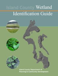
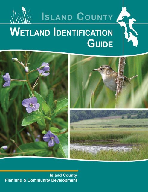
<strong>Island</strong> <strong>County</strong><br />
<strong>Wetland</strong> IdentIfIcatIon<br />
<strong>Island</strong> <strong>County</strong><br />
Planning & Community Development<br />
GuIde
Introduction 1<br />
Non-Native Vegetation 4<br />
Field Indicators <strong>Guide</strong><br />
•<br />
•<br />
•<br />
Contents<br />
Working With This <strong>Guide</strong> 2<br />
<strong>Wetland</strong>s 101 3<br />
<strong>Wetland</strong> Buffers 5<br />
About the Field Indicators 6<br />
Worksheet<br />
Hydrology 7-9<br />
Vegetation 10-20<br />
Soil 21<br />
Field Indicators Worksheet FIW:1-4<br />
Land Use Intensity Worksheet LUIW:1-3<br />
<strong>Wetland</strong> Buffer Worksheet WBW:1-9<br />
1<br />
Introduction<br />
The <strong>Island</strong> <strong>County</strong> <strong>Wetland</strong> Identification <strong>Guide</strong> is designed to help<br />
residential landowners study the lay of their land, make note of its<br />
characteristics, and see if their Camano or Whidbey <strong>Island</strong> property<br />
is affected by a wetland or wetland buffer. The value and function of<br />
critical areas are also discussed, along with step-by-step instructions to<br />
complete the Field Indicators Worksheet that is included with this booklet.<br />
When development is proposed, the Field<br />
Indicators Worksheet is required for <strong>County</strong> review.<br />
Planning staff will in turn confirm the information<br />
on the submitted Worksheet, to verify if a wetland<br />
or buffer may be affected. Upon completing their<br />
Critical Area Determination, other Worksheets may<br />
be required. Even before a permit application is<br />
filed, <strong>County</strong> Planners are available for a flat rate<br />
to make a preliminary critical area determination.<br />
This service helps property owners or prospective<br />
purchasers avoid potential pitfalls.<br />
Completing this workbook may take several hours<br />
or several days depending upon the amount of<br />
acreage a landowner needs to traverse looking for<br />
low spots, mapping sloped areas, and studying the<br />
types of plants, soils, and habitat on their property.<br />
Some residential property owners may opt to hire<br />
a private consultant to provide a report that contains<br />
all elements of the required Worksheet(s). There<br />
may be some circumstances when the latter will be<br />
recommended, especially where a wetland has been<br />
altered.<br />
Because nearby wetlands can impact future<br />
land use goals, some landowners should obtain<br />
permission to enter neighboring parcels in order to<br />
fully complete their Worksheet. When access to<br />
nearby land is not possible, determinations can be<br />
based upon database information and maps.<br />
Throughout the process, guidebook users are<br />
welcome to contact the Department of Planning and<br />
Community Development for more information.<br />
A Field Indicators Worksheet is required to be submitted for all development proposals.
type of land Use development will determine process<br />
Residential Applicants<br />
The chart below illustrates the process and Worksheets<br />
required for Critical Area Review of any proposal for single<br />
family residential land uses. At any step, the applicant<br />
has the option to instead hire a wetland professional to<br />
prepare report(s) which contain the required elements.<br />
ResIdentIAl lAnd Use ApplIcAnt<br />
FIeld IndIcAtoRs WoRksheet<br />
Submit Form to <strong>County</strong> for verification<br />
Yes, there is a wetland<br />
Submit the Following<br />
Worksheets for <strong>County</strong> Review<br />
and Critical Area Determination<br />
lAnd Use IntensItY<br />
WoRksheet<br />
WetlAnd BUFFeR<br />
WoRksheet<br />
no wetland present<br />
Continue with development<br />
process<br />
Alteration may affect ease of identification<br />
2<br />
Working With This <strong>Guide</strong><br />
Non-Residential or Commercial Development<br />
The chart below illustrates the process and Worksheets<br />
required for Critical Area Review of any non-residential or<br />
commercial development land use proposals. The applicant<br />
must retain a wetland professional to prepare report(s)<br />
which contain the required elements.<br />
non-ResIdentIAl lAnd Use ApplIcAnt<br />
FIeld IndIcAtoRs WoRksheet<br />
submit Form completed by a <strong>Wetland</strong><br />
Professional to <strong>County</strong> for verification<br />
Yes, there is a wetland<br />
Submit a <strong>Wetland</strong> Report,<br />
prepared by a <strong>Wetland</strong><br />
professional that contains<br />
the elements of the following<br />
Worksheets for <strong>County</strong> Review<br />
and Critical Area Determination<br />
lAnd Use IntensItY<br />
WoRksheet<br />
WetlAnd BUFFeR<br />
WoRksheet<br />
no wetland present<br />
Continue with development<br />
process<br />
<strong>Wetland</strong> identification is a complex subject, and this simplified guidebook may not be sufficient in every situation.<br />
Some wetlands or their buffers are easy to identify, while others are more complicated. This workbook is<br />
designed primarily for helping landowners identify wetlands that have not been altered or disturbed.<br />
Most alterations to Camano and Whidbey <strong>Island</strong> wetlands happened in the 150 years that preceded <strong>Island</strong><br />
<strong>County</strong>’s adoption of the CAO (Critical Areas Ordinance). Since 1985, these regulations have severely curtailed<br />
alterations to wetlands and associated buffers.<br />
Typical alterations in years past involved clearing of vegetation, plowing or tilling of wetland soil, redirecting<br />
water flow, and grading and filling. Other actions that can cause wetlands to be considered “altered” are ditching,<br />
tiling, draining, compacting, off-site conveyance, herbicide use, and upstream damming (natural or man-made).<br />
Impervious surfaces such as roads and structures also disturb wetland functions by altering the amount of water<br />
and pollutants that enter and exit a wetland.<br />
If a property shows indications that a wetland or buffer has been altered or disturbed, landowners are<br />
encouraged to first consult with <strong>County</strong> Critical Areas Planners to determine the best course of action before<br />
completing the Worksheets in this booklet.
What are wetlands?<br />
Most wetlands contain these three characteristics:<br />
hydrology - A wetland may be ponded year round, or just a seasonally soggy<br />
area. The area does not have to be wet all the time, but must have water at or<br />
near the soil’s surface continually for at least 2-3 weeks per year.<br />
soil - <strong>Wetland</strong> soils are poorly drained and develop certain characteristics due to<br />
the presence of water and absence of oxygen. These soils can be identified by<br />
being darker than non wetland soil, or grey with rusty streaks or spots.<br />
Why are wetlands important?<br />
<strong>Wetland</strong>s 101<br />
Vegetation - Only specific plant species can handle the oxygen deprived conditions<br />
present in wetlands. Some plants are normally found only in wetlands, such as<br />
cattails, skunk cabbage, slough sedge, and water lilies, while others can be found<br />
both inside and outside of wetlands, such as red alder, salmonberry, and red cedar.<br />
<strong>Wetland</strong>s Retain Water: When rain arrives after periods of dry weather, wetlands act<br />
like a sponge, absorbing the water and releasing it slowly to connecting channels and<br />
estuaries. This provides more time for water to infiltrate into aquifers which replenish<br />
drinking water supplies. During rainy periods, some wetlands even prevent flooding and<br />
erosion downstream by retaining heavy runoff.<br />
<strong>Wetland</strong>s purify Water: <strong>Wetland</strong> soil, together with the plants, microbes,<br />
and organisms living within, acts like a filter to trap and detoxify pollutants that<br />
are carried into the wetland by runoff or wind. As long as this capacity is not<br />
overwhelmed by too much pollution at once, water leaves most wetlands cleaner<br />
than when it entered. Through this filtering process, both groundwater and<br />
surface water are cleaned.<br />
<strong>Wetland</strong>s provide habitat: <strong>Wetland</strong>s provide a rich habitat. In <strong>Island</strong> <strong>County</strong>, wetlands<br />
sustain at least 150 species of birds, 44 mammals, 8 amphibians, 6 reptiles, over 4 species<br />
of salmonids, as well as over 249 plant species.<br />
<strong>Wetland</strong>s add to Rural character: <strong>Wetland</strong>s provide open spaces that add to<br />
the rural character and scenic vistas of our communities. Healthy wetlands maintain<br />
property values, provide incentives for tourism, and are essential for sustaining safe<br />
shores and waters for recreational activities on Camano and Whidbey <strong>Island</strong>s.<br />
3
non-native plants affect wetlands<br />
Non-Native Vegetation<br />
Invasion by non-native plant species can threaten wetlands by displacing native species and changing the<br />
ecological processes within affected habitats. These species can be spread by such activities as agriculture,<br />
development, or other modifications to the landscape. Non-native plant seeds are spread by wind, wildlife,<br />
and water. Because most local animals are not adapted to the new invader, they too may be impacted.<br />
examples of native plants examples of non-native plants<br />
Skunk Cabbage<br />
Lysichiton americanum<br />
Water Parsley<br />
Oenanthe sarmentosa<br />
Cattails<br />
Typha latifolia<br />
Slough Sedge<br />
Carex obnupta<br />
4<br />
Yellow Iris<br />
Iris pseudacorus<br />
English Holly<br />
Ilex aquifolium<br />
Reed Canary Grass<br />
Phalaris arundinancea<br />
Bull Thistle<br />
Cirsium vulgare
What is a buffer?<br />
Buffers are an important means of wetland protection. A buffer is an<br />
undisturbed vegetated area that surrounds a wetland. Because there are<br />
different types of wetlands with assorted characteristics, functions, and<br />
sensitivities, their buffer sizes will vary. Buffers are also influenced by the type<br />
of land use activity or development that is proposed near or adjacent to critical<br />
areas. For instance, a commercial use affects a wetland differently than a<br />
single home on 5 acres.<br />
<strong>Wetland</strong> Buffers<br />
When buffers are disturbed, the functions of the wetland can be reduced<br />
<strong>Wetland</strong> with an Intact Buffer <strong>Wetland</strong> with a disturbed Buffer<br />
Vegetated buffers around wetlands help protect wetland functions by<br />
• Providing the initial filtering of sediments and other pollutants from runoff. A wetland can be<br />
adversely affected when a buffer’s protective ability is reduced. If the buffer’s vegetation filters out some<br />
of the pollutants and sediments first, it can help the wetland do its job. This helps keep streams, lakes,<br />
aquifers, and the Puget Sound clean for humans and all species.<br />
• providing wood and other organic matter. These materials are useful to animals, plants and other<br />
life. Downed organic matter and woody debris provide a source of nutrients for bugs and plants, as well as<br />
shelter for animals.<br />
• Maintaining shade, water temperature, and the microclimate. Buffers protect these wetland<br />
functions and habitat. Plants and animals can be adversely affected by even small changes to wetland<br />
functions.<br />
5
Field Indicators Worksheet - 3 parts<br />
About the Field Indicators Worksheet<br />
Information provided in the Field Indicators Worksheet helps landowners and applicants identify if their<br />
property contains or is affected by a wetland or wetland buffer. This Worksheet is required to be submitted<br />
with all development proposals. <strong>County</strong> Planners will review the submitted Worksheet and issue a Critical Area<br />
Determination.<br />
As discussed earlier, an area must meet three specific criteria to be considered a wetland: First, a wetland must<br />
have hydrological indicators. Secondly, only specific types of Vegetation can grow in a wetland. Lastly, a<br />
wetland must have specific soil conditions. Most wetlands have all three characteristics.<br />
tools You May need<br />
shoVel<br />
Used to dig hole for hydrology<br />
test and to collect soil sample<br />
MeAsURIng tApe<br />
Used to measure depth of hole<br />
for hydrology test and soil sample<br />
MAchete<br />
May be used to cut small trail<br />
for access to potential wetlands<br />
Section #1 - HYDROLOGY<br />
Hydrology is the movement and distribution of water. Determining hydrology<br />
is important because wetlands need to have water present at some time of<br />
the year for at least 2-3 weeks. The Hydrology Section (Questions 1-6) of<br />
the Field Indicators worksheet guides in the identification of water on or near<br />
your property, how frequently water is present, and how it enters/exits your<br />
property.<br />
Section #2 - VEGETATION<br />
The Vegetation Section (Questions 7-8) of the Field Indicators Worksheet helps<br />
to identify the type of plants you have on your property. Because only certain<br />
types of plants can survive in the oxygen-deprived soils that are characteristic<br />
of wetlands, there are certain indicator plants that can be used to verify the<br />
presence of a wetland. Brief descriptions as well as detailed photographs are<br />
provided in the <strong>Wetland</strong> Vegetation Section of this guide.<br />
Section #3 - SOIL<br />
The Soils Section (Questions 9-11) of the Field Indicators Worksheet will help<br />
you determine if your property has wetland soils. Technically termed “hydric<br />
soils”, these soils serve as an essential indicator for determining the presence of<br />
a wetland. Hydric soils are created in areas where water displaces oxygen that<br />
would otherwise be present.<br />
6<br />
cAMeRA<br />
Pictures provide helpful information<br />
about land characteristics
hYdRologY - Questions 1-6<br />
Field Indicators<br />
H ydrology is the movement or distribution of water through a given area. Control of water<br />
movement, or hydrology, is one function of a wetland. Some wetlands can absorb runoff and/or<br />
slowly release water to connecting channels, estuaries, or aquifers and are usually low-lying in the<br />
landscape.<br />
The following instructions help with completing Questions 1-6 of the Field Indicators Worksheet. Please<br />
use the comments box for questions, to provide photos, or to include more detailed<br />
information. Use a second page if you need more space. After Question 6, you<br />
will sketch a Hydrology map. A separate sheet of paper, no larger than 11x17<br />
inches, may be used.<br />
1.<br />
Indicate whether there is standing water on the property at any time of<br />
the year. Please check only one box. If you check yes, indicate whether<br />
the standing water is present short term (4 weeks - 4 months),<br />
seasonally (4 months - 8 months) or longer (8 months - year round).<br />
2. Relative elevation is an important factor in<br />
determining where water runoff flows, the<br />
possibility of soil erosion, and where<br />
water collects. Because water flows<br />
downhill, flat or depressed areas<br />
can collect greater amounts<br />
of water over time and are<br />
more susceptible to longer<br />
periods of saturation. For<br />
question 2, check all the<br />
boxes that apply in relation<br />
to areas where there is or<br />
has been standing water.<br />
3. Sometimes surface water is<br />
actually located right below the<br />
ground level. Even though it is<br />
located just below the surface, it is still<br />
considered surface water. After examining<br />
your property for potential wetlands, dig a hole<br />
(about 16 inches deep) where you believe there may be a<br />
wetland. Potential areas are located in low spots or depressions<br />
on your property, as well as areas where you have observed<br />
ponding or water flow in the past. Leave the hole alone for about<br />
an hour. Return and observe whether there is any standing water<br />
in the hole. If there is water within 10 inches of the ground level, it is<br />
considered a positive indicator of wetland hydrology. (See picture, left)<br />
7
4.<br />
5.<br />
Identify slopes that contribute water onto your property. For question 3,<br />
check all that apply. General observations can be made by walking around<br />
the perimeter of your property and observing any channels or paths<br />
where water was flowing into your property at any time of the year.<br />
Elevation sloping downwards onto your property may also<br />
indicate paths for water to travel. Below are illustrations of<br />
streams and seasonal streams that may be dry during<br />
your survey. Water can enter your property in many<br />
different ways, e.g. streams, ditches, culverts,<br />
swales, etc. If there are other contributing features,<br />
please indicate them in the appropriate space.<br />
For question 5, check all that apply. Identify<br />
all the features that transfer water away from<br />
your property. Walk your property lines and observe any areas that slope<br />
downward and away from your land or where water exits any time of<br />
the year. Look for any evidence of a channel that may indicate water<br />
flowing off of your land. Water can exit your property in many ways,<br />
e.g. culverts, ditches, streams, percolation into the ground, etc.<br />
If there are other features in which water leaves your property,<br />
please indicate them in the spaces provided.<br />
Even seasonal streams<br />
leave defined channels<br />
in the ground, and are<br />
indicators of hydrology.<br />
8<br />
Field Indicators<br />
6.<br />
Look for defined channels. Channels can be<br />
any width or depth; larger channels indicate higher<br />
amounts of water entering and leaving your property. Based on your<br />
observations, indicate how long the channel has been at that location<br />
and use your best judgment to estimate whether it is less than or greater<br />
than 2 feet wide. Also indicate if there is a grass lined swale, which is an<br />
area that appears to have been ponded at some point.
hydrology Map<br />
9<br />
Field Indicators<br />
After answering questions 1-6 of the Hydrology Section of the Field Indicators Worksheet, you will be asked to<br />
draw a Hydrology map outlining observed hydrological features. This map will provide a visual impression of the<br />
hydrological features that exist on your property, as well as help <strong>County</strong> Planners identify where potential wetlands<br />
may exist making their site visit more efficient.<br />
The following examples are provided to help you develop your map. Please keep your map organized and easy<br />
to understand. Include information from your answers, as well as any residential structures and roads or other<br />
improvements that are existing or proposed. If you would like an Aerial overlay map you may obtain one from<br />
the <strong>County</strong> Planning offices or download at: http://www.islandcounty.net/planning/maps.htm<br />
Sample Site Map<br />
Sample Site Map<br />
w/ Aerial Overlay<br />
Wren Ln<br />
Forested Area<br />
(shaded)<br />
Proposed Single<br />
Family Residence<br />
& Driveway<br />
Proposed Single<br />
Family Residence<br />
& Driveway<br />
2,000 sq/ft<br />
Footprint<br />
Hudson Rd<br />
2,000 sq/ft<br />
Footprint<br />
Gradual Slope<br />
20%<br />
Change in Veg.<br />
(Slough Sedge &<br />
Salmonberry)<br />
Slope<br />
Gradual Slope<br />
20% Steep<br />
Change in Veg.<br />
(Slough Sedge &<br />
Salmonberry)<br />
Soil Sample<br />
Sites<br />
Soil Sample<br />
Sites<br />
Steep Slope<br />
40%<br />
Grass Swale<br />
40%<br />
Grass Swale<br />
Culvert<br />
Ditch<br />
Small<br />
Channel<br />
Culvert<br />
Ditch<br />
Small<br />
Channel
VegetAtIon - Questions 7-8<br />
vegetation is another indicator for identifying the presence of wetlands. <strong>Wetland</strong> plants have adapted to<br />
soil that is deprived of oxygen. Their roots are also submerged from short to long periods of time, requiring<br />
them to exist where most plants cannot. Because only certain plants are able to thrive in such conditions, they<br />
provide a valuable indicator of a wetland’s presence.<br />
Please use the following descriptions and pictures to identify and record any wetland indicator plants for<br />
Questions 7-8 of the Field Indicators worksheet. This Vegetation Section identifies only those wetland plants<br />
that are most common in <strong>Island</strong> <strong>County</strong>. Because some plants make better indicators than others, each plant’s<br />
ranking of Poor, Moderate, Good, or Excellent is color-coded to the right of the plant’s name, with “Poor” being<br />
the least indicative of a wetland, and “Excellent” being the best. Native plants are listed first in this section,<br />
followed by Non-Native species.<br />
native Vegetation<br />
American Speedwell – Veronica americana<br />
general: Perennial plant standing 10-70 cm tall. Usually has 3-5 pairs of oval to lanceshaped<br />
leaves on the flowering stem which are sharply pointed. Blue to violet saucershaped<br />
flowers are present in loose clusters along the stem.<br />
Where Found: Wet ground or shallow water, marshes, seepage areas, along springs and<br />
streams, wet clearings, ditches, and skidder tracks.<br />
Bull Rush – Schoenoplectus acutus<br />
general: Stout dense round stems forming large colonies. Very tall (over 4-5 feet) with few<br />
leaves, mostly at the base. Small brownish to grey spikes are found branching off the top of<br />
the stems.<br />
Where Found: Marshes, muddy shores, and shallow water.<br />
10<br />
Field Indicators<br />
Excellent<br />
Excellent
native Vegetation<br />
Cattails - Typha latifolia<br />
general: A tall plant usually found in or near standing water. Typically 1-3 m tall with<br />
unbranched stems and coarse spongy tops. This plant has long narrow leaves which grow<br />
1-2 cm wide.<br />
Where Found: Marshes, ponds, lakeshores, and wet ditches in slow-flowing or quiet water.<br />
Coontail / Hornwort - Ceratophyllum demersum<br />
general: A completely submersed aquatic plant with serrated forked leaves arranged in green<br />
whorls measuring 1-3 cm. Usually found on the bottom of lakes, it can float in columns 30-100<br />
cm tall or in dense mats just below the surface of the water.<br />
Where Found: Lakes, ponds, sloughs, slow-moving streams and other aquatic areas.<br />
Clayton J. Antieau Clayton J. Antieau<br />
Labrador Tea – Ledum groenlandicum<br />
general: Shrub ranging from 0.5-1.5 m tall with twigs. Has narrow oblong leaves<br />
measuring 6 cm long with a deep-green color on top and dense rust-colored hairs<br />
underneath; hairs on young leaves may not be rust colored. Small white flowers are located<br />
on top of the shrub and grow in umbrella-like clusters which become drooping capsules in<br />
the fall.<br />
Where Found: In bogs.<br />
11<br />
Field Indicators<br />
Excellent<br />
Excellent<br />
Richard Old<br />
www.xidservices.com<br />
Excellent
native Vegetation<br />
Pacific Silverweed — Potentilla anserina ssp. pacifica<br />
general: A coastal estuarine species with glossy green leaves that are 3-50 cm long.<br />
Silverweed has yellow flowers that bloom in May-August. Leaves dry out and become<br />
brown but are still identifiable through much of the winter.<br />
Where Found: Wet areas, marsh edges, stream sides, beaches, and common at low to<br />
middle elevation.<br />
Slough Sedge, Swamp Grass, or Saw Toothed Grass - Carex obnupta<br />
general: Coarse stiff stems standing 60-150 cm tall. Have a purplish sheath covering the<br />
stem that is rough when running one’s finger downward. Leaves are coarse and about<br />
3-10 mm wide and shorter than stems. Small seed clusters are shiny and are yellowish,<br />
green or brown in color and sprout off of the stem.<br />
Where Found: Primarily found in marshes, forested wetlands and stream-banks. Also<br />
found in lakeshores, wet forest openings, bogs, meadows, and clearings.<br />
Skunk Cabbage – Lysichiton americanum<br />
general: Has large lance-shaped leaves growing straight up from the ground and measure<br />
between 30-150 cm tall. Most noted for its large bright yellow leaf-like flower, skunky odor,<br />
and large green leaves.<br />
Where Found: Swamps, wet forests, mucky seepage areas, and wet meadows.<br />
12<br />
Field Indicators<br />
Excellent<br />
Excellent<br />
Excellent
native Vegetation<br />
Water Parsley – Oenanthe sarmentosa<br />
general: Weak-stemmed plant that trails along the ground or water and grows up to 1 m<br />
long. Plant is green and has white flowers that grow in compact clusters that rise up from<br />
the stem on 1-3 cm long stalks. Leaves are parsley-like (see picture).<br />
Where Found: In temporary standing water along streams and sloughs, in marshes, wet<br />
meadows, clearings, and forest edges.<br />
Cooleye’s Hedge Nettle – Stachys cooleyae<br />
general: Leafy perennial with hairy heart/egg-shaped leaves that are about 6-15 cm long.<br />
This nettle stands 70-150 cm tall and has deep red/purple flowers that grow in small clusters<br />
along the top of the stem.<br />
Where Found: Moist roadsides, clearings, thickets, and open woods.<br />
Crabapple – Malus fusca<br />
general: Shrub or small tree with spikes extending from branches. Leaves are about 10 cm<br />
long and have either an egg-shape or sometimes a mitten shape with pointed ends. In the fall<br />
they turn red or yellow-orange. Plant bears small egg-shaped apples that are initially green but<br />
turn yellow or red.<br />
Where Found: Moist woods, swamps, edges of standing and flowing water, upper beaches, and<br />
on the outer-edges of estuaries.<br />
13<br />
Field Indicators<br />
Excellent<br />
Good<br />
Good
native Vegetation<br />
Hardhack - Spiraea douglasii<br />
general: Shrub growing 2 m tall in dense clusters or thickets. Oblong/oval leaves that are<br />
darker green on top and whitish green on the underside. Tiny pink to deep-pink flowers<br />
grow in crowded clusters on the top of the shrubs in early summer and later turn darker.<br />
Where Found: Swamps, stream-banks, lake margins, and wet meadows. Often the<br />
dominant shrub component of wetlands.<br />
Red Stemmed Dogwood – Cornus sericea<br />
general: Shrub with many stems and branches that often lie on the ground. Young<br />
stems are smooth, round, and often bright red. Leaves are pointed and turn red in<br />
the fall. Has small white to greenish flowers with 4 petals. Shrub bears small white<br />
inedible berries which occasionally have a blue tinge.<br />
Where Found: Moist soil, bogs, streambanks, open forests, thickets, bog forest edges,<br />
and disturbed sites.<br />
Willows - Salix lucidia, Salix hookeriana, Salix scouleriana, ect<br />
general: Found in shrub and small tree form, willows vary from 2-12 m tall. A defining trait of<br />
willows are the different types of catkins they produce (seen right side below). Catkins can appear<br />
as a densely hairy pod, as a drooping cylindrical cluster of tiny pale yellow flowers, or as a small<br />
green spiky looking twig. Not all plants with catkins are willows, however, plants found with catkins in<br />
<strong>Island</strong> <strong>County</strong> are likely to be willows. Although not all willows are listed in this section, Salix lucidia,<br />
Salix hookeriana, Salix scouleriana are a few of the most common willows found in <strong>Island</strong> <strong>County</strong>.<br />
Where Found: Forested wetlands, pond edges, and along streams.<br />
14<br />
Field Indicators<br />
Good<br />
Good<br />
Good
native Vegetation<br />
Common Rush – Juncus effusus<br />
general: Grows in dense clusters with single round spiky stems growing 25-130 cm tall. Fluffy<br />
crowded groups of small greenish/brownish flowers from the top of the stem grow away from<br />
the main stem.<br />
Where Found: Moist to wet fields, pastures, roadsides, ditches, clearings, tideflats, pond<br />
margins, and bogs. Often found in disturbed habitats.<br />
Nootka Rose – Rosa nutkana<br />
general: Up to 3 m tall with pairs of opposing thorns along the length of the stem, as<br />
shown in the left most picture. Characterized by 4-8 cm wide pink flowers and red fruit.<br />
Where Found: Shorelines, meadows, thickets, streamsides, roadsides, and clearings.<br />
Red Alder – Alnus rubra<br />
general: Up to 25 m tall, Red Alders are deciduous trees and have thin grey smooth bark with<br />
white patches of lichens. Alder leaves are 5-15 cm long and remain green until they drop off<br />
in the late fall.<br />
Where Found: Moist woods, stream banks, floodplains, slide tracks, and recently cleared lands.<br />
Red alders often indicate wetlands but are also found in recently cleared non-wetland areas.<br />
15<br />
Field Indicators<br />
Moderate<br />
Moderate<br />
Moderate
native Vegetation<br />
Salmonberry - Rubus spectabilis<br />
general: Often forming dense thickets, this shrub has thorny branches and grows to 4 m<br />
tall. It is mainly characterized by the yellow or reddish “raspberry looking” berries that are<br />
visible early summer.<br />
Where Found: Moist wet places, forests, disturbed sites, along stream edges, and wet<br />
recently logged areas.<br />
Sitka Spruce - Picea sitchensis<br />
general: Large evergreen tree growing from 50-70 m tall with a trunk diameter of up to 5 m.<br />
The crown is broad and conic in younger trees and becomes more cylindrical as they age. The<br />
leaves are sharp and needlelike with a green color on the top portion and shaded white on the<br />
underside.<br />
Where Found: Forested wetlands.<br />
Ben Legler<br />
Western Red Cedar - Thuja plicata<br />
general: A large tree up to 60 m tall with grey to reddish-brown bark. Branches tend to spread<br />
or droop slightly and then turn upward like a “J” on the end. Cones are in loose clusters present<br />
throughout the branches and are about 1 cm long each.<br />
Where Found: Mostly found in moist to wet soils, bogs, and shaded forests.<br />
Bud Kovalchik<br />
Ben Legler<br />
16<br />
Clayton J. Antieau<br />
Field Indicators<br />
Ben Legler<br />
Moderate<br />
Moderate<br />
Moderate<br />
Bud Kovalchik
non-native Vegetation<br />
Eurasian Water-Milfoil – Myriophyllum spicatum<br />
general: Aquatic plant with leafy stems growing 30-100 cm long. Leaves are whorled, 1-3<br />
cm long and separate into many thread-like segments giving it a featherlike appearance.<br />
Where Found: Lakes, ponds, sloughs, slow-moving streams and other aquatic areas.<br />
Richard Old, www.xidservices.com Richard Old, www.xidservices.com<br />
Creeping Buttercup – Ranunculus repens<br />
general: Grows from fibrous roots and has dark green leaves, often with pale spots, seen<br />
year round. Most noted for its deep yellow (10-35 cm wide) flowers with hairy stems.<br />
Where Found: Moist disturbed sites, fields, pastures, gardens, lawns, ditches, clearings,<br />
and in settled areas.<br />
Hairy Willow-Herb – Epilobium hirsutum<br />
general: Most distinct for its size: 1 to 2 m tall. It has showy pink-purple flowers extending from the<br />
top of the plant, pod-like seed capsules, hairy, toothed leaves, and hairy stems.<br />
Where Found: Wet and semi-wet areas.<br />
17<br />
Field Indicators<br />
Excellent<br />
Richard Old, www.xidservices.com<br />
Good<br />
Good
non-native Vegetation<br />
Reed Canary Grass – Phalaris arundinacea<br />
general: This rough-stemmed grass grows 2-7 m tall with roughed sheathes covering<br />
the stalks. The bottom portion of the stalk is usually green and can fade to red towards<br />
the top. Often abundant locally.<br />
Where Found: Wet places in disturbed sites, including clearings, ditches along roads,<br />
marshy spots and depressions, stream-banks and along edges of wetlands, and around<br />
areas of human habitation and agricultural practices.<br />
Velvetgrass – Holcus lanatus<br />
general: Known for the “velvety” feeling of its leaves. Has a compact flowering panicle that is<br />
usually purple tinged. Grows 30-100 cm tall.<br />
Where Found: Fields, lawns, roadsides and other developed areas. Common in all of <strong>Island</strong><br />
<strong>County</strong>.<br />
Yellow Iris - Iris pseudacorus<br />
general: This plant can grow up to 1 m tall and has long blade-like leaves that extend upwards<br />
from the ground. A yellow flower blooms from the end of the stem from June through July.<br />
Where Found: Bogs, streambanks, and ponds.<br />
18<br />
Ben Legler<br />
Field Indicators<br />
Ben Legler<br />
Good<br />
Good<br />
Excellent
non-native Vegetation<br />
Bull Thistle – Cirsium vulgare<br />
general: Spiny, toothed leaves and spines on stems. Pink-purple prickled flowers are 2 to 4<br />
cm long and longer than those of Canadian Thistle. Is rooted with a fleshy taproot.<br />
Where Found: Fields, pastures, meadows, clearings and roadsides. Common in agricultural areas.<br />
Ben Legler Ben Legler<br />
Himalayan Blackberry – Rubus procerus or Rubus discolor or Rubus armeniacus<br />
general: This plant forms dense impenetrable thickets with branches most notably<br />
covered in sharp thorns. Green leaves are present year round and have three or five lobes.<br />
Produces edible berries in late summer.<br />
Where Found: Disturbed sites and can dominate wetlands.<br />
Canadian Thistle – Cirsium arvense<br />
general: Spiny, toothed leaves, and prickles on pink-purple flowers. Flowers are 1 to 2 cm long<br />
and smaller than those of Bull Thistle. Grows via creeping rhizomes.<br />
Where Found: Fields, pastures, meadows, clearings and roadsides. Common in agricultural<br />
areas.<br />
Ben Legler<br />
19<br />
Field Indicators<br />
Moderate<br />
Ben Legler<br />
Moderate<br />
Ben Legler<br />
Poor<br />
Ben Legler
non-native Vegetation<br />
English Holly – Ilex aquifolium<br />
general: Shrub or tree growing to 6 m tall. Has thick, shiny dark-green leaves with<br />
toothed margins. Produces bright red berries in the fall.<br />
Where Found: Forested areas. Is often planted as ornamental or cultivated for<br />
commercial use.<br />
English Ivy – Hedera helix<br />
general: Grows as a trailing or climbing vine. Old vines can be up to a foot in diameter.<br />
Leaves are typically dark green and grow in two forms: young leaves have 3-5 lobes and<br />
older leaves are oval-shaped. Mature plants produce clusters of greenish-white flowers.<br />
Where Found: Developed forested areas.<br />
Evergreen Blackberry/Cutleaf Blackberry – Rubus laciniatus<br />
general: Thorny perennial that grows as a bush or along the ground. Stems grow up to<br />
10 m long. The leaves are green and smooth above and hairy beneath. Produces black<br />
edible berries in late summer.<br />
Where Found: Roadsides and disturbed areas at low elevations.<br />
Clayton J. Antieau<br />
Ben Legler<br />
20<br />
Field Indicators<br />
Poor<br />
Poor<br />
Poor<br />
Ben Legler
soIl - Questions 9-11<br />
<strong>Wetland</strong>s contain “hydric soils” that occur as a result of water saturation, significant changes in soil<br />
environment, and/or flooding or ponding that has occurred long enough during the growing season to deprive<br />
the soil of oxygen.<br />
The following will help complete Questions 9-11 in the Soil section in the Field Indicators worksheet.<br />
Remove a soil sample from 12 inches below<br />
the surface, in an area where you believe<br />
there may be a wetland. You may use the<br />
same hole you dug in Question #3.<br />
9. Return to the hole(s) you dug for Question #3. Measure 12 inches from the<br />
surface and remove soil samples from this depth. Observe whether the soil<br />
is moist, dry, or muddy. Inspect the soil for color and indicate whether<br />
the sample taken from the bottom of the hole is Dark/Black, Grey w/<br />
Rust Spots, or Brown. The color chart below illustrates different colors<br />
of soil. Check only one box. (To better identify the edge of the<br />
wetland, dig additional holes away from the potential area until you<br />
no longer see wetland type soils).<br />
10. Take a sample of soil from the bottom of the 12 inch hole and smell it. If the soil smells similar to sulfur<br />
or rotten eggs, then check the box. Check only one box.<br />
11. Check the soil for moisture. Is the soil saturated with water or is it just damp? Squeeze a sample of soil<br />
from the bottom. If it molds together like clay or is moist, it is saturated. If it crumbles apart, it is dry.<br />
Check only one box.<br />
21<br />
Field Indicators<br />
Which example below does the soil at the<br />
bottom of the hole most resemble?<br />
dark/Black grey w/ Rust Brown
<strong>Island</strong> county planning and community development<br />
Field Indicators Worksheet<br />
The Field Indicators Worksheet will help you and the <strong>County</strong> determine if a wetland or wetland buffer is on your<br />
property. Applicants for permits for single family residential uses must either complete this Worksheet or, at their<br />
option, hire a wetland professional to complete a <strong>Wetland</strong> Report that includes the elements of the Worksheet. All<br />
other applicants (commercial or non-residential) must do the latter, if the <strong>County</strong> verifies that the development<br />
proposal is for land that contains or is affected by a wetland.<br />
The comments section of this Worksheet may be used to record any particulars or information about your property.<br />
You may attach additional pages and photographs.<br />
The <strong>County</strong> will verify the information provided in this Worksheet or related wetland report.<br />
This Worksheet must be included with every application for development. Prospective purchasers may also ask the<br />
<strong>County</strong> to review the Worksheet to assist them in determining whether the property they are interested in purchasing<br />
contains wetlands.<br />
Applicant name (please print):______________________________ date: _______________________<br />
parcel or key number:________________________<br />
FIW:1
hydrology<br />
The presence of water is the most obvious and common indicator of a wetland. There are several factors that must be<br />
considered in describing whether or not you have water on your property. Some wetlands have standing water all year<br />
long; others are soggy only during wetter months of the year; and, others appear wet only after storm events.<br />
1. Is there ever standing water on the property?<br />
Yes No<br />
If No, proceed to question #3<br />
If Yes, is it:<br />
4 weeks - 4 months 4 months - 8 months - Seasonally 8 months - Year Round<br />
2. If you answered yes to question #1, are the surrounding adjacent areas:<br />
Topographically higher Yes No<br />
Topographically lower Yes No<br />
Topographically the same elevation Yes No<br />
3. When you dug the hole, did you observe any water within 10 inches of the ground surface?<br />
Yes No<br />
4. Identify any features through which water flows onto your property (Check all that apply)<br />
Stream Culverts Ditches Roadside Ditch<br />
Storm Drains Ponds, lakes, estuaries Pumps Other__________________________<br />
5. Identify any features through which water flows off of your property (Check all that apply)<br />
Stream Culverts Ditches Roadside Ditch<br />
Storm Drains Ponds, lakes, estuaries Pumps Other_________________________<br />
6. Are there defined ditches/channels on, or near your property that have water?<br />
Yes, there are ditches/channels that have occasional water flow (e.g. after storm events).<br />
Yes, there are ditches/channels that have regular water flow during wet months.<br />
Yes, there are ditches/channels that have water flow all year long.<br />
No, there are no defined channels<br />
If Yes, how wide is defined channel?<br />
Large (>2 ft across) Small (
hydrology Map<br />
Please refer to the Hydrology Map Example found in the <strong>Wetland</strong> Identification <strong>Guide</strong> for instructions<br />
Draw a close approximation of the features you listed in questions 1-6 of the Hydrology section of the Field<br />
Indicators Worksheet. Please label the features and approximate dimensions. You may also include areas where<br />
wetland vegetation was observed and sites where you performed your soil samples. An organized and informative<br />
drawing will help make our site visit more efficient. For greater accuracy, you may obtain an aerial map of your<br />
parcel from the <strong>Island</strong> <strong>County</strong> Planning and Community Development offices, and use it as the base layer for your<br />
map. The Hydrology Map section of the <strong>Island</strong> <strong>County</strong> <strong>Wetland</strong> Identification <strong>Guide</strong> has further information.<br />
Comments:<br />
FIW:3
Vegetation<br />
Only certain types of vegetation can survive in wetland conditions. In fact, some plants, trees and shrubs live nowhere<br />
else except in wetlands, e.g. skunk cabbage. Other types of vegetation are tolerant of both wet and drier conditions,<br />
e.g. salmonberry and alder. Most trees and plants look different depending upon the time of the year. This can make<br />
it difficult to identify exactly what’s on your property. Numerous photographs of the more common types of wetland<br />
vegetation are shown during different seasons. please include these observations in your hydrology Map.<br />
7. Are there any native wetland plants on the property that are identified in the <strong>Wetland</strong> Vegetation section of the<br />
soil<br />
<strong>Wetland</strong> Identification <strong>Guide</strong>? (Check all that apply)<br />
Slough Sedge Cooleye’s Hedge Nettle Crabapple Red Stemmed Dogwood<br />
Labrador Tea Water Parsley Skunk Cabbage American Speedwell<br />
Cat Tail Common Rush Willows Red Alder<br />
Salmonberry Nootka Rose Bull Rush Western Red Cedar<br />
Pacific Silverweed Sitka Spruce Hardhack Grasses (other than lawn)<br />
8. Are there any non-native wetland plants on the property that are identified in the <strong>Wetland</strong> Vegetation section of<br />
the <strong>Wetland</strong> Identification <strong>Guide</strong>?<br />
Creeping Buttercup Reed Canary Grass Yellow Iris Himalayan Blackberry<br />
Eurasian Milfoil Evergreen Blackberry Velvetgrass Yellow Iris<br />
Canadian Thistle/ Hairy Willow-herb<br />
Bull Thistle<br />
Comments:<br />
While water and vegetation can be identified by simply observing what is on your property, learning about your soils will<br />
take a little more work. Soil characteristics change as a result of the regular presence of water. Minerals in the soil will<br />
start to rust and organics are unable to decompose. By digging some holes you can see whether or not the area you are<br />
looking at is in fact a wetland. The <strong>Wetland</strong> Identification <strong>Guide</strong>’s Soil section provides additional information that you<br />
may find useful in answering the following questions. You will need to dig a hole 12 inches deep in order to answer the<br />
following questions. please include the locations where you took your soil samples in your hydrology Map.<br />
9. Indicate the color of the soil at the bottom of the 12 inch deep hole that you dug.<br />
Dark Black Grey w/rust spots Brown<br />
10. Does the soil smell sulfuric? (like rotten eggs)<br />
Yes No At Times<br />
11. If you take a tablespoon size sample of the soil and squeeze it, is it saturated with water?<br />
Yes Moderate/Soil is damp No. Soil is dry<br />
Comments:<br />
FIW:4
stop continue only if..... stop<br />
Applicants for single family structures must complete the<br />
following two Worksheets (Land Use Intensity Worksheet &<br />
<strong>Wetland</strong> Buffer Worksheet), if their site contains or is affected by<br />
a wetland or wetland buffer. At their option, residential applicants<br />
may choose to hire a wetland consultant to prepare a report that<br />
instead includes the elements of all relevant Worksheets.<br />
Applicants for non-residential or commercial development<br />
proposals for properties that contain or are affected by a wetland or<br />
wetland buffer must submit a wetland report, prepared by a private<br />
consultant, which includes the elements of all relevant Worksheets:<br />
Field Indicators, Land Use Intensity, and <strong>Wetland</strong> Buffer.<br />
Reminder:<br />
Even if your property does not appear to contain or be affected<br />
by a wetland or wetland buffer, a Field Indicators Worksheet<br />
must be submitted with any development proposal. This applies<br />
to all permits for single family residential uses, as well as nonresidential<br />
or commercial proposals.
<strong>Island</strong> county planning and community development<br />
lAnd Use IntensItY WoRksheet<br />
For all applications for any development proposal related to a Single Family Home that involves property containing<br />
or affected by a wetland, the single family landowner/applicant must either complete this Worksheet, or at their<br />
option they may hire a wetland professional to prepare a wetland report that includes the elements of this worksheet.<br />
For all other applications (non-residential or commercial), a private wetland professional must prepare a wetland<br />
report that contains the elements of this worksheet.<br />
This Worksheet helps the <strong>County</strong> determine the Intensity of the uses or structures proposed for development. Land<br />
Use Intensity is a key determiner of the appropriate wetland buffer size.<br />
<strong>Wetland</strong> buffers are established by two factors: 1) the type of wetland, and 2) the intensity of the development for<br />
your land. For property that is or will be developed for a single family home use, the Rural Stewardship Plan is an<br />
option for landowners to utilize for reducing a property’s land use intensity level and protecting natural resources.<br />
Please ask Planning staff for more information about the Rural Stewardship Plan.<br />
Applicant name (please print):____________________________ date: _________________________<br />
parcel or key number:__________________<br />
Intensity level (circle one): low Medium high<br />
For county Use only<br />
Confirmation Date: _______________________ Confirmed By: ________________________<br />
LUIW:1
1. land Use & parcel size (Check one):<br />
<br />
<br />
My lot is, or will be, used for commercial, industrial, or other non-residential purposes – If you checked this,<br />
please select one of the following:<br />
My lot is less than 5 acres - If you checked this, yours is likely a high intensity use and you do<br />
not need to continue with this worksheet.<br />
My lot is greater than or equal to 5 acres - If you checked this, yours is likely a Medium<br />
intensity use and you do not need to continue with this worksheet.<br />
My lot is, or will be, used for residential purposes - If you checked this, please select one of the following:<br />
My lot is less than 1 acre. If you checked this, yours is a high intensity use.<br />
My lot is from 1 acre to 2.49 acres in size – Proceed to Question 2.a<br />
My lot is from 2.5 acres to 4.99 acres – Proceed to Question 2.b<br />
My lot is from 5 acres to 9.99 acres in size - Proceed to Question 2.c<br />
My lot is from 10 acres to 19.99 acres in size - Proceed to Question 2.d<br />
My lot is greater than or equal to 20 acres in size - Proceed to Question 2.e<br />
2. cleared area and/or impervious surface for residential uses:<br />
If your parcel qualifies for 2 different Land Use Intensity ratings, you must choose the higher intensity rating.<br />
a. Lots 1 acre to 2.49 acres (check one of the following):<br />
More than 50% of my lot is, or will be, cleared or more than 10% of my lot is, or will be, covered with an<br />
impervious surface – You are high intensity*<br />
Less than 35% of my lot is, or will be, cleared and less than 5% of my lot is, or will be, covered with an<br />
impervious surface – You are low intensity - proceed to question 3<br />
From 35% to 50% of my lot is, or will be, cleared, or from 5% to 10% of the lot is or, will be, covered with<br />
an impervious surface – You are Medium intensity*<br />
b. Lots 2.5 acres to 4.99 acres (check one of the following):<br />
More than 45% of my lot is, or will be, cleared or more than 10% of my lot is, or will be, covered with an<br />
impervious surface – You are initially high intensity*<br />
Less than 30% of my lot is, or will be, cleared and less than 5% of my lot is, or will be, covered with an<br />
impervious surface – You are initially low intensity - Proceed to question 3<br />
From 30% to 45% of my lot is, or will be, cleared or from 5% to 10% of the lot is, or will be, covered with<br />
an impervious surface – You are Medium intensity*<br />
c. Lots 5 acres to 9.99 acres (check one of the following):<br />
More than 40% of my lot is, or will be, cleared or more than 10% of my lot is, or will be, covered with an<br />
impervious surface – You are initially high intensity*<br />
Less than 25% of my lot is, or will be, cleared and less than 5% of my lot is, or will be, covered with an<br />
impervious surface – You are initially low intensity - Proceed to question 3<br />
From 25% to 40% of my lot is, or will be, cleared or from 5% to 10% of the lot is, or will be, covered with<br />
an impervious surface – You are Medium intensity*<br />
LUIW:2
d. Lots 10 acres to 19.99 acres (check one of the following):<br />
More than 35% of my lot is, or will be, cleared or more than 10% of my lot is, or will be, covered with an<br />
impervious surface – You are initially high intensity*<br />
Less than 20% of my lot is, or will be, cleared and less than 5% of my lot is, or will be, covered with an<br />
impervious surface – You are initially low intensity - Proceed to question 3<br />
From 20% to 35% of my lot is, or will be, cleared or from 5% to 10% of the lot is, or will be, covered with<br />
an impervious surface – You are Medium intensity*<br />
e. Lots greater than or equal to 20 acres (check one of the following):<br />
More than 30% of my lot is, or will be, cleared or more than 10% of my lot is, or will be, covered with an<br />
impervious surface – You are initially high intensity*<br />
Less than 15% of my lot is, or will be, cleared and less than 5% of my lot is, or will be, covered with an<br />
impervious surface – You are initially low intensity - Proceed to question 3<br />
From 15% to 30% of my lot is, or will be, cleared or from 5% to 10% of the lot is, or will be, covered with<br />
an impervious surface – You are Medium intensity*<br />
3. low Intensity Requirements:<br />
Residential uses that are classified as Low intensity must include each of the following standards in order to retain<br />
the low intensity designation.<br />
• Structures, patios and decks shall be setback fifteen (15) feet from the outer edge of the wetland buffer; and<br />
• Exterior lighting fixtures shall comply with the lighting standards of Chapter 17.03 ICC and shall be shrouded<br />
and directed away from a <strong>Wetland</strong> or <strong>Wetland</strong> Buffer; and<br />
• Fertilizers, pesticides and herbicides shall not be applied in a manner that adversely impacts <strong>Wetland</strong><br />
Functions or their <strong>Wetland</strong> Buffers; and<br />
• Storm water from Impervious Surfaces shall be controlled before it reaches the <strong>Wetland</strong> Buffer.<br />
*Note: A Land Use Intensity rating may be reduced through enrollment in the <strong>County</strong>’s Rural Stewardship Plan. A<br />
commitment to the requirements outlined in the RSP can reduce your property’s intensity score from High to<br />
Medium, or from Medium to Low. Such a reduction comes with significant added responsibility for current and<br />
future landowners. Please contact Planning and Community Development staff for more information.<br />
LUIW:3
<strong>Island</strong> county planning and community development<br />
WetlAnd BUFFeR WoRksheet<br />
This <strong>Wetland</strong> Buffer Worksheet must be submitted with any development proposal related to a Single Family Home<br />
that involves property containing or affected by a wetland; or, at the single family homeowner’s option, a <strong>Wetland</strong><br />
Report including the elements of this Worksheet can be prepared by a <strong>Wetland</strong> Professional hired by the Single<br />
Family homeowner/applicant. A wetland report containing the elements of this worksheet, and prepared by a private<br />
wetland professional, will be required of all other applicants (non-residential or commercial) when the proposed<br />
development is on land that contains or is affected by a wetland or wetland buffer.<br />
The following questions are designed to help you identify important characteristics of the wetland and the area<br />
surrounding it. Your answers should apply to the entire wetland, not just the part that is on your property. This<br />
Worksheet, along with information from the Land Use Intensity Worksheet, will help <strong>County</strong> planners determine the<br />
buffer width for your wetland. A buffer is the vegetated area adjacent to the boundary of a wetland that protects it<br />
from disturbance and inputs to protect water quality and habitat.<br />
Applicant name (please print):____________________________ date: _________________________<br />
habitat score:_______(from Page WBW:7 of this Worksheet)<br />
<strong>Wetland</strong> Buffer:___________ feet<br />
For county Use only<br />
Confirmation Date: _______________________ Confirmed By: _________________________<br />
WBW:1
describe and score the <strong>Wetland</strong> and Its surroundings<br />
1. high priority <strong>Wetland</strong> type<br />
Does all or part of your wetland meet the definition of any of the following wetland types? Maps showing known<br />
locations of these types are available from the <strong>County</strong>. However, not all locations are known, so you should evaluate<br />
your wetland independently to see if it meets these definitions.<br />
___ Bog: A relatively undisturbed <strong>Wetland</strong> with at least seventy percent (70%) ground cover of mosses; or with<br />
water with a pH of less than 5.0; or with more than thirty percent (30%) cover of Sitka Spruce, Western Red<br />
Cedar, Western Hemlock or Lodgepole Pine; and a preponderance of plants that are listed as bog species in Table<br />
3 of the 2004 <strong>Wetland</strong> Rating System prepared by the Washington State Department of Ecology; and having<br />
Peat or Muck soils at least sixteen (16) inches deep. Many Bogs are fed largely by precipitation. <strong>County</strong> maps<br />
identify the location of some but not all Bogs. See also Relict Bog. If the criteria are met, put an “X” the space at<br />
the beginning of this definition. Many Bogs have acidic conditions, low nutrient levels; soils classified as peat or<br />
muck; and are fed largely by precipitation.<br />
___ coastal lagoon <strong>Wetland</strong>: A wetland located within a shallow water body adjacent to marine waters<br />
that is partly or completely separated from Puget Sound by a barrier beach. A Coastal Lagoon receives periodic<br />
influxes of salt water which may occur from storm surges or flow through porous beach sediments. The water<br />
in a Coastal Lagoon is saline or brackish (>0.5 ppt measured near the bottom) during most of the year. If the<br />
criteria are met, put an “X” in the space at the beginning this definition.<br />
___ delta estuary <strong>Wetland</strong>: An Estuarine wetland located directly adjacent to or within a Delta Estuary.<br />
These wetlands are located on the north end of Camano <strong>Island</strong> adjacent to the mouth of the Skagit and<br />
Stillaguamish Rivers. If the criteria are met, put an “X” in the space at the beginning of this definition.<br />
___ estuarine <strong>Wetland</strong>: A tidal wetland containing emergent vegetation that is usually semi-enclosed by land<br />
but has open or partly obstructed access to Puget Sound. If the criteria are met, put an “X” in the space at the<br />
beginning of this definition.<br />
If the wetland meets one of the above, your buffer can be determined from the chart below; if<br />
not, please continue to the remaining questions.<br />
The type of wetland you marked above gives a preliminary determination of the width of the buffer<br />
that may be recommended for a new Development Proposal. Select the largest applicable buffer from<br />
Table 1 below. You are then done with this assessment.<br />
table 1<br />
Intensity<br />
level<br />
(Intensity<br />
Worksheet)<br />
Bog coastal<br />
lagoon<br />
wetland<br />
WBW:2<br />
delta estuary<br />
wetland<br />
estuarine<br />
low 125 ft 100 ft 40 ft 30 ft<br />
Moderate 190 ft 150 ft 90 ft 55 ft<br />
high 250 ft 200 ft 125 ft 90 ft
2. Vegetation Forms (maximum of 4 points):<br />
Which kinds of plant forms cover more than 10% of the wetland’s vegetated area? Mark each kind<br />
with a “1” in the line next to it.<br />
Aquatic Plants (e.g., coontail, pond lily) _________<br />
Herbs (e.g., grasses, wildflowers, ferns) _________<br />
Shrubs (e.g., willow, elderberry, alder, salmon berry) _________<br />
Trees (e.g., cedar, sitka spruce, hemlock) _________<br />
3. non-native plant cover (maximum of 6 points)<br />
4. dead Wood (maximum of 2 points):<br />
sum the numbers and insert here (Maximum of 4 points): ________<br />
Are non-native plants present in your wetland? Check all that apply.<br />
non-native shrubs and Vines (a partial list):<br />
___ Himalayan Blackberry<br />
___ Evergreen Blackberry<br />
___ Holly<br />
___ Others. List: ______________________________________________________________________<br />
non-native herbs (a partial list):<br />
___ Reed Canary Grass<br />
___ Velvetgrass<br />
___ Creeping Buttercup<br />
___ Yellow Iris<br />
___ Hairy Willow-herb<br />
___ English Ivy<br />
___ Canada Thistle, Bull Thistle<br />
___ Eurasian Milfoil<br />
___ Others. List: ______________________________________________________________________<br />
* Note: This list is not comprehensive. You may wish to consult Flora of the Pacific Northwest<br />
(C. Leo Hichcock and Arthur Cronquist, University of Washington Press)<br />
Now estimate the approximate percent of the entire wetland’s vegetated area covered by non-native species:<br />
___ Less than 5% (6 points; put “6” in the space to the left)<br />
___ From 5 to 50% (3 points; put “3” in the space to the left)<br />
___ More than 50% (0 points; put “0” in the space to the left)<br />
Insert the point value here (Maximum of 6 points): ________<br />
What kind of dead wood is found in the wetland? Insert the points at the beginning of all lines where<br />
applicable.<br />
___ Multiple large fallen logs greater than 4 inches in diameter at their base and longer than 6 ft (1 point)<br />
___ Multiple large standing dead trees greater than 4 inches in diameter at chest height (1 point)<br />
___ Neither of the above (0 points)<br />
sum the numbers and insert here (Maximum of 2 points): ________<br />
WBW:3
The following questions describe how wetlands on your property are connected with other natural areas. These questions are<br />
important because they help describe how your wetlands fit into larger ecosystems, and that in turn partly determines their<br />
importance to wildlife and plants. Maps and aerial photographs available online or at the counter of the Planning Department<br />
can assist you in answering these questions.<br />
5. surrounding Vegetation (Maximum of 10 points):<br />
how much of the area surrounding the wetland is “naturally vegetated”?<br />
“Naturally vegetated” means no pavement, buildings, lawns, bare soil, tilled soil, bedrock, or heavily-grazed pasture.<br />
Lightly-grazed or infrequently-mowed pasture is OK (mowed fewer than 4 times a year). Vegetation does not need to<br />
consist of native species.<br />
Circle the diagram below that best describes the surrounding vegetation of your wetland. If more than one<br />
diagram applies choose the one with the higher point score. If none apply, give the wetland a 0. Maps and aerial<br />
photographs available online or at the counter of the Planning Department can assist you in answering this question.<br />
95% of 300ft upland area is naturally vegetated:<br />
10 points<br />
95% of 150ft upland area is naturally<br />
vegetated: 8 points<br />
95% of 80ft upland area is naturally<br />
vegetated: 4 points<br />
25% of 300ft upland area is naturally vegetated:<br />
6 points<br />
50% of 300ft upland area is naturally vegetated:<br />
8 points<br />
50% of 150ft upland area is naturally<br />
vegetated: 6 points<br />
95% of 6ft upland area is naturally<br />
vegetated: 1 point<br />
Insert the point value here (Maximum of 10 points): ________<br />
WBW:4
6. large Woodlands (Maximum of 10 points):<br />
“Woodlands” are areas of trees or shrubs.<br />
“Connected to” includes areas that are separated from each other or from the wetland by distances less than<br />
100 ft. Include wooded areas within the wetland when summing the acreage.<br />
a. how much woodland is connected to your wetland? Ignore all Roads<br />
More than 100 acres (5 points) ________<br />
Greater than 9 to 100 acres (3 points) ________<br />
From 1 to 9 acres (1 point) ________<br />
None of the above/any other condition (0 points) ________<br />
b. Assess this again, but this time consider roads as a disconnection. Roads don’t include private<br />
driveways.<br />
More than 100 acres (5 points) ________<br />
Greater than 9 to 100 acres (3 points) ________<br />
From 1 to 9 acres (1 point) ________<br />
None of the above/any other condition (0 points) ________<br />
The above two questions can be answered most easily by consulting maps and aerial photographs at the<br />
Planning Department.<br />
Add up the points from (a) and (b) and insert here (maximum of 10 points): ________<br />
7. distance to lake or saltwater (maximum of 5 points):<br />
how far is this wetland from the nearest lake or saltwater area? Select only the one condition with the<br />
highest score.<br />
___ Within 300 ft (5 points)<br />
___ Between 300 ft and ½ mile (3 points)<br />
___ More than ½ mile (0 points)<br />
This can be answered most easily by consulting maps and aerial photographs at the Planning Department<br />
Insert the point value here (Maximum of 5 points): ________<br />
WBW:5
8. nearby <strong>Wetland</strong>s (maximum of 5 points):<br />
how many other county-mapped wetlands are within ½ mile of your wetland? This can be answered<br />
most easily by consulting maps and aerial photographs at the Planning Department. Insert the points on the line<br />
next to the one condition that gives the highest applicable points.<br />
___ three or more, and none are separated from this wetland by paved roads, lawns, bare soil, tilled soil, or<br />
heavily-grazed pasture (5 points)<br />
___ three or more, but some are separated from this wetland by paved roads, lawns, bare soil, tilled soil, or<br />
heavily-grazed pasture (4 points)<br />
___ one or two, and none are separated from this wetland by paved roads, lawns, bare soil, tilled soil, or<br />
heavily-grazed pasture (3 points)<br />
___ one or two, but some are separated from this wetland by paved roads, lawns, bare soil, tilled soil, or<br />
heavily-grazed pasture (1 point)<br />
___ none (0 points)<br />
9. Water persistence and pattern (maximum of 6 points):<br />
Insert the point value here (Maximum of 5 points): ________<br />
Check and complete the section that describes your wetland in a normal year. Then add the additional points<br />
immediately beneath it if applicable.<br />
More than 10% of wetland (or more than ¼ acre) contains more than 4 inches of standing water<br />
during the entire year. (4 points)<br />
Add 2 points if:<br />
Water is mostly scattered throughout the wetland in multiple patches and most of<br />
it floods herbs, grasses, or the thin stems of shrubs during the growing season.<br />
More than 10% of wetland (or more than ¼ acre) contains more than 4 inches of standing water<br />
for part of the year, but not year-round. (2 points)<br />
Add 1 point if:<br />
Water is mostly scattered throughout the wetland and most of it floods herbs, grasses, or<br />
thin stems of shrubs during the growing season.<br />
Other. (0 points)<br />
Insert the total point value here (Maximum of 6 points): ________<br />
WBW:6
now add the points from questions 2 through 9 and record the total heRe: ________. this is your<br />
habitat score.<br />
Are the points 22 or greater?<br />
___ Yes. Answer the <strong>Wetland</strong> Outlet question below and proceed to Table 2 below to make a preliminary<br />
determination of the width of the buffer that may be recommended for a new Development Proposal. You are<br />
then done with this assessment.<br />
___ No. Answer the <strong>Wetland</strong> Outlet question below and proceed to question #10.<br />
<strong>Wetland</strong> outlet?<br />
An outlet is a location where there is visible evidence of the discharge of surface water from a wetland at any<br />
season of the year. Although the presence or lack of an outlet does not affect habitat directly, wetlands without<br />
outlets tend to be more sensitive because any pollution that reaches them becomes confined and is not diluted<br />
significantly. If the presence of an outlet is unclear or uncertain, the wetland should be presumed to not have<br />
an outlet.<br />
does the wetland have an outlet? Select one:<br />
______No<br />
______Yes<br />
table 2<br />
Intensity level<br />
(Land Use Intensity<br />
Worksheet)<br />
<strong>Wetland</strong> outlet habitat score (<strong>Wetland</strong> Buffer Worksheet)<br />
40 or higher 32-39 29-31 22-28<br />
low Yes 125 ft 75 ft 75 ft 75 ft<br />
No 150 ft 125 ft 100 ft 75 ft<br />
Moderate Yes 200 ft 110 ft 110 ft 110 ft<br />
No 225 ft 175 ft 150 ft 110 ft<br />
high Yes 250 ft 150 ft 150 ft 150 ft<br />
No 300 ft 200 ft 175 ft 150 ft<br />
WBW:7
10. other priority <strong>Wetland</strong> types<br />
Does all or part of the wetland meet the definition of any of the following wetland types? Maps showing known<br />
locations of some of these types are available from the <strong>County</strong>. However, not all locations are known, so you<br />
should evaluate your wetland independently to see if it meets these definitions.<br />
___ Mature Forested <strong>Wetland</strong>: A <strong>Wetland</strong> one (1) acre or larger in size in which the tree canopy within<br />
the vegetated part of the <strong>Wetland</strong> is comprised predominantly of trees having diameters eighteen (18) inches<br />
or larger measured at 4.5 feet above ground level or the oldest trees are 80-200 years old; crown cover may<br />
be less than 100%; and, decay, decadence, number of snags and quantity of downed material is generally<br />
less than found in old-growth forests. <strong>County</strong> maps will identify Mature Forested <strong>Wetland</strong>s as they are located<br />
through review of Development Proposals. If the criteria are met, put a “A” in the space that began this<br />
definition.<br />
___ large ponded <strong>Wetland</strong>: A non-Estuarine <strong>Wetland</strong> with visible evidence of at least five (5) acres of<br />
standing surface water in any part of the <strong>Wetland</strong> during most of the Growing Season for a normal year. If the<br />
criteria are met, put a “B” in the space that began this definition.<br />
___ <strong>Wetland</strong> Associated With a Bog, coastal lagoon, or delta estuary: A <strong>Wetland</strong> that has a wetland<br />
outlet that connects the <strong>Wetland</strong> directly to a Bog, Coastal Lagoon or Delta Estuary, or is within 500 feet of<br />
a Bog, Coastal Lagoon or Delta Estuary in a n uphill direction and within the same Contributing Area. If the<br />
criteria are met, put a “B” in the space that began this definition.<br />
___ Anadromous Fish stream <strong>Wetland</strong>: A <strong>Wetland</strong> that has a <strong>Wetland</strong> Outlet that connects the <strong>Wetland</strong><br />
directly to an Anadromous Fish Stream or is within 500 feet of an Anadromous Fish Stream in an uphill<br />
direction and within the same Watershed. If the criteria are met, put a “B” in the space that began this<br />
definition.<br />
___ Resident salmonid stream <strong>Wetland</strong>: A <strong>Wetland</strong> that has a <strong>Wetland</strong> Outlet that connects the <strong>Wetland</strong><br />
directly to an Resident Salmonid Stream or is within 500 feet of an Resident Salmonid Stream in an uphill<br />
direction and within the same Watershed. If the criteria are met, put a “c” in the space that began this<br />
definition.<br />
___ Mosaic <strong>Wetland</strong>: A group of two or more <strong>Wetland</strong>s, each less than one (1) acre in size; located,<br />
on average, less than one hundred (100) feet apart; and at least fifty percent (50%) of the surface area of<br />
<strong>Wetland</strong> and upland, taken together, is comprised of <strong>Wetland</strong>s. The group of <strong>Wetland</strong>s, including the upland<br />
area between the <strong>Wetland</strong>s, will be regulated as one <strong>Wetland</strong>. If the criteria are met, put a “c” in the space<br />
that began this definition.<br />
___ small ponded <strong>Wetland</strong>: A non-Estuarine <strong>Wetland</strong> with visible evidence of water forming a contiguous<br />
surface area of at least one (1) acre in any part of the <strong>Wetland</strong> during most of the Growing Season for a<br />
normal year. If the criteria are met, put a “d” in the space that began this definition.<br />
___ native plant <strong>Wetland</strong>: A <strong>Wetland</strong> with visible evidence that at least a majority of its vegetated surface<br />
area is covered by Native Species at some time of the year. If your wetland received a score of “6” or “3” for<br />
question 3 and if the criteria are met, put a “d” in the space that began this definition.<br />
___ (none of the Above). Put an “e” in the space to the left.<br />
WBW:8
11. Using Table 3 below, do a preliminary determination of the width of the buffer for a new Development Proposal.<br />
Do so by considering its <strong>Wetland</strong> Type (from question 10), whether it has an outlet, and the assessment you<br />
did using the Land Use Intensity Worksheet. If more than one letter (column headings) applies, select the one<br />
resulting in the largest buffer.<br />
table 3<br />
Intensity level<br />
(Intensity Worksheet)<br />
<strong>Wetland</strong> outlet <strong>Wetland</strong> type category<br />
(from question 10)<br />
A B c d e<br />
low Yes 40 ft 35 ft 30 ft 25 ft 20 ft<br />
No 75 ft 50 ft 40 ft 35 ft 25 ft<br />
Moderate Yes 90 ft 65 ft 55 ft 45 ft 30 ft<br />
No 105 ft 90 ft 75 ft 60 ft 40 ft<br />
high Yes 125 ft 110 ft 90 ft 65 ft 40 ft<br />
No 175 ft 150 ft 125 ft 90 ft 50 ft<br />
12. For Development Proposals on lots that are sloped between the proposed development and the wetland,<br />
increase the buffer recommendation in Table 3 using the multipliers in Table 4. However, a buffer wider than<br />
300 feet will not be required.<br />
table 4<br />
slope gradient Additional Buffer<br />
Multiplier<br />
5-14% 1.3<br />
15-40% 1.4<br />
>40% 1.5<br />
Buffers may be decreased, averaged or increased based upon the buffer’s condition and ability to<br />
perform its functions. the buffer as initially determined from the land Use Intensity and <strong>Wetland</strong><br />
Buffer Worksheets is subject to confirmation by the <strong>County</strong>.<br />
If the wetland and/or buffer size leaves no room for the use of the property, there are options<br />
available to make sure that the wetland can be protected and still make your land usable for uses<br />
allowed under the zoning code. If this is your situation, please contact the <strong>Island</strong> county critical<br />
Areas planner to discuss your options.<br />
WBW:9
<strong>Island</strong> <strong>County</strong> Department of Planning & Community Development<br />
Whidbey <strong>Island</strong><br />
1 NE 6th Street PO Box 5000<br />
Coupeville, WA 98239-5000<br />
(360) 679-7339 (North/Central Whidbey)<br />
(360) 321-5111 ext 7339 (South Whidbey)<br />
http://www.islandcounty.net/planning.htm<br />
Camano <strong>Island</strong><br />
121 N. East Camano Drive<br />
Camano <strong>Island</strong>, WA 98282<br />
(360) 629-4522 ext 7339