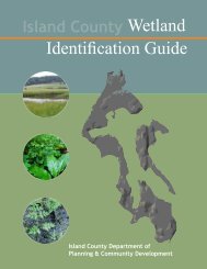
Wetland I.D. Guide - Island County Government
Wetland I.D. Guide - Island County Government
Wetland I.D. Guide - Island County Government

You also want an ePaper? Increase the reach of your titles
YUMPU automatically turns print PDFs into web optimized ePapers that Google loves.
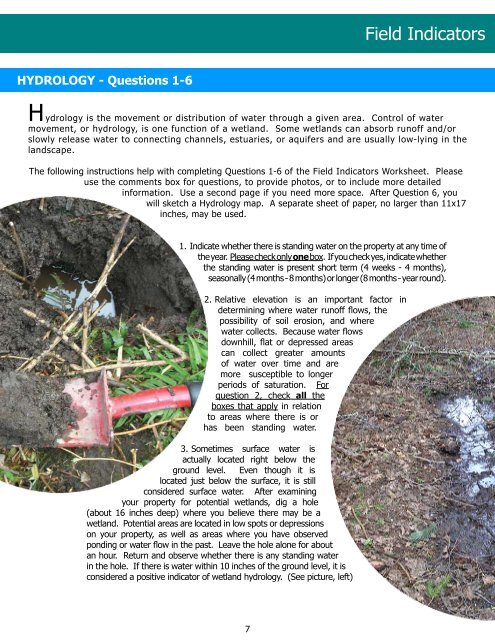
hYdRologY - Questions 1-6<br />
Field Indicators<br />
H ydrology is the movement or distribution of water through a given area. Control of water<br />
movement, or hydrology, is one function of a wetland. Some wetlands can absorb runoff and/or<br />
slowly release water to connecting channels, estuaries, or aquifers and are usually low-lying in the<br />
landscape.<br />
The following instructions help with completing Questions 1-6 of the Field Indicators Worksheet. Please<br />
use the comments box for questions, to provide photos, or to include more detailed<br />
information. Use a second page if you need more space. After Question 6, you<br />
will sketch a Hydrology map. A separate sheet of paper, no larger than 11x17<br />
inches, may be used.<br />
1.<br />
Indicate whether there is standing water on the property at any time of<br />
the year. Please check only one box. If you check yes, indicate whether<br />
the standing water is present short term (4 weeks - 4 months),<br />
seasonally (4 months - 8 months) or longer (8 months - year round).<br />
2. Relative elevation is an important factor in<br />
determining where water runoff flows, the<br />
possibility of soil erosion, and where<br />
water collects. Because water flows<br />
downhill, flat or depressed areas<br />
can collect greater amounts<br />
of water over time and are<br />
more susceptible to longer<br />
periods of saturation. For<br />
question 2, check all the<br />
boxes that apply in relation<br />
to areas where there is or<br />
has been standing water.<br />
3. Sometimes surface water is<br />
actually located right below the<br />
ground level. Even though it is<br />
located just below the surface, it is still<br />
considered surface water. After examining<br />
your property for potential wetlands, dig a hole<br />
(about 16 inches deep) where you believe there may be a<br />
wetland. Potential areas are located in low spots or depressions<br />
on your property, as well as areas where you have observed<br />
ponding or water flow in the past. Leave the hole alone for about<br />
an hour. Return and observe whether there is any standing water<br />
in the hole. If there is water within 10 inches of the ground level, it is<br />
considered a positive indicator of wetland hydrology. (See picture, left)<br />
7