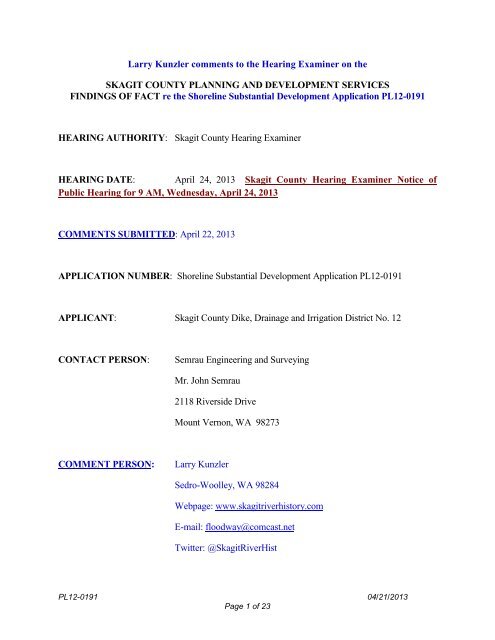
Larry Kunzler comments to the Hearing Examiner on the SKAGIT ...
Larry Kunzler comments to the Hearing Examiner on the SKAGIT ...
Larry Kunzler comments to the Hearing Examiner on the SKAGIT ...

Create successful ePaper yourself
Turn your PDF publications into a flip-book with our unique Google optimized e-Paper software.
<str<strong>on</strong>g>Larry</str<strong>on</strong>g> <str<strong>on</strong>g>Kunzler</str<strong>on</strong>g> <str<strong>on</strong>g>comments</str<strong>on</strong>g> <str<strong>on</strong>g>to</str<strong>on</strong>g> <str<strong>on</strong>g>the</str<strong>on</strong>g> <str<strong>on</strong>g>Hearing</str<strong>on</strong>g> <str<strong>on</strong>g>Examiner</str<strong>on</strong>g> <strong>on</strong> <str<strong>on</strong>g>the</str<strong>on</strong>g><br />
<strong>SKAGIT</strong> COUNTY PLANNING AND DEVELOPMENT SERVICES<br />
FINDINGS OF FACT re <str<strong>on</strong>g>the</str<strong>on</strong>g> Shoreline Substantial Development Applicati<strong>on</strong> PL12-0191<br />
HEARING AUTHORITY: Skagit County <str<strong>on</strong>g>Hearing</str<strong>on</strong>g> <str<strong>on</strong>g>Examiner</str<strong>on</strong>g><br />
HEARING DATE: April 24, 2013 Skagit County <str<strong>on</strong>g>Hearing</str<strong>on</strong>g> <str<strong>on</strong>g>Examiner</str<strong>on</strong>g> Notice of<br />
Public <str<strong>on</strong>g>Hearing</str<strong>on</strong>g> for 9 AM, Wednesday, April 24, 2013<br />
COMMENTS SUBMITTED: April 22, 2013<br />
APPLICATION NUMBER: Shoreline Substantial Development Applicati<strong>on</strong> PL12-0191<br />
APPLICANT: Skagit County Dike, Drainage and Irrigati<strong>on</strong> District No. 12<br />
CONTACT PERSON: Semrau Engineering and Surveying<br />
Mr. John Semrau<br />
2118 Riverside Drive<br />
Mount Vern<strong>on</strong>, WA 98273<br />
COMMENT PERSON: <str<strong>on</strong>g>Larry</str<strong>on</strong>g> <str<strong>on</strong>g>Kunzler</str<strong>on</strong>g><br />
Sedro-Woolley, WA 98284<br />
Webpage: www.skagitriverhis<str<strong>on</strong>g>to</str<strong>on</strong>g>ry.com<br />
E-mail: floodway@comcast.net<br />
Twitter: @SkagitRiverHist<br />
PL12-0191 04/21/2013<br />
Page 1 of 23
OPENING COMMENT:<br />
First my apologies <str<strong>on</strong>g>to</str<strong>on</strong>g> <str<strong>on</strong>g>the</str<strong>on</strong>g> <str<strong>on</strong>g>Examiner</str<strong>on</strong>g> for not being able <str<strong>on</strong>g>to</str<strong>on</strong>g> testify at this hearing because of<br />
circumstances described below I did not learn of <str<strong>on</strong>g>the</str<strong>on</strong>g> hearing until last Friday and have already made<br />
work commitments that I cannot cancel.<br />
As <str<strong>on</strong>g>the</str<strong>on</strong>g> <str<strong>on</strong>g>Examiner</str<strong>on</strong>g> I’m sure remembers from <str<strong>on</strong>g>the</str<strong>on</strong>g> hearings <strong>on</strong> <str<strong>on</strong>g>the</str<strong>on</strong>g> Cascade Mall, I have been involved<br />
with <str<strong>on</strong>g>the</str<strong>on</strong>g> Skagit River flood issue for many years. I have served <strong>on</strong> <str<strong>on</strong>g>the</str<strong>on</strong>g> <strong>on</strong> <str<strong>on</strong>g>the</str<strong>on</strong>g> Skagit River Flood<br />
C<strong>on</strong>trol Advisory Committee, <str<strong>on</strong>g>the</str<strong>on</strong>g> State Department of Ecology Floodplain Management<br />
Advisory Committee, <str<strong>on</strong>g>the</str<strong>on</strong>g> Washing<str<strong>on</strong>g>to</str<strong>on</strong>g>n State Legislative Joint Select Committee <strong>on</strong> Flood<br />
Damage Reducti<strong>on</strong>, as an advisor <str<strong>on</strong>g>to</str<strong>on</strong>g> <str<strong>on</strong>g>the</str<strong>on</strong>g> Skagit River Impact Partnership, and currently serve as<br />
an at-large member <str<strong>on</strong>g>to</str<strong>on</strong>g> <str<strong>on</strong>g>the</str<strong>on</strong>g> Skagit County Flood C<strong>on</strong>trol Z<strong>on</strong>e District Advisory Committee. I<br />
also publish a web page at www.skagitriverhis<str<strong>on</strong>g>to</str<strong>on</strong>g>ry.com where many of <str<strong>on</strong>g>the</str<strong>on</strong>g> issues discussed<br />
herein are supported by appropriate documentati<strong>on</strong>. I have included an electr<strong>on</strong>ic copy of this<br />
document in order <str<strong>on</strong>g>to</str<strong>on</strong>g> assist <str<strong>on</strong>g>the</str<strong>on</strong>g> <str<strong>on</strong>g>Examiner</str<strong>on</strong>g> in reviewing <str<strong>on</strong>g>the</str<strong>on</strong>g> hyperlink embedded within this<br />
document. I str<strong>on</strong>gly urge <str<strong>on</strong>g>the</str<strong>on</strong>g> <str<strong>on</strong>g>Examiner</str<strong>on</strong>g> <str<strong>on</strong>g>to</str<strong>on</strong>g> query <str<strong>on</strong>g>the</str<strong>on</strong>g> site for any assistance it can render in<br />
helping <str<strong>on</strong>g>the</str<strong>on</strong>g> <str<strong>on</strong>g>Examiner</str<strong>on</strong>g> make an informed decisi<strong>on</strong> c<strong>on</strong>cerning this applicati<strong>on</strong>.<br />
It is with a great sense of pers<strong>on</strong>al outrage that I submit <str<strong>on</strong>g>the</str<strong>on</strong>g>se <str<strong>on</strong>g>comments</str<strong>on</strong>g> <str<strong>on</strong>g>to</str<strong>on</strong>g> <str<strong>on</strong>g>the</str<strong>on</strong>g> H<strong>on</strong>orable <str<strong>on</strong>g>Hearing</str<strong>on</strong>g><br />
<str<strong>on</strong>g>Examiner</str<strong>on</strong>g> regarding <str<strong>on</strong>g>the</str<strong>on</strong>g> above listed permit applicati<strong>on</strong>. If anything pers<strong>on</strong>ifies <str<strong>on</strong>g>the</str<strong>on</strong>g> “sleaze fac<str<strong>on</strong>g>to</str<strong>on</strong>g>r”<br />
in Skagit County it is this applicati<strong>on</strong>, not <strong>on</strong>ly for <str<strong>on</strong>g>the</str<strong>on</strong>g> way it has been hidden from <str<strong>on</strong>g>the</str<strong>on</strong>g> current flood<br />
committee but how over <str<strong>on</strong>g>the</str<strong>on</strong>g> years DD12 has c<strong>on</strong>ducted itself as a “outlaw government entity” in<br />
c<strong>on</strong>juncti<strong>on</strong> with <str<strong>on</strong>g>the</str<strong>on</strong>g> Burling<str<strong>on</strong>g>to</str<strong>on</strong>g>n City Planning Department and evidently now <str<strong>on</strong>g>the</str<strong>on</strong>g> Skagit County<br />
Planning Department.<br />
On or about February 25 th of this year, I met with <str<strong>on</strong>g>the</str<strong>on</strong>g> Planning Dept. representative and asked <str<strong>on</strong>g>to</str<strong>on</strong>g> see<br />
all active files regarding permits for Dike District 12 (“DD12”). All I was given was a file <strong>on</strong> a<br />
project <str<strong>on</strong>g>to</str<strong>on</strong>g> raise <str<strong>on</strong>g>the</str<strong>on</strong>g> levees adjacent <str<strong>on</strong>g>to</str<strong>on</strong>g> Puget Sound. I asked and I was <str<strong>on</strong>g>to</str<strong>on</strong>g>ld emphatically that <str<strong>on</strong>g>the</str<strong>on</strong>g>re<br />
were no o<str<strong>on</strong>g>the</str<strong>on</strong>g>r files regarding <str<strong>on</strong>g>the</str<strong>on</strong>g> applicati<strong>on</strong> for any permits. Clearly by <str<strong>on</strong>g>the</str<strong>on</strong>g> Exhibits listed in <str<strong>on</strong>g>the</str<strong>on</strong>g><br />
Findings of Facts this permit applicati<strong>on</strong> was submitted and active from July 9 th 2012. I did not<br />
learn of this hearing or permit applicati<strong>on</strong> until last Friday, April 19 th . Thus I, and for that matter<br />
<str<strong>on</strong>g>the</str<strong>on</strong>g> general public at large has been denied a full and complete opportunity <str<strong>on</strong>g>to</str<strong>on</strong>g> review this permit<br />
applicati<strong>on</strong> and provide appropriate <str<strong>on</strong>g>comments</str<strong>on</strong>g>. This despite <str<strong>on</strong>g>the</str<strong>on</strong>g> fact that at <str<strong>on</strong>g>the</str<strong>on</strong>g> last meeting before<br />
<str<strong>on</strong>g>the</str<strong>on</strong>g> Skagit County Flood C<strong>on</strong>trol Z<strong>on</strong>e District Advisory Committee (“FCZD”) <strong>on</strong> April 13 th , a<br />
discussi<strong>on</strong> ensued about <str<strong>on</strong>g>the</str<strong>on</strong>g> illegal activities of <str<strong>on</strong>g>the</str<strong>on</strong>g> DD12 permit his<str<strong>on</strong>g>to</str<strong>on</strong>g>ry and <str<strong>on</strong>g>the</str<strong>on</strong>g> DD12 at<str<strong>on</strong>g>to</str<strong>on</strong>g>rney was<br />
PL12-0191 04/21/2013<br />
Page 2 of 23
publically asked about DD12 permits and <str<strong>on</strong>g>the</str<strong>on</strong>g> resp<strong>on</strong>se we received was “I can’t comment <strong>on</strong> that.”<br />
Thus <str<strong>on</strong>g>the</str<strong>on</strong>g> members of <str<strong>on</strong>g>the</str<strong>on</strong>g> FCZD committee were not given notice of this hearing nor an opportunity<br />
for public discussi<strong>on</strong> am<strong>on</strong>gst <str<strong>on</strong>g>the</str<strong>on</strong>g>mselves. Ir<strong>on</strong>ically, <str<strong>on</strong>g>the</str<strong>on</strong>g>re was a discussi<strong>on</strong> about how <str<strong>on</strong>g>the</str<strong>on</strong>g> public<br />
needs <str<strong>on</strong>g>to</str<strong>on</strong>g> be <str<strong>on</strong>g>to</str<strong>on</strong>g>ld <str<strong>on</strong>g>the</str<strong>on</strong>g> truth about <str<strong>on</strong>g>the</str<strong>on</strong>g> flooding situati<strong>on</strong> in Skagit County. That truth is that <str<strong>on</strong>g>the</str<strong>on</strong>g><br />
severity of <str<strong>on</strong>g>the</str<strong>on</strong>g> flooding of <str<strong>on</strong>g>the</str<strong>on</strong>g> Skagit River in <str<strong>on</strong>g>the</str<strong>on</strong>g> lower valley is not an Act of God but an act of<br />
DD12 (See The Realities of Flood C<strong>on</strong>trol in Skagit County) and <str<strong>on</strong>g>the</str<strong>on</strong>g>ir illegal practices of<br />
putting fill in <str<strong>on</strong>g>the</str<strong>on</strong>g> floodway of <str<strong>on</strong>g>the</str<strong>on</strong>g> Skagit River (raised <str<strong>on</strong>g>the</str<strong>on</strong>g>ir levees al<strong>on</strong>g Whitmarsh Road 4 feet<br />
without any permits), fill from <str<strong>on</strong>g>the</str<strong>on</strong>g>ir keyway projects placed <strong>on</strong> <str<strong>on</strong>g>the</str<strong>on</strong>g> riverward side of <str<strong>on</strong>g>the</str<strong>on</strong>g> levees (i.e.<br />
floodway). Their illegal activity that <str<strong>on</strong>g>the</str<strong>on</strong>g> DD12 commissi<strong>on</strong>ers even boast about at public meetings,<br />
“Yeah we never do improvements; all we do is maintenance, ha ha ha.” In c<strong>on</strong>juncti<strong>on</strong> with <str<strong>on</strong>g>the</str<strong>on</strong>g><br />
Burling<str<strong>on</strong>g>to</str<strong>on</strong>g>n City Planning Department and now evidently <str<strong>on</strong>g>the</str<strong>on</strong>g> Skagit County Planning Department<br />
<str<strong>on</strong>g>the</str<strong>on</strong>g> DD12 is trying <str<strong>on</strong>g>to</str<strong>on</strong>g> legitimize <str<strong>on</strong>g>the</str<strong>on</strong>g>ir complete trashing of <str<strong>on</strong>g>the</str<strong>on</strong>g> Shoreline Management Act and <str<strong>on</strong>g>the</str<strong>on</strong>g>ir<br />
illegal activities in <str<strong>on</strong>g>the</str<strong>on</strong>g> past. I str<strong>on</strong>gly urge <str<strong>on</strong>g>the</str<strong>on</strong>g> <str<strong>on</strong>g>Examiner</str<strong>on</strong>g> <str<strong>on</strong>g>to</str<strong>on</strong>g> review <str<strong>on</strong>g>the</str<strong>on</strong>g> past permitting (or <str<strong>on</strong>g>the</str<strong>on</strong>g> lack<br />
<str<strong>on</strong>g>the</str<strong>on</strong>g>reof) his<str<strong>on</strong>g>to</str<strong>on</strong>g>ry of <str<strong>on</strong>g>the</str<strong>on</strong>g> DD12. I would ask <str<strong>on</strong>g>the</str<strong>on</strong>g> <str<strong>on</strong>g>Examiner</str<strong>on</strong>g> <str<strong>on</strong>g>to</str<strong>on</strong>g> take judicial notice of <str<strong>on</strong>g>the</str<strong>on</strong>g> requirement in<br />
WAC 197-11-800(3)(c) wherein it states in part<br />
PROJECT LOCATION<br />
Repair/rebuilding of major dams, dikes, and reservoirs shall also not<br />
be c<strong>on</strong>sidered exempt under this subsecti<strong>on</strong>. (Emphasis added.)<br />
The area subject <str<strong>on</strong>g>to</str<strong>on</strong>g> <str<strong>on</strong>g>the</str<strong>on</strong>g> proposed shoreline stabilizati<strong>on</strong> and flood protecti<strong>on</strong> improvements is<br />
located al<strong>on</strong>g <str<strong>on</strong>g>the</str<strong>on</strong>g> right (north & west) bank of <str<strong>on</strong>g>the</str<strong>on</strong>g> Skagit River extending from Lafayette Road in<br />
<str<strong>on</strong>g>the</str<strong>on</strong>g> North <str<strong>on</strong>g>to</str<strong>on</strong>g> Gardner Road in <str<strong>on</strong>g>the</str<strong>on</strong>g> South, East of Burling<str<strong>on</strong>g>to</str<strong>on</strong>g>n, Washing<str<strong>on</strong>g>to</str<strong>on</strong>g>n, within Secti<strong>on</strong> 4,<br />
Township 34 North, Range 4 East & Secti<strong>on</strong> 33, Township 35 North, Range 4 East, W.M., Skagit<br />
County, WA.<br />
PROJECT DESCRIPTION<br />
This project is an eastern extensi<strong>on</strong> of <str<strong>on</strong>g>the</str<strong>on</strong>g> levee maintenance project initiated by <str<strong>on</strong>g>the</str<strong>on</strong>g> City of<br />
Burling<str<strong>on</strong>g>to</str<strong>on</strong>g>n, and Skagit County Dike, Drainage and Irrigati<strong>on</strong> District No. 12, intended <str<strong>on</strong>g>to</str<strong>on</strong>g> increase<br />
flood protecti<strong>on</strong>s for <str<strong>on</strong>g>the</str<strong>on</strong>g> City of Burling<str<strong>on</strong>g>to</str<strong>on</strong>g>n. Skagit County Dike, Drainage and Irrigati<strong>on</strong> District<br />
No. 12 propose <str<strong>on</strong>g>to</str<strong>on</strong>g> enlarge both <str<strong>on</strong>g>the</str<strong>on</strong>g> width and <str<strong>on</strong>g>the</str<strong>on</strong>g> height of <str<strong>on</strong>g>the</str<strong>on</strong>g> existing Skagit River levee al<strong>on</strong>g <str<strong>on</strong>g>the</str<strong>on</strong>g><br />
1.53 mile l<strong>on</strong>g project site. The project extends from <str<strong>on</strong>g>the</str<strong>on</strong>g> Burling<str<strong>on</strong>g>to</str<strong>on</strong>g>n City limits at Gardner Road<br />
north <str<strong>on</strong>g>to</str<strong>on</strong>g> <str<strong>on</strong>g>the</str<strong>on</strong>g> terminus of <str<strong>on</strong>g>the</str<strong>on</strong>g> Burling<str<strong>on</strong>g>to</str<strong>on</strong>g>n Nor<str<strong>on</strong>g>the</str<strong>on</strong>g>rn Santa Fe Railroad <strong>on</strong> Lafayette Road in <str<strong>on</strong>g>the</str<strong>on</strong>g> North.<br />
The elevati<strong>on</strong> at <str<strong>on</strong>g>the</str<strong>on</strong>g> <str<strong>on</strong>g>to</str<strong>on</strong>g>p of <str<strong>on</strong>g>the</str<strong>on</strong>g> levee will be increased by approximately 4 feet in height and <str<strong>on</strong>g>the</str<strong>on</strong>g> <str<strong>on</strong>g>to</str<strong>on</strong>g>e<br />
PL12-0191 04/21/2013<br />
Page 3 of 23
or base of <str<strong>on</strong>g>the</str<strong>on</strong>g> levee will be increased by approximately 60 feet in width. The widening of <str<strong>on</strong>g>the</str<strong>on</strong>g> dike<br />
will be limited <str<strong>on</strong>g>to</str<strong>on</strong>g> an area landward of <str<strong>on</strong>g>the</str<strong>on</strong>g> existing levee <str<strong>on</strong>g>to</str<strong>on</strong>g>e. The purpose of <str<strong>on</strong>g>the</str<strong>on</strong>g> improvements is<br />
for structural reinforcement of <str<strong>on</strong>g>the</str<strong>on</strong>g> levy system <str<strong>on</strong>g>to</str<strong>on</strong>g> prevent a failure during elevated flood events.<br />
Below is a graphic summary prepared by Skagit County and <str<strong>on</strong>g>the</str<strong>on</strong>g> Corps of Engineers hydraulic<br />
c<strong>on</strong>sultant (nhc) <strong>on</strong> <str<strong>on</strong>g>the</str<strong>on</strong>g> impacts of <str<strong>on</strong>g>the</str<strong>on</strong>g> current levee system <strong>on</strong> upstream property owners.<br />
PL12-0191 04/21/2013<br />
Page 4 of 23
The numbers represent <str<strong>on</strong>g>the</str<strong>on</strong>g> amount in feet of ADDITIONAL water <str<strong>on</strong>g>the</str<strong>on</strong>g> levee system described<br />
above currently artificially s<str<strong>on</strong>g>to</str<strong>on</strong>g>res upstream. This artificial s<str<strong>on</strong>g>to</str<strong>on</strong>g>rage impacts not <strong>on</strong>ly <str<strong>on</strong>g>the</str<strong>on</strong>g><br />
Nookachamps/Sterling/Clear Lake/Sedro-Woolley communities but is resp<strong>on</strong>sible for pushing<br />
floodwaters over Highway 20 <str<strong>on</strong>g>to</str<strong>on</strong>g> <str<strong>on</strong>g>the</str<strong>on</strong>g> North and thus flooding <str<strong>on</strong>g>the</str<strong>on</strong>g> old natural channel of <str<strong>on</strong>g>the</str<strong>on</strong>g> Skagit<br />
River, Gages Slough which as you can tell from <str<strong>on</strong>g>the</str<strong>on</strong>g> graphic below is several hundred yards wide,<br />
high ground <str<strong>on</strong>g>to</str<strong>on</strong>g> high ground.<br />
(Source: 12/1982 Dames & Moore Report)<br />
PL12-0191 04/21/2013<br />
Page 5 of 23
SITE DESCRIPTION<br />
This secti<strong>on</strong> of <str<strong>on</strong>g>the</str<strong>on</strong>g> existing levee is c<strong>on</strong>structed <strong>on</strong> an alluvial terrace and runs al<strong>on</strong>g <str<strong>on</strong>g>the</str<strong>on</strong>g> outer bend<br />
of an el<strong>on</strong>gated meander of <str<strong>on</strong>g>the</str<strong>on</strong>g> Skagit River. Bank erosi<strong>on</strong> c<strong>on</strong>tinues al<strong>on</strong>g this reach of <str<strong>on</strong>g>the</str<strong>on</strong>g> river<br />
and has progressed <str<strong>on</strong>g>to</str<strong>on</strong>g> <str<strong>on</strong>g>the</str<strong>on</strong>g> base of <str<strong>on</strong>g>the</str<strong>on</strong>g> levee <strong>on</strong> <str<strong>on</strong>g>the</str<strong>on</strong>g> north end. Rock has been placed at <str<strong>on</strong>g>the</str<strong>on</strong>g> waterward<br />
<str<strong>on</strong>g>to</str<strong>on</strong>g>e of <str<strong>on</strong>g>the</str<strong>on</strong>g> levee at this locati<strong>on</strong> <str<strong>on</strong>g>to</str<strong>on</strong>g> prevent fur<str<strong>on</strong>g>the</str<strong>on</strong>g>r erosi<strong>on</strong> and encroachment in<str<strong>on</strong>g>to</str<strong>on</strong>g> <str<strong>on</strong>g>the</str<strong>on</strong>g> levee prism.<br />
COMMENT: What <str<strong>on</strong>g>the</str<strong>on</strong>g> above Site Descripti<strong>on</strong> fails <str<strong>on</strong>g>to</str<strong>on</strong>g> inform <str<strong>on</strong>g>the</str<strong>on</strong>g> <str<strong>on</strong>g>Examiner</str<strong>on</strong>g> is that <str<strong>on</strong>g>the</str<strong>on</strong>g> entire<br />
locati<strong>on</strong> of <str<strong>on</strong>g>the</str<strong>on</strong>g> proposed project sits a<str<strong>on</strong>g>to</str<strong>on</strong>g>p volcanic lahars. (See 11/2010 DRAFT Skagit River<br />
Flood Risk Reducti<strong>on</strong> Study, Envir<strong>on</strong>mental Without-Project C<strong>on</strong>diti<strong>on</strong> Report and Figure<br />
4 of Report <strong>on</strong> Mount Vern<strong>on</strong> Flood Protecti<strong>on</strong> Project Geotechnical Assessment, Mount Vern<strong>on</strong><br />
Washing<str<strong>on</strong>g>to</str<strong>on</strong>g>n)<br />
Envir<strong>on</strong>mental Setting<br />
The Skagit River watershed supports <str<strong>on</strong>g>the</str<strong>on</strong>g> Puget Sound’s largest populati<strong>on</strong>s of naturally reproducing<br />
salm<strong>on</strong> and steelhead trout, and has been identified as a core watershed for <str<strong>on</strong>g>the</str<strong>on</strong>g> recovery of<br />
Endangered Species Act-listed Chinook salm<strong>on</strong>, steelhead, and bull trout. The assessment reach is<br />
utilized by recreati<strong>on</strong>alists such as boaters and fisherman.<br />
The area water ward of <str<strong>on</strong>g>the</str<strong>on</strong>g> proposal provides habitat for <str<strong>on</strong>g>the</str<strong>on</strong>g> Chinook salm<strong>on</strong>, steelhead trout, and<br />
bull trout including adult and juvenile migrati<strong>on</strong> in <str<strong>on</strong>g>the</str<strong>on</strong>g> channel; juvenile rearing al<strong>on</strong>g <str<strong>on</strong>g>the</str<strong>on</strong>g> channel<br />
margins; spawning habitat, and refuge habitat in riparian forests during high flow events. Habitat<br />
c<strong>on</strong>diti<strong>on</strong>s for terrestrial species are primarily dominated by forest plant communities with <str<strong>on</strong>g>the</str<strong>on</strong>g><br />
excepti<strong>on</strong> of small scale farms, roads, and residences. Bald eagles perch <strong>on</strong> suitable-sized trees<br />
al<strong>on</strong>g <str<strong>on</strong>g>the</str<strong>on</strong>g> riparian corridor and feed <strong>on</strong> salm<strong>on</strong> within <str<strong>on</strong>g>the</str<strong>on</strong>g> project area.<br />
EXHIBITS:<br />
1. Departmental Staff report.<br />
2. Shoreline Substantial Development/C<strong>on</strong>diti<strong>on</strong>al Use applicati<strong>on</strong> PL12-0050<br />
submitted July 9, 2012.<br />
3. Skagit County Assessor’s Parcel & Tax Account Number list for PL12-0191.<br />
4. Site Plans.<br />
5. Notice of Development Applicati<strong>on</strong>, published November 22 & 29, 2012.<br />
6. SEPA Final EIS issued July 16, 2010 by <str<strong>on</strong>g>the</str<strong>on</strong>g> City of Burling<str<strong>on</strong>g>to</str<strong>on</strong>g>n.<br />
7. Wetland Site Assessment Report by Graham Bunting Associates, dated<br />
November 8, 2012.<br />
PL12-0191 04/21/2013<br />
Page 6 of 23
8. Fish and Wildlife Site Assessment Report by Graham Bunting Associates,<br />
dated February 27, 2013.<br />
COMMENTS RECEIVED<br />
9. A comment letter was received from Dike District No. 20, dated January 2, 2013,<br />
indicating that <str<strong>on</strong>g>the</str<strong>on</strong>g> additi<strong>on</strong> <str<strong>on</strong>g>to</str<strong>on</strong>g> <str<strong>on</strong>g>the</str<strong>on</strong>g> height of <str<strong>on</strong>g>the</str<strong>on</strong>g> levee at <str<strong>on</strong>g>the</str<strong>on</strong>g> proposed locati<strong>on</strong> will<br />
result in increased flood levels in <str<strong>on</strong>g>the</str<strong>on</strong>g> Nookachamps Drainage.<br />
10. A comment letter was received from DeVries Dairy, dated January 2, 2013,<br />
indicating that <str<strong>on</strong>g>the</str<strong>on</strong>g> additi<strong>on</strong> <str<strong>on</strong>g>to</str<strong>on</strong>g> <str<strong>on</strong>g>the</str<strong>on</strong>g> height of <str<strong>on</strong>g>the</str<strong>on</strong>g> levee at <str<strong>on</strong>g>the</str<strong>on</strong>g> proposed locati<strong>on</strong> will<br />
result in increased flood levels in <str<strong>on</strong>g>the</str<strong>on</strong>g> Nookachamps Drainage.<br />
COMMENT: The fact that as of <str<strong>on</strong>g>the</str<strong>on</strong>g> original publicati<strong>on</strong> of <str<strong>on</strong>g>the</str<strong>on</strong>g> “Findings of Fact” <str<strong>on</strong>g>the</str<strong>on</strong>g> Planning<br />
Department <strong>on</strong> received two “Comments” should add <str<strong>on</strong>g>to</str<strong>on</strong>g> <str<strong>on</strong>g>the</str<strong>on</strong>g> creditability of <str<strong>on</strong>g>the</str<strong>on</strong>g> statements earlier<br />
referring <str<strong>on</strong>g>to</str<strong>on</strong>g> <str<strong>on</strong>g>the</str<strong>on</strong>g> way this applicati<strong>on</strong> has been handled as “sleazy”. DeVries Dairy and Dike<br />
District #20 are <strong>on</strong>e of <str<strong>on</strong>g>the</str<strong>on</strong>g> same so in reality <str<strong>on</strong>g>the</str<strong>on</strong>g>y <strong>on</strong>ly received <strong>on</strong>e comment. When a project of<br />
this magnitude will impact hundreds of people and communities <strong>on</strong>e comment should certainly<br />
be suspect <str<strong>on</strong>g>to</str<strong>on</strong>g> <str<strong>on</strong>g>the</str<strong>on</strong>g> <str<strong>on</strong>g>Examiner</str<strong>on</strong>g>.<br />
GENERAL PROPERTY/PROJECT INFORMATION:<br />
• PARCEL #: P38223, P38305, P38304, P38302, P38307, P38220, P38308 & P38303<br />
• DEVELOPMENT SCHEDULE – Skagit County Dike, Drainage and Irrigati<strong>on</strong> District<br />
No. 12 has completed some of <str<strong>on</strong>g>the</str<strong>on</strong>g> acti<strong>on</strong>s by placing some fill <strong>on</strong> <str<strong>on</strong>g>the</str<strong>on</strong>g> landward side of <str<strong>on</strong>g>the</str<strong>on</strong>g><br />
dike. The remainder of <str<strong>on</strong>g>the</str<strong>on</strong>g> grading project will be completed during <str<strong>on</strong>g>the</str<strong>on</strong>g> spring, summer and<br />
early fall of 2013.<br />
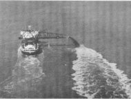
COMMENT: The fact is that DD12 got caught putting fill in <str<strong>on</strong>g>the</str<strong>on</strong>g> floodplain in <str<strong>on</strong>g>the</str<strong>on</strong>g> below<br />
newspaper article without a permit and decided it was time <str<strong>on</strong>g>to</str<strong>on</strong>g> apply for a permit, something <str<strong>on</strong>g>the</str<strong>on</strong>g>y<br />
clearly in <str<strong>on</strong>g>the</str<strong>on</strong>g> past were not used <str<strong>on</strong>g>to</str<strong>on</strong>g> doing.<br />
PL12-0191 04/21/2013<br />
Page 7 of 23
• PROJECT ACCESS – The project is served by access off of Gardner Road or Lafayette<br />
Road.<br />
• PROJECT TRAFFIC AND PARKING – No additi<strong>on</strong>al traffic or parking should occur as<br />
a result of <str<strong>on</strong>g>the</str<strong>on</strong>g> improvements. Temporary traffic delays may be necessary during<br />
c<strong>on</strong>structi<strong>on</strong> of <str<strong>on</strong>g>the</str<strong>on</strong>g> expanded levee.<br />
• SURROUNDING LAND USE – Current use of <str<strong>on</strong>g>the</str<strong>on</strong>g> adjacent properties is dominated by<br />
residential properties, agriculture, and natural areas such as <str<strong>on</strong>g>the</str<strong>on</strong>g> riparian corridor al<strong>on</strong>g <str<strong>on</strong>g>the</str<strong>on</strong>g><br />
Skagit River. The land adjacent <str<strong>on</strong>g>to</str<strong>on</strong>g> <str<strong>on</strong>g>the</str<strong>on</strong>g> project site is designated by <str<strong>on</strong>g>the</str<strong>on</strong>g> Skagit County<br />
Comprehensive Plan as Agriculture - Natural Resource Land.<br />
PL12-0191 04/21/2013<br />
Page 8 of 23
• AESTHETIC IMPACTS – The improvements are located <strong>on</strong> <str<strong>on</strong>g>the</str<strong>on</strong>g> shoreline of <str<strong>on</strong>g>the</str<strong>on</strong>g> Skagit<br />
River. Some aes<str<strong>on</strong>g>the</str<strong>on</strong>g>tic impacts are anticipated as a result of increasing <str<strong>on</strong>g>the</str<strong>on</strong>g> size of <str<strong>on</strong>g>the</str<strong>on</strong>g> levee.<br />
This may alter <str<strong>on</strong>g>the</str<strong>on</strong>g> visual character of <str<strong>on</strong>g>the</str<strong>on</strong>g> shoreline until <str<strong>on</strong>g>the</str<strong>on</strong>g> riparian areas recover.<br />
DEPARTMENTAL FINDINGS:<br />
1. ZONING/COMPREHENSIVE PLAN. The subject property is designated as<br />
Agriculture - Natural Resource Lands as indicated <strong>on</strong> <str<strong>on</strong>g>the</str<strong>on</strong>g> Comprehensive Plan and<br />
Z<strong>on</strong>ing maps adopted December 23, 2008, and as amended <str<strong>on</strong>g>the</str<strong>on</strong>g>reafter. The subject site<br />
has a shoreline designati<strong>on</strong> of Rural as indicated in <str<strong>on</strong>g>the</str<strong>on</strong>g> Skagit County Shoreline<br />
Management Master Program (SCSMMP). The Skagit River is a Shoreline of Statewide<br />
Significance.<br />
2. PROCESSING. A Notice of Development Applicati<strong>on</strong> was posted <strong>on</strong> <str<strong>on</strong>g>the</str<strong>on</strong>g> subject<br />
property and published in a newspaper of general circulati<strong>on</strong> <strong>on</strong> November 22 & 29,<br />
2012 as required by Secti<strong>on</strong> 14.26.9.04 of Skagit County Code. Notificati<strong>on</strong> was<br />
provided <str<strong>on</strong>g>to</str<strong>on</strong>g> all property owners within 300 feet of <str<strong>on</strong>g>the</str<strong>on</strong>g> subject property. There was a 30<br />
day comment period associated with <str<strong>on</strong>g>the</str<strong>on</strong>g> Notice of Development which ended <strong>on</strong><br />
December 28, 2012. Two comment letters were received, see exhibits 9 & 10.<br />
3. STATE ENVIRONMENTAL POLICY ACT. A Determinati<strong>on</strong> of Significance (DS)<br />
was issued by <str<strong>on</strong>g>the</str<strong>on</strong>g> City of Burling<str<strong>on</strong>g>to</str<strong>on</strong>g>n and a draft envir<strong>on</strong>mental impact statement (DEIS)<br />
was completed <strong>on</strong> Feb 13, 2009 for <str<strong>on</strong>g>the</str<strong>on</strong>g> dike stabilizati<strong>on</strong> project. The Final<br />
Envir<strong>on</strong>mental Impact Statement (EIS) was issued <strong>on</strong> July 16, 2010. The final EIS is<br />
included as Exhibit 6.<br />
COMMENT: Exhibit #6 is <str<strong>on</strong>g>the</str<strong>on</strong>g> Final Envir<strong>on</strong>mental Impact Statement/FEIS To Adopt A<br />
Strategic Program for Comprehensive Flood Hazard Mitigati<strong>on</strong>. In my pers<strong>on</strong>al opini<strong>on</strong> <str<strong>on</strong>g>the</str<strong>on</strong>g><br />
document was <strong>on</strong>e of <str<strong>on</strong>g>the</str<strong>on</strong>g> greatest insults <str<strong>on</strong>g>to</str<strong>on</strong>g> <str<strong>on</strong>g>the</str<strong>on</strong>g> planning community and SEPA ever prepared. I<br />
pers<strong>on</strong>ally submitted a 20 page document of <str<strong>on</strong>g>comments</str<strong>on</strong>g> regarding <str<strong>on</strong>g>the</str<strong>on</strong>g> DEIS. Resp<strong>on</strong>ses <str<strong>on</strong>g>to</str<strong>on</strong>g> my<br />
<str<strong>on</strong>g>comments</str<strong>on</strong>g> al<strong>on</strong>e were not <strong>on</strong>ly an attempt <str<strong>on</strong>g>to</str<strong>on</strong>g> mislead <str<strong>on</strong>g>the</str<strong>on</strong>g> reviewer but a flat out lie. Example:<br />
See my comment and picture <strong>on</strong> page #121 of <str<strong>on</strong>g>the</str<strong>on</strong>g> FEIS, page #14 of my letter. Clearly I was<br />
talking about <str<strong>on</strong>g>the</str<strong>on</strong>g> 4 feet of fill placed in <str<strong>on</strong>g>the</str<strong>on</strong>g> floodway of <str<strong>on</strong>g>the</str<strong>on</strong>g> Skagit River, riverward of <str<strong>on</strong>g>the</str<strong>on</strong>g> old<br />
levee al<strong>on</strong>g Whitmarsh Road. In <str<strong>on</strong>g>the</str<strong>on</strong>g> FEIS <strong>on</strong> page #39 addressing that c<strong>on</strong>cern it was reported<br />
that I was talking about rocks al<strong>on</strong>g <str<strong>on</strong>g>the</str<strong>on</strong>g> Whitmarsh levee. In my opini<strong>on</strong>, <str<strong>on</strong>g>the</str<strong>on</strong>g>se untrustworthy<br />
scoundrels cannot be trusted <str<strong>on</strong>g>to</str<strong>on</strong>g> comply with <str<strong>on</strong>g>the</str<strong>on</strong>g> requirements of SEPA and pers<strong>on</strong>ify <str<strong>on</strong>g>the</str<strong>on</strong>g> sleaze<br />
fac<str<strong>on</strong>g>to</str<strong>on</strong>g>r in Skagit County. Again in my opini<strong>on</strong> it does not matter whe<str<strong>on</strong>g>the</str<strong>on</strong>g>r it is Dike District<br />
commissi<strong>on</strong>ers, planners, Shoreline Administra<str<strong>on</strong>g>to</str<strong>on</strong>g>rs or even <str<strong>on</strong>g>the</str<strong>on</strong>g> at<str<strong>on</strong>g>to</str<strong>on</strong>g>rneys representing <str<strong>on</strong>g>the</str<strong>on</strong>g>m, <str<strong>on</strong>g>the</str<strong>on</strong>g>y<br />
cannot be trusted. What kind of a pers<strong>on</strong> would flood some<strong>on</strong>e else with <str<strong>on</strong>g>the</str<strong>on</strong>g>ir floodwater? What<br />
PL12-0191 04/21/2013<br />
Page 9 of 23
kind of people put an additi<strong>on</strong>al 60,000 plus cfs (6 feet or more) <str<strong>on</strong>g>to</str<strong>on</strong>g> travel downriver so o<str<strong>on</strong>g>the</str<strong>on</strong>g>r<br />
communities have <str<strong>on</strong>g>to</str<strong>on</strong>g> spend milli<strong>on</strong>s <strong>on</strong> a floodwall <str<strong>on</strong>g>to</str<strong>on</strong>g> protect <str<strong>on</strong>g>the</str<strong>on</strong>g>mselves from DD12’s water?<br />
What kind of people raise <str<strong>on</strong>g>the</str<strong>on</strong>g>ir existing levees 4 feet knowing that it will impact upriver<br />
communities my at least ano<str<strong>on</strong>g>the</str<strong>on</strong>g>r 2 feet of water as well as prol<strong>on</strong>g <str<strong>on</strong>g>the</str<strong>on</strong>g> volume of water in<str<strong>on</strong>g>to</str<strong>on</strong>g> <str<strong>on</strong>g>the</str<strong>on</strong>g><br />
Samish Basin? What kind of people indeed!! Almost this exact same project was proposed in<br />
1979. Even <str<strong>on</strong>g>the</str<strong>on</strong>g> residents of Burling<str<strong>on</strong>g>to</str<strong>on</strong>g>n voted it down. (See 1979 Levee Improvement Project<br />
His<str<strong>on</strong>g>to</str<strong>on</strong>g>rical Index in general and specifically 11/7/79 SVH article titled Decisive defeat at <str<strong>on</strong>g>the</str<strong>on</strong>g><br />
polls – Flood c<strong>on</strong>trol future unclear. Voters in Burling<str<strong>on</strong>g>to</str<strong>on</strong>g>n voted it down by a 65.9% vote.<br />
Countywide <str<strong>on</strong>g>the</str<strong>on</strong>g> voters turned down <str<strong>on</strong>g>the</str<strong>on</strong>g> project by a 71.4% no vote. But evidently <str<strong>on</strong>g>the</str<strong>on</strong>g> DD12,<br />
shoreline administra<str<strong>on</strong>g>to</str<strong>on</strong>g>rs and planners d<strong>on</strong>’t care about what voters want presumably because<br />
<str<strong>on</strong>g>the</str<strong>on</strong>g>y know what’s best for “<str<strong>on</strong>g>the</str<strong>on</strong>g>ir people” and <str<strong>on</strong>g>the</str<strong>on</strong>g> hell with who <str<strong>on</strong>g>the</str<strong>on</strong>g>ir project hurts.<br />
4. FLOOD AREA REVIEW. The existing levee is located within an A7 flood z<strong>on</strong>e which<br />
is designated as a 100 year flood area as indicated <strong>on</strong> FIRM Community Panel Number<br />
530151 0235D, effective September 29, 1989, and Panel Number 530151 250C, effective<br />
January 3, 1985.<br />
5. CRITICAL AREA REVIEW: The subject parcel was reviewed with respect <str<strong>on</strong>g>to</str<strong>on</strong>g> <str<strong>on</strong>g>the</str<strong>on</strong>g><br />
Skagit County Critical Areas Ordinance, Chapter 14.24 of <str<strong>on</strong>g>the</str<strong>on</strong>g> Skagit County Code. The<br />
results of <str<strong>on</strong>g>the</str<strong>on</strong>g> critical areas review indicated that critical areas/c<strong>on</strong>diti<strong>on</strong>s were <strong>on</strong> or<br />
within 200 feet of <str<strong>on</strong>g>the</str<strong>on</strong>g> proposed development, which include wetlands and fish & wildlife<br />
habitat c<strong>on</strong>servati<strong>on</strong> areas. The applicant submitted a wetland site assessment report by<br />
Graham Bunting Associates, dated November 8, 2012, a fish and wildlife site assessment<br />
by Graham Bunting Associates, dated February 27, 2013, and a Biological Assessment<br />
by Anchor QEC, LLC, dated Oc<str<strong>on</strong>g>to</str<strong>on</strong>g>ber 2009. (The biological assessment is specific <str<strong>on</strong>g>to</str<strong>on</strong>g> <str<strong>on</strong>g>the</str<strong>on</strong>g><br />
three bridge corridor south and west of <str<strong>on</strong>g>the</str<strong>on</strong>g> subject site. Although <str<strong>on</strong>g>the</str<strong>on</strong>g> study was limited <str<strong>on</strong>g>to</str<strong>on</strong>g><br />
<str<strong>on</strong>g>the</str<strong>on</strong>g> three bridge corridor).<br />
The assessments indicate that <str<strong>on</strong>g>the</str<strong>on</strong>g> proposed improvements were determined <str<strong>on</strong>g>to</str<strong>on</strong>g> be in<br />
compliance with Skagit County’s Critical Areas regulati<strong>on</strong>s. Additi<strong>on</strong>al critical areas<br />
compliance and envir<strong>on</strong>mental protecti<strong>on</strong>s are provided under <str<strong>on</strong>g>the</str<strong>on</strong>g> provisi<strong>on</strong>s of SCC<br />
14.24.040 (3), Jurisdicti<strong>on</strong>al Substituti<strong>on</strong> with <str<strong>on</strong>g>the</str<strong>on</strong>g> United States Army Corps of<br />
Engineers.<br />
COMMENT: For many years now I have maintained that FEMA designated <str<strong>on</strong>g>the</str<strong>on</strong>g> levees from <str<strong>on</strong>g>the</str<strong>on</strong>g><br />
landward <str<strong>on</strong>g>to</str<strong>on</strong>g>e of <str<strong>on</strong>g>the</str<strong>on</strong>g> levee <str<strong>on</strong>g>to</str<strong>on</strong>g> <str<strong>on</strong>g>the</str<strong>on</strong>g> landward <str<strong>on</strong>g>to</str<strong>on</strong>g>e of <str<strong>on</strong>g>the</str<strong>on</strong>g> levee as areas that should be treated as<br />
floodways which would necessitate <str<strong>on</strong>g>the</str<strong>on</strong>g>m being classified as critical areas. I tried again in my 20<br />
page letter of <str<strong>on</strong>g>comments</str<strong>on</strong>g> <strong>on</strong> <str<strong>on</strong>g>the</str<strong>on</strong>g> DEIS for this project. Once again <str<strong>on</strong>g>to</str<strong>on</strong>g> no big surprise that effort was<br />
not properly addressed. I would call <str<strong>on</strong>g>the</str<strong>on</strong>g> <str<strong>on</strong>g>Examiner</str<strong>on</strong>g>s attenti<strong>on</strong> <str<strong>on</strong>g>to</str<strong>on</strong>g> <str<strong>on</strong>g>the</str<strong>on</strong>g> following documents:<br />
PL12-0191 04/21/2013<br />
Page 10 of 23
12/1982 Dames & Moore Report<br />
2/1/1984<br />
11/08/1984<br />
FEMA letter re denial of<br />
appeal filed <strong>on</strong> Burling<str<strong>on</strong>g>to</str<strong>on</strong>g>n<br />
FIS<br />
Transcript of Burling<str<strong>on</strong>g>to</str<strong>on</strong>g>n City<br />
Council Meeting November 8,<br />
1984<br />
100 year flood determined <str<strong>on</strong>g>to</str<strong>on</strong>g> be 240,000 cfs at Sedro-<br />
Woolley. 110,000 cfs assumed <str<strong>on</strong>g>to</str<strong>on</strong>g> stay in channel. 130,000<br />
cfs assumed <str<strong>on</strong>g>to</str<strong>on</strong>g> flow overland. Assumed 86,000 cfs flowing<br />
<str<strong>on</strong>g>to</str<strong>on</strong>g> Padilla Bay and 44,000 cfs flowing <str<strong>on</strong>g>to</str<strong>on</strong>g> Skagit Bay via <str<strong>on</strong>g>the</str<strong>on</strong>g><br />
Samish basin. I-5 will ultimately be over<str<strong>on</strong>g>to</str<strong>on</strong>g>pped. Used<br />
Mannings "n" values of .045 <str<strong>on</strong>g>to</str<strong>on</strong>g> .06. Recommended 10% of<br />
floodplain could be developed using density floodway<br />
method until flood waters would be raised 1 foot.<br />
This letter explains why <str<strong>on</strong>g>the</str<strong>on</strong>g> appeal of <str<strong>on</strong>g>the</str<strong>on</strong>g> Burling<str<strong>on</strong>g>to</str<strong>on</strong>g>n FIS<br />
was denied by FEMA. Regulati<strong>on</strong>s <strong>on</strong>ly require FEMA <str<strong>on</strong>g>to</str<strong>on</strong>g><br />
use available <str<strong>on</strong>g>to</str<strong>on</strong>g>pographic data. Lands within and including<br />
<str<strong>on</strong>g>the</str<strong>on</strong>g> Skagit River levees were designated as floodways.<br />
Unlikely that his<str<strong>on</strong>g>to</str<strong>on</strong>g>rical depth of floodwaters would be<br />
repeated.<br />
“Lastly <str<strong>on</strong>g>the</str<strong>on</strong>g>re is <str<strong>on</strong>g>the</str<strong>on</strong>g> FLOODWAY which in <str<strong>on</strong>g>the</str<strong>on</strong>g> case of<br />
Burling<str<strong>on</strong>g>to</str<strong>on</strong>g>n is <strong>on</strong>ly <str<strong>on</strong>g>the</str<strong>on</strong>g> area that runs landward of <str<strong>on</strong>g>the</str<strong>on</strong>g> dike<br />
by fifty feet. When you’re landward of <str<strong>on</strong>g>the</str<strong>on</strong>g> dike and your<br />
looking <str<strong>on</strong>g>to</str<strong>on</strong>g>wards <str<strong>on</strong>g>the</str<strong>on</strong>g> river essentially nothing can be built<br />
from that distance <str<strong>on</strong>g>to</str<strong>on</strong>g> <str<strong>on</strong>g>the</str<strong>on</strong>g> river.” (Steve Ladd, City Planner)<br />
I will give appropriate kudos <str<strong>on</strong>g>to</str<strong>on</strong>g> <str<strong>on</strong>g>the</str<strong>on</strong>g> writers of <str<strong>on</strong>g>the</str<strong>on</strong>g> FEIS for at least <strong>on</strong>e secti<strong>on</strong> wherein <str<strong>on</strong>g>the</str<strong>on</strong>g>y stated<br />
<strong>on</strong> page 13:<br />
The 1984 Flood Insurance Study stated “…for <str<strong>on</strong>g>the</str<strong>on</strong>g> Skagit River proper, <str<strong>on</strong>g>the</str<strong>on</strong>g> levees<br />
c<strong>on</strong>fining <str<strong>on</strong>g>the</str<strong>on</strong>g> channel and adjacent areas have been designated as<br />
floodways,” using <str<strong>on</strong>g>the</str<strong>on</strong>g> most landward levees <str<strong>on</strong>g>to</str<strong>on</strong>g> establish <str<strong>on</strong>g>the</str<strong>on</strong>g> floodway<br />
boundary.<br />
“C<strong>on</strong>venti<strong>on</strong>al floodways are not appropriate for <str<strong>on</strong>g>the</str<strong>on</strong>g> Skagit River<br />
delta area for a number of reas<strong>on</strong>s. Although flood elevati<strong>on</strong> and<br />
depth criteria can be established for <str<strong>on</strong>g>the</str<strong>on</strong>g> delta based up<strong>on</strong> general<br />
flood risk assessments which c<strong>on</strong>sider possible modes and<br />
locati<strong>on</strong>s of levee failure in flow path computati<strong>on</strong>s, such analyses<br />
are not appropriate for establishing floodways <strong>on</strong> <str<strong>on</strong>g>the</str<strong>on</strong>g> delta. Unlike<br />
typical valley situati<strong>on</strong>s, <str<strong>on</strong>g>the</str<strong>on</strong>g> exact locati<strong>on</strong> of flow paths during<br />
any particular flood event <strong>on</strong> <str<strong>on</strong>g>the</str<strong>on</strong>g> delta cannot be known in<br />
advance due <str<strong>on</strong>g>to</str<strong>on</strong>g> <str<strong>on</strong>g>the</str<strong>on</strong>g> uncertainty of where levee failures will occur,<br />
<str<strong>on</strong>g>the</str<strong>on</strong>g> relative sequence of levee failures, and <str<strong>on</strong>g>the</str<strong>on</strong>g> volumes of flow that<br />
will result. Likewise, because of <str<strong>on</strong>g>the</str<strong>on</strong>g> <str<strong>on</strong>g>to</str<strong>on</strong>g>pographic nature of <str<strong>on</strong>g>the</str<strong>on</strong>g><br />
delta, flooding occurs in sheet flow patterns and no <strong>on</strong>e particular<br />
PL12-0191 04/21/2013<br />
Page 11 of 23
flow path is inherently more efficient than o<str<strong>on</strong>g>the</str<strong>on</strong>g>r possible<br />
alternatives, making <str<strong>on</strong>g>the</str<strong>on</strong>g> selecti<strong>on</strong> of a floodway locati<strong>on</strong> highly<br />
arbitrary.”<br />
“Therefore, it is recommended that all communities with land use<br />
jurisdicti<strong>on</strong> <strong>on</strong> <str<strong>on</strong>g>the</str<strong>on</strong>g> delta assume a resp<strong>on</strong>sibility <str<strong>on</strong>g>to</str<strong>on</strong>g> maintain flow<br />
paths for floodwaters in order <str<strong>on</strong>g>to</str<strong>on</strong>g> minimize backwater effects which<br />
may increase flood levels. Suggested measures include design of<br />
new roads and streets <str<strong>on</strong>g>to</str<strong>on</strong>g> be at grade in order that obstructive fills<br />
not be placed perpendicular <str<strong>on</strong>g>to</str<strong>on</strong>g> local flow paths, preservati<strong>on</strong> of<br />
swale areas, and existing drainage channels such as Gages<br />
Slough, and a minimizati<strong>on</strong> of development density in currently<br />
z<strong>on</strong>ed agricultural areas.”<br />
Regarding a floodway designati<strong>on</strong> in Burling<str<strong>on</strong>g>to</str<strong>on</strong>g>n, FEMA helped with a<br />
compromise in 1984, which was <str<strong>on</strong>g>to</str<strong>on</strong>g> designate Gages Slough a “Special Flood Risk<br />
Area,” having a ground elevati<strong>on</strong> which is three feet or more below <str<strong>on</strong>g>the</str<strong>on</strong>g> 100-year<br />
floodplain elevati<strong>on</strong>. In additi<strong>on</strong>, FEMA included as floodway, areas lying<br />
within 300 feet of <str<strong>on</strong>g>the</str<strong>on</strong>g> landward <str<strong>on</strong>g>to</str<strong>on</strong>g>e of <str<strong>on</strong>g>the</str<strong>on</strong>g> levee. (Emphasis added.)<br />
So <str<strong>on</strong>g>the</str<strong>on</strong>g> levees AND 300 feet from <str<strong>on</strong>g>the</str<strong>on</strong>g> landward <str<strong>on</strong>g>to</str<strong>on</strong>g>e of <str<strong>on</strong>g>the</str<strong>on</strong>g> levee were designated as “floodway”<br />
which prohibits fill, so how can <str<strong>on</strong>g>the</str<strong>on</strong>g> <str<strong>on</strong>g>Examiner</str<strong>on</strong>g> allow this project <str<strong>on</strong>g>to</str<strong>on</strong>g> go forward when <str<strong>on</strong>g>the</str<strong>on</strong>g> project is<br />
asking <str<strong>on</strong>g>to</str<strong>on</strong>g> put 4 feet of “fill” <strong>on</strong> <str<strong>on</strong>g>to</str<strong>on</strong>g>p of <str<strong>on</strong>g>the</str<strong>on</strong>g> levee and add 60 feet of “fill” <str<strong>on</strong>g>to</str<strong>on</strong>g> <str<strong>on</strong>g>the</str<strong>on</strong>g> landward <str<strong>on</strong>g>to</str<strong>on</strong>g>e of<br />
<str<strong>on</strong>g>the</str<strong>on</strong>g> levee? I do not believe that ei<str<strong>on</strong>g>the</str<strong>on</strong>g>r proposal c<strong>on</strong>forms <str<strong>on</strong>g>to</str<strong>on</strong>g> <str<strong>on</strong>g>the</str<strong>on</strong>g> letter of <str<strong>on</strong>g>the</str<strong>on</strong>g> law and <str<strong>on</strong>g>the</str<strong>on</strong>g>refore<br />
urge <str<strong>on</strong>g>the</str<strong>on</strong>g> <str<strong>on</strong>g>Examiner</str<strong>on</strong>g> <str<strong>on</strong>g>to</str<strong>on</strong>g> deny <str<strong>on</strong>g>the</str<strong>on</strong>g> permit.<br />
6. HEALTH DEPARTMENT REVIEW: The applicati<strong>on</strong> was routed <str<strong>on</strong>g>to</str<strong>on</strong>g> <str<strong>on</strong>g>the</str<strong>on</strong>g> Skagit County<br />
Health Department for review. The Health Department commented “WAC 173-200 & 173-<br />
201A shall be observed. As l<strong>on</strong>g as staging/fill areas and work do not impact any septics &<br />
wells we have no c<strong>on</strong>cerns. SCC 14.24.330 2 (a) requires a narrative memo that no wells are<br />
in <str<strong>on</strong>g>the</str<strong>on</strong>g> area that could be impacted.” The Health Department requested that <str<strong>on</strong>g>the</str<strong>on</strong>g> following<br />
c<strong>on</strong>diti<strong>on</strong> be added <str<strong>on</strong>g>to</str<strong>on</strong>g> <str<strong>on</strong>g>the</str<strong>on</strong>g> staff report: If <str<strong>on</strong>g>the</str<strong>on</strong>g> demoliti<strong>on</strong> of any buildings occurs that<br />
discovers septic systems, DF/tanks, septic lines or pipes under <str<strong>on</strong>g>the</str<strong>on</strong>g> proposed project area,<br />
<str<strong>on</strong>g>the</str<strong>on</strong>g>n <str<strong>on</strong>g>the</str<strong>on</strong>g> c<strong>on</strong>trac<str<strong>on</strong>g>to</str<strong>on</strong>g>r shall call SCHD <str<strong>on</strong>g>to</str<strong>on</strong>g> obtain decommissi<strong>on</strong>ing approval. Any wells GB-1<br />
<str<strong>on</strong>g>to</str<strong>on</strong>g> GB-9 impacted or removed from <str<strong>on</strong>g>the</str<strong>on</strong>g> project site shall be decommissi<strong>on</strong>ed per state WAC.<br />
PL12-0191 04/21/2013<br />
Page 12 of 23
7. PUBLIC WORKS DEPARTMENT REVIEW: Public Works commented “The proposed<br />
project will need <str<strong>on</strong>g>to</str<strong>on</strong>g> comply with secti<strong>on</strong> 14.32.060 of <str<strong>on</strong>g>the</str<strong>on</strong>g> Skagit County Code. This secti<strong>on</strong><br />
deals with erosi<strong>on</strong> and sediment c<strong>on</strong>trols. A grading permit is required.”<br />
COMMENT: I would ask <str<strong>on</strong>g>the</str<strong>on</strong>g> <str<strong>on</strong>g>Examiner</str<strong>on</strong>g> <str<strong>on</strong>g>to</str<strong>on</strong>g> determine who in <str<strong>on</strong>g>the</str<strong>on</strong>g> Public Works Department made<br />
this comment? The Public Works Dept. works directly with <str<strong>on</strong>g>the</str<strong>on</strong>g> FCZD and at no time did <str<strong>on</strong>g>the</str<strong>on</strong>g><br />
department ever bring this subject up for discussi<strong>on</strong>.<br />
8. CURRENT PLANNING REVIEW: Current Planning staff had no comment <strong>on</strong> <str<strong>on</strong>g>the</str<strong>on</strong>g><br />
project.<br />
COMMENT: Really? Current Planning staff had no comment? One has <str<strong>on</strong>g>to</str<strong>on</strong>g> w<strong>on</strong>der if that is<br />
because <str<strong>on</strong>g>the</str<strong>on</strong>g>y know how badly <str<strong>on</strong>g>the</str<strong>on</strong>g> Burling<str<strong>on</strong>g>to</str<strong>on</strong>g>n City Planning Dept. and DD12 have trashed <str<strong>on</strong>g>the</str<strong>on</strong>g><br />
SMA in <str<strong>on</strong>g>the</str<strong>on</strong>g> past?<br />
9. BUILDING OFFICIAL/FLOODPLAIN MANAGER REVIEW: The Building Official<br />
<str<strong>on</strong>g>comments</str<strong>on</strong>g>: A grading and floodplain permit will be required. If <str<strong>on</strong>g>the</str<strong>on</strong>g> c<strong>on</strong>structi<strong>on</strong> results in<br />
modificati<strong>on</strong> of <str<strong>on</strong>g>the</str<strong>on</strong>g> regula<str<strong>on</strong>g>to</str<strong>on</strong>g>ry floodplain, first a CLOMR and <str<strong>on</strong>g>the</str<strong>on</strong>g>n a LOMR will be<br />
required.<br />
COMMENT: This would be <str<strong>on</strong>g>the</str<strong>on</strong>g> same floodplain manager who <str<strong>on</strong>g>to</str<strong>on</strong>g>ld me in February that <str<strong>on</strong>g>the</str<strong>on</strong>g>re<br />
were not any o<str<strong>on</strong>g>the</str<strong>on</strong>g>r open files <strong>on</strong> permits for DD12?<br />
10. FIRE MARSHAL REVIEW: The Fire Marshal did not have any <str<strong>on</strong>g>comments</str<strong>on</strong>g> <strong>on</strong> this<br />
project.<br />
11. SHORELINE MANAGEMENT MASTER PROGRAM CRITERIA: Skagit<br />
County’s SMMP, SCC 14.26, indicates that SMMP policies and regulati<strong>on</strong>s will be<br />
reviewed when approving or denying Shoreline permits. The proposed improvements<br />
are located within a Shoreline of Statewide Significance. Chapter 5.03 Shoreline of<br />
Statewide Significance, Chapter 7.06 Landfills, and Chapter 7.16, Shoreline stabilizati<strong>on</strong><br />
and Flood Protecti<strong>on</strong> were all reviewed with respect <str<strong>on</strong>g>to</str<strong>on</strong>g> <str<strong>on</strong>g>the</str<strong>on</strong>g> project and found <str<strong>on</strong>g>to</str<strong>on</strong>g> be in<br />
general compliance. Comments <str<strong>on</strong>g>to</str<strong>on</strong>g> Chapter 7.16 are as follows:<br />
Shoreline Stabilizati<strong>on</strong> and Flood Protecti<strong>on</strong> – Policies – General, 7.16, 1A.<br />
(1) Streamway modificati<strong>on</strong> and marine diking programs should be coordinated and<br />
m<strong>on</strong>i<str<strong>on</strong>g>to</str<strong>on</strong>g>red <str<strong>on</strong>g>to</str<strong>on</strong>g> provide for more comprehensive planning of Skagit County’s<br />
Shorelines.<br />
PL12-0191 04/21/2013<br />
Page 13 of 23
Streamway modificati<strong>on</strong> and marine diking is not included within <str<strong>on</strong>g>the</str<strong>on</strong>g> project<br />
proposal. However, increasing <str<strong>on</strong>g>the</str<strong>on</strong>g> dike height may result in minor modificati<strong>on</strong> of<br />
<str<strong>on</strong>g>the</str<strong>on</strong>g> Skagit River hydrology during elevated flood events. This project has been<br />
coordinated between Dike District 12 and <str<strong>on</strong>g>the</str<strong>on</strong>g> City of Burling<str<strong>on</strong>g>to</str<strong>on</strong>g>n. The proposal is<br />
not c<strong>on</strong>sidered a coordinated resp<strong>on</strong>se or an approved mitigati<strong>on</strong> measure for<br />
flooding prescribed by <str<strong>on</strong>g>the</str<strong>on</strong>g> members of <str<strong>on</strong>g>the</str<strong>on</strong>g> Skagit River General Investigati<strong>on</strong>.<br />
The proposal is solely designed <str<strong>on</strong>g>to</str<strong>on</strong>g> modify <str<strong>on</strong>g>the</str<strong>on</strong>g> existing diking system <strong>on</strong> <str<strong>on</strong>g>the</str<strong>on</strong>g> north<br />
and west side of <str<strong>on</strong>g>the</str<strong>on</strong>g> Skagit River in order <str<strong>on</strong>g>to</str<strong>on</strong>g> provide shoreline stabilizati<strong>on</strong> and<br />
greater flood protecti<strong>on</strong> <str<strong>on</strong>g>to</str<strong>on</strong>g> <str<strong>on</strong>g>the</str<strong>on</strong>g> City of Burling<str<strong>on</strong>g>to</str<strong>on</strong>g>n.<br />
COMMENT: Since this project so closely resembles <str<strong>on</strong>g>the</str<strong>on</strong>g> Corps of Engineers 1979 levee project<br />
at a minimum <str<strong>on</strong>g>the</str<strong>on</strong>g> increased dike height would result in at least 1.5 <str<strong>on</strong>g>to</str<strong>on</strong>g> 2 feet of water upstream of<br />
<str<strong>on</strong>g>the</str<strong>on</strong>g> project. Two more feet of water <strong>on</strong> <str<strong>on</strong>g>to</str<strong>on</strong>g>p of <str<strong>on</strong>g>the</str<strong>on</strong>g> water <str<strong>on</strong>g>the</str<strong>on</strong>g> DD12 people are already “s<str<strong>on</strong>g>to</str<strong>on</strong>g>ring”<br />
upstream <strong>on</strong> property is at least 12 feet higher <str<strong>on</strong>g>the</str<strong>on</strong>g>n down<str<strong>on</strong>g>to</str<strong>on</strong>g>wn Burling<str<strong>on</strong>g>to</str<strong>on</strong>g>n. How can <str<strong>on</strong>g>the</str<strong>on</strong>g>se people<br />
sleep at night? What government agency wants <str<strong>on</strong>g>to</str<strong>on</strong>g> say that putting water in<str<strong>on</strong>g>to</str<strong>on</strong>g> an 89 year old<br />
grandmo<str<strong>on</strong>g>the</str<strong>on</strong>g>r’s house is okay with <str<strong>on</strong>g>the</str<strong>on</strong>g>m? To date that would be DD12, Burling<str<strong>on</strong>g>to</str<strong>on</strong>g>n Planning<br />
Department and now evidently <str<strong>on</strong>g>the</str<strong>on</strong>g> Skagit County Shoreline Administra<str<strong>on</strong>g>to</str<strong>on</strong>g>r.<br />
(2) Recognizing that streamway modificati<strong>on</strong>s may cause interference with normal<br />
river geohydraulic processes that may lead <str<strong>on</strong>g>to</str<strong>on</strong>g> erosi<strong>on</strong> of o<str<strong>on</strong>g>the</str<strong>on</strong>g>r up and down river<br />
shorelines, <str<strong>on</strong>g>the</str<strong>on</strong>g>n such modificati<strong>on</strong>s and stabilizati<strong>on</strong> measures should incorporate<br />
basic geohydraulic principles and be located, designed, coordinated and<br />
maintained for homogeneous river reaches. Such modificati<strong>on</strong>s and measures<br />
should be sited and designed by qualified, professi<strong>on</strong>al pers<strong>on</strong>nel.<br />
This project was designed by <str<strong>on</strong>g>the</str<strong>on</strong>g> engineers of Pacific Internati<strong>on</strong>al Engineering<br />
utilizing geohydraulic principles in design and c<strong>on</strong>structi<strong>on</strong>. Although hydraulic<br />
modeling of <str<strong>on</strong>g>the</str<strong>on</strong>g> proposal indicates that upstream and downstream impacts may<br />
occur during elevated flood events, Dike District 12 and <str<strong>on</strong>g>the</str<strong>on</strong>g> City of Burling<str<strong>on</strong>g>to</str<strong>on</strong>g>n<br />
utilized designs that will minimize those impacts. The proposal is also required <str<strong>on</strong>g>to</str<strong>on</strong>g><br />
comply with <str<strong>on</strong>g>the</str<strong>on</strong>g> Flood Damage Preventi<strong>on</strong> Ordinance SCC 14.34.<br />
COMMENT: And so with <str<strong>on</strong>g>the</str<strong>on</strong>g> knowledge that <str<strong>on</strong>g>the</str<strong>on</strong>g> project has adverse impacts <strong>on</strong> upstream and<br />
downstream property owners <str<strong>on</strong>g>the</str<strong>on</strong>g> Shoreline Administra<str<strong>on</strong>g>to</str<strong>on</strong>g>r thinks it’s okay? Did <str<strong>on</strong>g>the</str<strong>on</strong>g>y go<br />
upstream and downstream and ask <str<strong>on</strong>g>the</str<strong>on</strong>g> property owners if it was okay with <str<strong>on</strong>g>the</str<strong>on</strong>g>m? Somehow I<br />
really doubt it because <str<strong>on</strong>g>the</str<strong>on</strong>g>y would have had more than <strong>on</strong>e comment letter.<br />
PL12-0191 04/21/2013<br />
Page 14 of 23
Shoreline Stabilizati<strong>on</strong> and Flood Protecti<strong>on</strong> – Policies – Design and Locati<strong>on</strong>, 7.16,<br />
1B.<br />
(1) All bank stabilizati<strong>on</strong> and flood protecti<strong>on</strong> measures should be c<strong>on</strong>structed <str<strong>on</strong>g>to</str<strong>on</strong>g><br />
comply with <str<strong>on</strong>g>the</str<strong>on</strong>g> design and locati<strong>on</strong> standards and guidelines of applicable<br />
agencies.<br />
The project has been designed according <str<strong>on</strong>g>to</str<strong>on</strong>g> <str<strong>on</strong>g>the</str<strong>on</strong>g> United States Army Corps of<br />
Engineers (USACE) guidelines, designs and standards in an effort <str<strong>on</strong>g>to</str<strong>on</strong>g> receive<br />
levee certificati<strong>on</strong>. The proposal is also required <str<strong>on</strong>g>to</str<strong>on</strong>g> comply with <str<strong>on</strong>g>the</str<strong>on</strong>g> Flood<br />
Damage Preventi<strong>on</strong> Ordinance SCC 14.34.<br />
(2) Riprapping and o<str<strong>on</strong>g>the</str<strong>on</strong>g>r bank stabilizati<strong>on</strong> measures should be located, designed,<br />
and c<strong>on</strong>structed primarily <str<strong>on</strong>g>to</str<strong>on</strong>g> prevent damage <str<strong>on</strong>g>to</str<strong>on</strong>g> agricultural land, public roads and<br />
bridges, existing homes and residential areas, or o<str<strong>on</strong>g>the</str<strong>on</strong>g>r structures or natural<br />
features whose preservati<strong>on</strong> is in <str<strong>on</strong>g>the</str<strong>on</strong>g> public interest. Such measures should not<br />
restrict <str<strong>on</strong>g>the</str<strong>on</strong>g> flow of <str<strong>on</strong>g>the</str<strong>on</strong>g> river or stream.<br />
Although riprapping is not proposed, <str<strong>on</strong>g>the</str<strong>on</strong>g> bank stabilizati<strong>on</strong> project is located and<br />
designed <str<strong>on</strong>g>to</str<strong>on</strong>g> minimize impacts from <str<strong>on</strong>g>the</str<strong>on</strong>g> Skagit River <str<strong>on</strong>g>to</str<strong>on</strong>g> <str<strong>on</strong>g>the</str<strong>on</strong>g> City of Burling<str<strong>on</strong>g>to</str<strong>on</strong>g>n<br />
during flood events. Hydraulic modeling completed by Pacific Internati<strong>on</strong>al<br />
Engineering indicates <str<strong>on</strong>g>the</str<strong>on</strong>g> proposal should not result in significant adverse<br />
impacts <str<strong>on</strong>g>to</str<strong>on</strong>g> areas upstream or downstream of <str<strong>on</strong>g>the</str<strong>on</strong>g> subject site.<br />
COMMENT: Who is it that defines significant? PIE? Wouldn’t that be <str<strong>on</strong>g>the</str<strong>on</strong>g> private c<strong>on</strong>sultant<br />
who cost <str<strong>on</strong>g>the</str<strong>on</strong>g> County milli<strong>on</strong>s of dollars <strong>on</strong>ly <str<strong>on</strong>g>to</str<strong>on</strong>g> have not a single federal agency accept <str<strong>on</strong>g>the</str<strong>on</strong>g>ir<br />
hydrology? Why now is Skagit County accepting <str<strong>on</strong>g>the</str<strong>on</strong>g>ir work? Is <str<strong>on</strong>g>the</str<strong>on</strong>g> Planning Department not in<br />
sync with <str<strong>on</strong>g>the</str<strong>on</strong>g> County Commissi<strong>on</strong>ers or <str<strong>on</strong>g>the</str<strong>on</strong>g> Public Works Department? I would urge <str<strong>on</strong>g>the</str<strong>on</strong>g><br />
<str<strong>on</strong>g>Examiner</str<strong>on</strong>g> <str<strong>on</strong>g>to</str<strong>on</strong>g> review <str<strong>on</strong>g>the</str<strong>on</strong>g> Corps of Engineers Internal Audit Report dated September 2002. (See<br />
Memorandum thru Deputy Commander, Seattle District for Commander, Seattle District<br />
re: IR Audit Report NWS-IR 2002-09.)<br />
PL12-0191 04/21/2013<br />
Page 15 of 23
(3) Fish and Wildlife Resources - Recognizing <str<strong>on</strong>g>the</str<strong>on</strong>g> value and interdependency of<br />
water bodies and associated wetlands as biologically productive habitats and<br />
recognizing <str<strong>on</strong>g>the</str<strong>on</strong>g> intent of <str<strong>on</strong>g>the</str<strong>on</strong>g> Shoreline Management Act (RCW 90.58.030(2) and<br />
WAC 173.22.030, shoreline stabilizati<strong>on</strong> and flood protecti<strong>on</strong> projects should be<br />
located landward of natural wetlands, marshes, and swamps of associated fresh<br />
and marine water bodies.<br />
The shoreline stabilizati<strong>on</strong> project is not located within wetlands, marshes or<br />
swamps. However, <str<strong>on</strong>g>the</str<strong>on</strong>g> hydraulic model generated by <str<strong>on</strong>g>the</str<strong>on</strong>g> City of Burling<str<strong>on</strong>g>to</str<strong>on</strong>g>n and<br />
Dike District 12 indicates that some impacts <str<strong>on</strong>g>to</str<strong>on</strong>g> wetlands located downstream and<br />
across <str<strong>on</strong>g>the</str<strong>on</strong>g> river may receive some additi<strong>on</strong>al flooding during a elevated flood<br />
event. It is not anticipated that <str<strong>on</strong>g>the</str<strong>on</strong>g> additi<strong>on</strong>al flood waters will have a significant<br />
adverse impact <str<strong>on</strong>g>to</str<strong>on</strong>g> <str<strong>on</strong>g>the</str<strong>on</strong>g> wetlands.<br />
(4) Braided and meandering channels and associated shoreline areas should not be <str<strong>on</strong>g>the</str<strong>on</strong>g><br />
locati<strong>on</strong>s for intensive land use developments such as those of an industrial,<br />
commercial, or residential nature.<br />
With <str<strong>on</strong>g>the</str<strong>on</strong>g> excepti<strong>on</strong> of existing farmworker housing and urban residential<br />
development within Burling<str<strong>on</strong>g>to</str<strong>on</strong>g>n City limits, This proposal is not directly<br />
associated with intensive land use developments.<br />
COMMENT: OMG!! I can’t believe, with all that has been said in this staff report that <str<strong>on</strong>g>the</str<strong>on</strong>g><br />
planner who wrote this still has a job. This proposal is not directly associated with intensive land<br />
use development? Why do <str<strong>on</strong>g>the</str<strong>on</strong>g>y need it <str<strong>on</strong>g>the</str<strong>on</strong>g>n?<br />
(5) Substantial stream channel directi<strong>on</strong> modificati<strong>on</strong>, realignment, and straightening<br />
should be discouraged as a means of shoreline and flood protecti<strong>on</strong> and for<br />
protecti<strong>on</strong> of road rights-of-way, navigati<strong>on</strong>al routes, and o<str<strong>on</strong>g>the</str<strong>on</strong>g>r c<strong>on</strong>structi<strong>on</strong> or<br />
developmental projects.<br />
The project does not include provisi<strong>on</strong>s for stream channel directi<strong>on</strong><br />
modificati<strong>on</strong>, realignment and straightening.<br />
COMMENT: What does a levee 4 feet higher do except change <str<strong>on</strong>g>the</str<strong>on</strong>g> directi<strong>on</strong> of <str<strong>on</strong>g>the</str<strong>on</strong>g> stream<br />
channel flood waters and send <str<strong>on</strong>g>the</str<strong>on</strong>g>m where God never intended <str<strong>on</strong>g>the</str<strong>on</strong>g>m <str<strong>on</strong>g>to</str<strong>on</strong>g> go?<br />
Shoreline Stabilizati<strong>on</strong> and Flood Protecti<strong>on</strong> – Policies – Materials, 7.16, 1C.<br />
(1) Shoreline stabilizati<strong>on</strong> and revetment material should c<strong>on</strong>sist of substantial rock<br />
and should meet <str<strong>on</strong>g>the</str<strong>on</strong>g> standards and guidelines of <str<strong>on</strong>g>the</str<strong>on</strong>g> Soil C<strong>on</strong>servati<strong>on</strong> Service.<br />
PL12-0191 04/21/2013<br />
Page 16 of 23
The project proposes <str<strong>on</strong>g>to</str<strong>on</strong>g> utilize glacially derived fill material sufficiently well<br />
sorted, ranging from fine <str<strong>on</strong>g>to</str<strong>on</strong>g> coarse, <str<strong>on</strong>g>to</str<strong>on</strong>g> functi<strong>on</strong> as a hydraulic barrier and meet<br />
<str<strong>on</strong>g>the</str<strong>on</strong>g> Army Corp of Engineering standards and guidelines for geotechnical<br />
c<strong>on</strong>structi<strong>on</strong> of <str<strong>on</strong>g>the</str<strong>on</strong>g> diking system.<br />
(2) Junk and solid waste should not be permitted for shoreline stabilizati<strong>on</strong> and<br />
revetment material. C<strong>on</strong>crete and c<strong>on</strong>crete waste should not be used as<br />
stabilizati<strong>on</strong> and revetment material.<br />
C<strong>on</strong>crete, junk and solid waste, including c<strong>on</strong>crete waste, are not proposed <str<strong>on</strong>g>to</str<strong>on</strong>g> be<br />
utilized in project c<strong>on</strong>structi<strong>on</strong>.<br />
(3) Shoreline stabilizati<strong>on</strong> programs should utilize natural, perennial vegetati<strong>on</strong> ei<str<strong>on</strong>g>the</str<strong>on</strong>g>r<br />
as stabilizati<strong>on</strong> material al<strong>on</strong>e or as complementary <str<strong>on</strong>g>to</str<strong>on</strong>g> o<str<strong>on</strong>g>the</str<strong>on</strong>g>r materials.<br />
C<strong>on</strong>sistent with diking practices in Skagit County, <str<strong>on</strong>g>the</str<strong>on</strong>g> dike will be reseeded with<br />
grass and maintained. Perennial vegetati<strong>on</strong> maybe used in areas that do not<br />
c<strong>on</strong>flict with <strong>on</strong>going dike maintenance.<br />
Shoreline Stabilizati<strong>on</strong> and Flood Protecti<strong>on</strong> – Policies – Natural Features, 7.16, 1D.<br />
(1) Natural features such as snags, stumps or uprooted trees which support fish and<br />
o<str<strong>on</strong>g>the</str<strong>on</strong>g>r aquatic systems, and do not intrude <strong>on</strong> <str<strong>on</strong>g>the</str<strong>on</strong>g> navigati<strong>on</strong>al channel or reduce<br />
flow, and do not threaten agricultural land and existing structures and facilities<br />
should be allowed <str<strong>on</strong>g>to</str<strong>on</strong>g> remain.<br />
No snags, stumps and uprooted trees are currently located within <str<strong>on</strong>g>the</str<strong>on</strong>g> proposed<br />
improvement area. The area east and south of <str<strong>on</strong>g>the</str<strong>on</strong>g> existing dike, adjacent <str<strong>on</strong>g>to</str<strong>on</strong>g> <str<strong>on</strong>g>the</str<strong>on</strong>g><br />
Skagit River will remain in its current c<strong>on</strong>figurati<strong>on</strong>. Any snags, stumps or<br />
uprooted trees occurring at or near <str<strong>on</strong>g>the</str<strong>on</strong>g> OHWM will not be removed.<br />
PL12-0191 04/21/2013<br />
Page 17 of 23
Shoreline Stabilizati<strong>on</strong> and Flood Protecti<strong>on</strong> – Policies – Alternatives, 7.16, 1F.<br />
Shoreline stabilizati<strong>on</strong> programs should be encouraged <str<strong>on</strong>g>to</str<strong>on</strong>g> develop alternative methods of<br />
streamway modificati<strong>on</strong>s utilizing natural systems of stabilizati<strong>on</strong> and geohydraulic<br />
principles.<br />
The project does not include provisi<strong>on</strong>s for streamway or channel directi<strong>on</strong> modificati<strong>on</strong>,<br />
realignment and straightening<br />
See comment above.<br />
Stabilizati<strong>on</strong> and Flood Protecti<strong>on</strong> – Policies – Impacts, 7.16, 1G.<br />
(1) Recognizing that shorelines of recreati<strong>on</strong>, wildlife, and aes<str<strong>on</strong>g>the</str<strong>on</strong>g>tic value are limited<br />
and irreplaceable resources, than shoreline stabilizati<strong>on</strong> and flood protecti<strong>on</strong><br />
projects should c<strong>on</strong>sider <str<strong>on</strong>g>the</str<strong>on</strong>g>ir potential effects and impacts up<strong>on</strong> such resources.<br />
All work is proposed west or landward of <str<strong>on</strong>g>the</str<strong>on</strong>g> existing levy. It is not anticipated<br />
that this proposal will have a significant adverse impact <strong>on</strong> recreati<strong>on</strong><br />
opportunities, fish and wildlife habitat, or current aes<str<strong>on</strong>g>the</str<strong>on</strong>g>tic values.<br />
(2) Recognizing that <str<strong>on</strong>g>the</str<strong>on</strong>g> related shoreline stabilizati<strong>on</strong> and flood protecti<strong>on</strong> activities<br />
of filling, grading, lago<strong>on</strong>ing, and dredging may have a substantial impact up<strong>on</strong><br />
<str<strong>on</strong>g>the</str<strong>on</strong>g> existing aquatic and biological systems, navigati<strong>on</strong>, and river hydraulics by<br />
subsequent erosi<strong>on</strong> and sedimentati<strong>on</strong>, <str<strong>on</strong>g>the</str<strong>on</strong>g>n <str<strong>on</strong>g>the</str<strong>on</strong>g>se activities and <str<strong>on</strong>g>the</str<strong>on</strong>g>ir possible<br />
impacts should be recognized.<br />
All work is proposed west or landward of <str<strong>on</strong>g>the</str<strong>on</strong>g> existing levee. It is not anticipated<br />
that this proposal will have a significant adverse impact <strong>on</strong> fish and wildlife<br />
habitat or create navigati<strong>on</strong> barriers. The possible impacts were recognized and<br />
PL12-0191 04/21/2013<br />
Page 18 of 23
alanced with <str<strong>on</strong>g>the</str<strong>on</strong>g> need <str<strong>on</strong>g>to</str<strong>on</strong>g> provide public protecti<strong>on</strong>s. Potential biologic impacts<br />
resulting from this project may be mitigated by re-establishing and maintaining<br />
native vegetati<strong>on</strong> in riparian and upland areas.<br />
Stabilizati<strong>on</strong> and Flood Protecti<strong>on</strong> – Regulati<strong>on</strong>s – Shoreline Areas, 7.16, 2A.<br />
(3) Rural.<br />
a. Shoreline stabilizati<strong>on</strong> and flood protecti<strong>on</strong> measures are<br />
permitted subject <str<strong>on</strong>g>to</str<strong>on</strong>g> <str<strong>on</strong>g>the</str<strong>on</strong>g> General Regulati<strong>on</strong>s.<br />
Stabilizati<strong>on</strong> and Flood Protecti<strong>on</strong> – Regulati<strong>on</strong>s – General, 7.16, 2B.<br />
(2) Qualificati<strong>on</strong>s for approval - Shoreline stabilizati<strong>on</strong> and flood protecti<strong>on</strong><br />
measures shall be allowed <strong>on</strong>ly when adequate evidence is presented that <strong>on</strong>e of<br />
<str<strong>on</strong>g>the</str<strong>on</strong>g> following c<strong>on</strong>diti<strong>on</strong>s exist:<br />
a. Significant erosi<strong>on</strong> of agricultural lands.<br />
b. High water or erosi<strong>on</strong> threatens public works and<br />
properties, including roads, bridges, railroads, and utility<br />
systems.<br />
c. High water or significant erosi<strong>on</strong> damages or threatens<br />
existing homes and residential areas.<br />
d. High water or significant erosi<strong>on</strong> damages or threatens <str<strong>on</strong>g>to</str<strong>on</strong>g><br />
damage existing commercial and industrial uses and<br />
developments.<br />
This project is designed <str<strong>on</strong>g>to</str<strong>on</strong>g> provide additi<strong>on</strong>al flood protecti<strong>on</strong> <str<strong>on</strong>g>to</str<strong>on</strong>g> <str<strong>on</strong>g>the</str<strong>on</strong>g> City of<br />
Burling<str<strong>on</strong>g>to</str<strong>on</strong>g>n, and meets <str<strong>on</strong>g>the</str<strong>on</strong>g> criteria for high water threatening public works and<br />
properties, including roads, bridges, railroads, and utility systems, for high water<br />
threatening existing homes and residential areas, and for high water threatening<br />
existing commercial and industrial uses and developments.<br />
PL12-0191 04/21/2013<br />
Page 19 of 23
COMMENT: Didn’t <str<strong>on</strong>g>the</str<strong>on</strong>g>y just say “This proposal is not directly associated with intensive land<br />
use development?”<br />
(3) Professi<strong>on</strong>al design - The County may require professi<strong>on</strong>al design of shoreline<br />
stabilizati<strong>on</strong> and flood protecti<strong>on</strong> works where such projects will cause<br />
interference with normal river geohydraulic processes, leading <str<strong>on</strong>g>to</str<strong>on</strong>g> erosi<strong>on</strong> of o<str<strong>on</strong>g>the</str<strong>on</strong>g>r<br />
up and down river shoreline properties or adverse effects <str<strong>on</strong>g>to</str<strong>on</strong>g> shoreline resources<br />
and uses.<br />
This project was designed by Washing<str<strong>on</strong>g>to</str<strong>on</strong>g>n State licensed professi<strong>on</strong>al engineers<br />
utilizing geohydraulic principles in design and c<strong>on</strong>structi<strong>on</strong>. The City of<br />
Burling<str<strong>on</strong>g>to</str<strong>on</strong>g>n in c<strong>on</strong>juncti<strong>on</strong> with <str<strong>on</strong>g>the</str<strong>on</strong>g> Army Corps of Engineers designed this project<br />
<str<strong>on</strong>g>to</str<strong>on</strong>g> protect <str<strong>on</strong>g>the</str<strong>on</strong>g> city from elevated flood events while minimizing upstream and<br />
downstream hydraulic impacts from <str<strong>on</strong>g>the</str<strong>on</strong>g> proposed dike improvement.<br />
COMMENT: The <str<strong>on</strong>g>Examiner</str<strong>on</strong>g> should determine what public meetings and public documents did<br />
<str<strong>on</strong>g>the</str<strong>on</strong>g> Corps prepare and how much did <str<strong>on</strong>g>the</str<strong>on</strong>g> Corps charge DD12 and Burling<str<strong>on</strong>g>to</str<strong>on</strong>g>n?<br />
(4) Channel modificati<strong>on</strong>s - River and stream channel directi<strong>on</strong> modificati<strong>on</strong>,<br />
realignment, and straightening are not permitted unless for substantiated purposes<br />
c<strong>on</strong>nected with uses c<strong>on</strong>sistent with this program.<br />
The project does not include provisi<strong>on</strong>s for river realignment and straightening.<br />
(5) Design and c<strong>on</strong>structi<strong>on</strong><br />
a. Existing streambank vegetati<strong>on</strong> shall be preserved <str<strong>on</strong>g>to</str<strong>on</strong>g> <str<strong>on</strong>g>the</str<strong>on</strong>g> maximum extent<br />
feasible during shoreline stabilizati<strong>on</strong> and flood protecti<strong>on</strong> work.<br />
b. New or expanded dike, revetment, or riprap systems, cut and fill slopes,<br />
and backfilled areas shall be progressively planted with compatible,<br />
self-sustaining, and soil stabilizing vegetati<strong>on</strong>.<br />
PL12-0191 04/21/2013<br />
Page 20 of 23
c. All works shall allow for <str<strong>on</strong>g>the</str<strong>on</strong>g> passage of surface and ground waters.<br />
d. All works shall be designed and c<strong>on</strong>structed <str<strong>on</strong>g>to</str<strong>on</strong>g> meet <str<strong>on</strong>g>the</str<strong>on</strong>g> requirements and<br />
standards of <str<strong>on</strong>g>the</str<strong>on</strong>g> County Engineer, State Departments of Fisheries and/or<br />
Game, Corps of Engineers where applicable, and Soil C<strong>on</strong>servati<strong>on</strong><br />
Service.<br />
The Department has c<strong>on</strong>cluded that all of <str<strong>on</strong>g>the</str<strong>on</strong>g> above criteria, a –d, will be met.<br />
The City of Burling<str<strong>on</strong>g>to</str<strong>on</strong>g>n and Dike District 12 have proposed <str<strong>on</strong>g>to</str<strong>on</strong>g> preserve <str<strong>on</strong>g>the</str<strong>on</strong>g> natural<br />
vegetati<strong>on</strong> in <str<strong>on</strong>g>the</str<strong>on</strong>g> area waterward of <str<strong>on</strong>g>the</str<strong>on</strong>g> existing dike. Areas exposed as a result of<br />
grading activities will be replanted with grass for soil stabilizati<strong>on</strong>. The expanded<br />
levee system should not interfere with <str<strong>on</strong>g>the</str<strong>on</strong>g> passage of surface or ground waters<br />
greater than what currently exist. The project has been designed and c<strong>on</strong>structed<br />
<str<strong>on</strong>g>to</str<strong>on</strong>g> meet <str<strong>on</strong>g>the</str<strong>on</strong>g> requirements of <str<strong>on</strong>g>the</str<strong>on</strong>g> Army Corps of Engineers for levee design.<br />
(6) Materials<br />
a. Materials for shoreline stabilizati<strong>on</strong> and flood protecti<strong>on</strong> works shall not<br />
c<strong>on</strong>sist of solid waste, junk or aband<strong>on</strong>ed au<str<strong>on</strong>g>to</str<strong>on</strong>g>mobiles, asphalt or<br />
macadam, or any building demoliti<strong>on</strong> debris except that which is used for<br />
emergency purposes.<br />
b. Techniques utilizing <str<strong>on</strong>g>to</str<strong>on</strong>g>tally or in part vegetative bank stabilizati<strong>on</strong><br />
procedures shall be preferred over structural means such as c<strong>on</strong>crete<br />
revetments or extensive riprap.<br />
Junk and solid waste including asphalt & demoliti<strong>on</strong> debris are not proposed <str<strong>on</strong>g>to</str<strong>on</strong>g><br />
be utilized in c<strong>on</strong>structi<strong>on</strong> of <str<strong>on</strong>g>the</str<strong>on</strong>g> project. The proposed improvements will be<br />
replanted with natural grass vegetati<strong>on</strong> in <str<strong>on</strong>g>the</str<strong>on</strong>g> upland areas of <str<strong>on</strong>g>the</str<strong>on</strong>g> project site.<br />
(7) Estuaries and wetlands - Any proposal <str<strong>on</strong>g>to</str<strong>on</strong>g> dike, drain, or fill tidelands, estuaries,<br />
salt marshes, and associated water bodies and wetlands shall provide a thorough<br />
evaluati<strong>on</strong> of <str<strong>on</strong>g>the</str<strong>on</strong>g> natural productivity of <str<strong>on</strong>g>the</str<strong>on</strong>g> wetlands <str<strong>on</strong>g>to</str<strong>on</strong>g> be displaced and <str<strong>on</strong>g>the</str<strong>on</strong>g><br />
proposed use.<br />
PL12-0191 04/21/2013<br />
Page 21 of 23
A wetlands complex is located <strong>on</strong> <str<strong>on</strong>g>the</str<strong>on</strong>g> west side of <str<strong>on</strong>g>the</str<strong>on</strong>g> Skagit River adjacent <str<strong>on</strong>g>to</str<strong>on</strong>g> <str<strong>on</strong>g>the</str<strong>on</strong>g><br />
project site. As all work is proposed landward of <str<strong>on</strong>g>the</str<strong>on</strong>g> existing levee, it is not<br />
anticipated that this project will have an adverse impact <strong>on</strong> <str<strong>on</strong>g>the</str<strong>on</strong>g> wetland complex.<br />
A sec<strong>on</strong>d wetland complex is located landward of <str<strong>on</strong>g>the</str<strong>on</strong>g> existing levee. The wetland<br />
site assessment prepared by Graham Bunting Associates indicates <str<strong>on</strong>g>the</str<strong>on</strong>g> wetland<br />
landward of <str<strong>on</strong>g>the</str<strong>on</strong>g> levee meets Skagit County’s critical areas ordinance criteria as<br />
not regulated by Skagit County.<br />
(9) Project informati<strong>on</strong> - The county shall require and utilize <str<strong>on</strong>g>the</str<strong>on</strong>g> following<br />
substantiating informati<strong>on</strong> during review of shoreline stabilizati<strong>on</strong> and flood<br />
protecti<strong>on</strong> proposals:<br />
a. River channel hydraulics and floodway characteristics up and down<br />
stream from <str<strong>on</strong>g>the</str<strong>on</strong>g> project area shall be identified c<strong>on</strong>tingent up<strong>on</strong> <str<strong>on</strong>g>the</str<strong>on</strong>g> extent<br />
and nature of project work involved. Updated <str<strong>on</strong>g>to</str<strong>on</strong>g>pography maps or phased<br />
(old and recent) aerial pho<str<strong>on</strong>g>to</str<strong>on</strong>g>graphy would be adequate.<br />
b. Existing shoreline stabilizati<strong>on</strong> and flood protecti<strong>on</strong> works within <str<strong>on</strong>g>the</str<strong>on</strong>g> area<br />
stipulated above.<br />
c. Physical, geological, and/or soil characteristics of <str<strong>on</strong>g>the</str<strong>on</strong>g> area.<br />
d. Existing and proposed shoreline water uses for <str<strong>on</strong>g>the</str<strong>on</strong>g> project area and area<br />
stipulated above.<br />
e. Predicted impact up<strong>on</strong> area shore and hydraulic processes, adjacent<br />
properties, and shoreline and water uses.<br />
The Department is satisfied that <str<strong>on</strong>g>the</str<strong>on</strong>g> appropriate informati<strong>on</strong> has been provided<br />
as part of <str<strong>on</strong>g>the</str<strong>on</strong>g> applicati<strong>on</strong>.<br />
The Department also reviewed SCC 14.26, Chapter 5.03 Shoreline of Statewide<br />
Significance and Landfills SCC 14.26, Chapter 7.06. The review indicated that <str<strong>on</strong>g>the</str<strong>on</strong>g><br />
project is c<strong>on</strong>sistent with <str<strong>on</strong>g>the</str<strong>on</strong>g> policies and regulati<strong>on</strong>s of <str<strong>on</strong>g>the</str<strong>on</strong>g>se chapters.<br />
13. Time Requirements: Under <str<strong>on</strong>g>the</str<strong>on</strong>g> provisi<strong>on</strong>s of RCW 90.58.143 (2) & (3) and WAC 173-<br />
27-090 (2)(a), <str<strong>on</strong>g>the</str<strong>on</strong>g> applicant is required <str<strong>on</strong>g>to</str<strong>on</strong>g> begin <str<strong>on</strong>g>the</str<strong>on</strong>g> project within 2 years and complete<br />
<str<strong>on</strong>g>the</str<strong>on</strong>g> project within 5 years.<br />
RECOMMENDATION<br />
Based <strong>on</strong> a review of all submitted informati<strong>on</strong> and <str<strong>on</strong>g>the</str<strong>on</strong>g> above findings, Skagit County Planning<br />
and Development Services recommends approval of shoreline substantial development permit<br />
request PL12-0191 for <str<strong>on</strong>g>the</str<strong>on</strong>g> proposed shoreline stabilizati<strong>on</strong> and flood protecti<strong>on</strong> project by Dike<br />
District 12 and <str<strong>on</strong>g>the</str<strong>on</strong>g> City of Burling<str<strong>on</strong>g>to</str<strong>on</strong>g>n subject <str<strong>on</strong>g>to</str<strong>on</strong>g> <str<strong>on</strong>g>the</str<strong>on</strong>g> following c<strong>on</strong>diti<strong>on</strong>s:<br />
PL12-0191 04/21/2013<br />
Page 22 of 23
1) The applicant and its c<strong>on</strong>trac<str<strong>on</strong>g>to</str<strong>on</strong>g>rs shall comply with <str<strong>on</strong>g>the</str<strong>on</strong>g> State Water Quality Criteria,<br />
Surface Water WAC 173—201A and Ground Water WAC 173-200.<br />
2) Temporary erosi<strong>on</strong>/sedimentati<strong>on</strong> c<strong>on</strong>trol measures shall be utilized in accordance<br />
with <str<strong>on</strong>g>the</str<strong>on</strong>g> Skagit County Code 14.32 Drainage.<br />
3) The applicant shall comply with Northwest Clean Air Agency requirements.<br />
4) The applicant shall comply with all relevant provisi<strong>on</strong>s of Skagit County Code<br />
14.26 Shoreline Management Master Program, Skagit County Code 14.24 Critical<br />
Areas Ordinance, Skagit County Code 14.34 Flood Damage Preventi<strong>on</strong> Ordinance<br />
and Skagit County Code 14.16 Z<strong>on</strong>ing.<br />
5) Aes<str<strong>on</strong>g>the</str<strong>on</strong>g>tic impacts shall be minimized.<br />
6) The applicant shall strictly adhere <str<strong>on</strong>g>to</str<strong>on</strong>g> <str<strong>on</strong>g>the</str<strong>on</strong>g> project informati<strong>on</strong> (site diagram)<br />
submitted for this proposal. If <str<strong>on</strong>g>the</str<strong>on</strong>g> applicant proposes any modificati<strong>on</strong> of <str<strong>on</strong>g>the</str<strong>on</strong>g><br />
subject proposal, he/she shall request a permit revisi<strong>on</strong> from this office.<br />
7) If <str<strong>on</strong>g>the</str<strong>on</strong>g> demoliti<strong>on</strong> of any buildings occurs that discovers septic systems, drain fields,<br />
septic tanks, septic lines or pipes under <str<strong>on</strong>g>the</str<strong>on</strong>g> proposed project area, <str<strong>on</strong>g>the</str<strong>on</strong>g>n <str<strong>on</strong>g>the</str<strong>on</strong>g><br />
c<strong>on</strong>trac<str<strong>on</strong>g>to</str<strong>on</strong>g>r shall c<strong>on</strong>tact <str<strong>on</strong>g>the</str<strong>on</strong>g> Skagit County Health Department <str<strong>on</strong>g>to</str<strong>on</strong>g> obtain<br />
decommissi<strong>on</strong>ing approval. Any wells GB-1 <str<strong>on</strong>g>to</str<strong>on</strong>g> GB-9 impacted or removed from<br />
<str<strong>on</strong>g>the</str<strong>on</strong>g> project site shall be decommissi<strong>on</strong>ed per state requirements..<br />
Prepared By: John Cooper<br />
Dated: April 17, 2013<br />
COMMENTOR RECOMMENDATION: For <str<strong>on</strong>g>the</str<strong>on</strong>g> reas<strong>on</strong>s stated herein I str<strong>on</strong>gly recommend<br />
that <str<strong>on</strong>g>the</str<strong>on</strong>g> <str<strong>on</strong>g>Examiner</str<strong>on</strong>g> deny this permit request for DD12 (PL12-0191). I request that <str<strong>on</strong>g>the</str<strong>on</strong>g> <str<strong>on</strong>g>Examiner</str<strong>on</strong>g><br />
review and c<strong>on</strong>sider all of <str<strong>on</strong>g>the</str<strong>on</strong>g> electr<strong>on</strong>ic hyperlinked documents by using <str<strong>on</strong>g>the</str<strong>on</strong>g> electr<strong>on</strong>ic copy of<br />
this document provided by <str<strong>on</strong>g>Larry</str<strong>on</strong>g> <str<strong>on</strong>g>Kunzler</str<strong>on</strong>g>.<br />
Again, Mr. <str<strong>on</strong>g>Examiner</str<strong>on</strong>g>, I apologize for not being able <str<strong>on</strong>g>to</str<strong>on</strong>g> be at <str<strong>on</strong>g>the</str<strong>on</strong>g> meeting or having l<strong>on</strong>ger <str<strong>on</strong>g>to</str<strong>on</strong>g><br />
draft <str<strong>on</strong>g>the</str<strong>on</strong>g>se <str<strong>on</strong>g>comments</str<strong>on</strong>g>. Had I had a l<strong>on</strong>ger period of time, I would have drafted a legal<br />
memorandum for your perusal and made <str<strong>on</strong>g>the</str<strong>on</strong>g> presentati<strong>on</strong> pers<strong>on</strong>ally.<br />
/s /<br />
Prepared By: <str<strong>on</strong>g>Larry</str<strong>on</strong>g> <str<strong>on</strong>g>Kunzler</str<strong>on</strong>g><br />
4/21/2013<br />
Submitted By: <str<strong>on</strong>g>Larry</str<strong>on</strong>g> <str<strong>on</strong>g>Kunzler</str<strong>on</strong>g><br />
4/22/2013<br />
PL12-0191 04/21/2013<br />
Page 23 of 23