GEOLOGIC HISTORY OF SKAGIT VALLEY - Skagit River History
GEOLOGIC HISTORY OF SKAGIT VALLEY - Skagit River History
GEOLOGIC HISTORY OF SKAGIT VALLEY - Skagit River History

Create successful ePaper yourself
Turn your PDF publications into a flip-book with our unique Google optimized e-Paper software.
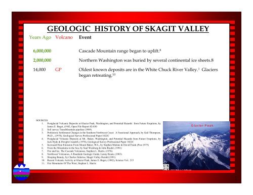
<strong>GEOLOGIC</strong> <strong>HISTORY</strong> <strong>OF</strong> <strong>SKAGIT</strong> <strong>VALLEY</strong><br />
Years Ago Volcano Event<br />
6,000,000 Cascade Mountain range began to uplift. 8<br />
2,000,000 Northern Washington was buried by several continental ice sheets.8<br />
14,000 GP Oldest known deposits are in the White Chuck <strong>River</strong> Valley. 1 Glaciers<br />
began retreating. 10<br />
SOURCES:<br />
1. Postglacial Volcanic Deposits at Glacier Peak, Washington, and Potential Hazards from Future Eruptions, by<br />
James E. Beget, (1982, Open File Report 82-830<br />
2. Soil survey TransMountain pipeline (1989).<br />
3. Prehistoric Settlement Changes in the Southern Northwest Coast: A Functional Approach, by Gail Thompson,<br />
Ph.D.., (1978), Geological Survey Professional Paper 1022C<br />
4. Postglacial Volcanic Deposits at Mt.. Baker, Washington, and Potential Hazards from Future Eruptions, by<br />
Jack Hyde & Dwight Crandell, (1978), Geological Survey Professional Paper 1022C<br />
5. Increased Heat Emission From Mount Baker, WA., by Stephen Malone & David Frank (Post 1975)<br />
6. From the Mountains to the Sea, by Saul Weisberg & John Riedel, (1991)<br />
7. Fire and Ice, The Cascade Volcanoes, Stephen L. Harris, (1976)<br />
8. Northwest Volcanoes, A Roadside Geologic Guide, Lanny Ream, (1983)<br />
9. Sleeping Beauty, by Charles Siderius, <strong>Skagit</strong> Valley Herald (1991)<br />
10. Recent Volcanic Activity at Glacier Peak, James E. Beget, (1982), Science Vol.. 215<br />
11. Fire Mountains Of The West, Stephen L. Harris<br />
Glacier Peak<br />
1
<strong>GEOLOGIC</strong> <strong>HISTORY</strong> <strong>OF</strong> <strong>SKAGIT</strong> <strong>VALLEY</strong><br />
Years Ago Volcano Event<br />
13,000 Sea level was 600 ft above present location. Deposition of estuarine and<br />
deltaic sediments began. Discharge of sediment materials would have<br />
begun around Hamilton. 3<br />
12,000 GP Violent eruption depositing widespread layers of ash. 7<br />
12-11,000 Sea level drops rapidly and becomes relatively stable. 3<br />
SOURCES:<br />
1. Postglacial Volcanic Deposits at Glacier Peak, Washington, and Potential Hazards from Future Eruptions, by<br />
James E. Beget, (1982, Open File Report 82-830<br />
2. Soil survey TransMountain pipeline (1989).<br />
3. Prehistoric Settlement Changes in the Southern Northwest Coast: A Functional Approach, by Gail Thompson,<br />
Ph.D.., (1978), Geological Survey Professional Paper 1022C<br />
4. Postglacial Volcanic Deposits at Mt.. Baker, Washington, and Potential Hazards from Future Eruptions, by<br />
Jack Hyde & Dwight Crandell, (1978), Geological Survey Professional Paper 1022C<br />
5. Increased Heat Emission From Mount Baker, WA., by Stephen Malone & David Frank (Post 1975)<br />
6. From the Mountains to the Sea, by Saul Weisberg & John Riedel, (1991)<br />
7. Fire and Ice, The Cascade Volcanoes, Stephen L. Harris, (1976)<br />
8. Northwest Volcanoes, A Roadside Geologic Guide, Lanny Ream, (1983)<br />
9. Sleeping Beauty, by Charles Siderius, <strong>Skagit</strong> Valley Herald (1991)<br />
10. Recent Volcanic Activity at Glacier Peak, James E. Beget, (1982), Science Vol.. 215<br />
11. Fire Mountains Of The West, Stephen L. Harris<br />
Glacier Peak<br />
2
<strong>GEOLOGIC</strong> <strong>HISTORY</strong> <strong>OF</strong> <strong>SKAGIT</strong> <strong>VALLEY</strong><br />
Years Ago Volcano Event<br />
11,500 GP White Chuck assemblage Lahar travels 100 km (62 miles) down<br />
Stillaguamish <strong>River</strong> Valley to Arlington. Changed the flow of the Sauk<br />
<strong>River</strong> near Darrington from the Stillaguamish <strong>River</strong> to the <strong>Skagit</strong> <strong>River</strong>.<br />
Lahar can be observed 1.8 miles west of Arlington. 1 Volcano remains<br />
dormant for approximately 5,700 years.<br />
10,350 BAKER Mount Baker erupts. Grayish brown to black ash. Prior to eruption large<br />
mudflow moves down Sulphur Creek Valley. 4<br />
10,000 BAKER Boulder Creek valley was free of ice below 4,000 ft. 4<br />
SOURCES:<br />
1. Postglacial Volcanic Deposits at Glacier Peak, Washington, and Potential Hazards from Future Eruptions, by<br />
James E. Beget, (1982, Open File Report 82-830<br />
2. Soil survey TransMountain pipeline (1989).<br />
3. Prehistoric Settlement Changes in the Southern Northwest Coast: A Functional Approach, by Gail Thompson,<br />
Ph.D.., (1978), Geological Survey Professional Paper 1022C<br />
4. Postglacial Volcanic Deposits at Mt.. Baker, Washington, and Potential Hazards from Future Eruptions, by<br />
Jack Hyde & Dwight Crandell, (1978), Geological Survey Professional Paper 1022C<br />
5. Increased Heat Emission From Mount Baker, WA., by Stephen Malone & David Frank (Post 1975)<br />
6. From the Mountains to the Sea, by Saul Weisberg & John Riedel, (1991)<br />
7. Fire and Ice, The Cascade Volcanoes, Stephen L. Harris, (1976)<br />
8. Northwest Volcanoes, A Roadside Geologic Guide, Lanny Ream, (1983)<br />
9. Sleeping Beauty, by Charles Siderius, <strong>Skagit</strong> Valley Herald (1991)<br />
10. Recent Volcanic Activity at Glacier Peak, James E. Beget, (1982), Science Vol.. 215<br />
11. Fire Mountains Of The West, Stephen L. Harris<br />
Glacier Peak<br />
3
<strong>GEOLOGIC</strong> <strong>HISTORY</strong> <strong>OF</strong> <strong>SKAGIT</strong> <strong>VALLEY</strong><br />
Years Ago Volcano Event<br />
9,000-5,000 Sea level lowers 30 to 60 feet. The <strong>Skagit</strong> Delta builds out first into Samish<br />
Bay.3 This area is referred to as the Northern Lobe and has been inactive<br />
for 5,000 years. 6<br />
8,700 BAKER Pyroclastic flows, mudflows, and two lava flows moved down Boulder<br />
Creek valley. Some of the flows reached Baker <strong>River</strong>. 4,8<br />
8,400 GP Trees grew at elevation 5,700 feet. Charcoal deposits carbon dated. Subalpine<br />
fir trees grow today up to a few hundred feet above this level. 1<br />
SOURCES:<br />
1. Postglacial Volcanic Deposits at Glacier Peak, Washington, and Potential Hazards from Future Eruptions, by<br />
James E. Beget, (1982, Open File Report 82-830<br />
2. Soil survey TransMountain pipeline (1989).<br />
3. Prehistoric Settlement Changes in the Southern Northwest Coast: A Functional Approach, by Gail Thompson,<br />
Ph.D.., (1978), Geological Survey Professional Paper 1022C<br />
4. Postglacial Volcanic Deposits at Mt.. Baker, Washington, and Potential Hazards from Future Eruptions, by<br />
Jack Hyde & Dwight Crandell, (1978), Geological Survey Professional Paper 1022C<br />
5. Increased Heat Emission From Mount Baker, WA., by Stephen Malone & David Frank (Post 1975)<br />
6. From the Mountains to the Sea, by Saul Weisberg & John Riedel, (1991)<br />
7. Fire and Ice, The Cascade Volcanoes, Stephen L. Harris, (1976)<br />
8. Northwest Volcanoes, A Roadside Geologic Guide, Lanny Ream, (1983)<br />
9. Sleeping Beauty, by Charles Siderius, <strong>Skagit</strong> Valley Herald (1991)<br />
10. Recent Volcanic Activity at Glacier Peak, James E. Beget, (1982), Science Vol.. 215<br />
11. Fire Mountains Of The West, Stephen L. Harris<br />
Glacier Peak<br />
4
<strong>GEOLOGIC</strong> <strong>HISTORY</strong> <strong>OF</strong> <strong>SKAGIT</strong> <strong>VALLEY</strong><br />
Years Ago Volcano Event<br />
6,000 BAKER Very large mudflow moved 17.5 miles down the Nooksack Valley,<br />
large mudflow (lava) moved at least 7.2 miles down Sulphur Creek<br />
valley.4 The lava (Sulphur Creek) reached Baker <strong>River</strong> and forced it<br />
against its east bank. 8<br />
5,500-5,100 GP Lahar from Kennedy Creek assemblage travels 100 km (62 miles)<br />
down the <strong>Skagit</strong>. Lahar also located in Dusty Creek assemblage<br />
which also traveled down the <strong>Skagit</strong>. Very possible both lahar<br />
assemblages were affected by damning of both the White Chuck and<br />
Suiattle <strong>River</strong>s. Lake created on the Suiattle was at least 45' deep .1<br />
SOURCES:<br />
1. Postglacial Volcanic Deposits at Glacier Peak, Washington, and Potential Hazards from Future Eruptions, by<br />
James E. Beget, (1982, Open File Report 82-830<br />
2. Soil survey TransMountain pipeline (1989).<br />
3. Prehistoric Settlement Changes in the Southern Northwest Coast: A Functional Approach, by Gail Thompson,<br />
Ph.D.., (1978), Geological Survey Professional Paper 1022C<br />
4. Postglacial Volcanic Deposits at Mt.. Baker, Washington, and Potential Hazards from Future Eruptions, by<br />
Jack Hyde & Dwight Crandell, (1978), Geological Survey Professional Paper 1022C<br />
5. Increased Heat Emission From Mount Baker, WA., by Stephen Malone & David Frank (Post 1975)<br />
6. From the Mountains to the Sea, by Saul Weisberg & John Riedel, (1991)<br />
7. Fire and Ice, The Cascade Volcanoes, Stephen L. Harris, (1976)<br />
8. Northwest Volcanoes, A Roadside Geologic Guide, Lanny Ream, (1983)<br />
9. Sleeping Beauty, by Charles Siderius, <strong>Skagit</strong> Valley Herald (1991)<br />
10. Recent Volcanic Activity at Glacier Peak, James E. Beget, (1982), Science Vol.. 215<br />
11. Fire Mountains Of The West, Stephen L. Harris<br />
Glacier Peak<br />
5
<strong>GEOLOGIC</strong> <strong>HISTORY</strong> <strong>OF</strong> <strong>SKAGIT</strong> <strong>VALLEY</strong><br />
Years Ago Volcano Event<br />
3,000 Western (Burlington & West Mt. Vernon) and Southern (South Mt.<br />
Vernon & Fir Island) lobes of <strong>Skagit</strong> Delta were created within last<br />
3,000 years, first to Padilla Bay and then to <strong>Skagit</strong> Bay. The delta<br />
engulfed several islands, Burlington Hill, Bay View Ridge, & finally<br />
Pleasant Ridge. 3<br />
2,000-1,500 Anthropologist suggest Indian settlements began along <strong>Skagit</strong> <strong>River</strong><br />
tributaries. One such site has been identified along Dry Slough on Fir<br />
Island. 3<br />
1,800 GP Lahar reaches Sauk <strong>River</strong> down White Chuck. Believed to have been<br />
triggered by large landslide high on Glacier Peak. Clay Lahar 100 m<br />
(328 ft) thick travels down Dusty Creek Valley. 1<br />
SOURCES:<br />
1. Postglacial Volcanic Deposits at Glacier Peak, Washington, and Potential Hazards from Future Eruptions, by<br />
James E. Beget, (1982, Open File Report 82-830<br />
2. Soil survey TransMountain pipeline (1989).<br />
3. Prehistoric Settlement Changes in the Southern Northwest Coast: A Functional Approach, by Gail Thompson,<br />
Ph.D.., (1978), Geological Survey Professional Paper 1022C<br />
4. Postglacial Volcanic Deposits at Mt.. Baker, Washington, and Potential Hazards from Future Eruptions, by<br />
Jack Hyde & Dwight Crandell, (1978), Geological Survey Professional Paper 1022C<br />
5. Increased Heat Emission From Mount Baker, WA., by Stephen Malone & David Frank (Post 1975)<br />
6. From the Mountains to the Sea, by Saul Weisberg & John Riedel, (1991)<br />
7. Fire and Ice, The Cascade Volcanoes, Stephen L. Harris, (1976)<br />
8. Northwest Volcanoes, A Roadside Geologic Guide, Lanny Ream, (1983)<br />
9. Sleeping Beauty, by Charles Siderius, <strong>Skagit</strong> Valley Herald (1991)<br />
10. Recent Volcanic Activity at Glacier Peak, James E. Beget, (1982), Science Vol.. 215<br />
11. Fire Mountains Of The West, Stephen L. Harris<br />
Glacier Peak<br />
6
<strong>GEOLOGIC</strong> <strong>HISTORY</strong> <strong>OF</strong> <strong>SKAGIT</strong> <strong>VALLEY</strong><br />
Years Ago Volcano Event<br />
1,750 GP "Red" Lahar travels down White Chuck <strong>River</strong> near Crystal Creek<br />
carrying dacite-rich alluvium which underlies the town of Burlington<br />
which contains charcoal about 1,800 years old. Estimated that lahar<br />
was caused by violent eruption of Glacier Peak which produced 100<br />
million cubic meters (130,000,000 cubic yards) of material. 1 The depth<br />
of volcanic material is between 3-30 feet thick. 2 Several small towns<br />
in the lower <strong>Skagit</strong> <strong>River</strong> valley are built on volcanogenic<br />
sedimentary deposits of this age. 10<br />
SOURCES:<br />
1. Postglacial Volcanic Deposits at Glacier Peak, Washington, and Potential Hazards from Future Eruptions, by<br />
James E. Beget, (1982, Open File Report 82-830<br />
2. Soil survey TransMountain pipeline (1989).<br />
3. Prehistoric Settlement Changes in the Southern Northwest Coast: A Functional Approach, by Gail Thompson,<br />
Ph.D.., (1978), Geological Survey Professional Paper 1022C<br />
4. Postglacial Volcanic Deposits at Mt.. Baker, Washington, and Potential Hazards from Future Eruptions, by<br />
Jack Hyde & Dwight Crandell, (1978), Geological Survey Professional Paper 1022C<br />
5. Increased Heat Emission From Mount Baker, WA., by Stephen Malone & David Frank (Post 1975)<br />
6. From the Mountains to the Sea, by Saul Weisberg & John Riedel, (1991)<br />
7. Fire and Ice, The Cascade Volcanoes, Stephen L. Harris, (1976)<br />
8. Northwest Volcanoes, A Roadside Geologic Guide, Lanny Ream, (1983)<br />
9. Sleeping Beauty, by Charles Siderius, <strong>Skagit</strong> Valley Herald (1991)<br />
10. Recent Volcanic Activity at Glacier Peak, James E. Beget, (1982), Science Vol.. 215<br />
11. Fire Mountains Of The West, Stephen L. Harris<br />
Glacier Peak<br />
7
<strong>GEOLOGIC</strong> <strong>HISTORY</strong> <strong>OF</strong> <strong>SKAGIT</strong> <strong>VALLEY</strong><br />
Years Ago Volcano Event<br />
1,100 GP "Remarkable" flood travels down White Chuck <strong>River</strong> creating large<br />
flood plain deposits down the Sauk <strong>River</strong>. Flood believed to have<br />
been caused by glacier-outburst. Two clay light-gray lahars travel<br />
down Dusty Creek. Lahars also travel down Chocolate Creek.<br />
Possible large flood was related to eruption but no "unequivocal<br />
evidence" to support theory. 1<br />
600 BAKER Gray and rusty brown mudflow travels down Park Creek to Baker <strong>River</strong>.<br />
Estimated volume of 2 million cubic meters (2,600,000 cubic yards).<br />
Probably caused by avalanches of hydrothermally altered rock. No fewer<br />
than four avalanches and mudflows have occurred at Baker during the last<br />
600 years.4 Flow can be viewed where Baker Lake Road crosses Park<br />
Creek.8<br />
SOURCES:<br />
1. Postglacial Volcanic Deposits at Glacier Peak, Washington, and Potential Hazards from Future Eruptions, by<br />
James E. Beget, (1982, Open File Report 82-830<br />
2. Soil survey TransMountain pipeline (1989).<br />
3. Prehistoric Settlement Changes in the Southern Northwest Coast: A Functional Approach, by Gail Thompson,<br />
Ph.D.., (1978), Geological Survey Professional Paper 1022C<br />
4. Postglacial Volcanic Deposits at Mt.. Baker, Washington, and Potential Hazards from Future Eruptions, by<br />
Jack Hyde & Dwight Crandell, (1978), Geological Survey Professional Paper 1022C<br />
5. Increased Heat Emission From Mount Baker, WA., by Stephen Malone & David Frank (Post 1975)<br />
6. From the Mountains to the Sea, by Saul Weisberg & John Riedel, (1991)<br />
7. Fire and Ice, The Cascade Volcanoes, Stephen L. Harris, (1976)<br />
8. Northwest Volcanoes, A Roadside Geologic Guide, Lanny Ream, (1983)<br />
9. Sleeping Beauty, by Charles Siderius, <strong>Skagit</strong> Valley Herald (1991)<br />
10. Recent Volcanic Activity at Glacier Peak, James E. Beget, (1982), Science Vol.. 215<br />
11. Fire Mountains Of The West, Stephen L. Harris<br />
Glacier Peak<br />
8
<strong>GEOLOGIC</strong> <strong>HISTORY</strong> <strong>OF</strong> <strong>SKAGIT</strong> <strong>VALLEY</strong><br />
Years Ago Volcano Event<br />
450-150 BAKER Rock debris erupts from Baker, two large mudflows moved 6.5 miles<br />
down Boulder Creek valley, large avalanche of rock debris moved at least<br />
5.4 miles down Rainbow Creek valley. 4<br />
300-200 GP Small eruptions. Indians reported to pioneers of seeing mountain<br />
smoking. 1 Evidence of a very large flood taking place in this time frame. 10<br />
>200 GP Two small lahars in Chocolate Creek. 1<br />
64 GP In 1938 a lahar buried and destroyed forests as much as 6 miles down<br />
Chocolate Creek from Chocolate Glacier. Flooding was observed far down<br />
the Suiattle and Sauk <strong>River</strong>s. Caused by glacier-outburst flood. 1<br />
SOURCES:<br />
1. Postglacial Volcanic Deposits at Glacier Peak, Washington, and Potential Hazards from Future Eruptions, by<br />
James E. Beget, (1982, Open File Report 82-830<br />
2. Soil survey TransMountain pipeline (1989).<br />
3. Prehistoric Settlement Changes in the Southern Northwest Coast: A Functional Approach, by Gail Thompson,<br />
Ph.D.., (1978), Geological Survey Professional Paper 1022C<br />
4. Postglacial Volcanic Deposits at Mt.. Baker, Washington, and Potential Hazards from Future Eruptions, by<br />
Jack Hyde & Dwight Crandell, (1978), Geological Survey Professional Paper 1022C<br />
5. Increased Heat Emission From Mount Baker, WA., by Stephen Malone & David Frank (Post 1975)<br />
6. From the Mountains to the Sea, by Saul Weisberg & John Riedel, (1991)<br />
7. Fire and Ice, The Cascade Volcanoes, Stephen L. Harris, (1976)<br />
8. Northwest Volcanoes, A Roadside Geologic Guide, Lanny Ream, (1983)<br />
9. Sleeping Beauty, by Charles Siderius, <strong>Skagit</strong> Valley Herald (1991)<br />
10. Recent Volcanic Activity at Glacier Peak, James E. Beget, (1982), Science Vol.. 215<br />
11. Fire Mountains Of The West, Stephen L. Harris<br />
Glacier Peak<br />
9
<strong>GEOLOGIC</strong> <strong>HISTORY</strong> <strong>OF</strong> <strong>SKAGIT</strong> <strong>VALLEY</strong><br />
Years Ago Volcano Event<br />
29 BAKER In 1975 increased steam vent activity at Sherman Crater. 4<br />
24 GP On June 20, 1980 a small lahar traveled down Dusty Creek to the Suiattle<br />
<strong>River</strong>. Bark was stripped from the trees and mud was deposited on trees<br />
and the valley walls of Dusty Creek as much as 3.3 feet above the lahar. It<br />
buried about 220,000 sq ft of riverbank and adjacent forest. The volume of<br />
material was estimated at 10,000 cubic meters (13,000 cubic yards). 1<br />
11 GP On August 17, 1993 the <strong>Skagit</strong> <strong>River</strong> ran chocolate brown. The cause, a<br />
small glacier outburst flood and resulting mudflow down Chocolate and<br />
Dusty Creek's.<br />
SOURCES:<br />
1. Postglacial Volcanic Deposits at Glacier Peak, Washington, and Potential Hazards from Future Eruptions, by<br />
James E. Beget, (1982, Open File Report 82-830<br />
2. Soil survey TransMountain pipeline (1989).<br />
3. Prehistoric Settlement Changes in the Southern Northwest Coast: A Functional Approach, by Gail Thompson,<br />
Ph.D.., (1978), Geological Survey Professional Paper 1022C<br />
4. Postglacial Volcanic Deposits at Mt.. Baker, Washington, and Potential Hazards from Future Eruptions, by<br />
Jack Hyde & Dwight Crandell, (1978), Geological Survey Professional Paper 1022C<br />
5. Increased Heat Emission From Mount Baker, WA., by Stephen Malone & David Frank (Post 1975)<br />
6. From the Mountains to the Sea, by Saul Weisberg & John Riedel, (1991)<br />
7. Fire and Ice, The Cascade Volcanoes, Stephen L. Harris, (1976)<br />
8. Northwest Volcanoes, A Roadside Geologic Guide, Lanny Ream, (1983)<br />
9. Sleeping Beauty, by Charles Siderius, <strong>Skagit</strong> Valley Herald (1991)<br />
10. Recent Volcanic Activity at Glacier Peak, James E. Beget, (1982), Science Vol.. 215<br />
11. Fire Mountains Of The West, Stephen L. Harris<br />
Glacier Peak<br />
10
<strong>GEOLOGIC</strong> <strong>HISTORY</strong> <strong>OF</strong> <strong>SKAGIT</strong> <strong>VALLEY</strong><br />
In 1792 Spanish explorers in Bellingham Bay reported "illumination and rumblings emanating from<br />
Mount Baker" and left as quickly as they possibly could.<br />
Ed Coleman, who first climbed Baker in 1866 quoted an old Indian who recalled when he was a<br />
boy the mountain burst out with a terrible fire and great smoke poisoning the fish in the <strong>Skagit</strong><br />
<strong>River</strong> (approx. 1810).<br />
John Hiaton, Pacific Northwest Indian, claimed to have witnessed eruptions of Mt. Baker "about<br />
1820". In 1843 Indians reported stories of an eruption that resulted in a massive fish kill in Baker<br />
<strong>River</strong>, volcanic ash, and a large forest fire east of the volcano.<br />
In 1858 local miners reported lava and apparent lahar reaching Baker <strong>River</strong>. 5<br />
volcanic activity at Mt. Baker are 1843, 1854, 1858, 1859, and 1870.<br />
Accepted dates of<br />
SOURCES:<br />
1. Postglacial Volcanic Deposits at Glacier Peak, Washington, and Potential Hazards from Future Eruptions, by<br />
James E. Beget, (1982, Open File Report 82-830<br />
2. Soil survey TransMountain pipeline (1989).<br />
3. Prehistoric Settlement Changes in the Southern Northwest Coast: A Functional Approach, by Gail Thompson,<br />
Ph.D.., (1978), Geological Survey Professional Paper 1022C<br />
4. Postglacial Volcanic Deposits at Mt.. Baker, Washington, and Potential Hazards from Future Eruptions, by<br />
Jack Hyde & Dwight Crandell, (1978), Geological Survey Professional Paper 1022C<br />
5. Increased Heat Emission From Mount Baker, WA., by Stephen Malone & David Frank (Post 1975)<br />
6. From the Mountains to the Sea, by Saul Weisberg & John Riedel, (1991)<br />
7. Fire and Ice, The Cascade Volcanoes, Stephen L. Harris, (1976)<br />
8. Northwest Volcanoes, A Roadside Geologic Guide, Lanny Ream, (1983)<br />
9. Sleeping Beauty, by Charles Siderius, <strong>Skagit</strong> Valley Herald (1991)<br />
10. Recent Volcanic Activity at Glacier Peak, James E. Beget, (1982), Science Vol.. 215<br />
11. Fire Mountains Of The West, Stephen L. Harris<br />
Glacier Peak<br />
11
WHAT DOES IT ALL MEAN??<br />
Volcanic-Hazards Assessment<br />
Future eruptions of large volume are likely to form thick fills of lahars and<br />
pyroclastic-flow deposits in the upper parts of valleys that head on the volcano.<br />
Subsequent incision of these deposits would aggrade valley floors farther<br />
downstream with sediment for many years after the eruption, thereby affecting<br />
the capacity of stream channels and locally increasing heights of floods.<br />
THESE EFFECTS WOULD BE ESPECIALLY SIGNIFICANT FOR THE<br />
EXTENSIVE LOW-LYING AREAS <strong>OF</strong> THE <strong>SKAGIT</strong> RIVER FLOOD PLAIN AND<br />
DELTA.<br />
Glacier Peak<br />
SOURCE: Volcanic Hazards With Respect To Siting Nuclear Power Plants In The Pacific Northwest, USGS Open File<br />
Report 87-297 (1987)<br />
12
<strong>Skagit</strong> <strong>River</strong> Basic Facts<br />
‣ Drainage Basin = 3,140 Sq.. Miles = 2,009,600 Acres<br />
‣ 100 Year Flood = 236,000 C.F.S. At Sedro-Woolley<br />
‣ 1 C.F.S. = 7.5 Gallons = 1,770,000 Gallons Per Second -<br />
106,200,000 Gallons Per Minute = 6,372,000,000 Gallons Per<br />
Hour<br />
‣ One C.F.S. flowing for 24 hours will cover 2 acres to a depth of<br />
one foot<br />
‣ There are 68,000 acres in the Lower <strong>Skagit</strong> <strong>River</strong> Valley<br />
‣ One Acre Foot = One acre to a depth of one foot = 325,000<br />
Gallons<br />
Source: U.S. Army Corps of Engineers
<strong>Skagit</strong> <strong>River</strong> Basic Facts<br />
‣ <strong>Skagit</strong> <strong>River</strong> is potentially the most damaging river in the<br />
Pacific Northwest.<br />
‣ November 1995 Flood - <strong>Skagit</strong> County had 25% of all FEMA<br />
Public Assistance costs statewide, 24% of Emergency<br />
Housing, 33% Individual Grants, 29% SBA loans, 22% Flood<br />
Insurance claims.<br />
‣ 1990 Flood: <strong>Skagit</strong> County had 47% of all damages in the State<br />
of Washington (COE).<br />
‣ AT LEAST 30% <strong>OF</strong> ALL <strong>SKAGIT</strong> COUNTY RESIDENTS ARE IN<br />
THE FLOODPLAIN VS. 6% STATEWIDE; GREATER<br />
PERCENTAGE IN THE DELTA.<br />
Source: Federal Emergency Management Agency (FEMA)
Major Flood <strong>History</strong><br />
Year<br />
Flow in Cubic Feet Per Second (C.F.S)<br />
About 1815<br />
400,000 at Sedro Woolley<br />
About 1856<br />
300,000 at Sedro Woolley<br />
1897 190,000 at Sedro Woolley<br />
1909 220,000 at Sedro Woolley<br />
1921 210,000 at Sedro Woolley<br />
1951 144,000 at Mount Vernon<br />
1975 130,000 at Mount Vernon<br />
1990 152,000 at Mount Vernon 146,000 Concrete<br />
1995 145,000 at Mount Vernon 160,000 Concrete<br />
2003 129,000 at Mount Vernon 166,000 Concrete<br />
Source: U.S. Army Corps of Engineers
Description: General view of Reflector Bar<br />
Date: Dec 16, 1954
Description: <strong>Skagit</strong> Damage, Davis Ranch Range Station<br />
Date: Mar 29, 1927
Davis Ranch as it appears today. It’s under Gorge Lake<br />
where Highway 20 crosses Gorge Lake. Houses on Reflector<br />
Bar can be seen in the center background. (Source: Picture taken 2/14/04<br />
by Larry Kunzler)
JAMES E. STEWART 1923 PRELIMINARY<br />
REPORT – FIELD JOURNAL NOTES<br />
Page 23 Leonard Everett says 1897 flood about 9 inches<br />
lower than 1909. Says that log jam in The Dalles raised water 10<br />
feet in 2 hours. Considerable distance and slope between 1897<br />
and 1909 and 1921 marks. 1897 1.4 feet higher.<br />
Page 62 Measuring the lengths of rope in Dalles. Found<br />
first 100 feet only 95 feet due to shrinkage in rope. Rope<br />
probably about okay for the two Dalles sections, as it was<br />
graduated while dry but not stretched, while it was used wet and<br />
stretched.<br />
Page 69 Checks on rope graduation were made while<br />
rope was still stretched across river. It is not certain that these<br />
checks are applicable to the lower cross sections also but<br />
probably will have to be assumed so.<br />
Page 100 Ed Presentine says 1897 flood 6 inches higher<br />
than 1909 at Rockport. Says Indians claim 1897 flood highest on<br />
Sauk of all times.<br />
(Source: James E. Stewart “Field Journal”, beginning entry November 24, 1922)
James E. Stewart Handwritten Notes<br />
APPENDIX E<br />
Place<br />
Rockport<br />
Date<br />
1/28/23<br />
Difference<br />
btwn w/s at<br />
date and<br />
high-water<br />
1897 = 18.1<br />
1909 = 17.6<br />
1917 = 17.5<br />
1921 = 17.6<br />
1400 feet<br />
Above The<br />
Dalles<br />
The Dalles at<br />
the Head of<br />
the Dalles<br />
11/24/22<br />
11/25/22<br />
1856 = 38.2<br />
1909 = 31.0<br />
1921 = 29.6<br />
1820 = 53.2<br />
1856 = 42.1<br />
1897 = 36.5<br />
1909 = 33.3 (Est)<br />
1921 = 32.0<br />
Sauk<br />
Faber Ferry<br />
John<br />
Larson’s<br />
Place<br />
1/28/23<br />
1/28/23<br />
11/27/22<br />
1897 = 19.2<br />
1909 = 18.1<br />
1917 = 16.2<br />
1921 = 19.0<br />
1921 = 25.5<br />
1894 = 15.5<br />
1896 = 21.6<br />
1897 = 21.8<br />
1909 = 22.2<br />
1921 = 21.9<br />
At Lower<br />
End of The<br />
Dalles<br />
At Upper<br />
End of Slope<br />
Section<br />
At Lower<br />
End of Slope<br />
Section<br />
11/25/22<br />
1/31/23<br />
1/29/23<br />
1820 = 43.1<br />
1856 = 38.9 (Est)<br />
1897 = 30.0<br />
1909 = 28.6<br />
1921 = 27.1<br />
1820 = 45.0 (Est)<br />
1856 = 36.6 (Est)<br />
1921 = 21.2<br />
1820 = 39.8 (Est)<br />
1856 = 32.3<br />
1921 = 24.8
James E. Stewart Handwritten Notes<br />
APPENDIX E<br />
Fessler’s<br />
Ranch<br />
Presentine<br />
Ferry<br />
Hamilton<br />
Cockerham<br />
Island<br />
Sedro-<br />
Woolley<br />
11/28/22<br />
11/28/22<br />
11/27/22<br />
12/12/22<br />
12/12/22<br />
1820 = 40.7 (Est)<br />
1856 = 33.3 (Est)<br />
1909 = 26.6<br />
1921 = 25.9<br />
1897 = 24.0<br />
1909 = 22.5 (Est)<br />
1921 = 21.2<br />
1897 = 15.8<br />
1909 = 16.1<br />
1917 = 15.5<br />
1921 = 16.4<br />
1894 = 14.4<br />
1897 = 17.9<br />
1909 & 1917 = 17.4<br />
1921 = 16.2<br />
1820 = 30.0<br />
1856 = 26.4<br />
1897 = 21.2<br />
1906 = 21.1<br />
1909 = 22.9<br />
1917 = 20.5<br />
1921 = 20.7
JAMES E. STEWART 1923<br />
REPORT<br />
Comparison of 1918 and 1923 Flood Flows<br />
Concrete WA.<br />
Flood year<br />
1897<br />
1909<br />
1917<br />
1918 Report<br />
205,000 cfs<br />
185,000 cfs<br />
175,000 cfs<br />
1923 Report<br />
275,000<br />
260,000<br />
220,000<br />
(Source: 1918 and 1923 Stewart Reports)
H.C. Riggs & W. H. Robinson 1950 Report<br />
“Proposed Revision of <strong>Skagit</strong> <strong>River</strong> Flood Peaks”<br />
Revision for Concrete The<br />
Dalles<br />
Year<br />
1815<br />
1856<br />
1897<br />
1909<br />
1921<br />
1917<br />
Stewart<br />
1923<br />
500,000<br />
350,000<br />
275,000<br />
260,000<br />
240,000<br />
220,000<br />
Revision<br />
1950<br />
400,000<br />
280,000<br />
230,000<br />
220,000<br />
210,000<br />
190,000<br />
Year<br />
1815<br />
1856<br />
1896<br />
1897<br />
1906<br />
1909<br />
1917<br />
1921<br />
Revision for Sedro-Woolley<br />
Stewart<br />
1923<br />
400,000<br />
300,000<br />
185,000<br />
190,000<br />
180,000<br />
220,000<br />
195,000<br />
210,000<br />
Revisions<br />
1950<br />
330,000<br />
230,000<br />
170,000<br />
170,000<br />
160,000<br />
190,000<br />
160,000<br />
170,000
FLOOD<br />
EVENT<br />
10<br />
50<br />
75<br />
100<br />
250<br />
500<br />
FLOOD FLOW CFS RECURRENCE LEVELS [1]<br />
WITH STEWART<br />
UNREG.<br />
163,000<br />
248,000<br />
274,000<br />
293,000<br />
362,000<br />
423,000<br />
REG.<br />
124,000<br />
185,000<br />
205,000<br />
221,000<br />
279,000<br />
348,000<br />
WITHOUT STEWART<br />
UNREG.<br />
147,000<br />
210,000<br />
228,000<br />
241,000<br />
288,000<br />
327,000<br />
REG.<br />
112,000<br />
157,000<br />
171,000<br />
182,000<br />
222,000<br />
269,000<br />
WITH STEWART<br />
1918<br />
UNREG.<br />
153,000<br />
222,000<br />
242,000<br />
257,000<br />
308,000<br />
353,000<br />
REG.<br />
116,000<br />
165,000<br />
181,000<br />
194,000<br />
237,000<br />
290,000<br />
(Source: Unregulated columns and Regulated With Stewart column, Corps of Engineers,<br />
Seattle District, 2003, all other regulated columns interpolated estimates)<br />
[1]<br />
All figures rounded to the nearest 1,000.
REASONS FOR NOT USING STEWART DATA<br />
‣ Mr. Stewart originally calculated the 1897, 1909 and<br />
1917 floods as floods that would occur every ten years.<br />
(Source: Stewart Report, 1918, Page 1)<br />
‣ Mr. Stewart often recognized that his work product had<br />
room for error and in some instances was just plain<br />
wrong. (Sources: Stewart Report 1918, Page 11; Stewart Notes at Reflector<br />
Bar, 5/2/18; James E. Stewart “Field Journal”, beginning entry November 24,<br />
1922; Letter to Frank Davis, Davis Ranch, from Stewart, 5/23/23; Letter to Frank<br />
Davis from Stewart, 7/6/23; Letter to Mr. T.H. Judd from Stewart, 8/22/23; <strong>Skagit</strong><br />
<strong>River</strong> Near Sedro Woolley, Revision 1908—1922, 3/13/23; Letter to FM Veatch,<br />
District Engineer, USGS, Tacoma, WA from Stewart, 6/1/50)
REASONS FOR NOT USING STEWART DATA<br />
‣The Corps of Engineers has questioned the<br />
accuracy of Mr. Stewart’s data. (Source: Appendix to Report<br />
on Survey for Flood Control of <strong>Skagit</strong> <strong>River</strong> and Tributaries, Corps of Engineers,<br />
2/21/52, Not For Public Release, Page 17 31)<br />
‣The discrepancies between calculated flows<br />
from Mr. Stewarts 1918 and 1923 Report are<br />
never addressed. (Source: 1918 and 1923 Stewart Reports; See page<br />
17 of Whitepaper)<br />
‣ His flood elevation marks are not consistent<br />
and do not support his flow calculations. (Source:<br />
James E. Stewart Field Log and Hand Written Notes)
REASONS FOR NOT USING STEWART DATA<br />
‣No one from USGS was ever able to reproduce<br />
Mr. Stewarts flood flows using Stewart’s<br />
assumptions and data. (Sources: Stewart 1918 & 1923 Reports;<br />
Proposed Revision of <strong>Skagit</strong> <strong>River</strong> Flood Peaks, H.C. Riggs & W.H. Robinson,<br />
11/16/50; <strong>Skagit</strong> <strong>River</strong> near Concrete, Wash. – Verification Study by F.J. Flynn and<br />
M.A. Benson, 8/52; <strong>Skagit</strong> <strong>River</strong> near Sedro-Woolley, Wash., Proposed revisions of<br />
historical flood peaks, F. L. Hidaka, 1/12/54; <strong>Skagit</strong> <strong>River</strong> Flood Peaks, Memorandum<br />
of Review by G. L. Bodhaine, USGS, 5/13/54)<br />
‣At no time did Mr. Stewart nor USGS ever take<br />
into consideration the log jam which Stewart<br />
documented at The Dalles which would have<br />
greatly influenced the “flood marks” located by<br />
Mr. Stewart. (Sources: James E. Stewart “Field Journal”, beginning entry<br />
November 24, 1922; Proposed Revision of <strong>Skagit</strong> <strong>River</strong> Flood Peaks, H.C. Riggs &<br />
W.H. Robinson, 11/16/50)
REASONS FOR NOT USING STEWART DATA<br />
‣During the November 21 through 25, 1990 flood<br />
event 6 inches of rain fell at Marblemount, 15.5 inches<br />
of rain fell at Reflector Bar, 11 inches of rain fell at<br />
Glacier on the Baker <strong>River</strong> side and 11.3 inches of rain<br />
fell at Darrington on the Sauk <strong>River</strong>. The regulated<br />
peaks of 146,000 cfs and 152,000 cfs at Concrete and<br />
Mount Vernon respectively would have been 182,000<br />
cfs and 180,000 cfs if left unregulated. One has to ask<br />
that if Stewart and USGS computations of the 1921<br />
flood are to be believed, how did we end up with only<br />
180,000 cfs unregulated flow with 15.5 inches of rain at<br />
Reflector Bar, and Stewart and USGS end up with<br />
240,000 cfs and 225,000 cfs respectfully with only 10.21<br />
inches of rain falling at Reflector Bar? (Sources: Flood Summary<br />
Report, Nooksack, <strong>Skagit</strong> and Snohomish <strong>River</strong> Basins, November 1990 Events, Corps of<br />
Engineers, 7/18/91; (Stewart/Bodhaine Report, Geological Survey Water-Supply Paper 1527,<br />
1961)
HOW CAN WE RESOLVE THIS ISSUE?<br />
1. WE CAN ELIMINATE THE STEWART FLOOD<br />
DATA AND USE THE LAST 82 YEARS WORTH<br />
<strong>OF</strong> GAGE DATA TO DETERMINE THE 100<br />
YEAR FLOOD FLOWS.<br />
2. WE CAN TAKE OUR STATE <strong>OF</strong> THE ART<br />
HYDRAULIC MODEL WE PAID 1.5 MILLION<br />
DOLLARS FOR, MOVE BACK THE LEVEES TO<br />
WHERE THEY WERE IN 1921, TAKE OUT THE<br />
LAND FILL AND THE FREEWAY, SIMULATE<br />
THE BREAKING <strong>OF</strong> THE LEVEES AND SEE IF<br />
THE 1990 AND 1995 FLOODS WOULD BE AS<br />
DEEP IN BURLINGTON AND CLEAR LAKE AS<br />
THEY WERE IN 1921.