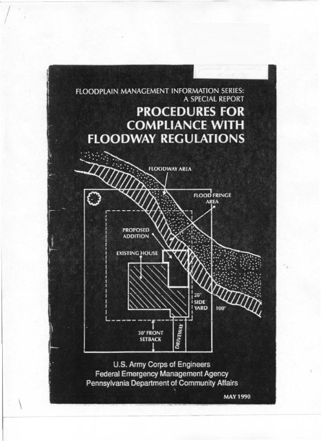
Procedures for Compliance with Floodway Regulations.pdf
Procedures for Compliance with Floodway Regulations.pdf
Procedures for Compliance with Floodway Regulations.pdf

You also want an ePaper? Increase the reach of your titles
YUMPU automatically turns print PDFs into web optimized ePapers that Google loves.
FLOODPLAIN MANAGEMENT INFORMATION SERIES,<br />
A SPECIAL REPORT<br />
PROCEDURES FOR<br />
COMPLIANCE WITH<br />
FLOODWAY REGULATIONS<br />
Prepared by:<br />
The Hydrologic Engineering Center<br />
Water Resources Support Center<br />
U.S. Army Corps of Engineers<br />
Davis, Cali<strong>for</strong>nia<br />
Aod<br />
Made Available by:<br />
The Philadelphia District, U.s. Army Corps of Engineers<br />
For:<br />
federal Emergency Management Agency<br />
Region III Office<br />
Floodplain Management Division<br />
Pennsylvania Department of<br />
Community Affairs<br />
May 1990<br />
Second Edition<br />
~ ..<br />
\
!<br />
TABLE OF CONTENTS<br />
Page<br />
Number<br />
1. INTRODUCTION ...........••••...•.•.....•.........•.•. ,<br />
'·1. Purpose 1<br />
\-2. RelXlrt Organization 1<br />
2. THE NATIONAL flOOD INSURANCE PROGRAM ....••........ 2<br />
2-1. Overview 2<br />
2·2. General Development <strong>Procedures</strong> .......••................ 3<br />
2-3. Flood Hazard Analysis of NFIP Areas 4<br />
3. PRELIMINARY EVALUATION OF PROPOSED DEVELOPMENT ••••• 6<br />
3-1. General 6<br />
3-2. locating Floodplain Development .........•....•.......... 6<br />
4. FlOODWAY DEVELOPMENT IMPACTS 8<br />
4-1 . Overview 8<br />
4-2. Development Complies <strong>with</strong> Floodplain <strong>Regulations</strong> 8<br />
4-3. Development Results in Profile Rise Within Surcharge Limits 9<br />
4-4. Development Results in Profile Rise Above Surcharge Limits 9<br />
5. EXMiPLES OF flOODPLAIN DEVElOPMENT ......•........•. 10<br />
5-1 . Overview ...................................••..... 10<br />
5-2. Downstream Side of Existing Struaure ........•.....••..... 11<br />
5·3. Relocation of Channel Alignment 11<br />
5-4. Equal Conveyance Replacement _..••.•..... 12<br />
5·5. Development Elevated on Piers ()( Columns .....•........... 13<br />
5-6. Fill or Barrier Obstrudion 13<br />
5-7. Highway Stream Crossing ..................••.......... 14<br />
£t. FLOODWAY IMPACT ANAlySiS 14<br />
6-1 . General ......................•.....•............... 14<br />
6-2. Data ReqUired ..........•...•..•..........•.......... 14<br />
6-3. Analysis <strong>Procedures</strong> ......•......•...........•......... 19
7. FlOODWAY REVISION SUBMITIAL PROCEDURES ......•..... 19<br />
7-1. General........................... . 19<br />
7-2. Dala Requir~ents 19<br />
7-3. FEMA Response to <strong>Floodway</strong> Revision Request ........•..... 21<br />
7-4. Subminal of Material . 21<br />
8. flOOD PLAINS WITHOUT DESIGNATED FLOODWAYS 22<br />
8-1. NFIP-No Regulated <strong>Floodway</strong> 22<br />
APPENDIX A· REFERENCES _.•...... 23<br />
APPENDIX B· STATE FLOODWAY REGULATIONS .....•••••..... 25<br />
FIGURES<br />
No.<br />
Pase<br />
1 <strong>Floodway</strong> and <strong>Floodway</strong> Fringe ............•...•...•........ 2<br />
2 Floodplain Development <strong>Procedures</strong>...............•.•........ 5<br />
3 Development Location .....................•.•••.•.•...... 7<br />
4 Development Downstream Side of StruOure ......•...•....... 11<br />
5 Relocation of Channel ......................••••.•....... 13<br />
6 Equal Conveyance Replacement ...............•............ 13<br />
7 Location of Valley Cross Sections. . ........•...•...•........ 15<br />
8 Plan View of Proposed Development .......•...•...•........ 16<br />
9 Bridge Cross Section . . . . . . . . . . . . . . . . . . . . . . . 17<br />
10 Plan View of Culvert ...............•.................... 18<br />
11 Front View of Dam .... . .•..........•...•...•..... 19<br />
FOREWORD<br />
This documenl is the second edition of <strong>Procedures</strong> (or <strong>Compliance</strong>_<strong>with</strong><br />
Ffoodway <strong>Regulations</strong> developed by the Region 3 office of the Federal<br />
Emergency Management Agency and the U.s. Army Corps of Engineers. tt<br />
provides technical guidance on how to comply <strong>with</strong> community noodway<br />
regulations which have been adopted to comply <strong>with</strong> the minimum requirements<br />
of the National Flood Insurance Program. It is intended <strong>for</strong> use by<br />
designers, builders, developers, engineers, community building officials. and<br />
homeowners.<br />
The intent of this manual is nollO encourage development in a designated<br />
noodway. Rather, when such development cannot be avoided. it is to help<br />
ensure that it be accomplished in a manner that minimizes the potential <strong>for</strong><br />
flood damage and ensures compliance wilh the community's regulations.<br />
v
PROCEDURES FOR COMPLIANCE<br />
WITH FLOODWAY REGULATIONS<br />
1. Introduction<br />
•<br />
1-1. Purpose. This document is designed to assist municipal officials in<br />
administering local regulations based on the requirements of the National<br />
Flood Insurance Program (NFJP). More specifically, it provides guidance and<br />
procedures <strong>for</strong> reviewing development proposals to ensure compliance <strong>with</strong><br />
local noodW3Y regulations. It al50 contains in<strong>for</strong>mation concerning the<br />
process and procedure <strong>for</strong> officially revising floodplain and floodway delineations<br />
and <strong>for</strong> modifying base flood elevations.<br />
The document will also serve as a useful reference guide <strong>for</strong> builders,<br />
developers and property owners wishing to develop <strong>with</strong>in designated<br />
floodplain and floodway areas. The criteria, requirements and procedures<br />
described can be used as the basis <strong>for</strong> preparing the type in<strong>for</strong>mation needed<br />
<strong>for</strong> local review and, if necessary. <strong>for</strong> review by the Federal Emergency<br />
Management Agency (FEMAl.<br />
1-2. Report Organization. The refXlrt begins <strong>with</strong> an overview of the<br />
National Flood Insurance Program (NFIP), a description of general development<br />
procedures, an explanation of the flCKldplain maps and basic flood<br />
elevation data generated through the NFIP, and a description of the proce·<br />
dures <strong>for</strong> locating development relative to an identified floodplain. Further<br />
on, the report includes a discussion of three possible encroachment impacts<br />
resulting from proposed development <strong>with</strong>in identified floodways. a description<br />
of six selected types of f100dway development and some analytical<br />
considerations and submittal requirements <strong>for</strong> each, and an explanation of<br />
the in<strong>for</strong>mation and analyses which are needed to evaluate and document<br />
Hoodway impacts. The report concludes <strong>with</strong> an explanation of the requiremenls<br />
and procedures <strong>for</strong> requesting floodway revisions and a briefdiscu:;sion<br />
of development in unregulated f100dways.
Cross Section A<br />
Encro.1Chmcnl<br />
flood fringe<br />
floodway<br />
Ellcroachment<br />
Plan View<br />
Figure I: <strong>Floodway</strong> and <strong>Floodway</strong> Fringe<br />
2. The National flood Insurance Program<br />
Encroachment Permilled<br />
A<br />
noon<br />
fringe<br />
•<br />
Encro"c1l1nent Permined<br />
2-1. Overview. The National Flood Insurance Program (NFIP) was created<br />
by Congress lhrough the passage ofthe National Flocxf Insurance Act of 1968.<br />
The purJX>5e of the NFIP is twofold: 1) to provide the general public the<br />
opportunity to obtain insurance coverage to cover flood damages to buildings<br />
and their contents and, 1) to reduce future flood damages by requiring the<br />
local regulation of new development in floodprone areas. The NFIP is<br />
administered by the Federal Insurance Administration (FIA), a division of the<br />
Federal Emergency Management Agency (FEMA).<br />
The availability of flood insurance is contingent upon a community'S<br />
participation in the NFIP. To participate, a community must enact regulations<br />
10 control development activities <strong>with</strong>in identified floodplain areas. Local<br />
A<br />
regulations must meet or exceed minimum NFIP requirements. There are over<br />
17,000 municipalities currently participating in the NFIP, nationwide.<br />
FloodplQne areas are idenrified on maps provided to communities by the<br />
Federal Insurance Administration. Referred to as Special Flood Hazard Areas,<br />
the~ areas represent the extent of inundation which can be expected from a<br />
100 year flood or base flood. local regulations must ensure that all new and<br />
substantially improved buildings are prOleaed 10 the level of the base flood.<br />
allhe very minimum.<br />
For municipalities <strong>with</strong> Flood Insurance Studies, the identified floodplain<br />
is divided into two distina zones or distrias: a floodway and floodway fringe<br />
(see figure 1). The f100dway is delineated <strong>for</strong> the purpose of keeping an area<br />
clear of obstructions to allow flood waters to freely discharge downstream.<br />
When f100dways are identified, municipalities must include regulations<br />
which restrict any new development <strong>with</strong>in noodwar-; which would cause<br />
any increase in nood heights. There is no such restrioion to development<br />
<strong>with</strong>in the floodway fringe. Development may occur in the f100dway fringe<br />
provided it complies <strong>with</strong> applicable elevation or floodproofing requirements.<br />
The Federal Insurance AdminiSlration uses special criteria in delineating<br />
f100dways. In an attempt to allow <strong>for</strong> some development in floodplains, FIA<br />
decided to delineate f100dways assuming that development may take place<br />
<strong>with</strong>in floodway fringes to an extent that flood heights will be raised a<br />
maximum of one foot. Some states have enacted more stringent surcharge<br />
limits, but, <strong>for</strong> the most part, the NFIP floodway criteria and delineation is<br />
widely used. The following seaiolls attempt to clarify NFIP floodway regulations<br />
and the proper procedures and data needed to evaluate development<br />
proposals.<br />
2.1 General Oevelopmenl <strong>Procedures</strong>. It is the responsibility of the<br />
builder, developer. or property owner to obtain a local permit be<strong>for</strong>e proceeding<strong>with</strong><br />
any construoion or development <strong>with</strong>in an identified floodplain area.<br />
The definition of del'eloDnlenl as defined through the NFIP is as follows:<br />
allY /tUl1r-made challge t(l improved or ullImproved real estate. i"dudi"g but 1101<br />
IinUled to bU/fdlllgs or Olher Structures. milling. dredgurg. fillillg. gradillg.<br />
pavmg. excavation. drilling operations or J,loraKe 01 equipment or matt!flafJ..<br />
As one of the conditions <strong>for</strong> obtaining local approval. an applicant must<br />
secure all other necessary federal and state permits which are required <strong>for</strong> the<br />
location and type of development being proposed. Many states have permit<br />
requirements and regulations pertaining to development activities in the<br />
f100dway. The U.S. Army Corps of Engineers and various states have strict<br />
regulations concerning the development of wetlands. While il is the responsibility<br />
of the applicant to obtain these and other applicable governmental<br />
permits, it is incumbent upon communities participating in the NFIP to<br />
<strong>with</strong>hold the issuance of a local permit until such time that the applicant<br />
provides evidence that all necessary permits have been secured.<br />
2 3
For a developer, the process begins <strong>with</strong> the location of the proposed<br />
development. Is the area flO
The Flood Boundary and FIdway Map is generally derived from a<br />
detailed hydraulic study and should provide reasonably accurate in<strong>for</strong>mation.<br />
The hydraulic data are available through regional offices of the Federal<br />
Emergency Management Agency and are normally in the <strong>for</strong>m of computer<br />
input data sets <strong>for</strong> calculating waler surface profiles. The Flood Insurance<br />
Rate Map is usually developed at the same time as tnc water surface profile<br />
analysis model and has base f1d elevations added.<br />
The analysis of proposed development <strong>with</strong>in the floodplain generally falls<br />
<strong>with</strong>in four categories of studies <strong>with</strong> regard to the NFIP regulations. These<br />
are: (1) a detailed flood insurance study has been per<strong>for</strong>med and a regulatory<br />
f100dway is in effect; (2) a community is participating in the regular program<br />
and 100 year flood elevations have been determined, but no regulatory<br />
f1dway has been established; and (J) 100 year flood elevations have not<br />
been established, but a one hundred year fld plain has been approximated,<br />
or (4) an area has not been identified as fldprone. This document focuses<br />
primarily on the development proposals and requirements <strong>with</strong>in floodplain<br />
boundaries where regulatory flO
accuracy of the mapping. Normally, the determination as to whether or not<br />
a development site is <strong>with</strong>in the floodway limits should be corrooorated <strong>with</strong><br />
the appropriate local officials.<br />
4. <strong>Floodway</strong> Development Impacts<br />
4·1. Overview. The proposed developmenl <strong>with</strong>in the floodway boundaries<br />
may result in one of three impacts <strong>with</strong> regards 10 the rise in the base<br />
water surface profile. They are:<br />
I. Development complies <strong>with</strong> floodway regulations (no rise)-<br />
2. Development results in profile increase, but <strong>with</strong>in surcharge limits.<br />
3. Development results in profile increase above the surcharge limits.<br />
NOle: In some circumstances proposed development may result in no rise<br />
in the base water surface profile or in an increase that is <strong>with</strong>in surcharge<br />
limits, b:J1 will also result in increases in water vefocily. Such increases may<br />
result in disapproval of the proposed floodway development by the community<br />
()( a request <strong>for</strong> a LOMR from FEMA.<br />
The developer must perf()(m the technical studies required to demonstrate<br />
the impact of the proposed development. In general, the approval offloodway<br />
development is contingent on the development complying <strong>with</strong> the floadway<br />
regulations - no rise in the base water surface profile. However, if the<br />
proposed development results in a rise in the base profile, under some<br />
circumstances the community and FEMA may revise the floodway boundaries<br />
or grant approval if the developer per<strong>for</strong>ms remedial aaions. The hydraulic<br />
analysis data set used by FEMA in the FlS, modified to reflect the proposed<br />
developmental conditions, must be used 10 document rhe impaas of the<br />
proposed development.<br />
- no rise :::: 0.00 ft.<br />
4-2. Development Complies With floodway <strong>Regulations</strong>. This condition<br />
results (rom the proposed development complying<strong>with</strong> the NFIP no rise policy<br />
fOf floodway development. No rise means a zero
conditional approval of the Federaltnsurance Administrator is firSl obtained.<br />
The Developer should initially anempt to reduce the surcharge to the base<br />
level. This may be accomplished by evaluating alternatives such as widening<br />
the n()(Xjway or other conveyance mooifications described in Seaion 4-2 to<br />
compensate <strong>for</strong> loss of conveyances caused by the proposed development. If<br />
the rise canOOl be entirely negated, but the water surface profile elevation is<br />
<strong>with</strong>in the surcharge limit, the developer must request a fl()(Xjway revision as<br />
defined in Section 4·3.<br />
If the developer demonstrates that an unavoidable increase in the profile<br />
elevation above the surcharge limit results from the development, a request<br />
<strong>for</strong> a conditional map change must be made. Basically this requires the<br />
following:<br />
1. A request <strong>for</strong> conditional approval of the map change and the appropriate<br />
initial review fee if applicable.<br />
2. An evaluation of alternatives which would not resull in a flood elevation<br />
increase aoove the allowable surcharge limit. This evaluation should<br />
demonstrate why these alternatives are not feasible.<br />
3. Documentation of individual legal notice to all impacted property<br />
owners <strong>with</strong>in and outside of the community, explaining the impact of the<br />
proposed action on their property.<br />
4. Concurrence of the Chief Executive Officer of any other communities<br />
impacled by the proposal.<br />
5. Certification that no structures are located in areas which would be<br />
impacted by the increased base nood elevation<br />
6. A request <strong>for</strong> revision of the base flood elevation and the floodway.<br />
Upon receipt of the Administrator's conditional approval of map change<br />
and prior to approving the proposed encroachments, the community must<br />
provide evidence to the administrator of the adoption of floodplain management<br />
ordinances incorporating the increased base flood elevations and/or<br />
revised noodway refleaing the post-projea condition. Finally upon comple·<br />
tion of the proposed encroachments, the community must provide as-built<br />
certifications. A final map revision is then initiated uJXln receipt of the<br />
certification.<br />
5. Examples of <strong>Floodway</strong> Dcvelopmcnt<br />
5-1. Overview. This seaion overviews typical development proposals <strong>for</strong><br />
floodways and describes basic analysis considerations and requirements <strong>for</strong><br />
submittal (or approval. The actual conditions may necessitate a variation in<br />
analysis procedures and requirements. In general, approval <strong>for</strong> proposed<br />
developments in the noodways is contingent on demonstration that the project<br />
will not result in a rise in the noodway profile. Specific criteria and actions<br />
are described in Seaion 6.<br />
5-2. Downstream SideofExistingStrudure. A small addition to an existing<br />
struaure may be acceptable if it is constructed on the downstream side of the<br />
structure <strong>with</strong>in the now panernsshown in Figure 4. However, the hydraulics<br />
of losses and flow panerns around buildings and other obstructions are<br />
complex, especially in urban areas. The developer may be required to show<br />
that the assumptions as shown in Figure 4 are applicable to the proposed<br />
development location and that no rise in the base flocx:l will occur.<br />
<<br />
Figure 4:<br />
---- ;Cl'/<br />
PROPOSED<br />
ADDITION<br />
, , , ,2i..:><br />
EXISTING<br />
STRU(lURE<br />
POSSIBLE<br />
DEVELOPMENT ZONE<br />
flOOD<br />
FLOW<br />
I'ATII<br />
Development Downstream Side of Structure<br />
If it can be shown that the now panerns are such that the development is<br />
on the downstream side, the flow patterns are not significantly interfered <strong>with</strong><br />
by other obstructions, and that the addition is relatively small. the proposal<br />
maybe approved <strong>with</strong>out detailed water surface profile analysis_ Normally<br />
<strong>for</strong> this condition the proJXl5ed development must be located <strong>with</strong>in the<br />
flowline shadow of the existing building conceptualized by 20 degree angles<br />
<strong>with</strong> the downstream corners of the building.<br />
For complex areas where the now patterns are affected by several obstruc·<br />
tions, more complex hydraulic modeling and analysis may be required to<br />
demonstrate that no risc in the base profile will occur.<br />
5-3. Relocation of Channel Alignment. Development <strong>with</strong>in the floodway<br />
areas may include realignment of the existing flow conveyance path and<br />
floodway delineations. Figure 5 shows an example of a realignment of a<br />
10 11
channel and revised floodwaydelineation. This option is generally limited to<br />
relatively small streams. The base flood profile must reflee no increase in<br />
elevation unless conditions defined in Seaion 4 "<strong>Floodway</strong> Development<br />
Impacts"' are applied. Adjacent communities and property owners opposite,<br />
upstream and downstream of the development must be notified of proposed<br />
realignments and of any negative impacts induced by the projea.<br />
The community has the option of shifting the floodway to one side of the<br />
stream or the other as long as both sides of the stream are <strong>with</strong>in the corporate<br />
limits and there are no ownership problems. For example, the designated<br />
floodway boundaries may be shifted to a park area on one side of a stream to<br />
allow commercial development on the other side.<br />
The development proposal may require hydraulic design documentation<br />
of radical bends, bank erosion and sediment control methods, flow lransitions<br />
to the existing channel and energy dissipation procedures at the lower end<br />
of rhe development as applicable. The hydraulic analysis must encompass<br />
the stream from a downstream point unaffeaed by the proposed development<br />
to the upstream point where original conditions and anticipated post·projea<br />
profiles converge.<br />
Any environmental impacts associated <strong>with</strong> the realignment ofthe channel<br />
must be described and documented.<br />
5-4. Equal Conveyance Replacement. The concepl of equal conveyance<br />
replacement as part ofa development proposal is simi lar to that ofthe channel<br />
realignment. The concept is to replace the cross-seaional area of conveyance<br />
taken by the development <strong>with</strong> an equal area below the Base Flood Elevation<br />
so that there is no decrease in Closs-sectional conveyance area at the development<br />
location throughout its range of flow depths. See Figure 6. This may be<br />
accomplished by excavation of the conveyance area or by replacing a<br />
struaure below the Base Flood Elevation by one of equal or less volume and<br />
cross-seaional area. The excavated area must be adjacent to the main<br />
channel to assure that conveyance is maintained so that there is no increase<br />
in the <strong>Floodway</strong> profile.<br />
Other hydraulic design criteria as described in Seaion 5-) are also applicable.<br />
As in relocation of channel alignments the hydraulic analysis must<br />
encompass the Slream from a downSlream point unaffected by the proposed<br />
development tothe upstream point where original conditions and anticipated<br />
post-projea profiles converge, and it must be demonSlrated that a reasonable<br />
flow transition is maintained through the altered cross seaions.<br />
-----,,------ ----------------------- ----_.,-----<br />
Existing Channel<br />
Proposed Development Site<br />
Figure 5:<br />
r,,,,,,",,,<br />
New Chlln"eI<br />
ExcaV.llioll<br />
Relocation of Channel<br />
r!oodW.lY<br />
.. ,<br />
.:...<br />
.. ' '.<br />
.,-<br />
....<br />
.<br />
-'. -<br />
Flood flinge<br />
Figure 6: Equal Conveyance Replacement<br />
I •<br />
5-5. Development Elevated on Piers or Columns. Proposed development<br />
elevated on piers or columns may result in a negligible increase in the base<br />
flood elevations, requiring nocompensatingaClions. However, the developer<br />
must demonsHale lhallhis is the case. Small increases in the base profile may<br />
be offsel by procedures defined in Seaion 4-2. The developer may also be<br />
required to analyze the effea of debris buildup among the piers Of columns.<br />
5-6. Fill or Barrier Obstruction. The placement of fill or a barrier such as<br />
a levee or floodwalJ in the floodway requires remedial aaions to offsel lhe<br />
induced increase in the base flood profiles. These aaions are often equal<br />
replacement of lost conveyance area through lhe cross seaion at the development<br />
(see Seaian 5-4). The developer, if a Federal agenq Of if using funds<br />
from a Federally sponsored program, must also meet applicable floodplain<br />
guidelines such as Executive Order 11988.<br />
National Flood Insurance Program regulations (PART 65) include standards<br />
<strong>for</strong> levees or floodwalJs. These standards address freeboard requirements,<br />
struClure and closure maintenance, interior drainage, etc. Developers and<br />
12<br />
13
community officials should be aware of specific applicable requirE'ments in<br />
order to avoid adverse Oood insurance rating.<br />
5-7. Highway Slream Crossing. For communities where the NFIP regulations<br />
are in effect and the regulatory floodway defined, the initial allernalive<br />
analyzed should be a highway stream crossing <strong>with</strong> all components excluded<br />
from the f100dway. The design, which essentially spans the Ooodway, must<br />
also limit the rise of the base flood (l aD-year Oood profile) <strong>with</strong>in the<br />
regulatory criteria (normally one fooU. The alternative must be sufficiently<br />
detailed to show the effect on the Ooodway profile.<br />
When it is clearly shown to be inappropriate to design a highway crossing<br />
to avoid encroachment on the floodway and where the floodway cannot be<br />
modified such that the structure could be excluded, FEMA will approve an<br />
alternate floodway <strong>with</strong> profile in excess of the 1 foot maximum only when<br />
the following conditions have been met:<br />
1. A location hydraulic study has been per<strong>for</strong>med in accordance <strong>with</strong><br />
Federal·Aid Highway Program Manual (FHPM) 6- 7·)·2 ~location and<br />
Hydraulic Design of Encroachments on Floodplains" (23 CFR 650, Subpart A)<br />
and FHWA finds the encroachment is the only practicable alternative (Federal<br />
Highway Administration 1979).<br />
2. The construaing agency has made appropriate arrangements <strong>with</strong><br />
affected property owners and the community to obtain flooding easements or<br />
Olherwise compensate them {or future flood losses due to the effeas of the<br />
structure.<br />
3. The constructing agency has made appropriate arrangements to assure<br />
that the National Flood Insurance Program and Flood Insurance Fund do not<br />
incur any liability f()( additional future flCXld losses to existing structures which<br />
are insured under the Program and grandfathered in under the risk stalUs<br />
existing prior to the construction of the structure.<br />
4. Prior to initiating construction, the constructing agency provides FEMA<br />
<strong>with</strong> revised nood profiles, noodway and floodplain mapping, and background<br />
technical data necessary <strong>for</strong> FEMA to issue revised Flood Insurance<br />
Rate Maps and Flood Boundary and <strong>Floodway</strong> Maps <strong>for</strong> the affeaed area upon<br />
completion of the struaure.<br />
6. <strong>Floodway</strong> Impact Analysis<br />
6-1. General. The developer must assemble and provide to the local<br />
officials in<strong>for</strong>mation and analysis results ofthe effeetsof the proposed development<br />
on fulure flood elevations. These data will be used to determine whether<br />
or not the requeS( f()( floodway development is approved.<br />
6-2. Dala Required. The followingd3t3 mUSf be provided by the developer<br />
(permit applicantJ and submined to the appropriate local officials to use in<br />
determining the effect of the proposed aaivity on future Oood heights.<br />
1. Valley Cross Sections. The valley cross section of the channel and<br />
overbank area must be taken perpendicular to the flow of the stream (see<br />
Figure 7l. The cross seaion must extend to an elevation above the expected<br />
1DO-year floodplain.<br />
NOle: Sections right angle to flow<br />
omit· not effeclive to convey flow<br />
regular intervals<br />
Figure 7:<br />
I<br />
Q)<br />
1<br />
ch3n~e in<br />
cross section<br />
the downstream distances mUSI be sufficient to mitigate starting conditions<br />
profile errors prior to downstream noodway revisions associated <strong>with</strong> the<br />
structure. Upstream distances must be of sufficient distance that the modified<br />
conditions profile converges 10 that of the base condition. The distances will<br />
vary depending on the magnitude of the floodway revision and the hydraulic<br />
charaaeriSlics of the stream.<br />
o "«W)\<br />
r - ~;~ .: .... --<br />
FLOOD FIlINGE<br />
1 ./<br />
The followins ~h.l1I ~<br />
~hown on lh'$ pial<br />
t-----.(,-----I---+---t----1--- pl.ln,<br />
.~ SiuoftMlol.<br />
.. ' FlOODWAY AREA London 01 hoo~ on<br />
1---: ..... --" ,'tJ~:' '7:/~;~/:;:.~:~f7jj)t:~·:~-:~:~,,, ...~.b: ...--O-F-ltlC-Kt;I-.N-G-Ci'-"-K-! §~:;=7~<br />
"(J// 0;.:':::..<br />
..f.// ':.':.' Drplh of front Y.lrd.<br />
A~EA<br />
c<br />
.2<br />
"~<br />
w<br />
2. Photographs. Photographs must be taken along the stream mowing the<br />
channel and ground cover in the overbank areas. Photographs should also<br />
be taken to show the upstream and downstream ends of all control strUOures<br />
in the vicinity of the proposed development<br />
3. Plan View. A plan view ofthe proposed development must be included<br />
<strong>with</strong> the materials submined <strong>for</strong> review. The plan view must show the exact<br />
dimensions of the proposed change in the relation to the S1ream and other<br />
physical and geographic features. The geometry of the proposed development<br />
should also be shown on the valley cross seoion so that the hydraulic<br />
effects of the encroachment on the opposite side of the stream can be<br />
analyzed. (See Figure 8)<br />
Road Elevatioll<br />
]<br />
.<br />
Geometry or Bridge Rail \<br />
Low Steel Elevation<br />
Abutment Slope<br />
PiE!f"Width<br />
L'<br />
7-29<br />
I" - 25'<br />
Figure 8:<br />
i ,l'-"""",~ :,~~~ loo~~rl<br />
1---+---L'+-_-_-_+__--ffl--_-_"I--'-::<br />
~ TAX ptllC~<br />
7-30<br />
DElUGr ROAD<br />
I 7-31<br />
!:'<br />
§<br />
Plan View of Proposed Development<br />
Figure 9:<br />
Distance - feet<br />
Bridge Cross Section<br />
4. Bridge Data. For cases where a bridge is the controlling fador in the<br />
analysis of the proposed development, the effea of the bridge on the water<br />
surface profile must be determined. The (ollowing data are required:<br />
a. A representative valley cross seaion,<br />
b. A cross seaion along the centerline of the bridge to the assumed<br />
floodplain limits (See Figure 9),<br />
c. The roadway elevation, road width, and type of surface,<br />
d. A cross sedion o( the bridge opening showing the low steel elevation,<br />
bridge abutments. piers, and channel,<br />
e. The number, size, and type of piers,<br />
f. The bridge skew (the angle between the centerline of the bridge and<br />
a line drawn perpendicular to the channel now,<br />
16 17
g. Size of bridge opening.<br />
h. Description of bridge railings, and<br />
i. Photograph of the bridge opening, channel, overbanks, right and left<br />
roadway approaches, and the top of the roadway.<br />
5. Culvert Data. For cases where a culvert is the controlling factor in the<br />
analysis and the effects of the water surface profile of the culvert must be<br />
computed, the following data are required:<br />
a. A representative cross section,<br />
b. A cross section along the centerline of the road to the assumed<br />
floodplain limits (See Figure 10),<br />
e. Road width,<br />
d. Type of surface,<br />
e. Number, type, size, and length of culvertS,<br />
f. Upstream and downstream invert elevations of the culvertS,<br />
g. Skew of the culvert {the angle between the centerline of the culvert<br />
and a line drawn perpendicular to the flow),and<br />
h. Inlet characteristics (e.g. headwall, projecting, mitered, etc.)<br />
b. Elevations and description of the dam,<br />
e. Elevation, dimensions and description of the spillway and all olher<br />
outlet works,<br />
d. Representative downstream cross sections to determine tail water effects,<br />
and<br />
e. Operating plan (or the dam Of available)<br />
lop 01 d.Jm el~~t;OIl<br />
width<br />
sill oIpte<br />
elev~lion<br />
@----<br />
Rn"d<br />
ripe<br />
Culve.'<br />
UpSlre~m Invert<br />
Embankment<br />
Figure 11: front View of Dam<br />
6-3. Analysis <strong>Procedures</strong>. The increase to the water surface profile must<br />
be referenced to the existing conditions profile developed when the floodway<br />
was first established. The base and modified conditions water surface profile<br />
analysis must extend far enough upstream and downstream to evaluate the<br />
impact of the proposed development.<br />
Pipe Culvell:<br />
If the input data of the original regulatory conditions is unavailable, a new<br />
data set should be developed using the original cross-sectional topographic<br />
in<strong>for</strong>mation and the discharge values contained in the Flood Insurance Study<br />
which establish the original f100dway. The profile analysis should then be<br />
per<strong>for</strong>med confining the effective flow area to the currently established<br />
f100dway and calibrated to reproduce the FrS profile. The modified floodway<br />
conditions are then evaluated using the above procedures.<br />
7. <strong>Floodway</strong> Revision Submittal <strong>Procedures</strong><br />
Assumed Floodplain Umil<br />
Figure 10: Plan View of Culvert<br />
6. Dam Data. For situations where a dam in the controlling factor in the<br />
analysis and the effects of the water surface profile (rom the dam must be<br />
computed, the following data are required: (See Figure 11)<br />
a. Type, size, and number of gates if appropriate,<br />
18<br />
7-1. General. This section describes the data requirements that must be<br />
submined by the community <strong>for</strong> review of f100dway development proposals<br />
and if approved, revisions tothe Ooodway. The potential actions of the FEMA<br />
on a request are also described.<br />
7-2 Data Requirements. Technical data submined to FEMA in support of<br />
a floodway revision request should include [hat lis[ed in the following<br />
p.:lragraphs:<br />
19
1. A plan view of the proposed development must be furnished <strong>for</strong> all<br />
proposed floodway development. The plan view muSt show the dimensions<br />
and location of the proposed change in relationship to the stream and other<br />
physical features. The geometry of the proposed fill Of excavation should be<br />
shown on the valley cross section so that compensating conveyance<br />
parameters can be reviewed.<br />
2. Be<strong>for</strong>e and after cross-seaions, plaited on graph paper.<br />
J. Photographs of the site, upstream and downstream conditions, and of<br />
unique features that may affea the water surface profile must be provided.<br />
4. Copy of current regulatory Flood Boundary <strong>Floodway</strong> Map, (FBFM)<br />
showing existing conditions, proposed development and revised floodway<br />
limits.<br />
S. Copies of the printout <strong>for</strong> the original computer models representing<br />
both the l00-year and subsequent fldway determination runs which were<br />
used to develop the present effective f100dway. The printouts must include<br />
full input and OUtput listings.<br />
6. Copy of the printout from the hydraulic computer model representing<br />
the revised l00-year profile. The model should include any channel<br />
modifications, fill Of encroachments that have occurred in the floodplain since<br />
the original f100dway was delineated.<br />
7. Copyofthe printout from the hydrauliC mocIel representingthefloodway<br />
run <strong>for</strong> the proposed f100dway, including channel modifications and<br />
encroachmen15 since the original f1cxx:1way was established. The equal<br />
conveyance reduction method should be used to compute the revised floodway<br />
limits unless agreements have been made <strong>with</strong> affeaed propel1yowners<br />
to utilize a different method. The printout must include full input and output<br />
listings <strong>with</strong> all input changes from the original model highlighted.<br />
8. A COpy of the revised <strong>Floodway</strong> Data Table representing data <strong>for</strong> the<br />
proposed f100dway configuration.<br />
9. A COpy of the presently effective FBFM showing the existing floodway<br />
and one COpy showing the proposed floodway configurations.<br />
10. Cel1ification from a professional engineer that the physical parameters<br />
used in the proposed f100dway delineation represent actual conditions.<br />
11. If the basis <strong>for</strong> the proposed f100dway is a channel modification, the<br />
completion of a dam, or any other structural measure, evidence is required to<br />
demonstrate the design is adequate and maintenance and operations<br />
provision, where applicable, are provided. The submittal must indicate what<br />
entity has maintenance responsibility and how it will be per<strong>for</strong>med. If<br />
maintenance is to be provided by agencies other than the community, a legal<br />
prOViSion <strong>for</strong> community monitoring and back-up assistance is required.<br />
20<br />
12. Documentation of approval of the proposed floodway revision from<br />
the appropriate state agency <strong>for</strong> communities where the state regulates the<br />
f100dway.<br />
7-3 FEMA Response To <strong>Floodway</strong> Revision Requests. FEMA is required<br />
to review all community requests <strong>for</strong> floodway map revisions. When the<br />
revision is considered to be significant, FEMA will revise floodway maps and<br />
distribute them to recognized users. FEMA will respond to a request from the<br />
community fOf a floodway revision by one of the following means:<br />
1. Reprinting the affeaed panels of the Flood Boundary and <strong>Floodway</strong><br />
Map <strong>with</strong> the COfresponding revised dates. The panels will be accompanied<br />
by a revised index panel showing the most up-to-date f100dway panels<br />
maintained at FEI\t\A. Copies of the revised floodway panels will be sent to<br />
previous recipients of the fkxxfway maps. A revised Flood Insurance S1udy<br />
report will accompany the f100dway maps. Included in the report will be a<br />
description of the revision and revised <strong>Floodway</strong> Data Tables.<br />
2. Revising the Flood Boundary and <strong>Floodway</strong> Map, but <strong>with</strong>out immedi.<br />
ate reprinting FEMA will send one Copy of the FId Boundary and <strong>Floodway</strong><br />
Map designating the approved f100dway revision to the community and a<br />
letter ofmap revision (lOMR) stating that the review ofthe submitted material<br />
has resulted in the delermination that the FEI\t\A minimum requirements have<br />
been met but a reprinting of the Flood Boundary and <strong>Floodway</strong> Map is oot<br />
warranted at this t~me. The material will be filed <strong>for</strong> incOfporation at a later<br />
time into a floodway map revision. The approved Flood Boundary and<br />
<strong>Floodway</strong> Map revision copies will be dated. Since it is possible that FEMA<br />
has previously responded to a floodway revision request in this manner, all<br />
Flood Insurance Study users are encouraged to contact the community be<strong>for</strong>e<br />
proceeding <strong>with</strong> plans <strong>for</strong> development <strong>with</strong>in f100dway fringe and flood·<br />
ways.<br />
3. send a letter to the community stating that the submittal material is<br />
incomplete and/or that the revised flooway does not meet FEMA minimum<br />
criteria.<br />
7-4 Submittal of Material. The material requesting revisions to floodway<br />
areas must be submitted by the community to the appropriate FEMA Regional<br />
Office. The Regional Office will review the material <strong>for</strong> completeness, concur<br />
<strong>with</strong> the proposed changes, approve any maintenance ordinances, and <strong>for</strong>ward<br />
the necessary material to the FEMA Central Office.<br />
The FEMA Central Office will review the hydrologic and hydraulic<br />
materials, engineering design, and any plans of operations and maintenance<br />
(where appropriate), request additional revisions or correaions as necessary,<br />
then respond to the community by mneans of the appropriate action defined<br />
in Section 7-3.<br />
21
To oblain further in<strong>for</strong>mation on the conditions and criteria fOf floodway<br />
revisions, communilies are encouraged to contact lhe FEMA Regional Office.<br />
IRegion III, 105 So. 7th St., Philadelphia, PA 19106 - (215) 931-5737J<br />
8. Floodplains Without Designated <strong>Floodway</strong>s<br />
8-1. NFIP. No Regulatory <strong>Floodway</strong>. For communities where a detailed<br />
flood insurance study has been per<strong>for</strong>med but no regulatory f100dway designated,<br />
the base condition flood profile is the focus of fhe analysis. The<br />
development should be designed to allow no more than the regulatory criteria<br />
(cumultive total of 1·{oot of surcharge) increase in the base profile establi~ed<br />
by the flood insurance study. Where it is not practicable to deSign the<br />
development to meet the regulatory criteria, the procedures outlined under<br />
Section 4 should be followed in requesting a revision of the base regulatory<br />
profile.<br />
APPENDIX A<br />
REFERENCES<br />
1. Federal Emergency Management Agency 1985,1, National Flood Insurance<br />
Program and Related <strong>Regulations</strong>, Oct. 1, 1988.<br />
2. Federal Emergency Management Agency 1985b. Flood Insurance<br />
Study, Guidelines and Specifications <strong>for</strong> Study Cantr.lc1ors, Federal Insurance<br />
Administration.<br />
3. Federal Emergency Management Agency 1984, Conditions and<br />
Criteria <strong>for</strong> <strong>Floodway</strong> Revisions.<br />
4. Federal Emergency Management Agency 1982, Coordination on Highway<br />
Encroachments, Memorandum to FEMA Regional Directors.<br />
5. Federal Highway Administration 1980, Assessment of the Impaas of<br />
the Naliona/ Flood Insurance Programs on Highways, Repon No. HGWAlRD<br />
80/015.<br />
6. Federal Highway Administration 1979, Location and Hydraulic Design<br />
of Encroachments on Flood Plains, Department of Transpc:lItation, Federal<br />
Register.<br />
7. Pa. Department of Communiry Affairs, Regulating Floodplain Develop~<br />
ment . A Handbook ror local Officials, December, 1982.<br />
a. State of Wisconsin 1986, Data Needed <strong>for</strong> Floodplain Determination,<br />
Wisconsin Department of Natural Resources.<br />
9. U.s. Government 1968, National Flood Insurance Aa of 1968, Title<br />
XIII - National Flood Insurance Program, federal Register.<br />
10. U.S. Water Resources Council 1982, Strengthening Slate Floodplain<br />
Management, Appendix A, Regulation of Flood Hazard Areas to Reduce<br />
Flood losses, Vol. 3.<br />
11. U.S. Water Resources Council 1978, Floodplain Management<br />
Guidefines <strong>for</strong> Implementing E.G. 11988.<br />
22<br />
23
APPENDIX B<br />
STATE FlOODWAY REGULATIONS<br />
PENNSYlVANIA<br />
The Pennsylvania Department of Environmental Resources, Bureau of<br />
Dams and Waterway Management maintains jurisdidion over any obstructions,<br />
existing and proposed, <strong>with</strong>in any identified floodway area. Where<br />
flood ways are not identified, DER's jurisdiaion el