California Washed Away: The Great Flood of 1862 - Skagit River ...
California Washed Away: The Great Flood of 1862 - Skagit River ...
California Washed Away: The Great Flood of 1862 - Skagit River ...

Create successful ePaper yourself
Turn your PDF publications into a flip-book with our unique Google optimized e-Paper software.
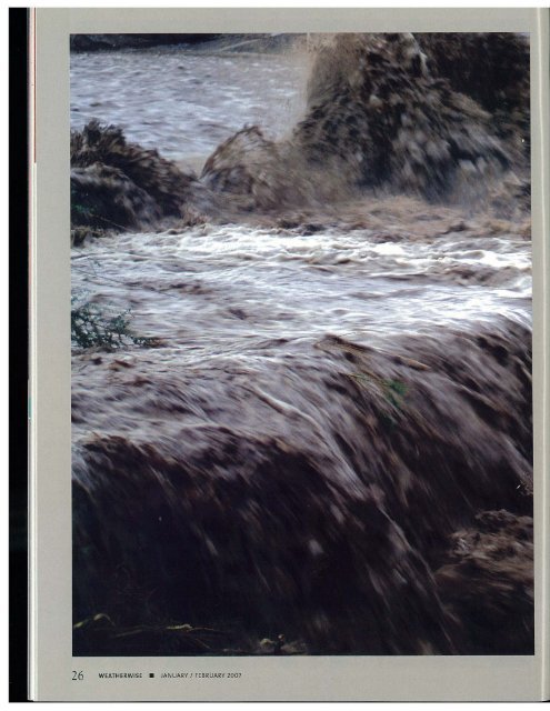
26 WEATHERWISE. JANUARY I FEBRUARY 2007
<strong>The</strong> ~reat Flo(f)d ([) <strong>1862</strong><br />
by Jan<br />
Null and Joelle Hulbert<br />
hen the first storms <strong>of</strong> the winter season arrived in <strong>California</strong> in<br />
December 2005, they were initially a welcome sign that the state's<br />
long dry season was finally over. But as 2006 began, rivers were<br />
pushed over their banks as heavy rains prevailed across the northern<br />
third <strong>of</strong> the Golden State. For many <strong>California</strong>ns, the localized flooding that<br />
occurred in the towns <strong>of</strong> Healdsburg, Guerneville, and Sacramento seemed<br />
near Biblical proportions, and there was a great gnashing <strong>of</strong> teeth and fear for<br />
the <strong>California</strong> levee system. Although the 2005-2006 season was alarming,<br />
many people likely would have been surprised to know that their Civil Warera<br />
ancestors faced a much larger crisis in <strong>1862</strong>, as a record-setting rainy<br />
season prompted the construction <strong>of</strong> that same levee system and threatened<br />
to rain destruction on the many budding communities in the young state.<br />
To put the issue in context, the December<br />
2005 rainfall event in San Francisco recorded<br />
a little more than 11 inches, followed by 3.5<br />
more inches in January 2006. Compare this to<br />
nearly 10 inches for San Francisco in December<br />
1861, followed by an unprecedented 24 inches in<br />
January <strong>1862</strong>. And unlike the winter 2005-2006<br />
storms, the 1861-<strong>1862</strong> storms caused record or<br />
near~record flooding events across the state, from<br />
Eureka and Humboldt counties in the northwest,<br />
all the way to Orange and San Diego counties in<br />
the south.<br />
JANUARY I FEBRUARY 2007 • WEATHERWISE 27
An artist's view <strong>of</strong> K Street in Sacramento during the <strong>1862</strong> flood.<br />
Another view <strong>of</strong> K Street from 4th Street looking east durir<br />
the ,862 flood.<br />
A State Dependent on Its <strong>River</strong>s<br />
To better understand the concern over river<br />
flooding and the levee system in <strong>California</strong>, one<br />
must first understand the geography <strong>of</strong> <strong>California</strong>'s<br />
Central Valley. Composed <strong>of</strong>the Sacramento Valley<br />
from Redding to Sacramento, and the San Joaquin<br />
Valley from Modesto to Bakersfield, the terrain is<br />
generally flat and surrounded on all sides by mountains.<br />
<strong>The</strong> Coast Ranges lie to the west and the<br />
Sierra Nevada mountains to the east. When rain<br />
falls on these mountains, it runs into creeks that<br />
flow down the mountains into streams and rivers<br />
<strong>California</strong>'s 30 days <strong>of</strong> ram m<br />
December 1861 and January <strong>1862</strong><br />
was the equivalent <strong>of</strong> at least a<br />
30.000-year [flood] event.<br />
and into the Central Valley. From there it flows<br />
toward the only sea-level outlet to the ocean, the<br />
Sacramento-San Joaquin <strong>River</strong> Delta, and on out<br />
through the San Francisco Bay. In the Sacramento<br />
Valley, the American, Feather, and Sacramento rivers<br />
all rush through the Sacramento area and then<br />
toward the delta. In the San Joaquin Valley, the San<br />
Joaquin, Kern, Stanislaus, and Merced rivers also<br />
flow to the delta before heading out into the San<br />
Francisco Bay and into the Pacific Ocean.<br />
In the mid-1800s there were no interstate highways<br />
crisscrossing the state. <strong>The</strong> major highways <strong>of</strong><br />
that era were the rivers, so life in <strong>California</strong> developed<br />
along its banks. <strong>The</strong> Gold Rush in the 1850s<br />
had resulted in an impressive influx <strong>of</strong> people whose<br />
livelihoods were tied to the rivers <strong>of</strong> <strong>California</strong> as<br />
commerce flowed along their waters. Meanwhile,<br />
scores <strong>of</strong> farmers had settled along the banks <strong>of</strong> the<br />
rivers, where the most fertile farmland could be<br />
found in the low-lying, flood-prone areas.<br />
But the promise <strong>of</strong> rich cropland along rhe banks<br />
<strong>of</strong> the rivers came at a high risk. Farmers gambled<br />
their life savings on crops and livestock, and residents<br />
<strong>of</strong>burgeoning urban areas near the rivers lived<br />
with the constant knowledge that it would take only<br />
a couple <strong>of</strong> days <strong>of</strong> rain to destroy their operations<br />
and bankrupt their finances. In a natural desire to<br />
protect their property, people who made their homes<br />
along <strong>California</strong>'s rivers constructed earthen levees<br />
along many riverbanks in an effort hold back the<br />
warers. From rhe early 1850s to 1861, more rhan<br />
$1.5 million was spent on building and improving<br />
the levee system in and around Sacramento. Adjusted<br />
to today's dollars, that is almost $30 million.<br />
<strong>The</strong> Deluge<br />
Although extremely wet weather in <strong>California</strong><br />
is sometimes associated with an El-Nifio weather<br />
pattern, the definitive paper on historic El Nii'ios,<br />
written in 1992 by Oregon State Climatologist<br />
Victor Neal and William Quinn, an oceanographer<br />
at Oregon State University, determined that<br />
the synoptic weather panern during the December<br />
1861-January <strong>1862</strong> flooding event was non-EI Nino.<br />
28 WEATHERWISE. JANUARY I FEBRUARY 2007
g<br />
,.. .. - CQIlPOStO .ulll ~<br />
~ " ••te"U(\~ UIUle·TI1 ...--...<br />
r:ro THE SACRAMtN~<br />
llOWA.ftDBEMEVOl£ItT SOClH't<br />
~"iY ~<br />
JI~~e~<br />
r,ur l~.•"lt'...t. to\ ~.ts.a.-,,!lI<br />
....., , "._ "" oj<br />
<strong>The</strong> Signal Corps network <strong>of</strong>weather stations would<br />
not be established on the West Coast for another 10<br />
years, but there were a number <strong>of</strong> Army observers<br />
and private weather observers in place when the<br />
<strong>1862</strong> floods occurred. According to these stations'<br />
records in December 1861, the polar jet stream was<br />
to the north as the Pacific Northwest experienced<br />
a mild rainy pattern for the fin;[ half <strong>of</strong> the month.<br />
<strong>The</strong> jet stream slid south, and on Christmas Day<br />
1861 the Oregon stations reported freezing conditions.<br />
Heavy rainfall began falling in <strong>California</strong> as<br />
the longwave trough moved south over the state.<br />
This trough remained nearly stationary over <strong>California</strong><br />
through the end <strong>of</strong> January <strong>1862</strong>, allowing<br />
heavy rains to fall statewide just shy <strong>of</strong>the proverbial<br />
40 days and 40 nights. Eventually, the polar jet slid<br />
even farther south, allowing several inches <strong>of</strong> snow<br />
to accumulate in the Central Valley and adjacent<br />
mountain ranges.<br />
Daily rainfall was reported in the Sacramento<br />
Union, the Lo, Angeie5 Star, and the Alta <strong>California</strong>.<br />
During the period from December 24, 1861-January<br />
21, <strong>1862</strong>, rain occurred in the state on 28 out <strong>of</strong> the<br />
30 days. San Francisco recorded nearly 34 inches <strong>of</strong><br />
rain between December and January. Sacramento<br />
tallied over 37 inches for the 2 months, with a<br />
one~day maximum <strong>of</strong> 4 inches. Nevada City, in<br />
the lower reaches <strong>of</strong> the Sierra Nevada mountains<br />
reported snowfall equivalent to 115 inches <strong>of</strong> rain<br />
for the storm. At Red Dog, also in Nevada County,<br />
the 24~hour maximum rainfall was reported at 11<br />
inches. Also in the Sierra Nevada foothills, the<br />
Tuolumne County mining town <strong>of</strong> Sonora reported<br />
over 102 inches <strong>of</strong> rainfall in December and January.<br />
In Southern <strong>California</strong>, flooding in Los Angeles<br />
was among the worst on record following nearly 35<br />
inches <strong>of</strong> rainfall. San Diego also suffered the effects<br />
<strong>of</strong> the storms, recording over 7 inches <strong>of</strong> rain-300<br />
percent <strong>of</strong> the January normal at the time! <strong>The</strong> San<br />
Diego <strong>River</strong> floodplain also suffered severe flooding<br />
as the tide backed its waters into the city, eventually<br />
cutting a new channel into the bay.<br />
Widespread <strong>Flood</strong>ing<br />
When considering buying property or insurance,<br />
many people use the loa-year flood line as a safe<br />
benchmark. However, <strong>California</strong>'s 30 days <strong>of</strong> rain in<br />
December 1861 and January <strong>1862</strong> was the equivalent<br />
<strong>of</strong> at least a 30,OOO-year event. In San Francisco,<br />
the storms resulted in a 1O,000~year event,<br />
while in Sacramento, the flooding was "only" a<br />
2,300-year event.<br />
Preceding the actual flood~producing rains in<br />
Sacramento, there was a levee break on December<br />
9, 1861. <strong>The</strong> Sacramento <strong>River</strong> flooded to a stage<br />
<strong>of</strong> 22 feet, 6 inches. This prompted the <strong>California</strong><br />
state Legislature to propose moving the Capitol to<br />
San Francisco until the floodwaters receded. While<br />
it is nor clear how much time the Legislature actu~<br />
ally spent in San Francisco, the <strong>California</strong> Supreme<br />
Court moved its operations to the city and remains<br />
in San Francisco to this day. Notes from the court<br />
that were stored at the <strong>California</strong> Historical Society<br />
state, ".. .it appears that weather, water, and whiskey<br />
had a lor to do with it."<br />
..<br />
JANUARY I FEBRUARY 2007 • WEATHERWISE 29
<strong>The</strong> flooding was exacerbated by warm rains that<br />
caused an unusual December melting <strong>of</strong> the snow<br />
pack in the Sierra Nevadas. This prompted noted<br />
<strong>California</strong> naturalist and Sierra Club founder John<br />
Muir CO commem, "<strong>The</strong> Sierra <strong>River</strong>s are flooded<br />
every spring by the melting <strong>of</strong> rhe snow as regularly<br />
as the famous old Nile. Strange to say, rhe greatest<br />
floods occur in wimer, when one would suppose all<br />
the wild waters would be muffled and chained in<br />
frost and snow ... But at rare imervals, warm rains<br />
and warm winds invade the moumains and push<br />
back the snow line from 2,1XXl to 8,IXXl, or even<br />
higher, and then come the big floods."<br />
Newly elected Governor<br />
Leland Stanford, <strong>California</strong>'s<br />
eighth governor, traveled to<br />
his own inauguration ceremony<br />
in a rowboat.<br />
<strong>The</strong> state Legislature rerurned from its wimer<br />
recess in early January-several weeks into the<br />
heavy rainfall-and was in session on Inauguration<br />
Day, January 10, <strong>1862</strong>, when another levee broke<br />
on the Sacramemo <strong>River</strong>. <strong>The</strong> evem raised the<br />
flood level to a full 24 feet. Newly elected Governor<br />
Leland Stanford, <strong>California</strong>'s eighth governor, traveled<br />
to his own inauguration ceremony in a row~<br />
boat. Newspaper accounts <strong>of</strong> the day were dramatic,<br />
and on January 13, the Sacramenco Union reported,<br />
"Continuous rains and melting snows in the moun~<br />
tains have brought disaster and destruction upon<br />
those valleys and cities <strong>of</strong> <strong>California</strong> which have<br />
been the chief pride <strong>of</strong> the state."<br />
William Brewer, a geologist from Yale University,<br />
was in Sacramemo during the start <strong>of</strong> the storms in<br />
December. On January 19, <strong>1862</strong>, he reported, "<strong>The</strong><br />
great Central Valley <strong>of</strong>the state is under water-the<br />
Sacramemo and San Joaquin valleys-a region<br />
250 to 300 miles long and an average <strong>of</strong> at least<br />
20 miles wide, a district <strong>of</strong> 5,IXXl or 6,IXXl square<br />
miles, or probably three to three and a half million<br />
acres! Although much <strong>of</strong> it is not cultivated, yet a<br />
part <strong>of</strong> it is the garden <strong>of</strong> the state. Thousands <strong>of</strong><br />
farms are emirely under water-