tidal hardwood swamps - Maryland Department of Natural Resources
tidal hardwood swamps - Maryland Department of Natural Resources
tidal hardwood swamps - Maryland Department of Natural Resources

Create successful ePaper yourself
Turn your PDF publications into a flip-book with our unique Google optimized e-Paper software.
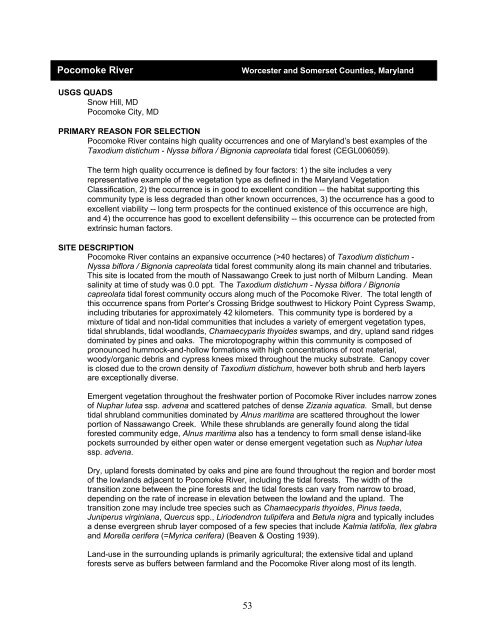
Pocomoke River Worcester and Somerset Counties, <strong>Maryland</strong><br />
USGS QUADS<br />
Snow Hill, MD<br />
Pocomoke City, MD<br />
PRIMARY REASON FOR SELECTION<br />
Pocomoke River contains high quality occurrences and one <strong>of</strong> <strong>Maryland</strong>’s best examples <strong>of</strong> the<br />
Taxodium distichum - Nyssa biflora / Bignonia capreolata <strong>tidal</strong> forest (CEGL006059).<br />
The term high quality occurrence is defined by four factors: 1) the site includes a very<br />
representative example <strong>of</strong> the vegetation type as defined in the <strong>Maryland</strong> Vegetation<br />
Classification, 2) the occurrence is in good to excellent condition -- the habitat supporting this<br />
community type is less degraded than other known occurrences, 3) the occurrence has a good to<br />
excellent viability -- long term prospects for the continued existence <strong>of</strong> this occurrence are high,<br />
and 4) the occurrence has good to excellent defensibility -- this occurrence can be protected from<br />
extrinsic human factors.<br />
SITE DESCRIPTION<br />
Pocomoke River contains an expansive occurrence (>40 hectares) <strong>of</strong> Taxodium distichum -<br />
Nyssa biflora / Bignonia capreolata <strong>tidal</strong> forest community along its main channel and tributaries.<br />
This site is located from the mouth <strong>of</strong> Nassawango Creek to just north <strong>of</strong> Milburn Landing. Mean<br />
salinity at time <strong>of</strong> study was 0.0 ppt. The Taxodium distichum - Nyssa biflora / Bignonia<br />
capreolata <strong>tidal</strong> forest community occurs along much <strong>of</strong> the Pocomoke River. The total length <strong>of</strong><br />
this occurrence spans from Porter’s Crossing Bridge southwest to Hickory Point Cypress Swamp,<br />
including tributaries for approximately 42 kilometers. This community type is bordered by a<br />
mixture <strong>of</strong> <strong>tidal</strong> and non-<strong>tidal</strong> communities that includes a variety <strong>of</strong> emergent vegetation types,<br />
<strong>tidal</strong> shrublands, <strong>tidal</strong> woodlands, Chamaecyparis thyoides <strong>swamps</strong>, and dry, upland sand ridges<br />
dominated by pines and oaks. The microtopography within this community is composed <strong>of</strong><br />
pronounced hummock-and-hollow formations with high concentrations <strong>of</strong> root material,<br />
woody/organic debris and cypress knees mixed throughout the mucky substrate. Canopy cover<br />
is closed due to the crown density <strong>of</strong> Taxodium distichum, however both shrub and herb layers<br />
are exceptionally diverse.<br />
Emergent vegetation throughout the freshwater portion <strong>of</strong> Pocomoke River includes narrow zones<br />
<strong>of</strong> Nuphar lutea ssp. advena and scattered patches <strong>of</strong> dense Zizania aquatica. Small, but dense<br />
<strong>tidal</strong> shrubland communities dominated by Alnus maritima are scattered throughout the lower<br />
portion <strong>of</strong> Nassawango Creek. While these shrublands are generally found along the <strong>tidal</strong><br />
forested community edge, Alnus maritima also has a tendency to form small dense island-like<br />
pockets surrounded by either open water or dense emergent vegetation such as Nuphar lutea<br />
ssp. advena.<br />
Dry, upland forests dominated by oaks and pine are found throughout the region and border most<br />
<strong>of</strong> the lowlands adjacent to Pocomoke River, including the <strong>tidal</strong> forests. The width <strong>of</strong> the<br />
transition zone between the pine forests and the <strong>tidal</strong> forests can vary from narrow to broad,<br />
depending on the rate <strong>of</strong> increase in elevation between the lowland and the upland. The<br />
transition zone may include tree species such as Chamaecyparis thyoides, Pinus taeda,<br />
Juniperus virginiana, Quercus spp., Liriodendron tulipifera and Betula nigra and typically includes<br />
a dense evergreen shrub layer composed <strong>of</strong> a few species that include Kalmia latifolia, Ilex glabra<br />
and Morella cerifera (=Myrica cerifera) (Beaven & Oosting 1939).<br />
Land-use in the surrounding uplands is primarily agricultural; the extensive <strong>tidal</strong> and upland<br />
forests serve as buffers between farmland and the Pocomoke River along most <strong>of</strong> its length.<br />
53