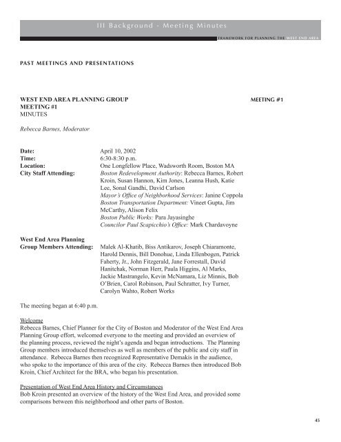
III Background - Meeting Minutes - Boston Redevelopment Authority
III Background - Meeting Minutes - Boston Redevelopment Authority
III Background - Meeting Minutes - Boston Redevelopment Authority

You also want an ePaper? Increase the reach of your titles
YUMPU automatically turns print PDFs into web optimized ePapers that Google loves.
PAST MEETINGS AND PRESENTATIONS<br />
WEST END AREA PLANNING GROUP<br />
MEETING #1<br />
MINUTES<br />
Rebecca Barnes, Moderator<br />
Date: April 10, 2002<br />
Time: 6:30-8:30 p.m.<br />
Location: One Longfellow Place, Wadsworth Room, <strong>Boston</strong> MA<br />
City Staff Attending: <strong>Boston</strong> <strong>Redevelopment</strong> <strong>Authority</strong>: Rebecca Barnes, Robert<br />
Kroin, Susan Hannon, Kim Jones, Leanna Hush, Katie<br />
Lee, Sonal Gandhi, David Carlson<br />
Mayor’s Office of Neighborhood Services: Janine Coppola<br />
<strong>Boston</strong> Transportation Department: Vineet Gupta, Jim<br />
McCarthy, Alison Felix<br />
<strong>Boston</strong> Public Works: Para Jayasinghe<br />
Councilor Paul Scapicchio’s Office: Mark Chardavoyne<br />
West End Area Planning<br />
Group Members Attending: Malek Al-Khatib, Biss Antikarov, Joseph Chiaramonte,<br />
Harold Dennis, Bill Donohue, Linda Ellenbogen, Patrick<br />
Faherty, Jr., John Fitzgerald, Jane Forrestall, David<br />
Hanitchak, Norman Herr, Paula Higgins, Al Marks,<br />
Jackie Mastrangelo, Kevin McNamara, Liz Minnis, Bob<br />
O’Brien, Carol Robinson, Paul Schratter, Ivy Turner,<br />
Carolyn Wahto, Robert Works<br />
The meeting began at 6:40 p.m.<br />
I I I B a c k g r o u n d - M e e t i n g M i n u t e s<br />
Welcome<br />
Rebecca Barnes, Chief Planner for the City of <strong>Boston</strong> and Moderator of the West End Area<br />
Planning Group effort, welcomed everyone to the meeting and provided an overview of<br />
the planning process, reviewed the night’s agenda and began introductions. The Planning<br />
Group members introduced themselves as well as members of the public and city staff in<br />
attendance. Rebecca Barnes then recognized Representative Demakis in the audience,<br />
who spoke to the importance of this area of the city. Rebecca Barnes then introduced Bob<br />
Kroin, Chief Architect for the BRA, who began his presentation.<br />
Presentation of West End Area History and Circumstances<br />
Bob Kroin presented an overview of the history of the West End Area, and provided some<br />
comparisons between this neighborhood and other parts of <strong>Boston</strong>.<br />
F R A M E W O R K F O R P L A N N I N G T H E W E S T E N D A R E A<br />
MEETING #1<br />
45
MEETING #1 cont.<br />
46<br />
I I I B a c k g r o u n d - M e e t i n g M i n u t e s<br />
Discussion<br />
The discussion began with a question from the Planning Group regarding the ability to be<br />
visionary in these discussions of the West End Area with the many preconceptions of the<br />
Area. A member of the Planning Group commented that it was the Urban Renewal Plan<br />
that allowed for the urban density and open space which was why she chose to live in the<br />
West End. Parking concerns were also expressed. Bob Kroin responded that open space<br />
needs to be maintained, but the Area need not be all open space—it can be a mix of highrise<br />
and low-rise buildings.<br />
Questions regarding the planned development projects for the Area and the possibility/<br />
plans for a supermarket were asked. Rebecca Barnes responded that the development<br />
projects that will be presented at future meetings are the projects that the community is<br />
already familiar with, as those are the projects the City is familiar with as well.<br />
Numerous requests for more information on the West End Urban Renewal Plan were made.<br />
A suggestion was also made for having members of the Zoning Board of Appeal, BTD and<br />
the Police Department attend future meetings.<br />
Many Planning Group members expressed their belief that the West End Area was the best<br />
community to live in and noted that Charles River Park was an award-winning concept. A<br />
suggestion was made to create a list of resident’s likes and dislikes of the area to be used as<br />
a starting point for discussion.<br />
Rebecca Barnes then opened the discussion to everyone at the meeting:<br />
A resident commented that they felt that the presentation was unfair in that it compared the<br />
best snapshots of <strong>Boston</strong> to the worst of the West End Area. It was suggested that planning<br />
should come first, then zoning and then development. Rebecca Barnes responded that in<br />
an ideal world, this could happen, but we live in a place with previously established legal<br />
and physical constraints. Equity Residential was asked to shelve their plans for Emerson<br />
Place until the end of the planning process.<br />
When a moratorium on development was requested, it was explained that the BRA has no<br />
legal right to stop a developer from filing and that stopping development may or may not<br />
be possible. Rebecca Barnes stated that the City is hoping to convene all interests in these<br />
meetings.<br />
A resident commented that they felt that the presentation was biased to promote density.<br />
Rebecca Barnes responded that the City is not promoting any proposals in these meetings.<br />
Other comments from the community and Planning Group members included traffic<br />
concerns during Fleet Center events, the lack of theaters and art galleries in the area,<br />
housing affordability, maintaining the existing open space and the creation of more open<br />
space. Residents stated that they moved to the West End Area for the open space and that<br />
it should be preserved. A second request for a list of likes/dislikes (pros/cons) of the area<br />
was made. Rebecca Barnes agreed to the list.
Rebecca Barnes closed the meeting stressing that the City is not selling any proposals. The<br />
planning process is a forum to share opinions and review the legal and social conditions<br />
and issues in the area—to recognize the values and realize them.<br />
The meeting closed at 9:00 p.m.<br />
NEXT MEETING:<br />
Tuesday, May 7, 2002, 6:15 p.m. to 8:15 p.m.<br />
MGH O’Keefe Auditorium<br />
All are welcome.<br />
WEST END AREA PLANNING GROUP<br />
MEETING #2<br />
MINUTES<br />
Rebecca Barnes, Moderator<br />
I I I B a c k g r o u n d - M e e t i n g M i n u t e s<br />
Date: May 7, 2002<br />
Time: 6:15-9:00 p.m.<br />
Location: Shriners Hospital Auditorium, <strong>Boston</strong> MA<br />
City Staff Attending: <strong>Boston</strong> <strong>Redevelopment</strong> <strong>Authority</strong>: Rebecca Barnes,<br />
Robert Kroin, Kim Jones, Leanna Hush, Katie Lee,<br />
Sonal Gandhi, Rick Shaklik<br />
<strong>Boston</strong> Transportation Department: Jim McCarthy,<br />
Alison Felix<br />
West End Area Planning<br />
Group Members Attending: Malek Al-Khatib, Biss Antikarov, Harold Dennis, Bill<br />
Donohue, Linda Ellenbogen, Patrick Faherty, Jr.,<br />
John Fitzgerald, Jane Forrestall, David Hanitchak,<br />
Paula Higgins, Al Marks, Jackie Mastrangelo, Kevin<br />
McNamara, Liz Minnis, Bob O’Brien, Carol Robinson,<br />
Paul Schratter, Ivy Turner, Robert Works, Emilie<br />
Pugliano<br />
The meeting began at 6:30 p.m.<br />
Rebecca Barnes summarized the process for this initiative, the schedule and the<br />
proceedings of the first meeting (held on April 10 th at Longfellow Place). Questions and<br />
comments from both the Planning Group and the audience revealed a common request<br />
to adapt the schedule to include a “summer break.” This would better accommodate<br />
the schedules of many participants and would allow for time to digest the information<br />
F R A M E W O R K F O R P L A N N I N G T H E W E S T E N D A R E A<br />
MEETING #1 cont.<br />
MEETING #2<br />
47
MEETING #2 cont.<br />
48<br />
I I I B a c k g r o u n d - M e e t i n g M i n u t e s<br />
being presented in these first several meetings. Rebecca agreed to make appropriate<br />
changes and redistribute a new schedule (see “West End Area Planning meeting<br />
schedule UPDATE” below).<br />
Participants then separated into 10 small groups to discuss the question:<br />
In thinking about the future of the West End Area, what values do you want<br />
to be sure are represented and carried out through planning and development<br />
efforts?<br />
Groups were asked to think about the answer to this question as it pertains to the<br />
following elements:<br />
1) Character and Livability<br />
2) Activity and Use<br />
3) Access and Circulation<br />
4) Relationship to surrounding areas<br />
Rebecca polled the audience to see how everyone felt about the idea of adjusting the<br />
evening’s agenda by moving the scheduled zoning and urban renewal presentation/<br />
discussion to a later meeting, and instead devoting the remainder of the evening to the<br />
reports from the breakout groups. There was consensus to do this.<br />
The attachment in your email entitled “Charts-meeting #2” contains the notes from<br />
each of the 10 groups. The attachment “Summary of individual responses at West<br />
End meeting 2” details the responses we received from the eighteen participants who<br />
submitted their own written answers to the same questions discussed in the small<br />
groups.<br />
GROUP RESPONSES: VERBATIM NOTES<br />
GROUP #1<br />
Special about West End<br />
• Open Space<br />
• Accessibility to neighborhoods and amenities<br />
• Combined urban/suburban qualities<br />
• Park-like atmosphere<br />
• Sense of Community<br />
• Unique identity<br />
• Pedestrian thoroughfares<br />
• Quality views for many residents<br />
• Sense of safety<br />
• Diverse population
Enhancements to West End<br />
• Cambridge Street improvements<br />
• North Station area upgrade<br />
• Lower noise level (Garden garage, helicopters)<br />
• Wm. Cardinal O’Connell way safety<br />
• Improve Blossom Street<br />
• “Main-stream” supermarket<br />
• Movie Theater<br />
• Visual and Performing Arts<br />
GROUP #2<br />
• Enhance residential area.<br />
-West End is contained. New proposals will not work. A wall around.<br />
Enhance connections.<br />
• Retain and want open space-like a walkable park.<br />
-Needs of residents need to be met<br />
-Too much traffic during the day—needs improvement<br />
-Idea of road through Blossom to Martha Way to split area—not a good idea<br />
-Like safe area<br />
-Contrast-balance of residential-commercial<br />
• Enhance human-small-scale balance.<br />
-Equity is asking for too massive, high building<br />
-Improve public transportation—add more small service businesses<br />
• Subzones of residential should be maintained.<br />
• Want appropriate growth.<br />
GROUP #3<br />
Special—Want to Preserve:<br />
I I I B a c k g r o u n d - M e e t i n g M i n u t e s<br />
1. Green Space, birds, trees, low density of buildings<br />
2. Close-knit stable community, many long-term residents<br />
3. Availability of amenities, health care, social activities, City Hall, Federal services<br />
within walking distance<br />
4. Pedestrian friendly, access to public transportation<br />
F R A M E W O R K F O R P L A N N I N G T H E W E S T E N D A R E A<br />
MEETING #2 cont.<br />
49
MEETING #2 cont.<br />
50<br />
I I I B a c k g r o u n d - M e e t i n g M i n u t e s<br />
5. Close to Esplanade, River<br />
6. Safe neighborhood<br />
7. Diversity of ages, income, ethnicity…welcoming to all<br />
8. Car-free zone in midst of busy area<br />
9. Availability of off-street parking<br />
10. A community that works better than most<br />
Things we can Improve:<br />
1. Public opinion of our neighborhood<br />
2. Connections between buildings and surrounding areas<br />
3. Accessibility for all, better maintained sidewalks, curb cuts, traffic crossings<br />
4. Attractiveness, aesthetic improvements<br />
5. Improve appearance of surrounding public buildings<br />
6. Address homelessness and vagrants on perimeter<br />
7. Air quality, Big Dig, MGH diesel busses, hazardous waste, medical waste, leaking<br />
dumpsters<br />
8. Too many busses and trucks on Cardinal O’Connell Way<br />
9. Unsightly security measures like jersey barriers around public buildings<br />
10. More brick, less concrete, more planters, more attractive lighting<br />
11. Upgrade Science Park and Bowdoin stations<br />
12. Improve pedestrian overpasses to Science Museum, Esplanade<br />
13. Improve signage and reconfigure pedestrian walkways<br />
14. Unattractive edges (Martha Road, Charles Street extension, Blossom St., etc.)<br />
15. Noise from Helipad, Fleet Center Garage, Loading ramps<br />
GROUP #4<br />
Current:<br />
• Diversity: Business/Residential, Social/Economic<br />
• West End has a very well defined image: open space, quiet, unique<br />
Future:<br />
• Maintain affordability and stability<br />
• Can we expand or make better use of West End boundaries, specifically to be used<br />
for Residential<br />
• Restrict density levels<br />
• Residential support services, (i.e., schools, retail, recreational)<br />
• Preserve open space and character
Current: (activities)<br />
• Value open space and residential<br />
• Value live and work<br />
• Value proximity to other resources of city<br />
Future: (activities)<br />
• Need more open green space<br />
• More retail storefronts<br />
• Quiet enjoyment of residential areas with proper balance of entertainment licenses<br />
• Better recreational activities for the neighborhood’s lifestyles<br />
Current:<br />
• Very walkable area in a city known as the “Walking City”<br />
• Safe and secure<br />
Enhance:<br />
• Maintain and beautify<br />
• Increase safety and security<br />
• Easier access through MGH to Charles Station<br />
• Stop Cardinal Way being used as a shortcut<br />
• Help overall infrastructure<br />
• Improve Science Park station<br />
Current:<br />
• One of safest neighborhoods in City (BPD)<br />
• West End has strong sense of community<br />
GROUP #5<br />
Special:<br />
I I I B a c k g r o u n d - M e e t i n g M i n u t e s<br />
• Park like—Open<br />
• Vertical Neighborhood, Sense of Place<br />
• Views of City-sunset, river, city, State House, CITGO<br />
• Acceptable density, not NYC<br />
• Surrounded by Institutional Uses<br />
• Residential provides open space, circulation for institutions and public<br />
• Exception to typical residential development; stability and safe (inst/res)<br />
F R A M E W O R K F O R P L A N N I N G T H E W E S T E N D A R E A<br />
MEETING #2 cont.<br />
51
MEETING #2 cont.<br />
52<br />
I I I B a c k g r o u n d - M e e t i n g M i n u t e s<br />
Improvements:<br />
• Preserving, returning, and improving green space, light, air, sun<br />
• Connection to institutions—outlying areas<br />
• Supermarket<br />
• Senior services<br />
• Reduce traffic, noise, congestion within Blossom Street/Storrow Drive<br />
• Institutions pay more attention to residential<br />
• Limit density/height—surrounding areas to be developed—Nashua St.<br />
• Science Park/Charles circulation<br />
GROUP #6<br />
Character and Livability:<br />
• City and River views<br />
• High Density—Green Open Space<br />
• Layout is conducive to neighborhood environment (Community)<br />
• Layout is conducive to security<br />
• Diversity and Demographics<br />
Ideas on how to Improve:<br />
• Submerge open parking lots and develop more open space for recreational/social<br />
activities<br />
Activity and Use:<br />
• Access and Circulation<br />
• Pedestrian circulation<br />
• Proximity to public transportation<br />
• Concerns about increased circulation<br />
What can we improve upon?:<br />
• Vehicular circulation by enhancing alternative transportation<br />
• Accessibility to Green Line
GROUP #7<br />
Good Better<br />
1. “Park-like,” open space, mid-city Maintain/Strengthen<br />
2. Retail balance towards residential Upgrade North Station,<br />
Cambridge St., Grocery Store,<br />
Local Services, Arts<br />
3. Traffic Access, Thoreau Path, Security Can Improve: access to subway,<br />
elderly access, pedestrians at<br />
grade<br />
4. Attractive Enhance Landscape,<br />
Residential, Other<br />
GROUP #8<br />
Special:<br />
I I I B a c k g r o u n d - M e e t i n g M i n u t e s<br />
• Residential should stay residential<br />
• 48 acres? Unique to world?<br />
• Beauty of City with open space<br />
• Vital active neighborhood<br />
• Great location—public transportation<br />
• Convenience<br />
• Affordable housing (large proportion?)<br />
• Students<br />
• Diversity without tension<br />
• Seniors<br />
• Safety—lighting, security guards<br />
• Neighborhood<br />
• Quiet green/gardens<br />
• Views (don’t want NYC)<br />
• Stability—long-time residents<br />
• Hospital as a “wall”—huge<br />
• What do we have to give up?<br />
• Are the “fringes” fair ground?<br />
• Development on Nashua Street?<br />
• Don’t lose the uniqueness of the residential/high rise park area<br />
• Parking/Congestion increased fear of future development<br />
• Access for vehicles<br />
• Sunlight<br />
F R A M E W O R K F O R P L A N N I N G T H E W E S T E N D A R E A<br />
MEETING #2 cont.<br />
53
MEETING #2 cont.<br />
54<br />
I I I B a c k g r o u n d - M e e t i n g M i n u t e s<br />
• Parking should be shielded as much as possible<br />
• Concern about maintaining healthy mix of residential/commercial/institutional<br />
• Market—Pace’s good addition, need more of this (institutions have taken it over)<br />
GROUP #9<br />
• Open Space Preserved<br />
• Quiet areas an oasis<br />
• Maintain beautiful landscape<br />
• No more high-rise buildings<br />
• Build an elementary school<br />
• Better street lighting, downward facing lights<br />
• Keep views, access to sunlight, air for existing buildings, support home values<br />
• Don’t add traffic to Blossom Court<br />
• Maintain safe environment for children<br />
• Adequate fire protection<br />
• Don’t add to traffic congestion in and around West End<br />
• Any new buildings to blend into existing architecture<br />
• No need to change West End beyond changes already in process<br />
• Expand West End with housing in direction of Nashua Street, with access from<br />
Charles River Park commercial development<br />
• Reduce pollution from vehicles serving the area<br />
• Maintain recreation facilities<br />
GROUP #10<br />
• Security<br />
• Open Spaces/Green<br />
• Unique, not gated, quieter than city<br />
• Value diversity<br />
• Lowest cost of living in city<br />
• Multiple access points<br />
• Balance between institutional, retail and residential (world class hospital)<br />
• Architecture blends in<br />
• Recreational facilities/access<br />
Activity:<br />
• Pedestrian-friendly<br />
• Open Space<br />
• Parking Balance<br />
• Health clubs<br />
• Security<br />
• Basketball
Access and Circulation:<br />
• Vehicle access issue—maxed out<br />
• MBTA improvements needed<br />
• Bike racks<br />
• Car parking<br />
• MBTA accessibility<br />
• Crosswalks—poor location<br />
• No sticker parking<br />
• Access to jobs<br />
• Residential within institutional area (not recognized as such by outsiders)<br />
• Diversity of the area—has a uniqueness<br />
• Access to other neighborhoods on foot<br />
Future:<br />
I I I B a c k g r o u n d - M e e t i n g M i n u t e s<br />
• Open space—keep and add<br />
• Facilitated access points to institution<br />
• Grocery store<br />
• Bike path<br />
• Residential development on Nashua Street<br />
• Charles River Park should have more retail<br />
• Improve Science Park stop<br />
• Bad access to North End<br />
• Add lighting on surrounding streets<br />
• Deter homeless<br />
• <strong>Boston</strong> Licensing Board—better to continue in North Station area<br />
• Noise/Air pollution in Fleet Center area<br />
• Better access to river<br />
• Infrastructure<br />
• Low crime rate<br />
• Open Space retained<br />
• Uniqueness<br />
• Not trapped—multiple access<br />
• Economic diversity and cultural diversity<br />
• Recreational facilities<br />
• Pedestrian-friendly<br />
F R A M E W O R K F O R P L A N N I N G T H E W E S T E N D A R E A<br />
MEETING #2 cont.<br />
55
MEETING #2 cont.<br />
56<br />
I I I B a c k g r o u n d - M e e t i n g M i n u t e s<br />
The remaining notes summarize individuals’ written responses to the same<br />
aforementioned question (page 48).<br />
1. CHARACTER AND LIVABILITY<br />
What is special?<br />
• Open space was an element that people enjoy very much; this was listed as<br />
something to be “retained” (often mentioned)<br />
• There is a lot of “light” (2) * and it feels like “an oasis” (3) in the city.<br />
• Safety for children and the elderly<br />
• Socioeconomic diversity<br />
• That the West End is “unique to <strong>Boston</strong>,” and “well-defined”<br />
• Maintenance of the recreational facilities (from the notes it was difficult to tell if<br />
this fell under the “can be enhanced” category)<br />
• Inside of the buildings “holds up very well”<br />
• History<br />
• Home values<br />
• Attractive<br />
• Convenient (3)<br />
• Views (4)<br />
• Urban yet surrounded by trees and grass”/urban-suburban feel<br />
• “Characterized by contrasts”—old and new, quiet yet busy, mixes of uses<br />
• History of world-class medicine (2)<br />
What can be enhanced?<br />
• Updated street lighting (3)<br />
• Architecture of the buildings is “not attractive”; would like to find ways of<br />
improving this (2)<br />
• “more rather than less open space is needed to balance buildings”<br />
• Maintain affordability and stability<br />
• “Clean up—Cambridge Street homeless—drunks”<br />
• “Jail—get rid of it. Maybe put a new building there”<br />
• “Lindemann is ugly (2)—give it a face lift”<br />
• Public art, fountains<br />
• More appropriate fencing<br />
• Seating conducive to socializing<br />
• “Return green space and trees forfeited to the Big Dig” (2)<br />
• More/better trees, grass, plantings (2); mulch is not an okay substitute<br />
• “No buildings built up at sidewalk edge”<br />
* Note: Numbers in parentheses refer to how many times something was mentioned in<br />
the individual responses.
2. ACTIVITY AND USE<br />
What is special?<br />
• Outdoor seating at Pace’s is a nice amenity (3)<br />
• Being able to “meet neighbors for a chat” in the plaza (2)<br />
• “Proximity to resources/work” (5)<br />
• “Gateway to the city from the North”<br />
• Hardware stores<br />
• Restaurants<br />
• “Improved housing for families—rebuild townhouses”<br />
• Available parking (2)<br />
What can be enhanced?<br />
I I I B a c k g r o u n d - M e e t i n g M i n u t e s<br />
• “No new development to increase density (4)”<br />
• “Appropriate” growth (2)<br />
• Maintain balance of uses (2)<br />
• “Reduced scale could be enhanced; large scale seems to be predominant”<br />
• “Too much institutional use now—it walls off neighborhood”<br />
• One person found it undesirable that the MGH had converted a restaurant to a<br />
cancer center<br />
• Retain/Need more “residential services”—retail! restaurants, dry cleaners, senior<br />
services, schools, retail store fronts (6); don’t lose them to medical offices (1)<br />
• Keep noise level down (2)<br />
• Maintain city infrastructure (2)<br />
• Dedicated recreational areas for children and families; Better shared playground<br />
for all residents<br />
• Cinema/theater/performing arts space (3)<br />
• Supermarket options (5) (Some liked the idea of a Bread & Circus, some liked the<br />
idea of a more traditional grocery market)<br />
• Community Center (2)<br />
• Art galleries (2)<br />
• Reopen pool on Esplanade<br />
• “Bring engineering (electronics) firms”<br />
• “Retain park-like core, build and improve commercial use on the perimeter”<br />
• Expand the library<br />
F R A M E W O R K F O R P L A N N I N G T H E W E S T E N D A R E A<br />
MEETING #2 cont.<br />
57
MEETING #2 cont.<br />
58<br />
I I I B a c k g r o u n d - M e e t i n g M i n u t e s<br />
3. ACCESS AND CIRCULATION<br />
What is special?<br />
• Ideal for those who do not drive—close to “T” (5)<br />
• “Circular streets reflect patterns of original <strong>Boston</strong>”<br />
• Pedestrian aspect throughout (4)—maintain this<br />
• Limited vehicle traffic within park<br />
• Safe (6)<br />
What can be enhanced?<br />
• Ensure multiple access points, open to the community at large; but retain sense of<br />
community and safety aspects (2)<br />
• Put all garages underground (3)<br />
• Reduce traffic (5); “we are overwhelmed by traffic on Storrow Drive and Martha<br />
Road now”<br />
• Access from Storrow Drive, Martha Road is poor (2)<br />
• Beautification<br />
• Pedestrian safety at crossings (3); more “Walk” lights (Cardinal O’Connell,<br />
Blossom, and Cambridge streets all mentioned)<br />
• Enforce parking laws on streets (events at the Fleet Center)<br />
• Opportunity to remove elevated Green Line tracks<br />
• Green Line handicap access in general & Science Park station need upgrades (3)<br />
• Better overpasses to T and Esplanade<br />
• More parking for visitors as well as residents<br />
• Limo parking<br />
• Better access through MGH campus (3) “don’t want to have to go through hospital<br />
to reach Cambridge Street”<br />
• Access to Whittier by car is poor<br />
• Reconfigure some pathways<br />
• Not well-marked street signs<br />
• Easier interchanges between T buses and commuter rail lines<br />
• Improve surrounding roads (especially Cambridge Street)<br />
• Put a new park along Blossom Street where parking garage is, not a new high-rise<br />
• Bike paths<br />
• Vehicles are restricted by the limited streets
4. RELATIONSHIP TO SURROUNDING AREAS<br />
What is special?<br />
• Great to be able to walk to the Charles River Esplanade and the harbor (4)<br />
• Strong sense of community/stability<br />
• Easy access to other neighborhoods<br />
• Visitors from other parts of the city for tourism, etc.<br />
• More housing units coming onto market in the immediate surrounding areas<br />
• Strong medical history<br />
What can be enhanced?<br />
I I I B a c k g r o u n d - M e e t i n g M i n u t e s<br />
• Conversion of Charles River Plaza to commercial use will add to the “walling off” of<br />
the West End from the rest of the city<br />
• Develop Nashua Street and Bullfinch Triangle area for housing (5) [especially<br />
affordable housing (1)]; to link North End and West End<br />
• “Keep control” of entertainment/liquor licenses;<br />
“The area of North Station could use some improvement in “class” of businesses—<br />
to attract less of the panhandler part of society”<br />
• Too much like an “institutional back door” now (2)<br />
• Need an “easier way to walk to Charlestown”<br />
• “Fleet Center attendees trash our neighborhood and are disruptive (e.g., drunk,<br />
noisy, argumentative)”<br />
• Encourage surrounding institutions to improve the aesthetics of the portions that<br />
face Charles River Park<br />
• Feels “somewhat isolated” from surrounding neighborhoods: improve connections<br />
F R A M E W O R K F O R P L A N N I N G T H E W E S T E N D A R E A<br />
MEETING #2 cont.<br />
59
MEETING #3 **NEXT MEETING: JUNE 4, 2002 AT SHRINERS HOSPITAL AUDITORIUM AT<br />
6:15 p.m. (Beacon Hill Times published the incorrect location.)<br />
60<br />
I I I B a c k g r o u n d - M e e t i n g M i n u t e s<br />
WEST END AREA PLANNING GROUP<br />
MEETING #3<br />
MINUTES<br />
Rebecca Barnes, Moderator<br />
Date: May 22, 2002<br />
Time: 6:15-9:00 p.m.<br />
Location: Shriners Hospital Auditorium, <strong>Boston</strong> MA<br />
City Staff Attending: <strong>Boston</strong> <strong>Redevelopment</strong> <strong>Authority</strong>: Rebecca Barnes,<br />
Keith Craig, Owen Donnelly, Sonal Gandhi, Kim Jones,<br />
Robert Kroin, Katie Lee<br />
<strong>Boston</strong> Transportation Department: Alison Felix, Vineet<br />
Gupta, Jim McCarthy<br />
West End Area Planning<br />
Group Members Attending: Malek Al-Khatib, Biss Antikarov, Richard Cirace,<br />
Harold Dennis, Bill Donohue, Linda Ellenbogen,<br />
Patrick Flaherty, Jr., John Fitzgerald, Jane Forrestall,<br />
David Hanitchak, Norman Herr, Paula Higgins, Al<br />
Marks, Jackie Mastrangelo, Kevin McNamara, Liz<br />
Minnis, Bob O’Brien, Emilie Pugliano, Carol Robinson,<br />
Paul Schratter, Ivy Turner, Carolyn Wahto, Robert<br />
Works<br />
The meeting began at 6:15 p.m.<br />
Rebecca Barnes welcomed the Planning Group and other community members in<br />
attendance. She addressed the change in schedule as requested at the previous<br />
meeting. A break will be taken during the months of July and August and the<br />
meetings will begin again September. Rebecca suggested a weekend workshop for the<br />
first meeting in September after the summer break, in order to regroup and refocus on<br />
the possible outcomes of this process. The Planning Group will be consulted during<br />
the summer regarding the workshop format and contents. The process is scheduled to<br />
end in late October.
PROJECT PRESENTATIONS<br />
EQUITY RESIDENTIAL: EMERSON PLACE<br />
Presenter: Bill Donohue<br />
The proposed concept for Emerson Place consists of the development of 529 new units<br />
of housing while maintaining the 444 units of housing in their two existing buildings.<br />
The concept also includes the construction of a 527-space underground parking<br />
garage. The same amount of existing green space will remain. Through the numerous<br />
community meetings, Equity has been informed of the community’s concerns. These<br />
concerns include density, the need for larger more contemporary units, parking,<br />
affordability, security, the desire for rental and ownership opportunities, improving<br />
and maintaining the open space, and overall maintenance of and improvements to the<br />
park and the surrounding areas. Equity has also met with various property owners<br />
in the area. Moving forward, Equity will continue to listen to the community and<br />
evaluate all comments and concerns while participating in the BRA’s West End Area<br />
Planning Process. A revised Letter of Intent will be submitted to the BRA, which will<br />
begin the public review process.<br />
Questions and Comments for Equity:<br />
Rebecca Barnes commented on the good news that Equity will be participating in<br />
the planning process and will wait until the end of the process, with the current<br />
schedule, to submit a development proposal to the BRA. The community expressed<br />
concern regarding the traffic impacts on Blossom Street/Court, the filing of the Project<br />
Notification Form (PNF) from Equity and whether the proposal will be within the<br />
current zoning. Equity responded that as long as the process keeps to the current<br />
schedule, they will not file until the process is complete and that the current plan is<br />
not within the zoning, but that they do not have a definite plan yet.<br />
The community questioned whether someone from the EPA was in attendance.<br />
Rebecca Barnes responded that invitations were sent to the City and State<br />
environmental offices, as suggested. Concerns regarding the environmental effects<br />
were also expressed. Equity responded that they have hired engineers to study<br />
this, but until the plans are further along, it is difficult to proceed. Other comments<br />
included concern over the quality of the “If you lived here, you’d be home” sign and<br />
how it is representative of Equity’s treatment of their residents and that they would<br />
like to see Massachusetts General Hospital (MGH), the Charles Street Jail Hotel and<br />
Equity work together.<br />
CARPENTER & COMPANY: CHARLES STREET JAIL HOTEL<br />
Presenter: Peter Diana<br />
I I I B a c k g r o u n d - M e e t i n g M i n u t e s<br />
Carpenter & Company works primarily in the development of hotels. The Charles<br />
Street Jail Hotel will be similar to the Charles Hotel in Cambridge in terms of quality,<br />
size and intent. It will have approximately the same number of rooms, but less<br />
meeting and restaurant space.<br />
F R A M E W O R K F O R P L A N N I N G T H E W E S T E N D A R E A<br />
MEETING #3 cont.<br />
61
MEETING #3 cont.<br />
62<br />
I I I B a c k g r o u n d - M e e t i n g M i n u t e s<br />
Improvements to the current condition of the area:<br />
• The outside wall (around the site) will be taken down and replaced with a much<br />
lower, knee-high wall.<br />
• The slate roof will be restored.<br />
• The cupola will be restored.<br />
• The outside of the building will be cleaned.<br />
• Open space will be created on Charles Street in front of the hotel.<br />
The driveway will be located on Charles Street as far from Charles Circle as possible.<br />
Cambridge Street will be avoided entirely by traffic entering the hotel from Storrow<br />
Drive. The only traffic that will effect Cambridge Street will be that coming from<br />
Downtown, which should be minimal. An interior road will be created, connecting<br />
the hotel to the MGH garage, which will provide the hotel with the necessary parking<br />
spaces. The hotel’s floor plan is designed to allow public access to the historic site.<br />
The Project Notification Form (PNF) has been submitted and the comment period ends<br />
on May 31, 2002.<br />
Questions and Comments for Carpenter & Company:<br />
The community questioned whether there would be parking space flexibility with<br />
MGH if the number of necessary parking spaces has been underestimated for the hotel<br />
and how many additional people the hotel would bring to the area. Carpenter & Co.<br />
responded that the parking analysis was done from a business standpoint, in that it<br />
is in the hotel’s best interest to have sufficient parking, and that at maximum usage,<br />
which is rare, there would be 1000-1200 additional people.<br />
The community commented that the hotel is going to be a great improvement and<br />
questioned the visibility of the open space in front of the hotel. Carpenter & Co.<br />
responded that it would be completely open with only a knee-high wall. Other<br />
questions and comments included the size of the ballroom and the penetrability of<br />
the area. Carpenter & Co. directed the penetrability question to MGH as the hotel is<br />
out of the way in terms of access for residents of the West End to the Charles/MGH T<br />
Station. The ballroom will be about 2/3 the size of the ballroom at the Charles Hotel in<br />
Cambridge, which is small to begin with.<br />
MASSACHUSETTS GENERAL HOSPITAL: YAWKEY CENTER FOR OUTPATIENT CARE<br />
Presenters: Dr. Jean Elrick, David Hanitchak and John Messervy<br />
MGH is proposing to develop approximately 640,000 (466,700 net new) square feet of<br />
ambulatory care and medical office space, together with a below-grade parking garage<br />
with approximately 725 (475 net new) spaces on its campus located off Cambridge<br />
Street. The proposed Yawkey Center for Outpatient Care will be developed in two<br />
phases. Phase 1 will be located south of Fruit Street and will span the eastern portion<br />
of the Charles Street Jail site towards Cambridge Street. The northern portion will be<br />
built on top of the existing Northeast Proton Therapy Center and the southern portion
will be located on top of the proposed below-grade parking garage on the Cambridge<br />
Street end of the former Charles Street Jail (proposed hotel). Phase 1 is scheduled to<br />
be completed in the spring of 2004.<br />
Phase 2 will be located north of Fruit Street at the current site of the Vincent/<br />
Burnham, Clinics and Tilton buildings, which would be taken down. Construction of<br />
Phase 2 should begin upon the completion of Phase 1.<br />
Questions and Comments for MGH:<br />
I I I B a c k g r o u n d - M e e t i n g M i n u t e s<br />
The community questioned whether there will be inpatients and if there will be<br />
improvements to the taxi service for the center. MGH responded that there will be no<br />
in-patients and that the hospital is studying the taxi situation for the entire campus.<br />
Two specific questions regarding the Fruit Street garage and whether MGH has plans<br />
to convert Fruit Street into a two-way street. MGH responded that the demolition<br />
of the Fruit Street garage will be within 10 years, as part of Phase 2 (2008) and that<br />
there is no commitment to make Fruit Street a two-way street, but that there have<br />
been discussions.<br />
The community requested that the Cambridge/Blossom Street Working Group<br />
discussions be better advertised in the community and questioned if the meetings<br />
were advertised in the Beacon Hill Times. MGH responded that email is the current<br />
mode of notification. The email is not sent to a select list, but to individuals who live<br />
or own property on Cambridge or Blossom streets. The emails are also sent to the<br />
neighborhood groups, which were believed to be getting the information out to their<br />
members. MGH will also do whatever is necessary/desired by the community.<br />
MASSACHUSETTS GENERAL HOSPITAL: INSTITUTIONAL MASTER PLAN<br />
Presenters: Dr. Jean Elrick, David Hantichak and John Messervy<br />
Rebecca Barnes: MGH submitted the Institutional Master Plan (IMP) Notification<br />
Form to the BRA approximately 48 hours ago. It is being presented for the first time<br />
here tonight.<br />
The Massachusetts General Hospital’s mission strives for excellence in three areas:<br />
patient care, education and research. Over the next ten years, the hospital proposes<br />
a complete facilities plan, as part of its Institutional Master Plan, to address current<br />
demands and in order to continue to improve the three components of its mission. The<br />
plan includes leasing off-site space, additions to and updating of older facilities as well<br />
as a number of new construction projects.<br />
Proposed new construction projects in the IMP include:<br />
• A research facility on the eastern portion of Site 4B (bounded by Cambridge,<br />
Blossom, Parkman and North Anderson streets) above an underground parking<br />
garage on the site (2009-2012)<br />
• The relocation of the Resident Physician’s House to the southwestern portion<br />
F R A M E W O R K F O R P L A N N I N G T H E W E S T E N D A R E A<br />
MEETING #3 cont.<br />
63
MEETING #3 cont.<br />
64<br />
I I I B a c k g r o u n d - M e e t i n g M i n u t e s<br />
of Site 4B fronting on Cambridge Street in order to allow for the creation of<br />
Cambridge Street retail space at its existing location (2012)<br />
• A new steam and co-generation facility along with administrative space above the<br />
existing Service Building (2005-2007)<br />
• Demolition of the Fruit Street Garage and construction of underground parking<br />
(2012-2015)<br />
• Administration, ambulatory and retail space on the site of the existing Fruit Street<br />
Garage (2012-2015)<br />
• A new Multi-Modal Transportation Center and parking garage for employees on<br />
the Nashua Street lot (2004-2007)<br />
Leased space:<br />
• Administrative and ambulatory space (2003)<br />
• Charles River Plaza research building (2004)<br />
Additions/Upgrades to existing facilities:<br />
• Phase 2—Yawkey Center for Outpatient Care (2005-2008)<br />
• Gray Jackson Building for the differential of inpatient beds not provided in the<br />
addition to the Yawkey Center in Phase 2 (2004-2007)<br />
Beyond the terms of the IMP:<br />
• Removal of the Parkman Street Garage and construction of approximately 600<br />
below-grade parking spaces and 9-stories of administration and ambulatory space<br />
Questions and Comments for MGH:<br />
The community expressed concerns regarding the environmental impacts of the IMP.<br />
MGH responded that environmental studies will definitely be performed as part of the<br />
scoping for the IMP Notification Form (IMPNF). An explanation of the scoping was<br />
requested. MGH, Owen Donnelly and Rebecca Barnes explained that at the end of the<br />
comment period for the IMPNF, the City will review the comments received and define<br />
the scope of the IMP, i.e. an explanation of the concerns, desired uses and additional<br />
information and/or studies that need to be presented. MGH will then produce the<br />
IMP; there will be public review of the draft and a formal approval process.<br />
Owen Donnelly explained that there is a different level of impact analysis for the IMP<br />
than for BRA Large Project Review. After the IMP is in place, each project will still go<br />
through the Large Project Review process. There will also be a master transportation<br />
plan as part of the IMP and individual project transportation agreements.<br />
The community also questioned whether there is any plan for retail space on Blossom<br />
Street. MGH responded that there was and that what is actually chosen will be<br />
a discussion with the community. Other questions included whether MGH was<br />
equipped with an anthrax disaster plan, what are the plans for the red brick buildings<br />
across from the Holiday Inn, and what the Cambridge/Blossom Street working group
will study. MGH answered that yes, MGH has an anthrax disaster plan, the red brick<br />
buildings will be research facilities, and that the group will represent the concerns<br />
from everyone on the street and entire corridor.<br />
Community members also expressed their desires for residential projects on Nashua<br />
Street and improved pedestrian access through the institutional campus to Blossom<br />
Street.<br />
Rebecca Barnes stated that the June 4 th meeting will be the second of three ‘Plans<br />
and Project Presentation’ meetings. The <strong>Boston</strong> Transportation Department, Charles<br />
River Plaza, the MBTA and DCAM will be presenting.<br />
The next meeting of the West End Area Planning Group will be held on Tuesday, June<br />
4, 2002 at 6:15 p.m. at Shriners Hospital Auditorium.<br />
Coming Up:<br />
I I I B a c k g r o u n d - M e e t i n g M i n u t e s<br />
<strong>Meeting</strong> #4 <strong>Meeting</strong> #5<br />
Plans and Project Presentations Plans and Project Presentations—II, <strong>III</strong><br />
Tuesday, June 4, 2002 Monday, June 24, 2002 `<br />
6:15 p.m. 6:15 p.m.<br />
Shriners Hospital Auditorium Shriners Hospital Auditorium<br />
Transportation Traffic Concerns BTD: Overview of BRA: Zoning and<br />
Charles River Plaza Urban and Renewal<br />
MBTA North Area Working Group<br />
DCAM<br />
F R A M E W O R K F O R P L A N N I N G T H E W E S T E N D A R E A<br />
MEETING #3 cont.<br />
65
MEETING #4 WEST END AREA PLANNING GROUP<br />
MEETING #4<br />
MEETING MINUTES<br />
66<br />
I I I B a c k g r o u n d - M e e t i n g M i n u t e s<br />
Rebecca Barnes, Moderator<br />
Date: June 4, 2002<br />
Time: 6:15-8:45 p.m.<br />
Location: Shriners Hospital Auditorium, <strong>Boston</strong> MA<br />
City Staff Attending: <strong>Boston</strong> <strong>Redevelopment</strong> <strong>Authority</strong>: Rebecca Barnes,<br />
Sonal Gandhi, Leanna Hush, Kim Jones, Katie Lee,<br />
Richard Shaklik<br />
<strong>Boston</strong> Transportation Department: Alison Felix, Vineet<br />
Gupta, Jim McCarthy<br />
West End Area Planning<br />
Group Members Attending: Biss Antikarov, Richard Cirace, Harold Dennis,<br />
Patrick Flaherty, Jr., John Fitzgerald, Jane Forrestall,<br />
David Hanitchak, Norman Herr, Paula Higgins,<br />
Kevin McNamara, Liz Minnis, Emilie Pugliano, Carol<br />
Robinson, Paul Schratter, Ivy Turner, Carolyn Wahto,<br />
Robert Works<br />
The meeting began at 6:30 p.m.<br />
Rebecca Barnes welcomed the Planning Group and other community members in<br />
attendance. Requests had been made to have the DCAM presentation first, and<br />
Rebecca Barnes and DCAM were prepared to accommodate this request. Rebecca<br />
announced that MGH will ask the combined membership of the West End Area<br />
Planning Group and the Cambridge Street/Blossom Street Working Group to<br />
participate in the Institutional Master Planning Process for MGH. The public meeting<br />
for the MGH Master Plan is scheduled for June 19, 2002 at 6:30 p.m. in the Walcott<br />
Rooms in the Wang Ambulatory Care Center.<br />
Rebecca Barnes also announced that the Planning Group will be meeting in the near<br />
future to discuss the format and content of the fall workshop and the products of this<br />
planning effort. The BRA will coordinate this meeting shortly. The public will be<br />
invited to the fall workshop.
PROJECT PRESENTATIONS<br />
DCAM: LINDEMANN CENTER, SALTONSTALL UPDATE<br />
Presenter: Liz Minnis, Deputy Director, Courts<br />
I I I B a c k g r o u n d - M e e t i n g M i n u t e s<br />
Liz began with a discussion of the master plan for the Suffolk Courts, including the<br />
new Brooke Courthouse (completed in 1999) and the renovation of the historic Suffolk<br />
Courthouse scheduled to be completed in 2003.<br />
The Nashua Street site was proposed to the Massachusetts Bar Association and was<br />
met with resistance. The Post Office Square Courthouse was examined as well, but<br />
the federal government is not selling the building. The Saltonstall Building is not<br />
available for court uses, and neither is City Hall Plaza. The Pemberton Square site<br />
is currently used as a courthouse, but the building is restricted for renovation and<br />
won’t work for the design that modern courts now require and would not be able to<br />
accommodate growth. The Lindemann Center site has the opportunity for court uses,<br />
as it is owned by the Commonwealth and near the existing Brooke Courthouse. It is a<br />
complex building, with the Department of Mental Health (DMH) housed there, but the<br />
courts would like to have it examined more closely.<br />
A site plan of the Lindemann Center was shown, which included the details of where<br />
the DMH would be consolidated. The DMH administrative offices would be relocated<br />
to the Saltonstall Building which would improve the functionality of the site for DMH.<br />
A detailed study of this site is in progress.<br />
As a site for the new Suffolk Trial Court, the Lindemann Center is attractive to the<br />
state because of its location next to the Brooke Courthouse. Some issues that need<br />
further study are the status of the building as a landmark, which would require<br />
minimal or no demolition, and the cost and schedule of the project. The project would<br />
involve infill of the courtyard and renovation of the existing building. The DMH<br />
would be isolated to one wing, and the rest would be office space. There could be an<br />
atrium connecting the new building (infill of courtyard) to the existing building, which<br />
would improve site circulation. Floor plans were shown with the advantages of secure<br />
parking, multiple access points for loading and detainees, and an adequate footprint<br />
for the courts.<br />
Regarding the Saltonstall Building, construction should be complete in 2003. DCAM<br />
will lease space back in that building. The project, being developed by Massachusetts<br />
Development Finance Agency/Saltonstall Building <strong>Redevelopment</strong> Corporation, calls<br />
for the renovation of the existing 632,000 square foot building for the construction<br />
of approximately 38,500 square feet of retail space, seventy-five (75) residential<br />
condominium units, and the reconfiguration of the existing 110,000 square foot<br />
parking garage for the provision of 466 spaces.<br />
Rebecca Barnes then asked Liz Minnis to address the supermarket issue with the<br />
Lindemann Center site. The BRA has had a study completed which shows the<br />
F R A M E W O R K F O R P L A N N I N G T H E W E S T E N D A R E A<br />
MEETING #4 cont.<br />
67
MEETING #4 cont.<br />
68<br />
I I I B a c k g r o u n d - M e e t i n g M i n u t e s<br />
Lindemann Center is a good site for a supermarket based on location and road<br />
networks.<br />
Liz responded that DCAM is aware of this issue. Before they had their plans finalized<br />
for the courthouse, a consultant looked at the space and found that a supermarket<br />
would not be feasible, for reasons such as the incompatibility of a courthouse and a<br />
supermarket, security and loading issues. Liz stated that it would not be affordable<br />
for a developer to build a supermarket at that site with all of the state constraints on<br />
the site.<br />
The discussion included concerns from community members regarding the analyses<br />
of several state-owned neighborhood buildings that have been ruled out by DCAM<br />
for supermarket use. The community would like an affordable supermarket to serve<br />
Beacon Hill, the West End, and the North End, and to have livelier, more active<br />
street edges around the institutional blocks that abut these neighborhoods. It was<br />
mentioned by several audience members, including Representative Paul Demakis,<br />
that it is not unreasonable to ask the state to give something back to the communities<br />
in which there is a strong state presence and where it is generally agreed that there is<br />
a problem created by the lack of affordable grocery alternatives. In addressing these<br />
concerns, Liz further elaborated on the security concerns at the Lindemann as well as<br />
footprint size and layout issues at state-owned facilities that create serious constraints<br />
for would-be supermarket developers.<br />
BOSTON TRANSPORTATION DEPARTMENT: TRANSPORTATION OVERVIEW<br />
Presenter: Vineet Gupta, BTD Director of Policy and Planning<br />
Vineet Gupta introduced Alison Felix, Transportation Planner and Jim McCarthy,<br />
Senior Transportation Planner.<br />
Vineet began with an overview of BTD’s Transportation Planning Principles which<br />
include:<br />
• Developing community-based strategies that enhance the quality of life<br />
• Manage the cumulative transportation impact of new development projects<br />
• Keep regional traffic on the highway system and local traffic on neighborhood<br />
streets<br />
• Adopt a “transit first” approach in addressing congestion and access<br />
• Develop a transportation vision in tandem with the urban design vision<br />
An explanation of BTD’s participation followed:<br />
• Comprehensive district planning in coordination with BRA<br />
• Negotiate transportation mitigation programs with development projects<br />
• Manage off-street parking supply<br />
• Enforce curb regulations and maintain signals<br />
• Oversee Construction Management Plans<br />
• Coordinate with MBTA and state transportation agencies
I I I B a c k g r o u n d - M e e t i n g M i n u t e s<br />
A site map of development projects and concepts was shown which pointed out<br />
the following projects: Saltonstall, Charles River Plaza, 226 Causeway Street, the<br />
Hoffman Building, Nashua Street, Emerson Place, MGH IMP, Yawkey Center,<br />
Charles Street Jail Hotel.<br />
Transportation projects through 2006 were reviewed, including the following:<br />
1. Charles Circle Station and area reconstruction<br />
2. Cambridge Street reconstruction<br />
3. Merrimac Street reconstruction<br />
4. Green/Orange Line Superstation<br />
5. Leverett Circle pedestrian bridge/Nashua Street<br />
6. Martha Road/Lomasney Way Green Line reconstruction<br />
7. Causeway Street reconstruction<br />
8. Haymarket bus station reconstruction<br />
A diagram of the future roadway network after the Central Artery/Tunnel project is<br />
completed was shown.<br />
West End Area streets reconstruction:<br />
1. Cambridge Street: construction from summer ’02 to summer ’04, realignment<br />
of street with median, two lanes in each direction with left turn lanes, brick<br />
sidewalks, new trees, planters and pendant lights on both sides of street.<br />
2. Merrimac Street: construction underway with fall ’03 completion, two lanes in<br />
each direction with island and trees on both sides of street.<br />
3. Leverett Circle: construction underway with spring ’05 completion, new at-grade<br />
crossings at O’Brien and Nashua streets, new pedestrian bridge, MDC’s Nashua<br />
Park with spring ’03 completion and all connections complete by winter ’04.<br />
4. Martha Road: coordinated with removal of elevated T, construction with spring ’05<br />
completion, two lane roadway and new trees and plantings.<br />
Transportation issues that BTD focuses on include:<br />
• Pedestrian safety including crosswalks, sidewalks and streetscape<br />
• Pedestrian paths to MBTA stations and parks/open space system<br />
• Problem intersections and cut-through traffic<br />
• Reduce volume of car-trips and parking spaces<br />
• Traffic circulation patterns<br />
• Curbside regulations and their enforcement<br />
• Truck impacts<br />
The discussion included community input on specific intersections where there are<br />
safety issues, including the need for better vehicular traffic management (outside the<br />
Kennedy Building garage) and the hazards of pedestrian crossings at Leverett Circle.<br />
There was clarification regarding the prospective completion date for Merrimac<br />
Street (scheduled at that time for fall 2003). There were also a few comments about<br />
the dangers posed by brick sidewalks to those who use wheelchairs and canes. BTD<br />
stated that this has been a concern and that the engineering for these types of<br />
surfaces has greatly improved in recent years.<br />
F R A M E W O R K F O R P L A N N I N G T H E W E S T E N D A R E A<br />
MEETING #4 cont.<br />
69
MEETING #4 cont.<br />
70<br />
I I I B a c k g r o u n d - M e e t i n g M i n u t e s<br />
MASSACHUSETTS BAY TRANSPORTATION AUTHORITY<br />
Presenter: Barbara Boylan, MBTA Director of Design<br />
Barbara began with an update of the North Station Superstation and Leverett Circle.<br />
North Station has been under construction since 1995 and the Green Line should be<br />
completed by 2004. She described the changes to this station, including platforms to<br />
cross between the Green and Orange lines, and a pedestrian link to the Old Garden<br />
site. There will be a 16,000 sq. ft. train lobby, and the station will be intermodal<br />
(Orange and Green lines as well as commuter rail). The MBTA expects to award the<br />
contract in July 2002 and issue a Notice to Proceed in August, for completion in May<br />
2005. While the Green Line is taken down, bus service will run from North Station<br />
to Lechmere, from about May 2004 to May 2005. Traffic mitigation has been worked<br />
through during the MBTA’s planning process.<br />
Charles Street Station:<br />
A design competition was initiated in 1998 to solicit ideas for improving access and<br />
modernizing this station; construction of the new station will begin after Labor Day<br />
of this year. Barbara went through the city agencies that have worked on this project<br />
and explained that the new station will be 150 feet further up Cambridge Street than<br />
it is now—this will involve a land swap with MDC.<br />
Issues and factors that the MBTA has examined include traffic circulation (traffic<br />
will be shifted, but the capacity will still be met), and access to the station. There<br />
will be a crosswalk from the CVS to the station and pedestrians will also be able to<br />
cross to the MGH side. Landscaping will be included with the project. The design of<br />
the station uses a great deal of glass so the station interior is daylit and visible from<br />
the outside at night; it will have an enlarged waiting area. The tracks and platforms<br />
will remain where they are today. The MBTA is committed to noise barriers and the<br />
project will include a 10 foot sound wall above the tracks. The existing headhouse will<br />
be demolished.<br />
The discussion included comments from the audience regarding the need for installing<br />
properly located elevators, providing full handicap accessibility, and undertaking<br />
general upgrades to the appearance at Science Park station. MBTA signs currently<br />
incorrectly display that this is an accessible station. Barbara explained that while<br />
there is nothing in the plans right now for this station, it will be on a list for the<br />
future.
CENTRAL ARTERY/TUNNEL PROJECT<br />
Presenter: Peter Smith, Central Artery Community Liaison<br />
Peter Smith updated the residents on the progress of the CA/T. The following<br />
information can be found at: http://www.bigdig.com/thtml/schedule.htm<br />
Remaining Milestones of the Central Artery/Tunnel Project:<br />
November 2002: I-90 Extension<br />
The opening of the I-90/Massachusetts Turnpike extension will take place in three<br />
phases. The first to open will be I-90 westbound from Route 1A to Logan Airport and<br />
the Ted Williams Tunnel (TWT) meeting the existing Mass Pike westbound to Routes<br />
128, 495 and western Massachusetts. Shortly thereafter, I-90 eastbound opens from<br />
its current terminus at I-93, under the Fort Point Channel and South <strong>Boston</strong> through<br />
the TWT to the airport and Route 1A. Also, a major interchange in South <strong>Boston</strong> will<br />
provide direct access to development in the area, including the new convention center.<br />
In a few weeks a new I-93 northbound ramp to I-90 eastbound will open. The TWT,<br />
which is currently restricted to commercial vehicles, will be opened to all traffic.<br />
December 2002: Northbound Central Artery/I-93<br />
The northbound lanes of the underground Central Artery will begin carrying traffic<br />
about a year before the southbound lanes. Northbound traffic will begin using the tenlane,<br />
cable-stayed Leonard P. Zakim Bunker Hill Bridge across the Charles River at<br />
the same time.<br />
November 2003: Southbound Central Artery/I-93*<br />
I I I B a c k g r o u n d - M e e t i n g M i n u t e s<br />
Opening of the southbound lanes of the underground expressway will take<br />
approximately one year longer than the northbound lanes because southbound<br />
traffic will use the existing Dewey Square (South Station) Tunnel. The transition<br />
from an above-ground approach to the tunnel to one from the underground highway<br />
requires a more complicated construction sequence. The Dewey Square Tunnel will be<br />
completely refurbished to carry southbound traffic only.<br />
*Note: The Project Management Monthly (PMM) as of February 28, 2002, reports a<br />
schedule delay of approximately one month for southbound Central Artery/I-93 and<br />
for project completion. This delay will be reevaluated as part of the project’s Annual<br />
Cost/Schedule analysis in mid-2002.<br />
F R A M E W O R K F O R P L A N N I N G T H E W E S T E N D A R E A<br />
MEETING #4 cont.<br />
71
MEETING #4 cont.<br />
72<br />
I I I B a c k g r o u n d - M e e t i n g M i n u t e s<br />
December 2004: Project Completion*<br />
Demolition of the elevated Central Artery will begin once southbound traffic has<br />
begun using the underground expressway. Restoration of the surface will follow,<br />
including landscaping and other amenities, creating 27 acres of open space along the<br />
old highway corridor. Three quarters of that space will remain open, with modest<br />
commercial and residential development on the rest. Construction on the development<br />
parcels will begin after the Central Artery project is finished.<br />
Update on the Sumner Tunnel:<br />
Starting Saturday June 8, 2002, the Sumner Tunnel will operate one travel lane only<br />
between 7:00 a.m. and 10 p.m. on Saturdays throughout the summer. Two travel<br />
lanes will be provided at all other times.<br />
The discussion focussed on the emergency plans for fires/smoke in the tunnel. Artery<br />
representatives stated that emergency stations will be open 24 hours, with tow trucks<br />
and ambulances, located above-ground near on-ramps. Variable message signs will be<br />
used and the tunnel has been designed so that systems are up-to-date and motorists<br />
will be aware of problems well in advance. There was a request for collaboration<br />
between the MBTA and the CA/T, and it was stated that a representative from the<br />
MBTA would be at the next CA/T meeting.<br />
THE DAVIS COMPANIES: CHARLES RIVER PLAZA<br />
Presenter: Paul Marcus, Principal<br />
The Davis Companies has had discussions with MGH about the possibility of MGH as<br />
a tenant for the project. The goal is to start the project by the end of this year.<br />
There will be a newsletter process to update abutters of the construction plans.<br />
The CVS will remain open (and will expand) and the Stop & Shop will be closing in<br />
January 2003. The Stop & Shop will be replaced by Bread & Circus.<br />
The project is still continuing with design review and includes some Blossom Street<br />
entrance improvements.<br />
Construction will take about 11⁄2 years and the Davis Companies will be talking to the<br />
community throughout the process.<br />
Charles River Limited Partnership proposes to develop approximately 397,000 net<br />
new sq. ft. of office/lab/R&D space and 10,000 sq. ft. of street-front retail in two<br />
structures at Charles River Plaza on Cambridge Street. The project received BRA<br />
Board approval on 12/6/01.
I I I B a c k g r o u n d - M e e t i n g M i n u t e s<br />
The discussion included clarification regarding what space MGH would have in<br />
the new development (the majority of the North Structure) and also regarding the<br />
property owned by Davis behind Blossom Court. The company has a long term lease<br />
with Pace’s, and has renewed leases with the dry cleaner and travel agent. It was<br />
commented that the neighborhood is very happy with Pace’s.<br />
F R A M E W O R K F O R P L A N N I N G T H E W E S T E N D A R E A<br />
MEETING #4 cont.<br />
73
MEETING #5 WEST END AREA PLANNING GROUP<br />
MEETING #5<br />
MINUTES<br />
74<br />
I I I B a c k g r o u n d - M e e t i n g M i n u t e s<br />
Rebecca Barnes, Moderator<br />
Date: June 24, 2002<br />
Time: 6:15-8:45 p.m.<br />
Location: Shriners Hospital Auditorium, <strong>Boston</strong> MA<br />
City Staff Attending: <strong>Boston</strong> <strong>Redevelopment</strong> <strong>Authority</strong>: Rebecca Barnes,<br />
Sonal Gandhi, Lisa Greenfield, Leanna Hush, Kim<br />
Jones, Katie Lee, Richard Shaklik, Don Wiest<br />
<strong>Boston</strong> Transportation Department: Alison Felix, Vineet<br />
Gupta, Jim McCarthy<br />
West End Area Planning<br />
Group Members Attending: Jane Forrestall, Linda Ellenbogen, Norman Herr,<br />
David Hanitchak, Paul Schratter, Ivy Turner, Carol<br />
Robinson, Patrick Faherty, John Fitzgerald, Harold<br />
Dennis, Robert Works, Malek Al-Khatib, Kevin<br />
McNamara<br />
The meeting began at 6:30 p.m.<br />
Rebecca Barnes welcomed everyone to the meeting and reviewed why and how the<br />
City is conducting this community planning process. She stated that a Planning<br />
Group was appointed to ensure consistent representation of all area constituencies<br />
throughout the process, but that all meetings are open to the public and that everyone<br />
should feel encouraged to participate. Rebecca explained that this was the fifth in a<br />
series of meetings offering presentations of existing conditions as well as of imminent<br />
changes to the vicinity in the near future.<br />
At a previous meeting, Rebecca agreed to accommodate a request from participants to<br />
have no meetings of this type in July or August. She explained that while honoring<br />
that request, she did however want to invite members of the Planning Group to meet<br />
with her and other city staff once during the summer to provide input on how the<br />
rest of the planning process, including a September workshop, should proceed. (This<br />
meeting is meant primarily to be a discussion about the goals and logistics of the<br />
September workshop—an event that will be advertised widely in advance and in which<br />
everyone will be welcome to participate.) In response to a request for scheduling<br />
preferences, most Planning Group members had responded that August 8 or July 22<br />
work best. Rebecca stated that a date will soon be selected and announced. (*The<br />
meeting has now been scheduled for August 8 , from 5–7 p.m. in the BRA Board Room<br />
in City Hall.)
*PLEASE SAVE THE DATE: Saturday September 14 th is the tentative date for the<br />
workshop / charrette! Details are forthcoming.<br />
NORTH AREA PLANNING INITIATIVE (NAPI)<br />
Presenter: David Neilson<br />
I I I B a c k g r o u n d - M e e t i n g M i n u t e s<br />
Rebecca introduced urban design consultant David Neilson to present the work<br />
of the NAPI. (Both Bob O’Brien and Biss Antikarov, Planning Group members<br />
affiliated with the NAPI, regretted that they were unable to make it to the meeting to<br />
participate in this presentation.)<br />
David stated that this ongoing planning process began two years ago and is supported<br />
by Move Massachusetts, the Downtown North Association, and the Artery Business<br />
Committee (ABC) along with others, with all funds matched by the Massachusetts<br />
Development Finance Agency. There were bimonthly meetings and two<br />
subcommittees. The intent of the process was to identify redevelopment opportunities<br />
being created in the area given the impending arrival of a new surface artery.<br />
Participants explored how coming changes to the area would effect development<br />
interests there. The process was very interactive, using models to help everyone<br />
understand the issues.<br />
The NAPI’s study area was defined by North Washington, Sudbury, Cambridge<br />
streets, and the Charles River. The process was designed to enable a large group<br />
of stakeholders to examine “what if?” scenarios together, and to establish a plan<br />
before any development proposals were made for sites in this part of the city. David<br />
emphasized that there is no “right or wrong” among these ideas.<br />
A few of the many principles articulated through the NAPI process for guiding future<br />
change to the area include: enhanced pedestrian, vehicle and visual connections<br />
between subdistricts and to other parts of the downtown; maintenance and expansion<br />
of the current variety of uses in the area; diminishing the impact of transportation<br />
infrastructure; and enhancing connections to the river and between open public<br />
spaces there and within the study area. David also discussed how building densities<br />
might be sensitively increased in some areas to the fulfillment of the agreed-upon<br />
principles, and also touched upon how a supermarket use might be located in or near<br />
the Lindemann-Hurley complex. David presented the extensive urban design analysis<br />
that served as a basis for some of the ideas. David stated that copies of the book<br />
produced in this process can be ordered through Biss Antikarov at the ABC.<br />
Comments from audience: Objection to putting a “fortress” over a garage and to<br />
anything that will block views to the new bridge and other scenic areas. Also a call to<br />
“clean up the North Station area.”<br />
F R A M E W O R K F O R P L A N N I N G T H E W E S T E N D A R E A<br />
MEETING #5 cont.<br />
75
MEETING #5 cont.<br />
76<br />
I I I B a c k g r o u n d - M e e t i n g M i n u t e s<br />
Question from the audience: Is the corner of Lindemann-Hurley (Merrimac and<br />
Staniford streets) designated as open space or parking? David responded that it is<br />
open space.<br />
ZONING PRESENTATION<br />
Presenter: Rick Shaklik, BRA Deputy Director for Zoning<br />
Rick presented some background information on zoning in <strong>Boston</strong> as well as some<br />
information particular to the West End Study Area. The following is the outline of his<br />
presentation.<br />
I. <strong>Boston</strong> Zoning Code<br />
A. Large (three-volume) complex set of land use regulations and dimensional<br />
regulations for buildings; controls development in the city.<br />
Includes:<br />
Process for reviewing and assessing the impact of projects<br />
Mechanism for planning and developing specific regulations for large<br />
parcels (PDA)<br />
Mechanism for amending and modifying regulations<br />
Not a static document; built-in flexibility designed to respond to changing<br />
goals, plans, and needs of the city<br />
B. This presentation discusses what is applicable to West End Study Area;<br />
and attempts to simplify 4 parts:<br />
1. Underlying or “base zoning”<br />
2. Zoning overlays<br />
3. Process for reviewing projects and plans<br />
4. Zoning relief<br />
II. West End Study Area/Base Zoning (includes three different zoning districts<br />
or areas) indicated by red dotted line on the map in the PowerPoint<br />
presentation<br />
A. Government Center/Markets District<br />
1. Lindemann-Hurley complex<br />
B. Cambridge Street North District<br />
1. Charles Street Jail<br />
2. MGH Garages<br />
3. Charles River Plaza<br />
4. SPNEA and Old West
C. General Code Area<br />
1. MGH main campus<br />
2. Mass. Eye and Ear<br />
3. Charles River Park<br />
<strong>III</strong>. Government Center/Markets District—date implemented 1991<br />
A. Use and Dimensional Regulations in Article 46/Map 1H<br />
B. Subdistricts in West End Study Area (three districts)<br />
1. Pemberton Square Protection Area—along Staniford St.<br />
a. Height: 125’<br />
b. FAR: 8<br />
2. New Chardon Street Medium Density Area—New Chardon/Merrimac<br />
streets<br />
a. Height: 125’/155’<br />
b. FAR: 8/10<br />
3. Open Space (2 subdistricts)<br />
IV. Cambridge Street North District—1992<br />
I I I B a c k g r o u n d - M e e t i n g M i n u t e s<br />
A. Use and dimensional regulations in Article 47A/Map 1K<br />
B. Subdistricts (5) entirely within West End Study Area<br />
1. Cambridge Street North Side Protection Area (Charles Circle to<br />
Staniford)—most restrictive<br />
a. Height: 65’<br />
b. FAR: 4/5<br />
2. Charles Street Jail South Protection Area<br />
a. Height: 125’<br />
b. FAR: 5<br />
3. Blossom Street Restricted Growth Area<br />
a. Height: 80’/100’<br />
b. FAR: 6/7<br />
4. North Grove Street Restricted Growth Area<br />
a. Height: 65’/100’<br />
b. FAR: 4/7<br />
5. Charles Street Jail North Medium Density Area<br />
a. Height: 125’/155’<br />
b. FAR: 5<br />
6. Height range for district 65’–155’/FAR 4-7<br />
F R A M E W O R K F O R P L A N N I N G T H E W E S T E N D A R E A<br />
MEETING #5 cont.<br />
77
MEETING #5 cont.<br />
78<br />
I I I B a c k g r o u n d - M e e t i n g M i n u t e s<br />
V. General Code Area—MGH/CRP<br />
A. Use and dimensional regulations in Volume I, Article 8 and Article 13<br />
B. Districts within West End Study Area (three types of underlying districts)<br />
1. H District—Apartment/Multi-family (H-3, H-4)<br />
a. Height: none<br />
b. FAR: 3-4<br />
2. L District—Local Business (L-2) (Blossom Court commercial building)<br />
a. Height: none<br />
b. FAR: 2<br />
3. B District—General Business (B-4) (Small area north of Charles River<br />
Plaza)<br />
a. Height: none<br />
b. FAR: 4<br />
VI. Overlay Districts<br />
Layers that supplement and/or replace underlying zoning provisions<br />
Require public hearing and approval by Zoning Commission (ZC) as<br />
amendment to Code. Three districts to be discussed—four including Restricted<br />
Parking District<br />
A. Downtown Interim Planning Overlay District (1987)<br />
1. Covers General Code Area—MGH/CRP<br />
B. Planned Development Areas (2)<br />
1. Charles River Park<br />
2. Mass General<br />
C. Urban Renewal Areas (3)<br />
1. Shriners<br />
2. Lowell Square<br />
3. Charles River Plaza<br />
VII. Downtown Interim Planning Overlay District<br />
A. Medium Growth Subdistrict<br />
1. Height: 125’—restricts height (155’ with Board of Appeal approval)<br />
2. FAR: 8—increases FAR (10 with Board of Appeal approval)<br />
B. PDAs not allowed
V<strong>III</strong>. PDAs<br />
A. PDA # 7 Charles River Park (Longfellow Place, 50 Staniford, Parking<br />
Garage, Amy Lowell House) (H-3-D)<br />
1. 1972<br />
2. 9.2 acres<br />
3. Part of Parcels 2—1E—1F of the West End Land Assembly and<br />
<strong>Redevelopment</strong> Project<br />
4. Permitted uses—residential, retail, parking, office, sports facility<br />
B. PDA #15 Mass General Hospital<br />
1. 1982 (as amended)<br />
2. In excess of 10.5 acres<br />
3. Permitted uses—hospital and accessory uses (research, offices, clinics,<br />
keeping of lab animals)<br />
IX. Urban Renewal Areas or “U” District<br />
Designation by the Zoning Commission, through Amendment process, of an<br />
area within an Urban Renewal Plan area.<br />
Use and dimensional controls are the use and dimensional controls of the<br />
urban renewal plan and land disposition agreement related to the parcel<br />
A. Shriners Burns Institute (1992)<br />
B. Lowell Square/West End Place (1994)<br />
C. Charles River Plaza (April 2001)<br />
X. Development Review Process (Article 80)<br />
I I I B a c k g r o u n d - M e e t i n g M i n u t e s<br />
Adopted in 1996 to consolidate development review regulations, make them<br />
easier to use and understand and to apply the regulations consistently<br />
throughout the city. (See Citizen’s Guide to Development Review for overview.<br />
[This document was available at the meeting, and can be attained at the BRA<br />
at no cost.])<br />
A. Large Project Review<br />
1. 50,000 sq. ft. threshold for new construction<br />
2. Multi-step process to analyze impacts of proposed project such as:<br />
a. Transportation and parking<br />
b. Environment (wind, shadow, noise)<br />
c. Urban design<br />
d. Historic resources<br />
e. Infrastructure (water, sewer, electricity)<br />
F R A M E W O R K F O R P L A N N I N G T H E W E S T E N D A R E A<br />
MEETING #5 cont.<br />
79
MEETING #5 cont.<br />
80<br />
I I I B a c k g r o u n d - M e e t i n g M i n u t e s<br />
3. Process<br />
a. PNF (Project Notification Form)<br />
b. Scoping (45 days after PNF)<br />
c. Draft Project Impact Report (DPIR)/Preliminary Adequacy<br />
Determination (PAD)<br />
d. Final Project Impact Report (FPIR)/Adequacy Determination<br />
(AD)—BRA public hearing<br />
e. Certification and implementation (cooperation agreement, Design<br />
Review, certification of compliance, permitting and project<br />
construction)<br />
4. Impact Advisory Group (IAG)<br />
Executive Order relative to mitigation of large projects; an<br />
IAG assists the BRA in determining appropriate mitigation<br />
B. Planned Development Areas (PDAs)<br />
1. Plan for larger areas, appropriate to location, may not be<br />
accommodated by underlying zoning, such as a development involving<br />
a large building, group of buildings or mix of uses.<br />
2. Development plan must be approved by BRA and Zoning Commission<br />
(ZC)<br />
3. Plan must specify:<br />
a. Proposed location, dimensions, and appearance of all buildings<br />
b. Proposed uses, parking, and landscaping<br />
c. Public benefits<br />
4. Process<br />
a. PDA plan files<br />
b. Comment period for 45 days<br />
c. BRA public hearing within 60 days<br />
d. Zoning Commission hearing and adoption<br />
C. Institutional Master Plan (IMP) required city-wide by amendment 2 years<br />
ago<br />
1. required to insure that expansion of hospitals or colleges enhances<br />
surrounding community and city<br />
2. comprehensive development plan that describes:<br />
a. existing facilities<br />
b. long-range planning goals<br />
c. proposed projects<br />
3. update and renewal periodically and amended when it adds or changes<br />
projects over threshold (20,000)<br />
4. Creates new zoning regulations based on plan
XI. Zoning Relief<br />
5. Process<br />
a. Institutional Master Plan Notification Form (IMPNF)—comment<br />
period, 30 days—scoping, 45 days<br />
b. IMP filed—comment period (60 days)—BRA public hearing (90<br />
days)<br />
c. Zoning Commission hearing and adoption<br />
A. Zoning Amendment<br />
1. Petition to Zoning Commission for text or map change<br />
a. Usually by BRA, as City’s planning agency<br />
b. Often as part of the City’s comprehensive rezoning process<br />
c. Any citizen has right to petition the ZC for a zoning change<br />
2. BRA is responsible for advising the ZC before the ZC considers a<br />
zoning change<br />
3. A public hearing, duly advertised, is held by the ZC before considering<br />
a zoning text for map amendment<br />
B. Zoning Appeal<br />
1. Zoning Board of Appeal may grant zoning relief from provisions of the<br />
Code through the conditional use or variance process<br />
2. Petitioner may file an appeal at Inspectional Services Department<br />
(ISD) after permit application has been denied for zoning violations<br />
3. BRA makes recommendations on appeals to Board of Appeal<br />
4. Board of Appeal holds public hearing, then abutters are notified, then<br />
a hearing is advertised, then Board makes decision<br />
5. Board can grant relief only for specific provisions of Code in question<br />
6. Criteria for conditional use permit and variance is included in the Code<br />
(Articles 6 and 7)<br />
C. Planned Development Area<br />
1. Zoning Commission adopts development plan which determines<br />
dimensional, design, parking, circulation, open space and landscaping<br />
of proposed project<br />
2. Overlays and supersedes underlying zoning<br />
D. Urban Renewal Area<br />
I I I B a c k g r o u n d - M e e t i n g M i n u t e s<br />
1. Zoning Commission adopts Urban Renewal designation for specific<br />
area within an Urban Renewal Plan<br />
2. Overlays and supersedes underlying zoning<br />
F R A M E W O R K F O R P L A N N I N G T H E W E S T E N D A R E A<br />
MEETING #5 cont.<br />
81
MEETING #5 cont.<br />
82<br />
I I I B a c k g r o u n d - M e e t i n g M i n u t e s<br />
E. Institutional Master Plan<br />
1. Zoning Commission adopts Institutional Master Plan for specific area<br />
2. Overlays and supersedes underlying zoning<br />
WEST END URBAN RENEWAL PLAN OVERVIEW<br />
Presenter: Don Wiest, BRA Land Use Counsel<br />
Don discussed how the West End urban renewal plan works as well as the relationship<br />
between this type of regulation and the zoning controls for the area.<br />
Zoning controls what structures may be built, and what uses may take place, on<br />
property throughout <strong>Boston</strong>. In a few areas of the city, such as the West End, land use<br />
is also controlled by an urban renewal plan. This plan is formally called the West End<br />
Land Assembly and <strong>Redevelopment</strong> Plan, referred to here as the “Plan.”<br />
Creation of Plan/Contrast with Zoning:<br />
Zoning controls have been in place within the City of <strong>Boston</strong> since 1924. The West<br />
End Plan, by contrast, was implemented in connection with a neighborhood-specific<br />
urban renewal scheme that got underway in the late 1950s. The Plan was enacted by<br />
the City Council on July 22, 1957. On July 26, 1957, the Mayor of the City of <strong>Boston</strong><br />
approved the City Council’s action, thus rendering the Plan operative. Afterwards, the<br />
specified land within the neighborhood was either purchased or judicially taken by the<br />
City of <strong>Boston</strong>, and was then cleared for redevelopment.<br />
The land within the Urban Renewal Area was then divided into parcels, and each<br />
parcel was designated for one of several different use classifications. A Master<br />
Leasehold covering the entire Plan area was executed with the chosen redeveloper,<br />
and, over time, the individual parcels were leased for development as the developer’s<br />
specific plans for those parcels were approved. The leases transferring this land<br />
contained dimensional and use restrictions consistent with the terms of the Plan.<br />
These restrictions vary by type of parcel. There are also fairly specific restrictions on<br />
the types of uses permitted within each type of redevelopment parcel. The leases to<br />
the redevelopment parcels contained options to purchase, with the condition that the<br />
deeds transferred must remain subject to the Plan restrictions appropriate to that<br />
parcel.
I I I B a c k g r o u n d M a t e r i a l s<br />
The Plan thus differs from zoning in terms of how it binds land owners and users.<br />
Zoning represents legislative restrictions on the use of land—it is law that is imposed<br />
upon all land within <strong>Boston</strong>’s city limits. Although the Urban Renewal Plan began as<br />
legislation, it binds the use of land primarily through contract. As the Plan provides<br />
in Section B(3)(B), restrictions set out in the Plan “shall be binding and effective upon<br />
all purchasers of land, their heirs and assigns, in that section of <strong>Boston</strong> identified as<br />
the West End Land Assembly and <strong>Redevelopment</strong> Project Area . . . .”<br />
Plan/Code Interplay:<br />
Any new development within the West End is subject to both the Plan and zoning,<br />
to the extent that both apply to the project. This means that any property owner<br />
must comply simultaneously with all the limitations imposed by both of these sets of<br />
controls. Plan Section G(5) states that “[w]hen there is any difference between these<br />
restrictions and the standards of the Zoning Regulations, Building Code, or other legal<br />
requirement, the most restrictive shall govern.”<br />
A U-District is a type of specialized subdistrict within an urban renewal area in which<br />
only the controls of the relevant urban renewal plan apply, as opposed to the controls<br />
of both that plan and the zoning code. <strong>Boston</strong> Zoning Code Section 3-1A(b) states<br />
that, “[u]pon application from the <strong>Boston</strong> <strong>Redevelopment</strong> <strong>Authority</strong>, the whole or any<br />
part of a subdistrict may be established as an urban renewal area [i.e., U-District] if<br />
all land within such urban renewal area . . . consists solely of land . .. with respect to<br />
which an agreement has been entered into with said <strong>Authority</strong> establishing use and<br />
dimensional controls as specified in a land assembly and redevelopment, or urban<br />
renewal plan, as defined in Chapter 121 of the General Laws.” This section further<br />
provides that “the provisions of this code establishing use, dimensional, parking, and<br />
loading requirements . . . shall not apply to urban renewal areas . . . .”<br />
Changes to the Plan:<br />
I I I B a c k g r o u n d - M e e t i n g M i n u t e s<br />
It is important to understand when discussing the Plan that it is a plan only. While<br />
comprehensive in its scope and well-thought-through, it is not set in stone. Plan<br />
Section G(2), entitled “Amendments to the <strong>Redevelopment</strong> Plan,” states that, “[s]ubject<br />
to applicable Federal, State, and local laws, this Plan may be modified after lease or<br />
sale of any land in the Project Area, provided that such modifications are consented to<br />
by the lessee or purchaser of the property affected by the proposed modifications and<br />
by the <strong>Boston</strong> <strong>Redevelopment</strong> <strong>Authority</strong>.”<br />
In 1972, the Massachusetts Supreme Judicial Court—the state equivalent to the<br />
United States Supreme Court—addressed the process by which modifications to<br />
F R A M E W O R K F O R P L A N N I N G T H E W E S T E N D A R E A<br />
MEETING #5 cont.<br />
83
MEETING #5 cont.<br />
84<br />
I I I B a c k g r o u n d - M e e t i n g M i n u t e s<br />
the Plan may take place. The issue before the Court was the decision by the City<br />
of <strong>Boston</strong> not to construct a school on what was identified as Parcel 2 of the West<br />
End <strong>Redevelopment</strong> Area. Instead, the property would be redeveloped to contain<br />
two 35-story apartment buildings, a 10-story office building, 1,200 enclosed parking<br />
spaces, tennis courts, a swimming pool, and a skating rink. The State Department<br />
of Community Affairs, or DCA, which is today the Department of Housing and<br />
Community Development, sued on the theory that such changes required its prior<br />
approval.<br />
The Court dismissed the DCA’s contentions, ruling that the BRA did not need to<br />
submit such changes in the Plan to the DCA for approval. Commissioner of the<br />
Department of Community Affairs v. BRA, 362 Mass. 602 (1971). As the Court<br />
noted, the enabling legislation, G.L. c. 121, s. 26J, referred to the land assembly and<br />
redevelopment plan “as it may exist from time to time.” Id. at 614. Thus, the Court<br />
concluded, the legislation “clearly contemplated the possibility of revisions.” Id. In<br />
addition, the Court pointed out, “s. 26KK, which required DCA approval of the original<br />
plan, did not require approval of revisions.” Id. The Court further observed that the<br />
language of the Plan itself that relates to modifications also does not require DCA<br />
approval.<br />
The Court suggested that DCA approval “might” be required in a situation in which<br />
“the nature and magnitude of the revisions of a plan could fundamentally alter the<br />
essence of the project.” Id. at 618. The Court emphasized, however, that “[a]ny<br />
assessment of the magnitude” of changes “must be made with reference to the plan as<br />
a whole, not simply with reference to the affected parcel.” Id.<br />
Accordingly, as the Court has made clear, the provisions of the Plan, as they apply to a<br />
specific parcel within the West End, may be modified by agreement of the BRA and the<br />
owner of the property in question. Such modification is impermissible only where the<br />
change in question would “fundamentally alter the essence” of the Plan as a whole.<br />
Duration of the Plan:<br />
Plan Section B(3)(A)(6) states that “[t]he following restrictions shall be binding and<br />
effective . . . . for a period of 50 years from the date of adoption of the Plan by the<br />
<strong>Boston</strong> City Council.” This Section then sets forth what is known as an “evergreen,”<br />
or self-renewing, provision: it states that “[s]aid restrictions shall be automatically<br />
extended for successive ten (10) year periods unless terminated by a vote of a majority<br />
of the owners with the approval of the <strong>Boston</strong> City Council.”<br />
Ownership and Maintenance of Easements:<br />
Regarding the maintenance of the footpath crossing through the West End: Plan<br />
Section B(3)(A)(6) states that “[t]he developer is to purchase all the land of a delivery<br />
parcel including that portion of the ‘public foot path’ contained within a delivery<br />
parcel. The developer shall grant to the <strong>Authority</strong> an easement for the construction of
the ‘public foot path’ and an easement making the ‘public foot path’ a right-of-way for<br />
pedestrian travel. The foot path will be dedicated for public uses and transferred by<br />
the <strong>Authority</strong> to the City of <strong>Boston</strong> for such purposes only.”<br />
Plan Section B(3)(B)(2)(e)(ii) provides that “[o]wners of property abutting on a public<br />
walkway shall be responsible for maintaining that portion of said easements which is<br />
lawn and shrubbery and between their lot lines and all public sidewalks. Owners of<br />
the property shall also be responsible for installing and maintaining all lawn spaces<br />
between public sidewalks for curbs.”<br />
Questions/Comments:<br />
I I I B a c k g r o u n d - M e e t i n g M i n u t e s<br />
A question regarding the meaning of “majority of owners” in terms of condo owners<br />
or parcel owners was asked. Don Weist responded that it has not yet been tested in<br />
the courts; residential condominiums were not contemplated in the drafting of the<br />
documents. A member of the community stated that they understood this planning<br />
process to be a result of the upcoming expiration of the Urban Renewal Plan, but that<br />
per Don Weist’s presentation it seems that the Urban Renewal Plan can automatically<br />
renew itself.<br />
Rebecca Barnes responded that the planning process is being conducted in an effort<br />
to share information about planning and to establish a clear framework for future<br />
planning that includes community values.<br />
A specific question was asked if whether the owner of Parcel A, if they want to make<br />
a change, needs the approval from the owners of Parcel B. Don Weist responded that<br />
no, each is contractual between the two parties. A question regarding the termination<br />
of the Plan was asked. Don Weist responded that the BRA has never been presented<br />
with the issue of termination, but that many parties would probably weigh in.<br />
There were a few questions of clarification regarding how the Downtown IPOD<br />
changes the FAR restrictions and how the annual renewal process that the IPOD<br />
requires is advertised to the public. Rick stated that since it was created in 1987 it<br />
has been annually renewed, using the BRA’s standard notification process, including a<br />
notice in the <strong>Boston</strong> Herald, which is the City’s paper of record.<br />
A question was asked whether the owners of the Lindemann–Hurley buildings<br />
were subject to the Plan. Don and Rebecca responded that they are owned by the<br />
Commonwealth (Division of Capital Asset Management—DCAM) and that DCAM is of<br />
the position that they can do what they want. The City has pushed back on this issue.<br />
The State typically abides by the zoning as a matter of courtesy. It was also noted<br />
that the City commissioned a study for potential supermarket locations in the vicinity,<br />
which found the Lindemann–Hurley to be a desirable site.<br />
F R A M E W O R K F O R P L A N N I N G T H E W E S T E N D A R E A<br />
MEETING #5 cont.<br />
85
MEETING #5 cont.<br />
86<br />
I I I B a c k g r o u n d - M e e t i n g M i n u t e s<br />
Clarification on what constitutes a “fundamental change” was requested. Don<br />
responded that in the Blackstone case, the Court stated that those particular changes<br />
(as mentioned above) were not enough to shift from the fundamentally residential<br />
character of the area.<br />
A comment was made that it seems that unless something has large historical value<br />
(Fenway Park was given as an example), all Emerson needs to do is go to the BRA<br />
to get approved. More time on this subject was requested. Questions/comments on<br />
the accuracy of the map were made. A question was asked as to what an individual<br />
can do to lobby and work with the State regarding the Lindemann planning. Rebecca<br />
responded that they should talk to Liz Minnis of DCAM, who is on the West End Area<br />
Planning Group.<br />
Comments were made regarding the confusion of what happens in 2007. When<br />
individuals decided to move to the area, they believed that they had an understanding<br />
of the Plan, but that turns out not to be the case. Rebecca responded that existing<br />
conditions are not set in stone. Constraints exist but they can be changed and they<br />
are meant to be flexible. This is a universal situation in the City and the country due<br />
to the way we use the law.<br />
A verbatim version of Don’s presentation was requested in the meeting minutes. A<br />
comment was made that it seems like it comes down to what the City wants. Rebecca<br />
and Don responded that through the review process a project can change drastically<br />
and that it is about balancing competing goals and the sentiments of the stakeholders<br />
involved.<br />
A question was asked that with the building height restricted to 155 feet and a FAR of<br />
8-10 if a 155-foot building could be proposed. Don responded yes, but it would have to<br />
go through the Article 80 process due to the number of square feet.<br />
A specific question regarding the lease of 20,000 sq. ft. by MGH and not triggering the<br />
IMP process was asked. The space MGH will lease in the Charles River Plaza will be<br />
for research use and not patient care, therefore IMP process was not triggered.<br />
Copies of the Urban Renewal Plan can be requested from the Executive Secretary’s<br />
office at the BRA.<br />
Rebecca thanked Shriners for the use of their facility and stated that she’d send a<br />
letter. She thanked David Neilson for his presentation.
WEST END AREA PLANNING<br />
MEETING #6<br />
MINUTES<br />
Rebecca Barnes, Moderator<br />
I I I B a c k g r o u n d - M e e t i n g M i n u t e s<br />
Date: November 6, 2002<br />
Time: 6:00–8:00 p.m.<br />
Location: Shriners Burns Hospital, <strong>Boston</strong> MA<br />
City Staff Attending: <strong>Boston</strong> <strong>Redevelopment</strong> <strong>Authority</strong>: Rebecca Barnes,<br />
Kimberly Jones, Katie Lee<br />
<strong>Boston</strong> Transportation Department: Alison Felix<br />
West End Area Planning<br />
Group Members Attending: Jane Forrestall, Ivy Turner, Biss Antikarov, Linda<br />
Ellenbogen, John Fitzgerald, David Hanitchak, Paula<br />
Higgins, Jim McCarthy, Robert Works, Malek Al-<br />
Khatib, Paul Schratter<br />
Rebecca Barnes, Chief Planner for the City of <strong>Boston</strong> and Moderator of the West End<br />
Area Planning effort, welcomed everyone to the meeting. Everyone present introduced<br />
himself or herself. Rebecca apologized that at the last meeting, some participants<br />
hadn’t gotten an opportunity to speak, and stated that in the future meetings would be<br />
moderated in such a way to ensure all could be heard.<br />
Rebecca gave a presentation that reviewed what we’ve been doing so far and where<br />
we’re going in this process. After reviewing the purpose and goals of the process,<br />
what meetings and workshops have produced to date, Rebecca spent the last portion<br />
of the presentation going over the “genius statements” that had been produced in<br />
response to feedback from the Planning Group at a prior meeting. (Planning Group<br />
members had asked City staff to reexamine the draft principles, redraft them in<br />
such a way that they addressed specific places within the West End Area and not the<br />
entire district, and to begin this redrafting process by writing a summary—a “genius<br />
statement”—for each category of principle.) Rebecca read through each of these draft<br />
“genius statements”—also called overview statements—for the categories: community<br />
character, transportation, open space, community facilities, and land use. The<br />
presentation ended with Don Kindsvatter of Von Grossmann & Company, consultants<br />
on this process, reviewing what will be the table of contents for the Framework<br />
Document that will be produced to report on the findings of this planning process.<br />
Comments from the audience:<br />
Many people expressed satisfaction with the tone, content and direction of the<br />
overview statements, and there were many affirmations of the sentiments expressed<br />
in the statements regarding preserving the pedestrian character and tremendous<br />
importance of open space to this community.<br />
There were also suggestions from the audience for the next phase of drafting the<br />
principles. These included the addition of language about: the importance of different<br />
government entities working better together, the need for upgrades at Science Park<br />
station, the need for improving the area around Nashua Street, and the lack of places<br />
for limousines to park without blocking important access routes. There were questions<br />
F R A M E W O R K F O R P L A N N I N G T H E W E S T E N D A R E A<br />
MEETING #5 cont.<br />
87
MEETING #6 cont.<br />
88<br />
I I I B a c k g r o u n d - M e e t i n g M i n u t e s<br />
surrounding pedestrian safety concerns and signage on Blossom Street, and what is<br />
being done about these issues. (There is an ongoing working group looking specifically<br />
at issues on Blossom Street, which meets on the last Tuesday of each month, on the 3 rd<br />
floor of Bartlett; the public is welcome.)<br />
City Councilor Mike Ross suggested that there be a group walk-through of the<br />
area with the people who know it best. It would be a good opportunity for some<br />
participants to get to know the West End Area better. Councilor Ross stated that<br />
the Framework Document being created in this process has the opportunity to be<br />
something, and he welcomed comments on and expressions of interest in the idea of a<br />
neighborhood walk-through.<br />
In response to questions regarding scheduling, Rebecca stated that the team of City<br />
staff and consultants would like the opportunity to respond to the concerns and ideas<br />
expressed and in drafting the planning principles. She noted that this West End Area<br />
process was designed as a community conversation about the development pressures<br />
in the area, and that intent has been met with the series of meetings held since May<br />
2002, and will conclude with the publication of a report this spring.