the distillery redevelopment - Boston Redevelopment Authority
the distillery redevelopment - Boston Redevelopment Authority
the distillery redevelopment - Boston Redevelopment Authority

You also want an ePaper? Increase the reach of your titles
YUMPU automatically turns print PDFs into web optimized ePapers that Google loves.
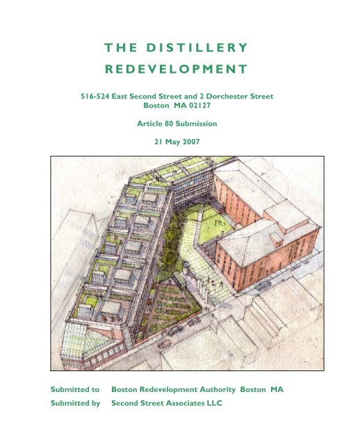
THE DISTILLERY<br />
REDEVELOPMENT<br />
516-524 East Second Street and 2 Dorchester Street<br />
<strong>Boston</strong> MA 02127<br />
Article 80 Submission<br />
21 May 2007<br />
Submitted to <strong>Boston</strong> <strong>Redevelopment</strong> <strong>Authority</strong> <strong>Boston</strong> MA<br />
Submitted by Second Street Associates LLC
THE DISTILLERY REDEVELOPMENT<br />
516-524 East Second Street / 2 Dorchester Street, <strong>Boston</strong> MA 02127<br />
Article 80 Submission 21 May 2007<br />
Submitted to <strong>Boston</strong> <strong>Redevelopment</strong> <strong>Authority</strong><br />
Submitted by Second Street Associates LLC<br />
Project Team Frederick M. Gordon Proponent<br />
Second Street Associates LLC<br />
516 East Second Street,<br />
South <strong>Boston</strong>, MA 02127<br />
617-269-8430 following page…
617-1776<br />
The Distillery <strong>Redevelopment</strong> | East Second Street | South <strong>Boston</strong><br />
Hubert Murray Architect + Planner Architecture / Planning<br />
204 Erie Street, Cambridge, MA 02139<br />
617-354-9555<br />
The Hickory Consortium Energy Consultant<br />
Mark Kelly PE LEED AP.<br />
1 Jeefe Rd, Acton MA 01720<br />
978-895-0988<br />
The Office of David Neilson Urban Design.<br />
17 Powderhouse St., #316,<br />
South <strong>Boston</strong>, MA 02127<br />
617-268-0816<br />
Vanasse Hangen Brustlin Inc. Transportation / Infrastructure<br />
Susan Sloan Rossiter, Principal,<br />
99 High Street, <strong>Boston</strong>, 02110<br />
617-728-7777<br />
Weidlinger Associates Inc. Geotechnical / Structural<br />
Stephen Lew.PhD, PE, NIST<br />
201 Broadway, 4th Floor,<br />
Cambridge, MA 02139-1955<br />
617-374-0000<br />
Dr. Nancy Seasholes, PhD Site History<br />
1 Field Rd., Lexington,<br />
MA 02421-8014<br />
781-863-8085<br />
Apex. Environmental Soils Analysis<br />
Geoffrey May, LSP<br />
374 Congress Street.,<br />
<strong>Boston</strong>, MA Suite 508 02210<br />
617-728-0070 x 114<br />
Goulston and Storrs Legal<br />
Mat<strong>the</strong>w Kiefer LLB,<br />
400 Atlantic Avenue,<br />
<strong>Boston</strong>, MA 02110-3333<br />
0.0 Table of Contents 0-2
Executive Summary<br />
1. INTRODUCTION<br />
1.1. Project Objectives<br />
1.2. Housing and Urban Design Objectives<br />
1.3. Environmental and Energy Objectives<br />
1.4. Article 37<br />
2. PROGRAM<br />
2.1. Existing Program<br />
2.2. Proposed Development<br />
2.3. Construction Sequencing<br />
2.4. Program Summary<br />
2.5. Parking<br />
3. ZONING ANALYSIS<br />
3.1. Article 80 Large Project Review<br />
3.2. Article 37 Green Buildings<br />
3.3. Article 27P South <strong>Boston</strong> IPOD<br />
3.4. Project Dimensions<br />
3.5. Space Allocation<br />
3.6. O<strong>the</strong>r Permits<br />
4. SITE CONDITIONS<br />
4.1. Tidelands<br />
4.2. Flood Hazard<br />
4.3. Environmental Site History<br />
5. HISTORIC RESOURCES<br />
5.1. Neighborhood Historic Resources<br />
5.2. Site Land Use History<br />
6. URBAN DESIGN<br />
6.1. Site Context<br />
6.2. Site Development and Massing<br />
6.3. Space Allocation<br />
6.4. Access and Circulation<br />
7. ARCHITECTURE<br />
7.1. Architectural Expression<br />
7.2. H Street Elevation<br />
7.3. East First Street Elevation<br />
7.4. Dorchester Street Elevation<br />
7.5. East Second Street Elevation<br />
7.6. Roofscape<br />
Architectural Drawings 1 through 16<br />
The Distillery <strong>Redevelopment</strong> | East Second Street | South <strong>Boston</strong><br />
0.0 Table of Contents 0-3
8. LANDSCAPE ARCHITECTURE<br />
8.1. Street Landscape<br />
8.2. The Courtyard<br />
8.3. The Roof<br />
The Distillery <strong>Redevelopment</strong> | East Second Street | South <strong>Boston</strong><br />
9. TRANSPORTATION ACCESS PLAN COMPONENT<br />
9.1. Introduction<br />
9.1.1. Project Description<br />
9.1.2. Study Area<br />
9.1.3. Study Methodology<br />
9.1.4. Summary of Findings<br />
9.2. Existing Conditions<br />
9.2.1. Existing Roadway Conditions<br />
9.2.2. Study Area Intersections<br />
9.2.3. Existing Traffic Volumes<br />
9.2.4. Parking<br />
9.2.5. Crash History<br />
9.2.6. Pedestrian and Bicycle Conditions<br />
9.2.7. Public Transportation<br />
9.2.8. Vehicular Site Access<br />
9.2.9. Adjacent Land Uses<br />
9.3. Evaluation of Future Transportation Conditions<br />
9.3.1. No Build Condition<br />
9.3.2. 2011 Build Condition<br />
9.4. Traffic Operations Analysis<br />
9.5. Access to Parking<br />
9.5.1. Assessment of Alternatives<br />
9.5.2. Lower Level Access<br />
9.5.3. Upper Level Access<br />
9.5.4. Service Vehicles and Emergency Services<br />
9.6. Transportation Mitigation and Improvement Plan<br />
9.6.1. Project Improvements<br />
9.6.2. Transportation Demand Management<br />
9.6.3. Loading and Service Management Actions<br />
9.6.4. Construction Management<br />
9.7. Transportation Access Plan Agreement and Construction Management Plan<br />
10. INFRASTRUCTURE SYSTEMS<br />
10.1. Introduction<br />
10.1.1. Regulatory Framework<br />
10.2. Wastewater<br />
10.2.1. Existing Wastewater<br />
10.2.2. Demand / Use<br />
10.2.3. Proposed Connection<br />
10.3. Domestic Water and Fire Protection<br />
0.0 Table of Contents 0-4
The Distillery <strong>Redevelopment</strong> | East Second Street | South <strong>Boston</strong><br />
10.3.1. Existing Water Supply System<br />
10.3.2. Proposed Connection<br />
10.4. Stormwater Management<br />
10.4.1. Existing Conditions<br />
10.4.2. Proposed Conditions<br />
10.4.3. Compliance with DEP Stormwater Management Policy<br />
10.5. Anticipated Energy Needs<br />
10.5.1. Electrical Service<br />
10.5.2. Natural Gas<br />
10.5.3. Telecommunications<br />
10.6. Protection of Utilities<br />
10.7. Sustainable Design / Energy Conservation<br />
10.8. Conclusion<br />
11. GEOTECHNICAL IMPACT<br />
11.1. Project Description<br />
11.2. Subsurface Exploration Program<br />
11.3. Subsurface Conditions<br />
11.4. Groundwater<br />
11.5. Foundation Design Recommendations<br />
11.6. Seismic Design<br />
11.7. Construction Considerations<br />
Figures and Tables<br />
12. ENVIRONMENTAL IMPACTS<br />
12.1. Article 37<br />
12.2. Wind<br />
12.3. Shadow<br />
12.4. Daylight<br />
12.5. Solar Glare<br />
12.6. Air Quality<br />
12.7. Water Quality<br />
13. CONSTRUCTION IMPACTS<br />
13.1. Traffic<br />
13.2. Air Quality<br />
13.3. Noise<br />
13.4. Rodent Control<br />
13.5. Wildlife Habitat<br />
13.6. Construction Management<br />
13.7. Monitoring<br />
14. DESIGN REVIEW<br />
14.1. Community Meetings<br />
14.2. <strong>Boston</strong> Civic Design Commission<br />
0.0 Table of Contents 0-5
EXECUTIVE SUMMARY<br />
The Distillery <strong>Redevelopment</strong> | East Second Street | South <strong>Boston</strong><br />
Second Street Associates owns a property in South <strong>Boston</strong>, <strong>the</strong> site of a former rum<br />
<strong>distillery</strong>. The Distillery site is a 1.74 acre site bounded by East First Street, East Second<br />
Street, H Street and Dorchester Street.<br />
There are three main buildings on <strong>the</strong> site, totaling 105,667 gross square feet providing a<br />
total of 30 live-work units and 42 work-only units for artists and small manufacturers:<br />
• <strong>the</strong> former <strong>distillery</strong>, (consisting of <strong>the</strong> Distillery Building on East Second Street<br />
and <strong>the</strong> Warehouse on H Street) was built in <strong>the</strong> period 1862 - 1874, providing 30<br />
live-work and 38 work-only spaces.<br />
• a former <strong>distillery</strong> company bottling plant built in 1966 currently being used as a<br />
laydown area and warehouse by Fishbach and Moore, an electrical contractor.<br />
• a one-story masonry building, a former cooper shop built in <strong>the</strong> 1930’s, currently<br />
with three commercial tenancies.<br />
The aim of <strong>the</strong> owner is to redevelop <strong>the</strong> property, preserving <strong>the</strong> older, architecturally<br />
distinguished, Distillery Building while demolishing <strong>the</strong> o<strong>the</strong>r buildings on site. These<br />
will be replaced with 124,996 gross square feet of residential space, artists’ work and<br />
live-work units, workshops, offices, retail stores, and 123 parking spaces. The new<br />
building complex will be designed and constructed to reduce fossil fuel in <strong>the</strong><br />
construction materials used, <strong>the</strong> method of construction and day to day operation,<br />
achieving a high benchmark in terms of life cycle energy costs. The building will also<br />
seek to minimize non-energy related negative environmental impacts and to promote and<br />
sustain a healthy living environment.<br />
It is also <strong>the</strong> goal of <strong>the</strong> owner to attract to <strong>the</strong> property more artists, and small-scale<br />
entrepreneurs involved in green technology so that <strong>the</strong> place becomes a destination not<br />
only for its design and construction but also for <strong>the</strong> technologically progressive and<br />
creative community that will live and work in this part of South <strong>Boston</strong>.<br />
1.0 Executive Summary | Introduction 1-1
The Distillery <strong>Redevelopment</strong> | East Second Street | South <strong>Boston</strong><br />
The proposed development will retain 30 artists’ live-work units and 37 commercial units<br />
(losing one from <strong>the</strong> current count of 38) in <strong>the</strong> existing historic building on <strong>the</strong> eastern<br />
half of <strong>the</strong> site and add 44 new residential units, 25 new live-work units, art galleries, a<br />
café, greenhouse, and small-scale retail spaces with associated off-street parking. The<br />
development will produce all of its electricity on site using a renewable and almost<br />
carbon-neutral fuel. The waste heat from this process will carry all heat, hot water and<br />
air conditioning loads.<br />
Project Description<br />
Landowner: Second Street Associates LLC<br />
Developer: Second Street Associates LLC<br />
The proposed development involves <strong>the</strong> construction of two wings of four-storey<br />
residential and commercial accommodation over two basement stories of structured<br />
parking. In order to prepare this part of <strong>the</strong> site for <strong>the</strong> proposed development, two singlestorey<br />
industrial buildings will be demolished.<br />
The residential development on East First Street consists of 25 live-work studios totaling<br />
28,755 net square feet. Pedestrian access to <strong>the</strong>se units is from East First Street and an<br />
inner court, elevation +34’. Street access to <strong>the</strong> inner court is at <strong>the</strong> corner of East First<br />
and Dorchester Streets (elevation +16’) via elevator and stairs. There is also direct, atgrade<br />
access to <strong>the</strong> courtyard from East Second Street at elevation +32’.<br />
The 44-unit residential accommodation (58,751 net square feet) on Dorchester Street is<br />
accessible from five street level front doors leading to five stair and elevator cores<br />
serving residential units clustered around a shared atrium. The units are also accessible<br />
via stairs from <strong>the</strong> courtyard.<br />
There are two levels of parking. The lower level parking (59 spaces) is served by twoway<br />
access from H Street, extending along East First Street and Dorchester Street at<br />
elevation +16’. The upper level parking (capacity 64 spaces) is served by two-way access<br />
from Dorchester Street at elevation +25’, extending to Dorchester Street and First Street<br />
1.0 Executive Summary | Introduction 1-2
The Distillery <strong>Redevelopment</strong> | East Second Street | South <strong>Boston</strong><br />
with a short spur adjacent to East Second Street. The upper level parking has a small<br />
truck loading area to serve <strong>the</strong> retail store on East Second Street. On H Street <strong>the</strong>re is a<br />
40-ft. truck loading dock that can serve, via dock and large elevator, all buildings in <strong>the</strong><br />
development, existing and proposed.<br />
The project is designed to be served by two 45 kw diesel generators powered by<br />
vegetable oil. The system will be grid-integrated for backup purposes, but o<strong>the</strong>rwise will<br />
draw no net electricity during each monthly billing cycle. All heating and cooling loads<br />
will be met by <strong>the</strong> waste heat from <strong>the</strong> electric generation. In addition to serving <strong>the</strong><br />
buildings, excess electrical capacity will be available to provide electrical charging for<br />
plug-in hybrid electrical vehicles.<br />
Zoning and Project Dimensions<br />
The site is located in <strong>the</strong> South <strong>Boston</strong> Interim Planning Overlay District under <strong>the</strong> terms<br />
of Article 27P of <strong>the</strong> Zoning Ordinance. Map 4 (South <strong>Boston</strong>) shows <strong>the</strong> site to be<br />
designated L, allowing a building height of 35 feet and an FAR of 2.0.<br />
The proposed building roof height is <strong>the</strong> same as <strong>the</strong> existing adjacent buildings<br />
established as +83’ above sea level. The grade varies from +16.5’ at <strong>the</strong> corner of First<br />
and Dorchester, to +32’ on East Second Street. The roof heights in <strong>the</strong> table below are<br />
established as height above mean grade for each of <strong>the</strong> four frontages on <strong>the</strong> block.<br />
Proposed Building Height above mean grade Existing Roof Height<br />
First Street 61.59’ n.a.<br />
H Street 53.47’ 60’-6”<br />
Second Street 48.32’ 52’-0”<br />
Dorchester Street 65.30’ n.a.<br />
The FAR of <strong>the</strong> new and existing buildings combined on <strong>the</strong> site is 3.05.<br />
Setbacks: <strong>the</strong> new buildings are built to <strong>the</strong> property line at Dorchester Street and East<br />
Second Street. On East First Street <strong>the</strong> building will be set back from <strong>the</strong> property line to<br />
allow a 5’-6” sidewalk. An open courtyard (26,322 sf) faces south onto East Second<br />
Street.<br />
1.0 Executive Summary | Introduction 1-3
1.0 INTRODUCTION<br />
The Distillery <strong>Redevelopment</strong> | East Second Street | South <strong>Boston</strong><br />
Second Street Associates owns a property in South <strong>Boston</strong>, <strong>the</strong> site of a former<br />
rum <strong>distillery</strong>. The Distillery site is a 1.74 acre site bounded by East First Street,<br />
East Second Street, H Street and Dorchester Street.<br />
There are three main buildings on <strong>the</strong> site, totaling 105,667 gross square feet<br />
providing a total of 30 live-work units and 42 work-only units for artists and small<br />
manufacturers:<br />
• <strong>the</strong> former <strong>distillery</strong>, (consisting of <strong>the</strong> Distillery Building on East Second<br />
Street and <strong>the</strong> Warehouse on H Street) was built in <strong>the</strong> period 1862 - 1874,<br />
providing 30 live-work and 38 work-only spaces.<br />
• a former <strong>distillery</strong> company bottling plant built in 1966 currently being<br />
used as a laydown area and warehouse by Fishbach and Moore, an<br />
electrical contractor.<br />
• a one-story masonry building, a former cooper shop built in <strong>the</strong> 1930’s,<br />
currently with three commercial tenancies.<br />
The aim of <strong>the</strong> owner is to redevelop <strong>the</strong> property, preserving <strong>the</strong> older,<br />
architecturally distinguished, Distillery Building while demolishing <strong>the</strong> o<strong>the</strong>r<br />
buildings on site. These will be replaced with 124,996 gross square feet of<br />
residential space, artists’ work and live-work units, workshops, offices, retail<br />
stores, and 123 parking spaces. The new building complex will be designed and<br />
constructed to reduce fossil fuel in <strong>the</strong> construction materials used, <strong>the</strong> method of<br />
construction and day to day operation, achieving a high benchmark in terms of<br />
life cycle energy costs. The building will also seek to minimize non-energy<br />
related negative environmental impacts and to promote and sustain a healthy<br />
living environment.<br />
1.0 Executive Summary | Introduction 1-4
The Distillery <strong>Redevelopment</strong> | East Second Street | South <strong>Boston</strong><br />
It is also <strong>the</strong> goal of <strong>the</strong> owner to attract to <strong>the</strong> property more artists, and smallscale<br />
entrepreneurs involved in green technology so that <strong>the</strong> place becomes a<br />
destination not only for its design and construction but also for <strong>the</strong> technologically<br />
progressive and creative community that will live and work in this part of South<br />
<strong>Boston</strong>.<br />
The proposed development will retain 30 artists’ live-work units and 37<br />
commercial units (losing one from <strong>the</strong> current count of 38) in <strong>the</strong> existing historic<br />
building on <strong>the</strong> eastern half of <strong>the</strong> site and add 44 new residential units, 25 new<br />
live-work units, art galleries, a café, greenhouse, and small-scale retail spaces<br />
with associated off-street parking. The development will produce all of its<br />
electricity on site using a renewable and almost carbon-neutral fuel. The waste<br />
heat from this process will carry all heat, hot water and air conditioning loads.<br />
1.1 Project Objectives<br />
The objectives that <strong>the</strong> proponent has set for <strong>the</strong> project is to create an energy<br />
efficient development minimizing dependency on fossil fuels and non-renewable<br />
resources and at <strong>the</strong> same time maintain and expand accommodation for <strong>the</strong> artists<br />
and creative entrepreneurs as well as providing new high quality conventional<br />
residences.<br />
In addition to specific studies of materials, design, and materials, <strong>the</strong> development<br />
team generated at <strong>the</strong> very outset of its work a prioritized schedule of values<br />
which this project is to realize. These are:<br />
1. Energy<br />
This project is a live social, political and technological experiment in <strong>the</strong><br />
economics of energy use in residential construction. The goal is to reduce<br />
dependence on outside sources of fossil fuel energy and o<strong>the</strong>rwise nonrenewable<br />
resources. These goals are to be quantified in terms of<br />
1.0 Executive Summary | Introduction 1-5
The Distillery <strong>Redevelopment</strong> | East Second Street | South <strong>Boston</strong><br />
1.1. Embodied energy contained in materials<br />
1.2. Energy used in construction<br />
1.3. Energy in use<br />
1.4. Cycles of renewability for both materials and fuels<br />
2. Environment<br />
The project is designed to minimize its environmental footprint in terms<br />
of:<br />
2.1. The use of renewable resources<br />
2.2. The minimization of exposure to and creation of toxins and<br />
destructive residuals<br />
2.3. Minimizing damage to <strong>the</strong> surrounding environment and ecology,<br />
including air and water quality and <strong>the</strong> condition of <strong>the</strong> upper<br />
atmosphere<br />
3. Technology<br />
The technology employed in pursuit of <strong>the</strong>se objectives must be:<br />
3.1. State-of-<strong>the</strong>-Shelf - established and up-to-date<br />
3.2. Experimental – technologies may be tested and demonstrated<br />
within this residential configuration<br />
3.3. Robust and Redundant – durable, ei<strong>the</strong>r duplicative or non-critical<br />
and user-friendly<br />
3.4. Transferable – technologies and configurations should serve as a<br />
standard and be transferable to comparable projects elsewhere.<br />
1.0 Executive Summary | Introduction 1-6
4. Profitability<br />
The Distillery <strong>Redevelopment</strong> | East Second Street | South <strong>Boston</strong><br />
4.1. The project has to make a profit for <strong>the</strong> Owner. Considerations that<br />
may affect <strong>the</strong> degree of profit may be <strong>the</strong> terms of ownership<br />
(condominium or leased rental) which may be affected by <strong>the</strong><br />
terms of liability and <strong>the</strong> degree of test-bed experimentation<br />
required in use.<br />
4.2. The residences, studios, offices and retail locations have to be<br />
marketable.<br />
5. Comfort<br />
5.1. The design of <strong>the</strong> residences will provide visual, auditory and<br />
<strong>the</strong>rmal comfort.<br />
6. Community<br />
6.1. Within <strong>the</strong> context of profitability <strong>the</strong> project will incorporate a<br />
number of affordable units for artists, small sustainable<br />
development firms and non-profits in <strong>the</strong> field of sustainable<br />
development.<br />
6.2. Affordable units within <strong>the</strong> complex will be indistinguishable in<br />
quality from o<strong>the</strong>r accommodation. They will accommodate a full<br />
spectrum of qualifying candidates with accommodation sizes<br />
ranging from single room studios to 3-bedroom family units.<br />
6.3. It is important that this development contribute to, and enhance <strong>the</strong><br />
potential of, <strong>the</strong> community of artists already on site and to <strong>the</strong><br />
neighborhood and community of South <strong>Boston</strong>. The design process<br />
will fully involve members of <strong>the</strong>se communities.<br />
1.0 Executive Summary | Introduction 1-7
7. Health<br />
The Distillery <strong>Redevelopment</strong> | East Second Street | South <strong>Boston</strong><br />
6.4. The development of live-work space for artists and technological<br />
innovators will create a new questing and creative community at<br />
<strong>the</strong> cusp of an existing residential and former industrial area.<br />
7.1. The aim of <strong>the</strong> project is to promote a healthy environment during<br />
construction and in <strong>the</strong> living and working environment<br />
accommodated in <strong>the</strong> development. Healthy materials and<br />
processes as well as Indoor Air Quality will be particularly<br />
important not only as a good in itself but as an attractive marketing<br />
characteristic.<br />
7.2. Natural organic fruit and vegetables will be grown on site and sold<br />
to provide healthy produce to residents and neighbors.<br />
7.3. Issues to be address will focus on maximizing indoor air quality<br />
and <strong>the</strong> minimization of toxins in <strong>the</strong> structure and systems.<br />
7.4. The maintenance and operation of <strong>the</strong> building will adhere to<br />
protocols on <strong>the</strong> use of non-toxic cleaning agents, fertilizers,<br />
sprays, packaging etc.<br />
8. Liability<br />
9. Waste<br />
8.1. While this is an innovative project engaging financial,<br />
technological and social risk, it calls for risk management to<br />
reduce <strong>the</strong> liability of participating parties.<br />
9.1. The development should engage ‘cradle-to-cradle’ thinking in <strong>the</strong><br />
use of resources and materiel including construction waste, food<br />
waste, and production waste.<br />
1.0 Executive Summary | Introduction 1-8
10. Attractiveness<br />
The Distillery <strong>Redevelopment</strong> | East Second Street | South <strong>Boston</strong><br />
10.1. The residences must be attractive places to live in. This may be<br />
interpreted as aes<strong>the</strong>tically pleasing and as ethically and<br />
technologically attractive. In addition to creating an attractive<br />
architecture that reflects <strong>the</strong> values of <strong>the</strong> project and makes a<br />
positive contribution to <strong>the</strong> neighborhood, <strong>the</strong> building will capture<br />
views of <strong>the</strong> city and <strong>the</strong> neighborhood. A close relationship to<br />
natural vegetation will be important.<br />
10.2. Open space and landscaped roof areas within <strong>the</strong> project will<br />
embody principles of sustainability, incorporating areas for homegrown<br />
fruit and vegetables and employing recycled water for<br />
irrigation.<br />
11. Transportation<br />
12. Water<br />
11.1. The development will address <strong>the</strong> issues of urban transportation<br />
opening up possibilities of links to <strong>the</strong> neighborhood and city that<br />
reduce dependency on private automobiles. Options will include<br />
alternative fuels, shared ownership, alternative modes (such as<br />
buses, shuttles, taxis, battery driven scooters and bicycles) and<br />
walking.<br />
12.1. Water will be valued and managed as an increasingly scarce and<br />
valuable resource to be used and re-used. As an element<br />
fundamental to human life, water will also be expressed as part of<br />
<strong>the</strong> architecture and landscape.<br />
13. Defiance<br />
1.0 Executive Summary | Introduction 1-9
The Distillery <strong>Redevelopment</strong> | East Second Street | South <strong>Boston</strong><br />
13.1. This project is a bold act of defiance. Reflecting <strong>the</strong> nature of<br />
many of <strong>the</strong> resident artists and innovators, <strong>the</strong> aim is to create a<br />
healthy, innovative, and attractive living and working environment<br />
in an urban neighborhood of a nor<strong>the</strong>rn city in defiance of climate,<br />
<strong>the</strong> changing economy, dependence on non-renewable resources<br />
and acceptance of <strong>the</strong> status quo.<br />
14. Demonstration<br />
14.1. The Distillery project aims to act as a demonstration and as a<br />
standard for comparable projects throughout <strong>the</strong> country. The<br />
project will employ methods that are reproducible elsewhere and<br />
will diffuse <strong>the</strong> innovations in technology, construction, project<br />
management and community involvement through documentation<br />
and publication.<br />
By <strong>the</strong>se standards <strong>the</strong> Distillery will measure its own success and will become a<br />
standard for o<strong>the</strong>rs.<br />
1.2 Housing and Urban Design Objectives<br />
The existing buildings on <strong>the</strong> Distillery site include 30 residential live-work units<br />
for artists and 42 commercial units for artists, small manufacturers and service<br />
operations. The larger of <strong>the</strong> two one-storey buildings on Dorchester Street is<br />
currently occupied by an electrical contractor who uses <strong>the</strong> space as a warehouse.<br />
This is a temporary location for <strong>the</strong> contractor, Fishbach and Moore, for <strong>the</strong>ir<br />
work on <strong>the</strong> “Big Dig;” it will soon be completed and that building will be vacant.<br />
The smaller of <strong>the</strong> two buildings, a former cooper shop, has three small-scale<br />
tenants.<br />
As proposed, <strong>the</strong> new development will consist of 25 live-work units on <strong>the</strong> East<br />
First Street frontage and 44 residential units on <strong>the</strong> Dorchester Street frontage.<br />
The new development will also include small commercial and retail spaces at<br />
1.0 Executive Summary | Introduction 1-10
The Distillery <strong>Redevelopment</strong> | East Second Street | South <strong>Boston</strong><br />
street level. At courtyard level <strong>the</strong>re will be a café and two small galleries<br />
(included in <strong>the</strong> commercial / retail category below).<br />
Table 1-1 NET NEW UNITS<br />
Units<br />
Existing Lost Gained Total<br />
Commercial / Retail 42 -1 6 47<br />
Live-Work 30 0 25 55<br />
Residential 0 0 44 44<br />
Total 72 -1 75 146<br />
The aim of <strong>the</strong> development is to retain existing tenancies as affordable units for<br />
artists and small businesses. It is envisioned that <strong>the</strong> existing Distillery building<br />
will not be improved and will remain a relatively low-cost rental location for its<br />
artist and commercial tenants. The new development is designed to attract more<br />
of <strong>the</strong> same type of enterprise, with an emphasis on small-scale entrepreneurs<br />
engaged in ‘green technology’ so that <strong>the</strong> site will become a destination for those<br />
interested in this field.<br />
This project will be developed in accordance with <strong>the</strong> Executive Order of Mayor<br />
Thomas M. Menino dated May 16th 2006 relative to <strong>the</strong> Inclusionary<br />
Development Policy of <strong>the</strong> City of <strong>Boston</strong>. The number of affordable units in <strong>the</strong><br />
project will be not less than 15% of <strong>the</strong> total market rate units, i.e. 15% of 69 units<br />
= 10 units.<br />
The intention is to retain <strong>the</strong> residential units as rental apartments at least for <strong>the</strong><br />
first five years after completion so that any wrinkles in <strong>the</strong> new technology can be<br />
ironed out. Finishes will be kept very simple allowing residents to complete <strong>the</strong><br />
units according to <strong>the</strong>ir own taste and budgets.<br />
1.3 Environmental and Energy Objectives<br />
The proposed buildings will use a unique engineering approach to achieve<br />
reduction in energy use and environmental impact which until now has been<br />
achievable only by small-scale experimental architecture. This approach<br />
involves three main factors: building geometry, cogeneration of electricity with<br />
1.0 Executive Summary | Introduction 1-11
The Distillery <strong>Redevelopment</strong> | East Second Street | South <strong>Boston</strong><br />
renewable fuel, and energy efficient shell and floor slabs. O<strong>the</strong>r techniques,<br />
passive solar heat gain, heliostats, daylighting, natural venting and heat recovery<br />
venting are included in our design, but play a lesser role in <strong>the</strong> energy<br />
performance. Integration of electrical cogeneration, plug-in hybrid vehicles and<br />
o<strong>the</strong>r innovative transportation initiatives also contribute to benchmark setting<br />
reductions in <strong>the</strong> total energy and environmental impact of <strong>the</strong> site.<br />
The conceptualization of <strong>the</strong> energy profile of <strong>the</strong> project was facilitated by a<br />
grant from <strong>the</strong> Massachusetts Technology Collaborative. The report, The<br />
Feasibility Study of Renewable Energy and Energy Efficiency Options for a 79unit<br />
Condominium Development in South <strong>Boston</strong> (May 2005), is available from<br />
<strong>the</strong> MTC or from <strong>the</strong> developer. This study defined <strong>the</strong> building’s energy<br />
efficient building morphology, and did a broad survey of <strong>the</strong> energy efficiency<br />
technologies which <strong>the</strong> project will implement. A second grant from MTC for<br />
$40,000, A Feasibility study for Vegetable Oil CHP, was awarded in October,<br />
2006, and is focused more specifically on establishing <strong>the</strong> feasibility of using<br />
virgin vegetable oil as an energy source for a combined heat and power system.<br />
Work under this grant commenced on Dec. 13 th , and should be completed May 1,<br />
2007.<br />
1.4 Construction<br />
In addition to complying with <strong>the</strong> pertinent regulations, it is an objective of <strong>the</strong><br />
proponent to incorporate into <strong>the</strong> construction process healthful and<br />
environmentally responsible principles insofar as this is practicable. In order to<br />
maintain as much normal use of <strong>the</strong> property as possible, <strong>the</strong> construction will be<br />
sequenced so that <strong>the</strong> vacant north sector of <strong>the</strong> lot will be developed first – <strong>the</strong><br />
live-work studios facing East First Street – to be followed by <strong>the</strong> development of<br />
<strong>the</strong> residential units on Dorchester Street.<br />
1.0 Executive Summary | Introduction 1-12
2.0 PROGRAM<br />
2.1 Existing Program<br />
The Distillery <strong>Redevelopment</strong> | East Second Street | South <strong>Boston</strong><br />
Currently <strong>the</strong>re are three main buildings on <strong>the</strong> 1.74-acre site:<br />
• <strong>the</strong> Distillery / Warehouse, containing 30 live-work and 38 work-only<br />
units;<br />
• <strong>the</strong> Honeywell Building / former bottling plant , currently accommodating<br />
one commercial tenant using <strong>the</strong> building as light manufacturing and<br />
warehousing;<br />
• <strong>the</strong> Cooper Shop, currently accommodating 3 small-scale commercial<br />
tenants.<br />
The existing disposition of buildings on <strong>the</strong> site is shown in Figure 2-1:<br />
HONEYWELL BUILDING<br />
Figure 2-1: Existing Buildings<br />
COOPER SHOP<br />
WAREHOUSE<br />
DISTILLERY<br />
2.0 Program 2-1
The existing program is summarized in Table 2-1:<br />
The Distillery <strong>Redevelopment</strong> | East Second Street | South <strong>Boston</strong><br />
Table 2-1 PROGRAM IN EXISTING BUILDINGS (Distillery / Warehouse / Honeywell / Cooper Shop)<br />
Program Use Gp NSF # units<br />
Residential Units (Live-Work units) R-2 42,798 30<br />
Studio non-live Work Units (Commercial) B 31,812 41<br />
Industrial / Light Manufacturing F-2 21,950 1<br />
Total Units 96,560 72<br />
Gross Area (GSF) 105,667<br />
Parking<br />
Parking available to residential and commercial units 45<br />
O<strong>the</strong>r parking rented to Fishbach and Moore 21<br />
Total Parking 66<br />
2.2 Proposed Development<br />
The aim of <strong>the</strong> owner is to redevelop <strong>the</strong> property, preserving <strong>the</strong> older Distillery<br />
building while demolishing <strong>the</strong> o<strong>the</strong>r buildings on site, replacing <strong>the</strong>m with<br />
apartments, artists’ studios and studio apartments, workshops, offices and retail<br />
stores. The overall layout is shown in Figure 2-2:<br />
Figure 2-2: Proposed Development<br />
2.0 Program 2-2
The Distillery <strong>Redevelopment</strong> | East Second Street | South <strong>Boston</strong><br />
The proposed development will retain <strong>the</strong> artists’ live-work units and commercial<br />
units in <strong>the</strong> existing historic building on <strong>the</strong> eastern half of <strong>the</strong> site and on <strong>the</strong><br />
north and west edges of <strong>the</strong> site add new residential units, new live-work units;<br />
and a mix of galleries, a café, greenhouse, and small-scale retail spaces with<br />
associated off-street parking. Where <strong>the</strong> proposed new building and <strong>the</strong> existing<br />
building join (at <strong>the</strong> corner of H Street and First) <strong>the</strong>re is a reconfiguration of livework<br />
studios on six floors (with no reduction) and <strong>the</strong> loss of one existing workonly<br />
unit (in <strong>the</strong> basement) to accommodate that junction and <strong>the</strong> vertical<br />
circulation. The net total of existing and proposed units is summarized in Table<br />
2-2:<br />
Table 2-2 EXISTING AND NEW UNITS<br />
Units<br />
Existing Lost Gained Total<br />
Commercial / Retail 42 -5 6 43<br />
Live-Work 30 0 25 55<br />
Residential 0 0 44 44<br />
Total 72 -1 75 142<br />
The residential accommodation on East First Street consists of 25 live-work<br />
studios on four floors. There is direct pedestrian access to <strong>the</strong>se units from East<br />
First Street and from <strong>the</strong> inner court, two levels up at elevation +34’. Street access<br />
to <strong>the</strong> inner court is at <strong>the</strong> corner of East First and Dorchester Streets (elevation<br />
+16’) via elevator and stairs. There is also direct, at-grade access to <strong>the</strong> court from<br />
East Second Street.<br />
The residential accommodation on Dorchester Street consists of 44 new<br />
residential units on four floors, arranged in five cores centered on stairs, elevators<br />
and an enclosed atrium. The units are also accessible via stairs from <strong>the</strong> courtyard.<br />
There are two levels of parking. The lower level parking (59 spaces) is served by<br />
two-way access from H Street, extending along East First Street and Dorchester<br />
Street at elevation +16’. The upper level parking (64 spaces) is served by two-way<br />
access from Dorchester Street at elevation +25’, extending to Dorchester Street<br />
2.0 Program 2-3
The Distillery <strong>Redevelopment</strong> | East Second Street | South <strong>Boston</strong><br />
and First Street with a short spur adjacent to East Second Street. The upper level<br />
parking has a small truck loading area to serve <strong>the</strong> retail store on East Second<br />
Street. On H Street <strong>the</strong>re is a large truck loading dock that can serve all buildings<br />
in <strong>the</strong> development, existing and proposed.<br />
2.3 Construction Sequencing<br />
In order to maintain revenue while construction proceeds <strong>the</strong> proposed sequencing<br />
of <strong>the</strong> work will be split into two phases. Phase 1 will be built on largely vacant<br />
land demolishing only <strong>the</strong> Cooper Shop, leaving <strong>the</strong> Honeywell Building in place.<br />
Phase 1 will be completed and occupied as construction proceeds into Phase 2,<br />
entailing <strong>the</strong> demolition of <strong>the</strong> Honeywell Building to make way for <strong>the</strong><br />
residential units on Dorchester Street. This is illustrated in Figures 2-3 and 2-4.1,<br />
2.4.2, and 2.4.3 below.<br />
PHASE 2<br />
Figure 2-3: Construction Sequencing<br />
PHASE 1<br />
2.0 Program 2-4
Figure 2.4.1 Phase 1 Construction – Level 1<br />
Figure 2.4.2 Phase 1 Construction – Level 2<br />
Figure 2.4.3 Phase 1 Construction – Level 3<br />
The Distillery <strong>Redevelopment</strong> | East Second Street | South <strong>Boston</strong><br />
2.0 Program 2-5
The Distillery <strong>Redevelopment</strong> | East Second Street | South <strong>Boston</strong><br />
The development and disposition of new units and <strong>the</strong> net totals through Phases 1<br />
and 2 is shown in Table 2-3:<br />
Table 2-3 CONSTRUCTION SEQUENCING BY PHASE<br />
EXISTING Commercial Live/ Work Residential Total Parking<br />
Distillery / Warehouse 38 30 68<br />
Honeywell 1 1<br />
Cooper 3 3<br />
Total Occupancies 42 30 0 72<br />
Parking Surface 66<br />
Parking Structured 0<br />
Parking Total 66<br />
PHASE ONE Commercial Live/ Work Residential Total Parking<br />
Distillery / Warehouse 37 30 67<br />
Honeywell 1 1<br />
Phase One Building 3 25 12 40<br />
Total Occupancies 41 55 12 108<br />
Parking Surface 24<br />
Parking Structured 45<br />
Parking Total 69<br />
PHASE TWO Commercial Live/ Work Residential Total Parking<br />
Distillery / Warehouse 37 30 67<br />
Phase One Building 3 25 12 40<br />
Phase Two Building 3 32 35<br />
Total Occupancies 43 55 44 142<br />
Parking Surface 0<br />
Parking Structured 123<br />
Parking Total 123<br />
2.4 Program Summary<br />
A summary of <strong>the</strong> program (for new construction) by Use Group in total and by<br />
phase is shown in Table 2-4 on <strong>the</strong> following pages.<br />
2.0 Program 2-6
Table 2-4 PROPOSED PROGRAM BY USE GROUP AND PHASE<br />
The Distillery <strong>Redevelopment</strong> | East Second Street | South <strong>Boston</strong><br />
PHASE 1 PHASE 2 TOTAL<br />
Commercial Unit Use Gp nsf units nsf units nsf units<br />
COM 1.1 - store at Dorchester L1 M 472 1 626 626 1<br />
COM 3.1 - Dorchester and Second L3 M - - 1,500 1 1,500 1<br />
COM 3.2 - café L3 A-3 1,584 1 1,584 1<br />
COM 4.1 - greenhouse L4 B - - 1,319 1 1,319 1<br />
GAL 2.1 - Gallery (in courtyard) L2 A-3 - - 1,324 1 1,324 1<br />
GAL 3.1 - Gallery L3 A-3 868 1 868 1<br />
Total 2,924 3 4,769 3 7,221 6<br />
PHASE 1 PHASE 2 TOTAL<br />
Residential - Live Work Studios Unit Use Gp nsf units nsf units nsf units<br />
LWS 3.01 R-2 1,014 1 - - 1,014 1<br />
LWS 3.02 R-2 1,006 1 - - 1,006 1<br />
LWS 3.03 R-2 1,030 1 - - 1,030 1<br />
LWS 3.04 R-2 1,249 1 - - 1,249 1<br />
LWS 4.01 R-2 1,121 1 - - 1,121 1<br />
LWS 4.02 R-2 1,445 1 - - 1,445 1<br />
LWS 4.03 R-2 1,127 1 - - 1,127 1<br />
LWS 4.04 R-2 1,050 1 - - 1,050 1<br />
LWS 4.05 R-2 1,160 1 - - 1,160 1<br />
LWS 4.06 R-2 1,000 1 - - 1,000 1<br />
LWS 4.07 R-2 1,249 1 - - 1,249 1<br />
LWS 5.01 R-2 1,121 1 - - 1,121 1<br />
LWS 5.02 R-2 1,445 1 - - 1,445 1<br />
LWS 5.03 R-2 1,127 1 - - 1,127 1<br />
LWS 5.04 R-2 1,050 1 - - 1,050 1<br />
LWS 5.05 R-2 1,160 1 - - 1,160 1<br />
LWS 5.06 R-2 1,000 1 - - 1,000 1<br />
LWS 5.07 R-2 1,249 1 - - 1,249 1<br />
LWS 6.01 R-2 1,121 1 - - 1,121 1<br />
LWS 6.02 R-2 1,445 1 - - 1,445 1<br />
LWS 6.03 R-2 1,127 1 - - 1,127 1<br />
LWS 6.04 R-2 1,050 1 - - 1,050 1<br />
LWS 6.05 R-2 1,160 1 - - 1,160 1<br />
LWS 6.06 R-2 1,000 1 - - 1,000 1<br />
LWS 6.07 R-2 1,249 1 - - 1,249 1<br />
- -<br />
Total 28,755 25 - - 28,755 25<br />
2.0 Program 2-7
The Distillery <strong>Redevelopment</strong> | East Second Street | South <strong>Boston</strong><br />
PHASE 1 PHASE 2 TOTAL<br />
Residential Units Unit Use Gp nsf units nsf units nsf units<br />
APT 3.01 R-2 - - 1,455 1 1,455 1<br />
APT 3.02 R-2 - - 1,446 1 1,446 1<br />
APT 3.03 R-2 - - 1,446 1 1,446 1<br />
APT 3.04 R-2 - - 1,446 1 1,446 1<br />
APT 3.05 R-2 - - 1,446 1 1,446 1<br />
APT 3.06 R-2 - - 1,446 1 1,446 1<br />
APT 3.07 R-2 - - 1,446 1 1,446 1<br />
APT 3.08 R-2 - - 1,446 1 1,446 1<br />
APT 3.09 R-2 1,446 1 - - 1,446 1<br />
APT 3.10 R-2 748 1 - - 748 1<br />
APT 3.11 R-2 700 1 - - 700 1<br />
APT 4.01 R-2 - - 1,464 1 1,464 1<br />
APT 4.02 R-2 - - 1,481 1 1,481 1<br />
APT 4.03 R-2 - - 1,481 1 1,481 1<br />
APT 4.04 R-2 - - 1,481 1 1,481 1<br />
APT 4.05 R-2 - - 1,481 1 1,481 1<br />
APT 4.06 R-2 - - 1,481 1 1,481 1<br />
APT 4.07 R-2 - - 1,481 1 1,481 1<br />
APT 4.08 R-2 - - 1,481 1 1,481 1<br />
APT 4.09 R-2 1,481 1 - - 1,481 1<br />
APT 4.10 R-2 748 1 - - 748 1<br />
APT 4.11 R-2 700 1 - - 700 1<br />
APT 5.01 R-2 - - 1,464 1 1,464 1<br />
APT 5.02 R-2 - - 1,481 1 1,481 1<br />
APT 5.03 R-2 - - 1,481 1 1,481 1<br />
APT 5.04 R-2 - - 1,481 1 1,481 1<br />
APT 5.05 R-2 - - 1,481 1 1,481 1<br />
APT 5.06 R-2 - - 1,481 1 1,481 1<br />
APT 5.07 R-2 - - 1,481 1 1,481 1<br />
APT 5.08 R-2 - - 1,481 1 1,481 1<br />
APT 5.09 R-2 1,481 1 - - 1,481 1<br />
APT 5.10 R-2 748 1 - - 748 1<br />
APT 5.11 R-2 700 1 - - 700 1<br />
APT 6.01 R-2 - - 1,464 1 1,464 1<br />
APT 6.02 R-2 - - 1,481 1 1,481 1<br />
APT 6.03 R-2 - - 1,481 1 1,481 1<br />
APT 6.04 R-2 - - 1,481 1 1,481 1<br />
APT 6.05 R-2 - - 1,481 1 1,481 1<br />
APT 6.06 R-2 - - 1,481 1 1,481 1<br />
APT 6.07 R-2 - - 1,481 1 1,481 1<br />
APT 6.08 R-2 - - 1,481 1 1,481 1<br />
APT 6.09 R-2 1,481 1 - - 1,481 1<br />
APT 6.10 R-2 748 1 - - 748 1<br />
APT 6.11 R-2 700 1 - - 700 1<br />
Total 11,681 12 47,070 32 58,751 44<br />
2.0 Program 2-8
2.5 Parking<br />
The Distillery <strong>Redevelopment</strong> | East Second Street | South <strong>Boston</strong><br />
A summary of <strong>the</strong> parking program by phase is shown in Table 2-5. Fur<strong>the</strong>r<br />
analysis is provided in Chapter 9: Transportation Access Plan.<br />
Table 2-5 PARKING<br />
PHASE 1 PHASE 2 - TOTAL<br />
Use Gp nsf spaces nsf spaces<br />
Lower Parking (Level 1) S-2 9,348 23 21,955 59<br />
Upper Parking (Level 2) S-2 8,116 22 25,056 64<br />
Surface parking (phase 1 only) N.A. 24 -<br />
Total 17,464 69 47,011 123<br />
2.0 Program 2-9
3.0 ZONING ANALYSIS<br />
3.1 Article 80<br />
The Distillery <strong>Redevelopment</strong> | East Second Street | South <strong>Boston</strong><br />
The proposed project amounts to 124,996 gross square feet of new construction<br />
(excluding associated garage space) and <strong>the</strong>refore qualifies for consideration as a<br />
Large Project under <strong>the</strong> terms of Article 80B.<br />
3.2 Article 37<br />
Article 37, Green Buildings, adopted into Article 80 on January 10 th 2007, is<br />
addressed in this proposal in Chapter 12 Environmental Impacts, Section 12.1 and<br />
Appendices 12-1 and 12-2.<br />
3.3 South <strong>Boston</strong> IPOD Article 27P<br />
The site is located in <strong>the</strong> South <strong>Boston</strong> Interim Planning Overlay District under<br />
<strong>the</strong> terms of Article 27P of <strong>the</strong> Zoning Ordinance. Map 4 (South <strong>Boston</strong>) shows<br />
<strong>the</strong> site to be designated L, allowing a building height of 35 feet and an FAR of<br />
2.0. Tables 3-1 through 3-3 provide basic dimensions of <strong>the</strong> proposed<br />
development.<br />
3.4 Project Dimensions<br />
Project dimensions are tabulated in Tables 3-1 through 3-4 below.<br />
Building Heights: The proposed building roof height is <strong>the</strong> same as <strong>the</strong> existing<br />
adjacent buildings. The grade varies from +16.5’ at <strong>the</strong> corner of First and<br />
Dorchester, to +32’ on East Second Street as shown in Figure 3-1. The roof<br />
heights in Table 3-1 below are established as height above mean grade for each of<br />
<strong>the</strong> four frontages on <strong>the</strong> block.<br />
3.0 Zoning 3-1
+ 16.5’<br />
Table 3-1 BUILDING HEIGHTS – above mean<br />
grade<br />
The Distillery <strong>Redevelopment</strong> | East Second Street | South <strong>Boston</strong><br />
Proposed Building Heights Existing Roof Height<br />
First Street 61.59’ n.a.<br />
H Street 53.47’ 60’-6”<br />
Second Street 48.32’ 52’-0”<br />
Dorchester Street 65.30’ n.a.<br />
Setbacks and Sidewalks: <strong>the</strong> new buildings are built to <strong>the</strong> property line at<br />
Dorchester Street, H Street and East Second Street. On East First Street <strong>the</strong><br />
building will be set back from <strong>the</strong> property line to allow for a 5’-6” sidewalk<br />
(currently 4’-0”) to be compatible with <strong>the</strong> new sidewalk built on <strong>the</strong> adjacent<br />
block. An open courtyard, part of <strong>the</strong> property but publicly visible and accessible,<br />
faces south on East Second Street.<br />
Table 3-2 PROJECT DIMENSIONS<br />
Height Stories Frontage Setback Sidewalk<br />
proposed<br />
Sidewalk<br />
existing<br />
East First Street 61.59’ 2 parking + 4 187’-0” 0’-0” 5’-6” 4’-0”<br />
H Street 53.47’ 2 parking + 4 56’-0” 0’-0” 8’-0” 8’-0”<br />
Second Street 48.32’ 2 parking + 4<br />
1 parking<br />
93’-6”<br />
110-0”<br />
+ 19.5’<br />
+ 29.5’ +32’<br />
+ 30.5’<br />
Figure 3-1<br />
Spot Grade Elevations<br />
0’-0” 8’-6” 8’-6"<br />
Dorchester Street 65.30’ 2 parking + 4 316’-6” 0’-0” 8’-5” to 11’-4” 8’-5” to 11’-4”<br />
3.0 Zoning 3-2
The Distillery <strong>Redevelopment</strong> | East Second Street | South <strong>Boston</strong><br />
Floor Area Ratio: <strong>the</strong> FAR is shown both as a function of <strong>the</strong> proposed new building<br />
in relation to <strong>the</strong> available developable area on <strong>the</strong> lot; and as a function of <strong>the</strong><br />
proposed new development and <strong>the</strong> existing property in relation to <strong>the</strong> total lot<br />
area.<br />
Table 3-3 FLOOR AREA RATIO<br />
1.0 LOT AREA<br />
1.1 Total Lot Area 75,618 S.F.<br />
1.2 Distillery & Boiler House (footprint) 21,205 S.F.<br />
1.3 Total developable lot area (courtyard and one-storey buildings) 54,413 S.F.<br />
2.0 GROSS FLOOR AREA (GFA)<br />
2.1 Parking LEVEL 1 3,949 S.F.<br />
2.2 Parking LEVEL 2 3,954 S.F.<br />
2.3 Residential LEVEL 3 31,421 S.F.<br />
2.4 Residential LEVEL 4 28,830 S.F.<br />
2.5 Residential LEVEL 5 28,421 S.F.<br />
2.6 Residential LEVEL 6 28,421 S.F.<br />
2.7 Total Proposed GFA 124,996 S.F.<br />
2.8 Total Existing GFA 105,667 S.F.<br />
2.9 Total GFA (existing and proposed) 230,663 S.F.<br />
3.0 FLOOR AREA RATIO (FAR)<br />
3.1 Proposed GFA / Total Developable Lot Area (line 2.7 / line 1.3 ) 2.30<br />
3.2 Total GFA / Total Lot Area (line 2.9 / line 1.1 ) 3.05<br />
4.0 PARKING SPACES<br />
4.1 Level 1 Parking 59<br />
4.2 Level 2 Parking 64<br />
4.3 Total Parking spaces 123<br />
3.0 Zoning 3-3
3.5 Space Allocation<br />
The Distillery <strong>Redevelopment</strong> | East Second Street | South <strong>Boston</strong><br />
The space use and parking program is summarized in Chapter 2 and Tables 2-1<br />
through 2-5. The allocation of space is shown on <strong>the</strong> architectural plans in<br />
Chapter 7 and summarized in Table 3-4 below:<br />
Table 3-4 SPACE ALLOCATION<br />
Stories Residential Commercial O<strong>the</strong>r<br />
East First Street 2 parking + 4 25 Live<br />
Work Units<br />
on four<br />
stories<br />
None Main pedestrian access at Level 1<br />
to residences and café / gallery on<br />
Level 3<br />
H Street 2 parking + 4 None None Access to Level 1 Parking.<br />
Truck Loading<br />
Pedestrian access<br />
Second Street 2 parking + 4<br />
1 parking<br />
Dorchester Street 2 parking + 4 44<br />
Residential<br />
Units on<br />
four stories<br />
3.6 O<strong>the</strong>r Permits<br />
None Retail outlet<br />
at street level.<br />
Greenhouse<br />
above.<br />
Emergency and delivery access to<br />
courtyard.<br />
Access to residences, galleries<br />
and cafe<br />
None 5 pedestrian access points to<br />
residential units. Vehicle access to<br />
Level 2 parking. Light truck service<br />
access.<br />
Permits that may be anticipated for this project are as follows:<br />
BOSTON <strong>Boston</strong> Landmarks Commission Review Demolition Delay<br />
<strong>Boston</strong> Water and Sewer Commission Site Plan Review<br />
<strong>Boston</strong> Water and Sewer Commission General Service Application<br />
Public Improvement Commission Specific Repairs<br />
<strong>Boston</strong> Transportation Department Construction Management Plan<br />
<strong>Boston</strong> Transportation Department Transportation Access Plan Agreement<br />
Inspectional Services Department Building Permit(s)<br />
STATE Massachusetts Historical Commission Finding of No Adverse Impact<br />
Department of Environmental Protection Sewer Connection Permit<br />
Department of Environmental Protection Notice of Demolition / Construction<br />
FEDERAL Federal Aviation Administration Notice of Hazard to Air Navigation<br />
EPA / NPDES Notice of Intent for Construction - Stormwater<br />
3.0 Zoning 3-4
4.0 SITE CONDITIONS<br />
4.1 Tidelands<br />
The Distillery <strong>Redevelopment</strong> | East Second Street | South <strong>Boston</strong><br />
MGL Chapter 91 and <strong>the</strong> Waterways Regulations Act 310 CMR 9.0 do not apply<br />
to <strong>the</strong> Distillery development site under any of <strong>the</strong> four stipulated criteria:<br />
1. Flowed Tidelands: <strong>the</strong> entire site is on <strong>the</strong> landward side of <strong>the</strong> Mean High<br />
Water (MHW) shoreline.<br />
2. Filled Tidelands: <strong>the</strong> historic Mean High Water ran through <strong>the</strong> middle of<br />
<strong>the</strong> site which has been gradually filled over <strong>the</strong> course of <strong>the</strong> last century<br />
and a half (see Chapter 5.0). The site is separated from <strong>the</strong> existing MHW<br />
by East First Street. In addition <strong>the</strong> closest point of <strong>the</strong> site to <strong>the</strong> existing<br />
MHW is 449 feet, which is outside <strong>the</strong> prescribed limit of 250 feet. These<br />
two factors render <strong>the</strong> site a ‘landlocked tideland’ beyond <strong>the</strong> jurisdiction<br />
of Chapter 91.<br />
3. The site does not conform with <strong>the</strong> definition of a great pond, and<br />
4. The site is not situated on a non-tidal river or stream.<br />
For <strong>the</strong>se reasons it is construed that MGL Chapter 91 does not apply. See Figure<br />
4-1 on <strong>the</strong> next page.<br />
4.2 Flood Hazard<br />
According to <strong>the</strong> FEMA Flood Insurance map (Figure 4-2), <strong>the</strong> site is in Zone C,<br />
i.e. outside <strong>the</strong> 100-year and 500-year flood zones. In addition, it is to be noted<br />
that while <strong>the</strong> lowest point of <strong>the</strong> site is at datum 116.5 (MHW = 100.0) <strong>the</strong><br />
proposed building is designed so that <strong>the</strong> lowest residential floor is at datum 135,<br />
i.e. 18.5’ higher than that lowest point. Lower levels of <strong>the</strong> construction are<br />
devoted principally to parking.<br />
4.0 Site Conditions 4-1
Figure 4-1 Tidelands<br />
The Distillery <strong>Redevelopment</strong> | East Second Street | South <strong>Boston</strong><br />
449 FEET<br />
Figure 4-2 FEMA Flood Insurance Rate Map, Rev. November 1990<br />
4.0 Site Conditions 4-2
4.3 Environmental Site History<br />
The Distillery <strong>Redevelopment</strong> | East Second Street | South <strong>Boston</strong><br />
The property is located in a commercial/residential area of South <strong>Boston</strong>. The<br />
property and surrounding properties have had industrial/commercial uses for well<br />
over 100 years. The neighborhood, including portions of <strong>the</strong> property, were part<br />
of a manufactured gas plant that operated from <strong>the</strong> 1890’s to <strong>the</strong> 1930’s. A<br />
shipping channel also occupied <strong>the</strong> lower portion of <strong>the</strong> property along First<br />
Street.<br />
The property has three Release Tracking Numbers (RTN) associated with it. The<br />
response actions to <strong>the</strong> releases have been conducted under <strong>the</strong> Massachusetts<br />
Contingency Plan (310 CMR 40.0000).<br />
RTN 3 – 11965<br />
This petroleum release is associated with <strong>the</strong> former No.6 fuel oil tanks. In<br />
October 1995, a 9,000 gallon underground ground storage tank was removed from<br />
<strong>the</strong> property. During a Phase I assessment, elevated levels of total petroleum<br />
hydrocarbons were detected above reportable concentrations. A Phase II<br />
Comprehensive Site assessment was conducted. A Release Abatement Measure<br />
consisting of bioremediation was also undertaken to reduce <strong>the</strong> levels of<br />
petroleum contamination in <strong>the</strong> soil. A Method III Risk assessment confirmed that<br />
<strong>the</strong> petroleum contamination was low enough to conclude that a Condition of No<br />
Significant Risk had been obtained at <strong>the</strong> site. An Activity and Use Limitation<br />
was submitted that provided notice on <strong>the</strong> deed that soils below 9 feet from grade<br />
were to be left undisturbed unless proper oversight was obtained by a Licensed<br />
Site Professional. A Response Action Completion Report was prepared for RTN<br />
3-11965 and submitted to <strong>the</strong> Massachusetts Department of Environmental<br />
Protection in February, 1999.<br />
RTN 3 – 18069<br />
During <strong>the</strong> subsurface investigation conducted to assess <strong>the</strong> petroleum<br />
contamination as described above, elevated levels of polyaromatic hydrocarbons<br />
4.0 Site Conditions 4-3
The Distillery <strong>Redevelopment</strong> | East Second Street | South <strong>Boston</strong><br />
(PAHs) were encountered in <strong>the</strong> soil from a boring located along First Street<br />
far<strong>the</strong>st from <strong>the</strong> former underground tank. The PAHs were attributed to past<br />
releases of coal tar from <strong>the</strong> former coal gasification facility. A Downgradient<br />
Property Status (DPS) Opinion was submitted to <strong>the</strong> DEP. The DPS was audited<br />
by <strong>the</strong> DEP and an addendum to <strong>the</strong> DPS was submitted in November, 2000. This<br />
RTN currently has DPS status for <strong>the</strong> coal tar contamination detected in soils<br />
along First Street.<br />
RTN 3 – 24537<br />
As part of <strong>the</strong> preparations for <strong>the</strong> proposed construction activities on <strong>the</strong><br />
property, <strong>the</strong> physical conditions of <strong>the</strong> existing monitoring wells associated with<br />
<strong>the</strong> above RTN (3-18069) were assessed. A total of 12 inches of dense nonaqueous<br />
phase liquid (DNAPL) was measured for <strong>the</strong> first time in <strong>the</strong> existing<br />
well near First Street. This boring had been <strong>the</strong> focus previous response action<br />
activities under RTN 3-18069. The presence of DNAPL in <strong>the</strong> groundwater<br />
constituted a new reporting condition. The DNAPL was reported to <strong>the</strong> DEP in<br />
December 2004. Immediate Response Actions (IRA) was conducted and<br />
consisted of assessment and monitoring of <strong>the</strong> DNAPL over a period of one year.<br />
DNAPL was not detected in o<strong>the</strong>r monitoring wells located in <strong>the</strong> immediate area.<br />
The site was tier classified as a Tier II site in December of 2005. An Immediate<br />
Response Action Completion report was also submitted at that time indicating<br />
that <strong>the</strong> DNAPL had been removed and had not returned during <strong>the</strong> one-year<br />
monitoring period. The site is currently under going Phase II Comprehensive Site<br />
assessment to evaluate <strong>the</strong> extent of <strong>the</strong> coal tar contamination along First Street.<br />
4.0 Site Conditions 4-4
5.0 HISTORIC RESOURCES<br />
The Distillery <strong>Redevelopment</strong> | East Second Street | South <strong>Boston</strong><br />
5.1 Neighborhood Historic Resources<br />
On <strong>the</strong> streets immediately abutting <strong>the</strong> Distillery site <strong>the</strong>re are no buildings of<br />
historic interest listed by <strong>the</strong> Massachusetts Historical Commission (MHC). The<br />
map at <strong>the</strong> end of this chapter (Figure 5-1) shows buildings listed by <strong>the</strong> MHC<br />
within a quarter mile radius of <strong>the</strong> site 1 . None of <strong>the</strong>se buildings is likely to be<br />
affected by <strong>the</strong> development.<br />
The Distillery buildings <strong>the</strong>mselves and <strong>the</strong> site in particular, are of historic<br />
interest although not listed by <strong>the</strong> MHC. The following account gives a history of<br />
<strong>the</strong> development of <strong>the</strong> site and buildings since 1847. During site excavation a<br />
photographic record will be kept of any major artifacts unear<strong>the</strong>d. Should any<br />
large pieces of granite be discovered <strong>the</strong>y will ei<strong>the</strong>r be used on site in a visible<br />
way as part of <strong>the</strong> historical interpretation of <strong>the</strong> site, or <strong>the</strong>y will be reserved for<br />
use on parts of <strong>the</strong> seawall elsewhere in <strong>the</strong> city.<br />
5.2 Site Land Use History<br />
The parcel owned by Second Street Associates LLC (SSA) at 516 E. Second St.,<br />
South <strong>Boston</strong>, is bounded by East Second, Dorchester, East First, and H Streets. A<br />
detail from an 1847 chart of <strong>Boston</strong> Harbor, surveyed by <strong>the</strong> U. S. Coast Survey<br />
and known for its accuracy, shows that this area was once on <strong>the</strong> north shore of<br />
South <strong>Boston</strong> - <strong>the</strong> south part of <strong>the</strong> present parcel is original uplands and <strong>the</strong><br />
north part once tidal flats (Figure 5-2). The chart also shows that in 1847 <strong>the</strong>re<br />
was, on what is now SSA land, a small L-shaped building on Dorchester Street<br />
and a small wharf extending out into <strong>the</strong> flats at <strong>the</strong> end of <strong>the</strong> street (Figure 5-2).<br />
1 Data compiled from <strong>the</strong> following:<br />
http://mhc-macris.net/VMWeb.asp?Page=towns.asp<br />
http://www.cityofboston.gov/assessing/search/<br />
http://www.cityofboston.gov/bra/pdf/maps/southboston.pdf<br />
5.0 Historic Resources 5-1
The Distillery <strong>Redevelopment</strong> | East Second Street | South <strong>Boston</strong><br />
Figure 5-2 US Coast Survey: Plan of Inner Harbor of <strong>Boston</strong>, 1847<br />
The land that became <strong>the</strong> SSA parcel had been owned in <strong>the</strong> early nineteenth<br />
century by <strong>the</strong> South <strong>Boston</strong> Association, a corporation formed in 1805 to<br />
develop South <strong>Boston</strong> as a speculative venture. The future SSA area north of East<br />
Second between Dorchester and H Streets apparently became <strong>the</strong> property of<br />
Jonathan Mason, a member of <strong>the</strong> association, for after Mason died in 1831 this<br />
land was included in an 1836 partition of his estate. A plan of this partition, dated<br />
April 9, 1836, shows that <strong>the</strong> SSA parcel is comprised of Lots No. 47-52 in<br />
Mason's estate (Figure 5-3). The 1836 plan also shows that <strong>the</strong> north part of <strong>the</strong><br />
present SSA parcel was to become a public dock ("dock" meaning water into<br />
which ships sailed, not structures at which <strong>the</strong>y moored) and suggests that Lots<br />
47-50 had already been filled to <strong>the</strong> edge of <strong>the</strong> dock (Figure 5-3). The later 1847<br />
plan, however, shows no such dock (Figure 5-2). The explanation is probably that<br />
<strong>the</strong> dock was mandated in 1836 but <strong>the</strong> area surrounding it had not yet been filled.<br />
5.0 Historic Resources 5-2
Figure 5-3 Wadsworth survey, 1836<br />
The Distillery <strong>Redevelopment</strong> | East Second Street | South <strong>Boston</strong><br />
Lots 47 and 48 were purchased in 1862 by Henry Sou<strong>the</strong>r. By this time <strong>the</strong> lots<br />
had definitely been filled out to <strong>the</strong> dock, for <strong>the</strong> deeds of sale cite <strong>the</strong> dock as<br />
<strong>the</strong>ir northwestern boundary. 2 It was probably Sou<strong>the</strong>r who built <strong>the</strong> existing fourand-a-half<br />
story brick brewery on E. Second Street and adjoining six-story brick<br />
malt house on H Street. These buildings were constructed sometime between<br />
1862 and 1874, for <strong>the</strong>re were no buildings on Lots 47 and 48, where <strong>the</strong><br />
buildings are located (Figures 5-3 and 5-4), when Sou<strong>the</strong>r acquired <strong>the</strong>se lots in<br />
1862 but buildings are shown in this location in an 1874 atlas. 3 Also, <strong>the</strong><br />
architecture of <strong>the</strong> buildings, with a panel-brick detail at <strong>the</strong> cornice and<br />
segmental-arch window heads, is consistent with a late 1860s/early 1870s<br />
construction date. And in 1870 when Sou<strong>the</strong>r bought <strong>the</strong> adjoining Lot 49 (Figure<br />
5-3), he is described as a "brewer.” 4<br />
2 Deeds, Suffolk [County, Massachusetts) Registry of Deeds, Edward W. Brooke Courthouse, <strong>Boston</strong>,<br />
Mass., 814: 81, 34 (hereafter cited as S.D.).<br />
3 G.M. Hopkins, Atlas of <strong>the</strong> County of Suffolk, Massachusetts. Volume 3rd including South <strong>Boston</strong> and<br />
Dorchester (Philadelphia: G.M. Hopkins & Co., 1874), Plate C. 3 S.D. 1021: 111. 4 S.D. 1874: 83.<br />
4 S.D. 1021: 111.<br />
5.0 Historic Resources 5-3
The Distillery <strong>Redevelopment</strong> | East Second Street | South <strong>Boston</strong><br />
Figure 5-4 1888 Sanborn Insurance Atlas, Plate 113<br />
By 1883, a prospectus for <strong>the</strong> brewery on East Second St. indicates that, although<br />
it was still owned by Sou<strong>the</strong>r, it was operated by Jones, Cook and Company under<br />
<strong>the</strong> name Bay State Brewery & Malt House (Figure 5-5a). The buildings shown<br />
on <strong>the</strong> plan accompanying <strong>the</strong> prospectus (Figure 5-5b) are also shown on an<br />
1888 Sanborn atlas map of <strong>the</strong> property (Figure 5-4). The prospectus had<br />
presumably been prepared with <strong>the</strong> intention of selling <strong>the</strong> property, and in 1889<br />
Sou<strong>the</strong>r did sell it-to Frank Jones, James P. Cook, and Charles A. Sinclair of <strong>the</strong><br />
Bay State Brewery. 5 Five months later, however, Jones, Cook, and Sinclair sold<br />
<strong>the</strong> property to Frederic Jessup Stimson, Louis Curtis, and John M. Graham. The<br />
deed included a 99-year lease to <strong>the</strong> Frank Jones Brewing Company, 6 which<br />
continued to operate a brewery on <strong>the</strong> site.<br />
5 S.D. 1874: 83<br />
6 S.D. 1877: 145; 3095: 353.<br />
5.0 Historic Resources 5-4
The Distillery <strong>Redevelopment</strong> | East Second Street | South <strong>Boston</strong><br />
Figure 5-5a 1883 Prospectus<br />
Figure 5-5b 1883 Prospectus, Plan<br />
5.0 Historic Resources 5-5
The Distillery <strong>Redevelopment</strong> | East Second Street | South <strong>Boston</strong><br />
Figure 5-6 1899 Sanborn Insurance Atlas, Plates 27, 28<br />
Meanwhile, <strong>the</strong> property on <strong>the</strong> west side of <strong>the</strong> dock had been acquired in <strong>the</strong> late<br />
1850s and early 60s by <strong>the</strong> South <strong>Boston</strong> Gas Light Company. The company<br />
undoubtedly produced coal gas on this site, for both <strong>the</strong> 1888 and 1899 Sanborn<br />
atlases show coal sheds on <strong>the</strong> wharf portion of <strong>the</strong> property and retorts closer to<br />
West First Street (Figures 5-4 and 5-6). The coal gas was presumably stored in a<br />
gas holder located on <strong>the</strong> western part of what is now <strong>the</strong> SSA parcel (Figures 5-<br />
4, 5-5b and 5-6). In 1905 all <strong>Boston</strong> gas companies consolidated as <strong>the</strong> <strong>Boston</strong><br />
Consolidated Gas Company. In June 1905, for example, <strong>the</strong> consolidated gas<br />
company acquired al1 <strong>the</strong> property of <strong>the</strong> former South <strong>Boston</strong> Gas Light<br />
Company. 7 <strong>Boston</strong> Consolidated Gas apparently soon stopped producing coal gas<br />
on <strong>the</strong> W. First Street site, for in 1906 it sold most of <strong>the</strong> property to Lumsden and<br />
Van Stone Company, which operated a machine shop and foundry (Figure 5-7). 8<br />
7 S.D. 3049: 237.<br />
8 S.D. 3174: 356, 359.<br />
5.0 Historic Resources 5-6
Figure 5-7 1923 Sanborn Insurance Atlas<br />
The Distillery <strong>Redevelopment</strong> | East Second Street | South <strong>Boston</strong><br />
The gas company did, however, retain <strong>the</strong> parcel at <strong>the</strong> comer of West First and<br />
Dorchester Streets for ano<strong>the</strong>r 15 years, selling it in 1921 to Windram<br />
Manufacturing Company, which produced treated cloth (Figure 5-7). 9 The gas<br />
company also maintained <strong>the</strong> gas holder at <strong>the</strong> comer or E. Second and Dorchester<br />
Streets until at least 1923 (Figures 5-7 and 5-8), selling <strong>the</strong> site, with no mention<br />
of a gasholder on it, in 1930. 10<br />
9 S.D. 4278: 530.<br />
10 S.D. 5229: 289.<br />
5.0 Historic Resources 5-7
Figure 5-8 1947 Sanborn Insurance Atlas<br />
The Distillery <strong>Redevelopment</strong> | East Second Street | South <strong>Boston</strong><br />
Changes also occurred on <strong>the</strong> SSA parcel. In 1905, Stimson, Curtis, and Graham<br />
sold <strong>the</strong> brewery property on <strong>the</strong> eastern part of <strong>the</strong> present SSA parcel to Frederic<br />
L. Felton of Newton. 11 The brewery relinquished its lease 12 and in 1906, <strong>the</strong> same<br />
year that <strong>Boston</strong> Consolidated Gas sold most of <strong>the</strong> former South <strong>Boston</strong> Gas<br />
Light property to Lumsden and Van Stone (see above), Felton sold his property to<br />
Felton & Son, Inc. 13 The former brewery <strong>the</strong>n became a rum <strong>distillery</strong> (Figure 5-<br />
7).<br />
In 1914 <strong>the</strong> city decided to extend E. First Street westward across <strong>the</strong> dock and<br />
across <strong>the</strong> former South <strong>Boston</strong> Gas, New England Felt Roofing, and Jarvis<br />
Wharf properties to join with W. First Street (see Figures 5-6 and 5-7). 14 The<br />
11<br />
S.D. 3095: 353.<br />
12<br />
S.D. 3095: 355.<br />
13<br />
S.D. 3188: 95.<br />
14<br />
Annual Report of <strong>the</strong> Street Laying-Out Department for <strong>the</strong> year Ending February 1, 1915, City<br />
Document No. 32 (1915).<br />
5.0 Historic Resources 5-8
The Distillery <strong>Redevelopment</strong> | East Second Street | South <strong>Boston</strong><br />
order to extend <strong>the</strong> street was passed at <strong>the</strong> end of June, and on August 21, 1914,<br />
<strong>the</strong> city received a license to do <strong>the</strong> necessary filling across <strong>the</strong> dock. The license<br />
specified that <strong>the</strong> north side of <strong>the</strong> new street was to be finished with a seawall,<br />
<strong>the</strong> south side was to be sloped, and <strong>the</strong> quadrilateral cut off at <strong>the</strong> end of <strong>the</strong> old<br />
dock (Figure 5-6) was to be filled solid to <strong>the</strong> grade of <strong>the</strong> street (italics added). 15<br />
The license does not specify, however, <strong>the</strong> kind of fill to be used. The extension<br />
or East First Street and filling of <strong>the</strong> dock-<strong>the</strong> part of <strong>the</strong> present SSA parcel now<br />
designated RTN-11965-was probably completed in 1914. Felton & Son <strong>the</strong>n<br />
acquired this newly made land in 1920 and 1921. 16<br />
In <strong>the</strong> years since <strong>the</strong> dock was filled <strong>the</strong>re have been more changes to <strong>the</strong> SSA<br />
parcel. The gasholder at <strong>the</strong> corner of E. Second and Dorchester Streets was<br />
evidently removed sometime between 1923 and 1930 (see above). Felton & Son<br />
did not acquire this land and <strong>the</strong> adjoining lot at <strong>the</strong> western tip of <strong>the</strong> parcel until<br />
1956, however. 17 (The present Neamco Office Products building at 510 East<br />
Second Street was reportedly constructed about 1966 on <strong>the</strong> site of <strong>the</strong> former<br />
gasholder. 18 ) In <strong>the</strong> 1930s <strong>the</strong>re was a railroad track, shown on a 1947 Sanborn<br />
atlas (Figure 5-8), on <strong>the</strong> site of <strong>the</strong> former dock in <strong>the</strong> north part of <strong>the</strong> parcel.<br />
The track was used for hauling molasses to <strong>the</strong> <strong>distillery</strong>, 19 and railroad cars can<br />
be seen on <strong>the</strong> north side of <strong>the</strong> Felton <strong>distillery</strong> in a photograph that appeared on<br />
<strong>the</strong> front of a 1938 booklet about <strong>the</strong> Felton & Son <strong>distillery</strong>. 20 About 1960 Felton<br />
& Son sold what is now <strong>the</strong> SSA parcel to Old Mr. <strong>Boston</strong>. 21 The latter continued<br />
to operate a <strong>distillery</strong> on <strong>the</strong> site until <strong>the</strong>y sold <strong>the</strong> property to Second Street<br />
Associates in 1982. 22<br />
15<br />
License No. 98, Directors of <strong>the</strong> Port of <strong>Boston</strong> to <strong>the</strong> City of <strong>Boston</strong>, August 21, 1914, Division of<br />
Wetlands and Waterways, [Massachusetts] Department of Environmental Protection, <strong>Boston</strong>, Mass.<br />
16<br />
S.D. 4224: 51, 4307: 109.<br />
17<br />
S.D. 7168: 381, 7200: 575.<br />
18<br />
ENSTRAT, Report on Project No. 049522-8.<br />
19<br />
Fred Gordon, personal communication.<br />
20<br />
West Peterson, The Romance of Rum: [History of New England's Famous Drink and Felton's Five<br />
Generations of Quality ([<strong>Boston</strong>]: , 1938).<br />
21<br />
Fred Gordon, personal communication.<br />
22 Ibid.<br />
5.0 Historic Resources 5-9
6.0 URBAN DESIGN<br />
6.1 Site Context<br />
The Distillery <strong>Redevelopment</strong> | East Second Street | South <strong>Boston</strong><br />
The area of South <strong>Boston</strong> in which <strong>the</strong> site is located is historically on <strong>the</strong><br />
shoreline (see Chapter 5) which in <strong>the</strong> nineteenth and <strong>the</strong> twentieth centuries was<br />
heavily industrialized, <strong>the</strong> Distillery itself being an example of <strong>the</strong> type of land<br />
use prevalent throughout this period. As <strong>the</strong> shoreline was extended outwards on<br />
‘made land’ <strong>the</strong> new uses were primarily industrial. On <strong>the</strong> higher ground, in <strong>the</strong><br />
hinterland, is <strong>the</strong> residential neighborhood proper, extending south along<br />
Dorchester Street on both sides.<br />
Figure 6-1 Project Site in relation to South <strong>Boston</strong> neighborhood and seaport<br />
6.0 Urban Design 6-1
The Distillery <strong>Redevelopment</strong> | East Second Street | South <strong>Boston</strong><br />
Today <strong>the</strong> site is at <strong>the</strong> cusp of <strong>the</strong> industrial uses that abut First Street (to <strong>the</strong><br />
north) and <strong>the</strong> residential land uses that extend south to Broadway and beyond.<br />
On <strong>the</strong> northwest side of <strong>the</strong> site (on Dorchester Street) a former industrial site is<br />
being redeveloped as residential. To <strong>the</strong> east of <strong>the</strong> site, on H Street, <strong>the</strong> industrial<br />
land uses still prevail.<br />
Figure 6-2 View of Distillery site from Summer Street bridge<br />
6.2 Site Development and Massing<br />
The massing and disposition of <strong>the</strong> buildings on site are determined by <strong>the</strong><br />
following objectives:<br />
1. To create a strong edge to all four streets on <strong>the</strong> block.<br />
On Dorchester Street this objective is enriched by <strong>the</strong> additional desire to<br />
locate front doors to <strong>the</strong> residential units on this street in order to maximize<br />
pedestrian circulation. The elevation is given a vertical articulation with bay<br />
windows that also give residents views up and down <strong>the</strong> street.<br />
6.0 Urban Design 6-2
The Distillery <strong>Redevelopment</strong> | East Second Street | South <strong>Boston</strong><br />
Figure 6-3 View up Dorchester Street from corner of East First Street<br />
Figure 6-4 View up Dorchester Street from corner of East Second Street<br />
On First Street <strong>the</strong> goal is to provide a strong edge to <strong>the</strong> trucking route,<br />
eliminating vehicular access on this frontage for safety reasons but at <strong>the</strong> same<br />
time providing pedestrian access to <strong>the</strong> live-work units and to <strong>the</strong> elevated<br />
courtyard from street level. At <strong>the</strong> corner of First and Dorchester <strong>the</strong>re is a<br />
major entrance to <strong>the</strong> entire complex. This entrance lobby rises through three<br />
stories from <strong>the</strong> street to a café and gallery at courtyard level, as well as to <strong>the</strong><br />
live-work and residential units. The stair rises through an extensively glazed<br />
6.0 Urban Design 6-3
The Distillery <strong>Redevelopment</strong> | East Second Street | South <strong>Boston</strong><br />
lobby to permit views up and down First Street and to provide a lively, well lit<br />
elevation to passing traffic. A second stairway is located at mid-block giving<br />
access to <strong>the</strong> live-work units and <strong>the</strong> courtyard.<br />
The elevational treatment maintains <strong>the</strong> scale of <strong>the</strong> existing historic industrial<br />
buildings with which <strong>the</strong>y form a corner, and at <strong>the</strong> same time <strong>the</strong> mass is<br />
scaled down with small ‘juliet’ balconies and vertical patterns in <strong>the</strong><br />
brickwork at <strong>the</strong> party walls.<br />
Figure 6-5 View west along East First Street<br />
Figure 6-6 East First Street edge to Distillery site<br />
6.0 Urban Design 6-4
The Distillery <strong>Redevelopment</strong> | East Second Street | South <strong>Boston</strong><br />
The H Street elevation is an extension of <strong>the</strong> Distillery Building in general<br />
massing. This elevation also provides access to <strong>the</strong> lower level parking and to<br />
<strong>the</strong> loading bay for large trucks.<br />
2. To create of an edge condition on Second Street modified by <strong>the</strong> objective of<br />
creating an energy efficient footprint that maximizes solar exposure for<br />
sou<strong>the</strong>rn elevations and for <strong>the</strong> open courtyard space at <strong>the</strong> center of <strong>the</strong><br />
development.<br />
Figure 6-7 Interior courtyard elevation – sou<strong>the</strong>ast exposure<br />
The Second Street frontage will have <strong>the</strong> existing Distillery Building as one<br />
‘bookend’ to <strong>the</strong> street frontage. On <strong>the</strong> corner of Second and Dorchester <strong>the</strong>re<br />
will be a large volume greenhouse which will have exposure to sunshine for<br />
most of <strong>the</strong> day. As an urban design element it is intended to create a<br />
landmark at this important but o<strong>the</strong>rwise somewhat inchoate crossroads.<br />
Between <strong>the</strong> Distillery Building and <strong>the</strong> Greenhouse, <strong>the</strong> courtyard is open<br />
and penetrated by sunshine from morning until early afternoon. Next to <strong>the</strong><br />
Greenhouse will be a plinth (over <strong>the</strong> upper level parking) raised<br />
approximately 3 feet above sidewalk level that will be developed as an urban<br />
garden. At that height it will be easy for members of <strong>the</strong> pedestrians on <strong>the</strong><br />
Second Street sidewalk to see <strong>the</strong> garden itself and beyond into <strong>the</strong> planted<br />
courtyard. Between <strong>the</strong> plinth and <strong>the</strong> Distillery Building <strong>the</strong>re will be a 24’<br />
wide access point to <strong>the</strong> courtyard restricted to emergency and delivery<br />
vehicles.<br />
6.0 Urban Design 6-5
The Distillery <strong>Redevelopment</strong> | East Second Street | South <strong>Boston</strong><br />
Figure 6-8 Interior courtyard – view from East Second Street<br />
3. To respond to <strong>the</strong> massing and volume of <strong>the</strong> existing historic structures on<br />
site which are approximately 65 feet above mean grade. The parapet level of<br />
<strong>the</strong> new buildings is calibrated as an extension of <strong>the</strong> existing eaves and<br />
parapet lines of <strong>the</strong> Distillery (on Second Street) and <strong>the</strong> Warehouse Building<br />
(on H Street). The heights of <strong>the</strong> new structures above mean grade for each of<br />
<strong>the</strong> streets are shown in Tables 3-1 and 3-2.<br />
Figure 6-9 H Street elevation of <strong>the</strong> existing buildings and proposed extension<br />
6.0 Urban Design 6-6
The Distillery <strong>Redevelopment</strong> | East Second Street | South <strong>Boston</strong><br />
4. To modulate <strong>the</strong> slope of <strong>the</strong> hill from Second Street (elevation +32’) on <strong>the</strong><br />
sou<strong>the</strong>rn boundary of <strong>the</strong> site down to First Street (elevation +16.5’). While<br />
<strong>the</strong> roof line of <strong>the</strong> new buildings remains level, <strong>the</strong> relative height of <strong>the</strong> roof<br />
at <strong>the</strong> top of <strong>the</strong> hill, adjacent to <strong>the</strong> residential neighborhood, is less than it is<br />
at <strong>the</strong> bottom of <strong>the</strong> hill adjacent to <strong>the</strong> industrial / manufacturing uses and <strong>the</strong><br />
First Street through-route.<br />
Figure 6-10 Dorchester Street Elevation<br />
6.3 Space Allocation<br />
GALLERY<br />
Figure 6-11 Site plan and space allocation existing buildings<br />
proposed development<br />
6.0 Urban Design 6-7
The Distillery <strong>Redevelopment</strong> | East Second Street | South <strong>Boston</strong><br />
Four levels (Levels 3 to 6) of live-work and commercial units are placed on <strong>the</strong><br />
First Street frontage with a predominantly nor<strong>the</strong>rn orientation. These units will<br />
be serviced by <strong>the</strong> truck access off H Street.<br />
Four levels (Levels 3 to 6) of residential units are located on Dorchester Street<br />
facing north-west (over <strong>the</strong> street) and south-east (into <strong>the</strong> courtyard).<br />
Lower level parking (Level 1), serving all units above, is accessible from H Street<br />
and may be serviced by <strong>the</strong> large truck (40’) on H.<br />
Upper level parking (Level 2), serving all units above, is accessible from<br />
Dorchester Street and may be serviced by <strong>the</strong> box truck dock on Dorchester St.<br />
A café and an art gallery are located at <strong>the</strong> corner of Dorchester and First Street<br />
on Level 3, accessible from <strong>the</strong> street by stair and elevator, and from <strong>the</strong> courtyard<br />
(which is at level 3). This location gives patrons an excellent view of <strong>the</strong> street as<br />
<strong>the</strong>y wait for <strong>the</strong> bus (or a ride) to pick <strong>the</strong>m up. The bright lights and signage of<br />
<strong>the</strong> café will also provide a welcome landmark on First Street.<br />
A greenhouse for growing vegetables is located at level 4 on <strong>the</strong> corner of<br />
Dorchester and Second Street, accessible from <strong>the</strong> street by stair and elevator. The<br />
south facing glazing of <strong>the</strong> greenhouse is not only very functional but will also<br />
provide an iconic corner characteristic as <strong>the</strong> signature statement of <strong>the</strong> new green<br />
building on <strong>the</strong> edge of <strong>the</strong> residential neighborhood.<br />
6.0 Urban Design 6-8
6.4 Access and Circulation<br />
The Distillery <strong>Redevelopment</strong> | East Second Street | South <strong>Boston</strong><br />
Figure 6-12 Pedestrian and Vehicular Access<br />
Pedestrian access Vehicular access<br />
The principal pedestrian approach to <strong>the</strong> site is from Broadway (where most of<br />
<strong>the</strong> buses run) down Dorchester Street. There are pedestrian access points – front<br />
doors – to each group of residential units along <strong>the</strong> Dorchester Street frontage. In<br />
addition <strong>the</strong>re is open access from <strong>the</strong> Second Street sidewalk to <strong>the</strong> courtyard,<br />
leading to a reception area, galleries and café and <strong>the</strong> live-work studios both in <strong>the</strong><br />
new building and <strong>the</strong> existing. From First Street <strong>the</strong>re is a major pedestrian<br />
entrance at <strong>the</strong> corner of First and Dorchester where <strong>the</strong>re is a three-storey lobby<br />
leading to <strong>the</strong> café and <strong>the</strong> courtyard. The lobby is served by elevators and a<br />
generous staircase.<br />
It is envisioned that a convenience food store will occupy <strong>the</strong> commercial site at<br />
<strong>the</strong> corner of Dorchester and E. Second Street. The store will be accessed by a<br />
6.0 Urban Design 6-9
The Distillery <strong>Redevelopment</strong> | East Second Street | South <strong>Boston</strong><br />
handicap access ramp, which will serve also non-handicap entrance from E.<br />
Second Street. This ramp will join stairs access coming up from <strong>the</strong> corner of<br />
Dorchester Street and E. First. The store will <strong>the</strong>reby invite entrance from its own<br />
residents (and o<strong>the</strong>rs on Second Street), and from <strong>the</strong> broader neighborhood to <strong>the</strong><br />
south and west.<br />
Supplementary pedestrian access points are located at H Street adjacent to <strong>the</strong><br />
lower parking entrance, <strong>the</strong> freight elevator and <strong>the</strong> loading dock, as well as on<br />
<strong>the</strong> upper end of H Street into <strong>the</strong> existing Distillery building; and on Second<br />
Street at <strong>the</strong> corner of <strong>the</strong> retail store, leading into <strong>the</strong> store itself and to <strong>the</strong><br />
Greenhouse above. This route is also served by an elevator.<br />
Vehicular access points are located at H Street for lower level parking; at<br />
Dorchester Street for upper level parking; and at Second Street for access to <strong>the</strong><br />
courtyard (for emergency vehicles). A loading dock is provided at H Street<br />
allowing large trucks to load and unload off-street and have direct access to <strong>the</strong><br />
freight elevator that serves both <strong>the</strong> new live-work units and <strong>the</strong> existing building.<br />
Access for <strong>the</strong> corner retail store will be from a loading dock located in <strong>the</strong> upper<br />
level parking off Dorchester Street.<br />
There is an even distribution of vehicle access points between three of <strong>the</strong> four<br />
surrounding streets. First Street is not used as an access point for vehicles because<br />
it is a busy through-route.<br />
H Street is used as access to <strong>the</strong> lower parking and for <strong>the</strong> loading dock because it<br />
is <strong>the</strong> least heavily trafficked and poses least interference, disruption or danger.<br />
Second Street serves <strong>the</strong> delivery trucks (USPS, UPS, FedEx etc) and emergency<br />
vehicles.<br />
For alternative access points reviewed see Chapter 9.<br />
6.0 Urban Design 6-10
7.0 ARCHITECTURE<br />
7.1 Architectural expression<br />
The Distillery <strong>Redevelopment</strong> | East Second Street | South <strong>Boston</strong><br />
The architectural expression and choice of materials for <strong>the</strong> project is influenced<br />
firstly by several considerations. It is influenced firstly by <strong>the</strong> strong architectural<br />
character of <strong>the</strong> existing Distillery building—a traditional, industrial, loadbearing<br />
brick structure characterized by identical punched windows on all elevations.<br />
Secondly, by <strong>the</strong> requirement to create a transition from that industrial vernacular<br />
to an architectural form more expressive of, and sympa<strong>the</strong>tic to, new uses for <strong>the</strong><br />
proposed development. This is to be reflected in <strong>the</strong> use of new materials and<br />
more variation in scale. Thirdly, it is influenced by <strong>the</strong> prominence of <strong>the</strong><br />
building. Although well-embedded in <strong>the</strong> urban fabric, it is fully visible both<br />
from a long distance (Figure 7-1 - Summer Street Bridge over <strong>the</strong> Reserve<br />
Channel) and from close quarters (particularly along <strong>the</strong> residential streets of<br />
Second Street and Dorchester Street). Lastly, <strong>the</strong> form and materials of <strong>the</strong><br />
building are influenced by <strong>the</strong> energy performance considerations. This is to a<br />
large extent dependent on <strong>the</strong> relative balance of window and wall, and <strong>the</strong><br />
requirement for carefully designed overhangs to provide summer shading of<br />
windows while maximizing passive heat gain during <strong>the</strong> heating season. See<br />
Table 7-1 at <strong>the</strong> end of this section for a summary of building materials.<br />
Figure 7-1 View from Summer Street bridge<br />
7.0 Architecture 7-1
7.2 H Street Elevation<br />
The Distillery <strong>Redevelopment</strong> | East Second Street | South <strong>Boston</strong><br />
The H Street elevation (Figure 7-2) features a wall characterized by <strong>the</strong> loading<br />
dock and vehicle access point with a series of punched windows (facing due east).<br />
The window to unit floor area will be kept below 5%, as is recommended for<br />
passive heating on east exposures. The principal design issue here is <strong>the</strong> decision<br />
as to whe<strong>the</strong>r to match <strong>the</strong> existing brickwork of <strong>the</strong> Warehouse or to make a<br />
distinct addition. Given <strong>the</strong> age and wea<strong>the</strong>ring of <strong>the</strong> existing brickwork, a<br />
distinction is favored using composite or limestone panels as a complement to <strong>the</strong><br />
brick.<br />
Figure 7-2 H Street elevation<br />
7.3 East First Street Elevation<br />
East First Street is a busy truck route and <strong>the</strong> wall of <strong>the</strong> new building is facing<br />
due north (Figure 7-3). It is anticipated that snow and ice buildup, plus spattering<br />
of salt spray from passing vehicles, makes for a harsh, cold environment. The<br />
parking garage walls will be of concrete with a distinctive formwork pattern; this<br />
part of <strong>the</strong> wall will be punctuated with fresh air intake ventilation grills. Above<br />
<strong>the</strong> parking levels <strong>the</strong> elevation will be of brick with windows and balconies<br />
(serving <strong>the</strong> live-work spaces) distributed evenly throughout. The main field of<br />
brickwork will be a warm russet color with vertical accents at each party wall<br />
(and movement joint) in a dark blue-gray ironspot. Balconies and window trim<br />
will be set off in an attractive color.<br />
7.0 Architecture 7-2
Figure 7-3 East First Street elevation<br />
7.4 Dorchester Street Elevation<br />
The Distillery <strong>Redevelopment</strong> | East Second Street | South <strong>Boston</strong><br />
Dorchester Street will have a residential character on both sides of <strong>the</strong> street.<br />
Street trees on both sides will start at <strong>the</strong> bottom of <strong>the</strong> hill and continue up<br />
beyond Second Street to enhance this residential neighborhood character. The<br />
building itself is designed to have front doors on <strong>the</strong> sidewalk, serving all of <strong>the</strong><br />
new residential apartments (Figure 7-4). At <strong>the</strong> lower end of <strong>the</strong> site, building<br />
entrances will be flanked by retail storefronts. At <strong>the</strong> top of <strong>the</strong> street at <strong>the</strong> corner<br />
<strong>the</strong>re will be a convenience food store accessible from Second Street. At <strong>the</strong><br />
bottom of <strong>the</strong> hill on <strong>the</strong> corner with First Street, <strong>the</strong> main entrance to <strong>the</strong> building<br />
complex and access to <strong>the</strong> café and galleries will be located, presenting a<br />
welcoming transparent face to passing motorists and pedestrians. On Dorchester<br />
Street itself, <strong>the</strong> elevation of <strong>the</strong> building is given a regular articulation with metal<br />
clad bay windows set against a main wall clad in limestone or artificial stone<br />
cladding panels (Figure 7-5).<br />
Figure 7-4 Dorchester Street elevation<br />
7.0 Architecture 7-3
The Distillery <strong>Redevelopment</strong> | East Second Street | South <strong>Boston</strong><br />
Figure 7-5 View up Dorchester Street from corner of East First Street<br />
7.5 East Second Street Elevation<br />
The proposed development does not present an elevation directly on East Second<br />
Street. However <strong>the</strong> courtyard elevations are highly visible from East Second<br />
Street (Figure 7-6). The treatment to this more ‘interior’ elevation is warmer,<br />
softer and more subtle than on <strong>the</strong> outer faces. The cladding will be in natural<br />
cedar punctuated by windows and doors accented with color. Balconies and<br />
sunscreens will be constructed of semi-transparent perforated metal to give<br />
residents a view downwards and to convey a feeling of lightness on <strong>the</strong> face of <strong>the</strong><br />
building. There will also be an opportunity to grow plants on this sou<strong>the</strong>rn aspect<br />
of <strong>the</strong> building. Ano<strong>the</strong>r major feature of <strong>the</strong> Second Street / Dorchester Street<br />
corner will be <strong>the</strong> transparent greenhouse (Figure 7-7) which will be a production<br />
unit for growing vegetables, some of which will be sold in <strong>the</strong> retail store below.<br />
7.0 Architecture 7-4
The Distillery <strong>Redevelopment</strong> | East Second Street | South <strong>Boston</strong><br />
Figure 7-6 Distillery courtyard from East Second Street<br />
7.6 Roofscape<br />
As described in <strong>the</strong> landscape architecture section of this report, <strong>the</strong> roofs and<br />
courtyard will act as ‘gardens’ for <strong>the</strong> growth of vegetable produce. In addition<br />
<strong>the</strong> roof lights to <strong>the</strong> atriums will provide a characteristic and attractive roofscape<br />
for those neighbors who will look down on <strong>the</strong> development from higher<br />
elevations up <strong>the</strong> hill (Figure 7-7). The use of <strong>the</strong> roof for vegetable gardens, as a<br />
place for roof decks for people to sit out on, and as a ga<strong>the</strong>ring place is important<br />
to <strong>the</strong> concept of <strong>the</strong> building. The design is intended to reduce <strong>the</strong> windswept<br />
environment and to maximize <strong>the</strong> use of <strong>the</strong> roof as a place for gardens,<br />
penthouses, as well as accommodating <strong>the</strong> elevator headhouses and atria, staying<br />
within <strong>the</strong> requirement of one third of <strong>the</strong> total roof area for such uses.<br />
7.0 Architecture 7-5
The Distillery <strong>Redevelopment</strong> | East Second Street | South <strong>Boston</strong><br />
Figure 7-7 Distillery courtyard and roofscape from above East Second Street<br />
TABLE 7-1 PROPOSED MATERIALS FOR BUILDING FACADES<br />
H Street Elevation<br />
limestone clad or artificial stone cladding panels<br />
East First Street Elevation concrete for parking garage<br />
brick (warm russet and dark blue-gray)<br />
Dorchester Street Elevation metal clad bay windows<br />
limestone clad or artificial stone cladding panels<br />
East Second Street Elevation natural cedar punctuated by windows and doors accented with color<br />
semi-transparent perforated metal balconies<br />
glass for greenhouse at corner of East 2nd and Dorchester Streets.<br />
7.0 Architecture 7-6
8.0 LANDSCAPE ARCHITECTURE<br />
The Distillery <strong>Redevelopment</strong> | East Second Street | South <strong>Boston</strong><br />
It is <strong>the</strong> objective of <strong>the</strong> landscape plan for <strong>the</strong> development to provide an<br />
attractive and reasonably hardy streetscape and, particularly within <strong>the</strong><br />
development, to provide a productive horticulture that will consist of trees and<br />
bushes bearing fruits and berries and extensive areas of fruit and vegetable<br />
annuals. The landscape aes<strong>the</strong>tic within <strong>the</strong> complex is <strong>the</strong>refore based on <strong>the</strong> idea<br />
that a productive landscape is also an attractive one.<br />
The landscape architecture of <strong>the</strong> development is treated in three areas:<br />
8.1 Street Landscape<br />
It is <strong>the</strong> intention of <strong>the</strong> developer to work with <strong>the</strong> BRA in determining an<br />
appropriate paving and planting scheme for all four abutting sidewalks. Tree<br />
planting is envisioned for Dorchester Street and Second Street. On First Street this<br />
may be problematic firstly because it is situated in shadow; and secondly it is<br />
likely to suffer from salt spray thrown up by heavy truck traffic.<br />
8.2 The Courtyard<br />
Fig 8-1 Dorchester Street planting<br />
The courtyard has to be paved and structured for emergency vehicle access and<br />
must allow for pick-up and drop-off services such as <strong>the</strong> mail, laundry or <strong>the</strong><br />
occasional maintenance vehicle. Hard standing will be provided by ‘grascrete’ or<br />
8.0 Landscape Architecture 8-1
The Distillery <strong>Redevelopment</strong> | East Second Street | South <strong>Boston</strong><br />
similar paving type materials that allow for vegetation to grow within a structural<br />
matrix.<br />
Fig 8-2 Courtyard planting<br />
The courtyard will also be planted with fruit trees with an underplanting of<br />
productive bushes. The basement of <strong>the</strong> former boiler house (to be demolished)<br />
will serve as a hardscape for ball games, barbecues and occasional block parties.<br />
The plinth (<strong>the</strong> roofed area over <strong>the</strong> upper level parking spaces extending along<br />
Second Street) will be used for intensive vegetable cultivation by residents.<br />
8.3 The Roof<br />
The roof will be used for relaxation and gardening. There are two elevator access<br />
points to <strong>the</strong> roof (one on Dorchester Street, <strong>the</strong> o<strong>the</strong>r on First Street) and seven<br />
staircase access points. Most of <strong>the</strong> areas designated for gardening will consist of<br />
elevated beds (approximately 24” above <strong>the</strong> paving) to provide for <strong>the</strong> required<br />
depth of soil.<br />
Fig 8-3 Roof landscape<br />
8.0 Landscape Architecture 8-2
The Distillery <strong>Redevelopment</strong> | East Second Street | South <strong>Boston</strong><br />
Each of <strong>the</strong> Dorchester Street stair headhouses will have a small greenhouse leanto<br />
for use by residents. Each of <strong>the</strong> atrium modules will have use of seating and<br />
gardening space protected from <strong>the</strong> wind. On <strong>the</strong> First Street roof, <strong>the</strong> gardening<br />
area will be distributed amongst residents in <strong>the</strong> live-work units below. Ano<strong>the</strong>r<br />
characteristic feature of <strong>the</strong> Dorchester Street roofs will be <strong>the</strong> glazed headhouse<br />
to each of five atriums. The headhouses will also contain heliostat mirror systems<br />
to direct sunlight into <strong>the</strong> atrium.<br />
A parapet railing will run around <strong>the</strong> entire roof.<br />
8.0 Landscape Architecture 8-3
9.0 TRANSPORTATION ACCESS PLAN COMPONENT<br />
9.1 Introduction<br />
The Distillery <strong>Redevelopment</strong> | East Second Street | South <strong>Boston</strong><br />
This chapter of <strong>the</strong> Expanded Project Notification Form (PNF) for <strong>the</strong> Rum<br />
Distillery project (referred to as <strong>the</strong> “Distillery project”), presents an evaluation<br />
and summary of existing and future transportation aspects of <strong>the</strong> project. The<br />
transportation study has been performed in order to understand and mitigate any<br />
potential transportation impacts of <strong>the</strong> proposed Distillery project, and provide a<br />
Transportation Access Plan in accordance with Article 80 of <strong>the</strong> City of <strong>Boston</strong><br />
Zoning Code. The Transportation Access Plan includes an analysis of <strong>the</strong><br />
following:<br />
• Vehicular traffic on study area roadways and intersections;<br />
• Parking conditions;<br />
• Loading and service activities;<br />
• Pedestrian and bicycle activities; and<br />
• Public transportation and private shuttle bus services.<br />
In addition to quantifying existing conditions, <strong>the</strong> analysis assesses <strong>the</strong><br />
transportation impacts that are expected in <strong>the</strong> study area under future conditions,<br />
with and without <strong>the</strong> Distillery project. This chapter is presented in four sections,<br />
as follows:<br />
Existing Conditions<br />
Defines and quantifies existing transportation conditions in <strong>the</strong> project study area<br />
as defined by <strong>the</strong> <strong>Boston</strong> Transportation Department (BTD);<br />
9.0 Transportation Access Plan 9-1
Future Conditions<br />
The Distillery <strong>Redevelopment</strong> | East Second Street | South <strong>Boston</strong><br />
Projects <strong>the</strong> expected future transportation conditions in <strong>the</strong> study area, and<br />
identifies <strong>the</strong> transportation impacts that might occur as a result of <strong>the</strong> Distillery<br />
project;<br />
Traffic Operations Analysis<br />
Presents a capacity and operational analysis at study area intersections under<br />
existing and future conditions; and<br />
Transportation Improvement Plan<br />
Develops a set of improvement strategies and actions that will address any<br />
transportation effects of <strong>the</strong> Distillery project and improve <strong>the</strong> transportation<br />
infrastructure in <strong>the</strong> surrounding area.<br />
The remainder of this Introduction section includes an overview of <strong>the</strong> Distillery<br />
project, <strong>the</strong> definition of <strong>the</strong> study area and <strong>the</strong> transportation analysis<br />
methodology.<br />
9.1.1 Project Description<br />
The Distillery project is located on a parcel of land, originally used as a rum<br />
<strong>distillery</strong>, abutting East First Street to <strong>the</strong> north, East Second Street to <strong>the</strong> south,<br />
Dorchester Street to <strong>the</strong> west and H Street to <strong>the</strong> east, in South <strong>Boston</strong>. The<br />
location of <strong>the</strong> site is shown in Figure 9-1. The site comprises approximately<br />
75,618 square feet of land and is currently occupied by three buildings.<br />
As proposed, <strong>the</strong> Distillery project will maintain one existing building, <strong>the</strong> 6-story<br />
brick Distillery / Warehouse building, and demolish <strong>the</strong> remaining two buildings,<br />
<strong>the</strong> Honeywell Building (former bottling plant) and Cooper’s Shop. Two new<br />
buildings will be built, accommodating 124,996 gross square foot (GSF) of<br />
commercial space, live-work space, residential units, retail, a café, a greenhouse<br />
and two galleries, with dedicated on-site parking (refer to Chapter 2 and Table 3-<br />
9.0 Transportation Access Plan 9-2
The Distillery <strong>Redevelopment</strong> | East Second Street | South <strong>Boston</strong><br />
3 for details). The project thus comprises <strong>the</strong> addition of two new buildings, <strong>the</strong><br />
tallest of which is 6-stories high and will include <strong>the</strong> following components (see<br />
also Table 2-4):<br />
• 25 Live-Work Studios (28,755 nsf)<br />
• 44 Residential Units (58,751 nsf)<br />
• Retail space (2,126 nsf)<br />
• Café (1,584 nsf)<br />
• Greenhouse (1,319 nsf)<br />
• Gallery (868 nsf)<br />
• Gallery (1,324 nsf)<br />
• TOTAL 94,727 NSF<br />
The project proposes 123 total parking spaces to support <strong>the</strong> entire site, an<br />
increase of 57 spaces over <strong>the</strong> existing 66 surface parking spaces (see Tables 2-1<br />
and 2-5). 99 spaces will be allocated to <strong>the</strong> residential components (for 30<br />
existing + 69 new units), and <strong>the</strong> remaining 24 spaces will support <strong>the</strong><br />
commercial and retail space. The need for private automobile access is expected<br />
to be lower than for similar developments in <strong>the</strong> city due to access to existing<br />
public transportation services, <strong>the</strong> mixed-use nature of <strong>the</strong> development program,<br />
and <strong>the</strong> aggressive alternative transportation options that are being proposed. A<br />
detailed discussion of expected on-site parking demand and operations is<br />
presented later in this chapter.<br />
9.1.2 Study Area<br />
The project study area includes 5 intersections that have been specifically defined<br />
for analysis by <strong>the</strong> BTD. These intersections, illustrated in Figure 9-2, are as<br />
follows:<br />
1. East First Street at West First Street/Pappas Way<br />
2. East First Street at Dorchester Street<br />
9.0 Transportation Access Plan 9-3
3. East First Street at H Street<br />
4. East Second Street at Dorchester Street<br />
5. East Second Street at H Street<br />
The Distillery <strong>Redevelopment</strong> | East Second Street | South <strong>Boston</strong><br />
In addition, <strong>the</strong> project site driveways are included in <strong>the</strong> analysis.<br />
Figure 9-1 Site Location<br />
9.0 Transportation Access Plan 9-4
The Distillery <strong>Redevelopment</strong> | East Second Street | South <strong>Boston</strong><br />
Figure 9-2 Study Area Intersections and MBTA Bus Stop Locations<br />
9.0 Transportation Access Plan 9-5
9.1.3 Study Methodology<br />
The Distillery <strong>Redevelopment</strong> | East Second Street | South <strong>Boston</strong><br />
Although <strong>the</strong> <strong>Boston</strong> Transportation Department (BTD) has not issued a formal<br />
Transportation Access Plan Scope, <strong>the</strong> transportation analysis presented in this<br />
chapter conforms to <strong>the</strong> BTD “Transportation Access Plans Guidelines” (2001).<br />
The analysis has been developed to be responsive to <strong>the</strong> BTD through a number<br />
of preliminary meetings and discussions.<br />
The analysis of Existing Conditions included a survey and compilation of existing<br />
transportation conditions within <strong>the</strong> study area, including:<br />
• An inventory of <strong>the</strong> transportation infrastructure within <strong>the</strong> defined project<br />
study area;<br />
• Transportation characteristics of <strong>the</strong> proposed site, including access, egress,<br />
parking, loading activities, shuttle bus activities, and truck activities;<br />
• Geometric and operational characteristics of study area roadways and<br />
intersections;<br />
• Existing traffic control at study area intersections (i.e., traffic signalization,<br />
stop signs, one-way streets, etc.);<br />
• Area off-street and on-street parking supply, demands, turnover, availability,<br />
and rates;<br />
• An inventory of study area sidewalks and crosswalks;<br />
• Pedestrian activity and bicycle accommodations along study area roadways,<br />
and at study area intersections;<br />
• Public transportation options within <strong>the</strong> study area, including bus and subway<br />
options, and existing capacity by specific transit service type.<br />
9.0 Transportation Access Plan 9-6
The Distillery <strong>Redevelopment</strong> | East Second Street | South <strong>Boston</strong><br />
In <strong>the</strong> evaluation of Future Conditions, future transportation conditions were<br />
analyzed within <strong>the</strong> study area. The future no-build conditions (without <strong>the</strong><br />
Distillery project) were developed by analyzing projected roadway volumes for a<br />
5-year time horizon, to <strong>the</strong> year 2011. The future build condition (with <strong>the</strong><br />
Distillery project) assesses <strong>the</strong> addition of <strong>the</strong> proposed project and supporting<br />
transportation improvements to <strong>the</strong> 2011 no-build conditions. The future<br />
conditions analysis includes evaluation of pedestrian, transit, parking and loading<br />
aspects of <strong>the</strong> project, as well as traffic operations for <strong>the</strong> morning and evening<br />
peak commuter periods. Hence, <strong>the</strong> transportation study addresses three<br />
conditions, as follows:<br />
• 2006 Existing Conditions<br />
• 2011 No-Build Conditions<br />
• 2011 Build Conditions<br />
Based on <strong>the</strong> evaluation of existing conditions, as well as <strong>the</strong> identified projectrelated<br />
effects of <strong>the</strong> Distillery project to pedestrian, parking, traffic, and public<br />
transportation conditions, a comprehensive package of improvement actions was<br />
developed, described in detail later in this chapter. The proposed improvement<br />
actions serve as <strong>the</strong> basis for a Transportation Access Plan Agreement (TAPA) to<br />
be developed and executed by both <strong>the</strong> proponent and <strong>the</strong> BTD.<br />
Finally, <strong>the</strong> project’s short-term impacts due to construction activity are evaluated<br />
as a basis for a Construction Management Plan to be approved by <strong>the</strong> BTD.<br />
9.1.4 Summary of Findings<br />
The primary finding of <strong>the</strong> transportation analysis is that <strong>the</strong> Distillery project will<br />
have no significant impact on <strong>the</strong> transportation infrastructure in South <strong>Boston</strong>.<br />
The proposed project will add approximately 110 AM and 80 PM peak hour trips<br />
to area roadways. As <strong>the</strong>se trips will be distributed in several directions, no<br />
adverse operational or capacity impacts are expected. The neighborhood is also<br />
9.0 Transportation Access Plan 9-7
The Distillery <strong>Redevelopment</strong> | East Second Street | South <strong>Boston</strong><br />
well served by transit, with ample service available within a few-minutes walk of<br />
<strong>the</strong> site to accommodate anticipated transit demand from <strong>the</strong> project.<br />
Additionally, <strong>the</strong> proponent has developed a package of transportation<br />
improvements and actions that will provide artists, residents, and visitors with<br />
additional and improved access choices to <strong>the</strong> project site, including<br />
• Intersection safety improvements;<br />
• Parking management strategies;<br />
• Transportation demand management enhancements;<br />
• Pedestrian access and open space improvements; and<br />
• Construction management actions.<br />
The proposed Transportation Demand Management (TDM) incentives to residents<br />
and employees at <strong>the</strong> Distillery project will promote <strong>the</strong> use of public<br />
transportation and o<strong>the</strong>r alternative modes of travel that will help to reduce <strong>the</strong><br />
amount of single occupant vehicles in <strong>the</strong> area and decrease <strong>the</strong> demand for onsite<br />
parking. Taken toge<strong>the</strong>r, <strong>the</strong>se measures will ensure that <strong>the</strong> project will have<br />
minimal impact on neighborhood transportation services, and indeed may benefit<br />
<strong>the</strong> existing neighborhood.<br />
9.0 Transportation Access Plan 9-8
9.2 EXISTING CONDITIONS<br />
The Distillery <strong>Redevelopment</strong> | East Second Street | South <strong>Boston</strong><br />
Existing transportation conditions in <strong>the</strong> study area, including roadway geometry,<br />
traffic controls, peak hour traffic and pedestrian flows, transit availability, parking<br />
supply and utilization, and loading and service activities are described in this<br />
section of <strong>the</strong> transportation chapter. The existing access characteristics of <strong>the</strong><br />
project site are specifically described, and transportation characteristics of <strong>the</strong><br />
entire study area are quantified.<br />
The project site, located in South <strong>Boston</strong>, is currently occupied by three buildings<br />
The project will complement <strong>the</strong> surrounding area by helping to streng<strong>the</strong>n a<br />
transition zone between <strong>the</strong> residential neighborhood to <strong>the</strong> south and <strong>the</strong> more<br />
industrial activity to <strong>the</strong> north of <strong>the</strong> site while supporting artists’ working and<br />
living environments and providing some neighborhood-serving retail uses.<br />
This section describes <strong>the</strong> existing transportation infrastructure including roadway<br />
geometry, intersection conditions, parking supply and demand, crash analysis,<br />
public transportation, and pedestrian and bicycle facilities. Existing traffic and<br />
pedestrian volumes are presented, but capacity and operational analysis of study<br />
intersections is presented later in <strong>the</strong> chapter along with <strong>the</strong> corresponding<br />
analysis of future no-build and build conditions.<br />
9.2.1 Existing Roadway Conditions<br />
The study area includes <strong>the</strong> following four roadways:<br />
East First Street is an urban minor arterial that runs in a general east-west<br />
direction from Farrago Road to <strong>the</strong> east to West First Street near <strong>the</strong> project site.<br />
Generally, <strong>the</strong>re are two lanes in each direction and <strong>the</strong> roadway is 80 feet wide in<br />
<strong>the</strong> vicinity of <strong>the</strong> project site. Adjacent to <strong>the</strong> project site and to <strong>the</strong> east, parking<br />
is available on <strong>the</strong> north side of <strong>the</strong> street. Pavement markings along East First<br />
Street are in faded condition. Generally, <strong>the</strong>re are sidewalks on both sides of East<br />
First Street, although <strong>the</strong> sidewalk is in poor condition adjacent to and opposite<br />
<strong>the</strong> project site and is limited to 4-feet in width in some locations.<br />
9.0 Transportation Access Plan 9-9
The Distillery <strong>Redevelopment</strong> | East Second Street | South <strong>Boston</strong><br />
Dorchester Street is an urban minor arterial that runs in a general nor<strong>the</strong>astsouthwest<br />
direction from its intersection with East First Street adjacent to <strong>the</strong> site<br />
southwest to Andrew Square, where it intersects with Preble Street, Dorchester<br />
Avenue, Southampton Street and <strong>Boston</strong> Street. Dorchester Street is 34 feet wide<br />
and <strong>the</strong>re is one lane in each direction near <strong>the</strong> project site, with parking allowed<br />
on both sides of <strong>the</strong> street. There are sidewalks on both sides of East First Street,<br />
with newer sidewalks adjacent and across from <strong>the</strong> project site. There are no<br />
pavement markings on Dorchester Street.<br />
East Second Street is an urban minor arterial abutting <strong>the</strong> south side of <strong>the</strong> project<br />
site. It runs east-west between M Street and West First Street at <strong>the</strong> southwest<br />
corner of <strong>the</strong> project site. East Second Street is 34 feet wide and has one lane in<br />
each direction. Parking is permitted on both sides of East Second Street. There<br />
are sidewalks on both sides of <strong>the</strong> street. There are no pavement markings on<br />
East Second Street.<br />
H Street is an urban minor arterial abutting <strong>the</strong> east side of <strong>the</strong> project site. It runs<br />
in a north-south direction, between East First Street at <strong>the</strong> nor<strong>the</strong>ast corner of <strong>the</strong><br />
project site, south to Columbia Road. H Street is 34 feet wide and is one-way<br />
with one lane in <strong>the</strong> northbound direction. Parking is permitted on both sides of<br />
<strong>the</strong> street. Sidewalks are provided on both sides of H Street, however across H<br />
Street from <strong>the</strong> project site, <strong>the</strong> lack of a curb makes <strong>the</strong> sidewalk<br />
indistinguishable from <strong>the</strong> street; field observations revealed that parked cars<br />
encroached on pedestrian space. There are no pavement markings on H Street.<br />
9.2.2 Study Area Intersections<br />
As discussed previously, <strong>the</strong> project study area includes 5 intersections defined by<br />
<strong>the</strong> BTD (see Figure 9-2). The following descriptions of <strong>the</strong> 5 study area<br />
intersections include physical characteristics, geometric conditions, pedestrian<br />
facilities, and traffic control measures. Again, intersection capacity and<br />
operational analysis is presented later in this chapter.<br />
9.0 Transportation Access Plan 9-10
The Distillery <strong>Redevelopment</strong> | East Second Street | South <strong>Boston</strong><br />
1. East First Street / West First Street/Pappas Way is an off-set 4-way<br />
unsignalized intersection. East First Street intersects West First Street at an angle,<br />
with Pappas Way, a private roadway, intersecting East First Street about 50 feet to<br />
<strong>the</strong> east of West First Street. The West First Street northbound and Pappas Way<br />
southbound approaches are stop-sign controlled. There is one travel lane<br />
provided in each direction on all approaches. Parking is allowed on both sides of<br />
East and West First Street. Sidewalks are provided on West First Street, but <strong>the</strong>re<br />
are no sidewalks on East First Street near <strong>the</strong> intersection. There are no marked<br />
crosswalks at this intersection<br />
2. East First Street / Dorchester Street is an unsignalized three-legged<br />
intersection with a fourth leg being a driveway onto private property. All<br />
approaches provide one lane in each direction. The Dorchester Street northbound<br />
approach is stop-sign controlled. There is unrestricted parking on Dorchester<br />
Street and <strong>the</strong> south side of East First Street, but no parking allowed on <strong>the</strong> north<br />
side of East First Street. Sidewalks are provided on <strong>the</strong> south side of East First<br />
Street and on <strong>the</strong> Dorchester Street approaches, but <strong>the</strong>re is only a nominal<br />
sidewalk on <strong>the</strong> north side of East First Street. There are no marked crosswalks at<br />
this intersection, but <strong>the</strong>re is an ADA-accessible curb cut on <strong>the</strong> southwest corner<br />
of <strong>the</strong> intersection.<br />
3. East First Street / H Street is an unsignalized three-legged intersection with a<br />
fourth leg being a private driveway as <strong>the</strong> north leg of <strong>the</strong> intersection. The<br />
eastbound and westbound East First Street approaches provide one lane in each<br />
direction. H Street is one-way with one lane in <strong>the</strong> northbound direction. The H<br />
Street northbound approach is stop-sign controlled. No parking is allowed on <strong>the</strong><br />
East First Street eastbound approach at this intersection. Unrestricted parking is<br />
allowed on <strong>the</strong> south side of East First Street east of <strong>the</strong> intersection and along H<br />
Street. Sidewalks are provided on <strong>the</strong> south side of East First Street and on both<br />
sides of H Street. There are no marked crosswalks at this intersection.<br />
9.0 Transportation Access Plan 9-11
The Distillery <strong>Redevelopment</strong> | East Second Street | South <strong>Boston</strong><br />
4. East Second Street / Dorchester Street/West First Street is a four-legged<br />
unsignalized intersection. There is one travel lane at each approach to <strong>the</strong><br />
intersection. The East Second Street westbound and West First Street eastbound<br />
approaches are stop-sign controlled. Parking is allowed on both sides of each<br />
approach. However, <strong>the</strong>re are multiple curb cuts along <strong>the</strong> sou<strong>the</strong>rn side of East<br />
Second Street serving adjacent businesses. Sidewalks are provided along all<br />
intersection approaches. There are no marked crosswalks at this intersection, but<br />
<strong>the</strong>re are ADA-accessible ramps at all corners except <strong>the</strong> sou<strong>the</strong>astern corner of<br />
<strong>the</strong> intersection.<br />
5. East Second Street / H Street is an un-signalized four-legged intersection.<br />
The East Second Street approach provides one lane in each direction and H Street<br />
is one-way with one lane in <strong>the</strong> northbound direction. The H Street northbound<br />
and southbound approaches are stop-sign controlled. Unrestricted parking is<br />
allowed on both sides of all approaches to <strong>the</strong> intersection. Sidewalks are<br />
provided along all intersection approaches. There are no marked crosswalks<br />
provided at this intersection, although <strong>the</strong>re are ADA-accessible ramps at all<br />
corners except <strong>the</strong> sou<strong>the</strong>astern corner.<br />
9.2.3 Existing Traffic Volumes<br />
An extensive transportation data collection program was conducted, including<br />
morning and evening peak hour turning movement counts (TMCs) from 7:00 to<br />
9:00 AM and from 4:00 to 6:00 PM at all study area intersections. In addition, an<br />
automatic traffic recorder (ATR) count was conducted for 48 hours along East<br />
First Street between Dorchester Street and H Street. Traffic count data are<br />
included in <strong>the</strong> Transportation Appendix and are summarized below.<br />
Average Weekday Daily Traffic Counts<br />
Hourly traffic activity on East First Street is presented in Table 9-1. The data<br />
represent <strong>the</strong> averages of data collected over two weekdays.<br />
9.0 Transportation Access Plan 9-12
Table 9-1 Average Weekday Daily Traffic Summary<br />
Hour Beginning<br />
The Distillery <strong>Redevelopment</strong> | East Second Street | South <strong>Boston</strong><br />
East First Street (between Dorchester Street and H Street)<br />
Westbound<br />
Volume<br />
Eastbound<br />
Volume<br />
Total for<br />
9.0 Transportation Access Plan 9-13<br />
Both<br />
Directions<br />
Peak<br />
Direction<br />
Percent in<br />
Peak<br />
Direction<br />
Midnight 13 9 21 WB 60%<br />
1:00 AM 8 7 15 WB 52%<br />
2:00 AM 6 2 8 WB 75%<br />
3:00 AM 7 5 12 WB 58%<br />
4:00 AM 13 17 30 EB 57%<br />
5:00 AM 59 58 117 WB 50%<br />
6:00 AM 142 121 263 WB 54%<br />
7:00 AM 218 141 358 WB 61%<br />
8:00 AM 269 139 408 WB 66%<br />
9:00 AM 187 154 340 WB 55%<br />
10:00 AM 146 156 302 EB 52%<br />
11:00 AM 171 157 328 WB 52%<br />
Noon 183 153 336 WB 54%<br />
1:00 PM 119 156 275 EB 57%<br />
2:00 PM 116 141 257 EB 55%<br />
3:00 PM 134 184 318 EB 58%<br />
4:00 PM 170 133 302 WB 56%<br />
5:00 PM 154 138 292 WB 53%<br />
6:00 PM 127 118 244 WB 52%<br />
7:00 PM 112 129 241 EB 54%<br />
8:00 PM 82 75 156 WB 52%<br />
9:00 PM 44 47 91 EB 51%<br />
10:00 PM 47 39 85 WB 55%<br />
11:00 PM 31 26 56 WB 54%<br />
Daily Total 2,552 2,300 4,852 WB 53%<br />
Source: ATR counts conducted by Vanasse Hangen Brustlin, Inc. from Tuesday<br />
August 2 through Wednesday August 3, 2006
The Distillery <strong>Redevelopment</strong> | East Second Street | South <strong>Boston</strong><br />
On East First Street between Dorchester Street and H Street, <strong>the</strong> average weekly<br />
daily traffic (AWDT) is approximately 4,850 vehicles, with more traffic traveling<br />
westbound during <strong>the</strong> majority of each hourly period. Hourly traffic volumes are<br />
highest during <strong>the</strong> morning peak period (7 to 10 AM), with a total of just over 400<br />
vehicles in <strong>the</strong> peak hour, 8 to 9 AM. The evening peak period occurs quite early<br />
in <strong>the</strong> afternoon, with <strong>the</strong> peak hour volume of almost 320 vehicles occurring<br />
between 3 to 4 PM.<br />
Peak Hour Traffic Volumes<br />
Manual turning movement/classification counts (TMCs) were conducted on July<br />
27th, 2006 at each of <strong>the</strong> 5 study area intersections. As requested by <strong>the</strong> BTD,<br />
TMCs were conducted from 7 to 9 AM and from 4 to 6 PM.<br />
The intersection turning movement counts were used to develop 2006 Existing<br />
Conditions traffic networks for <strong>the</strong> study area during <strong>the</strong> morning and evening<br />
peak hours. The networks were balanced to eliminate discrepancies due to<br />
differences in peak hours for individual locations. The study area’s overall peak<br />
hours were determined to occur between 7:45 AM and 8:45 AM and between<br />
4:45 PM and 5:45 PM. Existing Condition (2006) morning and evening peak<br />
hour traffic volumes are presented in Figures 9-3 and 9-4, respectively. Detailed<br />
data collection summary sheets for ATRs and TMCs are included in <strong>the</strong><br />
Transportation Appendix.<br />
9.0 Transportation Access Plan 9-14
The Distillery <strong>Redevelopment</strong> | East Second Street | South <strong>Boston</strong><br />
Figure 9-3 2006 Existing Conditions: Morning Peak Hour Traffic Volumes<br />
Figure 9-4 2006 Existing Conditions: Evening Peak Hour Traffic Volumes<br />
9.0 Transportation Access Plan 9-15
9.2.4 Parking<br />
The Distillery <strong>Redevelopment</strong> | East Second Street | South <strong>Boston</strong><br />
This section identifies <strong>the</strong> existing parking supply and demand in <strong>the</strong> study area,<br />
which comprises on-street parking that is largely unrestricted. Although <strong>the</strong>re is<br />
off-street parking on <strong>the</strong> existing project site and o<strong>the</strong>r sites in <strong>the</strong> vicinity, <strong>the</strong>re<br />
are no off-street public parking facilities.<br />
On-street parking located in <strong>the</strong> area around <strong>the</strong> project site is summarized in<br />
Table 9-2 and illustrated in Figure 9-5. There are approximately 117 on-street<br />
spaces in <strong>the</strong> defined study area. 107 of <strong>the</strong> 117 spaces are unrestricted parking<br />
and <strong>the</strong> remaining 10 spaces are ei<strong>the</strong>r for South <strong>Boston</strong> Residents between 6:00<br />
PM and 10:00 AM Monday-Friday (2 spaces) or for South <strong>Boston</strong> Visitors<br />
between 6:00 PM and 10:00 AM Monday-Friday (8 spaces). Mid-day and<br />
overnight observations revealed that, on average, 54% and 58% of <strong>the</strong> on-street<br />
spaces were used, respectively, although parking is very under-utilized on East<br />
First Street and West First Street.<br />
Table 9-2 On-Street Parking Summary<br />
Street Location (Both Sides of Street) Restricted Un-Restricted Mid Day<br />
Utilization<br />
East First Street West First Street to H Street - 27 7% 7%<br />
East Second Street Dorchester Street to H Street 10 14 92% 88%<br />
West First Street East First Street to Dorchester Street - 24 25% 33%<br />
Dorchester Street East First Street to East Second Street - 24 75% 79%<br />
9.0 Transportation Access Plan 9-16<br />
Overnight<br />
Utilization<br />
H Street East First Street to East Second Street - 19 84% 100%<br />
Total 10 107 54% 58%<br />
Source: Vanasse Hangen Brustlin, Inc. field survey conducted August 2, 2006.
Figure 9-5 Parking - Existing Curb Use<br />
The Distillery <strong>Redevelopment</strong> | East Second Street | South <strong>Boston</strong><br />
9.0 Transportation Access Plan 9-17
9.2.5 Crash History<br />
The Distillery <strong>Redevelopment</strong> | East Second Street | South <strong>Boston</strong><br />
In order to identify any traffic safety concerns in <strong>the</strong> study area, crash data for <strong>the</strong><br />
study area intersections was obtained from <strong>the</strong> Massachusetts Highway<br />
Department (MassHighway) for <strong>the</strong> most recent three-year period available<br />
(2002-2004). There were 2 accidents reported at <strong>the</strong> 5 study area intersections<br />
over <strong>the</strong> three-year period 1 .<br />
• In 2003, <strong>the</strong>re was an angle-type crash reported at Dorchester Street and<br />
Second Street. The crash occurred during <strong>the</strong> morning peak period in wet<br />
conditions. The crash resulted in property-related damage.<br />
• In 2003, <strong>the</strong>re was a head-on crash reported at 405 West First Street, near <strong>the</strong><br />
intersection of Dorchester Street/West First Street/East Second Street. The<br />
crash occurred on a weekday during off-peak hours in dry conditions and<br />
resulted in personal injury.<br />
As <strong>the</strong> crash history is very limited, it is not possible to identify any specific crash<br />
trends or safety issues.<br />
9.2.6 Pedestrian and Bicycle Conditions<br />
Pedestrian activities were observed and recorded at each of <strong>the</strong> study area<br />
intersections during morning and evening peak hours. The following sections<br />
discuss pedestrian facilities and peak hour pedestrian flows in <strong>the</strong> study area.<br />
Existing Pedestrian and Bicycle Facilities<br />
Pedestrian facilities in <strong>the</strong> study area include sidewalks that vary in width from<br />
less than four feet to as much as eleven feet. Figure 9-6 provides an inventory of<br />
existing sidewalks and <strong>the</strong>ir minimum widths (shown in feet). There are no<br />
1 Accidents at parking lot driveways were not analyzed because accident locations are rarely reported with a<br />
high enough level of precision to identify accidents at specific driveways.<br />
9.0 Transportation Access Plan 9-18
The Distillery <strong>Redevelopment</strong> | East Second Street | South <strong>Boston</strong><br />
marked crosswalks at study area intersections. Sidewalk conditions vary from<br />
street to street.<br />
Figure 9-6 Existing Sidewalk Widths<br />
9.0 Transportation Access Plan 9-19
The Distillery <strong>Redevelopment</strong> | East Second Street | South <strong>Boston</strong><br />
Along <strong>the</strong> north side of East First Street, <strong>the</strong>re are only nominal provisions for<br />
pedestrians, with no sidewalk available in some locations to <strong>the</strong> west adjacent to<br />
<strong>the</strong> Casey & Hayes property. Sidewalks surrounding <strong>the</strong> 3 Dorchester Street<br />
project site vary from new sidewalks along Dorchester Street to no sidewalks<br />
provided near <strong>the</strong> northwest corner of <strong>the</strong> block. Surrounding <strong>the</strong> project site,<br />
sidewalk conditions also vary from new concrete sidewalks along Dorchester<br />
Street that are ADA-accessible to narrower sidewalks on East First Street, with<br />
obstructions, that are not accessible.<br />
Bicycle facilities in <strong>the</strong> study area are minimal, with no visible on-street bicycle<br />
racks and no marked bicycle lanes along any of <strong>the</strong> study area roadways.<br />
Pedestrian Volumes<br />
Morning and evening peak hour pedestrian counts were conducted at each of <strong>the</strong><br />
study area intersections and are presented in Figures 9-7 and 9-8, respectively.<br />
The following key observations characterize pedestrian activities in <strong>the</strong> project<br />
study area:<br />
• Pedestrian volumes are generally very low in <strong>the</strong> study area. Along East First<br />
Street, pedestrians were observed walking along both sides of <strong>the</strong> street,<br />
including <strong>the</strong> north side of <strong>the</strong> street where <strong>the</strong>re is a minimal sidewalk with<br />
obstacles.<br />
• The intersection with <strong>the</strong> highest pedestrian volume is West First Street/East<br />
Second Street/Dorchester Street. At this intersection, <strong>the</strong>re were a total of 52<br />
pedestrians in <strong>the</strong> morning peak. In <strong>the</strong> evening peak hour, this intersection<br />
also was <strong>the</strong> busiest in <strong>the</strong> study area, with a total of 21 pedestrians observed<br />
crossing <strong>the</strong> street.<br />
9.0 Transportation Access Plan 9-20
The Distillery <strong>Redevelopment</strong> | East Second Street | South <strong>Boston</strong><br />
Figure 9-7 Existing Conditions Morning Peak Hour Pedestrian Volumes<br />
Figure 9-8 Existing Conditions Evening Peak Hour Pedestrian Volumes<br />
9.0 Transportation Access Plan 9-21
9.2.7 Public Transportation<br />
The Distillery <strong>Redevelopment</strong> | East Second Street | South <strong>Boston</strong><br />
The project site is located within a 5-minute (1/4-mile) walk of three<br />
Massachusetts Bay Transportation <strong>Authority</strong> (MBTA) bus routes, within 1/3-mile<br />
of <strong>the</strong> Silver Line and Route 7 and about 1-mile from <strong>the</strong> MBTA’s Broadway<br />
Station on <strong>the</strong> Red Line rapid transit line. Bus service to Broadway Station takes<br />
less than 10 minutes, with Red Line service to downtown in about 10 minutes.<br />
Bus service to Back Bay is also directly provided by two bus routes, with service<br />
taking about 30 minutes. These routes are described in detail below, and are<br />
shown in Figure 9-9. MBTA bus routes are accessible to persons with<br />
disabilities.<br />
Route 5<br />
MBTA bus route 5 provides service from City Point in South <strong>Boston</strong> to<br />
McCormack Housing via Broadway, Dorchester Street, Andrew Square Station<br />
and Columbia Road. The nearest bus stop is at <strong>the</strong> intersection of H Street and<br />
East Broadway, about 1/8-mile from <strong>the</strong> project site. Route 5 service runs from<br />
8:45 AM until 3:00 PM inbound, from 9:15 AM until 2:30 PM outbound<br />
approximately every hour during weekdays. Saturday inbound service operates<br />
from 9:45 AM until 3:00 PM approximately every hour. Saturday outbound<br />
service operates from 9:15 AM until 2:30 PM approximately every hour. There is<br />
no Sunday service.<br />
Route 7<br />
Route 7 provides service from downtown crossing in <strong>Boston</strong> to City Point in<br />
South <strong>Boston</strong> via Summer Street / L Street and East Broadway. The nearest bus<br />
stop is at <strong>the</strong> intersection of East First Street and Summer Street, about 1/3-mile<br />
from <strong>the</strong> project site. Route 7 service runs from 5:15 AM to 10:00 PM inbound,<br />
5:40 AM to 10:40 PM outbound during <strong>the</strong> week; 5:15 AM to 9:50 PM inbound<br />
and 5:37 AM to 10:20 PM outbound on Saturday; and no service on Sunday.<br />
9.0 Transportation Access Plan 9-22
The Distillery <strong>Redevelopment</strong> | East Second Street | South <strong>Boston</strong><br />
During <strong>the</strong> morning and evening peak hours, every o<strong>the</strong>r outbound (morning) and<br />
inbound (evening) trip operates via <strong>the</strong> Harbor Industrial Park along Pappas Way<br />
and East First Street adjacent <strong>the</strong> project site.<br />
Figure 9-9 MBTA Transit Map<br />
Route 9<br />
Route 9 provides service from City Point in South <strong>Boston</strong> to Copley Square in <strong>the</strong><br />
Back Bay via Broadway, West Broadway, Broadway Station, East Berkeley<br />
9.0 Transportation Access Plan 9-23
The Distillery <strong>Redevelopment</strong> | East Second Street | South <strong>Boston</strong><br />
Street, St. James Avenue and Boylston Street. The nearest bus stop is at <strong>the</strong><br />
intersection of H Street and East Broadway, about 1/8-mile from <strong>the</strong> project site.<br />
Route 9 service runs from 5:13 AM to 12:28 AM inbound, 5:38 AM to 12:52 AM<br />
outbound during <strong>the</strong> week; 5:10 AM to 12:30 AM inbound and 5:40 AM to 12:54<br />
AM outbound on Saturday; and 6:00 AM to 12:30 AM inbound and 6:25 AM to<br />
12:53 AM on Sunday.<br />
Route 10<br />
Route 10 provides service from City Point in South <strong>Boston</strong> to Copley Square in<br />
<strong>the</strong> Back Bay via Broadway, Dorchester Street, Andrew Station, Southampton<br />
Street, Newmarket Square, Massachusetts Avenue, Albany Street, East Newton<br />
Street/East Concord Street, Washington Street, West Dedham Street and<br />
Dartmouth Street. The nearest bus stop is at <strong>the</strong> intersection of H Street and East<br />
Broadway, about 1/8-mile from <strong>the</strong> project site. Route 10 service runs from 4:55<br />
AM to 12:32 AM inbound, 5:30 AM to 1:05 AM outbound during <strong>the</strong> week; 6:15<br />
AM to 12:20 AM inbound and 7:00 AM to 12:50 AM outbound on Saturday; and<br />
6:00 AM to 12:15 AM inbound and 6:28 AM to 12:45 AM on Sunday.<br />
Silver Line SL3<br />
The MBTA’s new Silver Line Bus Rapid Transit provides service from City Point<br />
in South <strong>Boston</strong> to South Station in downtown <strong>Boston</strong>, via <strong>the</strong> South <strong>Boston</strong><br />
Waterfront and providing an important link to Logan International Airport via <strong>the</strong><br />
SL1 transfer at <strong>the</strong> Silver Line Way Station. The nearest bus stop is at <strong>the</strong><br />
intersection of East First Street and Summer Street, about 1/3-mile from <strong>the</strong><br />
project site. SL3 service runs from 6:03 AM to 8:18 PM inbound, 5:45 AM to<br />
7:55 PM outbound during <strong>the</strong> week. There is no weekend SL3 service. The<br />
MBTA’s Silver Line is accessible to persons with disabilities.<br />
Red Line<br />
The nearest MBTA rapid transit station is located on <strong>the</strong> Red Line at <strong>the</strong><br />
Broadway Station. The Red Line is <strong>the</strong> MBTA’s busiest rapid transit line,<br />
9.0 Transportation Access Plan 9-24
The Distillery <strong>Redevelopment</strong> | East Second Street | South <strong>Boston</strong><br />
providing service from Braintree on <strong>the</strong> South Shore, Ashmont/Mattapan in<br />
Dorchester, downtown <strong>Boston</strong>, and major academic and employment centers in<br />
Cambridge. The Red Line provides service from 5:05 AM until 1:08 AM<br />
northbound and between 5:24 AM until 12:15 AM southbound Monday-Saturday;<br />
from 5:50 AM until 1:03 AM northbound and between 6:08 AM until 12:14 AM<br />
southbound on Sunday. The Red Line’s Broadway Station is ADA-accessible.<br />
9.2.8 Vehicular Site Access<br />
Currently, <strong>the</strong> project site has driveway curb cuts in four locations and a loading<br />
dock accessed on East Second Street. There is one driveway curb cut providing<br />
access to <strong>the</strong> Fishbach & Moore loading area, located on Dorchester Street near<br />
its intersection with East First Street. There is an additional driveway curb cut<br />
located on East First Street near <strong>the</strong> intersection with Dorchester Street serving<br />
<strong>the</strong> existing primary surface parking lot. A third driveway curb cut located about<br />
mid-block on East Second Street provides ano<strong>the</strong>r access point to <strong>the</strong> surface<br />
parking lot. A fourth driveway curb cut providing access to <strong>the</strong> existing Fishbach<br />
& Moore surface parking area is located on H Street near <strong>the</strong> corner of East First<br />
Street and H Street. Finally, a small loading dock is located on East Second<br />
Street attached to <strong>the</strong> Distillery Building, near <strong>the</strong> midpoint of <strong>the</strong> building on<br />
East Second Street.<br />
9.2.9 Adjacent Land Uses<br />
The BTD requested that as part of this Expanded PNF an inventory and<br />
description of adjacent land uses be provided to better understand <strong>the</strong> impact of<br />
<strong>the</strong> project on loading activity of abutting properties. Adjacent uses and driveway<br />
curb cuts are shown in Figure 9-10.<br />
Industrial uses are located across East First Street to <strong>the</strong> north and H Street to <strong>the</strong><br />
east. There are two driveway curb cuts located on East First Street at <strong>the</strong><br />
intersections of Dorchester Street and H Street. Observations during <strong>the</strong> morning<br />
peak hour revealed numerous trucks exiting <strong>the</strong> Casey & Hayes property at <strong>the</strong> H<br />
9.0 Transportation Access Plan 9-25
The Distillery <strong>Redevelopment</strong> | East Second Street | South <strong>Boston</strong><br />
Street driveway, turning westbound onto East First Street. Along H Street, <strong>the</strong>re<br />
are four curb cuts across <strong>the</strong> street from <strong>the</strong> project site, but it appears that only<br />
one driveway is in active use, as <strong>the</strong> fence was locked at <strong>the</strong> remaining three<br />
driveways and vehicles were parked blocking access to <strong>the</strong>se driveways on both<br />
sides of <strong>the</strong> fence.<br />
Figure 9-10 Adjacent Uses, Access Points, Curb Cuts<br />
9.0 Transportation Access Plan 9-26
The Distillery <strong>Redevelopment</strong> | East Second Street | South <strong>Boston</strong><br />
To <strong>the</strong> south, <strong>the</strong>re are light industrial uses at both <strong>the</strong> corner of East Second<br />
Street and H Street and Dorchester Street. Mid-block along East Second Street<br />
between Dorchester Street and H Street are residential uses. There are numerous<br />
curb cuts on <strong>the</strong> south side of East Second Street, primarily serving <strong>the</strong> large<br />
driveways to <strong>the</strong> industrial uses. The residences have two driveway curb cuts.<br />
Finally, across Dorchester Street is <strong>the</strong> newly constructed 3 Dorchester Street<br />
project, a residential development. There are no driveway curb cuts for <strong>the</strong> 3<br />
Dorchester Street project on Dorchester Street.<br />
9.3 EVALUATION OF FUTURE TRANSPORTATION CONDITIONS<br />
To evaluate future roadway operations, traffic volumes in <strong>the</strong> study area were<br />
projected to <strong>the</strong> year 2011 to reflect a five-year planning horizon. The 2011 No-<br />
Build traffic volumes include all existing traffic, new traffic attributable to general<br />
background growth, and traffic generated by identified planned/approved<br />
developments in <strong>the</strong> area. Anticipated site-generated traffic volumes that are<br />
expected to be generated by <strong>the</strong> project were <strong>the</strong>n added to <strong>the</strong> No-Build traffic<br />
volumes to provide Build traffic volumes. In addition, any roadway<br />
improvements currently under construction or planned to be completed within <strong>the</strong><br />
planning horizon are taken into account when analyzing both future No-Build and<br />
Build Conditions.<br />
9.3.1 2011 No Build Condition<br />
The 2011 No Build Condition considers study area traffic conditions if <strong>the</strong><br />
Distillery project was not built. 2011 No Build Condition traffic volumes were<br />
developed by considering background traffic growth and traffic related to specific<br />
development by o<strong>the</strong>rs expected to be completed by <strong>the</strong> 2011 analysis year.<br />
9.0 Transportation Access Plan 9-27
Background Growth<br />
The Distillery <strong>Redevelopment</strong> | East Second Street | South <strong>Boston</strong><br />
In consultation with <strong>the</strong> BTD, <strong>the</strong> No Build Conditions for study area<br />
intersections were developed by applying a 1% per year background traffic<br />
growth rate to <strong>the</strong> 2006 Existing Condition traffic volumes.<br />
Specific Area Developments<br />
There are two developments expected to influence traffic volumes within <strong>the</strong><br />
study area - <strong>the</strong> 3 Dorchester Street project and <strong>the</strong> Channel Wharf Project.<br />
Traffic volumes from <strong>the</strong>se projects were obtained from <strong>the</strong> Channel Wharf Draft<br />
Project Impact Report prepared by Daylor Consulting Group in 2002. Since <strong>the</strong><br />
filing of <strong>the</strong> Channel Wharf DPIR, a portion of <strong>the</strong> 3 Dorchester Street project has<br />
been completed. Thus, some traffic related to this project is included in <strong>the</strong> traffic<br />
counts conducted for <strong>the</strong> Distillery Project. However, <strong>the</strong> entire 3 Dorchester<br />
Street project, as represented in <strong>the</strong> Channel Wharf DPIR, was added to <strong>the</strong> 2011<br />
projections, representing a more conservative analysis. The resulting 2011 No-<br />
Build morning and evening peak hour traffic volumes are presented in Figures 9-<br />
11 and 9-12.<br />
Figure 9-11 2011 No-Build Condition Morning Peak Hour Traffic Volume<br />
9.0 Transportation Access Plan 9-28
The Distillery <strong>Redevelopment</strong> | East Second Street | South <strong>Boston</strong><br />
Figure 9-12 2011 No-Build Condition Evening Peak Hour Traffic Volume<br />
9.3.2 2011 Build Condition<br />
2011 Build Condition traffic volumes for <strong>the</strong> study area intersections were<br />
determined by estimating site-generated traffic volumes and distributing <strong>the</strong>se<br />
volumes over <strong>the</strong> study area roadways. The site-generated volumes were <strong>the</strong>n<br />
added to <strong>the</strong> 2011 No-Build traffic volumes to create <strong>the</strong> Build volume networks.<br />
The following section describes <strong>the</strong> procedure used to estimate site-generated<br />
traffic.<br />
Project-Generated Trips and Mode Split<br />
The Distillery project will contain a mix of uses designed to enhance and blend in<br />
with <strong>the</strong> existing surrounding neighborhood. Trip generation was developed for<br />
each new component of <strong>the</strong> project independently, based on <strong>the</strong> proposed program<br />
listed on page 9-3 (also in Table 2-4) that was current at <strong>the</strong> time of analysis.<br />
9.0 Transportation Access Plan 9-29
The Distillery <strong>Redevelopment</strong> | East Second Street | South <strong>Boston</strong><br />
The analysis presented in this section is conservative in that it does not take any<br />
credit for <strong>the</strong> elimination of some of <strong>the</strong> existing uses on <strong>the</strong> site, and does not<br />
reflect <strong>the</strong> fact that some trips generated by individual project components will be<br />
shared (e.g. residential – retail or café).<br />
The ITE Trip Generation Manual 2 provides trip generation rates for much of <strong>the</strong><br />
proposed project, including <strong>the</strong> residential (ITE Land Use Code 230 – Residential<br />
Condominium/Townhouse), retail (Land Use Code 852 - Convenience Market)<br />
and café (Land Use Code 933) portion of <strong>the</strong> project. While trip generation rates<br />
for artists’ workshops, galleries and greenhouses are not specifically defined by<br />
ITE, Land Use Code 110, General Light Industrial 3 , provides an appropriate<br />
proxy for <strong>the</strong> level of trips that will be generated by those project components.<br />
Special events held at <strong>the</strong> two galleries may produce additional trips, but <strong>the</strong>se<br />
events would likely occur during off-peak hours and would not affect <strong>the</strong> peak<br />
hour analysis. The trip generation for each of <strong>the</strong> Land Use Codes is provided in<br />
<strong>the</strong> Transportation Appendix.<br />
Table 9-3 provides <strong>the</strong> daily and peak hour person-trip generation estimates for<br />
<strong>the</strong> proposed project, using a vehicle-occupancy rate (VOR) of 1.2 in order to<br />
convert <strong>the</strong> raw ITE vehicle trip generation estimates to person trips. It should be<br />
noted that <strong>the</strong> residential trip rates were applied to <strong>the</strong> 69 new residential units (44<br />
residential and 25 live-work) in <strong>the</strong> proposed project, as <strong>the</strong> 30 existing live/work<br />
units will remain, and are already accounted for in <strong>the</strong> base traffic counts.<br />
2 Institute of Transportation Engineers Trip Generation 7th Edition<br />
3 ITE LUC 110, General Light Industrial, is defined as having fewer than 500 employees, “an emphasis on<br />
activities o<strong>the</strong>r than manufacturing and typically have minimal office space. Typical light industrial<br />
activities include printing, material testing and assembly of data processing equipment.” Institute of<br />
Transportation Engineers Trip Generation 7th Edition, page 89<br />
9.0 Transportation Access Plan 9-30
Morning Peak Hour<br />
Table 9-3: Person Trip Generation Summary<br />
The Distillery <strong>Redevelopment</strong> | East Second Street | South <strong>Boston</strong><br />
Residential Galleries 1 Retail Café Total VOR Person Trips<br />
In 7 10 24 62 103 1.2 124<br />
Out 37 8 23 62 130 1.2 156<br />
Total 44 18 47 124 233 1.2 280<br />
Evening Peak Hour<br />
In 34 9 26 24 93 1.2 112<br />
Out 17 11 27 24 79 1.2 95<br />
Total 51 20 53 48 172 1.2 207<br />
Weekday Daily<br />
In 260 12 695 608 1,575 1.2 1,890<br />
Out 260 12 695 608 1,575 1.2 1,890<br />
Total 520 24 1,390 1,216 3,150 1.2 3,780<br />
1 Includes <strong>the</strong> two galleries and <strong>the</strong> greenhouse<br />
Source: Institute of Transportation Engineers Trip Generation 7th Edition<br />
Trip generation estimates are generally based on data ga<strong>the</strong>red at auto-oriented<br />
suburban locations, and an adjustment must be made for <strong>the</strong> mix of transportation<br />
options available in <strong>the</strong> South <strong>Boston</strong> neighborhood, including transit, walking<br />
and bicycling. Mode share data for <strong>the</strong> South <strong>Boston</strong> neighborhood was obtained<br />
from <strong>the</strong> BTD and analyzed separately by daily, morning and evening periods.<br />
The mode splits are presented in Table 9-4.<br />
9.0 Transportation Access Plan 9-31
Table 9-4: Mode Share<br />
The Distillery <strong>Redevelopment</strong> | East Second Street | South <strong>Boston</strong><br />
AM PM<br />
Mode Daily In Out In Out<br />
Automobile 52% 35% 58% 58% 35%<br />
Transit 15% 22% 13% 13% 22%<br />
Walk/Bike/O<strong>the</strong>r 33% 43% 29% 29% 43%<br />
Total 100% 100% 100% 100% 100%<br />
Source: <strong>Boston</strong> Transportation Department Mode Share for Zone 13<br />
These mode shares were applied to <strong>the</strong> person trip generation results in order to<br />
obtain vehicle trips, transit trips and pedestrian/bicycle trips. The auto mode split<br />
includes all vehicle-based trips including taxis and has been adjusted by a vehicle<br />
occupancy rate of 1.2. This VOR is consistent with previous studies in <strong>the</strong> South<br />
<strong>Boston</strong> area. Vehicle, transit and pedestrian trips are shown in Table 9-5 below.<br />
9.0 Transportation Access Plan 9-32
Table 9-5: Trip Generation by Mode Summary<br />
Morning Peak<br />
Hour<br />
In<br />
Out<br />
Total<br />
Evening Peak<br />
Hour<br />
In<br />
Out<br />
Total<br />
Weekday Daily<br />
In<br />
Out<br />
Total<br />
Vehicle/<br />
Person Trips<br />
The Distillery <strong>Redevelopment</strong> | East Second Street | South <strong>Boston</strong><br />
VOR<br />
9.0 Transportation Access Plan 9-33<br />
Vehicle<br />
Trips<br />
Transit Trips Pedestrian Trips<br />
124 1.2 36 27 53<br />
156 1.2 75 20 45<br />
280 1.2 111 47 98<br />
112 1.2 53 14 32<br />
95 1.2 28 21 41<br />
207 1.2 81 35 73<br />
1,890 1.2 819 283 623<br />
1,890 1.2 819 283 623<br />
3,780 1.2 1,638 566 1,246<br />
As shown in Table 9-5, <strong>the</strong> Distillery project is expected to generate<br />
approximately 111 new vehicle trips (36 in, 75 out) during <strong>the</strong> weekday morning<br />
peak hour, and 81 new vehicle trips (53 in, 28 out) during <strong>the</strong> weekday evening<br />
peak hour.<br />
During <strong>the</strong> morning peak hour, <strong>the</strong> project is expected to generate approximately<br />
47 new transit trips (27 in, 20 out) and 98 pedestrian trips (53 in and 45 out), and<br />
35 new transit trips (14 in, 21 out) and 73 pedestrian trips (32 in, 41 out) during<br />
<strong>the</strong> weekday evening peak hour.<br />
The trip generation estimates presented above did not take into account <strong>the</strong><br />
reduction in trips due to <strong>the</strong> demolition of <strong>the</strong> existing 19,680 square-foot Bottling<br />
Plant and 3,524 square-foot Cooper’s Shop buildings. Additionally, no pass-by or<br />
internal trip reduction was assumed. In particular, <strong>the</strong> café and convenience retail<br />
is expected to have a large portion of trips resulting from passers-by or shared<br />
(internal) trips, so <strong>the</strong> analysis presented presents a more conservative scenario.
Trip Distribution<br />
The Distillery <strong>Redevelopment</strong> | East Second Street | South <strong>Boston</strong><br />
The BTD provided trip distribution patterns for <strong>the</strong> neighborhood that <strong>the</strong><br />
Distillery project is located in (Zone 13), and <strong>the</strong>se were reduced to a general<br />
distribution to/from <strong>the</strong> Distillery site. The BTD’s trip distribution patterns are<br />
derived from home-based, work-based and “o<strong>the</strong>r” trip categories, accurately<br />
reflecting <strong>the</strong> mixed-use nature of <strong>the</strong> Distillery project. The distribution pattern<br />
developed and approved by <strong>the</strong> BTD for this project was also compared to that<br />
presented in <strong>the</strong> Channel Wharf DPIR. Table 9-6 and Figure 9-13 present <strong>the</strong><br />
anticipated trip distribution patterns for <strong>the</strong> proposed project.<br />
Table 9-6: Trip Distribution<br />
Origin Travel Route Traffic Assigned to Route<br />
North/West via West First Street 48%<br />
South via Dorchester Street 41%<br />
Local via East First/Second Streets 11%<br />
Total 100%<br />
Source: BTD<br />
As shown, <strong>the</strong> majority of vehicle trips will utilize West First Street and<br />
Dorchester Street to access points north, west and south of <strong>the</strong> site. The greatest<br />
increase in traffic will be on H Street, with an additional 38 vehicles and 36<br />
vehicles on East First Street in <strong>the</strong> morning peak hour.<br />
9.0 Transportation Access Plan 9-34
Figure 9-13 Project Trip Distribution<br />
Build Traffic Volumes<br />
The Distillery <strong>Redevelopment</strong> | East Second Street | South <strong>Boston</strong><br />
Trips were assigned to <strong>the</strong> proposed site driveways based on <strong>the</strong> distribution of<br />
parking spaces served by each driveway. The site-generated traffic volumes were<br />
assigned to <strong>the</strong> study area roadways according to <strong>the</strong> trip distribution and travel<br />
patterns presented in Table 9-6 for <strong>the</strong> morning and evening peak hours. The<br />
project trips are shown graphically in Figures 9-14 and 9-15. Site-generated<br />
traffic was <strong>the</strong>n combined with <strong>the</strong> 2011 No-Build traffic volumes to develop <strong>the</strong><br />
2011 Build traffic volumes. The resulting 2011 Build Condition morning and<br />
evening peak hour traffic volumes are presented in Figures 9-16 and 9-17.<br />
9.0 Transportation Access Plan 9-35
The Distillery <strong>Redevelopment</strong> | East Second Street | South <strong>Boston</strong><br />
Figure 9-14 Project Generated Trips Morning Peak Hour Traffic Volumes<br />
Figure 9-15 Project Generated Trips Evening Peak Hour Traffic Volumes<br />
9.0 Transportation Access Plan 9-36
The Distillery <strong>Redevelopment</strong> | East Second Street | South <strong>Boston</strong><br />
Figure 9-16 2011 Build condition Morning Peak Hour Traffic Volumes<br />
Figure 9-17 2011 Build condition Evening Peak Hour Traffic Volumes<br />
9.0 Transportation Access Plan 9-37
Pedestrians<br />
The Distillery <strong>Redevelopment</strong> | East Second Street | South <strong>Boston</strong><br />
As presented in Table 9-5, <strong>the</strong> project is expected to generate 98 (73) pedestrian<br />
trips in <strong>the</strong> morning (evening) peak hour, and a total of 1,246 pedestrian trips<br />
during a typical weekday. These pedestrians are expected to generally walk along<br />
<strong>the</strong> south side of East First Street, Dorchester Street, H Street and East Second<br />
Street to access <strong>the</strong> local neighborhood and MBTA services on Broadway and at<br />
L Street. Sidewalk provision in most locations is adequate, with <strong>the</strong> exception of<br />
parts of East First Street and on <strong>the</strong> east side of H Street. However, as part of <strong>the</strong><br />
project, <strong>the</strong> sidewalk adjacent to <strong>the</strong> site on East First Street will be reconstructed<br />
and widened to 5’6”.<br />
Parking<br />
The project proposes 123 parking spaces for residents, workers and visitors.<br />
These spaces are distributed as follows: 99 spaces are to be allocated to <strong>the</strong><br />
residential units on site (including 30 existing Distillery building units plus 69<br />
new units) and 24 spaces are to be allocated to <strong>the</strong> galleries, café, and retail space<br />
(including existing commercial space in <strong>the</strong> Distillery, a total of 7,221 + 31,812 =<br />
39,033 nsf). The parking ratios are 1.0 space per residential unit and less than 1<br />
per 1,000 square feet of commercial/retail space. It is anticipated that <strong>the</strong>se<br />
spaces, combined with <strong>the</strong> travel demand management measures described in <strong>the</strong><br />
next section, will be sufficient to serve all users on-site.<br />
Public Transportation<br />
The proposed project is expected to generate approximately 566 transit trips per<br />
weekday, with 47 of those trips occurring during <strong>the</strong> morning peak hour and 35<br />
during <strong>the</strong> evening peak hour. These trips are expected to be distributed amongst<br />
<strong>the</strong> areas bus routes and <strong>the</strong> Red Line with no undue impact. The Proponent will<br />
work with <strong>the</strong> MBTA to fur<strong>the</strong>r enhance service near <strong>the</strong> project site.<br />
9.0 Transportation Access Plan 9-38
9.4 TRAFFIC OPERATIONS ANALYSIS<br />
The Distillery <strong>Redevelopment</strong> | East Second Street | South <strong>Boston</strong><br />
Level of service (LOS) is <strong>the</strong> term used to denote <strong>the</strong> different operating<br />
conditions that occur on a given roadway or intersection under various volume<br />
loads. It is a qualitative measure of <strong>the</strong> effect of roadway/intersection geometry,<br />
speed, travel delay, freedom to maneuver, and safety. Level of service provides an<br />
index to <strong>the</strong> operational qualities of a roadway or intersection. LOS designations<br />
range from A to F, with LOS A representing <strong>the</strong> best operating conditions and<br />
LOS F representing <strong>the</strong> worst operating conditions.<br />
Highway Capacity Manual (HCM) evaluation criteria are different for signalized<br />
and for unsignalized intersections. For signalized intersections, level of service is<br />
calculated for individual moves or combination of moves, approaches and for <strong>the</strong><br />
overall intersection. For unsignalized intersections, as is <strong>the</strong> case for all of <strong>the</strong><br />
study intersections, only <strong>the</strong> critical moves are analyzed, i.e. <strong>the</strong> minor street<br />
movements and/or <strong>the</strong> left turn movements from <strong>the</strong> major street.<br />
A level of service analysis was performed at study intersections during <strong>the</strong><br />
morning and evening peak hours for each scenario. Table 9-7 shows 2006<br />
Existing, 2011 No Build and 2011 Build morning peak hour intersection LOS for<br />
<strong>the</strong> study area for unsignalized intersections. Table 9-8 shows 2006 Existing,<br />
2011 No Build and 2011 Build evening peak hour intersection LOS for <strong>the</strong> study<br />
area for all intersections. Complete Synchro 6 reports are provided in <strong>the</strong><br />
Transportation Appendix.<br />
It should be noted that for <strong>the</strong> West First Street/East First Street/Pappas Way<br />
intersection it is necessary to perform <strong>the</strong> analysis as two separate intersections, as<br />
follows:<br />
1. West First Street/East First Street<br />
1A. East First Street/Pappas Way<br />
9.0 Transportation Access Plan 9-39
The Distillery <strong>Redevelopment</strong> | East Second Street | South <strong>Boston</strong><br />
As shown in Tables 9-7 and 9-8, all study area intersections operate at Level of<br />
Service (LOS) C or better during both morning and evening peak hours, and are<br />
expected to continue to do so under future No Build conditions with only minor<br />
increases in delay for critical movements.<br />
9.0 Transportation Access Plan 9-40
The Distillery <strong>Redevelopment</strong> | East Second Street | South <strong>Boston</strong><br />
Table 9-7 Unsignalized Intersection Capacity Analysis Summary<br />
Weekday Morning Peak Hour<br />
2006 Existing<br />
2011 No-Build 2011 Build Condition<br />
Condition<br />
Condition<br />
Location Approach v/c 1 Delay2 LOS3 v/c 1 Delay2 LOS3 v/c<br />
1<br />
Delay2 LOS3 1. East First Street/ West First<br />
Street<br />
2. East First Street/ Dorchester<br />
Street<br />
Westbound<br />
Southbound<br />
Northbound<br />
Eastbound<br />
Westbound<br />
Northbound<br />
Southbound<br />
3. East First Street/ H Street Eastbound<br />
Westbound<br />
Northbound<br />
Southbound<br />
4. West First Street/ East Second<br />
Street/ Dorchester Street<br />
Westbound<br />
Eastbound<br />
Northbound<br />
Southbound<br />
5. East Second Street/H Street Eastbound<br />
Westbound<br />
Northbound<br />
1A. East First Street/ Pappas Way Eastbound<br />
Westbound<br />
Southbound<br />
Site Drive A/ Dorchester Street Westbound<br />
Northbound<br />
Southbound<br />
Site Drive B/ H Street Eastbound<br />
Northbound<br />
0.08<br />
0.11<br />
0.28<br />
0.00<br />
0.03<br />
0.12<br />
0.00<br />
0.00<br />
0.17<br />
0.16<br />
0.01<br />
0.17<br />
0.19<br />
0.08<br />
0.00<br />
0.01<br />
0.05<br />
0.12<br />
0.32<br />
0.48<br />
0.06<br />
N/A<br />
N/A<br />
N/A<br />
N/A<br />
N/A<br />
3<br />
NEG<br />
15<br />
NEG<br />
1<br />
11<br />
NEG<br />
NEG<br />
NEG<br />
12<br />
11<br />
16<br />
11<br />
4<br />
NEG<br />
2<br />
NEG<br />
10<br />
9.0 Transportation Access Plan 9-41<br />
11<br />
12<br />
9<br />
N/A<br />
N/A<br />
N/A<br />
A<br />
A<br />
B<br />
A<br />
A<br />
B<br />
A<br />
A<br />
A<br />
B<br />
B<br />
C<br />
B<br />
A<br />
A<br />
A<br />
A<br />
B<br />
B<br />
B<br />
A<br />
N/A<br />
N/A<br />
N/A<br />
0.09<br />
0.12<br />
0.43<br />
0.00<br />
0.03<br />
0.15<br />
0.00<br />
0.00<br />
0.18<br />
0.17<br />
0.01<br />
0.20<br />
0.22<br />
0.09<br />
0.00<br />
0.01<br />
0.05<br />
0.12<br />
0.36<br />
0.58<br />
0.07<br />
N/A<br />
N/A<br />
N/A<br />
3<br />
NEG<br />
19<br />
NEG<br />
1<br />
12<br />
NEG<br />
NEG<br />
NEG<br />
13<br />
11<br />
18<br />
11<br />
4<br />
NEG<br />
2<br />
NEG<br />
10<br />
1 Demand of critical movement from <strong>the</strong> minor street or left-turn movement from <strong>the</strong> major street, expressed in vehicles per<br />
hour.<br />
2 Average delay to critical movements, expressed in seconds per vehicle.<br />
3 Level of Service.<br />
N/A<br />
N/A<br />
N/A<br />
N/A<br />
N/A<br />
N/A<br />
11<br />
14<br />
9<br />
N/A<br />
N/A<br />
N/A<br />
N/A<br />
N/A<br />
A<br />
A<br />
C<br />
A<br />
A<br />
B<br />
A<br />
A<br />
A<br />
B<br />
B<br />
C<br />
B<br />
A<br />
A<br />
A<br />
A<br />
B<br />
B<br />
B<br />
A<br />
N/A<br />
N/A<br />
N/A<br />
N/A<br />
N/A<br />
0.09<br />
0.13<br />
0.45<br />
0.00<br />
0.04<br />
0.21<br />
0.00<br />
0.00<br />
0.18<br />
0.29<br />
0.01<br />
0.25<br />
0.28<br />
0.09<br />
0.01<br />
0.03<br />
0.05<br />
0.16<br />
0.38<br />
0.65<br />
0.07<br />
0.03<br />
0.06<br />
0.01<br />
0.05<br />
0.01<br />
3<br />
NEG<br />
20<br />
NEG<br />
2<br />
14<br />
NEG<br />
NEG<br />
NEG<br />
15<br />
12<br />
22<br />
13<br />
4<br />
NEG<br />
4<br />
NEG<br />
12<br />
12<br />
17<br />
10<br />
9<br />
NEG<br />
1<br />
9<br />
2<br />
A<br />
A<br />
C<br />
A<br />
A<br />
B<br />
A<br />
A<br />
A<br />
B<br />
B<br />
C<br />
B<br />
A<br />
A<br />
A<br />
A<br />
B<br />
B<br />
C<br />
A<br />
A<br />
A<br />
A<br />
A<br />
A
The Distillery <strong>Redevelopment</strong> | East Second Street | South <strong>Boston</strong><br />
Table 9-8 Unsignalized Intersection Capacity Analysis Summary<br />
Weekday Evening Peak Hour<br />
2006 Existing<br />
2011 No-Build 2011 Build Condition<br />
Condition<br />
Condition<br />
Location Approach v/c 1 Delay2 LOS3 v/c 1 Delay2 LOS3 v/c<br />
1<br />
Delay2 LOS3 1. East First Street/ West First<br />
Street<br />
2. East First Street/ Dorchester<br />
Street<br />
Westbound<br />
Southbound<br />
Northbound<br />
Eastbound<br />
Westbound<br />
Northbound<br />
Southbound<br />
3. East First Street/ H Street Eastbound<br />
Westbound<br />
Northbound<br />
Southbound<br />
4. West First Street/ East Second<br />
Street/ Dorchester Street<br />
Westbound<br />
Eastbound<br />
Northbound<br />
Southbound<br />
5. East Second Street/H Street Eastbound<br />
Westbound<br />
Northbound<br />
1A. East First Street/ Pappas Way Eastbound<br />
Westbound<br />
Southbound<br />
Site Drive A/ Dorchester Street Westbound<br />
Northbound<br />
Southbound<br />
Site Drive B/ H Street Eastbound<br />
Northbound<br />
0.10<br />
0.19<br />
0.15<br />
0.00<br />
0.02<br />
0.08<br />
0.00<br />
0.00<br />
0.09<br />
0.08<br />
0.00<br />
0.10<br />
0.31<br />
0.03<br />
0.00<br />
0.01<br />
0.02<br />
0.06<br />
0.29<br />
0.25<br />
0.06<br />
N/A<br />
N/A<br />
N/A<br />
N/A<br />
N/A<br />
4<br />
NEG<br />
11<br />
NEG<br />
2<br />
12<br />
NEG<br />
NEG<br />
NEG<br />
11<br />
9.4<br />
14<br />
11<br />
4<br />
NEG<br />
2<br />
NEG<br />
10<br />
9.0 Transportation Access Plan 9-42<br />
10<br />
9<br />
9<br />
N/A<br />
N/A<br />
N/A<br />
A<br />
A<br />
B<br />
A<br />
A<br />
B<br />
A<br />
A<br />
A<br />
B<br />
A<br />
B<br />
B<br />
A<br />
A<br />
A<br />
A<br />
A<br />
A<br />
A<br />
A<br />
N/A<br />
N/A<br />
N/A<br />
0.10<br />
0.21<br />
0.24<br />
0.00<br />
0.02<br />
0.15<br />
0.00<br />
0.00<br />
0.09<br />
0.09<br />
0.00<br />
0.12<br />
0.34<br />
0.04<br />
0.00<br />
0.01<br />
0.02<br />
0.07<br />
0.33<br />
0.29<br />
0.07<br />
N/A<br />
N/A<br />
N/A<br />
4<br />
NEG<br />
14<br />
NEG<br />
2<br />
13<br />
NEG<br />
NEG<br />
NEG<br />
11<br />
9.5<br />
16<br />
11<br />
4<br />
NEG<br />
2<br />
NEG<br />
10<br />
1 Demand of critical movement from <strong>the</strong> minor street or left-turn movement from <strong>the</strong> major street, expressed in vehicles per<br />
hour.<br />
2 Average delay to critical movements, expressed in seconds per vehicle.<br />
3 Level of Service.<br />
N/A<br />
N/A<br />
N/A<br />
N/A<br />
N/A<br />
N/A<br />
10<br />
10<br />
9<br />
N/A<br />
N/A<br />
N/A<br />
N/A<br />
N/A<br />
A<br />
A<br />
B<br />
A<br />
A<br />
B<br />
A<br />
A<br />
A<br />
B<br />
A<br />
C<br />
B<br />
A<br />
A<br />
A<br />
A<br />
A<br />
B<br />
A<br />
A<br />
N/A<br />
N/A<br />
N/A<br />
N/A<br />
N/A<br />
0.11<br />
0.23<br />
0.25<br />
0.00<br />
0.03<br />
0.19<br />
0.00<br />
0.00<br />
0.09<br />
0.12<br />
0.00<br />
0.16<br />
0.41<br />
0.04<br />
0.00<br />
0.04<br />
0.02<br />
0.09<br />
0.35<br />
0.30<br />
0.07<br />
0.01<br />
0.04<br />
0.01<br />
0.02<br />
0.02<br />
4<br />
NEG<br />
14<br />
NEG<br />
2<br />
14<br />
NEG<br />
NEG<br />
NEG<br />
12<br />
9.7<br />
18<br />
13<br />
4<br />
NEG<br />
4<br />
NEG<br />
11<br />
11<br />
10<br />
9<br />
9<br />
NEG<br />
2<br />
9<br />
3<br />
A<br />
A<br />
B<br />
A<br />
A<br />
B<br />
A<br />
A<br />
A<br />
B<br />
A<br />
C<br />
B<br />
A<br />
A<br />
A<br />
A<br />
B<br />
B<br />
A<br />
A<br />
A<br />
A<br />
A<br />
A<br />
A
The Distillery <strong>Redevelopment</strong> | East Second Street | South <strong>Boston</strong><br />
The proposed project is not expected to cause any changes in level of service, and<br />
any increases in delay as a result of <strong>the</strong> project, are limited to a maximum of 4<br />
seconds per vehicle. Generally, <strong>the</strong> increases in delay for each critical move are<br />
in <strong>the</strong> range of 0 to 2 seconds per vehicle. Volume/capacity ratios are very low<br />
under all conditions. Accordingly, <strong>the</strong> study intersections are not expected to be<br />
adversely impacted by <strong>the</strong> proposed project, and will continue to operate well<br />
under future build conditions largely with LOS A or B, and at worst LOS C at a<br />
few approaches. The project driveways are also expected to operate very well at<br />
LOS A in all cases. The SYNCHRO output for all <strong>the</strong> conditions analyzed is<br />
presented in <strong>the</strong> Transportation Appendix.<br />
Again, it should be borne in mind that <strong>the</strong> traffic analysis is conservative in that<br />
no trip credit was taken for <strong>the</strong> elimination of <strong>the</strong> existing Bottling Plant and<br />
Cooper’s Shop, and no shared-trip or pass-by trip credit was assumed.<br />
9.5 ACCESS TO PARKING<br />
9.5.1 Assessment of Alternatives<br />
Taking advantage of <strong>the</strong> natural slope of <strong>the</strong> site from +32 feet at Second Street to<br />
+16.5 feet at <strong>the</strong> junction of First Street and Dorchester Street, <strong>the</strong> parking is<br />
arranged on two levels with a separate access point for each level, obviating <strong>the</strong><br />
need for internal ramps. For each of <strong>the</strong> lower and upper level access points, two<br />
alternative locations were evaluated on <strong>the</strong> following criteria:<br />
• Safety and Function: ease of access and exiting; relative traffic flows at<br />
access point; sight lines; distance from corners.<br />
9.0 Transportation Access Plan 9-43
The Distillery <strong>Redevelopment</strong> | East Second Street | South <strong>Boston</strong><br />
• Nuisance: annunciator noise as disturbance to neighbors; headlights of<br />
exiting vehicles as annoyance to neighbors; interruption to pedestrian flow<br />
at sidewalks.<br />
• Program: <strong>the</strong> effect on parking numbers or o<strong>the</strong>r program elements as a<br />
result of situating <strong>the</strong> access point in one location or ano<strong>the</strong>r.<br />
The analysis of Options 1 and 2 on <strong>the</strong> Lower and upper Levels (LL1 + UL1; LL2<br />
+ UL2) examines alternative options for access as described. The alternative<br />
locations also require changes in <strong>the</strong> assumed grade of <strong>the</strong> parking levels. Option<br />
1 is situated two feet higher than <strong>the</strong> alternative in order to allow level access at<br />
<strong>the</strong> lower level off First Street and to make <strong>the</strong> ramp connection between Second<br />
Street and <strong>the</strong> upper level parking possible. Option 2 is situated two feet lower to<br />
ensure a level connection between Dorchester Street and <strong>the</strong> upper level parking<br />
while at <strong>the</strong> same time keeping a feasible connection between H Street and <strong>the</strong><br />
lower parking level. One general advantage of Option 2 (<strong>the</strong> lower of <strong>the</strong> two<br />
options) is that <strong>the</strong> overall building height is correspondingly lower.<br />
9.5.2 Lower Level Access<br />
Lower Level parking is at +18’ accommodating 57 spaces (LL1) or at +16’<br />
accommodating 62 spaces (LL2). Option LL1 as shown also indicates <strong>the</strong><br />
possibility of adding ano<strong>the</strong>r 42 spaces by double-stacking vehicles (for a Lower<br />
Level total of 99) in <strong>the</strong> basement of <strong>the</strong> Warehouse building. This option is not<br />
financially feasible.<br />
Option LL1 from First Street: this access point is situated midway along <strong>the</strong> First<br />
Street block and is designed for cars entering and leaving <strong>the</strong> lower level at an<br />
elevation of +18 feet. The closest corner is <strong>the</strong> First Street / Dorchester Street<br />
junction, about 70’ away.<br />
9.0 Transportation Access Plan 9-44
The Distillery <strong>Redevelopment</strong> | East Second Street | South <strong>Boston</strong><br />
Figure 9-18 Option LL1 Lower Level Access from East First Street<br />
Safety and Function: There are good sightlines in both directions. However, First<br />
Street is <strong>the</strong> most heavily trafficked of all <strong>the</strong> surrounding streets and is a<br />
designated truck route. Westbound traffic in <strong>the</strong> morning is <strong>the</strong> heaviest flow thus<br />
presenting a specific problem for morning traffic exiting <strong>the</strong> Distillery which<br />
would be executing a left turn into <strong>the</strong> flow on <strong>the</strong> far side of <strong>the</strong> road.<br />
Nuisance: First Street is a busy and noisy road with industrial uses on <strong>the</strong> o<strong>the</strong>r<br />
side of <strong>the</strong> road so no additional nuisance is generated by vehicles coming in and<br />
out of <strong>the</strong> site.<br />
Program: Compared to Option LL2 this alternative accommodates five fewer<br />
parking spaces; does not accommodate a truck loading dock; and to make room<br />
for <strong>the</strong> parking spaces <strong>the</strong> mechanical room has to be relocated.<br />
Option LL2 from H Street: this access point is located on H Street at an elevation<br />
of +20 feet, ramping down to +16 feet in <strong>the</strong> parking area. There is also room for<br />
a truck loading dock adjacent.<br />
9.0 Transportation Access Plan 9-45
The Distillery <strong>Redevelopment</strong> | East Second Street | South <strong>Boston</strong><br />
Figure 9-19 Option LL2 Lower Level Access from H Street<br />
Safety and Function: The curb cut starts approximately 25 feet from <strong>the</strong> First<br />
Street curb edge. On <strong>the</strong> o<strong>the</strong>r hand H Street is <strong>the</strong> most light trafficked of all <strong>the</strong><br />
streets and it is one way feeding into First Street. Thus for vehicles exiting at this<br />
point <strong>the</strong>re are clear sightlines upstream of <strong>the</strong> traffic (coming downhill from <strong>the</strong><br />
top of H Street) and <strong>the</strong>re are no vehicles turning into H Street from First Street,<br />
rendering <strong>the</strong> shortened view in that direction moot from a safety point of view.<br />
Nuisance: <strong>the</strong> opposite side of H Street between First Street and Second Street is<br />
an industrial use with only one access point. The location of an entrance to <strong>the</strong><br />
parking at this location does not create a nuisance.<br />
Program: <strong>the</strong> location of <strong>the</strong> access at this point allows five more parking spaces<br />
than LL1 and enables <strong>the</strong> conjunction of a loading dock and freight elevator in <strong>the</strong><br />
same location.<br />
9.0 Transportation Access Plan 9-46
9.5.3 Upper Level Access<br />
The Distillery <strong>Redevelopment</strong> | East Second Street | South <strong>Boston</strong><br />
Upper Level parking is at + 27’-8” accommodating 45 spaces (UL1) or at +25’<br />
accommodating 66 spaces (UL2).<br />
Option UL1 from Second Street gains access from a street elevation of +32’<br />
ramping down to +27’-8”. The closest corner is Second Street / Dorchester Street,<br />
approximately 80’ away.<br />
Figure 9-20 Option UL1 Upper Level Access from Second Street<br />
Safety and Function: <strong>the</strong> crossroads of Second and Dorchester Streets, both of<br />
which are two-way, is too close in our opinion. In addition, <strong>the</strong> ramp down from<br />
Second Street to <strong>the</strong> parking level presents an additional hazard, particularly for<br />
exiting vehicles which will emerge on a steep slope at <strong>the</strong> same time as having to<br />
look both ways for street traffic.<br />
Nuisance: headlights from emerging traffic will strike <strong>the</strong> opposite side of <strong>the</strong><br />
road which is zoned for residential development. Acceleration noise will be<br />
9.0 Transportation Access Plan 9-47
The Distillery <strong>Redevelopment</strong> | East Second Street | South <strong>Boston</strong><br />
exacerbated on <strong>the</strong> exit slope and braking noise for vehicles accessing <strong>the</strong> garage<br />
will also be a concern.<br />
Program: <strong>the</strong> location of <strong>the</strong> access point on Second Street required <strong>the</strong> raising of<br />
<strong>the</strong> upper level parking to reduce <strong>the</strong> length and slope of <strong>the</strong> access ramp. A<br />
concern is that <strong>the</strong> parking level will be raised so high above street level at <strong>the</strong><br />
lower end of <strong>the</strong> site that <strong>the</strong> overall effect will be that of a formidable wall. In<br />
order to mitigate this effect <strong>the</strong> parking level in option UL1 extends only to <strong>the</strong><br />
corner of Dorchester Street and First Street. In order to make up <strong>the</strong> numbers of<br />
parking spaces this layout demonstrates <strong>the</strong> possibility of double stacking of<br />
vehicles to gain 45 spaces (21 fewer than option UL2). On fur<strong>the</strong>r analysis<br />
mechanical stacking proves to be cost prohibitive both in capital cost and<br />
operations and maintenance.<br />
Option UL2 from Dorchester Street enters <strong>the</strong> upper level parking at +25’ from<br />
street level requiring minimal ramping.<br />
Figure 9-21 Option UL2 Upper Level Access from Dorchester Street<br />
9.0 Transportation Access Plan 9-48
The Distillery <strong>Redevelopment</strong> | East Second Street | South <strong>Boston</strong><br />
Safety and Function: <strong>the</strong> access point is approximately 125’ away, a comfortable<br />
distance from <strong>the</strong> two-way junction at Second and Dorchester Streets. Sightlines<br />
are unimpaired and <strong>the</strong> entry is not significantly ramped making negotiation of<br />
both access and exit relatively simple.<br />
Nuisance: while <strong>the</strong> glare of headlights from exiting vehicles may be present,<br />
because <strong>the</strong>re is no significant ramping at this access point lights will be directed<br />
at <strong>the</strong> ground plane ra<strong>the</strong>r than sweeping <strong>the</strong> vertical face of residential<br />
development opposite (as would be <strong>the</strong> case with UL1). In addition any noise of<br />
braking or acceleration will be not significantly worse than that generated in <strong>the</strong><br />
normal course of street traffic.<br />
Program: Option LL2 and UL2 bring <strong>the</strong> parking levels closer to street grades<br />
than do <strong>the</strong> o<strong>the</strong>r options. This allows <strong>the</strong> upper level to extent to First Street to<br />
accommodate 66 spaces, 21 more than Option UL1 and without <strong>the</strong> expense and<br />
difficulty of mechanical parking.<br />
9.5.4 Service Vehicles and Emergency Services<br />
Large Truck Access: as noted above in <strong>the</strong> discussion of LL2, large trucks and<br />
tractor-trailer combinations have access to a loading dock off H Street, offloading<br />
to a freight elevator that services both existing and new buildings. This<br />
means all furniture removal can take place off-street. In addition <strong>the</strong>re is direct<br />
tailboard loading from East Second Street into <strong>the</strong> retail store on <strong>the</strong> corner for<br />
“box trucks” of 14’ length and up to 11 ½’ high. The dock area is 12’ wide<br />
allowing <strong>the</strong> trucks to accommodate <strong>the</strong> wide swing into <strong>the</strong> dock, and <strong>the</strong> trucks<br />
will be completely inside <strong>the</strong> building when unloading, clearing <strong>the</strong> sidewalk.<br />
Small Truck and Van Deliveries: delivery vans have access to <strong>the</strong> upper level<br />
courtyard directly off Second Street. They will have three point turnaround space<br />
on a driveway adjacent to <strong>the</strong> front door of <strong>the</strong> existing Distillery building.<br />
9.0 Transportation Access Plan 9-49
The Distillery <strong>Redevelopment</strong> | East Second Street | South <strong>Boston</strong><br />
Emergency Vehicles: emergency services have access to <strong>the</strong> building from all four<br />
surrounding streets and from <strong>the</strong> internal courtyard. A turning circle of radius 41’-<br />
0” is sufficient for full 180-degree turnaround of fire trucks.<br />
9.6 TRANSPORTATION MITIGATION AND IMPROVEMENT PLAN<br />
9.6.1 Project Improvements<br />
This section delineates <strong>the</strong> transportation improvements and enhancement plan<br />
that is proposed to support <strong>the</strong> planned Distillery project. The proponents of <strong>the</strong><br />
Distillery project are dedicated to reducing <strong>the</strong> overall impact of <strong>the</strong> project on <strong>the</strong><br />
surrounding environment, and this extends to <strong>the</strong> transportation impact of <strong>the</strong><br />
project. As such, <strong>the</strong> proponent is studying methods of reducing single-occupant<br />
auto trips to and from <strong>the</strong> site to a greater extent than would be necessary since<br />
<strong>the</strong> project does not generate any adverse impact on area roadways. The purpose<br />
of this transportation improvement plan is to:<br />
• Help alleviate transportation impacts generated by <strong>the</strong> proposed Distillery<br />
project; and<br />
• Provide transportation infrastructure enhancements to <strong>the</strong> surrounding area.<br />
This transportation improvement plan includes several elements:<br />
• Intersection safety improvements;<br />
• Parking management strategies;<br />
• Transportation demand management enhancements;<br />
• Pedestrian access and open space improvements; and<br />
• Construction management actions.<br />
9.0 Transportation Access Plan 9-50
The Distillery <strong>Redevelopment</strong> | East Second Street | South <strong>Boston</strong><br />
Table 9-9 lists each transportation improvement element that is proposed and a<br />
summary of <strong>the</strong> purpose and benefit of that action.<br />
Table 9-9 Distillery Project Transportation Improvements and Enhancements<br />
Improvement<br />
Element<br />
Description Purpose/Benefit<br />
1 On-Site Parking Provide up to 123 regular parking spaces on site as part<br />
of <strong>the</strong> project.<br />
2 Pedestrian Access<br />
Improvements<br />
3 Transportation<br />
Demand<br />
Management Actions<br />
Provide new/upgraded sidewalks/crosswalks and street<br />
landscaping to match that on Dorchester Street on H<br />
Street, East First Street and East Second Street<br />
bordering <strong>the</strong> project site.<br />
Provide innovative TDM programs and amenities that<br />
seek to encourage <strong>the</strong> use of car-sharing and transit as a<br />
regular means of commuting.<br />
4 Bicycle Parking Provide bicycle racks, showers, and lockers on-site as<br />
part of <strong>the</strong> project.<br />
5 Prepare<br />
Transportation<br />
Access Plan<br />
Agreement<br />
6 Prepare Construction<br />
Management Plan<br />
Minimizes potential for<br />
parking demand to be<br />
accommodated on street.<br />
Will improve pedestrian<br />
environment for <strong>the</strong><br />
neighborhood.<br />
Will encourage shift in mode<br />
share from auto to transit by<br />
tenants.<br />
Will encourage shift in mode<br />
share from auto to bicycle.<br />
Prepare and submit detailed TAPA to <strong>the</strong> BTD. Will formalize <strong>the</strong><br />
improvement plan and<br />
schedule for implementation.<br />
Prepare and submit detailed Construction Management<br />
Plan.<br />
9.6.2 Transportation Demand Management<br />
Will minimize construction<br />
impacts.<br />
The proponent is considering <strong>the</strong> following Transportation Demand Management<br />
(TDM) strategies for <strong>the</strong> Distillery project:<br />
• Marketing packets including MBTA information<br />
• MBTA Transit Pass subsidies<br />
• Ridematching utilizing an innovative system called Ecolane<br />
• Ridematching through MassRides<br />
9.0 Transportation Access Plan 9-51
• Preferential parking for carpool/vanpools<br />
• Secure, indoor bicycle storage<br />
• Encouraged flextime & staggered work hours<br />
• Compressed work weeks<br />
• Providing bandwidth to allow telecommuting<br />
• Showers for bicyclists<br />
The Distillery <strong>Redevelopment</strong> | East Second Street | South <strong>Boston</strong><br />
• Commuter shuttles to transit, if need is demonstrated, using alternative<br />
fuel vehicles whenever possible<br />
• Providing parking space(s) for car-sharing options, such as Zipcar<br />
• Providing accommodations for plug-in hybrids<br />
The proponent is studying innovative transportation options including <strong>the</strong><br />
following:<br />
Car Sharing<br />
The proponent has had preliminary discussions with Zipcar about supplying <strong>the</strong>ir<br />
vehicles to <strong>the</strong> East Second Street site. Zipcar has indicated that, while <strong>the</strong>y have<br />
no interest in bringing Zipcar to <strong>the</strong> site before development, <strong>the</strong>y would have an<br />
interest in doing so after <strong>the</strong> new buildings are built. The proponent will also<br />
contact Planet Trans who provides a similar service. Planet Trans is a Cambridge<br />
start-up which now supplies Toyota Prius hybrids to Genzyme employees and is<br />
looking to expand <strong>the</strong>ir fleet of low-emission vehicles. The proponent would like<br />
to encourage <strong>the</strong>m to acquire plug-in Prius hybrids, potentially on a cost-sharing<br />
basis.<br />
Car Pooling<br />
The new buildings, with 79 units, are expected to house approximately 150<br />
residents. The existing Distillery building has approximately <strong>the</strong> same number of<br />
residents. It is believed that a considerable portion of <strong>the</strong> on-site tenants would<br />
9.0 Transportation Access Plan 9-52
The Distillery <strong>Redevelopment</strong> | East Second Street | South <strong>Boston</strong><br />
use a carpool service if one were provided. Fur<strong>the</strong>r, <strong>the</strong>re is or will soon be an<br />
additional 600 residents not more than 2 blocks from <strong>the</strong> project site. Therefore,<br />
including existing residents it is estimated that <strong>the</strong>re are approximately 900<br />
residents within 2 blocks who might be candidates for car pooling at <strong>the</strong> site.<br />
The proponent conducted a survey of existing tenants indicating that most<br />
commute to a few locations: <strong>the</strong> downtown business district, Harvard Square, <strong>the</strong><br />
Museum of Fine Arts area, <strong>the</strong> South End, and Jamaica Plain. This narrow range<br />
of destinations makes carpooling attractive. The proponent feels that <strong>the</strong><br />
difficulty with most existing car pools is that <strong>the</strong>y are rigid in pairing drivers and<br />
riders, and are inflexible in <strong>the</strong>ir scheduling. A passenger must meet <strong>the</strong> same<br />
driver at <strong>the</strong> same time on prearranged days. This rigidity does not fit <strong>the</strong> flexible<br />
schedules of artists and part-time workers who make up many of <strong>the</strong> project’s<br />
existing tenants, and does not fit <strong>the</strong> schedules of <strong>the</strong> artists, young professionals,<br />
or retirees who we expect to be a substantial portion of <strong>the</strong> new residents.<br />
Computerized systems which employ java-based queuing software relax <strong>the</strong>se<br />
constraints. Using a java-capable cellular phone or a web-connected computer<br />
terminal, a system user can schedule to be ei<strong>the</strong>r a driver or passenger in as little<br />
as 15 minutes before departure. The developer has met with Robin Chase, <strong>the</strong><br />
developer of Go Loco, a sophisticated computerized car pool system which is set<br />
to pilot in February 2007 and anticipated to be in operation in March of 2007. We<br />
have proposed that <strong>the</strong> existing tenants at <strong>the</strong> Distillery would be part of <strong>the</strong> beta<br />
trial.<br />
Robin Chase is a founder of Zipcar, and brings over to computerized car pooling<br />
<strong>the</strong> computer sophistication and business planning that made Zipcar a success.<br />
Under this system, riders would be able to access intersecting car pool<br />
populations. The Distillery might be one, Mass General Hospital or City Hall<br />
might be ano<strong>the</strong>r. Potential ridership might be fur<strong>the</strong>r sorted by rider and ride<br />
provider preferences, to conform to social or professional groupings. Fur<strong>the</strong>r,<br />
each driver and rider will have an on-line profile which can be accessed and<br />
9.0 Transportation Access Plan 9-53
The Distillery <strong>Redevelopment</strong> | East Second Street | South <strong>Boston</strong><br />
added to by o<strong>the</strong>rs in <strong>the</strong> system. This would provide feedback on unreputable<br />
participants, much as E-bay does.<br />
The system would share all costs of <strong>the</strong> ride, with <strong>the</strong> rider paying 50% and <strong>the</strong><br />
driver paying 20% of <strong>the</strong> income to Go Loco. This system <strong>the</strong>refore qualifies as a<br />
cost sharing arrangement, ra<strong>the</strong>r than a taxi or limo service. Riders and drivers’<br />
security and safety is increased by <strong>the</strong> closed nature of each of <strong>the</strong>se ride-sharing<br />
groups, by <strong>the</strong> review of members by participants, and by <strong>the</strong> fact that each<br />
participant has a “buddy” who is informed on-line about <strong>the</strong> time, destination and<br />
persons involved in each transport transaction.<br />
Go Loco is a timely and, in our view, very well developed plan for computerized<br />
car pooling, which will integrate with our plans to make it feasible for people to<br />
conveniently avoid car ownership.<br />
Shuttle Service<br />
The grouping of destinations in <strong>Boston</strong> and Cambridge locations indicates that a<br />
shuttle service may be feasible. On <strong>the</strong> one hand, <strong>the</strong> distances are small and <strong>the</strong><br />
degree of congestion since <strong>the</strong> Big Dig is manageable. However, <strong>the</strong> cost of<br />
parking is high and often cannot be obtained exactly at <strong>the</strong> desired destination.<br />
Shuttle vans provide portal to portal service, or drop-offs to major public<br />
transportation links.<br />
The proponent intends to provide one or two shuttle vans available to residents<br />
and those from <strong>the</strong> surrounding blocks. Computer-based reservation<br />
software would coordinate ridership to minimize both near-empty runs and<br />
overflows that strand potential riders.<br />
The proponent is following <strong>the</strong> availability of Mercedes’ plug-in Sprinter vans<br />
which are now being test-marketed in <strong>the</strong> US. The shuttle service could be run by<br />
<strong>the</strong> proponent or by an outside vendor. The proponent has been in contact with<br />
<strong>Boston</strong> Coach and o<strong>the</strong>rs with whom <strong>the</strong>y would like to enter into a cost-sharing<br />
agreement for <strong>the</strong> premium cost of plug-ins.<br />
9.0 Transportation Access Plan 9-54
Improved Bus Service<br />
The Distillery <strong>Redevelopment</strong> | East Second Street | South <strong>Boston</strong><br />
Many of <strong>the</strong> prospective tenants or condo owners would commute toward<br />
downtown. Currently, <strong>the</strong> closest public transportation is <strong>the</strong> No. 9 bus on East<br />
Broadway and H Street, three blocks away. The No. 7 bus runs from Otis and<br />
Summer Streets to City Point. During morning rush hours, Route 7 operates<br />
outbound from Downtown along Summer Street and serves <strong>the</strong> Harbor Industrial<br />
Park by turning right onto Pappas Way, and a left onto East First Street to City<br />
Point. Approximately half of <strong>the</strong> outbound morning peak period buses travel this<br />
diverted route to serve <strong>the</strong> Industrial Park. It returns downtown along Summer<br />
Street. During evening rush hours, it leaves City Point, travels down East First<br />
Street past <strong>the</strong> project site, taking a right onto Pappas Way to serve <strong>the</strong> Industrial<br />
Park, and <strong>the</strong>n continues onto Summer Street into downtown, and returns<br />
outbound to City Point along Summer Street. Again, approximately half of <strong>the</strong><br />
inbound buses travel this diverted route to serve <strong>the</strong> Industrial park in <strong>the</strong> evening<br />
peak period. Changes to <strong>the</strong> service in improve <strong>the</strong> service for tenants wanting to<br />
pick-up <strong>the</strong> Route 7 along East First Street is being discussed with <strong>the</strong> MBTA. It<br />
should be noted that Pappas Way is a private road and changes in <strong>the</strong> service<br />
would need to be discussed with <strong>the</strong> roadway owner. Fur<strong>the</strong>r, <strong>the</strong>re may be riders<br />
who currently pick up Route 7 along Summer Street who would have a decrease<br />
in <strong>the</strong>ir service.<br />
A preliminary discussion with <strong>the</strong> MBTA indicated a willingness to continue<br />
looking at <strong>the</strong>se service modifications. The proponent is contacting tenants and<br />
residents in adjacent buildings to determine if sufficient ridership currently exists<br />
for <strong>the</strong>se service improvements.<br />
Plug-In Hybrid Energy and Fuel Cost Savings<br />
The development project is unique in <strong>the</strong> integration of distributed power<br />
generation and plug-in hybrids. The proponent will use diesel generator<br />
equipment which runs on vegetable oil developed by Schmitt Enertec (Mayen,<br />
Germany) and installed and maintained by Kraft Power (Woburn, MA). These<br />
9.0 Transportation Access Plan 9-55
The Distillery <strong>Redevelopment</strong> | East Second Street | South <strong>Boston</strong><br />
will produce power in a way which is minimally polluting and virtually carbon<br />
neutral. At market rates for vegetable oil, generated electrical power (subtracting<br />
<strong>the</strong> value of its useable heat and REC’s credits) will cost around 6 cents per<br />
kilowatt hour (kwh).<br />
Plug-in hybrids are three times as efficient as in-vehicle gasoline engines in miles<br />
per gallon of fuel burned 4 . With a distributed power system representing a<br />
roughly 1:1 ratio of electricity and heat, <strong>the</strong> efficiency of miles per gallon of fuel<br />
is raised to six times <strong>the</strong> efficiency of a conventional gasoline automobile.<br />
At 10 cents/kwh, plug-in hybrids will cost <strong>the</strong> equivalent of 50 cents/gallon to<br />
run. At <strong>the</strong> project’s lower electric rates, that cost is <strong>the</strong>oretically lowered to 30<br />
cents a mile. The use of distributed power and plug-in hybrids represents an<br />
experiment which may potentially set new benchmarks in nonpolluting fuel use<br />
and fuel economy.<br />
Transportation and Building Layout<br />
The project is designed in accordance with its transportation aims. The two new<br />
buildings come toge<strong>the</strong>r at <strong>the</strong> corner of Dorchester Street and East First Street.<br />
There will be a café on level three (even with <strong>the</strong> grade of <strong>the</strong> interior courtyard<br />
and above <strong>the</strong> two levels of parking) where people can assemble to wait for <strong>the</strong><br />
bus, to take <strong>the</strong> shuttles, or to pick up a car pool ride. To depart by bus, people<br />
will go downstairs (16 ft) to a wea<strong>the</strong>r-protected lobby on <strong>the</strong> corner of<br />
Dorchester Street and First Street, and from <strong>the</strong>re to <strong>the</strong> bus stop across <strong>the</strong> street.<br />
Access will be provided to parking level 2, from which <strong>the</strong> commuter vans will<br />
depart. A third option allows <strong>the</strong>m to go to <strong>the</strong> designed numbered parking space<br />
in <strong>the</strong> two-level garage to pick up <strong>the</strong>ir car pool ride. All information about bus<br />
schedules, van and carpool deployments, will be accessible by a large monitor in<br />
4 Scientific American, April 2006 “Hybrid Vehicles Gain Traction,” Technology Review, May 24th, 2006.<br />
Plug-in Hybrids are on <strong>the</strong> Way.<br />
9.0 Transportation Access Plan 9-56
The Distillery <strong>Redevelopment</strong> | East Second Street | South <strong>Boston</strong><br />
<strong>the</strong> café. Computer terminals at several tables will allow ride scheduling on <strong>the</strong><br />
spot.<br />
The café will be an attractive social meeting place, with a patio open to <strong>the</strong><br />
courtyard in good wea<strong>the</strong>r, an adjacent art gallery, and a view out to First Street<br />
and <strong>the</strong> city skyline.<br />
9.6.3 Loading and Service Management Actions<br />
Service and loading activities for <strong>the</strong> development is accommodated in <strong>the</strong> dock<br />
area located within <strong>the</strong> building and from <strong>the</strong> driveway area in <strong>the</strong> central<br />
courtyard. Access to <strong>the</strong> main loading dock is via a driveway located on H Street.<br />
The majority of goods and services delivered to tenants and residents of <strong>the</strong><br />
Distillery project will be primarily by single-panel trucks or smaller delivery<br />
vehicles such as vans. Typical deliveries will include artists’ supplies, residential<br />
moves and trash collection for <strong>the</strong> building. The loading dock has been designed<br />
to accommodate 35-foot vehicles (SU-35) without encroaching onto sidewalks<br />
and driveways. Occasionally longer vehicles may visit <strong>the</strong> site. The dock staff<br />
will actively manage <strong>the</strong>se occasions. It is anticipated that Federal Express, o<strong>the</strong>r<br />
package and mail deliveries will come through <strong>the</strong> main building entrance within<br />
<strong>the</strong> courtyard area accessed via <strong>the</strong> driveway located on East Second Street.<br />
These trucks can execute three-point turnarounds in <strong>the</strong> area near <strong>the</strong> current main<br />
entrance. There will also be a loading area on <strong>the</strong> first level of <strong>the</strong> garage for <strong>the</strong><br />
condominium units accessed via Dorchester Street.<br />
9.6.4 Construction Management<br />
The proponent will develop a detailed evaluation of potential short-term<br />
construction-related transportation impacts including construction vehicle traffic,<br />
parking supply and demand, and pedestrian access. Detailed Construction<br />
Management Plans will be developed and submitted to <strong>the</strong> BTD for <strong>the</strong>ir<br />
approval. These plans will detail construction vehicle routing and staging.<br />
9.0 Transportation Access Plan 9-57
Construction Vehicle Traffic<br />
The Distillery <strong>Redevelopment</strong> | East Second Street | South <strong>Boston</strong><br />
Construction vehicles will be necessary to move construction materials to and<br />
from <strong>the</strong> project sites. Every effort will be made to reduce <strong>the</strong> noise, control<br />
fugitive dust, and minimize o<strong>the</strong>r disturbances associated with construction<br />
traffic. It is anticipated that East First Street will serve as <strong>the</strong> principal<br />
construction traffic route. Truck staging and lay-down areas for <strong>the</strong> project will<br />
be carefully planned. The need for street occupancy (lane closures) along<br />
roadways adjacent to <strong>the</strong> project site is not known at this time.<br />
Construction Parking Issues<br />
Contractors will be encouraged to devise access plans for <strong>the</strong>ir personnel that deemphasize<br />
auto use (such as seeking off-site parking, provide transit subsidies,<br />
on-site lockers, etc.) Construction workers will be encouraged to use public<br />
transportation to access <strong>the</strong> project site because no new parking will be provided<br />
for <strong>the</strong>m. Because of <strong>the</strong> construction workers early arrival/departure (7:00AM-<br />
3:00PM) schedule, a conflict for on-street parking is not anticipated.<br />
Pedestrian Access During Construction<br />
During <strong>the</strong> construction period, pedestrian activity adjacent to <strong>the</strong> parcels may be<br />
impacted by sidewalk closures. A variety of measures will be considered and<br />
implemented to protect <strong>the</strong> safety of pedestrians. Temporary walkways,<br />
appropriate lighting, and new directional and informational signage to direct<br />
pedestrians around <strong>the</strong> construction sites will be provided. After construction is<br />
complete, finished pedestrian sidewalks will be permanently reconstructed to<br />
meet ADA standards around <strong>the</strong> new facilities. Any damage as a result of<br />
construction vehicles or o<strong>the</strong>rwise will be repaired per City standards.<br />
9.0 Transportation Access Plan 9-58
The Distillery <strong>Redevelopment</strong> | East Second Street | South <strong>Boston</strong><br />
9.7 TRANSPORTATION ACCESS PLAN AGREEMENT & CONSTRUCTION<br />
MANAGEMENT PLAN<br />
As required by <strong>the</strong> Article 80 process, <strong>the</strong> Proponent will prepare and submit a<br />
Transportation Access Plan Agreement (TAPA) and Construction Management<br />
Plan (CMP) for review by <strong>the</strong> BTD and o<strong>the</strong>r City of <strong>Boston</strong> agencies as<br />
appropriate.<br />
Specifically, <strong>the</strong> TAPA will address <strong>the</strong> following:<br />
• Assessment of overall traffic impacts and mitigation adequacy;<br />
• Assessment of construction traffic impacts and mitigation;<br />
• Monitoring and mitigation of traffic impacts; and<br />
• Management of loading and deliveries.<br />
The following are some of <strong>the</strong> elements that are anticipated to be included in a<br />
forthcoming CMP to support <strong>the</strong> project:<br />
• The primary vehicular access to <strong>the</strong> project site during <strong>the</strong> construction period<br />
will be from East First Street.<br />
• The construction site will be maintained on private property and will likely<br />
not require long-term roadway and/or sidewalk occupancies (o<strong>the</strong>r than for<br />
utilities connections, <strong>the</strong> reconstruction of new driveways and sidewalks,<br />
lighting, and street furniture.<br />
• Construction worker parking will be provided on-site.<br />
• A majority of staging areas for construction are anticipated to be located<br />
directly on <strong>the</strong> site.<br />
9.0 Transportation Access Plan 9-59
APPENDIX 9-1 SOUTH BOSTON PARKIN G FREEZE<br />
The Distillery <strong>Redevelopment</strong> | East Second Street | South <strong>Boston</strong><br />
9.0 Transportation Access Plan 9-60
The Distillery <strong>Redevelopment</strong> | East Second Street | South <strong>Boston</strong><br />
9.0 Transportation Access Plan 9-61
10.0 INFRASTRUCTURE SYSTEMS<br />
10.1 INTRODUCTION<br />
The Distillery <strong>Redevelopment</strong> | East Second Street | South <strong>Boston</strong><br />
The Distillery project will connect to existing city and utility company systems in<br />
<strong>the</strong> adjacent public streets. This chapter evaluates <strong>the</strong> infrastructure systems that<br />
will support <strong>the</strong> project. Based on initial investigations and consultations with <strong>the</strong><br />
appropriate agencies and utility companies, existing infrastructure systems are<br />
available at <strong>the</strong> project site and appear adequately sized to accept <strong>the</strong> incremental<br />
increase in demand associated with <strong>the</strong> development and operation of <strong>the</strong> project.<br />
The following utilities were reviewed: wastewater, water, drainage, electricity and<br />
telecommunications. In addition, consideration was given to <strong>the</strong> sustainable<br />
elements of <strong>the</strong> energy supply provision for <strong>the</strong> project.<br />
This project will include a number of innovative sustainable design features<br />
aimed at reducing <strong>the</strong> depletion of natural resources through increased<br />
efficiencies, selection in materials and overall design philosophy. This will<br />
ultimately result in a lower operating demand for building systems. The project is<br />
still in <strong>the</strong> design process and <strong>the</strong>se exact savings will be refined and documented<br />
as <strong>the</strong> project moves forward. For <strong>the</strong> purposes of this section we have carried<br />
typical generation rates for sewer and water as well as initial design demands and<br />
service needs for energy systems to ensure that this evaluation takes a<br />
conservative approach to <strong>the</strong> availability of public and private utility systems.<br />
The final design process for <strong>the</strong> project will include all required engineering<br />
analyses and will adhere to all applicable protocols and design standards, ensuring<br />
that <strong>the</strong> proposed buildings are properly supported by, and in turn properly use by<br />
<strong>the</strong> City’s infrastructure. Detailed design of <strong>the</strong> project’s utility systems will<br />
proceed in conjunction with <strong>the</strong> design of <strong>the</strong> buildings and interior mechanical<br />
systems.<br />
10.0 Infrastructure 10-1
The Distillery <strong>Redevelopment</strong> | East Second Street | South <strong>Boston</strong><br />
The systems discussed below include those owned or managed by <strong>the</strong> <strong>Boston</strong><br />
Water and Sewer Commission (BWSC), private utility companies and on-site<br />
infrastructure systems. There will be close coordination among <strong>the</strong>se entities and<br />
with <strong>the</strong> Project Engineers and Architects during subsequent reviews and design<br />
process. Figure 10-1 depicts <strong>the</strong> existing utilities infrastructure and Figure 10-2<br />
shows <strong>the</strong> approximate proposed utility locations.<br />
All improvements and connections to BWSC infrastructure will be reviewed by<br />
BWSC as part of <strong>the</strong> BWSC Site Plan Review Process. This process includes a<br />
comprehensive design review of <strong>the</strong> proposed service connections, assessment of<br />
system demands and capacity and establishment of service accounts.<br />
Regulatory Framework<br />
This chapter, in addition to a description of existing and future infrastructure<br />
connections, discusses <strong>the</strong> regulatory framework of utility connection reviews and<br />
standards. All connections will be designed and constructed in accordance with<br />
city, state and federal standards.<br />
• In <strong>the</strong> City of <strong>Boston</strong>, BWSC is responsible for <strong>the</strong> majority of water, sewer<br />
and stormwater systems.<br />
• A sewer connection/extension permit from <strong>the</strong> Massachusetts Department of<br />
Environmental Protection (DEP) will be required.<br />
• The <strong>Boston</strong> Fire Department (BFD) will review <strong>the</strong> Project with respect to fire<br />
protection measures such as siamese connections and standpipes.<br />
• Design of <strong>the</strong> site access, hydrant locations and energy systems (electric) will<br />
also be coordinated with <strong>the</strong> respective system owner.<br />
• New utility connections will be authorized by <strong>the</strong> <strong>Boston</strong> Public Works<br />
Department through <strong>the</strong> street opening permit process, as required.<br />
Additional information on <strong>the</strong> regulatory framework for each utility system is<br />
included in subsequent sections of this chapter.<br />
10.0 Infrastructure 10-2
The Distillery <strong>Redevelopment</strong> | East Second Street | South <strong>Boston</strong><br />
A more complete list of <strong>the</strong> state and local permits anticipated in connection with<br />
<strong>the</strong> project infrastructure is included above in Chapter 3. Figure 10-1 shows <strong>the</strong><br />
existing infrastructure at <strong>the</strong> site.<br />
10.2 WASTEWATER<br />
10.2.1 Existing Wastewater<br />
Local sanitary sewer service in <strong>the</strong> City is provided by <strong>the</strong> BWSC. Sewage<br />
generated by <strong>the</strong> existing building on <strong>the</strong> site is collected by <strong>the</strong> BWSC’s 12-inch<br />
combined sewer and drain line in Dorchester Street. In addition, <strong>the</strong> site is served<br />
by a 36x48-inch and a 20x27-inch combined sewer along East Second Street.<br />
Fur<strong>the</strong>rmore, a 12-inch sewer along East First Street flows into <strong>the</strong> previously<br />
mentioned 36x48-inch combined main in H Street before turning <strong>the</strong> corner<br />
towards East Second Street.<br />
10.2.2 Demand / Use<br />
The Distillery Project’s residential units, including <strong>the</strong> artist live-work studios,<br />
will generate approximately 10,230 gallons per day (gpd). The retail and café<br />
aspects of <strong>the</strong> project are expected to generate an additional 1,919 gpd. The<br />
gallery, greenhouse and remaining commercial area will also contribute 2,837<br />
gpd. A total sewer generation of approximately 15,000 gpd for <strong>the</strong> building<br />
program is expected. Generation rates from <strong>the</strong> Massachusetts State<br />
Environmental Code (Title 5) were used. The project is also expected to generate<br />
additional demand from cooling system operations which will slightly increase<br />
<strong>the</strong> total sewer generation. The project is currently exploring opportunities for<br />
water re-use that would limit this demand.<br />
10.2.3 Proposed Connection<br />
The sanitary collection system in <strong>the</strong> immediately adjacent streets is a combined<br />
system meaning that both drainage and sewerage are conveyed in <strong>the</strong> same lane<br />
10.0 Infrastructure 10-3
The Distillery <strong>Redevelopment</strong> | East Second Street | South <strong>Boston</strong><br />
and are ultimately discharged to <strong>the</strong> wastewater treatment plant at Deer Island.<br />
The city has an ongoing program to eliminate such systems where feasible to limit<br />
unnecessary flows to Deer Island and increase system capacities and limit<br />
potential for overflow of sewerage during rain events. Ideally <strong>the</strong> project will be<br />
designed to support any future separation improvements that are planned. At a<br />
minimum <strong>the</strong> design will include separate drain and sewer connections with <strong>the</strong><br />
ability to be directed to different systems in <strong>the</strong> future. The project team has had<br />
initial discussions with <strong>Boston</strong> Water and Sewer regarding <strong>the</strong> proximity of <strong>the</strong><br />
site planned separation improvements. The proponent will work with BWSC<br />
regarding appropriate location and configurations that correspond with <strong>the</strong><br />
Commission’s larger plan for any separation program.<br />
Sewer service for <strong>the</strong> new building will consist of three residential connections<br />
onto Dorchester Street; and two separate connections along East First Street to<br />
service <strong>the</strong> café and retail portion of <strong>the</strong> project.<br />
The proponent will coordinate with BWSC and <strong>the</strong> necessary agencies on <strong>the</strong><br />
design and capacity for proposed connections to <strong>the</strong> sewer system. In addition,<br />
<strong>the</strong> proponent will submit a General Service Application and site plan, for review,<br />
as <strong>the</strong> project progresses.<br />
The project will generate new wastewater flows exceeding 15,000 gallons per day<br />
which will require a Sewer Connection Permit from <strong>the</strong> DEP.<br />
10.3 DOMESTIC WATER AND FIRE PROTECTION<br />
10.3.1 Existing Water Supply System<br />
Water will be provided by <strong>the</strong> BWSC. There are five different water<br />
systems/service districts within <strong>the</strong> City, which provide service to portions of <strong>the</strong><br />
City based on ground surface elevation. The five systems are sou<strong>the</strong>rn low<br />
(commonly known as low service), sou<strong>the</strong>rn high (commonly known as high<br />
10.0 Infrastructure 10-4
The Distillery <strong>Redevelopment</strong> | East Second Street | South <strong>Boston</strong><br />
service), sou<strong>the</strong>rn extra high, nor<strong>the</strong>rn low and nor<strong>the</strong>rn high. Water service for<br />
<strong>the</strong> existing building is supplied by a 12-inch sou<strong>the</strong>rn low service in Dorchester<br />
Street. The project site is also serviced by a 12-inch sou<strong>the</strong>rn high line in East<br />
First, East Second and H Streets along with a 12-inch sou<strong>the</strong>rn low service main<br />
in East First Street.<br />
Domestic water demand is based on estimated sewage generation with an added<br />
factor of 10 percent for consumption, system losses and o<strong>the</strong>r use. Based upon<br />
sewage generation rates outlined in <strong>the</strong> DEP Sewer Connection and Extension<br />
Regulations, 310 CMR 15.203.f, <strong>the</strong> Project will require approximately 16,500<br />
gallons of water per day. Additional demand will be required as “make-up” water<br />
for operation of <strong>the</strong> building cooling systems resulting in an increase of <strong>the</strong> total<br />
demand. However, water re-use will be pursued for limited building uses. Total<br />
demand will be defined as <strong>the</strong> project design is developed.<br />
Hydrant test data was obtained from BWSC for hydrants located on H Street and<br />
East First Street. The test results, provided in Table 10-1, indicate <strong>the</strong>re is<br />
adequate flow and pressure in <strong>the</strong> area to service <strong>the</strong> project.<br />
Table 10-1 Hydrant Flow Results<br />
Date Location Static<br />
Pressure<br />
(psi)<br />
3/25/99 H Street<br />
(hydrant 236)<br />
1/31/97 H Street<br />
(hydrant 236)<br />
1. psi= pounds per square inch<br />
Residual<br />
Pressure<br />
(psi)<br />
Total<br />
Flow<br />
(gpm)<br />
90 65 2126 3707<br />
88 75 1417 3464<br />
Flow<br />
(gpm) @ 20<br />
psi1 The results of <strong>the</strong> hydrant flow test indicate <strong>the</strong> actual amount of water (flow)<br />
available and <strong>the</strong> actual pressure (residual) flow provided. For reference, <strong>the</strong>se<br />
10.0 Infrastructure 10-5
The Distillery <strong>Redevelopment</strong> | East Second Street | South <strong>Boston</strong><br />
numbers are analyzed to establish <strong>the</strong> quantity of water that will be delivered to<br />
<strong>the</strong> project site at 20 psi.<br />
10.3.2 Proposed Connection<br />
The project will be serviced by BWSC’s low service system located in Dorchester<br />
and East First Street for both domestic and fire protection service. Domestic<br />
water service connections required by <strong>the</strong> project will meet <strong>the</strong> applicable city and<br />
state codes and standards, including cross-connection backflow prevention.<br />
Compliance with <strong>the</strong> standards for <strong>the</strong> domestic water system service connections<br />
will be reviewed as part of BWSC’s Site Plan Review Process. The review<br />
includes, but not limited to, sizing of domestic water and fire protection services,<br />
calculation of meter sizing, backflow prevention design, and location of hydrants<br />
and siamese connections conform to BWSC and BFD requirements.<br />
10.4 STORMWATER MANAGEMENT<br />
The project site is currently a combination of areas both pervious and impervious<br />
to rainfall percolation. Construction of <strong>the</strong> project will not produce significant<br />
changes in ei<strong>the</strong>r <strong>the</strong> pattern of, or increase <strong>the</strong> rate of, stormwater runoff. The<br />
project will look to include state of <strong>the</strong> art sustainability measures that will aim to<br />
reduce runoff volumes and reuse resources where possible. Stormwater<br />
management controls will be established in compliance with BWSC standards,<br />
and <strong>the</strong> project will not result in <strong>the</strong> introduction of any peak flows, pollutants, or<br />
sediments that would potentially impact <strong>the</strong> local BWSC stormwater drainage<br />
system.<br />
10.4.1 Existing Conditions<br />
The property is serviced by multiple combined sewer and drain lines along<br />
Dorchester Street, East Second and H Street as mentioned previously. In<br />
10.0 Infrastructure 10-6
The Distillery <strong>Redevelopment</strong> | East Second Street | South <strong>Boston</strong><br />
addition, a 12-inch drain line in East First Street services <strong>the</strong> site where it<br />
eventually discharges to <strong>the</strong> <strong>Boston</strong> Harbor.<br />
The site currently is broken into two sub-watersheds: <strong>the</strong> building area and <strong>the</strong><br />
remaining paved areas. Both <strong>the</strong> existing building and pavement run-off drains to<br />
<strong>the</strong> adjacent drainage system via perimeter catch basins.<br />
10.4.2 Proposed Conditions<br />
Construction of <strong>the</strong> project will not produce significant changes in <strong>the</strong> rate of<br />
stormwater runoff from <strong>the</strong> site. The project courtyard will connect and drain to<br />
<strong>the</strong> main in East Second Street in addition to spaced roof drains along Dorchester<br />
Street.<br />
Remaining stormwater generated from <strong>the</strong> project will be collected on site and<br />
conveyed within a private drainage system for re-use applications to <strong>the</strong> greatest<br />
extent possible. Building run-off will also be controlled by <strong>the</strong> proposed 24-inch<br />
raised bed green roof. As part of BWSC’s review process, <strong>the</strong> proponent will<br />
consider measures wherever applicable to minimize flows leaving <strong>the</strong> site.<br />
Table 10-2 contains stormwater peak runoff estimates for <strong>the</strong> 2-, 10-, 25-, and<br />
100-year storm events. The existing condition runoff is slightly higher than <strong>the</strong><br />
proposed condition runoff.<br />
Table 10-2 Stormwater Runoff<br />
2-year<br />
storm<br />
10-year<br />
storm<br />
25-year<br />
storm<br />
100-year<br />
storm<br />
Estimated existing runoff (cfs) 1 5.44 7.87 9.43 11.34<br />
Estimated future runoff (cfs) 4.31 6.68 8.23 10.13<br />
1. cfs = cubic feet per second<br />
10.0 Infrastructure 10-7
The Distillery <strong>Redevelopment</strong> | East Second Street | South <strong>Boston</strong><br />
Stormwater management controls will be established in compliance with BWSC<br />
standards; <strong>the</strong> project will not introduce any increased peak flows, pollutants or<br />
sediments that would potentially impact <strong>the</strong> <strong>Boston</strong> Harbor. In conjunction with<br />
<strong>the</strong> site plan and <strong>the</strong> General Service Application, <strong>the</strong> proponent will submit a<br />
stormwater management plan to BWSC. Compliance with <strong>the</strong> standards for <strong>the</strong><br />
final site design will be reviewed as part of BWSC’s Site Plan Review Process.<br />
10.4.3 Compliance with DEP Stormwater Management Policy<br />
The project involves <strong>the</strong> <strong>redevelopment</strong> of a previously developed site. Standard 7<br />
of <strong>the</strong> Stormwater Management Standards states: “<strong>Redevelopment</strong> of previously<br />
developed sites must meet <strong>the</strong> Stormwater Management Policy to <strong>the</strong> maximum<br />
extent practicable. However, if it is not practicable to meet all <strong>the</strong> Standards, new<br />
(retrofitted or expanded) stormwater management systems must be designed to<br />
improve existing conditions.” To demonstrate <strong>the</strong> ways in which <strong>the</strong> project will<br />
be consistent with <strong>the</strong> Stormwater Management Policy, a discussion of each<br />
Stormwater Management Standard follows:<br />
Standard #1: Untreated Stormwater<br />
The project will treat <strong>the</strong> runoff contributed by plazas and driveway areas through<br />
appropriate stormwater measures. DEP Management Standards identify rooftop<br />
runoff (except certain metal roofs) as uncontaminated for <strong>the</strong> purposes of <strong>the</strong><br />
Stormwater Management Standards.<br />
Standard #2: Post-Development Peak Discharge Rates<br />
The project will employ features such as green roofs and water collection systems<br />
for rainwater re-use that are anticipated to reduce runoff from <strong>the</strong> site. The<br />
proposed condition will also feature more landscaping and pervious surfaces than<br />
currently exist which will fur<strong>the</strong>r reduce runoff from <strong>the</strong> site. Accordingly, <strong>the</strong><br />
post-development discharge rate is expected not to exceed <strong>the</strong> pre-development<br />
10.0 Infrastructure 10-8
The Distillery <strong>Redevelopment</strong> | East Second Street | South <strong>Boston</strong><br />
discharge rate to <strong>the</strong> receiving body of water (<strong>Boston</strong> Harbor). Since <strong>the</strong><br />
discharge rate is not expected to increase, no increased flooding impacts are<br />
expected.<br />
Standard #3: Recharge to Groundwater<br />
The project site is not located with <strong>the</strong> Groundwater Overlay District <strong>the</strong>refore<br />
<strong>the</strong>re is no local requirement for groundwater recharge. However, opportunities<br />
for on-site recharge will be explored as part of <strong>the</strong> stormwater management<br />
design. This will likely be done through pervious pavements (porous asphalt or<br />
open joint pavers) and <strong>the</strong> addition of landscape areas.<br />
Standard #4: 80 Percent Total Suspended Solids Removal<br />
No new surface control structures are proposed. The sidewalk and pavement<br />
runoff will discharge to existing catch basins or proposed inlets constructed in<br />
connection with <strong>the</strong> project.<br />
Standard #5: Higher Potential Pollutant Loads<br />
The project site does not contain land uses with higher potential pollutant loads.<br />
Standard #6: Protection of Critical Areas<br />
The project site does not contain any critical areas.<br />
Standard #7: <strong>Redevelopment</strong> Projects<br />
The project does not increase impervious area and it will meet <strong>the</strong> Stormwater<br />
Management Standards to <strong>the</strong> maximum extent practicable, which is required to<br />
meet Standard #7.<br />
Standard #8: Erosion/Sediment Controls<br />
10.0 Infrastructure 10-9
The Distillery <strong>Redevelopment</strong> | East Second Street | South <strong>Boston</strong><br />
The project’s construction documents will include measures and specifications<br />
regarding erosion and sediment controls and barriers (e.g., silt fence, hay bales,<br />
and catch basin sacks). Construction dewatering discharges will be appropriately<br />
controlled and discharged in accordance with National Pollutant Discharge<br />
Elimination System (NPDES) and state dewatering standards.<br />
Standard #9: Operation/Maintenance Plan<br />
An Operation and Maintenance plan will be developed for both construction and<br />
post-development, which will include, at a minimum, system ownership<br />
information, parties responsible for operation and maintenance, and inspection<br />
and maintenance schedules. Routine maintenance is expected to include catch<br />
basin cleaning, stormwater control cleaning and removal of debris from outlets. It<br />
is also expected that pedestrian and vehicular access ways will be swept<br />
appropriately to control sand applied during winter months.<br />
Measures aimed at minimizing <strong>the</strong> disposition of site soils to off-site areas,<br />
primarily <strong>the</strong> surrounding streets and existing drainage collection systems, will be<br />
a part of <strong>the</strong> City’s required Construction Management Plan. In addition, <strong>the</strong><br />
proponent will apply for all appropriate permits for construction activity and<br />
dewatering. All efforts will be made to contain sediment, pollutants and any o<strong>the</strong>r<br />
construction-related materials within <strong>the</strong> site. Stabilized construction<br />
entrances/exits will be installed at each access point of <strong>the</strong> work areas to minimize<br />
off-site transport of soil by construction vehicles. These entrances/exits will<br />
remain in place until site areas have been stabilized. In addition, <strong>the</strong> proponent<br />
will use Best Management Practices (BMPs) during construction including<br />
installing silt sacks on catch basins, a truck-trailer wheel wash station, antitracking<br />
pads and covering material piles.<br />
10.0 Infrastructure 10-10
10.5 ANTICIPATED ENERGY NEEDS<br />
10.5.1 Electrical Service<br />
The Distillery <strong>Redevelopment</strong> | East Second Street | South <strong>Boston</strong><br />
One of <strong>the</strong> primary features of <strong>the</strong> project’s sustainable design is <strong>the</strong> inclusion of a<br />
vegetable oil based cogeneration system that will be designed to provide<br />
electricity and heating service demand for <strong>the</strong> site. This system will be connected<br />
to <strong>the</strong> NSTAR system which will provide any unusual peak needs and service<br />
when <strong>the</strong> cogeneration system is under maintenance.<br />
NSTAR has service in East First, East Second and H Street. Availability of<br />
service will be determined as <strong>the</strong> building design progresses; however less<br />
demand will be required from NSTAR compared with o<strong>the</strong>r developments. A<br />
proposed connection to East First Street will provide service for <strong>the</strong> reserve<br />
electrical system. The proponent will work with NSTAR on particulars as <strong>the</strong><br />
project design advances.<br />
10.5.2 Natural Gas<br />
It is not <strong>the</strong> intention of this project to use gas as an energy source since it is not<br />
cost effective and is associated with health problems in residential settings.<br />
10.5.3 Telecommunications<br />
It is <strong>the</strong> proponent’s goal as a sustainability initiative to accommodate <strong>the</strong> latest<br />
available telecommunications system configuration for enhanced speed and<br />
mobility enabling site residents to telecommute.<br />
The proponent will select private telecommunications companies to provide<br />
telephone, cable and data services. There are several potential candidates with<br />
substantial downtown <strong>Boston</strong> networks capable of providing service. Upon<br />
selection of a provider or providers, <strong>the</strong> proponent will coordinate service<br />
connection locations and obtain appropriate approvals.<br />
10.0 Infrastructure 10-11
10.6 PROTECTION OF UTILITIES<br />
The Distillery <strong>Redevelopment</strong> | East Second Street | South <strong>Boston</strong><br />
Existing public and private infrastructure located within <strong>the</strong> public right-of-way<br />
will be protected during construction. The installation of proposed utilities within<br />
<strong>the</strong> public way will be in accordance with BWSC, <strong>Boston</strong> Public Works<br />
Department, <strong>the</strong> Dig-Safe Program and governing utility company requirements.<br />
All necessary permits will be obtained before <strong>the</strong> commencement of work.<br />
Specific methods for constructing proposed utilities where <strong>the</strong>y are near to, or<br />
connect with, existing water, sewer or drain facilities will be reviewed by BWSC<br />
as part of its Site Plan Review Process.<br />
10.7 SUSTAINABLE DESIGN / ENERGY CONSERVATION<br />
The proposed buildings will use an engineering approach to achieve reduction in<br />
energy use and environmental impact which until now has been achievable only<br />
by small-scale experimental architecture. This approach involves three main<br />
factors: building geometry, cogeneration of electricity with renewable fuel, and<br />
energy efficient shell and floor slabs. O<strong>the</strong>r techniques, passive solar heat gain,<br />
heliostats, daylighting, natural venting and heat recovery venting are included in<br />
our design, but play a lesser role in <strong>the</strong> energy performance. Integration of<br />
electrical cogeneration, plug-in hybrid vehicles and o<strong>the</strong>r innovative<br />
transportation initiatives also contribute to benchmark setting reductions in <strong>the</strong><br />
total energy and environmental impact of <strong>the</strong> site.<br />
The geometry of most buildings in South <strong>Boston</strong> (and many o<strong>the</strong>r neighborhoods)<br />
is energy inefficient with one to three unit free-standing dwellings with narrow<br />
alleys between <strong>the</strong>m. The proposed building on Dorchester Street takes <strong>the</strong><br />
compact form of attached row houses extended to a depth of 76 feet (as opposed<br />
to a more typical 40 to 50 feet). By including a central atrium light and air is<br />
brought to <strong>the</strong> inner portion of <strong>the</strong> building. Carefully designed fenestration and<br />
<strong>the</strong> use of heliostats minimize energy loss from <strong>the</strong> atrium while maximizing<br />
daylight.<br />
10.0 Infrastructure 10-12
The Distillery <strong>Redevelopment</strong> | East Second Street | South <strong>Boston</strong><br />
For <strong>the</strong> First Street building <strong>the</strong> site dictates a building depth of 56 feet, so an<br />
atrium is not necessary, instead getting light and air into <strong>the</strong> habitable spaces from<br />
windows on both sides. Both buildings are designed without a central corridor in<br />
order to allow through-ventilation and <strong>the</strong>refore <strong>the</strong> possibility of nighttime<br />
cooling and associated energy savings. Concrete floor slabs and o<strong>the</strong>r use of<br />
<strong>the</strong>rmal mass will also reduce peak energy loads. With a tight and highly<br />
insulated building enclosure, energy use is expected to be 40% of that of a new<br />
building to code of similar geometry, and around 25% when compared to<br />
structures with a more typical geometry.<br />
The electrical loads will be supplied by on site internal combustion generators<br />
fueled by vegetable oil (or biodiesel). Energy models show that <strong>the</strong> building will<br />
be in balance, so that <strong>the</strong> heat from electrical generation is sufficient for <strong>the</strong> heat,<br />
hot water, and cooling needs of <strong>the</strong> building. Cooling will be achieved with <strong>the</strong><br />
application of adsorption chillers. The balanced use of heat from cogeneration of<br />
electricity for all <strong>the</strong> <strong>the</strong>rmal loads pushes <strong>the</strong> energy efficiency of <strong>the</strong> building up<br />
to 80% reduction from buildings of similar geometry, and 90% improvement over<br />
typical geometry.<br />
In <strong>the</strong> energy planning of <strong>the</strong> building, <strong>the</strong> objective has been to avoid all<br />
technologies that are not cost-effective relative to greenhouse-gas producing<br />
alternatives. For that reason solar photovoltaics have not been included since at<br />
current prices <strong>the</strong>y produce electricity at an unsubsidized $.27/kWh.<br />
Cogeneration of electricity with vegetable oil produces electricity well below<br />
current market rates after accounting for <strong>the</strong> value of <strong>the</strong> recoverable heat. As <strong>the</strong><br />
electricity is generated from a renewable biofuel, <strong>the</strong>re is <strong>the</strong> option of selling<br />
RECS and reducing <strong>the</strong> cost of electricity at this site to near zero. The economics<br />
of this technology is expected to make this building a model attractive for o<strong>the</strong>rs<br />
to adopt.<br />
10.0 Infrastructure 10-13
10.8 CONCLUSION<br />
The Distillery <strong>Redevelopment</strong> | East Second Street | South <strong>Boston</strong><br />
The Distillery Project will use <strong>the</strong> existing water, sewer, and electrical systems<br />
available in public streets adjacent <strong>the</strong> project site. Research and coordination to<br />
date indicates that <strong>the</strong>se services have <strong>the</strong> ability to support <strong>the</strong> increased demands<br />
associated with <strong>the</strong> development of <strong>the</strong> project. The proponent will continue to<br />
work with <strong>the</strong> utility authorities on <strong>the</strong> design and servicing of <strong>the</strong> proposed<br />
project. The project is consistent with DEP’s Stormwater Management Policy<br />
and it incorporates a number of sustainable design and energy conservation<br />
measures.<br />
10.0 Infrastructure 10-14
11.0 GEOTECHNICAL IMPACT 1<br />
11.1 Project Description<br />
General<br />
The Distillery <strong>Redevelopment</strong> | East Second Street | South <strong>Boston</strong><br />
The 516 East Second Street project in South <strong>Boston</strong>, Massachusetts consists<br />
of <strong>the</strong> design and construction of a proposed four-story residential complex<br />
with an attached greenhouse and an underground parking garage. The new<br />
residential complex will replace two existing structures at <strong>the</strong> site along<br />
Dorchester Street and East 1st Street. This report provides geotechnical<br />
design recommendations for <strong>the</strong> proposed residential construction.<br />
The geotechnical scope of work performed by Weidlinger Associates, Inc.<br />
(Weidlinger) for this project comprises:<br />
1. Collection and review of available data on subsurface conditions in<br />
<strong>the</strong> project area.<br />
2. Observation and documentation of subsurface explorations<br />
consisting of geotechnical borings.<br />
3. Summary of available boring data; a generalized interpretation of<br />
subsurface conditions; recommended design values for soil<br />
engineering properties based on laboratory and field test data.<br />
4. Geotechnical engineering analyses and design and construction<br />
recommendations.<br />
5. Summary of data and recommendations in a Geotechnical Report.<br />
The analysis excludes all environmental related work <strong>the</strong>refore<br />
environmental-related issues are not addressed in this report.<br />
Existing Conditions<br />
1 The source of this chapter (with a very few syntactical edits) is a report on <strong>the</strong> site at 516 East Second Street, South<br />
<strong>Boston</strong> by Weidlinger Associates Inc. Final Geotechnical Data and Geotechnical Engineering Report dated January<br />
13 th 2006.<br />
11.0 Geotechnical Impact 11-1
The Distillery <strong>Redevelopment</strong> | East Second Street | South <strong>Boston</strong><br />
Three structures are currently present at <strong>the</strong> site: (1) a seven-story brick<br />
building with a basement level located at <strong>the</strong> sou<strong>the</strong>ast corner of <strong>the</strong> site, (2) a<br />
one-story brick warehouse with a mezzanine situated along Dorchester Street<br />
on <strong>the</strong> western side of <strong>the</strong> property, and (3) a one-story cinderblock building<br />
on <strong>the</strong> northwest section of <strong>the</strong> site. Nei<strong>the</strong>r of <strong>the</strong> one-story structures has a<br />
basement level. The locations of <strong>the</strong> existing buildings are shown in Figure<br />
11-2, Project Site Aerial Photograph. The proposed residential complex will<br />
be located along East First Street and Dorchester Street as shown in The<br />
Architectural Drawings; and <strong>the</strong> one-story brick warehouse and cinderblock<br />
building will be razed to make room for <strong>the</strong> new condominium complex.<br />
11.2 Subsurface Exploration Program<br />
The subsurface exploration program conducted at 516 East Second Street<br />
consisted of seven (7) test borings (WB-1 through WB-7) drilled from<br />
November 8 to November 18, 2005 by New England Boring Contractors, Inc.<br />
of Glastonbury, Connecticut. The seven borings included standard split spoon<br />
sampling at five-foot intervals in accordance with <strong>the</strong> procedures of ASTM<br />
D1586. In addition, groundwater elevations were measured in each of <strong>the</strong><br />
boreholes during <strong>the</strong> drilling operation. A Weidlinger representative was<br />
present during <strong>the</strong> explorations to observe and document <strong>the</strong> operations and<br />
<strong>the</strong> conditions encountered.<br />
The purpose of <strong>the</strong> test borings was to determine <strong>the</strong> type and properties of <strong>the</strong><br />
subsurface soils in <strong>the</strong> vicinity of <strong>the</strong> proposed condominiums. The locations<br />
of <strong>the</strong> test borings are shown on Figure 11-3, Boring Location Plan. The<br />
borings were advanced using rotary drilling methods and four-inch casing,<br />
with <strong>the</strong> exception of WB-2, located within <strong>the</strong> existing warehouse, which<br />
was advanced with three-inch casing. Test boring logs are provided in Table<br />
11-3 at <strong>the</strong> end of this chapter. Descriptions of subsurface conditions observed<br />
from <strong>the</strong>se borings are presented in Section 11.3 below.<br />
11.0 Geotechnical Impact 11-2
11.3 Subsurface Conditions<br />
The Distillery <strong>Redevelopment</strong> | East Second Street | South <strong>Boston</strong><br />
The seven borings drilled during <strong>the</strong> subsurface exploration program<br />
terminated at depths ranging from 37 feet below ground surface (bgs) for WB-<br />
2 to 72 feet bgs for WB-5. Summary of boring depth and surface elevation at<br />
<strong>the</strong> borings are included as Table 11-1.<br />
Table 11-1 Summary of Boring Depths and Depth to Water Table<br />
Measurement Measurement Ground Water Boring Boring<br />
Location Date Elevation (ft) Elevation (ft) Depth (ft)<br />
WB-1 11/11/05 8:00am 17.5 31.5 60.0<br />
WB-2 11/17/05 1:00 pm 11.5 19.5 37.0<br />
WB-3 11/9/05 10:50am 12.0 18.0 45'9"<br />
WB-4 11/11/05 11:30am 9.5 18.5 52.0<br />
WB-5 11/14/05 1:50pm 9.5 21.5 72.0<br />
WB-6 11/14/05 12.5 27.5 52.0<br />
WB-7 11/16/05 16.0 29.0 58.0<br />
Groundwater level measurements were made while boreholes were open during <strong>the</strong> boring program.<br />
Based on conditions encountered in <strong>the</strong>se borings, surficial deposits consist<br />
primarily of four strata: Miscellaneous Fill, Sand, Clay and Till. Of <strong>the</strong> seven<br />
borings, rock was encountered only in boring WB-7 at approximately 56 feet<br />
bgs. The rock is identified as gray wea<strong>the</strong>red Argillite. The rock sample was<br />
retrieved in <strong>the</strong> SPT sampler and not from rock core, <strong>the</strong>refore, though <strong>the</strong><br />
presence of <strong>the</strong> rock likely mark <strong>the</strong> top of rock at that location, this finding is<br />
not conclusive.<br />
Subsurface profiles derived based on conditions encountered at <strong>the</strong> borings are<br />
shown in Figure 11-4. Following is a brief description of <strong>the</strong> surficial deposits<br />
11.0 Geotechnical Impact 11-3
The Distillery <strong>Redevelopment</strong> | East Second Street | South <strong>Boston</strong><br />
at <strong>the</strong> boring locations and <strong>the</strong> general site geology at <strong>the</strong> condominium<br />
complex:<br />
Miscellaneous Fill<br />
The soil borings indicate that portions of <strong>the</strong> site area are covered with<br />
approximately 4 to 17 feet of miscellaneous fill. Fill was encountered in all<br />
borings except for WB-2 and WB-7. In general, <strong>the</strong> fill sampled consisted of<br />
brown fine to coarse sand and varying amounts of ash/cinders, gravel, and<br />
fines. Occasional fragments of brick and concrete were encountered within <strong>the</strong><br />
fill. The fill ranged in density from very loose to very dense, with <strong>the</strong> Standard<br />
Penetration Test (SPT) N-values ranging from 2 blows per foot to a blow<br />
count of 50/2”.<br />
Sand<br />
A sand layer was found underlying <strong>the</strong> miscellaneous fill in borings WB-1,<br />
throughout <strong>the</strong> entire boring in WB-2, between two clay layers in boring WB-<br />
3, and at ground level and directly beneath a sand and gravel stratum in WB-7.<br />
This sand layer was not encountered in WB-4, WB-5, and WB-6. The<br />
thickness of this stratum ranged from 2 feet in boring WB-3 to over 37 feet in<br />
boring WB-2.<br />
The density of <strong>the</strong> sand is medium dense to very dense, with SPT N-values<br />
ranging from 23 blows per foot to a blow count of 100/6”. This stratum can be<br />
described as brown fine to coarse sand with varying amount of silt and gravel.<br />
Based on its relative density and neighboring deposits, it is probable that this<br />
sand layer was deposited as glacial outwash.<br />
Clay<br />
At borings WB-3, WB-4, and WB-5, a 5 to 33-foot thick layer of clay was<br />
encountered beneath <strong>the</strong> miscellaneous fill. At borings WB-3 and WB-7, a<br />
clay stratum was also found below a sand layer. Clay was not encountered in<br />
11.0 Geotechnical Impact 11-4
The Distillery <strong>Redevelopment</strong> | East Second Street | South <strong>Boston</strong><br />
borings WB-1, WB-2, or WB-6. The consistency of <strong>the</strong> clay is medium stiff to<br />
very hard, with SPT N-values ranging from 6 to 40 blows per foot. This clay<br />
stratum can be described as gray clay with varying amounts of sand and silt<br />
with occasional traces of gravel. Based on <strong>the</strong> local geology and <strong>the</strong> visual<br />
classification of <strong>the</strong> samples obtained, this clay stratum was probably<br />
deposited under a marine environment and is locally known as <strong>Boston</strong> Blue<br />
Clay.<br />
Till<br />
A layer of till consisting of sand and gravel was found directly below <strong>the</strong><br />
miscellaneous fill at boring WB-6, beneath a sand layer in WB-7, and at <strong>the</strong><br />
base of borings WB-1, WB-3, WB-4, and WB-5. The thickness of this layer<br />
ranged from 7 feet in WB-7 to over 42 feet in WB-1. Since borings WB-1,<br />
WB-3, WB-4, WB-5, and WB-6 terminated in this till stratum, <strong>the</strong> thickness<br />
of this layer cannot be assessed based on existing borings. The density of this<br />
stratum is dense to very dense, with SPT N-values ranging from 32 blows per<br />
foot to a blow count of 100/3”. The sand and gravel layer can be described as<br />
brown fine to coarse sand and gravel with varying amounts of silt.<br />
Site Geology<br />
Figure 11-5 shows <strong>the</strong> bedrock geology map of <strong>the</strong> <strong>Boston</strong> area. As indicated on<br />
Figure 11-5, in <strong>the</strong> vicinity of <strong>the</strong> project site, <strong>the</strong> underlying rock is expected to<br />
be soft rocks such as Argillite, slate, volcanic ash, and sandstone. A small amount<br />
of Argillite was encountered at <strong>the</strong> bottom of Boring WB-7 thus indicating <strong>the</strong> rock<br />
to be consistent with <strong>the</strong> known bedrock geology in <strong>the</strong> region. Figure 11-6,<br />
Location of Telegraph Hill and Historic Shoreline, is a plan of <strong>the</strong> South <strong>Boston</strong><br />
Area illustrating that a portion of South <strong>Boston</strong> is occupied by Telegraph Hill.<br />
Telegraph Hill is considered a drumlin (Skehan, 2001) consisting of a bedrock<br />
high mantled with till. Kaye (1976) indicates that <strong>the</strong> surface of <strong>the</strong> bedrock is<br />
high near <strong>the</strong> top of Telegraph Hill and <strong>the</strong>n drops off quickly away from<br />
Telegraph Hill to <strong>the</strong> east and west. Previous seismic and geotechnical<br />
11.0 Geotechnical Impact 11-5
The Distillery <strong>Redevelopment</strong> | East Second Street | South <strong>Boston</strong><br />
investigations indicate that <strong>the</strong> bedrock surface is 40 to 50 feet bgs near <strong>the</strong><br />
intersection of Columbia Road and Damrell just south of Telegraph Hill. Directly<br />
to <strong>the</strong> east of Telegraph Hill, <strong>the</strong>re appears to be a bedrock valley that has been<br />
filled with till and glacial outwash deposits. Very thin and discontinuous marine<br />
clay deposits have been encountered in this filled valley area.<br />
Like many regions in <strong>Boston</strong>, areas encircling Telegraph Hill are filled land<br />
with a typical stratigraphic sequence of fill, thin discontinuous sand deposits,<br />
organic silt and clay, marine clay, and till overlying <strong>the</strong> bedrock. As shown on<br />
Figure 11-6, <strong>the</strong> project site is located at <strong>the</strong> edge of <strong>the</strong> natural shoreline as it<br />
existed in 1630. Figure 11-7, Historic Shoreline, shows historic shoreline as<br />
of 1868 and indicates that approximately <strong>the</strong> nor<strong>the</strong>rn third of <strong>the</strong> site is<br />
beyond <strong>the</strong> shoreline at that time. Sanborn map of 1888, shown as Figure 11-<br />
8, indicates that a dock was present at <strong>the</strong> northwest corner of <strong>the</strong> site.<br />
Considering <strong>the</strong> local geology, site topography, evaluation of <strong>the</strong> historic<br />
shoreline, and <strong>the</strong> subsurface conditions encountered at <strong>the</strong> borings, <strong>the</strong><br />
sou<strong>the</strong>rn half of <strong>the</strong> site appears to be located on <strong>the</strong> edge of <strong>the</strong> Telegraph<br />
Hill drumlin thus underlain by till (consistent with materials encountered at<br />
borings WB-1 and WB-7). The nor<strong>the</strong>rn side of <strong>the</strong> site is situated on filled<br />
land thus fill is anticipated above <strong>the</strong> natural deposit (consistent with materials<br />
encountered at borings WB-3 2 , WB-4, WB-5, and WB-6). WB-2 is located<br />
within <strong>the</strong> existing warehouse and <strong>the</strong> historic fill was probably removed as<br />
part of <strong>the</strong> construction of <strong>the</strong> warehouse. Given <strong>the</strong> presence of <strong>the</strong> dock and<br />
<strong>the</strong> expansion of <strong>the</strong> shoreline since late 1800’s, it is also anticipated that large<br />
granite blocks are present below <strong>the</strong> nor<strong>the</strong>rn portion of <strong>the</strong> site. Granite<br />
blocks are commonly used as seawalls and are generally not removed as <strong>the</strong><br />
shoreline expands. Exact configuration and locations of <strong>the</strong> seawall at this site<br />
are unknown due to limited information obtained for this project.<br />
Never<strong>the</strong>less, <strong>the</strong> presence of <strong>the</strong> seawalls is likely and is considered<br />
obstructions for <strong>the</strong> underground structures, if encountered.<br />
2 WB-2 is located within <strong>the</strong> existing warehouse and <strong>the</strong> historic fill was probably removed as part of <strong>the</strong> construction of<br />
<strong>the</strong> warehouse.<br />
11.0 Geotechnical Impact 11-6
11.4 Groundwater<br />
The Distillery <strong>Redevelopment</strong> | East Second Street | South <strong>Boston</strong><br />
Depth to groundwater at <strong>the</strong> seven borings observed during <strong>the</strong> site<br />
investigation program ranged from approximately El. 9.5 to El. 17.5, with an<br />
average groundwater elevation of El.12.0 feet. Groundwater measurements<br />
made during <strong>the</strong> field program are tabulated in Table 11-1. Given <strong>the</strong><br />
proximity of <strong>the</strong> site to <strong>the</strong> Reserved Channel, it should be expected that<br />
groundwater levels might be subjected to variations due to tidal fluctuations as<br />
well as seasonal precipitation. It is recommended that readings be made prior<br />
to construction at <strong>the</strong> existing observation wells at <strong>the</strong> site to quantify <strong>the</strong> tidal<br />
and seasonal fluctuations in <strong>the</strong> groundwater level.<br />
11.5 Foundation Design Recommendations<br />
The proposed new structures at this site include four-story residential complex<br />
as indicated in <strong>the</strong> Architectural Drawings (Chapter 7). The geotechnical<br />
concerns for this site are potential building differential settlements and<br />
minimizing groundwater movements. Groundwater flow is of concern since<br />
<strong>the</strong> owner has indicated that within a relatively confined section near <strong>the</strong><br />
northwestern corner of <strong>the</strong> site, known contaminant was encountered. Due to<br />
<strong>the</strong> presence of known contaminant, it is recommended that special<br />
precautions should be followed during construction to minimize groundwater<br />
flow that may potentially induce <strong>the</strong> movement of <strong>the</strong> contaminants as well as<br />
disposal of excavated material and decontamination of <strong>the</strong> equipment that<br />
came in contact with <strong>the</strong> contaminant.<br />
Groundwater measurements obtained during <strong>the</strong> boring program consistently<br />
show <strong>the</strong> groundwater level below <strong>the</strong> final proposed top of slab. Additional<br />
groundwater readings should be made at <strong>the</strong> existing observation wells to<br />
verify <strong>the</strong> groundwater level relative to <strong>the</strong> slab grade accounting for tidal and<br />
seasonal fluctuations. This information should be obtained prior to<br />
construction as it may impact <strong>the</strong> construction sequence, extent, method, and<br />
schedule of <strong>the</strong> building foundation.<br />
11.0 Geotechnical Impact 11-7
The Distillery <strong>Redevelopment</strong> | East Second Street | South <strong>Boston</strong><br />
Based on borings and <strong>the</strong> site geology, 2 subsurface conditions exist at <strong>the</strong><br />
site: (A) profile with sand and till and (B) profile with clay. Foundation<br />
recommendations for <strong>the</strong>se 2 profiles are presented below:<br />
Profile A<br />
Along Dorchester Street south of Boring WB-2 and WB-6, <strong>the</strong> new building is<br />
likely to be founded on <strong>the</strong> sand or till (sand and gravel). Based on visual<br />
classification, <strong>the</strong> underlying sand and till can be classified as Material Class 7<br />
or 8 in accordance with <strong>the</strong> 6th edition of <strong>the</strong> Massachusetts State Building<br />
Code (MSBC, Table 1804). The N-value for <strong>the</strong> sand and till layer is<br />
generally above 35 blows/ft indicating <strong>the</strong> material to be dense to very dense.<br />
It is recommended that spread footing foundations with maximum allowable<br />
bearing pressure of 4 tons/ft 2 be used on <strong>the</strong> dense sand and till. The bottom of<br />
<strong>the</strong> footing should extend 4-ft below <strong>the</strong> final grade for frost protection with a<br />
minimum width of 3-ft. For footing width of 2-ft, <strong>the</strong> maximum allowable<br />
bearing pressure is 3 tons/ft 2 . The estimated settlement for loading within <strong>the</strong><br />
allowable bearing stated above is less than 0.3”. If <strong>the</strong> till is not encountered at<br />
a depth of 4-ft at footing locations, <strong>the</strong> existing miscellaneous fill should be<br />
excavated to an additional depth of 4 feet or to top of sand or till, whichever is<br />
less, and replaced with compacted structural fill. However, should conditions<br />
require excavation to or below <strong>the</strong> elevation of <strong>the</strong> bottom of <strong>the</strong> footing, <strong>the</strong><br />
engineer should be informed and site visit by <strong>the</strong> engineer should be made to<br />
provide recommendations based on actual conditions encountered prior to <strong>the</strong><br />
contractor proceeding. Structural fill should be placed in 9” loose lifts with<br />
each successive lift compacted to a density of not less than 95 percent of <strong>the</strong><br />
maximum as determined by ASTM D1557. Recommended material gradation<br />
for structural fill and gravel borrow base course is shown in Table 11-2.<br />
Permanent retaining walls and temporary support of excavation walls should<br />
be designed to sustain <strong>the</strong> lateral earth and water pressures shown on Figure<br />
11-9. For <strong>the</strong> permanent retaining wall design, it should be assumed that <strong>the</strong><br />
11.0 Geotechnical Impact 11-8
Table 11-2 Recommended Material Gradation<br />
Sieve Size Percent Finer by Weight<br />
4-inch 100<br />
½ inch 50 – 85<br />
No. 4 40 – 75<br />
No. 10 10 – 35<br />
No. 100 5 – 20<br />
No. 200 2 - 10<br />
The Distillery <strong>Redevelopment</strong> | East Second Street | South <strong>Boston</strong><br />
groundwater elevation is 2-ft above <strong>the</strong> top of base slab. This assumed<br />
groundwater level is significantly higher than <strong>the</strong> actual condition and is only<br />
applicable for <strong>the</strong> design of permanent retaining wall. For <strong>the</strong> design of o<strong>the</strong>r<br />
building components, <strong>the</strong> actual groundwater level, which is few feet below<br />
<strong>the</strong> final grade, should be used.<br />
Profile B<br />
Along East First Street, north of Boring WB-2 and WB-6, fill and clay is<br />
likely to be present below <strong>the</strong> new building. Based on visual classification, <strong>the</strong><br />
underlying clay can be classified as Material Class 10 accordance with <strong>the</strong> 6th<br />
edition of <strong>the</strong> Massachusetts State Building Code (MSBC, Table 1804). The<br />
N-value for <strong>the</strong> clay layer is generally above 6 blows/ft with <strong>the</strong> top 10-ft of<br />
<strong>the</strong> clay stratum with N-values above 10 blows/ft indicating <strong>the</strong> material to be<br />
stiff at <strong>the</strong> top and medium stiff below. It is recommended that spread footing<br />
foundations with maximum allowable bearing pressure of 2 tons/ft 2 be used<br />
on <strong>the</strong> stiff to medium stiff clay. The bottom of <strong>the</strong> footing should extend 4-ft<br />
below <strong>the</strong> final grade for frost protection with a minimum width of 3-ft. For<br />
footing width of 2-ft, <strong>the</strong> maximum allowable bearing pressure is 1.5 tons/ft 2 .<br />
The estimated settlement for loading within <strong>the</strong> allowable bearing stated<br />
above is less than 0.75”. It is likely that <strong>the</strong> clay will not be encountered at a<br />
depth of 4-ft at footing locations in this area; in this case, <strong>the</strong> existing<br />
miscellaneous fill should be excavated to an additional depth of 4 feet or to<br />
11.0 Geotechnical Impact 11-9
The Distillery <strong>Redevelopment</strong> | East Second Street | South <strong>Boston</strong><br />
top of clay and replaced with compacted structural fill. However, should<br />
conditions require excavation to or below <strong>the</strong> elevation of <strong>the</strong> bottom of <strong>the</strong><br />
footing, <strong>the</strong> engineer should be informed and site visit by <strong>the</strong> engineer should<br />
be made to provide recommendations based on actual conditions encountered<br />
prior to <strong>the</strong> contractor proceeding. Structural fill should be placed in 9” loose<br />
lifts with each successive lift compacted to a density of not less than 95<br />
percent of <strong>the</strong> maximum as determined by ASTM D1557. The material<br />
gradation structural fill specified above should be used. In this case, <strong>the</strong><br />
required over-excavation may extend below <strong>the</strong> water table. In this case,<br />
efforts should be made to minimize inducing additional groundwater flow thus<br />
potentially cause movement in <strong>the</strong> contaminant. In <strong>the</strong> vicinity of Boring WB-<br />
4, it may be necessary to over-excavate well below <strong>the</strong> water table due to <strong>the</strong><br />
presence of a pocket of very loose fill (N-value of 2 blows/ft) encountered at<br />
WB-4. At o<strong>the</strong>r locations, <strong>the</strong> required over-excavation appear to be limited to<br />
4-ft as <strong>the</strong> existing fill appear to consist of acceptable material and density. In<br />
this area, <strong>the</strong> engineer must make a site visit and assess <strong>the</strong> actual conditions<br />
in order to provide appropriate recommendations based on <strong>the</strong> conditions<br />
encountered. If additional load bearing capacity is required, <strong>the</strong> use of helical<br />
piles or H-piles may be considered. Drilled-in piers, drilled shafts, or minipiles<br />
are not recommended due to <strong>the</strong> known presence of contaminants a <strong>the</strong><br />
northwest corner of <strong>the</strong> site.<br />
Based on existing borings, <strong>the</strong> exact location of <strong>the</strong> transition from Profile A<br />
to Profile B is unknown and <strong>the</strong> exact location of transition can only be<br />
identified after commencement of <strong>the</strong> construction and as part of <strong>the</strong><br />
foundation work.<br />
The temporary earth support for construction of <strong>the</strong>se retaining walls and<br />
foundation elements should be designed by <strong>the</strong> contractor to prevent damage<br />
to adjacent structure including existing utilities, roadways, and buildings.<br />
11.0 Geotechnical Impact 11-10
The Distillery <strong>Redevelopment</strong> | East Second Street | South <strong>Boston</strong><br />
Based on <strong>the</strong> soil and corresponding N-values encountered at <strong>the</strong> site, <strong>the</strong> soils<br />
at <strong>the</strong> site is not susceptible to liquefaction.<br />
11.6 Seismic Design<br />
Based on <strong>the</strong> results of <strong>the</strong> site investigation program, soil Profile A (sou<strong>the</strong>rn<br />
part of <strong>the</strong> site) at this site can be categorized as type S1, with a site<br />
coefficient of 1.0 and soil Profile B (nor<strong>the</strong>rn part of <strong>the</strong> site) can be<br />
categorized as type S2 with site coefficient of 1.2 (Table 1612.4.1, 780 CMR:<br />
Massachusetts State Building Code, 6th Edition).<br />
11.7 Construction considerations<br />
The site is located close to <strong>the</strong> historic shoreline with sou<strong>the</strong>rn half of <strong>the</strong> site<br />
on till and <strong>the</strong> nor<strong>the</strong>rn half on clay and fill. Based on <strong>the</strong> historic shoreline<br />
and <strong>the</strong> historic use of <strong>the</strong> site, it is anticipated that granite blocked seawall are<br />
present below <strong>the</strong> nor<strong>the</strong>rn half of <strong>the</strong> site. The exact location and <strong>the</strong><br />
configuration of <strong>the</strong> seawalls are unknown and <strong>the</strong>y are potentially<br />
obstructions for <strong>the</strong> proposed underground work. Specific recommendations<br />
for <strong>the</strong> seawalls cannot be provided at this time since <strong>the</strong> most appropriate<br />
measure would depend on <strong>the</strong> final structure and <strong>the</strong> actual condition<br />
encountered. It is recommended that <strong>the</strong> contractor and <strong>the</strong> engineer are aware<br />
of this condition prior to construction thus are prepared to address this if<br />
seawalls are encountered.<br />
As indicated in <strong>the</strong> previous sections, <strong>the</strong> owner has indicated that <strong>the</strong>re are<br />
environmental issues at <strong>the</strong> northwest corner of <strong>the</strong> site. Since environmental<br />
services are beyond <strong>the</strong> scope of our work, specific recommendations cannot<br />
be provided with regards to <strong>the</strong> treatment and disposal of <strong>the</strong> material.<br />
However, it is recommended that pumping of groundwater be avoided in<br />
order to minimize <strong>the</strong> potential to induce movements of <strong>the</strong><br />
contaminant. Excavated material should also be tested so <strong>the</strong>y can be<br />
properly disposed. If dewatering cannot be avoided, it is recommended<br />
11.0 Geotechnical Impact 11-11
References<br />
The Distillery <strong>Redevelopment</strong> | East Second Street | South <strong>Boston</strong><br />
that sheetpiles bounding <strong>the</strong> site be installed in order to minimize flow<br />
into <strong>the</strong> site in response to <strong>the</strong> pumping.<br />
Skehan, J.W., 2001. Roadside Geology of Massachusetts. Missoula,<br />
Montana: Mountain Press Publishing Company.<br />
Kaye, C.A., 1976. The Geology and Early History of <strong>the</strong> <strong>Boston</strong> Area of<br />
Massachusetts: a bicentennial approach: <strong>the</strong> role of geology in <strong>the</strong> important<br />
events that took place around <strong>Boston</strong> 200 years ago, Geological Survey<br />
Bulletin; 1476, Washington: U.S. Government Printing Office.<br />
11.0 Geotechnical Impact 11-12
The Distillery <strong>Redevelopment</strong> | East Second Street | South <strong>Boston</strong><br />
Figure 11-1 Site Location<br />
Figure 11-2<br />
Project Site Aerial Photograph<br />
11.0 Geotechnical Impact 11-13
Figure 11-3 Boring Location Plan<br />
Figure 11-4 Subsurface Profile<br />
The Distillery <strong>Redevelopment</strong> | East Second Street | South <strong>Boston</strong><br />
11.0 Geotechnical Impact 11-14
Figure 11-5 Bedrock Geology Map of <strong>the</strong> <strong>Boston</strong> Area<br />
The Distillery <strong>Redevelopment</strong> | East Second Street | South <strong>Boston</strong><br />
11.0 Geotechnical Impact 11-15
The Distillery <strong>Redevelopment</strong> | East Second Street | South <strong>Boston</strong><br />
Figure 11-6, Location of Telegraph Hill and Historic Shoreline<br />
Figure 11-7, Historic Shoreline of 1868<br />
11.0 Geotechnical Impact 11-16
Figure 11-8, 1888 Sanborn Map<br />
The Distillery <strong>Redevelopment</strong> | East Second Street | South <strong>Boston</strong><br />
11.0 Geotechnical Impact 11-17
Figure 11-9 Lateral Earth Pressures<br />
The Distillery <strong>Redevelopment</strong> | East Second Street | South <strong>Boston</strong><br />
11.0 Geotechnical Impact 11-18
Table 11-3 Boring Table<br />
The Distillery <strong>Redevelopment</strong> | East Second Street | South <strong>Boston</strong><br />
11.0 Geotechnical Impact 11-19
The Distillery <strong>Redevelopment</strong> | East Second Street | South <strong>Boston</strong><br />
11.0 Geotechnical Impact 11-20
The Distillery <strong>Redevelopment</strong> | East Second Street | South <strong>Boston</strong><br />
11.0 Geotechnical Impact 11-21
The Distillery <strong>Redevelopment</strong> | East Second Street | South <strong>Boston</strong><br />
11.0 Geotechnical Impact 11-22
The Distillery <strong>Redevelopment</strong> | East Second Street | South <strong>Boston</strong><br />
11.0 Geotechnical Impact 11-23
The Distillery <strong>Redevelopment</strong> | East Second Street | South <strong>Boston</strong><br />
11.0 Geotechnical Impact 11-24
The Distillery <strong>Redevelopment</strong> | East Second Street | South <strong>Boston</strong><br />
11.0 Geotechnical Impact 11-25
The Distillery <strong>Redevelopment</strong> | East Second Street | South <strong>Boston</strong><br />
11.0 Geotechnical Impact 11-26
The Distillery <strong>Redevelopment</strong> | East Second Street | South <strong>Boston</strong><br />
11.0 Geotechnical Impact 11-27
The Distillery <strong>Redevelopment</strong> | East Second Street | South <strong>Boston</strong><br />
11.0 Geotechnical Impact 11-28
12.0 ENVIRONMENTAL IMPACTS<br />
12.1 Article 37<br />
12.2 Wind<br />
The Distillery <strong>Redevelopment</strong> | East Second Street | South <strong>Boston</strong><br />
The intention of this project from <strong>the</strong> outset has been to set new standards for<br />
sustainable design, construction and use of residential and associated mixed uses<br />
in an inner city location. In addition to <strong>the</strong> foregoing description of <strong>the</strong> project<br />
components and in compliance with Article 80B-3.2, <strong>the</strong> Environmental<br />
Protection Component of Article 80, <strong>the</strong> proponent has analyzed <strong>the</strong> project for<br />
compliance with <strong>the</strong> newly adopted regulations. This analysis is presented in<br />
Appendix 12-1 (Article 37 Project Checklist and Appendix 12-2 (LEED NC<br />
Checklist). The project scores 65 points out of a possible 73 on <strong>the</strong> Article 37<br />
checklist and 60 points out of a possible 69 on <strong>the</strong> LEED NC checklist.<br />
The proposed development is flanked by low rise buildings to <strong>the</strong> north and east<br />
(East First Street and H Street) and by low to medium rise residential<br />
development to <strong>the</strong> south and west (East Second Street and Dorchester Street. The<br />
annual prevailing wind is from <strong>the</strong> north-west (315 o ), principally a phenomenon<br />
of <strong>the</strong> winter months. In spring and fall <strong>the</strong> wind tends to veer from southwest<br />
(225 o ) to northwest (315 o ). In summer <strong>the</strong>se patterns are to a certain extent<br />
conditioned by on-shore and off-shore breezes. In any of <strong>the</strong>se conditions <strong>the</strong> new<br />
development is likely to prove an asset in providing something of a windbreak to<br />
<strong>the</strong> Second Street neighborhood frontage opposite and is unlikely to cause<br />
turbulence in any area – except possibly <strong>the</strong> courtyard within <strong>the</strong> development<br />
itself. This potential effect is mitigated by <strong>the</strong> open exposure to sunshine even<br />
during <strong>the</strong> winter months.<br />
12.0 Environmental Impacts 12-1
Figure 12-1 Prevailing winds (annual)<br />
Figure 12-2 Prevailing winds (monthly)<br />
The Distillery <strong>Redevelopment</strong> | East Second Street | South <strong>Boston</strong><br />
12.0 Environmental Impacts 12-2
Figure 12-3 Prevailing Wind diagram<br />
12.3 Shadow<br />
The Distillery <strong>Redevelopment</strong> | East Second Street | South <strong>Boston</strong><br />
The shadow diagrams shown in Figure 12-4 illustrate sun and shadow conditions<br />
in Summer (June 21 st ), Equinox (March 21 st and September 21 st ) and Winter<br />
(December 21 st ) at 9am, noon, 3pm and 6pm (as appropriate). The massing of <strong>the</strong><br />
proposed development ensures that every part of <strong>the</strong> new buildings is exposed to<br />
direct sunlight for a significant period of <strong>the</strong> day in all seasons. The sou<strong>the</strong>ast<br />
elevation of <strong>the</strong> Dorchester Street block is at <strong>the</strong> outer limit of <strong>the</strong> shadow line<br />
caused by <strong>the</strong> Distillery building at 9am in December. Likewise, <strong>the</strong> existing<br />
Distillery and Warehouse buildings are not affected by <strong>the</strong> new development<br />
except in late afternoon in December.<br />
Outside <strong>the</strong> site, <strong>the</strong>re is no significant overshadowing on 1 st Street, H Street and<br />
2 nd Street. On Dorchester Street <strong>the</strong>re is some overshadowing of proposed new<br />
housing on <strong>the</strong> opposite side of <strong>the</strong> street on winter mornings (9:00am). From<br />
about 1:30 0nwrds <strong>the</strong> street receives direct sunlight.<br />
12.0 Environmental Impacts 12-3
12.4 Daylight<br />
The Distillery <strong>Redevelopment</strong> | East Second Street | South <strong>Boston</strong><br />
Every unit in <strong>the</strong> new development is illuminated with natural light. Window head<br />
heights are typically 8’-0” or more to maximize <strong>the</strong> penetration of natural light<br />
into <strong>the</strong> center of <strong>the</strong> apartments. The residential apartments have been designed<br />
to be exceptionally deep (75 feet from front to back) in order minimize <strong>the</strong> ratio<br />
of building enclosure to enclosed floor area. In order to bring natural light into <strong>the</strong><br />
center of <strong>the</strong> apartment a lightwell is located in between <strong>the</strong> pairs of units. The<br />
natural light is augmented by heliostats, mirrors designed to track <strong>the</strong> sun<br />
throughout <strong>the</strong> day focusing down on a fixed target within <strong>the</strong> atrium.<br />
The live-work studio units are less deep from front to back (56 feet) and are<br />
served by tall windows on each elevation with <strong>the</strong> purpose of bringing natural<br />
light into <strong>the</strong> center of <strong>the</strong> units.<br />
The location of <strong>the</strong> new development in relation to <strong>the</strong> surrounding neighborhood<br />
is such that <strong>the</strong> only shadowing is across Dorchester Street in <strong>the</strong> early morning.<br />
There will be no significant diminution of natural light.<br />
12.5 Solar Glare<br />
The building envelope of <strong>the</strong> new development is principally non-reflective<br />
consisting of masonry on <strong>the</strong> exterior facades and wood on <strong>the</strong> inner courtyard<br />
facades. The elevations of <strong>the</strong> building most directly hit by <strong>the</strong> sun will also be<br />
shaded so that <strong>the</strong> sun will not be hitting glass windows for any significant<br />
amount of time causing annoyance with reflection. The roof is landscaped<br />
throughout and will <strong>the</strong>refore be non-reflective.<br />
12.6 Air Quality<br />
It is expected that <strong>the</strong> air quality impact of this development will be significantly<br />
less than that of projects comparable in size and scope. The primary goals of <strong>the</strong><br />
project are to minimize energy use and <strong>the</strong> use of fossil fuels, minimize<br />
environmental impact and promote health. The use of vegetable oil for <strong>the</strong><br />
12.0 Environmental Impacts 12-4
The Distillery <strong>Redevelopment</strong> | East Second Street | South <strong>Boston</strong><br />
cogeneration plant and <strong>the</strong> promotion of plug-in hybrid vehicles are examples of<br />
this intention. These goals and o<strong>the</strong>r objectives are outlined in Chapter 1.<br />
12.7 Water Quality<br />
It is expected that <strong>the</strong>re will be no negative water quality impacts from <strong>the</strong><br />
proposed project. The development of <strong>the</strong> site will reduce <strong>the</strong> area of impervious<br />
surfaces and retention and re-use of stormwater is part of <strong>the</strong> project program. As<br />
part of <strong>the</strong> Health objective (see Chapter 1) protocols for <strong>the</strong> use of non-toxic<br />
cleaning agents, fertilizers sprays and packaging for maintenance and operations<br />
will be developed and adhered to. The safe disposal of toxic materials used by<br />
artists are, and will continue to be, fully compliant with current regulations.<br />
12.0 Environmental Impacts 12-5
The Distillery <strong>Redevelopment</strong> | East Second Street | South <strong>Boston</strong><br />
Chapter 12 ENVIRONMENTAL IMPACT - APPENDICES<br />
APPENDIX 12-1 Article 37 Project Checklist<br />
BOSTON GREEN BUILDING CREDITS 4 Possible Points<br />
Credit 1 Modern Grid<br />
The proposed project will generate near to 100% of all energy required for <strong>the</strong><br />
occupants, buildings and infrastructure with renewable fuel. A combustion<br />
engine driven, distributed generation/combined heat and power system that is<br />
fueled with vegetable oil is proposed.<br />
Credit 2 Historic Preservation<br />
Not applicable to this project.<br />
Credit 3 Groundwater Recharge<br />
The proposed Distillery <strong>Redevelopment</strong> will meet <strong>the</strong> requirements.<br />
Credit 4 Modern Mobility<br />
The proposed Distillery <strong>Redevelopment</strong> will meet <strong>the</strong> requirements.<br />
Alternative transportation is a major component of <strong>the</strong> project as outline in <strong>the</strong><br />
Transportation Mitigation and Improvement Plan - Section 9.6.<br />
SUSTAINABLE SITES 14 Possible Points<br />
Prereq 1 Construction Activity Pollution Prevention<br />
An Erosion and Sedimentation Control (ESC) Plan will be created and<br />
implemented for all construction activities associated with <strong>the</strong> project. All<br />
elements of <strong>the</strong> project will also comply with Phase I and Phase II of <strong>the</strong><br />
National Pollutant Discharge Elimination System (NPDES) program.<br />
Credit 1 Site Selection<br />
The Distillery <strong>Redevelopment</strong> Site meets <strong>the</strong> requirements.<br />
Credit 2 Development Density & Community Connectivity<br />
The proposed Distillery <strong>Redevelopment</strong> meets <strong>the</strong> requirements.<br />
Credit 3 Brownfield <strong>Redevelopment</strong><br />
The Distillery <strong>Redevelopment</strong> Site meets <strong>the</strong> requirements.<br />
Credit 4.1 Alternative Transportation, Public Transportation Access<br />
Currently, <strong>the</strong> closest public transportation is <strong>the</strong> No. 9 bus on East Broadway<br />
and H Street, three blocks away. O<strong>the</strong>r bus and subway services are not<br />
within <strong>the</strong> required distance of <strong>the</strong> site. A preliminary discussion with <strong>the</strong><br />
12.0 Environmental Impacts 12-6
The Distillery <strong>Redevelopment</strong> | East Second Street | South <strong>Boston</strong><br />
MBTA indicated a willingness to continue looking at service modifications<br />
that may bring a second bus stop to within ¼ mile.<br />
Credit 4.2 Alternative Transportation, Bicycle Storage & Changing Rooms<br />
The proposed Distillery <strong>Redevelopment</strong> meets <strong>the</strong> requirements.<br />
Credit 4.3 Alternative Transportation, Low Emitting & Fuel Efficient Vehicles<br />
The proposed Distillery <strong>Redevelopment</strong> meets <strong>the</strong> requirements. Alternative<br />
transportation is a major component of <strong>the</strong> project as outline in <strong>the</strong><br />
Transportation Mitigation and Improvement Plan - Section 9.6.<br />
Credit 4.4 Alternative Transportation, Parking Capacity<br />
The proposed Distillery <strong>Redevelopment</strong> meets <strong>the</strong> requirements. Alternative<br />
transportation is a major component of <strong>the</strong> project as outline in <strong>the</strong><br />
Transportation Mitigation and Improvement Plan - Section 9.6.<br />
Credit 5.1 Site Development, Protect or Restore Habitat<br />
The proposed Distillery <strong>Redevelopment</strong> will restore a minimum of 50% of <strong>the</strong><br />
site area (excluding <strong>the</strong> building footprint) with native or adapted vegetation.<br />
Credit 5.2 Site Development, Maximize Open Space<br />
The proposed Distillery <strong>Redevelopment</strong> will provide vegetated open space<br />
greater than 20% of <strong>the</strong> project’s site area.<br />
Credit 6.1 Stormwater Design, Quantity Control<br />
The proposed Distillery <strong>Redevelopment</strong> will use highly sustainable<br />
Stormwater Management programs that will meet <strong>the</strong> requirements.<br />
Credit 6.2 Stormwater Design, Quality Control<br />
The proposed Distillery <strong>Redevelopment</strong> will use highly sustainable<br />
Stormwater Management programs that will meet <strong>the</strong> requirements.<br />
Credit 7.1 Heat Island Effect, Non-Roof<br />
The proposed Distillery <strong>Redevelopment</strong> will have 100% underground parking.<br />
Credit 7.2 Heat Island Effect, Roof<br />
The proposed Distillery <strong>Redevelopment</strong> will use a high albedo and vegetated<br />
roof surfaces that, in combination, will meet <strong>the</strong> requirements.<br />
Credit 8 Light Pollution Reduction<br />
The proposed Distillery <strong>Redevelopment</strong> meets <strong>the</strong> requirements.<br />
WATER EFFICIENCY 5 Possible Points<br />
Credit 1.1 Water Efficient Landscaping, Reduce by 50%<br />
12.0 Environmental Impacts 12-7
The Distillery <strong>Redevelopment</strong> | East Second Street | South <strong>Boston</strong><br />
The proposed Distillery <strong>Redevelopment</strong> will use only captured rainwater for<br />
landscape irrigation.<br />
Credit 1.2 Water Efficient Landscaping, No Potable Use or No Irrigation<br />
The proposed Distillery <strong>Redevelopment</strong> will use only captured rainwater for<br />
landscape irrigation.<br />
Credit 2 Innovative Wastewater Technologies<br />
Not determined at this time.<br />
Credit 3.1 Water Use Reduction, 20% Reduction<br />
Not determined at this time.<br />
Credit 3.2 Water Use Reduction, 30% Reduction<br />
Not determined at this time.<br />
ENERGY & ATMOSPHERE 17 Possible Points<br />
Prereq 1 Fundamental Commissioning of <strong>the</strong> Building Energy Systems Required<br />
The proposed Distillery <strong>Redevelopment</strong> buildings and systems will be fully<br />
commissioned.<br />
Prereq 2 Minimum Energy Performance Required<br />
Energy conservation measures will be an integral part of <strong>the</strong> project’s<br />
infrastructure design with expected energy cost savings exceeding 50% of<br />
baseline.<br />
Prereq 3 Fundamental Refrigerant Management Required<br />
No CFC-based refrigerants will be used in <strong>the</strong> building HVAC&R systems.<br />
Credit 1 Optimize Energy Performance<br />
10 credits. Energy conservation measures will be an integral part of <strong>the</strong><br />
project’s infrastructure design with expected energy cost savings exceeding<br />
50% of baseline.<br />
Credit 2 On-Site Renewable Energy<br />
3 credits. The proposed project will generate near to 100% of all energy<br />
required for <strong>the</strong> occupants, buildings and infrastructure with renewable fuel.<br />
Credit 3 Enhanced Commissioning<br />
The proposed Distillery <strong>Redevelopment</strong> buildings and systems will be fully<br />
commissioned and meet this requirement.<br />
Credit 4 Enhanced Refrigerant Management<br />
The proposed Distillery <strong>Redevelopment</strong> project will not use refrigerants.<br />
12.0 Environmental Impacts 12-8
The Distillery <strong>Redevelopment</strong> | East Second Street | South <strong>Boston</strong><br />
Credit 5 Measurement & Verification<br />
Building energy consumption will be measured and verified for no less than<br />
one year of post-construction occupancy.<br />
Credit 6 Green Power<br />
The proposed project will generate near to 100% of all energy required for <strong>the</strong><br />
occupants, buildings and infrastructure with renewable fuel.<br />
MATERIALS & RESOURCES 13 Possible Points<br />
Prereq 1 Storage & Collection of Recyclables Required<br />
The proposed Distillery <strong>Redevelopment</strong> meets <strong>the</strong> requirements.<br />
Credit 1.1 Building Reuse, Maintain 75% of Existing Walls, Floors & Roof<br />
<br />
Credit 1.2 Building Reuse, Maintain 95% of Existing Walls, Floors & Roof<br />
<br />
Credit 1.3 Building Reuse, Maintain 50% of Interior Non-Structural Elements<br />
<br />
Credit 2.1 Construction Waste Management, Divert 50% from Disposal 1<br />
This requirement will be included in construction contracts.<br />
Credit 2.2 Construction Waste Management, Divert 75% from Disposal 1<br />
This requirement will be included in construction contracts.<br />
Credit 3.1 Materials Reuse, 5%<br />
This requirement will be included in construction documents and contracts.<br />
Credit 3.2 Materials Reuse, 10%<br />
This requirement will be included in construction documents and contracts.<br />
Credit 4.1 Recycled Content, 10% (post-consumer + 1/2 pre-consumer)<br />
This requirement will be included in construction contracts.<br />
Credit 4.2 Recycled Content, 20% (post-consumer + 1/2 pre-consumer)<br />
Not determined at this time.<br />
Credit 5.1 Regional Materials, 10% Extracted, Processed & Manufactured Regionally<br />
This requirement will be included in construction contracts.<br />
Credit 5.2 Regional Materials, 20% Extracted, Processed & Manufactured Regionally<br />
Not determined at this time.<br />
12.0 Environmental Impacts 12-9
The Distillery <strong>Redevelopment</strong> | East Second Street | South <strong>Boston</strong><br />
Credit 6 Rapidly Renewable Materials<br />
This requirement will be included in construction contracts.<br />
Credit 7 Certified Wood<br />
This project will use a minimum of 50% of wood-based materials and<br />
products, which are certified in accordance with <strong>the</strong> Forest Stewardship<br />
Council’s (FSC) Principles and Criteria, for wood building components.<br />
INDOOR ENVIRONMENTAL QUALITY 15 Possible Points<br />
Prereq 1 Minimum IAQ Performance Required<br />
The proposed buildings will meet <strong>the</strong>se requirements.<br />
Prereq 2 Environmental Tobacco Smoke (ETS) Control Required<br />
The proposed buildings will meet <strong>the</strong>se requirements.<br />
Credit 1 Outdoor Air Delivery Monitoring<br />
Ventilation systems will be monitored and will meet <strong>the</strong>se requirements.<br />
Credit 2 Increased Ventilation<br />
Ventilation systems will be designed to meet <strong>the</strong>se requirements.<br />
Credit 3.1 Construction IAQ Management Plan, During Construction<br />
An Indoor Air Quality (IAQ) Management Plan for <strong>the</strong> construction and preoccupancy<br />
phases of <strong>the</strong> building will be developed and implemented to meet<br />
<strong>the</strong>se requirements.<br />
Credit 3.2 Construction IAQ Management Plan, Before Occupancy<br />
An Indoor Air Quality (IAQ) Management Plan for <strong>the</strong> construction and preoccupancy<br />
phases of <strong>the</strong> building will be developed and implemented to meet<br />
<strong>the</strong>se requirements.<br />
Credit 4.1 Low-Emitting Materials, Adhesives & Sealants<br />
This requirement will be included in specifications, construction documents<br />
and contracts.<br />
Credit 4.2 Low-Emitting Materials, Paints & Coatings<br />
This requirement will be included in specifications, construction documents<br />
and contracts.<br />
Credit 4.3 Low-Emitting Materials, Carpet Systems<br />
This requirement will be included in specifications, construction documents<br />
and contracts.<br />
Credit 4.4 Low-Emitting Materials, Composite Wood & Agrifiber Products<br />
12.0 Environmental Impacts 12-10
The Distillery <strong>Redevelopment</strong> | East Second Street | South <strong>Boston</strong><br />
This requirement will be included in specifications, construction documents<br />
and contracts.<br />
Credit 5 Indoor Chemical & Pollutant Source Control<br />
The proposed buildings will meet <strong>the</strong>se requirements.<br />
Credit 6.1 Controllability of Systems, Lighting<br />
The proposed buildings will meet <strong>the</strong>se requirements.<br />
Credit 6.2 Controllability of Systems, Thermal Comfort<br />
The proposed buildings will meet <strong>the</strong>se requirements.<br />
Credit 7.1 Thermal Comfort, Design<br />
The proposed buildings will meet <strong>the</strong>se requirements.<br />
Credit 7.2 Thermal Comfort, Verification<br />
The buildings will undergo verification to meet <strong>the</strong>se requirements.<br />
Credit 8.1 Daylight & Views, Daylight 75% of Spaces<br />
The proposed buildings will meet <strong>the</strong>se requirements.<br />
Credit 8.2 Daylight & Views, Views for 90% of Spaces<br />
The proposed buildings will meet <strong>the</strong>se requirements.<br />
INNOVATION & DESIGN PROCESS 5 Possible Points<br />
Credit 1.1 Innovation in Design<br />
The project will use heliostats, natural air flow night venting, vegetable oil<br />
CHP, computer enabled ride-share systems, plug-in hybrid commuter vans,<br />
waterless urinals in public spaces, French-intensive rooftop Victory gardens as<br />
well as innovations in IAQ. It is expected that all 4 Innovation in Design<br />
Credits will be attained.<br />
Credit 1.2 Innovation in Design<br />
See above.<br />
Credit 1.3 Innovation in Design<br />
See above.<br />
Credit 1.4 Innovation in Design<br />
See above.<br />
Credit 2 LEED Accredited Professional<br />
Mark Kelley, P.E. of The Hickory Consortium is a principal participant of <strong>the</strong><br />
project team and is a LEED Accredited Professional.<br />
12.0 Environmental Impacts 12-11
APPENDIX 12-2 LEED NC CHECKLIST<br />
The Distillery <strong>Redevelopment</strong> | East Second Street | South <strong>Boston</strong><br />
LEED-NC Version 2.2 Registered Project Checklist<br />
The Distillery <strong>Redevelopment</strong><br />
South <strong>Boston</strong>, MA 02127<br />
Yes ? No<br />
13 1 Sustainable Sites 14 Points<br />
Y<br />
Prereq<br />
1 Construction Activity Pollution Prevention Required<br />
1 Credit<br />
1 Site Selection 1<br />
1 Credit<br />
2 Development Density & Community Connectivity 1<br />
1 Credit<br />
3 Brownfield <strong>Redevelopment</strong> 1<br />
1 Credit<br />
4.1 Alternative Transportation, Public Transportation Access 1<br />
1 Credit<br />
4.2<br />
Alternative Transportation, Bicycle Storage & Changing<br />
Rooms<br />
1<br />
1 Credit<br />
4.3<br />
Alternative Transportation, Low-Emitting and Fuel-Efficient<br />
Vehicles<br />
1<br />
1 Credit<br />
4.4 Alternative Transportation, Parking Capacity 1<br />
1 Credit<br />
5.1 Site Development, Protect or Restore Habitat 1<br />
1 Credit<br />
5.2 Site Development, Maximize Open Space 1<br />
1 Credit<br />
6.1 Stormwater Design, Quantity Control 1<br />
1 Credit<br />
6.2 Stormwater Design, Quality Control 1<br />
1 Credit<br />
7.1 Heat Island Effect, Non-Roof 1<br />
1 Credit<br />
7.2 Heat Island Effect, Roof 1<br />
1 Credit<br />
8 Light Pollution Reduction 1<br />
Yes ? No<br />
2 3 Water Efficiency 5 Points<br />
1 Credit<br />
1.1 Water Efficient Landscaping, Reduce by 50% 1<br />
1 Credit<br />
1.2<br />
Water Efficient Landscaping, No Potable Use or No<br />
Irrigation<br />
1 Credit<br />
2 Innovative Wastewater Technologies 1<br />
1 Credit<br />
3.1 Water Use Reduction, 20% Reduction 1<br />
1 Credit<br />
3.2 Water Use Reduction, 30% Reduction 1<br />
Yes ? No<br />
12.0 Environmental Impacts 12-12<br />
1
The Distillery <strong>Redevelopment</strong> | East Second Street | South <strong>Boston</strong><br />
17 Energy & Atmosphere 17 Points<br />
Y<br />
Prereq<br />
1<br />
Fundamental Commissioning of <strong>the</strong> Building Energy<br />
Systems<br />
12.0 Environmental Impacts 12-13<br />
Required<br />
Y<br />
Prereq<br />
2 Minimum Energy Performance Required<br />
Y<br />
Prereq<br />
3 Fundamental Refrigerant Management Required<br />
10 Credit<br />
1 Optimize Energy Performance 1 to 10<br />
3 Credit<br />
2 On-Site Renewable Energy 1 to 3<br />
1 Credit<br />
3 Enhanced Commissioning 1<br />
1 Credit<br />
4 Enhanced Refrigerant Management 1<br />
1 Credit<br />
5 Measurement & Verification 1<br />
1 Credit<br />
6 Green Power 1<br />
Yes ? No<br />
continued…<br />
8 2 3 Materials & Resources 13 Points<br />
Y<br />
Prereq<br />
1 Storage & Collection of Recyclables Required<br />
1 Credit<br />
1.1<br />
Building Reuse, Maintain 75% of Existing Walls, Floors &<br />
1<br />
1<br />
Roof<br />
Credit<br />
1.2<br />
Building Reuse, Maintain 100% of Existing Walls, Floors &<br />
Roof<br />
1<br />
1 Credit<br />
1.3<br />
Building Reuse, Maintain 50% of Interior Non-Structural<br />
Elements<br />
1<br />
1 Credit<br />
2.1 Construction Waste Management, Divert 50% from Disposal 1<br />
1 Credit<br />
2.2 Construction Waste Management, Divert 75% from Disposal 1<br />
1 Credit<br />
3.1 Materials Reuse, 5% 1<br />
1 Credit<br />
3.2 Materials Reuse,10% 1<br />
1 Credit<br />
4.1 Recycled Content, 10% (post-consumer + ½ pre-consumer) 1<br />
1 Credit<br />
4.2 Recycled Content, 20% (post-consumer + ½ pre-consumer) 1<br />
1 Credit<br />
5.1<br />
Regional Materials, 10% Extracted, Processed &<br />
Manufactured Regionally<br />
1<br />
1 Credit<br />
5.2<br />
Regional Materials, 20% Extracted, Processed &<br />
Manufactured Regionally<br />
1<br />
1 Credit<br />
6 Rapidly Renewable Materials 1<br />
1 Credit<br />
7 Certified Wood 1<br />
Yes ? No<br />
15 Indoor Environmental Quality 15 Points<br />
Prereq<br />
Y<br />
1 Minimum IAQ Performance Required<br />
Y<br />
Prereq<br />
2 Environmental Tobacco Smoke (ETS) Control Required<br />
1 Credit<br />
1 Outdoor Air Delivery Monitoring 1
The Distillery <strong>Redevelopment</strong> | East Second Street | South <strong>Boston</strong><br />
1 Credit<br />
2 Increased Ventilation 1<br />
1 Credit<br />
3.1 Construction IAQ Management Plan, During Construction 1<br />
1 Credit<br />
3.2 Construction IAQ Management Plan, Before Occupancy 1<br />
1 Credit<br />
4.1 Low-Emitting Materials, Adhesives & Sealants 1<br />
1 Credit<br />
4.2 Low-Emitting Materials, Paints & Coatings 1<br />
1 Credit<br />
4.3 Low-Emitting Materials, Carpet Systems 1<br />
1 Credit<br />
4.4<br />
Low-Emitting Materials, Composite Wood & Agrifiber<br />
Products<br />
1 Credit<br />
5 Indoor Chemical & Pollutant Source Control 1<br />
1 Credit<br />
6.1 Controllability of Systems, Lighting 1<br />
1 Credit<br />
6.2 Controllability of Systems, Thermal Comfort 1<br />
1 Credit<br />
7.1 Thermal Comfort, Design 1<br />
1 Credit<br />
7.2 Thermal Comfort, Verification 1<br />
1 Credit<br />
8.1 Daylight & Views, Daylight 75% of Spaces 1<br />
1 Credit<br />
8.2 Daylight & Views, Views for 90% of Spaces 1<br />
Yes ? No<br />
5 Innovation & Design Process 5 Points<br />
1 Credit<br />
1.1 Innovation in Design: Provide Specific Title 1<br />
1 Credit<br />
1.2 Innovation in Design: Provide Specific Title 1<br />
1 Credit<br />
1.3 Innovation in Design: Provide Specific Title 1<br />
1 Credit<br />
1.4 Innovation in Design: Provide Specific Title 1<br />
1 Credit<br />
2 LEED ® Accredited Professional 1<br />
Yes ? No<br />
60 6 3 Project Totals (pre-certification estimates) 69 Points<br />
Certified 26-32 points Silver 33-38 points Gold 39-51 points Platinum 52-69 points<br />
12.0 Environmental Impacts 12-14<br />
1
6 AM 9 AM 12 PM 3 PM<br />
6 PM<br />
MAR 21<br />
JUN 21<br />
SEP 21<br />
DEC 21<br />
Figure 12-4 Shadow diagrams by season and time of day
13.0 CONSTRUCTION IMPACT<br />
13.1 Traffic<br />
See Chapter 9.7<br />
13.2 Air Quality<br />
13.3 Noise<br />
The Distillery <strong>Redevelopment</strong> | East Second Street | South <strong>Boston</strong><br />
Construction activities may generate fugitive dust resulting in a localized increase<br />
in airborne particles. Construction equipment with internal combustion engines<br />
will generate tailpipe emissions similar to those generated by highway trucks. To<br />
reduce fugitive dust and tailpipe emissions during construction a plan will be<br />
developed and incorporated into construction documents. Issues to be addressed<br />
include:<br />
• The use of wetting agents to suppress and control dust<br />
• Covering trucks transporting construction debris and materials<br />
• Regular cleaning of streets and sidewalks to minimize dust accumulation<br />
• Reduction of vehicle and equipment idling time<br />
• On-site monitoring of construction practices and impacts<br />
The proponent will include in all construction contracts <strong>the</strong> requirement that<br />
contractors observe city ordinances with regard to noise.<br />
The main sources of obtrusive noise are likely to be:<br />
• Demolition of existing structures<br />
• Excavation and driving sheet piles for construction of <strong>the</strong> basement<br />
13.0 Construction Impact 13-1
13.4 Rodent Control<br />
The Distillery <strong>Redevelopment</strong> | East Second Street | South <strong>Boston</strong><br />
The proponent will employ <strong>the</strong> services of a rodent control consultant and<br />
operative to minimize <strong>the</strong> disruptive effects in <strong>the</strong> adjacent neighborhood of<br />
rodents displaced by construction.<br />
13.5 Wildlife Habitat<br />
There is no known wildlife habitat on site.<br />
13.6 Construction Management<br />
The proponent will comply with applicable state and local regulations covering<br />
construction impacts and will develop and be bound by a Construction<br />
Management Plan (CMP) developed in consultation with <strong>the</strong> <strong>Boston</strong><br />
Transportation Department and o<strong>the</strong>r City of <strong>Boston</strong> agencies as appropriate prior<br />
to <strong>the</strong> commencement of construction.<br />
The CMP will establish guidelines and specific mitigation methods and staging<br />
plans to minimize impacts to neighboring residents and property. An Erosion and<br />
Sedimentation Control (ESC) plan will be developed and implemented for all<br />
construction activities associated with <strong>the</strong> project. All elements of <strong>the</strong> project will<br />
also comply with Phase I and II of <strong>the</strong> National Pollutant Discharge Elimination<br />
System (NPDES) program.<br />
13.7 Monitoring<br />
The proponent will employ staff and equipment to comply with <strong>the</strong> mitigation<br />
measures outlined above and to carry out <strong>the</strong> Construction Management Plan, <strong>the</strong><br />
Erosion and Sedimentation Control Plan and o<strong>the</strong>r measures required for effective<br />
construction monitoring.<br />
13.0 Construction Impact 13-2
14.0 DESIGN REVIEW<br />
14.1 Community Meetings<br />
The Distillery <strong>Redevelopment</strong> | East Second Street | South <strong>Boston</strong><br />
The Distillery development is situated at <strong>the</strong> edge of <strong>the</strong> South <strong>Boston</strong><br />
neighborhood within five minutes walk of Broadway and will naturally be of<br />
great interest to neighbors and abutters and to <strong>the</strong> community at large. As a long<br />
term property owner in <strong>the</strong> area, <strong>the</strong> proponent has had <strong>the</strong> opportunity to build up<br />
lasting relationships and has employed local residents from time to time in <strong>the</strong><br />
operations and maintenance of <strong>the</strong> existing property. In addition to residents of<br />
<strong>the</strong> surrounding neighborhood <strong>the</strong>re are also residents in <strong>the</strong> existing Distillery<br />
buildings all of whom have a clear and distinct interest in <strong>the</strong> outcome of <strong>the</strong><br />
proposed development.<br />
The proponent has, during <strong>the</strong> course of developing this proposal, engaged a<br />
group of Distillery residents, engaging <strong>the</strong>m in discussions of what <strong>the</strong>y would<br />
like to see on <strong>the</strong> site and soliciting ideas in frequent meetings. The Article 80<br />
process is <strong>the</strong> time to communicate with <strong>the</strong> broader public through <strong>the</strong> Impact<br />
Advisory Group. The proponent will put resources forward for making <strong>the</strong> public<br />
meetings an opportunity for providing clear information and for receiving<br />
community input.<br />
14.2 <strong>Boston</strong> Civic Design Commission<br />
Under <strong>the</strong> terms of Section 80B-5.2 <strong>the</strong> Urban Design component of <strong>the</strong> proposed<br />
development is required to be submitted for review by <strong>the</strong> <strong>Boston</strong> Civic Design<br />
Commission. This submission contains all <strong>the</strong> required information for such<br />
review. For fur<strong>the</strong>r details in this regard refer to:<br />
Chapter 2 Program<br />
Chapter 3 Zoning<br />
Chapter 6 Urban Design<br />
Chapter 7 Architecture<br />
Chapter 8 Landscape Architecture<br />
14.0 Design Review 14-1