

County Kildare Walking Routes Project - Kildare.ie
County Kildare Walking Routes Project - Kildare.ie
County Kildare Walking Routes Project - Kildare.ie

Create successful ePaper yourself
Turn your PDF publications into a flip-book with our unique Google optimized e-Paper software.
<strong>County</strong> <strong>Kildare</strong> <strong>Walking</strong> <strong>Routes</strong> <strong>Project</strong><br />
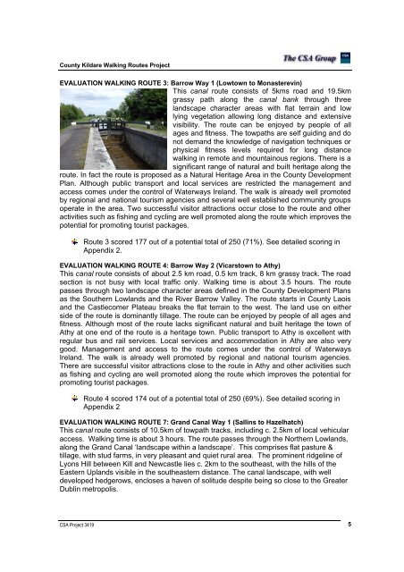
EVALUATION WALKING ROUTE 3: Barrow Way 1 (Lowtown to Monasterevin)<br />
This canal route consists of 5kms road and 19.5km<br />
grassy path along the canal bank through three<br />
landscape character areas with flat terrain and low<br />
lying vegetation allowing long distance and extensive<br />
visibility. The route can be enjoyed by people of all<br />
ages and fitness. The towpaths are self guiding and do<br />
not demand the knowledge of navigation techniques or<br />
physical fitness levels required for long distance<br />
walking in remote and mountainous regions. There is a<br />
significant range of natural and built heritage along the<br />
route. In fact the route is proposed as a Natural Heritage Area in the <strong>County</strong> Development<br />
Plan. Although public transport and local services are restricted the management and<br />
access comes under the control of Waterways Ireland. The walk is already well promoted<br />
by regional and national tourism agenc<strong>ie</strong>s and several well established community groups<br />
operate in the area. Two successful visitor attractions occur close to the route and other<br />
activit<strong>ie</strong>s such as fishing and cycling are well promoted along the route which improves the<br />
potential for promoting tourist packages.<br />
Route 3 scored 177 out of a potential total of 250 (71%). See detailed scoring in<br />
Appendix 2.<br />
EVALUATION WALKING ROUTE 4: Barrow Way 2 (Vicarstown to Athy)<br />
This canal route consists of about 2.5 km road, 0.5 km track, 8 km grassy track. The road<br />
section is not busy with local traffic only. <strong>Walking</strong> time is about 3.5 hours. The route<br />
passes through two landscape character areas defined in the <strong>County</strong> Development Plans<br />
as the Southern Lowlands and the River Barrow Valley. The route starts in <strong>County</strong> Laois<br />
and the Castlecomer Plateau breaks the flat terrain to the west. The land use on either<br />
side of the route is dominantly tillage. The route can be enjoyed by people of all ages and<br />
fitness. Although most of the route lacks significant natural and built heritage the town of<br />
Athy at one end of the route is a heritage town. Public transport to Athy is excellent with<br />
regular bus and rail services. Local services and accommodation in Athy are also very<br />
good. Management and access to the route comes under the control of Waterways<br />
Ireland. The walk is already well promoted by regional and national tourism agenc<strong>ie</strong>s.<br />
There are successful visitor attractions close to the route in Athy and other activit<strong>ie</strong>s such<br />
as fishing and cycling are well promoted along the route which improves the potential for<br />
promoting tourist packages.<br />
Route 4 scored 174 out of a potential total of 250 (69%). See detailed scoring in<br />
Appendix 2<br />
EVALUATION WALKING ROUTE 7: Grand Canal Way 1 (Sallins to Hazelhatch)<br />
This canal route consists of 10.5km of towpath tracks, including c. 2.5km of local vehicular<br />
access. <strong>Walking</strong> time is about 3 hours. The route passes through the Northern Lowlands,<br />
along the Grand Canal ‘landscape within a landscape’. This comprises flat pasture &<br />
tillage, with stud farms, in very pleasant and qu<strong>ie</strong>t rural area. The prominent ridgeline of<br />
Lyons Hill between Kill and Newcastle l<strong>ie</strong>s c. 2km to the southeast, with the hills of the<br />
Eastern Uplands visible in the southeastern distance. The canal landscape, with well<br />
developed hedgerows, encloses a haven of solitude despite being so close to the Greater<br />
Dublin metropolis.<br />
CSA <strong>Project</strong> 3419 5


