OTTO LINNE PREIS - luchterhandt
OTTO LINNE PREIS - luchterhandt
OTTO LINNE PREIS - luchterhandt

Create successful ePaper yourself
Turn your PDF publications into a flip-book with our unique Google optimized e-Paper software.
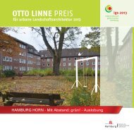
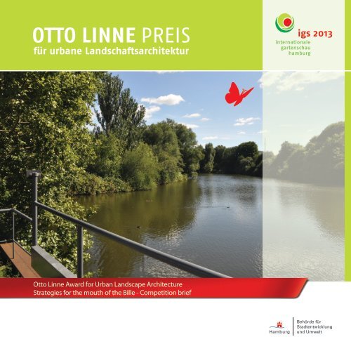
<strong>OTTO</strong> <strong>LINNE</strong> <strong>PREIS</strong><br />
für urbane Landschaftsarchitektur<br />
Otto Linne Award for Urban Landscape Architecture<br />
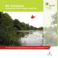
Strategies for the mouth of the Bille - Competition brief
Table of Contents<br />
Competion brief<br />
Single-stage, International Design Competition for Students and Young Graduates in Landscape<br />
Architecture<br />
1. Introductions and aims 4<br />
2. Otto Linne Award: aspirations and perspectives 5<br />
3. Sponsors<br />
4. Information about the review area 8<br />
4.1 City districts/usages 10<br />
4.2 Traffic flows and structures 18<br />
4.3 Water bodies 20<br />
4.4 Green areas/spaces 22<br />
4.5 Current plans/prospects 28<br />
5. Project brief 44<br />
6. Otto Linne - one of Hamburgs`s major landscape gardeners and architects 48<br />
7. Photo documentation 50<br />
8. Procedure 58<br />
3
1. Introduction and Aims<br />
The intention behind the Otto Linne Award is to reward designs which develop a forward-looking attitude<br />
to urban landscape architecture. Following the reinstatement of the award in 2009, for which<br />
young landscape architects were required to come to grips with a complex situation where Hamburg-<br />
Altona slopes down to the Elbe, the brief for the 2011 Otto Linne Award calls into question the classic<br />
limitations of landscape architecture and focuses on Rothenburgsort district’s “Stadttor Südost” (the<br />
south-east ‘gateway’ to the city) and the area round the mouth of the Bille river - a site where there is<br />
a massive overlapping of issues involving traffic planning, the built environment, urban development<br />
and, of course, open space planning.<br />
More than hitherto, it is hoped that the Otto Linne Award will encourage designers to take a long, hard<br />
look at the principles and conceivable perspectives of urban landscape architecture. The intention is<br />
that work on the issues raised by this part of Hamburg will spark a high-calibre debate in professional<br />
circles, stimulate controversial ideas and find new images which make the process clear.<br />
To “provoke” those entering for Otto Linne Award into producing innovative, surprising approaches to<br />
a solution, the issues and project brief have not been closely defined. Specifically, the jury is not looking<br />
for feasible designs which must correspond with the stated objectives. Rather it is the task of the<br />
competition entrants to identify the challenges of this location themselves and to develop their own<br />
project brief – relating to the specific place selected and with a view to stating a general position on the<br />
profession of “landscape architect” now and in future.<br />
The challenge of the 2011 Otto Linne Award<br />
For the Otto Linne Award in 2011 the sponsors have deliberately chosen not to narrowly define the issues<br />
to be addressed or the associated review area, in order to promote entrants’ creativity. Competitors<br />
should enter into a dialogue with the location, soak up its atmosphere and at the same time reflect on<br />
the nature of forward-looking, urban landscape architecture and how it might be adopted for the area<br />
around the mouth of the Bille. Just as Otto Linne, himself a pioneer accustomed to thinking outside the<br />
box, would have liked. The sponsors are convinced that the entrants will submit forward-looking, creative<br />
answers which will allow them to embark on a fresh debate about urban landscape architecture.<br />
4
2. Otto Linne Award: aspirations and perspectives<br />
Following questions are intended to illustrate the goal to which the Otto Linne Award for Urban Landscape<br />
Architecture aspires and describe the perspectives:<br />
• What issues are currently associated with future-oriented landscape and open space planning?<br />
• Which methods and procedures seem likely, from the landscape architect’s point of view, to provide<br />
convincing answers to the recognized challenges of climate change, consumption of resources,<br />
information overload, rapid obsolescence, an aging population and an increasing diversity<br />
of lifestyles?<br />
• In what direction could and should the professional profile of the modern landscape architect<br />
develop? What role/position might planners take?<br />
• Which media seem to offer suitable ways of communicating contemporary landscape architecture<br />
to a range of different actors and encouraging them to contribute or become involved?<br />
The Otto Linne Award invites a debate on the perspectives adopted by professional landscape architects.<br />
It is hoped that the entries will spark a debate about the ways in which the job of the urban landscape<br />
architect has changed over the last few decades and how the profession should or must develop.<br />
5
3. Sponsors<br />
Ministry of Urban Development and the Environment (BSU) -<br />
management of Otto Linne’s legacy of parks and gardens<br />
As a consequence of the Greater Hamburg Law of 1937 the various gardens departments of what had<br />
been independent towns and municipalities were grouped together and centralized. After 1949 Hamburg<br />
became a single municipality with seven boroughs. The BSU has its own specialists for urban green<br />
spaces and, together with the garden departments in the boroughs, sees itself as heir to a tradition of<br />
parks and gardens management which originated in places such as Harburg, Wandsbek, Altona, and<br />
historic Hamburg.<br />
igs internationale gartenschau hamburg 2013<br />
From April to October of the year 2013 Hamburg will once again be the venue of an international garden<br />
show. The goal is to create a park for the 21st century on the Elbe island of Wilhelmsburg, Europe’s<br />
largest river island. The location itself already suggests that here too the attractive Hamburg mixture of<br />
water and greenery will be playing a leading role. This blend will be enriched by modern themes such<br />
as open-air fitness programmes, and recreation and exercise in pleasant surroundings. Apart from its<br />
waterfront situation, Wilhelmsburg’s chief characteristics are an international population and its closeness<br />
to the port. This inspired the igs 2013 to choose “Around the world in 80 gardens” as its motto.<br />
The design of the gardens, stimulating play areas and a wide variety of food and drink will reflect the<br />
cultural diversity of this Elbe island. The igs 2013 will spread its wings beyond Wilhelmsburg. Cooperation<br />
projects are being initiated in the metropolitan region of Hamburg too. The igs 2013 sees the Otto Linne<br />
Award as a way to foster a fundamental debate among the students and young graduates of schools of<br />
landscape architecture about current urban landscape architecture issues – by encouraging participants<br />
from many countries to work on solutions for Hamburg’s areas of future development.<br />
6
“The mouth of the Bille is a<br />
transit space, inner city periph-<br />
ery, disjointed infrastructure,<br />
workplace and home at one and<br />
the same time. Over the course<br />
of time, changing uses, land-<br />
scape and architectural<br />
interventions<br />
and migration patterns of the<br />
local populace will once again<br />
reveal the potential of natural<br />
spaces in the area round the<br />
mouth of the Bille.”<br />
Hans Gabányi, Free and Hanseatic City of Hamburg, Minis-<br />
try of Urban Development and the Environment
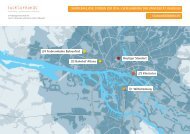
4. Information about the review area<br />
The review area is fringed by neighbourhoods with diversified structures and uses and differing characters.<br />
Areas mainly given over to light industry abut residential quarters, which in turn rub shoulders<br />
with office blocks; this variety of usages is then criss-crossed by roads, railways and waterways.<br />
The mouth of the Bille is like a hinge linking the various types of use and it is already apparent that the<br />
effect is both to divide and to connect.<br />
The city neighbourhoods which give the review area its face are described below.<br />
8<br />
review area<br />
review area
Wholesale Market<br />
Oberhafen<br />
Lock<br />
City South<br />
B 4<br />
Flood control basin<br />
Bille<br />
Piggyback rail station<br />
(Huckepackbahnhof)<br />
9<br />
review area
4.1 City districts/usages<br />
Hammerbrook<br />
(Hamburg urban development forum 1993)<br />
Hammerbrook is north of the Bille, next to the flood control basin. Historically, Hammerbrook developed<br />
in three separate stages:<br />
Marshlands until 1850<br />
Regulating the flow of the Bille in the 13th century created the cultivated landscape of Hammerbrook.<br />
Dykes and drainage systems permitted agricultural use. In the 14th century the area was brought within<br />
the city boundaries. The process of splitting inner from outer Hammerbrook began in the 17th century<br />
with the completion of Hamburg’s defensive ring wall which ran where Heidenkampsweg now is. In the<br />
first half of the 19th century Hamburg‘s systematic development plan led to the growth of an early industrial<br />
era mixed-use area in inner Hammerbrook. In 1842 the Hamburg-Bergedorf railway was opened<br />
and extended to Berlin in following years.<br />
The eastern or outer Hammerbrook district, which directly adjoined the newly created flood control<br />
basin, become increasingly popular with craftsmen and farmers and as a place for bourgeois pleasure<br />
gardens, creating a unique environment within the meadow landscape.<br />
Gruenderzeit developments and reformed architecture prior to the 2nd World War<br />
From 1880 onwards, the expansion of industrial production and the opening up of new markets<br />
thanks to improved transport infrastructure resulted in the redevelopment of outer Hammerbrook in<br />
the Gruenderzeit style. Along the continuation of Middle and South Canals, the practice of Hamburg<br />
merchants to have access to their buildings from both road and waterway was adopted for sites being<br />
developed for industry, and the Bille was canalized accordingly.<br />
10
Deutsche Grundkarte<br />
11
The preferred uses for plots of land with street-only access were multi-storey residential block developments.<br />
At the same time a comprehensive infrastructure was created, including schools, churches,<br />
bathing facilities, municipal utilities and parks.<br />
The no-frills Reform architecture of the 1920s particularly made its mark in the east of the district and<br />
remains in evidence to this day.<br />
The Nazi dictatorship planned to systematically clear Hammerbrook of its residential population. Especially<br />
large numbers of Communist voters lived in the area, and it was decided to reserve this section<br />
of the city exclusively for port and industry use in the “Greater Hamburg” that was to arise after “final<br />
victory” had been won. Housing in the marshland, the lowlands by the Elbe, was deemed detrimental<br />
to the “Health of the Nation” and declared a planning taboo for urban developers.<br />
The area was almost totally destroyed in the 2nd World War. Before July 1943 40,000 residents lived<br />
here; after 10 days of bombing raids only a few hundred were left. The SS forced the survivors out of the<br />
district and sealed it off hermetically. And so a gigantic city of the dead lay in the heart of Hamburg.<br />
The destruction was cynically called a “fortunate happening” that would allow buildings reflecting<br />
Nazi town-planning ideology to be put up instead. This historical shock brought changes that are still<br />
felt today, because the general plan developed at the time later became the foundation for post-war<br />
rebuilding plans.<br />
Development up to 2010<br />
Large parts of Hammerbrook remained uninhabited ruins. Based on the rebuilding plan (1948/54) the<br />
area was designated a zone of predominantly industrial use. A residential population persisted only<br />
in the east, huddled together in temporary housing. Picking up the threads of pre-war life, business<br />
restarted in the stimulants-making industry, vehicle trading & repair, forwarding, wholesaling and<br />
warehousing and the provision of public utilities. The new comprehensive plan (UK equivalent, local<br />
development framework) of 1973 and the draft programme plans of 1977 cemented the development of<br />
a monostructure which started with the 1948/54 designation as industrial zone where people work but<br />
do not live.<br />
12
Not until the regional landscape programme of 1990 was drafted, was the proposal made to use larger<br />
swathes of “outer Hammerbrook” for a mix of homes and workplaces. There were also plans, in the<br />
context of “environmental redevelopment”, to reduce existing pollution and to extend the green finger<br />
connections already in the area and develop possible new options for such wedges, especially along the<br />
edge of the Bille.<br />
City South<br />
Until 1943 City South, a neighbourhood in the Hammerbrook district, was a densely populated area with<br />
good infrastructure where most of the residents were working class families. After the Second World War<br />
the authorities decided against rebuilding the housing areas, and as a result the site remained derelict<br />
for many years. In the 1980s plans were developed, and later implemented, to build offices in west<br />
Hammerbrook in order to satisfy rising demand for office space and relieve some of the pressure on<br />
Hamburg city centre. In 1995 the City South advocacy group was founded and set itself the task of trying<br />
to make the location, which is ideally served by a local train service, more attractive. For example a supermarket<br />
was opened in the area, there is now a twice-weekly street market, public spaces have been<br />
made more attractive and the lighting in the train station improved in the interests of greater safety.<br />
Today, central City South offers around 1 million m² of office space, covering a total area of 82 ha. Some<br />
27,000 people work here, but only 700 live in the area.<br />
13
Outer Hammerbrook<br />
To the east the outer Hammerbrook neighbourhood of Hammerbrook borders on the flood control basin<br />
and its salient feature is a very heterogeneous structure.<br />
Usage<br />
• Housing in the eastern third only<br />
• In the west: mixed use comprising manufacturing, wholesale, retail and services<br />
• Large area where utilities and waste disposal businesses operate next to the flood control basin<br />
• Sports fields next to the flood control basin, planned by Otto Linne<br />
Green spaces/water bodies<br />
• Green spaces along the sides of the flood control basin and isolated pockets on the bank of the Bille<br />
• In general consisting only of roadside trees<br />
• Allotments in the east<br />
• In the east between Bille and Süderstrasse there is a large conglomeration of public and private<br />
green space, most of it lawns<br />
HafenCity<br />
HafenCity is currently the biggest inner city development project in Europe. The 157-ha-site is being developed<br />
into a new waterfront city district, to be used for a mix of workplaces and homes, retail outlets,<br />
leisure pursuits, gastronomy and culture. Size alone is not all that makes this project unusual. Unlike<br />
similarly dimensioned urban development projects, it occupies a central inner-city location.<br />
HafenCity’s distinguishing features are the high quality of the architecture and open space design plus<br />
a wide variety of relationships with the water.<br />
HafenCity is steadily taking shape and maturing into a distinctive district in Hamburg’s central city. Almost<br />
half of the construction volume underlying the master plan that was adopted in 2000 has either<br />
been completed, is now being built or is guaranteed by deed of sale and an undertaking to build on<br />
the land purchased.<br />
14
Rothenburgsort<br />
Hamburg’s Rothenburgsort is a classic working<br />
class neighbourhood covering about 7.6 square<br />
km. This area is home to 8,938 people, for a population<br />
density of 1,176 inhabitants/km². Manufacturing<br />
dominates the district, which is situated<br />
at the point where the Bille empties into the<br />
Elbe; it has widely varying structures: Billhuder<br />
Island with allotments (38 ha), an industrial estate<br />
(Billwerder Ausschlag Island) which is cut<br />
through the middle by Bullenhuser Canal, railway<br />
facilities and local rail stations, a residential<br />
neighbourhood and Entenwerder Park.<br />
The Entenwerder Elbe Park opened in 1997 on<br />
the derelict Entenwerder peninsula where port<br />
activities had been discontinued; together with<br />
Trauns Park on its eastern border, it offers a recreation<br />
area for the local populace of Rothenburgsort.<br />
Trauns Park was created by Otto Linne<br />
between 1923 and 1925.<br />
Billwerder Ausschlag<br />
Billwerder Ausschlag is a river island in the Elbe<br />
belonging to Billwerder Island. The name “Ausschlag”<br />
refers to its position outside the areas<br />
protected by dykes. This district became part of<br />
Rothenburgsort in 1970. It covers an area of 4.5<br />
km² and stretches for 3.1 km from east to west.<br />
Existing use study<br />
hamburg urban development forum 1993<br />
Master Plan HafenCity East<br />
March 2011<br />
15
“It could be that intermediate spaces,<br />
disjunctions, confusion and jagged edges should not be swept aside. Perhaps we<br />
must instead see them as hidden chances to revitalize and re-invent this piece of<br />
urban no man’s land.”<br />
Bertel Kahlet Bruun, landscape architect, Hamburg<br />
“The mouth of the Bille is a non-place! Why? – after all, it seems to have a Mediter-<br />
ranean character, or why else do a ristorante, pizzeria and trattoria survive here … and<br />
that in the open air, too,<br />
Is that a contradiction? Everyone wants Mediterranean style! Or do a lot a people mean<br />
despite noise, dust and dirt.<br />
something else by Mediterranean?<br />
I think this place is exciting, a real challenge for a city that is proud of its greenery and<br />
wants to be a metropolis at the same time!”<br />
Hanns-Jürgen Redeker, Bundesverband Garten-, Landschafts- und Sportplatzbau e.V., Hamburg (Federal association for creators<br />
of gardens, landscapes and outdoor sports facilities)
Cleared piggyback rail station<br />
(Huckepackbahnhof) at Billhorner Brückenstraße<br />
17
4.2 Traffic Flows and Structures<br />
Road traffic<br />
Four-lane thoroughfares intersect in the review area and degrade the south east entrance to the city by<br />
making it one of Hamburg’s biggest traffic junctions. Travelling south, two Federal trunk roads, the B4<br />
(Amsinckstraße) and the B75 (Heidenkampsweg) merge here into the Billhorner Brückenstrasse which<br />
then crosses the Elbe.<br />
The daily volume of traffic on these roads is: Amsinckstraße 62,000 vehicles/24 hrs, Heidenkampsweg<br />
57,000 veh./24 hrs, Billhorner Brückenstrasse/Neue Elbbrücken 100,000 veh./24 hrs (numbers at:<br />
27.1.2009, Ministry of Urban Development and the Environment, traffic figures)<br />
Rail traffic<br />
From east to west and from north to south main-line trains cross the area around the mouth of the Bille<br />
on elevated tracks.<br />
In Hammerbrook and Rothenburgsort there are two central stops for the local S-train service in the immediate<br />
vicinity of the review area. Every ten minutes S21 trains to Bergedorf/Aumühle and S3 trains to<br />
Neugraben leave Hamburg main station heading for a stop at one of these stations.<br />
The S3 is elevated (about 20m high) and passes directly over the mouth of the Bille area before crossing<br />
the Elbe. Starting from Hamburg main station the ICE route to Berlin passes between the wholesale<br />
market and Hammerbrook and traverses the centre of Rothenburgsort parallel with the S-train lines.<br />
There is a train once an hour and the trip to Berlin main station takes an hour and a half.<br />
18
Trafficplan<br />
Free and Hanseatic City of Hamburg, 2008<br />
19
4.3 Water bodies<br />
The Elbe<br />
The Elbe, whose source is in the Krkoknose Mountains of the Czech Republic, flows through Germany on<br />
its way to the North Sea and a central section of the river flows through Hamburg. It is Hamburg’s major<br />
transport waterway, bringing 140.4m tonnes of cargo to or from Hamburg port every year.<br />
The Elbe is 1,091.5 km long, its first 364 km are in the Czech Republic and 727 are in Germany, where it<br />
flows through major cities such as Dresden, Magdeburg and Hamburg.<br />
The Bille<br />
The Bille flows into the Elbe from the north-east, having travelled 65 km from its source near Trittau,<br />
east of Hahnheide nature reserve. The first 42 km flow through Schleswig-Holstein, the remaining 23 km<br />
through Hamburg.<br />
Approaching from the east, the Bille snakes between Hammerbrook and Rothenburgsort, through<br />
Brandshofer lock into Oberhafen and from thence into the Elbe.<br />
Although some stretches are used for industrial purposes, the Bille is mainly the domain of pleasure<br />
boats which either travel upstream to the north-east or use the lock to enter the Elbe.<br />
The area around the Bille varies a great deal, depending on whether it is being used for industry or<br />
private purposes. Industrial buildings, power stations, waste incineration plants and a container rail<br />
station stand in contrast to weekend homes and allotments.<br />
Two of east Hamburg’s nature reserves are on the banks of the Bille, low-lying Boberger Niederung and<br />
Billetal valley. Features of Boberger Niederung, in the Hamburg district of Bergedorf, are moors and<br />
bogs, fen woodland, damp meadows, sand dunes and heath.<br />
20
“By the Alster, by<br />
the Elbe, by the Bill,<br />
everyone can do just<br />
whatever he will.<br />
That is the refrain of a Low German folk song from<br />
Hamburg.<br />
The rhyme contains two core messages:<br />
Hamburg lies on three rivers! The third, the Bille,<br />
is barely recognizable as a river, at least not in the<br />
review area.<br />
In the past, people did do whatever they wanted<br />
with and around the Bille, most alterations being<br />
dictated by the demands of trade and industry.<br />
Towards the objective of re-casting the Bille as being, as it were, part of a “Gateway to the City” the following impressions<br />
need to be countered:<br />
• The natural scenery of the Bille is no longer recognizable. But it still, as in the past, flows<br />
through Hammerbrook (brook is a Low German word for the low-lying area surrounding<br />
water), in front of the northern Horner Geest. The Bille is used mostly for transportation or for<br />
supplying trade and industrial sites from the water.<br />
• Very few parts of its banks still offer public access and can be used for leisure pursuits.<br />
The space is characterized and dominated by roads, most of them several lanes wide, traffic intersections<br />
and the mainline railway.<br />
Currently a green space corridor is being developed from the north along the side of the flood control basin. However<br />
there is no bridge over the Bille apart from on the roads.<br />
An important part of the riverbank where the flood control basin empties into the Bille is occupied by the recycling<br />
centre and thus closed to the public. There is considerable noise nuisance.<br />
Note:<br />
The green finger along the flood control basin on the northern edge used to be a park; called the “Stoltenpark”, it<br />
was laid out in 1920 by Hamburg’s director of gardens Otto Linne and until the night bombing raids in the 2nd World<br />
War was a recreation spot for the residents of the housing areas then situated to the east.”<br />
Dieter Schramm, Deutsche Gesellschaft für Gartenkunst und Landschaftskultur e.V. Hamburg / Schleswig-Holstein section (German society for gardens<br />
and landscapes)
4.4 Green Areas/Spaces<br />
The review area’s place in the landscape programme<br />
Overall development planning for natural areas and landscape in the built and unbuilt areas of the Free<br />
and Hanseatic City of Hamburg is set down in the landscape programme. In tandem with the revised<br />
version of the comprehensive plan, it was adopted by the House of Burgesses in 1997 as a binding official<br />
planning instrument. The legal foundation for the landscape programme is the Federal Nature Conservation<br />
Act and the corresponding Hamburg State law (see section 4 HmbBNatSchAG on the Hamburg landscape<br />
programme and sections 9, 10, 11 of the federal law BNatSchG). Apart from planning statements<br />
concerning species and biotope conservation, natural systems and the visual quality of landscape, the<br />
landscape programme is chiefly concerned with statements on the structures of the integrated open<br />
space system in Hamburg. The integrated open space system called “Hamburg’s Green Network” consists<br />
of landscape axes, green rings and green finger connections and, above all, a variety of green<br />
areas, and has been singled out as a separate technical concept. Its overriding goal is to network parks,<br />
playgrounds and sports grounds, allotments and cemeteries with wide green space corridors and narrow<br />
green finger connections and in the process, apart from providing open space for the populace, to<br />
contribute to organizing and structuring the city.<br />
In the review area for the Otto Linne Award 2011 the landscape programme defines a landscape axis<br />
along the Bille. This landscape axis, the Bille axis, includes the entire course of the Bille and the open<br />
space on its banks from the eastern section of the Bille in Bergedorf up to its mouth. The objective of<br />
the landscape axis is to network the open spaces and biotopes in an east-westerly direction and it is<br />
thus the major organizing structural element in the large expanse of the industrial estates of Billbrook-<br />
Hammerbrook-Billwerder Ausschlag-Rothenburgsort. The particularly important “intersections” here<br />
are where the Bille axis crosses the green space corridors running north-south along the flood control<br />
basin via Rothenburgsort to Entenwerder and through Billhafen and Oberhafen basins around the<br />
mouth of the Bille; these form part of the Elbe landscape axis and facilitate integration with the western<br />
section. In the context of the conversion areas in the eastern HafenCity and the Brandshof area up to Billebecken,<br />
this section of the lower reach of the Bille is the backbone for fresh ideas on how to restructure<br />
the townscape of this area.<br />
22
“Grünes Netz Hamburg“<br />
landscape programme Hamburg, June 2010<br />
23
Since 1997 the landscape programme has designated a green strip on both banks of the Bille, either as<br />
public park or as a garden with limited use. On the map a dotted strip denotes the edge of the landscape<br />
axis and thus where it is separated from built-up space. This is to bring attention to the transitional<br />
space between landscape axis and built-up area which demands especially high standards of<br />
design in order to accomplish said transition. In the area around the north bank of the Bille basin (south<br />
of Hammer Dyke/west of Billwerder Steindamm) plans are currently being drafted for the development<br />
of a mixed use area with improved qualities of open space.<br />
Moreover, in the review area the landscape programme describes the opening and completion of an<br />
uninterrupted walkway along the flood control facility, in front of the wholesale market via Brandshofer<br />
lock to Billhorner Brückenstrasse. The creation of this public pathway is seen as an urgent priority in order<br />
to connect the inner city, which is expanding into the HafenCity, with Rothenburgsort and, progressing<br />
east along the Elbe axis, with the important local recreation area of Vierlanden and Marschlanden.<br />
In some sections plans are already being made to improve these pathways along the Elbe. Likewise the<br />
area formerly occupied by the piggyback rail freight station Rothenburgsort is marked as a site still in<br />
need of a clearly defined purpose. Here it is especially important to create a green finger connection<br />
between the flood control basin and Rothenburgsort/Entenwerder/Elbe.<br />
The area around the Bille mouth between the lock and where the Heidenkampsweg crosses over is<br />
fringed by trees and bushes which are entered in the landscape programme as green space with limited<br />
utility. In the area of the junction where the major roads Amsinckstraße/Heidenkampsweg diverge the<br />
lay-out of the intersection has produced extensive areas of lawn which are in a reasonably good condition<br />
but are very underutilized due to their location and the noise levels.<br />
The trees standing parallel with the Amsinckstraße are laid out in highly structured manner, whereas<br />
the trees growing around the Billhornerbrückenstrasse/Röhrdamm traffic junction seem to have been<br />
planted without much planning. Renewal and redesign work on the Billhorner Brückenstrasse began<br />
in 2010. Part of this task involves replanting and this will be done in accordance with the “Master Plan<br />
Hamburg Elbe Bridges” adopted by the Senate.<br />
24
“This is a place that has been completely<br />
alienated and altered by typical<br />
urban developments and infrastructure planning. The historic, natural structures<br />
of the mouth of a river – where the Bille empties into the Elbe – are no<br />
longer visible and barely imaginable. This place is a typical example of dynamic<br />
change in a big city: a variety of traffic routes with differing importance in the<br />
historic context overlap in this place, and while they form its characteristic face,<br />
they also call out for change and development. The Italian restaurant is pioneering<br />
the re-invention of this place; on the one hand it seems rather lost<br />
between heavy traffic and industry, on the other hand, however, it signalizes<br />
hope for new moves to reclaim this isolated area for the general public.<br />
The place communicates an image of contradiction and challenge: creativity<br />
and dynamism in the context of an ideas competition for the mouth of the Bille<br />
can present the area from a new perspective, however it will never achieve ultimate<br />
perfection but remain in a state of permanent evolution.<br />
The potential of this place has yet to be invented.”<br />
Heiner Baumgarten, managing director, internationale gartenschau hamburg 2013
Open space planning competition for a green<br />
space corridor along the flood control basin in<br />
Hamburg-Hammerbrook<br />
(From the explanatory text of landscape architects<br />
lohrer, hochrein, Munich)<br />
In the summer of 2009 the Ministry of Urban<br />
Development and the Environment initiated an<br />
open space planning competition for a green<br />
space corridor along the flood control basin,<br />
which was won by landscape architects lohrer.<br />
hochrein landschaftsarchitekte. This design is<br />
currently being revised. The first section, between<br />
Süderstrasse and Bullerdeich, is to be completed<br />
by the final presentation year of Hamburg International<br />
Building Exhibition in 2013. The building<br />
start is scheduled for the spring of 2011. The<br />
design is derived from the following planning<br />
concepts:<br />
The new park by the basin is to act as an overarching<br />
link between Alster and Elbe, while at<br />
the same time spurring developments that will<br />
help local residents identify with the area.<br />
Sequence of spaces<br />
The backbone of the park is an extensive, treelined<br />
boulevard, running like a transparent<br />
green curtain parallel with the basin. This provides<br />
forecourts to the houseboat jetties. The in-<br />
26<br />
Winner open space planning competition<br />
“Grünzug am Hochwasserbassin“ 2009
terplay of light and shade, the sparkle of the water and the greenery overhead are the natural design<br />
elements of a promenade that has pleasantly minimalist furniture.<br />
Size matters: A broad axis has been chosen in order to communicate the expansiveness of a contiguous<br />
park lay-out and to provide enough space for people to stroll or cycle through. From beneath this<br />
green canopy there is a view to the west of urban waterfront areas and small canals. To the east, the<br />
functional “inlays” of the green space corridor dock onto the boulevard. In the direction of the railway<br />
embankment there are open spaces which can be used for a variety of activities and are framed by a<br />
path that is slightly elevated above the ground This path offers a circular tour round the park. It will<br />
especially please walkers and joggers.<br />
Inlays<br />
The various uses that already exist here and the proposed areas between boulevard and walkway are<br />
set into the design of the park as windows of opportunity. The stable framework of built pathways, the<br />
structuring qualities of vegetation and the sequence of places combine to allow for possible changes in<br />
future, e.g. swapping one sporting use for another.<br />
At its southern tip the outer edge will be a kind of urban stage created by the sculpturing and functional<br />
modelling of the terrain, offering a far-ranging vista of the park. An expanse of lawn at the intersection<br />
of the waters with a gradient oriented to catch the sun will create a sense of wide open space and offer<br />
a lot of scope for extensive use of the park, such as sunbathing, picnicking or even open air concerts.<br />
Copyright Floating Homes GmbH, www.floatinghomes.de<br />
27
4.5 Current Plans/Prospects<br />
Study on “Creative milieus and open spaces in Hamburg”<br />
The purpose of this study commissioned by the Free and Hanseatic City of Hamburg’s Ministry of Urban<br />
Development and the Environment is to add the dimension of urban space to the city’s economic prospects.<br />
Part of this study included outline solutions and targeted ways in which the cultural and creative<br />
economy could be advanced.<br />
The urban space and socio-economic aspects of creative milieus in Hamburg were examined and some<br />
examples presented in case studies. In order to implement the overriding objective, six fields of action<br />
were defined: new land use policy, user-oriented infrastructure, dynamic development procedures,<br />
legal framework, finance/grants and communication/cooperation.<br />
Analysis of types of milieu and locations in the case of Brandshof<br />
The industrial and commercial area between Bille and Billhorner Brückenstrasse, known as “Brandshof”<br />
is labelled an area that is changing radically. It is home to inspirational projects such as Kubik 2009,<br />
the existing atelier of Marc v.d. Broek und the Oelfrue gallery. The Brandshof Festiv, which is held once<br />
a year during the summer months, has its roots in the area of the Elbe bridges and features temporary<br />
happenings and events.<br />
The narrow strip around Brandshofer Dyke is a collection of commercially used and empty buildings. The<br />
former inland shipping headquarters, a centrally situated building complex, was bought by an investor<br />
after subculture activities had put it on the map, and is now being steadily redeveloped as a residential<br />
and cultural site.<br />
28
Scenario: “Creative image building – Oberhafen area”<br />
• Potential of Oberhafen set in the triangle formed by opposing forces of the inner city, HafenCity and<br />
Brandshof<br />
• Continuation of the “Art Mile” towards the south east, linking it to an urban space that is already<br />
used by creative people<br />
• The potential axis from west to east would run through: Oberhafen bridge/quarter – Oberhafen/<br />
wholesale market – Bille mouth – Brandshofer Dyke<br />
Scenario:<br />
“Creative image building – Oberhafen area”<br />
29
Scenario: “Office city 2.0.” - Hammerbrook<br />
• Presents itself as an urban space that will be important for urban future development due to its<br />
central location in the immediate neighbourhood of the inner city and HafenCity, its good traffic<br />
infrastructure, its proximity to the Elbe bridges and the motorway and the large number of waterfront<br />
sites<br />
• The current monostructural pattern of use does not accord with what is needed of locations that are<br />
potentially key to the city<br />
• Potential of the location: good quality of life on the waterfront, central location for experimenting<br />
with water sites, access via waterways, reasonably priced area with vacancies<br />
The study identified the area around Brandshofer Dyke as currently being a satellite in the cultural and<br />
creative heavens. But when HafenCity has been completed, its eastern edge will come very close to<br />
Brandshofer lock, meaning there is a great deal of potential for this area.<br />
30<br />
Scenario: “Office city 2.0.” - Hammerbrook
Piggyback rail station (Huckepackbahnhof)<br />
The roughly 10.6 ha site of the former piggyback freight station Rothenburgsort (south of Billstrasse, east<br />
of the S-train station Rothenburgsort), where trucks used to be loaded onto trains up to the 1990s, is<br />
designated for commercial use. In April 2002 the Senate Commission for Urban Development and the<br />
Environment therefore decided to use the former rail facility for the “provision, securing and development<br />
of commercial building sites”. In 2007 the site was declared no longer required for the operation<br />
of rail services and it was bought by the city.<br />
The “Master Plan Elbe Bridges” from 2007 describes development perspectives for the south east access<br />
to Hamburg from Veddel up to Heidenkampsweg. Large parts of Rothenburgsort, including the piggyback<br />
station, were included in the deliberations. In the area surrounding the old piggyback station it is<br />
planned to designate a roughly 60 m wide strip east of the Billhorner Brückenstrasse as a core business<br />
district (CBD). The development aim of designating this CBD is to make Billhorner Brückenstrasse an urban<br />
road space with correspondingly high buildings put to appropriate uses. The intended height (six to<br />
seven stories, a few ten-story buildings) is not suitable for industrial purposes.<br />
Another aim of the master plans for the site of the old piggyback station is to lengthen the Alster-Elbe<br />
green axis, by creating a green finger connection leading through a cutting in the railway embankment<br />
in the south and, as an extension of Billhorner Mühlenweg, arching through to Entenwerder Elbe Park.<br />
The printed matter “Master Plan Elbe Bridges” was presented to the Senate in November 2007 which<br />
adopted the objectives described.<br />
Following various preliminary talks between the department for urban and landscape planning at Hamburg-Mitte<br />
borough council offices and the other specialist departments of government involved, and<br />
when the survey of the site had been completed, the borough council commissioned a preliminary traffic<br />
survey in October 2010. The competent department for urban and landscape planning will initiate the<br />
procedures to arrive at a legally binding land use plan in May/June 2011.<br />
31
The site of the piggyback rail station has just been cleared of interim uses (used car dealer). In the course<br />
of 2011 what remains of the facility (rails, ties, points, gravel etc.) will be removed by the prior owner. At<br />
the end of 2011/early 2012 work is due to start on unexploded ordnance (UXO) clearance and the cleaning<br />
up of inherited pollution.<br />
Costly traffic infrastructure measures will be needed to facilitate site development (including cutting<br />
through the south rail line) so that it is predicted that the site will not be ready for construction work in<br />
terms of planning permission and feasability until about 2016.<br />
32
Master plan city gateway south east<br />
The Free and Hanseatic City of Hamburg has had<br />
a master plan drafted for the development of the<br />
area around the bridges across the Norderelbe<br />
(north arm of Elbe). The objective of this urabn<br />
development concept is to create a more structured<br />
space out of the heterogeneous and fragmentary<br />
environs of Billhorner Brückenstrasse<br />
and give it an aspect that better reflects its role<br />
as a major entry into Hamburg.<br />
Chicago Square in HafenCity<br />
The completion of Chicago Square in the eastern<br />
part of HafenCity will create a new urban meeting<br />
point. Similar to the more westerly squares<br />
it will have various levels, and numerous cafés,<br />
restaurants, bars and shops will move into the<br />
neighbouring buildings.<br />
Master Plan Elbbrücken<br />
Urban planning concept, 31.10.2007<br />
33
“… what remains!<br />
It is spring. May, to be precise. The trees and bushes are still decked in fresh green.<br />
Light green. Delicate. Not yet covered by the dust of the summer and exhaust fumes<br />
from the four hundred thousand cars registered in Hamburg. A mighty backdrop of<br />
noise mingles with the freshness of spring where the Bille meets the Elbe. And the ten,<br />
eleven members of the Otto Linne advisory committee add their voices and motion to<br />
the scene.<br />
We look at this space. Try to understand it. Grasp its essence. We want to determine<br />
whether it can be a suitable space for the Otto Linne competition 2011. Next to the carpark,<br />
immediately alongside this unspectacular confluence of the Bille with Hamburg’s<br />
larger, more important river, there is a pizzeria. With an energetic owner. With tables<br />
and benches outside.<br />
Is this place suitable only for diners with no wish to talk or communicate? Or is eating<br />
here a pleasure only to those who appreciate the place, wish to concentrate on it and<br />
make an effort to experience it more deliberately than all other alternatives in Hamburg?<br />
Or is it just the Italian character of the place? Like the noise and hustle-bustle of<br />
the Via Celio Vibenna next to the Colosseum in Rome? Where locals and tourists – who<br />
are often crazy anyway, sit right next to the road, eating, drinking and shouting above<br />
the noise.
At any rate this restaurant on the Bille is busy. In summer people sit outside. Or is it this<br />
magic location, on the periphery of Hamburg. At the entrance to the city, where a tourist<br />
has to decide in a split second whether to fork to the north or west of Hamburg.<br />
This is one of the busiest intersections in the city. For decades people have been talking<br />
about what a “welcome to Hamburg” should look like. Green surrrounds this junction, still<br />
very close to the mouth of the Bille, Hamburg’s second biggest river, which comes into the<br />
city from the east, creeps almost unnoticed through the industrial areas and then, with a<br />
total lack of drama, disappears into the Elbe. The Bille simply vanishes in this rich, succulent<br />
and lush expanse of green. For years some of Hamburg’s most special fans have been<br />
hiding in their dachas on the verdant edge of the river. And some of the city’s vagrants<br />
sometimes doze the summer away here. A countryside vacation. A holiday between roads,<br />
commuter trains, freight tracks and industrial relics.<br />
The decision to choose this place is clear-cut. Because the place is so difficult, being neither<br />
one thing nor the other, being unable to decide wither it is the gateway to Hamburg,<br />
a refuge for animals, plants and people who need little to be satisfied, it does in fact offer<br />
a wealth of opportunity. This is something for young people, because we older ones always<br />
know in advance why it won’t work here. The care-free attitude of the stranger is needed.<br />
The creativity of the unyielding. The innovative will of people who have not yet given in to<br />
routine. This is a place for competitions.”<br />
Werner Steinke, Free and Hanseatic City of Hamburg, Ministry of Urban Development and the Environment
5. Project Brief<br />
There has been a deliberate decision to define no specific project brief for the Otto-Linne Award 2011.<br />
Competitors’ task is to form their own opinions about the planning area described above. By closely<br />
examining the place and how it is linked with the rest of the city, entrants are to identify for themselves<br />
what the development of this place involves in terms of themes and challenges and present their plans<br />
for answers to the problem. Contestants are called upon to develop creative concepts which will express<br />
a convincing and forward-looking attitude in terms of urban landscape architecture.<br />
The most important concern is to create an integrated overall strategy for the open space planning of<br />
the review area of the south-east gateway to the city/Bille mouth in the Hamburg-Mitte borough of<br />
the Free and Hanseatic City of Hamburg. From now on it is left to the contestants’ discretion whether<br />
they examine a large, contiguous area or concentrate on a part area or place within an area, or on an<br />
exemplary detail.<br />
Thematic fields<br />
All entrants are invited to discuss the challenges currently facing landscape architects and open space<br />
planners as they relate to this site and to help develop solutions. The following themes seem unavoidable:<br />
Spatial unit of the landscape; Bille mouth - Elbe<br />
Many Hamburg residents are unfamiliar with the Bille as a spatial unit of the landscape. And yet it is an<br />
important part of Hamburg’s watercourse topography, even if, in the process of industrialization, the<br />
place where it empties into the Elbe has been remoulded and relocated so that it is now barely visible or<br />
tangible - neither as a waterway, nor as a place for sports and leisure. Although it is still a strong presence<br />
in the eastern district of Hamburg-Allermöhe, where many appreciate the attractive open space it<br />
provides, the mouth of the river has been obscured by buildings, is overgrown, inaccessible and hidden.<br />
Moreover, its relationship with or connection to the Elbe and other nearby waters (flood control basin)<br />
seems unclear and unresolved. History and present significance, use and usefulness, environment and<br />
accessibility, the aesthetics and atmosphere of this water (space): these are the keywords indicating<br />
which aspects should be treated in greater depth.<br />
36
Brandshofer Lock<br />
private boat jetty<br />
37
South-east entrance to the city<br />
The review area embraces something that for many years has repeatedly been a discussion point in<br />
Hamburg, the “south-east gateway to the city”. Everyone travelling the road over the Elbe bridges has<br />
to arrive in this space – and is surprised by the infrastructure-heavy aura of the area, coming so soon<br />
after the far more emotional act of crossing the Elbe. In the past many planners have produced their<br />
concepts for turning this place into a worthy entrance into Hamburg. In the process, special attention<br />
was concentrated on the great hopes for developing the former piggyback station, which, being a large,<br />
continuous stretch of derelict space, has enormous potential for the redevelopment of Rothenburgsort.<br />
The following keywords point to issues regarding development based on urban planning for the built<br />
environment and open spaces: inner periphery and backyard view, concision in urban development and<br />
imposing open space in the metropolis, fundamental rearrangement of space or incremental strategy,<br />
townscape and architectural measures or distinctively planned open spaces?<br />
Homogeneous or heterogeneous pattern of use<br />
In the review area a variety of uses and “no-uses” clash with each other. It is a production site (National<br />
Starch), a trading site (wholesale market and commerce), a place to live, eat out and offer services. A<br />
neighbourhood of old warehouses, buildings worth preserving and worthless storage halls is now gaining<br />
a reputation as an up and coming creative quarter. At present it seems underused, although is has<br />
already been officially discovered and is part of a municipal strategy of developing quarters for creative<br />
people in Hamburg. There are a few options on the market for using the water – from workplaces to<br />
houses to sports and tourism. Asking what the location’s use profile is raises a core question: which uses<br />
might – unlike today – be more compatible with each other in future? Is it possible to achieve a new<br />
coexistence between hitherto incompatible uses and users? What principles would apply? Which use<br />
would have priority? Can one use displace another? Are certain uses no longer appropriate these days?<br />
What new uses are conceivable? What role is played by infrastructure which is put to varyingly intensive<br />
use, or by air and noise pollution?<br />
38
New ways to create urban infrastructures<br />
Infrastructure has an enormous influence on the look of this area: roads, railtracks, waterways, bridges,<br />
underpasses, public and private transport, freight and people. A derelict rail freight station. Infrastructure<br />
creates links and also erects barriers in the urban space. And that is especially true of this place.<br />
Infrastructure creates all kinds of tensions which become an issue – raising not only the question of how<br />
traffic is organized but of its compatibility with other uses, of the aesthetics of the place, the quality of<br />
the supply of utilities to the place and the entire city. What spatial qualities seem desirable: a place to<br />
linger or simply a transit space? A link or a barrier?<br />
No place/non-place<br />
• The review area is full of contradictions and opposites. It lies between city districts, is known throughout<br />
the city without possessing its own identity. It has excellent connections, but everyone just wants<br />
to pass through quickly. From here attractive places like Billebecken, Entenwerder, Veddel and HafenCity<br />
seem quick and easy to reach. Do places like these actually need their own identity? Who would think<br />
that important? Can its identity not remain as this “no place/non-place” and work concentrate simply<br />
on how it is perceived?<br />
Framework conditions<br />
Overall strategies<br />
The place seems hard to grasp in its entirety. The complexes of themes listed above are suggestions to<br />
help stimulate the finding of solutions tailored to the place and also general approaches to urban landscape<br />
architecture: what open space, urban development, artistic plans and strategies can help to end<br />
the lack of orientation found here or in similar places.<br />
Review area<br />
The stipulated review area is not delineated by a designated planning area. It should rather be understood<br />
as a space for exploring the themes described. Therefore every entrant is free to choose the limits<br />
and size of the space he/she addresses. This will be connected with the chosen focus theme and the<br />
39
40<br />
Mouth of the Bille
overriding overall strategy. It is possible, depending on where the thematic focus lies, to show how the<br />
proposals fit into a larger or smaller spatial context. What is essential is that, in terms of scale and coverage,<br />
entrants have a convincing reason for making their chosen spatial demarcation. Every entrant is<br />
called upon to focus their themes and approaches to a fine point. It is certainly not required that every<br />
draft should cover and process every possible aspect and theme. It is far more important to concentrate<br />
on the idea and statement (and at the same time do justice to the complex situation) and to do everything<br />
possible to make the entry lucid and powerfully convincing.<br />
Interdisciplinary work<br />
The participants are expected to produce entries which show, by the way the communication has been<br />
prepared, perhaps even in the methodology, a clearly defined attitude to the perspective of the professional<br />
landscape architect in relation to architecture and urban planning, traffic planning and art, communication<br />
design and process management. To obtain checks and balances, participants are urgently<br />
recommended to form interdisciplinary teams in which completely differing viewpoints and approaches<br />
to action can be discussed and drafted across disciplinary borders. The jury would explicitly like to see<br />
landscape architects heading teams which include, for example, town planners and architects, traffic<br />
planners and sociologists, communication designers and artists.<br />
Communicate imaginatively, stimulate discussion<br />
In keeping with the way the project brief has been left open-ended, creative, unconventional, debateprovoking<br />
forms of presentation should be developed in line with the theme(s) on which the entry has<br />
focussed. It is hoped that the entrants will be stimulated into adding other forms of expression such as<br />
comics, newspapers, films or art installations to the customary preparation of plans and models. Great<br />
importance will be attached to a transparent, logical connection between form and content, i.e. the<br />
medium should be chosen carefully for the specific theme. The entries must be capable of being presented<br />
and judged at a jury meeting. All entrants must also provide a sheet with a summary of the core<br />
contents of their work inasmuch as they use media other than drawings.<br />
41
6. Otto Linne - One of Hamburg`s major landscape<br />
gardeners and architects<br />
42<br />
Otto Linne<br />
Otto Linne, born on 2 December 1869 in Bremen,<br />
learned gardening at the Royal Gardens in Dresden.<br />
After his military service in Rostock he attended<br />
the Gardening Instruction and Research Institute<br />
at the Game Park in Potsdam. Brief stints<br />
followed as a gardening technician at the municipal<br />
gardens departments in Berlin-Treptow,<br />
Lübeck and Dresden-Blasewitz. In 1894 Linne<br />
became chief municipal gardener in Magdeburg.<br />
Five years later the 29-year-old was appointed<br />
director of gardens in Erfurt. Here he completely<br />
reformed the administration of gardens and created<br />
numerous new facilities. After nine years,<br />
he left for Essen, where he worked in the same<br />
capacity. As the last large German city to do so,<br />
Hamburg established its own gardens department<br />
at the beginning of the year 1914. Up until<br />
then, gardening and cemetery management had<br />
been the responsibility of the engineering department<br />
of the building authority. Otto Linne<br />
was chosen as Hamburg’s first director of gardens.<br />
Under Linne’s stewardship the plans for<br />
Hammer Park were advanced and Hamburg Municipal<br />
Park (Stadtpark) opened to the public.
Otto Linne’s work in Hamburg was interrupted by the outbreak of the First World War. After the end of<br />
the war he dedicated himself to restructuring the parks and gardens in Hamburg. As a result of postwar<br />
changes in society, the vast majority of people were unable to make much use of the existing parks and<br />
green spaces. The poorer sections of the population in particular lacked both time and money to visit<br />
the more distant parks. Thus Linne’s main priority was to create a dense network of numerous smaller<br />
parks in direct proximity to the heavily populated housing areas where, instead of purely decorative<br />
gardens, local residents would have space for recreation, games and sports. An office was set up to deal<br />
with allotments; it was tasked with the provision of assistance to allotment gardeners, fair allocation<br />
of the gardening land and the designation of additional sites. Under Linne’s management numerous<br />
open air facilities, some of them quite considerable, were created in Hamburg between 1914 and 1929:<br />
6 parks, including the transformation and replanting of Horner Park, Wehbers Park, Trauns gardens<br />
Hayns gardens and Hammer park,<br />
3 green space corridors<br />
13 grass playgrounds and sun-bathing lawns<br />
78 children’s playgrounds (including the first adventure playground in Jungiusstrasse)<br />
42 sand pits and 15 paddling pools<br />
9 gardens for senior citizens<br />
38 sports grounds<br />
91 permanent lease gardens<br />
Otto Linne’s artistic design for the Municipal Park and his extension to Ohlsdorf cemetery were much<br />
admired (1914-1920).<br />
On 31.12.1933 Otto Linne retired and died three and a half years later in Klein Flottbek. Linne’s garden<br />
design was typical of the “New Garden Architecture” of the opening decades of the 20th century. Otto<br />
Linne was a pioneer of designing public gardens so as to develop and cleverly utilize existing open<br />
spaces in ways that benefited the people while attaching great importance to leaving the elements of<br />
the landscape intact.<br />
43
7. Photo Documentation<br />
44<br />
1<br />
2 3<br />
5 4<br />
Branshofer Deich
1 Brandshofer Lock bridge, view of the lock<br />
2 Brandshofer Lock bridge,looking north 3 Private boat jetty<br />
4 View of the Bille 5 View under the ariele elevated<br />
45
46<br />
13<br />
6<br />
7<br />
Amsinckstraße and traffic junktion<br />
Amsinckstraße/Billhorner Brückenstraße<br />
10<br />
9<br />
8<br />
11<br />
12
6 View of Amsinckstraße bridge 7 Amsinckstraße bridge,lookib north<br />
8 Traffic junktion<br />
11 View of Billhorner<br />
Brückenstraße bridge<br />
9 Mercedes high-rise building<br />
12 Piggyback rail station<br />
(Huckepackbahnhof)<br />
10 Billhorner Brückenstraße bridge<br />
13 Amsinckstraße, looking west<br />
47
48<br />
16<br />
19<br />
Brandshofer Deich and<br />
Billhorner Brückenstraße/Elbbrücken<br />
15<br />
17<br />
14<br />
18<br />
20
14 former inland shipping headquarter 15 Brandshofer Deich 16 Brandshofer Deich<br />
17 Construction material depot at Billhorner Brückenstraße<br />
18 Billhorner Brückenstraße<br />
19 View from the Elbbrücken 20 Billhorner Brückenstraße,<br />
Holiday Inn<br />
49
50<br />
CitySouth in the city district of Hammerbrook<br />
and the float control basin (Hochwasserbassin)<br />
23<br />
24<br />
26<br />
25<br />
21<br />
22
21 View of Bullerdeich bridge 22 View from Bullerdeich bridge<br />
23 View of a boat jetty 24 View of “Berliner Bogen”<br />
25 View from the bridge at Süderstraße 26 View over Mittelkanal looking<br />
west<br />
51
8. Procedure<br />
1. Sponsors<br />
igs internationale gartenschau hamburg 2013 gmbh<br />
Pollhornbogen 18<br />
21107 Hamburg<br />
Contact: Dr. Hanna Bornholdt<br />
Free and Hanseatic City of Hamburg<br />
Ministry of Urban Development and the Environment<br />
Stadthausbrücke 8<br />
20355 Hamburg<br />
Contact: Werner Steinke<br />
in agreement with the borough council Hamburg-Mitte<br />
2. Procedural support<br />
büro <strong>luchterhandt</strong><br />
stadtplanung.stadtforschung.stadtreisen<br />
Wrangelstrasse 18<br />
20253 Hamburg<br />
Tel: +49 (0) 40/707080-70<br />
Fax: +49 (0) 40/707080-780<br />
buero@<strong>luchterhandt</strong>.de<br />
www.<strong>luchterhandt</strong>.de<br />
contact: Daniel Luchterhandt, Lena Schüttken<br />
52
3. Occasion, purpose of the competition<br />
The Otto Linne Award, sponsored by the internationale gartenschau hamburg 2013 gmbh and the Free<br />
and Hanseatic City of Hamburg, will go to the winners of an international ideas competition dedicated<br />
to urban landscape architecture. The competition is addressed to students and young graduates (up to<br />
39) of landscape architecture. It is recommended that landscape architects head working groups composed<br />
of town planners, architects, traffic planners and artists etc.<br />
The award is named after Hamburg’s first director of gardens, Otto Linne (2 Dec. 1869 - 4 June 1937); a<br />
man with progressive ideas, plans and designs for all aspects of municipal green space, he played a key<br />
role in determining the pace and nature of developments in Hamburg.<br />
In presenting this award, igs 2013 and the City of Hamburg wish to act in the spirit of Otto Linne by<br />
promoting the development of students and young landscape architects and honouring excellent design,<br />
scientific and artistic achievements in the field of landscape gardening and green space planning.<br />
Moreover, it is hoped that the public perception of landscape gardening and architecture can<br />
be heightened when good examples of the art are honoured in the shape of competition awards.<br />
Municipal projects for open and green areas will be examined in the light of the “Hamburg Quality of<br />
Open Space Campaign” and discussed in the public arena. Public awareness of Hamburg’s landscape<br />
architecture will be promoted by publications in the national and international press.<br />
Additionally, the large number of proposals submitted in a competition process facilitates the process<br />
of optimizing objectives and concepts for the principal/borough in a way that would not be possible if<br />
a single planner were commissioned with the task. This competition could make it easier and faster to<br />
implement a good idea in a difficult place.<br />
53
4. Type of procedure<br />
The competition is being organized as a single-stage, international ideas competition for open space planning,<br />
addressed to students and young landscape architecture graduates. The procedure is anonymous.<br />
5. The task<br />
The object of the competition is to create an integrated overall strategy for the open space planning of the<br />
review area, i.e. the south-east gateway to the city/Bille mouth in the Hamburg-Mitte borough of the Free<br />
and Hanseatic City of Hamburg. It is left to the contestants’ discretion whether they treat a large, contiguous<br />
area, or concentrate on part of an area, a place within an area, or on an exemplary detail.<br />
6. Eligibility<br />
Students and young graduates from schools of landscape architecture are eligible to participate if, at the time<br />
the competition is announced, they are no older than 39. Students and graduates from other fields will be<br />
admitted only if they are part of a working group with landscape architects. Only students and graduates are<br />
eligible whose 40th birthday falls after the date of the announcement of the competition (date of birth on<br />
or after 1st March 1971).<br />
The participants will be registered when they request the competition documents and when they submit<br />
their entries. A record will be made of name, date of birth, address, telephone number, e-mail address<br />
and current occupation plus proof of subjects studied and/or academic degree. In order to participate in the<br />
competition contestants are required to register online at www.<strong>luchterhandt</strong>.de on or after 16 February 2011.<br />
Together with confirmation of registration, each entrant will receive details of how to access and download<br />
the competition documents. The competition brief and planning principles are available from 1st March 2011<br />
and may be downloaded free of charge.<br />
54
It is the responsibility of every entrant to check whether he/she is eligible. Contestants participate on<br />
their own responsibility. The declaration of authorship supplied on submission of each competition entry<br />
shall state first name and surname of everyone involved with the work. In the case of group works,<br />
one member (with a landscape architecture background) is to be named group leader. A copy of the<br />
student identification card or of the diploma/bachelor‘s or master‘s degree certificate or similar qualification<br />
and a copy of the identity card/passport are to be included with the declaration of authorship on<br />
submission of the competition entry. No contestant may submit more than one entry to the competition.<br />
7. Eligible countries and competition language<br />
The competition is open to every country in the world. Competition languages are German and English.<br />
8. Jury<br />
Members of the jury:<br />
• Heiner Baumgarten, managing director, internationale gartenschau hamburg 2013 gmbh<br />
• Hans Gabanyi, head of the regional and landscape planning department at the Ministry of Urban<br />
Development and the Environment, Free and Hanseatic City of Hamburg<br />
• Bodo Hafke, head of the economics, construction and environment department, office for the<br />
management of public space, Hamburg-Mitte borough council<br />
• Henri Bavar, landscape architect, Karlsruhe (enquired)<br />
• Christa Reicher, town planner, Aachen<br />
• Mania Lohrengel, landscape architect, Berlin<br />
• Birgiit Schmidt, University Weihenstephan-Triesdorf<br />
55
Substitute members:<br />
• Uli Hellweg, managing director of IBA Hamburg GmbH.<br />
• Dr. Heike Tiedemann, regional and landscape planning department at the Ministry of Urban<br />
Development and the Environment, Free and Hanseatic City of Hamburg<br />
• Gerd Baum, head of the urban green spaces department, office of urban and landscape planning,<br />
Hamburg-Mitte borough council<br />
• Johannes Böttger, jbbug büro urbane gestalt, Cologne (enquired)<br />
• Maria T. Wagener, Regionalverband Ruhr, Essen<br />
• Sophie Holz, landscape architect, Berlin<br />
• Luca Gilic, landscape architect, Berlin<br />
Guests<br />
• N.n, a politician<br />
• N.n, a politician<br />
• N.n, a politician<br />
• Horst von Bassewitz, arts forum Freie Akademie der Künste in Hamburg e.V, chairman of the<br />
architecture section<br />
• Kerstin Berg, BDLA – Hamburg section, Bielfeldt + Berg<br />
• Jan Michael Runge, Hamburg Chamber of Architects<br />
• Dieter Schramm, DGGL e.V., Meyer – Schramm - Bontrup<br />
• Hanns-Jürgen Redeker, Bundesverband Garten-, Landschafts- und Sportplatzbau e.V., Hamburg<br />
(Federal association for creators of gardens, landscapes and outdoor sports facilities)<br />
• Dr. Lutz Spandau, Allianz environment trust<br />
• Katharina von Ehren, German arboriculture association,<br />
• Robert Schäfer, publishing house Callwey Verlag GmbH & Co. KG, gardens + landscaping editor<br />
• Prof. Dr. Martin Prominski, Leibniz University Hannover, Institute for landscape architecture<br />
• Dipl.-Ing. Martin Kohler, HafenCity University Hamburg, town planning<br />
• Prof. Ariane Röntz, Dipl.-Ing., University of Kassel, FB 6–Architecture, town/landscape planning<br />
56
• Bertel Kehlet Bruun, Breimann & Bruun Garten- und Landschaftsarchitekten MAA (landscape<br />
gardeners and architects), Hamburg<br />
• Peter Köster, landscape architect, arbos Landschaftsarchitekten GbR<br />
• Hans Gabányi, Ministry of Urban Development and the Environment, Free and Hanseatic City<br />
of Hamburg<br />
9. Experts<br />
• Heiner Baumgarten, managing director, internationale gartenschau hamburg 2013<br />
• Hanna Bornholdt, internationale gartenschau hamburg 2013 gmbh<br />
• Werner Steinke, regional and landscape planning department at the Ministry of Urban<br />
Development and the Environment, Free and Hanseatic City of Hamburg<br />
• Sylvia Wiegers, borough council Hamburg-Mitte, economics, construction and environment<br />
department, office for the management of public space<br />
• Olaf Bahr, regional and landscape planning department, landscape and green space<br />
planning section, at the Ministry of Urban Development and the Environment, Free and<br />
Hanseatic City of Hamburg<br />
The sponsors reserve the right to appoint further experts.<br />
10. Preliminary examination<br />
The preliminary examination will be conducted by büro <strong>luchterhandt</strong>, Hamburg, in cooperation with<br />
igs 2013 gmbh, the Ministry of Urban Development and the Environment of the Free and Hanseatic City<br />
of Hamburg and Hamburg-Mitte borough council. The sponsors reserve the right to appoint additional<br />
experts and preliminary examiners.<br />
57
11. Announcement of the competition result<br />
All entrants and members of the jury will be notified of the results when the jury has completed its<br />
deliberations. The sponsors will display to the public all competition entries, naming the author(s) of<br />
each. The exact exhibition dates and sites will be announced in due time.<br />
12. Documents<br />
58<br />
• Competition brief<br />
• Aerial photo<br />
• Plans showing historical development<br />
• Digital municipal property maps DSGK 1:5000<br />
• Excerpts from legally binding land use plan<br />
• Excerpt from comprehensive (LDF) plan<br />
• Basic cadastral info (dwg/dxf)<br />
• Excerpt from the landscape programme<br />
• Standing trees<br />
• Map of sealed surfaces<br />
• Map of traffic volumes<br />
• Layout plan City South<br />
• Competition “Green space corridor along the flood control basin” layout plan<br />
• Master Plan Elbe Bridges Redevelopment (urban planning concept, building structures and<br />
typology, uses, landscape concept)<br />
• HafenCity layout plan<br />
• Photos of the photographic documentation<br />
13. To be provided by entrants<br />
To be provided by entrants<br />
• A free representation of the principal design idea<br />
• Outline drawing clarifying how the project would be integrated into the urban setting and
open spaces with reference to the current and future situation, representation of the functional<br />
spaces in the green corridor and how project connects with the surrounding urban and landscape<br />
structures, proposal of a concept for future land-use<br />
• Structural plan on a scale of 1:5,000 (including elevations)<br />
• Design presented on a scale chosen by the entrant<br />
• Explanation of the landscape architecture design idea through optional use of detail drawings,<br />
sketches, perspectives or topographic sections<br />
• Explanatory report with the reasoning behind the design concept<br />
All plans and documents are to be submitted in digital form on a CD (plans as dxf files and tif format<br />
without compression, CMYK, 150 dpi in the original size).<br />
• Declaration of authorship (printed form)<br />
• Copy of student identification card or diploma/bachelor’s or master’s degree certification or<br />
similar qualification<br />
• Copy of identity card/passport<br />
• Declaration of commitment for the use of digital data<br />
Formal specifications:<br />
• At least 1 plan DIN A0 portrait format (118.9cm x 84.1cm) rolled up; max. 3 plans DIN A0 portrait<br />
format (presentation plans)<br />
• Explanatory report (max. 2 DIN A4 pages),<br />
• One set of preliminary examination plans (may be submitted folded),<br />
• CD with digital version of the complete work (dwg/dxf files, tif format im CMYK mode, explanatory<br />
report in pdf format)<br />
The use of presentation media (videos, artworks, photos, other objects, digital media etc.) is explicitly<br />
welcomed and permitted for the judging process, inasmuch as they do not occupy more than 3 m²<br />
(equivalent to 3 DIN A0 sheets) of wall or floor space. Films may not run for longer than 3 minutes. No<br />
more than one screen/projector may be used for each entry.<br />
59
14. Assessment criteria<br />
60<br />
• Originality of the design idea<br />
• Artistic design and spatial quality<br />
• Landscape architecture quality<br />
• Procedural quality<br />
• Innovative content<br />
• Originality of the presentation<br />
• Interdisciplinary quality<br />
• Have current issues regarding a forward-looking landscape and open space planning process<br />
been identified and addressed?<br />
• Were new methods/approaches developed in order to supply answers to the challenges?<br />
• Were new media used? Which contemporary media appear to offer suitable ways of<br />
communicating to a range of actors the kind of landscape architecture that is appropriate to<br />
our times?<br />
Further criteria:<br />
• Development of an overall strategy/ quality of the strategy/ future viability of the strategy<br />
• Treatment of/highlighting the landscape space at the mouth of the Bille<br />
• Integration/emphasizing the city entry/traffic junction in the south east<br />
• New infrastructure concepts<br />
• Treatment of contradictions and opposites at this no place/non-place
15. Prize and purchase money<br />
Total available prize money for the competition is 12,000 EUR (net).<br />
1st prize 5,000.00 euros<br />
2nd prize 3,000.00 euros<br />
3rd prize 2,000.00 euros<br />
4th prize 1,200.00 euros<br />
5th prize 800.00 euros<br />
The jury may unanimously decide to allocate the prize money in different manner.<br />
16. Further queries and colloquium<br />
Queries must be addressed in writing to büro <strong>luchterhandt</strong> (buero@<strong>luchterhandt</strong>.de) no later than 13<br />
April 2011. Answers will be given at the queries colloquium to be held on 28 April 2011. The minutes of<br />
the queries colloquium will become part of the competition brief and be sent to all entrants.<br />
17. Identifying the works<br />
Competition entries are to be submitted anonymously. Plans and all other documents will be marked<br />
with a six-figure code number in the top right-hand corner, any objects submitted will also be marked<br />
with the code in clearly visible manner (inside a frame of no more than 6 cm wide by 2 cm high). The<br />
code number must also be marked on the CD. The declaration of authorship and proofs of eligibility are<br />
to be submitted in a separate, closed, non see-through envelope marked with the code number.<br />
61
18. Deadline for submission<br />
Works clearly marked “Otto Linne Award” may be delivered personally to the offices of büro <strong>luchterhandt</strong>,<br />
Wrangelstraße 18, 20253 Hamburg. Deadline for submission is 8 Sep. 2011. Work submitted by<br />
post or by any other carrier shall be deemed to have met the deadline if the date stamp shows the date<br />
indicated above. If the mailed item does not have a date stamp, then proof of delivery shall be provided<br />
by means of an appropriate postal receipt.<br />
19. Invoice address for prize money and fees<br />
igs internationale gartenschau hamburg 2013 gmbh, Pollhornbogen 18, 21107 Hamburg<br />
Invoices made out to the above named recipient are to be sent to büro <strong>luchterhandt</strong>. When the invoice<br />
has been checked this competition support office will forward it to igs 2013 gmbh.<br />
20. Copyright<br />
All works distinguished with prizes and purchases shall become property of the sponsors. The designers<br />
of the drafts shall retain the copyright and the right to publish the designs. The sponsors are entitled<br />
to use, for the envisaged purpose, the competition works submitted by the designers who will be asked<br />
to undertake further planning work. The designers and their legal successors shall be obliged to permit<br />
deviations from their competition works. Section 14 of the 2nd Law on Copyrights and Related Industrial<br />
Property Rights (German copyright law) of 9 Sep.1965 (Federal Gazette I p.1273) shall remain unaffected.<br />
Prior to any substantial alteration in the execution of the work, the designers are to be consulted, inasmuch<br />
as such is reasonable. Suggestions from the designers shall be taken into consideration unless<br />
the sponsors are of the opinion that economic or functional concerns, which are to be communicated,<br />
stand in the way of implementation.<br />
Minor partial solutions belonging to any other work that is not specified for execution shall be considered<br />
compensated and may be used by the sponsors. The sponsors shall have the right to publish first.<br />
62
They shall be entitled to publish the entries submitted to the competition without any further remuneration.<br />
The designers and their co-workers are to be named.<br />
The sponsors shall be liable for damage to or loss of works submitted to the competition only if they<br />
have acted with gross negligence.<br />
21. Competition schedule<br />
1st Feb. 2011 Registration starts<br />
1st Mar. 2011 Planning principles and competition brief made available<br />
1st Mar. 2011 Start of the competition<br />
13 Apr. 2011 Deadline for queries<br />
28 Apr. 2011 Colloquium on queries received<br />
08 Sep. 2011 Submission of competition entries<br />
20 Oct. 2011 Jury meets<br />
02 Dec. 2011 Awards ceremony and exhibition start<br />
63
Imprint<br />
Editor<br />
igs internationale gartenschau hamburg 2013 gmbh<br />
Pollhornbogen 18 · 21107 Hamburg<br />
www.igs-hamburg.de<br />
Koordination: Dr. Hanna Bornholdt<br />
Conception<br />
büro <strong>luchterhandt</strong><br />
stadtplanung.stadtforschung.stadtreisen<br />
Daniel Luchterhandt, Lena Schüttken<br />
Wrangelstraße 18 · 20253 Hamburg<br />
www.<strong>luchterhandt</strong>.de<br />
Text<br />
igs internationale gartenschau hamburg 2013 gmbh<br />
Behörde für Stadtentwicklung und Umwelt<br />
büro <strong>luchterhandt</strong><br />
Corporate Design<br />
KAMEKO DESIGN GbR<br />
Lokstedter Steindamm 31<br />
22529 Hamburg<br />
www.kameko.de<br />
Translation<br />
Angela Weckler<br />
64
List of illustrations<br />
Regional and landscape planning department at the Ministry of Urban Development and the Environment:<br />
pages 19, 23, 26, 29, 30, 33, 42<br />
Borough council Hamburg-Mitte: pages 2, 9, 11, 15, 19, 44, 46, 48, 50<br />
HafenCity Hamburg GmbH: page 15<br />
lohrer hochrein landschaftsarchitekten: page 26<br />
Machleid + Partner: page 33<br />
Floating Homes GmbH: page 27<br />
Interessensgemeinschaft CitySüd: page 15<br />
Study on “Creative milieus and open spaces in Hamburg”: pages 29, 30<br />
büro <strong>luchterhandt</strong>: pages 2, 8, 17, 37, 40, 45, 47, 49, 51<br />
65
igs internationale gartenschau hamburg 2013 gmbh<br />
Pollhornbogen 18 · 21107 Hamburg<br />
www.igs-hamburg.de