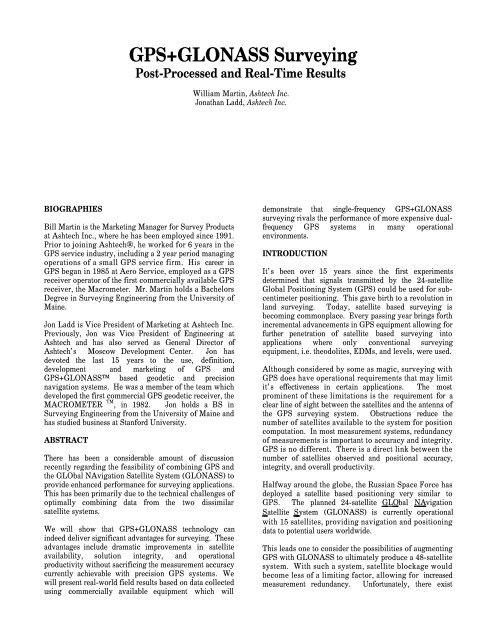
GPS+GLONASS Surveying
GPS+GLONASS Surveying
GPS+GLONASS Surveying

Create successful ePaper yourself
Turn your PDF publications into a flip-book with our unique Google optimized e-Paper software.
BIOGRAPHIES<br />
<strong>GPS+GLONASS</strong> <strong>Surveying</strong><br />
Post-Processed and Real-Time Results<br />
Bill Martin is the Marketing Manager for Survey Products<br />
at Ashtech Inc., where he has been employed since 1991.<br />
Prior to joining Ashtech®, he worked for 6 years in the<br />
GPS service industry, including a 2 year period managing<br />
operations of a small GPS service firm. His career in<br />
GPS began in 1985 at Aero Service, employed as a GPS<br />
receiver operator of the first commercially available GPS<br />
receiver, the Macrometer. Mr. Martin holds a Bachelors<br />
Degree in <strong>Surveying</strong> Engineering from the University of<br />
Maine.<br />
Jon Ladd is Vice President of Marketing at Ashtech Inc.<br />
Previously, Jon was Vice President of Engineering at<br />
Ashtech and has also served as General Director of<br />
Ashtech’s Moscow Development Center. Jon has<br />
devoted the last 15 years to the use, definition,<br />
development and marketing of GPS and<br />
<strong>GPS+GLONASS</strong> based geodetic and precision<br />
navigation systems. He was a member of the team which<br />
developed the first commercial GPS geodetic receiver, the<br />
MACROMETER TM , in 1982. Jon holds a BS in<br />
<strong>Surveying</strong> Engineering from the University of Maine and<br />
has studied business at Stanford University.<br />
ABSTRACT<br />
There has been a considerable amount of discussion<br />
recently regarding the feasibility of combining GPS and<br />
the GLObal NAvigation Satellite System (GLONASS) to<br />
provide enhanced performance for surveying applications.<br />
This has been primarily due to the technical challenges of<br />
optimally combining data from the two dissimilar<br />
satellite systems.<br />
We will show that <strong>GPS+GLONASS</strong> technology can<br />
indeed deliver significant advantages for surveying. These<br />
advantages include dramatic improvements in satellite<br />
availability, solution integrity, and operational<br />
productivity without sacrificing the measurement accuracy<br />
currently achievable with precision GPS systems. We<br />
will present real-world field results based on data collected<br />
using commercially available equipment which will<br />
William Martin, Ashtech Inc.<br />
Jonathan Ladd, Ashtech Inc.<br />
demonstrate that single-frequency <strong>GPS+GLONASS</strong><br />
surveying rivals the performance of more expensive dualfrequency<br />
GPS systems in many operational<br />
environments.<br />
INTRODUCTION<br />
It’s been over 15 years since the first experiments<br />
determined that signals transmitted by the 24-satellite<br />
Global Positioning System (GPS) could be used for subcentimeter<br />
positioning. This gave birth to a revolution in<br />
land surveying. Today, satellite based surveying is<br />
becoming commonplace. Every passing year brings forth<br />
incremental advancements in GPS equipment allowing for<br />
further penetration of satellite based surveying into<br />
applications where only conventional surveying<br />
equipment, i.e. theodolites, EDMs, and levels, were used.<br />
Although considered by some as magic, surveying with<br />
GPS does have operational requirements that may limit<br />
it’s effectiveness in certain applications. The most<br />
prominent of these limitations is the requirement for a<br />
clear line of sight between the satellites and the antenna of<br />
the GPS surveying system. Obstructions reduce the<br />
number of satellites available to the system for position<br />
computation. In most measurement systems, redundancy<br />
of measurements is important to accuracy and integrity.<br />
GPS is no different. There is a direct link between the<br />
number of satellites observed and positional accuracy,<br />
integrity, and overall productivity.<br />
Halfway around the globe, the Russian Space Force has<br />
deployed a satellite based positioning very similar to<br />
GPS. The planned 24-satellite GLO bal NA vigation<br />
S atellite S ystem (GLONASS) is currently operational<br />
with 15 satellites, providing navigation and positioning<br />
data to potential users worldwide.<br />
This leads one to consider the possibilities of augmenting<br />
GPS with GLONASS to ultimately produce a 48-satellite<br />
system. With such a system, satellite blockage would<br />
become less of a limiting factor, allowing for increased<br />
measurement redundancy. Unfortunately, there exist
significant technological hurdles in combining the two<br />
systems into one in order to produce survey grade<br />
accuracies. Overcoming these hurdles opens the door to<br />
the potential of enhanced performance in surveying<br />
applications.<br />
ADVANTAGES OF SATELLITE AVAILABILITY<br />
Ask a surveyor what qualities she/he desires in a precision<br />
surveying system. The response includes adjectives like<br />
integrity, accuracy, and productivity. For a satellite based<br />
surveying system, these qualities are largely dependent on<br />
the availability of satellites at the time of data collection.<br />
Productivity<br />
Point occupation times for GPS surveying are based on<br />
the amount of time required to determine the correct set of<br />
integer phase ambiguities, which facilitates determination<br />
of an accurate centimeter-level position. The more data<br />
used to determine the ambiguities, i.e. longer observation<br />
or more satellites, the greater the integrity of the solution.<br />
Users requiring the highest levels of productivity will<br />
normally utilize either Rapid Static (post processed) or<br />
Kinematic (real-time or post processed) modes of GPS<br />
surveying. These modes rely on the ability to quickly<br />
determine the correct set of integer ambiguities. As the<br />
number of satellites used in the position determination<br />
increases, the speed at which these integer ambiguities can<br />
be determined increases, enabling the user to spend more<br />
time surveying and less time ‘initializing’ the system.<br />
Integrity<br />
The integrity of a surveyed position using a satellite<br />
based system depends largely on the number of satellites<br />
used in the position computation. This is especially true<br />
when the user is seeking the highest levels of<br />
productivity, as described in the previous paragraph.<br />
High productivity requires determination of the correct set<br />
of integer ambiguities as quickly as possible, i.e. using as<br />
little data as possible. The risk is the possibility of<br />
selecting the wrong set of integer ambiguities, resulting in<br />
an inaccurate position determination. Successfully<br />
selecting the correct set of ambiguities is directly linked<br />
to time and satellite availability. Since the goal is to<br />
minimize the time, i.e. increase productivity, the number<br />
of available satellites becomes the driving factor. As the<br />
number of satellites used in the position determination<br />
increases, the likelihood of selecting the incorrect set of<br />
integer ambiguities decreases, raising the level of integrity<br />
in the system.<br />
Accuracy<br />
The geometry of the observed satellites directly affects the<br />
accuracy of the position determination. The various<br />
Dilution of Precision (DOP) values are measures of the<br />
satellite geometry and can be used to predict attainable<br />
accuracy. The lower the DOP value, the more accurate<br />
the measurement. Increase the number of satellites<br />
observed during data collection and you will find, in most<br />
cases, that the geometry improves. Improved geometry<br />
lowers DOP values, which in turn increases accuracy.<br />
GPS CONSTELLATION<br />
With 24 GPS satellites, 7 satellites typically are visible<br />
10 degrees or more above the horizon. In mountainous<br />
terrain, under tree canopy, among tall buildings, and in<br />
open pit mines, the number of visible GPS satellites is<br />
reduced. In some cases, blockage can be so severe that<br />
the system will fail to determine a position, rendering the<br />
area off limits to GPS surveying.<br />
THE <strong>GPS+GLONASS</strong> ADVANTAGE<br />
Using a combined 48 satellite <strong>GPS+GLONASS</strong><br />
constellation, a surveyor can expect the number of<br />
available satellites to increase to a minimum of 8, an<br />
average of 14, and a maximum of 20 above a mask angle<br />
of 10 degrees in most parts of the world.<br />
In obstructed areas, the combined system significantly<br />
increases the likelihood of satellites being in visible<br />
portions of the sky. Locations once deemed off limits to<br />
GPS surveying become candidates for <strong>GPS+GLONASS</strong>.<br />
Clearly, <strong>GPS+GLONASS</strong> technology has a dramatic<br />
effect on satellite availability. The following experiments<br />
demonstrate that this increased availability translates into<br />
measurable benefits in positional integrity, positional<br />
accuracy, and overall productivity.<br />
FIELD RESULTS - POST-PROCESSED RAPID<br />
STATIC APPLICATION<br />
This section presents results from data collected with<br />
<strong>GPS+GLONASS</strong> receivers. These data are compared to<br />
data collected with GPS only receivers.<br />
On June 11, 1997, a 12 hour observation was performed<br />
on a 3.5 km baseline between points TG10 and MG. At<br />
point TG10, one antenna was connected to two different<br />
receivers, a dual frequency GPS receiver and a single<br />
frequency <strong>GPS+GLONASS</strong> receiver. Point MG had a<br />
similar setup.<br />
On June 12, 1997, an identical setup was used to collect a<br />
12 hour observation on a 19 km baseline between points<br />
TG10 and BM.<br />
The 3.5 km was processed using all 12 hours of data,<br />
holding fixed the known position at TG10. The<br />
processing resulted in two solutions for MG, one between<br />
the two dual frequency GPS receivers and one between the<br />
two single frequency <strong>GPS+GLONASS</strong> receivers. The 19<br />
km baseline was processed in the same manner.<br />
Table 1 shows the results of this data processing. The<br />
position determined for MG and BM are listed twice, one<br />
being determined by the GPS receivers and the other
eing determined by the <strong>GPS+GLONASS</strong> receivers. The<br />
bottom of the table shows the positional difference<br />
between the two methods of determining the position. As<br />
you can see by the millimeter level differences, there is no<br />
adverse effect on the position determination by adding<br />
GLONASS to GPS.<br />
Table 1, Compatibility of GPS and <strong>GPS+GLONASS</strong><br />
derived positions<br />
Point MG Point BM<br />
3.5 km baseline 19 km baseline<br />
Dual<br />
GPS<br />
Frequency<br />
Latitude 37 20 30.92594 37 15 08.80695<br />
Longitude 121 59 33.01407 121<br />
51.17623<br />
50<br />
Height 8.780 20.360<br />
Single Frequency<br />
<strong>GPS+GLONASS</strong><br />
Latitude 37 20 30.92586 37 15 08.80674<br />
Longitude 121 59 121 50<br />
33.01412 51.17639<br />
Height 8.782 20.364<br />
Delta Position<br />
Latitude 0.002 meters -0.006 meters<br />
Longitude -0.001 meters -0.004 meters<br />
Height -0.002 meters -0.004 meters<br />
For use in later accuracy comparisons, the average of the<br />
GPS determined position and the <strong>GPS+GLONASS</strong><br />
determined position for MG and BM will be considered<br />
the known position of these points.<br />
Although the results of the above comparison were<br />
interesting, 12 hour observations do not qualify as high<br />
productivity. The next step in the analysis was to<br />
determine how well the single frequency<br />
<strong>GPS+GLONASS</strong> receivers performed in Rapid Static<br />
mode.<br />
For this comparison, the 12 hour GPS and<br />
<strong>GPS+GLONASS</strong> observations on the 3.5 km baseline<br />
were segmented into seventy two 10 minute observations.<br />
All segments were processed. The GPS segments where<br />
processed in two ways; single frequency GPS and dual<br />
frequency GPS. The 19 km baseline was segmented in<br />
15 minute observations resulting in 48 separate segments<br />
and then processed in the same way.<br />
All processed segments were examined to determine if<br />
enough data was present to produce an ambiguities fixed,<br />
centimeter level solution. Figure 1 shows the percentage<br />
of segments resulting in such a solution.<br />
% Ambiguity Fixed Solutions<br />
100%<br />
90%<br />
80%<br />
70%<br />
60%<br />
50%<br />
40%<br />
30%<br />
20%<br />
10%<br />
0%<br />
GPS v. <strong>GPS+GLONASS</strong> Rapid Static Performance<br />
Single Frequency GPS (5-8sv)<br />
Single Frequency <strong>GPS+GLONASS</strong> (8-15sv)<br />
Dual Frequency GPS (5-8sv)<br />
67%<br />
100% 100% 100%<br />
97%<br />
3.5 Km Baseline<br />
10 min. obs.<br />
8.9 Km Baseline<br />
10 min. obs.<br />
29%<br />
65%<br />
98%<br />
19 Km Baseline<br />
15 min. obs.<br />
Figure 1, Comparison of Rapid Static performance<br />
between GPS and <strong>GPS+GLONASS</strong><br />
In a separate experiment, 3 hours of <strong>GPS+GLONASS</strong><br />
data was collected on an 8.9 km baseline. The data was<br />
segmented into eighteen 10 minute observations. Each<br />
segment was processed. Figure 1 includes the percentage<br />
of the 18 segments that produced an ambiguities fixed<br />
solution. In this experiment, no dual frequency GPS<br />
receiver was used to collect simultaneous data therefore a<br />
comparison could not be made. This data is included in<br />
the figure to give some idea of the capability of the single<br />
frequency <strong>GPS+GLONASS</strong> system on a medium length<br />
baseline.<br />
The following key points can be extracted from figure 1:<br />
• For ‘shorter’ baselines, single frequency<br />
<strong>GPS+GLONASS</strong> performance approaches that of dual<br />
frequency GPS, proving it’s viability as a Rapid<br />
Static surveying solution.<br />
• For ‘longer’ baselines, dual frequency GPS clearly<br />
outperforms single frequency <strong>GPS+GLONASS</strong>,<br />
probably due to growing systematic errors, e.g.<br />
ionosphere.<br />
Next, the accuracy of the 3.5 km and 19 km solutions are<br />
compared. The 3.5 km baseline is examined first. As<br />
stated earlier, the 12 hour observation was segmented into<br />
seventy two 10 minutes segments. Each segment was<br />
processed resulting in 72 GPS positions for point MG<br />
and 72 <strong>GPS+GLONASS</strong> positions for point MG. The<br />
differences between the known position of point MG<br />
(average of 12 hour GPS and <strong>GPS+GLONASS</strong> solution)<br />
and the position determined from each the seventy two 10<br />
minute segments were computed. Figure 4 plots these<br />
differences for the dual frequency GPS segments. Figure 5<br />
plots the differences for the single frequency<br />
<strong>GPS+GLONASS</strong> segments. Any segment that did not<br />
result in an ambiguities fixed solution was not included<br />
in the plots. In this case, only one segment did not fix<br />
ambiguities. This was one of the <strong>GPS+GLONASS</strong><br />
segments. Therefore, figure 2 contains 72 position<br />
differences and figure 3 contains 71.
meters<br />
Dual Frequency GPS Horizontal Position Accuracy<br />
3.5 km baseline - 10 minute observations<br />
0.050<br />
0.040<br />
0.030<br />
0.020<br />
0.010<br />
0.000<br />
-0.010<br />
-0.020<br />
-0.030<br />
-0.040<br />
-0.050<br />
-0.050<br />
-0.040<br />
Horizontal Standard Deviation = 0.7 cm<br />
-0.030<br />
-0.020<br />
-0.010<br />
0.000<br />
meters<br />
0.010<br />
0.020<br />
0.030<br />
0.040<br />
0.050<br />
Vertical<br />
Standard<br />
Deviation = 1.1 cm<br />
Figure 2, ‘Short’ baseline position accuracy of Rapid<br />
Static observations using dual frequency GPS<br />
meters<br />
Single Freq <strong>GPS+GLONASS</strong> Horizontal Position Acc.<br />
3.5 km baseline - 10 minute observations<br />
0.050<br />
0.040<br />
0.030<br />
0.020<br />
0.010<br />
0.000<br />
-0.010<br />
-0.020<br />
-0.030<br />
-0.040<br />
-0.050<br />
-0.050<br />
-0.040<br />
Horizontal Standard Deviation = 0.7 cm<br />
-0.030<br />
-0.020<br />
-0.010<br />
0.000<br />
meters<br />
0.010<br />
0.020<br />
0.030<br />
0.040<br />
0.050<br />
Vertical<br />
Standard<br />
Deviation = 1.0 cm<br />
Figure 3, ‘Short’ baseline position accuracy of Rapid<br />
Static observations using single frequency<br />
<strong>GPS+GLONASS</strong><br />
The horizontal and vertical standard deviations are listed<br />
on each plot. As can be seen from the plots and the listed<br />
standard deviations, there is no distinguishable difference<br />
in horizontal accuracy between GPS and<br />
<strong>GPS+GLONASS</strong>.<br />
Segmenting the 19 km baseline into 15 minute<br />
observations resulted in 48 separate solutions for point<br />
BM. Figures 4 and 5 plot the differences between the<br />
known position for point BM and the position determined<br />
from the 15 minute segments for the GPS and<br />
<strong>GPS+GLONASS</strong> solutions, respectively. Again, those<br />
segments not resulting in ambiguities fixed solutions are<br />
not plotted. Only one of the dual frequency GPS<br />
segments did not fix ambiguities so figure 4 contains 47<br />
separate solutions. Seventeen of the <strong>GPS+GLONASS</strong><br />
segments did not result in fixed ambiguities therefore<br />
figure 5 contains 31 separate solutions.<br />
meters<br />
Dual Frequency GPS Horizontal Position Accuracy<br />
19 km baseline - 15 minute observations<br />
0.050<br />
0.040<br />
0.030<br />
0.020<br />
0.010<br />
0.000<br />
-0.010<br />
-0.020<br />
-0.030<br />
-0.040<br />
-0.050<br />
-0.050<br />
-0.040<br />
Horizontal Standard Deviation = 1.4 cm<br />
-0.030<br />
-0.020<br />
-0.010<br />
0.000<br />
meters<br />
0.010<br />
0.020<br />
0.030<br />
0.040<br />
0.050<br />
Vertical<br />
Standard<br />
Deviation = 2.6 cm<br />
Figure 4, ‘Long’ baseline position accuracy of Rapid<br />
Static observations using dual frequency GPS
meters<br />
Single Freq <strong>GPS+GLONASS</strong> Horizontal Position Acc.<br />
19 km baseline - 15 minute observations<br />
0.050<br />
0.040<br />
0.030<br />
0.020<br />
0.010<br />
0.000<br />
-0.010<br />
-0.020<br />
-0.030<br />
-0.040<br />
-0.050<br />
-0.050<br />
-0.040<br />
Horizontal Standard Deviation = 1.4 cm<br />
-0.030<br />
-0.020<br />
-0.010<br />
0.000<br />
meters<br />
0.010<br />
0.020<br />
0.030<br />
0.040<br />
0.050<br />
Vertical<br />
Standard<br />
Deviation = 1.8 cm<br />
Figure 5, ‘Long’ baseline position accuracy of Rapid<br />
Static observations using single frequency<br />
<strong>GPS+GLONASS</strong><br />
The horizontal and vertical standard deviations are again<br />
listed on each plot. As in the 3.5 km baseline, the<br />
horizontal accuracy between GPS and <strong>GPS+GLONASS</strong><br />
are identical. The vertical standard deviations, on the<br />
other hand, are quite different. The <strong>GPS+GLONASS</strong><br />
vertical standard deviation seems to be about 30% better.<br />
Why? Better geometry.<br />
Figures 6 shows the Horizontal and Vertical DOP values<br />
for the GPS satellites for the 12 hour observation currently<br />
being analyzed. Figure 7 shows the HDOP and VDOP<br />
for the <strong>GPS+GLONASS</strong> satellites during the same<br />
period.<br />
GPS Dilution of Precision<br />
Average GPS HDOP = 1.5 Average GPS VDOP = 2.7<br />
Figure 6, GPS HDOP and VDOP for test data period<br />
<strong>GPS+GLONASS</strong> Dilution of Precision<br />
Average <strong>GPS+GLONASS</strong> HDOP = 1.1 Average <strong>GPS+GLONASS</strong> VDOP = 1.9<br />
Figure 7, <strong>GPS+GLONASS</strong> HDOP and VDOP for test<br />
data period<br />
Listed on each figure is the average HDOP and VDOP.<br />
The VDOP for the <strong>GPS+GLONASS</strong> constellation is<br />
approximately 30% better than the VDOP for GPS only,<br />
possibly explaining the 30% accuracy improvement.<br />
Better geometry results in better accuracy.<br />
Interestingly, the <strong>GPS+GLONASS</strong> HDOP is also<br />
approximately 30% better than the GPS HDOP. Why<br />
did this not translate into a better horizontal accuracy for<br />
the <strong>GPS+GLONASS</strong> solutions? This will have to be<br />
investigated further.<br />
PRELIMINARY <strong>GPS+GLONASS</strong> REAL-TIME<br />
KINEMATIC RESULTS<br />
The <strong>GPS+GLONASS</strong> Real-Time Kinematic (GG RTK)<br />
results presented here are preliminary. The RTK<br />
algorithms have just recently been integrated into the<br />
<strong>GPS+GLONASS</strong> receivers. The focus has been on<br />
tuning and testing of the algorithm on short baselines.<br />
During this tuning and testing phase, a significant amount<br />
of data has been collected on a well established 7 meter<br />
baseline on the roof of the Ashtech building. Following<br />
are the compiled results:<br />
GG RTK: 7 meter baseline<br />
• 2 GG-24 receivers running GG RTK algorithm<br />
• Points on Ashtech rooftop test range<br />
• 9921 solutions examined<br />
• 99.6% reliability observed<br />
• 50% of solutions fixed within 2 secs<br />
• 95% of solutions fixed within 97 secs<br />
• Horizontal Standard Deviation = 1 cm<br />
To elaborate on some of the data listed above, 9921<br />
ambiguity fixed solutions were examined. Of these<br />
solutions, 99.6% of them correctly fixed ambiguities,<br />
0.4% incorrectly fixed ambiguities resulting in an<br />
incorrect solution. This is one area of concentration. The<br />
goal is to support 99.9% reliability. Of the 9921<br />
ambiguity fixed solutions, 50% of them fixed ambiguities
within 2 seconds after acquiring satellites, 95% fixed<br />
ambiguities within 97 secs. These are very fast<br />
ambiguity resolution times. Data collected on the same<br />
baseline using a dual frequency GPS receiver resulted in a<br />
50% fix time of 35 seconds and a 95% fix time of 125<br />
seconds.<br />
A data set on a slightly longer baseline was collected by<br />
one of our beta test sites. Following are the results of<br />
their experiment:<br />
GG RTK: 700 meter baseline<br />
• 2 GG-24 receivers running GG RTK algorithm<br />
• Results from a beta site<br />
• 625 solutions examined<br />
• 100% reliability<br />
• 50% of solutions fixed within 2 secs<br />
• Maximum fix time: 138 secs<br />
In more detail, this beta customer collected data on a 700<br />
meter baseline. A total of 625 ambiguities fixed solutions<br />
were examined. Of these solutions, 100% fixed<br />
ambiguities correctly, none of the 625 solutions were<br />
incorrect. Of the 625 solutions, 50% of them fixed<br />
ambiguities within 2 seconds after acquiring satellites.<br />
Interestingly, this is the same for the 7 meter baseline.<br />
The 95% number is not available but the beta site did<br />
indicate that the maximum time to fix ambiguities was<br />
138 seconds.<br />
Again, it must be stressed this is preliminary data on the<br />
RTK performance. The concentration has been on short<br />
baseline testing and tuning of the system. It was hoped<br />
that longer baseline results would be available but there is<br />
none at this time. Although, there is little doubt that the<br />
GG RTK system will function well on longer baselines.<br />
This optimism is based partly on the fact that longer<br />
baseline data has been analyzed using the GG RTK<br />
algorithm running on a PC, prior to integration into the<br />
GG-24 receiver. These results look very promising.<br />
CONCLUSION<br />
Our analysis of GPS and <strong>GPS+GLONASS</strong> data supports<br />
the following two points:<br />
1. Single frequency <strong>GPS+GLONASS</strong> is a viable<br />
solution for robust Rapid Static surveying.<br />
2. The added satellite availability inherent in<br />
<strong>GPS+GLONASS</strong> provides improved positional<br />
integrity and accuracy, and overall productivity.<br />
Figures 1 clearly shows that single frequency<br />
<strong>GPS+GLONASS</strong> is superior to single frequency GPS in<br />
performing Rapid Static surveys. They also show that<br />
single frequency <strong>GPS+GLONASS</strong> is on par with dual<br />
frequency GPS in performing Rapid Static surveys on<br />
‘shorter’ baselines. As the baselines get ‘longer’, dual<br />
frequency GPS is superior, probably due to the ability to<br />
remove systematic errors associated with ionosphere.<br />
Increased productivity was certainly demonstrated when<br />
comparing single frequency GPS to single frequency<br />
<strong>GPS+GLONASS</strong>. Comparing single frequency<br />
<strong>GPS+GLONASS</strong> to dual frequency GPS resulted in<br />
similar capabilities on ‘shorter’ baselines.<br />
<strong>GPS+GLONASS</strong> seems to promise improvements in<br />
accuracy, mainly due to improved geometry. This proved<br />
especially true in the vertical component when analyzing<br />
the data used in the experiment. More data will need to<br />
be collected to better qualify these potential<br />
improvements.<br />
Finally, single frequency <strong>GPS+GLONASS</strong> promises to<br />
be a viable Real-Time Kinematic solution, with the<br />
potential of surpassing dual frequency GPS in speed and<br />
accuracy on ‘shorter’ baselines.<br />
The enhanced performance demonstrated in these tests can<br />
be attributed to one simple fact; more satellites are better.<br />
<strong>GPS+GLONASS</strong> technology simply provides the user<br />
today with the advantages of an expanded satellite system.<br />
REFERENCES<br />
William Martin and Frank van Diggelen,<br />
“<strong>GPS+GLONASS</strong> Technology”, Geomatics Info<br />
Magazine, April 1997, pp. 73-75<br />
S.A. Gourevitch, S.Sila-Novitsky, and F. van Diggelen,<br />
“The GG24 Combined <strong>GPS+GLONASS</strong> Receiver”,<br />
Proceedings of ION GPS-96, Kansas City, Mo.,<br />
September, 1996<br />
R.G. Lorenz and S.A. Gourevitch, “The Z-12<br />
Performance Advantage”, Proceedings of the ION<br />
National Technical Meeting, Anaheim, Ca, January, 1995<br />
J.M. Nolan, I.R. Webster, S.A. Gourevitch, and<br />
J.W.Ladd, “Rapid Static <strong>Surveying</strong> with an Operational<br />
GPS System”, , Proceedings of ION GPS-93, Salt Lake<br />
City, Utah, September, 1993<br />
Ashtech is a registered trademark of Ashtech Inc. <strong>GPS+GLONASS</strong> is<br />
a trademark of Ashtech Inc. Other product names or trademarks are<br />
the property of their respective owners.