

GPR for river dyke - GSB
GPR for river dyke - GSB
GPR for river dyke - GSB

Create successful ePaper yourself
Turn your PDF publications into a flip-book with our unique Google optimized e-Paper software.
new pitch road has been made. The third layer may represent compacted soil below the preexisting<br />
footpath. Below the third layer earth fill that is the layer 4 <strong>for</strong>med by silty clay to clay<br />
materials found with slight variation of materials, compactness and wetness.<br />
Each division of the vertical axis is 20 ns representing a depth of 1m with the assumption of<br />
the wave speed 10 cm/ns. So the approximate depth of layers 1, 2 and 3 are about 0.5 m<br />
each. Due to their thinness, it is very hard to differentiate among pitch, brick and brick chips<br />
zone within the uppermost layer (layer 1). Horn antenna or 60cm length antenna may give<br />
good result <strong>for</strong> identification of pitch layer in the uppermost layer.<br />
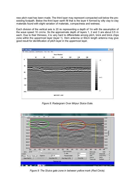
Figure 8: Radargram Over Mirpur Sluice Gate.<br />
Figure 9: The Sluice gate zone in between yellow mark (Red Circle).