

GPR for river dyke - GSB
GPR for river dyke - GSB
GPR for river dyke - GSB

Create successful ePaper yourself
Turn your PDF publications into a flip-book with our unique Google optimized e-Paper software.
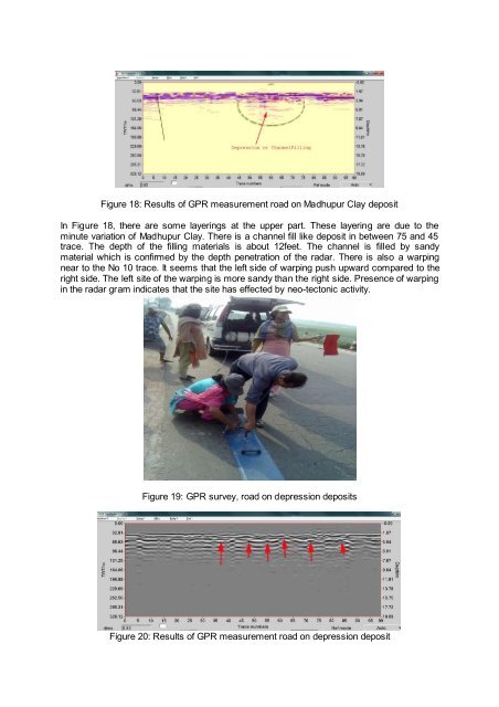
Figure 18: Results of <strong>GPR</strong> measurement road on Madhupur Clay deposit<br />
In Figure 18, there are some layerings at the upper part. These layering are due to the<br />
minute variation of Madhupur Clay. There is a channel fill like deposit in between 75 and 45<br />
trace. The depth of the filling materials is about 12feet. The channel is filled by sandy<br />
material which is confirmed by the depth penetration of the radar. There is also a warping<br />
near to the No 10 trace. It seems that the left side of warping push upward compared to the<br />
right side. The left site of the warping is more sandy than the right side. Presence of warping<br />
in the radar gram indicates that the site has effected by neo-tectonic activity.<br />
Figure 19: <strong>GPR</strong> survey, road on depression deposits<br />
Figure 20: Results of <strong>GPR</strong> measurement road on depression deposit