

GPR for river dyke - GSB
GPR for river dyke - GSB
GPR for river dyke - GSB

You also want an ePaper? Increase the reach of your titles
YUMPU automatically turns print PDFs into web optimized ePapers that Google loves.
Figure 15 shows the radargram <strong>for</strong> <strong>GPR</strong> measurement on the highway beside Prottasha<br />
bridge. From this figure one can clearly see that the ground structure of the section between<br />
two yellow lines (trace number 125 to 265) is different to the adjacent sections at both sides.<br />
This is the section when the <strong>GPR</strong> moves close to the bridge connecting road. The red lines<br />
show the reflections from a shallow layer (brick to sand interface?). At trace numbers 30, 85,<br />
330, there may be reflections from pipes or cables under the highway.<br />
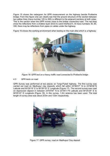
Figure 16 shows the working environment when testing on the main dike which is a highway.<br />
Figure 16: <strong>GPR</strong> test on a heavy traffic road connected to Prottasha bridge<br />
4.3 <strong>GPR</strong> tests on road<br />
<strong>GPR</strong> Survey was per<strong>for</strong>med at two places on Tongi-Pubail highway. The first survey was<br />
carried out road on Madhupur clay deposits which fall within 23º56′07″ N to 23º56′06″N<br />
Latitude and 90º28′19″ E to 90º28′19″ E Longitude (Figure 17). The second survey was road<br />
on depression deposit in between 23º54′54″ N to 23º54′51″N Latitude and 90º25′28″ E to<br />
90º25′23″ E Longitude (Figure 19). In this survey, 1.2m antenna has been used. The total<br />
length of survey area was about 203m and 133m respectively.<br />
Figure 17: <strong>GPR</strong> survey, road on Madhupur Clay deposit