

Download - Coordinates
Download - Coordinates
Download - Coordinates

You also want an ePaper? Increase the reach of your titles
YUMPU automatically turns print PDFs into web optimized ePapers that Google loves.
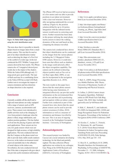
Figure 16: Nokia 6500 image processed<br />
using the circle identifi cation script<br />
The tests show that it is possible to identify<br />
shapes based on images taken from a smart<br />
phone camera. This can then be used as<br />
part of an object identi cation routine<br />
such as detecting the shape of a Fire Exit<br />
or the symbol of a toilet sign. In the test<br />
conducted the HTC Wild re 5 mega pixel<br />
camera showed the best results. The iPhone<br />
camera also of 5 megapixel showed poor<br />
results due to the impact of the shadow.<br />
While the Nokia 6500 although only 3.2<br />
mega pixels gave good results. The type<br />
of ash used may be a contributing factor<br />
as the Nokia 6500 has as dual LED ash.<br />
Further tests to investigate the impact of<br />
camera orientation and lens distortion<br />
on shape detection is also required.<br />
Conclusion<br />
Currently available off-the-shelf mid to<br />
high-end smart phones are today equipped<br />
with a range of sensors such as GPS<br />
receivers, cameras, accelerometers and<br />
gyros. These sensors were introduced to<br />
enable activities such as the changing of<br />
view from portrait to landscape when the<br />
phone is tilted, image stabilization, and<br />
outdoor position guidance. This has further<br />
evolved into the playing of games and other<br />
such applications. These sensors are low<br />
cost, low grade sensors which were not<br />
designed for high accuracy or high reliability<br />
applications. The tests conducted showed<br />
that the Compass on the phone tested was<br />
able to provide fairly stable results outdoors<br />
however, in the indoor environment tested<br />
it proved unreliable due to the in uence<br />
of metal objects in the indoor area.<br />
Nevertheless, the tests conducted showed<br />
that if this data is integrated with gyro data it<br />
can provide useful orientation information.<br />
26 | <strong>Coordinates</strong> May 2012<br />
The iPhone GPS receiver had an accuracy<br />
of a few metres and was able to provide<br />
positions in an indoor environment<br />
with a clear roof structure. However<br />
after navigating underneath the covered<br />
walkway (Figure 4), the position<br />
solution drifted by up to 24 metres.<br />
Integration with the onboard inertia<br />
sensors would assist in correcting such<br />
errors. Further research has been done<br />
in this project utilising the smart phone<br />
inertia sensors to detect the walking<br />
dynamics of the user and based on this,<br />
computing the distance travelled.<br />
The camera tests conducted have shown<br />
that object identi cation can be conducted<br />
on the images from the various phones<br />
including the 3.2 Megapixel Nokia<br />
6500 camera. However, it could also<br />
been seen that effects such as shadows<br />
in the image could adversely affect<br />
the object recognition capability. The<br />
camera can be utilised in detecting<br />
objects/symbols such as Fire exit or<br />
wet oor signs (Bail, 2009), or can<br />
also be incorporated in the navigation<br />
algorithm (Kessler et al., 2010).<br />
The tests results in this paper have<br />
shown that the smart phone sensors<br />
while having some limitations, if<br />
integrated effectively can provide useful<br />
information on the environmental ow<br />
of the user and thus aid in positioning<br />
and navigation within an indoor context.<br />
Further tests conducted as part of this<br />
research have also shown that the smart<br />
phone sensors can be used to provide<br />
context awareness (Collins, 2010)<br />
information as well as a measure of<br />
orientation and distance travelled by<br />
the user. This is an area of ongoing<br />
research at the Nottingham Geospatial<br />
Institute - University of Nottingham.<br />
Acknowledgements<br />
This research project was funded by<br />
Caecus Ltd a social enterprise developing<br />
technology for the blind and partially<br />
sighted. The data collection iPhone<br />
application was written by my colleague<br />
Gary Wang at the GNSS Research and<br />
Applications Centre of Excellence<br />
(GRACE), University of Nottingham.<br />
References<br />
1. http://www.apple.com/iphone/specs.<br />
html (Last Accessed December 2010)<br />
2. http://developer.apple.com/library/<br />
ios/#referencelibrary/GettingStarted/<br />
Creating_an_iPhone_App/index.html<br />
(Last Accessed December 2010)<br />
3. http://www.htc.com/www/product/<br />
wild re/speci cation.html (Last<br />
Accessed December 2010)<br />
4. http://kitchen.cs.cmu.edu/<br />
Home/3DM-GX1-Datasheet-Rev-1.<br />
pdf (Last Accessed December 2010)<br />
5. http:// les.microstrain.com/<br />
product_datasheets/3DM-GX3-25_<br />
datasheet_version_1.07a.pdf (Last<br />
Access November 2011)<br />
6. http://www.nokia.co.uk/ nd-products/<br />
all-phones/nokia-6500-slide/speci cations<br />
(Last Accessed December 2010)<br />
7. Bail, S., (2009), Image Processing<br />
on a Mobile Platform. MSc Thesis,<br />
University of Manchester, Faculty of<br />
Engineering and Physical Sciences.<br />
8. Collins, J, (2010) Context Aware<br />
Navigation Algorithms. Published<br />
online in GPS World Tech Talk Blog<br />
August 13th, 2010. http://techtalk.sidt.<br />
gpsworld.com/?p=645#more-645<br />
9. Hide, C., Botterill, T., and Andreotti,<br />
M. (2009) An Integrated IMU, GNSS and<br />
Image Recognition Sensor for Pedestrian<br />
Navigation. Proceedings of the Institute of<br />
Navigation (ION) GNSS Conference 2009.<br />
10. Kessler, C., Ascher, C., Frietsch,<br />
N., Weinmann, M., and Trommer,<br />
G. F. (2010) Vision-Based Attitude<br />
Estimation for Indoor Navigation using<br />
Vanishing Points and Lines Proceeding<br />
of ION/IEEE PLANS, Palm Springs,<br />
USA, May 2010, pp 310 - 318.<br />
11. Ross D. A., and Blasch, B. B. (2000).<br />
Wearable Interfaces for Orientation and<br />
Way nding. In Proceedings of ASSETS00,<br />
November 13 – 15, 2000, Arlington,<br />
Virginia. ACM 1-58113-314-8/00/0011.


