Volcanism in Iceland in historical time: Volcano types, eruption ...
Volcanism in Iceland in historical time: Volcano types, eruption ...
Volcanism in Iceland in historical time: Volcano types, eruption ...

You also want an ePaper? Increase the reach of your titles
YUMPU automatically turns print PDFs into web optimized ePapers that Google loves.
Abstract<br />
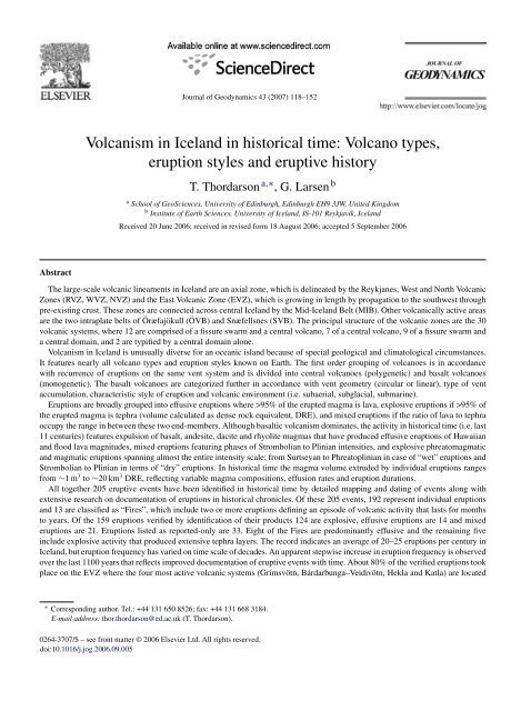
Journal of Geodynamics 43 (2007) 118–152<br />
<strong>Volcanism</strong> <strong>in</strong> <strong>Iceland</strong> <strong>in</strong> <strong>historical</strong> <strong>time</strong>: <strong>Volcano</strong> <strong>types</strong>,<br />
<strong>eruption</strong> styles and eruptive history<br />
T. Thordarson a,∗ , G. Larsen b<br />
a School of GeoSciences, University of Ed<strong>in</strong>burgh, Ed<strong>in</strong>burgh EH9 3JW, United K<strong>in</strong>gdom<br />
b Institute of Earth Sciences, University of <strong>Iceland</strong>, IS-101 Reykjavík, <strong>Iceland</strong><br />
Received 20 June 2006; received <strong>in</strong> revised form 18 August 2006; accepted 5 September 2006<br />
The large-scale volcanic l<strong>in</strong>eaments <strong>in</strong> <strong>Iceland</strong> are an axial zone, which is del<strong>in</strong>eated by the Reykjanes, West and North Volcanic<br />
Zones (RVZ, WVZ, NVZ) and the East Volcanic Zone (EVZ), which is grow<strong>in</strong>g <strong>in</strong> length by propagation to the southwest through<br />
pre-exist<strong>in</strong>g crust. These zones are connected across central <strong>Iceland</strong> by the Mid-<strong>Iceland</strong> Belt (MIB). Other volcanically active areas<br />
are the two <strong>in</strong>traplate belts of Öræfajökull (ÖVB) and Snæfellsnes (SVB). The pr<strong>in</strong>cipal structure of the volcanic zones are the 30<br />
volcanic systems, where 12 are comprised of a fissure swarm and a central volcano, 7 of a central volcano, 9 of a fissure swarm and<br />
a central doma<strong>in</strong>, and 2 are typified by a central doma<strong>in</strong> alone.<br />
<strong>Volcanism</strong> <strong>in</strong> <strong>Iceland</strong> is unusually diverse for an oceanic island because of special geological and climatological circumstances.<br />
It features nearly all volcano <strong>types</strong> and <strong>eruption</strong> styles known on Earth. The first order group<strong>in</strong>g of volcanoes is <strong>in</strong> accordance<br />
with recurrence of <strong>eruption</strong>s on the same vent system and is divided <strong>in</strong>to central volcanoes (polygenetic) and basalt volcanoes<br />
(monogenetic). The basalt volcanoes are categorized further <strong>in</strong> accordance with vent geometry (circular or l<strong>in</strong>ear), type of vent<br />
accumulation, characteristic style of <strong>eruption</strong> and volcanic environment (i.e. subaerial, subglacial, submar<strong>in</strong>e).<br />
Eruptions are broadly grouped <strong>in</strong>to effusive <strong>eruption</strong>s where >95% of the erupted magma is lava, explosive <strong>eruption</strong>s if >95% of<br />
the erupted magma is tephra (volume calculated as dense rock equivalent, DRE), and mixed <strong>eruption</strong>s if the ratio of lava to tephra<br />
occupy the range <strong>in</strong> between these two end-members. Although basaltic volcanism dom<strong>in</strong>ates, the activity <strong>in</strong> <strong>historical</strong> <strong>time</strong> (i.e. last<br />
11 centuries) features expulsion of basalt, andesite, dacite and rhyolite magmas that have produced effusive <strong>eruption</strong>s of Hawaiian<br />
and flood lava magnitudes, mixed <strong>eruption</strong>s featur<strong>in</strong>g phases of Strombolian to Pl<strong>in</strong>ian <strong>in</strong>tensities, and explosive phreatomagmatic<br />
and magmatic <strong>eruption</strong>s spann<strong>in</strong>g almost the entire <strong>in</strong>tensity scale; from Surtseyan to Phreatopl<strong>in</strong>ian <strong>in</strong> case of “wet” <strong>eruption</strong>s and<br />
Strombolian to Pl<strong>in</strong>ian <strong>in</strong> terms of “dry” <strong>eruption</strong>s. In <strong>historical</strong> <strong>time</strong> the magma volume extruded by <strong>in</strong>dividual <strong>eruption</strong>s ranges<br />
from ∼1m 3 to ∼20 km 3 DRE, reflect<strong>in</strong>g variable magma compositions, effusion rates and <strong>eruption</strong> durations.<br />
All together 205 eruptive events have been identified <strong>in</strong> <strong>historical</strong> <strong>time</strong> by detailed mapp<strong>in</strong>g and dat<strong>in</strong>g of events along with<br />
extensive research on documentation of <strong>eruption</strong>s <strong>in</strong> <strong>historical</strong> chronicles. Of these 205 events, 192 represent <strong>in</strong>dividual <strong>eruption</strong>s<br />
and 13 are classified as “Fires”, which <strong>in</strong>clude two or more <strong>eruption</strong>s def<strong>in</strong><strong>in</strong>g an episode of volcanic activity that lasts for months<br />
to years. Of the 159 <strong>eruption</strong>s verified by identification of their products 124 are explosive, effusive <strong>eruption</strong>s are 14 and mixed<br />
<strong>eruption</strong>s are 21. Eruptions listed as reported-only are 33. Eight of the Fires are predom<strong>in</strong>antly effusive and the rema<strong>in</strong><strong>in</strong>g five<br />
<strong>in</strong>clude explosive activity that produced extensive tephra layers. The record <strong>in</strong>dicates an average of 20–25 <strong>eruption</strong>s per century <strong>in</strong><br />
<strong>Iceland</strong>, but <strong>eruption</strong> frequency has varied on <strong>time</strong> scale of decades. An apparent stepwise <strong>in</strong>crease <strong>in</strong> <strong>eruption</strong> frequency is observed<br />
over the last 1100 years that reflects improved documentation of eruptive events with <strong>time</strong>. About 80% of the verified <strong>eruption</strong>s took<br />
place on the EVZ where the four most active volcanic systems (Grímsvötn, Bárdarbunga–Veidivötn, Hekla and Katla) are located<br />
∗ Correspond<strong>in</strong>g author. Tel.: +44 131 650 8526; fax: +44 131 668 3184.<br />
E-mail address: thor.thordarson@ed.ac.uk (T. Thordarson).<br />
0264-3707/$ – see front matter © 2006 Elsevier Ltd. All rights reserved.<br />
doi:10.1016/j.jog.2006.09.005
T. Thordarson, G. Larsen / Journal of Geodynamics 43 (2007) 118–152 119<br />
and 9%, 5%, 1% and 0.5% on the RVZ–WVZ, NVZ, ÖVB, and SVB, respectively. Source volcano for ∼4.5% of the <strong>eruption</strong>s is<br />
not known.<br />
Magma productivity over 1100 years equals about 87 km 3 DRE with basaltic magma account<strong>in</strong>g for about 79% and <strong>in</strong>termediate<br />
and acid magma account<strong>in</strong>g for 16% and 5%, respectively. Productivity is by far highest on the EVZ where 71 km 3 (∼82%) were<br />
erupted, with three flood lava <strong>eruption</strong>s account<strong>in</strong>g for more than one half of that volume. RVZ–WVZ accounts for 13% of the<br />
magma and the NWZ and the <strong>in</strong>traplate belts for 2.5% each. Collectively the axial zone (RVZ, WVZ, NVZ) has only erupted<br />
15–16% of total magma volume <strong>in</strong> the last 1130 years.<br />
© 2006 Elsevier Ltd. All rights reserved.<br />
Keywords: Eruption frequency; Magma production rates; Volcanic systems; Explosive volcanism; Effusive volcanism<br />
1. Introduction<br />
<strong>Volcanism</strong> <strong>in</strong> <strong>Iceland</strong> is diverse for an oceanic island and has featured nearly all volcano <strong>types</strong> and <strong>eruption</strong> styles<br />
known on Earth (Thorar<strong>in</strong>sson and Sæmundsson, 1979; Thorar<strong>in</strong>sson, 1981). The volcano <strong>types</strong> range from archetypal<br />
mafic lava shields to classical conical-shape stratovolcanoes, whereas the styles of volcanic activity span the spectrum<br />
of effusive as well as phreatomagmatic and magmatic explosive <strong>eruption</strong>s <strong>in</strong> the sett<strong>in</strong>gs of subaerial to subglacial<br />
and submar<strong>in</strong>e environments. Although volcanism is typified by effusive basalt <strong>eruption</strong>s, it is also characterized by<br />
a range of explosive styles that <strong>in</strong>cludes felsic <strong>eruption</strong>s of subpl<strong>in</strong>ian and Pl<strong>in</strong>ian <strong>in</strong>tensities as well as the renowned<br />
mafic subglacial phreatomagmatic <strong>eruption</strong>s. The effects of many <strong>Iceland</strong>ic <strong>eruption</strong>s have been felt on a hemispheric<br />
scale and the very largest ones may have had global impact.<br />
Just over 25 years ago, Thorar<strong>in</strong>sson and Sæmundsson (1979), published a decisive paper titled “Volcanic activity<br />
<strong>in</strong> <strong>historical</strong> <strong>time</strong>s”, outl<strong>in</strong><strong>in</strong>g the contemporary understand<strong>in</strong>g of <strong>Iceland</strong>ic volcanoes. S<strong>in</strong>ce then significant advances<br />
have been made and it is <strong>time</strong> to present a new review of the volcanic activity <strong>in</strong> <strong>Iceland</strong> <strong>in</strong> <strong>historical</strong> <strong>time</strong>s, which is<br />
the pr<strong>in</strong>cipal objective of this paper.<br />
2. Geology of <strong>Iceland</strong><br />
2.1. Geologic sett<strong>in</strong>g<br />
The <strong>Iceland</strong> basalt plateau is situated at the junction of two large submar<strong>in</strong>e physiographic structures, the Mid-<br />
Atlantic Ridge and the Greenland–<strong>Iceland</strong>–Faeroe Ridge (Fig. 1). It rises more than 3000 m above the surround<strong>in</strong>g<br />
sea floor, has crustal thickness of 10–40 km and covers about 350,000 km 2 (e.g. Gudmundsson, 2000 and references<br />
there<strong>in</strong>). About 30% of this area (∼103,000 km 2 ) is above sea level, the rema<strong>in</strong>der forms the 50–200 km wide shelf<br />
around the island. The construction of the <strong>Iceland</strong> basalt plateau is by most considered to be the product of an <strong>in</strong>teraction<br />
between a spread<strong>in</strong>g plate boundary and a mantle plume (e.g. V<strong>in</strong>k, 1984; White et al., 1995; Bjarnason et al., 1996;<br />
Wolfe et al., 1997; Allen et al., 1999). The construction is thought to have begun about 24 million years ago (e.g.<br />
Sæmundsson, 1978, 1979; Jóhannesson, 1980; Kristjánsson, 1982; Óskarsson et al., 1985), although the oldest rocks<br />
exposed on land <strong>in</strong> <strong>Iceland</strong> are only 14–16 million years old (e.g. Moorbath et al., 1968; McDougall et al., 1984; Watk<strong>in</strong>s<br />
and Walker, 1977). The present and past geological architecture of <strong>Iceland</strong> is a representation of this <strong>in</strong>teraction and the<br />
most obvious manifestation is the elevation of the plateau above the surround<strong>in</strong>g sea floor as well as the configuration<br />
of active volcanic zones and belts (Fig. 1). The <strong>Iceland</strong> mantle plume has been active for the last 65 million years and<br />
formed the ∼2000 km long North Atlantic Igneous Prov<strong>in</strong>ce (NAIP), <strong>in</strong>clud<strong>in</strong>g <strong>Iceland</strong> which is the only part that is<br />
still active (e.g. Saunders et al., 1997).<br />
2.2. Regions of active volcanism<br />
Current distribution and arrangement of active volcanism <strong>in</strong> <strong>Iceland</strong> results from superposition of the spread<strong>in</strong>g<br />
plate boundary over the <strong>Iceland</strong> mantle plume as well as the relative motion of these two structures. The surface<br />
expressions of this <strong>in</strong>teraction are the neovolcanic zones; a discrete 15–50 km wide belts of active fault<strong>in</strong>g and<br />
volcanism (e.g. Sæmundsson, 1979; Jóhannesson, 1980; V<strong>in</strong>k, 1984; Óskarsson et al., 1985; Hardarson et al., 1997;
120 T. Thordarson, G. Larsen / Journal of Geodynamics 43 (2007) 118–152<br />
Fig. 1. <strong>Iceland</strong> is an elevated plateau <strong>in</strong> the middle of the North Atlantic, situated at the junction between the Reykjanes and Kolbe<strong>in</strong>sey Ridge<br />
segments. Also shown: the axis of the Mid-Atlantic Ridge (heavy solid l<strong>in</strong>e), the North Atlantic basalt plateau (black) and their submar<strong>in</strong>e equivalents<br />
(dark grey). The l<strong>in</strong>e with the dots shows the position of the <strong>Iceland</strong> mantle plume from 65 million years to the present day. Modified after Saunders<br />
et al. (1997).<br />
Gudmundsson, 2000). Of those the most prom<strong>in</strong>ent belt is the axial volcanic zone, the loci of active spread<strong>in</strong>g and<br />
plate growth that follows the plate boundary across <strong>Iceland</strong> from Reykjanes <strong>in</strong> the southwest to Öxarfjörður <strong>in</strong> the<br />
north (Fig. 2). The axial zone is typified by tholeiitic magmatism and its core structures are the West (WVZ) and<br />
the North (NVZ) Volcanic Zones, which are jo<strong>in</strong>ed by Mid-<strong>Iceland</strong> Belt (MIB) and l<strong>in</strong>ked to the Mid-Atlantic Ridge<br />
system by the Reykjanes Volcanic Zone (RVZ) <strong>in</strong> the south and the Tjörnes Fracture Zone (TFZ) <strong>in</strong> the North. The<br />
East Volcanic Zone (EVZ) is an axial rift <strong>in</strong> the mak<strong>in</strong>g that eventually will take over from the West Volcanic Zone.<br />
It is dom<strong>in</strong>ated by tholeiitic magmatism <strong>in</strong> the northeast (Fig. 3a), whereas mildly alkalic magmatism characterizes<br />
the currently propagat<strong>in</strong>g southwest segment of the zone (e.g. Jakobsson, 1979a; Sæmundsson, 1979; Gudmundsson,<br />
1995a). Its construction has taken place by southwest propagation of volcanism through pre-exist<strong>in</strong>g crust and at<br />
present it is the most volcanically active region <strong>in</strong> <strong>Iceland</strong> (Fig. 2). There are also two active <strong>in</strong>traplate volcanic<br />
belts of mildly alkalic magmatism <strong>in</strong> <strong>Iceland</strong>. The Öræfi Volcanic Belt situated to the east of the current plate<br />
marg<strong>in</strong>s, which may represent an embryonic rift (Thordarson and Höskuldsson, 2002). The Snæfellsnes Volcanic<br />
Belt <strong>in</strong> west <strong>Iceland</strong>, an old rift zone reactivated about 2 Ma and is currently propagat<strong>in</strong>g to the east-southeast
T. Thordarson, G. Larsen / Journal of Geodynamics 43 (2007) 118–152 121<br />
Fig. 2. The pr<strong>in</strong>cipal elements of the geology <strong>in</strong> <strong>Iceland</strong>, outl<strong>in</strong><strong>in</strong>g the distribution of the major geological subdivisions, <strong>in</strong>clud<strong>in</strong>g the ma<strong>in</strong> fault<br />
structures and volcanic zones and belts. RR, Reykjanes Ridge; RVB, Reykjanes Volcanic Belt; SISZ, South <strong>Iceland</strong> Seismic Zone; WVZ, West<br />
Volcanic Zone; MIB, Mid-<strong>Iceland</strong> Belt; EVZ, East Volcanic Zone; NVZ, North Volcanic Zone; TFZ, Tjörnes Fracture Zone; KR, Kolbe<strong>in</strong>sey Ridge;<br />
ÖVB, Öræfi Volcanic Belt; SVB, Snæfellsnes Volcanic Belt. Modified from Thordarson and Höskuldsson (2002).<br />
(e.g. Gudmundsson, 2000). Collectively, the regions of active volcanism cover ∼30,000 km 3 or about one third of<br />
<strong>Iceland</strong>.<br />
2.3. Volcanic structures <strong>in</strong> <strong>Iceland</strong><br />
The volcanic system can be viewed as the pr<strong>in</strong>cipal geological structure <strong>in</strong> <strong>Iceland</strong> (Fig. 3). It is characterized by<br />
conspicuous volcanotectonic architecture that features a fissure (dyke) swarm or a central volcano or both and has a<br />
typical life<strong>time</strong> of 0.5–1.5 million years (e.g. Jakobsson et al., 1978; Jakobsson, 1979a; Sæmundsson, 1978, 1979). The<br />
fissure swarms of each system are elongate structures that normally are aligned sub-parallel to the axis of the host<strong>in</strong>g<br />
volcanic zone. The central volcano, when present, is the focal po<strong>in</strong>t of eruptive activity and typically the largest edifice<br />
with<strong>in</strong> each system (Fig. 3). The first to identify the cluster<strong>in</strong>g of volcanic and tectonic surface structures that now are
122 T. Thordarson, G. Larsen / Journal of Geodynamics 43 (2007) 118–152
T. Thordarson, G. Larsen / Journal of Geodynamics 43 (2007) 118–152 123<br />
used to def<strong>in</strong>e the volcanic systems was Bárdarson (1929) and he did so when mapp<strong>in</strong>g the geology of the Reykjanes<br />
pen<strong>in</strong>sula. He referred to these clusters as “Vulkanbælter” (volcanic belts). Later studies, <strong>in</strong>dependently, reached the<br />
same conclusions regard<strong>in</strong>g the overall volcanotectonic architecture <strong>in</strong> <strong>Iceland</strong> (e.g. Walker, 1959, 1963, 1964, 1975;<br />
Sæmundsson, 1974, 1978, 1979; Tryggvason, 1973; Jakobsson et al., 1978; Jakobsson, 1979a) and as such established<br />
the volcanic system as a fundamental structure <strong>in</strong> the volcanic successions (Jakobsson, 1979b; Gudmundsson, 1995b,<br />
2000).<br />
As illustrated <strong>in</strong> Fig. 3a, 30 volcanic systems are identified by Jóhannesson and Sæmundsson (1998) with<strong>in</strong> the<br />
active volcanic regions; 3 with<strong>in</strong> the RVZ, 6 <strong>in</strong> the WVZ, 2 <strong>in</strong> MIB, 5 <strong>in</strong> the NVZ, 8 <strong>in</strong> the EVZ and 3 <strong>in</strong> each of the<br />
<strong>in</strong>traplate volcanic belts. These systems are listed <strong>in</strong> Table 1 along with basic geometrical statistics. This tabulation<br />
shows that the size of <strong>in</strong>dividual systems ranges from ∼25 to 2500 km 2 and their length from 7 to 200 km. Accord<strong>in</strong>g<br />
to this data, the Bárdarbunga–Veidivötn volcanic system (∼2500 km 2 ) covers the largest area, followed by the Askja<br />
(∼2300 km 2 ) and the Hofsjökull (∼2200 km 2 ) systems. The smallest systems are that of Hrómundart<strong>in</strong>dur (∼24 km 2 )<br />
and Geysir (∼25 km 2 ). The two longest systems are Askja and Bárdarbunga-Veidivötn, ∼200 and ∼190 km, respectively.<br />
Twenty of the 30 volcanic systems feature a fissure swarm (Jóhannesson and Sæmundsson, 1998). Of those 12 are<br />
well developed and mature swarms, 5 are of moderate maturity and 4 can be regarded as embryonic (Table 1). The<br />
mature and moderately mature fissure swarms are dist<strong>in</strong>ct narrow and elongated strips (5–20 km wide and 50–200 km<br />
long) with high density of tensional cracks, normal faults and volcanic fissures, whereas embryonic swarms feature<br />
one or a few discrete volcanic fissures.<br />
Twenty-three central volcanoes crown 19 volcanic systems. Four systems, Hofsjökull, Tungnafellsjökull,<br />
Bárdarbunga–Veidivötn and Grímsvötn, feature two central volcanoes (Fig. 3; Table 1). The map by Jóhannesson<br />
and Sæmundsson (1998) shows the rema<strong>in</strong><strong>in</strong>g systems with doma<strong>in</strong>s conta<strong>in</strong><strong>in</strong>g high-temperature geothermal fields.<br />
These doma<strong>in</strong>s are thought to <strong>in</strong>dicate the presence of a shallow crustal magma hold<strong>in</strong>g chamber and thus may represent<br />
central volcanoes that perhaps are <strong>in</strong> their earliest growth stage.<br />
Events on the volcanic systems with<strong>in</strong> the axial volcanic zones are <strong>in</strong>timately l<strong>in</strong>ked to the plate movements.<br />
The spread<strong>in</strong>g and subsequent rift<strong>in</strong>g of the crust that takes place at the plate boundary is not a cont<strong>in</strong>uous process,<br />
<strong>in</strong> either <strong>time</strong> or space. It occurs <strong>in</strong> dist<strong>in</strong>ct rift<strong>in</strong>g episodes that most commonly are conf<strong>in</strong>ed to a s<strong>in</strong>gle<br />
volcanic system at any one <strong>time</strong>, although near-concurrent activity on two or more system is know to have happened<br />
(e.g. Jónsson, 1983; E<strong>in</strong>arsson and Jóhannesson, 1989; Thordarson and Self, 1993; Sigurgeirsson, 1992, 1995;<br />
Larsen et al., 1998). Normally the whole system is activated <strong>in</strong> these episodes that can last for several years to<br />
decades and the tradition is to refer to such events as ‘Fires’ (e.g. the Krafla Fires). These episodes are characterized<br />
by recurr<strong>in</strong>g earthquake swarms and volcanic <strong>eruption</strong>s with<strong>in</strong> the central volcano and on the fissure<br />
swarm.<br />
Two somewhat contrast<strong>in</strong>g models have been proposed for the subsurface structure of the volcanic system and<br />
behaviour of the magma plumb<strong>in</strong>g system dur<strong>in</strong>g major rift<strong>in</strong>g episodes:<br />
(a) One where magma replenishment and pressurization of a shallow crustal chamber and subsequent <strong>in</strong>jection of<br />
lateral dykes <strong>in</strong>to the fissure swarm is viewed as the driv<strong>in</strong>g mechanism of rift<strong>in</strong>g on the volcanic system (e.g.<br />
Sigurdsson and Sparks, 1978; Björnsson et al., 1979; Brandsdóttir and E<strong>in</strong>arsson, 1979; Sæmundsson, 1979;<br />
Björnsson, 1985; E<strong>in</strong>arsson, 1991).<br />
Fig. 3. (a) Distribution of active volcanic systems among volcanic zones and belts <strong>in</strong> <strong>Iceland</strong> as depicted by Jóhannesson and Sæmundsson (1998).<br />
Reykjanes Volcanic Zone: (1) Reykjanes–Svartsengi, (2) Kr´ysuvík, (3) Brenniste<strong>in</strong>sfjöll; West Volcanic Zone: (4) Hengill, (5) Hrómundart<strong>in</strong>dur, (6)<br />
Grímsnes, (7) Geysir, (8) Prestahnjúkur, (9) Langjökull; Mid-<strong>Iceland</strong> Belt: (10) Hofsjökull, (11) Tungnafellsjökull; East Volcanic Zone: (12) Vestmannaeyjar,<br />
(13) Eyjafjallajökull, (14) Katla, (15) T<strong>in</strong>dfjöll, (16) Hekla–Vatnafjöll, (17) Torfajökull, (18) Bárðarbunga–Veiðivötn, (19) Grímsvötn;<br />
North Volcanic Zone: (20) Kverkfjöll, (21) Askja, (22) Fremr<strong>in</strong>ámur, (23) Krafla, (24) Þeistareykir; Öræfajökul Volcanic Belt: (25) Öræfajökull,<br />
(26) Esjufjöll, (27) Snæfell; Snæfellsnes Volcanic Belt: (28) Ljósufjöll, (29) Helgr<strong>in</strong>dur, (30) Snæfellsjökull. The large open circle <strong>in</strong>dicates the<br />
approximate centre of the <strong>Iceland</strong> mantle plume/anomaly as depicted by Wolfe et al. (1997). Dotted l<strong>in</strong>e shows the northern limits of the East<br />
Volcanic Zone, whereas the hachured l<strong>in</strong>e <strong>in</strong>dicates the boundary between the active and propagat<strong>in</strong>g rift segments of the zone. (b) Key structures of<br />
volcanic systems. Upper panel shows the ma<strong>in</strong> structural elements of a volcanic system. mr, magma reservoir; c, crustal magma chamber; ds, dyke<br />
swarm; cv, central volcano; fs, fissure swarm; fe, fissure <strong>eruption</strong>. Lower panel depicts the two modes of dyke <strong>in</strong>jection predicted by model (a) and<br />
model (b) (see text for details). The numbers <strong>in</strong>dicate the growth sequence of the vertical dyke from a magma reservoir.
124 T. Thordarson, G. Larsen / Journal of Geodynamics 43 (2007) 118–152<br />
Table 1<br />
Volcanic systems <strong>in</strong> <strong>Iceland</strong><br />
Volcanic<br />
zone<br />
Name Max. elev. a<br />
(m.a.s.l.)<br />
Length<br />
(km)<br />
Width<br />
(km)<br />
Area<br />
(km 2 )<br />
Fissure<br />
swarm b<br />
Central<br />
volcano c<br />
Name of central volcano<br />
1 RVZ Reykjanes/Svartsengi 163 58 13 350 xxx d<br />
2 RVZ Kr´ysuvík 393 55 13 300 xxx d<br />
3 RVZ Brenniste<strong>in</strong>sfjöll 621 45 10 280 xxx d<br />
4 WVZ Hengill 803 60 9 370 xxx cv Hengill<br />
5 WVZ Hrómundart<strong>in</strong>dur 283 7 8 25 d<br />
6 WVZ Grímsnes 214 15 8 100 xx d<br />
7 WVZ Geysir c 600 7 7 25 d<br />
8 WVZ Prestahnjúkur 1400 80 27 950 xxx cv Prestahnjúkur<br />
9 WVZ Hveravellir 1000 60 18 720 xx cv Hveravellir<br />
10 MIB Hofsjökull 1800 95 38 2200 xxx cv Hofsjökull/Kerl<strong>in</strong>garfjöll<br />
11 MIB Tungnafellsjökull 1520 55 15 530 xx cv Tungnafellsjökull/Hágöngur<br />
12 EVZ Vestmannaeyjar 283 28 25 20 km depth) and subsequent <strong>in</strong>jection of subvertical dykes <strong>in</strong>to the upper crust<br />
(e.g. Gudmundsson, 1987a, 1995b, 2000).<br />
The first and earlier established model is based on detailed deformation and seismic studies at the Krafla volcanic<br />
system dur<strong>in</strong>g the 1975–1985 rift<strong>in</strong>g episode (i.e. the Krafla Fires, e.g. E<strong>in</strong>arsson, 1991 and references there<strong>in</strong>). In<br />
this model, a deep-rooted central plumb<strong>in</strong>g system beneath the central volcanoes <strong>in</strong>termittently feeds magma to the<br />
shallow crustal reservoir situated at 2–6 km depth, which <strong>in</strong> turn <strong>in</strong>flates. Rift<strong>in</strong>g and lateral dyke <strong>in</strong>jections <strong>in</strong>to the<br />
fissure swarm occur when the <strong>in</strong>flation has pressurized the chamber such that the magma overpressure exceeds the<br />
tensile strength of the crust (Fig. 3b).<br />
In the other model, which was first proposed by Gudmundsson (1987a, 1995b) and based on systematic studies of<br />
volcanotectonic structures <strong>in</strong> <strong>Iceland</strong>, the fissure swarm and the central volcano are surface expressions of two different<br />
<strong>types</strong> of subsurface magma hold<strong>in</strong>g systems (Fig. 3b). The fissure swarms are the surface expressions of elongated<br />
deep-seated magma reservoirs, which are situated at the base of the crust (>20 km depth). The central volcano is a<br />
surface manifestation of shallow crustal magma chambers which are located at 2–6 km depth. Here the view is that<br />
rift<strong>in</strong>g is a response to replenishment and pressurization of magma with<strong>in</strong> the deep-seated reservoir, result<strong>in</strong>g <strong>in</strong> vertical<br />
dyke <strong>in</strong>jections that mobilize the whole system, <strong>in</strong>clud<strong>in</strong>g the crustal magma chamber (Fig. 3b).
3. Volcanic activity: general considerations<br />
3.1. <strong>Volcano</strong> <strong>types</strong> and forms<br />
T. Thordarson, G. Larsen / Journal of Geodynamics 43 (2007) 118–152 125<br />
The term volcano encompasses a wide range of structures that are constructed around the vent(s) by the volcanic<br />
activity, whether they are formed by s<strong>in</strong>gle (monogenetic) or multiple (polygenetic) <strong>eruption</strong>s (Macdonald, 1972; Cas<br />
and Wright, 1987; Francis and Oppenheimer, 2004). The overall architecture of a volcano is primarily determ<strong>in</strong>ed by<br />
the type of magma erupted, the habitual <strong>eruption</strong> behaviour, the shape of the vent system and the environmental sett<strong>in</strong>g<br />
(i.e. subaerial, subglacial, submar<strong>in</strong>e). Consequently, volcanoes display a wide spectrum of forms, rang<strong>in</strong>g from a<br />
crack <strong>in</strong> the ground to the majestic stratovolcanoes. This variability <strong>in</strong> form and shape is showcased exceptionally well<br />
<strong>in</strong> <strong>Iceland</strong>, because it displays all known volcano <strong>types</strong> on Earth with the exception of diatremes (Thorar<strong>in</strong>sson and<br />
Sæmundsson, 1979; Thorar<strong>in</strong>sson, 1981).<br />
It is not a straightforward exercise to determ<strong>in</strong>e how many active volcanoes there are <strong>in</strong> <strong>Iceland</strong>. It is easy to<br />
count the number of central volcanoes that have erupted <strong>time</strong> after <strong>time</strong> dur<strong>in</strong>g the Holocene, which are 17 <strong>in</strong> total<br />
(Table 1). However, the difficulty arises when we assess the status of monogenetic volcanoes, because by def<strong>in</strong>ition<br />
these volcanoes are ext<strong>in</strong>ct, although the region where they are located is still volcanically active. This problem is<br />
circumvented by consider<strong>in</strong>g a monogenetic volcano to be active if it is located with<strong>in</strong> a volcanic system that is still<br />
active (i.e. produced <strong>eruption</strong>s <strong>in</strong> the Holocene).<br />
3.1.1. Central volcanoes<br />
<strong>Iceland</strong>ic central volcanoes are constructed by repeated <strong>eruption</strong>s from a central vent system that is ma<strong>in</strong>ta<strong>in</strong>ed by a<br />
long-lived plumb<strong>in</strong>g system. The recurr<strong>in</strong>g <strong>eruption</strong>s occur on circular summit vents or r<strong>in</strong>g fractures with<strong>in</strong> the summit<br />
caldera or on short, often radial, fissures on the outer flanks of the volcano (e.g. Gudmundsson, 2000). Published studies<br />
of Tertiary-age central volcanoes show that their construction was dom<strong>in</strong>ated by effusion of basaltic lavas, with small but<br />
significant contribution from <strong>eruption</strong>s of <strong>in</strong>termediate and silicic magma (e.g. Walker, 1959, 1963; Carmichael, 1964;<br />
Blake, 1970). Volcaniclastic deposits make up a small proportion of the succession, typically around 3–6%, but values<br />
up to 20% are known. Thus, the overall morphometry and lithofacies associations of these Tertiary centres bear strongest<br />
resemblance to the Hawaiian shield volcanoes, such as Kilauea and Kohala on the Big Island of Hawaii (Macdonald<br />
et al., 1970; Walker, 1990; Moore and Clauge, 1992). However, the proportions of <strong>in</strong>termediate to silicic rocks are<br />
generally higher <strong>in</strong> the <strong>Iceland</strong>ic centres (e.g. Carmichael, 1964; Blake, 1970). On the other hand, the construction<br />
of modern central volcanoes <strong>in</strong> <strong>Iceland</strong> has been <strong>in</strong>fluenced by ice–volcano <strong>in</strong>teractions, although to variable degree.<br />
Consequently, they are characterized by a succession of alternat<strong>in</strong>g lava flows and volcaniclastic deposits and thus are<br />
composite volcanoes by def<strong>in</strong>ition (Macdonald, 1972). Ten of the presently active central volcanoes (i.e. Grímsvötn,<br />
Bárdarbunga, M´yrdalsjökull, Eyjafjallajökull, Hengill, T<strong>in</strong>dfjöll, Hofsjökull, Tungnafellsjökull, Askja and Kverkfjöll)<br />
have a foundation that is largely constructed by subglacial <strong>eruption</strong>s (e.g. Sæmundsson, 1967, 1995; Jakobsson, 1979a;<br />
Sigvaldason, 2002; Loughl<strong>in</strong>, 2002). Their form is irregular and variable, but characterized by moderately slop<strong>in</strong>g<br />
flanks (4–8 ◦ ) and broad summit regions that are typically capped by 7–15 km wide nested caldera complexes (Fig. 4a).<br />
None of these volcanoes conform to the criteria set up for classification of either stratovolcanoes or shield volcanoes<br />
(e.g. Cas and Wright, 1987; Francis and Oppenheimer, 2004), although Eyjafjallajökull volcano does show a close<br />
morphological resemblance to the polygenetic Hawaiian shields (Fig. 4b; see also Fig. 11-8 <strong>in</strong> Macdonald, 1972). Five<br />
<strong>Iceland</strong>ic central volcanoes (i.e. Snæfellsjökull, Kerl<strong>in</strong>garfjöll, Öræfajökull, Snæfell and Hekla) match the accepted<br />
criteria for the classification of stratovolcanoes; a composite cone with 15–33 ◦ slopes (e.g. Pike and Clow, 1981).<br />
The <strong>Iceland</strong>ic stratovolcanoes are generally capped by a summit crater or a small caldera that is often l<strong>in</strong>ed with<br />
lava domes along the rim slopes (Fig. 4c). The <strong>in</strong>famous Hekla volcano is an exception because it is a ridge-shaped<br />
stratovolcano. When viewed from the southwest (or northeast), the volcano exhibits a classical cone form (Fig. 4d),<br />
but if it is viewed from the northwest (or southeast) the form is similar to that of a boat with its keel turned up<br />
(Fig. 4e). The ridge-shape form of Hekla is the consequence of repeated <strong>eruption</strong>s that occur along a ∼5 km long<br />
fissure extend<strong>in</strong>g from the southwest shoulder, across the summit, and onto the northwest shoulder of the volcano. Two<br />
of the central volcanoes <strong>in</strong> <strong>Iceland</strong>, namely Torfajökull and Krafla, are characterized by very gently slop<strong>in</strong>g (
126 T. Thordarson, G. Larsen / Journal of Geodynamics 43 (2007) 118–152<br />
Fig. 4. Central volcanoes: (a) M´yrdalsjökull central volcano. Arrows po<strong>in</strong>t to the south (left) and north (right) caldera rims; note the relatively low<br />
(∼5–6 ◦ ) slope of the flanks on either side. (b) The shield-like volcano of Eyjafjallajökull (photo Á. Höskuldsson). (c) The stratovolcano Snæfell<br />
(photo Á. Höskuldsson). (d and e) Hekla volcano viewed from the southwest and the east (see text for details).<br />
architecture of rema<strong>in</strong><strong>in</strong>g central volcanoes listed <strong>in</strong> Table 1 is fragmentary and therefore they are not considered further<br />
here.<br />
3.1.2. Basalt volcanoes<br />
The late Professor Sigurdur Thórar<strong>in</strong>sson (e.g. Thorar<strong>in</strong>sson, 1981) proposed a classification scheme for <strong>Iceland</strong>ic<br />
volcanoes that is based on the vent form and the nature of vent products. In this scheme, the geometry of the vent<br />
system is the dist<strong>in</strong>guish<strong>in</strong>g parameter, where the vent systems are categorized as a l<strong>in</strong>ear or po<strong>in</strong>t source (Fig. 6). The<br />
former category <strong>in</strong>cludes vent systems demarked as fissures, whereas the latter represents circular vent systems and<br />
those that <strong>in</strong>itially were short fissures but activity was then rapidly reduced to a s<strong>in</strong>gle vent. L<strong>in</strong>ear vent systems <strong>in</strong><br />
<strong>Iceland</strong> range <strong>in</strong> length from a few hundred meters to >75 km, whereas the circular <strong>types</strong> have crater diameters 1 km 3 ) lava shields, such as Skjaldbreidur (Fig. 6c), are often remarkably<br />
symmetrical volcanoes, where a lava cone with summit crater and gently slop<strong>in</strong>g (3–10 ◦ ) outer flanks is circumscribed<br />
by a lava apron with surface slope of 0.5–2 ◦ (e.g. Rossi, 1996). These shields are thought to be produced by a long-lived<br />
(years to decades) flood lava <strong>eruption</strong>s that are fed by susta<strong>in</strong>ed lava lakes resid<strong>in</strong>g <strong>in</strong> the summit vent (Table 2). It<br />
should be noted that smaller volume <strong>eruption</strong>s have also produced lava shields as exemplified by the effusive phase
Table 2<br />
Classification of basaltic volcanoes <strong>in</strong> <strong>Iceland</strong><br />
Eruption characteristics Circular (central vent or<br />
short fissure)<br />
Environment Eruption type<br />
Subaerial magmatic<br />
Subaerial phreatomagmatic<br />
Subglacial and submar<strong>in</strong>e<br />
Modified from Thorar<strong>in</strong>sson (1981). ?: no examples are known.<br />
a Svartikrókur segment.<br />
Examples L<strong>in</strong>ear (long fissure) Examples<br />
Effusive–less explosive<br />
Lava shield Skjaldbreidur,<br />
Mixed cone row Laki, Eldgjá<br />
(flood lava)<br />
Kollóttadyngja<br />
Effusive Spatter r<strong>in</strong>g (eldborg) Eldborg at M´yrar,<br />
Spatter cone row Tröllagígar,<br />
Búrfell <strong>in</strong> Heidmörk<br />
Threngslaborgir<br />
Effusive–explosive Scoria cone Eldfell, Grábrók Scoria cone row Vikraborgir,<br />
Explosive Volcanigenic chasms Valagjá<br />
Explosive Tephra (tuff) cone,<br />
tephra (tuff) r<strong>in</strong>g<br />
Hrossaborg, Hverfjall ? Tephra (tuff) cone<br />
row, tephra (tuff) r<strong>in</strong>g<br />
row<br />
Maar Grænavatn, Víti Maar crater row ?<br />
Vatnaöldur, Veidivötn a<br />
Effusive Pillow lava cone ? Pillow lava ridge Kverkfjallarani<br />
Effusive–explosive Móberg cone seamount Keilir Jólnir Móberg ridge or<br />
Sveifluhals,<br />
submar<strong>in</strong>e ridge<br />
Eldeyjarbodi<br />
Effusive–explosive–effusive Table mounta<strong>in</strong> Herdubreid Table mounta<strong>in</strong><br />
(ridge-like)<br />
Bláfjall<br />
T. Thordarson, G. Larsen / Journal of Geodynamics 43 (2007) 118–152 127
128 T. Thordarson, G. Larsen / Journal of Geodynamics 43 (2007) 118–152<br />
Fig. 5. Simplified geological map of the Torfajökull volcano. Modified from Macdonald et al. (1990).<br />
of the 1963–1967 Surtsey <strong>eruption</strong> (Thordarson, 2000) and early Holocene picritic shields of the Reykjanes pen<strong>in</strong>sula<br />
(e.g. Jónsson, 1978; Jakobsson et al., 1978).<br />
Magmatic l<strong>in</strong>ear-type volcanoes or volcanic fissures are the trademark of <strong>Iceland</strong>ic volcanism. They are demarked<br />
by a row of often tightly packed cratered cones, several meters to >100 m high that del<strong>in</strong>eate a volcanic fissure<br />
(e.g. Thorar<strong>in</strong>sson, 1981; Thordarson and Self, 1993). In some <strong>in</strong>stances the cone rows def<strong>in</strong>e a s<strong>in</strong>gle fissure segment,<br />
but most commonly the rows consist of multiple fissure segments <strong>in</strong> an en echelon arrangement. This group<br />
of basalt volcanoes <strong>in</strong>cludes spatter, scoria, and mixed cone rows, which are constructed by weakly to vigorously<br />
founta<strong>in</strong><strong>in</strong>g, lava-produc<strong>in</strong>g <strong>eruption</strong>s as well as volcanigenic chasms. Spatter and scoria cone rows are typically<br />
formed by small volume (≤0.5 km 3 ) fissure <strong>eruption</strong>s. Spatter cone rows, such as the 1862–1864a.d. Tröllagígar on<br />
the Bárdarbunga–Veidivötn system, are common <strong>in</strong> <strong>Iceland</strong>, whereas scoria cone rows are rare and perhaps best represented<br />
by the 1961a.d. Vikraborgir row on the Askja volcanic system (Table 2). The most common type of l<strong>in</strong>ear<br />
volcanoes <strong>in</strong> <strong>Iceland</strong> is mixed cone rows (Thorar<strong>in</strong>sson, 1981). Mixed cone rows are complex vent systems that consists<br />
of spatter and scoria cones or hybrids thereof (Fig. 10d), but often also feature disparate vent structures such<br />
as “gjá” (chasm) and tuff cones as well as ramparts of clastogenic lava (Robson, 1957; Thorar<strong>in</strong>sson, 1981; Miller,<br />
1989; Thordarson, 1991; Thordarson and Self, 1993). They are produced by short-lived (days to weeks) and long-lived<br />
(months to years) <strong>eruption</strong>s that traverse the size-spectrum of <strong>historical</strong> events <strong>in</strong> <strong>Iceland</strong>. The volume of erupted<br />
magma ranges from 0.01 to 20 km 3 . Mixed cone rows are typical of large-volume fissure <strong>eruption</strong>s, as is spectacularly<br />
illustrated by the vent systems of the 1783–1784a.d. Laki and 934–940a.d. Eldgjá flood lava <strong>eruption</strong>s <strong>in</strong> South <strong>Iceland</strong><br />
(Fig. 6d and e). These <strong>eruption</strong>s represent the two largest volcanic events <strong>in</strong> <strong>Iceland</strong>’s history and the largest of its k<strong>in</strong>d<br />
on Earth <strong>in</strong> the last 2000 years (e.g. Larsen, 2000; Thordarson et al., 2001, 2003a). However, it should be noted that<br />
not all large-volume fissure <strong>eruption</strong>s feature mixed cone rows, because the spatter cone rows of Threngslaborgir and<br />
Lúdentsborgir at Lake M´yvatn were formed by an event that produced 2.5 km 3 of erupted magma (e.g. Thorar<strong>in</strong>sson,<br />
1951; Sæmundsson, 1991). Volcanigenic chasms are known to have formed <strong>in</strong> two pre-<strong>historical</strong> <strong>eruption</strong>s <strong>in</strong> <strong>Iceland</strong>;
T. Thordarson, G. Larsen / Journal of Geodynamics 43 (2007) 118–152 129<br />
Fig. 6. (a) Spatter r<strong>in</strong>g (Eldborg at M´yrar; photo R. Haraldsson), (b) Scoria cone (Eldfell at Heimaey, photo Á. Höskuldsson), (c) Lava shield<br />
(Kollóttadyngja, N-<strong>Iceland</strong>), (d) Mixed cone-row (Laki), and (e) Eldgjá Chasm (photo by O. Sigurdsson).<br />
Valagjá on the Hekla volcanic system and Biskupsfellsgjá on the Kverkfjöll system (Thorar<strong>in</strong>sson, 1981; Karhunen,<br />
1988). However, the most famous chasm <strong>in</strong> <strong>Iceland</strong> – Eldgjá proper, which is part of a >75 km long 934–940a.d. Eldgjá<br />
vent system – is not a true volcanigenic chasm. Recent studies have shown that the volcanic fissure opened up <strong>in</strong> a<br />
pre-exist<strong>in</strong>g graben that is much older than the <strong>eruption</strong> (Miller, 1989). Although our knowledge of chasm-form<strong>in</strong>g<br />
events <strong>in</strong> <strong>Iceland</strong> is still <strong>in</strong>complete, they appear to beg<strong>in</strong> with a short-lived phase of phreatomagmatic activity and the<br />
“gjá” formation, but then changes abruptly to magmatic <strong>eruption</strong> with vigorous founta<strong>in</strong><strong>in</strong>g activity produc<strong>in</strong>g meters<br />
to tens of meters thick vent successions consist<strong>in</strong>g of clastogenic lava, spatter and scoria align<strong>in</strong>g the rims around the<br />
chasm.
130 T. Thordarson, G. Larsen / Journal of Geodynamics 43 (2007) 118–152<br />
Fig. 7. (a) Hverfjall tuff cone at M´yvatn and (b) Vatnaöldur tephra cone row (photos O. Sigurdsson).<br />
By the same token, subaerial (and very shallow submar<strong>in</strong>e) monogenetic volcanoes produced by phreatomagmatic<br />
<strong>eruption</strong>s are referred to as tephra or tuff cones and r<strong>in</strong>gs when constructed around a circular vent and as tephra or tuff<br />
cone rows when such vent structures del<strong>in</strong>eate fissures (Fig. 7; Table 2; Heiken, 1971; Thorar<strong>in</strong>sson, 1981). The same<br />
term<strong>in</strong>ology system applies to maar volcanoes, which are monogenetic phreatomagmatic or phreatic explosion craters<br />
filled with water (Lorentz, 1973).<br />
Tuff cones represent some of the largest monogenetic volcanoes of the central vent-type <strong>in</strong> <strong>Iceland</strong> as demonstrated<br />
by the 2700 BP Hverfjall cone at M´yvatn (e.g. Thorar<strong>in</strong>sson, 1952a, 1952b; Sæmundsson, 1991). Commonly, they are<br />
near-circular to horseshoe shaped cones with a broad crater (up to 1000 m <strong>in</strong> diameter) that is flanked by up to 150 m high<br />
cone walls consist<strong>in</strong>g of multiple tephra beds that dip 15–35 ◦ outwards from the crater (Fig. 7a). Tuff cone volcanoes<br />
are formed by small volume (
T. Thordarson, G. Larsen / Journal of Geodynamics 43 (2007) 118–152 131<br />
produc<strong>in</strong>g lava deltas and subaerial flows (Fig. 8c). Eruptions that reached this stage form tuyas or table mounta<strong>in</strong>s<br />
(stapi <strong>in</strong> <strong>Iceland</strong>ic), which are some of the most impressive volcanic structures <strong>in</strong> <strong>Iceland</strong>.<br />
3.2. Eruption styles and mechanisms<br />
Like elsewhere, <strong>Iceland</strong>ic <strong>eruption</strong>s, regardless of their environmental sett<strong>in</strong>g, can feature a s<strong>in</strong>gle style of activity,<br />
either purely explosive or effusive. However, many of them encompass both styles and such <strong>eruption</strong>s have been referred<br />
to as mixed <strong>eruption</strong>s (Thorar<strong>in</strong>sson, 1981; Thorar<strong>in</strong>sson and Sæmundsson, 1979). We ma<strong>in</strong>ta<strong>in</strong> this term<strong>in</strong>ology here<br />
with slight modifications. An <strong>eruption</strong> is effusive if the volume of lava comprises ≥95% of the bulk volume of erupted<br />
products. Similarly, an <strong>eruption</strong> is classified as explosive if the DRE-volume of the tephra is ≥95% of the total volume<br />
produced. Anyth<strong>in</strong>g <strong>in</strong>-between is grouped as a mixed <strong>eruption</strong>. Moreover, volume figures for lava flows are taken<br />
here to correspond to dense rock equivalent (DRE) volumes and all tephra volume figures are given as DRE, unless<br />
otherwise noted.<br />
Although volcanism <strong>in</strong> <strong>Iceland</strong> is typified by basaltic activity, its diversity <strong>in</strong> terms of the range <strong>in</strong> <strong>eruption</strong> <strong>types</strong> and<br />
styles is not surpassed by any other volcanic region on Earth as it spans the spectrum of effusive and explosive <strong>eruption</strong>s<br />
(Thorar<strong>in</strong>sson, 1981; Thorar<strong>in</strong>sson and Sæmundsson, 1979). This is very well exemplified by the <strong>eruption</strong>s of <strong>historical</strong><br />
<strong>time</strong>, where expulsion of basalt, andesite, dacite and rhyolite magmas have produced effusive <strong>eruption</strong>s of Hawaiian<br />
and flood lava magnitudes, mixed <strong>eruption</strong>s of Strombolian to Pl<strong>in</strong>ian <strong>in</strong>tensities, and explosive phreatomagmatic<br />
and magmatic <strong>eruption</strong>s spann<strong>in</strong>g almost the entire <strong>in</strong>tensity scale; from Surtseyan to Phreatopl<strong>in</strong>ian <strong>in</strong> case of “wet”<br />
<strong>eruption</strong>s and Strombolian to Pl<strong>in</strong>ian <strong>in</strong> terms of “dry” <strong>eruption</strong>s.<br />
3.2.1. Effusive <strong>eruption</strong>s<br />
Effusive volcanism <strong>in</strong> <strong>Iceland</strong> features monogenetic central vent and fissure type volcanoes as well as central<br />
volcanoes where such <strong>eruption</strong>s often occur on short r<strong>in</strong>g fracture segments or radial fissures. These <strong>eruption</strong>s produce<br />
basalt as well as dacite–rhyolite magmas, but effusion of andesite magma without conjunction of an explosive phase<br />
has yet to be recorded.<br />
Effusive dacite to rhyolite <strong>eruption</strong>s are significant but relatively rare occurrence and generally have produced<br />
small volume (
132 T. Thordarson, G. Larsen / Journal of Geodynamics 43 (2007) 118–152<br />
Fig. 9. Schematic illustration of sequence of events dur<strong>in</strong>g the Laki-Grímsvötn <strong>eruption</strong>s. Extent of earthquake swarms is <strong>in</strong>dicated by wiggly l<strong>in</strong>es;<br />
fluctuations <strong>in</strong> lava discharge shown by shaded area (not to scale); <strong>eruption</strong> clouds denote explosive activity at Laki fissures; <strong>eruption</strong> clouds with<br />
a cone at the base denote explosive activity at Grímsvötn volcano; arrows <strong>in</strong>dicate onset and term<strong>in</strong>ation of Laki <strong>eruption</strong>. The solid bars show the<br />
extent of each <strong>eruption</strong> episode, labelled I, II, III, etc. Modified from Thordarson and Self (1993).<br />
mechanism of these <strong>eruption</strong>s, which <strong>in</strong> turn has enhanced our understand<strong>in</strong>g of larger-scale flood basalt <strong>eruption</strong>s on<br />
Earth and Mars (e.g. Larsen, 1979, 2000; Thordarson and Self, 1993, 1996, 1998; Self et al., 1996, 1997; Thordarson et<br />
al., 1996, 1998, 2003a; Keszthelyi et al., 2000, 2004; Guilbaud et al., 2005). It has also demonstrated that over the last<br />
1130 years, these events are the most significant of <strong>Iceland</strong>ic <strong>eruption</strong>s <strong>in</strong> terms of environmental and climatic effects<br />
because of the huge amount of sulphur (100–250 Mt of SO2) they release <strong>in</strong>to the atmosphere (Thorar<strong>in</strong>sson, 1979;<br />
Metrich et al., 1991; Stothers, 1996, 1998; Thordarson et al., 1996, 2001, 2003b; Thordarson and Self, 2003; Oman et<br />
al., 2006) The high-discharge flood lava events are prolonged fissure <strong>eruption</strong>s that last for months to years and feature<br />
numerous <strong>eruption</strong> episodes (Fig. 9). Each episode appears to represent a rift<strong>in</strong>g event (i.e. formation of a new fissure)<br />
and beg<strong>in</strong>s with a short-lived explosive phase followed by a longer phase of lava emissions. The <strong>in</strong>itial explosive phase<br />
of each episode has duration of hours to days. It is typified by subpl<strong>in</strong>ian activity, or more rarely phreatomagmatic<br />
activity, which co<strong>in</strong>cide with <strong>time</strong>s of peak magma discharge (up to 7000 m 3 /s). The subsequent effusive phase features<br />
relatively quiet effusion of lava at more moderate (1000–3000 m 3 /s) and steadily decl<strong>in</strong><strong>in</strong>g discharge (Fig. 9). These<br />
<strong>eruption</strong>s have produced widespread tephra layers of substantial volumes (0.4–1.2 km 3 DRE) as well as pahoehoe and<br />
rubbly pahoehoe lava flow fields that are some of the largest on Earth <strong>in</strong> post-glacial <strong>time</strong>.<br />
3.2.2. Explosive <strong>eruption</strong>s<br />
Explosive <strong>eruption</strong>s feature strongly <strong>in</strong> <strong>Iceland</strong>ic volcanism and fall under the umbrella of three elementary<br />
styles; Surtseyan, Phreatopl<strong>in</strong>ian and Pl<strong>in</strong>ian <strong>eruption</strong>s, thus represent<strong>in</strong>g the two basic classes of explosive<br />
<strong>eruption</strong>s—magmatic (dry) and phreatomagmatic (wet) explosions.<br />
Over 50 explosive silicic (dacite and rhyolite) <strong>eruption</strong> are known to have occurred with<strong>in</strong> 7 central volcanoes<br />
dur<strong>in</strong>g the Holocene. At least 25 of these <strong>eruption</strong>s came from ice-capped or ice-covered central volcanoes (Larsen,<br />
2002; Larsen et al., 2001) and were either phreatomagmatic or Phreatopl<strong>in</strong>ian. Several of the rema<strong>in</strong><strong>in</strong>g <strong>eruption</strong>s<br />
had a Phreatopl<strong>in</strong>ian open<strong>in</strong>g phase, <strong>in</strong>clud<strong>in</strong>g the 1875 Askja <strong>eruption</strong> (phase C; Self and Sparks, 1978). Exist<strong>in</strong>g<br />
data also <strong>in</strong>dicates that the <strong>eruption</strong> frequency of explosive silicic <strong>eruption</strong>s <strong>in</strong> <strong>Iceland</strong> is high or one <strong>eruption</strong> every<br />
200–300 years. Eruptions that emit 1–10 km 3 of tephra (0.25–2.5 km 3 DRE) occur on the average once every 1000<br />
years (Thorar<strong>in</strong>sson, 1958, 1967a, 1970a; Larsen and Thorar<strong>in</strong>sson, 1977; Larsen et al., 2001; Larsen, 2002). Larger<br />
events (>10 km 3 tephra) occur roughly once <strong>in</strong> 100,000 years (Lacasse et al., 1995; Lacasse and Garbe-Schönberg,<br />
2001)—equivalent to the highly active silicic systems like the Taupo Volcanic Zone <strong>in</strong> New Zealand (Houghton et al.,<br />
1995; Wilson et al., 1995).
T. Thordarson, G. Larsen / Journal of Geodynamics 43 (2007) 118–152 133<br />
Fig. 10. Plot of thickness vs. square root of area for a selection of major Hekla <strong>eruption</strong>s. <strong>Iceland</strong>ite–basalt icelandite <strong>eruption</strong>s are shown with<br />
solid symbols; rhyolite–icelandite with open symbols. For comparison we show data from four <strong>historical</strong> Pl<strong>in</strong>ian <strong>eruption</strong>s (St. Helens, 18 May<br />
1980; Hudson, 1991; Quizapu, 1931; Novarupta, 1912) and four Strombolian <strong>eruption</strong>s (Kilauea Iki, 1959; Etna, 1971, Terceira B; Terceira E).<br />
Unpublished data, from B.F. Houghton and T. Thordarson (2006).<br />
Pl<strong>in</strong>ian to subpl<strong>in</strong>ian rhyolite and dacite <strong>eruption</strong>s are conf<strong>in</strong>ed to central volcanoes and are fairly typical <strong>in</strong> that<br />
they feature widespread tephra fall (Fig. 10) and more rarely pyroclastic density currents of significant volumes (e.g.<br />
Thorar<strong>in</strong>sson, 1958, 1967a, 1970b, 1979; Walker, 1962, 1966; Larsen and Thorar<strong>in</strong>sson, 1977; Larsen, 1984; Larsen<br />
et al., 1999, 2001; Sparks et al., 1981; Jorgensen, 1987; Lacasse et al., 1995; Lacasse, 2001; Róbertsdóttir et al., 2002).<br />
The post-glacial record <strong>in</strong>corporates several 1991-P<strong>in</strong>atubo-size <strong>eruption</strong>s and <strong>in</strong>cludes three <strong>historical</strong> Pl<strong>in</strong>ian events<br />
(Hekla 1104, Öræfajökull 1362, 1875 Askja, phase D).<br />
Phreatopl<strong>in</strong>ian volcanism is the most diverse group of explosive <strong>eruption</strong>s <strong>in</strong> <strong>Iceland</strong> as it <strong>in</strong>cludes dacite to rhyolite<br />
<strong>eruption</strong>s from ice-free and ice-capped central volcanoes as well as large-volume basaltic fissure <strong>eruption</strong>s (Sparks et<br />
al., 1981; Larsen et al., 2001; Larsen, 1984, 2005). The unify<strong>in</strong>g feature of phreatopl<strong>in</strong>ian <strong>eruption</strong>s is that they all<br />
<strong>in</strong>volve magma <strong>in</strong>teract<strong>in</strong>g with surface water, but yet exhibit enormous range of temporal and physical attributes. All<br />
have Walker F <strong>in</strong>dices of ≥80% and form th<strong>in</strong> blankets dispersed over areas of 10 3 to >10 6 km 2 . In <strong>Iceland</strong> the volumes<br />
of phreatopl<strong>in</strong>ian tephra vary by >2 orders of magnitude, from 0.01 to 5 km 3 . The <strong>Iceland</strong>ic record <strong>in</strong>cludes the only<br />
verified <strong>historical</strong> example of silicic Phreatopl<strong>in</strong>ian <strong>eruption</strong>s (1875 Askja C) on Earth and is one of the type-<strong>eruption</strong>s<br />
for this style of volcanism (Self and Sparks, 1978). We can now add the explosive fissure event of ∼870a.d. Vatnaöldur,<br />
which accord<strong>in</strong>g to the properties and dispersal of the tephra represents a basaltic Phreatopl<strong>in</strong>ian <strong>eruption</strong> (e.g. Larsen,<br />
2005), produc<strong>in</strong>g a large and widespread tephra layer that covers more than half of the land surface <strong>in</strong> <strong>Iceland</strong> and has<br />
volume of 1–1.5 km 3 (DRE).<br />
Phreatomagmatic basaltic <strong>eruption</strong>s (i.e. Surtseyan; Walker, 1973b) are common <strong>in</strong> <strong>Iceland</strong> and <strong>in</strong>clude subglacial,<br />
subaerial and submar<strong>in</strong>e <strong>eruption</strong>s from monogenetic central vent and fissure <strong>eruption</strong>s as well as <strong>eruption</strong>s from<br />
polygenetic central volcanoes. Due to recent activity at the ice-covered Grímsvötn volcano (i.e. <strong>eruption</strong>s <strong>in</strong> 1996, 1998<br />
and 2004; Gudmundsson, 2003; Gudmundsson et al., 1997; Sigmundsson and Gudmundsson, 2004) as well as the recent<br />
and well-publicised <strong>eruption</strong> at Surtsey <strong>in</strong> 1963–1967 (e.g. Thorar<strong>in</strong>sson, 1967b, 1967c), it is fair to say that emergent<br />
subglacial and submar<strong>in</strong>e phreatomagmatic <strong>eruption</strong>s have become new trademark events for <strong>Iceland</strong> volcanism.<br />
About 70 <strong>eruption</strong>s have occurred on the Grímsvötn system <strong>in</strong> <strong>historical</strong> <strong>time</strong>, most of them presumably with<strong>in</strong><br />
the central volcano (Thorar<strong>in</strong>sson, 1974; Larsen et al., 1998; G. Larsen and M.T. Gudmundsson, unpublished data).<br />
Tephra volumes are difficult to verify due to large fall area with<strong>in</strong> the ice cap but an estimated range is 0.01 to >0.5 km 3 .<br />
Depend<strong>in</strong>g on factors such as the ice thickness over the <strong>eruption</strong> site, only a fraction of the erupted material is dispersed<br />
subaerially <strong>in</strong> many of the <strong>eruption</strong>s. The best available volume estimates are from the 1996 Gjálp event, 0.45 km 3<br />
DRE, and obta<strong>in</strong>ed by us<strong>in</strong>g calorimetric estimates derived from the mass of ice melted by the erupted magma as<br />
well as mapp<strong>in</strong>g of the tephra deposit by radio-echo sound<strong>in</strong>g and other geophysical methods (e.g. Gudmundsson
134 T. Thordarson, G. Larsen / Journal of Geodynamics 43 (2007) 118–152<br />
Table 3<br />
Historical <strong>eruption</strong>s on the Katla volcanic system<br />
Katla volcanic system Eruption year Date Length days Preced<strong>in</strong>g <strong>in</strong>terval Volume of airborne tephra a<br />
Katla (1999) 18 July (44)<br />
Katla (1955) 25 June (37)<br />
Katla 1918 12 October 24 58 Large<br />
Katla 1860 8 May 20 37 Small<br />
Katla 1823 26 June 28 68 Small<br />
Katla 1755 17 October ∼120 34 Large<br />
Katla 1721 11 May >100 61 Moderate<br />
Katla 1660 3 November >60 35 Moderate<br />
Katla 1625 2 September 13 13 Large<br />
Katla 1612 12 October 32 Small<br />
Katla 1580 11 August ∼80 Small<br />
Katla ∼1500 Large<br />
Katla 15 ca. Small<br />
Katla ∼1440 ∼24 Small<br />
Katla 1416 ∼59 Moderate<br />
Katla ∼1357 ∼95 Moderate<br />
Katla 1262 17 Large<br />
Katla 1245 ∼66 Small<br />
Katla ∼1179 Small<br />
Katla 12 ca. Small<br />
Eldgjá 934/938 ∼16 Large<br />
Katla ∼920 Moderate<br />
Katla 9 ca. Small<br />
Data from Larsen (2000) and Eiríksson et al. (2004).<br />
a Uncompacted tephra volume: small 0.5 km 3 .<br />
et al., 1997, 2002; Gudmundsson, 2005). Jökulhlaup from the subglacial lake <strong>in</strong> the Grímsvötn caldera, which reach<br />
peak discharge of 40,000 m 3 /s, can be triggered by ice melt<strong>in</strong>g associated with <strong>eruption</strong>s on the Grímsvötn system,<br />
as occurred <strong>in</strong> 1996 when Gjálp erupted (e.g. Gudmundsson et al., 1997). Some<strong>time</strong>s the reverse is true; jökulhlaup<br />
trigger <strong>eruption</strong>s with<strong>in</strong> the Grímsvötn caldera as occurred <strong>in</strong> 2004 (Sigmundsson and Gudmundsson, 2004).<br />
Twenty Katla <strong>eruption</strong>s took place on fissures with<strong>in</strong> the ice-filled Katla summit caldera on the M´yrdalsjökull<br />
central volcano <strong>in</strong> <strong>historical</strong> <strong>time</strong> (Table 3). All are subglacial phreatomagmatic <strong>eruption</strong>s and only produced basaltic<br />
tephra layers with volumes rang<strong>in</strong>g from ∼0.01 to ∼1km 3 (Larsen, 2000). All recorded Katla <strong>eruption</strong>s have been<br />
accompanied by jökulhlaup, the largest of which have peak discharge of ∼300,000 m 3 /s and flood areas of up to<br />
400 km 2 (Tómasson, 1996). These jökulhlaup’s carry with them a load of ice as well as great quantities of primary<br />
volcanic debris, which exceeds the volume of the airborne tephra <strong>in</strong> some <strong>eruption</strong>s.<br />
3.2.3. Mixed <strong>eruption</strong>s<br />
Mixed <strong>eruption</strong>s form a dist<strong>in</strong>ctive category as they feature both explosive and effusive activity and are almost<br />
exclusively produced by andesite volcanism, which <strong>in</strong> <strong>historical</strong> <strong>time</strong> has been largely conf<strong>in</strong>ed to the Hekla central<br />
volcano, with one exception; the 1973a.d. Eldfell <strong>eruption</strong> at Heimaey (e.g. Thorar<strong>in</strong>sson, 1967a, 1970a; Thorar<strong>in</strong>sson<br />
et al., 1973; Blackburn et al., 1976). Hekla <strong>eruption</strong>s are therefore taken here to typify this group. They follow a<br />
consistent pattern of activity with three phases. Each <strong>eruption</strong> has built over a few m<strong>in</strong>utes <strong>in</strong>to a vigorous subpl<strong>in</strong>ian<br />
to Pl<strong>in</strong>ian event (phase 1) characterized by high magma discharge (Fig. 11a). Phase 1 is typically of
T. Thordarson, G. Larsen / Journal of Geodynamics 43 (2007) 118–152 135<br />
Fig. 11. (a) Diagram show<strong>in</strong>g magma discharge vs. <strong>time</strong> dur<strong>in</strong>g the 1991 Hekla <strong>eruption</strong>. Inset shows the magma discharge for phases 1–3 over the<br />
first 5 days of the <strong>eruption</strong>. Based Gudmundsson et al. (1992) and unpublished data by T. Thordarson (2006). (b) Map show<strong>in</strong>g the 1991 Hekla vent<br />
system, ma<strong>in</strong> tephra fall sectors dur<strong>in</strong>g phases 1 and 2 of the <strong>eruption</strong> as well as the distribution of phase 2 founta<strong>in</strong>-fed and phase 3 ‘normal’ lava<br />
flows.<br />
4. Recent <strong>eruption</strong> history<br />
4.1. Distribution and frequency of <strong>historical</strong> <strong>eruption</strong>s<br />
Volcanic activity <strong>in</strong> <strong>Iceland</strong> <strong>in</strong> <strong>historical</strong> <strong>time</strong> (i.e. over the last 1100 years) is a direct cont<strong>in</strong>uation of the prehistoric<br />
Holocene activity and generally conf<strong>in</strong>ed to the same volcanic regions. A total of 16 volcanic systems have been
136 T. Thordarson, G. Larsen / Journal of Geodynamics 43 (2007) 118–152<br />
volcanically active dur<strong>in</strong>g this period. Of 9 volcanic systems on the RVZ–WVZ sector of the axial zone (Fig. 2), 4<br />
have erupted <strong>in</strong> the last 1100 years. Those are the, Reykjanes–Svartsengi, Kr´ysuvík, Brenniste<strong>in</strong>sfjöll, and Langjökull<br />
systems on the WVZ–RVZ (Fig. 3; Jónsson, 1983; Jóhannesson, 1989; Jóhannesson and E<strong>in</strong>arsson, 1988a, 1988b;<br />
E<strong>in</strong>arsson and Jóhannesson, 1989; Sigurgeirsson, 1995). On the NVZ sector of the axial zone only three systems have<br />
produced <strong>eruption</strong>s <strong>in</strong> <strong>historical</strong> <strong>time</strong>, namely Theistareykir, Krafla and Askja (Fig. 3; Thorar<strong>in</strong>sson, 1963, 1965a;<br />
Björnsson et al., 1979; Björnsson, 1985; Larsen et al., 1979; Grönvold, 1984; E<strong>in</strong>arsson, 1991; Sæmundsson, 1991;<br />
Thorar<strong>in</strong>sson and Sigvaldason, 1962; Sigurdsson and Sparks, 1978; Sigvaldason, 1979, 1982; Sparks et al., 1981). In<br />
contrast, of the eight systems on the much younger EVZ, with the exception of T<strong>in</strong>dfjöll, have all recorded <strong>historical</strong><br />
<strong>eruption</strong>s and four of these systems, Grímsvötn, Veidivötn, Hekla and Katla, have been profoundly active s<strong>in</strong>ce the<br />
settlement of <strong>Iceland</strong> (e.g. Thorar<strong>in</strong>sson, 1967a, 1974, 1975; Jakobsson, 1979a; Larsen, 1984, 2000; Larsen et al.,<br />
1998; Björnsson and E<strong>in</strong>arsson, 1990; Gudmundsson et al., 1997; Thordarson et al., 2003a; Gudmundsson, 2005). On<br />
the <strong>in</strong>traplate volcanic belts, the Öræfajökull system on the ÖVB and Ljósufjöll on the SVB are the only two systems<br />
that have been active <strong>in</strong> <strong>historical</strong> <strong>time</strong> (e.g. Thorar<strong>in</strong>sson, 1958; Jóhannesson, 1977).<br />
The <strong>eruption</strong> history <strong>in</strong> <strong>Iceland</strong> over the past 11 centuries is well documented and fairly robust. A detailed volcanological<br />
record, <strong>in</strong> form of vent structures, lava flows as well as tephra layers preserved <strong>in</strong> soils and glacial ice, is<br />
complemented by written accounts of volcanic <strong>eruption</strong>s that date back to the 12th and 13th century, which <strong>in</strong>clude<br />
references to <strong>eruption</strong>s extend<strong>in</strong>g back to the <strong>time</strong> of settlement (i.e. early 10th century). Comprehensive analysis<br />
of reliable written records <strong>in</strong> junction with systematic chronostratigraphic field studies has enabled an exceptionally<br />
accurate reconstruction of the <strong>historical</strong> <strong>eruption</strong>s (see references cited <strong>in</strong> caption to Fig. 12). Careful evaluation of the<br />
results from these studies reveals the occurrence of 205 <strong>historical</strong> events and of those; the products of 172 have been<br />
verified by identification of their deposits <strong>in</strong> the field (Fig. 12).<br />
Of the 205 recorded events, 192 (∼94%) represent s<strong>in</strong>gle <strong>eruption</strong>s. Exclud<strong>in</strong>g the reported events because their<br />
characteristic <strong>eruption</strong> style has not been verified, bulk of the rema<strong>in</strong><strong>in</strong>g 159 events are categorized as explosive<br />
<strong>eruption</strong>s or 124 (78%) <strong>in</strong> total. The tally of mixed <strong>eruption</strong>s is 21 (∼13%), whereas only 14 (∼9%) count as effusive<br />
events. Thirteen (∼6%) of the 205 events represent “Fires” (Table 4; Fig. 12). Although these “Fires” typically<br />
<strong>in</strong>clude two or more (up to 11) discrete <strong>eruption</strong>s, they are grouped here as <strong>in</strong>dividual events because the activity<br />
is characterized by styles rang<strong>in</strong>g from effusive, mixed to explosive (Sigurdsson and Sparks, 1978; E<strong>in</strong>arsson and<br />
Jóhannesson, 1989; Grönvold, 1984; E<strong>in</strong>arsson, 1991; Thordarson and Self, 1993; Larsen, 2000; Thordarson et al.,<br />
2001, 2003a). Consequently, it is not always obvious what should be taken as one <strong>eruption</strong>. Out of the 13 recorded<br />
“Fires”, 8 (∼60%) featured ma<strong>in</strong>ly effusive activity, whereas the 5 (∼40%) <strong>in</strong>cluded explosive activity that produced<br />
substantial amount of tephra and <strong>in</strong> three of those “Fires” the volume of tephra exceeded 1 km 3 (DRE).<br />
Table 4<br />
Historical events recorded as “Fires”<br />
Fires No. of <strong>eruption</strong>s a Sources<br />
Krafla 1975–1984 9 E<strong>in</strong>arsson (1991), Sæmundsson (1991)<br />
Surtsey 1963–1967 b 6–7 Thorar<strong>in</strong>sson (1964, 1965b, 1966, 1968), Jakobsson and Moore<br />
(1982), Thordarson (2000)<br />
Askja 1921–1929 5–6 Thorar<strong>in</strong>sson (1963)<br />
Tröllahraun 1862–1864 2–3 Thorar<strong>in</strong>sson and Sigvaldason (1972b), Jónsson (1945)<br />
Skaftáreldar 1783–1785 b 10–11 Thordarson and Self (1993), Thordarson et al. (2003a, 2003b)<br />
M´yvatnseldar 1724–1729 6–7 Thoroddsen (1907), Grönvold (1984), Sæmundsson (1991)<br />
Veidivötn 1477– b ? Larsen (1984, 2005)<br />
Illahraun 1227– ? Jóhannesson and E<strong>in</strong>arsson (1988a), E<strong>in</strong>arsson and<br />
Jóhannesson (1989)<br />
Krísuvíkureldar 1151– ? Jóhannesson and E<strong>in</strong>arsson (1988b)<br />
Y-Hellnahraun 10th century ? E<strong>in</strong>arsson et al. (1991), Jónsson (1983)<br />
Húsfellsbruni ca. 950 ? Kaldal et al. (1996), Jónsson (1983)<br />
Eldgjá ca. 934 b ? Larsen (2000, 2005), Thordarson et al. (2001)<br />
Vatnaöldur ca. 870 b ? Larsen (1984, 2005), Kaldal (1985)<br />
?: exact number of <strong>eruption</strong> is not known.<br />
a All “Fires” <strong>in</strong>clude two or more <strong>eruption</strong>s, but number of <strong>eruption</strong>s is only given where the total is known with certa<strong>in</strong>ty.<br />
b Fires that featured explosive activity produc<strong>in</strong>g significant amounts of tephra.
T. Thordarson, G. Larsen / Journal of Geodynamics 43 (2007) 118–152 137<br />
Fig. 12. Frequency of known volcanic events <strong>in</strong> <strong>Iceland</strong> s<strong>in</strong>ce the Norse settlement around 870, where the data is b<strong>in</strong>ned (a) per 100 years and (b) per<br />
20 years. As the century of the pre-13th century Frambruni <strong>eruption</strong> is not known with certa<strong>in</strong>ty the total number of events used <strong>in</strong> the plot are 204,<br />
where 191 are counted <strong>in</strong>dividual <strong>eruption</strong>s and 13 as “Fires”, which designates year to decade long volcanotectonic episodes with 2–11 <strong>eruption</strong>s.<br />
Number of <strong>eruption</strong>s <strong>in</strong> “Fires” pre-dat<strong>in</strong>g 1700a.d. is generally not known. The category “Reported” are volcanic events described <strong>in</strong> <strong>historical</strong><br />
accounts but have not been verified by identification of their volcanic products. Based on data from Jónsson (1945), Thorar<strong>in</strong>sson (1950, 1958,<br />
1963, 1965a, 1967a, 1970a, 1974, 1975), Thorar<strong>in</strong>sson and Sæmundsson (1979), Jakobsson (1979a), Jóhannesson (1977, 1983, 1984, 1987, 1989),<br />
Jóhannesson and E<strong>in</strong>arsson (1988a, 1988b), Jónsson (1978, 1983), Sæmundsson and E<strong>in</strong>arsson (1980), Sæmundsson (1991), Ste<strong>in</strong>thórsson (1978),<br />
Larsen (1982, 1984, 2000), Larsen et al. (1992, 1998), E<strong>in</strong>arsson and Jóhannesson (1989), Grönvold et al. (1983, 1995), Sigurgeirsson (1992, 1995),<br />
Thordarson and Self (1993), Thordarson et al. (2003a, 2003b), Gudmundsson (2005), Eiríksson et al. (2004), Lacasse et al. (2004), Sigmundsson<br />
and Gudmundsson (2004) and G. Larsen and M.T. Gudmundsson (unpublished data, 2006).<br />
The volcanic systems of the EVZ produced about 80% (137) of the 172 verified events. Bulk, or 132 events<br />
(∼77%), were produced by the four most active volcanic systems on the EVZ, namely Grímsvötn, Hekla, Katla and<br />
Bárdarbunga–Veidivötn (Fig. 3a). The Grímsvötn system alone accounts for about 38% of the verified <strong>historical</strong> <strong>eruption</strong>s<br />
and collectively the Bárdarbunga–Veidivötn (∼14%), Hekla (∼13%) and Katla (∼12%) systems are responsible<br />
for another ∼39% of the number of events. The other three systems on the EVZ that have been active <strong>in</strong> <strong>historical</strong><br />
<strong>time</strong>, Vestmannaeyjar, Eyjafjöll and Torfajökull account for 3% of the events (Larsen et al., 1998; Larsen, 2002).<br />
The rema<strong>in</strong>der is divided on other volcanic zones as follows: RVZ–WVZ, 9%, NVZ, 5%, ÖVB, 1% and SVB, 0.5%.<br />
The orig<strong>in</strong> of some tephra layers is still uncerta<strong>in</strong>, which accounts for the rema<strong>in</strong><strong>in</strong>g 4.5%. If we consider the event<br />
frequency on the basis of the spatial distribution with<strong>in</strong> the volcanic systems, then vast majority (∼90%) <strong>in</strong>volves<br />
activity at the central volcanoes or their correspond<strong>in</strong>g doma<strong>in</strong>s and of those ∼70% are small basaltic <strong>eruption</strong>s. The<br />
rema<strong>in</strong><strong>in</strong>g events represent <strong>eruption</strong>s that were conf<strong>in</strong>ed to the fissure swarms and are always of basaltic composition.
138 T. Thordarson, G. Larsen / Journal of Geodynamics 43 (2007) 118–152<br />
The number of known events s<strong>in</strong>ce ∼870a.d. is plotted aga<strong>in</strong>st <strong>time</strong> <strong>in</strong> 100 year b<strong>in</strong>s and 20 year b<strong>in</strong>s <strong>in</strong> Fig. 12a<br />
and b. On the latter graph the frequency of effusive, mixed and explosive events as well as “Fires” is also shown.<br />
Note that reported events are <strong>in</strong>cluded here, even though they are not verified and a few that are doubtful. These plots<br />
clearly give the impression of a stepwise <strong>in</strong>crease <strong>in</strong> <strong>eruption</strong> frequency from the settlement <strong>time</strong> to present. When<br />
b<strong>in</strong>ned accord<strong>in</strong>g to centuries (Fig. 12a), the data <strong>in</strong>dicates a mean <strong>eruption</strong> frequency of ∼10 <strong>eruption</strong>s per century <strong>in</strong><br />
the period 870–1200a.d., which <strong>in</strong>creases to ∼15 <strong>eruption</strong>s per century dur<strong>in</strong>g the Middle Ages (i.e. 1201–1600a.d.),<br />
and to 27 <strong>eruption</strong>s per century <strong>in</strong> the last 400 years. It is possible that this data reflects a real change <strong>in</strong> the <strong>eruption</strong><br />
frequency, but there is no doubt that it is strongly amplified by the <strong>in</strong>completeness of the <strong>eruption</strong> record <strong>in</strong> the earlier<br />
part of the period considered here. This perception is supported by the follow<strong>in</strong>g knowledge:<br />
(a) the earlier jump <strong>in</strong> <strong>eruption</strong> frequency around 1200a.d. co<strong>in</strong>cides with the <strong>in</strong>ception of tephra layers preserved<br />
<strong>in</strong> the glacier ice of Vatnajökull as documented <strong>in</strong> recent studies (e.g. Larsen et al., 1998; Larsen, 2002). These<br />
studies have substantially improved the post-1200a.d. record of small phreatomagmatic subglacial <strong>eruption</strong>s, <strong>in</strong><br />
particular from the subglacial Grímsvötn and Bárdarbunga central volcanoes, and<br />
(b) the apparent <strong>in</strong>crease around 1600a.d. corresponds to the <strong>time</strong> of vast improvement <strong>in</strong> the quality and totality of<br />
written accounts on volcanic <strong>eruption</strong>s as is clearly revealed by the <strong>in</strong>crease <strong>in</strong> number of <strong>eruption</strong>s categorized as<br />
“reported”. It jumps from 6 <strong>in</strong> the pre-1600 record to 27 <strong>in</strong> the post-1600 record (Fig. 12b).<br />
This record also shows that the repose <strong>in</strong>tervals between <strong>eruption</strong>s vary from 20 years and the longest<br />
periods of low activity are <strong>in</strong> the 11th and 16th centuries (Fig. 12b). These two excursions are not caused by documentation<br />
and represent real dips <strong>in</strong> the <strong>eruption</strong> frequency. The cause for these dips is unknown but <strong>in</strong> terms of tim<strong>in</strong>g they<br />
do not correspond to major climate cool<strong>in</strong>g events reflected by <strong>in</strong>crease <strong>in</strong> the volume of the ice caps and expansion of<br />
outlet glaciers.<br />
The decadal b<strong>in</strong>n<strong>in</strong>g of events is shown <strong>in</strong> Fig. 12b. In general it shows the same long-term trend, but here<br />
dist<strong>in</strong>ct peaks are seen to alternate with lows <strong>in</strong> the activity on decadal scale. This is most obvious for volcanoes<br />
below Vatnajökull ice cap, which reveal a second order trend with periodicity of ∼140 year. This periodicity<br />
appears to reflect real changes <strong>in</strong> <strong>eruption</strong> frequency, where 40–80-year long <strong>in</strong>tervals of high frequency<br />
alternate with equally long <strong>in</strong>tervals of low <strong>eruption</strong> frequency (Larsen et al., 1998; Larsen, 2002). This periodicity<br />
mirrors the <strong>eruption</strong> frequency at the most active volcanic systems, <strong>in</strong> particular those of Grímsvötn and<br />
Bárdarbunga–Veidivötn, which are situated directly above the centre of the <strong>Iceland</strong> mantle plume/anomaly. Furthermore,<br />
major rift<strong>in</strong>g episodes occurred on Grímsvötn system <strong>in</strong> 1783–1785a.d. and Bárdarbunga–Veidivötn system<br />
<strong>in</strong> 1477a.d.; <strong>in</strong> both cases dur<strong>in</strong>g <strong>in</strong>tervals of high activity. Peak stra<strong>in</strong> release periods on the South <strong>Iceland</strong> Seismic<br />
Zone occur at <strong>in</strong>tervals of about 140 years (Stefánsson and Halldórsson, 1988). These periods last for years to<br />
decades and feature earthquakes of magnitude 6–7 that release stra<strong>in</strong> built up over long <strong>time</strong>. These peak periods of<br />
stra<strong>in</strong> release have co<strong>in</strong>cided with the observed high frequency <strong>eruption</strong> periods as far back as written record extend<br />
(i.e. 14th century).<br />
It is also <strong>in</strong>terest<strong>in</strong>g to exam<strong>in</strong>e the frequency distribution of <strong>historical</strong> basaltic <strong>eruption</strong>s <strong>in</strong> relation to their size<br />
and geographical position with<strong>in</strong> a particular volcanic system. Small (
T. Thordarson, G. Larsen / Journal of Geodynamics 43 (2007) 118–152 139<br />
record, or ∼25 events per century (Fig. 12a) and consequently the <strong>eruption</strong> frequency rises to about 30 <strong>eruption</strong>s per<br />
century if the recurr<strong>in</strong>g <strong>eruption</strong>s of the Fires are counted <strong>in</strong>dividually.<br />
4.2. Magma output: volume of erupted magma<br />
Enhanced record on the number of <strong>historical</strong> <strong>eruption</strong>s and volume of their products allows for improved assessment<br />
on the total amount of magma erupted as lava and tephra over the last 1130 years. Although this record only takes<br />
<strong>in</strong>to account the amount of erupted magma it provides new <strong>in</strong>sights <strong>in</strong>to the magma productivity <strong>in</strong> <strong>Iceland</strong> dur<strong>in</strong>g<br />
<strong>historical</strong> <strong>time</strong>. It is important to keep <strong>in</strong> m<strong>in</strong>d that these are estimates that are based on an improved, but not a fully<br />
complete, volume record. The volume of magma erupted as lava is better constra<strong>in</strong>ed than that of tephra, because<br />
overall the <strong>in</strong>formation on the aerial distribution and thicknesses of lava flows is more complete. In addition, the<br />
sizes of the largest <strong>historical</strong> lava flows, which are the most significant contributors to the volume of erupted magma<br />
(see below), are now known more accurately than before, as the estimated error on the volume calculations is less<br />
than ±15%. The constra<strong>in</strong>ts on the tephra volumes are poorer, ma<strong>in</strong>ly because the distribution of many small volume<br />
tephra layers, especially those produced by the ∼85 subglacial <strong>eruption</strong>s from the Grímsvötn and Bárdarbunga central<br />
volcanoes, cannot be mapped <strong>in</strong> sufficient detail to allow robust volume calculations. However, the DRE volumes of<br />
subglacial <strong>eruption</strong>s on Grímvötn system <strong>in</strong> the 20th century have recently been estimated, giv<strong>in</strong>g an average volume<br />
of ∼0.04 and ∼0.3 km 3 for <strong>eruption</strong>s <strong>in</strong>side and outside the caldera, respectively (Gudmundsson, 2005). The tephra<br />
volume produced by the Grímsvötn central volcano <strong>in</strong> <strong>historical</strong> <strong>time</strong> is estimated by assum<strong>in</strong>g that the average DRE<br />
volumes of subglacial <strong>eruption</strong>s with<strong>in</strong> and outside the Grímsvötn caldera dur<strong>in</strong>g the 20th century is representative for<br />
all <strong>historical</strong> <strong>eruption</strong>s. Consequently, the <strong>in</strong>ferred uncerta<strong>in</strong>ties on the volume figures presented here are estimated at<br />
±25%.<br />
The total amount of lava and tephra produced over the last 1100 years is estimated at ∼122 km 3 , which is equivalent<br />
to 87 km 3 of magma when dense rock equivalent (DRE) volume is used for the tephra (Table 5). Note that here DRE is<br />
taken to be equal to solidified lava. Basaltic <strong>eruption</strong>s are the greatest contributors as mafic magmas account for ∼79%<br />
of the total volume of erupted magma. About 16% is <strong>in</strong>termediate and ∼5% is silicic magmas (Table 5). However, it<br />
Table 5<br />
Volume of erupted magma accord<strong>in</strong>g to rock type and volcanic regions<br />
Rock type Lava Tephra Tephra (DRE) Total Total (DRE) % DRE<br />
Basalt 50 44 19 94 69 79<br />
Andesite 11.5 4.5 2 16 13.5 16<br />
Rhyolite and dacite 0.5 11 3.5 11.5 4 5<br />
Sum ∼62 ∼60 ∼25 ∼122 ∼87<br />
Volcanic zones<br />
Reykjanes Volcanic Zone and West Volcanic Zone 11 1 0.5 11.5 11.5 13<br />
North Volcanic Zone 1 3 1 4 2 2.5<br />
East Volcanic Zone 50 49 21 99 71 82<br />
Öræfajökull and Snæfellsnes Volcanic Belts 0.2 6.5 2 6.7 2.2 2.5<br />
Sum ∼62 ∼60 ∼25 ∼122 ∼87<br />
Four most productive volcanic systems<br />
Katla 18 15a 6–7a 33 25 36<br />
Grímsvötn 15 14b 6b 29 21 30<br />
Hekla 11 6 2 17 13 19<br />
Bárdarbunga–Veidivötn 5 13 5 18 10 15<br />
Sum 49 48 19–20 97 69<br />
Note: volume estimates for the Grímsvötn Volcanic System are based on the assumption that average DRE volume of 20th century <strong>eruption</strong>s with<strong>in</strong><br />
and outside the Grímsvötn caldera (=0.04 and 0.3 km 3 , respectively; Gudmundsson (2005) is representative for the activity <strong>in</strong> <strong>historical</strong> <strong>time</strong> (see<br />
text for further details).<br />
a Includes jökulhlaup-transported deposits.<br />
b Includes subglacial deposits.
140 T. Thordarson, G. Larsen / Journal of Geodynamics 43 (2007) 118–152<br />
should be noted that the four event, the 934–938a.d. Eldgjá (∼20 km 3 ), ∼950a.d. Hallmundarhraun (∼8km 3 ), pre-<br />
13th century Frambruni (∼4km 3 ) and 1783–1784a.d. Laki (∼15 km 3 ) flood lava <strong>eruption</strong>s (Larsen, 2000; Thordarson<br />
et al., 2001; S<strong>in</strong>ton et al., 2005; Haukur Jóhannesson, person. commun.; Thordarson and Self, 1993), account for more<br />
than one half (54%) of the total erupted volume and ∼68% of the mafic magma component. Furthermore, ∼95% of<br />
the <strong>in</strong>termediate magma is produced by one volcano, namely Hekla. The 1362a.d. Öræfajökull <strong>eruption</strong> is the ma<strong>in</strong><br />
contributor to the silicic magma budget, account<strong>in</strong>g for ∼50%, whereas bulk of the rest split about evenly between two<br />
other central volcanoes (i.e. Hekla and Askja).<br />
The volume of erupted magma <strong>in</strong> <strong>historical</strong> <strong>time</strong> is not evenly distributed among the active volcanic zones and<br />
belts. The output is dom<strong>in</strong>ated by the EVZ, which accounts for ∼82% (∼71 km 3 ) of the total volume, followed by<br />
the RVZ–WVZ produc<strong>in</strong>g ∼13%, whereas the NVZ and the <strong>in</strong>traplate volcanic belts only account for ∼2.5% each<br />
(Table 5). It is noteworthy that events with<strong>in</strong> the axial zone (i.e. RVZ–WVZ and NVZ) have collectively produced<br />
∼13.5 km 3 of the magma <strong>in</strong> <strong>historical</strong> <strong>time</strong>s, which is just under 20% of the output on the EVZ. The volume of erupted<br />
magma is neither evenly distributed among the volcanic systems. This is nowhere more ubiquitous than <strong>in</strong> the EVZ<br />
where four volcanic systems, i.e. Katla (∼25 km 3 ), Grímsvötn (∼21 km 3 ), Hekla (∼13 km 3 ) and Veidivötn (∼10 km 3 ),<br />
have collective magma outputs of about 69 km 3 , correspond<strong>in</strong>g to ∼97% of the output by EVZ and ∼79% of the total<br />
erupted magma volume (Table 5). Furthermore, three flood lava events (i.e. Eldgjá, Frambruni and Laki) account for<br />
more than one half (∼55%) of the EVZ output and alone the Hallmundarhraun flood lava <strong>eruption</strong> represents ∼70%<br />
of the RVZ–WVZ output over the last 1130 years.<br />
Although volume estimates are not as robust as is desirable and have fairly large uncerta<strong>in</strong>ties (±25%), they are of<br />
the correct magnitude and as such provide a basis for some general conclusions concern<strong>in</strong>g magma output <strong>in</strong> <strong>Iceland</strong><br />
over the last 1130 years.<br />
First, our value, 87 km 3 , for total volume of erupted magma is about two <strong>time</strong>s greater than the 42 km 3 (DRE)<br />
reported previously by Thorar<strong>in</strong>sson and Sæmundsson (1979). However, the proportions of mafic (79%), <strong>in</strong>termediate<br />
(16%) and silicic (5%) magmas are essentially unchanged (Table 5). This <strong>in</strong>creases the output of erupted magma<br />
<strong>in</strong> <strong>Iceland</strong> to ∼8km 3 per century or more than double the output by currently active volcanoes <strong>in</strong> Hawaii, which is<br />
estimated at ∼3.6 km 3 (range, 2.1–4.3 km 3 ) per century (e.g. Swanson, 1972; Dvorak and Dzuris<strong>in</strong>, 1993). Furthermore,<br />
this output rate is about 52% of the <strong>in</strong>ferred output rate of the Columbia River Basalt Group at <strong>time</strong> when<br />
activity was at its peak, but only 8% of the estimated peak output rate for the Deccan traps (Tolan et al., 1989;<br />
Self et al., 2006). The figures given here are m<strong>in</strong>imum values for the magma productivity at all of the volcanic<br />
prov<strong>in</strong>ces considered, because they do not account for the volume of non-erupted magma stored <strong>in</strong> <strong>in</strong>trusions with<strong>in</strong><br />
the crust. These figures are likely to double or triple if <strong>in</strong>trusive volumes are <strong>in</strong>cluded (i.e. Dvorak and Dzuris<strong>in</strong>,<br />
1993).<br />
Second, one <strong>in</strong>escapable, but important conclusion that can be extracted from this data is that the EVZ is the<br />
dom<strong>in</strong>ant contributor to the productivity <strong>in</strong> <strong>historical</strong> <strong>time</strong>, account<strong>in</strong>g for ∼79% (∼69 km 3 ) of the total volume of<br />
erupted magma, while the axial zone (i.e. RVZ–WVZ and NVZ) only accounts for 15–16%. Moreover, bulk of the<br />
magma output <strong>in</strong> the EVZ (97%) and <strong>in</strong> <strong>Iceland</strong> as a whole (77%) is accommodated by the four volcanic systems of<br />
Katla, Grímsvötn, Hekla and Bárdarbunga–Veidivötn (Table 5). It is not <strong>in</strong>tuitively obvious why these four systems are<br />
the most productive ones <strong>in</strong> <strong>Iceland</strong>. Although, two of the systems (i.e. Grímsvötn and Bárdarbunga–Veidivötn) are<br />
situated directly above the presumed centre of the <strong>Iceland</strong> mantle plume/anomaly and thus most magmatically active<br />
part of <strong>Iceland</strong>, the other two (i.e. Katla and Hekla) are situated considerable distance to the west (Fig. 3a). Furthermore,<br />
the Katla and Grímsvötn, which are by far the two most productive systems <strong>in</strong> <strong>historical</strong> <strong>time</strong>, feature well developed<br />
caldera-capped central volcanoes but poorly developed (embryonic) fissure swarms (Table 1). However, irrespective<br />
of the specific cause, it is clear that this part of the EVZ has been the ma<strong>in</strong> corridor for the magma to the surface <strong>in</strong><br />
<strong>historical</strong> <strong>time</strong>.<br />
Third, it is noteworthy that the four flood lava <strong>eruption</strong>s, 934–938a.d. Eldgjá, ∼950a.d. Hallmundarhraun, pre-13th<br />
century Frambruni and 1783–1784A.D. Laki events, account for ∼54% of the magma output over the last 1130 years.<br />
These events also produced the only lava flows that extend beyond the limits of the active volcanic zones. Therefore,<br />
<strong>in</strong> accordance to the Pálmason (1973) spread<strong>in</strong>g model, they have the highest potential for preservation with<strong>in</strong> the<br />
<strong>Iceland</strong>ic stratigraphic succession of the modern volcanic products. As such, they may represent the rate by which lava<br />
is added to the plateau basalt pile of <strong>Iceland</strong>, but it is clear from the Tertiary succession, which for example <strong>in</strong>cludes<br />
numerous central volcanoes, that volcanic structures with distribution limited to the active volcanic zones are also<br />
<strong>in</strong>corporated <strong>in</strong>to the long-term stratigraphic record (e.g. Jóhannesson and Sæmundsson, 1998).
Table 6<br />
Historical <strong>eruption</strong>s on the Hekla volcanic system<br />
T. Thordarson, G. Larsen / Journal of Geodynamics 43 (2007) 118–152 141<br />
Year of <strong>eruption</strong> (a.d.) Tephra (km 3 ) Tephra DRE (km 3 ) Lava (km 3 ) Preced<strong>in</strong>g <strong>in</strong>terval (years)<br />
Hekla central volcano<br />
2000 0.01 0.004 0.17 9<br />
1991 0.02 0.01 0.15 10<br />
1980–1981 0.06 0.026 0.12 10<br />
1970 0.07 0.03 0.2 22<br />
1947–1948 0.18 0.08 0.8 101<br />
1845 0.23 0.1 0.63 77<br />
1766–1768 0.4 0.18 1.3 73<br />
1693 0.3 0.13 0.9 56<br />
1636 0.18 0.08 0.5 39<br />
1597 0.29 0.13 0.9 86<br />
1510 0.32 0.14 1.0 120<br />
1389 0.15 0.07 0.5 47<br />
1341 0.18 0.08 0.5 40<br />
1300 0.5 0.22 1.5 78<br />
1222 0.04 0.02 0.1 15<br />
1206 0.4 0.18 1.2 46<br />
1158 0.33 0.1 0.1 53<br />
1104 2 0.61 >230<br />
Total 5.6 2.2 10.8<br />
Hekla fissure swarm<br />
1913 35<br />
1878 153<br />
1725 171<br />
1554 114<br />
1440 ?<br />
Total (est. 0.6)<br />
Data from Thorar<strong>in</strong>sson (1967a, 1970a, 1970b), Jakobsson (1979a, 1979b); Larsen et al. (1999), Gudmundsson et al. (1992), Haraldsson et al.<br />
(2002), Ólafsdóttir et al. (2002). Italicised numbers <strong>in</strong> column 3 are anticipated lava flow volumes us<strong>in</strong>g the mean ratio of tephra and lava calculated<br />
from <strong>eruption</strong>s where both values are known.<br />
4.3. Eruption history of selected volcanic systems<br />
In order to provide a more detailed <strong>in</strong>sight <strong>in</strong>to volcanism <strong>in</strong> <strong>Iceland</strong> we present here a brief overview of the <strong>historical</strong><br />
activity on selected volcanic systems. The selection <strong>in</strong>cludes the Hekla, Katla, Grímsvötn, and Bárdarbunga–Veidivötn<br />
on the EVZ, because they represent the four most active systems <strong>in</strong> the country. Also <strong>in</strong>cluded is the Krafla volcanic<br />
system on the NVZ, because it has featured “Fires” that have provided critical <strong>in</strong>sight <strong>in</strong>to basaltic magmatism and<br />
precursors that precede <strong>eruption</strong>s on the axial zone.<br />
4.3.1. Hekla volcanic system<br />
S<strong>in</strong>ce the first <strong>historical</strong> <strong>eruption</strong> <strong>in</strong> 1104a.d., the Hekla volcanic system has registered 23 events, which make it<br />
the second most active system <strong>in</strong> <strong>Iceland</strong> (Table 6). Majority of these <strong>eruption</strong>s (18) are centred on the Hekla central<br />
volcano, occurr<strong>in</strong>g along the 5 km-long, southwest–northeast trend<strong>in</strong>g summit fissure as well as on radial fissures on<br />
the flanks of the edifice (Thorar<strong>in</strong>sson, 1967a, 1970a; Thorar<strong>in</strong>sson and Sigvaldason, 1972a; Grönvold et al., 1983;<br />
Gudmundsson et al., 1992). The last <strong>eruption</strong> at Hekla proper was <strong>in</strong> February 2000 (Lacasse et al., 2004). The rema<strong>in</strong><strong>in</strong>g<br />
five are basaltic fissure <strong>eruption</strong>s that took place on the fissure swarm outside the doma<strong>in</strong> of the central volcano. The<br />
oldest is from around 1440a.d. whereas the youngest occurred <strong>in</strong> 1913a.d. (Bárdarson, 1930; Thorar<strong>in</strong>sson, 1967a,<br />
1970a; Jakobsson, 1979a).<br />
With the exception of the 1104a.d. rhyolite Pl<strong>in</strong>ian <strong>eruption</strong>, which was purely explosive, the rema<strong>in</strong><strong>in</strong>g 17 <strong>eruption</strong>s<br />
from the Hekla central volcano are known or <strong>in</strong>ferred to have been mixed <strong>eruption</strong>s produc<strong>in</strong>g significant amounts of<br />
both tephra and lava. The frequency of <strong>eruption</strong>s at Hekla volcano over the last 1100 years has been on the order of
142 T. Thordarson, G. Larsen / Journal of Geodynamics 43 (2007) 118–152<br />
one to three <strong>eruption</strong>s per century. The exception is the last (i.e. 20th) century, when the volcano featured a tally of five<br />
<strong>eruption</strong>s, each be<strong>in</strong>g of less magnitude than the previous one. The composition of the erupted magma ranges from dacite<br />
to basaltic andesite. The mixed Hekla <strong>eruption</strong>s typically beg<strong>in</strong> with a short-lived (0.5–2 h long) Pl<strong>in</strong>ian or subpl<strong>in</strong>ian<br />
phase that is immediately followed by a longer-last<strong>in</strong>g phase of lava founta<strong>in</strong><strong>in</strong>g and effusion (Figs. 10 and 11). The<br />
silica content of the first erupted magma <strong>in</strong> each <strong>eruption</strong> is determ<strong>in</strong>ed by the preced<strong>in</strong>g <strong>in</strong>terval of quiescence and<br />
s<strong>in</strong>ce 1389 the last magma to appear has silica content of 52–54%.<br />
The tephra fall deposit and its dispersal is known for all of the <strong>historical</strong> <strong>eruption</strong>s. The volume of tephra produced<br />
by <strong>in</strong>dividual <strong>historical</strong> <strong>eruption</strong>s ranges from 0.01 to 2 km 3 (=0.004–0.6 km 3 DRE) and the cumulative volume is<br />
about 5.6 km 3 or ∼2.2 km 3 DRE. The extent and thickness of the last seven lava flows from Hekla (i.e. post-1700s)<br />
is well known and volumes of these lavas ranges from 0.1 to 1.5 km 3 (Table 6). Most of the pre-1700s lavas are now<br />
completely buried by these younger flows and flows of seven <strong>eruption</strong>s (e.g. a.d. 1693, 1636, 1597, 1510, 1341, 1222<br />
and 1206) are not exposed. However, the oldest identified flow is dacite lava from the <strong>eruption</strong> <strong>in</strong> 1158a.d. (Sigmarsson<br />
et al., 1992) and the first one mentioned <strong>in</strong> <strong>historical</strong> accounts is that of the <strong>eruption</strong> <strong>in</strong> 1389a.d. (Thorar<strong>in</strong>sson, 1967a,<br />
1970a). Thus, we assume that all <strong>historical</strong> Hekla <strong>eruption</strong>s, except the one of 1104, formed lava flows and we have<br />
estimated their volume us<strong>in</strong>g the mean ratio of lava to tephra for the post-1700 <strong>eruption</strong>s. The volume of exposed and<br />
mapped lava flows is ∼4km 3 but the estimated <strong>historical</strong> lava volume is ∼11 km 3 (Table 6). The five basaltic fissure<br />
<strong>eruption</strong>s have a collective lava volume of ∼0.6 km 3 (Jakobsson, 1979a), mak<strong>in</strong>g the total volume of erupted magma<br />
from Hekla <strong>in</strong> <strong>historical</strong> <strong>time</strong> is ∼13–14 km 3 .<br />
4.3.2. Katla volcanic system<br />
Katla is third most active system <strong>in</strong> <strong>historical</strong> <strong>time</strong> with at least 21 <strong>eruption</strong> s<strong>in</strong>ce the late 9th century (Larsen, 2000),<br />
which all have produced evolved FeTi-basalt with rare phenocrysts of plagioclase, oliv<strong>in</strong>e and augite (e.g. Jakobsson,<br />
1979a). With the exception of one, these <strong>eruption</strong>s took place on fissures with<strong>in</strong> the ice-filled Katla summit caldera on<br />
the M´yrdalsjökull central volcano (Table 3). All are subglacial phreatomagmatic <strong>eruption</strong>s and only produced basaltic<br />
tephra layers with volumes rang<strong>in</strong>g from ∼0.01 to >1 km 3 (e.g. Thorar<strong>in</strong>sson, 1975). All recorded Katla <strong>eruption</strong>s have<br />
been accompanied by jökulhlaups, the largest of which have peak discharge of ∼300,000 m 3 /s and flood areas of up to<br />
400 km 2 (Tómasson, 1996). The jökulhlaup are loaded with glacier ice and carry forward large quantities of primary<br />
tephra, which <strong>in</strong> some <strong>eruption</strong>s exceeds the mass of the airborne tephra. By far the largest <strong>eruption</strong> on the Katla system,<br />
the 934–938a.d. Eldgjá flood lava <strong>eruption</strong>, took place on a 75 km long discont<strong>in</strong>uous volcanic fissure extend<strong>in</strong>g from<br />
the Katla caldera <strong>in</strong> the southwest to the tip of Vatnajökull <strong>in</strong> the northeast. The southwest 15 km opened up below<br />
the M´yrdalsjökull ice cap with phreatomagmatic activity that produced a m<strong>in</strong>imum of 4 km 3 (∼1.3 km 3 DRE) of<br />
basaltic tephra (Larsen, 2000). Effusive activity prevailed on the subaerial part of the fissure, produc<strong>in</strong>g about 0.5 km 3<br />
(DRE) of tephra and 18.6 km 3 of lava cover<strong>in</strong>g an area of ∼780 km 2 . The total SO2 emissions from Eldgjá amount to<br />
∼220 Mt, correspond<strong>in</strong>g to ∼400 Mt of sulphuric aerosols, mak<strong>in</strong>g it the greatest volcanic pollution event from flood<br />
lava <strong>eruption</strong>s <strong>in</strong> <strong>historical</strong> <strong>time</strong>s (Thordarson et al., 2001).<br />
The volume of lava erupted <strong>in</strong> <strong>historical</strong> <strong>time</strong> is ∼18.6 km 3 and that of airborne tephra and jökulhlaup-deposited<br />
volcanic debris is ∼15 km 3 (=6–7 km 3 DRE). Thus, the total volume of erupted magma is about 25 km 3 , mak<strong>in</strong>g the<br />
Katla volcanic system the most productive <strong>in</strong> <strong>historical</strong> <strong>time</strong>. The <strong>eruption</strong> frequency has been one to three <strong>eruption</strong>s<br />
per century except for the period of 11th and 12th century, when the system went through an ∼240-year-long <strong>in</strong>terval<br />
of quiescence <strong>in</strong> the wake of the Eldgjá <strong>eruption</strong> <strong>in</strong> the 930 s (Table 3). It is noteworthy that Katla <strong>eruption</strong>s have never<br />
started <strong>in</strong> the w<strong>in</strong>ter and the preferred month of <strong>eruption</strong> is October.<br />
4.3.3. Grímsvötn volcanic system<br />
About 70 <strong>eruption</strong>s are attributed to the Grímsvötn system (Fig. 13), mak<strong>in</strong>g it the most active volcanic system <strong>in</strong><br />
<strong>historical</strong> <strong>time</strong> <strong>in</strong> terms of <strong>eruption</strong> frequency (Larsen, 2002). The central volcano with the Grímsvötn caldera and<br />
about 60 km of the 90 km long SW-trend<strong>in</strong>g fissure swarm lie below the Vatnajökull ice cap (Sæmundsson, 1978). The<br />
Laki flood lava <strong>eruption</strong> <strong>in</strong> 1783–1784 took place on a 27 km long cont<strong>in</strong>uous volcanic fissure <strong>in</strong> the ice-free part of<br />
the Grímsvötn system and produced about 14.7 km 3 of lava, cover<strong>in</strong>g an area of about 565 km 2 , and about 0.4 km 3<br />
(DRE) of tephra (Thordarson and Self, 1993). The Laki <strong>eruption</strong> released about 120 Mt of SO2 <strong>in</strong>to the atmosphere,<br />
produc<strong>in</strong>g an aerosol cloud that covered the top northern quarter of the globe and produced significant environmental<br />
and climatic effects (Thordarson et al., 1996; Thordarson and Self, 2003; Chenet et al., 2005; Oman et al., 2006).<br />
All other <strong>historical</strong> <strong>eruption</strong>s took place on the ice-covered part of the system. Most of the 64 verified <strong>eruption</strong>s are
T. Thordarson, G. Larsen / Journal of Geodynamics 43 (2007) 118–152 143<br />
Fig. 13. Frequency of <strong>eruption</strong>s on the Grímsvötn volcanic system s<strong>in</strong>ce 1200a.d. Two gaps <strong>in</strong> activity, 1540–1600a.d. and 1940–1980a.d. are<br />
evident from the data, as well as five frequency peaks that are spaced at <strong>in</strong>tervals of 100–160 years. Pre-1300a.d. data is <strong>in</strong>complete and therefore<br />
not <strong>in</strong>cluded. Data from Thorar<strong>in</strong>sson (1974), Ste<strong>in</strong>thórsson (1978) and Larsen et al. (1998) as well as unpublished data by G. Larsen and M.T.<br />
Gudmundsson (2006).<br />
thought to have occurred with<strong>in</strong> the Grímsvötn caldera whereas 10–11 <strong>eruption</strong>s may have occurred below thicker ice<br />
cover outside the caldera, as <strong>in</strong> the case of the 1996 Gjálp <strong>eruption</strong> (Thorar<strong>in</strong>sson, 1974; Gudmundsson and Bjornsson,<br />
1991; Gudmundsson, 2005; G. Larsen and M.T. Gudmundsson unpublished data, 2006). Tephra volumes are difficult<br />
to verify due to large fall area with<strong>in</strong> the ice cap but an estimated range is 0.01 to >0.5 km 3 . Depend<strong>in</strong>g on factors such<br />
as the ice thickness over the <strong>eruption</strong> site, only a fraction of the erupted material is dispersed subaerially <strong>in</strong> many of<br />
the <strong>eruption</strong>s. The best available volume estimates have been obta<strong>in</strong>ed by us<strong>in</strong>g the mass of ice melted by the magma<br />
erupted <strong>in</strong> the 20th century events (Gudmundsson et al., 1997; Gudmundsson, 2003, 2005), <strong>in</strong>dicat<strong>in</strong>g average volumes<br />
of ∼0.04 km 3 with<strong>in</strong> the Grímsvötn caldera and ∼0.3 km 3 for <strong>eruption</strong>s outside of the caldera. Jökulhlaup from the<br />
subglacial lake <strong>in</strong> the Grímsvötn caldera, which reach peak discharge of 40,000 m 3 /s, can be triggered by ice melt<strong>in</strong>g<br />
associated with <strong>eruption</strong>s on the Grímsvötn system, as occurred <strong>in</strong> 1996 when Gjálp erupted (e.g. Gudmundsson et al.,<br />
1997). Some<strong>time</strong>s the reverse is true; jökulhlaup trigger <strong>eruption</strong>s with<strong>in</strong> the Grímsvötn caldera as occurred <strong>in</strong> 2004<br />
(Sigmundsson and Gudmundsson, 2004 and references there<strong>in</strong>). The <strong>eruption</strong> pattern of Grímsvötn is characterized<br />
by dist<strong>in</strong>ct 50–80-year-long periods of high <strong>eruption</strong> frequency alternat<strong>in</strong>g with equally long periods of low <strong>eruption</strong><br />
frequency (Fig. 13; Larsen et al., 1998). The shortest and longest periods are 100 and 160 years and the average is<br />
∼140 years. This periodicity co<strong>in</strong>cides with major stra<strong>in</strong> release events on the South <strong>Iceland</strong> Seismic Zone and the<br />
prediction is that that the next 60 years will be an <strong>in</strong>terval of high <strong>eruption</strong> frequency, peak<strong>in</strong>g around 2030–2040a.d.<br />
4.3.4. Bárdarbunga–Veidivötn volcanic system<br />
At least 23 <strong>eruption</strong>s (verified) are attributed to the Bárdarbunga–Veidivötn system, which makes it the second most<br />
active <strong>in</strong> <strong>historical</strong> <strong>time</strong> (Larsen, 2002). The central volcano, Bárdarbunga, and nearly 60 km of the 190 km long fissure<br />
swarm lie below northwestern part of the Vatnajökull ice cap (Sæmundsson, 1978). Most of the <strong>historical</strong> <strong>eruption</strong>s<br />
have taken place on the ice-covered part of the volcanic system, emitt<strong>in</strong>g small to moderate volumes of basaltic tephra.<br />
Here it is assumed that the average magma volume <strong>in</strong> these <strong>eruption</strong>s is similar to that of the <strong>in</strong>tra-caldera Grímsvötn<br />
<strong>eruption</strong>s or 0.04 km 3 DRE. Several of the <strong>historical</strong> <strong>eruption</strong>s (i.e. a.d. 1684, 1716, 1717, and 1726) are known to have<br />
generated jökulhlaup that were discharged to the north through the channel system of Jökulsá áFjöllum (Thorar<strong>in</strong>sson,<br />
1950).<br />
Three of the <strong>historical</strong> <strong>eruption</strong>s, that of 1862–1864a.d. Tröllagígar, ∼1477a.d. Veidivötn and ∼870a.d. Vatnaöldur,<br />
occurred on long fissures on the ice-free part of the system, although concurrent subglacial <strong>eruption</strong>s at Bárdarbunga<br />
are <strong>in</strong>ferred from contemporary accounts and dispersal pattern of the correspond<strong>in</strong>g tephra layers (Thorar<strong>in</strong>sson and<br />
Sigvaldason, 1972b; Larsen, 1984). The Vatnaöldur and Veidivötn <strong>eruption</strong>s emanated from >60 km long discont<strong>in</strong>uous<br />
fissure vent systems that <strong>in</strong> parts cut through areas where the groundwater table was at or near the surface. Explosive<br />
activity dom<strong>in</strong>ated <strong>in</strong> the wet areas, produc<strong>in</strong>g 5–10 km 3 of freshly fallen basaltic tephra; <strong>in</strong> dry areas small lavas were<br />
formed (Larsen, 1984, 2005). Transitory tephra dammed lakes were formed as a result of these <strong>eruption</strong>s. The ∼870 and
144 T. Thordarson, G. Larsen / Journal of Geodynamics 43 (2007) 118–152<br />
Fig. 14. Maps show<strong>in</strong>g the <strong>time</strong> progression of vent and lava flows produced by the <strong>eruption</strong>s of the 1975–84 Krafla Fires. Modified from Sæmundsson<br />
(1991).
T. Thordarson, G. Larsen / Journal of Geodynamics 43 (2007) 118–152 145<br />
∼1477 tephra fall, together with the basaltic Eldgjá and rhyolitic Öræfajökull tephra fall deposits constitute the largest<br />
tephra layers deposited <strong>in</strong> <strong>Iceland</strong> <strong>in</strong> <strong>historical</strong> <strong>time</strong> (Thorar<strong>in</strong>sson, 1958; Larsen, 1984, 2000, 2005). Rhyolitic, mixed<br />
and/or hybrid (rhyolite-basalt) tephra and lava was erupted on the southwest ends of the Vatnaöldur and Veidivötn<br />
fissures where the SW tip of the vent systems extended <strong>in</strong>to the silicic Torfajökull central volcano (Mörk, 1984;<br />
McGarvie, 1984; McGarvie et al., 1990).<br />
4.3.5. Krafla<br />
Two major volcanotectonic episodes have occurred at the Krafla volcanic system <strong>in</strong> <strong>historical</strong> <strong>time</strong>s, both with<strong>in</strong> the<br />
last 250 years: the 1724–1729 M´yvatn Fires and the 1975–1984 Krafla Fires, signify<strong>in</strong>g periodic rift<strong>in</strong>g and fault<strong>in</strong>g<br />
along the plate boundary conf<strong>in</strong>ed to a s<strong>in</strong>gle system. Both rift<strong>in</strong>g episodes <strong>in</strong>cluded a series of four (M´yvatn Fires) and<br />
n<strong>in</strong>e (Krafla Fires) small (
146 T. Thordarson, G. Larsen / Journal of Geodynamics 43 (2007) 118–152<br />
2. The diversity of volcanism <strong>in</strong> <strong>Iceland</strong> is emphasised by the fact that it features nearly all known volcano <strong>types</strong> known<br />
on Earth. The first order group<strong>in</strong>g is polygenetic central volcanoes and monogenetic basalt volcanoes. Monogenetic<br />
basalt volcanoes are categorized <strong>in</strong>to circular and l<strong>in</strong>ear-<strong>types</strong> and then are grouped <strong>in</strong>to 19 sub<strong>types</strong> based on the<br />
nature of vent accumulation, <strong>eruption</strong> style and volcanic environment (i.e. Table 2).<br />
3. The diversity of <strong>eruption</strong> <strong>types</strong> is equally impressive and not surpassed by any other volcanic region on Earth.<br />
The first order group<strong>in</strong>g is based on the volume ratio (DRE) of lava and tephra. Effusive <strong>eruption</strong>s are def<strong>in</strong>ed<br />
as those with >95% of the erupted products emplaced as lava and similarly explosive <strong>eruption</strong>s are those where<br />
>95% of the products is tephra. Those with lava/tephra value equal to 0.06–0.94 are def<strong>in</strong>ed as mixed <strong>eruption</strong>s.<br />
Although volcanism <strong>in</strong> <strong>Iceland</strong> throughout its geologic history is characterized by lava-produc<strong>in</strong>g basalt <strong>eruption</strong>s<br />
of Hawaiian and flood lava magnitudes, the abundance of explosive <strong>eruption</strong>s is high and dom<strong>in</strong>ates the<br />
record <strong>in</strong> <strong>historical</strong> <strong>time</strong> as well as throughout the Holocene and the Quaternary. The ma<strong>in</strong> reason for dom<strong>in</strong>ance<br />
of explosive <strong>eruption</strong>s over the last 1100 years is that the most active central volcanoes are situated beneath a<br />
glacier or feature ice-capped summits, although high ground water level <strong>in</strong> volcanically active areas and occurrence<br />
of offshore volcanism also play a role. Consequently, phreatomagmatic activity is common. Bulk of <strong>historical</strong><br />
basalt <strong>eruption</strong>s is explosive (Surtseyan to Phreatopl<strong>in</strong>ian) <strong>in</strong> nature due to <strong>in</strong>teraction of magma with external<br />
water and for the same reason over 50% of silicic <strong>eruption</strong>s are Phreatopl<strong>in</strong>ian or phreatomagmatic. In addition,<br />
mixed <strong>eruption</strong>s of Strombolian to Pl<strong>in</strong>ian <strong>in</strong>tensities and silicic Pl<strong>in</strong>ian <strong>eruption</strong>s also feature strongly <strong>in</strong> the<br />
record.<br />
4. Volumes extruded by <strong>historical</strong> <strong>eruption</strong>s <strong>in</strong> <strong>Iceland</strong> extend over 10 orders of magnitude, from 1 m 3 to ∼20 km 3 .<br />
The two largest <strong>eruption</strong>s <strong>in</strong> the last 11 centuries are the 934–938a.d. Eldgjá and 1783–1784a.d. Laki flood<br />
lava <strong>eruption</strong>s, whereas the largest Pl<strong>in</strong>ian and Phreatopl<strong>in</strong>ian <strong>eruption</strong>s are order of magnitude smaller (i.e.<br />
1–2 km 3 ). The smallest volume (∼1m 3 , DRE) was produced by a m<strong>in</strong>iature explosive event through a geothermal<br />
borehole.<br />
5. The <strong>historical</strong> record conta<strong>in</strong>s 205 eruptive events, which have been identified through chronostratigraphic studies<br />
and analysis of <strong>historical</strong> accounts. Thus, on average there have been 20–25 events per 100 years throughout<br />
<strong>historical</strong> <strong>time</strong>. Of these 205 <strong>historical</strong> events, 192 represent <strong>in</strong>dividual <strong>eruption</strong>s and 13 are classified as “Fires”.<br />
Of the 192 <strong>in</strong>dividual <strong>eruption</strong>s 159 have been verified by identification of their products. Explosive <strong>eruption</strong>s are<br />
most common, compris<strong>in</strong>g 124 events, effusive <strong>eruption</strong>s account for 14 events and mixed <strong>eruption</strong>s for 21. “Fires”<br />
are grouped separately, because they <strong>in</strong>clude two or more <strong>eruption</strong>s, but often of unknown number, which def<strong>in</strong>e<br />
an episode of volcanic activity last<strong>in</strong>g for months to decades. Eight of the Fires are predom<strong>in</strong>antly effusive and the<br />
rema<strong>in</strong><strong>in</strong>g five also <strong>in</strong>clude explosive activity that produced widespread tephra layers.<br />
6. The East Volcanic Zone, where the four most active volcanic systems (Grímsvötn, Veidivötn, Hekla and Katla)<br />
are located, produced about 80% of the verified <strong>eruption</strong>s. The events are divided on the other volcanic zones as<br />
follows: Reykjanes–West Volcanic Zone (9%), North Volcanic Zone (5%), Öræfi Volcanic Belt (1%) and Snæfellsnes<br />
Volcanic Belt (0.5%). The source volcano is not known for about 4.5% of the <strong>eruption</strong>s. An apparent stepwise<br />
<strong>in</strong>crease <strong>in</strong> <strong>eruption</strong> frequency is observed over the last 1130 years that reflects improved documentation of eruptive<br />
events with <strong>time</strong>. Lows <strong>in</strong> <strong>eruption</strong> frequency <strong>in</strong> the 11th and 16th century a.d. are revealed by b<strong>in</strong>n<strong>in</strong>g accord<strong>in</strong>g<br />
to centuries. Dist<strong>in</strong>ct peaks and lows <strong>in</strong> <strong>eruption</strong> frequency appear on decadal scale, best seen <strong>in</strong> volcanoes below<br />
Vatnajökull ice cap which show a periodicity of ∼140 year. Peak stra<strong>in</strong> release periods on the South <strong>Iceland</strong> Seismic<br />
Zone have the same periodicity and co<strong>in</strong>cide with the high frequency <strong>eruption</strong> periods.<br />
7. The volume of erupted magma over the last 1100 years is ∼87 km 3 (DRE), where basalt magma accounts for<br />
79%, <strong>in</strong>termediate magma for 16% and silicic magma for 5%. Productivity is greatest, by far, on the East Volcanic<br />
Zone as its <strong>eruption</strong>s have contributed ∼79% (69 km 3 ) of the total volume and two events, the 934–938a.d. Eldgjá<br />
and 1783–84 Laki flood lava <strong>eruption</strong>s account for more than one half (∼35 km 3 ). Eruptions and “Fires” on the<br />
Reykjanes and West Volcanic Zones produced about 13% of the magma volume, whereas volcanic events on the<br />
North Volcanic Zone and the <strong>in</strong>traplate belts each account for 2.5% of the erupted magma volume. Thus, the axial<br />
zone (RVZ, WVZ and NWZ) has only produced 15–16% of total magma volume <strong>in</strong> the last 1130 years.<br />
Acknowledgements<br />
We are grateful to Ágúst Gudmundsson and Magnús T. Gudmundsson for constructive reviews and suggestions,<br />
which resulted <strong>in</strong> significant improvements on the <strong>in</strong>itial draft of this manuscript.
References<br />
T. Thordarson, G. Larsen / Journal of Geodynamics 43 (2007) 118–152 147<br />
Allen, R.M., Nolet, G., Morgan, W.J., Vogfjörd, K., Bergsson, B.H., et al., 1999. The th<strong>in</strong> hot plume beneath <strong>Iceland</strong>. Geophys. J. Int. 137, 51–63.<br />
Bárdarson, G.G., 1929. Geologisk kort over Reykjanes–Halvøen. Det 18. Skand<strong>in</strong>aviske Naturforskermøde, Copenhagen (Geological map of the<br />
Reykjanes pen<strong>in</strong>sula. Report of the 18th Scand<strong>in</strong>avian Natural Congress), pp. 182–190.<br />
Bárdarson, G.G., 1930. Vulkan-Ausbrucke <strong>in</strong> Island. I. Vulkan-Ausbrucke <strong>in</strong> der Gegend der Hekla im jahre 1913. Soc. Sci. Isl. Rit. 1, 31.<br />
Bjarnason, I.T., Wolfe, C.J., Solomon, S.C., Gudmundsson, G., 1996. Initial results from the ICEMELT experiment: body-wave delay <strong>time</strong>s and<br />
shear-wave splitt<strong>in</strong>g across <strong>Iceland</strong>. Geophys. Res. Lett. 23, 459–462.<br />
Björnsson, A., 1985. Dynamics of crustal rift<strong>in</strong>g <strong>in</strong> NE <strong>Iceland</strong>. J. Geophys. Res. 90, 10151–10162.<br />
Björnsson, A., Johnsen, G., Sigurdsson, S., Thorbergsson, G., Tryggvason, E., 1979. Rift<strong>in</strong>g of the plate boundary <strong>in</strong> north <strong>Iceland</strong> 1975–1978. J.<br />
Geophys. Res. 84 (B6), 3029–3038.<br />
Björnsson, H., E<strong>in</strong>arsson, P., 1990. <strong>Volcano</strong>es beneath Vatnajökull, <strong>Iceland</strong>: evidence from radio-echo-sound<strong>in</strong>g, earthquakes, and jökulhlaups.<br />
Jökull 40, 147–167.<br />
Blackburn, E.A., Wilson, L., Sparks, R.S.J., 1976. Mechanism and dynamics of Strombolian activity. J. Geol. Soc., London 132, 429–440.<br />
Blake, D.H., 1970. Geology of the Alftarfjordur volcano, a Tertiary volcanic centre <strong>in</strong> south-east <strong>Iceland</strong>. Sci. Isl. 2, 43–63.<br />
Blake, S., 1984. Magma mix<strong>in</strong>g and hybridization processes at the alkalic, silicic, Torfajökull central volcano triggered by tholeiitic Veidivötn<br />
fissur<strong>in</strong>g, south <strong>Iceland</strong>. J. <strong>Volcano</strong>l. Geotherm. Res. 22, 1–31.<br />
Brandsdóttir, B., E<strong>in</strong>arsson, P., 1979. Seismic activity associated with the September 1977 deflation of the Krafla center volcano <strong>in</strong> North-eastern<br />
<strong>Iceland</strong>. J. <strong>Volcano</strong>l. Geotherm. Res. 6, 197–212.<br />
Carmichael, I.S.E., 1964. The Petrology of Th<strong>in</strong>gmuli, a Tertiary volcano <strong>in</strong> eastern <strong>Iceland</strong>. J. Petrol. 5 (3), 435–460.<br />
Cas, R.A.F., Wright, J.V., 1987. Volcanic Successions: Modern and Ancient. Allen and Unw<strong>in</strong>, London, 528 pp.<br />
Chenet, A.-L., Fluteau, F., Courtillot, V., 2005. Modell<strong>in</strong>g massive sulphate aerosol pollution, follow<strong>in</strong>g the large 1783 Laki basaltic <strong>eruption</strong>. Earth<br />
Planet. Sci. Lett. 236, 721–731.<br />
Dvorak, J.J., Dzuris<strong>in</strong>, D., 1993. Variations <strong>in</strong> magma supply rate at Kilauea volcano, Hawaii. J. Geophys. Res. 98 (B12), 22255–22268.<br />
E<strong>in</strong>arsson, P., 1991. Umbrot<strong>in</strong> vid Kröflu 1975–1989. In: Gardarson, A., E<strong>in</strong>arsson, Á. (Eds.), Náttúra M´yvatns. Hid íslenska náttúrufrædafélag,<br />
Reykjavík.<br />
E<strong>in</strong>arsson, T., 1949. The rate of production of material dur<strong>in</strong>g the <strong>eruption</strong>. The <strong>eruption</strong> of Hekla 1947–1948. Soc. Sci. Isl. (Reykjavík) IV (2),<br />
1–18.<br />
E<strong>in</strong>arsson, S., Jóhannesson, H., 1989. Aldur Arnarseturshrauns á Reykjanesskaga (Age of the Arnarseturshraun lava flow, Reykjanes pen<strong>in</strong>sula,<br />
SW-<strong>Iceland</strong>). Fjölrit Náttúrufrædistofnunar 8, 15.<br />
E<strong>in</strong>arsson, S., Jóhannesson, H., Sve<strong>in</strong>björnsdóttir, Á.E., 1991. Krísuvíkureldar. II. Kapelluhraun og gátan um aldur Hellnahrauns (The Krísuvík<br />
fires. II. Age of the Kapelluhraun and Hellnahraun lava flows, Reykjanes pen<strong>in</strong>sula, Southwest <strong>Iceland</strong>). Jökull 41, 61–80.<br />
Eiríksson, J., Larsen, G., Knudsen, K.L., He<strong>in</strong>emeier, J., Símonarson, L.A., 2004. Mar<strong>in</strong>e reservoir age variability and water mass distribution <strong>in</strong><br />
the <strong>Iceland</strong> Sea. Quat. Sci. Rev. 23, 2247–2268.<br />
Francis, P., Oppenheimer, C., 2004. <strong>Volcano</strong>es. Oxford University Press, Oxford, 521 pp.<br />
Grönvold, K., 1984. Myvatn Fires 1724–1729. Chemical composition of the lava. Science Report 8401. Nordic <strong>Volcano</strong>logical Institute, Reykjavik.<br />
Grönvold, K., Larsen, G., E<strong>in</strong>arsson, P., Thorar<strong>in</strong>sson, S., Saemundsson, K., 1983. The Hekla <strong>eruption</strong> 1980–1981. Bull. <strong>Volcano</strong>l. 46,<br />
349–363.<br />
Grönvold, K., Óskarsson, N., Johnsen, S.J., Clausen, H.B., Hammer, C.U., Bond, G., Bard, E., 1995. Ash layers from <strong>Iceland</strong> <strong>in</strong> the Greenland GRIP<br />
ice core correlated with oceanic and land based sediments. Earth Planet. Sci. Lett. 135, 149–155.<br />
Gudmundsson, A., 1986. Formation of crustal magma chambers <strong>in</strong> <strong>Iceland</strong>. Geology 14, 164–166.<br />
Gudmundsson, A., 1987a. Formation and mechanics of magma reservoirs <strong>in</strong> <strong>Iceland</strong>. Geophys. J. R. Astron. Soc. 91, 27–41.<br />
Gudmundsson, A., 1987b. Lateral magma flow, caldera collapse, and a mechanism of large <strong>eruption</strong>s <strong>in</strong> <strong>Iceland</strong>. J. <strong>Volcano</strong>l. Geotherm. Res. 34,<br />
65–78.<br />
Gudmundsson, A., 1988. Effect of tensile stress concentration around magma chambers on <strong>in</strong>trusion and extrusion frequencies. J. <strong>Volcano</strong>l. Geotherm.<br />
Res. 35, 179–194.<br />
Gudmundsson, A., 1995a. Ocean-ridge discont<strong>in</strong>uities <strong>in</strong> <strong>Iceland</strong>. J. Geol. Soc., London 152, 1011–1015.<br />
Gudmundsson, A., 1995b. Infrastructure and mechanics of volcanic systems <strong>in</strong> <strong>Iceland</strong>. J. <strong>Volcano</strong>l. Geotherm. Res. 64, 1–22.<br />
Gudmundsson, A., 2000. Dynamics of volcanic systems <strong>in</strong> <strong>Iceland</strong>: example of tectonism and volcanism at juxtaposed hot spot and mid-ocean ridge<br />
systems. Ann. Rev. Earth Planet. Sci. 28, 107–140.<br />
Gudmundsson, A., Oskarsson, N., Grönvold, K., Saemundsson, K., Sigurdsson, O., Stefánsson, R., Gíslason, S.R., E<strong>in</strong>arsson, P., Brandsdóttir, B.,<br />
Larsen, G., Jóhannesson, J., Thordarson, T., 1992. The 1991 <strong>eruption</strong> of Hekla, <strong>Iceland</strong>. Bull. <strong>Volcano</strong>l. 54, 238–246.<br />
Gudmundsson, M.T., 2003. Melt<strong>in</strong>g of ice by magma–ice–water <strong>in</strong>teractions dur<strong>in</strong>g subglacial <strong>eruption</strong>s as an <strong>in</strong>dicator of heat transfer <strong>in</strong> subaqueous<br />
<strong>eruption</strong>s. In: White, J.D.L., Smellie, J.L., Clague, D. (Eds.), Geophys. Monogr. 140. Explosive Subaqueous <strong>Volcanism</strong>, AGU, pp. 61–72.<br />
Gudmundsson, M.T., 2005. Subglacial volcanic activity <strong>in</strong> <strong>Iceland</strong>. In: Caseld<strong>in</strong>e, C., et al. (Eds.), <strong>Iceland</strong>—Modern Processes and Past Environments.<br />
Elsevier; Develop. Quat. Sci. 5, 127–151.<br />
Gudmundsson, M.T., Bjornsson, H., 1991. Eruptions <strong>in</strong> Grímsvötn, Vatnajökull, <strong>Iceland</strong>, 1934–1991. Jökull 41, 21–46.<br />
Gudmundsson, M.T., Sigmundsson, F., Björnsson, H., 1997. Ice–volcano <strong>in</strong>teraction of the 1996 Gjálp subglacial <strong>eruption</strong>, Vatnajökull, <strong>Iceland</strong>.<br />
Nature 389, 954–957.<br />
Gudmundsson, M.T., Pálsson, F., Björnsson, H., Högnadóttir, T., 2002. The hyaloclastite ridge formed <strong>in</strong> the subglacial 1996 <strong>eruption</strong> <strong>in</strong> Gjálp,<br />
Vatnajökull, <strong>Iceland</strong>: present day shape and furture preservation. In: Smellie, J.L., Chapman, M.G. (Eds.), <strong>Volcano</strong>–Ice Interaction on Earth and<br />
Mars. Geol. Soc. Spec. Publ. 202. The Geological Society, London, pp. 319–336.
148 T. Thordarson, G. Larsen / Journal of Geodynamics 43 (2007) 118–152<br />
Guilbaud, M.-N., Self, S., Thordarson, Th., Blake, S., 2005. Morphology, surface structures, and emplacement of lavas produced by Laki, a.d.<br />
1783–1784. In: Manga, M., Ventura G. (Eds.), K<strong>in</strong>ematics and Dynamics of Lava Flows. Geol. Soc. Am. Spec. Pap. 396, pp. 81–102.<br />
doi:10.1130/2005.2396(07).<br />
Haraldsson, K.Ö., Árnason, S.G., Larsen, G., Eiríksson, J., 2002. The Hekla <strong>eruption</strong> of 2000–the tephra fall. In: Proceed<strong>in</strong>gs of the 25th Nordic<br />
Geological W<strong>in</strong>ter Meet<strong>in</strong>g, Abstracts volume, Reykjavík, p. 71.<br />
Hardarson, B.S., Fitton, J.G., Ellam, R.M., Pr<strong>in</strong>gle, M.S., 1997. Rift relocation—a geochemical and geochronological <strong>in</strong>vestigation of a palaeo-rift<br />
<strong>in</strong> Northwest <strong>Iceland</strong>. Earth Planet. Sci. Lett. 153, 181–196.<br />
Heiken, G.H., 1971. Tuff r<strong>in</strong>gs: examples from the Fort Rock-Christmas Lake valley bas<strong>in</strong>, south-central Oregon. J. Geophys. Res. 76 (23),<br />
5615–5626.<br />
Höskuldsson, A., Sparks, R.S.J., 1997. Thermodynamics and fluid dynamics of effusive subglacial <strong>eruption</strong>s. Bull. <strong>Volcano</strong>l. 59, 219–230.<br />
Houghton, B.F., Wilson, C.J.N., McWilliams, M., Lanphere, M.A., Weaver, S.D., Briggs, R.M., Pr<strong>in</strong>gle, M.S., 1995. Chronology and dynamics of<br />
a large silicic magmatic system: central Taupo Volcanic Zone. NZ Geol. 23, 13–16.<br />
Jakobsson, S.P., 1979a. Petrology of recent basalts of the Eastern Volcanic Zone, <strong>Iceland</strong>. Acta Nat. Isl. 26, 1–103.<br />
Jakobsson, S.P., 1979b. Outl<strong>in</strong>e of the petrology of <strong>Iceland</strong>. Jökull 29, 57–73.<br />
Jakobsson, S.P., Jónsson, J., Shido, F., 1978. Petrology of the western Reykjanes pen<strong>in</strong>sula, <strong>Iceland</strong>. J. Petrol. 19, 669–705.<br />
Jakobsson, S.P., Moore, J.G., 1982. The Surtsey drill<strong>in</strong>g project of 1979. Surtsey Res. Prog. Rep. IX, pp.76–93.<br />
Jóhannesson, H., 1977. Þar var ei bær<strong>in</strong>n sem nú er borg<strong>in</strong> (The age of two recent lava flows <strong>in</strong> Hnappadalur, W-<strong>Iceland</strong>). Náttúrufræd<strong>in</strong>gur<strong>in</strong>n 47,<br />
129–141.<br />
Jóhannesson, H., 1980. Jardlagaskipan ogþróun rekbelta á Vesturlandi (Stratigraphy and evolution of rift zones <strong>in</strong> West <strong>Iceland</strong>). Náttúrufræd<strong>in</strong>gur<strong>in</strong>n<br />
50, 13–31.<br />
Jóhannesson, H., 1983. Gossaga Grímsvatna 1900–1983 í stuttu máli (A brief review of the volcanic activity of the Grímsvötn volcanic system<br />
1900–1983). Jökull 33, 146–147.<br />
Jóhannesson, H., 1984. Grímsvatnagos 1933 og fleira frá því ári (The Grímsvötn <strong>eruption</strong> <strong>in</strong> 1933). Jökull 34, 151–158.<br />
Jóhannesson, H., 1987. Heimildir um Grímsvatnagos<strong>in</strong> 1902–1910. Fjölrit Náttúrufrædistofnunar 4, 49.<br />
Jóhannesson, H., 1989. Aldur Hallmundarhrauns í Borgarfirdi (Age of the Hallmundarhraun lava flow, Western <strong>Iceland</strong>). Fjölrit Náttúrufrædistofnunar<br />
9, 12.<br />
Jóhannesson, H., E<strong>in</strong>arsson, S., 1988a. Aldur Illahrauns vid Svartengi (Age of the Illahraun lava flow, Reykjanes pen<strong>in</strong>sula, SW-<strong>Iceland</strong>). Fjölrit<br />
Náttúrufrædistofnunar 7, 10.<br />
Jóhannesson, H., E<strong>in</strong>arsson, S., 1988b. Krísuvíkureldar. I. Aldur Ögmundarhrauns og midaldalags<strong>in</strong>s (The Krísuvík fires. I. Age of the<br />
Ögmundarhraun lava and the Medieval tephra layer). Jökull 38, 71–87.<br />
Jóhannesson, H., Sæmundsson, K., 1998. Geological Map of <strong>Iceland</strong>, 1:500,000. Bedrock Geology. <strong>Iceland</strong>ic Institute of Natural History and <strong>Iceland</strong><br />
Geodetic Survey, Reykjavík.<br />
Jones, J.G., 1969. Intraglacial volcanoes of the Laugarvatn region, Southwest <strong>Iceland</strong>, 1. Geol. Soc. London 124, 197–211.<br />
Jones, J.G., 1970. Intraglacial volcanoes of the Laugarvatn region, Southwest <strong>Iceland</strong>, 2. J. Geol. 78 (2), 127–140.<br />
Jónsson, J., 1978. Jardfrædikort af Reykjanesskaga. I. Sk´yr<strong>in</strong>gar vid jardfrædikort (Geological map of the Reykjanes pen<strong>in</strong>sula). National Energy<br />
Authority Research Report OS-JHD 7831. Orkustofnun, Reykjavík.<br />
Jónsson, J., 1983. Eldgos ásögulegum tíma á Reykjanesskaga (Volcanic <strong>eruption</strong>s <strong>in</strong> <strong>historical</strong> <strong>time</strong> on the Reykjanes pen<strong>in</strong>sula, SW <strong>Iceland</strong>).<br />
Náttúrufræd<strong>in</strong>gur<strong>in</strong>n 52, 127–139.<br />
Jónsson, Ó., 1945. Ódádahraun II. Bókaútgáfan Nordri HF, Akureyri, 447 pp.<br />
Jorgensen, K.A., 1987. M<strong>in</strong>eralogy and petrology of alkal<strong>in</strong>e granophyric xenoliths from the Thorsmork ignimbrite, southern <strong>Iceland</strong>. Lithos 20,<br />
153–168.<br />
Kaldal, I., 1985. Vatnaöldur. Náttúrufræd<strong>in</strong>gur<strong>in</strong>n 55, 137–138.<br />
Kaldal, I., Vík<strong>in</strong>gsson, S., Jóhannesson, H., Saemundsson, K., Torfason, H., 1996. Map of superficial deposits, Vífilsfell 1613/III SA-J, 1:25.000.<br />
<strong>Iceland</strong> Geodethic Survey, National Energy Authority, Gardabær, Hafnarfjördur, Kópavogur, Seltjarnarnes Towns and Reykjavík City.<br />
Karhunen, R., 1988. Eruption mechanism and rheomorphism dur<strong>in</strong>g the basaltic fissure <strong>eruption</strong> <strong>in</strong> Biskupsfell, Kverkfjöll, north-central <strong>Iceland</strong>.<br />
Research Report 8802. Nordic <strong>Volcano</strong>logical Institute, Reykjavík.<br />
Keszthelyi, L., McEwen, A.S., Thordarson, T., 2000. Terrestrial analogs and thermal models for Martian flood lavas. J. Geophys. Res. 105,<br />
15027–15050.<br />
Keszthelyi, L., Thordarson, T., McEwen, A.S., Haack, H., Guilbaud, M.-N., Self, S., Rossi, M.J., 2004. <strong>Iceland</strong>ic analogs to Martian flood lavas.<br />
Geochem. Geophys. Geosyst. 5, Q11014, doi:10.1029/2004GC000758.<br />
Kjartansson, G., 1996. A contribution to the morphology of Surtsey. Surtsey Res. Prog. Rep. 2, pp. 125–128.<br />
Kjartansson, G., 1966b. Stapakenn<strong>in</strong>g<strong>in</strong> og Surtsey. Náttúrufræd<strong>in</strong>gur<strong>in</strong>n 36, 1–34.<br />
Kristjánsson, L., 1982. Geomagnetic polarity mapp<strong>in</strong>g <strong>in</strong> <strong>Iceland</strong>ic lavas. Comparison with ocean-floor magnetic l<strong>in</strong>eations. Earth Evol. Sci. 2,<br />
126–129.<br />
Lacasse, C., 2001. Influence of climate variability on the atmospheric transport of <strong>Iceland</strong>ic tephra <strong>in</strong> the subpolar North Atlantic. Glob. Planet.<br />
Change 29, 31–55.<br />
Lacasse, C., Garbe-Schönberg, C.D., 2001. Explosive silicic volcanism <strong>in</strong> <strong>Iceland</strong> and the Jan Mayen area dur<strong>in</strong>g the last 6 Ma: sources and tim<strong>in</strong>g<br />
of major <strong>eruption</strong>s. J. <strong>Volcano</strong>l. Geotherm. Res. 107, 113–147.<br />
Lacasse, C., Sigurdsson, H., Jóhannesson, H., Paterne, M., Carey, S., 1995. Source of Ash Zone 1 <strong>in</strong> the North Atlantic. Bull. <strong>Volcano</strong>l. 57, 18–32.<br />
Lacasse, C., Karlsdóttir, S., Larsen, G., Soosalu, H., Rose, W.L., Ernst, G.G.J., 2004. Weather radar observations of the Hekla 2000 erutpion cloud,<br />
<strong>Iceland</strong>. Bull. <strong>Volcano</strong>l. 66, 457–473.<br />
Larsen, G., 1979. Um aldur Eldgjárhrauna (Tephrochronological dat<strong>in</strong>g of the Eldgjá lavas <strong>in</strong> S-<strong>Iceland</strong>). Náttúrufræd<strong>in</strong>gur<strong>in</strong>n 49, 1–25.
T. Thordarson, G. Larsen / Journal of Geodynamics 43 (2007) 118–152 149<br />
Larsen, G., 1982. Gjóskutímatal Jökuldals og nágrennis (Tephrochronology of the Jökuldalur area and its vic<strong>in</strong>ity). In: Thórar<strong>in</strong>sdóttir, H., Óskarsson,<br />
Ó.H., Ste<strong>in</strong>thórsson, S., E<strong>in</strong>arsson, Th. (Eds.), Eldur er í Nordri. Sögufélag, Reykjavík, pp. 51–65.<br />
Larsen, G., 1984. Recent volcanic history of the Veidivötn fissure swarm, southern <strong>Iceland</strong>—an approach to volcanic risk assessment. J. <strong>Volcano</strong>l.<br />
Geotherm. Res. 22, 33–58.<br />
Larsen, G., 2000. Holocene <strong>eruption</strong>s with<strong>in</strong> the Katla volcanic system, south <strong>Iceland</strong>: characteristics and environmental impact. Jökull 49, 1–28.<br />
Larsen, G., 2002. A brief overview of <strong>eruption</strong>s from ice-covered and ice-capped volcanic systems <strong>in</strong> <strong>Iceland</strong> dur<strong>in</strong>g the past 11 centuries: frequency,<br />
periodicity and implications. In: Smellie, J.L., Chapman, M.G. (Eds.), <strong>Volcano</strong>–Ice Interaction on Earth and Mars. Geol. Soc. Lond. Spec. Publ.,<br />
London, pp. 81–90.<br />
Larsen, G., 2005. Explosive volcanism <strong>in</strong> <strong>Iceland</strong>: three examples of hydromagmatic basaltic <strong>eruption</strong>s on long volcanic fissures with<strong>in</strong> the past<br />
1200 years. Geophysical Research Abstracts, vol. 7, 10158, 2005, SRef-ID: 1607-7962/gra/EGU05-A-10158 © . European Geosciences Union.<br />
Larsen, G., Thorar<strong>in</strong>sson, S., 1977. H-4 and other acid Hekla tephra layers. Jökull 27, 28–46.<br />
Larsen, G., Gronvold, K., Thorar<strong>in</strong>sson, S., 1979. Volcanic <strong>eruption</strong> through a geothermal borehole at Námafjall, <strong>Iceland</strong>. Nature 278, 707–710.<br />
Larsen, G., Vilmundardóttir, E.G., Thorkelsson, B., 1992. Heklugosid 1991: Gjóskufallid og gjóskulagid frá fyrsta degi goss<strong>in</strong>s (The Hekla <strong>eruption</strong><br />
of 1991—the tephra fall). Náttúrufræd<strong>in</strong>gur<strong>in</strong>n 61, 159–176.<br />
Larsen, G., Gudmundsson, M.T., Björnsson, H., 1998. Eight centuries of periodic volcanism at the center of the <strong>Iceland</strong>ic hotspot revealed by glacier<br />
tephrostratigraphy. Geology 26, 943–946.<br />
Larsen, G., Dugmore, A.J., Newton, A.J., 1999. Geochemistry of <strong>historical</strong>-age silicic tephras <strong>in</strong> <strong>Iceland</strong>. Holocene 9, 463–471.<br />
Larsen, G., Newton, A.J., Dugmore, A.J., Vilmundardóttir, E., 2001. Geochemistry, dispersal, volumes and chronology of Holocene silicic tephra<br />
layers from the Katla volcanic system, <strong>Iceland</strong>. J. Quat. Sci. 16, 119–132.<br />
Lorentz, V., 1973. On the formation of maars. Bull. <strong>Volcano</strong>l. 37, 183–204.<br />
Loughl<strong>in</strong>, S.C., 2002. Facies analysis of proximal subglacial and proglacial volcaniclastic successions at the Eyjafjallajökull central volcano, southern<br />
<strong>Iceland</strong>. In: Smellie, J.L., Chapman, M.G. (Eds.) <strong>Volcano</strong>–Ice Interaction on Earth and Mars. Geol. Soc. Spec. Publ. no. 202. The Geological<br />
Society, London.<br />
Macdonald, G.A., 1972. <strong>Volcano</strong>es. Prentice-Hall Incorporation, Englewood Cliffs, NJ, 510 pp.<br />
Macdonald, G., Abbott, A.T., Peterson, F.L., 1970. <strong>Volcano</strong>es <strong>in</strong> the Sea. University of Hawaii Press, Honolulu, 517 pp.<br />
Macdonald, R., McGarvie, D.W., P<strong>in</strong>kerton, H., Smith, R.L., Palacz, Z.A., 1990. Petrogenetic evolution of the Torfajokull volcanic complex, <strong>Iceland</strong>.<br />
1. Relationship between the magma <strong>types</strong>. J. Petrol. 31 (2), 429–459.<br />
McDougall, I., Kristjansson, L., Saemundsson, K., 1984. Magnetostratigraphy and geochronology of NW-<strong>Iceland</strong>. J. Geophys. Res. 89, 7029–<br />
7060.<br />
McGarvie, D.W., 1984. Torfajökull, a volcano dom<strong>in</strong>ated by magma mix<strong>in</strong>g. Geology 12, 685–688.<br />
McGarvie, D.W., Macdonald, R., P<strong>in</strong>kerton, H., Smith, R.L., 1990. Petrogenic evolution of the Torfajökull volcanic complex, <strong>Iceland</strong>. II. The role<br />
of magma mix<strong>in</strong>g. J. Petrol. 31, 461–481.<br />
Metrich, N., Sigurdsson, H., Meyers, P.S., Dev<strong>in</strong>e, J.D., 1991. The 1783 Lakagigar <strong>eruption</strong> <strong>in</strong> <strong>Iceland</strong>, geochemistry, CO2, and sulfur degass<strong>in</strong>g.<br />
Contrib. M<strong>in</strong>eral. Petrol. 107, 435–447.<br />
Miller, D.J., 1989. The 10th Century <strong>eruption</strong> of Eldgjá, southern <strong>Iceland</strong>. Research Report 8903. Nordic <strong>Volcano</strong>logical Institute, University of<br />
<strong>Iceland</strong>, Reykjavík.<br />
Moorbath, S., Sigurdson, H., Goodw<strong>in</strong>, R., 1968. K-Ar ages of oldest exposed rocks <strong>in</strong> <strong>Iceland</strong>. Earth Planet. Sci. Lett. 4, 197–205.<br />
Moore, J.G., Clauge, D.A., 1992. <strong>Volcano</strong> growth and evolution of the island of Hawaii. Geol. Soc. Am. Bull. 104, 1471–1487.<br />
Mörk, M.B.E., 1984. Magma mix<strong>in</strong>g <strong>in</strong> the postglacial Veidivötn fissure <strong>eruption</strong>, South <strong>Iceland</strong>. A microprobe study of m<strong>in</strong>eral and glass variations.<br />
Lithos 17, 55–75.<br />
Ólafsdóttir, R., Höskuldsson, Á., Gronvold, K., 2002. The evolurion of the lava flow from Hekla <strong>eruption</strong> 2000. In: Proceed<strong>in</strong>gs of the 25th Nordic<br />
Geological W<strong>in</strong>ter Meet<strong>in</strong>g, Abstracts vol. 149, Reykjavik.<br />
Oman, L., Robock, A., Stenchikov, G.L., Thordarson, T., Koch, D., Sh<strong>in</strong>dell, D.T., Gao, C., 2006. Model<strong>in</strong>g the distribution of the volcanic aerosol<br />
cloud from the 1783–1784 Laki <strong>eruption</strong>. J. Geophys. Res. Atmos. 111, D12209, doi:10.1029/2005JD006899.<br />
Óskarsson, N., Ste<strong>in</strong>þórsson, S., Sigvaldason, G.E., 1985. <strong>Iceland</strong> Geochemical anomaly: orig<strong>in</strong>, volcanotectonics, chemical fractionation and<br />
isotope evolution of the crust. J. Geophys. Res. 90 (B12), 10011–10025.<br />
Pálmason, G., 1973. K<strong>in</strong>ematics and heat flow <strong>in</strong> a volcanic rift zone, with application to <strong>Iceland</strong>. Geophys. J. R. Astron. Soc. 33, 451–481.<br />
Pike, R.J., Clow, G.D., 1981. Revised classification of terrestrial volcanoes and a catalog of topographic dimensions with new results on edifice<br />
volume. US Geol. Surv. Open File Rep. OF 81-1038.<br />
Róbertsdóttir, B.G., Larsen, G., Eiríksson, J., 2002. A new detailed stratigraphical and geochemical record of 30 tephra layers from the Hekla<br />
volcanic system, <strong>Iceland</strong>, 2980-850 cal. BP. In: Proceed<strong>in</strong>gs of the 25th Nordic Geological W<strong>in</strong>ter Meet<strong>in</strong>g, Abstracts vol. 178, Reykjavík.<br />
Robson, G.R., 1957. The volcanic geology of Vestur-Skaftafellss´ysla, <strong>Iceland</strong>. PhD Thesis. University of Durham, 259 pp.<br />
Rossi, M., 1996. Morphology and mechanism of <strong>eruption</strong> of postglacial shield volcanoes <strong>in</strong> <strong>Iceland</strong>. Bull. <strong>Volcano</strong>l. 57, 530–540.<br />
Saunders, A.D., Fitton, J.G., Kerr, A.C., Norry, M.J., Kent, R.W., 1997. The North Atlantic Igneous Prov<strong>in</strong>ce. In: Mahoney, J.J., Coff<strong>in</strong>, M.F.<br />
(Eds.), Large Igneous Prov<strong>in</strong>ces: Cont<strong>in</strong>ental, Oceanic, and Planetary Flood <strong>Volcanism</strong>. Geophys. Monogr. 100. American Geophysical Union,<br />
Wash<strong>in</strong>gton, DC, pp. 45–93.<br />
Sæmundsson, K., 1967. Vulkanismus und Tektonik des Hengill-Gebietes <strong>in</strong> Südwest-Island. Acta Nat. Isl. 11, 1–105.<br />
Sæmundsson, K., 1972. Jardfrædiglefsur um Torfajökulssvædid (Notes on the geology of the Torfajökull central volcano). Náttúrufræd<strong>in</strong>gur<strong>in</strong>n 42,<br />
82–99.<br />
Sæmundsson, K., 1974. Fissure swarms and central volcanoes of the neovolcanic zones of <strong>Iceland</strong>. Geol. Soc. Am. Bull. 85, 495–504.<br />
Sæmundsson, K., 1978. Fissure swarms and central volcanoes of the neovolcanic zones of <strong>Iceland</strong>. Geol. J. Spec. Iss. 10, 415–432.<br />
Sæmundsson, K., 1979. Outl<strong>in</strong>e of the geology of <strong>Iceland</strong>. Jökull 29, 7–28.
150 T. Thordarson, G. Larsen / Journal of Geodynamics 43 (2007) 118–152<br />
Sæmundsson, K., 1991. Jardfrædi Kröflukerfis<strong>in</strong>s (Geology of the Krafla volcanic system). In: Gardarson, A., E<strong>in</strong>arsson, Á. (Eds.), Náttúra M´yvatns.<br />
Hid íslenska náttúrufrædifélag, Reykjavík, pp. 25–95.<br />
Sæmundsson, K., 1995. Hengill Geological Map (Bedrock), 1:50,000. Orkustofnun, Hitaveita Reykavikur and Landmæl<strong>in</strong>gar Íslands, Reykjavik.<br />
Sæmundsson, K., E<strong>in</strong>arsson, S., 1980. Geological map of <strong>Iceland</strong>, Sheet 3, SW-<strong>Iceland</strong>, 2nd ed. Museum of Natural History and <strong>Iceland</strong> Geodetic<br />
Survey, Reykjavík.<br />
Self, S., Sparks, R.S.J., 1978. Characteristics of widespread pyroclastic deposits formed by the <strong>in</strong>teraction of silicic magma and water. Bull. <strong>Volcano</strong>l.<br />
41, 196–212.<br />
Self, S., Thordarson, T., Keszthelyi, L., Walker, G.P.L., Hon, K., Murphy, M.T., Long, P., F<strong>in</strong>nemore, S., 1996. A new model for the emplacement<br />
of the Columbia River Basalt as large, <strong>in</strong>flated pahoehoe sheet lava flow fields. Geophys. Res. Lett. 23, 2689–2692.<br />
Self, S., Thordarson, T., Keszthelyi, L., 1997. Emplacement of cont<strong>in</strong>ental flood basalt lava flows. In: Mahoney, J.J., Coff<strong>in</strong>, M.F. (Eds.), Large<br />
Igneous Prov<strong>in</strong>ces: Cont<strong>in</strong>ental, Oceanic, and Planetary Flood volcanism. Geophys. Monogr. 100. American Geophysical Union, Wash<strong>in</strong>gton,<br />
DC, pp. 381–410.<br />
Self, S., Widdowson, M., Thordarson, T., Jay, A.E., 2006. Volatile fluxes dur<strong>in</strong>g flood basalt <strong>eruption</strong>s and potential effects on the global environment:<br />
a Deccan perspective. Earth Planet. Sci. Lett. 248, 518–532.<br />
Sigmarsson, O., Condom<strong>in</strong>es, M., Fourcade, S., 1992. A detailed Th, Sr and O isotope study of Hekla, differentation processes <strong>in</strong> an <strong>Iceland</strong>ic<br />
volcano. Contrib. M<strong>in</strong>eral. Petrol. 112, 20–34.<br />
Sigmundsson, F., 2006. <strong>Iceland</strong> Geodynamics, Crustal Deformation and Divergent Plate Tectonics. Praxis Publish<strong>in</strong>g/Spr<strong>in</strong>ger-Verlag, Chichester,<br />
209 pp.<br />
Sigmundsson, F., Gudmundsson, M.T., 2004. The Grímvötn <strong>eruption</strong>. Jökull 54, 139–142.<br />
Sigurdsson, H., Sparks, R.S.J., 1978. Rift<strong>in</strong>g episode <strong>in</strong> north <strong>Iceland</strong> <strong>in</strong> 1874–1875 and the <strong>eruption</strong>s of Askja and Sve<strong>in</strong>agjá. Bull. <strong>Volcano</strong>l. 41,<br />
1–19.<br />
Sigurgeirsson, M.A., 1992. Gjóskumyndanir á Reykjanesi (Tephra deposits on the Reykjanes volcanic system). MSc Thesis. University of <strong>Iceland</strong>,<br />
114 pp.<br />
Sigurgeirsson, M., 1995. Yngra-Stampagosid a Reykjanesi [The Younger-Stampar <strong>eruption</strong> at Reykjanes, SW-<strong>Iceland</strong>]. Náttúrufræd<strong>in</strong>gur<strong>in</strong>n 64,<br />
211–230.<br />
Sigvaldason, G.E., 1979. Rift<strong>in</strong>g, magmatic activity, and <strong>in</strong>teraction between acid and basic liquids: the 1875 Askja <strong>eruption</strong> <strong>in</strong> <strong>Iceland</strong>. Research<br />
Report 7903. Nordic <strong>Volcano</strong>logical Institute, Reykjavík, <strong>Iceland</strong>.<br />
Sigvaldason, G.E., 1982. Samspil vatns og kviku. Öskjugosid 1875 (Water to magma <strong>in</strong>teractions. The Askja <strong>eruption</strong> of 1875). In: Thórar<strong>in</strong>sdóttir,<br />
H., Óskarsson, Ó.H., Ste<strong>in</strong>thórsson, S., E<strong>in</strong>arsson, Th. (Eds.), Eldur er í Nordri. Sögufélagid, Reykjavík, pp. 37–48.<br />
Sigvaldason, G.E., 2002. Volcanic and tectonic processes co<strong>in</strong>cid<strong>in</strong>g with glaciation and crustal rebound: an early Holocene rhyolitic <strong>eruption</strong> <strong>in</strong><br />
the Dyngjufjöll volcanic centre and the formation of the Askja caldera, north <strong>Iceland</strong>. Bull. <strong>Volcano</strong>l. 64, 192–205.<br />
S<strong>in</strong>ton, J., Gronvold, K., Saemundsson, K., 2005. Postglacial eruptive history of the Western Volaca<strong>in</strong>c Zone, <strong>Iceland</strong>. Geochem. Geophys. Geosyst.<br />
6 (12), Q12009, doi:10.1029/2005GC001021.<br />
Skill<strong>in</strong>g, I., 2002. Basaltic pahoehoe lava-fed deltas: large-scale charateristics, clast generation, emplacement processes and environmental discrim<strong>in</strong>ation.<br />
In: Smellie, J.L., Chapman, M.G. (Eds.), <strong>Volcano</strong>–Ice Interaction on Earth and Mars. Geol. Soc. Spec. Publ. 202. The Geological<br />
Society, London, pp. 91–114.<br />
Smellie, J.L., 2000. Lithofacies archtecture and construction of volcanic sequences erupted subglacially. In: Gulick, V.C., Gudmundsson, M.T.<br />
(Eds.), <strong>Volcano</strong>/Ice Interactions on Earth and Mars. University of <strong>Iceland</strong>, Reykjavík, p. 42.<br />
Sparks, R.S.J., Wilson, L., Sigurdsson, H., 1981. The pyroclastic deposits of the 1875 <strong>eruption</strong> of Askja, <strong>Iceland</strong>. Phil. Trans. R. Soc. Ser. A, London<br />
299, 241–273.<br />
Stefánsson, R., Halldórsson, P., 1988. Stra<strong>in</strong> release and stra<strong>in</strong> build-up <strong>in</strong> the south <strong>Iceland</strong> Seismic zone. Tectonophysics 152, 267–276.<br />
Ste<strong>in</strong>thórsson, S., 1978. Tephra layers <strong>in</strong> a drill core from the Vatnajökull Ice Cap. Jökull 27, 2–27.<br />
Stothers, R.B., 1996. The great dry fog of 1783. Climate Change 32, 79–89.<br />
Stothers, R.B., 1998. Far Reach of the tenth Century Eldgjá <strong>eruption</strong>, <strong>Iceland</strong>. Climate Change 39, 715–726.<br />
Swanson, D.A., 1972. Magma supply rate at Kilauea volcano, 1952–1971. Science 175, 169–170.<br />
Thorar<strong>in</strong>sson, S., 1950. Jökulhlaup og eldgos á jökulvatnasvædi Jökulsár á Fjöllum (Glacier outbursts <strong>in</strong> the river Jökulsá á Fjöllum).<br />
Náttúrufræd<strong>in</strong>gur<strong>in</strong>n 20, 113–133.<br />
Thorar<strong>in</strong>sson, S., 1951. Laxárgljúfur and Laxárhraun: a tephrochronological study. Geograf. Ann. 33 (1–2), 1–89.<br />
Thorar<strong>in</strong>sson, S., 1952a. Hverfjall I. Náttúrufræd<strong>in</strong>gur<strong>in</strong>n 22, 113–129.<br />
Thorar<strong>in</strong>sson, S., 1952b. Hverfjall II. Náttúrufræd<strong>in</strong>gur<strong>in</strong>n 22, 145–172.<br />
Thorar<strong>in</strong>sson, S., 1958. The Öræfajökull <strong>eruption</strong> of 1362. Acta Nat. Isl. II 2, 1–100.<br />
Thorar<strong>in</strong>sson, S., 1963. Askja on Fire. Almenna bókafélagid, Reykjavík, 55 pp.<br />
Thorar<strong>in</strong>sson, S., 1964. Surtsey—the New Island <strong>in</strong> the North Atlantic. Almenna bókafélagid, Reykjavík, 64 pp.<br />
Thorar<strong>in</strong>sson, S., 1965a. Nedansjávargos vid Ísland (Submar<strong>in</strong>e <strong>eruption</strong>s of the coast of <strong>Iceland</strong>). Náttúrufræd<strong>in</strong>gur<strong>in</strong>n 35, 49–74.<br />
Thorar<strong>in</strong>sson, S., 1965b. Sitt af hverju um Surtseyjargosid (Some facts about the Surtsey <strong>eruption</strong>). Náttúrufræd<strong>in</strong>gur<strong>in</strong>n 35, 153–181.<br />
Thorar<strong>in</strong>sson, S., 1966. The Surtsey Eruption, Course of Events and the Development of Surtsey and other New Islands. Surtsey Res. Prog. Rep. 2.<br />
The Surtsey Research Society, Reykjavík, pp. 117–125.<br />
Thorar<strong>in</strong>sson, S., 1967a. The <strong>eruption</strong>s of Hekla <strong>in</strong> <strong>historical</strong> <strong>time</strong>s. In: E<strong>in</strong>arsson, T., Kjartansson, G., Thorar<strong>in</strong>sson, S. (Eds.), The <strong>eruption</strong> of<br />
Hekla 1947–1948 I. Soc. Sci. Isl., Reykjavík, pp. 1–177.<br />
Thorar<strong>in</strong>sson, S., 1967b. The Surtsey <strong>eruption</strong> and related scientific work. Polar Record 13 (86), 571–578.<br />
Thorar<strong>in</strong>sson, S., 1967c. Surtsey—the New Island <strong>in</strong> the North Atlantic. Vik<strong>in</strong>g Press, New York, 105 pp.<br />
Thorar<strong>in</strong>sson, S., 1968. Sídustu thættir Eyjaelda (The last phases of the Surtsey <strong>eruption</strong>). Náttúrufræd<strong>in</strong>gur<strong>in</strong>n 38, 113–135.
T. Thordarson, G. Larsen / Journal of Geodynamics 43 (2007) 118–152 151<br />
Thorar<strong>in</strong>sson, S., 1970a. Hekla. Almenna Bókafélagid, Reykjavík, 59 pp (<strong>in</strong> <strong>Iceland</strong>ic).<br />
Thorar<strong>in</strong>sson, S., 1970b. Ignimbrítid íThórsmörk. Náttúrufræd<strong>in</strong>gur<strong>in</strong>n 39 (3/4), 139–155.<br />
Thorar<strong>in</strong>sson, S., 1974. Vötn<strong>in</strong> stríd. Saga Grímsvatnagosa og Skeidarárhlaupa (The swift flow<strong>in</strong>g rivers. Grímsvötn <strong>eruption</strong>s and jökulhlaups <strong>in</strong><br />
river Skeidará). Bókaútgáfa Menn<strong>in</strong>garsjóds, Reykjavík, 258 pp.<br />
Thorar<strong>in</strong>sson, S., 1975. Katla og annáll Kötlugosa (Katla and its <strong>historical</strong> <strong>eruption</strong>s). Árbók Ferdafélags Íslands 1975, 125–149.<br />
Thorar<strong>in</strong>sson, S., 1976. Course of events. In: E<strong>in</strong>arsson, T., Kjartansson, G., Thorar<strong>in</strong>sson, S. (Eds.), The Eruption of Hekla 1947–1948 IV (1). Soc.<br />
Sci. Isl., Reykjavík, pp. 1–47.<br />
Thorar<strong>in</strong>sson, S., 1979. On the damage caused by volcanic <strong>eruption</strong>s with special reference to tephra and gases. In: Sheets, P.D., Grayson, D.K.<br />
(Eds.), Volcanic Activity and Human Geology. Academic, New York, pp. 125–159.<br />
Thorar<strong>in</strong>sson, S., 1981. Jardeldasvædi ánútíma (Volcanic areas of the Holocene). In: Náttúra Íslands, 2nd ed. Almenna bókafélagid, Reykjavík, pp.<br />
81–119.<br />
Thorar<strong>in</strong>sson, S., Sigvaldason, G.E., 1962. The <strong>eruption</strong> <strong>in</strong> Askja 1961. Am. J. Sci. 260, 641–651.<br />
Thorar<strong>in</strong>sson, S., Sigvaldason, G.E., 1972a. The Hekla <strong>eruption</strong> of 1970. Bull. <strong>Volcano</strong>l. 36, 269–288.<br />
Thorar<strong>in</strong>sson, S., Sigvaldason, G.E., 1972b. Tröllagígar og Tröllahraun (The Tröllagígar <strong>eruption</strong> 1862–1864). Jökull 22, 12–26.<br />
Thorar<strong>in</strong>sson, S., Sæmundsson, K., 1979. Volcanic activity <strong>in</strong> <strong>historical</strong> <strong>time</strong>. Jökull 29, 29–32.<br />
Thorar<strong>in</strong>sson, S., Ste<strong>in</strong>thórsson, S., E<strong>in</strong>arsson, T., Kristmannsdóttir, H., Óskarsson, N., 1973. The <strong>eruption</strong> on Heimaey, <strong>Iceland</strong>. Nature 241,<br />
372–375.<br />
Thordarson, Th., 1991. Skaftáreldar 1783–1785. Gjóskan og framv<strong>in</strong>da goss<strong>in</strong>s (The Skaftár Fires 1783–1785. Tephra fall and course of events).<br />
Háskólaútgáfan, Reykjavík, 187 pp.<br />
Thordarson, Th., 2000. Morphology and structure of the 1963–1967a.d. Surtsey lava flow field: results from prelim<strong>in</strong>ary observations. Surtsey Res.<br />
Prog. Rep. XI, pp. 125–142.<br />
Thordarson, T., Self, S., 1993. The Laki (Skaftár Fires) and Grímsvötn <strong>eruption</strong>s <strong>in</strong> 1783–1785. Bull. <strong>Volcano</strong>l. 55, 233–263.<br />
Thordarson, T., Self, S., 1996. Sulphur, chlor<strong>in</strong>e and fluor<strong>in</strong>e degass<strong>in</strong>g and atmospheric load<strong>in</strong>g by the Roza <strong>eruption</strong>, Columbia River Basalt<br />
Group, Wash<strong>in</strong>gton, USA. J. <strong>Volcano</strong>l. Geotherm. Res. 74, 49–73.<br />
Thordarson, T., Self, S., 1998. The Roza member, Columbia River Basalt group: Agigantic pahoehoe lava flow field formed by endogenoous<br />
processes? J. Geophys. Res. 103, 27411–27445.<br />
Thordarson, T., Höskuldsson, Á., 2002. <strong>Iceland</strong>. Classic Geology <strong>in</strong> Europe 3. Terra Publish<strong>in</strong>g, Harpenden, UK, 200 pp.<br />
Thordarson, T., Self, S., 2003. Atmospheric and environmental effects of the 1783–1784 Laki <strong>eruption</strong>, <strong>Iceland</strong>: a review and reassessment. J.<br />
Geophys. Res. 103, 27411–27445, 108(D1). doi:10.1029/2001JD002042.<br />
Thordarson, T., Miller, D.J., Larsen, G., Self, S., Sigurdsson, H., 2001. New estimates of sulfur degass<strong>in</strong>g and atmospheric mass-load<strong>in</strong>g by the<br />
934a.d. Eldgjá <strong>eruption</strong>, <strong>Iceland</strong>. J. <strong>Volcano</strong>l. Geotherm. Res. 108 (1–4), 33–54.<br />
Thordarson, T., Self, S., Óskarsson, N., Hulsebosch, T., 1996. Sulfur, chlor<strong>in</strong>e, and fluor<strong>in</strong>e degass<strong>in</strong>g and atmospheric load<strong>in</strong>g by the 1783–1784a.d.<br />
Laki (Skaftár Fires) <strong>eruption</strong> <strong>in</strong> <strong>Iceland</strong>. Bull. <strong>Volcano</strong>l. 58, 205–225.<br />
Thordarson, T., Miller, D.J., Larsen, G., 1998. New data on the age and orig<strong>in</strong> of the Leidólfsfell cone group <strong>in</strong> south <strong>Iceland</strong>. Jökull 46, 3–15.<br />
Thordarson, T., Larsen, G., Ste<strong>in</strong>thorsson, S., Self, S., 2003a. The 1783–1785a.d. Laki-Grímsvötn <strong>eruption</strong>s. II. Appraisal based on contemporary<br />
accounts. Jökull 53, 11–48.<br />
Thordarson, T., Self, S., Miller, D.J., Larsen, G., Vilmundardóttir, E.G., 2003. Sulphur release from flood lava <strong>eruption</strong>s <strong>in</strong> the Veidivötn, Grímsvötn<br />
and Katla volcanic systems, <strong>Iceland</strong>. In: Oppenheimer, C., Pyle, D.M., Barclay, J. (Eds.), Volcanic Degass<strong>in</strong>g. Geol. Soc. Lond. Spec. Publ. 213,<br />
pp. 103–121.<br />
Thoroddsen, Th., 1907. Sk´yrslur um M´yvatnselda 1724–1729 (Reports on the M´yvatn Fires 1724–1729). Safn til sögu Íslands IV, pp. 385–<br />
411.<br />
Tolan, T.L., Reidel, S.P., Beeson, M.H., Anderson, J.L., Fecht, K.R., Swanson, D.A., 1989. Revision to the estimates of the aerial extent and volume<br />
of the Columbia River Basalt Group. In: Reidel, S.P., Hooper, P.R. (Eds.), <strong>Volcanism</strong> and Tectonism <strong>in</strong> the Columbia River flood-basalt Prov<strong>in</strong>ce.<br />
Geological Society of America Special Paper 239. Geol. Soc. Am., Boulder, Colorado, pp.1–20.<br />
Tómasson, H., 1996. The jökulhlaup from Katla <strong>in</strong> 1918. Ann. Glaciol. 22, 249–254.<br />
Tryggvason, E., 1973. Seismicity, earthquake swarm and plate boundaries <strong>in</strong> the <strong>Iceland</strong> region. Bull. Seism. Soc. Am. 63, 1327–1348.<br />
Tryggvason, E., 1984. Widen<strong>in</strong>g of the Krafla fissure swarm dur<strong>in</strong>g the 1975–1981 volcano-tectonic episode. Bull. <strong>Volcano</strong>l. 47, 47–69.<br />
Tuffen, H., Gilbert, J., McGarvie, D.W., 2001. Products of an effusive subglacial rhyolite <strong>eruption</strong>: Bláhnúkur, Torfajökull, <strong>Iceland</strong>. Bull. <strong>Volcano</strong>l.<br />
63, 179–190.<br />
Tuffen, H., McGarvie, D.W., Gilbert, J., P<strong>in</strong>kerton, H., 2002. Physical volcanology of a subglacial-to-emergent rhyolitic tuya at Raudufossafjöll,<br />
Torfajökull, <strong>Iceland</strong>. In: Smellie, J.L., Chapman, M.G. (Eds.), <strong>Volcano</strong>–Ice Interaction on Earth and Mars. Geol. Soc. Spec. Publ. 202. The<br />
Geological Society, London, pp. 213–236.<br />
V<strong>in</strong>k, G.E., 1984. A hotspot model for <strong>Iceland</strong> and the Vor<strong>in</strong>g Plateau. J. Geophys. Res. 89, 9949–9959.<br />
Walker, G.P.L., 1959. Geology of the Reydarfjördur area, eastern <strong>Iceland</strong>. Quart. J. Geol. Soc., London 68, 515–528.<br />
Walker, G.P.L., 1962. Tertiary welded tuffs <strong>in</strong> <strong>Iceland</strong>. Quart. J. Geol. Soc., London 118, 275–293.<br />
Walker, G.P.L., 1963. The Breiddalur central volcano, eastern <strong>Iceland</strong>. Quart. J. Geol. Soc., London 119, 29–63.<br />
Walker, G.P.L., 1964. Geological <strong>in</strong>vestigations <strong>in</strong> eastern <strong>Iceland</strong>. Bull. <strong>Volcano</strong>l. 27, 1–15.<br />
Walker, G.P.L., 1966. Acid volcanic rocks <strong>in</strong> <strong>Iceland</strong>. Bull. <strong>Volcano</strong>l. 29, 375–402.<br />
Walker, G.P.L., 1973a. Lengths of lava flows. Phil. Trans. R. Soc., Ser. A London 274, 107–118.<br />
Walker, G.P.L., 1973b. Explosive volcanic <strong>eruption</strong>s—a new classification scheme. Geol. Rund. 62, 431–446.<br />
Walker, G.P.L., 1975. Intrusive sheet swarms and the identity of crustal layer 3 <strong>in</strong> <strong>Iceland</strong>. J. Geol. Soc. 131, 143–161.<br />
Walker, G.P.L., 1984. Downsag calderas, r<strong>in</strong>g faults, caldera sizes, and <strong>in</strong>cremental caldera growth. J. Geophys. Res. 89 (B10), 8407–8416.
152 T. Thordarson, G. Larsen / Journal of Geodynamics 43 (2007) 118–152<br />
Walker, G.P.L., 1990. Geology and volcanology of the Hawaiian Islands. Pacific Sci. 44, 315–347.<br />
Watk<strong>in</strong>s, N.D., Walker, G.P.L., 1977. Magnetostratigraphy of Eastern-<strong>Iceland</strong>. Am. J. Sci. 277, 513–584.<br />
White, R.S., Brown, J.W., Smallwood, J.R., 1995. The temperature of the <strong>Iceland</strong> plume and orig<strong>in</strong> of outward-propagat<strong>in</strong>g V-shaped ridges. J.<br />
Geol. Soc., London 152, 1039–1045.<br />
Wolfe, C.J., Bjarnason, I.T., Van Decar, J.C., Solomon, S.C., 1997. Seismic structure of the <strong>Iceland</strong> mantle plume. Nature 385, 245–247.<br />
Wilson, C.J.N., Houghton, B.F., McWilliams, M.O., Lanphere, M.A., Weaver, S.D., Briggs, R.M., 1995. Volcanic and structural evolution of Taupo<br />
Volcanic Zone, New Zealand: a review. J. <strong>Volcano</strong>l. Geotherm. Res. 68, 1–28.