Biophysical Survey of Mafia Island Marine Reserves
Biophysical Survey of Mafia Island Marine Reserves
Biophysical Survey of Mafia Island Marine Reserves
You also want an ePaper? Increase the reach of your titles
YUMPU automatically turns print PDFs into web optimized ePapers that Google loves.
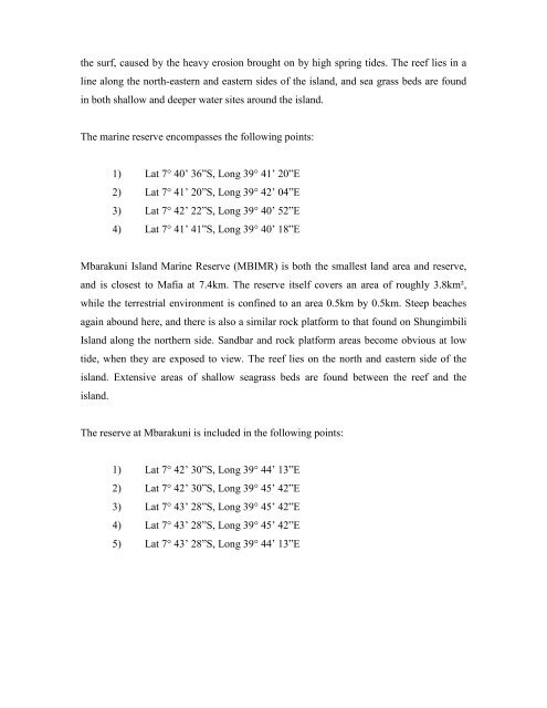
the surf, caused by the heavy erosion brought on by high spring tides. The reef lies in a<br />
line along the north-eastern and eastern sides <strong>of</strong> the island, and sea grass beds are found<br />
in both shallow and deeper water sites around the island.<br />
The marine reserve encompasses the following points:<br />
1) Lat 7° 40’ 36”S, Long 39° 41’ 20”E<br />
2) Lat 7° 41’ 20”S, Long 39° 42’ 04”E<br />
3) Lat 7° 42’ 22”S, Long 39° 40’ 52”E<br />
4) Lat 7° 41’ 41”S, Long 39° 40’ 18”E<br />
Mbarakuni <strong>Island</strong> <strong>Marine</strong> Reserve (MBIMR) is both the smallest land area and reserve,<br />
and is closest to <strong>Mafia</strong> at 7.4km. The reserve itself covers an area <strong>of</strong> roughly 3.8km²,<br />
while the terrestrial environment is confined to an area 0.5km by 0.5km. Steep beaches<br />
again abound here, and there is also a similar rock platform to that found on Shungimbili<br />
<strong>Island</strong> along the northern side. Sandbar and rock platform areas become obvious at low<br />
tide, when they are exposed to view. The reef lies on the north and eastern side <strong>of</strong> the<br />
island. Extensive areas <strong>of</strong> shallow seagrass beds are found between the reef and the<br />
island.<br />
The reserve at Mbarakuni is included in the following points:<br />
1) Lat 7° 42’ 30”S, Long 39° 44’ 13”E<br />
2) Lat 7° 42’ 30”S, Long 39° 45’ 42”E<br />
3) Lat 7° 43’ 28”S, Long 39° 45’ 42”E<br />
4) Lat 7° 43’ 28”S, Long 39° 45’ 42”E<br />
5) Lat 7° 43’ 28”S, Long 39° 44’ 13”E


