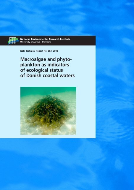
Macroalgae and phytoplankton as indicators of ... - Naturstyrelsen
Macroalgae and phytoplankton as indicators of ... - Naturstyrelsen
Macroalgae and phytoplankton as indicators of ... - Naturstyrelsen

Create successful ePaper yourself
Turn your PDF publications into a flip-book with our unique Google optimized e-Paper software.
National Environmental Research Institute<br />
University <strong>of</strong> Aarhus . Denmark<br />
NERI Technical Report No. 683, 2008<br />
<strong>Macroalgae</strong> <strong>and</strong> <strong>phytoplankton</strong><br />
<strong>as</strong> <strong>indicators</strong><br />
<strong>of</strong> ecological status<br />
<strong>of</strong> Danish co<strong>as</strong>tal waters
[Blank page]
National Environmental Research Institute<br />
University <strong>of</strong> Aarhus . Denmark<br />
NERI Technical Report No. 683, 2008<br />
<strong>Macroalgae</strong> <strong>and</strong> <strong>phytoplankton</strong><br />
<strong>as</strong> <strong>indicators</strong><br />
<strong>of</strong> ecological status<br />
<strong>of</strong> Danish co<strong>as</strong>tal waters<br />
Jacob Carstensen<br />
Dorte Krause-Jensen<br />
Karsten Dahl<br />
Peter Henriksen
Data sheet<br />
Series title <strong>and</strong> no.: NERI Technical Report No. 683<br />
Title:<br />
Authors:<br />
Department:<br />
<strong>Macroalgae</strong> <strong>and</strong> <strong>phytoplankton</strong> <strong>as</strong> <strong>indicators</strong> <strong>of</strong> ecological status <strong>of</strong> Danish co<strong>as</strong>tal waters<br />
Jacob Carstensen, Dorte Krause-Jensen, Karsten Dahl & Peter Henriksen<br />
Department <strong>of</strong> Marine Ecology<br />
Publisher: National Environmental Research Institute ©<br />
University <strong>of</strong> Aarhus - Denmark<br />
URL: http://www.neri.dk<br />
Year <strong>of</strong> publication: December 2008<br />
Editing completed: December 2008<br />
Referees: Henning Karup <strong>and</strong> Jens Brøgger Jensen<br />
Financial support:<br />
Ple<strong>as</strong>e cite <strong>as</strong>:<br />
Danish Environmental Protection Agency (EPA) - Water Unit<br />
Carstensen, J., Krause-Jensen, D., Dahl, K. & Henriksen, P. 2008: <strong>Macroalgae</strong> <strong>and</strong><br />
<strong>phytoplankton</strong> <strong>as</strong> <strong>indicators</strong> <strong>of</strong> ecological status <strong>of</strong> Danish co<strong>as</strong>tal waters. National<br />
Environmental Research Institute, University <strong>of</strong> Aarhus. 90 pp. - NERI Technical Report<br />
No. 683.<br />
http://www.dmu.dk/Pub/FR683.pdf<br />
Reproduction permitted provided the source is explicitly acknowledged.<br />
Abstract:<br />
Keywords:<br />
Layout:<br />
Cover photo:<br />
This report contributes to the development <strong>of</strong> tools that can be applied to <strong>as</strong>sess the five<br />
cl<strong>as</strong>ses <strong>of</strong> ecological status <strong>of</strong> the Water Framework Directive b<strong>as</strong>ed on the biological quality<br />
elements <strong>phytoplankton</strong> <strong>and</strong> macroalgae. Nitrogen inputs <strong>and</strong> concentrations representing<br />
reference conditions <strong>and</strong> boundaries between the five ecological status cl<strong>as</strong>ses were calculated<br />
from estimates <strong>of</strong> nitrogen inputs from Denmark to the Danish straits since 1900 combined with<br />
expert judgement <strong>of</strong> the general environmental conditions <strong>of</strong> Danish waters during different time<br />
periods. From these calculated nitrogen concentrations <strong>and</strong> a macroalgal model ecological<br />
status cl<strong>as</strong>s boundaries were established for six macroalgal <strong>indicators</strong> in a number <strong>of</strong> Danish<br />
estuaries <strong>and</strong> co<strong>as</strong>tal are<strong>as</strong>. Furthermore, site-specific correlations between concentrations <strong>of</strong><br />
nitrogen <strong>and</strong> chlorophyll a were used to define reference conditions <strong>and</strong> ecological status cl<strong>as</strong>s<br />
boundaries for the <strong>phytoplankton</strong> metric ‘mean summer concentration <strong>of</strong> chlorophyll a’ in<br />
several Danish estuaries <strong>and</strong> co<strong>as</strong>tal are<strong>as</strong>. Precision <strong>of</strong> the two different chlorophyll a <strong>indicators</strong><br />
‘summer mean’ <strong>and</strong> ‘90-percentile’ w<strong>as</strong> evaluated. The 90-percentile w<strong>as</strong> substantially<br />
more uncertain than the mean or median <strong>indicators</strong>, particularly for small sample sizes but also<br />
for large sample sizes.<br />
Water Framework Directive, <strong>phytoplankton</strong>, macroalgae, <strong>indicators</strong>, models, reference condition,<br />
status cl<strong>as</strong>sification.<br />
Anne van Acker<br />
Single boulder covered with brown algae at shallow waters NE <strong>of</strong> Zeal<strong>and</strong>. Photo: Karsten Dahl.<br />
ISBN: 978-87-7073-060-0<br />
ISSN (electronic): 1600-0048<br />
Number <strong>of</strong> pages: 90<br />
Internet version:<br />
The report is available in electronic format (pdf) at NERI's website<br />
http://www.dmu.dk/Pub/FR683.pdf
Contents<br />
Summary 5<br />
Sammenfatning 6<br />
1 Introduction 7<br />
2 Boundary values for TN concentration 8<br />
2.1 Establishing reference TN inputs 8<br />
2.2 Boundaries for TN concentrations 10<br />
3 <strong>Macroalgae</strong> <strong>as</strong> <strong>indicators</strong> <strong>of</strong> water quality 18<br />
3.1 Introduction 18<br />
3.2 Aim 19<br />
3.3 Methods 19<br />
3.4 Results 30<br />
3.5 Discussion 50<br />
3.6 Conclusions 55<br />
4 Assessment <strong>of</strong> ecological status using chlorophyll a 56<br />
4.1 Boundaries for chlorophyll a 56<br />
4.2 Comparison <strong>of</strong> boundary values for chlorophyll a <strong>and</strong> eelgr<strong>as</strong>s<br />
depth limits 62<br />
4.3 Evaluation <strong>of</strong> the precision <strong>of</strong> the chlorophyll a indicator described <strong>as</strong> 'summer<br />
mean' <strong>and</strong> '90 th percentile' 65<br />
5 Conclusions <strong>and</strong> recommendations 69<br />
6 References 71<br />
7 Appendices 75<br />
National Environmental Research Institute<br />
NERI technical reports
[Blank page]
Summary<br />
During the implementation <strong>of</strong> the EU Water Framework Directive, an intercalibration<br />
<strong>of</strong> selected metrics <strong>of</strong> the biological quality elements w<strong>as</strong><br />
undertaken at a limited number <strong>of</strong> sites. This report describes a method<br />
for establishing ecological status cl<strong>as</strong>ses for <strong>phytoplankton</strong> in more are<strong>as</strong><br />
<strong>and</strong> evaluates several macroalgal <strong>indicators</strong> <strong>and</strong> their calculated indicator<br />
values for ecological status cl<strong>as</strong>s boundaries.<br />
In the first part <strong>of</strong> the report, estimates <strong>of</strong> nitrogen inputs from Denmark<br />
to the Danish straits since 1900 combined with expert judgement <strong>of</strong> the<br />
general environmental conditions <strong>of</strong> Danish waters during different time<br />
periods were used to establish nitrogen inputs representing reference<br />
conditions <strong>and</strong> boundaries between the five ecological status cl<strong>as</strong>ses.<br />
These reference conditions <strong>and</strong> cl<strong>as</strong>s boundaries were transformed into<br />
nitrogen concentrations in the water in several fjords <strong>and</strong> co<strong>as</strong>tal localities<br />
by the use <strong>of</strong> site-specific relations between nitrogen inputs <strong>and</strong> nitrogen<br />
concentrations.<br />
An existing macroalgal model w<strong>as</strong> refined in the second part <strong>of</strong> the report.<br />
The model describes the following variables: i) the total algal cover,<br />
ii) the cumulative algal cover <strong>of</strong> the total algal community, opportunistic<br />
species or late-successional species, iii) the fraction <strong>of</strong> opportunistic species<br />
<strong>and</strong> iv) the number <strong>of</strong> late-successional species. All macroalgal variables<br />
responded to changes in total nitrogen but also to changes in salinity<br />
which emph<strong>as</strong>ises the need for setting different targets depending on salinity.<br />
The strongest responses to changes in nitrogen concentration <strong>and</strong><br />
the le<strong>as</strong>t variability were found for the <strong>indicators</strong> 'total algal cover',<br />
'number <strong>of</strong> late-successional species' <strong>and</strong> fraction <strong>of</strong> opportunists'. Ecological<br />
status cl<strong>as</strong>s boundaries were established for all the macroalgal<br />
variables in a number <strong>of</strong> Danish estuaries <strong>and</strong> co<strong>as</strong>tal are<strong>as</strong>.<br />
A Spanish macroalgal index b<strong>as</strong>ed on 'cover', 'proportion <strong>of</strong> opportunists'<br />
<strong>and</strong> 'species richness' w<strong>as</strong> tested using Danish data. Each component <strong>of</strong><br />
the index responded to nutrient gradients but the index needs adjustment<br />
<strong>of</strong> especially the scoring system in order to be applicable to Danish<br />
conditions.<br />
In the third part <strong>of</strong> the report site-specific correlations between concentrations<br />
<strong>of</strong> nitrogen <strong>and</strong> chlorophyll a (chla) were used to define reference<br />
conditions <strong>and</strong> ecological status cl<strong>as</strong>s boundaries for the <strong>phytoplankton</strong><br />
metric 'mean summer concentration <strong>of</strong> chla' in several Danish<br />
estuaries <strong>and</strong> co<strong>as</strong>tal are<strong>as</strong>. The relationship between chla <strong>and</strong> nitrogen<br />
concentrations varied from site to site <strong>and</strong> reflected the bio-available<br />
fraction <strong>of</strong> total nitrogen. A relationship w<strong>as</strong> demonstrated between reference<br />
conditions <strong>and</strong> good-moderate boundaries for eelgr<strong>as</strong>s depth limits<br />
<strong>and</strong> the corresponding values for chla.<br />
Precision <strong>of</strong> the two different chla <strong>indicators</strong> 'summer mean' <strong>and</strong> '90-<br />
percentile w<strong>as</strong> evaluated. The 90-percentile w<strong>as</strong> substantially more uncertain<br />
than the mean or median <strong>indicators</strong>, particularly for small sample<br />
sizes but also for large sample sizes.<br />
5
Sammenfatning<br />
I forbindelse med implementeringen af det europæiske v<strong>and</strong>rammedirektiv<br />
blev der foretaget en interkalibrering af delelementer af de biologiske<br />
kvalitetselementer i et begrænset antal områder. Denne rapport beskriver<br />
en metode til f<strong>as</strong>tsættelse af miljøtilst<strong>and</strong>skl<strong>as</strong>ser for kvalitetselementet<br />
fytoplankton i yderligere en række områder samt forslag til<br />
indikatorer for makroalger med f<strong>as</strong>tsættelse af miljøtilst<strong>and</strong>skl<strong>as</strong>ser i en<br />
række danske områder.<br />
På baggrund af estimater af kvælst<strong>of</strong>overskud fra dansk l<strong>and</strong>brug tilbage<br />
til år 1900 beskriver rapportens første del f<strong>as</strong>tsættelsen af tilførsler af<br />
kvælst<strong>of</strong> under referenceforhold samt under forhold, der repræsenterer<br />
perioder svarende til forskellige miljøtilst<strong>and</strong>skl<strong>as</strong>ser for havmiljøet generelt.<br />
Ud fra lokale relationer mellem kvælst<strong>of</strong>tilførsler og kvælst<strong>of</strong>koncentrationer<br />
i v<strong>and</strong>et defineres referencekoncentrationer af kvælst<strong>of</strong> samt<br />
kvælst<strong>of</strong>koncentrationer svarende til grænseværdier mellem de fem miljøtilst<strong>and</strong>skl<strong>as</strong>ser<br />
for en række danske fjorde og åbne kystområder.<br />
I rapportens <strong>and</strong>en del videreudvikles en makroalgemodel, der beskriver<br />
i) det totale algedække, ii) det kumulative dække af hele algesamfundet,<br />
opportunistiske arter eller kraftigere langsomt voksende arter,<br />
iii) fraktionen af opportunistiske arter og iv) antal kraftige langsomt voksende<br />
arter. Alle disse variable responderede på kvælst<strong>of</strong>koncentrationer,<br />
men også på salinitet, hvilket understreger nødvendigheden af, at<br />
forskellige miljømål defineres for forskellige saliniteter. Det tydeligste<br />
respons på kvælst<strong>of</strong>koncentrationer og den mindste variation f<strong>and</strong>tes for<br />
de tre indikatorer 'totale algedække', 'antal kraftige langsomt voksende<br />
arter' og 'opportunisters <strong>and</strong>el af den samlede vegetationsdækning'. B<strong>as</strong>eret<br />
på kvælst<strong>of</strong>koncentrationerne svarende til grænserne mellem miljøtilst<strong>and</strong>skl<strong>as</strong>serne<br />
er der for samtlige makroalgevariable beregnet værdier<br />
for grænserne mellem de fem miljøtilst<strong>and</strong>skl<strong>as</strong>ser i en række danske<br />
fjorde og kystnære områder. Desuden blev anvendeligheden af et spansk<br />
makroalgeindeks b<strong>as</strong>eret på 'algedække', 'fraktion opportunistiske arter'<br />
og 'artsrigdom' undersøgt. Det spanske indeks kræver væsentlig modifikation,<br />
før det kan anvendes under danske forhold.<br />
Lokale sammenhænge mellem kvælst<strong>of</strong>koncentrationer og koncentrationen<br />
af klor<strong>of</strong>yl a, der anvendes som indikator for biom<strong>as</strong>se, benyttes i<br />
rapportens tredje del til at definere afgrænsningen mellem de fem miljøtilst<strong>and</strong>skl<strong>as</strong>ser<br />
for kvalitetselementet fytoplankton i en række danske<br />
fjorde og kystnære v<strong>and</strong>områder. Data viste, at sammenhængen mellem<br />
koncentrationen af klor<strong>of</strong>yl a og kvælst<strong>of</strong>koncentrationen varierede fra<br />
område til område og afspejlede den bio-tilgængelige fraktion af kvælst<strong>of</strong>.<br />
I områder, hvor der var defineret referenceforhold samt afgrænsning<br />
mellem god og moderat tilst<strong>and</strong> for både fytoplankton og ålegræssets<br />
dybdegrænse, var der overensstemmelse mellem tilst<strong>and</strong>smålene for<br />
de to kvalitetselementer. En undersøgelse af præcisionen på anvendelsen<br />
af hhv. sommermiddel eller 90-percentilen af klor<strong>of</strong>yl a som indikator<br />
demonstrerede væsentlig større usikkerhed på 90-percentilen.<br />
6
1 Introduction<br />
This report is part <strong>of</strong> a series <strong>of</strong> projects initiated <strong>and</strong> financed by the<br />
Danish Environmental Protection Agency (EPA) - Water Unit dealing<br />
with the implementation <strong>of</strong> the Water Framework Directive (WFD).<br />
The WFD aims to achieve at le<strong>as</strong>t a good ecological status in all European<br />
rivers, lakes <strong>and</strong> co<strong>as</strong>tal waters <strong>and</strong> dem<strong>and</strong>s that the ecological<br />
status is quantified b<strong>as</strong>ed primarily on biological <strong>indicators</strong>, i.e. <strong>phytoplankton</strong><br />
<strong>and</strong> benthic flora <strong>and</strong> fauna. The WFD dem<strong>and</strong>s an evaluation<br />
<strong>of</strong> which water bodies are being at risk <strong>of</strong> failing to meet the good ecological<br />
status in 2015.<br />
In order to <strong>as</strong>sess the ecological status, it is necessary to identify biological<br />
<strong>indicators</strong> which respond to environmental impact/anthropogenic<br />
pressures. Moreover, it is necessary to relate the levels <strong>of</strong> these <strong>indicators</strong><br />
to biological status cl<strong>as</strong>ses.<br />
The aim <strong>of</strong> this project w<strong>as</strong> to establish a scientific foundation which can<br />
contribute to the development <strong>of</strong> tools that can be applied to <strong>as</strong>sess ecological<br />
status <strong>of</strong> co<strong>as</strong>tal waters b<strong>as</strong>ed on the biological quality elements<br />
<strong>phytoplankton</strong> <strong>and</strong> macroalgae. The aim included an <strong>as</strong>sessment <strong>of</strong> values<br />
for the boundaries between ecological status cl<strong>as</strong>ses with main emph<strong>as</strong>is<br />
on the boundaries between good <strong>and</strong> moderate ecological status since<br />
this boundary defines whether the ecological status is acceptable or not.<br />
The report is divided in three chapters: a first chapter which <strong>as</strong>sesses reference<br />
conditions <strong>and</strong> boundary values for TN concentrations, a second<br />
chapter on macroalgae <strong>as</strong> <strong>indicators</strong> <strong>of</strong> water quality <strong>and</strong> a third chapter<br />
on <strong>phytoplankton</strong> <strong>as</strong> an indicator <strong>of</strong> water quality.<br />
7
2 Boundary values for TN concentration<br />
The procedure for determining reference conditions <strong>and</strong> boundary values<br />
for total nitrogen (TN) w<strong>as</strong> already presented <strong>and</strong> discussed in Carstensen<br />
(2006). The procedure h<strong>as</strong> been exp<strong>and</strong>ed with data from recent<br />
years <strong>and</strong> applied to two specific se<strong>as</strong>onal windows: 1) January-June<br />
used for relationships to summer chlorophyll (May-September) <strong>and</strong> 2)<br />
July-June used for relationships to macroalgae <strong>indicators</strong>.<br />
2.1 Establishing reference TN inputs<br />
In Conley et al. (2007) nutrient inputs from Denmark to the Danish straits<br />
were hindc<strong>as</strong>ted b<strong>as</strong>ed on estimates <strong>of</strong> the nitrogen surplus from Danish<br />
agriculture <strong>and</strong> estimated changes in point sources. These figures have<br />
been updated with recent estimated nutrient inputs (Figure 2.1). It should<br />
be acknowledged that the estimated diffuse sources are overestimates in<br />
the beginning <strong>of</strong> the time series, since draining <strong>of</strong> arable l<strong>and</strong>, reclamation<br />
<strong>of</strong> wetl<strong>and</strong>s, <strong>and</strong> straightening <strong>of</strong> streams have reduced the nitrogen<br />
retention capacity <strong>of</strong> the watershed <strong>and</strong> therefore, the riverine nitrogen<br />
discharges were smaller. The proportion <strong>of</strong> point sources directly to marine<br />
waters h<strong>as</strong> also incre<strong>as</strong>ed over time. The majority <strong>of</strong> these changes<br />
presumably occurred in the 1950s <strong>and</strong> 1960s (e.g. Skjern Å project 1962-<br />
1968 <strong>and</strong> Odense Å 1944-1962). It is <strong>as</strong>sumed that the majority <strong>of</strong> these<br />
hydro-morphological changes were completed by the 1970s.<br />
It is difficult to estimate the change in nutrient retention these changes<br />
may have caused, but changes in primary production over half a century<br />
may give some hints about the magnitude. Carstensen et al. (2003) found<br />
a significant linear coupling between annual primary production in the<br />
Kattegat <strong>and</strong> annual nitrogen input, <strong>and</strong> cross-system comparisons have<br />
documented similar strong relationships (Nixon 1992). Richardson & Heilmann<br />
(1995) reported a 2-3 fold incre<strong>as</strong>e in annual primary production<br />
from 1954-1960 to 1984-1993. Assuming an average 2.5-fold incre<strong>as</strong>e <strong>and</strong><br />
comparing this to nitrogen inputs in the same period (incre<strong>as</strong>e <strong>of</strong> 58%)<br />
suggests that 37% <strong>of</strong> the nitrogen input w<strong>as</strong> retained in the freshwater<br />
systems. Thus, estimated nitrogen inputs to marine are<strong>as</strong> before the<br />
1970s should be reduced by ca. 37% to account for the higher retention<br />
capacity in the watersheds in this period.<br />
A nutrient input reference situation could be interpreted <strong>as</strong> the diffuse<br />
input around 1900 (~8,000 tons N per year including 37% incre<strong>as</strong>ed retention)<br />
<strong>and</strong> a point source contribution corresponding to present day<br />
level with nutrient removal from w<strong>as</strong>tewater treatment plants (6,000 tons<br />
N per year). Thus, a reference input <strong>of</strong> 14,000 tons N per year is proposed.<br />
8
Figure 2.1 Long-term trends in nitrogen input from Denmark to the Danish straits. From Conley et al. (2007).<br />
Discussions with the Danish EPA (J. Brøgger Jensen <strong>and</strong> H. Karup, pers.<br />
com.) have led to the characterisation <strong>of</strong> different ecological status<br />
cl<strong>as</strong>ses during different periods in time. The period up to 1950 is considered<br />
having a high ecological status, corresponding to a nitrogen input <strong>of</strong><br />
about 22,000 tons N per year (including 37% incre<strong>as</strong>ed retention). In the<br />
1950s <strong>and</strong> early 1960s the ecological status w<strong>as</strong> considered to be good,<br />
corresponding to a nitrogen input <strong>of</strong> about 32,000 tons N per year (including<br />
37% incre<strong>as</strong>ed retention). In the late 1960s <strong>and</strong> 1970s the situation<br />
started worsening <strong>and</strong> the ecological status w<strong>as</strong> considered to be<br />
moderate, corresponding to an average nitrogen input <strong>of</strong> about 73,000<br />
tons N per year. In the 1980s the conditions were really poor (average <strong>of</strong><br />
91,000 tons N per year) <strong>and</strong> in certain years the status may even have<br />
been considered bad (average <strong>of</strong> 110,000 tons N per year for the 3 worst<br />
years). Nitrogen inputs in the 1990s were highly variable with an average<br />
<strong>of</strong> 66,000 tons N per year, an input level similar to the 1970s <strong>and</strong> the<br />
status could be characterised <strong>as</strong> moderate. In the most recent years, the<br />
nitrogen input h<strong>as</strong> been about 50,000 tons N per year, a status that may<br />
be characterised <strong>as</strong> between good <strong>and</strong> moderate status. Thus, the consequence<br />
<strong>of</strong> these <strong>as</strong>sertions is that present day nitrogen input level characterises<br />
a good ecological status, <strong>as</strong>suming linearity between inputs <strong>and</strong><br />
effects. It should be acknowledged that such proportionality <strong>as</strong>sumptions<br />
do not apply for ecological effects with a hysteretic response (type<br />
<strong>of</strong> threshold response) to changing nutrient levels. In such c<strong>as</strong>es ecological<br />
status corresponds to different nutrient inputs during the eutrophication<br />
development <strong>and</strong> during the eutrophication trend reversal. Boundaries<br />
between nutrient inputs corresponding to the 5 ecological status<br />
cl<strong>as</strong>ses are chosen <strong>as</strong> midpoint values (Table 2.1).<br />
9
Table 2.1 Proposed nitrogen input values corresponding to reference conditions <strong>and</strong> boundary values between ecological<br />
status cl<strong>as</strong>ses. Nitrogen inputs are converted to a flow-weighted TN concentration using an average freshwater discharge <strong>of</strong><br />
8,523 km 3 per year (average to the Danish straits 1942-2006).<br />
Period Boundary Nitrogen input per year Flow-weighted TN concentration<br />
Around 1900 Reference condition 14,000 tons 117 µmol l -1<br />
Around 1950 High → Good 27,000 tons 226 µmol l -1<br />
Around 1965 Good → Moderate 52,500 tons 440 µmol l -1<br />
Around 1980 Moderate → Poor 82,000 tons 687 µmol l -1<br />
Worst years in the 1980s Poor → Bad 100,500 tons 842 µmol l -1<br />
2.2 Boundaries for TN concentrations<br />
A total <strong>of</strong> 39 sites were selected from the National Marine Datab<strong>as</strong>e<br />
(MADS) that had sufficient TN data for estimating relationships to TN<br />
inputs. The sites included all are<strong>as</strong> defined within the Danish National<br />
Aquatic Monitoring <strong>and</strong> Assessment Program (DNAMAP) <strong>as</strong> well <strong>as</strong> a<br />
few additional sites that were part <strong>of</strong> regional monitoring programs.<br />
Time series <strong>of</strong> nitrogen input to the Danish straits were compiled <strong>and</strong><br />
used to establish relationship for TN concentrations at sites connected to<br />
the Danish straits <strong>and</strong> sites located on the west co<strong>as</strong>t <strong>of</strong> Denmark with a<br />
strong influence <strong>of</strong> local nutrient sources (Ringkøbing Fjord, Nissum<br />
Fjord, inner Wadden Sea). Co<strong>as</strong>tal sites on the Jutl<strong>and</strong> west co<strong>as</strong>t are,<br />
however, more affected by nutrient inputs from the continental rivers<br />
discharging to the southern North Sea (mainly the rivers Elbe, Weser <strong>and</strong><br />
Ems). For instance, the catchment area <strong>of</strong> River Elbe is more than 3 times<br />
larger than the total l<strong>and</strong> area <strong>of</strong> Denmark <strong>and</strong> freshwater <strong>and</strong> nutrient<br />
discharges are more than twice <strong>as</strong> high <strong>as</strong> total Danish inputs (Gerlach<br />
1990).<br />
2.2.1 Salinity-TN relationships for co<strong>as</strong>tal North Sea<br />
Distinctive gradients (both north-south <strong>and</strong> e<strong>as</strong>t-west) in salinity <strong>and</strong> nutrient<br />
concentrations characterise this area <strong>and</strong> any analysis <strong>of</strong> data from<br />
this area must take variations in salinity into account. Salinity levels<br />
typically range from 28 to 35 <strong>and</strong> TN concentrations from 0.2 to 1.5 µg l -1 .<br />
In simple terms, the TN concentration in this area is determined from<br />
mixing <strong>of</strong> central North Sea water (salinity ~35) <strong>and</strong> riverine inputs. The<br />
TN concentration in the central North Sea is <strong>as</strong>sumed constant (µ),<br />
where<strong>as</strong> the TN gradient with respect to salinity varies between years<br />
<strong>and</strong> between months.<br />
TN ij = µ + month i × (salinity ij -35) + year j × (salinity ij -35)<br />
This regression model w<strong>as</strong> analysed using data from 1993 <strong>and</strong> onwards,<br />
since there were very few data before 1993. Both the month-specific gradients<br />
(p
Figure 2.2 Surface TN versus salinity for 1993-2006 (January-June) (top) <strong>and</strong> the estimated salinity gradients for different<br />
months (bottom left) <strong>and</strong> different years (bottom right).<br />
The estimated gradients can be used for predicting the TN concentration<br />
at salinity 0, <strong>and</strong> compare these estimates to the riverine concentrations.<br />
Annual mean TN concentrations from the River Elbe me<strong>as</strong>ured in Hamburg<br />
were obtained from EIONET (www.eea.eu.int) <strong>and</strong> in order to<br />
make these values more comparable to TN concentrations me<strong>as</strong>ured in<br />
January-June, a moving average <strong>of</strong> two years w<strong>as</strong> computed. TN concentrations<br />
in the Elbe River have generally decre<strong>as</strong>ed from about 400 µmol<br />
l -1 in the beginning <strong>of</strong> the 1990s to below 300 µmol l -1 in recent years, in<br />
accordance with the decre<strong>as</strong>ing slopes <strong>of</strong> the TN-salinity gradients along<br />
the west co<strong>as</strong>t (Figure 2.2). Consequently, there w<strong>as</strong> a strong correlation<br />
between TN concentrations in the River Elbe <strong>and</strong> estimated TN concentrations<br />
at salinity 0 using the relationships from the TN-salinity model<br />
(Figure 2.3). Only 1996 seems to deviate from the overall pattern, <strong>and</strong><br />
1996 w<strong>as</strong> exceptional in the sense that extremely low concentrations<br />
were me<strong>as</strong>ured along the west co<strong>as</strong>t. It should be noted that the pre-<br />
11
dicted TN concentrations from the model are, on average, 27.8 µmol l -1<br />
(±8.3) lower than me<strong>as</strong>ured concentration in the river, indicating a TN<br />
sink in the German Bight.<br />
Figure 2.3 Mean annual TN concentrations in River Elbe compared to estimated TN<br />
concentrations b<strong>as</strong>ed on the salinity-TN regression model. Data from 1996 were not included<br />
in the regression.<br />
Assuming that the l<strong>and</strong> use, <strong>and</strong> presumably nitrogen loss also, in the<br />
catchment are<strong>as</strong> <strong>of</strong> River Elbe <strong>and</strong> other contributing rivers is similar to<br />
the l<strong>and</strong> use in Denmark, equivalent TN concentrations calculated from<br />
TN inputs to the Danish straits in an average freshwater discharge year<br />
(Table 2.1) minus an average TN sink <strong>of</strong> 27.8 µmol l -1 were employed <strong>as</strong><br />
end-point members. Reference conditions <strong>and</strong> boundaries between ecological<br />
status cl<strong>as</strong>ses are therefore found <strong>as</strong> salinity-dependent lines<br />
starting at 13.18 µmol l -1 for salinity 35 <strong>and</strong> intersecting 0 salinity at 80,<br />
189, 403, 650, <strong>and</strong> 805 µmol l -1 (Table 2.2) for reference conditions, H-G<br />
boundary, G-M boundary, M-P boundary, <strong>and</strong> P-B boundary, respectively.<br />
Such reference conditions <strong>and</strong> boundaries were found for 4 sites<br />
along the west-co<strong>as</strong>t <strong>of</strong> Jutl<strong>and</strong> using average salinities characteristic for<br />
each site (Table 2.2). The uncertainty <strong>as</strong>sociated with these estimates derives<br />
from the estimated TN level at salinity 35 <strong>and</strong> the TN sink, since the<br />
TN concentrations at salinity 0 are fixed values. The values in Table 2.2<br />
will be used for deriving reference condition <strong>and</strong> boundary values for<br />
Nissum Fjord, Ringkøbing Fjord <strong>and</strong> the inner Wadden Sea.<br />
Table 2.2 Suggested reference conditions <strong>and</strong> boundary values for TN concentration (µmol l -1 ) normalised to st<strong>and</strong>ard salinity<br />
<strong>of</strong> 33 for Hirtshals, 31.7 for the co<strong>as</strong>tal area <strong>of</strong>f Nissum Fjord, 31.4 for the co<strong>as</strong>tal area <strong>of</strong>f Ringkøbing Fjord, <strong>and</strong> 30.4 for outer<br />
Wadden Sea.<br />
Intercalibration site Ref. cond. H-G G-M M-P P-B<br />
Hirtshals 17.0 (±0.7) 23.2 (±0.7) 35.5 (±0.7) 49.6 (±0.7) 58.4 (±0.7)<br />
Co<strong>as</strong>t <strong>of</strong>f Nissum Fjord 19.5 (±0.9) 29.8 (±0.9) 49.9 (±0.9) 73.2 (±0.9) 87.8 (±0.9)<br />
Co<strong>as</strong>t <strong>of</strong>f Ringkøbing Fjord 20.1 (±1.0) 31.3 (±1.0) 53.3 (±1.0) 78.7 (±1.0) 94.6 (±1.0)<br />
Outer Wadden Sea 22.0 (±1.2) 36.3 (±1.2) 64.4 (±1.2) 96.9 (±1.2) 117.3 (±1.2)<br />
12
2.2.2 Nitrogen input-TN relationships for estuarine <strong>and</strong> co<strong>as</strong>tal sites<br />
Salinity gradients are less pronounced in Danish estuaries <strong>and</strong> co<strong>as</strong>tal<br />
sites, although there are differences between stations within these sites,<br />
but salinity variations at specific monitoring stations are generally small.<br />
Data from 39 different sites were selected <strong>and</strong> for each <strong>of</strong> these sites yearly<br />
TN means for January-June (for chlorophyll relationships) <strong>and</strong> July-<br />
June (for macroalgae relationships) were calculated, taking stations-specific<br />
<strong>and</strong> month <strong>of</strong> sampling variations into account. TN means b<strong>as</strong>ed on<br />
few observations <strong>and</strong> with a relative st<strong>and</strong>ard error <strong>of</strong> more than 15%<br />
were discarded.<br />
To establish relationships between nitrogen input from l<strong>and</strong> <strong>and</strong> TN<br />
concentrations, 39 site-specific relationships between nitrogen input <strong>and</strong><br />
TN concentrations were found (Figure 2.4). Out <strong>of</strong> the 39 sites, 33 sites<br />
had a significant relationship (p
Figure 2.4 Regression lines obtained from 39 different sites covering TN mean levels<br />
(January-June) in estuaries <strong>and</strong> co<strong>as</strong>tal are<strong>as</strong> in Denmark. Nitrogen input to the Danish<br />
straits cover July to June. The regression line for open-water stations in the Danish straits<br />
is highlighted (bold, green). Solid lines are significant relationships (p
Flensborg Fjord on the ranked scale, the response to nitrogen input is<br />
about 2-3 times larger than for open co<strong>as</strong>tal sites. The largest response to<br />
nitrogen input is observed for inner Odense Fjord, Nissum Fjord <strong>and</strong><br />
R<strong>and</strong>ers Fjord, sites strongly affected by riverine inputs. Overall the<br />
ranking <strong>of</strong> the sites by their slopes corresponds well to the expected influence<br />
from l<strong>and</strong>-b<strong>as</strong>ed nitrogen discharges.<br />
Figure 2.6 Estimated site-specific slopes in TN-nitrogen input relations <strong>and</strong> 95% confidence intervals for the estimate. Estimates<br />
have been sorted by incre<strong>as</strong>ing slopes.<br />
For the 39 different water bodies, reference conditions <strong>and</strong> boundary values<br />
between ecological status cl<strong>as</strong>ses were predicted from the regression<br />
model using fixed intercepts <strong>and</strong> site-specific slopes (Table 2.3). The uncertainty<br />
<strong>of</strong> these estimates includes a variance contribution from both<br />
the slope <strong>and</strong> the estimated common intercept <strong>of</strong> 15.46 µmol l -1 (±0.88).<br />
For the TN concentrations used in the macroalgae calculations the procedure<br />
is similar with the exception that TN annual means represent an<br />
entire year (July-June). Given this, we found values (Table 2.4) that were<br />
slightly lower than those used for chlorophyll due to generally lower TN<br />
levels in July-December compared to January-June.<br />
15
Table 2.3 Suggested reference conditions <strong>and</strong> boundary values for TN concentration (µmol l -1 ) for January-June computed<br />
from corresponding values <strong>of</strong> nitrogen by means <strong>of</strong> the regression model with site-specific slopes. These values were used for<br />
calculating corresponding reference conditions <strong>and</strong> boundary values for chlorophyll a.<br />
Locality Ref. cond. H-G G-M M-P P-B<br />
Archipelago <strong>of</strong> southern Fyn 17.8 (+/-1.1) 19.9 (+/-1.4) 24.1 (+/-2.1) 28.9 (+/-3.1) 32.0 (+/-3.8)<br />
Augustenborg Fjord 20.7 (+/-1.9) 25,4 (+/-3.3) 34,8 (+/-6.1) 45.7 (+/-9.5) 52.5 (+/-12.0)<br />
Bornholm West 16.4 (+/-1.2) 17,2 (+/-1.7) 18,8 (+/-2.8) 20.7 (+/-4.1) 21.9 (+/-5.0)<br />
Dybsø Fjord 23.0 (+/-2.8) 30.0 (+/-5.2) 43.6 (+/-9.9) 59.4 (+/-15.0) 69.3 (+/-19.0)<br />
Fakse Bay 16.6 (+/-1.5) 17.6 (+/-2.4) 19.5 (+/-4.4) 21.8 (+/-6.7) 23.2 (+/-8.2)<br />
Flensborg Fjord 19.4 (+/-1.1) 23.0 (+/-1.4) 30.2 (+/-2.2) 38.4 (+/-3.2) 43.6 (+/-3.8)<br />
Fyns Hoved / Great Belt 16.7 (+/-1.1) 17.8 (+/-1.2) 20.0 (+/-1.6) 22.6 (+/-2.3) 24.2 (+/-2.7)<br />
Hevring Bay 17.1 (+/-1.2) 18.7 (+/-1.7) 21.7 (+/-2.8) 25.1 (+/-4.2) 27.3 (+/-5.2)<br />
Hjelm Bay 16.7 (+/-1.7) 17.7 (+/-2.7) 19.9 (+/-5.0) 22.3 (+/-7.8) 23.9 (+/-9.5)<br />
Horsens Fjord 21.5 (+/-1.2) 27.0 (+/-1.5) 37.9 (+/-2.5) 50.5 (+/-3.7) 58.4 (+/-4.5)<br />
Isefjord 19.8 (+/-1.1) 23.7 (+/-1.3) 31.4 (+/-2.0) 40.4 (+/-2.9) 46.0 (+/-3.5)<br />
Kalundborg Fjord 17.3 (+/-1.1) 19.1 (+/-1.4) 22.4 (+/-2.1) 26.3 (+/-3.1) 28.8 (+/-3.7)<br />
Karrebæksminde Bay 17.4 (+/-1.9) 19.2 (+/-3.3) 22.8 (+/-6.1) 26.8 (+/-9.5) 29.4 (+/-12.0)<br />
Kertinge Nor 22.1 (+/-1.2) 28.2 (+/-1.6) 40.2 (+/-2.5) 54.0 (+/-3.8) 62.7 (+/-4.6)<br />
Køge Bay 17.0 (+/-1.1) 18.4 (+/-1.4) 21.1 (+/-2.1) 24.3 (+/-3.1) 26.2 (+/-3.7)<br />
The Little Belt 16.9 (+/-1.0) 18.3 (+/-1.2) 20.9 (+/-1.6) 23.9 (+/-2.1) 25.8 (+/-2.5)<br />
Limfjorden 35.7 (+/-2.1) 54.5 (+/-3.8) 91.4 (+/-7.2) 134.0 (+/-11.0) 161.0 (+/-14.0)<br />
Limfjord E<strong>as</strong>t 26.3 (+/-1.1) 36.3 (+/-1.4) 55.9 (+/-2.3) 78.6 (+/-3.3) 92.8 (+/-4.0)<br />
Limfjorden S <strong>of</strong> Mors 23.6 (+/-1.2) 31.1 (+/-1.7) 45.9 (+/-2.8) 62.9 (+/-4.2) 73.6 (+/-5.1)<br />
Løgstør Bredning 26.0 (+/-1.2) 35.8 (+/-1.7) 54.9 (+/-2.9) 77.1 (+/-4.4) 91.0 (+/-5.4)<br />
Nissum Bredning 22.5 (+/-1.2) 28.9 (+/-1.6) 41.6 (+/-2.7) 56.3 (+/-4.1) 65.5 (+/-4.9)<br />
Nissum Fjord 41.7 (+/-1.1) 66.0 (+/-1.5) 114.0 (+/-2.3) 169.0 (+/-3.4) 204.0 (+/-4.2)<br />
North <strong>of</strong> Zeal<strong>and</strong> 16.5 (+/-1.1) 17.5 (+/-1.3) 19.3 (+/-2.0) 21.5 (+/-2.8) 22.8 (+/-3.4)<br />
Northern Kattegat 16.9 (+/-1.1) 18.2 (+/-1.5) 20.7 (+/-2.4) 23.6 (+/-3.5) 25.5 (+/-4.2)<br />
Odense Fjord inner 47.2 (+/-1.4) 76.6 (+/-2.2) 134.0 (+/-4.0) 201.0 (+/-6.1) 243.0 (+/-7.5)<br />
Odense Fjord outer 26.4 (+/-1.2) 36.4 (+/-1.5) 56.2 (+/-2.4) 79.1 (+/-3.6) 93.5 (+/-4.4)<br />
Open waters 16.7 (+/-1.0) 17.7 (+/-1.1) 19.9 (+/-1.2) 22.3 (+/-1.5) 23.8 (+/-1.7)<br />
Præstø Fjord 23.7 (+/-1.7) 31.3 (+/-2.9) 46.2 (+/-5.4) 63.5 (+/-8.3) 74.4 (+/-10.0)<br />
R<strong>and</strong>ers Fjord 37.4 (+/-1.3) 57.7 (+/-1.8) 97.6 (+/-3.0) 144.0 (+/-4.6) 173.0 (+/-5.5)<br />
Ringkøbing Fjord after 1996 33.5 (+/-1.1) 50.2 (+/-1.4) 82.9 (+/-2.1) 121.0 (+/-3.0) 145.0 (+/-3.6)<br />
Ringkøbing Fjord before 1996 34.6 (+/-1.3) 52.3 (+/-1.8) 87.1 (+/-3.2) 127.0 (+/-4.8) 153.0 (+/-5.8)<br />
Roskilde Fjord 25.6 (+/-1.1) 35.0 (+/-1.3) 53.5 (+/-1.8) 74.8 (+/-2.6) 88.2 (+/-3.1)<br />
Sejerø Bay 16.9 (+/-1.3) 18.2 (+/-1.9) 20.7 (+/-3.2) 23.6 (+/-4.9) 25.4 (+/-5.9)<br />
Skive Fjord / Lovns Bredning 28.9 (+/-1.0) 41.3 (+/-1.1) 65.7 (+/-1.4) 93.9 (+/-1.8) 112.0 (+/-2.1)<br />
Vejle Fjord 19.4 (+/-1.1) 23.0 (+/-1.5) 30.1 (+/-2.4) 38.2 (+/-3.5) 43.4 (+/-4.2)<br />
Wadden Sea inner part 24.0 (+/-1.1) 31.8 (+/-1.4) 47.3 (+/-2.1) 65.1 (+/-3.1) 76.3 (+/-3.7)<br />
The Sound North 16.4 (+/-1.2) 17.3 (+/-1.6) 19.0 (+/-2.6) 20.9 (+/-3.9) 22.1 (+/-4.7)<br />
Åbenrå Fjord 18.7 (+/-1.4) 21.6 (+/-2.1) 27.4 (+/-3.8) 34.2 (+/-5.7) 38.4 (+/-7.0)<br />
Århus Bay 16.4 (+/-1.1) 17.2 (+/-1.2) 18.8 (+/-1.7) 20.7 (+/-2.3) 21.9 (+/-2.8)<br />
16
Table 2.4 Suggested reference conditions <strong>and</strong> boundary values for TN concentration (µmol l -1 ) for July-June computed from<br />
corresponding values <strong>of</strong> nitrogen by means <strong>of</strong> the regression model with site-specific slopes. These values were used for calculating<br />
corresponding reference conditions <strong>and</strong> boundary values for macroalgae.<br />
Locality Ref. cond. H-G G-M M-P P-B<br />
Open co<strong>as</strong>ts Bornholm West 16.6 (+/-1.1) 17.6 (+/-1.4) 19.6 (+/-2.1) 21.9 (+/-3.1) 23.4 (+/-3.8)<br />
Bornholm E<strong>as</strong>t 16.2 (+/-1.1) 16.8 (+/-1.3) 18.0 (+/-2) 19.4 (+/-2.9) 20.3 (+/-3.5)<br />
Endelave 17.4 (+/-1.4) 19.1 (+/-2.2) 22.4 (+/-3.9) 26.3 (+/-6.0) 28.8 (+/-7.4)<br />
Hesselø 16.0 (+/-1.6) 16.4 (+/-2.7) 17.3 (+/-5.0) 18.4 (+/-7.6) 19.0 (+/-9.3)<br />
Hevring Bay 16.7 (+/-1.1) 17.8 (+/-1.3) 20.0 (+/-1.9) 22.5 (+/-2.6) 24.1 (+/-3.2)<br />
Hjelm Bay 16.1 (+/-1.2) 16.7 (+/-1.5) 17.8 (+/-2.5) 19.0 (+/-3.7) 19.8 (+/-4.5)<br />
Karrebæksminde Bay 17.0 (+/-1.3) 18.4 (+/-1.9) 21.1 (+/-3.3) 24.3 (+/-5.0) 26.3 (+/-6.1)<br />
Køge Bay 17.2 (+/-1.1) 18.9 (+/-1.3) 22.0 (+/-1.9) 25.7 (+/-2.7) 28.0 (+/-3.2)<br />
The Little Belt co<strong>as</strong>t 16.8 (+/-1.0) 18.0 (+/-1.0) 20.4 (+/-1.1) 23.2 (+/-1.3) 24.9 (+/-1.4)<br />
Nivå Bay 16.4 (+/-1.1) 17.2 (+/-1.4) 18.8 (+/-2.2) 20.6 (+/-3.2) 21.8 (+/-3.9)<br />
North <strong>of</strong> Zeal<strong>and</strong> 16.0 (+/-1.1) 16.4 (+/-1.3) 17.2 (+/-1.8) 18.1 (+/-2.6) 18.7 (+/-3.1)<br />
Northern Belt Sea co<strong>as</strong>t 16.5 (+/-1.1) 17.5 (+/-1.3) 19.4 (+/-2.0) 21.6 (+/-2.9) 23.0 (+/-3.5)<br />
Sejerø Bay 16.8 (+/-1.1) 18.0 (+/-1.3) 20.3 (+/-2.0) 23.1 (+/-2.9) 24.8 (+/-3.5)<br />
Archipelago <strong>of</strong> southern Fyn 17.4 (+/-1.1) 19.1 (+/-1.3) 22.5 (+/-1.9) 26.5 (+/-2.7) 28.9 (+/-3.2)<br />
The Sound 16.4 (+/-1) 17.3 (+/-1.1) 19.0 (+/-1.3) 20.9 (+/-1.6) 22.1 (+/-1.8)<br />
Århus Bay 16.2 (+/-1) 16.8 (+/-1.1) 18.0 (+/-1.4) 19.5 (+/-1.8) 20.4 (+/-2.0)<br />
Inner fjords Augustenborg Fjord 19.8 (+/-1.2) 23.7 (+/-1.6) 31.5 (+/-2.6) 40.4 (+/-3.9) 46.0 (+/-4.7)<br />
Dybsø Fjord 20.3 (+/-1.5) 24.7 (+/-2.3) 33.4 (+/-4.1) 43.4 (+/-6.3) 49.7 (+/-7.7)<br />
Flensborg Fjord 20.5 (+/-1.1) 25.1 (+/-1.4) 34.2 (+/-2.1) 44.7 (+/-3.0) 51.2 (+/-3.6)<br />
Genner Fjord 18.9 (+/-1.3) 22.0 (+/-1.9) 28.1 (+/-3.2) 35.2 (+/-4.8) 39.6 (+/-5.9)<br />
Horsens Fjord 21.6 (+/-1.1) 27.2 (+/-1.5) 38.2 (+/-2.4) 51.0 (+/-3.5) 59.0 (+/-4.2)<br />
Isefjord 21.2 (+/-1.2) 26.6 (+/-1.6) 37.0 (+/-2.6) 49.1 (+/-3.9) 56.6 (+/-4.8)<br />
Kalundborg Fjord 17.4 (+/-1.1) 19.2 (+/-1.4) 22.6 (+/-2.1) 26.6 (+/-3.0) 29.1 (+/-3.6)<br />
Karrebæk Fjord 31.1 (+/-2.0) 45.5 (+/-3.4) 73.9 (+/-6.5) 106.6 (+/-10.1) 127.2 (+/-12.3)<br />
Kertinge Nor 21.7 (+/-1.1) 27.4 (+/-1.3) 38.6 (+/-1.8) 51.6 (+/-2.5) 59.7 (+/-3.0)<br />
Kolding Fjord 22.3 (+/-1.4) 28.6 (+/-2.1) 41.0 (+/-3.7) 55.3 (+/-5.7) 64.2 (+/-6.9)<br />
Korsør Nor 21.4 (+/-1.3) 26.8 (+/-1.8) 37.6 (+/-3.2) 50.0 (+/-4.8) 57.7 (+/-5.8)<br />
Limfjorden NW <strong>of</strong> Mors 23.9 (+/-1.1) 31.7 (+/-1.3) 47.0 (+/-1.9) 64.7 (+/-2.7) 75.8 (+/-3.2)<br />
Limfjorden S <strong>of</strong> Mors 22.1 (+/-1.0) 28.2 (+/-1.2) 40.1 (+/-1.5) 53.9 (+/-2.0) 62.6 (+/-2.4)<br />
Limfjorden W <strong>of</strong> Mors 22.1 (+/-1.1) 28.2 (+/-1.3) 40.1 (+/-1.9) 53.9 (+/-2.8) 62.6 (+/-3.3)<br />
Nakkebølle Fjord 26.0 (+/-3.7) 35.8 (+/-6.9) 55.0 (+/-13.3) 77.2 (+/-20.7) 91.1 (+/-25.3)<br />
Odense Fjord 37.7 (+/-1.2) 58.4 (+/-1.5) 98.9 (+/-2.4) 145.7 (+/-3.6) 175.1 (+/-4.4)<br />
Præstø Fjord 21.2 (+/-1.2) 26.4 (+/-1.6) 36.8 (+/-2.7) 48.7 (+/-4.1) 56.2 (+/-5.0)<br />
Roskilde Fjord 29.3 (+/-1.1) 42.1 (+/-1.2) 67.2 (+/-1.6) 96.3 (+/-2.2) 114.5 (+/-2.6)<br />
Skive Fjord 27.5 (+/-1.0) 38.5 (+/-1.1) 60.3 (+/-1.3) 85.5 (+/-1.7) 101.3 (+/-1.9)<br />
Vejle Fjord 18.8 (+/-1.1) 21.8 (+/-1.4) 27.8 (+/-2.1) 34.6 (+/-3.1) 39.0 (+/-3.8)<br />
E<strong>as</strong>tern Limfjord 24.6 (+/-1.1) 33.1 (+/-1.2) 49.8 (+/-1.6) 69.0 (+/-2.3) 81.1 (+/-2.7)<br />
Åbenrå Fjord 18.8 (+/-1.1) 21.9 (+/-1.4) 27.9 (+/-2.3) 34.9 (+/-3.3) 39.3 (+/-4.0)<br />
Outer fjords Flensborg Fjord 17.5 (+/-1.2) 19.3 (+/-1.6) 23.0 (+/-2.7) 27.2 (+/-4.0) 29.8 (+/-4.9)<br />
Horsens Fjord 19.1 (+/-1.1) 22.4 (+/-1.5) 28.9 (+/-2.3) 36.5 (+/-3.4) 41.2 (+/-4.1)<br />
Isefjord 18.8 (+/-1.1) 21.9 (+/-1.3) 28.0 (+/-1.8) 35.0 (+/-2.6) 39.4 (+/-3.1)<br />
Kalundborg Fjord 17.1 (+/-1.1) 18.5 (+/-1.4) 21.4 (+/-2.1) 24.7 (+/-3.1) 26.7 (+/-3.7)<br />
Løgstør Bredning 23.6 (+/-1.1) 31.1 (+/-1.2) 45.8 (+/-1.7) 62.9 (+/-2.4) 73.6 (+/-2.9)<br />
Nissum Bredning 21.4 (+/-1.1) 26.9 (+/-1.2) 37.7 (+/-1.7) 50.1 (+/-2.4) 57.9 (+/-2.8)<br />
Odense Fjord 23.9 (+/-1.1) 31.7 (+/-1.2) 46.9 (+/-1.7) 64.6 (+/-2.3) 75.7 (+/-2.8)<br />
Roskilde Fjord 20.5 (+/-1.0) 25.1 (+/-1.2) 34.2 (+/-1.5) 44.6 (+/-2.1) 51.2 (+/-2.4)<br />
Skive Fjord 24.0 (+/-1.1) 31.9 (+/-1.2) 47.3 (+/-1.7) 65.2 (+/-2.3) 76.5 (+/-2.8)<br />
Venø Bay 22.4 (+/-1.1) 28.8 (+/-1.5) 41.3 (+/-2.3) 55.8 (+/-3.4) 64.9 (+/-4.1)<br />
17
3 <strong>Macroalgae</strong> <strong>as</strong> <strong>indicators</strong> <strong>of</strong> water<br />
quality<br />
3.1 Introduction<br />
Eutrophication is a major threat to submerged plant communities. Incre<strong>as</strong>ed<br />
nutrient richness stimulates the growth <strong>of</strong> planktonic algae <strong>and</strong><br />
thereby reduces water clarity <strong>and</strong> shades the benthic vegetation (e.g.<br />
Nielsen et al. 2002a). The shading effect may be further accentuated by<br />
epiphytic algae which also tend to proliferate under eutrophic conditions<br />
(Borum 1985). Lack <strong>of</strong> light reduces the depth penetration <strong>of</strong> benthic<br />
vegetation (Duarte 1991; Nielsen et al. 2002b) <strong>and</strong> also reduces vegetation<br />
abundance in the deeper, light limited waters (Duarte 1991; Dahl & Carstensen<br />
2008).<br />
Opportunistic <strong>and</strong> perennial macroalgal species may respond differently<br />
to changes in nutrient <strong>and</strong> light levels. Nutrient enrichment tends to<br />
stimulate the growth <strong>of</strong> opportunistic algae which then shade the perennial<br />
species (Littler & Littler 1980; Steneck & Dethiers 1994; Duarte 1995;<br />
Pedersen 1995). The abundance <strong>of</strong> opportunistic algae is therefore likely<br />
to incre<strong>as</strong>e at the expense <strong>of</strong> perennial algae <strong>as</strong> a function <strong>of</strong> incre<strong>as</strong>ed<br />
nutrient input. Moreover, the number <strong>of</strong> algal species may decline along<br />
a nutrient gradient (Middelboe et al. 1997).<br />
In our previous work for the Danish EPA we tested the response <strong>of</strong> Danish<br />
co<strong>as</strong>tal macroalgal communities to eutrophication <strong>and</strong> found that it<br />
to some extent followed the patterns outlined above (Carstensen et al.<br />
2005, Krause-Jensen et al. 2007a & b). The abundance <strong>of</strong> the macroalgal<br />
community <strong>as</strong> a whole <strong>as</strong> well <strong>as</strong> the abundance <strong>of</strong> perennial <strong>and</strong> opportunistic<br />
algae at given depths decre<strong>as</strong>ed significantly along a eutrophication<br />
gradient. By contr<strong>as</strong>t, the relative abundance <strong>of</strong> opportunists did not<br />
respond to changes in nutrient level, but instead responded to changes in<br />
salinity, being largest in the most brackish are<strong>as</strong>. These results indicate<br />
that at large geographical scales the marked salinity gradient <strong>of</strong> the Danish<br />
co<strong>as</strong>tal waters overrules possible effects <strong>of</strong> nutrients on the relative<br />
abundance <strong>of</strong> opportunists.<br />
Our previous studies <strong>of</strong> the co<strong>as</strong>tal Danish macroalgae thus strongly<br />
suggested that cover <strong>of</strong> the total macroalgal community <strong>and</strong> cover <strong>of</strong><br />
perennial macroalgae are useful <strong>indicators</strong> <strong>of</strong> water quality. However,<br />
there is a need to develop these <strong>indicators</strong> to become even more sensitive<br />
to changes in water quality, to define boundaries between ecological<br />
status cl<strong>as</strong>ses <strong>and</strong> to describe precisely how to use the <strong>indicators</strong> for <strong>as</strong>sessing<br />
water quality according to the WFD.<br />
For Spanish co<strong>as</strong>tal waters it h<strong>as</strong> been identified that not only the cover<br />
<strong>of</strong> characteristic algal species declines along a nutrient gradient, the<br />
number <strong>of</strong> the characteristic species also declines <strong>and</strong> the fraction <strong>of</strong> the<br />
total algal community made up by opportunistic algae incre<strong>as</strong>es along<br />
18
the gradient. These responses have been combined into a single index,<br />
the CFR-Index (Cover, Fraction, Richness) <strong>as</strong> a descriptor <strong>of</strong> the status <strong>of</strong><br />
the macroalgal community (Juanes et al. 2008). Whether the same index<br />
can be applied in Danish co<strong>as</strong>tal waters is yet to be tested.<br />
3.2 Aim<br />
The overall aim <strong>of</strong> this project w<strong>as</strong> to develop tools for <strong>as</strong>sessing water<br />
quality <strong>of</strong> Danish co<strong>as</strong>tal are<strong>as</strong> b<strong>as</strong>ed on macroalgae.<br />
Firstly, we aimed to improve the macroalgal cover <strong>indicators</strong> for use under<br />
the WFD by:<br />
• b<strong>as</strong>ing the models on more data sets <strong>and</strong> refining the models by<br />
stratifying the data further,<br />
• <strong>as</strong>sessing site-specific reference levels <strong>and</strong> boundary values for ecological<br />
status cl<strong>as</strong>ses, e.g. high/good <strong>and</strong> good/moderate status,<br />
• analysing sensitivity <strong>of</strong> the <strong>indicators</strong>,<br />
• testing how status <strong>as</strong>sessment b<strong>as</strong>ed on Danish algal <strong>indicators</strong> match<br />
status <strong>as</strong>sessment b<strong>as</strong>ed on Swedish algal <strong>indicators</strong> for the Oresund<br />
region<br />
• providing a step-by-step guidance for using the indicator to <strong>as</strong>sess<br />
water quality according to the WFD.<br />
Secondly, we aimed to evaluate whether the "Spanish index" is suitable<br />
for Danish conditions. This will done by:<br />
• testing whether the individual components <strong>of</strong> the "Spanish CFRindex",<br />
i.e. cover, proportion <strong>of</strong> opportunists <strong>and</strong> species richness reflect<br />
nutrient gradients in Danish co<strong>as</strong>tal waters,<br />
• analysing whether the scoring system <strong>of</strong> the Spanish CFR-index is<br />
applicable for Danish co<strong>as</strong>tal waters.<br />
3.3 Methods<br />
3.3.1 Algal data<br />
We used data from the Danish National Monitoring <strong>and</strong> Assessment<br />
Programme <strong>and</strong> regional monitoring activities collected by the Danish<br />
counties <strong>and</strong> stored centrally in the National Environmental Research Institute's<br />
(NERI's) datab<strong>as</strong>e. Data (2665-2668 observations for the different<br />
<strong>indicators</strong>) were distributed along 1-18 sites each with a number <strong>of</strong> observations<br />
along a depth gradient in each <strong>of</strong> 34 co<strong>as</strong>tal are<strong>as</strong> (Table 3.1,<br />
Figure 3.1). Some <strong>of</strong> the are<strong>as</strong> were subdivided so that the data set contained<br />
a total <strong>of</strong> 44 are<strong>as</strong>/sub-are<strong>as</strong>. Algal data were collected during<br />
summer (May-September) <strong>of</strong> 2001, 2003 <strong>and</strong> 2005 (since our previous<br />
analyses <strong>of</strong> the co<strong>as</strong>tal macroalgae, some <strong>of</strong> the data from 2001 <strong>and</strong> 2003<br />
have been revised <strong>and</strong>, in some c<strong>as</strong>es changed, by the Local Environmental<br />
Authorities). We chose to use data from 2001 onwards rather<br />
than the entire data set dating back to 1989 because the recent data set is<br />
more uniform <strong>and</strong> better integrated with the pelagic monitoring pro-<br />
19
gram. Data were collected according to new common guidelines (Krause-<br />
Jensen et al. 2001), where divers visually recorded the percent cover <strong>of</strong> individual<br />
erect algal species <strong>and</strong> <strong>of</strong> the total erect macroalgal community<br />
(excluding the crust-forming algae). Algal cover w<strong>as</strong> estimated in percent<br />
<strong>of</strong> the hard substratum within 3 sub-are<strong>as</strong> <strong>of</strong> 25 m 2 at specific depth<br />
in each 2-m depth interval along the depth gradients/sites.<br />
Data sets where the summed cover <strong>of</strong> algal species constituted
Table 3.1 Overview <strong>of</strong> sampling are<strong>as</strong>, depth range <strong>and</strong> number <strong>of</strong> sites <strong>and</strong> observations<br />
<strong>of</strong> the macroalgal variables included in the analyses. Number <strong>of</strong> observations is<br />
indicated in parentheses for the variables 'total cover' <strong>and</strong> 'cumulated cover', <strong>and</strong> except<br />
for Roskilde Fjord, the number <strong>of</strong> observations <strong>of</strong> the two variables is equal. Sampling<br />
years: 2001, 2003 <strong>and</strong> 2005. Area numbers (No.) refer to the numbers in Figure 3.1.<br />
(No.) Area Depth range (m) No. <strong>of</strong> sites (No. <strong>of</strong> obs.)<br />
Weakly exposed are<strong>as</strong><br />
(W1) Limfjorden, Venø Bay 3-5 2 (21)<br />
(W2) Limfjorden, Mors NW 1-7 3 (92)<br />
(W3) Limfjorden, Mors W 1-5 3 (71)<br />
(W4) Limfjorden, Skive Fjord 1-7 4 (116)<br />
(W5) Roskilde Fjord 1-7 7 (106-109)<br />
(W6) Genner Fjord 1-5 1 (10)<br />
Moderately exposed are<strong>as</strong><br />
(M1) Augustenborg Fjord 3-9 5 (52)<br />
(M2) Flensborg Fjord 3-13 11 (142)<br />
(M3) Horsens Fjord 3-7 5 (17)<br />
(M4) Isefjord 3-7 11 (61)<br />
(M5) Kalundborg Fjord 3-11 18 (157)<br />
(M6) Karrebæksminde Bay 3-9 4 (33)<br />
(M7) Køge Bay 3-9 6 (84)<br />
(M8) Limfjorden, Løgstør Broad 3-7 4 (69)<br />
(M9) Limfjorden, Nissum Broad 3-7 3 (52)<br />
(M10) Nivå Bay 3-7 2 (21)<br />
(M11) Odense Fjord 3-5 1 (18)<br />
(M12) Vejle Fjord 3-13 5 (56)<br />
(M13) Åbenrå Fjord 3-9 8 (84)<br />
(M14) Århus Bay 3-13 10 (226)<br />
(M15) The Sound 3-13 11 (196)<br />
Highly exposed are<strong>as</strong><br />
(H1) Archipelago <strong>of</strong> southern Fyn 3-9 6 (38)<br />
(H2) Beltsea N 5-13 3 (24)<br />
(H3) Bornholm W 5-13 5 (111)<br />
(H4) Bornholm E 5-13 4 (88)<br />
(H5) Ebelt<strong>of</strong>t 5-13 7 (45)<br />
(H6) Endelave 5-13 2 (14)<br />
(H7) Great Belt 5-11 5 (60)<br />
(H8) Hesselø 5-13 1 (34)<br />
(H9) Hjelm Bay 5-13 5 (84)<br />
(H10) Kirkegrund/ Knudshoved 5-13 5 (79)<br />
(H11) The Little Belt 5-13 14 (208)<br />
(H12) Zeal<strong>and</strong> N 5-13 5 (134)<br />
(H13) Sejerø Bay 5-11 10 (62)<br />
Total 196 (2665-2668)<br />
21
Table 3.2 Overview <strong>of</strong> functional groups (Steneck & Dethiers 1994) <strong>and</strong> our grouping <strong>of</strong> late-successional <strong>and</strong> opportunistic<br />
species in the present study. *Microalgae <strong>and</strong> crustose algae are not represented in the present study <strong>and</strong> therefore not included in<br />
our grouping.<br />
Functional group Examples <strong>of</strong> algal genus Grouping in this study<br />
1. Microalgae (single cell)* Cyanobacteria <strong>and</strong> diatoms<br />
2. Filamentous algae (uniseriate) Cladophora, Bangia<br />
2.5 Filamentous <strong>and</strong> thinly corticated algae Polysiphonia, Ceramium, Sphacelaria Opportunists<br />
3. Foliose algae (single layer) Monostroma, Ulva, Porphyra Opportunists<br />
3.5 Foliose algae (corticated) Dictyota, Padina Opportunists<br />
4. Corticated macrophytes Chondrus, Gigartina Late-successionals<br />
5. Leathery macrophytes Laminaria, Fucus, Halidrys Late-successionals<br />
6. Articulated calcareous algae Corallina, Halimeda Late-successionals<br />
7. Crustose algae* Lithothamnion, Peyssonnelia, Ralfsia<br />
We analysed six algal variables: Total cover represented the diver estimates<br />
<strong>of</strong> total erect macroalgal cover for each sub-sample, which represented<br />
values in the range 0-100%. Cumulated cover w<strong>as</strong> calculated by<br />
summing the cover values <strong>of</strong> all erect macroalgal species in each subsample.<br />
Cumulated cover values could surp<strong>as</strong>s 100%, because algae can<br />
grow in several layers. The remaining algal variables to be analysed were<br />
related to the composition <strong>of</strong> the macroalgal community. Cumulated<br />
cover <strong>of</strong> opportunistic algae w<strong>as</strong> calculated <strong>as</strong> the summed cover <strong>of</strong> all<br />
algal species belonging to functional groups 1-3, <strong>and</strong> cumulated cover <strong>of</strong><br />
late-successional algae w<strong>as</strong> calculated <strong>as</strong> the summed cover <strong>of</strong> algae belonging<br />
to algal groups 4-6. Relative cover <strong>of</strong> opportunistic algae w<strong>as</strong> finally<br />
calculated by dividing the cumulated cover <strong>of</strong> opportunists by the<br />
cumulated cover <strong>of</strong> all species <strong>and</strong> therefore provided data in the range<br />
0-100%. Finally, the number <strong>of</strong> late-successional algal species in each<br />
subsample w<strong>as</strong> calculated <strong>as</strong> the total number <strong>of</strong> the species belonging to<br />
this group <strong>and</strong> having a cover <strong>of</strong> at le<strong>as</strong>t 1%.<br />
All algal variables were tested for responses to physico-chemical gradients<br />
<strong>and</strong>, thus, for their potential <strong>as</strong> <strong>indicators</strong> <strong>of</strong> water quality according<br />
to the WFD.<br />
3.3.2 Substratum<br />
Composition <strong>of</strong> substratum w<strong>as</strong> registered along with the collection <strong>of</strong><br />
algal data. Divers visually recorded the total cover <strong>of</strong> suitable hard substratum<br />
<strong>as</strong> well <strong>as</strong> the cover <strong>of</strong> various substratum cl<strong>as</strong>ses: size cl<strong>as</strong>ses <strong>of</strong><br />
stones, s<strong>and</strong>, mud <strong>and</strong> shells. Data on cover <strong>of</strong> suitable hard substratum<br />
were extracted from the datab<strong>as</strong>e together with each algal data set.<br />
3.3.3 Physico-chemical variables<br />
Spatial variations in algal variables were related to the physico-chemical<br />
variables salinity, nutrient concentration, chlorophyll concentration <strong>and</strong><br />
Secchi depth. These data were sampled at sites situated in the vicinity <strong>of</strong><br />
vegetation sites. The water chemistry sites were typically located centrally<br />
in the investigated co<strong>as</strong>tal are<strong>as</strong> or sub-are<strong>as</strong>, <strong>and</strong> generally 2 or<br />
more algal sites/depth gradients were related to the same water chemistry<br />
site.<br />
22
We <strong>as</strong>sumed that mean values from the various algal sites would represent<br />
the algae <strong>of</strong> a given co<strong>as</strong>tal area <strong>and</strong> that the centrally located water<br />
chemistry site would represent the physical conditions <strong>and</strong> water chemistry<br />
<strong>of</strong> the same co<strong>as</strong>tal area in spite <strong>of</strong> some distance between macroalgal<br />
<strong>and</strong> water chemistry sites.<br />
Water chemistry data were collected by the Danish counties <strong>and</strong> stored<br />
in NERI's datab<strong>as</strong>e. Sampling <strong>and</strong> chemical analysis were performed according<br />
to common guidelines (Andersen et al. 2004) <strong>and</strong> typically represented<br />
a sampling frequency between weekly <strong>and</strong> monthly sampling.<br />
3.3.4 Statistical analyses <strong>of</strong> algal variables<br />
Algal model<br />
We focused the analysis exclusively on algae from the depth range<br />
where disturbance w<strong>as</strong> no longer a major controlling factor for cover (see<br />
Figure 3.2). The co<strong>as</strong>tward end <strong>of</strong> this depth range w<strong>as</strong> estimated <strong>as</strong> the<br />
water depth with highest algal cover using non-parametric adjustment<br />
(LOESS, Clevel<strong>and</strong> 1979). This adjustment w<strong>as</strong> made separately for each<br />
area <strong>and</strong> showed that the are<strong>as</strong> could be categorised in weakly exposed<br />
are<strong>as</strong> where maximum cover w<strong>as</strong> located at water depths <strong>of</strong> ~1 m, moderately<br />
exposed are<strong>as</strong> with maximum cover at water depths <strong>of</strong> ~3 m <strong>and</strong><br />
highly exposed are<strong>as</strong> with maximum cover at water depths <strong>of</strong> ~5 m (Carstensen<br />
et al. 2005). As a consequence, we restricted the analysis to water<br />
depths >1 m in weakly exposed are<strong>as</strong>, >3 m in moderately exposed are<strong>as</strong><br />
<strong>and</strong> >5 m in highly exposed are<strong>as</strong>. Only few (122) observations represented<br />
water depths >13 m at 6 specific localities (Bornholm West <strong>and</strong><br />
E<strong>as</strong>t, North <strong>of</strong> Zeal<strong>and</strong>, Hesselø <strong>and</strong> Little Belt, Northern Belt Sea) <strong>and</strong><br />
we therefore restricted the analysis to water depths
which the relation between algal cover <strong>and</strong> hard substratum differed for<br />
levels <strong>of</strong> hard substratum <strong>of</strong> below <strong>and</strong> above 50%.<br />
Algal data representing cumulated cover levels were ln transformed before<br />
analysis. By contr<strong>as</strong>t, raw values <strong>of</strong> the algal variables 'total cover'<br />
<strong>and</strong> 'fraction <strong>of</strong> opportunists' were in the range 0-100% <strong>and</strong> greater variation<br />
w<strong>as</strong> expected around 50% than at 0% <strong>and</strong> 100%, so for use in the statistical<br />
analyses we employed the following transformation <strong>of</strong> these data<br />
(p, Sokal & Rohlf 1981):<br />
x = arcsin p<br />
(1)<br />
Species number w<strong>as</strong> counted <strong>as</strong> the total number <strong>of</strong> perennial macroalgal<br />
species which covered at le<strong>as</strong>t 1% <strong>of</strong> the sea bottom in a given subsample.<br />
Data were ln transformed before analysis:<br />
x = ln ( p + 1)<br />
Variations in algal variables (representing either ln transformed or arc<br />
sin transformed data, x) were described by the following generic model:<br />
x = area + subarea (area) + site (subarea) + year + month + depth +<br />
% hard substratum (0-50%) x depth + % hard substratum (50-100%) ∗<br />
depth + diver<br />
(2)<br />
The model is b<strong>as</strong>ed on the <strong>as</strong>sumption that the observed level <strong>of</strong> each algal<br />
variable depends on co<strong>as</strong>tal area, sub-area (inner or outer parts <strong>of</strong> estuaries<br />
or open co<strong>as</strong>ts), site, water depth water depth in combination<br />
with substratum composition, sampling year <strong>and</strong> month, <strong>and</strong> diver effects.<br />
'Site' <strong>and</strong> 'diver' are included in the model <strong>as</strong> stoch<strong>as</strong>tic effects<br />
while the other variables are included <strong>as</strong> fixed factors.<br />
'Water depth' is treated <strong>as</strong> a continuous variable in the models describing<br />
algal cover, since algal cover (transformed) declines linearly with depth.<br />
By contr<strong>as</strong>t, water depth is treated <strong>as</strong> a categorical variable in the models<br />
describing 'fraction <strong>of</strong> opportunists' <strong>and</strong> 'species number', since these<br />
variables do not decre<strong>as</strong>e linearly with depth.<br />
The dependence on substratum composition is expressed by a linear relation<br />
that differs between depth intervals <strong>as</strong> well <strong>as</strong> between levels <strong>of</strong><br />
hard substratum below <strong>and</strong> above 50%.<br />
The model calculates the marginal distributions for the area-specific <strong>and</strong><br />
depth-specific variations <strong>as</strong> well <strong>as</strong> for the year-specific <strong>and</strong> month-specific<br />
variation in algal variables. Marginal distributions describe the variation<br />
in a specific factor <strong>of</strong> the model when variations <strong>of</strong> all other factors<br />
are taken into account. Thus, mean values <strong>of</strong> each algal variable were<br />
calculated for each area, taking into account that monitored depth intervals,<br />
substratum composition <strong>and</strong> sampling year could vary among are<strong>as</strong>.<br />
Thereby, the model provided comparable values <strong>of</strong> algal variables between<br />
are<strong>as</strong>. These marginal means represented expected values corresponding<br />
to a water depth <strong>of</strong> 7 m (average <strong>of</strong> the depth range 1-13 m included<br />
in analysis), averaged over the three sampling years (2001, 2003<br />
24
<strong>and</strong> 2005), averaged over the months used in the analysis (May-September),<br />
<strong>and</strong> for a substratum composed <strong>of</strong> 50% hard bottom. An example <strong>of</strong><br />
this data harmonisation procedure is given in Figure 3.3 for a constructed<br />
data set representing sampling stations along three transects in two are<strong>as</strong><br />
all with different depth distributions.<br />
Figure 3.3 Example on the data<br />
harmonization procedure resulting<br />
in an estimated marginal<br />
mean value <strong>of</strong> the selected indicator<br />
with confidence level represented<br />
at a water depth <strong>of</strong> 7 m.<br />
The variation shown by the marginal means should be interpreted <strong>as</strong><br />
relative variation <strong>and</strong> not actual levels <strong>as</strong> some are<strong>as</strong>, for instance, may<br />
be shallower than 7 m. In principle, the model can also compute site-,<br />
depth-, time- <strong>and</strong> substratum-specific levels <strong>of</strong> algal cover.<br />
Refined models for selected estuaries<br />
In the new general linear models for describing algal variables, we have<br />
stratified the data set <strong>as</strong> much <strong>as</strong> possible, i.e. every area/sub-area typically<br />
contains just one water chemistry site <strong>and</strong> one to several vegetation<br />
sites. The limiting factor for further stratification <strong>of</strong> the data in our general<br />
model is the number <strong>of</strong> water chemistry sites.<br />
The variation between sites within are<strong>as</strong> (<strong>and</strong> sub-are<strong>as</strong>) in the analyses<br />
above w<strong>as</strong> <strong>as</strong>sumed r<strong>and</strong>om, but we also investigated potential continuous<br />
gradients for are<strong>as</strong> that had a re<strong>as</strong>onable number <strong>of</strong> sites that could<br />
represent a gradient from the most polluted part to the le<strong>as</strong>t polluted<br />
part <strong>of</strong> the site. This w<strong>as</strong> done by adding site-specific north-south <strong>and</strong><br />
e<strong>as</strong>t-west components to the general model to replace the factor describing<br />
differences between sub-are<strong>as</strong> within area:<br />
x = area + N-S(area) + E-W(area) + site(area) + year + month + depth +<br />
% hard substratum (0-50%) x depth + % hard substratum (50-100%) ∗<br />
depth + diver<br />
(3)<br />
Similarly to the previous analyses, this model considers site(area) <strong>and</strong><br />
diver <strong>as</strong> stoch<strong>as</strong>tic effects. This implies that the spatial variation <strong>of</strong> sites<br />
within are<strong>as</strong> w<strong>as</strong> modelled <strong>as</strong> a linear gradient <strong>as</strong> opposed to a step<br />
change between sub-are<strong>as</strong>, e.g. a step change from the inner to the outer<br />
part <strong>of</strong> an estuary. We investigated if a continuous gradient for the spa-<br />
25
tial variation would give a better spatial description <strong>and</strong> reduce the r<strong>and</strong>om<br />
variation between sites.<br />
Coupling algal variables to water quality<br />
The variation in water quality variables w<strong>as</strong> initially analysed using a<br />
model similar to the algal model. The model describes water quality<br />
variables with respect to area-specific variation, site-specific variation,<br />
se<strong>as</strong>onal variation <strong>and</strong> year-to-year variation among hydrological years,<br />
i.e. July-June. For each water quality variable we calculated area-specific<br />
marginal means.<br />
Algal variables were related to physico-chemical variables through multiple<br />
regression analysis using backward elimination. First we introduced<br />
all the potential independent variables in the regression, <strong>and</strong> then excluded<br />
variables one by one until only the significant variables remained.<br />
The analyses were conducted on a spatial b<strong>as</strong>is to explain differences in<br />
algal parameters between various co<strong>as</strong>tal are<strong>as</strong>/sub-are<strong>as</strong>.<br />
Testing the "Spanish index" on Danish data<br />
A test <strong>of</strong> the "Spanish index" on Danish data dem<strong>and</strong>s some adjustment<br />
since Danish <strong>and</strong> Spanish algal data are collected differently <strong>and</strong> species<br />
composition <strong>and</strong> depth distribution differ. A first adjustment regards the<br />
definition <strong>of</strong> the three components <strong>of</strong> the index which also affects the<br />
data range <strong>and</strong> thus the scoring system. However, the principle <strong>of</strong> the<br />
scoring system, i.e. its depth <strong>and</strong> area dependence may also need adjustment<br />
for the index to be applicable under Danish conditions.<br />
Our approach for testing the "Spanish index" is the following:<br />
• Verify whether the individual components <strong>of</strong> the index reflect nutrient<br />
gradients in Danish co<strong>as</strong>tal waters since this is a prerequisite for<br />
including them in the index.<br />
• Identify whether each component is depth dependent <strong>and</strong> whether its<br />
level varies between are<strong>as</strong>, e.g. depending on salinity. This part <strong>of</strong> the<br />
test will tell us whether the principle <strong>of</strong> the Spanish scoring system<br />
can be transferred to Danish conditions.<br />
Below we explain how the "Spanish index" is defined <strong>and</strong> translated to<br />
Danish conditions <strong>and</strong> how the scoring system <strong>of</strong> the "Spanish index"<br />
operates.<br />
Definition <strong>of</strong> the three components <strong>of</strong> the "Spanish index"<br />
The first component <strong>of</strong> the index is the cover <strong>of</strong> characteristic species. In<br />
Spain, this variable is <strong>as</strong>sessed by estimating the percentage <strong>of</strong> the stable<br />
substratum <strong>of</strong> the sample area which is covered by 'characteristic species'<br />
<strong>as</strong> defined for Spanish are<strong>as</strong>. Characteristic species are those which are<br />
not opportunistic. We translate the Spanish 'characteristic species' to the<br />
Danish 'late-successional species'. The first component <strong>of</strong> the Spanish index<br />
is therefore approached by the Danish variable 'cumulated cover <strong>of</strong><br />
late-successional species'. The data range is 1-100% for the Spanish variable<br />
but may exceed 100% for the Danish variable.<br />
26
The second component <strong>of</strong> the Spanish index is the number <strong>of</strong> characteristic<br />
species which is defined <strong>as</strong> the total number <strong>of</strong> 'characteristic species<br />
exceeding a cover <strong>of</strong> 1%'. We approach this component by the Danish<br />
variable 'number <strong>of</strong> late-successional species'.<br />
The third component <strong>of</strong> the index is the fraction <strong>of</strong> opportunists. In<br />
Spain, this value is <strong>as</strong>sessed by relating the percentage <strong>of</strong> the sampling<br />
area which is covered by opportunistic species to the percentage <strong>of</strong> the<br />
sampling area which is covered by vegetation. The third component <strong>of</strong><br />
the Spanish index thus almost equals the Danish variable 'fraction <strong>of</strong> opportunists'.<br />
For both Spanish <strong>and</strong> Danish data sets the potential data<br />
range is 100%.<br />
The scoring system<br />
The scoring system <strong>of</strong> the Spanish index is composed <strong>of</strong> a score for each<br />
<strong>of</strong> the three components <strong>of</strong> the index (Table 3.3). Moreover, for each <strong>of</strong><br />
the three components, the score is defined for up to four types <strong>of</strong> habitat:<br />
• Semi-exposed intertidal<br />
• Exposed intertidal<br />
• Depth range 5-15 m<br />
• Depth range 15-20 m<br />
The cl<strong>as</strong>s borders <strong>of</strong> the Spanish score system are b<strong>as</strong>ed on expert<br />
knowledge. They have not been documented b<strong>as</strong>ed on relationships between<br />
algal variables <strong>and</strong> nutrient gradients for various types <strong>of</strong> are<strong>as</strong>.<br />
Table 3.3 Scores <strong>as</strong>signed to each <strong>of</strong> the three components <strong>of</strong> the Spanish index for its<br />
application at different intertidal <strong>and</strong> subtidal zones in Spain.<br />
Cover<br />
Score<br />
Intertidal<br />
semi-exposed<br />
Intertidal<br />
exposed<br />
Subtidal<br />
5-15 m<br />
Subtidal<br />
15-25 m<br />
45 70-100% 50-100% 70-100% 50-100%<br />
35 40-69% 30-49% 40-69% 30-49%<br />
20 20-39% 10-29% 20-39% 10-29%<br />
10 10-19% 5-9% 10-19% 5-9%<br />
0 5<br />
15 4-5 3 4-5 4-5<br />
10 2-3 2 2-3 2-3<br />
5 1 1 1 1<br />
0 0 0 0 0<br />
Opportunists<br />
Score Intertidal semi-exposed Subtidal 5-15 m Subtidal 15-25 m<br />
35
The total score <strong>of</strong> the Spanish index is calculated by adding the scores<br />
obtained for each <strong>of</strong> the three components: cover, species number <strong>and</strong><br />
fraction <strong>of</strong> opportunists. The corresponding EQR value is calculated by<br />
division with 100. The final score system h<strong>as</strong> been adjusted upon intercalibration<br />
with Portugal (Table 3.4).<br />
Table 3.4 The total score <strong>of</strong> the Spanish index with corresponding EQR-value <strong>and</strong> status<br />
cl<strong>as</strong>s. Confirmed through intercalibration with Portugal.<br />
Total score EQR Status<br />
81-100 0.81-1 High<br />
57-80 0.57-0.80 Good<br />
33-56 0.33-0.55 Moderate<br />
9-32 0.09-0.33 Poor<br />
< 9
The variance <strong>of</strong> a macroalgae indicator (I) is a function <strong>of</strong> the three variance<br />
components <strong>and</strong> is calculated <strong>as</strong><br />
V<br />
[] I<br />
σ<br />
=<br />
n<br />
2<br />
diver<br />
diver<br />
σ<br />
+<br />
n<br />
2<br />
site<br />
site<br />
+<br />
n<br />
diver<br />
σ<br />
⋅ n<br />
2<br />
residual<br />
site<br />
⋅ n<br />
samples<br />
2<br />
Where σ denotes the three different variance components, <strong>and</strong> the sampling<br />
is carried out by n diver divers investigating n site sites comprised <strong>of</strong><br />
n samples point observations, i.e. a total <strong>of</strong> n ⋅ n ⋅ n observations.<br />
diver<br />
site<br />
samples<br />
Power analyses were used to <strong>as</strong>sess how many observations are needed<br />
in order to evaluate environmental status b<strong>as</strong>ed on the various algal<br />
variables in so-called 'face value' <strong>and</strong> 'fail safe' scenarios with a st<strong>and</strong>ard<br />
power value <strong>of</strong> 80%. The difference between 'fail safe' <strong>and</strong> 'face value'<br />
corresponds to using a confidence level <strong>of</strong> 95% <strong>and</strong> 50%, respectively<br />
(Figure 3.4). In the following we will demonstrate power analyses for<br />
testing compliance with the good/moderate (G/M) boundary, provided<br />
that the true mean is at the H/G boundary. For the face value approach<br />
the critical value for testing the indicator equals the G/M boundary,<br />
where<strong>as</strong> the critical value for the fail safe approach equals the 95% confidence<br />
level under the null hypothesis, a distribution with a mean equal<br />
to the G/M boundary. Thus, in order to obtain sufficient confidence under<br />
the fail safe approach, the indicator value actually h<strong>as</strong> to be better than<br />
the G/M boundary with a certain confidence margin. For the face value<br />
approach there is no margin, <strong>and</strong> the uncertainty is equally shared between<br />
the 'environment' <strong>and</strong> 'polluters'. The fail safe approach therefore<br />
requires more observations <strong>as</strong> indicated by the narrower indicator distribution<br />
in order to obtain the same power.<br />
The power analyses for the transformed macroalgal variables under the<br />
normal distribution follow the calculations outlined in Carstensen (2007).<br />
We analysed all combinations <strong>of</strong> 1-3 divers, 1-10 sites <strong>and</strong> 2-10 point<br />
samples per site <strong>and</strong> chose the combination with the le<strong>as</strong>t total number<br />
<strong>of</strong> observations that fulfil the power requirements.<br />
Figure 3.4 Two different approaches for cl<strong>as</strong>sification <strong>of</strong> ecological status: Face-value<br />
cl<strong>as</strong>sification (left panel) <strong>and</strong> fail safe cl<strong>as</strong>sification (right panel), both with a st<strong>and</strong>ard power<br />
value <strong>of</strong> 80. The dotted line denotes the critical value for the two approaches for testing<br />
compliance with the G/M boundary, provided that the true mean is at the H/G boundary.<br />
29
3.4 Results<br />
3.4.1 Descriptive analyses <strong>of</strong> the algal community<br />
Data on the various algal variables were modelled b<strong>as</strong>ed on fixed variation<br />
between are<strong>as</strong>, sub-are<strong>as</strong> <strong>and</strong> sites within each sub-area <strong>as</strong> well <strong>as</strong><br />
on variation between depth intervals, substrate composition in depth intervals,<br />
se<strong>as</strong>onal variation <strong>and</strong> year-to-year variation (Table 3.5). Moreover,<br />
the model took into account stoch<strong>as</strong>tic variation due to variation<br />
between sub-samples, diver effects <strong>and</strong> residual variation (Table 3.6). The<br />
next paragraphs describe the different components <strong>of</strong> variation for each<br />
<strong>of</strong> the analysed algal variables.<br />
Table 3.5 Each <strong>of</strong> the algal variables: total cover (Tot. cov.), cumulated algal cover (Cum. cov.), cumulated cover <strong>of</strong> opportunists<br />
(Cum. opp. cov.), cumulated cover <strong>of</strong> late-successional species (Cum. late cov.), fraction <strong>of</strong> opportunists (Frac. opp.) <strong>and</strong> number<br />
<strong>of</strong> late-successional species (Species no. late) w<strong>as</strong> modelled in relation to a number <strong>of</strong> fixed <strong>and</strong> stoch<strong>as</strong>tic model components<br />
(first column). The table shows P-values for each model component for each <strong>of</strong> the modelled algal variables. The total<br />
number <strong>of</strong> observations within each model w<strong>as</strong> 2668.<br />
Model component<br />
Tot.<br />
cov.<br />
Cum.<br />
cov.<br />
Cum.<br />
late cov<br />
Cum.<br />
opp. cov.<br />
Frac.<br />
opp.<br />
Species<br />
no. late<br />
Fixed effects<br />
- Area
The levels <strong>of</strong> mean cumulated algal cover showed the same trend <strong>as</strong> that<br />
<strong>of</strong> total cover with lowest levels (down to 11%) in protected estuaries <strong>and</strong><br />
highest levels (up to 342%) along open co<strong>as</strong>ts <strong>and</strong> outer parts <strong>of</strong> some estuaries<br />
(Figure 3.5B).<br />
Modelled cumulated cover <strong>of</strong> late-successional species w<strong>as</strong> also lowest<br />
(down to 0%) in some protected are<strong>as</strong> <strong>and</strong> highest along open co<strong>as</strong>ts (up<br />
to 274%, Figure 3.5C).<br />
Modelled levels <strong>of</strong> cumulated cover <strong>of</strong> opportunistic algae also showed a<br />
minimum in some <strong>of</strong> the sheltered are<strong>as</strong> (down to
32<br />
Figur 3.5 Modelled mean level <strong>of</strong> algal variables in co<strong>as</strong>tal are<strong>as</strong>/sub-are<strong>as</strong>. (I) <strong>and</strong> (O)<br />
indicate inner <strong>and</strong> outer parts <strong>of</strong> the fjord. A: 'total cover', B: 'cumulated cover', C: cumulated<br />
cover <strong>of</strong> late-successional algae. Data are from 2001, 2003 <strong>and</strong> 2005. Error bars<br />
represent confidence intervals. The figure continues on the next page.
Figur 3.5 continued Modelled mean level <strong>of</strong> algal variables in co<strong>as</strong>tal are<strong>as</strong>/sub-are<strong>as</strong>.<br />
(I) <strong>and</strong> (O) indicate inner <strong>and</strong> outer parts <strong>of</strong> the fjord. D: cumulated cover <strong>of</strong> opportunistic<br />
algae, E: fraction <strong>of</strong> opportunists, F: number <strong>of</strong> late-successional species. Data are from<br />
2001, 2003 <strong>and</strong> 2005. Error bars represent confidence intervals.<br />
33
Figure 3.6 Modelled levels <strong>of</strong> algal variables <strong>as</strong> a function <strong>of</strong> water depth: A: total cover. B: cumulated cover, cumulated cover<br />
<strong>of</strong> late-successional species <strong>and</strong> cumulated cover <strong>of</strong> opportunistic algae, C. fraction <strong>of</strong> opportunists, D: number <strong>of</strong> latesuccessional<br />
algal species. Data are from 2001, 2003 <strong>and</strong> 2005.<br />
Variation along depth gradients<br />
Modelled levels <strong>of</strong> all tested algal variables differed significantly between<br />
water depths (Table 3.5). As data from the most exposed shallow<br />
depth intervals, having low algal cover were excluded in the data analyses,<br />
the modelled levels <strong>of</strong> all algal cover variables declined with water<br />
depth. Levels <strong>of</strong> total cover showed a sigmoid decline with depth (Figure<br />
3.6A), where<strong>as</strong> cumulated cover declined exponentially with depth (Figure<br />
3.6B). The fraction <strong>of</strong> opportunists showed a relative minimum in shallow<br />
water <strong>and</strong> a maximum at 3-7 m depth (Figure 3.6C). The number <strong>of</strong><br />
late-successional species at 1-3 m depth w<strong>as</strong> about twice <strong>as</strong> high <strong>as</strong> in<br />
deeper water (Figure 3.6D).<br />
Temporal variation<br />
Differences between years were significant for all algal variables except<br />
for the cumulated cover <strong>and</strong> the cumulated cover <strong>of</strong> late successionals.<br />
The average total algal cover w<strong>as</strong> lowest in 2001 <strong>and</strong> highest in 2003<br />
while 2003 levels were intermediate. Cumulated cover <strong>of</strong> opportunists<br />
incre<strong>as</strong>ed from 2001 to 2003 <strong>and</strong> then remained at the same level in 2005<br />
34
while the fraction <strong>of</strong> opportunists incre<strong>as</strong>ed over the sampling years. The<br />
species number w<strong>as</strong> similar in 2001 <strong>and</strong> 2003 <strong>and</strong> slightly lower in 2005.<br />
Se<strong>as</strong>onal variations were also significant for all variables, except for the<br />
cumulated cover <strong>of</strong> late-successionals <strong>and</strong> the fraction <strong>of</strong> opportunists<br />
(Table 3.5).<br />
Dependence on substratum composition<br />
Modelling <strong>of</strong> algal variables w<strong>as</strong> improved by taking into account that<br />
algal cover varied with the level <strong>of</strong> hard substratum (Table 3.5). For details<br />
see Carstensen et al. (2005).<br />
Stoch<strong>as</strong>tic variation in algal cover<br />
In addition to the fixed variation due to area, depth, substratum composition<br />
in depth intervals <strong>and</strong> temporal variation, the algal variables are<br />
also subject to stoch<strong>as</strong>tic variation. The stoch<strong>as</strong>tic variation h<strong>as</strong> been<br />
subdivided into variation between sites, variation due to diver effects<br />
<strong>and</strong> residual variation (Table 3.6). The residual variation expresses the<br />
variation between replicates, i.e. the r<strong>and</strong>om variation which is left when<br />
the other stoch<strong>as</strong>tic effects have been taken into account. In c<strong>as</strong>e the<br />
model is not perfect, the residual variation also includes variation due to<br />
imperfection <strong>of</strong> the model.<br />
For 'total cover', the residual variance is 0.0674. This equals a st<strong>and</strong>ard<br />
error <strong>of</strong> 0.26 (= sqrt 0.0674) <strong>of</strong> arc. sin. transformed total cover levels or<br />
an absolute variance around 16.5% (calculated by up-scaling with Π/2,<br />
valid for intermediate coverages). This means that an algal cover value <strong>of</strong><br />
50% could typically be represented by observations between 33.5 <strong>and</strong><br />
66.5%. If more sites are included in the survey, site-to-site variance,<br />
which is slightly smaller than the residual variation, adds to the variability.<br />
Moreover, divers also contribution to r<strong>and</strong>om variation, that should<br />
be included. Total stoch<strong>as</strong>tic variance is 0.1556 which recalculated to total<br />
cover values corresponds to about 25% at cover levels <strong>of</strong> 50%. Thus, a<br />
mean total cover <strong>of</strong> 50% could typically be represented by observations<br />
between 25 <strong>and</strong> 75%. The variance is smaller at the extremes <strong>of</strong> the scale.<br />
Cumulated cover is even more variable. The residual variation <strong>of</strong> 0.2981<br />
corresponds to a st<strong>and</strong>ard error (se) <strong>of</strong> 0.55 (= sqrt 0.2981) <strong>of</strong> the log<br />
transformed cumulated cover value. This equals an absolute variation <strong>of</strong><br />
73% (calculated <strong>as</strong> exp(se) = 1 + d, where d is the relative variation). If<br />
more sites <strong>and</strong> different divers are involved, the total variance amounts<br />
to 0.7613, corresponding to a variation <strong>of</strong> about 139%. Thus, a mean cumulated<br />
cover <strong>of</strong> 200% might typically be represented by observations in<br />
the range 143%-278%.<br />
Stoch<strong>as</strong>tic variation <strong>of</strong> cumulated cover <strong>of</strong> perennials or opportunistic<br />
species is even larger, <strong>and</strong> those <strong>of</strong> the fraction <strong>of</strong> opportunists <strong>and</strong> the<br />
number <strong>of</strong> late-successional algal species are also large. So, in conclusion,<br />
all the algal variables are characterised by large variability.<br />
Gradients within sites<br />
We chose 11 are<strong>as</strong> having a sufficient number <strong>of</strong> sites to enable the identification<br />
<strong>of</strong> potential spatial gradients. Augustenborg Fjord, Flensborg<br />
35
Fjord, Horsens Fjord, Isefjord, Kalundborg Fjord, Roskilde Fjord, Sejerø<br />
Bay, Vejle Fjord, the Sound, Åbenrå Fjord <strong>and</strong> Århus Bay. In the analysis<br />
above with the spatial variation within area described <strong>as</strong> a step-change<br />
between sub-are<strong>as</strong>, three are<strong>as</strong> had significant differences between inner<br />
<strong>and</strong> outer parts (Flensborg Fjord, Isefjord <strong>and</strong> Roskilde Fjord). Changing<br />
this to a continuous gradient did not result in more significant spatial<br />
variations relative to the results in Table 3.7. Flensborg Fjord showed significant<br />
E-W gradients for all <strong>indicators</strong>, <strong>and</strong> Isefjord showed significant<br />
gradients for four out <strong>of</strong> six <strong>indicators</strong>. Only two <strong>indicators</strong> (cumulated<br />
algal cover <strong>and</strong> cumulated cover <strong>of</strong> late-successional species) had significant<br />
N-S gradients for Roskilde Fjord, where<strong>as</strong> significant gradients were<br />
found in Kalundborg Fjord for cumulated cover <strong>of</strong> late-successionals <strong>and</strong><br />
opportunist <strong>as</strong> well <strong>as</strong> for the fraction <strong>of</strong> opportunists. Thus, there were<br />
differences in whether the are<strong>as</strong> had significant step change or continuous<br />
gradients, but overall there w<strong>as</strong> no general tendency for one gradient<br />
model to be better than the other. The step-change in macroalgal observations<br />
w<strong>as</strong> very pronounced in Roskilde Fjord, where all sites in the<br />
inner part had the same level but sites north <strong>of</strong> Frederikssund (outer<br />
part) had a different level.<br />
This lack <strong>of</strong> model improvement w<strong>as</strong> also reflected in the estimated variance<br />
components for the two different models. For five out <strong>of</strong> the six<br />
macroalgal <strong>indicators</strong> the site variance actually incre<strong>as</strong>ed from the stepchange<br />
to the continuous gradient model (Table 3.8), where<strong>as</strong> the diver<br />
<strong>and</strong> residual variance components did not change or incre<strong>as</strong>ed slightly.<br />
This suggests that the continuous gradient model does not provide a<br />
significant improvement to describing the spatial variation, <strong>and</strong> that the<br />
spatial variation may only potentially be reduced by inclusion <strong>of</strong> explanatory<br />
factors capable <strong>of</strong> describing the small scale variability in the<br />
distribution <strong>of</strong> macroalgae.<br />
Table 3.8 Quantification <strong>of</strong> variances <strong>of</strong> stoch<strong>as</strong>tic effects for the models describing each <strong>of</strong> the algal variables by the two<br />
different models (step change vs. linear gradient in grey): Cumulated algal cover (Cum. cov.), total cover (Tot. cov.), cumulated<br />
cover <strong>of</strong> opportunists (Cum. opp. cov.), cumulated cover <strong>of</strong> late-successional species (Cum. late cov.), fraction <strong>of</strong> opportunists<br />
(Frac. opp.) <strong>and</strong> number <strong>of</strong> late-successional species (Species no. late). Results are from 11 selected are<strong>as</strong> with sufficient sites.<br />
Model component Tot. cov. Cum. cov.<br />
Cum.<br />
late cov.<br />
Cum.<br />
opp. cov. Frac. opp.<br />
Species<br />
no. late<br />
- Site w. step change 0.0429 0.1873 0.4866 0.2874 0.0237 0.0798<br />
- Site w. continuous gradient 0.0596 0.2557 0.6820 0.2445 0.0250 0.1098<br />
- Diver w. step change 0.0492 0.3849 0.3915 0.5013 0.0140 0.0386<br />
- Diver w. continuous gradient 0.0544 0.4007 0.4644 0.5337 0.0221 0.0402<br />
- Residual w. step change 0.0726 0.2670 0.4315 0.5494 0.0388 0.0869<br />
- Residual w. continuous gradient 0.0723 0.2651 0.4282 0.5472 0.0387 0.0866<br />
36
3.4.2 Physico-chemical variables<br />
Physico-chemical variables were modelled using the same methodology<br />
<strong>as</strong> for algal variables. Annual mean levels <strong>of</strong> physico-chemical variables<br />
varied markedly between are<strong>as</strong> (Figure 3.7). Nutrient concentrations were<br />
generally highest in inner estuaries <strong>and</strong> lowest along open co<strong>as</strong>ts. Modelled<br />
mean concentrations <strong>of</strong> total phosphorus ranged from 0.53 µM TP<br />
at Hesselø to 5.65 µM TP in inner parts <strong>of</strong> Roskilde Fjord, while concentrations<br />
<strong>of</strong> inorganic phosphorus ranged from 0.06 µM DIP in Dybsø<br />
Fjord to 4.62 µM DIP in inner parts <strong>of</strong> Roskilde Fjord (Figure 3.7A, B).<br />
Modelled mean concentrations <strong>of</strong> total nitrogen ranged from 18.37 µM<br />
TN north <strong>of</strong> Zeal<strong>and</strong> to 85.33 µM TN in inner parts <strong>of</strong> Nissum Fjord,<br />
while concentrations <strong>of</strong> inorganic nitrogen ranged from 0.89 µM DIN at<br />
Hesselø to 33.81 µM DIN in inner parts <strong>of</strong> Nissum Fjord (Figure 3.7C, D).<br />
Inner estuaries also generally had the most turbid waters with low Secchi<br />
depths <strong>and</strong> high concentrations <strong>of</strong> chlorophyll while open co<strong>as</strong>tal<br />
waters had high water clarity <strong>and</strong> low concentrations <strong>of</strong> chlorophyll.<br />
Area-specific mean Secchi depths ranged from an average <strong>of</strong> 1.4 m in<br />
Nissum Fjord to 13.2 m at the west co<strong>as</strong>t <strong>of</strong> Bornholm while area-specific<br />
mean chlorophyll concentrations ranged from 1.27 µg l -1 in Køge Bay to<br />
7.18 µg l -1 in Skive Fjord (Figure 3.7E, F).<br />
Area-specific mean salinities declined markedly from water bodies in the<br />
north-west towards those in the south-e<strong>as</strong>t, reflecting the mixing between<br />
North Sea water <strong>of</strong> high salinity <strong>and</strong> Baltic Sea water <strong>of</strong> low salinity.<br />
Salinity means ranged from an average <strong>of</strong> 7.3 at the e<strong>as</strong>tern co<strong>as</strong>t <strong>of</strong><br />
Bornholm to 30.7 in Nissum Broad (Figure 3.7G).<br />
37
38<br />
Figure 3.7 Mean modelled levels <strong>of</strong> physico-chemical variables in co<strong>as</strong>tal waters/subare<strong>as</strong>.<br />
(I) <strong>and</strong> (O) indicate inner <strong>and</strong> outer parts <strong>of</strong> the fjord. A: concentration <strong>of</strong> TP, B:<br />
concentration <strong>of</strong> DIP. The figure continues on the next page.
Figure 3.7 continued Mean modelled levels <strong>of</strong> physico-chemical variables in co<strong>as</strong>tal<br />
waters/sub-are<strong>as</strong>. (I) <strong>and</strong> (O) indicate inner <strong>and</strong> outer parts <strong>of</strong> the fjord. C: concentration<br />
<strong>of</strong> TN, D: concentration <strong>of</strong> DIN. The figure continues on the next page.<br />
39
40<br />
Figure 3.7 continued Mean modelled levels <strong>of</strong> physico-chemical variables in co<strong>as</strong>tal<br />
waters/sub-are<strong>as</strong>. (I) <strong>and</strong> (O) indicate inner <strong>and</strong> outer parts <strong>of</strong> the fjord. E: Secchi depth,<br />
F: concentration <strong>of</strong> chlorophyll a, <strong>and</strong> G: salinity.
3.4.3 Algal variables in relation to physico-chemical variables<br />
The area-specific modelled marginal means <strong>of</strong> algal variables were related<br />
to the area-specific modelled means <strong>of</strong> the physico-chemical variables<br />
through multiple regression analysis. In these analyses mean cover<br />
levels for each co<strong>as</strong>tal area represented an average water depth <strong>of</strong> 7 m, a<br />
substratum composed <strong>of</strong> 50% hard bottom <strong>and</strong> July <strong>as</strong> the sampling<br />
month.<br />
We found a similar tendency for all tested algal variables: they were related<br />
to the concentration <strong>of</strong> total nitrogen <strong>and</strong> salinity <strong>and</strong>/or interactions<br />
between them. An interaction between effects <strong>of</strong> TN <strong>and</strong> salinity<br />
means that the effect <strong>of</strong> TN depends on the salinity or vice versa. No<br />
other physico-chemical variables improved the relationships (Table 3.9).<br />
All relationships were highly significant <strong>and</strong> could explain from 66 to<br />
80% <strong>of</strong> the variation in algal variables (0.6349
In contr<strong>as</strong>t to the other algal variables, the fraction <strong>of</strong> opportunists<br />
showed the strongest response to changing TN levels at low salinities<br />
(Figure 3.8F).<br />
Figure 3.8 Total algal cover (A), cumulated algal cover (B), cumulated cover <strong>of</strong> late-successionals (C), <strong>and</strong> number <strong>of</strong> latesuccessional<br />
algal species (D) in relation to concentrations <strong>of</strong> total nitrogen. Left panels show transformed (Tr.) data where<strong>as</strong><br />
right panels show backtransformed data. Algal variables are modelled for a water depth <strong>of</strong> 7 m <strong>and</strong> it is indicated which salinity<br />
range data represent. Regression lines describing empirical relationships between algal variables <strong>and</strong> TN-levels are shown for 3<br />
salinities. The figure continues on the next page.<br />
42
Figure 3.8 continued Cumulated cover <strong>of</strong> opportunists (E), <strong>and</strong> fraction <strong>of</strong> opportunists (F) in relation to concentrations <strong>of</strong> total<br />
nitrogen. Left panels show transformed (Tr.) data where<strong>as</strong> right panels show backtransformed data. Algal variables are modelled<br />
for a water depth <strong>of</strong> 7 m <strong>and</strong> it is indicated which salinity range data represent. Regression lines describing empirical relationships<br />
between algal variables <strong>and</strong> TN-levels are shown for 3 salinities.<br />
3.4.4 The "Spanish Index" tested on Danish macroalgal data<br />
A prerequisite for the "Spanish index" is that it reflects negative antropogenic<br />
influence on the marine environment. As it appears in the previous<br />
section, the cover <strong>of</strong> late-successional species, the fraction <strong>of</strong> opportunists<br />
<strong>as</strong> well <strong>as</strong> the number <strong>of</strong> late-successional species were all related to concentrations<br />
<strong>of</strong> total nitrogen (Table 3.9, Figures. 3.8B, E <strong>and</strong> F). The criterion<br />
for including these variables in the index w<strong>as</strong> thus fulfilled for Danish<br />
co<strong>as</strong>tal are<strong>as</strong>.<br />
The "Spanish index" operates with just two depth intervals. We found,<br />
not surprisingly, that each <strong>of</strong> the three components were depth dependent<br />
(Table 3.5) <strong>and</strong> showed marked changes with depth (Figure 3.6). Hard<br />
substrate in Danish waters is made up <strong>of</strong> boulders <strong>and</strong> stones nearly everywhere<br />
with changing depth distribution from site to site. Moreover,<br />
hard bottom is generally found on deeper waters in open <strong>and</strong> less polluted<br />
waters compared to sheltered fjords. This depth dependence <strong>and</strong><br />
distribution pattern <strong>of</strong> hard substrate are not compatible with a scoring<br />
system with just two depth ranges. Rather, the depth dependence <strong>of</strong> the<br />
algal components must be better integrated in the scoring system.<br />
We also found that the level <strong>of</strong> algal components in the index varied<br />
markedly between are<strong>as</strong> (Table 3.5) <strong>and</strong> that salinity w<strong>as</strong> an important<br />
variable affecting the algae (Table 3.9, Figure 3.7). The salinity will then<br />
have a strong influence in the index scores.<br />
43
3.4.5 Reference levels <strong>and</strong> cl<strong>as</strong>s borders sensu WFD for macroalgal<br />
variables<br />
For each <strong>of</strong> the estuaries/co<strong>as</strong>tal are<strong>as</strong> we entered the TN-levels defining<br />
reference levels <strong>and</strong> cl<strong>as</strong>s boundaries (Table 2.4 in chapter 2) <strong>and</strong> annual<br />
mean salinities (shown in Figure 3.7G) in the empirical relationships (defined<br />
in Table 3.9). We thereby calculated the level <strong>of</strong> algal variables defining<br />
reference conditions <strong>and</strong> cl<strong>as</strong>s boundaries (Appendices 1-6). The<br />
level <strong>of</strong> the boundaries, the variability <strong>as</strong>sociated with them <strong>and</strong> the<br />
width <strong>of</strong> the status cl<strong>as</strong>ses differ widely between variables <strong>and</strong> between<br />
are<strong>as</strong>. The applicability <strong>of</strong> the algal variables for <strong>as</strong>sessment <strong>of</strong> water<br />
quality thus also varies between variables <strong>and</strong> are<strong>as</strong>.<br />
In order for an algal variable to be applicable for <strong>as</strong>sessment <strong>of</strong> ecological<br />
status, the cl<strong>as</strong>s borders should be defined with low variability <strong>and</strong> the<br />
status cl<strong>as</strong>s b<strong>and</strong>s should be relatively broad. This dem<strong>and</strong> w<strong>as</strong> best fulfilled<br />
for the variables which were <strong>as</strong>sociated with a low degree <strong>of</strong> stoch<strong>as</strong>tic<br />
variability <strong>and</strong> a strong response to changes in TN concentrations.<br />
The variables 'total cover', <strong>and</strong> 'number <strong>of</strong> late-successional species' generally<br />
showed relatively low stoch<strong>as</strong>tic variability <strong>and</strong> a strong response<br />
to TN concentration at high salinities so these <strong>indicators</strong> had cl<strong>as</strong>s borders<br />
with relatively low variability in high salinity are<strong>as</strong> (Table 3.6). The<br />
'fraction <strong>of</strong> opportunists' also had relatively limited stoch<strong>as</strong>tic variability<br />
with weak responses to changing TN concentrations at high salinities. So<br />
cl<strong>as</strong>s borders <strong>of</strong> this variable generally showed high variability <strong>and</strong> narrow<br />
status cl<strong>as</strong>s b<strong>and</strong>s in high salinity are<strong>as</strong>. By contr<strong>as</strong>t, in low salinity<br />
are<strong>as</strong> where responses to TN were stronger, cl<strong>as</strong>s borders were defined<br />
with less variability.<br />
The cumulated algal cover variables were <strong>as</strong>sociated with more stoch<strong>as</strong>tic<br />
variability than the algal variables mentioned above <strong>and</strong> therefore tended<br />
to have cl<strong>as</strong>s borders connected with relatively large variability.<br />
The response <strong>of</strong> TN concentration to changes in TN loading in a given<br />
area also affects the width <strong>of</strong> the status cl<strong>as</strong>s. Thus, are<strong>as</strong> which demonstrate<br />
a strong response in TN upon changes in N-loading, i.e. are<strong>as</strong> having<br />
a large regression slope for the regression <strong>of</strong> TN-concentration upon<br />
TN-input (chapter 2, Figure 2.6) have broader status cl<strong>as</strong>s b<strong>and</strong>s than are<strong>as</strong><br />
showing a weak response to TN inputs. Many open are<strong>as</strong>, such <strong>as</strong> Bornholm,<br />
show weak responses in TN to changing TN inputs <strong>and</strong>, therefore,<br />
have narrow status cl<strong>as</strong>s b<strong>and</strong>s. By contr<strong>as</strong>t, are<strong>as</strong> with significant nutrient<br />
sources <strong>and</strong> low water exchange such <strong>as</strong> inner Odense Fjord, several<br />
Limfjord b<strong>as</strong>ins, R<strong>and</strong>ers <strong>and</strong> Nissum Fjords show strong responses in<br />
TN concentration to changes in TN inputs <strong>and</strong> therefore have broader<br />
status cl<strong>as</strong>s b<strong>and</strong>s. The dem<strong>and</strong> for the <strong>indicators</strong> to have low stoch<strong>as</strong>tic<br />
variability <strong>and</strong> high sensitivity to TN is intensified if the area in question<br />
h<strong>as</strong> narrow status cl<strong>as</strong>s b<strong>and</strong>s for TN.<br />
For the Sound, Nivå Bay, Limfjorden west <strong>of</strong> Mors <strong>and</strong> Roskilde Fjord<br />
we have illustrated the cl<strong>as</strong>s boundaries <strong>and</strong> their <strong>as</strong>sociated variability<br />
together with actual levels <strong>of</strong> the algal <strong>indicators</strong> (Figures 3.9 - 3.12).<br />
These figures illustrate that status cl<strong>as</strong>s b<strong>and</strong>s are narrow in the Sound<br />
<strong>and</strong> Nivå Bay – are<strong>as</strong> with a weak response <strong>of</strong> TN concentrations to TN<br />
44
inputs (Figures 3.9 <strong>and</strong> 3.10) where<strong>as</strong> they are much broader in Limfjorden<br />
west <strong>of</strong> Mors <strong>and</strong> Roskilde Fjord – are<strong>as</strong> with a strong response <strong>of</strong><br />
TN concentration to TN inputs (Figures 3.11 <strong>and</strong> 3.12). All cover <strong>indicators</strong><br />
have been estimated to a st<strong>and</strong>ard depth <strong>of</strong> 7 m for comparison<br />
across are<strong>as</strong>. This depth st<strong>and</strong>ardisation will reduce the indicator precision<br />
for those sites with few data around 7 m, <strong>and</strong> in such c<strong>as</strong>es it will be<br />
more appropriate to choose a st<strong>and</strong>ardisation depth representing an average<br />
depth for the area.<br />
The figures also illustrate that along the open co<strong>as</strong>ts <strong>of</strong> the Sound <strong>and</strong><br />
Nivå Bay, status cl<strong>as</strong>s b<strong>and</strong>s <strong>of</strong> total cover were close to 100% <strong>and</strong> all<br />
very narrow. This is because total cover levels are potentially high in the<br />
open are<strong>as</strong> <strong>and</strong> <strong>of</strong>ten reach the upper boundary <strong>of</strong> 100%. Therefore, future<br />
modelling <strong>of</strong> total cover levels <strong>and</strong> cl<strong>as</strong>s boundaries for open co<strong>as</strong>tal<br />
are<strong>as</strong> should represent a water depth <strong>of</strong> 9 m where light limitation is<br />
more intense <strong>and</strong> where cover levels consequently are lower than at a<br />
depth <strong>of</strong> 7 m.<br />
In Limfjorden west <strong>of</strong> Mors status cl<strong>as</strong>s boundaries were well separated<br />
for all variables except for the fraction <strong>of</strong> opportunists (Figure 3.11). The<br />
narrow status cl<strong>as</strong>s b<strong>and</strong>s for the fraction <strong>of</strong> opportunists in this area are<br />
due to the high salinities which weaken the response <strong>of</strong> the fraction <strong>of</strong><br />
opportunists to TN (Figure 3.8).<br />
For the Sound <strong>and</strong> Nivå Bay, the mean levels <strong>of</strong> the algal <strong>indicators</strong> for<br />
the years 2001-2005 typically fell within the status cl<strong>as</strong>s 'bad'. The relatively<br />
low TN levels <strong>of</strong> the Sound thus give expectations <strong>of</strong> higher levels<br />
<strong>of</strong> algal cover <strong>and</strong> numbers <strong>of</strong> perennial species <strong>and</strong> lower fractions <strong>of</strong><br />
opportunists than found. B<strong>as</strong>ed on the Swedish macrophyte index, the<br />
ecological status <strong>of</strong> the northern Sound is <strong>as</strong>sessed <strong>as</strong> moderate<br />
(http://www.viss.lst.se/; district= Södra Östersjön, vattenkategori=Kust; Öresund).<br />
45
A<br />
Total algal cover (%)<br />
100<br />
80<br />
60<br />
40<br />
BAD<br />
Ref. H-G G-M M-P P-B 2001 2003 2005<br />
B<br />
Cummulated algal cover (%)<br />
250<br />
200<br />
150<br />
100<br />
50<br />
0<br />
HIGH<br />
GOOD<br />
MODERATE<br />
POOR<br />
BAD<br />
Ref. H-G G-M M-P P-B 2001 2003 2005<br />
C<br />
Cum. cover <strong>of</strong> late successionals (%)<br />
140<br />
120<br />
100<br />
80<br />
60<br />
40<br />
20<br />
0<br />
HIGH<br />
GOOD<br />
MODERATE<br />
POOR<br />
BAD<br />
Ref. H-G G-M M-P P-B 2001 2003 2005<br />
D<br />
Cum. cover <strong>of</strong> opportunists (%)<br />
225<br />
200<br />
100<br />
80<br />
60<br />
40<br />
20<br />
0<br />
HIGH<br />
MODERATE<br />
BAD<br />
GOOD<br />
POOR<br />
Ref. H-G G-M M-P P-B 2001 2003 2005<br />
E<br />
Fraction <strong>of</strong> opportunists (%)<br />
80<br />
70<br />
60<br />
50<br />
40<br />
30<br />
20<br />
BAD<br />
POOR<br />
MODERATE<br />
GOOD<br />
HIGH<br />
Ref. H-G G-M M-P P-B 2001 2003 2005<br />
F<br />
Number <strong>of</strong> late successionals<br />
9<br />
8<br />
7<br />
6<br />
5<br />
4<br />
3<br />
2<br />
HIGH<br />
GOOD<br />
MODERATE<br />
POOR<br />
BAD<br />
Ref. H-G G-M M-P P-B 2001 2003 2005<br />
Figure 3.9 Reference levels, cl<strong>as</strong>s borders <strong>and</strong> actual levels <strong>of</strong> various algal variables in the Sound: Total algal cover (A),<br />
Cumulated algal cover (B), Cumulated cover <strong>of</strong> late-successionals (C), Cumulated cover <strong>of</strong> opportunists (D), fraction <strong>of</strong> opportunists<br />
(E) <strong>and</strong> number <strong>of</strong> late-successional algal species (F). Algal variables are modelled for a water depth <strong>of</strong> 7 m.<br />
46
A<br />
Total algal cover (%)<br />
100<br />
95<br />
90<br />
85<br />
80<br />
75<br />
50<br />
25<br />
0<br />
HIGH<br />
GOOD<br />
MODERATE<br />
POOR<br />
BAD<br />
Ref. H-G G-M M-P P-B 2001 2003 2005<br />
B<br />
Cummulated algal cover (%)<br />
450<br />
375<br />
250<br />
225<br />
200<br />
175<br />
150<br />
125<br />
100<br />
75<br />
50<br />
25<br />
0<br />
HIGH<br />
GOOD<br />
MODERATE<br />
POOR<br />
BAD<br />
Ref. H-G G-M M-P P-B 2001 2003 2005<br />
C<br />
Cum. cover <strong>of</strong> late successionals (%)<br />
120<br />
100<br />
80<br />
60<br />
40<br />
20<br />
0<br />
HIGH<br />
GOOD<br />
MODERATE<br />
POOR<br />
BAD<br />
Ref. H-G G-M M-P P-B 2001 2003 2005<br />
D<br />
Cum. cover <strong>of</strong> poortunists (%)<br />
500<br />
400<br />
160<br />
140<br />
120<br />
100<br />
80<br />
60<br />
40<br />
20<br />
HIGH<br />
GOOD<br />
MODERATE<br />
POOR<br />
BAD<br />
Ref. H-G G-M M-P P-B 2001 2003 2005<br />
E<br />
Fraction <strong>of</strong> opportunists (%)<br />
100<br />
80<br />
60<br />
40<br />
20<br />
BAD<br />
POOR<br />
MODERATE GOOD<br />
HIGH<br />
Ref. H-G G-M M-P P-B 2001 2003 2005<br />
F<br />
Number <strong>of</strong> late successionals<br />
9<br />
8<br />
7<br />
6<br />
5<br />
4<br />
3<br />
2<br />
1<br />
HIGH<br />
GOOD<br />
MODERATE<br />
POOR<br />
BAD<br />
Ref. H-G G-M M-P P-B 2001 2003 2005<br />
Figure 3.10 Reference levels, cl<strong>as</strong>s borders <strong>and</strong> actual levels <strong>of</strong> various algal variables in Nivå Bay: Total algal cover (A),<br />
Cumulated algal cover (B), Cumulated cover <strong>of</strong> late-successionals (C), Cumulated cover <strong>of</strong> opportunists (D), fraction <strong>of</strong> opportunists<br />
(E) <strong>and</strong> number <strong>of</strong> late-successional algal species (F). Algal variables are modelled for a water depth <strong>of</strong> 7 m.<br />
47
A<br />
C<br />
E<br />
Total algal cover (%)<br />
Cum. cover <strong>of</strong> late successionals (%)<br />
Fraction <strong>of</strong> opportunists (%)<br />
100<br />
80<br />
60<br />
40<br />
20<br />
250<br />
200<br />
150<br />
100<br />
50<br />
0<br />
0<br />
100<br />
75<br />
50<br />
20<br />
15<br />
10<br />
5<br />
0<br />
HIGH<br />
GOOD<br />
MODERATE<br />
Ref. H-G G-M M-P P-B 2001 2003 2005<br />
HIGH<br />
GOOD<br />
MODERATE<br />
POOR<br />
Ref. H-G G-M M-P P-B 2001 2003 2005<br />
BAD<br />
POOR<br />
MODERATE<br />
GOOD<br />
HIGH<br />
Ref. H-G G-M M-P P-B 2001 2003 2005<br />
B<br />
D<br />
F<br />
Cum. cover <strong>of</strong> opportunists (%)<br />
Cum. cover <strong>of</strong> opportunists (%)<br />
No. <strong>of</strong> successionals<br />
300<br />
250<br />
200<br />
150<br />
100<br />
50<br />
25<br />
20<br />
15<br />
10<br />
5<br />
0<br />
0<br />
20<br />
15<br />
10<br />
5<br />
0<br />
HIGH<br />
GOOD<br />
MODERATE<br />
Ref. H-G G-M M-P P-B 2001 2003 2005<br />
HIGH<br />
GOOD<br />
MODERATE<br />
Ref. H-G G-M M-P P-B 2001 2003 2005<br />
HIGH<br />
GOOD<br />
MODERATE<br />
POOR<br />
Ref. H-G G-M M-P P-B 2001 2003 2005<br />
Figure 3.11 Reference levels, cl<strong>as</strong>s borders <strong>and</strong> actual levels <strong>of</strong> various algal variables in Limfjorden west <strong>of</strong> Mors: Total algal<br />
cover (A), Cumulated algal cover (B), Cumulated cover <strong>of</strong> late-successionals (C), Cumulated cover <strong>of</strong> opportunists (D), fraction<br />
<strong>of</strong> opportunists (E) <strong>and</strong> number <strong>of</strong> late-successional algal species (F). Algal variables are modelled for a water depth <strong>of</strong> 7 m.<br />
48
A<br />
100<br />
B<br />
140<br />
Total algal cover (%)<br />
80<br />
60<br />
40<br />
20<br />
0<br />
HIGH<br />
GOOD<br />
MODERATE<br />
Ref. H-G G-M M-P P-B 2001 2003 2005<br />
Cummulated algal cover (%)<br />
120<br />
100<br />
80<br />
60<br />
40<br />
20<br />
0<br />
HIGH<br />
GOOD<br />
MODERATE<br />
POOR<br />
BAD<br />
Ref. H-G G-M M-P P-B 2001 2003 2005<br />
C<br />
E<br />
Cum. cover <strong>of</strong> late successionals (%)<br />
35<br />
30<br />
25<br />
20<br />
15<br />
10<br />
5<br />
0<br />
HIGH<br />
GOOD<br />
MODERATE<br />
Ref. H-G G-M M-P P-B 2001 2003 2005<br />
D<br />
F<br />
Cum. cover <strong>of</strong> opportunists (%)<br />
60<br />
50<br />
40<br />
30<br />
20<br />
10<br />
0<br />
5<br />
HIGH<br />
GOOD<br />
MODERATE<br />
POOR<br />
BAD<br />
Ref. H-G G-M M-P P-B 2001 2003 2005<br />
Fraction <strong>of</strong> opportunists (%)<br />
100<br />
90<br />
80<br />
70<br />
60<br />
50<br />
GOOD<br />
HIGH<br />
Ref. H-G G-M M-P P-B 2001 2003 2005<br />
Number <strong>of</strong> late successionals<br />
4<br />
3<br />
2<br />
1<br />
0<br />
-1<br />
HIGH<br />
GOOD<br />
MODERATE<br />
POOR<br />
BAD<br />
Ref. H-G G-M M-P P-B 2001 2003 2005<br />
Figure 3.12 Reference levels, cl<strong>as</strong>s borders <strong>and</strong> actual levels <strong>of</strong> various algal variables in Roskilde Fjord: Total algal cover (A),<br />
Cumulated algal cover (B), Cumulated cover <strong>of</strong> late-successionals (C), Cumulated cover <strong>of</strong> opportunists (D), fraction <strong>of</strong> opportunists<br />
(E) <strong>and</strong> number <strong>of</strong> late-successional algal species (F). Algal variables are modelled for a water depth <strong>of</strong> 7 m.<br />
The mean levels <strong>of</strong> the algal <strong>indicators</strong> in Limfjorden west <strong>of</strong> Mors were<br />
typically within the status cl<strong>as</strong>s moderate. Modelled mean levels <strong>of</strong> each<br />
algal variable in each area are shown in Appendices 7-12.<br />
3.4.6 Sensitivity <strong>of</strong> the algal variables<br />
The variance <strong>of</strong> the residual variation w<strong>as</strong> the largest <strong>of</strong> the three components<br />
<strong>of</strong> stoch<strong>as</strong>tic variation, but the variance contribution from divers<br />
<strong>and</strong> sites w<strong>as</strong> also considerable (Table 3.6). Therefore, <strong>as</strong> a general rule <strong>of</strong><br />
thumb, all these components should be reduced by incre<strong>as</strong>ing both the<br />
number <strong>of</strong> divers, sites <strong>and</strong> point samples per site in order to obtain<br />
more precise results.<br />
49
The le<strong>as</strong>t number <strong>of</strong> observations necessary to evaluate environmental<br />
status b<strong>as</strong>ed on the various algal variables in face value <strong>and</strong> fail safe cl<strong>as</strong>sification<br />
scenarios with a st<strong>and</strong>ard power value <strong>of</strong> 80% are shown in<br />
Appendices 13-18. Results are shown for all are<strong>as</strong> which fulfilled the power<br />
requirements within combinations <strong>of</strong> 1-3 divers, 1-10 sites <strong>and</strong> 2-10 point<br />
samples per site.<br />
The fail safe approach always required more observations than the face<br />
value approach <strong>and</strong> in many c<strong>as</strong>es the fail value approach could not fulfil<br />
the power requirements within the combinations <strong>of</strong> 1-3 divers, 1-10<br />
sites <strong>and</strong> 2-10 point samples per site.<br />
The le<strong>as</strong>t number <strong>of</strong> observations necessary to fulfil the power requirements<br />
also varied considerably among variables. The power dem<strong>and</strong>s<br />
were best fulfilled for the variables 'total cover', 'fraction <strong>of</strong> opportunists'<br />
<strong>and</strong> 'number <strong>of</strong> late-successional species'. Of the 44 are<strong>as</strong>/sub-are<strong>as</strong> examined<br />
19 fulfilled the power dem<strong>and</strong>s in the face value scenario <strong>and</strong> 11<br />
fulfilled the dem<strong>and</strong>s for the fail safe scenario with regard to the variable<br />
'total cover' (Appendix 13). The corresponding numbers for the number <strong>of</strong><br />
late-successionals were 19 <strong>and</strong> 10 (Appendix 18), <strong>and</strong> for the fraction <strong>of</strong><br />
opportunists 16 <strong>and</strong> 2 are<strong>as</strong> fulfilled the requirements (Appendix 17).<br />
Only few are<strong>as</strong> fulfilled the power dem<strong>and</strong>s with respect to the cumulated<br />
cover variables. Eight are<strong>as</strong> fulfilled the power dem<strong>and</strong>s in the face<br />
value scenario while no are<strong>as</strong> fulfilled the dem<strong>and</strong>s for the fail safe scenario<br />
with regard to the variable 'cumulated algal cover' (Appendix 14).<br />
The corresponding numbers for the 'cumulated cover <strong>of</strong> late-successionals'<br />
were 6 <strong>and</strong> 2 (Appendix 15), <strong>and</strong> for 'cumulated cover <strong>of</strong> opportunists'<br />
9 <strong>and</strong> 1 are<strong>as</strong> fulfilled the requirements (Appendix 16).<br />
The numbers <strong>of</strong> sub-samples needed to fulfil the requirements at one<br />
sampling depth in a given area/sub-area varied from 2 to 90, but in most<br />
c<strong>as</strong>es below 20 samples were needed. For illustration, an annual sampling<br />
intensity <strong>of</strong> e.g. 5 sites with 3 sub-samples per depth interval <strong>and</strong> only<br />
one diver results in 15 observations per area/sub-area per year <strong>and</strong> 45<br />
observations if data from 3 years are pooled.<br />
3.5 Discussion<br />
3.5.1 Algal variables in relation to nutrient <strong>and</strong> salinity gradients<br />
All tested algal variables responded to changes in concentrations <strong>of</strong> total<br />
nitrogen <strong>and</strong> salinity. The regulating mechanisms thus seem to be very<br />
uniform among variables.<br />
Such uniformity h<strong>as</strong> not been apparent in our earlier analyses which<br />
were b<strong>as</strong>ed on fewer data sets (Carstensen et al. 2005). The uniformity h<strong>as</strong><br />
emerged after we have included additional data <strong>and</strong> refined the algal<br />
models. Very large data sets were apparently necessary in order to identify<br />
patterns hidden in a jungle <strong>of</strong> variability.<br />
50
A response to changes in nutrient concentration is a prerequisite for using<br />
the algal variables <strong>as</strong> <strong>indicators</strong> <strong>of</strong> eutrophication. This prerequisite<br />
w<strong>as</strong> thus found to be fulfilled for all the variables even though the<br />
strength <strong>of</strong> coupling to TN concentration varied between variables <strong>and</strong><br />
typically also depended on salinity.<br />
Cumulated cover <strong>of</strong> opportunistic species showed a negative response to<br />
TN – in opposition to most previous findings. The re<strong>as</strong>on for this is<br />
probably that our study focused on algae growing in deeper waters<br />
where opportunists <strong>as</strong> well <strong>as</strong> late-successionals are light limited. The<br />
positive effect <strong>of</strong> improved water quality on cover <strong>of</strong> opportunistic<br />
macroalgae in deeper water can thus be explained by the better light<br />
conditions for growth <strong>as</strong> nutrient concentrations decre<strong>as</strong>e.<br />
In open are<strong>as</strong> such <strong>as</strong> along the open co<strong>as</strong>ts <strong>of</strong> the Sound <strong>and</strong> Nivå Bay,<br />
status cl<strong>as</strong>s b<strong>and</strong>s <strong>of</strong> total cover were close to 100% <strong>and</strong> all very narrow.<br />
This is in part because these are<strong>as</strong> have a weak response <strong>of</strong> TN concentrations<br />
to TN inputs <strong>and</strong> in part because total cover levels are potentially<br />
high in the open are<strong>as</strong> <strong>and</strong> <strong>of</strong>ten reach the upper boundary <strong>of</strong><br />
100%. Only few samples represent water depths >10 m where light attenuation<br />
more markedly affects the open water algal communities.<br />
Deeper located algal communities in open waters such <strong>as</strong> the stone reef<br />
algae do show clear responses to changes in nutrient load (Dahl & Carstensen<br />
2008).<br />
The fraction <strong>of</strong> opportunists incre<strong>as</strong>ed with incre<strong>as</strong>ing concentrations <strong>of</strong><br />
TN, <strong>as</strong> expected. This response did not appear in our earlier analyses<br />
where the fraction <strong>of</strong> opportunists w<strong>as</strong> found to respond solely to<br />
changes in salinity (Carstensen et al. 2005). The larger data sets used in<br />
this analysis have made it possible to detect a response to TN. This response<br />
w<strong>as</strong> strongest at low salinities where more opportunistic species<br />
are present <strong>and</strong> weaker at higher salinities where cover levels <strong>of</strong> opportunists<br />
are low.<br />
The positive effect <strong>of</strong> salinity on the number <strong>of</strong> algal species is in accordance<br />
with earlier reports <strong>of</strong> incre<strong>as</strong>es in the total number <strong>of</strong> macroalgal<br />
species along the Baltic salinity gradient (Nielsen et al. 1995) <strong>and</strong> in Danish<br />
estuaries (Middelboe et al. 1998). It can be explained by the fact that<br />
more species are adapted to marine than to brackish conditions. The larger<br />
diversity at higher salinities may also explain the higher cover levels<br />
<strong>of</strong> the algal community at higher salinities because the many species representing<br />
various life forms <strong>and</strong> forming a multi-layered community<br />
should be able to exploit the incoming light more efficiently <strong>and</strong> thus be<br />
more productive <strong>and</strong> dense than a less diverse community (Spehn et al.<br />
2000). The methodology used in our study also generates a higher likelihood<br />
<strong>of</strong> obtaining high levels <strong>of</strong> cumulated cover when more species are<br />
present, because even if one species grows in more layers, its maximum<br />
possible cover is 100%.<br />
Our results also showed that salinity affects the ratio between latesuccessional<br />
<strong>and</strong> opportunistic species. Again this is in accordance with<br />
large scale studies from the Baltic Sea, showing that the cl<strong>as</strong>ses <strong>of</strong> red<br />
<strong>and</strong> brown algae, which contain most <strong>of</strong> the late-successional species,<br />
51
prevail at high salinities, while green algae which contain many opportunists<br />
prevail at low salinities (Nielsen et al. 1995). Other variables than<br />
salinity do, however, also affect the gradients <strong>of</strong> macroalgal distribution<br />
across the Baltic Sea (e.g. Middelboe et al. 1997).<br />
3.5.2 Variability <strong>of</strong> algal variables<br />
Another important characteristic <strong>of</strong> a good indicator is that it can be <strong>as</strong>sessed<br />
precisely, i.e. with low stoch<strong>as</strong>tic variability.<br />
All algal variables were found to be <strong>as</strong>sociated with considerable variability<br />
(Table 3.6). The variables showing le<strong>as</strong>t stoch<strong>as</strong>tic variability were<br />
total cover, fraction <strong>of</strong> opportunists (in are<strong>as</strong> with low salinity) <strong>and</strong> number<br />
<strong>of</strong> late-successional species.<br />
The variables expressing cumulated cover showed much more variability<br />
– especially the cumulated cover <strong>of</strong> late-successionals <strong>and</strong> the cumulated<br />
cover <strong>of</strong> opportunists. The higher variability <strong>of</strong> cumulated cover levels<br />
relative to total cover levels is most likely due to the fact that the cumulated<br />
levels are sums <strong>of</strong> cover observations with <strong>as</strong>sociated variability<br />
<strong>and</strong> thus also accumulate this variability. The re<strong>as</strong>on why cumulated<br />
cover <strong>of</strong> opportunists <strong>and</strong> <strong>of</strong> late-successional species are more variable<br />
than cumulated cover <strong>of</strong> the entire algal community may be that there is<br />
more natural variability connected with the specific algae which colonise<br />
the substrates in a given area than with the total colonisation <strong>of</strong> the substrates.<br />
This would imply that sub-samples differ more with respect to<br />
the cumulated cover <strong>of</strong> perennials <strong>and</strong> opportunists than with respect to<br />
cumulated cover <strong>of</strong> all species.<br />
The power analyses confirmed the patterns indicated by the stoch<strong>as</strong>tic<br />
variability but also demonstrated that the number <strong>of</strong> observations needed<br />
in order to <strong>as</strong>sess ecological status with sufficient accuracy strongly depends<br />
on the type <strong>of</strong> the estuary/co<strong>as</strong>tal area in question. Thus, are<strong>as</strong><br />
with weak responses <strong>of</strong> TN concentration to TN input dem<strong>and</strong>ed more<br />
observations than are<strong>as</strong> with strong TN responses.<br />
A further reduction <strong>of</strong> the stoch<strong>as</strong>tic variation <strong>of</strong> the algal variables requires<br />
that diver variation is reduced <strong>and</strong> that effects <strong>of</strong> site-specific features<br />
such <strong>as</strong> currents <strong>and</strong> bottom topography are adequately described.<br />
Biologic interaction like space competition between macroalgal vegetation<br />
<strong>and</strong> blue mussels (Mytilus edulis) or sea squirts (Ciona intestinalis) are<br />
also likely to contribute to the observed stoch<strong>as</strong>tic variation.<br />
3.5.3 Choice <strong>of</strong> algal <strong>indicators</strong><br />
The best algal <strong>indicators</strong> are those which reflect nutrient gradients <strong>as</strong><br />
clearly <strong>as</strong> possible <strong>and</strong> which are <strong>as</strong>sociated with low variability. B<strong>as</strong>ed<br />
on these criteria <strong>and</strong> the discussions <strong>of</strong> the previous two sections total<br />
algal cover <strong>and</strong> number <strong>of</strong> perennial algal species together with the fraction<br />
<strong>of</strong> opportunists in are<strong>as</strong> <strong>of</strong> low salinity were the most promising<br />
among the potential algal <strong>indicators</strong>. However, it is important to keep in<br />
mind that the indicator total algal cover needs deeper sampling stations<br />
to provide useful data compared to <strong>indicators</strong> using cumulative cover.<br />
52
In its present form the Spanish index w<strong>as</strong> found not to be applicable to<br />
Danish conditions. One re<strong>as</strong>on is that we found each <strong>of</strong> the three components<br />
<strong>of</strong> the index to change markedly with depth (Table 3.5, Figure 3.6).<br />
This depth dependence is not compatible with a scoring system with just<br />
two depth ranges (5-15 m <strong>and</strong> 15-25 m) <strong>as</strong> defined for the Spanish index.<br />
Rather, the depth dependence <strong>of</strong> the algal components must be better integrated<br />
in the scoring system in order to be useful for Danish waters. If<br />
this adjustment is not incorporated in the index, we risk misinterpreting<br />
the ecological status. For example, with the present version <strong>of</strong> the Spanish<br />
index, a site having a high algal cover – but only to a depth <strong>of</strong> 6 m –<br />
may obtain a better score than sites with algal communities <strong>of</strong> limited<br />
cover at a depth <strong>of</strong> 15 m.<br />
We also found that the level <strong>of</strong> each <strong>of</strong> the three algal components <strong>of</strong> the<br />
Spanish index varied markedly between are<strong>as</strong> (Table 3.5) <strong>and</strong> that salinity<br />
w<strong>as</strong> an important variable affecting each component <strong>of</strong> the index (Table<br />
3.9, Figure 3.8). In order to be useful for Danish conditions, the scoring<br />
system must therefore also take salinity into account.<br />
Moreover, the scoring system must be adjusted to Danish conditions.<br />
First <strong>of</strong> all it must be adjusted to the range <strong>of</strong> the Danish algal variables<br />
which differ from that <strong>of</strong> the Spanish variables. In addition, we find it<br />
necessary to b<strong>as</strong>e the definition <strong>of</strong> reference values <strong>and</strong> cl<strong>as</strong>s borders on<br />
documented changes in the level <strong>of</strong> algal components with changing TN<br />
levels <strong>as</strong> identified in our empirical models.<br />
3.5.4 Use <strong>of</strong> algal variables to <strong>as</strong>sess ecological status according to<br />
the Water Framework Directive<br />
The present study identified the algal variables 'total algal cover' <strong>and</strong><br />
'number <strong>of</strong> late-successional algal species' together with the 'fraction <strong>of</strong><br />
opportunists' in are<strong>as</strong> <strong>of</strong> low salinity <strong>as</strong> the most promising among the<br />
potential algal <strong>indicators</strong>. Assessment <strong>of</strong> water quality b<strong>as</strong>ed on these<br />
variables seems most fe<strong>as</strong>ible for are<strong>as</strong> showing strong responses <strong>of</strong> TN<br />
concentration to TN input <strong>and</strong> thereby having relatively well separated<br />
ecological status cl<strong>as</strong>ses. Still, however, the algal <strong>indicators</strong> are connected<br />
with considerable variability which renders precise <strong>as</strong>sessment <strong>of</strong> ecological<br />
status difficult. With these limitations in mind, we here provide a<br />
stepwise guidance with a diagram on how to <strong>as</strong>sess ecological status in<br />
the future, b<strong>as</strong>ed on the most promising algal variables (Figure 3.13):<br />
Choice 1: Use the present model which is b<strong>as</strong>ed on algal- <strong>and</strong> physico-chemical<br />
data from 2001, 2003 <strong>and</strong> 2005 <strong>as</strong> a b<strong>as</strong>is for the <strong>as</strong>sessment.<br />
• Collection <strong>of</strong> algal data<br />
Collect new algal data along the depth gradients <strong>of</strong> the area to be <strong>as</strong>sessed.<br />
• Normalisation <strong>of</strong> data<br />
Normalise the new algal data taking into account sampling sites,<br />
sampling depths, substratum cover <strong>and</strong> sampling month in order to<br />
estimate a mean value representing a water depth <strong>of</strong> 7 m, 50% cover<br />
<strong>of</strong> hard substratum <strong>and</strong> July <strong>as</strong> the sampling month. This procedure<br />
53
enders the new data set comparable to the data defining the ecological<br />
quality cl<strong>as</strong>ses <strong>and</strong> also defines <strong>as</strong>sociated confidence levels. The<br />
normalization procedure needs advanced statistical tools like 'SAS'. A<br />
web b<strong>as</strong>ed access to a normalization procedure at the National Marine<br />
Monitoring Data Centre at NERI could be a way forward for users in<br />
the future.<br />
• Assessment <strong>of</strong> ecological quality<br />
Compare the normalised algal data with the ecological quality cl<strong>as</strong>ses<br />
<strong>and</strong> thereby <strong>as</strong>sess ecological status.<br />
Choice 2: Improve the model b<strong>as</strong>ed on new algal <strong>and</strong> physico-chemical data collected<br />
in the future <strong>and</strong> use the improved model <strong>as</strong> a b<strong>as</strong>is for the <strong>as</strong>sessment.<br />
• Collection <strong>of</strong> algal <strong>and</strong> physicochemical data<br />
Include new data sets <strong>of</strong> algal <strong>and</strong> physico-chemical variables for 2007,<br />
2009, … to supplement the existing data from 2001, 2003 <strong>and</strong> 2005.<br />
• Update the model with the new data<br />
Use the new data series to update the existing model, thereby establishing<br />
new borders <strong>of</strong> the ecological quality cl<strong>as</strong>ses.<br />
• Assess ecological status<br />
Compare the newest data set (e.g. 2009) <strong>of</strong> a given area with the borders<br />
defining the quality cl<strong>as</strong>ses <strong>and</strong> thereby <strong>as</strong>sess the ecological<br />
status.<br />
Further development <strong>of</strong> the model is recommended <strong>as</strong> new data sets become<br />
available in the coming years <strong>and</strong> a larger data set is expected to<br />
improve the accuracy <strong>of</strong> the ecological quality cl<strong>as</strong>ses <strong>of</strong> the different algal<br />
<strong>indicators</strong>. Nitrogen load figures used to define the borders <strong>of</strong> ecological<br />
cl<strong>as</strong>ses might also change in the coming years <strong>as</strong> knowledge improves.<br />
Figure 3.13 Stepwise guidance<br />
on future practical use <strong>of</strong> the<br />
algal model to <strong>as</strong>sess ecological<br />
status, b<strong>as</strong>ed on the most promising<br />
algal variables.<br />
54
3.6 Conclusions<br />
• All algal variables responded to changes in TN <strong>and</strong> thereby fulfil an<br />
important prerequisite for use <strong>as</strong> <strong>indicators</strong> <strong>of</strong> water quality.<br />
• All algal variables also responded to changes in salinity <strong>and</strong> thereby<br />
highlight the need for setting different targets depending on salinity.<br />
• The algal variables showed a large generality in responses <strong>as</strong> TN <strong>and</strong><br />
salinity are the main factors regulating them all. The variables were,<br />
however, <strong>as</strong>sociated with considerable variability due to diver effects,<br />
variation between sites <strong>and</strong> residual variation.<br />
• Each <strong>of</strong> the components <strong>of</strong> the Spanish index responded to nutrient<br />
gradients in Danish co<strong>as</strong>tal waters, but the index would need marked<br />
adjustments, especially in the scoring system, in order to be applicable<br />
to Danish conditions.<br />
• Our analyses indicate that the most promising <strong>indicators</strong>, i.e. those<br />
that show the strongest response to nutrient gradients <strong>and</strong> are <strong>as</strong>sociated<br />
with le<strong>as</strong>t variability are the following: 'total algal cover', 'number<br />
<strong>of</strong> late-successional species' <strong>and</strong> 'fraction <strong>of</strong> opportunists'.<br />
• Assessment <strong>of</strong> water quality b<strong>as</strong>ed on these variables seems most fe<strong>as</strong>ible<br />
for are<strong>as</strong> showing strong responses <strong>of</strong> TN concentration to TN<br />
input <strong>and</strong> thereby having relatively well separated ecological status<br />
cl<strong>as</strong>ses.<br />
• With the above limitations in mind, the study describes how to <strong>as</strong>sess<br />
ecological status in the future, b<strong>as</strong>ed on the most promising algal<br />
variables.<br />
55
4 Assessment <strong>of</strong> ecological status using<br />
chlorophyll a<br />
4.1 Boundaries for chlorophyll a<br />
Summer primary production in Danish co<strong>as</strong>tal waters is nitrogen limited<br />
due to the exchange with phosphate-rich open waters. Therefore, the<br />
summer <strong>phytoplankton</strong> biom<strong>as</strong>s is considered related to the nitrogen<br />
levels. Dissolved inorganic nitrogen (DIN) in winter h<strong>as</strong> previously been<br />
considered a good indicator for the <strong>phytoplankton</strong> biom<strong>as</strong>s potential,<br />
especially in deeper open waters where mixing depths exceed the photic<br />
depths until around March when the spring bloom occurs. This mechanism<br />
does, however, not apply to shallow co<strong>as</strong>tal waters where primary<br />
production <strong>and</strong> <strong>phytoplankton</strong> biom<strong>as</strong>s can be considerable even in winter.<br />
Secondly, DIN is a highly fluctuating variable <strong>and</strong> the relatively few<br />
observations over a winter period does not give sufficient precision for<br />
estimating the mean level. Consequently, total nitrogen is a more robust<br />
variable that is directly related to nitrogen inputs from l<strong>and</strong> <strong>and</strong> a large<br />
fraction <strong>of</strong> TN is bioavailable, particularly if a large part <strong>of</strong> TN h<strong>as</strong> terrestrial<br />
origin. TN is considered composed <strong>of</strong> a bioavailable <strong>and</strong> a refractory<br />
part, <strong>and</strong> it is believed that there is a generic functional relationship between<br />
<strong>phytoplankton</strong> biom<strong>as</strong>s <strong>and</strong> bioavailable nitrogen, where<strong>as</strong> the fraction<br />
<strong>of</strong> bioavailable nitrogen depends on site-specific features such <strong>as</strong> influence<br />
<strong>of</strong> terrestrial nitrogen, retention time <strong>and</strong> exchange with Baltic<br />
Sea water that h<strong>as</strong> a relatively high refractory part <strong>of</strong> TN.<br />
Let us <strong>as</strong>sume that we can describe the generic relationship between<br />
<strong>phytoplankton</strong> biom<strong>as</strong>s, proxied by chlorophyll a (chla), <strong>and</strong> bioavailable<br />
TN by means <strong>of</strong> a power function:<br />
chla = a ⋅TN(<br />
bioavailable)<br />
= a ⋅ p(<br />
bioavailable)<br />
b<br />
b<br />
⋅TN<br />
b<br />
where p(bioavailable) is the bioavailable proportion <strong>of</strong> TN. Using a log-transform<br />
on this equation yields<br />
log( chla)<br />
= log( a)<br />
+ b ⋅ log( p(<br />
bioavailable))<br />
+ b ⋅ log( TN)<br />
which is a linear relationship between log(TN) <strong>and</strong> log(chla) with an intercept,<br />
log(a), that is site-dependent. The site-specific relationships were estimated<br />
to analyse commonalities in the slopes (Figure 4.1). A total <strong>of</strong> 19<br />
sites had significant slopes with 2 <strong>of</strong> these actually showing negative relationships<br />
between chla <strong>and</strong> TN (Mariager Fjord <strong>and</strong> Ringkøbing Fjord<br />
after change <strong>of</strong> sluice practice). Mariager Fjord is the only true fjord in<br />
Denmark with a sill, permanent stratification <strong>and</strong> hypoxia/anoxia below<br />
the pycnocline. Mussels in high densities are present along the shores<br />
above the pycnocline, but grazing pressure in the deeper part, where the<br />
monitoring station is located, is limited because the poor oxygen conditions<br />
in the deep water gives little zooplankton recruitment. Consequently,<br />
other mechanisms than bottom-up control may be more important for<br />
the summer <strong>phytoplankton</strong> biom<strong>as</strong>s. Ringkøbing Fjord experienced a re-<br />
56
gime shift after changing the sluice practice in 1995 raising the salinity<br />
level (Petersen et al. 2008). One <strong>of</strong> several consequences w<strong>as</strong> that mussel<br />
colonisation changed the sediment characteristics substantially, incre<strong>as</strong>ing<br />
oxygen penetration through bioturbation. This incre<strong>as</strong>ed the sediment<br />
capacity to iron-bind phosphate <strong>and</strong> for <strong>phytoplankton</strong> the consequence<br />
w<strong>as</strong> that primary production became phosphorus limited. Only<br />
in recent years Ringkøbing Fjord appears to be switching back to nitrogen<br />
limitation. Therefore, TN cannot be expected to control <strong>phytoplankton</strong><br />
biom<strong>as</strong>s for the period after 1995. These two sites will thus not be<br />
used for establishing a generic relationship between chla <strong>and</strong> TN.<br />
All other sites, except for Køge Bay, had confidence intervals for estimated<br />
slopes that could contain values in the range between 0 <strong>and</strong> 1,<br />
which is the expected slope range reflecting a decre<strong>as</strong>ing yield <strong>of</strong> chla for<br />
incre<strong>as</strong>ing TN. Slopes above 1 would reflect progressively incre<strong>as</strong>ing chla<br />
with TN, which is contradictory to the general ecological theory. Most <strong>of</strong><br />
the slope estimates were in the range from 0.2 to 0.85, however, with a<br />
group <strong>of</strong> 6 sites having estimated slopes above 1.<br />
Figure 4.1 Ranked estimated slopes for a linear relationship between log-transformed TN <strong>and</strong> chla. Non-significant slopes<br />
(p >0.05) have open symbols <strong>and</strong> significant slopes (p
The statistical analysis w<strong>as</strong> carried out on log-transformed variables (Figure<br />
4.2), <strong>and</strong> the common factor (b) w<strong>as</strong> estimated <strong>as</strong> 0.55 (±0.05). The sitespecific<br />
factors varied from 0.16 to 2.96, typically lower for co<strong>as</strong>tal sites<br />
with the exception <strong>of</strong> Dybsø Fjord <strong>and</strong> incre<strong>as</strong>ing <strong>as</strong> the estuaries/<br />
co<strong>as</strong>tal sites become more enclosed (Figure 4.3). Two sites, Nissum Fjord<br />
<strong>and</strong> Ringkøbing Fjord before change <strong>of</strong> sluice practice, had very high factors<br />
giving unrealistically high chla yields compared to TN when using<br />
Redfield ratios <strong>and</strong> a carbon:chla ratio <strong>of</strong> 50 for conversion. This indicates<br />
that additional nitrogen is introduced to these systems. In fact, both<br />
systems have been dominated by cyanobacteria (ca. 33% <strong>and</strong> 80% for<br />
Nissum Fjord <strong>and</strong> Ringkøbing Fjord, respectively) <strong>and</strong> this additional nitrogen<br />
input may have come from nitrogen fixation. Thus, the consequence<br />
<strong>of</strong> this is that chla-TN relationships <strong>as</strong> described here are not applicable<br />
to co<strong>as</strong>tal systems with a large proportion <strong>of</strong> nitrogen-fixing<br />
cyanobacteria, particularly if the proportion <strong>of</strong> cyanobacteria varies<br />
greatly from year to year.<br />
Figure 4.2 Summer chla versus winter-spring TN mean concentrations for 42 different sites. Solid line shows the estimated<br />
relationship averaged over all sites, <strong>and</strong> dotted lines show relationship with the lowest factor (Dybsø Fjord) <strong>and</strong> the highest<br />
factor (Ringkøbing Fjord before change <strong>of</strong> sluice practice).<br />
58
Figure 4.3 Estimated site-specific factors ranked by magnitude. Error bars show the 95% confidence intervals <strong>of</strong> the estimates.<br />
The site-specific factors estimated from the chla-TN relationships described<br />
the fraction <strong>of</strong> TN available for <strong>phytoplankton</strong> biom<strong>as</strong>s <strong>and</strong> to<br />
verify this <strong>as</strong>sumption the bioavailable fraction w<strong>as</strong> calculated during<br />
the winter months (January-February) when most <strong>of</strong> the bioavailable fraction<br />
w<strong>as</strong> either in the form <strong>of</strong> dissolved inorganic nitrogen (DIN) or <strong>phytoplankton</strong><br />
biom<strong>as</strong>s. Therefore, the bioavailable nitrogen w<strong>as</strong> calculated<br />
<strong>as</strong> the sum <strong>of</strong> DIN <strong>and</strong> chla converted to nitrogen by means <strong>of</strong> Redfield<br />
ratios <strong>and</strong> a carbon : chla ratio <strong>of</strong> 50.<br />
Indeed, most sites showed a good agreement between the estimated factors<br />
<strong>and</strong> the winter bio-available nitrogen fraction (Figure 4.4). The intercept<br />
<strong>of</strong> the regression w<strong>as</strong> not significantly different from zero (p =<br />
0.9132) resulting in a proportional relationship between the bioavailable<br />
nitrogen fraction in winter <strong>and</strong> the estimated site-specific yield factor<br />
from the chla-TN regression. This is in agreement with the conceptual<br />
theory. There were, however, a number <strong>of</strong> sites that deviated from the<br />
overall pattern. R<strong>and</strong>ers Fjord <strong>and</strong> Odense Fjord inner part are strongly<br />
influenced, particularly in winter time, by riverine inputs. These two<br />
sites deviate because 1) TN in January-June may not be a good nutrient<br />
status indicator for summer chla due to low retention times <strong>and</strong> 2) <strong>phytoplankton</strong><br />
primary production in summer may additionally be limited<br />
by high flushing rates <strong>and</strong> light limitation. Skive Fjord is very productive<br />
with high biom<strong>as</strong>ses throughout summer <strong>and</strong> summer algae blooms are<br />
fuelled by nutrients from the sediments following events <strong>of</strong> hypoxia<br />
(Carstensen et al. 2007). In this sense Skive Fjord behaves partly like<br />
Mariager Fjord with an intensified internal recycling <strong>of</strong> nutrients <strong>and</strong> no<br />
benthic grazing in the deeper parts where the monitoring station is located.<br />
Finally, Dybsø Fjord h<strong>as</strong> a lower chla yield from TN than most<br />
other sites. The exact re<strong>as</strong>on for this is not known.<br />
59
Figure 4.4 Estimated sitespecific<br />
factor from chla-TN relationship<br />
versus estimated bioavailable<br />
nitrogen fraction in<br />
January <strong>and</strong> February. Nissum<br />
Fjord <strong>and</strong> Ringkøbing Fjord before<br />
change <strong>of</strong> sluice practice are<br />
not shown due to high factors<br />
(2.0 <strong>and</strong> 3.0, respectively). Open<br />
symbols with identified sites show<br />
sites that also deviated from the<br />
overall trend.<br />
For the analysis above it h<strong>as</strong> been <strong>as</strong>sumed that the relationship between<br />
chla <strong>and</strong> TN could be described by a power function, which is a re<strong>as</strong>onable<br />
flexible function for curve fitting. However, to investigate the appropriateness<br />
<strong>of</strong> this function, an alternative relationship w<strong>as</strong> investigated<br />
<strong>as</strong>suming a quadratic response for the log-transformed variables<br />
(Smith 2006). The rationale behind this response w<strong>as</strong> the observation <strong>of</strong> a<br />
strong curvilinear relationship when pooling data from 92 marine sites,<br />
although site-specific features were neglected.<br />
Figure 4.5 Estimated chla-TN<br />
relationship using linear <strong>and</strong><br />
quadratic response compared to<br />
the relationship reported by Smith<br />
(2006). Data from Mariager Fjord,<br />
Nissum Fjord <strong>and</strong> Ringkøbing<br />
Fjord were not used. Dotted lines<br />
show relationship with the lowest<br />
factor (Dybsø Fjord) <strong>and</strong> the<br />
highest factor (Skive Fjord).<br />
Investigating the present data set using a quadratic response with a sitespecific<br />
intercept in comparison to the linear response described above<br />
gave a marginally significant <strong>and</strong> a slight improvement in the coefficient<br />
<strong>of</strong> determination (from R 2 = 87.9% to 88.1%), but the strong curvilinear<br />
response suggested by Smith (2006) w<strong>as</strong> not observed (Figure 4.5). Moreover,<br />
the annual means in the cross-system analysis <strong>of</strong> Smith (2006) cannot<br />
be directly compared to the se<strong>as</strong>onal means used for the present<br />
study. The significance <strong>of</strong> the quadratic response w<strong>as</strong> driven by data<br />
60
from R<strong>and</strong>ers Fjord <strong>and</strong> Odense Fjord inner part only, <strong>and</strong> <strong>as</strong> described<br />
above it is questionable whether these sites actually fulfil the requirements<br />
for establishing a generic chla-TN relationship. Consequently, the<br />
linear relationship w<strong>as</strong> chosen.<br />
Reference conditions <strong>and</strong> boundary values were calculated from the<br />
chla-TN regression using the corresponding values for TN <strong>as</strong> input (Table<br />
4.1). St<strong>and</strong>ard errors for these estimates were found by Monte Carlo<br />
simulation taking variations in the estimated model <strong>as</strong> well <strong>as</strong> uncertainty<br />
<strong>of</strong> the TN reference condition <strong>and</strong> boundary values into account.<br />
There were only minor differences in the reference conditions <strong>and</strong><br />
boundary values <strong>of</strong> Table 4.1 to those reported for the WFD intercalibration<br />
(Carstensen 2006, unpublished).<br />
The boundary between good <strong>and</strong> moderate w<strong>as</strong> on average 36% above<br />
the reference conditions but it varied from 8% in the Sound North to 91%<br />
for the outer part <strong>of</strong> the Wadden Sea. These differences were a combination<br />
<strong>of</strong> the response in TN to nitrogen inputs <strong>and</strong> the factor used in the<br />
chla-TN relationship. It is noteworthy that open water sites along the<br />
west co<strong>as</strong>t (Wadden Sea outer part <strong>and</strong> Hirtshals) <strong>and</strong> co<strong>as</strong>tal sites exchanging<br />
with the North Sea (Wadden Sea inner part <strong>and</strong> sites in Limfjorden)<br />
all had high ratios between G/M boundary <strong>and</strong> reference condition<br />
(>47%) for those re<strong>as</strong>ons.<br />
Reference conditions <strong>and</strong> boundary values could not be determined for a<br />
number <strong>of</strong> co<strong>as</strong>tal sites that behave differently from the general responses<br />
<strong>of</strong> Danish co<strong>as</strong>tal sites. Ringkøbing Fjord might be included in<br />
the analysis after a few more years <strong>of</strong> monitoring since the cyanobacteria<br />
have disappeared <strong>and</strong> the fjord is becoming nitrogen limited. Nissum<br />
Fjord still h<strong>as</strong> a considerable cyanobacteria population <strong>and</strong> further studies<br />
should conclude how to account for their presence. Mariager Fjord h<strong>as</strong><br />
an internal recycling <strong>of</strong> nutrients that dominates relative to freshwater<br />
sources, <strong>and</strong> models that take such phenomenon into account should be<br />
developed specifically for Mariager Fjord. It could also be argued that<br />
R<strong>and</strong>ers Fjord, Odense Fjord inner part, Skive Fjord <strong>and</strong> Dybsø Fjord do<br />
not entirely fulfil the <strong>as</strong>sumptions for the approach (ref. Figure 4.4), but<br />
until better models are available for these sites the calculated values (Table<br />
4.1) provide the best estimates.<br />
61
Table 4.1 Suggested reference conditions <strong>and</strong> boundary values for summer (May-September) chla concentration (µg l -1 ) computed<br />
from corresponding values <strong>of</strong> TN concentrations (Table 2.3) by means <strong>of</strong> the generic regression model with site-specific<br />
factors. Boundary values between good <strong>and</strong> moderate status are highlighted.<br />
Locality Ref. cond. H-G G-M M-P P-B<br />
Archipelago <strong>of</strong> southern Fyn 1.31 (±0.08) 1.40 (±0.10) 1.57 (±0.12) 1.76 (±0.15) 1.87 (±0.17)<br />
Augustenborg Fjord 2.79 (±0.51) 3.16 (±0.60) 3.81 (±0.78) 4.50 (±0.98) 4.90 (±1.11)<br />
Bornholm W 1.22 (±0.10) 1.25 (±0.12) 1.33 (±0.15) 1.40 (±0.21) 1.45 (±0.23)<br />
Dybsø Fjord 0.93 (±0.29) 1.10 (±0.35) 1.37 (±0.46) 1.66 (±0.57) 1.82 (±0.65)<br />
Fakse Bay 1.52 (±0.21) 1.57 (±0.24) 1.66 (±0.31) 1.78 (±0.42) 1.83 (±0.48)<br />
Flensborg Fjord 3.00 (±0.22) 3.34 (±0.24) 3.93 (±0.30) 4.56 (±0.37) 4.93 (±0.42)<br />
Fyns Hoved / Great Belt 2.01 (±0.10) 2.09 (±0.11) 2.24 (±0.14) 2.41 (±0.17) 2.51 (±0.20)<br />
Hevring Bay 1.93 (±0.17) 2.03 (±0.19) 2.22 (±0.25) 2.43 (±0.32) 2.55 (±0.37)<br />
Hirtshals 1.83 (±0.09) 2.21 (±0.09) 2.86 (±0.10) 3.50 (±0.15) 3.87 (±0.19)<br />
Hjelm Bay 1.40 (±0.19) 1.45 (±0.22) 1.55 (±0.30) 1.66 (±0.41) 1.72 (±0.47)<br />
Horsens Fjord 3.14 (±0.26) 3.61 (±0.29) 4.43 (±0.37) 5.28 (±0.46) 5.77 (±0.52)<br />
Isefjord 2.31 (±0.13) 2.58 (±0.15) 3.06 (±0.19) 3.57 (±0.24) 3.86 (±0.27)<br />
Kalundborg Fjord 1.62 (±0.10) 1.72 (±0.11) 1.90 (±0.15) 2.09 (±0.19) 2.21 (±0.21)<br />
Karrebæksminde Bay 1.03 (±0.19) 1.09 (±0.22) 1.19 (±0.30) 1.32 (±0.38) 1.39 (±0.43)<br />
Kertinge Nor 2.95 (±0.26) 3.42 (±0.29) 4.23 (±0.37) 5.09 (±0.46) 5.56 (±0.51)<br />
Køge Bay 1.15 (±0.07) 1.21 (±0.08) 1.32 (±0.10) 1.43 (±0.13) 1.50 (±0.15)<br />
The Little Belt 2.19 (±0.10) 2.29 (±0.11) 2.49 (±0.14) 2.70 (±0.17) 2.83 (±0.20)<br />
Limfjorden 3.88 (±0.87) 5.04 (±1.12) 6.91 (±1.55) 8.69 (±1.92) 9.73 (±2.13)<br />
Limfjorden E<strong>as</strong>t 2.82 (±0.25) 3.43 (±0.28) 4.47 (±0.34) 5.50 (±0.43) 6.09 (±0.48)<br />
Limfjorden S <strong>of</strong> Mors 3.25 (±0.34) 3.84 (±0.39) 4.86 (±0.49) 5.90 (±0.60) 6.49 (±0.67)<br />
Løgstør Bredning 3.06 (±0.30) 3.71 (±0.35) 4.82 (±0.44) 5.92 (±0.56) 6.55 (±0.63)<br />
Nissum Bredning 2.84 (±0.26) 3.32 (±0.30) 4.14 (±0.37) 4.98 (±0.46) 5.46 (±0.52)<br />
North <strong>of</strong> Zeal<strong>and</strong> 1.14 (±0.07) 1.18 (±0.07) 1.25 (±0.10) 1.33 (±0.13) 1.38 (±0.15)<br />
Northern Kattegat 1.35 (±0.09) 1.41 (±0.11) 1.53 (±0.14) 1.66 (±0.18) 1.73 (±0.21)<br />
Odense Fjord Inner 2.91 (±0.40) 3.91 (±0.49) 5.50 (±0.67) 7.05 (±0.87) 7.91 (±1.00)<br />
Odense Fjord Outer 2.93 (±0.26) 3.58 (±0.29) 4.66 (±0.37) 5.74 (±0.46) 6.36 (±0.52)<br />
Open waters 1.51 (±0.04) 1.56 (±0.04) 1.68 (±0.05) 1.80 (±0.07) 1.87 (±0.08)<br />
Præstø Fjord 2.61 (±0.45) 3.08 (±0.53) 3.90 (±0.69) 4.75 (±0.86) 5.23 (±0.98)<br />
R<strong>and</strong>ers Fjord 3.67 (±0.38) 4.79 (±0.45) 6.58 (±0.59) 8.33 (±0.77) 9.32 (±0.87)<br />
Roskilde Fjord 2.40 (±0.16) 2.90 (±0.18) 3.76 (±0.21) 4.61 (±0.26) 5.10 (±0.30)<br />
Sejerø Bay 1.24 (±0.12) 1.30 (±0.14) 1.40 (±0.18) 1.51 (±0.23) 1.58 (±0.28)<br />
Skive Fjord/Lovns Bredning 5.99 (±0.34) 7.46 (±0.32) 9.89 (±0.32) 12.3 (±0.44) 13.7 (±0.55)<br />
Vejle Fjord 3.62 (±0.32) 4.02 (±0.36) 4.73 (±0.43) 5.48 (±0.53) 5.91 (±0.58)<br />
Wadden Sea inner part 4.02 (±0.33) 4.78 (±0.36) 6.08 (±0.41) 7.40 (±0.48) 8.14 (±0.54)<br />
Wadden Sea outer part 3.15 (±0.22) 4.26 (±0.21) 6.03 (±0.27) 7.74 (±0.40) 8.70 (±0.52)<br />
The Sound North 1.42 (±0.11) 1.46 (±0.12) 1.54 (±0.17) 1.63 (±0.22) 1.69 (±0.25)<br />
Åbenrå Fjord 2.34 (±0.25) 2.56 (±0.29) 2.96 (±0.38) 3.38 (±0.49) 3.63 (±0.55)<br />
Århus Bay 1.68 (±0.08) 1.73 (±0.09) 1.83 (±0.11) 1.94 (±0.15) 2.00 (±0.17)<br />
4.2 Comparison <strong>of</strong> boundary values for chlorophyll a <strong>and</strong><br />
eelgr<strong>as</strong>s depth limits<br />
Reference conditions were suggested for eelgr<strong>as</strong>s depth limits (Table 1 in<br />
Krause-Jensen 2006 unpublished) b<strong>as</strong>ed on historical me<strong>as</strong>urements <strong>of</strong> the<br />
eelgr<strong>as</strong>s distribution at the start <strong>of</strong> the 20 th century. In these historical investigations<br />
maximum depth limits were synthesised for large are<strong>as</strong><br />
without considering gradients within estuaries or between different<br />
parts <strong>of</strong> a co<strong>as</strong>tal stretch. It w<strong>as</strong> later decided by the Danish Government<br />
to use a 26% (25-30%) deviation from reference conditions for the good-<br />
62
moderate boundaries. Reference depth limits <strong>and</strong> G-M boundaries (defined<br />
<strong>as</strong> 25% deviation from reference) were combined with the boundaries<br />
for chla given in Table 4.1 <strong>and</strong> are listed in Table 4.2.<br />
Table 4.2 Suggested reference conditions <strong>and</strong> G-M boundary values for summer (May-September) chla concentration (µg l -1 )<br />
from Table 4.1 combined with similar values for eelgr<strong>as</strong>s depth limits (m) (Krause-Jensen 2006 unpublished).<br />
Chlorophyll a (µg l -1 )<br />
Eelgr<strong>as</strong>s depth limit (m)<br />
Locality Ref. cond. G-M Locality Ref. cond. G-M<br />
Archipelago <strong>of</strong> southern Fyn 1.31 (±0.08) 1.57 (±0.12)<br />
Augustenborg Fjord 2.79 (±0.51) 3.81 (±0.78)<br />
Bornholm W 1.22 (±0.10) 1.33 (±0.15)<br />
Dybsø Fjord 0.93 (±0.29) 1.37 (±0.46)<br />
Fakse Bay 1.52 (±0.21) 1.66 (±0.31) The Baltic, Fakse Bay 6.7 5.0<br />
Flensborg Fjord 3.00 (±0.22) 3.93 (±0.30)<br />
Fyns Hoved / Great Belt 2.01 (±0.10) 2.24 (±0.14) The Great Belt & Langel<strong>and</strong>sbælt 9.4 7.1<br />
Hevring Bay 1.93 (±0.17) 2.22 (±0.25) Kattegat, Ålborg Bay 9.5 7.1<br />
Hirtshals 1.83 (±0.09) 2.86 (±0.10)<br />
Hjelm Bay 1.40 (±0.19) 1.55 (±0.30) The Baltic <strong>of</strong>f Falster 9.4 7.1<br />
Horsens Fjord 3.14 (±0.26) 4.43 (±0.37)<br />
Isefjord 2.31 (±0.13) 3.06 (±0.19)<br />
Kalundborg Fjord 1.62 (±0.10) 1.90 (±0.15)<br />
Karrebæksminde Bay 1.03 (±0.19) 1.19 (±0.30) Smål<strong>and</strong>sfarv<strong>and</strong>et, open part 7.7 5.8<br />
Kertinge Nor 2.95 (±0.26) 4.23 (±0.37)<br />
Køge Bay 1.15 (±0.07) 1.32 (±0.10)<br />
The Little Belt 2.19 (±0.10) 2.49 (±0.14) The Little Belt 7.7 5.8<br />
Limfjorden 3.88 (±0.87) 6.91 (±1.55) Limfjorden 5 3.8<br />
Limfjorden E<strong>as</strong>t 2.82 (±0.25) 4.47 (±0.34) Limfjorden 5 3.8<br />
Limfjorden S <strong>of</strong> Mors 3.25 (±0.34) 4.86 (±0.49) Limfjorden 5 3.8<br />
Løgstør Bredning 3.06 (±0.30) 4.82 (±0.44) Limfjorden 5 3.8<br />
Nissum Bredning 2.84 (±0.26) 4.14 (±0.37) Limfjorden 5 3.8<br />
North <strong>of</strong> Zeal<strong>and</strong> 1.14 (±0.07) 1.25 (±0.10) The Sound & North <strong>of</strong> Zeal<strong>and</strong> 7.7 5.8<br />
Northern Kattegat 1.35 (±0.09) 1.53 (±0.14) Kattegat, Ålborg Bay 9.5 7.1<br />
Odense Fjord Inner 2.91 (±0.40) 5.50 (±0.67)<br />
Odense Fjord Outer 2.93 (±0.26) 4.66 (±0.37)<br />
Open waters 1.51 (±0.04) 1.68 (±0.05) 9.5<br />
Præstø Fjord 2.61 (±0.45) 3.90 (±0.69)<br />
R<strong>and</strong>ers Fjord 3.67 (±0.38) 6.58 (±0.59)<br />
Roskilde Fjord 2.40 (±0.16) 3.76 (±0.21)<br />
Sejerø Bay 1.24 (±0.12) 1.40 (±0.18)<br />
Skive Fjord/Lovns Bredning 5.99 (±0.34) 9.89 (±0.32) Limfjorden 5 3.8<br />
Vejle Fjord 3.62 (±0.32) 4.73 (±0.43)<br />
Wadden Sea inner part 4.02 (±0.33) 6.08 (±0.41)<br />
Wadden Sea outer part 3.15 (±0.22) 6.03 (±0.27)<br />
The Sound North 1.42 (±0.11) 1.54 (±0.17) The Sound & North <strong>of</strong> Zeal<strong>and</strong> 7.7 5.8<br />
Åbenrå Fjord 2.34 (±0.25) 2.96 (±0.38)<br />
Århus Bay 1.68 (±0.08) 1.83 (±0.11) Waters between Samsø & Juttl<strong>and</strong> 8.6 6.5<br />
It is <strong>as</strong>sumed that eelgr<strong>as</strong>s can potentially grow to a depth limit (D)<br />
which is defined <strong>as</strong> a percentage (P) <strong>of</strong> the surface irradiance (Nielsen et<br />
al. 2002b). The attenuation <strong>of</strong> light is controlled by the amount <strong>of</strong> dis-<br />
63
solved <strong>and</strong> particulate matter in the water <strong>as</strong> well <strong>as</strong> by water itself.<br />
Thus, in theory:<br />
P = exp(-kd · D)<br />
= exp (- (k d water + k d dom * DOM + k d chla * CHLA + k d OPM * OPM) · D)<br />
where DOM represents dissolved organic matter, CHLA is the chla concentration<br />
<strong>and</strong> OPM represents other particulate matter than <strong>phytoplankton</strong>.<br />
Assuming that chla can also be a proxy for the unknown amount <strong>of</strong> dissolved<br />
organic matter <strong>and</strong> other particulate matter, this equation reduces<br />
to<br />
P = exp (- (k d water + k d chla * CHLA) · D)<br />
which can be solved to find a relationship between depth limit (D) <strong>and</strong><br />
chla (CHLA) <strong>as</strong><br />
D -1 = - k d water/ln(P) - k d chla/ln(P) * CHLA<br />
Thus, the inverse <strong>of</strong> the depth limit should in theory be linearly related<br />
to chla under the <strong>as</strong>sumption that chla represents dissolved <strong>and</strong> particular<br />
matter attenuating light. The existence <strong>of</strong> such relationship is demonstrated<br />
by the combined reference <strong>and</strong> G-M boundary values (Figure 4.6),<br />
although it should be acknowledged that these relationships are governed<br />
by eelgr<strong>as</strong>s depth limits in Limfjorden. This analysis suffers from<br />
few values on eelgr<strong>as</strong>s depth limits <strong>and</strong> could potentially be improved if<br />
more values with clear spatial links to the water chemistry stations could<br />
be established.<br />
Figure 4.6 Relationships between<br />
reference values <strong>and</strong> G-M<br />
boundaries (Table 4.2).<br />
64
4.3 Evaluation <strong>of</strong> the precision <strong>of</strong> the chlorophyll a indicator<br />
described <strong>as</strong> 'summer mean' <strong>and</strong> '90 th percentile'<br />
Different <strong>indicators</strong> have been suggested to characterise <strong>phytoplankton</strong><br />
biom<strong>as</strong>s. In the Baltic GIG summer means have been proposed, where<strong>as</strong><br />
the North E<strong>as</strong>t Atlantic GIG proposes to use the 90-percentile <strong>as</strong> indicator.<br />
The rationale behind these selections h<strong>as</strong> not been given careful considerations<br />
with respect to the statistical properties <strong>of</strong> indicator estimation.<br />
For the usefulness <strong>of</strong> <strong>indicators</strong>, two issues should be considered: 1)<br />
the responsiveness <strong>of</strong> the <strong>indicators</strong> to the pressure <strong>and</strong> 2) the precision<br />
<strong>of</strong> the indicator from sample sizes. In this section we will compare the<br />
two different <strong>indicators</strong> <strong>of</strong> <strong>phytoplankton</strong> biom<strong>as</strong>s by means <strong>of</strong> their precision<br />
given realistic sample sizes. We will examine these properties <strong>as</strong>suming<br />
chla to be described by parametric distributions (normal <strong>and</strong> lognormal)<br />
<strong>and</strong> non-parametric distribution using data from the national<br />
monitoring datab<strong>as</strong>e. The precision <strong>of</strong> the indicator will be <strong>as</strong>sessed by<br />
the st<strong>and</strong>ard error <strong>of</strong> the indicator estimation.<br />
The st<strong>and</strong>ard error <strong>of</strong> the mean is known to be inversely related to the<br />
square root <strong>of</strong> the sample size but such explicit relationships are more<br />
difficult to derive for percentiles. However, it is known that the variance<br />
<strong>of</strong> percentiles incre<strong>as</strong>es going from statistics describing the median to<br />
minimum <strong>and</strong> maximum values. Therefore, for different samples sizes (n<br />
= 10, 20, 30, …., 100) a st<strong>and</strong>ard normal <strong>and</strong> lognormal distribution w<strong>as</strong><br />
simulated 10000 times, <strong>and</strong> the mean, the median, 60-percentile, 70-<br />
percentile, 80-percentile <strong>and</strong> 90-percentile were calculated from these<br />
sample distributions. The st<strong>and</strong>ard error or the different statistics (<strong>indicators</strong>)<br />
w<strong>as</strong> estimated <strong>as</strong> the st<strong>and</strong>ard deviation <strong>of</strong> the 10000 replicates.<br />
The results using the two parametric distributions are in accordance with<br />
the theory <strong>of</strong> incre<strong>as</strong>ing st<strong>and</strong>ard error going from the mean over median<br />
to the 90-percentile (Figure 4.7). If data are normal distributed, then<br />
using the mean, estimated by the average <strong>of</strong> the sampled data, is by far<br />
the most precise indicator <strong>of</strong> the distribution. For the lognormal distribution<br />
the raw average <strong>of</strong> data is not the best estimator <strong>of</strong> the mean <strong>and</strong> it is<br />
actually more uncertain than the median <strong>and</strong> 60-percentile. This is due to<br />
the skewness <strong>of</strong> the lognormal distribution with high observations in the<br />
right tail that have a strong influence on the average. However, logtransforming<br />
the data prior to averaging <strong>and</strong> back-transforming the<br />
mean to the original scale gives the most precise indicator (Figure 4.7),<br />
because the log-transformation implicitly gives less weight to high observations<br />
<strong>and</strong> thereby reduce their influence on the mean statistic. Thus,<br />
the mean statistic is the most precise indicator for a sample distribution,<br />
provided that data can be approximated by a parametric distribution.<br />
This is also the re<strong>as</strong>on why the mean is used <strong>as</strong> parameter, <strong>and</strong> not the<br />
median or a percentile, for characterising statistical distributions.<br />
65
Figure 4.7 Estimated st<strong>and</strong>ard error for different statistics for describing two parametric distributions: A) A st<strong>and</strong>ard normal<br />
distribution (N(0;1)) <strong>and</strong> B) a st<strong>and</strong>ard lognormal distribution LN(0;1). For the lognormal distribution the mean w<strong>as</strong> estimated<br />
with <strong>and</strong> without log-transforming data prior to computing the statistics.<br />
To investigate the validity <strong>of</strong> these theoretical results relying on the <strong>as</strong>sumption<br />
that data can be described by a parametric distribution, a bootstrap<br />
method w<strong>as</strong> employed on summer chla values (May-September)<br />
over a 6-year period (2001-2006) to 4 stations representing a gradient<br />
from open water to eutrophic estuary. The bootstrap is a non-parametric<br />
method for estimating different statistics by r<strong>and</strong>omly drawing a sample<br />
from all the observations with replacement (Efron & Tibshirani 1993). For<br />
this analysis 10000 re-samplings <strong>of</strong> n = 10, 20, …., 100 observations were<br />
analysed <strong>and</strong> the st<strong>and</strong>ard error <strong>of</strong> the statistics w<strong>as</strong> estimated <strong>as</strong> the<br />
st<strong>and</strong>ard deviation <strong>of</strong> the 10000 bootstrap sample estimates, e.g. 10000<br />
mean estimates were calculated from the bootstrap samples <strong>and</strong> the st<strong>and</strong>ard<br />
deviation <strong>of</strong> these will converge towards the true st<strong>and</strong>ard error <strong>of</strong><br />
the mean for large number <strong>of</strong> replications.<br />
66
The 90-percentile w<strong>as</strong> clearly substantially more uncertain that the mean<br />
or median <strong>indicators</strong>, particularly for small sample sizes (Figure 4.8). This<br />
w<strong>as</strong> most pronounced at stations 431 <strong>and</strong> 170006, where the empirical<br />
distribution w<strong>as</strong> characterised by a few relatively extreme observations<br />
(e.g. a chla concentration <strong>of</strong> 34.4 µg l -1 in May 2005 at station 170006<br />
compared to a mean <strong>of</strong> 2.2 µg l -1 ). The chla distributions at these two stations<br />
also had the highest skewness. Extreme observations also influence<br />
the raw mean, where<strong>as</strong> the influence is reduced if data are log-transformed<br />
prior to the analysis. For all the four c<strong>as</strong>es the most precise indicator<br />
is the mean calculated on log-transformed observations <strong>and</strong> subsequently<br />
back-transformed. Another approach to reduce the influence <strong>of</strong><br />
extreme observations is to use a robust mean estimate, i.e. averaging<br />
data after removing the 1-3 highest <strong>and</strong> lowest observations. In all c<strong>as</strong>es,<br />
the 90-percentile is substantially more uncertain that mean <strong>and</strong> median<br />
statistics even for large sample sizes (factor <strong>of</strong> 3-5).<br />
Figure 4.8 Estimated st<strong>and</strong>ard error for different statistics using a non-parametric bootstrap method with resampling <strong>of</strong> monitored<br />
summer chlorophyll a concentrations (2001-2006) from 4 sites representing a eutrophication gradient: A) the Sound, B)<br />
Århus Bay , C) Odense Fjord, <strong>and</strong> D) Skive Fjord. Note the difference in scaling. The mean w<strong>as</strong> estimated with <strong>and</strong> without logtransforming<br />
data prior to computing the statistics.<br />
These results, both from the theoretical parametric distributions <strong>and</strong> the<br />
empirical distributions b<strong>as</strong>ed on monitoring data, clearly document the<br />
inadequacy <strong>of</strong> the 90-percentile <strong>as</strong> a precise indicator <strong>of</strong> <strong>phytoplankton</strong><br />
biom<strong>as</strong>s. The problem <strong>of</strong> using the 90-percentile is that it is b<strong>as</strong>ed on 1-2<br />
me<strong>as</strong>urements from the right tail <strong>of</strong> the distribution, where the range between<br />
observations is large. The 90-percentile <strong>as</strong> an indicator is useful<br />
only, if it can be documented that this indicator relates more strongly to<br />
nutrient status than the mean, i.e. that nutrient enrichment should affect<br />
<strong>phytoplankton</strong> bloom concentrations more than the overall chla concentration.<br />
So far, this h<strong>as</strong> not been documented. Carstensen et al. (2004)<br />
67
68<br />
showed that both the overall chla concentration <strong>and</strong> bloom frequency related<br />
to nutrient inputs for the Kattegat. It could also be argued that the<br />
90-percentile maybe h<strong>as</strong> more informational value for the sub-element<br />
<strong>phytoplankton</strong> blooms than <strong>phytoplankton</strong> biom<strong>as</strong>s, but for this purpose<br />
its precision should be compared to that <strong>of</strong> other bloom <strong>indicators</strong> (e.g.<br />
Carstensen et al. 2007). Thus, we recommend that the decision to use the<br />
90-percentile <strong>as</strong> indicator for <strong>phytoplankton</strong> biom<strong>as</strong>s in the North E<strong>as</strong>t<br />
Atlantic GIG is revised to a mean indicator. This will also allow for comparison<br />
with results from the Baltic GIG.
5 Conclusions <strong>and</strong> recommendations<br />
Reference conditions <strong>and</strong> boundary values for TN concentration (µmol l -1 )<br />
were estimated for January-June <strong>and</strong> July-June for calculation <strong>of</strong> corresponding<br />
reference conditions <strong>and</strong> boundary values <strong>of</strong> the <strong>indicators</strong><br />
<strong>phytoplankton</strong> <strong>and</strong> macroalgae, respectively.<br />
All macroalgal variables responded to changes in TN <strong>and</strong> thereby fulfil<br />
an important prerequisite for use <strong>as</strong> <strong>indicators</strong> <strong>of</strong> water quality. However,<br />
all algal variables also respond to changes in salinity <strong>and</strong> thereby<br />
highlight the need for setting different targets depending on salinity.<br />
The macroalgal variables showed a large generality in responses <strong>as</strong> TN<br />
<strong>and</strong> salinity are the main factors regulating them all. The variables were,<br />
however, <strong>as</strong>sociated with considerable variability due to diver effects,<br />
variation between sites <strong>and</strong> residual variation.<br />
Each <strong>of</strong> the components <strong>of</strong> the Spanish index responded to nutrient gradients<br />
in Danish co<strong>as</strong>tal waters, but the index would need marked adjustments,<br />
especially in the scoring system, in order to be applicable to<br />
Danish conditions.<br />
The analyses indicate that the most promising <strong>indicators</strong>, i.e. those that<br />
show the strongest response to nutrient gradients <strong>and</strong> are <strong>as</strong>sociated<br />
with le<strong>as</strong>t variability, are the following: 'total algal cover', 'number <strong>of</strong><br />
late-successional species' <strong>and</strong> 'fraction <strong>of</strong> opportunists'. Assessment <strong>of</strong><br />
water quality b<strong>as</strong>ed on these variables seems most fe<strong>as</strong>ible for are<strong>as</strong><br />
showing strong responses <strong>of</strong> TN concentration to TN input <strong>and</strong> thereby<br />
having relatively well separated ecological status cl<strong>as</strong>ses.<br />
For <strong>phytoplankton</strong> the appropriateness <strong>of</strong> describing the relationship between<br />
chla <strong>and</strong> TN by a power function w<strong>as</strong> investigated by comparison<br />
to an alternative relationship b<strong>as</strong>ed on a quadratic response for the logtransformed<br />
variables. The quadratic response with a site-specific intercept<br />
in comparison gave a marginally significant <strong>and</strong> a slight improvement<br />
in the coefficient <strong>of</strong> determination relative to the relationship b<strong>as</strong>ed<br />
on a linear response. However, the significance <strong>of</strong> the quadratic response<br />
w<strong>as</strong> driven by data from R<strong>and</strong>ers Fjord <strong>and</strong> Odense Fjord inner part<br />
only, <strong>and</strong> it is questionable whether these sites actually fulfil the requirements<br />
for establishing a generic chla-TN relationship. Consequently, the<br />
linear relationship w<strong>as</strong> chosen <strong>and</strong> reference conditions <strong>as</strong> well <strong>as</strong> boundary<br />
values for chla were calculated from corresponding values for TN.<br />
The chla-TN relationships <strong>as</strong> described in this study are not applicable to<br />
co<strong>as</strong>tal systems with a large proportion <strong>of</strong> nitrogen-fixing cyanobacteria,<br />
particularly if the proportion <strong>of</strong> cyanobacteria varies greatly from year to<br />
year.<br />
B<strong>as</strong>ed on the <strong>as</strong>sumption that chla is representative <strong>of</strong> dissolved <strong>and</strong> particular<br />
matter attenuating light, a relationship w<strong>as</strong> demonstrated be-<br />
69
tween reference conditions <strong>and</strong> good-moderate boundaries for eelgr<strong>as</strong>s<br />
depth limits <strong>and</strong> the corresponding values for chla.<br />
Precision <strong>of</strong> the two different chla <strong>indicators</strong> 'summer mean' (used in the<br />
Baltic GIG) <strong>and</strong> '90-percentile' (used in the North E<strong>as</strong>t Atlantic GIG) w<strong>as</strong><br />
evaluated using theoretical parametric distributions <strong>and</strong> empirical distributions<br />
b<strong>as</strong>ed on monitoring data (summer chla values (May-<br />
September) over a 6-year period (2001-2006) from 4 stations representing<br />
a gradient from open water to eutrophic estuary). The 90-percentile w<strong>as</strong><br />
clearly substantially more uncertain that the mean or median <strong>indicators</strong>,<br />
particularly for small sample sizes but also for large sample sizes (factor<br />
<strong>of</strong> 3-5).<br />
The 90-percentile <strong>as</strong> an indicator is useful only if it can be documented<br />
that this indicator relates more strongly to nutrient status than the mean,<br />
i.e. that nutrient enrichment should affect <strong>phytoplankton</strong> bloom concentrations<br />
more than the overall chla concentration. So far, this h<strong>as</strong> not<br />
been documented. We recommend that the decision to use the 90-percentile<br />
<strong>as</strong> indicator for <strong>phytoplankton</strong> biom<strong>as</strong>s in the North E<strong>as</strong>t Atlantic<br />
GIG is revised to a mean indicator. This will also allow for comparison<br />
with results from the Baltic GIG.<br />
70
6 References<br />
Andersen, J., Markager, S.. & Ærtebjerg G. (red.) 2004: Tekniske anvisninger<br />
for marin overvågning. National Environmental Research Institute,<br />
Denmark.<br />
http://www.dmu.dk/Overvaagning/Fagdatacentre/Det+Marine+Fagd<br />
atacenter/Tekniske+anvisninger+NOVANA+2004-2009 /<br />
Borum, J. 1985: Development <strong>of</strong> epiphytic communities on eelgr<strong>as</strong>s (Zostera<br />
marina) along a nutrient gradient in a Danish estuary. - Marine Biology<br />
87: 211-218.<br />
Carstensen, J. 2007: Statistical principles for ecological status cl<strong>as</strong>sification<br />
<strong>of</strong> Water Framework Directive monitoring data. - Marine Pollution<br />
Bulletin 55: 3-15.<br />
Carstensen, J., Conley, D.J. & Müller-Karulis, B. 2003: Spatial <strong>and</strong> temporal<br />
resolution <strong>of</strong> carbon fluxes in a shallow co<strong>as</strong>tal ecosystem, the Kattegat.<br />
- Marine Ecology Progress Series 252: 35-50.<br />
Carstensen, J., Conley, D.J. & Henriksen, P. 2004: Frequency, composition<br />
<strong>and</strong> causes <strong>of</strong> summer <strong>phytoplankton</strong> blooms in a shallow co<strong>as</strong>tal ecosystem,<br />
the Kattegat. - Limnology <strong>and</strong> Oceanography 49: 191-201.<br />
Carstensen, J., Henriksen, P. & Heiskanen, A.-S. 2007: Summer algal<br />
blooms in shallow estuaries: Definition, mechanisms <strong>and</strong> link to eutrophication.<br />
- Limnology <strong>and</strong> Oceanography 52: 370-384.<br />
Carstensen, J., Krause-Jensen, D., Dahl. K. & Middelboe, A.L. 2005: Development<br />
<strong>of</strong> macroalgal <strong>indicators</strong> <strong>of</strong> water quality. - In: Petersen, J.K.,<br />
Hansen, O.S., Henriksen, P., Carstensen, J., Krause-Jensen, D., Dahl, K.,<br />
Josefson, A.B., Hansen, J.L.S., Middelboe, A.L. & Andersen, J.H; Scientific<br />
<strong>and</strong> technical background for intercalibration <strong>of</strong> Danish co<strong>as</strong>tal waters.<br />
National Environmental Research Institute, Denmark. - NERI Technical<br />
Report No. 563, Ch. 3, pp. 27-58. http://technical-reports.dmu.dk<br />
Clevel<strong>and</strong>, W.S. 1979: Robust locally weighted regression <strong>and</strong> smooting<br />
scatterplots. - Journal <strong>of</strong> the American Statistical Association 74: 829-836.<br />
Conley, D.J., Carstensen, J., Ærtebjerg, G., Christensen, P.B., Dalsgaard,<br />
T., Hansen, J.L.S. & Josefson, A. 2007: Long-term changes <strong>and</strong> impacts <strong>of</strong><br />
hypoxia in Danish co<strong>as</strong>tal waters. - Ecological Applications 17(5) Supplement:<br />
S165-S184.<br />
Dahl, K. & Carstensen, J. 2008: Tools to access conservation status on<br />
open water reefs in Nature-2000 are<strong>as</strong>. National Environmental Research<br />
Institute, University <strong>of</strong> Aarhus. 25 pp. - NERI Technical Report No. 663.<br />
http://www.dmu.dk/Pub/FR663.pdf<br />
Duarte, C.M. 1991: Seagr<strong>as</strong>s depth limits. - Aquatic Botany 40: 363-377.<br />
71
Duarte, C.M. 1995: Submerged aquatic vegetation in relation to different<br />
nutrient regimes. - Ophelia 41: 87-112.<br />
Efron, B. & Tibshirani, R.J. 1993: An introduction to the bootstrap.<br />
Monographs on statistics <strong>and</strong> applied probability 57. Chapman Hall/<br />
CRC, Boca Raton, USA.<br />
Gerlach, S.A. 1990: Nitrogen, phosphorus, plankton <strong>and</strong> oxygen deficiency<br />
in the German Bight <strong>and</strong> in Kiel Bay. - Kieler Meeresforschungen<br />
no. 7. University <strong>of</strong> Kiel.<br />
Juanes, J.A., Guinda, X., Puente, A. & Revilla, J.A. 2008: <strong>Macroalgae</strong>, a<br />
suitable indicator <strong>of</strong> the ecological status <strong>of</strong> co<strong>as</strong>tal rocky communities in<br />
the NE Atlantic. - Ecological Indicators 8(4): 351-359.<br />
Kautsky, L., Andersson, C. & Dahlgren, S. 2004: Framtagning av nya<br />
bedömningsgrunder för kust och hav enligt ramdirektivets krav – Förslag<br />
til ekologisk kvalitetskvot (EQR) för den biologiska parametern makrovegetation.<br />
Rapport 2004-01-12. Botaniska Institutionen, Stockholms Universitet.<br />
Krause-Jensen, D., Laursen, J.S., Middelboe, A.L. & Stjernholm, M. 2001:<br />
NOVA – Teknisk anvisning for marin overvågning. Ch. 12. National Environmental<br />
Research Institute. Ministry <strong>of</strong> Environment <strong>and</strong> Energy,<br />
Denmark. (In Danish).<br />
Krause-Jensen, D., Carstensen, J. & Dahl, K. 2007a: Total <strong>and</strong> opportunistic<br />
algal cover in relation to environmental variables. - Marine Pollution<br />
Bulletin 55: 114-125.<br />
Krause-Jensen, D., Middelboe, A.L., Carstensen, J. & Dahl, K. 2007b: Spatial<br />
patterns <strong>of</strong> macroalgal abundance in relation to eutrophication. - Marine<br />
Biology 152: 25-36.<br />
Littler, M.M. & Littler, D.S. 1980: The evolution <strong>of</strong> thallus form <strong>and</strong> survival<br />
strategies in benthic marine macroalgae: field <strong>and</strong> laboratory tests<br />
<strong>of</strong> a functional form model. - American Naturalist 116: 25-44.<br />
Middelboe, A.L., S<strong>and</strong>-Jensen, K. & Brodersen, K.P. 1997: Patterns <strong>of</strong><br />
macroalgal distribution in the Kattegat-Baltic region. - Phycologia 36:<br />
208-219.<br />
Middelboe, A.L., S<strong>and</strong>-Jensen, K. & Krause-Jensen, D. 1998: Patterns <strong>of</strong><br />
macroalgae species diversity in Danish estuaries. - Journal <strong>of</strong> Phycology<br />
34: 457-466.<br />
Nielsen, R., Kristiansen, A., Mathiesen, L. & Mathiesen, H. 1995: Distributional<br />
index <strong>of</strong> the benthic macroalgae <strong>of</strong> the Baltic Sea area. - Acta<br />
Botanica Fennica 155: 1-51.<br />
Nielsen, S.L., S<strong>and</strong>-Jensen, K., Borum, J. & Geertz-Hansen, O. 2002a:<br />
Phytoplankton, nutrients <strong>and</strong> transparency in Danish co<strong>as</strong>tal waters. -<br />
Estuaries 25: 930-937.<br />
72
Nielsen, S.L., S<strong>and</strong>-Jensen, K., Borum, J. & Geertz-Hansen, O. 2002b:<br />
Depth colonisation <strong>of</strong> eelgr<strong>as</strong>s (Zostera marina) <strong>and</strong> macroalgae <strong>as</strong> determined<br />
by water transparancy in Danish co<strong>as</strong>tal waters. - Estuaries 25:<br />
1025-1032.<br />
Nixon S.W. 1992: Quantifying the relationship between nitrogen input<br />
<strong>and</strong> the productivity <strong>of</strong> marine ecosystems. - In: Takah<strong>as</strong>hi, M., Nakata,<br />
K., Parsons, T.R. (Eds.): Proceedings <strong>of</strong> Advanced Marine Technology<br />
Conference, Tokyo, Japan 5: 57-83.<br />
Pedersen, M.F. 1995: Nitrogen limitation <strong>of</strong> photosynthesis <strong>and</strong> growth:<br />
Comparison across plant communities in a Danish estuary (Roskilde<br />
Fjord). - Ophelia 41: 261-272.<br />
Petersen, J.K., Hansen, J.W., Laursen, M.B., Clausen, P., Conley, D.J. &<br />
Carstensen, J. 2008: Regime shift in a co<strong>as</strong>tal marine ecosystem. - Ecological<br />
Applications 18(2): 497-510.<br />
Richardson, K. & Heilmann, J.P. 1995: Primary production in the Kattegat:<br />
P<strong>as</strong>t <strong>and</strong> present. - Ophelia 41: 317-328.<br />
Smith, V.H. 2006: Responses <strong>of</strong> estuarine <strong>and</strong> co<strong>as</strong>tal marine <strong>phytoplankton</strong><br />
to nitrogen <strong>and</strong> phosphorus enrichment. - Limnology <strong>and</strong> Oceanography<br />
51: 377-384.<br />
Sokal, R.R. & Rohlf, F.J. 1981: Biometry (second edition). Freeman, San<br />
Francisco.<br />
Spehn, E.M., Joshi, J., Diemer, M. & Körner, C. 2000: Above-ground resource<br />
use incre<strong>as</strong>es with plant species richness in experimental gr<strong>as</strong>sl<strong>and</strong><br />
ecosystems. - Functional Ecology 14: 326-337.<br />
Steneck, R.S. & Dethiers, M.N. 1994: A functional group approach to the<br />
structure <strong>of</strong> algal-dominated communities. - Oikos 69: 476-498.<br />
Unpublished material<br />
Carstensen, J. 2006: Boundary setting for biological element: Phytoplankton.<br />
- Technical document to the Danish Environmental Protection<br />
Agency, prepared in May 2006. 12 pp.<br />
Krause-Jensen, D. 2006: God økologisk tilst<strong>and</strong> – målt ud fra ålegræssets<br />
dybdegrænse. - Technical document to the Danish Environmental Protection<br />
Agency, prepared in April 2006. 4 pp.<br />
73
7 Appendices<br />
75
76<br />
Appendix 1. Reference levels <strong>and</strong> status cl<strong>as</strong>s boundaries modelled for the algal variable 'total cover' at a depth <strong>of</strong> 7 metre in various estuaries/co<strong>as</strong>tal are<strong>as</strong> defined <strong>as</strong> inner-<br />
(I) or outer estuaries (O) or open co<strong>as</strong>ts (C). Data represent means <strong>and</strong> 95% confidence limits.<br />
Locality Type Reference H/G G/M M/P P/B<br />
Augustenborg Fjord I 98.7 (93.8-100) 94.9 (87.1-99.3) 80.5 (64.1-92.8) 56.5 (28.3-79.1) 40 (11.4-69.6)<br />
Bornholm West C 95.7 (80.9-100) 95.3 (80.3-100) 94.2 (77.8-100) 92.9 (74.8-100) 91.7 (72.8-99.9)<br />
Bornholm E<strong>as</strong>t C 95.9 (81.4-100) 95.6 (80.2-100) 95 (78.8-100) 94.2 (77-100) 93.8 (76.1-100)<br />
Flensborg Fjord I 98.2 (93.1-100) 92.9 (84.8-98.3) 73.9 (58.3-86.2) 44.5 (21.5-65.7) 26.6 (4.9-52.2)<br />
Flensborg Fjord O 99.7 (96.1-100) 98.9 (93.7-100) 95.6 (85.4-100) 89.3 (70.1-99.4) 84.6 (58.4-98.8)<br />
Genner Fjord I 99.3 (95-100) 97 (89.8-100) 87.8 (71-98.2) 71.3 (40.9-93) 58.8 (22.4-88.1)<br />
Hesselø C 100 (97.8-100) 100 (96.2-100) 100 (87.7-100) 99.9 (71.8-100) 99.7 (60.3-100)<br />
Hjelm Bay C 97 (85.1-100) 96.7 (84.2-100) 96 (82.6-100) 95.4 (80.1-100) 94.9 (78.3-100)<br />
Horsens Fjord I 98.3 (91.5-100) 89.5 (77.8-97.4) 56.9 (35.6-75.4) 15.7 (0.3-42.3) 1.7 (0-23)<br />
Horsens Fjord O 99.9 (95.1-100) 97.6 (89.1-100) 85.2 (67.9-97.1) 61.8 (32.4-85.5) 44.9 (13.4-75.2)<br />
Isefjord I 98.2 (92.1-100) 90.7 (80.2-97.8) 63.4 (41.9-81.3) 24.8 (2.9-52.8) 7.3 (0-34.9)<br />
Isefjord O 99.7 (95.5-100) 97.6 (90.7-100) 87.8 (75.9-96.3) 69.1 (48-85.6) 55.3 (29.9-76.3)<br />
Kalundborg Fjord I 99.9 (96.7-100) 99.2 (94.6-100) 96.4 (88-100) 90.5 (75.1-99.1) 85.8 (65.4-98)<br />
Kalundborg Fjord O 99.9 (96.8-100) 99.5 (95.3-100) 97.6 (90.1-100) 93.6 (80-99.9) 90.2 (71.8-99.5)<br />
Karrebæksminde Bay C 98.8 (92.9-100) 98 (90.7-100) 95.9 (84.5-100) 92.8 (74.5-100) 90.6 (67.1-100)<br />
Køge Bay C 97.1 (86.9-100) 96.2 (84.6-100) 93.9 (80.9-99.8) 90.7 (74.9-99.1) 88.5 (70.3-98.5)<br />
The Little Belt co<strong>as</strong>t C 100 (97.2-100) 99.7 (96-100) 98.4 (93.2-100) 95.6 (88.7-99.5) 93.2 (85.3-98.5)<br />
Limfjorden Mors, NW I 96 (85.6-100) 76.7 (60.6-89.8) 20.6 (4.2-42.5) 0 (0-2.6) 0 (0-0)<br />
Limfjorden Mors, W I 99.2 (87.2-100) 86.7 (65.7-99.1) 36.4 (12.2-64.5) 0 (0-14.7) 0 (0-0.5)<br />
Løgstør Bredning O 96.8 (85.2-100) 77.7 (58.9-92.3) 20.1 (3.7-43.2) 0 (0-2.2) 0 (0-0)<br />
Nissum Bredning O 99.9 (87-100) 90.8 (66.1-100) 43.5 (15.3-74.2) 0.9 (0-20.9) 0 (0-2.7)<br />
Nivå Bay C 99.5 (95.5-100) 99.2 (94.5-100) 98.4 (91.7-100) 97 (86.8-100) 95.9 (82.9-100)<br />
North <strong>of</strong> Zeal<strong>and</strong> C 100 (98.1-100) 100 (97.7-100) 100 (96.4-100) 99.9 (93.7-100) 99.7 (91.6-100)<br />
Northern Belt Sea co<strong>as</strong>t C 100 (97.8-100) 100 (96.8-100) 99.7 (93.4-100) 98.1 (86.5-100) 96.6 (80.9-100)<br />
Odense Fjord O 95.3 (87.7-99.5) 78.7 (66.9-88.6) 29.8 (12.8-48.9) 0 (0-10) 0 (0-0.1)<br />
Roskilde Fjord I 86.5 (73.5-95.3) 63.9 (45.2-80.4) 15.2 (1.3-40.6) 0 (0-5.4) 0 (0-0)<br />
Roskilde Fjord O 98.4 (93.4-100) 93 (85.4-98.2) 73.4 (59.9-84.5) 43 (23.8-61.7) 24.4 (6-46.4)<br />
Sejerø Bay C 100 (97.2-100) 99.8 (96-100) 98.6 (91.9-100) 95.8 (84.5-100) 93.5 (78-100)<br />
Skive Fjord I 89 (77.8-96.8) 53.8 (37.4-69.2) 0 (0-10.5) 0 (0-0) 0 (0-0)<br />
Skive Fjord O 96.2 (84-100) 75.2 (57.3-89.6) 16.5 (2.3-38.1) 0 (0-0.7) 0 (0-0)<br />
Archipelago <strong>of</strong> southern Fyn C 99.3 (95.4-100) 98.4 (93-100) 95.5 (87.5-99.6) 90.5 (77.8-98) 86.5 (70.1-96.9)<br />
Vejle Fjord I 100 (95.5-100) 98.4 (90-100) 88.1 (72-98.3) 67.6 (40.7-88.6) 51.6 (20.3-79.9)<br />
Venø Bay O 99 (85.5-100) 84.8 (61.2-98.7) 30.3 (6.2-60.6) 0 (0-11) 0 (0-0)<br />
The Sound C 99.7 (96.1-100) 99.4 (95.4-100) 98.5 (93.5-100) 97 (90.3-99.9) 95.9 (88.2-99.7)<br />
Åbenrå Fjord I 99.4 (95.3-100) 97.1 (90.6-100) 88.1 (75.4-96.9) 71.4 (48.6-88.6) 58.9 (30.4-81.7)<br />
Århus Bay C 100 (98.2-100) 100 (97.7-100) 100 (96.1-100) 99.8 (93.6-100) 99.4 (91.4-100)
77<br />
Appendix 2. Reference levels <strong>and</strong> status cl<strong>as</strong>s boundaries modelled for the algal variable 'cumulated cover' at a depth <strong>of</strong> 7 metre in various estuaries/co<strong>as</strong>tal are<strong>as</strong> defined <strong>as</strong><br />
inner- (I) or outer estuaries (O) or open co<strong>as</strong>ts (C). Data represent means <strong>and</strong> 95% confidence limits.<br />
Locality Type Reference H/G G/M M/P P/B<br />
Augustenborg Fjord I 160.4 (123.1-212.8) 127.9 (97.9-169.3) 82.4 (57.1-116.8) 49.5 (29.2-80.1) 36 (18.8-63.9)<br />
Bornholm West C 128.8 (80.6-206.2) 124.8 (78-198.3) 118.7 (73.9-189.9) 112.7 (69.2-185.5) 108.7 (65.9-180.7)<br />
Bornholm E<strong>as</strong>t C 128.5 (79.7-208.3) 126.7 (78.1-201.7) 123.3 (75.2-198.1) 119 (72.8-192.2) 117 (70.2-192)<br />
Flensborg Fjord I 153.4 (119.2-201.9) 118 (91.8-152.2) 70.9 (51.7-95.3) 39.4 (24.8-59.6) 27 (15.1-44.6)<br />
Flensborg Fjord O 178.7 (136-239.3) 161.4 (122.3-220.8) 131.7 (93.5-192.8) 105.1 (64.5-169.9) 90.9 (52.3-160.3)<br />
Genner Fjord I 169.9 (128.6-228.4) 141.8 (105.3-193.4) 100 (66.3-153) 66.4 (36.7-119.5) 51.8 (24.7-102)<br />
Hesselø C 226.1 (153.3-343.4) 218.2 (137.9-365.9) 204.9 (103.4-450.8) 190 (69.6-592.7) 182.8 (53.6-707.3)<br />
Hjelm Bay C 136.3 (88.5-205.7) 133.4 (87.1-205.1) 130.1 (83.6-201.7) 125.3 (79-197.4) 122.7 (75.7-198.9)<br />
Horsens Fjord I 156.7 (114.9-217.7) 106.9 (79.2-146.7) 51 (33.5-75) 21.4 (11.3-37.5) 12.5 (5.6-25)<br />
Horsens Fjord O 190.2 (131.8-280.8) 150.3 (105.7-218.7) 94.7 (63.2-143.3) 55.7 (32.7-93.7) 40.2 (20.4-73.8)<br />
Isefjord I 155 (117.1-209.8) 110.4 (83.5-149.2) 57.1 (38-84.5) 26.6 (13.9-45.9) 16.6 (7.4-32.6)<br />
Isefjord O 181.1 (133.2-251) 148.7 (111.6-201.3) 100.9 (74.6-138.9) 64.9 (43.3-94.5) 48.9 (30.1-75.8)<br />
Kalundborg Fjord I 186.8 (140.7-249.8) 167.6 (126.3-229.5) 137 (100.6-192.7) 108.8 (74.3-164.3) 94.7 (59.1-151.1)<br />
Kalundborg Fjord O 189.8 (142.1-256.5) 174.3 (130.9-235.8) 147 (107.2-210) 121.7 (81.4-186) 107.8 (67.4-173.1)<br />
Karrebæksminde Bay C 156.5 (117.2-214.3) 147.4 (106.8-203.1) 131.8 (88.5-196.6) 115.8 (70.5-191.9) 107.2 (59.1-190.4)<br />
Køge Bay C 138.3 (94.4-201.4) 131.4 (89.1-192.1) 119 (80.9-175.1) 105.6 (69.7-159.3) 98.9 (64.2-151.1)<br />
The Little Belt co<strong>as</strong>t C 190.9 (144.1-255.2) 178.2 (135.8-236.7) 155.4 (119.8-204.4) 132.1 (103.5-171.1) 119.6 (93.5-156.2)<br />
Limfjorden Mors, NW I 138.4 (96.8-200.7) 76.8 (55.2-108.2) 24.5 (15.1-37.9) 6.5 (2.9-13.3) 2.8 (1-7.1)<br />
Limfjorden Mors, W I 174.8 (103.1-305.4) 101.7 (62.2-167.8) 35.3 (20-60.1) 10.2 (4.7-20.9) 4.7 (1.8-11.4)<br />
Løgstør Bredning O 145.9 (96.7-225) 79.3 (54.5-117.6) 24.3 (14.7-38.7) 6.2 (2.7-12.6) 2.6 (1-6.5)<br />
Nissum Bredning O 197 (105.5-382.8) 115 (64.1-210) 40.4 (22.6-73.6) 12.2 (5.5-24.9) 5.7 (2.2-13.5)<br />
Nivå Bay C 170.7 (129.5-227.1) 164 (123.7-219.7) 152.7 (112-212.3) 139.7 (96.1-208.9) 133.3 (88.3-208)<br />
North <strong>of</strong> Zeal<strong>and</strong> C 214.9 (155.6-302.6) 209.5 (151.3-295.3) 198 (139.5-291.3) 185.2 (124.9-290.8) 180 (114.3-295.7)<br />
Northern Belt Sea co<strong>as</strong>t C 221 (152.7-326.5) 206.8 (143.4-308.6) 180.7 (122.2-280.7) 156.2 (99-258.5) 141.6 (84.5-249.3)<br />
Odense Fjord O 132 (101.3-174.9) 79.7 (62.1-102.4) 29.7 (19.9-42.5) 9.5 (4.9-17.2) 4.6 (2-10.3)<br />
Roskilde Fjord I 93.7 (69-128.1) 56.1 (38.9-80.9) 20.2 (11.8-35) 6.4 (2.8-13.9) 3 (1.1-8)<br />
Roskilde Fjord O 155.1 (120.8-203.7) 119 (94-152) 70.2 (53.7-91.3) 38.1 (26.1-54.3) 26 (16-39.9)<br />
Sejerø Bay C 194.7 (145.7-266.8) 181.1 (134.7-249.7) 157.7 (114.2-222.3) 133.5 (91.1-201.9) 121.6 (77.4-195.5)<br />
Skive Fjord I 105.3 (78.6-142.6) 48 (35.4-64.2) 10.2 (5.7-18.1) 1.7 (0.6-4.5) 0.5 (0.2-1.9)<br />
Skive Fjord O 140.2 (94.5-209.4) 75.3 (53-108.7) 22.2 (13.6-35.5) 5.5 (2.4-11.5) 2.2 (0.8-5.8)<br />
Archipelago <strong>of</strong> southern Fyn C 167.9 (128.1-220.4) 154 (118.7-201.4) 129.9 (97.4-174.8) 107.8 (76.5-151.9) 95.4 (64.7-139)<br />
Vejle Fjord I 197.7 (135.2-295.2) 158.1 (109.5-233.7) 102.6 (69.6-156.4) 63.1 (36.9-103.7) 46.5 (24.7-82.6)<br />
Venø Bay O 172.1 (96.9-298.1) 96.7 (57.6-162.9) 30.6 (16.7-55.4) 8.3 (3.3-18.7) 3.7 (1.1-10.1)<br />
The Sound C 176.8 (134.3-235.1) 169.5 (129.5-224.3) 155.9 (119.6-203.3) 140.7 (108.3-189.1) 132.7 (100.3-178.4)<br />
Åbenrå Fjord I 173.2 (130.9-232.1) 143.4 (109.2-191.4) 101 (73.4-140.8) 67.4 (43.1-102) 52.2 (30.2-85.7)<br />
Århus Bay C 237.1 (158.1-358.3) 225.9 (151.3-340.2) 206.3 (139.1-314.7) 185.9 (124.7-291.6) 174.7 (115.1-275.3)
78<br />
Appendix 3. Reference levels <strong>and</strong> status cl<strong>as</strong>s boundaries modelled for the algal variable 'cumulated cover <strong>of</strong> late successional algae' at a depth <strong>of</strong> 7 metre in various<br />
estuaries/co<strong>as</strong>tal are<strong>as</strong> defined <strong>as</strong> inner- (I) or outer fjord (O) or open co<strong>as</strong>ts (C). Data represent means <strong>and</strong> 95% confidence limits.<br />
Locality Type Reference H/G G/M M/P P/B<br />
Augustenborg Fjord I 87.1 (61.5-126.8) 63.1 (43.8-92.6) 33.9 (20.3-54.6) 16.6 (7.6-32.2) 10.4 (4.1-23.6)<br />
Bornholm West C 32 (16.8-59.9) 29.2 (15.3-56.5) 24.9 (12.2-51.1) 20.7 (9.3-45.1) 18.2 (7.6-42.7)<br />
Bornholm E<strong>as</strong>t C 32 (16.8-61.6) 30.3 (15.8-58.8) 27.6 (13.6-55.5) 24.7 (11.4-53.5) 22.9 (10-53.3)<br />
Flensborg Fjord I 80 (57.2-114.3) 54.9 (39.2-77.5) 26.5 (17.1-40) 11.3 (5.8-20.2) 6.7 (2.9-13.6)<br />
Flensborg Fjord O 96.8 (67.1-144.1) 83.2 (56.8-126.8) 61.7 (37.5-104.2) 43.9 (21.7-88.5) 35.8 (15.4-82.7)<br />
Genner Fjord I 95.5 (66.8-142.7) 74 (49.6-113.5) 45.2 (25.6-80.9) 25.8 (10.6-57.4) 17.7 (6-47.6)<br />
Hesselø C 171.9 (108.2-284.2) 166.3 (96-306.8) 154.2 (65.9-400.5) 140.5 (39.6-532.1) 132.9 (29.7-646.5)<br />
Hjelm Bay C 38.5 (21.4-69.9) 36.8 (20.1-68) 33.5 (17-68) 30.4 (13.6-69.4) 28.5 (11.5-70.7)<br />
Horsens Fjord I 112.6 (76.8-168.6) 71.6 (48.5-105.5) 29.1 (17.2-47.6) 10.4 (4.7-20.9) 5.4 (2-12.8)<br />
Horsens Fjord O 153.1 (99.9-241.7) 116.5 (76.3-183.4) 68.3 (41.8-114) 37.3 (19.3-70.7) 25.4 (11.2-52.8)<br />
Isefjord I 98.4 (68.8-144.5) 64 (44.1-94.3) 27.5 (16-45.7) 10.4 (4.6-21.3) 5.6 (1.9-13.6)<br />
Isefjord O 121.3 (82.8-178.1) 94.2 (65.8-138.9) 57.5 (38.6-86.9) 32.7 (19.3-53.7) 22.8 (12.1-40.7)<br />
Kalundborg Fjord I 110.4 (76.7-163.4) 95.6 (66.1-141.6) 72.6 (47.3-113.6) 52.3 (30.3-90.9) 42.7 (22.5-80.7)<br />
Kalundborg Fjord O 112.7 (77.7-167.7) 99.3 (69-147.8) 79.1 (51.8-126.1) 60.6 (34.6-108.8) 51 (26.5-97)<br />
Karrebæksminde Bay C 60.3 (38.6-95.1) 53.8 (33.2-88.7) 43.2 (22.3-84.7) 33.2 (13.9-80.1) 28.5 (9.9-83.5)<br />
Køge Bay C 40.9 (24-70.2) 35.7 (21.1-61.2) 27.7 (15.5-50.1) 20.5 (10.5-40.1) 17.2 (8.2-34.8)<br />
The Little Belt co<strong>as</strong>t C 112.2 (77.4-163.7) 101.3 (71.1-148.7) 83.5 (59.6-119.2) 66.8 (47.8-94.3) 58 (41.3-81.9)<br />
Limfjorden Mors, NW I 122 (78.9-191.4) 64.9 (42.2-98.8) 18.7 (10.4-31.9) 4.4 (1.8-10) 1.8 (0.6-4.9)<br />
Limfjorden Mors, W I 240.4 (126.6-458.5) 146.7 (79.9-270.6) 55.2 (29.3-105.7) 18.1 (7.9-38.8) 8.9 (3.3-21.8)<br />
Løgstør Bredning O 155.2 (93-258.9) 83.8 (51.6-136.6) 25.2 (14.1-44.5) 6.3 (2.8-14) 2.6 (1-6.9)<br />
Nissum Bredning O 345.5 (163.5-735.3) 216.9 (103.7-454.5) 91.2 (43.8-191.5) 33.1 (14.3-73.3) 17.5 (7.1-42.4)<br />
Nivå Bay C 76.7 (51.6-116.1) 72.3 (47.9-111.6) 63.1 (39.1-105.1) 54.4 (29.7-102.4) 49.3 (24.8-101)<br />
North <strong>of</strong> Zeal<strong>and</strong> C 146.3 (98.1-225.9) 141.7 (95-220.9) 132.8 (85-214.9) 121.8 (73.5-216.2) 116.4 (64.9-220.6)<br />
Northern Belt Sea co<strong>as</strong>t C 172.5 (110.4-269.6) 158.7 (103.5-254.5) 136.1 (84.6-228.8) 114.2 (65.2-208.1) 101.1 (54.3-202.1)<br />
Odense Fjord O 82.6 (59-117.6) 43.9 (31.4-61.8) 12.8 (7.4-20.8) 3 (1.3-6.6) 1.2 (0.4-3.3)<br />
Roskilde Fjord I 21.1 (13.7-32.3) 7.4 (4.3-12.7) 1 (0.4-2.5) 0.1 (0-0.4) 0 (0-0.1)<br />
Roskilde Fjord O 85.5 (61.5-122.2) 58.9 (42.6-80.9) 28.2 (19.3-40.2) 12.1 (7.1-19.8) 7.1 (3.6-12.8)<br />
Sejerø Bay C 118.5 (81.4-176.6) 107.2 (73.2-162.3) 88.5 (58-141.8) 70.6 (41.4-124.9) 61.3 (33.7-116.8)<br />
Skive Fjord I 78.9 (54.2-116.1) 31.9 (21.2-47.2) 5.4 (2.7-10.4) 0.7 (0.2-2) 0.2 (0-0.8)<br />
Skive Fjord O 139.9 (85.3-227.1) 73.4 (45.7-117.3) 21 (11.8-36.3) 4.9 (2.1-10.8) 1.9 (0.7-5.2)<br />
Archipelago <strong>of</strong> southern Fyn C 77.7 (53.7-114.8) 67.3 (45.7-100.1) 51.1 (33.3-78.8) 37.1 (22.1-61.9) 30.5 (16.6-55.2)<br />
Vejle Fjord I 165.4 (106.2-266.1) 129.1 (82.7-206.5) 79.3 (48.8-131.1) 45.6 (24.6-83.2) 32.2 (15.5-64.6)<br />
Venø Bay O 248.3 (130.1-491) 148.5 (78.6-280.1) 53.5 (26.7-105.5) 16.5 (6.5-38.4) 7.8 (2.6-21.4)<br />
The Sound C 84.8 (58.2-127.1) 79.3 (54.7-117.7) 69.1 (47.5-103.4) 58.8 (39.4-88.1) 53.5 (35.2-83.5)<br />
Åbenrå Fjord I 100 (69.4-144.6) 77.8 (54.2-113.6) 47.4 (30.6-74.2) 27.1 (14.3-48.7) 19 (8.8-38.2)<br />
Århus Bay C 198.5 (123.9-320) 188.9 (118.6-303.2) 170.7 (106.8-278.7) 151.8 (93.6-253.3) 140.6 (85.5-242.3)
79<br />
Appendix 4. Reference levels <strong>and</strong> status cl<strong>as</strong>s boundaries modelled for the algal variable 'cumulated cover <strong>of</strong> opportunistic algae' at a depth <strong>of</strong> 7 metre in various estuaries/co<strong>as</strong>tal<br />
are<strong>as</strong> defined <strong>as</strong> inner- (I) or outer fjords (O) or open co<strong>as</strong>ts (C). Data represent means <strong>and</strong> 95% confidence limits.<br />
Locality Type Reference H/G G/M M/P P/B<br />
Augustenborg Fjord I 37.5 (28.4-50.5) 30.7 (22.9-41.3) 20.5 (14.5-28.9) 12.9 (7.9-20.4) 9.7 (5.4-16.8)<br />
Bornholm West C 73.7 (51-107.2) 72 (49.9-103.8) 68.9 (47.8-98.7) 65.7 (45.6-94.4) 63.4 (44.6-93.9)<br />
Bornholm E<strong>as</strong>t C 75.1 (51.8-109.6) 74.5 (51.5-107.4) 72.1 (50.1-104.5) 70.3 (49-102.5) 68.5 (47.7-101.9)<br />
Flensborg Fjord I 36.8 (27.8-48.9) 29 (22.1-38.2) 18.2 (13.5-24.6) 10.7 (6.9-15.9) 7.6 (4.6-12)<br />
Flensborg Fjord O 43.8 (32.6-59.8) 40 (29.5-55) 33.2 (23.4-48.5) 26.9 (17.3-43.3) 23.6 (14-40.2)<br />
Genner Fjord I 39.2 (29.4-53) 33.2 (24.5-45.9) 24.1 (16.3-36.2) 16.7 (9.5-28.8) 13.4 (6.8-25.2)<br />
Hesselø C 39.7 (28.8-55.9) 38.5 (25.7-59.3) 36.8 (19.5-73.2) 34.2 (13.4-89.7) 33.2 (11.2-105.9)<br />
Hjelm Bay C 70.2 (49-101) 69.4 (48.5-100.7) 67.4 (46.7-98.1) 65.4 (45.4-97.2) 63.8 (43.8-97.9)<br />
Horsens Fjord I 27.9 (21.4-36.5) 19.8 (14.9-26.3) 10.1 (6.6-14.8) 4.6 (2.5-8) 2.8 (1.3-5.5)<br />
Horsens Fjord O 31 (23.4-41.6) 25.1 (18.9-33.6) 16.5 (11.4-23.8) 10.2 (5.9-16.7) 7.6 (3.9-13.6)<br />
Isefjord I 30.8 (23.6-40.9) 22.7 (17.1-30.3) 12.5 (8.3-18.1) 6.2 (3.4-10.7) 4 (1.9-7.7)<br />
Isefjord O 35.3 (26.9-47) 29.5 (22.6-39.1) 20.8 (15.2-28.3) 13.8 (9.3-20.1) 10.7 (6.7-16.4)<br />
Kalundborg Fjord I 41.7 (31.3-56.7) 38 (28.4-51.4) 31.7 (23.1-44.1) 25.8 (17.6-38.1) 22.6 (14.5-35.7)<br />
Kalundborg Fjord O 42.7 (31.4-58.1) 39.6 (29.6-53.9) 34 (24.7-48.1) 28.5 (19.4-42.5) 25.6 (16.6-40.1)<br />
Karrebæksminde Bay C 55.6 (40-76.9) 52.7 (37.7-74.8) 47.2 (33-70.4) 42 (26.7-68.3) 38.8 (23.2-67.3)<br />
Køge Bay C 64.2 (45.6-91.2) 61.2 (43.8-87.5) 55.8 (40.2-78.8) 50 (36.1-70.4) 47 (33.8-66.7)<br />
The Little Belt co<strong>as</strong>t C 43.7 (32.4-58.9) 40.9 (30.8-55.1) 36.2 (27.5-48.3) 31.4 (23.8-41.5) 28.6 (21.9-37.7)<br />
Limfjorden Mors, NW I 20.6 (15.8-26.9) 12.2 (8.9-16.3) 4.3 (2.6-6.9) 1.3 (0.6-2.7) 0.6 (0.2-1.5)<br />
Limfjorden Mors, W I 17.8 (13.3-23.4) 10.9 (7.6-15.1) 4.2 (2.4-6.9) 1.4 (0.6-2.9) 0.7 (0.2-1.7)<br />
Løgstør Bredning O 18.8 (14.3-24.5) 10.8 (7.8-14.8) 3.7 (2.2-6.1) 1.1 (0.5-2.3) 0.5 (0.2-1.3)<br />
Nissum Bredning O 16 (11.9-21.4) 9.9 (6.9-13.9) 3.8 (2.2-6.5) 1.3 (0.6-2.8) 0.7 (0.2-1.6)<br />
Nivå Bayt C 52.7 (38.2-72.5) 50.9 (37.1-70.8) 47.4 (34-67.6) 43.8 (30.2-65.7) 41.7 (27.8-65.4)<br />
North <strong>of</strong> Zeal<strong>and</strong> C 42.6 (31.7-58) 41.5 (31-56.9) 39.3 (28.5-55.6) 37.3 (25.6-56.4) 36 (23.7-57.1)<br />
Northern Belt Sea co<strong>as</strong>t C 37.7 (28.5-50.9) 35.5 (26.4-48.2) 31.4 (22.6-44.8) 27.4 (18.2-42.3) 25.3 (15.7-41.6)<br />
Odense Fjord O 25.9 (20-33.7) 16.4 (12.5-21.4) 6.7 (4.4-9.8) 2.4 (1.3-4.3) 1.2 (0.6-2.6)<br />
Roskilde Fjord I 36.1 (27.7-47.4) 22.7 (17.9-28.8) 9.1 (6.6-12.5) 3.1 (1.9-5.2) 1.6 (0.8-3.1)<br />
Roskilde Fjord O 35.6 (27.1-47) 27.9 (21.5-36.3) 17.3 (13.1-22.8) 10 (6.9-13.9) 7 (4.5-10.5)<br />
Sejerø Bay C 42.7 (31.9-57.9) 40.1 (30-54.8) 35.3 (25.7-49.4) 30.6 (20.9-45.4) 27.9 (18.2-43.8)<br />
Skive Fjord I 18 (13.8-23.1) 8.8 (6.3-12) 2.1 (1.2-3.8) 0.4 (0.2-1.1) 0.2 (0-0.5)<br />
Skive Fjord O 19 (14.5-24.8) 10.8 (7.8-14.7) 3.6 (2.1-5.9) 1 (0.4-2.2) 0.4 (0.2-1.2)<br />
Archipelago <strong>of</strong> southern Fyn C 48.7 (35.9-66.9) 45 (33.5-61.6) 38.5 (28.4-53.5) 32.4 (23.6-46) 29 (20.3-42)<br />
Vejle Fjord I 30.8 (23.5-40.9) 25.2 (18.9-34.1) 17.2 (11.9-24.5) 11 (6.7-17.5) 8.3 (4.5-14.4)<br />
Venø Bay O 16.7 (12.4-22.2) 9.9 (6.7-14.1) 3.5 (1.9-6.2) 1.1 (0.4-2.5) 0.5 (0.2-1.4)<br />
The Sound C 50.4 (36.6-68.7) 48.6 (35.9-66.3) 45 (33.5-61.5) 41.2 (30.6-56.2) 38.9 (28.7-53.6)<br />
Åbenrå Fjord I 38.3 (29.2-51.7) 32.8 (24.8-44.1) 23.7 (17.3-33) 16.4 (10.7-24.5) 13 (7.9-20.7)<br />
Århus Bay C 37 (27.8-49.5) 35.5 (26.6-47.4) 32.7 (24.4-44.4) 29.8 (21.6-41.6) 28.1 (20.1-40.2)
80<br />
Appendix 5. Reference levels <strong>and</strong> status cl<strong>as</strong>s boundaries modelled for the algal variable 'fraction <strong>of</strong> opportunists' at a depth <strong>of</strong> 7 metre in various estuaries/co<strong>as</strong>tal are<strong>as</strong> defined <strong>as</strong><br />
inner- (I) or outer fjords (O) or open co<strong>as</strong>ts (C). Data represent means <strong>and</strong> 95% C.L.<br />
Locality Type Reference H/G G/M M/P P/B<br />
Augustenborg Fjord I 30.4 (22.8-38.4) 34.6 (27-42.4) 43 (34.3-52.6) 52.8 (41.6-66.2) 59.1 (45.3-75.1)<br />
Bornholm West C 48.8 (36.8-61.4) 51.2 (38.2-64.4) 56.3 (40.9-71.9) 61.9 (42.8-80) 65 (44.4-85.3)<br />
Bornholm E<strong>as</strong>t C 48.4 (36-60.8) 49.6 (36.9-63) 52.8 (37.9-67.6) 56.2 (38.7-74.6) 58.4 (37.8-78.6)<br />
Flensborg Fjord I 31.8 (24.3-39.4) 36.8 (29.4-44.4) 47.2 (38.8-56.1) 59.2 (47.5-71.9) 66.6 (52.3-81.3)<br />
Flensborg Fjord O 29.5 (21.3-38.2) 31.5 (23.2-40) 35.9 (26.4-45.2) 40.7 (29-52.3) 43.8 (30.4-57.9)<br />
Genner Fjord I 29.1 (21.4-37.2) 32.5 (24.4-40.3) 39 (29.1-48.7) 46.4 (34.2-60.8) 51.2 (37-68.1)<br />
Hesselø C 21.1 (13.6-29.6) 21.5 (13.5-29.8) 22.2 (12.4-31.5) 22.9 (10.6-34.7) 23.4 (9.3-36.9)<br />
Hjelm Bay C 45 (33.1-57.1) 46.3 (33.8-59) 48.9 (33.5-64.6) 51.8 (32.4-71.6) 53.5 (30.6-76.3)<br />
Horsens Fjord I 24.1 (17.3-31.3) 27.5 (21-34.5) 34.6 (26.2-44.3) 43.2 (30.3-58.3) 48.9 (32.4-68.2)<br />
Horsens Fjord O 20.8 (14-28.4) 22.4 (15.8-29.6) 25.7 (18.9-33.2) 29.6 (21.5-39.7) 32.1 (22.7-44.2)<br />
Isefjord I 27 (19.9-34.4) 31.1 (24.2-38.3) 39.8 (31.6-49.7) 50 (37.9-65.1) 56.5 (40.8-74.8)<br />
Isefjord O 25 (17.7-32.8) 27.2 (20.4-34.5) 32.1 (25-39.3) 37.7 (29.7-47) 41.4 (32.2-52.4)<br />
Kalundborg Fjord I 27.2 (19.5-35.5) 28.9 (21.2-37.1) 32.5 (24.1-40.4) 36.6 (27.4-46) 39.1 (29-49.4)<br />
Kalundborg Fjord O 27.1 (19.3-35.4) 28.6 (20.6-36.8) 31.5 (23.3-39.5) 34.9 (25.5-44.3) 37 (26.9-47.3)<br />
Karrebæksminde Bay C 37.7 (27.7-47.9) 40.2 (29.2-51.1) 44.9 (30.5-59.5) 50.4 (31-69.9) 53.9 (31.9-76.3)<br />
Køge Bay C 44.8 (33.5-56.1) 48.5 (37-59.9) 55.2 (41.8-68.1) 63 (47.9-78.2) 67.5 (50.7-83.9)<br />
The Little Belt co<strong>as</strong>t C 27.2 (19.2-35.7) 28.4 (20.7-36.6) 31 (23.4-38.8) 33.9 (26.4-41.3) 35.7 (28.5-43)<br />
Limfjorden Mors, NW I 19.5 (13.2-26.9) 22.1 (15.2-30.2) 27.6 (16.5-40.5) 34.4 (16.1-55.6) 38.6 (15.4-64.8)<br />
Limfjorden Mors, W I 10.2 (4.5-17.9) 9.7 (3.8-18) 8.6 (1.8-19.7) 7.5 (0.2-23.3) 6.7 (0-25.8)<br />
Løgstør Bredning O 15.5 (9.3-22.9) 16.4 (9.5-24.9) 18.7 (8.7-31.9) 21.2 (5.8-42.6) 22.9 (4.7-49.5)<br />
Nissum Bredning O 6.5 (1.8-14.1) 5.3 (0.9-13.3) 3.2 (0-12.5) 1.5 (0-13) 0.7 (0-13.6)<br />
Nivå Bayt C 33.6 (24.4-43) 34.6 (25.2-44.4) 37.2 (26.6-47.5) 40 (26.9-52.3) 41.7 (27.4-55.9)<br />
North <strong>of</strong> Zeal<strong>and</strong> C 23.4 (15.7-31.6) 23.8 (16.1-32.3) 24.5 (16.5-32.7) 25.3 (16.6-33.6) 25.8 (16.6-34.7)<br />
Northern Belt Sea co<strong>as</strong>t C 20.8 (13.7-28.9) 21.4 (14.2-29.4) 22.4 (15.1-30) 23.8 (16.2-31.4) 24.6 (16.8-32.6)<br />
Odense Fjord O 27.9 (21.5-35.1) 34.1 (27.3-41.1) 46.4 (35.3-58.2) 60.9 (42.2-78.7) 69.7 (46-89.3)<br />
Roskilde Fjord I 60.9 (50.5-70.8) 81.7 (69-92.1) 100 (93.4-100) 100 (100-100) 100 (100-100)<br />
Roskilde Fjord O 30.4 (23.1-38) 35.2 (28.2-42.3) 44.8 (37-53.2) 56.1 (45.3-67.5) 63.1 (49.7-76.8)<br />
Sejerø Bay C 26.3 (18.6-34.5) 27.5 (19.7-35.7) 29.8 (21.6-37.8) 32.4 (23.4-41.4) 34.2 (24.5-43.9)<br />
Skive Fjord I 24.5 (18.1-31.5) 30.2 (21.9-39.4) 42.1 (25.1-60.1) 56.9 (27.8-83.2) 65.5 (29.2-94)<br />
Skive Fjord O 16.8 (10.4-24.3) 18.4 (11.4-26.9) 21.6 (10.7-35.3) 25.6 (8.7-47.6) 28.1 (7.4-56)<br />
Archipelago <strong>of</strong> southern Fyn C 33.2 (24.5-42.4) 35.8 (26.8-44.7) 40.5 (31.3-50) 46.3 (35.6-57.2) 49.7 (37.8-62.3)<br />
Vejle Fjord I 19.7 (13.1-27.2) 21.1 (14.3-28.3) 23.7 (17.2-31) 26.8 (19.2-35.8) 28.8 (20.2-40)<br />
Venø Bay O 9.3 (3.8-17.2) 8.5 (2.7-16.8) 7 (0.9-18.5) 5.5 (0-21.5) 4.6 (0-23.4)<br />
The Sound C 31.9 (23.1-40.9) 33 (24.3-42.1) 35.3 (26.4-44.1) 38 (28.9-46.7) 39.7 (30.6-48.9)<br />
Åbenrå Fjord I 28.4 (20.6-36.6) 31.5 (24-39.2) 37.6 (29.4-45.6) 44.8 (35.2-55.9) 49.2 (38.4-62.5)<br />
Århus Bay C 19 (12-27) 19.2 (12.3-27.4) 19.9 (12.9-27.5) 20.4 (13.7-28) 21 (13.9-28.5)
81<br />
Appendix 6. Reference levels <strong>and</strong> status cl<strong>as</strong>s boundaries modelled for the algal variable 'number <strong>of</strong> late successional algal species' at a depth <strong>of</strong> 7 metre in various estuaries/co<strong>as</strong>tal<br />
are<strong>as</strong> defined <strong>as</strong> inner- (I) or outer estuaries (O) or open co<strong>as</strong>ts (C). Data represent means <strong>and</strong> 95% confidence limits.<br />
Locality Type Reference H/G G/M M/P P/B<br />
Augustenborg Fjord I 7.44 (6.29-8.88) 6.18 (5.12-7.55) 4.26 (3.17-5.61) 2.66 (1.58-4.07) 1.92 (0.89-3.34)<br />
Bornholm West C 3.07 (2.21-4.13) 2.98 (2.14-4.04) 2.86 (2.03-3.92) 2.71 (1.88-3.78) 2.62 (1.78-3.71)<br />
Bornholm E<strong>as</strong>t C 3.01 (2.19-4.11) 2.97 (2.13-4.02) 2.89 (2.05-3.96) 2.81 (1.96-3.9) 2.76 (1.91-3.89)<br />
Flensborg Fjord I 7.06 (5.99-8.36) 5.71 (4.81-6.79) 3.68 (2.84-4.63) 2.07 (1.29-3) 1.37 (0.64-2.26)<br />
Flensborg Fjord O 7.77 (6.56-9.29) 7.15 (5.92-8.74) 6.07 (4.64-8.02) 5.01 (3.38-7.36) 4.45 (2.68-7.02)<br />
Genner Fjord I 7.85 (6.54-9.53) 6.78 (5.49-8.45) 5.06 (3.59-7) 3.55 (1.98-5.77) 2.81 (1.3-5.16)<br />
Hesselø C 11.69 (9.19-15.21) 11.43 (8.29-16.14) 10.81 (6.39-18.91) 10.28 (4.49-23.22) 10.02 (3.62-26.11)<br />
Hjelm Bay C 3.53 (2.68-4.61) 3.48 (2.61-4.55) 3.39 (2.5-4.51) 3.28 (2.33-4.51) 3.22 (2.22-4.52)<br />
Horsens Fjord I 8.93 (7.31-10.99) 6.57 (5.3-8.13) 3.46 (2.41-4.76) 1.44 (0.61-2.49) 0.65 0-1.6)<br />
Horsens Fjord O 10.92 (8.73-13.67) 9.1 (7.26-11.53) 6.28 (4.62-8.45) 4 (2.47-6.08) 2.96 (1.55-5.05)<br />
Isefjord I 8.17 (6.76-9.92) 6.22 (5.08-7.61) 3.52 (2.48-4.8) 1.63 (0.73-2.8) 0.88 (0.13-1.95)<br />
Isefjord O 9.3 (7.71-11.34) 7.94 (6.57-9.69) 5.8 (4.64-7.26) 3.95 (2.83-5.39) 3.07 (1.95-4.45)<br />
Kalundborg Fjord I 8.55 (7.17-10.28) 7.87 (6.55-9.58) 6.71 (5.35-8.54) 5.53 (4.04-7.56) 4.91 (3.29-7.11)<br />
Kalundborg Fjord O 8.63 (7.23-10.38) 8.05 (6.69-9.79) 7.07 (5.62-8.98) 6.05 (4.4-8.2) 5.47 (3.72-7.97)<br />
Karrebæksminde Bay C 5.34 (4.41-6.46) 5.09 (4.1-6.3) 4.62 (3.44-6.17) 4.13 (2.69-6.03) 3.84 (2.27-6.05)<br />
Køge Bay C 3.92 (3.05-4.93) 3.73 (2.92-4.76) 3.41 (2.6-4.4) 3.06 (2.24-4.07) 2.86 (2.03-3.89)<br />
The Little Belt co<strong>as</strong>t C 8.59 (7.2-10.29) 8.1 (6.85-9.66) 7.26 (6.18-8.66) 6.38 (5.38-7.62) 5.89 (4.94-7.06)<br />
Limfjorden Mors, NW I 9.27 (7.43-11.69) 5.79 (4.6-7.31) 2.02 (1.26-2.98) 0.18 (0-0.8) 0 (0-0.1)<br />
Limfjorden Mors, W I 14.34 (10.52-19.66) 9.42 (6.89-12.95) 3.93 (2.53-5.76) 1.08 (0.28-2.25) 0.2 (0-1.06)<br />
Løgstør Bredning O 10.71 (8.33-13.94) 6.61 (5.11-8.5) 2.3 (1.47-3.33) 0.25 (0-0.91) 0 (0-0.14)<br />
Nissum Bredning O 18.06 (12.67-26.15) 12.13 (8.53-17.21) 5.27 (3.4-7.82) 1.67 (0.69-3.08) 0.56 (0-1.6)<br />
Nivå Bay C 6.34 (5.36-7.54) 6.14 (5.13-7.4) 5.8 (4.62-7.24) 5.4 (4.04-7.17) 5.14 (3.64-7.14)<br />
North <strong>of</strong> Zeal<strong>and</strong> C 10.38 (8.53-12.78) 10.14 (8.27-12.58) 9.71 (7.67-12.52) 9.27 (6.87-12.7) 9.03 (6.45-12.94)<br />
Northern Belt Sea co<strong>as</strong>t C 11.76 (9.45-14.8) 11.17 (8.95-14.2) 10.09 (7.72-13.32) 8.97 (6.45-12.8) 8.3 (5.53-12.68)<br />
Odense Fjord O 7.32 (6.14-8.73) 4.82 (4-5.77) 1.9 (1.28-2.6) 0.3 (0-0.83) 0 (0-0.22)<br />
Roskilde Fjord I 3.31 (2.68-4.04) 1.99 (1.48-2.62) 0.46 (0.09-0.96) 06 (0-0.02) 0 (0-0.36)<br />
Roskilde Fjord O 7.4 (6.27-8.75) 5.93 (5.03-7) 3.78 (3.06-4.61) 2.11 (1.46-2.84) 1.37 (0.77-2.07)<br />
Sejerø Bay C 8.96 (7.46-10.81) 8.43 (7-10.32) 7.58 (6.06-9.57) 6.65 (4.93-9.04) 6.13 (4.3-8.8)<br />
Skive Fjord I 6.92 (5.71-8.38) 3.53 (2.8-4.39) 0.52 (0.1-1.06) 0.58 (0-0.28) 0 (0-0.63)<br />
Skive Fjord O 10 (7.9-12.89) 6.1 (4.77-7.75) 2 (1.27-2.94) 0.11 (0-0.68) 0 (0-0)<br />
Archipelago <strong>of</strong> southern Fyn C 6.56 (5.56-7.76) 6.13 (5.16-7.31) 5.32 (4.35-6.54) 4.52 (3.47-5.81) 4.07 (2.96-5.46)<br />
Vejle Fjord I 11.53 (9.16-14.6) 9.75 (7.73-12.44) 6.93 (5.16-9.35) 4.58 (2.96-6.84) 3.49 (1.97-5.64)<br />
Venø Bay O 14.56 (10.58-20.27) 9.32 (6.74-13.16) 3.63 (2.19-5.64) 0.83 (0.03-2.03) 0.02 (0-0.95)<br />
The Sound C 6.89 (5.83-8.12) 6.65 (5.65-7.87) 6.2 (5.24-7.39) 5.74 (4.77-6.92) 5.46 (4.48-6.65)<br />
Åbenrå Fjord I 8.08 (6.79-9.73) 7.01 (5.83-8.46) 5.21 (4.05-6.71) 3.67 (2.46-5.22) 2.89 (1.73-4.48)<br />
Århus Bay C 13.03 (10.28-16.62) 12.59 (9.96-16.11) 11.76 (9.25-15.04) 10.84 (8.37-14.39) 10.33 (7.83-13.85)
Appendix 7. Modelled mean levels <strong>of</strong> total cover at a depth <strong>of</strong> 7 metre in various estuaries/co<strong>as</strong>tal are<strong>as</strong> defined <strong>as</strong> inner- (I) or<br />
outer fjords (O) or open co<strong>as</strong>ts (C). Data represent means <strong>and</strong> 95% confidence limits.<br />
Locality Type 2001 2003 2005<br />
Augustenborg Fjord I 98.4 (57.1-100) 69.7 (9.5-100)<br />
Augustenborg Fjord O 81.2 (54-97.7) 63.5 (33.1-88.9) 68.3 (39.3-91.1)<br />
Bornholm West C 82.2 (51.3-99) 89 (60.9-100) 80.4 (49.6-98.4)<br />
Bornholm E<strong>as</strong>t C 69 (34.1-94.7) 94.9 (69.8-100) 95.1 (70.6-100)<br />
Ebelt<strong>of</strong>t C 56.4 (28.7-82)<br />
Endelave C 100 (99.8-100)<br />
Flensborg Fjord I 5.3 (0-34.4) 7.2 (0-33.3) 74.5 (27.1-99.9)<br />
Flensborg Fjord O 100 (94.1-100) 97.7 (84.4-100) 99.6 (90.7-100)<br />
Genner Fjord I 4.1 (0-43.5) 34.8 (0.8-84.7)<br />
Hesselø C 98.4 (66-100) 100 (97.6-100) 100 (89.7-100)<br />
Hjelm Bay C 89.1 (68.4-99.4) 97.9 (85.1-100) 0 (0-0)<br />
Horsens Fjord I 88.6 (57.3-100) 30 (1.6-73.7) 5.8 (0-41.9)<br />
Horsens Fjord O 96.8 (66.3-100)<br />
Isefjord I 31.7 (6.5-65.1) 92.2 (70.7-100)<br />
Isefjord O 97 (79.7-100) 99.5 (88.2-100) 100 (96-100)<br />
Kalundborg Fjord I 91.6 (71.8-99.9) 69.5 (40.5-91.8) 92.9 (72.8-100)<br />
Kalundborg Fjord O 93.7 (72.9-100) 84.9 (61-98.5) 100 (92.8-100)<br />
Karrebæksminde Bay C 99.4 (82.8-100) 99.2 (83.5-100) 95.5 (75.2-100)<br />
Kirkegrund & Knudshoved C 99.4 (89.3-100) 100 (98.2-100) 96.6 (77.2-100)<br />
Køge Bay C 12.6 (0.5-37) 50.9 (26.4-75.2) 86.2 (63.5-98.8)<br />
The Little Belt co<strong>as</strong>t C 100 (96.4-100) 98.4 (89.5-100) 100 (97.8-100)<br />
Limfjorden Mors, NW I 9.3 (0-33.5) 11.9 (0.2-37.9) 14.7 (0.8-41.2)<br />
Limfjorden Mors, W I 16.6 (1.2-44.6) 17 (1.3-44.9) 10.9 (0-37.6)<br />
Løgstør Bredning O 20.9 (2.9-49.3) 23.5 (5-50) 31.6 (8.9-60.4)<br />
Nissum Bredning O 47.5 (17.3-78.8) 62.7 (31.8-88.7) 67.3 (35.9-91.9)<br />
Nivå Bay C 43 (8.6-82) 98.1 (75.4-100) 98.8 (75.8-100)<br />
North <strong>of</strong> Zeal<strong>and</strong> C 100 (98.4-100) 100 (98.3-100) 100 (99.9-100)<br />
Northern Belt Sea co<strong>as</strong>t C 68.3 (19.3-99.3) 86 (53.3-100)<br />
Odense Fjord O 22.1 (0-72.7) 38 (2.3-85.3)<br />
Roskilde Fjord I 11.5 (1.4-29.6) 5.3 (0-21.3)<br />
Roskilde Fjord O 99.9 (74.1-100) 95.6 (56.5-100) 95.5 (55.9-100)<br />
Sejerø Bay C 100 (96.8-100) 100 (98.8-100) 100 (99.9-100)<br />
Skive Fjord I 0 (0-10.1) 12 (0-43.1) 14.6 (0.1-47.1)<br />
Skive Fjord O 6.4 (0-34.8) 5.7 (0-32.4) 12 (0-43.4)<br />
The Great Belt co<strong>as</strong>t C 97.4 (79.8-100) 77.3 (47.8-96.6)<br />
Archipelago <strong>of</strong> southern Fyn C 82.8 (53.8-98.8)<br />
Vejle Fjord I 84.5 (30.2-100)<br />
Vejle Fjord O 81.2 (51.6-98.4) 70.6 (39-93.9) 72.9 (36.3-97.1)<br />
Venø Bay O 15.2 (0-52.5) 42.1 (9.2-79.6) 26.4 (1.9-65.4)<br />
The Sound C 58.4 (36.7-78.6) 67.6 (45.6-86.1) 81.5 (60.6-95.7)<br />
Åbenrå Fjord I 100 (93.1-100) 87.1 (60.7-99.7) 100 (89-100)<br />
Åbenrå Fjord O 97.3 (80.1-100) 98.6 (78.9-100) 98.9 (82.2-100)<br />
Århus Bay C 71.3 (40.3-94) 91 (65.7-100) 47 (18.1-77.1)<br />
Århus Bay I 33.4 (8.1-65.5) 64.4 (32.7-90.3)<br />
Århus Bay O 43.5 (10-80.8) 71.6 (32.9-97.3) 66.7 (26.8-95.9)<br />
82
Appendix 8. Modelled mean levels <strong>of</strong> cumulated cover at a depth <strong>of</strong> 7 metre in various estuaries/co<strong>as</strong>tal are<strong>as</strong> defined <strong>as</strong> inner-<br />
(I) or outer fjords (O) or open co<strong>as</strong>ts (C). Data represent means <strong>and</strong> 95% confidence limits.<br />
Locality Type 2001 2003 2005<br />
Augustenborg Fjord I 95.4 (28.5-314) 110.3 (27.2-438.7)<br />
Augustenborg Fjord O 85.7 (43.2-169.1) 77.4 (38-156.4) 104 (52.7-204.3)<br />
Bornholm West C 97.1 (36.8-253.7) 99.7 (37.7-260.7) 90.5 (34.6-234.3)<br />
Bornholm E<strong>as</strong>t C 95.9 (35.4-257.4) 145.3 (54.1-387.6) 161.7 (60.7-428.1)<br />
Ebelt<strong>of</strong>t C 124.3 (60.8-253.1)<br />
Endelave C 278.4 (94.7-814.9)<br />
Flensborg Fjord I 12.8 (4.9-31.4) 23.5 (10.5-51.3) 80.1 (27.5-229.9)<br />
Flensborg Fjord O 201.3 (111.2-363.7) 133 (72.3-244) 268.3 (147.8-486.2)<br />
Genner Fjord I 22.7 (7.4-65.6) 36 (11.5-108.4)<br />
Hesselø C 246.2 (93.1-648.2) 455.4 (178.3-1160.4) 351.7 (134.1-919.5)<br />
Hjelm Bay C 143.6 (81.4-252.8) 235.7 (137.3-404.2)<br />
Horsens Fjord I 79.5 (35.4-177.1) 33.5 (12.7-85.9) 11.3 (3.8-30.9)<br />
Horsens Fjord O 120.1 (47.1-303.5)<br />
Isefjord I 40.6 (19.2-84.7) 71.3 (38.1-132.7)<br />
Isefjord O 141.7 (72.7-275.4) 167.6 (90.8-308.5) 243.9 (132.6-447.8)<br />
Kalundborg Fjord I 101.6 (56.8-181.4) 67.7 (35.7-127.8) 127.8 (69.8-233.1)<br />
Kalundborg Fjord O 136.2 (72.6-254.8) 93.9 (51.3-171.2) 150 (79.9-281.1)<br />
Karrebæksminde Bay C 173.4 (82-365.1) 195.9 (98.6-388.2) 210.2 (109.4-403.3)<br />
Kirkegrund & Knudshoved C 225.6 (129.1-393.9) 299.6 (176.4-508.5) 255.8 (130.8-499.5)<br />
Køge Bay C 8.9 (4.2-17.6) 41.9 (23.5-74.2) 112 (61.4-203.6)<br />
The Little Belt co<strong>as</strong>t C 243.7 (144.8-409.9) 196.4 (116.8-329.7) 268.2 (161.9-443.7)<br />
Limfjorden Mors, NW I 13.4 (6.6-26.2) 10.9 (5.1-22.3) 12 (5.8-24.2)<br />
Limfjorden Mors, W I 21.1 (10.3-42.2) 18.8 (9.2-37.6) 14.8 (6.8-31)<br />
Løgstør Bredning O 29.1 (14.7-56.7) 19 (9.7-36.5) 30.6 (15.3-60.2)<br />
Nissum Bredning O 43.5 (21.2-88.2) 54.3 (27-108) 58.2 (28.8-116.8)<br />
Nivå Bay C 60.3 (25.5-140.9) 167.9 (77.8-360.8) 186.2 (81.4-424.5)<br />
North <strong>of</strong> Zeal<strong>and</strong> C 360 (211-613.8) 360.2 (213.2-608.3) 372.3 (217.1-637.9)<br />
Northern Belt Sea co<strong>as</strong>t C 199.6 (67.9-583.4) 164 (78-343.7)<br />
Odense Fjord O 55.7 (17.9-169.1) 85.4 (28.9-248.6)<br />
Roskilde Fjord I 16.7 (9.7-28.2) 9.7 (5.3-17.2)<br />
Roskilde Fjord O 164.6 (61.3-439.1) 99.7 (36.4-270) 124.8 (45.1-342.1)<br />
Sejerø Bay C 154.7 (75-318.2) 240.7 (134.2-431.2) 362.9 (195.9-671.9)<br />
Skive Fjord I 6.2 (2.3-14.7) 18.2 (8.1-39.7) 22.7 (10.2-49.4)<br />
Skive Fjord O 12.7 (5.4-28.5) 11.3 (4.8-25.1) 9.2 (3.8-20.9)<br />
The Great Belt co<strong>as</strong>t C 243.5 (116.5-507.9) 177 (83.3-375)<br />
Archipelago <strong>of</strong> southern Fyn C 127.1 (49.4-324.4)<br />
Vejle Fjord I 76.7 (22.9-251.9)<br />
Vejle Fjord O 125.9 (61.4-257.2) 59.5 (30-117) 65.4 (23.2-180.9)<br />
Venø Bay O 36.6 (15.3-86) 46 (19.3-107.7) 29.5 (12.1-70.1)<br />
The Sound C 97.2 (58.2-161.9) 118.5 (70.5-198.6) 64.4 (37.1-111.3)<br />
Åbenrå Fjord I 218.1 (109.8-432.4) 149.8 (74.4-300.8) 252.4 (123.6-514.3)<br />
Åbenrå Fjord O 147.6 (75-289.3) 152.7 (68.8-337.7) 191.9 (91.9-399.7)<br />
Århus Bay C 164 (76.7-349.7) 174 (80.8-373.2) 72.4 (33.7-154.5)<br />
Århus Bay I 127.4 (58.5-276.2) 104.6 (48.3-225.4)<br />
83
Appendix 9. Modelled mean levels <strong>of</strong> cover <strong>of</strong> late successionals at a depth <strong>of</strong> 7 metre in various estuaries/co<strong>as</strong>tal are<strong>as</strong> defined<br />
<strong>as</strong> inner- (I) or outer estuaries (O) or open co<strong>as</strong>ts (C). Data represent means <strong>and</strong> 95% confidence limits.<br />
Locality Type 2001 2003 2005<br />
Augustenborg Fjord I 135.4 (23-776.1) 130.8 (16.8-977.2)<br />
Augustenborg Fjord O 95.2 (39.2-229) 62.1 (24.4-156.1) 52.3 (21.3-126.1)<br />
Bornholm West C 25.2 (8.8-68.7) 25.6 (9-69.9) 27.1 (9.8-72.2)<br />
Bornholm E<strong>as</strong>t C 29.7 (9.9-85.8) 33.4 (11.3-95.7) 55.8 (19.5-156.2)<br />
Ebelt<strong>of</strong>t C 93.5 (40.3-215.3)<br />
Endelave C 248.3 (70.4-869.4)<br />
Flensborg Fjord I 2.3 (0-9.7) 6.6 (1.8-19.9) 18.7 (3.6-83.9)<br />
Flensborg Fjord O 166 (80.4-341.6) 93.7 (44-198.1) 169.6 (81.5-351.9)<br />
Genner Fjord I 18.6 (3.3-89.7) 34 (6.1-172.2)<br />
Hesselø C 133.7 (29.8-587.1) 182.9 (42.5-775.8) 142 (32-618.4)<br />
Hjelm Bay C 32.4 (14.4-71.2) 51.3 (23.9-108.5)<br />
Horsens Fjord I 71.7 (23.6-214.4) 20.8 (4.7-82.3) 5.8 (0.7-25.7)<br />
Horsens Fjord O 106.6 (28.2-395.9)<br />
Isefjord I 5.7 (1.4-17.3) 25.2 (10.1-60.5)<br />
Isefjord O 110.3 (46.1-262.2) 108.9 (46.8-251.4) 110.1 (47.1-255.7)<br />
Kalundborg Fjord I 21.5 (9.2-48.4) 18.7 (7.2-46.1) 39.5 (16.7-91.6)<br />
Kalundborg Fjord O 47.3 (19.3-114) 29 (12.3-66.8) 86.4 (35.3-209.4)<br />
Karrebæksminde Bay C 116.5 (40.2-333.8) 65 (24.1-172.9) 71 (28-177.8)<br />
Kirkegrund & Knudshoved C 50.1 (22.8-108.7) 105.9 (50.5-220.8) 46 (17.7-117.2)<br />
Køge Bay C 3.2 (0.8-8.9) 2.6 (0.7-6.6) 6.2 (2.2-14.9)<br />
The Little Belt co<strong>as</strong>t C 197.3 (107.6-360.9) 137.1 (75-250.1) 193.1 (108.4-343.3)<br />
Limfjorden Mors, NW I 20.7 (7.7-53.2) 9.7 (3.3-25.7) 8.8 (3-23)<br />
Limfjorden Mors, W I 11.5 (3.9-30.4) 18.1 (6.6-46.8) 11.9 (4-32.5)<br />
Løgstør Bredning O 43.3 (17-107.9) 20.6 (8.4-48.2) 26.9 (10.8-65.4)<br />
Nissum Bredning O 73.7 (26.9-198.8) 74.2 (28.7-189.4) 79 (30.1-204.9)<br />
Nivå Bay C 3.1 (0.2-13.1) 27 (8.1-85.2) 35 (9.9-118.7)<br />
North <strong>of</strong> Zeal<strong>and</strong> C 159.3 (75.6-334.7) 151.2 (72.8-312.9) 143.3 (67.3-303.8)<br />
Northern Belt Sea co<strong>as</strong>t C 124.5 (26.1-580.5) 97.2 (31.8-292.5)<br />
Odense Fjord O 57.2 (11.1-279.8) 74.3 (15.5-343.7)<br />
Roskilde Fjord I -0.4 (-0.7-0.3) -0.5 (-0.8-0)<br />
Roskilde Fjord O 101.6 (21.9-458.6) 86.3 (18.2-396.6) 10.8 (1.6-53.4)<br />
Sejerø Bay C 119.4 (42.6-331.2) 167.3 (75.3-370.7) 212 (88.1-507.8)<br />
Skive Fjord I 6.9 (1.5-23.8) 6.1 (1.4-19.9) 7.8 (2-24.8)<br />
Skive Fjord O 23.9 (7.1-75) 9.1 (2.4-28.9) 6.5 (1.5-21.2)<br />
The Great Belt co<strong>as</strong>t C 221.4 (90.6-538.7) 134.1 (53.3-335.1)<br />
Archipelago <strong>of</strong> southern Fyn C 83.2 (32.4-211.3)<br />
Vejle Fjord I 96.4 (16.2-550.3)<br />
Vejle Fjord O 102 (39.1-263.8) 38.6 (14.2-102.3) 74.4 (24.1-225.4)<br />
Venø Bay O 75.9 (21.8-259.1) 45.7 (13.4-150.4) 29.9 (8.4-100.5)<br />
The Sound C 31.8 (16.2-61.5) 29 (14.6-56.9) 51.5 (25.3-103.9)<br />
Åbenrå Fjord I 169.7 (68.6-417.5) 97.6 (38.5-245.2) 185.1 (71.6-475.7)<br />
Åbenrå Fjord O 112.8 (46.4-272.5) 117.1 (39.7-341.5) 152.1 (56.8-404.3)<br />
Århus Bay C 125.4 (48.7-320.1) 143 (55.1-368.9) 56.3 (21.7-143.8)<br />
Århus Bay I 107.5 (40.6-282) 75.8 (28.8-196.9)<br />
Århus Bay O 125 (37.9-406.6) 112.7 (34.2-366.4) 57.1 (16.3-194.5)<br />
84
Appendix 10. Modelled mean levels <strong>of</strong> cover <strong>of</strong> opportunists at a depth <strong>of</strong> 7 metre in various estuaries/co<strong>as</strong>tal are<strong>as</strong> defined <strong>as</strong><br />
inner- (I) or outer estuaries (O) or open co<strong>as</strong>ts (C). Data represent means <strong>and</strong> 95% confidence limits.<br />
Locality Type 2001 2003 2005<br />
Augustenborg Fjord I 1.2 (-0.6-10.4) 2 (-0.5-19.6)<br />
Augustenborg Fjord O 3.7 (0.7-12.2) 1.9 (0-7.5) 16.6 (5.3-48.3)<br />
Bornholm West C 39.6 (5.3-260.7) 49.4 (6.8-324.6) 32.3 (4.2-211.7)<br />
Bornholm E<strong>as</strong>t C 21.5 (2.4-147.7) 54 (7.4-360.3) 52.6 (7.2-348.6)<br />
Ebelt<strong>of</strong>t C 9.3 (2.3-30.7)<br />
Endelave C 24.1 (2.5-177.2)<br />
Flensborg Fjord I 1.6 (-0.3-8.1) 2.6 (0.1-10.1) 14.4 (2.4-68.7)<br />
Flensborg Fjord O 13.2 (4.5-35.4) 10 (3.2-27.6) 24.9 (9.1-65.7)<br />
Genner Fjord I 0.2 (-0.7-4) 5.6 (0.5-28.1)<br />
Hesselø C 70.3 (19-253.2) 274.4 (80.2-933.1) 131.1 (36.3-466.4)<br />
Hjelm Bay C 70.1 (29.5-164.7) 138.1 (60.9-311.9)<br />
Horsens Fjord I 4.3 (0.7-16.2) 9.9 (2-38.8) 7.5 (1.2-31.5)<br />
Horsens Fjord O 7.4 (1.2-30.3)<br />
Isefjord I 40.6 (13.6-117.3) 44.5 (17.4-111.5)<br />
Isefjord O 14.2 (4.5-40.9) 63.8 (25.2-159.2) 153.5 (61.6-379.9)<br />
Kalundborg Fjord I 95.2 (39.8-226.1) 71.8 (28.1-181) 82.8 (33.3-203.4)<br />
Kalundborg Fjord O 106.6 (42.4-266) 76.3 (30.9-186.2) 65 (25.6-163)<br />
Karrebæksminde Bay C 38.9 (12.6-116.3) 115.4 (42.3-312.4) 202.1 (78.2-520)<br />
Kirkegrund & Knudshoved C 110.6 (47.4-256.3) 145.6 (65.3-323.3) 272 (101.2-727.8)<br />
Køge Bay C 9.1 (2.9-24.9) 58.1 (24.4-136.8) 72 (28.8-177.8)<br />
The Little Belt co<strong>as</strong>t C 7.9 (2.8-20.2) 13 (4.9-32.2) 18.4 (7.4-44)<br />
Limfjorden Mors, NW I 1.7 (0.1-5.9) 1.4 (-0.1-5.6) 2.5 (0.3-8.4)<br />
Limfjorden Mors, W I 4 (0.8-12.8) 2 (0.1-7.2) 1.7 (-0.1-7.1)<br />
Løgstør Bredning O 0.5 (-0.4-2.8) 1.9 (0.1-6.7) 4.2 (0.8-13.6)<br />
Nissum Bredning O 3.1 (0.5-10.2) 3.3 (0.5-11) 2.6 (0.3-9.2)<br />
Nivå Bay C 77.3 (23.5-249.1) 159.4 (54.8-460.2) 130.1 (40.8-410.4)<br />
North <strong>of</strong> Zeal<strong>and</strong> C 106.3 (47.3-237.2) 127.3 (57.5-280.3) 229.2 (102.1-512.6)<br />
Northern Belt Sea co<strong>as</strong>t C 30.2 (6-137.7) 60.4 (21.2-168.9)<br />
Odense Fjord O 5.9 (0.5-30.8) 15.3 (2.7-70.5)<br />
Roskilde Fjord I 25.8 (11.4-56.9) 11.9 (4.7-27.9)<br />
Roskilde Fjord O 36.7 (9.4-135.6) 14.6 (3.2-56.5) 44.4 (11-171)<br />
Sejerø Bay C 13.4 (4.1-39.6) 58 (23.8-139.2) 110.4 (44.4-272.2)<br />
Skive Fjord I 1.2 (-0.2-5.6) 3.9 (0.6-13.6) 4.7 (0.9-16)<br />
Skive Fjord O -0.4 (-0.8-0.8) 1.5 (-0.2-6.4) 1.4 (-0.2-6.1)<br />
The Great Belt co<strong>as</strong>t C 18.2 (5.1-60) 16.6 (4.5-55.9)<br />
Archipelago <strong>of</strong> southern Fyn C 30.6 (4-199.6)<br />
Vejle Fjord I 0.4 (-0.7-6.2)<br />
Vejle Fjord O 4.8 (1-15.8) 15.6 (5.4-42.4) 1.3 (-0.7-14.3)<br />
Venø Bay O -0.3 (-0.8-1.1) 2.9 (0.1-12.2) 3 (0.2-12.7)<br />
The Sound C 50.1 (22.1-112.1) 99.8 (44.2-223.9) 22.3 (9-53.1)<br />
Åbenrå Fjord I 17.5 (5.6-51.3) 12.1 (3.6-36.6) 69.7 (23.2-206.2)<br />
Åbenrå Fjord O 12.2 (3.7-35.6) 10.4 (2.5-36.2) 43.1 (13.6-131.9)<br />
Århus Bay C 16.7 (4.5-56.2) 17 (4.5-57.3) 7.5 (1.6-26.3)<br />
Århus Bay I 11.1 (2.7-38.8) 13.6 (3.5-46.5)<br />
Århus Bay O 17.9 (4.2-67.9) 22.3 (5.4-83.8) 23.2 (5.4-90.2)<br />
85
Appendix 11. Modelled mean levels <strong>of</strong> fraction <strong>of</strong> opportunists at a depth <strong>of</strong> 7 metre in various estuaries/co<strong>as</strong>tal are<strong>as</strong> defined<br />
<strong>as</strong> inner- (I) or outer fjords (O) or open co<strong>as</strong>ts (C). Data represent means <strong>and</strong> 95% confidence limits.<br />
Locality Type 2001 2003 2005<br />
Augustenborg Fjord I 0.8 (0-28.1) 0.4 (0-34.1)<br />
Augustenborg Fjord O 7.2 (0-25.2) 6.5 (0-25) 34.7 (13.6-59.7)<br />
Bornholm West C 60.6 (28.3-88.5) 63 (30.5-90) 54.1 (23-83.5)<br />
Bornholm E<strong>as</strong>t C 39.5 (10.8-72.9) 57.7 (24.8-87.2) 45.8 (15.5-77.9)<br />
Ebelt<strong>of</strong>t C 14.2 (1.6-36.3)<br />
Endelave C 9 (0-40.4)<br />
Flensborg Fjord I 66.5 (33.5-92.3) 50.2 (22.4-77.9) 57.2 (17.6-91.9)<br />
Flensborg Fjord O 13 (2.3-30.5) 17.3 (4.2-36.9) 22.1 (7.1-42.3)<br />
Genner Fjord I 17.7 (0.1-54.9) 47.6 (10.8-86.1)<br />
Hesselø C 20.1 (0.8-55.4) 44.5 (13-78.7) 28.6 (3.7-64.9)<br />
Hjelm Bay C 47.3 (26.6-68.5) 52.7 (32.5-72.4)<br />
Horsens Fjord I 9.1 (0-33.1) 19.6 (0.7-55) 37 (7-74.4)<br />
Horsens Fjord O 11.5 (0-42.2)<br />
Isefjord I 89.9 (67.3-99.9) 63.6 (39.7-84.3)<br />
Isefjord O 13.4 (1.5-34.5) 22.9 (6.7-45.1) 44.5 (22.4-67.8)<br />
Kalundborg Fjord I 72.7 (51.5-89.5) 69.9 (46.3-88.9) 59.3 (36.2-80.4)<br />
Kalundborg Fjord O 59.1 (35.4-80.7) 61.6 (39-81.9) 37.4 (16.4-61.2)<br />
Karrebæksminde Bay C 10.6 (0.1-34.8) 47.5 (22.1-73.5) 63.1 (38.2-84.7)<br />
Kirkegrund & Knudshoved C 47.4 (27-68.4) 42.1 (23.4-62) 78.7 (54.2-95.4)<br />
Køge Bay C 47.6 (24-71.7) 96.4 (84.4-100) 92.9 (76.9-99.8)<br />
The Little Belt co<strong>as</strong>t C 6.6 (0.5-18.9) 14.3 (3.9-29.6) 14.7 (4.4-29.6)<br />
Limfjorden Mors, NW I 30.3 (10.8-54.4) 36.1 (14.5-61.3) 49.5 (25.8-73.4)<br />
Limfjorden Mors, W I 46.2 (22.3-71) 25 (7.1-49.1) 41.8 (17.6-68.3)<br />
Løgstør Bredning O 4.4 (0-20.1) 10.8 (1-29.2) 26.3 (8.1-50.2)<br />
Nissum Bredning O 11.7 (0.6-33.8) 3.3 (0-18.2) 3 (0-17.8)<br />
Nivå Bay C 92.9 (67.8-100) 72.9 (44-93.9) 58.8 (27.3-86.8)<br />
North <strong>of</strong> Zeal<strong>and</strong> C 26.8 (11.2-46.1) 32.9 (16.1-52.4) 47.3 (27.6-67.5)<br />
Northern Belt Sea co<strong>as</strong>t C 31.1 (3.4-70.7) 29.1 (7.9-57)<br />
Odense Fjord O 11 (0-47.5) 21.8 (0.7-60.4)<br />
Roskilde Fjord I 0 (0-0) 100 (98.1-100) 100 (99.3-100)<br />
Roskilde Fjord O 18.4 (0.4-54) 9.1 (0-40.9) 70.4 (32-96.8)<br />
Sejerø Bay C 9.3 (0.1-31.3) 19.2 (5.3-39.2) 24.9 (7.8-47.6)<br />
Skive Fjord I 55.5 (25.9-83.1) 58.3 (30.1-83.8) 55.7 (27.7-81.8)<br />
Skive Fjord O 8.5 (0-31.4) 36.2 (12.2-64.6) 52.3 (24.6-79.3)<br />
The Great Belt co<strong>as</strong>t C 13.2 (1-35.9) 19.1 (3-44.5)<br />
Archipelago <strong>of</strong> southern Fyn C 28.2 (5.6-59.5)<br />
Vejle Fjord I 0 (0-19.8)<br />
Vejle Fjord O 8.2 (0-28.3) 16.9 (2.6-40.1) 0.2 (0-15.5)<br />
Venø Bay O 0.2 (0-13.6) 7.8 (0-32.6) 14.7 (0.4-43.6)<br />
The Sound C 47.1 (28.6-66) 64.1 (44.7-81.3) 45.9 (25.9-66.6)<br />
Åbenrå Fjord I 16.9 (2.7-39.6) 20.1 (4-44.2) 33.2 (11.4-59.9)<br />
Åbenrå Fjord O 19.3 (4.1-42.1) 12.5 (0.3-38.6) 28.7 (7.9-56.1)<br />
Århus Bay C 20.3 (3.5-46.2) 18.4 (2.6-44.1) 16.9 (2.1-41.6)<br />
Århus Bay I 13.8 (0.9-38.3) 23.7 (5-50.6)<br />
Århus Bay O 23.1 (2.9-54.5) 27.9 (5-60) 48.2 (17-80.2)<br />
86
Appendix 12. Modelled mean levels <strong>of</strong> number <strong>of</strong> perennials at a depth <strong>of</strong> 7 metre in various estuaries/co<strong>as</strong>tal are<strong>as</strong> defined <strong>as</strong><br />
inner- (I) or outer fjords (O) or open co<strong>as</strong>ts (C). Data represent means <strong>and</strong> 95% confidence limits.<br />
Locality Type 2001 2003 2005<br />
Augustenborg Fjord I 5.7 (2.6-11.5) 7.7 (3.1-17.5)<br />
Augustenborg Fjord O 6.1 (4.3-8.5) 5.3 (3.6-7.6) 5.2 (3.7-7.2)<br />
Bornholm West C 2.3 (1.5-3.3) 2.6 (1.7-3.8) 2.4 (1.6-3.3)<br />
Bornholm E<strong>as</strong>t C 2.3 (1.4-3.5) 2.7 (1.7-4) 3.1 (2-4.4)<br />
Ebelt<strong>of</strong>t C 8.2 (6.3-10.6)<br />
Endelave C 5.6 (3.5-8.7)<br />
Flensborg Fjord I 0.9 (0.3-1.9) 1.9 (1-3.1) 1.8 (0.6-3.9)<br />
Flensborg Fjord O 7.9 (6.1-10) 5.8 (4.4-7.6) 6.6 (5.1-8.5)<br />
Genner Fjord I 2.2 (0.9-4.3) 3.3 (1.4-6.5)<br />
Hesselø C 10.8 (6.2-18.2) 12.4 (7.3-20.7) 11.2 (6.5-18.8)<br />
Hjelm Bay C 4.3 (3.1-5.8) 4.8 (3.6-6.4)<br />
Horsens Fjord I 6.7 (4.3-10.2) 6.1 (3.3-10.7) 2.2 (0.9-4.3)<br />
Horsens Fjord O 9.1 (5.4-15.1)<br />
Isefjord I 1.2 (0.5-2.1) 4.5 (3.1-6.3)<br />
Isefjord O 3.6 (2.5-5.1) 5.4 (3.8-7.5) 6.1 (4.3-8.6)<br />
Kalundborg Fjord I 5 (3.7-6.8) 4.2 (3-5.9) 6.3 (4.5-8.6)<br />
Kalundborg Fjord O 6.9 (4.9-9.4) 5.1 (3.7-6.9) 9.5 (6.9-13)<br />
Karrebæksminde Bay C 2.6 (1.5-4.3) 3.8 (2.4-5.7) 5.6 (3.9-7.9)<br />
Kirkegrund & Knudshoved C 6.2 (4.7-8.3) 9.4 (7.2-12.2) 7.5 (5.2-10.7)<br />
Køge Bay C 0.9 (0.4-1.6) 0.7 (0.4-1.2) 2.6 (1.8-3.6)<br />
The Little Belt co<strong>as</strong>t C 8.2 (6.7-10.1) 8.2 (6.7-10) 8.8 (7.3-10.6)<br />
Limfjorden Mors, NW I 2.9 (1.9-4.3) 2.4 (1.5-3.5) 2 (1.3-3.1)<br />
Limfjorden Mors, W I 3 (2-4.5) 2.7 (1.7-4) 1.3 (0.7-2.2)<br />
Løgstør Bredning O 3.8 (2.6-5.4) 2.7 (1.8-3.8) 1.4 (0.8-2.2)<br />
Nissum Bredning O 6.5 (4.5-9.3) 7.1 (5-10) 6.6 (4.6-9.5)<br />
Nivå Bay C 2.8 (1.5-4.9) 4.6 (2.8-7.3) 5.5 (3.3-8.9)<br />
North <strong>of</strong> Zeal<strong>and</strong> C 11.5 (8.8-14.9) 11.7 (9.1-15) 11.3 (8.7-14.8)<br />
Northern Belt Sea co<strong>as</strong>t C 10.3 (5.9-17.6) 8.1 (5.3-12.2)<br />
Odense Fjord O 8.3 (4.5-14.6) 13.3 (7.8-22.4)<br />
Roskilde Fjord I 0.4 (0.1-0.7) 0.3 (0-0.6)<br />
Roskilde Fjord O 3.2 (1.5-6) 2.6 (1.2-5.1) 0.7 (0-1.8)<br />
Sejerø Bay C 8.7 (5.8-12.8) 8.5 (6.4-11.1) 12.7 (9.1-17.5)<br />
Skive Fjord I 0.8 (0.2-1.7) 1 (0.4-1.8) 0.9 (0.3-1.7)<br />
Skive Fjord O 2.9 (1.7-4.6) 2.5 (1.5-4) 1.7 (0.9-2.8)<br />
The Great Belt co<strong>as</strong>t C 15.1 (11.4-19.8) 12 (8.9-16.1)<br />
Archipelago <strong>of</strong> southern Fyn C 4.3 (3.2-5.8)<br />
Vejle Fjord I 8.1 (3.9-15.9)<br />
Vejle Fjord O 8.2 (5.7-11.5) 7.4 (5-10.7) 8 (5.5-11.6)<br />
Venø Bay O 5.4 (3.2-8.7) 6 (3.7-9.4) 2.6 (1.4-4.4)<br />
The Sound C 3.7 (2.9-4.7) 3.3 (2.6-4.3) 5.7 (4.5-7.3)<br />
Åbenrå Fjord I 7.1 (5.1-9.9) 6.6 (4.6-9.3) 8 (5.6-11.3)<br />
Åbenrå Fjord O 8.3 (6-11.3) 10.6 (6.9-15.8) 10.6 (7.4-15.2)<br />
Århus Bay C 11.7 (8.6-15.6) 11.3 (8.3-15.3) 8.1 (5.9-10.9)<br />
Århus Bay I 9.5 (6.9-13) 9 (6.5-12.2)<br />
Århus Bay O 13.6 (9.1-20.1) 10 (6.6-14.9) 7.5 (4.7-11.5)<br />
87
Appendix 13. Results <strong>of</strong> power analyses showing the le<strong>as</strong>t number (n) <strong>of</strong> observations necessary to evaluate environmental<br />
status b<strong>as</strong>ed on the algal variable 'total cover' in 'face value' <strong>and</strong> 'fail safe' cl<strong>as</strong>sification scenarios with a st<strong>and</strong>ard power value<br />
<strong>of</strong> 80%. Results are shown for all are<strong>as</strong> which fulfilled the power requirements within combinations <strong>of</strong> 1-3 divers, 1-10 sites <strong>and</strong><br />
2-10 point samples per site. Type indicates inner fjords (I), outer fjords (O) <strong>and</strong> open co<strong>as</strong>t (C).<br />
Face value<br />
Fail safe<br />
Area Type n total n diver n site n sample n total n diver n site n sample<br />
Augustenborg Fjord I 8 2 2 2<br />
Flensborg Fjord I 6 1 2 3<br />
Genner Fjord I 24 2 6 2<br />
Horsens Fjord I 3 1 1 3 24 2 6 2<br />
Horsens Fjord O 12 1 6 2<br />
Isefjord I 3 1 1 3 42 3 7 2<br />
Isefjord O 16 2 4 2<br />
Limfjorden Mors, NW I 2 1 1 2 4 1 1 4<br />
Limfjorden Mors, W I 2 1 1 2 6 1 2 3<br />
Løgstør Bredning O 2 1 1 2 3 1 1 3<br />
Nissum Bredning O 2 1 1 2 6 1 3 2<br />
Odense Fjord O 2 1 1 2 6 1 2 3<br />
Roskilde Fjord I 2 1 1 2 4 1 1 4<br />
Roskilde Fjord O 6 1 2 3<br />
Skive Fjord I 2 1 1 2 2 1 1 2<br />
Skive Fjord O 2 1 1 2 3 1 1 3<br />
Vejle Fjord I 12 2 3 2<br />
Venø Bay O 2 1 1 2 4 1 2 2<br />
Åbenrå Fjord I 24 2 6 2<br />
Appendix 14. Results <strong>of</strong> power analyses showing the le<strong>as</strong>t number (n) <strong>of</strong> observations necessary to evaluate environmental<br />
status b<strong>as</strong>ed on the algal variable 'cumulated cover' in 'face value' <strong>and</strong> 'fail safe' cl<strong>as</strong>sification scenarios with a st<strong>and</strong>ard power<br />
value <strong>of</strong> 80%. Results are shown for all are<strong>as</strong> which fulfilled the power requirements within combinations <strong>of</strong> 1-3 divers, 1-10<br />
sites <strong>and</strong> 2-10 point samples per site. Type indicates inner fjords (I), outer fjords (O) <strong>and</strong> open co<strong>as</strong>t (C).<br />
Face value<br />
Fail safe<br />
Area Type n total n diver n site n sample n total n diver n site n sample<br />
Limfjorden Mors, NW I 18 3 3 2<br />
Limfjorden Mors, W I 48 3 8 2<br />
Løgstør Bredning O 18 3 3 2<br />
Odense Fjord O 60 3 10 2<br />
Roskilde Fjord I 24 3 4 2<br />
Skive Fjord I 4 1 2 2<br />
Skive Fjord O 16 2 4 2<br />
Venø Bay O 30 3 5 2<br />
88
Appendix 15. Results <strong>of</strong> power analyses showing the le<strong>as</strong>t number (n) <strong>of</strong> observations necessary to evaluate environmental<br />
status b<strong>as</strong>ed on the algal variable 'cumulated cover <strong>of</strong> perennial algae' in 'face value' <strong>and</strong> 'fail safe' cl<strong>as</strong>sification scenarios with<br />
a st<strong>and</strong>ard power value <strong>of</strong> 80%. Results are shown for all are<strong>as</strong> which fulfilled the power requirements within combinations <strong>of</strong><br />
1-3 divers, 1-10 sites <strong>and</strong> 2-10 point samples per site. Type indicates inner fjords (I), outer fjords (O) <strong>and</strong> open co<strong>as</strong>t (C).<br />
Face value<br />
Fail safe<br />
Area Type n total n diver n site n sample n total n diver n site n sample<br />
Limfjorden NV <strong>of</strong> Mors I 30 3 5 2<br />
Løgstør Bredning O 48 3 8 2<br />
Odense Fjord O 18 3 3 2<br />
Roskilde Fjord I 2 1 1 2 2 1 1 2<br />
Skive Fjord I 4 1 1 4 90 3 10 3<br />
Skive Fjord O 30 3 5 2<br />
Appendix 16. Results <strong>of</strong> power analyses showing the le<strong>as</strong>t number (n) <strong>of</strong> observations necessary to evaluate environmental<br />
status b<strong>as</strong>ed on the algal variable 'cumulated cover <strong>of</strong> opportunists' in 'face value' <strong>and</strong> 'fail safe' cl<strong>as</strong>sification scenarios with a<br />
st<strong>and</strong>ard power value <strong>of</strong> 80%. Results are shown for all are<strong>as</strong> which fulfilled the power requirements within combinations <strong>of</strong> 1-3<br />
divers, 1-10 sites <strong>and</strong> 2-10 point samples per site. Type indicates inner fjords (I), outer fjords (O) <strong>and</strong> open co<strong>as</strong>t (C).<br />
Face value<br />
Fail safe<br />
Area Type n total n diver n site n sample n total n diver n site n sample<br />
Limfjorden NV <strong>of</strong> Mors I 6 3 1 2<br />
Limfjorden V <strong>of</strong> Mors I 6 3 1 2<br />
Løgstør Bredning O 4 2 1 2<br />
Nissum Bredning O 6 3 1 2<br />
Odense Fjord O 18 3 3 2<br />
Roskilde Fjord I 36 3 6 2<br />
Skive Fjord I 2 1 1 2 12 2 2 3<br />
Skive Fjord O 4 2 1 2<br />
Venø Bay O 4 2 1 2<br />
Appendix 17. Results <strong>of</strong> power analyses showing the le<strong>as</strong>t number (n) <strong>of</strong> observations necessary to evaluate environmental<br />
status b<strong>as</strong>ed on the algal variable 'fraction <strong>of</strong> opportunists' in 'face value' <strong>and</strong> 'fail safe' cl<strong>as</strong>sification scenarios with a st<strong>and</strong>ard<br />
power value <strong>of</strong> 80%. Results are shown for all are<strong>as</strong> which fulfilled the power requirements within combinations <strong>of</strong> 1-3 divers, 1-<br />
10 sites <strong>and</strong> 2-10 point samples per site. Type indicates inner fjords (I), outer fjords (O) <strong>and</strong> open co<strong>as</strong>t (C).<br />
Face value<br />
Fail safe<br />
Area Type n total n diver n site n sample n total n diver n site n sample<br />
Augustenborg Fjord I 16 2 4 2<br />
Flensborg Fjord I 12 2 3 2<br />
Genner Fjord I 30 3 5 2<br />
Horsens Fjord I 16 2 4 2<br />
Isefjord I 12 2 3 2<br />
Isefjord O 48 3 8 2<br />
Køge Bay C 90 3 10 3<br />
Limfjorden NV <strong>of</strong> Mors I 18 3 3 2<br />
Nissum Bredning O 3 1 1 3 36 3 6 2<br />
Odense Fjord O 8 1 4 2<br />
Roskilde Fjord I 3 1 1 3 30 3 5 2<br />
Roskilde Fjord O 12 2 3 2<br />
Skive Fjord I 6 1 3 2<br />
Skive Fjord O 54 3 9 2<br />
Venø Bay O 24 3 4 2<br />
Åbenrå Fjord I 30 3 5 2<br />
89
Appendix 18. Results <strong>of</strong> power analyses showing the le<strong>as</strong>t number (n) <strong>of</strong> observations necessary to evaluate environmental<br />
status b<strong>as</strong>ed on the algal variable 'number <strong>of</strong> perennial algae' in 'face value' <strong>and</strong> 'fail safe' cl<strong>as</strong>sification scenarios with a st<strong>and</strong>ard<br />
power value <strong>of</strong> 80%. Results are shown for all are<strong>as</strong> which fulfilled the power requirements within combinations <strong>of</strong> 1-3<br />
divers, 1-10 sites <strong>and</strong> 2-10 point samples per site. Type indicates inner estuary (I), outer fjords (O) <strong>and</strong> open fjords (C).<br />
Face value<br />
Fail safe<br />
Area Type n total n diver n site n sample n total n diver n site n sample<br />
Augustenborg Fjord I 12 2 3 2<br />
Flensborg Fjord I 8 1 4 2<br />
Genner Fjord I 30 3 5 2<br />
Horsens Fjord I 4 1 1 4 54 3 9 2<br />
Horsens Fjord O 18 3 3 2<br />
Isefjord I 4 1 2 2<br />
Isefjord O 30 3 5 2<br />
Limfjorden Mors, NW I 2 1 1 2 8 1 4 2<br />
Limfjorden Mors, W I 3 1 1 3 20 2 5 2<br />
Løgstør Bredning O 2 1 1 2 8 1 4 2<br />
Nissum Bredning O 3 1 1 3 36 3 6 2<br />
Odense Fjord O 2 1 1 2 10 1 5 2<br />
Roskilde Fjord I 2 1 1 2 3 1 1 3<br />
Roskilde Fjord O 8 1 4 2<br />
Skive Fjord I 2 1 1 2 3 1 1 3<br />
Skive Fjord O 2 1 1 2 6 1 3 2<br />
Vejle Fjord I 28 2 7 2<br />
Venø Bay O 2 1 1 2 16 2 4 2<br />
Åbenrå Fjord I 30 3 5 2<br />
90
NERI<br />
DMU<br />
National Environmental Research Institute<br />
Danmarks Miljøundersøgelser<br />
National Environmental Research Institute,<br />
NERI, is a part <strong>of</strong><br />
University <strong>of</strong> Aarhus.<br />
NERI’s t<strong>as</strong>ks are primarily to conduct<br />
research, collect data, <strong>and</strong> give advice<br />
on problems related to the environment<br />
<strong>and</strong> nature.<br />
At NERI’s website www.neri.dk<br />
you’ll fi nd information regarding ongoing<br />
research <strong>and</strong> development projects.<br />
Furthermore the website contains a datab<strong>as</strong>e<br />
<strong>of</strong> publications including scientifi c articles, reports,<br />
conference contributions etc. produced by<br />
NERI staff members.<br />
Further information:<br />
National Environmental Research Institute<br />
Frederiksborgvej 399<br />
PO Box 358<br />
DK-4000 Roskilde<br />
Denmark<br />
Tel: +45 4630 1200<br />
Fax: +45 4630 1114<br />
National Environmental Research Institute<br />
Vejlsøvej 25<br />
PO Box 314<br />
DK-8600 Silkeborg<br />
Denmark<br />
Tel: +45 8920 1400<br />
Fax: +45 8920 1414<br />
National Environmental Research Institute<br />
Grenåvej 14, Kalø<br />
DK-8410 Rønde<br />
Denmark<br />
Tel: +45 8920 1700<br />
Fax: +45 8920 1514<br />
www.neri.dk<br />
Management<br />
Personnel <strong>and</strong> Economy Secretariat<br />
Monitoring, Advice <strong>and</strong> Research Secretariat<br />
Department <strong>of</strong> Policy Analysis<br />
Department <strong>of</strong> Atmospheric Environ ment<br />
Department <strong>of</strong> Marine Ecology<br />
Department <strong>of</strong> Environmental Chemistry <strong>and</strong> Microbiology<br />
Department <strong>of</strong> Arctic Environment<br />
Monitoring, Advice <strong>and</strong> Research Secretariat<br />
Department <strong>of</strong> Marine Ecology<br />
Department <strong>of</strong> Terrestrial Ecology<br />
Department <strong>of</strong> Freshwater Ecology<br />
Department <strong>of</strong> Wildlife Ecology <strong>and</strong> Biodiversity
NERI Technical Reports<br />
NERI’s website www.neri.dk contains a list <strong>of</strong> all published technical reports along with other<br />
NERI publications. All recent reports can be downloaded in electronic format (pdf) without<br />
charge. Some <strong>of</strong> the Danish reports include an English summary.<br />
Nr./No. 2008<br />
Nr. 676 Fodring af kortnæbbede gæs om foråret i Vestjyll<strong>and</strong>. Biologiske fakta til understøttelse af<br />
fremtidig forvaltningsstrategi. Af Madsen, J. 20 s. (elektronisk)<br />
675 Annual Danish Emission Inventory Report to UNECE. Inventories from the b<strong>as</strong>e year <strong>of</strong> the<br />
protocols to year 2006. By Nielsen, O.-K. et al. 504 pp. (electronic)<br />
674 Environmental monitoring at the cryolite mine in Ivittuut, Spouth Greenl<strong>and</strong>, in 2007. Johansen,<br />
P. et al. 31 pp. (electronic)<br />
672 Revised emission factors for g<strong>as</strong> engines including start/stop emissions. Sub-report 3 (NERI).<br />
By Nielsen, M., Illerup, J.B. & Birr-Petersen, K. 67 pp. (electronic)<br />
671 DEVANO. Decentral V<strong>and</strong>- og Naturovervågning. Programbeskrivelse 2008. Af Boutrup, S. &<br />
Jensen, P.N. (red.). 33 s. (elektronisk)<br />
670 Prioriteringsmetoder i forvaltningen af Habitatdirektivets naturtyper og arter i Natura<br />
2000-områder. Af Skov, F. et al. 36 s. (elektronisk)<br />
669 Identifi kation af referencev<strong>and</strong>løb til implementering af v<strong>and</strong>rammedirektivet i Danmark.<br />
Kristensen, E.A. et al. 55 s. elektronisk)<br />
668 Brændefyring i hjemmet – praksis, holdninger og regulering. Af Petersen, L.K. & Martinsen, L.<br />
48 s. (elektronisk)<br />
667 Denmark’s National Inventory Report 2008. Emission Inventories 1990-2006 – Submitted under<br />
the United Nations Framework Convention on Climate Change. By Nielsen, O.-K. et al. 701 pp.<br />
(electronic)<br />
666 Agerhønens biologi og best<strong>and</strong>sregulering. En gennemgang af den nuværende viden.<br />
Af Kahlert, T., Asferg, T. & Odderskær, P. 61 s.<br />
665 Individual traffi c-related air pollution <strong>and</strong> new onset adult <strong>as</strong>thma. A GIS-b<strong>as</strong>ed pilot study.<br />
By Hansen, C.L. et al. 23 pp.<br />
664 Aluminiumsmelter og v<strong>and</strong>kraft i det centrale Grønl<strong>and</strong>. Datagrundlag for natur og<br />
ressourceudnyttelse i forbindelse med udarbejdelse af en Strategisk Miljøvurdering (SMV).<br />
Af Johansen, P. et al. 110 s.<br />
663 Tools to <strong>as</strong>sess conservation status on open water reefs in Nature-2000 are<strong>as</strong>.<br />
By Dahl, K. & Carstensen, J. 25 pp.<br />
662 Environmental monitoring at the Nalunaq Gold Mine, South Greenl<strong>and</strong>, 2007.<br />
By Glahder, C.M., Asmund, G. & Riget, F. 31 pp.<br />
661 Tilst<strong>and</strong>svurdering af levesteder for arter. Af Søgaard, B. et al. 72 s.<br />
660 Opdatering af vurdering af anvendelse af SCR-katalysatorer på tunge køretøjer som virkemiddel<br />
til nedbringelse af NO 2 forureningen i de største danske byer. Af Ketzel, M. & Palmgren, F. 37 s.<br />
659 Optimering af beh<strong>and</strong>lingseffekten i akvakultur. Minimering af forbrug og udlednbing af<br />
hjælpest<strong>of</strong>fer. Af Sortkjær, O. et al. 124 s. (also available in print edtion).<br />
658 Danske kystklitter – vegetation og jordbundskemi. Analyse af NOVANA-data 2004-2006.<br />
Af Damgaard, C., Nygaard, B. & Nielsen, K.E. 66 s.<br />
657 High density are<strong>as</strong> for harbour porpoises in Danish waters. By Teilmann, J. et al. 40 pp.<br />
656 Manglende indberetninger til vildtudbyttestatistikken i jagtsæsonen 2006/07. Af Asferg, T. 21 s.<br />
654 Rapportering af Luftemissioner på Grid. Metoder og principper. Af Jensen, M.T. et al. 56 s.<br />
653 Control <strong>of</strong> Pesticides 2006. Chemical Substances <strong>and</strong> Chemical Preparations.<br />
By Krongaard, T., Petersen, K.K. & Christ<strong>of</strong>fersen, C. 25 pp.<br />
652 A preliminary strategic environmental impact <strong>as</strong>sessment <strong>of</strong> mineral <strong>and</strong> hydrocarbon activities<br />
on the Nuussuaq peninsula, West Greenl<strong>and</strong>. By Boertmann, D. et al. 66 pp.<br />
651 Undersøgelser af jordh<strong>and</strong>ler i forbindelse med naturgenopretning.<br />
Af Jensen, P.L., Schou, J.S. & Ørby, P.V. 44 s.<br />
650 Fuel consumption <strong>and</strong> emissions from navigation in Denmark from 1990-2005<br />
– <strong>and</strong> projections from 2006-2030. By Winther, M. 108 pp.
[Blank page]
<strong>of</strong> Danish co<strong>as</strong>tal waters<br />
683 Macroalgea <strong>and</strong> <strong>phytoplankton</strong> <strong>as</strong> <strong>indicators</strong> <strong>of</strong> ecological status<br />
This report contributes to the development <strong>of</strong> tools that can be applied<br />
to <strong>as</strong>sess the five cl<strong>as</strong>ses <strong>of</strong> ecological status <strong>of</strong> the Water Framework Directive<br />
b<strong>as</strong>ed on the biological quality elements <strong>phytoplankton</strong> <strong>and</strong> macroalgae.<br />
Nitrogen inputs <strong>and</strong> concentrations representing reference<br />
conditions <strong>and</strong> boundaries between the five ecological status cl<strong>as</strong>ses were<br />
calculated from estimates <strong>of</strong> nitrogen inputs from Denmark to the Danish<br />
straits since 1900 combined with expert judgement <strong>of</strong> the general environmental<br />
conditions <strong>of</strong> Danish waters during different time periods. From<br />
these calculated nitrogen concentrations <strong>and</strong> a macroalgal model ecological<br />
status cl<strong>as</strong>s boundaries were established for six macroalgal <strong>indicators</strong><br />
in a number <strong>of</strong> Danish estuaries <strong>and</strong> co<strong>as</strong>tal are<strong>as</strong>. Furthermore, sitespecific<br />
correlations between concentrations <strong>of</strong> nitrogen <strong>and</strong> chlorophyll<br />
a were used to define reference conditions <strong>and</strong> ecological status cl<strong>as</strong>s boundaries<br />
for the <strong>phytoplankton</strong> metric ‘mean summer concentration <strong>of</strong><br />
chlorophyll a’ in several Danish estuaries <strong>and</strong> co<strong>as</strong>tal are<strong>as</strong>. Precision <strong>of</strong><br />
the two different chlorophyll a <strong>indicators</strong> ‘summer mean’ <strong>and</strong> ‘90-percentile’<br />
w<strong>as</strong> evaluated. The 90-percentile w<strong>as</strong> substantially more uncertain<br />
than the mean or median <strong>indicators</strong>, particularly for small sample sizes<br />
but also for large sample sizes.<br />
National Environmental Research Institute 978-87-7073-060-0<br />
University <strong>of</strong> Aarhus . Denmark ISSN 1600-0048