South Broad Street Corridor Plan - the City of San Luis Obispo
South Broad Street Corridor Plan - the City of San Luis Obispo
South Broad Street Corridor Plan - the City of San Luis Obispo

Create successful ePaper yourself
Turn your PDF publications into a flip-book with our unique Google optimized e-Paper software.
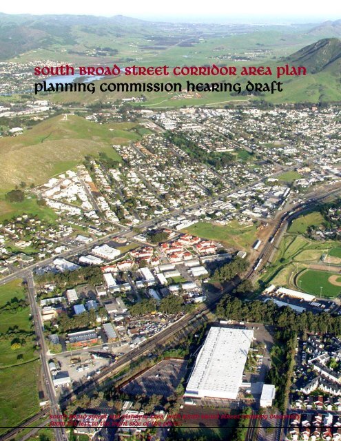
<strong>South</strong> broad street corridor area <strong>Plan</strong><br />
<strong>Plan</strong>ning Commission hearing draft<br />
<strong>South</strong> <strong>Broad</strong> <strong>Street</strong> and <strong>Plan</strong>ning Area, with 0 <strong>South</strong> <strong>Broad</strong> <strong>Street</strong> crossing diagonally<br />
from <strong>the</strong> left to <strong>the</strong> right side <strong>of</strong> <strong>the</strong> photo.
<strong>South</strong> <strong>Broad</strong> <strong>Street</strong> <strong>Corridor</strong> Area <strong>Plan</strong><br />
<strong>Plan</strong>ning Commission Hearing Draft, February 2012<br />
Community Development Department<br />
MISSION STATEMENT<br />
Our mission is to identify and serve <strong>the</strong> needs <strong>of</strong> all people in a positive and courteous manner and to<br />
help ensure that <strong>San</strong> <strong>Luis</strong> <strong>Obispo</strong> remains a healthy, safe, attractive and enjoyable place to live,<br />
work or visit. We help plan <strong>the</strong> <strong>City</strong>'s form and character, support community values, preserve <strong>the</strong><br />
environment, promote <strong>the</strong> wise use <strong>of</strong> resources and protect public health and safety.<br />
OUR SERVICE PHILOSOPHY<br />
The <strong>City</strong> <strong>of</strong> <strong>San</strong> <strong>Luis</strong> <strong>Obispo</strong> Community Development Department staff provides high-quality<br />
service whenever and wherever you need it. We will:<br />
• Listen to and understand your needs;<br />
• Give clear, accurate and prompt answers to your questions;<br />
• Explain how you can achieve your goals under <strong>the</strong> <strong>City</strong>'s rules;<br />
• Help resolve problems in an open, objective and fair manner;<br />
• Maintain <strong>the</strong> highest ethical standards; and<br />
• Work to continually improve our services.<br />
<strong>City</strong> <strong>of</strong> <strong>San</strong> <strong>Luis</strong> <strong>Obispo</strong><br />
<strong>Plan</strong>ning Commission Hearing Draft<br />
SOUTH BROAD STREET CORRIDOR AREA PLAN<br />
(Adoption Date)<br />
<strong>San</strong> <strong>Luis</strong> <strong>Obispo</strong> <strong>City</strong> Council Resolution No. (2012 Series)<br />
1
<strong>South</strong> <strong>Broad</strong> <strong>Street</strong> <strong>Corridor</strong> Area <strong>Plan</strong><br />
<strong>Plan</strong>ning Commission Hearing Draft, February 2012<br />
SAN LUIS OBISPO CITY COUNCIL<br />
Jan Howell Marx, Mayor<br />
John Ashbaugh, Vice Mayor<br />
Dan Carpenter<br />
Andrew Carter<br />
Kathy Smith<br />
PLANNING COMMISSION<br />
Michael Multari, Chair<br />
Michael Draze<br />
John Larson<br />
Eric Meyer<br />
Airlin Singewald<br />
Charles Stevenson<br />
Mary Whittlesey, Vice Chair<br />
ARCHITECTURAL REVIEW COMMISSION<br />
Anthony Palazzo, Chair<br />
Ken Curtis<br />
Jim Duffy, Vice Chair<br />
Suzan Ehdaie<br />
Steven Hopkins<br />
Michelle McCovey-Good<br />
Greg Wynn<br />
CULTURAL HERITAGE COMMITTEE<br />
Jeff Oliveira, Chair<br />
Enrica Costello<br />
Hemalata Dandekar<br />
John Fowler<br />
Jaime Hill<br />
Ken “Buzz” Kalkowski<br />
Robert Pavlik<br />
SOUTH BROAD STREET CORRIDOR FOCUS GROUP<br />
Ka<strong>the</strong>rine Dunklau<br />
Jennifer Metz<br />
Doug Highland<br />
Jeff Lambert<br />
Jeff Jamieson<br />
Shawna Scott<br />
Deborah Denker<br />
Elaine Thurmond<br />
Shawn McNabb<br />
Lee Anna O’Daniel<br />
Mary Whittlesey<br />
Stacey White<br />
Paula Carr<br />
Dan Kallal<br />
Linda Minton<br />
Chuck Crotser<br />
Anthony Palazzo<br />
Carlyn Christianson<br />
2
<strong>South</strong> <strong>Broad</strong> <strong>Street</strong> <strong>Corridor</strong> Area <strong>Plan</strong><br />
<strong>Plan</strong>ning Commission Hearing Draft, February 2012<br />
<strong>City</strong> Administration<br />
Katie Lichtig, <strong>City</strong> Manager<br />
Michael Codron, Assistant <strong>City</strong> Manager<br />
Claire Clark, Economic Development Manager<br />
Community Development Department<br />
Derek Johnson, Community Development Director<br />
Kim Murry, Deputy Director<br />
Tyler Corey, Housing Programs Manager<br />
Es<strong>the</strong>r Valle, <strong>Plan</strong>ning Intern<br />
Edgar Gutierrez, <strong>Plan</strong>ning Intern<br />
John Kibildis, <strong>Plan</strong>ning Intern<br />
Amy López, <strong>Plan</strong>ning Intern<br />
Public Works Department<br />
Jay Walter, Public Works Director<br />
Tim Bochum, Deputy Director<br />
Peggy Mandeville, Principal Transportation <strong>Plan</strong>ner<br />
Jake Hudson, Traffic Engineer<br />
<strong>City</strong> <strong>of</strong> <strong>San</strong> <strong>Luis</strong> <strong>Obispo</strong><br />
919 Palm <strong>Street</strong><br />
<strong>San</strong> <strong>Luis</strong> <strong>Obispo</strong>, CA 93401- 3218<br />
Partially funded through a Community-Based<br />
Transportation <strong>Plan</strong>ning Grant from<br />
California State Department <strong>of</strong> Transportation, District 5<br />
Project Consultants<br />
Rick Engineering / Urban Design & <strong>Plan</strong>ning<br />
Pierre Rademaker Design<br />
To purchase additional copies <strong>of</strong> this <strong>Plan</strong> or o<strong>the</strong>r planning documents, please contact <strong>the</strong> Community<br />
Development Department, <strong>City</strong> <strong>of</strong> <strong>San</strong> <strong>Luis</strong> <strong>Obispo</strong>, 919 Palm <strong>Street</strong>, <strong>San</strong> <strong>Luis</strong> <strong>Obispo</strong>, California 93401-<br />
3218. Phone: (805) 781-7170. Fax: (805) 781-7173. Web address: www.slocity.org<br />
3
<strong>South</strong> <strong>Broad</strong> <strong>Street</strong> <strong>Corridor</strong> Area <strong>Plan</strong> – PC Hearing Draft February 2012<br />
4
<strong>South</strong> <strong>Broad</strong> <strong>Street</strong> <strong>Corridor</strong> Area <strong>Plan</strong> – PC Hearing Draft February 2012<br />
TABLE OF CONTENTS<br />
SOUTH BROAD STREET CORRIDOR AREA PLAN<br />
Foreword<br />
Page<br />
A Fundamental Shift in Land Use 7<br />
A Smart Growth Opportunity 7<br />
Form-Based Codes 8<br />
1.0 Introduction<br />
1.1 Purpose and Intent 9<br />
1.2 The <strong>Plan</strong> Area and Its Issues 9<br />
1.3 Public Participation 14<br />
1.4 <strong>Plan</strong> Objectives 15<br />
1.5 Relationship to <strong>the</strong> General <strong>Plan</strong> and Zoning Regulations 15<br />
1.6 Overview <strong>of</strong> <strong>the</strong> <strong>Plan</strong> 15<br />
2.0 The Area <strong>Plan</strong><br />
2.1 Purpose 17<br />
2.2 How to Use <strong>the</strong> Area <strong>Plan</strong> 17<br />
2.3 Interpretation and Area <strong>of</strong> Application 18<br />
2.4 Applicability <strong>of</strong> Area <strong>Plan</strong> Standards 18<br />
2.5 <strong>Street</strong> Types 21<br />
2.6 Zones Established 27<br />
2.7 Allowed Land Uses 27<br />
3.0 Development Standards<br />
3.1 Overview and Intent 35<br />
3.2 Applicability 35<br />
3.3 Guiding Principles 35<br />
3.4 Building Types by <strong>Street</strong> Type 36<br />
3.5 Form-Based Codes 37<br />
3.6 Parking Requirements 49<br />
3.7 Special Design Factors 50<br />
4.0 <strong>Street</strong>scape Standards<br />
4.1 Overview and Intent 52<br />
4.2 <strong>Street</strong> Design Standards 52<br />
4.3 <strong>Street</strong> Trees and Landscaping 55<br />
4.4 Lighting and Utilities 57<br />
4.5 Signage, <strong>Street</strong> Furniture, and Special Paving 58<br />
5.0 Architectural Standards<br />
5.1 Overview and Intent 60<br />
5.2 Applicability 60<br />
5.3 General Architectural Standards 60<br />
5.4 Specific Architectural Standards 65<br />
6.0 Public Facilities Financing<br />
6.1 Purpose<br />
5
<strong>South</strong> <strong>Broad</strong> <strong>Street</strong> <strong>Corridor</strong> Area <strong>Plan</strong> – PC Hearing Draft February 2012<br />
6.2 Applying <strong>the</strong> Standards 68<br />
6.3 Exceptions and Discretionary Approvals 68<br />
7.0 Glossary 70<br />
8.0 References 71<br />
9.0 Appendices 72<br />
9.1 Resolution No. XXXX (2008 Series) – General <strong>Plan</strong> Amendment<br />
9.2 Ordinance No. XXXX (2008 Series) – Rezoning: Mixed-Use/Form-Based<br />
Codes Overlay Zoning<br />
9.3 Public Participation Record<br />
9.4 Economic Tools<br />
9.5 Technical Data<br />
6
<strong>South</strong> <strong>Broad</strong> <strong>Street</strong> <strong>Corridor</strong> Area <strong>Plan</strong> – PC Hearing Draft February 2012<br />
FOREWORD<br />
Neighborhoods change and evolve over time. A case in point: <strong>the</strong> <strong>South</strong> <strong>Broad</strong> <strong>Street</strong> neighborhood,<br />
bounded by <strong>Broad</strong> <strong>Street</strong> on <strong>the</strong> west, <strong>the</strong> Union Pacific Railroad tracks on <strong>the</strong> east, Downtown and <strong>the</strong><br />
Railroad Historic District to <strong>the</strong> northwest and west, and Orcutt Road on <strong>the</strong> south is a neighborhood in<br />
transition. This roughly 140-acre neighborhood, once home to many Italian-Americans and railroad<br />
workers, is one <strong>of</strong> <strong>the</strong> <strong>City</strong>’s oldest residential neighborhoods, dating to <strong>the</strong> early 1880s. Though many<br />
dwellings remain, most <strong>of</strong> <strong>the</strong> neighborhood, sometimes referred to as “Little Italy,” has been replaced by<br />
a mix <strong>of</strong> commercial, light industrial, waste recycling, auto sales, auto repair, and o<strong>the</strong>r uses and<br />
businesses.<br />
The General <strong>Plan</strong> identifies this area as an “Optional Use and Special Design Area” and says <strong>the</strong> <strong>City</strong><br />
should prepare a plan to encourage innovative design<br />
Figure F.1. Vicinity Map<br />
concepts that help revitalize and beautify <strong>the</strong> area. In<br />
addition, <strong>the</strong> Housing Element identifies this area as<br />
having potential for infill housing development.<br />
Working with its citizens and <strong>the</strong> California Department<br />
<strong>of</strong> Transportation (Caltrans), <strong>the</strong> <strong>City</strong> has prepared this<br />
Area <strong>Plan</strong> to meet General <strong>Plan</strong> policy, to help guide<br />
<strong>the</strong> area’s private development with mixed commercial<br />
and residential uses, to achieve needed public<br />
improvements, and to encourage <strong>the</strong> development <strong>of</strong><br />
higher-density infill housing. The Area <strong>Plan</strong> does this<br />
with three primary tools: a new land use vision, an<br />
emphasis on housing, and form-based codes to guide<br />
and implement change.<br />
A Fundamental Shift in Land Use<br />
Over a 20-year planning horizon, <strong>the</strong> Area <strong>Plan</strong><br />
anticipates approximately 425 new dwellings;<br />
880,000 square feet <strong>of</strong> commercial space; a revitalized<br />
architectural character that reflects <strong>the</strong> area’s historic<br />
uses; and more walkable, attractive, and accessible<br />
streets and public spaces. Under <strong>the</strong> Area <strong>Plan</strong>, mixeddensity<br />
residential uses, small-scale retail sales, <strong>of</strong>fices,<br />
and neighborhood-serving uses would be encouraged.<br />
Existing service-commercial uses would gradually<br />
transition to more compatible uses, such as small-scale<br />
workshops, work-live studios, and o<strong>the</strong>r compatible<br />
service-commercial uses.<br />
A Smart Growth Opportunity<br />
Figure F.2. <strong>South</strong> <strong>Broad</strong> <strong>Street</strong> <strong>Corridor</strong><br />
<strong>Plan</strong>ning Area<br />
Redevelopment <strong>of</strong> <strong>the</strong> <strong>South</strong> <strong>Broad</strong> <strong>Street</strong> <strong>Corridor</strong><br />
makes good sense. The <strong>Corridor</strong> is close to shopping,<br />
schools, employment centers, and major transportation<br />
facilities, including public transit, <strong>the</strong> <strong>San</strong> <strong>Luis</strong> <strong>Obispo</strong><br />
County Regional Airport, and <strong>the</strong> Amtrak Train Station.<br />
By emphasizing infill development, <strong>the</strong> Area <strong>Plan</strong><br />
implements <strong>the</strong> <strong>City</strong>’s Smart Growth principles. It<br />
encourages walking, bicycling, and public transit use<br />
7
<strong>South</strong> <strong>Broad</strong> <strong>Street</strong> <strong>Corridor</strong> Area <strong>Plan</strong> – PC Hearing Draft February 2012<br />
and avoids <strong>the</strong> need to extend major streets or utilities into undeveloped areas.<br />
Form-Based Codes<br />
This Area <strong>Plan</strong> uses form-based codes (FBCs) to achieve <strong>the</strong> community’s vision for <strong>the</strong> <strong>South</strong> <strong>Broad</strong><br />
<strong>Street</strong> <strong>Corridor</strong>. In this area, <strong>the</strong> <strong>City</strong> wants to promote mixed residential and commercial uses, improve<br />
<strong>the</strong> appearance and safety <strong>of</strong> streets and o<strong>the</strong>r public places, and expand housing opportunities.<br />
FBCs regulate land use and development through clear, illustrated standards for <strong>the</strong> design <strong>of</strong> streets,<br />
buildings, and public spaces. They emphasize <strong>the</strong> physical form and spatial qualities <strong>of</strong> urban areas and<br />
can increase development “predictability” for both property owners and <strong>the</strong> community. FBCs use clear,<br />
specific standards to allow more flexible approaches to land use, parking, and residential density than<br />
possible under conventional zoning standards with <strong>the</strong> end goal <strong>of</strong> creating high-quality, sustainable, and<br />
vibrant neighborhoods and public spaces. Land use changes can happen gradually in response to changing<br />
community needs and market forces.<br />
The <strong>South</strong> <strong>Broad</strong> <strong>Street</strong> <strong>Corridor</strong> Area <strong>Plan</strong> emphasizes <strong>the</strong> development <strong>of</strong> multi-family, stacked flats;<br />
town homes; and mixed-use developments to expand <strong>the</strong> range <strong>of</strong> housing types and prices, to increase<br />
tenure, and to help meet diverse housing demands in <strong>the</strong> area.<br />
8
<strong>South</strong> <strong>Broad</strong> <strong>Street</strong> <strong>Corridor</strong> Area <strong>Plan</strong> – PC Hearing Draft February 2012<br />
Chapter 1: INTRODUCTION<br />
1.1 PURPOSE AND INTENT<br />
The overarching purposes <strong>of</strong> <strong>the</strong> <strong>South</strong> <strong>Broad</strong> <strong>Street</strong> <strong>Corridor</strong> Area <strong>Plan</strong> are to improve <strong>the</strong> area’s<br />
transportation safety, encourage mixed land uses, increase affordable housing, and enhance <strong>the</strong> area’s<br />
appearance as a major <strong>City</strong> gateway. This plan implements <strong>the</strong> following General <strong>Plan</strong> Land Use<br />
Element Policy and Housing Element Program for <strong>the</strong> <strong>South</strong> <strong>Broad</strong> <strong>Street</strong> <strong>Corridor</strong> area:<br />
Land Use Element—Policy 8.3<br />
Figure 10 <strong>of</strong> <strong>the</strong> General <strong>Plan</strong> shows <strong>the</strong> <strong>South</strong> <strong>Broad</strong> <strong>Street</strong> <strong>Corridor</strong> (Area 3) as an “optional use and<br />
special design area.” It is one <strong>of</strong> several areas where <strong>the</strong> General <strong>Plan</strong> calls for <strong>the</strong> <strong>City</strong> to consider a<br />
range or mix <strong>of</strong> uses, which do not necessarily match any single use district described in <strong>the</strong> Land Use<br />
Element.<br />
The policy says that <strong>the</strong> “renovation <strong>of</strong> streetscapes, landscaping, and building façades is encouraged, and<br />
that <strong>the</strong> <strong>City</strong> should work with property owners to prepare area plans containing design guidelines and<br />
implementation programs. Programs may include implementation incentives, such as variations from<br />
development standards or loan funds.” The <strong>South</strong> <strong>Broad</strong> <strong>Street</strong> <strong>Corridor</strong> Area <strong>Plan</strong> is a result <strong>of</strong> this<br />
policy.<br />
The Area <strong>Plan</strong> combines a range and mix <strong>of</strong> land uses especially suited to this area within a specific<br />
physical design framework and implementation strategy. With this plan, <strong>the</strong> <strong>City</strong> intends to:<br />
(A) Choose appropriate land uses for <strong>the</strong> planning area, utilizing an area plan and form-based codes to<br />
address specific land uses and requirements for improved public facilities, including streets, sidewalks,<br />
utilities, and bike paths; and<br />
(B) Encourage innovative design concepts which help revitalize and beautify <strong>the</strong> area.<br />
Housing Element—Program 6.12.A<br />
Program 6.12.A and Figure 1 <strong>of</strong> <strong>the</strong> Housing Element identify <strong>the</strong> Little Italy district and portions <strong>of</strong> <strong>the</strong><br />
<strong>South</strong> <strong>Broad</strong> <strong>Street</strong> <strong>Corridor</strong> area for possible rezoning to encourage mixed-use development and higher<br />
density housing. In response, <strong>the</strong> <strong>City</strong>’s 2003-2005 Financial <strong>Plan</strong> identified <strong>Broad</strong> <strong>Street</strong> <strong>Corridor</strong><br />
Enhancement as a Major <strong>City</strong> Goal.<br />
The <strong>Plan</strong> will “re-create” and revitalize a neighborhood that has been somewhat isolated and overlooked<br />
in terms <strong>of</strong> public and private improvement. The corridor is ideally situated to implement now widelyaccepted<br />
transit-oriented development principles. It could become a place where people live, work, and<br />
play near schools, parks, shopping, jobs, and services, as well as be an area where people are linked to <strong>the</strong><br />
<strong>City</strong> and region through several transit modes. In addition, as discussed in <strong>the</strong> Housing Element, <strong>the</strong> Little<br />
Italy area may <strong>of</strong>fer opportunities for low- and moderate-cost housing with convenient access to jobs,<br />
services, Downtown, and <strong>the</strong> nearby Railroad Transit Center.<br />
1.2 THE PLAN AREA AND ITS ISSUES<br />
The <strong>Plan</strong> Area<br />
The <strong>South</strong> <strong>Broad</strong> <strong>Street</strong> <strong>Corridor</strong> is centrally situated in <strong>the</strong> <strong>City</strong> <strong>of</strong> <strong>San</strong> <strong>Luis</strong> <strong>Obispo</strong>, with <strong>the</strong> Regional<br />
Transit Center, Fire Station #1, Hawthorne Elementary School, and Meadow Park anchoring <strong>the</strong> nor<strong>the</strong>rn<br />
9
<strong>South</strong> <strong>Broad</strong> <strong>Street</strong> <strong>Corridor</strong> Area <strong>Plan</strong> – PC Hearing Draft February 2012<br />
portion <strong>of</strong> <strong>the</strong> area. The sou<strong>the</strong>rn end <strong>of</strong> <strong>the</strong> corridor includes retail shopping centers, Maxine Lewis<br />
Memorial Shelter, and <strong>the</strong> Damon-Garcia Sports Fields facility. The Villa Rosa residential condominium<br />
development, which includes affordable to upper moderate income dwelling units, is a major residential<br />
node for <strong>the</strong> sou<strong>the</strong>rn portion <strong>of</strong> <strong>the</strong> plan area.<br />
The one-mile stretch <strong>of</strong> <strong>Broad</strong> <strong>Street</strong> between High <strong>Street</strong> and Orcutt Road is <strong>the</strong> corridor <strong>of</strong> <strong>the</strong> planning<br />
area. Approximately 5,500 people live within one-half mile <strong>of</strong> <strong>the</strong> corridor, mostly on <strong>the</strong> west side <strong>of</strong><br />
<strong>Broad</strong> <strong>Street</strong>. In a regional context, <strong>Broad</strong> <strong>Street</strong> is <strong>the</strong> <strong>City</strong>’s main connection with <strong>the</strong> <strong>San</strong> <strong>Luis</strong> <strong>Obispo</strong><br />
County Regional Airport and with <strong>the</strong> cities <strong>of</strong> Arroyo Grande, Pismo Beach, and Grover Beach via State<br />
Highway 227 and Price Canyon Road. One <strong>of</strong> <strong>the</strong> main objectives <strong>of</strong> <strong>the</strong> plan is to improve bicycle,<br />
pedestrian, transit, and vehicular linkages within and through <strong>the</strong> corridor, <strong>the</strong>reby making it more livable.<br />
Existing and potential linkages are shown in Figure 1.4.<br />
<strong>Corridor</strong> Issues<br />
The <strong>South</strong> <strong>Broad</strong> <strong>Street</strong> <strong>Corridor</strong> poses several planning issues. These were identified at public workshops<br />
held in 2004 and 2006, and at numerous public meetings during 2006, 2007, and 2008. These issues have<br />
shaped <strong>the</strong> <strong>Plan</strong>’s goals, policies, and programs and are summarized below and include: land use, <strong>Broad</strong><br />
<strong>Street</strong>, airport planning, transportation safety, connectivity, and aes<strong>the</strong>tics.<br />
Figure 1.3 The “spine” <strong>of</strong> <strong>the</strong> planning area,<br />
<strong>Broad</strong> <strong>Street</strong> (looking south from <strong>South</strong><br />
<strong>Street</strong>) currently functions efficiently in its<br />
role as an extension <strong>of</strong> State Route 227, but is<br />
also a barrier between neighborhoods on <strong>the</strong><br />
west side and east side <strong>of</strong> <strong>the</strong> street.<br />
10
<strong>South</strong> <strong>Broad</strong> <strong>Street</strong> <strong>Corridor</strong> Area <strong>Plan</strong> – PC Hearing Draft February 2012<br />
Figure 1.4 Site Constraints and Opportunities Analysis (Prepare 11x17 foldout map.)<br />
11
<strong>South</strong> <strong>Broad</strong> <strong>Street</strong> <strong>Corridor</strong> Area <strong>Plan</strong> – PC Hearing Draft February 2012<br />
Land Use<br />
In 2008, <strong>the</strong> area’s primary General <strong>Plan</strong> designation, Services and Manufacturing, was <strong>the</strong> result <strong>of</strong> <strong>the</strong><br />
area’s historic association with <strong>the</strong> railroad; however, this land use designation no longer suits <strong>the</strong> <strong>City</strong>’s<br />
contemporary urban pattern.<br />
Development in <strong>the</strong> area began in <strong>the</strong> late 1880s as a residential subdivision and was eventually zoned<br />
under County jurisdiction as “manufacturing.” It was later annexed to <strong>the</strong> <strong>City</strong> as “servicecommercial/light<br />
industrial,” making <strong>the</strong> remaining homes “legal, nonconforming.” As new housing and<br />
retail shops and services develop nearby, <strong>the</strong> more intensive service-commercial and manufacturing uses<br />
can pose compatibility issues due to noise, truck traffic, or o<strong>the</strong>r use characteristics. O<strong>the</strong>r areas, such as<br />
<strong>the</strong> Sacramento Drive and Airport areas, <strong>of</strong>fer service-commercial and manufacturing zoned land with<br />
larger lots, better access, and better public facilities than <strong>the</strong> <strong>South</strong> <strong>Broad</strong> <strong>Street</strong> area <strong>of</strong>fers.<br />
The area lacks public facilities common in o<strong>the</strong>r <strong>City</strong> neighborhoods, such as continuous sidewalks, street<br />
trees, and crosswalks. Revitalization has been difficult due to <strong>the</strong> lack <strong>of</strong> a cohesive plan for <strong>the</strong> area,<br />
limited access, <strong>the</strong> area’s historic development pattern <strong>of</strong> small parcels, and <strong>the</strong> need for public<br />
improvements. This <strong>Plan</strong> provides <strong>the</strong> vision and <strong>the</strong> tools to create opportunities for infill development,<br />
compatible mixed land uses, and a more attractive, walkable neighborhood.<br />
<strong>Broad</strong> <strong>Street</strong><br />
The <strong>Broad</strong> <strong>Street</strong> corridor is a spine <strong>of</strong> <strong>the</strong> <strong>City</strong>’s<br />
transportation and transit network, linking<br />
Downtown with <strong>the</strong> SLO County Regional Airport<br />
and <strong>South</strong> County. The Regional Transportation<br />
Center, located just north <strong>of</strong> <strong>the</strong> planning area in <strong>the</strong><br />
Railroad Historic District, is a public transit hub for<br />
citywide, regional, and statewide bus and train<br />
service.<br />
<strong>Broad</strong> <strong>Street</strong> serves multiple transportation needs as<br />
a regional arterial street and as a local street serving<br />
businesses, residences, shopping, and public<br />
facilities. Its design allows for high traffic volumes,<br />
relatively high speeds, and continuous, uncontrolled<br />
left turns into streets and driveways, making it<br />
difficult for residents to access businesses, adjacent<br />
neighborhoods, schools, parks, and public transit. It<br />
poses an obstacle to residents west <strong>of</strong> <strong>Broad</strong> <strong>Street</strong><br />
who desire improved mobility through <strong>the</strong><br />
neighborhood, particularly to commercial uses and<br />
neighborhood features on <strong>the</strong> east side <strong>of</strong> <strong>the</strong> street.<br />
As shown in Figure 1.5, several important<br />
community facilities are in <strong>the</strong> vicinity <strong>of</strong> <strong>the</strong> <strong>Plan</strong><br />
area. <strong>South</strong> <strong>Broad</strong> <strong>Street</strong> functions as an arterial<br />
street, providing local access to those facilities.<br />
Figure 1.5 <strong>Plan</strong> Area With Community<br />
Facilities<br />
12
<strong>South</strong> <strong>Broad</strong> <strong>Street</strong> <strong>Corridor</strong> Area <strong>Plan</strong> – PC Hearing Draft February 2012<br />
Airport Land Use <strong>Plan</strong><br />
Most <strong>of</strong> <strong>the</strong> planning area is located within Safety<br />
Area S-2 <strong>of</strong> <strong>the</strong> Airport Land Use <strong>Plan</strong> (ALUP), as<br />
shown in Figure 1.6. The ALUP sets land use and<br />
design standards to balance airport planning and<br />
safety needs with land use, residential density and<br />
infill goals. The Area <strong>Plan</strong> is consistent with <strong>the</strong><br />
ALUP standards and was prepared as a Detailed<br />
Area <strong>Plan</strong>, in consultation with <strong>the</strong> <strong>San</strong> <strong>Luis</strong> <strong>Obispo</strong><br />
County Airport Land Use Commission. Its policies,<br />
programs and guidelines will maintain compatibility<br />
between development in <strong>the</strong> plan area and airport<br />
operations.<br />
Figure 1.6 Airport Safety Zones. <strong>South</strong><br />
Transportation Safety<br />
<strong>Broad</strong> <strong>Street</strong> <strong>Corridor</strong> planning area,<br />
located in Airport Safety Zone 2B<br />
A recurring <strong>the</strong>me voiced at public hearings and<br />
workshops is <strong>the</strong> need for safe pedestrian and bicycle facilities in <strong>the</strong> corridor. For example, public transit<br />
users traveling southbound on <strong>Broad</strong> <strong>Street</strong> face a significant challenge if <strong>the</strong>y want to disembark midblock<br />
and cross to a business on <strong>the</strong> east side <strong>of</strong> <strong>the</strong> street. Existing conditions, including high traffic<br />
volumes and speed, lack <strong>of</strong> signalized intersections, and a five-lane right-<strong>of</strong>-way on <strong>Broad</strong> <strong>Street</strong>, have<br />
prompted area residents to seek context sensitive design solutions that provide improved mobility and an<br />
enhanced aes<strong>the</strong>tic character for <strong>the</strong><br />
corridor and adjacent mixed-use<br />
neighborhood.<br />
Connectivity<br />
Although centrally located, <strong>the</strong> planning<br />
area’s accessibility is limited by <strong>the</strong><br />
railroad tracks, an incomplete street<br />
network, historic development patterns<br />
and by <strong>Broad</strong> <strong>Street</strong>. Traffic volumes on<br />
<strong>Broad</strong> <strong>Street</strong> – up to 29,100 vehicles per<br />
day in 2010 – discourage all but <strong>the</strong><br />
most determined pedestrians and<br />
bicyclists from crossing <strong>Broad</strong> <strong>Street</strong>. Figure 1.7 Proposed Circulation Modifications<br />
Crosswalks, sidewalks, and bikeways<br />
between <strong>the</strong> planning area and surrounding neighborhoods will allow safer access to Hawthorne<br />
Elementary School, Sinsheimer Elementary School, and Sinsheimer Park; enhance quality <strong>of</strong> life; affirm<br />
<strong>the</strong> area’s role as a neighborhood; and encourage residential and commercial investment.<br />
As shown in <strong>the</strong> Master Illustrative <strong>Plan</strong>, Figure 1.10, proposed street, bicycle, and pedestrian connections<br />
to destinations on ei<strong>the</strong>r side <strong>of</strong> <strong>Broad</strong> <strong>Street</strong> will make <strong>the</strong> revitalized neighborhood more livable and<br />
improve access to area businesses, schools, parks, and o<strong>the</strong>r public facilities. For example, during public<br />
workshops on <strong>the</strong> Area <strong>Plan</strong>, <strong>the</strong> extension <strong>of</strong> Victoria Avenue was universally supported as an important<br />
component <strong>of</strong> future development. The extension will provide a through route from Mutsuhito to<br />
Roundhouse Avenue, providing important street frontage for existing businesses and new mixed-use<br />
development, and it will provide an alternative route to <strong>Broad</strong> <strong>Street</strong> with lower speed vehicular traffic,<br />
making pedestrian and bicycle use more attractive. The <strong>South</strong> <strong>Broad</strong> <strong>Street</strong> <strong>Corridor</strong> “Mission Critical”<br />
13
<strong>South</strong> <strong>Broad</strong> <strong>Street</strong> <strong>Corridor</strong> Area <strong>Plan</strong> – PC Hearing Draft February 2012<br />
Improvement Projects & Cost Estimates document (April 29, 2011) lays out <strong>the</strong> estimated costs for<br />
essential infrastructure improvements in <strong>the</strong> plan area.<br />
The <strong>Plan</strong>ning Area is within a 5-10 minute walk from several <strong>City</strong> parks and open space areas. The<br />
Railroad Safety Trail bike path runs along <strong>the</strong> east side <strong>of</strong> <strong>the</strong> railroad right-<strong>of</strong>-way, linking <strong>the</strong> area with<br />
<strong>the</strong> Railroad Historic District, Downtown, and, eventually, with Cal Poly. Safe pedestrian and bicycle<br />
access to <strong>the</strong>se park and open space areas is limited, however, by <strong>Broad</strong> <strong>Street</strong> and <strong>the</strong> railroad tracks.<br />
This Area <strong>Plan</strong> would improve park and open space access for residents on both sides <strong>of</strong> <strong>Broad</strong> <strong>Street</strong> and<br />
<strong>the</strong> railroad tracks by including an improved railroad undercrossing initially and a railroad pedestrian<br />
bridge in <strong>the</strong> near future. The plan also includes a new section <strong>of</strong> <strong>the</strong> Railroad Safety Trail on <strong>the</strong> west<br />
side <strong>of</strong> <strong>the</strong> railroad tracks and a pocket park near <strong>the</strong> end <strong>of</strong> McMillan <strong>Street</strong> at <strong>the</strong> railroad.<br />
Aes<strong>the</strong>tics<br />
Much <strong>of</strong> <strong>the</strong> planning area was originally developed as part <strong>of</strong> <strong>the</strong> Imperial Addition, an 1888 subdivision<br />
laid out as a residential neighborhood. The neighborhood originally consisted <strong>of</strong> small houses with simple<br />
designs. Over time, as zoning changed and non-residential uses appeared, most <strong>of</strong> <strong>the</strong> old neighborhood<br />
was demolished. The most notable concentration <strong>of</strong> <strong>the</strong> few remaining houses from that period is between<br />
Humbert Avenue and Woodbridge <strong>Street</strong>.<br />
Figure 1.8 <strong>Broad</strong> <strong>Street</strong> at Humbert,<br />
looking south, in 2008<br />
Figure 1.9 <strong>Broad</strong> <strong>Street</strong> at Humbert, looking<br />
south, with implementation <strong>of</strong> proposed<br />
improvements<br />
In 2011, this is a neighborhood in transition, both in terms <strong>of</strong> land use and visual character. Depending<br />
upon one’s perspective, its visual character has been described as “funky” and diverse. Some areas are<br />
described as dilapidated due to <strong>the</strong> lack <strong>of</strong> public facilities, vacant and underutilized properties, and<br />
presence <strong>of</strong> legal, nonconforming buildings. Land uses in <strong>the</strong> area are in transition, and that transition is<br />
reflected in <strong>the</strong> area’s diverse architectural character: a mix <strong>of</strong> older commercial and residential buildings.<br />
Through this plan, <strong>the</strong> area’s desirable qualities <strong>of</strong> architectural variety, diversity, mixed-uses, and human<br />
scale will be retained and enhanced.<br />
1.3 PUBLIC PARTICIPATION<br />
Public involvement has been a key part <strong>of</strong> <strong>South</strong> <strong>Broad</strong> <strong>Street</strong> <strong>Corridor</strong> planning. Through a series <strong>of</strong><br />
public workshops and verbal, written, telephone, and email feedback, <strong>the</strong> planning team compiled a set <strong>of</strong><br />
Community Values and Neighborhood Features, or physical and functional elements <strong>of</strong> <strong>the</strong> study area and<br />
its surroundings, that ought to be taken into account throughout <strong>the</strong> planning process.<br />
Building upon two Caltrans-funded public “visioning” workshops in May 2004, followed by ano<strong>the</strong>r<br />
well-attended public workshop in November 2006, a 20-member Focus Group composed <strong>of</strong> area<br />
14
<strong>South</strong> <strong>Broad</strong> <strong>Street</strong> <strong>Corridor</strong> Area <strong>Plan</strong> – PC Hearing Draft February 2012<br />
residents, business, and property owners, and representatives from <strong>the</strong> <strong>Plan</strong>ning and Architectural Review<br />
Commissions and <strong>the</strong> Cultural Heritage Committee was created. Input received at <strong>the</strong> workshops and<br />
subsequent outreach techniques are discussed in detail in Appendix 9.3.<br />
1.4 PLAN OBJECTIVES<br />
The following objectives were developed through collaboration between community members and<br />
Community Development Staff:<br />
Reduce traffic impact<br />
Increase safety for biking and walking<br />
Maintain and foster neighborhood identity<br />
Emphasize affordable housing<br />
1.5 RELATIONSHIP TO THE GENERAL PLAN AND ZONING REGULATIONS<br />
The <strong>South</strong> <strong>Broad</strong> <strong>Street</strong> <strong>Corridor</strong> Area <strong>Plan</strong> is part <strong>of</strong> <strong>the</strong> <strong>City</strong>’s General <strong>Plan</strong>. It carries out goals, policies,<br />
and programs <strong>of</strong> <strong>the</strong> General <strong>Plan</strong> and establishes development regulations for a specific geographic area<br />
in <strong>the</strong> <strong>City</strong>. Within this area, development is regulated by <strong>the</strong> form-based codes included in <strong>the</strong> Area <strong>Plan</strong>.<br />
These codes implement <strong>the</strong> community’s vision for <strong>the</strong> planning area as created through a series <strong>of</strong> public<br />
meetings held from 2004 through 2008 and <strong>the</strong>n set forth in <strong>the</strong> Area <strong>Plan</strong>. Where <strong>the</strong>re is a conflict<br />
between <strong>the</strong> form-based codes and <strong>the</strong> Zoning Regulations, <strong>the</strong> form-based codes shall govern. For<br />
development standards not addressed in <strong>the</strong> Area <strong>Plan</strong> or form-based codes, <strong>the</strong> o<strong>the</strong>r applicable sections<br />
<strong>of</strong> <strong>the</strong> Zoning Regulations, Municipal Code, and State and Federal law shall apply.<br />
1.6 OVERVIEW OF THE PLAN<br />
The <strong>South</strong> <strong>Broad</strong> <strong>Street</strong> <strong>Corridor</strong> Area <strong>Plan</strong> is two documents in one: it is a long-range land use plan<br />
describing a “vision” to create a vibrant mixed-use neighborhood, and it is a legal document that regulates<br />
land development through clear, predictable, yet flexible standards for land use, site planning, building<br />
form, and density. The Area <strong>Plan</strong> uses simple graphic and written descriptions to define a range <strong>of</strong> street,<br />
building, and land use types. Through this emphasis on physical form, <strong>the</strong> Area <strong>Plan</strong> seeks to create a<br />
safe, attractive, economically vital, and enjoyable neighborhood with a mix <strong>of</strong> complementary land uses.<br />
The vision is shown in Figure 1.10, Master Illustrative <strong>Plan</strong>.<br />
15
<strong>South</strong> <strong>Broad</strong> <strong>Street</strong> <strong>Corridor</strong> Area <strong>Plan</strong> – PC Hearing Draft February 2012<br />
Figure 1.10 <strong>South</strong> <strong>Broad</strong> <strong>Street</strong> Master Illustrative <strong>Plan</strong><br />
(Foldout page with color map)<br />
16
<strong>South</strong> <strong>Broad</strong> <strong>Street</strong> <strong>Corridor</strong> Area <strong>Plan</strong> – PC Hearing Draft February 2012<br />
2.1 PURPOSE<br />
Chapter 2: THE AREA PLAN<br />
This section establishes <strong>the</strong> land use zones or “districts” applied to property within <strong>the</strong> plan area. The<br />
Area <strong>Plan</strong> divides <strong>the</strong> plan area into separate zones or districts that are based on <strong>the</strong> predominant street<br />
type that borders <strong>the</strong> property, with most zones allowing a significant mixture <strong>of</strong> residential and<br />
commercial land uses. This approach differs from conventional zoning maps in that it uses specific<br />
standards for building style, placement and compatibility – tailored for <strong>the</strong> particular area – instead <strong>of</strong><br />
land use zones as <strong>the</strong> spatial basis for regulating development. The zones also effectively implement<br />
General <strong>Plan</strong> objectives for mixed-uses, housing and urban design within <strong>the</strong> planning area.<br />
2.2 HOW TO USE THE AREA PLAN<br />
The Area <strong>Plan</strong> sets special land use and design standards for <strong>the</strong> <strong>South</strong> <strong>Broad</strong> <strong>Street</strong> <strong>Corridor</strong> planning<br />
area. The <strong>Plan</strong> has three basic parts: 1) street types, 2) land use and development standards, and 3) general<br />
provisions. The <strong>Plan</strong> shall apply to all parcels and rights-<strong>of</strong>-way, as fur<strong>the</strong>r described below.<br />
In using and applying <strong>the</strong> standards in this Area <strong>Plan</strong>, <strong>the</strong>se key terms shall be defined as follows:<br />
The terms “shall” or “will” are mandatory and mean that an action shall be taken or a standard followed<br />
without exception. “Should” means such an action or standard will be followed in most circumstances<br />
unless significant reasons or factors, as determined by <strong>the</strong> Director, prevent or discourage<br />
implementation. The terms “encourage,” “promote,” and “support” are permissive and indicate a<br />
desirable but not a mandatory action. They indicate intent to take action but are not linked to a specific<br />
timeframe or work program. In this document, <strong>the</strong> terms “code” and “standard” are used<br />
interchangeably and indicate adopted municipal law.<br />
Determining allowed uses. Using Figure 2.1, determine whe<strong>the</strong>r <strong>the</strong> property is within <strong>the</strong> planning area<br />
boundaries. If <strong>the</strong> property does not lie within <strong>the</strong> planning area boundaries, <strong>the</strong>n this Area <strong>Plan</strong> does not<br />
apply, and <strong>the</strong> <strong>City</strong>wide Zoning Regulations or o<strong>the</strong>r applicable regulations and guidelines should be<br />
consulted. If <strong>the</strong> property does lie within <strong>the</strong> planning area boundaries, <strong>the</strong>n this Area <strong>Plan</strong> applies. If <strong>the</strong><br />
property is located in more than one zoning district, <strong>the</strong> district which includes <strong>the</strong> majority <strong>of</strong> parcel area<br />
shall apply.<br />
Review Table 2.1 (page ___), Table <strong>of</strong> Allowed Uses, to determine what uses are allowed and<br />
conditionally allowed on <strong>the</strong> property.<br />
Determining development standards. Use Figure 2.2 (page___) to determine which street type <strong>the</strong><br />
property fronts. If <strong>the</strong> property is a corner lot, use <strong>the</strong> primary street frontage according to <strong>the</strong> street type<br />
hierarchy described in Section 2.6, <strong>Street</strong> Types.<br />
Use Table 3.2 to determine allowed building types based on <strong>the</strong> parcel’s primary street frontage.<br />
Review <strong>the</strong> Form-Based Codes, Section 3.5, to determine <strong>the</strong> allowed building placement, height,<br />
setbacks, and o<strong>the</strong>r standards for allowed building types.<br />
Review <strong>the</strong> Architectural Standards, Chapter 5, for specific exterior architectural and landscape standards.<br />
Review Implementation, Chapter 6, to determine how to apply <strong>the</strong> standards and how to get approval for<br />
<strong>the</strong> development project.<br />
17
<strong>South</strong> <strong>Broad</strong> <strong>Street</strong> <strong>Corridor</strong> Area <strong>Plan</strong> – PC Hearing Draft February 2012<br />
2.3 INTERPRETATION AND AREA OF APPLICATION<br />
The <strong>South</strong> <strong>Broad</strong> <strong>Street</strong> <strong>Corridor</strong> Area <strong>Plan</strong> shall apply to <strong>the</strong> area shown in Figure 2.1, and as fur<strong>the</strong>r<br />
described in Appendix 9.5, Technical Data. The Director shall interpret <strong>the</strong>se regulations, subject to <strong>the</strong><br />
appeal procedures in Chapter 17.66 <strong>of</strong> <strong>the</strong> Zoning Regulations. The included text and maps shall<br />
supersede standards in o<strong>the</strong>r <strong>City</strong> documents, unless stated o<strong>the</strong>rwise in this document. The standards<br />
provide a flexible yet predictable process for encouraging and guiding redevelopment <strong>of</strong> <strong>the</strong> planning<br />
area, consistent with <strong>the</strong> General <strong>Plan</strong>. Photographic images and concept sketches are intended to show<br />
desired streetscape or building character for <strong>the</strong> planning area and are for illustrative purposes only.<br />
2.4 APPLICABILITY OF AREA PLAN STANDARDS<br />
The zones <strong>of</strong> this Area <strong>Plan</strong> prescribe street types, architectural types, and land uses within <strong>the</strong> plan area,<br />
as well as providing detailed standards for building placement, height, and pr<strong>of</strong>ile. Figure 2.1 shows <strong>the</strong><br />
location <strong>of</strong> <strong>the</strong> zones in relation to existing rights-<strong>of</strong>-way and parcels.<br />
18
<strong>South</strong> <strong>Broad</strong> <strong>Street</strong> <strong>Corridor</strong> Area <strong>Plan</strong> – PC Hearing Draft February 2012<br />
Figure 2.1 Zones in <strong>the</strong> <strong>Plan</strong> Area<br />
19
<strong>South</strong> <strong>Broad</strong> <strong>Street</strong> <strong>Corridor</strong> Area <strong>Plan</strong> – PC Hearing Draft February 2012<br />
Figure 2.2 <strong>Street</strong> Hierarchy<br />
(Foldout map in color)<br />
20
<strong>South</strong> <strong>Broad</strong> <strong>Street</strong> <strong>Corridor</strong> Area <strong>Plan</strong> – PC Hearing Draft February 2012<br />
2.5 STREET TYPES<br />
Development under this <strong>Plan</strong> is regulated by street type. <strong>Street</strong>s are a primary determinant <strong>of</strong> building<br />
placement and form, and <strong>the</strong>y play an important role in creating safe and attractive facilities for<br />
pedestrians, bicyclists, and motorists. Allowed land uses are determined by zone; suitable uses should be<br />
selected based on <strong>the</strong> building form established by street type. Five street types are hereby established in<br />
<strong>the</strong> planning area, as shown in Figure 2.2. A hierarchy <strong>of</strong> street types is established as follows, from<br />
highest to lowest order: <strong>Corridor</strong> <strong>Street</strong> (<strong>Broad</strong> <strong>Street</strong>), Village <strong>Street</strong> (Victoria Avenue), Entry <strong>Street</strong>,<br />
Service <strong>Street</strong>, and Village Court or “woonerf” (a shared space). On corner parcels, <strong>the</strong> primary street<br />
frontage governing development standards is determined by <strong>the</strong> higher intensity street type that <strong>the</strong><br />
property faces. (See Table 3.1 on page ___.) <strong>Street</strong> design, function, and visual character shall be as<br />
described below and in Figures 2.3 through 2.14.<br />
<strong>Corridor</strong> <strong>Street</strong>. <strong>Broad</strong> <strong>Street</strong>, one <strong>of</strong> <strong>the</strong> <strong>City</strong>’s<br />
most heavily traveled thoroughfares, is <strong>the</strong> only<br />
“<strong>Corridor</strong> <strong>Street</strong>” in <strong>the</strong> planning area. This street<br />
type emphasizes its role as an important regional<br />
commercial corridor and neighborhood connector.<br />
This role defines appropriate uses and design<br />
standards, including greater building setbacks,<br />
enhanced streetscape, city-wide oriented retailcommercial<br />
and <strong>of</strong>fice land uses, rear-loaded<br />
parking, and restricted curb openings.<br />
Figure 2.3 <strong>Corridor</strong> <strong>Street</strong> (<strong>Broad</strong> <strong>Street</strong>)<br />
Figure 2.4. <strong>Corridor</strong> <strong>Street</strong>,<br />
View <strong>of</strong> <strong>Broad</strong> <strong>Street</strong> looking north<br />
21
<strong>South</strong> <strong>Broad</strong> <strong>Street</strong> <strong>Corridor</strong> Area <strong>Plan</strong> – PC Hearing Draft February 2012<br />
Village <strong>Street</strong>s. The most pedestrian oriented street –<br />
Victoria Avenue – is <strong>the</strong> only “Village <strong>Street</strong>” in <strong>the</strong> study<br />
area. This street’s design and character emphasizes <strong>the</strong><br />
pedestrian experience. This will be accomplished through<br />
greater building setbacks to achieve wider sidewalks,<br />
pedestrian-friendly building design, more landscaping,<br />
outdoor dining and merchandise display, and limited curb<br />
openings.<br />
Figure 2.5 Village <strong>Street</strong> (Victoria Avenue)<br />
Typical Section and <strong>Plan</strong><br />
Figure 2.6 Village <strong>Street</strong> Illustrative <strong>Plan</strong><br />
22
<strong>South</strong> <strong>Broad</strong> <strong>Street</strong> <strong>Corridor</strong> Area <strong>Plan</strong> – PC Hearing Draft February 2012<br />
Figure 2.7 View <strong>of</strong> Victoria, looking north toward Roundhouse<br />
23
<strong>South</strong> <strong>Broad</strong> <strong>Street</strong> <strong>Corridor</strong> Area <strong>Plan</strong> – PC Hearing Draft February 2012<br />
Entry <strong>Street</strong>. These streets serve as local collectors linking <strong>the</strong> main village area with <strong>Broad</strong> <strong>Street</strong>. Entry<br />
streets are characterized by buildings adjacent to <strong>the</strong> street with mostly commercial uses along <strong>the</strong> ground<br />
story, lower building heights, and more curb openings to allow internal block access for rear parking.<br />
Entry streets will provide access to interior block parking and utility areas, and <strong>the</strong>y feature parallel<br />
parking on both sides. Entry streets would typically have commercial uses on <strong>the</strong> ground floor fronting on<br />
<strong>the</strong> street with residential above. Parcels <strong>of</strong> one-quarter acre or larger could have ground floor dwellings<br />
fronting on <strong>the</strong> street.<br />
Figure 2.9 Entry <strong>Street</strong><br />
Humbert looking east toward <strong>San</strong>ta Lucia Foothills<br />
Figure 2.8 Entry <strong>Street</strong><br />
Typical Section and <strong>Plan</strong><br />
24
<strong>South</strong> <strong>Broad</strong> <strong>Street</strong> <strong>Corridor</strong> Area <strong>Plan</strong> – PC Hearing Draft February 2012<br />
Service <strong>Street</strong>. The plan accommodates <strong>the</strong> long-standing concentration <strong>of</strong> light-industrial and <strong>of</strong>fice<br />
uses along western Duncan and McMillan <strong>Street</strong>s and anticipates <strong>the</strong> gradual transition to a more<br />
residential character through live-work development. Service <strong>Street</strong>s will have <strong>the</strong> lowest traffic counts in<br />
<strong>the</strong> planning area and are designed primarily to accommodate commercial activities as well as provide<br />
basic pedestrian amenities. This area will feature pedestrian and bicycle paths as shown in Figure 1.4 and<br />
will eventually be linked to Sacramento Drive and employment and retail centers to <strong>the</strong> south via a<br />
signalized intersection at Duncan and Orcutt Road. So that uses on both McMillan and Duncan can access<br />
<strong>the</strong> future signalized intersection, a new service street is proposed as shown in Figure 2.2.<br />
Figure 2.11 Typical Service <strong>Street</strong><br />
McMillian looking north<br />
Figure 2.10 Service <strong>Street</strong><br />
Typical Section and <strong>Plan</strong><br />
25
<strong>South</strong> <strong>Broad</strong> <strong>Street</strong> <strong>Corridor</strong> Area <strong>Plan</strong> – PC Hearing Draft February 2012<br />
Village Court (Woonerf) – To reduce traffic conflicts on <strong>Broad</strong> <strong>Street</strong>, new development should provide<br />
access and parking at <strong>the</strong> rear <strong>of</strong> <strong>the</strong> lot. The Area <strong>Plan</strong> calls for a 24-foot wide “village court,” a multipurpose<br />
roadway, along <strong>the</strong> rear <strong>of</strong> parcels fronting on <strong>Broad</strong> <strong>Street</strong> between Francis and Mutsuhito. Also<br />
called a “woonerf,” <strong>the</strong> village court will serve both residential and commercial uses and should be<br />
designed to integrate car and pedestrian use, as shown in Figure 2.12. The woonerf design integrates<br />
sidewalks and roadways into one surface, creating <strong>the</strong> impression <strong>of</strong> a yard.<br />
Figure 2.13 (above) and Figure 2.14 (below)<br />
Examples <strong>of</strong> multi-purpose Village Courts,<br />
or “woonerfs,” showing character and features<br />
Figure 2.12 – Village Court<br />
Typical Section and <strong>Plan</strong><br />
26
<strong>South</strong> <strong>Broad</strong> <strong>Street</strong> <strong>Corridor</strong> Area <strong>Plan</strong> – PC Hearing Draft February 2012<br />
2.6 ZONES ESTABLISHED<br />
The following zones are established by this Area <strong>Plan</strong> and applied to property within <strong>the</strong> boundary as<br />
shown on Figure 2.1.<br />
Service-Commercial Zone (C-S). This zone is applied to areas adjacent to <strong>the</strong> Union Pacific Railroad<br />
right-<strong>of</strong>-way, <strong>the</strong> area north <strong>of</strong> Orcutt Road, along Duncan and McMillan Roads, and between <strong>the</strong> Retail<br />
Commercial zones. This zone is intended to provide for <strong>the</strong> guided transition <strong>of</strong> this area from its present<br />
service-commercial, light-industrial land use to a mixed-use district that promotes higher density infill<br />
housing and compatible commercial service uses, such as arts and crafts studios and galleries; small scale<br />
fabrication and assembly; architectural, engineering, and interior design services; and eating and drinking<br />
establishments. Services are to be primarily at street level with <strong>of</strong>fices, dwellings, and residential support<br />
facilities above.<br />
Retail-Commercial Zone (C-R). This zone is applied to parcels with frontage on <strong>Broad</strong> <strong>Street</strong> and<br />
Victoria Avenue. With <strong>the</strong> presence <strong>of</strong> <strong>Broad</strong> <strong>Street</strong>, this zone takes advantage <strong>of</strong> <strong>the</strong> area’s commercial<br />
exposure along an arterial street, city gateway, and major connection to <strong>the</strong> <strong>San</strong> <strong>Luis</strong> <strong>Obispo</strong> County<br />
Airport and <strong>South</strong> County. It allows a wide range <strong>of</strong> retail, <strong>of</strong>fice, and residential uses in two- and threestory<br />
buildings, including general retail, specialty retail, restaurants, nightclubs, <strong>of</strong>fices, and dwellings<br />
above <strong>the</strong> ground floor. Along Victoria Avenue, this zone serves as “Main <strong>Street</strong>” for <strong>the</strong> mixed-use<br />
neighborhood. Retail stores, markets, personal services, bakeries, cafes (including outdoor dining), and<br />
o<strong>the</strong>r pedestrian- and neighborhood-oriented uses line Victoria Avenue at <strong>the</strong> ground level, with <strong>of</strong>fice<br />
and residential uses above.<br />
Existing Zoning. Areas that are already substantially developed or have received entitlements for<br />
development and are not included in one <strong>of</strong> <strong>the</strong> above zone districts are designated as “Existing Zoning.”<br />
Land designated as existing zoning is indicated in white in Figure 2.1, Zones in <strong>the</strong> Area <strong>Plan</strong>. Most <strong>of</strong><br />
<strong>the</strong> plan area to <strong>the</strong> west <strong>of</strong> <strong>Broad</strong> <strong>Street</strong> and on both sides <strong>of</strong> <strong>Broad</strong> <strong>Street</strong> to <strong>the</strong> north <strong>of</strong> <strong>South</strong> <strong>Street</strong><br />
have this designation. These properties are not subject to <strong>the</strong> land use and development standards in this<br />
<strong>Plan</strong>. Existing or entitled development shall be governed by <strong>the</strong> Zoning Regulations for <strong>the</strong> underlying<br />
zone; however, <strong>the</strong> <strong>Street</strong>scape Standards (Chapter 4) <strong>of</strong> <strong>the</strong> <strong>Plan</strong> apply to all properties within <strong>the</strong> plan<br />
area.<br />
2.7 ALLOWED LAND USES<br />
These regulations are intended to guide <strong>the</strong> development <strong>of</strong> <strong>the</strong> <strong>Broad</strong> <strong>Street</strong> <strong>Corridor</strong> in an orderly<br />
manner; to follow <strong>the</strong> adopted General <strong>Plan</strong>; to protect and enhance <strong>the</strong> quality <strong>of</strong> <strong>the</strong> natural and built<br />
environment; and to promote <strong>the</strong> public health, safety, and general welfare by regulating <strong>the</strong> use <strong>of</strong> land<br />
and buildings and <strong>the</strong> location and basic form <strong>of</strong> structures. For <strong>the</strong> zoning districts identified in <strong>the</strong> Area<br />
<strong>Plan</strong>, allowed, conditionally allowed, and prohibited uses shall be as shown in Table 2.1. For parcels<br />
designated as Existing Zoning, allowed land uses shall be as allowed for <strong>the</strong> base zone shown in <strong>the</strong> most<br />
current <strong>of</strong>ficial zoning map and as allowed in Chapter 17.22 <strong>of</strong> <strong>the</strong> Zoning Regulations.<br />
Zone District Boundaries. Boundaries between zoning districts generally follow lot lines or <strong>the</strong>ir<br />
extensions, physical features, or contour lines as noted on <strong>the</strong> <strong>of</strong>ficial zoning map. Boundaries adjoining<br />
streets shall be assumed to follow <strong>the</strong> centerlines <strong>of</strong> streets if such location becomes an issue in <strong>the</strong> use <strong>of</strong><br />
private property, such as when a street is abandoned. Zones which meet a street centerline shall not be<br />
considered “adjacent.” The location <strong>of</strong> boundaries which are not readily determined by inspection <strong>of</strong> <strong>the</strong><br />
<strong>of</strong>ficial zone map shall be determined by <strong>the</strong> Director.<br />
Conflict with Public Provisions. These regulations are not intended to interfere with or annul any o<strong>the</strong>r<br />
law or regulation. Where <strong>the</strong>se regulations impose a restriction different from any o<strong>the</strong>r law or regulation,<br />
27
<strong>South</strong> <strong>Broad</strong> <strong>Street</strong> <strong>Corridor</strong> Area <strong>Plan</strong> – PC Hearing Draft February 2012<br />
<strong>the</strong> more restrictive shall apply. Where no restriction or standard is stated, <strong>the</strong> Zoning Regulations or<br />
o<strong>the</strong>r pertinent <strong>City</strong> standard shall apply.<br />
Conflict with Private Provisions. These regulations are not intended to interfere with or annul any<br />
easement, covenant, or o<strong>the</strong>r agreement between private parties. Where <strong>the</strong>se regulations impose a<br />
restriction different from a private agreement, <strong>the</strong> provisions which are more restrictive or which impose<br />
higher standards shall govern.<br />
Establishment <strong>of</strong> a Use. Any one or more <strong>of</strong> <strong>the</strong> allowed or conditionally allowed uses identified in<br />
Table 2.1 may be established on any parcel within that district, subject to <strong>the</strong> permit requirement listed in<br />
<strong>the</strong> Table and in compliance with <strong>the</strong> applicable development standards. In Table 2.1, allowed uses are<br />
designated as “A,” uses that are allowed with Director’s use permit approval are designated as “D,” and<br />
uses allowed by <strong>Plan</strong>ning Commission Use Permit are designated as “PC.” The Director shall determine<br />
whe<strong>the</strong>r uses which are not listed shall be deemed allowed or allowed subject to use permit approval in a<br />
certain zone. This interpretation procedure shall not be used as a substitute for <strong>the</strong> amendment procedure<br />
as a means <strong>of</strong> adding new types <strong>of</strong> uses to a zone.<br />
Similar or Accessory Uses. The Director may determine that an unlisted use is allowed, provided that it<br />
is a similar use in terms <strong>of</strong> use characteristics, compatibility, parking, and access requirements, or that <strong>the</strong><br />
use is accessory to <strong>the</strong> primary use allowed under Table 2.1.<br />
Nonconforming Uses. A nonconforming use is one which was legally established on <strong>the</strong> effective date <strong>of</strong><br />
applicable sections <strong>of</strong> <strong>the</strong>se regulations but which is not now an allowed or conditionally allowed use in<br />
<strong>the</strong> zone in which it is located. Nonconforming uses shall be permitted in compliance with Chapter 17.10<br />
<strong>of</strong> <strong>the</strong> Zoning Regulations.<br />
Airport Land Use <strong>Plan</strong> Consistency. Most areas within <strong>the</strong> <strong>Plan</strong> area are subject to Airport Land Use<br />
<strong>Plan</strong> (ALUP) standards. The ALUP sets special land use limitations, and Table 2.1 and Development<br />
Standards shall be applied consistently with <strong>the</strong> ALUP, as described in Chapter 17.22 <strong>of</strong> <strong>the</strong> Zoning<br />
Regulations.<br />
28
<strong>South</strong> <strong>Broad</strong> <strong>Street</strong> <strong>Corridor</strong> <strong>Plan</strong> – PC Hearing Draft February 2012<br />
Table 2.1<br />
Key:<br />
Notes:<br />
Table <strong>of</strong> Allowed Uses<br />
A = Allowed<br />
D = Director's Use Permit approval required<br />
A/D = Director's Use Permit approval required on ground floor; allowed on<br />
second floor or above<br />
PC = <strong>Plan</strong>ning Commission Use Permit approval required<br />
Blank space = Use is Prohibited<br />
Footnotes 1-8 affecting specific land uses follow <strong>the</strong> Table.<br />
Zoning Districts<br />
Land Use C-S C-R Municipal Code<br />
INDUSTRY, MANUFACTURING & PROCESSING,<br />
WHOLESALING<br />
Bakery, wholesale<br />
A<br />
Furniture and fixtures manufacturing, cabinet<br />
shop<br />
D<br />
Industrial research and development<br />
A<br />
Laboratory - Medical, analytical, research,<br />
testing<br />
A<br />
Laundry, dry cleaning plant<br />
A<br />
Manufacturing - Heavy<br />
Manufacturing - Light<br />
A<br />
Petroleum product storage and distribution<br />
Photo and film processing lab<br />
A<br />
Printing and publishing<br />
A<br />
Recycling facilities - Collection and processing<br />
facility<br />
Recycling facilities - Scrap and dismantling<br />
yard<br />
Recycling facilities - Small collection facility D<br />
Storage – Personal storage facility<br />
A<br />
Storage yard<br />
Warehousing, indoor storage<br />
A<br />
Wholesaling and distribution<br />
A<br />
Zoning Districts<br />
Land Use C-S C-R Municipal Code<br />
LODGING<br />
Bed and breakfast inn<br />
A<br />
Homeless shelter PC 17.08.110<br />
Hostel<br />
A<br />
29
<strong>South</strong> <strong>Broad</strong> <strong>Street</strong> <strong>Corridor</strong> Area <strong>Plan</strong> – PC Hearing Draft February 2012<br />
Hotel, motel<br />
Recreational vehicle (RV) park accessory to<br />
hotel, motel<br />
A<br />
Vacation Rental<br />
17.22.G<br />
Zoning Districts<br />
Land Use C-S C-R Municipal Code<br />
RECREATION, EDUCATION,<br />
AND PUBLIC ASSEMBLY<br />
Bar/tavern D D<br />
Club, lodge, private meeting hall D D<br />
Commercial recreation facility - Indoor D(6) D 17.08.060<br />
Commercial recreation facility - Outdoor<br />
PC<br />
Educational conferences D 17.08.010.C.6<br />
Fitness/health facility A A<br />
Golf Course<br />
Library, museum<br />
D<br />
Library, branch facility<br />
D<br />
Nightclub D D 17.95<br />
Park, playground<br />
A<br />
Public assembly facility A A<br />
Religious facility D(3) D<br />
School - Boarding school, elementary, middle,<br />
secondary<br />
School - College, university campus<br />
School - College, university - Satellite classroom<br />
facility<br />
School - Elementary, middle, secondary<br />
School - Specialized education/training A A/D<br />
Special event D D 17.08.010<br />
Sports and entertainment assembly facility<br />
Studio - Art, dance, martial arts, music, etc. A A/D<br />
Theater A 17.95<br />
Theater - Drive-in<br />
Zoning Districts<br />
Land Use C-S C-R Municipal Code<br />
RESIDENTIAL USES<br />
Boarding/rooming house, dormitory 17.20<br />
Caretaker’s quarters A A(8)<br />
30
<strong>South</strong> <strong>Broad</strong> <strong>Street</strong> <strong>Corridor</strong> Area <strong>Plan</strong> – PC Hearing Draft February 2012<br />
Convents and monasteries<br />
Fraternity, sorority<br />
High occupancy residential use<br />
Home occupation A A 17.08.090<br />
Live/work units A A(8) 17.08.120<br />
Mixed-use project A A(8) 17.08.072<br />
Mobile home as temporary residence at building site<br />
Mobile home park<br />
Multi-family dwellings<br />
A(8)<br />
Residential care facilities - 6 or fewer residents<br />
A/D(8)<br />
Residential care facilities - 7 or more residents<br />
A/D(8)<br />
Residential hospice facility<br />
D(8)<br />
Rest home<br />
A/D(8)<br />
Single-family dwellings<br />
Secondary dwelling units 17.21<br />
Work/live units A 17.08.120<br />
Zoning Districts<br />
Land Use C-S C-R Municipal Code<br />
RETAIL SALES<br />
Auto and vehicle sales and rental<br />
Auto parts sales, with installation<br />
A<br />
Auto parts sales, without installation A A<br />
Bakery, retail A A<br />
Building and landscape materials sales, indoor A A<br />
Building and landscape materials sales, outdoor A D<br />
Construction and heavy equipment sales and rental<br />
Convenience store D A 17.08.095<br />
Extended hour retail D D<br />
Farm supply and feed store<br />
D<br />
Fuel dealer (propane, etc)<br />
PC<br />
Furniture, furnishings, and appliance stores A A<br />
General retail - 2,000 sf or less<br />
A<br />
General retail - More than 2,000 sf, up to 15,000 sf<br />
A<br />
General retail - More than 15,000 sf, up to 45,000 sf<br />
D<br />
General retail - More than 60,000 sf, up to 140,000<br />
sf<br />
Groceries, liquor, specialty foods A (7)<br />
Mobile home, RV, and boat sales<br />
Office-supporting retail, 2,000 sf or less<br />
A<br />
Office-supporting retail, More than 2,000, up to<br />
5,000 sf A<br />
31
<strong>South</strong> <strong>Broad</strong> <strong>Street</strong> <strong>Corridor</strong> Area <strong>Plan</strong> – PC Hearing Draft February 2012<br />
Outdoor temporary and/or seasonal sales See Section 17.08.020 17.08.020<br />
Produce stand A A<br />
Restaurant A A<br />
Outdoor BBQ/Grill, accessory to restaurant D D<br />
Service Station (see also “vehicle services”) A D 17.08.030<br />
Vending machine See Section 17.08.020 17.08.020<br />
Warehouse stores - 45,000 sf or less gfa D D<br />
Warehouse stores - more than 45,000 sf gfa<br />
Zoning Districts<br />
Land Use C-S C-R Municipal Code<br />
SERVICES – BUSINESS, FINANCIAL, GENERAL<br />
& PROFESSIONAL<br />
ATMs A A<br />
Banks and financial services A(1) A<br />
Business support services A A/D<br />
Medical service - Clinic, laboratory, urgent care D(5) D<br />
Medical service - Doctor <strong>of</strong>fice D(5) A/D<br />
Medical service - Extended care<br />
D<br />
Medical service - Hospital<br />
Convalescent hospital<br />
Office - Accessory A A<br />
Office – Business and Service A(1) A/D<br />
Office - Government<br />
A/D<br />
Office - Processing A(1) A/D<br />
Office - Production and administrative A(1) A/D<br />
Office - Pr<strong>of</strong>essional<br />
A/D<br />
Office - Temporary See Section 17.08.010.C 17.08.010.C<br />
Photographer, photographic studio A A/D<br />
Zoning Districts<br />
Land Use C-S C-R Municipal Code<br />
SERVICES – GENERAL<br />
Catering service A D<br />
Cemetery, mausoleum, columbarium<br />
Copying and Quick Printer Service A A<br />
Day care - Day care center D(4) A/D 17.08.100<br />
Day care - Family day care home A 17.08.100<br />
Equipment rental<br />
A<br />
Food bank/packaged food distribution center<br />
PC<br />
Maintenance service, client site services<br />
A<br />
Mortuary, funeral home<br />
PC<br />
32
<strong>South</strong> <strong>Broad</strong> <strong>Street</strong> <strong>Corridor</strong> Area <strong>Plan</strong> – PC Hearing Draft February 2012<br />
Personal services A A<br />
Personal services - Restricted D D<br />
Public safety facilities<br />
Public utility facilities A 17.08.080<br />
Repair service - Equipment, large appliances, etc. A<br />
Residential Support Services<br />
A<br />
Social service organization<br />
A<br />
Vehicle services - Repair and maintenance - Major<br />
Vehicle services - Repair and maintenance - Minor A<br />
Vehicle services - Carwash D D<br />
Veterinary clinic/hospital, boarding, large animal<br />
Veterinary clinic/hospital, boarding, small animal,<br />
indoor A A/D<br />
Veterinary clinic/hospital, boarding, small animal,<br />
outdoor<br />
D<br />
Zoning Districts<br />
Land Use C-S C-R Municipal Code<br />
TRANSPORTATION & COMMUNICATIONS<br />
Airport<br />
Ambulance, taxi, and/or limousine dispatch<br />
facility<br />
Antennas and telecommunications facilities D D 17.16.120<br />
Media Production - <strong>Broad</strong>cast studio A A/D<br />
Media Production - Backlots/outdoor facilities<br />
and soundstages<br />
D<br />
Heliport<br />
PC<br />
Parking facility D(2) D(2)<br />
Parking facility - Multi-level PC(2) PC(2)<br />
Parking facility - Temporary D D 17.08.010<br />
Railroad facilities<br />
D<br />
Transit station or terminal A A<br />
Transit stop A A<br />
Truck or freight terminal<br />
D<br />
Water and wastewater treatment plants and<br />
services<br />
Notes for Allowed Uses:<br />
1. C-S zone - Required findings for <strong>of</strong>fices. The approval <strong>of</strong> an <strong>of</strong>fice facility in <strong>the</strong> C-S zone shall require that <strong>the</strong><br />
review authority first find that:<br />
a. The project will be compatible with existing and allowed land uses in <strong>the</strong> area;<br />
b. The project location or access arrangements will not significantly direct traffic to use local or collector<br />
streets in residential zones;<br />
33
<strong>South</strong> <strong>Broad</strong> <strong>Street</strong> <strong>Corridor</strong> Area <strong>Plan</strong> – PC Hearing Draft February 2012<br />
c. The project will provide adequate mitigation to address potential impacts related to noise, light, and glare,<br />
and loss <strong>of</strong> privacy, among o<strong>the</strong>rs, imposed by commercial activities on nearby residential areas, by using<br />
methods such as setbacks, landscaping, berming, and fencing;<br />
d. The project will not preclude industrial or service commercial uses in areas especially suited for <strong>the</strong>se uses<br />
when compared with <strong>of</strong>fices; and<br />
e. The project will not create a shortage <strong>of</strong> C-S zoned land available for service commercial or industrial<br />
development.<br />
2. Parking as a principal use. Use Permit approval may include deviations to o<strong>the</strong>rwise applicable setback<br />
requirements and building height limits. A multi-level parking facility shall require <strong>the</strong> approval <strong>of</strong> a Use Permit by<br />
<strong>the</strong> <strong>Plan</strong>ning Commission.<br />
3. Religious facilities. Use Permit review shall consider that <strong>the</strong> C-S zone is primarily intended to accommodate<br />
uses not generally suited to o<strong>the</strong>r commercial zones because <strong>of</strong> noise, truck traffic, visual impacts, and similar<br />
factors. A Use Permit may be approved only when <strong>the</strong> religious facility likely will not cause unreasonable<br />
compatibility problems with existing or likely future service commercial uses in <strong>the</strong> vicinity. Use Permit conditions<br />
may include measures to mitigate incompatibility.<br />
4. Day care centers. Allowed by right where accessory to a church or school, or where an employer provides onsite<br />
child care to 14 or fewer children for <strong>the</strong> exclusive benefit <strong>of</strong> employees, providing <strong>the</strong> primary use meets <strong>City</strong><br />
parking standards.<br />
5. Medical services. To approve a Medical Service use in <strong>the</strong> C-S zone, <strong>the</strong> Hearing Officer must make <strong>the</strong><br />
following findings:<br />
a. The proposed medical service is compatible with surrounding land uses.<br />
b. The proposed medical service is located along a street designated as an arterial or commercial collector in<br />
<strong>the</strong> Circulation Element and has convenient access to public transportation.<br />
c. The proposed medical service will not significantly increase traffic or create parking impacts in residential<br />
neighborhoods.<br />
d. The proposed medical service is consistent with <strong>the</strong> Airport Land Use <strong>Plan</strong>.<br />
e. The project will not preclude service commercial uses in areas especially suited for <strong>the</strong>se uses when<br />
compared with medical services.<br />
f. The project site can accommodate <strong>the</strong> parking requirements <strong>of</strong> <strong>the</strong> proposed medical service and will not<br />
result in o<strong>the</strong>r lease spaces being under-utilized because <strong>of</strong> a lack <strong>of</strong> available parking.<br />
6. C-S zone - Required findings for indoor commercial recreational facilities. Commercial indoor recreational<br />
uses in <strong>the</strong> C-S zone shall not include less than 10,000 square feet gross floor area per establishment. The approval<br />
<strong>of</strong> an indoor commercial recreational facility in <strong>the</strong> C-S zone shall require that <strong>the</strong> review authority first find that:<br />
a. The proposed use will serve <strong>the</strong> community, in whole or in significant part, and <strong>the</strong> nature <strong>of</strong> <strong>the</strong> use<br />
requires a larger size in order to function;<br />
b. The project will be compatible with existing and allowed land uses in <strong>the</strong> area;<br />
c. The project location or access arrangements will not significantly direct traffic to use local or collector<br />
streets in residential zones;<br />
d. The project will not preclude industrial or service commercial uses in areas especially suited for <strong>the</strong>se uses<br />
when compared with recreational facilities; and<br />
e. The project will not create a shortage <strong>of</strong> C-S-zoned land available for service commercial development.<br />
7. Groceries, liquor, specialty foods in <strong>the</strong> C-R zone along Victoria Avenue. In <strong>the</strong> C-R zone along Victoria<br />
Avenue, grocery, liquor, and specialty food stores shall not exceed a gross floor area <strong>of</strong> 15,000 square feet for each<br />
establishment.<br />
8. Noise buffer on <strong>Broad</strong> <strong>Street</strong>. Dwellings fronting on <strong>Broad</strong> <strong>Street</strong> shall include special noise reduction measures<br />
to meet Noise Element standards to <strong>the</strong> approval <strong>of</strong> <strong>the</strong> Community Development Director. These measures may<br />
include techniques such as increased setback from <strong>Broad</strong> <strong>Street</strong>, dual glazing, 6” wall studs, R-29 insulation, and<br />
noise-reducing window and door assemblies.<br />
34
<strong>South</strong> <strong>Broad</strong> <strong>Street</strong> <strong>Corridor</strong> Area <strong>Plan</strong> – PC Hearing Draft February 2012<br />
Chapter 3: DEVELOPMENT STANDARDS<br />
3.1 OVERVIEW AND INTENT<br />
This Chapter identifies <strong>the</strong> standards and requirements for new buildings (new construction), and<br />
significant additions (an addition with at least 50% floor-area <strong>of</strong> <strong>the</strong> existing building) and substantial<br />
remodels (50% <strong>of</strong> value…) to buildings in each zone within <strong>the</strong> Area <strong>Plan</strong> in order to ensure proposed<br />
development is consistent with <strong>the</strong> <strong>City</strong>'s goals for building form, character, and quality. The applicable<br />
standards for a building are determined by Building Types as summarized in Table 3.1, Allowed Building<br />
Types by <strong>Street</strong> Frontage. Development within <strong>the</strong> planning area shall comply with <strong>the</strong> development<br />
standards described below for <strong>the</strong> appropriate zone and street type. Where no standards are listed, o<strong>the</strong>r<br />
pertinent <strong>City</strong> development regulations shall apply, including but not limited to <strong>the</strong> Zoning Regulations,<br />
Subdivision Regulations, Community Design Guidelines, and Parking and Driveway Regulations. Those<br />
properties designated as Existing Zoning which rezone to C-S or C-R shall be subject to Table 2.1, Table<br />
<strong>of</strong> Allowed Uses.<br />
3.2 APPLICABILITY<br />
Each proposed improvement and building shall be designed in compliance with <strong>the</strong> standards <strong>of</strong> this<br />
Chapter for <strong>the</strong> applicable district, except for public and institutional buildings, which, because <strong>of</strong> <strong>the</strong>ir<br />
unique disposition and application, are not required to comply with <strong>the</strong>se requirements and shall be<br />
reviewed for consistency with <strong>the</strong> Community Design Guidelines through <strong>the</strong> architectural review<br />
process.<br />
3.3 GUIDING PRINCIPLES<br />
The following provisions apply to all parcels within <strong>the</strong> planning area, except as noted:<br />
Density. The maximum density allowed by <strong>the</strong> Airport Land Use <strong>Plan</strong> (ALUP) for <strong>the</strong> Area <strong>Plan</strong> is 18<br />
d.u./acre for residential and 150 persons/acre for commercial. The densities anticipated within <strong>the</strong> Area<br />
<strong>Plan</strong> are approximately 3 d.u./acre for residential development and 52 persons/acre for commercial<br />
development, which is substantially less than allowed by <strong>the</strong> ALUP. These estimates are based on ALUP<br />
land use densities and a development capacity study completed by <strong>the</strong> <strong>City</strong> for <strong>the</strong> Area <strong>Plan</strong>.<br />
Building Façades. Building façades should be designed to define <strong>the</strong> spatial and architectural character<br />
<strong>of</strong> <strong>the</strong> street.<br />
Individual Open Space. Entry courtyards, patios, stoops, and balconies should be adjacent to Entry<br />
<strong>Street</strong>s, Village <strong>Street</strong>s, and Village Courts to provide individual open space, and to promote safe streets<br />
and walkable neighborhoods.<br />
Block Development Pattern. Much <strong>of</strong> <strong>the</strong> planning area was subdivided in 1888. This subdivision<br />
established a grid lot and block pattern in <strong>the</strong> nor<strong>the</strong>rn portion <strong>of</strong> <strong>the</strong> planning area, with 40-foot-wide by<br />
140-foot-deep lots as <strong>the</strong> standard. These narrow lots were well suited for small houses but make<br />
development <strong>of</strong> conventional commercial and multi-family housing difficult. Lot assembly or merger will<br />
be <strong>the</strong> most effective way to achieve <strong>the</strong> Area <strong>Plan</strong>’s objectives and to promote infill housing and<br />
commercial development. Figure 3.1 shows a typical block development pattern with a mix <strong>of</strong> standard<br />
(40-foot width) and oversize (wider than 40-foot) parcels.<br />
35
<strong>South</strong> <strong>Broad</strong> <strong>Street</strong> <strong>Corridor</strong> Area <strong>Plan</strong> – PC Hearing Draft February 2012<br />
Residential Uses on <strong>the</strong> Ground Floor. Most lots in<br />
<strong>the</strong> planning area are less than <strong>the</strong> standard lot size<br />
requirement <strong>of</strong> 9,000 square feet for lots zoned C-S and<br />
C-R. Consequently, <strong>the</strong>y are difficult to develop<br />
efficiently with mixed-uses and adequate <strong>of</strong>f-street<br />
parking. Within <strong>the</strong> Area <strong>Plan</strong>, new dwellings must be<br />
located above <strong>the</strong> ground level, except in <strong>the</strong> following<br />
cases: 1) on legal lots with dwellings existing at <strong>the</strong> time<br />
<strong>of</strong> plan adoption, or 2) on legal, conforming lots <strong>of</strong> at<br />
least 9,000 square feet or two 40-foot by 140-foot lots<br />
combined side-by-side (lot sides abutting, whichever is<br />
larger).<br />
Figure 3.1 Block Development Pattern<br />
The area’s unique character is due, in part, to <strong>the</strong><br />
pattern, size, and shape <strong>of</strong> existing lots. To retain that<br />
character, development <strong>of</strong> 40-foot-wide lots is allowed<br />
with appropriate building types, as described in Table<br />
3.1. Figure 3.1 shows a typical block development<br />
pattern, with build-to lines, building areas, setbacks,<br />
reciprocal access ways, and parking areas.<br />
3.4 BUILDING TYPES BY STREET TYPE<br />
Table 3.1 indicates <strong>the</strong> Building Types allowed, according to <strong>the</strong> building’s primary street frontage. For<br />
lots with multiple street frontages, <strong>the</strong> primary street frontage refers to <strong>the</strong> highest intensity street <strong>the</strong><br />
property fronts on, as shown in Table 3.1. Each proposed building shall be designed according to <strong>the</strong><br />
form-based codes identified per <strong>the</strong> district in which <strong>the</strong> property is located.<br />
36
<strong>South</strong> <strong>Broad</strong> <strong>Street</strong> <strong>Corridor</strong> <strong>Plan</strong> – PC Hearing Draft February 2012<br />
Table 3.1 Allowed Building Types by <strong>Street</strong> Frontage.<br />
<strong>Street</strong> Type - Primary Building Frontage<br />
Higher Intensity → Lower Intensity<br />
Building Type<br />
(refer to Notes)<br />
<strong>Corridor</strong><br />
<strong>Street</strong> (<strong>Broad</strong><br />
<strong>Street</strong>)<br />
Village <strong>Street</strong><br />
(Victoria<br />
Avenue)<br />
Entry<br />
<strong>Street</strong><br />
Service<br />
<strong>Street</strong><br />
Commercial/Office (4, 5) X X X<br />
Village Court<br />
("Woonerf")<br />
Mixed-Use (4) X X X<br />
Industrial Shed<br />
Multiple Family X X<br />
Stacked Dwelling X X<br />
Rowhouse (4) X X<br />
Live/Work X X X X<br />
Courtyard Housing X X<br />
X<br />
Notes:<br />
1. On corner lots, <strong>the</strong> allowed building type may have frontage on <strong>the</strong> adjacent street, as shown in Figure 3.1.<br />
2. The minimum parcel size for ground-floor residential development is 9,000 square feet or two 40-foot x 140-foot lots<br />
combined side-by-side (i.e., side property lines abutting), whichever is larger.<br />
3. Figure 3.1 shows a standard 360-foot x 420-foot block pattern with building envelopes, build-to lines, setbacks, and access and<br />
parking easements. Variations may be allowed by <strong>the</strong> Director for non-standard blocks to achieve equivalent access, connectivity,<br />
and land use compatibility.<br />
4. Building type allowed on 40-foot-wide lot with residential uses allowed only above <strong>the</strong> ground story.<br />
5. On Village <strong>Street</strong>s, <strong>the</strong> ground story should house retail uses. Offices shall be located above <strong>the</strong> ground story unless a<br />
Director’s Use Permit is approved.<br />
3.5 FORM-BASED CODES<br />
These codes apply to all new buildings, significant additions, and substantial remodels in <strong>the</strong> planning<br />
area. Review <strong>the</strong> general codes in Section 3.5.1 that apply to all building types. Check <strong>the</strong> following<br />
sections for special codes that apply to individual building types.<br />
3.5.1 General Codes<br />
37
<strong>South</strong> <strong>Broad</strong> <strong>Street</strong> <strong>Corridor</strong> Area <strong>Plan</strong> – PC Hearing Draft February 2012<br />
Figure 3.2 Between <strong>Broad</strong> <strong>Street</strong> and<br />
Victoria Avenue – Example Half-block<br />
Lines (See Figures 3.2 and 3.3)<br />
Figure 3.3 Orcutt Road Area – Example<br />
Half-block<br />
d-to and Setback<br />
Buil<br />
Building Placement. The dimensions in Table 3.2, Setback and<br />
Build-to Requirements, are from face <strong>of</strong> building to property line.<br />
Table 3.2 Setback and Build-to Requirements<br />
<strong>Corridor</strong><br />
<strong>Street</strong><br />
(<strong>Broad</strong> <strong>Street</strong>)<br />
Village <strong>Street</strong><br />
(Victoria Avenue)<br />
Build-to-Line<br />
(Distance to<br />
Property Line)<br />
Minimum<br />
Setback<br />
Maximum<br />
Setback<br />
Location in<br />
Figure 3.2<br />
Location in<br />
Figure 3.3<br />
- 0' 5' A A<br />
10' - - C -<br />
Entry <strong>Street</strong> 5' - - B -<br />
Service <strong>Street</strong> - 5' - - I<br />
Side<br />
Yard<br />
Village Court<br />
("Woonerf")<br />
Adjacent to<br />
Residential<br />
Adjacent to<br />
Driveway<br />
Mid-block on<br />
Village <strong>Street</strong><br />
- 12.5' - D D<br />
- 0' 10' - F<br />
- 10' - G -<br />
- 5' - H -<br />
Rear<br />
Yard<br />
Ground Floor - 30' - E E<br />
Above Ground<br />
Floor<br />
- 10' - E E<br />
38
<strong>South</strong> <strong>Broad</strong> <strong>Street</strong> <strong>Corridor</strong> Area <strong>Plan</strong> – PC Hearing Draft February 2012<br />
Building Façade. Building façade shall be built to <strong>the</strong> BTL for at least eighty percent (80%) <strong>of</strong> <strong>the</strong> lot<br />
width, except when a smaller building façade width is required to meet driveway standards. Building<br />
façade at BTL may include <strong>of</strong>fsets or jogs <strong>of</strong> up to twenty-four (24) inches in depth. Buildings should<br />
have a main ground floor entrance facing <strong>the</strong> primary street. Rear-facing buildings, loading docks,<br />
overhead doors, and o<strong>the</strong>r service entries are prohibited on primary street façades.<br />
Building Heights. See Table 3.3 and Figure 3.4.<br />
Table 3.3 Building Height Requirements<br />
Minimum<br />
Height<br />
Maximum<br />
Height<br />
Figure 3.4 Building Section<br />
A (General requirement) 25' 35'<br />
A (Mixed-use or historic designation<br />
buildings)<br />
25' 40'<br />
B (For balconies) 12'<br />
C (For balconies)<br />
4’ maximum projection into<br />
public right-<strong>of</strong>-way<br />
D (Ground story, clear interior height) 12' -<br />
E (Upper stories, clear interior height) 8' -<br />
Not illustrated: Finished floor<br />
height above adjacent sidewalk<br />
Up to 3’<br />
<strong>Street</strong> Wall or Fence Height. Any section along <strong>the</strong> BTL not defined by a building, driveway, or<br />
pedestrian access-way should be defined by a thirty six (36) inch high fence, railing, wall, or hedge.<br />
39
<strong>South</strong> <strong>Broad</strong> <strong>Street</strong> <strong>Corridor</strong> Area <strong>Plan</strong> – PC Hearing Draft February 2012<br />
3.5.2 Commercial/Office<br />
Building Description. A building designed for occupancy by retail or service uses on <strong>the</strong> ground floor,<br />
with upper floors configured for those uses and <strong>of</strong>fices. This building type should be designed according<br />
to <strong>the</strong> Railroad Commercial or <strong>Broad</strong> <strong>Street</strong> Village Contemporary styles (See Section 5.3).<br />
Massing and Site Concept<br />
Figure 3.6 Commercial/Office Building<br />
Examples<br />
40
<strong>South</strong> <strong>Broad</strong> <strong>Street</strong> <strong>Corridor</strong> Area <strong>Plan</strong> – PC Hearing Draft February 2012<br />
3.5.3 Mixed-Use<br />
Building Description. A building designed for occupancy by retail and service uses on <strong>the</strong> ground floor,<br />
with upper floors configured primarily for residences and secondarily for <strong>of</strong>fices. Appropriate<br />
architectural styles for this building type are Railroad Commercial and <strong>Broad</strong> <strong>Street</strong> Village<br />
Contemporary (See Section 5.3).<br />
Massing and Site Concept<br />
Figure 3.7 Mixed-Use Building Examples<br />
41
<strong>South</strong> <strong>Broad</strong> <strong>Street</strong> <strong>Corridor</strong> <strong>Plan</strong> – PC Hearing Draft February 2012<br />
42
<strong>South</strong> <strong>Broad</strong> <strong>Street</strong> <strong>Corridor</strong> Area <strong>Plan</strong> – PC Hearing Draft February 2012<br />
3.5.4 Industrial Shed<br />
Building Description. A building up to 4,000 square feet in size that has been designed or structurally<br />
modified to accommodate industrial activity, with or without joint residential occupancy in a structure<br />
similar in scale to a single dwelling. The industrial shed allows light industrial activity in immediate<br />
proximity to single dwellings by utilizing <strong>the</strong> characteristics <strong>of</strong> <strong>the</strong> single dwelling for non-residential and<br />
residential purposes. This building type is best suited to <strong>the</strong> Railroad Vernacular Bungalow/Little Italy<br />
and <strong>Broad</strong> <strong>Street</strong> Village Contemporary styles (See Section 5.3).<br />
Massing and Site Concept<br />
Figure 3.8 Industrial Shed Building Examples<br />
43
<strong>South</strong> <strong>Broad</strong> <strong>Street</strong> <strong>Corridor</strong> Area <strong>Plan</strong> – PC Hearing Draft February 2012<br />
3.5.5 Multiple Family<br />
Building Description. A building designed for multiple dwellings consisting <strong>of</strong> at least two (2) units<br />
arrayed ei<strong>the</strong>r side by side along <strong>the</strong> primary frontage or vertically with upper levels along <strong>the</strong> primary<br />
frontage and/or setback from <strong>the</strong> build-to lines. The <strong>Broad</strong> <strong>Street</strong> Village Contemporary style is<br />
appropriate for this building type (See Section 5.3).<br />
Massing and Site Concept<br />
Figure 3.9 Multiple Family Building Examples<br />
44
<strong>South</strong> <strong>Broad</strong> <strong>Street</strong> <strong>Corridor</strong> Area <strong>Plan</strong> – PC Hearing Draft February 2012<br />
3.5.6 Stacked Dwelling<br />
Building Description. A structure <strong>of</strong> single-floor and/or multi-floor dwellings <strong>of</strong> similar configuration<br />
ei<strong>the</strong>r above or below. This building type allows for increased density while maintaining <strong>the</strong> structural<br />
scale already present in <strong>the</strong> area. The <strong>Broad</strong> <strong>Street</strong> Village Contemporary style is appropriate for Stacked<br />
Dwellings (See Section 5.3).<br />
Massing and Site Concept<br />
Figure 3.10 Stacked Dwelling Building Examples<br />
45
<strong>South</strong> <strong>Broad</strong> <strong>Street</strong> <strong>Corridor</strong> Area <strong>Plan</strong> – PC Hearing Draft February 2012<br />
3.5.7 Rowhouse<br />
Building Description. An individual structure on a parcel with a rear yard and individual garage accessed<br />
from an alley, occupied by one primary residence in an array <strong>of</strong> at least 3 such structures or a structure <strong>of</strong><br />
3 multiple townhouse unit types arrayed side by side along <strong>the</strong> primary frontage. The <strong>Broad</strong> <strong>Street</strong> Village<br />
Contemporary style should be used for this building type (See Section 5.3).<br />
Massing and Site Concept<br />
Figure 3.11 Rowhouse Building Examples<br />
46
<strong>South</strong> <strong>Broad</strong> <strong>Street</strong> <strong>Corridor</strong> Area <strong>Plan</strong> – PC Hearing Draft February 2012<br />
3.5.8 Live-Work<br />
Building Description. An integrated residence and working space located on <strong>the</strong> ground floor, occupied<br />
and utilized by a single household, in an array <strong>of</strong> at least 3 such structures or 1 multiple structure with at<br />
least 3 units, consisting <strong>of</strong> at least 3 units arrayed side by side along <strong>the</strong> primary frontage, that has been<br />
designed or structurally modified to accommodate joint residential occupancy and work activity. This<br />
building type should be designed according to <strong>the</strong> Railroad Commercial or <strong>Broad</strong> <strong>Street</strong> Village<br />
Contemporary styles (See Section 5.3).<br />
Massing and Site Concept<br />
Figure 3.12 Live-Work Building Examples<br />
47
<strong>South</strong> <strong>Broad</strong> <strong>Street</strong> <strong>Corridor</strong> Area <strong>Plan</strong> – PC Hearing Draft February 2012<br />
3.5.9 Courtyard<br />
Building Description. Consisting <strong>of</strong> residences that can be arranged in four possible configurations:<br />
townhouses, flats, townhouses over flats, and flats over flats. These are arrayed next to each o<strong>the</strong>r, on one<br />
or more courts, to form a shared courtyard that is partly or wholly open to <strong>the</strong> street. All three<br />
architectural styles described and illustrated in Section 5.3 are appropriate for this building type.<br />
Massing and Site Concept<br />
Figure 3.13 Courtyard Building Examples<br />
48
<strong>South</strong> <strong>Broad</strong> <strong>Street</strong> <strong>Corridor</strong> Area <strong>Plan</strong> – PC Hearing Draft February 2012<br />
3.6 PARKING REQUIREMENTS<br />
This section is intended to ensure provision <strong>of</strong> adequate <strong>of</strong>f-street parking, considering <strong>the</strong> demands likely<br />
to result from various uses, combinations <strong>of</strong> uses, and settings. It is <strong>the</strong> <strong>City</strong>’s intent, where possible, to<br />
consolidate parking and to minimize <strong>the</strong> area devoted exclusively to parking and driveways when typical<br />
demands may be satisfied more efficiently by shared facilities. Parking shall be provided for development<br />
and uses, as required by Section 17.16.060 <strong>of</strong> <strong>the</strong> Zoning Regulations. The following special provisions<br />
shall apply in <strong>the</strong> planning area:<br />
Shared Parking. Shared parking easements should be provided between parcels to promote efficient site<br />
use. Upon redevelopment, lots should dedicate shared parking to allow vehicle parking in <strong>the</strong> interior <strong>of</strong><br />
blocks to serve multiple parcels, as shown in Figure 3.1.<br />
Common Driveways. Parcels with frontages along Entry <strong>Street</strong>s should dedicate common driveway<br />
easements to create Village Court <strong>Street</strong>s and provide through access to ano<strong>the</strong>r Entry <strong>Street</strong> or common<br />
driveway easement, as shown in Figure 3.1.<br />
Shared Parking Reduction. Where two or more uses share common parking areas, <strong>the</strong> total number <strong>of</strong><br />
parking spaces required shall be reduced by up to ten percent (10%). Where shared parking is located on<br />
more than one parcel, affected parties must record an agreement governing <strong>the</strong> shared parking, to <strong>the</strong><br />
satisfaction <strong>of</strong> <strong>the</strong> Director.<br />
Mixed-Use Parking Reduction. The parking requirement for mixed-use projects, where times <strong>of</strong><br />
maximum parking demand from various uses will not coincide, shall be reduced by up to twenty percent<br />
(20%), in addition to <strong>the</strong> shared parking reduction, for a total maximum parking reduction <strong>of</strong> thirty<br />
percent (30%).<br />
Automobile Trip Reduction. The parking requirement for projects implementing non-auto travel,<br />
particularly for commuting, shall be reduced by up to thirty percent (30%) when it can be demonstrated<br />
that reduction <strong>of</strong> on-site parking will be safe, and will not be detrimental to <strong>the</strong> surrounding area or cause<br />
a decline in quality <strong>of</strong> life. The applicant shall provide reasonable justification for <strong>the</strong> reduction, including<br />
innovative project design, transportation demand management (TDM), or incentives, which will reduce<br />
single-occupant vehicle travel to and from <strong>the</strong> site. These may include, but are not limited to, programs<br />
such as carsharing, employer-paid transit passes, cashouts (i.e., trip reduction incentive plans), or <strong>of</strong>f-peak<br />
work hours.<br />
Off-<strong>Street</strong> Parking and Garages. Parking areas should be screened from view from public or private<br />
streets with a three-foot-tall landscape planting, wall, or berm. Parking between build-to lines and public<br />
right-<strong>of</strong>-ways is prohibited. Garage entries or driveways should be located at least forty (40) feet away<br />
from any block corner, driveway, or garage entry on <strong>the</strong> same block, unless specifically shown in <strong>the</strong><br />
regulating plan. Garage entries should be setback at least twelve (12) inches but not more than thirty-six<br />
(36) inches behind <strong>the</strong> adjacent façade.<br />
Vehicle Access from <strong>Broad</strong> <strong>Street</strong>. Upon redevelopment, parcels with frontage along <strong>the</strong> east side <strong>of</strong><br />
<strong>Broad</strong> <strong>Street</strong> should provide vehicle access from Entry <strong>Street</strong>s or Village Courts.<br />
<strong>Broad</strong> <strong>Street</strong> Driveways. New curb cuts along <strong>Broad</strong> <strong>Street</strong> should not be installed. As vehicular access<br />
is provided from Entry <strong>Street</strong>s or Village Courts, existing curb cuts along <strong>Broad</strong> <strong>Street</strong> should be<br />
eliminated and replaced by <strong>City</strong> standard curb, gutter, and sidewalk.<br />
49
<strong>South</strong> <strong>Broad</strong> <strong>Street</strong> <strong>Corridor</strong> Area <strong>Plan</strong> – PC Hearing Draft February 2012<br />
Figure 3.14 illustrates how parking within a block could be designed according to <strong>the</strong> parking<br />
requirements and allowed reductions.<br />
Figure 3.14 Conceptual Block Parking Layout<br />
50
<strong>South</strong> <strong>Broad</strong> <strong>Street</strong> <strong>Corridor</strong> Area <strong>Plan</strong> – PC Hearing Draft February 2012<br />
3.7 SPECIAL DESIGN FACTORS<br />
Recycling and Solid Waste Disposal. In mixed-use projects, <strong>the</strong> residential dwelling units should have<br />
and maintain a recycling and solid waste disposal area that is separate from those disposal areas used by<br />
<strong>the</strong> commercial uses whenever feasible. It shall be clearly marked for residential use only, and use by<br />
commercial uses is prohibited. All recycling and solid waste disposal areas for commercial uses shall be<br />
located so as to be convenient to <strong>the</strong> commercial uses and where associated odors and noise will not<br />
adversely impact <strong>the</strong> residential uses. Recycling and solid waste areas and receptacles shall be screened so<br />
as not to be visible from <strong>the</strong> public right-<strong>of</strong>-way and shall be in accordance with Zoning Regulations<br />
Section 17.18.070.<br />
Pedestrian Orientation and Design. All new uses shall be oriented and designed to enhance pedestrian<br />
movement to and between adjacent uses. New development shall include pedestrian walkways. Pedestrian<br />
circulation shall be adequately separated from vehicular traffic. Pedestrian entrances and walkways shall<br />
be clearly identified and easily accessible to minimize pedestrian/vehicle conflict. In mixed-use projects,<br />
pedestrian walkways shall link dwelling units with <strong>the</strong> compatible commercial facilities in <strong>the</strong> project,<br />
common open space, plazas, courtyards, parking areas, and public sidewalks. Colored, textured paving<br />
shall be used to delineate pedestrian walkways along Village Courts, at crossings, in driveways, and in<br />
parking lots. Figure 3.15 shows a block aerial view <strong>of</strong> Woodbridge at <strong>Broad</strong> <strong>Street</strong>, illustrating typical lot<br />
layout and development patterns found in <strong>the</strong> Area <strong>Plan</strong>. Figure 3.16 is <strong>the</strong> Conceptual Block Illustrative<br />
<strong>Plan</strong>, which includes section drawings <strong>of</strong> various street types which provides an example <strong>of</strong> how this<br />
block could be redeveloped.<br />
Figure 3.16 Conceptual Block Illustrative <strong>Plan</strong> and <strong>Street</strong> Sections<br />
ssections.<br />
51
<strong>South</strong> <strong>Broad</strong> <strong>Street</strong> <strong>Corridor</strong> Area <strong>Plan</strong> – PC Hearing Draft February 2012<br />
Figure 3.15 Block Aerial View: Woodbridge at <strong>Broad</strong> <strong>Street</strong><br />
52
<strong>South</strong> <strong>Broad</strong> <strong>Street</strong> <strong>Corridor</strong> Area <strong>Plan</strong> – PC Hearing Draft February 2012<br />
Chapter 4: STREETSCAPE STANDARDS<br />
4.1 OVERVIEW AND INTENT<br />
These standards show <strong>the</strong> typical configurations for street spaces within <strong>the</strong> planning area. The <strong>City</strong> will<br />
configure and adjust <strong>the</strong>se as necessary for specific conditions. The specifications address vehicular<br />
traffic lane widths, bikeways, crosswalks, parkway, curb and sidewalk design, street trees, and on-street<br />
parking configurations.<br />
<strong>Street</strong>s within <strong>the</strong> planning area will balance <strong>the</strong> needs <strong>of</strong> all forms <strong>of</strong> traffic (i.e. automobile, bicycle,<br />
pedestrian, etc.) to maximize mobility and convenience for citizens, area residents, employees, and<br />
visitors. <strong>Street</strong> design and character will vary with <strong>the</strong>ir location and function. For example, <strong>Broad</strong> <strong>Street</strong><br />
is designed both to carry a large volume <strong>of</strong> traffic and to provide pedestrian and bicycle facilities. Victoria<br />
Avenue will provide a more active and intense “Main <strong>Street</strong>” pedestrian experience.<br />
4.2 STREET DESIGN STANDARDS<br />
<strong>Street</strong> Configuration. <strong>Street</strong>s within <strong>the</strong> plan area will form an interconnected network, including<br />
automobile, bicycle, and pedestrian routes, that provides direct connections to local destinations. These<br />
pathways will provide for both intra- and inter-neighborhood connections, knitting neighborhoods<br />
toge<strong>the</strong>r ra<strong>the</strong>r than forming barriers between <strong>the</strong>m.<br />
<strong>Street</strong> Design. Entry, Village, and Service <strong>Street</strong>s should be designed to serve as both public ways and<br />
neighborhood amenities. They should have continuous sidewalks and large species <strong>of</strong> street trees on both<br />
sides. Individual residential dwelling units should provide entries, gates, porches, and o<strong>the</strong>r inviting<br />
features that face local streets to help create a sense <strong>of</strong> community and improve safety. In <strong>the</strong> limited<br />
circumstances where cul-de-sac streets are appropriate, through pedestrian and bicycle access should be<br />
provided to o<strong>the</strong>r pedestrian and bicycle facilities.<br />
Appropriate <strong>Street</strong> Widths. Each street's design should be based on its anticipated role within <strong>the</strong><br />
project and surrounding neighborhoods. <strong>Street</strong> widths should be narrow enough to slow traffic while<br />
accommodating demonstrated traffic demand at a reduced speed and providing adequate emergency<br />
vehicle access. <strong>Street</strong>s should not be wider than needed to accommodate demonstrated traffic demand.<br />
Bicycle Infrastructure. Shared lane markings (also known as Sharrows) or o<strong>the</strong>r appropriate signing and<br />
striping shall be installed in both directions along Victoria Avenue to increase connectivity within <strong>the</strong><br />
plan area. Bicycle parking shall be installed as described in Section 6.3.F <strong>of</strong> <strong>the</strong> Community Design<br />
Guidelines. Appropriate bicycle parking facilities include: bicycle lockers, locked rooms with standard<br />
racks, and standard racks located on site. At least 50% <strong>of</strong> long-term bicycle parking should be covered.<br />
Bicycle parking shall be installed throughout <strong>the</strong> plan area in locations <strong>of</strong> high visibility and convenience,<br />
such as near building entrances. Bicycle parking shall be provided according to Section 17.16.060.F and<br />
Table 6.5 <strong>of</strong> <strong>the</strong> Zoning Regulations.<br />
Signalization. Traffic signals should be installed at intersections on <strong>Broad</strong> <strong>Street</strong> as traffic demands<br />
increase. The addition <strong>of</strong> traffic signals may be in accordance with <strong>the</strong> recommendations in <strong>the</strong> Final<br />
Traffic Impact Analysis (FTIA) (January 7, 2010) and future traffic studies and analyses.<br />
Additional Turn Lanes. As traffic demand increase, some intersections may require restriping in order<br />
to provide additional turn lanes. Such restriping may follow recommendations listed in <strong>the</strong> FTIA.<br />
53
<strong>South</strong> <strong>Broad</strong> <strong>Street</strong> <strong>Corridor</strong> Area <strong>Plan</strong> – PC Hearing Draft February 2012<br />
Traffic Calming Features. The design <strong>of</strong> an interconnected street network should include provisions to<br />
discourage fast through-traffic on neighborhood connector and local streets. Traffic measures that restrict<br />
traffic at <strong>the</strong> expense <strong>of</strong> <strong>the</strong> overall interconnectedness and coherence <strong>of</strong> future growth in <strong>the</strong> area should<br />
be avoided.<br />
Traffic Circles. To slow and divert traffic, small traffic circles should be placed at <strong>the</strong> center <strong>of</strong> Entry<br />
<strong>Street</strong> and Village <strong>Street</strong> intersections. Center islands should be landscaped and include public art. <strong>Plan</strong>t<br />
materials and artwork should be selected and maintained to avoid obstructing drivers' views.<br />
Median Islands. These islands are installed in <strong>the</strong> center <strong>of</strong> a street and should serve to narrow and<br />
redirect traffic lanes, manage traffic movements, and provide a safe pedestrian/bicycle crossing.<br />
Bulb-outs, Textured Crosswalks, and Raised Intersections. These features should be used singly or in<br />
combination. Sidewalk bulb-outs shall be provided on Victoria Avenue at mid-blocks and at intersections<br />
to help slow traffic, reduce pedestrian crossing distance, and improve visibility. Crosswalks shall be<br />
colored and textured by means <strong>of</strong> special pavers or o<strong>the</strong>r treatment, to <strong>the</strong> approval <strong>of</strong> <strong>the</strong> <strong>City</strong> Engineer.<br />
Mid-block bulb-outs shall include street trees, as shown in Figure 4.1.<br />
Figure 4.1. Mid-block and corner bulb-outs on<br />
Victoria Avenue<br />
Impervious Landscape Reduction. The extent <strong>of</strong> impervious surfaces throughout <strong>the</strong> streetscape should<br />
be reduced whenever possible. The incorporation <strong>of</strong> pervious pavers, small rain gardens along<br />
streetfronts, and a healthy tree canopy will reduce <strong>the</strong> amount <strong>of</strong> stormwater falling directly on<br />
impervious surfaces, such as asphalt and concrete. It is encouraged that such measures are used in order to<br />
eliminate problems with standing water, provide for groundwater recharge, control erosion, and reduce<br />
<strong>the</strong> need for stormwater retention/detention areas. Examples <strong>of</strong> such measures are illustrated in Figures<br />
4.2 and 4.3.<br />
54
<strong>South</strong> <strong>Broad</strong> <strong>Street</strong> <strong>Corridor</strong> Area <strong>Plan</strong> – PC Hearing Draft February 2012<br />
Figures 4.2 (left) and 4.3 (right) Methods for reducing impervious surface<br />
area on <strong>the</strong> streetscape<br />
55
<strong>South</strong> <strong>Broad</strong> <strong>Street</strong> <strong>Corridor</strong> Area <strong>Plan</strong> – PC Hearing Draft February 2012<br />
4.3 STREET TREES AND LANDSCAPING<br />
The future growth area shall be landscaped with a palette <strong>of</strong> street trees and landscaping appropriate in<br />
scale and species for each <strong>of</strong> <strong>the</strong> differing street types in order to establish <strong>the</strong> hierarchy <strong>of</strong> streets and<br />
provide a cohesive <strong>the</strong>me for <strong>the</strong> area. <strong>Street</strong> trees should be planted on both sides <strong>of</strong> streets and generally<br />
be spaced no more than forty (40) feet apart.<br />
Figure 4.4 <strong>Street</strong> tree placement<br />
Species. Each street should have one dominant species <strong>of</strong> street tree for in-sidewalk planters or parkways,<br />
with alternate tree types for any in-street parking space trees (bulb-outs) and planted medians. Largecanopy,<br />
deep-root street trees should be used on all streets, as listed in <strong>the</strong> <strong>City</strong>’s Tree Regulations. Tree<br />
species should be selected to provide a consistent range in tree form, height, color, and texture, and to<br />
provide a canopy over sidewalk and street areas. Preferred street tree species for Entry, Village, and<br />
Service <strong>Street</strong>s are: London <strong>Plan</strong>e (Platanus acerifolia), Chinese Elm (Ulmus paviflolia), Jacaranda<br />
(Jacaranda mimosifolia), Chinese Pistache (Pistacia chinensis), and Red Maple (Acer rubrum).<br />
Alternative species from <strong>the</strong> approved <strong>City</strong> list may be approved by <strong>the</strong> Architectural Review<br />
Commission.<br />
Tree Grates. Sidewalks shall be <strong>City</strong> standard integral curb-gutter with a minimum width <strong>of</strong> ten (10) feet.<br />
Generously sized tree grates should be placed around street trees, <strong>of</strong>f-set in right-<strong>of</strong>-way, with <strong>the</strong> edge <strong>of</strong><br />
<strong>the</strong> grating spaced eighteen (18) inches from <strong>the</strong> back <strong>of</strong> <strong>the</strong> curb, as shown in Figure 4.5. Tree grates<br />
should occur along sidewalks and in public plazas where a continuous walking surface is needed. A<br />
standard tree grate size, shape and finish shall be used. Size shall be 48<br />
inches by 72 inches, with longest dimension parallel to <strong>the</strong> street. The<br />
design is shown in Figure 4.5, Neenah Foundry Model R-811, Model R-<br />
8815-1, or<br />
equal.<br />
Figure 4.5 <strong>Street</strong> Tree Grates: Narrow-slot<br />
rectangular tree grates with powder-coated<br />
finish (above) and rust finish (right)<br />
56
<strong>South</strong> <strong>Broad</strong> <strong>Street</strong> <strong>Corridor</strong> Area <strong>Plan</strong> – PC Hearing Draft February 2012<br />
Tree Guards. Tree guards should extend vertically from tree grates to protect trees in highly active areas.<br />
To relate to o<strong>the</strong>r site furnishings, tree guard bars should be narrow and vertical and should be attached to<br />
<strong>the</strong> tree grate. Welds should not be visible. Tree guards should be about four (4) feet in height with<br />
openings varying in diameter according to tree species.<br />
Figure 4.6 Installation showing tree guard<br />
Landscape <strong>Plan</strong>t Materials. Ground landscaping in <strong>the</strong> public right-<strong>of</strong>-way, including shrubs and<br />
ground covers, shall be selected with consideration <strong>of</strong> site-specific conditions, such as shade, wind,<br />
moisture, drought tolerance, and soils.<br />
Bioretention Areas. Bioretention areas should be incorporated along roads and open space where room is<br />
available. Bioretention areas capture and temporarily store stormwater and allow for higher pollutant<br />
removal close to <strong>the</strong> source <strong>of</strong> <strong>the</strong> water. In addition to <strong>the</strong>ir stormwater management benefits,<br />
bioretention areas contribute aes<strong>the</strong>tic value to <strong>the</strong> street by adding vegetation and color to streetfronts.<br />
Figure 4.7 Examples <strong>of</strong> bioretention areas<br />
57
<strong>South</strong> <strong>Broad</strong> <strong>Street</strong> <strong>Corridor</strong> Area <strong>Plan</strong> – PC Hearing Draft February 2012<br />
4.4 LIGHTING AND UTILITIES<br />
Exterior lighting shall comply with <strong>the</strong> Night Sky Preservation standards, Ch. 17.23 <strong>of</strong> <strong>the</strong> <strong>San</strong> <strong>Luis</strong><br />
<strong>Obispo</strong> Municipal Code. Materials and equipment chosen for lighting fixtures should be durable and easy<br />
to maintain. Exterior lighting is appropriate for safety and decoration.<br />
A. <strong>Street</strong> Lights. <strong>Street</strong>s must be lit with light standards (fixtures and poles) with a consistent and<br />
high quality appearance throughout <strong>the</strong> area. Light bollards are also encouraged in areas with<br />
high pedestrian activity levels. The height and location <strong>of</strong> light standards should correspond to <strong>the</strong><br />
activities <strong>the</strong>y illuminate:<br />
(1) Along Entry and Village <strong>Street</strong>s and Village Courts. Light standards in environments<br />
where pedestrians are <strong>the</strong> primary focus (e.g., main streets and pedestrian walkways) should be<br />
lower in height to create an environment that is more human in scale. On <strong>the</strong>se streets, <strong>City</strong><br />
standard pedestrian light # 7915 should be used, as shown in Figure 4.8. Light standards shall be<br />
spaced approximately one hundred fifty (150) feet to one hundred seventy-five (175) feet along<br />
streets.<br />
(2) Along primarily automobile-oriented streets. Light standards along major streets must<br />
relate to both vehicles and pedestrians at <strong>the</strong> edge <strong>of</strong> street and may be taller than those on local<br />
and connector streets.<br />
(3) Placement. To <strong>the</strong> extent feasible, light standards should be placed on both sides <strong>of</strong> <strong>the</strong> street<br />
in a triangulated pattern. Lighting for parking garages shall satisfy Crime Prevention Through<br />
Environmental Design (CPTED) Standards. Parks, plazas, paseos, arcades, and sidewalks should<br />
include pedestrian-level lighting, such as light bollards, lighting embedded in steps and walls, and<br />
low-level luminaires.<br />
58
<strong>South</strong> <strong>Broad</strong> <strong>Street</strong> <strong>Corridor</strong> Area <strong>Plan</strong> – PC Hearing Draft February 2012<br />
Figure 4.8 <strong>Street</strong> Pedestrian Lighting<br />
for Entry and Village <strong>Street</strong>s and<br />
Village Courts<br />
B. Utilities. Overhead utilities along Village Courts and Village, Entry, and <strong>Corridor</strong> <strong>Street</strong>s shall be<br />
undergrounded concurrent with major street improvements, to <strong>the</strong> approval <strong>of</strong> <strong>the</strong> city engineer.<br />
(1) Public utilities shall be undergrounded.<br />
(2) Mailboxes should be architecturally integrated into <strong>the</strong> residences and/or residential complexes.<br />
Where <strong>the</strong>y are consolidated, <strong>the</strong>y should be textured and painted to match or compliment <strong>the</strong> architecture<br />
and/or natural settings, subject to US Postal Service approval.<br />
(3) Air conditioners and fountain and pool filters shall be located outside <strong>of</strong> <strong>the</strong> required setbacks and<br />
shall be visually screened from public rights-<strong>of</strong>-way. To minimize noise disturbance, such equipment<br />
should be located as far away as feasible from bedroom windows or public outdoor use areas, to <strong>the</strong><br />
Director’s approval.<br />
(4) Powered exhaust fan ports or ventilation fan ports shall not be located within ten (10) feet <strong>of</strong> <strong>the</strong><br />
surface <strong>of</strong> a public sidewalk, street, plaza, or o<strong>the</strong>r outdoor assembly area, whe<strong>the</strong>r publicly or privately<br />
owned, to <strong>the</strong> Director’s approval. All ventilation shall be directed through <strong>the</strong> ro<strong>of</strong>.<br />
C. Exterior Equipment. The following shall be located on private property and shall be visually<br />
screened from <strong>the</strong> street:<br />
(1) Air compressors, mechanical pumps, exterior water heaters, water s<strong>of</strong>teners, utility and telephone<br />
company meters or boxes, refuse and recycling containers, storage tanks, and similar utilitarian equipment<br />
and facilities.<br />
(2) Ro<strong>of</strong>-mounted heating, ventilation and air conditioning equipment shall be screened from view from<br />
<strong>the</strong> public realm. This does not apply to photovoltaic installations.<br />
59
<strong>South</strong> <strong>Broad</strong> <strong>Street</strong> <strong>Corridor</strong> Area <strong>Plan</strong> – PC Hearing Draft February 2012<br />
4.5 SIGNAGE, STREET FURNITURE, AND SPECIAL PAVING<br />
Signage. Signage shall comply with <strong>the</strong> Sign Regulations, Ch. 15.40 <strong>of</strong> <strong>the</strong> <strong>San</strong> <strong>Luis</strong> <strong>Obispo</strong> Municipal<br />
Code.<br />
<strong>Street</strong> Furniture and Special Paving.<br />
(A) Kiosks serve as information booths and/or shelter for small vendors. Kiosk design should be<br />
consistent with <strong>the</strong> architectural style <strong>of</strong> surrounding buildings and any nearby landscaped frontages.<br />
(B) Newspaper racks should occur around major pedestrian ga<strong>the</strong>ring areas. The design should<br />
consolidate all vending boxes into one rack. Rack construction should use masonry elements or metal that<br />
complements o<strong>the</strong>r site furnishings in <strong>the</strong> area or <strong>the</strong> architecture <strong>of</strong> adjacent buildings. The rack should<br />
be attractive on all sides and properly anchored. Individual racks should not be permitted.<br />
(C) Bicycle racks shall be designed to meet <strong>the</strong> <strong>City</strong>’s Bicycle Facilities <strong>Plan</strong>, and should be located and<br />
sized according to <strong>the</strong> Community Design Guidelines Chapter 6.3.F. The color <strong>of</strong> bicycle racks should<br />
coordinate with <strong>the</strong> color scheme established for all <strong>of</strong> <strong>the</strong> street furnishings.<br />
(D) Throughout <strong>the</strong> Area <strong>Plan</strong>, solid waste and recycling receptacles should be provided. Receptacles<br />
should have vertical metal bars and be painted to match o<strong>the</strong>r recommended features. To avoid overflow,<br />
receptacles should be sized to be at least a thirty-gallon capacity, especially in commercial areas, and<br />
should be properly anchored. Multiple coats <strong>of</strong> a powder coating or comparable finish are recommended<br />
for durability.<br />
(E) <strong>Plan</strong>ters should be simple in form. Round and square types are recommended. <strong>Plan</strong>ter material should<br />
be durable and attractive. <strong>Plan</strong>ters should be at least three (3) feet in diameter. <strong>Plan</strong>ters <strong>of</strong> various sizes<br />
should be grouped in clusters to enrich streetscapes and plazas.<br />
(F) Paving, plants, and site furnishings should be utilized to enhance <strong>the</strong> character <strong>of</strong> <strong>the</strong> plan area. These<br />
features should be consistent with <strong>the</strong> following recommendations, whe<strong>the</strong>r in streets, parks, or plazas, or<br />
as on-site landscaping:<br />
1. Interlocking pavers or equal shall be used in <strong>the</strong> public realm for plazas, Village Courts, pedestrian<br />
arcades, and pass-throughs, and in crosswalks on all streets within <strong>the</strong> planning area. Pavers should be<br />
durable and <strong>of</strong> brick, stone, or o<strong>the</strong>r materials appropriate to <strong>the</strong> area’s architectural character.<br />
2. Alternative paving methods can be used to locally infiltrate rainwater and <strong>the</strong> run<strong>of</strong>f leaving a site.<br />
Examples <strong>of</strong> such methods include interlocking concrete pavers and grass pavers. These methods<br />
provide a solid ground surface, strong enough to manage heavy, frequent loads, while at <strong>the</strong> same<br />
time allowing water to filter through <strong>the</strong> surface and reach <strong>the</strong><br />
underlying soils.<br />
Figure 4.9 Examples <strong>of</strong> Alternative Paving Methods<br />
60
<strong>South</strong> <strong>Broad</strong> <strong>Street</strong> <strong>Corridor</strong> Area <strong>Plan</strong> – PC Hearing Draft February 2012<br />
Chapter 5: ARCHITECTURAL STANDARDS<br />
5.1 OVERVIEW AND INTENT<br />
This chapter establishes general architectural standards that apply to new development within <strong>the</strong><br />
planning area and specific design standards for individual building types. It also provides standards that<br />
apply to site improvements and special design situations. The standards govern a building’s exterior<br />
architectural elements and materials and help ensure that proposed development in <strong>the</strong> planning area<br />
meets General <strong>Plan</strong> goals and Community Design Guidelines for high-quality, aes<strong>the</strong>tically pleasing,<br />
sustainable, and historically compatible development.<br />
Figure 5.1. Prevailing building pattern in <strong>the</strong> <strong>South</strong> <strong>Broad</strong> <strong>Street</strong> <strong>Corridor</strong><br />
with parking lots adjacent to <strong>the</strong> street<br />
5.2 APPLICABILITY<br />
New buildings (new construction), significant additions (an addition with at least 50% floor-area <strong>of</strong> <strong>the</strong><br />
existing building), substantial remodels (50% <strong>of</strong> value…), and site improvements shall comply with<br />
<strong>the</strong>se standards. Historically-designated properties are exempt from <strong>the</strong>se standards. Changes to<br />
Contributing or Master List historic buildings shall comply with <strong>the</strong> United States Secretary <strong>of</strong> <strong>the</strong><br />
Interior’s Standards for <strong>the</strong> Treatment <strong>of</strong> Historic Properties and <strong>the</strong> <strong>City</strong>’s Historical Preservation<br />
Program Guidelines and Historic Preservation Ordinance. The Architectural Standards establish a clear<br />
identity by creating a coherent character for <strong>the</strong> district and promote development which is both highquality<br />
and architecturally compatible. Buildings must be reviewed by Community Development Staff to<br />
verify that <strong>the</strong>y meet <strong>the</strong> standards set forth in this chapter. Wall treatments, ro<strong>of</strong> materials, and signage<br />
are regulated in <strong>the</strong>se standards.<br />
5.3 GENERAL ARCHITECTURAL STANDARDS<br />
Proposed projects shall comply with <strong>the</strong> Community Design Guidelines and with <strong>the</strong> following standards.<br />
Where <strong>the</strong>se conflict, <strong>the</strong> Area <strong>Plan</strong> standards shall apply.<br />
(A) Buildings, walls and fences shall be designed to define <strong>the</strong> street and public spaces; storage shall not<br />
be located between buildings and <strong>the</strong> street.<br />
(B) Buildings on corner lots shall be designed so that windows and architectural detailing extend to all<br />
elevations visible from <strong>the</strong> adjoining streets.<br />
61
<strong>South</strong> <strong>Broad</strong> <strong>Street</strong> <strong>Corridor</strong> Area <strong>Plan</strong> – PC Hearing Draft February 2012<br />
(C) Development projects should integrate public spaces and public art into <strong>the</strong> design to promote<br />
pedestrian character and sense <strong>of</strong> place.<br />
(D) Building surfaces over two (2) stories high or forty (40) feet in length should provide vertical and<br />
horizontal wall plane <strong>of</strong>f sets.<br />
(E) Primary building entrances shall be designed as highly visible and prominent architectural features.<br />
(F) The following elements shall be located in rear yards or side yards not facing Village Courts:<br />
Trash enclosures<br />
Utility meters<br />
Air conditioning compressors<br />
Irrigation and pool pumps<br />
Window and wall conditioners<br />
(G) The following elements are prohibited:<br />
Reflective glass<br />
Glossy finish or backlit awning<br />
Inoperable or plastic window shutters<br />
<strong>Street</strong> or side yard fences made <strong>of</strong> chain link, barbed wire, or wire mesh<br />
(H) Building designs should promote social interaction and defensible space through <strong>the</strong> use <strong>of</strong> balconies,<br />
patios, stoops, bow windows, and windows placed to capture views <strong>of</strong> streets and public and common use<br />
areas (e.g. interior parking courts and driveways).<br />
(I) Architectural styles shall reflect <strong>the</strong> planning area’s historic connection to <strong>the</strong> railroad as well as to <strong>the</strong><br />
mix <strong>of</strong> Victorian and simple, utilitarian service-commercial buildings. The area’s buildings are eclectic<br />
and simple with no single, predominant style.<br />
New buildings shall be designed to incorporate <strong>the</strong> common architectural forms, materials,<br />
features, and details <strong>of</strong> <strong>the</strong> following styles:<br />
Railroad Vernacular Bungalow/Little Italy Style. This architectural style incorporates Bungalow and<br />
Italianate design elements into a simpler, local Railroad Vernacular style common in <strong>the</strong> <strong>City</strong>’s railroad<br />
neighborhoods when <strong>the</strong> Imperial Addition was subdivided and <strong>the</strong> area’s residential character was<br />
established. These buildings are rectilinear in plan, single or<br />
multi-story on raised foundations, and are marked by<br />
traditional architectural details, such as composition hip and<br />
gable ro<strong>of</strong>s, covered porches, eave overhangs with exposed<br />
rafters, horizontal wood board siding, double-hung wood<br />
frame windows, and covered porches. This architectural<br />
style may most appropriately be used for industrial shed,<br />
multi-family, and courtyard building types. The style is<br />
reflected in several houses located at 743, 774, 796, and 797<br />
Caudill; 2502, 2546, and 2663 Victoria; and 762<br />
Woodbridge (Figure 5.3).<br />
Figure 5.2 Single-story Italianate architectural style<br />
influenced early house designs in <strong>the</strong> railroad area<br />
62
<strong>South</strong> <strong>Broad</strong> <strong>Street</strong> <strong>Corridor</strong> Area <strong>Plan</strong> – PC Hearing Draft February 2012<br />
Figure 5.3 Railroad Vernacular style buildings in <strong>the</strong> Area <strong>Plan</strong><br />
(Clockwise, from left: 762 Woodbridge, 743 Caudill, 2546 Victoria, and 2950 McMillan)<br />
63
<strong>South</strong> <strong>Broad</strong> <strong>Street</strong> <strong>Corridor</strong> Area <strong>Plan</strong> – PC Hearing Draft February 2012<br />
Figure 5.4 Metal shop/warehouse at<br />
778 Francis<br />
Railroad Commercial Style. Commercial buildings<br />
associated with <strong>the</strong> railroad consisted <strong>of</strong> a diverse range<br />
<strong>of</strong> styles and materials; however, certain style elements<br />
were prevalent and helped define <strong>the</strong> area’s historic<br />
character and sense <strong>of</strong> place. Architectural styles ranged<br />
from simple shed-type or gable-ro<strong>of</strong>ed metal buildings<br />
to brick, plaster, and concrete multi-story, rectilinear<br />
and round buildings. The following should be used in<br />
commercial, mixed-use, industrial shed, live-work, and<br />
courtyard building types: common brick; horizontal<br />
wood board siding; vertical board-and-batt siding;<br />
corrugated metal siding and ro<strong>of</strong>ing; double-hung,<br />
casement, jalousie, and fixed-glass windows with trim;<br />
use <strong>of</strong> brick trim and metal lintels over doors and<br />
windows; stone foundations or accent courses;<br />
decorative ro<strong>of</strong> parapets; arched window and door<br />
openings; decorative ro<strong>of</strong> rafters; clerestory windows;<br />
and concrete, tile, and smooth plaster. Examples <strong>of</strong> old<br />
and new buildings are shown in Figures 5.4, 5.5, and 5.6.<br />
More examples can be found in <strong>the</strong> <strong>City</strong>’s Railroad<br />
District <strong>Plan</strong>.<br />
Figure 5.5 Contemporary metal-sided<br />
<strong>of</strong>fice building reflects railroad<br />
influences at 1980 <strong>San</strong>ta Barbara<br />
Avenue<br />
Figure 5.6 Remodeled railroad<br />
warehouse with saw tooth ro<strong>of</strong> and<br />
clerestory windows at 1940 <strong>San</strong>ta<br />
Barbara Avenue<br />
64
<strong>South</strong> <strong>Broad</strong> <strong>Street</strong> <strong>Corridor</strong> Area <strong>Plan</strong> – PC Hearing Draft February 2012<br />
<strong>Broad</strong> <strong>Street</strong> Village Contemporary. Paying homage to <strong>the</strong> past with a blend <strong>of</strong> traditional and<br />
contemporary architectural forms, materials, and influences, <strong>the</strong> <strong>Broad</strong> <strong>Street</strong> Village Contemporary Style<br />
creates an urban village character unique to this area. Forms and materials are utilitarian and influenced<br />
by <strong>the</strong> area’s heritage with sustainable “green building” features, such as: solar ro<strong>of</strong>s; plaster, brick, or<br />
metal exterior walls; raised and/or recessed entries, patios, porches, and balconies; arcades and<br />
courtyards; wide ro<strong>of</strong> overhangs; and extensive use <strong>of</strong> glass, skylights, and sustainable and recycled<br />
building materials. This style should be used for any <strong>of</strong> <strong>the</strong> building types described in Section 3.5, Form-<br />
Based Codes. Figures 5.7, 5.8, and 5.9 depict this architectural style.<br />
Figure 5.7. Little Italy, <strong>San</strong><br />
Diego, California<br />
Figure 5.8. Mill Quarter, Bend, Oregon<br />
Figure 5.9 Village at <strong>Broad</strong><br />
65
<strong>South</strong> <strong>Broad</strong> <strong>Street</strong> <strong>Corridor</strong> Area <strong>Plan</strong> – PC Hearing Draft February 2012<br />
5.4 SPECIFIC ARCHITECTURAL STANDARDS<br />
Exterior Building Walls. Building walls should reflect <strong>the</strong> traditional materials and techniques <strong>of</strong><br />
California’s Spanish Colonial Revival architecture and <strong>the</strong> industrial/railroad history <strong>of</strong> <strong>the</strong> plan area.<br />
Building walls should express <strong>the</strong> construction techniques and structural constraints <strong>of</strong> traditional, longlasting<br />
materials. Simple configurations and solid craftsmanship are favored over complexity and<br />
ostentation in building form.<br />
Wall Materials. Exterior materials should be durable and easily maintained. Building façades should be<br />
treated consistently on all elevations. Rough-coat stucco and highly reflective materials are prohibited.<br />
Exterior exhausts should be vented into areas without frequent pedestrian activity. The following types <strong>of</strong><br />
exterior wall materials should be used. O<strong>the</strong>r materials may be allowed if consistent with <strong>the</strong> architectural<br />
styles:<br />
Common brick (real, full dimension brick with <strong>the</strong> appearance <strong>of</strong> native clays);<br />
Smooth-finish cement plaster;<br />
Wood board siding, horizontal or vertical;<br />
Native stone (not faux stone);<br />
Concrete, concrete block, tile and precast masonry units;<br />
Metal, painted or unpainted (Paint should be factory applied and not applied on <strong>the</strong> job site); and<br />
Reused materials.<br />
Wall Articulation. Large, blank walls, unrelieved with windows, doors, architectural detailing, or o<strong>the</strong>r<br />
ornamentation, are prohibited. At <strong>the</strong> street level, buildings should be designed to accommodate<br />
residential and/or retail uses. Both types <strong>of</strong> uses should be entered directly from <strong>the</strong> street level sidewalk.<br />
Where front floor residential units are raised <strong>of</strong>f-grade by podiums or o<strong>the</strong>r means, stoops should provide<br />
direct access to <strong>the</strong> street. Handicapped access must be provided as required by local construction codes.<br />
Wall openings should not span vertically more than one story.<br />
Wall materials should be consistent horizontally (i.e. joints between different materials must be<br />
horizontal and continue around corners) except for towers, chimneys and piers.<br />
Brick, metal, block, and stone must be properly detailed and in appropriate load-bearing<br />
proportions.<br />
Ro<strong>of</strong>s and Gutters. Within one building, ro<strong>of</strong> pitches should have consistent pitches and generous eave<br />
overhangs to provide visual continuity. Ro<strong>of</strong>s should also respond to climate by utilizing appropriate<br />
pitch, drainage, materials, sod ro<strong>of</strong>s or o<strong>the</strong>r “green building” strategies to reduce energy costs and<br />
provide usable areas for people, such as ro<strong>of</strong> decks. The following types <strong>of</strong> ro<strong>of</strong> materials should be used.<br />
O<strong>the</strong>r materials may be allowed if consistent with <strong>the</strong> architectural styles:<br />
Clay or concrete;<br />
Standing seam metal;<br />
Tile, barrel, or flat clay, terra cotta, concrete, or slate;<br />
Built-up ro<strong>of</strong>ing (flat ro<strong>of</strong>s with parapets);<br />
Composition shingle (for historic properties); and<br />
Gutters and downspouts <strong>of</strong> copper, aluminum, or galvanized steel.<br />
Ro<strong>of</strong> lines should be simple, utilizing gables, hips, and sheds, or combinations <strong>of</strong> <strong>the</strong>se basic forms.<br />
Equipment on top <strong>of</strong> buildings should be enclosed and integrated into <strong>the</strong> building form. Unnecessarily<br />
complicated ro<strong>of</strong> lines are to be avoided. Where eave overhangs are appropriate, <strong>the</strong>y should be generous<br />
and significant as an architectural statement. Rakes (gable end) should overhang at least twenty-four (24)<br />
66
<strong>South</strong> <strong>Broad</strong> <strong>Street</strong> <strong>Corridor</strong> Area <strong>Plan</strong> – PC Hearing Draft February 2012<br />
inches. Eaves and rakes on accessory buildings, dormers, and o<strong>the</strong>r smaller structures should overhang at<br />
least twelve (12) inches.<br />
S<strong>of</strong>fits should be placed perpendicular to <strong>the</strong> building wall, not sloping in plane with <strong>the</strong> ro<strong>of</strong> (except for<br />
gable end rakes). Cornices and s<strong>of</strong>fits may be a combination <strong>of</strong> stone, masonry, wood, and/or metal.<br />
Vinyl cornices or s<strong>of</strong>fits are prohibited.<br />
Skylights and ro<strong>of</strong> vents on sloped ro<strong>of</strong>s are permitted only on <strong>the</strong> ro<strong>of</strong> plane opposite <strong>the</strong> primary public<br />
realm, except for <strong>Broad</strong> <strong>Street</strong> Village Contemporary architecture.<br />
Doors and Windows. Windows and doors should be simple in both design and placement. Where used,<br />
divided-light windows should be true with real mullions and muntins. “<strong>Plan</strong>t on” mullions or muntins are<br />
prohibited.<br />
The number <strong>of</strong> windows on public streets should be maximized to increase safety. Retail frontages should<br />
provide architectural interest at and above <strong>the</strong> pedestrian level, and <strong>the</strong>y should provide sufficient glazing<br />
to allow visual transparency. Building entries should be designed to promote pedestrian comfort, safety,<br />
and orientation. Entries should be clearly identifiable and visible from <strong>the</strong> street and easily accessible and<br />
inviting to pedestrians.<br />
Window glass must be clear with light transmission at <strong>the</strong> ground story at least ninety percent (90%) and<br />
seventy-five percent (75%) for <strong>the</strong> upper stories (subject to modification if necessary to meet Title 24<br />
requirements). Specialty windows may use stained or opalescent glass. Window screens should be black<br />
or gray. Window screen frames should match <strong>the</strong> window frame material, adjacent trim, or wall colors.<br />
Window Opening Configurations and Techniques.<br />
Openings should be taller than <strong>the</strong>y are wide. Transom windows are not included in <strong>the</strong><br />
measurements <strong>of</strong> this requirement.<br />
Windows may be hung horizontally.<br />
Shutters, window boxes, and fabric awnings (without backlighting or glossy finishes) are<br />
permitted.<br />
Exterior shutters shall be sized and mounted appropriately for <strong>the</strong> window (1/2 <strong>the</strong> width) and<br />
should be operable.<br />
Vinyl or aluminum windows are prohibited.<br />
Door Opening Configurations and Techniques.<br />
Double-height entryways are prohibited.<br />
Storefronts may extend up to 12” beyond <strong>the</strong> building façade toward <strong>the</strong> street.<br />
Doors should be recessed behind <strong>the</strong> storefront windows to create a vestibule and a break in <strong>the</strong><br />
façade bulk and mass.<br />
Doors, especially main entrance doors, should be framed and recessed to reinforce <strong>the</strong>ir primacy.<br />
The actual door and its hardware should exhibit high quality materials even if <strong>the</strong> remainder <strong>of</strong><br />
<strong>the</strong> building is simple and functional.<br />
Upper-Story Windows.<br />
Windows should be double-hung, single-hung, or casement type.<br />
Residential windows should be operable.<br />
67
<strong>South</strong> <strong>Broad</strong> <strong>Street</strong> <strong>Corridor</strong> Area <strong>Plan</strong> – PC Hearing Draft February 2012<br />
Storefront (Ground Floor) Windows and Doors.<br />
Restaurants, cafes, and shops are encouraged to use operable French doors, folding doors, and<br />
similar openings to create outdoor dining and display areas adjacent to <strong>the</strong> public sidewalk.<br />
For all storefronts, clear glazing unobstructed by structural elements, shelves, or merchandise,<br />
should comprise at least fifty percent (50%) <strong>of</strong> <strong>the</strong> total storefront area to create visually<br />
interesting and pedestrian-friendly building façades facing <strong>the</strong> street. Storefront displays at least<br />
five feet deep should count toward <strong>the</strong> ninety percent (90%) minimum area.<br />
Ground floor windows should not be made opaque by window materials, coverings, or treatments<br />
(except for operable sunscreen devices).<br />
Walls, Fences, and Railings. Walls, fences, and railings establish clear edges where buildings or<br />
landscaping do not. This plan includes a series <strong>of</strong> masonry, brick, or stone walls that define public and<br />
private spaces, enhance or screen views, provide privacy, enhance safety, and reduce noise.<br />
Wall, Fence, and Railing Materials.<br />
Natural stone;<br />
Metal – wrought iron, welded steel and/or aluminum (black);<br />
Clay brick;<br />
Stucco on concrete block (or poured concrete) with decorative coping; and<br />
A combination <strong>of</strong> materials (e.g., stone pilasters with metal infill panels).<br />
Wall, Fence, and Railing Configurations and Techniques.<br />
Wall, fence, and railing heights shall comply with Section 17.16.050 <strong>of</strong> <strong>the</strong> Zoning Regulations.<br />
Where visible from a public street, plaster, concrete, or masonry walls should have a climatically<br />
appropriate species <strong>of</strong> climbing vine planted along <strong>the</strong>m.<br />
All walls should be as carefully designed as <strong>the</strong> building façade, with similar finished surfaces on<br />
both sides.<br />
68
<strong>South</strong> <strong>Broad</strong> <strong>Street</strong> <strong>Corridor</strong> Area <strong>Plan</strong> – PC Hearing Draft February 2012<br />
6.1 PURPOSE<br />
Chapter 6: PUBLIC FACILITIES FINANCING<br />
This chapter describes <strong>the</strong> approach to evaluate <strong>the</strong> ability <strong>of</strong> land uses proposed in <strong>the</strong> Area <strong>Plan</strong> to fund<br />
required public facilities. The following issues are addressed in this chapter:<br />
Summarizing <strong>the</strong> public facilities required to serve <strong>the</strong> <strong>South</strong> <strong>Broad</strong> <strong>Street</strong> <strong>Corridor</strong><br />
Considering a combination <strong>of</strong> impact fees, debt financing, and developer contributions to fund<br />
public facilities as <strong>the</strong>y are needed<br />
Identifying <strong>the</strong> total one-time burdens (impact fees) and potential annual burdens (annual<br />
special taxes) proposed to be assessed to fund <strong>the</strong> improvements<br />
Discussing future steps associated with implementation and administration <strong>of</strong> <strong>the</strong> financing<br />
plan<br />
Implementation Matrix. The following measures identify required actions, responsible parties,<br />
costs/funding resources, and timing necessary to implement <strong>the</strong>se standards.<br />
Table 6.1. Implementation Measures. (to be added)<br />
Parking Requirements<br />
Right-<strong>of</strong>-Way Acquisition and Easements Dedication<br />
Public Improvements<br />
<strong>Plan</strong> Follow-up Actions and Monitoring<br />
69
<strong>South</strong> <strong>Broad</strong> <strong>Street</strong> <strong>Corridor</strong> Area <strong>Plan</strong> – PC Hearing Draft February 2012<br />
<strong>Plan</strong> Amendments. The <strong>South</strong> <strong>Broad</strong> <strong>Street</strong> <strong>Corridor</strong> Area <strong>Plan</strong> may be amended in <strong>the</strong> manner<br />
prescribed in Chapter 17.80 <strong>of</strong> <strong>the</strong> <strong>San</strong> <strong>Luis</strong> <strong>Obispo</strong> Municipal Code, subject to application requirements<br />
established by <strong>the</strong> <strong>City</strong> Council.<br />
70
<strong>South</strong> <strong>Broad</strong> <strong>Street</strong> <strong>Corridor</strong> Area <strong>Plan</strong> – PC Hearing Draft February 2012<br />
Chapter 7: GLOSSARY<br />
7.0 Glossary (to be added)<br />
new buildings (new construction), significant additions (an addition with at least 50% floor-area<br />
<strong>of</strong> <strong>the</strong> existing building), and substantial remodels (50% <strong>of</strong> value…)<br />
71
<strong>South</strong> <strong>Broad</strong> <strong>Street</strong> <strong>Corridor</strong> Area <strong>Plan</strong> – PC Hearing Draft February 2012<br />
Chapter 8: REFERENCES<br />
8.0 References (to be added)<br />
72
<strong>South</strong> <strong>Broad</strong> <strong>Street</strong> <strong>Corridor</strong> Area <strong>Plan</strong> – PC Hearing Draft February 2012<br />
Chapter 9: APPENDICES<br />
9.0 Appendices (to be added)<br />
9.1 Resolution No. XXXX (2012 Series) – General <strong>Plan</strong> Amendment<br />
9.2 Ordinance No. XXXX (2012 Series) – Rezoning: Mixed-Use/Form-Based Codes Overlay<br />
Zoning<br />
9.3 Public Participation Record<br />
9.4 How to Use <strong>the</strong> Regulating <strong>Plan</strong><br />
9.5 Economic Tools<br />
9.6 Technical Data<br />
(Include environmental study, relationship <strong>of</strong> plan to General <strong>Plan</strong> policies, traffic report, legal<br />
description, ALUP policies, o<strong>the</strong>r?)<br />
g/cdplan/jhook/broadstreetcorridorplan/draftcorridorplan/pchearingdraft_May2008/admindraft_southbroadstre<br />
etcorridorplan9-12-08<br />
73