Neighbourhood Framework Document - Islington Council
Neighbourhood Framework Document - Islington Council
Neighbourhood Framework Document - Islington Council

You also want an ePaper? Increase the reach of your titles
YUMPU automatically turns print PDFs into web optimized ePapers that Google loves.
<strong>Neighbourhood</strong> Action Plan Seven<br />
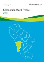
Bemerton<br />
Adopted 18th May 2004<br />
Introduction<br />
The <strong>Neighbourhood</strong> Action Plan (NAP) is<br />
a complementary document to the<br />
existing Unitary Development Plan (UDP)<br />
and to other planning policy or guidance,<br />
including planning briefs<br />
and site-specific proposals. The<br />
<strong>Neighbourhood</strong> Action Plan includes<br />
a series of projects that support<br />
regeneration and it highlights<br />
opportunities to improve service delivery<br />
at a very local level.<br />
Character Assessment<br />
This <strong>Neighbourhood</strong> Action Plan is best<br />
read in conjunction with: London Borough<br />
of <strong>Islington</strong>’s, Safer Routes To Public<br />
Transport report 2004. Part of this is<br />
reproduced as an appendix to<br />
<strong>Neighbourhood</strong> Action Plan 7.<br />
The Bemerton area is dominated by<br />
residential development, with the<br />
Bemerton Estate being the largest single<br />
feature of this <strong>Neighbourhood</strong> Action<br />
Plan. Caledonian Road with its shops and<br />
services forms one side of this<br />
<strong>Neighbourhood</strong> Action Plan. Bingfield<br />
Street is another boundary road with<br />
more residential estates beyond this.<br />
Bingfield Park (<strong>Neighbourhood</strong> Action<br />
Plan 5) lies just outside of the area but is<br />
in many ways inseparable from the<br />
Bemerton Estate. Finally, the North<br />
London Line runs along an embankment<br />
and forms the final edge of this<br />
<strong>Neighbourhood</strong> Action Plan.<br />
Caledonian Road has newsagents,<br />
hardware stores, cafes, estate agents<br />
and grocery stores along this section.<br />
There is an ATM machine but no other<br />
banking services exist on the road. There<br />
is a doctor’s surgery and just off<br />
Caledonian Road is the Housing Office<br />
for Hyde Housing.<br />
Virtually all of the buildings on both sides<br />
of this stretch of Caledonian Road are in<br />
a conservation area (CA10). The majority<br />
of these properties are low-rise Victorian<br />
terraced commercial premises with<br />
housing above, typically accessed from<br />
the rear.<br />
Caledonian Road has long since lost the<br />
major retail chains such as Boots and<br />
Woolworth that used to occupy premises.<br />
Iceland and the Co-op are the only major<br />
retailers there now. On a more positive<br />
note, there are a number of useful<br />
specialist services including ironmongers,<br />
glass suppliers and a locksmith. As there<br />
are no major DIY retail chains nearby,<br />
this aspect of the Caledonian Road may<br />
be seen as an asset warranting further<br />
attention.<br />
Finally, the entrance to Caledonian Road<br />
and Barnsbury station (North London<br />
Line) is situated just within this<br />
<strong>Neighbourhood</strong> Action Plan; this line<br />
offers regular services to other parts of<br />
north, west and east London.<br />
The Bemerton Estate is divided into a<br />
larger section (this <strong>Neighbourhood</strong> Action<br />
Plan) and a smaller one (<strong>Neighbourhood</strong><br />
Action Plan 6 – Thornhill). The Bemerton<br />
was constructed in the late 1960s and<br />
early 1970s and, both externally and<br />
internally, it reflects the design approach<br />
of that period.<br />
The deck access blocks that make up the<br />
estate are largely five to six storeys high,<br />
there are two ten-storey blocks. The<br />
estate does not follow a traditional street<br />
pattern and so acts as a barrier between<br />
39