(PIC) Protocol Manual - Kitsap Public Health District
(PIC) Protocol Manual - Kitsap Public Health District
(PIC) Protocol Manual - Kitsap Public Health District

Create successful ePaper yourself
Turn your PDF publications into a flip-book with our unique Google optimized e-Paper software.
<strong>Kitsap</strong> <strong>Public</strong> <strong>Health</strong> <strong>District</strong><br />
Pollution Source Identification and Correction: <strong>Protocol</strong> <strong>Manual</strong><br />
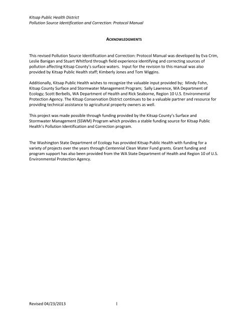
ACKNOWLEDGMENTS<br />
This revised Pollution Source Identification and Correction: <strong>Protocol</strong> <strong>Manual</strong> was developed by Eva Crim,<br />
Leslie Banigan and Stuart Whitford through field experience identifying and correcting sources of<br />
pollution affecting <strong>Kitsap</strong> County’s surface waters. Input for the revision to this manual was also<br />
provided by <strong>Kitsap</strong> <strong>Public</strong> <strong>Health</strong> staff; Kimberly Jones and Tom Wiggins.<br />
Additionally, <strong>Kitsap</strong> <strong>Public</strong> <strong>Health</strong> wishes to recognize the valuable input provided by; Mindy Fohn,<br />
<strong>Kitsap</strong> County Surface and Stormwater Management Program; Sally Lawrence, WA Department of<br />
Ecology; Scott Berbells, WA Department of <strong>Health</strong> and Rick Seaborne, Region 10 U.S. Environmental<br />
Protection Agency. The <strong>Kitsap</strong> Conservation <strong>District</strong> continues to be a valuable partner and resource for<br />
providing technical assistance to agricultural property owners as well.<br />
This project was made possible through funding provided by the <strong>Kitsap</strong> County’s Surface and<br />
Stormwater Management (SSWM) Program which provides a stable funding source for <strong>Kitsap</strong> <strong>Public</strong><br />
<strong>Health</strong>’s Pollution Identification and Correction program.<br />
The Washington State Department of Ecology has provided <strong>Kitsap</strong> <strong>Public</strong> <strong>Health</strong> with funding for a<br />
variety of projects over the years through Centennial Clean Water Fund grants. Grant funding and<br />
program support has also been provided from the WA State Department of <strong>Health</strong> and Region 10 of U.S.<br />
Environmental Protection Agency.<br />
Revised 04/23/2013 1
<strong>Kitsap</strong> <strong>Public</strong> <strong>Health</strong> <strong>District</strong><br />
Pollution Source Identification and Correction: <strong>Protocol</strong> <strong>Manual</strong><br />
INTRODUCTION ................................................................................................................................................. 4<br />
OBJECTIVES ...................................................................................................................................................... 6<br />
CHAPTER 1 PROJECT PREPARATION ....................................................................................................................... 7<br />
Project Area Evaluation............................................................................................................................. 7<br />
<strong>Public</strong> Notification & Information ............................................................................................................. 8<br />
<strong>Public</strong> Meetings and/or OSS Workshops .................................................................................................. 8<br />
Field Preparation & Safety ...................................................................................................................... 10<br />
CHAPTER 2 SAMPLE COLLECTION & TESTING ....................................................................................................... 13<br />
Quality Assurance and Quality Control ................................................................................................... 13<br />
Collecting water samples ........................................................................................................................ 13<br />
Dye Testing procedures .......................................................................................................................... 15<br />
Mixing and Handling of Dye Tracers ....................................................................................................... 17<br />
Mixing and Handling of Elution Solution ................................................................................................ 19<br />
Checklist for Performing an Elution and Analysis of Charcoal packs ...................................................... 20<br />
Optical Brightener Procedure ................................................................................................................. 21<br />
CHAPTER 3 CONDUCTING SHORELINE SURVEYS..................................................................................................... 23<br />
Field Preparation checklist ...................................................................................................................... 24<br />
Collecting water samples: ....................................................................................................................... 25<br />
Sample results and data organization..................................................................................................... 27<br />
Confirmation sampling ............................................................................................................................ 28<br />
CHAPTER 4 CONDUCTING PROPERTY SURVEYS ..................................................................................................... 31<br />
Property Parcel Inspection Preparation .................................................................................................. 31<br />
Door Hangers .......................................................................................................................................... 35<br />
Meeting the owner/occupant ................................................................................................................. 36<br />
Table 2. Criteria for rating OSS inspection results .................................................................................. 37<br />
Assessment of Non-OSS FC Pollution Sources (PET WASTE) ..................................................................... 38<br />
Assessment of Non-OSS FC Pollution Sources (HIGH PRIORITY FARMS) ................................................ 38<br />
<strong>PIC</strong> property surveys involving FARMS ................................................................................................... 39<br />
Property Survey Evaluation Tool ............................................................................................................. 42<br />
CHAPTER 5 WATER QUALITY COMPLAINTS ......................................................................................................... 43<br />
Types of complaints: ............................................................................................................................... 43<br />
Non-OSS Fecal Pollution Sources ............................................................................................................ 48<br />
Revised 04/23/2013 2
<strong>Kitsap</strong> <strong>Public</strong> <strong>Health</strong> <strong>District</strong><br />
Pollution Source Identification and Correction: <strong>Protocol</strong> <strong>Manual</strong><br />
Spills, Illicit Discharges or Connections to a Municipal Stormwater System .......................................... 48<br />
CHAPTER 6 ENFORCEMENT ............................................................................................................................... 50<br />
Notice and Order to Correct Violation (NOCV) ....................................................................................... 50<br />
Notice of Civil Infraction (Ticket) ............................................................................................................ 51<br />
Search Warrants...................................................................................................................................... 54<br />
CHAPTER 7 ILLICIT DISCHARGE DETECTION AND ELIMINATION (IDDE) ..................................................................... 56<br />
CHAPTER 8 REPORTING .................................................................................................................................... 58<br />
<strong>PIC</strong> PROJECT FOLLOW-UP ................................................................................................................................. 58<br />
APPENDIX A: INFORMATION SOURCES FOR <strong>PIC</strong> PROJECT EVALUATIONS ....................................................... 59<br />
APPENDIX B: FIELD EQUIPMENT LIST ..................................................................................................... 60<br />
APPENDIX C : EXAMPLE OF PRESS RELEASE AND FACT SHEET ...................................................................... 62<br />
APPENDIX D: WATER QUALITY DATABASE ENTRY PROCEDURES................................................................... 64<br />
APPENDIX E: <strong>PIC</strong> DATABASE ENTRY PROCEDURES .................................................................................... 69<br />
APPENDIX F: POLLUTION IDENTIFICATION & CORRECTION (<strong>PIC</strong>) INSPECTION FORM .................................. 76<br />
APPENDIX G: NOTICE AND ORDER TO CORRECT VIOLATION ....................................................................... 78<br />
APPENDIX H: EXAMPLE OF COMPLETED NOTICE OF CIVIL INFRACTION (TICKET) ............................................ 80<br />
Revised 04/23/2013 3
<strong>Kitsap</strong> <strong>Public</strong> <strong>Health</strong> <strong>District</strong><br />
Pollution Source Identification and Correction: <strong>Protocol</strong> <strong>Manual</strong><br />
Pollution Source Identification and Correction: <strong>Protocol</strong> <strong>Manual</strong><br />
INTRODUCTION<br />
Fecal coliform in surface water provides an early warning for determining whether land use,<br />
development and human activities are being managed to effectively protect public health and the<br />
environment.<br />
Fecal waste from warm-blooded animals can contain pathogenic bacteria and viruses that cause human<br />
diseases such as shigellosis, campylobacter enteritis, viral gastroenteritis, giardiasis, and<br />
cryptosporidiosis. Fecal contamination of surface waters is caused by human and animal waste<br />
discharged or leaked to the ground or surface waters. During rain events, flowing surface water picks up<br />
pollutants, such as fecal waste, and transports them to local streams, bays, and lakes. Additionally, as<br />
impervious surfaces are increased in watersheds, pollutants are transported rapidly to receiving waters.<br />
Shellfish beaches are an important resource in <strong>Kitsap</strong> County. <strong>Kitsap</strong> <strong>Public</strong> <strong>Health</strong> works in partnership<br />
with Washington State Department of <strong>Health</strong> (DOH) to protect and restore shellfish harvesting in <strong>Kitsap</strong><br />
County.<br />
The Water Quality Standards for Surface Waters of the State of Washington (Chapter 173-201A<br />
Washington Administrative Code [WAC]; hereafter referred to as “water quality standards”), and the<br />
beach classification criteria set forth in Recreational Shellfish Beaches (Chapter 246-280 WAC) and<br />
Sanitary Control of Shellfish (Chapter 246-282 WAC) currently use surface water fecal coliform (FC)<br />
concentrations to determine whether or not surface waters and shellfish tissue are safe for human<br />
contact and consumption, respectively. Fecal coliform (FC) and Escherichia coli (EC) bacteria are<br />
indicators used to assess the presence and level of fecal waste in surface and ground waters.<br />
Background<br />
The <strong>Kitsap</strong> <strong>Public</strong> <strong>Health</strong> <strong>District</strong> has monitored major streams and marine waters for FC on a routine<br />
basis since 1996. This extensive monitoring program has resulted in the listing of many <strong>Kitsap</strong> County<br />
marine and freshwater bodies for FC pollution on Washington State’s 303(d) List of impaired or<br />
threatened waters. Elevated levels of fecal pollution are responsible for posting of selected streams with<br />
warning signs that guard against contact with the water. Additionally, documented FC pollution or the<br />
threat of pollution has caused the closure and restricted use of commercial shellfish beds in Burley<br />
Lagoon, Dyes Inlet, Hood Canal, Liberty Bay, Port Orchard Bay, Port Gamble Bay, Sinclair Inlet, and Yukon<br />
Harbor. Monitoring has also provided a feedback mechanism for water cleanup projects and has<br />
provided evidence of water quality improvements including removal of warning signs and upgrades of<br />
shellfish harvest areas.<br />
FC pollution may come from point or nonpoint sources. Point sources like wastewater treatment plants<br />
are regulated by the Environmental Protection Agency’s (EPA) National Pollution Discharge Elimination<br />
System (NPDES) permitting program.<br />
Nonpoint pollution is a combination of discharges from many activities on many land parcels and as such<br />
is more difficult to identify and control. The identification and correction of nonpoint pollution is<br />
primarily the responsibility of local jurisdictions in Washington State. The <strong>Kitsap</strong> County Surface and<br />
Storm Water Management Program (SSWM) was developed and implemented locally to provide a<br />
Revised 04/23/2013 4
<strong>Kitsap</strong> <strong>Public</strong> <strong>Health</strong> <strong>District</strong><br />
Pollution Source Identification and Correction: <strong>Protocol</strong> <strong>Manual</strong><br />
framework for organizing and funding surface water assessment, protection, and restoration efforts<br />
related to nonpoint source pollution. SSWM program activities are carried out by <strong>Kitsap</strong> County <strong>Public</strong><br />
Works, <strong>Kitsap</strong> County <strong>Health</strong> <strong>District</strong> (<strong>Kitsap</strong> <strong>Public</strong> <strong>Health</strong>), <strong>Kitsap</strong> Conservation <strong>District</strong>, Washington<br />
State University <strong>Kitsap</strong> Extension, and <strong>Kitsap</strong> County Department of Community Development.<br />
<strong>Kitsap</strong> <strong>Public</strong> <strong>Health</strong> is the primary agency responsible for monitoring, identifying, and prioritizing<br />
nonpoint fecal pollution correction programs in <strong>Kitsap</strong> County. In response to the fecal pollution<br />
problem, <strong>Kitsap</strong> <strong>Public</strong> <strong>Health</strong> developed a SSWM-funded Pollution Identification and Correction (<strong>PIC</strong>)<br />
program, an Onsite Sewage System (OSS) Monitoring and Maintenance program, and a Water<br />
Protection Complaint Response program. These programs utilize existing local regulations and authority<br />
to address FC pollution sources and enforce correction when necessary. The programs incorporate a<br />
strong educational element to prevent future fecal pollution.<br />
<strong>Kitsap</strong> <strong>Public</strong> <strong>Health</strong> developed the <strong>PIC</strong> program to prioritize and address water quality problem areas in<br />
<strong>Kitsap</strong> County. FC pollution problem areas are thoroughly assessed for land uses and ranked by water<br />
quality data and public accessibility. Door-to-door <strong>PIC</strong> inspections are conducted in top-priority areas to<br />
identify and correct fecal pollution sources. <strong>PIC</strong> inspectors provide free technical assistance to guide<br />
property owners through the process of correcting identified pollution sources. The inspection is<br />
designed to help property owners and residents prevent fecal pollution of surface waters and get the<br />
most life possible from their OSS investment.<br />
<strong>Kitsap</strong> <strong>Public</strong> <strong>Health</strong> <strong>PIC</strong> projects utilize community participation by proactively educating owners and<br />
residents while identifying and correcting FC sources. The <strong>Kitsap</strong> <strong>PIC</strong> program has been responsible for<br />
performing FC source identification projects at the watershed and sub-watershed scale resulting in<br />
documented improved water quality in streams, lakes, marine waters as well as upgrades of shellfish<br />
harvest areas, including Dogfish creek, Burley Lagoon, Cedar Cove, Dyes Inlet, and Yukon Harbor.<br />
Purpose<br />
The purpose of this document is to explain in detail how <strong>Kitsap</strong> <strong>Public</strong> <strong>Health</strong> investigates and identifies<br />
major FC nonpoint pollution sources.<br />
Revised 04/23/2013 5
<strong>Kitsap</strong> <strong>Public</strong> <strong>Health</strong> <strong>District</strong><br />
Pollution Source Identification and Correction: <strong>Protocol</strong> <strong>Manual</strong><br />
GOALS<br />
The goals of the Pollution Identification and Correction (<strong>PIC</strong>) program are to:<br />
• Assess fecal pollution of <strong>Kitsap</strong> County surface waters.<br />
• Protect the public from waterborne illness related to fecal pollution of surface waters, storm<br />
water, and shellfish.<br />
• Address or assist with federal, state and county water quality mandates as required.<br />
OBJECTIVES<br />
• Determine fecal pollution levels in streams and marine waters.<br />
• Prioritize <strong>Kitsap</strong> water bodies for <strong>PIC</strong> projects.<br />
• Determine fecal pollution water quality improvements or declines in <strong>Kitsap</strong> surface waters.<br />
• Determine water quality improvements or declines in <strong>Kitsap</strong> lakes.<br />
• Identify and correct FC pollution sources in high priority areas.<br />
• Investigate citizen complaints and reports related to failing onsite sewage systems (OSS).<br />
• Correct FC pollution sources pursuant to local OSS and solid waste regulations.<br />
• Prevent failing OSS by promoting and providing education on the use of OSS to residents, the<br />
OSS industry, realtors, developers, builders, lenders, etc.<br />
• Support financial options for <strong>Kitsap</strong> County residents to promote voluntary correction of failing<br />
onsite sewage systems.<br />
• Assist <strong>Kitsap</strong> County with tracing and correcting storm water system illicit discharges or<br />
connections.<br />
• Provide public education and advisories on water quality related health hazards.<br />
• Assist <strong>Kitsap</strong> County with Federal Clean Water Act Section 303(d) compliance and<br />
implementation of associated Total Maximum Daily Load studies.<br />
• Assist <strong>Kitsap</strong> County with response to Washington State Department of <strong>Health</strong> commercial<br />
shellfish harvest classification changes.<br />
• Coordinate with other agencies to ensure that monitoring efforts are not duplicated.<br />
Revised 04/23/2013 6
<strong>Kitsap</strong> <strong>Public</strong> <strong>Health</strong> <strong>District</strong><br />
Pollution Source Identification and Correction: <strong>Protocol</strong> <strong>Manual</strong><br />
CHAPTER 1 PROJECT PREPARATION<br />
Project Area Evaluation<br />
Project area evaluation is an important tool to gain a thorough understanding of an area. The steps of<br />
this evaluation include:<br />
Evaluate information related to the project area.<br />
Conduct an initial project area visit.<br />
Conduct an evaluation of water quality data.<br />
Evaluate information related to the project area<br />
Before visiting a project area, or conducting a parcel inspection, an evaluation of the project area shall<br />
be conducted to review available data and background information. A list of information sources that<br />
may be used for this evaluation is found in Appendix A.<br />
Determine whether the project is grant funded. If it is, there will be a project scope of work and Quality<br />
Assurance Project Plan (QAPP). These documents specify the project components, commitments,<br />
timeline, field and laboratory methodologies.<br />
Once sufficient background information is gathered, the information should be organized into project<br />
file(s) e.g., property parcel information organized by road, water quality monitoring data, maps, project<br />
QAPP, grant, etc. This information will be needed during the project for the preparation of public<br />
notification, meetings, door-to-door surveys, press releases, and the final report.<br />
Conduct initial project area visit (a.k.a “ground truthing”)<br />
An initial project area visit should be conducted. It is used as a tool to determine the following:<br />
• Confirm storm water drainage patterns of the <strong>PIC</strong> area.<br />
• Identify surface waters (drainage in roadside ditches, pipe discharges, streams, and marine<br />
water) for FC “impact” monitoring to assist in identifying priority areas. This is conducted in<br />
coordination with other program monitoring activities.<br />
• Determine project boundaries and note road segments to be inspected, along with property<br />
addresses.<br />
• Look for potential fecal sources in the area, including pet or livestock waste, grease, and food<br />
waste.<br />
Conduct an evaluation of water quality data<br />
Gather and evaluate available water quality monitoring data for the area to determine general areas<br />
with elevated FC or EC levels. Work with the project lead or program manager and consult the QAPP to<br />
determine which indicator organism to use for investigations. Water quality data is used to determine<br />
where water quality problem areas are located and to delineate and refine the project area.<br />
Revised 04/23/2013 7
<strong>Kitsap</strong> <strong>Public</strong> <strong>Health</strong> <strong>District</strong><br />
Pollution Source Identification and Correction: <strong>Protocol</strong> <strong>Manual</strong><br />
<strong>Public</strong> Notification & Information<br />
<strong>Public</strong> notification is key to informing and engaging <strong>Kitsap</strong> County residents about <strong>PIC</strong> projects. After<br />
the office evaluation, initial project area visit, and water quality evaluation are complete, the public<br />
within the <strong>PIC</strong> boundary will be is notified of <strong>Kitsap</strong> <strong>Public</strong> <strong>Health</strong>'s intent to conduct a <strong>PIC</strong> project.<br />
<strong>Public</strong> notification is accomplished using the following resources and/or methods: hosting public<br />
meetings, press releases, direct mailings to households, door hangers, project fact sheets, articles in<br />
local news media and/or publications. The information presented should be direct, concise, and<br />
complete.<br />
It should contain the following items:<br />
• Why and where the <strong>PIC</strong> project is being conducted;<br />
• Applicable water quality results;<br />
• Who is doing the <strong>PIC</strong> project, and by what authority;<br />
• How and when the <strong>PIC</strong> project be conducted;<br />
• Possible sources of fecal pollution;<br />
• Who to contact for answers to questions.<br />
Developing the format and content of <strong>PIC</strong> project information and the choice of how to distribute the<br />
information to the public is made in consultation with the Field Supervisor or Program Manager.<br />
Specific information regarding public notification will also be found in a project’s QAPP (if applicable),<br />
e.g. the number of public meetings, workshops, development of Fact Sheets etc.<br />
Examples of a Press Release and a fact sheet, are found in Appendix C. These are also kept<br />
electronically and accessible to staff in the <strong>PIC</strong> Common directory. Typically these documents are<br />
organized in folders based on project areas.<br />
All press releases must comply with <strong>Kitsap</strong> <strong>Public</strong> <strong>Health</strong>’s press release policy, and must be approved by<br />
the Program manager or Field supervisor and the <strong>Public</strong> Information Officer prior to dissemination.<br />
A short informational fact sheet about area water quality is an effective way to introduce and provide<br />
information to area residents about the project. It is recommended that a health educator review the<br />
flyer for optimal effectiveness. Submit to field supervisor or program manager for approval.<br />
<strong>Public</strong> Meetings and/or OSS Workshops<br />
<strong>Public</strong> meetings are held to launch a new project, provide an update on an existing project, and/or host<br />
an OSS Onsite Sewage System workshop.<br />
The public meeting is held at a convenient and comfortable location as close as possible to the project<br />
area. The elements of the public meeting include a short presentation about the FC pollution problem,<br />
project information such as water quality data, the goals and objectives for the project, etc. Sufficient<br />
time should be allotted to enable the public to ask questions. Invite project partners, e.g. <strong>Kitsap</strong><br />
Conservation <strong>District</strong>, Department of Ecology (Ecology), Department of <strong>Health</strong>, Environmental<br />
Protection Agency, <strong>Kitsap</strong> County Surface and Stormwater Management. Identify community groups in<br />
the project area to determine and address local concerns. It may be useful to hold your public meeting<br />
Revised 04/23/2013 8
<strong>Kitsap</strong> <strong>Public</strong> <strong>Health</strong> <strong>District</strong><br />
Pollution Source Identification and Correction: <strong>Protocol</strong> <strong>Manual</strong><br />
at a regularly scheduled meeting of a community group. Consult the Field Supervisor or Program<br />
Manager for guidance.<br />
Members of the public that should be invited to these public meetings include: residents of the project<br />
area, local government representatives, the <strong>Kitsap</strong> Board of <strong>Health</strong>, and grant officers.<br />
Table 1. Guidelines for <strong>Public</strong> Meeting Preparation<br />
Timing Preparation Chore Tips<br />
1-3 months in advance<br />
of meeting<br />
Choose a meeting location and<br />
make reservations<br />
Choose meeting time(s)<br />
Find a comfortable meeting space within the<br />
project area. Review cost, seating capacity,<br />
available chairs and tables, audiovisual<br />
equipment access, and if setup will be needed<br />
or provided. Meeting times can vary with<br />
project areas.<br />
1 – 3 months in advance<br />
of meeting<br />
Arrange light refreshments in<br />
accordance with grant policies<br />
Some meeting locations will require that they<br />
provide the refreshments at additional cost.<br />
1 month in advance of<br />
meeting<br />
1 month in advance of<br />
meeting<br />
1 month in advance of<br />
meeting<br />
1 month to 3 weeks in<br />
advance of meeting<br />
Mailing List<br />
If applicable, fill out and submit<br />
light refreshments form &<br />
prepare or obtain Ecology<br />
attendance form<br />
Prepare maps to be used for<br />
presentation<br />
Complete meeting notice mailer<br />
2-3 weeks in advance of Coordinate with Clerical staff to<br />
meeting<br />
send mailers<br />
2 weeks in advance Press release to newspapers.<br />
Notify Board of <strong>Health</strong> and other<br />
key stakeholders<br />
Using the <strong>PIC</strong> property list, make mailing labels<br />
using mail merge. Seek assistance from clerical<br />
staff as needed.<br />
Contact the Ecology grant administrator for<br />
these forms.<br />
Otherwise, prepare a Sign In sheet on <strong>Kitsap</strong><br />
<strong>Public</strong> <strong>Health</strong> letterhead.<br />
Request maps from <strong>Kitsap</strong> <strong>Public</strong> <strong>Health</strong> staff<br />
trained in ArcView.<br />
Use the templates that the <strong>Health</strong> Educator<br />
created for a uniform design for all meeting<br />
materials.<br />
Submit draft presentation to program manager<br />
for review.<br />
1 week in advance Prepare presentation Submit draft presentation to program manager<br />
for review.<br />
1 week in advance Gather materials for tabletop<br />
displays and maps<br />
See the table of meeting supplies that follows.<br />
Consider partnering with other agencies/staff to assist with meeting preparation.<br />
<strong>Kitsap</strong> Conservation <strong>District</strong> is contracted under some grants to help with meetings. They can provide<br />
useful GIS information and maps. They have a presentation on agricultural best management practices<br />
(BMPs), and can arrange for agricultural property owners who have implemented BMP’s to speak at<br />
meetings.<br />
Clerical Support staff can also provide assistance with making labels, mailers etc.<br />
Revised 04/23/2013 9
<strong>Kitsap</strong> <strong>Public</strong> <strong>Health</strong> <strong>District</strong><br />
Pollution Source Identification and Correction: <strong>Protocol</strong> <strong>Manual</strong><br />
GIS Maps and Powerpoint<br />
Get help with experienced staff for any technical elements or software you may not be familiar with.<br />
Make sure to plan ahead. It’s also helpful to make sure your documents and software are compatible<br />
with that used by other presenters if you’re going to share resources. It is also helpful to ensure that the<br />
software is compatible with the equipment, e.g. laptop has updated software.<br />
Meeting Supplies<br />
It’s helpful to have a plastic box dedicated to brochures and materials that you’ll take to your<br />
public/project meetings. It is useful to gather supplies well in advance of the meeting so that items can<br />
be added to the box as they are ready. Some suggested supplies include:<br />
Equipment Supplies/Handout materials Items for refreshments<br />
Scotch Tape<br />
Stapler<br />
Extension cord<br />
Easels or tacks for<br />
directional signs<br />
Projector screen<br />
Directional signs to meeting place and room<br />
Audiovisual equipment<br />
Laser pointer<br />
Business cards for speakers and other programs<br />
Brochures/Fact Sheets<br />
Sign-in sheets/Pens<br />
For speakers: Gum or mints, drinking water, cough<br />
drops<br />
Coffee filters<br />
Coffee pot<br />
Creamer<br />
Sugar<br />
Tea bags<br />
Bottled water<br />
Napkins<br />
Spoons<br />
Tablecloth(s)<br />
Field Preparation & Safety<br />
Personal safety in the field is extremely important. <strong>Health</strong> <strong>District</strong> inspectors should always adhere to<br />
the guidelines herein when conducting field inspections and investigations. Refer to a description of<br />
property access and consent. Safety equipment/supplies that each field staff should carry includes; cell<br />
phone, pepper spray, dog treats, gloves, reflective vest, <strong>Kitsap</strong> <strong>Public</strong> <strong>Health</strong> identification badge, and<br />
business cards. A complete list of field equipment is found in Appendix B.<br />
Before setting out into the field for the initial project area visit or individual parcel inspections, it is<br />
essential to be mentally prepared, properly equipped, and organized.<br />
Inform project lead and note field work locations on the water quality calendar on the intranet.<br />
Coordinate with other inspectors in the area. Inspectors are encouraged to ask another inspector to<br />
“ride along” if they are uncomfortable visiting a particular property alone or if they want another “set of<br />
eyes” to assess a possible problem or violation. However, there are certain circumstances where “ride<br />
alongs” are probably not necessary, including consecutive visits (with owner/renter permission) to a<br />
property undergoing a dye test, etc. Use your best professional judgment in determining where and<br />
when to ask for a “ride along” – safety is our first concern but we also need to consider financial<br />
impacts. Contact the project lead, field supervisor, or the program manager if you are unsure.<br />
Revised 04/23/2013 10
<strong>Kitsap</strong> <strong>Public</strong> <strong>Health</strong> <strong>District</strong><br />
Pollution Source Identification and Correction: <strong>Protocol</strong> <strong>Manual</strong><br />
TIP: Park your vehicle in a manner that does not interfere with the movement of other vehicles<br />
and provides you with the opportunity for a quick exit.<br />
Cut the interview short if the homeowner shows any signs of hostility. If an individual makes threats or<br />
threatening gestures towards you, leave the property immediately.<br />
Do not inspect the property in this situation. Drive away and find a safe location to note the details on<br />
the survey form. Inform your project lead, field supervisor or program manager immediately.<br />
Revised 04/23/2013 11
<strong>Kitsap</strong> <strong>Public</strong> <strong>Health</strong> <strong>District</strong><br />
Pollution Source Identification and Correction: <strong>Protocol</strong> <strong>Manual</strong><br />
Handling Dogs<br />
Dogs can be a major threat in the field. Dog treats are an essential tool to make friends with dogs in a<br />
project area, but always carry pepper spray to protect yourself. Contact the field supervisor or program<br />
manager to arrange for the required training to use pepper spray.<br />
When entering a property, look for signs of dogs e.g. barking, doghouses or leashes. Stay in the car when<br />
dogs are present to assess whether the dogs are friendly or aggressive.<br />
If you do not immediately see a dog or dogs, stay near the car with the door open momentarily or rattle<br />
a fence or gate and/or call out your name and affiliation several times to draw attention to yourself and<br />
listen for dog barking. If you feel confident that there is no immediate threat, continue to follow the<br />
main path to the front door.<br />
If there is a dog on the property, use your best professional judgment to decide if the dog is friendly or<br />
not. If the dog is friendly, continue with your approach to the front door. If not, wait a few minutes to<br />
give the resident time to notice the dog barking and come to the door. Note the address of the home,<br />
and if possible, the homeowner's name, and contact the homeowner/occupant by phone to schedule an<br />
appointment. You can also leave your business card or door hanger at the door or gate with the date<br />
and time you were there.<br />
Field Equipment List<br />
A list and description of the standard and specialized equipment necessary to conduct inspections and<br />
investigations is located in Appendix B. Ordering new equipment and making repairs to existing<br />
equipment are handled through the field supervisor program manager. Report all instances of<br />
equipment breakage or loss as soon as possible.<br />
Revised 04/23/2013 12
<strong>Kitsap</strong> <strong>Public</strong> <strong>Health</strong> <strong>District</strong><br />
Pollution Source Identification and Correction: <strong>Protocol</strong> <strong>Manual</strong><br />
CHAPTER 2 SAMPLE COLLECTION & TESTING<br />
Quality Assurance and Quality Control<br />
Procedures for the collection, labeling and transport of water samples shall follow the <strong>Kitsap</strong> County<br />
<strong>Health</strong> <strong>District</strong> Water Quality Monitoring Plan, also known as the Trend Plan. Details regarding the<br />
collection, labeling and transport of water samples is also described below.<br />
Collecting water samples<br />
Water sampling is conducted for shoreline surveys, performing impact and trend sampling and<br />
responding to water quality complaints. Samples may be analyzed for either FC or E.Coli bacteria. The<br />
type of analysis will be determined by the purpose for the sampling as well as any associated QAPPs.<br />
When collecting samples, wear nitrile gloves. You may want to wear two sets of gloves when working on<br />
rough shorelines or terrain.<br />
During shoreline surveys collect water samples from all flowing discharge points including storm water<br />
outfalls, yard drains, bulkhead drains, pipes, drainage ditches, seeps, and sheet flow.<br />
When sampling in streams and lakes, use the “U” scoop method<br />
• Reach out with the wand and slowly plunge the bottle straight down into the water,<br />
approximately to the middle of the water column, and scoop in a smooth, semicircular “Ushaped”<br />
motion back up to the surface.<br />
• The scooping motion helps to ensure that the sample will not be biased with bacteria from<br />
the surface micro-layer.<br />
• Also take care not to scoop up any sediment in the sampling bottle. If this occurs, use a<br />
fresh bottle or empty the bottle, rinse it with clear water from the sampling site and<br />
resample.<br />
It is important to leave some airspace in the bottle. If the bottle contains water above the 100ml<br />
line, slowly pour out the excess. Replace and tighten the cap, again taking care to avoid touching<br />
the neck of the bottle and the inside of the cap. The bottle should be filled to the line shown<br />
below.<br />
Revised 04/23/2013 13
<strong>Kitsap</strong> <strong>Public</strong> <strong>Health</strong> <strong>District</strong><br />
Pollution Source Identification and Correction: <strong>Protocol</strong> <strong>Manual</strong><br />
Fill bottle to the 100 ml line<br />
Note any unusual odors, matting, vegetative growth, laundry lint, food waste, temperature,<br />
animal tracks, animal waste, or any other characteristics that may indicate a sewage or laundry source at<br />
or near the water sample.<br />
Once the sample is collected and the bottle secured, place the bottle in a cooler with ice packs. The<br />
bottles should be kept below 10 degrees Celsius (Holding time and temperature from APHA Standard<br />
Methods, 20 th edition pg 9-21).<br />
Wash hands as soon as possible after sampling and before you eat.<br />
Labeling and Recording samples:<br />
• Use a black permanent marker (or regular pen) to label the 100 milliliter sample bottle with the<br />
sample identifier, date, and time the sample was collected on the label.<br />
• Clearly record the sample name, collection time, location, drainage size, pipe diameter, and pipe<br />
material (if applicable) in the field notebook.<br />
• Record detailed parcel-oriented sample descriptions in the field notebook so that outfalls can be<br />
re sampled by different staff, if necessary.<br />
Transporting samples<br />
When water samples are collected they should be transported in coolers with ice packs. The<br />
recommended temperature, according to APHA Standards Method is 10 degrees Celsius.<br />
Chain of custody<br />
Water samples are analyzed at Lab/Cor Inc. Following the collection of all water samples, a chain of<br />
custody form must be completed. Check the QAPP, or ask the project lead or the Field Supervisor to<br />
verify whether samples should be analyzed for FC or EC. A chain of custody form is also submitted when<br />
additional analytical sampling is needed, e.g. ammonia, nutrients etc.<br />
Revised 04/23/2013 14
<strong>Kitsap</strong> <strong>Public</strong> <strong>Health</strong> <strong>District</strong><br />
Pollution Source Identification and Correction: <strong>Protocol</strong> <strong>Manual</strong><br />
Dye Testing procedures<br />
<strong>Kitsap</strong> <strong>Public</strong> <strong>Health</strong> utilizes methods developed by Dr. Tom Aley, of Ozark Underground Laboratories<br />
(OUL). Reference documentation regarding the procedures for the analysis of dye testing may be found<br />
at the OUL website, http://ozarkundergroundlab.com.<br />
<strong>Kitsap</strong> <strong>Public</strong> <strong>Health</strong> purchases three fluorescent dyes from OUL to dye-test OSS: Fluorescein (a greenyellow<br />
dye), Rhodamine WT (a purple-red dye) and Eosine (a pink-green dye). By using three different<br />
colored dyes, dye testing a large survey area can be accomplished more efficiently since up to three<br />
homes can be dye tested simultaneously.<br />
When dye testing two homes concurrently, it is recommended to use Fluorescein and Rhodamine-WT.<br />
This is due to the wavelength difference between Fl and Rh-WT.<br />
Select dye in consultation with the project lead and/or program manager. Charcoal packs (packs) utilize<br />
activated charcoal to adsorb dye and are used to confirm a hydraulic connection between the OSS and<br />
the discharge point.<br />
Fluorescein<br />
Rhodamine-WT<br />
Eosine<br />
To meet the goals and objectives of the <strong>PIC</strong> project, dye testing shall be conducted in the sequence<br />
outlined below:<br />
Checklist for conducting a dye test<br />
__Develop a plan in advance for dye testing. This should include the type of dye to be used, locations of<br />
packs, and how to secure and camouflage the packs. Project water quality improvements depend, in<br />
part, on the effectiveness of dye testing plans. The inspector should consult with the project lead or<br />
Field Supervisor if they are unsure how to proceed.<br />
__Place a control sample charcoal pack one week prior to introducing the dye to determine whether any<br />
of the dyes are present in the background. It has been shown that fluorescein may appear in tap water,<br />
or fluids leaked from vehicles will contain the color of certain dyes (antifreeze contains fluorescein and<br />
transmission fluid has a pink color similar to rhodamine). In areas with these potential sources, it is<br />
advisable to analyze the control packs before determining which dye to use.<br />
The control should be placed in an outfall pipe, or area that has shown elevated (FC or EC levels).<br />
Revised 04/23/2013 15
<strong>Kitsap</strong> <strong>Public</strong> <strong>Health</strong> <strong>District</strong><br />
Pollution Source Identification and Correction: <strong>Protocol</strong> <strong>Manual</strong><br />
In lakes, you may want to establish charcoal floats in priority areas where you plan to dye test.<br />
Two charcoal packs<br />
__ Wear gloves when handling or introducing dye. Dispose of gloves and used dye bottles in a manner<br />
that will prevent cross contamination of dye testing materials. For example, after introducing dye into<br />
fixtures in a house, place empty dye bottle along with gloves into the Ziploc bag that was used to store<br />
the dye bottle.<br />
__Use two charcoal packs to make up each sampler. The duplicate can be stored frozen and sent to OUL<br />
for spectrofluorophotometric analysis as necessary.<br />
__ Charcoal packs should be placed in the same location as the control and in one or more locations<br />
down gradient of the potential source. Remember that the sample locations in flowing water must be in<br />
areas where the water samples results exceeded 200 FC/100ml or 160 EC/100ml. To protect yourself<br />
when placing charcoal packs in a location that has yielded high bacteria counts gloves may be worn.<br />
__ Prior to introducing dye into the OSS, retrieve the controls and seal them into Whirl-Pak TM bags<br />
clearly labeled in black permanent marker with sampler address, location, and dates and times placed<br />
and retrieved.<br />
__Store retrieved charcoal packs away from dye supplies and out of the sun. A clean cooler and ice<br />
packs are used to transport the retrieved charcoal packs to the office. Store them in a dedicated freezer<br />
until elution is performed. The retrieved packs are stored frozen to prevent algal growth that interferes<br />
with dye identification.<br />
__After retrieving the controls, place another set of charcoal packs in the same location. Note the date<br />
and time the controls were retrieved and the new packs replaced on the <strong>PIC</strong> survey form.<br />
__Map charcoal sampler locations in a field notebook or on the <strong>PIC</strong> survey form.<br />
Revised 04/23/2013 16
<strong>Kitsap</strong> <strong>Public</strong> <strong>Health</strong> <strong>District</strong><br />
Pollution Source Identification and Correction: <strong>Protocol</strong> <strong>Manual</strong><br />
__Cover charcoal packs with a rock, board, or other object to prevent sun exposure, algae growth, and<br />
disturbance. Make sure, especially along marine shorelines or within creeks, that they are secured (i.e.<br />
heavy gauge wire, fishing line, cinder blocks, or stakes, washers, and/or cricket cage). Carefully describe<br />
and/or mark locations on the map and/or <strong>PIC</strong> survey form.<br />
__Note which dye you used on the <strong>PIC</strong> survey form. Fluorescein is generally easier to see and is the least<br />
expensive. Before introducing dye, make sure the owner/occupant hasn’t experienced any recent<br />
backups. Carefully introduce a total of 500 milliliters of the prepared dye solution equally into all toilets,<br />
the kitchen sink, and a laundry sink.<br />
TIP: Flush the toilet first, before introducing dye, to be sure it is working properly!<br />
__After introducing the dye, flush the toilet twice, or more if necessary, to flush residual dye from the<br />
bowl. Clean up any splashes with toilet paper. Replace the dye bottle lid, place used gloves and bottle<br />
back into the resealable plastic bag, and close the bag tightly. Keep used bottles away from all other dye<br />
testing supplies.<br />
__When you return to work, dispose of used gloves in the appropriate receptacle in the lab and return<br />
the used bottles in their plastic bags to the dedicated used-bottle storage area for reuse. Do not bring<br />
dye bottles into the office to prevent cross-contamination.<br />
__Retrieve the first set of dye-packs approximately one week after dye introduction using the<br />
procedures specified above for retrieving controls. Replace with another set of charcoal packs. Note the<br />
retrieval and replacement information on the survey form. Elute the charcoal pak in the laboratory to<br />
determine the presence or absence of dye. If visual dye is present, then the test is POSITIVE, and the<br />
dye test may be stopped.<br />
__Retrieve the second and third set of dye-packs one week following placement using the procedures<br />
specified above.<br />
__Typically dye testing is conducted over a three week period. However if you suspect low water flow in<br />
the residence or intermittent failure, the dye test can be extended additional weeks by placing<br />
additional charcoal sets, as needed, on a weekly basis.<br />
The following provides a description for interpreting the results from dye testing.<br />
Positive Dye Test<br />
A dye test is considered to be positive when either there is visual dye that appears at the property, e.g.<br />
surfacing in the drainfield, coming out of a pipe, bulkhead etc. OR when the charcoal pack is eluted and<br />
there is presence of visual dye in the elution vial.<br />
Suspect Dye Test<br />
A dye test is suspect, when there is no visual dye either at the property site, or in the elution vial,<br />
however, the laboratory analysis of the charcoal indicates a detectable level of dye.<br />
Revised 04/23/2013 17
<strong>Kitsap</strong> <strong>Public</strong> <strong>Health</strong> <strong>District</strong><br />
Pollution Source Identification and Correction: <strong>Protocol</strong> <strong>Manual</strong><br />
Negative Dye Test<br />
A dyes test is negative when there is no visual dye present either at the property, in the elution vial and<br />
the laboratory analysis indicates that dye was not detected in the sample(s).<br />
Mixing and Handling of Dye Tracers<br />
Prior to handling dye, refer to the Material Safety Data Sheets provided in the laboratory for health and<br />
safety information.<br />
<strong>Kitsap</strong> <strong>Public</strong> <strong>Health</strong> purchases dye mixing supplies from OUL and follows their mixing protocol.<br />
Fluorescein and Eosine dye are stored in dry-powdered form in one (1) pound containers and<br />
Rhodamine WT is stored in liquid form in one (1) pound containers. Do not move these dyes from their<br />
location until you are prepared to conduct dye mixing.<br />
Dye mixing instructions are specific to the type of dye being used, and are described below.<br />
Fluorescein Dye<br />
While wearing proper protective equipment (e.g. gloves, safety glasses) mix 1 lb. fluorescein powder<br />
with 9,078 ml (2.4 gallons) of tap water. This will yield 18 bottles (500ml) for use in the field, and result<br />
in a 5% mixture.<br />
Eosine Dye<br />
While wearing proper protective equipment (e.g. gloves, safety glasses), mix 1 lb. of eosine powder<br />
with 6,052 ml (1.6 gallons) of tap water.<br />
NOTE: In order to have a similar volume of eosine dye mixture e.g., 500 ml bottle, of dye for<br />
each mixture, 1.5 times more eosine is needed.<br />
This will yield 12 bottles (500ml) for use in the field, and result in a 7.5% mixture.<br />
Rhodamine WT<br />
While wearing proper protective equipment (e.g. gloves, safety glasses) mix one 16 oz bottle of RhWT<br />
with 4,085 ml (1.1 gallons) of tap water<br />
This will yield 8 bottles (500ml) for use in the field, and result in a 10% mixture.<br />
Each mixed dye is poured into a dedicated 500-milliliter. Nalgene bottles. Clearly mark each bottle<br />
with black permanent marker: FL for Fluorescein, Rh for Rhodamine, or Eo for Eosine. Dye pouring<br />
should occur in an outdoor location where any dye spills can be easily contained or cleaned up without<br />
public exposure or interference with dye tests in progress. Make a fresh batch of 1:10 bleach and water<br />
solution for decontamination.<br />
Once poured, rinse the exterior of the 500-ml Nalgene bottle with a bleach solution to remove dye, then<br />
air dry or wipe with a disposable clean paper tower and place into a new resealable bag. Prevent crosscontamination<br />
by keeping the bags away from dye during the pouring and sealing process.<br />
Revised 04/23/2013 18
<strong>Kitsap</strong> <strong>Public</strong> <strong>Health</strong> <strong>District</strong><br />
Pollution Source Identification and Correction: <strong>Protocol</strong> <strong>Manual</strong><br />
To prevent cross-contamination, the powdered and liquid dye is stored in the metal supply cabinet in<br />
the lab. Charcoal packs are stored in the metal supply cabinet located in the 3 rd floor environmental<br />
health storage room.<br />
Inspectors store dye bottles out of the sun in a dedicated and separate container from packs and other<br />
materials in their vehicles. Opaque, waterproof containers, such as plastic tubs, are excellent vessels for<br />
containing dye bottles.<br />
Verify the absence of dye in the laboratory area where dye packets are eluted in November and March<br />
of each year as follows:<br />
• Wipe the hood, interior and exterior, with paper towel wetted with alcohol.<br />
• Add elution solution to the paper towel in a 50 ml conical vial.<br />
• Observe for visual dye after one and 48 hours.<br />
• Record the result in the elution notebook.<br />
• Send the 50 ml conical vial with the paper towel/elution solution to OUL for non-visual range<br />
analysis.<br />
If visual or non-visual dye is detected, the laboratory will be thoroughly cleaned and retested until visual<br />
and non-visual dye is absent from the samples. To prevent this from occurring, it is required that the<br />
hood and vent system be cleaned with bleach solution at least once per quarter.<br />
Mixing and Handling of Elution Solution<br />
Dye elution solution consists of 5% aqua ammonia and 95% isopropyl alcohol solution and sufficient<br />
potassium hydroxide flakes to saturate the solution. The isopropyl alcohol is 70% alcohol and 30%<br />
water. The aqua ammonia solution is 29% ammonia. The potassium hydroxide is added until a supersaturated<br />
layer is visible in the bottom of the container. This super-saturated layer is not used for<br />
elution.<br />
The elution solution is used to release absorbed dye from charcoal packs. The proper laboratory<br />
procedures for the preparation of the elution solution includes:<br />
__Before handling chemicals, refer to the Material Safety Data Sheets provided in the laboratory for<br />
health and safety information.<br />
__Under the vented hood, wearing eye protection and gloves, measure 950 ml of isopropyl alcohol<br />
solution in the 1000 ml graduated cylinder and pour into the 1000-ml clear glass Erlenmeyer flask with<br />
rubber stopper used for mixing the solution.<br />
__Measure 50 ml of aqua ammonia into the 100 ml graduated cylinder and pour into the flask.<br />
__Potassium hydroxide flakes are added until a super-saturated layer is visible in the bottom of the<br />
flask. It is not necessary to add additional potassium hydroxide flakes if a super-saturated layer is<br />
already visible at the bottom of the flask.<br />
__Stir with a 25 ml pipette and keep the flask sealed to avoid evaporation. Elution solution is stored in<br />
the vented hood located in the laboratory.<br />
Revised 04/23/2013 19
<strong>Kitsap</strong> <strong>Public</strong> <strong>Health</strong> <strong>District</strong><br />
Pollution Source Identification and Correction: <strong>Protocol</strong> <strong>Manual</strong><br />
__Label the Erlenmeyer flask with the date the elution solution was mixed.<br />
IMPORTANT NOTE: Avoid using the super-saturated layer when eluting charcoal.<br />
Checklist for Performing an Elution and Analysis of Charcoal packs<br />
Charcoal packs should be eluted following the first week they are collected. There may or may not be<br />
visual dye, but if visual dye is present, the dye test can be stopped.<br />
__ Wear latex gloves when eluting charcoal packs to determine presence/absence of dye.<br />
__ Label a clean 50 ml plastic elution vial with charcoal sample identification and date placed and<br />
retrieved.<br />
__ Remove one of the charcoal packs from the Whirl-Pak TM for the elution. Keep the other sampler in<br />
the Whirl-Pak TM and return it to the freezer. This duplicate is stored in a dedicated freezer and sent to<br />
OUL for spectrofluorophotometric analysis if necessary.<br />
__ Rinse the charcoal pack with tap water.<br />
__ Using scissors or a utility knife, cut open the charcoal pack and transfer the charcoal into the 50 ml<br />
elution vial. The scissors and/or knife should be immersed in 1:10 bleach solution and rinsed with water<br />
before and after use. Rinse and store scissors open.<br />
__ Turn on the vent in the hood.<br />
__ Add the elution solution to the 50 ml elution vial containing the charcoal inside the hood.<br />
Add approximately 25 ml of elution solution to the vial. Do not use the super-saturated layer.<br />
__Tighten the vial cap firmly, mix for about 20 seconds and store in the dark with the cap side up to<br />
prevent leaks.<br />
After one hour, observe the solution for the presence of dye. In a dark room, beam a non-fluorescent<br />
light source into the vial. Aim the light at 90 degrees to the viewing angle. Dye is most visible in the light<br />
beam. Note the results. Repeat observation 24 hours later, and note the results on the <strong>PIC</strong> survey form.<br />
In some cases, it is difficult to determine if dye is present, ask another <strong>PIC</strong> staff member to view the vial<br />
to help determine presence/absence of dye. If you have difficulty, discuss the observations with the<br />
Field supervisor, or program manager.<br />
Keep positive samples labeled and stored in a dedicated container in a darkened room or storage area.<br />
These stored samples are sorted quarterly and are set aside in the dedicated waste disposal locker in the<br />
lab when OSS repair is complete. Disposal occurs as needed by <strong>Kitsap</strong> <strong>Public</strong> <strong>Health</strong>’s hazardous waste<br />
coordinator.<br />
Revised 04/23/2013 20
<strong>Kitsap</strong> <strong>Public</strong> <strong>Health</strong> <strong>District</strong><br />
Pollution Source Identification and Correction: <strong>Protocol</strong> <strong>Manual</strong><br />
Sending Charcoal Packs to Ozark Underground Laboratory (OUL)<br />
Charcoal packs are sent to OUL for spectrofluorophotometric analysis. Typically this is done when there<br />
is an absence of visual dye in the charcoal, and the OSS has suspect or non conforming conditions.<br />
Send the duplicate charcoal sampler to OUL for analysis. Pack packs in a plastic bag with a cold pack, and<br />
ship to arrive within two business days. Expedited shipping prevents algae growth that could obscure<br />
dye results. You can also send eluted charcoal vials to OUL for analysis. Contact <strong>Kitsap</strong> <strong>Public</strong> <strong>Health</strong>’s<br />
shipping coordinator to request shipment.<br />
A chain of custody form must be included in the package containing the charcoal sampler(s). Several<br />
packs may be shipped at the same time. The chain of custody form is available from OUL. A blank<br />
template is also stored in the <strong>PIC</strong> common directory under Ozark Laboratories.<br />
Optical Brightener Procedure<br />
Optical brightener testing is another tool used to assess fecal hotspots, or when the discharge of<br />
graywater is suspected. Optical brighteners are fluorescent white dyes found in laundry soaps and<br />
detergents that absorb ultraviolet light and emit visible blue light. They are removed by adsorption onto<br />
soil and organic materials. Recovery of optical brighteners indicates that graywater is being discharged<br />
and/or wastewater is not being adequately treated. This makes optical brighteners useful to trace<br />
wastewater and graywater discharges. <strong>Kitsap</strong> <strong>Public</strong> <strong>Health</strong> conducts optical brightener sampling in<br />
accordance with protocols developed by Ozark Underground Laboratories.<br />
Optical brightener packs consist of cotton-test fabrics which have not been optically brightened. The<br />
packs adsorb optical brighteners present in laundry detergent and are used to indicate a graywater or<br />
sewage connection to the discharge point. Packs must be deployed as close as possible to the potential<br />
discharge in order to absorb the optical brighteners.<br />
Store optical brightener packs in new re-sealable plastic bags isolated from potential sources of laundry<br />
soaps and detergents.<br />
To perform optical brightener testing follow these steps:<br />
• Wear disposable gloves when handling optical brightener pads.<br />
• Place cotton packs in locations where either visual evidence indicates a discharge and/or<br />
• in locations in which elevated water sample results were collected. Place packs in a location<br />
where they are not likely to be seen or hide them with rocks.<br />
• Anchor the packs with sturdy copper, galvanized wire, or plastic garden ties to a large<br />
• rock or brick, leaving at least an inch of space between the sampler and the anchor. Ensure<br />
• they are placed in a location where they are well-exposed to the water flow. Do not use iron<br />
• wire or old galvanized wire which may leave rust stains that could interfere with the<br />
• analysis.<br />
• Carefully describe, map, and/or mark cotton sampler locations, and record dates and times<br />
• placed and retrieved on the <strong>PIC</strong> survey form.<br />
Revised 04/23/2013 21
<strong>Kitsap</strong> <strong>Public</strong> <strong>Health</strong> <strong>District</strong><br />
Pollution Source Identification and Correction: <strong>Protocol</strong> <strong>Manual</strong><br />
• Retrieve optical brightener pads after one week of placement, briefly rinse in water flow,<br />
• squeeze out excess water (do not wring), and place in new re-sealable plastic bag. Label bag<br />
with sampling station, date and time sampler was placed and recovered. Do not put any label or<br />
used anchoring wire inside the bag. Use a permanent black pen to label the bag.<br />
• Refrigerate or freeze the optical brightener pads until shipment.<br />
The pads do not need to shipped overnight, but it is advisable to ship them so that arrive within a few<br />
business days. Include the chain of custody form from OUL along with a letter requesting sample<br />
analysis.<br />
FLUOROMETER<br />
The fluorometer is used for both optical brighteners and fluorescein dye. Instructions for the calibration<br />
and use of the fluorometer are found in the lab with the unit.<br />
Revised 04/23/2013 22
<strong>Kitsap</strong> <strong>Public</strong> <strong>Health</strong> <strong>District</strong><br />
Pollution Source Identification and Correction: <strong>Protocol</strong> <strong>Manual</strong><br />
CHAPTER 3 CONDUCTING SHORELINE SURVEYS<br />
A shoreline survey is the inventory and bacterial assessment of all flowing discharges to the project area.<br />
Most project areas that include a QAPP require both wet and dry weather shoreline surveys. Wet<br />
weather season surveys are conducted from Oct. 1 through April 30. Dry weather season occur surveys<br />
from May 1 through Sep 30.<br />
Dry weather events can identify problems in areas where storm water masks FC sources or where<br />
residences are only occupied in the summer. Wet weather assessments can identify OSS failures caused<br />
by high seasonal groundwater and surface water drainage issues. Wet weather conditions are met<br />
when water is flowing off parcels and stormwater is flowing in roadside ditches or storm systems.<br />
Check with the Project Lead and/or Program Manager if you have questions regarding any of these<br />
items. The checklist should be used to ensure staff are prepared for shoreline surveys and have gathered<br />
the necessary equipment and supplies. A complete equipment/supply list is found in Appendix B.<br />
Revised 04/23/2013 23
<strong>Kitsap</strong> <strong>Public</strong> <strong>Health</strong> <strong>District</strong><br />
Pollution Source Identification and Correction: <strong>Protocol</strong> <strong>Manual</strong><br />
Field Preparation checklist<br />
__ Check tides (http://www.protides.com/washington) and weather conditions.<br />
__ Determine access location(s) to shoreline and length of shoreline to be surveyed.<br />
__ Get a partner.<br />
Determine whether you will need a shoreline survey partner and confirm with<br />
the project lead or program manager. Partners are strongly recommended when the area is<br />
unknown or unusually soggy, muddy or marshy. Always err on the side of caution, while using<br />
resources carefully and wisely. When working in pairs, park one vehicle at the “start” access point<br />
and one at the “end” point.<br />
__ Estimate the number and type of samples to be collected.<br />
Check the monthly laboratory schedule (common Water Quality calendar) and add the number and<br />
type of samples you will be collecting. Become familiar with the sample holding time, and be sure<br />
that the samples will be delivered either personally or by the courier. The courier schedule is<br />
periodically updated and found in the <strong>PIC</strong> Common folder.<br />
__ Gather field supplies:<br />
• Personal protective equipment: boots, rain gear, hat, gloves, mudders (if needed)<br />
• Sampling wand, bottles, cooler, ice packs,<br />
• Field notebook pen(s) (a permanent marker) or pencil(s), wrist watch or stop watch<br />
• GPS, camera, cell phone<br />
• First Aid Kit & hand sanitizer<br />
• Fact sheet about the project/shoreline area being surveyed<br />
• Business cards, identification badge<br />
• Dog treats, pepper spray<br />
Sample bottles, Field book, gloves and<br />
Hand sanitizer<br />
Sampling wand with empty sample bottle<br />
__ In the office, map the “start” and “end” access points at the shoreline.<br />
Visit these sites to determine accessibility. These points can be a public access area like a public boat<br />
launch, or a property parcel where consent has been granted to access the shoreline. You can access<br />
Revised 04/23/2013 24
<strong>Kitsap</strong> <strong>Public</strong> <strong>Health</strong> <strong>District</strong><br />
Pollution Source Identification and Correction: <strong>Protocol</strong> <strong>Manual</strong><br />
<strong>Kitsap</strong> County’s Assessor database and Washington State Department of Ecology’s shoreline aerial<br />
photos to determine potential access points.<br />
__ Work out a sampling strategy and nomenclature system for labeling the samples ahead of<br />
time with the project lead.<br />
There are several ways to name the sampling stations. It is important to choose carefully because you<br />
will need to track data collected from each sampling station over the course of the project. Examples<br />
from previous <strong>PIC</strong> shoreline surveys are shown in the following table.<br />
Project Area Naming Description Sampling Station Identifier*<br />
Sinclair Inlet<br />
Sinclair, abbreviated SN<br />
Shoreline area divided into sections,<br />
SN A 1,2,3…..<br />
SN B 1,2,3….<br />
A,B,C etc.<br />
Sample locations numbered<br />
Colvos Passage<br />
Colvos Passage abbreviated Col, area Col 1,2,3….<br />
was not divided into sections, sample<br />
locations numbered<br />
Jump off Joe/Hood Canal Jump Off Joe Hood Canal 1 followed JHC1-1,2,3….<br />
by sequential number<br />
*There is a 6 character limit in the water quality database for station identifier.<br />
NOTE: During an initial shoreline survey there will be x number of stations. On a subsequent survey of<br />
the same area (typically during wet weather), additional flows may be observed. To keep the<br />
nomenclature constant, use a letter of the alphabet as an extension to the name.<br />
For example during a shoreline survey along Colvos passage, Col 1, and Col 2.. three additional flows are<br />
observed. Name these new stations, Col 1A, Co 1lB and Col1C etc.<br />
Conducting the shoreline survey<br />
When you arrive at the “starting” access point, park your vehicle safely, so that it will not obstruct other<br />
traffic. Place your business card either on the dashboard or inside the driver’s side window, to provide<br />
contact information. Inspectors are responsible for knowing the rules for property access and consent.<br />
Proper technique for collecting, labeling, and transporting samples is critical to ensure that sampling<br />
data is valid. To be representative, water samples should be collected from freefalling surface water<br />
flow. Sediments and surface bacteria can skew results.<br />
Collecting water samples:<br />
• Wear nitrile gloves. You may want to wear two sets of gloves (or heavier duty gloves) when<br />
working on rough shorelines or terrain.<br />
• Collect water samples from all flowing discharge points including storm water outfalls, yard<br />
drains, bulkhead drains, pipes, drainage ditches, seeps, and sheet flow.<br />
Revised 04/23/2013 25
<strong>Kitsap</strong> <strong>Public</strong> <strong>Health</strong> <strong>District</strong><br />
Pollution Source Identification and Correction: <strong>Protocol</strong> <strong>Manual</strong><br />
NOTE: If necessary, a composite sample may be collected when there are multiple small discharges that<br />
appear to emanate from one parcel and/or are close together.<br />
Sometimes discharges are too small to sample without capturing underlying sediment. This is not a<br />
significant problem - simply try to minimize the amount of sediment collected.<br />
• Note any unusual odors, matting, vegetative growth, laundry lint, food waste, temperature,<br />
animal tracks, animal waste, or any other characteristics that may indicate a sewage or laundry<br />
source at or near the water sample.<br />
• Wash hands as soon as possible after sampling and before you eat.<br />
Labeling and Recording samples:<br />
• Use a black permanent marker (or regular pen) to label the 100 milliliter sample bottle with the<br />
sample identifier, date, and time the sample was collected on the label.<br />
• Clearly record the sample name, collection time, location, drainage size, pipe diameter, and pipe<br />
material (if applicable) in the field notebook.<br />
• Record detailed parcel-oriented sample descriptions in the field notebook so that outfalls can be<br />
resampled by different staff, if necessary.<br />
• Note any characteristics that will help distinguish the property when accessed from upland so<br />
that the outfall can be easily found for resampling and the associated property address can be<br />
identified, if necessary.<br />
• Record latitude and longitude of the discharge with a GPS unit and take digital photographs.<br />
• Photographs are helpful for re-identification of sample stations during subsequent surveys.<br />
• Generally one partner will collect the water sample and photo and the other will record field<br />
notes and GPS coordinates.<br />
• Enter the sample information in the field notebook.<br />
• Print the Project Name at the top of the page, the start/end locations, include the date, staff<br />
initials and the weather and tide conditions. An example of the field notebook entry is shown<br />
below:<br />
SAMPLE ENTRY IN FIELD NOTEBOOK<br />
Hood Canal Shoreline Survey Staff Initials DATE<br />
Weather conditions, e.g. Rain, Temp 50F, wind S at 10 mph<br />
Start: Address and/or public access and approximate distance<br />
Sample ID Time Latitude Longitude Description Comments<br />
HC 1 10:15 xx.xxxxx xx.xxxxx 6 in black flex<br />
in bulkhead<br />
Matting at<br />
base of<br />
bulkhead<br />
HC 2 10:25 xx.xxxxx xx.xxxxx Beach seep Raccoon tracks<br />
HC 3 10:43 xx.xxxxx xx.xxxxx 4 in pvc pipe Suds<br />
under dock<br />
HC 4 11:02 xx.xxxxx xx.xxxxx Stormwater<br />
diffuser on<br />
hillside<br />
Revised 04/23/2013 26
<strong>Kitsap</strong> <strong>Public</strong> <strong>Health</strong> <strong>District</strong><br />
Pollution Source Identification and Correction: <strong>Protocol</strong> <strong>Manual</strong><br />
REMEMBER: A replicate water sample (or duplicate sample) should be collected for every 10 th sample.<br />
Include the letter R at the end of the sample identifier to distinguish it as the replicate.<br />
• Record the GPS coordinates at the sampling location. Enter the sample identifier into the GPS<br />
unit. This information can be downloaded to the computer at the office, and added to a parcel<br />
map to match the sample site to a property parcel if needed. Entering the sampling station to<br />
the GPS also facilitates relocating the sample site on subsequent shoreline surveys.<br />
• Take a photograph of the sampling location. Be sure to include a distinguishing feature in the<br />
area that will help identify the location, e.g. for example if the sample location is a beach seep<br />
next to a house, be sure to include a portion of the house in the photograph. In some instances<br />
more than one photo may be necessary.<br />
Transporting samples<br />
When water samples are collected they should be transported in coolers with ice packs. The<br />
recommended temperature, according to APHA Standards Method is 10 degrees Celsius. When samples<br />
are brought back to the <strong>Kitsap</strong> <strong>Public</strong> <strong>Health</strong> office, they should be stored in the designated sample<br />
refrigerator. Place the samples in this refrigerator and attach the completed chain of custody form to<br />
the front of the refrigerator. The courier from the contract laboratory, Twiss Analytical, picks up samples<br />
twice daily.<br />
Chain of custody<br />
Water samples are analyzed at Lab/Cor Inc. Following the collection of all water samples, a chain of<br />
custody form must be completed. Check with the Program manager and/or Quality Assurance Project<br />
Plan to verify whether samples should be analyzed for FC or EC. A chain of custody form is also<br />
submitted when additional analytical sampling is needed, e.g. ammonia, nutrients, etc.<br />
Sample results and data organization<br />
Water quality sample results are reported by Lab/Cor Inc. and sent to staff either electronically or via<br />
hard copy. Sample results will be reported according to the turnaround time checked on the chain of<br />
custody, and can range from 24, 48 or 96 hrs.<br />
Water quality sample results are entered into the Water Quality Database or in an Excel spreadsheet.<br />
The Water Quality database is a Microsoft Access database developed by <strong>Kitsap</strong> <strong>Public</strong> <strong>Health</strong><br />
Information Technology and water quality staff. Appendix D provides a description of the water quality<br />
data entry procedures. An example from the data entry page of the water quality database is shown<br />
below.<br />
Revised 04/23/2013 27
<strong>Kitsap</strong> <strong>Public</strong> <strong>Health</strong> <strong>District</strong><br />
Pollution Source Identification and Correction: <strong>Protocol</strong> <strong>Manual</strong><br />
Figure 1. Water quality database entry page for shoreline survey results<br />
Water quality data for monitoring of lakes, beaches, marine monitoring, stream trend monitoring, and<br />
shoreline surveys are entered into this database.<br />
Confirmation sampling<br />
All sampled discharges with FC results exceeding 200 FC/100ml or EC results exceeding 160 EC/100ml<br />
shall be re-sampled to confirm whether or not they may be categorized as “hot-spots.” When the<br />
calculated geometric mean of three samples from a discharge is greater than 200 FC or 160 EC it is<br />
considered a “hot spot” and needs further investigation.<br />
Re-sampling should occur as soon as possible. Samples must be collected within the same sampling<br />
season, e.g. if the samples were collected as part of a wet weather event, then confirmation samples<br />
must also be collected during the wet season. Work with the project lead or program manager if you<br />
have questions. This is required because a discharge can be a “hot spot” during the dry season, or<br />
during the wet season, or during both seasons.<br />
Discharges determined to be “hot spots” are investigated for potential fecal sources. It is recommended<br />
to rank the “hot spots” according to geomean, those with the highest GMV should be investigated first,<br />
etc. An investigation package (or file folder) is assembled for each hot spot, including drainage<br />
Revised 04/23/2013 28
<strong>Kitsap</strong> <strong>Public</strong> <strong>Health</strong> <strong>District</strong><br />
Pollution Source Identification and Correction: <strong>Protocol</strong> <strong>Manual</strong><br />
tracking, segment sampling when applicable, and building and OSS records for nearby residences. It is<br />
very useful to make these individual folders for each hot spot so that the inspector can collect and<br />
organize all the data and activities conducted related to this hot spot. Photos and maps of the hot spot<br />
drainage should also be included in this folder. This also facilitates the transfer of hot spot<br />
investigations to other inspectors, when needed.<br />
Potential fecal pollution sources are evaluated and identified through property surveys, and segment (or<br />
impact) sampling using the FC “Hot Spot“ Response Process that follows. This applies to both shoreline<br />
and stream sampling.<br />
Revised 04/23/2013 29
<strong>Kitsap</strong> <strong>Public</strong> <strong>Health</strong> <strong>District</strong><br />
Pollution Source Identification and Correction: <strong>Protocol</strong> <strong>Manual</strong><br />
FC Bacteria “Hot Spot” Response Process<br />
STEP 1<br />
STEP 2<br />
STEP 3<br />
STEP 4<br />
STEP 5<br />
Applies to Stream Impact Sampling and Shoreline Survey “Hot Spots”<br />
Confirm “hot spot” during dry or wet season by collecting a minimum of three<br />
samples for GMV calculation.<br />
Create map of “hot spot” area with 200 foot buffer<br />
Conduct recon to assess # of homes, proximity to drainage, presence of<br />
livestock, possible access points for segment sampling, etc.<br />
If # homes ≤10, review onsite sewage system (OSS) records for all homes and<br />
inspect them.<br />
If # homes >10, conduct segment sampling. Collect minimum 3 sampling events<br />
and calculate geometric mean for each segment. Note that segment sampling<br />
must occur during the same season that “hot spot” was proved.<br />
if drainage is “hot” throughout, conduct OSS record search for all homes<br />
within 200 feet of the segment and inspect according to matrix below.<br />
if drainage is not “hot” throughout, conduct OSS record search for all<br />
homes within 200 feet of the “hot” segments, then inspect all homes<br />
according to matrix below.<br />
Property Inspection Prioritization Process<br />
Consider Distance of OSS or Livestock Activity to Surface Water as the most Critical Factor<br />
PRIORITY 1 Homes with no OSS records and livestock present.<br />
PRIORITY 2 Homes with no OSS records<br />
PRIORITY 3 Homes with gravity OSS ≥25 years old<br />
PRIORITY 4 Homes with gravity OSS and livestock present<br />
PRIORITY 5 Homes with gravity OSS 10 – 24 years old<br />
PRIORITY 6 Homes with alternative OSS with deficient report<br />
PRIORITY 7 All other gravity OSS, and homes with alternative OSS but no current<br />
maintenance contract.<br />
PRIORITY 9 Homes with alternative OSS and current maintenance contract<br />
Revised 04/23/2013 30
<strong>Kitsap</strong> <strong>Public</strong> <strong>Health</strong> <strong>District</strong><br />
Pollution Source Identification and Correction: <strong>Protocol</strong> <strong>Manual</strong><br />
CHAPTER 4 CONDUCTING PROPERTY INSPECTIONS<br />
Property Parcel Inspection Preparation<br />
<strong>PIC</strong> staff coordinate with support staff to prepare <strong>PIC</strong> inspection forms, assessor records, OSS records,<br />
applicable monitoring and maintenance (M&M) records, and other correspondence for each individual<br />
property parcel in the project area before the property inspections.<br />
In some cases, project areas include residential properties served by sewer. Sewer billing departments<br />
can confirm properties served by sewer. Inspectors may make a courtesy site visit to sewered properties<br />
and let them know about the FC pollution problem and potential sources. Look for potential FC sources<br />
including sewage leaks, pet and livestock waste, and grease and food waste.<br />
Property parcel inspections consist of:<br />
• Contacting the property owner/occupant to conduct the informational interview.<br />
• Obtaining access and consent to perform a field inspection of the property including an<br />
inspection of the onsite septic system and animal waste management practices.<br />
• Evaluating discharges leaving the property during wet weather conditions.<br />
• Making any site specific recommendations to reduce stress to the onsite septic system.<br />
Conducting the property inspection:<br />
<strong>Kitsap</strong> <strong>Public</strong> <strong>Health</strong> inspectors must follow the Property Access and Consent Policy when visiting a<br />
property. This policy follows:<br />
Property Access and Consent<br />
Site Entry and Searches<br />
While conducting inspections or surveys, <strong>Health</strong> <strong>District</strong> inspectors must enter private property. Because<br />
the state and federal constitutions prohibit unreasonable searches, inspectors must decide whether<br />
they may enter a particular property to conduct an inspection. There are no blanket rules regarding<br />
allowable searches. In all cases, an inspection can occur only after obtaining consent from a responsible<br />
party (owner or tenant), or by making observations from a location where the inspector may legally be<br />
without consent. To assist you in determining whether you may enter a property some basic<br />
constitutional doctrines are listed below:<br />
Reasonable Expectation of Privacy: There are two components to a reasonable expectation of privacy.<br />
The first is a subjective component: Does the person have a subjective expectation of privacy in a<br />
particular object or location? The second is an objective component: Is this expectation one that society<br />
recognizes as reasonable? Generally, a person has a reasonable expectation of privacy in his home, in<br />
the area immediately adjacent to the home, and in areas where he/she has taken steps to exclude the<br />
public and shield the area from the public’s view.<br />
Residence: A person always has a reasonable expectation of privacy in his/her home. You may not enter<br />
a person’s home, except with the resident’s consent.<br />
Revised 04/23/2013 31
<strong>Kitsap</strong> <strong>Public</strong> <strong>Health</strong> <strong>District</strong><br />
Pollution Source Identification and Correction: <strong>Protocol</strong> <strong>Manual</strong><br />
Curtilage: The land immediately surrounding and associated with the home, i.e., that area associated<br />
with the intimate activity of a home and the privacies of life. Curtilage receives the highest level of<br />
protection under both the federal and state constitutions. You may not enter the curtilage without a<br />
resident’s consent, except as explained below. To help determine if an area is within the curtilage,<br />
answer these questions:<br />
Q: How close is the area you want to inspect to the house?<br />
A: The closer the area you want to inspect is to the house, the more likely it will be considered<br />
within the curtilage.<br />
Q: Is there a fence or other enclosure that surrounds the house and the area you want to inspect?<br />
A: A fence that surrounds the house suggests the limits of the curtilage. Accordingly, where a house<br />
is situated on a standard lot and the lot is fenced, that is the limit of the curtilage. On a larger piece of<br />
property there may be a fence around the perimeter of the property, and an inner fence enclosing the<br />
house. In that case, the interior fence would indicate the limits of the curtilage. A clearing or maintained<br />
area has the same effect. Thus, on a larger piece of property that is forested, the cleared area<br />
surrounding the house would indicate the limits of the curtilage.<br />
Q: What is the area you want to inspect used for?<br />
A: The concept of the curtilage is to protect those activities normally associated with the home and<br />
the privacies of life. Thus, if an area near the house is used for family or personal activities (e.g., play<br />
area, patio, garage), then it is probably within the curtilage. However, if the area is used for activities not<br />
associated with home life, especially illegal activities, then it probably will not be considered within the<br />
curtilage. You may use evidence you observe from the road or a neighbor’s property, or information a<br />
neighbor gives you, to determine if an area is being used for an activity associated with the home or<br />
some other activity.<br />
Q: Has the resident taken any steps to protect the area you want to inspect from observation of<br />
passersby?<br />
A: If a fence -- especially a sight-obstructing fence -- or hedge shields the view of the house from the<br />
street and neighboring properties, then the area within the fence or hedge will probably be considered<br />
within the curtilage.<br />
Q: Can an inspector ever enter the curtilage?<br />
A: Yes. You may enter the curtilage to contact the resident. In doing so, however, you may use only<br />
a recognizable access route, such as a driveway, walkway, or path. Approach the house as any<br />
reasonably respectful citizen would. Normally, you should not enter a side or back yard. You may,<br />
however, call out or try to get someone’s attention if you see or hear something that leads you to believe<br />
the resident is in a side or back yard.<br />
Other factors to consider when conducting an inspection of private property:<br />
No Trespassing Signs: A “No Trespassing” or “No Solicitors” sign does not prohibit you from approaching<br />
a residence using a recognized access route for the purpose of contacting the resident.<br />
Open Fields: Areas that are outside the curtilage are considered “open fields” and do not always receive<br />
the same high level of constitutional protection that the curtilage does. In an urban area, you may not<br />
Revised 04/23/2013 32
<strong>Kitsap</strong> <strong>Public</strong> <strong>Health</strong> <strong>District</strong><br />
Pollution Source Identification and Correction: <strong>Protocol</strong> <strong>Manual</strong><br />
find any open fields. In outlying areas, however, you are likely to encounter them. An open field doesn’t<br />
need to be either “open” or a “field.” It could be a thickly wooded area or a beach. Generally, an open<br />
field is any unoccupied or undeveloped area outside the curtilage.<br />
In many instances, you will be able to enter open fields without the permission of the owner. However,<br />
you need to consider whether the owner has manifested an “expectation of privacy” in the area you<br />
want to enter. Some manifestations of an expectation of privacy are: 1) a long driveway; 2) “No<br />
Trespassing” signs; 3) fences, especially sight-obstructing fences, or maintained hedges; 4) a locked gate;<br />
or 5) the area cannot be seen from a road or neighboring property.<br />
Each situation is different, so it is not possible to provide a blanket rule for entering open fields. It may<br />
be best to consult with a supervisor before entering.<br />
Open View: If you are in a place you may legally be, such as a roadway, public property, a neighboring<br />
property that you have permission to be on, or are approaching the residence via a recognized access<br />
route, then you can base an enforcement action on anything you can see from that vantage point.<br />
Accordingly, if a person allows you in his/her backyard, and you can see illegally stored solid waste on<br />
the neighbor’s patio, you can write a notice and order to correct the violation or a notice of civil<br />
infraction, based on what you can see from the neighbor’s property. As long as you remain on the<br />
property you have permission to be on, you can climb a ladder to see over a fence, or use binoculars.<br />
You may take photographs from a place you may legally be.<br />
Plain View: The plain view doctrine applies when you have entered a property with the resident’s<br />
consent. The plain view doctrine allows you to use anything that you see inadvertently as you walk<br />
through the area. The object must be in plain view; you may not move anything. You may not remove a<br />
lid on a trash container to see inside. Plain view works the same way when the resident has given you<br />
permission to look around. If you want to see inside or under something, ask the resident if it’s okay.<br />
Implied Consent: An inspector obtains valid consent to inspect when he or she asks the resident for<br />
permission to conduct an inspection and receives an affirmative response through words or action. An<br />
inspector need not inform a person of his/her right to refuse an inspection but, if the person asks<br />
whether he/she may refuse, the inspector must tell the person that he/she may refuse.<br />
Statements such as “I’m going to look around,” or “I have to inspect the property,” should be avoided. A<br />
person who submits to an inspection after such a statement has not given his/her consent to the<br />
inspection and a court could suppress anything that is found during the inspection.<br />
Although <strong>Health</strong> <strong>District</strong> inspectors have the legal right to access a property marked “No Trespassing,”<br />
<strong>PIC</strong> inspectors offer a higher level of respect to the property owner by leaving a door hanger at a gate or<br />
fence post. Bring plastic bags and rubber bands to secure door hangers especially in windy or wet<br />
weather. Do not place door hangers in or on mailboxes. Mailboxes are legally reserved for U.S. Postal<br />
Service only.<br />
When conducting the property inspection it is very important that the inspector be confident, cordial,<br />
well-organized, and professional. The job of inspecting private properties to identify pollution sources is<br />
Revised 04/23/2013 33
<strong>Kitsap</strong> <strong>Public</strong> <strong>Health</strong> <strong>District</strong><br />
Pollution Source Identification and Correction: <strong>Protocol</strong> <strong>Manual</strong><br />
much easier when the public perceives the inspector as an objective and trustworthy professional.<br />
Developing a good relationship and trust with the owner/occupant is the key to a successful survey.<br />
When approaching a property, it is recommended to call out a friendly greeting and enter a property<br />
along the main access route to the front door. Following no response at the front door, it is also<br />
acceptable to follow the main access route to the back door. Call out a greeting in case someone is<br />
working outside and knock on a side or back door, provided this does not infringe on the curtilage of the<br />
property.<br />
Revised 04/23/2013 34
<strong>Kitsap</strong> <strong>Public</strong> <strong>Health</strong> <strong>District</strong><br />
Pollution Source Identification and Correction: <strong>Protocol</strong> <strong>Manual</strong><br />
Door Hangers<br />
When property owners/occupants are not home, inspectors leave door hangers with a brief description<br />
for the purpose of the visit and their contact information.<br />
The door hangers used at <strong>Kitsap</strong> <strong>Public</strong> <strong>Health</strong> are pre-printed with the following text:<br />
TIP : It is recommended that inspectors staple their business cards to the bottom portion of the door<br />
hanger. This saves time, & provides complete contact information.<br />
TIP: : When leaving a door hanger associated with a <strong>PIC</strong> project the following verbiage may be<br />
used to describe the purpose for your visit: “The Liberty Bay Restoration project and your onsite septic<br />
system. Please contact me. Thank you!”<br />
Keep track of address, location, and contact information for properties that have received door hangers.<br />
<strong>PIC</strong> inspectors should make three attempts to contact each property owner/occupant by door hangers<br />
left at the door. One of these attempts should be on a Saturday. Note dates and results of contact<br />
attempts on the <strong>PIC</strong> inspection form, or when responding to complaints the information should be<br />
entered on the complaint form.<br />
After the three attempts have been made to contact the resident with no response from them, a letter<br />
is sent to the property owner. An example of this letter may be found in Appendix G.<br />
Revised 04/23/2013<br />
35
<strong>Kitsap</strong> <strong>Public</strong> <strong>Health</strong> <strong>District</strong><br />
Pollution Source Identification and Correction: <strong>Protocol</strong> <strong>Manual</strong><br />
Meeting the owner/occupant<br />
If the owner or occupant (must be over 18) is there, provide a brief introduction about your visit,<br />
whether it be the reasons for the <strong>PIC</strong> project, the problem alleged in a public complaint, or deficiencies<br />
noted in the certified pumpers or maintenance specialists report.<br />
The <strong>PIC</strong> inspection form includes a checklist of topics that the inspector should address when<br />
performing the property inspection for a <strong>PIC</strong> project. Using this form, provide the owner or occupant<br />
with a copy of their OSS records (when available). This is used to provide an overview of their system.<br />
Ask whether they have been experiencing problems with odors, soggy spots, or water backing up into<br />
the house. Make site-specific suggestions to protect their OSS investment (i.e. conserve water, route<br />
surface or ground water away from OSS components, reduce waste strength, do not use harmful<br />
chemicals, and prevent physical damage to the system like driving on storing heavy equipment on the<br />
drainfield).<br />
It is important that the inspector walk over the drainfield during <strong>PIC</strong> project inspections since this will<br />
enable the inspector to assess its condition. Use this as an opportunity to educate the owner/occupant<br />
about the signs of septic system problems/failure, as well as what a properly functioning drainfield<br />
should look like.<br />
The purpose for the <strong>PIC</strong> property inspection is to provide education to the owner/occupant<br />
about their septic system including an inspection of the OSS (walk over the drainfield to assess its<br />
condition and rate the system based on this inspection). Inspectors use their best judgment regarding<br />
access to the drainfield, in some situations if it is heavily overgrown with dense vegetation such as<br />
blackberry bushes, they may not be able to assess the drainfield and should note this on the <strong>PIC</strong><br />
inspection form.<br />
During the property inspection, <strong>PIC</strong> staff should also assess other land use practices during their<br />
conversation with the owner/occupant, e.g. pet waste disposal, if livestock are present, how is manure<br />
managed, the use of fertilizers, composting and any other practices that could impact surface waters.<br />
This is a good time to identify whether the property is upland, streamside, on a marine shoreline, drains<br />
to stormwater systems, or has potential FC sources. The information from the property inspection<br />
should be recorded on the <strong>PIC</strong> inspection form. Following the inspection, <strong>PIC</strong> staff will assign a rating to<br />
the OSS. Table 2 provides the criteria for rating the onsite septic system.<br />
Revised 04/23/2013 36
<strong>Kitsap</strong> <strong>Public</strong> <strong>Health</strong> <strong>District</strong><br />
Pollution Source Identification and Correction: <strong>Protocol</strong> <strong>Manual</strong><br />
Table 2. Criteria for rating OSS inspection results<br />
Rating<br />
Classification Criteria for Meeting Classification 1<br />
No Apparent<br />
Problems 1<br />
No Records 1<br />
Non-Conforming 2<br />
Denied Access<br />
Did Not Particpate<br />
Suspect 2<br />
•Completed/signed Sewage Disposal Permit on file at <strong>Health</strong> <strong>District</strong>, or available from<br />
owner.<br />
•No illegal repairs or alterations have been performed on OSS.<br />
•All applicable setbacks and conditions in effect at the time of permitting are in place.<br />
•No completed/signed Sewage Disposal Permit on file at the <strong>Health</strong> <strong>District</strong>, or in<br />
possession of the owner/occupant.<br />
•No Non-Conforming, Suspect or Failure criteria were observed .<br />
•Repairs or alterations have been performed on OSS without a permit<br />
•Additional bedrooms have been added to the home (or business) without a permit.<br />
Additional living units have been connected to the OSS without a permit.<br />
•Non-conforming conditions exist (such as insufficient setbacks from surface waters or<br />
wells, non-conforming use of dedicated reserve area, vehicular traffic on the drainfield).<br />
• Owner has denied access to <strong>PIC</strong> inspector.<br />
Those parcels draining to surface waters are investigated during wet weather<br />
conditions by collecting FC or EC water samples leaving the property. If elevated<br />
levels are found and/or the inspector has other evidence to show there may be a<br />
problem with the OSS, a search warrant may be obtained to gain access and also<br />
conduct a dye test.<br />
Three site visits were made and a letter sent without any response from the<br />
owner. Non-participating properties are evaluated by reviewing OSS records,<br />
noting other potential FC sources, and determining the proximity of surface<br />
waters to the property.<br />
• Drainfield area is saturated.<br />
• Collected water sample results from bulkhead drains, curtain drains, or<br />
other pipes or seeps, at or above 500 FC/100 ml (or 400 EC/100ml) and a negative dyetest.<br />
• Collected water sample results from bulkhead drains, curtain drains, or<br />
other pipes or seeps, less than 500 FC/100 ml (or 400 EC/100ml) and positive dye-test.<br />
Revised 04/23/2013 37
<strong>Kitsap</strong> <strong>Public</strong> <strong>Health</strong> <strong>District</strong><br />
Pollution Source Identification and Correction: <strong>Protocol</strong> <strong>Manual</strong><br />
Failure 2, 3<br />
•Sewage on the surface of the ground<br />
•Sewage discharged directly to surface water or upon the surface of the ground unless<br />
the discharge is under permit from WA DOE.<br />
•Sewage backing up into, or not draining out of a structure caused by slow soil absorption<br />
of septic tank effluent.<br />
•Sewage leaking from a septic tank, pump tank, holding tank, or collection system.<br />
Any component of an onsite sewage system or public sewer connection found to be<br />
broken, in disrepair, or not functioning as intended.<br />
Inadequately treated sewage effluent contaminating ground or surface water.<br />
•Collected water sample result from bulkhead drains, curtain drains, or other pipes or<br />
seeps, at or above 500 FC/100 ml (or 400 EC/100ml) and positive dye-test results.<br />
•Cesspools or seepage pits where evidence of ground water or surface water quality<br />
degradation exists, or inadequately treated effluent contaminating ground or surface<br />
water<br />
•Non compliance with standards stipulated on the permit, with the regulations in effect<br />
at the time the system was approved for use, or with the regulations in effect at the time<br />
the structure was constructed or modified.<br />
•Straight discharge (greywater or blackwater) from any indoor plumbing, including<br />
recreational vehicles, is observed and documented.<br />
1<br />
All of the criteria in each rating classification must be met.<br />
2 One of the criteria must be met.<br />
3<br />
As defined in the <strong>Kitsap</strong> County Board of <strong>Health</strong> (KCBH) Ordinance 2008-01 “Sewage Regulations.”<br />
Assessment of Non-OSS FC Pollution Sources (PET WASTE)<br />
State and local regulations require that pet waste not be discarded in areas where it may pollute surface<br />
or ground water. <strong>Kitsap</strong> County’s solid waste regulations require that pet owners pick up pet waste at<br />
least weekly, or more often as necessary, double bag, and dispose in a sealed trash container.<br />
During <strong>PIC</strong> property inspectionss, staff review the proper disposal of pet waste with owners (as it<br />
applies). A pet waste brochure is also available to provide to residents.<br />
Assessment of Non-OSS FC Pollution Sources (FARMS)<br />
<strong>Kitsap</strong> <strong>Public</strong> <strong>Health</strong>’s solid waste regulations require that “ animal manure shall not be deposited, or<br />
allowed to accumulate, in any ditch, gulch, ravine, river, stream, lake, pond, marine water or upon the<br />
surface of the ground, or on any highway or road right of way, where it may become a nuisance or<br />
menace to health or pollution of water.” Animal waste includes manure from livestock.<br />
<strong>Kitsap</strong> <strong>Public</strong> <strong>Health</strong> has an interlocal agreement and memorandum of understanding for agricultural<br />
and livestock sites with the <strong>Kitsap</strong> Conservation <strong>District</strong> (KCD). KCD often works as a partner in <strong>PIC</strong><br />
projects. They can conduct an agricultural inventory and generate a list of high priority farms for<br />
investigation. KCD offers and provides free technical assistance for animal waste management and<br />
other agricultural challenges. KCD is a great information source for best management practice cost<br />
shares and ideas for livestock and mud management.<br />
It is recommended to start agricultural <strong>PIC</strong> inspections early in a project since the investigation and<br />
correction can be time consuming and challenging.<br />
Revised 04/23/2013 38
<strong>Kitsap</strong> <strong>Public</strong> <strong>Health</strong> <strong>District</strong><br />
Pollution Source Identification and Correction: <strong>Protocol</strong> <strong>Manual</strong><br />
<strong>PIC</strong> property inspections involving FARMS<br />
When performing <strong>PIC</strong> inspections involving agricultural properties follow the same procedure as<br />
described in conducting the property inspection section and add the following items:<br />
__Walk the property parcel boundaries to identify, map, and sample any flowing surface<br />
waters that leave the property.<br />
__Photograph potential fecal pollution sources to the sampling points such as:<br />
• Accumulated animal waste (pets and livestock);<br />
• Non-vegetated, heavily used or muddy pastures or animal holding areas draining to surface<br />
waters;<br />
• Animals with uncontrolled access to surface waters;<br />
• Discharge pipes or ditches;<br />
• Stormwater systems; and<br />
• Inadequate grease or food waste management which can attract wildlife.<br />
__Include a sketch on the <strong>PIC</strong> form, with a map showing the sampling locations.<br />
Include information in the map or <strong>PIC</strong> form regarding surface waters marine water, lakes and ponds,<br />
streams, wetlands, and storm water originating on or running through or contiguous to the parcel;<br />
outfall material and diameter; number and locations of animals or birds at time of inspection; animal<br />
waste observed; Curtain drains or outfalls to surface water; stormwater system components; stream<br />
access points for livestock; fencing.<br />
__Collect three (3) water samples from the same location(s) on different days to best represent field<br />
conditions. Sampling during wet weather conditions is recommended. When the geometric mean<br />
(GMV) for these samples is equal to, or exceeds, 200 FC /100 ml or 160 EC/100ml, across the property,<br />
source correction will be needed.<br />
__Inform the owner/resident of the fecal pollution and ask if a KCD staff member can contact them to<br />
help them develop and implement a waste management plan. Document this information on the <strong>PIC</strong><br />
inspection form.<br />
Revised 04/23/2013 39
<strong>Kitsap</strong> <strong>Public</strong> <strong>Health</strong> <strong>District</strong><br />
Pollution Source Identification and Correction: <strong>Protocol</strong> <strong>Manual</strong><br />
__In the event the owner/resident refuses assistance from the <strong>Kitsap</strong> Conservation <strong>District</strong>, and/or does<br />
not want to address/correct the fecal pollution issue, <strong>PIC</strong> staff will need to enforce the Solid Waste<br />
Regulations.<br />
Assessment of Non-OSS FC Pollution Sources (WILDLIFE)<br />
Wildlife can be a serious FC source, especially in areas where outdoor pet feeding occurs. <strong>PIC</strong> staff<br />
should inform residents about this issue, and encourage them to keep sources of food inaccessible to<br />
wildlife. For example, during a routine shoreline “hotspot” investigation, <strong>PIC</strong> staff found a large raccoon<br />
latrine adjacent to a shellfish growing area.<br />
Investigate discharges at least three times, ideally within a one month period, from a property where<br />
human activity is attracting wildlife. Look for grease and food waste management or evidence of<br />
feeding. The property owner/occupant may choose to work with KCD to mitigate fecal pollution sources.<br />
The information from the property inspection, including the rating is then entered into the <strong>PIC</strong> database.<br />
An example of the <strong>PIC</strong> inspection form is found in Appendix F.<br />
The <strong>PIC</strong> database was developed to track <strong>PIC</strong> inspections and associated information. All properties in<br />
the project area should be selected for that project in the <strong>PIC</strong> database at the beginning of the project<br />
for tracking purposes. Completed inspections should be entered into the database as soon as possible.<br />
The database is a powerful tool that provides information necessary for quarterly and annual reporting.<br />
Procedures for entering information in the <strong>PIC</strong> database are found in Appendix E.<br />
The following figures provide illustrations of a data entry page from the <strong>PIC</strong> database, as well as an<br />
example of one of the report forms available from the database.<br />
Revised 04/23/2013 40
<strong>Kitsap</strong> <strong>Public</strong> <strong>Health</strong> <strong>District</strong><br />
Pollution Source Identification and Correction: <strong>Protocol</strong> <strong>Manual</strong><br />
Figure 2. <strong>PIC</strong> inspection database entry page<br />
Revised 04/23/2013 41
<strong>Kitsap</strong> <strong>Public</strong> <strong>Health</strong> <strong>District</strong><br />
Pollution Source Identification and Correction: <strong>Protocol</strong> <strong>Manual</strong><br />
Figure 3. <strong>PIC</strong> database OSS failure report<br />
Property Inspection Evaluation Tool<br />
Property inspection effectiveness can be evaluated to assess the knowledge gained, behavior change,<br />
and perceived value of the property inspection. One to two weeks after the property inspection, the <strong>PIC</strong><br />
staff sends a prepaid follow-up inspection postcard, containing approximately five questions, to the<br />
property owner/occupant. Coordinate printing and postage with the project lead and clerical staff. The<br />
number of postcards needed will depend upon the number of <strong>PIC</strong> inspections planned. Returned<br />
postcards are delivered to the project lead. Results are compiled in a spreadsheet and are reported at<br />
the conclusion of the project.<br />
Revised 04/23/2013 42
<strong>Kitsap</strong> <strong>Public</strong> <strong>Health</strong> <strong>District</strong><br />
Pollution Source Identification and Correction: <strong>Protocol</strong> <strong>Manual</strong><br />
CHAPTER 5 WATER QUALITY COMPLAINTS<br />
<strong>PIC</strong> staff are responsible for responding to water quality complaints. These complaints are prioritized<br />
based on the immediate impact to public health. The response to these complaints will vary depending<br />
upon their severity and complexity. <strong>PIC</strong> staff also coordinate the response with other <strong>Kitsap</strong> <strong>Public</strong><br />
<strong>Health</strong> staff, particularly staff in the Onsite Sewage System and Solid and Hazardous Waste programs. A<br />
list of the types of complaints <strong>PIC</strong> staff respond to and the associated response follows.<br />
Types of complaints:<br />
Onsite septic system (OSS) failure<br />
Other connection to municipal storm water system (illicit discharge)<br />
OSS Monitoring & Maintenance<br />
OSS other<br />
Sewage from recreational vehicles (RV)<br />
Sewage from side sewer<br />
Sewage odors<br />
Water quality<br />
Type complaint may<br />
lead to one or more<br />
of the following<br />
actions<br />
Phone call to<br />
complainantby<br />
<strong>PIC</strong> staff<br />
Site Visit by <strong>PIC</strong><br />
staff<br />
Notice and Order to<br />
Correct Violation<br />
letter<br />
Ticket*<br />
Other action<br />
Onsite septic system<br />
failure<br />
Other connection to<br />
municipal<br />
stormwater system<br />
(illicit discharge)<br />
X X X X<br />
X X X X<br />
Coordinate<br />
with OSS<br />
program if<br />
failure<br />
confirmed<br />
Coordinate<br />
with SSWM,<br />
municipality<br />
and SHW<br />
OSS Monitoring &<br />
Maintenance (when<br />
in <strong>PIC</strong> project areas)<br />
Sewage from<br />
recreational vehicles<br />
(RV)<br />
Sewage from side<br />
sewer<br />
X<br />
X<br />
X X X X<br />
X<br />
Coordinate<br />
with OSS<br />
repair staff<br />
X X X<br />
Refer/inform<br />
municipality<br />
Sewage odors X X X X Coordinate<br />
with OSS<br />
Program if<br />
failure<br />
confirmed<br />
Water quality: direct<br />
sewage discharge<br />
X X<br />
Revised 04/23/2013 43
<strong>Kitsap</strong> <strong>Public</strong> <strong>Health</strong> <strong>District</strong><br />
Pollution Source Identification and Correction: <strong>Protocol</strong> <strong>Manual</strong><br />
*A Ticket (Citation) may be issued immediately when there is threat to public health from a deliberate<br />
release of sewage onto the surface of the ground or to the water observed by the inspector, or when<br />
the conditions of the Notice and Order to Correct Violation have not been met. Refer to Chapter 6<br />
Enforcement for details.<br />
Responding to complaints<br />
<strong>PIC</strong> staff or other <strong>Kitsap</strong> <strong>Public</strong> <strong>Health</strong> staff may receive a call from the public regarding a water quality<br />
complaint. Using the <strong>Kitsap</strong> <strong>Public</strong> <strong>Health</strong> Complaint form, fill out the following information:<br />
• Date and time<br />
• Caller’s name and telephone number; ask the complainant if they wish to remain anonymous. If<br />
the complainant indicates that they wish to remain anonymous, and/or indicates that disclosure<br />
of their name may endanger their life, physical safety, or property, check the “YES” box<br />
following the question “DO YOU WANT TO REMAIN CONFIDENTIAL?” on the complaint form.<br />
• The name and location/address of the violator (if known)<br />
• Statement of the problem; include the location of the problem and request information about<br />
access<br />
• Directions to the place of the problem/incident<br />
NOTE: Complaints of sewage discharging to the ground surface, surface waters or ground waters are<br />
investigated (within 24 hours) as are plumbing back-ups.<br />
__ Gather information from <strong>Kitsap</strong> <strong>Public</strong> health records e.g. OSS records, M&M reports,<br />
property parcel information.<br />
__Check the Complaint database to determine whether there is an open and/or other<br />
complaints related to the property<br />
__ Check the <strong>PIC</strong> database to determine whether the parcel is located in a current project area<br />
and inform project lead.<br />
Site Visit by <strong>PIC</strong> staff:<br />
Once the necessary information is gathered regarding a complaint, <strong>PIC</strong> staff will visit the property to<br />
assess the situation. Visits should be conducted as soon as possible, however the response time will<br />
vary depending upon the type of problem, e.g. immediate visit for spills to surface waters.<br />
When responding to a complaint, and other issues are observed at the property, such as solid waste,<br />
junk vehicles, boats, or recreational vehicles, consult with the Solid and Hazardous Waste (SHW)<br />
program staff. SHW staff has access to the Washington’s Department of Licensing system to get vehicle<br />
registration information from automobile and boat license numbers. This can be helpful to determine<br />
the registered owner’s name and phone number, if this information is not readily available from the<br />
property records.<br />
Revised 04/23/2013 44
<strong>Kitsap</strong> <strong>Public</strong> <strong>Health</strong> <strong>District</strong><br />
Pollution Source Identification and Correction: <strong>Protocol</strong> <strong>Manual</strong><br />
Field equipment and/or supplies that <strong>PIC</strong> staff should have when responding to complaints include at a<br />
minimum; identification badge, door hangers, pen, digital camera, field book, pepper spray, dog treats,<br />
nitrile gloves, sample bottles, dye, charcoal packs and hand sanitizer.<br />
When conducting a complaint investigation and approaching a property, use good judgment and<br />
consider your safety first and foremost.<br />
BE SAFE: Do not proceed to the property if the situation appears to be unsafe, or you feel<br />
uncomfortable. Coordinate a return visit with a co-worker, the Field Supervisor, or the Program<br />
Manager.<br />
If there does not appear to be a safety concern, call out a friendly greeting and enter the property along<br />
the main access route to the front door. Following no response at the front door, it also acceptable to<br />
follow the main access route to a side or back door, provided this does not infringe on the curtilage of<br />
the property.<br />
Meet with the owner/occupant to assess the situation. Provide records or other information gathered<br />
prior to visiting the site as necessary. It is important to take photographs to document observations,<br />
and to document the conditions at the property. Record these observations on the complaint form<br />
(typically this is done either when you return to the vehicle or in the office).<br />
When <strong>PIC</strong> staff encounter properties with surfacing effluent, or other surface water flows that may be<br />
sources of fecal bacteria, a water sample should be collected.<br />
When the sample(s) equals or exceeds 500 FC/100ml (or 400 EC/100ml) the owner/occupant should be<br />
notified. Depending upon the situation, the following actions may be taken:<br />
Initial water sample results >500FC, or > Action following initial water sample<br />
400 EC and…..<br />
Suspect OSS failure<br />
Conduct a dye test to confirm a failing OSS.*<br />
Sewage from recreational vehicles (RV) Issue a Notice and Order to Correct Violation.<br />
Sewage from side sewer<br />
Issue a Notice and Order to Correct Violation<br />
letter. Notify the public sewer purveyor.<br />
Sewage odors<br />
If suspect source is from OSS, conduct dye<br />
test. If source not evident, collect two<br />
confirmation samples.<br />
*NOTE: If consent is not given to perform a dye test then a search warrant may be obtained.<br />
However, <strong>PIC</strong> staff must contact the Program Manager before taking any action regarding a search<br />
warrant (see chapter 6 Enforcement).<br />
If the owner or occupant is not home, leave a door hanger with your business card, the date and time,<br />
and a brief description regarding the purpose for your visit.<br />
TIP: Conduct a visual inspection of public access areas, when approaching or leaving a property<br />
to identify potential FC sources, and take a photo. Document your observations on complaint form.<br />
Revised 04/23/2013 45
<strong>Kitsap</strong> <strong>Public</strong> <strong>Health</strong> <strong>District</strong><br />
Pollution Source Identification and Correction: <strong>Protocol</strong> <strong>Manual</strong><br />
Assessment of OSS Performance<br />
If the house has OSS records, use the records to help identify the location of the OSS components. If the<br />
house has no permit records, check the parcel assessor’s building information for the residence date.<br />
<strong>Kitsap</strong>’s sewage regulations were originally developed in 1961. OSS records will not be available for<br />
properties that pre-date these regulations.<br />
You can ask the owner/occupant if they know the location of the septic system and whether a permit<br />
was obtained. Ask the owner/occupant for the name of previous owners. This may be helpful in locating<br />
records.<br />
If OSS information is unavailable, locate the system by doing the following:<br />
• Look for very lush, green grass growing in obvious stripes. Stripes generally indicate the location<br />
of drainfield laterals. Other indicators that may show the location of a drainfield include<br />
depressions, dead or dying grass, or no grass growth at all.<br />
• Locate the plumbing vent pipe on the roof to identify where the plumbing leaves the house.<br />
Generally, the largest of these pipes is often directly above the point where the wastewater<br />
drain passes through the foundation. The drain location can also be determined by observing a<br />
clean-out or the house plumbing may be visible through a crawl space or basement.<br />
• The septic tank is usually down-gradient of the house, near the kitchen and bathrooms, in a<br />
straight line from the plumbing about five to ten feet from the foundation. The drainfield is<br />
usually in a direct line down slope from the septic tank.<br />
• Review the sewage disposal permit, as-built and plot plan with the owner/occupant to identify<br />
the likely locations of the system components. Check for and note any changes since the OSS<br />
was installed. Check the distance between components and surface water, drainage ditches,<br />
curtain drains, wells, and other structures both on the subject property and properties adjacent.<br />
Check to see if the dedicated reserve area and associated setbacks have been maintained. Look<br />
for any non-conforming conditions in the drainfield and reserve areas such as parking, driving,<br />
building, burning, or pasturing livestock.<br />
• Observe the topography of the site to determine drainage of the property and whether surface<br />
water flows towards OSS components. Pay particular attention to the location and daylight of<br />
curtain drains. Drainage or transport lines may cross-connect septic effluent to surface waters.<br />
Curtain drains do not function as designed when the outlet is plugged.<br />
• If the house is near a slope, channel, lake, or marine shoreline, look for drainage pipes or other<br />
discharges. Draw a rough sketch of the discharge location and photograph if possible. If pipes<br />
are flowing, ask the property owner/occupant for consent to take a water sample and note the<br />
date, discharge type and size, and any unusual features on<br />
• the inspection form. If pipes are not flowing, ask the owner/occupant if you may sample during<br />
wet weather.<br />
Revised 04/23/2013 46
<strong>Kitsap</strong> <strong>Public</strong> <strong>Health</strong> <strong>District</strong><br />
Pollution Source Identification and Correction: <strong>Protocol</strong> <strong>Manual</strong><br />
• Evaluate the area over the septic tank, pump chamber (if applicable), and drainfield area with a<br />
walk-over/visual assessment. Check the tank area for signs of overflow. Check to ensure that<br />
roof drains are diverted away from the tank area.<br />
The following may be used to identify symptoms of a failing drainfield:<br />
Hydraulic Failure --- effluent ponding or breakout. The presence of lush green grass over the drainfield<br />
area can be evidence of upward capillary movement of water. Lush green vegetation associated with<br />
wet, soggy, soil is indicative of an OSS failure. Collect a sample of any standing or flowing water in the<br />
drainfield area or down gradient of the drainfield area. You may need to collect samples when the<br />
residents are using water. Note any animal or bird waste present in the drainfield area.<br />
Odors --- noticeable sewage odor emanating from the OSS area may be an indication of failure but must<br />
be distinguished from decaying vegetation odor. Odor alone is not sufficient to determine a failure.<br />
Odor can be caused by normal OSS venting or unusual wind conditions.<br />
Damage --- observe any indications of damage that may have occurred either before, during, or after<br />
the OSS was installed. Examples of damage to the OSS are soil removal, new or widened road cuts,<br />
landscaping (including rock walls and other cut banks in or near the drainfield area); patio installation,<br />
driveway construction, structures over the OSS, excessive soil backfilling over the OSS, or ruts caused by<br />
vehicular traffic or livestock.<br />
Unusual Surface Features --- features such as eroded soils, evidence of digging, soil settling depressions,<br />
or added features such as sand, bark, or rock over the top of the drainfield area.<br />
Greywater Discharge --- ask the property owner/occupant if all kitchen sink, laundry and bathroom sink<br />
and shower water goes into the septic tank. Walk all the way around the house to look for discharges.<br />
Laundry soap/bleach odors, clothing fibers and lint associated with a pipe discharge indicates a<br />
greywater discharge. Collect a sample if possible and take a photograph. Greywater can have high levels<br />
of fecal and other bacterial pollution. State and local regulations do not allow it to be disposed of on the<br />
ground surface or to surface or ground waters. Documented greywater discharges must be connected<br />
to the interior house plumbing. If this is not possible, it must be connected to the sewer pipe before it<br />
enters the septic tank. A follow-up dye test can be conducted to determine OSS functional status.<br />
Optical brightener testing is a tool that can identify some laundry discharges.<br />
Dye Testing --- dye testing is a tool used in association with water sample results to confirm a failing<br />
OSS. <strong>Kitsap</strong> <strong>Public</strong> <strong>Health</strong> uses methods and materials developed by Dr. Tom Aley, Ozark Underground<br />
Laboratories. Dye testing should only be used when the preponderance of the evidence you’ve collected<br />
suggests that a test is necessary, such as high bacteria counts, sewage odor, visual signs of sewage.<br />
Optical Brighteners – optical brightener sampling can be conducted to screen for wastewater and<br />
suspected greywater discharges. Optical brightener tracing is used in association with water sample<br />
results to determine whether laundry wash water is discharging to surface waters. <strong>Kitsap</strong> <strong>Public</strong> <strong>Health</strong><br />
uses methods developed by Dr. Tom Aley, Ozark Underground Laboratories .<br />
Revised 04/23/2013 47
<strong>Kitsap</strong> <strong>Public</strong> <strong>Health</strong> <strong>District</strong><br />
Pollution Source Identification and Correction: <strong>Protocol</strong> <strong>Manual</strong><br />
Non-OSS Fecal Pollution Sources<br />
When complaints include non-OSS fecal pollution sources <strong>PIC</strong> staff should refer to the <strong>Kitsap</strong> County<br />
Board of <strong>Health</strong> Ordinance Number 2010-1, “Solid Waste Regulations,” effective July 6, 2010.<br />
Animal Waste (e.g. Farms)<br />
Examples of enforceable solid waste violations include, but are not limited to, uncontrolled run-off from<br />
manure piles, pasture areas, heavy use areas, and other areas where manure is inadequately managed.<br />
Agricultural and livestock fecal pollution sources in <strong>Kitsap</strong> County are often corrected through an<br />
Interlocal Agreement and Memorandum of Understanding with <strong>Kitsap</strong> Conservation <strong>District</strong> concerning<br />
investigation and correction procedures for livestock waste handling violations.<br />
If you are unsure if the violation(s) meet the criteria of a solid waste violation consult the project lead or<br />
program manager.<br />
Spills, Illicit Discharges or Connections to a Municipal Stormwater System<br />
When responding to a complaint involving a spill, illicit discharge or illicit connection into or from a<br />
municipal stormwater system, <strong>PIC</strong> staff must notify the County via <strong>Kitsap</strong> One, and the local municipality<br />
to inform them of the situation and gather any available information from the municipality.<br />
For illicit discharges or connections from a commercial property <strong>PIC</strong> staff should contact the property<br />
owner and conduct the initial site visit. Spills, illicit discharges or connections may originate from a<br />
residential property or a commercial property. As with other water quality complaints, photographs<br />
should be taken and an assessment of the situation thoroughly documented.<br />
If water samples are collected, and results are above 500 FC/100 ml or 400 EC/100 ml, there is a<br />
potential illicit discharge or connection. Additional measurements may be needed for pH, temperature,<br />
conductivity, and/or detergents per Illicit Discharge, Detection and Elimination (IDDE) guidance manual<br />
for program development and technical assistance by the Center for Watershed Protection and Robert<br />
Pitt, the University of Alabama.<br />
Common FC contaminated illicit connections and discharges include sewer line breaks, improper<br />
plumbing connections, failing OSS, illegal dumping of solids or liquids, spills of grease and vehicle fluids<br />
to paved areas, outdoor washing activities that create flow to a storm drain, and uncontrolled grease<br />
and food waste that attracts urban wildlife.<br />
The correction of the illicit discharge must be made as soon as possible. Illicit connections, which are<br />
direct piped connections to the storm drain system, are required to be corrected within 6 months of<br />
confirmation according to NPDES Phase II permit requirements for the county and cities. <strong>PIC</strong> staff will<br />
follow up the site visit with a Notice and Order to Correction Violation ( NOCV), or in certain cases<br />
tickets may be issued immediately depending upon the intent and severity of the illicit discharge.<br />
In July 2011, <strong>Kitsap</strong> County <strong>Public</strong> Works (KCPW) and <strong>Kitsap</strong> <strong>Public</strong> <strong>Health</strong> entered into an agreement to<br />
perform efficient and effective coordination of investigation, confirmation and removal of illicit<br />
discharges, spills, and illicit connections which are confirmed to enter the <strong>Kitsap</strong> County municipal storm<br />
Revised 04/23/2013 48
<strong>Kitsap</strong> <strong>Public</strong> <strong>Health</strong> <strong>District</strong><br />
Pollution Source Identification and Correction: <strong>Protocol</strong> <strong>Manual</strong><br />
sewer drainage system. Staff from both KCPW and <strong>Kitsap</strong> <strong>Public</strong> <strong>Health</strong> will follow the protocol<br />
described in this document referred to as the Stormwater Illicit Detection and Correction protocol.<br />
Revised 04/23/2013 49
<strong>Kitsap</strong> <strong>Public</strong> <strong>Health</strong> <strong>District</strong><br />
Pollution Source Identification and Correction: <strong>Protocol</strong> <strong>Manual</strong><br />
CHAPTER 6 ENFORCEMENT<br />
Notice and Order to Correct Violation (NOCV)<br />
<strong>PIC</strong> staff will write and issue a Notice and Order to Correct Violation (NOCV) letter when:<br />
there is a confirmed OSS failure, illicit connection to stormwater, sewage from a recreational vehicle,<br />
OR any other water quality issue that warrants this letter.<br />
The content of a written NOCV must conform to items described in Section 19 of the <strong>Kitsap</strong> County<br />
Board of <strong>Health</strong> Ordinance 2008A-01 (Jun 2011) Onsite Sewage System and General Sewage Sanitation<br />
Regulations, and/or Section 950(5) of the solid waste regulations.<br />
Examples of standard enforcement letters (NOCV), that cite the most commonly used regulations<br />
located in the <strong>PIC</strong> common directory, <strong>PIC</strong> enforcement folder. An example of some of the common<br />
compliance measures and associated regulations include:<br />
Surfacing sewage:<br />
• Section 6.B.2 “sewage shall not be discharged to the surface of the ground”<br />
• Section 6.D “correction of insanitary or nuisance conditions”<br />
Non-permitted OSS:<br />
• Section 6.B.3 “sewage shall not be discharged into an onsite sewage system installed, repaired,<br />
or maintained in violation of these regulations.”<br />
Trailer added to OSS<br />
• Section 6.B.3 “sewage shall not be discharged into an onsite sewage system installed, repaired,<br />
or maintained in violation of these regulations.”<br />
Greywater discharge:<br />
• Section 6.B.2 “sewage shall not be discharged to the surface of the ground”<br />
Failure to Follow NOCV:<br />
• Section 6.D “correction of insanitary or nuisance conditions, or violations of these regulations.”<br />
Bootleg OSS: (use one or more of these):<br />
• Section 14.B.11 “permit required”<br />
• Section 14.A.4 “building site application required”<br />
• Section 6.J “installer credentials<br />
For a failing OSS, the NOCV requires the owner/operator to contact a licensed designer or professional<br />
engineer within an appropriate time period - typically 30 days, although a 7 or 14 day time period may<br />
be used for imminent health threats. <strong>PIC</strong> staff may issue a pump-out order for properties with failing<br />
OSS, as part of the NOCV. A pump-out order means that the tank is pumped as often as is necessary to<br />
keep sewage off the surface of the ground and/or from backing up in the residence. The<br />
Revised 04/23/2013 50
<strong>Kitsap</strong> <strong>Public</strong> <strong>Health</strong> <strong>District</strong><br />
Pollution Source Identification and Correction: <strong>Protocol</strong> <strong>Manual</strong><br />
owner/occupants are required to conserve water to prevent untreated sewage from surfacing and<br />
flowing into surface, ground, or storm water.<br />
The NOCV must be served on the person to whom it is directed by mailing the order via certified and<br />
regular mail to such person at his/her last known address. We can also deliver it in person. An example<br />
of an NOCV letter is provided in Appendix G.<br />
After the deadline specified in the written notice has been reached, the status of the violation must be<br />
determined. If a violation still exists, other enforcement options may be appropriate. Under normal<br />
circumstances, failure to comply with an NOCV is followed by a Notice of Civil Infraction (ticket).<br />
Notice of Civil Infraction (Ticket)<br />
The notice of civil infraction procedures, also known as the “ticket writing” procedures, are referenced<br />
in Section 19(4)(2) of the onsite sewage regulations and Section 950(6)(b) of the solid waste regulations<br />
and described in Chapter 7.80 Revised Code of Washington (RCW), Civil Infractions. An example of a<br />
completed ticket is provided in Appendix H.<br />
In most cases, tickets are issued following failure to comply with the NOCV. However, an NOCV is not<br />
required prior to issuing a ticket. A ticket can be issued to a defendant during the initial site inspection<br />
or any other time the inspector has reasonable cause to believe that the person has violated the<br />
regulations.<br />
Revised 04/23/2013 51
<strong>Kitsap</strong> <strong>Public</strong> <strong>Health</strong> <strong>District</strong><br />
Pollution Source Identification and Correction: <strong>Protocol</strong> <strong>Manual</strong><br />
Writing a Ticket<br />
Check Non-Traffic<br />
County of <strong>Kitsap</strong> <strong>Health</strong> <strong>District</strong><br />
Complete as much information<br />
as available. Be sure it is<br />
accurate.<br />
DO NOT FILL IN THIS BOX<br />
Include the <strong>Kitsap</strong> County Board<br />
of <strong>Health</strong> Ordinance and<br />
associated sections regarding<br />
the violation(s).<br />
Include the Penalty<br />
Date Issued<br />
Your name<br />
Inspector number<br />
Your signature<br />
IT IS IMPORTANT TO COMPLETELY AND ACCURATELY FILL OUT INFORMATION WHEN WRITING A TICKET. The following is a<br />
list of all the information that must be completed:<br />
Revised 04/23/2013 52
<strong>Kitsap</strong> <strong>Public</strong> <strong>Health</strong> <strong>District</strong><br />
Pollution Source Identification and Correction: <strong>Protocol</strong> <strong>Manual</strong><br />
• Check the following boxes on the top portion of the ticket: “INFRACTION,” “NON-TRAFFIC,” and<br />
“COUNTY OF HEALTH DISTRICT DISTRICT.”<br />
• In the spaces provided, complete as much information about the defendant as possible.<br />
The defendant’s name and address are required at a minimum.<br />
If the defendant is present while you are writing the ticket, request to see his/her driver’s<br />
license or state identification card. Confirm that the information is current and copy to the<br />
ticket.<br />
The residential phone number is needed to notify the defendant of a change in the court<br />
date or time.<br />
• Indicate the infraction DATE in the space provided below the personal information. The time of all<br />
infractions should be noted in military time.<br />
• Indicate the LOCATION of the infraction. This could be an address or tax account number. When<br />
written in this space, the term “situs” indicates that the infraction occurred at the defendant's address<br />
as listed on the top of the ticket.<br />
• DO NOT complete any of the information in the large box (motor vehicle section) in the center of<br />
the ticket.<br />
• In the next section, describe the specific section(s) of the regulations violated and provide a brief<br />
narrative describing the infraction.<br />
• Indicate the penalty amount in the “PENALTY” box. The penalty for one infraction is $524.00. The<br />
penalty for two infractions is $1048.00. When a second ticket is issued, it should not be done until after<br />
a judgment has been reached on the first. If a violation remains after a judgment has been reached on a<br />
second ticket, consult with a program manager on how to proceed with the case.<br />
• Indicate the date the infraction was written in the “DATE ISSUED” box. The ticket should be written<br />
as soon as possible after the infraction has been observed (and/or as necessary after an infraction has<br />
not been corrected as required).<br />
• Sign your name in the “OFFICER” box and write your officer number next to your name.<br />
• If the defendant is present when the ticket is written, show them the ticket and explain what the<br />
ticket is being issued for. The response instructions are explained on the back of the defendant’s (green)<br />
copy. Review each of these options with the defendant. If the defendant refuses to sign or is not present<br />
when the ticket is written, write the word “INVESTIGATION” in the signature box.<br />
• DO NOT complete the “ABSTRACT OF JUDGMENT” section of the ticket.<br />
• Provide a narrative of case events on the reverse side of the original copy, and then sign it on the<br />
bottom. This narrative is the only testimony the court will see from the inspector if he/she is not present<br />
for a hearing. The general guideline for completing this section is to be thorough enough to describe<br />
and prove your case. Include a description of all infractions observed in your narrative, even though you<br />
Revised 04/23/2013 53
<strong>Kitsap</strong> <strong>Public</strong> <strong>Health</strong> <strong>District</strong><br />
Pollution Source Identification and Correction: <strong>Protocol</strong> <strong>Manual</strong><br />
may have written the ticket for only one or two. When completed, the copy of the ticket with the<br />
narrative will be forwarded to the court. The inspector should make a photocopy of the narrative for<br />
their records. If the ticket is completed at the site, the narrative may be completed after returning to the<br />
office.<br />
IMPORTANT: The inspector must never give legal advice to the defendant or attempt to predict what the<br />
<strong>District</strong> Court judge will do if the case goes to court.<br />
Route copies of the completed ticket as follows:<br />
• Top 3 forms to <strong>District</strong> Court<br />
• Photocopy the back of the top White copy that contains the narrative and keep with the<br />
Inspector’s file<br />
• Retain the last white copy for the Inspector’s file<br />
The court’s copies must be filed in <strong>District</strong> Court within 48 hours of writing the ticket, excluding<br />
Saturdays, Sundays and holidays. The inspector should attach a business card and note to the court’s<br />
copies requesting notification of the court date and location. Court copies should be delivered in person<br />
to the <strong>District</strong> Court at 614 Division Street, MS-25, Port Orchard, Washington.<br />
When a ticket is issued, the defendant has 15 days to respond to the court. Instructions for this<br />
response are on the back of the defendant’s copy (green form).<br />
Additional questions about filling out the ticket should be directed to an experienced staff member or<br />
the program manager.<br />
Dismissal Order<br />
The defendant should be informed that the ticket can be dismissed by the inspector if the infraction is<br />
corrected prior to the court date (when one has been requested). The court can evaluate reduced fee<br />
requests as appropriate. To dismiss a case, complete and sign a “Motion, Certification, and Order to<br />
Dismiss” form (Dismissal Order). The Dismissal Order is then forwarded to the Prosecuting Attorney’s<br />
Office, Civil Division, to be signed. The inspector or Deputy Prosecuting Attorney must then forward the<br />
signed Dismissal Order to the court for the judge to sign. A copy of the Dismissal Order must also be sent<br />
to the defendant after all appropriate signatures are obtained. This process should begin a minimum of<br />
one week prior to a hearing date. The inspector may also verbally request dismissal during a hearing.<br />
The inspector may dismiss any ticket pending against a first time violator if the violator complies with<br />
<strong>Health</strong> <strong>District</strong>’s NOCV prior to the court date. A Stipulated Order can be filed with the court prior to the<br />
court date, where the defendant agrees that the violation was committed and agrees to a set of<br />
required conditions.<br />
Search Warrants<br />
It may be necessary to obtain an administrative search warrant to conduct a dye test of an OSS if data<br />
shows the OSS may be polluting fresh or marine waters of the state. Administrative search warrants to<br />
address suspected OSS failures are only used after all other options are exhausted. The decision to<br />
Revised 04/23/2013 54
<strong>Kitsap</strong> <strong>Public</strong> <strong>Health</strong> <strong>District</strong><br />
Pollution Source Identification and Correction: <strong>Protocol</strong> <strong>Manual</strong><br />
pursue an administrative search warrant will be made in coordination with the Program Manager,<br />
Environmental <strong>Health</strong> Director, the <strong>Health</strong> Officer, and the <strong>Kitsap</strong> County Prosecuting Attorney’s Office.<br />
Revised 04/23/2013 55
<strong>Kitsap</strong> <strong>Public</strong> <strong>Health</strong> <strong>District</strong><br />
Pollution Source Identification and Correction: <strong>Protocol</strong> <strong>Manual</strong><br />
CHAPTER 7 ILLICIT DISCHARGE DETECTION AND ELIMINATION (IDDE)<br />
Stormwater drainage systems are constructed in developed areas to reduce localized flooding and<br />
provide limited water quality treatment. Drainage systems include roads, ditches, ponds, pipes, swales,<br />
catch basins, and underground facilities. These systems provide a rapid pathway for pollutants to be<br />
transported to receiving waters.<br />
<strong>Kitsap</strong> County and cities are required in their National Pollution Discharge and Elimination System<br />
(NPDES) Phase II Stormwater Permit to assess the outfalls discharging to receiving waters for nonstormwater<br />
connections and discharges. FC or EC sampling of dry weather flowing stormwater outfalls<br />
is one of the components of the assessment program. This is commonly called the Illicit Discharge<br />
Detection and Elimination (IDDE Program).<br />
FC contamination in stormwater drainage system flows come from two sources: 1) flowing<br />
contaminated water from paved areas or 2) fecal contaminated sediments in the storm facilities. These<br />
pollutants, both discharges and sediments, are carried to local receiving waters causing significant<br />
impacts. Recent studies show that unmaintained stormwater systems build up excessive sediments,<br />
transport the fecal contaminated sediments during intense storm events downstream to receiving<br />
waters, and reduce the designed storm event storage capacity of the facilities. Reduced storage<br />
capacity limits the water quality benefits of these facilities.<br />
<strong>Kitsap</strong> <strong>Public</strong> <strong>Health</strong> initiated stormwater pollution source identification and correction in 2007 in<br />
partnership with <strong>Kitsap</strong> County <strong>Public</strong> Works. Emphasis is placed on inter-agency partnership to educate<br />
property owners and businesses about stormwater system maintenance, Best Management Practices<br />
(BMPs) to reduce FC sources, and illicit connections.<br />
Commercial property <strong>PIC</strong> inspections are conducted in coordination with the stormwater utility. The<br />
inspection focuses on stormwater system maintenance, clean runoff areas, and the presence of illicit<br />
connections or business practices causing illicit discharges. Property owners are given an informational<br />
packet showing their stormwater facilities, maintenance requirements for those facilities, and BMPs to<br />
prevent illicit discharges.<br />
Dye testing is a useful tool used to confirm illicit connections from building floor drains and to confirm<br />
corrections.<br />
Sewer Evaluation<br />
Some areas are served by older sewer collection systems that are beyond their functional lifespan.<br />
These areas can be further challenged by surface, ground, and storm waters. <strong>Kitsap</strong> <strong>Public</strong> <strong>Health</strong> will<br />
conduct sewer investigations, in partnership with sewer utilities, pursuant to the IDDE <strong>Manual</strong> and the<br />
U.S. Environmental Protection Agency handbook “Sewer System Infrastructure Analysis and<br />
Rehabilitation,” 1991.<br />
Revised 04/23/2013 56
<strong>Kitsap</strong> <strong>Public</strong> <strong>Health</strong> <strong>District</strong><br />
Pollution Source Identification and Correction: <strong>Protocol</strong> <strong>Manual</strong><br />
Effective evaluation of sewer infrastructure includes, but is not limited to:<br />
• Evaluating existing infrastructure maps, field truthing existing maps, or creating new maps.<br />
• FC /EC data needs to be collected from drainage segments to determine areas with fecal<br />
pollution.<br />
• Ammonia and optical brightener sampling can be used to indicate sewage leaks when located<br />
near the source.<br />
• IDDE dry weather screening can also be useful to determine sewer infrastructure integrity.<br />
• The sewer utility can conduct an infiltration and inflow analysis that may include side sewer<br />
lateral issues.<br />
• Other investigation tools include dye testing, video inspection, smoke testing, etc.<br />
Sewer lines experiencing infiltration during high groundwater conditions, especially those that are<br />
pressurized, can potentially leak sewage during low groundwater conditions. Sewer infrastructure<br />
problems need to be addressed by the sewer utility but can be investigated in partnership with <strong>Kitsap</strong><br />
<strong>Public</strong> <strong>Health</strong>.<br />
Revised 04/23/2013 57
<strong>Kitsap</strong> <strong>Public</strong> <strong>Health</strong> <strong>District</strong><br />
Pollution Source Identification and Correction: <strong>Protocol</strong> <strong>Manual</strong><br />
CHAPTER 8 REPORTING<br />
<strong>PIC</strong> project reporting is part of <strong>Kitsap</strong> <strong>Public</strong> <strong>Health</strong>’s semi-annual and annual KCSSWM stormwater<br />
program reports. The program manager and field supervisor are responsible for submitting these<br />
reports.<br />
Grant funded <strong>PIC</strong> projects also having reporting requirements. The frequency for reporting will be<br />
specified in the grant contract, but generally, reports are required on a quarterly basis throughout the<br />
duration of a project. The format and/or elements to be included for regular reports are specified by<br />
the agency requiring the report. Check with the project lead or program manager for details.<br />
Project leads are responsible for ensuring that reports are submitted to the funding agency per the<br />
contract. When several staff are involved in working on a project, the project lead needs to solicit input<br />
from staff regarding their activities so that they can compile the report. Project leads should send the<br />
report to the field supervisor for review and submission.<br />
A final and comprehensive report detailing the project scope, methods, results, conclusions, and<br />
recommendations of a <strong>PIC</strong> project is prepared at the end of the project.<br />
Develop a timeline for the submission of the final report, e.g. collection of all data, completion of data<br />
analysis, draft report, submission of the draft report to <strong>PIC</strong> staff for peer review, and submission of the<br />
draft report to the field supervisor and program manager. Incorporate comments/changes as needed<br />
and re-submit to program manager for final review. The report will be sent to funding agency for<br />
approval then released to project partners and posted on the website.<br />
<strong>PIC</strong> Project Follow-up<br />
A comprehensive follow-up program for non-participating properties is essential to maintain and build<br />
the trust and associated cooperation of the community. Non-participating properties are evaluated by<br />
analyzing water quality data to determine whether there is a seasonal or rainfall pattern to elevated<br />
fecal results. Areas are evaluated by sampling any surface water entering and leaving the property. Wet<br />
weather and conditions are useful for identifying OSS failures due to seasonal high water table, surface<br />
water intrusion, and transports surfacing sewage to discharge points. Dry weather and conditions are<br />
used for identifying direct discharges or seeps that may be masked by rain or illicit discharges into storm<br />
waters.<br />
Vacant property parcels, those with OSS systems categorized as suspect (see Table 3), and parcels<br />
classified as high or medium priority (see Table 4) should be flagged in <strong>Kitsap</strong> <strong>Public</strong> <strong>Health</strong>’s Logger<br />
database for follow-up during any future permit submissions.<br />
Revised 04/23/2013 58
<strong>Kitsap</strong> <strong>Public</strong> <strong>Health</strong> <strong>District</strong><br />
Pollution Source Identification and Correction: <strong>Protocol</strong> <strong>Manual</strong><br />
APPENDIX A:<br />
Information sources for <strong>PIC</strong> Project Evaluations<br />
Information Source(s) Reference<br />
Water quality data<br />
<strong>Kitsap</strong> <strong>Public</strong> <strong>Health</strong>,<br />
www.ecy.wa.gov/water.html<br />
Washington State<br />
Departments of Ecology and<br />
<strong>Health</strong><br />
OSS sanitary survey data <strong>Kitsap</strong> <strong>Public</strong> <strong>Health</strong> <strong>PIC</strong> database<br />
OSS Building Site<br />
<strong>Kitsap</strong> <strong>Public</strong> <strong>Health</strong><br />
Online RME<br />
Applications & Permits<br />
Farm inventories & parcel <strong>Kitsap</strong> Conservation <strong>District</strong> KCD.org<br />
priority lists<br />
Project area soil conditions Soil Survey of <strong>Kitsap</strong> County<br />
Area, Washington (USDA,<br />
Soil Survey of <strong>Kitsap</strong> County Area,<br />
Washington (USDA, September 1980)<br />
September 1980)<br />
Project area topography USGS topography maps, <strong>Kitsap</strong><br />
County ARC View/GIS data<br />
Complaint information<br />
Property parcel information<br />
<strong>Kitsap</strong> <strong>Public</strong> <strong>Health</strong>,<br />
<strong>Kitsap</strong> County Department of<br />
Community Development and<br />
<strong>Public</strong> Works<br />
<strong>Kitsap</strong> County Geographic<br />
Information System<br />
<strong>Kitsap</strong> <strong>Public</strong> <strong>Health</strong> Complaint database<br />
<strong>Kitsap</strong> One<br />
http://www.kitsapgov.com/gis/<br />
Aerial photographs Google Earth Google Earth software<br />
Washington Coastal Atlas Department of Ecology www.ecy.wa.gov/programs/sea/sma/atlas<br />
(aerial photos)<br />
_home.html<br />
Watershed Action Plans and<br />
characterizations<br />
Stormwater drainage<br />
patterns<br />
Stormwater outfall maps<br />
<strong>Kitsap</strong> <strong>Public</strong> <strong>Health</strong><br />
Jurisdiction Stormwater Utility<br />
Jurisdiction Stormwater Utility<br />
Revised 04/23/2013 59
<strong>Kitsap</strong> <strong>Public</strong> <strong>Health</strong> <strong>District</strong><br />
Pollution Source Identification and Correction: <strong>Protocol</strong> <strong>Manual</strong><br />
APPENDIX B:<br />
Field Equipment List<br />
Sampling/Testing Equipment<br />
100ml sterile plastic water sample bottles. Used to collect water samples for FC or EC analysis.<br />
Sample wand. Telescoping wand used to collect water samples.<br />
Cooler with ice and/or ice pack(s). Used to store samples until delivered to lab.<br />
Digital camera. Used to document violations/items of interest. All inspectors are issued a digital<br />
camera in the Pollution Identification and Correction Program.<br />
GPS unit; used for shoreline surveys, trend and impact monitoring.<br />
Dye tracers. Ready-for-use individual liquid dye mixtures in 500 ml Nalgene® bottles stored separately<br />
from other <strong>PIC</strong> supplies in a water proof container. Used to dye-test OSS.<br />
Charcoal packs. Used during dye tests to “catch” dye. Packs are available in the storage cabinet located<br />
in the office and in a separate location from the dye tracers.<br />
Whirl-Pak TM bags. Used for storage of individual control and dye packs retrieved from sampling sites.<br />
Water proof markers, e.g. “Sharpie”. Used to write on water sampling bottles for identification<br />
purposes.<br />
Rubber bands and plastic bags. Used to post and protect written materials left for property<br />
owners/occupants.<br />
Butane Torch. Used to “flame-off” spigots to prior to collecting drinking water samples.<br />
Required Paperwork<br />
OSS permit records. Used to assist inspectors locate the OSS on a specific property.<br />
OSS operation and maintenance records. Used to determine if the alternative OSS on the property has<br />
been properly maintained through the monitoring and maintenance program.<br />
<strong>PIC</strong> survey form. Used to record needed information regarding the property being inspected.<br />
<strong>PIC</strong> door hanger. Used to inform area residents that a <strong>Health</strong> Inspector visited that property, and to<br />
provide information regarding the purpose of this visit.<br />
Home Owners Guide to On-site Sewage Systems. Used to provide basic information about various types<br />
of onsite sewage systems, and what home owners/occupants should do to maintain these systems.<br />
Onsite Sewage System Repair brochure. Used to assist residents with failing OSS.<br />
“Rite-in-the-Rain” notebook. Used to map sampling locations.<br />
Safety Equipment<br />
<strong>Kitsap</strong> <strong>Public</strong> <strong>Health</strong> <strong>District</strong> identification badge. Used to identify yourself to property owners. Badges<br />
are issued to the inspector.<br />
<strong>Kitsap</strong> <strong>Public</strong> <strong>Health</strong> Business card. Used in conjunction with badge to identify yourself to property<br />
owners. Cards are issued to the inspector.<br />
Cellular phone. Inspectors are issued a cellular phone for use while conducting <strong>Health</strong> <strong>District</strong> business,<br />
or they may use a personal cell phone.<br />
Revised 04/23/2013 60
<strong>Kitsap</strong> <strong>Public</strong> <strong>Health</strong> <strong>District</strong><br />
Pollution Source Identification and Correction: <strong>Protocol</strong> <strong>Manual</strong><br />
Pepper spray. Used for self-defense. Inspectors are trained annually in the use of pepper spray.<br />
Pepper spray containers are issued by the <strong>Health</strong> <strong>District</strong> after completion of the training.<br />
Disposable latex gloves. Used to protect an inspector from pathogenic organisms that are associated<br />
with sewage.<br />
Personal Protective clothing includes; steel toe or safety toe boots and rain gear (jacket and rain pants).<br />
These items are provided to staff according to the Collective Bargaining Agreement.<br />
Hand-wipes/sanitizer. Used to clean hands. Always use a hand-wipe after collecting water samples or<br />
charcoal packs.<br />
Chlorine bleach solution. Used for cleaning-up spilled dye. Wear gloves while handling.<br />
Revised 04/23/2013 61
<strong>Kitsap</strong> <strong>Public</strong> <strong>Health</strong> <strong>District</strong><br />
Pollution Source Identification and Correction: <strong>Protocol</strong> <strong>Manual</strong><br />
APPENDIX C :<br />
Example of Press Release and Fact Sheet<br />
News Release<br />
FOR IMMEDIATE RELEASE<br />
CONTACT: Eva Crim<br />
February 3, 2011 (360) 337-5621<br />
<strong>Health</strong> <strong>District</strong> to Kick Off<br />
Shellfish Restoration & Protection Project and offer<br />
Onsite Septic System workshop<br />
Indianola- The <strong>Kitsap</strong> County <strong>Health</strong> <strong>District</strong> will hold a public meeting on Wednesday February 9 th ,<br />
2011, from 7:00 p.m. to 8:30 p.m., at the Indianola Clubhouse, 20446 Indianola Road, Indianola. The<br />
purpose for the meeting is to present information about the Shellfish Restoration and Protection<br />
project and provide education about septic systems.<br />
The goal for the project is to restore and protect shellfish growing areas by identifying and correcting<br />
sources of fecal pollution through a routine shoreline monitoring program. Attendees<br />
will also learn about septic systems and what they can do to help maximize the life of their systems.<br />
A wide variety of printed information will be available, including <strong>Health</strong> <strong>District</strong> homeowner’s<br />
manuals for septic systems. <strong>Kitsap</strong> Conservation <strong>District</strong> staff will also be present to share<br />
information about best management practices for livestock waste, and rain gardens. Water<br />
conservation items, such as low-flow shower heads will also be made available upon request.<br />
The <strong>Health</strong> <strong>District</strong> will be working with the <strong>Kitsap</strong> Conservation <strong>District</strong>, <strong>Kitsap</strong> County Surface and<br />
Stormwater Management Program, to conduct this project which is being funded through a grant by<br />
the Environmental Protection Agency.<br />
For more information, please contact Eva Crim at (360) 337-5621 or crimeva@health.co.kitsap.wa.us<br />
Revised 04/23/2013 62
<strong>Kitsap</strong> <strong>Public</strong> <strong>Health</strong> <strong>District</strong><br />
Pollution Source Identification and Correction: <strong>Protocol</strong> <strong>Manual</strong><br />
Revised 04/23/2013 63
<strong>Kitsap</strong> <strong>Public</strong> <strong>Health</strong> <strong>District</strong><br />
Pollution Source Identification and Correction: <strong>Protocol</strong> <strong>Manual</strong><br />
APPENDIX D:<br />
Water Quality database entry procedures<br />
Importing electronic data files from Lab/Cor Inc.<br />
A new section has been added to the chain of custody form. If the box is checked to “send data<br />
electronically”, results for each sampling event should be sent to the person listed in the “Results<br />
to:”. The data will be sent in an Excel file via email, which must be saved to the following directory:<br />
<strong>PIC</strong> Common\Electronic Sampling Data.<br />
To import data from the Excel file into the Water Quality database, use the following steps.<br />
A. Open the Water Quality database.<br />
B. At the top of the data entry form, enter the field data information beginning with Date and<br />
Staff, and Notes.<br />
C. Once this information has been entered, click on the “Import Twiss Data” button.<br />
D. Select the file to import.<br />
E. Enter event type, (1) for Trend or (2) for <strong>PIC</strong> Impact.<br />
F. See section 5 of this document for instructions on QAQC.<br />
General procedures for manually entering new data<br />
A. Only Trend monitoring data, <strong>PIC</strong> impact data and Shoreline survey data are entered into the<br />
WQ database. Complaint investigations, shoreline investigative sampling and other types of<br />
data are not entered.<br />
B. New data will be entered and filed by date in the current water year (October 1 to September<br />
30) file location in the main WQ files. The monitoring data is filed by monitoring area and type<br />
of water (fresh or marine), which are grouped as follows:<br />
FRESH WATER Monitoring areas and associated watersheds<br />
Central<br />
Dyes Inlet, Port Orchard / Burke Bay<br />
North<br />
Upper Hood Canal, Foulweather Bluff/Appletree Cove,<br />
and Liberty Bay/Miller Bay<br />
Southeast<br />
Sinclair Inlet, partial Colvos Passage/Yukon Harbor<br />
Southwest<br />
Upper Hood Canal, Burley/Minter, Coulter Creek/Rock<br />
Creek, partial Colvos Passage/Yukon Harbor and<br />
Tahuya/Union Rivers<br />
MARINE WATER Monitoring areas and associated watersheds<br />
Upper Hood Canal Monitored by DOH<br />
East marine Liberty Bay/Miller Bay & Port Orchard/Burke Bay & Colvos/Yukon<br />
Dyes/Sinclair Dyes and Sinclair Inlets<br />
B. Open the database - the default screen is the Stream Data Entry Mode.<br />
Revised 04/23/2013 64
<strong>Kitsap</strong> <strong>Public</strong> <strong>Health</strong> <strong>District</strong><br />
Pollution Source Identification and Correction: <strong>Protocol</strong> <strong>Manual</strong><br />
C. Using the tabs at the top left of the screen, select the appropriate matrix (i.e. Marine, Stream,<br />
Shoreline etc.)<br />
Fresh Water<br />
A. Enter the field data information beginning with “date” and “staff”. The date format is:<br />
MM/DD/YEAR. If you enter a visit date that is identical to an existing visit date in the<br />
database, the program will ask if you are sure you want to proceed with this entry. This<br />
occurs to prevent duplicate entries of the same data. Click on the drop down lists next to the<br />
“staff” fields to select the appropriate staff member who collected the samples.<br />
B. In the fresh water data entry process, if you enter a visit date that is identical to an existing<br />
visit date in the database the program will ask if you are sure you want to proceed with this<br />
entry. This occurs to prevent duplicate entries of the same data. Ensure that the data you are<br />
entering is not already in the database.<br />
C. Enter the noted weather conditions or other field information from the field notebook in the<br />
notes field.<br />
D. Enter or select the station from the pull down list. The database will only allow data to be<br />
entered for stations that are activated in the database. If the sampled station is not shown, it<br />
needs to be either activated or added to the ‘Stations’ table.<br />
E. Specify the type of sampling event. Enter either “trend” or “<strong>PIC</strong>” in the event field. The<br />
default value is “trend”.<br />
F. Enter the time, using the 24 hr. clock format (i.e., 14:00 for 2:00 PM), you must enter a “0” at<br />
the beginning of the field for times prior to 12:00 PM. (i.e. 09:00)<br />
G. Enter the “FC” values for the entire event prior to entering the data for the other sample<br />
parameters.<br />
H. Fecal coliform (FC) values:<br />
Prior to January 2010, all FC samples were analyzed using the MPN method.<br />
This data was entered as follows:<br />
For any FC value reported as < 2, enter as ‘1’ in database.<br />
For any FC value reported as > 1600, enter as ‘1601’.<br />
For other results, enter actual reported value.<br />
After January 2010, FC samples were analyzed using membrane filtration (MF), and the data is<br />
entered as follows:<br />
For STREAM data: (with 1/10 dilution)<br />
For any result reported as 2000, enter ‘2001’.<br />
For other results, or those beyond 2000, enter actual reported value.<br />
Revised 04/23/2013 65
<strong>Kitsap</strong> <strong>Public</strong> <strong>Health</strong> <strong>District</strong><br />
Pollution Source Identification and Correction: <strong>Protocol</strong> <strong>Manual</strong><br />
For MARINE data: (with no dilution)<br />
For any value reported as < 1 FC/100ml, enter ‘0.5’<br />
For any value reported as > 200, enter ‘201’.<br />
For other results, or those beyond 200, enter actual reported value.<br />
I. Duplicate samples – check the “Dup” box in the shaded column next to time after selecting<br />
the Station ID. The same time as the duplicated sample will automatically be entered. An FC<br />
value must be entered in the database for the duplicate sample, there is no need to add any<br />
of the associated conventional parameter data for the duplicate station entry.<br />
J. For sampling events where there are no results for a parameter you must assume that the<br />
parameter was not monitored and leave the field blank.<br />
K. If a mistake is made and you wish to delete a complete record, click in the gray column to the<br />
left of the Station and press the delete key. If you begin to enter a Station and then do not<br />
complete the entry, the database will give you an error message about a null value in the field.<br />
Click “OK” on the error message and then hit the “Esc” key to move out of the field.<br />
L. Once all Station, time, and FC values are entered, move to the first Station entered and begin<br />
entering the other parameter data associated with each Station. One decimal place (i.e., 10.1)<br />
is used for each value and either the Tab key, Return key, or the mouse can be used to move<br />
from field to field. When moving to the next Station, the database will provide an error<br />
message if any of the parameter values are outside the accepted range of values for the<br />
parameter.<br />
M. The “TDS” column is left blank as this data is no longer collected by the <strong>Health</strong> <strong>District</strong>.<br />
N. Proceed to the QA/QC section on Page 5.<br />
Marine Water (DOH data also)<br />
A. Using the tabs at the top left of the screen, select the marine matrix.<br />
B. Follow the same data entry procedures as fresh water. Additional marine water data entry<br />
procedures are listed below.<br />
C. In the tide table at the top of the entry screen, enter the high and low tide information in the<br />
tide table, using the 24 hour time format (i.e., 14:00 for 2:00 PM). This information will be<br />
found on the first page of the copied field notes or in the local tide tables. As there are two<br />
high and low tides each day, enter the values for the tides that occurred closest to the<br />
sampling event.<br />
D. Although unlikely when entering marine water data, specify the type of sampling event. Enter<br />
either “trend” or “<strong>PIC</strong>” in the event field.<br />
Revised 04/23/2013 66
<strong>Kitsap</strong> <strong>Public</strong> <strong>Health</strong> <strong>District</strong><br />
Pollution Source Identification and Correction: <strong>Protocol</strong> <strong>Manual</strong><br />
E. DOH data entry: DOH submits marine water monitoring data to the <strong>Health</strong> <strong>District</strong> for use in<br />
trend analysis for the Upper Hood Canal and Colvos Passage areas. When received, the FC<br />
data must be entered for the corresponding KCHD monitoring station in the database. In the<br />
data entry information, a spreadsheet of the DOH/KCHD stations will provide the necessary<br />
matches. Make sure to enter the data by date for each monitoring event, then follow the<br />
QA/QC procedures. For values reported as “
<strong>Kitsap</strong> <strong>Public</strong> <strong>Health</strong> <strong>District</strong><br />
Pollution Source Identification and Correction: <strong>Protocol</strong> <strong>Manual</strong><br />
B. In the fresh water data entry process, if you enter a visit date that is identical to an existing visit<br />
date in the database the program will ask if you are sure you want to proceed with this entry.<br />
This occurs to prevent duplicate entries of the same data. Ensure that the data you are entering<br />
is not already in the database.<br />
C. Enter the noted weather conditions or other field information from the field notebook in the<br />
notes field.<br />
D. Enter or select the station from the pull down list. The database will only allow data to be<br />
entered for stations that are activated in the database. If the sampled station is not shown, it<br />
needs to be either activated or added to the ‘Stations’ table<br />
E. Specify the type of sampling event. Enter “<strong>PIC</strong>” for shoreline surveys.<br />
F. Enter the time, using the 24 hr. clock format (i.e., 14:00 for 2:00 PM), you must enter a “0” at<br />
the beginning of the field for times prior to 12:00 (i.e., 09:00).<br />
G. Enter the “FC” OR “EC” values for the entire event prior to entering the data for the other<br />
sample parameters.<br />
Fecal coliform (FC) values:<br />
For freshwater data: (with 1/10 dilution)<br />
For any result reported as 2000, enter ‘2001’.<br />
E. coli (EC values)<br />
For freshwater data :(no dilution)<br />
For any result reported as < 1 EC/100 ml, enter ‘0.5’<br />
For any result reported as < 10 EC/100 ml, enter ‘4’<br />
For any result reported as > 2419 EC/100 ml, enter ‘2420’<br />
Shoreline survey Confirmation sampling. When entering confirmation sample results from shoreline<br />
survey, you must associate the confirmation with the date the original sample was taken. Check the box<br />
for “confirmation” and enter the date in the next field that the original sample was collected, i.e.<br />
02/24/2011. This will associate the confirmation sample with the date the original sample was collected,<br />
and then calculate the geometric mean for that station.<br />
Editing Existing Data<br />
A. Select the desired matrix (marine, fresh, shoreline, lake – swimming beach) to make the<br />
necessary editing changes.<br />
Revised 04/23/2013 68
<strong>Kitsap</strong> <strong>Public</strong> <strong>Health</strong> <strong>District</strong><br />
Pollution Source Identification and Correction: <strong>Protocol</strong> <strong>Manual</strong><br />
B. To edit existing data click on the “Data Entry Mode” drop down button and select “Edit a<br />
Specific Visit”. Select the date of the visit to edit using the pull down list in the left field below<br />
the “Edit a Specific Visit” field. Sampling dates are listed chronologically with the most recent<br />
events listed last.<br />
C. If a range of dates must be edited, select the second date in the field to the right of the first<br />
date field mentioned in Step B above. When the records appear after the date selections,<br />
they will be ordered by the date and the record buttons above the data entry area must be<br />
used to scroll through the selected records.<br />
Database QA/QC<br />
A. Once all the data has been entered for the sampling event, click the forward arrow in the<br />
record area above the Station column. This will record the data and move to a new blank data<br />
entry form. Click the record back arrow to move to the page you just recorded. The “Print<br />
QA/QC” button in the upper right portion of the screen will now be active. Print the record<br />
for review.<br />
B. Compare the printed data report to that information on the lab data report and in the field<br />
notebook pages.<br />
C. Note all discrepancies on the printed QA/QC report and return to the database to make the<br />
appropriate edits. If necessary, print the newly corrected data report.<br />
D. Once the data comparison is complete and any necessary edits have been performed, check<br />
the “QA Completed” box in the database above the “Print QA/QC” button.<br />
E. On the printed report, note the initials of the person who entered the data and quality control<br />
checked the data, and the date that they occurred. List comments, especially what edits may<br />
have been performed, as needed.<br />
F. Put the field notes, the database report (edited copy if necessary), and the original lab data<br />
report together. These are then filed in the main files.<br />
APPENDIX E:<br />
<strong>PIC</strong> Database entry procedures<br />
Open the <strong>PIC</strong> database. It will appear as shown below:<br />
Revised 04/23/2013 69
<strong>Kitsap</strong> <strong>Public</strong> <strong>Health</strong> <strong>District</strong><br />
Pollution Source Identification and Correction: <strong>Protocol</strong> <strong>Manual</strong><br />
At the top right corner, there are 4 icons; Select a form; Select a Report; Search; Access internet.<br />
Choose the Search icon (binoculars) and type in the address of the property surveyed. (If you do not have<br />
a site address, you can also search on Tax ID, Owner Name, RP account, or Project Area.)<br />
Enter the information for your search criteria, e.g. house number, then OK. If there is more than one<br />
address with the same house number you will see a list as shown below:<br />
To select the property of interest, click on the yellow arrow.<br />
Revised 04/23/2013 70
<strong>Kitsap</strong> <strong>Public</strong> <strong>Health</strong> <strong>District</strong><br />
Pollution Source Identification and Correction: <strong>Protocol</strong> <strong>Manual</strong><br />
The <strong>PIC</strong> database is linked to the <strong>Kitsap</strong> County LIS system. The Owner name, RP_Acct_ID, Acct_No and<br />
Address are automatically populated into the <strong>PIC</strong> database. This information appears at the top of the<br />
screen, and in the shaded cells. Information in shaded cells cannot be altered. Information can be<br />
added to cells that are white/blank.<br />
DATA ENTRY FIELDS & INSTRUCTIONS:<br />
1. Owner’s Phone: Add the owner’s telephone number, (if available).<br />
2. Project Area: Select the Project Area for the property you surveyed from the drop down menu.<br />
This is REQUIRED!!! If you do not see the area in the list contact the Project Lead, OR, you can<br />
add an area to the Project Area list. To add an area, click on the Select a form icon, go to Project<br />
Area, scroll down to the bottom of the list and select the water body, then type in the area to be<br />
added to this water body.<br />
3. Priority: Select low, medium, high.<br />
4. Copy Site Address to Mail: If the site address is the same as the mailing address, click on the<br />
copy button. It will auto fill the fields. If the mailing address is NOT the same, simply type it into<br />
the “Mail to” cells.<br />
5. Occupancy Type: Use the drop down menu to choose the occupancy type. The choices include:<br />
Commercial, Community, Multi-family or Single family.<br />
6. System Type: Use the drop down menu to choose the system type. The choices include;<br />
alternative, cesspool, holding tank, pit privy, pump to gravity, seepage bed, sewer, standard<br />
gravity, unknown.<br />
Revised 04/23/2013 71
<strong>Kitsap</strong> <strong>Public</strong> <strong>Health</strong> <strong>District</strong><br />
Pollution Source Identification and Correction: <strong>Protocol</strong> <strong>Manual</strong><br />
7. Records on File: If records are on file, CHECK this box. If there are no records, do not check the<br />
box.<br />
8. #Bedrooms: Type in the number of bedrooms.<br />
9. OSS Design Flow: Type in the design flow, based on 120 GPD per bedroom e.g. 3 bedrooms =<br />
120 x 3 = 360 GPD<br />
10. Marine shoreline: Check if applicable.<br />
11. Fresh shoreline: Check if applicable.<br />
12. Upland: Check if applicable.<br />
13. Property Related Comments: Type in pertinent property related comments, e.g. property is<br />
vacation home, there are 7 people living in this 3 bedroom home, cars observed parked on<br />
reserve etc.<br />
14. Survey Date: Type in the date the survey was completed.<br />
15. Staff: Select your initials from the drop down menu.<br />
16. Inspection Status: Select the inspection status from the drop down menu. The choices include:<br />
Assigned, Completed, Denied Access, Did Not Participate, Vacant.<br />
NOTE: If a property is VACANT do not add an OSS rating.<br />
17. Using the “Assigned” status may be chosen at the beginning of and/or during a project, to<br />
Assign properties to staff for tracking purposes.<br />
18. OSS Rating: Select the OSS rating from the drop down menu. The choices include: Failure,<br />
Failure-grey, No Apparent Problems, No Records, Non-Conforming, Suspect. NOTE: if the<br />
property is Vacant do not assign an OSS rating. This is a required field.<br />
19. Farm Rating: If the property is a Farm, select a rating from the drop down menu. The choices<br />
are: High, Medium, Low, NA.<br />
20. Last Pump Out: Type in the date of the last pump out for the system, if available.<br />
21. Follow up Inspection Due: Type in a date, if you plan on doing some follow up for the property.<br />
22. Follow Up For: Type in the reason for the follow up.<br />
23. Completed: When follow up is complete, CHECK this box.<br />
GO BACK TO THE BEGINNING OF THE DATA ENTRY LINE THAT STARTS WITH SURVEY DATE TO CONTINUE<br />
ENTERING INFORMATION.<br />
Revised 04/23/2013 72
<strong>Kitsap</strong> <strong>Public</strong> <strong>Health</strong> <strong>District</strong><br />
Pollution Source Identification and Correction: <strong>Protocol</strong> <strong>Manual</strong><br />
Click on the arrow.<br />
THEN click on the +<br />
It will expand the page to show the following:<br />
Occupant #: Type in the number of occupants. Be sure to do this FIRST, otherwise you will not be able to<br />
enter in the characteristics, or comments.<br />
Select all characteristics that apply: Select all that apply from the drop down menu. The choices include;<br />
dye test, livestock present, OSS altered since install, Pets present, Postcard mailed, WC Distributed<br />
(water conservation kit).<br />
Comments (if livestock/pets present or OSS altered please explain): Type in comments as applicable,<br />
e.g. 4 camels, 3 dogs, 2 cats and a partridge in a pear tree…<br />
When you are finished entering data, click on the box with the – sign. This will minimize the screen.<br />
Revised 04/23/2013 73
<strong>Kitsap</strong> <strong>Public</strong> <strong>Health</strong> <strong>District</strong><br />
Pollution Source Identification and Correction: <strong>Protocol</strong> <strong>Manual</strong><br />
FOR COMMERCIAL PROPERTY INSPECTIONS<br />
Follow the DATA ENTRY steps # 1-6 stated previously.<br />
Click on the arrow.<br />
THEN click on the + It will expand the page to show the following:<br />
DATA ENTRY FIELDS:<br />
1. Business Name: Type in the name of the business<br />
2. Business Type (if Other, specify): Select the type of business from the drop down menu. The<br />
choices include: Automotive, Dry Cleaners, Food, Manufacturing, Medical/Dental, Nursery,<br />
Other, Retail.<br />
3. Referred From: Select the jurisdiction from the drop down menu.<br />
4. Referred To: Select the jurisdiction from the drop down menu.<br />
5. Source Control: Select the type of source control from the drop down menu. The choices are:<br />
bio-swale, catch basin, O/W sep (oil/water separator), Other, pond, vaults.<br />
6. Comments: Type in pertinent comments about the business/property inspection.<br />
7. # Tenants: Type in the number of tenants.<br />
8. Tenants: This feature is NOT active (as of 8/30/10). IT is working on this.<br />
9. Survey Date: Enter the survey date (MM/DD/YYYY)<br />
10. Staff: Select staff initials from drop down menu.<br />
11. Contact Person: Type in the name of the business contact person.<br />
12. Contact Phone: Type in the telephone number.<br />
Click on the arrow.<br />
THEN click on the +<br />
It will expand the page to show the following:<br />
Revised 04/23/2013 74
<strong>Kitsap</strong> <strong>Public</strong> <strong>Health</strong> <strong>District</strong><br />
Pollution Source Identification and Correction: <strong>Protocol</strong> <strong>Manual</strong><br />
DATA ENTRY FIELDS:<br />
NOTES: Type in notes about the property as needed.<br />
Stormwater Rating: Select the rating form the drop down menu. The choices are Deficient, Illicit<br />
Discharge or No Apparent Problem.<br />
Type of Deficiency: Select the type of deficiency (if applicable).<br />
Illicit Discharge: Select the type of illicit discharge (if applicable).<br />
Discharge Corrected: Check this box, when the discharge has been corrected.<br />
When all the data has been entered, you can enter another property by selecting the search function<br />
(binocular icon), or simply close the program to end. The information will be saved automatically.<br />
Revised 04/23/2013 75
<strong>Kitsap</strong> <strong>Public</strong> <strong>Health</strong> <strong>District</strong><br />
Pollution Source Identification and Correction: <strong>Protocol</strong> <strong>Manual</strong><br />
APPENDIX F:<br />
TAX ID:<br />
PROJECT AREA<br />
Pollution Identification & Correction (<strong>PIC</strong>) Inspection Form<br />
ADDRESS<br />
OWNER NAME<br />
PHONE<br />
OCCUPANT NAME<br />
PROPERTY SURVEY INFORMATION:<br />
Occupancy type<br />
__ Commercial<br />
__ Single family<br />
__ Multi-family<br />
System type<br />
__Standard gravity<br />
__Pressure<br />
__Drip irrigation<br />
__Glendon<br />
__Other ________<br />
__M & M contract<br />
Records on file<br />
__BSA<br />
__Permit<br />
__As built<br />
#Bedrooms<br />
__Marine shoreline<br />
__Fresh shoreline<br />
__Upland<br />
Distance to OSS<br />
Survey date(s) Staff OSS rating Farm rating Date last pumping<br />
Roof drains<br />
__ OK<br />
__ needs improvement<br />
Curtain drains<br />
__ OK<br />
__ needs improvement<br />
Bulkhead drains<br />
__ OK<br />
__ needs improvement<br />
Pets present<br />
(# and type)<br />
Livestock present<br />
(# and type)<br />
Animal waste management: ___ OK ___ Needs improvement ___ Violation<br />
Notes/Comments on OSS and/or other property conditions<br />
OSS EDUCATION CHECKLIST:<br />
___ Water usage: (Hydraulic Loading, Plumbing leaks, laundry, use of low flow fixtures, runoff, sprinklers)<br />
___ Waste strength: (Use of Additives, Chemical drain cleaners Bleach, Fabric softener, Meds, Fats/Oils/Greases)<br />
___ Physical damage: (Driving over drainfield, bldgs/structures, heavy equipment etc.)<br />
___ Inspect system regularly (pump/inspect frequency, warning signs of failing OSS)<br />
___ Educational materials provided circle 1 or more (Fact Sheet, OSS manual, Repair brochure, Pet waste)<br />
ANIMAL WASTE CHECKLIST:<br />
Revised 04/23/2013 76
<strong>Kitsap</strong> <strong>Public</strong> <strong>Health</strong> <strong>District</strong><br />
Pollution Source Identification and Correction: <strong>Protocol</strong> <strong>Manual</strong><br />
___ Pet waste<br />
___ Manure from livestock<br />
___ Referral to <strong>Kitsap</strong> Conservation <strong>District</strong> __________________________________________________________<br />
Revised 04/23/2013 77
<strong>Kitsap</strong> <strong>Public</strong> <strong>Health</strong> <strong>District</strong><br />
Pollution Source Identification and Correction: <strong>Protocol</strong> <strong>Manual</strong><br />
APPENDIX G:<br />
Notice and Order to Correct Violation<br />
SENT REGULAR AND CERTIFIED MAIL<br />
DATE<br />
ADDRESSEE<br />
RE: SEPTIC SYSTEM FAILURE AT ADDRESS, TAX ID XXXXXXXXXX<br />
Dear<br />
A violation of <strong>Kitsap</strong> County Board of <strong>Health</strong> Ordinance 2008-01 “Onsite Sewage System and General<br />
Sewage Sanitation Regulations” has been identified at the above referenced property owned or<br />
occupied by you.<br />
On SPECIFIC DATE, an authorized representative of the <strong>Health</strong> Officer determined that sewage effluent<br />
was discharging onto the surface of the ground from the above referenced property. This determination<br />
was made by visual observation of the sewage on the ground and subsequent testing of a sample from<br />
the discharge. Discharging sewage effluent to the surface of the ground or to waters of the State<br />
violates the following provisions of said regulations:<br />
2008-01 Sections 6.B.2 - “Discharge of Sewage Effluent” ; and<br />
2008A-01 Section 6.C, 6.D - “Insanitary Conditions”<br />
The <strong>Health</strong> <strong>District</strong> hereby gives you notice to correct the violations identified above within thirty days<br />
of receiving this notice by doing the following:<br />
Immediately prevent sewage from discharging to the ground surface and becoming a public health<br />
nuisance. To protect public health, hire a licensed designer to evaluate the system as soon as possible.<br />
STATE ANY OTHER ITEMS/ACTIONS THE OWNER NEEDS TO TAKE<br />
By SPECIFIC DATE; Submit a building site application developed by an Onsite Wastewater Treatment<br />
Designer licensed under Chapter 18.210 RCW, or a Professional Engineer licensed under Chapter 18.43<br />
RCW, and;<br />
Obtain a Sewage Disposal Permit from the <strong>Health</strong> <strong>District</strong> pursuant of Section 6.F of said regulations.<br />
Failure to comply with this notice and order to correct violation will result in the issuance of a civil<br />
infraction notice to you pursuant to section 19.B of said regulations. The civil infraction notice may<br />
result in a fine of up to $524.00 per violation per day to be assessed to you.<br />
Please note that pursuant to Section 20.A. of the above regulations that any person aggrieved by the<br />
contents of a notice and order to correct violation issued under this regulation, or by any inspection or<br />
enforcement action conducted by the <strong>Health</strong> <strong>District</strong> under this regulation, may submit a completed<br />
Revised 04/23/2013 78
<strong>Kitsap</strong> <strong>Public</strong> <strong>Health</strong> <strong>District</strong><br />
Pollution Source Identification and Correction: <strong>Protocol</strong> <strong>Manual</strong><br />
application for appeal with the applicable fee to the <strong>Health</strong> Officer within 10 business days of the action<br />
appealed.<br />
Please call me at (360) 337-xxxx, Monday through Friday from 8 a.m. to 4:30 p.m. if you have any<br />
questions or comments regarding this matter.<br />
Sincerely,<br />
Name, Title of Inspector<br />
Pollution Identification and Correction Program<br />
Revised 04/23/2013 79
<strong>Kitsap</strong> <strong>Public</strong> <strong>Health</strong> <strong>District</strong><br />
Pollution Source Identification and Correction: <strong>Protocol</strong> <strong>Manual</strong><br />
APPENDIX H:<br />
Example of completed Notice of Civil Infraction (Ticket)<br />
Revised 04/23/2013 80
<strong>Kitsap</strong> <strong>Public</strong> <strong>Health</strong> <strong>District</strong><br />
Pollution Source Identification and Correction: <strong>Protocol</strong> <strong>Manual</strong><br />
On the reverse side of the ticket there is space for the Officer Report. This is the section that should be<br />
used to provide a narrative of case events. Include a description of all infractions observed in the<br />
narrative, even though the ticket was written for only one or two.<br />
For example:<br />
• Jan. 17, 2011. Site visit to property. Observed surfacing effluent, took water sample from drainfield area,<br />
and conducted dye test.<br />
• Jan. 18, 2011 Results from water sample = 2419 fecal coliform/100ml. conducted second site visit, and<br />
observed dye. Due to positive water sample and positive dye test, confirmed failing septic system. Sent<br />
NOCV to property owner.<br />
• Jan 18, 2011 Spoke to property owner and instructed them to have OSS pumped immediately, cover the<br />
area with lime and sand, conserve water. OSS needs to be repaired by Jan 31, 2011.<br />
Feb. 1, 2011 Site visit, owner has not taken any action to repair the OSS. Observed surfacing effluent.<br />
Issued citation.<br />
Revised 04/23/2013 81