Using GPS - Forests Monitor
Using GPS - Forests Monitor
Using GPS - Forests Monitor

You also want an ePaper? Increase the reach of your titles
YUMPU automatically turns print PDFs into web optimized ePapers that Google loves.
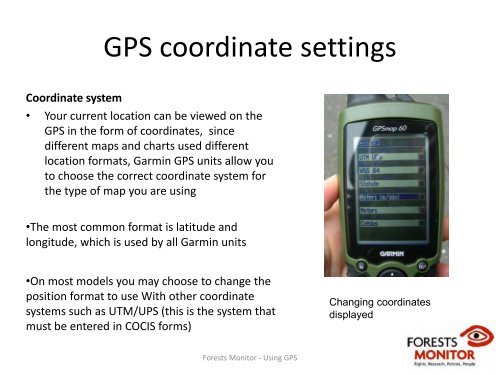
<strong>GPS</strong> coordinate settings<br />
Coordinate system<br />
• Your current location can be viewed on the<br />
<strong>GPS</strong> in the form of coordinates, since<br />
different maps and charts used different<br />
location formats, Garmin <strong>GPS</strong> units allow you<br />
to choose the correct coordinate system for<br />
the type of map you are using<br />
•The most common format is latitude and<br />
longitude, which is used by all Garmin units<br />
•On most models you may choose to change the<br />
position format to use With other coordinate<br />
systems such as UTM/UPS (this is the system that<br />
must be entered in COCIS forms)<br />
Changing coordinates<br />
displayed<br />
<strong>Forests</strong> <strong>Monitor</strong> ‐ <strong>Using</strong> <strong>GPS</strong>