Using GPS - Forests Monitor
Using GPS - Forests Monitor
Using GPS - Forests Monitor

You also want an ePaper? Increase the reach of your titles
YUMPU automatically turns print PDFs into web optimized ePapers that Google loves.
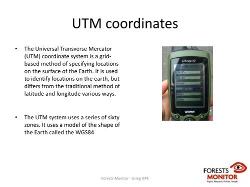
UTM coordinates<br />
• The Universal Transverse Mercator<br />
(UTM) coordinate system is a gridbased<br />
method of specifying locations<br />
on the surface of the Earth. It is used<br />
to identify locations on the earth, but<br />
differs from the traditional method of<br />
latitude and longitude various ways.<br />
• The UTM system uses a series of sixty<br />
zones. It uses a model of the shape of<br />
the Earth called the WGS84<br />
<strong>Forests</strong> <strong>Monitor</strong> ‐ <strong>Using</strong> <strong>GPS</strong>