Excellence in Research - Faculty of Construction and Environment
Excellence in Research - Faculty of Construction and Environment
Excellence in Research - Faculty of Construction and Environment

You also want an ePaper? Increase the reach of your titles
YUMPU automatically turns print PDFs into web optimized ePapers that Google loves.
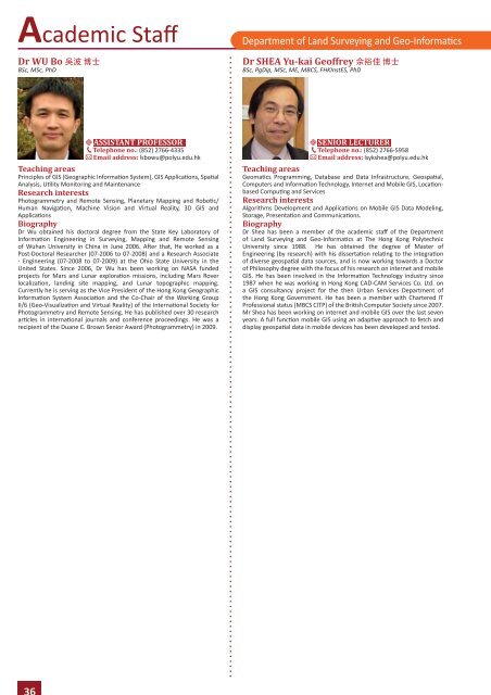
Academic Staff<br />
Dr WU Bo 吳 波 博 士<br />
BSc, MSc, PhD<br />
Department <strong>of</strong> L<strong>and</strong> Survey<strong>in</strong>g <strong>and</strong> Geo-Informatics<br />
Dr SHEA Yu-kai Ge<strong>of</strong>frey 佘 裕 佳 博 士<br />
BSc, PgDip, MSc, ME, MBCS, FHKInstES, PhD<br />
ASSISTANT PROFESSOR<br />
Telephone no.: (852) 2766-4335<br />
Email address: lsbowu@polyu.edu.hk<br />
Teach<strong>in</strong>g areas<br />
Pr<strong>in</strong>ciples <strong>of</strong> GIS (Geographic Information System), GIS Applications, Spatial<br />
Analysis, Utility Monitor<strong>in</strong>g <strong>and</strong> Ma<strong>in</strong>tenance<br />
<strong>Research</strong> <strong>in</strong>terests<br />
Photogrammetry <strong>and</strong> Remote Sens<strong>in</strong>g, Planetary Mapp<strong>in</strong>g <strong>and</strong> Robotic/<br />
Human Navigation, Mach<strong>in</strong>e Vision <strong>and</strong> Virtual Reality, 3D GIS <strong>and</strong><br />
Applications<br />
Biography<br />
Dr Wu obta<strong>in</strong>ed his doctoral degree from the State Key Laboratory <strong>of</strong><br />
Information Eng<strong>in</strong>eer<strong>in</strong>g <strong>in</strong> Survey<strong>in</strong>g, Mapp<strong>in</strong>g <strong>and</strong> Remote Sens<strong>in</strong>g<br />
<strong>of</strong> Wuhan University <strong>in</strong> Ch<strong>in</strong>a <strong>in</strong> June 2006. After that, He worked as a<br />
Post-Doctoral <strong>Research</strong>er (07-2006 to 07-2008) <strong>and</strong> a <strong>Research</strong> Associate<br />
- Eng<strong>in</strong>eer<strong>in</strong>g (07-2008 to 07-2009) at the Ohio State University <strong>in</strong> the<br />
United States. S<strong>in</strong>ce 2006, Dr Wu has been work<strong>in</strong>g on NASA funded<br />
projects for Mars <strong>and</strong> Lunar exploration missions, <strong>in</strong>clud<strong>in</strong>g Mars Rover<br />
localization, l<strong>and</strong><strong>in</strong>g site mapp<strong>in</strong>g, <strong>and</strong> Lunar topographic mapp<strong>in</strong>g.<br />
Currently he is serv<strong>in</strong>g as the Vice President <strong>of</strong> the Hong Kong Geographic<br />
Information System Association <strong>and</strong> the Co-Chair <strong>of</strong> the Work<strong>in</strong>g Group<br />
II/6 (Geo-Visualization <strong>and</strong> Virtual Reality) <strong>of</strong> the International Society for<br />
Photogrammetry <strong>and</strong> Remote Sens<strong>in</strong>g. He has published over 30 research<br />
articles <strong>in</strong> <strong>in</strong>ternational journals <strong>and</strong> conference proceed<strong>in</strong>gs. He was a<br />
recipient <strong>of</strong> the Duane C. Brown Senior Award (Photogrammetry) <strong>in</strong> 2009.<br />
SENIOR LECTURER<br />
Telephone no.: (852) 2766-5958<br />
Email address: lsykshea@polyu.edu.hk<br />
Teach<strong>in</strong>g areas<br />
Geomatics Programm<strong>in</strong>g, Database <strong>and</strong> Data Infrastructure, Geospatial,<br />
Computers <strong>and</strong> Information Technology, Internet <strong>and</strong> Mobile GIS, Locationbased<br />
Comput<strong>in</strong>g <strong>and</strong> Services<br />
<strong>Research</strong> <strong>in</strong>terests<br />
Algorithms Development <strong>and</strong> Applications on Mobile GIS Data Model<strong>in</strong>g,<br />
Storage, Presentation <strong>and</strong> Communications.<br />
Biography<br />
Dr Shea has been a member <strong>of</strong> the academic staff <strong>of</strong> the Department<br />
<strong>of</strong> L<strong>and</strong> Survey<strong>in</strong>g <strong>and</strong> Geo-Informatics at The Hong Kong Polytechnic<br />
University s<strong>in</strong>ce 1988. He has obta<strong>in</strong>ed the degree <strong>of</strong> Master <strong>of</strong><br />
Eng<strong>in</strong>eer<strong>in</strong>g (by research) with his dissertation relat<strong>in</strong>g to the <strong>in</strong>tegration<br />
<strong>of</strong> diverse geospatial data sources, <strong>and</strong> is now work<strong>in</strong>g towards a Doctor<br />
<strong>of</strong> Philosophy degree with the focus <strong>of</strong> his research on <strong>in</strong>ternet <strong>and</strong> mobile<br />
GIS. He has been <strong>in</strong>volved <strong>in</strong> the Information Technology <strong>in</strong>dustry s<strong>in</strong>ce<br />
1987 when he was work<strong>in</strong>g <strong>in</strong> Hong Kong CAD-CAM Services Co. Ltd. on<br />
a GIS consultancy project for the then Urban Services Department <strong>of</strong><br />
the Hong Kong Government. He has been a member with Chartered IT<br />
Pr<strong>of</strong>essional status (MBCS CITP) <strong>of</strong> the British Computer Society s<strong>in</strong>ce 2007.<br />
Mr Shea has been work<strong>in</strong>g on <strong>in</strong>ternet <strong>and</strong> mobile GIS over the last seven<br />
years. A full function mobile GIS us<strong>in</strong>g an adaptive approach to fetch <strong>and</strong><br />
display geospatial data <strong>in</strong> mobile devices has been developed <strong>and</strong> tested.<br />
36