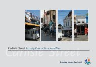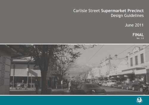
Carlisle Street Supermarket Precinct Design ... - City of Port Phillip
Carlisle Street Supermarket Precinct Design ... - City of Port Phillip
Carlisle Street Supermarket Precinct Design ... - City of Port Phillip

Create successful ePaper yourself
Turn your PDF publications into a flip-book with our unique Google optimized e-Paper software.
<strong>Carlisle</strong> <strong>Street</strong> <strong>Supermarket</strong> <strong>Precinct</strong> <strong>Design</strong> Guidelines | June 2011| DRAFT Version 2<br />
1
<strong>Carlisle</strong> <strong>Street</strong> <strong>Supermarket</strong> <strong>Precinct</strong> <strong>Design</strong> Guidelines | June 2011| Version 3<br />
Table <strong>of</strong> Contents<br />
BACKGROUND ........................................................ 2<br />
PURPOSE OF THE PRECINCT GUIDELINES......................... 3<br />
KEY STUDIES & DOCUMENTS ....................................... 3<br />
PRECINCT GUIDELINES STRUCTURE ............................... 3<br />
1. ACTIVITY CENTRE STRATEGIC CONTEXT ...................... 4<br />
2. EXISTING PRECINCT CONTEXT .................................. 6<br />
3. PREFERRED ACTIVITY & FUNCTION ............................ 8<br />
4. PREFERRED ACCESS & MOVEMENT ............................10<br />
5. PREFERRED BUILT FORM........................................11<br />
5A CAMDEN STREET DESIGN GUIDELINES.................14<br />
5B NELSON STREET DESIGN GUIDELINES .................15<br />
5C ALFRED STREET DESIGN GUIDELINES..................17<br />
5D CARLISLE STREET DESIGN GUIDELINES................19<br />
5E LANEWAYS & ACCESSWAYS DESIGN GUIDELINES ....21<br />
6 DEVELOPMENT SCENARIOS & PHASING ........................23<br />
7 OVERALL PRECINCT PLAN .......................................25<br />
2
<strong>Carlisle</strong> <strong>Street</strong> <strong>Supermarket</strong> <strong>Precinct</strong> <strong>Design</strong> Guidelines | June 2011| Version 3<br />
BACKGROUND<br />
In late 2009, the <strong>City</strong> <strong>of</strong> <strong>Port</strong> <strong>Phillip</strong> adopted the <strong>Carlisle</strong> <strong>Street</strong> Activity<br />
Centre Structure Plan and accompanying Urban <strong>Design</strong> Framework. Council<br />
further resolved to seek Ministerial authorisation to prepare and exhibit an<br />
amendment to incorporate the directions <strong>of</strong> the Structure Plan and UDF into<br />
the <strong>Port</strong> <strong>Phillip</strong> Planning Scheme (Amendment C80). This will include the<br />
introduction <strong>of</strong> local policy and a design and development overlay provision in<br />
the scheme (refer to attachment 1).<br />
PURPOSE OF THE PRECINCT GUIDELINES<br />
While the existing Structure Plan, Urban <strong>Design</strong> Framework and proposed<br />
local policy and overlay (as part <strong>of</strong> Amendment C80) will provide the<br />
statutory basis for new development within the centre, the purpose <strong>of</strong> this<br />
document is to focus specifically on the designated <strong>Supermarket</strong> <strong>Precinct</strong> and<br />
highlight Council’s expectations for new development. These guidelines seek<br />
to provide additional guidance to landowners, developers and the community<br />
and provide standards for development within both the public and private<br />
realm.<br />
The purpose <strong>of</strong> this document is to:<br />
• complement and expand upon established strategic directions and design<br />
guidelines;<br />
• provide illustrative representation/examples <strong>of</strong> potential design<br />
outcomes;<br />
• provide clarity to developers, landowners, community and Council on the<br />
desired standards and benchmark for design;<br />
• provide a context for formulating and assessing private development<br />
proposals to ensure that they respond to desired character; and<br />
• guide the management, coordination and improvement <strong>of</strong> public spaces.<br />
KEY STUDIES & DOCUMENTS<br />
These <strong>Precinct</strong> Guidelines are heavily based on the <strong>Carlisle</strong> <strong>Street</strong> Structure<br />
Plan and Urban <strong>Design</strong> Framework. This document deliberately omits<br />
background material as already contained within relevant existing strategic<br />
studies.<br />
These <strong>Precinct</strong> Guidelines are directly informed by:<br />
• <strong>Carlisle</strong> <strong>Street</strong> Major Activity Centre Structure Plan, 2009<br />
• <strong>Carlisle</strong> <strong>Street</strong> Urban <strong>Design</strong> Framework, 2009<br />
• Proposed Amendment C80 Documentation<br />
- <strong>Carlisle</strong> <strong>Street</strong> Major Activity Centre Policy<br />
- <strong>Design</strong> and Development Overlay (Schedule 21)<br />
A number <strong>of</strong> other documents also provide guidance to specific aspects <strong>of</strong><br />
new development within the <strong>Supermarket</strong> <strong>Precinct</strong>, which this Guidelines<br />
does not duplicate. These include:<br />
• Urban <strong>Design</strong> Charter, Department <strong>of</strong> Sustainability and Environment,<br />
2010.<br />
• Activity Centre <strong>Design</strong> Guidelines, Department <strong>of</strong> Sustainability and<br />
Environment, 2005.<br />
• Safer <strong>Design</strong> Guidelines for Victoria, Department <strong>of</strong> Sustainability and<br />
Environment, 2005.<br />
• Guidelines for Higher Density Residential Development, Department <strong>of</strong><br />
Sustainability and Environment, 2004.<br />
• (Interim) Guidelines for Larger Format Retail Premises, Department <strong>of</strong><br />
Planning and Community Development, 2007.<br />
• <strong>City</strong> <strong>of</strong> <strong>Port</strong> <strong>Phillip</strong> Activity Centres Review, 2006 and Activities Centre<br />
Strategy Implementation Plan, 2006.<br />
3
<strong>Carlisle</strong> <strong>Street</strong> <strong>Supermarket</strong> <strong>Precinct</strong> <strong>Design</strong> Guidelines | June 2011| Version 3<br />
PRECINCT GUIDELINES STRUCTURE<br />
The format <strong>of</strong> the <strong>Carlisle</strong> <strong>Street</strong> <strong>Supermarket</strong> <strong>Precinct</strong> Guidelines is<br />
structured as follows:<br />
1. Activity Centre Strategic Context<br />
Map and summary <strong>of</strong> relevant projects within the Centre<br />
2. Existing <strong>Precinct</strong> Context<br />
<strong>Precinct</strong> overview and existing characteristics<br />
3. Preferred Activity and Function<br />
Outlining future land use, activity and function<br />
4. Preferred Built Form Envelopes<br />
Summary <strong>of</strong> Council adopted height controls – for full details refer to<br />
proposed DDO (Amendment C80)<br />
5. Development Guidelines<br />
Specific design standards organised by streetscape interface<br />
6. Development Scenarios and Phasing<br />
Potential redevelopment models and outcomes<br />
7. Overall <strong>Precinct</strong> Plan<br />
1. ACTIVITY CENTRE STRATEGIC<br />
CONTEXT<br />
The <strong>Carlisle</strong> <strong>Street</strong> Structure Plan outlines a number <strong>of</strong> strategic precincts<br />
within the Activity Centre - largely defined by their land use, role and<br />
function. Of note, the Plan recognises a major urban renewal opportunity<br />
within a significant portion <strong>of</strong> land positioned centrally to the <strong>Carlisle</strong> <strong>Street</strong><br />
Activity Centre. This area is identified as the <strong>Carlisle</strong> <strong>Street</strong> <strong>Supermarket</strong><br />
<strong>Precinct</strong> which comprises the centre’s two major supermarkets and extensive<br />
areas <strong>of</strong> ground level car parking.<br />
Proximate to the <strong>Supermarket</strong> <strong>Precinct</strong>, a number <strong>of</strong> planned projects are<br />
currently underway. These projects include the proposed <strong>Carlisle</strong> <strong>Street</strong><br />
Public Transport Interchange (Department <strong>of</strong> Transport- DoT), the Balaclava<br />
Train Station upgrade (DoT), and the Southern Station Car Park – Housing<br />
Project (<strong>Port</strong> <strong>Phillip</strong> Housing Association & CoPP). It is anticipated that the<br />
proposed public transport initiatives are likely to commence by 2012-2013.<br />
In light <strong>of</strong> the abovementioned projects, a Car Parking and Traffic Study <strong>of</strong> the<br />
<strong>Carlisle</strong> <strong>Street</strong> Activity Centre is also currently in progress to assess potential<br />
traffic implications (i.e. loss <strong>of</strong> car parking, road remodelling etc). It is noted<br />
that the findings <strong>of</strong> this study should also inform the decision process for<br />
future developments within the area.<br />
4
<strong>Carlisle</strong> <strong>Street</strong> <strong>Supermarket</strong> <strong>Precinct</strong> <strong>Design</strong> Guidelines | June 2011| DRAFT Version 3<br />
5
<strong>Carlisle</strong> <strong>Street</strong> <strong>Supermarket</strong> <strong>Precinct</strong> <strong>Design</strong> Guidelines | June 2011| Version 3<br />
2. EXISTING PRECINCT CONTEXT<br />
THE STUDY AREA<br />
The study precinct is located on the northern side <strong>of</strong> the <strong>Carlisle</strong> <strong>Street</strong> and<br />
generally includes land bounded by Chapel <strong>Street</strong> (to the west), Alfred <strong>Street</strong><br />
(to the north), Nelson <strong>Street</strong> (to the east). While the primary redevelopment<br />
area includes the existing supermarket sites and associated parking areas, it is<br />
important that the surrounding context and immediate streetscapes are also<br />
considered in the evolution <strong>of</strong> the <strong>Precinct</strong>.<br />
The renewal <strong>of</strong> key public and privately owned sites within the precinct <strong>of</strong>fers<br />
a strategic opportunity, not only to enhance the economic viability <strong>of</strong> the<br />
centre, but also to significantly improve the quality <strong>of</strong> the public realm<br />
(streets and spaces), and to reinforce the centre’s unique ‘sense <strong>of</strong> place’ for<br />
the local community. Redevelopment within the precinct will act as a catalyst<br />
to improvements in the wider centre.<br />
Camden <strong>Street</strong> (looking south)<br />
6
<strong>Carlisle</strong> <strong>Street</strong> <strong>Supermarket</strong> <strong>Precinct</strong> <strong>Design</strong> Guidelines | June 2011| Version 3<br />
Existing <strong>Precinct</strong> Context<br />
7
<strong>Carlisle</strong> <strong>Street</strong> <strong>Supermarket</strong> <strong>Precinct</strong> <strong>Design</strong> Guidelines | June 2011| Version 3<br />
3. PREFERRED ACTIVITY & FUNCTION<br />
<strong>Precinct</strong> Use<br />
Council expects new development within the <strong>Supermarket</strong> <strong>Precinct</strong> to<br />
achieve the following:<br />
• 2 full line supermarkets within the <strong>Precinct</strong> and an adequate mix <strong>of</strong><br />
speciality retail and commercial uses<br />
• Vertical layering <strong>of</strong> uses and generally composed:<br />
- Underground – car parking, loading, services (inactive<br />
uses)<br />
- Ground level – supermarket/ retail, residential entries,<br />
community uses, open space (limited service areas)<br />
- Aboveground – <strong>of</strong>fices, mixed commercial, residential<br />
(diverse range <strong>of</strong> housing types), private/communal open<br />
space<br />
• Predominantly active frontages (facades that engage with pedestrians such<br />
as window shop fronts, entries etc) to <strong>Carlisle</strong> <strong>Street</strong>, Camden <strong>Street</strong>,<br />
Nelson <strong>Street</strong> and Alfred <strong>Street</strong> (priority in that order)<br />
• Provision <strong>of</strong> public amenities (public toilets, baby change facilities and<br />
bicycle parking, street furniture etc)<br />
• Adequate car parking is largely provided underground<br />
• New development to incorporate ESD principles and achieves a minimum<br />
6 green star rating<br />
• Contributes to creating additional and improved streetscapes and public<br />
spaces within the <strong>Precinct</strong> (either through developer contributions or<br />
works in kind). The nature <strong>of</strong> improvement is subject to future<br />
negotiations.<br />
8
<strong>Carlisle</strong> <strong>Street</strong> <strong>Supermarket</strong> <strong>Precinct</strong> <strong>Design</strong> Guidelines | June 2011| Version 3<br />
Preferred Activity & Function<br />
9
<strong>Carlisle</strong> <strong>Street</strong> <strong>Supermarket</strong> <strong>Precinct</strong> <strong>Design</strong> Guidelines | June 2011| Version 3<br />
4. PREFERRED ACCESS & MOVEMENT<br />
<strong>Precinct</strong> Car Parking<br />
Council expects car parking for new development:<br />
• considers the capacity for car parking as both precinct and activity centre<br />
based approach<br />
• considers application for sustainable car parking rates and<br />
• considers the use <strong>of</strong> sharecars and associated parking locations<br />
<strong>Precinct</strong> Traffic Circulation<br />
Council expects new development to manage traffic impacts:<br />
• to <strong>Carlisle</strong> <strong>Street</strong> (including existing tram line and anticipated <strong>Carlisle</strong><br />
<strong>Street</strong> Train/Tram Interchange)<br />
• to residential streets <strong>of</strong> Camden and Nelson <strong>Street</strong>s (north <strong>of</strong> Alfred)<br />
Council’s preferred traffic circulation routes are as follows (preference in<br />
order):<br />
1. Improve Camden and <strong>Carlisle</strong> <strong>Street</strong> intersection<br />
2. Potential long term connection with Chapel <strong>Street</strong> to allow loop<br />
access to Camden <strong>Street</strong> and <strong>Carlisle</strong> <strong>Street</strong> (subject to traffic studies<br />
& consultation with landowners/ community)<br />
Note: until the above option is possible, the following applies:<br />
<strong>Precinct</strong> Pedestrian Linkages<br />
Council expects new development to maximise pedestrian connections:<br />
• by integrating the building form to link with existing and/or new<br />
pedestrian arcades with <strong>Carlisle</strong> <strong>Street</strong><br />
• by reinstating laneway to the rear <strong>of</strong> <strong>Carlisle</strong> <strong>Street</strong> to allow east-west<br />
movement<br />
• by enhancing the public realm <strong>of</strong> Camden, Alfred and Nelson <strong>Street</strong>s<br />
through canopy landscaping, new paving, low level planting, street<br />
furniture and water sensitive urban design treatments<br />
Loading and Servicing<br />
Council expects loading and servicing areas <strong>of</strong> new development to:<br />
• not be located along <strong>Carlisle</strong> <strong>Street</strong><br />
• not impact upon the developability <strong>of</strong> adjoining sites<br />
• preferably be consolidated and located under ground, away from public<br />
view<br />
• be screened from public view with architectural treatments that<br />
complement the building design<br />
3. Utilise Camden <strong>Street</strong> (section between <strong>Carlisle</strong> <strong>Street</strong> and Alfred<br />
<strong>Street</strong>) as key vehicle access/exit to avoid impacts on residential<br />
streets and function <strong>of</strong> proposed <strong>Carlisle</strong> <strong>Street</strong> Train/Tram<br />
Interchange.<br />
4. Vehicle access loop with entry at Camden <strong>Street</strong>, through to Alfred<br />
<strong>Street</strong> – Nelson <strong>Street</strong>s and egress at <strong>Carlisle</strong> <strong>Street</strong>.<br />
10
<strong>Carlisle</strong> <strong>Street</strong> <strong>Supermarket</strong> <strong>Precinct</strong> <strong>Design</strong> Guidelines | June 2011| Version 3<br />
Preferred Access & Movement<br />
11
<strong>Carlisle</strong> <strong>Street</strong> <strong>Supermarket</strong> <strong>Precinct</strong> <strong>Design</strong> Guidelines | June 2011| Version 3<br />
5. PREFERRED BUILT FORM<br />
Council expects new development to respond to relevant strategic studies<br />
(outlined previously) and in particular built form controls outlined in the<br />
proposed <strong>Design</strong> and Development Overlay (DDO) – <strong>Carlisle</strong> <strong>Street</strong><br />
Major Activity Centre<br />
Supplementary <strong>Design</strong> Guidelines have been prepared for the following<br />
streetscapes:<br />
5a – Camden <strong>Street</strong><br />
5b – Nelson <strong>Street</strong><br />
5c – Alfred <strong>Street</strong><br />
5d – <strong>Carlisle</strong> <strong>Street</strong><br />
5e – laneways and accessways<br />
<strong>Carlisle</strong> <strong>Street</strong> Shopping Centre (existing conditions)<br />
Alfred <strong>Street</strong> (existing conditions)<br />
Camden <strong>Street</strong> (existing conditions)<br />
12
<strong>Carlisle</strong> <strong>Street</strong> <strong>Supermarket</strong> <strong>Precinct</strong> <strong>Design</strong> Guidelines | June 2011| Version 3<br />
Preferred Built Form<br />
13
<strong>Carlisle</strong> <strong>Street</strong> <strong>Supermarket</strong> <strong>Precinct</strong> <strong>Design</strong> Guidelines | June 2011| Version 3<br />
5A<br />
CAMDEN STREET<br />
VISION<br />
Camden <strong>Street</strong> will be transformed into a high quality<br />
streetscape that is activated by new retail frontages<br />
and continuous pedestrian shelter. While pedestrian<br />
and vehicle traffic will need to share the public<br />
domain, it will be a traffic calmed environment and<br />
place that fosters slow speeds. The street will also<br />
develop as a ‘green’ streetscape that includes<br />
extensive canopy and low level landscaping, new<br />
paving, water sensitive urban design treatments and<br />
street furniture.<br />
DESIGN GUIDELINES<br />
The following guidelines are suggested minimum<br />
standards that will assist in achieving Council’s vision:<br />
Use<br />
• Locate car parking and servicing below ground<br />
level<br />
• Locate major/specialty retail on the ground floor<br />
• Locate commercial, residential and<br />
complementary activities on upper levels<br />
• Orientate units above ground level to promote<br />
passive surveillance<br />
Form<br />
• Scale and setbacks <strong>of</strong> buildings to comply with<br />
proposed DDO controls (refer to street section)<br />
• Establish active frontages (i.e. shopfronts, entries,<br />
glazing) to at least 50% <strong>of</strong> the streetscape width<br />
• Facades to incorporate awnings and canopies<br />
• Demarcate building entries by incorporating<br />
interesting architectural features<br />
• Utilise sun screens etc to control sunlight and<br />
wind<br />
Movement<br />
• Reinstate laneway to the rear <strong>of</strong> <strong>Carlisle</strong> <strong>Street</strong><br />
to connect through to Camden <strong>Street</strong><br />
• Reduce through traffic to the residential section<br />
<strong>of</strong> Camden <strong>Street</strong> to the north <strong>of</strong> Alfred <strong>Street</strong><br />
• Retain existing 3 tonne vehicle ban from Alfred<br />
<strong>Street</strong> to Inkerman <strong>Street</strong><br />
• Investigate traffic improvements (i.e. signals) at<br />
Camden and <strong>Carlisle</strong> <strong>Street</strong> intersection<br />
• Explore long term opportunities for new linkage<br />
from Chapel <strong>Street</strong> to Camden <strong>Street</strong><br />
Public Realm<br />
• Delineate a shared zone by paving treatments<br />
• Incorporate extensive canopy planting (in line<br />
with CoPP WSUD guidelines and Greening <strong>Port</strong><br />
<strong>Phillip</strong> Strategy)<br />
• Establish and install a consistent suite <strong>of</strong> street<br />
furniture that complements the <strong>Precinct</strong> and the<br />
broader <strong>Carlisle</strong> <strong>Street</strong> corridor<br />
14
<strong>Carlisle</strong> <strong>Street</strong> <strong>Supermarket</strong> <strong>Precinct</strong> <strong>Design</strong> Guidelines | June 2011| Version 3<br />
15
<strong>Carlisle</strong> <strong>Street</strong> <strong>Supermarket</strong> <strong>Precinct</strong> <strong>Design</strong> Guidelines | June 2011| Version 3<br />
5B<br />
NELSON STREET<br />
VISION<br />
Nelson <strong>Street</strong> will be a pedestrian friendly place with<br />
strong pedestrian connectivity with the Balaclava<br />
Station and (future) integrated tram stop. There will<br />
be a mix <strong>of</strong> uses along the <strong>Street</strong> and traffic patterns<br />
will favour pedestrians.<br />
GUIDELINES<br />
The following guidelines are suggested minimum<br />
standards that will assist in achieving Council’s vision:<br />
Use<br />
• Locate car parking and servicing below ground<br />
level<br />
• Locate major/speciality retail on the ground floor<br />
• Locate commercial, residential and<br />
complementary activities on upper levels<br />
• <strong>Design</strong> each use for acoustic privacy given the<br />
proximity to the rail line<br />
Form<br />
• Scale and setbacks <strong>of</strong> buildings to comply with<br />
proposed DDO controls (refer to street section)<br />
• Establish active frontages (i.e. shopfronts, entries,<br />
glazing) to at least 50% <strong>of</strong> the streetscape width<br />
• Facades to incorporate awnings and canopies<br />
• Demarcate building entries by incorporating<br />
interesting architectural features<br />
• Utilise sun screens etc to control sunlight and<br />
wind<br />
Movement<br />
• Retan existing one-way traffic along Nelson<br />
<strong>Street</strong><br />
• Retain existing 3 tonne vehicle ban from Alfred<br />
<strong>Street</strong> to Inkerman <strong>Street</strong> along Nelson <strong>Street</strong><br />
• Ensure vehicle access does not impact upon<br />
future Train/Tram Interchange at <strong>Carlisle</strong> <strong>Street</strong><br />
• Traffic patterns must favour pedestrians<br />
• Access vehicle entrances to underground car<br />
parking from Nelson <strong>Street</strong><br />
• Separate commercial car parking and servicing<br />
from residential car parking<br />
Public realm<br />
• Provide a quality consistent footpath treatment,<br />
street furniture and landscaping in line with<br />
Council’s requirements to achieve a cohesive<br />
precinct<br />
• Investigate potential to consolidate Council<br />
owned land into a public north facing open space<br />
on the corner <strong>of</strong> Nelson <strong>Street</strong> and Alfred <strong>Street</strong><br />
• Provide passive surveillance <strong>of</strong> the street and<br />
new open space through orientation and<br />
fenestration design<br />
• Establish and install a consistent suite <strong>of</strong> street<br />
furniture that complements the <strong>Precinct</strong> and the<br />
broader <strong>Carlisle</strong> <strong>Street</strong> corridor<br />
16
<strong>Carlisle</strong> <strong>Street</strong> <strong>Supermarket</strong> <strong>Precinct</strong> <strong>Design</strong> Guidelines | June 2011| Version 3<br />
17
<strong>Carlisle</strong> <strong>Street</strong> <strong>Supermarket</strong> <strong>Precinct</strong> <strong>Design</strong> Guidelines | June 2011| Version 3<br />
5C<br />
ALFRED STREET<br />
VISION<br />
Alfred <strong>Street</strong> will be an attractive service street to<br />
cater for future mix-use/residential developments<br />
(northern side) and the <strong>Supermarket</strong> <strong>Precinct</strong>.<br />
Buildings will present highly articulated frontages that<br />
correspond to the prevailing streetscape pattern.<br />
Given its narrowness, the street will foster a slow<br />
speed environment and will be enhanced through<br />
new canopy trees in planting bays.<br />
GUIDELINES<br />
The following guidelines are suggested minimum<br />
standards that will assist in achieving Council’s vision:<br />
Use<br />
• Locate car parking and servicing below ground<br />
level<br />
• Locate major/specialty retail on the ground floor<br />
• Locate commercial, residential and<br />
complementary activities on upper levels<br />
• Locate key residential entrances at ground floor<br />
• Orientate units above ground level to promote<br />
passive surveillance<br />
Form<br />
• Scale and setbacks <strong>of</strong> buildings to comply with<br />
proposed DDO controls (refer to street section)<br />
• Step back upper levels <strong>of</strong> development to reduce<br />
visual bulk as perceived from pedestrian level <strong>of</strong><br />
northern side <strong>of</strong> the street<br />
• New development to maximise northerly aspect<br />
• Demarcate building entries by incorporating<br />
interesting architectural features<br />
• Balconies should be located adjacent to a primary<br />
living space<br />
• Avoid extensive areas <strong>of</strong> blank walls, opaque<br />
glazing or large scale signage<br />
Movement<br />
• Implement traffic calming and landscaping<br />
treatments<br />
• Limit the extent <strong>of</strong> truck access within the street<br />
• Locate car parking and service areas below<br />
ground level<br />
• Isolate service requirements from residential<br />
access<br />
Public realm<br />
• Consider new development to integrate with<br />
existing canopy trees<br />
• or implement new planting regime along the<br />
streetscape, possibly within planting bays with<br />
water sensitive urban design treatments<br />
alongside with on-street parallel parking<br />
• Widen footpaths on the southern side <strong>of</strong> the<br />
street<br />
• Establish and install a consistent suite <strong>of</strong> street<br />
furniture that complements the <strong>Precinct</strong> and the<br />
broader <strong>Carlisle</strong> <strong>Street</strong> corridor<br />
18
<strong>Carlisle</strong> <strong>Street</strong> <strong>Supermarket</strong> <strong>Precinct</strong> <strong>Design</strong> Guidelines | June 2011| Version 3<br />
19
<strong>Carlisle</strong> <strong>Street</strong> <strong>Supermarket</strong> <strong>Precinct</strong> <strong>Design</strong> Guidelines | June 2011| Version 3<br />
5D<br />
CARLISLE STREET<br />
VISION<br />
<strong>Carlisle</strong> <strong>Street</strong> will continue to be a vibrant<br />
traditional street retail centre. The street edge will<br />
be engaging with pedestrians and the majority <strong>of</strong><br />
retail uses will be located on the ground floor. A<br />
bicycle lane and an accessible tram stop will be<br />
incorporated and traffic signalling will be adjusted to<br />
suit.<br />
GUIDELINES<br />
The following guidelines are suggested minimum<br />
standards that will assist in achieving Council’s vision:<br />
Use<br />
• Access to car parking and servicing is not<br />
permitted along <strong>Carlisle</strong> <strong>Street</strong><br />
• Locate major/speciality retail on the ground floor<br />
• Locate commercial, residential and<br />
complementary activities on upper levels<br />
Form<br />
• Scale and setbacks <strong>of</strong> buildings to comply with<br />
proposed DDO controls (refer to street section)<br />
• Recess storeys above level two so that these<br />
levels are invisible when viewed from opposite<br />
side <strong>of</strong> the street<br />
• Build on street boundary<br />
• Establish active frontages (i.e. shopfronts, entries,<br />
glazing) to at least 80% <strong>of</strong> the streetscape width<br />
• Facade to incorporate awnings and canopies for<br />
the full width <strong>of</strong> the street<br />
• Demarcate building entries by incorporating<br />
interesting architectural features<br />
• Avoid extensive areas <strong>of</strong> blank walls, opaque<br />
glazing or large scale signage<br />
• Façade and upper level design to respond to ‘fine<br />
grain’ street pattern<br />
Movement<br />
• No vehicle crossovers<br />
• No loading bay access from <strong>Carlisle</strong> <strong>Street</strong><br />
• Locate access to car parking from Camden <strong>Street</strong><br />
or existing laneway to the west<br />
Public realm<br />
• provide a quality consistent footpath treatment<br />
and landscaping in line with Council’s strategies<br />
and requirements<br />
• Establish and install a consistent suite <strong>of</strong> street<br />
furniture that complements the <strong>Precinct</strong> and the<br />
broader <strong>Carlisle</strong> <strong>Street</strong> corridor<br />
20
<strong>Carlisle</strong> <strong>Street</strong> <strong>Supermarket</strong> <strong>Precinct</strong> <strong>Design</strong> Guidelines | June 2011| Version 3<br />
21
<strong>Carlisle</strong> <strong>Street</strong> <strong>Supermarket</strong> <strong>Precinct</strong> <strong>Design</strong> Guidelines | June 2011| Version 3<br />
5E<br />
LANEWAYS & ACCESSWAYS<br />
VISION<br />
The <strong>Supermarket</strong> <strong>Precinct</strong> will build and expand upon<br />
the existing network <strong>of</strong> lanes and accessways.<br />
Accessibility through the <strong>Precinct</strong> could be improved<br />
through reinstatement <strong>of</strong> laneways and possibly new<br />
linkages to key roads (in the longer term).<br />
GUIDELINES<br />
The following guidelines are suggested minimum<br />
standards that will assist in achieving Council’s vision:<br />
Use<br />
• Activation <strong>of</strong> laneways is strongly encouraged<br />
• Position commercial uses (i.e. cafes, shops) to<br />
open onto the lane<br />
• Encourage development (fronting <strong>Carlisle</strong> <strong>Street</strong>)<br />
to present to the rear as a secondary address<br />
• Explore opportunities for outdoor dining areas<br />
Form<br />
• New development should apply a minimum<br />
setback <strong>of</strong> 5m from the property boundary<br />
(above a 3 storey street wall)<br />
• Provide adequate spacing between buildings to<br />
allow for sunlight and minimise amenity impacts<br />
(i.e. overlooking)<br />
• Avoid extensive areas <strong>of</strong> blank walls, opaque<br />
glazing or large scale signage<br />
• New development between Camden and Nelson<br />
<strong>Street</strong> must allow for a through pedestrian link<br />
with <strong>Carlisle</strong> <strong>Street</strong><br />
Movement<br />
o<br />
o<br />
Consider an integrated development<br />
with <strong>Carlisle</strong> <strong>Street</strong> sites<br />
Maximise connections with existing<br />
arcades<br />
• Reinstate laneway (to the rear <strong>of</strong> <strong>Carlisle</strong> <strong>Street</strong>)<br />
to connect and open to Camden <strong>Street</strong><br />
• Implement traffic calming and landscaping<br />
treatments<br />
• Locate access to underground parking/loading<br />
areas from laneways<br />
Public realm<br />
• Ensure street lighting is implemented along<br />
laneways and integrated with new building forms<br />
• Laneways should be a minimum 5m wide<br />
22
<strong>Carlisle</strong> <strong>Street</strong> <strong>Supermarket</strong> <strong>Precinct</strong> <strong>Design</strong> Guidelines | June 2011| Version 3<br />
23
<strong>Carlisle</strong> <strong>Street</strong> <strong>Supermarket</strong> <strong>Precinct</strong> <strong>Design</strong> Guidelines | June 2011| Version 3<br />
6 DEVELOPMENT<br />
SCENARIOS & PHASING<br />
It is recognised that the precinct can be developed<br />
in a number <strong>of</strong> ways and in various configurations.<br />
The following provides a series <strong>of</strong> development<br />
scenarios for Council consideration. It is important<br />
that any new development within the precinct take<br />
into account the surrounding (existing/anticipated)<br />
context.<br />
The following plan represents existing land<br />
ownership arrangements within the <strong>Precinct</strong>.<br />
Scenario 1 – Develop precinct as 1 site<br />
Phase 1: Opportunity to develop the entire precinct<br />
in one stage. This will require co-operation with all<br />
landowners, community, public agencies and Council.<br />
This is the optimum scenario as redevelopment issues<br />
(such as parking, building design, activity, linkages etc)<br />
are then dealt within a precinct/ Activity Centre wide<br />
approach. Public spaces and streetscape improvements<br />
can be achieved after the redevelopment and<br />
construction <strong>of</strong> buildings.<br />
Scenario 2 – Integration <strong>of</strong> 2 development<br />
phases<br />
Phase 1: Potential to firstly develop the existing Coles<br />
site and Council car park land simultaneously including<br />
streetscape improvements to Alfred & Nelson <strong>Street</strong>s<br />
Phase 2: Secondly, redevelop existing Woolworth’s<br />
site and Council car park. New development should<br />
seek to obtain access to Chapel <strong>Street</strong> (to the west) to<br />
improve overall permeability and servicing <strong>of</strong> the<br />
<strong>Precinct</strong>.<br />
Camden <strong>Street</strong> improvements can form part <strong>of</strong> either<br />
Phase 1 or 2 works<br />
Scenario 3 – Integration <strong>of</strong> 3 development<br />
phases<br />
Phase 1: Redevelopment/ expansion <strong>of</strong> existing Coles<br />
supermarket. New development must have regard to<br />
valued streetscapes and must not restrict the<br />
developability <strong>of</strong> adjoining sites. Camden <strong>Street</strong><br />
improvements should form part <strong>of</strong> this stage.<br />
Phase 2: Redevelopment <strong>of</strong> existing Council car park<br />
for mixed use/ community purposes. Opportunities for<br />
new public spaces including enhancements to Alfred<br />
and Nelson <strong>Street</strong>s.<br />
Phase 3: Lastly, redevelop existing Woolworth’s site<br />
and Council car park. New development should seek<br />
to obtain access to Chapel <strong>Street</strong> (to the west) to<br />
improve overall permeability and servicing <strong>of</strong> the<br />
<strong>Precinct</strong>.<br />
24
<strong>Carlisle</strong> <strong>Street</strong> <strong>Supermarket</strong> <strong>Precinct</strong> <strong>Design</strong> Guidelines | June 2011| Version 3<br />
7 OVERALL PRECINCT PLAN<br />
The following Overall <strong>Precinct</strong> Plan expresses key redevelopment principles<br />
that must be achieved in both the private and public realm:<br />
25
<strong>Carlisle</strong> <strong>Street</strong> <strong>Supermarket</strong> <strong>Precinct</strong> <strong>Design</strong> Guidelines | June 2011| DRAFT Version 3<br />
26