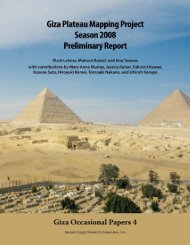
Download a PDF of our 2009 Annual Report - Ancient Egypt ...
Download a PDF of our 2009 Annual Report - Ancient Egypt ...
Download a PDF of our 2009 Annual Report - Ancient Egypt ...

You also want an ePaper? Increase the reach of your titles
YUMPU automatically turns print PDFs into web optimized ePapers that Google loves.
the Ramp surfaces are later than the Ante-Town, but earlier<br />
than the houses.<br />
Our trenches provided a few direct stratigraphic ties<br />
between deposits across the ancient trench. We saw traces <strong>of</strong><br />
a prepared surface approximately 5 meters (16.4 feet) wide<br />
running along the north side <strong>of</strong> the Ramp, which was itself<br />
approximately 10 meters wide (32.8 feet). Quite a monumental<br />
approach to this area <strong>of</strong> the settlement and necropolis!<br />
The Mysterious Basin<br />
During the <strong>2009</strong> season, we cleared and recorded the large<br />
stone-lined basin (photo on pages 21 and 32) to the northwest<br />
<strong>of</strong> the Ramp. The well-cut rectangular limestone blocks, laid<br />
in five stepped c<strong>our</strong>ses, increase in size with each c<strong>our</strong>se up.<br />
People may have used these projecting c<strong>our</strong>ses as steps to go<br />
in and out <strong>of</strong> the basin since there is no stairway. On the south<br />
a shoulder <strong>of</strong> limestone debris rises higher than the top <strong>of</strong> the<br />
Ramp, held in place by a fieldstone retaining wall.<br />
A stone-lined drain slopes down to the north from the surface<br />
<strong>of</strong> the Ramp under the southern shoulder to empty into the<br />
upper c<strong>our</strong>se <strong>of</strong> the stepped basin. The drain consists <strong>of</strong> three<br />
different elements: a base made <strong>of</strong> carved U-shaped stones, the<br />
cover (also U-shaped in cross-section), and Nile silt sealing<br />
the top <strong>of</strong> the drain, possibly to make it water-tight. The drain<br />
is about 9 centimeters (3.5 inches) in diameter and over 7.20<br />
meters (23.6 feet) long.<br />
Two stepped gravel terraces surround the basin, rising<br />
above and stepping outward from it. Traces <strong>of</strong> mudbrick walls<br />
remain on each terrace. The southern shoulder and fieldstone<br />
retaining wall are built over the surface <strong>of</strong> the Ramp.<br />
The basin is part <strong>of</strong> a series <strong>of</strong> basins and water tanks<br />
known from both the MVT and the KKT settlement. It seems to<br />
relate to a mudbrick podium structure, now much denuded, at<br />
the top <strong>of</strong> the Ramp, immediately to the southeast.<br />
<br />
The information gathered so far from recording and excavating<br />
at the town <strong>of</strong> Khentkawes has changed substantially <strong>our</strong><br />
understanding <strong>of</strong> the nature and time span <strong>of</strong> this settlement.<br />
The analysis <strong>of</strong> the material culture and the integration <strong>of</strong> the<br />
various excavation reports into an overall, coherent narrative is<br />
<strong>our</strong> next priority.<br />
The Ramp area in the KKT-AI operation. View to the west.<br />
Basin<br />
Menkaure Valley<br />
Temple Ante-Town<br />
Ramp<br />
House outside KKT<br />
Enclosure Wall<br />
19