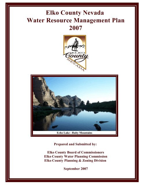
Elko County Nevada Water Resource Management Plan 2007
Elko County Nevada Water Resource Management Plan 2007
Elko County Nevada Water Resource Management Plan 2007

Create successful ePaper yourself
Turn your PDF publications into a flip-book with our unique Google optimized e-Paper software.
<strong>Elko</strong> <strong>County</strong> <strong>Nevada</strong><br />
<strong>Water</strong> <strong>Resource</strong> <strong>Management</strong> <strong>Plan</strong><br />
<strong>2007</strong><br />
Echo Lake - Ruby Mountains<br />
Prepared and Submitted by:<br />
<strong>Elko</strong> <strong>County</strong> Board of Commissioners<br />
<strong>Elko</strong> <strong>County</strong> <strong>Water</strong> <strong>Plan</strong>ning Commission<br />
<strong>Elko</strong> <strong>County</strong> <strong>Plan</strong>ning & Zoning Division<br />
September <strong>2007</strong>
Executive Summary<br />
The <strong>Elko</strong> <strong>County</strong> <strong>Water</strong> <strong>Resource</strong> <strong>Management</strong> <strong>Plan</strong> has been prepared to guide the development,<br />
management and use of water resources in conjunction with land use management over the next twenty<br />
five (25) years. Use by decision makers of information contained within this plan will help to ensure<br />
that the environment of the <strong>County</strong> is sustained while at the same time enabling the expansion and<br />
diversification of the local economy. Implementation of the <strong>Elko</strong> <strong>County</strong> <strong>Water</strong> <strong>Resource</strong> <strong>Management</strong><br />
<strong>Plan</strong> will assist in maintaining the quality of life enjoyed by residents and visitors of <strong>Elko</strong> <strong>County</strong> now<br />
and in the future. Achievement of goals outlined in the plan will result in water resources found within<br />
<strong>Elko</strong> <strong>County</strong> being utilized in a manner beneficial to the residents of <strong>Elko</strong> <strong>County</strong> and the State of<br />
<strong>Nevada</strong>.<br />
The State of <strong>Nevada</strong> <strong>Water</strong> <strong>Plan</strong> represents that <strong>Elko</strong> <strong>County</strong> will endure a loss of population and<br />
agricultural lands over the next twenty five years. Land use and development patterns prepared by <strong>Elko</strong><br />
<strong>County</strong> do not agree with this estimated substantial loss of population and agricultural lands. The trends<br />
show that agricultural uses in <strong>Elko</strong> <strong>County</strong> are stable with minimal notable losses each year.<br />
Development patterns represent that private lands that are not currently utilized for agricultural are<br />
being developed in cooperation and conjunction with agricultural uses.<br />
<strong>Elko</strong> <strong>County</strong> is currently the largest water user in the State of <strong>Nevada</strong>. Current water use in <strong>Elko</strong> <strong>County</strong><br />
including domestic, recreation, commercial, industrial, mining, livestock and irrigated agriculture is<br />
estimated to be approximately 933,041 acre feet annually or 24% of the total state wide use. The largest<br />
of the water users being agriculture at approximately 97%. The State of <strong>Nevada</strong> Demographer and<br />
State of <strong>Nevada</strong> Division of <strong>Water</strong> <strong>Plan</strong>ning has provided estimates and forecast representing a decrease<br />
in population and a loss of agricultural lands in <strong>Elko</strong> <strong>County</strong> through 2026. Forecasts and estimates<br />
based on development patterns provided by <strong>Elko</strong> <strong>County</strong> represents continued growth of population,<br />
anticipated commercial and industrial growth, projected numbers of tourists visiting <strong>Elko</strong> <strong>County</strong><br />
annually and sustained or minimal loss of agricultural lands. Should these estimates and forecasts come<br />
to realization annual water duties in <strong>Elko</strong> <strong>County</strong> could increase for domestic, commercial and<br />
municipal/ industrial consumptive uses by as much as 100 acre feet annually. However, this also<br />
represents a loss of Agricultural lands averaging 0.1% annually. Assuming that all of the elements of<br />
the economic and forecasted populations are achieved, the total water use in the year 2025 may exceed<br />
918,000 acre feet annually. This represents a decrease of 1.6% primarily due to the loss of agricultural<br />
lands.<br />
Studies conducted by the U.S.G.S. indicate that the quantity of groundwater being lost to<br />
evapotranspiration is generally more than double than that estimated in previous evaluations.<br />
Hydrographic Analysis Reports of this plan suggest that recharge over the specific areas of <strong>Elko</strong> <strong>County</strong><br />
is significantly greater than previous estimates. However, research and analysis is characterized by<br />
considerable uncertainty and additional confirmation is required. The implications for this water plan<br />
are that more water is available and may be made available for development and use within <strong>Elko</strong><br />
<strong>County</strong>. This mandates that additional Hydrographic Analysis Reports are necessary for the upper<br />
Humboldt River basin as well as all basins and hydrographic areas in <strong>Elko</strong> <strong>County</strong> to determine<br />
perennial yields based on current technology.<br />
-i-
INDEX:<br />
EXECUTIVE SUMMARY ........................................................ i<br />
EXECUTIVE INDEX ........................................................... ii<br />
ABBREVIATIONS & ACRONYMS .................................................... vi<br />
WATER EQUIVALENT TABLE ..................................................... vii<br />
REFERENCES .................................................................. vii<br />
AUTHORS ..................................................................... xiii<br />
ELKO COUNTY APPROVAL AND ADOPTION .................................. xvi<br />
SECTION 1 - PLAN DEVELOPMENT INFORMATION<br />
INTRODUCTION ........................................................ S1 p1<br />
INSTITUTIONAL FRAMEWORK & HISTORY .................................. S1 p3<br />
History ......................................................... S1 p3<br />
<strong>Elko</strong> <strong>County</strong> Board of Commissioners ................................ S1 p3<br />
<strong>Elko</strong> <strong>County</strong> <strong>Water</strong> <strong>Plan</strong>ning Commission ............................. S1 p3<br />
Composition of the <strong>Water</strong> <strong>Plan</strong>ning Commission ........................ S1 p4<br />
Mission Statement ................................................ S1 p5<br />
<strong>Plan</strong>ning Data Criteria ............................................. S1 p5<br />
<strong>Plan</strong> Areas ...................................................... S1 p5<br />
GOALS AND OBJECTIVES ................................................ S1 p6<br />
<strong>Plan</strong> Goals ...................................................... S1 p6<br />
<strong>Plan</strong> Objectives .................................................. S1 p6<br />
GUIDING PRINCIPLES ................................................... S1 p7<br />
DEMOGRAPHICS ....................................................... S1 p8<br />
Geographics ..................................................... S1 p8<br />
<strong>County</strong> Climate & Precipitation ...................................... S1 p8<br />
State Climate & Precipitation ...................................... S1 p10<br />
Geology & Soils ................................................. S1 p11<br />
Vegetation ..................................................... S1 p12<br />
Land Mass ..................................................... S1 p13<br />
<strong>County</strong> Populations .............................................. S1 p14<br />
Municipal Boundaries ............................................ S1 p14<br />
LAND USE ........................................................... S1 p15<br />
Agriculture ..................................................... S1 p15<br />
Residential ..................................................... S1 p16<br />
Commercial .................................................... S1 p16<br />
Industrial ...................................................... S1 p16<br />
Recreation ..................................................... S1 p17<br />
Natural <strong>Resource</strong>s, Mining & Exploration ............................ S1 p18<br />
Private Ownership & Development .................................. S1 p19<br />
Transportation .................................................. S1 p19<br />
<strong>Nevada</strong> & <strong>Elko</strong> <strong>County</strong> Public Land Use History ....................... S1 p20<br />
Western Settlements of Public Lands ................................ S1 p21<br />
SOCIOECONOMIC OVERVIEW ............................................ S1 p22<br />
History ........................................................ S1 p22<br />
Geography & Hydrology .......................................... S1 p23<br />
-ii-
WATER RESOURCES & USES ............................................ S1 p24<br />
SECTION 1 SUMMARY CONCLUSIONS ...................................... S1 p26<br />
LIST OF FIGURES<br />
Figure 1 - <strong>Elko</strong> <strong>County</strong> Average Precipitation (Valley Floors) ...... . . . . . . . . . . . . S1 p8<br />
Figure 2 - <strong>Elko</strong> <strong>County</strong> Average Snowfall (Valley Floors) ...................... S1 p8<br />
Figure 3 - <strong>Elko</strong> <strong>County</strong> Average Sunshine (Valley Floors) ...................... S1 p9<br />
Figure 4 - <strong>Elko</strong> <strong>County</strong> Average Temperatures (Valley Floors) ................... S1 p9<br />
Figure 5 - <strong>Elko</strong> <strong>County</strong> Monthly Precipitation Inches .......................... S1 p9<br />
Figure 6 - <strong>Elko</strong> <strong>County</strong> Annual Precipitation Inches ........................... S1 p9<br />
Figure 7 - <strong>Nevada</strong> Average Annual Rainfall Inches ........................... S1 p10<br />
Figure 8 - Average Annual Lake Surface Evaporation ......................... S1 p10<br />
Figure 9 - <strong>Elko</strong> <strong>County</strong> General Soils ...................................... S1 p11<br />
Figure 10 - <strong>Elko</strong> <strong>County</strong> General Vegetation ................................ S1 p12<br />
Figure 11 - <strong>Nevada</strong> Counties ............................................. S1 p13<br />
Figure 12 - <strong>Nevada</strong> Counties Population Growth 1990 - 2000 ................... S1 p14<br />
Figure 13 - <strong>Elko</strong> <strong>County</strong> Hydrographic Basins ............................... S1 p22<br />
Figure 14 - <strong>Nevada</strong> Hydrographic Regions .................................. S1 p22<br />
Figure 15 - <strong>Nevada</strong> Public <strong>Water</strong> Withdrawals by Source ...................... S1 p24<br />
Figure 16 - <strong>Nevada</strong> <strong>Water</strong> Withdrawals by <strong>County</strong> ........................... S1 p24<br />
LIST OF TABLES<br />
Table 1 - <strong>Nevada</strong> Average Annual Rainfall by Location. . . . . . . . . . . . . . . ........ S1 p10<br />
Table 2 - Agricultural Rating Nation Wide .................................. S1 p15<br />
Table 3 - <strong>Nevada</strong> <strong>Water</strong> Withdrawals by Category. . . . . . . . . . . . . . . ............. S1 p17<br />
SECTION 2 - <strong>Water</strong> <strong>Resource</strong> <strong>Management</strong><br />
EXECUTIVE SUMMARY .................................................. S2 p1<br />
INTRODUCTION ........................................................ S2 p2<br />
NEVADA WATER LAW ................................................... S2 p3<br />
SOCIOECONOMIC CHARACTERISTICS ...................................... S2p4<br />
REGIONAL HYDROGRAPHIC DATA ......................................... S2 p7<br />
REGIONAL HYDROGEOLOGIC FEATURES ................................... S2 p7<br />
REGIONAL HYDROGRAPHIC BASINS ....................................... S2 p8<br />
Snake River Basin ................................................ S2 p8<br />
Humboldt River Basin ............................................. S2 p9<br />
Central Region .................................................. S2 p10<br />
Great Salt Lake Basin ............................................ S2 p10<br />
Hydrographic Basins & Sub-Areas .................................. S2 p11<br />
COUNTY HYDROGRAPHIC DATA ......................................... S2 p13<br />
COUNTY DOMESTIC WELL INVENTORIES .................................. S2 p15<br />
COUNTY POPULATION ESTIMATES ........................................ S2 p17<br />
COUNTY POPULATION FORECASTS ....................................... S2 p17<br />
COUNTY CENSUS HOUSING DATA (2000) ................................... S2 p18<br />
-iii-
MUNICIPAL QUASI-MUNICIPAL WATER SOURCES ........................... S2 p19<br />
MUNICIPAL QUASI-MUNICIPAL WATER RESOURCES ......................... S2 p20<br />
DOMESTIC WELL RESOURCES ........................................... S2 p21<br />
WATER USE FORECASTS ................................................ S2 p25<br />
DEVELOPMENT CONSIDERATIONS ........................................ S2 p28<br />
Benefits of <strong>Water</strong> Education ....................................... S2 p28<br />
Statutory <strong>Plan</strong>ning Provisions ...................................... S2 p29<br />
<strong>Plan</strong>ning & Development of <strong>Water</strong> <strong>Resource</strong>s ......................... S2 p29<br />
Drought Conditions .............................................. S2 p33<br />
State of <strong>Nevada</strong> Drought <strong>Plan</strong> ...................................... S2 p34<br />
<strong>Water</strong> <strong>Resource</strong> Conservation ...................................... S2 p38<br />
Effects of Groundwater Pumping ................................... S2 p39<br />
Well Head Protection ............................................. S2 p41<br />
Nonpoint Source Pollution ......................................... S2 p41<br />
Safe Drinking <strong>Water</strong> Act .......................................... S2 p44<br />
Flood Plain <strong>Management</strong> .......................................... S2 p45<br />
REPORT FINDINGS ..................................................... S2 p48<br />
Population Forecasts ............................................. S2 p48<br />
Agricultural <strong>Water</strong> Use Forecasts ................................... S2 p48<br />
Domestic <strong>Water</strong> Use Forecasts ..................................... S2 p48<br />
Estimated Residential <strong>Water</strong> Use .................................... S2 p49<br />
Commercial & Industrial <strong>Water</strong> Use Forecasts ......................... S2 p49<br />
<strong>Elko</strong> <strong>County</strong> <strong>Water</strong> Rights ......................................... S2 p50<br />
Drought <strong>Management</strong> ............................................ S2 p50<br />
Rural Land Use and <strong>Water</strong> <strong>Resource</strong> <strong>Management</strong> <strong>Plan</strong>ning .............. S2 p51<br />
Conservation & <strong>Water</strong> <strong>Resource</strong> <strong>Management</strong> ......................... S2 p52<br />
Flood Plain <strong>Management</strong> .......................................... S2 p52<br />
SECTION 2 SUMMARY .................................................. S2 p54<br />
CONCLUSIONS & PLAN DIRECTIVES ...................................... S2 p55<br />
Preamble ...................................................... S2 p55<br />
<strong>Elko</strong> <strong>County</strong> <strong>Water</strong> <strong>Resource</strong> <strong>Management</strong> Policy ...................... S2 p55<br />
<strong>Elko</strong> <strong>County</strong> Natural <strong>Resource</strong> <strong>Management</strong> ........................... S2 p56<br />
<strong>Elko</strong> <strong>County</strong> Land Use <strong>Plan</strong>ning .................................... S2 p58<br />
Hydrographic Analysis ............................................ S2 p59<br />
LIST OF FIGURES<br />
Figure 1 - <strong>Nevada</strong> Major Acquifers ........................... . . . . . . . . . . . . S2 p6<br />
Figure 2 - <strong>Nevada</strong> Hydrographic Regions .................................... S2 p7<br />
Figure 3 - Snake River Basin Flow System .................................. S2 p8<br />
Figure 4 - Humboldt River Basin Flow System ............................... S2 p9<br />
Figure 5 - Central Region Flow System .................................... S2 p10<br />
Figure 6 - Great Salt Lake Basin Flow System ............................... S2 p10<br />
Figure 7 - <strong>Elko</strong> <strong>County</strong> Hydrographic Areas ................................ S2 p11<br />
Figure 8 - <strong>Elko</strong> <strong>County</strong> Hydrographic Area Map ............................. S2 p12<br />
Figure 9 - <strong>Nevada</strong> Committed Groundwater <strong>Resource</strong>s ........................ S2 p16<br />
Figure 10 - <strong>Nevada</strong> Un-Committed Groundwater <strong>Resource</strong>s .................... S2 p16<br />
-iv-
Figure 10 - U.S. Short Term Drought Indicator Map (<strong>2007</strong>) .................... S2 p36<br />
Figure 11 - U.S. Long Term Drought Indicator Map (<strong>2007</strong>) .................... S2 p37<br />
Figure 12 - U.S. Drought Monitor Map (<strong>2007</strong>) .............................. S2 p37<br />
Figure 13 - Effects of Groundwater Pumping <strong>Water</strong> Level Decline in Feet ......... S2 p39<br />
Figure 14A - Effects of Groundwater Pumping Natural Conditions .............. S2 p40<br />
Figure 14B - Effects of Groundwater Pumping <strong>Water</strong> Level Declines ............ S2 p40<br />
Figure 14C - Effects of Groundwater Pumping Groundwater Quality ............. S2 p40<br />
Figure 14D - Effects of Groundwater Pumping Environmental Effects ............ S2 p40<br />
Figure 15 - Groundwater Recharge Movement (FEMA) ....................... S2 p46<br />
Figure 16 - Flood Plain & Terrace diagram (FEMA) .......................... S2 p46<br />
Figure 17A - Flood Plain Terrace Diagram (FEMA) .......................... S2 p47<br />
Figure 17B - Flood Plain Terrace Diagram (FEMA) .......................... S2 p47<br />
Figure 17C - Flood Plain Terrace Diagram (FEMA) .......................... S2 p47<br />
Figure 17D - Flood Plain Terrace Diagram (FEMA) .......................... S2 p47<br />
Figure 18 - Statewide <strong>Water</strong> Withdrawal by <strong>County</strong> .......................... S2 p48<br />
Figure 19 - Statewide <strong>Water</strong> Withdrawal by use ............................. S2 p48<br />
LIST OF TABLES<br />
Table 1 - <strong>Water</strong> Usage by Type/Sector. . . . . . . . . . . . . . . ....................... S2 p5<br />
Table 2 - Snake River Hydrographic Areas. . . . . . . . . . . . . . . . . . ................. S2 p8<br />
Table 3 - Humboldt River Basin Hydrographic Areas .......................... S2 p9<br />
Table 4 - Central Region Hydrographic Areas ............................... S2 p10<br />
Table 5 - Great Salt Lake Hydrographic Areas ............................... S2 p10<br />
Table 6 - <strong>Elko</strong> <strong>County</strong> Hydrographic Areas ................................. S2 p11<br />
Table 7 - <strong>Elko</strong> <strong>County</strong> Hydrographic Areas & Sub Areas ...................... S2 p12<br />
Table 8 - Basin <strong>Resource</strong> Summary Perennial Yields, Permitted & Applications .... S2 p14<br />
Table 9 - <strong>Elko</strong> <strong>County</strong> Domestic Well Inventories ............................ S2 p17<br />
Table 10 - <strong>Elko</strong> <strong>County</strong> Population Estimates 1996-2004 ...................... S2 p19<br />
Table 11A - <strong>Elko</strong> <strong>County</strong> Population Forecasts 2005-2025 (State of <strong>Nevada</strong>) ...... S2 p19<br />
Table 11B - <strong>Elko</strong> <strong>County</strong> Population Forecast 2005-2025 (<strong>Elko</strong> <strong>County</strong>) .......... S2 p20<br />
Table 12 - Census Housing Data (2000) .................................... S2 p21<br />
Table 13 - Un-Incorporated Municipal & Quasi-Municipal <strong>Water</strong> & Sewer Sources . S2 p22<br />
Table 14 - Un-Incorporated Municipal & Quasi-Municipal <strong>Water</strong> <strong>Resource</strong>s ....... S2 p23<br />
Table 15 - Un-Incorporated Domestic <strong>Water</strong> <strong>Resource</strong>s ....................... S2 p24<br />
Table 16 - <strong>Water</strong> Withdrawal Forecast Equation ............................. S2 p25<br />
Table 17A - Estimated & Forecasted <strong>Water</strong> Use (State of <strong>Nevada</strong>) ............... S2 p26<br />
Table 17B - Estimated & Forecasted <strong>Water</strong> Use (<strong>Elko</strong> <strong>County</strong>) .................. S2 p27<br />
Table 18 - Household <strong>Water</strong> Usage ....................................... S2 p49<br />
-v-
Abbreviations and Acronyms<br />
AF ..................................................... Acre-Feet (or Acre-Foot)<br />
AFY .......................................................... Acre-Feet per Year<br />
AWWA ........................................... American <strong>Water</strong> Works Association<br />
BFE ................................................. Base Flood Elevation (FEMA)<br />
BIA ............................................... Bureau of Indian Affairs (USDI)<br />
BLM ............................................Bureau of Land <strong>Management</strong> (USDI)<br />
CFS ....................................................... Cubic Feet per Second<br />
CORPS .................................... U.S. Army Corps of Engineers (also USACE)<br />
CWA ...................................................... Clean <strong>Water</strong> Act (EPA)<br />
DOW .................................................. Division of Wildlife (DCNR)<br />
DWR ........................................... Division of <strong>Water</strong> <strong>Resource</strong>s (DCNR)<br />
DWP ............................................ Division of <strong>Water</strong> <strong>Plan</strong>ning (DCNR)<br />
FEMA .........................................Federal Emergency <strong>Management</strong> Agency<br />
FIRM ............................................. Flood Insurance Rate Map (FEMA)<br />
FIS ................................................ Flood Insurance Study (FEMA)<br />
GIS ................................................ Geographic Information System<br />
GPC ................................................... Gallons per Capita (Person)<br />
GPCD ....................................................Gallons per Capita per Day<br />
GPD ............................................................ Gallons per Day<br />
GPED ................................................. Gallons per Employee per Day<br />
M&I ...................................................... Municipal and Industrial<br />
MGD ...................................................... Million Gallons per Day<br />
MSL .............................................................Mean Sea Level<br />
NDOW .......................................... <strong>Nevada</strong> Division of Wildlife (DCNR)<br />
NDSP ......................................... <strong>Nevada</strong> Division of State Parks (DCNR)<br />
NDWP .....................................<strong>Nevada</strong> Division of <strong>Water</strong> <strong>Plan</strong>ning (DCNR)<br />
NFIP .......................................National Flood Insurance Program (FEMA)<br />
NPS .................................................. Non-Point Source [Pollution]<br />
PWS ....................................... Public <strong>Water</strong> System/Public <strong>Water</strong> Supply<br />
S.A. ......................................................... Seasonally Adjusted<br />
SDWA ................................................ Safe Drinking <strong>Water</strong> Act (EPA)<br />
SFHA ............................................ Special Flood Hazard Area (FEMA)<br />
SFIP ........................................ Standard Flood Insurance Policy (FEMA)<br />
SNOTEL .............................................. Snowpack Telemetry (NRCS)<br />
SPF ................................................Standard Project Flood (FEMA)<br />
USACE ......................................U.S. Army Corps of Engineers (also Corps)<br />
USBR .............................................U.S. Bureau of Reclamation (USDI)<br />
USDA ................................................ U.S. Department of Agriculture<br />
USDI ................................................ U.S. Department of the Interior<br />
USFS ...................................................U.S. Forest Service (USDA)<br />
USFWS ..........................................U.S. Fish and Wildlife Service (USDI)<br />
USGS ................................................ U.S. Geological Survey (USDI)<br />
WRD ..............................................<strong>Water</strong> <strong>Resource</strong>s Division (USGS)<br />
-vi-
WATER EQUIVALENT TABLE<br />
1 cubic foot = 7.48 gallons = 62.4 pounds of water<br />
1 acre-foot = 43,560 cubic feet = 325,851 gallons<br />
1 cubic foot per second (cfs) = 449 gallons per minute (gpm)<br />
1 cfs for 24 hours = 1.9835 acre-feet<br />
1 cfs for 30 days = 59.5 acre-feet<br />
1 cfs for 1 year = 724 acre-feet<br />
1 million gallons = 3.07 acre-feet<br />
1 million gallons per day (mgd) = 1,120 acre-feet per year = 1.55 cubic feet per second<br />
1,000 gallons per minute = 4.42 acre-feet per day<br />
REFERENCES<br />
Anctil, R.J., Oesterling, W.A. and Willson, R.E., 1960. Areal Economic Geology, TWP 35N, RGE 61E & 62E,<br />
<strong>Elko</strong>. Southern Pacific Mineral Survey.<br />
Anctil, R., and Oesterling, W.A., 1960. Areal Economic Geology, TWP 36N, RGE 61E &62E, <strong>Elko</strong>, Southern<br />
Pacific Mineral Survey.<br />
Anctil, R.J., 1961. Areal Economic Geology, TWP 33N, RGE 55E & 56E, <strong>Elko</strong>. Southern Pacific Mineral<br />
Survey.<br />
Avon, L. and Durbin, T.J., 1992. Evaluation of the Maxey-Eakin Method for Calculating Recharge to<br />
Groundwater Basins in <strong>Nevada</strong>: Las Vegas Valley <strong>Water</strong> District, Cooperative <strong>Water</strong> Project Report No. 7,<br />
44 p.<br />
Berger, D.L., 1999. <strong>Water</strong> Budgets for Pine Valley, Carico Lake Valley, and Upper Reese River Valley<br />
Hydrographic Areas, Middle Humboldt River Basin, North-Central <strong>Nevada</strong> – Methods for Estimation and<br />
Results. U.S. Geological Survey <strong>Water</strong>-<strong>Resource</strong>s Investigations Report 99-4272.<br />
Blackburn, P.W., 1986. Soil Survey of <strong>Elko</strong> <strong>County</strong>, <strong>Nevada</strong>, Central Part. USDA – Natural <strong>Resource</strong>s<br />
Conservation Service, 3 Volumes with Accompanying Maps.<br />
Blackwelder, E., 1931. Pleistocene Glaciation in the Sierra <strong>Nevada</strong> and Basin Ranges. Geological Society of<br />
America, Bulletin, v. 42.<br />
Bouwer, 1978. Groundwater Hydrology. Prentice Hall, New York.<br />
City of <strong>Elko</strong>, 1997. Population.<br />
City of <strong>Elko</strong> Engineering Department, August, 1995. City of <strong>Elko</strong>’s Wellhead Protection Program.<br />
City of <strong>Elko</strong> Engineering Department, July 2000. <strong>Water</strong> System Data.<br />
City of <strong>Elko</strong> Engineering Department, July 2000. <strong>Water</strong> Reclamation Facility data.<br />
City of <strong>Elko</strong> Engineering Department, 2001. Sundance Well Data.<br />
City of <strong>Elko</strong> <strong>Plan</strong>ning Department, July 2000. Existing and <strong>Plan</strong>ned Park and Recreational Facilities.<br />
Coats, Robert S., 1987. Geology of <strong>Elko</strong> <strong>County</strong>, <strong>Nevada</strong>. <strong>Nevada</strong> Bureau of Mines and Geology, Bulletin 101.<br />
Daly, C., R.P. Nielsen, and D.L. Phillips, 1994. A Statistical-Topographic model for Mapping Climatological<br />
Precipitation Over Mountainous Terrain. Journal of Applied Meteorology. V. 33, No. 2, p. 140-158.<br />
-vii-
Desert Research Institute – Western Regional Climate Center, 2001. <strong>Nevada</strong> Climate Summaries – Deeth 2 SW,<br />
<strong>Nevada</strong> – Period of Record Climate Data Summary 1951-2000.<br />
Desert Research Institute – Western Regional Climate Center, 2001. <strong>Nevada</strong> Climate Summaries – <strong>Elko</strong> WB<br />
Airport, <strong>Nevada</strong> – Period of Record Climate Data Summary 1890-2000.<br />
Desert Research Institute – Western Regional Climate Center, 2001. <strong>Nevada</strong> Climate Summaries – Lamoille PH,<br />
<strong>Nevada</strong> – Period of Record Climate Data Summary 1917-1972.<br />
Desert Research Institute – Western Regional Climate Center, 2001. <strong>Nevada</strong> Climate Summaries – Lamoille<br />
YOST, <strong>Nevada</strong> – Period of Record Climate Data Summary 1975-2000.<br />
Desert Research Institute – Western Regional Climate Center, 2001. <strong>Nevada</strong> Climate Summaries – Jiggs, <strong>Nevada</strong><br />
– Period of Record Climate Data Summary 1948-1972.<br />
Desert Research Institute – Western Regional Climate Center, 2001. <strong>Nevada</strong> Climate Summaries – Jiggs 8 SSE<br />
Zaga, <strong>Nevada</strong> – Period of Record Climate Data Summary 1978-2000.<br />
Dott, R.H., Jr., 1955. Pennsylvanian Stratigraphy of <strong>Elko</strong> and Northern Diamond Ranges, Northeastern <strong>Nevada</strong>.<br />
American Association of Petroleum Geologists Bulletin 39(11):22.<br />
Dohrenwend, J.C. and Moring, B.C., 1991. Reconnaissance photogeologic map of young faults in the<br />
Winnemucca 1 by 2-degree quadrangle, <strong>Nevada</strong>. U.S. Geological Survey Miscellaneous Field Studies Map MF-<br />
2175.<br />
Dohrenwend, J.C., Schell, B.A., and B.C. Moring, 1991. Reconnaissance Photogeologic Map of Young Faults<br />
in the <strong>Elko</strong> 1 by 2-degree Quadrangle, <strong>Nevada</strong> and Utah. U.S. Geological Survey Miscellaneous Field Studies<br />
Map MF-2179.<br />
Driscoll, F., 1986. Groundwater and Wells. Johnson Filtration Systems Inc., 2 nd Edition.<br />
Eakin, T.E., and Lamke, R.D., 1966. Hydrologic Reconnaissance of the Humboldt River Basin, <strong>Nevada</strong>. <strong>Nevada</strong><br />
Department of Conservation and Natural <strong>Resource</strong>s, <strong>Water</strong> <strong>Resource</strong>s Bulletin 32, 107 p.<br />
Eakin, T.E., G.B. Maxey, T.W. Robinson, J.C. Fredericks and O.J. Loeltz, 1951. Contributions to the Hydrology<br />
of Eastern <strong>Nevada</strong>. <strong>Nevada</strong> Department of Conservation and Natural <strong>Resource</strong>s, <strong>Water</strong> <strong>Resource</strong>s Bulletin 12,<br />
171p.<br />
<strong>Elko</strong> <strong>County</strong> Assessors Office Records.<br />
Emmons, W.H., 1910. Reconnaissance of some mining camps in <strong>Elko</strong>, Lander, and Eureka Counties, <strong>Nevada</strong>,<br />
<strong>Elko</strong>, Lander, Eureka, U.S. Geological Survey, Bulletin 408.<br />
Erwin, John W., 1974. Bouger gravity map of <strong>Nevada</strong>: Winnemucca sheet. <strong>Nevada</strong> Bureau of Mines and Geology<br />
Map 47.<br />
Evans, J.G., and K.B. Ketner, 1971. Geologic map of the Swales Mountain quadrangle and part of the Adobe<br />
Summit quadrangle, <strong>Elko</strong> <strong>County</strong>, <strong>Nevada</strong>. U.S. Geological Survey Miscellaneous Geol. Inv. Map I-667.<br />
Fay, W.M., 1980. <strong>Elko</strong> 1 degree x 2 degree NTMS area, <strong>Nevada</strong> and Utah, data report, hydrogeochemical and<br />
stream sediment reconnaissance. E. I. du Pont de Nemours and Company, for US DOE, Report GJBX-163.<br />
Fenneman, N.M., 1931. Physiography of the Western United States. McGraw Hill Book Co.<br />
Flynn, D.B., 1957. Geology of part of the Dixie Flats quadrangle, <strong>Elko</strong> <strong>County</strong>, <strong>Nevada</strong>. University of California<br />
Los Angeles Master's thesis (unpublished).<br />
-viii-
Foglesong, M.T., 1999. <strong>Water</strong>-related scientific activities of the U.S. Geological Survey in <strong>Nevada</strong>, fiscal years<br />
1997 and 1998: U.S. Geological Survey Open-File Report 99-206.<br />
Fredericks, J.C., and O.J. Loeltz, 1947. Ground water in the vicinity of <strong>Elko</strong>, <strong>Nevada</strong>, in Eakin, T.E., Maxey,<br />
G.B., Robinson, T.W., Fredericks, J.C., and Loeltz, O.J., Contributions to the hydrology of eastern <strong>Nevada</strong>, 1951.<br />
<strong>Nevada</strong> State Engineer, <strong>Water</strong> <strong>Resource</strong>s Bulletin 12, p. 35-63.<br />
Freeze, R. Allan and John A. Cherry, 1979. Groundwater. Prentice-Hall.<br />
French, R. H., 1983. A Preliminary Analysis of Precipitation in Southern <strong>Nevada</strong>. <strong>Water</strong> <strong>Resource</strong>s Center,<br />
Desert Research Institute, 39 p.<br />
Gibbs, J.F., Willden, Ronald, and J.E. Carlson, 1968. Gravity anomalies in the Ruby Mountains, northeastern<br />
<strong>Nevada</strong>. U.S. Geological Survey Professional Paper 600-B.<br />
Granger, A.E., Bell, M.M., Simmons, G.C., and F. Lee, 1957. Geology and mineral resources of <strong>Elko</strong> <strong>County</strong>,<br />
<strong>Nevada</strong>. <strong>Nevada</strong> Bureau of Mines and Geology Bulletin 54.<br />
Greeley and Hanson Consultants, 1998. City of <strong>Elko</strong> <strong>Water</strong> Reclamation Master <strong>Plan</strong>.<br />
Haines, C.F., Van Sickle, D.M., and Ryals, W.G., 1949. Range <strong>Water</strong> <strong>Resource</strong>s of a Part of the <strong>Elko</strong> Grazing<br />
District, <strong>Elko</strong> <strong>County</strong>, <strong>Nevada</strong>. U.S. Geological Survey Open-File Report 49-76, 84 p.<br />
Harrill, J.R., and Prudic, D.E., 1998. Aquifer Systems in the Great Basin Region of <strong>Nevada</strong>, Utah, and Adjacent<br />
States--Summary Report. U.S. Geological Survey Professional Paper 1409-A.<br />
Hope, R.A., 1972. Geologic Map of the Spruce Mountain Quadrangle, <strong>Elko</strong> <strong>County</strong>, <strong>Nevada</strong>. U.S. Geological<br />
Survey Geologic Quadrangle Map GQ-942.<br />
Hurlow, H.A., 1987. Structural Geometry, Fabric, and Chronology of a Tertiary Extensional Shear Zone-<br />
Detachment System, Southwestern East Humboldt Range, <strong>Elko</strong> <strong>County</strong>, <strong>Nevada</strong>. University of Wyoming,<br />
Laramie, WY Master's thesis.<br />
Iverson, B.G., 1991. Stratigraphy of Devonian-Mississippian Rocks, Northern Pinyon Range, southwestern <strong>Elko</strong><br />
<strong>County</strong>, <strong>Nevada</strong>. University of <strong>Nevada</strong> Reno Master's thesis.<br />
Iverson, B.G., 1992. Geologic map of the Northern Pinon Range, Southwestern <strong>Elko</strong> <strong>County</strong>, <strong>Nevada</strong> - in<br />
Structural Geology and Petroleum Potential of Southwest <strong>Elko</strong> <strong>County</strong>, <strong>Nevada</strong>, <strong>Nevada</strong> Petroleum Society<br />
Fieldtrip Guidebook, June 5-7, 1992.<br />
Jaeger, K.B., 1987. Structural geology and stratigraphy of the <strong>Elko</strong> Hills, <strong>Elko</strong> <strong>County</strong>, <strong>Nevada</strong>. University of<br />
Wyoming; Laramie, WY. Master's thesis.<br />
Johnson, M.J., 1995. Summer Evapotranspiration Rates, by Bowen-Ratio and Eddy Correlation Methods, in<br />
Boulder Flat and in Maggie Creek Area, Eureka <strong>County</strong>, <strong>Nevada</strong>, 1991-92. U.S. Geological Survey <strong>Water</strong>-<br />
<strong>Resource</strong>s Investigations Report 95-4079.<br />
Ketner, K.B.; Smith J.F., Jr., 1963. Geology of the Railroad mining district, <strong>Elko</strong> <strong>County</strong>, <strong>Nevada</strong>. U.S.<br />
Geological Survey Bulletin 1162-B.<br />
-ix-
Ketner, Keith B., 1970. Geology and mineral potential of the Adobe Range, <strong>Elko</strong> Hills, and adjacent areas, <strong>Elko</strong><br />
<strong>County</strong>, <strong>Nevada</strong>. U.S. Geological Survey Professional Paper 700-B.<br />
Ketner, K.B., 1973. Preliminary geologic map of the Hunter quadrangle, <strong>Elko</strong> <strong>County</strong>, <strong>Nevada</strong>. U.S. Geological<br />
Survey Miscellaneous Field Studies Map MF-539.<br />
Ketner, K.B., 1985. Preliminary geologic map of the <strong>Elko</strong> Hills, <strong>Elko</strong> <strong>County</strong>, <strong>Nevada</strong>. U.S. Geological Survey<br />
Open-File Report 85-713.<br />
Ketner, K.B., 1990. Geologic map of the <strong>Elko</strong> Hills, <strong>Elko</strong> <strong>County</strong>, <strong>Nevada</strong>. U.S. Geological Survey<br />
Miscellaneous Investigations Series I-2082, supersedes OF 85-713.<br />
Kennedy/Jenks Consultants, Spring 2000. City of <strong>Elko</strong> <strong>Water</strong> System Master <strong>Plan</strong>.<br />
King, C., 1877 and 1878. Geological Exploration of the 40 th Parallel. Professional Paper of the Engineering<br />
Department, US Army, No. K8, V. 1, 803 pp.<br />
Knight, A.S., Jr., 1954. Stratigraphy of the Carlin Canyon area, <strong>Nevada</strong>. Columbia University, New York<br />
Master's Thesis.<br />
Konakis, F.S., 2001. Personal Communication.<br />
Konakis, F.S., Alford, D.E., Hermanson, L., and Simmons, R.L., November 2000. <strong>Water</strong> System Master <strong>Plan</strong>ning<br />
for the City of <strong>Elko</strong>, <strong>Nevada</strong>. Proceedings of the American <strong>Water</strong> <strong>Resource</strong>s Association, November 2000.<br />
Laczniak, R.J., Guy A. DeMeo, S.R. Reiner, J. LaRue Smith, and W.E. Nylund, 1999. Estimates of Ground-<br />
<strong>Water</strong> Discharge as Determined from Measurements of Evapotranspiration, Ash Meadows Area, Nye <strong>County</strong>,<br />
<strong>Nevada</strong>. U.S. Geological Survey <strong>Water</strong>-<strong>Resource</strong>s Investigation Report 99-4079.<br />
Larson, L.T.; Beal, L.H., 1977. Great Basin Geologic Framework and Uranium Favorability, <strong>Elko</strong>, Eureka,<br />
Lander, Humboldt, Pershing, Mackay School of Mines, Bendix Field Engineering Corp, Contract No. BFEC-<br />
GJO/76-020-E.<br />
Loeltz, O.J., and Malmberg, G.T., 1961. The Ground-<strong>Water</strong> Situation in <strong>Nevada</strong>, 1960: <strong>Nevada</strong> Department of<br />
Conservation and Natural <strong>Resource</strong>, <strong>Water</strong> <strong>Resource</strong>s – Information Report 1, 20 p.<br />
Lush, A.P., 1982. Geology of Part of the Northern East Humboldt Range, <strong>Elko</strong> <strong>County</strong>, <strong>Nevada</strong>. University of<br />
California Santa Barbara Master's Thesis.<br />
Maurer, D.K., and D.L. Berger, 1997. Subsurface Flow and <strong>Water</strong> Yield from <strong>Water</strong>sheds Tributary to Eagle<br />
Valley Hydrographic Area, West-Central <strong>Nevada</strong>. U.S. Geological Survey <strong>Water</strong> <strong>Resource</strong>s Investigation Report<br />
97-4191.<br />
Maurer, D.K., and C.E. Thodal, 1999. Quantity and Chemical Quality of Recharge, and Updated <strong>Water</strong> Budgets<br />
for the Basin-Fill Aquifer in Eagle Valley, Western <strong>Nevada</strong>. U.S. Geological Survey <strong>Water</strong> <strong>Resource</strong>s<br />
Investigation Report 99-4289.<br />
Metcalf and Eddy, 1991. Wastewater Engineering -Treatment, Disposal, Reuse. Third Edition. McGraw Hill.<br />
Moring, B.C., 1990. Map Showing Drill-hole Depths, Lithologic Intercepts, and Partial Isopachs of Basin Fill<br />
in the Winnemucca 1 Degree by 2 Degree Quadrangle, <strong>Nevada</strong>. U.S. Geological Survey Miscellaneous Field<br />
Studies MAP MF-1955.<br />
National Oceanic and Atmospheric Administration. Climatological Data - Annual Summary: <strong>Nevada</strong>, 1997.<br />
-x-
<strong>Nevada</strong> Department of Conservation and Natural <strong>Resource</strong>s, 1996, Division of <strong>Water</strong> <strong>Plan</strong>ning, State of <strong>Nevada</strong><br />
<strong>Water</strong> <strong>Plan</strong>. (NRS 540.101)<br />
<strong>Nevada</strong> Department of Conservation and Natural <strong>Resource</strong>s, 1992. <strong>Nevada</strong> <strong>Water</strong> Facts.<br />
<strong>Nevada</strong> Department of Conservation and Natural <strong>Resource</strong>s, Division of <strong>Water</strong> <strong>Plan</strong>ning, March 1998. <strong>Elko</strong><br />
<strong>County</strong> Socioeconomic Overview: An Overview of Historic, Geographic, Hydrologic, <strong>Water</strong> Use and<br />
Socioeconomic Trends and Conditions for Use in the State <strong>Water</strong> <strong>Plan</strong>.<br />
<strong>Nevada</strong> Department of Conservation and Natural <strong>Resource</strong>s, Division of <strong>Water</strong> <strong>Resource</strong>s, 2001. Internet<br />
Database (Access) of Well Logs.<br />
<strong>Nevada</strong> Department of Conservation and Natural <strong>Resource</strong>s, Division of <strong>Water</strong> <strong>Resource</strong>s, 2001. AutoCAD<br />
Database of Hydrographic Basin Boundaries.<br />
<strong>Nevada</strong> Department of Conservation and Natural <strong>Resource</strong>s, US Department of Agriculture, May 1963. <strong>Water</strong><br />
and Related Land <strong>Resource</strong>s, Humboldt River Basin, <strong>Nevada</strong>, Report No. 3, Ruby Mountains Sub-Basin.<br />
<strong>Nevada</strong> Department of Conservation and Natural <strong>Resource</strong>s, US Department of Agriculture, June 1963. <strong>Water</strong><br />
and Related Land <strong>Resource</strong>s, Humboldt River Basin, <strong>Nevada</strong>, Report No. 4, Mary’s River Sub-Basin.<br />
<strong>Nevada</strong> Department of Conservation and Natural <strong>Resource</strong>s, US Department of Agriculture, August 1963. <strong>Water</strong><br />
and Related Land <strong>Resource</strong>s, Humboldt River Basin, <strong>Nevada</strong>, Report No. 5, North Fork Sub-Basin.<br />
<strong>Nevada</strong> Department of Conservation and Natural <strong>Resource</strong>s, US Department of Agriculture, April 1964. <strong>Water</strong><br />
and Related Land <strong>Resource</strong>s, Humboldt River Basin, <strong>Nevada</strong>, Report No. 7, <strong>Elko</strong> Reach.<br />
Nichols, W.D., 1994. Groundwater Discharge by Phreatophyte Shrubs in the Great Basin as Related to Depth<br />
to Groundwater. <strong>Water</strong> <strong>Resource</strong>s Research, v. 30, no. 12, p. 3265-3274.<br />
Nichols, W.D., 2001. Regional Ground-<strong>Water</strong> Evapotranspiration and Ground-<strong>Water</strong> Budgets, Great Basin,<br />
<strong>Nevada</strong>. US Geological Survey Professional Paper 1628.<br />
Niswonger, R.G., Prudic, D.E., Constantz, Jim, 2000. Estimating Recharge and Flow from Mountain-Front<br />
Streams Using Temperature Measurements and Coupling Models of Surface and Groundwater Flow [abs.]:<br />
Eos, American Geophysical Union, Transactions, December 2000, San Francisco, California, v. 81, no. 48, p.<br />
F422.<br />
Olympus Aerial Surveys, Salt Lake City, Utah, 1996. City of <strong>Elko</strong> Aerial Photo, 1" = 46,000' Scale.<br />
Pendergast, M.A., 1981. Devonian and Mississippian stratigraphy of the Swales Mountain area, <strong>Elko</strong> <strong>County</strong>,<br />
<strong>Nevada</strong>. Oregon State University Master's thesis.<br />
Percival, T.J.; Bright, J.H., 1982. National Uranium <strong>Resource</strong> Evaluation--<strong>Elko</strong> quadrangle, <strong>Nevada</strong> and Utah.<br />
Uranium Services Co., for DOE Report PGJ/F-046(82).<br />
Plume, R.W., 1995. <strong>Water</strong> <strong>Resource</strong>s and Potential Effects of Ground-<strong>Water</strong> Development in Maggie,<br />
Mary’s, and Susie Creek Basins, <strong>Elko</strong> and Eureka Counties, <strong>Nevada</strong>. U.S. Geological Survey <strong>Water</strong>-<br />
<strong>Resource</strong>s Investigations Report 94-4222.<br />
Preissler, A.M., Roach, G.A., Thomas, K.A., and Wilson, J.W., 1999. <strong>Water</strong> <strong>Resource</strong>s Data, <strong>Nevada</strong> <strong>Water</strong><br />
Year 1998: U.S. Geological Survey <strong>Water</strong>-Data Report NV-98-1, 598 p.<br />
Regnier, Jerome, 1960. Cenozoic Geology in the Vicinity of Carlin, <strong>Nevada</strong>, Geological Society of America<br />
Bulletin 71(8).<br />
Riggs, H.C., and Moore, D.O., 1965, A Method of Estimating Mean Runoff from Ungaged Basins in<br />
Mountainous Regions. In Geological Survey Research 1965: U.S. Geological Survey Professional Paper 525-D,<br />
p. 199-202.<br />
-xi-
Robinson, T.W., 1970. Evapotranspiration of Woody Phreatophytes in the Humboldt River Valley Near<br />
Winnemucca, <strong>Nevada</strong>. USGS Professional Paper 491-D.<br />
Roberts, R.J.; Montgomery, K.M.; Lehner, R.E., 1967. Geology and mineral resources of Eureka <strong>County</strong>,<br />
<strong>Nevada</strong>. <strong>Nevada</strong> Bureau of Mines and Geology Bulletin 64.<br />
Schaefer, D.H., 1988. Gravity, Depth to Consolidated Rock, and Soil Temperature in the <strong>Elko</strong> Area, Northeastern<br />
<strong>Nevada</strong>. U.S. Geological Survey Miscellaneous Investigations Series MAP I-1900.<br />
Scott, B.R., T.J. Smales, F.E. Rush, and A.S. VanDenburgh, 1971. <strong>Water</strong> for <strong>Nevada</strong>: <strong>Nevada</strong> Department of<br />
Conservation and Natural <strong>Resource</strong>s, <strong>Water</strong> <strong>Plan</strong>ning Report No. 3.<br />
Server, G.T., Jr.; Solomon, B.J., 1983. Geology and Oil Shale Deposits of the <strong>Elko</strong> Formation, Pinon Range, <strong>Elko</strong><br />
<strong>County</strong>, <strong>Nevada</strong>. U.S. Geological Survey Miscellaneous Field Studies Map MF-1546.<br />
Sharp, R.P., 1939. Basin-Range Structure of the Ruby-East Humboldt Range, Northeastern <strong>Nevada</strong>. Geological<br />
Society of America Bulletin 50(6).<br />
Sharp, R.P., 1940. Geomorphology of the Ruby-East Humboldt Range, <strong>Nevada</strong>. Geological Society of America<br />
Bulletin 51(3).<br />
Smith, J.F., Jr.; Ketner, K.B., 1972. Generalized Geologic map of the Carlin, Dixie Flats, Pine Valley, and<br />
Robinson Mountain quadrangles, <strong>Elko</strong> and Eureka Counties, <strong>Nevada</strong>. U.S. Geological Survey Miscellaneous<br />
Field Studies Map MF-481.<br />
Smith, J.F., Jr.; Ketner, K.B., 1975. Stratigraphy of Paleozoic rocks in the Carlin-Pinon Range area, <strong>Nevada</strong>. U.S.<br />
Geological Survey Professional Paper 867-A.<br />
Smith, J.F., Jr.; Ketner, K.B., 1976. Stratigraphy of Post-Paleozoic Rocks and Summary of <strong>Resource</strong>s in the<br />
Carlin-Pinon Range Area, <strong>Nevada</strong>. U.S. Geological Survey Professional Paper 867-B.<br />
Smith, J.F., Jr.; Howard, K.A., 1977. Geologic Map of the Lee 15-Minute Quadrangle, <strong>Elko</strong> <strong>County</strong>, <strong>Nevada</strong>.<br />
U.S. Geological Survey Geologic Quadrangle Map GQ-1393.<br />
Smith, J.F., Jr.; Ketner, K.B., 1978. Geologic Map of the Carlin-Pinon Range Area, <strong>Elko</strong> and Eureka Counties,<br />
<strong>Nevada</strong>. U.S. Geological Survey Miscellaneous Investigations Series I-1028.<br />
Smith, J.L., Reece, B.D., and R.L. Medina, 2001. Data Sets and Related Information Used for Estimating<br />
Regional Ground-<strong>Water</strong> Evapotranspiration in Eastern <strong>Nevada</strong>. U.S. Geological Survey Open File Report 99-242<br />
Solomon, B.J., 1981. Geology and Oil Shale <strong>Resource</strong>s Near <strong>Elko</strong>, <strong>Nevada</strong>. U.S. Geological Survey Open-File<br />
Report 81-709.<br />
Solomon, B.J.; Moore, S.W., 1982. Geologic Map and Oil Shale Deposits of the <strong>Elko</strong> West Quadrangle, <strong>Elko</strong><br />
<strong>County</strong>, <strong>Nevada</strong>. U.S. Geological Survey Miscellaneous Field Studies Map MF-1410.<br />
Solomon, B.J.; Moore, S.W., 1982. Geologic Map and Oil Shale Deposits of the <strong>Elko</strong> East Quadrangle, <strong>Elko</strong><br />
<strong>County</strong>, <strong>Nevada</strong>. U.S. Geological Survey Miscellaneous Field Studies Map MF-1421.<br />
Stewart, J.H., and J.E. Carlson, 1976. Geologic Map of North-Central <strong>Nevada</strong>. <strong>Nevada</strong> Bureau of Mines and<br />
Geology, MAP 50.<br />
Stone, W.J., 1992. Groundwater Recharge Estimates, Maggie and Mary’s Creek Basins, Northeast <strong>Nevada</strong>:<br />
Carlin, <strong>Nevada</strong>. Newmont Gold Company, 34 p.<br />
U.S. Geological Survey, May 2001. <strong>Nevada</strong> Hydrographic Regions – Humboldt River Basin<br />
U.S. Geological Survey, 1962 (Photo-revised 1975). <strong>Elko</strong> West, Quadrangle, 7.5-Minute Series, Topographic<br />
Map.<br />
-xii-
Weight, W.D., and J.L. Sonderegger, 2001. Manual of Applied Field Hydrogeology. McGraw Hill, Pub.<br />
Willard Owens Associates, Inc., 1970. Geologic Map of the <strong>Elko</strong> 1 degree by 2 degree AMS Quadrangle, <strong>Elko</strong>,<br />
<strong>Nevada</strong>, prepared for the NURE program & USDOE.<br />
Willden, R., and R.W. Kistler, 1967. Ordovician Tectonism in the Ruby Mountains, <strong>Elko</strong> <strong>County</strong>, <strong>Nevada</strong>. U.S.<br />
Geological Survey Professional Paper 575-D.<br />
Willden, R.; Kistler, R.W., 1969. Geologic Map of the Jiggs quadrangle, <strong>Elko</strong> <strong>County</strong>, <strong>Nevada</strong>. U.S. Geological<br />
Survey Geologic Quadrangle Map GQ-859.<br />
Winchester, D.E., 1923. Oil Shale of the Rocky Mountain Region, U.S. Geological Survey, Bulletin 729.<br />
Zietz, I., Stewart, J.H., Gilbert, F.P., and J.R. Kirby, 1977. Aeromagnetic Map of <strong>Nevada</strong>. U.S. Geological Survey<br />
Miscellaneous Field Studies Map MF-902<br />
Scott R. Brown, P.L.S., F.P.M., W.R.S.<br />
AUTHORS<br />
<strong>Elko</strong> <strong>County</strong>, Administrator– Community Development Department<br />
<strong>Elko</strong> <strong>County</strong> ,Director – <strong>Plan</strong>ning & Zoning Division<br />
<strong>Elko</strong> <strong>County</strong> Flood Plain Manager<br />
<strong>Elko</strong> <strong>County</strong> Surveyor<br />
B.A. University of Georgia 1979<br />
Professional Land Surveyor, Licenced in the State of <strong>Nevada</strong>, Utah, California, Arizona and Idaho.<br />
State of <strong>Nevada</strong> <strong>Water</strong> Rights Surveyor, Certificate Number 1175<br />
28 years of experience in land use planning, surveying, water rights and land use law<br />
Principal areas of responsibility for this plan: Overall compilation and direction of accumulated data.<br />
Compilation of text with direction from the <strong>Water</strong> <strong>Plan</strong>ning Commission.<br />
Michael D. Buschelman , P.L.S., W.R.S.<br />
Michael D. Buschelman Consulting, Inc.<br />
B.S., General Biology, University of <strong>Nevada</strong>-Reno<br />
U.S. Department of Interior Bureau of Reclamation <strong>Water</strong> Measurement Workshop<br />
California State University, Basic Photogrammetry Workshop<br />
Trimble Navigation, Global Positioning Systems Seminar<br />
<strong>Nevada</strong> <strong>Water</strong> <strong>Resource</strong> Association<br />
Regional <strong>Water</strong> <strong>Plan</strong>ning and Advisory Board of Washoe <strong>County</strong>, <strong>Nevada</strong><br />
Washoe <strong>County</strong> Regional <strong>Water</strong> <strong>Plan</strong>ning Commission<br />
Principal areas of responsibility for this plan: Technical and textual matter consultant, advisor and staff to the<br />
<strong>Elko</strong> <strong>County</strong> <strong>Water</strong> <strong>Plan</strong>ning Commission.<br />
-xiii-
John Ellison<br />
<strong>Elko</strong> <strong>County</strong> Commissioner 2000 - Present<br />
City of <strong>Elko</strong> Councilman 1992-2000<br />
<strong>2007</strong> - President <strong>Nevada</strong> Association of Counties (NACO)<br />
<strong>Elko</strong> <strong>County</strong> <strong>Water</strong> <strong>Plan</strong>ning Commissioner<br />
Electrical Contractor - Owner Operator<br />
Lifetime resident of <strong>Elko</strong> <strong>County</strong><br />
David Evetts<br />
<strong>Elko</strong> <strong>County</strong> <strong>Water</strong> <strong>Plan</strong>ning Commissioner (alternate non-voting)<br />
2002-present: Hydrologist with the USGS/ <strong>Nevada</strong> <strong>Water</strong> Science Center/<strong>Elko</strong> NV. Primary focus: Surface water<br />
dynamics, data collection, and indirect discharge computation.<br />
2000-2002: Hydrologist with the USGS / <strong>Nevada</strong> <strong>Water</strong> Science Center/Carson City. Projects Division, Primary<br />
focus: Groundwater pumpage and usage inventory<br />
Publications: Second Author: Ground-water pumpage and artificial recharge estimates for calendar year 2000<br />
and average annual natural recharge and interbasin flow by hydrographic area, <strong>Nevada</strong><br />
1999-2000: Student hydrologist with the USGS /Alaska <strong>Water</strong> Science Center/Fairbanks.<br />
Publications: Third Author: Preliminary hydraulic analysis and implications for restoration of Noyes Slough,<br />
Fairbanks, Alaska<br />
Bachelors in Engineering/ Geological Engineering University of Alaska, Fairbanks<br />
Jonathan Gorman<br />
<strong>Elko</strong> <strong>County</strong> <strong>Water</strong> <strong>Plan</strong>ning Commissioner<br />
Manager of Reclamation and Regulatory Affairs for AngloGold Ashanti in <strong>Elko</strong>, <strong>Nevada</strong>.<br />
Has worked in the mining industry and consulting for over 20 years, with a focus on water resources,<br />
hydrogeology, and environmental issues.<br />
BS and MS in Geological Sciences.<br />
Lee E. Hoffman<br />
<strong>Elko</strong> <strong>County</strong> <strong>Water</strong> <strong>Plan</strong>ning Commissioner (Retired)<br />
Director – <strong>Nevada</strong> <strong>Plan</strong>ning Group, Newmont Mining Corporation<br />
City of <strong>Elko</strong> Councilman (Retired)<br />
B.S (1973) / M.S (1975) in Metallurgical Engineering - University of <strong>Nevada</strong>, Mackay School of Mines<br />
Metallurgist with 28 years experience in the mining industry.<br />
Have served on the <strong>Elko</strong> City Council for 14 years with responsibility and liaison duties in the engineering,<br />
municipal water supply, and wastewater departments.<br />
Chris Johnson<br />
City of <strong>Elko</strong> Councilman 2004- Present<br />
<strong>Elko</strong> <strong>County</strong> <strong>Water</strong> <strong>Plan</strong>ning Commissioner<br />
B.S. Mechanical Engineering University of <strong>Nevada</strong> Reno<br />
Owner / Operator Chester Plumbing Company<br />
Lifetime resident of <strong>Elko</strong> <strong>County</strong><br />
-xiv-
Gerald K. Miller<br />
<strong>Elko</strong> <strong>County</strong> <strong>Water</strong> <strong>Plan</strong>ning Commissioner<br />
<strong>Resource</strong> Conservationist USDA Natural <strong>Resource</strong>s Conservation Service 1987 - present<br />
B.S. <strong>Plan</strong>t, Soil and <strong>Water</strong> Science, University of <strong>Nevada</strong>, 1986<br />
<strong>Resource</strong> Conservationist, with 25 years of technical and professional experience of working with people on<br />
Natural <strong>Resource</strong> concerns throughout Northeastern <strong>Nevada</strong>.<br />
Snow Surveyor - with 25 years of experience of measuring snow packs and predicting runoff rates throughout<br />
<strong>Nevada</strong>.<br />
James V. Muth<br />
<strong>Elko</strong> <strong>County</strong> <strong>Water</strong> <strong>Plan</strong>ning Commissioner<br />
Owner & Consultant Muth Drilling Company, <strong>Elko</strong> <strong>Nevada</strong><br />
B.S. Geology Certified Professional Geologist<br />
Former President American Institute of Professional Geologists, <strong>Nevada</strong> Section<br />
Former <strong>Nevada</strong> Mine Manager<br />
Jerry F. Parker<br />
<strong>Elko</strong> <strong>County</strong> <strong>Water</strong> <strong>Plan</strong>ning Commissioner<br />
Consultant- Mine design and definition<br />
B.S. Geological Engineering - University of Arizona, Tucson 1959<br />
Former Mining & Geological Consultant with Whitney & Whitney of Reno, <strong>Nevada</strong><br />
Former superintendent Tonkin Springs Mine and Getchell Mine (Retired)<br />
Warren Russell<br />
<strong>Elko</strong> <strong>County</strong> Commissioner 2000 - Present<br />
<strong>Elko</strong> <strong>County</strong> Highway Commissioner<br />
Regional Transportation Commissioner<br />
<strong>Elko</strong> <strong>County</strong> <strong>Water</strong> <strong>Plan</strong>ning Commissioner<br />
Master's in Education, Post Graduate in Education<br />
Owner / Operator Russell Valley Ranch<br />
Editor and Writer<br />
10 year resident of <strong>Elko</strong> <strong>County</strong><br />
Tim Siroteck<br />
<strong>Elko</strong> <strong>County</strong> <strong>Water</strong> <strong>Plan</strong>ning Commissioner<br />
City of Carlin Councilman (Retired)<br />
Mine Operations Superintendent - <strong>Nevada</strong> Underground – Newmont Mining Corporation.<br />
B.S. Mine Engineering – Mackay School of Mines – University of <strong>Nevada</strong> – Reno 1993<br />
14 years experience in Mine Engineering with 26 years of overall experience in Mining Industry.<br />
Served 4 years on the City of Carlin Council with oversight of Parks and Streets.<br />
-xv-
<strong>Elko</strong> <strong>County</strong><br />
<strong>Water</strong> <strong>Resource</strong> <strong>Management</strong> <strong>Plan</strong><br />
<strong>Plan</strong> Development Information<br />
Section 1<br />
Mountain Lake - Ruby Mountains
SECTION 1<br />
<strong>Elko</strong> <strong>County</strong> <strong>Water</strong> <strong>Resource</strong> <strong>Management</strong> <strong>Plan</strong><br />
<strong>Plan</strong> Development Information<br />
INTRODUCTION<br />
The <strong>Elko</strong> <strong>County</strong> <strong>Water</strong> <strong>Resource</strong> <strong>Management</strong> <strong>Plan</strong> is developed by the <strong>Elko</strong> <strong>County</strong> Division of <strong>Plan</strong>ning<br />
and Zoning under direction of the <strong>Elko</strong> <strong>County</strong> <strong>Water</strong> <strong>Plan</strong>ning Commission and the <strong>Elko</strong> <strong>County</strong> Board of<br />
Commissioners . Data was obtained through the <strong>Elko</strong> <strong>County</strong> Assessor’s Office, State of <strong>Nevada</strong><br />
Department of Conservation and Natural <strong>Resource</strong>s, State of <strong>Nevada</strong> Division of <strong>Water</strong> <strong>Resource</strong>s, State of<br />
<strong>Nevada</strong> Engineer, State of <strong>Nevada</strong> Health Department, State of <strong>Nevada</strong> Demographer, State of <strong>Nevada</strong><br />
Division of Forestry, The United States Bureau of Land <strong>Management</strong>, United States Forest Service, United<br />
States Geological Survey, private Hydrology and Engineering Consultants and the general public of <strong>Elko</strong><br />
<strong>County</strong>. The <strong>Plan</strong> is a comprehensive effort to unite and direct land use planning and water use planning<br />
directions in <strong>Elko</strong> <strong>County</strong>, by realizing the Economic and Quality of Life Benefits of <strong>Water</strong> Right<br />
Protection, <strong>Water</strong> Shed Protection and <strong>Water</strong> Conservation.<br />
<strong>Nevada</strong> is the driest state in the United States with mean annual precipitation ranging from 24" in the<br />
northwest to less than 6" in the south. The dry arid high desert and mountainous region of <strong>Elko</strong> <strong>County</strong><br />
receives an average of only 12" per year. Therefore the necessity of planning future water needs to<br />
accommodate existing populations as well as projected population and development increases is imperative<br />
to our way of life.<br />
Across the country, counties and municipalities are realizing the many benefits of water management and<br />
conservation plans, not just the economic values, but the health and quality of life issues as well. Reports<br />
and plans have been prepared and developed to promote and develop consistent and feasible future<br />
development of residential, commercial and industrial use of water, as well as to maintain existing uses.<br />
Agriculture, recreation and conservation have been a primary focus with the inclusion of the economic<br />
impacts of water availability to specifically planned residential communities and recreational areas. The<br />
reality of many of these referenced plans reflects the economic impact of quality of life issues in reference to<br />
potential water based recreation, commercial and industrial development. The economic value quality of<br />
life and health benefits contribute to commercial, industrial, residential, agricultural and recreational<br />
development in areas that have not been considered feasible.<br />
The creation and implementation of the <strong>Elko</strong> <strong>County</strong> <strong>Water</strong> <strong>Resource</strong> <strong>Management</strong> <strong>Plan</strong> will provide the<br />
necessary information to develop proper water resource management and conservation procedure. The plan<br />
is designed to promote new technology in the identification of recharge and perennial yield analysis. The<br />
purposes of the plan are to:<br />
• Develop and implement a plan to protect the public interest by maintaining existing water rights and<br />
water resources.<br />
• Develop a water conservation program.<br />
• Provide accurate measurement of hydrologic area perennial yields to encourage and promote<br />
economic diversity in <strong>Elko</strong> <strong>County</strong>.<br />
SECTION 1 - Page -1-
SECTION 1<br />
<strong>Elko</strong> <strong>County</strong> <strong>Water</strong> <strong>Resource</strong> <strong>Management</strong> <strong>Plan</strong><br />
<strong>Plan</strong> Development Information<br />
The plan will provide comprehensive information to specific areas of high density development and aid in<br />
the development of private and public lands within the specific boundaries. This will provide data for short<br />
and long range planning to ensure that water supply and quality will not be affected by over development.<br />
The plan will provide pertinent general data about rural areas and comprehensive data on the specific<br />
hydrographic areas as outlined in Section 3 and provide the tools necessary for proper long range land use<br />
planning.<br />
The <strong>Water</strong> <strong>Resource</strong> <strong>Management</strong> <strong>Plan</strong> is designed to guide the growth and development patterns for <strong>Elko</strong><br />
<strong>County</strong> for a time of Twenty five years (25), the plan will require review every five years. A<br />
comprehensive review is required at the twenty fifth (25 th ) year anniversary in 2032. The <strong>Water</strong> <strong>Resource</strong><br />
<strong>Management</strong> <strong>Plan</strong> is intended to provide the reader with pertinent water supply and demand information for<br />
future development.<br />
High Mountain Meadows - near Coon Creek Summit, Jarbidge Area<br />
SECTION 1 - Page -2-
SECTION 1<br />
<strong>Elko</strong> <strong>County</strong> <strong>Water</strong> <strong>Resource</strong> <strong>Management</strong> <strong>Plan</strong><br />
<strong>Plan</strong> Development Information<br />
INSTITUTIONAL FRAMEWORK & HISTORY<br />
HISTORY<br />
April 17, 1997 a letter from the State of <strong>Nevada</strong> Division of <strong>Water</strong> <strong>Resource</strong>s was delivered to the <strong>Elko</strong><br />
<strong>County</strong> Division of <strong>Plan</strong>ning and Zoning. The letter was prepared by Mr. Michael Turnipseed, P.E., State of<br />
<strong>Nevada</strong> Engineer and Director of the Division of <strong>Water</strong> <strong>Resource</strong>s. The letter was concerning the creation<br />
of additional parcels within the <strong>Elko</strong> Segment of the Humboldt River Basin. Mr. Turnipseed recommended<br />
to <strong>Elko</strong> <strong>County</strong> that for each new parcel created within the <strong>Elko</strong> Segment 2.02 acre feet of water rights in<br />
good standing must be relinquished and abandoned to the State of <strong>Nevada</strong>. This meant that for each Parcel<br />
map or Subdivision that created parcels smaller than forty (40) acres in size that required the development<br />
of individual domestic wells, the developer would be required to acquire water rights that equaled 1800gpd<br />
or 2.02 acre feet per each parcel before the Parcel map or Subdivision could be approved.<br />
Mr. Turnipseed’s letter provided some land status inventory of the <strong>Elko</strong> Segment, stating that approximately<br />
4,500 parcels were at that time in existence and each parcel had been allocated for domestic wells. This<br />
number did not take into consideration access to other utilities, ingress / egress, topographic features or other<br />
limiting factors to the development of the parcel. The letter also recommenced to <strong>Elko</strong> <strong>County</strong> that the<br />
creation and implementation of an <strong>Elko</strong> <strong>County</strong> <strong>Water</strong> <strong>Plan</strong> would be needed.<br />
The letter was forwared to the <strong>Elko</strong> <strong>County</strong> Board of Commissioners. The Commissioners directed staff to<br />
request the State Engineer to attend a regularly scheduled meeting at his convenience. Mr. Hugh Ricci,<br />
Deputy Director of the State of <strong>Nevada</strong> Division of <strong>Water</strong> <strong>Resource</strong>s did attend and provide explanation as<br />
to the letter. His response was that the letter was only a recommendation to <strong>Elko</strong> <strong>County</strong> to proceed with<br />
new land development within the <strong>Elko</strong> Segment with caution as to the water allocation and to create and<br />
implement an <strong>Elko</strong> Segment or <strong>County</strong> <strong>Water</strong> <strong>Plan</strong>.<br />
THE ELKO COUNTY BOARD OF COMMISSIONERS<br />
In December of 1997 the <strong>Elko</strong> <strong>County</strong> Board of Commissioners approved by resolution the creation of the<br />
<strong>Elko</strong> <strong>County</strong> <strong>Water</strong> <strong>Plan</strong>ning Commission as an Advisory Board. The <strong>Water</strong> <strong>Plan</strong>ning Commission was<br />
charged with the duty to create and implement the <strong>Elko</strong> <strong>County</strong> <strong>Water</strong> <strong>Resource</strong>s <strong>Plan</strong>. The <strong>Elko</strong> <strong>County</strong><br />
<strong>Water</strong> <strong>Plan</strong>ning Commission was established and first met in February 1998. Upon the creation of the <strong>Plan</strong>,<br />
the <strong>Elko</strong> <strong>County</strong> <strong>Water</strong> <strong>Plan</strong>ning Commission was to submit the <strong>Plan</strong>, Recommendations and Policies to the<br />
Board of <strong>County</strong> Commissioners for approval.<br />
THE ELKO COUNTY WATER PLANNING COMMISSION<br />
The <strong>Elko</strong> <strong>County</strong> Board of Commissioners instructed staff to prepare project outlines and cost analysis for<br />
the <strong>Elko</strong> <strong>County</strong> <strong>Water</strong> <strong>Plan</strong>. In September of 1997 the <strong>Elko</strong> <strong>County</strong> <strong>Plan</strong>ning and Zoning Division<br />
prepared a project outline for the creation and implementation of the <strong>Elko</strong> <strong>County</strong> <strong>Water</strong> <strong>Plan</strong> and submitted<br />
it to the <strong>Elko</strong> <strong>County</strong> Board of Commissioners. The first priority was establishing the <strong>Elko</strong> <strong>County</strong> <strong>Water</strong><br />
<strong>Plan</strong>ning Commission.<br />
SECTION 1 - Page -3-
SECTION 1<br />
<strong>Elko</strong> <strong>County</strong> <strong>Water</strong> <strong>Resource</strong> <strong>Management</strong> <strong>Plan</strong><br />
<strong>Plan</strong> Development Information<br />
COMPOSITION OF THE WATER PLANNING COMMISSION<br />
The <strong>Water</strong> <strong>Plan</strong>ning Commission is a seven member board, with an additional seven member voting<br />
alternates, to act in an advisory role to the Board of <strong>County</strong> Commissioners. The <strong>Water</strong> <strong>Plan</strong>ning<br />
Commission consists of:<br />
Voting Members:<br />
<strong>Elko</strong> <strong>County</strong> Board of Commissioners, one member, and Staff<br />
City of <strong>Elko</strong>, one member, and Staff<br />
City of Wells, one member, and Staff<br />
City of West Wendover, one member, and Staff<br />
City of Carlin, one member, and Staff<br />
At Large Members, two members<br />
Voting Alternates:<br />
<strong>Elko</strong> <strong>County</strong> Board of Commissioners, one member<br />
City of <strong>Elko</strong>, one member<br />
City of Wells, one member<br />
City of West Wendover, one member<br />
City of Carlin, one member<br />
At Large Members, two members<br />
The method of selecting and appointing the members of the <strong>Elko</strong> <strong>County</strong> <strong>Water</strong> <strong>Plan</strong>ning Commission was<br />
conducted as follows:<br />
1) Request to the City Council of each Incorporated City within the boundary of <strong>Elko</strong> <strong>County</strong>, to appoint one<br />
voting member from the planning commission or city council and one voting alternate, to be accompanied<br />
by any support staff that may be available and qualified.<br />
2) Request applications from the general public for the appointment of two at large voting members and two<br />
alternate members.<br />
3) <strong>Elko</strong> <strong>County</strong> <strong>Plan</strong>ning and Zoning Division is the primary staff and coordinate all planning activities.<br />
The <strong>Water</strong> <strong>Plan</strong>ning Commission is charged with the task of creating and implementing a comprehensive<br />
<strong>Elko</strong> <strong>County</strong> <strong>Water</strong> <strong>Resource</strong> <strong>Management</strong> <strong>Plan</strong>, as directed and approved by the <strong>Elko</strong> <strong>County</strong> Board of<br />
Commissioners. The <strong>Water</strong> <strong>Plan</strong>ning Commission is a working board for the creation of the <strong>Elko</strong> <strong>County</strong><br />
<strong>Water</strong> <strong>Resource</strong> <strong>Management</strong> <strong>Plan</strong>, including the gathering and compilation of needed data.<br />
SECTION 1 - Page -4-
SECTION 1<br />
<strong>Elko</strong> <strong>County</strong> <strong>Water</strong> <strong>Resource</strong> <strong>Management</strong> <strong>Plan</strong><br />
<strong>Plan</strong> Development Information<br />
ELKO COUNTY WATER RESOURCES MANAGEMENT PLAN MISSION STATEMENT<br />
The mission of the <strong>Elko</strong> <strong>County</strong> <strong>Water</strong> <strong>Resource</strong> <strong>Management</strong> <strong>Plan</strong> is to create a comprehensive plan of<br />
<strong>Elko</strong> <strong>County</strong> to protect existing and future water rights and water resources of the general public and<br />
individual land owners. The <strong>Water</strong> <strong>Resource</strong> <strong>Management</strong> <strong>Plan</strong> will ensure that future development in <strong>Elko</strong><br />
<strong>County</strong> is managed and do not result in diverse impacts on our water resources. The <strong>Water</strong> <strong>Resource</strong><br />
<strong>Management</strong> <strong>Plan</strong> is to be created by the public of <strong>Elko</strong> <strong>County</strong> and approved by the Governing Board of<br />
<strong>County</strong> Commissioners for the health, safety and welfare needs of the citizens of <strong>Elko</strong> <strong>County</strong>.<br />
PLANNING DATA CRITERIA OF THE ELKO COUNTY WATER RESOURCE MANAGEMENT PLAN<br />
There are areas of intense development that will require more in-depth comprehensive information and data<br />
areas of low or no development activity will not require comprehensive study. These different areas are<br />
identified, and are established using development patterns and potential land use as the major influence.<br />
The areas include:<br />
<strong>Elko</strong> Segment <strong>Water</strong> Basin, extending from Carlin to Osino along the Humboldt River Basin. This area has<br />
historically and currently shown a high rate of residential, commercial and industrial development patterns<br />
over the past fifteen (15) years, especially within three(3) to eight (8) miles from the incorporated boundary<br />
of the City of <strong>Elko</strong>, primarily east along the Humboldt River. Most all commercial development has<br />
occurred within the City of <strong>Elko</strong> limits. Industrial development is sporadic along the East Idaho Street,<br />
primarily within the City of <strong>Elko</strong> limits, with pockets of industrial uses directly adjacent to the city<br />
boundary.<br />
Spring Creek, Lamoille, and South Fork Areas. Currently these areas are being developed at a high rate.<br />
A large percentage of this area is serviced by water systems; Spring Creek Utilities and Lamoille <strong>Water</strong><br />
Users Association. Other rural land owners are developing parcels for residential use, utilizing individual<br />
domestic wells and septic systems. These areas are part of the Spring Creek / Lamoille Master <strong>Plan</strong> and<br />
South Fork Master <strong>Plan</strong>. The Spring Creek / Lamoille Master <strong>Plan</strong> designates extensive areas for potential<br />
commercial and industrial development. However, the Dixie Creek / Ten Mile basin water resources will<br />
prohibit specific high consumption of water for industrial or commercial uses. This is due primarily to the<br />
residential development of the valley.<br />
North Fork Humboldt and Humboldt River Area ( I-80 Corridor) from the Osino Area, to east of the City<br />
of Wells. This area represents areas of low to moderate growth. The potential of residential and commercial<br />
development is present, as evidenced by numerous existing subdivisions and industrial zoned areas along the<br />
Interstate 80 corridor. [The Adobe Range north along Mountain City Highway (SR 225) to the Wild Horse<br />
Reservoir] This area represents an area of low to moderate development. This area is increasing in<br />
developmental activity and is primarily an area of agricultural - residential development in ten acre parcels.<br />
The potential for higher density is present, primarily in the Adobe Summit area north towards Lone<br />
Mountain Station.<br />
<strong>Elko</strong> <strong>County</strong> (Remainder). Slow, steady development has been occurring throughout the remainder of the<br />
<strong>County</strong>. Agricultural use is dominant for much of Rural <strong>Elko</strong> <strong>County</strong>, however development patterns show<br />
a loss of agricultural lands to to development of residential subdivisions. These subdivisions are creating<br />
parcels ranging from five acres to 40 acres.<br />
SECTION 1 - Page -5-
SECTION 1<br />
<strong>Elko</strong> <strong>County</strong> <strong>Water</strong> <strong>Resource</strong> <strong>Management</strong> <strong>Plan</strong><br />
<strong>Plan</strong> Development Information<br />
GOALS &OBJECTIVES<br />
The goals and objectives of the <strong>Elko</strong> <strong>County</strong> <strong>Water</strong> <strong>Resource</strong> <strong>Management</strong> <strong>Plan</strong> are presented along with<br />
principles that guided the <strong>Elko</strong> <strong>County</strong> <strong>Water</strong> <strong>Plan</strong>ning Commission in the development of this plan. The<br />
plan provides a history of the processes that were used to develop the <strong>Water</strong> <strong>Resource</strong> <strong>Management</strong> <strong>Plan</strong> and<br />
the relationship between this plan and other land use planning documents.<br />
GOALS: The <strong>Elko</strong> <strong>County</strong> <strong>Water</strong> <strong>Resource</strong> <strong>Management</strong> <strong>Plan</strong> is prepared and implemented to ensure that<br />
adequate supplies of water remain available in <strong>Elko</strong> <strong>County</strong> to; maintain and enhance the cultural integrity<br />
of the environment; maintain and improve the quality of life for residents and visitors to <strong>Elko</strong> <strong>County</strong> and to<br />
expand and diversify our economy.<br />
OBJECTIVES:<br />
1) Identify and define all existing water resources in <strong>Elko</strong> <strong>County</strong> utilizing current science and technology.<br />
2) Identify existing water uses in <strong>Elko</strong> <strong>County</strong>.<br />
3) Identify projected growth patterns and water supply demands for the twenty five (25) year plan life.<br />
4) Continual identification of water supply issues that are pertinent to the protection, conservation and<br />
distribution of <strong>Elko</strong> <strong>County</strong> water resources.<br />
5) Identify short and long term water demands in <strong>Elko</strong> <strong>County</strong> that benefit the environment and citizens.<br />
6) Identify specific basin recharge rates and demands.<br />
7) Conduct perennial yield and recharge rate studies in using current technologies that provide sound water<br />
resource information for future development.<br />
8) Educate the general public about the effects of state and local laws, policies and issues.<br />
9) Provide water resource management information and policy to existing and future land use Master <strong>Plan</strong>s<br />
of <strong>Elko</strong> <strong>County</strong>.<br />
10) Develop a review program of the plan every fifth (5 th ) year anniversary and a comprehensive review at<br />
the twenty fifth (25 th ) anniversary.<br />
11) Provide comprehensive water planning data for specific regions of <strong>Elko</strong> <strong>County</strong>, to allow proper future<br />
Land Use planning.<br />
12) Comply with and adopt all Applicable Federal and State Laws concerning <strong>Water</strong> <strong>Resource</strong> <strong>Management</strong>.<br />
SECTION 1 - Page -6-
SECTION 1<br />
<strong>Elko</strong> <strong>County</strong> <strong>Water</strong> <strong>Resource</strong> <strong>Management</strong> <strong>Plan</strong><br />
<strong>Plan</strong> Development Information<br />
GUIDING PRINCIPLES<br />
1) All water resources of <strong>Elko</strong> <strong>County</strong> belong to the public and are managed by the State of <strong>Nevada</strong> Division<br />
of <strong>Water</strong> <strong>Resource</strong>s, the State Engineer and <strong>Nevada</strong> Revised Statutes 533 and 534.<br />
2) <strong>Water</strong> resource needs of the current and future of <strong>Elko</strong> <strong>County</strong> residents must be managed with a balanced<br />
approach that provides for <strong>Elko</strong> <strong>County</strong>’s economic goals without detriment to the social, aesthetic, cultural,<br />
recreational, individual and ecological values of <strong>Elko</strong> <strong>County</strong>.<br />
3) The appropriation and beneficial use of <strong>Elko</strong> <strong>County</strong>’s water resources is administered by the <strong>Nevada</strong> State<br />
Engineer in accordance with the requirements and provisions of <strong>Nevada</strong> <strong>Water</strong> Law and by state and federal<br />
decrees and regulations.<br />
4) Public education and public input is imperative to the success of water resource management planning and<br />
all units of local government.<br />
5) <strong>Water</strong> rights in <strong>Nevada</strong> are private property and may be bought, sold and traded under free market conditions.<br />
6) <strong>Elko</strong> <strong>County</strong>, in filing for ground and surface rights within the <strong>Elko</strong> <strong>County</strong> Boundary is only interested in<br />
augmenting and enhancing the water resources for <strong>Elko</strong> <strong>County</strong> citizens and the economic diversity.<br />
7) All water resource development in <strong>Elko</strong> <strong>County</strong> should be conducted in a manner that is technically,<br />
environmentally and economically sound and consistent with state and federal laws.<br />
8) <strong>Water</strong> conservation and re-use methods are important components of the planning and management of <strong>Elko</strong><br />
<strong>County</strong> water resources.<br />
9) The <strong>Elko</strong> <strong>County</strong> <strong>Water</strong> <strong>Resource</strong> <strong>Management</strong> <strong>Plan</strong> must be based on sound science and water resource<br />
evaluation and management principles.<br />
10) The <strong>Elko</strong> <strong>County</strong> <strong>Water</strong> <strong>Resource</strong> <strong>Management</strong> <strong>Plan</strong> is to be adopted as an element to the <strong>Elko</strong> <strong>County</strong><br />
Master <strong>Plan</strong> as per <strong>Nevada</strong> Revised Statutes 278.150 through 278.265 inclusive.<br />
SECTION 1 - Page -7-
GEOGRAPHICS:<br />
SECTION 1<br />
<strong>Elko</strong> <strong>County</strong> <strong>Water</strong> <strong>Resource</strong> <strong>Management</strong> <strong>Plan</strong><br />
<strong>Plan</strong> Development Information<br />
DEMOGRAPHICS<br />
Geographically, <strong>Elko</strong> <strong>County</strong> was created March 5 th 1869 from a portion of Lander <strong>County</strong>. Its 17,181 square<br />
miles are spread over the northeast corner of the State of <strong>Nevada</strong>. It is <strong>Nevada</strong>’s second largest <strong>County</strong> and is<br />
the fourth largest in the United States, excluding Alaska. The <strong>County</strong> seat is the City of <strong>Elko</strong>. <strong>Elko</strong> <strong>County</strong> is<br />
bounded on the west by Humboldt <strong>County</strong>, and on the south by Lander, Eureka and White Pine Counties. <strong>Elko</strong><br />
<strong>County</strong> is bounded on the east by the state of Utah and on the north by the state of Idaho. <strong>Elko</strong> <strong>County</strong> is<br />
approximately 200 miles wide east to west and 180 miles north to south. Most of the <strong>County</strong> lies above the<br />
5,000 foot mean sea level elevation (MSLE). The land consists of rugged mountain ranges, broad fertile valleys,<br />
various sagebrush species, tree covered canyons and lofty peaks. The mountain ranges and valleys run primarily<br />
in a north south direction. Several peaks are over 10,000 feet MSLE, including the Matterhorn, Spruce<br />
Mountain, Pilot Peak, Hole in the Mountain and Ruby Dome. <strong>Elko</strong> <strong>County</strong> contains a substantial portion of the<br />
Humboldt River Basin as well as portions of the Ruby Mountains, Mary’s River, North Fork, South Fork,<br />
Maggie Creek, <strong>Elko</strong> Reach, Pine Valley and Battle Mountain sub-basins. The Humboldt River flows generally<br />
westward terminating in the Humboldt sink, located in north central <strong>Nevada</strong>.<br />
Physiographically <strong>Elko</strong> <strong>County</strong> can be divided into mountains, intermediate slopes or uplands, and grass valleys<br />
or lowlands. Geologic uplift, warping and faulting has contributed to the present relief. Several mountain<br />
ranges have steep fronts with sharply incised canyons and less steeply dipping back slopes. Glacial scouring<br />
and deposits occur in few of the high mountain ranges, most notably in the Ruby and Jarbidge Mountains.<br />
ELKO COUNTY CLIMATE & PRECIPITATION:<br />
The climate of <strong>Elko</strong> <strong>County</strong> is generally considered to be semi-arid or arid. Summers are hot especially at lower<br />
elevations and winters are cold. Annual precipitation is normally light in the Lake Bonneville region (east<br />
quarter of the county), averaging less than 8 inches. Valleys in the rest of the county receive on average 9 inches<br />
of precipitation. The county is subject to short duration high intensity summer convection storms. At higher<br />
elevations precipitation is much greater usually in excess of 20 inches. Much of this precipitation falls as snow<br />
during the winter and early spring and accumulates to considerable depths. The snow-melt irrigates crops in<br />
adjacent valleys or runs off and is stored in man-made reservoirs. The average temperatures are in the upper<br />
20's in the winter and low to upper 80's in the summer. The sun shines about 80 percent of the day in the<br />
summer and about 70 percent in winter. The prevailing wind is from the southwest, with the highest average<br />
wind speed of 7 miles per hour occuring in the spring.<br />
Figure 1 - Average Valley Floor Precipitation<br />
Figure 2 - Average Valley Floor Snowfall<br />
SECTION 1 - Page -8-
SECTION 1<br />
<strong>Elko</strong> <strong>County</strong> <strong>Water</strong> <strong>Resource</strong> <strong>Management</strong> <strong>Plan</strong><br />
<strong>Plan</strong> Development Information<br />
Figure 3 - Average Valley Floor Sunshine<br />
Figure 4 - Average Valley Floor Temperatures<br />
Figure 5 - Monthly<br />
Precipitation Inches<br />
Inclusive<br />
Figure 6 - Annual<br />
Precipitation Inches<br />
Inclusive<br />
SECTION 1 - Page -9-
NEVADA CLIMATE AND PRECIPITATION:<br />
SECTION 1<br />
<strong>Elko</strong> <strong>County</strong> <strong>Water</strong> <strong>Resource</strong> <strong>Management</strong> <strong>Plan</strong><br />
<strong>Plan</strong> Development Information<br />
The climate of <strong>Nevada</strong> is characterized as semi-arid to arid with precipitation and temperature varying widely<br />
between the northern and southern regions of the State, and between valley floors and mountain tops. With<br />
temperatures that fall below -40 F during some months in the northeast, and rise over 120 F during a few<br />
summer days in the south, and precipitation that ranges from only three to four inches in southern <strong>Nevada</strong> to<br />
over 40 inches (and over 300 inches of snowfall) in the Carson Range portion of the Sierra <strong>Nevada</strong>, <strong>Nevada</strong> is<br />
truly a land of great climatic contrast (James, J.W., State Climatologist, Climate of <strong>Nevada</strong>, Paper No. 84-12,<br />
Bureau of Business and Economic Research, University of <strong>Nevada</strong>, Reno, 1984). Total precipitation averages<br />
approximately 9 inches per year (53,000,000 acre-feet) making <strong>Nevada</strong> the most arid State in the Nation<br />
(Geraghty, J.J. et al., <strong>Water</strong> Atlas of the United States, <strong>Water</strong> Information Center, Port Washington, N.Y., 1973).<br />
Of the total annual average precipitation amount, approximately 10 percent accounts for stream runoff and<br />
ground-water recharge. The remaining 90 percent is lost through evaporation and transpiration. Average lake<br />
surface evaporation rates vary widely across the State from less than 36 inches per year in the west to over 80<br />
inches per year in the south (State Engineer's Office, The Future Role of Desalting in <strong>Nevada</strong>, Carson City,<br />
<strong>Nevada</strong>, April 1973).<br />
Figure 7 - <strong>Nevada</strong> Average Annual Rainfall<br />
Figure 8 - Average Annual Lake Surface<br />
Evaporation<br />
Table 1 - <strong>Nevada</strong> Average<br />
Annual Rainfall by Location<br />
SECTION 1 - Page -10-
GEOLOGY AND SOILS:<br />
SECTION 1<br />
<strong>Elko</strong> <strong>County</strong> <strong>Water</strong> <strong>Resource</strong> <strong>Management</strong> <strong>Plan</strong><br />
<strong>Plan</strong> Development Information<br />
Hills and mountains consist mainly of Tertiary volcanic extrusives, Devonian limestone and Cretaceous granite.<br />
Valleys consist of consolidated and unconsolidated Tertiary and Pleistocene alluvial deposits of ash, tuff and<br />
clastic material. Floodplains are of recent unconsolidated Holocene alluvium. Basin floors in the east quarter<br />
of the county consist of Pleistocene and Holocene lacustrine and beach deposits. Typical soils found in the<br />
mountains and hills are steep, very gravelly, medium textured and moderately deep to bedrock. Valley soils are<br />
gently sloping, medium textured and are moderately deep to a hardpan. Soils on floodplains are nearly level,<br />
salt and alkali affected, fine textured and very deep. Soils found on basin floors in the Lake Bonneville region<br />
of the county are salt and alkali affected, nearly level, fine textured (upper horizon), coarse textured (lower<br />
horizons) and are very deep.<br />
Figure 9 - General Geology, <strong>Elko</strong><br />
<strong>County</strong>, by <strong>Nevada</strong> Bureau of Mines<br />
SECTION 1 - Page -11-
VEGETATION:<br />
SECTION 1<br />
<strong>Elko</strong> <strong>County</strong> <strong>Water</strong> <strong>Resource</strong> <strong>Management</strong> <strong>Plan</strong><br />
<strong>Plan</strong> Development Information<br />
Major plant associations in the area typify the general zonation of vegetation common in the Great Basin<br />
Region. Basin floors in the southeast quarter of the county are dominated by salt-desert shrub plant communities<br />
consisting of shadscale, budsage and winterfat. Valley floors above the salt-desert shrub zone are dominated by<br />
sagebrush-grass plant communities consisting of Wyoming big sagebrush, black sagebrush, basin big sagebrush<br />
and bluebunch wheatgrass. Mountain big sagebrush, low sagebrush, Antelope bitterbrush and Idaho fescue<br />
dominate the hills and mountains. Curlleaf mountain mahogany and stands of aspen are common at the highest<br />
elevations. Singleleaf pinyon and Utah Juniper are extensive in the hills and mountains in the southeast quarter<br />
of the county. Riparian areas along floodplains, stringer meadows and springs and seeps are characterized by<br />
diverse plant species consisting of herbaceous meadow vegetation and willows.<br />
Figure 10 - General Vegetation <strong>Elko</strong> <strong>County</strong><br />
SECTION 1 - Page -12-
SECTION 1<br />
<strong>Elko</strong> <strong>County</strong> <strong>Water</strong> <strong>Resource</strong> <strong>Management</strong> <strong>Plan</strong><br />
<strong>Plan</strong> Development Information<br />
LAND MASS:<br />
The total area of <strong>Elko</strong> <strong>County</strong> is 17,181 square miles or 10,995,840 acres. Of this total area 71.91%, or<br />
7,907,333 acres, is managed by the Bureau of Land <strong>Management</strong> (BLM), the U.S. Forest Service (USFS) and<br />
Division of Fish and Wildlife. Privately owned property in <strong>Elko</strong> <strong>County</strong> is ** 26.80% or 2,946,775 acres. **<br />
Other exempt lands owned, such as nonprofit exempt properties, Bureau of Indian Affairs, state or local<br />
governments, equals 1.69%, or 185,568 acres. The BLM is responsible for the largest portion of public lands,<br />
62.12%, or 6,830,881 acres. The USFS manages 9.7%, or 1,068,886 acres, and the Division of Fish and<br />
Wildlife manages 0.069%, or 7,566 acres.<br />
**Note: Acreage and populations<br />
were calculated from information<br />
provided by the Bureau of Land<br />
<strong>Management</strong>, United States Forest<br />
Service, State of <strong>Nevada</strong><br />
Demographer and the <strong>Elko</strong> <strong>County</strong><br />
Assessor. A common error exists in<br />
deeds prepared without the benefit<br />
of a survey and the error is<br />
normally within the deed acreage<br />
not being correct. An example of<br />
this error may be that a deed<br />
reflects a section of land or a square<br />
mile containing exactly 640 acres,<br />
while the actual or true acreage<br />
may be more or less than 640 acres<br />
or that a specific lot may have a<br />
legal description such as the NW 1/4<br />
of the NW 1/4 containing 40 acres<br />
while the actual acreage may be<br />
more or less than 40 acres.<br />
Currently, the total parcel count in<br />
<strong>Elko</strong> <strong>County</strong> is 49,696 parcels and it<br />
is estimated that only 25% of these<br />
parcels calculated acreage is based<br />
on a survey for accuracy.<br />
Therefore, calculated total acres in<br />
<strong>Elko</strong> <strong>County</strong> indicated herein is<br />
more than the actual calculated<br />
total area of <strong>Elko</strong> <strong>County</strong>. The<br />
error is 0.38% or 42,000 acres.<br />
SECTION 1 - Page -13-<br />
Figure 11 - <strong>Nevada</strong> Counties
2006 POPULATION:<br />
SECTION 1<br />
<strong>Elko</strong> <strong>County</strong> <strong>Water</strong> <strong>Resource</strong> <strong>Management</strong> <strong>Plan</strong><br />
<strong>Plan</strong> Development Information<br />
The <strong>Nevada</strong> State Demographer's Office prepares annual population estimates for <strong>Nevada</strong>'s Counties, Cities and<br />
Unincorporated Towns. The 2006 Official State of <strong>Nevada</strong> Demographer Estimates for <strong>Elko</strong> <strong>County</strong> are:<br />
Incorporated Cities:<br />
City of Carlin - 2,281<br />
City of <strong>Elko</strong> - 18,183<br />
City of Wells - 1,449<br />
City of West Wendover - 4,871<br />
Unincorporated towns:<br />
Town of Jackpot - 1,293<br />
Town of Montello - 175<br />
Town of Mountain City - 125<br />
Unincorporated areas:<br />
<strong>Elko</strong> <strong>County</strong> - 19,962<br />
<strong>Elko</strong> <strong>County</strong> total - 48,339<br />
Figure 12 - <strong>Nevada</strong> Population Growth<br />
Percentages 1990 - 2000<br />
MUNICIPAL BOUNDARIES:<br />
<strong>Elko</strong> <strong>County</strong> has four incorporated cities. Lands within the municipal boundaries of the Cities of <strong>Elko</strong>, Carlin,<br />
Wells and West Wendover are approximately 33 square miles, 21,120 acres, or 0.19% of the total surface area<br />
or land mass. Uses within the incorporated cities include commercial, industrial, recreation, residential and<br />
some agricultural. Population counts in <strong>Elko</strong> <strong>County</strong> show that approximately 26,784 or 55.4% of the total<br />
population in <strong>Elko</strong> <strong>County</strong> live in the incorporated cities. It is also estimated that an additional 13,000 people,<br />
or 26.9% of the total population, live in the outlying areas around the City of <strong>Elko</strong>, including the Spring Creek,<br />
Lamoille and South Fork areas. After consideration of the unincorporated towns’ population of 1,593 people,<br />
or 3.3%, that leaves a remainder of 6,962 people, or 14.4% of the total population, living in the rural areas<br />
outside of urban or adjacent communities.<br />
SECTION 1 - Page -14-
AGRICULTURAL USES:<br />
SECTION 1<br />
<strong>Elko</strong> <strong>County</strong> <strong>Water</strong> <strong>Resource</strong> <strong>Management</strong> <strong>Plan</strong><br />
<strong>Plan</strong> Development Information<br />
LAND USES<br />
According to the <strong>Elko</strong> <strong>County</strong> Assessor, privately owned agricultural land comprises 22%, or 2.47 million acres,<br />
of the total land mass in <strong>Elko</strong> <strong>County</strong>. According to the 2002 United States Department of Agriculture census,<br />
there were 397 ranches/farms in the area. The average size is 6,250 acres. This acreage has shown a slight<br />
decline since 1997 when it was 2.53 million acres. The farms typically produce alfalfa hay for winter feeding.<br />
The ranches are cow/calf operations, and the current year’s crop is generally sold in the fall and exported. The<br />
ranches commonly utilize public lands for seasonal livestock grazing. Spring runoff from the nearby mountains<br />
provides early seasonal irrigation. At higher elevations, small springs and seeps provide limited watering<br />
facilities for livestock. According to the 2002 United States Department of Agriculture census, the market value<br />
of all agricultural products sold in <strong>Elko</strong> <strong>County</strong> exceeds $45 million annually.<br />
<strong>Elko</strong> <strong>County</strong> typifies a true “Cow <strong>County</strong>” with vast lands amid rugged mountains. The county ranked first in<br />
the number of beef cows tabulated in the 2002 census of agriculture. Agricultural production is focused around<br />
the Ruby Mountains including Wells, Clover, Starr and Ruby valley, Lamoille and Jiggs. Other areas of<br />
agriculture include the areas of North Fork, Mountain City and Tuscarrora, along the Independence mountain<br />
range, the ranching communities of O’Neil and Jarbidge in the northeastern portion of the county and the areas<br />
along the Humboldt River including Metropolis, <strong>Elko</strong>, Deeth, Halleck and Carlin.<br />
Table 2 - Agricultural Rating Nation Wide<br />
SECTION 1 - Page -15-
RESIDENTIAL USES:<br />
SECTION 1<br />
<strong>Elko</strong> <strong>County</strong> <strong>Water</strong> <strong>Resource</strong> <strong>Management</strong> <strong>Plan</strong><br />
<strong>Plan</strong> Development Information<br />
Residential uses in <strong>Elko</strong> <strong>County</strong> vary from parcels of 6,000 square feet or smaller to larger parcels of more than<br />
40 acres in size. Residential development increased during the boom years of the 1980's and1990's to its current<br />
status of a deficiency of developable land. Platting of residential subdivisions in <strong>Elko</strong> <strong>County</strong> has primarily<br />
occurred through subdivision of lands previously used for agricultural purposes. Numerous subdivisions platted<br />
in the early 1960's, prior to N.R.S. subdivision law, did not provide legal access, roads or utilities. Many of<br />
these subdivisions to date have not been developed or are developing at a slower rate. Most residential<br />
development has occurred within the incorporated boundaries of <strong>Elko</strong> and the surrounding areas, such as Spring<br />
Creek, South Fork, Lamoille and areas directly adjacent to the City of <strong>Elko</strong>, or along the Interstate 80 highway<br />
corridor, including Osino and Ryndon.<br />
Average lot sizes within City boundaries are approximately 6,000 s.f. and are restrictive to residential uses.<br />
Residential parcels in unincorporated <strong>Elko</strong> <strong>County</strong> average 2.5 acres permitting limited hobby (noncommercial)<br />
agricultural uses. Other residentially zoned properties in <strong>Elko</strong> <strong>County</strong>, such as Special Lands,<br />
encourage the development of agricultural uses to maintain the agricultural environment while providing<br />
residential uses.<br />
COMMERCIAL USES:<br />
Commercial uses and developments in <strong>Elko</strong> <strong>County</strong> are primarily within the incorporated cities or highly<br />
developed subdivision areas. The commercial uses in <strong>Elko</strong> <strong>County</strong> are diverse in nature supplying a wide<br />
variety of professional and common services, as well as all types of commercial retail and wholesale sales.<br />
Gaming in <strong>Elko</strong> <strong>County</strong> is one of the <strong>County</strong>’s largest sources of revenue. The total area of commercially zoned<br />
property within <strong>Elko</strong> <strong>County</strong> is approximately 1,000 acres, with less than 400 acres currently developed for<br />
existing businesses. Master <strong>Plan</strong>ned commercially designated property equals approximately 5,000 acres.<br />
Development of major commercial properties have been made within the City of <strong>Elko</strong> providing the city as a<br />
central regional retail hub for northeastern and east central <strong>Nevada</strong> .<br />
INDUSTRIAL USES:<br />
Industrial uses and developments in <strong>Elko</strong> <strong>County</strong> are primarily within the incorporated cities or lands adjacent<br />
to their boundaries. The industrial uses in <strong>Elko</strong> <strong>County</strong> are diverse in nature supplying a wide variety of<br />
services. A large portion of the industrial business is specific to mining in northern <strong>Nevada</strong>. Several specific<br />
areas or parcels are zoned light or general industrial. These parcels are primarily used for small private<br />
businesses related to public services. There are two industrial subdivisions that provide areas of concentrated<br />
industrial type uses primarily for business specific to the local needs. The total area of industrial zoned property<br />
within <strong>Elko</strong> <strong>County</strong> is approximately 500 acres, with less than 200 acres currently developed for existing<br />
businesses. Master planned industrial designations equal approximately 2,000 acres for industrial zoning. To<br />
date manufacturing is not provided in <strong>Elko</strong> <strong>County</strong>, primarily due to the lack of sufficient water resources and<br />
our proximity to major urban areas.<br />
SECTION 1 - Page -16-
RECREATIONAL USES:<br />
SECTION 1<br />
<strong>Elko</strong> <strong>County</strong> <strong>Water</strong> <strong>Resource</strong> <strong>Management</strong> <strong>Plan</strong><br />
<strong>Plan</strong> Development Information<br />
Privately owned and operated open space recreation areas within <strong>Elko</strong> <strong>County</strong> including the incorporated cities,<br />
excluding gaming, is virtually nonexistent. Approximately 1,000 acres of privately owned land is dedicated and<br />
zoned recreational. The recreational uses of this zone primarily are the operation of Dude Ranches, Hunting<br />
/ Fishing Guide Services, Helicopter Snow Skiing and Remote Gathering and Lodging Facilities.<br />
Public water based recreational uses in <strong>Elko</strong> <strong>County</strong> are primarily state or federally owned and/or managed<br />
lands. The BLM currently manages approximately 25 camping sites totaling 8,218 acres. The Forest Service<br />
currently manages approximately 22 sites totaling 160 acres. The State of <strong>Nevada</strong> provides approximately 5,000<br />
acres of recreation are, including the South Fork State Park and Wild Horse Recreation Area.<br />
The BLM and USFS note that use of the developed recreational sites is decreasing. One of the reasons for the<br />
decrease in use is the increasingly use of undeveloped public lands for camping and other recreation. This trend<br />
is referred to as Dispersed Recreation. The land managers are now educating the public about the impacts of<br />
Dispersed Recreation.<br />
It was calculated by the author of the 1971 <strong>Elko</strong> <strong>County</strong> General <strong>Plan</strong> that approximately 35% of the total land<br />
mass of <strong>Elko</strong> <strong>County</strong> was utilized for recreation. Recreation and tourism in the 1971 General <strong>Plan</strong> were<br />
considered “Bridge Traffic,” meaning while traveling from other points, travelers merely traversed <strong>Elko</strong> <strong>County</strong><br />
with occasional stops. Recreation was primarily utilized by the local population and hunters that ventured to<br />
<strong>Elko</strong> <strong>County</strong> for hunting opportunities. Over the past 30 years, <strong>Elko</strong> <strong>County</strong> has become a nationally recognized<br />
destination due to the diversity of recreational, historical, cultural and ethnic special events and attractions.<br />
Recreation, as pointed out in the 1971 General <strong>Plan</strong>, was primarily hunting, fishing, equestrian use and camping<br />
in our many pristine nature areas. Recreational uses have expanded over the last 30 years to include all-terrain<br />
vehicles, cross-country motorcycle racing, long range highway auto racing, hiking, nature viewing, photography,<br />
snow skiing, cross country skiing, boating and numerous other uses.<br />
Lamoille Canyon - Beaver Ponds<br />
SECTION 1 - Page -17-
SECTION 1<br />
<strong>Elko</strong> <strong>County</strong> <strong>Water</strong> <strong>Resource</strong> <strong>Management</strong> <strong>Plan</strong><br />
<strong>Plan</strong> Development Information<br />
NATURAL RESOURCE MINING AND EXPLORATION USES:<br />
Very little attention was given to mining in <strong>Elko</strong> <strong>County</strong> in the 1971 General <strong>Plan</strong>, due to most of the mining<br />
activities of the area being developed in neighboring Eureka <strong>County</strong>. However, very few envisioned the impact<br />
the mining boom of the 1980's and 1990's would have on the City of <strong>Elko</strong> and surrounding areas. Due to the<br />
proximity of the City of <strong>Elko</strong>, development of the Newmont, Barrick and Freeport mines produced urban<br />
sprawl. Extensive development of residential areas in the vicinity of the City of <strong>Elko</strong> occurred. Commercial and<br />
industrial development also expanded. Many such facilities and structures are vacant today.<br />
Mining and exploration has become one of <strong>Elko</strong> <strong>County</strong>’s most reliable and efficient economic stabilizers. The<br />
mining industry, even though primarily located outside of the <strong>Elko</strong> <strong>County</strong> boundaries, has provided thousands<br />
of jobs to the residents of our county. The mining industry also was responsible for the development of<br />
professional services such as engineering, surveying, land use development, construction, geology and many<br />
other related fields. These economic developments improved the condition of the area by providing<br />
infrastructure and revenue to our local governments and population. The mining industry is currently <strong>Elko</strong><br />
<strong>County</strong>’s largest employer. As a result average wages per household are among the highest in the nation. This<br />
helps provide economic stability and quality of life to our communities.<br />
Table 3 - 1995 <strong>Elko</strong> <strong>County</strong><br />
<strong>Water</strong> Withdrawals by Category<br />
SECTION 1 - Page -18-
PRIVATE OWNERSHIP AND DEVELOPMENT:<br />
SECTION 1<br />
<strong>Elko</strong> <strong>County</strong> <strong>Water</strong> <strong>Resource</strong> <strong>Management</strong> <strong>Plan</strong><br />
<strong>Plan</strong> Development Information<br />
Private land ownership is diverse due to past history of subdivision and development. Development of<br />
residential areas has occurred through subdivision of lands previously used for agricultural purposes. Many of<br />
these subdivision were created in the early 1960's, prior to N.R.S. subdivision law or <strong>Elko</strong> <strong>County</strong> ordinance<br />
and did not provide access, utilities or legal water rights. Many of these subdivisions have never been fully<br />
developed or inhabited.<br />
Development of residential uses has historically been within municipal boundaries and areas surrounding the<br />
City of <strong>Elko</strong>, including Spring Creek, Lamoille, South Fork and areas directly adjacent to the City of <strong>Elko</strong>. A<br />
recent trend is division of land into large parcels of 40 acres or more. This trend has generated many residential<br />
parcels with agricultural potential. Most of these divisions of land occur in close proximity to incorporated<br />
cities.<br />
The City of West Wendover is <strong>Elko</strong> <strong>County</strong>’s second largest city. Since incorporation in 1991 the City of West<br />
Wendover has increased its population to 4,871. The development of legalized gambling, retail sales and<br />
services required residential development to accommodate the new employees and families. The City of West<br />
Wendover currently has limited expansion ability potential due to the lack of developed water supply. The City<br />
of West Wendover currently pipes water from a source approximately 35 miles to west to accommodate its water<br />
needs. Some non-potable water is available from ground locations within the corporate limits for irrigation use<br />
only.<br />
Other areas that developed during the 1990's include the rural subdivision of Spring Creek. The area has<br />
commercial, industrial, recreation and residential uses. As of 2006 approximately 13,000 people live in the<br />
Spring Creek, Lamoille and South Fork areas. Other areas such as Osino, Ryndon and River Ranch have also<br />
developed with primarily residential uses.<br />
TRANSPORTATION:<br />
<strong>Elko</strong> <strong>County</strong> has ten primary highway transportation routes crossing the county from east to west and north to<br />
south. Interstate 80 is a four-lane divided highway that extends approximately 130 miles from the eastern state<br />
line at West Wendover to the western boundary with Eureka <strong>County</strong> near Carlin. This route bisects <strong>Elko</strong><br />
<strong>County</strong>. The second most traveled route is Highway 93 which is a two-lane highway 140 miles long from the<br />
southern boundary with White Pine <strong>County</strong> to the northern state line at Jackpot. State Route 225 begins in the<br />
city of <strong>Elko</strong> and traverses north approximately 90 miles to the Idaho border. State Routes 227 and 228 are<br />
primarily local area access routes. State Route 227 begins in the City of <strong>Elko</strong> and traverses southeast<br />
approximately 25 miles to the town of Lamoille. State Route 228 intersects State Route 227 in the most<br />
northerly portion of Spring Creek area, and trends southerly approximately 30 miles, providing access to the<br />
South Fork Recreation Area, the community of Jiggs and the Ruby Marshes Wildlife Refuge, to the base of the<br />
Ruby Mountains at Harrison Pass.<br />
State Routes 27B and 766 cross a small area of southwestern <strong>Elko</strong> <strong>County</strong> and both are two-lane roads<br />
originating in the City of Carlin. State Route 27B is a major transportation route to the Town of Eureka, in<br />
Eureka <strong>County</strong>. Highway 766 provides access to the mining areas in northern Eureka <strong>County</strong> and western <strong>Elko</strong><br />
<strong>County</strong>. State Route 226 intersects State Route 225 near Lone Mountain Station in central <strong>Elko</strong> <strong>County</strong> and<br />
SECTION 1 - Page -19-
SECTION 1<br />
<strong>Elko</strong> <strong>County</strong> <strong>Water</strong> <strong>Resource</strong> <strong>Management</strong> <strong>Plan</strong><br />
<strong>Plan</strong> Development Information<br />
treks northwesterly approximately 40 miles providing access to the town of Tuscarora and Independence Valley.<br />
State Route 233 intersects Interstate 80 at Oasis Interchange going northeast through the town of Montello to<br />
the Utah border. State Route 93A begins in West Wendover and traverses southwest approximately 35 miles<br />
to the <strong>Elko</strong> and White Pine <strong>County</strong> border. <strong>Elko</strong> <strong>County</strong> currently maintains approximately 1,200 miles of<br />
gravel and asphalt surface roads. It is estimated that less than 40 miles of these roads are asphalt surfaces, the<br />
remainder is gravel and dirt surfaces. The average width of <strong>Elko</strong> <strong>County</strong> Maintained roads is 26 feet, providing<br />
for two way traffic flows.<br />
Most all county roads commence at intersections with state or federal highways. These roads in most all cases<br />
are the primary accesses to remote areas, rural towns, ranches, farms, recreation areas or other rural<br />
developments. For the most part, all of the <strong>Elko</strong> <strong>County</strong> road system are maintained roads within an implied<br />
or prescriptive use right of way. Very few descriptive right of ways exists, most all of the descriptive right of<br />
ways are short stretches of less than a mile and were dedicated because of a land action or subdivision. The lack<br />
of descriptive right of way is primarily due to the historical location of the roads. For the most part the roads<br />
themselves have never been relocated or surveyed for location. Historical value can be given to most of <strong>Elko</strong><br />
<strong>County</strong>’s road system due to their very location and specific destinations.<br />
<strong>Elko</strong> <strong>County</strong> also provides for air transportation and railway service. Commercial air freight and passenger<br />
service is provided by the City of <strong>Elko</strong> Municipal Airport. The passenger service is primarily to Reno, <strong>Nevada</strong><br />
and Salt Lake City, Utah. Connections to any destination can be made from either location. A grant application<br />
is pending to provide air service to Ely, and Las Vegas. Railway service is provided by Union Pacific Railroad<br />
and Amtrak including both freight and passenger service.<br />
NEVADA AND ELKO COUNTY PUBLIC LAND HISTORY:<br />
Until 1976, public lands in <strong>Nevada</strong> were available for private acquisition. The amount of public land in <strong>Nevada</strong><br />
is a direct result of choices made by the territorial government at the time of statehood and the state government<br />
for a number of years thereafter and also private citizens between the mid-1800's and 1976. The United States<br />
government acquired lands in the area that is now <strong>Nevada</strong> through the Treaty of Guadalupe Hidalgo in 1848.<br />
This treaty ended hostilities between the United States and the Mexican governments at the close of the Mexican<br />
American War. <strong>Nevada</strong> was given sections 16 and 36 in every township as state land equaling approximately<br />
four million acres.<br />
At the request of <strong>Nevada</strong>, the U.S. Congress changed this in 1870, to allow <strong>Nevada</strong> to select up to two million<br />
acres of land of their choice in lieu of the four million acres of the specified sections. The apparent reason for<br />
the State’s request was their belief that at least half of the acreage in sections 16 and 36 was on mountaintops<br />
or otherwise unusable land. After 1870, the State selected lands based on requests by <strong>Nevada</strong> citizens, such as<br />
Pedro Altube, John Sparks and Governor Blasdel.<br />
SECTION 1 - Page -20-
WESTERN SETTLEMENTS OF PUBLIC LANDS:<br />
SECTION 1<br />
<strong>Elko</strong> <strong>County</strong> <strong>Water</strong> <strong>Resource</strong> <strong>Management</strong> <strong>Plan</strong><br />
<strong>Plan</strong> Development Information<br />
The Homestead Act was passed in 1862, the Desert Land Act in 1877, the Mining Law in 1872 and the Preemption<br />
Act in 1830, as well as other land laws to promote the settlement of the West. Although most of these<br />
laws were on the books until 1976, they were not taken advantage of in <strong>Nevada</strong>. The primary reason that more<br />
land was not homesteaded in this state was because of the arid nature of the lands and its general unsuitability<br />
for agriculture in many places. By contrast, most of Washington, Idaho and a major part of Colorado are private<br />
lands because they were largely successfully homesteaded for farming and ranching in the late 1800's and early<br />
1900's. The passage of the Federal Land Policy and <strong>Management</strong> Act (FLPMA) in 1976 repealed the Homestead<br />
Act and other laws that provided for public entry.<br />
1800's Homestead - Ruby Valley<br />
SECTION 1 - Page -21-
HISTORY:<br />
SECTION 1<br />
<strong>Elko</strong> <strong>County</strong> <strong>Water</strong> <strong>Resource</strong> <strong>Management</strong> <strong>Plan</strong><br />
<strong>Plan</strong> Development Information<br />
SOCIOECONOMIC OVERVIEW<br />
<strong>Elko</strong> <strong>County</strong> was named for the town of <strong>Elko</strong>, which was first settled by George F. Paddleford in December of<br />
1868. It is believed that the town of <strong>Elko</strong> was named by Charles Crocker, or some other official of the Central<br />
Pacific Railroad, for the name is a typical railroad name denoting stations in Alabama, Colorado, Georgia,<br />
Minnesota, South Carolina, Virginia, and British Columbia. Another theory holds that Charles Crocker named<br />
<strong>Elko</strong> for the elk which once roamed here.<br />
As the source of the Humboldt River, the only major waterway in <strong>Nevada</strong> which is wholly contained within the<br />
state, <strong>Elko</strong> <strong>County</strong> was visited by many famous early explorers and emigrant trains headed for California and<br />
Oregon. Upon entering <strong>Nevada</strong> on the California (Humboldt) Trail, the springs of Humboldt Wells (presently<br />
the City of Wells) provided much-needed refreshment during the period 1845-1870 to thousands of travelers<br />
each year who rested and refitted from their arduous journey and prepared them for the grueling 300-mile trek<br />
along the Humboldt River and Valley through the present-day sites of <strong>Elko</strong>, Winnemucca, and Lovelock.<br />
On December 29, 1868, representatives of the Central Pacific Railroad started laying out lots for the future town<br />
of <strong>Elko</strong> and the town grew up as a rail stop on the transcontinental railroad, which was completed in 1869. By<br />
1870, the thriving town had 5,000 people. There was an immense volume of freight and passenger traffic over<br />
the stageline roads north and south from the railhead at <strong>Elko</strong> to the local mining areas. The University of <strong>Nevada</strong><br />
was originally established in <strong>Elko</strong> in 1874 and remained here until 1885, when it was moved 290 miles west to<br />
its present location in the city of Reno. By the early 1870’s, <strong>Elko</strong> became the marketing and economic center<br />
for northeastern <strong>Nevada</strong>. In the 1870’s and 1880’s, great ranching enterprises were built on <strong>Elko</strong> <strong>County</strong>’s vast<br />
rangelands and were ruled over by such powerful and colorful cattle kings as L.R. “Broadhorns” Bradley,<br />
<strong>Nevada</strong>’s second Governor and its first “cowboy” Governor; the French Garat family, Spanish Altubes, and John<br />
Sparks, Governor of <strong>Nevada</strong> in the early years of this century. To this day, <strong>Elko</strong> remains the economic hub of<br />
<strong>Nevada</strong>’s greatest range area. In addition to mining operations in <strong>Elko</strong> <strong>County</strong> and in adjacent Eureka <strong>County</strong><br />
to the west, the city of <strong>Elko</strong> has also become a major recreation and tourism center in northeast <strong>Nevada</strong>.<br />
Since the county’s formation in 1869, <strong>Elko</strong> <strong>County</strong>’s mining industry has constituted a crucial underpinning to<br />
the county’s growth and economic well-being. In addition to mining operations within <strong>Elko</strong> <strong>County</strong>, the town<br />
of <strong>Elko</strong> also serves as an important mining center for operations along the Carlin Trend in nearly Eureka and<br />
Lander counties. In 1997, <strong>Elko</strong> <strong>County</strong>’s mines produced $436.3 million in mineral resources, primarily gold,<br />
up significantly from $232.5 million in 1996, making <strong>Elko</strong> <strong>County</strong> the second most important mineral producing<br />
county after Eureka <strong>County</strong> in the State of <strong>Nevada</strong> in 1997.<br />
Early agricultural development in <strong>Elko</strong> <strong>County</strong> was bolstered to serve the needs of the various mining districts.<br />
Runoff from several large mountain ranges including the Jarbidge Mountains and the Ruby Mountains insured<br />
abundant water to serve the local farming and ranching industry. More recently, gaming has constituted a major<br />
industry sector in the county, primarily in Wendover, <strong>Elko</strong>, and Jackpot. <strong>Elko</strong> <strong>County</strong>’s casinos brought in<br />
approximately $198.3 million in total gaming win in 1997 with $99.8 million, or 50.3 percent of that total<br />
accounted for by the Wendover gaming market. While <strong>Elko</strong> <strong>County</strong>’s growth has been dependent on the health<br />
of <strong>Nevada</strong>’s gold mining industry and the county’s strategic location to mining operations in Eureka <strong>County</strong> in<br />
particular, also important to the county’s well-being has been its growing strength as a gaming and tourism<br />
center serving markets in Idaho and Utah. <strong>Water</strong> availability, of course, plays a crucial role here.<br />
SECTION 1 - Page -22-
GEOGRAPHY AND HYDROLOGY:<br />
SECTION 1<br />
<strong>Elko</strong> <strong>County</strong> <strong>Water</strong> <strong>Resource</strong> <strong>Management</strong> <strong>Plan</strong><br />
<strong>Plan</strong> Development Information<br />
<strong>Elko</strong> <strong>County</strong> is located in the extreme northeastern portion of <strong>Nevada</strong> and is bordered by Utah to the east and<br />
Idaho to the north. <strong>Elko</strong> <strong>County</strong> is the second largest county in <strong>Nevada</strong> (after Nye <strong>County</strong>) and covers<br />
approximately 17,181 square miles (44,500 square kilometers), accounting for 15.5 percent of <strong>Nevada</strong>’s total<br />
surface area of 110,540 square miles (286,297 square kilometers). Of <strong>Elko</strong> <strong>County</strong>’s 10,995,840 acres of surface<br />
area, 7,841,588 acres, or over 71 percent of the county’s total area, are managed by the federal government. Of<br />
these federally-managed public lands, approximately 6,767,675 acres of <strong>Elko</strong> <strong>County</strong> are managed by the U.S.<br />
Bureau of Land <strong>Management</strong> (BLM), 1,067,987 acres are managed by the U.S. Forest Service (USFS), and<br />
5,926 acres are managed by the U.S. Fish and Wildlife Service (USFWS). In addition, 164,714 acres of <strong>Elko</strong><br />
<strong>County</strong> are contained in Indian Reservation (Bureau of Indian Affairs) and another 26,518 acres are owned and<br />
managed by the State of <strong>Nevada</strong>. The lands managed by the USFS include two large tracks of the Humboldt<br />
National Forest. The northern tract is located in the Jarbidge Mountains and includes one source of the North<br />
Fork of the Humboldt River; the southern tract lies in the Ruby Mountains and contains a primary source of the<br />
South Fork of the Humboldt River. <strong>Elko</strong> <strong>County</strong> ranks eleventh highest in terms of its percentage of federal land<br />
ownership and first in terms of acreage of federal land ownership among all of <strong>Nevada</strong>’s counties.<br />
<strong>Elko</strong> <strong>County</strong> stretches across four of <strong>Nevada</strong>’s fourteen hydrographic regions or water basins (watersheds).<br />
However, a major portion of the county is contained within two river basins: the Snake River Basin<br />
(Hydrographic Basin 3), which drains to the north, out of the Great Basin and into the Columbia River System,<br />
and the Humboldt River Basin (Hydrographic Basin 4), which is the only principal river system wholly<br />
contained within <strong>Nevada</strong>. In addition, the extreme eastern edge of the county lies within the Great Salt Lake<br />
Basin (Hydrographic Basin 11) and the southeastern portion of the county lies within the Central Region<br />
(Hydrographic Basin 10). Within the four major hydrographic regions, <strong>Elko</strong> <strong>County</strong> also contains, either wholly<br />
or partially, forty-two hydrographic areas and sub-areas. These areas are defined as hydrographic units within<br />
a major water basin and typically consisting of a single valley or discrete drainage area.<br />
Figure 13 - <strong>Elko</strong> <strong>County</strong> Hydrographic Areas<br />
Figure 14 - <strong>Nevada</strong> Hydrographic Regions<br />
SECTION 1 - Page -23-
SECTION 1<br />
<strong>Elko</strong> <strong>County</strong> <strong>Water</strong> <strong>Resource</strong> <strong>Management</strong> <strong>Plan</strong><br />
<strong>Plan</strong> Development Information<br />
WATER RESOURCES and WATER USES<br />
Much of the water for agriculture, ranches, recreation areas, and communities of the county is provided by<br />
snowfall from the high watersheds. The highest average precipitation in the River Basin is to be found in the<br />
Ruby Mountains. Some 44% of the total basin water yield comes from the Ruby Mountains and the East<br />
Humboldt Range. <strong>Water</strong> yield from 65% of the Basin is negligible while a 10,000 acre area in the Ruby<br />
Mountains yields more than 30 inches per acre of water annually. Some water from the west slope of the Ruby<br />
Mountains is diverted to the east slope due to fault planes and fractures in the limestone formation of the<br />
mountains south of Harrison Pass.<br />
Three of <strong>Elko</strong> <strong>County</strong>’s four incorporated cities, Carlin, <strong>Elko</strong>, and Wells lie within the Humboldt River Basin.<br />
The basin encompasses 15% of the state and is composed of approximately 20 sub-watershed areas. Through<br />
conservation these watersheds could yield more water resources. The Humboldt River Basin receives 9,285,000<br />
acre feet of water per year resulting from rain and snow.<br />
In 2000, when <strong>Elko</strong> <strong>County</strong>’s population was estimated to be 45,251 persons, it was estimated that total water<br />
withdrawals were approximately 936,593 acre-feet, or 23.2 % of estimated total water withdrawals within<br />
<strong>Nevada</strong>. This makes <strong>Elko</strong> <strong>County</strong> the largest water user among all of <strong>Nevada</strong>’s seventeen counties. Estimated<br />
water use in <strong>Elko</strong> <strong>County</strong> in 2000 was 2.1% greater than in 1990, but 11.5% below total water use in 1985. Of<br />
the total 2000 total water withdrawals, public supplied (i.e., municipal and industrial, or M&I) water<br />
withdrawals were estimated at 14,920 acre-feet, or 1.6 % of the county’s total water withdrawn for all purposes.<br />
From the table below, it may be seen that most of the water withdrawals in <strong>Elko</strong> <strong>County</strong> have been used for<br />
irrigation purposes (97% of total water withdrawals in 2000) while water withdrawals for domestic purposes,<br />
i.e., residential use from all sources, constituted only 1.2% of total water withdrawals in 2000.<br />
Based on the 1995 water use data, along with comparable period population and employment figures, it is<br />
estimated that <strong>Elko</strong> <strong>County</strong>’s public supplied water use per person (also referred to as municipal and industrial,<br />
or M&I, water use per capita), based only on the estimated population served by public supply water systems,<br />
was 332 gallons per person per day as compared to a usage rate of 456 gallons per person per day in 1985 and<br />
348 gallons per person per day in 1990.<br />
It has been estimated that 213,903 acres were irrigated in <strong>Elko</strong> <strong>County</strong> 243,960 irrigated acres in 1985 and<br />
210,150 irrigated acres in 1990). This amount of irrigated acreage comprised approximately 29.9% of the state’s<br />
total 1995 irrigated acreage of 715,439 acres (843,760 acres in 1985 and 728,650 acres in 1990). This 1995<br />
level of irrigated acreage placed <strong>Elko</strong> <strong>County</strong> as the highest in terms of county irrigated acreage in <strong>Nevada</strong> at<br />
that time (and well above the second-place county of Humboldt with 142,558 irrigated acres).<br />
Based on 1995 estimates of both total irrigated acreage and total irrigation water withdrawals, the average water<br />
use (withdrawals) on irrigated acres in <strong>Elko</strong> <strong>County</strong> was estimated at approximately 4.2 acre-feet per acre per<br />
year. <strong>Elko</strong> <strong>County</strong>’s 1995 irrigation conveyance losses were estimated at 0.9 acre-feet per acre per year, thereby<br />
leaving irrigation water available for consumptive use of 3.3 acre-feet per acre per year. Considered in its<br />
entirety, the Humboldt River system represents a highly efficient irrigation water conveyance and distribution<br />
mechanism.<br />
Agricultural water users along this river system, stretching from the river’s headwaters in <strong>Elko</strong> <strong>County</strong> through<br />
Eureka, Lander, Humboldt and into Pershing <strong>County</strong>, benefit from a continuous process of water diversion,<br />
SECTION 1 - Page -24-
SECTION 1<br />
<strong>Elko</strong> <strong>County</strong> <strong>Water</strong> <strong>Resource</strong> <strong>Management</strong> <strong>Plan</strong><br />
<strong>Plan</strong> Development Information<br />
application, return flow, and reuse. Consequently, measures of irrigation conveyance losses and water<br />
withdrawals do not fully reflect the actual workings of the overall river system.<br />
In 1995, the value of total farm marketings for <strong>Elko</strong> <strong>County</strong> was $40.527 million, down 23.6 percent from<br />
$53.071 million in farm marketings in 1990, but up 21.4% over $33.379 million in total farm marketings in<br />
1985.<br />
Figure 15 - <strong>Water</strong> Withdrawals by Source<br />
Figure 16 - Statewide<br />
<strong>Water</strong> Withdrawals<br />
SECTION 1 - Page -25-
SECTION 1<br />
<strong>Elko</strong> <strong>County</strong> <strong>Water</strong> <strong>Resource</strong> <strong>Management</strong> <strong>Plan</strong><br />
<strong>Plan</strong> Development Information<br />
SECTION 1 - SUMMARY CONCLUSIONS<br />
Section 1 offers general information concerning the Institutional frame work of the <strong>Elko</strong> <strong>County</strong> <strong>Water</strong> <strong>Plan</strong>ning<br />
Commission and its creation and implementation of the <strong>Elko</strong> <strong>County</strong> <strong>Water</strong> <strong>Resource</strong> <strong>Management</strong> <strong>Plan</strong>. The<br />
<strong>Water</strong> <strong>Plan</strong>ning Commission was established with the sole purpose of the creation of the plan. Subsequent<br />
implementation will be at the instance of the <strong>Elko</strong> <strong>County</strong> Board of Commissioners. The plan is to be developed<br />
to provide a guideline of future water resource management by the general public and <strong>Elko</strong> <strong>County</strong> staff. The<br />
<strong>Water</strong> <strong>Plan</strong>ning Commission was charged with the development of the plan as well as establishing a mission<br />
statement, the plan areas, goals and objects and guiding principals.<br />
Demographics were provided by the State of <strong>Nevada</strong> Division of <strong>Water</strong> <strong>Plan</strong>ning, State of <strong>Nevada</strong> Demographer<br />
and <strong>Elko</strong> <strong>County</strong> staff. The demographics represented in Section 1 and Section 2 depict the geographics, climate<br />
geology, vegetation, land mass, population and municipal boundaries. Demographic information concerning<br />
population provided by the State of <strong>Nevada</strong> indicates a decrease in population and a loss of agricultural lands<br />
in <strong>Elko</strong> <strong>County</strong> over the next twenty five years. In contrast <strong>Elko</strong> <strong>County</strong> staff indicates an increase in population<br />
and sustained agricultural lands. This is based on historical data representing development patterns and recent<br />
economic trends.<br />
The <strong>Elko</strong> <strong>County</strong> <strong>Plan</strong>ning & Zoning Division, <strong>Elko</strong> <strong>County</strong> Assessor, Bureau of Land <strong>Management</strong> and U.S.<br />
Forest Service have provided information concerning land uses and development patterns. This information is<br />
based on a twenty year history establishing trends and development. Specific types of land uses are represented<br />
and explained as part of Section 1. Specific lands uses are as follows:<br />
Agriculture<br />
Residential<br />
Commercial<br />
Industrial<br />
Recreation<br />
Mining<br />
Private Development<br />
Transportation<br />
Public Land History<br />
Western Settlements<br />
The socioeconomic overview is provided by the State of <strong>Nevada</strong> Division of <strong>Water</strong> <strong>Plan</strong>ning as part of the<br />
<strong>Nevada</strong> <strong>Water</strong> <strong>Plan</strong>. Some issues within the State <strong>Plan</strong> depict an evaluation by the State of <strong>Nevada</strong> and are not<br />
necessarily the views of the <strong>Water</strong> <strong>Plan</strong>ning Commission or <strong>County</strong> staff. The overview provides pertinent<br />
information related to History, Hydrology, <strong>Water</strong> <strong>Resource</strong>s and <strong>Water</strong> uses.<br />
The authors of the <strong>Elko</strong> <strong>County</strong> <strong>Water</strong> <strong>Resource</strong> <strong>Management</strong> <strong>Plan</strong> establish Section 1 as general information<br />
concerning water resources, issues and data specific to the state, region and <strong>Elko</strong> <strong>County</strong>. Section 1 is not<br />
intended to project comprehensive data concerning hydrology analysis of any specific area. The <strong>Water</strong><br />
<strong>Resource</strong> <strong>Management</strong> <strong>Plan</strong> is intended to encourage future analysis of hydrographic areas in <strong>Elko</strong> <strong>County</strong><br />
utilizing current scientific methods.<br />
SECTION 1 - Page -26-
<strong>Elko</strong> <strong>County</strong><br />
<strong>Water</strong> <strong>Resource</strong> <strong>Management</strong> <strong>Plan</strong><br />
<strong>Water</strong> <strong>Resource</strong> <strong>Management</strong><br />
Section 2<br />
Lamoille Church & Ruby Mountains
SECTION 2<br />
<strong>Elko</strong> <strong>County</strong> <strong>Water</strong> <strong>Resource</strong> <strong>Management</strong> <strong>Plan</strong><br />
<strong>Water</strong> <strong>Resource</strong> <strong>Management</strong><br />
EXECUTIVE SUMMARY<br />
The <strong>Elko</strong> <strong>County</strong> <strong>Water</strong> <strong>Resource</strong> <strong>Management</strong> <strong>Plan</strong> has been prepared to guide the development, management,<br />
and use of water resources within the <strong>County</strong> during the next twenty-five years. Use by decision makers of<br />
information contained within this plan will help ensure that the environment of the <strong>County</strong> is sustained while<br />
at the same time enabling the expansion and diversification of the local economy. Implementation of the <strong>Elko</strong><br />
<strong>Water</strong> <strong>Resource</strong>s <strong>Management</strong> <strong>Plan</strong> will assist in maintaining the quality of life enjoyed by residents and visitors<br />
to the <strong>County</strong> now and in the future. Achievement of goals outlined in the <strong>Plan</strong> will result in water resources<br />
found within <strong>Elko</strong> <strong>County</strong> being utilized in a manner beneficial to the residents of <strong>Elko</strong> <strong>County</strong> and the State<br />
of <strong>Nevada</strong>.<br />
Preparation of the <strong>Elko</strong> <strong>County</strong> <strong>Water</strong> <strong>Resource</strong> <strong>Plan</strong> has involved extensive consultation with residents of the<br />
<strong>County</strong>, Local Governments, State and Federal agencies. The <strong>Elko</strong> <strong>County</strong> <strong>Water</strong> <strong>Plan</strong>ning Commission reaches<br />
conclusions, which differ, from what the State of <strong>Nevada</strong> may indicate on population growth and water resource<br />
utilization. This plan envisions continued population growth in <strong>Elko</strong> <strong>County</strong>, and in irrigated agricultural<br />
production and related water requirements. Thus water usage staying generally the same.<br />
Studies by the United States Geological Survey are underway to update groundwater resource budgets in select<br />
groundwater basins in <strong>Elko</strong> <strong>County</strong>. Although research to date is characterized by considerable uncertainty and<br />
additional work is required, the results of these studies suggest that the perennial groundwater yield may be<br />
significantly greater than previously thought. The implications of this water plan are that more water than<br />
previously considered possible may be available for development and use within <strong>Elko</strong> <strong>County</strong><br />
The <strong>Nevada</strong> Division of <strong>Water</strong> <strong>Resource</strong>s has reviewed draft versions of this plan and has offered important<br />
comments and guidance leading to the completion of the <strong>Elko</strong> <strong>County</strong> <strong>Water</strong> <strong>Resource</strong> <strong>Management</strong> <strong>Plan</strong>. The<br />
<strong>Elko</strong> <strong>County</strong> <strong>Water</strong> <strong>Resource</strong> <strong>Management</strong> <strong>Plan</strong> is to be adopted as an element to the <strong>Elko</strong> <strong>County</strong> Master <strong>Plan</strong><br />
as per <strong>Nevada</strong> Revised Statutes 278.150 through 278.265 inclusive.<br />
Currently, water use (for all uses including domestic, commercial, industrial, mining, livestock and irrigated<br />
agriculture) in <strong>Elko</strong> <strong>County</strong> is estimated at 933,041 acre feet per year. Based upon the forecasted growth of<br />
population within the west, and given the abundance of natural resources in <strong>Elko</strong> <strong>County</strong>, we have developed<br />
seven key areas to focus future planning activities:<br />
1. Integrate <strong>Water</strong> <strong>Plan</strong>ning with <strong>Elko</strong> <strong>County</strong> Master <strong>Plan</strong>ning and Zoning.<br />
2. Identifying and Maintaining Forecasts of reasonably Foreseeable Future <strong>Water</strong> Demands.<br />
3. Encourage City-<strong>County</strong> cooperation on growth issues in the I-80 Corridor between Carlin and Ryndon.<br />
4. Obtaining <strong>Water</strong> Rights at Key Locations to ensure water for growth in rural areas.<br />
5. Support USGS and NDWR Activities, such as hydrogeological studies and Spring and Well Monitoring<br />
6. Encourage more recreational lakes/wildlife areas that the citizens of <strong>Elko</strong> <strong>County</strong> can enjoy and sustain our<br />
economy.<br />
7. Encourage <strong>Elko</strong> <strong>County</strong> in hiring a Natural <strong>Resource</strong>s Manager.<br />
SECTION 2 - Page -1-
SECTION 2<br />
<strong>Elko</strong> <strong>County</strong> <strong>Water</strong> <strong>Resource</strong> <strong>Management</strong> <strong>Plan</strong><br />
<strong>Water</strong> <strong>Resource</strong> <strong>Management</strong><br />
INTRODUCTION<br />
Development of water resources within <strong>Elko</strong> <strong>County</strong> include both surface water and groundwater. Principal<br />
municipal supplies in the communities of Jarbidge, Jackpot, Midas, Montello and Mountain City are provided<br />
by both groundwater and surface water sources. Most all of rural <strong>Elko</strong> <strong>County</strong> has experienced slower growth<br />
rates versus the higher growth rates occurring in the City of <strong>Elko</strong>, West Wendover, Osino, Ryndon, Spring Creek<br />
and South Fork areas during the last decade. Although rapid development of the rural areas has not occurred in<br />
the past, emphasis has been placed on development, management and protection of water resources in rural <strong>Elko</strong><br />
<strong>County</strong>.<br />
While rural areas have remained virtually un-developed, areas such as Jackpot, Jarbidge, Midas, Montello,<br />
Mountain City and West Wendover have experienced light to heavy development. West Wendover being an<br />
incorporated City has by far experienced the fastest and heaviest population and development increases while<br />
the other areas have experienced light to moderate increases. The largest water usage in rural <strong>Elko</strong> <strong>County</strong> is<br />
from ranches and farms utilizing surface and groundwater sources for irrigation, stock watering and domestic<br />
use. <strong>Elko</strong> <strong>County</strong> is the largest water user in the State at approximately 24.4% of all usage. Agricultural use in<br />
<strong>Elko</strong> <strong>County</strong> accounts for approximately 97% of our total water usage. Rural water resource development dates<br />
back to original settlement of the area along the California Trail in the 1840’s. Groundwater development didn’t<br />
occur until the early 1900’s.<br />
With an arid climate, <strong>Elko</strong> <strong>County</strong> has always been dependent upon the successful development of water<br />
resources. During the early development of the State, settlement locations were restricted to areas with readily<br />
available water. Now population locations in <strong>Elko</strong> <strong>County</strong> have many more options than these early pioneers.<br />
Technologic advances have made it possible to deliver water to once remote areas, develop a variety of water<br />
sources, and meet the water needs of a growing population. <strong>Water</strong> is a primary ingredient for the continued<br />
prosperity of <strong>Elko</strong> <strong>County</strong>, but its availability is limited. The challenge is to wisely develop and use our most<br />
precious renewable natural resource. With a limited water supply, conservation and wastewater reclamation<br />
become more essential for responsible water management.<br />
Education of the public about water, its use and conservation is necessary for wise water management in the<br />
future. It is the intent of this section to provide the public with a brief introduction to our water resources. This<br />
Section provides an aspect of our available water resources, followed by current and future water use estimates,<br />
forecasts and related information.<br />
In 1998, The <strong>Nevada</strong> Division of <strong>Water</strong> <strong>Plan</strong>ning developed elements of a State <strong>Water</strong> <strong>Plan</strong>. The Draft State<br />
<strong>Water</strong> <strong>Plan</strong> included historic, geographic, hydrologic, water use, and socioeconomic trends and conditions for<br />
the State of <strong>Nevada</strong>, including <strong>Elko</strong> <strong>County</strong>. In response to recommendations and information presented in the<br />
Draft <strong>Water</strong> <strong>Plan</strong>, <strong>Elko</strong> <strong>County</strong> appointed a <strong>Water</strong> <strong>Plan</strong>ning Commission to review and make recommendations<br />
to the <strong>Elko</strong> <strong>County</strong> Commission on water related issues within the <strong>County</strong>’s jurisdiction.<br />
SECTION 2 - Page -2-
SECTION 2<br />
<strong>Elko</strong> <strong>County</strong> <strong>Water</strong> <strong>Resource</strong> <strong>Management</strong> <strong>Plan</strong><br />
<strong>Water</strong> <strong>Resource</strong> <strong>Management</strong><br />
NEVADA WATER LAW<br />
The water in <strong>Nevada</strong> on the surface and below the ground surface belongs to the people of the State. Entities<br />
within the State can apply for the right to use that water. <strong>Nevada</strong> <strong>Water</strong> Law is founded on the doctrine of prior<br />
appropriation - "first in time, first in right." Under the appropriation doctrine, the first user of water from a<br />
water course acquired a priority right to the use and to the extent of its use (Shamberger, H.A., Evolution of<br />
<strong>Nevada</strong>'s <strong>Water</strong> Laws, as Related to the Development and Evaluation of the State's <strong>Water</strong> <strong>Resource</strong>s from 1866<br />
to about 1960, U.S. Geological Survey <strong>Water</strong> <strong>Resource</strong>s Bulletin 46, 1991).<br />
<strong>Nevada</strong> <strong>Water</strong> Law is set forth in <strong>Nevada</strong> Revised Statutes (NRS), Chapters 533 and 534. In addition, there are<br />
numerous court decisions which have helped define <strong>Nevada</strong> <strong>Water</strong> Law. The State Engineer is the water rights<br />
administrator and is responsible for the appropriation, adjudication, distribution and management of water in<br />
the State. To carry out these duties he is vested with broad discretionary powers.<br />
As part of the duties of the office, the State Engineer reviews applications for new water rights appropriations.<br />
In approving or rejecting an application, the State Engineer considers the following questions as set forth in NRS<br />
533.370: 1) is there unappropriated water in the proposed source?; 2) would the proposed use impair existing<br />
rights?; and 3) will the proposed use prove detrimental to the public interest? Public interest is not defined by<br />
statute and the State Engineer can consider different issues, depending upon the individual application.<br />
All water rights are considered real property and thus are conveyed by deed. <strong>Water</strong> rights can be bought and<br />
sold, and the location and type of use changed. The attributes of appropriative water rights in <strong>Nevada</strong> are: 1)<br />
beneficial use is the measure and the limit of the right to the use of the water; 2) rights are stated in terms of<br />
definite quantity, manner of use, and period of use; and 3) a water right can be lost by abandonment or forfeiture.<br />
Abandonment is determined by the intent of the water user to forsake the use of the water. A water right is lost<br />
by forfeiture if the right is not used for 5 years. <strong>Water</strong> lost through abandonment or forfeiture reverts back to<br />
the public and is subject to future appropriation.<br />
The <strong>Nevada</strong> Division of <strong>Water</strong> <strong>Resource</strong>s is responsible for administering and enforcing <strong>Nevada</strong> <strong>Water</strong> Law,<br />
which includes the adjudication and appropriation of groundwater and surface water in the state. The appointed<br />
administrative head of this division is the State Engineer, whose office was created by the <strong>Nevada</strong> Legislature<br />
in 1903. The purpose of the 1903 legislation was to account for all of the existing water use according to<br />
priority. The 1903 act was amended in 1905 to set out a method for appropriation of water not already being put<br />
to a beneficial use.<br />
It was not until the passage of the <strong>Nevada</strong> General <strong>Water</strong> Law Act of 1913 that the <strong>Nevada</strong> Division of <strong>Water</strong><br />
<strong>Resource</strong>s was granted jurisdiction over all wells tapping artesian water or water in definable underground<br />
aquifers. The 1939 <strong>Nevada</strong> Underground <strong>Water</strong> Act granted the <strong>Nevada</strong> Division of <strong>Water</strong> <strong>Resource</strong>s total<br />
jurisdiction over all groundwater in the state.<br />
The 1913 and 1939 acts have been amended a number of times, and <strong>Nevada</strong>'s <strong>Water</strong> Law is considered one of<br />
the most comprehensive water laws in the West. The above-mentioned acts provide that all water within the<br />
boundaries of the state, whether above or beneath the surface of the ground, belongs to the public, as referenced<br />
in NRS 533.025 and is subject to appropriation for beneficial use under the laws of the state (NRS 533.030 and<br />
NRS 534.020).<br />
SECTION 2 - Page -3-
SECTION 2<br />
<strong>Elko</strong> <strong>County</strong> <strong>Water</strong> <strong>Resource</strong> <strong>Management</strong> <strong>Plan</strong><br />
<strong>Water</strong> <strong>Resource</strong> <strong>Management</strong><br />
SOCIOECONOMIC CHARACTERISTICS<br />
In terms of socioeconomic characteristics, a large percentage of <strong>Elko</strong> <strong>County</strong>’s population tends to be<br />
concentrated in or vicinity of the incorporated City of <strong>Elko</strong>. The 2000 census estimated the county’s total<br />
population at 45,291 persons. As of 2006, the state of <strong>Nevada</strong> Demographer estimated the county’s population<br />
at 48,339. The county’s population is divided by cities and communities as follows: City of <strong>Elko</strong> (18,183<br />
persons, or 37.6 percent of the county’s estimated 2006 total population); West Wendover (4,871 persons, or<br />
10.0 percent of total county population); Carlin (2,281 persons, or 4.7 percent of county population); and Wells<br />
(1,449 persons, or 3.0 percent of <strong>Elko</strong> <strong>County</strong>’s total population). Another important population and growth area<br />
is centered in the Spring Creek/ Lamoille / Southfork areas, located approximately fifteen miles east southeast<br />
of <strong>Elko</strong>. It is estimated that these areas have a population of 13,000 persons or 26.9 percent of the county’s total<br />
estimated 2006 population.<br />
Between 1990 and 1997, the county’s population growth averaged 5.1 percent per year. By decade, <strong>Elko</strong><br />
<strong>County</strong>’s population has grown at annual average rates as follows: 1950’s—0.3 percent per year; 1960’s—1.5<br />
percent per year; 1970’s—2.2 percent per year) and 1980’s—6.9 percent per year. During the entire 1950–1997<br />
time period, <strong>Elko</strong> <strong>County</strong>’s population has averaged a rate of growth of 3.0 percent per year as compared to a<br />
5.2 percent annual rate of population growth for the entire state. The relatively slower rate of population growth<br />
in <strong>Elko</strong> <strong>County</strong>, particularly during the decades of the 1950’s, 1960’s, and 1970’s, was due to the agrarian nature<br />
of the economy and the existence of little economic diversification. Beginning in the late 1980’s, however, the<br />
mining boom along the Carlin Trend, particularly in adjoining Eureka <strong>County</strong>, began a period of rapid growth<br />
as the City of <strong>Elko</strong> served as a primary base of operations for many of the mining endeavors. Following the<br />
mining boom and resultant population increase, <strong>Elko</strong> also expanded rapidly in casino gaming, both in the City<br />
of <strong>Elko</strong>, Jackpot located on the <strong>Nevada</strong>-Idaho Border and in West Wendover, located on the <strong>Nevada</strong>-Utah<br />
border.<br />
In 1997, <strong>Elko</strong> <strong>County</strong>’s average age of its population was estimated at 31.7 years, significantly below the 35.6<br />
years for <strong>Nevada</strong>’s overall population’s average age, making <strong>Elko</strong> <strong>County</strong> the second “youngest” of <strong>Nevada</strong><br />
seventeen counties. Based on 2006 populations, <strong>Elko</strong> <strong>County</strong>’s population density was approximately 2.8<br />
persons per square mile, the eighth least dense of any county in <strong>Nevada</strong>. This figure compares to an average<br />
population density of 16.1 persons per square mile for the entire state.<br />
<strong>Elko</strong> <strong>County</strong>’s ratio of its 1997 covered employment (i.e., workers covered under state and federal<br />
unemployment insurance programs) to its 1997 total population (a proxy measure of the county’s labor force<br />
participation rate) stood at 42.3 percent, the seventh highest of any county in <strong>Nevada</strong>. This compared to a<br />
statewide average labor force participation rate estimated at 49.9 percent. One explanation of the county’s<br />
comparatively low ranking is due to the large portion of the county’s population counted as being employed in<br />
the mining industry in bordering Eureka <strong>County</strong>, thereby causing the county’s population to be overstated<br />
relative to local county jobs.<br />
Based on <strong>Elko</strong> <strong>County</strong>’s total covered employment of 20,182 workers (excluding agriculture) in1997, the 8,298<br />
jobs in the county’s service industry accounted for the greatest portion of total employment at 41.1 percent.<br />
Mining’s 1,427 jobs in 1997 accounted for 7.1 percent of total employment. <strong>Elko</strong> <strong>County</strong>’s service industry jobs<br />
also accounted for the greatest percentage of the county’s payrolls at 33.0 percent while the county’s mining jobs<br />
accounted for 14.5 percent of total payrolls, over twice as great as their share of employment. The highest<br />
SECTION 2 - Page -4-
SECTION 2<br />
<strong>Elko</strong> <strong>County</strong> <strong>Water</strong> <strong>Resource</strong> <strong>Management</strong> <strong>Plan</strong><br />
<strong>Water</strong> <strong>Resource</strong> <strong>Management</strong><br />
average annual salary in <strong>Elko</strong> <strong>County</strong> in 1997 was in the mining industry which, at $52,154 per worker per year,<br />
was 105.6 percent greater than the county average annual salary of $25,369 per worker. Based on U.S.<br />
Department of Commerce job classifications of full and part-time employment, <strong>Elko</strong> <strong>County</strong>’s farming and<br />
agricultural services industry was estimated to have 942 workers in 1996, comprising 3.8 percent of all<br />
employment within the county as opposed to 1,002 workers, or 14.4 percent of all jobs in 1970.<br />
In 1995, when <strong>Elko</strong> <strong>County</strong>’s population was estimated to be 43,050 persons, it was estimated that total water<br />
withdrawals were approximately 936,593 acre-feet, or 23.2 percent of estimated total water withdrawals within<br />
<strong>Nevada</strong>. This makes <strong>Elko</strong> <strong>County</strong> the largest water user among all of <strong>Nevada</strong>’s seventeen counties. Estimated<br />
water use in <strong>Elko</strong> <strong>County</strong> in 1995 was 2.1 percent greater than in 1990, but 11.5 percent below total water use<br />
in 1985. Of the total 1995 total water withdrawals, public supplied (i.e., municipal and industrial, or M&I) water<br />
withdrawals were estimated at 14,920 acre-feet, or 1.6 percent of the county’s total water withdrawn for all<br />
purposes. Most of the water withdrawals in <strong>Elko</strong> <strong>County</strong> have been used for irrigation purposes (97.0 percent<br />
of total water withdrawals in 1995) while water withdrawals for domestic purposes, i.e., residential use from<br />
all sources, constituted only 1.2 percent of total water withdrawals in 1995. Based on the 1995 water use data,<br />
along with comparable period population and employment figures, it is estimated that <strong>Elko</strong> <strong>County</strong>’s public<br />
supplied water use per person (also referred to as municipal and industrial, or M&I, water use per capita), based<br />
only on the estimated population served by public supply water systems, was 332 gallons per person per day as<br />
compared to a usage rate of 456 gallons per person per day in 1985 and 348 gallons per person per day in 1990.<br />
Table 1 below presents a number of estimated water usage rates for <strong>Elko</strong> <strong>County</strong> for the years 1985, 1990, and<br />
1995 based on water use per person, per worker, and per occupied household or housing unit.<br />
Table 1 - <strong>Water</strong> Usage Rates by Type/Sector<br />
1985 1990 1995<br />
Municipal & Industrial <strong>Water</strong> Use per Person 456 348 332<br />
Domestic Public Supplied <strong>Water</strong> Use per Person 307 267 242<br />
Total Domestic (Residential) <strong>Water</strong> Use per Person 303 263 240<br />
Total Commercial & Industrial <strong>Water</strong> Use per Worker 178 504 415<br />
Total Domestic <strong>Water</strong> Use per Household 868 754 690<br />
From a 1995 survey, it was estimated that 213,903 acres were irrigated in <strong>Elko</strong> <strong>County</strong> (243,960 irrigated acres<br />
in 1985 and 210,150 irrigated acres in 1990). This amount of irrigated acreage comprised approximately 29.9<br />
percent of the state’s total 1995 irrigated acreage of 715,439 acres (843,760 acres in 1985 and 728,650 acres in<br />
1990). This 1995 level of irrigated acreage placed <strong>Elko</strong> <strong>County</strong> as the highest in terms of county irrigated<br />
acreage in <strong>Nevada</strong> at that time (and well above the second-place county of Humboldt with 142,558 irrigated<br />
acres).<br />
SECTION 2 - Page -5-
SECTION 2<br />
<strong>Elko</strong> <strong>County</strong> <strong>Water</strong> <strong>Resource</strong> <strong>Management</strong> <strong>Plan</strong><br />
<strong>Water</strong> <strong>Resource</strong> <strong>Management</strong><br />
Based on 1995 estimates of both total irrigated acreage and total irrigation water withdrawals, the average water<br />
use (withdrawals) on irrigated acres in <strong>Elko</strong> <strong>County</strong> was estimated at approximately 4.2 acre-feet per acre per<br />
year. <strong>Elko</strong> <strong>County</strong>’s 1995 irrigation conveyance losses were estimated at 0.9 acre-feet per acre per year, thereby<br />
leaving irrigation water available for consumptive use of 3.3 acre-feet per acre per year. Considered in its<br />
entirety, the Humboldt River system represents a highly efficient irrigation water conveyance and distribution<br />
mechanism. Agricultural water users along this river system, stretching from the river’s headwaters in <strong>Elko</strong><br />
<strong>County</strong> through Eureka, Lander, Humboldt, Churchhill and into Pershing <strong>County</strong>, benefit from a continuous<br />
process of water diversion, application, return flow, and reuse. Consequently, measures of irrigation conveyance<br />
losses and water withdrawals do not fully reflect the actual workings of the overall river system.<br />
In 1995, the value of total farm marketings for <strong>Elko</strong> <strong>County</strong> was $40.527 million, down 23.6 percent from<br />
$53.071 million in farm marketings in 1990, but up 21.4 percent over $33.379 million in total farm marketings<br />
in 1985.<br />
Figure 1 – <strong>Nevada</strong> Major Aquifers<br />
SECTION 2 - Page -6-
SECTION 2<br />
<strong>Elko</strong> <strong>County</strong> <strong>Water</strong> <strong>Resource</strong> <strong>Management</strong> <strong>Plan</strong><br />
<strong>Water</strong> <strong>Resource</strong> <strong>Management</strong><br />
REGIONAL HYDROGRAPHIC DATA<br />
[1] Northwest Region<br />
[2] Black Rock Desert Region<br />
[3] Snake River Basin<br />
[4] Humboldt River Basin<br />
[5] West Central Region<br />
[6] Truckee River Basin<br />
[7] Western Region<br />
[8] Carson River Basin<br />
[9] Walker River Basin<br />
[10] Central Region<br />
[11] Great Salt Lake Basin<br />
[12] Escalante Desert Basin<br />
[13] Colorado River Basin<br />
[14] Death Valley Basin<br />
Figure 2 - <strong>Nevada</strong> Hydrographic Regions<br />
REGIONAL HYDROGEOLOGIC FEATURES<br />
The U.S. Geological Survey (Harrill and Prudic, 1998) has identified 20 flow systems and 282 hydrographic<br />
areas within the Great Basin Region of the southwestern United States. Of these, 14 flow systems and 252<br />
hydrographic areas are wholly or partially within <strong>Nevada</strong>. Four flow systems are located in <strong>Elko</strong> <strong>County</strong>, three<br />
within the Great Basin (Humboldt River, Great Salt Lake Basin, and Central Region), with the fourth within the<br />
Snake River Plain (Figure 2). Within these four flow systems, there are 50 hydrographic areas in the county. The<br />
eight (8) hydrographic areas currently under evaluation by <strong>Elko</strong> <strong>County</strong> in partnership with the U.S.G.S. are<br />
within the Humboldt River Flow System, specifically identified by the USGS as the Upper Humboldt River<br />
Basin.<br />
Although most flow systems are confined to one or two areas in the Basin and Range area, several areas are<br />
linked together in an extended ground-water flow system in places. In the majority of the areas, flow passes<br />
through the basin-fill sediments that cover the valley floors, as in the Humboldt system. However, where<br />
carbonate rocks underlie the basins, data indicate that some basins are hydrologically linked by the carbonate<br />
rocks and that large quantities of ground water flow through them and discharge through the overlying basin-fill<br />
sediments to large springs. Because few wells are drilled into the carbonate rocks, data is scarce and several<br />
assumptions have been made to account for flow in these rocks.<br />
SECTION 2 - Page -7-
SECTION 2<br />
<strong>Elko</strong> <strong>County</strong> <strong>Water</strong> <strong>Resource</strong> <strong>Management</strong> <strong>Plan</strong><br />
<strong>Water</strong> <strong>Resource</strong> <strong>Management</strong><br />
One assumption is that the carbonate rocks and the basin-fill deposits form a single hydrologic unit. At locations<br />
where wells have been drilled in both rock types, the water levels in each aquifer have been similar. Another<br />
piece of evidence that the two rock types act as one hydrologic unit comes from the Ash Meadows area in<br />
southern <strong>Nevada</strong>. Irrigation wells in that area that withdrew water from the basin-fill deposits drew down water<br />
levels in the carbonate-rock aquifers more than 1 foot from 1969 to 1972 (Harrill and Prudic, 1998).<br />
The topography of the drainage area within each hydrographic area controls the movement of ground water at<br />
a regional scale. Because of the topographic effect of the mountains, the amount of precipitation increases as<br />
the altitude increases (Maxey and Eakin, 1958; and Avon and Durbin, 1992). Conversely, the amount of<br />
evapotranspiration decreases as altitude increases, as a consequence of lower temperatures at higher altitudes<br />
(Robinson, 1970). The distribution of recharge and discharge is additional evidence of interbasin flow.<br />
Large local flow systems are characterized by predominantly interbasin flow and flow paths that are confined<br />
to a single basin. Springs connected to these systems have moderate to large discharges and moderate seasonal<br />
ranges in discharge. Very short flow paths generally characterize small local flow systems, usually no more than<br />
a few miles in length. Springs connected to these systems have highly variable annual ranges in discharge.<br />
(USGS, 2001).<br />
REGIONAL HYDROGRAPHIC BASINS & AREAS<br />
[3] Snake River Basin — Covers 5,230 square miles (13,546 square kilometers or 3,347,200 acres) in parts<br />
of <strong>Elko</strong> and Humboldt counties and includes eight hydrographic areas; extends into the states of Oregon and<br />
Idaho to the north and the State of Utah to the east.<br />
Figure 3- Regional Flow<br />
System Snake River Basin<br />
Table 2 - Snake River Basin Hydrographic Areas<br />
SECTION 2 - Page -8-
SECTION 2<br />
<strong>Elko</strong> <strong>County</strong> <strong>Water</strong> <strong>Resource</strong> <strong>Management</strong> <strong>Plan</strong><br />
<strong>Water</strong> <strong>Resource</strong> <strong>Management</strong><br />
[4] Humboldt River Basin — Covers 16,843 square miles (43,623 square kilometers or 10,779,520 acres) in<br />
parts of eight counties — <strong>Elko</strong>, White Pine, Eureka, Humboldt, Lander, Nye, Pershing, and Churchill — and<br />
the largest river (Humboldt River) wholly contained within <strong>Nevada</strong>. This basin contains 34 hydrographic areas<br />
and one hydrographic sub-area and is one of only two that are wholly contained within the State of <strong>Nevada</strong>. It<br />
originates in the Ruby, Jarbidge, Independence, and East Humboldt Mountain ranges (<strong>Elko</strong> <strong>County</strong>) and<br />
terminates in the Humboldt Lake and Sink (Pershing and Churchill counties). During particularly wet years, the<br />
Humboldt Sink may drain into the Carson Sink by means of the Humboldt Slough.<br />
Table 3 - Humboldt River Basin Hydrographic Areas<br />
Figure 4 - Regional Flow System<br />
Humboldt River Basin<br />
SECTION 2 - Page -9-
SECTION 2<br />
<strong>Elko</strong> <strong>County</strong> <strong>Water</strong> <strong>Resource</strong> <strong>Management</strong> <strong>Plan</strong><br />
<strong>Water</strong> <strong>Resource</strong> <strong>Management</strong><br />
[10] Central Region — By far the largest hydrographic region in <strong>Nevada</strong> covering 46,783 square miles<br />
(121,167 square kilometers or 29,941,120 acres) in thirteen <strong>Nevada</strong> counties—Nye, <strong>Elko</strong>, White Pine, Lincoln,<br />
Clark, Humboldt, Pershing, Churchill, Lander, Eureka, Lyon, Mineral, and Esmeralda. This region includes 78<br />
hydrographic areas, ten of which are divided into two sub-areas and one into three sub-areas; extends to the<br />
south and west into the State of California.<br />
Table 4 - Central Region Hydrographic Areas<br />
Figure 5 - Regional Flow System<br />
Central Region<br />
11] Great Salt Lake Basin — Covers 3,807 square miles (9,860 square kilometers or 2,436,480 acres) of<br />
the easternmost portions of <strong>Elko</strong>, White Pine, and Lincoln counties; includes eight hydrographic areas, one<br />
of which is divided into four hydrographic sub-areas; extends to the east into the State of Utah.<br />
Table 5 - Great Salt Lake Basin Region Hydrographic Areas<br />
Figure 6 - Regional Flow System<br />
Great Salt Lake Basin<br />
SECTION 2 - Page -10-
ELKO COUNTY HYDROGRAPHIC BASINS,<br />
AREAS & SUB-AREAS<br />
SECTION 2<br />
<strong>Elko</strong> <strong>County</strong> <strong>Water</strong> <strong>Resource</strong> <strong>Management</strong> <strong>Plan</strong><br />
<strong>Water</strong> <strong>Resource</strong> <strong>Management</strong><br />
Table 6 -<br />
Hydrographic Areas<br />
Figure 7 - <strong>Elko</strong> <strong>County</strong><br />
Hydrographic Regions, Areas, and Sub-Areas Table Notes:<br />
A Basin is defined as a geographic area drained by a single major stream or<br />
an area consisting of a drainage system comprised of streams and often<br />
natural or man-made lakes. Also referred to as Drainage Basin, <strong>Water</strong>shed,<br />
or Hydrographic Region. The U.S. Geological Survey and the <strong>Nevada</strong><br />
Division of <strong>Water</strong> <strong>Resource</strong>s, Department of Conservation and Natural<br />
<strong>Resource</strong>s, have divided the state into discrete hydrologic units for water<br />
planning and management purposes. These have been identified as 232<br />
Hydrographic Areas (256 areas and sub-areas, combined) within 14 major<br />
Hydrographic Regions or Basins.<br />
[1] <strong>Nevada</strong> Hydrographic Basin Number (1-14).<br />
[2] <strong>Nevada</strong> Hydrographic Area/Sub-Area Number (1-232; hydrographic subareas<br />
designated A, B, C, etc.). There are a total of 256 hydrographic areas<br />
and sub-areas.<br />
[3] and [4] Hydrographic areas and sub-areas in square miles and acres,<br />
respectively, and include acreage only contained within <strong>Nevada</strong>.<br />
[5] Counties are listed in order of their share of the hydrographic area/subarea.<br />
[6] Desig = Designated Groundwater Basin (Area or Sub-Area). Designated<br />
groundwater basins are basins where permitted ground water rights approach<br />
or exceed the estimated average annual recharge and the water resources are<br />
being depleted or require additional administration. Under such conditions,<br />
a state's water officials will so designate a groundwater basin and, in the<br />
interest of public welfare, declare preferred uses (e.g., municipal and<br />
industrial, domestic, agriculture, etc.). Also referred to as Administered<br />
Groundwater Basins. For <strong>Nevada</strong>, in the interest of public welfare, the<br />
<strong>Nevada</strong> State Engineer, Division of <strong>Water</strong> <strong>Resource</strong>s, Department of<br />
Conservation and Natural <strong>Resource</strong>s, is authorized by statute (<strong>Nevada</strong><br />
Revised Statute 534.120) and directed to designate a groundwater basin and<br />
declare preferred uses within such designated basin. The State Engineer has<br />
additional authority in the administration of the water resources within a<br />
designated groundwater basin. source Data: Office of the State Engineer,<br />
NDWR Department of Conservation and Natural <strong>Resource</strong>s.<br />
SECTION 2 - Page -11-
ELKO COUNTY HYDROGRAPHIC<br />
BASINS, AREAS & SUB-AREAS<br />
(CONTINUED)<br />
SECTION 2<br />
<strong>Elko</strong> <strong>County</strong> <strong>Water</strong> <strong>Resource</strong> <strong>Management</strong> <strong>Plan</strong><br />
<strong>Water</strong> <strong>Resource</strong> <strong>Management</strong><br />
Figure 8 – Map of <strong>Elko</strong> <strong>County</strong><br />
Hydrographic Areas<br />
Central Region<br />
153 - Diamond Valley<br />
175 - Long Valley<br />
176 - Ruby Valley<br />
177 - Clover Valley<br />
178A - Butte Valley North<br />
178B - Butte Valley South<br />
179 - Steptoe Valley<br />
186A - Antelope Valley South<br />
186B - Antelope Valley North<br />
187 - Goshute Valley<br />
188 - Independence Valley<br />
Great Salt Lake Basin<br />
189 - Rock Butte Area<br />
189A - Herill Siding - Brush Creek Area<br />
189B - Toano - Rock Spring Area<br />
189C - Montello - Crittenden Creek Area<br />
190 - Grouse Creek Valley<br />
191 - Pilot Creek Valley<br />
192 - Great Salt Lake Desert<br />
193 - Deep Creek Valley<br />
Snake River Basin<br />
034 - Little Owyhee River Area<br />
035 - South Fork Owyhee River Area<br />
036 - Independence Valley<br />
037 - Owyhee River Area<br />
038 - Bruneau River Area<br />
039 - Jarbidge River Area<br />
040 - Salmon Falls Creek Area<br />
Humboldt River Basin<br />
042 - Mary’s River Area<br />
043 - Starr Valley Area<br />
044 - North Fork Area<br />
045 - Lamoille Valley<br />
046 - South Fork Area<br />
047 - Huntington Valley<br />
048 - Dixie Creek - Tenmile Creek area<br />
049 - <strong>Elko</strong> Segment<br />
050 - Susie Creek Area<br />
051 - Maggie Creek Area<br />
052 - Mary’s Creek Area<br />
053 - Pine Valley<br />
061 - Boulder Flat<br />
062 - Rock Creek Valley<br />
063 - Willow Creek Valley<br />
064 - Clover’s Area<br />
066 - Kelly Creek Area<br />
067 - Little Humboldt Valley<br />
Table 7 - <strong>Elko</strong> <strong>County</strong> Hydrographic Areas<br />
SECTION 2 - Page -12-
SECTION 2<br />
<strong>Elko</strong> <strong>County</strong> <strong>Water</strong> <strong>Resource</strong> <strong>Management</strong> <strong>Plan</strong><br />
<strong>Water</strong> <strong>Resource</strong> <strong>Management</strong><br />
REGIONAL & LOCAL DATA<br />
COMMITTED & UN-COMMITTED GROUNDWATER RESOURCES<br />
To acquire a water permit, an application must be made on an approved form and filed with the State Engineer<br />
(NRS 533.325). Pursuant to <strong>Nevada</strong> <strong>Water</strong> Law, the application must be supported by a map prepared in a<br />
prescribed form by a water rights surveyor. The supporting map must show the point of diversion and place of<br />
use of the water within the proper legal subdivisions. No application shall be for the water of more than one<br />
source to be used for more than one purpose (NRS 533.330).<br />
When the application and map are properly completed, a notice must be sent to a newspaper of general<br />
circulation in the area where the application was filed. This notice is published for approximately 30 days (NRS<br />
533.360). Interested parties may file a formal protest up until 30 days after the last day of publication explaining<br />
their objections to the application and requesting denial of the application or other appropriate action by the<br />
State Engineer (NRS 533.365).<br />
After the expiration of the protest period, the application is ready for action by the State Engineer. When<br />
considering an application for approval or denial, the State Engineer must consider the following:<br />
• Is there unappropriated water at the source?<br />
• Will the use of the water under the proposed application conflict with existing rights?<br />
• Will the use of the water under the proposed application prove detrimental to the public interest?<br />
• Will the use of the water under the proposed application adversely impact domestic wells?<br />
In addition to these items, other criteria within NRS 533.370 deal with impacts within irrigation districts, the<br />
good faith intent of the applicant to construct the works of diversion and put the water to beneficial use, and the<br />
financial ability and reasonable expectation to construct the works of diversion and put the water to beneficial<br />
use.<br />
The State Engineer may require any additional information needed prior to approval or rejection of an<br />
application (NRS 533.375). The State Engineer also has the discretion to hold a hearing prior to any decision.<br />
The State Engineer reviews any pertinent information and either approves or denies the application. When an<br />
application is denied, the State Engineer notifies the applicant of denial, retains the denied application for the<br />
record and will not pursue any further action under the application. The denial may be appealed in the<br />
appropriate court of jurisdiction within 30 days after the denial action (NRS 533.450). When a water permit is<br />
approved, the permit terms and limitations are specified as part of the permit. A fee is also required for any<br />
permit issued in accordance with NRS 533.435. Once a permit is issued, the applicant may initiate the work to<br />
divert and use the water established as the beneficial use.<br />
Once granted, water rights in <strong>Nevada</strong> have the standing of both real and personal property - meaning they are<br />
conveyed as an appurtenance to real property unless they are specifically excluded in the deed of conveyance.<br />
When water rights are purchased or sold as personal property or treated as a separate appurtenance in a realestate<br />
transaction, the water rights are conveyed specifically by a deed of conveyance. It is possible to buy or sell water<br />
rights and change the water's point of diversion, manner of use and place of use by filing the appropriate<br />
application with the State Engineer.<br />
SECTION 2 - Page -13-
SECTION 2<br />
<strong>Elko</strong> <strong>County</strong> <strong>Water</strong> <strong>Resource</strong> <strong>Management</strong> <strong>Plan</strong><br />
<strong>Water</strong> <strong>Resource</strong> <strong>Management</strong><br />
Table 8 - Basin <strong>Resource</strong> Summary Perennial-Yield,<br />
Permitted <strong>Water</strong> and Pending Applications - January 2006<br />
SNAKE RIVER DRAINAGE<br />
Perennial-Yield<br />
AF/An USGS<br />
Permitted<br />
GW AF/An<br />
Pending<br />
Appl AF/An<br />
Little Owyhee River - No. 34 1,400 28 0<br />
South Fork Owyhee River - No. 35 8,000 3,317 11,424<br />
Independence Valley - No. 36 12,000 12,905 4,917<br />
Owyhee River - No. 37 7,000 5,439 320<br />
Bruneau River - No. 38 10,000 16 0<br />
Jarbidge River - No. 39 12,000 72 0<br />
Salmon Falls Creek - No. 40 10,000 6,114 0<br />
Goose Creek - No. 41 1,700 990 0<br />
HUMBOLDT RIVER DRAINAGE<br />
Perennial-Yield<br />
AF/An USGS<br />
Permitted<br />
GW AF/An<br />
Pending<br />
Appl AF/An<br />
Marys River - No. 42 32,000 26,136 32<br />
Starr Valley - No. 43 10,000 3,281 0<br />
North Fork - No. 44 33,000 8,898 22<br />
Lamoille Valley - No. 45 8,000 6,402 0<br />
South Fork - No. 46 2,000 68 0<br />
Huntington Valley - No. 47 15,000 9,133 53<br />
Dixie Cr. / Tenmile Cr. - No. 48 8,000 16,027 302<br />
<strong>Elko</strong> Segment - No. 49 11,000 25,874 1086<br />
Suzie Creek - No. 50 2,200 765 31<br />
Maggie Creek - No. 51 3,800 14,264 0<br />
Marys Creek - No. 52 2,000 1,940 0<br />
Pine Valley - No. 53 20,000 15,892 0<br />
Rock Creek - No. 62 1,500 2,158 0<br />
SECTION 2 - Page -14-
SECTION 2<br />
<strong>Elko</strong> <strong>County</strong> <strong>Water</strong> <strong>Resource</strong> <strong>Management</strong> <strong>Plan</strong><br />
<strong>Water</strong> <strong>Resource</strong> <strong>Management</strong><br />
Willow Creek - No. 63 1,300 5,281 0<br />
Clovers Area - No. 64 40,000<br />
Kelly Creek - No. 66 16,000<br />
Little Humboldt River - No. 67 19,000 10,215 0<br />
CENTRAL REGION<br />
Perennial-Yield<br />
AF/An USGS<br />
Permitted<br />
GW AF/An<br />
Pending<br />
Appl AF/An<br />
Long Valley - No. 175 6,000 4,729 0<br />
Ruby Valley - No. 176 53,000 32,559 8,985<br />
Clover Valley - No. 177 20,000 17,568 0<br />
Butte Valley - North - No. 178A 6,000 63 0<br />
Butte Valley - South - No. 178B 14,000 298 26,064<br />
Steptoe Valley - No. 179 70,000 95,111 13,926<br />
Antelope Valley - South - No. 186A 800 638 0<br />
Antelope Valley - North - No. 186B 1,700 629 7<br />
Goshute Valley - No. 187 11,000 11,722 25<br />
Pequop V.- No. 188 9,000 792 12<br />
GREAT SALT LAKE BASIN<br />
Perennial-Yield<br />
AF/An USGS<br />
Permitted<br />
GW AF/An<br />
Pending<br />
Appl AF/An<br />
Thousand Springs V. - No. 189A 1,800 3,453 0<br />
Thousand Springs V. - No. 189B 2,600 7,493 0<br />
Thousand Springs V. - No. 189C 1,400 452 0<br />
Thousand Springs V. - No. 189D 14,000 20,293 1,600<br />
Grouse Creek - No. 190 350 33 0<br />
Pilot Creek Valley - No. 191 4,500 1,701 0<br />
Great Salt Lake - No. 192 5,000 2,901 0<br />
Deep Creek - No. 193 2,000 0 0<br />
SECTION 2 - Page -15-
SECTION 2<br />
<strong>Elko</strong> <strong>County</strong> <strong>Water</strong> <strong>Resource</strong> <strong>Management</strong> <strong>Plan</strong><br />
<strong>Water</strong> <strong>Resource</strong> <strong>Management</strong><br />
Figure 9 - <strong>Nevada</strong> Committed<br />
Groundwater <strong>Resource</strong>s<br />
Figure 10 - <strong>Nevada</strong><br />
Un-Committed Groundwater<br />
As shown in Figure 10, the State of <strong>Nevada</strong> has identified sub-areas of available or un-committed water<br />
resources within the watershed or flow systems. The un-committed areas shown in <strong>Elko</strong> <strong>County</strong> are primarily<br />
located within rural un-developed areas of the county. Primarily the uses within the un-committed areas are<br />
agricultural irrigation or stock water. The un-committed water in the sub-areas represent potential future use<br />
whether for extended agricultural uses or for the transfer to adjacent areas of development.<br />
Table 8 Depicts an inventory conducted by the <strong>Elko</strong> <strong>County</strong> <strong>Plan</strong>ning Division representing all sub-basins<br />
within <strong>Elko</strong> <strong>County</strong>. The inventory concerns Basin <strong>Resource</strong> Summary Perennial-Yield as per the U.S.G.S.<br />
and the State Engineer, Permitted <strong>Water</strong> and Pending Applications through 2005 as per the State of <strong>Nevada</strong><br />
Division of <strong>Water</strong> <strong>Resource</strong>s. As the table represents, many of the highly developed areas in <strong>Elko</strong> <strong>County</strong> are<br />
over allocated. The table also identifies areas adjacent to the developed areas as potential resources for future<br />
sustainability and growth.<br />
Table 9 Represents all developed Domestic Wells in <strong>Elko</strong> <strong>County</strong>. Each domestic well represents 2.02 acre<br />
feet annually. Currently <strong>Elko</strong> <strong>County</strong> has 2,363 domestic wells equaling 4,773 acre feet of water annually.<br />
SECTION 2 - Page -16-
SECTION 2<br />
<strong>Elko</strong> <strong>County</strong> <strong>Water</strong> <strong>Resource</strong> <strong>Management</strong> <strong>Plan</strong><br />
<strong>Water</strong> <strong>Resource</strong> <strong>Management</strong><br />
ELKO COUNTY INVENTORY DATA<br />
Table 9 - Domestic Well Inventories - January 2004<br />
Hydrographic Basin Sub Basin Number & Name Domestic Wells<br />
Snake River 034 - Little Owyhee River Area 0<br />
035 - South Fork Owyhee River Area 1<br />
036 - Independence Valley 5<br />
037 - Owyhee River Area 30<br />
038 - Bruneau River Area 0<br />
039 - Jarbidge River Area 3<br />
040 - Salmon Falls Creek Area 12<br />
041 - Goose Creek Area 0<br />
Total Basin 51<br />
Humboldt River 042 - Mary’s River Area 100<br />
043 - Starr Valley Area 19<br />
044 - North Fork Area 285<br />
045 - Lamoille Valley 185<br />
046 - South Fork Area 13<br />
047 - Huntington Valley 29<br />
048- Dixie Creek / Tenmile 307<br />
049 - <strong>Elko</strong> Segment 767<br />
050 - Susie Creek Area 9<br />
051 - Maggie Creek Area 12<br />
052 - Mary’s Creek Area 8<br />
053 - Pine Valley 10<br />
061 - Boulder Flat 9<br />
062 - Rock Creek Valley 1<br />
063 - Willow Creek Valley 3<br />
064 - Clovers Area 49<br />
SECTION 2 - Page -17-
SECTION 2<br />
<strong>Elko</strong> <strong>County</strong> <strong>Water</strong> <strong>Resource</strong> <strong>Management</strong> <strong>Plan</strong><br />
<strong>Water</strong> <strong>Resource</strong> <strong>Management</strong><br />
066 - Kelly Creek Area 4<br />
067 - Little Humboldt Valley 0<br />
Total Basin 1,810<br />
Central Region 175 - Long Valley 1<br />
176 - Ruby Valley 71<br />
177 - Clover Valley 16<br />
178A - Butte Valley North 1<br />
178B - Butte Valley South 0<br />
186A - Antelope Valley South 333<br />
186B - Antelope Valley North 0<br />
187 - Goshute Valley 1<br />
188 - Independence Valley 2<br />
Total Basin 425<br />
Great Salt Lake 189 - Rocky Butte Area 0<br />
189A - Herrill Siding - Brush Creek Area 2<br />
189B - Toano - Rock Spring Area 2<br />
189C - Montello - Crittenden Creek Area 0<br />
190 - Grouse Creek Valley 0<br />
191 - Pilot Creek Valley 73<br />
192 - Great Salt Lake Desert 0<br />
193 - Deep Creek Valley 0<br />
Total Basin 77<br />
Totals All Basins 2,363<br />
Domestic Wells in <strong>Nevada</strong> are not required to be a permitted water right. The permitted consumption of a Domestic Well<br />
is 2.02 acre feet annually or 1,800 gallons per day as per N.R.S. 534.180.<br />
Estimated yield from each Domestic Well is 275 gallons per day (gpd) during non - irrigation months, November -<br />
March, and 650 gallons per day (gpd) during irrigation months, April - October.<br />
The estimated daily average yield from each Domestic Well is 493.75 gallons per day (gpd) or 180,219 gallons per year.<br />
Total estimated use for 2,363 domestic wells is 1,166,730 gallons per day (gpd) or 425,856,709 gallons per year. The<br />
total estimated use is1,307 acre feet, the permitted use at 2.02 (1,800 gpd) acre feet annually per well is 4,773 acre feet.<br />
SECTION 2 - Page -18-
SECTION 2<br />
<strong>Elko</strong> <strong>County</strong> <strong>Water</strong> <strong>Resource</strong> <strong>Management</strong> <strong>Plan</strong><br />
<strong>Water</strong> <strong>Resource</strong> <strong>Management</strong><br />
Table 10 - <strong>Elko</strong> <strong>County</strong> Population Estimates<br />
1996 - 2005<br />
Year 1997 1998 1999 2000 2001 2002 2003 2004 2005 2006<br />
<strong>Elko</strong><br />
<strong>County</strong><br />
46,543 46,818 45,727 45,633 46,668 46,577 45,805 46,499 47,586 48,339<br />
Carlin 2,614 2,311 2,159 2,395 2,215 2,074 2,045 2,240 2,261 2,281<br />
<strong>Elko</strong> 19,189 17,518 16,721 17,191 17,093 16,690 16,354 17,140 17,850 18,183<br />
Wells 1,502 1,427 1,364 1,348 1,191 1,389 1,373 1,406 1,423 1,449<br />
Wendover 4,192 4,421 4,518 4,814 4,614 4,839 4,732 4,830 4,848 4,871<br />
Jackpot 1,005 951 1,120 1,204 1,287 1,288 1,271 1,281 1,273 1,293<br />
Montello 195 200 191 199 181 181 181 179 181 175<br />
Mt. City 146 143 136 138 132 127 125 123 121 125<br />
Rural (1) 17,700 19,847 19,518 18,344 19,955 19,989 19,724<br />
(2)<br />
19,300<br />
(3)<br />
19,629<br />
(3)<br />
19,662<br />
(3)<br />
(1) <strong>County</strong> estimations approximately 13,000 people occupy the Spring Creek, Lamoille and South Fork Areas.<br />
(2) 2003 Rural 19,724 - 13,000 = 6,962 estimated population <strong>Elko</strong> <strong>County</strong> Rural<br />
(3) Calculated by <strong>Elko</strong> <strong>County</strong> Division of <strong>Plan</strong>ning, Zoning, Building & Safety<br />
Table 11A - Forecasted <strong>Elko</strong> <strong>County</strong> Population 2005 - 2025<br />
Data provided www.nsbdc.org/demographer/pubs/<br />
Year 2005 2006 <strong>2007</strong> 2008 2009 2010 2011 2012 2013 2014 2015<br />
<strong>Elko</strong><br />
<strong>County</strong><br />
47,586<br />
Est.<br />
48,339<br />
Est.<br />
46,850<br />
-0.6%<br />
46,583<br />
-0.6%<br />
46,346<br />
-0.5%<br />
46,139<br />
-0.4%<br />
45,981<br />
-0.3%<br />
45,854<br />
-0.3%<br />
45,730<br />
-0.3%<br />
45,075<br />
-1.4%<br />
44,560<br />
-1.1%<br />
Year 2016 2017 2018 2019 2020 2021 2022 2023 2024 2025 2026<br />
<strong>Elko</strong><br />
<strong>County</strong><br />
43,657<br />
-2.0%<br />
42,984<br />
-1.5%<br />
42,470<br />
-1.2%<br />
42,105<br />
-0.9%<br />
41,877<br />
-0.5%<br />
41,733<br />
-0.3%<br />
41,698<br />
-0.1%<br />
41,739<br />
+0.1%<br />
41,844<br />
+0.3%<br />
41,998<br />
+0.4%<br />
41,656<br />
-0.8%<br />
Population Forecast from State of <strong>Nevada</strong> Demographer July 21, 2006 - www.nsbdc.org/demographer/pubs/<br />
2006 State Demographer estimates represent a 1.6% increase from 2005.<br />
SECTION 2 - Page -19-
SECTION 2<br />
<strong>Elko</strong> <strong>County</strong> <strong>Water</strong> <strong>Resource</strong> <strong>Management</strong> <strong>Plan</strong><br />
<strong>Water</strong> <strong>Resource</strong> <strong>Management</strong><br />
Table 11B - Forecasted <strong>Elko</strong> <strong>County</strong> Population 2006 - 2026<br />
Data provided <strong>Elko</strong> <strong>County</strong><br />
Year 2005 2006 <strong>2007</strong> 2008 2009 2010 2011 2012 2013 2014 2015<br />
<strong>Elko</strong><br />
<strong>County</strong><br />
47,586 48,339<br />
+1.6%<br />
48,301<br />
+0.5%<br />
48,543<br />
+0.5%<br />
48,786<br />
+0.5%<br />
48,981<br />
+0.4%<br />
49,128<br />
+0.3%<br />
49,275<br />
+0.3%<br />
49,423<br />
+0.3%<br />
49,571<br />
+0.3%<br />
49,695<br />
+0.25<br />
Year 2016 2017 2018 2019 2020 2021 2022 2023 2024 2025 2026<br />
<strong>Elko</strong><br />
<strong>County</strong><br />
49,819<br />
+0.25<br />
49,969<br />
+0.3%<br />
50,069<br />
+0.2%<br />
50,169<br />
+0.2%<br />
50,219<br />
+0.1%<br />
50,319<br />
+0.2%<br />
50,369<br />
+0.1%<br />
50,419<br />
+0.1%<br />
50,570<br />
+0.3%<br />
50,773<br />
+0.4%<br />
50,874<br />
+0.2%<br />
Population Forecast from <strong>Elko</strong> <strong>County</strong> Division of <strong>Plan</strong>ning & Zoning<br />
2006 State Demographer estimates represent a 1.6% increase from 2005.<br />
Top of Merritt Mountain Viewing Westward<br />
SECTION 2 - Page -20-
SECTION 2<br />
<strong>Elko</strong> <strong>County</strong> <strong>Water</strong> <strong>Resource</strong> <strong>Management</strong> <strong>Plan</strong><br />
<strong>Water</strong> <strong>Resource</strong> <strong>Management</strong><br />
Table 12 - 2000 Census Housing Data<br />
SECTION 2 - Page -21-
SECTION 2<br />
<strong>Elko</strong> <strong>County</strong> <strong>Water</strong> <strong>Resource</strong> <strong>Management</strong> <strong>Plan</strong><br />
<strong>Water</strong> <strong>Resource</strong> <strong>Management</strong><br />
Table 13 - Un-Incorporated Town Rural Communities Municipal<br />
<strong>Elko</strong> <strong>County</strong> Un-Incorporated Towns / Rural Communities<br />
Municipal / Quasi-Municipal / Domestic Well<br />
<strong>Water</strong> & Sanitary Sewer Sources - 2005<br />
Town /<br />
Community / Area<br />
Municipal<br />
<strong>Water</strong><br />
System<br />
Individual<br />
Domestic<br />
Wells<br />
Sanitary<br />
Sewer<br />
System<br />
Individual<br />
Septic<br />
System<br />
High<br />
Projected<br />
Growth<br />
Moderate<br />
Projected<br />
Growth<br />
Low<br />
Projected<br />
Growth<br />
Jackpot (1) <br />
Jarbidge (2) <br />
Midas (4) <br />
Montello (1) <br />
Mountain City <br />
Tuscarora (4) <br />
Clover Valley (5) <br />
North Adobe (5) <br />
Pilot Valley (5) <br />
I-80 Corridor (5)<br />
Elburz - Wendover<br />
<br />
Ryndon (5) <br />
Wendover (3) <br />
(1) Un-Incorporated Town Limits<br />
(2) Un-Incorporated <strong>Water</strong> / Sewer Service<br />
(3) Incorporated City Limits<br />
(4) Private <strong>Water</strong> User Association or General Improvement District<br />
(5) Rural Area no systems<br />
Note: Projected Growth rates are based on growth patterns from the years 2000 - 2006<br />
SECTION 2 - Page -22-
SECTION 2<br />
<strong>Elko</strong> <strong>County</strong> <strong>Water</strong> <strong>Resource</strong> <strong>Management</strong> <strong>Plan</strong><br />
<strong>Water</strong> <strong>Resource</strong> <strong>Management</strong><br />
Table 14 - <strong>Elko</strong> <strong>County</strong> Un-Incorporated Towns / Rural Communities<br />
Municipal / Quasi-Municipal / Domestic Well <strong>Water</strong> <strong>Resource</strong>s<br />
<strong>Elko</strong> <strong>County</strong> Un-Incorporated Towns / Rural Communities<br />
Municipal <strong>Water</strong> <strong>Resource</strong>s - 2005<br />
Town / Community /<br />
Area<br />
Current<br />
Certificated<br />
Municipal<br />
Ground<br />
<strong>Water</strong> (afa)<br />
Current<br />
Certificated<br />
Municipal<br />
Surface<br />
<strong>Water</strong> (afa)<br />
Current<br />
Annual<br />
Duty(afa)<br />
Potential<br />
Residential<br />
Build-out<br />
(residential<br />
lots)<br />
Potential<br />
Addition to<br />
Municipal<br />
Annual Duty<br />
(afa)<br />
Current<br />
Potential<br />
Total<br />
Municipal<br />
Annual Duty<br />
(afa)<br />
Jackpot (1) 10,458 0 5,340.5 50 33.6 5,374.1<br />
Jarbidge (1) 0 4,048.5 4,099.6 50 33.6 4,133.2<br />
Lamoille (3) 1,810.6 0 233.6 25 16.8 250.4<br />
Midas (1) 166.6 14.5 55.9 25 16.8 72.7<br />
Montello (1) 0 5,967.7 5,882.4 50 33.6 5,916<br />
Mountain City (1) 0 2,983.9 2,982.4 50 33.6 3,016<br />
Tuscarora (3) 181.1 724.2 742.2 25 16.8 759<br />
Wendover (2) 23,023 1,882 10,949 300 446.4 11,395.4<br />
(1) Un-Incorporated Town System Limits<br />
(2) Incorporated City System Limits<br />
(3) Private <strong>Water</strong> User Association or General Improvement District (GID)<br />
Notes:<br />
(afa) - Acre Feet Annually<br />
Information provided by State of <strong>Nevada</strong> Division of <strong>Water</strong> <strong>Resource</strong>s<br />
SECTION 2 - Page -23-
SECTION 2<br />
<strong>Elko</strong> <strong>County</strong> <strong>Water</strong> <strong>Resource</strong> <strong>Management</strong> <strong>Plan</strong><br />
<strong>Water</strong> <strong>Resource</strong> <strong>Management</strong><br />
Table 15 - <strong>Elko</strong> <strong>County</strong> Rural Communities and Areas Domestic <strong>Water</strong> <strong>Resource</strong>s<br />
<strong>Elko</strong> <strong>County</strong> Un-Incorporated Towns / Rural Communities<br />
Domestic Well <strong>Water</strong> <strong>Resource</strong>s - 2005<br />
Rural Area (Hydrographic)<br />
Sub-Area)<br />
Domestic<br />
Self Service<br />
Wells<br />
Current<br />
Annual<br />
Allocation<br />
Potential<br />
Residential<br />
Lots<br />
Build-out<br />
Potential<br />
Increase<br />
Allocation<br />
Potential Total<br />
Allocation<br />
at Build Out<br />
Jackpot (040) 3 6.1 50 101 107.1<br />
Jarbidge (039) 3 6.1 25 50.5 56.6<br />
Midas (061-064)<br />
(066, 067)<br />
66 133.3 25 50.5 183.8<br />
Montello (189C) 0 0 50 101 101<br />
Mountain City (037) 30 60.6 50 101 161.6<br />
Tuscarora (036) 5 10.1 25 50.5 60.6<br />
Clover Valley (177) 16 32.3 100 202 234.3<br />
North Adobe (050) 9 18.2 100 202 220.2<br />
Pilot Creek Valley (191) 73 147.5 1,800 3,636 3,783.5<br />
I-80 Corridor<br />
Elburz - Wendover<br />
( 042,043,182, 187, 188 )<br />
122 246.4 900 1,818 2,064.4<br />
Ryndon (044) 285 575.7 2,300 4,646 5,221.7<br />
Remainder <strong>County</strong> 479 967.6 2,000 4,040 5,007.6<br />
TOTALS 1,091 2,203.9 7,425 14,998.5 17,202.4<br />
Note: All Information Shown in Table 15 pertains to areas outside water system limits within the specified<br />
Hydrographic Area or Sub-Area<br />
SECTION 2 - Page -24-
SECTION 2<br />
<strong>Elko</strong> <strong>County</strong> <strong>Water</strong> <strong>Resource</strong> <strong>Management</strong> <strong>Plan</strong><br />
<strong>Water</strong> <strong>Resource</strong> <strong>Management</strong><br />
Municipal, Domestic, Commercial, Industrial & Agricultural <strong>Water</strong> Use Forecast<br />
Rapid population growth in <strong>Elko</strong> <strong>County</strong> has been due in large part to trends in the mining industry, especially<br />
since the late 1980’s. Between 1950 and 1970, <strong>Elko</strong> <strong>County</strong>’s population grew by only 2,243 persons. However,<br />
over the next 27 years the population grew by nearly 30,000 persons. Much of this growth was due to mining,<br />
in <strong>Elko</strong> <strong>County</strong> and neighboring Eureka <strong>County</strong>. While gaming and tourism have had significant impacts on<br />
growth in Clark and Washoe counties, mining has had major influences on many of the rural counties’<br />
population and employment growth, demographic trends, and economic development. Since 1989, gold mining<br />
in <strong>Nevada</strong> has made a major contribution to a number of rural counties’ economic growth, or specifically <strong>Elko</strong>,<br />
Eureka, Humboldt, Lander, Nye, and Pershing counties.<br />
Table 11A and Table 16A represent forecasts prepared by the State of <strong>Nevada</strong> Demographer. In both tables<br />
a decline in population is represented. Table 16A also reflects a loss of agriculture use. However, trends and<br />
data recorded by <strong>Elko</strong> <strong>County</strong> from 1998 - 2005 reflects a steady increase in population and limited minimal<br />
loss of agricultural lands (Tables 11B and 16B). These discrepancies make long term land use and water<br />
resource management difficult. The representation of a constant loss of population and decrease in water<br />
consumption also promotes the approximation that <strong>Elko</strong> <strong>County</strong> may currently have, and will have a future<br />
surplus of water resources. The State of <strong>Nevada</strong> <strong>Water</strong> <strong>Plan</strong> utilizes data provided by the State Demographer<br />
in 1997. This data represented increased population forecast in <strong>Elko</strong> <strong>County</strong> through 2020. Since that time the<br />
State Demographer has revised the data base and is now reflecting decreases in <strong>Elko</strong> <strong>County</strong> population.<br />
Therefore, total consumption data reflected herein does not concur with the total consumptive use tables of the<br />
State <strong>Water</strong> <strong>Plan</strong>.<br />
The forecast methodology developed for the <strong>Elko</strong> <strong>County</strong> <strong>Water</strong> <strong>Resource</strong> <strong>Management</strong> <strong>Plan</strong> uses a forecast of<br />
key socioeconomic variables multiplied by a water use factor or coefficient to produce a water withdrawal<br />
forecast. This process is depicted in its simplest form in Flow Chart below, Basic Forecasting Methodology.<br />
Specifically, forecasts of population, employment (which itself is derived from the population forecast), and<br />
irrigated acreage provide the means to develop a number of water withdrawal forecasts by water use category,<br />
including withdrawals for domestic (both public and self-supplied), municipal and industrial (M&I), public use<br />
and losses, commercial and industrial, irrigation and livestock water withdrawals.<br />
Table 16 - <strong>Water</strong> Withdrawal Forecast Equation<br />
SECTION 2 - Page -25-
SECTION 2<br />
<strong>Elko</strong> <strong>County</strong> <strong>Water</strong> <strong>Resource</strong> <strong>Management</strong> <strong>Plan</strong><br />
<strong>Water</strong> <strong>Resource</strong> <strong>Management</strong><br />
Table 17A - Estimated & Forecasted M&I, Domestic,<br />
Commercial, Industrial & Agricultural <strong>Water</strong> Use as<br />
per State of <strong>Nevada</strong> Demographer 2006<br />
<strong>Elko</strong> <strong>County</strong><br />
Estimated<br />
2005<br />
Forecast<br />
2010<br />
Forecast<br />
2015<br />
Forecast<br />
2020<br />
Forecast<br />
2025<br />
Resident Population (persons) (3)<br />
Percent Population on Public Supply (2)<br />
Population on Public Supply (2) (4)<br />
Population being Self Supplied (3) (4)<br />
47,586<br />
93.30%<br />
44,398<br />
3,188<br />
46,139<br />
93.28%<br />
43,038<br />
3,100<br />
44,560<br />
93.27%<br />
41,606<br />
2,954<br />
41,877<br />
93.27%<br />
39,059<br />
2,818<br />
41,998<br />
93.27%<br />
39,172<br />
2,826<br />
Total Municipal & Industrial Use (1) (2) (4) 16,493 15,991 15,444 14,514 14,556<br />
Public Use and Losses (2) (4)<br />
As a Percent of Total M&I <strong>Water</strong> Use (2)<br />
1,498<br />
9.08%<br />
1,452<br />
9.08%<br />
1,402<br />
9.08%<br />
1,318<br />
9.08%<br />
1,321<br />
9.08%<br />
Total Domestic <strong>Water</strong> Use (1) (2) (4)<br />
Public <strong>Water</strong> Supply Use (1) (2) (4)<br />
Domestic Wells (1)(4) 2.02 af each<br />
16,729<br />
11,956<br />
4,773<br />
16,238<br />
11,590<br />
4,648<br />
15,681<br />
11,192<br />
4,489<br />
14,740<br />
10,520<br />
4,220<br />
14,780<br />
10,550<br />
4,230<br />
Total Agricultural Withdrawals (1) (2)<br />
Irrigation <strong>Water</strong> Withdrawals (1) (2)<br />
Livestock <strong>Water</strong> Use (1) (2)<br />
898,321<br />
896,621<br />
1,700<br />
882,655<br />
880,992<br />
1,663<br />
863,951<br />
862,325<br />
1,626<br />
845,248<br />
843,658<br />
1,590<br />
830,610 (4)<br />
829,056 (4)<br />
1,554 (4)<br />
Total <strong>Water</strong> Withdrawals (1) (2) (4) 933,041 916,336 896,478 875,820 861,267 (4)<br />
(1) Acre Feet Annually<br />
(2) Information From State of <strong>Nevada</strong> Division of <strong>Water</strong> <strong>Plan</strong>ning<br />
(3) Population Estimates & Forecast from State of <strong>Nevada</strong> Demographer<br />
(4) Estimated, Forecasted and Calculated by <strong>Elko</strong> <strong>County</strong> Division of <strong>Plan</strong>ning & Zoning<br />
Merritt Mountain Viewing Northeasterly<br />
SECTION 2 - Page -26-
SECTION 2<br />
<strong>Elko</strong> <strong>County</strong> <strong>Water</strong> <strong>Resource</strong> <strong>Management</strong> <strong>Plan</strong><br />
<strong>Water</strong> <strong>Resource</strong> <strong>Management</strong><br />
Table 17B - Estimated & Forecasted M&I, Domestic,<br />
Commercial, Industrial & Agricultural <strong>Water</strong> Use as<br />
per <strong>Elko</strong> <strong>County</strong> <strong>Plan</strong>ning & Zoning Division 2006<br />
<strong>Elko</strong> <strong>County</strong><br />
Estimated<br />
2005<br />
Forecast<br />
2010<br />
Forecast<br />
2015<br />
Forecast<br />
2020<br />
Forecast<br />
2025<br />
Resident Population (persons) (3)<br />
Percent Population on Public Supply (2)<br />
Population on Public Supply (2) (4)<br />
Population being Self Supplied (3) (4)<br />
47,586<br />
93.30%<br />
44,398<br />
3,188<br />
48,981<br />
93.28%<br />
45,689<br />
3,292<br />
49,695<br />
93.27%<br />
46,351<br />
3,344<br />
50,219<br />
93.27%<br />
46,839<br />
3,380<br />
50,773<br />
93.27%<br />
47,356<br />
3,417<br />
Total Municipal & Industrial Use (1) (2) (4) 16,493 16,976 17,224 17,405 17,597<br />
Public Use and Losses (2) (4)<br />
As a Percent of Total M&I <strong>Water</strong> Use (2)<br />
1,498<br />
9.08%<br />
1,541<br />
9.08%<br />
1,564<br />
9.08%<br />
1,580<br />
9.08%<br />
1,598<br />
9.08%<br />
Total Domestic <strong>Water</strong> Use (1) (2) (4)<br />
Public <strong>Water</strong> Supply Use (1) (2) (4)<br />
Domestic Wells (1)(4) 2.02 af each<br />
16,729<br />
11,956<br />
4,773<br />
17,214<br />
12,303<br />
4,911<br />
17,465<br />
12,482<br />
4,983<br />
17,649<br />
12,614<br />
5,035<br />
17,844<br />
12,753<br />
5,091<br />
Total Agricultural Withdrawals (1)(4)<br />
Irrigation <strong>Water</strong> Withdrawals (1) (4)<br />
Livestock <strong>Water</strong> Use (1) (4)<br />
898,321<br />
896,621<br />
1,700<br />
893,829<br />
892,138<br />
1,691<br />
889,360<br />
887,677<br />
1,683<br />
884,913<br />
883,239<br />
1,674<br />
880,489 (4)<br />
878,823 (4)<br />
1,666 (4)<br />
Total <strong>Water</strong> Withdrawals (1) (2) (4) 933,041 929,560 925,613 921,547 917,528 (4)<br />
(1) Acre Feet Annually<br />
(2) Information From State of <strong>Nevada</strong> Division of <strong>Water</strong> <strong>Plan</strong>ning<br />
(3) Population Estimates & Forecast from <strong>Elko</strong> <strong>County</strong> Division of <strong>Plan</strong>ning & Zoning<br />
(4) Estimated, Forecasted and Calculated by <strong>Elko</strong> <strong>County</strong> Division of <strong>Plan</strong>ning & Zoning<br />
Clover Valley<br />
SECTION 2 - Page -27-
SECTION 2<br />
<strong>Elko</strong> <strong>County</strong> <strong>Water</strong> <strong>Resource</strong> <strong>Management</strong> <strong>Plan</strong><br />
<strong>Water</strong> <strong>Resource</strong> <strong>Management</strong><br />
DEVELOPMENT CONSIDERATIONS<br />
WATER RESOURCE & CONSERVATION EDUCATION<br />
As the driest state in the nation and one of the fastest growing, it is important that <strong>Elko</strong> <strong>County</strong> residents<br />
understand the fundamental science of water, how water is managed in the state, and the issues affecting water<br />
management. An educated populace is clearly a key to future management of water resources, and therefore,<br />
water education must become a priority.<br />
Benefits of <strong>Water</strong> Education: The overall goal of water education is to develop more knowledgeable citizens<br />
who can participate in public discussion and debate about water issues. Information improves people’s ability<br />
to examine and evaluate information presented and the information that is not presented. With a basic<br />
understanding of water, residents can respond intelligently to issues such as the need to develop water supplies<br />
or wastewater treatment facilities, the benefits and costs of conservation, the dangers associated with leaking<br />
contaminants, the risks posed by poor water quality and the benefits and costs of river restoration or flood<br />
control.<br />
It is especially important that <strong>Elko</strong> <strong>County</strong>’s young adults and children learn about water so that they develop<br />
an appreciation for the unique role water plays in the development of our state and become informed citizens<br />
who can think critically and evaluate information intelligently throughout their lives. <strong>Water</strong> as a topic has natural<br />
links to science, math, social studies, and language and is an excellent unifying curricular theme. <strong>Water</strong> attracts<br />
children and learning about it can be interesting and fun, encouraging both a greater appreciation of the<br />
environment and a greater interest in selecting science and math oriented careers.<br />
Jarbidge Mountains Viewing West<br />
SECTION 2 - Page -28-
NRS 540.011 Legislative declaration.<br />
SECTION 2<br />
<strong>Elko</strong> <strong>County</strong> <strong>Water</strong> <strong>Resource</strong> <strong>Management</strong> <strong>Plan</strong><br />
<strong>Water</strong> <strong>Resource</strong> <strong>Management</strong><br />
STATUTORY PLANNING PROVISIONS<br />
<strong>Plan</strong>ning and Development of <strong>Water</strong> <strong>Resource</strong>s<br />
1. The Legislature, determines that it is the policy of the State of <strong>Nevada</strong> to continue to recognize the critical<br />
nature of the States limited water resources. It is acknowledged that many of the State’s surface water resources<br />
are committed to existing uses, under existing water rights, and that in many areas of the State the available<br />
groundwater supplies have been appropriated for current uses. It is the policy of the State of <strong>Nevada</strong> to recognize<br />
and provide for the protection of these existing water rights. It is also the policy of the State to encourage<br />
efficient and non-wasteful use of these limited supplies.<br />
2. The Legislature further recognizes the relationship between the critical nature of the State’s limited water<br />
resources and the increasing demands placed on these resources as the population of the State continues to grow.<br />
3. The Legislature further recognizes the relationship between the quantity of water and the quality of water, and<br />
the necessity to consider both factors simultaneously when planning the uses of water.<br />
4. The Legislature further recognizes the important role of water resource planning and that such planning must<br />
be based upon identifying current and future needs for water. The Legislature determines that the purpose of the<br />
State’s water resource planning is to assist the State, its local governments and its citizens in developing<br />
effective plans for the use of water.<br />
NRS 540.051 Duties of Section. The Section shall:<br />
1. Include in its planning:<br />
(a) Recognition and protection of existing water rights consistent with chapters 533 and 534 of NRS; and<br />
(b) Consideration of the factors relating to the quality of water in this State and the importance of considering<br />
the issues of quantity and quality simultaneously, but the State Environmental Commission and Division of<br />
Environmental Protection of the Department retain full responsibility for the management of water quality.<br />
2. Suggest to the Legislature changes in water policy which may be necessary to meet new requirements of law<br />
or of the people of the State.<br />
3. Assist the State Engineer in dealings with the Federal Government and other states, but the State Engineer<br />
is solely responsible for the allocation of water resources and litigation.<br />
4. Review local and federal documents regarding water planning that are relevant to the use of water in <strong>Nevada</strong>,<br />
including, without limitation, local water and resource plans. Reviews conducted pursuant to this subsection<br />
must consider, without limitation:<br />
(a) The accuracy of information relating to water use and water planning;<br />
(b) Compliance with the water law of this State; and<br />
(c) General advice relating to water planning.<br />
SECTION 2 - Page -29-
SECTION 2<br />
<strong>Elko</strong> <strong>County</strong> <strong>Water</strong> <strong>Resource</strong> <strong>Management</strong> <strong>Plan</strong><br />
<strong>Water</strong> <strong>Resource</strong> <strong>Management</strong><br />
5. Compile and update summarized data relating to hydrographic basins to support decisions that the State<br />
Engineer makes regarding such basins, and provide summarized information regarding such basins to the public.<br />
The Section shall cause to be generated and updated a summary for each hydrographic basin to show critical<br />
information regarding that basin, including, without limitation:<br />
(a) Whether the basin is designated;<br />
(b) All appurtenant or associated studies related to the availability of water;<br />
(c) Rulings and orders affecting new appropriations of water;<br />
(d) The availability of crop and pumpage inventories;<br />
(e) The availability of data regarding water levels; and<br />
(f) Current commitments of water from the basin that are attributable to existing water rights.<br />
The information described in this subsection must, insofar as practicable, be provided in an electronic format<br />
and made available on the website of the State Engineer on the Internet or its successor.<br />
6. Upon request, provide technical assistance to the Board for Financing <strong>Water</strong> Projects created by NRS<br />
349.957, including, without limitation, the review of letters of intent and applications for grants.<br />
7. Promote water conservation by:<br />
(a) Consulting with suppliers of water concerning:<br />
(1) Community water conservation plans; and<br />
(2) The content and scope of water plans; and<br />
(b) Reviewing plans for compliance with the applicable provisions of NRS 540.121 to 540.151, inclusive.<br />
8. Assist federal, state and local governments and the general public in obtaining information regarding water<br />
planning, the availability of water and issues relating to water rights.<br />
9. Support activities in response to drought as provided for under the drought plan established for the State.<br />
10. Administer the statewide program established for the management of floodplains.<br />
11. Upon request, provide updates to local governments on water issues relevant to this State, changes in policy<br />
and the availability of new information concerning water resources.<br />
(Added to NRS by 1977, 1170; A 1987, 2280; 1991, 173; 1993, 1703; 1995, 2499; 2005, 2566)<br />
NRS 534.0105 “Aquifer” defined. “Aquifer” means a geological formation or structure that stores or transmits<br />
water, or both.<br />
(Added to NRS by 1987, 1770)<br />
NRS 534.0115 “Area of hydrologic effect” defined. “Area of hydrologic effect” means the surface area of land<br />
covering the extent of hydrologic response of water recharged pursuant to a project to recharge.<br />
(Added to NRS by 1987, 1770)<br />
NRS 534.020 Underground waters belong to public and are subject to appropriation for beneficial use;<br />
declaration of legislative intent.<br />
SECTION 2 - Page -30-
SECTION 2<br />
<strong>Elko</strong> <strong>County</strong> <strong>Water</strong> <strong>Resource</strong> <strong>Management</strong> <strong>Plan</strong><br />
<strong>Water</strong> <strong>Resource</strong> <strong>Management</strong><br />
Transfer of <strong>Water</strong> From <strong>County</strong> of Origin to Another <strong>County</strong><br />
NRS 533.438 Imposition of fee on certain transfers of water by county of origin; review by State Engineer;<br />
limitation on use of money collected from fee. [Effective through December 31, 2006.]<br />
1. Except as otherwise provided in subsection 4, if an appropriation of groundwater pursuant to a permit to<br />
appropriate groundwater results in the transfer to and beneficial use of water in a county in this State other than<br />
the county in which the water is appropriated or in another state, the county of origin may impose a fee of $6<br />
per acre-foot per year on the transfer.<br />
2. A county of origin shall not impose a fee pursuant to subsection 1 without the prior approval of the State<br />
Engineer. The county of origin shall notify the State Engineer in writing of its intent to impose the fee. The State<br />
Engineer shall review the notice of intent to impose the fee to determine:<br />
(a) Whether the appropriation of groundwater pursuant to the permit specified in subsection 1 results in a<br />
transfer to and beneficial use of water in a county in this State other than the county of origin or in another state;<br />
and<br />
(b) The amount of water, if any, that is:<br />
(1) Subject to the proposed fee because of that transfer and beneficial use; or<br />
(2) Not subject to the proposed fee pursuant to subsection 4.<br />
3. Within 30 days after reviewing the notice of intent to impose the fee, the State Engineer shall send a written<br />
notice to the county of origin that includes the results of his review. If the State Engineer determines that the<br />
appropriation of groundwater pursuant to the permit results in a transfer to and beneficial use of water in a<br />
county in this State other than the county of origin or in another state, the State Engineer shall include in the<br />
notice the amount of water that is subject to the proposed fee. The county may, upon such a determination,<br />
impose the fee on the transfer.<br />
4. A fee may not be imposed pursuant to this section on water that is appropriated and beneficially used pursuant<br />
to a permit to appropriate groundwater which is issued for a point of diversion and a place of beneficial use in<br />
the county of origin and which, after the water is diverted and beneficially used, is discharged or migrates into<br />
a county in this State other than the county of origin or into another state.<br />
5. All money collected from a fee imposed pursuant to this section must be deposited in a trust fund for the<br />
county. The principal and interest of the trust fund may be used by the county only for the purposes of economic<br />
development, health care and education.<br />
6. For the purposes of this section, if a basin includes land lying in more than one county, each county any part<br />
of whose land is included is a county of origin to the extent of the proportionate amount of water transferred<br />
from it. The State Engineer shall determine the respective proportions.<br />
7. As used in this section:<br />
(a) A “basin” is one designated by the State Engineer for the purposes of chapter 534 of NRS.<br />
(b) “Origin” means the place where water is taken from underground.<br />
(Added to NRS by 1991, 1368; A 2001, 1933; 2005, 497)<br />
SECTION 2 - Page -31-
SECTION 2<br />
<strong>Elko</strong> <strong>County</strong> <strong>Water</strong> <strong>Resource</strong> <strong>Management</strong> <strong>Plan</strong><br />
<strong>Water</strong> <strong>Resource</strong> <strong>Management</strong><br />
NRS 533.438 Imposition of fee on certain transfers of water by county of origin; review by State Engineer;<br />
limitation on use of money collected from fee. [Effective January 1, <strong>2007</strong>.]<br />
1. Except as otherwise provided in subsection 4, if an appropriation of groundwater pursuant to a permit to<br />
appropriate groundwater results in the transfer to and beneficial use of water in a county in this State other than<br />
the county in which the water is appropriated or in another state, the county of origin may impose a fee of $10<br />
per acre-foot per year on the transfer.<br />
2. A county of origin shall not impose a fee pursuant to subsection 1 without the prior approval of the State<br />
Engineer. The county of origin shall notify the State Engineer in writing of its intent to impose the fee. The State<br />
Engineer shall review the notice of intent to impose the fee to determine:<br />
(a) Whether the appropriation of groundwater pursuant to the permit specified in subsection 1 results in a<br />
transfer to and beneficial use of water in a county in this State other than the county of origin or in another state;<br />
and<br />
(b) The amount of water, if any, that is:<br />
(1) Subject to the proposed fee because of that transfer and beneficial use; or<br />
(2) Not subject to the proposed fee pursuant to subsection 4.<br />
3. Within 30 days after reviewing the notice of intent to impose the fee, the State Engineer shall send a written<br />
notice to the county of origin that includes the results of his review. If the State Engineer determines that the<br />
appropriation of groundwater pursuant to the permit results in a transfer to and beneficial use of water in a<br />
county in this State other than the county of origin or in another state, the State Engineer shall include in the<br />
notice the amount of water that is subject to the proposed fee. The county may, upon such a determination,<br />
impose the fee on the transfer.<br />
4. A fee may not be imposed pursuant to this section on water that is appropriated and beneficially used pursuant<br />
to a permit to appropriate groundwater which is issued for a point of diversion and a place of beneficial use in<br />
the county of origin and which, after the water is diverted and beneficially used, is discharged or migrates into<br />
a county in this State other than the county of origin or into another state.<br />
5. All money collected from a fee imposed pursuant to this section must be deposited in a trust fund for the<br />
county. The principal and interest of the trust fund may be used by the county only for the purposes of economic<br />
development, health care and education.<br />
6. For the purposes of this section, if a basin includes land lying in more than one county, each county any part<br />
of whose land is included is a county of origin to the extent of the proportionate amount of water transferred<br />
from it. The State Engineer shall determine the respective proportions.<br />
7. As used in this section:<br />
(a) A “basin” is one designated by the State Engineer for the purposes of chapter 534 of NRS.<br />
(b) “Origin” means the place where water is taken from underground.<br />
(Added to NRS by 1991, 1368; A 2001, 1933; 2005, 497, 498, effective January 1, <strong>2007</strong>)<br />
NRS 533.4385 <strong>Plan</strong> to mitigate adverse economic effects caused by transfer of water; contents of plan;<br />
modification of plan by State Engineer.<br />
SECTION 2 - Page -32-
SECTION 2<br />
<strong>Elko</strong> <strong>County</strong> <strong>Water</strong> <strong>Resource</strong> <strong>Management</strong> <strong>Plan</strong><br />
<strong>Water</strong> <strong>Resource</strong> <strong>Management</strong><br />
1. If a county of origin has not imposed a fee on the transfer of water pursuant to NRS 533.438, an applicant and<br />
the governing body of the county of origin may execute a plan to mitigate the adverse economic effects caused<br />
by the transfer of water from the county of origin to another county. If such a plan is executed, the plan is<br />
binding on the county of origin and the applicant or his successor.<br />
2. A plan to mitigate the adverse economic effects caused by the transfer of water from the county of origin to<br />
another county may include, but is not limited to, provisions concerning:<br />
(a) The reservation of designated water rights to the county of origin; and<br />
(b) Compensation for the foreseeable effects of the transfer.<br />
3. If a plan is executed pursuant to subsection 1, the applicant shall submit the plan to the State Engineer. The<br />
State Engineer may modify a plan executed pursuant to subsection 1 if a provision of the plan:<br />
(a) Violates a specific statute; or<br />
(b) Becomes impossible or impracticable to put into effect.<br />
(Added to NRS by 1991, 1368; A 2005, 499)<br />
1. All underground waters within the boundaries of the State belong to the public, and, subject to all existing<br />
rights to the use thereof, are subject to appropriation for beneficial use only under the laws of this State relating<br />
to the appropriation and use of water and not otherwise.<br />
2. It is the intention of the Legislature, by this chapter, to prevent the waste of underground waters and pollution<br />
and contamination thereof and provide for the administration of the provisions thereof by the State Engineer,<br />
who is hereby empowered to make such rules and regulations within the terms of this chapter as may be<br />
necessary for the proper execution of the provisions of this chapter.<br />
[1:178:1939; 1931 NCL § 7993.10]<br />
DROUGHT CONDITIONS<br />
As <strong>Nevada</strong> is the driest State in the Nation, drought is relatively common and expected. Every 6 out of 10 years,<br />
the major rivers in the State experience below average flows. For most of <strong>Nevada</strong>, which depends mostly on<br />
streamflow for water supply, a drought is considered to be a period of 2 or more consecutive years in which<br />
streamflow is much less than average. The most significant droughts were during 1928-37, 1953-55, 1959-62,<br />
1976-77, and 1987-92. Droughts can magnify quality problems for surface and ground-water sources. By<br />
decreasing streamflow, droughts tend to lessen the quality of remaining water for human and wildlife uses.<br />
Droughts also can cause more reliance on ground-water sources which may stress the resource beyond its longterm<br />
potential.<br />
In 1987 Governor Bryan formed the Drought Review and Reporting Committee (DRRC) to inform the citizens<br />
of <strong>Nevada</strong> about climatological conditions and the severity of the current drought. As the drought progressed,<br />
the DRRC helped produce a State Drought <strong>Plan</strong> that outlines the State and Federal actions that can be taken<br />
during various stages of drought. (1987-1992 Drought Impact Summary)<br />
Smaller communities in <strong>Elko</strong> <strong>County</strong> have done very well coping with drought conditions. Midas and Tuscarora<br />
have had their springs dry up resulting in temporary water hauling operations to provide drinking water. Both<br />
of these towns are switching to more reliable ground-water supplies. <strong>Water</strong> management and water conservation<br />
efforts have allowed the citizens of <strong>Elko</strong>, Spring Creek and West Wendover to continue outdoor watering, even<br />
with their main source of water greatly reduced. Agriculture has also been severely impacted by the drought.<br />
SECTION 2 - Page -33-
SECTION 2<br />
<strong>Elko</strong> <strong>County</strong> <strong>Water</strong> <strong>Resource</strong> <strong>Management</strong> <strong>Plan</strong><br />
<strong>Water</strong> <strong>Resource</strong> <strong>Management</strong><br />
Fish and wildlife have been significantly stressed due to the drought conditions. Many of <strong>Elko</strong> <strong>County</strong>’s wetland<br />
areas are either dry or are severely diminished. These wetlands are important resting stops for migratory birds.<br />
The limited availability of food and habitat will stress the birds during migration and increase mortality rates.<br />
The drought has resulted in minimum pools in most of our reservoirs. The fisheries in these pools are<br />
significantly stressed due to increases in temperature and oxygen depletion.<br />
<strong>Water</strong>-based recreation has been severely impacted at Wild Horse Reservoir, South Fork Reservoir, Ruby<br />
Marshes and several other smaller reservoirs. Visitor counts at these reservoirs are lower than previous nondrought<br />
years, and boating access is limited or nonexistent.<br />
The State of <strong>Nevada</strong> Division of <strong>Water</strong> <strong>Plan</strong>ning has created and implemented a State Drought <strong>Plan</strong> outlined<br />
as follows:<br />
STATE OF NEVADA DROUGHT PLAN<br />
PLAN SUMMARY:<br />
<strong>Plan</strong> Title: State of <strong>Nevada</strong> Drought <strong>Plan</strong><br />
Type: The Drought <strong>Plan</strong> is a strategic operations plan that describes the procedural framework for initiating and<br />
maintaining State-level actions under three different stages of drought. Natural resources identified in the Drought <strong>Plan</strong><br />
include water resources (e.g., stream flow, reservoir storage), fish and wildlife and soil.<br />
<strong>Plan</strong> Description: (Purpose, Goals and Guiding Principles)<br />
The Drought <strong>Plan</strong> establish an administrative coordinating and reporting system between agencies that should be involved<br />
in providing assistance to help mitigate drought impacts. Goals of the plan include:<br />
To establish a formal framework for state agency response to drought impacts.<br />
To establish a system for determining drought severity.<br />
To establish a process for allocating state and for obtaining federal assistance, as determined to be necessary by<br />
the Governor.<br />
To help provide an orderly system for activating the state response to drought.<br />
To define state policies, procedures, intergovernmental assessment and response responsibilities for different<br />
drought scenarios and different impact mitigation needs.<br />
To notify farmers and ranchers of potential drought conditions, assess and project likely impacts, identify<br />
alternative responses and sources of assistance and report data and recommendations to the Drought Review and<br />
Reporting Committee or Drought Response Center.<br />
To address drought-related impacts to wildlife due to the threat of water reduction and wildfire.<br />
To establish procedures and an organization to assess drought-related economic impacts and recommend and<br />
undertake specific responses.<br />
<strong>Plan</strong>ning/Guiding Principles:<br />
The following principles are inferred from the <strong>Plan</strong>.<br />
The primary responsibility for drought response must remain with the individual, followed by local cooperative<br />
actions and the then state and federal assistance.<br />
SECTION 2 - Page -34-
SECTION 2<br />
<strong>Elko</strong> <strong>County</strong> <strong>Water</strong> <strong>Resource</strong> <strong>Management</strong> <strong>Plan</strong><br />
<strong>Water</strong> <strong>Resource</strong> <strong>Management</strong><br />
State resources will be used to supplement private and local resources. Federal resources will be necessary to<br />
supplement private, local and state resources under certain qualifying conditions.<br />
The plan does not establish specific conservation measures for local entities.<br />
The plan does not affect existing water rights.<br />
Develop State response scenarios based on three stages of drought - Drought Warning Stage; Severe Drought<br />
Stage, and Emergency Drought Stage.<br />
The Governor provides policy and resource allocation direction. However, the Drought Response Center makes<br />
policy recommendations and resource allocation requests to the Governor.<br />
Three Drought Impact Task Forces will be set up as needed to make recommendations to the Governor.<br />
Geographic Scope: -- Statewide ( However, drought conditions often exist in a limited area, so the geographic scope<br />
of drought mitigation actions can be region specific).<br />
Legislative Authority and/or Administrative Policies: Information in the Drought <strong>Plan</strong> indicates that the Governor<br />
of <strong>Nevada</strong> called for the establishment of a Drought Review and Reporting Committee in the late 1980's. Apparently the<br />
Division of <strong>Water</strong> <strong>Plan</strong>ning with the Division of Emergency <strong>Management</strong> were directed to coordinate the development<br />
of a State Drought <strong>Plan</strong>.<br />
Cooperating Agencies: Involvement of agencies depends on the drought stage and impacted resources. State<br />
Climatologist is the lead responsible agency. Other directly involved agencies include the Department of Emergency<br />
<strong>Management</strong>, divisions in the State Department of Conservation and Natural <strong>Resource</strong>s, agencies within the U.S.<br />
Departments of Agriculture and of the Interior, agricultural trade organizations, tribes, Natural <strong>Resource</strong>s Conservation<br />
Service, irrigation and water (sub)conservancy districts, and the largest utility companies.<br />
Participating Stakeholders: (See Cooperating Agencies above)<br />
Public Communication and/or Participation Process: Task Force is only convened at the recommendation of the<br />
DRRC and under the direction of the Governor when severe or emergency drought stages exist. Each Task Force is to<br />
be made up of representatives of industry trade organizations, state agencies, federal agencies, tribal agencies, and local<br />
agencies.<br />
Date Completed: Completed January 1991. Next update - not determined<br />
<strong>Plan</strong>ning Process & Data Collection: The Drought <strong>Plan</strong> is a static process document. The actions laid out in the plan<br />
become implemented in reaction to the occurrence of a drought and subsequent impacts. Implementation of the Drought<br />
<strong>Plan</strong> begins once the Governor receives and concurs with a recommendation from the State Climatologist that conditions<br />
are sufficiently dry to declare that a drought warning stage exists.<br />
Data Types Required and Used: Reservoir storage, precipitation, snowpack, stream flow, ground water levels, soil<br />
moisture, temperatures, and long term weather predictions. Data on the impact to crop production, livestock production,<br />
and fish and wildlife (game and nongame and endangered species) would be collected by the respective Task Forces.<br />
During the drought, Task Force agencies would also estimate potential impacts (losses) to fish and wildlife, especially<br />
on state controlled land and waters, and then recommend mitigation measures involving reservoir conservation pools,<br />
instream flows, construction of water ponds, etc. Funding and logistic resources needed would also be estimated,<br />
including an assessment of state held water rights and the need for additional resources.<br />
Data Sources: It is the responsibility of the Division of <strong>Water</strong> <strong>Plan</strong>ning to insure that the required hydrologic data are<br />
being collected to effectively evaluate potential droughts and drought severity. Determination of drought stages are made<br />
by the State Climatologist after evaluating the hydrologic and climatic data.<br />
SECTION 2 - Page -35-
SECTION 2<br />
<strong>Elko</strong> <strong>County</strong> <strong>Water</strong> <strong>Resource</strong> <strong>Management</strong> <strong>Plan</strong><br />
<strong>Water</strong> <strong>Resource</strong> <strong>Management</strong><br />
Natural <strong>Resource</strong> or Environmental Indicators: Palmer Drought Severity Index (a measure of soil moisture<br />
deficiency or excess) is used to determine whether a drought exists and the stage, or degree of severity, of the drought<br />
conditions. Stages of drought are: a drought warning (Palmer Index between -1.0 to -2.0), severe drought (Palmer Index<br />
between -2.0 and -3.0) and emergency drought (Palmer index below -3.0) stage.<br />
Funding Sources: Funding needs are considered special, and will be addressed at the time funds are requested. The<br />
<strong>Nevada</strong> Division of Emergency <strong>Management</strong> is the agency designated in NRS 414 that coordinates all state and federal<br />
assistance to jurisdictions in federally declared and non-declared emergency situations.<br />
Figure 10 - Short Term Drought Indicator Map - April <strong>2007</strong><br />
SECTION 2 - Page -36-
SECTION 2<br />
<strong>Elko</strong> <strong>County</strong> <strong>Water</strong> <strong>Resource</strong> <strong>Management</strong> <strong>Plan</strong><br />
<strong>Water</strong> <strong>Resource</strong> <strong>Management</strong><br />
Figure 11- Long Term Drought Indicator Map - April <strong>2007</strong><br />
Figure 12- U.S. Drought<br />
Monitor Map - April <strong>2007</strong><br />
SECTION 2 - Page -37-
SECTION 2<br />
<strong>Elko</strong> <strong>County</strong> <strong>Water</strong> <strong>Resource</strong> <strong>Management</strong> <strong>Plan</strong><br />
<strong>Water</strong> <strong>Resource</strong> <strong>Management</strong><br />
WATER RESOURCE CONSERVATION<br />
The growing population and economy of <strong>Elko</strong> <strong>County</strong> will require ever increasing amounts of water in the<br />
future, however available sources for meeting these needs are limited. Part of the solution is the implementation<br />
of water conservation measures. The ability of conservation measures to extend supplies, and delay and/or<br />
reduce the need for future supply development has been documented.<br />
<strong>Water</strong> conservation will continue to be a critical component of overall water management. As William O.<br />
Maddaus ("Integrating <strong>Water</strong> Conservation Into Total <strong>Water</strong> <strong>Management</strong>", American <strong>Water</strong> Works Association<br />
Journal, Vol. 82, No. 5, May 1990) notes, "the time is past when [water supply] needs can be met simply by<br />
building more water storage and delivery systems." The challenge facing water suppliers in today's political,<br />
environmental, and economic climate is to fully integrate our findings on demand management into long-range<br />
water supply planning." For <strong>Elko</strong> <strong>County</strong> this means understanding population and development trends and<br />
matching current and future water conservation practices and policies.<br />
Recognizing the need for conservation, the 1991 State Legislature passed Assembly Bill (AB) 359 and Senate<br />
Bill (SB) 360. AB 359 requires each county and city to impose certain minimum standards for plumbing<br />
fixtures, by building codes or ordinance, for new residential, commercial, or industrial construction beginning<br />
on or after March 1, 1992 (NRS 278.580, 244.3675, 444.340 through 444.430, 268.413). In accordance with<br />
the amended <strong>Nevada</strong> Revised Statutes, each supplier of water for municipal, industrial or domestic purposes<br />
is required to adopt a water conservation plan based on the climate and the living conditions of its service area.<br />
The plan is to include provisions relating to:<br />
1. Increasing public awareness of the State's limited water supply and the need to conserve;<br />
2. Identifying and reducing leakage in water supplies, inaccuracies in water meters, and high pressure<br />
situations;<br />
3. Increasing the reuse of wastewater treatment plant effluent;<br />
4. Contingency plan for drought conditions that ensures an adequate supply of potable water; and<br />
5. Adoption of a plan to provide incentives to encourage water conservation; to retrofit existing structures<br />
with reduced flow plumbing fixtures; and for installation of landscaping that uses a minimal amount of<br />
water.<br />
Increasingly stringent wastewater discharge requirements coupled with scarce supplies of freshwater are<br />
inducing municipalities and industries to seek alternative uses of wastewater rather than treatment and<br />
subsequent discharge to a stream or to a ground-water aquifer. The most common use of treated wastewater is<br />
land application for irrigation of agricultural land or urban areas, such as golf courses.<br />
The reuse of wastewater treatment plant effluent has increased in <strong>Nevada</strong> in recent years. In 1979 there were<br />
approximately 12 reuse application sites (<strong>Nevada</strong> Division of <strong>Water</strong> <strong>Plan</strong>ning, Land Application of Wastewater<br />
in <strong>Nevada</strong>, Information Series <strong>Water</strong> <strong>Plan</strong>ning Report 2, Carson City, <strong>Nevada</strong>, September 1979). By 1990 the<br />
SECTION 2 - Page -38-
SECTION 2<br />
<strong>Elko</strong> <strong>County</strong> <strong>Water</strong> <strong>Resource</strong> <strong>Management</strong> <strong>Plan</strong><br />
<strong>Water</strong> <strong>Resource</strong> <strong>Management</strong><br />
number had increased to over 20. Current uses of reclaimed wastewater effluent in <strong>Nevada</strong> include agricultural<br />
irrigation, golf course and landscape irrigation, industrial uses, wetlands applications, and construction water.<br />
In 1990 public wastewater treatment facilities discharged approximately 150 mgd (170,000 af/year). Of this<br />
amount, only about 9 percent was reclaimed directly for the above uses. However, if one takes into account the<br />
effluent that is discharged to a river, such as the Truckee and Colorado Rivers, and later diverted by other users,<br />
the effluent reuse percentage exceeds 90 percent.<br />
EFFECTS OF GROUNDWATER PUMPING<br />
Any withdrawal of ground water results in removal of water from storage. Large-scale withdrawals in many<br />
areas in the Southwest have resulted in wide spread lowering of water tables (Figure 15) which reflects a<br />
quantity of ground water that is no longer available. Several other aspects of lowered water tables affect future<br />
water availability. Lowering of watertables results in increased costs to lift water a greater distance. For some<br />
water uses such as agriculture, pumping costs from deep aquifers could be prohibitively high. Lowered water<br />
tables can result in loss of well productivity and adversely effect water quality. In most basins, shallower<br />
sediments are less compacted and more readily release water to wells than deeper sediments. Lowered water<br />
tables can result in the need to drill more and deeper wells to maintain a desired rate of ground-water<br />
withdrawal.<br />
Figure 13- Effects of Groundwater Pumping <strong>Water</strong> Level Decline in Feet<br />
SECTION 2 - Page -39-
SECTION 2<br />
<strong>Elko</strong> <strong>County</strong> <strong>Water</strong> <strong>Resource</strong> <strong>Management</strong> <strong>Plan</strong><br />
<strong>Water</strong> <strong>Resource</strong> <strong>Management</strong><br />
Figure 14A - Effects of Groundwater<br />
Pumping Natural Conditions<br />
Figure 14B- Effects of Groundwater<br />
Pumping <strong>Water</strong> Level Declines<br />
Figure 14C - Effects of Groundwater<br />
Pumping Groundwater Quality<br />
Figure 14D - Effects of Groundwater<br />
Pumping Environmental Effects<br />
SECTION 2 - Page -40-
WELLHEAD PROTECTION<br />
SECTION 2<br />
<strong>Elko</strong> <strong>County</strong> <strong>Water</strong> <strong>Resource</strong> <strong>Management</strong> <strong>Plan</strong><br />
<strong>Water</strong> <strong>Resource</strong> <strong>Management</strong><br />
The Wellhead Protection (WHP) Program was established by the 1986 Amendments to the Safe Drinking <strong>Water</strong><br />
Act (SDWA). The purpose of the program is to protect public ground-water supplies from contamination and<br />
prevent the need for costly treatment of water to meet drinking water standards. The program is based upon the<br />
concept that the development and application of land-use controls and other preventative measures can protect<br />
groundwater. A comprehensive WHP Program comprises several distinct and essential elements:<br />
1. Specification of roles and duties of State agencies, local government entities, and public water suppliers;<br />
2. Delineation of the wellhead protection area (WHPA) for each well;<br />
3. Identification of potential sources of contaminants within each WHAP;<br />
4. Development of management approaches to protect the water supply within the WHAP;<br />
5. Contingency planning for the provision of alternate drinking water supplies in the event of well or well<br />
field contamination;<br />
6. Consideration of all potential contaminant sources within the expected wellhead area of a new water<br />
well; and<br />
7. Provisions for public participation.<br />
The <strong>Nevada</strong> Division of Environmental Protection (NDEA) is encouraging water purveyors in the State to<br />
develop a WHOP Program for their area. As part of this voluntary program, NDEA is providing technical and<br />
possibly financial support for WHOP Program development. Well Head Protection Programs have been<br />
implemented in Jackpot, West Wendover, Wells, Carlin, Montello and the City of <strong>Elko</strong>. This <strong>Plan</strong> endorses and<br />
implements the State of <strong>Nevada</strong> Well Head Protection Program in and for <strong>Elko</strong> <strong>County</strong>.<br />
NONPOINT SOURCE POLLUTION<br />
Clean water is essential to all life. Yet every-day activities impair water quality and thus reduce the availability<br />
of good water supplies. Throughout the U.S. and <strong>Nevada</strong> water resource experts and agencies are finding that<br />
the leading cause of water quality impairment is nonpoint source (NRS)pollution. Pollution from nonpoint, or<br />
diffuse, sources is more difficult to control than pollution from point sources, which are discharges through<br />
pipes or channels from a distinct source. Almost any activity can increase runoff and add to NPS pollution.<br />
Commonly identified sources, activities and facilities such as mining, construction, grading, roads and trails,<br />
septic systems, underground storage tanks, modified water courses, feed lots, grazing and timber harvesting are<br />
commonly identified sources. These widespread activities can stir up, produce and release pollutants which are<br />
then picked up by runoff from melting snow, rain fall, or irrigation and deposited downstream in pulses.<br />
NPS pollution occurs wherever water flowing across the land or underground picks up nutrients, salts, metals,<br />
organic material, soil, or chemicals and delivers the accumulated pollutants to streams, lakes, wetlands or ground<br />
water aquifers in amounts greater than natural background levels. The excess pollutants may result in impacts<br />
such as nutrient enrichment, undesirable algae growth, higher total dissolved solids, turbidity, lower dissolved<br />
oxygen, pH changes, higher temperatures and increases in pathogenic microorganisms. These conditions<br />
SECTION 2 - Page -41-
SECTION 2<br />
<strong>Elko</strong> <strong>County</strong> <strong>Water</strong> <strong>Resource</strong> <strong>Management</strong> <strong>Plan</strong><br />
<strong>Water</strong> <strong>Resource</strong> <strong>Management</strong><br />
negatively affect water supplies by fouling water systems and increasing treatment requirements and operation<br />
and maintenance costs. Aquatic ecosystems may also be impacted by diffuse sources.<br />
The presence of wetlands and water availability are important factors determining the degree of NPS impact to<br />
water quality. One of the reasons wetlands and riparian zones are valued and protected by regulation is their<br />
treatment capacity, which is the ability to detain, trap, convert and assimilate sediment, nutrients, and organic<br />
wastes. The actual relationship between stream flow and water quality is complex, but in general where river<br />
flows are lowered by drought and/or up stream diversions and nonpoint pollution is present, the negative water<br />
quality impacts can be amplified.<br />
An innovative approach to improving water quality with increased stream flow is the <strong>Water</strong> Quality Settlement<br />
Agreement for the Truckee River. State, local, tribal and federal agencies cooperatively developed a plan in 1996<br />
to increase flows and dilute point and nonpoint source pollutant concentrations, primarily in the Lower Truckee<br />
River. Federal and local governments have agreed to share the cost of acquiring water and reservoir storage<br />
rights in the upper Truckee River system. The acquired water is intended to increase stream flow during periods<br />
when low water levels are likely to contribute to poor water quality conditions.<br />
The dry climate, infrequency of rainfall events, and diversions from streams often are significant factors<br />
influencing the degree of nonpoint pollution impacts on water resources. For example, Steamboat Creek, a<br />
tributary of the Truckee River, collects urban and agricultural drainage. Below the creek’s confluence with the<br />
Truckee River, water quality conditions deteriorate in late summer because river flows are lower, so the<br />
nonpoint source pollutant load from Steamboat Creek has a larger influence on river water quality. In the case<br />
of a large storm water runoff event that occurs after a long dry spell, larger quantities of NPS pollutants from<br />
urban development and suburban ranches can be mobilized and thus cause not only a short term water quality<br />
impact but also contribute to longer term levels of lower water quality as more solids become deposited in the<br />
creekand river channels. Circumstances vary on each river, so intensive field investigations are helpful in<br />
explaining site specific cause and effect relationships between nonpoint sources and hydrologic conditions that<br />
contribute to NPS pollutant discharges and water quality impairment.<br />
Preventing and controlling NPS pollution is accomplished primarily by implementing Best <strong>Management</strong><br />
Practices (BMPs). BMPs work on the principles that materials belonging on the land should be kept there, and<br />
that decreasing the distance runoff travels from the source minimizes control costs. Some general categories of<br />
BMPs applicable to many source activities are soil conservation, revegetation of disturbed areas, erosion and<br />
storm water controls, fertilizer management planning, integrated pest management, wetland protection and<br />
enhancement, and storm water treatment cells. Land use planning practices such as open space master plan<br />
designations, zoning controls, and subdivision development ordinances also have been used to ameliorate<br />
nonpoint source pollution potential of land development.<br />
State agency water quality assessments, more fully described below, have found that urban areas, irrigation,<br />
grazing, and flow regulation practices are the largest nonpoint pollutant contributors. Statewide, the most<br />
common NPS pollutants of concern include suspended solids, total dissolved solids (salinity and chlorides), total<br />
phosphates, nitrogen species, turbidity, and thermal energy. In some waters, arsenic, boron, selenium, lead, and<br />
iron levels are elevated. These elements are areas associated with geothermal sources, and become concentrated<br />
in closed basins by high evaporation rates. Runoff and subsurface flow from irrigated agricultural land may<br />
SECTION 2 - Page -42-
SECTION 2<br />
<strong>Elko</strong> <strong>County</strong> <strong>Water</strong> <strong>Resource</strong> <strong>Management</strong> <strong>Plan</strong><br />
<strong>Water</strong> <strong>Resource</strong> <strong>Management</strong><br />
increase the amount of these contaminants. A special concern is mercury in the Carson River from historic<br />
mining and milling operations. Rapid population growth, changing land uses, urbanization, and changing public<br />
expectations regarding water quality add to the complexity of managing NPS pollution.<br />
Given the prevalence of these factors in <strong>Nevada</strong>, it is not surprising that all major rivers are impacted to some<br />
degree by NPS pollution. Much is being done cooperatively by state, local, federal agencies and land owners<br />
to manage nonpoint source pollution through education. Encouraging and funding implementation of pollution<br />
prevention and BMP retrofit projects, installation of control technologies, monitoring and assessment of<br />
nonpoint sources, improving our understanding of the cause and effect relationships between water quality<br />
impairment and pollutant sources. Researching and implementing new, more effective strategies is an ongoing<br />
effort of all agencies within the Department of Conservation and Natural <strong>Resource</strong>s.<br />
Local Agencies Involvement with Nonpoint Sources<br />
<strong>Nevada</strong>’s nonpoint source control program places an emphasis on local management and enforcement. Local<br />
governments have a variety of tools available to accomplish this, including: 1)identifying environmentally<br />
sensitive lands during the Master Land Use <strong>Plan</strong>ning process; 2) adopting development ordinances with design<br />
criteria intended to minimize soil disturbance and erosion, retain wetlands and riparian zones, and preserve<br />
natural drainages and stream channels; 3) acquiring open space to achieve environmental objectives; and 4)<br />
adoption of ordinances requiring application of BMPs. Cities and counties also collaborate with conservation<br />
districts and the University of <strong>Nevada</strong> Cooperative Extension offices to enhance public education efforts on<br />
pollution prevention and to review development plans for NPS concerns. The two largest metropolitan areas<br />
located in Washoe and Clark Counties hold permits from NDEP for discharges from their municipal storm water<br />
systems. Under these permits, agencies within the metropolitan areas agree to monitor water quality, apply<br />
BMPs, correct illegal discharges to storm drains, and work to alleviate significant NPS discharges to storm<br />
drainage system segments within their jurisdiction.<br />
Angel Lake - East Humboldt Mountains<br />
SECTION 2 - Page -43-
SAFE DRINKING WATER ACT<br />
SECTION 2<br />
<strong>Elko</strong> <strong>County</strong> <strong>Water</strong> <strong>Resource</strong> <strong>Management</strong> <strong>Plan</strong><br />
<strong>Water</strong> <strong>Resource</strong> <strong>Management</strong><br />
The Safe Drinking <strong>Water</strong> Act of 1974 provides for the safety of drinking water supplies throughout the United<br />
States by establishing and enforcing national drinking water quality standards. Congress authorized the<br />
Environmental Protection Agency (EPA) to support State and local community drinking water programs by<br />
providing financial and technical assistance to undertake research and study efforts.<br />
Under the Safe Drinking <strong>Water</strong> Act SDWA, EPA has the primary responsibility of establishing the national<br />
standards; the States are responsible for enforcing the standards and otherwise supervising public water supply<br />
systems and sources of drinking water.<br />
In response to mandates of the 1986 amendments to SDWA, EPA is developing, proposing, and adopting new<br />
drinking water regulations that are significantly changing water treatment practices and water utility operations.<br />
Since passage of the 1986 amendments, regulations for volatile organic chemicals, fluoride, surface water<br />
treatment, total coliform bacteria, synthetic organic and inorganic chemicals, and lead and copper have been<br />
promulgated by EPA. Additional regulations regarding radionuclides (radon), other synthetic organic and<br />
inorganic chemicals, and disinfection are anticipated.<br />
The cost of these new regulations to water systems in <strong>Nevada</strong> is significant. It has been estimated that $100 to<br />
$170 million in capital improvements are needed throughout the State for compliance with these latest<br />
regulations. Financial assistance for (SDWA) compliance projects is available through a State loan/grant<br />
program established by NAC and NRS. This program is administered by the State Board for Financing <strong>Water</strong><br />
Projects.<br />
NEW SYSTEM AUTHORITY: By October 1, 1999, each State must obtain the authority to ensure that new<br />
community water systems and non-transient, non-community water systems have the technical, financial, and<br />
managerial capacity to meet National Primary Drinking <strong>Water</strong> Regulations. A State will receive only 80% of<br />
its DWSRF allotment unless the State has such authority. [1420(a)] Sec. 119<br />
SYSTEMS IN SIGNIFICANT NONCOMPLIANCE: States must prepare and submit to EPA by August 6,<br />
1997 (and periodically update) a list of community water systems and non-transient, non-community water<br />
systems that have a history of significant noncompliance, and the reasons for their noncompliance. States must<br />
report to EPA in 5 years on the success of efforts to assist small systems in improving capacity. [1420(b)]<br />
Sec.119<br />
STATE CAPACITY DEVELOPMENT STRATEGIES: States are required to establish capacity development<br />
strategies to assist systems in developing and maintaining technical, financial and management capacity. States<br />
not developing and implementing a strategy receive only 90% of their DWSRF allotment in Fiscal Year 2001;<br />
85% in 2002; and 80% in each subsequent fiscal year. [1420(c)] Sec. 119. The total withholding for all capacity<br />
development provisions may not exceed 20%. [1452(a)(1)(G)]. Sec. 130<br />
CONTENT OF STATE STRATEGY: In preparing its capacity development strategy, each State shall: consider<br />
the criteria it will use to identify public water supplies most in need of improved capacity; describe factors that<br />
encourage or impair capacity development; describe how the State will use its authorities to assist systems in<br />
complying, encourage partnerships between systems, and assist in training/certification of operators; describe<br />
how the State will measure progress; and identify parties interested in capacity development, [1420(c)] Sec. 119<br />
SECTION 2 - Page -44-
SECTION 2<br />
<strong>Elko</strong> <strong>County</strong> <strong>Water</strong> <strong>Resource</strong> <strong>Management</strong> <strong>Plan</strong><br />
<strong>Water</strong> <strong>Resource</strong> <strong>Management</strong><br />
CLEAN WATER ACT (CWA) The <strong>Water</strong> Quality Act is a 1987 amendment to the Clean <strong>Water</strong> Act of 1977,<br />
which amended the Federal <strong>Water</strong> Pollution Control Act of 1972, and is the primary legislative vehicle for<br />
federal water pollution control programs. The <strong>Water</strong> Quality Act is often referred to as the Clean <strong>Water</strong> Act<br />
(CWA). This Act was established to “restore and maintain the chemical, physical, and biological integrity of<br />
the nation’s waters” and set goals to eliminate discharges of pollutants into navigable water, protect fish and<br />
wildlife, and prohibit the discharge of toxic pollutants in quantities that could adversely affect the environment.<br />
The State Environmental Commission (SEC), established by State law, has adopted regulations which define<br />
State programs to carry out the provisions of <strong>Nevada</strong>’s <strong>Water</strong> Pollution Control Laws. These laws, contained<br />
in Chapter 445A of the <strong>Nevada</strong> Revised Statutes (NRS), establish the authority to implement portions of the<br />
CWA and the Safe Drinking <strong>Water</strong> Act in addition to several non-federal water pollution control programs. In<br />
addition to adopting regulations, the SEC establishes fee schedules for permits, advises, consults and cooperates<br />
with other governmental agencies regarding water pollution matters, establishes qualifications for sewage<br />
treatment plant operators, and holds hearings regarding the actions of the <strong>Nevada</strong> Division of Environmental<br />
Protection (NDEP). The powers and duties of the SEC are listed primarily in NRS 445A.425, and also in NRS<br />
445A.135, 445A.160, 445A.180, 445A.428, 445A.430, 445A.605, and 445A.610.<br />
NDEP has been delegated the authority to implement aspects of the CWA in <strong>Nevada</strong>. Following is a summary<br />
of major sections of the CWA and their application to water quality management in <strong>Nevada</strong>.<br />
OTHER STATE PROGRAMS (NDEP) In addition to the federal CWA and Safe Drinking <strong>Water</strong> Act<br />
programs delegated to NDEP, numerous state programs exist to protect, control and restore the quality of the<br />
waters of the State. Apart from the NPDES permits issued under the CWA, NDEP issues <strong>Water</strong> Pollution<br />
Control Permits with a zero-discharge performance standard for certain mining facilities, and State Ground<br />
<strong>Water</strong> Permits for infiltration basins, land application of treated effluent, large septic systems and industrial<br />
facilities. In addition to these permitting processes, NDEP reviews subdivision plans to ensure that wastewater<br />
is disposed of adequately. Also, NDEP regulates highly hazardous substances under the chemical accident<br />
prevention program. Remediation of polluted soil and/or groundwater falls under the State Corrective Actions<br />
Program which includes authorities under two federal acts: the <strong>Resource</strong> Conservation and Recovery Act<br />
(RCRA) and the Comprehensive Environmental Response, Compensation, and Liability Act (CERCLA).<br />
OTHER FEDERAL PROGRAMS (NDEP) <strong>Management</strong> of solid waste, hazardous waste and underground<br />
storage tanks are covered by the <strong>Resource</strong> Conservation and Recovery Act (RCRA) programs delegated to<br />
NDEP. <strong>Nevada</strong> also has a program under the Comprehensive Environmental Response, Compensation, and<br />
Liability Act (CERCLA) to perform spill reporting and tracking, assessments, investigations and remedial<br />
activities as necessary.<br />
SECTION 2 - Page -45-
FLOOD PLAIN MANAGEMENT<br />
SECTION 2<br />
<strong>Elko</strong> <strong>County</strong> <strong>Water</strong> <strong>Resource</strong> <strong>Management</strong> <strong>Plan</strong><br />
<strong>Water</strong> <strong>Resource</strong> <strong>Management</strong><br />
Flood plain management experience indicates that the best damage reduction plans are occurring in those<br />
counties that have provided leadership strong enough to stay the course between high profile flood events. The<br />
WGA Floods Task Force concludes that pre-disaster flood planning and floodplain management are “essential”<br />
elements in reducing flood risk. All levels of government should place greater emphasis on these two policy<br />
areas. Detailed local planning will play an essential role in river-basin management in the future. Leadership<br />
must focus on a balance of structural and non-structural flood plain management tools. With urbanization<br />
rapidly expanding in the west, decision makers must recognized that storm-water management planning is an<br />
integral component of an overall strategy to reduce flood losses.<br />
Conditions for flooding in the west are much different than those in eastern states. The mountainous regions<br />
provide the environment for flash flooding, high velocity flows, excessive erosion, and torrent storm patterns.<br />
The gradual flood build-up of major rivers that devour small towns and remain high for weeks is a condition<br />
that exist primarily in the east. Alluvial fans, a common topographic feature in the west, will continue to present<br />
a tremendous challenge to local planners until an effective model for mapping alluvial fan flooding is developed<br />
and accepted by those in the engineering, urban and rural planning, and flood plain management professions.<br />
The great number of homes and businesses on alluvial fans pose high risk to western communities, a risk that<br />
must be better understood and mitigation strategies developed.<br />
Accurate maps are vital to the local flood plain administrator to make sound management decisions. These<br />
maps are used by the flood plain administrator to determine if and how a structure can be built in a flood plain.<br />
In some western states, the Flood Insurance Rate Maps were last updated in the late 1970's and 1980's. FEMA<br />
is currently working to improve and modernize the flood mapping process. Currently, all maps are needed to<br />
reflect new growth and changes in flood plains to correct inaccuracies in the original maps and to show the<br />
annexation of new land that is not mapped.<br />
Figure 15 - Groundwater Recharge & Movement<br />
Figure 16 - Flood Plain & Terrace diagram<br />
SECTION 2 - Page -46-
SECTION 2<br />
<strong>Elko</strong> <strong>County</strong> <strong>Water</strong> <strong>Resource</strong> <strong>Management</strong> <strong>Plan</strong><br />
<strong>Water</strong> <strong>Resource</strong> <strong>Management</strong><br />
Figure 17A - Every community must recognize that decisions about flood<br />
plain resources are decisions about the communities future. With careful<br />
consideration and planning, rivers and streams can be aesthetic and<br />
functional assets that reflect community pride and ingenuity. However, a<br />
community that ignores the importance of natural flood plain functions may<br />
ultimately face flood losses and deteriorating water quality. In the end it<br />
would be less costly to plan well now.<br />
Figure 17B - Well placed parks and recreation areas that include vegetation<br />
are often ideal for maintaining flood plain storage capacity that help support<br />
flood plain functions that protect water quality and sustain wildlife habitat.<br />
Open space areas, such as agricultural lands, can help to rally functioning<br />
flood plains, such as protecting or planting vegetated buffer strips and<br />
creating channel alterations for fish habitat improvement.<br />
Figure 17C - Development within flood plains often occurs without<br />
consideration of the effects on flood plain natural resource functions. If an<br />
area is built up during a period when there have been few floods, the need<br />
for flood storage capacity of a naturally functioning flood plain may have<br />
been overlooked. The loss of natural flood plain functions in heavily<br />
developed areas not only impedes flood storage, but can also increase<br />
erosion and reduces the mitigating effects that vegetated areas can have on<br />
the pollution of water ways.<br />
Figure 17D - Impermeable surfaces such as buildings and pavements<br />
replace vegetation as ground cover, increasing the runoff that would have<br />
infiltrated in a natural flood plain. The removal of vegetation, destruction<br />
of wetlands and paving in urban and suburban settings can thus increase the<br />
risk of flooding. Upstream development outside the floodplain can also<br />
increase erosion and sedimentation, which may cover spawning areas and<br />
bury food sources in streams. Loss of vegetation also removes sources of<br />
shelter and food for wildlife and human made structures may present<br />
barriers to migration and reproductive activity.<br />
SECTION 2 - Page -47-
SECTION 2<br />
<strong>Elko</strong> <strong>County</strong> <strong>Water</strong> <strong>Resource</strong> <strong>Management</strong> <strong>Plan</strong><br />
<strong>Water</strong> <strong>Resource</strong> <strong>Management</strong><br />
REPORT FINDINGS<br />
POPULATION FORECAST: Most all of rural <strong>Elko</strong> <strong>County</strong> has experienced slower growth rates versus the higher<br />
growth rates occurring in the City of <strong>Elko</strong>, West Wendover, Osino, Ryndon, Spring Creek and South Fork areas<br />
during the last decade. The 2006 State of <strong>Nevada</strong> Demographer population forecast indicate a 11.5% decrease<br />
in county population for the years 2006 through 2022 . Beginning in 2023 a 0.8% increase per year is projected<br />
through 2026. However, population estimates from the State of <strong>Nevada</strong> Demographer show that the years 2003<br />
through 2004 have depicted a positive growth rate of 1.5% and the years 2004 through 2005 have depicted a<br />
positive growth rate of 2.3%. In addition, <strong>Elko</strong> <strong>County</strong> development patterns indicate that the county will<br />
continue to experience positive growth through 2026. (Table 11B)<br />
Figure 18 - Statewide <strong>Water</strong> Withdrawal<br />
by User/<strong>County</strong><br />
Figure 19 - Statewide <strong>Water</strong> Withdrawal<br />
by Type of Use<br />
AGRICULTURAL WATER USE FORECAST: <strong>Elko</strong> <strong>County</strong> is currently the largest water user in the State of <strong>Nevada</strong><br />
at 24.4%, predominantly due to agricultural uses. Agricultural uses in the State of <strong>Nevada</strong> is currently 83.2%<br />
of all waters within the state, by far the largest water user group. 2005 information from the <strong>Nevada</strong> Division<br />
of <strong>Water</strong> <strong>Resource</strong>s indicates that <strong>Elko</strong> <strong>County</strong> withdraws approximately 898,321 acre feet annually for<br />
agricultural uses. Growth and development patterns indicates that agricultural uses in <strong>Elko</strong> <strong>County</strong> will<br />
minimally decrease or hold steady through 2025. It is estimated by the State Division of <strong>Water</strong> <strong>Plan</strong>ning that<br />
by the year 2025 <strong>Elko</strong> <strong>County</strong> total agriculture water uses will withdraw 830,610 acre feet annually. This<br />
represents a decrease from total water use in 2005 of 898,321 acre feet annually or a total loss of -7.5 %. <strong>Elko</strong><br />
<strong>County</strong> data forecasts that by the year 2025 total agriculture uses will withdraw 880,489 acre feet annually a<br />
loss of 0.1 % annually or a total loss of 2.0%.<br />
DOMESTIC WATER USE: It is estimated by the City of <strong>Elko</strong>, and other water purveyors as well as the <strong>Elko</strong><br />
<strong>County</strong> <strong>Plan</strong>ning & Zoning Division that domestic water users of <strong>Elko</strong> <strong>County</strong> use approximately 250 gallons<br />
per day per person, including interior and exterior use. The State of <strong>Nevada</strong> <strong>Water</strong> <strong>Plan</strong> indicates that every<br />
person in <strong>Nevada</strong> uses 240 gallons of water per day. <strong>Nevada</strong> Revised Statutes (NRS) stipulates that every new<br />
and existing parcel in <strong>Nevada</strong> that utilizes an individual domestic well uses 1,800 gpd or 2.02 acre feet of water<br />
annually. The 2000 Census cites that households in <strong>Elko</strong> <strong>County</strong> equates to 2.6 persons per household. Using<br />
250 gallons per day per person this would equate to 650 gallons per day per household, approximately one third<br />
of the water allocated for each domestic well by the State Engineer.<br />
SECTION 2 - Page -48-
SECTION 2<br />
<strong>Elko</strong> <strong>County</strong> <strong>Water</strong> <strong>Resource</strong> <strong>Management</strong> <strong>Plan</strong><br />
<strong>Water</strong> <strong>Resource</strong> <strong>Management</strong><br />
The State of <strong>Nevada</strong> Demographer and the State of <strong>Nevada</strong> Division of <strong>Water</strong> <strong>Plan</strong>ning, estimates total domestic<br />
water uses, including M & I, in 2005 are 16,729 acre feet. The forecasted domestic uses for 2025 will be 14,780<br />
acre feet annually. This represents a decline in domestic uses of 1,949 acre feet or -11.65%. <strong>Elko</strong> <strong>County</strong><br />
forecasts that over the same period domestic uses, including M & I, will increase by 6.67% or 17,844 acre feet<br />
annually in 2025.<br />
Table 18 - Household <strong>Water</strong> Usage Without <strong>Water</strong> Saving Fixtures With <strong>Water</strong> Saving Fixtures<br />
Toilet, per flush 3.5 - 7 gallons 1.6 gallons<br />
Showerhead, per 5 minutes 15 - 40 gallons 10 - 12.5 gallons<br />
Kitchen/lavatory faucet, 5 minutes 14 - 35 gallons 11 gallons<br />
Dishwasher, per load 14 gallons 9.5 - 12 gallons<br />
Washing machine, per full load 55 gallons 42 - 47.5 gallons<br />
Average annual residential use.....................................200 gpcd<br />
Outdoor use..................................................................110 gpcd<br />
Indoor use...................................................................... 90 gpcd<br />
Sources;<br />
California Dept. of <strong>Water</strong> <strong>Resource</strong>s, "<strong>Water</strong> <strong>Plan</strong>: Benefit/Cost Analysis Software for <strong>Water</strong> <strong>Management</strong> <strong>Plan</strong>ning<br />
- <strong>Water</strong> Conservation Assumptions", Oct. 1989.<br />
Gupta, V.L. and D.E. Carlson, "Residential <strong>Water</strong> Consumption in Reno-Sparks, <strong>Nevada</strong>", Desert Research Institute<br />
Publication No. 41059, University of <strong>Nevada</strong> System, 1978.<br />
Vickers, A., "<strong>Water</strong>-Use Efficiency Standards for Plumbing Fixtures: Benefits of National Legislation," American<br />
<strong>Water</strong> Works Association Journal, Vol. 82, No. 5, May 1990.<br />
Westpac Utilities, "<strong>Water</strong> Conservation <strong>Plan</strong> for Reno/Sparks Metropolitan Area - Draft Report", Reno, <strong>Nevada</strong>,<br />
March 1992.<br />
COMMERCIAL & INDUSTRIAL WATER USE FORECAST: Northeastern <strong>Nevada</strong> region is the third largest gold<br />
mining community in the world and is also home to many casinos, hotels/motels and recreational uses. While<br />
the mining industry is going to be a large part of this region’s economy for the next 15 plus years, it is through<br />
strategic planning and forward-thinking that diversification will be accomplished. Economic diversify in this<br />
region while the economy is strong rather than relying on mining to be the prime underpinning of the region’s<br />
economy is imperative. Mining and its supporting industries are a very important basis to begin from in<br />
diversifying the economy.<br />
The City of <strong>Elko</strong> serves a five county area as a hub for retail, services, and housing, especially as it relates to<br />
the mining jobs located outside of this core area. Casinos or casino hotels employ approximately 4,800 persons<br />
in <strong>Elko</strong> <strong>County</strong> and are expanding. However, many of the people that work in Jackpot and West Wendover<br />
casinos live and/or spend their earnings in Idaho or Utah and exist to attract the target markets of those states<br />
for gambling. The City of <strong>Elko</strong> is experiencing moderate growth in the gaming industry. Forecast for<br />
SECTION 2 - Page -49-
SECTION 2<br />
<strong>Elko</strong> <strong>County</strong> <strong>Water</strong> <strong>Resource</strong> <strong>Management</strong> <strong>Plan</strong><br />
<strong>Water</strong> <strong>Resource</strong> <strong>Management</strong><br />
commercial and industrial uses in <strong>Elko</strong> <strong>County</strong> are primarily mining, transportation, recreation and gaming based<br />
types of business. Currently there are numerous vacant industrial and commercial lands. Industrial uses are<br />
anticipated to be primarily mining and transportation based due to our proximity to resources necessary for<br />
manufacture, including water.<br />
Potentially, incorporated cities could provide necessary resources, such as water for manufacturing or beverage<br />
production. However, location and transportation issues have caused the manufacturing companies to locate<br />
elsewhere. The <strong>Elko</strong> <strong>County</strong> Board of Commissioners and the <strong>Elko</strong> <strong>County</strong> Economic Diversification Authority<br />
have implemented plans of a Multi-Modal Trans-loading Facility. The development of this facility could<br />
potentially open rail and transportation corridors to help establish <strong>Elko</strong> <strong>County</strong> as a manufacturing and<br />
transportation hub for Northeastern <strong>Nevada</strong>.<br />
<strong>Elko</strong> <strong>County</strong> estimates, based on current growth and development patterns, indicate that Commercial and<br />
Industrial uses in <strong>Elko</strong> <strong>County</strong> will increase or hold steady through 2025. It is estimated that by the year 2025<br />
<strong>Elko</strong> <strong>County</strong> total Commercial & Industrial water uses will withdraw 17,597 acre feet annually. This represents<br />
an increase from total water use in 2005 of 16,493 acre feet annually, or 6.3 %.<br />
WATER RIGHTS: The water in <strong>Nevada</strong> on the surface and below the ground surface belongs to the people of the<br />
State. Entities within the State can apply for the right to use that water. <strong>Nevada</strong> <strong>Water</strong> Law is founded on the<br />
doctrine of prior appropriation - "first in time, first in right." Under the appropriation doctrine, the first user of<br />
water from a water course acquired a priority right to the use and to the extent of its use.<br />
<strong>Nevada</strong> <strong>Water</strong> Law is set forth in <strong>Nevada</strong> Revised Statutes (NRS), Chapters 533 and 534. In addition, there are<br />
numerous court decisions which have helped define <strong>Nevada</strong> water law. The State Engineer is the water rights<br />
administrator and is responsible for the appropriation, adjudication, distribution and management of water in<br />
the State. To carry out these duties he is vested with broad discretionary powers. As state statute cites, entities<br />
within <strong>Nevada</strong> are permitted to file and acquire water rights. <strong>Elko</strong> <strong>County</strong> should utilize this as a tool to<br />
potentially protect exportation of ground and surface waters from the county as well as ensure that water rights<br />
are available for future uses. Filing for ground and surface water should be made and held by the county for<br />
application of future needs. It should not be the intention of the county to hold water rights for any other reason<br />
other than the protection of <strong>Elko</strong> <strong>County</strong> water for municipal uses associated with specific uses. The<br />
application and acquisition of water rights by <strong>Elko</strong> <strong>County</strong> will require the development of a county <strong>Water</strong><br />
<strong>Resource</strong> Manager / <strong>Water</strong> Master or Natural <strong>Resource</strong> Manager.<br />
DROUGHT MANAGEMENT: As <strong>Nevada</strong> is the driest State in the Nation, drought is relatively common and<br />
expected. Every 6 out of 10 years, the major rivers in the state experience below average flows. For most of<br />
<strong>Nevada</strong>, which depends mostly on stream flow for water supply, a drought is considered to be a period of 2 or<br />
more consecutive years in which stream flow is much less than average. The most significant droughts were<br />
during 1928-37, 1953-55, 1959-62, 1976-77, and 1987-92. Droughts can magnify quality problems for surface<br />
and ground-water sources. By decreasing stream flow, droughts tend to lessen the quality of remaining water<br />
for human and wildlife uses. Droughts also can cause more reliance on ground-water sources which may stress<br />
the resource beyond its long-term potential.<br />
SECTION 2 - Page -50-
SECTION 2<br />
<strong>Elko</strong> <strong>County</strong> <strong>Water</strong> <strong>Resource</strong> <strong>Management</strong> <strong>Plan</strong><br />
<strong>Water</strong> <strong>Resource</strong> <strong>Management</strong><br />
Communities in <strong>Elko</strong> <strong>County</strong> have done very well coping with drought conditions. Midas and Tuscarora have<br />
had their springs dry up resulting in temporary water hauling operations to provide drinking water. Both of these<br />
towns are switching to more reliable ground-water supplies. <strong>Water</strong> management and water conservation efforts<br />
have allowed the citizens of <strong>Elko</strong>, Carlin, Wells, Spring Creek and West Wendover to continue outdoor<br />
watering, even with their main source of water greatly reduced. Agriculture has also been severely impacted by<br />
drought conditions. The <strong>Elko</strong> <strong>County</strong> <strong>Water</strong> <strong>Resource</strong>s <strong>Management</strong> <strong>Plan</strong>, by the document, adopts and<br />
implements the State of <strong>Nevada</strong> Drought <strong>Plan</strong>. The enforcement of all conservation methods and policies<br />
provided herein will require the development of a county <strong>Water</strong> <strong>Resource</strong> Manager / <strong>Water</strong> Master or Natural<br />
<strong>Resource</strong> Manager.<br />
RURAL LAND USE AND WATER MANAGEMENT PLANNING: Historically, rural planning in <strong>Elko</strong> <strong>County</strong> has been<br />
based on development patterns and Local Area Master <strong>Plan</strong>s; Spring Creek / Lamoille Master <strong>Plan</strong>, South Fork<br />
Master <strong>Plan</strong>, Jackpot Master <strong>Plan</strong> and the 1971 <strong>Elko</strong> <strong>County</strong> General <strong>Plan</strong> and land use zoning. Land use<br />
patterns in <strong>Elko</strong> <strong>County</strong> now commands that a full comprehensive Land Use Master <strong>Plan</strong> be created that<br />
addresses Urban and Rural Development as well as to implement elements of the <strong>Water</strong> <strong>Resource</strong> <strong>Management</strong><br />
<strong>Plan</strong>. Future land use planning and development criteria will ultimately need to address water consumption and<br />
usage. Most residential or domestic development in rural <strong>Elko</strong> <strong>County</strong> consists of the development of larger<br />
parcels between 2.5 acres and 40 acres. Specific build out Master <strong>Plan</strong>s should be required prior to development<br />
to help identify the potential total water consumption of a proposed development along with the potential<br />
impacts to a specific area or basin.<br />
Certain aspects of the <strong>Elko</strong> <strong>County</strong> Code, Titles 4 (zoning) and Title 5 (subdivision), require review and<br />
amendment to examine and provide methods of proper rural planning. Currently, NRS 278 subdivision code<br />
provides methods and provisions that permit local government to require land use / water planning and review<br />
during the planning process. These provisions should be included in the <strong>Elko</strong> <strong>County</strong> Code pertaining to zoning,<br />
subdivision and building criteria.<br />
<strong>Water</strong> <strong>Resource</strong> <strong>Management</strong> and Conservation practices should be implemented within the development<br />
criteria. <strong>Elko</strong> <strong>County</strong> should also take an active role in the management of waters in <strong>Elko</strong> <strong>County</strong>. A share of<br />
this would be accomplished by the development and implementation of a <strong>Water</strong> Master position or a Natural<br />
<strong>Resource</strong>s Manager. An active role in the protection of water in <strong>Elko</strong> <strong>County</strong> will require the filing of water<br />
rights applications by the governing body, either the county or specific incorporated city / unincorporated town.<br />
Filing and developing water rights for domestic/municipal/agricultural use for the future growth of <strong>Elko</strong> <strong>County</strong><br />
will help promote orderly and affirmative development and will help discourage future loss of agricultural lands.<br />
Potentially the acquisition of water rights by <strong>Elko</strong> <strong>County</strong> will provide for a sustained growth in specific areas<br />
that currently provide infrastructure and will support future development. This concept would help to control<br />
the pocket, or spot development, that creates hardships to local services such as fire protection, police protection<br />
and emergency services.<br />
SECTION 2 - Page -51-
SECTION 2<br />
<strong>Elko</strong> <strong>County</strong> <strong>Water</strong> <strong>Resource</strong> <strong>Management</strong> <strong>Plan</strong><br />
<strong>Water</strong> <strong>Resource</strong> <strong>Management</strong><br />
CONSERVATION & MANAGEMENT: Conservation in <strong>Elko</strong> <strong>County</strong> has historically been utilized on a voluntary<br />
basis. Most of <strong>Elko</strong> <strong>County</strong>’s incorporated cities have ordinances that employ water conservation methods as<br />
well as contain verbiage that mandates specific water conservation provisions. Current <strong>Elko</strong> <strong>County</strong><br />
development criteria does not address water conservation issues. The development of specific mandatory and<br />
voluntary water conservation policies and standards code in <strong>Elko</strong> <strong>County</strong> is imperative for future development<br />
and protection of existing uses. As with all conservation issues, public education, acceptance and<br />
implementation are necessary. Ordinance and planning provisions should require a public education process<br />
that will promote the need of water conservation during development phases of all subdivisions and structures.<br />
Implemented conservation programs have a potential to influence the State Engineer’s policy of requiring 1,800<br />
gpd or 2.02 acre feet annually per domestic well. As previously stated, the <strong>Nevada</strong> State <strong>Water</strong> <strong>Plan</strong> cites that<br />
per capita a person in <strong>Nevada</strong> uses 200 gallons of water per day. As cited by <strong>Elko</strong> <strong>County</strong> <strong>Plan</strong>ning & Zoning<br />
Division, 250 gallons per day for 2.6 persons per household equates to 650 gallons per day per household,.<br />
approximately 1/3 of the total allocated for a domestic well. This would indicate that the State Engineer could<br />
revise the state statute, thus, providing the potential of higher densities in areas currently restricted by local and<br />
state policies and/or ordinance.<br />
Other conservation techniques include the re-use of treated wastewater for irrigation purposes. For the most<br />
part, the use of treated wastewater requires the development of sanitary sewer facilities or retrofitting exiting<br />
facilities to treat the water for irrigation use. This is a potential in several outlying areas and un-incorporated<br />
towns and communities such as Jackpot, Montello, Mountain City and Spring Creek. The City of <strong>Elko</strong><br />
currently utilizes the use of grey water for irrigation of several agricultural fields as well as the municipal golf<br />
course.<br />
Conservation programs and policies have been implemented and are enforced by the Incorporated Cities in <strong>Elko</strong><br />
<strong>County</strong>. Education and voluntary conservation programs are to be developed and implemented by <strong>Elko</strong> <strong>County</strong><br />
including, <strong>Plan</strong>ning, Zoning and Building Codes that encourage conservation in residential and commercial<br />
plumbing fixtures. The <strong>Elko</strong> <strong>County</strong> <strong>Water</strong> <strong>Resource</strong>s management plan promotes that <strong>Elko</strong> <strong>County</strong> develop,<br />
adopt and implement a water conservation ordinance as well as enforcement policies and procedures. This is<br />
to be included within Title 4 and Title 5 of <strong>Elko</strong> <strong>County</strong> Code. Conservation should also be promoted within<br />
the policies and procedures of the adopted <strong>Elko</strong> <strong>County</strong> building code.<br />
FLOOD PLAIN MANAGEMENT: Flood hazards in <strong>Nevada</strong> are typically underestimated due to the arid climate,<br />
few perennial streams, and low precipitation. This state is subject to two types of flooding; rivers overtopping<br />
their banks and alluvial fan or flash flooding. Alluvial fan/ flash flooding (dry mantle) is potentially more<br />
dangerous than riverine (wet mantle) flooding because it is unpredictable and the threat is often not apparent,<br />
particularly to new residents in the state unfamiliar with the desert environment.<br />
Accurate maps are vital to the local flood plain administrator to make sound management decisions. These<br />
maps are used by the flood plain administrator to determine if and how a structure can be built in a flood plain.<br />
In some western states, the Flood Insurance Rate Maps were last updated in the late 1970's and 1980's. FEMA<br />
is currently working to improve and modernize the flood mapping process. Currently, all maps are needed to<br />
SECTION 2 - Page -52-
SECTION 2<br />
<strong>Elko</strong> <strong>County</strong> <strong>Water</strong> <strong>Resource</strong> <strong>Management</strong> <strong>Plan</strong><br />
<strong>Water</strong> <strong>Resource</strong> <strong>Management</strong><br />
reflect new growth and changes in flood plains to correct inaccuracies in the original maps and to show the<br />
annexation of new land that is not mapped.<br />
<strong>Elko</strong> <strong>County</strong> Code Title 4 Chapter 13 adopts the Flood Plain <strong>Management</strong> Ordinance as approved by the State<br />
of <strong>Nevada</strong> Flood Plain Administrator. The ordinance provides procedures for aspects of development in a flood<br />
plain. Historically, enforcement of Title 4 Chapter 13 has been through the Building Permit process. This<br />
process is reactionary to a building permit application. As demonstrated through flooding of annual and<br />
perennial flow streams and rivers in <strong>Elko</strong> <strong>County</strong>, it is imperative that a pro-active approach be made to<br />
administration of flood plains in <strong>Elko</strong> <strong>County</strong>. Detailed local planning will play an essential role in river-basin<br />
management in the future. Leadership must focus on a balance of structural and non-structural flood plain<br />
management tools.<br />
Coon Creek Summit - Mountain Lake Jarbidge Area<br />
Recognition In Memory Of:<br />
During the ten year development of the <strong>Plan</strong> two members of the <strong>Elko</strong> <strong>County</strong> <strong>Water</strong> <strong>Plan</strong> passed away. The<br />
two members were Mr. Jeffery Borhauer a representative from Carlin and Mr.Jerry Parker an <strong>Elko</strong> <strong>County</strong> at<br />
large representative. These two members provided a great deal of knowledge, experience and stimulus into<br />
the development of this document. Thank you Mr. Borhauer and Mr. Parker for all that you have provided<br />
to this document and to <strong>Elko</strong> <strong>County</strong>.<br />
<strong>Elko</strong> <strong>County</strong> <strong>Water</strong> <strong>Plan</strong>ning Commission<br />
<strong>Elko</strong> <strong>County</strong> Board of <strong>County</strong> Commissioners<br />
SECTION 2 - Page -53-
SECTION 2<br />
<strong>Elko</strong> <strong>County</strong> <strong>Water</strong> <strong>Resource</strong> <strong>Management</strong> <strong>Plan</strong><br />
<strong>Water</strong> <strong>Resource</strong> <strong>Management</strong><br />
SECTION 2 SUMMARY<br />
Section 2 of the <strong>Elko</strong> <strong>County</strong> <strong>Water</strong> <strong>Resource</strong> <strong>Management</strong> <strong>Plan</strong> offers information and data on a wide range<br />
of topics. The Section 2 Summary is intended to briefly offer the reader a compilation of the data and<br />
information provided. The data compiled covers information supplied by various entities, including the State<br />
of <strong>Nevada</strong> and county departments. The purpose of the data is to provide the reader a thought or solution to<br />
<strong>Water</strong> <strong>Resource</strong> <strong>Management</strong> by providing specific data on growth and development potentials in <strong>Elko</strong> <strong>County</strong>.<br />
The fundamentals of <strong>Nevada</strong> <strong>Water</strong> Law are also discussed in Section 2. This provides basic information to the<br />
reader as to how the State of <strong>Nevada</strong> Division of <strong>Water</strong> <strong>Resource</strong>s manages water rights and usage throughout<br />
the state.<br />
Socioeconomic characteristics specific to <strong>Elko</strong> <strong>County</strong> are provided in Section 2. This information provides<br />
the reader data pertaining to economic studies developed by the State of <strong>Nevada</strong> Division of <strong>Water</strong> <strong>Plan</strong>ning.<br />
Historical demographics are provided that identify the county’s current usage of water and natural resources.<br />
This also provides data specific to the economics of <strong>Elko</strong> <strong>County</strong> including industry, agriculture, commercial<br />
and residential uses while providing estimates of overall consumptive uses of water for each individual<br />
demographic.<br />
The Regional Hydrographic Data and Regional and Local Data of Section 2 provides information as to the four<br />
hydrographic regions and forty four hydrographic areas located in <strong>Elko</strong> <strong>County</strong>. This data is provided by the<br />
State of <strong>Nevada</strong> Division of <strong>Water</strong> <strong>Resource</strong>s. The data provides data sets such as committed and uncommitted<br />
water resources, hydrographic area perennial yields, water right permits and pending applications. The<br />
information also provides information pertaining to domestic and municipal uses in the listed areas. Population<br />
estimates and projections are depicted from the State of <strong>Nevada</strong> Demographer and <strong>Elko</strong> <strong>County</strong>. The estimates<br />
and projections offer a separate and completely different conclusion of future water requirements and demands.<br />
Development considerations and statutory planning provisions offer information to assist land use planning<br />
considerations of future water requirements. These provisions also discuss the need for planning, considering<br />
drought conditions, conservation measures, effects of groundwater pumping, non-point source pollution, safe<br />
drinking water flood plain management and other federal, state and local programs related to water resource<br />
management.<br />
Report findings summarize all of the data and information of Section 2. The findings address Agricultural,<br />
Domestic Commercial / Industrial and Municipal water use estimates and forecasts in the county over the 25<br />
year life of the plan. The findings summarize water rights and water law as well as state programs such as<br />
drought management, flood plain management, local interest in the creation of conservation programs, and Rural<br />
Land Use.<br />
Based on the data and information provided in Section 2, the <strong>Elko</strong> <strong>County</strong> <strong>Water</strong> <strong>Plan</strong>ning Commission and the<br />
<strong>Elko</strong> <strong>County</strong> Board of Commissioners have developed the following Conclusions and <strong>Plan</strong> Directives. The<br />
Conclusions and <strong>Plan</strong> Directives offer solutions to fulfill the mission of the <strong>Elko</strong> <strong>County</strong> <strong>Water</strong> <strong>Resource</strong><br />
<strong>Management</strong> <strong>Plan</strong>. The Conclusions and <strong>Plan</strong> Directives offer a method of implementation of the programs and<br />
solutions outlined in Section 2. Future compiled data and information will be included to augment the nature<br />
and comprehensiveness of this plan, including hydrographic area analysis and findings utilizing current science<br />
and technology.<br />
SECTION 2 - Page -54-
SECTION 2<br />
<strong>Elko</strong> <strong>County</strong> <strong>Water</strong> <strong>Resource</strong> <strong>Management</strong> <strong>Plan</strong><br />
<strong>Water</strong> <strong>Resource</strong> <strong>Management</strong><br />
CONCLUSIONS AND PLAN DIRECTIVES<br />
Preamble: Based on the data and information provided in Section 2, the <strong>Elko</strong> <strong>County</strong> <strong>Water</strong> <strong>Plan</strong>ning<br />
Commission and the <strong>Elko</strong> <strong>County</strong> Board of Commissioners have developed the following Conclusions and <strong>Plan</strong><br />
Directives:<br />
I. <strong>Elko</strong> <strong>County</strong> <strong>Water</strong> <strong>Resource</strong> <strong>Management</strong> Policy:<br />
A) The protection of existing water rights, water uses and un-appropriated water within <strong>Elko</strong> <strong>County</strong> is<br />
of paramount importance to <strong>Elko</strong> <strong>County</strong>’s economic and cultural prosperity. Therefore, transfers of<br />
water use shall be carefully reviewed and considered in relationship to history, traditions and culture of<br />
<strong>Elko</strong> <strong>County</strong>.<br />
B) <strong>Elko</strong> <strong>County</strong> recognizes that the protection and development of water resources are essential to its<br />
short and long term economic base.<br />
C) <strong>Elko</strong> <strong>County</strong> shall review and consider the impacts of all existing water users as well as future water<br />
rights for all uses including:<br />
1) Agricultural<br />
2) Municipal<br />
3) Quasi-Municipal<br />
4) Commercial / Industrial<br />
5) Domestic<br />
6) Geothermal<br />
7) De-watering<br />
D) <strong>Elko</strong> <strong>County</strong> shall encourage alternate methods of water uses including but not limited to:<br />
A) Geothermal<br />
B) Hydroelectric<br />
C) Conservation<br />
E) Inter-basin transfers of groundwater must be approved or rejected by the State of <strong>Nevada</strong> Engineer.<br />
As per State Statute the State Engineer shall consider:<br />
1) Whether the applicant has justified the need to import the water from another basin;<br />
2) If the State Engineer determines that a plan for conservation of water is advisable for the basin<br />
into which the water is to be imported, whether the applicant has demonstrated that such a plan<br />
has been adopted and is being effectively implemented and enforced;<br />
3) Whether the proposed action is environmentally sound as it relates to the basin from which<br />
the water is exported;<br />
4) Whether the proposed action is an appropriate long-term use which will not unduly limit the<br />
future growth and development in the basin from which the water is exported; and<br />
5) Any other factor the State Engineer determines relevant.<br />
SECTION 2 - Page -55-
SECTION 2<br />
<strong>Elko</strong> <strong>County</strong> <strong>Water</strong> <strong>Resource</strong> <strong>Management</strong> <strong>Plan</strong><br />
<strong>Water</strong> <strong>Resource</strong> <strong>Management</strong><br />
F) <strong>Elko</strong> <strong>County</strong> generally agrees with these provisions regarding inter-basin and intra-basin transfers and<br />
hereby adopts them in development of the <strong>Elko</strong> <strong>County</strong> <strong>Water</strong> <strong>Resource</strong> <strong>Management</strong> <strong>Plan</strong> with the<br />
following reservations and provisions:<br />
1) State & Private Ownership Monitoring Program<br />
2) Inter-basin & Intra-basin Transfers Monitoring program<br />
II.<br />
<strong>Elko</strong> <strong>County</strong> Natural <strong>Resource</strong> <strong>Management</strong>:<br />
A) Development and implementation of an <strong>Elko</strong> <strong>County</strong> Division of Natural <strong>Resource</strong>s including but<br />
not limited to the following duties and responsibilities:<br />
1) Track and administrate all Surface and Groundwater water rights, usage, annual duties and<br />
withdrawals in <strong>Elko</strong> <strong>County</strong>.<br />
a) Governmental application and usage. (Surface / Groundwater / Other)<br />
1) Applications made by all governing entities.<br />
a) Local<br />
b) <strong>County</strong><br />
c) State<br />
d) Federal<br />
2) Usage and annual duties<br />
a) Current allocation, usage and withdrawal<br />
b) Future forecasts of usage and withdrawal<br />
c) Commercial and Industrial uses and annual duties<br />
d) Residential uses and duties<br />
e) Municipal uses and duties<br />
f) Municipal recharges and alternate uses<br />
b) Private application and usage. (Surface / Groundwater / Other)<br />
1) Applications made by private parties.<br />
a) Domestic Well<br />
b) Quasi-Municipal<br />
c) Commercial / Industrial<br />
d) Agricultural<br />
2) Usage and annual duties<br />
a) Current allocation, usage and withdrawal<br />
b) Future forecasts of usage and withdrawal<br />
c) Agricultural uses and duties<br />
c) Identify and track all water rights applications, requests for inter-basin or inter-county<br />
transfers and other considerations that would have any impacts to the hydrographic<br />
basins of <strong>Elko</strong> <strong>County</strong>.<br />
1) Correspond and provide guidance to the <strong>Elko</strong> <strong>County</strong> Board of Commissioners<br />
and county staff regarding future impacts or potential withdrawals of ground or<br />
surface water within <strong>Elko</strong> <strong>County</strong> hydrographic areas.<br />
SECTION 2 - Page -56-
SECTION 2<br />
<strong>Elko</strong> <strong>County</strong> <strong>Water</strong> <strong>Resource</strong> <strong>Management</strong> <strong>Plan</strong><br />
<strong>Water</strong> <strong>Resource</strong> <strong>Management</strong><br />
2) Coordinate all planning efforts of all governmental agencies including:<br />
a) <strong>Elko</strong> <strong>County</strong><br />
1) Public Works<br />
2) <strong>Plan</strong>ning & Zoning<br />
3) Assessor<br />
b) City of <strong>Elko</strong><br />
1) Public Works<br />
2) <strong>Plan</strong>ning<br />
3) Engineering<br />
c) City of Carlin<br />
1) Public Works<br />
2) <strong>Plan</strong>ning<br />
3) Engineering<br />
d) City of Wells<br />
1) Public Works<br />
2) <strong>Plan</strong>ning<br />
3) Engineering<br />
e) Bureau of Land <strong>Management</strong><br />
f) United States Forest Service<br />
g) State of <strong>Nevada</strong> Land Use <strong>Plan</strong>ning<br />
h) State of <strong>Nevada</strong> Division of <strong>Water</strong> <strong>Resource</strong>s<br />
3) Coordinate and track all <strong>Water</strong> Right applications made and certificated by and for <strong>Elko</strong><br />
<strong>County</strong>.<br />
a) Identify hydrographic areas with available ground or surface water rights.<br />
b) Advise the <strong>Elko</strong> <strong>County</strong> Board of Commissioners of potential filings.<br />
c) Coordinate, develop and implement a Public Education Program concerning <strong>Elko</strong><br />
<strong>County</strong> filings for the acquisition of water rights.<br />
4) Safe Drinking <strong>Water</strong> Act Compliance:<br />
a) Track all Quasi-Municipal and Municipal water delivery systems for compliance with<br />
the Safe Drinking <strong>Water</strong> Act.<br />
SECTION 2 - Page -57-
III.<br />
SECTION 2<br />
<strong>Elko</strong> <strong>County</strong> <strong>Water</strong> <strong>Resource</strong> <strong>Management</strong> <strong>Plan</strong><br />
<strong>Water</strong> <strong>Resource</strong> <strong>Management</strong><br />
<strong>Elko</strong> <strong>County</strong> Land Use <strong>Plan</strong>ning:<br />
A) Develop and implement a comprehensive Land Use Master <strong>Plan</strong> with the following considerations:<br />
1) Land use development patterns<br />
a) Identify existing and potential areas of growth and development<br />
b) Identify existing local master plans (public & private)<br />
1) Review and identify master plans that may have conflicting or negative<br />
impacts to their respective plan areas concerning water usage, annual duties or<br />
projected forecasts.<br />
2) Forecasted or designated land uses and population densities<br />
a) Commercial / Industrial<br />
b) Residential<br />
c) Domestic<br />
d) Agricultural<br />
e) Recreation<br />
3) Hydrographic Areas<br />
a) Current allocation and annual duties<br />
b) Projected annual duties and necessities for development<br />
c) Perennial Recharge rates<br />
1) Hydrology studies or assessment<br />
a) Recharge rates as per study<br />
b) Recharge rates as per <strong>Nevada</strong> State Engineer<br />
4) Flood Plains<br />
a) Identification of Flood Plains as per FIRM and FEMA<br />
1) Methods of mitigation<br />
2) Active enforcement of Flood Plain management as per <strong>Elko</strong> <strong>County</strong> Code.<br />
5) <strong>Water</strong> <strong>Resource</strong> Conservation Programs:<br />
a) Develop and implement a county conservation education program<br />
b) Develop and implement a comprehensive county conservation program<br />
1) Building codes utilizing conservation materials<br />
2) Irrigation and outdoor use water conservation program<br />
B) Adopt and implement the State of <strong>Nevada</strong> Drought <strong>Management</strong> <strong>Plan</strong> within all planning activities<br />
including:<br />
1) Private Development Master <strong>Plan</strong><br />
2) Local Area Public Master <strong>Plan</strong><br />
3) <strong>County</strong> Land Use Master <strong>Plan</strong><br />
4) Any method of Subdivision or Re-division of Private Lands<br />
SECTION 2 - Page -58-
SECTION 2<br />
<strong>Elko</strong> <strong>County</strong> <strong>Water</strong> <strong>Resource</strong> <strong>Management</strong> <strong>Plan</strong><br />
<strong>Water</strong> <strong>Resource</strong> <strong>Management</strong><br />
C) Review and amendment of existing Subdivision and Zoning actions within <strong>Elko</strong> <strong>County</strong> Code, Title<br />
4 and Title 5.<br />
1) Title 4: all chapters of Land Use Zoning<br />
a) Create and implement conservation program<br />
2) Title 5: all chapters of Land Subdivision<br />
a) Create and implement conservation program<br />
b) Identify potential water use impacts<br />
c) Identify potential impacts to the hydrographic area<br />
d) Develop and implement water right allocation and dedication program through the<br />
Natural <strong>Resource</strong>s Division.<br />
IV.<br />
Hydrographic Analysis:<br />
A) Groundwater and Surface water Hydrographic Analysis Studies of all hydrographic areas of <strong>Elko</strong><br />
<strong>County</strong> are to be conducted to provide water recharge rates and perennial yield rates using current<br />
technology and science.<br />
B) Partner with the U.S.G.S. and the State Division of <strong>Water</strong> <strong>Resource</strong>s to conduct and prepare<br />
comprehensive Hydrographic Analysis Studies of upper Humboldt River Basin.<br />
C) The <strong>Elko</strong> <strong>County</strong> <strong>Water</strong> <strong>Resource</strong> <strong>Management</strong> <strong>Plan</strong> is to include and incorporate findings of all new<br />
studies upon completion and approval of the State of <strong>Nevada</strong>, the <strong>Elko</strong> <strong>County</strong> <strong>Water</strong> <strong>Plan</strong>ning<br />
Commission and the <strong>Elko</strong> <strong>County</strong> Board of Commissioners.<br />
D) Provide presentation and representation of recharge rate and perennial yield rate data to the State of<br />
<strong>Nevada</strong> Engineer and Division of <strong>Water</strong> <strong>Resource</strong>s.<br />
SECTION 2 - Page -59-