Spring Creek/Lamoille - Elko County
Spring Creek/Lamoille - Elko County
Spring Creek/Lamoille - Elko County

Create successful ePaper yourself
Turn your PDF publications into a flip-book with our unique Google optimized e-Paper software.
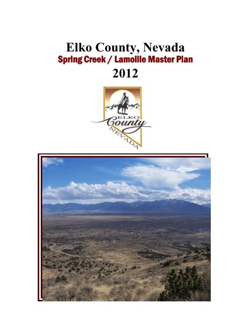
<strong>Elko</strong> <strong>County</strong>, Nevada<br />
<strong>Spring</strong> <strong>Creek</strong> / <strong>Lamoille</strong> Master Plan<br />
2012
Pg. 1
Planning Commission, <strong>County</strong> Commissioners Approvals 1<br />
<strong>Spring</strong> <strong>Creek</strong> / <strong>Lamoille</strong> Master Plan Index 2 thru 5<br />
<strong>Spring</strong> <strong>Creek</strong> / <strong>Lamoille</strong> Master Plan Index<br />
Section I<br />
Introduction 6<br />
General Disclosure 7<br />
History 8<br />
Statutory Provisions 10<br />
Physical Characteristics 11<br />
Climate 11<br />
Vegetation 12<br />
Soil Limitations 12<br />
Drainage and Flood Plains 13<br />
Public Facilities and Services 14<br />
Education / Schools 14<br />
Recreation 14<br />
Fire Protection 14<br />
Law Enforcement / Police Protection 14<br />
Solid Waste Disposal 15<br />
Utilities 15<br />
Public Development of the Master Plan 15<br />
Master Plan Boundaries 16<br />
Plan Area I 17<br />
Plan Area II 17<br />
Plan Area III 18<br />
Plan Area IV 19<br />
Overall Plan Area 20<br />
Summary of Workshops and Public Hearings 22<br />
Public Concerns 32<br />
General Public Concerns 32<br />
Specific Public Concerns 32<br />
<strong>Spring</strong> <strong>Creek</strong> / <strong>Lamoille</strong> Master Plan Index<br />
Section II<br />
Master Plan Policies 33<br />
Agricultural 33<br />
Residential 33<br />
Recreation 34<br />
Public 34<br />
Pg. 2
Traffic Circulation 34<br />
Public Facilities 35<br />
Population (1997/2005/2012) 35<br />
General 35<br />
Subdivision Regulations 36<br />
Consistency 36<br />
General Implementation 36<br />
Plan Implementation 37<br />
Zoning Regulations 37<br />
Guidelines 37<br />
Land use designation and Zoning districts 37<br />
Special Designations and Provisions 37<br />
Commercial (Restricted) 37<br />
Commercial <strong>Lamoille</strong> and Jiggs Highways 38<br />
Commercial Adjacent to <strong>Lamoille</strong> Highway 38<br />
Corral Lane Re-alignment 38<br />
Boyd Kennedy Road/ <strong>Lamoille</strong> Hwy Intersection 38<br />
Architectural Restrictions 39<br />
<strong>Lamoille</strong> Cemetery 39<br />
Acreage Restrictions (Residential) (1997) 39<br />
Planned Cluster Housing Developments (concept) 39<br />
Light Industrial (Restricted) (Dual Designation) (Reviewed 2005/2012) 40<br />
Industrial (Conditions) 40<br />
Special Public Designations (Addition of the 2005 Review) 40<br />
Special Subdivision Provision Valley Vista Estates Subdivision 41<br />
KRL Development CC&R and Impact Fees 41<br />
Redstone Ranch Development 41<br />
Cully Gravel Pit 41<br />
Zoning Districts and Designations 42<br />
Agricultural - Residential (2005/2012 Review & Changes) 42<br />
Special Lands (2005/2012 Review & Additions) 43<br />
Residential 1 and Residential 2 44<br />
Open Space (2005/2012 Review & Changes) 45<br />
Agricultural and Residential Density (2005/2012 Review & Changes) 46<br />
Commercial Designations 47<br />
Commercial Density (2005/2012 Review & Additions) 48<br />
Commercial Review 49<br />
Industrial Districts 49<br />
Industrial Density (2005/2012 Review) 50<br />
Public District Designations 50<br />
<strong>Spring</strong> <strong>Creek</strong> / <strong>Lamoille</strong> Master Plan Index<br />
Section III<br />
New Roads, Highways, and Re-alignment (2005/2012 Review & Changes) 51<br />
Secondary access between the City of <strong>Elko</strong> and <strong>Spring</strong> <strong>Creek</strong> / <strong>Lamoille</strong> 52<br />
Zoning Regulation Compliance 52<br />
Pg. 3
2005 Review and Revisions 53<br />
Master Plan Revision Proposals 53<br />
R-3 Overlay 54<br />
AR-CRD 1 Overlay 54<br />
AR-CRD 2 Overlay 54<br />
Implementation of AR-CRD 54<br />
Scenic Corridor (2005/2012 Review) 54<br />
Designation of SL Sections 19, 29, 30, 31 & 32 T. 34 N., R. 56 E. 55<br />
KRL Development, CC&R’s requirement to pay Impact fees to <strong>Spring</strong> <strong>Creek</strong> 55<br />
Re-designation Hearings 55<br />
Special Lands Designation (2005/2012) Revisions 55<br />
Commercial Designation (2005/2012) Revisions 55<br />
Request for Removal of Commercial Designations 55<br />
APN 057-001-001 55<br />
APN 053-006-001 55<br />
APN 053-004-021 55<br />
APN 043-002-001 55<br />
APN 043-002-002 55<br />
Request for Removal of Dual LI - AR Designations 55<br />
Commercial & Special Lands Designations 10 Mile Ranch SR 228 56<br />
2011/2012 Review and Revisions 56<br />
Changes to master plan boundaries and concepts 56<br />
Plan Area I Changes 57<br />
Redstone Development zoning districts realignments 57<br />
Kennedy Ave. & Trescartes connect to Boyd Kennedy Rd. 57<br />
Abandonment of Corral Lane realignment 57<br />
Boyd Kennedy intersection realignment 57<br />
Designations of R-1 & R-2 on 84.59 acres, Sec. 14, T. 33 N., R. 56 E. 59<br />
Designation of R-2 on 8 acres, Sec. 14, T. 33 N., R. 56 E. 59<br />
Plan Area II Changes 57<br />
Zoning changes incorporated within Maps 57<br />
Plan Area III, Changes 57, 58<br />
Designation of R-2 on 1.19 acre, Sec. 14, T. 33 N., R. 56 E. 57<br />
Plan Area IV Changes 57-59<br />
Boundary change to include Portion Sec. 28, T. 34N., R. 55E. 58<br />
Zoning changes incorporated within maps 58<br />
Boundary change Sec. 33, T.34 N., R. 55 E., <strong>Elko</strong> Infiltration ponds 58<br />
General Changes 59<br />
Designation of A-R on 88.18 acres 33, T.34 N., R. 55 E. 58<br />
Designation of AR-CRD-1 on 488 acres 33, T.34 N., R. 55 E. 58<br />
Final action by <strong>Elko</strong> <strong>County</strong> Board of Commissioners 2011/2012 Review 59<br />
Pg. 4
<strong>Spring</strong> <strong>Creek</strong> / <strong>Lamoille</strong> Master Plan Index<br />
Section IV<br />
<strong>Spring</strong> <strong>Creek</strong> / <strong>Lamoille</strong> Master Plan Inventories 60<br />
2012 Land Use Inventories 60<br />
2012 Proposed Land Use Inventories 63<br />
2012 Population Estimates 68<br />
2012 Water Use & Consumption Estimates 69<br />
2012 Potential Domestic Water Requirement Estimates 70<br />
<strong>Elko</strong> <strong>County</strong> Code 5-2-3(C) Water Rights Requirements 70<br />
<strong>Spring</strong> <strong>Creek</strong> / <strong>Lamoille</strong> Master Plan Appendix 72<br />
Appendix I 73<br />
Nevada Revised Statutes Chapter 278.150 - 278.265 74<br />
Appendix II 84<br />
<strong>Spring</strong> <strong>Creek</strong> / <strong>Lamoille</strong> Phase Boundary Map / Legend Map 85<br />
Appendix III 86<br />
Plan Area I 87<br />
Appendix IV 88<br />
Plan Area II 89<br />
Appendix V 90<br />
Plan Area III 91<br />
Appendix VI 92<br />
Plan Area IV 93<br />
Appendix VII 94<br />
<strong>Spring</strong> <strong>Creek</strong> / <strong>Lamoille</strong> Master Plan Overall Boundary 95<br />
Appendix VIII 96<br />
<strong>Elko</strong> <strong>County</strong> Zoning Ordinance Zoning Designations 96<br />
Acknowledgments 120<br />
Pg. 5
<strong>Spring</strong> <strong>Creek</strong> / <strong>Lamoille</strong> Master Plan, Section I<br />
Introduction to the <strong>Spring</strong> <strong>Creek</strong> / <strong>Lamoille</strong> Master Plan<br />
The <strong>Elko</strong> <strong>County</strong> General plan was prepared in accordance with NRS 278.150 through 278.265<br />
inclusive. It provides a basis for regulating development within the plan boundaries, protecting the<br />
resources, and implementing other measures necessary for effective land use planning through the<br />
enforcement of zoning ordinances. Changes in development trends, public demands, and physical<br />
changes in the land may, from time to time, cause a need for the development of plans for specific areas.<br />
The <strong>Spring</strong> <strong>Creek</strong> / <strong>Lamoille</strong> area has grown steadily over the last 16 years primarily by the development<br />
of existing subdivisions and continued minor subdivisions. To ensure continued compatible planned<br />
growth to this area, the development and implementation of the <strong>Spring</strong> <strong>Creek</strong> / <strong>Lamoille</strong> Master Plan was<br />
necessary.<br />
The geographical boundary for the plan area was established and accepted by the Planning Commission.<br />
The Planning Commission adopted the idea of dividing the total plan area into four phases in order to<br />
have more manageable areas to concentrate on areas of concern. The four phases were adopted and<br />
development of the plan began.<br />
Each of the four phases was the subject of at least three public hearings and workshops held by the <strong>Elko</strong><br />
<strong>County</strong> Planning Commission. At a public hearing held on the 5th day of February, 1997 this Master<br />
Plan was officially adopted by the Board of <strong>County</strong> Commissioners.<br />
<strong>Spring</strong> <strong>Creek</strong> Marina<br />
Pg. 6
General Disclosure of the <strong>Spring</strong> <strong>Creek</strong> / <strong>Lamoille</strong> Master Plan<br />
This general disclosure advises the reader that:<br />
1. The Master Plan Document and maps represents a consensus of the people and land owners in the plan<br />
area of appropriate land-uses. The reader is advised that some properties in the plan area are encumbered<br />
by Deed Restrictions, Covenants, Conditions, and Restrictions, (C.C.& R.'s) or Declaration of<br />
Reservations, (D.O.R.'s), that may prohibit the development of those properties as designated herein. In<br />
the event Deed restrictions, C.C.& R.'s, or D.O.R.'s are Recorded, they shall prevail over any designation<br />
or proposed uses shown or listed herein. Where said Deed Restrictions, C.C.& R.'s or D.O.R.'s exceed<br />
the projected five (5) year life of this document, no warranties are made that the designations shown<br />
herein shall apply to future Master Plans.<br />
2. The <strong>Elko</strong> <strong>County</strong> Planning Commission shall, within one year of the final acceptance of this document,<br />
review all current applicable <strong>Elko</strong> <strong>County</strong> Zoning Ordinances. Following completion of this review, the<br />
<strong>Elko</strong> <strong>County</strong> Planning Commission shall make formal recommendations to the <strong>Elko</strong> <strong>County</strong> Board of<br />
Commissioners regarding appropriate additions and/or deletions.<br />
3. The Master Plan does not vest any right to receive a zone change for any properties which has not<br />
applied for and received a zone change pursuant to the designations contained herein within the projected<br />
five (5) year life of this document. Once the five (5) year life has expired <strong>Elko</strong> <strong>County</strong> shall have the<br />
right to modify, by increasing or decreasing the land use intensity contained herein as the Planning<br />
Commission and Board of <strong>County</strong> Commissioners deem appropriate at that time.<br />
4. During the Zone Change application process the <strong>Elko</strong> <strong>County</strong> Planning Commission shall require<br />
pertinent documentation of intended uses of the properties to be re-zoned. The Planning Commission<br />
may restrict the use to that specific use represented during the application process.<br />
5. A Master Plan designation is a proposed or indication that the affected property has a potential to be<br />
zoned to the specific designation. The designation does not preclude the requirements of Title 4 of the<br />
<strong>Elko</strong> <strong>County</strong> Code or any other local or state statute that may apply. All requirements of <strong>Elko</strong> <strong>County</strong><br />
Code and applicable state statutes must be fulfilled prior to final action on any zone change, conditional<br />
use or variance.<br />
Ruby Mountains<br />
Pg. 7
History of the <strong>Spring</strong> <strong>Creek</strong> / <strong>Lamoille</strong> Master Plan Area<br />
Earliest Inhabitants<br />
Existing archaeological information indicates that the presumed earliest inhabitants were during the<br />
Paleo-Indian stage. While no Paleo-Indian sites are known in the area, their major characteristic was that<br />
they were primarily big game hunters. During the same period, there were people in the Great Basin who<br />
used various types of large stemmed points. Archaeologists proposed the name of "Western Pluvial<br />
Lakes Tradition" for the flaked stone artifacts, and associated the users of these artifacts as Proto-Archaic.<br />
The Western Pluvial Lake Tradition represented a hunting-foraging based economy practiced by people<br />
who may have camped on or near the shores of receding lakes and along the rivers much of the time.<br />
The Archaic stage, which began about 6,000 years ago, was a long and highly successful period of<br />
adaption to the Great Basin environment. Commonly divided in to two or three time periods by the<br />
changes in subsistence, material culture, or settlement patterns, the people of the archaic stage ranged<br />
from sedentary villages in the Owens Valley to small hunting groups that foraged over a large territory.<br />
Archaeologists postulate a settlement pattern adapted to a foraging / collecting economy, often consisting<br />
of a winter base camp, sometimes a secondary summer base camp, and numerous small temporary camps.<br />
The arrival of the Euro-American brought the Archaic stage to an end, however their presence is<br />
commonly associated with the ancestors of the Western Shoshone and other Numic-speakers.<br />
The Western Shoshone's presence in the area has been postulated by linguists to have been from a rapid<br />
spread of Numic-speaking peoples from the southwest. These people have inhabited the regions for<br />
approximately 1,000 years. Throughout the Great Basin, Numic-speaking groups such as the Western<br />
Shoshone were known to use various techniques to modify wild plant harvest in addition to hunting and<br />
gathering. Today, a branch of the Te-Moak Western Shoshone resides on the South Fork Indian<br />
Reservation South of the Plan area.<br />
The first white man to see any portion of what is now Nevada was a company of some fur trappers led by<br />
the noted mountaineer, Jedediah Smith in the 1820's. The route of that expedition was through a portion<br />
of what is known now as western Wyoming, down the Humboldt River country to the Walker River, out<br />
through Walkers Pass into California.<br />
During this time the Hudson Bay Company claimed the region between the Rockies and Sierra Nevada<br />
Mountains as their exclusive grounds for trapping. Peter S. Ogden began trapping the region in 1831 and<br />
traveled down the Humboldt River following the same route as Smith. Captain B.L. Bonneville and<br />
Joseph Walker also took trapping and exploration trips into Nevada and traveled the area around the<br />
Humboldt River during the 1830's. In 1833 Kit Carson along with the Hudson Bay Company expedition<br />
also visited the region of the Humboldt River. These were the first explorers who opened the way across<br />
the Great Basin to California, and were followed by emigrants who sought the western coast as their<br />
home.<br />
The first emigrant party to cross Nevada passed through the South Fork area in 1841. The Bidwell -<br />
Bartleson party crossed the Ruby Mountains at Harrison Pass and proceeded down the South Fork<br />
Canyon to the Humboldt River Valley.<br />
Pg. 8
This trail known as the Hastings Cut-off of the California Emigrant Trail, was also used by the Reed-<br />
Donner party. Ironically almost 30 days of travel time was lost, sowing the seeds for the disaster which<br />
overtook them in the Sierras in December of that year.<br />
History within the <strong>Spring</strong> <strong>Creek</strong> / <strong>Lamoille</strong> Master Plan area is as diverse as the Master Plan itself.<br />
The origins of the Town of <strong>Lamoille</strong> originate in the 1800's revolving around the rich wet soils. The<br />
acceptance of this area by early settlers was for farming and ranching. The proximity of the nearby Ruby<br />
Mountain Range offered shelter from the sweltering heat in the summer and a break from the<br />
mountainous winds during the cold bitter winters. The area also gave a haven for various types of<br />
wildlife, creating an eco-system that would sustain human life.<br />
The <strong>Lamoille</strong> Valley was settled in the late 1860's by ranchers and farmers primarily from the east coast.<br />
The name <strong>Lamoille</strong> was give to the valley by John P. Walker, because the valley reminded him of his<br />
home in <strong>Lamoille</strong> <strong>County</strong>, Vermont. The name <strong>Lamoille</strong> is a result of a notable typographical error. The<br />
word <strong>Lamoille</strong> was originally given to <strong>Lamoille</strong>, Vermont by Champlain in 1609, however he gave it the<br />
name La Moutte meaning water fowl. The name was mis-spelled in the Maps of Discovery of North<br />
America published in 1764 where it was listed as Riviere la Mouelle. The transcriber failed to cross the<br />
ll's to make them t's. So in essence the town of <strong>Lamoille</strong>, as we know it today could have very well been<br />
called La Moutte.<br />
The valley was primarily farming country producing grain and truck garden freighted by teams to be sold<br />
in mining camps. Most settlers ran a few cattle and as herds increased, ranchers shifted from grain to<br />
raising cattle. Over the years the valley also produced dairy products and honey as well as butchered<br />
meat for sale in the nearby Town of <strong>Elko</strong>.<br />
The Town of <strong>Lamoille</strong> had its beginning in 1869 when John P. Walker built a log store, saloon,<br />
blacksmith shop, and the Cottonwood Hotel. In 1906 the <strong>Lamoille</strong> Mercantile Company was formed by<br />
George F. Talbot. The company constructed a two story hotel with 20 beds, dining room, kitchen, and<br />
billiard hall. Over the years other stores had been created, many of them with saloons. During<br />
prohibition these saloons provided whiskey under the counter that had been produced by numerous<br />
bootleg stills located in the valley. The valley was known as a bootlegger’s haven.<br />
<strong>Lamoille</strong> was the first among agricultural valleys to fulfill educational needs. A school was opened by<br />
private subscription in the Walker-Waterman cabin in 1871. Fifty students from the <strong>Lamoille</strong>, Pleasant<br />
Valley and Halleck area attended the six month summer school.<br />
In 1905 the first service was held at the newly dedicated <strong>Lamoille</strong> Presbyterian Church that had been built<br />
by generous donations from Reverend George Greenfield. The Church, as it stands today, is known to be<br />
Nevada's oldest standing Presbyterian Church.<br />
A post office was established August 27, 1872, at Walkers cross-roads and operated until it was<br />
discontinued October 21, 1874. Reestablished on May 10, 1880, it functioned until August 2, 1882, after<br />
which mail was secured in <strong>Elko</strong>. May 14, 1883, the post office was reestablished and still serves<br />
<strong>Lamoille</strong> today. The town was surveyed, platted, and streets named in 1924.<br />
Pg. 9
Access to the Valley from the <strong>Elko</strong> area was a dirt road known as the Hamilton Stage route that<br />
traversed over the <strong>Elko</strong> Mountains, through the <strong>Spring</strong> <strong>Creek</strong> Valley, and Pleasant Valley to <strong>Lamoille</strong>.<br />
The trip to and from <strong>Lamoille</strong> to <strong>Elko</strong> was generally an all day and possibly an overnight trip. In 1947,<br />
an oiled road was completed connecting the <strong>Elko</strong> and <strong>Lamoille</strong> areas. This access afforded the<br />
development of recreation for tourists throughout the state and nation. The <strong>Lamoille</strong> Valley, in addition<br />
to the continued ranching and farming, now offers many types of outdoor recreation including helicopter<br />
skiing in the Ruby Mountain range, guided hunts, as well as fine restaurants, and hotels. The Valley still<br />
maintains much of its pristine beauty, as it did for the settlers of the Valley.<br />
The <strong>Spring</strong> <strong>Creek</strong> area was primarily a valley or flat that was used by the <strong>Lamoille</strong> ranchers for grazing<br />
land. Several smaller ranches were located within the flat area along the Ten Mile <strong>Creek</strong> and <strong>Spring</strong><br />
<strong>Creek</strong>. The earliest ranches in this area were very secluded and did not expand as much as the <strong>Lamoille</strong><br />
Ranches. Today, operation of the Whear Ranch located along the Ten Mile <strong>Creek</strong> in the geographic<br />
center of the Plan area continues to provide some memory of the historical use of this land over the past<br />
150 years. Several small ranches still are in operation including what we now know as the animal farm,<br />
located in <strong>Spring</strong> <strong>Creek</strong>. This was one of the first ranches settled within the area.<br />
In the late 1960's, a large portion of the ranch land was sold to a developer from Texas. The intention<br />
was to develop a 6,000 unit subdivision including a 18 hole golf course and reservoir along <strong>Spring</strong><br />
<strong>Creek</strong>. As we know it today, the <strong>Spring</strong> <strong>Creek</strong> subdivision is developed into four major areas, the 100,<br />
200, 300, and 400 Tracts. The 200 Tract is commonly known as the Mobile Home Section while the<br />
other tracts are predominantly comprised of stick built homes.<br />
The 100 Tract is comprised of 2,034 lots and is developed to within 75% with 1,522 occupied lots and<br />
512 vacant lots. The 200 Tract is comprised of 1,469 lots and is developed to within 97% with 1,422<br />
occupied lots and 47 vacant lots. The 300 Tract is comprised of 397 lots and is developed to within 65%<br />
with 260 occupied lots and 137 vacant lots. The 400 Tract is comprised of 1,520 lots and is developed<br />
to within 68% with 1,036 occupied lots and 484 vacant lots. The <strong>Spring</strong> <strong>Creek</strong> subdivision as a whole is<br />
comprised of a total of 5,420 lots and is developed to within 78% with 4,240 occupied lots and 1,180<br />
vacant lots. (Revised 2012) (<strong>Spring</strong> <strong>Creek</strong> Association Data Nov.2011)<br />
Several smaller subdivisions have been created throughout the Valley. The creation of these<br />
subdivisions has provided diverse types of dwelling possibilities in the area ranging from semimetropolis<br />
housing to the full development of large ranching companies, as well as the development of<br />
Commercial and Industrial corporations within the Valley. The <strong>Spring</strong> <strong>Creek</strong> / <strong>Lamoille</strong> area has<br />
become an area that <strong>Elko</strong> <strong>County</strong> residents are proud of due to the diversity of planned development and<br />
the beauty of the area which includes panoramic views of the <strong>Elko</strong> and Ruby Mountain Ranges.<br />
Statutory Provisions of the <strong>Spring</strong> <strong>Creek</strong> / <strong>Lamoille</strong> Master Plan<br />
Chapter 278 of the Nevada Revised Statutes sets forth statutory provisions for the local governments to<br />
carry out their role in the planning process. Chapter 278 includes procedures for the adoption of a long<br />
term general plan to serve as a master plan for the development of a specific area as well as<br />
implementation of the plan, by the local government through zoning districts and ordinances.<br />
Chapter 278 of the Nevada Revised Statutes provides the following in relation to the regulatory<br />
authority of local governments:<br />
Pg. 10
Goals and guidelines used during the Master Plan process included the following;<br />
Climate<br />
1) It is in the public interest to place the primary authority for the planning process with<br />
the local government;<br />
2) Unregulated growth and development of the state will result in harm to the public<br />
safety, health, comfort, convenience, resources, and general welfare;<br />
3) Local governments have a responsibility for guiding the development of areas within<br />
their respective boundaries for the common good;<br />
4) Planning must be done in harmony to insure orderly growth and preservation of the<br />
state.<br />
Physical Characteristics of the <strong>Spring</strong> <strong>Creek</strong> / <strong>Lamoille</strong> Master Plan<br />
The <strong>Spring</strong> <strong>Creek</strong> / <strong>Lamoille</strong> Master Plan area varies in elevation from approximately 5200 feet above<br />
m.s.l. to 6200 above m.s.l.<br />
The climate is semi-arid, with sub-zero winter temperatures and hot dry summers. January is the coldest<br />
month with an average high of 23 F. The warmest month is July reaching an average daily temperature<br />
high of 90 F. Extremes of -43 F and 102 F have been recorded.<br />
The average annual snowfall precipitation is 9 inches, with the heaviest amounts falling as snow during<br />
the winter months. Average annual snowfall is approximately 36 inches. December is the wettest<br />
month with an average snowfall of approximately 9 inches. Summer precipitation occurs mostly in the<br />
form of showers and does not contribute greatly to vegetation growth. July is the driest month with an<br />
average of less than ½ inch of precipitation.<br />
The average number of days with clear skies is 131, 100 days are partly cloudy, and 134 days are<br />
cloudy. The prevailing wind is from the southwest and is the strongest in late winter and spring. The<br />
average wind speed is 6.0 miles per hour.<br />
The average rainfall of this area is approximately 8 inches. The average air temperature is 48 degrees<br />
Fahrenheit. The average frost free season is approximately 110 days per year.<br />
Climate Information: Source: National Weather Service Forecast Office, <strong>Elko</strong> WB Airport, NV<br />
Monthly Temperature (F) 2007 2008 2009 Average<br />
January 16.2 17.4 28.1 20.6<br />
February 33.0 26.1 32.1 30.4<br />
March 42.8 36.5 37.9 39.1<br />
April 46.5 40.9 44.2 43.9<br />
May 56.0 52.7 57.2 55.3<br />
June 65.1 61.6 61.7 62.8<br />
July 75.8 71.5 71.6 73.0<br />
August 70.5 70.3 67.5 69.4<br />
September 58.8 60.4 63.7 61.0<br />
October 46.1 47.6 43.6 45.8<br />
November 35.8 41.6 34.6 37.3<br />
December 25.5 24.3 16.0 21.9<br />
Average 47.7 45.9 46.5 46.7<br />
Pg. 11
Monthly Snowfall (inches) 2006-2007 2007-2008 2008-2009 Average<br />
July 0.00 0.00 0.00 0.00<br />
August 0.00 0.00 0.00 0.00<br />
September 0.00 0.00 0.00 0.00<br />
October 0.00 1.10 0.00 0.37<br />
November 2.80 0.10 0.10 1.00<br />
December 7.30 8.20 12.30 9.27<br />
January 4.50 28.00 5.00 12.50<br />
February 7.50 11.00 7.80 8.77<br />
March 3.40 2.80 6.50 4.23<br />
April 0.10 1.20 8.50 3.27<br />
May 0.00 0.00 0.00 0.00<br />
June 0.00 0.00 0.00 0.00<br />
Average 2.13 4.37 3.35 3.28<br />
Monthly Precipitation (inches) 2007 2008 2009 Average<br />
January 0.27 1.75 1.28 1.10<br />
February 1.05 0.79 0.59 0.81<br />
March 0.48 0.39 0.78 0.55<br />
April 0.61 0.15 1.83 0.86<br />
May 0.17 1.13 0.47 0.59<br />
June 0.37 0.57 2.94 1.29<br />
July 0.08 0.13 0.20 0.14<br />
August 0.14 0.25 0.68 0.36<br />
September 0.17 0.01 0.27 0.15<br />
October 1.05 0.43 0.49 0.66<br />
November 0.32 1.54 0.01 0.62<br />
December 1.02 0.91 1.68 1.20<br />
Average 0.48 0.67 0.94 0.69<br />
Vegetation<br />
Types of brush and grass vegetation include, Basin Sagebrush, Basin Wild Rye, Willow, Black<br />
Greasewood, Wheatgrass, Spiny Hop Sage, Douglas Rabbit Brush, Indian Rice Grass, and Sandberg<br />
Bluegrass.<br />
Types of tree and bush vegetation include, Service Berry, Wild Rose, Quaking Aspen, Choke Cherry,<br />
Mountain Mahogany, Juniper Evergreen, Pinion Pine, and Elderberry. Several different types of nonindigenous<br />
plants grow in the Master Plan area. These plants have primarily been imported to the area<br />
and require both irrigation and plant feeding. These plants have been primarily raised by developers,<br />
home, and land owners of the area.<br />
Soil Limitations<br />
Characteristics and limitations of the 44 major soil associations within the <strong>Spring</strong> <strong>Creek</strong> / <strong>Lamoille</strong><br />
Master Plan area are very diverse and therefore cannot be readily summarized. For purposes of<br />
developing the Master Plan Area, information regarding soils was obtained from the Soil Conservation<br />
Service of the Department of Agriculture. This information was separated into various categories that<br />
include physical location, soil depth, and soil characteristics for each major soil association.<br />
The survey from which this information was obtained is referred to as an Order III survey. This type of<br />
survey is classified as a reconnaissance report prepared primarily from photo interpretations and soil<br />
associations that have been grouped with other soil of similar characteristics. More specific information<br />
would have to be obtained through on-site investigations of specific areas.<br />
Pg. 12
According to the Soils Conservation Service rating system, a “Severe” rating is given to soils that have<br />
one or more properties unfavorable for the rated use. These properties include, steep slopes, bedrock<br />
near the surface, flood zones, high shrink or swell potential, a seasonal high water table, or low strength.<br />
This degree of limitation generally requires major soil reclamation, special design, or intensive<br />
maintenance.<br />
When ratings are made by the Soil Conservation Service in relation to septic tank absorption fields, only<br />
the soil between the depths of 24 and 60 inches are considered. Consideration is given to the affect of<br />
soil limitations and site features on the absorption of the effluent, construction and maintenance of the<br />
system, and public health.<br />
Limitations and site features that affect the absorption of the effluent are permeability, depth of seasonal<br />
high water, depth to bedrock, cemented pan, and a susceptibility to flooding. Stones, boulders, and a<br />
shallow depth to bedrock or a cemented pan interfere with the installation. Excessive slope may cause<br />
lateral seepage and surfacing of effluent in down slope areas. Erosion is also a hazard where absorption<br />
fields are installed in sloping soils.<br />
Percolation tests used to evaluate soil suitability for septic absorption fields should be performed during<br />
the seasons when the water table is at its highest and the soil is at minimum absorptive capacity.<br />
Experience indicates that soils that have a percolation rate of faster than 45 minutes per inch function<br />
satisfactorily, soils that have a rate of 45 to 60 minutes per inch have moderate limitations, and soils that<br />
have a rate slower than 60 minutes per inch have severe limitations.<br />
Drainage and Flood Plains<br />
Drainage within the <strong>Spring</strong> <strong>Creek</strong> / <strong>Lamoille</strong> Master Plan area is collected by Ten Mile <strong>Creek</strong>, Mitchell<br />
<strong>Creek</strong>, Rabbit <strong>Creek</strong>, and <strong>Lamoille</strong> <strong>Creek</strong>. All of which except Ten Mile <strong>Creek</strong> flow directly into the<br />
Humboldt River. Ten Mile <strong>Creek</strong> flows to the South Fork of the Humboldt River.<br />
Approximately 2,000 acres along these drainage collectors have been identified by the Federal<br />
Emergency Management Agency (FEMA) as being flood prone and have been designated on the official<br />
flood maps of that agency as "Areas of Special Flood Hazards".<br />
As set forth in Title 44 of the Code of Federal Regulations, the Federal Emergency Management Agency<br />
(FEMA) administers the National Flood insurance Program. This program provides a means of making<br />
flood insurance available to owners of property that has been identified as being prone to flooding.<br />
In order for the flood insurance to be available, the community in which the property identified as flood<br />
prone is located must participate in the program. <strong>Elko</strong> <strong>County</strong> does actively participate in the FEMA<br />
program. All building permit and zoning applications are reviewed for flood plain location.<br />
One of the stipulations that Federal Emergency Management Agency (FEMA) places on a participating<br />
community is the promotion of better flood plain management through ordinances and building codes<br />
that meet certain criteria as set forth by federal regulations. The purpose of the National Flood<br />
Insurance Program is to carry out national goals of minimizing the loss of lives, property, and natural<br />
resources due to flooding.<br />
Pg. 13
Public Facilities and Services within the <strong>Spring</strong> <strong>Creek</strong> / <strong>Lamoille</strong> Master Plan<br />
The demand for public facilities and service within the <strong>Spring</strong> <strong>Creek</strong> / <strong>Lamoille</strong> plan area is increasing<br />
as development and population expands. Facilities and services such as schools, recreation, police, fire<br />
protection, utilities and waste disposal are addressed below.<br />
Education / Schools<br />
At the present time, school age children living within the plan area are attending one of two elementary<br />
schools, a junior high school and a high school. The <strong>Elko</strong> <strong>County</strong> School District is proposing a new<br />
Elementary School to be located near the <strong>Spring</strong> <strong>Creek</strong> Horse Palace in the future. However at this time<br />
the demand is being met by the existing public schools. As the plan area develops the expansion of<br />
these facilities will be necessary. The Master Plan has allowed for a provision for non-designation of<br />
Public Districts to accommodate for the future demands.<br />
Recreation<br />
Opportunities within the plan area are oriented toward outdoor activities such as hiking, bicycling,<br />
fishing, boating, camping and rafting. The nearby South Fork State Recreation Area accommodates for<br />
much of the desired activities. The <strong>Lamoille</strong> Canyon area is also well utilized for a great deal of outdoor<br />
recreation. Areas of Recreational designation have also been planned within the Town of <strong>Lamoille</strong> area,<br />
to accommodate for bed and breakfast establishments, helicopter ski operations, and possible hunting<br />
lodge facilities. Planned recreation facilities within the plan area will maintain the ideas, to maintain the<br />
historic values, scenic values, natural features, and key wildlife habitat. The Nevada Department of<br />
Transportation is developing a Statewide Bicycle Plan for the state highway system in Nevada which<br />
may provide future paths and routes within the master plan area.<br />
Fire Protection<br />
The <strong>Spring</strong> <strong>Creek</strong> / <strong>Lamoille</strong> Master Plan area is currently served by a fire protection district that is<br />
administered by the Nevada Division of Forestry in accordance with NRS 473. This fire district was<br />
formed in order to provide fire protection for the un-incorporated portions of <strong>Elko</strong> <strong>County</strong>. The Board<br />
of <strong>County</strong> Commissioners serves as the board of directors for this district. There are four existing fire<br />
station locations located within the master plan area. The <strong>Spring</strong> Valley Parkway location within plan<br />
area I, the Licht Parkway location near the intersection with the <strong>Lamoille</strong> Highway within plan area III<br />
and the Town of <strong>Lamoille</strong> location within plan area II have active fire stations. The North Engle Dr.<br />
location in plan area 1 does not have an active fire station.<br />
The existence of volunteer fire departments have aided in fulfilling the fire protection needs of the plan<br />
area. As development expands the need for further fire stations is eminent, however the placement of<br />
these facilities can be accommodated within designated or existing Agricultural - Residential and Open<br />
Space zoning by the use of conditional use permits. Therefore the need for Public Zoning Designations<br />
to accommodate the future fire stations was not needed.<br />
Law Enforcement / Police Protection<br />
Police protection for the <strong>Spring</strong> <strong>Creek</strong> / <strong>Lamoille</strong> plan area is provided by the <strong>Elko</strong> <strong>County</strong> Sheriff's<br />
Department. Currently a Substation is in use by the Sheriff's Department for service to the expanding<br />
community.<br />
Pg. 14
As expansion occurs it will become necessary for this facility to expand as well. The development of<br />
future substations and possible incarceration facilities has been planned for in the existing and<br />
designated industrial and commercial zoning areas.<br />
Solid Waste Disposal<br />
Currently the plan area is serviced for solid waste disposal by <strong>Elko</strong> Sanitation. The closest sanitary<br />
landfill is in the City of <strong>Elko</strong>. The use of individual sewage disposal systems is the primary method of<br />
sanitary sewerage and is the responsibility of the individual property owners. The presence of isolated<br />
community sanitary sewer systems is being utilized by the <strong>Spring</strong> <strong>Creek</strong> Subdivision for use by multiple<br />
family dwellings and some commercial uses. As development occurs, alternative avenues of waste<br />
disposal both liquid and solid will be explored so as to guarantee the safe levels of ground water and soil<br />
contamination.<br />
Utilities<br />
Public Utilities within the <strong>Spring</strong> <strong>Creek</strong> / <strong>Lamoille</strong> plan area are currently provided by Citizen Telcom<br />
(telephone), Wells Rural Electric (electricity), and Sierra Pacific Power (electricity). A small area<br />
encompassing <strong>Spring</strong> <strong>Creek</strong> Subdivision tracts 201 and 202 are serviced by T.C.I. (cable television).<br />
<strong>Spring</strong> <strong>Creek</strong> Utilities serves the <strong>Spring</strong> <strong>Creek</strong> Subdivisions and the Brentwood Subdivision adjacent to<br />
the tract 301 for domestic water service.<br />
The utilities are constantly being expanded within minor and major subdivisions. These utilities are<br />
accommodated during the subdivision process by method of review and will serve affidavits. The<br />
continued development of the <strong>Spring</strong> <strong>Creek</strong> / <strong>Lamoille</strong> plan area will make it necessary for the continued<br />
expansion and upgrade of the current utilities. The facilities that will become necessary can be<br />
accommodated within any of the represented designations and or current zoning.<br />
Public Development of the <strong>Spring</strong> <strong>Creek</strong> / <strong>Lamoille</strong> Master Plan<br />
The <strong>Spring</strong> <strong>Creek</strong> <strong>Lamoille</strong> Master Plan as presented is a representation of ideas, views, opinions, and<br />
thoughts taken from numerous public workshops and public meetings held by the <strong>Elko</strong> <strong>County</strong> Planning<br />
Commission. These concepts were prepared by the <strong>Elko</strong> <strong>County</strong> Planning and Zoning Department from<br />
the public input in order to provide the Planning Commission an overview of Public opinion and needs<br />
for development of land uses within the Master Plan area.<br />
The Master Plan process was started in January of 1995, with the goal of completing the Master Plan by<br />
August of 1996. The total Master Plan area is approximately 110 square miles. The Plan area was<br />
divided into four phases to allow for a more manageable workshop and public input process. This<br />
process also allowed for certain areas of overlapping phases to be addressed by the impacted public.<br />
The total Master Plan area encompasses diverse types of uses ranging from Agricultural uses to Heavy<br />
Industrial uses. The <strong>Lamoille</strong> Highway (S.R. 227) is the major access arterial and therefore, this<br />
corridor was a primary center of attention. Many different opinions were recorded as to the future<br />
development of <strong>Lamoille</strong> Highway. The idea of designating <strong>Lamoille</strong> Highway as a scenic highway was<br />
reviewed and discussed at length. However, as the community expands and develops, the idea of<br />
limiting the types of access from the <strong>Lamoille</strong> Highway was abandoned.<br />
This Master Plan will allow for a better understanding of how the public perceives the expansion of their<br />
community. The Public Workshops and Hearings held were within the community itself to allow for the<br />
best accessibility to the affected public.<br />
Pg. 15
The creation of the Master Plan was developed with a minimum of three hearings held for each Phase.<br />
Four workshops / hearings were held at the <strong>Spring</strong> <strong>Creek</strong> High School Library for each of Plan area I<br />
and Phase III. Five workshops / hearings were held in the Town of <strong>Lamoille</strong> at the <strong>Lamoille</strong> Church for<br />
Phase II. An extension of approximately six months was granted to the owners of several local ranches<br />
in Phase II for the purpose of consulting private planners.<br />
Phase II was adopted in March of 1996. Two hearings were held for Phase IV at the <strong>Elko</strong> <strong>County</strong> Court<br />
House, Room 106, and no significant public comment was received on this Phase.<br />
The Master Plan was opened to the public for review and amendment by the <strong>Elko</strong> <strong>County</strong> Planning<br />
Commission in September of 2005. Final actions by the <strong>Elko</strong> <strong>County</strong> Commission for approval of<br />
amendments to the document were approved in April of 2006. Revisions and amendments are<br />
documented in the 2006 Revised <strong>Spring</strong> <strong>Creek</strong> <strong>Lamoille</strong> Master Plan.<br />
The Master Plan was again opened for public for review and amendment by the <strong>Elko</strong> <strong>County</strong> Planning<br />
Commission in November of 2011. Final actions by the <strong>Elko</strong> <strong>County</strong> Commission for approval of<br />
amendments to the document were approved on April 19, 2012. Revisions and amendments are<br />
documented in the 2012 Revised <strong>Spring</strong> <strong>Creek</strong> <strong>Lamoille</strong> Master Plan.<br />
<strong>Lamoille</strong> Church<br />
Master Plan Boundaries<br />
Plan Area - I is an area encompassing the <strong>Spring</strong> <strong>Creek</strong> 200 tracts, a portion of Last Chance Ranches<br />
Unit No.1, Area West Development, and the Whear Ranch. This Phase also encompassed<br />
approximately 6 square miles of land currently under management by the Bureau of Land Management<br />
to the south and east. The majority of this Plan Area is Residential, with Commercial, Industrial and<br />
Agricultural uses present. The total area of Plan Area - I is approximately 24.40 square miles in area.<br />
Pg. 16
Plan Area - I Boundary:<br />
Commencing at the northeast corner of Section 22, T. 34 N., R. 56 E., M.D.B.& M., The Point of<br />
Beginning;<br />
thence south along east section lines of Section 22, and 27 to the southeast corner of said Section 27;<br />
thence east along the north section lines of Section 35, and 36 to the northeast Corner of said Section 3,<br />
being the line common to Range 56 East and Range 57 East;<br />
thence south along said range line to the southeast corner of said Section 36, being the line common to<br />
township 34 North and Township 33 North;<br />
thence continuing south along said range line to its intersection with the most northerly boundary of<br />
<strong>Spring</strong> <strong>Creek</strong> Subdivision Tracts 102 and 104;<br />
thence west and south along the boundary of <strong>Spring</strong> <strong>Creek</strong> Subdivision to its intersection with State<br />
Route 227 easterly right of way;<br />
thence south easterly along said State Route 227 easterly right of way to a point of intersection with<br />
<strong>Spring</strong> <strong>Creek</strong> Parkway and Licht Parkway extended;<br />
thence south westerly along the northerly right of way of said Licht Parkway to its intersection with the<br />
most easterly right of way of Culley Road;<br />
thence north to its intersection with the most northerly boundary of the industrial / residential<br />
development known as Culley Development;<br />
thence westerly along said boundary and the most northerly boundary of Brentwood Estates Units 1<br />
and 2 to its intersection with the northerly right of way of <strong>Spring</strong>field Parkway;<br />
thence westerly along the northerly right of way of said <strong>Spring</strong>field Parkway to its intersection with the<br />
<strong>Spring</strong> <strong>Creek</strong> Subdivision Tract 304;<br />
thence westerly, northerly and southerly along the boundary of said <strong>Spring</strong> creek Subdivision, Tract<br />
304 to the southwest Corner of said Section 16;<br />
thence north along the west section line of said Section 16 to the west 1/4 Corner of said Section 16;<br />
thence west along the center 1/4 Section line of south section line of Section 17, to the east 1/4 Section<br />
Corner of said Section 17;<br />
thence north along the west section lines of Sections 17, 8, and 5 to the northwest Corner of said<br />
Section 5, being the Township line common to Township 33 North and Township 34 North;<br />
thence north along the west section lines of Sections 32, 29, and 20, to the northwest Corner of Said<br />
Section 20;<br />
thence east along the north section lines of sections 20, 21, and 22, to the northeast Corner of said<br />
Section 22, the Point of Beginning.<br />
Plan Area - II is an area encompassing the <strong>Lamoille</strong> area including Ruby Home Ranch, Sarman Ranch,<br />
Dysart Ranches, Sustacha Ranch, Ruby Dome Ranch, Maggie <strong>Creek</strong> Ranch, Pleasant Valley<br />
Subdivision, the Town Proper of <strong>Lamoille</strong>, Nevada and an approximate 2 mile diameter around the town<br />
of <strong>Lamoille</strong>. This Plan Area encompasses primarily Open Space Zoning, some existing Agricultural-<br />
Residential, and a limited Commercial area within the Town of <strong>Lamoille</strong>. The total area of Plan Area -<br />
II is approximately 19.20 square miles in area.<br />
Plan Area - II Boundary:<br />
Commencing at the northeast Corner of Section 17, T. 33 N., R. 58 E., M.D.B.& M., The Point of<br />
Beginning;<br />
thence south along east section lines of Sections 17, 20, to the southeast Corner of said Section 20;<br />
thence easterly along the north section line of Section 28 to the northeast Corner of said Section 28;<br />
thence south along the east section line of said section 28 to the southeast Corner of said Section 28;<br />
thence west long the south section line of said Section 28 to the southwest Corner of said Section 28<br />
and northeast Corner of Section 32;<br />
Pg. 17
thence west along the south section lines of Sections 31, and 32 to the southwest Corner of said Section<br />
31, being the line common to Range 57 East and Range 58 East;<br />
thence west along the north section line of Section 36, to the northeast Corner of Section 1, T. 32 N. R.<br />
57 E., M.D.B.& M.;<br />
thence south along the east section line of said Section 1 to the southeast Corner of said Section 1;<br />
thence west along the south section line of Section 1 and 2 to the southwest Corner of said Section 2;<br />
thence north along the west section line of said Section 2 to the northwest Corner of said Section 2,<br />
being the line common to Township 32 North and Township 33 North;<br />
thence north along the west section lines of Sections 35, 26, 23, and 14, to the northwest Corner of said<br />
Section 14;<br />
thence east along the north section lines of sections 14, and 13, to the northeast Corner of said Section<br />
13, being the line common to Range 57 East and Range 58 East;<br />
thence east along the north section lines of Sections 18, and 17 to the northeast Corner of said Section<br />
17, the Point of Beginning.<br />
<strong>Spring</strong> <strong>Creek</strong> Golf Course<br />
Plan Area - III is an area encompassing primarily the <strong>Spring</strong> <strong>Creek</strong> Subdivision, 100's, 300's and 400<br />
Tracts also including privately owned ranches to the south and north, Ruby Mountain Estates, Lipparelli<br />
Estates and a small portion of Area West Development. An area of approximately 8 square miles of<br />
land is currently under management by the Bureau of Land Management. This Plan Area encompassed<br />
primarily residential, with limited Commercial uses, some Agricultural and Industrial uses present. The<br />
total area of Plan Area - III is approximately 45.90 square miles in area.<br />
Plan Area - III Boundary:<br />
Commencing at the northeast corner of Section 3, T. 33 N., R. 57 E., M.D.B.& M., The Point of<br />
Beginning;<br />
thence south along east section lines of Sections 3, 10, 15, 22, 27, and 34 to the southeast Corner of<br />
said Section 34, being the line common to Township 33 North and Township 32 North;<br />
thence south along the east section line of Section 3, to the southeast Corner of said Section 3;<br />
thence west along the south section lines of Sections 3, 4, 5, and 6 the southwest Corner of said Section<br />
6, being the line common to Range 56 East and Range 57 East;<br />
Pg. 18
thence west along the south section lines of Sections 1, 2, and 3 to the southwest Corner of said Section<br />
3;<br />
thence north along the west section line of Section 3, to the northwest Corner of said Section 3, being<br />
the line common to Township 32 North and Township 33 North;<br />
thence west along the south section line of Section 33, to the southwest Corner of said Section 33;<br />
thence north along the west section lines of Sections 33, 28, and 21, to the northwest Corner of Said<br />
Section 21;<br />
thence east along the north section line of said Section 21 to its intersection with the <strong>Spring</strong> <strong>Creek</strong><br />
Subdivision Tract 304, being the Northeast Corner of Said Section 21;<br />
thence northerly, easterly and southerly along the boundary of said <strong>Spring</strong> creek Subdivision, Tract 304<br />
to its intersection with the most northerly right of way of <strong>Spring</strong>field Parkway;<br />
thence easterly along the northerly right of way of said <strong>Spring</strong>field Parkway to its intersection with the<br />
boundary of Brentwood Estates Subdivision Unit No 1;<br />
thence easterly and southerly along the northerly boundary of said Brentwood Estates Unit No. And<br />
Brentwood Estates Unit No. 2 to its intersection with the northerly boundary of Culley Development;<br />
thence easterly along the north boundary of said Culley Development to its intersection with the<br />
easterly right of way of Culley Road;<br />
thence south along the easterly right of way of said Culley Road to its intersection with the northerly<br />
right of way of Licht Parkway;<br />
thence east along the northerly right of way of said Licht Parkway extended to the most easterly right<br />
of way of State Route 227;<br />
thence northerly and westerly along the most easterly right of way of said State Route 227 to its<br />
intersection with the <strong>Spring</strong> <strong>Creek</strong> Subdivision Tract 104 and 102;<br />
thence easterly along the boundary of said <strong>Spring</strong> <strong>Creek</strong> Subdivision to its intersection with the west<br />
section line of 7;<br />
thence north along the west section lines of section 6 and 7 to the northwest Corner of said Section 6;<br />
thence east along the north section lines of Sections 6, 5, 4, and 3 to the northeast Corner of said<br />
Section 3, the Point of Beginning.<br />
Plan Area - IV is an area encompassing west from the 200 Tracts, to the current City of <strong>Elko</strong><br />
serviceable high water contour elevation. This Plan area encompasses primarily Open Space lands with<br />
some residential uses along <strong>Lamoille</strong> Highway. This Plan Area is primarily undeveloped.<br />
Some subdivision has been created including <strong>Elko</strong> Summit Estates, Government tracts, and Parcel Map<br />
subdivisions. Also included is an area of approximately 8 square miles of land currently under<br />
management by the Bureau of Land Management. The total area of Plan Area - IV is approximately<br />
20.95 square miles in area.<br />
Plan Area - IV Boundary:<br />
Commencing at the northeast Corner of Section 19, T. 34 N., R. 56 E., M.D.B.& M., The Point of<br />
Beginning; thence south along east section lines of Sections 19, 30, and 31 to the southeast Corner of<br />
said Section 31, being the line common to Township 33 North and Township 34 North;<br />
thence south along the east section lines of Sections 6, and 7 to the southeast Corner of said Section 7;<br />
thence west along the south section line of said Section 7, to the southwest Corner of said Section 7,<br />
being the line common to Range 55 East and Range 56 East;<br />
thence west along the south section lines of Sections 11, 10, and 9 to the southwest Corner of said<br />
Section 9;<br />
thence north along the west section lines of Sections 9, and 4 to the southwest Corner of said Section<br />
33, being the line common to Township 33 North and Township 34 North;<br />
thence north along the west section line of Section 33, and Section 28 to the northwest 1/16 Corner of<br />
Section 28;<br />
Pg. 19
thence east along the north 1/16 line of Section 28 to the northeast 1/16 Corner of Section 28;<br />
thence north along the east line of Section 28 to the northeast Corner of said Section 28;<br />
thence east along the north section line of said Section 27 and Section 26 to the northeast Corner of<br />
said Section 26;<br />
thence north along the west section line of Section 24 to the west 1/4 section Corner of said Section 24;<br />
thence east along the center 1/4 section line of said Section 24 to its intersection with the City of <strong>Elko</strong><br />
Boundary;<br />
thence southerly, easterly and northerly along said City of <strong>Elko</strong> Boundary to the northwest Corner of<br />
Said Section 19;<br />
thence east along the north section line of said Section 19 to the northeast Corner of Said Section 19,<br />
the Point of Beginning.<br />
<strong>Spring</strong> <strong>Creek</strong> / <strong>Lamoille</strong><br />
Overall <strong>Spring</strong> <strong>Creek</strong> / <strong>Lamoille</strong> Master Plan Boundary<br />
Commencing at the northeast corner of Section 22, T. 34 N., R. 56 E., M.D.B.& M., The Point of<br />
Beginning;<br />
thence south along the east section lines of Section 22, and 27 to the southeast Corner of said Section<br />
27;<br />
thence east along the north section lines of Section 35, and 36 to the northeast Corner of said Section<br />
36, being the line common to Range 56 East and Range 57 East;<br />
thence south along said range line to the southeast corner of said Section 36, being the line common to<br />
Township 34 North and Township 33 North;<br />
thence continuing south along said range line to the Northeast corner of Section 1;<br />
thence east along the north section line of Sections 6,5, 4 and 3, Township 33 North Range 57 East,<br />
M.D.B.& M.;<br />
thence south along the east section line of said Section 3 and Section10 to the southeast Corner of said<br />
Section 10;<br />
thence east along the north section lines of Sections 14, and 13, to the northeast Corner of said Section<br />
13, being the line common to Range 57 East and Range 58 East;<br />
Pg. 20
thence east along the north section lines of Sections 18, and 17 to the northeast Corner of said Section<br />
17;<br />
thence south along east section lines of Sections 17, 20, to the northwest corner of said Section 28;<br />
thence east along the north section line of said Section 28 to the northeast corner of said Section 28;<br />
thence south along the east section line of said Section 28 to the southeast Corner of Said Section 28;<br />
thence west along the south section line of said Section 28 to the southwest Corner of said Section28;<br />
thence south along the west section line of Section 33 to the southwest Corner of Section 33;<br />
thence west along the north section line of said Section 33 and Section 32 to the northwest Corner of<br />
Section 32 being the line common to Range 57 East and Range 58 East;<br />
thence west along the said common range line to the northeast Corner of Section 1;<br />
thence west along the south section lines of Sections 1, 2, 3, 4, 5, and 6 to the southwest Corner of said<br />
Section 6, being the line common to Range 56 East and Range 57 East;<br />
thence west along the south section lines of Sections 1, 2, and 3 to the southwest Corner of said Section<br />
3;<br />
thence north along the west section line of Section 3, to the southwest Corner of said Section 3, being<br />
the line common to Township 32 North and Township 33 North;<br />
thence west along the south section line of Section 33, to the southwest Corner of said Section 33;<br />
thence north along the west section lines of Sections 33, 28, 21, and 16 to the west 1/4 Corner of<br />
Section 16;<br />
thence west along the center 1/4 section line of Section 17 to the west 1/4 Corner of said Section 17;<br />
thence north along the west section line of said Section 17 to the northwest Corner of Said Section 17;<br />
thence west along the north section line of Section 18 to the northwest Corner of said Section 18, being<br />
the line common to Range 55 East and Range 56 East;<br />
thence west along the south section lines of Sections 12, 11, 10, and 9 to the Southwest Corner of said<br />
Section 9;<br />
thence north along the west section lines of Sections 9, and 4 to the southwest Corner of said Section<br />
33, being the line common to Township 33 North and Township 34 North;<br />
thence north along the west section line of Section 33, and Section 28 to the northwest 1/16 Corner of<br />
Section 28;<br />
thence east along the north 1/16 line of Section 28 to the northeast 1/16 Corner of Section 28;<br />
thence north along the east line of Section 28 to the northeast Corner of said Section 28;<br />
thence east along the north section line of said Section 27 and Section 26 to the northeast corner of said<br />
Section 26;<br />
thence north along the west section line of Section 24 to the west 1/4 section Corner of said Section 24;<br />
thence east along the center 1/4 section line of said Section 24 to its intersection with the City of <strong>Elko</strong><br />
Boundary;<br />
thence southerly, easterly and northerly along said City of <strong>Elko</strong> Boundary to the Northwest Corner of<br />
Said Section 19;<br />
thence east along the north section line of Section 19, to the northeast Corner of Section 19;<br />
thence east along the north section lines of Sections 19, 20, 21, and 22, to the Northeast Corner of Said<br />
Section 22, the Point of Beginning.<br />
Total <strong>Spring</strong> <strong>Creek</strong> / <strong>Lamoille</strong> Master Plan area is approximately 110.45 square miles.<br />
Pg. 21
<strong>Spring</strong> <strong>Creek</strong> Campgrounds, Ruby Mountains<br />
Summary of Workshops and Public Hearings of the<br />
<strong>Spring</strong> <strong>Creek</strong> / <strong>Lamoille</strong> Master Plan<br />
Each of the Workshops and Public Hearings held are summarized as follows:<br />
April 19, 1995, Workshop (Phase I) - A presentation of the overall Master Plan boundary was made<br />
which included the proposed four phases and boundaries. The information consisted primarily of<br />
existing zoning within Phase I. Phase I was the subject of this workshop to gather information that<br />
would be useful in the preparation of drafting plan goals, objectives and policies from the public. A<br />
conceptual map depicting the different types of land uses and projected land uses was also presented.<br />
May 10, 1995, Workshop (Phase I) - The purpose of this workshop was to present a conceptual map<br />
depicting changes and information supplied during the workshop on April 19, 1995. A presentation was<br />
made by the Nevada Department of Transportation in regards to the future development of the <strong>Lamoille</strong><br />
Corridor.<br />
May 31, 1995, Public Hearing (Phase I) - This Public Hearing was set to accept the Conceptual Map<br />
for approval. Items discussed were the depth of proposed commercial designations, roadway realignments<br />
of Corral Lane and Trescartes Drive, residential designations and access to the <strong>Lamoille</strong><br />
Highway. These provisions are further discussed under the designation for each zoning. A special<br />
provision was also made to re-examine a portion of Phase I at the Phase III workshops due to the<br />
potential impact to both Phase areas I and II.<br />
July 26, 1995, Regular Meeting, Public Hearing (Phase I) At the regular meeting of the <strong>Elko</strong> <strong>County</strong><br />
Planning Commission, Phase I of the <strong>Spring</strong> <strong>Creek</strong> / <strong>Lamoille</strong> Master Plan was adopted.<br />
July 27, 1995, Workshop (Phase II) - This workshop was held in order to gather public comment and<br />
input on the Phase II conceptual plan. Public comment was offered primarily on the proposed<br />
designations concerning commercial and recreation land use development. Concerns about future<br />
development patterns involved the types of architecture that were to be allowed. The density of<br />
Residential designations was also discussed.<br />
Pg. 22
August 16, 1995, Workshop (Phase II) - This workshop was held to discuss the information compiled<br />
from the July 27, 1995 workshop as well as to collect further public comment. Concern for future<br />
residential development was made. Architectural Restriction was discussed, as well as acreage<br />
restrictions. A Cluster Housing concept was discussed, in particular, allowable densities favored by the<br />
community. A presentation of the second conceptual map was made and further information was given<br />
as to changes that the community would like to make.<br />
September 6, 1995, Public Hearing (Phase II) - A conceptual plan was presented at this workshop.<br />
The 3rd conceptual plan was developed using information received from the previous two workshops.<br />
The general idea presented in the conceptual plan was to allow for more residential, recreational, and<br />
commercial designations. Several concerns arose in response. The residential over growth of the area<br />
was discussed and cluster types of development were advised. Commercial development was a topic of<br />
concern for several of the local, long time residents. Access problems relating to the <strong>Lamoille</strong> Highway<br />
as well as an alternative Route were also discussed.<br />
September 20, 1995, Public Hearing (Phase II) - A presentation of the fourth conceptual map was<br />
made at this Public Hearing. Several opposing viewpoints were presented by the public. A proposal by<br />
the larger property owners was made to grant a time extension for Phase II approval in order to provide<br />
for the retention of Private Professional Planners to prepare land use plan alternatives for the individual<br />
larger ranches in the area. A motion was made and passed by the <strong>Elko</strong> <strong>County</strong> Planning Commission to<br />
grant a six month extension. However monthly status reports were required and finalization of Phase II<br />
would be called for in February of 1996.<br />
November 8, 1995, Workshop (Phase III) - A conceptual plan for Phase III was presented followed by<br />
an invitation for public input and response. A split was evident concerning the designation of<br />
commercial and industrial property within this Phase. A general consensus approved the use of planned<br />
residential developments.<br />
December 5, 1995, Workshop (Phase III) - A presentation of the 2nd conceptual map was made<br />
showing the prior workshop information. Again primary concerns were the commercial and industrial<br />
designations within the phase. The concerns centered on the future safety on interior roads due to<br />
increased traffic flows. The consensus of the Planning Commission was to provide these commercial<br />
and residential designations while maintaining the safety and welfare of the residential area.<br />
January 10, 1996, Public Hearing (Phase III) - This Public Hearing was scheduled to present the 3rd<br />
conceptual plan for Phase III. Finalizations of special commercial and industrial zoning designations<br />
within Phase III were also scheduled. Both positive and negative comments were made by the public<br />
concerning these designations. The Planning Commission opted to extend the Public Hearing to allow<br />
for more time to consult with staff and the general public.<br />
January 29, 1996, Public Hearing (Phase III) - The 4th conceptual plan was presented during this<br />
Public Hearing. This concept adopted the designation of commercial and industrial areas as discussed at<br />
the last hearing. Further public comment was given, both positive and negative. Phase III of the <strong>Spring</strong><br />
<strong>Creek</strong> / <strong>Lamoille</strong> Master Plan was adopted by the <strong>Elko</strong> <strong>County</strong> Planning Commission.<br />
March 13, 1996, Public Hearing (Phase II) - The purpose of this meeting was the final presentation of<br />
Phase II of the <strong>Spring</strong> <strong>Creek</strong> / <strong>Lamoille</strong> Master Plan. This presentation included findings from the<br />
Private planners. The plan was amended to the concept as shown on the Phase II Master Plan Map. The<br />
plan was accepted and adopted by the Planning Commission, unanimously.<br />
Pg. 23
May 8, 1996, Regular Meeting, Workshop (Phase IV) - A presentation of a conceptual map for Phase<br />
IV was made. Discussion ensued as to the designations. Several suggestions were made from the<br />
Planning Commissioners. At this workshop no public comment was offered due to the lack of public<br />
participation. Information was taken and compiled and would be presented at the next public hearing.<br />
June 26 1996, Regular Meeting, Public Hearing (Phase IV) - Presentation of the 2nd conceptual map,<br />
reflecting changes made by the Planning Commission at the last workshop were included on the<br />
conceptual map. The <strong>Elko</strong> <strong>County</strong> Planning Commission accepted the Plan with the noted changes,<br />
unanimously.<br />
Review, 2005/2006<br />
September 15 th , 2005 Regular Meeting, Public Hearing “2005 Review” - Presentation of the changes<br />
to the Master Plan boundaries. Alternate methods of access to the <strong>Spring</strong> <strong>Creek</strong> / <strong>Lamoille</strong> / South Fork<br />
area to the City of <strong>Elko</strong>. Regional Transportation Commission (R.T.C.) interest in identifying alternate<br />
access. Planning Commission concerns of maintenance of existing and future subdivision roads. One<br />
specific request for “Special Lands” Designation adjacent to <strong>Spring</strong> <strong>Creek</strong> Tract 201. Other issues of<br />
discussion and concern:<br />
1) Road maintenance<br />
2) Home Owners’ associations<br />
3) Impact fees and Gas taxes<br />
4) Densities and impacts thereof<br />
5) Water / Water rights issues<br />
6) Recreational designations<br />
7) Commercial designations and Commercial hubs<br />
8) <strong>Lamoille</strong> Highway Scenic Corridor architectural restrictions<br />
October 20 th , 2005 Regular Meeting, Public Hearing 2005 Review - Presentation of up-dated 2005<br />
inventories. Phase IV Boundaries adjacent to the City of <strong>Elko</strong> and all boundaries were discussed.<br />
Discussion considering the implementation of the R-3 Overlay on Sage Lake Subdivision, Valley Vista<br />
Subdivision, Rolling Hills Subdivision, Government Track on <strong>Elko</strong> Summit and the Cold <strong>Creek</strong> Area<br />
near Rabbit <strong>Creek</strong> Road. Discussion, Scenic Corridor along SR 227 and SR 228. Architectural<br />
restrictions and or tax credits within the scenic corridor. The KRL Special Lands Zoning Designation<br />
was discussed.<br />
November 17 th , 2005 Regular Meeting, Public Hearing 2005 Review -<br />
Presentation of information concerning a Scenic Corridor was provided with a staff recommendation<br />
that the Scenic Corridor not be pursued at this time. Discussion of self imposed architectural restrictions<br />
at the SR 227 and <strong>Lamoille</strong> Canyon Roads was reviewed.<br />
A request, consideration and approval of Commercial Designation and Special Lands Designation by<br />
Dorothy A. Stonier in portions of Section 8 & 17 T. 33 N., R. 56 E., M.D.B.& M. were discussed and<br />
approved.<br />
Concept and Designations of Commercial and Special Lands on the above referenced lands as shown<br />
on the Master Plan Map approved by the <strong>Elko</strong> <strong>County</strong> Planning Commission November 17, 2005.<br />
Motion made by Mr. Galyen, second by Mr. Rice, with a vote of 5 yes, 0 no. Motion approved.<br />
A letter from the <strong>Spring</strong> <strong>Creek</strong> Association requesting existing Commercial designations within the<br />
<strong>Spring</strong> <strong>Creek</strong> Subdivision at the intersections of <strong>Spring</strong> <strong>Creek</strong> Parkway, Palace Parkway and SR 227 be<br />
removed from the Master Plan was received and set for public hearing December 15 th , 2005.<br />
Pg. 24
December 15 th , 2005 Regular Meeting, Public Hearing 2005 Review - Final actions were made on the<br />
following issues concerning the 2005 review of the <strong>Spring</strong> <strong>Creek</strong> / <strong>Lamoille</strong> Master Plan.<br />
Master Plan Boundaries, changes to:<br />
a) Phase I and Phase III common boundary.<br />
b) Phase II boundary to include all of Dysart and Sustacha Subdivisions.<br />
c) Phase IV boundary reflecting City of <strong>Elko</strong> annexation.<br />
d) Phase IV addition of City of <strong>Elko</strong> boundary of influence.<br />
e) Phase I common boundary with South Fork Master Plan area along SR 228.<br />
Concept discussed, reviewed and approved September 21, 2005. On December 15 th , 2005, the<br />
Planning Commission adopted the revised boundaries with a motion by Mr. Judd and second by Mr.<br />
Grisham with a vote of 7 yes, 0 no. Motion approved.<br />
Place R-3 Conservation Reserve District overlay on existing Agricultural -Residential Zoning to limit<br />
parcel sizes to 2.5 acre minimum or existing parcel size as per <strong>Elko</strong> <strong>County</strong> Code 4-3-4.<br />
a) Areas to be included within the existing R-3 overlay:<br />
1) Government Tracks Section 30, T.34 N., R.56 E., M.D.B.& M.<br />
2) Rabbit <strong>Creek</strong> area<br />
3) Rolling Hills Subdivision<br />
4) Valley Vista Subdivision Special Provision of 2.0 acre minimum parcels<br />
Concept approved by the Planning Commission with a 5-0 Vote November 17, 2005. On December<br />
15 th , 2005, the Planning Commission motion made by Mr. Galyen to establish the R-3 overlay on the<br />
above referenced subdivisions and areas was seconded by Mr. Grisham. The vote was 7 yes - 0 no.<br />
Motion approved.<br />
Develop AR-CRD 1, Conservation Reserve District 2.50 - 5.0 acre minimum zoning ordinance.<br />
a) 1997 Master Plan designated areas with minimum parcels size between 2.50 and 5.0 acres to<br />
match existing development patterns. The 2005 proposed is to develop an addition of the<br />
Agriculture - Residential District as a Conservation Reserve District to include parcels sizes<br />
between two and one half (2.5) acres and five (5.0) acres minimum to be known as AR-CRD 1<br />
2.5 to 5.0 acre minimum parcel size. Proposed to be an amendment to <strong>Elko</strong> <strong>County</strong> Code as<br />
4-2-5.<br />
Develop AR-CRD 2, Conservation Reserve District 5.0 - 10.0 acre minimum zoning ordinance.<br />
a) 1997 Master Plan designated areas with minimum parcels size between 5.0 and 10.0 acres to<br />
match existing development patterns. The 2005 proposed is to develop an addition of the<br />
Agriculture - Residential District as a Conservation Reserve District to include parcels sizes<br />
between five (5.0) acres and ten (10.0) acres minimum to be known as AR-CRD 2 5.0 to 10.0<br />
acre minimum parcel size. Proposed to be an addition to <strong>Elko</strong> <strong>County</strong> Code as 4-2-6.<br />
December 15 th , 2005, A Planning Commission motion to create the AR-CRD 1 and AR-CRD 2<br />
Zoning Districts as part of Title 4 of the <strong>Elko</strong> <strong>County</strong> Code was made by Mr. Galyen and second by<br />
Mr. Rice. The vote was 7 yes, 0 no. Motion approved.<br />
Pg. 25
Review, develop and implement a Scenic Corridor along SR 227 and SR 228 within the Master Plan<br />
boundaries from the <strong>Elko</strong> City Limits to the Town of <strong>Lamoille</strong>.<br />
Mr. Galyen made the motion to abandon the concept of a scenic corridor on State Route 227 & SR 228<br />
and revisit it at the next review of the master plan. Mr. Krohn seconded the motion. The vote was<br />
4 yes, 1no. Mr. Rice voted “no” and the “Motion Failed”. Five (5) of the seven (7) Planning<br />
Commissioners were present, as per NRS, master plan actions require a super majority 2/3 or five (5) of<br />
total Planning Commission Members. This item is to be heard by the full Planning Commission<br />
12/15/05.<br />
December 15 th , 2005, A Planning Commission motion to abandon the Scenic Corridor concept along SR<br />
227 and SR 228 made by Mr. Judd and seconded by Mr. Galyen. The vote was 6 yes, 1 no. Motion<br />
approved.<br />
Designation of Special Lands on those portions of Sections 19, 29, 30, 31 & 32 T. 34 N., R. 56 E.,<br />
M.D.B.& M. as shown on the Master Plan Maps.<br />
Mr. Krohn made a motion to allow the area a Special Lands Designation with no further division below<br />
ten acres. Mr. Galyen second the motion, the vote was 4-1. Mr. Grisham voted “no” and Mr. Hough<br />
“abstained”. Motion Failed”. Six (6) of the seven (7) Planning Commissioners were present, as per<br />
NRS, master plan actions require a super majority 2/3 or five (5) of total Planning Commission<br />
Members. This item is to be heard by the full Planning Commission12/15/05.<br />
December 15 th , 2005, A Planning Commission motion by Mr. Galyen to establish a Special Lands<br />
Designation on the KRL Lands described above was seconded by Mr. Judd. The vote was 6 yes, 1no.<br />
Motion approved.<br />
<strong>Spring</strong> <strong>Creek</strong> Association” request for removal of Commercial Designation:<br />
1) APN 057-001-001 Lot 1, Block 1, Tract 104<br />
2) APN 053-006-001 Lot1, Block 6, Tract 103<br />
3) APN 053-004-021 Lot 21, Block 4, Tract 103<br />
4) APN 043-002-001 Lot 1, Block 2, Tract 401<br />
5) APN 043-002-002 Lot 2, Block 2, Tract 401<br />
December 15 th , 2005, the Planning Commission finalized the action to by a failed vote to remove the<br />
Commercial Designation from the above referenced <strong>Spring</strong> <strong>Creek</strong> Lots. The motion was to remove the<br />
designation made by Mr. Hough, second by Mr. Rice. The Vote was 3 to 3 with Mr. Galyen abstaining<br />
due to his association with the <strong>Spring</strong> <strong>Creek</strong> Committee of Architecture. Motion failed.<br />
March 2 nd , 2006 Special Hearing by the <strong>Elko</strong> <strong>County</strong> Board of Commissioners 2005 Review - The<br />
Board of <strong>County</strong> Commissioners held the Special Meeting at the <strong>Spring</strong> <strong>Creek</strong> High School Gym. Final<br />
actions were made on the 12 issues concerning the 2005 review of the <strong>Spring</strong> <strong>Creek</strong> / <strong>Lamoille</strong> Master Plan<br />
reviewed by the <strong>Elko</strong> Planning Commission.<br />
1) Master Plan Boundaries, changes to:<br />
a) Phase I and Phase III common boundary.<br />
b) Phase II boundary to include all of Dysart and Sustacha Subdivisions.<br />
c) Phase IV boundary reflecting City of <strong>Elko</strong> annexation.<br />
d) Phase IV addition of City of <strong>Elko</strong> boundary of influence.<br />
e) Phase I common boundary with South Fork Master Plan area along SR 228<br />
Pg. 26
The Action of the Planning Commission was up-held by the <strong>Elko</strong> <strong>County</strong> Board of Commissioners<br />
March 2 nd , 2006 with a5 yes, 0 no vote.<br />
2) Place R-3 Conservation Reserve District overlay on existing Agricultural -Residential Zoning to<br />
limit parcel sizes to 2.5 acre minimum or existing parcel size as per <strong>Elko</strong> <strong>County</strong> Code 4-3-4.<br />
a) Areas to be included within the existing R-3 overlay:<br />
1) Government Tracks Section 30, T.34 N., R.56 E., M.D.B.& M.<br />
2) Rabbit <strong>Creek</strong> area<br />
3) Rolling Hills Subdivision<br />
4) Valley Vista Estates<br />
The Action of the Planning Commission was up-held by the <strong>Elko</strong> <strong>County</strong> Board of Commissioners<br />
March 2 nd , 2006 with a5 yes, 0 no vote.<br />
3) Develop AR-CRD 1, Conservation Reserve District 2.50 - 5.0 acre minimum zoning ordinance.<br />
a) 1997 Master Plan designated areas with minimum parcels size between 2.50 and 5.0 acres<br />
to match existing development patterns. The 2005 proposed is to develop an addition of the<br />
Agriculture - Residential District as a Conservation Reserve District to include parcels sizes<br />
between two and one half (2.5) acres and five (5.0) acres minimum to be known as AR-CRD<br />
1, 2.5 to 5.0 acre minimum parcel size. Proposed to be an amendment to <strong>Elko</strong> <strong>County</strong> Code<br />
as 4-2-5.<br />
The Action of the Planning Commission was up-held by the <strong>Elko</strong> <strong>County</strong> Board of Commissioners<br />
March 2 nd , 2006 with a 5 yes, 0 no vote.<br />
4) Develop AR-CRD 2, Conservation Reserve District 5.0 - 10.0 acre minimum zoning ordinance.<br />
a) 1997 Master Plan designated areas with minimum parcels size between 5.0 and 10.0 acres<br />
to match existing development patterns. The 2005 proposed is to develop an addition of the<br />
Agriculture - Residential District as a Conservation Reserve District to include parcels sizes<br />
between five (5.0) acres and ten (10.0) acres minimum to be known as AR-CRD 2, 5.0 to<br />
10.0 acre minimum parcel size. Proposed to be an addition to <strong>Elko</strong> <strong>County</strong> Code as 4-2-6.<br />
The Action of the Planning Commission was up-held by the <strong>Elko</strong> <strong>County</strong> Board of Commissioners<br />
March 2 nd , 2006 with a 4 yes, 1 no vote.<br />
5) Approve, adopt and implement R-3, AR-CRD 1 and AR-CRD 2 Conservation Reserve District<br />
overlays as shown on the <strong>Spring</strong> <strong>Creek</strong> / <strong>Lamoille</strong> Master Plan Map.<br />
The Action of the Planning Commission was up-held by the <strong>Elko</strong> <strong>County</strong> Board of Commissioners<br />
March 2 nd , 2006 with a 5 yes, 0 no vote.<br />
6) Review, develop and implement a “Scenic Corridor” along SR 227 and SR 228 within the<br />
Master Plan boundaries from the <strong>Elko</strong> City Limits to the Town of <strong>Lamoille</strong>.<br />
The Action of the Planning Commission was up-held by the <strong>Elko</strong> <strong>County</strong> Board of Commissioners<br />
March 2 nd , 2006 with a 5 yes, 0 no vote.<br />
Pg. 27
7) Designation of “Special Lands” on those portions of Sections 19, 29, 30, 31 & 32 T. 34 N., R.<br />
56 E., M.D.B.& M. (KRL Properties) as shown on the Master Plan Maps.<br />
Approved with the contingency that KRL is to create a written agreement with <strong>Spring</strong> <strong>Creek</strong> for road<br />
maintenance of roads located within the <strong>Spring</strong> <strong>Creek</strong> Subdivision by the <strong>Elko</strong> <strong>County</strong> Board of<br />
Commissioners March 2 nd , 2006 with a 5 yes, 0 no vote.<br />
8) Review current inventories and potential density increases. (Presentation no action required)<br />
9) Review existing designations and impacts. (Presentation no action required)<br />
10) Review proposed changes to designations as shown on the Master Plan Maps.<br />
a) <strong>Spring</strong> <strong>Creek</strong> Association” request for removal of Commercial Designation:<br />
1) APN 057-001-001 Lot 1, Block 1, Tract 104<br />
2) APN 053-006-001 Lot1, Block 6, Tract 103<br />
3) APN 053-004-021 Lot 21, Block 4, Tract 103<br />
4) APN 043-002-001 Lot 1, Block 2, Tract 401<br />
5) APN 043-002-002 Lot 2, Block 2, Tract 401<br />
The action of the Planning Commission was overturned and the Commercial Designations were removed<br />
by the <strong>Elko</strong> <strong>County</strong> Board of Commissioners March 2 nd , 2006 with a 5 yes, 0 no vote.<br />
11) Review and remove dual Light Industrial / Agriculture - Residential Designation SR 227<br />
near Lipparelli Lane - APN 006-52C-002 Lot 1, W1/2 NE1/4 NW1/4 Section 30, T. 33 N., R. 57<br />
E., M.D.B.& M.<br />
The Action of the Planning Commission was up-held by the <strong>Elko</strong> <strong>County</strong> Board of Commissioners<br />
March 2 nd , 2006 with a 5 yes, 0 no vote.<br />
12) “Property owner Dorothy A. Stonier” request for “Commercial” and “Special Lands”<br />
Designations:<br />
a) Request for Commercial Designation along frontage of SR 228 near 10 Mile Ranch (LDS<br />
Ranch) in portions of Sections 8 and 17, T. 33 N., R. 56 E., M.D.B.& M.<br />
b) Request for Special Lands Designation near 10 Mile Ranch (LDS Ranch) in portions of<br />
Sections 9, 16 and 17, T. 33 N., R.56 E., M.D.B.& M.<br />
The Action of the Planning Commission was up-held by the <strong>Elko</strong> <strong>County</strong> Board of Commissioners<br />
March 2 nd , 2006 with a 5 yes, 0 no vote.<br />
March 16 th , 2006 Regular Meeting, Public Hearing 2005 Review - Hearing to review amendments<br />
made by the <strong>Elko</strong> <strong>County</strong> Board of Commissioners March 2 nd , 2006. The Planning Commission is to report<br />
back to the <strong>County</strong> Commissioners on said changes with recommendations. A report was prepared and<br />
offered to the <strong>Elko</strong> <strong>County</strong> Board of Commissioners. The report offered suggestions related to the two<br />
changes made by the <strong>County</strong> Commissioners. The first was the action of the contingency concerning the<br />
land use designation of Special Lands on the KRL development.<br />
The Planning Commission offered an explanation of events during the Tentative and Final maps approvals<br />
of the KRL development.<br />
Pg. 28
The Planning Commission felt that KRL had included the <strong>Spring</strong> <strong>Creek</strong> Association and agreed to pay road<br />
impact fees to <strong>Spring</strong> <strong>Creek</strong> until such time an access road was developed specifically to the KRL<br />
development area. The report offered all pertinent information and minutes from the public hearings.<br />
The Board of <strong>County</strong> Commissioners agreed and removed the contingency with a provision that the KRL<br />
CC& R’s agreement be written into the Master Plan (See Page 37 “M” & Page 48 “7”) . The second item of<br />
the removal of the Commercial designations was ratified “as is” by the Planning Commission without any<br />
comment.<br />
April 19 th , 2006 Special Hearing by the <strong>Elko</strong> <strong>County</strong> Board of Commissioners 2005 Review - Review<br />
of reports and recommendations submitted by the <strong>Elko</strong> <strong>County</strong> Planning Commission. Final action on the<br />
<strong>Spring</strong> <strong>Creek</strong> / <strong>Lamoille</strong> Master Plan 2005 review. See Page 37 “M” & Page 48 “7”.<br />
Review, 2011/2012<br />
November 17 th , 2011 Regular Meeting, Public Hearing, 1st of a series of public hearings to review and<br />
amend the <strong>Spring</strong> <strong>Creek</strong> <strong>Lamoille</strong> Master Plan – Review and presentation of changes to the <strong>Spring</strong> <strong>Creek</strong><br />
<strong>Lamoille</strong> Master Plan Area including the proposed Redstone Development, changes in commercial and<br />
residential zoning districts within Redstone, The abandonment of the Corral Lane alignment for a round-about<br />
intersection located across from Boyd Kennedy road, and other zone changes that have taken place<br />
within the plan. Comments and suggestions were solicited from the board and the public. State bicycle plan<br />
was asked to be included within the plan.<br />
December 15 th , 2011, Regular Meeting, Public Workshop Hearing, 2nd of a series of public hearings<br />
to review and amend the <strong>Spring</strong> <strong>Creek</strong> <strong>Lamoille</strong> Master Plan – Comments and suggestions were<br />
solicited from the board and the public with no input in any of the phases 1-4.<br />
January 19 th , 2012, Regular Meeting, Public Workshop Hearing, 3rd of a series of public hearings to<br />
review and amend the <strong>Spring</strong> <strong>Creek</strong> <strong>Lamoille</strong> Master Plan – Review and action taken, Inclusion of S1/2<br />
of Sec. 28 and the S1/2 of the N1/2 of Sec. 28, T.34 N., R.55 E. into the master plan. Inclusion of the<br />
designations of A-R and AR-CRD-1 within Sec. 33, T.34 N., R.55E.<br />
February 16 th , 2012, Regular Meeting, Public Workshop Hearing, 4 th of a series of public hearings to<br />
review and amend the <strong>Spring</strong> <strong>Creek</strong> <strong>Lamoille</strong> Master Plan – No public comment offered. Discussion<br />
and representation of changes and updates to Plan and topics discussed:<br />
1) Verbiage change, phases are now represented as Plan Areas throughout the document.<br />
2) Relinquishment of water rights statement placed in document.<br />
3) Big W. Ranch, Whear Ranch now represented in the document as Redstone Development.<br />
4) The <strong>Spring</strong> <strong>Creek</strong> Subdivision areas of development are referred to in the document by their<br />
assigned Tract Numbers.<br />
5) The revision to the number of lots that have been developed and the number of lots remaining<br />
undeveloped within each of the Tracts updated from the <strong>Spring</strong> <strong>Creek</strong> Association data of November<br />
2011.<br />
6) Changes to Plan inventories, designations, population, water wells and water inventories.<br />
7) In the Recreation section a note about the Nevada Department of Transportation developing a<br />
statewide bicycle plan, which may provide future paths and routes within the master plan area was<br />
added.<br />
8) The Plan Area 4 boundary has changed where the Jordanelle Development was included. 480<br />
acres changed to agriculture residential and includes the agriculture residential CRD1 in section 33.<br />
Pg. 29
March 15 th , 2012, Regular Meeting, Public Workshop Hearing, 4 th of a series of public hearings to<br />
review and amend the <strong>Spring</strong> <strong>Creek</strong> <strong>Lamoille</strong> Master Plan – No public comment received. Topics<br />
discussed:<br />
1) A review of Commercial designations along SR 227.<br />
2) Potential parcel counts with the Redstone Development proposal.<br />
April 19 th , 2012, Regular Meeting, Public Workshop Hearing, 5 th of a series of public hearings to<br />
review and amend the <strong>Spring</strong> <strong>Creek</strong> <strong>Lamoille</strong> Master Plan –<br />
1) Ram Enterprises approximately 25 acres of an 84.59 requested for a designation of R-2 and the<br />
remainder R-1.<br />
Motion by Commissioner Hartley to approve and second by Commissioner Larason. Approved<br />
unanimously with a 7-0 vote.<br />
2) Completion of review and changes to Plan Area 1including change made April 19 th , 2012 RE<br />
Ram Enterprises.<br />
Motion by Commissioner Larason to approve Plan Area I with changes made and second by<br />
Commissioner Hough. Approved unanimously with a 7-0 vote.<br />
3) Completion of review and changes to Plan Area 2 and approval.<br />
Commissioner Hartley moved to approve Plan Area II with changes made. Seconded by Commissioner<br />
Larason. Motion passed unanimously with a 7-0 vote.<br />
4) Completion of review and changes to Plan Area 3.<br />
Commissioner Hartley made a motion to approve Plan Area III with no changes, seconded by<br />
Commissioner Wilson. Motion passed unanimously with a 7-0 vote.<br />
5) Completion of review and changes to Plan Area IV. Changes made for the Jordanelle<br />
development.<br />
a) Changes to the boundary including the S ½ , S ½ N ½ Section 28 T34N R55E.<br />
b) Changes to the map show the existing agriculture residential zoning within the S ½ , S½<br />
N ½ of Section 28 Section 28 T34N R55E.<br />
c) Change to the boundary was a 500 strip of land along the entire west boundary of Section<br />
33 has been conveyed to the city of <strong>Elko</strong> to meet infiltration pond setbacks.<br />
d) Change to the map depicting the boundary change of the 500 foot strip along the entire<br />
west boundary of Section 33.<br />
e) Change of designation to Section 33 T34N R55E, designation of agriculture residential on<br />
an 88.18 acre parcel of land located within Section 33 T34N R55E.<br />
f) Designation of ARCD 1 on approximately 488 acres in Section 33 T34N R55E<br />
Pg. 30
g) Changes in the map to show the ARCD1 designation.<br />
Commissioner Larason moved based upon the information we have received tonight and the pending the<br />
change on the buffer zone and the activity of the City of <strong>Elko</strong> and related parties that we approve the map<br />
as presented at this time seconded Commissioner Hough. Motion passed unanimously.<br />
Commissioner Hartley made a motion to approve Plan Area IV also known as Phase IV with all the<br />
changes a-g on page 55 & 56 of the report, seconded by Commissioner Larason. Motion passed<br />
unanimously with a 7-0 vote.<br />
6) Completion of the <strong>Spring</strong> <strong>Creek</strong> <strong>Lamoille</strong> Master Plan review and update of 2012,<br />
recommendation of approval by the <strong>Elko</strong> <strong>County</strong> Planning Commission.<br />
Commissioner Hough made a motion to accept the <strong>Spring</strong> <strong>Creek</strong>/<strong>Lamoille</strong> Master Plan as written and<br />
forward it to the <strong>Elko</strong> <strong>County</strong> Commissioners with a recommendation for approval, seconded by<br />
Commissioner Hartley. Motion passed unanimously with a 7-0 vote.<br />
July 19 th , 2012, Regular Meeting, Public Workshop Hearing, 6 th of a series of public hearings to<br />
review and amend the <strong>Spring</strong> <strong>Creek</strong> <strong>Lamoille</strong> Master Plan.<br />
1) A public hearing to review/amend a portion of land located within Phase 1 of the <strong>Spring</strong> <strong>Creek</strong> /<br />
<strong>Lamoille</strong> Master Plan Phase. Further review / amendment of the Master Plan for a change of<br />
designation from Light Industrial to Residential -2 at 73 Licht Parkway.<br />
Commissioner Galyen moved to update Plan Area 1 by designating APN# 006-30E-007 l Residential 2.<br />
Seconded by Commissioner Hartley. Motion passed with a 5-0 vote.<br />
Note: The Summary of Workshops and Public Hearings of the <strong>Spring</strong> <strong>Creek</strong> / <strong>Lamoille</strong> Master Plan as<br />
shown above is a general history of the events that had taken place during the Workshops and Public<br />
Hearings. These summaries do not represent a verbatim documentation of said Workshops and Public<br />
Hearings.<br />
<strong>Spring</strong> <strong>Creek</strong> Commercial & Residential Areas<br />
Pg. 31
Public Concerns Presented During the Public Workshops and Hearings<br />
of the <strong>Spring</strong> <strong>Creek</strong> / <strong>Lamoille</strong> Master Plan<br />
General concerns: expressed during the Public Workshops and Hearings, were as follows;<br />
1) Maintain the highest possible speed on <strong>Lamoille</strong> Highway.<br />
2) Commercial properties should be developed at existing road intersections.<br />
3) Maintain non-commercial designations at SR 227 and the <strong>Spring</strong> <strong>Creek</strong> housing sections<br />
intersections. (Revised 2012)<br />
4) Commercial development should be accessed by the development of secondary collector<br />
streets.<br />
5) The entire <strong>Lamoille</strong> corridor should be considered when determining traffic relation to the<br />
Master Plan.<br />
6) Planned Population Densities for the Master Plan Area.<br />
Specific Concerns and Ideas: expressed during the public workshops and hearings were as follows;<br />
1) <strong>Spring</strong> <strong>Creek</strong> controlled intersection location changed from Corral Lane location to<br />
alignment with the Boyd Kennedy Road with a round-a-bout to control traffic.<br />
2) Commercial and residential zoning designation changes within the proposed Redstone<br />
Ranch Development to support the round-a-bout location.<br />
3) Inclusion of S1/2 of Sec. 28 and the S1/2 of the N1/2 of Sec. 28, T.34 N., R.55 E. into the<br />
master plan. (Revised 2012)<br />
4) Inclusion of the designations of A-R and AR-CRD-1 within Sec. 33, T.34 N., R.55E.<br />
5) Maintain non-commercial designations at SR 227 and the <strong>Spring</strong> <strong>Creek</strong> housing sections<br />
intersections.<br />
6) Commercial designation of the west side of <strong>Spring</strong> Valley Court in Phase I is desired.<br />
7) Commercial designation on the east side of <strong>Spring</strong> Valley Parkway in Phase I should be<br />
prohibited.<br />
8) Commercial designation on the west side of Jiggs highway and south side of the <strong>Lamoille</strong><br />
Highway along Jiggs Highway to a minimum depth of 400 feet should be provided.<br />
9) The Intersection of <strong>Lamoille</strong> Highway and Trescartes should be designated as<br />
Commercial.<br />
10) The Intersection of Martin Ave. and <strong>Lamoille</strong> Highway within Valley Vista Acres should<br />
be designated as Commercial with restrictions of low or non-traffic types of businesses.<br />
11) A Commercial and Industrial district should be designated at the intersection of <strong>Lamoille</strong><br />
Highway and Lower <strong>Lamoille</strong> road.<br />
12) The intersection of <strong>Spring</strong> <strong>Creek</strong> Parkway and <strong>Lamoille</strong> Highway should be reviewed for<br />
public comment in the Phase III portion of the Master Plan for possible Commercial<br />
designation.<br />
13) Alternate traffic routes due to increased traffic congestion on <strong>Lamoille</strong> Highway, should<br />
be planned for in the future.<br />
14) Commercial Development in proportion to the residential and agricultural areas in and<br />
around the Town of <strong>Lamoille</strong>.<br />
15) Density of residential septic system developments within the <strong>Lamoille</strong> area as well as all<br />
other Phases.<br />
16) Will Cluster Housing Concepts in the <strong>Lamoille</strong> area, affect future development<br />
17) Acreage restrictions within Agricultural - Residential Zones should be developed taking<br />
existing and future development of existing Agricultural Ranches into account.<br />
Pg. 32
18) Provide for the Creation of Architectural Review committees for new development along<br />
the <strong>Lamoille</strong> Highway Corridor and the <strong>Lamoille</strong> Area.<br />
19) Allow for Planned Unit Developments - with Deed Restrictions for limitation of Parcel<br />
sizes.<br />
20) Provide for Commercial Zoning within the <strong>Spring</strong> <strong>Creek</strong> Subdivision Housing Section.<br />
21) Provide for Industrial Zoning along the <strong>Lamoille</strong> Highway frontage with (restricted uses)<br />
near the Lipparelli Estates area.<br />
22) Allow for the Expansion of existing gravel mining operations adjacent to residential<br />
areas within the <strong>Spring</strong> <strong>Creek</strong> Subdivision.<br />
23) Effect of water rights relinquishment required for parceling within the Basin 048 – Dixie<br />
<strong>Creek</strong>/Ten Mile and Basin 049- <strong>Elko</strong> Segment. (Revised 2012)<br />
Agricultural<br />
<strong>Spring</strong> <strong>Creek</strong> / <strong>Lamoille</strong> Master Plan, Section II<br />
Master Plan Policies<br />
Continued agricultural use of meadows, irrigated pastures, and public lands and open space for livestock<br />
grazing is encouraged.<br />
Residential<br />
Residential development is needed for the continued expansion of the plan area with restriction to minimum<br />
parcel size to be maintained at one acre to insure the rural estate presentation.<br />
Considerations should be given to existing subdivision and development patterns of the plan area. The type<br />
and parcel size of existing development patterns of an area should be considered when new proposals for<br />
development have been made. Restrictions and limits of densities of residential areas should be reviewed to<br />
be commensurate with the existing development pattern of an individual area. Special considerations<br />
should be given to the following:<br />
1) Slopes in excess of 25 percent<br />
2) Fragile land forms<br />
3) Severe soil limitations<br />
4) Earthquake fault lines<br />
5) Flood Plain areas<br />
The density of residential development should be consistent with the land use designations of the <strong>Spring</strong><br />
<strong>Creek</strong> / <strong>Lamoille</strong> Master Plan Map and Document.<br />
Single and Multiple family dwellings should only be allowed in the designations and zoning that are<br />
appropriate for this type of development. Single Family dwellings should be in separate ownership on an<br />
individual lot or parcel in accordance with Chapter 4, of the <strong>Elko</strong> <strong>County</strong> Code.<br />
Pg. 33
<strong>Lamoille</strong> Canyon<br />
Recreation<br />
Areas of recreational use accommodate low density types of use. The Recreation areas designated within<br />
the plan area are primarily in the <strong>Lamoille</strong> area. They are to be primarily for outdoor types of activities such<br />
as "base" locations for outdoor activities. No overall plan has been prepared or adopted for the recreation<br />
areas adopted within the plan area. The Nevada Department of Transportation is developing a Statewide<br />
Bicycle Plan for the state highway system in Nevada which may provide future paths and routes within the<br />
master plan area. Generally, uses for recreation are to be reviewed on a case by case basis.<br />
Public<br />
Public land use within the plan area is primarily local and state government. The continued expansion of<br />
public facilities within the plan area should be encouraged as the plan area expands and develops.<br />
The Bureau of Land Management and US Forest Service have responsibility for management of several<br />
square miles within the plan area. Management of these lands should continue under the multiple use<br />
concept.<br />
Traffic Circulation<br />
As the residential density of the plan area increases, air quality, public health and safety will be impacted by<br />
dust generated from traffic on the unpaved roads. Consideration by the <strong>Elko</strong> <strong>County</strong> Planning and Zoning<br />
Department should be given to addressing this problem by oiling, paving, or the application of magnesium<br />
chloride or the like, to the most heavily traveled roads as the area develops.<br />
Pg. 34
New roads that are developed within the plan area should be constructed in consideration of natural<br />
topography and soil constraints in order to avoid the potential for excessive erosion. Future roads should<br />
relate to existing maintained roads whenever possible in order to provide a functional pattern of circulation.<br />
The circulation pattern of the <strong>Spring</strong> <strong>Creek</strong> / <strong>Lamoille</strong> Master plan should address the possibility of a<br />
secondary access in relief of the <strong>Lamoille</strong> Highway. Exploration of development of the Lower <strong>Lamoille</strong><br />
Road and new development of future Major collector roads should be a high priority to the <strong>Elko</strong> <strong>County</strong><br />
Planning and Zoning Department during the subdivision review process. The development of the major<br />
collectors should be considered with the development of high density Commercial, Industrial, and<br />
Residential projects.<br />
Maintain highest possible vehicular speed limit on <strong>Lamoille</strong> Highway by limitation of direct accesses to<br />
future residential, commercial, or industrial developments. This is to be insured by the development of<br />
primary or major collectors from the highway and secondary or minor collector street networks within the<br />
interiors of the developments themselves.<br />
Public Facilities<br />
The need for public facilities and services within the plan area, as well as their respective locations, must be<br />
determined by the rate and location that growth actually occurs. Currently, the dense development of <strong>Spring</strong><br />
<strong>Creek</strong> dictates the need for additional Public Facilities and services. The Master Plan has adopted the<br />
method of no designation of Public Zoning with the option of reviewing each proposed Public Zone on a<br />
case by case basis.<br />
Public Facilities and Services that should be considered in a review process include at a minimum, Police,<br />
Fire Protection, water supply, Solid and liquid waste disposal, utilities, and Educational facilities. These<br />
facilities and services should be considered on a case by case basis during the review process.<br />
Population<br />
If all privately owned land is developed according to the land use designations of the Land Use Master Plan<br />
Map for the <strong>Spring</strong> <strong>Creek</strong> / <strong>Lamoille</strong> Master Plan area, there will be a potential population from<br />
approximately 2,900 single family dwellings to (19,000 in 2005) and (23,590 in 2012) single family<br />
dwelling units. This has been an increase of 4,590 potential single family dwelling units that have been<br />
added to the master plan during the last 7 years a majority of which are from the proposed Redstone<br />
Development. These numbers depend on minimum parcel sizes allowed for each individual development.<br />
Population figures in this plan area are in accordance with the U.S. Bureau of the Census - 2010, which<br />
indicates that the average number of persons per dwelling unit in this area is approximately 3.5.<br />
Population and density figures are outlined, with each designation in the Zoning and Designation portion of<br />
this document. The figures are based on projected parcel sizes and minimum county code for parcel<br />
acreage.<br />
General<br />
Residential development should occur in a manner that will minimize impairment to the resource and<br />
promote the health, safety and welfare of the public. Consideration should be given to the following when<br />
reviewing development proposals.<br />
Pg. 35
1) Protection of Natural features, cultural resources, rural characteristics, visual resources and open<br />
space.<br />
2) Topography and other land features.<br />
3) Protection of livestock and wildlife through signing, fencing, and/or cattleguards as necessary.<br />
4) Minimize soil erosion and vegetative disturbances.<br />
5) Minimize stream sedimentation in order to protect resource values, including groundwater<br />
recharge, riparian areas and wildlife habitat, recreational opportunities and aesthetic values.<br />
6) Seek additional professional research in relation to hydrology, drainage, soil characteristics,<br />
geology, archaeology, and other fields as may be necessary in order to meet plan objectives, when a<br />
proposed development appears to be detrimental to the resources, fragile or sensitive areas, or to the<br />
health, safety, and general welfare of the public.<br />
7) Water supply and sewage disposal systems that comply with the State Laws.<br />
8) Provision of a continuous supply of water that is of an acceptable quality.<br />
9) Drainage designs that will prevent damage to properties as well as the resources.<br />
10) Easements for drainage and public purposes such as utilities and access.<br />
11) Design standards for lots, streets, and roads that will minimize negative impacts.<br />
12) Adequate legal access through the dedication of right-of-ways or easements.<br />
13) Limited or prohibited development in areas known to be subject to natural hazards unless safe<br />
mitigation measures can be taken.<br />
14) Method of assuring that sufficient funds are available to complete all necessary improvements<br />
and that the completion of those improvements will be timely.<br />
5) Flexibility to enter into development agreements with land owners in order to minimize<br />
impairment to the resources and promote the health, safety, and general welfare of the public as set<br />
forth in the plan policies.<br />
<strong>Elko</strong> <strong>County</strong> Subdivision Regulations<br />
The arrangement of land uses within the <strong>Spring</strong> <strong>Creek</strong> / <strong>Lamoille</strong> Master Plan area will involve the<br />
application of Title 5, of the <strong>Elko</strong> <strong>County</strong> Code, Subdivision Regulations. Effective use of these regulations<br />
should provide the following;<br />
1) Lots of sufficient size and appropriate design for the use intended.<br />
2) Preservation of the environmental assets.<br />
3) Densities of land uses commensurate with the natural capabilities of the land.<br />
4) An aesthetically pleasing environment.<br />
5) Streets and highways with adequate width, location, and design.<br />
6) The necessary improvements to protect the health, safety, and general welfare of the public.<br />
Consistency. The subdivision regulations and the plan policies of the <strong>Spring</strong> <strong>Creek</strong> / <strong>Lamoille</strong> Master Plan<br />
are generally consistent. Therefore, only minor if any change in those regulations would be necessary for<br />
proper implementation of the plan.<br />
General Implementation. Depending on the type of development that is proposed within the plan area,<br />
zoning and subdivision regulations may not thoroughly provide an avenue for the implementation that is<br />
intended in the plan. If this occurs, implementation should be made with reference to the <strong>Spring</strong> <strong>Creek</strong> /<br />
<strong>Lamoille</strong> Master Plan Document whenever possible.<br />
Pg. 36
Plan Implementation of the <strong>Spring</strong> <strong>Creek</strong> / <strong>Lamoille</strong> Master Plan<br />
Zoning Regulations. The principal means of implementing the plan proposals will be through the use and<br />
application of Title 4, Zoning Regulations of the <strong>Elko</strong> <strong>County</strong> Code. The zoning districts and the<br />
regulations of each district will largely determine the uses that will occur on the lands within the <strong>Spring</strong><br />
<strong>Creek</strong> / <strong>Lamoille</strong> Master Plan area. With the exception of specific areas addressed within the land use<br />
forum. Therefore, it is important to establish zoning districts that are consistent with the land use<br />
designations indicated on the <strong>Spring</strong> <strong>Creek</strong> / <strong>Lamoille</strong> Master Plan.<br />
Guidelines. For effective implementation of the plan, the following guidelines shall be followed:<br />
1) Establish zoning districts that will be consistent with the land use designations reflected in the<br />
<strong>Spring</strong> <strong>Creek</strong> / <strong>Lamoille</strong> Master Plan.<br />
2) Re-Zone, where appropriate, the areas where existing zoning districts are inconsistent with the<br />
designations proposed within the <strong>Spring</strong> <strong>Creek</strong> / <strong>Lamoille</strong> Master Plan; and<br />
3) Retain consistency between zoning districts and the designations within the plan area.<br />
Land use Designations and Zoning Districts. The following is a summary of the land use designations<br />
and zoning districts that would be appropriate in order to attain the consistency with each designation. In<br />
addition to the zoning districts and designations, special designations and provisions were approved as part<br />
of the <strong>Spring</strong> <strong>Creek</strong> / <strong>Lamoille</strong> Master Plan. The following is a list the special zoning designations and<br />
zoning provisions:<br />
Special Designations and Provisions of the<br />
<strong>Spring</strong> <strong>Creek</strong> / <strong>Lamoille</strong> Master Plan<br />
Special Designations and Provisions set forth in the Master Plan were incorporated to help restrict<br />
Commercial and Industrial uses within residential areas as well as to maintain minimum Residential Parcel<br />
sizes. These Special Designations and Provisions were used to provide the necessary Commercial<br />
Development for the continued growth of the residential areas. The minimum Parcel sizes were<br />
implemented to maintain the current types of development patterns already proven to be successful within<br />
the Master Plan Area. These Designations were also needed to address the referenced specific concerns<br />
made during the public workshops and meetings. The following list of Special Designations and Provisions<br />
is proposed to be added to the <strong>Elko</strong> <strong>County</strong> Zoning Code.<br />
A) Commercial Zoning; (Restricted Uses) through the frontage of Valley Vista Acres<br />
Subdivision in Phase I shown as Commercial (Restricted Use).<br />
1) The restricted uses that were listed were as follows:<br />
a) Commercial (Restricted) low Vehicular and Pedestrian Traffic flow;<br />
Examples of Business types are:<br />
1) Real Estate Office<br />
2) Contractor Services’ Office<br />
3) Engineering / Surveying Services’ Office<br />
4) Plumbing / Electrical Shop<br />
5) Accounting / Tax Service Office<br />
6) Attorney's Office<br />
7) Architect’s Office<br />
8) Travel Agency<br />
Pg. 37
2) Frontage Road shall be designated along the highway right-of-way in order to restrict<br />
Commercial Traffic within a Subdivision.<br />
a) Goal: to prohibit internal commercial traffic as well as provide a buffer zone<br />
between Commercial and Residential.<br />
3) The <strong>Elko</strong> <strong>County</strong> Planning Commission is to review each re-zone request to this special<br />
designation on a "Case by Case" basis.<br />
B).Commercial Designation of Property Located at the Intersection of <strong>Lamoille</strong> Highway and<br />
Jiggs Highway should be restricted to a minimum depth of 400 feet.<br />
1) Goal: to allow for an interior street network and restrict the amount of direct accesses to<br />
highways (SR 227 and SR 228).<br />
a) No designation of C-1 or C-2 specified, adjacent to existing C-1 and C-2.<br />
b) Goal: Review of uses on case by case basis during the re-zone process.<br />
C) All Commercial adjacent to the <strong>Lamoille</strong> Highway must maintain a minimum depth that<br />
would allow for the development of secondary internal roadway system.<br />
1) Goal: to maintain the integrity of the current speed limits for the <strong>Lamoille</strong> Highway by<br />
limiting the need for additional direct access from the highway itself.<br />
a) Exception to this restriction shall be granted at the Intersection of <strong>Lamoille</strong><br />
Highway/<strong>Spring</strong> Valley Parkway, <strong>Lamoille</strong> Highway/ <strong>Spring</strong> <strong>Creek</strong> Parkway and<br />
Licht Parkway, <strong>Lamoille</strong> Highway and Boyd Kennedy Road, <strong>Lamoille</strong> Highway and<br />
South <strong>Spring</strong> <strong>Creek</strong> Parkway and Palace Parkway, within the Town of <strong>Lamoille</strong> and<br />
within the <strong>Spring</strong> <strong>Creek</strong> High and Middle School Sage elementary zones along<br />
<strong>Lamoille</strong> Highway.<br />
D) The Planned re-alignment of Corral Lane as indicated within the 2006 revised edition of<br />
this Plan to intersect with <strong>Lamoille</strong> Highway at the front entrance of the <strong>Spring</strong> <strong>Creek</strong> High<br />
School has been abandoned. The proposed commercial development and zoning designations<br />
have been moved north and access to the commercial properties will be from a proposed<br />
round-a-bout aligned with Boyd Kennedy Road.<br />
E) The Round-a-bout Location at Boyd Kennedy Road provides for a safer access to the<br />
<strong>Spring</strong> <strong>Creek</strong> High and Middle Schools and adjacent commercial and residential property<br />
uses. Other contributing issues were unresolved wetlands issues preventing development in<br />
the Corral Lane location.<br />
1) Goal: to provide for the placement of a round-a-bout intersection at the time development<br />
of commercial property is made.<br />
a) Goal: to provide a controlled access from the highway to the Commercial<br />
developments.<br />
b) Goal: To provide a safe controlled ingress, egress to the <strong>Spring</strong> <strong>Creek</strong> High and<br />
Middle Schools and adjacent commercial and residential property uses.<br />
Pg. 38
F) Encourage the Adoption of Architectural Restrictions along the <strong>Lamoille</strong> Highway<br />
Corridor and within Individual Subdivisions.<br />
1) Architectural Restrictions are desirable, therefore, the consensus of the Planning<br />
Commission was that Architectural Restrictions should be encouraged using the following<br />
vehicles:<br />
a) Encourage Voluntary Deed Restrictions.<br />
b) Encourage the formation of Individual Architectural Review Committees by<br />
subdivision groups.<br />
c) Review of Future Development during Re-zone, Conditional use or Variance<br />
Process.<br />
d) Encouragement during the Tentative and Final Subdivision Review.<br />
1) Public Input process<br />
2) The implementation of a "Scenic Corridor" was discussed to be part of the Master Plan.<br />
Various methods were researched. The final consensus reached by the Planning Commission<br />
was to abandon the "Scenic Corridor" concept. (Reviewed 2005/2012) Concept abandoned<br />
for the following reasons:<br />
a) Lack of available funding for the purchase of lands within the Corridor.<br />
b) Existing development patterns included within the proposed Corridor.<br />
c) Public opposition to the “Scenic Corridor” concept.<br />
d) De-Valuation of the Private Property within the Proposed Corridor, resulting in a<br />
"takings’ issue".<br />
G) Provision allowing for the designation of Industrial zoning for the continued use of a<br />
Cemetery in the <strong>Lamoille</strong> Area, in an area with an industrial zoning designation, specifically<br />
restricted to Cemetery Use. (Reviewed and Revised 2005)<br />
1) Goal: To Provide a location in the <strong>Lamoille</strong> area to be used specifically for a cemetery.<br />
H) Acreage Restriction of Agricultural - Residential Designations adjacent to the <strong>Spring</strong> <strong>Creek</strong><br />
Subdivisions and <strong>Lamoille</strong> Area.<br />
1) Goal: to restrict the minimum parcel size to be compatible with the existing development<br />
patterns of parcels in the existing <strong>Spring</strong> <strong>Creek</strong> and other adjacent subdivisions.<br />
a) This Provision would insure the continued type of development that has proven to<br />
work within individual areas of the <strong>Spring</strong> <strong>Creek</strong> Subdivisions.<br />
1) This restriction is limited to the terrain and soil limitations existing and<br />
unique to each individual parcel.<br />
2) This may not be conducive to each Parcel designated Agriculture-<br />
Residential therefore the use of other Zoning such as Agricultural-Recreation<br />
or Special Lands may be substituted.<br />
2) The Goal is to encourage the type of rural environment now existing in the <strong>Lamoille</strong> area<br />
through the use of Voluntary Deed Restrictions and or the above described method.<br />
I) Encourage individual deed restrictions that would in some cases result in the form of the<br />
Planned Cluster Housing Developments.<br />
1)Goal: to allow for higher density of development and maintain the Open Space<br />
environment that is now part of or now enjoyed by the Ranching Community.<br />
Pg. 39
a) Example: The development of a 120 acre parcel to a density of approximately 1<br />
dwelling to 10 acres of land. The developments would be in a cluster of<br />
approximately 20 units developing approximately 1 or 2 acres per unit. These<br />
individual communities would be supported by community water or sanitary sewer<br />
systems. The remaining acreage would be left to Open Space as common areas to be<br />
administered by the cluster housing community.<br />
J) Light Industrial (Restricted) / Agricultural - Residential Dual Zoning on a single parcel.<br />
(Reviewed 2005/2012) Concept retained<br />
1) The one parcel under this designation is located in the Northwest 1/4 of Section 30, T.33<br />
N., R. 57 E., M.D.B.& M. known as A.P.N. 006-52C-002. This property is adjacent to the<br />
Lipparelli Estates area, the Dual Designation was provided to allow for Specific Light<br />
Industrial Uses as listed below, as well as providing a residential site for the business<br />
operation and residential dwelling of an individual owner.<br />
a) Provision for Light Industrial Uses with Residence on Same Parcel<br />
1) Contractor Services / Residential<br />
2) Electrician Shop<br />
3) Plumbing Shop<br />
4) Nurseries (Retail)<br />
5) Restricted to uses not requiring exterior storage of building supplies and or<br />
equipment.<br />
K) General Industrial<br />
1)A special provision for General Industrial Zoning is a parcel of land located in the East ½<br />
of Section 26, T. 33 N., R. 56 E., M.D.B.& M., adjacent to the <strong>Spring</strong> <strong>Creek</strong> Subdivision<br />
Tract 401 accessed from Chimney <strong>Creek</strong> Road, known as A.P.N. 006-300-034.<br />
a) The current zoning of the existing gravel pit is General Industrial. The owners of<br />
this land proposed a maximum of 40 acre expansion of the general industrial.<br />
1) The expansion was approved with the following provisions.<br />
a) The equal area of recovery of the existing Gravel Pit operation must<br />
be made before expansion is to be approved.<br />
2) Example: if 10 acres is to be expanded an equal 10 acres of the existing pit<br />
must be recovered.<br />
3) The owner/operator must comply with any existing access use limitations<br />
or regulations.<br />
L) Public Zoning Designation (Phase IV)<br />
1) Currently within Phase IV of the Master Plan area a portion of land is owned by <strong>Elko</strong><br />
<strong>County</strong>, Nevada. The land is Located in S ½ of Section 24, Township34 North, Range 55<br />
East, M.D.B.& M.<br />
a) A portion of the property is under lease to a Non-Profit Organization operating a<br />
automobile race track. (<strong>Elko</strong> Summit Raceway Inc.)<br />
Pg. 40
1) The <strong>Elko</strong> <strong>County</strong> Planning Commission has stipulated that this property<br />
remain for recreational uses within Public Zoning.<br />
b) A portion of the property is under lease to a Non-Profit Organization operating an<br />
Archery Range. (<strong>Elko</strong> Archery Club)<br />
M) Special Subdivision Provision Valley Vista Estates Subdivision (Phase I)<br />
1) Existing zoning of the Valley Vista Estates Subdivision is Agriculture-Residential. The<br />
Special Provision adopted and approved by the <strong>Elko</strong> <strong>County</strong> Planning Commission during<br />
the 2005 review permits:<br />
a) Existing lots / parcels within the subdivision may subdivide to a 2.0 acre minimum<br />
lot/ parcel size.<br />
N) KRL development CC & R’s requirement to pay impact fees to <strong>Spring</strong> <strong>Creek</strong> Association<br />
1) As approved by the <strong>Elko</strong> <strong>County</strong> Planning Commission during public hearings concerning<br />
the KRL Development Division of Land into Large Parcels, tentative and the final map filed<br />
at the Office of the <strong>Elko</strong> <strong>County</strong> Recorder October 5th, 2005 as file No. 541627.<br />
2) Any future zone change / subdivision action or building construction will require that said<br />
developer / property owner acquire a written agreement with <strong>Spring</strong> <strong>Creek</strong> Association and<br />
pay said impact fees equal to that of <strong>Spring</strong> <strong>Creek</strong>s new road construction and maintenance<br />
assessments until such time a road of equal quality is developed to the KRL development<br />
area.<br />
O) Redstone Ranch Development, commercial development and zoning designations have been<br />
moved north and access to the commercial properties will be from a proposed round-a-bout<br />
aligned with Boyd Kennedy Road.<br />
1) Goals include:<br />
a) Provide safer access to the <strong>Spring</strong> <strong>Creek</strong> High and Middle Schools and adjacent<br />
commercial and residential property uses by use of a round-a-bout controlled<br />
intersection.<br />
b) Limit ingress and egress from the <strong>Spring</strong> <strong>Creek</strong> High School by limiting turning<br />
movements to right hand turning movements.<br />
c) Allow development and access to SR 227 without wetland issues along Ten Mile<br />
<strong>Creek</strong>.<br />
P) Cully Pit 22.27 acres R-2 & 62.30 acres R-1Designations.<br />
1) The old Cully Gravel Pit has been mined and the resource is exhausted . Area is<br />
conducive to more intensive housing development. Zoning designations are 22,27 acres R-2<br />
& 62.30 acres R-1Designations.<br />
Pg. 41
Zoning Districts and Designations<br />
Agricultural - Residential (Existing and Designated Zoning)<br />
The Agricultural-Residential areas of approximately 8,620 acres in 2012 as depicted on the <strong>Spring</strong> <strong>Creek</strong> /<br />
<strong>Lamoille</strong> Master Plan concept are shown to allow for residential development in areas adjacent to existing<br />
residential uses. In the review of 2005, there were approximately 7,500 acres.<br />
These areas represent a marked increase of density, as shown using minimum parcel sizes of 1.0 acre, 2.5<br />
acre, and 5.0 acre respectively.<br />
Existing Zoning:<br />
1) Existing 1.0 acre parcels 6,425 possible additional units<br />
2) Existing 2.5 acre parcels 2,730 possible additional units<br />
3) Existing 5.0 acre parcels 1,400 possible additional units<br />
The below increases by zoning Designation would be in addition to existing Ag-Res zoning densities.<br />
Designated Zoning:<br />
1) Designated 1.0 acre parcels 3,000 possible additional units<br />
2) Designated 2.5 acre parcels 1,300 possible additional units<br />
3) Designated 5.0 acre parcels 700 possible additional units<br />
The total densities created by Agricultural - Residential in the <strong>Spring</strong> <strong>Creek</strong> / <strong>Lamoille</strong> Master Plan:<br />
Total of Existing and Designated Zoning:<br />
1) 1.0 acre parcels 9,425 possible additional units<br />
2) 2.5 acre parcels 4,030 possible additional units<br />
3) 5.0 acre parcels 2,100 possible additional units<br />
Using the density of 2.65 persons per dwelling unit the following increases in population for Ag-Res would<br />
be:<br />
Total Possible Population of Existing and Designated Zoning:<br />
1) 1.0 acre parcels 9,425 x 2.65=24,976 increased Population<br />
2) 2.5 acre parcels 4,030 x 2.65 = 10,679 increased Population<br />
3) 5.0 acre parcels 2,101 x 2.65 = 5,567 increased Population<br />
These densities represent the use of individual septic systems and water well supply. These densities shown<br />
are the maximum allowable, however further restrictions could be developed as proposed subdivision and<br />
parcel maps are presented to <strong>Elko</strong> <strong>County</strong> for review.<br />
An alternative to review restrictions could be the extension of the R-3 Overlay to cover proposed and<br />
existing zoning within <strong>Spring</strong> <strong>Creek</strong> / <strong>Lamoille</strong> Master Plan. Another method that could be used would be<br />
the requirement of Community Water and Sanitary Sewer service.<br />
Pg. 42
As the <strong>Spring</strong> <strong>Creek</strong> / <strong>Lamoille</strong> Master Plan incorporates The 100, 200, 300 and 400 Tracts of the <strong>Spring</strong><br />
<strong>Creek</strong> subdivision, Pleasant Valley and the <strong>Lamoille</strong> area, additional lands need to be Designated<br />
Agricultural - Residential to accommodate the need for new development. These lands should follow the<br />
example of 2.5 to 10 acre parcel sizes currently in use by the <strong>Spring</strong> <strong>Creek</strong> Subdivisions.<br />
Historically the types of subdivision developments that have been proposed in this area are 2.5 to 10 acre<br />
parcels. These developments have incorporated the use of individual septic systems and domestic water<br />
wells. The developments that have implemented this method are Valley Vista Acres, Rolling Hills<br />
Subdivision, Last Chance Ranches Unit No.1, Sage Lake Subdivision, Ruby Home Ranch, Dysart Ranch,<br />
Area West, Ruby Mountain Estates, Pleasant Valley Estates, and Lipparelli Estates, as well as several Minor<br />
Subdivisions by Parcel Map.<br />
The <strong>Spring</strong> <strong>Creek</strong> Subdivisions have developed a municipal water system in conjunction with the use of the<br />
individual septic system. This system also services the Brentwood Estates subdivision, as well as a public<br />
school and fire station and in the future, the Redstone Development. This water system has become quite<br />
expansive. The possibility of further expansion to incorporate new subdivision within the service area<br />
should be reviewed on a "case by case" basis as to the feasibility of future development incorporating into<br />
the system.<br />
Some other concerns that must be addressed in future development of residential areas are; Fire Protection,<br />
Septic System design, Domestic Water Well use, Subdivision C.C.& R.'s restricting further subdivision of<br />
existing parcels, Access Roads and secondary collector streets, and Population densities.<br />
Special - Lands (SL) Designation<br />
The Special Lands Designation of approximately 14,800 acres as revised in 2012 is an area currently zoned<br />
Open Space with minimum 40 acre parcels. There were 15,400 acres designated SL in the review of 2005.<br />
The Special Lands Designation would allow for the subdivision of these parcels to 10 acre minimum.<br />
However the minimum required property width of 500 feet may restrict the subdivision in many cases to 20<br />
acre parcels. 20 acre parcels would in essence double the density of this area as compared with the<br />
minimum 40 acre requirement of Open Space.<br />
The following densities labeled (1) relate the maximum number of parcels allowed by acreage. The label<br />
(2) relates the maximum number of densities using 20 acre parcels.<br />
(1) 10.0 acre parcels 1,490 possible additional units<br />
(2) 20.0 acre parcels 745 possible additional units<br />
Using the density of 2.65 persons per dwelling unit the following increases in population for Special Lands:<br />
(1) 10.0 acre parcels 1,490 x 2.65 = 3,948 increased Population<br />
(2) 20.0 acre parcels 745 x 2.65 = 1,974 increased Population<br />
The Special Lands Designation is used to allow for development of larger parcels. Due to the depth, length<br />
and original design of existing Special Land parcels, additional Ag-Res type development would not be<br />
feasible. The further development of these parcels would create problems with roads, namely the<br />
establishment of dead end roads and / or Cul-de-Sacs. If too many of these are created without secondary<br />
access the concept of rural type living could be endangered.<br />
Pg. 43
Residential - 1 (R-1) and Residential – 2 (R-2)<br />
The Residential - 1 (R1) and Residential - 2 (R2) designations and current zoning represented in <strong>Spring</strong><br />
<strong>Creek</strong> / <strong>Lamoille</strong> Master Plan are located in the areas adjacent to an existing residential area namely<br />
Brentwood Estates, the Town of <strong>Lamoille</strong>, and within the proposed Redstone Ranch Development. R-1 and<br />
R-2 designations shown are adjacent to Commercial zoning designations, Industrial zoning designations,<br />
existing Industrial zoning, and actually intermingled between Industrial zones. This allows the R-1 and R-2<br />
zoning to act as buffer zones between existing Ag-Res zones and the Industrial and Commercial zones. As<br />
per the <strong>Elko</strong> <strong>County</strong> Planning Commission all zoning change applications within the R-1 and R-2<br />
designations must comply with all State, <strong>County</strong>, and Local codes concerning sewer and water<br />
requirements. The total area for existing zoning and designated zoning for R-1 and R-2 is approximately<br />
1350 acres as revised 2012. There were 300 acres of R-1 and R-2 in total as shown in the review of 2005.<br />
Calculations used:<br />
Existing R-1 Zoning:<br />
R-1 - 6,000 2,093 possible additional units<br />
R-1 - 8,000 1,006 possible additional units<br />
R-1 - 10,000 538 possible additional units<br />
R-1 - 0.5 acre 101 possible additional units<br />
Total R-1<br />
3,738 possible additional units<br />
Designated R-1 Zoning:<br />
R-1- 0.5 acre<br />
87 possible additional units<br />
The total densities created by R-1 would be as follows:<br />
Total R-1,<br />
5,023 possible additional units<br />
Existing R-2 Zoning, 10,000.<br />
Total Existing R-2, 10,000<br />
1,779 possible additional units<br />
Designated R-2 Zoning, 10,000<br />
Total Designated R-2, 10,000<br />
305 possible additional units<br />
The total densities created by R-2, 10,000 would be as follows:<br />
Total R-2 - 10,000<br />
2,084 possible additional units<br />
Pg. 44
Using the density of 2.65 persons per dwelling unit, the following increases in population for<br />
R-1 and R-2 would be:<br />
Total R-1&R-2,<br />
18,833 increased Population<br />
These densities represent the use of Community Sanitary Sewer and Water Systems. Densities will vary<br />
with multiple living unit structures in the R-1 and R-2 zoning districts.<br />
Open Space Designations and Existing Zoning<br />
The Open Space Zoning shown within the overall master plan area is acreage that has not had another<br />
zoning district classification assigned. They are generally parcels with a minimum of 40 acres.<br />
The approximate acreage shown is approximately 7,959 acres in 2012, down from the 9,160 acres shown in<br />
the review of 2005. Primarily, the decrease is due to the proposed Redstone Development. Approximately<br />
86% of the Open Space shown is currently under the management by the B.L.M. Approximately 1,500<br />
acres of Open Space within the Master Plan area is adjacent to a portion of the South Fork Master Plan near<br />
the Ten Mile <strong>Creek</strong> basin.<br />
Currently the minimum parcel size represented in the South Fork Master Plan is 40 acres due to the<br />
availability of existing water sources. The areas depicted in the <strong>Spring</strong> <strong>Creek</strong> / <strong>Lamoille</strong> Master Plan that<br />
are adjacent to the South Fork Master Plan are shown to be Open Space both in current zoning and future<br />
designation.<br />
The total maximum densities created by Open Space in Plan Area I would be as follows:<br />
1) OS - 40 acres 199 possible additional units<br />
Using the density of 2.65 persons per dwelling unit, the following increases/decreases in<br />
population for Open Space are:<br />
1) OS - 40 acres 199 x 2.65 = 527 increased Population<br />
<strong>Spring</strong> <strong>Creek</strong> Equestrian Trails & Marina<br />
Pg. 45
Agricultural and Residential Density Totals<br />
The density totals shown below represent unit densities within the following zoned districts; Open - Space,<br />
Agricultural - Residential, R-1, R-2, and Special Lands. These densities represent A-R with 1.0 acre min.<br />
parcels, AR-CRD 1, 2.5 acre min. parcel sizes, AR-CRD 2, with 5.0 acre min. parcel sizes, Special Lands<br />
with a 10.00 acre min. parcel size and Special Lands with a 20.00 acre min. parcel size.<br />
Existing Zoning, Number of Units:<br />
A-R, 1.0 acre 6,425<br />
AR-CRD 1, 2.5 acres 2,730<br />
AR-CRD 2, 5.0 acres 1,400<br />
SL, 10.0 acres 1,490<br />
SL, 20.0 acre min. 745<br />
OS 199<br />
R-1 3,738<br />
R-2 717<br />
The density totals shown below represent total possible population densities within zoned and designated<br />
Open - Space, Agricultural - Residential, R-1, R-2, and Special Lands. These densities represent A-R with<br />
1.0 acre min. parcels, AR-CRD 1, 2.5 acre min. parcel sizes, AR-CRD 2, with 5.0 acre min. parcel sizes,<br />
Special Lands with a 10.00 acre min. parcel size and Special Lands with a 20.00 acre min. parcel size.<br />
Existing and Designated Zoning, Total units:<br />
A-R, 1.0 acre 9,425<br />
AR-CRD 1, 2.5 acres 5,525<br />
AR-CRD 2, 5.0 acres 2,101<br />
SL, 10.0 acres 1,480<br />
SL, 20.0 acre min. 740<br />
OS 199<br />
R-1 3,738<br />
R-2 717<br />
Total Populations @ 2.65 persons per household:<br />
A-R Zoned and Designated, 1.0 acre, 24,976<br />
AR-CRD 1 Zoned and Designated, 2.5 acres, 14,641<br />
AR-CRD 2 Zoned and Designated, 5.0 acres , 5,567<br />
SL Designations, 10.0 acres, 3,922<br />
SL Designations, 20.0 acre min.,<br />
N/A<br />
OS Zoned, Existing, 527<br />
R-1 Designations, 6,000 & 8,000 9,905<br />
R-2 Designations, 10,000 1,900<br />
Total Population: 61,438<br />
Pg. 46
“<strong>Spring</strong> <strong>Creek</strong>”<br />
Commercial District Designations<br />
Commercial designations are represented in the <strong>Spring</strong> <strong>Creek</strong> / <strong>Lamoille</strong> Master Plan in several locations<br />
along the <strong>Lamoille</strong> Highway corridor. These areas are restricted to no more than one access to the <strong>Lamoille</strong><br />
Highway per area with secondary collector streets required for development.<br />
This would allow for the traffic on <strong>Lamoille</strong> Highway to maintain a speed of between 45 MPH and 55<br />
MPH. Round-a-bout intersections, turning lanes and/or slow down lanes may be required, by the Nevada<br />
Department of Transportation. Exceptions to the secondary access would be areas designated Commercial<br />
at existing intersections within the <strong>Spring</strong> <strong>Creek</strong> Subdivision as well as the Town of <strong>Lamoille</strong> area.<br />
The master plan does not designate C-1, C-2, or C-3, zoning. The implementation of commercial uses will<br />
be examined by the Planning Commission as to the classification and use on a "case by case" basis. At<br />
present four areas are zoned Commercial primarily for the development of "Retail Sale" type of businesses.<br />
The addition of commercial zones along the corridor would allow for the expansion of more service oriented<br />
businesses and retail sales businesses to be located in the <strong>Spring</strong> <strong>Creek</strong> / <strong>Lamoille</strong> Area.<br />
Commercial Designations located in Sections 2, 3, and 10 Township 33 North, Range 56 East, (Plan area 1)<br />
utilize the shown Zone “C” flood plain as a buffer between residential uses and the <strong>Lamoille</strong> Highway.<br />
Interior commercial designations lying within the proposed Redstone Development are located adjacent to<br />
Residential-1 and Residential-2 designations. A two hundred foot no build zone is shown between<br />
agricultural - Residential and Commercial districts where applicable within the plan. This zone would<br />
provide a buffer zone between commercial and residential areas.<br />
Pg. 47
Commercial Designations shown are located at proposed or existing intersections of primary collector<br />
streets. This was done to help protect the useable traffic speed of the <strong>Lamoille</strong> Highway.<br />
1) The (2006 Plan as Revised) depicts the re-alignment of two major collector roads. The<br />
realignment planning creates easier access to and from the commercial and residential areas. The<br />
two roads are Trescartes Ave. and Corral Lane. The relocation of Corral Lane would create an<br />
intersection with the entrance to the <strong>Spring</strong> <strong>Creek</strong> High School and <strong>Lamoille</strong> Highway. The creation<br />
of this intersection may warrant the use of Electric Traffic Control Devices as indicated by the<br />
Nevada Department of Transportation.<br />
2) The 2012 Plan as Revised depicts the abandonment of aligning Corral Lane with the front of the<br />
<strong>Spring</strong> <strong>Creek</strong> High School due partly to difficulties with construction within the flood plain and the<br />
ability to locate to the more favorable location of alignment with Boyd Kennedy Road which met<br />
with approvals from area residents, businesses, the <strong>Elko</strong> <strong>County</strong> School District and the Nevada<br />
Department of Transportation. An extension of the Corral Lane Roadway to the frontage of<br />
<strong>Lamoille</strong> Highway in alignment with Boyd Kennedy Road is planned for a round-a-bout controlled<br />
intersection. The intersection will collect traffic from business, residential areas and churches both<br />
present and future, the <strong>Spring</strong> <strong>Creek</strong> Schools and the proposed Redstone Ranch. The collection of<br />
"High", "Middle", and "Grammar School" traffic will alleviate the problems associated with merging<br />
busses and vehicle traffic across travel lanes on <strong>Lamoille</strong> Highway. A right hand turning movement<br />
for ingress and egress from the southeast travel direction is planned for the High School frontage.<br />
All other turning movements will be controlled by the Round-a-bout intersection.<br />
The construction of Trescartes Ave. would allow for a secondary access to the <strong>Spring</strong> <strong>Creek</strong> 200 Tracts, as<br />
well as a primary access for the proposed Commercial development shown. Traffic control for this<br />
intersection will be at the discretion of the Nevada Department of Transportation. Kennedy Avenue along<br />
the northerly boundary of the Commercial district provides access to Valley Vista Acres to the west and<br />
Boyd-Kennedy Road to the east.<br />
Maximum Commercial Densities<br />
The densities calculated are based on 10,000 s.f. building sites. The approximate area of Commercial<br />
designations is 625 acres as revised in 2012. The total Commercial densities created by Commercial<br />
Designation in Phase I would be as follows:<br />
Commercial 10,000<br />
2722 possible additional sites<br />
As stated above, this density relates to the maximum number of units represented by the use of a 100'x 100'<br />
parcel. It also excludes the development criteria and street construction requirements that may affect the<br />
minimum parcel size.<br />
In many cases, the 10,000 s.f. parcel size will not be sufficient to allow for required off-street parking. A<br />
minimum of 1 parking space per 400 s.f. of floor space is required as per <strong>Elko</strong> <strong>County</strong> Zoning Ordinances.<br />
This standard is a minimum for general Commercial and this increases to 1 unit per 300 s.f. for C-1 group 2,<br />
C-2, and C-3 zoning designations.<br />
Pg. 48
Commercial Review<br />
The development of new commercial zones shall also be reviewed on a case by case basis by the Planning<br />
Commission. As development of these areas takes place, the commercial standards included in the <strong>Elko</strong><br />
<strong>County</strong> Codes shall be adhered to with each development.<br />
These uses should be well defined as per <strong>Elko</strong> <strong>County</strong> Code and possibly the adoption of an additional<br />
Zoning Designation. These uses should also be required to conform to U.B.C. standards for commercial<br />
buildings as well as <strong>Elko</strong> <strong>County</strong> Commercial development criteria.<br />
The Commercial (restricted use) area shown as the frontage of Valley Vista Acres Subdivision, is<br />
restricted to allow for the use of service oriented businesses that create low vehicular and pedestrian traffic<br />
flow such as Office Space for: Income Tax Preparation, Real Estate Office, Business Office for<br />
Construction Companies, Accountants, Travel Agency, Civil Engineering / Surveying Company, Architects,<br />
etc.<br />
Currently a small one lot area at the intersection of <strong>Lamoille</strong> Highway and <strong>Spring</strong> <strong>Creek</strong> Parkway is zoned<br />
Commercial - 1, restricted to the use of an existing Real-Estate Office. The 2005 <strong>Elko</strong> <strong>County</strong> Planning<br />
Commission review of the <strong>Spring</strong> <strong>Creek</strong> area designated the intersection of the <strong>Spring</strong> <strong>Creek</strong> Parkway, Light<br />
Parkway as Commercial. The intersection of <strong>Spring</strong> <strong>Creek</strong> Parkway, Palace Parkway and <strong>Lamoille</strong><br />
Highway were also designated as Commercial. However the Plan as adopted in 2005 by the <strong>Elko</strong> <strong>County</strong><br />
Commission without the Commercial designations on these <strong>Spring</strong> <strong>Creek</strong> properties due to overwhelming<br />
protest by <strong>Spring</strong> <strong>Creek</strong> property owners.<br />
There are currently two Commercial designated areas located on SR 228 within Sections 8 & 17 of T. 33N.,<br />
R.56 E. of the Old LDS Ranch which are undeveloped.<br />
Within the proposed Redstone Ranch Development there are three Commercially designated areas located<br />
within Sec. 3 of T. 33N., R.56 E.<br />
Industrial District Designations<br />
The Industrial Zones shown in the <strong>Spring</strong> <strong>Creek</strong> / <strong>Lamoille</strong> Master Plan are primarily existing zoning.<br />
15.7 acres have been zoned Light Industrial within Redstone Development. Additionally, approximately<br />
250 acres has been designated for new Industrial Zoning primarily for the development of Gravel mining.<br />
Approximately 20 acres of the industrial designation is for the use of M-1 type business with a dual zoning<br />
of Agricultural-Residential on the same Parcel. The existing zoning includes an Industrial Subdivision,<br />
Ruby Mountain Industrial Subdivision. The uses of the subdivision fall into the M-1 General Industrial<br />
uses. A large portion of the existing Industrial uses are for the mining of gravel.<br />
The other uses for the Industrial Zones are for the location of Construction Companies including storage of<br />
equipment and building materials, Propane Gas storage and distribution, Recycling facility, Storage for<br />
various types of equipment including automobiles and Freeport Storage Building.<br />
The development of the Industrial areas is becoming imperative to the continued development of Residential<br />
areas. The development of theses industrial zones are not always popular in the public view. Due to the<br />
location of many of the zones adjacent to existing Residential areas, the use of the zones can be controlled if<br />
reviewed by the Planning Commission during the Re-Zone or Conditional Use application process.<br />
Pg. 49
Areas of concern expressed during the 2005 public input process were the expansion of the Rabe Trust<br />
Gravel Pit. The designation of an additional 80 acres was contingent upon the reclamation of the original<br />
gravel mining operation prior to any future development. Designations of two separate Sustacha mining<br />
operations were made along the <strong>Lamoille</strong> Highway. These designations were for the development and<br />
operation of Gravel Mining for the continued development of the <strong>Lamoille</strong> Highway as well as residential<br />
development. During the Public meeting process these designations were discussed extensively as to the<br />
need and value of the proposed operation of the Gravel Mines. The <strong>Elko</strong> <strong>County</strong> Planning Commission<br />
granted the designation on the grounds that the operation is needed for the continued growth and expansion<br />
of the Master Plan Area.<br />
Industrial Densities<br />
The Densities calculated are based on 20,000 s.f. building site. The approximate area of Industrial and<br />
Light Industrial designations is as follows:<br />
Total Industrial Acreage<br />
521 acres<br />
The total Industrial and Lt. Industrial densities created by Industrial Designation in the Master Plan area,<br />
would be as follows:<br />
Light Industrial and M-1 Industrial 20,000 s.f.<br />
1,134 possible units<br />
As stated previously, this density relates to the maximum number of units represented by the use of a 141'x<br />
141' parcel. It also excludes the development criteria and street construction requirements that may affect<br />
the minimum parcel size. In many cases this size parcel will not be sufficient to allow for required off-street<br />
parking that a developer must create, as outlined "per use" in the <strong>Elko</strong> <strong>County</strong> Zoning Ordinances.<br />
Public District Designations<br />
Public Areas exist within the <strong>Spring</strong> <strong>Creek</strong> / <strong>Lamoille</strong> Master Plan for education purposes. They are<br />
occupied by the <strong>Spring</strong> <strong>Creek</strong> High School, <strong>Spring</strong> <strong>Creek</strong> Middle School, <strong>Spring</strong> <strong>Creek</strong> Elementary and<br />
Sage Elementary Schools. Within the proposed Redstone Development, public areas have been set aside for<br />
a water treatment plant, future school, fire station, and other public facilities. These public areas are located<br />
within Sections 3 and 4, Township 33 North, Range 56 East. The <strong>Spring</strong> <strong>Creek</strong> Land Fill is one other public<br />
area in the <strong>Spring</strong> <strong>Creek</strong> / <strong>Lamoille</strong> Master Plan which is no longer active.<br />
No additional Public Area has been specifically designated within the <strong>Spring</strong> <strong>Creek</strong> / <strong>Lamoille</strong> Master Plan<br />
Area, however additional Public Areas should be provided as part of future development.<br />
A Public zoning designation should be treated as an area that may be created exclusive of any Master Plan<br />
as the need presents itself for additional Schools or Public facilities.<br />
The <strong>Elko</strong> <strong>County</strong> School District and <strong>Elko</strong> <strong>County</strong> should have the authority to add areas that may be<br />
required to develop School and Government Facilities as community development occurs.<br />
As development occurs within the Master Plan area, considerations should be given to the development of<br />
Public Parks. This development would be administered by the <strong>Elko</strong> <strong>County</strong> Planning and Zoning<br />
Department during subdivision review process.<br />
Pg. 50
<strong>Elko</strong> <strong>County</strong> currently owns two properties within the Master Plan area. <strong>Elko</strong> <strong>County</strong> owns and maintains<br />
the property located south of and adjacent to the North Eastern Nevada Regional Hospital. The property is<br />
currently leased by two separate non-profit organizations for recreation, Summit Raceway and the <strong>Elko</strong><br />
Archery Club. Land is available for future recreational development. The second property is located across<br />
from Valley Vista Estates and has been designated solely for future recreation purposes by the <strong>Elko</strong> <strong>County</strong><br />
Board of Commissioners. As the property has not been utilized for recreation purposes, the parcel has been<br />
leased and is now being utilized for a park and ride lot. This property remains available for future<br />
development of recreational purposes to the <strong>Spring</strong> <strong>Creek</strong> / <strong>Lamoille</strong> communities.<br />
<strong>Spring</strong> <strong>Creek</strong> / <strong>Lamoille</strong> Master Plan, Section III<br />
Proposed New Roads, Road Re-Alignments, & Road Up-Grades<br />
The improvements proposed within the <strong>Spring</strong> <strong>Creek</strong> / <strong>Lamoille</strong> Master Plan is an attempt to maintain the<br />
traffic speed of the <strong>Lamoille</strong> Highway at 45-55 MPH. One idea that has been presented was to limit the<br />
access directly to the <strong>Lamoille</strong> Highway from major and minor collectors. In order to achieve this, access to<br />
<strong>Lamoille</strong> Highway must be limited.<br />
The (2012 Plan as Revised) depicts the abandonment of aligning Corral Lane with the front of the <strong>Spring</strong><br />
<strong>Creek</strong> High School. This was due partly to difficulties with proposed construction within the flood plain<br />
and the ability to locate to the more favorable location of alignment with Boyd Kennedy Road. The new<br />
location met with approvals from area residents and businesses, the <strong>Elko</strong> <strong>County</strong> School District and the<br />
Nevada Department of Transportation. An extension of Corral Lane to the frontage of <strong>Lamoille</strong> Highway in<br />
alignment with Boyd Kennedy Road is planned for a round-a-bout controlled intersection. The intersection<br />
will collect traffic from business, residential areas and churches both present and future, the <strong>Spring</strong> <strong>Creek</strong><br />
Schools and the proposed Redstone Ranch. The collection of "High", "Middle", and "Grammar School"<br />
traffic will alleviate the problems associated with merging busses and vehicle traffic across travel lanes on<br />
<strong>Lamoille</strong> Highway.<br />
A right hand turning movement for ingress and egress from the southeast travel direction is planned for the<br />
High School frontage. All other turning movements will be controlled by the round-a-bout intersection.<br />
Trescartes Avenue a Major Collector currently accesses to <strong>Lamoille</strong> Highway by way of the frontage road.<br />
Although portions of Trescartes Avenue are not developed, the Future plan for this road is to become the<br />
primary access for Valley Vista Estates as well as the secondary access for the <strong>Spring</strong> <strong>Creek</strong> 200 Tracts.<br />
The Gustin Commercial and Light Industrial properties now have primary accesses by both Kennedy<br />
Avenue and Trescartes Avenue.<br />
Trescartes Avenue would access to a frontage road directly south of Valley Vista connecting the west with<br />
Martin Avenue.<br />
Kennedy Avenue is developed and connects Trescartes and Boyd Kennedy Road. The Boyd Kennedy Road<br />
accesses <strong>Lamoille</strong> Highway currently and is a proposed round-a-bout controlled intersection.<br />
The Existing Martin Avenue that currently accesses <strong>Lamoille</strong> Highway at some point in time would be<br />
excluded from access to <strong>Lamoille</strong> Highway. This would be necessary to accommodate the use of an<br />
Electric Traffic Control Device at the intersection of Trescartes Avenue and <strong>Lamoille</strong> Highway.<br />
Pg. 51
All of this development would be introduced at the time deemed necessary and contingent to development<br />
of the Gustin Commercial and Light Industrial property.<br />
Other proposed concepts were to provide a second access from the City of <strong>Elko</strong> to the <strong>Spring</strong> <strong>Creek</strong>,<br />
<strong>Lamoille</strong> area. This concept presented several problems as to the actual alignment of a second "Highway".<br />
The Planning Commission is unable to address this problem of future access to the area due to the lack of<br />
funds and the lack of a feasible alignment of any proposed highway.<br />
A second access road or highway between the City of <strong>Elko</strong> and the <strong>Spring</strong> <strong>Creek</strong> / <strong>Lamoille</strong> area must be<br />
provided in the future. This access road, while not specifically identified in the <strong>Spring</strong> <strong>Creek</strong> / <strong>Lamoille</strong><br />
Master Plan, shall be addressed as development extends towards <strong>Elko</strong> City.<br />
Secondary access between the City of <strong>Elko</strong> and <strong>Spring</strong> <strong>Creek</strong> / <strong>Lamoille</strong>:<br />
The Regional Transportation Commission has researched and developed three specific potential roads for<br />
development of the “Secondary Access” as follows:<br />
1) Burner Basin Road: this road is identified on the Master Plan maps. The Burner Basin Roads<br />
would provide all weather access to and through a residential area that is currently very difficult to<br />
reach. Development of this road will permit for feasible residential development of approximately<br />
300 Agriculture - Residential Lots. The development of these roads is potentially the most viable<br />
method of secondary access due to its potential for future development to include access to the<br />
<strong>Spring</strong> <strong>Creek</strong> 100, 300, and 400 Tracts and the Town of <strong>Lamoille</strong> by Lower <strong>Lamoille</strong> Road and Hog<br />
Tommy Road.<br />
2) KRL / <strong>Spring</strong> <strong>Creek</strong> Tracts 201 & 202 to the City of <strong>Elko</strong>: This road is identified on the<br />
Master Plan maps. The development of this particular road could provide an emergency access<br />
corridor to and from the 200 Tracts of the <strong>Spring</strong> <strong>Creek</strong> subdivision and <strong>Elko</strong>. Daily use of this road<br />
would be most feasible by the private property owners of the specific area due to the limited access it<br />
will have to other major collectors.<br />
3) Hamilton Stage road from the upper SouthFork area to the City of <strong>Elko</strong> Errecart Boulevard<br />
fronting the Northern Nevada Regional Hospital: This road is identified on the Master Plan<br />
maps. The development of this particular road could provide an emergency access corridor to and<br />
from South Fork / <strong>Spring</strong> <strong>Creek</strong> and <strong>Elko</strong>. Daily use of this road would be most feasible by the<br />
private property owners of the specific area due to the limited access it will have to other major<br />
collectors.<br />
<strong>Elko</strong> <strong>County</strong> Zoning Regulations:<br />
(Appendix VII)<br />
Chapter 4 of the <strong>Elko</strong> <strong>County</strong> Codes, Zoning regulations are applicable to all Zoning Change, Conditional<br />
Use, and Variance applications within the <strong>Spring</strong> <strong>Creek</strong> / <strong>Lamoille</strong> Master Plan area as well as <strong>Elko</strong><br />
<strong>County</strong> in general.<br />
The intent of this document does not waiver from applicable <strong>Elko</strong> <strong>County</strong> Code nor is it intended to change<br />
any applicable <strong>Elko</strong> <strong>County</strong> Code in effect on the day of its acceptance. This Master Plan document shall<br />
conform to any and all Zoning Code, Subdivision Code, and any other applicable <strong>Elko</strong> <strong>County</strong> Code,<br />
current or future. A copy of the Zoning Regulations and Subdivision Regulations can be acquired in detail<br />
from the <strong>Elko</strong> <strong>County</strong> Planning and Zoning Department at 540 Court Street, Suite 104, <strong>Elko</strong> Nevada.<br />
Pg. 52
<strong>Spring</strong> <strong>Creek</strong> / <strong>Lamoille</strong> / Ruby Mountains<br />
“2005” <strong>Spring</strong> <strong>Creek</strong> / <strong>Lamoille</strong> Master Plan Review and Revisions<br />
The 2005 review of the <strong>Spring</strong> <strong>Creek</strong> / <strong>Lamoille</strong> Master Plan began in August 2005 by the <strong>Elko</strong> <strong>County</strong><br />
Planning and Zoning Division. The Planning and Zoning Division prepared 2005 inventories, population<br />
estimates and projections.<br />
A minimum of three public hearings were scheduled before the <strong>Elko</strong> <strong>County</strong> Planning Commission.<br />
“2005” Plan Revision Proposals:<br />
1) Master Plan Boundaries, changes to:<br />
a) Phase I and Phase II common boundary.<br />
b) Phase II boundary to include all of Dysart and Sustacha Subdivisions.<br />
c) Phase IV boundary reflecting City of <strong>Elko</strong> annexation.<br />
d) Phase IV addition of City of <strong>Elko</strong> boundary of influence.<br />
e) Phase I common boundary with South Fork Master Plan area along SR 228.<br />
Concept discussed and reviewed September 21, 2005.<br />
Mr. Judd made a motion to approve changes to Master Plan Boundaries, second by Mr. Grisham, the<br />
vote was 7 yes - 0 no “Motion Approved”.<br />
Pg. 53
2) Place R-3 Conservation Reserve District overlay on existing Agricultural -Residential Zoning to limit<br />
parcel sizes to 2.5 acre minimum or existing parcel size as per <strong>Elko</strong> <strong>County</strong> Code 4-3-4.<br />
a) Areas to be included within the existing R-3 overlay:<br />
1. Government Tracks Section 30 T.34 N., R.56 E., M.D.B.& M.<br />
2. Rabbit <strong>Creek</strong> area<br />
3. Rolling Hills Subdivision<br />
4. Valley Vista Estates<br />
Concept Approved by Planning Commission 5-0 Vote November 17, 2005.<br />
Mr. Galyen made a motion to place R-3 overlay 2.5 acre minimum parcel size on Government Tracts,<br />
Rabbit <strong>Creek</strong> Area, Rolling Hills Subdivision & Valley Vista Estates with a special provision on Valley<br />
Vista Estates to permit parcels to be subdivided to a minimum parcel size of 2.0 acres, second by Mr.<br />
Grisham, the vote was 7 yes - 0 no “Motion Approved”.<br />
3) Develop AR-CRD 1 Conservation Reserve District, 2.5 - 5.0 acre minimum zoning ordinance.<br />
a) 1997 Master Plan designated areas with minimum parcels size between 2.5 and 5.0 acres to<br />
match existing development patterns. The 2005 proposed is to develop an addition of the<br />
Agriculture Residential District as a Conservation Reserve District to include parcels sizes between<br />
two and one half (2.5) acres and five (5.0) acres minimum to be known as AR-CRD 1, 2.5 to 5.0<br />
acre minimum parcel size. Proposed to be an amendment to <strong>Elko</strong> <strong>County</strong> Code as 4-2-5.<br />
4) Develop AR-CRD 2 Conservation Reserve District, 5.0 - 10.0 acre minimum zoning ordinance.<br />
a) 1997 Master Plan designated areas with minimum parcels size between 5.0 and 9.99 acres<br />
to match existing development patterns. The 2005 proposed is to develop an addition of the<br />
Agriculture - Residential District as a Conservation Reserve District to include parcels sizes<br />
between five (5.0) acres and ten (10.0) acres minimum to be known as AR-CRD 2 5.0 to 10.0 acre<br />
minimum parcel size. Proposed to be an addition to <strong>Elko</strong> <strong>County</strong> Code as 4-2-6.<br />
5) Approve, adopt and implement R-3, AR-CRD 1 and AR-CRD 2 Conservation Reserve District overlays<br />
as shown on the <strong>Spring</strong> <strong>Creek</strong> / <strong>Lamoille</strong> Master Plan Map as shown on the Official Master Plan Maps<br />
herein.<br />
Mr. Galyen made a motion to approve AR-CRD 1 and AR-CRD 2 Conservation Districts and implement<br />
them into the Master Plan, second by Mr. Rice, the vote was 7 yes - 0 no, “Motion Approved”.<br />
6) Review, develop and implement a Scenic Corridor along SR 227 within the Master Plan boundaries from<br />
the <strong>Elko</strong> City Limits to the Town of <strong>Lamoille</strong>.<br />
Mr. Judd made a motion to abandon the Scenic Corridor concept with “no” provision to revisit in 2010,<br />
second by Mr. Galyen, the vote was 6 yes - 1 no, “Motion Approved”.<br />
Pg. 54
7) Designation of Special Land on those portions of Sections 19, 29, 30, 31 & 32 T. 34 N., R. 56 E.,<br />
M.D.B. & M. as shown on the Master Plan Maps.<br />
Mr. Galyen made a motion to approve the Special Lands designation with no division less that 10 acres,<br />
second by Mr. Judd, the vote was 6 yes - 1 no, “Motion Approved”.<br />
8) KRL development, CC & R’s requirement to pay impact fees to <strong>Spring</strong> <strong>Creek</strong> Association.<br />
As approved by the <strong>Elko</strong> <strong>County</strong> Planning Commission during public hearings concerning the KRL<br />
Development Division of Land Into Large Parcels tentative and the final map filed in to Office of the <strong>Elko</strong><br />
<strong>County</strong> Recorder October 5 th , 2005 as file No. 541627.<br />
Any future zone change / subdivision action or building construction will require that said developer /<br />
property owner acquire a written agreement with <strong>Spring</strong> <strong>Creek</strong> Association and pay said impact fees equal<br />
to that of <strong>Spring</strong> <strong>Creek</strong>s new road construction and maintenance assessments until such time a road of equal<br />
quality is developed to the KRL development area.<br />
8) Review current inventories and potential density increases. Reviewed September 21 & October 20, 2005.<br />
9) Review existing designations and impacts. Reviewed September 21 & October 20, 2005.<br />
10) Review proposed changes to designations as shown on the Master Plan Maps.<br />
a) <strong>Spring</strong> <strong>Creek</strong> Association” request for removal of Commercial Designation:<br />
1. APN 057-001-001 Lot 1, Block 1, Tract 104<br />
2. APN 053-006-001 Lot 1, Block 6, Tract 103<br />
3. APN 053-006-001 Lot 21, Block 4, Tract 103<br />
4. APN 043-002-001 Lot 1, Block 2, Tract 401<br />
5. APN 043-002-002 Lot 2, Block 2, Tract 401<br />
Mr. Hough made a motion to remove the Commercial Designations on the five (5) above referenced<br />
parcels and return them to Agriculture-Residential, second by Mr. Rice, the was vote 3 yes - 3 no - 1<br />
abstention, “Motion Failed”.<br />
11) Review and remove dual Light Industrial / Agriculture - Residential Designation SR 227 near<br />
Lipparelli Lane - APN 006-52C-002 Lot 1, W1/2 NE1/4 NW1/4 Section 30, T. 33 N., R. 57 E.,<br />
M.D.B.& M.<br />
Public Hearing held November 17, 2005 “Designation to remain in effect”. Motion made by Mr. Rice,<br />
second by Mr. Galyen the vote was 5-0 vote, “Motion Approved.<br />
Pg. 55
12) “Property owner Dorothy A. Stonier” request for “Commercial” and “Special Lands”<br />
Designations:<br />
a) Request for Commercial Designation along frontage of SR 228 near 10 Mile Ranch (LDS Ranch)<br />
in portions of Sections 8 and 17, T. 33 N., R. 56 E., M.D.B.& M.. APN 006-300-004<br />
b) Request for Special Lands Designation near 10 Mile Ranch (LDS Ranch) in portions of Sections<br />
9, 16 and 17, T.33 N., R.56 E., M.D.B.& M. APN 006-300-004<br />
Mr. Galyen made a motion to approve Commercial and Special Lands Designation on the above<br />
referenced lands as shown on the Master Plan Map, second by Mr. Rice, the vote was 5 yes - 0 no<br />
“Motion Approved”.<br />
June 16 th , 2011 <strong>Spring</strong> <strong>Creek</strong> / <strong>Lamoille</strong> Master Plan Review and Revisions<br />
1) Ruby Vista Ranch (Redstone) zoning district modifications to correspond with proposed<br />
roundabout.<br />
a) Ruby Vista Ranch, relocation of proposed intersection of Corral Lane and SR 227 to Boyd<br />
Kennedy Road at SR 227.<br />
b) Ruby Vista Ranch review and amendment request in relocation of Commercial areas to the Boyd<br />
Kennedy & SR227 intersection.<br />
c) Ruby Vista Ranch review and amendment request in relocation of Residential areas to the Boyd<br />
Kennedy & SR227 intersection.<br />
Mr. Brough moved to approve with staff’s recommendations. Commissioner Larason 2 nd the motion.<br />
Motion passed unanimously 5-0.<br />
“2012” <strong>Spring</strong> <strong>Creek</strong> / <strong>Lamoille</strong> Master Plan Review and Revisions<br />
The 2011/2012 review of the <strong>Spring</strong> <strong>Creek</strong> / <strong>Lamoille</strong> Master Plan and subsequent revisions began in<br />
November 2011 by the <strong>Elko</strong> <strong>County</strong> Planning & Zoning Division. The Planning & Zoning Division<br />
prepared 2012 year inventories, population estimates and projections.<br />
A minimum of three public hearings were schedule before the <strong>Elko</strong> <strong>County</strong> Planning Commission.<br />
“2012” Plan Revision Proposals:<br />
1) Changes to Master Plan Boundaries and concepts:<br />
a) Plan Area I,<br />
1. Inclusion of Redstone Development & zoning districts.<br />
2. Round-a-bout location moved to Boyd Kennedy Rd. location.<br />
3. Designations of R-1 (60 acres) and R-2 (20 acres) applied on 80+ acres, (Abandoned<br />
Gravel Pit).<br />
b) Plan Area II, No changes to boundary or designations.<br />
Pg. 56
c) Plan Area III, No changes to boundary, designation of R-2 applied on 1.19 acre LI zoned parcel<br />
(006-30E-007).<br />
d) Plan Area IV boundary change to include the S1/2; S1/2N1/2 Section 28, T. 34N., R. 55E.<br />
Concepts discussed and reviewed December 15, 201, no action taken.<br />
2) Discussion of abandonment of the Corral Lane realignment moving the location to Boyd-Kennedy Road<br />
and the Redstone Development Private Master Plan<br />
Concepts discussed and reviewed January 19, 2012, no action was taken.<br />
3) Plan Area I:<br />
a) Plan Area I review of changes to Redstone development and proposed round-a-bout.<br />
b) Realignment of commercial districts to coincide with realignment with Boyd Kennedy<br />
Road.<br />
c) Kennedy Avenue, Trescartes connect Boyd-Kennedy Road.<br />
d) Right hand turn movement restrictions proposed for <strong>Spring</strong> <strong>Creek</strong> High School. All other<br />
turning movements will be controlled through round-a-bout eliminating cross traffic turning<br />
movements.<br />
Commissioner Galyen moved to approve Plan Area I of the <strong>Spring</strong> <strong>Creek</strong>/<strong>Lamoille</strong> Master Plan at<br />
this time with the amendments that have been made through previous meetings; with no<br />
additional input given. Commissioner Larason seconded. The motion passed unanimously.<br />
4) Plan Area II:<br />
a) Update to APN 007-08B-031 to show current zoning within the plan area.<br />
Commissioner Larason made a motion to accept the changes that have been made during the<br />
previous meetings up to this date for Phase II of the <strong>Spring</strong> <strong>Creek</strong>/<strong>Lamoille</strong> Master Plan.<br />
Seconded by Commissioner Galyen. Motion passed unanimously.<br />
5) Plan Area III:<br />
a) Designation of R-2 on 1.19 acre, Sec. 14, T. 33 N., R. 56 E.<br />
Commissioner Galyen made a motion to approve Phase III of the <strong>Spring</strong> <strong>Creek</strong>/<strong>Lamoille</strong><br />
Master Plan. Commissioner Larason seconded. The motion passed unanimously.<br />
6) Plan Area IV:<br />
a) A change to this boundary now includes the S1/2; S1/2N1/2 Section 28, T. 34N., R. 55E.<br />
b) A change to the Map showing existing Agricultural – Residential zoning within the S1/2;<br />
S1/2N1/2 Section 28, T. 34N., R. 55E.<br />
Pg. 57
c) A change to this boundary where a 500 feet strip of land along the entire westerly<br />
boundary of Section 33 has been conveyed to the City of <strong>Elko</strong> to meet infiltration pond<br />
setbacks.<br />
d) A change to the Map depicting the boundary change of a 500 feet strip of land along the<br />
entire westerly boundary of Section 33<br />
e) A change of designation to Section 33, T.34 N., R. 55 E.:<br />
1. Designation of Agricultural – Residential on an 88.18 acre parcel of land located<br />
within Section 33, Township 34 North, Range 55 East, M.D.B.&M., <strong>Elko</strong> <strong>County</strong>,<br />
Nevada, more particularly described as follows:<br />
Commencing at the northwest corner of said Section 33, a point from which the north 1/4<br />
corner common to Section 28 and said Section 33 bears North 89°58'05" East, a distance of<br />
2588.38 feet; thence North 89°58'05" East, along the northerly line of said Section 33, a<br />
distance of 500.00 feet to Corner Number 1, the point of beginning;<br />
thence North 89°58'05" East, continuing along the northerly line of said<br />
Section 33 a distance of 1100.00 feet to Corner Number 2;<br />
thence south 14°07'55" East, a distance of 3607.33 feet to corner Number 3;<br />
thence North 90°00'00" West, a distance of 1560.00 feet to Corner Number 4;<br />
thence North 5°23'04" East, a distance of 1755.92 feet to Corner Number 5;<br />
thence North 2°58'15" West, a distance of 628.63 feet to Corner Number 6;<br />
thence North 26°14'35" West, a distance of 1250.48 feet to Corner Number 1,<br />
the Point of Beginning.<br />
f) Designation of AR-CRD-1on approximately 488 acres within Section 33, Township 34<br />
North, Range 55 East.<br />
g) Change to Map depicting AR-CRD-1 within Section 33, Township 34 North, Range 55<br />
East.<br />
Commissioner Larason moved, based upon the information we have received and the pending<br />
change on the buffer zone and the activity of the City of <strong>Elko</strong> and related parties that we approve<br />
the map as presented at this time. Second by Commissioner Hough. Motion passed unanimously.<br />
Concepts discussed and reviewed February 16, 2012.<br />
7) General changes to text, populations and lot counts.<br />
a) The term “Phase” replaced with the term “Plan Area”<br />
b) Inclusion of ECC 5-2-3(C).<br />
c) Updates to pictures within the Plan.<br />
d) The <strong>Spring</strong> <strong>Creek</strong> sections will be referred to by their prospective Track Numbers.<br />
e) Revisions to parcel development and population numbers within the <strong>Spring</strong> <strong>Creek</strong> Tracts.<br />
f) Revisions to parcel development and population numbers within the Plan.<br />
g) Development of State Bicycle Plan mentioned in Plan.<br />
No action was taken at this meeting.<br />
8) Designation of R-1 & R-2 at the old Culley pit near Brentwood Estates.<br />
Pg. 58
a) Concept of R-1 and R-2 discussed for the old Cully pit, a 84.59 acre parcel once used for gravel<br />
mining. The Board and Staff agree that designations of R-1 and R-2 are preferable to the M-1<br />
designation due to the need for additional inexpensive housing alternatives and because of the heavy<br />
traffic generated near the <strong>Spring</strong> <strong>Creek</strong> Grammar School. Approximately sixty (60)acres of the<br />
western most portion of the parcel is to be designated R-1 with the remainder designated as R-2.<br />
Concepts discussed and reviewed April 19, 2012.<br />
Commissioner Hartley made a motion to approve the <strong>Spring</strong> <strong>Creek</strong> <strong>Lamoille</strong> Master Plan. Second by<br />
Commissioner Larason, vote was (7 ) yes – (0 ) no. Motion Passed.<br />
9) Designation of R-2 placed on APN 006-30E-007, an 8 acre parcel.<br />
Concept discussed and reviewed July 19, 2012.<br />
Commissioner Galyen moved to designate this lot APN# 006-30E-007 from a Light Industrial to a<br />
Residential 2 designation, seconded by Commissioner Hartley, vote was 5 yes, 1 abstention and 1 member<br />
absent.<br />
On November 7th, 2012, a special hearing by the <strong>Elko</strong> <strong>County</strong> Board of Commissioners was held to<br />
approve the 2011/2012 review, revision and recommendations of the <strong>Spring</strong> <strong>Creek</strong> <strong>Lamoille</strong> Master Plan as<br />
submitted by the <strong>Elko</strong> <strong>County</strong> Planning Commission. Final action to approve was taken on the <strong>Spring</strong><br />
<strong>Creek</strong> / <strong>Lamoille</strong> Master Plan 2011/2012 as submitted without modification.<br />
<strong>Spring</strong> <strong>Creek</strong> / <strong>Lamoille</strong> Master Plan, Section IV<br />
Upper <strong>Lamoille</strong> Canyon<br />
Pg. 59
<strong>Spring</strong> <strong>Creek</strong> / <strong>Lamoille</strong> Master Plan Inventories<br />
“Residential” (R1 & R2) &“Agriculture Residential Districts”<br />
(2012 Review) Land Use Inventory<br />
Subdivision / Area Zoning Total Lots Dev. Un-Dev. %Build out<br />
Brentwood (R1, R2) 55 54 1 98%<br />
* Government Tracks (AR) 32 6 26 19%<br />
<strong>Lamoille</strong> Rural Area (AR) 78 66 12 85%<br />
<strong>Lamoille</strong> Town (AR, R1) 85 68 17 80%<br />
* Last Chance Ranches (AR) 60 0 60 0%<br />
Pleasant Valley (AR) 307 159 148 52%<br />
Rabbit <strong>Creek</strong> Area (AR) 14 7 7 50%<br />
Rolling Hills (AR) 14 11 3 79%<br />
Sage Lake (AR) 22 20 2 91%<br />
Valley Vista (AR) 41 29 12 71%<br />
<strong>Spring</strong> <strong>Creek</strong> 100's (AR, R1, R2) 2,034 1,522 512 75%<br />
<strong>Spring</strong> <strong>Creek</strong> 200's (AR, R1, R2) 1,469 1,422 47 97%<br />
<strong>Spring</strong> <strong>Creek</strong> 300's (AR, R1, R2) 397 260 137 65%<br />
<strong>Spring</strong> <strong>Creek</strong> 400's (AR, R1, R2) 1,520 1,036 484 68%<br />
Jordanelle Development (AR) 360 43 317 12%<br />
Redstone Development (R1, R2) 3,992 0 3,992 0%<br />
Total Lots Dev. Un-Dev. %Build out<br />
<strong>Spring</strong> <strong>Creek</strong> Total 5,420 4,240 1,180 78%<br />
Master Plan Total AR, R1, R2 10,480 4,703 5,777 45%<br />
*- Area of low development due to lack of an all weather access.<br />
Pg. 60
<strong>Spring</strong> <strong>Creek</strong> / <strong>Lamoille</strong> Area<br />
Subdivision / Area Zoning Total Lots Developed Un-Developed % Build out<br />
Area West (OS) 38 22 16 58%<br />
Dysart Area (OS, SL) 72 37 35 51%<br />
<strong>Elko</strong> Summit Estates (SL) 58 27 31 47%<br />
*KRL (OS, SL) 44 0 42 0%<br />
# Lipparelli Estates (OS) 25 24 1 96%<br />
# Other Rural (OS, SL) 24 12 12 50%<br />
Rabbit <strong>Creek</strong> Area (SL) 15 7 8 47%<br />
# Ruby Home Ranch (SL) 34 12 22 35%<br />
# Ruby Mtn. Estates (OS) 31 21 10 68%<br />
Stonier 10 Mile Ranch 33 0 33 0%<br />
Total Lots Dev. Un-Dev. %Build out<br />
(2012) Total OS & SL 374 162 212 43%<br />
# - Subdivided area Open Space and Special Lands zoning with SL designation no request for higher<br />
densities<br />
* - Area currently Open Space zoning requested Special Lands designation<br />
Pg. 61
Totals of Master Plan Area Inventories<br />
Totals Master Plan Area<br />
AR, R1, R2, OS & SL<br />
Total Master Plan Area Total Lots Developed Un-developed % Build out<br />
10,854 4,865 5,989 45%<br />
“Commercial” Land Use Inventory<br />
Commercial 1 / Commercial 2 / Commercial 3<br />
Area Total Lots Developed Un-developed % Build out Acreage<br />
Gustin / Valley Vista 6 3 3 50% 40<br />
<strong>Lamoille</strong> Rural 4 2 2 50% 10<br />
* <strong>Lamoille</strong> Town 30 21 9 70% 19<br />
Lower <strong>Lamoille</strong> Road 2 0 2 0% 56<br />
Rabbit <strong>Creek</strong> 1 1 0 100% 12<br />
* <strong>Spring</strong> <strong>Creek</strong> Central 32 13 19 41% 65<br />
* <strong>Spring</strong> <strong>Creek</strong> North 23 17 6 74% 58<br />
* <strong>Spring</strong> <strong>Creek</strong> South 10 2 8 20% 8<br />
Redstone Development 457 0 431 0% 105<br />
Stonier 10 Mile Ranch 326 0 326 0% 75<br />
Total Lots Developed Un-developed % Build out Acreage<br />
Total Master Plan Area 891 59 832 6.6% 448<br />
Total Potential Commercial lots using 10,000 s.f. minimum = 618 commercial lots<br />
* - existing lots cannot be further subdivided.<br />
Pg. 62
“2012” “Industrial” Use Inventory<br />
(M1) General Industrial / (LI) Light Industrial<br />
Area Total Lots Developed Un-developed % Build out Acreage<br />
Chimney Ck. (M1) 1 1 0 100% 160<br />
Culley / Area West (M1) 15 12 4 80% 179<br />
Gustin / Valley Vista (LI) 8 5 3 63% 54<br />
Rabbit <strong>Creek</strong> (LI) 1 1 0 100% 18<br />
* Ruby Mtn. Ind. Park (LI) 23 6 17 26% 20<br />
**Redstone Dev. (LI) 1 0 1 0% 15.7<br />
Total Lots Developed Un-developed % Build out Acreage<br />
Total Master Plan Area 49 25 25 51% 446.7<br />
Total Potential Industrial lots using 20,000 s.f. minimum = 972 industrial lots<br />
* - existing lots cannot be further subdivided<br />
** Lot to be developed for water treatment plant<br />
“2012” Proposed Designations<br />
<strong>Spring</strong> <strong>Creek</strong> / <strong>Lamoille</strong> Master Plan<br />
Proposed “Residential” Zone Designations Includes:<br />
Agriculture – Residential, (A-R), (AR-CRD-1), (AR-CRD-2)<br />
Agricultural-Recreation District, (A)<br />
Residential-1, (R1)<br />
Residential-2, (R2)<br />
Agriculture – Residential, (A-R)<br />
Minimum parcel size 1.0 acre<br />
Area Existing Designation Acreage Potential Lots Increase<br />
N/A<br />
Total 0 0 0 0<br />
Pg. 63
Agriculture-Residential Conservation Reserve District, (AR-CRD 1)<br />
Parcel size 2.5 - 5.0 Acres<br />
Area Existing Designation Acreage Potential Lots Increase<br />
Area West 1 108 21- 43 20 - 42<br />
<strong>Lamoille</strong> Rural 7 620 124 - 247 114 - 240<br />
Lipparelli Estates Area 1 43 8 - 17 7 - 16<br />
Lower <strong>Lamoille</strong> Road 4 775 155 - 310 151 - 306<br />
Sage Lake Area 5 884 176 - 353 171 - 348<br />
<strong>Spring</strong> <strong>Creek</strong> Central 6 1,380 276 - 552 270 - 546<br />
Totals 24 3,810 762 - 1,524 733 – 1,498<br />
Normal font = Minimum allowable density by designation<br />
Italic font = Maximum allowable density by designation<br />
Agriculture -Residential Conservation Reserve District-2, (AR-CRD 2)<br />
Minimum Parcel Size 5.0 - 7.5<br />
Area Existing Designation Acreage Potential Lots Increase<br />
<strong>Lamoille</strong> Rural 11 5,650 753 - 1,130 742 - 1,119<br />
<strong>Spring</strong> <strong>Creek</strong> South 11 4,355 580 - 871 569 - 860<br />
<strong>Spring</strong> <strong>Creek</strong> North 10 1,590 212 - 318 202 – 308<br />
Totals 32 11,595 1,545 - 2,319 1,513 - 2,287<br />
Normal font = Minimum allowable density by designation<br />
Italic font = Maximum allowable density by designation<br />
Agriculture – Recreation, (A)<br />
Minimum parcel size 5 Acres<br />
Area Existing Designation Acreage Potential Lots Increase<br />
<strong>Lamoille</strong> 25 1,025 205 180<br />
Total 25 1,025 205 180<br />
Pg. 64
Residential-1<br />
10,890 s.f. minimum -1/2 acre<br />
Area Existing Designations Acreage Potential Lots Increase<br />
<strong>Lamoille</strong> 50 95 375 325<br />
<strong>Spring</strong> <strong>Creek</strong> / Brentwood 121 105 285 285<br />
Totals 171 200 660 610<br />
Residential-1<br />
6,000 s.f. minimum<br />
Area Existing Designation s Acreage Potential Lots Increase<br />
N/A 0 0 0 0<br />
Residential-2<br />
Area Existing Designations Acreage Potential Lots Increase<br />
<strong>Spring</strong> <strong>Creek</strong> / Brentwood 2 5.8 11 11<br />
Totals:<br />
Agriculture – Residential, (A-R), (AR-CRD-1), (AR-CRD-2)<br />
Agricultural-Recreation District, (A)<br />
Residential-1, (R1)<br />
Residential-2, (R2)<br />
Master Plan Area Existing Designations Acreage Potential Lots Increase<br />
TOTAL 254 16,636 3,183 - 4,719 3,047 - 4,586<br />
“Special Lands” Zone Designation, (SL)<br />
Minimum parcel size 10 acres<br />
Area Acreage Not Subdivided Potential Parcels<br />
Area West 1,420 142<br />
Dysart Area 530 53<br />
<strong>Elko</strong> Summit Area 5,760 576<br />
KRL 1,260 126<br />
<strong>Lamoille</strong> Rural 300 30<br />
Rabbit <strong>Creek</strong> 130 13<br />
<strong>Spring</strong> <strong>Creek</strong> Central 280 28<br />
Total Master Plan Area 9,680 acres 968 parcels<br />
Pg. 65
“Open Space” Zone Designation, (OS)<br />
Minimum parcel size 40 acres<br />
Area Acreage Not Subdivided Potential Parcels<br />
<strong>Lamoille</strong> Rural 775 19<br />
Ruby Home Ranch 675 17<br />
<strong>Spring</strong> <strong>Creek</strong> North 1,270 31<br />
Stonier 10 Mile Ranch 586 14<br />
Total Master Plan Area 3,306 81<br />
“Agriculture - Recreation” Zone Designation, (A)<br />
Minimum parcel size 5.00 acres<br />
Area Acreage Not Subdivided Potential Parcels<br />
<strong>Lamoille</strong> Rural 1,025 205<br />
Total 1,025 205<br />
Total Proposed Designations of Master Plan Area<br />
Residential-1, (R1) / Residential-2, (R2)<br />
Agriculture – Residential, (A-R), (AR-CRD-1), (AR-CRD-2)<br />
Agricultural-Recreation District, (A) / Special Lands / Open Space<br />
Area Minimum Lots Maximum Lots<br />
R1&R2 671 671<br />
AR 88 88<br />
A 205 205<br />
AR-CRD-1 762 1,524<br />
AR-CRD-2 1,545 2,319<br />
SL 968 968<br />
OS 81 81<br />
Minimum Lots<br />
Total 4,320 5,856<br />
Maximum Lots<br />
Pg. 66
“Commercial” Zone Designation (C1, C2, C3)<br />
Minimum parcel size 10,000 s.f.<br />
Area Acreage Not Subdivided Potential Lots<br />
<strong>Lamoille</strong> Rural 104 acres 453 lots<br />
Lower <strong>Lamoille</strong> Road 58 acres 254 lots<br />
Rabbit <strong>Creek</strong> 35 acres 152 lots<br />
<strong>Spring</strong> <strong>Creek</strong> Middle 2 acres 9 lots<br />
<strong>Spring</strong> <strong>Creek</strong> North 20 acres 87 lots<br />
<strong>Spring</strong> <strong>Creek</strong> South 13 acres 58 lots<br />
Valley Vista 10 acres 43 lots<br />
Total Master Plan Area 242 acres 1,056 lots<br />
Proposed “Industrial” Zone Designation, (M1, LI)<br />
Minimum parcel size 20,000 s.f.<br />
Area Acreage Not Subdivided Potential Lots<br />
Area West 60 acres 131lots<br />
Rabbit <strong>Creek</strong> 121 acres 263 lots<br />
Total Master Plan Area 181 acres 394 lots<br />
<strong>Lamoille</strong> Canyon<br />
Pg. 67
“2012” Population Estimates<br />
Population Data 2010 Census<br />
(2012) Multiplier as per 2010 Census = 2.65 per Housing Unit<br />
Area Population Estimate Housing<br />
Units<br />
<strong>Spring</strong> <strong>Creek</strong> 11,236 4,240<br />
Area Population Estimate Housing<br />
Units<br />
<strong>Spring</strong> <strong>Creek</strong> / <strong>Lamoille</strong> Master Plan Area 12,534 4,703<br />
“2012” <strong>Elko</strong> <strong>County</strong> School District Enrollment<br />
<strong>Spring</strong> <strong>Creek</strong> High School - 858<br />
<strong>Spring</strong> <strong>Creek</strong> Middle School - 664<br />
<strong>Spring</strong> <strong>Creek</strong> Elementary - 686<br />
Sage Elementary - 524<br />
Total - 2,732<br />
Estimated students living outside Master Plan area 100<br />
Total Master Plan Area 2,632<br />
Estimated 0.47 school aged children per home within the Master Plan area<br />
Population Estimates<br />
Estimated Population at Total Build-Out of Existing Parcels 10,480 @ 2.65 = 27,772<br />
Projected Additional Population at Total Build –Out (Minimum Density) 4,320 @ 2.65 = 11,448<br />
Projected Additional Population at Total Build –Out (Maximum Density) 5,856 @ 2.65 = 15,518<br />
Combined Total Population Estimate at (Minimum Density). 14,800 @ 2.65 = 39,220<br />
(Existing parcels and Proposed Designations)<br />
Combined Total Population Estimate at (Maximum Density). 16,336 @ 2.65 = 43,290<br />
Pg. 68
“2012” Water Use & Consumption Estimates<br />
(Existing parcels and Proposed Designations)<br />
Residential / Ag-Residential / Agriculture - Recreation / Special Lands / Open Space<br />
Current Estimated Domestic Water Consumption<br />
Estimated Average Daily Residential Consumption<br />
450 g.p.d.<br />
Area Developed Lots g.p.d a.f.d. g.a. a.f.a.<br />
<strong>Spring</strong> <strong>Creek</strong> 4,240 1,908,000 5.855 696,420,000 2,137.08<br />
Remainder of Plan Area 463 208,350 0.639 76,047,750 233.38<br />
Total Consumption 4,703 2,116,350 6.494 772,467,750 2370.46<br />
Estimated Additional Potential Domestic Water Consumption<br />
Total Build-Out of Existing Lots / Parcels<br />
Estimated Average Daily Consumption = 450 g.p.d.<br />
Area Un-Dev. Lots g.p.d a.f.d. g.a. a.f.a.<br />
<strong>Spring</strong> <strong>Creek</strong> 1,180 531,000 1.63 193,815,000 595.0<br />
Remainder 5,777 2,599,650 7.98 948,872,250 2,912.7<br />
Total Consumption 6,957 3,130,650 9.61 1,142,687,250 3,507.0<br />
Inventories at Total Build-Out.<br />
Un-Dev. Lots g.p.d a.f.d. g.a. a.f.a.<br />
11,660 5,247,000 16.10 1,915,155,000 5,877.46<br />
Estimated Additional Potential for Domestic Water Consumption<br />
Proposed Increase of Density by Designations.<br />
Area Un-Dev. Lots g.p.d a.f.d. g.a. a.f.a.<br />
A-R 0 0 0.00 0 0.00<br />
AR-CRD-1 733 329,850 1.01 120,395,250 369.48<br />
1,498 674,100 2.07 246,046,500 755.09<br />
AR-CRD-2 1,513 680,850 2.09 248,510,250 762.65<br />
2,287 1,029,150 3.16 375,639,750 1152.80<br />
Pg. 69
(continued)<br />
Area Un-Dev. Lots g.p.d a.f.d. g.a. a.f.a.<br />
A 180 81,0000 .25 29,565,000 90.73<br />
R-1 610 274,500 0.84 100,192,500 307.48<br />
R-2 11 4,950 0.02 1,806,750 5.54<br />
*S L 892 892,000 2.74 325,580,000 999.17<br />
*Open Space 81 81,0000 .25 29,565,000 90.73<br />
Total 4,021 2,344,150 7.19 855,614,750 2,625.78<br />
3,785 1,703,250 5.23 621,686,250 1,907.88<br />
* - Large Parcels (SL & OS) pose a potential for increased water consumption Average Daily Use<br />
Estimated at 1,000 g.p.d.<br />
Potential Domestic Well Development & Water Right Requirements<br />
<strong>Elko</strong> <strong>County</strong> Code 5-2-3(C) Water Rights Requirements<br />
A parcel map creating new parcels shall be required to have adequate water resources of a minimum of<br />
2.0 acre-feet for each new parcel created. Prior to the approval of the parcel map, the water right shall<br />
be relinquished to the Nevada division of water resources. The applicant is responsible for completing<br />
all Nevada division of water resources requirements and for paying all fees to the Nevada division of<br />
water resources.<br />
The relinquishment of 2.02 acre-feet of water right in good standing and certificated for each new parcel<br />
shall be required in the following hydrographic basins:<br />
Basin 048 - Dixie <strong>Creek</strong>/Tenmile<br />
Basin 049 - <strong>Elko</strong> Segment<br />
Basin 153 - Diamond Valley (Ord. 01-2008, 5-21-2008, eff. 7-11-2008)<br />
(A-R), (AR-CRD-1), (AR-CRD-2), (A), SL, OS<br />
Note: The above districts permit the development of an individual domestic well for each parcel. Each<br />
parcel is allocated 2.02 Acre feet annually for domestic purposes without a certificated water right.<br />
Zoning Districts Total Potential Lots Acre Feet<br />
A-R, AR-CRD-1, AR-CRD-2, A, 3,072 / 4,820 6,205 / 9,736<br />
SL 892 1,802<br />
OS 81 164<br />
Total 4,045 / 4,820 8,171 / 9,736<br />
Pg. 70
Total Build-Out for Existing Parcels & Proposed Parcels by Zoning Designation<br />
Estimated Water Consumption<br />
Existing Residential Lots / Parcels 10,480 (1) 10,480 450 g.p.d.<br />
Existing Lots / Parcels, OS / SL 374 (2) 374 (2) 1,000 g.p.d.<br />
Proposed Lots / Parcels, Residential Use 3,183 (1) 4,719 (1) 450 g.p.d.<br />
Proposed Large Parcels, OS / SL 968 (2) 968 (2) 1,000 g.p.d.<br />
Total 17,316 18,928<br />
g.p.d a.f.d. g.a. a.f.a.<br />
(1) 4,716,000 17.62 1,721,340,000 5,283<br />
(1) 1,432,350 4.40 522,807,750 1,604<br />
(2) 374,000 2.97 136,510,000 419<br />
(2) 968,000 1.15 353,320,000 1.084<br />
Total 6,058,000 21.74 2,211,170,000 6,786<br />
7,490,350 26.14 2,733,977,750 8,390<br />
State of Nevada Hydrographic Water Basin Information<br />
Basin Master Plan Area Perennial Yield Active Annual Duty Muni / Quasi<br />
* Dixie <strong>Creek</strong> 63 sq. mi. 8,000 afa 16,329 afa 7,203 af<br />
<strong>Elko</strong> Segment 18 sq. mi. 13,000 afa 26,968 afa 18,000 af<br />
# <strong>Lamoille</strong> Basin 19 sq. mi. 20,000 afa 6,439 afa 240 af<br />
*South Fork 9 sq. mi. 8,000 N/A N/A<br />
* - The State of Nevada Division of Water Resources combines the perennial yield and all pertinent data<br />
for Huntington Valley, South Fork and Dixie <strong>Creek</strong> / 10 Mile <strong>Creek</strong> area as 25,000 a.f.a.<br />
# - The State of Nevada Division of Water Resources combines the perennial yield and all pertinent data<br />
for <strong>Lamoille</strong> Valley, Mary’s River, Starr Valley and North Fork areas as 83,000 a.f.a.<br />
Pg. 71
<strong>Spring</strong> <strong>Creek</strong> / <strong>Lamoille</strong> Master Plan Appendix<br />
Nevada Revised Statutes Chapter 278.150 - 278.265 74<br />
Plan Area Boundary Map / Legend Map / Vicinity Map 85<br />
Plan Area I 87<br />
Plan Area II 89<br />
Plan Area III 91<br />
Plan Area IV 93<br />
<strong>Spring</strong> <strong>Creek</strong> / <strong>Lamoille</strong> Master Plan Overall Boundary 95<br />
<strong>Elko</strong> <strong>County</strong> Zoning Ordinance Zoning Designations 96<br />
Acknowledgements 120<br />
Pg. 72
Appendix I<br />
Nevada Revised Statutes<br />
Chapter 278.150 - 278.265<br />
Inclusive<br />
Pg. 73
Nevada Revised Statutes 278.150 through 278.265 Inclusive<br />
NRS 278.150 Master plan: Preparation and adoption by planning commission; adoption by governing body of<br />
city or county.<br />
1. The planning commission shall prepare and adopt a comprehensive, long-term general plan for the physical<br />
development of the city, county or region which in the commissions judgment bears relation to the planning<br />
thereof.<br />
2. The plan must be known as the master plan, and must be so prepared that all or portions thereof, except as<br />
otherwise provided in subsections 3 and 4, may be adopted by the governing body, as provided in NRS 278.010 to<br />
278.630, inclusive, as a basis for the development of the city, county or region for such reasonable period of time<br />
next ensuing after the adoption thereof as may practically be covered thereby.<br />
3. In counties whose population is 100,000 or more but less than 400,000, if the governing body of the city or<br />
county adopts only a portion of the master plan, it shall include in that portion a conservation plan, a housing plan<br />
and a population plan as provided in NRS 278.160.<br />
4. In counties whose population is 400,000 or more, the governing body of the city or county shall adopt a master<br />
plan for all of the city or county that must address each of the subjects set forth in subsection 1 of NRS 278.160.<br />
[Part 8:110:1941; A 1947, 834; 1943 NCL § 5063.07]—(NRS A 1973, 1241; 1979, 530; 1995, 2225; 2001, 1679)<br />
NRS 278.160, Subject matter of master plan.<br />
1. Except as otherwise provided in subsection 4 of NRS 278.150 and subsection 3 of NRS 278.170, the master<br />
plan, with the accompanying charts, drawings, diagrams, schedules and reports, may include such of the<br />
following subject matter or portions thereof as are appropriate to the city, county or region, and as may be made<br />
the basis for the physical development thereof:<br />
(a) Community design. Standards and principles governing the subdivision of land and suggestive patterns for<br />
community design and development.<br />
(b) Conservation plan. For the conservation, development and utilization of natural resources, including, without<br />
limitation, water and its hydraulic force, underground water, water supply, forests, soils, rivers and other waters,<br />
harbors, fisheries, wildlife, minerals and other natural resources. The plan must also cover the reclamation of land<br />
and waters, flood control, prevention and control of the pollution of streams and other waters, regulation of the<br />
use of land in stream channels and other areas required for the accomplishment of the conservation plan,<br />
prevention, control and correction of the erosion of soils through proper clearing, grading and landscaping,<br />
beaches and shores, and protection of watersheds. The plan must also indicate the maximum tolerable level of air<br />
pollution.<br />
(c) Economic plan. Showing recommended schedules for the allocation and expenditure of public money in order<br />
to provide for the economical and timely execution of the various components of the plan.<br />
(d) Historical properties preservation plan. An inventory of significant historical, archaeological and architectural<br />
properties as defined by a city, county or region, and a statement of methods to encourage the preservation of<br />
those properties.<br />
(e) Housing plan. The housing plan must include, without limitation:<br />
(1) An inventory of housing conditions, needs and plans and procedures for improving housing standards<br />
and for providing adequate housing.<br />
(2) An inventory of affordable housing in the community.<br />
(3) An analysis of the demographic characteristics of the community.<br />
Pg. 74
(4) A determination of the present and prospective need for affordable housing in the community.<br />
(5) An analysis of any impediments to the development of affordable housing and the development of<br />
policies to mitigate those impediments.<br />
(6) An analysis of the characteristics of the land that is the most appropriate for the construction of<br />
affordable housing.<br />
(7) An analysis of the needs and appropriate methods for the construction of affordable housing or the<br />
conversion or rehabilitation of existing housing to affordable housing.<br />
(8) A plan for maintaining and developing affordable housing to meet the housing needs of the<br />
community.<br />
(f) Land use plan. An inventory and classification of types of natural land and of existing land cover and uses, and<br />
comprehensive plans for the most desirable utilization of land. The land use plan may include a provision<br />
concerning the acquisition and use of land that is under federal management within the city, county or region,<br />
including, without limitation, a plan or statement of policy prepared pursuant to NRS 321.7355.<br />
(g) Population plan. An estimate of the total population which the natural resources of the city, county or region<br />
will support on a continuing basis without unreasonable impairment.<br />
(h) Public buildings. Showing locations and arrangement of civic centers and all other public buildings, including<br />
the architecture thereof and the landscape treatment of the grounds thereof.<br />
(i) Public services and facilities. Showing general plans for sewage, drainage and utilities, and rights-of-way,<br />
easements and facilities therefore, including, without limitation, any utility projects required to be reported<br />
pursuant to NRS 278.145.<br />
(j) Recreation plan. Showing a comprehensive system of recreation areas, including, without limitation, natural<br />
reservations, parks, parkways, trails, reserved riverbank strips, beaches, playgrounds and other recreation areas,<br />
including, when practicable, the locations and proposed development thereof.<br />
(k) Rural neighborhoods preservation plan. In any county whose population is 400,000 or more, showing general<br />
plans to preserve the character and density of rural neighborhoods.<br />
(l) Safety plan. In any county whose population is 400,000 or more, identifying potential types of natural and<br />
man-made hazards, including, without limitation, hazards from floods, landslides or fires, or resulting from the<br />
manufacture, storage, transfer or use of bulk quantities of hazardous materials. The plan may set forth policies for<br />
avoiding or minimizing the risks from those hazards.<br />
(m) School facilities plan. Showing the general locations of current and future school facilities based upon<br />
information furnished by the appropriate local school district.<br />
(n) Seismic safety plan. Consisting of an identification and appraisal of seismic hazards such as susceptibility to<br />
surface ruptures from faulting, to ground shaking or to ground failures.<br />
(o) Solid waste disposal plan. Showing general plans for the disposal of solid waste.<br />
(p) Streets and highways plan. Showing the general locations and widths of a comprehensive system of major<br />
traffic thoroughfares and other traffic ways and of streets and the recommended treatment thereof, building line<br />
setbacks, and a system of naming or numbering streets and numbering houses, with recommendations concerning<br />
proposed changes.<br />
(q) Transit plan. Showing a proposed multimodal system of transit lines, including mass transit, streetcar, motor<br />
coach and trolley coach lines, paths for bicycles and pedestrians, and related facilities.<br />
Pg. 75
(r) Transportation plan. Showing a comprehensive transportation system, including, without limitation, locations<br />
of rights-of-way, terminals, viaducts and grade separations. The plan may also include port, harbor, aviation and<br />
related facilities.<br />
2. The commission may prepare and adopt, as part of the master plan, other and additional plans and reports<br />
dealing with such other subjects as may in its judgment relate to the physical development of the city, county or<br />
region, and nothing contained in NRS 278.010 to 278.630, inclusive, prohibits the preparation and adoption of<br />
any such subject as a part of the master plan.<br />
[Part 8:110:1941; A 1947, 834; 1943 NCL § 5063.07]—(NRS A 1973, 141, 1242, 1825; 1989, 149; 1991, 954,<br />
1402; 1995, 2226; 1997, 3249; 1999, 2471, 3367; 2001, 742, 1680)<br />
NRS 278.170 Coordination of master plans; adoption of all or parts.<br />
1. Except as otherwise provided in subsections 2 and 3, the commission may prepare and adopt all or any part of<br />
the master plan or any subject thereof for all or any part of the city, county or region. Master regional plans must<br />
be coordinated with similar plans of adjoining regions, and master county and city plans within each region must<br />
be coordinated so as to fit properly into the master plan for the region.<br />
2. In counties whose population is 100,000 or more but less than 400,000, if the commission prepares and adopts<br />
less than all subjects of the master plan, as outlined in NRS 278.160, it shall include, in its preparation and<br />
adoption, the conservation, housing and population plans described in that section.<br />
3. In counties whose population is 400,000 or more, the commission shall prepare and adopt a master plan for all<br />
of the city or county that must address each of the subjects set forth in subsection 1 of NRS 278.160.<br />
[Part 8:110:1941; A 1947, 834; 1943 NCL § 5063.07]—(NRS A 1973, 1243; 1979, 530; 1995, 2228; 2001, 1682)<br />
NRS 278.180 School sites: Commission to notify school boards of preparation of plans for community and<br />
public buildings. The county and city planning commission shall, during the formulation of plans for community<br />
design and public buildings, notify the governing boards of school districts having jurisdiction of the areas<br />
considered of the preparation of such plans to the end that adequate and properly located school sites may be<br />
provided for.<br />
[Part 8:110:1941; A 1947, 834; 1943 NCL § 5063.07]<br />
NRS 278.185 Notice of plan for future construction of school. When the board of trustees of a school district<br />
develops a plan for the future construction of one or more schools, it shall notify each city, county or regional<br />
planning commission any part of whose territory will be served by a proposed school. The notice must include the<br />
grades to be taught, the number of pupils to be accommodated, and the area to be served. The board shall notify<br />
each commission of any change in or abandonment of its plan.<br />
(Added to NRS by 1977, 1498; A 1979, 705; 1981, 1707; 1987, 659; 1989, 499; 1993, 2564)—(Substituted in<br />
revision for part of NRS 278.349)<br />
NRS 278.190 Commission to promote public interest in master plan: Powers.<br />
1. The commission shall endeavor to promote public interest in and understanding of the master plan and of<br />
official plans and regulations relating thereto. As a means of furthering the purpose of a master plan, the<br />
commission shall annually make recommendations to the governing body for the implementation of the plan.<br />
2. It also shall consult and advise with public officials and agencies, public utility companies, civic, educational,<br />
professional and other organizations, and with citizens generally with relation to the carrying out of such plans.<br />
3. The commission, and its members, officers and employees, in the performance of their functions, may enter<br />
upon any land and make examinations and surveys and place and maintain necessary monuments and marks<br />
thereon.<br />
Pg. 76
4. In general, the commission shall have such power as may be necessary to enable it to fulfill its functions and<br />
carry out the provisions of NRS 278.010 to 278.630, inclusive.<br />
[Part 8:110:1941; A 1947, 834; 1943 NCL § 5063.07]—(NRS A 1973, 1826)<br />
NRS 278.200 Form of master plan. The master plan shall be a map, together with such charts, drawings,<br />
diagrams, schedules, reports, ordinances, or other printed or published material, or any one or a combination of<br />
any of the foregoing as may be considered essential to the purposes of NRS 278.010 to 278.630, inclusive.<br />
[9:110:1941; 1931 NCL § 5063.08]—(NRS A 1973, 1827)<br />
NRS 278.210 Adoption of master plan and amendments by commission: Notice; hearing; resolution; frequency of<br />
certain amendments; attested copies; certification by electronic means.<br />
1. Before adopting the master plan or any part of it in accordance with NRS 278.170, or any substantial<br />
amendment thereof, the commission shall hold at least one public hearing thereon, notice of the time and place of<br />
which must be given at least by one publication in a newspaper of general circulation in the city or county, or in<br />
the case of a regional planning commission, by one publication in a newspaper in each county within the regional<br />
district, at least 10 days before the day of the hearing.<br />
2. The adoption of the master plan, or of any amendment, extension or addition thereof, must be by resolution of<br />
the commission carried by the affirmative votes of not less than two-thirds of the total membership of the<br />
commission. The resolution must refer expressly to the maps, descriptive matter and other matter intended by the<br />
commission to constitute the plan or any amendment, addition or extension thereof, and the action taken must be<br />
recorded on the map and plan and descriptive matter by the identifying signatures of the secretary and chairman of<br />
the commission.<br />
3. No plan or map, hereafter, may have indicated thereon that it is a part of the master plan until it has been<br />
adopted as part of the master plan by the commission as herein provided for the adoption thereof, whenever<br />
changed conditions or further studies by the commission require such amendments, extension or addition.<br />
4. Except as otherwise provided in this subsection, the commission shall not amend the land use plan of the<br />
master plan set forth in paragraph (f) of subsection 1 of NRS 278.160, or any portion of such a land use plan,<br />
more than four times in a calendar year. The provisions of this subsection do not apply to a change in the land use<br />
designated for a particular area if the change does not affect more than 25 percent of the area.<br />
5. An attested copy of any part, amendment, extension of or addition to the master plan adopted by the planning<br />
commission of any city, county or region in accordance with NRS 278.170 must be certified to the governing<br />
body of the city, county or region. The governing body of the city, county or region may authorize such<br />
certification by electronic means.<br />
6. An attested copy of any part, amendment, extension of or addition to the master plan adopted by any regional<br />
planning commission must be certified to the county planning commission and to the board of county<br />
commissioners of each county within the regional district. The county planning commission and board of county<br />
commissioners may authorize such certification by electronic means.<br />
[10:110:1941; 1931 NCL § 5063.09]—(NRS A 2001, 1682, 2805, 2816)<br />
NRS 278.220 Adoption of master plan by governing body: Notice; hearing; procedure for changes in plan. Except<br />
as otherwise provided in subsection 4 of NRS 278.150:<br />
1. Upon receipt of a certified copy of the master plan, or of any part thereof, as adopted by the planning<br />
commission, the governing body may adopt such parts thereof as may practicably be applied to the development<br />
of the city, county or region for a reasonable period of time next ensuing.<br />
Pg. 77
2. The parts must thereupon be endorsed and certified as master plans thus adopted for the territory covered, and<br />
are hereby declared to be established to conserve and promote the public health, safety and general welfare.<br />
3. Before adopting any plan or part thereof, the governing body shall hold at least one public hearing thereon,<br />
notice of the time and place of which must be published at least once in a newspaper of general circulation in the<br />
city or counties at least 10 days before the day of hearing.<br />
4. No change in or addition to the master plan or any part thereof, as adopted by the planning commission, may be<br />
made by the governing body in adopting the same until the proposed change or addition has been referred to the<br />
planning commission for a report thereon and an attested copy of the report has been filed with the governing<br />
body. Failure of the planning commission so to report within 40 days, or such longer period as may be designated<br />
by the governing body, after such reference shall be deemed to be approval of the proposed change or addition.<br />
[Part 11:110:1941; A 1947, 834; 1943 NCL § 5063.10]—(NRS A 2001, 1683)<br />
NRS 278.230 Governing body to put adopted master plan into effect.<br />
1. Except as otherwise provided in subsection 4 of NRS 278.150, whenever the governing body of any city or<br />
county has adopted a master plan or part thereof for the city or county, or for any major section or district thereof,<br />
the governing body shall, upon recommendation of the planning commission, determine upon reasonable and<br />
practical means for putting into effect the master plan or part thereof, in order that the same will serve as:<br />
(a) A pattern and guide for that kind of orderly physical growth and development of the city or county which will<br />
cause the least amount of natural resource impairment and will conform to the adopted population plan, where<br />
required, and ensure an adequate supply of housing, including affordable housing; and<br />
(b) A basis for the efficient expenditure of funds thereof relating to the subjects of the master plan.<br />
2. The governing body may adopt and use such procedure as may be necessary for this purpose.<br />
[Part 11:110:1941; A 1947, 834; 1943 NCL § 5063.10]—(NRS A 1973, 1243; 1995, 2228; 2001, 1683)<br />
NRS 278.240 Approval required for certain dedications, closures, abandonments, construction or authorizations.<br />
Whenever the governing body of a city, county or region has adopted a master plan, or one or more subject<br />
matters thereof, for the city, county or region, or for a major section or district thereof, no street, square, park, or<br />
other public way, ground, or open space may be acquired by dedication or otherwise, except by bequest, and no<br />
street or public way may be closed or abandoned, and no public building or structure may be constructed or<br />
authorized in the area for which the master plan or one or more subject matters thereof has been adopted by the<br />
governing body unless the dedication, closure, abandonment, construction or authorization is approved in a<br />
manner consistent with the requirements of the governing body, board or commission having jurisdiction over<br />
such a matter.<br />
[12:110:1941; 1931 NCL § 5063.11]—(NRS A 1997, 2419)<br />
NRS 278.243 City or county authorized to represent own interests in certain matters if governing body has<br />
adopted master plan. A city or county whose governing body has adopted a master plan pursuant to NRS 278.220<br />
may represent its own interests with respect to land and appurtenant resources that are located within the city or<br />
county and are affected by policies and activities involving the use of federal land.<br />
(Added to NRS by 1999, 1421)<br />
NRS 278.246 City or county authorized to enter into certain actions if governing body has adopted master plan.<br />
1. Except as otherwise provided in subsection 2, a city or county whose governing body has adopted a master plan<br />
pursuant to NRS 278.220 may:<br />
Pg. 78
(a) On its own initiative bring and maintain an action in its own name and on its own behalf; or<br />
(b) Intervene on behalf of or bring and maintain an action on the relation of, any person in any meritorious case,<br />
in any court or before any federal agency, if an action or proposed action by a federal agency or instrumentality<br />
with respect to the lands, appurtenant resources or streets that are located within the city or county impairs or<br />
tends to impair the traditional functions of the city or county or the carrying out of the master plan.<br />
2. A city or county may not:<br />
(a) Bring and maintain an action pursuant to subsection 1 that would request a court to grant relief that would<br />
violate a state statute;<br />
(b) Participate in any proceeding of a federal agency pursuant to subsection 1 to request the federal agency to take<br />
any action that would violate a state statute; or<br />
(c) Bring or maintain an action pursuant to subsection 1 on behalf of this State or as representative of the interests<br />
of this State or any of its agencies.<br />
(Added to NRS by 1999, 1421)<br />
NRS 278.250 Zoning districts and regulations.<br />
1. For the purposes of NRS 278.010 to 278.630, inclusive, the governing body may divide the city, county or<br />
region into zoning districts of such number, shape and area as are best suited to carry out the purposes of NRS<br />
278.010 to 278.630, inclusive. Within the zoning district it may regulate and restrict the erection, construction,<br />
reconstruction, alteration, repair or use of buildings, structures or land.<br />
2. The zoning regulations must be adopted in accordance with the master plan for land use and be designed:<br />
(a) To preserve the quality of air and water resources.<br />
(b) To promote the conservation of open space and the protection of other natural and scenic resources from<br />
unreasonable impairment.<br />
(c) To provide for recreational needs.<br />
(d) To protect life and property in areas subject to floods, landslides and other natural disasters.<br />
(e) To conform to the adopted population plan, if required by NRS 278.170.<br />
(f) To develop a timely, orderly and efficient arrangement of transportation and public facilities and services,<br />
including facilities and services for bicycles.<br />
(g) To ensure that the development on land is commensurate with the character and the physical limitations of the<br />
land.<br />
(h) To take into account the immediate and long-range financial impact of the application of particular land to<br />
particular kinds of development, and the relative suitability of the land for development.<br />
(i) To promote health and the general welfare.<br />
(j) To ensure the development of an adequate supply of housing for the community, including the development of<br />
affordable housing.<br />
(k) To ensure the protection of existing neighborhoods and communities, including the protection of rural<br />
preservation neighborhoods.<br />
Pg. 79
3. The zoning regulations must be adopted with reasonable consideration, among other things, to the character of<br />
the area and its peculiar suitability for particular uses, and with a view to conserving the value of buildings and<br />
encouraging the most appropriate use of land throughout the city, county or region.<br />
4. In exercising the powers granted in this section, the governing body may use any controls relating to land use<br />
or principles of zoning that the governing body determines to be appropriate, including, without limitation,<br />
density bonuses, inclusionary zoning and minimum density zoning.<br />
5. As used in this section:<br />
(a) “Density bonus” means an incentive granted by a governing body to a developer of real property that<br />
authorizes the developer to build at a greater density than would otherwise be allowed under the master plan, in<br />
exchange for an agreement by the developer to perform certain functions that the governing body determines to be<br />
socially desirable, including, without limitation, developing an area to include a certain proportion of affordable<br />
housing.<br />
(b) “Inclusionary zoning” means a type of zoning pursuant to which a governing body requires or provides<br />
incentives to a developer who builds residential dwellings to build a certain percentage of those dwellings as<br />
affordable housing.<br />
(c) “Minimum density zoning” means a type of zoning pursuant to which development must be carried out at or<br />
above a certain density to maintain conformance with the master plan.<br />
[13:110:1941; 1931 NCL § 5063.12]—(NRS A 1973, 1244, 1828; 1977, 1016; 1991, 2232; 1995, 2228; 1999,<br />
2128, 3369)<br />
NRS 278.260 Determination, establishment, enforcement and amendment of zoning districts, regulations and<br />
restrictions: Notice and hearing; transmittal of information regarding application for recommendations to town<br />
board, citizens’ advisory council or town advisory board of certain unincorporated towns; signs; additional<br />
prerequisites for approval of certain applications in larger counties.<br />
1. The governing body shall provide for the manner in which zoning regulations and restrictions and the<br />
boundaries of zoning districts are determined, established, enforced and amended.<br />
2. A zoning regulation, restriction or boundary, or an amendment thereto, must not become effective until after<br />
transmittal of a copy of the relevant application to the town board, citizens’ advisory council or town advisory<br />
board pursuant to subsection 5, if applicable, and after a public hearing at which parties in interest and other<br />
persons have an opportunity to be heard. The governing body shall cause notice of the time and place of the<br />
hearing to be:<br />
(a) Published in an official newspaper, or a newspaper of general circulation, in the city, county or region; and<br />
(b) Mailed to each tenant of a mobile home park if that park is located within 300 feet of the property in question,<br />
at least 10 days before the hearing.<br />
3. If a proposed amendment involves a change in the boundary of a zoning district in a county whose population<br />
is less than 100,000, the governing body shall, to the extent this notice does not duplicate the notice required by<br />
subsection 2, cause a notice of the hearing to be sent at least 10 days before the hearing to:<br />
(a) The applicant;<br />
(b) Each owner, as listed on the county assessor’s records, of real property located within 300 feet of the portion<br />
of the boundary being changed;<br />
Pg. 80
(c) The owner, as listed on the county assessor’s records, of each of the 30 separately owned parcels nearest to the<br />
portion of the boundary being changed, to the extent this notice does not duplicate the notice given pursuant to<br />
paragraph (b); and<br />
(d) Any advisory board which has been established for the affected area by the governing body.<br />
The notice must be sent by mail or, if requested by a party to whom notice must be provided pursuant to<br />
paragraphs (a) to (d), inclusive, by electronic means if receipt of such an electronic notice can be verified, and<br />
must be written in language which is easy to understand. The notice must set forth the time, place and purpose of<br />
the hearing and a physical description of or a map detailing the proposed change, must indicate the existing<br />
zoning designation and the proposed zoning designation of the property in question, and must contain a brief<br />
summary of the intent of the proposed change. If the proposed amendment involves a change in the boundary of<br />
the zoning district that would reduce the density or intensity with which a parcel of land may be used, the notice<br />
must include a section that an owner of property may complete and return to the governing body to indicate his<br />
approval of or opposition to the proposed amendment.<br />
4. If a proposed amendment involves a change in the boundary of a zoning district in a county whose population<br />
is 100,000 or more, the governing body shall, to the extent this notice does not duplicate the notice required by<br />
subsection 2, cause a notice of the hearing to be sent at least 10 days before the hearing to:<br />
(a) The applicant;<br />
(b) Each owner, as listed on the county assessor’s records, of real property located within 750 feet of the portion<br />
of the boundary being changed;<br />
(c) The owner, as listed on the county assessor’s records, of each of the 30 separately owned parcels nearest to the<br />
portion of the boundary being changed, to the extent this notice does not duplicate the notice given pursuant to<br />
paragraph (b);<br />
(d) Each tenant of a mobile home park if that park is located within 750 feet of the property in question; and<br />
(e) Any advisory board which has been established for the affected area by the governing body.<br />
The notice must be sent by mail or, if requested by a party to whom notice must be provided pursuant to<br />
paragraphs (a) to (e), inclusive, by electronic means if receipt of such an electronic notice can be verified, and<br />
must be written in language which is easy to understand. The notice must set forth the time, place and purpose of<br />
the hearing and a physical description of or a map detailing the proposed change, must indicate the existing<br />
zoning designation and the proposed zoning designation of the property in question, and must contain a brief<br />
summary of the intent of the proposed change. If the proposed amendment involves a change in the boundary of<br />
the zoning district that would reduce the density or intensity with which a parcel of land may be used, the notice<br />
must include a section that an owner of property may complete and return to the governing body to indicate his<br />
approval of or opposition to the proposed amendment.<br />
If an application is filed with the governing body and the application involves a change in the boundary of a<br />
zoning district within an unincorporated town that is located more than 10 miles from an incorporated city, the<br />
governing body shall, at least 10 days before the hearing on the application is held pursuant to subsection 2,<br />
transmit a copy of any information pertinent to the application to the town board, citizens’ advisory council or<br />
town advisory board, whichever is applicable, of the unincorporated town. The town board, citizens’ advisory<br />
council or town advisory board may make recommendations regarding the application and submit its<br />
recommendations before the hearing on the application is held pursuant to subsection 2. The governing body or<br />
other authorized person or entity conducting the hearing shall consider any recommendations submitted by the<br />
town board, citizens’ advisory council or town advisory board regarding the application and, within 10 days after<br />
making its decision on the application, shall transmit a copy of its decision to the town board, citizens’ advisory<br />
council or town advisory board.<br />
Pg. 81
6. In a county whose population is 400,000 or more, if a notice is required to be sent pursuant to subsection 4:<br />
(a) The exterior of a notice sent by mail; or<br />
(b) The cover sheet, heading or subject line of a notice sent by electronic means, must bear a statement, in at least<br />
10-point bold type or font, in substantially the following form:<br />
OFFICIAL NOTICE OF PUBLIC HEARING<br />
7. In addition to sending the notice required pursuant to subsection 4, in a county whose population is 400,000 or<br />
more, the governing body shall, not later than 10 days before the hearing, erect or cause to be erected on the<br />
property at least one sign not less than 2 feet high and 2 feet wide. The sign must be made of material reasonably<br />
calculated to withstand the elements for 40 days. The governing body must be consistent in its use of colors for<br />
the background and lettering of the sign. The sign must include the following information:<br />
(a) The existing zoning designation of the property in question;<br />
(b) The proposed zoning designation of the property in question;<br />
(c) The date, time and place of the public hearing;<br />
(d) A telephone number which may be used by interested persons to obtain additional information; and<br />
(e) A statement which indicates whether the proposed zoning designation of the property in question complies<br />
with the requirements of the master plan of the city or county in which the property is located.<br />
8. A sign required pursuant to subsection 7 is for informational purposes only and must be erected regardless of<br />
any local ordinance regarding the size, placement or composition of signs to the contrary.<br />
9. A governing body may charge an additional fee for each application to amend an existing zoning regulation,<br />
restriction or boundary to cover the actual costs resulting from the mailed notice required by this section and the<br />
erection of not more than one of the signs required by subsection 7, if any. The additional fee is not subject to the<br />
limitation imposed by NRS 354.5989.<br />
10. The governing body shall remove or cause to be removed any sign required by subsection 7 within 5 days<br />
after the final hearing for the application for which the sign was erected. There must be no additional charge to the<br />
applicant for such removal.<br />
11. If a proposed amendment involves a change in the boundary of a zoning district in a county whose population<br />
is 400,000 or more that would reduce the density or intensity with which a parcel of land may be used and at least<br />
20 percent of the property owners to whom notices were sent pursuant to subsection 4 indicate in their responses<br />
opposition to the proposed amendment, the governing body shall not approve the proposed amendment unless the<br />
governing body:<br />
(a) Considers separately the merits of each aspect of the proposed amendment to which the owners expressed<br />
opposition; and<br />
(b) Makes a written finding that the public interest and necessity will be promoted by approval of the proposed<br />
amendment.<br />
12. The governing body of a county whose population is 400,000 or more shall not approve a zoning regulation,<br />
restriction or boundary, or an amendment thereof, that affects any unincorporated area of the county that is<br />
surrounded completely by the territory of an incorporated city without sending a notice to the governing body of<br />
the city. The governing body of the city, or its designee, must submit any recommendations to the governing body<br />
of the county within 15 days after receiving the notice.<br />
Pg. 82
The governing body of the county shall consider any such recommendations. If the governing body of the county does not<br />
accept a recommendation, the governing body of the county, or its authorized agent, shall specify for the record the<br />
reasons for its action.<br />
[14:110:1941; 1931 NCL § 5063.13]—(NRS A 1973, 1828; 1977, 1017; 1989, 962; 1991, 370; 1993, 2204; 1997, 2420;<br />
1999, 785, 911, 2078, 2080; 2001, 1446, 1683; 2003, 70, 2338)<br />
NRS 278.261 Rural preservation neighborhoods. Expired by limitation. (See chapter 619, Statutes of Nevada 1999, at<br />
page 3376.)<br />
NRS 278.262 Hearing examiners: Power of governing body to appoint. The governing body of any county or city may<br />
appoint as many full-time or part-time hearing examiners as are necessary or appropriate to assist the planning<br />
commission and the governing body in acting upon proposals for changes in zoning classification, zoning districts, special<br />
use permits, variances and other matters affecting zoning.<br />
(Added to NRS by 1973, 337; A 1977, 1017; 1979, 371)<br />
NRS 278.263 Hearing examiners: Compensation; qualifications; removal.<br />
1. Hearing examiners appointed under the authority of NRS 278.262 are entitled to receive such compensation as is<br />
considered necessary by the governing body and shall possess qualifications similar to those of a licensed architect,<br />
attorney, engineer or a member of the American Institute of Certified Planners.<br />
2. Hearing examiners serve at the pleasure of the governing body in accordance with any appropriate personnel ordinance<br />
or regulation.<br />
(Added to NRS by 1973, 337; A 1995, 453)<br />
NRS 278.264 Hearing examiners: Rules of procedure. Upon the determination of any governing body that a hearing<br />
examiner is to be employed and before any hearings are conducted utilizing his services, an ordinance shall be enacted<br />
setting forth rules of procedure for the processing and hearing of applications which are to be considered by a hearing<br />
examiner. (Added to NRS by 1973, 338)<br />
NRS 278.265 Hearing examiners: Notice and hearing; duties and powers; final action on certain matters; appeal of final<br />
action.<br />
1. Any ordinance enacted pursuant to the provisions of NRS 278.264 must provide, in substance, the same notice of<br />
hearing and conduct of hearing safeguards required by NRS 278.315 or 278.480, whichever is applicable.<br />
2. The governing body shall, by ordinance, set forth the duties and powers of the hearing examiner, including a statement<br />
of whether the hearing examiner may take final action on any matter assigned to him by the governing body.<br />
3. Except as otherwise provided in subsection 4, the governing body may authorize the hearing examiner to take final<br />
action on matters relating to a variance, vacation, abandonment, special use permit, conditional use permit and other<br />
special exception or application specified in the ordinance.<br />
4. The governing body shall not authorize the hearing examiner to take final action on:<br />
(a) Matters relating to a zoning classification, zoning district or an amendment to a zoning boundary.<br />
(b) An application for a conditional use permit that is filed pursuant to NRS 278.147.<br />
5. An applicant or protestant may appeal any final action taken by the hearing examiner in accordance with the ordinance<br />
adopted pursuant to NRS 278.3195.<br />
(Added to NRS by 1973, 338; A 1995, 453; 1997, 2422; 1999, 1137; 2001, 2805)<br />
Pg. 83
Appendix II<br />
2012<br />
<strong>Spring</strong> <strong>Creek</strong> / <strong>Lamoille</strong><br />
Phase Boundary Map<br />
Pg. 84
Pg. 85
Appendix III<br />
2012<br />
<strong>Spring</strong> <strong>Creek</strong> / <strong>Lamoille</strong><br />
Master Plan<br />
Plan Area I Map<br />
Pg. 86
Pg. 87
Appendix IV<br />
2012<br />
<strong>Spring</strong> <strong>Creek</strong> / <strong>Lamoille</strong><br />
Master Plan<br />
Plan Area II Map<br />
Pg. 88
Pg. 89
Appendix V<br />
2012<br />
<strong>Spring</strong> <strong>Creek</strong> / <strong>Lamoille</strong><br />
Master Plan<br />
Plan Area III Map<br />
Pg. 90
Pg. 91
Appendix VI<br />
2012<br />
<strong>Spring</strong> <strong>Creek</strong> / <strong>Lamoille</strong><br />
Master Plan<br />
Plan Area IV Map<br />
Pg. 92
Pg. 93
Appendix VII<br />
2012<br />
Master Plan<br />
Overall Boundary<br />
Pg. 94
Pg. 95
Appendix VIII<br />
2012<br />
<strong>Elko</strong> <strong>County</strong> Code Title 4<br />
Zoning Districts<br />
ELKO COUNTY ZONING<br />
TITLE 4<br />
AGRICULTURAL DISTRICTS<br />
CHAPTER 2<br />
4-2-1: OS, OPEN SPACE DISTRICT: The Open Space exclusive district is intended to provide protection for<br />
agricultural areas from urban development of residential subdivisions, and to serve as an open space area around<br />
the more intensive urban uses of the <strong>County</strong> of <strong>Elko</strong>. Noncommercial seasonal recreation activities not requiring fixed<br />
improvements including hunting, fishing, camping, horseback riding, ballgames, archery, picnicking, snowmobiling,<br />
skiing and similar uses allowed. (Ord. 1975-A, 3-5-75, eff. 4-1-75)<br />
(A)<br />
Permitted Uses: The following principal uses are permitted in the OS District provided there is full compliance<br />
with the definition of agriculture:<br />
1. Botanical conservatory<br />
2. Field and truck crops<br />
3. Orchards and vineyards<br />
4. Nurseries and greenhouses<br />
5. Crop drying<br />
6. Dairies and the processing of dairy products<br />
7. Animal breeding and raising, including horses, swine, sheep, goats, cattle, rabbits and similar animals<br />
8. Aviary<br />
9. Riding academies and stables<br />
10. Poultry raising, eggs and hatcheries<br />
11. Hay and straw sale and storage<br />
12. Pasture<br />
13. Livestock ranches<br />
14. Vegetable or flower farms<br />
15. Necessary housing for farm workers whose employment is necessary to agricultural operations conducted on<br />
the same parcel of land<br />
16. Apiary (beehives)<br />
17. Home occupations<br />
(B)<br />
Conditional Uses: The following are conditional uses in the OS District, permitted only when authorized by the<br />
Planning Commission:<br />
1. Recreational lodge<br />
2. Church<br />
3. School, attendance at which satisfies the requirements of the compulsory education laws of the State<br />
4. Utility or public service facility, when operating requirements necessitate its location within the District<br />
5. Park, playground or community recreation area operated by a governmental agency or nonprofit community<br />
organization<br />
Pg. 96
6. Golf course<br />
7. Permanent farm labor camp<br />
8. Bed and breakfast (Ord. 1975-A, 3-5-75, eff. 4-1-75; amd. Ord. 1993-U, 1-6-94, eff. 1-24-94)<br />
(C)<br />
Accessory Uses: Subject to the above provisions, uses customarily incidental to any of the listed permitted uses<br />
may be maintained, and specifically the following:<br />
1. Residence of the owner, owners, lessee or lessor of the kind upon which use is conducted<br />
2. Residence of bona fide employees<br />
3. Approved incidental uses pertaining to conditional uses when authorized by the Planning Commission<br />
4. All necessary farm storage, administration or other buildings or enclosures customarily required for the<br />
efficient operation of any of the permitted uses (Ord. 1975-A, 3-5-75, eff. 4-1-75)<br />
(D) Minimum Parcel Size: The minimum parcel size of land in an open space zoning district shall be forty (40)<br />
acres. No parcel shall have an average width of less than five hundred feet (500'). (Ord. 1994-H, 7-7-94, eff. 8-1-<br />
94)<br />
(E)<br />
Yards: The minimum requirements for yards shall be as follows:<br />
Front yard……. 50 feet<br />
Rear yard…….. 30 feet<br />
Side yard………20 feet<br />
(Ord. 1975-A, 3-5-75, eff. 4-1-75)<br />
4-2-2: SL, SPECIAL LANDS DISTRICT: The Special Lands District is intended for application to open space zoned<br />
rural and rural-urban lands that no longer meet the agricultural land classification use. Special lands are acreage<br />
land. Such land is identifiable by location, sales price or use, including rural-urban lands which are subdivided into lots or<br />
parcels outside the city or town limits. Special lands are not a part of a platted townsite or platted and approved<br />
subdivision that has a final map on file with <strong>Elko</strong> <strong>County</strong> designating specific lots and/or parcels.<br />
The Special Lands District is intended to provide the proper zoning for Open Space District land that no longer meets the<br />
agricultural land classification. Special Lands Districts will provide permitted uses of land that would be nonconforming<br />
under Open Space District zoning. The Special Lands District is intended to provide areas primarily for rural or estatetype<br />
living, but allowing certain hobby and/or recreational-agricultural pursuits to be maintained on land parcels of at least<br />
ten (10) acres. Parcels that would be less than ten (10) acres shall be considered for AR, Agricultural-Residential District<br />
zoning. (Ord. 1975-A, 3-5-75, eff. 4-1-75)<br />
(A)<br />
Permitted Uses: The following uses are permitted in the SL District:<br />
1. Single-family dwellings not to exceed one unit on each parcel of land<br />
2. Orchards<br />
3. Vegetable crops<br />
4. Public parks and campgrounds<br />
5. Nurseries and greenhouses<br />
6. Private stables<br />
7. Home occupations<br />
8. Small animal raising<br />
9. Agricultural uses that are not in full compliance with the definition of agriculture because the income derived<br />
from the operation is supplemental rather than a full-time commercial operation, as follows:<br />
(a) Gardens<br />
(b) Pasture<br />
(c) Field and truck crops<br />
(d) Hay and forage crops<br />
(e) Vegetable or flower farms<br />
(f) Aviary<br />
(g) Apiary (beehives)<br />
Pg. 97
(B)<br />
Conditional Uses: The following are conditional uses in the SL District, permitted only when authorized by the<br />
Planning Commission:<br />
1. Schools<br />
2. Libraries<br />
3. Museums<br />
4. Churches<br />
5. Retreats<br />
6. Monasteries<br />
7. Convents<br />
8. Riding academies<br />
9. Noncommercial clubs (Ord. 1993-U, 1-6-94, eff. 1-24-94)<br />
(C)<br />
(D)<br />
Minimum Parcel Size: The minimum land parcel size for any permitted use shall be ten (10) acres. No parcel<br />
shall have an average width of less than five hundred feet (500').<br />
Yards: The minimum requirements for yards shall be as follows:<br />
Front yard<br />
Rear yard<br />
Side yard<br />
50 feet<br />
30 feet<br />
20 feet<br />
(E)<br />
(F)<br />
(G)<br />
(H)<br />
Building Height: No building or structure shall have more than three (3) stories or a height in excess of forty feet<br />
(40'). No accessory building shall have a height in excess of twenty feet (20').<br />
Automobile Parking: For each dwelling unit, two (2) off-street parking spaces shall be provided. For other<br />
permitted or conditional uses, parking shall be as approved by the Planning Commission.<br />
Signs: No sign or nameplate for residences shall exceed three (3) square feet in size. For conditional uses, signs<br />
shall be controlled by the requirements of Chapter 8 of this Title.<br />
Maintenance of Animals: The permanent maintenance of not more than a reasonable number of horses, sheep,<br />
cows or fowl per one acre and on a lot occupied by a dwelling shall be a permitted accessory use so long as such<br />
maintenance is for hobby or family use and is in no way a full-time commercial operation. Animals other than<br />
those designated shall require Planning Commission approval. The following limitations shall apply:<br />
1. No accessory building used as a stable for any animals shall be located less than thirty five feet (35') from any<br />
dwelling or less than twenty feet (20') from any lot line, or less than sixty feet (60') from any front lot line, any<br />
school grounds or any public park or open space.<br />
2. No paddock or other open space set off for use by horses shall occupy any part of a required front yard, or<br />
sheds, corrals or barns for any other animals.<br />
(I)<br />
Implementation: Special Lands Districts will be zoned on a per case basis. When a land owner intends to<br />
develop or improve open space land that meets the special lands definition, the land owner shall apply for a<br />
change of zoning. The application for a change of zoning on land use shall be approved by the Planning<br />
Commission. (Ord. 1975-A, 3-5-75, eff. 4-1-75)<br />
4-2-3: AR, AGRICULTURAL-RESIDENTIAL DISTRICT: The Agricultural-Residential District is intended to<br />
provide areas primarily for rural or estate-type living, but allowing certain "hobby and/or recreation" agricultural<br />
pursuits to be maintained on land parcels of at least one acre.<br />
(A)<br />
Permitted Uses: The following uses are permitted in the AR District:<br />
1. Single-family dwellings not to exceed one unit on each parcel of land<br />
2. Orchards<br />
3. Vegetable crops<br />
Pg. 98
4. Gardens<br />
5. Rodeo and roping arenas<br />
6. Public parks and campgrounds<br />
7. Nurseries and greenhouses<br />
8. Private stables<br />
9. Home occupations<br />
(B)<br />
Conditional Uses: The following are conditional uses in the AR District, permitted only when authorized by the<br />
Planning Commission:<br />
1. Schools<br />
2. Libraries<br />
3. Museums<br />
4. Churches<br />
5. Retreats<br />
6. Monasteries<br />
7. Convents<br />
8. Riding academies<br />
9. Resort hotels<br />
10. Noncommercial clubs<br />
11. Golf courses<br />
12. Country clubs<br />
13. Riding and polo fields<br />
14. Invalid or invalid caretaker secondary housing. A secondary independent living unit on a lot or parcel already<br />
developed to the maximum density allowed in the District, for the housing of an invalid family member or a<br />
caretaker of an invalid family member residing in the primary residence on the parcel, subject to the following:<br />
(a) The dwelling may be attached or detached from the primary residence. A mobile home may not be<br />
attached to the primary residence.<br />
(b) The floor area of the secondary dwelling may not exceed that of the primary dwelling.<br />
(c) The conditional use permit must be reviewed within two (2) years and every two (2) years thereafter.<br />
(d) The secondary dwelling must be removed if it is a mobile structure when it is no longer used for<br />
invalid or invalid caretaker housing. In the case of an attached or conventionally constructed dwelling<br />
where removal is impractical, the unit may not be utilized as rental housing. (Ord. 1993-U, 1-6-94, eff. 1-<br />
24-94)<br />
(C)<br />
(D)<br />
Minimum Parcel Size: The minimum land parcel size for any permitted use shall be one acre. No parcel shall<br />
have an average width of less than one hundred fifty feet (150').<br />
Yards: The minimum requirements for yards shall be as follows:<br />
Front yard……..50 feet<br />
Rear yard………30 feet<br />
Side yard………20 feet<br />
(E)<br />
(F)<br />
(G)<br />
(H)<br />
Building Height: No building or structure shall have more than three (3) stories or a height in excess of forty feet<br />
(40'). No accessory building shall have a height in excess of twenty feet (20').<br />
Automobile Parking: For each dwelling unit, two (2) off-street parking spaces shall be provided. For other<br />
permitted or conditional uses, parking shall be as approved by the Planning Commission.<br />
Signs: No sign or nameplate for residences shall exceed three (3) square feet in size. For conditional uses, signs<br />
shall be controlled by the requirements of Chapter 8 of this Title.<br />
Maintenance of Animals: The permanent maintenance of not more than a reasonable number of horses, sheep,<br />
cows or fowl per one acre and on a lot occupied by a dwelling shall be a permitted accessory use so long as such<br />
maintenance is for hobby or family use only and is in no way a full-time commercial operation. Animals other<br />
than those designated shall require Planning Commission approval. The following limitations shall apply:<br />
Pg. 99
1. No accessory building used as a stable for any animals shall be located less than thirty five feet (35') from any<br />
dwelling or less than twenty feet (20') from any lot line, or less than sixty feet (60') from any front lot line, any<br />
school grounds or any public park or open space.<br />
2. No paddock or other open space set off for use by horses shall occupy any part of a required front yard, or<br />
sheds, corrals or barns for any other animals. (Ord. 1975-A, 3-5-75, eff. 4-1-75)<br />
4-2-4: A, AGRICULTURAL-RECREATION DISTRICT: The A, Agricultural-Recreational District is intended to<br />
provide for commercially operated dude ranching, resorts and other commercial recreation activities, but also<br />
including agricultural operations, farming and animal raising. It is also intended to provide areas for the development of<br />
"residential ranches" or vacation homes in a primarily ranch-type setting. (Ord. 1975-A, 3-5-75, eff. 4-1-75)<br />
(A)<br />
Permitted Uses: The following uses are permitted in the A District:<br />
1. Single-family dwelling not to exceed one unit on each parcel of land<br />
2. Lodge, with gaming and entertainment<br />
3. Dude ranches<br />
4. Ski facilities<br />
5. Golf courses<br />
6. Parks, playgrounds, campgrounds<br />
7. Customary accessory uses and buildings<br />
8. Home occupations (Ord. 1993-U, 1-6-94, eff. 1-24-94)<br />
(B)<br />
Conditional Uses: The following are conditional uses in the A District, permitted only when authorized by the<br />
Planning commission:<br />
1. Mobile home park<br />
2. Churches<br />
3. Schools, libraries, museums<br />
4. Utility or public service facilities<br />
5. Motels or hotels<br />
6. Eating and drinking establishments<br />
7. Single-family dwellings of a permanent nature<br />
8. Convents, monasteries, retreats<br />
9. Similar uses to those permitted which in the judgment of the Planning Commissioners are allowable as a<br />
conditional use<br />
10. Livestock ranches<br />
11. Skeet and trap range<br />
12. Invalid or invalid caretaker secondary housing. A secondary independent living unit on a lot or parcel already<br />
developed to the maximum density allowed in the District, for the housing of a invalid family member or a<br />
caretaker of an invalid family member residing in the primary residence on the parcel subject to the following:<br />
(a) The dwelling may be attached or detached from the primary residence. A mobile home may not be<br />
attached to the primary residence.<br />
(b) The floor area of the secondary dwelling may not exceed that of the primary dwelling.<br />
(c) The conditional use permit must be reviewed within two (2) years and every two (2) years thereafter.<br />
(d) The secondary dwelling must be removed if it is a mobile structure when it is no longer used for<br />
invalid or invalid caretaker housing. In the case of an attached or conventionally constructed dwelling<br />
where removal is impractical, the unit may not be utilized as rental housing. (Ord. 1975-A, 3-5-75, eff. 4-<br />
1-75; amd. Ord. 1993-U, 1-6-94, eff. 1-24-94)<br />
(C)<br />
Minimum Parcel Size: The minimum land parcel size for any permitted use shall be five (5) acres. No parcel<br />
shall have an average width of less than three hundred fifty feet (350').<br />
Pg. 100
(D)<br />
Yards: The minimum requirements for yards shall be as follows:<br />
Front yard……. 50 feet<br />
Rear yard…….. 30 feet<br />
Side yard………20 feet<br />
(E)<br />
Building Height Limits: None.<br />
(F) Parking Requirements: None. (Ord. 1975-A, 3-5-75, eff. 4-1-75)<br />
4-2-5: AR-CRD-1 AGRICULTURE - RESIDENTIAL CONSERVATION RESERVE DISTRICT: The<br />
Agricultural-Residential Conservation Reserve District 1 is intended to provide areas primarily for rural or estatetype<br />
living, but allowing certain "hobby and/or recreation" agricultural pursuits to be maintained on land parcels of at least<br />
two and one half (2.5) acres. The AR-CRD-1 District is intended to identify outlying lands that may be developed, but<br />
where the character of the land is suitable for moderate density development due to, but not limited to such factors as water<br />
availability, fire protection / emergency services and topography.<br />
(A)<br />
Permitted Uses:<br />
1. Single-family dwellings not to exceed one unit on each parcel of land<br />
2. Orchards<br />
3. Vegetable crops<br />
4. Gardens<br />
5. Rodeo and roping arenas<br />
6. Public parks and campgrounds<br />
7. Nurseries and greenhouses<br />
8. Private stables<br />
9. Home occupations<br />
(B)<br />
Conditional Uses:<br />
1. Schools<br />
2. Libraries<br />
3. Museums<br />
4. Churches<br />
5. Retreats<br />
6. Monasteries<br />
7. Convents<br />
8. Riding academies<br />
9. Resort hotels<br />
10. Noncommercial clubs<br />
11. Golf courses<br />
12. Country clubs<br />
13. Riding and polo fields<br />
14. Invalid or invalid caretaker secondary housing. A secondary independent living unit on a lot or parcel already<br />
developed to the maximum density allowed in the District, for the housing of an invalid family member or a<br />
caretaker of an invalid family member residing in the primary residence on the parcel, subject to the following:<br />
(a) The dwelling may be attached or detached from the primary residence. A mobile home may not be<br />
attached to the primary residence.<br />
(b) The floor area of the secondary dwelling may not exceed that of the primary dwelling.<br />
(c) The conditional use permit must be reviewed within two (2) years and every two (2) years thereafter.<br />
(d) The secondary dwelling must be removed if it is a mobile structure when it is no longer used for invalid<br />
or invalid caretaker housing. In the case of an attached or conventionally constructed dwelling where<br />
removal is impractical, the unit may not be utilized as rental housing. (Ord. 1993-U, 1-6-94, eff. 1-24-94)<br />
(C)<br />
Accessory Uses, AR-CRD-1 Districts: In addition to the general regulations governing accessory uses, the<br />
following specific limitations and special regulations shall apply in an AR-CRD-1 district: (same as R3)<br />
Pg. 101
1. Not more than one room in a dwelling unit shall be rented to a lodger, and no room shall be rented to more than<br />
two (2) persons.<br />
2. Recreational Vehicles / Camper Units / Boats owned and licensed by the property owner may be stored on any<br />
lot interior as to meet all setback limits. Recreational Vehicles / Camper Units / Boats not owned and licensed by<br />
the property owner shall not be stored on any portion of the lot.<br />
3. Childcare as a home occupation is permitted for not more than three (3) children other than members of the<br />
resident family.<br />
4. A non-permanentized accessory building may occupy part of the rear half of a required interior side yard or part<br />
of a required rear yard; provided that an equal area of open space exclusive of required yard space is provided<br />
elsewhere on the lot, and that no such non-permanentized building be distant less than three feet (3') from any lot<br />
line.<br />
(D)<br />
(E)<br />
Minimum Parcel Size: The minimum land parcel size in an AR-CRD-1 district shall have an area between two<br />
and one half (2.5) and five (5.0) acres”, and a minimum width of three hundred feet (300').<br />
Yards: The minimum requirements for yards in AR-CRD-1 districts shall be as follows:<br />
Depth of front yard<br />
Depth of rear yard<br />
Width of side yards<br />
50 feet<br />
30 feet<br />
20 feet<br />
In no event shall any structure be located closer than fifty feet (50') from the right of way of any state, county or<br />
federal highway.<br />
(F)<br />
(G)<br />
Height: No building shall have a height of more than forty feet (40').<br />
Signs: No sign shall have an area in excess of nine (9) square feet.<br />
(H) Parking: All vehicles must be parked off the street. (Ord. 1981-E, 7-9-1981, eff. 8-1-1981)<br />
(I)<br />
Maintenance of Animals: The permanent maintenance of not more than a reasonable number of horses, sheep,<br />
cows or fowl per two and one half (2.5) acre parcel and on a lot occupied by a dwelling shall be a permitted<br />
accessory use so long as such maintenance is for hobby or family use only and is in no way a full-time commercial<br />
operation. Animals other than those designated shall require Planning Commission approval. The following<br />
limitations shall apply:<br />
1. No accessory building used as a stable for any animals shall be located less than thirty five feet (35') from any<br />
dwelling or less than twenty feet (20') from any lot line, or less than sixty feet (60') from any front lot line, any<br />
school grounds or any public park or open space.<br />
2. No paddock or other open space set off for use by horses shall occupy any part of a required front yard, or sheds,<br />
corrals or barns for any other animals. (Ord. 1975-A, 3-5-75, eff. 4-1-75)<br />
4-2-6: AR-CRD-2 AGRICULTURE - RESIDENTIAL CONSERVATION RESERVE DISTRICT: The<br />
Agricultural-Residential Conservation Reserve District 1 is intended to provide areas primarily for rural or estatetype<br />
living, but allowing certain "hobby and/or recreation" agricultural pursuits to be maintained on land parcels of at least<br />
five acres. The AR-CRD-2 District is intended to identify outlying lands that may be developed, but where the character of<br />
the land is suitable for moderate to low density development due to, but not limited to such factors as water availability,<br />
fire protection / emergency services and topography.<br />
(A)<br />
Permitted Uses:<br />
1. Single-family dwellings not to exceed one unit on each parcel of land<br />
2. Orchards<br />
3. Vegetable crops<br />
4. Gardens<br />
5. Rodeo and roping arenas<br />
Pg. 102
6. Public parks and campgrounds<br />
7. Nurseries and greenhouses<br />
8. Private stables<br />
9. Home occupations<br />
10. Agricultural uses that are not in full compliance with the definition of agriculture because the income derived<br />
from the operation is supplemental rather than a full-time commercial operation, as follows:<br />
(a) Gardens<br />
(b) Pasture<br />
(c) Field and truck crops<br />
(d) Hay and forage crops<br />
(e) Vegetable or flower farms<br />
(f) Aviary<br />
(g) Apiary (beehives)<br />
(B)<br />
Conditional Uses:<br />
1. Schools<br />
2. Libraries<br />
3. Museums<br />
4. Churches<br />
5. Retreats<br />
6. Monasteries<br />
7. Convents<br />
8. Riding academies<br />
9. Resort hotels<br />
10. Noncommercial clubs<br />
11. Golf courses<br />
12. Country clubs<br />
13. Riding and polo fields<br />
14. Invalid or invalid caretaker secondary housing. A secondary independent living unit on a lot or parcel already<br />
developed to the maximum density allowed in the District, for the housing of an invalid family member or a<br />
caretaker of an invalid family member residing in the primary residence on the parcel, subject to the following:<br />
(a) The dwelling may be attached or detached from the primary residence. A mobile home may not be<br />
attached to the primary residence.<br />
(b) The floor area of the secondary dwelling may not exceed that of the primary dwelling.<br />
(c) The conditional use permit must be reviewed within two (2) years and every two (2) years thereafter.<br />
(d) The secondary dwelling must be removed if it is a mobile structure when it is no longer used for invalid<br />
or invalid caretaker housing. In the case of an attached or conventionally constructed dwelling where<br />
removal is impractical, the unit may not be utilized as rental housing. (Ord. 1993-U, 1-6-94, eff. 1-24-94)<br />
(C)<br />
(D)<br />
Accessory Uses, AR-CRD-2 Districts: In addition to the general regulations governing accessory uses, the<br />
following specific limitations and special regulations shall apply in an AR-CRD-2 district:<br />
1. Not more than one room in a dwelling unit shall be rented to a lodger, and no room shall be rented to more than<br />
two (2) persons.<br />
2. Recreational Vehicles / Camper Units / Boats owned and licensed by the property owner may be stored on any<br />
lot interior as to meet all setback limits. Recreational Vehicles / Camper Units / Boats not owned and licensed by<br />
the property owner shall not be stored on any portion of the lot.<br />
3. Childcare as a home occupation is permitted for not more than three (3) children other than members of the<br />
resident family.<br />
4. A non-permanentized accessory building may occupy part of the rear half of a required interior side yard or part<br />
of a required rear yard; provided that an equal area of open space exclusive of required yard space is provided<br />
elsewhere on the lot, and that no such non-permanentized building be distant less than three feet (3') from any lot<br />
line.<br />
Minimum Parcel Size: The minimum land parcel size in an AR-CRD-2 district shall have an area between five<br />
(5) and ten (10.0) acres”, and a minimum width of four hundred feet (400').<br />
Pg. 103
(E)<br />
Yards: The minimum requirements for yards in AR-CRD-2 districts shall be as follows:<br />
Depth of front yard<br />
Depth of rear yard<br />
Width of side yards<br />
50 feet<br />
30 feet<br />
20 feet<br />
In no event shall any structure be located closer than fifty feet (50') from the right of way of any state, county or<br />
federal highway.<br />
(F)<br />
(G)<br />
Height: No building shall have a height of more than forty feet (40').<br />
Signs: No sign shall have an area in excess of nine (9) square feet.<br />
(H) Parking: All vehicles must be parked off the street. (Ord. 1981-E, 7-9-1981, eff. 8-1-1981)<br />
(I)<br />
Maintenance of Animals: The permanent maintenance of not more than a reasonable number of horses, sheep,<br />
cows or fowl per five (5) acre parcel and on a lot occupied by a dwelling shall be a permitted accessory use so long<br />
as such maintenance is for hobby or family use only and is in no way a full-time commercial operation. Animals<br />
other than those designated shall require Planning Commission approval. The following limitations shall apply:<br />
1. No accessory building used as a stable for any animals shall be located less than thirty five feet (35') from any<br />
dwelling or less than twenty feet (20') from any lot line, or less than sixty feet (60') from any front lot line, any<br />
school grounds or any public park or open space.<br />
2. No paddock or other open space set off for use by horses shall occupy any part of a required front yard, or sheds,<br />
corrals or barns for any other animals. (Ord. 1975-A, 3-5-75, eff. 4-1-75)<br />
RESIDENTIAL DISTRICTS<br />
CHAPTER 3<br />
4-3-1: RESIDENCE DISTRICTS: Certain districts, designated herein by the primary symbol "R", are established to<br />
provide a means of regulating the distribution and density of population. The specific regulations for each of them<br />
are subject to all the general provisions of Chapter 6 of this Title. (Ord. 1975-A, 3-5-75, eff. 4-1-75)<br />
4-3-2: R1 ONE- AND TWO-FAMILY RESIDENCE DISTRICTS: The one- and two-family residence districts,<br />
designated herein by the primary symbol R1, dwellings, and to provide space in suitable locations for additional<br />
development of this kind, with appropriate community facilities.<br />
The R1 Districts may be divided into several density categories and the suffix number shall indicate the minimum lot area<br />
in each density class according to the following system:<br />
R1-6,000<br />
R1-8,000<br />
R1-10,000<br />
R1-15,000<br />
R1-0.5<br />
R1-1.0<br />
= 6,000 square feet lot area minimum<br />
= 8,000 square feet lot area minimum<br />
= 10,000 square feet lot area minimum<br />
= 15,000 square feet lot area minimum<br />
= One half acre lot area minimum<br />
= One acre lot area minimum<br />
(A)<br />
Permitted Uses, R1 Districts: The following principal uses are permitted in an R1 District:<br />
1. One one-family dwelling on a lot or one two-family dwelling on a lot<br />
2. Garden, orchard, field crop; where no building is involved. (Ord. 1975-A, 3-5-75, eff. 4-1-75)<br />
(B)<br />
Conditional Uses, R1 Districts: The following are conditional uses in an R1 District; permitted only when<br />
authorized by the Planning Commission:<br />
Pg. 104
1. Church<br />
2. School, attendance at which satisfies the requirements of the compulsory education laws of the State<br />
3. Utility or public service facility, when operating requirements necessitate its location within the District, but not<br />
including a storage garage, machine shop or corporation yard<br />
4. Recreation facility owned and maintained by an agency of any city, the <strong>County</strong>, the State or Federal agencies<br />
5. Community clubhouse<br />
6. Parking lot, when established to fulfill the parking space requirements of a use occupying abutting property<br />
7. Invalid or invalid caretaker secondary housing. A secondary independent living unit on a lot or parcel already<br />
developed to the maximum density allowed in the District, for the housing of an invalid family member or a<br />
caretaker of an invalid family member residing in the primary residence on the parcel, subject to the following:<br />
(a) The dwelling may be attached or detached from the primary residence. A mobile home may not be<br />
attached to the primary residence.<br />
(b) The floor area of the secondary dwelling may not exceed that of the primary dwelling.<br />
(c) The conditional use permit must be reviewed within two (2) years and every two (2) years thereafter.<br />
(d) The secondary dwelling must be removed if it is a mobile structure when it is no longer used for invalid<br />
or invalid caretaker housing. In the case of an attached or conventionally constructed dwelling where<br />
removal is impractical, the unit may not be utilized as rental housing. (Ord. 1975-A, 3-5-1975, eff.<br />
4-1-1975; amd. Ord. 1993-U, 1-6-1994, eff. 1-24-1994)<br />
(C)<br />
Accessory Uses, R1 Districts: In addition to the general regulations governing accessory uses, the following<br />
specific limitations and special regulations shall apply in an R1 district:<br />
1. Not more than one room in a dwelling unit shall be rented to a lodger, and no room shall be rented to more than<br />
two (2) persons.<br />
2. Not more than one mobile home or sports camper shall be stored on any lot, and no vehicle so stored shall be<br />
occupied or be stored in the open except in an area where accessory buildings are permitted.<br />
3. Childcare as a home occupation is permitted for not more than three (3) children other than members of the<br />
resident family.<br />
4. An accessory building may occupy part of the rear half of a required interior side yard or part of a required rear<br />
yard; provided that an equal area of open space exclusive of required yard space is provided elsewhere on the lot,<br />
and that no such building be distant less than three feet (3') from any lot line.<br />
(D)<br />
(E)<br />
Building Site Area, R1 Districts: Except as otherwise specified in the case of density classes, every building site<br />
in an R1 district shall have an area not less than six thousand (6,000) square feet and an average width not less than<br />
sixty feet (60').<br />
Yards, R1 Districts: The minimum requirements for yards in R1 districts shall be as follows:<br />
Depth of front yard, subject to the<br />
exceptions set forth by the General<br />
Regulations, Chapter 6………………………………. 20 feet<br />
Depth of rear yard……………………………………..20 feet<br />
Width of side yard along the street lot<br />
line of a corner lot……………………………………..10 feet<br />
(Ord. 1975-A, 3-5-1975, eff. 4-1-1975)<br />
Width of side yard along interior side lot line…………5 feet<br />
(Ord. 2000-H, 12-7-2000, eff. 12-26-2000)<br />
(F) Height of Buildings, R1 Districts: No dwelling in an R1 district shall have more than two and one-half (2 ½)<br />
stories or a height in excess of thirty five feet (35'). No accessory building shall have a height in excess of fifteen<br />
feet (15').<br />
Pg. 105
(G)<br />
(H)<br />
Signs, R1 Districts: No nameplate in an R1 district shall have an area in excess of four inches by sixteen inches<br />
(4" x 16"). Not more than two (2) sale or lease signs shall be placed on any lot, nor shall any such sign have an area<br />
in excess of nine (9) square feet.<br />
Extension Of Dwelling, R1 Districts: In an R1 district, an existing dwelling may be enlarged by an extension so<br />
as to occupy not more than thirty percent (30%) of the area of a required rear yard; provided that the coverage<br />
limitation is not exceeded, and that no such extension shall exceed one story in height or be less than five feet (5')<br />
from any lot line. An existing garage located in a side or rear yard may be connected to a main building by an<br />
addition if it is located not less than three feet (3') from any lot line and is used exclusively to provide automobile<br />
parking space.<br />
(I) Parking Requirements, R1 Districts: Two (2) spaces are required for each dwelling unit. (Ord. 1975-A, 3-5-<br />
1975, eff. 4-1-1975)<br />
4-3-3: R2 MULTI-FAMILY RESIDENTIAL DISTRICT: The medium density multi-family residential district,<br />
designated herein by the symbol R2, is intended to protect established neighborhoods of such dwellings and to<br />
provide space suitable in appropriate locations for additional housing developments of this kind such as garden apartments,<br />
townhouses, duplexes and similar dwellings, including condominium developments.<br />
(A)<br />
Permitted Uses: The following principal uses are permitted in an R2 district:<br />
1. One-family dwelling, two-family dwelling.<br />
2. Multiple dwelling.<br />
3. Garden, orchard, field crop; where no building is involved. (Ord. 1975-A, 3-5-1975, eff. 4-1-1975)<br />
(B)<br />
Conditional Uses; R2 Districts: The following are conditional uses in an R2 district, permitted only when<br />
authorized by the planning commission:<br />
1. Church, school, recreational, utility or service facility, all as limited and regulated in R1 districts.<br />
2. Community clubhouse.<br />
3. Parking lot.<br />
4. Boarding house.<br />
5. Rest home.<br />
6. Mobile home park.<br />
7. Fraternal clubs.<br />
8. Invalid or invalid caretaker secondary housing. A secondary independent living unit on a lot or parcel<br />
already developed to the maximum density allowed in the district, for the housing of an invalid family member<br />
or a caretaker of an invalid family member residing in the primary residence on the parcel, subject to the following:<br />
(a) The dwelling may be attached or detached from the primary residence. A mobile home may not be<br />
attached to the primary residence.<br />
(b) The floor area of the secondary dwelling may not exceed that of the primary dwelling.<br />
(c) The conditional use permit must be reviewed within two (2) years and every two (2) years thereafter.<br />
(d) The secondary dwelling must be removed if it is a mobile structure when it is no longer used for invalid<br />
or invalid caretaker housing. In the case of an attached or conventionally constructed dwelling where<br />
removal is impractical, the unit may not be utilized as rental housing. (Ord. 1975- A, 3-5-1975, eff.<br />
4-1-1975; amd. Ord. 1993-U, 1-6-1994, eff. 1-24-1994)<br />
(C) Accessory Uses: Same as R1.<br />
(D) Building Site Area: Every building site in the R2 district shall have an area of not less than ten thousand (10,000)<br />
square feet. The minimum width of a lot shall be seventy five feet (75').<br />
Pg. 106
(E)<br />
Yards: The minimum requirements for yards in the R2 district shall be as follows:<br />
Depth of front yard…..15 feet<br />
Depth of rear yard……10 feet<br />
Width of side yard……5 feet<br />
(F)<br />
Height of Building: No building in an R2 district shall have more than four (4) stories or a height in excess of fifty<br />
feet (50').<br />
(G) Signs: Same as R1.<br />
(H)<br />
Parking: Off-street parking spaces shall be provided on a parking lot or within a garage or carport at the ratio of<br />
one and one-half (1.5) spaces per dwelling unit. (Ord. 1975-A, 3-5-1975, eff. 4-1-1975)<br />
4-3-4: R3 CONSERVATION RESERVE DISTRICT: The one-family residence districts, designated herein by the<br />
symbol R3, intended to identify outlying lands that may be developed, but where the character of the land is<br />
unsuitable for intensive development.<br />
(A)<br />
Permitted Uses:<br />
1. One one-family dwelling on a lot.<br />
2. Garden, orchard, field crop. (Ord. 1981-E, 7-9-1981, eff. 8-1-1981)<br />
(B)<br />
Conditional Uses:<br />
1. Church.<br />
2. School, attendance at which satisfies the requirements of the compulsory education laws of the state.<br />
3. Recreation facility owned and maintained by an agency of any city, the county, the state or federal agencies.<br />
4. Invalid or invalid caretaker secondary housing. A secondary independent living unit on a lot or parcel already<br />
developed to the maximum density allowed in the district, for the housing of an invalid family member or a<br />
caretaker of an invalid family member residing in the primary residence on the parcel, subject to the following:<br />
(a) The dwelling may be attached or detached from the primary residence. A mobile home may not be<br />
attached to the primary residence.<br />
(b) The floor area of the secondary dwelling may not exceed that of the primary dwelling.<br />
(c) The conditional use permit must be reviewed within two (2) years and every two (2) years thereafter.<br />
(d) The secondary dwelling must be removed if it is a mobile structure when it is no longer used for invalid<br />
or invalid caretaker housing. In the case of an attached or conventionally constructed dwelling where<br />
removal is impractical, the unit may not be utilized as rental housing. (Ord. 1981-E, 7-9-1981, eff.<br />
8-1-1981; amd. Ord. 1993-U, 1-6-1994, eff. 1-24-1994)<br />
(C) Accessory Uses: Same as R1.<br />
(D) Building Site Area: Every building site in an R3 district shall have an area not less than two and one-half (2 ½)<br />
acres, and a minimum width of two hundred feet (200').<br />
(E)<br />
Yards: The minimum requirements for yards in R3 districts shall be as follows:<br />
Depth of front yard…… 50 feet<br />
Depth of rear yard……..50 feet<br />
Width of side yards……20 feet<br />
In no event shall any structure be located closer than fifty feet (50') from the right of way of any state, county or federal<br />
highway.<br />
(F)<br />
(G)<br />
Height: No building shall have a height of more than forty feet (40').<br />
Signs: No sign shall have an area in excess of nine (9) square feet.<br />
Pg. 107
(H)<br />
Parking: All vehicles must be parked off the street. (Ord. 1981-E, 7-9-1981, eff.<br />
8-1-1981)<br />
COMMERCIAL DISTRICTS<br />
CHAPTER 4<br />
4-4-1: COMMERCIAL DISTRICTS: Certain classes of districts, designated herein by the primary symbol "C" and<br />
collectively referred to as Commercial or "C" Districts, are established to provide for the various types of<br />
shopping, service and business facilities. The specific regulations set forth for each in the following Sections are subject to<br />
all the general regulations of Chapter 8 of this Title.<br />
4-4-2: C1 GENERAL COMMERCIAL-RETAIL DISTRICTS: The primary purpose of and application of this District<br />
shall be to provide suitable lands and locations of various retail, service and commercial activities, including<br />
gaming (Group I) and for the location of offices for professional services and for business activities which involve a<br />
relatively low volume of direct consumer contact; and to regulate such development (Group II).<br />
4-4-3: C1 GENERAL COMMERCIAL-RETAIL DISTRICTS; GROUP I:<br />
(A)<br />
Permitted Uses: The following principal uses are permitted in the C1 Group I category, when entirely conducted<br />
within an enclosed building:<br />
1. Retail stores, including:<br />
Bakery<br />
Book or stationery store<br />
Confectionery store<br />
Drugstore, pharmacy<br />
Dry goods or notions store<br />
Florist or gift shop<br />
Grocery, fruit or vegetable stores<br />
Hardware or electrical appliance store<br />
Jewelry store<br />
Meat market or delicatessen store<br />
Apparel and department stores<br />
Amusement enterprises<br />
Antique stores<br />
Automobile and trailer sales provided that repair work be conducted wholly within a building<br />
Furniture stores<br />
Secondhand stores, if conducted wholly within completely enclosed building<br />
Bar, cocktail lounge and eating and drinking establishments<br />
Gaming and gambling establishments<br />
2. Services:<br />
Bank<br />
Barber shop and beauty parlor<br />
Café or restaurant (including dancing or entertainment)<br />
Church<br />
Clothes cleaning agency and/or pressing establishment<br />
Club or lodge (non-profit), fraternal or religious association Community Center<br />
Dressmaker or millinery shop<br />
Clinic (human or animal)<br />
Laundry<br />
Photographer<br />
Post Office<br />
Shoe store and repair<br />
Pg. 108
Tailor<br />
Motion picture theater<br />
Blueprinting or photostating<br />
Cleaning and pressing establishment<br />
Carpenter shop, if conducted wholly within a completely enclosed building and no more than five (5)<br />
persons are employed on the premises<br />
Conservatory of music<br />
Drive-in business<br />
Fortune telling, clairvoyance or astrology<br />
Interior decorating store<br />
Locksmith shop<br />
Massage<br />
Medicine and dental laboratories<br />
Mortuary<br />
Newspaper plants<br />
Public garage, including automobile repairing and incidental body work, painting or upholstering, if all<br />
operations are conducted wholly within a completely enclosed building. Provided, however, that where a<br />
public garage is located on a lot which does not abut an alley and is within sixty five feet (65') of a lot in<br />
any "R" District, the garage wall which parallels the nearest line of such district shall have no opening<br />
other than stationary windows<br />
Public services, including electric distributing substation, fire or police station, telephone exchange and<br />
similar uses<br />
Theater<br />
Wedding Chapel<br />
3. Other uses similar to above if approved by the Planning Commission<br />
(B)<br />
Conditional Uses: The following are conditional uses in the Group I category and shall be permitted only if<br />
approved by the Planning Commission:<br />
Frozen food locker plants (excluding wholesale processing or cold storage)<br />
Plumbing shop<br />
Printing, lithographing, publishing or reproducing<br />
Distributors of petroleum products if location is approved by Planning Commission<br />
Furniture warehouse, for storing personal household goods, provided the ground floor front is devoted to stores.<br />
Ice storage house if not more than five (5) ton capacity<br />
Trade school, if location is approved by the Planning Commission<br />
Stadium and commercial recreation enterprise (Ord. 1975-A, 3-5-75, eff. 4-1-75)<br />
Outdoor advertising signs (Ord. 1982-J, 9-8-82, eff. 10-1-82)<br />
(C)<br />
(D)<br />
(E)<br />
(F)<br />
Parking: One parking space shall be provided for each four hundred (400) square feet of usable floor area for all<br />
permitted and conditional uses in the Group I category.<br />
Yards: No requirements.<br />
Height Limitations: No building shall have a height in excess of fifty feet (50') or four (4) stories, or in excess of<br />
twenty feet (20') when located within fifty feet (50') of a Residential ®) District.<br />
Building Site Area: The minimum building site area or lot in this Group shall be ten thousand (10,000) square<br />
feet; the minimum width of a lot shall be seventy five feet (75').<br />
4-4-4: C1 GENERAL COMMERCIAL-RETAIL DISTRICTS; GROUP II:<br />
(A)<br />
Permitted Uses: The following principal uses are permitted in a Group II category:<br />
1. Office or office building for the conduct of business, professional or administrative services<br />
2. Bank, loan agency<br />
3. Church, library, exhibit hall, art gallery<br />
Pg. 109
4. Clinic, hospital<br />
5. Clubhouse or rooms used by members of a lodge, union or society<br />
6. Medical or dental laboratory<br />
(B)<br />
Conditional Uses: The following are conditional uses and shall be permitted only if approved by the Planning<br />
Commission:<br />
1. Pharmacy, limited to the sale of drugs and medical supplies<br />
2. Restaurant or store needed to serve the occupants or existing buildings<br />
3. Parking lot<br />
4. Public utility substation or facility, not including any service yard or repair shop<br />
5. Mortuary establishment (Ord. 1975-A, 3-5-75, eff. 4-1-75)<br />
6. Outdoor advertising signs (Ord. 1982-J, 9-8-82, eff. 10-1-82)<br />
(C)<br />
(D)<br />
Accessory Uses: In a Group II category, a dwelling unit within a business building may be qualified as an<br />
accessory use if it is for occupancy by the owner or a lessee of business premises therein, or by a caretaker or<br />
watchman.<br />
Yards: The minimum yard requirements shall be as follows:<br />
Depth of front yard………………..…15 feet<br />
Depth of rear yard……………………10 feet<br />
Width of side yard abutting any<br />
R District or on the street side<br />
of a corner lot…………………………10 feet<br />
(otherwise)…………………………….5 feet<br />
No required yard shall be used as a parking space.<br />
All yards shall be landscaped or provided with growing ground cover, except for access driveways and walks.<br />
(E) Height Of Building: No building in a Group II category shall have a height in excess of fifty feet (50') or four (4)<br />
stories.<br />
(F)<br />
(G)<br />
(H)<br />
Signs: In a Group II category, the aggregate of identifying business signs on any one building site, or alternatively<br />
for each ten thousand (10,000) square feet of a building site containing two (2) or more separate main buildings,<br />
shall not exceed six (6) in number or fifty (50) square feet in area. No sign shall have any moving parts or extend<br />
more than four feet (4') above the roof or cornice line of any main building on the site. No sale or lease sign shall<br />
exceed nine (9) square feet in area.<br />
Building Site Area: The minimum building site area or lot in a Group II category shall be seven thousand five<br />
hundred (7,500) square feet. The minimum width of a lot shall be seventy five feet (75').<br />
Parking: One parking space shall be provided on site for each two hundred (200) square feet of usable floor area.<br />
(Ord. 1975-A, 3-5-1975, eff. 4-1-1975)<br />
4-4-5: C2 HIGHWAY SERVICES AND TOURIST COMMERCIAL DISTRICTS: The C2 Highway Services and<br />
Tourist Commercial District is established to provide space for highway and tourist related enterprises adjacent to<br />
major routes of travel so regulated as to prevent the impairment of safe and efficient movement of traffic and to encourage<br />
attractive development, compatible with adjacent residential land uses.<br />
(A)<br />
Permitted Uses: The following principal uses are permitted when conducted entirely within a completely enclosed<br />
building:<br />
1. Store for the sale at retail of books, confectionery, dairy products, drugs, flowers, food, stationery, toys or<br />
variety household goods, excluding secondhand stores.<br />
Pg. 110
2. Barber shop, beauty parlor.<br />
3. Tailor dressmaking or shoe repair shop.<br />
4. Office, bank, rental agency.<br />
5. Laundry, or dry cleaning pick-up agency, self-service automatic laundry.<br />
6. Eating establishment, including liquor and gaming.<br />
7. Commercial recreation facility.<br />
8. Social, cultural, religious or philanthropic institution.<br />
9. Liquor stores.<br />
10. Motel, motor hotel, with gaming. (Ord. 1975-A, 3-5-1975, eff. 4-1-1975)<br />
11. Outdoor advertising signs. (Ord. 1982-J, 9-8-1982, eff. 10-1-1982)<br />
(B)<br />
Conditional Uses: The following are conditional uses and shall be permitted only if approved by the Planning<br />
Commission:<br />
1. Any of the uses permitted when combined with or involving any outdoor display of goods or outdoor business<br />
activity.<br />
2. Automobile service station, including facilities for general repair or mechanical washing.<br />
3. Plant nursery, greenhouse, garden supply store.<br />
4. Sale at retail of new or used automotive vehicles, trailers or boats.<br />
5. Drive-in restaurant.<br />
6. Establishment where liquor is sold for consumption on the premises.<br />
7. Clinic, hospital (human or animal).<br />
8. Recreational vehicle park. (Ord. 1975-A, 3-5-1975, eff. 4-1-1975)<br />
9. Mobile home park. (Ord. 1979-AA, 11-8-1979, eff. 12-1-1979)<br />
10. Truck service station, including services for general repair or mechanical washing. (Ord. 1980-I, 6-5-1980, eff.<br />
6-25-1980)<br />
11. Post offices. (Ord. 1997-B, 3-19-1997, eff. 4-3-1997)<br />
(C)<br />
(D)<br />
Accessory Uses: In a C2 District, a dwelling unit within a business building may be qualified as an accessory use<br />
if it is for occupancy by the owner or lessee of business premises therein, or by a caretaker or watchman.<br />
Yards: The minimum requirements for yards shall be as follows:<br />
Depth of front yard…… 30 feet<br />
Depth of rear yard……. 20 feet<br />
Side yards……………10 feet<br />
(E)<br />
(F)<br />
(G)<br />
Height Limitations: No building shall have a height in excess of fifty feet (50') or four (4) stories, or in excess of<br />
twenty feet (20') when located within fifty feet (50') of an "R" District.<br />
Building Site Area: The minimum building site area or lot in the C2 District shall be ten thousand (10,000) square<br />
feet; the minimum width of a lot shall be seventy five feet (75').<br />
Parking: One parking space shall be provided for each three hundred (300) square feet usable floor area for all<br />
permitted and conditional uses in the C2 District. (Ord. 1975-A, 3-5-75; eff. 4-1-75)<br />
4-4-6: C3 HIGH RISE GENERAL COMMERCIAL-TOURIST COMMERCIAL DISTRICTS: The C-3 High Rise<br />
General Commercial and Tourist Commercial District is established to provide space for office, general<br />
commercial, and tourist related enterprises adjacent to major arteries of travel within an unincorporated town so regulated<br />
to prevent the overtaxing of Municipal facilities and encourage attractive development compatible with adjacent land uses.<br />
(A)<br />
Permitted Uses: The following principal uses when conducted within a completely enclosed building:<br />
1. Retail stores for the sale of books, confectionery, dairy products, drugs, flowers, food, stationery, toys or variety<br />
household goods, excluding secondhand stores.<br />
2. Services:<br />
Pg. 111
Barber shops, beauty parlor<br />
Tailor, dressmaker<br />
Bank<br />
Office<br />
Real estate office<br />
Laundry or dry-cleaning pick-up or agency<br />
Eating establishment, including liquor and gaming<br />
Gaming and gambling establishments<br />
Medical facilities, including clinic or hospital<br />
Establishment where liquor is sold for consumption on the premises<br />
Wedding Chapel<br />
3. Public Buildings:<br />
Theaters, live or motion picture<br />
Conservatory of music<br />
Churches, library or art gallery<br />
Club or lodge, fraternal or religious association<br />
Automobile parking structures used only for parking and not for the sale or repair of automobiles<br />
4. Hotels, motels, motor hotels with gaming<br />
5. Other uses similar to above if approved by the Planning Commission.<br />
(B)<br />
Conditional Uses: The following are conditional uses and shall be permitted only if approved by the Planning<br />
Commission:<br />
1. Automobile service station, including facilities for general repair or mechanical washing.<br />
2. Animal Clinic<br />
3. Parking Lot<br />
4. Public utility substation or facility, not including any service yard or repair shop<br />
5. Printing, lithographing, publishing, or reproducing plant<br />
6. Stadium and commercial recreation enterprise<br />
7. Schools, if location is approved by the Planning Commission (Ord. 1980-0, 2-7-80, eff. 3-1-80)<br />
8. Outdoor advertising signs. (Ord. 1982-J, 9-8-82, eff. 10-1-82)<br />
(C)<br />
(D)<br />
Accessory Uses: In a C3 District a dwelling unit within a business building may be qualified as an accessory use if<br />
it is for occupancy by the owner or lessee of the business premise therein, or by a caretaker or watchman.<br />
Yards: The minimum requirements for yards shall be as follows:<br />
Depth of front yard<br />
Depth of rear yard<br />
Side yards<br />
30 feet<br />
20 feet<br />
10 feet<br />
(E)<br />
(F)<br />
(G)<br />
Height Limitations: No restrictions up to two hundred forty feet (240') or twenty (20) stories. Buildings in excess<br />
of these limits must be individually approved by the Planning Commission.<br />
Building Site Area: The minimum building site area or lot in the C3 District shall be one acre; the minimum width<br />
of a lot shall be two hundred feet (200').<br />
Parking: One parking space shall be provided for each three hundred (300) square feet of usable floor and for all<br />
permitted and conditional uses in the C3 District. Reduction of this requirement requires Planning Commission<br />
approval. (Ord. 1980, D, 2-7-80, eff. 3-1-80)<br />
INDUSTRIAL DISTRICTS<br />
CHAPTER 5<br />
4-5-1: INDUSTRIAL AND EXTRACTIVE DISTRICTS: Certain classes of districts designated herein by the primary<br />
symbol "M" and collectively referred to as "Industrial" or "M" Districts, are established to provide for the various<br />
types of manufacturing, warehousing, processing and mineral extraction activities of <strong>Elko</strong> <strong>County</strong>.<br />
Pg. 112
NOTE: Inasmuch as <strong>Elko</strong> <strong>County</strong> is dotted with many old nonworking mine sites any future mineral extraction and/or<br />
milling shall require appropriate zoning or a variance if more than years have elapsed since the mine and/or mill was last<br />
operative. Last operative year shall be the last calendar year in which a net "proceeds of mines" report was filed.<br />
4-5-2: M1 GENERAL INDUSTRIAL AND EXTRACTIVE DISTRICTS: The M1 General Industrial and Extractive<br />
District is intended to provide space in suitable locations in <strong>Elko</strong> <strong>County</strong> for all types of manufacturing,<br />
warehousing, processing, mining, ore reduction and mineral development activities.<br />
(A)<br />
Permitted Uses: The following listed uses are permitted uses within the M1 District:<br />
1. Agricultural uses of any kind including animal and fowl raising in a situation where the feeds for such living<br />
animal or fowl are not grown by the animal or fowl raiser, but imported to the site from elsewhere.<br />
2. Retail and wholesale establishment for the sale or distribution of products manufactured or produced by the<br />
industry on the same site.<br />
3. Commercial establishments provided as a service to employees of the plant or industry on the same site.<br />
4. Dwellings to be limited to lots or parcels on which permitted factories manufacturing plants or industrial uses<br />
are located, such dwelling to be used exclusively by the caretaker or superintendent of such enterprise and his<br />
family.<br />
5. Mining, including milling<br />
6. Oil well drilling<br />
7. Steam electric generating station<br />
8. Railroad yards<br />
9. Airports and landing fields<br />
10. Manufacturing uses, as listed:<br />
a. Food and kindred products:<br />
(1) Sugar<br />
(2) Beverage industries<br />
(3) All other types of food and kindred products<br />
b. Textile mill products:<br />
(1) Scouring and combing plants<br />
(2) Carpets, rugs and other floor coverings<br />
(3) Miscellaneous textile goods:<br />
(a) Felt goods<br />
(b) Processed waste<br />
(c) Linen goods<br />
(d) Jute goods<br />
(e) Cordage and twine<br />
c. Lumber and wood products:<br />
(1) Logging camps and logging contractors<br />
(2) Sawmills and planing mills<br />
(3) Millwork, plywood and prefabricated structural wood products<br />
(4) Miscellaneous wood products<br />
d. Chemicals and allied products:<br />
(1) Drugs and medicines<br />
e. Products of petroleum and coal:<br />
(1) Coke and by-products<br />
(2) Paving and roofing materials<br />
(3) Miscellaneous petroleum and coal products<br />
f. Rubber products: All types<br />
g. Leather and leather products:<br />
(1) Industrial leather belting and packing<br />
(2) Boot and shoe cut stock and findings<br />
h. Stone, clay, and glass products: All types<br />
I. Primary metal industries: All types<br />
j. Fabricated metal products: All types<br />
k. Machinery and electrical machinery: All types<br />
l. Transportation equipment: All types<br />
Pg. 113
m. Miscellaneous manufacturing industries:<br />
(1) Candles<br />
(2) Mortician's goods<br />
(3) Beauty and barber shop equipment<br />
(4) Furs, dressed and dyed (Ord. 1975-A, 3-5-75, eff. 4-1-75)<br />
(B)<br />
Conditional Uses: The following manufacturing and industrial uses shall be permitted if the location and<br />
development plan is approved by the Planning Commission:<br />
1. Ammunition<br />
2. Meat packing and slaughtering<br />
3. Dyeing and finishing textiles<br />
4. Canning and curing of sea foods<br />
5. Pulp goods and miscellaneous converted paper products<br />
6. Pulp, paper and paperboard mills<br />
7. Chemicals and allied products<br />
8. Petroleum refinings<br />
9. Leather-tanned, curried and finished<br />
10. Matches<br />
11. Fireworks and pyrotechnics<br />
12. Rendering or reduction plant<br />
13. Salvage yard<br />
14. Junk Yard<br />
15. Open storage of used building, used building materials and used fixtures<br />
16. Blast furnace or coke oven<br />
17. Rocket propellants manufacturing and testing<br />
18. Explosives<br />
19. Permanent asphalt plant<br />
20. Livestock feed and sales yard<br />
21. Stockyards<br />
22. Sandblasting plants<br />
23. Tank farm for petroleum products<br />
24. Cement, lime, gypsum, potash or plaster of paris manufacture<br />
25. Drop forge industries manufacturing forgings with power hammers<br />
26. Iron, steel, brass or copper foundry or fabrication plant, including rolling mill and boiler works<br />
27. Ore reduction, including refining and smelting of metals<br />
28. Outdoor advertising signs<br />
Auto wrecking, salvage yards, junk yards, and open storage of used buildings, used building materials, and used fixtures,<br />
must be completely enclosed within a neat, painted, solid six foot (6') fence which shall be constructed in accordance with<br />
requirements of the <strong>County</strong> Building Official and maintained in good repair and painted at all times.<br />
Any of the above uses legally existing at the time this Section became effective, shall be deemed to have been approved by<br />
the Planning Commission and nothing in this Section shall be construed to prevent the enlargement and expansion of<br />
existing buildings and facilities for such uses if all other regulations of this Chapter are complied with, including the<br />
condition of any exception or variance heretofore granted authorizing such use.<br />
All existing yards and open storage noted in the above paragraph shall be required to be fenced. Existing facilities shall<br />
have two (2) years from the effective date of this Title to meet this requirement.<br />
(C)<br />
(D)<br />
Accessory Buildings: Any accessory building customarily incidental to any of the above uses when located on the<br />
same lot.<br />
Similar Uses M1 District: Any use similar to those listed specifically for the M1 District if the use, location and<br />
development plan is approved by the Planning Commission.<br />
Pg. 114
(E)<br />
(F)<br />
(G)<br />
Abatement of Fumes and Odors: Uses in the M1 District shall be planned, developed, conducted and operated so<br />
that smoke, fumes, dust, odors, liquids and other waste of any kind is confined and/or purified to control pollution<br />
of air, soil or water to meet the standards and requirements of the Planning Commission and in such manner as to<br />
provide no threat to public health and welfare.<br />
Parking and Loading: One parking space for each full-time employee shall be provided, plus guest parking and<br />
loading space as deemed appropriate by the Planning Commission for the particular use.<br />
Yards: The minimum requirements for yards in the M1 District shall be as follows:<br />
Front yard……. 25 feet<br />
Rear yard……..15 feet<br />
Side yards……. 10 feet<br />
(H)<br />
Height Limitations: None, except where the M1 District abuts an "R" or "C" District, no building, structure,<br />
chimney, or other facility within five hundred feet (500') of an "R" or "C" District boundary shall exceed thirty five<br />
feet (35') and two and one-half (2 ½) stories in height.<br />
1. Area of Building Site Requirements: Every lot or building site in an M1 District shall have an area not less than<br />
twenty thousand (20,000) square feet, and a width of not less than one hundred feet (100'). (Ord. 1975-A, 3-5-75;<br />
eff. 4-1-75; amd. Ord. 1982-J, 9-8-82, eff. 10-1-82)<br />
4-5-3: "LI", LIGHT INDUSTRIAL DISTRICT: Certain areas of the <strong>County</strong> are or shall be zoned as Light Industrial to<br />
provide suitable locations for various types of clean, light industrial, construction or commercial use of property.<br />
These districts shall be designated as "LI" Districts.<br />
(A)<br />
Permitted Uses: The following primary uses are permitted in a Light Industrial (LI) District:<br />
1. Ambulance service.<br />
2. Animal boarding (enclosed).<br />
3. Appliance repair.<br />
4. Assembly of products and materials.<br />
5. Automobile parking lot.<br />
6. Bakery.<br />
7. Bottling plant.<br />
8. Business machine service.<br />
9. Cemetery.<br />
10. Community clubhouse, social clubs.<br />
11. Contractor services.<br />
12. Corporate offices.<br />
13. Electrician shop.<br />
14. Fabricating of products and materials, provided that such fabrication does not result in fumes and/or debris<br />
being emitted into the air or any odor-causing agents or toxicants being released into the public sewer system,<br />
public water system or under the ground.<br />
15. Fire station.<br />
16. Freeport storage of goods and/or parts.<br />
17. Funeral home and/or mortuary.<br />
18. Government administration offices (including equipment and storage).<br />
19. Health and sports clubs.<br />
20. Individual family residential uses, including mobile homes, provided that such mobile homes qualify and<br />
constitute real property as established by chapter 361 of the Nevada Revised Statutes.<br />
21. Laboratories (medical, dental, optical, veterinary, chemists).<br />
22. Libraries.<br />
23. Manufacturing of products and materials provided, however, that such manufacturing does not result in<br />
noxious fumes and/or debris being emitted into the air, or any odor-causing agents or toxicants being released into<br />
the public sewer system, public water system or under the ground.<br />
24. Medical office.<br />
Pg. 115
25. Medical or dental type clinic.<br />
26. Municipal building.<br />
27. Museum.<br />
28. Parks and playing fields.<br />
29. Plumbing shop.<br />
30. Post office.<br />
31. Professional offices.<br />
32. Storage units.<br />
33. Trade and industrial schools for skills associated with the uses hereunder.<br />
34. Utility companies and buildings, including necessarily related structures, storage yards and related uses, but not<br />
power plants.<br />
(B)<br />
Conditional Uses: The following uses may be allowed within a Light Industrial District only if permitted, and<br />
only under the conditions specified by the Planning Commission in a conditional use permit:<br />
1. All other commercial and industrial uses which compliment and are of no more objectionable character than the<br />
listed permitted Light Industrial uses as determined by the Planning Commission and particularly, commercial<br />
services such as banks, gasoline service stations and food and beverage services and businesses designed to serve<br />
the district, or residential use as a mobile home park.<br />
(C)<br />
Accessory Permitted Uses: The accessory permitted uses in the Light Industrial District are:<br />
1. Automobile parking.<br />
2. Uses incidental to utility companies.<br />
3. Accessory Buildings Permitted: Any accessory building customarily incidental to any of the above stated uses<br />
and located on the same parcel, and meeting all set-back requirements and Building Code regulations.<br />
(D)<br />
(E)<br />
(F)<br />
Screen Walls: When the Light Industrial District abuts a residential district, or the light industrial use will occur<br />
within one hundred fifty feet (150') of a residential district, or a lot used for residential purposes, a screen wall not<br />
less than six feet (6'), nor more than eight feet (8'), in height above the grade, will be required to be constructed by<br />
the nonresidential user as approved by the Planning Commission provided, however, such wall shall extend no<br />
closer to a public thoroughfare than the minimum set-back requirement or as required for visibility on the public<br />
thoroughfare.<br />
Minimum Parcel Size: Ten thousand (10,000) square feet.<br />
Minimum Set-back Requirements: Required minimum yard set-backs in the Light Industrial District shall be as<br />
follows:<br />
1. Front Yard……10 feet.<br />
2. Rear Yard……..20 feet.<br />
3. Side Yard…..…20 feet.<br />
(G)<br />
(H)<br />
Maximum Building Height: Maximum allowable building height in Light Industrial Districts shall not exceed<br />
allowable elevation indications in applicable airport master plans or Federal aviation administration regulations;<br />
and where the Light Industrial District abuts on a residential or commercial district, no building or structure within<br />
five hundred feet (500') of the residential or commercial district boundary shall exceed thirty five feet (35') in<br />
height, nor two and one-half (2 ½) stories in height.<br />
Property Owner Responsibility: It shall be the duty and responsibility of the property owner to plan and develop<br />
his property in such a way that:<br />
1. On-street space will not be used to satisfy parking or loading space needs;<br />
2. Points of access from the public street will be minimized; and<br />
3. Driveway openings will be so located and dimensioned as to minimize the disruption of passing traffic and the<br />
creation of traffic hazards.<br />
Pg. 116
(I)<br />
Regulations Pertaining to Traffic: Every use shall conform to the following general standards in addition to the<br />
special standards for certain specific uses as set forth in this Chapter.<br />
1. Traffic Visibility: No obstructions to visibility at any street intersection including, but not limited to, structures,<br />
parked vehicles or vegetation, shall be allowed or permitted to remain in the District between the heights of two<br />
and one-half feet (2 ½') and eight feet (8') above the ground and within fifteen feet (15') of the intersection of the<br />
street right-of-way lines. In the case of an arterial street intersecting another arterial street or a railroad at grade, the<br />
vision clearance space shall be increased to twenty five feet (25').<br />
2. Driveways: All driveways installed, altered, changed, replaced, or extended after the effective date of this<br />
Chapter shall comply with the following requirements:<br />
(a) Driveway openings shall not be less than thirty feet (30') and shall not exceed forty feet (40') in width<br />
measured at the curb line.<br />
(b) Vehicular entrances and exits, public amusement uses, parks, funeral homes, Municipal buildings or<br />
similar uses generating very heavy periodic traffic, shall be located not closer than two hundred feet (200')<br />
to any pedestrian entrance or exit to a school, college, university, church, hospital, public emergency<br />
shelter or other place of public assembly.<br />
3. Access:<br />
(a) No direct private access shall be permitted to the existing or proposed right-of-way of any freeway,<br />
interstate highway, expressway or controlled- access or arterial street without the express permission of the<br />
agency having access control jurisdiction.<br />
(b) No direct public or private access shall be permitted to the existing or proposed rights-of-way of:<br />
(1) Freeways or interstate highways, nor to their interchanges or turning lanes, nor to their<br />
intersecting or interchanging streets, within one thousand five hundred feet (1,500') of the most<br />
remote end of the taper of the turning lanes.<br />
(2) Arterial streets intersecting another arterial street, within forty feet (40') of the intersection of<br />
right-of-way lines.<br />
(3) Local or collector streets intersecting an arterial street, within twenty five feet (25') of the<br />
intersection of right-of-way lines.<br />
(c) The driveway of every interior lot fronting on an arterial street shall have a paved turning area allowing<br />
vehicles to turn around and head into the arterial street. Under no circumstances shall any parking lot be so<br />
arranged as to necessitate backing a vehicle onto an arterial street.<br />
(J)<br />
Off-Street Parking Regulations: Off-street parking facilities shall be provided in an amount not less than<br />
hereinafter specified, for the parking of self-propelled motor vehicles used by occupants, employees, patrons,<br />
members and clients of establishments or uses erected or established after the effective date of this Chapter, and of<br />
existing establishments or uses which are thereafter extended, enlarged or changed.<br />
1. Mobile Home Parks and Subdivisions. A minimum of two (2)<br />
off-street parking spaces per mobile home.<br />
2. Offices:<br />
a. Offices, banks, savings and loan agencies. 1 per 300 s.f. of usable floor area.<br />
b. Medical and dental offices and clinics. 1 per 100 s.f. of waiting room + 1 per<br />
examination room or dental chair, + 1 per 2<br />
employees.<br />
3. Places of Public Assembly: Social Clubs such as<br />
Elks, Moose, VFW, etc.<br />
4. Commercial Recreation:<br />
a. Skating rinks, dance halls, dance studios<br />
capacity permitted by fire regulations.<br />
1 per 200 s.f. of usable floor area<br />
1 per 3 persons of maximum<br />
b. Bowling alleys. 4 per bowling lane, + 1 per 2 employees.<br />
c. Gymnasiums, health clubs. 1 per 400 s.f. of usable floor area, + 1 per 2<br />
Pg. 117
d. Private golf clubs swimming clubs, tennis clubs,<br />
and similar sport club type uses.<br />
employees.<br />
1 per 2 memberships, (families or individuals.)<br />
e. Restaurants, bars, cocktail lounges. 1 per 100 s.f. of usable floor area, +1 per 2<br />
employees.<br />
f. Drive-in food or drink lounges. 1 per 150 s.f. of usable floor area, + 1 per 2<br />
employees.<br />
g. Mortuaries, funeral homes. 1 per 3 fixed chapel seats, or 1 per 50 s.f. of<br />
assembly room area, whichever is greater + 1 per<br />
employee, + 1 per commercial funeral vehicle.<br />
h. Gas service stations. 1 per 2 gasoline pumps, + 2 per service bay.<br />
i. Manufacturing, fabricating and assembling. 1 per 500 sq. ft. of gross floor area or 1 per<br />
employee, whichever is greater<br />
j. Freeport ware- housing or storage uses 1 per 1700 sq. ft. of usable floor area, or 1 per<br />
employee, whichever is greater, + 1 per<br />
company-owned motor vehicle.<br />
(K)<br />
Parking Lot Access:<br />
1. Access From an Alley: An alley may not be used for principal access to any parking lot, nor for direct access to<br />
parking spaces.<br />
2. Access From a Street: No entrance or exit to a parking lot shall be located closer than fifteen feet (15') to any<br />
abutting residential district.<br />
3. Drainage: Every parking lot shall be:<br />
(a) Properly graded to prevent impoundment of surface water.<br />
(b) Required Screen Walls: Where the interior side lot line or rear lot line of a parking lot abuts a<br />
residential district and is not separated therefrom by an alley, or the parking lot will be within one hundred fifty<br />
feet (150') of a lot used for residential purposes, a screen wall not less than six feet (6'), nor more than eight feet<br />
(8'), in height above the grade, will be required to be constructed and maintained by the nonresidential user as<br />
approved by the Planning Commission prior to construction; provided, however, that such wall shall extend no<br />
closer to the street line than the minimum required setback for residential properties in the same block.<br />
(L)<br />
Plans Required for Off-Street Parking and Loading Spaces: Site plans are required for off-street parking and<br />
loading and shall show how the required parking and loading spaces are to be located and arranged on the site. In<br />
addition, such plans shall show how drives and parking lots are to be graded and drained as well as the location and<br />
design of all screen walls, landscaping and lighting. Such plans must be reviewed and approved by the Planning<br />
Commission.<br />
1. The owner or occupant of any building or use subject to off-street parking requirements under this Chapter shall<br />
not discontinue or reduce any existing required parking lot without first having established other parking space in<br />
replacement thereof and having submitted satisfactory evidence to the Planning Commission that such replacement<br />
space meets all requirements of this Chapter.<br />
2. Off-street parking space required under this Chapter shall not be used for the storage of merchandise, nor for the<br />
sale, rent, repair, dismantling, storage or servicing of vehicles or equipment.<br />
Page -118-
3. Required off-street parking shall be located within three hundred feet (300') of the building or use it is intended<br />
to serve, the distance being measured along the sidewalk from the nearest point of the building or use to the nearest<br />
point of the parking lot; provided, however, that parking facilities for a stadium, auditorium, outdoor sports arena,<br />
or similar use, may be located not further than one thousand three hundred feet (1,300') from the nearest point of<br />
such building or use.<br />
4. Whenever the use of a separate lot or parcel is proposed for fulfillment of minimum parking requirements, the<br />
owner shall submit as a part of his application, satisfactory assurance that the separate lot or parcel is permanently<br />
committed to parking use by deed restriction or other enforceable legal measure.<br />
(M)<br />
Methods of Providing Required Off-Street Parking: Required off-street parking may be provided by any one, or<br />
combination, of the following methods:<br />
1. By providing the required parking space on the same lot as the building or use being served.<br />
2. By the collective provision of required parking for two (2) or more buildings or uses, whereupon the total of<br />
such parking shall be not less than the sum of the requirements for the several buildings or uses computed<br />
separately; provided, however, that if two (2) or more such buildings or uses have operating hours which do not<br />
overlap, the Planning Commission may grant a reduction of the collective requirement based upon the special<br />
circumstances involved. A written agreement for joint use of such facilities shall be executed between the parties<br />
concerned and a copy shall be filed with the Building Inspector. (Ord. 1987-G, 9-3-87, eff. 9-21-87)<br />
P, PUBLIC DISTRICTS<br />
CHAPTER 6<br />
4-6-1: PUBLIC DISTRICTS: Public Districts are created to apply to land that is owned by a governmental agency and is<br />
in some form of public use, including open space, parks, schools and other public buildings and facilities. The<br />
purpose of designating such land as a "P" District on the Zoning Map is to relate the Zoning Map to major elements of<br />
actual land use and the <strong>County</strong>-wide Master Plan.<br />
4-6-2: P, PUBLIC DISTRICT: The Public Use District is intended to provide zoning regulation for such land and<br />
building as may be used for public purposes, but which may in the future be released for private purposes or which<br />
may be developed for more intensive public purposes.<br />
(A)<br />
Permitted Uses: The following principal uses are permitted in the "P" District:<br />
1. Buildings and uses of governmental agencies not subject to regulation by this Code.<br />
2. Public building and uses of the <strong>County</strong> and other governmental agencies that are subject to regulation by this<br />
Code, when in conformity with the Master Plan and the provisions of other applicable laws.<br />
(B)<br />
Conditional Uses: The following are conditional uses in the "P" District, permitted only when authorized by the<br />
Planning Commission:<br />
1. Parochial or private elementary or secondary schools, either nonprofit or operated for a profit, attendance at<br />
which satisfies the requirement of the compulsory education laws of the State of Nevada.<br />
2. Church (Ord. 1975-A, 3-5-75; eff. 4-1-75)<br />
Page -119-
<strong>Spring</strong> <strong>Creek</strong> <strong>Lamoille</strong> Master Plan Acknowledgments<br />
<strong>Elko</strong> <strong>County</strong> Planning Commission Members<br />
1997 Master Plan 2005 / 2006 Master Plan Review<br />
Ms. Debbie Smith, Chairperson<br />
Mr. Al Horrigan, Vice Chairman<br />
Mr. Jeoff Dahl<br />
Mr. Milt Grisham<br />
Mr. Chris Johnson<br />
Mr. Norm Mahlberg<br />
Mr. Mark Wetmore<br />
Mr. John Patrick Rice, Chairman<br />
Mr. Mike Judd, Vice Chairman<br />
Mr. Dave Galyen<br />
Mr. Milt Grisham<br />
Mr. David Hough<br />
Mr. William Krohn<br />
Mr. Norm Mahlberg<br />
2011 / 2012 Master Plan Review<br />
Mike Judd, Chairman (2011) Mike Judd, Chairman (2012)<br />
Dena M. Hartley, Vice Chairman (2011) David A. Galyen, Vice Chairman (2012)<br />
David L Hough, PLS (2011) David L Hough, PLS (2012)<br />
Jack D. Larason (2011) Dena M. Hartley (2012)<br />
David A. Galyen (2011) Jack D. Larason (2012)<br />
Wilde Brough (2011) Richard Genseal (2012)<br />
Richard Genseal (2011) Norlene Wilson (2012)<br />
<strong>Elko</strong> <strong>County</strong> Board of Commissioners<br />
1997 Master Plan 2005 / 2006 Master Plan Review<br />
Mr. Royce Hackworth, Chairman<br />
Mr. Mike Nannini, Vice Chairman<br />
Mr. Llee Chapman<br />
Mr. Tony Lesperance<br />
Ms. Roberta Skelton<br />
Mr. Warren Russell, Chairman<br />
Mr. John Ellison, Vice Chairman<br />
Ms. Sheri Eklund-Brown<br />
Mr. Charlie Myers<br />
Mr. Mike Nannini<br />
Page -120-
2012 Master Plan Review<br />
Mr. Demar Dahl, Chairman<br />
Mr. Jeff Williams, Vice Chairman<br />
Mr. Warren Russell<br />
Mr. Charlie Myers<br />
Mr. Glen Guttry<br />
<strong>Spring</strong> <strong>Creek</strong> Subdivision Association<br />
451 <strong>Spring</strong> <strong>Creek</strong> Parkway<br />
<strong>Spring</strong> <strong>Creek</strong>, Nevada 89815<br />
775-753-6295<br />
<strong>Spring</strong> <strong>Creek</strong> Association Board Members:<br />
Mr. Doug Nelson<br />
Mr. Terry Lister - Chairman<br />
Mr. William Graunke<br />
Ms. Paddy Lagarza<br />
Mr. Bob Collyer – Vice Chairman<br />
Mr. Travis Mahlke<br />
Mr. Michael McFarlane<br />
<strong>Spring</strong> <strong>Creek</strong> Committee of Architecture:<br />
Ms. Diane Quenell<br />
Ms. Linda Maclaren<br />
Mr. Russ Orr<br />
Mr. Garth Lefevre<br />
Ms. Bonnie Garcia<br />
<strong>Elko</strong> <strong>County</strong> Planning & Zoning Division:<br />
<strong>Elko</strong> <strong>County</strong> Community Development Department<br />
540 Court Street, Suite 104<br />
<strong>Elko</strong>, Nevada 89801<br />
775-738-6816<br />
Mr. Scott R. (Randy) Brown, P.L.S.<br />
Director Planning & Zoning<br />
rbrown@elkocountynv.net<br />
Ms. Peggy Pierce-Fitzgerald<br />
Planning tech / Mapping<br />
pfitzgerald@elkocountynv.net<br />
Mr. John W. Kingwell<br />
Associate Planner / Coordinator<br />
jkingwell@elkocountynv.net<br />
Ms. Eleanor O’Donnell<br />
Planning Administrator<br />
eodonnell@elkocountynv.net<br />
Page -121-
<strong>Elko</strong> <strong>County</strong> Building & Safety Division:<br />
Mr. Thomas Ingersoll<br />
Building Official<br />
tingersoll@elkocountynv.net<br />
Mr. Steve Kingwell<br />
Building Inspector II<br />
skingwell@elkocountynv.net<br />
Mr. Rick Robinson<br />
Building Inspector III<br />
rrobinson@elkocountynv.net<br />
Mr. Karl Kennison<br />
Building Permit Technician<br />
kkennison@elkocountynv.net<br />
Ms. Pam Scates<br />
Building Permit Technician<br />
pscates@elkocountynv.net<br />
<strong>Elko</strong> <strong>County</strong> Public Works Division:<br />
Mr. Lynn Forsberg<br />
Public Works Director<br />
lforsberg@elkocountynv.net<br />
Mr. Dale Johnson<br />
Public Works Technician<br />
djohnson@elkocountynv.net<br />
Ms. Kimberly Primeaux<br />
Administrative Assistant<br />
kprimeaux@elkocountynv.net<br />
Mr. Jim Kerr<br />
Public Works Technician<br />
jkerr@elkocountynv.net<br />
<strong>Elko</strong> <strong>County</strong> District Attorney:<br />
Ms. Kristin McQueary<br />
Chief Deputy District Attorney, Civil Division<br />
kmcqueary@elkocountynv.net<br />
K:\P&Z - Planning Commission Records\ACTIVE PERMIT FILES - 2012\11-1200-0001 <strong>Spring</strong> <strong>Creek</strong> <strong>Lamoille</strong> Master Plan 2012 Review\Final Copy (corrected) -<br />
SCLMP.doc<br />
Page -122-