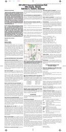
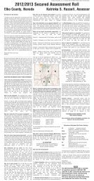
Spring Creek/Lamoille - Elko County
Spring Creek/Lamoille - Elko County
Spring Creek/Lamoille - Elko County

Create successful ePaper yourself
Turn your PDF publications into a flip-book with our unique Google optimized e-Paper software.
The Planning Commission felt that KRL had included the <strong>Spring</strong> <strong>Creek</strong> Association and agreed to pay road<br />
impact fees to <strong>Spring</strong> <strong>Creek</strong> until such time an access road was developed specifically to the KRL<br />
development area. The report offered all pertinent information and minutes from the public hearings.<br />
The Board of <strong>County</strong> Commissioners agreed and removed the contingency with a provision that the KRL<br />
CC& R’s agreement be written into the Master Plan (See Page 37 “M” & Page 48 “7”) . The second item of<br />
the removal of the Commercial designations was ratified “as is” by the Planning Commission without any<br />
comment.<br />
April 19 th , 2006 Special Hearing by the <strong>Elko</strong> <strong>County</strong> Board of Commissioners 2005 Review - Review<br />
of reports and recommendations submitted by the <strong>Elko</strong> <strong>County</strong> Planning Commission. Final action on the<br />
<strong>Spring</strong> <strong>Creek</strong> / <strong>Lamoille</strong> Master Plan 2005 review. See Page 37 “M” & Page 48 “7”.<br />
Review, 2011/2012<br />
November 17 th , 2011 Regular Meeting, Public Hearing, 1st of a series of public hearings to review and<br />
amend the <strong>Spring</strong> <strong>Creek</strong> <strong>Lamoille</strong> Master Plan – Review and presentation of changes to the <strong>Spring</strong> <strong>Creek</strong><br />
<strong>Lamoille</strong> Master Plan Area including the proposed Redstone Development, changes in commercial and<br />
residential zoning districts within Redstone, The abandonment of the Corral Lane alignment for a round-about<br />
intersection located across from Boyd Kennedy road, and other zone changes that have taken place<br />
within the plan. Comments and suggestions were solicited from the board and the public. State bicycle plan<br />
was asked to be included within the plan.<br />
December 15 th , 2011, Regular Meeting, Public Workshop Hearing, 2nd of a series of public hearings<br />
to review and amend the <strong>Spring</strong> <strong>Creek</strong> <strong>Lamoille</strong> Master Plan – Comments and suggestions were<br />
solicited from the board and the public with no input in any of the phases 1-4.<br />
January 19 th , 2012, Regular Meeting, Public Workshop Hearing, 3rd of a series of public hearings to<br />
review and amend the <strong>Spring</strong> <strong>Creek</strong> <strong>Lamoille</strong> Master Plan – Review and action taken, Inclusion of S1/2<br />
of Sec. 28 and the S1/2 of the N1/2 of Sec. 28, T.34 N., R.55 E. into the master plan. Inclusion of the<br />
designations of A-R and AR-CRD-1 within Sec. 33, T.34 N., R.55E.<br />
February 16 th , 2012, Regular Meeting, Public Workshop Hearing, 4 th of a series of public hearings to<br />
review and amend the <strong>Spring</strong> <strong>Creek</strong> <strong>Lamoille</strong> Master Plan – No public comment offered. Discussion<br />
and representation of changes and updates to Plan and topics discussed:<br />
1) Verbiage change, phases are now represented as Plan Areas throughout the document.<br />
2) Relinquishment of water rights statement placed in document.<br />
3) Big W. Ranch, Whear Ranch now represented in the document as Redstone Development.<br />
4) The <strong>Spring</strong> <strong>Creek</strong> Subdivision areas of development are referred to in the document by their<br />
assigned Tract Numbers.<br />
5) The revision to the number of lots that have been developed and the number of lots remaining<br />
undeveloped within each of the Tracts updated from the <strong>Spring</strong> <strong>Creek</strong> Association data of November<br />
2011.<br />
6) Changes to Plan inventories, designations, population, water wells and water inventories.<br />
7) In the Recreation section a note about the Nevada Department of Transportation developing a<br />
statewide bicycle plan, which may provide future paths and routes within the master plan area was<br />
added.<br />
8) The Plan Area 4 boundary has changed where the Jordanelle Development was included. 480<br />
acres changed to agriculture residential and includes the agriculture residential CRD1 in section 33.<br />
Pg. 29