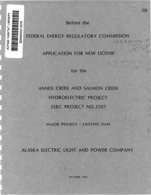
Before the FERC Application for New License for the Annex Creek ...
Before the FERC Application for New License for the Annex Creek ...
Before the FERC Application for New License for the Annex Creek ...

Create successful ePaper yourself
Turn your PDF publications into a flip-book with our unique Google optimized e-Paper software.
<strong>Be<strong>for</strong>e</strong> <strong>the</strong><br />
FEDERAL ENERGY REGULATORY COMMISSION<br />
APPLICATION FOR NEW LICENSE<br />
<strong>for</strong> <strong>the</strong><br />
ANNEX CREEK AND SALMON CREEK<br />
HYDROELECTRIC PROJECT<br />
<strong>FERC</strong> PROJECT NO.2307<br />
MAJOR PROJECT - EXISTING DAM<br />
ALASKA ELECTRIC LIGHT AND POWER COMPANY<br />
.<br />
•<br />
OCTOBER 1985
<strong>Be<strong>for</strong>e</strong> <strong>the</strong><br />
FEDERAL ENERGY REGULATORY COMMISSION<br />
- ."",,'"<br />
ANN~EX<br />
CREEK AND SALMON .C'REEK<br />
• ". • '.' •• \. .,.' .'
ANNEX CREEK/SALMON CREEK<br />
HYDROELECTRIC PROJECT<br />
<strong>FERC</strong> NO. 2307<br />
Salmon <strong>Creek</strong><br />
<strong>Annex</strong> <strong>Creek</strong>
APPLICATION FOR LICENSE<br />
FOR MAJOR PROJECT - EXISTING DAM<br />
ANNEX CREEK AND SALMON CREEK<br />
HYDROELECTRIC PROJECT<br />
<strong>FERC</strong> PROJECT NO. 2307<br />
GENERAL TABLE OF CONTENTS<br />
Exhibit<br />
A<br />
B<br />
C<br />
D<br />
E<br />
F<br />
G<br />
INITIAL STATEMENT<br />
PROJECT DESCRIPTION<br />
Title<br />
PROJECT OPERATION AND RESOURCE UTILIZATION<br />
CONSTRUCTION SCHEDULE<br />
PROJECT COSTS AND FINANCING<br />
ENVIRONMENTAL REPORT<br />
GENERAL DESIGN DRAWINGS<br />
SUPPORTING DESIGN REPORT (UNDER SEPARATE COVER)<br />
PROJECT MAPS
BEFORE THE FEDERAL ENERGY REGULATORY COMMISSION<br />
APPLICATION FOR LICENSE<br />
FOR MAJOR PROJECT - EXISTING DAM<br />
INITIAL STATEMENT<br />
1. The Alaska Electric Light and Power Company (Applicant) applies to <strong>the</strong><br />
Federa 1 Energy Regu 1 a tory Commi s s i on (<strong>FERC</strong>) <strong>for</strong> a 11 cense <strong>for</strong> <strong>the</strong> <strong>Annex</strong><br />
<strong>Creek</strong> and Salmon <strong>Creek</strong> Hydroelectric Project (Project) as described in<br />
<strong>the</strong> attached Exhibits. The Project is designated as <strong>FERC</strong> Project<br />
No. 2307. The original license <strong>for</strong> this Project was issued to Alaska<br />
Juneau Mining Company (A-J Industries) on October 24, 1963 and transferred<br />
to Alaska Electric Light and Power Company on March 23, 1973.<br />
2. The location of this Project is:<br />
State or Territory:<br />
County:<br />
Township or Nearby Town:<br />
Stream or O<strong>the</strong>r Body<br />
of Water:<br />
Alaska<br />
City and Borough of Juneau<br />
Juneau<br />
<strong>Annex</strong> <strong>Creek</strong> and Salmon <strong>Creek</strong><br />
3. The exact name and business address of <strong>the</strong> Applicant are:<br />
Alaska Electric Light and Power Company<br />
134 North Franklin Street<br />
Juneau, Alaska 99801<br />
The exact name, business address and phone number of each person authorized<br />
to act as Agent <strong>for</strong> <strong>the</strong> Applicant in this application is:<br />
Mr. William A. Corbus<br />
134 North Franklin Street<br />
Juneau, Alaska 99801<br />
Phone: (907) 586-2222<br />
4. The App 11 cant is a domes tic corpora t 1 on organ i zed under <strong>the</strong> 1 aws of <strong>the</strong><br />
State of Alaska and duly qualified to do business in <strong>the</strong> State of Alaska.<br />
5. (i) The statutory or regulatory requirements of <strong>the</strong> State(s) in which<br />
<strong>the</strong> Project woul d be located and that affect <strong>the</strong> Project as proposed,<br />
with respect to bed and banks and to <strong>the</strong> appropriation,<br />
diversion, and use of water <strong>for</strong> power purposes, and with respect to<br />
<strong>the</strong> right to engage in <strong>the</strong> business of developing, transmitting,<br />
and distributing power and in any o<strong>the</strong>r business necessary to<br />
accomplish <strong>the</strong> purposes of <strong>the</strong> license under <strong>the</strong> Federal Power Act,<br />
are:
a. Division of Policy and Planning, Office of <strong>the</strong> Governor<br />
Page 2<br />
Under Alaska Statutes AS 46.60.010-20 and <strong>the</strong> Alaska Administration<br />
Code 6 AAC 80.010-85.900, <strong>the</strong> State must determine<br />
whe<strong>the</strong>r activities having a "direct and significant impact"<br />
on coastal waters are compatible with State plans <strong>for</strong> <strong>the</strong><br />
coastal zone.<br />
b. Alaska Public Utilities Commission<br />
AS 42.05.010-721 provides <strong>for</strong> comprehensive regulation of <strong>the</strong><br />
services provided by electrical utilities and <strong>the</strong> rates<br />
charged <strong>for</strong> those services.<br />
c. Department of Environmental Conservation<br />
Under 18 AAC 70.081, <strong>the</strong> Department must certify that a project<br />
will comply with Alaska water quality standards. In<br />
add i ti on t under AS 43.03·.020, <strong>the</strong> Department in conj unct i on<br />
with <strong>the</strong> Department of Fish and Game must ascertain any<br />
impact on runs of anadromous fish.<br />
d. Department of Fish and Game<br />
Under AS 16.10.020, <strong>the</strong> Department1s approval is required <strong>for</strong><br />
any work impacting anadromous fish streams.<br />
e. Department of Natural Resources<br />
Under 11 AAC 93.150-200, <strong>the</strong> Department has extensive regulations<br />
covering dam construction. Under AS 46.15.010-270, <strong>the</strong><br />
Department regulates appropriation of State waters. Under AS<br />
38.05.330 and regulations promulgated under 11 AAC 58.300-910,<br />
<strong>the</strong> Department grants leases and easements that may be needed<br />
to use or cross State lands. Also under AS 41.20.040, AS<br />
41.35.020, AS 41.35.050, AS 41.35.080 and <strong>the</strong> regulations<br />
promu 1 gated under 11 AAC 16.010-160, <strong>the</strong> Department admi n i s<br />
ters and regulates <strong>the</strong> historic, prehistoric and archaeological<br />
resources of <strong>the</strong> State.<br />
(ii) The steps which <strong>the</strong> Applicant has taken or plans to take to comply<br />
with each of <strong>the</strong> laws cited above are:<br />
a. Division of Policy and Planning, Office of <strong>the</strong> Governor<br />
To comply with <strong>the</strong> laws and regulations administered by this<br />
agency, we have submitted a packet of in<strong>for</strong>mation describing<br />
<strong>the</strong> Project, a completed Coastal Project Questionnaire, a<br />
Statement of Consistency with <strong>the</strong> State Coastal Zone Management<br />
Plan, and a draft of <strong>the</strong> application <strong>for</strong> new license.
. Alaska Public Utilities Commission<br />
Page 3<br />
A copy of <strong>the</strong> in<strong>for</strong>mation packet and <strong>the</strong> draft appl i cation<br />
was filed with <strong>the</strong> Alaska Public Utilities Commission.<br />
c. Department of Environmental Conservation<br />
A copy of <strong>the</strong> in<strong>for</strong>mation packet and draft application was<br />
filed with <strong>the</strong> Department of Environmental Conservation.<br />
Their letter of May 15, 1985 waived <strong>the</strong> State1s right to<br />
certify <strong>the</strong> proposed activity. There<strong>for</strong>e, no fur<strong>the</strong>r action<br />
regarding <strong>the</strong> Section 401 Water Quality Certification is<br />
required at this time.<br />
d. Department of Fish and Game<br />
A copy of <strong>the</strong> in<strong>for</strong>mation packet and draft appl ication was<br />
filed with <strong>the</strong> Alaska Department of Fish and Game.<br />
e. Department of Natural Resources<br />
Copies of <strong>the</strong> packet of in<strong>for</strong>mation and draft license application<br />
were submitted to <strong>the</strong> Department of Natural Resources.<br />
Additional in<strong>for</strong>mation on <strong>the</strong> listing of <strong>the</strong> facilities at<br />
<strong>Annex</strong> <strong>Creek</strong> was submi tted at <strong>the</strong> request of <strong>the</strong> State Hi s<br />
toric Preservation Officer.<br />
6. The existing <strong>Annex</strong> <strong>Creek</strong> and Salmon <strong>Creek</strong> Hydroelectric Project is owned<br />
and operated by Alaska Electric Light and Power Company.<br />
I N WI TNESS WHEREOF <strong>the</strong> App 1 i cant has cau sed its name to be hereunder<br />
signed by William A. Corbus, Manager, Alaska Electric Light and Power<br />
Company, <strong>the</strong>reunto duly authorized this 9 day of 0 ~ I 1985.<br />
ALASKA ELECTRIC POWER AND LIGHT<br />
By:<br />
(80678B)
This <strong>Application</strong> is executed in <strong>the</strong><br />
City and Borough of Juneau,<br />
State of Alaska,<br />
by:<br />
SUBSCRIPTION AND VERIFICATION<br />
William A. Corbus<br />
Alaska Electric Light and Power Co.<br />
134 N. Franklin Street<br />
Juneau, Alaska 99801<br />
being duly sworn, deposes and says that <strong>the</strong> contents of this <strong>Application</strong> are<br />
true to <strong>the</strong> bes t of his knowl edge or be 1 i ef. The unders 1 gned App 1 i cant has<br />
signed <strong>the</strong> <strong>Application</strong> this ~day of O~ ,. 19~.<br />
) ss<br />
(Applicant)<br />
~tj<br />
By: i:J~e~ Q. ~<br />
Subscribed and sworn to be<strong>for</strong>e me, a (Notary Public, or title of o<strong>the</strong>r official<br />
author1zpd by <strong>the</strong> State to notarize d~mel'ts, as approprl~te), of <strong>the</strong><br />
State of a/'d;ol!4=-= thi s day of (J!dCed'~·5), 19?~ .<br />
(seal)<br />
~ta~t or o<strong>the</strong>r authorized official)<br />
My Comm iss i on e xp ire s _____ 1 1_-.....;/:....=.3_-.,;;...;:'..".,7:.....-_________ _
EXHIBIT A<br />
PROJECT DESCRIPTION<br />
TABLE OF CONTENTS<br />
Section<br />
Number<br />
1 .0<br />
2.0<br />
3.0<br />
INTRODUCTION<br />
Section and Subsection Title<br />
ANNEX CREEK COMPONENT DESCRIPTION<br />
2. 1 Genera 1<br />
2.2 Project Structures<br />
2.3 Impoundment<br />
2.4 Turbine-Generators<br />
2.5 Primary Transmission Lines<br />
2.6 Additional Equipment<br />
2.7 Lands of <strong>the</strong> United States<br />
SALMON CREEK COMPONENT DESCRIPTION<br />
3.1 General<br />
3.2 Project Structures<br />
3.3 Impoundment<br />
3.4 Turbine-Generators<br />
3.5 Primary Transmission Lines<br />
3.6 Additional Equipment<br />
3.7 Lands of <strong>the</strong> United States<br />
Page<br />
Number<br />
A-l<br />
A-3<br />
A-3<br />
A-3<br />
A-4<br />
A-4<br />
A-S<br />
A-S<br />
A-s<br />
A-7<br />
A-7<br />
A-7<br />
A-9<br />
A-9<br />
A-9<br />
A-10<br />
A-10<br />
APPENDIX A-l - Project <strong>License</strong> Chronology
1.0 INTRODUCTION<br />
The <strong>Annex</strong> <strong>Creek</strong> and Salmon <strong>Creek</strong> Hydroelectric Project (Project) is<br />
located in Sou<strong>the</strong>ast Alaska i~ a mountainous region within <strong>the</strong> City and<br />
Borough of Juneau (CBJ). The Project consists of two geographically separate<br />
components, <strong>Annex</strong> <strong>Creek</strong> and Salmon <strong>Creek</strong>, whose reservoirs are located approximately<br />
10 miles nor<strong>the</strong>ast and 3 miles north of downtown Juneau, respectively.<br />
Total Project installed capacity is 18,050 kVA (13.1 MW). The <strong>Annex</strong> <strong>Creek</strong><br />
Powerhouse contains two turbine-generator units <strong>for</strong> a total capacity of<br />
4,050 kVA (3.6 MH) and is located 11 m; 1es east of downtown Juneau on Taku<br />
Inlet. The Salmon <strong>Creek</strong> Upper Powerhouse contains two turbine-generator units<br />
<strong>for</strong> a total capacity of 3,500 kVA (2.8 MW) and <strong>the</strong> Lower Powerhouse contains<br />
one turbine-generator unit rated at 10,500 kVA (6.7 MH>' Due to constraints<br />
on <strong>the</strong> Salmon <strong>Creek</strong> Upper Penstock, both powerhouses cannot be operated simultaneously.<br />
Both are located within <strong>the</strong> Juneau Townsite which is shown in<br />
Exhibit G-l. The existing facilities are described in detail in <strong>the</strong> following<br />
sections and <strong>the</strong>ir locations are shown in Exhibit G-1. Since <strong>the</strong> Project consists<br />
of two distinct reservoir components with associated facilities, each<br />
reservoir and its associated facilities are described as a discrete development<br />
(Component). The <strong>Annex</strong> <strong>Creek</strong> Component is described first, followed by<br />
Salmon <strong>Creek</strong>.<br />
The Project is owned and operated by Alaska E1 ectri c Light and<br />
Power Company (AELP). AELP is an investor-owned electric utility that serves<br />
approximately 901 of <strong>the</strong> population of CBJ. It is estimated that <strong>the</strong> Project<br />
wi 11 supp 1 y a quarter of Juneau IS e 1 ectr i ca 1 energy dur i ng 1985. A br i ef<br />
history of AELP and <strong>the</strong> Project is presented below.<br />
AELP was organized in 1893, and in <strong>the</strong> summer of 1894 began to genera<br />
te and dis tr i bute e 1 ectri city produced from <strong>the</strong> waters of Gold <strong>Creek</strong> to<br />
res i dences and sma 11 bus i nes ses . As Juneau grew, <strong>the</strong> use of e 1 ectr i city<br />
increased, and steam generation facilities were added to <strong>the</strong> system. The<br />
mi n i ng compan i es in <strong>the</strong> Juneau area a 1 so bu i 1 t <strong>the</strong> i r own pr iva te genera t i ng<br />
facilities, most of which were hydroelectric.<br />
In 1914-15 <strong>the</strong> Gastineau Mining Company constructed first <strong>the</strong><br />
Sa 1 mon <strong>Creek</strong> and <strong>the</strong>n <strong>the</strong> <strong>Annex</strong> <strong>Creek</strong> Proj ect fac il i ties. The Proj ec't IS<br />
construction history, including <strong>the</strong> numerous rehabilitation programs, is<br />
described fully in Exhibit C. By 1936 all <strong>the</strong> mining companies and <strong>the</strong>ir<br />
electric generating facilities had been amalgamated into <strong>the</strong> Alaska Juneau<br />
Mining Company (A-J Industries). As AELP's load continued to grow, it met its<br />
addi tiona 1 energy requi rement wi th purchases from A-J Industri es. When <strong>the</strong><br />
m; nes were permanent 1 y closed in 1944, AELP became <strong>the</strong> sole purchaser of A-J<br />
Industries' hydroelectric energy.<br />
Beginning in <strong>the</strong> late 1960's, A-J Industries, <strong>the</strong> Alaska Public<br />
utilities Commission (APUC), and <strong>the</strong> Juneau municipal government became<br />
i nvo 1 ved ina cos t 1 Y and pro longed 1 ega 1 dispute over <strong>the</strong> eff; c; ency of A-J<br />
Industries' hydroelectric operation and its rate base. The case went to <strong>the</strong><br />
Alaska Supreme Court and resulted in numerous changes in wholesale rates to
A-2<br />
AELP and, consequently, to AELP's customers. In 1973, AELP purchased A-J<br />
Industries' hydroelectric generating facilities and transmission system, and<br />
<strong>the</strong> l.awsuit was resolved. This acquisition included <strong>the</strong> existing Project<br />
facilities. An historical chronology of Project licensing events is included<br />
as Appendix A-l.
A-3<br />
2.0 ANNEX CREEK COMPONENT DESCRIPTION<br />
2.1 GENERAL<br />
The <strong>Annex</strong> <strong>Creek</strong> Component iss i tuated ina remote area of <strong>the</strong><br />
Tongass National Forest. There are two lakes in <strong>the</strong> <strong>Annex</strong> <strong>Creek</strong> drainage<br />
area, Upper and Lower <strong>Annex</strong> Lake. Upper <strong>Annex</strong> Lake Reservoi r, <strong>the</strong> 1 arger of<br />
<strong>the</strong> two, serves as <strong>the</strong> reservoi r <strong>for</strong> <strong>the</strong> <strong>Annex</strong> <strong>Creek</strong> Component. It has a<br />
natura 1 water surface area of 183 acres at El 820 Mean Sea Leve 1 (MSL). A<br />
timber buttress dam is located at <strong>the</strong> outlet of Upper <strong>Annex</strong> Lake Reservoir,<br />
with a spillway crest at El 844.3 MSL. This raises <strong>the</strong> normal maximum water<br />
surface area of <strong>the</strong> reservoi r to 264 acres. Spi 11 way dis charge flows into<br />
Lower <strong>Annex</strong> Lake whi ch ; s drai ned by <strong>Annex</strong> <strong>Creek</strong>. <strong>Annex</strong> <strong>Creek</strong> flows <strong>for</strong><br />
approximately 0.5 mile downstream of <strong>the</strong> lake, discharging into Taku Inlet.<br />
A tunne 1 has been dri ven in rock to Upper <strong>Annex</strong> Lake Reservoi r,<br />
with a lake tap at El 690 MSL. A valve chamber is located at <strong>the</strong> outlet of<br />
<strong>the</strong> tunnel which connects to <strong>the</strong> penstock. The penstock is a riveted steel<br />
pipe 7,031 feet long, varying in diameter from 42 to 34 inches. The powerhouse<br />
conta ins two turb i ne-genera tor un its <strong>for</strong> a tota 1 of 4,050 kVA and i s<br />
located at Taku Inlet, approximately 0.5 mile nor<strong>the</strong>ast of <strong>the</strong> outlet of <strong>Annex</strong><br />
<strong>Creek</strong>. A 23-kV transmission line, with a combination of steel and wood structures,<br />
transmi ts <strong>the</strong> power generated at <strong>Annex</strong> <strong>Creek</strong> to <strong>the</strong> Thane Sw; tchyard.<br />
Thane is located on Gastineau Channel, approximately 4 mi les southwest of<br />
downtown Juneau.<br />
2.2 PROJECT STRUCTURES<br />
<strong>Annex</strong> <strong>Creek</strong> Dam. The <strong>Annex</strong> <strong>Creek</strong> Dam is a 20-foot-high by approximately<br />
110-foot-long timber buttress dam, which was reconstructed in 1967. The dam<br />
is constructed of pressure treated timbers. The upstream face is composed of<br />
3-inch-thick tongue and groove decking over 8-inch by 8-inch horizontal<br />
stringers. The stringers are supported by 8-inch by 10-inch beams which rest<br />
on 8-inch by 10-inch timber buttress struts. The upstream face is protected<br />
with an application of coal tar pitch. The toe of <strong>the</strong> dam is a concrete curb<br />
which provides a watertight seal with <strong>the</strong> rock foundation.<br />
A 57-foot-long spillway crest, also constructed of timber decking,<br />
is supported by 8-i nch by 8-i nch braced timber col umns at <strong>the</strong> center of <strong>the</strong><br />
dam crest. The spillway crest is at El 844.3 MSL. The total hydraulic capacityof<br />
<strong>the</strong> spillway at <strong>Annex</strong> Dam is approximately 458 cfs with no freeboard on<br />
<strong>the</strong> dam.<br />
<strong>Annex</strong> <strong>Creek</strong> Power Conduit. The <strong>Annex</strong> <strong>Creek</strong> Tunnel is 1,418 feet long and<br />
connects directly with Upper <strong>Annex</strong> Lake Reservoir via a lake tap at El 690<br />
MSL. The 1 ake tap is not prov i ded wi th trashracks. The tunne 1 is approximately<br />
8 feet by 8 feet and is unlined at <strong>the</strong> upstream end <strong>for</strong> approximately<br />
540 feet, <strong>the</strong>n protected by a 2-i nch guni te cover; ng <strong>for</strong> <strong>the</strong> next 628 feet.<br />
Approx i ma te 1 y <strong>the</strong> 1 as t 250 feet of <strong>the</strong> tunne 1 are re i n<strong>for</strong>ced concrete-1 i ned.
Here a transition is made to a 78-inch-diameter conduit section which permits<br />
connection to <strong>the</strong> riveted steel penstock just upstream of <strong>the</strong> valve chamber.<br />
Flow through <strong>the</strong> power conduit is controlled by a 42-inch rising stem gate<br />
valve in <strong>the</strong> valve chamber.<br />
The <strong>Annex</strong> <strong>Creek</strong> Penstock is of riveted steel construction,<br />
7,031 feet long and varying in diameter from 42 inches at <strong>the</strong> tunnel portal to<br />
34 inches at <strong>the</strong> <strong>Annex</strong> <strong>Creek</strong> Powerhouse. The penstock wa 11 th i cknes s vari es<br />
from 1/2 inch to 5/8 inch. The penstock is supported over most of its length<br />
by wooden trestle structures.<br />
<strong>Annex</strong> <strong>Creek</strong> Powerhouse. The <strong>Annex</strong> <strong>Creek</strong> Powerhouse is located directly<br />
on Taku Inlet nor<strong>the</strong>ast of <strong>the</strong> mouth of <strong>Annex</strong> <strong>Creek</strong>. The powerhouse contains<br />
two 2, 500-horsepower i mpul se type turbi nes connected to two generator uni ts;<br />
one is rated at 2,250 kVA and <strong>the</strong> o<strong>the</strong>r at 1,800 kVA. The 34-inch-diameter<br />
penstock bifurcates just upstream of <strong>the</strong> units and a turbine shutoff valve is<br />
located on each branch permitting independent operation of <strong>the</strong> units. A<br />
single 34-inch valve, with 4-inch bypass, is also positioned upstream of <strong>the</strong><br />
bifurcation as backup. The powerhouse is approximately 67 feet long by<br />
48 feet wide with a concrete substructure and steel frame superstructure with<br />
corruga ted meta 1 coveri ng. The floor is at El 28.56 and <strong>the</strong> he i ght of <strong>the</strong><br />
powerhouse ;s approximately 40 feet measured to <strong>the</strong> top of <strong>the</strong> roof. A 25-ton<br />
overhead crane (now derated to 15 tons) moves on rails which extend <strong>the</strong> length<br />
of <strong>the</strong> structure. A concrete ta i 1 race, measuri ng 18 feet deep by 40 feet<br />
wide, discharges over a weir into <strong>the</strong> inlet. The weir crest is at E1 17.41.<br />
2.3 IMPOUNDMENT<br />
Upper <strong>Annex</strong> Lake Reservoi r . Upper <strong>Annex</strong> Lake Reservoi r has a norma 1<br />
maximum surface area of 264 acres and normal maximum surface elevation of<br />
844 feet MSL. The gros s storage capac i ty is 26,000 acre-feet at th is e 1 evation.<br />
The active storage capacity is 23,400 acre-feet with a minimum pool<br />
elevation of 705 feet MSL.<br />
2.4 TURBINE-GENERATORS<br />
<strong>Annex</strong> <strong>Creek</strong> Turbi nes. The <strong>Annex</strong> <strong>Creek</strong> Powerhouse conta ins two 2,500-<br />
horsepower, impulse type, Allis-Chalmers turbines. They each operate at<br />
300 rpm, under an average net effective head of 765 feet.<br />
<strong>Annex</strong> <strong>Creek</strong> Generators. The two generators installed at <strong>the</strong> <strong>Annex</strong> <strong>Creek</strong><br />
Powerhouse are three-phase, 2,300-Volt Allis-Chalmers synchronous generators.<br />
Both generators were recently rewound; one is rated at 2,250 kVA and <strong>the</strong> o<strong>the</strong>r<br />
at 1,800 kVA. Excitation is provided by an automatic static voltage regulator<br />
system with a battery bank providing reliable control power.<br />
A-4
2.5 PRIMARY TRANSMISSION LINES<br />
<strong>Annex</strong> <strong>Creek</strong> Transmission Line. The <strong>Annex</strong> <strong>Creek</strong> Component of <strong>the</strong> Project<br />
has 12 mll es of 23-kV transmi s s i on 1 i ne stretch i ng over mounta i nous terrain<br />
from <strong>the</strong> <strong>Annex</strong> <strong>Creek</strong> Powerhouse to <strong>the</strong> Thane Switchyard. The <strong>Annex</strong>-Thane circui<br />
t consi sts primari 1y of No. 2/0 bare copper conductors on both wood and<br />
steel towers. A portion of <strong>the</strong> line at high elevations utilizes copper-clad<br />
steel conduit conductors, which generate sufficient heat to alleviate a potential<br />
ice build up problem.<br />
2.6 ADDITIONAL EQUIPMENT<br />
The <strong>Annex</strong> <strong>Creek</strong> Component has four 1, 250-kVA, s i ngl e-phase, 2,300-<br />
to 23,000-Volt, oil immersed, water-cooled Allis-Chalmers trans<strong>for</strong>mers. These<br />
trans<strong>for</strong>mers step-up from <strong>the</strong> 2,300-Vo1t generator voltage to <strong>the</strong> 23-kV transmission<br />
line voltage. One of <strong>the</strong> trans<strong>for</strong>mers serves as a spare. One set of<br />
three 23,000-Vo1t, double throw disconnect switches are provided as breakers.<br />
2.7 LANDS OF THE UNITED STATES<br />
The <strong>Annex</strong> <strong>Creek</strong> Component of <strong>the</strong> Proj ect inc 1 udes 692.6 acres of<br />
land owned by <strong>the</strong> United States including 215.2 acres on national Forest Service<br />
land and 477.4 acres on Bureau of Land Management land.<br />
A-5<br />
G-2<br />
G-3<br />
<strong>Annex</strong> <strong>Creek</strong> Component.<br />
Exhibit<br />
Township<br />
and Range<br />
T.41S, R.69E<br />
T.41S, R.69E<br />
Section<br />
4<br />
5<br />
8<br />
9<br />
10<br />
15<br />
16<br />
15<br />
16<br />
17<br />
18<br />
21<br />
Acres<br />
Use<br />
31 Reservoir<br />
83 Reservoir<br />
15 Reservoir<br />
242 Reservoir, tunnel, penstock,<br />
dam<br />
25 Reservoir, penstock<br />
43 Penstock, powerhouse<br />
3 Reservoir<br />
5.5 Transmission 1 i ne<br />
1.5 Transmission 1 i ne<br />
5.5 Transmission 1 i ne<br />
5 Transmission 1 i ne<br />
3.7 Transmission line
Township<br />
Exhibit and Range Section Acres Use<br />
G-3 T.41S, R.68E 13 5.9 Transmission 1 i ne<br />
22 5.5 Transmission 1 i ne<br />
23 99.0 Transmission 1 i ne<br />
24 6.6 Transmission line<br />
26 15.0 Transmission 1; ne<br />
27 77.9 Transmission 1 i ne<br />
32 5.4 Transmission line, switchyard<br />
33 5.5 Transmission 1 i ne<br />
34 11 .3 Transmission 1 i ne<br />
A-6
A-7<br />
3.0 SALMON CREEK COMPONENT DESCRIPTION<br />
3.1 GENERAL<br />
The Sa 1 mon <strong>Creek</strong> Component is 1 oca ted wi thi n <strong>the</strong> Juneau Towns i te<br />
Boundary. Salmon <strong>Creek</strong> Reservoir, located approximately 3 miles north of<br />
downtown Juneau, is <strong>for</strong>med by a concrete-arch dam. The spillway is located in<br />
<strong>the</strong> right abutment of <strong>the</strong> dam. An intake structure is built into <strong>the</strong> base of<br />
<strong>the</strong> dam wh i ch connects to <strong>the</strong> Sa 1 mon <strong>Creek</strong> Upper Pens tock and Upper Powerhouse.<br />
The Upper Powerhouse contains two turbine-generator units <strong>for</strong> a total<br />
of 3,500 kVA. Power generated at <strong>the</strong> Upper Powerhouse is transmi tted via a<br />
transmi s s ion 1 i ne to <strong>the</strong> old lower swi tchyard 1 oca ted near <strong>the</strong> Lower Powerhouse.<br />
Immedi ate 1 y above <strong>the</strong> Upper Powerhouse, <strong>the</strong> Upper Penstock bi furcates,<br />
permitting water to be diverted to <strong>the</strong> Upper Powerhouse or into <strong>the</strong><br />
Lower Penstock leading to <strong>the</strong> Lower Powerhouse. The flow of water to ei<strong>the</strong>r<br />
powerhouse is controlled by two butterfly valves located at <strong>the</strong> bifurcation.<br />
Due to Upper Penstock flow capacity and existing water rights, both<br />
powerhouses cannot be operated simultaneously. The Lower Penstock is of<br />
welded steel construction and is buried except where it crosses Salmon <strong>Creek</strong>.<br />
The new Lower Powerhouse is located on Gastineau Channel adjacent to <strong>the</strong> old<br />
Lower Powerhouse, now retired, approximately 3 miles northwest of downtown<br />
Juneau. The Lower Powerhouse contai ns one turbi ne-generator uni t rated at<br />
10,500 kVA. The nameplate capacity of <strong>the</strong> Lower Powerhouse Unit is 8.4 MW and<br />
was installed <strong>for</strong> future expansion. The licensed capacity of <strong>the</strong> unit is<br />
6.7 MW and is <strong>the</strong> maximum capacity <strong>the</strong> unit can presently operate. The power<br />
generated is transmitted via a short section (450 feet) of intertie to <strong>the</strong> new<br />
lower switchyard, where interconnection is made with AELp·s distribution<br />
system.<br />
When <strong>the</strong> Salmon <strong>Creek</strong> Component was originally constructed, an<br />
arbi trary e 1 evati on datum was used wi th <strong>the</strong> dam spi 11 way crest at E1 1172.<br />
This arbitrary datum is 26.29 feet below Mean Lower Low Water Datum (MLLW).<br />
Throughout thi s exhi bi t thi s arbi trary datum wi 11 be referred to as <strong>the</strong> Upper<br />
Salmon <strong>Creek</strong> Datum (USCD).<br />
The Lower Penstock and Lower Powerhouse, which were built in 1984,<br />
used ano<strong>the</strong>r arbitrary elevation datum which is 4.79 feet below MLLW. This<br />
arbitrary datum will be referred to as <strong>the</strong> Lower Salmon <strong>Creek</strong> Datum (LSCD).<br />
3.2 PROJECT STRUCTURES<br />
Salmon <strong>Creek</strong> Dam. The Salmon <strong>Creek</strong> Dam is a concrete arch dam 170 feet<br />
high with a crest length of 648 feet. The dam crest is at E1 1175 (USCD).<br />
The spillway crest elevation is 1172 feet (USCD) with 3 feet of freeboard provided<br />
by <strong>the</strong> dam. An intake structure is built into <strong>the</strong> base of <strong>the</strong> dam. At
A-8<br />
<strong>the</strong> crown of <strong>the</strong> arch, <strong>the</strong> dam measures 6 feet thick at <strong>the</strong> crest and 47.5 feet<br />
at <strong>the</strong> foundation contact.<br />
Releases can be made directly into Salmon <strong>Creek</strong> through <strong>the</strong> reservoir<br />
outlet. The outlet consists of a 36-inch pipe through <strong>the</strong> dam with a<br />
36-inch gate valve used to maintain <strong>the</strong> reservoir level at E1 1140 (USCD).<br />
The spi 11 way is an uncontrolled crest wi th ten 5-foot-wi de bays<br />
separated by 1-foot-thi ck concrete pi ers. A concrete-1 i ned chute downstream<br />
of <strong>the</strong> spillway directs water into <strong>the</strong> creekbed below <strong>the</strong> right abutment. The<br />
hydraulic capacity of <strong>the</strong> spillway at Salmon <strong>Creek</strong> Dam is approximately<br />
810 cfs with no freeboard on <strong>the</strong> dam crest. The spillway does not function<br />
due to <strong>the</strong> limitation imposed by <strong>the</strong> <strong>FERC</strong> of <strong>the</strong> maximum pool level as<br />
described below in paragraph 3.3.<br />
Salmon <strong>Creek</strong> Upper Power Conduit. The intake structure measures 10 feet<br />
wide by 11 feet high and is equipped with trashracks. Water is conveyed from<br />
<strong>the</strong> intake structure to <strong>the</strong> va1vehouse immediately downstream of <strong>the</strong> dam<br />
through a 36-inch-diameter concrete conduit. Flow into <strong>the</strong> Upper Penstock is<br />
contro 11 ed <strong>the</strong>re by a 36-inch, hand-operated gate va 1 ve. The Upper Pens tock<br />
is 4,475 feet in length and varies ;n diameter from 30 to 40 inches. The penstock<br />
is made of riveted steel varying in thickness from 0.25 to 0.47 inches.<br />
The Upper Penstock bifurcates immediately upstream of <strong>the</strong> powerhouse. Downstream<br />
of <strong>the</strong> bifurcation a butterfly valve has been installed on each<br />
branch. One condui t goes to <strong>the</strong> Upper Powerhouse and <strong>the</strong> o<strong>the</strong>r goes to <strong>the</strong><br />
Lower Powerhouse via <strong>the</strong> Lower Penstock.<br />
Sa 1 mon <strong>Creek</strong> Upper Powerhouse. The Upper Powerhouse is a ti mber frame<br />
structure 63 feet long, 34 feet wide and 27 feet high with a concrete substructure.<br />
A 15-ton overhead crane serv ice s <strong>the</strong> fac i 1 i ty. Two 2, 500-horsepower<br />
impu1 se type turbi ne-generator un; ts are housed ; n <strong>the</strong> structure wi th<br />
six trans<strong>for</strong>mers in an attached 48-foot-10ng by 15-foot-wi de by 27-foot-hi gh<br />
re i n<strong>for</strong>ced concrete bu i 1 d; ng . The 30-i nch-d i ameter pen stock b i furca tes jus t<br />
upstream of <strong>the</strong> units. The nozzle jet of <strong>the</strong> turbines is at E1 449.3 (USCD)'<br />
Discharge from <strong>the</strong> plant flows into <strong>the</strong> South Fork of Salmon <strong>Creek</strong>. Nearby<br />
detached structures serve as workshop, storage, and living accommodations.<br />
Salmon <strong>Creek</strong> Lower Penstock. The Salmon <strong>Creek</strong> Lower Penstock is a buried<br />
42-inch-diameter welded steel pipe varying in wall thickness from 0.375 to<br />
0.507 inches. It is approximately 11,030 feet long and is buried <strong>for</strong> its<br />
entire length except <strong>for</strong> <strong>the</strong> 346-foot section from <strong>the</strong> bifurcation to a pOint<br />
downstream of <strong>the</strong> Salmon <strong>Creek</strong> Bridge and <strong>for</strong> 225 feet at <strong>the</strong> lower bridge.<br />
The 42-inch-diameter penstock reduces to 30 inches in diameter just prior to<br />
entering <strong>the</strong> new Lower Powerhouse.<br />
Salmon <strong>Creek</strong> Lower Powerhouse. The new Lower Powerhouse structure is an<br />
insulated prefabricated metal building approximately 57 feet long by 44 feet<br />
wide by 22 feet high. It houses a single impulse turbine-generator unit with<br />
<strong>the</strong> turbine jet at E1 34 (LSCD). Equipment is serviced by a 30-ton capacity<br />
overhead bridge crane.
A 30-inch-diameter ball valve is located 1n <strong>the</strong> powerhouse immediately<br />
upstream of <strong>the</strong> turbine to serve as a turbine shutoff valve. An 8-foot<br />
by 4-foot buri ed rei n<strong>for</strong>ced concrete ta il race di scharges into four 3-foot by<br />
3-foot concrete box culverts extending from <strong>the</strong> <strong>for</strong>mer Lower Powerhouse.<br />
These culverts, in turn, connect to a double 4-foot by 9-foot rein<strong>for</strong>ced concrete<br />
box culvert that extends under Egan Drive and discharges into Gastineau<br />
Channel. The <strong>for</strong>mer Salmon <strong>Creek</strong> Lower Powerhouse is now used as a warehouse.<br />
3.3 IMPOUNDMENT<br />
Salmon <strong>Creek</strong> Reservoir. Until recently Salmon <strong>Creek</strong> Reservoir had a<br />
normal maximum water surface elevation of 1172 feet (USCD), with a resulting<br />
gross storage capacity of 18,000 acre-feet and a surface area of 205 acres.<br />
However, as ordered by <strong>the</strong> <strong>FERC</strong> in <strong>the</strong> current Project license, <strong>the</strong> reservoir<br />
surface is not allowed to exceed E1 1140 (USCD) <strong>for</strong> safety considerations (see<br />
Dam Safety Report, included in <strong>the</strong> Supporting Design Document to Exhibit F)'<br />
At this elevation <strong>the</strong> gross storage capacity is 12,000 acre-feet and <strong>the</strong> reservo;<br />
r area is 165 acres. The usab 1 e storage ; s 11,890 acre-feet at th; s<br />
reduced level. The minimum pool elevation is 1019 feet (USCD).<br />
3.4 TURBINE-GENERATORS<br />
Salmon <strong>Creek</strong> Upper Turbines. The Salmon <strong>Creek</strong> Upper Powerhouse contains<br />
two Joshua Hendy 2,500-horsepower, impulse turbines. They each operate at<br />
257 rpm under an average net head of 685 feet.<br />
Salmon <strong>Creek</strong> Upper Generators. The two General Electric generators<br />
installed at <strong>the</strong> Upper Powerhouse are three-phase, 60 Hz, 1,750-kVA, 2,300-Volt<br />
synchronous generators. Excitation is provided by an automatic static voltage<br />
regulator system with a battery bank providing reliable control power.<br />
Salmon <strong>Creek</strong> Lower Turbine. The Lower Powerhouse contains a single,<br />
9,210-horsepower Gilkes Turgo impulse turbine which operates at 720 rpm under<br />
a net effective head of 800 feet.<br />
Salmon <strong>Creek</strong> Lower Generator. The single generator installed at <strong>the</strong><br />
Lower Powerhouse ;s a Siemans-Al1is three-phase, 10,500-kVA, 12,700-Volt<br />
synchronous generator. Excitation is provided by a rotating exciter directly<br />
coupled to <strong>the</strong> generator shaft.<br />
3.5 PRIMARY TRANSMISSION LINES<br />
Salmon <strong>Creek</strong> Transmission Line. The Salmon <strong>Creek</strong> Component of <strong>the</strong> Project<br />
includes 2 miles of 23-kV transmission line, most of which connects <strong>the</strong><br />
Upper Powerhouse and <strong>the</strong> old lower switchyard. The remaining short section of<br />
line runs from <strong>the</strong> new Lower Powerhouse to <strong>the</strong> new distribution substation.<br />
A-9
3.6 ADDITIONAL EQUIPMENT<br />
A-10<br />
Salmon <strong>Creek</strong> Upper Powerhouse. The Upper Salmon <strong>Creek</strong> Powerhouse has six<br />
600-kVA, single-phase, 2,300-23,000-Vo1t, oil-immersed, water-cooled General<br />
Electric trans<strong>for</strong>mers. Two sets of three 23,000-Vo1t, single throw disconnect<br />
switches are provided as line disconnects.<br />
Salmon <strong>Creek</strong> Lower Powerhouse. Trans<strong>for</strong>mers and breakers are not within<br />
<strong>the</strong> Project boundary. They are considered part of <strong>the</strong> distribution system.<br />
3.7 LANDS OF THE UNITED STATES<br />
The Salmon <strong>Creek</strong> Component of <strong>the</strong> Project occupies 315 acres of<br />
1 and owned by <strong>the</strong> Un i ted States. The Component is 1 oca ted wi th in <strong>the</strong> Juneau<br />
Townsite Boundary as shown in Exhibit G-1. These lands have been selected by<br />
<strong>the</strong> State of Alaska, but remain under <strong>the</strong> interim management of <strong>the</strong> Bureau of<br />
Land Management (BLM) until <strong>the</strong> adjudicative process <strong>for</strong> selection has been<br />
completed.<br />
Salmon <strong>Creek</strong> Component.<br />
Exhibit<br />
Township<br />
and Range<br />
G-4 T.41S, R.67E<br />
Section<br />
1<br />
2<br />
3<br />
9<br />
10<br />
Acres<br />
167<br />
98<br />
11<br />
19<br />
20<br />
Use<br />
Reservoir<br />
Reservoir, dam, penstock,<br />
transmission line, Upper<br />
Powerhouse<br />
Penstock, road, transmission<br />
1 i ne<br />
Penstock, road, transmission<br />
line, Lower Penstock,<br />
switchyards<br />
Penstock, road, transmission<br />
line<br />
(80678B)
APPENDIX A-l<br />
PROJECT LICENSE CHRONOLOGY
APPENDIX A-1<br />
PROJECT LICENSE CHRONOLOGY<br />
Date<br />
January 24, 1918<br />
October 24, 1963<br />
December 23, 1963<br />
September 1968<br />
March 23, 1973<br />
May 16, 1983<br />
July 23, 1984<br />
September 28, 1984<br />
Event<br />
Joint Final Power Permit. The continued operation and<br />
ma; ntenance of <strong>the</strong> <strong>Annex</strong> <strong>Creek</strong> and Sa 1 mon <strong>Creek</strong> Hydroelectric<br />
Project was authorized in <strong>the</strong> Joint Power<br />
Permit issued to Alaska-Gastineau Mining Company by <strong>the</strong><br />
Department of <strong>the</strong> Interior and Department of Agriculture.<br />
The <strong>Annex</strong> <strong>Creek</strong> and Salmon <strong>Creek</strong> permit to<br />
construct and operate was originally issued by <strong>the</strong><br />
Secretary of Agri cu1 ture in 1915, but pursuant to <strong>the</strong><br />
Act of February 15, 1901 (31 Stat., 790), <strong>the</strong> Department<br />
of <strong>the</strong> Interior gained joint jurisdiction with <strong>the</strong><br />
Department of Agriculture over hydroelectric development.<br />
Project license issued by <strong>the</strong> Federal Power Commission<br />
(FPC). In 1963 <strong>the</strong> continued operation of <strong>the</strong> Project<br />
was authori zed in <strong>the</strong> 1 i cense issued to A-J Industri es<br />
by <strong>the</strong> FPC. The 1 i cense was issued on <strong>the</strong> cond i ti on<br />
that A-J Industri es rehabi 1 i tate both dams. The<br />
required modifications were completed by 1967.<br />
The FPC accepted A-J Industri es proposed modi fi cati ons<br />
to FPC's license renewal requirements.<br />
A-J Industries prepared and submitted <strong>the</strong> as-built construction<br />
drawings of <strong>the</strong> rehabilitation of both <strong>the</strong><br />
<strong>Annex</strong> <strong>Creek</strong> and Sa 1 mon <strong>Creek</strong> fac i 1 i ti es, wh i ch <strong>the</strong> FPC<br />
approved.<br />
<strong>Annex</strong> <strong>Creek</strong> and Salmon <strong>Creek</strong> license was transferred<br />
from A-J Industries to AELP.<br />
The Federal Energy Regulatory Commission (<strong>FERC</strong>, <strong>for</strong>merly<br />
FPC) granted AELP ali cense amendment to rehabi 1 i tate<br />
<strong>the</strong> Lower Salmon <strong>Creek</strong> Component.<br />
<strong>FERC</strong> granted a fur<strong>the</strong>r amendment to <strong>the</strong> 1 i cense to provide<br />
<strong>for</strong> <strong>the</strong> construction of a new powerhouse and change<br />
<strong>the</strong> penstock arrangement at Lower Salmon <strong>Creek</strong>.<br />
<strong>FERC</strong> approved AELP I S amendment concern; ng a change in<br />
<strong>the</strong> maximum water level allowed to be maintained behind<br />
Sa 1 mon <strong>Creek</strong> Dam to mi t i ga te concern s of dam stab i 1 i ty<br />
under full water conditions.
Appendix A-l<br />
Page 2<br />
Date<br />
November 1, 1984<br />
December 17, 1984<br />
Event<br />
<strong>FERC</strong> approved AELP I S request to a 11 ow <strong>the</strong> cons tructi on<br />
and operation of a water treatment facility by <strong>the</strong> City<br />
and Borough of Juneau, Alaska.<br />
<strong>New</strong> Lower Powerhouse at Salmon <strong>Creek</strong> went on-line.
EXHIBIT B<br />
PROJECT OPERATION AND RESOURCE UTILIZATION<br />
TABLE OF CONTENTS<br />
Section<br />
Number<br />
1 .0<br />
2.0<br />
3.0<br />
List of Figures<br />
INTRODUCTION<br />
ANNEX CREEK COMPONENT<br />
Section and Subsection Title<br />
Page<br />
Number<br />
2.1 Project Operation - Procedures and Constraints B-2<br />
2.2 Analysis of Estimated Dependable Capacity and<br />
Average Annual Energy B-2<br />
2.3 Project Output Utilization B-4<br />
2.4 Future Development B-4<br />
SALMON CREEK COMPONENT B-5<br />
3.1 Project Operation - Procedures and Constraints B-5<br />
3.2 Analysis of Estimated Dependable Capacity and<br />
Average Annual Energy B-7<br />
3.3 Project Output Utilization B-9<br />
3.4 Future Development B-9<br />
B-1<br />
B-2
LIST OF FIGURES<br />
Figure<br />
Number<br />
8-1<br />
8-2<br />
8-3<br />
8-4<br />
8-5<br />
8-6<br />
Title<br />
Inflow Duration Curve - <strong>Annex</strong> <strong>Creek</strong> Reservoir<br />
Capacity of <strong>Annex</strong> <strong>Creek</strong> Powerp1ant<br />
Area-Capacity Curve - <strong>Annex</strong> <strong>Creek</strong> Reservoir<br />
Inflow Duration Curve - Salmon <strong>Creek</strong> Reservoir<br />
Area-Capacity Curve - Salmon <strong>Creek</strong> Reservoir<br />
Capacity of Lower Salmon <strong>Creek</strong> Power Plant
1.0 INTRODUCTION<br />
The <strong>Annex</strong> <strong>Creek</strong> and Sa 1 mon <strong>Creek</strong> watersheds are located ; n <strong>the</strong><br />
mounta i nous areas outs 1 de of downtown Juneau, Alaska. The bas ins typi ca 11 y<br />
receive over 100 inches of precipitation annually, largely as snow at higher<br />
elevations.<br />
The ma in source of energy and capac i ty <strong>for</strong> <strong>the</strong> Juneau area ; s <strong>the</strong><br />
Snettisham Hydroelectric Project, which is operated by <strong>the</strong> Alaska Power Administration,<br />
an agency of <strong>the</strong> U.S. Government. The area is served by two electric<br />
utilities, <strong>the</strong> Applicant and <strong>the</strong> Glacier Highway Electric Association<br />
(GHEA), a rural electric cooperative with preference status in obtaining<br />
wholesale power from Federal sources. The GHEA currently serves about 8% of<br />
<strong>the</strong> tota 1 Juneau area load. The App 1 i cant uses its hydroe 1 ectr i c fac i 1 i ti es<br />
at <strong>Annex</strong> <strong>Creek</strong> and Salmon <strong>Creek</strong> to displace more expensive diesel generation.<br />
The expected average annual generation of <strong>the</strong> Project is estimated to be<br />
55. 7 GHh, wh i ch is proj ected to meet approx i ma te 1 y 25% of Juneau I s energy<br />
demand in 1985. The <strong>Annex</strong> <strong>Creek</strong> Powerhouse has a rated capacity of 4,050 kVA,<br />
and contributes 43% of <strong>the</strong> total Project energy. The Salmon <strong>Creek</strong> Lower<br />
Powerhouse wi 11 contri bute 57% of <strong>the</strong> tota 1 Project energy. Both components<br />
are operated to maximize generation during <strong>the</strong> peak winter load months of<br />
December through April. The Salmon <strong>Creek</strong> Upper Powerhouse has a rated capaci<br />
ty of 3,500 kVA. Because <strong>the</strong> same penstock serves both <strong>the</strong> Upper and Lower<br />
powerhouses, <strong>the</strong>y cannot be operated simultaneously.<br />
This exhibit identifies and discusses <strong>the</strong> in<strong>for</strong>mation related to<br />
<strong>the</strong> present Proj ect operati on, energy and capac i ty, and <strong>the</strong> need <strong>for</strong> and use<br />
of Proj ect power. Sa 1 mon <strong>Creek</strong> Reservoi r 1 eve 1 rna i ntenance procedures wi th<br />
regard to dam safety are also discussed. As in <strong>the</strong> o<strong>the</strong>r Exhibits of this<br />
app 1 i ca ti on <strong>for</strong> new 1 i cense, because <strong>the</strong> Project inc 1 udes more than one dam<br />
with associated facilities, each dam and <strong>the</strong> associated component parts are<br />
described toge<strong>the</strong>r as a discrete component. The <strong>Annex</strong> <strong>Creek</strong> Component is discussed<br />
first, followed by <strong>the</strong> Salmon <strong>Creek</strong> Component.
B-2<br />
2.0 ANNEX CREEK COMPONENT<br />
<strong>Annex</strong> <strong>Creek</strong> Lake Reservoi r is 1 oca ted 10 mi 1 e s nor<strong>the</strong>as t of downtown<br />
Juneau. <strong>Annex</strong> <strong>Creek</strong> has a dra; nage area of approx i ma te 1 y 6.2 square<br />
m; 1 es above <strong>the</strong> dam site. The <strong>Annex</strong> <strong>Creek</strong> bas in conta ins two 1 akes, Upper<br />
<strong>Annex</strong> Lake Reservoi r and Lower <strong>Annex</strong> Lake. Upper <strong>Annex</strong> Lake Reservoi r has a<br />
water surface area of 264 acres at <strong>the</strong> maximum water surface El 844 Mean Sea<br />
Level (MSL). Lower <strong>Annex</strong> Lake, which is located less than 0.25 mile downstream<br />
of <strong>the</strong> Upper Lake, has a natural water surface area of approximately<br />
25 acres at water surface El 620 (MSL). Lower <strong>Annex</strong> Lake is approximately<br />
0.5 mile from <strong>the</strong> mouth of <strong>Annex</strong> <strong>Creek</strong> at Taku Inlet.<br />
The <strong>Annex</strong> <strong>Creek</strong> drainage basin varies in elevation from sea level<br />
to 4170 feet at <strong>Annex</strong> Peak. Unlike <strong>the</strong> Salmon <strong>Creek</strong> basin, <strong>the</strong> <strong>Annex</strong> <strong>Creek</strong><br />
basin is not covered by glaciers.<br />
2.1 PROJECT OPERATION - PROCEDURES AND CONSTRAINTS<br />
The Applicant proposes to continue overall operation of <strong>the</strong> <strong>Annex</strong><br />
<strong>Creek</strong> Component as in <strong>the</strong> past, providing maximum power generation during <strong>the</strong><br />
peak winter load months of December through April. The <strong>Annex</strong> <strong>Creek</strong> Powerhouse<br />
is remotely operated and <strong>the</strong> facility is currently staffed by an operator/<br />
watchman. All control alarms and indications are telemetered to <strong>the</strong> Thane<br />
Operations Center which controls all generation <strong>for</strong> <strong>the</strong> Juneau area. The<br />
plant factor of <strong>the</strong> <strong>Annex</strong> <strong>Creek</strong> Component is estimated to be 76%, based on <strong>the</strong><br />
4,050-kVA rated capacity and <strong>the</strong> average annual energy generation.<br />
Under all flow conditions, <strong>the</strong> <strong>Annex</strong> <strong>Creek</strong> power facility is opera<br />
ted to ma i nta in <strong>the</strong> reservoi r 1 eve 1 between E1 705 MSL and E1 844 MSL, max i<br />
mi zi ng generation duri ng <strong>the</strong> peak wi nter months. Under norma 1 condi tions,<br />
flow through <strong>the</strong> powerhouse varies from 44 cfs in early spring to 73 cfs in<br />
<strong>the</strong> August-November period. Wi th a full reservoi r, <strong>the</strong> operati ng procedure<br />
calls <strong>for</strong> a maximum controlled release of 76.8 cfs, <strong>the</strong> hydraulic capacity of<br />
<strong>the</strong> <strong>Annex</strong> plant, in addition to uncontrolled spill. When <strong>the</strong> reservoir level<br />
falls to <strong>the</strong> minimum pool, El 705 MSL, no releases are made.<br />
2.2 ANALYSIS OF ESTIMATED DEPENDABLE<br />
CAPACITY AND AVERAGE ANNUAL ENERGY<br />
General Methodology. The Applicant has per<strong>for</strong>med reservoir operations<br />
studies to determine <strong>the</strong> average annual generation and dependable capacity of<br />
<strong>the</strong> Project. Input data used in <strong>the</strong> operations studies included monthly average<br />
reservoir inflows; minimum reservoir releases; reservoir area-capacity<br />
curves; turbine and generator flow/efficiency characteristics; and hydraulic<br />
head losses ; n <strong>the</strong> water conveyance systems. The average annua 1 energy and<br />
dependable capacity were estimated separately <strong>for</strong> each Project component.<br />
Dependable capacity was calculated based on <strong>the</strong> average power output during<br />
<strong>the</strong> peak load months of December through April <strong>for</strong> <strong>the</strong> worst year of record.
Streamflow Hydrology, Reservoir Inflow and Inflow Duration Curve. Syn<strong>the</strong>tic<br />
flow records were developed by <strong>the</strong> Applicant based on 18 years of gaged<br />
streamflow records from <strong>the</strong> USGS Gage No. 1504800, Sheep <strong>Creek</strong> near Juneau.<br />
The Sheep <strong>Creek</strong> dra i nage ba sin was chosen due to its simi 1 ari ty ins i ze and<br />
o<strong>the</strong>r physical characteristics with <strong>the</strong> <strong>Annex</strong> <strong>Creek</strong> basin. In addition, it<br />
has <strong>the</strong> longest period of record of unregulated flows in <strong>the</strong> vicinity of <strong>the</strong><br />
Project.<br />
Based on <strong>the</strong> syn<strong>the</strong>tic monthly average streamflow record, <strong>the</strong> average<br />
unregulated inflow to <strong>Annex</strong> <strong>Creek</strong> Reservoir is approximately 68 cfs. The<br />
maximum monthly average inflow is 280 cfs, and <strong>the</strong> minimum monthly average<br />
inflow is 0 cfs. A reservoir inflow duration curve <strong>for</strong> <strong>Annex</strong> <strong>Creek</strong> Reservoir<br />
is shown in Fig. B-1.<br />
Reservoir Rule Curve, Downstream Flow Requirements and Area-Capacity<br />
Curve. The power operations study was based on a rule curve release schedule<br />
designed to provide maximum power generation during <strong>the</strong> critical winter months<br />
of December through April. For <strong>Annex</strong> <strong>Creek</strong> Reservoir, <strong>the</strong> rule curve releases<br />
were as follows:<br />
B-3<br />
Month<br />
August through November<br />
December and January<br />
February through April<br />
May through July<br />
Release<br />
(cfs)<br />
73.4<br />
47.7<br />
44.0<br />
51 .4<br />
When <strong>the</strong> reservoir was full, all reservoir inflow was released<br />
through <strong>the</strong> penstock, up to <strong>the</strong> hydraulic capacity of <strong>the</strong> power plant.<br />
There are no minimum instream flow release requirements <strong>for</strong> <strong>Annex</strong><br />
<strong>Creek</strong> downstream of <strong>the</strong> dam.<br />
The area-capacity curve <strong>for</strong> <strong>Annex</strong> <strong>Creek</strong> Reservoir is shown in<br />
Fig. B-2. As shown in <strong>the</strong> exhibit, active storage at <strong>the</strong> maximum pool (E1 844<br />
MSL) is 23,400 acre-feet.<br />
Turbi ne Capabi 1 i ty. Hydrau 1 i c Capac i ty and Hydrau 1 i c Head Los ses. An<br />
estimated constant overall plant efficiency of 72% was used in <strong>the</strong> operation<br />
studies. The maximum plant capacity at full reservoir ;s 4,050 kVA, and <strong>the</strong><br />
max i mum hydrau 1 i c capac i ty of <strong>the</strong> plant is 76.8 cfs. The head los ses in <strong>the</strong><br />
penstock were calculated based on a Manning's II nil roughness value of 0.015,<br />
yielding a head loss coefficient of 0.01131. A curve showing power plant<br />
capability versus head and power plant discharge is shown in Fig. B-3.
B-4<br />
Ta i 1 water Ra ti ng Curve. Since <strong>the</strong> Anne)( <strong>Creek</strong> Powerhouse has i mpu 1 setype<br />
turbines with atmospheric discharge, a tai1water rating curve is not<br />
included. The turbine nozzle is at E1 27.15 MSL.<br />
Dependab 1 e Capaci ty and Average Annua 1 Energy. Based on <strong>the</strong> resu1 ts of<br />
<strong>the</strong> power operations study, <strong>the</strong> Anne)( <strong>Creek</strong> Component has an average annua 1<br />
energy generation of 24.2 GWh. The minimum annual generation <strong>for</strong> <strong>the</strong> peri-od<br />
of record is 21.7 GWh, and <strong>the</strong> ma)(imum annual generation <strong>for</strong> <strong>the</strong> period of<br />
record is 28.0 GWh. The dependable capacity is calculated to be appro)(imately<br />
2,000 kW, based on <strong>the</strong> worst year of record, 1952, and <strong>the</strong> average power output<br />
<strong>for</strong> <strong>the</strong> critical winter months.<br />
2.3 PROJECT OUTPUT UTILIZATION<br />
The App 1 i cant intends to conti nue to uti 1 i ze <strong>the</strong> full resources of<br />
<strong>the</strong> Anne)( <strong>Creek</strong> Component to serve loads 1n <strong>the</strong> Juneau service area. An estimated<br />
90,000 kWh are utilized on-site.<br />
2.4 FUTURE DEVELOPMENT<br />
The Project fully utilizes <strong>the</strong> e)(isting water resources of Anne)(<br />
<strong>Creek</strong>. Presentl y, <strong>the</strong> App 1 i cant does not propose addi ti ona 1 deve 1 opment of<br />
<strong>the</strong> facility or development of o<strong>the</strong>r projects on Anne)( <strong>Creek</strong>. The Applicant's<br />
long range plans do include future investigations of <strong>the</strong> feasibility of<br />
di verti ng water from Carl son <strong>Creek</strong> into Upper Anne)( Lake Reservoi r <strong>for</strong> power<br />
generation.
3.0 SALMON CREEK COMPONENT<br />
Sa 1 mon <strong>Creek</strong> Reservo; r is located about 3 mi 1 es north of downtown<br />
Juneau. The Sa 1 mon <strong>Creek</strong> dra; nage bas in has a tota 1 area of approx; ma te 1 y<br />
11.0 square miles above <strong>the</strong> mouth. Salmon <strong>Creek</strong> originates about 3.5 air<br />
miles nor<strong>the</strong>ast of Juneau and flows generally westward <strong>for</strong> approximately<br />
5 river miles be<strong>for</strong>e emptying into Gastineau Channel, approximately 3 miles<br />
northwest of downtown Juneau. The drainage area intercepted by Salmon <strong>Creek</strong><br />
Reservoir is estimated to be approximately 5.2 square miles. The surface area<br />
of <strong>the</strong> reservoir is approximately 165 acres at maximum pool (E1 1140).<br />
An arbitrary elevation datum was used <strong>for</strong> <strong>the</strong> Salmon <strong>Creek</strong> Dam and<br />
Upper Powerhouse when <strong>the</strong>y were constructed. This arbitrary datum is<br />
26.29 feet below Mean Lower Low Water (MLLW) and fixes <strong>the</strong> dam spillway crest<br />
at E1 1172. Throughout thi s exhi bi t thi s datum wi 11 be referred to as <strong>the</strong><br />
Upper Salmon <strong>Creek</strong> Datum (USCD).<br />
The Lower Penstock and Lower Powerhouse used an elevation datum<br />
4.79 feet blow MLLW. Thi s arbi trary datum wi 11 be referred to as <strong>the</strong> Lower<br />
Salmon <strong>Creek</strong> Datum (LSCD).<br />
The drainage basin varies in elevation from sea level to 4935 feet<br />
at Observation Peak. In contrast to <strong>the</strong> nearby Gold <strong>Creek</strong> and Lemon <strong>Creek</strong><br />
basins, only a sma.11 portion of Salmon <strong>Creek</strong> basin is covered by glaciers.<br />
3.1 PROJECT OPERATION - PROCEDURES AND CONSTRAINTS<br />
The Applicant proposes to continue operation of <strong>the</strong> Salmon <strong>Creek</strong><br />
Component at a reduced maximum, providing maximum power generation during <strong>the</strong><br />
peak winter load months of December through Apri 1. The Salmon <strong>Creek</strong> Upper<br />
Powerhouse wi 11 be operated on 1 y as a reserve fac i 1 i ty <strong>for</strong> <strong>the</strong> Lower Powerhouse<br />
and as necessary to maintain minimum flows in Salmon <strong>Creek</strong>. As<br />
described in Exhibit E (2.2.4), streamflow is to be maintained at a level of<br />
1 .4 feet as measured on <strong>the</strong> staff gage near <strong>the</strong> fi sh hatchery fac i 1 i ty. The<br />
Salmon <strong>Creek</strong> Lower Powerhouse is remotely operated. All control alarms and<br />
indications are also te1emetered to <strong>the</strong> Thane Operations Center. The plant<br />
factor of <strong>the</strong> Sa 1 mon <strong>Creek</strong> fac 11 i ty is es ti ma ted to be 54%, based on an<br />
installed capacity of 10,500 kVA and average annual energy generation.<br />
The Sa 1 mon <strong>Creek</strong> power fac i 1 i ty i s operated wi th in <strong>the</strong> fo 11 owi ng<br />
constraints:<br />
o Maximum permissible reservoir elevation of 1140 feet (USCD), as<br />
ordered by <strong>the</strong> Federal Energy Regulatory Commission on September<br />
28, 1984. Paragraph (B)(b) of <strong>the</strong> license <strong>for</strong> <strong>the</strong> Salmon <strong>Creek</strong><br />
Project was revised on that date.<br />
o Maximum penstock release flow of 4.64 cfs <strong>for</strong> water supply as<br />
agreed with <strong>the</strong> City and Borough of Juneau. Release is made<br />
B-5
8-6<br />
through a 10-inch outlet on <strong>the</strong> penstock just upstream of <strong>the</strong> Lower<br />
Powerhouse. This outlet will be used until Juneau's requirement<br />
reaches 3 mgd (or 4.6 cfs). Amounts above this will be pumped from<br />
<strong>the</strong> ta 11 race. I n order to run thi s 4.6 cfs through <strong>the</strong> turbl ne,<br />
<strong>the</strong> Applicant must make an agreement with CBJ to furnish <strong>the</strong> power<br />
to pump <strong>the</strong> 4.6 cfs from <strong>the</strong> ta i 1 race to <strong>the</strong> CBJ reservoi r above<br />
<strong>the</strong> powerhouse.<br />
o Re 1 eases from <strong>the</strong> Upper Powerhouse into Sa 1 mon <strong>Creek</strong> wi 11 be made<br />
during periods of low flow, as required by Certificate of Appropriation<br />
No. 611, ADL 45780, to maintain a staff gage level of<br />
1.4 feet at <strong>the</strong> staff gage located in Salmon <strong>Creek</strong> adjacent to <strong>the</strong><br />
upper hatchery building.<br />
o Releases through <strong>the</strong> Salmon <strong>Creek</strong> Dam low level discharge valve<br />
will be made in accordance with <strong>the</strong> following procedures set <strong>for</strong>th<br />
; n a memorandum from Wi 11 ; am A. Corbus, Manager, AELP, to Corry<br />
Hildenbrand, Generation Engineer, and agreed to by <strong>the</strong> Regional<br />
Habi tat Supervi sor, Alaska Department of Fi sh and Game and <strong>the</strong><br />
Regional Supervi sor, Alaska Department of Environmental Conservation.<br />
The memorandum was f; 1 ed wi th <strong>the</strong> Federa 1 Energy Regul atory<br />
Commission (<strong>FERC</strong>) on January 28, 1985.<br />
Annual Testing<br />
Test between May 15 and June 30<br />
Obtain verbal clearance from Regional Habitat Supervisor,<br />
Department of Fish and Game and Regional Supervisor,<br />
Department of Environmental Conservation prior<br />
to testing.<br />
Open va 1 ve no more than one-quarter to ensure proper<br />
functioning<br />
Maintaining Reservoir Elevation at 1140 Feet<br />
Notify ADFG and ADEC that unusual runoff conditions<br />
exist<br />
The Sal mon <strong>Creek</strong> Reservo; r is norma 11 y ma i nta i ned between E 1 1140<br />
(USCD), <strong>the</strong> maximum pool, and E1 1019 (USCD), <strong>the</strong> mi nimum pool. In thi s<br />
normal range <strong>the</strong> target releases through <strong>the</strong> powerhouse vary from 40 to<br />
105 cfs.<br />
With <strong>the</strong> reservoir level at maximum pool [E1 1140 (USCD)], <strong>the</strong><br />
i ncom; ng runoff is re 1 eased through <strong>the</strong> penstock up to a max i mum flow of<br />
105 cfs, <strong>the</strong> max i mum hydrau 1 i c capac i ty of <strong>the</strong> Lower Powerhouse. If <strong>the</strong><br />
inflow or projected inflow exceeds <strong>the</strong> maximum hydraulic capacity of <strong>the</strong> system,<br />
releases are made through <strong>the</strong> low level discharge valve to keep <strong>the</strong><br />
reservoir from exceeding E1 1140 (USCD).
B-7<br />
Dur i ng adverse water years, when <strong>the</strong> reservoi r 1 eve 1 drops be 1 ow<br />
<strong>the</strong> minimum pool, only minimum releases <strong>for</strong> fisheries and municipal water<br />
supply will be made.<br />
3.2 ANALYSIS OF ESTIMATED DEPENDABLE<br />
CAPACITY AND AVERAGE ANNUAL ENERGY<br />
General Methodology. The methodology used to estimate dependable capacity<br />
and average annual energy of <strong>the</strong> Salmon <strong>Creek</strong> facility is <strong>the</strong> same as that<br />
described previously <strong>for</strong> <strong>Annex</strong> <strong>Creek</strong> in Section 2.2.<br />
Streamflow Hydrology, Reservoir Inflow and Inflow Duration Curve. No<br />
long term record of unregulated Salmon <strong>Creek</strong> streamflows is available.<br />
Streamf10ws were recorded at <strong>the</strong> present site of Sa 1 mon <strong>Creek</strong> Dam from May<br />
1911 through April 1914. Also, runoff in <strong>the</strong> Salmon <strong>Creek</strong> flume below <strong>the</strong><br />
Upper Powerhouse was recorded from October 1914 through September 1917.<br />
Streamflows were recorded at <strong>the</strong> present site of Sa 1 mon <strong>Creek</strong> Dam <strong>for</strong> a<br />
23-month per i od . Due to <strong>the</strong> 1 i mi ted extent of th iss treamf1 ow record, syn<strong>the</strong>tic<br />
flow records were developed by <strong>the</strong> App1 icant <strong>for</strong> Salmon <strong>Creek</strong>. The<br />
syn<strong>the</strong>tic monthly average inflows are based on 22 years of gaged streamflow<br />
records from local basins with similar characteristics, namely Sheep <strong>Creek</strong>,<br />
Gold <strong>Creek</strong>, and Carlson <strong>Creek</strong>. Relationships between <strong>the</strong>se basins and Salmon<br />
<strong>Creek</strong> were established based on <strong>the</strong> period 1914 through 1920, where streamflow<br />
records <strong>for</strong> a 11 four sites are ava i 1 ab 1 e. Sheep <strong>Creek</strong> resu1 ted in <strong>the</strong> best<br />
correlation and was primarily used to develop <strong>the</strong> Salmon <strong>Creek</strong> streamf10ws.<br />
The 22-year study period January 1940 through December 1961 was<br />
selected as <strong>the</strong> critical study period because it includes <strong>the</strong> driest 2-year<br />
period on record, January 1950 through December 1951. Since Sheep <strong>Creek</strong> runoff<br />
records are only available <strong>for</strong> water years 1947 through 1962, <strong>the</strong> runoff<br />
from January 1940 through September 1946 was developed using a correlation<br />
with precipitation at Juneau. Using <strong>the</strong> actual and syn<strong>the</strong>tic Sheep <strong>Creek</strong><br />
streamf10ws, <strong>the</strong> Salmon <strong>Creek</strong> streamflows were developed <strong>for</strong> <strong>the</strong> 22-year critical<br />
study period. The complete methodology used is documented in "Feasibility<br />
Study - Replacement of Salmon <strong>Creek</strong> Flume and Lower Powerhouse Penstock,1I<br />
James M. Montgomery, Consulting Engineers, Inc., 1980.<br />
Based on <strong>the</strong> syn<strong>the</strong>tic streamflow record, <strong>the</strong> average unregulated<br />
inflow to Salmon <strong>Creek</strong> Reservoir is approximately 63 cfs. The maximum monthly<br />
average i nfl ow i s 227 cfs, and <strong>the</strong> mi n i mum month 1 y average i nf1 ow i s 0 cfs.<br />
An inflow duration curve <strong>for</strong> Salmon <strong>Creek</strong> Reservoir is shown in Fig. 8-4.<br />
Reservoir Rule Curve, Downstream Flow Requirements and Area-Capacity<br />
Curve. The power operations study was based on a rule curve release schedule<br />
designed to maximize power generation during <strong>the</strong> critical winter months of<br />
December through Apri 1 . For Sa 1 mon <strong>Creek</strong> Reservoi r, <strong>the</strong> ru 1 e curve re 1 eases<br />
were as follows:
B-8<br />
Month<br />
December and January<br />
February through April<br />
May through July<br />
August through November<br />
Release<br />
(cfs)<br />
44<br />
40<br />
47<br />
67<br />
The reservoir typically fills to El 1140 (USCD), <strong>the</strong> maximum pool,<br />
by late September. From that period until November or December, outflow is<br />
typically equal to inflow, up to <strong>the</strong> maximum outlet capacity.<br />
In <strong>the</strong> power operations study, when<br />
pool [E1 1140 (USCD)], all reservoir inflow was<br />
up to <strong>the</strong> hydraulic capacity of <strong>the</strong> power plant.<br />
plant capac i ty were as sumed to be discharged<br />
valve located in <strong>the</strong> base of Salmon <strong>Creek</strong> Dam.<br />
<strong>the</strong> reservoir was at maximum<br />
released through <strong>the</strong> penstock,<br />
Releases exceeding <strong>the</strong> power<br />
through <strong>the</strong> low-level outlet<br />
A maximum release of 4.6 cfs is discharged from <strong>the</strong> penstock above<br />
<strong>the</strong> Lower Powerhouse. This release is used <strong>for</strong> <strong>the</strong> City and Borough of Juneau<br />
water supply.<br />
The area-capacity curve <strong>for</strong> Salmon <strong>Creek</strong> Reservoir is shown in<br />
Fig. B-5. As shown in <strong>the</strong> exhibit, <strong>the</strong> gross storage at <strong>the</strong> maximum pool<br />
[E1 1140 (USCD)] is 12,000 acre-feet. The active storage at <strong>the</strong> maximum pool<br />
is 11,890 acre-feet.<br />
Turbi ne Capabi 1 i ty, Hydrau1i c Capaci ty and Hydrau1 i c Head Losses. The<br />
single unit at <strong>the</strong> Salmon <strong>Creek</strong> Lower Powerhouse has a maximum hydraulic<br />
capacity of 118 cfs, and a normal maximum hydraulic capacity of 105 cfs. Figure<br />
B-6 ill ustrates <strong>the</strong> turbi ne capabi 1 i ty in kW versus di scharge <strong>for</strong> <strong>the</strong><br />
maximum and minimum reservoir levels. The head loss in <strong>the</strong> power conduit was<br />
estimated based on Manning's II nil roughness values of 0.015 <strong>for</strong> <strong>the</strong> older pipe<br />
above <strong>the</strong> Upper Powerhouse and 0.0105 <strong>for</strong> <strong>the</strong> new pipeline running from <strong>the</strong><br />
Upper Powerhouse to <strong>the</strong> Lower Powerhouse. The resu 1 ti ng head los s coefficient'<br />
which includes entrance losses, is approximately 0.0253.<br />
Tailwater Rating Curve. Since <strong>the</strong> Lower Powerhouse has an impulse-type<br />
turbine with atmospheric discharge, a tai1water rating curve is not included.<br />
The centerline of <strong>the</strong> turbine nozzle ;s at E1 34 (LSCD).<br />
Dependab 1 e Capac i ty and Average Annua 1 Energy. Based on <strong>the</strong> resu 1 ts of<br />
<strong>the</strong> power operations study, <strong>the</strong> Salmon <strong>Creek</strong> Component has an average annual<br />
energy generation of 31.5 GWh. The minimum annual generation <strong>for</strong> <strong>the</strong> period<br />
of record is 23.0 GWh, and <strong>the</strong> max i mum annua 1 genera t i on <strong>for</strong> <strong>the</strong> per i od of<br />
record is 38.8 GWh. The dependable capacity is calculated to be approximately<br />
2,300 kW, based on <strong>the</strong> worst year of record, '956, and <strong>the</strong> average power<br />
output <strong>for</strong> <strong>the</strong> critical winter months.
B-9<br />
3.3 PROJECT OUTPUT UTILIZATION<br />
The Applicant intends to continue to utilize <strong>the</strong> full resources of<br />
<strong>the</strong> Sa 1 mon <strong>Creek</strong> Component to serve loads in <strong>the</strong> Juneau servi ce area. An<br />
estimated 75,000 kWh are utilized on-site.<br />
3.4 FUTURE DEVELOPMENT<br />
The Project fully utilizes <strong>the</strong> existing water resources of Salmon<br />
<strong>Creek</strong>. The Applicant does not presently propose additional development of <strong>the</strong><br />
facility, including reconstruction of <strong>the</strong> existing dam to return <strong>the</strong> reservoir<br />
to its <strong>for</strong>mer maximum allowable elevation, nor does it propose development of<br />
o<strong>the</strong>r projects on Sa lmon <strong>Creek</strong> at thi s time. As i ndi cated in prior correspondence<br />
with <strong>the</strong> <strong>FERC</strong> (see Appendix E-2 - Agency Consultation), <strong>the</strong> Applicant<br />
may investigate replacing <strong>the</strong> Upper Penstock to enable <strong>the</strong> operation of <strong>the</strong><br />
Lower Powerhouse at <strong>the</strong> installed capacity.<br />
(B0678B)
300<br />
280·<br />
260-<br />
240-<br />
220<br />
200<br />
-en<br />
I.L.<br />
u 180<br />
- 3t<br />
0 160<br />
..J<br />
I.L.<br />
z<br />
140<br />
Q:<br />
0<br />
><br />
Q:<br />
UJ<br />
en<br />
120<br />
UJ 100<br />
Q:<br />
80<br />
60<br />
40<br />
20<br />
0 0 20 40 60 80 100<br />
PERCENT OF TIME EQUALLED OR EXCEEDED<br />
ANNEX CREEK AND SALMON CREEK<br />
HYDROELECTRIC PROJECT<br />
JUNEAU. ALASKA<br />
INFLOW DURATION CURVE<br />
ANNEX CREEK RESERVOIR<br />
FIGURE 8-1
RESERVOIR SURFACE AREA (ACRES)<br />
250 200 150 100 50 0<br />
870r-------~--------~--------_r--------~--------~------~<br />
Spillway crest EI. 844<br />
- I-<br />
lIJ<br />
lIJ<br />
.....<br />
- z<br />
0<br />
l- e(<br />
><br />
lIJ<br />
...J<br />
lIJ<br />
0:::<br />
0<br />
><br />
0:::<br />
lIJ<br />
en<br />
lIJ<br />
0:::<br />
840<br />
~<br />
810 ____ ~ __ r-________ +-__ ~ ____ 4-________ ~~ ______ ~ _____ e(<br />
o<br />
v<br />
780<br />
750<br />
CIt<br />
..<br />
u --<br />
«<br />
v<br />
CD<br />
C\I<br />
Capacity<br />
-<br />
..... •<br />
•<br />
..<br />
u<br />
720r-----~~--------_+--------_+----~~~--------4_------~<br />
690~------~--------~--------~--------~~----~--------~<br />
o 4 8 12 16 20 24<br />
RESERVOIR CAPACITY· (1000 ACRE-FEET)<br />
• Reservoir capacity curve includes<br />
active storage on Iy.<br />
ANNEX CREEK AND SALMON CREEK<br />
HYDROELECTRIC PROJECT<br />
JUNEAU. ALASKA<br />
AREA-CAPACITY CURVE<br />
ANNEX CREEK RESERVOIR<br />
FIGURE B-2
5 --------------------~~--------~--------~----~<br />
44----------+----------+----------+----------r---~<br />
3650kW<br />
t =><br />
Maximum plant capacHy<br />
0..<br />
t =><br />
0- ~<br />
t-3=3-1----------I-----------+---------~L------~-+------I<br />
z~ g<br />
~o ~<br />
~o 0<br />
o..Q<br />
u<br />
0: _ N,ormal maximum .~<br />
LaJ reservoir EI. 844 ." :;)<br />
3= ~ ~<br />
o<br />
~ "'0 1--_--1<br />
0.. 2 ¢ ~<br />
.... .s::<br />
E<br />
:;)<br />
E<br />
JC<br />
o<br />
::E<br />
o o 20 40 60<br />
POWERPLANT DISCHARGE<br />
( CFS)<br />
80<br />
ANNEX CREEK AND SALMON CREEK<br />
HYDROELECTRIC PROJECT<br />
JUNEAU. ALASKA<br />
CAPACITY OF ANNEX<br />
CREEK POWERPLANT<br />
FIGURE B-3
240<br />
220<br />
200<br />
180<br />
-CI) 160<br />
L&..<br />
c.J<br />
-<br />
~ 140<br />
..J<br />
L&..<br />
~<br />
a: 120<br />
(5<br />
><br />
a:<br />
L&J 100<br />
(/)<br />
L&J<br />
a:<br />
80<br />
60<br />
40<br />
20<br />
0<br />
0 20 40 60 80 100<br />
PERCENT OF TIME EQUALLED OR EXCEEDED<br />
ANNEX CREEK AND SALMON CREEK<br />
HYDROELECTRIC PROJECT<br />
JUNEAU. ALASKA<br />
INFLOW DURATION CURVE<br />
SALMON CREEK RESERVOIR<br />
FIGURE 8-4
.....<br />
w<br />
L.tJ<br />
lL.<br />
Z<br />
0<br />
.....<br />
~<br />
L.tJ<br />
..J<br />
IJJ<br />
a:<br />
0<br />
><br />
a:<br />
lLJ<br />
CI)<br />
lLJ<br />
a:<br />
RESERVOIR SURFACE AREA (ACRES)<br />
8or-----~-2~0~0--------1~6-0--------1~2-0--------~------~~------~O<br />
80 40<br />
Spillway crest EI. 1172<br />
~, r<br />
,<br />
;; '" Maximum operating<br />
-Cl><br />
-. , pool EI. 1140 /'<br />
Cl><br />
I I 50 1---___ 10 I-+---~---I------\---+----:JIC---I---<br />
o<br />
-Cl><br />
C\J<br />
'- u<br />
<br />
0<br />
Cl><br />
m<br />
0-<br />
1120 r-----+---~+_~~r_---O Cl>-----~--------+--------~<br />
o '-<br />
... u<br />
~
7~--------~------------------T---------~----____ ~ ______ ~<br />
6.700 KW<br />
NOR L MAXIMUM PACITY<br />
6~--------~--------~--------+---------+-~~ ____ +-~~~~<br />
!C<br />
~<br />
~<br />
en<br />
§!<br />
ca<br />
a<br />
:t:<br />
I-<br />
I<br />
....<br />
:::)<br />
0-<br />
...<br />
a ...<br />
z<br />
:5<br />
0-<br />
a::<br />
I.&J<br />
3:<br />
0<br />
0-<br />
5<br />
4<br />
3<br />
2<br />
(.) Q..<br />
I.&J<br />
~ Cf)<br />
a:: Q<br />
I.&J ...J<br />
Q.. ::><br />
I- <<br />
I.&J 0:<br />
u..< u..<br />
Q2 Q J:<br />
to...J 2<br />
::><br />
°2 (.) ~<br />
85 CD x<br />
<<br />
- 2<br />
20<br />
40 60 80 100 120<br />
FLOW THROUGH TURBINE - CFS<br />
ANNEX CREEK AND SALMON CREEK<br />
HYDROELECTRIC PROJECT<br />
JUNEAU I<br />
ALASKA<br />
CAPACITY OF LOWER<br />
SALMON CREEK POWERPLANT<br />
FIGURE 8-6
EXHIBIT C<br />
CONSTRUCTION HISTORY<br />
TABLE OF CONTENTS<br />
Section<br />
Number<br />
1 .0<br />
2.0<br />
3.0<br />
Section and Subsection Title<br />
CONSTRUCTION HISTORY OF EXISTING PROJECT FEATURES<br />
CONSTRUCTION HISTORY SUMMARY - ANNEX CREEK COMPONENT<br />
CONSTRUCTION HISTORY SUMMARY - SALMON CREEK COMPONENT<br />
Page<br />
Number<br />
C-l<br />
C-2<br />
C-4
1.0 CONSTRUCTION HISTORY OF EXISTING PROJECT FEATURES<br />
The Gastineau Mining Company constructed <strong>the</strong> <strong>Annex</strong> <strong>Creek</strong> and Salmon<br />
<strong>Creek</strong> Hydroelectric Project (Project) between <strong>the</strong> years of 1912 through 1915.<br />
By 1936, all <strong>the</strong> mining companies and <strong>the</strong>ir electric facilities in <strong>the</strong> Juneau<br />
area had been amalgamated into <strong>the</strong> Alaska Juneau Mining Company (A-J Industries).<br />
In 1973, Alaska Electric Light and Power (AELP) purchased A-J Industries'<br />
transmission system and hydroelectric generating facilities, which<br />
included <strong>Annex</strong> <strong>Creek</strong> and Salmon <strong>Creek</strong>.<br />
Project construction acti vi ti es date as earl y as 1912. Important<br />
events related to <strong>the</strong> construction and rehabilitation of <strong>the</strong> Project are<br />
tabulated below. As in o<strong>the</strong>r Exhibits of this application <strong>for</strong> new license,<br />
because <strong>the</strong> Project includes more than one dam with associated facilities,<br />
each dam and <strong>the</strong> associated component parts are described toge<strong>the</strong>r as a discrete<br />
development. The <strong>Annex</strong> <strong>Creek</strong> Component is discussed first, followed by<br />
<strong>the</strong> Salmon <strong>Creek</strong> Component.
C-2<br />
2.0 CONSTRUCTION HISTORY SUMMARY<br />
ANNEX CREEK COMPONENT<br />
Date<br />
June 1915<br />
July 1915<br />
August 1915<br />
September 1915<br />
October 1915<br />
November 1915<br />
December 1915<br />
February 1916<br />
June 1936<br />
October 24, 1963<br />
June 1967<br />
September 1968<br />
Event<br />
Construction commenced on <strong>the</strong> original <strong>Annex</strong> <strong>Creek</strong> Tunnel<br />
and Penstock.<br />
Construction of <strong>the</strong> original <strong>Annex</strong> <strong>Creek</strong> Powerhouse and<br />
transmission line was initiated.<br />
Constructi on began on <strong>the</strong> ori gi na 1 <strong>Annex</strong> <strong>Creek</strong> ti mber<br />
buttress dam.<br />
The timber buttress dam and 264-acre reservoir were completed.<br />
The original transmission line extending from <strong>Annex</strong><br />
<strong>Creek</strong> Powerhouse to Thane was completed.<br />
Constructi on of <strong>the</strong> powerhouse and 7,031-foot-10ng penstock<br />
was completed.<br />
Power from <strong>Annex</strong> <strong>Creek</strong> was delivered to Thane. A temporary<br />
pipeline supplied water from <strong>the</strong> dam to <strong>the</strong> plant.<br />
The original 1,418-foot-10ng <strong>Annex</strong> <strong>Creek</strong> tunnel was completed.<br />
Construction of a new <strong>Annex</strong> <strong>Creek</strong> Dam was i ni ti ated.<br />
The original dam fai led when floating logs rammed <strong>the</strong><br />
structure during a flash flood. The 2S-foot-high framed<br />
timber buttress dam was completed this same year.<br />
Project license was issued to A-J Industries by <strong>the</strong><br />
Federal Power Commission (FPC) <strong>for</strong> <strong>the</strong> continued operation<br />
of <strong>the</strong> Project. The license was issued on <strong>the</strong><br />
condition that both <strong>Annex</strong> <strong>Creek</strong> and Salmon <strong>Creek</strong> dams be<br />
rehabilitated.<br />
Rehabil i tation of <strong>the</strong> small sadd1 e dam to <strong>the</strong> ri ght of<br />
<strong>the</strong> main dam and powerhouse fac i 1 i ti es was ; n i ti a ted.<br />
The rehabilitation was completed this same year.<br />
The FPC approved <strong>the</strong> as-bui 1 t draw; ngs of <strong>the</strong> rehabi 1-<br />
itation of <strong>Annex</strong> <strong>Creek</strong> Dam.
C-3<br />
Date<br />
March 23, 1973<br />
May 1977<br />
Event<br />
The <strong>Annex</strong> <strong>Creek</strong> and Sa 1 lOOn <strong>Creek</strong> Hydroe 1 ectri c Proj ect<br />
license was transferred from A-J Industries to AELP.<br />
Installation of electrical equipment <strong>for</strong> remote operation<br />
at <strong>Annex</strong> <strong>Creek</strong> Powerhouse was initiated. Renovation<br />
was completed this same year.
C-4<br />
3.0 CONSTRUCTION HISTORY SUMMARY<br />
SALMON CREEK COMPONENT<br />
Date<br />
May 1912<br />
June 1912<br />
January 1913<br />
March 1913<br />
April 1913<br />
May 1913<br />
September 1913<br />
October 1913<br />
November 1913<br />
August 1914<br />
October 1922<br />
1935<br />
October 24, 1963<br />
Event<br />
Construction of <strong>the</strong> original Lower Powerhouse (No.1)<br />
located near <strong>the</strong> mouth of Salmon <strong>Creek</strong> at Gastineau<br />
Channel commenced.<br />
and two ori gi na 1 pen<br />
Construction of <strong>the</strong> wooden fl ume<br />
stocks was initiated.<br />
The Lower Powerhouse was completed.<br />
Construction of <strong>the</strong> original transmission line system<br />
began.<br />
Construction of <strong>the</strong> original l70-foot-high concrete arch<br />
Salmon <strong>Creek</strong> Dam was initiated.<br />
The original transmission line from <strong>the</strong> Lower Powerhouse<br />
extending along <strong>the</strong> nor<strong>the</strong>ast shore of Gastineau Channel<br />
to Juneau was completed.<br />
Construction commenced on <strong>the</strong> Upper Powerhouse (No.2)<br />
located approximately 2 mi les upstream of <strong>the</strong> mouth of<br />
Salmon <strong>Creek</strong>.<br />
Construction of <strong>the</strong> 9,876-foot-long wooden flume and two<br />
original 1,625-foot-long riveted penstocks was completed.<br />
The Upper Powerhouse was completed.<br />
Construction of <strong>the</strong> Salmon <strong>Creek</strong> Dam and reservoir was<br />
completed. Salmon <strong>Creek</strong> went on-line.<br />
Salmon <strong>Creek</strong> Lower Powerhouse burned down.<br />
The Lower Powerhouse was rebuilt. The original 9,876-<br />
foot-long, 4-foot by 6-foot wooden flume was reconstructed<br />
and replaced by a 4-foot by 5-foot flume.<br />
Project 1 i cense was issued to A-J Industri es by <strong>the</strong> FPC<br />
<strong>for</strong> <strong>the</strong> continued operation of <strong>the</strong> Project. The license<br />
was issued on <strong>the</strong> condi ti on that both <strong>Annex</strong> <strong>Creek</strong> and<br />
Salmon <strong>Creek</strong> dams be rehabilitated.
C-5<br />
1964-67<br />
Date<br />
March 23, 1973<br />
December 30, 1974<br />
1980<br />
May 16, 1983<br />
July 8-November 6,<br />
1983<br />
July 23, 1984<br />
July-August 1984<br />
December 17, 1984<br />
Event<br />
Sa 1 mon <strong>Creek</strong> Dam and upper penstock support were rehabilitated<br />
during <strong>the</strong>se years.<br />
The <strong>Annex</strong> <strong>Creek</strong> and Salmon <strong>Creek</strong> Hydroelectric Project<br />
<strong>License</strong> was transferred from A-J Industries to AELP.<br />
Lower Powerhouse shut-down permanent1 y due to deteri oration<br />
of flume.<br />
The Upper Powerhouse was renovated and electrical equipment<br />
<strong>for</strong> remote operation was installed.<br />
The Federal Energy Regulatory Commission (<strong>FERC</strong>, <strong>for</strong>merly<br />
FPC) granted AELP ali cense amendment to rehabi 1 i tate<br />
<strong>the</strong> Salmon <strong>Creek</strong> Project.<br />
An access road was constructed between <strong>the</strong> Upper and<br />
Lower Salmon <strong>Creek</strong> powerhouses.<br />
<strong>FERC</strong> granted a fur<strong>the</strong>r amendment to <strong>the</strong> license to provide<br />
<strong>for</strong> <strong>the</strong> construction of a new powerhouse and change<br />
<strong>the</strong> penstock arrangement at Salmon <strong>Creek</strong>.<br />
Work commenced on <strong>the</strong> construction of a new penstock and<br />
a new Lower Powerhouse adjacent to <strong>the</strong> ex; sti ng Lower<br />
Powerhouse.<br />
The new Lower Powerhouse went on-line.<br />
(B0678B)
Section<br />
Nullber<br />
1.0<br />
2.0<br />
3.0<br />
4.0<br />
List of Tables<br />
GENERAL<br />
1 . 1 Project Descrt ption<br />
EXHIBIT 0<br />
PROJECT FINANCIAL STATEMENT<br />
TABLE OF CONTENTS<br />
Section and Subsection Title<br />
FAIR VAWE, NET INVESTMENT, SEVERANCE DAMAGES<br />
2.1 Fair Value<br />
2.1.1 <strong>Annex</strong> <strong>Creek</strong> Component<br />
2.1.2 Salmon <strong>Creek</strong> Component<br />
2.2 Net Investment<br />
2.3 Severance Damages<br />
AVERAGE ANNUAL COST<br />
ESTIMATED ANNUAL VALUE OF PROJECT POHER<br />
APPENDIX 0-1 - Alternative Fair Value Calculation<br />
Page<br />
Number<br />
0-1<br />
0-1<br />
0-2<br />
0-2<br />
0-2<br />
0-2<br />
0-3<br />
0-3<br />
0-5<br />
0-6
LIST OF TABLES<br />
Table<br />
Number<br />
D-1<br />
D-2<br />
D-3<br />
D-4<br />
D-5<br />
D-6<br />
D-7<br />
D-8<br />
D-9<br />
D-10<br />
D-11<br />
D-12<br />
DS-1<br />
Title<br />
Estimated Fair Value - <strong>Annex</strong> <strong>Creek</strong> Component<br />
Estimated Fair Value - Salmon <strong>Creek</strong> Component<br />
Original Value and Net Investment<br />
Project Annual Cost<br />
Alternative Cost<br />
Severance Damages<br />
Average Annual Project Energy<br />
Sources and Uses of Energy<br />
Annual Fixed Charges, 40 Year Life<br />
Annual Fixed Charges, 20 Year Life<br />
Operating and Maintenance Expenses<br />
Diesel Operating and Maintenance, Fuel Costs<br />
Original Value and Net Investment
1.0 GENERAL<br />
The <strong>Annex</strong> <strong>Creek</strong> and Salmon <strong>Creek</strong> Hydroelectric Project (Project) is<br />
an existing development consisting of two geographically separate hydroelectric<br />
components, <strong>Annex</strong> <strong>Creek</strong> and Salmon <strong>Creek</strong>. This exhibit will discuss <strong>the</strong><br />
ex i sti ng Project IS esti mated fa i r va 1 ue, net investment, and severance damages;<br />
<strong>the</strong> estimated average annual cost of <strong>the</strong> total Project; and an estimated<br />
annual value of Project power. Since nei<strong>the</strong>r new construction nor changes in<br />
operation are proposed by <strong>the</strong> Applicant, this exhibit does not include an<br />
estimated cost or <strong>the</strong> extent of financing of proposed new development. The<br />
<strong>Annex</strong> <strong>Creek</strong> and Salmon <strong>Creek</strong> Hydroelectric Project license application is not<br />
an initial license; <strong>the</strong>re<strong>for</strong>e, this exhibit does not include <strong>the</strong> original cost<br />
of land and water rights, nor of existing Project facilities.<br />
1.1 PROJECT DESCRIPTION<br />
The <strong>Annex</strong> <strong>Creek</strong> and Salmon <strong>Creek</strong> Hydroelectric Project is owned and<br />
operated by Alaska Electric Power and Light (AELP) (Applicant). AELP is an<br />
investor-owned electric utility that serves approximately 90% of <strong>the</strong> population<br />
of <strong>the</strong> City and Borough of Juneau, Alaska (CBJ).<br />
The <strong>Annex</strong> <strong>Creek</strong> and Salmon <strong>Creek</strong> reservoirs are located in a mounta<br />
i nous reg i on wi th in <strong>the</strong> CBJ, approx i rna te 1 y 10 mil es nor<strong>the</strong>as t and 3 mi 1 es<br />
north of downtown Juneau, respectively. Total Project installed capacity is<br />
18,050 kVA (13.1 MW). The <strong>Annex</strong> <strong>Creek</strong> Powerhouse contains two turbinegenerator<br />
units <strong>for</strong> a total capacity of 4,050 kVA (3.6 MW) and is located<br />
11 miles east of downtown Juneau on Taku Inlet. The Salmon <strong>Creek</strong> Upper Powerhouse<br />
contains two turbine-generator units <strong>for</strong> a total capacity of 3,500 kVA<br />
D-2<br />
2.0 FAIR VALUE, NET INVESTMENT, SEVERANCE DAMAGES<br />
2. 1 FAIR VALUE<br />
Fa 1 r va 1 ue of <strong>the</strong> Project is defi ned as <strong>the</strong> amount neces sary to<br />
reproduce <strong>the</strong> existing facilities in 1985. The cost of each major Project<br />
feature was estimated at a reconnaissance level, using actual construction<br />
costs <strong>for</strong> <strong>the</strong> newer or recently rehabilitated Project features when aval1-<br />
able. For <strong>the</strong> older features, <strong>the</strong> costs were estimated based on similar<br />
existing projects 1n Alaska. Table D-l presents <strong>the</strong> 1985 costs <strong>for</strong> constructing<br />
<strong>the</strong> <strong>Annex</strong> <strong>Creek</strong> Component which are estimated to be $12,400,000. Table D-Z<br />
presents <strong>the</strong> 1985 costs <strong>for</strong> <strong>the</strong> Salmon <strong>Creek</strong> Component which are estimated to<br />
be $18,700,000.<br />
A di fferent measure <strong>for</strong> determi n; ng <strong>the</strong> fa i r va 1 ue of <strong>the</strong> Project<br />
is to esti mate <strong>the</strong> va 1 ue of <strong>the</strong> ex i sti ng features, 1 es s an amount <strong>for</strong> deprec i<br />
ation over time. This method was considered but proved inappropriate <strong>for</strong> this<br />
Project because complete records of Project additions and deletions over <strong>the</strong><br />
life of <strong>the</strong> Project were not available. A complete explanation of this method<br />
is included in Appendix D-1.<br />
2.1.1 <strong>Annex</strong> <strong>Creek</strong> Component<br />
The <strong>Annex</strong> <strong>Creek</strong> Dam was reconstructed in 1967 at a cost of $62,000.<br />
Using <strong>the</strong> Water and Power Construction Cost Composite Index, <strong>the</strong> cost was<br />
escalated to $200,000 at 1985 bid price level.<br />
The <strong>Annex</strong> <strong>Creek</strong> Tunnel cost estimate was based on data from <strong>the</strong><br />
recently proposed Dorothy Lake Project. The lake tap cost estimate was determined<br />
by consulting with Dave Westfall of R. W. Beck and Associates who has:<br />
26 years of experience in design and construction of tunnels and associated<br />
features. The tunnel and lake tap are estimated to cost $3,100,000 at 1985<br />
bid price level.<br />
The <strong>Annex</strong> <strong>Creek</strong> Penstock cost was estimated based on <strong>the</strong> costs of<br />
<strong>the</strong> recently constructed Lower Salmon <strong>Creek</strong> Penstock and <strong>the</strong> Neets Bay Project<br />
pipeline near Ketchikan, Alaska. A review of <strong>the</strong> Neets Bay Project pipeline<br />
was inc 1 uded because <strong>the</strong> s; te ; s s; m; 1 ar to <strong>Annex</strong> <strong>Creek</strong>. Pens tock cost 1 s<br />
estimated as $2,100,000.<br />
The <strong>Annex</strong> <strong>Creek</strong> Powerhouse cost was estimated using <strong>the</strong> recently<br />
constructed Lower Salmon <strong>Creek</strong> Powerhouse plus an allowance <strong>for</strong> <strong>the</strong> site's<br />
remote location. Powerhouse cost is estimated as $1,600,000.<br />
The <strong>Annex</strong> <strong>Creek</strong> transmission line cost was estimated to be<br />
$5,400,000 based on existing projects.<br />
2.1.2 Salmon <strong>Creek</strong> Component<br />
The eXisting Salmon <strong>Creek</strong> Dam was built <strong>for</strong> a normal maximum water<br />
surface elevation of 1172 feet (USCD). For safety considerations (see Dal1l
D-3<br />
Safety Report, included in <strong>the</strong> Supporting Design Document to Exhibit F), <strong>the</strong><br />
current reservoir surface elevat10n is not allowed to exceed El 1140 (USCD).<br />
There<strong>for</strong>e, <strong>for</strong> determining <strong>the</strong> fair value of <strong>the</strong> dam, a cost of $9,500,000 was<br />
estimated assuming a smaller da. would be built to operate at this reduced<br />
1 eve 1 . Thi s est1mate was based on recently constructed concrete arch dams in<br />
Alaska with some consideration of remoteness.<br />
The Salmon <strong>Creek</strong> Upper Penstock cost estimate of $900,000 was based<br />
on <strong>the</strong> actua 1 cost of <strong>the</strong> recent1 y reconstructed Lower Pens tock, whi ch was<br />
$2,200,000.<br />
The actua 1 cost <strong>for</strong> <strong>the</strong> Lower Salmon <strong>Creek</strong> Powerhouse was used in<br />
this estimate; it was also used to estimate <strong>the</strong> cost of <strong>the</strong> Upper Salmon <strong>Creek</strong><br />
Powerhouse. Lower Salmon <strong>Creek</strong> Powerhouse cos t $1,900,000; <strong>the</strong> Upper Sa 1 mon<br />
<strong>Creek</strong> Powerhouse cost $800,000.<br />
The Salmon <strong>Creek</strong> transmission line cost was estimated to be<br />
$700,000 using <strong>the</strong> same basis as <strong>the</strong> <strong>Annex</strong> <strong>Creek</strong> transmission line.<br />
2.2 NET INVESTMENT<br />
Net investment is defined as <strong>the</strong> original Project value less book<br />
depreciation over <strong>the</strong> life of <strong>the</strong> Project. The total net investment <strong>for</strong> <strong>the</strong><br />
Project as of December 3l~ 1984 1s $7,247,627.64, as shown in Table D-3.<br />
2.3 SEVERANCE DAMAGES<br />
Severance damages are defined as <strong>the</strong> cost <strong>for</strong> <strong>the</strong> Applicant to find<br />
alternative sources of power if <strong>the</strong> <strong>Annex</strong> <strong>Creek</strong> and Salmon <strong>Creek</strong> Hydroelectric<br />
Project was taken over by ano<strong>the</strong>r enti ty. In thi s case, it; s assumed that<br />
<strong>the</strong> Project would be replaced by a 10-MH baseload diesel generator over <strong>the</strong><br />
1 i cense period of 40 years. Ten megawatts was se 1 ected to rep 1 ace <strong>the</strong> combined<br />
<strong>Annex</strong> <strong>Creek</strong> Powerhouse and <strong>the</strong> Lower Salmon <strong>Creek</strong> Powerhouse installed<br />
capacity of 10.3 MH. A diesel generator has an estimated life of 20 years;<br />
<strong>the</strong>re<strong>for</strong>e, a second generator would replace <strong>the</strong> first at <strong>the</strong> 21st year.<br />
In<strong>for</strong>mation used <strong>for</strong> <strong>the</strong> diesel alternative is from <strong>the</strong> Juneau 20 Year Power<br />
Supply Plan dated December 1984.<br />
Table D-4 presents <strong>the</strong> Project annual cost including <strong>the</strong> fixed<br />
charges on <strong>the</strong> tota 1 net investment and operati ng and maintenance expenses.<br />
Table D-5 presents <strong>the</strong> total annual cost using diesel to generate <strong>the</strong> equivalent<br />
amount of energy as <strong>Annex</strong> <strong>Creek</strong> and Salmon <strong>Creek</strong>. This includes purchasing<br />
power from Snettisham ra<strong>the</strong>r than generating <strong>the</strong> equivalent amount of<br />
diesel in <strong>the</strong> first 7 years. This table also includes <strong>the</strong> fixed costs,<br />
operation and maintenance expenses, and fuel costs of operating <strong>the</strong> diesel<br />
units.
0-4<br />
Table 0-6 presents <strong>the</strong> calculation of <strong>the</strong> severance damages <strong>for</strong><br />
each year of <strong>the</strong> 1 i cense. Tota 1 severance damages, at present worth (1989),<br />
over <strong>the</strong> 40-year license period are $67,374,509. Tables 0-7 through 0-12<br />
inc 1 ude <strong>the</strong> backup i n<strong>for</strong>mati on <strong>for</strong> <strong>the</strong> severance damages data. Tab 1 e 0-7<br />
shows how <strong>the</strong> average annual output of 55,000,000 kWh was derived. Table 0-8<br />
is a Sources and Uses of Energy Schedu 1 e deve loped from <strong>the</strong> Juneau 20 Year<br />
Power Supply Plan and assumes <strong>the</strong> Crater Lake Addition to Snettisham comes<br />
on-line January 1, 1989.<br />
Table 0-9 shows <strong>the</strong> fixed charge computation <strong>for</strong> <strong>Annex</strong> <strong>Creek</strong> and<br />
Sa 1 mon <strong>Creek</strong> over a 40-year plant 1 i fe. Tab 1 e 0-10 shows <strong>the</strong> fi xed charge<br />
computation <strong>for</strong> <strong>the</strong> diesel alternative over a 20-year life. Both of <strong>the</strong>se<br />
tables were based on an assumed 16.51 rate of return on common equity, an<br />
11 .561 average embedded interest cost, and a goa 1 of 50% debt to tota 1 capita1ization<br />
ratio.<br />
Table 0-11 presents <strong>the</strong> annual operation and maintenance costs <strong>for</strong><br />
<strong>the</strong> Project. Table 0-12 presents <strong>the</strong> details of operation and maintenance and<br />
fuel costs <strong>for</strong> <strong>the</strong> diesel generator.<br />
While not considered a severance damage to <strong>the</strong> Applicant, it should<br />
be mentioned that a potential impact exists on <strong>the</strong> CBJ water supply if <strong>the</strong><br />
Proj ect is taken over by ano<strong>the</strong>r enti ty. If <strong>the</strong> o<strong>the</strong>r enti ty di d not honor<br />
<strong>the</strong> agreement between <strong>the</strong> App 1 i cant and CBJ to supply domesti c water v i a<br />
Salmon <strong>Creek</strong> Lower Penstock, CBJ would have to replace that water source. An<br />
estimate by CBJ <strong>for</strong> replacement of that water source is included in Appendix<br />
E-2, Agency Consultation.
D-5<br />
3.0 AVERAGE ANNUAL COST<br />
The average annua 1 Proj ect costs are presented in Tab 1 e D-4. The<br />
costs i nc1 ude f1 xed charges on <strong>the</strong> Project capi ta 1 and operati ng and rna; ntenance<br />
expenses. The tot a 1 annua 1 cost over <strong>the</strong> 40-year 1; cense period is<br />
estimated to be $61,283,032. No changes are proposed over <strong>the</strong> license period.
D-6<br />
4.0 ESTIMATED ANNUAL VALUE OF PROJECT POWER<br />
The estimated annual value of Project power is estimated as <strong>the</strong><br />
average annual cost of obtaining an equivalent amount of power from <strong>the</strong> lowest<br />
cos tal terna t i ve source. The a 1 terna t i ve source <strong>for</strong> <strong>the</strong> power genera ted at<br />
<strong>Annex</strong> <strong>Creek</strong> and Salmon <strong>Creek</strong> would be a 10-MW diesel generator as described in<br />
Section 2.3. The annual value of Project power <strong>for</strong> <strong>the</strong> diesel alternative is<br />
shown in Table 0-5. The total annual cost over <strong>the</strong> 40-year license period is<br />
estimated to be $197,420,325.<br />
(B0678B)
TABLE D-1<br />
ESTIMATED FAIR VALUE<br />
ANNEX CREEK COMPONENT<br />
Item<br />
Dm<br />
Lake Tap and Tunnel ••••••••••••••••<br />
Penstock •••••••••••••••••••••••••••<br />
Powerhouse (including Equipment) •••<br />
Transmission Line ••••••••••••••••••<br />
Total ...••••••••..•••..•...•.......<br />
Cost(1)<br />
$ 200,000<br />
3,100,000<br />
2,100,000<br />
1,600,000<br />
5,400,000<br />
$12,400,000<br />
(1) Estimated cost August 1985<br />
(B0995B)
TABLE D-2<br />
ESTIMATED FAIR VALUE<br />
SALMON CREEK COMPONENT<br />
Item<br />
Dam<br />
Upper Penstock •••••••••••••••••••••<br />
Upper Powerhouse (including<br />
Equipment) •••••••••••••••••••••••<br />
Lower Penstock •••••••••••••••••••••<br />
Lower Powerhouse (including<br />
Equipment) •••••••••••••••••••••••<br />
Access Roads •••••••••••••••••••••••<br />
Transmission Line ••••••••••••••••••<br />
Total ............................. .<br />
Cost(l)<br />
$ 9,500,000<br />
900,000<br />
800,000<br />
2,200,000<br />
1,900,000<br />
2,200,000<br />
700,000<br />
$18,200,000<br />
(1) Estimated cost August 1985<br />
(B0995B)
TABLE D-3<br />
ORIGINAL VALUE AND NET INVESTMENT<br />
<strong>FERC</strong><br />
Account<br />
Number<br />
DescriEtion<br />
(11<br />
Original<br />
Value<br />
~2~ p~<br />
Ace. Book<br />
Net<br />
DeEreciation Investment<br />
33100<br />
33200<br />
33300<br />
33400<br />
33500<br />
33600<br />
Lower Salmon <strong>Creek</strong><br />
Structures and Improvements ...........<br />
Reservoirs, Dams and Waterways ••••••••<br />
Water Wheels, Turbines and Generators •<br />
Accessory Plant Equipment •••••••••••••<br />
Misc. Power Plant Equipment •••••••••••<br />
Roads, Railroads and Bridges ••••••••••<br />
$ 300,167.93<br />
2,500,326.64<br />
1,151,981.70<br />
297,321.93<br />
207,835.32<br />
1,632,187.68<br />
$ 26,828.26 $ 273,339.67<br />
197,303.46 2,303,023.18<br />
58,694.35 1,093,287.35<br />
21,101.88 276,220.05<br />
10,039.92 197,795.40<br />
20£402.34 1,611,785.34<br />
Total Lower Salmon <strong>Creek</strong> ••••••••••••••<br />
$6,089,821.20<br />
$ 334,370.21 $5,755,450.99<br />
Upper Salmon <strong>Creek</strong><br />
33100<br />
33200<br />
33300<br />
33400<br />
33500<br />
33600<br />
Structures and Improvements •••••••••••<br />
Reservoirs, Darns and Waterways ••••••••<br />
Water Wheels, Turbines and Generators •<br />
Accessory Plant Equipment •••••••••••••<br />
Misc. Power Plant Equipment •••••••••••<br />
Roads, Railroads and Bridges ••••••••••<br />
$ 73,537.00<br />
1,004,790.15<br />
92,523.00<br />
697,454.55<br />
8,422.11<br />
48,466.00<br />
$ 47,288.75 $ 26,248.25<br />
860,568.12 144,222.03<br />
57,939.15 34,583.85<br />
135,260.86 562,193.69<br />
4,506.48 3,915.63<br />
48£466.00 0.00<br />
Total Upper Salmon <strong>Creek</strong> ••••••••••••••<br />
$1,925,192.81<br />
$1,154,029.36 $ 771,163.45<br />
<strong>Annex</strong> <strong>Creek</strong><br />
33100<br />
33200<br />
33300<br />
33400<br />
33500<br />
33600<br />
Structures and Improvements •••••••••••<br />
Reservoirs, Darns and Waterways ••••••••<br />
Water Wheels, Turbines and Generators •<br />
Accessory Plant Equipment •••••••••••••<br />
Misc. Power Plant Equipment •••••••••••<br />
Roads, Railroads and Bridges ••••••••••<br />
$ 96,658.33<br />
429,893.66<br />
278,432.92<br />
603,400.00<br />
28,874.39<br />
0.00<br />
$ 61,687.88 $ 34,970.45<br />
258,792.14 171,101.52<br />
160,428.93 118,003.99<br />
244,238.05 359,161.95<br />
8,900.90- 37,775.29<br />
0.00 0.00<br />
Total <strong>Annex</strong> <strong>Creek</strong> •••••••••••••••••••••<br />
$1,437£259.30<br />
$ 716£246.10 $ 721,013.20<br />
Total <strong>FERC</strong> <strong>License</strong> No. 2307 •••••••••••<br />
$9,452,273.31<br />
$2,204,645.67 $7,247,627.64
TABLE D-4<br />
PROJECT ANNUAL COST<br />
ANNEX CREEK AND SALMON CREEK<br />
(1985 DOLLARS)<br />
(1) (2) (3) (4)<br />
ANNEX/SALMON FIXED O&M TOTAL<br />
YEAR GENER. (GWH) CHARGES EXPENSES ANNUAL COST<br />
1989 55 1,742,257 376,476 2,118,733<br />
1990 55 1,720,152 376,476 2,096,628<br />
1991 55 1,697,104 376,476 2,073,580<br />
1992 55 1,673,115 376,476 2,049,591<br />
1993 55 1,648,328 376,476 2,024,804<br />
1994 55 1,622,671 376,476 1,999,147<br />
1995 55 1,596,290 376,476 1,972,766<br />
1996 55 1,569,184 376,476 1,945,660<br />
1997 55 1,541,353 376,476 1,917,829<br />
1998 55 1,512,870 376,476 1,889,346<br />
1999 55 1,483,807 376,476 1,860,283<br />
2000 55 1,454,092 376,476 1,830,568<br />
2001 55 1,423,796 376,476 1,800,272<br />
2002 55 1,392,994 376,476 1,769,470<br />
2003 55 1,361,684 376,476 1,738,160<br />
2004 55 1,329,867 376,476 1,706,343<br />
2005 55 1,297,615 376,476 1,674,091<br />
2006 55 1,264,856 376,476 1,641,332<br />
2007 55 1,231,734 376,476 1,608,210<br />
2008 55 1,198,250 376,476 1,574,726<br />
2009 55 1,164,331 376,476 1,540,807<br />
2010 55 1,130,050 376,476 1,506,526<br />
2011 55 1,095,479 376,476 1,471,955<br />
2012 55 1,060,545 376,476 1,437,021<br />
2013 55 1,025,322 376,476 1,401,798<br />
2014 55 989,809 376,476 1,366,285<br />
2015 55 954,078 376,476 1,330,554<br />
2016 55 917,985 376,476 1,294,461<br />
2017 55 881,674 376,476 1,258,150<br />
2018 55 845,146 376,476 1,221,622<br />
2019 55 808,400 376,476 1,184,876<br />
2020 55 771,437 376,476 1,147,913<br />
2021 55 734,257 376,476 1,110,733<br />
2022 55 696,859 376,476 1,073,335<br />
2023 55 659,317 376,476 1,035,793<br />
2024 55 621,557 376,476 998,033<br />
2025 55 583,651 376,476 960,127<br />
2026 55 545,601 376,476 922,077<br />
2027 55 507,406 376,476 883,882<br />
2028 55 469,066 376,476 845,542<br />
TOTALS 2,200 46,223,992 15,059,040 61,283,032
TABLE D-4<br />
Page 2<br />
NOTES:<br />
Column<br />
(1) Table D-7<br />
(2) Column (8), Table D-9, x .001 x 7,247,627.64 (net investment)<br />
(3) See Table D-11<br />
(4) Column (2) + Column (3)
ALTERNATIVE COST<br />
10 MW DIESEL<br />
(1985 DOLlARS)<br />
TABLE D-5<br />
(1) (2) (3) (4) (5) (6) (7)<br />
ADDITIONAL<br />
SNETT I SHAM PUR CASE DIESEL FIXED o&M TOTAL<br />
YEAR REQO (GWH) POWER COST REQO (GWH) CHARGES EXPENSES FUEL ANNUAL COST<br />
1989 54 1,566,000 1 1,501,955 8,000 63,900 3,139,855<br />
1990 46 1,334,000 9 1,496,493 12,000 575,100 3,471,593<br />
1991 38 1,102,000 17 1,484,440 136,000 1,086,300 3,808,740<br />
1992 29 841,000 26 1,466,487 208,000 1,661,400 4,176,887<br />
1993 20 580,000 35 1,443,197 280,000 2,236,500 4,539,697<br />
1994 11 319,000 44 1,415,137 352,000 2,811,600 4,897,737<br />
1995 1 29,000 54 1,382,745 432,000 3,450,600 5,294,345<br />
1996 0 0 55 1,346,524 440,000 3,514,500 5,301,024<br />
1997 0 0 55 1,306,787 440,000 3,514,500 5,261,287<br />
1998 0 0 55 1,263,975 440,000 3,514,500 5,218,475<br />
1999 0 0 55 1,218,274 440,000 3,514,500 5,112,714<br />
2000 0 0 55 1,170,063 440,000 3,514,500 5,124,563<br />
2001 0 0 55 1,119,529 440,000 3,514,500 5,074,029<br />
2002 0 0 55 1,066,987 440,000 3,514,500 5,021,487<br />
2003 0 0 55 1,012,561 440,000 3,514,500 4,967,061<br />
2004 0 0 55 956,440 440,000 3,514,500 4,910,940<br />
2005 0 0 55 898,875 440,000 3,514,500 4,853,375<br />
2006 0 0 55 839,930 440,000 3,514,500 4,794,430<br />
2007 0 0 55 779,791 440,000 3,514,500 4,734,291<br />
200S 0 0 55 718,523 440,000 3,514,500 4,673,023<br />
2009 0 0 55 1,501,955 440,000 3,514,500 5,456,455<br />
2010 0 0 55 1,496,493 440,000 3,514,500 5,450,993<br />
2011 0 0 55 1,484,440 440,000 3,514,500 5,438,940<br />
2012 0 0 55 1,466,487 440,000 3,514,500 5,420,987<br />
2013 0 0 55 1,443,197 440,000 3,514,500 5,397,697<br />
2014 0 0 55 1,415,137 440,000 3,514,500 5,369,637<br />
2015 0 0 55 1,382,745 440,000 3,514,500 5,337,245<br />
2016 0 0 55 1,346,524 440,000 3,514,500 5,301,024<br />
2017 0 0 55 1,306,787 440,000 3,514,500 5,261,287<br />
2018 0 0 55 1,263,975 440,000 3,514,500 5,218,475<br />
2019 0 0 55 1,218,274 440,000 3,514,500 5,112,714<br />
2020 0 0 55 1,170,063 440,000 3,514,500 5,124,563<br />
2021 0 0 55 1,119,529 440,000 3,514,500 5,074,029<br />
2022 0 0 55 1,066,987 440,000 3,514,500 5,021,487<br />
2023 0 0 55 1,012,561 440,000 3,514,500 4,967,061<br />
2024 0 0 55 956,440 440,000 3,514,500 4,910,940<br />
2025 0 0 55 898,875 440,000 3,514,500 4,853,375<br />
2026 0 0 55 839,930 440,000 3,514,500 4,794,430<br />
2027 0 0 55 779,791 440,000 3,514,500 4,734,291<br />
2028 0 0 55 718,523 440,000 3,514,500 4,673,023<br />
TOTAtS 199 5 i<br />
771,000 2j OO1 47.m,425 16.008,000 127.863.900 197,4Z0,325
TABLE D-5<br />
Page 2<br />
NOTES:<br />
Column<br />
(1) Column (6), Table D-8<br />
(2) Column (1) x $0.029/kWh x 1,000,000 kWh<br />
(3) Column (7), Table D-8<br />
(4) Column (8), Table D-10 x 0.001 x $6,277,500 (cost to install<br />
one 10-MW diesel generator)<br />
(5) Column (3) x $0.008/kWh x 1,000,000 kWh; also see Table D-12<br />
(6)<br />
(7)<br />
Column (3) x $0.0639/kWh x 1,000,000 kWh; also see Table D-12<br />
Column (2) + Column (4) + Column (5) + Column (6)
SEVERENCE DAMAGES<br />
(1985 DOLLARS)<br />
TABLE D-6<br />
(1) (2) (3) (4)<br />
ANNUAL PRESENT<br />
ANNEX/SALMON 10 MW DIESEL SEVERENCE WORTH (A)<br />
YEAR ANNUAL COST ANNUAL COST DAMAGES<br />
1989 2,118,733 3,139,855 1,021,121 986,591<br />
1990 2,096,628 3,477,593 1,380,965 1,289,146<br />
1991 2,073,580 3,808,740 1,735,160 1,565,015<br />
1992 2,049,591 4,176,887 2,127,296 1,853,816<br />
1993 2,024,804 4,539,697 2,514,893 2,117,473<br />
1994 1,999,147 4,897,737 2,898,589 2,358,004<br />
1995 1,972,766 5,294,345 3,321,579 2,610,731<br />
1996 1,945,660 5,301,024 3,355,364 2,548,102<br />
1997 1,917,829 5,261,287 3,343,458 2,453,199<br />
1998 1,889,346 5,218,475 3,329,129 2,360,082<br />
1999 1,860,283 5,172,774 3,312,492 2,268,877<br />
2000 1,830,568 5,124,563 3,293,996 2,179,911<br />
2001 1,800,272 5,074,029 3,273,757 2,093,254<br />
2002 1,769,470 5,021,487 3,252,017 2,009,037<br />
2003 1,738,160 4,967,061 3,228,900 1,927,300<br />
2004 1,706,343 4,910,940 3,204,597 1,848,110<br />
2005 1,674,091 4,853,375 3,179,284 1,771,509<br />
2006 1,641,332 4,794,430 3,153,098 1,697,505<br />
2007 1,608,210 4,734,291 3,126,081 1,626,049<br />
2008 1,574,726 4,673,023 3,098,296 1,557,098<br />
2009 1,540,807 5,456,455 3,915,647 1,901,324<br />
2010 1,506,526 5,450,993 3,944,467 1,850,549<br />
2011 1,471,955 5,438,940 3,966,986 1,798,178<br />
2012 1,437,021 5,420,987 3,983,965 1,744,806<br />
2013 1,401,798 5,397,697 3,995,899 1,690,853<br />
2014 1,366,285 5,369,637 4,003,352 1,636,721<br />
2015 1,330,554 5,337,245 4,006,691 1,582,692<br />
2016 1,294,461 5,301,024 4,006,563 1,529,122<br />
2017 1,258,150 5,261,287 4,003,137 1,476,149<br />
2018 1,221,622 5,218,475 3,996,853 1,423,992<br />
2019 1,184,876 5,172,774 3,987,898 1,372,756<br />
2020 1,147,913 5,124,563 3,976,650 1,322,593<br />
2021 1,110,733 5,074,029 3,963,296 1,273,576<br />
2022 1,073,335 5,021,487 3,948,151 1,225,806<br />
2023 1,035,793 4,967,061 3,931,268 1,179,289<br />
2024 998,033 4,910,940 3,912,907 1,134,089<br />
2025 960,127 4,853,375 3,893,248 1,090,232<br />
2026 922,077 4,794,430 3,872,352 1,047,711<br />
2027 883,882 4,734,291 3,850,409 1,006,545<br />
2028 845,542 4,673,023 3,827,480 966,716<br />
TOTALS 61,283,032 197,420,325 136,137,293 67,374,509<br />
(A)<br />
Assumes a real escalation rate of 3.5% without considering<br />
inflation.
TABLE 0-6<br />
Page 2<br />
NOTES:<br />
Column<br />
(1) Column (4), Table 0-4<br />
(2) Column (7), Table 0-5<br />
(3) Column (2) - Column (1)
TABLE D-7<br />
AVERAGE ANNUAL PROJECT ENERGY<br />
a. <strong>Annex</strong> <strong>Creek</strong><br />
1981 27,402<br />
1982 19,360<br />
1983 25,259<br />
1984 24,812<br />
Total<br />
96,833 MWh<br />
Average<br />
24,208 KWh<br />
b. Upper Salmon<br />
1981 13,791<br />
1982 13,650<br />
1983 16,344<br />
1984 13,983<br />
Total<br />
57,768 KWh<br />
Average<br />
14,442 KWh<br />
c. Lower Salmon - per Exhibit D<br />
January 1984 Lic. Amendment<br />
16,700 KWh<br />
55,350 MWh<br />
(B0995B)
TABLE D-8<br />
SOURCES AND USES OF ENERGY<br />
(GWh)<br />
ilL (2) (3) (4) (5) (6 ) (7)<br />
GHEA/AELP Energy Deficit Snettisham Diesel<br />
Energy Without Displaced by Saved by<br />
Year Reg.(l) Snettisham Gold <strong>Creek</strong> <strong>Annex</strong>/Salmon <strong>Annex</strong>/Salmon <strong>Annex</strong>/Salmon<br />
1989 290 285 4 1 54 1<br />
1990 298 285 4 9 46 9<br />
1991 306 285 4 17 38 17<br />
1992 315 285 4 26 29 26<br />
1993 324 285 4 35 20 35<br />
1994 333 285 4 44 11 44<br />
1995 343 285 4 54 1 54<br />
1996 352 285 4 63 55<br />
1997 362 285 4 73 55<br />
1998 372 285 4 83 55<br />
1999 382 285 4 93 55<br />
2000 393 285 4 104 55<br />
2001 403 285 4 114 55<br />
2002 415 285 4 126 55<br />
2003 426 285 4 137 55<br />
2004 426 285 4 137 55<br />
2005 426 285 4 137 55<br />
2006 426 285 4 137 55<br />
2007 426 285 4 137 55<br />
2008 426 285 4 137 55<br />
2009 426 285 4 137 55<br />
2010 426 285 4 137 55<br />
2011 426 285 4 137 55<br />
2012 426 285 4 137 55<br />
2013 426 285 4 137 55<br />
2014 426 285 4 137 55<br />
2015 426 285 4 137 55<br />
2016 426 285 4 137 55<br />
2017 426 285 4 137 55<br />
2018 426 285 4 137 55<br />
2019 426 285 4 137 55
TABLE D-8<br />
Page 2<br />
llL (2) (3) (4) (5 ) (6) (7)<br />
GHEA/AELP Energy Deficit Snettisham Diesel<br />
Energy Without Displaced by Saved by<br />
Year Req.(I) Snettisham Gold <strong>Creek</strong> <strong>Annex</strong>/Salmon <strong>Annex</strong>/Salmon <strong>Annex</strong>/Salmon<br />
2020 426 285 4 137 55<br />
2021 426 285 4 137 55<br />
2022 426 285 4 137 55<br />
2023 426 285 4 137 55<br />
2024 426 285 4 137 55<br />
2025 426 285 4 137 55<br />
2026 426 285 4 137 55<br />
2027 426 285 4 137 55<br />
2028 426 285 4 137 55<br />
(1) Exhibit 1-E, Sheet 1, Vol. 2, Juneau 20-Year Power Supply Plan<br />
(B0995B)
TABLE D-9<br />
AIIUAL 'liED CHARGES ,aR el.OOO CA'ITA~<br />
.0 TEAR Lin<br />
IX'IWDITVRE<br />
CII<br />
C21<br />
'31 '.1 un CII<br />
1'71 rlJ<br />
IA~AIICI RETORI 01 IIITEREST 01 IDOl TAl 'ROPERTY I.COIIE TOTAL<br />
TIAII 0' DEIT IQUITY CA'ITAL DIIT CA'ITA~ DE'RECIATIDI DEPRECIATIDI TAl<br />
TAl FilED CHARGE<br />
1I0Ta CAl lOTI CI' IIOTI Cc, lOTI CD' IDTI CI' IIOTS CF' IIOTI eG'<br />
~---------~------~~-----~--~-----~~-----~-~--------------~-------------------~--------------~--------------<br />
I 1.000.00 82.SO 5'7.80 25.00 SO. 00 us. 00 80.09 2.0.39<br />
2 975.00 80 ••• !S8.38 25.00 .7.50 15.00 80.55 237.3.<br />
3 950.00 78.38 5 •• 91 25.00 .5.13 15.00 80.87 234.18<br />
925.00 78.31 53 •• 7 25.00 .2.87 15.00 eU.07 230.85<br />
•<br />
5 900.00 7 •• 25 52.02 25.00 .0.73 15.00 81.18 227 •• 3<br />
8 875.00 72.19 50.58 25.00 38.89 15.00 81.13 223.89<br />
7 850.00 70.13 .9.13 25.00 38.78 15.00 eu.oo 220.25<br />
8 825.00 88. OS .7.89 25,00 . 3 •• 92 15.00 80.78 218.51<br />
9 800.00 88.00 .8.2. 25.00 33.17 15.00 80 •• 3 212.87<br />
10 775.00 83.9. ••• 80 25.QCl 31.51 15.00 60.01 208.74<br />
II 750.00 81.88 .3.35 25.00 29.9. us. 00 59.50 20 •• 73<br />
12 725.00 59.81 • 1.91 25.00 28 ••• 15.00 H.91 200.83<br />
13 700.00 57.7B -40•• 8 25.00 27.02 15.00 H.2. 198 •• 5<br />
I. 875.00 55.89 39.02 25.00 25.87 15.00 57.50 192.20<br />
15 850.00 1S3.83 37.57 25.00 2 •• 38 15.00 58.&8 187.88<br />
18 825.00 51.58 38.13 25.00 23.17 15.00 55.80 183 •• 9<br />
17 600.00 • 9.50 3 •• 88 25.00 22.01 15.00 54 •• 179.0 •<br />
18 575.00 47 ••• 33.2. 25.00 20.91 15.00 53.85 17 •• 52<br />
19 550.00 .5.38 31.79 25.00 19.88 15.00 52.79 189.95<br />
20 525.00 .3.31 30.35 25.00 18.87 15.00 51.87 IM.33<br />
21 500.00 .1.25 21.90 25.00 17.92 15.00 so. 50 160.65<br />
22 475.00 39.19 27.48 25.00 17.03 15.00 .9.28 155.92<br />
23 450.00 37.13 28.01 25.00 18.11 15.00 .1.02 151.15<br />
24 .25.00 35.08 2 •• 57 25.00 15.3'7 15.00 .8.71 1.8.33<br />
25 .00.00 33.00 23.12 25.00 1 •• 80 15.00 .5.35 1.1 •• 7<br />
26 375.00 30.9. 21.ee 25.00 13.87 15.00 .3.ge 138.57<br />
27 350.00 28 •• 20.23 25.00 13.1. 15.00 .2.53 1:11.84<br />
28 325.00 28.81 18.79 25.00 12.52 15.00 .I.OS 128.88<br />
29 300.00 2 •• 75 17.3. 25.00 11.89 15.00 39.~ 121.815<br />
30 275.00 22.89 15.90 25.00 11.30 15.00 38.03 118.81<br />
31 .250.00 20.83 1 ••• 5 25.00 10.73 15.00 38 •• 8 111.5.<br />
32 225.00 18.~ 13.01 25.00 10.20 15.00 3 •• 87 lOtS. 4.<br />
33 200.00 18.50 11.58 25.00 9.89 15.00 33.25 101.31<br />
3. 175.00 I •••• 10.12 25.00 9.20 15.00 31.80 98.15<br />
35 150.00 12.38 8.87 25.00 8.7. 15.00 29.92 90.97<br />
38 125.00 10.31 7.23 25.00 8.30 15.00 28.22 85.78<br />
37 100.00 8.25 5.78 25.00 7.89 15.00 28.50 80.53<br />
38 75.00 8.19 •• 3. 25.00 7.50 15.00 2 •• 78 75.28<br />
39 50.00 •• 13 2.89 25.00 7.12 15.00 23.00 '70.01<br />
40 25.00 2.08 1 •• 5 25.00 8.78 15.00 21.21 8 •• 72<br />
CA' (COLUnW r I J I 2' I .1850<br />
C8, eCOLunli r I J I 2' X .1158<br />
CC, el.OOO DEPRECIATED OVER .0 TEARS - STRAIGHT LIIIE nETHOD<br />
CD' el.OOO DEPRECIATED OVER .0 TEARS - DOUBLE DECLINING BALANCE n£THOD<br />
eE' el.OOO x .015<br />
eF, LET T • TAX 'ATnEIIT<br />
T • 0.511 'CO~U"IIS<br />
C2+4-1' • TJ<br />
TCI - 0.5'1) • 0.111 rca~U"II' tl.t-S'J<br />
l' " !'I: ~ t ! O.489tC'D'un~3 t'2.4-!U i<br />
t . liW .. !l , ... ,4 -5) )<br />
h., COLtH'il:S 2 .. ." " " '; ~ .. 1
TABLE D-10<br />
ANNUA~ 'IXED CHAftGaS PER el.OOO CAP'TA~ EXPEND.TURE<br />
20 YEAR ~I'E<br />
tlJ t2J t3J t~l t5J<br />
IALANCE RETURN ON INTEREST ON lOOK TAX<br />
YEAR OF DEBT EQUITT CAPITAL DEBT CAPITAL DEPRECIATION DRPR!C'ATION<br />
NOTE CA) NOTE ca, NOTE CC) NOTE CD)<br />
I 1.000.00 82.50 57.80 50.00 100.00<br />
2 950.00 78.38 5 •• 81 50.00 80.00<br />
3 900.00 74.25 52.02 50.00 el.oo<br />
4 850.00 70.13 ~9.13 50.00 . 72.90<br />
5 800.00 158.00 ~8.2~ 50.00 85.81<br />
8 750.00 81.88 ~3.35 50.00 511.05<br />
7 700.00 57.75 ~0.~8 so. 00 53.1~<br />
8 850.00 53.83 37.57 50.00 ~7.e3<br />
800.00 ~1I.!50 3~.8e 50.00 .3.05<br />
10 "<br />
550.00 ~S.38 31.79 50.00 3 •• 7.<br />
11 500.00 ~1.25 2 •• 90 50.00 3 ••• 7<br />
12 ~50.00 37.13 28.01 50.00 31.38<br />
13 400.00 33.00 23.12 50.00 28.2.<br />
I. 350.00 28.88 20.23 50.00 25 •• 2<br />
15 300.00 2 •• 75 17.3. 50.00 22.88<br />
115 250.00 20.83 14 •• 5 50.00 20.59<br />
17 200.00 115.50 11.58 50.00 18.53<br />
18 150.00 12.38 8.157 so. 00 18.158<br />
19 100.00 8.25 5.78 50.00 15.01<br />
20 50.00 •• 13 2.89 50.00 13.51<br />
USJ<br />
PROPERTT<br />
TAX<br />
NOTE CE)<br />
15.00<br />
15.00<br />
us. 00<br />
15.00<br />
us. 00<br />
15.00<br />
15.00<br />
15.00<br />
15.00<br />
15.00<br />
15.00<br />
15.00<br />
15.00<br />
15.00<br />
15.00<br />
15.00<br />
15.00<br />
15.00<br />
15.00<br />
15.00<br />
t71<br />
I NCOIIE<br />
TAX<br />
IIOTE CF')<br />
33.98<br />
.0.10<br />
.5.20<br />
.9.35<br />
uS)<br />
TOTAL<br />
FIXED C1fARGE<br />
NOTE ca,<br />
239.215<br />
238.39<br />
2315 •• 7<br />
233.151<br />
52.88" 229.90<br />
55.20 225 •• 3<br />
57.08 220.27<br />
58.31 21 •• 50<br />
58.99 208.17"<br />
59.1. 201.3!5<br />
58.92 19 •• 07<br />
5 •• 25 1815.39<br />
57.22 178.3.<br />
55.1515 1159.97<br />
&6.21 1151.30<br />
52.29 152.38<br />
50.13 1.3.19<br />
.7.75 133.80<br />
.5.19 12 •• 22<br />
.2.... 11 ..... 15<br />
IA'<br />
CB'<br />
IC,<br />
CD'<br />
eE'<br />
CP,<br />
ca,<br />
lCOLunN ( I J I 2' X .1650<br />
CCOLunM (II I 2"X .115s<br />
el.OOO DEPRECIATED OVER 20 YEARS - STRAIGHT LINE "!THOD<br />
e •• ooo DEPRECIATED OVER 20 YEARS - DOUB~E DECLINING IALANCE "£THOD<br />
e .. ooo X .015<br />
LET T • TAX PAynENT<br />
T • 0.511 'COLunNS e2+.-5' + TJ<br />
TCI - 0.51 U • 0.511 rCOLU"NS (2••-5)1<br />
T<br />
0.511 I 0 •• 89 rCOLUIINS (2+.-5)'<br />
T • 1.0~5 rCO~U"NS C2+~-5"<br />
Ca~U"H8 I + 3 + • t • • ,
TABLE D-11<br />
ANNEX CREEK AND UPPER SALMON<br />
OPERATING AND MAINTENANCE EXPENSES<br />
Account<br />
For<br />
Number 1982 1983 1984 Exhibit D<br />
<strong>Annex</strong> <strong>Creek</strong><br />
Operating Expenses:<br />
53707 Labor · ........... $107,694 $118,108 $123,015<br />
53907 Misc. · ........... 9 z 717 7 z 167 4 2 852<br />
$117,411 $125,275 $127,867<br />
Maintenance:<br />
54200 Hydro Structures $ 153 $ $<br />
54307 Waterways •••••••• 1,407 2,804 754<br />
54407 Electric Plant ••• 13,869 12,982<br />
57100 O/H Trans. Line 40z642 4 2 182 8 2 288<br />
$ 56,071 $ 19,968 $ 9,042<br />
Total <strong>Annex</strong> <strong>Creek</strong> •• $173,482 $145,243 $136,909<br />
In 1985 Dollars(1) • $190,795 $156,913 $140,332 avg. $162,680<br />
U:2~r<br />
Salmon<br />
Operating Expenses:<br />
53708 Labor · ........... $105,608 $116,350 $118,338<br />
53908 Misc. · ........... 5 z 611 5 2 260 2 2 522<br />
$111,219 $121,610 $120,860<br />
Maintenance:<br />
54308 Waterways •••••••• $ 22,811 $ 15,325 $ 28,624<br />
54408 Electric Plant ••• 421 16 z 498 525<br />
$ 23,232 $ 31,823 $ 29,149<br />
Total Upper Salmon • $134,451 $153,433 $150,009<br />
In 1985 Dollars(l) $148,869 $165,761 $153,759 avg. $155,796
TABLE D-11<br />
Page 2<br />
Account<br />
lumber<br />
1982 1983 1984<br />
For<br />
Exhibit D<br />
Lower Salmon<br />
(1985 dollars)<br />
Operating Expenses:<br />
Labor ••••••••••••<br />
Misc •••••••••••••<br />
Maintenance:<br />
Waterway •••••••••<br />
Electric Plant •••<br />
Misc. Transmission<br />
Line •••••••••••••<br />
$ 5,000<br />
3,000<br />
10,000<br />
15,000<br />
25,000<br />
$376,476<br />
(I) O&M costs escalated to 1985 dollars using <strong>the</strong> consumer price index to<br />
estimate inflation<br />
(B0995B)
TABLE D-12<br />
Diesel Operation & Maintenance, Fuel Costs<br />
1. See Table 3 - IS, Page 3 - 61, Vol. I, Juneau 20 Year Power<br />
Supply Plan.<br />
2. Install 1 10 MW Base Load Diesel Generator <strong>for</strong> $6,277,500.<br />
3. Annual Energy capability of 10 MW Generator 58 GWH.<br />
4. Operation and Maintenance per KWH - O.8¢<br />
5. Fuel cost per KWH<br />
a.) Assume 15 KWH/Gal.<br />
b. ) Fuel Cost/Gal. 95 •. 9sz!<br />
c.) Fuel Cost/KWH =- .&.":39sz!<br />
d.) Assume no escalation in <strong>the</strong> cost of fuel.
APPENDIX 0-1<br />
ALTERNATIVE FAIR VALUE CALCLILATION<br />
The fair value of <strong>the</strong> <strong>Annex</strong> <strong>Creek</strong>. and Salmon <strong>Creek</strong>. Hydroelectric<br />
Project was determined to be <strong>the</strong> cost of constructing <strong>the</strong> existing features in<br />
1985, as described in Section 2.1. An alternative method, which yields a different<br />
measure of <strong>the</strong> fa i r value, is to determi ne <strong>the</strong> or i gi na 1 va 1 ue of <strong>the</strong><br />
Project at a 1985 level less an amount <strong>for</strong> depreciation. This method, which<br />
is described in detail below, was considered <strong>for</strong> this Project but not used due<br />
to i ncomp 1 ete records of changes to Project features over <strong>the</strong> 1 i fe of <strong>the</strong><br />
Project.<br />
To determine <strong>the</strong> Project's original value at a 1985 level in <strong>the</strong><br />
alternative fair value analysis, <strong>the</strong> original cost of each feature is escalated<br />
from its construction completion date to <strong>the</strong> 1985 level. This escalated<br />
original value is <strong>the</strong>n reduced by an amount <strong>for</strong> actual depreciation, called<br />
percent condition. Percent condition is defined as <strong>the</strong> original cost less<br />
book. depreciation (or net investment) divided by <strong>the</strong> original cost (or total<br />
oj nvestment). The percent condi tion <strong>for</strong> <strong>the</strong> Project was ca 1 cul ated by <strong>FERC</strong><br />
account <strong>for</strong> each Component, as shown in Table DS-1.<br />
Several gaps in <strong>the</strong> property ledgers made it difficult to accurately<br />
determine <strong>the</strong> original value and year of completion of each Project feature.<br />
Without this in<strong>for</strong>mation, escalating <strong>the</strong> original value to a 1985 level 1s<br />
near 1 y i mpos sib 1 e. There<strong>for</strong>e, th is method was determi ned as inaccurate and,<br />
thus, <strong>the</strong> fair value method described in Section 2.1 was used.
TABLE DS-l<br />
ORIGINAL VALUE AND NET INVESTMENT<br />
<strong>FERC</strong><br />
Account<br />
Number<br />
DescriEtion<br />
'1~<br />
Original<br />
Value<br />
'2~<br />
Ace. Book<br />
Del2reciation<br />
(3~<br />
Net<br />
Investment<br />
,41<br />
Percent<br />
Condition<br />
33100<br />
33200<br />
33300<br />
33400<br />
33500<br />
33600<br />
Lower Salmon <strong>Creek</strong><br />
Structures and Improvements ...........<br />
Reservoirs, Dams and Waterways ••••••••<br />
Water Wheels, Turbines and Generators •<br />
Accessory Plant Equipment •••••••••••••<br />
Misc. Power Plant Equipment •••••••••••<br />
Roads, Railroads and Bridges ••••••••••<br />
Total Lower Salmon <strong>Creek</strong> ••••••••••••••<br />
$ 300,167.93<br />
2,500,326.64<br />
1,151,981. 70<br />
297,321.93<br />
207,835.32<br />
1 1 632 1 187.68<br />
'8,089,821.20<br />
$ 26,828.26<br />
197,303.46<br />
58,694.35<br />
21,101.88<br />
10,039.92<br />
20,402.34<br />
• 334,370.21<br />
$ 273,339.67<br />
2,303,023.18<br />
1,093,287.35<br />
276,220.05<br />
197,795.40<br />
1£611,785.34<br />
'5,755,450.99<br />
0.91<br />
0.92<br />
0.95<br />
0.93<br />
0.95<br />
1h!!<br />
0.95<br />
UI2Eer Salmon <strong>Creek</strong><br />
33100<br />
33200<br />
33300<br />
33400<br />
33500<br />
33600<br />
Structures and Improvements •••••••••••<br />
Reservoirs, Dams and Waterways ••••••••<br />
Water Wheels, Turbines and Generators •<br />
Accessory Plant Equipment •••••••••••••<br />
Misc. Power Plant Equipment •••••••••••<br />
Roads, Railroads and Bridges ••••••••••<br />
• 73,537.00<br />
1,004,790.15<br />
92,523.00<br />
697,454.55<br />
8,422.11<br />
48,466.00<br />
$ 47,288.75<br />
860,568.12<br />
57,939.15<br />
135,260.86<br />
4,506.48<br />
48,466.00<br />
$ 26,248.25<br />
144,222.03<br />
34,583.85<br />
562,193.69<br />
3,915.63<br />
0.00<br />
0.36<br />
0.14<br />
0.37<br />
0.81<br />
0.46<br />
0.00<br />
Total Upper Salmon <strong>Creek</strong> ••••••••••••••<br />
$1,925,192.81<br />
$1,154,029.'36<br />
$ 771,163.45<br />
0.40<br />
<strong>Annex</strong> <strong>Creek</strong><br />
33100<br />
33200<br />
33300<br />
33400<br />
33500<br />
33600<br />
Structures and Improvements •••••••••••<br />
Reservoirs, Dams and Waterways ••••••••<br />
Water Wheels, Turbines and Generators •<br />
Accessory Plant Equipment •••••••••••••<br />
Misc. Power Plant Equipment •••••••••••<br />
Roads, Railroads and Bridges ••••••••••<br />
• 96,658.33<br />
429,893.66<br />
278,432.92<br />
603,400.00<br />
28,874.39<br />
0.00<br />
• 61,687.88<br />
258,792.14<br />
160,428.93<br />
244,238.05<br />
8,900.90-<br />
0.00<br />
• 34,970.45<br />
171,101.52<br />
118,003.99<br />
359,161.95<br />
37,775.29<br />
0.00<br />
0.36<br />
0.40<br />
0.42<br />
0.60<br />
1.31<br />
0.00<br />
Total <strong>Annex</strong> <strong>Creek</strong> •••••••••••••••••••••<br />
$1£437,259.30<br />
$ 716£246.10<br />
$ 721,013.20<br />
0.50<br />
Total <strong>FERC</strong> <strong>License</strong> No. 2307 •••••••••••<br />
$9,452,273.31<br />
$2,204,645.67<br />
$7,247,627.64<br />
0.77
w<br />
,<br />
to<br />
:c<br />
x<br />
I,.lJ
Section<br />
Number<br />
1.0<br />
2.0<br />
3.0<br />
List of Tables<br />
List of Exhibits<br />
List of Appendices<br />
EXHIBIT E<br />
ENVIRONMENTAL REPORT<br />
TABLE OF CONTENTS<br />
Section and Subsection Title<br />
GENERAL DESCRIPTION OF THE LOCALE<br />
1.1 Agency Consultation<br />
1.2 <strong>Annex</strong> <strong>Creek</strong> Component<br />
1.2.1 Existing Project Features<br />
1 . 2 . 2 C 11 ma te<br />
1.2.3 Topography, Vegetation, and Wetlands<br />
1.2.4 Land Development<br />
1.2.5 Population<br />
1.3 Salmon <strong>Creek</strong> Component<br />
1.3.1 Existing Project Features<br />
1 . 3 . 2 C 11 mate<br />
1.3.3 Topography, Vegetation, and Wetlands<br />
1.3.4 Land Development<br />
1.3.5 Population<br />
REPORT ON WATER USE AND QUALITY<br />
2.1 <strong>Annex</strong> <strong>Creek</strong> Component<br />
2.1.1 Existing Hater Use and Quality<br />
2.1.2 Existing Water Quality<br />
2.1.3 Impacts of Continued Operation and<br />
Protective Measures<br />
2.2 Salmon <strong>Creek</strong> Component<br />
2.2.1 Existing Water Use<br />
2.2.2 Existing Hater Quality<br />
2.2.3 Impacts of Continued Operation and<br />
Protective Measures<br />
2.2.4 Salmon <strong>Creek</strong> Minimum Flows<br />
2.3 Water Quality Certification<br />
REPORT ON FISH, WILDLIFE, AND BOTANICAL RESOURCES<br />
3.1 <strong>Annex</strong> <strong>Creek</strong> Component<br />
3.1.1 Existing Conditions<br />
3.1.2 Threatened and Endangered Species<br />
3.1.3 Impacts of Continued Operation and<br />
Protective Measures<br />
Page<br />
Number<br />
E-1<br />
E-2<br />
E-3<br />
E-3<br />
E-3<br />
E-4<br />
E-4<br />
E-4<br />
E-4<br />
E-4<br />
E-5<br />
E-5<br />
E-6<br />
E-6<br />
E-7<br />
E-7<br />
E-7<br />
E-8<br />
E-8<br />
E-8<br />
E-8<br />
E-10<br />
E-12<br />
E-12<br />
E-12<br />
E-13<br />
E-13<br />
E-13<br />
E-14<br />
E-14
TABLE OF CONTENTS<br />
(continued)<br />
Section<br />
Number<br />
Section and Subsection Title<br />
3.0 REPORT ON FISH, WILDLIFE, AND BOTANICAL RESOURCES<br />
(continued)<br />
3.2 Salmon <strong>Creek</strong> Component<br />
3.2. 1 Existing Conditions<br />
3.2.2 Threatened and Endangered Species<br />
3.2.3 Impacts of Continued Operation and<br />
Protective Measures<br />
4.0 REPORT ON ARCHAEOLOGICAL AND HISTORICAL RESOURCES<br />
4. 1 <strong>Annex</strong> <strong>Creek</strong> Component<br />
4. 1 . 1 Historical and Archaeological Resources<br />
4.1.2 Protective Measures<br />
4.2 Salmon <strong>Creek</strong> Component<br />
4.2. 1 Historical and Archaeological Resources<br />
4.2.2 Protective Measures<br />
5.0 REPORT ON RECREATIONAL RESOURCES<br />
5. 1 <strong>Annex</strong> <strong>Creek</strong> Component<br />
5. 1 . 1 Existing Recreational Facilities<br />
5. 1 .2 Existing Recreational Use<br />
5. 1 .3 Potential Recreational Use<br />
5. 1 .4 Agency Recommended Measures <strong>for</strong> Creating,<br />
Preserving, or Enhancing Recreational<br />
Opportunities<br />
5. 1 .5 Measures to Create, Preserve and Enhance<br />
Recreational Opportunities<br />
5.2 Salmon <strong>Creek</strong> Component<br />
5.2.1 Existing Recreational Facilities<br />
5.2.2 Existing Recreational Use<br />
5.2.3 Potential Recreational Use<br />
5.2.4 Agency Recommended Measures <strong>for</strong> Creating,<br />
Preserving or Enhancing Recreational<br />
Opportunities<br />
5.2.5 Measures to Create, Preserve, and<br />
Enhance Recreational Opportunities<br />
6.0 REPORT ON LAND MANAGEMENT AND AESTHETICS<br />
6. 1 <strong>Annex</strong> <strong>Creek</strong> Component<br />
6. 1 . 1 Existing Land Uses and Aes<strong>the</strong>tics<br />
6.1.2 Wetlands and Floodplains<br />
Page<br />
Number<br />
E-14<br />
E-14<br />
E-16<br />
E-16<br />
E-18<br />
E-18<br />
E-18<br />
E-18<br />
E-18<br />
E-18<br />
E-19<br />
E-20<br />
E-20<br />
E-20<br />
E-20<br />
E-2l<br />
E-2l<br />
E-2l<br />
E-22<br />
E-22<br />
E-22<br />
E-22<br />
E-23<br />
E-23<br />
E-24<br />
E-24<br />
E-24<br />
E-25
Section<br />
Number<br />
TABLE OF CONTENTS<br />
(continued)<br />
Section and Subsection Title<br />
6.0 REPORT ON LAND MANAGEMENT AND AESTHETICS (continued)<br />
Page<br />
Number<br />
6.1.3 Protection of Land Management, Aes<strong>the</strong>tics,<br />
and Recreational Values E-26<br />
6.2 Salmon <strong>Creek</strong> Component E-26<br />
6.2.1 Existing Land Uses and Aes<strong>the</strong>tics E-26<br />
6.2.2 Wetlands and Floodplains E-27<br />
6.2.3 Protection of Land Management, Aes<strong>the</strong>tics,<br />
and Recreational Values E-27<br />
7.0 LIST OF LITERATURE E-29
LIST OF TABLES<br />
Table<br />
Number<br />
E-2.1<br />
E-2.2<br />
E-2.3<br />
E-3.1<br />
E-3.2<br />
Title<br />
Appropriation of Salmon <strong>Creek</strong> Water Indicating User. Certiflcation<br />
or Permit Number and Quantity of Allocation<br />
Hater Quality of Salmon <strong>Creek</strong> Reservoir<br />
Hater Quality of Salmon <strong>Creek</strong><br />
Escapement Counts in Salmon <strong>Creek</strong> <strong>for</strong> 1940-1980<br />
Hildlife Species Associated with <strong>the</strong> Coastal Spruce/HemlocK<br />
Vegetation Type
Exhibit<br />
Number<br />
LIST OF EXHIBITS<br />
Title<br />
E-l General Map<br />
E-2 Lower Salmon CreeK Floodplain and Zoning Map<br />
E-3 Salmon CreeK Reservoir Water Quality Sampling Sites<br />
E-4 Terrestrial Resources Map<br />
E-5 Recreation<br />
E-6 Key Photo Map<br />
E-7 Land Use Designation and Visual Quality Objective Map
Appendix<br />
Number<br />
LIST OF APPENDICES<br />
Title<br />
E-l Agency Consultation<br />
E-2 Water Rights<br />
E-3 Water Quality Standards and Certification<br />
E-4 Salmon <strong>Creek</strong> Flow Data<br />
E-5 Recreation<br />
E-6 Land Use Designations<br />
E-7 Visual Quality Objectives<br />
E-8 Zoning District Definitions<br />
E-9 Alaska Coastal Management Program<br />
E-10 Stream Gauge Salmon <strong>Creek</strong> - R&M Project No. C-733
1.0 GENERAL DESCRIPTION OF THE LOCALE<br />
The <strong>Annex</strong> <strong>Creek</strong> and Salmon <strong>Creek</strong> Hydroelectric Project (Project)<br />
includes existing developments at both Salmon and <strong>Annex</strong> creeks. The <strong>Annex</strong><br />
<strong>Creek</strong> and Salmon <strong>Creek</strong> components are geographically separate, being located<br />
respectively in mountainous terrain about 10 miles nor<strong>the</strong>ast and 3 miles north<br />
of downtown Juneau. The <strong>Annex</strong> <strong>Creek</strong> Component is situated in a remote area of<br />
<strong>the</strong> Tongass National Forest. There are two lakes in <strong>the</strong> <strong>Annex</strong> <strong>Creek</strong> drainage<br />
area; <strong>the</strong> pr inc i pa lone, Upper <strong>Annex</strong> Lake Reservoi r, serves as <strong>the</strong> reservoi r<br />
<strong>for</strong> <strong>the</strong> <strong>Annex</strong> <strong>Creek</strong> Component. The watershed area 1 s surrounded by preci p<br />
itous, glaciated mountains, including <strong>Annex</strong> Peak and <strong>Annex</strong> Ridge. <strong>Annex</strong> <strong>Creek</strong><br />
drains a small area above <strong>the</strong> lake, east of Carlson <strong>Creek</strong>, and is tributary to<br />
Taku Inl et. The <strong>Annex</strong> <strong>Creek</strong>. Powerhouse and Swi tchyard are located on Taku<br />
Inlet, 11 miles east of Juneau by air and 22 miles by water.<br />
The Salmon <strong>Creek</strong> eo.ponent is situated within <strong>the</strong> Juneau Townsite<br />
Boundary shown in Exhibit E-l. These lands have been selected by <strong>the</strong> State of<br />
Alaska, but remain under <strong>the</strong> interim management of <strong>the</strong> Bureau of Land Management<br />
(BLM) until <strong>the</strong> adjudicative process <strong>for</strong> selection has been completed.<br />
The Sa 1 mon <strong>Creek</strong> Reservoi r 1 s located 3 mil es north of downtown Juneau in an<br />
undeveloped area. Salmon <strong>Creek</strong> flows west from <strong>the</strong> reservoir and drains into<br />
Gastineau Channel. The Upper Salmon <strong>Creek</strong> Powerhouse is located at <strong>the</strong> upper<br />
end of Sa 1 mon <strong>Creek</strong> Vall ey, 1 ess than 1 river mil e be low <strong>the</strong> dam and reservoir.<br />
The Lower Salmon <strong>Creek</strong> Powerhouse and Switchyard are located near<br />
similar commercial buildings along Egan Drive, adjacent to Gastineau Channel,<br />
and 3 miles northwest of downtown Juneau.<br />
As in <strong>the</strong> o<strong>the</strong>r Exhi bi ts of thi s app1 i cation <strong>for</strong> new 1 i cense,<br />
because <strong>the</strong> Project includes .,re than one dam with associated facilities,<br />
each dam and <strong>the</strong> associ ated faci 1 i ti es are descri bed toge<strong>the</strong>r as a di screte<br />
development or component. The description of <strong>the</strong> <strong>Annex</strong> <strong>Creek</strong> Component and<br />
related discussion regarding <strong>the</strong> affected resources occurs first, <strong>the</strong> Salmon<br />
<strong>Creek</strong> Component second. The followi ng is ali sti ng of <strong>the</strong> major features of<br />
<strong>the</strong> <strong>Annex</strong> <strong>Creek</strong> and Salmon <strong>Creek</strong>. Hydroelectric Project. Locations of <strong>the</strong>se<br />
features are shown in Exhibit E-l.<br />
<strong>Annex</strong> <strong>Creek</strong> Component<br />
o<br />
o<br />
o<br />
o<br />
o<br />
o<br />
20-foot-high timber buttress dam<br />
264-acre Upper <strong>Annex</strong> Lake Reservoir<br />
1,418-foot-long tunnel driven to a lake tap into <strong>Annex</strong> Lake<br />
7,031-foot penstock<br />
Powerhouse and switchyard<br />
12 miles of 23-kV transmission line<br />
Salmon <strong>Creek</strong> Component<br />
o<br />
o<br />
o<br />
o<br />
l70-foot-high concrete arch dam<br />
l64-acre Salmon <strong>Creek</strong> Reservoir<br />
lS,SOS-foot-long power conduit<br />
Upper. Powerhouse
E-2<br />
o<br />
o<br />
Lower Powerhouse<br />
Transmission line<br />
1.1 AGENCY CONSULTATION<br />
Formal consultation was initiated January 9, 1985 with letters sent<br />
to <strong>the</strong> fo 11 ow; ng agenc; es i n<strong>for</strong>mi ng <strong>the</strong>m of <strong>the</strong> scop i ng meet i ng he 1 d on January<br />
17, 1985:<br />
-- City and Borough of Juneau<br />
-- Alaska Power Administration<br />
-- National Marine Fisheries Service<br />
-- Alaska Department of Environmental Conservation<br />
-- U.S. Fish and Wildlife Service<br />
-- Alaska Department of Fish and Game<br />
-- Alaska Department of Natural Resources<br />
-- Alaska Public Utilities Commission<br />
-- Alaska Department of Natural Resources - Forestry Division<br />
-- Department of <strong>the</strong> Army Corps of Engineers<br />
The scopi ng process cOOll1enced be<strong>for</strong>e <strong>the</strong> Federal Energy Regu1 atory<br />
Commission (<strong>FERC</strong>) amended its pre-filing consultation requirements (18 CFR<br />
4.38) on March 20, 1985. Because <strong>the</strong> consultation was conducted in accordance<br />
with regulations in effect at <strong>the</strong> time, it does not con<strong>for</strong>m precisely to <strong>the</strong><br />
"new initial stage of consultation" regulations. An in<strong>for</strong>mation packet was<br />
prov i ded to all agenc i es and a scop i ng meeti ng was he 1 d to rece i ve agency<br />
input as early as possible. In addition, in<strong>for</strong>mation was also submitted to<br />
<strong>the</strong> fo 11 owi ng:<br />
-- United States Forest Service<br />
-- United States Bureau of Land Management<br />
-- National Park Service - Alaska Regional Office<br />
-- Alaska Department of Natural Resources -<br />
Division of Parks and Recreation<br />
-- Office of Management and Budget Division of<br />
Governmental Coordination<br />
-- Alaska Department of Natural Resources -<br />
Division of Land and Water Management<br />
Copi es of <strong>the</strong> 1 etters sent to <strong>the</strong> agenci es regardi ng <strong>the</strong> scopi ng<br />
meeting are included in AppendlxE-l along with <strong>the</strong> in<strong>for</strong>mation packet and<br />
materials distributed during and after <strong>the</strong> meeting. Agency letters commenting<br />
on <strong>the</strong> discussion at <strong>the</strong> scoping meeting and <strong>the</strong> material in <strong>the</strong> in<strong>for</strong>mation<br />
packet are also in Appendix E-1.<br />
On June 21, 1985, <strong>the</strong> draft <strong>Application</strong> <strong>for</strong> <strong>New</strong> <strong>License</strong> <strong>for</strong> <strong>the</strong><br />
<strong>Annex</strong> <strong>Creek</strong> and Salmon <strong>Creek</strong> Project was distributed to all <strong>the</strong> agencies<br />
1 i sted above. The comments provi ded by <strong>the</strong> agenci es in regard to <strong>the</strong> draft
E-3<br />
1 i cense appl i cation have been addressed and incorporated into <strong>the</strong> document.<br />
Copies of <strong>the</strong> letters are included in Appendix E-l.<br />
The National Marine Fisheries Service (NMFS) has stated during<br />
telephone consultation that <strong>the</strong>y will comment <strong>for</strong>mally to <strong>the</strong> Federal Energy<br />
Regulatory Commission upon receipt of <strong>the</strong> final <strong>Application</strong> <strong>for</strong> <strong>New</strong> <strong>License</strong>.<br />
The Alaska Offi ce of <strong>the</strong> Governor IOff; ce of Management and Budget Di vi s i on<br />
acts as <strong>the</strong> clearinghouse <strong>for</strong> comments provided by Alaska State agencies<br />
including <strong>the</strong> Alaska Department of Environmental Conservation; Alaska Department<br />
of Fi sh and Game; Alaska Pub 1 i c Uti 1 i ti es Contmi s s i on; and Alaska Department<br />
of Natural Resources. The Alaska Offi ce of <strong>the</strong> Governor revi ewed State<br />
agency comments and provided <strong>the</strong> Applicant with a letter notifying <strong>the</strong><br />
Applicant that li<strong>the</strong> State has no objection to <strong>the</strong> draft application." (See<br />
Appendix E-l.)<br />
1.2 ANNEX CREEK COMPONENT<br />
1.2.1 Existing Project Features<br />
The <strong>Annex</strong> <strong>Creek</strong> facility (3.6 MW; 4,050 kVA) consists of a 20-foothigh<br />
timber buttress dam located at <strong>the</strong> natural outlet of Upper <strong>Annex</strong> Lake<br />
Reservoi r, a power condui t, and a powerhouse located adjacent to Taku In1 et.<br />
Upper <strong>Annex</strong> Lake Reservoi r was tapped in 1916 and a 1, 418-foot-l ong tunne 1<br />
constructed, which provides a drawdown of 150 feet and 23,400 acre-feet of<br />
usable storage. Flow through <strong>the</strong> power conduit is primarily controlled by a<br />
gate valve located in <strong>the</strong> valve chamber at <strong>the</strong> outlet of <strong>the</strong> tunnel, where it<br />
is connected to <strong>the</strong> penstock. The penstock is a riveted steel pipe, 7,031 feet<br />
long. The <strong>Annex</strong> <strong>Creek</strong> Powerhouse contains two, 2,500-horsepower impulse turbi<br />
nes, one connected to a 2, 250-kVA generator, and <strong>the</strong> o<strong>the</strong>r to a 1, 800-kVA<br />
generator. A 23-kV transmission line extends 12 miles between <strong>Annex</strong> <strong>Creek</strong> and<br />
Thane, located on <strong>the</strong> Gastineau Channel, approximately 4 mi 1es southwest of<br />
downtown Juneau.<br />
1.2.2 Climate<br />
<strong>Annex</strong> <strong>Creek</strong> is affected by <strong>the</strong> maritime climatic conditions which<br />
prevai 1 throughout Sou<strong>the</strong>ast Alaska. Low pressure systems from <strong>the</strong> Gulf of<br />
Alaska typically produce overcast conditions, heavy precipitation, high humidity,<br />
and moderate temperatures in this region. Marine climatic influences<br />
limit daily and seasonal temperature ranges; however, high pressure systems<br />
from <strong>the</strong> interior occasionally generate clear skies and more extreme temperatures<br />
<strong>for</strong> several days at a time. The summers are cool and <strong>the</strong> winters warm<br />
with small diurnal temperature swings between seasons.<br />
The mean temperature at <strong>Annex</strong> <strong>Creek</strong>. ranges from 45°F to 61°F in<br />
<strong>the</strong> summer, and 18°F to 30°F in <strong>the</strong> winter. Annual precipitation at <strong>Annex</strong><br />
<strong>Creek</strong> is estimated to be 110 inches; most of which falls during <strong>the</strong> months of<br />
October to December. Based on a 54-year period of record, <strong>Annex</strong> <strong>Creek</strong> averages<br />
236 inches of snow (Alaska Department of Fish and Game (ADFG), 1973).
E-4<br />
1.2.3 Topography, Vegetation, and Wetlands<br />
The <strong>Annex</strong> <strong>Creek</strong> Component 1 s located in steep terra in and has a<br />
watershed characterized primarily by exposed bedrock and alpine tundra vegetation.<br />
The downstream portion of <strong>Annex</strong> <strong>Creek</strong> flows through <strong>for</strong>ested land<br />
dominated by western hemlock and Sitka spruce.<br />
The <strong>Annex</strong> <strong>Creek</strong> dra i nage bas in above <strong>the</strong> <strong>Annex</strong> <strong>Creek</strong> Dam encompasses<br />
6.15 square miles. The basin ranges in elevation from sea level to<br />
4170 feet at <strong>Annex</strong> Peak. The <strong>Annex</strong> <strong>Creek</strong>. Dam is located on <strong>the</strong> sou<strong>the</strong>ast end<br />
of Upper <strong>Annex</strong> Lake Reservoi r. <strong>Annex</strong> <strong>Creek</strong> flows sou<strong>the</strong>ast from <strong>the</strong> upper<br />
lake outlet at E1 820 Mean Sea Level (MSl) to Lower <strong>Annex</strong> Lake at El 620 MSL.<br />
<strong>Annex</strong> <strong>Creek</strong> <strong>the</strong>n cascades steeply <strong>for</strong> a distance of approximately 0.5 mile<br />
from <strong>the</strong> outlet of Lower <strong>Annex</strong> Lake to Taku Inlet at sea level.<br />
The power plant and swi tchyard are located on Taku Inlet approximately<br />
0.5 mile nor<strong>the</strong>ast of <strong>the</strong> mouth of <strong>Annex</strong> <strong>Creek</strong>. The transmission<br />
lines from <strong>the</strong> <strong>Annex</strong> <strong>Creek</strong> Powerhouse follow <strong>the</strong> sou<strong>the</strong>ast shore of Taku Inlet<br />
through a <strong>for</strong>ested area, <strong>the</strong>n extend northwest up llOunta i nous ri dges, past<br />
Power1ine Ridge, into Thane, covering a total distance of 12 miles. The<br />
precipitous slopes are sparsely vegetated; no wetlands have been identified<br />
within or near <strong>the</strong> Project site, o<strong>the</strong>r than <strong>the</strong> lacustrine habitat of <strong>the</strong><br />
streambed itself.<br />
1.2.4 Land Development<br />
The <strong>Annex</strong> <strong>Creek</strong> Project is located in <strong>the</strong> Tongass National Forest<br />
under <strong>the</strong> jurisdiction of <strong>the</strong> USFS. The Project site is located in a remote<br />
area and can only be reached from Juneau by air or via a 22-mile boat trip up<br />
Taku Inlet to <strong>the</strong> powerhouse, and <strong>the</strong>n on foot along <strong>the</strong> penstock to Upper<br />
<strong>Annex</strong> Lake. Fl yi ng condi ti ons to reach Upper <strong>Annex</strong> lake Reservoi r are often<br />
highly hazardous. Existing land development in this area is related to AELP's<br />
hydroelectric project. No o<strong>the</strong>r existing development occurs in or near <strong>the</strong><br />
vicinity of <strong>the</strong> Project boundary_<br />
1.2.5 Population<br />
The only permanent residents 1n <strong>the</strong> viCinity of <strong>the</strong> facility at<br />
<strong>Annex</strong> <strong>Creek</strong> are AELP employees. The nearest popu1ation center is downtown<br />
Juneau, whose population is described below (Section 1.3.5).<br />
1.3 SALMON CREEK COMPONENT<br />
1.3.1 Existing Project Features<br />
The Salmon <strong>Creek</strong> facility (6.7 MW; 10,500 kVA) consists of a<br />
l70-foot-high concrete arch dam that <strong>for</strong>ms a reservoir with a storage capacity<br />
of 12,000 acre-feet at <strong>the</strong> currently allowed maxinn. elevation of 1140 feet.<br />
The water surface is maintained at this level, as required by <strong>the</strong> current
E-5<br />
Project 11 cense, because of safety cons i derations. (See Dam Safety Report,<br />
included in <strong>the</strong> Supporting Design Documentation to Exhibit F.) Water from <strong>the</strong><br />
Salmon <strong>Creek</strong> Dam is conveyed downstream to <strong>the</strong> Upper Powerhouse via <strong>the</strong><br />
4,475-foot-long steel Upper Penstock. <strong>Be<strong>for</strong>e</strong> reaching <strong>the</strong> powerhouse, however,<br />
<strong>the</strong> penstock bi furcates perm; tti ng water to be di verted to <strong>the</strong> Upper<br />
Powerhouse (2.8 MW) or to <strong>the</strong> 11,030-foot-long Lower Penstock which leads to<br />
<strong>the</strong> Lower Powerhouse (6.7 MW). The flow is controlled by two butterfly<br />
va 1 ves. Because <strong>the</strong> same penstock serves both powerhouses, <strong>the</strong>y cannot be<br />
operated simultaneously. The Upper Powerhouse contains two 2,500-horsepower<br />
i mpul se turbi nes connected to 2, 300-Vo 1 t generators. The Lower Powerhouse<br />
contains one 9,210-horsepower impulse turbine connected to a 12,700-Volt generator.<br />
An arbitrary elevation datum was used <strong>for</strong> <strong>the</strong> Salmon <strong>Creek</strong> Dam and<br />
Upper Powerhouse when <strong>the</strong>y were constructed. This arbitary datum is<br />
26.29 feet below Mean Lower Low Hater (MLLW) and fixes <strong>the</strong> dam spillway crest<br />
at El 1172. Throughout this exhibit this datum will be referred to as <strong>the</strong><br />
Upper Salmon <strong>Creek</strong> Datum (USCD).<br />
The Lower Penstock and Lower Powerhouse used an elevation datum<br />
4.79 feet below MLLW. This arbitrary datum w1l1 be referred to as <strong>the</strong> Lower<br />
Salmon <strong>Creek</strong> Datum (LSCD).<br />
1 • 3 • 2 C 1 i rna t e<br />
Typical climatic conditions of Sou<strong>the</strong>ast Alaska are discussed in<br />
Section 1.1.2. Temperatures at <strong>the</strong> Salmon <strong>Creek</strong> Component are similar to<br />
those measured in downtown Juneau.<br />
The mean temperature in downtown Juneau ranges from 42°F to<br />
61°F in summer, and 18°F to 34°F in <strong>the</strong> winter. Precipitation data<br />
recorded by Alaska Gastineau Mining Company at <strong>the</strong> Salmon <strong>Creek</strong> Dam and Upper<br />
Powerhouse, and data from nearby Gold and Sheep creeks i nd i cate that annua 1<br />
precipitation at Salmon <strong>Creek</strong> is 100-150 inches, most of which falls during<br />
<strong>the</strong> months of October to December (AELP, 1982>' Total yearly precipitation in<br />
<strong>the</strong> Upper Sa 1 mon <strong>Creek</strong> dra i nage is 15 to 35'1 greater than that in downtown<br />
Juneau, which receives a mean annual precipitation of 91 inches.<br />
Snow occurs frequently in <strong>the</strong> area, but usually melts quickly at<br />
lower elevations. Higher elevations often remain snow covered unti 1 early<br />
summer. The average snowfall in downtown Juneau, based on a 31-year period of<br />
record, is 107 inches.<br />
1.3.3 Topography, Vegetation, and Hetlands<br />
The topographic setting of <strong>the</strong> Salmon <strong>Creek</strong> Reservoir is very<br />
similar to that of <strong>Annex</strong> <strong>Creek</strong>. The Salmon <strong>Creek</strong> drainage basin ranges in<br />
elevation from sea level to 4935 feet at Observation Peak located nor<strong>the</strong>ast of<br />
<strong>the</strong> reservoi r. The hi gher elevations of <strong>the</strong> watershed are character; zed by<br />
exposed bedrock and alpine tundra vegetation, and <strong>the</strong> terrain is precipitous.
E-6<br />
The dominant vegetative association below timberline is western hemlock/Sitka<br />
spruce <strong>for</strong>est.<br />
The Sa 1 mon <strong>Creek</strong> dra i nage bas in above <strong>the</strong> mouth of <strong>the</strong> creek comprises<br />
11 square miles; <strong>the</strong> area of <strong>the</strong> basin above <strong>the</strong> dam is estimated to be<br />
5.2 square miles. The Salmon <strong>Creek</strong> Dam is located on <strong>the</strong> west end of <strong>the</strong> reservoir.<br />
From <strong>the</strong> spillway elevation, <strong>the</strong> Salmon <strong>Creek</strong> bed falls 725 feet <strong>for</strong><br />
a distance of 4,500 feet. The stream course <strong>the</strong>n becomes quite flat <strong>for</strong> a<br />
di stance of 2 mi 1es as <strong>the</strong> stream flows through <strong>for</strong>ested land to Gastineau<br />
Channel. A floodplain exists near <strong>the</strong> mouth of Salmon <strong>Creek</strong> (Exhibit E-2>.<br />
Excepting <strong>the</strong> riverine system encompassing <strong>the</strong> stream channel itself, no wet-<br />
1 ands are present wi th in <strong>the</strong> Project boundary; ti da 1 wet 1 ands present along<br />
Gastineau Channel are over a mile northwest of <strong>the</strong> Project.<br />
1.3.4 Land Development<br />
The Sa 1 mon <strong>Creek</strong> Component is located wi thi n <strong>the</strong> Juneau Towns i te<br />
El imination from <strong>the</strong> Tongass National Forest, currently administered by <strong>the</strong><br />
BLM. This land has been selected by <strong>the</strong> State of Alaska under a General Purposes<br />
Selection (A-060997) and wll 1 be transferred to Ci ty and Borough of<br />
Juneau (CBJ) jurisdiction after transfer to <strong>the</strong> State.<br />
No ex is t i ng deve 1 opment o<strong>the</strong>r than AELP IS hydroe 1 ectr i c fac i 1 i ty<br />
exists in <strong>the</strong> vicinity of <strong>the</strong> upper portion of <strong>the</strong> Salmon <strong>Creek</strong> site. Existing<br />
development along <strong>the</strong> Salmon <strong>Creek</strong> road-pipeline alignment, which extends<br />
from <strong>the</strong> Upper to <strong>the</strong> Lower Powerhouse, is all related to AELP's hydroelectric<br />
generation activities. Along <strong>the</strong> route, land development is restricted to <strong>the</strong><br />
penstock, road, and transmission line, which delivers power from <strong>the</strong> Upper<br />
Sa 1 mon <strong>Creek</strong> Powerhouse to <strong>the</strong> AELP transmi s s i on sys tem (AELP, 1982) . The<br />
lower porti on of Sa 1 mon <strong>Creek</strong> Va 11 ey, adjacent to Egan Dri ve, is zoned <strong>for</strong><br />
commercial, industrial and residential development; specific zoning districts<br />
are shown in Exhibit E-2.<br />
1.3.5 Population<br />
The overall population of downtown Juneau has greatly increased<br />
since Alaska's statehood due to staffing associated with <strong>the</strong> required State<br />
and Federal government functions, including resource management agencies and<br />
related services in <strong>the</strong> State Capitol and overall economic growth. The population<br />
of <strong>the</strong> Juneau area has increased substantially over <strong>the</strong> last 20 years.<br />
The 1960 census showed a population of 9,745 <strong>for</strong> <strong>the</strong> combined City and<br />
Borough, and by 1970, <strong>the</strong> number had increased to 13,556. Current population<br />
recorded during <strong>the</strong> 1980 census is 19,528 (AELP, 1982); an increase of 441<br />
since <strong>the</strong> 1970 census and 1001 since <strong>the</strong> 1960 census.<br />
The population is mainly concentrated in downtown Juneau and few<br />
people reside near <strong>the</strong> Salmon <strong>Creek</strong> Project site. A 1975 population estimate<br />
<strong>for</strong> <strong>the</strong> area surrounding <strong>the</strong> Salmon <strong>Creek</strong> Development was 393 (AELP, 1982).
E-7<br />
2.0 REPORT ON WATER USE AND QUALITY<br />
The continued operation of <strong>the</strong> <strong>Annex</strong> <strong>Creek</strong> and Salmon <strong>Creek</strong> Hydroelectric<br />
Project (Project) will not alter water use or quality since nei<strong>the</strong>r<br />
new construction nor changes in operation are proposed. The App1 i cant began<br />
its assessment of water use and qua 1 i ty 1 n January 1985 by contacti ng appropriate<br />
agencies including <strong>the</strong> Alaska Departments of Environmental Conservation<br />
(ADEC), Natural Resources (DNR), and Fi sh and Game (ADFG), <strong>the</strong> Army Corps of<br />
Engineers, <strong>the</strong> U.S. Fish and Wildlife Service (FWS), <strong>the</strong> U.S. Forest Service<br />
(USFS), and <strong>the</strong> City and Borough of Juneau (CBJ). An in<strong>for</strong>mation packet was<br />
provi ded to each agency prior to <strong>the</strong> <strong>for</strong>ma 1 scopi ng meeti ng. (A copy of<br />
in<strong>for</strong>mation submi tted to <strong>the</strong> agenci es duri ng <strong>the</strong> scopi ng process is i nc1 uded<br />
in Appendi x E-1.) Many of <strong>the</strong> agenci es sent representati ves to a scopi ng<br />
meeti ng he 1 din Juneau on January 17, 1985 to di scuss agency interests wi th<br />
respect to <strong>the</strong> license application. Consultation with <strong>the</strong>se agencies has<br />
continued throughout <strong>the</strong> preparation of this application. Copies of agency<br />
letters received during consultation are included in Appendix E-l.<br />
The Project consists of two hydraulically separate components, one<br />
at <strong>Annex</strong> <strong>Creek</strong>, a remote site above Taku Inlet, <strong>the</strong> o<strong>the</strong>r at Salmon <strong>Creek</strong>,<br />
just a few miles outside Juneau. Because <strong>the</strong>se components are completely<br />
separate, each will be addressed separately in this report.<br />
2.1 ANNEX CREEK COMPONENT<br />
2.1.1 Existing Water Use and Quality<br />
Hydrology. The <strong>Annex</strong> <strong>Creek</strong> hydrology and reservoir operation are<br />
described in detail in Exhibit B. No streamflow data are available <strong>for</strong> <strong>Annex</strong><br />
<strong>Creek</strong>, hence operations and power studies are based on syn<strong>the</strong>tic hydrological<br />
in<strong>for</strong>mation. The following description of area hydrology presents some of<br />
that in<strong>for</strong>mation to provide background on <strong>the</strong> environmental setting.<br />
The <strong>Annex</strong> <strong>Creek</strong> drainage area above <strong>Annex</strong> <strong>Creek</strong> Dam encompasses<br />
6. 15 square mi 1 es. Mean month ly i nfl ow from thi s area into Upper <strong>Annex</strong> Lake<br />
Reservoir is estimated to be 68 cfs; <strong>the</strong> range of flow is 0 to 280 cfs. The<br />
reservoir elevation fluctuates from 698 to 848 feet; mean elevation is<br />
822 feet. At maximum water surface elevation <strong>the</strong> reservoir area is 264 acres.<br />
Minimum levels are typically experienced in March or April. By May <strong>the</strong> elevation<br />
of <strong>the</strong> reservoir begins to rise in response to spring snowmelt. The<br />
maximum level is achieved by September or October, after which power withdrawals<br />
exceed inflow, and <strong>the</strong> reservoir elevation decreases through March or<br />
April. Lower <strong>Annex</strong> Lake, whi ch has a natural water surface area of 25 acres<br />
at water surface El 620, flows into <strong>Annex</strong> <strong>Creek</strong>, which cascades steeply down<br />
to Taku Inlet.<br />
Water Use. The only recorded use of <strong>Annex</strong> <strong>Creek</strong> waters is generation of<br />
hydroe 1 ectri c power at <strong>the</strong> <strong>Annex</strong> <strong>Creek</strong>. Powerhouse near <strong>the</strong> mouth of <strong>Annex</strong>
<strong>Creek</strong>. AELP has a water ri ght <strong>for</strong> use of 74 cfs dati ng from 1915 (ADL<br />
45781). A copy of <strong>the</strong> water right certificate is included 1n Appendix E-2.<br />
No additional uses are proposed <strong>for</strong> <strong>Annex</strong> <strong>Creek</strong>.<br />
2.1.2 Existing Water Quality<br />
All fresh waters of Alaska not specifically classifled o<strong>the</strong>rwise<br />
are classified by ADEC as suitable <strong>for</strong> all potential freshwater uses, including:<br />
(1) water supply <strong>for</strong> drinking and food processing,. agriculture,<br />
aquaculture and industrial uses; (2) water recreation; and (3) growth and<br />
propagation of fish, shellfish, o<strong>the</strong>r aquatic life and wildlife including<br />
waterfowl and fur-bearers (ADEC, 1979). Criteria corresponding to each of<br />
<strong>the</strong>se uses have been developed by ADEC and are included in Appendix E-4;<br />
toge<strong>the</strong>r <strong>the</strong> criteria and classification constitute <strong>the</strong> water quality standards<br />
established by ADEC.<br />
Although no data are available on <strong>Annex</strong> <strong>Creek</strong> or <strong>Annex</strong> Lakes due to<br />
<strong>the</strong> absence of any development o<strong>the</strong>r than <strong>the</strong> hydroelectric generating facilities<br />
in <strong>the</strong> watershed, it is likely that <strong>the</strong> quality of <strong>the</strong>se water bodies is<br />
excellent. Seasonal variations in temperature and chemical water quality are<br />
probably similar to those of o<strong>the</strong>r surface waters in <strong>the</strong> Juneau vicinity,<br />
including Salmon <strong>Creek</strong> and Salmon <strong>Creek</strong> Reservoir, described in Section 2.2.2<br />
below.<br />
2.1.3 Impacts of Continued Operation and Protective Measures<br />
Since nei<strong>the</strong>r changes in operation nor new construction are proposed,<br />
continued operation of <strong>the</strong> Project will not alter present water use or<br />
quality. The current license contains articles designed to protect water<br />
quality. Protection of water quality and fish habitat is accomplished by<br />
Article 41 (of <strong>the</strong> 1963 license), which requires that erosion and siltation<br />
due to Project construction and operation be minimized.<br />
2.2 SALMON CREEK COMPONENT<br />
2.2.1 Existing Water Use<br />
Hydrology. The hydrology and operation of <strong>the</strong> Salmon <strong>Creek</strong>. Component,<br />
described in detail in Exhibit B, are summarized briefly here to provide back.<br />
ground in<strong>for</strong>mation. Limited streamflow data are available; <strong>the</strong>re<strong>for</strong>e, most of<br />
<strong>the</strong> description is derived from syn<strong>the</strong>tic hydrological modeling. Mean monthly<br />
inflow into <strong>the</strong> Salmon <strong>Creek</strong> Reservoir from its 5.2-square-mile drainage area<br />
is estimated to be 63 cfs; ranging from 0 to 227 cfs.<br />
Data collected from July 1911 through October 1912 are included in<br />
Appendix E-4 and provide an indication of what <strong>the</strong> typical pattern of Salmon<br />
<strong>Creek</strong> flow would be in <strong>the</strong> absence of <strong>the</strong> reservoir. Even in <strong>the</strong> driest month<br />
in this period, flows generally exceeded 4 cfs at <strong>the</strong> dam site.<br />
E-8
The reservoir elevation, which averages 1104 feet (USCD), ranges<br />
from 1019 to 1140, <strong>the</strong> maximum permitted because of dam safety considerations<br />
(see <strong>the</strong> Dam Safety Report in <strong>the</strong> Supporting Design Report). The surface area<br />
at maximum pool [E1 1140 (USCD)] is about 205 acres. The maximum level is<br />
typi ca 11 y achi eved by autumn and ma i nta i ned through December. In <strong>the</strong> wi nter ,<br />
wi th increased power generation and reduced runoff, <strong>the</strong> reservoi r e 1 evati on<br />
typically drops gradually throughout, reaching its minimum level by May.<br />
Data on <strong>the</strong> unregulated streamflow in <strong>the</strong> bypassed reach of Salmon<br />
<strong>Creek</strong> are unavailable, since streamflow data were not recorded in that reach<br />
prior to Project construction. Syn<strong>the</strong>tic hydrological analyses of unregulated<br />
streamflow have considered only inflow to <strong>the</strong> reservoir and are not available<br />
<strong>for</strong> <strong>the</strong> lower portion of <strong>the</strong> stream. It seems likely that flows in this reach<br />
would be slightly greater than those recorded at <strong>the</strong> dam site. The only data<br />
available on this issue were provided by <strong>the</strong> USGS (Balding, 1974). They<br />
exami ned di scharge measurements made in February 1973 when 1 eakage from <strong>the</strong><br />
flume was considered negligible due to icing and concluded that base flow into<br />
<strong>the</strong> stream below Salmon Reservoir is about 17 cfs.<br />
Streamflow in Salmon <strong>Creek</strong> has been recorded by <strong>the</strong> USGS since July<br />
1982 at a gage located 0.3 mile upstream from <strong>the</strong> mouth of Salmon <strong>Creek</strong>. Data<br />
collected from July 1982 to September 1984, when only <strong>the</strong> Upper Powerhouse was<br />
operating, have been analyzed to estimate future streamflow in Lower Salmon<br />
<strong>Creek</strong>.<br />
The analysis, which was based on assumed values of turbine and generator<br />
efficiencies, indicated that flow often drops to zero during dry<br />
spells, a conclusion which has been contested by <strong>the</strong> USFWS. Owing to <strong>the</strong><br />
uncerta i nt i es of <strong>the</strong> syn<strong>the</strong>t i c data, <strong>the</strong> USGS data recorded after <strong>the</strong> Lower<br />
Powerhouse went on-line in December 1984 provide a more accurate indication of<br />
<strong>the</strong> flows that can be expected duri ng Project operation. Monthly average<br />
flows during this period varied from 18 to 95 cfs (see Appendix E-4). During<br />
<strong>the</strong> lowest flow period, March 1985, mean daily flow dropped as low as 7.2 cfs,<br />
and was less than 9 cfs <strong>for</strong> a period of 7 days.<br />
In accordance wi th an agreement wi th ADFG (Appendi x E-1), streamflow<br />
in Salmon <strong>Creek</strong> is to be maintained at a level of 1.4 feet as measured on<br />
<strong>the</strong> staff gage 1 oca ted near <strong>the</strong> Salmon <strong>Creek</strong> Hatchery (see Append 1 x E-10 <strong>for</strong><br />
exact location). Analysis of available records indicates that this level corresponds<br />
to about 9 cfs.<br />
Water Use. Salmon <strong>Creek</strong> waters are currently serving three major purposes:<br />
(1) development of hydroelectric power at AELP facilities; (2) provis<br />
i on of 1 i mi ted pub 1 i c water supp 1 y <strong>for</strong> CBJ; and (3) maintenance of natura 1<br />
anadromous fishery habitat in <strong>the</strong> lower reaches of Salmon <strong>Creek</strong>.<br />
An agreement between AELP and CBJ allows <strong>for</strong> 4.64 cfs to be<br />
delivered to <strong>the</strong> CBJ <strong>for</strong> domestic water from <strong>the</strong> Lower Penstock. The agreement<br />
also includes removal of up to 10 mgd by pumping from <strong>the</strong> tailrace of <strong>the</strong><br />
Lower Powerhouse.<br />
E-9
E-10<br />
Appropriation and adjudication of water rights <strong>for</strong> use of surface<br />
and ground waters is under <strong>the</strong> jurisdiction of <strong>the</strong> DNR (Alaska Statutes<br />
46.15.101-270). Total consumptive ground and surface water allocations on<br />
Salmon <strong>Creek</strong> presently total 189.4 cfs (Table E-2.1). AELP has been granted<br />
an amendment to its Water Right Certificate No. 611 which enables use of a<br />
total of 120 cfs at <strong>the</strong> Lower Powerhouse. Copies of <strong>the</strong> water right certificates<br />
and applications are included in Appendix E-2.<br />
2.2.2 Existing Water Quality<br />
Salmon <strong>Creek</strong> Watershed. Hater quality classification of Salmon <strong>Creek</strong> and<br />
Reservoi r is II su i tab 1 e <strong>for</strong> all potenti a 1 uses; II cri ter i a correspondi ng to<br />
<strong>the</strong>se classifications are listed in Appendix E-3. A detailed ana1ysis of<br />
water quality data in <strong>the</strong> Salmon <strong>Creek</strong> watershed ;s available in AELP's application<br />
<strong>for</strong> license amendment <strong>for</strong> Salmon <strong>Creek</strong> (AELP, 1982); that analysis provides<br />
<strong>the</strong> basis <strong>for</strong> most of <strong>the</strong> following in<strong>for</strong>mation, some of which is quoted<br />
directly.<br />
Salmon <strong>Creek</strong> Reservoir. Hater quality of <strong>the</strong> reservoir and two inflowing<br />
streams at sites shown in Exhibit E-3 was IIOnitored <strong>for</strong> seasonal changes by<br />
<strong>the</strong> USGS (1974). Temperature profiles were obtained at each reservoir site,<br />
and chemical, bacteriological and dissolved oxygen analyses at all water<br />
sampling locations were conducted. Analytical results of that monitoring are<br />
provided in Table E.2-2. Hater quality of <strong>the</strong> reservoir was described by AELP<br />
E-11<br />
Dissolved oxygen levels in Salmon <strong>Creek</strong> Reservoir range from 7 to<br />
14 mgll during USGS (1974) sampling, indicating that <strong>the</strong> reservoir remains<br />
well aerated throughout <strong>the</strong> year. Although <strong>the</strong> reservoir site was not cleared<br />
prior to filling in 1915, annual fluctuations of reservoir storage have<br />
hastened decomposition of organic material in <strong>the</strong> sediment, thus reducing <strong>the</strong><br />
rate of oxygen depletion during stratification of <strong>the</strong> reservoir in <strong>the</strong> summer.<br />
Salmon <strong>Creek</strong>. The chemical quality of water collected by <strong>the</strong> USGS (1969,<br />
1974) near <strong>the</strong> Upper Powerhouse (sample site 3) and at <strong>the</strong> mouth of Salmon<br />
<strong>Creek</strong> (sample site 4) is similar to that of <strong>the</strong> reservoir, and meets criteria<br />
established by ADEC <strong>for</strong> all freshwater uses. Water chemistry data <strong>for</strong> Salmon<br />
<strong>Creek</strong> are presented in Table E-2.3. levels of silver. antimony, arsenic,<br />
cadmium, lead and molybdenum are within criteria set <strong>for</strong> protection of aquatic<br />
life and domestic use by ADEC (1979) and USEPA (1976, 1980a-d).<br />
Level s of copper (.002-.005 mg/1) and zinc (.018-.050 mg/1)<br />
approach those that may produce physiological effects according to general<br />
freshwater aquatic life criteria established by <strong>the</strong> USEPA (1976; 1980e). The<br />
healthy condition of propagating wild and hatchery stocks of pink and chum<br />
salmon in <strong>the</strong> creek, however, suggest that <strong>the</strong>se naturally occurring copper<br />
and zinc levels are probably not detrimental to aquatic organisms in Sa11110n<br />
<strong>Creek</strong>.<br />
A conti nuous record of water temperature <strong>for</strong> Salmon <strong>Creek</strong> ex; sts<br />
only <strong>for</strong> <strong>the</strong> year November 1980 through October 1981 (NSRAA, StreaM Data Log,<br />
1980-81). Mean monthly temperatures <strong>for</strong> this period range from 1.43°C in<br />
December 1980 to 9.77°C in August 1981. Because winter temperatures in <strong>the</strong><br />
Juneau viCinity in 1980-81 were unusually mild, <strong>the</strong> recorded water temperatures<br />
are probably uncharacteristically high between November and April.<br />
Based on comparl son of <strong>the</strong>se records wi th records <strong>for</strong> Cabi n <strong>Creek</strong> (1952-53),<br />
Deer Mountain Hatchery (1975-76), and Beaver Falls Hatchery (1975-76),<br />
Environaid (1976) estimated a probable seasonal range in Salmon <strong>Creek</strong> of O°C<br />
in wi nter to 10°C in summer. Need1 e ice may occur from ch ill i ng of turbulent<br />
waters during <strong>the</strong> winter.<br />
A bacteriological sample collected near <strong>the</strong> mouth of Salmon <strong>Creek</strong><br />
in October 1979 and ana lyzed by <strong>the</strong> ADFG Fi sh Pathology Laboratory showed a<br />
total coli<strong>for</strong>m count of 50 co10nies/100 m1 and a fecal coli<strong>for</strong>m (FC) count of<br />
o co10nies/100 ml (Envlronaid, 1979). This result supports <strong>the</strong> USGS (1974)<br />
observation that coli<strong>for</strong>m levels in Salmon <strong>Creek</strong> were higher than those in<br />
reservoir water.<br />
Sa 1 mon <strong>Creek</strong> carri es a subs tanti a 1 natural suspended sediment load<br />
composed of silt to sand-sized fractions derived from streambed and streambank<br />
erosion and landslides. Suspended sediment concentrations are particularly<br />
elevated during fall rainstorms. A 3.25-inch rainfall on October 8-10, 1979<br />
was observed to produce elevated turbidity and sediment loads (Environaid,<br />
1979).
2.2.3 Impacts of Continued Operation and Protective Measures<br />
E-12<br />
The current license articles designed to protect water quality are<br />
Article 41, discussed in Section 2.1.3, and Article 45. Article 45, contained<br />
in <strong>the</strong> May 16, 1983 Order, requires consultation with resource agencies in<br />
development of a plan to minimize erosion, sedimentation, water pollution, and<br />
slope stability problems.<br />
During <strong>the</strong> initial consultation, concern about rapid ramping rates<br />
during release from <strong>the</strong> low level outlet works at Salmon <strong>Creek</strong> Dam was<br />
expressed by representatives of ADEC, ADFG, and DNR. To minimize <strong>the</strong> chance<br />
that such releases will occur in <strong>the</strong> future, a procedure <strong>for</strong> testing <strong>the</strong> valve<br />
was developed by AELP in consultation with <strong>the</strong> concerned agencies. A memorandum<br />
documenti ng <strong>the</strong> procedure was fi 1 ed wi th <strong>FERC</strong> on January 28, 1985; a<br />
copy is included in Appendix E-1.<br />
The Applicant has been granted an amendment of its water rights on<br />
Sa 1 mon <strong>Creek</strong>; re 1 eases from <strong>the</strong> reservo; r duri ng peri ods of hi gh runoff wi 11<br />
be routed through <strong>the</strong> penstock, reducing scour in <strong>the</strong> stream.<br />
2.2.4 Salmon <strong>Creek</strong> Minimum Flows<br />
In <strong>the</strong> past no minimum flow releases were required of AELP at<br />
Salmon <strong>Creek</strong> Dam. Minimum flows required under terms of a recently concluded<br />
surface water rights permit negotiated with <strong>the</strong> Department of Natural<br />
Resources must be sufficient to adequately protect and preserve aquatic<br />
resources, including spawning and rearing of anadromous and resident sa1monids,<br />
in <strong>the</strong> reach of Salmon <strong>Creek</strong> extending from tidewater upstream approximately<br />
1,250 feet to an impassable falls. These flows must maintain a staff<br />
gage reading of 1.4 feet at a specified site on <strong>the</strong> stream below <strong>the</strong> falls<br />
(Appendix E-l>. This stage level corresponds to a flow of between 7 and<br />
9 cfs. Natural accretion from <strong>the</strong> watershed below <strong>the</strong> dam normally provides<br />
flows in excess of <strong>the</strong> amount required to reach <strong>the</strong> 1.4-foot elevation. In<br />
<strong>the</strong> event augmentation is needed, additional water will be released into <strong>the</strong><br />
stream channel by AELP from its Upper Powerhouse to meet minimum flow requirements.<br />
2.3 WATER QUALITY CERTIFICATION<br />
A copy of a letter waiving water quality certification under Section<br />
401 of <strong>the</strong> Clean Water Act is included 1n Appendix E-3.
TABLE E-2.1<br />
APPROPRIATION OF SALMON CREEK WATER,<br />
INDICATING USER, CERTIFICATION OR PERMIT NUMBER<br />
AND QUANTITY OF ALLOCATION<br />
User<br />
Alaska Electric Light and Power Co. •<br />
Alaska Electric Light and Power Co. •<br />
City and Borough of Juneau ••••••••••<br />
City and Borough of Juneau ••••••••••<br />
Joseph Henri ••••••••••••••••••••••••<br />
Joseph Henri ••••••••••••••••••••••••<br />
Nor<strong>the</strong>rn Sou<strong>the</strong>ast Regional<br />
Aquaculture Association •••••••••••<br />
Total .......•.•...•...••••••.......•<br />
Certification<br />
of Permit<br />
ADL No.<br />
45780-C<br />
51675-C<br />
62230-P<br />
62326-P<br />
100508-C<br />
100920-P<br />
101041-P<br />
Quantity<br />
(cfs)<br />
70<br />
105<br />
9<br />
0.1(1)<br />
0.1(1)<br />
0.2(1)<br />
_5_<br />
189.4<br />
(1) Three groundwater withdrawals are included as well depths are shallow and<br />
would be influenced by surface flow.<br />
Source: AELP, May 1982<br />
(B0995B)
_...-4<br />
- -<br />
fi\LLg i> 2.2<br />
WATER QUALITY OF SALMON C~EK RESERVOtR<br />
(Concentrations in milligrams per liter)<br />
-z<br />
'" '"<br />
"'" ."" ."" t"'l<br />
-<br />
(I)<br />
-OJ OJ
TABLE E-2.3<br />
WATER QUALITY OF SALMON CREEK<br />
Sample Temperature Concentrations imgL1~<br />
Site Date (oC) Si02 Fe Mn Ca M9 Na K HC03 C03 S04 C1 F<br />
3 2/22/73 2.0 2.5 0.02 0 " .. 0.9 0.6 0.8 30 0 ~ " , ~<br />
0.0 ::J.~ J...::J 0<br />
4 8/29/50 2.0 0.20 9.0 1.5 21 12.0 0.1<br />
4 11/22/66 1.1 2.0 0.04 7.2 1.2 20 6.7 1.4<br />
4 3/15/68 1.5 2.9 9.2 .9 0.6 0.7 28 0 5.0 0.7 0.1<br />
4 6/26/68 6.0 2.2 6.6 0.7 0.5 0.6 24 0 4.6 0.2 0<br />
4 2/22/73 2.0 2.9 0.04 0 9.0 0.7 0.8 0.7 32 0 4.8 1.8 0<br />
Source. USGS (1969, 1974)<br />
Hardness<br />
Sample Non- Conductivity<br />
Site Date Nitrate DO DS Total carbonate iumhos~ ...R!L Color<br />
3 2/22/73 0.22 14 37 26 1 60 7.0 1<br />
4 8/29/50 44 29 12 68 7.3<br />
4 11/22/66 0.10 30 23 7 48 7.4<br />
4 3/15/68 35 27 4 60 7.1 5<br />
4 6/26/68 28 20 50 6.8 5<br />
4 2/22/73 0.14 13 37 25 0 61 6.8 2<br />
Source. USGS (1969, 1974)<br />
Sample<br />
Metal Concentrations imgL1~<br />
Site Date ~ ~ ....!!....- ....£L ...£!.... Mo ...!!L.- ...!!L<br />
3 2/22/73 0 .005 .002<br />
4 2/22/73 .003 .004 0<br />
4 3/22/73 .006 .002 .003<br />
4 6/_/79 .002 0.12 .005 .002 .004 .05 .010 .018<br />
4 11/---./79 .050<br />
Source: USGS, 1974, Environaid, 1979
3.0 REPORT ON FISH, WILDLIFE, AND BOTANICAL RESOURCES<br />
E-13<br />
The continued operation of <strong>the</strong> <strong>Annex</strong> <strong>Creek</strong> and Salmon <strong>Creek</strong> Hydroelectric<br />
Project (Project) will not alter conditions with respect to fish,<br />
wildlife, and botanical resources since nei<strong>the</strong>r new construction nor changes<br />
in operation are proposed. The Applicant began its assessment of fish, wildlife,<br />
and botanical resources with reference to <strong>the</strong> proposed re1icensing in<br />
January 1985 by contacting resource agencies including <strong>the</strong> Alaska Departments<br />
of Fish and Game (ADFG) and Natural Resources (DNR), <strong>the</strong> U.S. Fish and Wildlife<br />
Service (FWS), <strong>the</strong> National Marine Fisheries Service (NMFS), and <strong>the</strong> U.S.<br />
Forest Service (USFS). Representatives from most of <strong>the</strong>se agencies attended a<br />
scoping meeting held in Juneau on January 17, 1985 to discuss agency interests<br />
with respect to <strong>the</strong> license application. (A copy of <strong>the</strong> in<strong>for</strong>mation submitted<br />
to <strong>the</strong> agencies during <strong>the</strong> scoping process is included in Appendix E-l.) Concerns<br />
identified at <strong>the</strong> meeting included <strong>the</strong> need to develop an operating plan<br />
to avoid excessive releases into Salmon <strong>Creek</strong> from <strong>the</strong> low level outlet works<br />
when releases are required <strong>for</strong> testing or to control <strong>the</strong> water level in Salmon<br />
Reservoir and establishing a minimum flow regime to protect aquatic resources.<br />
This issue was resolved with a memo prepared in consultation with ADFG and<br />
DNR; <strong>the</strong> memo is included in Appendix E-l. Consultation with all of <strong>the</strong>se<br />
resource agencies has continued through preparation of <strong>the</strong> license application.<br />
Copies of all agency letters during consUltation are in Appendix E-1.<br />
The Project consists of two physically separate components, one at<br />
<strong>Annex</strong> <strong>Creek</strong>, a remote location with no o<strong>the</strong>r development, and one at Salmon<br />
<strong>Creek</strong>, within a few miles of downtown Juneau. Since <strong>the</strong>se components are completely<br />
separate, each is described separately in this report.<br />
3.1 ANNEX CREEK COMPONENT<br />
3.1.1 Existing Conditions<br />
Fi sh Resources. <strong>Annex</strong> <strong>Creek</strong>. is preci pi tous and conta ins severa 1 fall s<br />
high enough to block. upstream migration. The stream sustains virtually no<br />
fishing; its fish population is probably limited to a few brook. trout that<br />
have moved down from <strong>the</strong> reservoi r and from Lower <strong>Annex</strong> Lak.e, whi ch was<br />
stocked with 28,000 eastern brook trout in June 1917.<br />
Upper <strong>Annex</strong> Lake Reservoir was stocked with 60,000 eastern brook<br />
trout by <strong>the</strong> Gastineau Mining Company in 1917. In 1963, <strong>the</strong> lake was reported<br />
to contain a stocked population of eastern brook trout, which was fished by a<br />
limited number of anglers. A few very large eastern brook trout have<br />
reported 1 y been taken in Upper <strong>Annex</strong> Lake Reservoi r (Pautzke, C. F ., 1963). In<br />
recent years, AELP employees who have fished <strong>the</strong> lake have found <strong>the</strong> fishing<br />
inconsistent. No current use by recreational anglers is known to AELP staff.<br />
Terrestrial Resources. Terrestrial resources at <strong>Annex</strong> <strong>Creek</strong> are shown in<br />
Exhibit E-4. Much of <strong>the</strong> <strong>Annex</strong> <strong>Creek</strong> drainage basin is located above timberline<br />
and consists of exposed bedrock and alpine tundra. More heavily
E-14<br />
vegetated areas, where <strong>the</strong> coastal spruce/hemlock vegetation type is dominant,<br />
include <strong>the</strong> land around both lakes and <strong>the</strong> area directly tributary to <strong>the</strong> outlet<br />
stream. Wildlife species reported to be present include mountain goat,<br />
black and brown bear, ptarmigan, black-tailed deer, and wolverine (Pautzke,<br />
1963, ADFG, 1973).<br />
3.1.2 Threatened and Endangered Species<br />
No Federally listed threatened or endangered species have been<br />
recorded in <strong>the</strong> vi ci ni ty of <strong>the</strong> <strong>Annex</strong> <strong>Creek</strong> Component; <strong>the</strong>re<strong>for</strong>e" no such<br />
species would be affected by continued operation of <strong>the</strong> facility.<br />
3.1.3 Impacts of Continued Operation and Protective Measures<br />
S1 nce nei <strong>the</strong>r changes in operation nor new construction are proposed,<br />
continued operation of <strong>the</strong> Project will not affect <strong>the</strong> existing populations<br />
which have persisted during several decades of Project operation at<br />
<strong>Annex</strong> <strong>Creek</strong>.<br />
Several articles of <strong>the</strong> current license pertain to protection of<br />
fish and wildlife resources. These include Articles 28 and 29 of <strong>the</strong> license<br />
issued in October 1963. Article 28 requires that <strong>the</strong> licensee construct,<br />
maintain, and operate facilities <strong>for</strong> conservation and development of fish and<br />
wildlife resources that are recommended by resource agencies and determined to<br />
be necessary, des i rab 1 e, and cons i stent wi th <strong>the</strong> purpose of <strong>the</strong> Project and<br />
<strong>the</strong> Act. Modification of Project structure or operation may sl.narly be<br />
required under Article 28. Article 29 requires that <strong>the</strong> licensee permit construction<br />
and operation on Project lands of Federal fish and wildlife facilities.<br />
Article 41, described above (Section 2.3), and Article 45 ensure<br />
protection of water quality and fish habitat.<br />
3.2 SALMON CREEK COMPONENT<br />
3.2.1 Existing Conditions<br />
Fish Resources. Approximately 1,250 feet of stream is accessible to<br />
anadromous sa1monids be<strong>for</strong>e upstream progress is blocked by an impassable<br />
falls between 10 and 15 feet high. Above tidewater <strong>the</strong> stream aver.ges about<br />
30 feet in wi dth at normal sUlaer flows between 25 and 35 cfs. The exi sti ng<br />
fi sh resources in Sa 1 mon <strong>Creek</strong> and Sa 1 mon Reservoi r were descri bed by AELP<br />
(1982); <strong>the</strong> following description is taken from that document:<br />
liSa 1 mon <strong>Creek</strong> supports anadromous chum (Oncorphynchus<br />
keta) , pink (Q. gorbuscha), and coho salmon (Q. kisutch)<br />
and Dolly Varden (Salve1inus malma) 1n <strong>the</strong> short section<br />
below <strong>the</strong> 6 m (20 ft.) falls near <strong>the</strong> mouth; and<br />
Dolly Varden and brook trout (~. fontina1is) in <strong>the</strong><br />
reservoir. Resident fish are reported in Salmon <strong>Creek</strong><br />
between <strong>the</strong> fall sand reservoi r . Be 1 ow <strong>the</strong> fa 11 s, a
E-15<br />
15 m (50 ft.) wi de s pawi ng reach contains good bank<br />
cover and a sand and gravel streambed suitable <strong>for</strong><br />
spawning. Escapement counts of pink and chum salmon<br />
are available <strong>for</strong> <strong>the</strong> years 1940-1980 (Table E-3.1).<br />
Prior to 1960, chum escapement typically exceeded 1,000<br />
to 1,500 fi sh and <strong>the</strong> chum run was <strong>the</strong> domi nant salmon<br />
run in Salmon <strong>Creek</strong>. Since 1960, chum escapement<br />
counts have declined and <strong>the</strong> pink run has become dominant.<br />
Based on stream observations in 1980 and a wei r<br />
count <strong>for</strong> part of <strong>the</strong> 1981 season, NSRAA personnel<br />
estimate <strong>the</strong> natural chum run (beginning July 15) numbered<br />
approximately 150 in 1980 and 375 in 1981. The<br />
pink run (beginning August 1) numbered approximately<br />
3,000 to 4,000 in 1980 and 6,000 in 1981.<br />
Coho salmon are occasionally observed during escapement<br />
counts in Sa 1 mon <strong>Creek</strong> but <strong>the</strong>re is not a sign i fi cant<br />
spawning run in <strong>the</strong> stream.<br />
Dolly Varden spawning in lower Salmon <strong>Creek</strong> is presumed<br />
to be limited (personal communication, Dick Marriott,<br />
ADF&G). Do11ys which spawn in nearby systems typically<br />
"nose i nto" Salmon <strong>Creek</strong> <strong>for</strong> severa 1 weeks at a ti me<br />
while ranging widely in local saltwaters each summer.<br />
Do 11 ys cou 1 d be expected to occur in Salmon <strong>Creek</strong> from<br />
July into early September. Reed and Armstrong (1972)<br />
evaluated <strong>the</strong> overall rearing potential of lower Salmon<br />
<strong>Creek</strong> as poor. Limited rearing areas include two large<br />
pools just below <strong>the</strong> falls, a smaller pool behind a log<br />
jam fur<strong>the</strong>r downstream, and some undercut bank areas.<br />
A survey of potential rearing areas in 1970 revealed an<br />
anadromous Dolly Varden population (lengths 103-145 mm)<br />
age 2 years)." (AELP, 1982)<br />
The Nor<strong>the</strong>rn Sou<strong>the</strong>ast Regional Aquaculture Association operated a<br />
private-nonprofit hatchery <strong>for</strong> chum, pink, and coho salmon near <strong>the</strong> mouth of<br />
Salmon <strong>Creek</strong> from 1980 to 1984. A coho rearing faci 1 ity began operation at<br />
Twin Lakes, just north of <strong>the</strong> mouth of Salmon <strong>Creek</strong>, in late 1981. Returns of<br />
coho to <strong>the</strong> mouth of Salmon <strong>Creek</strong> refl ect thi s past acti vi ty. In 1984, <strong>the</strong><br />
sport catch from returning coho salmon was estimated to be 1,500 fish. Larger<br />
returns are expected ;n 1985 (W111iam R. Heard, NMFS, Auke Bay Lab, Jan. 16,<br />
1985). Some of <strong>the</strong>se returning coho are likely to spawn in Lower Salmon<br />
<strong>Creek</strong>, augmenting <strong>the</strong> naturally occurring coho spawning activity.<br />
The Sa 1 mon <strong>Creek</strong> Reservo; r is reported to support a small natural<br />
population of Dolly Varden and a successfully planted stock of brook trout.<br />
The trout population originated from plants of 60,000 fish in June 1917<br />
(personal communication, Stone, AELP) and 13,150 fish in 1927 (Wadman, 1962)<br />
and has ma i nta; ned a healthy popu 1 at i on of a few thousand fl sh (persona 1
E-16<br />
communication, Dick Marriott, ADFG). ADFG monitors <strong>the</strong> trout population periodically,<br />
but is not involved in stock. enhancement. However, an examination<br />
of fish by ADFG several years ago indicated that <strong>the</strong> condition class was good<br />
and growth rates normal (Environaid, 1979) (AELP, 1982).<br />
Terrestrial Resources. Terrestrial resources at Salmon <strong>Creek</strong> are shown<br />
in Exhibit E-4. The Salmon <strong>Creek</strong> watershed consists mainly of areas below<br />
timberline, which are occupied by <strong>the</strong> coastal Sitka spruce/western hemlock<br />
<strong>for</strong>est association. Old-growth <strong>for</strong>est dominates in areas not disturbed by<br />
prior construction-related logging. Second-growth <strong>for</strong>est, including some<br />
stands of red alder, is evident in areas disturbed by initial construction of<br />
power fac i 1 it i es . Common unders tory plants inc 1 ude dev i 1 s club, salmonberry,<br />
stink current, blueberry, and high-bush cranberry.<br />
The drainage basin provides habitat <strong>for</strong> wildlife species that<br />
typically occur in spruce/hemlock <strong>for</strong>est. Major species include black bear,<br />
porcupine, red squirrel, and o<strong>the</strong>r small mammals, blue grouse, ptarmigan, and<br />
migratory waterfowl. Mountain goats move into <strong>the</strong> drainage from <strong>the</strong> surrounding<br />
ridges during winter, and Sitka black-tailed deer and wolverine may occur<br />
occas i ona 11 y. Lazzette Ohman (Sa 1 mon <strong>Creek</strong> area res i dent, 1923-1937) reca 11 s<br />
seeing very few deer in <strong>the</strong> viCinity (AELP, 1982), A list of species associated<br />
with this habitat type is provided in Table E-3.2.<br />
3.2.2 Threatened and Endangered Species<br />
No Federally listed threatened or endangered species have been<br />
recorded in <strong>the</strong> vicinity of <strong>the</strong> Salmon <strong>Creek</strong> Component; <strong>the</strong>re<strong>for</strong>e, none would<br />
be affected by continued operation of <strong>the</strong> facility.<br />
3.2.3 Impacts of Continued Operation and Protective Measures<br />
The existing populations have persisted during several decades of<br />
Project operation. No changes are proposed. Impacts to fish resources under<br />
<strong>the</strong> current operating regime are <strong>the</strong> same as those existing prior to <strong>the</strong> time<br />
<strong>the</strong> old Lower Powerhouse ceased operation on December 30, 1974. The current<br />
license articles designed to protect fish, wildlife, and botanical resources<br />
are discussed in Section 3.1.3. Articles 41 and 45 ensure protection of water<br />
quality and fish habitat. Article 41 is described above (Section 2.3);<br />
Article 45, contained in <strong>the</strong> May 16, 1983 order, requires consultation with<br />
resource agencies in development of a plan to minimize erosion, sedimentation,<br />
water pollution, and slope stability problems.<br />
Proposed operation under a new license will not differ significantly<br />
from that earlier regime and no change to fish resources is anticipated,<br />
except <strong>for</strong> a lessened change of mortality due to desiccation or freezing at<br />
times of low flow with implementation of <strong>the</strong> minimum flow provision included<br />
in <strong>the</strong> amended Water Right (see Appendix E-2).<br />
Negoti ations wi th <strong>the</strong> ADFG and DNR (i n connection wi th <strong>the</strong> Amendment<br />
to <strong>License</strong> <strong>for</strong> Salmon <strong>Creek</strong>) have established that maintaining a minimum
E-17<br />
flow of 1.4 feet as recorded on <strong>the</strong> staff gage at <strong>the</strong> upper fish hatchery is<br />
expected to protect fisheries in Salmon <strong>Creek</strong>. Low flows in Salmon <strong>Creek</strong> will<br />
be monitored to ensure con<strong>for</strong>mance with <strong>the</strong> established minimum flow and<br />
adequacy of this flow to protect fisheries. This monitoring plan will be<br />
developed in consultation with <strong>the</strong> appropriate agencies.<br />
During <strong>the</strong> initial consultation, concern about rapid ramping rates<br />
during release from <strong>the</strong> low level outlet works at Salmon <strong>Creek</strong> Dam was<br />
expressed by representatives of ADEC, ADFG, and DNR. To minimize <strong>the</strong> chance<br />
that such releases will occur in <strong>the</strong> future, a procedure <strong>for</strong> testing <strong>the</strong> valve<br />
was deve loped by AELP in consu 1 tat; on wi th <strong>the</strong> agenc 1 es. A memorandum documenti<br />
ng <strong>the</strong> procedure was fi led wi th <strong>FERC</strong> on Jarluary 28, 1985; a copy is<br />
included in Appendix E-1.<br />
Amendment of <strong>the</strong> Applicant's existing water rights on Salmon <strong>Creek</strong>,<br />
in accordance with a recent application to ADNR, would permit <strong>the</strong> Applicant to<br />
route through <strong>the</strong> pens tock more of <strong>the</strong> water released from <strong>the</strong> reservoi r<br />
during high runoff periods. Thts would minimize scour, <strong>the</strong>reby protecting<br />
fish habitat.
TABLE E-3.1<br />
ESCAPEMENT COUNTS IN SALMON CREEK FOR 1940-1980<br />
Length of<br />
Year Date Chum<br />
Fish Observed<br />
Survey<br />
Pink (mi)<br />
1940 9/21 P P<br />
1951 7/20 150 0.2<br />
8/08 400 0.2<br />
8/18 1,470 500 0.2<br />
1952 8/02 P 0.2<br />
1953 8/01 P 0 0.2<br />
8/24 P 0 0.2<br />
8/28 P 0 0.2<br />
1954 7/20 150<br />
8/17 1,000<br />
1955 8/19 2,500 2.0<br />
1957 7/20 1,500 0.5<br />
9/10 2,500<br />
1958 8/22 1,000 225<br />
1959 8/05 1,500 0.2<br />
1960 8/12 1,175 30 0.6<br />
9/01 320 600 Length<br />
1961 7/25 500 Length<br />
1962 8/17 269 99 Length<br />
1963 8/08 325 Length<br />
1964 9/04 32 365 Length<br />
1965 8/18 200 Length<br />
1967 8/11 150 20 Length<br />
8/30 300 0.2<br />
1968 8/12 80 730(1) Length<br />
8/14 2,400(1) Length<br />
1969 8/12 70 280 Length<br />
8/28 8 347 Length<br />
1971 8/27 70 108 Length<br />
1972 8/01 170 Length<br />
8/11 50 Length<br />
9/08 211 Length<br />
1973 8/08 172 437 Length<br />
1974 8/14 20 150 Tidal<br />
1975 8/08 60 115 Length<br />
8/21 105 285 Length<br />
1976 7/29 85 0.3<br />
8/03 168 50 0.2<br />
8/17 44 0.2<br />
10/27 (25 cobo) 0.3
TABLE E-3.1<br />
Page 2<br />
Length of<br />
Fish Observed<br />
Survey<br />
Year Date Chum Pink (mi)<br />
1977 7/22 38 Length<br />
8/03 475 630 1.0<br />
8/04 40(1) 825(1) 0.7<br />
8/10 130 2,300 Length<br />
1978 7/27 73 (1) 0.2<br />
8/03 74 0.1<br />
8/17 22 472(1) 0.3<br />
1979 7/23 61 19(1) 1.0<br />
8/07 3,589(1) 0.2<br />
8/21 3,760(1) 0.5<br />
1980 7/25 36 -- (I coho) 0.7<br />
8/20 300(1) 0.1<br />
8/21 14 496(1) 0.5<br />
P Indicates species present<br />
(1) Indicates intertidal count included<br />
Source: Reed and Armstrong, 1972; ADFG, Comm. Fish, 1981.<br />
(B0995B)
TABLE E-3.2<br />
WILDLIFE SPECIES ASSOCIATED WITH<br />
THE COASTAL SPRUCE/HEMLOCK VEGETATION TYPE<br />
MAMMALS (1 )<br />
Masked shrew<br />
Dusky shrew<br />
Keen myotis bat<br />
Silver-haired bat<br />
Little brown bat<br />
Red squirrel<br />
Nor<strong>the</strong>rn flying squirrel<br />
Deer mouse<br />
Nor<strong>the</strong>rn bog lemming<br />
Red-backed vole<br />
Meadow vole<br />
Long-tailed vole<br />
Mountain goat<br />
Bushy-tailed wood rat<br />
Porcupine<br />
Coyote<br />
Gray wolf<br />
Black bear<br />
Brown bear<br />
Marten<br />
Short-tailed weasel<br />
Least weasel<br />
Wolverine<br />
Lynx<br />
Sitka black-tailed deer<br />
Great blue heron<br />
Goshawk<br />
Sharp-shinned hawk<br />
Red-tailed hawk<br />
Rough-legged hawk<br />
Golden eagle<br />
Bald eagle<br />
Peregrine falcon<br />
Merlin<br />
American kestrel<br />
Blue grouse<br />
Willow ptarmigan<br />
Rock ptarmigan<br />
Solitary sandpiper<br />
Band-tailed pigeon<br />
Mourning dove<br />
Screech owl<br />
Great horned owl<br />
Hawk owl<br />
Great gray owl<br />
Pygmy owl<br />
Boreal owl<br />
Black-capped chickadee<br />
Chestnut-backed chickadee<br />
Red-breasted nuthatch<br />
Brown creeper<br />
Winter wren<br />
American robin<br />
Varied thrush<br />
Hermit thrush<br />
Swainson's thrush<br />
Gray-checked thrush<br />
Golden-crowned kinglet<br />
Ruby-crowned kinglet<br />
Bohemian waxwing<br />
Nor<strong>the</strong>rn shrike<br />
Starling<br />
Warbling vireo<br />
Orange-crowned warbler<br />
Yellow warbler<br />
Yellow-rumped warbler<br />
Townsend's warbler<br />
Nor<strong>the</strong>rn water thrush<br />
MacGillvray's warbler
TABLE E-3.2<br />
Page 2<br />
~(2) (continued)<br />
Saw-whet owl<br />
Common flicker<br />
Yellow-bellied sapsucker<br />
Black swift<br />
Vaux's swift<br />
Hairy woodpecker<br />
Downy woodpecker<br />
Hammond's flycatcher<br />
Nor<strong>the</strong>rn three-toed woodpecker<br />
Alder flycatcher<br />
Western flycatcher<br />
Western wood pewee<br />
Olive-sided flycatcher<br />
all Swallow species<br />
Gray jay<br />
Steller's jay<br />
Black-billed magpie<br />
Common raven<br />
Northwestern crow<br />
Wilson's warbler<br />
American redstart<br />
Rusty blackbird<br />
Pine grosbeak<br />
Gray-crowned rosy finch<br />
Hoary redpoll<br />
Common redpoll<br />
Pine siskin<br />
Red crossbill<br />
White-winged crossbill<br />
Dark-eyed junco<br />
Tree sparrow<br />
Chipping sparrow<br />
Harris' sparrow<br />
White-crowned sparrow<br />
Golden-crowned sparrow<br />
Fox sparrow<br />
Lincoln's sparrow<br />
Song sparrow<br />
(1) Edited by S. Forrest Blau, Habitat Biologist, Alaska Department of Fish<br />
and Game, September 1978.<br />
(2) U.S. Forest Service and Alaska Departaent of Fish and Game, 1973. Birds<br />
of Sou<strong>the</strong>ast Alaska - A Checklist.<br />
Source: AELP (1982)<br />
(B099SB)
4.0 REPORT ON ARCHAEOLOGICAL AND HISTORICAL RESOURCES<br />
E-18<br />
The continued operation of <strong>the</strong> <strong>Annex</strong> <strong>Creek</strong> and Salmon <strong>Creek</strong> Hydroelectric<br />
Project (Project) is expected to have no effect on archaeological or<br />
historical resources in <strong>the</strong> Project vicinity since no new construction 1s<br />
planned. The Applicant began its assessment of archaeological and historical<br />
resources in January 1985 by contacti ng agenci es wi th juri sdi ction over such<br />
resources. Agencies contacted included <strong>the</strong> Alaska Department of Natural<br />
Resources (DNR), National Park Service (NPS), and U.S. Forest Service (USFS).<br />
Consultation with <strong>the</strong>se agencies has continued during preparation of this<br />
application. Copies of agency letters are presented in Appendix E-l.<br />
The Project cons i sts of two separate deve 10pments, one at <strong>Annex</strong><br />
<strong>Creek</strong>, a remote site on Taku Inlet, <strong>the</strong> o<strong>the</strong>r at Salmon <strong>Creek</strong>, a few miles out<br />
of downtown Juneau. Because <strong>the</strong> two deve lopments are si tuated in di fferent<br />
dra i nage bas ins and are complete 1 y independent, <strong>the</strong>y wi 11 be discus sed separately.<br />
4.1 ANNEX CREEK COMPONENT<br />
4.1.1 Historical and Archaeological Resources<br />
After reviewing a description of <strong>the</strong> Project and <strong>the</strong> draft license<br />
application, <strong>the</strong> State Historic Preservation Officer (SHPO) (see Appendix E-l)<br />
determined that without additional in<strong>for</strong>mation, <strong>the</strong>y could not determine<br />
whe<strong>the</strong>r <strong>the</strong> facilities at <strong>Annex</strong> <strong>Creek</strong> (which are listed on <strong>the</strong> Alaska Heritage<br />
Resources Survey as site No. JUN-175) are eligible <strong>for</strong> inclusion in <strong>the</strong><br />
National Register of Historic Places. The SHPO also indicated that a Determination<br />
of Eligibility is not necessary unless major modifications to an<br />
existing facility are proposed.<br />
4.1.2 Protective Measures<br />
Article 44 of <strong>the</strong> May 16, 1983 order protects such significant<br />
historic resources as may exist in <strong>the</strong> Project vicinity. It requires, prior<br />
to any future constructi on at <strong>the</strong> Project, consu 1 tation wi th <strong>the</strong> SHPO about<br />
<strong>the</strong> need <strong>for</strong> cultural resources survey and salvage work. In addition, if any<br />
previously unrecorded archaeological or historical sites are discovered during<br />
construction, construction in <strong>the</strong> vicinity will be halted until implementation<br />
of appropriate measures <strong>for</strong> protection of <strong>the</strong> resource are determined in consultation<br />
with <strong>the</strong> SHPO.<br />
4.2 SALMON CREEK COMPONENT<br />
4.2.1 Historical and Archaeological Resources<br />
The Salmon <strong>Creek</strong> facilities were thoroughly investigated to determine<br />
<strong>the</strong>ir potential historical significance when application <strong>for</strong> Amendment of
E-19<br />
<strong>the</strong> Project license was made 1n 1983 (AELP. 1982>' Following <strong>the</strong> investigation,<br />
<strong>the</strong> SHPO concluded that <strong>the</strong> remains at Salmon <strong>Creek</strong> are not eligible <strong>for</strong><br />
inclusion in <strong>the</strong> National Register of Historic Places (see Appendix E-l).<br />
4.2.2 Protective Measures<br />
Article 44 of <strong>the</strong> May 16, 1983 order protects historic resources as<br />
may exist in <strong>the</strong> Project vicinity (see Sectton 4.1.2).
E-20<br />
5.0 REPORT ON RECREATIONAL RESOURCES<br />
The continued operation of <strong>the</strong> <strong>Annex</strong> <strong>Creek</strong> and Salmon <strong>Creek</strong> Hydroelectric<br />
Project (Project) will not alter conditions with respect to recreational<br />
resources since nei<strong>the</strong>r new construction nor changes in operation are<br />
proposed. The App 1 i cant began 1 ts assessllent of recreationa 1 resources in<br />
January 1985 by contact; ng appropri ate agenci es inc 1 udi ng <strong>the</strong> Alaska Department<br />
of Natural Resources (DNR), U.S. National Park Service (NPS), U.S. Forest<br />
Service (USFS), and Clty and Borough of Juneau (CBJ). Many of <strong>the</strong>se agencies<br />
sent representatives to a scoplng meeting held in Juneau on January 17, 1985<br />
to discuss agency interests with respect to <strong>the</strong> license application. (Copies<br />
of in<strong>for</strong>mation submitted to agencies during <strong>the</strong> scoping process are included<br />
in Appendix E-1.) Consultation with <strong>the</strong>se agencies has continued throughout<br />
<strong>the</strong> preparation of this application.<br />
The Project consi sts of two separate components t one located at<br />
<strong>Annex</strong> <strong>Creek</strong>, a remote site above Taku Inlet, and <strong>the</strong> o<strong>the</strong>r at Salmon <strong>Creek</strong>,<br />
located 2.5 miles outside of downtown Juneau. Slnce each is a completely<br />
separate component, each will be discussed separately.<br />
5.1 ANNEX CREEK COMPONENT<br />
5.1.1 Existing Recreational Facilities<br />
The <strong>Annex</strong> <strong>Creek</strong> Project area has no developed recreational facilities.<br />
The Project reservoir can only be reached by hlking along <strong>the</strong> penstock<br />
or by float plane. The nearest recreational faci 1 ity is Sheep <strong>Creek</strong> Trail<br />
which begins east of Thane and extends approximately 3 miles to <strong>the</strong> base of<br />
Power1ine Ridge. The USFS classification of Sheep <strong>Creek</strong> Trail changes from<br />
Level I to Level II as it continues to <strong>the</strong> Carlson <strong>Creek</strong> watershed, located<br />
approximately 2.5 miles southwest of <strong>Annex</strong> Lakes. Recreational facilities in<br />
<strong>the</strong> vicinity of <strong>Annex</strong> <strong>Creek</strong> are shown in Exhibit E-5.<br />
5.1.2 Existing Recreational Use<br />
Since no developed public recreational facilities exist, no recreation<br />
participation data haye been collected at <strong>the</strong> <strong>Annex</strong> <strong>Creek</strong> site.<br />
According to AELP employees, very few people use <strong>the</strong> area <strong>for</strong> recreational<br />
purposes. During spring, which is typically a popular outdoor recreation<br />
season in <strong>the</strong> Juneau area, vis i bl1 i ty at <strong>the</strong> <strong>Annex</strong> <strong>Creek</strong> site is often very<br />
poor, which precludes flying to Upper <strong>Annex</strong> Lake Reservoir. During <strong>the</strong><br />
wi nter, when <strong>the</strong> reservoi r ; s frozen, <strong>the</strong> area often experi ences MTaku" wi nds<br />
which can reach velocities of oyer 100 mph; <strong>the</strong>se conditions also make it too<br />
hazardous to fly into <strong>the</strong> area
E-21<br />
o<strong>the</strong>r debris that would damage any permanent moorage facilities. In addition,<br />
<strong>the</strong> fishing at <strong>the</strong> reservoir is poor and significantly better recreational<br />
opportunities are available at o<strong>the</strong>r remote lakes in <strong>the</strong> area.<br />
5.1.3 Potential Recreational Use<br />
The potent; a 1 recreational use of <strong>the</strong> Juneau area is projected to<br />
increase 3.6% annually based on a population growth rate of 3.6'1 <strong>for</strong> <strong>the</strong> CBJ<br />
between 1980 and 1981 (Juneau Area Recreation Plan, 1982). Current data indicate,<br />
however, that <strong>the</strong> population <strong>for</strong> <strong>the</strong> CBJ is increasing at a lower rate<br />
than projected in 1982. The area covered by this recreation plan includes <strong>the</strong><br />
CBJ, in addition to Glass Peninsula and <strong>the</strong> nor<strong>the</strong>rn portion of Admiralty<br />
Island located west of Stephens Passage. Lynn Canal north to Sullivan Island<br />
is also included. In 1979, a recreation survey was conducted throughout<br />
Juneau to determine residents' perceived recreational needs. Beachcombing,<br />
boating, and sports fishing consistently appear to <strong>the</strong> be <strong>the</strong> predominant outdoor<br />
recreationa 1 acti vi ti es in <strong>the</strong> Juneau area and <strong>the</strong>re is every reason to<br />
expect this trend to continue. Potential participation in recreational activi<br />
ti es if opportuni ti es were ava i 1 ab 1 e is often termed "1 atent demand." Based<br />
on survey responses, <strong>the</strong> latent demand <strong>for</strong> recreational resources in <strong>the</strong> area<br />
is <strong>for</strong> more fishing (28'1), hiking (23'1), motorboating (21'1), and hunting (12'1)<br />
(Juneau Area Recreation Plan, 1982).<br />
Statistics are not available to calculate <strong>the</strong> potential increase of<br />
recreational use at <strong>the</strong> <strong>Annex</strong> <strong>Creek</strong> site. However, based on <strong>the</strong> in<strong>for</strong>mation<br />
from AELP discussed above, <strong>the</strong> overall increase in recreation in <strong>the</strong> Juneau<br />
area has not greatl y affected <strong>the</strong> use of <strong>the</strong> <strong>Annex</strong> <strong>Creek</strong> site. The severe<br />
climate and remoteness of <strong>the</strong> site will most likely continue to limit <strong>the</strong> recreational<br />
use of this area.<br />
5.1.4 Agency Recommended Measures <strong>for</strong><br />
Creating, Preserving or Enhancing<br />
Recreational Opportunities<br />
The CBJ Parks and Recreation Department recommends that <strong>the</strong> App1 i<br />
cant cont; nue to permi t pub 1 i c access to Upper <strong>Annex</strong> Lake Reservo; r <strong>for</strong> recreationa<br />
1 purposes. The NPS recommends that AELP consul t wi th <strong>the</strong> USFS wi th<br />
respect to <strong>the</strong> feasibility of establishing marine facilities (i.e., boat<br />
moorage) near <strong>the</strong> powerhouse on Taku Inlet. Agency correspondence is in<br />
Appendix E-l.<br />
5.1.5 Measures to Create, Preserve and<br />
Enhance Recreational Opportunities<br />
In 1968, <strong>the</strong> 1 i censee of <strong>the</strong> Project, A-J Industri es, was ordered<br />
by <strong>the</strong> FPC to incorporate ; nits Recreation Use Plan provi s ions <strong>for</strong> recreational<br />
cabins at both <strong>the</strong> <strong>Annex</strong> <strong>Creek</strong> and Salmon <strong>Creek</strong> reservoirs. In 1973,<br />
<strong>the</strong> FPC modified <strong>the</strong> order and <strong>the</strong> licensee was exempted from this requirement<br />
due to <strong>the</strong> high cost of constructing <strong>the</strong> cabins at <strong>the</strong> remote Project site and
ecause of extensive vandalism previously experienced in both areas.<br />
of <strong>the</strong>se FPC Notices are in Appendix E-S.<br />
E-22<br />
Copies<br />
Articles 32 and 33 of <strong>the</strong> current license pertain to <strong>the</strong> protection<br />
and maintenance of recreational facilities at <strong>Annex</strong> <strong>Creek</strong> and Salmon <strong>Creek</strong>.<br />
Construction and maintenance of recreational facilities found to be necessary<br />
and desirable, and reasonably consistent with <strong>the</strong> primary purpose of <strong>the</strong> Project<br />
are required by Article 32. Article 33 provides <strong>for</strong> free public access to<br />
Project waters and lands except when restrictions are necessary <strong>for</strong> safety.<br />
No porti on of <strong>the</strong> <strong>Annex</strong> <strong>Creek</strong> area has been des i gnated <strong>for</strong> study<br />
<strong>for</strong> inclusion in <strong>the</strong> National Wild and Scenic Rivers system nor has any portion<br />
been designated or recommended <strong>for</strong> designation as a wilderness area under<br />
<strong>the</strong> Wilderness Act.<br />
AELP will consu 1 t wi th <strong>the</strong> USFS regardi ng mari ne-ori ented facilities<br />
on Taku Inlet. Due to <strong>the</strong> severe wea<strong>the</strong>r in <strong>the</strong> area, <strong>the</strong> extreme tidal<br />
range, <strong>the</strong> debris carried down by <strong>the</strong> Taku River, <strong>the</strong> lack of protected<br />
harbors, and <strong>the</strong> high turbidity caused by inflows from <strong>the</strong> Taku River, provision<br />
of such facilities seems impractical.<br />
5.2 SALMON CREEK COMPONENT<br />
5.2.1 Existing Recreational Facilities<br />
The recreational facilities located within <strong>the</strong> Salmon <strong>Creek</strong> Project<br />
area consist of Salmon <strong>Creek</strong> Trail which extends from <strong>the</strong> Lower Powerhouse to<br />
<strong>the</strong> reservoir. Five o<strong>the</strong>r hiking trails (Perseverance, Mt. Juneau,<br />
Mt. Roberts, Pt. Bishop, and Sheep <strong>Creek</strong>) are located in <strong>the</strong> vicinity of <strong>the</strong><br />
Salmon <strong>Creek</strong> Component area, just outside <strong>the</strong> Salmon <strong>Creek</strong> watershed. These<br />
recreational facilities are shown in Exhibit E-S.<br />
5.2.2 Existing Recreational Use<br />
AELP employees estimate that approximately 50 people per week walk<br />
up <strong>the</strong> Sa 1 mon <strong>Creek</strong> Tra i 1 to <strong>the</strong> reservoi r duri ng peak season, whi ch extends<br />
from May through September. The reservoi r, whi ch contai ns brook trout, sustains<br />
moderately heavy fishing pressure in <strong>the</strong> summer and was once a popular<br />
spot <strong>for</strong> ice fi shi ng (Reed and Armstrong, 1972), However, few now vi sit <strong>the</strong><br />
site in wi nter because a 1 ternati ve wi nter acti viti es have recent 1 y increased<br />
in popularity in <strong>the</strong> Juneau area (e.g., downhill and cross-country skiing,<br />
snowmobiling). In addition, <strong>the</strong> Twin Lakes, located 0.05 mile from downtown<br />
Juneau, provide ice fishing opportunities in an area much more accessible than<br />
Salmon <strong>Creek</strong> Reservoir.<br />
5.2.3 Potential Recreational Use<br />
The potential recreational use of <strong>the</strong> Juneau area is projected to<br />
increase 3.6% annually based on a population growth rate of <strong>the</strong> same magnitude
E-23<br />
according to <strong>the</strong> Juneau Area Recreation Plan (see Section 5.l.3). The<br />
increase in local population has apparently led to increased recreational use<br />
of <strong>the</strong> Salmon <strong>Creek</strong> facilities, a trend that is likely to continue as long as<br />
recreation is compatible with use of <strong>the</strong> Salmon <strong>Creek</strong> Reservoir <strong>for</strong> domestic<br />
water supply, as discussed in <strong>the</strong> following section.<br />
5.2.4 Agency Recommended Measures <strong>for</strong> Creating,<br />
Preserving or Enhancing Recreational Opportunities<br />
During agency consultation described in Section 5.1 above, <strong>the</strong><br />
following measures or facilities were recommended <strong>for</strong> <strong>the</strong> purpose of enhancing<br />
recreational opportunities at <strong>the</strong> Salmon <strong>Creek</strong> site and <strong>for</strong> <strong>the</strong> safety of <strong>the</strong><br />
public in its use of <strong>the</strong> surrounding lands and waters. Agency correspondence<br />
is in Appendix E-l.<br />
The CBJ Parks and Recreation Department reconnends that <strong>the</strong> Appl i<br />
cant provide yearly trail maintenance <strong>for</strong> hiking and cross-country skiing,<br />
trailhead signage that includes historical data, difficulty, and length of <strong>the</strong><br />
trail, and parking <strong>for</strong> five to ten vehicles at <strong>the</strong> Salmon <strong>Creek</strong> trailhead.<br />
The NPS supports <strong>the</strong>se recommendations and suggests <strong>the</strong>re also be an opportuni<br />
ty <strong>for</strong> vi s i tors to regi ster when in <strong>the</strong> area and that in<strong>for</strong>mation about<br />
recreational opportunities at Salmon <strong>Creek</strong> be made available to <strong>the</strong> public by<br />
AELP at its Juneau office.<br />
5.2.5 Measures to Create, Preserve and<br />
Enhance Recreational Opportunities<br />
The Salmon <strong>Creek</strong> Trail will be maintained to provide safe access<br />
<strong>for</strong> <strong>the</strong> pub 1 i c duri ng <strong>the</strong> spri ng and summer months. Park i ng fac 11 i ti es <strong>for</strong><br />
10 cars will be avai lable along with vi sitor use and regi stratlon in<strong>for</strong>mation.<br />
The Applicant will also provide recreational in<strong>for</strong>mation at <strong>the</strong> office<br />
of Alaska Electric Power and Light Company in Juneau.<br />
The articles of <strong>the</strong> current license which were designed to protect<br />
and maintain recreational facilities at <strong>the</strong> Project are discussed in Section<br />
5.1.5.<br />
No portion of <strong>the</strong> Salmon <strong>Creek</strong> area has been designated <strong>for</strong> study<br />
<strong>for</strong> inclusion in <strong>the</strong> National Wild and Scenic Rivers system nor has any portion<br />
been designated or recommended <strong>for</strong> designation as a wilderness area under<br />
<strong>the</strong> Wilderness Act.
E-24<br />
6.0 REPORT ON lAND MANAGEMENT AND AESTHETICS<br />
The Applicant proposes to continue operation of its existing hydroelectric<br />
generation facilities at <strong>Annex</strong> and Salmon creeks. Since nei<strong>the</strong>r new<br />
construction nor any change in operation is planned, <strong>the</strong> continued operation<br />
of <strong>the</strong> <strong>Annex</strong> <strong>Creek</strong> and Salmon <strong>Creek</strong> Hydroe 1 ectri c Project (Project) is not<br />
expected to affect 1 and management or aes<strong>the</strong>ti cs. The App 1 i cant began ; ts<br />
assessment of potential impacts on land management and aes<strong>the</strong>tics in January<br />
1985 by contact; ng Federa 1, State, and local agenci es wi th juri sd i cti on over<br />
land management in <strong>the</strong> Project vicinity. (Copies of in<strong>for</strong>mation submitted to<br />
agencies during <strong>the</strong> scoping process are included in Appendix E-1.) Agencies<br />
contacted inc 1 uded <strong>the</strong> Ci ty and Borough of Juneau (CBJ). Bureau of land Management<br />
(BlM), and U.S. Forest Service (USFS).<br />
The Project consists of two geographically separate components, one<br />
located at <strong>Annex</strong> <strong>Creek</strong>, a remote site tributary to Taku Inlet, and <strong>the</strong> o<strong>the</strong>r<br />
at Salmon <strong>Creek</strong>, located 3 miles outside of Juneau. Because each is a hydrologically<br />
and geographically separate component, each will be discussed separately.<br />
6.1 ANNEX CREEK COMPONENT<br />
6.1.1 Existing land Uses and Aes<strong>the</strong>tics<br />
The <strong>Annex</strong> <strong>Creek</strong> Component is located in <strong>the</strong> Tongass National Forest<br />
under <strong>the</strong> jurisdiction of <strong>the</strong> USFS. The existing facllities are in a mountainous<br />
area approximately 10 miles nor<strong>the</strong>ast of Juneau. The following is a<br />
bri ef descri ption of <strong>the</strong> component I s features in re 1 ation to <strong>the</strong> surroundi ng<br />
env ironment. Photographs showi ng <strong>Annex</strong> <strong>Creek</strong> features along wi th a key map<br />
(Exhibit E-6) identifying <strong>the</strong>ir location are also included.<br />
The existing <strong>Annex</strong> <strong>Creek</strong> Dam is at <strong>the</strong> sou<strong>the</strong>ast end of Upper <strong>Annex</strong><br />
Lake Reservoi r. Hater flows sou<strong>the</strong>ast from <strong>the</strong> upper lake outlet to create<br />
Lower <strong>Annex</strong> lake (Photo 1). The ex; sti ng 20-foot tillber buttress dam and<br />
264-acre reservoir (Photo 2) are surrounded by heavily vegetated <strong>for</strong>est lands;<br />
no o<strong>the</strong>r existing developments are within or near <strong>the</strong> vicinity of <strong>the</strong> <strong>Annex</strong><br />
lakes.<br />
The <strong>Annex</strong> <strong>Creek</strong> Penstock extends 7,031 feet from Upper <strong>Annex</strong> lake<br />
Reservoir to <strong>the</strong> powerhouse, traversing a steep valley of dense <strong>for</strong>est dominated<br />
by western hemlock and Si tka spruce. The <strong>Annex</strong> <strong>Creek</strong> Powerhouse and<br />
SWitchyard are located on Taku Inlet at <strong>the</strong> base of <strong>the</strong> precipitous mountains.<br />
The power plant and several adjacent small permanent buildings are<br />
situated on <strong>the</strong> shore of a small cove of <strong>the</strong> inlet (Photo 3). The eXisting<br />
powerhouse building is <strong>the</strong> original structure built in 1915 and is of steel<br />
frame construction covered with corrugated galvanized steel. The <strong>Annex</strong> <strong>Creek</strong><br />
Powerhouse discharges into a tailrace directly in front of <strong>the</strong> powerhouse.<br />
About 0.5 mi 1 e southwest of <strong>the</strong> powerhouse, <strong>the</strong> <strong>Annex</strong> <strong>Creek</strong> outl et cascades<br />
steeply into Taku Inlet.
E-25<br />
The <strong>Annex</strong> <strong>Creek</strong> Switchyard is located on <strong>the</strong> east end of <strong>the</strong> powerhouse.<br />
The 23-kV transmission lines extend from <strong>the</strong> switchyard, follow <strong>the</strong><br />
sou<strong>the</strong>ast shore of Taku Inlet through a <strong>for</strong>ested area and continue northwest<br />
acros s sparse 1 y vegetated, prec i pi tous mounta in ri dges into Thane. The tota 1<br />
distance is 12 miles (Photo 4).<br />
Land Use. Existing land use in <strong>the</strong> vicinity of <strong>the</strong> Project area is<br />
related to AELP's hydroelectric generation activities at <strong>Annex</strong> <strong>Creek</strong>. The<br />
existing facility is in Land Use Designation (LUD) II, defined by <strong>the</strong> USFS as<br />
lands "managed in a road1ess state to retain <strong>the</strong>ir wildland character II<br />
(Tongass Land Management P1 an 1979>' Lands adjacent to <strong>the</strong> Project on <strong>the</strong><br />
north, south, and west are a 1 so in LUD I I. The porti on of 1 and d i rect1 yeast<br />
of <strong>Annex</strong> <strong>Creek</strong> is in USFS classification LUD III, which is managed by <strong>the</strong> USFS<br />
<strong>for</strong> a variety of uses with an emphasis on providing <strong>the</strong> greatest combination<br />
of land use benefits (Tongass Land Management Plan 1982). Locations of land<br />
use designations are shown in Exhibit E-7. More complete LUD definitions are<br />
in Appendix E-6.<br />
A National Forest Landscape Management Plan, prepared by <strong>the</strong> USFS,<br />
identifies <strong>the</strong> visual characteristics of <strong>the</strong> landscape and establishes Visual<br />
Quality Objectives (VQO) <strong>for</strong> maintaining scenic values and visual quality in<br />
<strong>the</strong> Tongass National Forest. The following is a brief description of <strong>the</strong> VQO<br />
data <strong>for</strong> <strong>Annex</strong> <strong>Creek</strong>. VQO designations are shown in Exhibit E-7. A more<br />
detailed explanation of <strong>the</strong> overall visual management system and definition of<br />
terms are in Appendix E-7.<br />
The <strong>Annex</strong> <strong>Creek</strong> watershed is located in a low sensitivity area (3);<br />
<strong>the</strong> landscape is common variety class (S) and not outstanding in visual quality;<br />
<strong>the</strong> area is under <strong>the</strong> "modification" (M) visual quality management objective<br />
which allows activities to visually dominate <strong>the</strong> original characteristic<br />
landscape.<br />
The portion of land along <strong>the</strong> west side of Taku Inlet where <strong>the</strong><br />
powerhouse and a section of <strong>the</strong> penstock are located, is in a high sensitivity<br />
area (1); <strong>the</strong> landscape is viewed within a distance of 0 to 0.5 mile (fg); and<br />
is under <strong>the</strong> "Retention" (R) VQO, which provides <strong>for</strong> management activities<br />
that are not visually evident.<br />
Portions of <strong>Annex</strong> <strong>Creek</strong> and upper sections of <strong>the</strong> <strong>Annex</strong> <strong>Creek</strong> pipeline<br />
west of <strong>the</strong> <strong>Annex</strong> Lakes are in a high sensitivity area (1); <strong>the</strong> landscape<br />
is viewed within a distance of 0.5 to (3-5) miles (mg); and <strong>the</strong> area is under<br />
<strong>the</strong> "Partia1 Retention" (PR) VOO, which provides <strong>for</strong> activities that remain<br />
visually subordinate to <strong>the</strong> characteristic landscape (USFS, 1974).<br />
6.1.2 Wetlands and Floodplains<br />
No wetlands or floodplains exist within or adjacent to <strong>the</strong> Project<br />
boundary of <strong>the</strong> <strong>Annex</strong> <strong>Creek</strong> Component, excepting <strong>the</strong> lacustrine system within<br />
<strong>the</strong> stream channel itself.
E-26<br />
6.1.3 Protection of Land Management.<br />
Aes<strong>the</strong>tics, and Recreational Values<br />
No new construction and no changes in operation are planned <strong>for</strong> <strong>the</strong><br />
<strong>Annex</strong> <strong>Creek</strong> Component; <strong>the</strong>re<strong>for</strong>e, <strong>the</strong> continued operation of <strong>the</strong> facility is<br />
not expected to affect land management, aes<strong>the</strong>tic or recreational values at<br />
<strong>the</strong> site. The land within <strong>the</strong> <strong>Annex</strong> <strong>Creek</strong> site is controlled and protected by<br />
<strong>the</strong> land management practices of <strong>the</strong> USFS and by Article 32 of <strong>the</strong> existing<br />
Project 1 i cense, whi ch requi res <strong>the</strong> constructi on and mai ntenance of recreational<br />
facilities found to be necessary, desirable, and reasonably consistent<br />
with <strong>the</strong> primary purpose of <strong>the</strong> Project.<br />
6.2 SALMON CREEK COMPOIENT<br />
6.2.1 Existing Land Uses and Aes<strong>the</strong>tics<br />
The Salmon <strong>Creek</strong> Project is located within <strong>the</strong> Juneau Townsite<br />
El imination from <strong>the</strong> Tongass National Forest. currently admini stered by <strong>the</strong><br />
BLM. This land has been selected by <strong>the</strong> State and will be transferred to CBJ<br />
juri smiction after transfer to <strong>the</strong> State. The followi ng is a brief descri p<br />
tion of <strong>the</strong> component's features in relation to <strong>the</strong> surrounding environment.<br />
The location of <strong>the</strong> features is shown in <strong>the</strong> key photo map, Exhibit E-6.<br />
The Salmon <strong>Creek</strong> DaHl is located on <strong>the</strong> west end of Salmon <strong>Creek</strong><br />
Reserv'oir. The 170-foot concrete arch dam and 20S-acre reservoi r are surrounded<br />
by mountainous timbered land dominated by coastal spruce/hemlock vegetation<br />
(Photo 5).<br />
The Upper Salmon <strong>Creek</strong> Penstock extends 4,475 feet west from <strong>the</strong><br />
dam to <strong>the</strong> Upper Powerhouse, whi ch is <strong>the</strong> ori gi na 1 wooden structure comp 1 eted<br />
in 19'3. Just above <strong>the</strong> Upper Powerhouse, <strong>the</strong> penstock bifurcates permitting<br />
<strong>the</strong> water to be diverted to <strong>the</strong> Upper Powe'rhouse or to a penstock leading to<br />
<strong>the</strong> Lower Powerhouse (Photo 6). The Upper Powerhouse and appurtenant fac i 1-<br />
ities are situated at <strong>the</strong> upper end of Salmon <strong>Creek</strong> Valley in a small clearing<br />
surro ... ed by dense <strong>for</strong>est. A caretakers res i dence,. several uti 1 i ty bu i 1 d<br />
ings. tailrace, and abandoned flu.e and headworks surround <strong>the</strong> existing power<br />
plant. Approximately 2 miles of transmission line connects <strong>the</strong> Upper Powerhouse<br />
with <strong>the</strong> 23-kV switchyard located near <strong>the</strong> Lower Powerhouse. The access<br />
road begins at <strong>the</strong> Lower Powerhouse and follows <strong>the</strong> penstock to <strong>the</strong> Salmon<br />
<strong>Creek</strong> 'Upper Power Plant.<br />
The present Lower Powerhouse,. constructed in 1984, is adjacent to<br />
<strong>the</strong> foner powerhouse. which is now being used as a warehouse. Both structures<br />
.re located next to Egan Drive, a four-lane highway which runs along <strong>the</strong><br />
east shore of Gastineau Channel. Three cottages adjacent to <strong>the</strong> <strong>for</strong>mer powerhouse<br />
.re presently used by AELP employees. The Salmon <strong>Creek</strong> Powerhouse discharge<br />
crosses under Egan Drive in conduits and flows into Gastineau Channel<br />
E-27<br />
north of <strong>the</strong> Lower Powerhouse and a short i nterti e 1i ne runs from <strong>the</strong> powerhouse<br />
to <strong>the</strong> switchyard.<br />
Land Use. Ex; st; ng 1 and use along <strong>the</strong> Sa 1 mon <strong>Creek</strong> road-pi pe 1 i ne ali gnment<br />
and wi thi n <strong>the</strong> Salmon <strong>Creek</strong> Reservoi r is all re 1 ated to AELP I s hydroelectric<br />
generation activities. No o<strong>the</strong>r development occurs in or near <strong>the</strong><br />
vicinity of <strong>the</strong> upper portion of <strong>the</strong> Salmon <strong>Creek</strong> Project, with <strong>the</strong> exception<br />
of <strong>the</strong> existing Salmon <strong>Creek</strong> Trail. The lower portions of Salmon <strong>Creek</strong> Valley<br />
are zoned <strong>for</strong> commercial, industrial and residential development. Actually,<br />
<strong>the</strong> zon1 ng areas are "open-ended II and extend up <strong>the</strong> dra i nage to <strong>the</strong> towns i te<br />
boundary; however, de facto app 1i ca t i on of zon i ng 1 s genera 11 y 1 i mi ted to<br />
those developable portions of <strong>the</strong> lower drainage (AELP, 1982).<br />
The Lower Salmon <strong>Creek</strong> Powerhouse is located in an area zoned <strong>for</strong><br />
commercial development. The district south of <strong>the</strong> power plant is zoned <strong>for</strong><br />
multi-family residential development; <strong>the</strong> district to <strong>the</strong> north is zoned <strong>for</strong><br />
single residential development (Exhibit E-2>. A more complete definition of<br />
each zoning district is in Appendix E-8.<br />
6.2.2 Wetlands and Floodplains<br />
There are wetl ands borderi ng Gasti neau Channe lover a mi 1 e northwest<br />
of <strong>the</strong> Project boundary t but <strong>the</strong> conti nued operation of <strong>the</strong> PrOject is<br />
not expected to have any impacts on <strong>the</strong>se areas. Certification of consistency<br />
with <strong>the</strong> Alaska Coastal Management Program and a copy of <strong>the</strong> Coastal Project<br />
Questionnaire, requested by <strong>the</strong> Alaska Office of Management and Budget, Division<br />
of Governmental Coordination, are included as Appendix E-9.<br />
The floodplain at <strong>the</strong> mouth of Salmon <strong>Creek</strong> between <strong>the</strong> beach at<br />
Gastineau Channel and El 1400 (Exhibit E-2) has been defined by <strong>the</strong> Alaska<br />
District, Corps of Engineers and is described as follows:<br />
liThe Corps of Engineers est"imates an Intermediate<br />
Regional Flood (IRF) would discharge 3,200 cfs, with<br />
<strong>the</strong> water level reaching an elevation of 7 m (23 ft.)<br />
above <strong>the</strong> Glacier Highway Bridge, and 7.8 m (25.5 ft.)<br />
at a poi nt 180 m (600 ft.) upstream from <strong>the</strong> bri dge.<br />
An IRF is a flood which, based on statistical analysis<br />
of past hydro10gi c records, is expected to occur once<br />
every 100 years, or which has <strong>the</strong> probability of occurrence<br />
of 1 percent each year. Within <strong>the</strong> defined<br />
floodplain, a 15 m (50 ft.) wide buffer on each side of<br />
<strong>the</strong> stream is recommended <strong>for</strong> adequate flood protection<br />
(U.S. Corps of Engineers, 1969).11<br />
6.2.3 Protection of Land Management,<br />
Aes<strong>the</strong>tics, and Recreational Values<br />
No new construction and no changes in operation are planned <strong>for</strong> <strong>the</strong><br />
Salmon <strong>Creek</strong> Component; <strong>the</strong>re<strong>for</strong>e, <strong>the</strong> continued operation of <strong>the</strong> facility ;s
E-28<br />
not expected to affect land management or aes<strong>the</strong>tic and recreational values at<br />
<strong>the</strong> s; te. The 1 and wi th; n <strong>the</strong> Salmon <strong>Creek</strong>. Component area is contro 11 ed and<br />
protected by <strong>the</strong> land management practices of <strong>the</strong> BLM and by Article 32 discussed<br />
in Section 6.1.3.
Photo 1<br />
Upper .~d Lower <strong>Annex</strong> Lake.<br />
Photo 2<br />
<strong>Annex</strong> <strong>Creek</strong> Dam
Photo 3<br />
<strong>Annex</strong> <strong>Creek</strong> Powerbouae<br />
Photo 4 <strong>Annex</strong> Cr~.k Tranaai •• ion Line and Right-o~~.y
Photo 5<br />
Salmon <strong>Creek</strong> Dam<br />
Photo 6<br />
Upper Salmon <strong>Creek</strong> Powerhouse and Penstock
Photo 7<br />
Salmon <strong>Creek</strong> Lower Powerhouse and Subatation
E-29<br />
7.0 LIST OF LITERATURE<br />
Alaska Department of Environmental Conservation, 1978. Title 18. Environmental<br />
Conservation, Chapter 80, Drinking Water.<br />
Water Quality Stan<br />
Alaska Department of Environmental Conservation, 1979.<br />
dards, Alaska Water Pollution Control Program.<br />
Alaska Electric Light and Power Co., <strong>FERC</strong> <strong>Application</strong> <strong>for</strong> Amendment to <strong>License</strong><br />
<strong>for</strong> Major Project - Existing Dam, Salmon <strong>Creek</strong> Project, <strong>FERC</strong> No. 2307, May<br />
1982.<br />
Alaska Department of Fi sh and Game,<br />
1973.<br />
Alaska I s Wi 1 dl i fe and Habi tat, January<br />
Envi rona i d, 1979. Sa 1 mon <strong>Creek</strong> - Potent i a 1 as a water source <strong>for</strong> an NSRAA<br />
hatchery. Prepared <strong>for</strong> NSRAA. (Unpublished).<br />
Pautzke, C. F., Memo to Project Review Coordinator, Office of Assistant Secretary<br />
Holum, circa 1963.<br />
Juneau Area Recrea-<br />
State of Alaska, Department of Natural Resources, 1982.<br />
tion Plan.<br />
U.S. Environmental Protection Agency, 1980a.<br />
<strong>for</strong> antimony. EPA 440/5-80-020.<br />
U.S. Environmental Protection Agency, 1980b.<br />
<strong>for</strong> arsenic, EPA 440/4-80-221.<br />
U.S. Environmental Protection Agency, 1980c.<br />
<strong>for</strong> cadmium, EPA 440/5-80-025.<br />
U.S. Environmental Protection Agency, 1980d.<br />
<strong>for</strong> silver, EPA 440/5-80-071.<br />
U.S. Environmental Protection Agency, 1980e.<br />
<strong>for</strong> zinc, EPA 440/5-80-079.<br />
Ambient water quality criteria<br />
Ambient water quality criteria<br />
Ambient water quality criteria<br />
Ambient water quality criteria<br />
Ambient water quality criteria<br />
U.S. Forest Service, 1982. Tongass National Forest Land Management Plan, Land<br />
Use Designations, U.S. Government Printing Office, 596-336.<br />
u.S. Geological Survey, 1969.<br />
Hydrological data of <strong>the</strong> Juneau Borough, Alaska.<br />
U.S. Geological Survey, 1974. Hydrologic investigations of Salmon <strong>Creek</strong> Reservoir<br />
and drainage basin near Juneau, Alaska.<br />
(B0678B)
TRUE<br />
NORTH<br />
1<br />
1<br />
TONGASS<br />
NATIONAL FOREST<br />
LOCATION MAP<br />
I\......----__________________<br />
~ \<br />
rtJ). rRANsMISSI",! LINE --+-<br />
--- I -ls - -~+I-<br />
/lIL-------LOWER POWE:8H()(jSE I :~ '<br />
: I g<br />
I<br />
~~~~~~~----~~ . ~~-f---<br />
I<br />
m<br />
....<br />
tI)<br />
Lt.I<br />
a::<br />
o<br />
IL.<br />
/ rRANSMI$SION<br />
/ LINE I<br />
f<br />
\<br />
I<br />
/<br />
-~- -<br />
I<br />
I<br />
--- ~ ---- -- -<br />
ANNEX CREEK<br />
POWER PROJEcr<br />
I<br />
I<br />
__ T_O_N_G_A_S_S____<br />
~o<br />
v4-0<br />
/ ~~,<br />
NATIONAL ~<br />
FOREST<br />
~<br />
~<br />
I<br />
~<br />
I~<br />
i~<br />
!<br />
~><br />
~_~ __ ~_<br />
00110101 II I an<br />
---j-- -7'4=------"-~-----=:~~__+_--'-----l.,~--- --- ~ .<br />
I<br />
I<br />
I<br />
I<br />
1<br />
._+- - ----- ---- --<br />
I<br />
NOTES<br />
Source: FPC Licenae <strong>Application</strong> <strong>for</strong> Salmon<br />
<strong>Creek</strong> and <strong>Annex</strong> <strong>Creek</strong>, Elhibit J, A.J. Indultriea,<br />
Juneau, Alalka,!~62.<br />
2,qo
1<br />
1<br />
1<br />
TRUE<br />
j/'<br />
NORTH<br />
~29 . 5·<br />
MAGNETIC<br />
I<br />
NORTH<br />
,<br />
... _._--<br />
SALMON CREEK RESERVOIR<br />
, / j<br />
.... -.<br />
/<br />
SALMON CREEK DAM '<br />
---PENSTOCK<br />
Soulh Twin Lab_<br />
Access road ----.<br />
Salmon <strong>Creek</strong><br />
Floodplain<br />
~ TRANSIrIISSION LINe<br />
',----- PENSTOCK<br />
NOTES<br />
I. Zonin9 Data Source - City and Borouoh of Juneau,<br />
Plannln9 Department.<br />
2. Floodplain Data Source - AELP <strong>FERC</strong> <strong>Application</strong><br />
For Amendment To Licem,e For Major Project<br />
Exi1linO Dam, Salmon <strong>Creek</strong> Project, May 1982.<br />
Go s ,l in II 0 U<br />
Zonino<br />
R7 Residential DIstrlc1<br />
C3 General Commercial DI.lrlct<br />
I Industrial<br />
RMl... (Low density) Mulfi- Fa",,"y Residential Dlltrlct<br />
Floodplain<br />
100 year<br />
~y80r<br />
ANN EX CREEK AND SALMON CR E E K<br />
HYDROE LEC TRI C PROJ ECT<br />
JUN E AU, ALASKA<br />
EXHIBIT E-2<br />
LOWER SALMON CREEK FLOODPLAIN<br />
AND ZONING MAP<br />
6~ , ? 600' _~ o'_ IB?O' Z400'<br />
,.L...L.- --'--SC ALE : Ir . 600'<br />
I<br />
I<br />
~-
1<br />
1<br />
TRUE NORTH<br />
I<br />
!79.5.<br />
~<br />
/J<br />
'1<br />
MAGNETIC<br />
NORTH<br />
. - , . ,<br />
/ .04<br />
.0 .8<br />
.~almon CrtJlIIt RUllr,-oir<br />
I<br />
. ...-.______ 2 '<br />
'l<br />
1<br />
I<br />
-------. PENSTOCK<br />
SALMON CREEK DAM'<br />
\~_/ .D3 /<br />
(<br />
. , )<br />
.. --'~-'--~ '<br />
Salmon Sruk<br />
TRANSMISSION LINE<br />
"--- PENSTOCK<br />
LOWER POWERHOUSE<br />
NOTE<br />
Wat.r Quality SompllnQ Sit •• , US. GeoloQlcal<br />
Suney,1984.<br />
ANNEX CREEK AND SALMON CREEK<br />
HYDROELECTRIC PROJECT<br />
JUNEAU, ALASKA<br />
EXHIBIT E - 3<br />
SALMON CREEK RESERVOIR<br />
WATER QUALITY SAMPLING SITES<br />
~' , , I ,9 690 ' 1Z?O' 1800' Z~ 30p0'<br />
SCALE' I'. 600'<br />
J<br />
J
- - -- ------------ - - ------,<br />
1<br />
TRUE<br />
NORTH<br />
i.j MAGNETIC<br />
29,:, NORTH<br />
/<br />
CANAOA<br />
PROJECT<br />
LOCATION<br />
LOCATION MAP<br />
1-<br />
. TOiii6r--<br />
_~(ln~ :L _ ___ _.' /<br />
~~.--- ~<br />
~ _C'r : ~ l<br />
~:::.......'. ~ -- -- ----- ---- -- -- -- -- - -_._--<br />
,.~" ~ Anntlx Crtltlk ,<br />
.~ _ _ ____ __ _ ___ _ ~-•• - 0'<br />
'-<br />
..<br />
---<br />
~- ---+-~! -,---<br />
_.-<br />
, ~ , ) : ~-<br />
'r~r-<br />
I 7---<br />
..---- . - - - _ .-<br />
, '" /<br />
I n I (II<br />
NOTE<br />
Terrea.rlol Data Source'" Aloako Deportment of Flail<br />
and Game. Aloaka Wildlife and Habitat. 1973_<br />
ANNE X CREEK AND SALMON CR EEK<br />
HYDROE LECTR IC PR OJECT<br />
JUN E AU, ALASKA<br />
------ ~<br />
- ------1- --<br />
LEGEND<br />
~ Alpine Tundra and Barren Ground<br />
t j Coaatal 'Nntern Hemlock-Sitka<br />
Spruce I~oreat<br />
~ Glacier<br />
2,000'<br />
EXHIBIT E-4<br />
TERRESTRIAL RESOURCES MAP<br />
? 2,000 ' 4 ,00 0' 6 ,000' 8 ,000-<br />
s eAL E . I " • 2,000'<br />
10 ,000'<br />
- - -----, ----------<br />
J
----------------------------------------------------- - ---------------- ---------------- --<br />
------ - --- --<br />
r<br />
TRUE<br />
NORTH<br />
)./ MAGNETIC<br />
29~ NORTH<br />
/<br />
j<br />
CANADA<br />
TONG ASS<br />
NATIONAL FOREST<br />
I<br />
: (BI.".'''' Rid': T,.II / ':. .:_<br />
~ _----------t ----__ , __ ______ -~,<br />
'~ --,- ----- --~<br />
ll ----------~ - ----- I" !./ "U~~~<br />
~ \)', - -- ~ ________ ~u~<br />
/ I ; \ ' - l'~ ,<br />
./ - ~ SALM()N{ I t ~" , SALMON i1'S~ ,<br />
:' CREEK ~ " CREEK ~ 1I~ : ,/<br />
,: Salmon <strong>Creek</strong> Trail~ DAM y---- '-- , ' - RESERVOIR Ou~ _, l'<br />
.' \ - - -- , ---- --~, - - - 'G 4<br />
-9-:-"<br />
,:' PENSTOCK'\, ! ~ '} -____ , r /'<br />
• sal~o' .:":, ~" '" i'<br />
\<br />
\ \<br />
\<br />
\' ,\,~ 1 ~" l -<br />
.--O/ ::~E~~:~ONLINE ~~~ \ ----~I- ) ii ----
._ - --- _._- - - ------ ----<br />
r<br />
TRUE<br />
NORTH<br />
;.j MAGNETIC<br />
~:i NORTH<br />
J<br />
CANADA<br />
PROJECT<br />
( LOCATION<br />
TONGASS<br />
NATIONAL FOREST<br />
/<br />
.
---,<br />
I<br />
OBJECTIVES_ (VQO)<br />
I<br />
LEGEND<br />
TIONS (LUo)<br />
LAN O USE oESIGN:.;.:A ___ ~<br />
LUo m<br />
LUo D<br />
Variety Cia ....<br />
A oiltillctive<br />
8' Common<br />
Slnlitlvl<br />
. t<br />
y<br />
Levell<br />
..<br />
. h unlitlvlty<br />
I. HIQ lenlitivity<br />
2 AveroQe "t"vity<br />
3. . Low lenll I .<br />
oiltance Zon ..<br />
1- ForeQround<br />
f Q _ MiddleQround<br />
~: : - BackQround<br />
Quality ObJectiv ..<br />
PR R - R tention<br />
P.artla e "I Retention "<br />
M - Modification<br />
MAGNETIC<br />
'9,/ NORTH<br />
/<br />
~ ~\ "" ALASKA \ CANADA<br />
. F"'RB"~~S<br />
PROJECT<br />
. LOCATION<br />
\ .<br />
}<br />
I.<br />
!<br />
\<br />
Talru<br />
In I ~ f<br />
I<br />
-I'<br />
~KmAi--l~t.J<br />
- - ~<br />
EJlB.E~ ~<br />
~<br />
o<br />
q,<br />
i<br />
I I<br />
.~<br />
+<br />
I ,<br />
- ;r---<br />
/<br />
/<br />
_. - / / ,<br />
- "7""7-/ - I t Serllice,<br />
- = -~ /.. ~~ ~~ --NOTE LUO .nd va" 0 doto 0,,,,1
1. SCOPING PROCESS<br />
APPENDIX E-1<br />
AGENCY CONSULTATION<br />
As discussed in Exhibit E, Section 1.1, <strong>for</strong>mal consultation was<br />
initiated on January 9, 1985 with letters sent to resource agencies in<strong>for</strong>ming<br />
<strong>the</strong>m of <strong>the</strong> scoping meeting held on January 17, 1985. The following material<br />
includes: letters sent to <strong>the</strong> agencies regarding <strong>the</strong> scoping meeting; materials<br />
distributed dur'ing and after <strong>the</strong> meeting; <strong>the</strong> in<strong>for</strong>mation packet; and<br />
agency comment letters related to <strong>the</strong> relicenslng ef<strong>for</strong>t of <strong>the</strong> Project during<br />
early agency consultation. The in<strong>for</strong>mation is arranged numerically by letter<br />
date; <strong>the</strong> agencies include:<br />
Alaska Electric Light and Power Company (AELP)<br />
Federal Energy Regulatory Commission (<strong>FERC</strong>)<br />
Alaska Department of Environmental Conservation<br />
Alaska Power Administration<br />
City and Borough of Juneau<br />
National Marine Fisheries Service<br />
U.S. Fish and Wildlife Service<br />
Alaska Department of Fish and Game<br />
Alaska Department of Natural Resources<br />
Alaska Public Utilities Commission<br />
Alaska Department of Natural Resources - Division of Forestry<br />
Department of <strong>the</strong> Army Corps of Engineers<br />
United States Forest Service<br />
United States Bureau of Land Management<br />
Alaska National Park Service<br />
Sou<strong>the</strong>ast Regional Office - Office of Management and Budgetl<br />
Division of GovernMental Coordination<br />
Alaska Department of Natural Resources - Parks and Recreation<br />
Department<br />
Alaska Department of Natural Resources - Division of Land and<br />
Water Management<br />
United States Depart~nt of <strong>the</strong> Interior - National Park Service<br />
2. DRAFT APPLICATION FOR NEW lICENSE FOR THE<br />
ANNEX CREEK AND SALMON CREEK HYDROELECTRIC PROJECT<br />
The Draft App 1 i cation <strong>for</strong> <strong>New</strong> <strong>License</strong> <strong>for</strong> <strong>the</strong> <strong>Annex</strong> <strong>Creek</strong> and<br />
Salmon <strong>Creek</strong> Hydroelectric Project was sent to <strong>the</strong> agencies on June 21, 1985.<br />
The following contains agency comment letters responding to <strong>the</strong> draft application<br />
and to o<strong>the</strong>r environmental issues related to <strong>the</strong> Project. The following<br />
agencies provided letters; copies of <strong>the</strong> letters begin on <strong>the</strong> next page.
Alaska Department of Natural Resources - Division of Land and<br />
Water Management<br />
Alaska Power Administration<br />
Alaska Department of Natural Resources - Division of Parks<br />
and Outdoor Recreation<br />
Alaska Office of <strong>the</strong> Governor - Office of Management and Budget<br />
Division of Governmental Coordination<br />
Department of <strong>the</strong> Army Corps of Engineers<br />
City and Borough of Juneau<br />
United States Fish and Wildlife Service<br />
United States Department of <strong>the</strong> Interior - Bureau of<br />
Land Management<br />
United States Department of Agriculture - Forest Service<br />
E-l-l
o ~<br />
ALAS&CA ELECTRIC LIGHT AND POWER CO.<br />
134 N. FRANKLIN STREET t<br />
JUNEAU.<br />
(907) 586·2222<br />
ALASKA DDBOI<br />
February 15, 1983<br />
Mr. Kenneth F. Plumb<br />
Secretary<br />
Federal Energy Regulatory Commission<br />
825 North Capitol street N.E.<br />
Washington D. C. 20426<br />
Attention:<br />
Subject:<br />
Director of Office of Electric Power Regulations<br />
Request <strong>for</strong> Exempt <strong>Annex</strong> <strong>Creek</strong> Development<br />
<strong>FERC</strong>'Project No. 2307<br />
Gentlemen:<br />
In accordance with prov~s~ons of Paragraph 12.3 of Part<br />
12, Sub. Chapter B of Chapter 1 Title 18 Code of Federal<br />
Regulations request is hereby made to exempt <strong>the</strong> <strong>Annex</strong> <strong>Creek</strong><br />
Development from <strong>the</strong> requirement of inspection by an independent<br />
consultant as required by Part 12 of 18CFR.<br />
The dam of <strong>Annex</strong> <strong>Creek</strong> Development is only 20 feet high<br />
and is considered being low hazard potential as defined by<br />
Corps of Engineers. This low hazard classification is in<br />
accordance with Table 2 Subparagraph 2.1.2 Paragraph 222.8<br />
Title 33 Code of Federal Regulations dated July 1, 1981. The<br />
hazard as classified in Table 2 pertains to loss of human<br />
lif~ or property damage in area down stream of dam in <strong>the</strong><br />
event of failure of <strong>the</strong> dam. There will be no loss of life<br />
as no permanent structures <strong>for</strong> human habitation is in existance<br />
below <strong>Annex</strong> <strong>Creek</strong> Dam, nor would <strong>the</strong>re be any property damage<br />
in case of failure of <strong>the</strong> dam.<br />
Very truly yours,<br />
William A. Corbus<br />
Manager<br />
Copy to:<br />
~-JAC/ak<br />
Regional Engineer, San Francisco<br />
All Ec/ual OpPoTtunit]1 E11lplo.lIcr
-,t·<br />
"<br />
FEDERAL ENERGY REGULATORY COMMISSION<br />
WASHINGTON 20426<br />
IN RE~LY REP'EA TO.<br />
OEPR-DIHLA<br />
Project No. 2307-Alaska<br />
Alaska Electric Light and Power<br />
Company<br />
Mr. William A. Corbus<br />
Manager<br />
Alaska Electric Light and Power<br />
Company<br />
134 N. Franklin Street<br />
Juneau, Alaska 99801<br />
Dear Mr. Corbus: .<br />
This is in reply to your letter of February 15, 1983, requesting<br />
an exemption from <strong>the</strong> requirements of Subpart D, Part 12 of <strong>the</strong><br />
Commission's Regulations <strong>for</strong> <strong>the</strong> <strong>Annex</strong> <strong>Creek</strong> Development of <strong>the</strong><br />
Salmon <strong>Creek</strong> and <strong>Annex</strong> <strong>Creek</strong> Project No. 2307.<br />
Based on <strong>the</strong> in<strong>for</strong>mation contained in your letter, I am<br />
granting <strong>the</strong> requested exemption from <strong>the</strong> requirements <strong>for</strong> an<br />
inspection by an independent consultant <strong>for</strong> <strong>the</strong> <strong>Annex</strong> <strong>Creek</strong><br />
Development of Project No. 2307.<br />
Sincerely,<br />
~U.~<br />
Ronald A. Corso<br />
Acting Director, Division of<br />
Inspections and HydrO-<strong>License</strong><br />
Administration
ANNEX CREEK/SALMON CREEK HYDROELECTRIC PROJECT<br />
<strong>FERC</strong> NO. 2307<br />
INFORMATION PACKET FOR<br />
PREFILING CONSULTATION - INITIAL MEETING<br />
January 17, 1985<br />
Introduction<br />
This packet of in<strong>for</strong>mation has been prepared to initiate <strong>the</strong> <strong>for</strong>mal<br />
prefiling consultation required by regulations of <strong>the</strong> Federal Energy Regulatory<br />
Commission (<strong>FERC</strong>) <strong>for</strong> relicensing of <strong>the</strong> <strong>Annex</strong> <strong>Creek</strong>/Salmon <strong>Creek</strong> Project<br />
(Project) and has been sent to all agencies listed in Attachment A.<br />
Following <strong>the</strong> scoping meeting, agencies with jurisdiction over<br />
resources or expressing interest in <strong>the</strong> relicensing will be contacted <strong>for</strong><br />
additional in<strong>for</strong>mation and discussion. Our goal is to address and resolve all<br />
issues prior to completion of <strong>the</strong> draft license application, which will be<br />
submitted to all of <strong>the</strong> agencies listed in Attachment A. Agencies will have<br />
60 days to comment on <strong>the</strong> draft application. The application will be finalized<br />
and filed with <strong>FERC</strong> by August 31, 1985.<br />
Project Description<br />
The Project includes existing developments at both Salmon and <strong>Annex</strong><br />
<strong>Creek</strong>s. Locations of <strong>the</strong> facilities are shown in Fig. 1.<br />
The Salmon <strong>Creek</strong> facility consists of a l65-foot concrete arch dam<br />
which <strong>for</strong>ms a reservoir with a maximum capacity of 19,000 acre-feet. Water<br />
from Salmon <strong>Creek</strong> Dam is conveyed downstream to <strong>the</strong> Upper Powerhouse by a<br />
4,477-foot-long steel pipe. <strong>Be<strong>for</strong>e</strong> reaching <strong>the</strong> powerhouse <strong>the</strong> penstock<br />
divides into a wye branch which diverts <strong>the</strong> water ei<strong>the</strong>r to <strong>the</strong> Upper Powerhouse<br />
or to ano<strong>the</strong>r penstock leading to <strong>the</strong> Lower Powerhouse. This flow is<br />
controlled by two butterfly valves. The Upper Powerhouse contains two 2,500-<br />
horsepower impulse wheels directly connected to a 1,400-kW generator. The<br />
rehabilitation of <strong>the</strong> Lower Salmon <strong>Creek</strong> Hydroelectric Facility that was completed<br />
in December 1984 will provide an additional 2.8 MW of capacity and an<br />
estimated 15,000,000 kWh annually.<br />
The <strong>Annex</strong> <strong>Creek</strong> facility consists of a 20-foot timber crib dam<br />
located at <strong>Annex</strong> Lake outlet. A l,420-foot-long t.unnel has been driven into<br />
<strong>the</strong> lake, which provides a drawdown of 150 feet and 22,000 acre-feet of storage.<br />
At <strong>the</strong> tunnel outletk a 34-inch pipe is used to control <strong>the</strong> water<br />
supply. The penstock is a riveted steel pipe and is 7,273 feet long. <strong>Annex</strong><br />
<strong>Creek</strong> Powerhouse contains two units, each consisting of a 2, SOO-horsepower<br />
impulse wheel, connected to a l,750-kVA generator. A 23-kV transmission line<br />
extends 12.4 miles between <strong>Annex</strong> <strong>Creek</strong> and Thane.
Page 2<br />
Attachment B provides a brief chronology of <strong>the</strong> project since issuance<br />
of <strong>the</strong> <strong>FERC</strong> license in 1963. As can be readily seen, since <strong>the</strong> license<br />
was transferred to AELP, AELP has maintained responsible stewardship of <strong>the</strong><br />
project, rehabilitating <strong>the</strong> Salmon <strong>Creek</strong> facilities and cooperating with local<br />
authorities to facilitate o<strong>the</strong>r uses to <strong>the</strong> extent that hydropower operation<br />
is not impaired by such use.<br />
Resource Management<br />
The Project is classified as a major project/existing dam. The<br />
application <strong>for</strong> new license, which AELP is required to file three years be<strong>for</strong>e<br />
its existing license expires, must include an assessment of <strong>the</strong> existing<br />
environment and impacts of <strong>the</strong> proposed relicensing at <strong>the</strong> level of detail<br />
specified in Section 4.51 of 18 CFR.<br />
Issues that have been identified and discussed in previous agency<br />
consultation during licensing and amendment proceedings include fish and wildlife/water<br />
rights, cultural resource preservation, and recreation. Establishment<br />
of a minimum flow in Salmon <strong>Creek</strong> <strong>for</strong> protection of fish and wildlife is<br />
currently underway as part of <strong>the</strong> related water rights amendment proceeding;<br />
it is anticipated that agreement will be reached prior to <strong>the</strong> completion of<br />
<strong>the</strong> application <strong>for</strong> new license. Existing lice'nse articles (Attachment C)<br />
provide <strong>for</strong> protection of <strong>the</strong>se aspects of <strong>the</strong> environment.<br />
Please let us know if you have any o<strong>the</strong>r concerns and feel that<br />
<strong>the</strong>re are o<strong>the</strong>r issues that should be addressed in <strong>the</strong> license application.<br />
Following <strong>the</strong> January 17 meeting, additional in<strong>for</strong>mation will be sent to agencies<br />
with jurisdiction over resources and identified issues.<br />
Primary contacts <strong>for</strong> this project are David Stone (AELP, 907/586-<br />
2222) and Nan Nalder (R. W. Beck and Associates, Inc., 206/622-5000). Specific<br />
issues will be addressed by specialists on <strong>the</strong> R. W. Beck staff, who will<br />
be contacting agencies directly: David Hoopes (fish and wildlife, water<br />
rights), Jim Ru<strong>the</strong>r<strong>for</strong>d (engineering), and Sylvia Burges (license application).
Mr. Robert W. McVey<br />
United States Dept. of Comm.rce<br />
National Harine Fisheries Serv.<br />
P.O. Box.l668<br />
Juneau, AX 99802<br />
fltO'7/ S"-1240<br />
~tt.<br />
Chip Dennerlein'<br />
State of Alaska<br />
Dept. of Natural Resources<br />
619 Warehouse Dr. Suite 210<br />
Anchorage, AX 99501<br />
Of""'/ 271.- Z"~3<br />
~~. John B. Farleigh<br />
oAK Public Utilities Commission<br />
1100 MacKay Bldg-<br />
338 Denali St.<br />
Anchorage, AX 99501<br />
'01/ "27'- - ~22 2..<br />
Mr. Richard Reed<br />
State of Alaska<br />
Depart. of Fish , Game<br />
230 S. Franklin<br />
Juneau, AX 99801<br />
'01/..,' 5 - .q2.ctO<br />
Oi e.n<br />
l-1r. Waine E. 'f!iieu<br />
U.S. Dept. of <strong>the</strong> Interior<br />
Fi~ and Wildlife Serv.<br />
P.O. Box 1287<br />
Juneau, AX 99802<br />
qo-r I Sf" -12.41 0<br />
Mr. Robert J. Cross<br />
Dept. of Energy<br />
AX Power Administration<br />
P.C.Box 50<br />
Juneau, AX 99802<br />
q07/5f~- 1
ATTACHMENT B<br />
PROJECT CHRONOLOGY<br />
October 24, 1963<br />
December 23, 1963<br />
September 1968<br />
March 23, 1973<br />
May 16, 1983<br />
July 23, 1984<br />
September 28, 1984<br />
November 1, 1984<br />
December 17, 1984<br />
Project license issued by <strong>the</strong> Federal Power Commission<br />
(FPC). The <strong>Annex</strong> <strong>Creek</strong>/Salmon <strong>Creek</strong> permit to operate<br />
was originally issued by <strong>the</strong> Secretary of <strong>the</strong> Department<br />
of <strong>the</strong> Interior in 1918. In 1963 <strong>the</strong> continued<br />
operation of <strong>the</strong> Project was authorized in <strong>the</strong> license<br />
issued to Alaska-Juneau (A-J) Industries by <strong>the</strong> FPC.<br />
The license was issued on <strong>the</strong> condition that A-J<br />
Industries rehabilitate both dams. The required modifications<br />
were completed by 1967.<br />
The FPC accepted A-J Industries' proposed modifications<br />
to FPC's license renewal requirments.<br />
The FPC approved <strong>the</strong> as-built construction drawings of<br />
<strong>the</strong> rehabilitation of both <strong>Annex</strong> <strong>Creek</strong> and Salmon <strong>Creek</strong><br />
facilities. A-J Industries prepared and submitted <strong>the</strong><br />
drawings.<br />
AnneX/Salmon <strong>Creek</strong> license was transferred from A-J<br />
Industries to Alaska Electric Light and Power Company<br />
(AELP).<br />
The Federal Energy Regulatory Commission (<strong>FERC</strong>, <strong>for</strong>merly<br />
FPC) granted AELP a license amendment to rehabilitate<br />
<strong>the</strong> Salmon <strong>Creek</strong> Project.<br />
<strong>FERC</strong> granted a fur<strong>the</strong>r amendment to <strong>the</strong> license to<br />
provide <strong>for</strong> <strong>the</strong> construction of a new powerhouse and<br />
change <strong>the</strong> penstock arrangement at Salmon <strong>Creek</strong>.<br />
<strong>FERC</strong> approved AELP I S amendment concerning a change in<br />
<strong>the</strong> maximum water level allowed to'flow through Salmon<br />
<strong>Creek</strong> Dam to mitigate concerns of dam stability under<br />
full water conditions.<br />
<strong>FERC</strong> approved AELP I S request to grant an easement <strong>for</strong><br />
<strong>the</strong> construction and operation of a water treatment<br />
facility by <strong>the</strong> City and Borough of Juneau, Alaska.<br />
<strong>New</strong> powerhouse on Salmon <strong>Creek</strong> went on-line.
ATTACHMENT C<br />
LICENSE ARTICLES PROTEcrx.G THE ENVIRONMENT<br />
Fish and Wildlife Resources<br />
Fish and wildlife resources are protected by Articles 28 and 29 of<br />
<strong>the</strong> license issued in October 1963. Article 28 requires that <strong>the</strong> licensee<br />
construct, maintain, and operate faeilitiea <strong>for</strong> conservation and development<br />
of fish and wildlife resources that are recommended by resource agencies and<br />
determined to be necessary, desirable, and consistent with <strong>the</strong> purpose of <strong>the</strong><br />
Project and <strong>the</strong> act. Modification of Project structure or operation may similarly<br />
be required under Article 28. Article 29 requires that <strong>the</strong> licensee<br />
permit construction and operation on Project lands of Federal fish and wildlife<br />
facilities.<br />
Protection of water quality 8.DIl fish habitat is accomplished by<br />
Articles 41 and 45. Article 41 (of <strong>the</strong> 1963 license) requires that erosion<br />
and siltation due to Project construction and operation be minimized. Article<br />
45, contained in <strong>the</strong> May 16, 1983 order, requires consultation with<br />
resource agencies in development of a plan to minimize erosion, sedimentation,<br />
water pollution and slope stability probleas.<br />
Recreation<br />
Construction and maintenance of recreational facilities found to be<br />
necessary and desirable, and reasonably consistent with <strong>the</strong> primary purpose of<br />
<strong>the</strong> Project is required by Article 32. Article 33 provides <strong>for</strong> free access<br />
<strong>for</strong> <strong>the</strong> <strong>the</strong> public to Project waters and lands except when restrictions are<br />
necessary <strong>for</strong> safety.<br />
Archaeological and Historical Resources<br />
Article 44 of <strong>the</strong> May 16, 1983 order protects such significant<br />
historic resources as may exist in <strong>the</strong> Project vicinity. It requires, prior<br />
to any future construction at <strong>the</strong> Project, consultation with <strong>the</strong> State Historic<br />
Preservation Officer (SHPO) about <strong>the</strong> need <strong>for</strong> cultural resources survey<br />
and salvage work. In addition, if any previously unrecorded archaeological or<br />
historical sites are discovered during construction, construction in <strong>the</strong><br />
vicinity will be halted until implementation of appropriate measures <strong>for</strong> protection<br />
of <strong>the</strong> resource as determined in consultation with <strong>the</strong> SHPO.
AGENDA<br />
January 17, 1985<br />
<strong>Annex</strong> <strong>Creek</strong>/Salmon <strong>Creek</strong> Project<br />
Relicensing of<br />
<strong>FERC</strong> Project No. 2307<br />
Agency Scoping Meeting<br />
AELP Conference Room, 134 H. Franklin Street<br />
2:00 p.m.<br />
Welcome -<br />
Introduction of AELP<br />
and R. W. Beck Staff<br />
William A. Corbus, !ELP<br />
Relicensing<br />
Project Chronology<br />
Project Facilities<br />
Resource Management<br />
Schedule and Closing Remarks<br />
Nan A. Nalder, Beck<br />
David Stone, AELP<br />
James H. Ru<strong>the</strong>r<strong>for</strong>d, Beck<br />
Sylvia E. Burges, Beck<br />
Nan A. Nalder, Beck<br />
For future in<strong>for</strong>mation regarding <strong>the</strong> application <strong>for</strong> relicensing contact:<br />
R. W. Beck and Associates, Inc.<br />
Tower Building<br />
7th Avenue @ Olive Way<br />
Seattle, Washington 98101<br />
206/622-5000
~"~~IIIIIIIIIIIIIIIIIIIIIIII"1I1I1i1l1l1l1l13l11l_"II""P7.7W~"~·'.'*'·.O~fC5NPEg&~~F ....... rM'<br />
... rn .. m. .. ~ .........................w.......<br />
5Mur~.<br />
1068 FEDERAL POWER COMMISSION<br />
'tiona tor luppreulon. aDd .upprell Area on <strong>the</strong> laDd. to be occupied or UIecl<br />
UDder <strong>the</strong> Uceue. The Ucensee gall be Uable <strong>for</strong> and pQ' <strong>the</strong> coata Incurred<br />
b, <strong>the</strong> UDitecI Statu In auppreulDC Ar .. eaU184 from <strong>the</strong> con.tnu:tlon. oper<br />
.. tlon. or maintenance of <strong>the</strong> project worb or of <strong>the</strong> work appurtenaDt or<br />
.accellOl'1 <strong>the</strong>reto under <strong>the</strong> Ucense.<br />
Article U. 'lbe <strong>License</strong>e shall coDsult with Forest SelTice represeDtatlTea<br />
ad within one ,ear from <strong>the</strong> effective date of this license, submit revlaed<br />
ExhIbits F. J and K to define <strong>the</strong> final project boundary and area In ae<br />
-c:ordaDce with <strong>the</strong> rules aDd regulatloDS of <strong>the</strong> Commission.<br />
Article n. The Llcenaee sball conault wltb Forest Service represeDtaUvea<br />
ad aball wlthlD one ;year trom <strong>the</strong> date of lsauaDce of thl. UceDse submit<br />
tor CommlssloD approval, a plaD <strong>for</strong> relocatinc <strong>the</strong> exlsUnc traDSmlsslon une<br />
DOW located on <strong>the</strong> north side of Glacier Highway in <strong>the</strong> vlclnlty of <strong>the</strong><br />
I'oreat Senlee Juneau AdmlDlstration Slte. . ;(<br />
Arlie', '8. The Llcenaee sball, <strong>for</strong> <strong>the</strong> conservation and development of<br />
lab aDd wUWe resources, CODStrUCt, malDtaln. and operate, or arrance <strong>for</strong><br />
<strong>the</strong> mDitrucdon, maintenance and operaUon of such taclllties aDd compi;<br />
'WIth IUcb reasonable modifications of <strong>the</strong> project structures aDd operatioDl,<br />
... JDQ' be ordered by <strong>the</strong> Commission upon Its own motion or upon recom<br />
..mendatloDB of <strong>the</strong> Secretaf7 of th·e Interior or <strong>the</strong> Alaska DepartmeDt· of<br />
.J'isb aDd Game, after noUce aDd opportunity tor bearlDc and upon ADdlnp<br />
based OD substantial evidence that such facl11Ues and modUlcations are neceear7<br />
and desirable. reasoDably consistent with <strong>the</strong> primaf7 purpose of <strong>the</strong><br />
J)I"Oject and mnslstent with <strong>the</strong> provlsloDS of <strong>the</strong> Act. :<br />
Arlic16 U. Whenever <strong>the</strong> United States shall desire, In conDection with<br />
<strong>the</strong> project, to CODStruCt fish aDd wildlife taclllties or to Improve <strong>the</strong> exhtlDc<br />
fish and wlldUfe faciUUes at Its expeD&e. <strong>the</strong> <strong>License</strong>e shall permit th.<br />
Unlted States or ita desicnated agency to use, tree of cost, such of LlceDlee'.<br />
!ana aDd Interests In lands, reservoirs, waterways and project works as IDA1<br />
be re8aouab17 required to complete such fish facillties or such Improvementa.<br />
<strong>the</strong>reof. In addition, after noUce aDd opportUDltJ tor bearlDC <strong>the</strong> LlceDMI<br />
:shall DOW, <strong>the</strong> project operation as ma, be prescribed b, <strong>the</strong> CommlsslOD,<br />
eoDSlateDt with <strong>the</strong> prlmaf7 purpose of <strong>the</strong> project, ID order to permit <strong>the</strong> .'<br />
malatenaDee and operatioD of <strong>the</strong> fish and wlldllfe facUlties conatructe4 or .<br />
improved b, <strong>the</strong> United States UDder <strong>the</strong> provision of this arUcle. 'l'hll ;:.'<br />
artIde shall not be Interpreted to place an, obUgation on <strong>the</strong> United Statll· S~ .<br />
to mnstruc:t or Improve fish· baDdlinc taclUties or to relieve <strong>the</strong> Llcensee of .. ~:.<br />
aD1 obligation under this uceose.·:lf·.'b.r~~<br />
. Arl"'le 3(1. The LlceDsee sball Install additional capaclt, or make otJa.).~~.<br />
dwlges 1D lbe project 0.8 directed by <strong>the</strong> Commlsslo~~ to <strong>the</strong> extent that J& .• :~<br />
1. ecGnomieaU, sound and In <strong>the</strong> publlc IDterest to do so. after DOUce ...<br />
-opportuDltJ tor bearlnc. ' ,;<br />
Ar'tcle '1. The <strong>License</strong>e shall. after DOUce and opportuDlty <strong>for</strong> 1,1.,. ...... _,.<br />
-eoordluate <strong>the</strong> operaUoD of <strong>the</strong> project, electricalll' and hydrauUcall"<br />
ncb o<strong>the</strong>r power Q'stems and ID Buch manner as <strong>the</strong> CommllSlon ma,<br />
In lbe .nterest of power aDd o<strong>the</strong>r beneftclal publlc usea of water ...... ao'D'rce. ~~'<br />
and on sucb conditions conc&rnlDC <strong>the</strong> equitable sharina: of benefits bl<br />
<strong>License</strong>e al <strong>the</strong> CommluloD may order.<br />
ArrfcJc a:. Tbe Llcen," Iball collatruet. maln""D 1114 optrate<br />
.rnuH~l.' j .il' Oi" ("i}lu;:t,~II"'hlr\ hlnltlhmDJletl And ol~r.thm of lucb rec'l'IItlOI.;<br />
tL.P::~. :., ;:.;:;." j,;,.JI;" .. i.i.d ~a,h'l".::-' ilB;.it '.~! "'0 a d!! ,<br />
,. '.<br />
FEDERAL POWER COMMISSION 1069<br />
utIllU... U lOa, be preeerlbe4 bereaftor b, lhe CommluloD durin, tile term<br />
of thl. license upon Ita own motion or upon <strong>the</strong> recommendation of <strong>the</strong> Secretal7<br />
ot <strong>the</strong> Interior or Interested State apncle., after notice and opportunltJ<br />
<strong>for</strong> bearlD' and upon aDdlnll baaed upon lub.tanUal evidence that lUcia<br />
facUlties are Deceua.ry and dealrable. aDd reasoDab17 CODalateDt with <strong>the</strong><br />
primaf7 purpose of <strong>the</strong> project.: The Llce .. ee Iball within one l'e&f trom<br />
<strong>the</strong> date of lsauanct, ot <strong>the</strong> llcense. ftle with <strong>the</strong> Commission <strong>for</strong> approval<br />
Its proposed recreaUonal use plan tor <strong>the</strong> project. The plan shall be prepared<br />
after coDllultatlon with appropriate Federal, State and loc:al Icenda, aDd<br />
aball Include reCreAtional Improvements wbich may be provided by o<strong>the</strong>rs In<br />
addition to <strong>the</strong> ImprovemeDts <strong>the</strong> <strong>License</strong>e plana to provide.<br />
Arlic'e '3. So far u Is coDSIstcnt with proper operation of <strong>the</strong> project<br />
<strong>the</strong> LlcelUiee ahall allow <strong>the</strong> p~bllc tree accesa, to a reasonable extent, to<br />
project waters and adjacent project landa owned by <strong>the</strong> <strong>License</strong>e tor <strong>the</strong> purpose<br />
of tull pubUc utlll&atlon of such landa and waters tor navlcaUon and.<br />
recreaUonal purposes, lDcludinc fiahlnl' aDd bunUDl', and gall allow to •<br />
reasoDable atent tor ncb purposes <strong>the</strong> conatruction of acce81 roada, wbalT ....<br />
IaDdlnp, and o<strong>the</strong>r faclllties on Ita lands <strong>the</strong> OCCUpaDq of wblch mar 1D ap.<br />
propriate circumstances be .ubject to paJ'JDent of rent to <strong>the</strong> Llcensee In a<br />
reasonable amount: Provided, that <strong>the</strong> Llcensee ma)' reserve trom pubUC"<br />
access. such portions of <strong>the</strong> project waters. adjaceDt lands, and project faeWtles<br />
as may be necessaf7 tor <strong>the</strong> protectlon ot Ute, health, aDd property and<br />
Provided fur<strong>the</strong>r, that <strong>the</strong> LlceDsee's consent to <strong>the</strong> coDStruction of acceaa.<br />
roads, wbanes. laDdiDCS and o<strong>the</strong>r faclllUes sball not, without Its expressagreement,<br />
place upon <strong>the</strong> <strong>License</strong>e any obUgation to CODStruct or maintain<br />
BUch facllltlea. Tbese taciUties are In addition to <strong>the</strong> taciUties that <strong>the</strong><br />
<strong>License</strong>e ma,. COlUitruct and maintain U required b)' <strong>the</strong> Ucenae.<br />
Arl""e 34. The Llceosee shall pay to tbe UDlted States <strong>the</strong> tollowlnc an<br />
Dual charl'es, effecUve as of Januaf7 1. 1964:<br />
(1) For <strong>the</strong> purpose of relmburslDI' <strong>the</strong> UDlted States <strong>for</strong> <strong>the</strong> costa ot<br />
admlDlstraUon of Part I of <strong>the</strong> Act, ODe (1) cent on tbe authorized Installed<br />
capacity (12.100 borsepower) plus two aDd one-half (2-1/2) cents per 1,000-<br />
kilowatt-hours of cr088 energy generated during <strong>the</strong> calendar ,.ear <strong>for</strong> which<br />
<strong>the</strong> charce Is made; or such o<strong>the</strong>r amouDts as may hereafter be determlDect<br />
.. Decessaf7 to reimburse <strong>the</strong> United States tor <strong>the</strong> costs of admlDlstraUon.<br />
(11) For <strong>the</strong> purpose of recompelUilng <strong>the</strong> United States tor <strong>the</strong> tIBe. occupaDCY<br />
and eDjoyment of Its laDda exclusive of those used <strong>for</strong> transmlasloD<br />
Une rl,bt-of-wa:r an amouDt to be bereafter determined bl' <strong>the</strong> CommluloD.<br />
(Ill) For <strong>the</strong> purpose of recompenslDC <strong>the</strong> United States <strong>for</strong> <strong>the</strong> tIBe, occupaDe,'<br />
and enjoyment ot Ita landa <strong>for</strong> transmlssioD line rll'ht-of-wal' pUrpo&el<br />
ODl,r, an amouDt to be hereafter determined by <strong>the</strong> Commission.<br />
Arl""e 35. <strong>License</strong>e gall repair and modlf,. <strong>the</strong> SalmoD <strong>Creek</strong> and .A.Jmex<br />
<strong>Creek</strong> developments to make <strong>the</strong> atructuree sate and adequate and restore<br />
<strong>the</strong> tollowlDI' scbedule, <strong>the</strong> period to be&ln aa ot <strong>the</strong> effectlve date ot <strong>the</strong><br />
Ucense:<br />
,",,, 1" ear<br />
1. Installation ot alr venl In blowoU Une at ouUet of ADDU <strong>Creek</strong> Dam.<br />
2. Inltlatlon of a prorram tor <strong>the</strong> repair and modlflcaUon of <strong>the</strong> pDeraUDC<br />
equtpmeQt ID4 IppUfteant 'ldUU. ot ~e Salmon <strong>Creek</strong> A4 Anael <strong>Creek</strong><br />
dfYclQpmeutl,<br />
~ ('.{j':"'~lh.Ul;~' .. t <strong>the</strong> r~ill .. h·tl iiit~.,~ .:.iJclliH.iU~';;d i,;. (1.. ... I. .. :':.n(l·'i, f·'llll!}fftfnt<br />
'·.,';.. I.i.:lli4uL t .. ..:lUtl....... tt-, /I.' j"..;t.
1070 FEDERAL POWER COIOU8810N<br />
.Been. y,.,.<br />
. . .<br />
L Gaeral cleanap .round Salmon <strong>Creek</strong> dam .nd Ia and around Salmon<br />
~ BuerYoir. . ' . . • .<br />
J. lea .. dowutream face of 1a1l .. 08 C .... k d ....<br />
I. Replacement of sapports <strong>for</strong> 8almon <strong>Creek</strong> penstock No. L<br />
4. IDltl.Uoa ot tile rehabilitation ot <strong>the</strong> 8almon <strong>Creek</strong> laml.<br />
I. CoatillaatloA. of <strong>the</strong> prolram tor thl ... palr and modUlcatio. ot lIa<br />
-entin, equipmeDt.<br />
'2'~fnI Year<br />
'.<br />
L Drlll and &Tout Salmon <strong>Creek</strong> dam.<br />
2. Repair aaddle dame at Upper <strong>Annex</strong> <strong>Creek</strong> Lake.<br />
a. Replacement ot supports <strong>for</strong> Salmon <strong>Creek</strong> penstock No. L<br />
4. Continuation of <strong>the</strong> reh.bllltation of <strong>the</strong> S.lmon <strong>Creek</strong> 8ume.<br />
G. Clean and paint "alves of outlet at <strong>Annex</strong> <strong>Creek</strong> dam. .<br />
.. Qontlauatlon of <strong>the</strong> procram <strong>for</strong> <strong>the</strong> repair and modlflcatlon<br />
-eratlnl equlp~ent.<br />
101111" Y IGr<br />
L GUDlte and waterproof upstream face ot Salmoa <strong>Creek</strong> dam.<br />
2. CoDtlnuation ot <strong>the</strong> rehabl11tatlon ot <strong>the</strong> Sahuon <strong>Creek</strong> 8ume •.<br />
- a. Check <strong>the</strong> plate thickness ot "all penstocks. .';. '1,<br />
1'1'~ Year<br />
L Bepalr tailrace concrete at <strong>Annex</strong> <strong>Creek</strong> power plant. , ........<br />
2. Completion ot <strong>the</strong> rehablUtation of <strong>the</strong> Salmon <strong>Creek</strong> 8ume. " .',_ ..<br />
Arlkl. 36. <strong>License</strong>e sball maintain <strong>the</strong> Salmon <strong>Creek</strong> reservoir at a 'le,ei<br />
'Dot creater than ele'fatlon 1.140 feet Until such time as <strong>the</strong> repairs and modi<br />
Jlcatlou to <strong>the</strong> Salmon <strong>Creek</strong> Arch dam are completed .nd approved b, <strong>the</strong><br />
Commtuton. . . . '. . .. ,:r<br />
. Ar1kle 37. <strong>License</strong>e shall submit a seml·annual report ahowlnl <strong>the</strong> pro,-<br />
ft8I of CQostructlon pertormed pursuant to Article 35. . .. 1~<br />
Article 38. . <strong>License</strong>e shall prior to commencenlent ot concrete repal~' • .ui<br />
,II'OUtJDC ot <strong>the</strong> Salmon <strong>Creek</strong> dam as outlined III ArUclo 35 above, submit<br />
-detailed plans aDd speclflcatlons <strong>for</strong> <strong>the</strong>se rel)alra. tOle<strong>the</strong>r \\'Ith plans <strong>for</strong><br />
lowerlnc <strong>the</strong> reservoir level durinc Iroutlnc operations.. ,. ',' '," ,.;-<br />
:' Article 39. The <strong>License</strong>e shall make provisions at <strong>the</strong> Salmon <strong>Creek</strong>' dalD~' !".,<br />
10r measuremeDt ot <strong>the</strong> deflection ot <strong>the</strong> Cl'own ot <strong>the</strong> dam .t Its .crest; ~ -.;g .<br />
.IDJte mODthly. readings ot <strong>the</strong>measurement8 toce<strong>the</strong>r with a1multaneoDl'~~"::<br />
.readinp of <strong>the</strong> water surface elevation and "'ater and air, temperatures..<br />
<strong>License</strong>e shall also submit an annual report of such mea,ureUlents and·<br />
with respect to <strong>the</strong> condition ut <strong>the</strong> repair. a8 IJrescr}bed In ArUc" 35 •. ,!.,\,)<br />
ArUclc to. No lease ot <strong>the</strong> project or an, pa.rt <strong>the</strong>reot whereb, <strong>the</strong> l~<br />
Is craDted tbe OCCUpaDCJ', J)()88eSSIOD, or use of <strong>the</strong> project works, 01' .UT pate<br />
lDII top<strong>the</strong>r with a report on <strong>the</strong> overall condition ot <strong>the</strong> dam, partlC1lla.rl.r<br />
<strong>the</strong>reof. shaU be m'1(le without prlor written apIJrova.l ot <strong>the</strong> CollDm.lultoD~;:<br />
aDd tbe Commission lOa,. It In Its judgment <strong>the</strong> situation warrants.<br />
that all tbe l"ODdltloJ1s ot tbe license. ot <strong>the</strong> Act, and ot <strong>the</strong> ruleS and<br />
. latlons ot <strong>the</strong> CommlRt;lon shall be apPUt'ahle to suc:li propertJ BO .<br />
<strong>the</strong> .. me extent as It <strong>the</strong> lessee were <strong>the</strong>, LlcenN'e: Provided. that <strong>the</strong><br />
11011 of this arUcle ahnll nnt appl.r to lr31CS
. .<br />
!!I~[I;nlilfIUl!irilllfl!IJI!~lli Hit · ;<br />
- - -I._ W 0 . -~, ;: _. rfa. f.. .11" ~ .. f 'i'·~f ~ ..<br />
......<br />
f<br />
i<br />
'I<br />
t<br />
i<br />
.,<br />
.<br />
::: :..<br />
r': .<br />
!ll!~i~ ~~ .". ·rliii~,zfUI!;II:ltlt!!i;lflr;l. 'Itl,!!1<br />
j iii. -11-t • fi 1 t e.-(f- tit • I~t fI'O,- ,ii 11 - .1",<br />
_. i'i'! ilJJr :;t .. jj:tf~ fistlt=JI nt- .... :J-t ! I' ! tJ il I<br />
. . ~llliIJJ~i'J I: frfllt.l! Is"iln,rblrf_slartlr.f sIt. If f~ ..1.,0.<br />
~ir,.i'i'!!r·H Jl~tlll;.rfl'f. 1,«1 111 fEltrpl. !IJil.lllltlll<br />
. a.r~·~r rP P r --, ... r!t! r Irl<br />
p·ri~~!~~aa,' :.: IH!td~ll;!~1 LiH:i!IHi1;UI1fiiJrif!JU<br />
i~j~~i I!J~j:·.· UntliniUiii,' i~II-!~ff·;~ill"!illtll;rl!lrl!U'<br />
.' .g J 1f ". e:,l.f ·p=-fl~r ;'1' I'-I If I fiJI' Iltll l' Jtti<br />
. ... 1$. . '. Ilil~rfl:JII .. r.. . iU .... iI~J .. c r if<br />
Ii ~t1lif<br />
~II" dt!t~tliJI h .. tJ i II ~i!~f ,I'llrlll.' I<br />
g '., .<br />
p e<br />
.. '., . . ntCl5h~:IIi. I uthtf .. JaiU U ...... n=-u e;<br />
.. -.. _. - ..... ----_ ......... -
EXHIBIT A-1<br />
R. W. BECK AND ASSOCIATES. INC.<br />
APPLICATION FOR RELICENSING OF THE<br />
ANNEX CREEK/SALMON CREEK HYDROELECTRIC PROJECT<br />
PROJECT SCHEDULE·<br />
TASK<br />
1. Obtain Existing Project Data and Visit Site<br />
2. Initiate Agency Con.ultation with AELP<br />
3. Prepare Draft <strong>License</strong> <strong>Application</strong><br />
4. Conduct Formal Agency Con.ultatlon<br />
with AELP<br />
5. Prepare and File <strong>Application</strong><br />
-~8<br />
W Late.t date<br />
I <strong>for</strong> filing<br />
: with <strong>FERC</strong><br />
NOTES<br />
• Propo.ed Schedule a •• um •• Notice to Proceed<br />
received by Jan. 1. 1885<br />
1. Notice to Proceed<br />
2. Provide Con.ultatlon Package to AELP to Man to Agencle. (Jan. 7. 1886)<br />
3. Scoplng Meeting with Re.ource Agencle. (Jan. 17; 1885)<br />
4. Provide Draft to AELP (Mar. 15. 1885)<br />
5. Provide Draft to Agencle. (Mar. 28, 1885)<br />
8. Agency Comment. Due (May 28. 1885)<br />
7. Provide Final Llcen.e <strong>Application</strong> Document to AB.P<br />
<strong>for</strong> Filing with <strong>the</strong> <strong>FERC</strong> (June 28. 1885)
MEETING NOTES<br />
ANNEX CREEK/SALMON CREEK PROJECT<br />
<strong>FERC</strong> PROJECT NO. 2307<br />
RELICENSING<br />
PREFILING CONSULTATION<br />
January 17, 1985 - 2:00 p.m.<br />
AELP Conference Room,<br />
134 N. Franklin Street<br />
Juneau, Alaska<br />
By:<br />
David T. Hoopes<br />
Participants<br />
N. L. Pat Teague<br />
Don Shira<br />
Duane Peterson<br />
Bruce Hoffman<br />
Andrew Grossman<br />
Rick Reed<br />
Janet Hall<br />
Corry Hildenbrand<br />
Bill Corbus<br />
David Stone<br />
Nan Nalder<br />
Sylvia Burges<br />
Jim Ru<strong>the</strong>r<strong>for</strong>d<br />
David Hoopes<br />
City and Borough of Juneau<br />
155 S. Seward<br />
Juneau, Alaska 99801<br />
(907) 586-5241<br />
Alaska Power Administration<br />
Post Office Box 50<br />
Juneau, Alaska 99802<br />
(907) 586-7405<br />
National Marine Fisheries Service<br />
Juneau, Alaska<br />
(907) 586-7235<br />
Alaska Department of Environmental<br />
Conservation<br />
S. E. Regional Office<br />
(907) 789-3151<br />
U. S. Fish and Wildlife Service<br />
Juneau, Alaska<br />
(907) 586-7240<br />
Alaska Department of Fish and Game<br />
Post Office Box 20<br />
Douglas, Alaska<br />
(907) 465-4290<br />
Alaska Electric Light and Power (AELP)<br />
R. W. Beck and Associates, Inc. (Beck)
Page 2<br />
Purpose<br />
To initiate prefiling consultation with resource agencies as part<br />
of <strong>the</strong> application to <strong>FERC</strong> <strong>for</strong> relicensing of <strong>the</strong> Project.<br />
Summary of Discussion<br />
William A. Corbus, AELP Manager, began <strong>the</strong> meeting by introducting<br />
his staff and <strong>the</strong> Beck personnel present.<br />
Nan Nalder, Beck, began her discussion of <strong>the</strong> relicensing process<br />
by describing her <strong>FERC</strong> background, including preparation of <strong>the</strong> "Bluebook"<br />
description of <strong>FERC</strong> procedures and drafting some of <strong>the</strong> regulations now in<br />
effect. She noted that <strong>FERC</strong> does not have a clear set of guidelines <strong>for</strong><br />
relicensing, but that <strong>the</strong> requirements are variously addressed in <strong>the</strong> Federal<br />
Power Act. Beck will document how <strong>the</strong> Project relates to existing laws and<br />
regulations pertaining to dams. The application <strong>for</strong> relicensing will propose<br />
no new modifications or changes of <strong>the</strong> Project as it is now licensed o<strong>the</strong>r<br />
than minor changes related to <strong>FERC</strong> administration of <strong>the</strong> Project. AELP/Beck<br />
will provide <strong>the</strong> agencies with a draft application <strong>for</strong> review, and request a<br />
letter from each agency summarizing its comments. A tentative schedule <strong>for</strong><br />
preparation and filing of <strong>the</strong> application <strong>for</strong> license was distributed. The<br />
latest date <strong>for</strong> filing <strong>the</strong> application with <strong>the</strong> <strong>FERC</strong> is established by statute<br />
(August 31, 1985). The term of <strong>the</strong> license will probably be 30 years.<br />
David Stone (AELP) next described <strong>the</strong> history and major events that<br />
have occurred during <strong>the</strong> course of <strong>the</strong> Project. He began by noting that <strong>the</strong><br />
Project was originally constructed in an era of low-grade gold mining and that<br />
hydropower was <strong>the</strong> most economical source of energy to make mining feasible.<br />
David described <strong>the</strong> construction of <strong>the</strong> Salmon <strong>Creek</strong> facilities in 1913-14 and<br />
<strong>the</strong> <strong>Annex</strong> <strong>Creek</strong> facilities in 1915-16 and recounted <strong>the</strong> significant steps in<br />
Project history from that time on to <strong>the</strong> most recent (1984) license amendment<br />
covering <strong>the</strong> new powerhouse construction.<br />
Jim Ru<strong>the</strong>r<strong>for</strong>d (Beck) next described <strong>the</strong> Project's engineering<br />
features and noted <strong>the</strong> deletion of <strong>the</strong> transmission line between <strong>the</strong> Salmon<br />
<strong>Creek</strong> Powerhouse and <strong>the</strong> Thane Substation with an explanation that this<br />
portion of <strong>the</strong> grid serves as a distribution line. Jim noted that <strong>the</strong> minimum<br />
pool elevation at <strong>the</strong> Salmon <strong>Creek</strong> Reservoir was 1010 feet.<br />
Duane Peterson (NMFS) asked if <strong>the</strong> maximum reservoir level was<br />
limited as a result of <strong>the</strong> dam safety study.<br />
Ru<strong>the</strong>r<strong>for</strong>d replied that <strong>the</strong> maximum reservoir elevation is now set<br />
at 1140, reduced from <strong>the</strong> <strong>for</strong>mer 1170 as a result of a <strong>FERC</strong> requirement based<br />
upon <strong>the</strong> 1983 seismic safety review.<br />
Bill Corbus (AELP) noted that a safety inspection is prepared every<br />
five years and that <strong>the</strong> last inspection had added additional in<strong>for</strong>mation on<br />
earthquake stability based on a new technique <strong>for</strong> analyzing <strong>the</strong> structure.
Page 3<br />
Should an earthquake with a magnitude of 8 on <strong>the</strong> Richter scale occur, <strong>the</strong>re<br />
is some question of <strong>the</strong> upper portion of <strong>the</strong> dam being safe. The study shows<br />
that at <strong>the</strong> 1140 elevation, <strong>the</strong> Project remains safe under <strong>the</strong> utmost conditions.<br />
Ru<strong>the</strong>r<strong>for</strong>d went on to describe <strong>the</strong> upper powerhouse and <strong>the</strong> wye<br />
valve arrangement that permits both powerhouses to operate simultaneously. He<br />
noted that <strong>the</strong> old lower powerhouse is now used <strong>for</strong> storage. The new powerhouse<br />
houses a single turbine, which discharges into a tailrace that is connected<br />
to <strong>the</strong> original culvert system running under Glacier Highway.<br />
Ru<strong>the</strong>r<strong>for</strong>d noted that <strong>the</strong> <strong>Annex</strong> <strong>Creek</strong> Reservoir had a maximum elevation<br />
of 844 feet. The lake tap intake is at 690 and <strong>the</strong> dam consists of a<br />
20-ft-high timber crib structure. This structure was recently rebuilt and new<br />
drawings are being sent to <strong>the</strong> <strong>FERC</strong> to replace <strong>the</strong> ones <strong>the</strong>y have lost.<br />
Sylvia Burges (Beck) explained that <strong>the</strong> <strong>FERC</strong> relicensing requirements<br />
include preparing an environmental exhibit (Exhibit E) and a series of<br />
engineering exhibits and reports. No changes are proposed and no new impacts<br />
are expected. The scope and detail of Exhibit E will be commensurate with <strong>the</strong><br />
past level of operation. Much of Exhibit E will be devoted to describing<br />
existing conditions and agencies will be contacted <strong>for</strong> additional in<strong>for</strong>mation.<br />
Exhibit E will describe <strong>the</strong> individual resource areas and <strong>the</strong><br />
existing license articles that protect <strong>the</strong>m. Copies of <strong>the</strong>se articles were<br />
distributed.<br />
o General Description - Will be obtained from existing documents.<br />
o Water Use and Quality - Water use and mlnlmum flow are current<br />
ly being studied as part of <strong>the</strong> DNR water rights amendment<br />
process. Beck hopes to include a completed water rights<br />
amendment, including agreed-upon low flows, in an appendix to<br />
Exhibit E. The protective articles pertaining to water<br />
quality will be described.<br />
o Fish, Wildlife and Botanical Resources - Protective articles<br />
will be described.<br />
o Archaeological Resources - Protected under article 44 in <strong>the</strong><br />
recent amendment.<br />
o Recreational Resources - Protected by Articles 32 and 33. In<br />
<strong>the</strong> past <strong>the</strong> Project has been exempted because of its remote<br />
location and problems caused by vandalism. Beck will confirm<br />
that <strong>the</strong> reasons <strong>for</strong> this exemption are still valid.<br />
Bruce Hoffman (ADEC) noted that on September 8, 1983 an excessive<br />
amount of water was re leased from <strong>the</strong> Salmon <strong>Creek</strong> Reservoir, scouring <strong>the</strong><br />
streambed and <strong>for</strong>cing spawning salmon (no species identified) to <strong>the</strong> side of
Page 4<br />
<strong>the</strong> channel. At that time, both ADEC and ADFG requested that AELP prepare an<br />
operation plan describing how such releases would be avoided and send it to<br />
<strong>the</strong>m <strong>for</strong> review. To date, nei<strong>the</strong>r Hoffman nor ADFG have received such a plan.<br />
Janet Hall (ADFG) noted that her agency was still interested in<br />
receiving an operating plan to resolve <strong>the</strong> flow release situation.<br />
Bill Corbus (AELP) gave <strong>the</strong> background history of <strong>the</strong> release which<br />
involved a unique high water event and a valve test required by <strong>the</strong> <strong>FERC</strong>.<br />
Provisions have been made to prevent this type of release from occurring<br />
again. A plan will be <strong>for</strong>thcoming.<br />
Nan Nalder (Beck) advised agencies that Sylvia Burges and David<br />
Hoopes may be' contacting <strong>the</strong>m by phone to obtain fur<strong>the</strong>r in<strong>for</strong>mation. The<br />
results of <strong>the</strong> water right amendment negotiations will be factored into <strong>the</strong><br />
application text where appropriate. Official agency correspondence, including<br />
review comments, should be sent to Bill Corbus (AELP).<br />
Janet Hall (ADFG) asked if <strong>the</strong> NHFS and FWS had been apprised of<br />
<strong>the</strong> water rights flow discussions being held between AELP/Beck, DNR and ADFG.<br />
David Hoopes advised that both agencies were aware of <strong>the</strong> issue but<br />
that nei<strong>the</strong>r had been invited to join <strong>the</strong> in<strong>for</strong>mal field trip planned with<br />
ADFG <strong>for</strong> <strong>the</strong> following day.<br />
Rick Reed (ADFG) asked how flow regime would be resolved since<br />
Federal agencies have responsibilities under <strong>the</strong> Federal Power Act but have no<br />
direct influence over water rights, which are a State responsibility. Reed<br />
wondered whe<strong>the</strong>r or not Federal agencies would be consulted.<br />
David Hoopes (Beck) in<strong>for</strong>med Reed that AELP/Beck intends to continue<br />
<strong>the</strong> established coordination with both Federal and State agencies to<br />
arrive at a low flow regime that can be included in both <strong>the</strong> water right<br />
amendment and <strong>the</strong> license application. Our goal is to negotiate <strong>the</strong> low flow<br />
as part of <strong>the</strong> water right and append <strong>the</strong> final water right amendment to<br />
Exhibit E of <strong>the</strong> application to <strong>the</strong> <strong>FERC</strong>.<br />
Janet Hall (ADFG) asked if <strong>the</strong> City of Juneau's withdrawal of water<br />
from <strong>the</strong> tailrace (about 20 cfs) was involved. Nalder replied that only<br />
facilities involved in power generation fall under <strong>the</strong> licensing process.<br />
Nan Nalder (Beck) closed with <strong>the</strong> statement that <strong>the</strong> agencies will<br />
have <strong>the</strong> opportunity to review all <strong>the</strong> environmental exhibits but that <strong>the</strong>y<br />
may receive <strong>the</strong>m as separate reports to facilitate review. She explained <strong>the</strong><br />
concurrence <strong>for</strong>mat that will be used <strong>for</strong> <strong>the</strong> letters of transmittal so that<br />
agencies can respond with a minimum of ef<strong>for</strong>t.
ALASKA ELECTRIC LIGHT AND POWER CO.<br />
134 N. FRANKLIN STREET t<br />
JUNEAU.<br />
ALASKA 88801<br />
(807) 1588-2222<br />
January 29, 1985<br />
Don Shira<br />
Alaska Power Administration<br />
Post Office Box 50<br />
Juneau, Alaska 99802<br />
Dear Mr. ~hira:<br />
Subject: <strong>Annex</strong> <strong>Creek</strong>/Salmon <strong>Creek</strong> Hydroelectric Project<br />
PERC Project No. 2307<br />
Agency Scoping Meeting<br />
Enclosed is a summary of discussions that took place at <strong>the</strong><br />
meeting that you attended on January 17, 1985. Please review<br />
<strong>the</strong>se notes and call Nan Halder at R. W. Beck (206/622-5000) if<br />
you have any questions about <strong>the</strong> sunnary.<br />
Very truly yours,<br />
William A. Corbus<br />
Manager<br />
Copy to: Nan Nalder, RWB<br />
Enclosure<br />
An Equal Opportunity Employer
ALASKA ELECTRIC LIGHT AND POWER CO.<br />
134 N. FRANKLIN STREET t<br />
JUNEAU.<br />
ALASKA 88801<br />
(007) eee·2222<br />
January 29, 1985<br />
N. L. Pat Teague<br />
City and Borough of Juneau<br />
155 South Seward<br />
Juneau, Alaska 99801<br />
Dear Pat:<br />
Subject: <strong>Annex</strong> <strong>Creek</strong>/Salmon <strong>Creek</strong> Hydroelectric Project<br />
<strong>FERC</strong> Project No. 2307<br />
Agency Scoping Meeting<br />
Enclosed is a summary of discussions that took place at <strong>the</strong><br />
meeting that you attended on January 17, 1985. Please review<br />
<strong>the</strong>se notes and call Nan Nalder at R. W. Beck (206/622-5000) if<br />
you have any questions about <strong>the</strong> summary.<br />
Very truly yours,<br />
William A. Corbus<br />
Manager<br />
Copy to:<br />
Nan Nalder, RWB<br />
Enclosure<br />
An Equal Opportunity Employer
ALASKA ELECTRIC LIGHT AND POWER CO.<br />
134 N. FRANKLIN STREET t<br />
JUNEAU.<br />
ALASKA 1111801<br />
(Q07) !588.2222<br />
January 29, 1985<br />
Duane Peterson<br />
National Marine Fisheries Service<br />
Post Office Box 1668<br />
Juneau, Alaska 99802<br />
Dear Mr. Peterson:<br />
Subject: <strong>Annex</strong> <strong>Creek</strong>/Salmon <strong>Creek</strong> Hydroelectric Project<br />
<strong>FERC</strong> Project No. 2307<br />
Agency Scoping Meeting<br />
Enclosed is a summary of discussions that took place at <strong>the</strong><br />
meeting that you attended on January 17, 1985. Please review<br />
<strong>the</strong>se notes and call Nan Nalder at R. W. Beck (206/622-5000) if<br />
you have any questions about <strong>the</strong> summary.<br />
Very truly yours,<br />
William A. Corbus<br />
Manager<br />
Copy to:<br />
Nan Nalder, RWB<br />
Enclosure<br />
An Equal Opportunity Employer
ALASKA ELECTRIC LIGHT AND POWER CO.<br />
134 N. FRANKLIN STREET t<br />
JUNEAU.<br />
( 907 ) Se8 .. 2222<br />
ALASKA 1111801<br />
January 29, 1985<br />
Bruce Hoffman<br />
Alaska Department of<br />
Environmental Conservation<br />
Post Office Box 2420<br />
Juneau, Alaska 99803<br />
Dear Mr. Hoffman:<br />
Subject: <strong>Annex</strong> <strong>Creek</strong>/Salmon <strong>Creek</strong> Hydroelectric Project<br />
<strong>FERC</strong> Project No. 2307<br />
Agency Scoping Meeting<br />
Enclosed is a summary of discussions that took place at <strong>the</strong><br />
meeting that you attended on January 17, 1985. Please review<br />
<strong>the</strong>se notes and call Nan Nalder at R. W. Beck (206/622-5000) if<br />
you have any questions about <strong>the</strong> summary.<br />
Very truly yours,<br />
William A. Corbus<br />
Manager<br />
Copy to:<br />
Nan Nalder, RWB<br />
Enclosure<br />
An Equal Opportu
ALASKA ELECTRIC LIGHT AND POWER CO.<br />
134 N. FRANKLIN STREET r<br />
JUNEAU.<br />
(807) "'.2222<br />
ALASKA IlIIBOI<br />
January 29, 1985<br />
Andrew Grossman<br />
U.S. Fish and Wildlife Service<br />
Post Office box 1287<br />
Juneau, Alaska 99802<br />
Dear Mr. Grossman:<br />
Subject: <strong>Annex</strong> <strong>Creek</strong>/Salmon <strong>Creek</strong> Hydroelectric Project<br />
<strong>FERC</strong> Project No. 2307<br />
Agency Scoping Meeting<br />
Enclosed is a summary of discussions that took place at <strong>the</strong><br />
meeting that you attended on January 17, 1985. Please review<br />
<strong>the</strong>se notes and call Nan Nalder at R. W. Beck (206/622-5000) if<br />
you have any questions about <strong>the</strong> summary.<br />
Very truly yours,<br />
William A. Corbus<br />
Manager<br />
Copy to: Nan Nalder, RWB<br />
Enclosure<br />
An Equal OpportDity EmplC1geT
ALASKA ELECTRIC LIGHT AND POWER CO.<br />
134 N. FRANKLIN STREET t<br />
JUNEAU.<br />
(907 ) 588.2222<br />
ALASKA 1111801<br />
January 29, 198~<br />
Janet Hall<br />
Alaska Department of Fish and Game<br />
Post Office Box 20<br />
Douglas, Alaska 99824<br />
Dear Ms. Hall:<br />
Subject: <strong>Annex</strong> <strong>Creek</strong>/Salmon <strong>Creek</strong> Hydroelectric Project<br />
<strong>FERC</strong> Project No. 2307<br />
Agency Scoping Meeting<br />
Enclosed is a summary of discussions that took place at <strong>the</strong><br />
meeting that you attended on January 17, 1985. Please review<br />
<strong>the</strong>se notes and call Nan Nalder at R. W. Beck (206/622-5000) if<br />
you have any questions about <strong>the</strong> summary.<br />
Very -truly yours,<br />
William A. Corbus<br />
Manager<br />
Copy to:<br />
Nan Nalder, RWB<br />
Enclosure<br />
An Equal Opportunity Employer
ALASKA ELECTRIC LIGHT AND POWER CO.<br />
134 N. FRANKL.IN STREET t<br />
JUNEAU.<br />
ALASKA 1111801<br />
(007) e8e.2222<br />
January 29, 1985<br />
Rick Reed<br />
Alaska Department of Fish and Game<br />
Post Office Box 20<br />
Douglas, Alaska 99824<br />
Dear Mr. Reed:<br />
Subject: <strong>Annex</strong> <strong>Creek</strong>/Salmon <strong>Creek</strong> Hydroelectric Project<br />
<strong>FERC</strong> Project No. 2307<br />
Agency Scoping Meeting<br />
Enclosed is a summary of discussions that took place at <strong>the</strong><br />
meeting that you attended on January 17, 1985. Please review<br />
<strong>the</strong>se notes and call Nan Nalder at R. W. Beck (206/622-5000) if<br />
you have any questions about <strong>the</strong> summary.<br />
Very truly yours,<br />
William A. Corbus<br />
Manager<br />
Copy to:<br />
Nan Nalder, RWB<br />
Enclosure<br />
An Equal Opportuaity Employer
ALASKA ELECTRIC LIGHT AND POWER CO.<br />
134 N. FRANKLIN STREET t<br />
JUNEAU.<br />
(807) 1588.2222<br />
ALASKA eeeOI<br />
January 29, 1985<br />
Mr. Neil Johannsen<br />
State of Alaska<br />
Department of Natural Resources<br />
619 Warehouse Drive, Suite 210<br />
Anchorage, Alaska 99501<br />
Dear Mr. Johannsen:<br />
Subject: <strong>Annex</strong> <strong>Creek</strong>/Salmon <strong>Creek</strong> Hydroelectric Project<br />
<strong>FERC</strong> Project No. 2307<br />
Agency Scoping Meeting<br />
I am sorry that you were unable to attend <strong>the</strong> scoping meeting<br />
to discuss relicensing of <strong>the</strong> <strong>Annex</strong> <strong>Creek</strong>/Salmon <strong>Creek</strong> Project<br />
(Project). I am sending you a copy of <strong>the</strong> meeting notes that<br />
summarize <strong>the</strong> discussions at <strong>the</strong> meeting and a copy of materials<br />
distributed at <strong>the</strong> meeting.<br />
If you have any interests in <strong>the</strong> relicensing that you would<br />
like to have us address in <strong>the</strong> license application, please call<br />
Nan Nalder at R.W. Beck (206/622-5000) as soon as possible.<br />
Very truly yours,<br />
William A. Corbus<br />
Manager<br />
Enclosures<br />
An Equal Opportunit1l Employer
ALASKA ELECTRIC LIGHT AND POWER CO.<br />
134 N, FRANKLIN STREET t<br />
JUNEAU,<br />
(e07) :588·2222<br />
ALASKA 1111801<br />
Jan u a ry 29, 1985<br />
Mr. John B. Farleigh<br />
Alaska Public Utilities Commission<br />
420 L Street, Suite 100<br />
Anchorage, Alaska 99501<br />
Dear Mr. Farleigh:<br />
Subject: <strong>Annex</strong> <strong>Creek</strong>/Salmon <strong>Creek</strong> Hydroelectric Project<br />
<strong>FERC</strong> Project No. 2307<br />
Agency Scoping Meeting<br />
I am sorry that you were unable to attend <strong>the</strong> scoping meeting<br />
to discuss relicensing of <strong>the</strong> <strong>Annex</strong> <strong>Creek</strong>/Salmon <strong>Creek</strong> Project<br />
(Project). I am sending you a copy of <strong>the</strong> meeting notes that<br />
summarize <strong>the</strong> discussions at <strong>the</strong> meeting and a copy of materials<br />
distributed at <strong>the</strong> meeting.<br />
If you have any interests in <strong>the</strong> relicensing that you would<br />
like to have us address in <strong>the</strong> license application, please call<br />
Nan Nalder at R.W. Beck (206/622-5000) as soon as possible.<br />
Very truly yours,<br />
William A. Corbus<br />
Manager<br />
Enclosures<br />
An Equal Opportunity Employer
ALASKA ELECTRIC LIGHT AND POWER CO.<br />
13. N. FRANKLIN STREET t<br />
JUNEAU.<br />
ALASKA 1111801<br />
( e07) ~86.2222<br />
January 29, 1985<br />
Mr. Bruce Johnson<br />
Department of Natural Resources<br />
Division of Forestry<br />
400 Willoughby, Suite 400<br />
Juneau, Alaska 99801<br />
Dear Mr. Johnson:<br />
Subject: <strong>Annex</strong> <strong>Creek</strong>/Salmon <strong>Creek</strong> Hydroelectric Project<br />
<strong>FERC</strong> Project No. ~307<br />
Agency Seoping Meeting<br />
I am sorry that you were unable to attend <strong>the</strong> scoping meeting<br />
to discuss relicensing of <strong>the</strong> <strong>Annex</strong> <strong>Creek</strong>/Salmon <strong>Creek</strong> Project<br />
(Project). I am sending you a copy of <strong>the</strong> meeting notes that<br />
summarize <strong>the</strong> discussions at <strong>the</strong> meeting and a copy of materials<br />
distributed at <strong>the</strong> meeting.<br />
If you have any interests in <strong>the</strong> relicensing that you would<br />
like to have us address in <strong>the</strong> license application, please call<br />
Nan Nalder at R.W. Beck (206/622-5000) as soon as possible.<br />
Very truly yours,<br />
William A. Corbus<br />
Manager<br />
Enclosures<br />
An Equal Opportunif1l Employer
ALASKA ELECTRIC LIGHT AND POWER CO.<br />
134 N. FRANKLIN STREET t<br />
JUNEAU.<br />
(G07) Sae-2222<br />
ALASKA 88801<br />
January 29, 1985<br />
Mr. Richar~ C. Borsetti<br />
Department of <strong>the</strong> Army<br />
Corps of Engineers<br />
Post Office Box 7002<br />
Anchorage, Alaska 99510<br />
Dear Mr. Borsetti:<br />
Subject: <strong>Annex</strong> <strong>Creek</strong>/Salmon <strong>Creek</strong> Hydroelectric Project<br />
<strong>FERC</strong> Project No. 2307<br />
Agency Scoping Meeting<br />
I am sorry that you were unable to attend <strong>the</strong> scoping meeting<br />
to discuss relicensing of <strong>the</strong> <strong>Annex</strong> <strong>Creek</strong>/Salmon <strong>Creek</strong> Project<br />
(Project). I am sending you a copy of <strong>the</strong> meeting notes that<br />
summarize <strong>the</strong> discussions at <strong>the</strong> meeting and a copy of materials<br />
distributed at <strong>the</strong> meeting.<br />
If you have any interests in <strong>the</strong> relicensing that you would<br />
like to have us address in <strong>the</strong> license application, please call<br />
Nan Nalder at R.W. Beck (206/622-5000) as soon as possible.<br />
Very truly yours,<br />
William A. Corbus<br />
Manager<br />
Enclosures<br />
A n Equal Opportunity Employer
ALASKA ELECTRIC LIGHT AND POWER CO.<br />
134 N. FRANKLIN STREET t<br />
JUNEAU.<br />
ALASKA 1111801<br />
(e07) 8&8.2222<br />
January 29, 1985<br />
Jack A. Blackwell<br />
District Ranger<br />
United States Forest Service<br />
Post Office Box 2097<br />
Juneau, Alaska 99803<br />
Dear Mr. Blackwell:<br />
Subject: <strong>Annex</strong> <strong>Creek</strong>/Salmon <strong>Creek</strong> Hydroelectric Project<br />
<strong>FERC</strong> Project No. 2307<br />
Initiation of Prefiling Consultation -<br />
Project Relicensing<br />
It has come to my attention that you may have some interest<br />
in <strong>the</strong> relicensing of <strong>the</strong> <strong>Annex</strong> <strong>Creek</strong>/Salmon <strong>Creek</strong> Project<br />
(Project). Un<strong>for</strong>tunately, only those agencies who were on <strong>the</strong><br />
serv ice 1 i st <strong>for</strong> <strong>the</strong> Salmon <strong>Creek</strong> Amendment were inv i ted to <strong>the</strong><br />
initial scoping meeting. I apologize <strong>for</strong> <strong>the</strong> oversight.<br />
I have enclosed <strong>for</strong> your in<strong>for</strong>mation a copy of <strong>the</strong><br />
in<strong>for</strong>mation packet <strong>for</strong> prefilig consultation distributed prior to<br />
<strong>the</strong> January 17, 1985 meeting, a copy of <strong>the</strong> meeting notes<br />
summarizing <strong>the</strong> discussion at <strong>the</strong> scoping meeting, and a copy of<br />
<strong>the</strong> materials handed out at <strong>the</strong> meeting.<br />
If you have any interests in <strong>the</strong> relicensing that you would<br />
like us to address in <strong>the</strong> license application or any o<strong>the</strong>r<br />
comments, please call Nan Nalder, at R.W. Beck (206/622-5000), as<br />
soon as possible.<br />
Very truly yours,<br />
William A. Corbus<br />
Manager<br />
Enclosures<br />
An Equal Opportunity Employer
ALASKA ELECTRIC LIGHT AND POWER CO.<br />
134 N. FRANKLIN STREET t<br />
JUNEAU.<br />
ALASKA IIIIaol<br />
(807) 588.2222<br />
January 29, 1985<br />
David Mobraten<br />
United States Bureau<br />
of Land Management<br />
4700 East 72nd Avenue<br />
Anchorage, Alaska 99507<br />
Dear Mr. Mobraten:<br />
Subject:<br />
<strong>Annex</strong> <strong>Creek</strong>/Salmon <strong>Creek</strong> Hydroelectric Project<br />
<strong>FERC</strong> Project No. 2307<br />
Initiation of Prefiling Consultation -<br />
Project Relicensing<br />
It has come to my attention that you may have some interest<br />
in <strong>the</strong> relicensing of <strong>the</strong> <strong>Annex</strong> <strong>Creek</strong>/Salmon <strong>Creek</strong> Project<br />
(Project). Un<strong>for</strong>tunately, only those agencies who were on <strong>the</strong><br />
service list <strong>for</strong> <strong>the</strong> Salmon <strong>Creek</strong> Amendment were invited to <strong>the</strong><br />
initial scoping meeting. I apologize <strong>for</strong> <strong>the</strong> oversight.<br />
I have enclosed <strong>for</strong> your in<strong>for</strong>mation a copy of <strong>the</strong><br />
in<strong>for</strong>mation packet <strong>for</strong> prefilig consultation distributed prior to<br />
<strong>the</strong> January 17, 1985 meeting, a copy of <strong>the</strong> meeting notes<br />
summarizing <strong>the</strong> discussion at <strong>the</strong> scoping meeting, and a copy of<br />
<strong>the</strong> materials handed out at <strong>the</strong> meeting.<br />
If you have any interests in <strong>the</strong> relicensing that you would<br />
like us to address in <strong>the</strong> license application or any o<strong>the</strong>r<br />
comments, please call Nan Nalder, at R.W. Beck (206/622-5UOO), as<br />
soon as possible.<br />
Very truly yours,<br />
William A. Corbus<br />
Manager<br />
Enclosures<br />
An Equal Opportunity Employer
ALASKA ELECTRIC LIGHT AND POWER CO.<br />
13 .. N. FRANKLIN STREET. t<br />
JUNEAU,<br />
Ul07) !5Se.Z222<br />
ALASKA III1BOI<br />
January 29, 1985<br />
Mr. Larry Wright<br />
Alaska Regional Office<br />
National Park Service<br />
2525 Gambell Avenue<br />
Anchorage, Alaska 99503<br />
Dear Mr. Wright:<br />
Subject: <strong>Annex</strong> <strong>Creek</strong>/Salmon <strong>Creek</strong> Hydroelectric Project<br />
<strong>FERC</strong> Project No. 2307<br />
Initiation of Prefiling Consultation -<br />
Project Relicensing<br />
I t has come to my attention that you may have some interest<br />
in <strong>the</strong> relicensing of <strong>the</strong> <strong>Annex</strong> <strong>Creek</strong>/Salmon <strong>Creek</strong> Project<br />
(Project). Un<strong>for</strong>tunately, only those agencies who were on <strong>the</strong><br />
service list <strong>for</strong> <strong>the</strong> Salmon <strong>Creek</strong> Aaendment were invited to <strong>the</strong><br />
initial scoping meeting. I apologize <strong>for</strong> <strong>the</strong> oversight.<br />
I have enclosed <strong>for</strong> your in<strong>for</strong>mation a copy of <strong>the</strong><br />
in<strong>for</strong>mation packet <strong>for</strong> prefilig consultation distributed prior to<br />
<strong>the</strong> January 17, 1985 meeting, a copy of <strong>the</strong> meeting notes<br />
summarizing <strong>the</strong> discussion at <strong>the</strong> seoping meeting, and a copy of<br />
<strong>the</strong> materials handed out at <strong>the</strong> meeting.<br />
If you have any interests in <strong>the</strong> relicensing that you would<br />
like us to address in <strong>the</strong> license application or any o<strong>the</strong>r<br />
comments, please call Nan Nalder, at R.W. Beck (206/622-5000), as<br />
soon as possible.<br />
Very truly yours,<br />
William A. Corbus<br />
Manager<br />
Enclosures<br />
An Equal Opportunity Employer
ALASKA ELECTRIC LIGHT AND POWER CO.<br />
134 N. FRANKLIN STREET t<br />
JUNEAU.<br />
-<br />
(807) 158e.2222<br />
ALASKA 1111801<br />
January 29, 1985<br />
Ms. Sara T. Hunt<br />
Alaska Department of<br />
Natural Resources<br />
400 Willoughby, Suite 400<br />
Juneau, Alaska 99801<br />
Dear Ms. Hunt:<br />
Subject: <strong>Annex</strong> <strong>Creek</strong>/Salmon <strong>Creek</strong> Hydroelectric Project<br />
<strong>FERC</strong> Project No. 2307<br />
Initiation of Prefiling Consultation -<br />
Project Relicensing<br />
It has come to my attention that you may have some interest<br />
in <strong>the</strong> relicensing of <strong>the</strong> <strong>Annex</strong> <strong>Creek</strong>/Salmon <strong>Creek</strong> Project<br />
(Project). Un<strong>for</strong>tunately, only those agencies who were on <strong>the</strong><br />
service list <strong>for</strong> <strong>the</strong> Salmon <strong>Creek</strong> Amendment were invited to <strong>the</strong><br />
initial scoping meeting. I apologize <strong>for</strong> <strong>the</strong> oversight.<br />
I have enclosed <strong>for</strong> your in<strong>for</strong>mation a copy of <strong>the</strong><br />
in<strong>for</strong>mation packet <strong>for</strong> prefilig consultation distributed prior to<br />
<strong>the</strong> January 17, 1985 meeting, a copy of <strong>the</strong> meeting notes<br />
summarizing <strong>the</strong> discussion at <strong>the</strong> scoping meeting, and a copy of<br />
<strong>the</strong> materials handed out at <strong>the</strong> meeting.<br />
If you have any interests in <strong>the</strong> relicensing that you would<br />
like us to address in <strong>the</strong> license app.lication or any o<strong>the</strong>r<br />
comments, please call Nan Nalder, at R.W. Beck (206/622-5000), as<br />
soon as possible.<br />
Very truly yours,<br />
William A. Corbus<br />
Manager<br />
Enclosures<br />
An Equal Opportunity Employer
ALASKA ELECTRIC LIGHT AND POWER CO.<br />
134 N. FRANKLIN STREET t<br />
JUNEAU.<br />
(807) !Se8.2222<br />
ALASKA eeeOl<br />
January 29, 1985<br />
Ms. Lorraine Marshall<br />
Project Coordinator<br />
Sou<strong>the</strong>ast Regional Office<br />
Office of Management and Budget<br />
Division of Governmental Coordination<br />
Pouch AW<br />
Juneau, Alaska 99811<br />
Dear Ms. Marshall:<br />
Subject: <strong>Annex</strong> <strong>Creek</strong>/Salmon <strong>Creek</strong> Hydroelectric Project<br />
<strong>FERC</strong> Project No. 2307<br />
Initiation of Prefiling Consultation -<br />
Project Relicensing<br />
It has come to my attention that you may have some interest<br />
in <strong>the</strong> relicensing of <strong>the</strong> <strong>Annex</strong> <strong>Creek</strong>/Salmon <strong>Creek</strong> Project<br />
(Project). Un<strong>for</strong>tunately, only those agencies who were on <strong>the</strong><br />
serv ice 1 i st <strong>for</strong> <strong>the</strong> Salmon <strong>Creek</strong> Amendment were i nv i ted to <strong>the</strong><br />
initial scoping meeting. I apologize <strong>for</strong> <strong>the</strong> oversight.<br />
I have enclosed <strong>for</strong> your in<strong>for</strong>mation a copy of <strong>the</strong><br />
in<strong>for</strong>mation packet <strong>for</strong> prefilig consultation distributed prior to<br />
<strong>the</strong> January 17, 1985 meeting, a copy of <strong>the</strong> meeting notes<br />
summarizing <strong>the</strong> discussion at <strong>the</strong> seoping meeting, and a copy o~<br />
<strong>the</strong> materials handed out at <strong>the</strong> meeting. .<br />
If you have any interests in <strong>the</strong> relicensing that you would<br />
like us to address in <strong>the</strong> license application or any o<strong>the</strong>r<br />
comments, please call Nan Nalder, at R.W. Beck (206/622-5000), as<br />
soon as possible.<br />
Very truly yours,<br />
William A. Corbus<br />
Manager<br />
Enclosures<br />
An Equal Opportunit, Employer
ALASKA ELECTRIC LIGHT AND POWER CO.<br />
134 N. FRANKL-IN STREET t<br />
JUNEAU.<br />
(107) !5S8.2222<br />
AL.ASKA 1111801<br />
January 29, 1985<br />
Mr. Richard D. Reed<br />
Regional Habitat Protection Supervisor<br />
Alaska Department of Fish and Game<br />
Post Office ~ox 2U<br />
Douglas, Alaska 99824<br />
Dear Rick:<br />
The meeting notes accompanying this letter cover our<br />
January 18, 1985 field trip to Salmon <strong>Creek</strong> and outline AELP's<br />
understanding of <strong>the</strong> steps we all agreed to take in arriving at a<br />
low-flow requirement <strong>for</strong> Salmon <strong>Creek</strong> to protect fish resources.<br />
We have sent copies of <strong>the</strong>se meeting notes to <strong>the</strong> o<strong>the</strong>r<br />
interested agencies. If you have any corrections or questions,<br />
please call me at 586-2222 or Dr. David.Hoopes at 206/622-5000.<br />
Very truly yours,<br />
William A. Corbus<br />
Manager<br />
Copy to:<br />
Waine E. Oien, USFWS<br />
Robert W. McVey, NMFS<br />
Sara T. Hunt, DNR<br />
Enclosure<br />
An Equal Opportunity Employer
81LL SHEFFIEW, GOVERNCJ8<br />
.'.<br />
SOUTHEAST REGIONAL OFFICE<br />
43' NOR TH FRANKLIN<br />
POUCH A W. SUITE '0'<br />
JUNEAU, ALASKA 998' '..0165<br />
PHONE: (907) 465-3562<br />
OFFICE OF THE GOVERNOR<br />
OFFICE OF MANAGEMENT AND BUDGET<br />
DIVISION OF GOVERNMENTAL COORDINA TlON<br />
I<br />
CENTRAL OFFICE<br />
POUCH AW<br />
JUNEAU. ALASKA 998' '~165<br />
PHONE: (907) 465-3562<br />
SOUTHCENTRAL REGIONAL OFFICE NORTHERN REGIONAL O'FFfCE -<br />
2600 DENALI STREff 675 SEVENTH AVENUE<br />
SUITE 700<br />
S T A TION H<br />
Mr. Quenton Edson, Director<br />
Division of Hydropower Licensing<br />
Federal Energy Regulatory Commission<br />
400 First Street, Railroad Labor Building<br />
Washington, D.C 20426<br />
Dear Mr. Edson:<br />
ANCHORAGE, ALASICA 99503-2798 FAIRBANKS. ALASKA 9970' .... 596<br />
PHONE: (907) 274-'511 PHONE: (907) 456-3084<br />
~anuary 21, 1985<br />
SUBJECT:<br />
ALASKA ELECTRIC LIGHT AND POWER COMPANY<br />
(AEL&P) PROJECT NUMBER 2307-002<br />
In October 1984, when our office received <strong>the</strong> order modifying ~<br />
project operation, I distributed it to <strong>the</strong> State resource agencies<br />
<strong>for</strong> <strong>the</strong>ir in<strong>for</strong>mation.<br />
The order states that no significant environmental impacts will<br />
result from this amendment. There is a historic concern, howeverr,<br />
that has been noted by <strong>the</strong> Alaska Departments of Fish and Game and<br />
Environmental Conservation. That concern is <strong>the</strong> method of water<br />
release.<br />
In 1983 <strong>the</strong> water release was dramatic, and was associated with<br />
streambed scouring, streambank erosion, turbidity and may have<br />
caused early mortalities of salmon adults.<br />
AEL&P has been working with <strong>the</strong> Department of Fish and Game by<br />
contacting <strong>the</strong>m prior to any water releases. This is needed to<br />
avoid disturbances to spawning salmon and incubating eggs.<br />
According to <strong>the</strong> license, have modifications been made in AEL&P's<br />
method of water release? The State would appreciate a <strong>for</strong>malizati
ALASKA ELECTRIC LIGHT AND POWER CO.<br />
134 N. FRANKLIN STREET t<br />
JUNEAU.<br />
(807) 588.2222<br />
ALASKA 1111801<br />
January 23, 1985<br />
Memorandum<br />
From:<br />
To:<br />
Subj:<br />
William A. Corbus, Manager~<br />
Corry Hildenbrand, Generation Engineer<br />
Annual testing of low level discharge valve at base of<br />
Salmon <strong>Creek</strong> Dam<br />
1. <strong>FERC</strong> Regional Engineer, San Francisco, by letter dated<br />
July 13, 1983 specified that <strong>the</strong> low level discharge valve at <strong>the</strong><br />
Salmon <strong>Creek</strong> Dam be tested on an annual basis and <strong>the</strong> test<br />
verified in writing in accordance with Section 12.13 of <strong>the</strong> <strong>FERC</strong><br />
Regulations.<br />
2. The test should be per<strong>for</strong>med sometime during <strong>the</strong> perlod of<br />
mid May through June in order to not interfere with salmon<br />
spawning.<br />
3. Prior to <strong>the</strong> annual testing of <strong>the</strong> valve, verbal clearance<br />
should be received from <strong>the</strong> following State agencies:<br />
a. Area Habitat Biologist or Regional Habitat Supervisor,<br />
Alaska Dept. of Fish and Game, Douglas, Tel. 465-4290<br />
b. Regional Supervisor, Alaska Dept. of Environmental<br />
Conservation, Tel. 789-3151<br />
4. When testing <strong>the</strong> valve, it should be opened no more than 1/4<br />
of <strong>the</strong> way to <strong>the</strong> fully opened position to insure its proper<br />
functioning.<br />
5. Following <strong>the</strong>,. completion of testing <strong>the</strong> valve, send a<br />
notarized letter to <strong>FERC</strong> Regional Engineer, San Francisco,<br />
documenting per<strong>for</strong>mance of <strong>the</strong> test. A copy of <strong>the</strong> letter should<br />
be sent to AELP Manager and those listed in Paragraph 3.<br />
6. In order to prevent <strong>the</strong> water level of <strong>the</strong> resevoir from<br />
raising above <strong>the</strong> 1,140 foot elevation during unusual water<br />
runoff conditions, <strong>the</strong> low level discharge valve should be opened<br />
as soon as such conditions start to develop and not at more than<br />
1/4 of <strong>the</strong> way to <strong>the</strong> fully opened position. Prior to opening<br />
<strong>the</strong> valve <strong>the</strong> individuals listed in Paragraph 3 should be<br />
notified.<br />
Copy to:<br />
Regional Habitat Supervisor, Alaska Dept. of Fish & Game<br />
Regional Supervisor, Alaska Dept. of Environmental Conservation<br />
<strong>FERC</strong> Regional Engineer, San Francisco<br />
An Equal Opportunity Employer
ALASKA ELECTRIC LIGHT AND POWER CO.<br />
134 N. FRANKLIN STREET t<br />
JUNEAU.<br />
(107) 1511.2222<br />
ALASKA •• '01<br />
January 28, 1985<br />
Kenneth F. Plumb<br />
Secretary<br />
Federal Energy Regulatory Commission<br />
Washington, D.C. 20426<br />
RE: Salmon <strong>Creek</strong>/<strong>Annex</strong> <strong>Creek</strong> Project (<strong>FERC</strong> <strong>License</strong> No. 2307)<br />
Dear Mr. Plumb:<br />
Reference is made to <strong>the</strong> letter of January 21, 1985 from<br />
Lorraine Marshall, Project Coordinator, Sou<strong>the</strong>ast Regional<br />
Office, Office of <strong>the</strong> Governor, State of Alaska concerning<br />
release of water from <strong>the</strong> low level discharge valve at <strong>the</strong> base<br />
of <strong>the</strong> Salmon <strong>Creek</strong> Dam. Enclosed <strong>for</strong> your in<strong>for</strong>mation is a copy<br />
of a Memorandum outlining procedures to be followed <strong>for</strong> <strong>the</strong><br />
release of water from <strong>the</strong> dam. This Memorandum has been reviewed<br />
with <strong>the</strong> by Alaska Department of Fish and Game and Alaska<br />
Department of Environmental Conservation.<br />
Very truly yours,<br />
II<br />
William A. Corbus<br />
Manager.<br />
Copy to:<br />
<strong>FERC</strong> Regional Engineer, San Francisco<br />
Regional Habitat Supervisor, Alaska Department of Fish<br />
and Game<br />
Regional Supervisor, Alaska Department of Environmental<br />
Conservation<br />
Project Coordinator, Sou<strong>the</strong>ast Regional Office, Office<br />
of <strong>the</strong> Governor, State of Alaska<br />
.An Equal Opportunit1l Employ.er
ALASKA ELECTRIC LIGHT AND POWER CO.<br />
134 N. FRANKLIN STREET t<br />
JUNEAU.<br />
(807) 588.2222<br />
ALASKA 88801<br />
February Il, 1985<br />
Mr. David Mobraten<br />
Natural Resource Specialist<br />
u.s. Bureau of Land Management<br />
4700 East 72nd Avenue<br />
Anchorage, Alaska 99507<br />
Dear Mr. Mobraten:<br />
Subject:<br />
<strong>Annex</strong> <strong>Creek</strong>/Salmon <strong>Creek</strong><br />
Hydroelectric Project<br />
<strong>FERC</strong> Project No. 2307<br />
We wish to confirm <strong>the</strong> status of land in <strong>the</strong> vicinity of <strong>the</strong><br />
Salmon <strong>Creek</strong> developments. We understand that <strong>the</strong>se lands have<br />
been selected by <strong>the</strong> State, but remain under <strong>the</strong> interim<br />
management by <strong>the</strong> BLM until <strong>the</strong> adjudicative process <strong>for</strong><br />
selection has been completed. The lands occupied by project<br />
features are under power project withdrawal status.<br />
Please send me a letter confirming <strong>the</strong> management status of<br />
<strong>the</strong>se lands <strong>for</strong> inclusion in <strong>the</strong> application <strong>for</strong> license to <strong>FERC</strong><br />
presently under preparation. If you have any questions please<br />
call Nan Nalder of R. W. Beck and Associates, Inc.<br />
(206/622-5000).<br />
Very truly yours,<br />
William A. Corbus<br />
Manager<br />
An Equal Opportunitll Employer
*<br />
CITY/BOROUCH OF JUNEAU<br />
ALASK,(S CAPITAL CITY<br />
February 19, 1985<br />
\ I<br />
Larry Wriqht<br />
Outdoor Recreation Planner<br />
National Park Service<br />
Anchoraqe, Alaska 99502<br />
Dear Mr. Wriqht:<br />
As we discussed on February 15, 1985, <strong>the</strong> Parks and Recreation<br />
Department <strong>for</strong> <strong>the</strong> City and Borouqh of Juneau has <strong>the</strong> followinq<br />
suqqestions <strong>for</strong> <strong>the</strong> relicensinq of <strong>Annex</strong> and Salmon <strong>Creek</strong><br />
Hydroelectric Projects. Those suqqestions are:<br />
1. <strong>Annex</strong> <strong>Creek</strong> - Do nothinq except quarantee public access<br />
<strong>for</strong> recreational use.<br />
2. Salmon <strong>Creek</strong> - Provide parkinq at trailhead <strong>for</strong> 5 to 10<br />
vehicles.<br />
A. Provide <strong>for</strong> yearly trail maintenance in accordance<br />
with <strong>the</strong> United States Forest Service standard <strong>for</strong><br />
non motorized, hikinq and cross country skiinq,<br />
medium qrade difficulty.<br />
B. Provide trailhead siqnaqe that should include<br />
historical data, lenqth of trail and difficulty level.<br />
Hope this helps Larry, I have reviewed <strong>the</strong> above with Linda<br />
Kruqer of State Parks. Call if you need more in<strong>for</strong>mation.<br />
Continued Best Wishes.<br />
Sincerely,<br />
~~Hall' Director<br />
Parks and Recreation Department<br />
cc:<br />
Linda Kruqer<br />
.f<br />
, :'<br />
JRH/drb<br />
~-------15j South Seward Street, Juneau, Alaska 99801---------"'"
ALASKA ELECTRIC LIGHT AND POWER CO.<br />
134 N. FRANKLIN STREET t<br />
JUNEAU,<br />
ALASKA 1111801<br />
(e07) 580·2222<br />
February lY, lYij~<br />
Mr. Hruce H. Hoffman<br />
Alaska Department of Bnvironmental<br />
Conservation<br />
Post Office Hox 242U<br />
Juneau, Alaska 9980]<br />
Dear Mr. Hoffman:<br />
Subjec~:<br />
<strong>Annex</strong> <strong>Creek</strong>/Salmon <strong>Creek</strong> Hydroelectric Project<br />
<strong>FERC</strong> Project No. 2307 - 401 Certification<br />
At <strong>the</strong> scoping meeting held on January 17, 1985 you<br />
indicated that <strong>the</strong> Department of Environmental Conservation would<br />
probably be willing to waive <strong>the</strong> requirement <strong>for</strong> 401<br />
Certification <strong>for</strong> <strong>the</strong> continued operation of <strong>the</strong> eXIsting<br />
hydroelectric facilities at <strong>Annex</strong> and Salmon creeks. Since<br />
nei<strong>the</strong>r new construction nor any change in operation is planned,<br />
<strong>the</strong> proposed relicensing would have no effect on water quality.<br />
Please indicate your requirements <strong>for</strong> 401 Certification of<br />
this project or provide written verification that you will waive<br />
<strong>the</strong> requirement.<br />
I'<br />
Very truly yours,<br />
William A. Corbus<br />
Manager<br />
An Equal Opportunity Emplpyer
S TAT E o F<br />
A LAS K A<br />
Fern uary 1985<br />
Department of Natural Resources<br />
Division of Land and Water Management<br />
Sou<strong>the</strong>ast ReqionaL Office<br />
408 Wi lloughbv Ave., SUite 49&<br />
Jun(;;~clu. A las-kc1 99801-1724<br />
Phone: 907-465-3490<br />
Ms.. Nan Na lde.-<br />
R.W. Beck and Associates, Inc.<br />
Towel- I:ui lding<br />
7th Avpnue @ Olive Way<br />
Seattle, Washington 98191<br />
RE:: <strong>Annex</strong>/Sa,l~non C1' eel".:<br />
FER C F' ,- 0 j e c t N () .. z:; ,<br />
Dear t·1~::-.<br />
Na lder,<br />
Bill Corbus, Manager of Alaska Electric Light and Power Company,<br />
directed me to YOU to coordinate our agency's concerns with <strong>the</strong><br />
relicensing of <strong>the</strong> <strong>Annex</strong> <strong>Creek</strong>/Salmon <strong>Creek</strong> Project.<br />
Un<strong>for</strong>tunately we were not aware of <strong>the</strong> initial scoping meeting<br />
held in Juneau on January 17, 1985 as were were not on <strong>the</strong><br />
distribution Li~t. I dj~cussed this problem earlier with David<br />
Hoopes and Bi LL Corbus , and was assured we wouLd be included in<br />
<strong>the</strong> future.<br />
lhe major concerns our agency has with <strong>the</strong> relicensing of <strong>the</strong><br />
project are <strong>the</strong> necessary aMendments to <strong>the</strong> two water rights<br />
AELP has (ADL 45780 and ADL 51675) <strong>for</strong> <strong>the</strong> upper and Lower<br />
powerhouses~ We have been workjng closely with AELP and <strong>the</strong><br />
Depar tment of Fish and Gatlle to a II. end <strong>the</strong> cer t i fica tes I and<br />
ide n t i f y <strong>the</strong> t y p e 0 fin <strong>for</strong> 'Ii a t ion we 1- f!41. u ire t 0 allow <strong>the</strong> c han 9 e •<br />
The Major concern with <strong>the</strong> water withdrawals are <strong>the</strong> impacts of<br />
Low flows on salmon habitat. Ano<strong>the</strong>r related concern is <strong>the</strong><br />
scouring of <strong>the</strong> streaMbed caused by eKcessive releases of water<br />
from <strong>the</strong> reservoir.<br />
AELP has been extremely cooperative in providing data we have<br />
re~uested to establish miniMum fLow requirements which wi lL<br />
become conditions of th~ amended water rights, when finalized.<br />
As releasing water from <strong>the</strong> reservoir to meet <strong>the</strong> maximum<br />
reservoil- level of 1140 feet is re·{uired b)' <strong>FERC</strong>, <strong>the</strong> prevent ion<br />
of and/or mitigation of <strong>the</strong> resulting streambed scouring should<br />
be addressed in <strong>the</strong> l i cens'e when l~e i ss.ed. 1 he fila i ntenance of a<br />
miniMum instrearo flow level should also be addressed in <strong>the</strong><br />
license as well as in <strong>the</strong> amended water rights dOcuMent.<br />
We note that <strong>the</strong> u.s. Fish' Wi LdLife Service and <strong>the</strong> National<br />
Marine Fisheries Service wi II be conferred with in establishing<br />
<strong>the</strong> miniftlUm flow levels, with Rick Reed, Depart'llent of Fish ~<br />
GaMe as <strong>the</strong> primary contact.
F·· L (~ a !; E~ c. C) n t a c. t III (~ !) h 0 U L d yo tl r' (.~ ':1 U i r (~ i:) n y (. 1 Ci r i fie d 1 i C) n ..<br />
Sine e r' eLy,<br />
Pau La T ..<br />
Burge.!)"!i<br />
Sou<strong>the</strong>ast Re9ional Manager<br />
Say·a L .. Hunt<br />
Water Resources Officer<br />
by: 0 aA-tX' ;jaMcc:<br />
Bi Ll Corbus, AELP<br />
Rick Reed, ADF&G<br />
Deena Henkins, ADEC<br />
Waine E .. Dien, USF&WS<br />
Robert McVey, NMFS<br />
Lorraine MarshalL, OMB,DGC
81LL SHEFFIELD, COVEINOII<br />
DEPARTMENT OF NATURAL RESOIJRCES<br />
DIVISION OF PARKS & OUTDOOR RECREATION<br />
400 WILLOUGHBY. 5rh FLOOR<br />
JUNEAU, ALASKA 9980'-'38'<br />
PHONE: (907) 465-4563<br />
February 27,1985<br />
Mr. William Corbus, Manager<br />
Alaska Electric Light & Power<br />
134 N. Franklin<br />
Juneau, Alaska 99801<br />
Dear Mr. Corbus,<br />
I am sorry I was not contacted about <strong>the</strong> recent Scoping Meeting <strong>for</strong> <strong>Annex</strong><br />
<strong>Creek</strong>/Salmon <strong>Creek</strong> <strong>FERC</strong> Project No. 2307. I only' today became aware of<br />
<strong>the</strong> meeting.<br />
I would appreciate being added to your agency mailing list.<br />
In reviewing <strong>the</strong> summary notes, I'm 'sure <strong>the</strong> meeting would have been very<br />
hel pful to me.<br />
I will be working with Mr. Larry Wright, National Park Service, in identifying<br />
recreation opportunites in <strong>the</strong> project area.<br />
Sincerely,<br />
~ ~<br />
~er<br />
Regional Manager<br />
1o-J37LH
BILL SHEFFIELD. GOVE.qNOR<br />
DEPART'IEXT OF ~ATURAL RESOlJRCES<br />
DIVISIOII OF PARKS AND OUTDOOR RECREATION<br />
22SA CORDOVA STREET<br />
ANCHO~AGE. ALASKA 99501<br />
PHONE: ,907\276·2653<br />
MAILING ACDAESS:<br />
POUCH 7001<br />
ANChORAGE. ALASKA ;9510<br />
March 5. 1985<br />
Re: 1130-13<br />
3440 (<strong>FERC</strong>)<br />
Subject: <strong>Annex</strong> <strong>Creek</strong>/Salmon <strong>Creek</strong> Hydroelectric Project<br />
'ERC Project No. 2307, Re11cens1ng<br />
WilliaM A. Corbus<br />
"fanager<br />
AEL&P. Company<br />
134 N. Franklin Street<br />
Juneau. Alaska 99801<br />
Dear Mr. Corbus:<br />
As you know, <strong>the</strong> remains at Salmon <strong>Creek</strong> were determined "not eligible" <strong>for</strong><br />
inclusion on <strong>the</strong> National Register of Historic Places on December 22, 1982. A<br />
copy of our previous correspondence 1s enclosed. We <strong>the</strong>re<strong>for</strong>e have no<br />
concerns with relicensing at <strong>the</strong> Salmon <strong>Creek</strong> facilities, especially in light<br />
of <strong>the</strong> fact that no changes are proposed in <strong>the</strong> facilities <strong>the</strong>mselves. Your<br />
Exhibit E report should cover this matter io its section on cultural<br />
resources. If you require assistance 1n developing appropriate language <strong>for</strong><br />
your report, please let us know. We may be able to provide some preliminary<br />
wording.<br />
The <strong>Annex</strong> <strong>Creek</strong> portioft of your project is new to us. Our records do indicate<br />
that <strong>the</strong> <strong>Annex</strong> <strong>Creek</strong> power site is listed on <strong>the</strong> Alaska Heritage Resources<br />
Survey as site number JUN-175. This listing records <strong>the</strong> facility as possibly<br />
dating from 1914-1915 and that it was in operation as of 1979. It may be<br />
necessary to conduct a Determination of Eligibility on <strong>the</strong> <strong>Annex</strong> <strong>Creek</strong><br />
facilities similar to <strong>the</strong> one done <strong>for</strong> Sa!.on <strong>Creek</strong> •. In order to better<br />
ascertain whe<strong>the</strong>r that will be necessary, it would be very helpful if you<br />
C'"<br />
could provide dates of construction and possibly a shq~ history of <strong>the</strong><br />
existing <strong>Annex</strong> <strong>Creek</strong> facilities. Xerox copies of photographs would also aid<br />
in this process.
• L<br />
William A. Corbus<br />
MClrch:5. 1985<br />
Page 2 -<br />
We look <strong>for</strong>ward to working with you on this project. Please let us know if we<br />
can be of fur<strong>the</strong>r assistance.<br />
Sincerely.<br />
Neil C. Johannsen<br />
Director<br />
Cd "cfA-~~ &U/vu_<br />
By:<br />
Judith E. Bittner<br />
State Historic Preservation Officer<br />
enclosures<br />
cc:<br />
Nan Halder<br />
DR:tls
BGH ENGINEERING, INC.<br />
11550 CALUMET AVENUE, LA JOLLA. CAUFORNIA 82037<br />
f~~09<br />
March 25, 1985<br />
Mr. William A. Corbus, Manager<br />
Alaska Electric Light , Power Co.<br />
134 North Franklin Street<br />
Juneau, Alaska 99801<br />
Dear Bill,<br />
In accordance with your request, I have made a determination<br />
of <strong>the</strong> number of inches of rainfall on <strong>the</strong> Salmon<br />
<strong>Creek</strong> Reservoir drainage area that would be required to<br />
raise <strong>the</strong> reservoir water surface from Elevation 1140 to<br />
spillway Elevation 1172. This ceterrnination is based on <strong>the</strong><br />
assumption that <strong>the</strong>re was no outflow from <strong>the</strong> reservoir<br />
ei<strong>the</strong>r through <strong>the</strong> Lower Salmon <strong>Creek</strong> Powerhouse or through<br />
<strong>the</strong> reservoir outlet valve.<br />
Under <strong>the</strong> above assumption, I estimate that it would<br />
take approximately 22 inches of rainfall on <strong>the</strong> Salmon<br />
<strong>Creek</strong> Reservoir drainage area to raise <strong>the</strong> water surface<br />
from Elevation 1140 to Elevation 1172. One inch of rainfall<br />
would raise <strong>the</strong> level of <strong>the</strong> reservoir approximately<br />
18 inches.<br />
Assuming ehat Lower Salmon <strong>Creek</strong> Powerhouse is operating<br />
at its present full capacity, <strong>the</strong> outflow through <strong>the</strong> powerhouse<br />
is equivalent to a dxawdown of approximately 13 inches<br />
per day while <strong>the</strong> reservoir is above Elevation 1140. Assuming<br />
one inch of rainfall per day, <strong>the</strong> reservoir would rise<br />
under this condition at <strong>the</strong> rate of 5 inches per day. Assuming<br />
3 inches of rainfall per day, <strong>the</strong> rise is 40 inches per<br />
day and <strong>for</strong> an assumption of 5 inches per day, <strong>the</strong> rise is<br />
75 inches per day.<br />
Should you need fur<strong>the</strong>r in<strong>for</strong>mation on this matter please<br />
let me know.<br />
Sincerely,<br />
~<br />
B. G. Hildyard
ALASKA ELECTRIC LIGHT AND POWER CO.<br />
134 N. FRANKLIN STREET t<br />
JUNEAU.<br />
ALASKA IllIeol<br />
(807) 5 .... 2222<br />
April 4, 1985<br />
Judith E. Bittner<br />
Department of Natural Resources<br />
State Historic Preservation Officer<br />
Pouch 7001<br />
Anchorage, Alaska 99~10<br />
Dear Ms. Bittner:<br />
Subject: <strong>Annex</strong> <strong>Creek</strong>/Sal.an <strong>Creek</strong> Hydroelectric Project<br />
<strong>FERC</strong> Project No. 2307 - Relicensing<br />
As requested in your letter of March 5, 1985, please find<br />
enclosed a chronological summary of important events related to<br />
<strong>the</strong> construction and rehabilitation of <strong>Annex</strong> <strong>Creek</strong>, xeroxed<br />
photographs illustrating <strong>the</strong> appearance of <strong>the</strong> Project during<br />
construction and its appearance today, and a short excerpt from<br />
<strong>the</strong> book Hard Rock Gold that provides a historical perspective on<br />
<strong>the</strong> development of <strong>the</strong> <strong>Annex</strong> <strong>Creek</strong> Project. The section on <strong>Annex</strong><br />
<strong>Creek</strong> has been highlighted and is found on p. 47. The rest of<br />
<strong>the</strong> historical in<strong>for</strong>mation is to give you perspective on <strong>the</strong><br />
development of <strong>the</strong> Juneau area at <strong>the</strong> time <strong>Annex</strong> <strong>Creek</strong> and Salmon<br />
<strong>Creek</strong> Projects were constructed.<br />
We hope this material provides enough in<strong>for</strong>mation to<br />
ascertain whe<strong>the</strong>r it will be necessary to conduct a Deter.ination<br />
of Eligibility on <strong>Annex</strong> <strong>Creek</strong>. If you have any questions or need<br />
more in<strong>for</strong>mation, please contact David Stone at (907)586-2222.<br />
Very truly yours,<br />
Enclosures<br />
William A. Corbus<br />
Manager<br />
An Equal Opportunity Employer
*<br />
(lTV/BOROUGH OF JUNEAU<br />
ALASI\AS CAPITAL CITY<br />
April 12, 1985<br />
Mr. Larry Wright<br />
Outdoor Recreation Planner<br />
~ntional Park Service<br />
2525 Ga~bell Street<br />
Anchorage, Alaska 99503-2892<br />
Dear Mr. Wright:<br />
On behalf of <strong>the</strong> City and Borouqh of Juneau, I would like to request<br />
your agency strongly consider <strong>the</strong> following when reviewing <strong>the</strong><br />
relicensing of Salmon <strong>Creek</strong> Hydroelectric project:<br />
1. That <strong>the</strong> points addressed in James R. Hall's letter to<br />
you of February 19, 1985 be included in <strong>the</strong> permit.<br />
2. That several points in Linda Kruger's letter to you of<br />
February 27, 1985 alao be considered. They are:<br />
A. Maintenance of <strong>the</strong> trail, stairs and railings.<br />
B. Trail head access and signage.<br />
3. That no spur trails be developed or picnicing<br />
facilities. I am requesting this because of <strong>the</strong> City's<br />
concern over <strong>the</strong> creation of possible health hazards by<br />
contamination to <strong>the</strong> City's water source. We believe<br />
that creating spur trails and picnicing sites could<br />
increase <strong>the</strong> usage of this area thus increasing our<br />
fears. With Twin Lakes Park less than a mile away, we<br />
would suggest that it substitute <strong>for</strong> <strong>the</strong>se uses that<br />
you're seeking. Pleaso consider leaving <strong>the</strong> trail as<br />
it has been until this point, wa low key recreation<br />
experience. w<br />
I am hopeful <strong>the</strong>se sU9gestions will be taken seriously and that a<br />
recreation plan <strong>for</strong> <strong>the</strong> area will not be needed. I believe <strong>the</strong><br />
community is interested in having a well maintained trail, similar<br />
to <strong>the</strong> M8ny o<strong>the</strong>rs in <strong>the</strong> Borough, without <strong>the</strong> extras being<br />
suggested.<br />
Sincerely,<br />
,,'---<br />
#/'
ALASKA ELECTRIC LIGHT AND POWER CO.<br />
'34 N. FRANKLIN STREET t<br />
JUNEAU,<br />
ALASKA 111180'<br />
(g07) !5SI·2222<br />
April 25, 1985<br />
Mr. Waine E. Oien, Area Supervisor<br />
Division of Ecological Services<br />
u.s. Fish and Wildlife Services<br />
Post Office Box 1287<br />
Juneau, Alaska 99802<br />
Dear Mr. Oien:<br />
On April 5, 1985 members of my staff and I met with Richard<br />
D. Reed, Regional Habitat Protection Supervisor, ADFG, to review<br />
our proposed minimum instream flow recommendation <strong>for</strong> our Salmon<br />
<strong>Creek</strong> Hydroelectric Project (<strong>FERC</strong> No. 2307). Negotiations aimed<br />
at establishing a minimum flow are in <strong>the</strong> final stages as part of<br />
our application to <strong>the</strong> Department of Natural Resources <strong>for</strong> an<br />
amended water right. We have been coordinating <strong>the</strong>se<br />
negotiations with you because <strong>the</strong> Salmon <strong>Creek</strong> Project is due<br />
<strong>for</strong> relicensing under <strong>the</strong> Federal Power Act and <strong>the</strong> Fish and<br />
Wildlife Service will be one of <strong>the</strong> reviewers of <strong>the</strong> relicensing<br />
application.<br />
Subsequent to our April 5 meeting with ADFG, Dr. David<br />
Hoopes, our fisheries consultant, met in<strong>for</strong>mally with you and<br />
members of your staff and Tamra Faris of NMFS to describe <strong>the</strong><br />
status of <strong>the</strong> instream flow negotiations between AELP and ADFG.<br />
At that time both you and Ms. Faris requested that you receive<br />
copies of syn<strong>the</strong>tic flow data describing <strong>the</strong> hydraulic regime of<br />
Salmon <strong>Creek</strong>. Prints of this data accompany this letter along<br />
with a set of meeting notes describing our April 5 discussions<br />
with ADFG. Following our meeting with FWS and NMFS, we have been<br />
advised that ADFG has agreed to our minimum flow proposal.<br />
If ei<strong>the</strong>r you or your staff have any questions regarding <strong>the</strong><br />
meeting notes, agreement or data accompanying this letter, please<br />
give Dr. Hoopes a call at (206) 622-5000.<br />
Very truly yours,<br />
William A. Corbus<br />
Manager<br />
Copy to: Richard Reed, ADFG<br />
Enclosures
ALASKA ELECTRIC LIGHT AND POWER CO.<br />
134 N. FRANKL.IN STREET t<br />
JUNEAU.<br />
(807) 588·2222<br />
AL.ASKA 1111801<br />
April 25, 1985<br />
Mr. Robert W. McVey, Director<br />
Alaska Region<br />
National Marine Fisheries Serv~ce<br />
Post Office Box 1668<br />
Juneau, Alaska 99H02<br />
Dear Mr. McVey:<br />
Un April 5, 1985 members of my staff and I met with Richard<br />
D. Reed, Regional Habitat Protection Supervisor, ADFG, to review<br />
our proposed minimum instream flow recommendation <strong>for</strong> our Salmon<br />
<strong>Creek</strong> Hydroelectric Project (<strong>FERC</strong> No. 2307). Negotiations aimed<br />
at establishing a minimum flow are in <strong>the</strong> final stages as part of<br />
our application to <strong>the</strong> Department of Natural Resources <strong>for</strong> an<br />
amended water right. We have been coordinating <strong>the</strong>se<br />
negotiations with members of your Division of Environmental<br />
Assessment because <strong>the</strong> Salmon <strong>Creek</strong> Project is due <strong>for</strong><br />
relicensing under <strong>the</strong> Federal Power Act and <strong>the</strong> National Marine<br />
Fisheries Service will be one of <strong>the</strong> reviewers of <strong>the</strong> relicensing<br />
application.<br />
Subsequent to our April 5 meeting with ADFG, Dr. David<br />
Hoopes, our fisheries consultant, met in<strong>for</strong>mally with Waine Oien,<br />
Fish and Wildlife Services and Tamra Faris of your staff to<br />
describe <strong>the</strong> status of <strong>the</strong> instream flow negotiations between<br />
AELP and ADFG. At that time both Mr. Oien and Ms. Faris<br />
requested that <strong>the</strong>y receive copies of syn<strong>the</strong>tic flow data<br />
describing <strong>the</strong> hydraulic regime of Salmon <strong>Creek</strong>. Prints of this<br />
data accompany this letter along with a set of meeting notes<br />
describing our April 5 discussions with ADFG. Following our<br />
meeting with NMFS and FWS, we have been advised that ADFG has<br />
agreed to our minimum flow proposal.<br />
If ei<strong>the</strong>r you or your staff have any questions regarding <strong>the</strong><br />
meeting notes, agreement or data accompanying this letter, please<br />
give Dr. Hoopes a call at (206) 622-5000.<br />
Very truly yours,<br />
William A. Corbus<br />
Manager<br />
Copy to: Richard Reed, ADFG<br />
Enclosures
.'f!'<br />
I.'<br />
ALASKA ELECTRIC LIGHT AND POWER CO.<br />
134 N. FRANKLIN STRJ:ET JPI~}' ~ JUNEAU. ALASKA g9801<br />
(907) 586·2222<br />
May 16, 1985<br />
.1<br />
:!<br />
Robert Gilmore, Regiorial Director<br />
U. S. Fish and Wildlife Service<br />
1011 ~ast Tudor Road<br />
Anchorage, Alaska 99503<br />
Dear Mr. Gilmore:<br />
The Alaska Electric Light and Power Company is preparing an<br />
application <strong>for</strong> relicensing two small hydroelectric facilities<br />
near Juneau, Alaska, under provisions of <strong>the</strong> Federal Power Act<br />
(<strong>Annex</strong> <strong>Creek</strong>/Salmon <strong>Creek</strong> Hydroelectric Project, <strong>FERC</strong> Project No.<br />
2307). The Federal Energy Regulatory Commission (<strong>FERC</strong>) requires<br />
that <strong>the</strong> Applicant consult with <strong>the</strong> U.S. Fish and Wildlife<br />
Service, 18 CFR 4.41(£)(3)(i), to identify <strong>the</strong> presence of any<br />
endangered, threatened or candidate species in <strong>the</strong> vicinity of<br />
<strong>the</strong> Project. Un May 8, 1985, Dr. David T. Hoopes, Environmental<br />
Coordinator <strong>for</strong> our engineering consultant, R. \-V. Beck and<br />
Associates, Inc., discussed <strong>the</strong> consultation requirements with<br />
Mr. Dennis Money of your staff. This letter requesting<br />
in<strong>for</strong>mation on threatened and endangered species is being sent at<br />
Mr. Money's suggestion.<br />
The <strong>Annex</strong> <strong>Creek</strong>/Salmon <strong>Creek</strong> Project includes existing<br />
facilities at both <strong>Annex</strong> and Salmon creeks. The <strong>Annex</strong> <strong>Creek</strong><br />
and Salmon <strong>Creek</strong> components are geographically separate, being<br />
located respectively in mountainous terrain about 11 miles east<br />
and two and a half miles north of <strong>the</strong> City of Juneau. The <strong>Annex</strong><br />
<strong>Creek</strong> component .is situated in a remote area of <strong>the</strong> Tongass<br />
National Forest. There are two lakes in <strong>the</strong> <strong>Annex</strong> <strong>Creek</strong> drainage<br />
area; <strong>the</strong> principal one, Upper <strong>Annex</strong> Lake, serves as <strong>the</strong> <strong>Annex</strong><br />
<strong>Creek</strong> Reservoir. The watershed is surrounded by precipitous,<br />
glaciated mountains, including <strong>Annex</strong> Peak an <strong>Annex</strong> Ridge. <strong>Annex</strong><br />
<strong>Creek</strong> drains a small area above <strong>the</strong> lake, east of Carlson <strong>Creek</strong>,<br />
and is tributary to Taku Inlet. The <strong>Annex</strong> <strong>Creek</strong> powerhouse and<br />
switchyard are located near <strong>the</strong> mouth of <strong>Annex</strong> <strong>Creek</strong> on <strong>the</strong> west<br />
shore of Taku Inlet, 11 miles east of Juneau by air and 22 miles<br />
by water.<br />
An Equal Opportunity Employer
The Salmon <strong>Creek</strong> c()mpon~nt lies within <strong>the</strong> t..Juneau townsite.<br />
The Salmon <strong>Creek</strong> Reservoir is located two and a half miles north<br />
of <strong>the</strong> City of Juneau in an undeveloped area. Salmon <strong>Creek</strong> flows<br />
west from <strong>the</strong> reservoir to drain into Gastineau Channel. The<br />
Upper Salmon <strong>Creek</strong> Powerhouse is locateci at <strong>the</strong> upper end of<br />
Salmon <strong>Creek</strong> Valley, less than one river mi Ie below <strong>the</strong> dam and<br />
reservoir. The Lower Salmon <strong>Creek</strong> Powerhouse and switchyard are<br />
located near similar commercial buildings along Egan Drive and<br />
adjacent to Gastineau Channel, two and a half miles nor<strong>the</strong>ast of<br />
Juneau.<br />
The <strong>FERC</strong> will want to know whe<strong>the</strong>r or not <strong>the</strong> existing<br />
Project affects any threatened and endangered plant or animal<br />
species or candidate species and critical habitat. Would you<br />
please send me a letter stating whe<strong>the</strong>r any such species are<br />
present and verifying that <strong>the</strong> consultation process has been<br />
completed regarding this issue. Thank you <strong>for</strong> your help in<br />
obtaining this letter.<br />
Very truly yours,<br />
William A. Corbus<br />
Manager<br />
Copy to:<br />
Nan Nalder, R. W. Beck and Associates, Inc.<br />
Waine E. Oien, USFWS, Juneau .
United States Department of <strong>the</strong> Interior<br />
IN REPLY REi=E:M TO:<br />
~. i "',"J -<br />
• • ~ ! ,.:<br />
~'.'\J ~~ ,:~ 1'~:;5;.A<br />
~;',:t:.:n. 'W!mlt<br />
Sara Hunt<br />
400 Willoughby Avenue<br />
Suite 400<br />
Juneau, Alaska 99801<br />
FISH AND \VILDLIFE SERVIC=:<br />
p.o. Box 1287<br />
Juneau, Alaska 99802<br />
May 22, 1985<br />
Re: ADL 51675<br />
Certification No. 611<br />
Salmon <strong>Creek</strong><br />
Dear Ms. Hunt:<br />
We have reviewed your request <strong>for</strong> comments on <strong>the</strong> Alaska Electric Light and<br />
Power Company's (AEL&P) application <strong>for</strong> a chanqe of appropriation of water.<br />
The U.S. Fish and Wildlife Service (FWS) has met with Dave Hoopes of R.W. Beck<br />
and Associates, Inc., representing AEL&P in <strong>the</strong> relicensing coordination <strong>for</strong><br />
<strong>the</strong> Salmon <strong>Creek</strong> hydroelectric project. Mr. Hoopes has worked closely with<br />
<strong>the</strong> Alaska Department of Fish and Game (ADFG) in establishing a minimum<br />
acceptable flow <strong>for</strong> <strong>the</strong> creek.<br />
On April 29, 1985, biologists from <strong>the</strong> FWS and The National Marine Fisheries<br />
Service walked <strong>the</strong> lower portion of <strong>the</strong> creek up to <strong>the</strong> staff gauge. The<br />
staff gauge indicated a water depth of 1.5 feet. The staff gauge was in poor<br />
condition, but did not appear unstable. At a depth of 1.5 feet, all areas<br />
that we exaJnined which appeared to be of potential importance to anadromous<br />
fish were floooed. Previous field work by <strong>the</strong> Division of Commercial<br />
Fisheri.es indicates that <strong>the</strong> recorded low flows of 1985, corresponding to 1.4<br />
feet at <strong>the</strong> staff guage, were sufficient to protect all documented s-pawning<br />
habitat within accessible portions of <strong>the</strong> creek. Although this figure<br />
reflects a very low flow <strong>for</strong> this creek, we will concur with ADFG.<br />
Because changes in channel contours and elevations of natural drainages occur<br />
over time, we believe it is necessary to correlate <strong>the</strong> minimum acceptable<br />
depth with a value in cubic feet per second (cfs). He understand that AEL&P<br />
has obtained a range <strong>for</strong> this value using discharge data from <strong>the</strong> u.s.<br />
Geological Survey. The amount of discharge at 1.4 feet depth varies between 7<br />
and 9 cfs. Because of this variability and because of our concern that<br />
spawning beds remain inundated throughout <strong>the</strong> winter, it is appropriate that<br />
<strong>the</strong> higher figure serve as <strong>the</strong> standard. Should <strong>the</strong>re be changes in <strong>the</strong><br />
course or contour of <strong>the</strong> stream, a new staging gauge value should be selected<br />
which corresponds to a discharge of approximately 9 cfs.<br />
Of additional concern is <strong>the</strong> national record of fish loss which results when<br />
flow levels are not adequately monitored. Monitoring is absolutely critical<br />
if minimum flow standar.ds are to have any value. Monitor.ing and proper<br />
regulation must also insure that excessive water is not dumped from <strong>the</strong> Salmon<br />
<strong>Creek</strong> Dam.
Our corrnnents to <strong>the</strong> Federal Energy Regulatory Cornnission <strong>for</strong> <strong>the</strong> relicensing<br />
of this hydropower project will include <strong>the</strong> following recorrmendations. The<br />
licensee shall:<br />
]) Provide a permanently enclosed staging gauge to be established by<br />
survey.<br />
2) Require a minimum staging gauge depth of 1.4 feet which will reflect<br />
<strong>the</strong> corresponding discharge of 9 cfs. Should <strong>the</strong> physical character<br />
of <strong>the</strong> stream bed change such that 1.4 feet is no longer reflective<br />
of a 9 cfs, a new staging gauge valve would be established.<br />
3) Develop flow management operational plan which will ensure that<br />
minimum flows are maintained at all times and that -dumping- of<br />
impounded water will not occur.<br />
We appreciate <strong>the</strong> opportunity to cornnent on this action.<br />
Sincerely,<br />
Field Supervisor<br />
cc: FWS-ARD-HR, Anchorage<br />
AEL& P, Juneau<br />
R.W. Beck and Assoc, Inc, Seattle
BILL SHEFFIELD, GOVERNOR<br />
DE~\I'Tl"ENT Ct .... NATURAl .. n .. :SCtURCES<br />
SOUTHEAST REGIONAL OFFICE<br />
Division of Land & Water Management<br />
400 WILLOUGHBY A V! NUE<br />
SUITE 400<br />
JUN£AU. ALASKA 9980'<br />
PHONE: (907) 465-3400<br />
June 18, 1985<br />
Re: ADL 51675<br />
Certificate No. 611<br />
Change of Appropriation<br />
William A. Corbus, Manager<br />
Alaska Electric Light & Power Company<br />
134 North Franklin Street<br />
Juneau, Alaska 99801<br />
Dear Mr. Corbus:<br />
Enclosed <strong>for</strong> your records is a copy of <strong>the</strong> executed water permit that authorizes<br />
changes to your existing Certificate of Appropriation at Salmon <strong>Creek</strong>. Per<br />
11 AAC 93.930, if no objections to <strong>the</strong>se changes are received within one year,<br />
<strong>the</strong> changes authorized by this temporary permit will become permanent and an<br />
amended Certificate of Appropriation will be issued to represent <strong>the</strong> water right<br />
as changed.<br />
Sincerely,<br />
Paula Burgess, Regional Manager<br />
AA/rr J %d-i
• #<br />
·'<br />
STATE OF ALASKA<br />
DEPARTMENT OF NATURAL RESOURCES<br />
DIVISION OF LAND AND WATER MANAGEMENT<br />
TEMPORARY<br />
PERMIT TO APPROPRIATE WATER<br />
ADL S167S-P<br />
Pursuant to AS 46.15, as amended and <strong>the</strong> rules and<br />
regulations promulgated <strong>the</strong>reunder, permission is hereby<br />
granted ALASKA ELECTRIC LIGHT AND POWER COMPANY, 134 North<br />
Franklin Street, Juneau, Alaska 99801, <strong>for</strong> <strong>the</strong> following<br />
changes to <strong>the</strong>ir existing Certificate of Appropriation No.<br />
611, ADL 51675:<br />
1. The location of <strong>the</strong> use of <strong>the</strong> 105 cubic feet per<br />
second of water from <strong>the</strong> Salmon <strong>Creek</strong> Reservoir will be<br />
changed to allow -50 of <strong>the</strong> 105 cubic feet per second<br />
of water may be used at ei<strong>the</strong>r <strong>the</strong> upper Powerhouse No.<br />
2, swlswl Protracted Section 2, Township 41 South,<br />
Range 67 East, Copper River Meridian, or at <strong>the</strong> Lower<br />
Powerhouse No.1, U.S. Survey 3824, NwlsEl Protracted<br />
Section 9, Township 41 South, Range 67 East, Copper<br />
River Meridian."<br />
2. Alaska Electric Light and Power Company proposes to<br />
delete <strong>the</strong> concrete headworks that would have connected<br />
<strong>the</strong> Lower Powerhouse No. 1 penstock to <strong>the</strong> Upper<br />
Powerhouse No. 2 tailrace by now connecting <strong>the</strong><br />
proposed 42 inch diameter penstock to <strong>the</strong> existing<br />
riveted steel penstock upstream of Upper Powerhouse No.<br />
2 by means of a 30 inch Y Branch and two butterfly<br />
valves. One valve would lead to Upper Powerhouse No. 2<br />
and one would lead to <strong>the</strong> new penstock. A new<br />
Powerhouse will be constructed adjacent to <strong>the</strong> existing<br />
Lower Powerhouse No. 1 containing a single generating<br />
unit with a rated capacity of 6,700 Klv, and a ne\,l<br />
t.ailrace discharging into <strong>the</strong> existing tailrace which<br />
discharges into Gastineau Channel.<br />
Structures to be constructed and used: 42" diameter<br />
penstock connected to existing penstock by a 30" Y Branch<br />
and two butterfly valves: a new 6,700 KW powerhouse adjacent<br />
to Salmon <strong>Creek</strong> Power Plant No.1.
Changes in <strong>the</strong> natural state of water are to be made as<br />
stated herein and <strong>for</strong> <strong>the</strong> purposes indicated.<br />
During <strong>the</strong> effective period of' this permit, <strong>the</strong> permittee<br />
shall comply with <strong>the</strong> following conditions:<br />
CONDITIONS:<br />
1. Follow acceptable engineering standards in<br />
exercising <strong>the</strong> rights granted herein.<br />
2. Comply wi th all applicable laws, and any rules<br />
and/or regulations issued <strong>the</strong>reunder.<br />
3 • Indemnify <strong>the</strong> State against and hold it harmless<br />
from any and all claims, demands, suits, loss,<br />
liability and expense <strong>for</strong> injury to or death of<br />
persons and damages to or loss of property arising<br />
out of or connected with <strong>the</strong> exercise of <strong>the</strong><br />
privileges covered by this permit.<br />
4. Notify <strong>the</strong> Alaska Division of Land and Water<br />
Management upon CHANGE OF ADDRESS or TRANSFER OF<br />
ANY REAL PROPERTY related <strong>the</strong>reto.<br />
5. Pursuant to 11 AAC 93 .930 if no obj ections are<br />
received within one year, <strong>the</strong> changes authorized by<br />
this temporary permit will become permanent and an<br />
amended permit or Certificate of Appropriation will<br />
be issued to represent <strong>the</strong> water right as changed.<br />
6. Pursuant to AS 46.15.100 and 11 AAC 93.120(b), <strong>the</strong><br />
permittee shall keep daily records of <strong>the</strong> amount of<br />
water used in <strong>the</strong> Upper and Lower Powerhouses, and<br />
submit those records to <strong>the</strong> Sou<strong>the</strong>ast .Regional<br />
Office on a quarterly basis.<br />
The Division of Land and Water Management may suspend<br />
operations effected under this permit whenever such<br />
suspension shall in its judgement be necessary to protect<br />
<strong>the</strong> public interest or that of a prior appropriator.<br />
Priority date: December 31, 1913<br />
This permit shall expire:<br />
May 31, 1986<br />
Date Issued:<br />
b-I~ -55<br />
APPROVED:<br />
Division 0<br />
Departme<br />
Land and Water Management<br />
of Natural Resources<br />
. Attachment A, attached hereto and made a part hereof.
ALASKA ELECTRIC LIGHT AND POWER COMPANY<br />
TEMPORARY PErulIT TO APPROPRIATE WATER<br />
ADL 51675-P<br />
ATTACHMENT A<br />
7. The water level of Salmon <strong>Creek</strong> shall not fall<br />
below 1.4 feet as measured at <strong>the</strong> staging gauge.<br />
8. A precise description of <strong>the</strong> location and elevation<br />
of <strong>the</strong> staging gauge established by survey shall be<br />
provided by <strong>the</strong> applicant within 60 days of<br />
issuance of this permit. The staging gauge shall<br />
be permanently enclosed.<br />
9. Should <strong>the</strong>re be changes in <strong>the</strong> course or contour of<br />
<strong>the</strong> stream, a new staging gauge value should be<br />
selected which corresponds to <strong>the</strong> amount of<br />
discharge in cubic feet per second as measured at<br />
<strong>the</strong> 1.4 foot level on <strong>the</strong> staging gauge observed in<br />
1985, approximately 9 cfs.<br />
".
{I A<br />
Department Of Energy<br />
Alaska Power Administration<br />
P.O. Box 50<br />
Juneau, Alaska 99802<br />
July 2, 1985<br />
nr. William A Corbus<br />
rtanager<br />
Alaska Electric Light<br />
and Power Company<br />
134 N. Franklin Street<br />
Juneau, Alaska 99801<br />
Dear r-lr. Corbus:<br />
SUBJECT:<br />
<strong>Annex</strong> <strong>Creek</strong>/Salmon <strong>Creek</strong><br />
Hydroelectric Project,<br />
<strong>FERC</strong> Project no. 2307;<br />
Review of Draft<br />
<strong>Application</strong> <strong>for</strong><br />
Relicensing<br />
11e reviewed <strong>the</strong> draft application and have no significant changes<br />
or additions to suggest.<br />
It is apparent that <strong>the</strong> <strong>Annex</strong> Creel, and Salmon <strong>Creek</strong> projects<br />
will remain very important parts of Juneau's power supply <strong>for</strong><br />
many years to come, and that <strong>the</strong> relative importance has<br />
increased significantly with AEL&P's new Lower Salmon <strong>Creek</strong><br />
plant.<br />
The normal mode of operation <strong>for</strong> both projects and <strong>the</strong> Snettisham<br />
nydroelectric Project is by supervisory control from Alaska Power<br />
Administration, Juneau Substation at Thane. AEL&P operators man<br />
<strong>the</strong> station under a contract with Alaska Power Administration<br />
with <strong>the</strong> same shift operator controlling all three projects. I<br />
believe <strong>the</strong>se arrangements provide cost savings in operation of<br />
all three projects and enhance opportunities <strong>for</strong> opti~izing and<br />
integrating production schedules. It might be useful to lJention<br />
<strong>the</strong>se operating arrangements in <strong>the</strong> application <strong>for</strong> relicensing.<br />
Sincerely,<br />
cc: Nan Nalder, R.N. Beck<br />
~~rfk-.-<br />
Robert J. Cross<br />
Administrator
~~~~[ @~ ~~~~~£<br />
OF .. I£E OF THE GOVERNOR<br />
SOUTHEAST REGIONAL OFFICE<br />
--------- -----<br />
431 NORTH FRANKLIN<br />
POUCH AW. SUITE 101<br />
JUNEAU, ALASKA 99811-0165<br />
PHONE: (907) 465-3562<br />
OFFICE OF MANAGEMENT AND BUDGET<br />
DIVISION OF GOVERNMENTAL COORDINA TlON<br />
SOUTHCENTAAL _._ ....._.........-<br />
REGIONAL OFFICE<br />
2600 DENALI STREET<br />
SUITE 700<br />
ANCHORAGE. ALASKA 99503-2798<br />
PHONE: (907) 274-1581<br />
July 31, 1985<br />
BILL SHEffiELD, GOVERNOR<br />
CENTRAL OFFICE<br />
POUCHAW<br />
JUNEAU. ALASKA 99811-0165<br />
PHONE: (907) 465-3562<br />
NORTHERN REGIONAL OFFICE<br />
675 SEVENTH A VENUE<br />
STATION H<br />
FAIRBANKS, ALASKA 99701-4596<br />
PHONE: (907) 456-3084<br />
Mr. William Corbus<br />
Alaska Electric Light and Power Co.<br />
134 North Franklin Street<br />
Juneau, AK 99801<br />
Dear Mr. Corbus:<br />
SUBJECT:<br />
ANNEX/SALMON CREEKS HYDROELECTRIC PROJECT<br />
The Division of Governmental Coordination (DGC) received <strong>the</strong><br />
coastal project questionnaire, applications, and supporting<br />
in<strong>for</strong>mation you submitted <strong>for</strong> our project consistency review.<br />
Included in that packet was your consistency determination<br />
submitted <strong>for</strong> our agreement under Section 307(c) (1) of <strong>the</strong><br />
Federal Coastal Zone Management Act as per 15 CFR 930, Subpart D.<br />
The enclosed project in<strong>for</strong>mation sheet includes a State I.D.<br />
Number (AK850730-17J). Please refer to this number in any future<br />
reference to <strong>the</strong> project.<br />
This activity is a relicensing action, and has never been reviewed<br />
in light of <strong>the</strong> Alaska Coastal Management Plan.<br />
Appropriate materials have been distributed to participants in<br />
<strong>the</strong> Alaska Coastal Management Program <strong>for</strong> <strong>the</strong>ir review and<br />
comments. Reviewer milestones and <strong>the</strong> associated permits are<br />
also indicated on <strong>the</strong> enclosed sheet.<br />
By a copy of this letter we are in<strong>for</strong>ming <strong>the</strong> Federal Energy<br />
Regulatory Commission that <strong>the</strong> State's review has begun.<br />
Thank you <strong>for</strong> your cooperation in this review process.<br />
Enclosure<br />
cc:<br />
Lorraine Marshall<br />
Project Coordinator<br />
Mary Dahl, R.W. Beck and Associates, Inc., Seattle<br />
01-A35LH
DISTRIBUTION LIST<br />
[1028)<br />
[1221]<br />
[69}<br />
[1725]<br />
[321]<br />
[200]<br />
[529]<br />
[1094]<br />
[~7}<br />
[524]<br />
[696]<br />
[93]<br />
[26]<br />
[650]<br />
Ms. Bonnie Jo Borchick, Department of Commerce and Economic Development, Juneau<br />
Ms. Paula Burgess, Department of Natural Resources, Juneau<br />
Mr. Rick Harris, Juneau<br />
Ms. Deena Henkins, Department of Environmental Conservation, Juneau<br />
-Mi. Torn bawSOft, Department of Commerce 'and Economic Development, Juneau<br />
Mr. Wayne longacre, Department of Community and Regional Affairs, Juneau<br />
Mr. Robert McVey, U.S. Department of ComNerce, Juneau<br />
Mr. Wayne Oien, U.S. Department of Interior, Juneau<br />
Mr. Tom Peterson, Juneau<br />
Mr. Rich Poor, Department of Transport.tion and Public Facilities, Juneau<br />
The Honorable Vicke Pugil, Kachemak via Homer<br />
Mr. Rick Reed, Department of Fish and c..e, Juneau<br />
Mr. Fletcher Shives, U.S. Environmental Protection Agency, Juneau<br />
Mr. Ron ~lfe, Tlingit and Heida Central Council, Juneau<br />
distribution list<br />
July 31. 1985
Regulatory Branch<br />
.~~~l.1a~¢e Section<br />
":4 "-:--' ~ ". -..; I:;~ ~~ .. ~ ..:\.<br />
Wi'111 am A. Corbus, Manager<br />
Alaska Electric Light and<br />
Power Company<br />
134 North Franklin Street<br />
Juneau, Alaska 99801<br />
Dear Mr. Corbus:<br />
DEPARTMENT OF THE ARMY<br />
U.I. ARMY ENGINIER DISTRICT. ALASKA<br />
'.O.BOX ._<br />
ANCHORAGE.ALASKA .......<br />
JUL 311985<br />
ACTION COpy<br />
This is in reply to your application <strong>for</strong> a new license' from <strong>the</strong><br />
Federal Energy Regulatory CQrnmission (<strong>FERC</strong>), <strong>FERC</strong> Pr~ject N~. 2307, <strong>for</strong><br />
<strong>the</strong> <strong>Annex</strong> <strong>Creek</strong> and Salmon <strong>Creek</strong> Hydroelectric Projects and subsequent<br />
request <strong>for</strong> comments dated June 21, 1985. It is my understanding that no<br />
additional structures will be added to <strong>the</strong> existing projects.<br />
Our review of this application revealed that Department of <strong>the</strong> Ar~<br />
authorization will not be required <strong>for</strong> <strong>the</strong> subject license.<br />
Thank you <strong>for</strong> your coordination with this office. As requested, I am<br />
<strong>for</strong>warding a copy of this letter to Nan A. Nalder, Executive Analyst, R.<br />
W. Beck and Associates, Incorporated, Tower Building, 7th Avenue at Olive<br />
Way, Seattle, Washington 98101. If you have any questions, please feel<br />
free to contact Mr. Joel Ward of my staff, telephone (907) 753-2720.<br />
Sincerely,<br />
~<br />
Thomas M. Skordal<br />
Chief, Compliance Section<br />
Regulatory Branch
William A. Corbus, Manager<br />
Alaska Electric Light and Power Company<br />
134 N. Franklin Street<br />
Juneau, Alaska 99801<br />
Dear Mr. Corbus:<br />
August 5, 1985<br />
File No. 470<br />
Salmon <strong>Creek</strong> Water Supply<br />
<strong>Annex</strong> <strong>Creek</strong>/Salmon <strong>Creek</strong><br />
Hydroelectric Project<br />
The City and Borough of Juneau has reviewed your application <strong>for</strong><br />
relicensing of <strong>Annex</strong> <strong>Creek</strong> and Salmon <strong>Creek</strong> and offers <strong>the</strong><br />
following comments:<br />
Under Exhibit 0 Severance Damages, it would seem appropriate to<br />
<strong>the</strong> CBJ to mention <strong>the</strong> impact on <strong>the</strong> local water utility given<br />
<strong>the</strong> worst circumstance that AEL&P not have <strong>the</strong>ir license renewed,<br />
and as a result would no longer maintain <strong>the</strong> dam and/or<br />
penstocks.<br />
If it is as sumed ano<strong>the</strong>r en ti ty were to take over <strong>the</strong> Sa lmon<br />
<strong>Creek</strong> project, and if <strong>the</strong> o<strong>the</strong>r entity did not honor <strong>the</strong> current<br />
agreement between AEL&P and <strong>the</strong> CBJ, <strong>the</strong>n <strong>the</strong> CBJ has an investment<br />
approximately $3,500,000 in 1984 dollars that would require<br />
rep1acemen t. Es tima tes to provide an a 1 terna te source 0 f high<br />
quali ty wa ter a t <strong>the</strong> head prov ided by Salmon <strong>Creek</strong> vary from<br />
$11,470,700 at Montana <strong>Creek</strong> to $12,843,700 at Nugget <strong>Creek</strong>. See<br />
April, 1983, edition of <strong>the</strong> CBJ Water Plan/Study.<br />
While this is not a severance damage to AEL&P directly, nor is it<br />
necessarily an item AEL&P would be required to reimburse <strong>the</strong> CBJ<br />
<strong>for</strong>, it is a cost item that could result, should AEL&P no longer<br />
maintain or operate <strong>the</strong> dam and associated penstocks.<br />
Under Exhibit E Section 2.2.1, it is suggested you again state<br />
<strong>the</strong> agreement with <strong>the</strong> CBJ provides <strong>for</strong> 4.64 cfs to be delivered<br />
to <strong>the</strong> CBJ <strong>for</strong> domestic water out of <strong>the</strong> penitock, and to allow<br />
--------155 South Seward Street, Juneau, Alaska 99801--------""'·
William A. Corbus 2 August 5, 1985<br />
<strong>for</strong> removal of up to 10 mgd by pumping from <strong>the</strong> tailrace of <strong>the</strong><br />
lower powerhouse, and <strong>the</strong> tailrace was modified by AEL&P to allow<br />
<strong>for</strong> removal of tailrace water.<br />
Also under Exhibit E, Page E-28 is missing from <strong>the</strong> copy of <strong>the</strong><br />
application furnished to <strong>the</strong> CBJ.<br />
Sincerely,<br />
~~~ue, Manager<br />
City Borough of Juneau<br />
NLT/GP/shr<br />
cc:<br />
Nan A. N~er
United States Department of <strong>the</strong> Interior<br />
FISH AND WILDLIFE SERVICE<br />
P.O. Box 1287<br />
Juneau, Alaska 99802<br />
(907)586-7240<br />
Mr. William A. Cbrbus, Manager<br />
Alaska Electric Light and Power Company<br />
134 N. Franklin street<br />
Juneau, Alaska 99801<br />
August 06, 1985<br />
Dear Mr. O>rbus:<br />
The u.s. Fish and Wildlife Service (FWS) has reviewed <strong>the</strong> draft • Al;plication<br />
<strong>for</strong> <strong>New</strong> <strong>License</strong> <strong>for</strong> <strong>the</strong> <strong>Annex</strong> <strong>Creek</strong> and Salmon <strong>Creek</strong> Hydroelectric Project,.<br />
<strong>FERC</strong> Project No. 2307,· as prepared by <strong>the</strong> Alaska Electric Light and Power<br />
Conpany (AELP). We offer <strong>the</strong> following comnents:<br />
General Comments:<br />
Generally, <strong>the</strong> draft appears to be an adequate review of <strong>the</strong> proposed action.<br />
Some of <strong>the</strong> issues could be expanded to better address future demands which<br />
may be placed upon Salmon <strong>Creek</strong>. In recent years, <strong>the</strong> drainage has been<br />
involved in sustaining <strong>the</strong> Twin Lakes recreation area, a salmon hatchery, an<br />
increasingly popular sport fishe~, and most recently a Borough water supply<br />
system. The projection of relative impacts of power generation in relation to<br />
total inpacts, both present and future, would be of interest.<br />
The documentation of <strong>the</strong> preliminary project review and interagency<br />
coordination suggests only limited interaction with federal agencies. Should<br />
any dispute arise on discharge regimes, inadequate federal coordination could<br />
necessitate fur<strong>the</strong>r evaluation.<br />
§pecific Cbmments:<br />
Page B-8: Paragraph 3:<br />
The text indicates that releases from <strong>the</strong> upper power house will be made<br />
during periods of low flow in order to maintain <strong>the</strong> level at <strong>the</strong> staff gage at<br />
1.4 feet. FWS believes that <strong>the</strong> 1.4 staff gage reading should be used to<br />
reflect a required discharge of 9 cfs. The staff gage reading should be<br />
adjusted as a result of channel fluctuations or contour changes in <strong>the</strong><br />
streambed or if discharge is insufficient to inundate spawning beds. If<br />
discharge should fall below below 9 cfs, a new staff gage value should be<br />
established to reflect 9 cfs. Cooperative monitoring by AELP, ADFG, NMFS, and<br />
FWS would assure adequate habitat protection.<br />
Page E-4, E-6:<br />
The text indicates that no wetlands exist within <strong>the</strong> project boundaries. This<br />
is incorrect since <strong>the</strong> creek beds are considered wetlands that would fall<br />
under <strong>the</strong> jurisdiction of <strong>the</strong> Clean Water Act.
Page E-ll:<br />
The text states that analysis of streamflows from July 1982 to September 1984<br />
indicates that natural streamflow in Salmon <strong>Creek</strong> often drops to 0 cfs during<br />
cold winter spells. FWS believes that <strong>the</strong> extrapolation is inaccurate. We<br />
have no record nor is <strong>the</strong>re evidence to suggest that Salmon <strong>Creek</strong> has ever<br />
been an intermittent drainage.<br />
Page E-15:<br />
The text states that during <strong>the</strong> Januaroy 17, 1985 scoping meeting, <strong>the</strong> only<br />
concern identified was <strong>the</strong> need to develop an operating plan to avoid<br />
excessive releases into Salmon <strong>Creek</strong>. FWS records indicate that o<strong>the</strong>r<br />
concerns were brought up, including <strong>the</strong> maintenance of minimum flows to<br />
protect spawning habitat. It was announced that David Hoopes and ADFG<br />
biologists would walk <strong>the</strong> lower portion of <strong>the</strong> creek to identify areas of<br />
required habitat protection. Rick Reed, ADFG, cited FWS jurisdictional<br />
interest and expertise in <strong>the</strong> establishment of instream flow criteri~.<br />
Page E-20:<br />
FWS recommends that a monitoring program be established to ensure that<br />
operational procedures do infact provide adequate inundation of spawning<br />
habitat.<br />
Page E-19, Table E-3.2:<br />
Mammals: Silver-haired bat, bushy-tailed wood rat, coyote, and lynx are not<br />
common in <strong>the</strong> area. Birds: This bird list should be revised with more recent<br />
in<strong>for</strong>mation since many species listed are rare or accidental. We recommend<br />
Armstrong R.H. 1984, A Guide to <strong>the</strong> Birds of Alaska, Alaska Northwest<br />
Publishing conpany, Anchorage.<br />
Summary:<br />
We believe that <strong>the</strong> draft is generally acceptable. We recommend that minimum<br />
flows be referenced to a discharge of 9 cfs, <strong>the</strong> value of which would be<br />
reflected by <strong>the</strong> stream gage reading of 1.4 feet. We fur<strong>the</strong>r recommend<br />
participation of resource agencies and <strong>the</strong> applicant in a monitoring program<br />
to assure sufficient water quantity and quality in winter and to prevent<br />
ramping of discharge water from release valves.<br />
cc: NMFS, DNR, ADF&G, Juneau<br />
R.W. Beck, Seattle<br />
FWS-ARD, Anchorage<br />
Sincerely,<br />
~··~~V<br />
. /U1---~~ ~~-.-__<br />
~N(r Field Supervisor
--------_..----.------_.,<br />
OFFICE OF THE GOVERNOR<br />
OFFICE OF MANAGEMENT AND BUDGET<br />
DIVISION OF GOVERNMENTAL COORDINA TlON<br />
CENTRAL OFFICE<br />
POUCHAW<br />
JUNEAU. ALASKA 99811-0165<br />
PHONE: (907) 465-3562<br />
~.!'TH~~~ REGIONAL O~ICE<br />
431 NORTH FRANKLIN<br />
POUCH AW, SUITE 101<br />
JUNEAU, ALASKA 99811-0165<br />
PHONE: (907) 465-3562<br />
S0l!~~AL REGIONAL. OFFICE<br />
2600 DENALI STREET<br />
SUITE 700<br />
ANCHORAGE. ALASKA 99503-2798<br />
PHONE: f9(7) 274-1581<br />
August 14, 1985<br />
NORTHERN REGIONAL OFFICE<br />
675 SEVENTH AVENUE<br />
STATION H<br />
FAIRBANKS, ALASKA 99701-4596<br />
PHONE: (907) 456-3084<br />
t1r. William Corbus<br />
Alaska Electric Light and Power<br />
134 N. Fxanklin Street<br />
,Juneau, AI< 99801<br />
Dear Mr. Corbus:<br />
SUBJLCT: ANNEX CREEK/S~LMON CREEK<br />
HYDROELECTRIC PROJECT<br />
STATE 1.0. NO. AK850730-17J<br />
The Division of Governmental Coordination has completed <strong>the</strong><br />
coordination of <strong>the</strong> State's in<strong>for</strong>mational review of <strong>the</strong> draft<br />
application <strong>for</strong> relicensing from <strong>the</strong> Federal Energy Regulatory<br />
Commission, project No. 2307. The relicensing action will not<br />
.involve any change in <strong>the</strong> project as it is currently licensed.<br />
The purpc.se of thi!! in<strong>for</strong>mationc:l reVie\'l \t.'~S to provide input<br />
from r~viewers as to <strong>the</strong> adequacy with which <strong>the</strong>ir concerns,<br />
expressed during consultation, were addressed. The future review<br />
of <strong>the</strong> final application <strong>for</strong> a relicense will be a consistency<br />
review against <strong>the</strong> Standards of <strong>the</strong> Alaska Coastal Management<br />
Program. The Alaska Department of Fish and Game (DFG) has<br />
commented that <strong>the</strong>y have no objection to your draft application<br />
if <strong>the</strong> minimum instream flow agreement <strong>for</strong> Salmon <strong>Creek</strong> is<br />
included in <strong>the</strong> final relicensing application. With <strong>the</strong><br />
condition of <strong>the</strong> DFG comment, <strong>the</strong> State has no objection to <strong>the</strong><br />
draft application.<br />
cc:<br />
;z::~<br />
Lorraine Marshall<br />
Project Coordinator<br />
Sylvia Burgess, R.W. Beck and Associates, Seattle<br />
Project Reviewers<br />
tg85081501lmd
United States Department of <strong>the</strong> Interior<br />
BUREAU OF LAND MANAGEMENT<br />
ANCHORAGE DISTRICT OFFICE<br />
4700 Ease 72nd Avenue<br />
Anchorage, Alaska 99'07<br />
Mr. Wm. A. cor~us, Manager<br />
Alaska Electric Light & Power Company<br />
134 North Franklin Street<br />
Juneau, Alaska -99801<br />
Dear Mr. Corbus:<br />
August 16, 1985<br />
You have asked this office to comment on <strong>the</strong> <strong>Annex</strong> <strong>Creek</strong> and Salmon <strong>Creek</strong><br />
Hydroelectric Project (Federal Energy Regulatory Commission Project<br />
Number 2307).<br />
~ ... ," \ 8Ul6411'11<br />
AA-45547<br />
2800 (Olb)<br />
This letter will concern only <strong>the</strong> Salmon <strong>Creek</strong> portion because of <strong>the</strong> Bureau<br />
of Land Management's (BLM) involvement in <strong>the</strong> granting of a right-of-way<br />
(AA-45547) <strong>for</strong> a road and pipeline project, approximately 10,600 feet in<br />
length and 100 feet in width, lying within sections 2, 3, 9 and 10 of<br />
Township 41 South, Range 67 East of <strong>the</strong> Copper River Meridian. The right-ofway<br />
was issued because of <strong>the</strong> new lands <strong>the</strong> project involved and <strong>for</strong> purposes<br />
o<strong>the</strong>r than which <strong>the</strong> existing power project stated.<br />
The State of Alaska has <strong>the</strong> right to select <strong>the</strong>se lands under a General<br />
Purposes Selection (A-060997). The selection is pending conveyance due to<br />
litigation on mining claims in <strong>the</strong> general vicinity.<br />
It is <strong>the</strong> policy of <strong>the</strong> BLM to consider and incorporate <strong>the</strong> comments and<br />
concerns of <strong>the</strong> State of Alaska and <strong>the</strong> local community on decisions related<br />
to lands under interim management jurisdiction.<br />
The right-of-way project was supported by <strong>the</strong> State and City and Borough of<br />
Juneau. The BLM's main concern <strong>the</strong>re<strong>for</strong>e is that <strong>the</strong> project is developed in<br />
accordance with <strong>the</strong> term and condition of <strong>the</strong> right-of-way grant and to<br />
protect <strong>the</strong> lands and resources <strong>for</strong> <strong>the</strong> future land managers. In this case<br />
this will be <strong>the</strong> State of Alaska.<br />
Thank you <strong>for</strong> <strong>the</strong> opportunity to comment on this project.<br />
Sincerely yours,<br />
~/}:1f~~<br />
David L. Mobraten<br />
Acting Area Manager<br />
Peninsula Resource Area
BILL SHEFFIELD, GOVERNOR<br />
{di {~ :~ . SOUTHEAST REGIONAL OFFICE<br />
~ tr..; •.;; j,~~ .. ~ .. Division of Land & water Management<br />
•• W i",''f,'''. V:.f,,"<br />
•<br />
'., August 26, 1985<br />
400 WILLOUGHBY AVENUE<br />
SUITE 400<br />
JUNEAU, ALASKA 9980'<br />
PHONE, (901) 465-3400<br />
William A. Corbus, l-tanager<br />
Alaska Electric Light and Paver COmpany<br />
134 N. Franklin Street<br />
Juneau, Alaska 99801<br />
Dear Mr. Corbus:<br />
Subject: <strong>Annex</strong> <strong>Creek</strong>/Salm:>n <strong>Creek</strong> Hydroelectric Project<br />
PERC Project No. 2307;<br />
Comments on draft application <strong>for</strong> relicensing.<br />
The Alaska Deparbrent of Natural Resources (ADNR) , Division of Land<br />
and water Management, Sou<strong>the</strong>ast Regional Office has reviewed <strong>the</strong> draft<br />
application <strong>for</strong> new license <strong>for</strong> <strong>the</strong> Annax <strong>Creek</strong> and Salmon <strong>Creek</strong><br />
Hydroelectric Project, and <strong>the</strong> water r~gement Staff offers <strong>the</strong><br />
following Comments:<br />
Page A-8, Section 3.1, First Paragraph could be rewritten to better<br />
explain <strong>the</strong> penstock flow limitations and heM those limitations would<br />
effect <strong>the</strong> simultaneous use of both p:::lWerhouses. It has been ADNR's<br />
ur¥ierstanding that AELP will insure <strong>the</strong> winter minimum flows <strong>for</strong> Lower<br />
Salnon <strong>Creek</strong> habitat by releasing those flows through <strong>the</strong> upper<br />
J;XJWerhouse generator and tailrace. During <strong>the</strong>se tirres it is ass'l.lIl'ed<br />
that both powerhouses ~uld operate simultaneously.<br />
ADNR contacted AELP following <strong>the</strong> <strong>FERC</strong> notice of March 1984 and<br />
infonned AELP of <strong>the</strong> necessity to make changes to <strong>the</strong>ir existing<br />
Salm::>n <strong>Creek</strong> Water Rights, to allow <strong>the</strong> water use described in <strong>the</strong><br />
"AnEndr:rent of <strong>License</strong>". Since that initial contact ADNR staff has<br />
experienced an excellent working relationship with <strong>the</strong> management of<br />
AELP who have derronstrated a very cooperative approach toward <strong>the</strong><br />
resolving of State Water Management concerns involving minimum flows<br />
as wll as ernergency releases within <strong>the</strong> Salmon <strong>Creek</strong> watershed.<br />
'O·JJ5LH
William A. Corbus -2- August 26, 1985<br />
We are still rroving through <strong>the</strong> procedures <strong>for</strong> rna..king <strong>the</strong> above<br />
referenced changes. The second certificate change ( Certificate<br />
No.611 ) to allow rraxirmm capacity water use at <strong>the</strong> lower FQWerhouse,<br />
addresses <strong>the</strong> major state concern of delivery of mi.nirm.:ml flows to <strong>the</strong><br />
fisheries habitat of Sallron <strong>Creek</strong>. The canpranise developed by ADF&G,<br />
AELP & ADNR is incorporated into <strong>the</strong> conditions of <strong>the</strong> t.eIt1p:)rary<br />
permit issued by ADNR on 5-13-1985 (copy attached). It is felt that<br />
proper references and inclusion of this document into appendix E-3<br />
would greatly improve <strong>the</strong> accuracy and impressions gained from that<br />
section.<br />
The Depa..rt::lrent very much appreciates <strong>the</strong> opporttmity to cannent on<br />
this project.<br />
Sincerely,<br />
Paula Burgess, Regional Manager<br />
By:<br />
Christopher Landis<br />
Water Resource Officer<br />
CC: Nan A. Nalder, Executive Analyst<br />
R. W. Beck ar.d. Associates, Inc.<br />
Tower Building<br />
ith Avenue at Olive Way<br />
Seattle, washington 98101
· . 1><br />
._.<br />
STATE OF ALASKA<br />
DEPARTMENT OF NATURAL RESOURCES<br />
DIVISION OF LAND AND WATER MANAGEHENT<br />
TEMPORARY<br />
PERMIT TO APPROPRIATE WATER<br />
ADL SlG75-P<br />
Pursuant to AS 46.15, as amended and <strong>the</strong> rules .and<br />
regulations promulgated <strong>the</strong>reunder, permission is hereby<br />
granted ALASKA ELECTRl.C LIGHT AND PO\vER COMPANY, 134 North<br />
Franklin Street, Juneau, Alaska 99801, <strong>for</strong> <strong>the</strong> following<br />
changes to <strong>the</strong>ir existing Certificate of Appropriation No.<br />
611, ADL 51675:<br />
1. The location of <strong>the</strong> use of <strong>the</strong> 105 cubic feet per<br />
second of water from <strong>the</strong> Salmon <strong>Creek</strong> Reservoir will be<br />
changed to allow "50 of <strong>the</strong> 105 cubic feet per second<br />
of water may be used at ei<strong>the</strong>r <strong>the</strong> upper Powerhouse No.<br />
2, swlswl Protracted Section 2, Township 41 South,<br />
Range 67 East, Copper River Meridian, or at <strong>the</strong> Lower<br />
Powerhouse No. I, U. S . Survey 3824, Nvll SE 1 Protracted<br />
Section 9, Township 41 South, Range 67 East, Copper<br />
River Meridian."<br />
2. Alaska Electric Light and Power Company proposes to<br />
delete <strong>the</strong> concrete headworks that would have connected<br />
<strong>the</strong>. Lower Powerhouse No. 1 penstock to <strong>the</strong> Upper<br />
Powerhouse No. 2 tailrace by now connecting <strong>the</strong><br />
proposed 42 inch diameter penstock to <strong>the</strong> existing<br />
riveted steel penstock upstream of Upper Powerhouse No.<br />
2 by means of a 30 inch Y Branch and two butterfly<br />
valves. One valve would lead to Upper Powerhouse No. 2<br />
and one would lead to <strong>the</strong> new penstock. A new<br />
Powerhouse will be constructed adjacent to <strong>the</strong> existing<br />
Lower Po\verhouse No. 1 containing a s~ngle generating<br />
unit with a rated capacity of 6,700 KW, and a new<br />
tailrace discharging into <strong>the</strong> existing tailrace which<br />
discharges into Gastineau Channel.<br />
Structures to be constructed and used: 42" diameter<br />
penstock connected to existing penstock by a 30 II Y Branch<br />
and two butterfly valves; a new 6,700 KW powerhouse adjacent<br />
to Salmon <strong>Creek</strong> Power Plant No.1.
Changes in <strong>the</strong> natural state of water are to be made as<br />
stated herein and <strong>for</strong> <strong>the</strong> purposes indicated.<br />
During <strong>the</strong> effective period of this permit, <strong>the</strong> permittee<br />
shall comply with <strong>the</strong> following conditions:<br />
CONDITIONS:<br />
1. Follow acceptable engineering standards in<br />
exercising <strong>the</strong> rights granted herein.<br />
2. Comply with all applicable laws, and any rules<br />
and/or regulations issued <strong>the</strong>reunder.<br />
3. Indemnify <strong>the</strong> State against and hold it harmless<br />
from any and all claims, demands, suits, loss,<br />
liability and expense <strong>for</strong> injury to or death of<br />
persons and damages to or loss of property arising<br />
out of or connected with <strong>the</strong> exercise of <strong>the</strong><br />
privileges covered by this permit.<br />
4. Notify <strong>the</strong> Alaska Division of Land and water<br />
Management upon CHANGE OF ADDRESS or TRANSFER OF<br />
ANY REAL PROPERTY related <strong>the</strong>reto.<br />
5. Pursuant to 11 AAC 93.930 if no objections are<br />
received within one year, <strong>the</strong> changes authorized by<br />
this temporary permit will become permanent and an<br />
amended permit or Certificate of Appropriation will<br />
be issued to represent <strong>the</strong> water right as changed.<br />
6. Pursuant to AS 46.15.100 and 11 AAC 93.120(b), <strong>the</strong><br />
permittee shall keep daily records 6f <strong>the</strong> amount of<br />
water used in <strong>the</strong> Upper and Lower Powerhouses, and<br />
submit those records to <strong>the</strong> Sou<strong>the</strong>ast Regional<br />
pffice on a quarterly basis.<br />
The Division of Land and Water Management may suspend<br />
operations effected under this permit whenever such<br />
suspension shall in its judgement be necessary to protect<br />
<strong>the</strong> public interest or that of a prior appropriator.<br />
Priority date: December 31, 1913<br />
This permit shall expire:<br />
Nay 31, 1986<br />
Date Issued:<br />
APPROVED:<br />
Division 0<br />
Departme<br />
Land and Water Management<br />
of Natural Resources<br />
Attachment A, at~ached<br />
hereto and made a part hereof.
ALASKA ELECTRIC LIGHT AND POWER COMPANY<br />
TEHPORARY PERf.lIT TO APPROPRIATE WATER<br />
ADL 51675-P<br />
ATTACHMENT A<br />
7 • The water level of Salmon <strong>Creek</strong> shall not fall<br />
below 1.4 feet as measured at <strong>the</strong> staging gauge.<br />
8. A precise description of <strong>the</strong> location and elevation<br />
of <strong>the</strong> staging gauge established by survey shall be<br />
provided by <strong>the</strong> applicant within 60 days of<br />
issuance of this permit. The staging gauge shall<br />
be permanently enclosed.<br />
9. Should <strong>the</strong>re be changes in <strong>the</strong> course or<br />
<strong>the</strong> stream, a new staging gauge value<br />
selected which corresponds to <strong>the</strong><br />
discharge in cubic feet per second as<br />
<strong>the</strong> 1.4 foot level on <strong>the</strong> staging gauge<br />
1985, approximately 9 cfs.<br />
contour<br />
should<br />
amount<br />
measured<br />
obse!:"ved<br />
of<br />
be<br />
of<br />
at<br />
in
, \.~. I<br />
OFFICE OF MANAGEMENT AND BUDGET .<br />
OF GOVERNMENTAL COORDINATION<br />
CINTML 9!!5!1<br />
POUCHAW<br />
JUNEAU. ALAMA _".01.<br />
,,~: 1WJ7J ..,... .. A·<br />
- ,Q1 NOItTH FIfANI(IJN' . M» DENALI STIffE' '75 SEVENTH A VEM1E<br />
POUCH AW. SUITE 'Of SUITE 100 STATION H<br />
JUNEAU. ALASICA _1141. ANCHOIfAGE. ALASKA ~111 FAI1f8ANlC3.. AtAMA .701-45.<br />
~tlD1)--<br />
p=:1)~::~TION SHE~ COpy<br />
APPLICAlIl': A/q sL;a. F/uJnc... kf!4'& and f8v.",&, t4=. .<br />
PROJBCT TITLE: b n r=!(/Sat4nan c2l uk t!y,/;.a~c. ~W<br />
STATZ 1.0. NtlMBER/RBVIEWIHG OFPICB. AKa!
BILL SHEFFIELD. GOVERNOR<br />
DEPART'IENT OF l\'AT'[rRAL RESOrRCES<br />
DIVISION OF PARKS AND OUTDOOR RECIlEATION<br />
225A CORDOVA STREET<br />
ANCHORAGE. ALASKA 99501<br />
PHONE (9071276·2653<br />
MAILING ADDRESS<br />
POUCH 7001<br />
ANCHORAGE. ALASKA 99510<br />
August 28, 1985<br />
Re:<br />
3130-1 (<strong>FERC</strong>)<br />
William Corbus<br />
Alaska Electric Light and Power Company<br />
134 N. Franklin Street<br />
Juneau. Alaska 99801<br />
Dear Mr. Corbus:<br />
Thank you <strong>for</strong> <strong>the</strong> draft <strong>FERC</strong> license application <strong>for</strong> <strong>the</strong> <strong>Annex</strong> and Salmon<br />
creeks hydro projects (<strong>FERC</strong> 12307). Since <strong>the</strong> license application involves no<br />
new construction, we have no objections to licensing.<br />
The Salllon <strong>Creek</strong> system was determined "not eligible" <strong>for</strong> <strong>the</strong> National<br />
Register of 1983. The <strong>Annex</strong> <strong>Creek</strong> system may be eligible <strong>for</strong> its engineering<br />
significance. From <strong>the</strong> in<strong>for</strong>mation on hand, It appears that a lot of <strong>the</strong><br />
original structures remain in use. Eligibility does not seem to be an<br />
important question right now. When major modifications to <strong>the</strong> old structures<br />
are plaDned, historic values need to be taken into account (see 36 CFR 800).<br />
Sincerely,<br />
Neil C. Johannsen<br />
Director<br />
By:<br />
cc:<br />
Judith E. Bittner<br />
State Historic Preservation Officer<br />
Nan Nalder, R.W. Beck & Associates, Inc.<br />
TAS:clk
•<br />
~: United States<br />
~ Department of<br />
Agriculture<br />
Forest<br />
Service<br />
Region 10<br />
Tongass National For'est<br />
Juneau Ranger District<br />
P.O. Box 2097<br />
Juneau, Alaska 99803<br />
Reply To: 2770<br />
Date: August 30, 1985<br />
t-Ir. William A. Corbus, Hanager<br />
Alaska Electric Light and Power Company<br />
134 N. Franklin Street<br />
Juneau, AI< 99801<br />
RE:<br />
Draft <strong>Application</strong> <strong>for</strong> <strong>New</strong> <strong>License</strong><br />
Dear Hr. Corbus:<br />
The Juneau Ranger District, Chatham Area appreciates being kept infonned of<br />
developments with <strong>the</strong> relicensing <strong>for</strong> <strong>the</strong> <strong>Annex</strong> <strong>Creek</strong> and Salmon <strong>Creek</strong><br />
Hydroelectric Project, <strong>FERC</strong> Project No. 2301.<br />
Since <strong>the</strong> Federal Energy Regulatory Commission (<strong>FERC</strong>) is responsible <strong>for</strong><br />
National Environmental Protection Act (NEPA) compliance <strong>for</strong> projects licensed by<br />
FEHC, we are not responding directly to your Draft <strong>Application</strong> at this time.<br />
The USDA Forest Service will officially comment when contacted by <strong>FERC</strong>.<br />
Thank you <strong>for</strong> <strong>the</strong> opportuni ty to respond.<br />
Sincerely,<br />
fd.c,c)
United States Department of <strong>the</strong> Interior<br />
NATIONAL PARK SERVICE<br />
IN .. PLY ... nll TO:<br />
L7427 (ARO-ONR)<br />
ALASKA REGIONAL OFFICE<br />
2525 Gambell Street, Room 107<br />
Anchorage, Alaska 99503·2892<br />
Mr. William A. Corbus, Manager<br />
Alaska Electric Light and<br />
Power Company<br />
134 North Franklin street<br />
Juneau, Alaska 99801<br />
Dear Mr. eorbus,<br />
We have reviewed <strong>the</strong> -recreation and cultural resources analyses<br />
contained in <strong>the</strong> draft application <strong>for</strong> <strong>the</strong> relicensing of <strong>the</strong><br />
<strong>Annex</strong> <strong>Creek</strong>/Salmon <strong>Creek</strong> Hydroelectric project, F.E.R.C. 12307.<br />
There appear to be no unresolved cultural issues at this time.<br />
Our comments are in <strong>the</strong> <strong>for</strong>m of recommendations to be incorporated<br />
into <strong>the</strong> project recreation plan. The two project sites, <strong>Annex</strong><br />
<strong>Creek</strong> and Salmon <strong>Creek</strong>, are addressed separately.<br />
A. <strong>Annex</strong> <strong>Creek</strong>: We understand <strong>the</strong> u.s. Forest Service Juneau<br />
Ranger District staff is considering <strong>the</strong> feasibility of <strong>the</strong><br />
Alaska Electric Light and Power Company (AELP) developing<br />
marine-oriented recreation facilities which would accommodate<br />
Taku Inlet boaters. We suggest fur<strong>the</strong>r consultation with <strong>the</strong><br />
Forest Service about this proposal.<br />
AS a part of, or in addition to, <strong>the</strong> Forest Service proposal<br />
we suggest that pertinent public use in<strong>for</strong>mation, including a<br />
map of <strong>the</strong> project, be posted on-site as well as at <strong>the</strong> AELP<br />
Juneau office.<br />
B. Salmon <strong>Creek</strong>: The Salmon <strong>Creek</strong> Trail and its associated<br />
wooden structures (staircases, etc.) should be maintained at<br />
a standard which insures both <strong>the</strong> public safety and <strong>the</strong> long<br />
term viability of <strong>the</strong> resources. Vehicular parking <strong>for</strong> ten<br />
vehicles at one time and pertinent public use in<strong>for</strong>mation<br />
(such as visitor use hours, a description of <strong>the</strong> public<br />
facilities and a project map) should be provided, perhaps in<br />
<strong>the</strong> vicinity of <strong>the</strong> trailhead. Also, consideration should be<br />
given to <strong>the</strong> provision of sanitary facilities.<br />
Recreation planning <strong>for</strong> <strong>the</strong> project should be considered a dynamic<br />
process. During <strong>the</strong> period of license <strong>the</strong> degree and type of<br />
public use may warrant consideration of additional facility<br />
development. There<strong>for</strong>e it may be appropriate to update <strong>the</strong><br />
project recreation plan every five to ten years or whenever
2<br />
significant facility development is proposed. We suggest that<br />
visitors be permitted an opportunity to register at both project<br />
sites. This will assist AELP in estimating annual use. Visitors<br />
might be asked to identify <strong>the</strong> reason <strong>for</strong> <strong>the</strong>ir visit and to<br />
report any vandalism activity noted.<br />
If you have any questions about our recommendations you may wish<br />
to contact Larry Wright of my staff at 261-2636.<br />
Sincerely,<br />
~~<br />
Associate Regional Director, Operations<br />
Alaska Region<br />
cc:<br />
sylvia Burges, R.W. Beck and Associates, Inc.<br />
Linda Kruger, Alaska Dept. of Natural Resources<br />
James R. Hall, Alaska Dept. of Parks and Recreation<br />
N.L. Pat Teague, City and Borough of Juneau<br />
Juneau District Ranger, U.S. Forest Service
APPENDIX E-2<br />
WATER RIGHTS<br />
Copies of all water right certificates and applications <strong>for</strong> water<br />
rights on <strong>Annex</strong> <strong>Creek</strong> and Salmon <strong>Creek</strong> are included in this appendix. The<br />
Applicant has applied <strong>for</strong> a change in its authorization to use water under<br />
Certificate No. 611; negotiations with fish and wildlife agencies to establish<br />
an acceptable miniMum flow preceded <strong>the</strong> application.
Cor1ifi~~;) l~o •.. ~.~.Q ....................... .<br />
t(Ull1U . i\.U (:rtt r.~~ (iJ!1:'11~ :;lol',C:,UtIl that <strong>the</strong> State of Ak!ika, pursu~nt to A.S. 4G.15, as amcnced<br />
and <strong>the</strong> rules and regulations promulgated <strong>the</strong>reunder, hcr~by grants to~.~.~ ... ~~.~~:??~!~!:.~.L .................. .<br />
.. ................. ................... ........................ ~.~?~ ... ~ .~.~ .L.~~T~~.~:~~.~ ... ~\~.~~ .~~ ................................................................................... ..<br />
<strong>the</strong> right to <strong>the</strong> use of .. ~.?~.~~.?~.~.?.~ ... ~~~.~~~.~ ... ~.~ ... \~~~~.~!.~~Y. .... ironl <strong>the</strong> puLlic waters of t~1e<br />
State of<br />
Alaska <strong>for</strong> <strong>the</strong> purposes of .... ~.~~.~~.~~~~ .. y.~~~.?r.. .. ~~!1.~.~~~.~~.?~ .................................................................................... .<br />
The loce.tion of <strong>the</strong> '"later source to Y.'hich <strong>the</strong> w~ter right herein grnnto.d shall ap;Dertah! b .~~nr.t.?~ ... _.'.<br />
Lake, l:i th G~::1 ~~1t1 P~llstG,:l~ in~~:~;c str-u;:turcs in l~r-ot.r~ctcd SE 1 ... of Section 9 •<br />
.. .. T1 ~~." ... ~0~~ !~., ... ~.0.~:r.??; .. ~.~y~.~ ... f.! :?~~ ~.1.~~.~ ......................................... : ......................................................................... , ~<br />
. .<br />
and <strong>the</strong> right to s3id water shull be ~pr>urtenant to that certain tract of real prcpcr·:.y descr:b~d as<br />
follows:<br />
PO\':cr pl~nt in pl"otrac~ed SE 1/4 cf r~E 1/4 of S~ction IS, T41S, R69E,<br />
Coppel· Hi vcr l·!0ridi~m.<br />
Beneficial use of water began ...... ~.~.~.~ ................................................................................................................................ _<br />
QJn 3]~Ul' un~ t11 11011\ <strong>the</strong> said water ri~ht with <strong>the</strong> appurtenances n'l're()~ '.:'.nto <strong>the</strong> said Gr:ln~' ~<br />
and ............ ~.~~ ................. heirs and a~signs <strong>for</strong>ever, subject to <strong>the</strong> provisions of A. S. 46.15.140-160.<br />
1;11 [r'!iH;t1Gl~ll ~"'.:!l~rL'ltf <strong>the</strong> State of Alasl::a hns caused <strong>the</strong>se prcs:::nts to ~e executed by <strong>the</strong> .Din·
FILE<br />
ADL 45781 WATER RIGHTS INQUIRY<br />
CUSTOMEf\~- I D 000124471 AK ELEC LIGHT & POWER CO<br />
CASE STATUS CERT ISSD 11 25 1970 DISTRICT SEDOSJ<br />
OTHER NUM C0000610 PMT EXP FILE LOC SEDO WATER SE_~<br />
S U TYPE QUANTITY SIC QQ Q S TWN RNG M LAT LON MON DAYS<br />
A A DAM<br />
PRIORITY DATE<br />
D I Vf\:SN r-;:ATE<br />
SUBDIVISION<br />
CK., RVR .. LAKE<br />
COMMENTS<br />
74~0 C 4912 HE SE 09 041S 069£ C 0581936.5 1340739.1 W 365<br />
A 12 31 1915<br />
RELIABILITY-LOC MAPS<br />
QUAN<br />
ANNEX LAKE<br />
SDURCE- ANNEX LAKE WITH A DAM AND PENS<br />
TOCK INTAKE STRUCTURES .. SECT 9~<br />
USE LOCATION- POWER PLANT IN SECT 15.<br />
CONDITIONS<br />
PRESS PF8/18 (CASE MENU) OR PF9/19 (NLAS MENU) TO TERMINATE<br />
LEGEND:<br />
SIC = STANDARD INDUSTRIAL CODE<br />
SIC 4912 = HYDROELECTRIC POWER GENERATION<br />
C = CUBIC FEET PER SECOND
·..'::-:~.'.~..<br />
ij ;~~'~': ~>I<br />
CERTIFICATE OF APPROPRIATION OF WATER<br />
Certificate N09 .. 608 ....................... .<br />
~ltDW .All .alrn 1By ~lJrsr<br />
Vrrornts . that <strong>the</strong> State of Alaska, pursuant to A.S. 46,15, as amended<br />
and th~ rules and regulations promulgated <strong>the</strong>reunder, hereby grants to .A-JIndusldes II· ...<br />
........................................... ..... B.ox ... ~.~.~ ..... Jl,J.~~a.!-J., ... A.~p.5ka ,~8.0~ ............................................................... .<br />
lhe right to th~ use 0' 4S,24:?20() ... ga.U91:t$.P~r. .. c1IlY .......... from <strong>the</strong> public walen of lhe Stale of<br />
Aiask.-<strong>for</strong> <strong>the</strong> purposes of ... (!t(!~tr~.~ .. po~o~ .. gl?n~rati.(m ......<br />
The location of <strong>the</strong> watcr source to which <strong>the</strong> water right herein granted shaU appertain ill<br />
ta it rac~.<br />
froa Salmon <strong>Creek</strong> Power Plant No.2. comlllned with water froc North Fork and<br />
..... South.f
!.<br />
.-:-.. 1" •<br />
")-<br />
l,;...;.·f:;;-<br />
'/<br />
•<br />
•<br />
STATE OF ALASKA<br />
DEPARTMENT OF NATURAL RESOURCES<br />
DIVISION OF LAND AND WATER MANAGBMENT<br />
TEMPORARY<br />
PERMIT TO APPROPRIATE WATER<br />
ADL 45780-P<br />
Pursuant to AS 46. J S. as amended and <strong>the</strong> rules and regulations promulgated <strong>the</strong>reunder, pennission<br />
is hereby panted ALASKA ELECTRIC LIGHT AND POWER COMPANY, 134 North Franklin Street,.<br />
Juneau, Alaska 99801 <strong>for</strong> <strong>the</strong> following changes to <strong>the</strong>ir existing Certificate of<br />
Appropriation No. 608, ADL 45780:<br />
1) The location of <strong>the</strong> water source to which <strong>the</strong> water right shall appertain<br />
is changed to, "<strong>the</strong> Salmon <strong>Creek</strong> Reservior, with dam and penstock located<br />
within <strong>the</strong> NE!.;SE!, Protracted Section 2, T.4lS., R.67E., Copper River Meridian. fII<br />
.:<br />
2) Alaska Electric Light and Power Company proposes to delete th~ concrete<br />
headworks that would have connected <strong>the</strong> Lower Powerhouse No. 1 penstock<br />
to <strong>the</strong> Upper Powerhouse No. 2 tailrace by now connecting <strong>the</strong> proposed<br />
42-inch diameter penstock to <strong>the</strong> existing riveted steel penstock upstream<br />
of Upper Powerhouse No.2 by means of a 30-inch Y-Branch and two butterfly<br />
valves. One valve would lead to Upper Powerhouse No. 1 and one would lead<br />
to <strong>the</strong> new penstock. A new Powerhouse will be constructed adjacent to <strong>the</strong><br />
existing Lower Powerhouse No. 1 containing a single generating unit with<br />
a rated capacity of 6,700 KW, and a new tailrace discharging into <strong>the</strong><br />
existing tailrace which discharges into Gastineau channel.<br />
Structures to be constructed and used 42" Diameter Penstock connected to Existing Penstock.,<br />
by a 30" WYE Branch and two butterfly valves; a new 6700 KW Powerhouse adjacent to<br />
Salmon <strong>Creek</strong> Power Plat No.1.<br />
10-108 (Rev. 3182'
Changes in <strong>the</strong> natural state of water are to be maiJe u stated herein and <strong>for</strong> <strong>the</strong> purposes indicated.<br />
DUring <strong>the</strong> effective period of this pennit, <strong>the</strong> pennittee shall comply with <strong>the</strong> following conditions:<br />
CONDITIONS:<br />
I. Follow acceptable engineering standards in exercising <strong>the</strong> rights granted herein.<br />
2. Comply with all applicable laws, and any rules and/or regulations issued <strong>the</strong>reunder.<br />
3. Indemnify <strong>the</strong> State against and hold it hannless from any and all claims, demands. suits,<br />
loss, liability and expense <strong>for</strong> injury to or death of persons and damages to or loss of property<br />
arising out of or connected with <strong>the</strong> exercise of <strong>the</strong> privileges covered by this pennit.<br />
4. Notify <strong>the</strong> Alaska Division of Land and Water Management upon CHANGE OF<br />
ADDRESS or TRANSFER OF ANY REAL PROPERTY related hereto.<br />
5. Pursuant to 11 AAC 93.930 if no objections are received within one year, th~<br />
changes authorized by this temporary permit will become permanent and <strong>the</strong><br />
Couunissioner will issue an amended permit or Certificate of Appropriation t»<br />
represent <strong>the</strong> water right as changed.<br />
6. Pursuant to AS 46.15.100 and 11 AAC 93.l20(b), <strong>the</strong> permittee shall keep daily<br />
records of <strong>the</strong> amount of water used in <strong>the</strong> Lower Powerhouse and submit thOSe<br />
records to <strong>the</strong> Sou<strong>the</strong>ast District Office on a quarterly basis.<br />
7. Per AS 46.100 and 11 AAC 93.l20(b), <strong>the</strong> applicant should investigate <strong>the</strong><br />
possibility of utilizing <strong>the</strong> Upper Powerhouse during ?eriods of low flows<br />
and to schedule <strong>the</strong> spilling of excess water from <strong>the</strong> dam during periods<br />
of low flow. AELP shall provide a flow regime of <strong>the</strong> Salmon <strong>Creek</strong> watershe:.<br />
to <strong>the</strong> Sou<strong>the</strong>ast District Office by December 31, 1984.<br />
8. Per AS 46.15.160, submit an application <strong>for</strong> a change of appropriation <strong>for</strong><br />
ADL 5l675-C, Certificate of Appropriation No. 611, as necessary <strong>for</strong> <strong>the</strong> change~<br />
. .. inc;urred UUdE!f. <strong>the</strong> ..
FILE ADL 45780 WATER RIGHTS INQUIRY<br />
CUSTOMER-ID 900124471 AK ELEC LIGHT & POWER CO<br />
CASE STATUS CERT REVW 09 04 1984 DISTRICT SEDOSJ<br />
OTHER HUM Ce0e0608 PHT EX? 07 31 1985 FILE LOC SEDO FILES<br />
S U TYPE QUANTITY SIC QQ Q S TWN RNG H LAT LON MON DAY~<br />
A A DAM 70.0 C 4912 HE SE 02 041S 067E C 0582031.3 1342401.3 W 365<br />
PRIORITY DATE A 12 31 1913<br />
DIVRSN RATE RELIABILITY-LOC FLD QUAN<br />
SUBDIVISION USS 3924<br />
CK,RVR,LAKE<br />
COMMENTS<br />
SALMON CREEK<br />
SOURCE-THE SALMON CREEK RESERVIOR WITH DAM AND PENSTOCK<br />
USE- NEW POWERHOUSE ADJACENT TO OLD POWERHOUSE NO.1<br />
CONDITIONS<br />
PRESS PF8/1B (CASE MENU) OR PF9/19 (NLAS MENU) TO TERMINATE<br />
LEGEND:<br />
.<br />
SIC = STANDARD INDUSTRIAL CODE<br />
SIC 4912 = HYDROELECTRIC POWER GENERATION USE<br />
C = CUBIC FEET PER SECOND<br />
FLD = FIELD INSPECTED
.<br />
J.~~<br />
~V;;~."<br />
!.<br />
, I<br />
I<br />
CERTIFICATE OF APPROPRIATION OF WATER<br />
C.rt1fIca.t. No. .. UL ...................... .<br />
f ! 1 . • •<br />
EnG. ~ll Sru Iy mqt.., IIrramt. tbat <strong>the</strong> Slate of Alalka. p",n",ant to A.5. •• la. u amended<br />
. '.:<br />
~d <strong>the</strong> nales Uld regulations promulgated <strong>the</strong>reunder, h,reby,rUlu to .~~~... I.~d~~.r~.~~., .....................<br />
._......... .<br />
_......................-......................................... . Box 429,<br />
·~·;;;D-..<br />
Juneau, Alaska 99801<br />
t·b·~·· .....................................................................................................<br />
. <strong>the</strong> rieht to <strong>the</strong> UIe of .... ~!.~~.~~.,.l.~.~ .. I!.~.~!?~! ... P!! .. ~.~r. ...:...........(rom <strong>the</strong> public waten of <strong>the</strong> Stala of<br />
AlUki fOr <strong>the</strong> pUI'JIGMII of .... !~.c:.~~.~~~ .. ~.~!!' ... J~.~~~!.~.~~ .................................................................................... .<br />
The lacaUOD of <strong>the</strong> :.rater IOUrc:e to 'whic::h <strong>the</strong> water nlht herein IrUlted shan appertain is ... S.all1O~ ....<br />
Creok Reservoir, with da. and penstock intake in pTOtracted HE 1/4 of SE 1/4 of<br />
.. S.c:UDn .. 2 .... 141S .... 1b.1E .... Coppe.r .. .aiyl:r. .. ~ridiaa .............................................................................................. .<br />
..... <strong>the</strong> ~riJht to said water ahaU be appurtenant to that c:er\aJ.n tract of real property duc::r1bed u<br />
'.:<br />
foUowa: Salaan <strong>Creek</strong> Power Plant No.2, in pTOtracted SN 1/4 of SW 1/4 of Section 2,<br />
. T4lS. 167£. Copper R.ivcz: Meridian.<br />
I<br />
'\<br />
I<br />
J<br />
.:: I"<br />
'.<br />
·1<br />
~fic::;i&l UN of water· be,aD .... )?~~........;....................... ~ ..........................................................................................<br />
lia 'BOUt au to EDl'll <strong>the</strong> laid water right with <strong>the</strong> appu~tenances t"~reot unto <strong>the</strong> .aid Grantee<br />
~ .......... J~ .... : ........... heirs and assigns <strong>for</strong>ever. lubject to <strong>the</strong> provisions of A. S. 46.1~.}(O-J60.<br />
lu Qlr.illllUJny m~rrro{ <strong>the</strong> State'of Aluka baa caused <strong>the</strong>se prelenu to De executed bythc Dirl."c:tor<br />
: ' .<br />
of 1.be Division of Lands pursuant to A. S. 46.J5, as amended, thia........................ 2S.th. .................................... .<br />
u.;· .;:.........!.~~!~~.~.~....._........................... A.D. l •...!.~...•<br />
St.~1 Record of Water Right Certificates<br />
'!<br />
Vol. V........ . . Pal:4! ... 611. . ......... ADL 51675<br />
'-<br />
",':<br />
-
•.<br />
j<br />
FILE ADL 51675 WATER RIGHTS INQUIRY<br />
CUSTOHER-ID 000124471 AK ELEC LIGHT & POWER CO<br />
CASE STATUS CERT ISSD 11 25 1970 DISTRICT SEDOSJ<br />
OTHER NUM C0000611 PHT EXP FILE LOC SEDD WATER SECT<br />
S U TYPE QUANTITY SIC QQ Q S TWN RNG M LAT LON MON DAY~<br />
A A DAM 105.0 C 4912 NE SE 02 041S 067E C 0582031.3 1342401.3 W 363<br />
PRIORITY DATE A 12 31 1913<br />
DIVRSN RATE RELIABILITY-LOC FLD QUAN<br />
SUBDIVISION<br />
CK,RVR,LAKE<br />
SALMON CREEK<br />
COMMENTS SOURCE-SALMON CK RESVERVIOR WITH DAM & PENSTOCK<br />
USE-POWERHOUSE NO.2, SW1/4SW1/4! SEC 2.<br />
CONDITIONS<br />
PRESS PF8/18 (CASE MENU) OR PF9/19 (NLAS MENU) TO TERMINATE<br />
LEGEND:<br />
SIC = STANDARD INDUSTRIAL CODE<br />
SIC 4912 = HYDROELECTRIC POWER GENERATION<br />
C = CUBIC FEET PER SECOND<br />
FLD = FIELD INSPECTED
STATE·OF ALASKA<br />
DE~~TMENT OF NATURAL RESOURC~<br />
DIVISION OF LAND AND WATER MANAG M£NT<br />
PERMIT<br />
TO<br />
APPROPRIATE WATER<br />
LAS 1942<br />
THE STATE OF ALASKA UNDER AS 46.15, THE ALASKA WATER USE ACT,<br />
AND THE REGULATIONS ADOPTED UNDER IT, GRANTS TO:<br />
JUNEAU,C&B<br />
155 S .. SEWARD ST<br />
JUNEAU, AK .. 99801<br />
THE RIGHT TO DEVELOP THE USE OF WATER FROM THE FOLLOWING SOURCE:<br />
A) OTHER UNDEFINED , WITH A -':'RIORITY DATE OF·I;)7/03/1984'·<br />
10 .. 0 MILLION GAL/DAY<br />
FOR PUBLIC SUPPLY<br />
365 DAYS/YR<br />
THE LOCATION TO WHICH THIS WATER RIGHT APPERTAINS IS:<br />
THE TAILRACE OF A NEW, AEL&P LOWER SALMON CREEK POWERHOUSE WITHIN A<br />
FRACTIONAL PORTION OF U .. S.SURVEY 3824 LOCATED WITHIN THE NW1/4SEi/4<br />
PROTRACTED SECTION 09, TOWNSHIP 41 SOUTH, RANGE 67 EAST, COPPER RIVER<br />
MERIDIAN MORE PARTICULARLY DESCRIBED BY METES AND BOUNDS AS FOLLOWS:<br />
BEGINNING AT A POINT ON THE COMMON BOUNDARY BETWEEN THE NORTHERLY<br />
RIGHT-OF-WAY LIMITS OF EGAN DRIVE AND U .. S .. ,SURVEY NO .. 3824, SAID POINT<br />
BEING THE SOUTHERLY HOST POINT OF THIS DESC~IPTION, FROM WHICH<br />
MONUMENT CORNER NO.4, U .. S .. SURVEY NO .. ·3824 BEARS NORTH .1.5 DEG 44 MIN<br />
09 SEC EAST - 540 .. 10 FEETj THENCE ALONG THE SOUTHERLY BOUNDARY BEING<br />
COMMON TO THE NORTHERLY RIGHT-OF-WAY LIMITS OF EGAN DRIVE THE<br />
FOLLOWING COURSES: NORTH 41 DEG 59 MIN 25 SEC WEST - 25~9a FEET; NORTH<br />
16 DEG 59 MIN 25 SEC WEST - 42 .. 26 FEET; NORTH 62 DEG 33 MIN 27 SEC'<br />
WEST - 11 .. 13 FEET; NORTH 27 DEG 26 MIN 33 SEC EAST - 11 .. 35 FEET;<br />
NORTH 16 DEG 59 MIN 25 SEC WEST - 12.81 FEET; NORTH 46 DEG 59 MIN 19<br />
SEC EAST - 81.52 FEET.TO A POINT OF CURVATURE; THENCE CONTINUING,<br />
ALONG A 1 DEG 53 MIN 05 SEC CURVE TO THE LEFT, THROUGH AN ARC OF 0 DEb<br />
13M I N 01 SEC I AN ARC LENG TH OF· 1'1' .. 51 . FEET (-RAD IUS' = '3039 ~"79 . FEET-)<br />
TO A POINT ON CURVATURE; THENC~ DEPARTING AFOREMENTIONED SOUTHERLY<br />
BOUNDARY BEING IDENTICAL WITH THE NORTHERLY RIGHT-OF-WAY LIMITS OF<br />
EGAN DRIVE, NORTH 22 DEG 20 MIN 16 SEC EAST - 379.99 FEET MORE OR LESS<br />
TO A POINT ON THE LINE COMMON TO U.S. SURVEY 3824 AND U.S.M .. S. 955<br />
(EXTENSION NO .. i-BOSTON KING LODE); THENCE ALONG SAID LINE SOUTH 33<br />
DEG 55 MIN EAST - 150 .. 33 FEET; THENCE SOUTH 22 DEG 20 MIN 16 SEC WEST<br />
389.44 FEET; THENCE NORTH 32 DEC 46 MIN 54 SEC WEST - 41.65 FEET;<br />
THENCE SOUTH 58 DEG 21 MIN 55 SEC WEST - 47.60 FEET; THENCE SOUTH 48<br />
PAGE 1
PERMIT<br />
TO<br />
APPROPRIATE WATER<br />
LAS 1942<br />
DEG 00 MIN 35 SEC WEST - 41.48 FEET TO A POINT ON THE COMMON BOUNDARY<br />
BETWEEN U.S. SURVEY NO. 3824 AND THE NORTHERLY RIGHT-OF-WAY LIMITS OF<br />
EGAN DRIVE, BEING THE TRUE POINT AND PLACE OF BEGINNING.<br />
THE WATER RIGHT SHALL BE APPURTENANT TO AND USED FOR THE CITY AND<br />
BOROUGH OF JUNEAU MUNICIPAL WATER SYSTEM.<br />
CHANGES IN THE NATURAL STATE OF WATER ARE TO BE MADE IN THE MANNER AND<br />
ONLY FOR THE PlJRPOSES STATED IN THIS PERMIT. THIS PERMIT IS SUBJECT<br />
TO THE PERTINENT STATUTORY PROVISIONS IN AS 46.15, ADMINISTRATIVE<br />
REGULATIONS IN it AAC 93, AND THE FOLLOWING CONDITIONS:<br />
THE HOLDER OF THIS PERMIT SHALL:<br />
FOLLOW ACCEPTABLE ENGINEERING STANDARDS IN EXERCISING THE PRIVILEGE<br />
GRANTED BY THIS PERMIT.<br />
DEFEND AND INDEMNIFY THE STATE AGAINST AND HOLD IT HARMLESS FROM<br />
ANY AND ALL CLAIMS, DEMANDS, LEGAL ACTIONS. LOSS, LIABILITY AND<br />
EXPENSE FOR INJURY TO OR. DEATH OF PERSONS AND DAMAGES TO OR LOSS<br />
OF PROPERTY ARISING OUT OF OR CONNECTED WITH THE EXERCISE OF THE<br />
PRIVILEGE GRANTED BY THIS PERMIT.<br />
COMPLY WITH ALL APPLICABLE LAWS, REGULATIONS AND CONDITIONS.<br />
NOTIFY THE DIVISION OF LAND AND WATER MANAGEMENT, DEPARTMENT OF<br />
NATURAL RESOURCES OF ANY CHANGE OF ADDRESS OF THE GRANTEE OR<br />
TRANSFER OF ANY REAL PROPERTY IDENTIFIED IN THIS DOCUMENT.<br />
ESTABLISH A METERING SYSTEM WHICH CONTINUOUSLY RECORDS DAILY<br />
FLOWS OF OUTPUT FROM THE 412,000 GALLON CHLORINE CONTACT TANK<br />
TO THE DISTRIBUTION SYSTEM AND CONVEY THESE RECORDS TO THE<br />
SOUTHEAST DISTRICT WATER MANAGEMENT OFFICE ON A QUATERLY BASIS,<br />
WITH THE FIRST CONVEYANCE TO OCCUR WITHIN 97 DAYS OF THE INITIAL<br />
START UP OF THIS SOURCE SYSTEM.<br />
THIS PERMIT SHALL EXPIRE ON 07/03/1989<br />
THIS PERMIT TO APPROPRIATE WATER IS ISSUED BY AUTHORITY OF<br />
AS 46.t5.080 AND 11 AAC 93.120 ON ___ J~~~~1F_l~ _________ ,19~~_.<br />
APPROVED: ___ ~~_~~ ___________________ __<br />
TITLE: ----~JUL~_~l~~~_-----------<br />
DIVISIdN O~ LAND AND WATER MANAGEMENT<br />
PAGE 2
FILE<br />
CUSTOMER-ID<br />
CASE STATUS<br />
LAS 1942<br />
000126204 JUNEAU,C&B<br />
PERMT ISSD<br />
WATER RIGHTS INQUIRY<br />
...... MORE<br />
01 17 1985 DISTRICT SEDOSJ<br />
OTHER NUH PMT EXP 07 03 1989 FILE LOC L&WM WATER SECT<br />
S tJ TYPE QUANT I TY SIC QQ Q S TWN RNG M LAT LON MON DA'{::<br />
A A OTUR<br />
PRIORITY DATE<br />
nIVRSN RATE<br />
SUBDIVISION<br />
Ct
STATE OF ALASKA<br />
DEPARTMENT OF NATURAL RESOURCES<br />
DIVISION OF LAND AND WATER MANAGEMENT<br />
PERMIT TO APPROPRIATE WATER<br />
AMENDEDADL 62230-P<br />
--~-----------------<br />
Pursuant to AS 46.15, as amended and <strong>the</strong> rules and regulations promulgated <strong>the</strong>reunder, pennission<br />
is hereby granted The CITY AND BOROUGH OF JUNEAU, 155 S. Seward St., Juneau, Alaska 99801<br />
to develop <strong>the</strong> use of 9 cubic feet of water per second <strong>for</strong> salmon aquaculture, a publi~<br />
water supply system <strong>for</strong> adjacent residential areas and <strong>for</strong> <strong>the</strong> maintenance of water<br />
quality and lake levels at Twin Lakes. The water will be taken from Salmon <strong>Creek</strong><br />
within Nineral Survey 955 at a point which bears N 67°44' E approximately 440 feet frOt'\<br />
Corner No. 1 of Mineral Survey 955 within <strong>the</strong> SE~~~ Protracted Section 9, Township<br />
41 South, Range 67 East, Copper River Meridian. The areas of use will be Twin Lakes.<br />
<strong>the</strong> adjacent fish hatchery, and adjacent residential areas all located within Protracted<br />
Sections 5 and 9 and <strong>the</strong> NE~E~ Protracted Section 8, Township 41 South, Range 67 East,<br />
Copper River Meridian •<br />
••• 1<br />
StructuJ'C! to be constructed and used water intake. trash rack. shut of f "alves,<br />
diversion tunnel. supnly line ----~~~--~~~--~--~~------------~---<br />
and o<strong>the</strong>r related equipment<br />
10·108 lAw. 3I8:n
Changes in <strong>the</strong> natural state of water are to be made as stated herein and <strong>for</strong> <strong>the</strong> purposes indicated.<br />
During <strong>the</strong> effective period of this permit, <strong>the</strong> permittee shall comply with <strong>the</strong> following conditions:<br />
CONDITIONS:<br />
1. Follow acceptable engineering standards in exercising <strong>the</strong> rights granted herein.<br />
2. Comply with all applicable laws, and any rules and/or regulations issued <strong>the</strong>reunder.<br />
3. Indemnify <strong>the</strong> State against and hold it harmless from any and all claims, demands. suits..<br />
loss, liability and expense <strong>for</strong> injury to or death of persons and damages to or loss of property<br />
arising out of or connected with <strong>the</strong> exercise of <strong>the</strong> privileges covered by this permit.<br />
4. Notify <strong>the</strong> Alaska Division of Forest, Land and Water Management upon CHANGE OF<br />
ADDRESS or TRANSFER OF ANY REAL PROPERTY related hereto.<br />
I<br />
5. Per AS 46.15.100 and 11 AAC 93.120, establish a metering system<br />
acceptable to <strong>the</strong> Division and provide records of daily water use<br />
and pumping rates on a quarterly basis.<br />
6. Per AS 46~15.100 and 11 AAC 93.120, obtain <strong>the</strong> necessary right(s)<br />
of way <strong>for</strong> <strong>the</strong> placement of, utilization of, and access to<br />
structures necessary <strong>for</strong> <strong>the</strong> taking of water issued under this<br />
permit.<br />
7. A minimum stream flow of 3 cfs will be maintained in Salmon<br />
<strong>Creek</strong> downstream from <strong>the</strong> point of withdrawal .<br />
.. -. 1:<br />
The Division of Forest, Land and Water Management may suspend operations effected under this permit<br />
whenever such suspension shaH in its judgment be necessary to protect <strong>the</strong> public interest or that of a<br />
prior appropriator.<br />
Priori ty da te _.DA......<br />
1l~q ...... llw.St ........ l ... 3..1..,t--J .... 9""'7t...3L.-_____ _<br />
This permit shall expire<br />
an g)J 5 t 1 3<br />
_'....<br />
9;u;8 .. 7L.-___ _<br />
Date issued<br />
/- 3 I 0-'7<br />
_________________________ t_O_~<br />
_______ _<br />
10-108<br />
Rev. 6/79<br />
APPROVED:~~~~~__.~__.~~~~-----------<br />
Divis~ of Forest, Land and Water Management<br />
Department of Natural Resources
FILE<br />
CUSTOMER-ID<br />
CASE STATUS<br />
OTHER NUM<br />
ADL 62230<br />
WATER RIGHTS INQUIRY<br />
000126204 JUNEAU,C&B<br />
PERMT ISSD<br />
01 31 1983 DISTRICT SEDOSJ<br />
PMT EXP 08 13 1987 FILE LOC SEDO WATER SECT<br />
S U TYPE QUANTITY SIC QQ Q S TWN RNG M LAT LON MON DA"":<br />
A A STRM 9.0 C 9511 SE NW 09 041S e67E C 0581957.3 1342801.0 W 3c'<br />
PRIORITY DATE A 08 13 1973<br />
DIVRSN RATE<br />
RELIABILITY-LOe FLD QUAN R<br />
SUBDIVISION<br />
CK,RVR.L(')KE<br />
COMMENTS<br />
CONDITIONS<br />
PRESS PFS/18<br />
SALMON CREEl(<br />
WATER TO BE USED TO MAINTAIN LAKE LEVELS IN TWIN LAKES,<br />
12-16-81 CHANGE OF APPROPRIATION TO ADD USES OF PUBLIC WATER<br />
SUPPLY AND SALMON AFQUICULTURE IN TWIN LAKES HATCHERY.<br />
10 15 17<br />
(CASE MENU) OR PF9/19 (NLAS MENU) TO TERMINATE<br />
LEGEND:<br />
SIC = STANDARD INDUSTRIAL CODE<br />
SIC 9511 = ENVIRONMENTAL QUALITY MANAGEMENT USE<br />
C = CUBIC FEET PER SECOND
CERTIFICATE OF APPROPRIATION<br />
ADL<br />
l00508-C<br />
ijJ~2 ~at2 of Alaska. pursuant to AS 46.15, <strong>the</strong> Alaska Water Use Act, as amended and <strong>the</strong> regulation~<br />
promulgated <strong>the</strong>reunder grants to JOSEPH R. HENRI and AI,ETHA W. HENRI. P.o. Box 357 «<br />
I .<br />
Anchorage, Alaska 99510<br />
<strong>the</strong> right to <strong>the</strong> use of 2,000 gallons of water per day <strong>for</strong> multi-family domestic use<br />
1 ..."1. I:<br />
... ~<br />
from <strong>the</strong> public waters of <strong>the</strong>. ·e of Alaska. The location of <strong>the</strong> water source to whicb <strong>the</strong> water right<br />
g~anted appertains is a dug 1fI. 1, approximately 20 feet deep, wi thin Parcel 2 I U. S •<br />
. Survey 1075 I SEJaNW"- Protrac. i Section 9, Township 41 South I Range 67 East I Copper<br />
River Meridian
• •<br />
and <strong>the</strong> water right shall be appurtenant to that certain tract of real property described as follows:<br />
Parcel 2, u.s. Survey 1075, SE~NW~<br />
67 East, Copper River Meridian.<br />
9, Township 41 South, Range .<br />
Priority of appropriation began April 6, 1979 . The water right is subject to [he<br />
provisions of AS 46.15.140·160 and applicable regulations which deal with abandonment, <strong>for</strong>feiture, and<br />
reversion of appropriations, preferred use, and transfer and change of appropriations.<br />
mqe ~ntt of 1\luska. Division of Forest, Land and Wa.ter Management pursuant to AS 46.15, as<br />
amended, issues this Certificate of Appropriation on this 28th day of May A.D.<br />
19 81<br />
-.; .<br />
. " ,<br />
,<br />
~ '\<br />
:':f ' :' L<br />
Director DIVIsion of Forest, Land and Water Managemenr<br />
~.,~ 'i~~~0:~~~'~~'~.'·~· ~~' ~~~~T~-~~~~~~~~~~~~~~~~~~<br />
FILE ADL 100598 WATER RIGHTS INQUIRY<br />
CUSTOMER-ID 900114594 HENRI. JOSEPH R<br />
CASE STATUS eERT ISSD 05 28 1981 DISTRICT SEDOSJ<br />
OTHER NUM PMT EXP FILE LOC SEDO WATER SECT<br />
S U TYPE QUANTITY SIC QQ Q S TWN RNG M LAT LON MON DAYS<br />
A A DUGW 2000.0 G 6514 SE NW 09 041S 067E C 0581955.3 1342801~0 W 365<br />
PRIORITY DATE A 94 06 1979<br />
DIVRSH RATE RELIABILITY-LOC MAPS QUAN<br />
SUBDIVISION USS 1075<br />
CK,RVR,LAKE<br />
COMMENTS<br />
SOURCE= DUG WELL 20· DEEP ADJACENT TO SALMON CREEK.<br />
USE=IN 4 MOBILE HOMES ON LOT 2, U.S. SURVEY 1075.<br />
CONDITIONS<br />
PRESS PF8/18 (CASE MENU) OR PF9/19 (NLAS MENU) TO TERMINATE<br />
LEGEND:<br />
SIC ~ STANDARD INDUSTRIAL CODE<br />
SIC 6514 = MULTIFAMILY DOMESTIC USE<br />
G ~ GALLONS PER DAY<br />
DUGW = DUG WELL
STATE OF ALASKA<br />
DEPARTMENT OF NATURAL RESOURCES<br />
I)IVISION OF LAND AND WATER MANAGEMENT<br />
OFFICE USE ONLY<br />
APPLICA nON FOR WATER RIGHT<br />
Instructions: You will need (I) I map showing t..'te location of your source of water and <strong>the</strong> area of use ..<br />
« .:) a copy of your property owraership document, i.e. deed, patent. lease agreement or an easement<br />
agre"!'ment if you do not own <strong>the</strong> property involved, (3) a copy of your driller's well log, if application<br />
is <strong>for</strong> an existing well, (4) Statement of Beneficial Use Of Water (Form 10-1003A) if this is an existing<br />
w3ter use. md (5) <strong>Application</strong> <strong>for</strong> Permit to Const!'Uct or Modify Dam (Form 10-1015) if you will be<br />
constructinl a dam over 10 feet high or over SO acre feet of stora~. Please type or print in ink.<br />
l. Full legal name of Applicant{s) Douglas Island Pink and Chum<br />
..,<br />
Mailing Address P.O. Box 168<br />
Juneau, Alaska 99802<br />
Home Phone Bu~ess Phone (907)586-4041<br />
3. Source of Water Supply:<br />
--------------------------<br />
(a)<br />
DWell<br />
o Drilled 0 Hand Driven DDul 0 O<strong>the</strong>r ________ _<br />
If existing well, attach copy of driller's well log.<br />
(b)<br />
10·102 fRev. 3182)<br />
If existing weU, and no lOS. supply all known in<strong>for</strong>mation<br />
Total depth ______<br />
Orawdown -------<br />
Intake Depth _____<br />
Screened Yes No Unknown<br />
Static level ---------<br />
GJ Surface Water<br />
o Stream 0 RiYer l!J Lake 0 Sprina<br />
Give ,eoJl'3phic name (it unnamed, state so)<br />
Tailrace-Salmon <strong>Creek</strong> Powerhousi'.
\.<br />
Water will be tuen from sl.lrface water source by:<br />
.. •<br />
IX I Pumping<br />
I<br />
I Gravtty Flow System<br />
Q Diversion (Altering a watercourse) Attach sketch and plans ~vlng dimenSions<br />
and speclticanons.<br />
It Damminp: - Attach sketch and plans pvina dimensions and specifications. If dam is<br />
--' over 10 feet high or over SO acre feet stor:lge, ~L'ST file <strong>Application</strong> <strong>for</strong> Permit to<br />
Const:u~! or ~fodiry Dam (Fonn 10-10!S).<br />
-<br />
~ O<strong>the</strong>r<br />
lOC3t10n or point of WITHDRAWAL. O[vERSION. or J1dPOl~D~ENT:<br />
~fUST attach copy of map or subdivision plat and indicate location<br />
(a)<br />
(b)<br />
Fractional part SE!t, Section _ .... 9 __-<br />
Township 41 S. • Range 67 E. , Copper River Meridian.<br />
If applicable, Lot, Block. Subdivision: U.S. Survey No.<br />
Does applicant OW...!L9r !ease <strong>the</strong> property at point of water withdrawal and over which water is<br />
transported? Yes ~ No m Lease ap11ied <strong>for</strong> (ADL 104286)<br />
If "Yes:' MUST attac~ copy of ownership docurr:e:lt (Le. deed, patent)<br />
If "No," ~1:ST oba:n an easement or right-of-way and s'.lpply copy. Give n:une, :nailing<br />
address and t'~one number(s) of legal owner.<br />
~ame<br />
~ailing<br />
Address<br />
--------------------------------------------------------<br />
Zip -------<br />
Home phone __________ Business Phone _______________<br />
-<br />
5. Location of ~oint of ill.= Ir same as question 4, check and go to question 6. ~<br />
MUST attach copy of map or subdivision plat and indicate location.<br />
(a) Fr3ctional part Section<br />
Township ____ ----~------------- , lUnge _________ ~~--<br />
~eridian.<br />
(b)<br />
If applicable. Lot. Block., Subdivision; U.S. Survey No.<br />
(c) Does appliC3.nt own orle3Se <strong>the</strong> propetty at point of water use? Yes 0<br />
If "Yes,," ~UST attach copy of ownership document (i.e. deed, patent)<br />
--------------------------<br />
~o f !
!<br />
.f<br />
/<br />
Office Use I<br />
SIC<br />
Type(s) Of<br />
Use<br />
8800 ( 1) Single Family<br />
(a) Fully plumbed<br />
(b) Partially plumbed<br />
(c) Unplumbed<br />
6St4<br />
(1) Duplex<br />
I<br />
(3) Multi-Family<br />
701 i I (4) ~ocel. Resort I<br />
i<br />
o:~,<br />
(5) Livestock<br />
I<br />
I Oairy Cows<br />
I Hosing dairy barn<br />
011: I Range Cattle<br />
0:"': : Horses I<br />
,)11..1 I Sheep<br />
I GoalS and Hogs I<br />
! Poultry. Rabbits. etc. I<br />
; (6) Irrigation I<br />
! (Type of Crop: f~<br />
I )<br />
! ("':') Commerc:al/ II<br />
I<br />
l<br />
WATER USE CHART<br />
Standard<br />
Q'uancities<br />
Per Household<br />
SOO GPD<br />
250 GPO<br />
7S GPO<br />
Per DupJex 1000 GPO !<br />
I<br />
Per Unit ~SO GPO<br />
Per Room 100 GPO !<br />
Per Head<br />
I<br />
30 GPO I<br />
3S GPO<br />
I<br />
IS GPD<br />
I<br />
15 GPO !<br />
2 GPO<br />
,<br />
3 GPD I<br />
I GPO I<br />
Livestock Total<br />
Per Acre<br />
0.5 AFY<br />
I<br />
Quantity<br />
Requested<br />
GPO<br />
Months or 'Use<br />
From To<br />
(Inclusive)<br />
CPO 1<br />
1<br />
GPO I<br />
I<br />
GPO I !<br />
,.....-......-.;<br />
GPD !<br />
I I<br />
GPO I I<br />
I<br />
I ,<br />
I<br />
GPD<br />
I<br />
GPO I !<br />
GPO I I<br />
I<br />
GPO<br />
I<br />
-<br />
-<br />
.--<br />
I<br />
GPO ! I<br />
GPD 1 I .<br />
GPO I I<br />
GPO<br />
AFY<br />
I • - ~ ~ 1<br />
I<br />
I Industrial<br />
I (8) O<strong>the</strong>r: ___.....;Ii--------~-------+_--~---<br />
DEFINITIONS:<br />
GPO - gClllons per day AFY • acre feet ~r year CF'S • cubic feet per second<br />
(1 ) SI~G LE F A..\{IL Y • Water use necessary <strong>for</strong> a single household and <strong>the</strong> irrigation of up to<br />
J 0.000 sq. ft. of yard and garden.<br />
(a)<br />
Fully plumbed· Water piped into <strong>the</strong> residence <strong>for</strong> domestic uses. Hot wa[er ht'3ter<br />
and water flush toilet included.<br />
(b)<br />
Partially plumbed • Water piped into residence <strong>for</strong> limited domestic uses. Generally<br />
no hot water heater and no water flush toilet included.<br />
- - --~ - .----. ----.;.;;...;..; .......... ---..<br />
(c) L'nplumbed· ~o water piped into <strong>the</strong> residence. Water is hand carried <strong>for</strong> linli~t'd<br />
domestic: use. - - -<br />
(:) Dl:PLEX • Water use necessary <strong>for</strong> two single households and <strong>the</strong> irrig:ation or up to :0.000 sq.<br />
ft. of yard and larden.<br />
(3) \iULTI·F.Au,\1ILY· Water use neceuary <strong>for</strong> three or more households. Apartment unit:;<br />
included.
M~g Addre~ ________________________________________________<br />
If "No," MUST obtain an easement or right-of-way and supply copy. Give name, maiiimtg<br />
address and phone number(s) ofJepl owner.<br />
Name<br />
__<br />
Zip ____ _<br />
Home phone _______ -- Busine~ Phone ____ -<br />
________ _<br />
6. Type of water use and Quantity oC water needed: Please fill in <strong>the</strong> attached Water Use ~<br />
indicating <strong>the</strong> quantity of water and months of use <strong>for</strong> each trOt of water use. Standard quantitite'~<br />
and deful1t10nS are provided <strong>for</strong> your convenience. If wateTii'Se lS or a Commercial/Industrial Pu~S'!<br />
or O<strong>the</strong>r Use not on <strong>the</strong> Water Use Chan. refer to question 7.<br />
7. Commercial/Industrial and O<strong>the</strong>r Uses:<br />
Explain in detail <strong>the</strong> basis <strong>for</strong> quantity of water requested. Use additional sheet of paper if nee:c:!cd.<br />
Indicate type of operation including structures and methods used. Include a sketch or engin~ g<br />
drawings. Enter quantity requested and months of use on attached Water Use Chart.<br />
Based on incubation of 100 million pink salmon, 20 million chum salmon, and<br />
250,000 king/coho salmon; rearing of 250,000 king/coho salmon smolts; and<br />
3.0 CFS required to operate fishway during adult fish returns.<br />
8. Date when water use began or is expected to begin June 1986 . If water use is existing, rxn@c<br />
Statement of Beneficial Use of Water (Fonn 1 ()'1 OOJA).<br />
o<br />
~<br />
HAVE YOU ATIACHED?<br />
Deed, patent .. lease, etc.<br />
USGS or Subdivision map<br />
Water Use Chart<br />
o Statement of Beneficial Use of Water (Fonn 1 ()"'1 003A) (if existing water use)<br />
--<br />
n Driller's log (if existing welH<br />
Diversion sketch and plans<br />
o Dam sketch and plans<br />
Statements appearing herein are to <strong>the</strong> best of my knowledge true and correct.<br />
OFFICE<br />
USE<br />
ONLY<br />
X,Y<br />
RMI<br />
,<br />
Location<br />
check<br />
O<strong>the</strong>r<br />
;
.,05[· C •••• rel.1 U.e<br />
A2EA II{(!(. u~" IN<br />
'riv.tt, Non-rroflt Flah natchery<br />
TE Appro.l.ately 75,000 CY of •• t,rl.1 to b.<br />
dred"d fro. net pen .r.... Appro.i.ately<br />
2S,OOO CY to b. u,td a. fill <strong>for</strong> h.tchery<br />
conltruction .nd 50.000 CY to be dt.ro •• d<br />
of b7 public bid. Bulkh •• d to be vIed<br />
<strong>for</strong> contain •• nt of hydr.ulic.1ly-pl.ced<br />
.at,rlal.<br />
4~nt"""C' '-'ItC.,.,-s OF t:AtED+J.J,<br />
$)'fe.£ "" IN 40<br />
CHANNEL Dill VE<br />
---------- -<br />
$ ,#,'.
APPENDIX E-3<br />
WATER QUALTY STANDARDS AND CERTIFICATION<br />
A copy of <strong>the</strong> Alaska water quality criteria and classification<br />
system, which toge<strong>the</strong>r constitute <strong>the</strong> Alaska water quality standards, are<br />
included <strong>for</strong> reference.<br />
A copy of <strong>the</strong> letter waiving <strong>the</strong> water quality certification<br />
required under Section 401 of <strong>the</strong> Clean Water Act is also included in this<br />
Appendix.
706:1002<br />
(c) A person seeking a short-term variance of <strong>the</strong> water<br />
quality criteria shall submit a request to <strong>the</strong> commissioner.<br />
The request must contain <strong>the</strong> location.<br />
time, duration. and type of activity requiring <strong>the</strong><br />
vari .. nce: reasons why <strong>the</strong> activity is required; <strong>the</strong><br />
geographical extent and quantified degree of variance<br />
from <strong>the</strong> applicable criteria required: detailed plans<br />
or construction or operational techniques proposed;<br />
and an estimate of <strong>the</strong> impact of <strong>the</strong> activity on <strong>the</strong> uses<br />
of <strong>the</strong> waters involved. including growth and propagation<br />
or fish. shellfish. o<strong>the</strong>r aquatic life and wildlife. including<br />
seabirds. waterfowl and furbearers. The commissioner<br />
witf. in his discretion. treat an application <strong>for</strong> a U.S.<br />
Army Corps of Engineers' permit as an application <strong>for</strong><br />
a short-term variance <strong>for</strong> temporary activities associated<br />
with <strong>the</strong> placement of dredged or fill material<br />
when <strong>the</strong> commissioner determines that a variance is<br />
needed l'Or certification of <strong>the</strong> activity. Upon <strong>the</strong> commissioner's<br />
request. <strong>the</strong> applicant shall submit additional<br />
in<strong>for</strong>mation required <strong>for</strong> processing of an application <strong>for</strong><br />
a short-term variance.<br />
(d) I f <strong>the</strong> commissioner determines that <strong>the</strong> application<br />
may generate substantial controversy. he will issue public<br />
notice of <strong>the</strong> application under (e) of this section. rf<br />
public notice is not issued. <strong>the</strong> commissioner will obtain<br />
<strong>the</strong> staff recommendation on <strong>the</strong> application within 20<br />
days of receipt of <strong>the</strong> application. and will issue <strong>the</strong><br />
departments decision within 10 days after receipt of <strong>the</strong><br />
staff recommendation.<br />
(e) rf <strong>the</strong> commissioner determines to issue public<br />
notice under (d) of this section, he will. within 10 days of<br />
receipt of <strong>the</strong> application. publ ish notice of <strong>the</strong> application<br />
in two editions of a newspaper in general circulation<br />
within <strong>the</strong> area which will be most significantly affected<br />
by <strong>the</strong> decision. and in o<strong>the</strong>r media <strong>the</strong> commissioner<br />
deems appropriate. The notice will summarize <strong>the</strong> subslance<br />
of <strong>the</strong> request. and will identify <strong>the</strong> office of <strong>the</strong><br />
department where copies of <strong>the</strong> request and supporting<br />
documents may be obtained. Public comment will be<br />
considered timely if it is submitted within 30 days of <strong>the</strong><br />
second publication of notice. A mailing list of interested<br />
persons and organizHtions wishing to receive copies of <strong>the</strong><br />
public notice will be maintained by <strong>the</strong> department <strong>for</strong><br />
mailing at <strong>the</strong> time notice is given.<br />
(f) Within 10 days of <strong>the</strong> close of <strong>the</strong> public notice<br />
period. a staff person designated by <strong>the</strong> commissioner<br />
will issue a recommendation. The recommendation will<br />
include <strong>the</strong> basis <strong>for</strong> recommending approval or disapproval<br />
of <strong>the</strong> variance request. Where public comment<br />
adverse to <strong>the</strong> request has been received by <strong>the</strong> department,<br />
and where <strong>the</strong> staff recommendation is to approve<br />
<strong>the</strong> request. it will state <strong>the</strong> staff rationale <strong>for</strong> <strong>the</strong><br />
recommendation. The rationale <strong>for</strong> a recommended<br />
denial will also be provided. The staff recommendation<br />
will be <strong>for</strong>warded to <strong>the</strong> commissioner <strong>for</strong> his review. The<br />
recommendation will be served on <strong>the</strong> appl icant, and on<br />
all persons who submitted timely written comments.<br />
(g) Within 10 days of service of <strong>the</strong> staffs recommendation,<br />
<strong>the</strong> applicant, or any o<strong>the</strong>r person who submitted<br />
STATE WATER LAWS<br />
timely written comments on <strong>the</strong> application, may serve<br />
upon <strong>the</strong> commissioner comments on <strong>the</strong> recommendation.<br />
A II comments served. and all supplemental matters<br />
submitted by <strong>the</strong> staff, will be placed in a record file. The<br />
record file will be closed 10 days after <strong>the</strong> deadline <strong>for</strong><br />
serving comments under this subsection.<br />
(h) Within 10 days of closing <strong>the</strong> record file. <strong>the</strong> commissioner.<br />
or his designee. based upon <strong>the</strong> matters contained<br />
in <strong>the</strong> record file. will affirm. modify or reverse <strong>the</strong><br />
staff recommendation. The commissioner or his designee<br />
will. in his discretion. adopt <strong>the</strong> fndings and conclusions<br />
in <strong>the</strong> staff recommendation by reference. The decision<br />
will be served on <strong>the</strong> applicant and all persons who submitted<br />
timely written comments.<br />
(i) The commissioner or his designee will, in his discretion.<br />
include conditions in <strong>the</strong> short-term variance deemed<br />
necessary to insure that disturbance to water quality<br />
and protected uses, including growth and propagation of<br />
fish. shellfish. o<strong>the</strong>r aquatic life. and wildlife including<br />
seabirds, waterfowl and furbearers. is minimized.<br />
IS AAC 70.020. PROTECTED WATER USES<br />
AND CRITERIA. (a) Uses of waters of <strong>the</strong> state<br />
protected by water quality criteria established in (b) of<br />
this sect ion are<br />
(I) Frcsh Waters<br />
(A) Water Supply<br />
(i) drinking. culinary and food processing:<br />
(ii) agriculture. including irrigation and stock watering;<br />
(iii) aquaculture:<br />
(iv) industrial. including any watcr supply used in<br />
association with a manufacturing or production enterprise<br />
(o<strong>the</strong>r than food processing) including mining.<br />
placer mining. energy production or development.<br />
(8) Water Recreation<br />
(i) contact recreation:<br />
(ii) secondary recr\!ati~n:<br />
(C) Growth and propagation of fish. shellfish. o<strong>the</strong>r<br />
aquatic life. and wildlife including waterfowl and furbearers.<br />
(2) Marine Waters<br />
(A) Water Supply<br />
(i) aquaculture;<br />
(ii) seafood processing:<br />
(iii) industrial. including any water supply used i~<br />
association with a manufacturing or production enterprise<br />
(o<strong>the</strong>r than food processing) including mining.<br />
placer mining. energy production or development.<br />
(8) Water Recreation<br />
(i) contact recreation;<br />
(ii) secondary recreation.<br />
(C) Growth and propagation of fish, shellfish. o<strong>the</strong>r<br />
aquatic life. and wildlife including seabirds. waterl'Owl<br />
and furbearers.<br />
(D) Harvesting <strong>for</strong> consumption of raw mollusks or<br />
o<strong>the</strong>r raw aquatic life.<br />
(b) Water quality criteria applicable to each protected<br />
water use are:<br />
environment Reporter 76
ALASKA WATER STANDARDS<br />
S-$83<br />
708:1003<br />
'/' .<br />
WATER _<br />
QUAlITV<br />
PARAMITEPS<br />
I<br />
~f:t:SH. 1<br />
\VdtR USES<br />
lA' ~'t., ... Su...,ty<br />
I., d'.n ....... CIllIt<br />
I<br />
t<br />
I<br />
AMY .. ,,11 t..- ...... ..<br />
'"'J<br />
WATER QUALiTY CRITERIA<br />
11,<br />
HeAL COliFORM8AcnRIA Ife,<br />
ISnHPlot II<br />
Rf!f~1<br />
••.."<br />
n .....' tn ........ 1 "'C'''''"t In f (;IhlO 1ftI ......... not _<br />
,:..." Ill,. of _-..,5 .............'40 fOUIO "" f~ ..<br />
'jlC'llIl"joNMw """ rr ~.I ..," "".. ,.. ""...... ,<br />
relll'" m ....... '''"''1 1l1li .... roIi'fJlIb MMnbr_ liIIoor<br />
r.""niQ, .. fill .... Ih.ln J fe/IOO mI wt_ IIW1!I ..........<br />
12)<br />
OISSOl YEO GAS<br />
oro • .-.m of ~ .......... ,.... tIft ..... ".rind UtI :J) D ......' _.,."'" 10.0.' !AlII.,., grL'.t'.,. (hiOl\ Of<br />
tcIII •• ,.... "'!'I" 111\1'1 '1Oo>!I1lf,1 oJPIII, In ........'" n,<br />
_ • .., ..... o(".t\ ~I~ l1li. 1;oIl .... I"C"; .,..:.,..<br />
<strong>the</strong> 1'_1{ ...... fJI II) \jtOl..MoNilltII"II<br />
.,,',' .. ,rn MPH ....... _<br />
-,...--,,-,--------'._--<br />
13.<br />
pH<br />
'VOlf,~"nn n' pH '0' ·<br />
.... 1."<br />
n.tI.Ir~")· OUI" II.. Ipre.f.td<br />
fin.. ,h'" .. IOW.,ek ,he<br />
, iln9l' •<br />
Sh ... 1 no' ... Inl Ihm &.0<br />
o. 1'".''' Ih... '.5 Sh .. 1<br />
no' U'V fRO'. Ih... 0 5 pH<br />
un .. f.nm nit.". c.-,dtl.nn.<br />
IAIWal"'S~<br />
I". tljfc.hur .... n<br />
dud.n, ."....-• .arad<br />
not" w."""'1<br />
Fu, puxhicb _,n,"'v cooll'" ...... 'u. ct .. ,., _. O. O ........ I'tiI", Ih .... ) 11'1911 tn ' .. rf~ct'<br />
1. It Oft of ... '_,,,"'. products .... __ ........ ..a''''<br />
un .. 11'1._ 0' !. ..-,1ft I ..... " "' • , ..... ctf<br />
)0 d .. VS ....... M" tJlcllllCl 200 FC"oo mi ...... nol<br />
mo.. th.... 10'),. 0' <strong>the</strong> .. ""... ..... ..CIt'II ..,<br />
fC/loo .... F,.. ,,,oducb nol _ .... Iy coo .......<br />
100 ..... ,'1 I_ •• I.on of unt_t ..... 1lOd '''oductt ......<br />
c .. ,,, ... fOf cIo, .. " ........ fllUl .... V 11",Cd ..... .....,.<br />
Sh.,11 nne 1M I.", ,h.., 5.0<br />
or 9'Ultf Ih.., 9.0; '0' ,j .. ,.,<br />
llrut .... on pH "'II' nol 1M<br />
'.n ,h... 6 8 Of " ..... , Ih ...<br />
15.<br />
~------------+---------------~.------.----+---------<br />
fo, ••,lMhtctl norm ... v coolred .... - .... .,...... O. 0 shalt 1M "l1It., thllft 1 .....,11 'n,u"xe<br />
.. m.ntm_ •• b .M\p!n l"lft io a ...,I0Il .. 30 ... 1.,. The conelfttration 0' 1o,,, d.,IOI •• d<br />
dr, ........ no, e.CIMtf 200 fCI10D "" Iftd rtO'I _. ... Ih.IIt _, tIIend 110'!1. o' ..,..,~,,_ .,<br />
Ihllft 10'!1. of tIl. '''''.... ..,....... 400 fCiloo .. y po.t ........... colltel_<br />
mi. fo' ...,.... C1l _, _"Iy c ....... <strong>the</strong> cnltft.<br />
<strong>for</strong> ctttnl" ........ tUPPly HAU.' .... JIPIIIy.<br />
Sh.1I n"t bt ..., ''':,n &.5<br />
0' gtl1ll,f than a.s. Sh",<br />
nol _'If., 11'1_ than 0.5 pM<br />
unol hom _",.. cundt~,on.<br />
IAI W •••, Sllppiv<br />
10 .., 1nCIM ....... n<br />
clud.n']..,v ...... ,u,.<br />
pi,., u..... 1ft .IIOCI<br />
,1I.Oft .... Ih .. 11'1_11<br />
I .... ' .."n. Of p,odllc<br />
"nl .. ,_ .0 .... '<br />
I.Oft<br />
!h;." food 1JftIQ!,,,,,,,J.<br />
. r:<br />
melud.",...-.. pI/lCe'<br />
II'I'n'''9 -IY poocktc·<br />
,.Oft or dntInpmmt.<br />
Wher.. _"", eonl«1 "<br />
5 '_P'ts t.ke" .n • 30 ....'1 ,..,.ocI.• h .... not tac._<br />
'''"Ulnl ,h. _.. Fe Shllt not caut. d ... _... .fltcl' on<br />
b.ct .... cone."tr.hon. boned uPon " 11'1'_ o' tst ............... Ie. MlppI., " •• u".nt .... ..a,<br />
200 Felloo 11'1=. no, more 'h .. IO'!I. 0' <strong>the</strong> qmpits<br />
", .. II r..Cftd 400 fC/l00 mi.<br />
(8. I \"1•••, RIIC'e~t_ 8.wd on • ",.nimum 01 5 ' ......... ts 1~lIm III • 30 O. O. "'ell 1M " •• Ie, Ih .. 0' eq .... to ..<br />
Iti cnnuct ,tert. d.., "nod. Ihe _ .. Ih.1I _, .IICHd 20 FCI100 """.<br />
1_ mI.. .nd nol more Ih.. tax. of .... 101" _pt.,<br />
"'ill' u-.s 40 fC/IOG mf<br />
Shll. nOI he In, Ih..., 5.0<br />
0' ,.ea, •• Ih,n 9.0.<br />
Shall no' 1M ,." ,h.. 6.5<br />
0' 'I'."'.' than IS Sh",<br />
not WI.V mo •• ,h,n 0.5 pH<br />
"n.1 f."fR "aluu' cond.I_.<br />
If <strong>the</strong> n.tv,. cond,t'on pH "<br />
ou". Ih" ren" ."tKilIftCts<br />
,h.' nol 1M eddtd ,hal c_<br />
M .ne'....... ,n buff ... "" c.<br />
PCIIY of Ih .. _tar.<br />
1--__ ---------.-.-----1'-----.-------<br />
L~-______<br />
18' 11'1 ..,. Rte .. at.on Bl""d OR • mln,m" ... of 5 Wfft,lItt ..""" Itl a 30 O. O. ,,,..., 1M ,'til.' Ih .... Of .qull '0 4 Sh ..' nOI be<br />
lui _onct.... ,.<br />
Ie" th.... 5.0<br />
d ..., IIe'tod. Ihl! me ... ,h", no, ."CHd 200 FCIlOO """<br />
0' ....,., Ih.n '.0<br />
r. ..,..,.o"<br />
mi. and not ntO'. Ih." len. 0' III. 101'" ...... plts<br />
III ... n",", 400 feflOG mi.<br />
lei G,owth and P,olN<br />
'lal'M nf FI')". Stu'lI<br />
f"h otfIft Aqu,IIC<br />
l.... .nd INdtrt. 'n<br />
elud.ng Wlltftf-' .:md<br />
F",heM...,.<br />
O. 0 "'.., be ....,.. 'h.... 1 """ In .. a'~1<br />
uted by lIIlad,ornoul ~nct ,~"d.nl '.sh<br />
In 110 cne ,hall 0 O. be Its, ,h.n 5 mgll<br />
'0 a cltplh of 20 cm tn Ih. In,,,,ult.1II<br />
lira"" of "a." uttl" ... by anad,orno..,<br />
or ,... d.,,1 "Ih <strong>for</strong> IP_'"" (S.. Notl!<br />
21. Fe, •• 1.1 nol u,ed by an~.o_s<br />
Of ,ftfd
106:1004 STATE WATER LAWS<br />
The water qualitv criteria, when used in combination with <strong>the</strong> wlter UM designation, constitute <strong>the</strong> Mttlr qu.llty standard<br />
<strong>for</strong> I particulDr wat ... body. The wet ... qUllity IUnd ... ds ,egul.te """~ •• 11.,.tloM to lhe ... ten of <strong>the</strong> state.<br />
.4'<br />
TUR810ny<br />
1....,1 ..,.,..c ..... 'Of gfoumt.I .. III<br />
(51<br />
TEMPERATURE<br />
II.<br />
DISSOLVED INORGANIC IU.STANCII<br />
S" .. II 1101 .u~flI 5 N TU .. bo"" ,. .. tu," COft<br />
dillon ...... n lhe nttu," tu,btdit., " 50 NTU<br />
or 'en. and nol ".... _e lhan 10% .ftC, ....<br />
,n lu,htd,Iy .. h.n Ihe nal'.... condil,Oft "<br />
mo,,· Ihan 50 NTU. nOl 10 "cM I malllmum<br />
'M'IIIMe 01 25 NTU<br />
ShaH not CIIUI. de'mnemal ""KI. _<br />
1IIf!.<br />
,ndlcated<br />
Sh .. ' nol .ac .. d JO- C.<br />
TDS ..... Ret ••..., 1.000 """. Sod ..............<br />
lion rllio I.- thIIIII 2.5. IodIum ..."*'.... ....<br />
..... 1II'l'. r ..... cwboMte I ..... US """ •<br />
......... ..,. ..... 0.3....". , ... No .. 11.<br />
SWI not .,.cud 2S NTU ... ,.atu," c_<br />
d,tton .,,_ttl. For "I hlk. walllH ...., nol ••.<br />
cud S NTU 0"" natUfai cOfld.tion'&.<br />
Tot ........ lCIIids tit ......... ceed , _i-<br />
_ .. 1,500 ..... iftctudi,. ......... cOIIIIIitioM.<br />
____ I ........ TOS of •• 1M<br />
ftOC<br />
..... ,.ceed ,.. CONIttiolt _third of 0' .. <strong>the</strong><br />
.... , ......<br />
For .., otMr w,tt,.. thl _II·<br />
Iy ....,. lemperttUft lhail<br />
nOl uceed IiI. lpecilic ft·<br />
'IV,,_I. needed to .".<br />
w,., _mal spec;" 4 ...,·<br />
lily or I., p, ... nl apPNt·<br />
anet 0' nu"trIC' orl)lfti1ml.<br />
Shill nol ",,,se .I"m!!nl.1 etfKIt Oft elt.Jb.<br />
",hed wate, supply tr.al",.nt letlh.<br />
$h»1 not .wCftCl2S·C.<br />
No _II ...... natural coflllhtiont .... icb ClIft<br />
c-. CGn'OIion. lICIIIiftI. or procft. probl .... .<br />
:'~!!ns"::...'n'Cl::: !I::~UIU~:;~ ~:u~~ ~ Shall not .aCftCl lO·C.<br />
or Ie... and nol have mOt' Ih... 10% "'"'_<br />
In lu,bldlty when me nal"," cOftdil'Oft il _<br />
than SO NTU. nol I. uCHd I ",.. imum incr.Me<br />
of 1S NTU. Shall not .aCted S NTU<br />
_. n .. I".al COttdltlOM '0' "llaII,•• Itrl.<br />
Nol appIiaIIt •.<br />
Shal' nOl .. ~td 10 N·TU 0.'" n.IlI,aI _.<br />
• IIonl ... h~n n.I..... "lfbtdlly II 50 NTU or NOl ..... ic.bIe<br />
..... .nd nol h... more I"an 2O'lL lnere_<br />
,n lu.b.dlly ..... n Ihe .... I",aI CondItl_ il more<br />
th .... SO NTU. nol 10 e.CHd a m ...",,,,,, in,<br />
c, ...." of 50 NTU FOt allla" wa"'" lu.btdtly<br />
"'ai, nol .. cNd 5 NTU ..,r natu," cortd,<br />
bon,<br />
Not .... 1C4Ibi •.<br />
Shall not ncerd 25 NTU above .... 1.1, .. COft·<br />
• I'Oft ,... et Fo. aI' .... w ...,., 1...- nol raceed<br />
'N ru ."., natu.aI COftd.I.ortt.<br />
Shall nol •• cad 'lff C at any<br />
tim.. 1he follow ... ma.lmum<br />
..",pe,atuft ,".. I not be , •.<br />
cetded. wher. applicabl.:<br />
Mi"al.on 'OU...: 1S" C<br />
Sp.wn ......,":<br />
13- C<br />
R •."",_: 15 »C<br />
!:.:.:.:.. 13' C<br />
For all 0 ....' walt". th,_"·<br />
Iy Me,. "mperatur, thall<br />
nOI e.ceed lile lpecific ...<br />
qui,,,,,,.,." needed to pr.<br />
....... _mal Ipte... di"tr·<br />
sit 'I 0' to ","tnt appe ...<br />
.....,._.<br />
_, 0' nui~'<br />
Tot.. dillClhtd .ohds .... nol •• cad • ""aim_<br />
of 1.500 """ iftdudiftg natur .. COIId,, ___ I" •<br />
ct._ 4n TDS Ih.tII not .acad _third ......<br />
c_tnt,ation o' th' M ..,aI condirion .. ...<br />
.....,o.w .....<br />
Environment Reporter 180
ALASKA WATER STANDARDS<br />
S-583<br />
708:1005<br />
WATER QUALITY CRITERIA (Continued)<br />
--.----------~.----.--------.----------------~----------------------------~----------------<br />
ftAI(R _<br />
OUAUT"<br />
m<br />
18' ~ It,<br />
S(!)tlliteNT INOT APPUCAOLE TO<br />
TOXIC ANO OTHE" OElETERIOUS ORGANIC<br />
COLOR<br />
P~TERS<br />
GROUNDWATER SUPPLIES)<br />
AND INORGANIC SUBSTANCES<br />
ISHN"" 12,<br />
IAI \".1..,.....,., No m" ........ Incr .... in cunc .... tr.lion' 01 ,edi<br />
",'............. cui, ment ..... nat.,at condition •.<br />
".''0 .. nd .... 11#0'"'''<br />
'''9<br />
Subl1l1nu, .hd not .,.cud ~as"a O'lnk.", Wat.<br />
S&.IIIdMd& ISH Not. 5' or §e~~<br />
Im..W.Iw .SH No'ell a. applic:aiiftToiUbttme •.<br />
i Shall rot ... ceed 75 tolor<br />
~ :i:"r":~,:~'::. ~=v~:<br />
' •• Clted 5 color "ntt. wh.r.<br />
~--------------1---------.---.-----~---------------+----------------------------------~I~W_M __ ft_'_"_P __<br />
IAI 'h...... ~.. For ,."....,.. i"iplion. w ..., 'hllli be tree 0' S_ .. I1ItAltii whe" conlllCt w,t" • product<br />
. Not appllclblt<br />
It" ............,.. ,ft .plItlicl" of 0.074 """ or co."... For If"gation desllned <strong>for</strong> 'SU..... nt human con,,,mptlGft<br />
chldln, ........... and or "'.... ..".adi.... ,h.. 1 not t.c.... 200 mglt i, pre.."t. Same " n IIC' or FlIdftlll Watff Pol<br />
tlnck ....... <strong>for</strong> lin ....... Pft',od of lime. lution Control Admlni ..,,,t1on, !l!!!L-Qwtilx. i<br />
Crit.ril IWOC/FWPCA, " appIic:abtt to ."bttme..<br />
ro;-,tockwiii"n. ~Irltion, lor iniplion w.t ...<br />
shllli not .1I4*d WOC/fWPCA or ~ (5••<br />
NOlft'''''''.''<br />
1-------..... ---------------_._---......---------------- I<br />
IA) w ...........· No .........., loat. "'at will ..., ........ tII ft.'" flubtt_ft .hlll not indi ...... IY or i" c_bt_ Shllll not<br />
t ... 1<br />
......'v,. li<strong>the</strong>d --...... V trelll-'IC ....... ::r tc;t(~O~~:;, r:; :~~~'7:'=c: I unitl.<br />
idenld.ed by Ihe dep.rtmenl .. be,!'If <strong>the</strong> mos. I'<br />
Mnlliti... bloiogIC .. IV importlftt 10 thl! tilwI,_.<br />
Of .IIC1ted ClI ..,ia ciled ,n EPA. aullily CrittO, I<br />
~ or Alask. Dun'l!no ~1!dInIL<br />
{S ... Not.. 6 and sl. whic:heu. toncttnl.tl_ I<br />
it I.... Subsl_I" ,,, .. I not be p,.,enl Of •• ceed •<br />
f.::~~t~~: ..'!::':,:!i"~du::!~tO~~n f~::::n::~,: i<br />
.quatic: Of, ....,,", .. de,.rm,ned by eilher blo,,,1tY I<br />
or orpnol.ptlC Ifttl ISH NOl .. I .tId 91.<br />
PY_"_nQ __<br />
t_I_,t_II_ed __' __<br />
fAi) W.I~:-'=~. ;-•.';1.<br />
No ifftposed'oadItIIatwil, ..." ••• withft,a'"<br />
-- .. "- v li<strong>the</strong>d __ .upplv .reatment 1neI ••<br />
'"II *'I -<br />
.1CJI)I1r.<br />
II!II'd .. '-'--ion wirtt •<br />
m"n"IMI .• ront or<br />
pr·)t.lIot...... entefPti•<br />
IIH It .., ..... 100't<br />
1"1," ,'. ,1\1119. inf;ludi~<br />
"'I'll"" ....., mir~.<br />
_f. ~IiOn 01<br />
doMI....-..<br />
SubtllnC" shd nol be prewnl which post' ha,.. Shd not CIUII' d."rrnenlll<br />
10 _l., contact. .lIft" on .. I""'!had water<br />
'SUpply t, •• tl'Mftt '"IIf,.<br />
IH' __ RK""tOII No illcntfta I" ~, ...... IIbon nal" ... con·<br />
Y _t.., ncr.,· ditioM.<br />
Same .1U(A'1iI<br />
Sfld nol tllaed 15 color<br />
unill.<br />
1----------+ ..-------......-------4---------------.;.,---------<br />
fBI ... Aft, .. I,on· ShIll not pow hazlrd, to _ident" human con· Subtt-.s '!hall not be ."e.. nl which pow ha'" ; Shllli not int.,'''' ""til Of<br />
._ WC:ondtrv r.· IKt Of CMd. inler,.,IInc. _th Ih. UM. 10 inctdettl" hum .... conlact. I mall. Ch. wit.... IIfttit or<br />
..."'_.'_.M_-_______-+___.._... .. .._______...______ ~.-.----.---------------""I-U-n-,.-.. -'or-l-htt--U..<br />
-._____<br />
rCI Go..tII met P'OPI<br />
9"- at Fish. ShtU·<br />
'". o<strong>the</strong>r ACllHtlC<br />
ll'.. .-If Wildt.,. In,<br />
eI ....... W .... fowl md<br />
F" ...... ,.<br />
ThI! ...,cenl .:curn",lItiun IIf '-woiment in !hot ' ... of<br />
0. I """ ., 4.0 mrn tn Ih" fI- bed uI wilt •• ullllllld by<br />
~s Of """,""" fi!lh Iur 1PI"'"lII!I ffIiI¥ not be<br />
_!d _ III., ~ by ...... t I7tef ne&vNl r-nmlliOn<br />
I", ~ from flAin 501" lIK_Nllan " ••. Ifl no ca.<br />
..., .. O. I 111m to 4.0 mrn fw _imenl ,.,. In !hit<br />
...... bid 01 ......,. utiltilld by _lrQmOu'l lit .esiOIf>l<br />
ft9I .... ..-ing".c.eed ......... rn of :m. by -.' (IS<br />
__ from Wain ,ill ,:cu",,"'tiOn fI.'. IS. .. NOlas 3<br />
........ 'n .. ocher ,."t __ ." no __ I IOIIh<br />
... ....,.... Of dlpc4ilfldl ~ t ............. ""'2 eflKII<br />
011' ... lIIIit ....... 01 fJI:.n1 ..... <strong>the</strong>ir tepl"ClducllOft Of<br />
f-~ - .. - ..<br />
S .. btt .... ,tllIIl not indi"idulllly 01 'ft -aMnalion<br />
.. .c .... 0.01 tim., ,h. I_I Ift_"",<br />
96 '-' lC50rS.., Nol. t. <strong>for</strong> Iii •• 1"," o. ,pec:Mts<br />
identifil'd by Iht depatlm.nl II bti!',,,,, <strong>the</strong> __<br />
.."....... bioiogicallV ""portant to <strong>the</strong> Ioc.bon. _<br />
... c... pil .. "a cited in EPA. o.."j'Y 'ri ..... t.<br />
WIlD or AlalY..JWnlu09 W'I,r S'and.d, .S<br />
NOln • tRod 51 .hl<strong>the</strong>w.r concenl"IIOft it In"<br />
SUbt..... shllli not be .,,_nt Of ... end<br />
clJftCltlllllrlllOM which indi.,idIdIlV 01 in com~<br />
atiolt ~. undnir.bI. odIIf Of ,.... 10 f,. Of<br />
o<strong>the</strong>r ..... IC 0","'_ as de".mined by Iii""<br />
bi....., IW IW,enoIeptlC ttlb (S .. Not .. 6 tRod 91.<br />
I CoIOf Of Ippaft"t ca<strong>for</strong><br />
I :: .. I,httno~a:.._::..t= =~~<br />
'or pholosvn<strong>the</strong>tic KliYiey<br />
by mor. ttl... 10'lI0 'rons<br />
m. ""''''y "ttblidted<br />
ftOfm 'Of tqII.tic hf.. For<br />
1111 "'..." not h..... a<br />
w"ontIlV "t8blithM " _<br />
fOl tqII.tic: life c;oIor. or<br />
tppantftl cDlor. shill not<br />
i .. ned 50 color .,nit •.<br />
•<br />
..... 1 PUblished by THE BUREAU OF NATIONAL AFFAIRS, INC .• WASHINGTON. D.C. 20037 1811
708:1008 STATE WATER LAWS '<br />
The wate' quality criteri •• when used in combination with <strong>the</strong> water UN d .....,ation. constitute <strong>the</strong> Wit., qUllity standard<br />
<strong>for</strong> e particul .., wlter body. The Wit ... quellty Itend.,. '1gUlate m.n-lNIde elt ... etlon, to <strong>the</strong> .. t .... of <strong>the</strong> stIIte.<br />
-------------------------------.....-----r------------------~---------'--------------------------------~----~<br />
1101<br />
PETROLEUM HVDHOCARBON5.<br />
OIU AND ORE AU<br />
ISH Nvtl' un<br />
1111<br />
RADIOACTIVITY<br />
1121<br />
TOtAL<br />
RUIOUAL<br />
CHLOR.NE<br />
"~ ~<br />
AE~OUEI<br />
FRESH<br />
floMifts SoIich. DttIrit. ...... O...,eitt, '-. WATER<br />
Sc_ 1I'l0l .... iabI. to ....................,<br />
USES<br />
1S.""'te 17.1<br />
, ..... not c.M ...';111. lh .." "pOrI tI" IW'." o •• M w ...,. Sh ...<br />
.... '1ICft'd CGftHftt, .. i_ wluch ittd •.,.....'" or HI combi .... io ..<br />
............. t .........".IiMd by OftM'Ohtp'IC ......<br />
Sh .. 1 not uCHd 1M con· HO • ..",e.u'Jt,.<br />
centr"lon, lpecl"ed 1ft 1M I<br />
AllSka D"nk,nt W.tn 5 ....·,<br />
dItdl is.. No •• S, ...... Ihan<br />
not "c,ed hmltt tpec<strong>the</strong>d<br />
in Tid. 10. Cod. 0' F.,,,<br />
C .. I.tlm' -'at1 26 ''"<br />
ot. 0' Natlonll<br />
Bw...<br />
booI! 69::$" "1 S''''''''1''<br />
Not., •••.........<br />
Sh.n not .._<br />
or 1ft cOfftbtn.t_ With oth.,<br />
,ubstanc" 00 w .. t.. m,l" "'.." ""',t 01'<br />
unSf" 'or Ull'; &.IU••• '''m.•<br />
hu". 01' diS<br />
colOlft,on Oft thl' SU"IC. of th. ..t., 0'<br />
I oIdlO''''''9 IhOl'........ C ... If "lCh,n, 0' to.,c<br />
I or d ... t,flou. subst_lS. or UUlf • vu ••<br />
,ohd 0' """'lion '0 be d.oo".ed bIImt •• h or<br />
"POf'I <strong>the</strong> lu,f •• of .M w"". Wl<strong>the</strong>n <strong>the</strong><br />
w.t" colum". Oft 1M bonom. or upon<br />
-,o.,,,n, .hor.hn...<br />
IAI<br />
1.1<br />
$lull not c ..... itiIII4t Ih .." "pOrI <strong>the</strong> ......... of tM w .....<br />
$arf'It .. 1111 A lIil.<br />
Shill not be pre""t ,n quanti .... to CllUIf<br />
,oel pi"",,,,,, rt'duced "op y"'ct. or ClIUIf<br />
tM w .... to bit "n'"t or "Mal_ <strong>for</strong> <strong>the</strong> u ...<br />
tAl<br />
. I."<br />
ShIH not 011 __ 0.01 ,i,"" .Nt continuous flow 96 hour LC .. 01 if not<br />
......... (tie 1It_ .... 9IlIOur Le .. <strong>for</strong> tIIe .... ~. Is.. N ....<br />
9""101.<br />
S_ as I1UAIIU napt Sh ... not •• cHd $WI not 11_ or i" combiM.ion with IAI<br />
c_nt, .. ion hctors '00 2.0 "'" <strong>for</strong> uti· olllf, SUbslMlCft or watlS C81Ht..... hi,1<br />
.,..,...,.., in"oIwtd thai nol monoid 'i'" or w ... , to be ""fit 0' un .... <strong>for</strong> 1M "If.<br />
•• c .... _""um PffntlUibhl 10.0 uti! '00<br />
limit. <strong>for</strong> spec,flC ,....,. otllft .......,....<br />
0ICIPft ...... uII,dfntihed ~~ ISH Note II.<br />
IV,a .. alablishtd by T; ...<br />
10, CadI! ",' Fede,1I R ..·<br />
IJtiaBL P.n 20, ~"' NOte ,<br />
l3tiiMI Ntlipnal "'"- of,<br />
Stlndat'ch, Ha~ II" ,I<br />
ISftNote1.I.<br />
I<br />
----------------------------------------~--------.-----~---------~---------------------------r_---~<br />
Shall ".. __ th' ...... un'it or u",.f. <strong>for</strong> 1M " ...<br />
Sa_ .. I1IIAlht.<br />
Not appIicebI ••<br />
Shell not 11_ or in combt ... tion wittl<br />
ot .... ",bstanclS or ...... _ 1M<br />
...., to be unfit or "n"'. <strong>for</strong> dM ....<br />
IAI<br />
U"I<br />
INII not CMIM' 'ilm. sheen. or ditcoIet.tion on tM sur'..<br />
., ..... of tM ...., body • oIdjoiftiftl shor ........ Surf ........<br />
...... fif1uItIy 'Me f,om noeliftl oil.,<br />
SarM. "!lAIliI.<br />
Not~.<br />
Shill not 11_ ., HI ___ netion witll oth~<br />
suMt_a ...... _t.. "nfit or "ma', fur<br />
11M; or ca ... filM ......... or diIcoIoretion<br />
on 1M ,urf.. of <strong>the</strong> wet... 0' edfeiniftl<br />
thof .. in.; ~ ItlChi", of to.ic or .,.<br />
I""ioul ''' .... ane .. or C"'If • tfudflt. solid or<br />
""",,iof'I to ... deposited .,..... .. h 01 "pon<br />
1M I"".' 0' tM w.t.. within <strong>the</strong> wat"<br />
column. 0" lIIf bottom, 0' UpOn adjoinl",<br />
thor", .....<br />
---------------------------.--------------.----+---,--------------~---------~----------------.-----------~--_4<br />
.. III not _ e fltm, .h.. n, or eliteolo, ..!o" on 1M su".. S-a ""AIIU.<br />
or floor of 1M _te, body or adjoinin, sho, .. i"". Su,f ..<br />
....,. shill be 'Ii""",y f, .. frOM IIUti", .....<br />
Not .... icabI ••<br />
C81<br />
Iii<br />
Shill nol 11_ or in comb,n"ioR with 0"," 181<br />
subltfMtS _II. w.... "nfll 01' _ .... <strong>for</strong> Iii.<br />
U", or CfUIf • film, sheen, or dilColor.t.on<br />
on .he IUrfac. of 1M _t... or adj_ ...<br />
lhoreIiN, CJIUIf le.hi", of to.oc Of d.<br />
I.t"ious subltane.. or • ,I.,., WIIict or<br />
"""'_ to b, deposited beneath 0' u .....<br />
<strong>the</strong> .",f.ce of th' w.tff within tM wM"<br />
cotumn, on tM bottom. 01 upon Id,...".",<br />
thor",,,,,.<br />
TOUI hydl'ClCllfbont in <strong>the</strong> w.t" caI_ "'aI' not uCftd<br />
,••, or 0.01 of 1M I~ _1SUftId COftti......., "ow 96 Itour<br />
LCso <strong>for</strong> life It .... of ,pecift ide"tifted by 1M dtpert_t ..<br />
til. _. __ tift. IJioIotic"'y import_t .... in ..... ic"I"<br />
IocMioft ......... CGftC.ntretion i, .... Is.. NO'. , and 101.<br />
Totll ___ "ydracarbom in dI • ....., cohl_ ..... ' not •• ,<br />
ned 10 ..n, or 0.01 of tM '_t ...... ureti COftti_, lIow<br />
II "- LCIiO f. life It .... of .PKift idtft"fild by <strong>the</strong> .... ,..<br />
_. as .... _t -'ti" •• bioloticilly import"" speci .. in •<br />
penicuI... 100000ton. which.... ~t'etiOilt it ,... Is.. Note<br />
10 and 11 t. ConclItttr .. i_ of hy ••• rboN, "'""" f .. ", or<br />
........... .... Nt 1M ........ n. "' ... _. c_ delet.,iou, eftllC1l<br />
....... ic 'if.. s...- not c"' ... ,jim. ,"_. or dilcolOl.tion<br />
on <strong>the</strong> ,v.'" or IIoor 0' <strong>the</strong> •• t" body 01' adioini", "'_.<br />
It"" ..... f .. __ "' ... be "irtulily trft from .UIi", oil ••<br />
Same. UIIAUiiil.<br />
Shill not e.~<br />
2.0 utiI <strong>for</strong> ....<br />
monoid .ith 01<br />
10.0 "'" fot<br />
otllar ......''"'.<br />
IS .. Notell.<br />
Sh.H not 11_ 0' in combin .. ton with<br />
ot.... .ubstMtCfl or w .. tft caute th.<br />
w..., to ... unfit, "".... 0' calf ICUt. 0'<br />
ch,onic probl,," 1 •.,.1. as dttlt,m,ntd by<br />
biNI*", or o<strong>the</strong>, .pp,opri.te _thodI.<br />
Shall not 11_ or in combiNttion .'"<br />
oth" ",IK.. f'ICf' c.u.. • film. ...... or<br />
d.scoIoratiOf'l on th. su,flC' 0' ... ..... or<br />
oId,..nincI .hor~in.; or caulf 1,1Ichfnt of<br />
lo_c or dtttrt,,"OU. .ublt_; or uu .. .<br />
'I....... .oIid or ,,"ult,on to be ......... t ...<br />
"'ne.. h Of upon <strong>the</strong> ,u,flC. of tM "'-",<br />
withIn Itt, .at" col"mn, on 1M boeiOfft.<br />
• upon <strong>the</strong> IlCljotnint \hor"''''''<br />
---------------------------.-----------------~----------________ ~ _______ _L ____________ • __________ ~ _______ .<br />
It I<br />
E nvi ronment Reporter 182
ALASKA WATER STANDARDS<br />
8-650<br />
706:1013<br />
anadromous population in <strong>the</strong> waters to which <strong>the</strong> discharge<br />
is to be made. <strong>the</strong> department will. in its discretion.<br />
apply a new temperature criterion to <strong>the</strong> water body<br />
affected. The new criterion will assure <strong>the</strong> protection and<br />
propagation of a balanced indigenous and anadromous<br />
population of aquatic life. and o<strong>the</strong>r wildlife in and on<br />
that body of water. according to <strong>the</strong> classification of <strong>the</strong><br />
water.<br />
18 AAC 70.040. NATURAL CONDITIONS.<br />
[Repealed]<br />
18 AAC 70.050. CLASSIFICATION OF STATE<br />
WA TERS. (a) Specific waters of <strong>the</strong> state are classified<br />
as follows:<br />
Typc/Nrune<br />
Watershed<br />
Numher*<br />
Latitude<br />
Longitude**<br />
Location<br />
Designated<br />
Class<br />
Reach of<br />
\~ater<br />
Affected<br />
Rivers:<br />
Chena River 1903004<br />
147°54' 45 H \\,<br />
64°47'4S"N<br />
near<br />
Fairbanks<br />
(1) CA) (ii)<br />
(1) (A) (iii)<br />
(1) (A) (iv)<br />
(1) (8)<br />
(1) (e)<br />
confluence<br />
of Chena<br />
River and<br />
Chena<br />
Slough to<br />
<strong>the</strong><br />
confluence<br />
of Chena<br />
River and<br />
Tanana<br />
River<br />
·Watershed numbers refer to watersheds established by<br />
<strong>the</strong> U.S. Department of I nterior. Geological Survey map.<br />
"HYDROLOGIC UNIT MAP - 1974 STATE OF<br />
ALASKA" <strong>for</strong> sale by U.S. Geological Survey.<br />
Fairbanks. Alaska 99701; Denver. Colorado 80225: or<br />
Reston. Virginia 22092. (Price $1.00) or which may be<br />
examined at any office of <strong>the</strong> department and which is on<br />
file at <strong>the</strong> office of <strong>the</strong> lieutenant governor.<br />
•• River latitude and longitude designations are established<br />
at <strong>the</strong> downstream end of <strong>the</strong> reach of <strong>the</strong> river<br />
affected as determined from U.S. Department of<br />
Interior. Geological Survey quadrangle maps or as<br />
assigned in Water Resources Data For Ala.fka Water<br />
Year 1977 (U.S. Geological Survey Water-Data Report<br />
AK-77-1 ).<br />
.(b) ~pr"fH'OYided,i~(.)~.·IICiaI(.~ot<br />
UtI: .ale IN ~clasair ..:.. foll~<br />
(I) marine waters '::.::. 'cfasses' (2)(A). (2)(8). (2)(C)<br />
and (2)(0);<br />
(2) ground water - classes (I )(A) and (2) (A)(iii):<br />
(.·C"'~ .... ra.~ .. ~(f}{A)r.:(flt8)J~t~tXq(<br />
18 AAC 70.055. PROCEDURE FOR RECLASSIFI<br />
CATION. (a) A person may petition <strong>the</strong> department to<br />
reclassify particular waters of <strong>the</strong> state to include or<br />
exclude a protected use specified in 18 AAC 70.020 Qf<br />
this chapter. or to seasonally exclude a protected use.<br />
The petition must be served upon <strong>the</strong> commissioner and<br />
must include<br />
(I) <strong>the</strong> name. address and telephone number of <strong>the</strong><br />
petitioner: .<br />
(2) <strong>the</strong> names and addresses of all persons living<br />
within one mile of <strong>the</strong> portion of <strong>the</strong> water body <strong>for</strong><br />
which reclassification is sought, and of all owners or<br />
users within one mile of <strong>the</strong> petitioner's operation or<br />
proposed operation whose property, minerals, mineral<br />
claims. or leases are on <strong>the</strong> bank or shore of <strong>the</strong> waters in<br />
question;<br />
(3) an accurate description of <strong>the</strong> waters of <strong>the</strong> state <strong>for</strong><br />
which reclassification is sought, including <strong>the</strong> name of <strong>the</strong><br />
waters. if any. and a precise delineation of <strong>the</strong> waters on a<br />
most recent U.S. Geological Survey topographical map<br />
of <strong>the</strong> area, at a scale of 1:63.)60 (inch to mile) where<br />
available;<br />
(4) petitioner's use. or proposed use of <strong>the</strong> waters <strong>for</strong><br />
which reclassification is sought; and<br />
(5) a summary of <strong>the</strong> factual basis <strong>for</strong> petitioner's<br />
belief that a particular included protected use is not being<br />
made of <strong>the</strong> waters or that an excluded protected use is<br />
being made of <strong>the</strong> waters. The petitioner's summary must<br />
be supported by <strong>the</strong> following<br />
(A) <strong>the</strong> name. address. telephone nLimber. occupation<br />
and qualifications of each person on whom <strong>the</strong> petitioner<br />
relies in <strong>for</strong>ming <strong>the</strong> belief; and<br />
(8) a legible and complete copy or duplicate of any<br />
report, study. investigation, photograph or o<strong>the</strong>r written<br />
or tangible material on which <strong>the</strong> petitioner relies in<br />
<strong>for</strong>ming <strong>the</strong> belief.<br />
(b) The commissioner will, within 30 days of service or<br />
a petition under (a) of this section. set <strong>the</strong> petition <strong>for</strong><br />
public hearing if<br />
(I) <strong>the</strong> requirements of (a) of this section have been<br />
met;<br />
(2) <strong>the</strong> petition discloses that <strong>the</strong> petitioner is engaged.<br />
or is likely to engage in a protected use of <strong>the</strong> waters:<br />
4-1-83 Published by THE BUREAU OF NATIONAL AFFAIRS INC., Washington, D.C. 20037 95
ALASKA WATER STANDARDS<br />
S-650<br />
706:1015<br />
(j) The reclassification of waters of <strong>the</strong> state under this<br />
section is <strong>the</strong> exclusive procedure by which <strong>the</strong> department<br />
will change <strong>the</strong> use designations of waters. Proposed<br />
reclassifications by <strong>the</strong> department will con<strong>for</strong>m to<br />
(d)-(i) of this section. The use classification applicable to<br />
waters may not be challenged in a permit proceeding under<br />
IX AAC 15.020-100. a certification proceeding under<br />
IH AAC 15.130-IHO, or in a judicial proceeding o<strong>the</strong>r<br />
than a timely suit <strong>for</strong> judicial review of a decision under<br />
this sect ion. A petition <strong>for</strong> reclassification under this section<br />
may he filed at <strong>the</strong> same time as an application <strong>for</strong> a<br />
wastewater disposal permit under 18 AAC 15.0 IO(a)(9)<br />
or IH AAC 15.100(d), or an application <strong>for</strong> certification<br />
under IH AAC 15.130 or IH AAC 15.180; however. any<br />
deadlines applicable to those proceedings will be held in<br />
aheyance pending <strong>the</strong> outcome of <strong>the</strong> decision under this<br />
section.<br />
(k) The following waters may not be reclassified under<br />
this section<br />
( I) waters within areas administered under <strong>the</strong><br />
National Wilderness Preservation System;<br />
(2) waters within state and national parks, national<br />
preserves and monuments, national recreation areas.<br />
national wildlife refuges:<br />
(3) wild and scenic rivers established under 16 U.S.C.<br />
sec. 1271 el.w!q.:<br />
(4) marine sanctuaries established under 33 U.S.C.<br />
sec. 1401 et .fCq.:<br />
(5) estuarine sanctuaries established under 16 U.S.C.<br />
sec. 4151 el seq.:<br />
(6) waters within critical hahitat areas established under<br />
AS 16.0J.251( I) or AS 16.20: and<br />
(7) waters within Land Use Designation (LUD) I or II<br />
areas estahlished hy <strong>the</strong> U.S. Forest Service.<br />
IH AAC 70.05H. CLASSIFICATION CRITERIA.<br />
(a) A water supply use is present in particular waters if<br />
( I) an appropri,Jtion <strong>for</strong> that use from those waters has<br />
heen received under AS 46.15 or applicable and sufficient<br />
federal law; and <strong>the</strong> appropriation is heing utilized; or<br />
(2) on <strong>the</strong> basis of contractual ohligations or financial<br />
commitments. it is more likely than not that <strong>the</strong> criteria<br />
specified in (a)( I) of this section will he met within <strong>the</strong><br />
succeeding three years.<br />
(h) In addition to (a) Jf this section. a drinking water<br />
use is present in particular waters if<br />
(I) suhstantial domestic use associated with residences<br />
is being made of <strong>the</strong>se waters. and that use is exempt<br />
from <strong>the</strong> need to obtain an appropriation under II AAC<br />
72.200( 1)-( 5): or<br />
(2) <strong>the</strong> waters are used <strong>for</strong> drinking by substantial<br />
numbers of hunlers. fishermen. hikers or o<strong>the</strong>r<br />
recreational transients (as defined in (h) of this section).<br />
.(c) A water contact recreation use is rresenl in particular<br />
surface waters if<br />
( I) <strong>the</strong>re is substantial water contact recreation use of<br />
t hose waters: or<br />
(2) considering future population or transportation<br />
facilities e,pansion. it is more likely than not that <strong>the</strong>re<br />
will be suhstantial water contact recreation use of those<br />
waters within <strong>the</strong> succeeding three years.<br />
(d) A secondary water recreation use is present on atl<br />
lakes. streams. rivers. creeks and marine and intertidal<br />
waters. which meet <strong>the</strong> following criteria<br />
( I) <strong>the</strong> waters are visible from a public highway.<br />
railroad or public campground:<br />
(2) <strong>the</strong> waters are visible from <strong>the</strong> regular route of a<br />
marine tour ship or an Alaska state ferry;<br />
(3) <strong>the</strong> waters lie within public lands which have beefl<br />
classified by <strong>the</strong> managing agency <strong>for</strong> ei<strong>the</strong>r exclusive or<br />
nonexclusive public recreation;<br />
(4) <strong>the</strong> waters lie within lands which are subject to substantial<br />
secondary water recreation use: or<br />
(5) consider; ng futu re population or transportat ion<br />
f"lcilities expansion. it is more likely than not that (I). (2)<br />
and (4) of this subsection will be <strong>the</strong> case <strong>for</strong> those waters<br />
within three years.<br />
(e) A use <strong>for</strong> growth and propagation of fish. shellfish.<br />
o<strong>the</strong>r aquatic life, and wildlife, including seahirds, waterfowl<br />
and furbearers. is present in all surface waters oitfle<br />
state (including water used by fish af<strong>for</strong>ded protection<br />
under <strong>the</strong> "Anadromous Fish Act" AS. 16.05) except ror<br />
those waters which <strong>the</strong> department. in consultation with<br />
<strong>the</strong> Department of Fish and Game. finds are inconsequential<br />
ei<strong>the</strong>r to <strong>the</strong> food chain. habitat. rearing.<br />
growth or migration or fish. shellfish. birds. mammals<br />
(marine or terrestrial) or o<strong>the</strong>r species which <strong>the</strong> department.<br />
in consultation with <strong>the</strong> Department of Fish and<br />
Game. determines warrant protection under this subsection.<br />
(n The usc of harvesting <strong>for</strong> consumption of raw<br />
mollusks or o<strong>the</strong>r raw aquatic life is present in all surface<br />
waters of <strong>the</strong> state except<br />
( I) <strong>for</strong> those which impose an immediate naturally occurring<br />
hazard to <strong>the</strong> health of <strong>the</strong> consumer; and<br />
(2) <strong>for</strong> those which are determined by <strong>the</strong> department,<br />
in consultation with <strong>the</strong> Department or Fish and Game.<br />
to be inconsequential.<br />
(g) For purposes of this section a seasonal use is defined<br />
as a use or combination of uses identified in sec. 20(a)<br />
which does not oceur during one or more of <strong>the</strong> four<br />
se
~lf~lf~ (OJ~ ~~~£[K\~<br />
•<br />
DEPT. OF ENVIRONMENTAL (;ONSERV.4TION<br />
R£~ST REGIONAL OFFICE<br />
MAY 1 t \.~: .<br />
~w'lIL~<br />
Mr. Willia. j. Corbus, Manager<br />
Alaska Electric Light & Power<br />
134 N. Franklin Street<br />
Juneau, AK 99801<br />
81LL SHEFFIEW, GOVERNOR<br />
r.'.phon.: (907J<br />
May 14, 1985<br />
Add~u: 789-3151<br />
P.O. Box 2420<br />
Juneau, Alaska<br />
CERTIFIED MAIL<br />
RETURN RECEIPT<br />
REQUESTED<br />
99803<br />
RE: Waiver, <strong>Annex</strong> <strong>Creek</strong>/Salmon <strong>Creek</strong> <strong>FERC</strong> Project No. 2307<br />
~droelectric Project<br />
You requested a water quality certification, pursuant to Section 401 of <strong>the</strong><br />
Clean Water Act of 19~J. Jor <strong>the</strong> existing developments at both Salmon and<br />
<strong>Annex</strong> <strong>Creek</strong>s.<br />
The Sal.an <strong>Creek</strong> facility consists of a 165-foot 'concrete arch dam which <strong>for</strong>ms<br />
a reservoir with a maximum.capacity of 19,000 arce-feet. Water from Salmon<br />
<strong>Creek</strong> 01. is conveyed downstream to <strong>the</strong> Upper Powerhouse by a 4477-foot-long<br />
steel pipe. <strong>Be<strong>for</strong>e</strong> reaching <strong>the</strong> powerhouse <strong>the</strong> penstock divides into a wye<br />
branch which diverts <strong>the</strong> water ei<strong>the</strong>r to <strong>the</strong> Upper Powerhouse or to ano<strong>the</strong>r penstock<br />
leading to <strong>the</strong> Lower Powerhouse. This flow is controlled by two butterfly<br />
valves. The Upper Powerhouse contains two 2500-horsepower impulse wheels directly<br />
connected to a 140O-kW geneator. The rehabilitation of <strong>the</strong> lower Salmon <strong>Creek</strong><br />
~droelectr1c Facility that was completed in December 1984 will provide an additiom.l<br />
2.8 MWof capacity and an estimated 15,000,000 kWh annually.<br />
The <strong>Annex</strong> <strong>Creek</strong> facility consists of a 20-foot timber crib dam located at <strong>Annex</strong><br />
Lake outlet. A 1420-foot-long tunnel has been driven into <strong>the</strong> lake, which provides<br />
I drawdown of 150 feet and 22,000 acre-feet of storage. At <strong>the</strong> tunnel outlet a<br />
34-incb pipe is used to control <strong>the</strong> water supply. The penstock is a riveted<br />
steel pipe and is 7273 feet long. <strong>Annex</strong> <strong>Creek</strong> Powerhouse contains two units,<br />
each cORsisting of a 2500-horsepower impulse wheel, connected to I 1750-kVA<br />
generator. A 23-kY transmission line extends 12.4 miles between <strong>Annex</strong> <strong>Creek</strong><br />
and Thane.<br />
The proposed activity is located on properties adjacent to Salmon <strong>Creek</strong> and<br />
<strong>Annex</strong> <strong>Creek</strong>, Juneau, Alaska.<br />
Water qaality certification is required <strong>for</strong> <strong>the</strong> proposed activity because<br />
<strong>the</strong> actt.ity ~11be authorized by a Department of <strong>the</strong> Army Permit identified<br />
as <strong>Annex</strong> <strong>Creek</strong>/Sal.on <strong>Creek</strong> ~droelectr1c Rel1censing, <strong>FERC</strong> Project No. 2307.<br />
and a dtscharge '" res~lt from <strong>the</strong> proposed activity.<br />
" • .t<br />
.,' .. ,.
-2-<br />
Having reviewed <strong>the</strong> application, <strong>the</strong> Department finds that <strong>the</strong>re is no<br />
evidence available at this time which suggests that <strong>the</strong> proposed activity<br />
would have a significant adverse effect on <strong>the</strong> waters of <strong>the</strong> United States.<br />
The Department will not act on your application <strong>for</strong> certification. Pursuant<br />
to Section 401, this constitutes a waiver of <strong>the</strong> State1s right to certify<br />
<strong>the</strong> proposed activity. However, any modification to <strong>the</strong> activity, as well<br />
as si.ilar activities conducted in <strong>the</strong> future, may require certification.<br />
i: .ML<br />
Deena J.2.ins<br />
Regional Environmental Supervisor<br />
cc: Corps of Engineers<br />
EPA, Alaska Operations Office<br />
ADF&G, Juneau<br />
ADL, Juneau<br />
R.W. Beck & Associates, Inc.<br />
Nan Nal der<br />
FWS<br />
NMFS<br />
Div. of Governmental<br />
Coordination<br />
ADEC, SERO<br />
ADEC, Juneau District<br />
Office
APPENDIX E-4<br />
SALMON CREEK FLOW DATA<br />
The flow data in<strong>for</strong>mation <strong>for</strong> Salmon <strong>Creek</strong> discussed in Exhibit E,<br />
Section 2.2.1 was derived from a report prepared <strong>for</strong> <strong>the</strong> Alaska Gastineau<br />
Mining Company in 1913. The more recent flow data were provided by <strong>the</strong> USGS<br />
from <strong>the</strong> gaging station on Salmon <strong>Creek</strong> near Juneau. Excerpts from <strong>the</strong>se<br />
reports are presented in this appendix.
..... ..,., ,•..,.........................<br />
,.1.__<br />
1;;;:;-' __ -___<br />
D~port on tho ~Rlrnon <strong>Creek</strong> Dam<br />
•<br />
F. c. "Ol"mnnn<br />
•
140nth 1'fJ,11y 1")n1.1~ Daily<br />
1911. Averago Uaximtm 1-:1n1mum<br />
July 130 209 7tj<br />
Auc' .. et, Ul 144 62<br />
:;ep t,omber. ','']0 17U 40<br />
c,utober, 111<br />
..<br />
37:.! 25<br />
.!;ovember, 22<br />
..<br />
54 14<br />
J)oo\)uliJer. 3u 15~1 11<br />
11.112.<br />
January, 9.7 10 G.7<br />
j'.lbruftry. 10.6 (iO o.t.<br />
l~~oh, G.1t1 lG ;" • G<br />
,\j'l'r11, 9.4:! 22.5 5.0<br />
;,!ay. 33.7 15Y.8 ;1'1 • ()<br />
June, 75.1 130.0 ~'\i. 4<br />
;'aly, U1.4 1'13.0 03.0<br />
August, V6.4 2Gl.7 4';' .... r'<br />
, J<br />
~'cptcrnbcr • 117. '1 :,,~!o. 0 .,,;.1<br />
(Ie t.o 1;) or , 107.5 400.00<br />
•• ., r.<br />
', .. .'. OJ<br />
:.0 e.e.
'.<br />
- 1tn.rall, 1912 -<br />
1, 6.4 16, 5.6<br />
n<br />
6.6 17. 5.2<br />
3. t).4 lB. 4.8<br />
4, 6.4 19, 4.4<br />
5, "'.2 20, 3.8<br />
U. G.6 • 21, 3.6<br />
.)1"\<br />
1. G.4 £.t ..... 3.(;<br />
C, 7.2 U, 4.3<br />
0, 6.8 24, 4.5<br />
10, 6.4 25, 5.4<br />
11. 11.4 ~t~ • -,. ~<br />
l" ......, 6.8 ~fl. \j. (IS<br />
13, (i.' PUt fl. (;<br />
14, 6.8 29, 4.0<br />
l~. 6.G ~O, lti.O<br />
31, 11.2<br />
~---------oOo--~-~-~~~-<br />
Inf'pect1on or tbe pr~et rl ta t1nn r(;C()rl~ ot<br />
Juneau ~·,h"t'~ t~.n.t, (~r tht~ eloven yenrA, th!l.t f)f 19(j~1 \7".." about<br />
tlla l.i.VCl':1cei ill rivG o~ Ulfl olavtln YOGrB (lOg9, 190G, 1907,<br />
'lnd lUl:~). tho prGclj.ll t'ltl"n \':'n~ lon:) ~hn)l 1.1";.) .i-·/('rt'r(~; ',!.nd<br />
in LiHl rf'::I~:-4in1n{; :'1ve y~aro (lr.;:.:v, 1U01, lOO~!, lU04 ,LT ti 1905),<br />
tl .. o l'l'f!!c1;>i t::.t1on VlllS :;r.:!· t.cr thcn ~ll(} tl.v(:r::.,~(:.'.<br />
:." th~ " "an':"n, 1~1.1-1::. l:Ul·iJif ,,:·If.1. t'e n~ve<br />
:\CJt.u~l oire,l."tl n:c&ourer.1Crlt.R. th/':, 1,roo!pitr-\t1r.n in J:'.Illfl~ltly less<br />
t.l'(Hl tlJt: I;.vcr:-:.{"c. /\C(!Cr-t,ltl{, toLll! .;,~z t" .. .n t;"1"Cl'~:Cf~ r,',,?," -::-'in, 'or.<br />
, c 11 eilbcrrr. ll:~a IUil~!O c.n :l.flnlYR10 ,·/li1 elL 91 1 0 "/~ t}~:t. 'to un (1 ("1' n, ~r:lp':p.<br />
cond!t1onn tl!f) ',I)",,,'dblo TH.l'.H~l· ll.c\·el.:-nnl_~nt. of tL" o.ll·'\,l-.,(:(t cn.t.ch-<br />
11·.1~:it :.r~:l:; ,i t. 'If)'; tJfrlcj~n
United States Department of <strong>the</strong> lnterlor<br />
GEOLOGICAL SURVEY<br />
WATER RESOURCES DIVISION<br />
P.O. BOX 1568<br />
Juneau, Alaska, 99802<br />
5 September 1985<br />
Ms. Sylvia Burges<br />
R.W. Beck Associates<br />
2121 4th Avenue<br />
Seattle, Washington 98121<br />
Dear Ms. Burges,<br />
The gaging station on Salmon <strong>Creek</strong> near Juneau was established hy<br />
<strong>the</strong> U. S. Geological Survey in June of 1982. I have enclosed mean<br />
daily discharge data <strong>for</strong> <strong>the</strong> period f~om June 1982 through July 1985.<br />
Discharges <strong>for</strong> <strong>the</strong> period October 1984 through July 1985 have not<br />
been reviewed and are subject to revision. Data <strong>for</strong> August and<br />
September of 1985 will be available about 1I:.id October of 1985. If<br />
you have any questions or need additional in<strong>for</strong>mation do not hesitate<br />
to call our office.<br />
Sincerely,<br />
~-I~). ~ /J!....-..-<br />
[/<br />
James L. Van Maanen<br />
Enclosure
15051008 S~LHON C AB DIVERSION NR JUNEAU AK PROCESS D~TE: 16-AUG-85 09:11 RKP<br />
PROVISIONAL DATA DISCHARGE, IN CU~IC FEET PER SECOND, WATER YE~R OCTO~ER 1984 TO SEPTEMBER 1985<br />
M£~t~ VALUES<br />
OCT NOV<br />
JAN FEB M';R<br />
MA'( JUN JUL<br />
HUG SEF'<br />
2<br />
3<br />
4<br />
6<br />
7<br />
S<br />
9<br />
10<br />
11<br />
12<br />
13<br />
14<br />
15<br />
16<br />
17<br />
la<br />
1"<br />
20<br />
21<br />
22<br />
:::;<br />
:6<br />
2i<br />
:a<br />
:9<br />
30<br />
31<br />
TOTHL<br />
l'\Et'~N<br />
h';X<br />
iHN<br />
230<br />
170<br />
120<br />
90<br />
SO<br />
130<br />
200<br />
220<br />
160<br />
140<br />
140<br />
110<br />
107<br />
104<br />
102<br />
100<br />
99<br />
98<br />
62<br />
57<br />
57<br />
92<br />
132<br />
126<br />
114<br />
82<br />
71<br />
06<br />
61<br />
59<br />
64<br />
112<br />
230<br />
57<br />
56<br />
54<br />
54<br />
53<br />
54<br />
53<br />
47<br />
41<br />
40<br />
39<br />
38<br />
36<br />
37<br />
3B<br />
39<br />
50<br />
40<br />
39<br />
40<br />
Si<br />
SO<br />
SO<br />
40<br />
34<br />
"'I"<br />
.. I<br />
24<br />
23<br />
1:77 '"<br />
42.6<br />
S·j<br />
23<br />
C~L YR 1964 TOTAL 29542<br />
22<br />
21<br />
20<br />
20<br />
30<br />
54<br />
4:;;;<br />
38<br />
34<br />
30<br />
27<br />
.......<br />
_wi<br />
21<br />
20<br />
19<br />
1?<br />
17<br />
16<br />
15<br />
IS<br />
14<br />
11<br />
13<br />
13<br />
13<br />
14<br />
14<br />
14<br />
14<br />
i03 ,..<br />
54<br />
11<br />
16<br />
65<br />
42<br />
60<br />
60<br />
39<br />
32<br />
47<br />
69<br />
76<br />
S7<br />
51<br />
107<br />
62<br />
13S<br />
. .,.<br />
"..1<br />
~6<br />
33<br />
33<br />
30<br />
1':<br />
1<br />
M£';11<br />
19<br />
23<br />
23<br />
:0<br />
14<br />
16<br />
19<br />
16<br />
14<br />
13<br />
S' .?<br />
" 7 • Q '"<br />
14<br />
1.J<br />
17<br />
18<br />
1S<br />
1:<br />
15<br />
36<br />
18<br />
15<br />
13<br />
12<br />
12<br />
11<br />
11<br />
10<br />
U)<br />
11<br />
12<br />
1.4<br />
13<br />
13<br />
1:<br />
13<br />
1:<br />
12<br />
11<br />
10<br />
7 •<br />
"" 7 •<br />
S •<br />
S I<br />
S.<br />
7.<br />
I.<br />
7.<br />
9.<br />
4 '1 4 • 1 I' :; :;:: • /<br />
73<br />
7.<br />
SO.7 H?'X ~49<br />
29<br />
16<br />
16<br />
17<br />
1S<br />
13<br />
24<br />
33<br />
19<br />
16<br />
16<br />
:1<br />
:v<br />
19<br />
13<br />
lS<br />
14<br />
lS<br />
1S<br />
lS<br />
16<br />
1'3<br />
1';<br />
13<br />
13<br />
13<br />
MUI<br />
14<br />
20<br />
26<br />
29<br />
32<br />
29<br />
29<br />
43<br />
35<br />
3:<br />
36<br />
71<br />
49<br />
39<br />
36<br />
41<br />
77<br />
106<br />
-,.<br />
, 7<br />
67<br />
96<br />
101<br />
14<br />
11<br />
98<br />
101<br />
115<br />
127<br />
116<br />
BO<br />
64<br />
53<br />
55<br />
59<br />
74<br />
124<br />
15,;)<br />
114<br />
SS<br />
is<br />
94<br />
1 '"!":' ":'/'<br />
$'7<br />
73<br />
64<br />
61<br />
6;<br />
as'<br />
1sa<br />
113<br />
'70<br />
s:<br />
Ivo<br />
139<br />
140<br />
100<br />
eo<br />
e"<br />
93<br />
90<br />
73<br />
73<br />
112<br />
13,<br />
97<br />
1U<br />
111<br />
70<br />
77<br />
74<br />
i~<br />
9S<br />
s .~.<br />
RECORDS<br />
PROVISION/~L<br />
SUBJECT TO REVISJON<br />
(" //,,"''1': .__ ~
APPENDIX E-5<br />
RECREATION<br />
The Federal Power Commission (FPC) Notices concerning <strong>the</strong> construction<br />
of recreational facilities at <strong>the</strong> <strong>Annex</strong> <strong>Creek</strong> and Salmon <strong>Creek</strong> reservoirs<br />
are included in this appendix. The initial FPC order required <strong>the</strong> <strong>License</strong>e to<br />
construct recreation cabins at both reservoirs. The order was amended because<br />
of recurring vandalism and <strong>the</strong> high cost of constructing <strong>the</strong>se facilities in<br />
remote areas.
-=*-17<br />
UNITED STATES OF AMERICA<br />
FEDERAL POWER COMMISSION<br />
<strong>Be<strong>for</strong>e</strong> Commissioners: John N. Nassikas, Chainnan;<br />
Albert p .• Brooke, Jr., and :{ush Moody, Jr.<br />
A. J. Industries, Inc. ) Project No. 2307<br />
ORDER MODIFYING ORDER CONCERNING RECREATIONAL<br />
USE PLAN AND MODIFYING LICENSE ON REHEARING<br />
(Issued February 23, 1911)<br />
"By Order issued September 17, 1968, <strong>the</strong> Commission<br />
approved <strong>the</strong> Recreational Use Plan <strong>for</strong> <strong>the</strong> constructed<br />
Salmon and <strong>Annex</strong> <strong>Creek</strong>s Project No. 2307, as filed by<br />
<strong>License</strong>e A. J. Industries, Inc. (<strong>License</strong>e) on July 18,<br />
1966. Additionally, <strong>the</strong> Order of September 17, 1968,<br />
modified <strong>the</strong> license <strong>for</strong> Project No. 2307 by adding<br />
<strong>the</strong>reto <strong>the</strong> following license article:<br />
Article 42. The <strong>License</strong>e shall continue to<br />
cooperate with Federal, State and local agencies;<br />
and shall provide and install, in addition to<br />
<strong>the</strong> recreational facilities set <strong>for</strong>th in <strong>the</strong><br />
Recreational Use Plan, o<strong>the</strong>r facilities. Such<br />
additional facilities shall be installed at such<br />
'time as <strong>the</strong> Commission may require, ei<strong>the</strong>r-upon<br />
its own motion, or upon <strong>the</strong> recommendation of<br />
<strong>the</strong> U.S. Forest Service or <strong>the</strong> Alaska Department<br />
of Natural Resources <strong>for</strong> <strong>the</strong> <strong>Annex</strong> <strong>Creek</strong><br />
or <strong>the</strong> Salmon <strong>Creek</strong> reservoirs, after notice<br />
and opportunitj <strong>for</strong> hearing, and upon findings<br />
that such facilities are feasible, necessary,<br />
desirable, and consistent with <strong>the</strong> terms of <strong>the</strong><br />
license.<br />
nC-23<br />
----_...........- ~-~--~ ..-.....--~---- - ..._._- ..-.--.. -~ .. ~ ._-..-... - ..-- .._------
Project No. 2307 - 2 -<br />
In conjunction <strong>the</strong>rewith, it was ordered that <strong>License</strong>e<br />
construct at both <strong>the</strong> <strong>Annex</strong> and Salmon <strong>Creek</strong> sites cabins<br />
of a design to be approved by <strong>the</strong> U.S. Forest Service and<br />
<strong>the</strong> Alaska Department of Natural Resources. On October 15,<br />
1968, <strong>License</strong>e filed an application seeking rehearing.<br />
Order granting rehearing <strong>for</strong> purposes of fur<strong>the</strong>r consideration<br />
was issued November 5, 1968.<br />
In its petition <strong>for</strong> rehearing <strong>License</strong>e stresses <strong>the</strong><br />
cost of constructing <strong>the</strong> cabins which cost is increased by<br />
<strong>the</strong> remoteness of <strong>the</strong> sites and <strong>the</strong> difficult and hazardous<br />
terrain in addition to an extensive vandalism problem.<br />
Correspondence with <strong>the</strong> parties since <strong>the</strong> Order of November<br />
5, 1968, has indicated a continuing vandalism problem of<br />
sufficient proportion to justify <strong>the</strong> conclusion that ordering<br />
<strong>the</strong> building of <strong>the</strong> cabins at <strong>Annex</strong> and Salmon <strong>Creek</strong> sites<br />
at this time would prove infeasible because of <strong>the</strong> inability<br />
to maintain reasonable supervision of <strong>the</strong> use due to <strong>the</strong><br />
remoteness of <strong>the</strong> location. We are of <strong>the</strong> view that while<br />
Article 42 should remain a part of <strong>the</strong> license in order to<br />
provide <strong>for</strong> future population growth of <strong>the</strong> area and such<br />
increased useage and decreased vandalism that such structures<br />
may be in order, <strong>License</strong>e should not be required to construct<br />
<strong>the</strong> cabins in question at this time.<br />
The Commission finds:<br />
The "Order Concernin~ Recreational Use Plan and· Modifying<br />
<strong>License</strong> issued September 17, 1968, <strong>for</strong> A. J. Industries, Inc.<br />
Project No. 2307 should be modified by deleting <strong>the</strong>refrom<br />
<strong>the</strong> last sentence of <strong>the</strong> discussion appearing on page 3 which<br />
reads:<br />
However, because of <strong>the</strong> importance of safety and<br />
considering <strong>the</strong> recreational potential of <strong>the</strong> two<br />
sites, we conclude that comprehensive development<br />
requires that cabins be provided.<br />
and Finding (1) and Ordering paragraph (B).
Project No. 2307 - 3 -<br />
The Commission orders:<br />
(A) The Order Concerning Recreational Use Plan and<br />
Modifying <strong>License</strong> issued September 17, 1968, shall be modified<br />
as set <strong>for</strong>th in <strong>the</strong> above finding.<br />
(B) The acknowledgement of <strong>the</strong> acceptance of this order<br />
shall be signed by <strong>the</strong> <strong>License</strong>e and returned to <strong>the</strong> Commission<br />
within 60 days from <strong>the</strong> date of issuance of this Order and<br />
shall constitute acceptance of <strong>the</strong> September 17, 1968, order<br />
as modified herein.<br />
By <strong>the</strong> Commission.<br />
( SEA L )<br />
Kenneth ~i'. Plumb,<br />
Sec r~ t a lOY •
Al·rEfIDHENr NO.3#, I g<br />
INSTRmt1Elfr no. 5<br />
UNITED STATES OF AMERICA<br />
FEDERAL POWER COMMISSION<br />
<strong>Be<strong>for</strong>e</strong> Commissioners: Lee C. White, Chairman;<br />
and Carl E. Bagge.<br />
Charles fl. Ross,<br />
A. J. Industries, Inc. ) Project No. 2307<br />
ORDER CONCERNING RECREATIONAL USE PLAN<br />
AND MODIFYING LICENSE<br />
(Issued September 17, 1968)<br />
On July 18, 1966, A.J. Industries, Inc. filed <strong>for</strong><br />
Commission approval, pursuant to Article 32 of <strong>the</strong> license,<br />
its Recreational Use Plan <strong>for</strong> <strong>the</strong> constructed Salmon and<br />
<strong>Annex</strong> <strong>Creek</strong>s Project No. 2307.<br />
The Salmon and <strong>Annex</strong> <strong>Creek</strong> reservoirs are located in<br />
<strong>the</strong> mountainous area north and east of <strong>the</strong> City of Juneau,<br />
three and ten miles, respectively. The 210 acre Salmon<br />
<strong>Creek</strong> Reservoir is situated on U.s. lands in <strong>the</strong> Juneau ,?<br />
townsite, and is accessible b.y horseback or hiking over »<br />
rugged terrain, or by float equipped plane-or helicopter.<br />
The 264 acre <strong>Annex</strong> <strong>Creek</strong> Reservoir is located within <strong>the</strong><br />
Tongass National Forest, and can be reached by air or via<br />
a 20-mile boat trip up <strong>the</strong> Taku inlet to <strong>the</strong> <strong>Annex</strong> powerhouse,<br />
and <strong>the</strong>n on foot along <strong>the</strong> penstock to <strong>the</strong> reservoir.<br />
Flying in <strong>the</strong> spring is often impaired by <strong>the</strong> "Tak4" winds<br />
which reach velocities up to 100 m.p.h. The <strong>Annex</strong> Reservoir<br />
was stocked with brook trout several years ago. Recreational<br />
activities in <strong>the</strong> area consist of camping, fishing, and hunting.<br />
Approximately 15,000 people reside within 100 miles of<br />
<strong>the</strong> project, about 7,200 of which live in <strong>the</strong> City of Juneau.<br />
Climate, remote location, and limited population affect<br />
<strong>the</strong> recreational use at <strong>the</strong> project. The <strong>License</strong>e has estimated<br />
that <strong>the</strong> present annual use at Salmon <strong>Creek</strong> is about<br />
one percent of <strong>the</strong> population, and that an average of two<br />
hunting or fishing parties use <strong>the</strong> <strong>Annex</strong> area monthly.<br />
DC-23
Project No. 2307 - 2 -<br />
Prior to <strong>the</strong> issuance of <strong>the</strong> license, both <strong>the</strong> Department<br />
of <strong>the</strong> Interior and <strong>the</strong> u.s. Forest Service were asked<br />
if <strong>the</strong>re were any special inclusions that <strong>the</strong>y wished in <strong>the</strong><br />
license. Both acceded to <strong>the</strong>.L Forms in respect to recreational<br />
facilities.<br />
The recreational use plan as filed by <strong>License</strong>e proposes<br />
<strong>the</strong> construction of camping, picnic and sanitary facilities<br />
at both reservoirs. Boat and lodging facilities are not<br />
included, <strong>License</strong>e's position being that construction of<br />
any outlying cabins or <strong>the</strong> supply of boats were not justified<br />
by existing recreational demands. <strong>License</strong>e does undertake<br />
to provide <strong>the</strong>se at some unspecified future time. Under<br />
<strong>the</strong> plan as submitted, a schedule <strong>for</strong> completion of <strong>the</strong> installation<br />
of <strong>the</strong> camping, picnicking and sanitary facilities<br />
has not been established. <strong>License</strong>e represents that schedule<br />
will be concluded after fur<strong>the</strong>r consultation with appropriate<br />
Federal and State agencies.<br />
In support of its position, <strong>License</strong>e explains that it<br />
placed boats in <strong>the</strong> <strong>Annex</strong> reservoir in 1965 and 1966.<br />
Wea<strong>the</strong>r conditions resulted in destruction and damage of<br />
<strong>the</strong> boats in both years. <strong>License</strong>e fur<strong>the</strong>r states that an<br />
outlying cabin <strong>for</strong>merly located at <strong>the</strong> Salmon reservoir was<br />
destroyed by vandals and that a boat <strong>for</strong>merly placed at <strong>the</strong><br />
Salmon reservoir by <strong>the</strong> Alaska Sportsmen's Association was<br />
also destroyed by va1dalism .<br />
. The Forest Service in commenting on Licen&ee's present<br />
proposal recognizes limitations associated with wea<strong>the</strong>r and<br />
vandalism, but never<strong>the</strong>less, recommends that <strong>License</strong>e provide<br />
an outlying cabin at <strong>the</strong> <strong>Annex</strong> <strong>Creek</strong> site along with<br />
boats. In submitting its comments, <strong>the</strong> Forest Service has<br />
undertaken to maintain any cabin facilities in <strong>the</strong> <strong>Annex</strong><br />
reservoir since it is located within <strong>the</strong> Tongass National<br />
Forest. The Salmon <strong>Creek</strong> reservoir is not located upon<br />
public lands of <strong>the</strong> United States.<br />
..--<br />
''''" ?
Project No. 2307<br />
- 3 -<br />
Interior, although ori~inally concurring with <strong>the</strong><br />
licensee's more limited plans, subsequently recoounended<br />
<strong>the</strong> facilities proposed by <strong>the</strong> Forest Service at both<br />
reservoirs. Interior also recognizes that vandalism exists<br />
~t <strong>the</strong> sites, but felt that <strong>the</strong> facilities (<strong>the</strong> cabin<br />
would be of sturdy A frame construction) could be constructed<br />
of durable materials, such as heavy timber and stone, and<br />
that visitors could be required to register at <strong>the</strong> powerhouses.<br />
Commission staff field inspection of both sites confirms<br />
past actions of vandalism, limited accessibility of<br />
<strong>the</strong> reservoirs and recreational use of <strong>the</strong> two sites. However,<br />
because of <strong>the</strong> importance of safety and considering <strong>the</strong><br />
recreational potential of <strong>the</strong> two sites, we conclude that<br />
comprehensive developrnent. requires that cabins be provided.<br />
The Commission finds:<br />
(1) The construction and maintenance of <strong>the</strong> outlying<br />
cabins as hereinafter provided is consistent with <strong>the</strong><br />
public interest and appropriate <strong>for</strong> <strong>the</strong> purposes of <strong>the</strong><br />
Federa 1 Power Ac t. .<br />
(2) The following designated and described filings<br />
comprising <strong>the</strong> Recreational Use Plan <strong>for</strong> Project No. 2307<br />
con<strong>for</strong>m to <strong>the</strong> Commission's regulations and should be<br />
approved as part of <strong>the</strong> license <strong>for</strong> <strong>the</strong> project subject<br />
to <strong>the</strong> conditions set <strong>for</strong>th in ordering clausa (B) below:<br />
•<br />
1. Six pages of printed text entitled: "Recreational<br />
Development - Exhibit. R-2" and
Project No. 2307 - 4 -<br />
2. The following maps:<br />
": Exhibit R-l<br />
Sheet No.<br />
1<br />
2<br />
3<br />
Title<br />
Salmon <strong>Creek</strong> Reservoir &<br />
<strong>Annex</strong> <strong>Creek</strong> Reservoir<br />
Recreational Development -<br />
Vicinity Map<br />
Salmon <strong>Creek</strong> Reservoir &<br />
<strong>Annex</strong> <strong>Creek</strong> Reservoir<br />
Recreation Development -<br />
Site Map<br />
<strong>Annex</strong> <strong>Creek</strong> Reservoir<br />
Recreation Development -<br />
Si te D.etail<br />
FPC NO.<br />
2307-22<br />
2307-23<br />
2307.-24<br />
4<br />
Salmon <strong>Creek</strong> Reservoir<br />
Recreation Development -<br />
Site Detail<br />
2307-25
,".~. ,#",,:M'<br />
Project No. 2307 - 5 -<br />
",<br />
The Commission orders:<br />
(A) The Recreational Use Plan filings designated' and<br />
described in <strong>the</strong> above finding are hereby approved as part<br />
of <strong>the</strong> license <strong>for</strong> Project No. 2307 ..<br />
. (B) The <strong>License</strong>e shall construct at both <strong>the</strong> <strong>Annex</strong> and<br />
Salmon <strong>Creek</strong> sites, respectively, one A-frame type cabin of<br />
a design to be approved by <strong>the</strong> u.s. Forest Service and <strong>the</strong><br />
Alaska Department of Natural Resources and <strong>License</strong>e shall,<br />
within 60 days of <strong>the</strong> date of this order, submit <strong>for</strong> Commission<br />
approval:<br />
(1) Revised recreational development<br />
maps showing <strong>the</strong> proposed location<br />
of <strong>the</strong> cabins.<br />
(2) A report setting <strong>for</strong>th <strong>License</strong>e's<br />
ef<strong>for</strong>ts to obtain a responsible<br />
public agency or agencies to care<br />
<strong>for</strong> and maintain <strong>the</strong> cabins or,<br />
in <strong>the</strong> alternative, <strong>License</strong>e's<br />
own plan <strong>for</strong> providing maintenance<br />
at <strong>the</strong> cabins.<br />
In <strong>the</strong> event <strong>License</strong>e, <strong>the</strong> U.S. Forest Service and <strong>the</strong><br />
Alaska Department of Natural Resources cannot ~gree, <strong>the</strong><br />
design of <strong>the</strong> cabins shall be determined by <strong>the</strong> Commission<br />
after n~tice and opportunity <strong>for</strong> hearing.<br />
(C) The license <strong>for</strong> Project No. 2307.is hereby modified<br />
to include <strong>the</strong> following additional article:<br />
Article 42. The licensee shall continue<br />
to cooperate with Federal, State,<br />
and local agencies; and shall provide<br />
and install, in addition to <strong>the</strong><br />
recreational facilities set <strong>for</strong>th in<br />
<strong>the</strong> Recreational Use Plan, o<strong>the</strong>r<br />
facilities. Such additional facilities
· ,<br />
.. ., . ,.<br />
Project No. 2307 .. 6 ..<br />
shall be installed at such time as <strong>the</strong><br />
Commission may require, ei<strong>the</strong>r upon its<br />
own motion, or upon <strong>the</strong> recommendation<br />
of <strong>the</strong> U. S. Forest Service or <strong>the</strong> Alaska<br />
Department of Natural Resources <strong>for</strong> <strong>the</strong><br />
<strong>Annex</strong> <strong>Creek</strong> or <strong>the</strong> Salmon <strong>Creek</strong> reservoirs,<br />
after notice and opportunity <strong>for</strong><br />
hearing, and upon findings that such<br />
facilities are necessary, desirable,<br />
and consistent with <strong>the</strong> terms of <strong>the</strong><br />
license.<br />
(D) This order shall become final 30 days from <strong>the</strong><br />
date of its issuance unless application <strong>for</strong> rehearing shall<br />
be filed as provided in Section 3l3(a) of <strong>the</strong> Act, and<br />
failure to file such an application shall constitute acceptance<br />
of th~s order.<br />
By <strong>the</strong> Commission.<br />
Gordon M. Grant<br />
Secretary.
APPENDIX E-6<br />
LAND USE DESIGNATIONS<br />
The following definitions of Land Use Designations (LUD's) have<br />
been prepared by <strong>the</strong> U.S. Forest Service and incorporated in <strong>the</strong> Tongass<br />
National Forest Land Management Plan.
-<br />
Wilderness<br />
LAND USE DESIGNATIONS -<br />
LUD'S<br />
IlUD II Established Under AN IlC A<br />
Wilderness Areas will be managed as directed by <strong>the</strong><br />
1964 Wilderness Act, as amended by ANILCA, which<br />
provides <strong>for</strong> <strong>the</strong> following uses: Fishing. Hunting,<br />
Trapping, subject to State Fish and Game regulations;<br />
subsistence uses; public recreation cabins (existing<br />
and limited new); structures and facilities under<br />
special use permit and/or public use; Fish Habitat<br />
Enhancement; access to private. State. Native lands;<br />
use of airplanes, motor boats, and snow machines;<br />
beach log salvage, subsistence and recreation use of<br />
timber.<br />
Lands Released from Wilderness Recommendation (LUD I)<br />
These lands were considered by Congress <strong>for</strong> Wilderness<br />
designation during consideration of ANILCA. The<br />
Congress decided not to include <strong>the</strong>se lands in <strong>the</strong><br />
National Wilderness Preservation System, thus directing<br />
<strong>the</strong>ir release from LUD I status. The allocation of<br />
<strong>the</strong>se areas to Land Use Designations will be determined<br />
in <strong>the</strong> futur~ through <strong>the</strong> land management planning<br />
process.<br />
Nonwilderness National Monument Lands<br />
These lands, although not subject to provisions/<br />
requirements of <strong>the</strong> National Wilderness Preservation<br />
System. will be managed to protect objects of<br />
ecological, cultural, geological. historical.<br />
prehistorical, and scientific interest. Harvesting<br />
of timber <strong>for</strong> commerical purposes is not permitted.<br />
ANILCA has recognized <strong>the</strong> mineral values in <strong>the</strong>se<br />
locations and has provided <strong>for</strong> mineral development.<br />
Although withdrawn from entry, <strong>the</strong> Act makes<br />
provisions <strong>for</strong> continued prospecting on lands within<br />
3/4 of a mile of valid mineral claims.<br />
LUD II<br />
These lands are to be managed in a roadless state to<br />
retain <strong>the</strong>ir wildland character, but this would<br />
permit wildlife and fish habitat improvement and<br />
primitive recreational facility development. This<br />
designation will exclude:<br />
lU 0 III<br />
(1) Roads, except <strong>for</strong> specifically authorized<br />
uses.<br />
(2) Timber harvesting, except <strong>for</strong> controlling<br />
insect infestations or to protect o<strong>the</strong>r<br />
resource values.<br />
(3) Major concentrated recreational facilities.<br />
These lands will be managed <strong>for</strong> a variety of uses.<br />
The emphasis is on managing <strong>for</strong> uses and activities<br />
in a compatible and complementary manner to provide<br />
<strong>the</strong> greatest combination of benefits. These areas<br />
have ei<strong>the</strong>r high use or high amenity values in<br />
conjunction with high commodity values. Allowances<br />
in calculated potential timber yield have been made<br />
to meet multiple objectives. These lands may include<br />
concentrated recreational developments.<br />
LUD IV<br />
Opportun1t1es w1ll be prov1ded <strong>for</strong> intensive resource<br />
use and development where emphasis 1s primarily on<br />
commodity or market resources. Allowances in<br />
caculated potential timber yield have been made to<br />
provide <strong>for</strong> protection of physical and biological<br />
product tv1ty.
APPENDIX E-7<br />
VISUAL QUALITY OBJECTIVES<br />
The following in<strong>for</strong>mation is from <strong>the</strong> National Forest Landscape<br />
Management Volume 2 - The Visual Management System, prepared by <strong>the</strong> U.S.<br />
Forest Service. This in<strong>for</strong>mation is provided to supplement <strong>the</strong> Visual Quality<br />
Objective (VQO) data in Section 6.1.1.
Introduction<br />
The American people are concerned<br />
about <strong>the</strong> quality of <strong>the</strong>ir visual<br />
environment. Because of this concern, it<br />
has become appropriate to establish <strong>the</strong><br />
"visual landscape" as a basic resource,<br />
to be "treated as an essential part of and<br />
receive equal consideration with <strong>the</strong><br />
o<strong>the</strong>r basic resources of <strong>the</strong> land" (FSM<br />
2380).1 At <strong>the</strong> same time, public demand<br />
has increased <strong>for</strong> goods and services<br />
produced on much of <strong>the</strong> same land. It<br />
has thus become n"ecessary to both<br />
inventory <strong>the</strong> visual resource and provide<br />
measurable standards <strong>for</strong> <strong>the</strong><br />
management of it.<br />
Research has provided many of <strong>the</strong><br />
. premises on which <strong>the</strong> system is based.<br />
Additional premises are drawn from <strong>the</strong><br />
basic concepts, elements, principles,<br />
and variables of visual resource<br />
management described in National<br />
Forest Landscape Management, Volume<br />
I, Agriculture Handbook No. 434,<br />
Superintendent of Documents,<br />
Washington, D.C. 20402. The premises<br />
are presented here to give <strong>the</strong> reader an<br />
insight on how and why <strong>the</strong> system is<br />
structured as it is.<br />
The Visual Management System<br />
provides <strong>the</strong> framework within which<br />
this job can be accomplished.<br />
The objective of this chapter is to<br />
provide a system which:<br />
1. Establishes criteria <strong>for</strong> identification<br />
and classification of scenic quality as<br />
well as es<strong>the</strong>tic concern <strong>for</strong> that quality<br />
on National Forest lands.<br />
2. Establishes quality objectives <strong>for</strong><br />
alteration of <strong>the</strong> visual resource.<br />
3. Provides all disciplines involved in<br />
land management <strong>the</strong> freedom to<br />
explore viable alternatives in order to<br />
attain <strong>the</strong> appropriate visual quality<br />
objectives.<br />
4. Inputs <strong>the</strong> visual resource into <strong>the</strong><br />
established as well as <strong>the</strong> proposed land<br />
use and mut-tiple use methods of<br />
planning and operation.<br />
5. Recognizes <strong>the</strong> great variation in<br />
visual strength of <strong>the</strong> various types of<br />
natural landscapes and <strong>the</strong>ir inherent<br />
capabilities to accept alteration.
Varie1y Classes<br />
Process<br />
Variety Classes are obtained by<br />
classifying <strong>the</strong> landscape into different<br />
degrees of variety. This determines<br />
those landscapes which are most<br />
important and those which are of lesser<br />
value from <strong>the</strong> standpoint of scenic<br />
quality.<br />
The classification is based on <strong>the</strong><br />
premise that all landscapes have some<br />
value, but those with <strong>the</strong> most variety or<br />
diversity have <strong>the</strong> greatest potential <strong>for</strong><br />
high scenic value.<br />
There are three variety classes which<br />
identify <strong>the</strong> scenic quality of <strong>the</strong> natural<br />
landscape:<br />
Class A - Distinctive<br />
Class B • Common<br />
Class C • Minimal<br />
~~·c --- -~-.~<br />
,...<br />
Class A - Distinctive<br />
Refers to those areas where features of<br />
land<strong>for</strong>m, vegetative patterns, water<br />
<strong>for</strong>ms and rock <strong>for</strong>mations are of<br />
unusual or outstanding visual quality.<br />
They are usually not common in <strong>the</strong><br />
character type.<br />
Class B - Common<br />
Refers to those areas where features<br />
contain variety in <strong>for</strong>m, line, color, and<br />
texture or combinations <strong>the</strong>reof but<br />
which tend to be common throughout<br />
<strong>the</strong> character type and are not<br />
outstanding in visual quality.<br />
Class C - Minimal<br />
Refers to those areas whose features<br />
have little change in <strong>for</strong>m, line, color, or<br />
texture. Includes all areas not found<br />
under Classes A and' B.<br />
A frame of reference must be developed<br />
by which to judge <strong>the</strong> physical features<br />
of an area as distinctive, common, or<br />
minimal (Class A, B, or C). This is<br />
derived from <strong>the</strong> character type or<br />
subtype. (See pages 5 and 6.) Features<br />
such as land<strong>for</strong>ms, water <strong>for</strong>ms, rock<br />
<strong>for</strong>mations, and vegetative patterns are<br />
compared singularly or in combination<br />
with those commonly found in <strong>the</strong><br />
character type. Through this<br />
comparison, an area's overall degree of<br />
scenic quality and resultant variety class<br />
rating may be determined.<br />
Ranking <strong>the</strong> Class B features within <strong>the</strong><br />
area should be done first as a means of<br />
establishing a benchmark from which<br />
distinctive and minimal can be judged.<br />
The exceptions are those subtypes in<br />
which <strong>the</strong> features common to <strong>the</strong><br />
character type are outstanding in quality<br />
and lor known nationally <strong>for</strong> <strong>the</strong>ir scenic<br />
importance. These features should be<br />
ranked Class A even though <strong>the</strong>y are<br />
common to <strong>the</strong> character type.<br />
Class A is <strong>the</strong> ranking given to those<br />
areas with features more distinctive or<br />
unusual than those defined in <strong>the</strong> Class<br />
B benchmark established above. Class A<br />
features usually exhibit a great deal of<br />
variety in <strong>for</strong>m, line, color, and texture.<br />
land<strong>for</strong>m, rock, water and vegetation<br />
stand out as being unusual and lor<br />
outstanding in visual quality compared<br />
to those found common in <strong>the</strong> character<br />
type.<br />
Class C features have very little variety,<br />
if any, in <strong>for</strong>m, line, color, and texture.<br />
Water <strong>for</strong>ms, because of <strong>the</strong>ir high<br />
attractiveness to people, should not<br />
generally fall into this category.<br />
Exceptions will depend on <strong>the</strong> character<br />
type but might be very small stagnant<br />
ponds, intermittent streams, etc. There<br />
will be character types which have very<br />
little, if any, of <strong>the</strong> land and its features<br />
that fall into Class C.<br />
12
lap Preparation <strong>for</strong> Variety Class<br />
Preceding pages have identified variety<br />
classes and briefly outlined <strong>the</strong><br />
procedure <strong>for</strong> determining <strong>the</strong>m. The<br />
classes must now be mapped in order to<br />
provide <strong>the</strong> data base <strong>for</strong> development of<br />
visual quality objectives.<br />
1. Identify <strong>the</strong> character type and<br />
develop a written description of it and<br />
<strong>the</strong> subtype of <strong>the</strong> area.<br />
This oblique photo illustrates <strong>the</strong> steep<br />
mountain slope subtype within <strong>the</strong><br />
Western Cascades character type. The<br />
written description of this subtype<br />
would contain a discussion of <strong>the</strong> visual<br />
aspects of physical geology and plant<br />
communities_<br />
Land<strong>for</strong>m<br />
CLASS A CLASS B CLASS C<br />
DISTINCTIVE COMMON MINIMAL<br />
I<br />
Over 60 percent slopes 30-60 percent slopes 0-30 percent slopes<br />
which are dissected, which are moderately which have little variuneven,<br />
sharp exposed dissected or rOiling. ' ety. No dissection and<br />
ridges or large domin-<br />
no dominant features.<br />
ant features.<br />
Rock Flitures stand out on Features obvious but do Small to nonexistent<br />
Form land<strong>for</strong>m. not stand out. Common features.<br />
Unusual or outstanding, but not outstanding No avalanche chutes,<br />
avalanche chutes, talus avalanche chutes, talus talus slopes, boulders<br />
I slopes, outcrops, etc., slopes, boulders and and rock outcrops.<br />
in size, shape, and rock outcrops.<br />
' location.<br />
I<br />
Vegetation High degree of patterns Continuous vegetative Continuous vegetative<br />
in vegetation. I cover with interspersed cover with little or no<br />
patterns.<br />
pattern.<br />
I.;Irge old-growth timber. Mature but not out- No understory, over·<br />
Unusual or outstanding standing old-growth. story or ground cover.<br />
I diversity in plant species. Common diversity in<br />
plant species.<br />
Water I 50 acres or larger. 5 to 50 acres. Less than 5 acres. No<br />
I Forms, Those smaller than 50 Some shoreline irregularity or<br />
Lakes acres with one or more I irregularity. Minor reflection.<br />
of <strong>the</strong> following: reflections only.<br />
(1) Unusual or out- Class B shoreline<br />
standing shoreline vegetation.<br />
configuration,<br />
I<br />
(2) reflects maior features,<br />
(3) islands,<br />
(4) Class A shoreline<br />
vegetation or rock<br />
<strong>for</strong>ms.<br />
Water I Drainage with numer- Drainage, with common Intermittent streams or<br />
Forms. ous or unusual chang- meandering and flow small perennial streams<br />
Streams ing flow character- characteristics. with little or no fluctuistics,<br />
falls. rapids.<br />
ation in flow or falls.<br />
I<br />
pools and meanders<br />
rapids, or meandering.<br />
or large volume.<br />
I<br />
I<br />
I<br />
2. Prepare a chart (or list) of landscape<br />
features within <strong>the</strong> character type or<br />
subtype and describe each feature <strong>for</strong><br />
Variety Class A, B, and C.<br />
This chart represents a variety class<br />
breakdown of <strong>the</strong> steep mountain slope<br />
subtype shown in <strong>the</strong> photo. A chart of<br />
this kind should be compared to <strong>the</strong><br />
written description of <strong>the</strong> character type<br />
to determine what features are<br />
distinctive, common or minimal (Class<br />
A. B. or C). This chart is appropriate <strong>for</strong><br />
this subtype only since descriptions <strong>for</strong><br />
o<strong>the</strong>r character types or subtypes may<br />
vary according to <strong>the</strong> characteristics of<br />
<strong>the</strong> land.<br />
13
3. Rate features <strong>for</strong> variety<br />
This oblique photo illustrates <strong>the</strong> broad<br />
variety class breakdown defined in <strong>the</strong><br />
preceding chart <strong>for</strong> <strong>the</strong> sample area on<br />
<strong>the</strong> Mt. Hood National Forest. The<br />
photos below show both broad and<br />
detailed examples of <strong>the</strong> variety class<br />
breakdown within <strong>the</strong> stud·f area.<br />
Class A - Distinctive<br />
Class B - Common
Vertical photos, particularly in stereo<br />
pairs, are an excellent tool in judging<br />
<strong>the</strong> broad variety class determination of<br />
step NO.3.<br />
4. Prepare a detailed base map at <strong>the</strong><br />
same scale as those currently being<br />
used <strong>for</strong> Multiple Use pl'anning units.<br />
5. Prepare an overlay as shown at lert to<br />
illustrate <strong>the</strong> variety class determination.<br />
In<strong>for</strong>mation on <strong>the</strong> base map will be<br />
usod lor all aspects of <strong>the</strong> Visual<br />
Management System process and<br />
should include but not be limited to:<br />
Topographic data (best available).<br />
Landow nersh i p bou ndaries.<br />
Existing arnj- proposed (within 10 years)<br />
travel routes, including non-Forest<br />
Service routes which provide views into<br />
Forest Service lands. (Would include but<br />
not be limited to roads, trails, low-level<br />
commercial air routes, passenger rail<br />
routes, etc.) In<strong>for</strong>mation can be obtained<br />
from Forest Service, local, state and<br />
national route studies and transportation<br />
plans.<br />
Existing and proposed (within 10 years)<br />
use areas and water bodies including<br />
those on non-Forest Service land which<br />
provide views into Forest Service land.<br />
(Would include but not be limited to<br />
local,.state and national parks,<br />
recreation sites, monuments, etc.<br />
In<strong>for</strong>mation can be obtained Irom Forest<br />
Service, local, state and national<br />
recreation studies and plans.)<br />
15
,<br />
Sensitivity Leve'ls<br />
Process<br />
Sensitivity Levels are a measure of<br />
people's concern <strong>for</strong> <strong>the</strong> scenic quality<br />
of <strong>the</strong> National Forests.<br />
Sensitivity levels are determined <strong>for</strong> land<br />
areas viewed by those who: are travetlng<br />
through <strong>the</strong> Forest on developed roads<br />
and trails; are using areas such as<br />
campgrounds and visitor centers; or are<br />
recreating at lakes, streams, and o<strong>the</strong>r<br />
water bodies. It is recognized that all<br />
National Forest land Is seen at Ileast by<br />
aircraft users. There<strong>for</strong>e, some degree of<br />
visitor sensitivity will be established <strong>for</strong><br />
<strong>the</strong> entire land base.<br />
Three sensitivity levels are employed,<br />
each identifying a different level of user<br />
concern <strong>for</strong> 1he visual environment.<br />
Level 1 -<br />
Level 2 -<br />
Level 3 -<br />
Highest Sensitivity<br />
Average Sensitivity<br />
Lowest Sensitivity<br />
The degree of visitor sensitivity to his<br />
visual environment is extremely difficult<br />
to quantify. Additional research into <strong>the</strong><br />
sociological' aspects of man's perception<br />
of his environment is essential. Various<br />
research scientists are investigating this<br />
concept in depth and changes will be<br />
made in <strong>the</strong> process as findings are<br />
published.<br />
Two steps are involved ,In establishing<br />
sensitivity levels. Both must be<br />
coordinated between <strong>the</strong> Forests<br />
involved if <strong>the</strong> route or area in question<br />
crosses Forest boundaries.<br />
Step One-All travel routes, use areas,<br />
and water bodies are identified as being<br />
of ei<strong>the</strong>r primary or secondary<br />
importance within <strong>the</strong> area of<br />
consideration. The following list<br />
provides a general method <strong>for</strong><br />
determining into which catagory each<br />
facility belongs. Determinants such as<br />
national or local importance may not<br />
apply to all routes and areas, and<br />
additional Items may be required <strong>for</strong> a<br />
complete evaluation.<br />
,<br />
primary importance<br />
Step Two-The major and minor concern<br />
of users <strong>for</strong> <strong>the</strong> scenic qualities of <strong>the</strong><br />
Forest is identified in this step. Major<br />
concern <strong>for</strong> aes<strong>the</strong>tics is usually<br />
expressed by people who are driving <strong>for</strong><br />
pleasure, hiking scenic trails, camping<br />
at primary use areas, using lakes and<br />
streams along with o<strong>the</strong>r <strong>for</strong>ms of<br />
recreational activities. Minor concern <strong>for</strong><br />
aes<strong>the</strong>tics is usually expressed by those<br />
people involved with daily commuter<br />
driving, hauling <strong>for</strong>est products,<br />
employed in <strong>the</strong> woods and o<strong>the</strong>r<br />
commercial uses of <strong>the</strong> Forest.<br />
Identifying users and <strong>the</strong> major or minor<br />
concerns <strong>the</strong>y express <strong>for</strong> aes<strong>the</strong>tics will<br />
indicate <strong>the</strong> long range function of each<br />
specific travel route, use area, and water<br />
body. The combined in<strong>for</strong>mation will<br />
establish sensitivity levels <strong>for</strong> <strong>the</strong> total<br />
Forest land base.<br />
secondary importance<br />
Travel Route Nationa,l importance Local' importance<br />
High use volume I Low use volume<br />
Long use duration Short use duration<br />
Forest land access Project roads<br />
roads<br />
Use Areas National importance Local tmportance<br />
High use volume Low use volume<br />
Long use duration Short use duration<br />
Large size<br />
Small size<br />
. Water Bodies National importance Local importance<br />
High fishing use Low fishing use<br />
High boating use Low boating use<br />
High swimming use Low swimming use<br />
•<br />
18
Level' 1<br />
Sensitivity Level 1 Includes all seen<br />
areas from PRIMARY travel routes, use<br />
areas, and water bodles5 where, as a<br />
minimum. at least one-fourth of <strong>the</strong><br />
Forest visitors have a MAJOR concern<br />
<strong>for</strong> <strong>the</strong> scenic qualities. Examples are all<br />
areas seen from:<br />
Primary roads, primary trails used by<br />
hikers and horsemen. and primary use<br />
sites within National Parks, Nationat<br />
Recreation Areas. Wilderness and o<strong>the</strong>r<br />
dedicated Wild Areas.<br />
All public transportation systems of<br />
national importance Including railways.<br />
Primary areas of fishing. swimming.<br />
boating,and o<strong>the</strong>r active or passive<br />
recreation on or adjacent to water bodies<br />
such as streams, lakes, ocean, etc.<br />
Primary recreation areas (vista points,<br />
campgrounds, picnic grounds, beaches,<br />
visitor centers, trail camps, etc.)<br />
Primary resorts and winter sports areas.<br />
Primary geological areas.<br />
Sensitivity Level 1 also includes all seen<br />
areas from SECONDARY travel routes,<br />
use areas, and water bodies5 where at<br />
least three fourths of <strong>the</strong> Forest visitors<br />
have a MAJOR concern <strong>for</strong> <strong>the</strong> scenic<br />
qualities. Examples are areas seen<br />
from:<br />
Secondary roads and trails and use<br />
areas within as well as to and from<br />
National Parks, National Recreation<br />
Areas, Wilderness and o<strong>the</strong>r dedicated<br />
Wild Areas.<br />
Secondary recreation sites that fit <strong>the</strong><br />
definition above.<br />
Examples of ei<strong>the</strong>r primary or secondary<br />
roules which should always be assigned<br />
sensitivity level 1 are:<br />
All roads classified as "scenic<br />
highways."<br />
All roads and trails leading directly to<br />
major areas of interest; National Parks,<br />
Wilderness, major recreation<br />
. composities, historic sites and areas,<br />
botanical sites, etc.<br />
Primary botanical areas.<br />
Primary historlca' sites.<br />
Areas of primary importance <strong>for</strong><br />
observation of wildlife.<br />
Primary summer home tracts.<br />
Highly sensitive communities such as<br />
one where a large portion of <strong>the</strong><br />
population is not dlrecUy related to<br />
per<strong>for</strong>ming Forest land management<br />
activities.<br />
S'ncludes those travel routes, use areas,<br />
and water bodies that are existing and<br />
those proposed (within ten years).<br />
19
Level 2<br />
____ tfilt ......,.iliF1lt...<br />
Sensitivity level 2 includes a'll seen<br />
areas from PRIMARY travel routes. use<br />
areas, and water bodies6. where fewer<br />
than one fourth of <strong>the</strong> Forest visitors<br />
have a MAJOR concern <strong>for</strong> scenic<br />
qualities. Examples are all areas seen<br />
from:<br />
All Federal. State and primary County or<br />
Forest systems not listed under level 1.<br />
Known low-flying air routes (includes<br />
non-commercial leisure flying).<br />
Communities-large portion of <strong>the</strong><br />
population is directly related to<br />
per<strong>for</strong>ming Forest land management<br />
activities.<br />
O<strong>the</strong>r primary uses not incl'uded under<br />
level 1.<br />
level 2 also includes all seen areas from<br />
SECONDARY travel routes, use areas,<br />
and water bodies6 where at least<br />
one-fourth and not more than threefourths<br />
of <strong>the</strong> Forest visitors have a<br />
MAJOR concern <strong>for</strong> scenic qualities.<br />
Examples are all areas seen from:<br />
Secondary County and Forest systems<br />
that fit <strong>the</strong> above definition.<br />
Secondary trail systems.<br />
All roads leading directly to secondary<br />
areas of interest and recreation<br />
composites.<br />
Secondary recreation areas (vista points,<br />
campgrounds, picnic grounds, etc.).<br />
Secondary uses of fishing, swimming,<br />
boating, and o<strong>the</strong>r active or passive<br />
recreation on or adjacent to water bodies<br />
such as streams, lakes, etc.<br />
Secondary geological areas.<br />
Secondary botan ical areas.<br />
Secondary resorts.<br />
Secondary summer home tracts.<br />
Secondary historic sites.<br />
Areas of sectmdary importance <strong>for</strong><br />
observation of wildlife.<br />
Does not include travel routes and use<br />
areas of only occasional visitation.<br />
61ncludes both existing and proposed<br />
(within ten years).<br />
20
Level 3<br />
Level 3 Includes all seen areas from<br />
SECON DARY travel routes, use areas,<br />
and water bodies where less than onefourth<br />
of <strong>the</strong> Forest visitors have a<br />
MAJOR concern <strong>for</strong> scenic qualities.<br />
(Level 3 does not include any areas seen<br />
from PRIMARY routes or areas.)<br />
Examples are areas seen from:<br />
All county and Forest road systems, not<br />
in level 1 or 2, which are ei<strong>the</strong>r<br />
permanent or temporary.<br />
Secondary Forest trail system used<br />
primarily <strong>for</strong> fire protection and o<strong>the</strong>r<br />
administrative uses.<br />
Recreation sites of titHe or no<br />
consequence (such as an occasional<br />
unimproved hunter camps).<br />
Streams with little or no fishing use.<br />
Secondary roads or use areas with only<br />
occasional use.<br />
I Summary Table <strong>for</strong> all Sensitivitv Levers:<br />
Sensitivity Level<br />
Use ,<br />
2 3<br />
Prim_v Trav" At least Y. of use,s Less than Ya of users<br />
Routes. Use Areas. have MAJOR have MAJOR<br />
and Water Bodi .. concern <strong>for</strong> scenic concern <strong>for</strong> scenic<br />
I<br />
qualities<br />
qualities<br />
I<br />
Secondary Travel' At least % of users A t least % and not Less than Y. of users<br />
Rout_. Use Are •• have MAJOR more than * of have MAJOR<br />
.nd Wa~r Bodl. concern <strong>for</strong> scehle users have MAJOR concern <strong>for</strong> scenic<br />
I qualities concern <strong>for</strong> scenic qualities<br />
qualities<br />
The proportion of users (one-fourth and three-fourths figures) Identified through <strong>the</strong><br />
discussion and in this table are provided as a guide only. They indicate <strong>the</strong><br />
relationship between <strong>the</strong> types of visitor and <strong>the</strong>ir concern <strong>for</strong> aes<strong>the</strong>tics on <strong>the</strong><br />
National Forest. Adjustments in <strong>the</strong> one-fourth to three-fourths user quantification<br />
may be required to meet local situations.<br />
All National Forest land not seen from<br />
any travel route, use area, or water body.<br />
21
Map Preparation <strong>for</strong> Sensitivi1y Levels<br />
Preceding pages have identified<br />
sensitivity levels and discussed<br />
examples of each. The levels must now<br />
be mapped in order to provide <strong>the</strong> data<br />
base <strong>for</strong> development of visual quality<br />
objectives. The foHowing process is<br />
recommended:<br />
1. Utilize <strong>the</strong> same base map used <strong>for</strong><br />
variety class determination.<br />
2. Identify all travel routes, specific use<br />
areas, and water bodies which meet <strong>the</strong><br />
preceding Level 1, 2, or 3 determinants.<br />
3. Prepare an overlay of all seen areas<br />
from level 1 travel routes, use areas, and<br />
water bodies. Vertical photos provide<br />
one possible tool <strong>for</strong> determining seen<br />
areas. All' plotting should be verified on<br />
<strong>the</strong> ground. Several computer programs<br />
<strong>for</strong> determining seen area are available.<br />
(See appendix.)<br />
4. I'dentify distance zones of <strong>for</strong>eground,<br />
middleground, and bac'kground <strong>for</strong> seen<br />
areas established in step 3. Label' all<br />
distance zones with appropriate symbol<br />
and sensitivity level number:<br />
fg 1 • Foregound Level 1<br />
mg 1 • Middleground Level 1<br />
bg 1 • Background Level 1<br />
See page 7 <strong>for</strong> definition and discussion<br />
of distance zones.<br />
22
5. Prepare an overlay of all seen areas<br />
from level 2 travel routes. use areas and<br />
water bodies, as described under step<br />
No.3.<br />
6. Identity distance zones of<br />
<strong>for</strong>eground. middleground, and<br />
background <strong>for</strong> seen areas of Level 2<br />
travel routes, use areas, and water<br />
bodies as described under step NO . 4.<br />
Label all distance zones with appropriate<br />
symbol and sensitivity level number.<br />
Seen areas should be based primarily on<br />
land<strong>for</strong>m screening <strong>for</strong> both sensitivity<br />
levels 1 and 2 since vegetative screening<br />
may be altered through planned<br />
management or natural causes.<br />
On-<strong>the</strong>-ground analysis should be made<br />
during optimum lighting and wea<strong>the</strong>r<br />
conditions to verify <strong>the</strong> distance zones<br />
established . (See pages 52, 53,56 and<br />
57 of volume I.)<br />
7. Identify level 3 areas as all those land<br />
areas which do not meet <strong>the</strong> criteria lor<br />
Level 1 and 2. Level 3 determinants are<br />
listed on <strong>the</strong> preceding pages to point<br />
out <strong>the</strong> differences between level 2 and<br />
3. Label all such areas with <strong>the</strong> figure 3.<br />
Identification of distance zones is<br />
generally not necessary in level 3 areas.<br />
23
8. When <strong>the</strong> overlays developed in<br />
steps 3 through 7 are put toge<strong>the</strong>r,<br />
conflict may result from some areas<br />
being viewed from more than one<br />
distance zone or with a different<br />
sensitivity level. In all cases, <strong>the</strong> more<br />
restrictive sensitivity level will be used<br />
in <strong>the</strong> final overlay.<br />
1<br />
J<br />
24
i<br />
1<br />
,<br />
..<br />
bg2<br />
mg2<br />
fg1 mgl<br />
191 mg1<br />
191 mg1<br />
bgl<br />
bg1<br />
mg2<br />
I<br />
fg2<br />
fg2<br />
f92<br />
I<br />
mg2<br />
mg2<br />
mg2<br />
bg2<br />
bg2<br />
The most restrictive sensitivity level can<br />
be easily determined by use of this<br />
chart. If an area has been identified as<br />
both mg2 and fg2, <strong>the</strong>se can be<br />
compared (mg2 in <strong>the</strong> left column versus<br />
fg2 in <strong>the</strong> top row) to determine that fg2<br />
is <strong>the</strong> proper (or most restrictive) term<br />
<strong>for</strong> that area.<br />
fg2<br />
I<br />
fg1<br />
mg1<br />
fg2<br />
fgl<br />
bgl<br />
fg1<br />
mg1<br />
bg1<br />
mgl<br />
fg1<br />
mg1<br />
fg1<br />
191<br />
9. Adjust final seen area boundaries<br />
after conflicts involving sensitivity levels<br />
and distance zones have been resot'ved.<br />
The final overlay will show <strong>the</strong> seen area<br />
in terms of distance zones with <strong>the</strong><br />
sensitivity level number accompanying<br />
it.<br />
25
Quality Objectives<br />
At this p.olnt In <strong>the</strong> system all lands<br />
should have been Identified as to <strong>the</strong><br />
public's concern <strong>for</strong> scenic quality<br />
(sensitivity levels) as well as diversity of<br />
natural features (variety classes).<br />
Devel'opment of measurable standards or<br />
objectives <strong>for</strong> <strong>the</strong> visual management of<br />
<strong>the</strong>se lands now becomes <strong>the</strong> primary<br />
task. The visual quality objectives are<br />
designed to accomplish that purpose.<br />
They are represented by five terms which<br />
can be defined as visual resource<br />
management goals. The objectives are:<br />
'P<br />
R<br />
PR<br />
M<br />
MM<br />
Preservation<br />
Retention<br />
Partial Retention<br />
Modification<br />
Maximum Modification<br />
These objectives are keyed to <strong>the</strong> values<br />
set <strong>for</strong>th In <strong>the</strong> variety classes and<br />
sensitivity levels. Except <strong>for</strong><br />
preservation, each describes a different<br />
degree of acceptable alteration of <strong>the</strong><br />
natural landscape based upon <strong>the</strong><br />
importance of es<strong>the</strong>tics. The degree of<br />
alteration is measured In terms of visual<br />
contrast with <strong>the</strong> surrounding natural<br />
landscape.<br />
Two additional short-term management<br />
goals may be required. The first is used<br />
to upgrade landscapes containing visual<br />
impacts which do not meet <strong>the</strong> quality<br />
objectives set <strong>for</strong> that particular area.<br />
The second is <strong>for</strong> landscapes having a<br />
potential <strong>for</strong> greater natural-appearing<br />
variety. The short-term management<br />
goals are:<br />
reh<br />
e<br />
IRehabllltatlon<br />
Enhancement<br />
Once <strong>the</strong> short-term goa1 is attained,<br />
one of <strong>the</strong> five quality objectives is <strong>the</strong>n<br />
applied.<br />
The following are descriptions and<br />
illustrations of <strong>the</strong> five quality objectives<br />
and two short-term management goals.<br />
28
Preservation P<br />
This visual quality obJective allows<br />
ecological changes only_ Management<br />
activities, except <strong>for</strong> very low visualimpact<br />
recreation facUities, are<br />
proh ibited_<br />
This objective applies to Wilderness<br />
areas, primitive areas, o<strong>the</strong>r special<br />
classified areas, areas awaiting<br />
classification and some unique<br />
management units which do not justify<br />
special classification.<br />
., .....<br />
Wilderness<br />
Quaking Aspen Swamp Botanical Area<br />
Wheel,er <strong>Creek</strong> Research Natural Area<br />
29
Retention R<br />
This visual quality objective provides <strong>for</strong><br />
management activities which are not<br />
visually evident.<br />
Under Retention activities may only<br />
repeat <strong>for</strong>m, line, color, and texture<br />
which are frequently found In <strong>the</strong><br />
characteristic landscape. Changes in<br />
<strong>the</strong>ir qualities of size, amount, intensity,<br />
direction, pattern, etc., should not be<br />
evident.<br />
Duration of Visual Impact<br />
Immediate reduction in <strong>for</strong>m, line, color,<br />
and texture contrast in order to meet<br />
Retention should be accomplished<br />
ei<strong>the</strong>r during operation or immediately<br />
after. It may be done by such means as<br />
seeding vegetative clearings and cut-orfill<br />
slopes, hand planting of large stock,<br />
painting structures, etc.<br />
The majority of <strong>the</strong> lineal clearings <strong>for</strong><br />
log removal in this large tree removal<br />
sal,e are not evident even though located<br />
from top to bottom every 200 feet along<br />
<strong>the</strong> ridge. To achieve this quality<br />
objective, <strong>the</strong> clearing <strong>for</strong> <strong>the</strong> cable<br />
roads was kept to a minimum width of<br />
10 to 12 feet ra<strong>the</strong>r than <strong>the</strong> normal 25 to<br />
30 feet.<br />
The vegetative clearings <strong>for</strong> <strong>the</strong> ski runs<br />
and lifts above <strong>the</strong> parking area would<br />
not be visually evident to <strong>the</strong> casual<br />
Forest visitor. The clearings repeat <strong>for</strong>m<br />
line, and texture from <strong>the</strong> surrounding ,<br />
vegetative patterns to achieve <strong>the</strong><br />
RETENTION quality objective.<br />
Forms resulting from thls removal of<br />
large mature trees repeat natural<br />
openings frequently found in <strong>the</strong><br />
characteristic landscape so completely<br />
that <strong>the</strong>y are not evident. The <strong>for</strong>m on<br />
<strong>the</strong> right side of <strong>the</strong> after photo appears<br />
too large compared to adjacent natural!<br />
occurrences. However, just outside <strong>the</strong><br />
area photographed are natural openings<br />
as large. Meeting RETENTION also<br />
includes spur and skid roads which exist<br />
physically I but are not evident.<br />
30<br />
~-:;.-../'<br />
~.",<br />
<strong>Be<strong>for</strong>e</strong><br />
After
i<br />
i.<br />
i I'<br />
The aerial tramway which traverses <strong>the</strong> middle tand<strong>for</strong>m (A)<br />
from top to bottom does not introduce any evident <strong>for</strong>m. fine,<br />
color, or texture.<br />
The clearcut in this photo (C), of which only a hint of <strong>the</strong> tree<br />
bole edge can be seen. would not be evident to <strong>the</strong> <strong>for</strong>est<br />
visitor. It does not Introduce any evident <strong>for</strong>m, line, color, or<br />
texture. The lower photo (0) shows how some of <strong>the</strong>se harvest<br />
units look from <strong>the</strong> air.<br />
The detail photo (8) shows several reasons why. Trees were<br />
often topped Instead of cleared to maintain natural color and<br />
texture. Any clearing widths are absolute minimums. Tram<br />
profile Is low. corresponding to adjacent tree height. Color of<br />
cars and towers Is well choosen to blend with adjacent<br />
vegetation as well as color In <strong>the</strong> background.<br />
The shelterwood cut in <strong>the</strong> lower portion<br />
of this photo illustrates RETENTION .<br />
From <strong>the</strong> observation point and under<br />
<strong>the</strong>se lighting conditions, it does not<br />
introduce any evident <strong>for</strong>m. line, color or<br />
texture.<br />
31
Partial Retention PR<br />
Management activities remain visually<br />
subordinate to <strong>the</strong> characteristic<br />
landscape when managed according to<br />
<strong>the</strong> partial retention visual quality<br />
objective.<br />
Activities may repeat <strong>for</strong>m, line, color,<br />
or texture common to <strong>the</strong> characteristic<br />
landscape but changes in <strong>the</strong>ir qualities<br />
of sile, amount, intensity, direction,<br />
pattern, etc., remain visually<br />
subordinate to <strong>the</strong> characteristic<br />
landscape.<br />
Activities may also introduce <strong>for</strong>m, 'line,<br />
color, or texture which are found<br />
infrequently or not at all in <strong>the</strong><br />
characteristic landscape, but <strong>the</strong>y<br />
should remain subordinate to <strong>the</strong> visual<br />
strength of <strong>the</strong> characteristic landscape.<br />
Duration of Visual Impact<br />
Reduction in <strong>for</strong>m, line, color, and<br />
texture to meet partial retention should<br />
be accomplished as soon after project<br />
completion as possible or at a minimum<br />
within <strong>the</strong> first year.<br />
The irregularly-shaped clearcut at <strong>the</strong><br />
junction of <strong>the</strong>se two valleys is evident<br />
but remains subordinate to <strong>the</strong><br />
characteristic landscape. Note <strong>the</strong><br />
contrast with <strong>the</strong> rectangular unit to <strong>the</strong><br />
right. Color and texture contrast is<br />
reduced by leaving a heavy<br />
concentration of whlips in <strong>the</strong> unit. The<br />
shape is natural enough to be found in a<br />
valley such as this.<br />
The path in this photo is evident but<br />
remains subordinate to <strong>the</strong><br />
characteristic landscape. It was achieved<br />
by adding color to <strong>the</strong> paving material to<br />
repeat <strong>the</strong> darker grays in <strong>the</strong> rock<br />
<strong>for</strong>mations. The path follows <strong>the</strong> natural<br />
rock <strong>for</strong>mation resulting in minimal<br />
disruption of <strong>the</strong> site.<br />
This regeneration partial cut on <strong>the</strong> right side of <strong>the</strong> photo<br />
remains subordinate to <strong>the</strong> characteristic landscape. This Is<br />
because <strong>the</strong> shape, with <strong>the</strong> exception of being somewhat out<br />
of scale, repeats <strong>the</strong> <strong>for</strong>m, line, color, and texture of <strong>the</strong><br />
natural occurrences common to <strong>the</strong> surrounding area.<br />
Forms resulting from construction of this winter sports site<br />
(left center) are evident, but remain visually subordinate to <strong>the</strong><br />
characteristic landscape to achieve PARTIAL RETENTION.<br />
Form and line were repeated at <strong>the</strong> same scale as <strong>the</strong> natura'<br />
openings common to <strong>the</strong> scene being vieWed. Additional<br />
borrowing of color and texture by such techniques as<br />
established grass cover would have made <strong>the</strong> activity<br />
undiscernible and, thus, achieved <strong>the</strong> higher visual quality<br />
objective of RETENTION.<br />
32
This microwave facUlty repeats <strong>for</strong>m and color of <strong>the</strong><br />
surrounding land<strong>for</strong>ms and vegetation to <strong>the</strong> point that It<br />
remains visually subordinate to <strong>the</strong> characteristic landscape.<br />
This paved parking lot is evident but remains visually<br />
subordinate to <strong>the</strong> surrounding area to achieve PARTIAL<br />
RETENTION. The color of <strong>the</strong> paving repeats colors found in<br />
<strong>the</strong> existing rock. The line created where <strong>the</strong> edge of <strong>the</strong> paving<br />
joins <strong>the</strong> rocks is completely natural, following <strong>the</strong> outline of<br />
<strong>the</strong> outcrop.<br />
The road In this photo is evident but remains subordinate to<br />
<strong>the</strong> characteristic landscape. The detail photo shows why.<br />
"Corten Steel" bin walls were used which repeat <strong>the</strong> colors in<br />
<strong>the</strong> natural surroundings as well as allowing vegetation to<br />
remain close to <strong>the</strong> toe of <strong>the</strong> road.<br />
The <strong>for</strong>m introduced by <strong>the</strong> clearcut on <strong>the</strong> ridge remains<br />
visually subordinate to <strong>the</strong> characteristic landscape. The<br />
exposed soil color repeats enough color of <strong>the</strong> surrounding<br />
dormant vegetation to achieve this surbordination. Also, <strong>the</strong><br />
overall variety in vegetative patterns, texture, and color tends to<br />
draw <strong>the</strong> eye away from <strong>the</strong> activity.<br />
This fish ladder is evident but remains visually subordinate to<br />
<strong>the</strong> natural stream to achieve PARTIAL RETENTION. The same<br />
concrete walls, If constructed to look like stream rock<br />
<strong>for</strong>mations. might help achieve a higher Visual: Quality<br />
Objective. Varying <strong>the</strong> pool size and <strong>the</strong>ir heights in <strong>the</strong> ladder<br />
might have completed this achievement of RETENTION .<br />
33
Modification M<br />
Under <strong>the</strong> modification visual quality<br />
objective management activities may<br />
visually dominate <strong>the</strong> original characteristic<br />
landscape. However, activities of<br />
vegetative and land <strong>for</strong>m alteration must<br />
borrow from naturally established <strong>for</strong>m,<br />
line, color, or texture so completely and<br />
at such a scal'e that its visual<br />
characteristics are those of natural<br />
occurrences within <strong>the</strong> surrounding area<br />
or character type. Additional parts of<br />
<strong>the</strong>se activities such as structures,<br />
roads, slash, root wads, etc., must<br />
remain visually subordinate to <strong>the</strong><br />
proposed composition.<br />
Activities which are predominately<br />
introduction of facilities such as<br />
buildings, signs, roads, etc., should<br />
borrow naturally established <strong>for</strong>m, line,<br />
color and texture so completely and at<br />
such scale that its visual characteristics<br />
are compatible with <strong>the</strong> natural<br />
surroundings.<br />
Duration of Visual Impact<br />
Reduction in <strong>for</strong>m, line, color, and<br />
texture should be accomplished in <strong>the</strong><br />
first year or at a minimum should meet<br />
existing regional guidelines.<br />
This sign dominates <strong>the</strong> characteristic<br />
landscape but borrows from naturally<br />
established <strong>for</strong>m, line, and color so<br />
completely and at such scale that its<br />
visual characteristics are compatible<br />
with <strong>the</strong> natural surroundings.<br />
This powerline, with <strong>the</strong> exception of t'he<br />
bright towers exceeds <strong>the</strong> criteria <strong>for</strong><br />
MODIFICATION. The design of <strong>the</strong><br />
clearings has borrowed <strong>for</strong>m and texture<br />
from vegetative patterns in <strong>the</strong><br />
characteristic landscape. If <strong>the</strong> towers<br />
had borrowed color from <strong>the</strong><br />
surrounding area, <strong>the</strong> activity would<br />
meet a higher quality objective.<br />
The road dominates <strong>the</strong> <strong>for</strong>eground but<br />
borrows enough of <strong>the</strong> <strong>for</strong>m, line, color<br />
and texture from <strong>the</strong> land<strong>for</strong>m upon<br />
which it lies to appear visually<br />
compatible. The Quality Objective was<br />
achieved by fitting <strong>the</strong> road alignment<br />
to <strong>the</strong> land<strong>for</strong>ms. Cut banks were<br />
rounded back to appear as part of <strong>the</strong><br />
existing land<strong>for</strong>m. Vegetative clearing<br />
lines undulate including vegetation left<br />
in some places adjacent to <strong>the</strong> road's<br />
edge. This road seen in middle ground<br />
would likely meet RETENTION or<br />
PARTIAL RETENTION<br />
34<br />
The two photos illustrate vegetative alterations which dominate <strong>for</strong>egrounds. Such<br />
elements as skidroads, slash, cull logs, etc., should be subordinate to <strong>the</strong> opening.<br />
The photo on <strong>the</strong> right illustrates how planting of an annual grass cover plus<br />
achieving a natural appearing edge effect can complete <strong>the</strong> appearance of a natural<br />
opening though stilt dominant.<br />
The clearcut in this photo dominates <strong>the</strong><br />
characteristic landscape, but appears to<br />
be a natural occurence. It is achieved<br />
primarily because of <strong>the</strong> groupings of<br />
<strong>the</strong> trees left with in <strong>the</strong> <strong>for</strong>m.
The ranger station in this photo dominates <strong>the</strong> characteristic<br />
landscape but repeats much of <strong>the</strong> line. color, and texture of<br />
<strong>the</strong> timbered site. The structure is well sited among <strong>the</strong> trees<br />
and easily meets <strong>the</strong> MODIFICATION visual quality objective.<br />
This clearcut dominates <strong>the</strong> characteristic landscape, but with<br />
<strong>the</strong> exception of color, it appears as a natural occurrence. The<br />
Quality objective Is aChieved primarily because 0' <strong>the</strong> natural<br />
<strong>for</strong>m in scale with natural openings and <strong>the</strong> very loose,<br />
irregular edge effect caused by scattered tree groupings and<br />
undulating shape. The road is evident but remains subordinate<br />
to <strong>the</strong> natural appearing <strong>for</strong>m.<br />
~ ... ~;-<br />
~« ~ .. ~,( -'? . '<br />
;.: . " .<br />
" :" '-<br />
This visitor center dominates <strong>the</strong> characteristic landscape, but<br />
repeats enough <strong>for</strong>m and color from <strong>the</strong> rugged shoreline to<br />
appear visually compatible.<br />
The clearcuts dominate <strong>the</strong> characteristic landscape but appear<br />
as natural occurrelnces primarily because of <strong>for</strong>m and color.<br />
T,ho clearcuts have been seeded to grass to achieve an<br />
immediate reduction of <strong>the</strong> visual impact.<br />
The regeneration cut dominates as a<br />
natural appearing composition in a<br />
characteristic landscape of continuous<br />
texture (A). Form is borrowed well from<br />
<strong>the</strong> natural openings infrequently found<br />
in <strong>the</strong> surrounding landscape. The<br />
natural-appearing edge (8) is achieved<br />
through using small natural openings as<br />
part of <strong>the</strong> edge and by leaving scaltered<br />
trees just inside <strong>the</strong> boundary of <strong>the</strong> sale<br />
area. Color and texture appear natural<br />
because of scattered grass cover.<br />
35
Maximum Modification, MM<br />
Management activities of vegetative and<br />
land<strong>for</strong>m alterations may dominate <strong>the</strong><br />
characteristic landscape. However, when<br />
viewed as background, <strong>the</strong> visual<br />
characteristics must be those of natural<br />
occurrences within <strong>the</strong> surrounding area<br />
or character type. When viewed as<br />
<strong>for</strong>eground or middle ground, <strong>the</strong>y may<br />
not appear to completely borrow from<br />
naturally established <strong>for</strong>m, line, color,<br />
or texture. Alterations may also be out<br />
of scale or contain detail which is<br />
incongruent with natural occurrences as<br />
seen in <strong>for</strong>eground or middle<br />
ground.<br />
Introduction of additonal parts of <strong>the</strong>se<br />
activities such as structures, roads,<br />
slash, and root wads must remain<br />
visually subordinate to <strong>the</strong> proposed<br />
composition as viewed in background.<br />
Duration of Visual Impact<br />
Reduction of contrast should be<br />
accomp ~ ished within five years.<br />
The middle ground clearcut is one of<br />
vertical emphasis in a part of <strong>the</strong> natural<br />
landscape which Is primarily horizontal<br />
in direction. However, when viewed as<br />
background shape and pattern of <strong>for</strong>m,<br />
it appears as a natural occurrence.<br />
The clearcut in <strong>the</strong> background appears<br />
as a natural occurrence borrowing<br />
primarily <strong>for</strong>m or shape from adjacent<br />
land<strong>for</strong>ms. The scale of <strong>the</strong> unit appears<br />
to be larger than natural openings in <strong>the</strong><br />
area.<br />
Shape and pattern of <strong>for</strong>m are basically those of natural<br />
occurrences within <strong>the</strong> character type. The only exception<br />
involves <strong>the</strong> larger unit that exceeds <strong>the</strong> scale of <strong>the</strong><br />
surrounding area.<br />
36
fhess clearcuts dominate <strong>the</strong> characteristic landscape but<br />
borrow shape and pattern of <strong>for</strong>m so completely that <strong>the</strong>y<br />
appear as natural occurrences as would be seen In background.<br />
These clearcut <strong>for</strong>ms dominate but borrow shape and pattern of<br />
<strong>for</strong>m completely enough to appear as natural occurrences in<br />
this background scene.<br />
The shape and pattern of clearcut <strong>for</strong>m on <strong>the</strong> ridge top is<br />
dominant but appears as a natural occurrence in this<br />
background scene.<br />
The combination of clearcuts in this photo meet this objective<br />
because of <strong>the</strong> natural appearing variety in amount. size,<br />
shape, and pattern of <strong>for</strong>m as would be judged from a<br />
background d,istance zone.<br />
In background <strong>the</strong> roads would also tend to be visually<br />
subordinate to <strong>the</strong> pattern of <strong>for</strong>ms. The clearcut pattern<br />
e)(ceeds <strong>the</strong> criteria <strong>for</strong> MAXIMUM MODIFICATION, because of<br />
<strong>the</strong> green color of <strong>the</strong> older units.<br />
37
Unacceptable M,odification<br />
This section sets examples of excessive<br />
modification or what not to do to any<br />
landscape regardless of <strong>the</strong> distance<br />
from which <strong>the</strong> management activity<br />
may be observed.<br />
One or more of <strong>the</strong>se characteristics are<br />
indicative of unacceptable modHication:<br />
• Size of activities is excessive or poorly<br />
related to scale of land<strong>for</strong>m and<br />
vegetative patterns in characteristic<br />
landscape.<br />
• Overall extent of management<br />
activities is excessive.<br />
• Activities or facilities that contrast in<br />
<strong>for</strong>m, line, color, or texture are<br />
excessive. All dominance elements in<br />
<strong>the</strong> management activity are visually<br />
unrelated to those in <strong>the</strong> characteristic<br />
landscape.<br />
Duration of Visual Impact<br />
Unacceptable Modification includes<br />
those visual impacts which exceed 10<br />
years duration.<br />
The road cut <strong>for</strong> this intersection is<br />
strong in <strong>for</strong>m and visually unrelated to<br />
<strong>the</strong> flat site through which it passes.<br />
This powerline clearing produces a<br />
strong line which is visually unrelated to<br />
<strong>the</strong> characteristic landscape. Location<br />
on <strong>the</strong> right side of <strong>the</strong> river through a<br />
landscape strong in <strong>for</strong>m would have<br />
resulted in much less impact. Because<br />
of right-of-way maintenance, <strong>the</strong> impact<br />
will be visible <strong>for</strong> more than 1,0 years.<br />
Most of <strong>the</strong> clearcuts are visually unrelated in shape and<br />
pattern of <strong>for</strong>m to natural occurrences.<br />
The size and extent of this activity is excessive. It is poorly<br />
related to shape and scale of land<strong>for</strong>ms or vegetative openings<br />
within <strong>the</strong> characteristic landscape.<br />
38
The visual impact of this road failure<br />
illustrates how attention is brought not<br />
only to <strong>the</strong> effect on <strong>the</strong> visual resource<br />
but also to <strong>the</strong> mismanagement of <strong>the</strong><br />
soil and water resource. As In many such<br />
cases, <strong>the</strong> impact will be of long<br />
duration, well beyond <strong>the</strong> 10-year<br />
period. In this instance, it is because <strong>the</strong><br />
soil is moving continually, preventing<br />
revegetation of <strong>the</strong> slope.<br />
I' •<br />
This winter sports site produces a<br />
strong <strong>for</strong>m visually unrelated to those<br />
found in natural occurrences.<br />
The alignment of this road, being<br />
unrelated to <strong>the</strong> land<strong>for</strong>m through which<br />
it passes, Introduces strong contrasts of<br />
<strong>for</strong>m, line, and color In <strong>the</strong> characteristic<br />
landscape. The geometrically perfect cut<br />
slopes do not borrow from <strong>the</strong> rounded<br />
earth<strong>for</strong>ms or rock outcrops of this area.<br />
Often, <strong>the</strong> steepness of <strong>the</strong> slope and<br />
sterility of <strong>the</strong> soil wlli inot allow any type<br />
of vegetation to grow and reduce <strong>the</strong><br />
very apparent color contrast that has<br />
been created.<br />
Any activity that leaves an excessive amount of slash, cuI!!<br />
logs. and root wads is unacceptable regardless of <strong>the</strong><br />
sensitivity level of <strong>the</strong> area from which it is seen. This particular<br />
practice is also unacceptable from <strong>the</strong> standpoint of fire<br />
management. Slash In <strong>the</strong>se types of areas should meet, at a<br />
minimum, <strong>the</strong> MM fire management standard meaning medium<br />
rate 01 spread and medium resistance to control.<br />
The fish ladder in this photo may meet fisheries objectives and<br />
be structurally sound, but It is far too great a visual impact to<br />
be acceptable on most any stream. Very little, if any of its<br />
<strong>for</strong>m, line, color or texture is borrowed from <strong>the</strong> natural<br />
streamside character.<br />
39
Rehabilitation reh<br />
Landscape rehabilitation Is a short term<br />
management alternative used to restore<br />
landscapes containing undesirable<br />
visual impacts to a desired visual<br />
quality. It may not always be possible to<br />
immediately achieve <strong>the</strong> prescribed<br />
visual quality objective with rehabilitation,<br />
but it should provide a more<br />
visually desirabl'e landscape in <strong>the</strong><br />
interim. RehabiUtation may be achieved<br />
through alteration, concealment, or<br />
removal of obtrusive elements. Such<br />
rehabil'itation might include:<br />
• Vegetative alternatives to eliminate<br />
obtrusive edges, shapes, patterns,<br />
colors, etc.<br />
• Terrain alterations to blend better with<br />
natural slopes.<br />
• Alteration, concealment, or removal of<br />
structures containing obtrusive <strong>for</strong>m,<br />
colors, or light reflections.<br />
• Revegetation of cut-and-fill slopes.<br />
• Alteration, concealment, or removal of<br />
slash, root wads, or construction<br />
debris.<br />
<strong>Be<strong>for</strong>e</strong><br />
After<br />
This "be<strong>for</strong>e" drawing shows a number of clearcut blocks which do not meet any of<br />
<strong>the</strong> visual quality objectives. This dominant feature would normally be managed<br />
under RETENTION or PARTIAL RETENTION.<br />
The "after" drawing shows <strong>the</strong> clearcuts reshaped to lead <strong>the</strong> eye back towards <strong>the</strong><br />
dominant feature. Though <strong>the</strong> rehabilitation does not yet meet RETENTION or<br />
PARTIAL RETENTION, it is a much more accepta1ble composition while growth<br />
takes place.<br />
• Identification of landscapes needing<br />
rehabilitation should normally be done<br />
at <strong>the</strong> time quality objectives are<br />
applied. Fur<strong>the</strong>r instruction can be<br />
found in <strong>the</strong> back of this section and<br />
titled "Quality Objective Mapping"<br />
Color is often one of <strong>the</strong> most critcial elements in reducing <strong>the</strong> visual impact of road<br />
scars. The use of asphalt emulsion as illustrated In <strong>the</strong> detail photo Is one way of<br />
effectlvety reducing <strong>the</strong> color contrast.<br />
40<br />
Reduction of visual impact from<br />
unacceptable modification to PARTIAL<br />
RETENTION is being achieved by<br />
painting <strong>the</strong> high reflective aluminum<br />
towers with acid-base paint.
En1hancement e<br />
Enhancement is a short-term<br />
management alternative aimed at<br />
increasing positive visual variety where<br />
little variety now exists. Enhancement<br />
may be achieved through addition,<br />
subtract ion, or alteration of vegetation,<br />
water, rock, earth<strong>for</strong>ms, or structures, to<br />
create additional variety of <strong>for</strong>ms,<br />
edges, colors, textures, patterns, or<br />
spaces. Examples of <strong>the</strong>se might<br />
include:<br />
• Addition of speCies to plant<br />
community to give unique <strong>for</strong>m, color,<br />
or texture to an area.<br />
• Manipulation of vegetation to open up<br />
vistas or screen out undesirable<br />
views.<br />
• Addition of structures which enhance<br />
<strong>the</strong> natural landscape.<br />
• Identification of landscapes needing<br />
enhancement will normally come from<br />
landscape management corri1dor plans<br />
such as outlined in PSW 49 by L1tton7.<br />
Addition of plant species introduces<br />
spring color.<br />
Addition of plant species highlights fall<br />
colors.<br />
7Utton, R. Burton, Jr. 1968.<br />
Forest Landscape Description and<br />
Inventories-a basis <strong>for</strong> land planning<br />
and design. USDA Forest Service,<br />
Pacific SouthweSI Forest and Range<br />
Experiment Station, Berkley,<br />
Cali<strong>for</strong>nia.<br />
Construction of a fuel break creates a<br />
desirable view.<br />
41
APPENDIX E-8<br />
ZONING DISTRICT DEFINITIONS<br />
The Ci ty and Borough of Juneau (CBJ) has prepared zoni ng di stri ct<br />
definitions <strong>for</strong> <strong>the</strong> CBJ area. These definitions have been included to assist<br />
in describing land use and management practices in Lower Salmon <strong>Creek</strong> Valley.
04-13-84<br />
ZONING DISTRICT DEFINITIONS<br />
R-5, RESIDENTIAL DISTRICT; The purpose of <strong>the</strong> R-5 district is to provide and<br />
protect land <strong>for</strong> families who desire to live in an environment of single and<br />
two family dwellings and who do not want or have need <strong>for</strong> larger lots. It is<br />
desirable that this district be served by community water and sewer<br />
R-7. RESIDENTIAL DISTRICT. The purpose of <strong>the</strong> R-7 district is to provide and<br />
protect residential land <strong>for</strong> families who desire to live in an environment of<br />
single and two family dwellings. These districts may be established to<br />
protect <strong>the</strong> character of existing residentially developed areas.<br />
R-12, RESIDENTIAL DISTRICT. The purpose of <strong>the</strong> R-12 district is to provide<br />
and preserve land <strong>for</strong> families who desire to live in low density areas and<br />
where smaller lots would tend to be detrimental to <strong>the</strong> area.<br />
R-40, RESIDENTIAL~RESERYE DISTRICT. The purpose of <strong>the</strong> R-40 district is to<br />
provide and protect land <strong>for</strong> fanrilies who desire to live in a low density<br />
rural environment and where development on smaller lots would tend to be<br />
detrimental to <strong>the</strong> area. Also, it is recognized that much of <strong>the</strong> rural area<br />
of <strong>the</strong> city and borough has no pattern or trend of development established,<br />
<strong>the</strong>re<strong>for</strong>e, <strong>the</strong> district may also be utilized as a reserve or holding zone from<br />
which changes may be made as <strong>the</strong> community grows or as needs <strong>for</strong> various types<br />
of 1 and are dete",i ned.<br />
RM, (GARDEN APARTMENT) MULTI-FAMILY DISTRICT. The purpose of <strong>the</strong> RM district<br />
is to provide <strong>the</strong> opportunity <strong>for</strong> <strong>the</strong> establishment of multi-family uses in<br />
<strong>the</strong> lower density ranges such as townhouses or two-sto~ apartments,<br />
particularly where higher density developments would tend to be out of<br />
character with that of <strong>the</strong> existing or prospective development of <strong>the</strong><br />
adjoining properties.<br />
RML, (LOW DENSITY) MULTI-FAMILY RESIDENTIAL DISTRICT. This district provides<br />
areas <strong>for</strong> <strong>the</strong> development of low densit.y multi-family housing. It is designed<br />
to be located adjacent to single-family areas and will often be used as a<br />
buffer to provide <strong>for</strong> an orderly transition of development adjoining high<br />
density multi-family, commercial or industrial districts or along major<br />
streets where such areas, because of traffic, noise or o<strong>the</strong>r characteristics,<br />
may not be conducive to <strong>the</strong> development of desirable single-family<br />
environments.<br />
~~, (MEDIUM DENSITY) MULTI-FAMILY RESIDENTIAL DISTRICT. This district is<br />
deSigned to provide adequate and appropriately located areas <strong>for</strong> <strong>the</strong><br />
development of medium density multi-family uses and o<strong>the</strong>r compatible<br />
nonresidential uses.<br />
RO, (HIGH RISE RESIDENTIAL-OFFICE) DISTRICT. This is a high density<br />
multi-family reSidential district which also permits limited retail, office,<br />
and o<strong>the</strong>r uses in no more than ten percent of <strong>the</strong> gross floor area of<br />
multi-family structures.
C-l. NEIGHBORHOOD COMMERCIAL DISTRICT. This district is <strong>for</strong> <strong>the</strong> establishment<br />
of uses which primarily serve <strong>the</strong> daily or frequent convenience shopping and<br />
personal service needs of residents of <strong>the</strong> surrounding area. and thus serves a<br />
population and trade area less than that served by central of general<br />
commercial districts. It is. anticipated that new trade areas will be<br />
established as <strong>the</strong> community grows, <strong>the</strong>re<strong>for</strong>e, a special procedure <strong>for</strong> <strong>the</strong><br />
creation of new commercial districts <strong>for</strong> shopping center projects is provided<br />
<strong>the</strong> <strong>the</strong> zoning regulations.<br />
C-2, CENTRAL COMMERCIAL DISTRICT. This district recognizes <strong>the</strong> role of <strong>the</strong><br />
area's central business district which is primarily <strong>for</strong> retail trade,<br />
administrative and professional offices, specialty shops and services to <strong>the</strong><br />
general public. This district is more selective than <strong>the</strong> general commercia.l<br />
district in <strong>the</strong> heavier commercial uses such as lumber yards and wholesaling<br />
are not allowed.<br />
C-3, GENERAL COMMERCIAL DISTRICT. This district is to provide areas <strong>for</strong> those<br />
~pes of retail, wholesale. transportation and service uses which tend to<br />
conflict with <strong>the</strong> uses penmitted in neighborhood and central commercial<br />
districts.<br />
CWR, RESIDENTIAl - WATERFRONT COMMERCIAL DISTRICT. This district is primarily<br />
<strong>for</strong> waterfront apartments and service-commercial uses oriented to <strong>the</strong> marine<br />
element of <strong>the</strong> community and is designed to be located in close proximity to<br />
residential districts. This district recognizes <strong>the</strong> community's increasing<br />
interest in water related activities and will be designated on <strong>the</strong> zoning maps<br />
as fur<strong>the</strong>r need develops.<br />
I, INDUSTRIAL DISTRICT. This district provides <strong>for</strong> light manufacturing and<br />
service industries subject to perionnance standards regulating noise, odors.<br />
glare, physical hazards and o<strong>the</strong>r influences that could adversely affect<br />
adjoining properties. Types of heavy manufacturing and o<strong>the</strong>r industries which<br />
normally have characteristics objectionable to residential, commercial and<br />
even certain industrial uses are allowable in this district only after<br />
issuance of a conditional use permit.<br />
!.<br />
'.
APPENDIX E-9<br />
ALASKA COASTAL MANAGEMENT PROGRAM<br />
This appendix includes correspondence from <strong>the</strong> Alaska Office of<br />
Management and Budget, 01 vis i on of Governmenta 1 Coord 1 na t ion, regard 1 ng <strong>the</strong><br />
Alaska Coastal Management Program and <strong>the</strong> requested Coastal Project Questionnaire<br />
and Statement of Consistency.
COASTAL PROJECT QUESTIONNAIRE<br />
9/lfH84<br />
The State has a system <strong>for</strong> reviewing and processing resource-related permits, leases, and!<br />
approvals <strong>for</strong> propo8ed projects in coastal areas of Alaska. As a participant in this process,<br />
you are required to complete this questionnaire. The questionnaire will help you identify<br />
approvals required <strong>for</strong> your project (or a specific phase of your project) from <strong>the</strong><br />
Departments of Fish and Game, Natural Resources and Environmental Conservation.<br />
Attached is a list of regional agency contacts and a map of <strong>the</strong> coastal area with <strong>the</strong> regions<br />
delineated. We urge you to contact <strong>the</strong> appropriate agency staff when you are answering<br />
that agency's questions.<br />
If you need several approvals you must submit <strong>the</strong> packet of applications. <strong>for</strong> those approvals<br />
along with this questionnaire to <strong>the</strong> appropriate office in <strong>the</strong> region where <strong>the</strong> proposed<br />
project is to occur. Your project cannot be reviewed until all applications are received.<br />
Please use <strong>the</strong> following contacts <strong>for</strong> submittal:<br />
1. Packets that include applications to more than one State agency and/or one or more<br />
federal agencies must be submitted to <strong>the</strong> regional Office of Management and Budget.<br />
unless fees or confidential in<strong>for</strong>mation are included.<br />
2. Packets that require fees or confidential in<strong>for</strong>mation must be submitted to <strong>the</strong><br />
resource agency with that requirement.<br />
3. Packets that include application(s) <strong>for</strong> a project reqwrlng approval from only one<br />
State resource agency must be submitted to that State resource agency.<br />
4. The Annual Placer Mining <strong>Application</strong> must be submitted to <strong>the</strong> Department of<br />
Natural Resources instead of this questionnaire.<br />
If you have any questions concerning <strong>the</strong> process, please contact <strong>the</strong> Office of Management<br />
and Budget f Division of Governmental Coordination. If you have general questions<br />
about local, State or federal permits, both in and outside <strong>the</strong> coastal area, you may wish to<br />
contact <strong>the</strong> Department of Environmental Conservation Permit In<strong>for</strong>mation Centers in Fairbanks<br />
(452-2340), Anchorage (279-0254) or Juneau (465-2615). Collect calls are accepted.<br />
IF YOUR ANSWERS TO THE FOLLOWING QUESTIONS ARE NOT CORRECT AND COMPLET~<br />
AND AN AGENCY DETERMINES THAT YOU DO NEED ONE OF THEIR APPROVALS, THEY<br />
WILL NOTIFY YOU AND YOU WILL BE RESPONSIBLE FOR ATTAINING THAT APPROVAL.<br />
HOWEVER, THIS WILL LIKELY CAUSE A DELAY IN THE REVIEW OF YOUR PROJECT. TO<br />
A VOID THIS DELAY, WE ENCOURAGE YOU TO SEEK ASSISTANCE FROM AGENCY STAFF 1:\<br />
COMPLETING THE QUESTIONNAIRE.<br />
• • • • * • • * • • • • • • • • • • • * • * • •<br />
Applicant: Alaska Electric Light & Power<br />
Contact Person William A. Corbus<br />
Address: 134 N. Franklin Street Address: 134 N. Franklin Street<br />
Juneau, Alaska 99801 Juneau, Alaska 99801<br />
Phone (day): 907/586-2222 Phone (day): 907/586-2222<br />
---------------------------<br />
Brief description of project or activity: Continued generation of hydroelectric power using<br />
existing facilities at <strong>Annex</strong> <strong>Creek</strong> and Salmon <strong>Creek</strong> (<strong>FERC</strong> Project No. 2307).<br />
- 1 -
Location of project: Salmon <strong>Creek</strong> (S) and <strong>Annex</strong> <strong>Creek</strong> (A), near Juneau, Alaska.<br />
8 418 S 67E S 1 , 2 , 3 , 9 ,10<br />
Twsp A 415 Rge A 69E Meridian Copper R. Section A 9,10,15<br />
S Juneau B-2<br />
USGS Map A Juneau B-1<br />
Is <strong>the</strong> project on: private land state land federal land x<br />
municipal land<br />
ownership not known<br />
• • • • • • • • • • • • * • • • * • • • • • • •<br />
PART A<br />
Yes<br />
r.;o<br />
Do you currently have any State or federal approvals/permits <strong>for</strong> this project? X<br />
Permitl Approval Type Permit I Approval t Expiration date<br />
<strong>FERC</strong> <strong>License</strong> <strong>for</strong> Major Construced Project. Proj. No. 2307 August 31, 1988<br />
Permit to Appropriate Water<br />
ADL 45780, 45780P<br />
Permit to Appropriate Water ADL 51675<br />
Permit to Appropriate Water ADL 45781<br />
Will you be placing structures, or placing fills in any of <strong>the</strong> following:<br />
tidal waters, streams, lakes. wetlands?<br />
x<br />
If so, have you applied or do you intend to apply <strong>for</strong> aU. S. Army Corps of<br />
Engineers permit? (Indicate below.)<br />
Have you applied or do you intend to apply <strong>for</strong> o<strong>the</strong>r permits from any federal<br />
agency? (Indicate below.) X<br />
Agency<br />
<strong>FERC</strong><br />
Permitl Approval Type<br />
<strong>License</strong> <strong>for</strong> Major Project - Existing Dam<br />
---<br />
Date you submitted <strong>Application</strong><br />
A"gJJst J985<br />
• • • • • • • • • * • • * * * * • * • • * • *<br />
PART B<br />
DEPARTMENT OF NATURAL RESOURCES<br />
1. Is <strong>the</strong> proposed project on State-owned lands or will you need to cross<br />
State lands <strong>for</strong> access?<br />
2. Do you plan to use any of <strong>the</strong> following State-owned resources?<br />
a. Sand and Gravel Yes No_X_ If yes t amount?<br />
Source?<br />
S 120 cfs<br />
b. Water Yes ~ No If yes, amount? A 74.8 cfs<br />
S Saimon <strong>Creek</strong> Reservoir<br />
Source? A Upper <strong>Annex</strong> Lake Reservoir<br />
- 2 -
c. Timber Yes No X If yes, amount?<br />
----<br />
d. O<strong>the</strong>r Materials Yes No x<br />
-- --<br />
If yea, what material?<br />
~(~p-e-a-t-,-b--u~il~d--i-n-g--s-to-n-e--,-e-t-c-.-)---------<br />
3. Do you plan to drill a geo<strong>the</strong>rmal well?<br />
4. Will you be exploring <strong>for</strong> or extracting coal?<br />
5. Will you be harvesting timber from 10 or more acres?<br />
6. Will you be investigating or removing historic or archeological<br />
resources on state-owned lands?<br />
Yes<br />
No<br />
X<br />
x<br />
x<br />
x<br />
IF YOU ANSWERED NO TO ALL THESE QUESTIONS. YOU DO NOT NEED APPROVAL FROM TH<br />
ALASKA DEPARTMENT" OF NATURAL RESOURCES (DNR). GO TO PART C.<br />
IF YOU ANSWERED YES TO ANY OF THESE QUESTIONS, CONTACT DNR TO IDENTIFY AND<br />
OBTAIN ANY NECE~Y APPLICATION FORMS.<br />
If you have already contacted DNR. are you now submitting application(s) <strong>for</strong><br />
permits or approvals?<br />
X<br />
If no, indicate <strong>the</strong> reason below:<br />
a. (person contacted) told me on (date)<br />
that no DNR approvals or permits were required <strong>for</strong><br />
~~--~-------------<br />
this project.<br />
b. DNR regulations have no requirement <strong>for</strong> a permit or approval.<br />
c. O<strong>the</strong>r.<br />
* * * * • * • * * * • • • * * * * * • * • * * •<br />
PART C<br />
DEPARTMENT OF FISH AND GAME<br />
Yes<br />
No<br />
1. Will you be working in a stream or lake (including in running water or on<br />
ice. within <strong>the</strong> gravel floodplain. on islands, <strong>the</strong> face of <strong>the</strong><br />
banks, or <strong>the</strong> stream tideflats down to mean low tide)?<br />
x<br />
Name of stream or lake<br />
------------------------------------------------<br />
If no, go to question number 3.<br />
2. If yes. will you be doing any of <strong>the</strong> following:<br />
a) Building a dam or river training structure?<br />
b) Using <strong>the</strong> water?<br />
c) Diverting <strong>the</strong> stream?<br />
d) Blocking or damming <strong>the</strong> stream (temporarily or permanently)?<br />
- 3 -
e)<br />
f)<br />
g)<br />
Changing <strong>the</strong> flow of <strong>the</strong> water or changing <strong>the</strong> bed?<br />
Pumpinl water out of <strong>the</strong> stream or lake?<br />
Introducing silt. gravel. rock. petroleum products, debris,<br />
chemicals, or wastes of any type into <strong>the</strong> water?<br />
h) Using <strong>the</strong> stream as a road (even when frozen), or crossing<br />
<strong>the</strong> stream with tracked or wheeled vehicles. log-dragging<br />
or excavation equipment (backhoes. bulldozers, etc.)?<br />
Altering or stabilizing <strong>the</strong> banks?<br />
j) Mining or digging in <strong>the</strong> beds or banks?<br />
k) Using explosives?<br />
1) Building a bridge (including an ice bridge)?<br />
m) Installing a culvert of o<strong>the</strong>r drainage structure?<br />
3. Is your project located in a State Refuge or Critical Habitat? _x_<br />
IF YOU ANSWERED NO TO ALL THESE QUESTIONS. YOU DO NOT NEED A PERMIT FROM THE<br />
ALASKA DEPARTMENT" OF FISH AND GAME (DFG). GO TO PART D.<br />
IF YOU ANSWERED YES TO ANY OF THESE QUESTIONS, CONTACT THE REGIONAL<br />
HABITAT DIVISIONOF'FICE TO IDENTIFY AND OBTAIN ANY NECESSARY APPLICATION<br />
FORMS.<br />
If you have already contacted DFG. are you now submitting an application <strong>for</strong><br />
permit(s) ?<br />
If no. indicate <strong>the</strong> reason below.<br />
a. (person contacted) told me on (da te)<br />
-- that no DFG approvals or permits were required <strong>for</strong> -.th--is-p-r-o-je-c-t-.-----<br />
--<br />
b. DFG regulations have no requirement <strong>for</strong> a permit or approval.<br />
c. O<strong>the</strong>r.<br />
* • • * • * • • • * * * * * • • • • * * * *<br />
PART D DEPARTMENT OF ENVIRONMENTAL CONSERVATION<br />
1. \vill a discharge of wastewater from industrial or commercial operations<br />
occur?<br />
2. Will your project generate air emissions from <strong>the</strong> following:<br />
a} Diesel generators totaling more than 1000 hp?<br />
b} O<strong>the</strong>r fossil fuel-fired electric generator f furnace. or boiler<br />
totaling greater than 1000 hp?<br />
c) Asphalt plant?<br />
Yes<br />
No<br />
x<br />
x<br />
x<br />
x<br />
- 4 -
d) Incinerator burning more than 1000 lbe. per hour?<br />
e) Industrial process?<br />
3. Will a drinking water supply be developed that serves more than a<br />
singIe-fa mil y residence?<br />
4. Will you be processing seafood?<br />
s. Will food service be provided to <strong>the</strong> pubUc or workers?<br />
6. Will <strong>the</strong> project result in dredging or disposal of fill i.n wetlands or<br />
waterways?<br />
7. Is on-lot sewage or greywater disposal involved or necessary?<br />
8. Will your project result in <strong>the</strong> development of a currently unpermitted<br />
facility <strong>for</strong> <strong>the</strong> disposal of domestic or industrial solid waste?<br />
9. Will your project require offshore drilling or vessel transport of oil.<br />
or o<strong>the</strong>r petroleum products as cargo, or include onshore facilities<br />
with an effective storage capacity of greater than 10 f 000 barrels<br />
of such products?<br />
10. Will your project require <strong>the</strong> application of oil or pesticides to <strong>the</strong><br />
surface of <strong>the</strong> land?<br />
yes-<br />
x<br />
X<br />
X<br />
-,:ro-<br />
X<br />
X<br />
X<br />
X<br />
X<br />
X<br />
x<br />
IF YOU ANSWERED NO TO ALL THESE QUESTIONS, YOU DO NOT NEED A PERMIT OR<br />
OTHER APPROVAL FROM THE ALASKA DEPARTMENT OF ENVIRONMENTAL CONSERVATION<br />
(DEC) •<br />
IF YOU ANSWERED YES TO ANY OF THESE QUESTIONS, CONTACT THE DEC REGIONAL<br />
OFFICE TO IDENTIFY AND OBTAIN ANY NECESSARY APPLICATION FORMS.<br />
If you have already contacted <strong>the</strong> Alaska Department of Environmental Conservation,<br />
are you now submitting an application <strong>for</strong> permit (s)?<br />
If no, indicate <strong>the</strong> reason below:<br />
a. (person contacted) told me on (date)<br />
that no DEC approvals or permits were required <strong>for</strong> ~th:--:-is-p-r-o-:-je-c-t-.-----<br />
b. DEC regulations have no requirement <strong>for</strong> a permit or approval.<br />
c. O<strong>the</strong>r.<br />
* * * * * • • • • • • • • • • • * • * * * * * * * •<br />
To <strong>the</strong> best of my knowledge, this in<strong>for</strong>mation is accurate and complete.<br />
Signed<br />
cpqa/ PERMIT<br />
* • * • PLEASE ATTACH YOUR PERMIT APPLICATIONS * * * *<br />
- 5 -
Apr i 1 24, 198 ~<br />
STATE OF ALASKA<br />
DEPARTMENT OF NATURAL RESOURCES<br />
DIVISION OF LAND & WATER MANAGEMENT<br />
APPLICATION FOR CHANGE OF CERTIFICATE<br />
OF APPROPRIATION OF WATER NO. 611<br />
1.<br />
Applicant:<br />
Alaska Electric Light and Power Company<br />
134 N. Franklin Street<br />
Juneau, Alaska 99801<br />
Telephone: (907) 586-2222<br />
2. Source of<br />
Water Supply:<br />
Salmon <strong>Creek</strong> Reservoir.<br />
3.<br />
Description<br />
Of Change: a. The Salmon <strong>Creek</strong> Hydroelectric Project<br />
(<strong>FERC</strong> Lic. No. 2307) consists of a dam<br />
and reservoir tapped by a<br />
penstock<br />
leading to a Y-branch located just<br />
upstream from <strong>the</strong> Power Plant No.2.<br />
One<br />
branch of <strong>the</strong> penstock leads to<br />
Power Plant No. 2 which is authorized<br />
to utilize water under Certificate of<br />
Appropriation No. 611.<br />
The o<strong>the</strong>r branch<br />
leads to Power Plant No. 1 which utilizes<br />
water under Certificate No. 608.<br />
At <strong>the</strong> penstock Y branch,<br />
<strong>the</strong>re are<br />
valves<br />
that allow control of water flow<br />
to each powerhouse.<br />
b. The Alaska Electric Light and Power<br />
Company (AELP) proposes, to amend<br />
Certificate No. 611 to increase <strong>the</strong><br />
1
· .<br />
utilization at <strong>the</strong> Power Plant No.1 to<br />
up to 120 cubic feet per second.<br />
There<strong>for</strong>e, AELP proposes to change<br />
Cert if icate No. 611 to enable 50 CFS of<br />
<strong>the</strong> 105 CPS to be used at ei<strong>the</strong>r power<br />
plant.<br />
4. Effect on Water Rights of O<strong>the</strong>r<br />
Persons and <strong>the</strong> Public Interest:<br />
a. No o<strong>the</strong>r certificates of appropriation<br />
have been issued <strong>for</strong> Salmon <strong>Creek</strong>.<br />
AELP's Certificate No. 611 was issued on<br />
November 25, 1970 and beneficial use<br />
beg ani n 191 3.<br />
C e r t i f i cat e No. 608 was<br />
issued on November 25, 1970.<br />
Beneficial<br />
use began in 1913.<br />
ADL 45780, dated<br />
July 19, 1984, changed <strong>the</strong> location of<br />
taking <strong>the</strong> water <strong>for</strong> Certificate<br />
No. 608.<br />
b. The application is submitted in part to<br />
avert possible scouring of <strong>the</strong> stream<br />
bed and resulting damage to salmon<br />
spawning.<br />
AELP's <strong>FERC</strong> license requires<br />
that <strong>the</strong> elevation of <strong>the</strong> water level of<br />
<strong>the</strong> Salmon <strong>Creek</strong> Reservoir not be<br />
allowed to exceed 1140 feet.<br />
During<br />
periods of high precipitation or high<br />
runoff it may be necessary to release<br />
water at greater than <strong>the</strong> normal rate.
Such releases could take <strong>the</strong> <strong>for</strong>m of<br />
opening <strong>the</strong> low level discharge valve at<br />
<strong>the</strong> base of <strong>the</strong> Dam and/or increasing<br />
<strong>the</strong> flow of <strong>the</strong> water through <strong>the</strong><br />
penstock and Power Plant No.1.<br />
The<br />
proposed increased appropriation would<br />
allow taking water through <strong>the</strong> penstock<br />
to tide water at its ultimate designed<br />
capacity.<br />
c. AELP has carried out an extensive<br />
analysis of <strong>the</strong> flow regime of Salmon<br />
<strong>Creek</strong> and held numerous meetings with<br />
Alaska Department of Fish and Game<br />
(ADFG)<br />
with regard to assuring<br />
sufficient minimum stream flows to<br />
maintaim <strong>the</strong> indigenous salmon returns.<br />
Accordingly, AELP has reached an<br />
agreement with ADFG not to let <strong>the</strong> w~ter<br />
level fall below 1.4 feet as measured at<br />
<strong>the</strong> staff guage adjacent to <strong>the</strong> fish<br />
hatchery.<br />
The exact description of <strong>the</strong><br />
location and elevation of <strong>the</strong> staff<br />
guage will be provided within 60 days.
APPENDIX E-10<br />
STREAM GAUGE SALMON CREEK -<br />
R&M PROJECT NO. C-733<br />
This appendix includes <strong>the</strong> exact location of <strong>the</strong> Salmon <strong>Creek</strong><br />
stream gauge referred to in Section 2.2.1.
ASM ENGINEEAING.INC.<br />
•".r.l;t t'''<br />
(":tI tt rIC •• 1:.<br />
~.1"4'IoIl .t·rt:..<br />
•<br />
•<br />
"~I t ~ .. # I'.t , •• , .... f'<br />
April 20, 1985<br />
Alaska light and Power Company<br />
134 N. Franklin<br />
Juneau, Alaska 99801<br />
Attention:<br />
Re:<br />
Mr. 8i11 Corbus<br />
Stream Gauge Salmon <strong>Creek</strong><br />
R & M Project No. C-733<br />
Gentl ernen :<br />
In accordance with your request of approximately Apri 1 17, 1985, we<br />
have field located a stream gauge within Salmon <strong>Creek</strong>, City and<br />
Borough of Juneau.<br />
The stream gauge exists above <strong>the</strong> Fishery HOUSing Facility at<br />
Salmon <strong>Creek</strong>. The gauge is white and located on <strong>the</strong> easterly bank<br />
Salmon <strong>Creek</strong>. Per your request we have survey located <strong>the</strong> position<br />
of this gauge with respect to <strong>the</strong> earth's surface and also <strong>the</strong> elevation<br />
of several water height marks on said gauge. The position was<br />
determined utilizing Alaska State Planning Coordinate System, Zone 1.<br />
The elevation was obtained utilizing tidal bench marks in <strong>the</strong> Juneau/<br />
Salmon <strong>Creek</strong> area, near Bartlett Memorial Hospital. Specifically <strong>the</strong><br />
elevation was cross-checked from CBJ bench mark (S.M.) 57-A through<br />
temporary bench marks (T.B.M.) located at <strong>the</strong> AEL & P Salmon <strong>Creek</strong><br />
Substation/Powerhouse construction facility and run westerly and<br />
nor<strong>the</strong>rly to <strong>the</strong> site.<br />
The follOWing is <strong>the</strong> geodetic positions of <strong>the</strong> stream gauge;<br />
Alaska State Planning Coordinate, Zone lj Y = 2374965.63.<br />
X • 2532023.18 Ej Latitude 58 0 19 1 57.193" Northj<br />
longitude 134 0 27' 56.995" W.<br />
The mean lower low water (MLLW) elevation at <strong>the</strong> 2' mark of <strong>the</strong> stream<br />
gauge is equal to 25.39 fe.t. while at <strong>the</strong> 5' mark is equal to 28.40'.<br />
Additionally, a temporary bench mark was set. The temporary bench<br />
mark is a 6 1 ' spike located in a 32 1 • diameter Spruce. 3D' east and 15<br />
feet north of <strong>the</strong> tidal staff. It is approximately 100' northwest<br />
of <strong>the</strong> Salmon <strong>Creek</strong> Hatchery building and garage facility. The<br />
elevation of <strong>the</strong> temporary bench mark is 32.68' mean lower low water<br />
(MLLW) •<br />
ANCHORAGE FAIHBANKS .JUNEAU S~ll lAy.r<br />
If
,.<br />
Alaska· light and Power Company<br />
April 20, 1985<br />
Page 2<br />
Should <strong>the</strong>re be questions with regard to <strong>the</strong> above, ~ease<br />
hesitate to contact us.<br />
Sincerely,<br />
R & M ENGINEERING, INC.<br />
do not<br />
os<br />
.. ~.<br />
--'-'-' --~~'--~------~~--'-':-'~~--------------~------------~-----------
EXHIBIT F<br />
GENERAL DESIGN DRAWINGS AND<br />
SUPPORTING DESIGN REPORT<br />
LIST OF EXHIBITS<br />
Exhibit<br />
Number<br />
F-l<br />
F-2<br />
F-3<br />
F-4<br />
F-S<br />
F-6<br />
F-7<br />
F-8<br />
F-9<br />
F-10<br />
F-ll<br />
F-12<br />
Title<br />
<strong>Annex</strong> <strong>Creek</strong> Component Project Features<br />
<strong>Annex</strong> <strong>Creek</strong> Component Power Conduit Profile and Sections<br />
<strong>Annex</strong> <strong>Creek</strong> Component Penstock Details<br />
<strong>Annex</strong> <strong>Creek</strong> Component <strong>Annex</strong> Dam Plan and Section<br />
<strong>Annex</strong> <strong>Creek</strong> Component Powerhouse Plans and Sections<br />
Salmon <strong>Creek</strong> Component Project Features<br />
Salmon <strong>Creek</strong> Component Penstock Profile<br />
Salmon <strong>Creek</strong> Component Penstock Sections and Details<br />
Salmon <strong>Creek</strong> Component Dam Plan, Spillway and Intake<br />
Salmon <strong>Creek</strong> Component Arch Dam Elevation and Sections<br />
Salmon <strong>Creek</strong> Component Upper Powerhouse - General Site Arrangement<br />
Plan, Section and Detail .<br />
Salmon <strong>Creek</strong> Component Lower Powerhouse - General Site Arrangement<br />
Plan and Sections
TRUE NORTH<br />
729.5-<br />
-MAGNETIC<br />
NORTH<br />
IIPPEH ANNEX LAKE HESERVOIR<br />
Intake<br />
\<br />
\<br />
POWEH TUNNEL ---\<br />
\<br />
Valve chamber<br />
NOTES<br />
I . Mapping Reference :<br />
<strong>Application</strong> <strong>for</strong> Annn <strong>Creek</strong> Pipeline .<br />
RiOht-Of-Way, Owg. No. 6i11-11<br />
Corey and Kromer, Seattle, Feb. 1962<br />
Exhibit F-I Survey Not .., Applicati~n <strong>for</strong><br />
Final Powet Permit, <strong>Annex</strong> Cr .. k Project, 1915.<br />
J<br />
--1 ~ Penltock<br />
--.. ~- POWef' tunnel<br />
_ Tranlmlilion line<br />
)<br />
' I<br />
r a k u<br />
n I II I<br />
ANNEX CREEK AND SALMON CREEK<br />
HYDROELECTRIC PROJECT<br />
JUNEAU, ALASKA<br />
EXHIBIT F-I<br />
ANNEX CREEK COMPONENT<br />
400c..! ~~-c..~?L-__ P_.~~~_J .~E~C~T~8~~~~.A~T~U~~~~_~____<br />
SCALE · I ". ~OO'<br />
I&od L! ____ ~~'<br />
To Thane Subltation/
1<br />
gOQOOOOOOOOOClO.OOOQOQOOOOgogg 0<br />
0'_ 000 0 • 0 • 0 0 • 0 0 0 00 .0000 00 CI 0 0 • :<br />
Reln<strong>for</strong>cln9<br />
Iteel bar.<br />
TYPICAL CROSS SECTION<br />
TYPICAL LONGITUDINAL SECTION<br />
TYPICAL LONGITUDINAL SECTION<br />
TYPICAL CROSS SECTK>N<br />
TRIPLE RIVETED PIPE<br />
No Icole<br />
DOUBLE RIVETED PIPE<br />
No scale<br />
TYPICAL CROSS SECTION<br />
THROUGH LINED SECTION OF TUNNEL<br />
No Icole<br />
g:1<br />
1\OO~----------~~N!~II------------.--------------------------~------------------------~-----------------------~---------------~<br />
:: :rr.m~-~ -~/E-r::- ~ r- ~f- ~I r---- -<br />
~ BOO -- --I -- ~ G-- -- -~ - ~l -- - --- _-__ - -------.- ----- ----<br />
~ 700 ___ ~~~o=t--1 _____;-_"=' _ _______________ ~ _ __ __ _<br />
; 600 '~-;~-;;;I;~;~£~ r~~NEL j -- \':V~I\e ~::.-- ~suspenl~n ~-i~ge ----- --- --- --- - --<br />
-------- .<br />
;§<br />
~ ~ --- --- 7 Ann.x Cr",t7 - -- - -- ii<br />
~ 4OO1---------------------------I-----------------------------t-------------------------- +--------------------- -+ - - --- ------l j<br />
-l<br />
I&J<br />
300~--------------------------4--------------------------~------------------------~--------------------------r-----------------<br />
200 ,------------------------------t---------------------------t--------------------------+-------------------------- t----- ---- - ---<br />
POWER CONDUIT DIMENSIONS<br />
DESCRIPTION<br />
.29.~~7 U"line~ ~(lor~ J !!!1!l!I1 in fQc.L!L..Jt_!..B_<br />
79+79 73+47 , Gunnite linedaquore tU~!1eLJILr.Q~ ft.&. ~<br />
73+47 70091. COOc~ete li~ed !u!l!l!tin fQC;;~~Q ~<br />
ZQ:.~~ 2Q+()() Ooubh~ riyet~ ~~~ (li(l' onJrntlt.. 42- !.O__<br />
2(}OOO - 6 t 70 ' Tripie riveted Iteel p'il'eontrestle 42-1.0.<br />
&70 5·80 Trlp-" riv.ied sieei pipe on irestle 36-1.0.<br />
5'80 0-00 t!!P.!~ !i;'et8ct ateel e!~ ~n trestle _ 34~1.0.<br />
I<br />
\00 f-------------------------- +--------- - - ----------------f-------- - ---------------- f-- --- -----------<br />
0L-------------------------8~0~+-OO-----------------------7-0-.L-O-O----------------------60~+LOO~--------------------~~O~+~OO~------------~<br />
STATION<br />
r----._-------------.----------------~,_------------._-------------,--------,1\00<br />
r-------~-------------------_+-------------------- ---- --_+-------------------~-----------------r--- -- ---- - IOOO<br />
.~===::t:===::::::::;::::;;;;::;;;.=."...,.,.,;;.~;r;,~,~~~.:._= -=_----~-.....-_~ P~N-S-~-q-£-K-- +-_--<br />
__-t-<br />
_ -------------- -------- -------- ---~~_ L~ -__ ~ ~ ~ ~<br />
~ --- - -- r-- ---------- -- --- - "----- -- --- ------ -------r--- _ ___ AN~~X POWE'!~~~;-- - 500 Q<br />
~ "~ , 400i<br />
:::I======-=--=-- __-=<br />
_ -=---=--=--=--=-~=-----=---+---I-- ....... ----- -=--'----.- ----- -- =~~ ~=~ = a<br />
~-----4~0+00~~--------------~30~~~---------- --~207tLOO~---------------------~Ia.~OO~-----------=0~.ko~0~---~0<br />
STATION<br />
POWER CONDUIT PROFILE<br />
NOTES<br />
I. Elevation. ba .. d on Meon Sea Levee_<br />
2_ Refer to Exhibit F-3 tor typical penstock detuil&_<br />
3. Profile from <strong>Application</strong> <strong>for</strong> Ann ... <strong>Creek</strong><br />
PIpeline RiQht-of-Woy, 0-9. No. 6111-16, Carey<br />
and Kromer, Seattle, Feb. 1962.<br />
2?0: !<br />
ANNEX CREEK AND SALMON CREEK<br />
HYDROELECTRIC PROJECT<br />
JUNEAU, ALASKA<br />
EXHIBIT F-2<br />
ANNEX CREEK COMPONENT<br />
POWER CONDUIT PROFILE AND SECTIONS<br />
, ? 29°' 49°' 6lf1 890' I~I<br />
SCALE: ('. 200' (EXCEPT AS NOTED)
1<br />
20'-0·<br />
,------ --- --------------1<br />
l ____ D<br />
I<br />
I<br />
,<br />
,<br />
I<br />
I ___ __ __________<br />
,<br />
I<br />
J<br />
/- ;" ..<br />
I<br />
~~------ - ----------- ---~~<br />
FRONT ELEVATION<br />
1-_______ -=-2-=-6-'----",-0"' ______--------1<br />
SECTION _A-A<br />
' .<br />
42· rili1\9 ... '"<br />
To.<br />
blow-off<br />
Qat. val""~ _ ----"'-<br />
U .. d <strong>for</strong><br />
tunnel acc ...<br />
VALVE SCHEMATIC<br />
HTS<br />
I<br />
~ 34- rllin'il It.m<br />
Qat. vahe<br />
~ 34· rilint, Item<br />
~at. valv·.<br />
12· 0 ~'<br />
I.! ! ! I<br />
. VALVE CHAMBER<br />
10'<br />
I<br />
I~'<br />
,<br />
Scale: ~ •• 1'-0·<br />
zo'<br />
I<br />
2~'<br />
I<br />
,"'<br />
Ii IUlpenllon cable<br />
Tlmbe,' croll beam<br />
.<br />
~<br />
o<br />
><br />
,~Timber<br />
.-----<br />
bracing<br />
(<br />
,<br />
-~<br />
St.el to •• r<br />
Suspension cablel<br />
t· IUli>enlion rod<br />
PENSi'OCK<br />
Vorl ..<br />
Max . • pon 12'-0·<br />
TYPICAL PENSTOCI( TRESTLE<br />
PENSTOCK<br />
~~=~~=~i-St.eI tro .. beam<br />
12· 0 " Z' 3' 4' ~' 6' 7' 8' 9' 10' II'<br />
! .. , I r I !<br />
Scale: t .. 1'-0·<br />
SECTION<br />
A-A<br />
12 0 I' Z' 3' 4 S' 6' 7' 8' 9' 10' II'<br />
1,,,1 1 I I I It'<br />
Scal.: ~ •• I'-OG<br />
SECTION<br />
B-B<br />
12- 0 I' 2' 3' 4'<br />
~.<br />
6' 7' ft 9' 10' II'<br />
IIIII I I I I I I I I I----.J<br />
Scale: t·· 1'-0-<br />
8"<br />
SUlp.nllon cabl.<br />
-A<br />
Su.penlion cabl ••<br />
anchored In bedrock<br />
-. -j<br />
o<br />
I<br />
ANNEX CREEK AND SALMON CREEK<br />
HYDROELECTR~ PROJECT<br />
JUNEAU, ALASKA<br />
EXHIBIT F-3<br />
ANNEX CREEK COMPONENT<br />
PENSTOCK DETAILS<br />
Z'<br />
,<br />
3'<br />
!<br />
4'<br />
,<br />
!t<br />
!<br />
SCALE~<br />
AS NOTED<br />
PENSTOCK SUSPENSION BRIDGE<br />
10' 0 10'<br />
I ! .. I<br />
, zo' 30' 40' 50'<br />
,<br />
I<br />
I<br />
I<br />
Scale: ,-. 10'
1<br />
,\<br />
..<br />
TFIUE<br />
NORTH<br />
. .
1<br />
1<br />
'b<br />
"' !!!<br />
24· 010. tingle<br />
oate Yal"e<br />
~---r-34- 010. rl .... g atem<br />
gate valve<br />
~--===::=3:==~:--- 4 - 2.. 300V - 23.00() V<br />
t----.1-;::=========::; !::::::::::;;;:::!:;::±:;;v~:;;::;~:=:;::;z=::::;?( Single pha.e frana<strong>for</strong>me"<br />
TRUE<br />
MAG 'IIETIC<br />
NOR'rH<br />
~O<br />
~O<br />
40<br />
Q-HelicoPler landinQ pod<br />
Switchgear<br />
Boardwalk<br />
2,0<br />
1<br />
24- 010. aingle<br />
gate valv .. ~--<br />
,I<br />
c/ Building,<br />
'B'oordwolk -.....<br />
LI<br />
"========~=:n=======;:~~~~=:::::!:J-<br />
t.:<br />
Generator 1,800 ItVA)<br />
16'-6"'<br />
Generator 2.,2::;0 !tVA<br />
Impulse<br />
2,~OO tip.<br />
turblnea<br />
loch<br />
~~ 'l' ,C)<br />
PENsrOCK~y . , ,<br />
z... J... ~ ,ul,rut;.<br />
POWERHOUS~~I '---....J<br />
T,akll<br />
8<br />
L<br />
,<br />
18'-0-<br />
L<br />
~---t1'---Tallraca<br />
8<br />
~<br />
Channel<br />
H.,;coO'" . ()<br />
landing pad J<br />
'V<br />
POWERHOUSE - GENERAL SITE ARRANGEMENT<br />
40' 0<br />
I , I , I<br />
so'<br />
I<br />
Scale: 1-·40'<br />
40'<br />
I<br />
120'<br />
I<br />
160' 200'<br />
PLAN AT EL. 2B.~6<br />
12· 0 ~' 10' 15' 20' 25' 30' 3~' 40' 4~' ~'<br />
1.1 •• ,.1 I 1 I 1 I I I I<br />
Scale: i -. 1'-0·<br />
NO.!ES<br />
I. Relative location of project feature. i. approKlmote.<br />
Z.PowerhoulII elevation. based on US.G.S. Dolum<br />
19~9-5 which relulta in penslock nonle at<br />
EL 2 7.15. Si te arranoement contou". baaed<br />
EI. 0 equal fa EI. 27.1 ~ U.S.GS. Datum 19~9-~<br />
CorruQOted melal<br />
'idln~ and roof!"9<br />
'b<br />
-' Q<br />
o<br />
+<br />
o<br />
Tran'<strong>for</strong>mer'--1tt--__<br />
PENSTOCK<br />
Nonl'<br />
~EL2~15::~~~~~~~~~~~~~~~<br />
Tailrace Chan""<br />
EI , 20.74<br />
I flf"1\<br />
1~:;4;;:,:::=E=I=. 1=2::: .7=4===:;;; :~~w~er-ir-EI.I7~~::;\<br />
ANNEX CREEK AND SALMON CREEK<br />
HYDROELECTRIC PROJECT<br />
JUNEAU, ALASKA<br />
EXHIBIT F-5<br />
ANNEX CREEK COMPONENT<br />
POWERHOUSE PLANS AND SECTIONS<br />
o I' 2' J" 4" ~" 6"<br />
I J I ! I t I<br />
SCALES AS NOTED<br />
SECTION<br />
A-A<br />
,z"0<br />
II"<br />
~'<br />
!<br />
10' 15'<br />
I I<br />
2.0' 2.~'<br />
I I<br />
:ro' 3~'<br />
I I<br />
40' 4~'<br />
I I<br />
50'<br />
, .. SECTION B-B<br />
Sca": ~ •• ""0·
1·<br />
TRUE<br />
NORTH<br />
MAGNETIC<br />
NORTH<br />
1<br />
Bifurcation<br />
Exilting lurface Itreeta<br />
and Itructurel in thil<br />
not ahown.<br />
Acce .. rood-<br />
LOWER PENS rOCK<br />
UPPER POWERHOUSE<br />
~ TRANSMISSION LINE<br />
NOTES<br />
I . Mapping ReferericII:<br />
AI built drawingl <strong>for</strong> Lower Salmon <strong>Creek</strong><br />
Penstock, April 1984, Montgomery Consulting<br />
Engineer., La Jolla, Ca.<br />
As buill drawingl <strong>for</strong> Upper Salmon <strong>Creek</strong><br />
Penstock, Quinton Engineerl, Los Angeles,<br />
Co., March 1966.<br />
Survey not .. <strong>for</strong> Upper Penltock and Trans ..<br />
million Line, <strong>Application</strong> <strong>for</strong> Final Power<br />
Permit, Exhibits F3 a f4, Alalk(l Galtineau<br />
Mining Company, Alaska, 191~ .<br />
Penstock above ground<br />
-~--- Penstock buried<br />
LOWER POWERHOUSE<br />
Tranamillion line<br />
ANNE X CREEK AND SALMON CREEK<br />
HYDROELECTRIC PROJECT<br />
JUNEAU. ALASKA<br />
EXHIBIT F-6<br />
SALMON CREEK COMPONENT<br />
PROJECT FEATURES<br />
600' 0 600' 1200' 1800' 2400'<br />
LI .....L'.!-L.....L'_ _ --'-I---=-<br />
sc=ALi--;r;-60dl<br />
I<br />
~.<br />
I<br />
· I~ __ ---------------~------------------------~
I 200<br />
I 800<br />
1<br />
r---------------------------------------------------------------------------------------------------------------------------------------------------------~__,<br />
-.<br />
~<br />
oS<br />
c<br />
~<br />
D<br />
><br />
•<br />
W<br />
;!<br />
S.lm..<br />
CrHtDIl. > (/)<br />
-+-:=11<br />
900<br />
800<br />
-• 700<br />
:.<br />
.§ sOO<br />
c<br />
.!!<br />
~OO<br />
ii > 40()<br />
W •<br />
300 _<br />
200<br />
lliL<br />
_ 0_<br />
---<br />
.ti<br />
TUftne,! Brldo. ·\ ,.I-Brldoe BridQe \<br />
Bridve\ I I 00<br />
~ ~<br />
~<br />
.no<br />
.n l~ ) ......<br />
~~<br />
~~ \ - - f-- 1000<br />
~~ 900<br />
(Ii'<br />
I~ J -0<br />
001<br />
~ ~t1~<br />
NN<br />
!?~<br />
- ~ ~ ~2<br />
L ~<br />
(/)<br />
io/' \~ en (/)(1)<br />
r----i------==~~~~~~~~t2================~lri_t_--------~~~L-------_t--~~r__f--------------1--t-~~O~~~--+_--------------_+~ /<br />
800<br />
~------+_------------------------_1--------------------~~~_r----------_+_r~----------+_--~~~f_---------------4L-4---~--_f------------------~~~ -.,\ /<br />
700 ~<br />
~<br />
:.z.V<br />
--<br />
rUp,r~FR<br />
PO:"ERHQUSE 1§ 600 .5<br />
r====t================t=============~==~r=====::====::~=r==~~~====~~~II~~:tk/~~~==;;;;;±J~ ~ ~~~ 500~<br />
~------~------------------~----+-------------------------1_------------------------~--------------------____ +I ~~ ------------------------+_- I 300 W<br />
40+00 30+00 20+00 10+00<br />
UPPER PENSTOCK<br />
PROFILE<br />
(<br />
0+00 12(;+00<br />
Bifurcation<br />
Upper Pena'ock Sta. 0+35<br />
·L~ ... ~!" P~!'!!t~ek Sta. !2! + 2!<br />
1100<br />
STATION<br />
FROM TO<br />
UPPER PENSTOCK<br />
110+00<br />
100<br />
o<br />
POWER CONDUIT DIMENSIONS<br />
~<br />
DESCRIPTION<br />
42+90 42+22 Riv.ted .t.el pipe enca.ed in concrete 38- 1.0.<br />
-42+22 39+06 Riwted .teel pip. buri.d 3S- 1.0.<br />
________ ~--------------------------~--------~----------------~~-=9~0=0 39+06 31+19 R~~ed ~~ p~e onke.H. 3S- Ln<br />
r---------r-------~~------~_----~<br />
3 I + I 9 22 + 3 S Riveted , at ... pipe on tr .. tl. 36 1.0 .<br />
.________ ~--------------------------~------------------------~~~-~~-7~0~oi 22+38 16+65 R~ehd ah~~~onke.He3~ln<br />
~~--------------------~----------~~~----------~------------------------~--------------------------~ __________________________ ~~~~ 600£ 16+65 6+~ ~~hd.h~~~~ ke~.3~ln<br />
!! 5 00 ~ 6+ 62 0 + 00 Riw.ted at"1 pipe o'n tre.tl. 30· 1.0.<br />
~~--------------------~----------_r~~----------~----------------~------~--------------------------_r--------------------------~r~-~~<br />
~~c:::::::::::::::=====F~~~----~db~~~~~~*=================,=========d===========================k==========================~~~·1~4~0~0~ LOWER PENSTOCK<br />
r 300~ 121+21 117+32 Weld" at ... pipe ~ pipe .upport ~2-·I.D.<br />
1100<br />
1000<br />
900<br />
--------~--------------------------~--------------------------~-,-~~<br />
______ ~---------------- --------~---------------------------+_--------------------------~~ 200<br />
800<br />
SOO<br />
;:. 1700 100 -;<br />
~<br />
~ 1 600<br />
600<br />
=<br />
.&:<br />
u<br />
c:<br />
500<br />
500<br />
0<br />
.2<br />
~ 400<br />
.a<br />
- 300<br />
-----<br />
-400 D ,.<br />
N<br />
------<br />
en<br />
•<br />
---<br />
.. - ~ . W<br />
200<br />
2<br />
G<br />
-- 200<br />
100<br />
in<br />
100<br />
0<br />
:1.<br />
0<br />
50+00 -40+00 30+00 20+00<br />
LOWER POWFRHOUSE J IO~OO<br />
LOWER PENSTOCK PROFILE<br />
70+00<br />
100<br />
o<br />
II 7 + 32 96 + ~O<br />
Weld.d .t"1 pipe buried 42- 1.0.<br />
96+:50 95+00 Welded .te.1 pipe on pip •• up-p-o-rt--4-2·--I.D- .- -i<br />
95+00 94+3~ Weld.d .te.1 pipe encaa.d in concrete ~2- 1.0.<br />
~,-----<br />
94+35 10+92.61 Weld" st"1 pipe buried 42'"1.0.<br />
" 00<br />
!OOO<br />
900<br />
NOTES<br />
I. Ar bltrary .. ewatlon datum Vied.<br />
Spillway cre.t EI. 1172 I. 26.29 tNt ~Iow Wean<br />
Lo .. r Low Water.<br />
2 . Referenc •• -A. built drawinQ' <strong>for</strong> La...,. Salmo"<br />
<strong>Creek</strong> Pen.tock, April 1984, MontQomery<br />
Con.ultino EnQine.rs, La Jolla. Ca.<br />
AI built drawino. <strong>for</strong> Supports <strong>for</strong> Upper<br />
Salmon <strong>Creek</strong> Penstock, F.P.C. Project No. 2301.<br />
A.J. Indu.t!I .... Inc .. Jun.au, Ala.ka, 1966.<br />
ANNEX CREEK AND SALMON CREEK<br />
HYDROELECTRIC PROJECT<br />
JUNEAU, ALASKA<br />
EXHIBIT F-7<br />
SALMON CREEK COMPONENT<br />
zoo· o ~STO~~f>ROF~. 100' 1000'<br />
~-! ~~--~CALE~I·.2~OO~·~·---~----~!
1,<br />
1<br />
Trench Ipoll<br />
20' min.<br />
Compacted backfill<br />
Of cement Ilurry<br />
6-mln . compacted<br />
beddinO material<br />
TYPICAL PENSTOCK AND ROAD SECTION<br />
Lowe, Penltock 5to. 101" 92.61- S'o. 95.00<br />
and 5'o. 961"50-S'0.1I7.32<br />
NT5<br />
r- A<br />
-I£'PENSroCK ~<br />
l<br />
1'-6-16-'lmber<br />
pipe lupport<br />
\<br />
\<br />
PENSTOCK-<br />
'0 1<br />
-' . ..,1(<br />
- CI<br />
• E<br />
.Jt<br />
j<br />
PENSTOCl( -<br />
Tlmbef .oddle<br />
_,<br />
N,<br />
- I(<br />
CI<br />
• E<br />
~<br />
CI<br />
><br />
Vorie.-=. I ___ --1<br />
Mal. Ipon 12'-0- ___ _<br />
TYPICAL PENSTOCK STEEL TRESTLE<br />
Upper Penstock Sto. 0+00 - S'o. 39 +06<br />
NTS<br />
nmber bracino ~<br />
VIEW<br />
SECTION A-A<br />
TYPICAL PENSTOCK TI MBER TRESTLE<br />
Upper Penstoc:\ S,o. 0.00- S'o, 3S.06<br />
NTS<br />
SUPPORTS FOR LOWER PENSTOCI~<br />
S,o. 9'+00-5to. 96+50 a 5to.1I7. 32-5to.I21. 21<br />
NTS<br />
, NOTE<br />
Timber and It.el pen.tock 're.'le. Interlperled<br />
b.t we.n Sta, 0+00 and 5'0,39·06· MOlt tru'le.<br />
are mode of timber.<br />
ANNEX CREEK AND SALMON CREEK<br />
HYDROELECTRIC PROJECT<br />
JUNEAU, ALASKA<br />
EXHIBIT f-8<br />
SALMON CREEK C~PONENTS<br />
PENSTOCK SECTIONS AND DETAILS<br />
I' 2' l' .' ~' 6 ' 7' r! 9' '1 't<br />
, ~CAL~ I/~' • :'. o~ , ,
I<br />
I<br />
1<br />
I<br />
,.<br />
1 .<br />
-'----~-<br />
Trashrack~<br />
r-:A 1.1_'-_ 1.1-<br />
• • .. ~ I r~ ~'-II· - =-~~11<br />
- fll r ---- · - 1 t<br />
lJpetream B I i l -----~ 1-" ::!: B<br />
face of Dam I II<br />
-- .,.....- - -<br />
I :: "-INI II<br />
"g)i !! ~ . ~ I II<br />
QI :: I :<br />
! i: 6'-0- L :<br />
~ n ! :~ _ _ J ----- - -- -- -- 1 ~ -<br />
~-..)-- -- I .... - -------- - - -<br />
L<br />
I<br />
"0 \ " Upstream<br />
A-' I \ I face of dam<br />
~l \ 3~0·,~ ~<br />
--\r~ji<br />
Transition<br />
:_ - --1. __ '.___)<br />
DETAIL X<br />
'0<br />
..<br />
-co<br />
b:=:;::: . :::;: . :::::;.= . =:I.=-=' =. :=:!.=::J ... ..:::.:___<br />
SECTION 8-8<br />
PIPELINE INTAKE DETAILS<br />
2' 4' 6' B' 10' 12' 14' 16'<br />
1111rl~<br />
Wood handrail<br />
Wood walkway<br />
EJ.1I77<br />
ELII72<br />
..<br />
SECTION 0-0<br />
II<br />
h-t-. - /--<br />
SECTION C-C<br />
10 'lI.oy bay.<br />
c 'pI<br />
. 'at 6'-0 • center.<br />
;alkWay~ r~<br />
1<br />
~ ......-----1 I '- 0- (typ.)<br />
- ..0
- -<br />
0<br />
9<br />
4Q<br />
a<br />
;;<br />
EI.1I7!s<br />
° °<br />
~ ~<br />
It»<br />
:! :!<br />
ft .,<br />
s'<br />
TOTAL<br />
THICKNESS<br />
DAM DIMENSIONS<br />
'DOWNSTREAM I<br />
ELEVATION<br />
UPSTREAM<br />
RADIUS : RADIUS<br />
Stn. 7+00<br />
Normal max. W.s.<br />
EI. 1140<br />
.: ,<br />
EI.1I40<br />
EI.1I40<br />
EI.I140<br />
6<br />
8<br />
1.2<br />
16<br />
20<br />
24<br />
1175 325 331<br />
-.. --- _. _ - --- r-----. ',-<br />
1163 325 333<br />
1151 313 325<br />
--<br />
II 39 300 316<br />
-- -<br />
1127 28~ 305<br />
1115 270 294<br />
---<br />
510. 6+00<br />
Intake<br />
El.10~5<br />
=--------l4- 2 .~· EI. 1043<br />
f--'----=-=-:. ::...--+~~:~~Q~<br />
~7' EI . 1019<br />
. -=:-- 10'----<br />
_~~~~~:::::: : : --. - Hioo7<br />
,.-.r-----+~~~I .<br />
Vah,.<br />
27<br />
~ - .. ------<br />
30<br />
_ .<br />
32.5<br />
r--- -.--- - -<br />
33.5<br />
c--. ___ _<br />
- '<br />
36.5<br />
38.5<br />
41<br />
44<br />
47.5<br />
.<br />
II 03 255 282<br />
.. - _. - - .<br />
1091 240 270<br />
--.<br />
~.- ._---<br />
-- . --<br />
. - . __ ._ -- - - --.-- ~<br />
1079<br />
22~ 2515<br />
- -- . -- -<br />
1067 209 245 . ~<br />
t-<br />
- - -<br />
1055 190 226.5<br />
--I--' --<br />
1043 168.5 207<br />
- - I----<br />
1031 146.5 187.5<br />
1019 124 168<br />
1007 100 147.5<br />
DAM<br />
SECTIONS<br />
L<br />
Spillwo,<br />
(Fence<br />
Walkway. EI. II~<br />
L<br />
~~~~fl~Il=J~III=~ ILllfi'~~JlJl~~II~~E3=t~E3=F~E3=E~~~~~=£~~=t~EE~x=EI~~~3E~~~~~~=X~~~~EX3E~~~E3=r~E3~~:=X~~EX~~=r~~~~~=r~E3~~~ rE7 ~~ELII70<br />
. ."<br />
°<br />
+<br />
co<br />
C<br />
;;<br />
~---- -r~-" --. ---~-·-~----------~--------~---------r-- -------T--------- ~ ---------~---------+---- -----~----------r_--------+_---------/~~~'-.. j<br />
, /<br />
~---+------_+--~~~-_+-------_+-------_r-- -------~------~-------+------+---------r-----------r---------r- ~~-<br />
~ . AF' _ ° °<br />
1---___ ---+-___ _ __ ---+-"'~:__-----__1_-----_+---------I_-------+------+-----+_-----t-------r-----I-------+-------~~L...~ ·-- EI. 1I~0<br />
L--------~---- -----~~~------_r------T_-------- t----------r---------r---------------------~----------+---------~7~ ~--<br />
°co~1 ---j------t-""'~--___t_---___r___ .- -----+-----i-----+----- -t--..- --- - -+-------- t-----+L ~I<br />
-~f-------------t----~~,,-----l__--------__f_---------_+---------+_--------__t_---------___t------------r---------~----A·~ ~ ~ - 1.1I00 ~<br />
~ f ·NOTES<br />
L------I------4i..----I-----------;f.----------1------__t-------+--------t --------r -- -----IVb~~- I. Arbitrary elevation datum used.<br />
010+1 " ~ Spillway Crest El.lIn II 26.29 feet below M.an<br />
~ Low.r Low Water.<br />
,...<br />
---+-------~,,~-------+-- -----__t------_+------+------.t_---------t- - ~ 2.Source: <strong>Application</strong> <strong>for</strong> Final POWIlt' P'rmit, Salmoft<br />
"-- ..--1--' ~~ <strong>Creek</strong> and Annelt <strong>Creek</strong> Projectl,Exhibit A'l.<br />
~<br />
L---------t-- ---- --=-=-----+----------+--------- ---l--------+-- ------- --- t-- - ---- ----,.."'~'--- 1 - - - --- Alaska Galtlneau MlnlnQ Co.,Juneou.Mo-aka,AUQ-1<br />
O+I ./ ... ~! : IO~ 1917 and 01 built dwql.<strong>for</strong> Repair of Salmon<br />
,_ ~ ~ Cr .. k Dam. A.J. InefUl" .... Inc. 1967.<br />
L----------\~~--------+---------~----------r----~=--~ ~ -r------ ----<br />
~ L-~--'----------~~=-"i'___----+---------;J'L-~___+.."..<br />
--.~-- - c-- !I<br />
~I "~;; .J; !!I~ /<br />
.. I (1.1000<br />
J<br />
!I 'PENSTOCK ~<br />
t· ___· _- .E~+'199~<br />
Low level !ilChorve lunnel<br />
ELEVATION LOOKING UPSTREAM<br />
~I<br />
20'<br />
!<br />
° + aI +<br />
N -<br />
ANNEX CREEK AND SALMON CREEK<br />
HYDROELECTR~ PROJECT<br />
JUNEAU, ALASKA<br />
EXHIBIT F-IO<br />
SALMON CREEK COMPONENT<br />
ARCH DAM ELEVATION AND SECTIONS<br />
o<br />
!<br />
20'<br />
!<br />
loci<br />
SCALE : I".<br />
60<br />
' ----'-------',<br />
8,0' 100'<br />
zoo
TRUE<br />
NORTH<br />
MAGNETIC<br />
NORTH<br />
/IIPPER PENSTOCK<br />
~o0- s •• P ... 'oo'<br />
30" steel<br />
penltock<br />
~<br />
~y--- . ,--<br />
Bifurcation Detail<br />
7UPPER POWERHOUSE<br />
PIpe IUpport / -' -'<br />
-' "-<br />
/ / T '1<br />
FI.Il"" / - al race<br />
//
LOWER PENSTOCK<br />
'0 ,<br />
N<br />
N<br />
30 ton manual brldqe<br />
crane assembly with holst-<br />
Generator<br />
~etal from., building<br />
Re in<strong>for</strong>ced concrete substructure<br />
BOl culvert<br />
Fin. couplln9 -<br />
timber pile<br />
foundation<br />
water pick-up<br />
culltert<br />
SITE PLAN<br />
SA LMON CREEK LOWER POWERHOUSE<br />
"'0' I, I<br />
°<br />
40'<br />
, ... 1<br />
80'<br />
I<br />
120'<br />
I<br />
160'<br />
I<br />
200'<br />
I<br />
SECTION B-B<br />
12·0 5'<br />
'01, ," ,<br />
10'<br />
,<br />
20'<br />
Seale:~·. 1'-0·<br />
2~'<br />
,<br />
60'-0·<br />
Brido' crone roil<br />
~: "" l<br />
~ __ .,'--42· .teel pen(,toc:k<br />
\ ;"---Steel tran3ition<br />
~~B<br />
: I : val"e ."01.1'<br />
3d' .teel penstodl ----; :<br />
8o"ery Room<br />
EI. 41<br />
Generotor<br />
1<br />
A<br />
L<br />
o<br />
woter<br />
heater<br />
cr--Eye wa.h<br />
;:=-<br />
Storage<br />
area<br />
~Batterl"<br />
PLAN<br />
EL 41<br />
On.<br />
§E<br />
r--<br />
r--<br />
r--<br />
..--<br />
..--<br />
~<br />
r--<br />
I---<br />
A<br />
L<br />
Cont roI Room<br />
PLAN<br />
EI. 32<br />
GENERAL ARRANGEMENT<br />
30'<br />
12" 0 10' 15' 20'<br />
1""" I<br />
sca .. : ~·. 1'-0·<br />
10,~00 kVA<br />
Gen.rator<br />
Switch<br />
gear<br />
Control<br />
Room<br />
Treated<br />
timber pile<br />
foundation<br />
12·0 ~'<br />
I,'! . , . I<br />
SEcrON<br />
10'<br />
I<br />
I~'<br />
A-A<br />
20'<br />
I<br />
I<br />
Scale: ~ •• ,'-0·<br />
25'<br />
I<br />
30'<br />
I<br />
NOTES<br />
I. Arbitrary elevation datum uMCI<br />
Is 4 .19 feet betow ~.on Lower<br />
Low Water.<br />
2. Sit. Plan from <strong>Application</strong> <strong>for</strong><br />
Amendment of Licen.e <strong>for</strong><br />
Salmon <strong>Creek</strong> Project. <strong>FERC</strong><br />
Project No. 2301, Montoomery<br />
Con.ultin9 Engine.rs.lnc.<br />
January 198"'.<br />
ANNEX CREEK AND SALMON<br />
CREEK<br />
HYDROELECTR~ PROJECT<br />
JUNEAU, ALASKA<br />
EXHIBIT F-12<br />
SALMON CREEK COMPONENT<br />
LOWER powERHOUSE - GENERAL SITE ARRANGEMENT<br />
o '"<br />
PLAN AND SECTIONS<br />
2" 3" •• r 'f'<br />
SCALES AS NOTED'<br />
L-_______________________________________________________________________________ ~ ________________________ _______________________________________________ ______ _______________ __
EXHIBIT G<br />
PROJECT AREA MAPS<br />
TABLE OF CONTENTS<br />
Exhibit<br />
Number<br />
G-l<br />
G-2<br />
G-3<br />
G-4<br />
G-S<br />
Title<br />
General Map<br />
<strong>Annex</strong> <strong>Creek</strong> Component Project Boundary<br />
<strong>Annex</strong> <strong>Creek</strong> Component Project Boundary - Transmission Line<br />
Salmon <strong>Creek</strong> Component Project Boundary<br />
Salmon <strong>Creek</strong> Component Powerhouse Project Boundary Details
==========-==-=============================================================:=================----------------------------------------~TR~U~E~N~O~TH<br />
I '<br />
-- - ----<br />
·-~----- ·=-= -=--=--=-=--=--=-~----~---I<br />
29.':./ MAGNETIC<br />
-, NORTH<br />
/<br />
. ) .~<br />
. CANADA<br />
.? FAIRBA':S<br />
\ PROJECT<br />
~ '. ( LOCATION<br />
AN C H OR A ~ E \. "-<br />
~)Ov~<br />
C> •<br />
•• c:?~ -.<br />
r(O~~~~ NEAU<br />
) 2;0 ~
POWER CONDUIT ALIGNMENT<br />
EXHIBIT G-2<br />
TRUE<br />
NORTH<br />
I<br />
!<br />
I<br />
40<br />
_ _ R 68 E I . ~ 6_9_E ___ _<br />
J- - ---------=::,,-...::-------,-----------,----------.-----<br />
"<br />
--t--- - -,--- i<br />
r -r=----,<br />
6<br />
T~+~<br />
7<br />
4<br />
. ~ i '~r~<br />
I<br />
8<br />
I<br />
- -- ------<br />
2<br />
9<br />
0 "<br />
,.... :u<br />
en<br />
- ---_-f--<br />
10 II 12<br />
--+ - - - - ---+ - - - - -- -<br />
I<br />
____ -.-__<br />
7 8<br />
-r I<br />
1<br />
I<br />
I<br />
I<br />
I<br />
10 II<br />
ANNEX CREEK<br />
POWERHOUSE ~<br />
2 "JUNEAU<br />
,----------1<br />
I . I<br />
I<br />
I<br />
I<br />
I ~<br />
~ I ~<br />
~~ ~<br />
~~?~c;.' -"" I \ ~ I<br />
'" ~ --.J _.~, ~<br />
"'..:.>-:)~;~A~ - - ~ -- - ~-J<br />
~, - '--- EXHIBIT G - 3<br />
KEY MAP<br />
I<br />
13<br />
5- 5Ac.<br />
18<br />
17<br />
16<br />
I~<br />
14<br />
I<br />
16<br />
14<br />
~AGNETIC<br />
NORTH<br />
19<br />
20<br />
lr<br />
I<br />
0<br />
211S<br />
~.:) Ac.<br />
22<br />
19 20<br />
22<br />
T 415<br />
33<br />
~ . ~ Ac.<br />
34<br />
11.:3 Ac.<br />
29<br />
31 32<br />
~<br />
L Acrl •• hown arl aria. of Projlct Tranamillion<br />
Hnl ri9ht-of-way in loch .. ction.<br />
2. 51ction linl' orl un.ur\llyed and repu.ent<br />
projlctlon. modi by BL~.<br />
3. 5urvey Data Source: EaMment ~iptlon of<br />
<strong>Annex</strong> <strong>Creek</strong> Tranlmiulon Line and Tel~honl<br />
Line, Toner- NordllnQ a Auoc:latll, Inc., Juneou,<br />
Aloaa..a. Apri.1 15.1985.<br />
COURSE NO<br />
BEAR I N G DISiANCE (tt) R.O.W. WIDTH COURSE NO FROM TO (ft.) FROM TO<br />
BEARING 01 5TA NCE (ft)<br />
0 1 S34- 24 W 705.8 40 IS 19 N 2 I- II W - 439 . 5<br />
I 2 534- 24' W 596.7 40 19 20 N69- 43 W 656.9<br />
2 3 S39- 19' W 18~ .8 40 20 21 548- 36' W 380.6<br />
3 4 560- od W 908.9 40 21 22 573- 00 W 597.7<br />
4 ~ S61-0TW 713.4 40 22 23- 5'68- 53' W 311.2<br />
5 6 S51-32W 866.3 40 23 24 S74- 560W 5~7. 0<br />
6 7 1554- 09 W 339.3 40 24 25 S63- 02' W 321 . 7<br />
7 8 S59- 52' W 407 . 5 40 25 26 S73- 35 W 425.2<br />
8 9 560- I~ W 2153.9 40 26 27 NSI- 2
COURSE NO<br />
FROM TO<br />
o (Lower PH I<br />
I 2<br />
2 3<br />
:3 4<br />
4 5<br />
5 6<br />
6 7<br />
7 8<br />
8 9<br />
9 10<br />
II<br />
12<br />
13<br />
14<br />
15<br />
16<br />
17<br />
18<br />
19<br />
20<br />
20 21<br />
21 22<br />
22 a<br />
23 24<br />
BEARING<br />
LOWER PENSTOCK<br />
DISTANCE(ft.)<br />
N 46· 59 E 70.8<br />
N 2~ 42 E 414. 6<br />
N 2 I - 19' E 455.0<br />
NTa-24 E 21!0.3<br />
N 10·4Tw 422.5<br />
N54· 24 E 307.5<br />
S 80· 5~E 291.7<br />
S 65· 41' E 439 . 0<br />
N 89·39' E 244. 0<br />
N 65· 06'~E 337.7<br />
N :39·EE 32 . 0<br />
N 13· 39' E 3~.0<br />
N 12· 05' W 198. 5<br />
N 38· 31' E 291 . 1<br />
N62· 14' E 276.9<br />
S51-I4'E 68.4<br />
N 85° 53' E 378.0<br />
N 29·~3' E 164.7<br />
N 53· 15 98.6<br />
N 32-11' E _ 61.4<br />
N 4r29' E 162.B<br />
N5F48 1 -E 88.4<br />
N 32· 57' 203 . 2<br />
S 82· 22' E 323.4<br />
ALI GN MENT<br />
COURSE NO.<br />
FROM TO<br />
BEARING<br />
DISTANCE (ft.)<br />
24 25 S 75· 08 E 109 . 2<br />
25 26 S 40· 19' E 181.7<br />
26 27 S 18· 44' E 152 . 6<br />
27 28 S 26· 09' E 124 . 8<br />
28 29 S 81·09 E 116.9<br />
29 30 S 88· I2'E - 158.6<br />
I<br />
30 31 N 67· 39' E 313.0<br />
~~ 31 ____ 32 ~ __ ~~~~~~~r-__ N 36· 44' E -~3=3~~4<br />
32 33 N a- 08 -=--+-__ E --=20 5. I<br />
33 34 N 48·40' E ~T3-'- 4<br />
~~----~--~~~~~~~~--=2~9~3<br />
34 35 -s76· 05' E<br />
35 36 N 68· 43' E 165,-3<br />
36 37 N51· 1 5 E 140.2<br />
37 38 N 2· 41 W 160. 0<br />
38 39 N 2· 08' E<br />
39 40 N 52· 41 E<br />
40 __ 41 N 68· 2 ri E<br />
1---'~ 41 ____---= 42 __ +-=-:--=--=--=-----'--'=-r--'=-+-_<br />
S 89· 43' E _ 2 O£,O<br />
42 43 N 83· 59 E 549. I<br />
43 44 S 77· 05 E 565 . I<br />
44 45 N 65· 16' E 355.0<br />
4546(Wy. N80·41'E 61.6<br />
UPPER PENSTOCK ALIGNMENT<br />
.<br />
COURSE NO.<br />
FROM TO<br />
BEARING DISTANCE (ft.)<br />
DAM I N BI·46 W 101.3<br />
I 2 S 78-01' W 69.3<br />
2 3 N 83·~ W 437.7<br />
3 4 N 88-46' W 527. 2<br />
4 5 N 86· 57' W 1163.6<br />
- --<br />
5 6 N61·42'W 222.8<br />
6 7 S 44· -41' W 206_6<br />
7 8 S 62· 15' W- 265.7<br />
8 9 S 35· 3ri W 446 _0<br />
9 10 S 26· 14' W ~ 6 . 8<br />
10 Upper P H_ S 3~ 34'W 535 .0<br />
I<br />
98 Acr .. In Section 2<br />
2<br />
TRUE<br />
NORTH<br />
.iAGNETIC<br />
t..ORTH<br />
KEY MAP<br />
--1-<br />
I<br />
3<br />
II Acrel in Sec:tion 3<br />
Ace ... road<br />
9<br />
19 Acr .. In Section 9<br />
UPPER POWERHOUSE<br />
(Se. Exhibit G-5< <strong>for</strong> boundary)<br />
167 Acr .. in Section I<br />
TRANSMISSION LINE<br />
lOWER POWERHOUSE<br />
(S•• E, hi bit G -. '.r run.ar,1<br />
LOWER PENSTOCK<br />
20 Acr .. In Section 10<br />
10<br />
"<br />
TRANSMISSION LINE ALIGNMENT<br />
COURSE NO.<br />
FROM TO<br />
BEARING DISTANCE (to<br />
U ~ !::~~ !__-,I:--+, .:...:. N--,6::....7,--·--=0=--:1,,' _W,-,---+--=20 8 8-=--:.... _ 0-=------1<br />
t 2 N 24· I 2' E I 68. 3<br />
;~ 3 N II 2· 08' E 257 _ 0<br />
3--------'47-+N~e E I 36 . I<br />
COURSE NO. BEARING DISTANCE(ft)<br />
FROM TO<br />
26 27 N67· 06 E 126.0<br />
27 2 8 S 39· 21' E-+-___ 1_2_9_._3 __ ---I<br />
28 29 S 3 5· 48' E I 8 I . 2<br />
29 30 --S5S·- 3i'E 2~L3.8<br />
4 5 N 23· 2 7' E I 98 . 3 30 3 1 S 43· 34 E 224 . 9<br />
!i 6 N 3· I 6' E 333 . 9<br />
31 32 S 79· 16' E I I 7 . 2<br />
6 7 N3T~' E I 83 _ 2 32 33 N 74; - ,49'-'--=E"-+---'3-'O--'I'--'-. 7=-~<br />
7 8 N 21· 22'- E 227 . 8<br />
6 9 N~OI' E 381 _5<br />
9 lOS 79· 18' E 145 .5<br />
I 0 I I S ~-59'- E I 00 . I<br />
I I 12 S 6V 19 E 207 I<br />
12 13 563--57'--=-E-+----'- 154 -. 7<br />
13 I 4 S 82· 50' E 136. I<br />
14 15 N77·21'E 210_0<br />
I 5 I 6 N 67"24' E 148 _ 4<br />
I 6 I 7 N 62· 24' E 172 _ 7<br />
I '7 18 N 24~8'E 251.8<br />
I B I 9N33· 5!l' E 244 . 2<br />
1-9 20 N 54· 19 E I 66 . 2<br />
3_3 _____ 34 N 55- 16' E .-L91 . I<br />
34 3 5 N 3 6 • 4 2'._- -=E'-t-----"2.§_~ _<br />
3_~ ._ 36- N 39- 28' E 168 . 3<br />
~~ 3 7 _ KI ~_ 42' - E ~§.5 . I<br />
37 38 N 4 I· 57'E 225 . 8<br />
3B 39 N52· 23~ ~J 4 . 6<br />
39 40 N 70· 24' - E 169 . 9<br />
40 41 N §..8· 00 E~Q~.5<br />
41 42 N 57· 08' E 366 .7<br />
42 43 N 32· 40' E 2-' 5 . 5<br />
43 44 NGO'-2o' E ~ I . 8<br />
44 45 N 7 7 ~5' E I 40 . 4<br />
45 46 S 76---:3-5'- E --293:()<br />
20 2 ( N7 9· 04 T E 274.0 46 47 S 80· 1, 3' E 235 . 4<br />
21 22 S 85· 18' E I 58 . 5<br />
47 48 N 7 2 • 09' E ~ 8 _ 5<br />
22 23 IN 69· 29'-E _ '-82.7<br />
48 49 N 74· 08' E 212 . 0<br />
23 24 tL29· 27' E 31 I _ 3<br />
49 50 N 7 I· 10' E 362 _ 6<br />
24 25 N 61· 23' E 75 . I<br />
50 51 N 33· 02' Ern. 4<br />
25 26 Ealt 76 . 0 51 52 N43· 0,' E 123 . 1<br />
LEGEND<br />
12<br />
Power conduit<br />
Tranimillion line<br />
Project boundary<br />
NOTES<br />
I. Survey data lourcel:<br />
Upper Penltock and Tranlmillion Line:<br />
Exhibit F-3 and F-4, <strong>Application</strong> <strong>for</strong> Final<br />
Power Permit, Alalka Gastineau Minino Co. ,<br />
Juneau, Alalka, 1915.<br />
Lower Penltock: As builta, Montoomery<br />
ConluitinQ Enoineera, 1984.<br />
600'<br />
1,<br />
ANNEX CREEK AND SALMON CREEK<br />
HYDROELECTRIC PROJECT<br />
JUNEAU, ALASKA<br />
EXHIBIT G- 4<br />
SALMON CREEK COMPONENT<br />
PROJECT BOUNDARY<br />
o<br />
, ,<br />
SCA L E ', • • 600'<br />
3000'<br />
,
TRUE<br />
NORTH<br />
MAGNETIC<br />
NORTH<br />
SALMON CREEK<br />
RESERVOIR ____ ~. --......... .<br />
.~~<br />
UPPER<br />
POWERHOUSE<br />
EXHIBIT G-~<br />
/ . ' SO""O "<br />
'- Salmon ~--<br />
Crnk -~ ' !<br />
/<br />
/<br />
/<br />
/<br />
/<br />
/<br />
/<br />
/'\/<br />
/<br />
I<br />
/<br />
MAGNETIC<br />
Nc)RTH<br />
KEY MAP<br />
JUNEAU<br />
UPPER POWERHOUSE AREA<br />
PROJECT BOUNDARY DETAIL<br />
NOTES<br />
I. Upper Powerhou.e project bouncSory bearlnOland<br />
dlltanc" are not .urve.,". They ore "tlmatect·<br />
bo.ed on prOjKt feature location •.<br />
2.lo .... Powerhou.e project boundary bearlnOI<br />
and dlatancn are from u.S.S. No. 382~ and State<br />
of Alaska. Department of HIOhWGy$. RIC)ht~of-Way<br />
Wop tOf' foan Drive.<br />
Project boundary<br />
Penatock<br />
ANNEX CREEK AND SALMON CREEK<br />
• HYDROELECTRIC PROJECT<br />
JUNEAU, ALASKA<br />
EXHIBIT G-~<br />
SALMON CREEK COMPONENT<br />
POWERHOUSE PROJECT BOUNDARY DETAILS<br />
4,d ? 4~' 8~' '20' ,~. Z?O<br />
SCALE ," • 40'- 0"<br />
LOWER POWERHOUSE AREA<br />
PROJECT BOUNDARY DETA!L