Desktop Study on - Regional Climate Change Adaptation ...
Desktop Study on - Regional Climate Change Adaptation ...
Desktop Study on - Regional Climate Change Adaptation ...

Create successful ePaper yourself
Turn your PDF publications into a flip-book with our unique Google optimized e-Paper software.
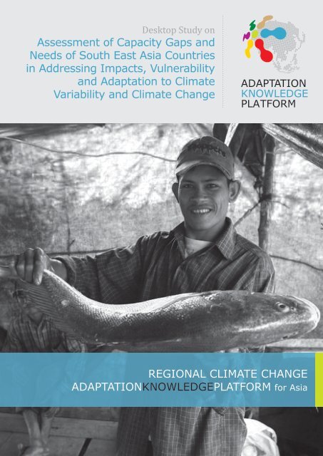
<str<strong>on</strong>g>Desktop</str<strong>on</strong>g> <str<strong>on</strong>g>Study</str<strong>on</strong>g> <strong>on</strong><br />
Assessment of Capacity Gaps and<br />
Needs of South East Asia Countries<br />
in Addressing Impacts, Vulnerability<br />
and Adaptati<strong>on</strong> to <strong>Climate</strong><br />
Variability and <strong>Climate</strong> <strong>Change</strong><br />
REGIONAL CLIMATE CHANGE<br />
ADAPTATIONKNOWLEDGEPLATFORM for Asia
Acknowledgements<br />
In an effort to provide enhanced services to the countries of the Southeast<br />
Asia, this desktop study was c<strong>on</strong>ducted as a joint effort between the<br />
Southeast Asia Network of <strong>Climate</strong> <strong>Change</strong> Focal Points (SEA-CC Net)<br />
and the Regi<strong>on</strong>al <strong>Climate</strong> <strong>Change</strong> Adaptati<strong>on</strong> Knowledge Platform for<br />
Asia (Adaptati<strong>on</strong> Knowledge Platform).<br />
Report C<strong>on</strong>tent Advisor & Reviewer: Mozaharul Alam 1 , Satya Priya 2<br />
Research & C<strong>on</strong>tributors: Hiromi Inagaki 2 , Sabine Huber 2 , Estefanía<br />
Ibáñez 2 , Fabio Farinosi 2<br />
Copy Review & Editor: Roopa Rakshit 2 , Vaidehi deosthali 2<br />
1 United Nati<strong>on</strong>s Envir<strong>on</strong>ment Programme Regi<strong>on</strong>al Office for Asia and the Pacific<br />
(UNEP ROAP)<br />
2 Asian Institute of Technology-United Nati<strong>on</strong>s Envir<strong>on</strong>ment Programme Regi<strong>on</strong>al<br />
Resource Centre for Asia and the Pacific (AIT-UNEP RRC.AP)<br />
Copyright © AIT-UNEP RRC.AP 2011<br />
Bangkok, Thailand<br />
July 2011<br />
How to obtain the digital copy:<br />
The <str<strong>on</strong>g>Desktop</str<strong>on</strong>g> <str<strong>on</strong>g>Study</str<strong>on</strong>g> <strong>on</strong> Assessment of Capacity Gaps and Needs of South East Asia Countries in<br />
Addressing Impacts, Vulnerability and Adaptati<strong>on</strong> to <strong>Climate</strong> Variability and <strong>Climate</strong> <strong>Change</strong><br />
can be electr<strong>on</strong>ically down loaded from the www.climateadapt.asia and www.asiapacificadapt.net<br />
This publicati<strong>on</strong> may be reproduced in whole or in part and in any form for educati<strong>on</strong>al or n<strong>on</strong>profit<br />
purposes without special permissi<strong>on</strong> from the copyright holder, provided acknowledgement<br />
of the source is made. The Regi<strong>on</strong>al <strong>Climate</strong> <strong>Change</strong> Adaptati<strong>on</strong> Knowledge Platform for Asia would<br />
appreciate receiving a copy of any publicati<strong>on</strong> that uses this report as a source.
<str<strong>on</strong>g>Desktop</str<strong>on</strong>g> <str<strong>on</strong>g>Study</str<strong>on</strong>g> <strong>on</strong><br />
Assessment of Capacity Gaps and<br />
Needs of South East Asia Countries<br />
in Addressing Impacts, Vulnerability<br />
and Adaptati<strong>on</strong> to <strong>Climate</strong><br />
Variability and <strong>Climate</strong> <strong>Change</strong>
CONTENTS<br />
ABBREVIATIONS & ACRONYMS i<br />
LIST OF FIGURES v<br />
LIST OF TABLES vii<br />
EXECUTIVE SUMMARY 1<br />
INTRODUCTION 9<br />
<str<strong>on</strong>g>Desktop</str<strong>on</strong>g> <str<strong>on</strong>g>Study</str<strong>on</strong>g> Background 9<br />
Goals and expected outputs 9<br />
<str<strong>on</strong>g>Study</str<strong>on</strong>g> Scope and Approach 10<br />
Methodology 11<br />
RESEARCH SYNTHESIS ON LAO PDR 14<br />
Country Characteristics 14<br />
<strong>Climate</strong> <strong>Change</strong> Impacts, Vulnerability and Adaptati<strong>on</strong> 16<br />
Cross-Sectoral Instituti<strong>on</strong>al Settings 25<br />
Summary of Identified Key Gaps, C<strong>on</strong>straints and Challenges 29<br />
RESEARCH SYNTHESIS ON VIET NAM 32<br />
Country Characteristics 32<br />
<strong>Climate</strong> <strong>Change</strong> Impacts, Vulnerability and Adaptati<strong>on</strong> 34<br />
Cross-Sectoral Instituti<strong>on</strong>al Settings 45<br />
Summary of Identified Key Gaps, C<strong>on</strong>straints and Challenges 50<br />
RESEARCH SYNTHESIS ON THE PHILIPPINES 53<br />
Country Characteristics 53<br />
<strong>Climate</strong> <strong>Change</strong> Impacts, Vulnerability and Adaptati<strong>on</strong> 56<br />
Cross-Sectoral Instituti<strong>on</strong>al Settings 64<br />
Summary of Identified Key Gaps, C<strong>on</strong>straints and Challenges 66
RESEARCH SYNTHESIS ON INDONESIA 69<br />
Country Characteristics 69<br />
<strong>Climate</strong> <strong>Change</strong> Impacts, Vulnerability and Adaptati<strong>on</strong> 72<br />
Cross-Sectoral Instituti<strong>on</strong>al Settings 80<br />
Summary of Identified Key Gaps, C<strong>on</strong>straints and Challenges 84<br />
RESEARCH SYNTHESIS ON THAILAND 87<br />
Country Characteristics 87<br />
<strong>Climate</strong> <strong>Change</strong> Impacts, Vulnerability and Adaptati<strong>on</strong> 90<br />
Cross-Sectoral Instituti<strong>on</strong>al Settings 98<br />
Summary of Identified Key Gaps, C<strong>on</strong>straints and Challenges 102<br />
RESEARCH SYNTHESIS ON CAMBODIA 106<br />
Country Characteristics 106<br />
<strong>Climate</strong> <strong>Change</strong> Impacts, Vulnerability and Adaptati<strong>on</strong> 108<br />
Cross-Sectoral Instituti<strong>on</strong>al Settings 116<br />
Summary of Identified Key Gaps, C<strong>on</strong>straints and Challenges 121<br />
RESEARCH SYNTHESIS ON UNION OF MYANMAR 124<br />
Country Characteristics 124<br />
<strong>Climate</strong> <strong>Change</strong> Impacts, Vulnerability and Adaptati<strong>on</strong> 126<br />
Cross-Sectoral Instituti<strong>on</strong>al Settings 132<br />
Summary of Identified Key Gaps, C<strong>on</strong>straints and Challenges 136<br />
RESEARCH SYNTHESIS ON MALAYSIA 139<br />
Country attributes 139<br />
<strong>Climate</strong> <strong>Change</strong> Impacts, Vulnerability and Adaptati<strong>on</strong> 141<br />
Cross-Sectoral Instituti<strong>on</strong>al Settings 149<br />
Summary of Identified Key Gaps, C<strong>on</strong>straints and Challenges 151<br />
REFERENCES 154
ABBREVIATIONS & ACRONYMS<br />
9MP NINTH MALAYSIA PLAN<br />
ACCCMAC ADVISORY COUNCIL ON CLIMATE CHANGE MITIGATION, ADAPTATION AND<br />
COMMUNICATION<br />
ACIAR AUSTRALIAN CENTRE FOR INTERNATIONAL AGRICULTURAL RESEARCH<br />
ADB ASIAN DEVELOPMENT BANK<br />
ADPC ASIAN DISTASTER PREPAREDNESS CENTER<br />
ADRC ASIAN DISASTER REDUCTION CENTER<br />
AIACC ASSESSMENT OF IMPACTS AND ADAPTATION TO CLIMATE CHANGE<br />
AIT ASIAN INSTITUTE OF TECHNOLOGY<br />
APF ADAPTATION POLICY FRAMEWORK<br />
ASEAN ASSOCIATION OF SOUTHEAST ASIAN NATIONS<br />
ASLR ACCELERATED SEA LEVEL RISE<br />
AUSAID AUSTRALIAN GOVERNMENT’S OVERSEAS AID PROGRAM<br />
BMA BANGKOK METROPOLITAN ADMINISTRATION<br />
CCAI CLIMATE CHANGE AND ADAPTATION INITIATIVE (OF MRC)<br />
CCAM CONFORMAL CUBIC ATMOSPHERIC MODEL<br />
CCCM CANADIAN CLIMATE CENTER MODEL<br />
CCCO CAMBODIAN CLIMATE CHANGE OFFICE<br />
CCDMS COMMUNE COMMITTEES FOR DISASTER MANAGEMENT<br />
CDM CLEAN DEVELOPMENT MECHANISIM<br />
CEDAC CAMBODIAN CENTER FOR STUDY AND DEVELOPMENT IN AGRICULTURE<br />
CIA CENTRAL INTELLIGENCE AGENCY<br />
CIDA CANADIAN INTERNATIONAL DEVELOPMENT AGENCY<br />
CSIRO AUSTRALIA’S COMMONWEALTH SCIENTIFIC AND INDUSTRIAL RESEARCH<br />
ORGANIZATION<br />
CSRD CENTRE FOR SOCIAL RESEARCH AND DEVELOPMENT<br />
DBM DEPARTMENT OF BUDGET AND MANAGEMENT<br />
DCCS DISASTER COORDINATING COUNCILS<br />
DDPM DEPARTMENT OF DISASTER PREVENTION AND MITIGATION<br />
DENR DEPARTMENT OF ENVIRONMENT AND NATURAL RESOURCES<br />
DFID DEPARTMENT FOR INTERNATIONAL DEVELOPMENT<br />
DID DID MALAYSIA DISASTER<br />
DMP DEPARTMENT OF MINERAL RESOURCES<br />
DNA DESIGNED NATIONAL AUTHORITY<br />
DOE DEPARTMENT OF ENERGY<br />
DOE DEPARTMENT OF ENVIRONMENT<br />
DOM DEPARTMENT OF METEOROLOGY<br />
i
DPA DEVELOPMENT PARTNERSHIP IN ACTION<br />
DPWTCP DEPARTMENT OF PUBLIC WORK AND TOWN AND COUNTRY PLANNING<br />
DRR DISASTER RISK REDUCTION<br />
ECHAM4 ATMOSPHERIC GENERAL CIRCULATION MODEL ECHAM4 IS BASED ON THE WEATHER<br />
FORECAST MODEL OF THE EUROPEAN CENTRE FOR MEDIUM RANGE WEATHER<br />
FORECASTS (ECMWF)<br />
EEPSEA ECONOMY AND ENVIRONMENT PROGRAM FOR SOUTHEAST ASIA<br />
EMP ENVIRONMENT MANAGEMENT PLAN<br />
ENSO EL NIÑO SOUTHERN OSCILLATION<br />
FABS FARM BUSINESS ADVISORS<br />
FAO FOOD AND AGRICULTURE ORGANIZATION<br />
FDPM FORESTRY DEPARTMENT OF PENINSULAR MALAYSIA<br />
FRD FEDERAL RESEARCH DIVISION<br />
GCMS GENERAL CIRCULATION MODELS<br />
GDP GROSS DOMESTIC PRODUCT<br />
GEF GLOBAL ENVIRONMENT FACILITY<br />
GFDL GEOPHYSICAL FLUID DYNAMICS LABORATORY<br />
GFDRR GLOBAL FACILITY FOR DISASTER RISK AND RECOVERY<br />
GIS GEOGRAPHIC INFORMATION SYSTEM<br />
GISS GODDARD INSTITUTE FOR SPACE STUDIES<br />
GPRD GOVERNMENT PUBLIC RELATED DEPARTMENT<br />
GPS GLOBAL POSITIONING SYSTEM<br />
GTZ GERMAN AGENCY FOR TECHNICAL COOPERATION<br />
IACCC INTER-AGENCY COMMITTEE ON CLIMATE CHANGE<br />
ICEM INTERNATIONAL CENTRE FOR ENVIRONMENTAL MANAGEMENT<br />
ICZM INTEGRATED COASTAL ZONE MANAGEMENT<br />
IDE INTERNATIONAL DEVELOPMENT ENTERPRISES<br />
IEC INFORMATION, EDUCATION AND COMMUNICATION<br />
IFAD INTERNATIONAL FUND FOR AGRICULTURAL DEVELOPMENT<br />
IFAP INTERNATIONAL FEDERATION OF AGRICULTURAL PRODUCERS<br />
ILO INTERNATIONAL LABOR ORGANIZATION<br />
IPCC INTERGOVERNMENTAL PANEL ON CLIMATE CHANGE<br />
IRRI INTERNATIONAL RICE RESEARCH INSTITUTE<br />
ITC IRRIGATION TECHNOLOGY CENTER<br />
IWMI INTERNATIONAL WATER MANAGEMENT INSTITUTE<br />
IWRM INTEGRATED WATER RESOURCE MANAGEMENT<br />
JICA JAPAN INTERNATIONAL COOPERATION AGENCY<br />
KOICA KOREA INTERNATIONAL COOPERATION AGENCY<br />
LDC LEAST DEVELOPED COUNTRIES<br />
ii
LESTARI INSTITUTE FOR ENVIRONMENT AND DEVELOPMENT<br />
MAFF MINISTRY OF AGRICULTURE, FORESTS, AND FISHERIES<br />
MARD MINISTRY OF AGRICULTURE AND RURAL DEVELOPMENT<br />
MARDI MALAYSIAN AGRICULTURE RESEARCH DEVELOPMENT INSTITUTE<br />
MDGS MILLENNIUM DEVELOPMENT GOALS<br />
MMD MALAYSIAN METEOROLOGICAL DEPARTMENT<br />
MOE MINISTRY OF ENVIRONMENT<br />
MOEYS MINISTRY OF EDUCATION YOUTH AND SPORTS<br />
MOH MINISTRY OF HEALTH<br />
MOLMUP MINISTRY OF LAND MANAGEMENT, URBAN PLANNING, AND CONSTRUCTION<br />
MONRE MINISTRY OF NATURAL RESOURCES AND ENVIRONMENT<br />
MOST MINISTRY OF SCIENCES AND TECHNOLOGY<br />
MOSTE MINISTRY OF SCIENCES, TECHNOLOGY AND ENVIRONMENT<br />
MOSTI MINISTRY OF SCIENCES, TECHNOLOGY AND INNOVATION<br />
MOWRAM MINISTRY OF WATER RESOURCES AND METEOROLOGY<br />
MPI MINISTRY OF PLANNING AND INVESTMENT<br />
MRC MEKONG RIVER COMMISSION<br />
MSMA URBAN STORMWATER MANAGEMENT MANUAL<br />
MTC MECHANICAL TRAINING CENTRE<br />
NAFREC NORTHERN AGRICULTURE AND FORESTRY RESEARCH CENTER<br />
NAFRI NATIONAL AGRICULTURE AND FORESTRY RESEARCH INSTITUTE<br />
NAHRIM NATIONAL RESEARCH HYDRAULIC INSTITUTE OF MALAYSIA<br />
NAPA NATIONAL ADAPTATION PLAN OF ACTION TO CLIMATE CHANGE<br />
NCCC NATIONAL CLIMATE CHANGE COMMITTEE<br />
NCCF NATIONAL CLIMATE CHANGE FUND<br />
NCCO NATIONAL CLIMATE CHANGE OFFICE<br />
NCDM NATIONAL COMMITTEE FOR DISASTER MANAGEMENT<br />
NCEA NATIONAL COMMISSION FOR ENVIRONMENTAL AFFAIRS<br />
NDCC NATIONAL DISASTER COORDINATING COUNCIL<br />
NDMO NATIONAL DISASTER MANAGEMENT OFFICE<br />
NDPCC NATIONAL DISASTER PREPAREDNESS CENTRAL COMMITTEE<br />
NDPMWC NATIONAL DISASTER PREPAREDNESS MANAGEMENT WORKING COMMITTEE<br />
NGOS NON-GOVERNMENTAL ORGANISATIONS<br />
NGPES NATIONAL GROWTH AND POVERTY ERADICATION STRATEGY<br />
NIO NORTH INDIAN OCEAN<br />
NOCCOP NATIONAL OFFICE FOR CLIMATE CHANGE AND OZONE PROTECTION<br />
NPRS NATIONAL POVERTY REDUCTION STRATEGY<br />
NSAPCC NATIONAL STRATEGY AND ITS ACTION PLAN ON CLIMATE CHANGE<br />
iii
NSCCC NATIONAL STEERING COMMITTEE ON CLIMATE CHANGE<br />
NSDP NATIONAL STRATEGIC DEVELOPMENT PLAN<br />
NSEDP NATIONAL SOCIO-ECONOMIC DEVELOPMENT PLAN<br />
NSTS NATIONAL STUDY TEAMS<br />
NTP NATIONAL TARGET PROGRAM TO RESPOND TO CLIMATE CHANGE<br />
OEPP OFFICE OF ENVIRONMENTAL POLICY AND PLANNING<br />
ONEP OFFICE OF NATURAL RESOURCES AND ENVIRONMENTAL POLICY PLANNING<br />
OPP3 THIRD OUTLINE PERSPECTIVE PLAN<br />
PAGASA PHILIPPINE ATMOSPHERIC, GEOPHYSICAL AND ASTRONOMICAL SERVICES<br />
ADMINISTRATION<br />
PCW PANTABANGAN-CARRANGLAN WATERSHED<br />
PEACE PELANGI ENERGI ABADI CITRA ENVIRO<br />
PET EVAPOTRANSPIRATION<br />
PMT PROJECT MANAGEMENT TEAM<br />
PRECIS PROVIDING REGIONAL CLIMATES FOR IMPACTS STUDIES<br />
PTFCC PRESIDENTIAL TASK FORCE ON CLIMATE CHANGE<br />
RAN-PI NATIONAL ACTION PLAN ADDRESSING CLIMATE CHANGE<br />
RCMP RIVER CATCHMENT MANAGEMENT PLAN<br />
RDCCS REGIONAL DISASTER COORDINATING COUNCILS<br />
REGHCM-PM REGIONAL HYDROCLIMATE MODEL OF PENINSULAR MALAYSIA<br />
RGC ROYAL GOVERNMENT OF CAMBODIA<br />
RUPP ROYAL UNIVERSITY OF PHNOM PENH<br />
SDC SWISS AGENCY FOR DEVELOPMENT AND COOPERATION<br />
SEA-CC NET SOUTHEAST ASIA NETWORK OF CLIMATE CHANGE FOCAL POINTS<br />
SRD SUSTAINABLE RURAL DEVELOPMENT<br />
SRES SPECIAL REPORT ON EMISSIONS SCENARIOS<br />
SRI SYSTEM OF RICE INTENSIFICATION<br />
START GLOBAL CHANGE SYSTEM FOR ANALYSIS, RESEARCH AND TRAINING<br />
TDRM TOTAL DISASTER RISK MANAGEMENT<br />
TEI THAILAND ENVIRONMENT INSTITUTE<br />
TKK WATER AND DEVELOPMENT RESEARCH GROUP OF HELSINKI UNIVERSITY OF<br />
TECHNOLOGY<br />
UKMO UNITED KINGDOM METEOROLOGICAL OFFICE<br />
UN-HABITAT UNITED NATIONS HUMAN SETTLEMENTS PROGRAMME<br />
UNDP UNITED NATIONS DEVELOPMENT PROGRAMME<br />
UNEP UNITED NATIONS ENVIRONMENT PROGRAMME<br />
UNFCCC UNITED NATIONS FRAMEWORK CONVENTION ON CLIMATE CHANGE<br />
UNFPA UNITED NATIONS POPULATION FUND<br />
UNICEF UNITED NATIONS CHILDREN’S FUND<br />
iv
V&A VULNERABILITY AND ADAPTATION<br />
VASS VIET NAMESE ACADEMY OF SOCIAL SCIENCES<br />
VI VULNERABILITY INDEX<br />
WB WORLD BANK<br />
WFP WORLD FOOD PROGRAMME<br />
WHO WORLD HEALTH ORGANIZATION<br />
WREA WATER RESOURCES AND ENVIRONMENT ADMINISTRATION (LAOS)<br />
WRRCC WATER RESOURCES COORDINATION COMMITTEE<br />
WRTC WATER, RESEARCH AND TRAINING CENTRE<br />
LIST OF FIGURES<br />
FIGURE 1: MEMBER COUNTRIES OF THE ASSOCIATION OF SOUTHEAST ASIAN NATIONS<br />
(ASEAN), ADOPTED FROM ASEAN (2009) (IN BLACK: COUNTRIES CONSIDERED IN<br />
THIS STUDY)<br />
FIGURE 2: NATIONAL LEVEL SYNTHESIS ON VULNERABILITY AND ADAPTATION – AN<br />
APPROACH<br />
10<br />
11<br />
FIGURE 3: LAO PDR LOCATION MAP (LAO PDR, 2009A) 15<br />
FIGURE 4: NUMBERS OF ANNUAL HOT DAY (>33 ºC) AND COOL DAY (
FIGURE 19: PERCENTAGE OF DAMAGE (US$) DUE TO TOTAL NATURAL DISASTERS 1980-2009 55<br />
FIGURE 20: OPERATIONAL SET-UP OF PRESIDENTIAL TASK FORCE ON CLIMATE CHANGE<br />
(ENVIRONMENTAL MANAGEMENT BUREAU, 2007)<br />
FIGURE 21: DISASTER COORDINATING COUNCILS (DCCS)’ ORGANIZATIONAL NETWORK<br />
(ASIAN DISASTER PREPAREDNESS CENTER, 2003)<br />
64<br />
65<br />
FIGURE 22: LOCATION MAP OF INDONESIA (UNDATA, 2009) 70<br />
FIGURE 23: CLIMATE HAZARD MAP OF INDONESIA (EXTRACTED FROM MULTIPLE CLIMATE<br />
HAZARD MAP OF SOUTHEAST ASIA, YUSUF A.A. AND H.A. FRANCISCO, 2009)<br />
FIGURE 24: PERCENTAGE OF PEOPLE AFFECTED DUE TO TOP 5 NATURAL DISASTERS 1980-<br />
2009<br />
FIGURE 25: PERCENTAGE OF PEOPLE AFFECTED DUE TO TOTAL NATURAL DISASTERS 1980-<br />
2009<br />
70<br />
72<br />
72<br />
FIGURE 26: PERCENTAGE OF DAMAGE (US$) DUE TO TOTAL NATURAL DISASTERS 1980-2009 73<br />
FIGURE 27: MAP OF BASIN OF CITARUM RIVER (TAKEUCHI, 1995) 74<br />
FIGURE 28: EXAMPLE OF LONG TERM PLAN FOR ADAPTATION FOR THE AGRICULTURAL SECTOR<br />
(BOER, 2007 CITED IN MINISTRY OF ENVIRONMENT, 2007)<br />
77<br />
FIGURE 29: LOCATION MAP OF THAILAND UNDATA, 2009) 88<br />
FIGURE 30: NUMBER OF DAYS PER ANNUM WITH MAXIMUM TEMPERATURES ABOVE 33ºC. CO2<br />
= 360PPM (BASELINE) (SEA START RC, 2006 CITED IN MRC, 2009)<br />
FIGURE 31: PERCENTAGE OF PEOPLE AFFECTED DUE TO TOP 5 NATURAL DISASTERS 1980-<br />
2009<br />
FIGURE 32: PERCENTAGE OF PEOPLE AFFECTED DUE TO TOTAL NATURAL DISASTERS 1980-<br />
2009<br />
88<br />
88<br />
89<br />
FIGURE 33: PERCENTAGE OF DAMAGE (US$) DUE TO TOTAL NATURAL DISASTERS 1980-2009 89<br />
FIGURE 34: INSTITUTIONAL ORGANIZATION CONCERNING CLIMATE CHANGE (SOURCE: MRC,<br />
2009)<br />
98<br />
FIGURE 35: LOCATION MAP OF CAMBODIA (CIA, 2009) 106<br />
FIGURE 36: CLIMATE HAZARD MAP OF THE CAMBODIA (EXTRACTED FROM MULTIPLE CLIMATE<br />
HAZARD MAP OF SOUTHEAST ASIA, YUSUF A.A. AND H.A. FRANCISCO, 2009))<br />
FIGURE 37: PERCENTAGE OF PEOPLE AFFECTED DUE TO TOP 5 NATURAL DISASTERS 1980-<br />
2009<br />
FIGURE 38: PERCENTAGE OF PEOPLE AFFECTED DUE TO TOTAL NATURAL DISASTERS 1980-<br />
2009<br />
106<br />
109<br />
109<br />
FIGURE 39: PERCENTAGE OF DAMAGE (US$) DUE TO TOTAL NATURAL DISASTERS 1980-2009 109<br />
FIGURE 40: LEVEL OF VULNERABILITY TO FLOOD BY PROVINCE (CAMBODIAN CLIMATE CHANGE<br />
OFFICE, 2005 CITED IN MINISTRY OF ENVIRONMENT, 2006)<br />
FIGURE 41: LEVEL OF VULNERABILITY TO DROUGHT BY PROVINCE (CAMBODIAN CLIMATE<br />
CHANGE OFFICE, 2005 CITED IN MINISTRY OF ENVIRONMENT, 2006)<br />
FIGURE 42: ORGANISATIONAL STRUCTURE OF NATIONAL COORDINATION BODIES<br />
FACILITATING CLIMATE CHANGE ADAPTATION (NAVANN, 2009)<br />
110<br />
111<br />
117<br />
FIGURE 43: ORGANISATIONAL STRUCTURE OF DISASTER MANAGEMENT IN CAMBODIA 120<br />
FIGURE 44: LOCATION MAP OF UNION OF MYANMAR (UNDATA, 2010) 124<br />
FIGURE 45: COUNTRIES MOST AFFECTED FROM EXTREME WEATHER EVENTS 1990-2008<br />
(SOURCE: GERMANWATCH AND MUNICH RE NATCATSERVICE® CITED IN<br />
HARMELING, 2009)<br />
124<br />
vi
FIGURE 46: PERCENTAGE OF PEOPLE AFFECTED DUE TO TOP 10 NATURAL DISASTERS 1900-<br />
2010<br />
FIGURE 47: PERCENTAGE OF PEOPLE AFFECTED DUE TO TOTAL NATURAL DISASTERS 1900-<br />
2010<br />
127<br />
127<br />
FIGURE 48: PERCENTAGE OF DAMAGE (US$) DUE TO TOTAL NATURAL DISASTERS 1900-2010 127<br />
FIGURE 49: CYCLONE NARGIS VULNERABILITY ESTIMATES BY TOWNSHIP (CENTER FOR<br />
REFUGEE AND DISASTER RESPONSE, 2008)<br />
FIGURE 50: ORGANISATIONAL STRUCTURE OF NATIONAL-LEVEL DISASTER MANAGEMENT IN<br />
UNION OF MYANMAR (ADPC, 2009)<br />
128<br />
134<br />
FIGURE 51: LOCATION MAP OF MALAYSIA (UNDATA, 2009) 140<br />
FIGURE 52: PERCENTAGE OF PEOPLE AFFECTED DUE TO TOP 5 NATURAL DISASTERS 1980-<br />
2009<br />
FIGURE 53: PERCENTAGE OF PEOPLE AFFECTED DUE TO TOTAL NATURAL DISASTERS 1980-<br />
2009<br />
140<br />
141<br />
FIGURE 54: PERCENTAGE OF DAMAGE (US$) DUE TO TOTAL NATURAL DISASTERS 1980-2009. 141<br />
FIGURE 55: ORGANISATIONAL STRUCTURE OF NATIONAL COORDINATION BODIES<br />
FACILITATING CLIMATE CHANGE ADAPTATION (NAVANN, 2009)<br />
150<br />
LIST OF TABLES<br />
TABLE_1 LAO PDR COUNTRY PROFILE OVERVIEW 14<br />
TABLE_2 OVERVIEW ON NATURAL DISASTERS IN LAO PDR: 1980-2009 16<br />
TABLE_3 VIET NAM COUNTRY PROFILE OVERVIEW 32<br />
TABLE_4 OVERVIEW ON NATURAL DISASTERS IN VIET NAM: 1980-2009 34<br />
TABLE_5 THE PHILIPPINES COUNTRY PROFILE OVERVIEW 53<br />
TABLE_6 OVERVIEW ON NATURAL DISASTERS IN THE PHILIPPINES FROM 1980 TO 2009 55<br />
TABLE_7 INDONESIA COUNTRY PROFILE OVERVIEW 69<br />
TABLE_8 OVERVIEW ON NATURAL DISASTERS IN INDONESIA FROM 1980 TO 2009 71<br />
TABLE_9 ADAPTATION STRATEGIES TO REDUCE DISASTER RISK (EEPSEA, 2010) 83<br />
TABLE_10 THAILAND COUNTRY PROFILE OVERVIEW 87<br />
TABLE_11 OVERVIEW ON NATURAL DISASTERS IN THAILAND FROM 1980 TO 2009 88<br />
TABLE_12 CAMBODIA COUNTRY PROFILE OVERVIEW 107<br />
TABLE_13 OVERVIEW ON NATURAL DISASTERS IN CAMBODIA FROM 1980 TO 2009 108<br />
TABLE_14 UNION OF MYANMAR COUNTRY PROFILE OVERVIEW 125<br />
TABLE_15 OVERVIEW ON NATURAL DISASTERS IN UNION OF MYANMAR FROM 1900 TO 2010 126<br />
TABLE_16 MALAYSIA COUNTRY PROFILE OVERVIEW 139<br />
TABLE_17 OVERVIEW ON NATURAL DISASTERS IN MALAYSIA FROM 1980 TO 2009 141<br />
vii
EXECUTIVE SUMMARY<br />
INTRODUCTION<br />
South-East Asia will be str<strong>on</strong>gly affected by the impacts of climate change<br />
according to the Intergovernmental Panel <strong>on</strong> <strong>Climate</strong> <strong>Change</strong> (IPCC) Technical<br />
Paper VI entitled “<strong>Climate</strong> <strong>Change</strong> and Water” (IPCC, 2008). This is due to the<br />
fact that <strong>on</strong>e of the most pressing envir<strong>on</strong>mental problems in this part of<br />
the world is the expansi<strong>on</strong> of areas subjected to increasing water stress. In<br />
reference to the Special Report <strong>on</strong> Emissi<strong>on</strong>s Scenarios (SRES), it is estimated<br />
that in the next forty years, the number of people that will experience severe<br />
water stress will increase between 4 and 5 times (Arnell, 2004). M<strong>on</strong>thly<br />
precipitati<strong>on</strong>s are expected to decrease in number but increase in intensity.<br />
Dry seas<strong>on</strong>s are expected to be more in number and l<strong>on</strong>ger in durati<strong>on</strong>. Thus,<br />
the risks of flooding in the wet seas<strong>on</strong> and water shortage in the dry seas<strong>on</strong><br />
are also highly increasing. The general reducti<strong>on</strong> of the rivers’ flow and<br />
the rise in sea level will provoke the intrusi<strong>on</strong> of saltwater in estuaries and<br />
eventually cause a general deteriorati<strong>on</strong> of surface and ground water stocks.<br />
These phenomena will impact str<strong>on</strong>gly in the Southeast Asian regi<strong>on</strong>, where<br />
8 members of the Associati<strong>on</strong> of Southeast Asian Nati<strong>on</strong>s (ASEAN), namely,<br />
Vietnam, Thailand, Malaysia, Philippines, Ind<strong>on</strong>esia, Lao PDR, Myanmar and<br />
Cambodia are given focus in this report. In these countries, the increasing<br />
water stress, the increasing intensity of precipitati<strong>on</strong>s and the c<strong>on</strong>sequent<br />
floods will provoke the general erosi<strong>on</strong> of the land and, c<strong>on</strong>sequently, the<br />
general deteriorati<strong>on</strong> of land quality and productivity. These c<strong>on</strong>diti<strong>on</strong>s,<br />
coupled with temperature changes and low water quality and availability<br />
impacts negatively <strong>on</strong> agriculture, in general, and livestock producti<strong>on</strong> and<br />
the aquaculture industry, in particular. It means that the vulnerability of the<br />
populati<strong>on</strong> will increase because the risks <strong>on</strong> water and food security are<br />
also increasing. Strategies need to be put in place in order for the general<br />
populati<strong>on</strong> to adapt to the changing physical and climatic c<strong>on</strong>diti<strong>on</strong>s. And<br />
to enhance the resilience of the socio-ec<strong>on</strong>omic systems in these countries,<br />
cooperati<strong>on</strong> between local governments and internati<strong>on</strong>al organizati<strong>on</strong>s is<br />
essential.<br />
This desktop study is c<strong>on</strong>ducted based <strong>on</strong> a stocktaking analysis provided<br />
by the Regi<strong>on</strong>al <strong>Climate</strong> <strong>Change</strong> Adaptati<strong>on</strong> Knowledge Platform for<br />
Asia (Adaptati<strong>on</strong> Knowledge Platform) in the ASEAN member countries<br />
indicated earlier. The purpose of this study is to illustrate the current state<br />
of adaptati<strong>on</strong>, its status and possibilities, of the regi<strong>on</strong>. It also investigates<br />
how these ASEAN countries can learn from each other and from the scientific<br />
community, in order to define some adaptati<strong>on</strong> strategies as possible next<br />
steps and priorities in the status of water and agriculture management<br />
from a socio-ec<strong>on</strong>omic perspective. The aim of the Adaptati<strong>on</strong> Knowledge<br />
Platform is to verify the state of knowledge in the different countries, identify<br />
the gaps and to try to fill them up.<br />
1
REGIONAL ANALYSIS OF ASEAN<br />
MEMBER COUNTRIES<br />
Gaps in adaptive capacity for the water sector:<br />
improvement of knowledge<br />
The analysis of existing studies <strong>on</strong> nati<strong>on</strong>al and regi<strong>on</strong>al vulnerability and<br />
adaptive capacity underlines several problems from local and regi<strong>on</strong>al points<br />
of view. The research in the specific countries highlights:<br />
Lack of informati<strong>on</strong> and statistical analysis applied to climate and<br />
hydro-geologic changes<br />
Scarce c<strong>on</strong>necti<strong>on</strong> between decisi<strong>on</strong>-makers and the scientific<br />
community<br />
Inadequate climate risk assessment methods<br />
Scarcity and inadequacy of technical instruments<br />
Scarcity of experience and financial capacity of governments in<br />
managing climate change studies, and<br />
Insufficient real-time informati<strong>on</strong> <strong>on</strong> rainfall and water level for<br />
operati<strong>on</strong>al schemes.<br />
The analysis also identified principal gaps that the 8 ASEAN member<br />
countries have to address:<br />
No river basin system-based management<br />
Lack of a l<strong>on</strong>g run strategy in water management: different use of<br />
the water resource, such as hydropower, irrigati<strong>on</strong>, fishing, are often<br />
c<strong>on</strong>flicting with each others<br />
Insufficient coordinati<strong>on</strong> between agencies<br />
Low investments<br />
No clear regulati<strong>on</strong> for rati<strong>on</strong>al use of land: deforestati<strong>on</strong> and costal and<br />
river basin erosi<strong>on</strong><br />
Inefficient use of water, especially in agriculture, and<br />
Insufficient drought management.<br />
This is exemplified by the scenario that even when river basins transcend the<br />
territorial jurisdicti<strong>on</strong>s of many countries, there is no str<strong>on</strong>g coordinati<strong>on</strong><br />
between nati<strong>on</strong>al and internati<strong>on</strong>als instituti<strong>on</strong>s am<strong>on</strong>g such countries.<br />
Intergovernmental cooperati<strong>on</strong> in managing comm<strong>on</strong> resources such as<br />
river basins is insufficient. This has led to a very fragmented scientific<br />
research, c<strong>on</strong>sequently losing the opportunity of creating a comm<strong>on</strong> strategy<br />
to solve transboundary envir<strong>on</strong>mental issues. Until now, different countries<br />
act differently and independently in addressing problems, which could<br />
be efficiently solved or avoided by a shared acti<strong>on</strong>. The situati<strong>on</strong> may be<br />
different am<strong>on</strong>g countries, however, the phenomen<strong>on</strong> of water stress caused<br />
by physical and climatic c<strong>on</strong>diti<strong>on</strong>s encompass the regi<strong>on</strong>.<br />
In coming up with adaptati<strong>on</strong> strategies related to the water and agriculture<br />
sectors, the main problem that can be pointed out is the lack of basin systembased<br />
management, especially in the case of big river systems and wetlands<br />
like the Mek<strong>on</strong>g that meander across different countries. The management<br />
of this resource should not be fragmented because mismanagement in <strong>on</strong>e<br />
country could affect the others. In order to minimize problems related to this<br />
scenario, multilateral agreements have been signed by various countries that<br />
2
put in place management systems for transboundary river basins. In 1957, an<br />
internati<strong>on</strong>al agreement created the Mek<strong>on</strong>g Committee, which, in 1995 was<br />
renamed as the Mek<strong>on</strong>g River Commissi<strong>on</strong>. However, this agreement was not<br />
signed by China, which is the source of the Mek<strong>on</strong>g and Myanmar, another<br />
country strategically located upstream of the river basin. While the original<br />
rati<strong>on</strong>ale of the agreement was to create a joint management system for<br />
hydro-power/hydro-electric producti<strong>on</strong>, irrigati<strong>on</strong>, navigati<strong>on</strong>, fishing and<br />
flood c<strong>on</strong>trol/relief, the Mek<strong>on</strong>g River Commissi<strong>on</strong> has, hardly eminently, a<br />
political role as it is not directly involved in the practical management of the<br />
basin. It also bears no str<strong>on</strong>g decisi<strong>on</strong>-making power.<br />
Another internati<strong>on</strong>al agreement, the ASEAN-Mek<strong>on</strong>g Basin Development<br />
Cooperati<strong>on</strong>, was signed in 1996. Nevertheless, such agreement was<br />
mostly created for the ec<strong>on</strong>omic development of the Mek<strong>on</strong>g basin. Aside<br />
from Commissi<strong>on</strong>s such as these, it is hoped that the c<strong>on</strong>stituti<strong>on</strong> of<br />
intergovernmental authorities, which have aut<strong>on</strong>omous decisi<strong>on</strong>-making<br />
power and ec<strong>on</strong>omic independence in cooperati<strong>on</strong> with local political and<br />
scientific instituti<strong>on</strong>s, could directly manage the scientific research and<br />
infrastructural interventi<strong>on</strong>s in the different basins. A combinati<strong>on</strong> of political<br />
pressure and ec<strong>on</strong>omic incentives may be used to encourage countries to<br />
cooperate. Local governments and river basin management organizati<strong>on</strong>s<br />
have to cooperate to achieve important aims such as:<br />
Advanced m<strong>on</strong>itoring and statistical analysis of the basin<br />
C<strong>on</strong>stant diffusi<strong>on</strong> of informati<strong>on</strong> and str<strong>on</strong>g interacti<strong>on</strong> with local<br />
instituti<strong>on</strong>s<br />
Floods and river overflows forecasting and alert system<br />
Rati<strong>on</strong>al regulati<strong>on</strong> of the use of water<br />
Scientific study of the infrastructure that have to be realized to regulate<br />
the river’s flow during wet and dry seas<strong>on</strong>s<br />
<str<strong>on</strong>g>Study</str<strong>on</strong>g> and realizati<strong>on</strong> of security basins which provoke c<strong>on</strong>trolled<br />
floods<br />
Efficient natural resource system management<br />
Efficient use of water resource<br />
Land use planning<br />
Geographical relocati<strong>on</strong> of populati<strong>on</strong> that live in places str<strong>on</strong>gly<br />
exposed to a high degree of risk<br />
Financial assistance, and<br />
Transparency in informati<strong>on</strong> management.<br />
The list of strategies may be l<strong>on</strong>g and comprehensive and it needs a l<strong>on</strong>gterm<br />
timetable for an overall river basin management policy to be effective.<br />
However, for the short-term, interventi<strong>on</strong>s have to be coordinated by local<br />
governments in cooperati<strong>on</strong> with internati<strong>on</strong>al organizati<strong>on</strong>s.<br />
3
Gaps in adaptive capacity for agricultural sector and<br />
food security: improvement of knowledge<br />
Agriculture is the most important ec<strong>on</strong>omic activity across the 8 ASEAN<br />
countries included in the study. Water resource dynamics, agriculture and<br />
food security are tightly linked. The analysis of the Adaptati<strong>on</strong> Knowledge<br />
Platform <strong>on</strong> the state of the local scientific research underlines the following<br />
gaps and issues:<br />
General backward situati<strong>on</strong> of the research’s state<br />
Inadequate tools, knowledge and financial endowment<br />
Lack of infrastructure<br />
General difficulty in communicating knowledge to farmers, and<br />
Lack of a clear study <strong>on</strong> the l<strong>on</strong>g-term impact of climate change <strong>on</strong> food<br />
producti<strong>on</strong>.<br />
It is possible to put forward as evidence some remarkable activities<br />
implemented by local instituti<strong>on</strong>s, however, they are often managed<br />
inefficiently. In Vietnam, for instance, the government is supporting research<br />
activities of agro-meteorology and rice seed development, but the lack of<br />
internati<strong>on</strong>al networks to exchange research results hinders the effective<br />
applicati<strong>on</strong> of significant findings and improvements throughout the regi<strong>on</strong>.<br />
The situati<strong>on</strong> is not better in terms of typology of the policies and strategies<br />
that local governments are trying to adopt in the regi<strong>on</strong>. Some of these<br />
countries are actively working to pursue poverty reducti<strong>on</strong> goals, food<br />
security and irrigati<strong>on</strong> development. Unfortunately, there are times when<br />
these adaptati<strong>on</strong> practices are badly influenced by instituti<strong>on</strong>al and socioec<strong>on</strong>omic<br />
envir<strong>on</strong>ments, especially at the local level. The stocktaking analysis<br />
outlines the following gaps and issues that need to be overcome:<br />
Insufficient financial resources<br />
Insufficient l<strong>on</strong>g-term perspectives<br />
Lack of integrati<strong>on</strong> am<strong>on</strong>g adaptati<strong>on</strong> strategies in food security and<br />
development strategies<br />
Insufficient integrati<strong>on</strong> between instituti<strong>on</strong>s<br />
Insufficient intergovernmental cooperati<strong>on</strong><br />
General difficulties for farmers to access credit<br />
Lack of cooperati<strong>on</strong> between farmers<br />
Poor infrastructure in some countries<br />
Lack of in-depth study <strong>on</strong> small and poor farmers’ socio-ec<strong>on</strong>omic<br />
c<strong>on</strong>diti<strong>on</strong>s, and<br />
Partial exclusi<strong>on</strong> of farmers from the diffusi<strong>on</strong> of informati<strong>on</strong> and<br />
decisi<strong>on</strong> processes.<br />
Nevertheless, there are cases wherein governments and instituti<strong>on</strong>s show<br />
their inability to address such situati<strong>on</strong>s. As such, farmers, especially the most<br />
advanced and developed, have already started to devise some adaptati<strong>on</strong><br />
strategies after having experienced the changes in producti<strong>on</strong> c<strong>on</strong>diti<strong>on</strong>s.<br />
This is especially identifiable in culture shifting: more resistant crops, shortcycle<br />
rice varieties. Unfortunately, the fragmentati<strong>on</strong> of producti<strong>on</strong>, the<br />
difficulty in accessing credit, the slow mechanizati<strong>on</strong> of producti<strong>on</strong>, and the<br />
general lack of educati<strong>on</strong> of farmers, do not dem<strong>on</strong>strate a tendency towards<br />
a method of producti<strong>on</strong> adapted to the impacts of climate change. In this<br />
case, producti<strong>on</strong> becomes inefficient.<br />
4
There are several good initiatives led by internati<strong>on</strong>al organizati<strong>on</strong>s and<br />
N<strong>on</strong>-Governmental Organisati<strong>on</strong>s (NGOs) in some ASEAN countries that<br />
need to be replicated in the others. These initiatives could be c<strong>on</strong>sidered as<br />
an introducti<strong>on</strong> of good measures to handle similar issues in other places<br />
with similar features. For instance, Food and Agriculture Organizati<strong>on</strong> (FAO)<br />
in the Philippines succeeded in improving rice yield from 4.5 t<strong>on</strong>s per hectare<br />
to 8 t<strong>on</strong>s per hectare by enhancing the efficiency of the producti<strong>on</strong> process.<br />
Analyzing some of the acti<strong>on</strong>s adopted by the governments could be<br />
useful in trying to delineate a series of acti<strong>on</strong>s to fill the gaps highlighted<br />
by the stocktaking analysis. For instance, the Ministry of Agriculture and<br />
Cooperatives of Thailand has carried out adaptati<strong>on</strong> measures including<br />
community-level capacity building and research initiatives <strong>on</strong> droughtresistant<br />
plant and animal species. In recent years, the needed safeguards,<br />
especially during severe droughts and floods, have been developed under the<br />
c<strong>on</strong>cept of “sufficiency ec<strong>on</strong>omy”. Another good example is provided by the<br />
Cambodian government <strong>on</strong> the occasi<strong>on</strong> of the United Nati<strong>on</strong>s Framework<br />
C<strong>on</strong>venti<strong>on</strong> <strong>on</strong> <strong>Climate</strong> <strong>Change</strong> (UNFCCC). Their efforts were oriented to the<br />
improvement of capacity building at all levels, especially local, with several<br />
objectives. Their strategies were developed taking into c<strong>on</strong>siderati<strong>on</strong> the<br />
following:<br />
An improvement of informati<strong>on</strong> systems to increase awareness <strong>on</strong><br />
adaptati<strong>on</strong><br />
An integrati<strong>on</strong> of adaptati<strong>on</strong> strategies for the water and agricultural<br />
sectors for the country’s sustainable development, with the realizati<strong>on</strong><br />
of infrastructures and ec<strong>on</strong>omic policies aimed at poverty reducti<strong>on</strong><br />
and food security<br />
A critical analysis of projects and policies in order to learn from good<br />
practices as well as mistakes and failures, and<br />
A wider scope of informati<strong>on</strong> disseminati<strong>on</strong> to increase awareness <strong>on</strong><br />
the realities and immediacy of climate-related issues.<br />
These examples illustrate that there are some countries acting more<br />
efficiently than others – gaps clearly underlined by the stocktaking analysis<br />
<strong>on</strong> which this study is based. Learning from the gaps between countries<br />
as well as <strong>on</strong> internati<strong>on</strong>al studies, it is imperative to outline a series of<br />
strategies and policies that could be proven to be effective and appropriate<br />
from a regi<strong>on</strong>al point of view. The applicati<strong>on</strong> of such policies and strategies<br />
at the local level, though, has to take into c<strong>on</strong>siderati<strong>on</strong> the different social,<br />
political and ec<strong>on</strong>omic backgrounds and the uniqueness of each local setting.<br />
In order to enhance resilience and reduce vulnerability, coherent policies<br />
and coordinated strategies could be proficient <strong>on</strong> a medium-term basis.<br />
And in the l<strong>on</strong>g run, such acti<strong>on</strong>s would result in improved efficiency in the<br />
ec<strong>on</strong>omic systems of the 8 ASEAN member countries, creating a virtuous<br />
circle that permits the internalizati<strong>on</strong> of adaptati<strong>on</strong> costs.<br />
5
Country Acti<strong>on</strong>s, Strategies and Perspectives<br />
In all cases, the applicati<strong>on</strong> of regi<strong>on</strong>al guidelines is always suggested. This secti<strong>on</strong> outlines<br />
the different policies and strategies that may be followed by each country.<br />
Lao PDR<br />
Scientific coordinati<strong>on</strong> between internati<strong>on</strong>al agencies and the hypothesized<br />
“Authority” with the local Water Resources and Envir<strong>on</strong>ment Administrati<strong>on</strong> for the<br />
water sector.<br />
Integrati<strong>on</strong> of the Strategic Framework of the Northern Agriculture and Forestry<br />
Research Centre (NAFReC) with other regi<strong>on</strong>al and local research centres, as a way<br />
for the informati<strong>on</strong> acquired to be reproduced and replicated in other countries.<br />
Development of a better forecasting system, adding the c<strong>on</strong>sequences of climate<br />
change to the strategic framework.<br />
Viet Nam<br />
Evaluati<strong>on</strong> of the applicability of the policies adopted in disaster preparedness.<br />
Diplomatic pressure <strong>on</strong> the political system to adopt socio-ec<strong>on</strong>omic subsidies that<br />
reduce the impact of adaptati<strong>on</strong> strategies <strong>on</strong> the populati<strong>on</strong>.<br />
Applicati<strong>on</strong> of projects for development and farmers’ assistance by micro-credit.<br />
Philippines<br />
<str<strong>on</strong>g>Study</str<strong>on</strong>g> and implementati<strong>on</strong> of the Water Balance model “WatBal”; reforestati<strong>on</strong>.<br />
Introducti<strong>on</strong> of urban wastewater recycling systems.<br />
Financial assistance to farmers; scientific assistance to research.<br />
Ind<strong>on</strong>esia<br />
Reforestati<strong>on</strong>; introducti<strong>on</strong> of urban wastewater recycling systems.<br />
Radical analysis and reformati<strong>on</strong> of agricultural producti<strong>on</strong> systems.<br />
Improvement of communicati<strong>on</strong> systems.<br />
Thailand<br />
Analysis and eventual implementati<strong>on</strong> of measures adopted by the Bangkok<br />
Metropolitan Administrati<strong>on</strong> (BMA) as well as those recommended by the other<br />
studies.<br />
Rati<strong>on</strong>alizati<strong>on</strong> of water c<strong>on</strong>sumpti<strong>on</strong>; improvement of the net efficiency of irrigati<strong>on</strong>.<br />
Shifting cultivati<strong>on</strong>; analysis of the studies of the Ministry of Agriculture and<br />
Cooperatives.<br />
Cambodia<br />
Analysis, improvement and eventual adopti<strong>on</strong> of the measures adopted for the water<br />
sector.<br />
Serious analysis and coordinati<strong>on</strong> of initiatives adopted in agricultural management.<br />
Myanmar<br />
Assistance to the local research institute and coordinati<strong>on</strong> of scientific studies <strong>on</strong> the<br />
Ayeyarwaddy River basin.<br />
Shifting cultivati<strong>on</strong> and the enhancement of efficiency in agriculture.<br />
Malaysia<br />
Regulati<strong>on</strong> <strong>on</strong> water and land use; regulati<strong>on</strong> of river flows through Ecosystembased<br />
and engineering soluti<strong>on</strong>s<br />
Improvement of research activities<br />
Analysis, improvement and eventual adopti<strong>on</strong> of the Integrated Pest Management<br />
Creati<strong>on</strong> of l<strong>on</strong>g-term climate-c<strong>on</strong>scious mindsets.<br />
6
C<strong>on</strong>clusi<strong>on</strong><br />
This study takes precedence from the research made by the Adaptati<strong>on</strong><br />
Knowledge Platform <strong>on</strong> the 8 ASEAN member countries and tries to provide<br />
some guidelines <strong>on</strong> the applicati<strong>on</strong> of adaptati<strong>on</strong> strategies. It also tries<br />
to specify country-specific strategies that could be adopted in order to<br />
enhance resilience through acti<strong>on</strong>s based <strong>on</strong> the combinati<strong>on</strong> of adaptati<strong>on</strong><br />
and development. The strategies and policies outlined above ensure that<br />
soluti<strong>on</strong>s to address the impacts of climate change are effectively managed,<br />
particularly those c<strong>on</strong>cerning the Water Sector, the Agricultural Sector<br />
and Food Security. Such strategies also overcome the gaps in coordinati<strong>on</strong><br />
and communicati<strong>on</strong> at the regi<strong>on</strong>al and local levels and between nati<strong>on</strong>al<br />
governments and internati<strong>on</strong>al agencies. As the stocktaking analysis noted<br />
that governments act differently and independently, this study highlights<br />
the importance of creating unified policies and coherent strategies in order<br />
to enhance resilience and reduce vulnerability in the Water and Agriculture<br />
sectors in Southeast Asia.<br />
7
The Adaptati<strong>on</strong> Knowledge Platform<br />
resp<strong>on</strong>ds to the demands for effective<br />
mechanisms for sharing informati<strong>on</strong> <strong>on</strong><br />
climate change adaptati<strong>on</strong> and developing<br />
adaptive capacities in Asian countries, many<br />
of whom are the most vulnerable to the<br />
effects of climate change.<br />
Photo credit: Serena Fortuna
Assessment of Capacity Gaps and Needs of South East Asia Countries<br />
in Addressing Impacts, Vulnerability and Adaptati<strong>on</strong> to <strong>Climate</strong> Variability and <strong>Climate</strong> <strong>Change</strong><br />
INTRODUCTION<br />
DESKTOP STUDY<br />
BACKGROUND<br />
The Regi<strong>on</strong>al <strong>Climate</strong> <strong>Change</strong> Adaptati<strong>on</strong> Knowledge<br />
Platform for Asia (hereinafter, referred to as the<br />
Adaptati<strong>on</strong> Knowledge Platform) is a three-year<br />
program that supports research <strong>on</strong> climate change<br />
adaptati<strong>on</strong>, policy making, capacity building and<br />
informati<strong>on</strong> sharing to help countries in Asia adapt<br />
to the challenges of climate change. The Adaptati<strong>on</strong><br />
Knowledge Platform resp<strong>on</strong>ds to the demands for<br />
effective mechanisms for sharing informati<strong>on</strong> <strong>on</strong><br />
climate change adaptati<strong>on</strong> and developing adaptive<br />
capacities in Asian countries, many of whom are the<br />
most vulnerable to the effects of climate change.<br />
The Adaptati<strong>on</strong> Knowledge Platform is leading the<br />
desktop study in collaborati<strong>on</strong> with the Southeast<br />
Asia Network of <strong>Climate</strong> <strong>Change</strong> Focal Points (SEA-CC<br />
Net). During the first SEA-CC Net meeting (Bangkok,<br />
11-12 March 2009), key ASEAN member countries<br />
identified the need to review and analyze existing<br />
studies <strong>on</strong> nati<strong>on</strong>al and regi<strong>on</strong>al vulnerabilities<br />
as <strong>on</strong>e of the first priority in order to provide the<br />
stakeholders with firm background for informed<br />
decisi<strong>on</strong> making. In an effort to provide enhanced<br />
services to the countries of SEA, this study is carried<br />
out as a joint effort between the SEA-CC Net and the<br />
Adaptati<strong>on</strong> Knowledge Platform.<br />
The research study and synthesis is the findings <strong>on</strong><br />
assessment of capacity gaps and needs of South East<br />
Asian Countries in addressing impacts, vulnerability<br />
and adaptati<strong>on</strong> to climate variability and climate<br />
change.<br />
The overarching objectives of this desktop study<br />
are to share up to date informati<strong>on</strong> <strong>on</strong> state of art<br />
methods, approach, technologies and status of<br />
adaptive capacity.<br />
Further, it represents a synthesis of existing<br />
studies and reports <strong>on</strong> impacts, vulnerabilities and<br />
adaptati<strong>on</strong> activities related to climate change in<br />
Southeast Asian countries. It has been elaborated<br />
with the immediate goal of identifying learning<br />
less<strong>on</strong>s for future capacity building acti<strong>on</strong>s.<br />
GOALS AND EXPECTED<br />
OUTPUTS<br />
The desktop study is aimed to provide informati<strong>on</strong><br />
<strong>on</strong> the status of vulnerability at nati<strong>on</strong>al and regi<strong>on</strong>al<br />
level in the countries of the Associati<strong>on</strong> of Southeast<br />
Asian Nati<strong>on</strong>s (ASEAN), which are am<strong>on</strong>g the world’s<br />
most vulnerable to the impacts of climate change.<br />
There are several comm<strong>on</strong> approaches, methods,<br />
toolkits, policies and research in water, agriculture<br />
and socio-ec<strong>on</strong>omic sectors. This desk study intends<br />
to highlight overlaps and gaps in these specific<br />
sectors, which may exist in order to design capacity<br />
building and experience sharing activities am<strong>on</strong>g the<br />
member countries for south-south cooperati<strong>on</strong>.<br />
The output is an improved knowledge-base <strong>on</strong><br />
existing data, informati<strong>on</strong> and knowledge in<br />
identifying country specific technical, instituti<strong>on</strong>al<br />
and functi<strong>on</strong>al setups and needs. This will form the<br />
basis for further decisi<strong>on</strong>-making processes, acti<strong>on</strong>s<br />
and mechanisms to resp<strong>on</strong>d to the needs of the<br />
countries in mainstreaming adaptati<strong>on</strong>. Available<br />
9
<str<strong>on</strong>g>Desktop</str<strong>on</strong>g> <str<strong>on</strong>g>Study</str<strong>on</strong>g><br />
Figure 1: Member countries of the Associati<strong>on</strong> of Southeast Asian Nati<strong>on</strong>s (ASEAN),<br />
adopted from ASEAN (2009) (in black: countries c<strong>on</strong>sidered in this study)<br />
Myanmmar •<br />
Lao PDR •<br />
Thailand •<br />
Cambodia •<br />
• Viet Nam<br />
• Philippines<br />
Malaysia •<br />
Brunei Darussalam •<br />
• Singapore<br />
Ind<strong>on</strong>esia •<br />
capacity at the regi<strong>on</strong>al level can be made available<br />
through networks and training programs to the<br />
nati<strong>on</strong>al and provincial governments in order to<br />
enable them to improve climate change impact<br />
analysis and to adapt accordingly.<br />
STUDY SCOPE AND<br />
APPROACH<br />
This study covers the eight selected countries,<br />
namely, Lao PDR, Viet Nam, the Philippines,<br />
Ind<strong>on</strong>esia, Thailand, Cambodia, Myanmar and<br />
Malaysia (see Figure 1). The selecti<strong>on</strong> provides a<br />
representati<strong>on</strong> of the Mek<strong>on</strong>g River Basin and Delta<br />
countries with the land locked, low lying areas as<br />
well as countries in ASEAN with the l<strong>on</strong>g coastlines.<br />
While these countries’ livelihoods and ec<strong>on</strong>omies<br />
are agricultural and aquaculture driven, a great<br />
emphasis <strong>on</strong> water, agriculture and socio-ec<strong>on</strong>omic<br />
sectors are given to compare, evaluate and assess<br />
the impacts of climate change.<br />
In this study, a climate risk management approach<br />
is followed, assessing the threats and opportunities<br />
that result from both existing and future climate<br />
variability, including those deriving from climate<br />
change. Successful adaptati<strong>on</strong> to future climate<br />
begins with successful coping with current climate<br />
variability (Noble, 2004). At the same time, a<br />
development perspective <strong>on</strong> adaptati<strong>on</strong> is adopted,<br />
as adaptati<strong>on</strong> to climate change is recognized as<br />
part of a development process. Thus, the adaptati<strong>on</strong><br />
process approach needs to be country driven with a<br />
focus <strong>on</strong> nati<strong>on</strong>al needs and local priorities (Noble,<br />
2004).<br />
METHODOLOGY<br />
The comp<strong>on</strong>ents included in the adopted methodology<br />
for the desktop study are to (i) take stock of existing<br />
studies <strong>on</strong> nati<strong>on</strong>al and regi<strong>on</strong>al vulnerabilities and<br />
adaptati<strong>on</strong> programs to climate change, namely in<br />
the water, agriculture and food security and socio-<br />
10
Assessment of Capacity Gaps and Needs of South East Asia Countries<br />
in Addressing Impacts, Vulnerability and Adaptati<strong>on</strong> to <strong>Climate</strong> Variability and <strong>Climate</strong> <strong>Change</strong><br />
Figure 2: Nati<strong>on</strong>al level synthesis <strong>on</strong> vulnerability and adaptati<strong>on</strong> – an approach<br />
Stage 4<br />
Sector<br />
Sector<br />
Stage 1<br />
<strong>Climate</strong> <strong>Change</strong><br />
Vulnerability<br />
Food Security<br />
Water Resources<br />
Socio-ec<strong>on</strong>omic<br />
Demographic Pressure<br />
Exploitati<strong>on</strong> of Natural Resources<br />
Emissi<strong>on</strong>s<br />
Country<br />
Specific<br />
<strong>Climate</strong><br />
<strong>Change</strong><br />
Inititatives<br />
Regi<strong>on</strong>al / Nati<strong>on</strong>al /<br />
Sub-nati<strong>on</strong>al climate<br />
strategies<br />
<strong>Climate</strong> Scenarios<br />
Adaptati<strong>on</strong> Pilots<br />
Mainstreaming<br />
Country<br />
Sectors<br />
Projects<br />
Barriers<br />
Socio-ec<strong>on</strong>omic C<strong>on</strong>flicts<br />
Gaps at all levels<br />
Stage 5<br />
Stage 2<br />
Instituti<strong>on</strong>al Capacity<br />
Public Outreach<br />
Stage 3<br />
Disaster Risk Management<br />
Vulnerability Analysis<br />
Source: Authors of this report<br />
ec<strong>on</strong>omic sectors; (ii) identify the less<strong>on</strong>s learnt,<br />
to share am<strong>on</strong>g member countries for capacity<br />
building activities; (iii) highlight gaps in country<br />
level knowledge and capacity in the implementati<strong>on</strong><br />
of vulnerability assessments; and (iv) identify<br />
effective tools and methodologies, capacity building,<br />
and instituti<strong>on</strong>al support modalities for vulnerability<br />
assessments and adaptati<strong>on</strong> activities.<br />
A total of fifteen (15) key studies, each for Lao<br />
PDR, Viet Nam, the Philippines, Ind<strong>on</strong>esia,<br />
Thailand, Cambodia, Myanmar and Malaysia, with<br />
a focus <strong>on</strong> water, agriculture and food security,<br />
and socioec<strong>on</strong>omic adaptati<strong>on</strong> and climate change<br />
related impacts in the last decade were reviewed. .<br />
In order to exemplify the review/ or study process,<br />
a country level approach was followed to synthesize<br />
country level data, informati<strong>on</strong> and knowledge<br />
towards adaptati<strong>on</strong> methods, technologies, best<br />
practices and mainstreaming approach to pave<br />
a way forward in the significant developmental<br />
endeavour of vulnerability and adaptati<strong>on</strong> study. A<br />
three pr<strong>on</strong>ged process covering regi<strong>on</strong>al, country<br />
specific climate adaptati<strong>on</strong> initiatives and local,<br />
sub-nati<strong>on</strong>al and nati<strong>on</strong>al levels were followed. The<br />
overall approach and processes pertaining to all<br />
these steps were embraced with external factors to<br />
keep the perspectives, while analyzing the data and<br />
informati<strong>on</strong> gathered. To c<strong>on</strong>duct the synthesis, a<br />
five-stage process was followed.<br />
Stage 1 in Figure 2 reviews the historical weather<br />
data that are analyzed to understand its significance<br />
in terms of climate change. Historical data are<br />
important as they are used to establish the change at<br />
sectoral levels such as water, agriculture and socioec<strong>on</strong>omic.<br />
Impacts <strong>on</strong> these sectors are of varying<br />
degrees in terms of climate parameters such as,<br />
rainfall amount, number of rainy days, temperature,<br />
intense rainfall leading to floods and changes in<br />
tropical cycl<strong>on</strong>e characteristics and frequencies.<br />
Stage 2 focuses <strong>on</strong> the impacts of future climatic<br />
c<strong>on</strong>diti<strong>on</strong>s under projected climate change scenarios<br />
through their vulnerabilities <strong>on</strong> food security,<br />
water resources and socio-ec<strong>on</strong>omic sectors. Since,<br />
knowledge <strong>on</strong> uncertainty in climate predicti<strong>on</strong>s is<br />
yet to be proven, as seen from available informati<strong>on</strong><br />
and knowledge, some aspects of downscaled climate<br />
data and scenarios are covered. While analyzing<br />
this top down process, where adaptati<strong>on</strong> is imposed<br />
from outside without much c<strong>on</strong>sultati<strong>on</strong> or<br />
interacti<strong>on</strong> (and being science driven), an evaluati<strong>on</strong><br />
of external factors such as, anticipated implicati<strong>on</strong>s<br />
of demographic pressure and exploitati<strong>on</strong> of natural<br />
resources are reviewed to ground the sectoral<br />
approach for a reality check and to find a way<br />
and status of the countries from an aut<strong>on</strong>omous<br />
adaptati<strong>on</strong> to planned adaptati<strong>on</strong> (or adaptive<br />
capacities).<br />
11
<str<strong>on</strong>g>Desktop</str<strong>on</strong>g> <str<strong>on</strong>g>Study</str<strong>on</strong>g><br />
Stage 3 recognizes the regi<strong>on</strong>al, nati<strong>on</strong>al and local<br />
level studies and its significance of promoting<br />
climate change adaptati<strong>on</strong> in building significant<br />
sectoral activities. Many of these pilot and research<br />
based studies are focused <strong>on</strong> technical assistance<br />
and knowledge management activities, whereas,<br />
some are meant to assess both social and ec<strong>on</strong>omic<br />
aspects of the issues with and without climate<br />
change scenarios. Communicati<strong>on</strong>, public awareness<br />
and outreach efforts further underline the facts<br />
of instituti<strong>on</strong>al, policy, technical level gaps to the<br />
current factual state and future directi<strong>on</strong>s.<br />
Stage 4 builds <strong>on</strong> stage 3 to further sectoral research<br />
and nati<strong>on</strong>al climate change adaptati<strong>on</strong> strategies,<br />
policies and regulatory framework to mainstream<br />
the process as developmental agenda at country level<br />
in the five years developmental plans and bey<strong>on</strong>d.<br />
An analysis of stage 4 helps understand the<br />
current engagement process to assess the goals<br />
and c<strong>on</strong>textualizati<strong>on</strong> of the issues am<strong>on</strong>g various<br />
stakeholder agencies to document expectati<strong>on</strong>s.<br />
Synthesizing this stage, a series of gaps emerged<br />
that are not climate impacts, but developmental<br />
challenges to build a sustainable process that<br />
includes adaptati<strong>on</strong>. Therefore, through this exercise,<br />
in stage 5, prioritizati<strong>on</strong> of the issues are undertaken<br />
and challenges that need to be overcome in view of<br />
the formulati<strong>on</strong> and implementati<strong>on</strong> of a successful<br />
climate change adaptati<strong>on</strong> activities are identified.<br />
12
Lao PDR has a tropical climate dominated<br />
by the southwest m<strong>on</strong>so<strong>on</strong>, which brings<br />
high rainfall, high humidity, and high<br />
temperatures. The climate is characterized<br />
by high inter-annual variability and<br />
frequent occurrences of heavy precipitati<strong>on</strong><br />
leading to floods.<br />
Photo credit: SEI
<str<strong>on</strong>g>Desktop</str<strong>on</strong>g> <str<strong>on</strong>g>Study</str<strong>on</strong>g><br />
RESEARCH SYNTHESIS ON LAO PDR<br />
COUNTRY<br />
CHARACTERISTICS<br />
This secti<strong>on</strong> presents Lao PDR’s geographic<br />
attributes, social, ec<strong>on</strong>omic and climatic risks<br />
situati<strong>on</strong>. Lao PDR’s country profile overview is<br />
shown in Table 1.<br />
Geographic Attributes<br />
Lao PDR is located in the Mek<strong>on</strong>g Regi<strong>on</strong>, bordering<br />
<strong>on</strong> China in the North, Thailand and Myanmar in the<br />
West, Cambodia in the South, and Viet Nam in the<br />
East (see Figure 3). From its total land area of about<br />
236,800 km2, approximately 80% are mountainous,<br />
located in northern Lao PDR in the eastern border,<br />
and in the south. The remaining land area mainly<br />
c<strong>on</strong>sists of flat floodplain al<strong>on</strong>g the Mek<strong>on</strong>g River<br />
(Lao PDR, 2009a).<br />
Table_1 Lao PDR Country Profile Overview<br />
Country informati<strong>on</strong> (Lao PDR, 2009a)<br />
Surface area (km2) 236, 800<br />
Bordering countries<br />
Populati<strong>on</strong> density, 2005 (pers<strong>on</strong>s/km2) 24<br />
Populati<strong>on</strong> growth rate, 2005 (%) 2.4<br />
Mountainous land (% of total area) 80<br />
Flat land (% of total area)<br />
Agricultural land (% of total area) 8<br />
China,<br />
Viet Nam,<br />
Cambodia,<br />
Thailand, and<br />
Myanmar<br />
≈20<br />
GDP, nominal, 2007-08 (milli<strong>on</strong> US$) 4,980<br />
C<strong>on</strong>tributi<strong>on</strong> of agricultural sector to<br />
GDP, 2007 (%)<br />
40.3<br />
Socio-Ec<strong>on</strong>omic Status<br />
C<strong>on</strong>tributi<strong>on</strong> of industrial sector to GDP,<br />
2007 (%)<br />
34.1<br />
According to the 2005 census, the populati<strong>on</strong> of Lao<br />
PDR is 5.8 milli<strong>on</strong> inhabitants, resulting with 24<br />
people per km2 in the lowest populati<strong>on</strong> density of<br />
Southeast Asia (Lao PDR, 2009a). The growth rate<br />
of the Lao PDR populati<strong>on</strong> was about 2.4% and the<br />
crude birth rate was 33.7 per 1,000 people. Around<br />
73% of the Lao populati<strong>on</strong> lived in rural areas.<br />
The country’s poverty could be reduced, showing<br />
38.6% of households living below the poverty line in<br />
1992/93 and 28.7% of poor households in 2002/03.<br />
The adult literacy rate was 73% in 2005 and was<br />
estimated to be 77% in 2007. In the UN Human<br />
Development Index, Lao ranks 133rd out of a total<br />
of 179 countries in 2009. Regarding the ec<strong>on</strong>omic<br />
activity, out of the in total US$ 4,980 milli<strong>on</strong> Gross<br />
Domestic Product (GDP) in 2007, 40.3% were<br />
C<strong>on</strong>tributi<strong>on</strong> of service sector to GDP,<br />
2007 (%)<br />
Percentage of populati<strong>on</strong>, 2005 (%) in<br />
- rural areas<br />
- urban areas<br />
Poor populati<strong>on</strong>, 2002/03 (% of<br />
households)<br />
25.6<br />
73<br />
27<br />
28.7<br />
Infant mortality rate, 2006 (%) 5.72<br />
Adult literacy rate, 2007 (% of total<br />
populati<strong>on</strong>, estimate)<br />
Access to water supply, 2007 (% of total<br />
populati<strong>on</strong>, estimate)<br />
77<br />
55<br />
14
Assessment of Capacity Gaps and Needs of South East Asia Countries<br />
in Addressing Impacts, Vulnerability and Adaptati<strong>on</strong> to <strong>Climate</strong> Variability and <strong>Climate</strong> <strong>Change</strong><br />
Figure 3: Lao PDR Locati<strong>on</strong> map (Lao<br />
PDR, 2009a)<br />
Figure 4: Numbers of annual hot day (>33<br />
ºC) and cool day (
<str<strong>on</strong>g>Desktop</str<strong>on</strong>g> <str<strong>on</strong>g>Study</str<strong>on</strong>g><br />
Table_2<br />
Overview <strong>on</strong> natural disasters in Lao PDR:<br />
1980-2009<br />
Top 5 Natural Disasters in Lao PDR: 1980-2009<br />
Type of natural<br />
disaster<br />
Date/year<br />
Storm Aug 1995 1,000,000<br />
Drought Dec 1988 730,000<br />
Flood Aug 2001 453,000<br />
Flood Sept 2000 450,000<br />
Flood Aug 1996 420,000<br />
Total Natural Disasters in Lao PDR:1980-2009<br />
Type of<br />
natural<br />
disaster<br />
Total no of<br />
events<br />
No of<br />
people<br />
affected<br />
No of people<br />
affected<br />
Damage<br />
000 US$<br />
Storm 5 1,462,312 305,951<br />
Water Sector<br />
The Mek<strong>on</strong>g River is <strong>on</strong>e of the<br />
world’s largest rivers, measuring<br />
about 4,900 km. The Mek<strong>on</strong>g River<br />
flows through China and marks the<br />
border between Myanmar and Lao<br />
PDR, before its runs through Lao<br />
PDR, Thailand, Cambodia, and Viet<br />
Nam to the South China Sea. The<br />
Mek<strong>on</strong>g River is of high relevance<br />
for Lao PDR, about 20% of the<br />
country’s total land area being<br />
floodplains al<strong>on</strong>g the Mek<strong>on</strong>g River<br />
and 50% of the Lao populati<strong>on</strong><br />
living in these plain areas (Lao<br />
PDR, 2009a). Thus, it is essential to<br />
assess the implicati<strong>on</strong>s of climate<br />
change <strong>on</strong> precipitati<strong>on</strong> patterns<br />
and associated effects <strong>on</strong> the<br />
Mek<strong>on</strong>g River and its tributaries.<br />
Drought 4 750,000 1,000<br />
Flood 12 2,792,740 22,828<br />
Source: EM-DAT (2009): The OFDA /CRED; Internati<strong>on</strong>al Disaster Database; www.emdat.net<br />
- Université Catholique de Louvain – Brussels, – Belgium.<br />
17-24% over the course of this century, which will<br />
substantially increase flooding risks in the wet seas<strong>on</strong><br />
and water scarcity in the dry seas<strong>on</strong>. The regi<strong>on</strong>al<br />
climate change scenario projects that hot periods<br />
with temperature higher than 33 °C will increase and<br />
cooler days with a temperature lower than 15 °C be<br />
reduced by 2-3 weeks a year (Snidv<strong>on</strong>gs 2006) (see<br />
Figure 4).<br />
CLIMATE CHANGE<br />
IMPACTS, VULNERABILITY<br />
AND ADAPTATION<br />
This secti<strong>on</strong> focuses <strong>on</strong> reviews from existing<br />
studies and programs <strong>on</strong> adaptati<strong>on</strong> issues in the<br />
three identified sectors, water, agriculture and food<br />
security, and socio-ec<strong>on</strong>omic aspects. The secti<strong>on</strong><br />
<strong>on</strong> further analyzes the methods used - a) study<br />
findings <strong>on</strong> the impact of climate change; b) the<br />
status of vulnerability and adaptati<strong>on</strong> to climate<br />
change; c) identified gaps and d) a review <strong>on</strong> newly<br />
launched sector-specific projects to report about <strong>on</strong>going<br />
policy and resp<strong>on</strong>se related to climate change<br />
adaptati<strong>on</strong> activities.<br />
Range of Studies<br />
Reviewed and Methods<br />
Applied<br />
A range of studies and applied<br />
methods were reviewed for<br />
analyzing the Lao PDR’s water<br />
situati<strong>on</strong> in view of climate change.<br />
Snidv<strong>on</strong>gs (2006) from the South East Asia Global<br />
<strong>Change</strong> System for Analysis Research and Training<br />
(SEA START) Regi<strong>on</strong>al Centre has presented a<br />
number of methods and models in its study <strong>on</strong><br />
extreme hydrological events and changes in water<br />
resources in Southeast Asia, including Lao PDR. To<br />
study climate change, a regi<strong>on</strong>al climate scenario was<br />
simulated with the C<strong>on</strong>formal Cubic Atmospheric<br />
Model (CCAM). This has been taking place at the<br />
level of the Lower Mek<strong>on</strong>g River Basin, since<br />
downscaling had be proven to produce inaccurate<br />
results for local levels (Snidv<strong>on</strong>gs, 2006). The CCAM<br />
has been specifically developed by the Australia’s<br />
Comm<strong>on</strong>wealth Scientific and Industrial Research<br />
Organizati<strong>on</strong> (CSIRO) Divisi<strong>on</strong> of Atmospheric<br />
Research in Australia for the Australasian regi<strong>on</strong><br />
(Lao PDR, 2009a). Recently, PRECIS 1 which is<br />
dynamically downscaling outputs from the coarser<br />
level ECHAM4 model to a resoluti<strong>on</strong> of 0.2° x 0.2°<br />
– has been calibrated for Southeast Asia by the<br />
1 PRECIS: PRECIS (pr<strong>on</strong>ounced as in the French précis - “PRAY-sea”) is based <strong>on</strong> the<br />
Hadley Centre’s regi<strong>on</strong>al climate modelling system. PRECIS was developed in order<br />
to help generate high-resoluti<strong>on</strong> climate change informati<strong>on</strong> for as many regi<strong>on</strong>s<br />
of the world as possible. The intenti<strong>on</strong> is to make PRECIS freely available to groups<br />
of developing countries in order that they may develop climate change scenarios<br />
at nati<strong>on</strong>al centres of excellence, simultaneously building capacity and drawing<br />
<strong>on</strong> local climatological expertise. These scenarios were and can be used in impact,<br />
vulnerability and adaptati<strong>on</strong> studies, and to aid in the preparati<strong>on</strong> of Nati<strong>on</strong>al<br />
Communicati<strong>on</strong>s.<br />
16
Assessment of Capacity Gaps and Needs of South East Asia Countries<br />
in Addressing Impacts, Vulnerability and Adaptati<strong>on</strong> to <strong>Climate</strong> Variability and <strong>Climate</strong> <strong>Change</strong><br />
Figure 5: Percentage of people affected<br />
due to top 5 natural disasters:<br />
1980-2009<br />
Southeast Asia START Regi<strong>on</strong>al (Lacombe and Hoanh,<br />
2009). For studying the climate change impact <strong>on</strong><br />
the hydrological regime in the Lower Mek<strong>on</strong>g River<br />
Basin, Snidv<strong>on</strong>gs (2006) relied <strong>on</strong> the Variable<br />
Infiltrati<strong>on</strong> Capacity hydrological model. This model<br />
solves water and energy balances at the land surfaceatmosphere<br />
interface, including parameters such as<br />
Storm 33%<br />
spatial variability of precipitati<strong>on</strong>, land surface cover,<br />
Flood 43%<br />
infiltrati<strong>on</strong>, soil and vegetati<strong>on</strong> characteristics.<br />
<strong>Climate</strong> change projecti<strong>on</strong>s for individual subbasins<br />
of the Mek<strong>on</strong>g River Basin were generated by<br />
Eastham et al. (2008) in their assessment of climate<br />
Drought 24%<br />
change impacts <strong>on</strong> water resources. They sampled<br />
the output of eleven Global <strong>Climate</strong> Models in order<br />
to reflect the uncertainty bounds of projecti<strong>on</strong>s. Subbasin<br />
level projecti<strong>on</strong>s of rainfall and temperature<br />
for the A1B SRES 2 climate change scenario were<br />
Figure 6 : Percentage of people affected obtained using statistical downscaling techniques<br />
due to total natural disasters: (Lacombe and Hoanh, 2009).<br />
1980-2009<br />
For preparing the Nati<strong>on</strong>al Adaptati<strong>on</strong> Programme<br />
of Acti<strong>on</strong> (NAPA) to <strong>Climate</strong> <strong>Change</strong> (see also chapter<br />
2.3.1 b), the NAPA Working Groups compiled climate<br />
data and statistics for temperature and rainfalls<br />
from the Department of Meteorology and Hydrology<br />
Storm 29%<br />
(DMH) for the period 1995-2005 and regi<strong>on</strong>ally<br />
produced climatic data since 1980 and climate<br />
change predicti<strong>on</strong>s from Mek<strong>on</strong>g River Commissi<strong>on</strong><br />
Flood 56%<br />
(MRC) (Lao PDR, 2009a).<br />
Drought 15%<br />
MRC has applied a couple of hydrological models <strong>on</strong><br />
regi<strong>on</strong>al basin scale including Lao PDR (MRC, 2006).<br />
MRC uses the Decisi<strong>on</strong> Support Framework (DSF) to<br />
analyze impacts of adaptati<strong>on</strong> strategies. The DSF<br />
c<strong>on</strong>sists of the Soil Water Assessment Tools (SWAT)<br />
as the hydrological model, linked with IQQM as the<br />
basin model, and ISIS as the hydrodynamic model.<br />
Figure 7: Percentage of damage (US$)<br />
All together are used as Impact Analysis Tools,<br />
due to total natural disasters:<br />
addressing both the spatial and temporal resoluti<strong>on</strong><br />
1980-2009<br />
of the modelling requirements (MRC, 2006). MRC<br />
carried out the impact analysis for both the ECHAM4<br />
Drought 0% Flood 17% A2 and ECHAM4 B2 Scenarios for the Mek<strong>on</strong>g Basin<br />
including Lao PDR to compute total flow, snow melt,<br />
mean annual peak, extreme peak, mean m<strong>on</strong>thly<br />
flow, mean dry seas<strong>on</strong> flow and mean wet seas<strong>on</strong><br />
flow for both present (1985 - 2000) and for future<br />
climate change scenarios (2010-2050) (MRC, 2009c).<br />
The study was accomplished through the Joint MRC-<br />
CSIRO Project <strong>on</strong> <strong>Climate</strong> <strong>Change</strong> Vulnerability in the<br />
Mek<strong>on</strong>g River Basin (2007 - 2009) with support from<br />
AusAID <strong>on</strong> regi<strong>on</strong>al scale. The outputs, toolkit and<br />
Storm 93%<br />
2 SRES: In order to predict future climate change, a projecti<strong>on</strong> of how anthropogenic<br />
emissi<strong>on</strong>s of greenhouse gases (and other c<strong>on</strong>stituents) will change in the future is<br />
needed. A range of emissi<strong>on</strong> scenarios has been developed by the IPCC). In this study,<br />
A1F, A2 and B2 were referenced as used in different countries.<br />
17
<str<strong>on</strong>g>Desktop</str<strong>on</strong>g> <str<strong>on</strong>g>Study</str<strong>on</strong>g><br />
know-how for these are available with MRC but not<br />
with the Lao Government department or instituti<strong>on</strong>s<br />
(Srinetr et al., 2009).<br />
In a recent study, Lacombe and Hoanh (2009)<br />
analyzed the impacts of climate change <strong>on</strong> rainfall<br />
and temperature in the Greater Mek<strong>on</strong>g Sub-regi<strong>on</strong>.<br />
They used the PRECIS regi<strong>on</strong>al climate model data<br />
(scenarios A2 and B2), produced by SEA START, and<br />
c<strong>on</strong>sidered over the period 1960 - 2049.<br />
Impacts <strong>on</strong> the Water Sector<br />
“As much as climate change mitigati<strong>on</strong> is about<br />
energy, climate change adaptati<strong>on</strong> is about water”,<br />
states the policy brief of the project called Water<br />
and <strong>Climate</strong> <strong>Change</strong> in the Lower Mek<strong>on</strong>g Basin<br />
Project (TKK and Southeast Asia START Regi<strong>on</strong>al<br />
Center, 2009). The reas<strong>on</strong> for the major relevance<br />
of water in climate change adaptati<strong>on</strong>, according to<br />
the project implemented by the Helsinki University<br />
of Technology (TKK) and the Southeast Asia START<br />
Regi<strong>on</strong>al Center, is based <strong>on</strong> the severe impact<br />
of climate change <strong>on</strong> ecosystems and people’s<br />
livelihoods through changed water cycles (TKK and<br />
Southeast Asia START Regi<strong>on</strong>al Center, 2009).<br />
<strong>Climate</strong> change impacts due to extreme hydrological<br />
events and changes in water resources in Southeast<br />
Asia – including Lao PDR – were assessed<br />
by Snidv<strong>on</strong>gs (2006). Also, rain-fed farmers’<br />
vulnerability and adopted adaptati<strong>on</strong> approaches<br />
have been analyzed. According to the applied climate<br />
change model, significantly l<strong>on</strong>ger hot periods<br />
in future summers and shorter cold periods (see<br />
Figure 4) as well as increasing precipitati<strong>on</strong>s must<br />
be expected, especially in eastern and southern<br />
Lao PDR. As a c<strong>on</strong>sequence <strong>on</strong> water resources,<br />
climate change is likely to increase water levels in<br />
most of the Mek<strong>on</strong>g River‘s tributaries, which will<br />
enhance the risk of flooding (Snidv<strong>on</strong>gs, 2006). The<br />
findings of the study c<strong>on</strong>cerning vulnerability and<br />
adaptati<strong>on</strong> measures of rain-fed rice farming in view<br />
of climate variability are presented in chapter 2.2.2<br />
<strong>on</strong> agriculture and food security.<br />
Eastham et al. (2008) also investigated climate<br />
changes in the Mek<strong>on</strong>g Basin by 2030 and their<br />
potential impacts <strong>on</strong> water resources. The results<br />
of the projecti<strong>on</strong>s indicate that the annual basin<br />
runoff is likely to increase by about 21%, mainly<br />
due to increased runoff as a c<strong>on</strong>sequence of<br />
increased precipitati<strong>on</strong>s during the rainy seas<strong>on</strong>. As<br />
a c<strong>on</strong>sequence, Eastham et al. (2008) estimate that<br />
the current water availability will be maintained<br />
or increased, despite potentially increased water<br />
withdrawals. However, increased flooding is likely<br />
to affect the whole basin, with the greatest impact<br />
to be expected in downstream catchments due to<br />
the cumulative effect of the increased water runoff.<br />
C<strong>on</strong>cerning the dry seas<strong>on</strong> precipitati<strong>on</strong>, climate<br />
change is expected to have a decreasing effect in<br />
Central and Southern Lao PDR, but is expected to<br />
increase the dry seas<strong>on</strong> precipitati<strong>on</strong> in Northern<br />
Lao PDR (Eastham et al., 2008).<br />
The results from Lacombe and Hoanh (2009) differ<br />
from those of Eastham et al. (2008), indicating that<br />
the total annual rainfall in Lao PDR is not predicted<br />
to change significantly (Lacombe and Hoanh, 2009;<br />
Roth, 2009). However, Lacombe and Hoanh (2009)<br />
show that the clearest tendency for the Lower<br />
Mek<strong>on</strong>g Basin is a decrease of light rainfall and of<br />
rainy days during the dry seas<strong>on</strong> in the Southern<br />
part of the catchment. Furthermore, Lacombe and<br />
Hoanh’s results indicate a 2-day shift in <strong>on</strong>set and<br />
end of the wet seas<strong>on</strong> every ten years of the study<br />
period (Roth, 2009).<br />
Vulnerability and Adaptati<strong>on</strong> in the<br />
Water Sector<br />
Vulnerability<br />
The sustainability of water resources has been<br />
recognized as a critical factor for Governments’<br />
objectives to reduce poverty and foster ec<strong>on</strong>omic<br />
growth in the past years (ADB, 2004). According to<br />
the WFP (2007), 46% of Lao PDR’s rural populati<strong>on</strong><br />
are vulnerable to drought, most of them being located<br />
in the Southern lowlands and the majority of them<br />
being farmers, especially in rain-fed agriculture.<br />
Vulnerability to changes in water resources may be<br />
exacerbated due to the existence of interest c<strong>on</strong>flicts<br />
between different water uses such as agriculture and<br />
hydropower, posing a high challenge of coordinating<br />
the management of water resources (ADB, 2004).<br />
General water-related adaptive resp<strong>on</strong>ses and<br />
instituti<strong>on</strong>al changes are presented here.<br />
Adaptati<strong>on</strong><br />
The Lao Government has implemented several<br />
instituti<strong>on</strong>al and legislative measures in order<br />
to foster efficient and effective water resources<br />
management (ADB, 2004). An important first<br />
step was to promote an integrated water resource<br />
management (IWRM) approach for reinforcing links<br />
and synergies between water, land use, envir<strong>on</strong>ment<br />
and sustainable development. Also for this purpose,<br />
the Water Resources Coordinating Committee<br />
18
Assessment of Capacity Gaps and Needs of South East Asia Countries<br />
in Addressing Impacts, Vulnerability and Adaptati<strong>on</strong> to <strong>Climate</strong> Variability and <strong>Climate</strong> <strong>Change</strong><br />
(WRRCC) has been established in 1998. Still,<br />
however, insufficient coordinati<strong>on</strong> am<strong>on</strong>g the total<br />
22 central agencies and provincial departments or<br />
related to the water sector is stated as a remaining<br />
instituti<strong>on</strong>al problem in the water sector. Although<br />
the problem still exists, yet this could be seen as a<br />
step towards increased priorities to reduce the<br />
vulnerability associated to water sector not just in<br />
physical forms but also to overcome the barriers in<br />
formulating adaptati<strong>on</strong> strategies at first and then<br />
build a mechanism for effective implementati<strong>on</strong>.<br />
C<strong>on</strong>tinued efforts of the government and others are<br />
trying to strengthen the water sector instituti<strong>on</strong>s.<br />
The instituti<strong>on</strong>alizati<strong>on</strong> and integrati<strong>on</strong> of the IWRM<br />
approach at central as well as provincial levels<br />
has been identified as <strong>on</strong>e of the main l<strong>on</strong>g-term<br />
objectives in the water sector (ADB, 2004).<br />
The MRC is an essential instituti<strong>on</strong> at regi<strong>on</strong>al level<br />
in terms of the management of water resources.<br />
Besides research activities about climate change<br />
and implicati<strong>on</strong>s <strong>on</strong> hydrology, vulnerability and<br />
adaptati<strong>on</strong> in the Lower Mek<strong>on</strong>g Regi<strong>on</strong>, the MRC<br />
also sets the climate change agenda for the Lao<br />
Nati<strong>on</strong>al Mek<strong>on</strong>g Commissi<strong>on</strong> (Resurrecci<strong>on</strong> et<br />
al., 2008). More recently, the MRC has launched a<br />
<strong>Climate</strong> <strong>Change</strong> and Adaptati<strong>on</strong> Initiative (CCAI) for<br />
the Mek<strong>on</strong>g River Basin (see secti<strong>on</strong> e).<br />
Gaps Identified in Programs and<br />
Studies<br />
The NAPA report states that assessments, analyses or<br />
predicti<strong>on</strong>s c<strong>on</strong>cerning the potential future impacts<br />
of climate change have to date <strong>on</strong>ly been d<strong>on</strong>e to a<br />
very limited extent at the nati<strong>on</strong>al level (Lao PDR,<br />
2009a). Although climate change phenomena such<br />
as l<strong>on</strong>ger dry seas<strong>on</strong>s and unusual flood events<br />
are experienced by the populati<strong>on</strong>, hardly any data<br />
for c<strong>on</strong>firming such percepti<strong>on</strong>s and even less for<br />
assessing future climatic c<strong>on</strong>diti<strong>on</strong>s are available. It is<br />
mainly due to a general lack of capacity and resources<br />
that the Lao government and instituti<strong>on</strong>s have not<br />
been c<strong>on</strong>ducting their own climate change research<br />
and studies, is stated in the NAPA (Lao PDR, 2009a).<br />
Indeed, the forecasts available are mainly shortterm<br />
and based <strong>on</strong> m<strong>on</strong>thly weather m<strong>on</strong>itoring, or<br />
are provided by external and regi<strong>on</strong>al sources such<br />
as data from the Global Telecommunicati<strong>on</strong> System<br />
linked from Bangkok or data from the MRC or the<br />
South East Asia START Regi<strong>on</strong>al Centre (SEA START)<br />
(Lao PDR, 2009a).<br />
An exhaustive review of various research papers,<br />
reports and policies reveal the gaps pertaining to the<br />
water sector in Lao PDR:<br />
Advanced statistical analysis of historical<br />
climate and hydrological data is not available<br />
and should be undertaken to determine the<br />
characteristics of vulnerability at provincial<br />
and local scales. MRC (2009b), for example,<br />
identified capacity building programs aimed<br />
at increasing climate change awareness, and<br />
scientific knowledge as a major priority for the<br />
CCAI. A package of climate change modelling<br />
and assessment tools are to be provided by<br />
MRC to the designated agencies in Lao PDR<br />
(MRC, 2009b).<br />
The range of climate uncertainty and variability<br />
using observed climate data before using the<br />
Global <strong>Climate</strong> Model Projecti<strong>on</strong> data for Lao<br />
PDR to be made available.<br />
Applicati<strong>on</strong> of hydrological or water balance<br />
model by the line departments and nati<strong>on</strong>al<br />
institutes or universities is not available. Some<br />
analysis with this respect has been made and<br />
was undertaken by internati<strong>on</strong>al or regi<strong>on</strong>al<br />
c<strong>on</strong>sultants using d<strong>on</strong>or funded resources.<br />
A nati<strong>on</strong>al strategy for addressing the<br />
multipurpose use of water – including water<br />
supply, hydropower, irrigati<strong>on</strong>, and fishery<br />
– is not available and it’s development could<br />
serve as a basis for comprehensive adaptati<strong>on</strong><br />
strategies in view of water-related extreme<br />
events such as, floods and droughts (MRC,<br />
2009b)<br />
Recent Projects in the Water Sector<br />
Listed here are a few recent initiatives in the water<br />
sector, related with the adaptati<strong>on</strong> to climate change.<br />
They include projects at regi<strong>on</strong>al, nati<strong>on</strong>al and at the<br />
provincial level.<br />
The MRC-GTZ Watershed Management Project is a<br />
pilot study for mainstreaming integrated watershed<br />
management (GTZ and MRC, 2007). It aims at<br />
exploring the `opportunities of climate change<br />
adaptati<strong>on</strong> <strong>on</strong> the watershed level´, meaning that<br />
impacts <strong>on</strong> natural ecosystems and the complex<br />
hydrological regime of the Mek<strong>on</strong>g are easier to be<br />
addressed within the same watershed than within<br />
administrative units. As a first step, a field study in<br />
Nam T<strong>on</strong> Pilot Watershed Area in Vientiane Province<br />
has been undertaken to define the physical climate<br />
change impacts perceived and adaptati<strong>on</strong> measures<br />
taken at the local level. The resp<strong>on</strong>se from the local<br />
people indicate trends in climate change, such as<br />
warmer temperature, heavier rain, change in the<br />
rainy seas<strong>on</strong> schedule in the form of delayed <strong>on</strong>set<br />
of m<strong>on</strong>so<strong>on</strong>s, l<strong>on</strong>ger and drier dry seas<strong>on</strong>s, and<br />
more flooding. Current adaptati<strong>on</strong> measures were<br />
19
<str<strong>on</strong>g>Desktop</str<strong>on</strong>g> <str<strong>on</strong>g>Study</str<strong>on</strong>g><br />
stated to follow the nature, and is looking up for the<br />
better local governance (GTZ and MRC, 2007). The<br />
MRC-GTZ Watershed Management Project is in its<br />
current phase is expected to bring a comprehensive<br />
watershed management plans of acti<strong>on</strong> for each of<br />
the pilot areas (MRC and GTZ, 2008). The evaluati<strong>on</strong><br />
team recommends that the next phase of project<br />
should include climate change adaptati<strong>on</strong> issues as<br />
priorities, in their project plan (MRC and GTZ, 2008).<br />
MRC’s <strong>Climate</strong> <strong>Change</strong> and Adaptati<strong>on</strong> Initiative<br />
(CCAI) for the Mek<strong>on</strong>g River Basin, is technically<br />
supported by the Internati<strong>on</strong>al Water Management<br />
Institute (IWMI), Australia’s Comm<strong>on</strong>wealth<br />
Scientific and Industrial Research Organizati<strong>on</strong><br />
(CSIRO) and SEA START (MRC, 2009a). The initial<br />
phase was implemented in July 2008, with the<br />
Regi<strong>on</strong>al <strong>Climate</strong> <strong>Change</strong> Forum as <strong>on</strong>e of the first<br />
activities for fostering dialogue and c<strong>on</strong>sultati<strong>on</strong><br />
am<strong>on</strong>g the c<strong>on</strong>cerned stakeholders of the Lower<br />
Mek<strong>on</strong>g Basin (MRC, 2008). A major goal of the CCAI<br />
is to improve the understanding of how the Mek<strong>on</strong>g<br />
River envir<strong>on</strong>mental systems will be threatened by<br />
climate change. Also, the potential vulnerability will<br />
be intended to be reduced by establishing adaptati<strong>on</strong><br />
frameworks and mechanisms (MRC, 2008).<br />
At the nati<strong>on</strong>al level, an integrated water resource<br />
management (IWRM) supported program was<br />
launched in October 2009 (Vientian Times, 2009a).<br />
The initiative is intended to help the Water<br />
Resources & Envir<strong>on</strong>ment Administrati<strong>on</strong> (WREA)<br />
with the implementati<strong>on</strong> of IWRM issues, such as<br />
the development and mainstreaming of river basin<br />
plans, sustainable use of ground water, and largescale<br />
water resource development projects. The<br />
program, being implemented from 2010 to 2012 is<br />
supported by the Asian Development Bank (ADB),<br />
the Australian Government’s Aid Program- AusAID<br />
and the Lao government (Vientian Times, 2009a).<br />
Also relevant to the water resources sector, especially<br />
with respect to adaptati<strong>on</strong> to climate change, a<br />
technical assistance project will be undertaken from<br />
2010 to 2012 (Vientian Times, 2009b). It is funded<br />
by the ADB and the Nordic Development Fund (NDF)<br />
and is led by the WREA. The project was launched<br />
in November 2009 and includes adaptive capacity<br />
development of WREA officials to cope with climate<br />
change, promoting climate resilient development of<br />
the country, and to strengthen access to financial<br />
instruments such as the Least Developed Country<br />
Funds. <strong>Climate</strong> change adaptati<strong>on</strong> pilot activities<br />
will adopt approaches of “learning by doing” and<br />
“ecosystem-based adaptati<strong>on</strong>” while addressing the<br />
priority sectors like agriculture, water and forestry<br />
(Vientian Times, 2009b).<br />
At the provincial level, five southern provinces of<br />
Lao PDR are currently case study sites to assess<br />
the impacts of climate change <strong>on</strong> water resources.<br />
The technical assistance work is funded by ADB<br />
and includes the modelling of the impact of climate<br />
change <strong>on</strong> probabilistic flood risks, carried out by<br />
RMSI (2007), a c<strong>on</strong>sulting firm based in India (ADB,<br />
2009a).<br />
Agriculture and Food Security Sector<br />
Lao PDR’s agriculture sector represents the country’s<br />
most important source of income, providing 40.3%<br />
to the total GDP in 2007 (Lao PDR, 2009a) and is also<br />
a critical factor towards Lao PDR’s food security.<br />
Range of Studies Reviewed and<br />
Methods Applied<br />
Snidv<strong>on</strong>gs (2006) presents a number of methods<br />
and models in the study <strong>on</strong>, “Extreme hydrological<br />
events and changes in water resources in Southeast<br />
Asia”. To study climate change impacts <strong>on</strong> rain-fed<br />
agriculture, the Decisi<strong>on</strong> Support System for Agro<br />
Technology Transfers (DSSAT versi<strong>on</strong> 4.0) is used for<br />
crop modelling to simulate future potential yield of<br />
rice vulnerability. Data c<strong>on</strong>sidered in the modelling<br />
includes parameters such as range of temperature,<br />
precipitati<strong>on</strong> and solar radiati<strong>on</strong>. The potential<br />
impact of increased floods due to climate change,<br />
however, was not included (Snidv<strong>on</strong>gs, 2006).<br />
Chinvanno et al. (2006) studied the farmers’<br />
strategies for adapting to climate variability through<br />
household surveys and focus group meetings in<br />
selected study sites in Lao PDR, Thailand and Viet<br />
Nam.<br />
In 2006, the World Food Programme (WFP, 2007)<br />
undertook a comprehensive analysis of food security<br />
and vulnerability in Lao PDR. The data collecti<strong>on</strong> took<br />
place through a key informant questi<strong>on</strong>naire that<br />
was distributed to the village head in the selected<br />
villages (in total 398) and a household questi<strong>on</strong>naire<br />
administered to sampled households (in total<br />
3,926). This primary data was complemented by the<br />
sec<strong>on</strong>dary data such as food security literature from<br />
Lao PDR (WFP, 2007).<br />
A study led by the ADB reviewed the situati<strong>on</strong> of the<br />
rice sector in Lao PDR, by reviewing existing studies<br />
and data (Bestari et al., 2006).<br />
The strategy framework reports of the Nati<strong>on</strong>al<br />
Agriculture and Forestry Research Institute (NAFRI)<br />
and Northern Agriculture and Forestry Research<br />
20
Assessment of Capacity Gaps and Needs of South East Asia Countries<br />
in Addressing Impacts, Vulnerability and Adaptati<strong>on</strong> to <strong>Climate</strong> Variability and <strong>Climate</strong> <strong>Change</strong><br />
Center (NAFReC) (NAFRI, 2008b) reviewed the<br />
instituti<strong>on</strong>al resp<strong>on</strong>ses in the agricultural sector.<br />
Impacts <strong>on</strong> Agriculture and Food<br />
Security Sector<br />
Snidv<strong>on</strong>gs’ (2006) has undertaken a study <strong>on</strong><br />
climate change impacts due to extreme hydrological<br />
events and changes in water resources, including<br />
crop modelling for assessing the impact of climate<br />
change <strong>on</strong> rice productivity in Southeast Asia. <str<strong>on</strong>g>Study</str<strong>on</strong>g><br />
findings indicate that the rain-fed rice producti<strong>on</strong> in<br />
Lao PDR, more specifically in Savannakhet province<br />
– shows tendency to be <strong>on</strong>ly slightly reduced under<br />
the modelled climate change scenario, taking into<br />
account l<strong>on</strong>ger hot and shorter cold periods (see<br />
also chapter 2.1.3 and Figure 4). However, it is to be<br />
noted that potential impacts due to more frequent<br />
and intense floods have not been assessed in this<br />
study. Indeed, discussi<strong>on</strong>s with farmer communities<br />
in Lao PDR have shown c<strong>on</strong>cerns am<strong>on</strong>g the farmers<br />
in view of an increased possibility of floods in future<br />
due to climate change (Chinvanno et al., 2006).<br />
Already, climate variability has been affecting Lao<br />
farmers, due to which adopting adaptati<strong>on</strong> measures<br />
is necessary. The adaptati<strong>on</strong> measures have evolved<br />
over the years, mainly because of the increasing<br />
variability in the dates of <strong>on</strong>set and end of the rainy<br />
seas<strong>on</strong>, changes in the wind directi<strong>on</strong>, changes in<br />
rainfall distributi<strong>on</strong> pattern throughout the seas<strong>on</strong>,<br />
and an increase in thunderstorm activity. Further,<br />
occurrence of these climatic events have increased<br />
in frequency throughout the rainy seas<strong>on</strong>, namely<br />
midseas<strong>on</strong> dry spell after that rice seeds are sowed<br />
and occurrence of floods before the crop has been<br />
harvested have posed significant threats to farmers’<br />
livelihoods (Chinvanno et al., 2006).<br />
Vulnerability and Adaptati<strong>on</strong> in the<br />
Agriculture and Food Security Sector<br />
Vulnerability<br />
The country has seen a significant reducti<strong>on</strong> of<br />
poverty due to the ec<strong>on</strong>omic growth during the past<br />
two decades and despite the fact that the agriculture<br />
sector is the populati<strong>on</strong>’s predominant ec<strong>on</strong>omic<br />
activity, insufficient food security is still affecting an<br />
important part of the Lao populati<strong>on</strong> (WFP, 2007).<br />
One main reas<strong>on</strong> is that the country is predominantly<br />
mountainous – about 80% of the total surface (Lao<br />
PDR, 2009a) – making significant porti<strong>on</strong>s of the<br />
land not accessible by road and/or not cultivable<br />
(WFP, 2007). Especially in rural areas, chr<strong>on</strong>ic<br />
malnutriti<strong>on</strong> is alarmingly high, with 50% of the<br />
children being affected. This indicates that Lao’s food<br />
security has not improved over the past decade. The<br />
study highlights that 13% of Lao’s rural populati<strong>on</strong><br />
faced food insecurity at the time of the studied<br />
period during the post-harvest seas<strong>on</strong> and more<br />
than 50% were at risks to becoming food insecure<br />
because of floods and droughts (internal shocks) or<br />
oil price peaks (external shocks). This means that in<br />
total, two thirds of the rural populati<strong>on</strong> is effectively<br />
or potentially affected by food insufficiency. The<br />
study identified droughts as the biggest threat to<br />
the food insecurity, potentially affecting 46% of the<br />
rural populati<strong>on</strong>.<br />
Adaptati<strong>on</strong><br />
Farm households in Savannakhet Province have<br />
developed c<strong>on</strong>siderable ability to adapt to existing<br />
climate variability and hazards, states Snidv<strong>on</strong>gs<br />
(2006) and the working report of Chinvanno et<br />
al. (2006). Chinvanno et al. (2006) and Snidv<strong>on</strong>gs<br />
(2006) assessed the vulnerability and the adaptati<strong>on</strong><br />
of farmers to climate change. The results of the<br />
field survey indicate that the farmers’ vulnerability<br />
varies from place to place, depending <strong>on</strong> the degree<br />
of climate impact, socio-ec<strong>on</strong>omic as well as the<br />
area’s physical c<strong>on</strong>diti<strong>on</strong>s. At the same time, the<br />
socio-ec<strong>on</strong>omic situati<strong>on</strong> str<strong>on</strong>gly influences the<br />
adaptati<strong>on</strong> measures undertaken by the rain-fed<br />
farmers. Farmers in less developed socio-ec<strong>on</strong>omic<br />
c<strong>on</strong>diti<strong>on</strong>s in Lao PDR tend to rely mostly <strong>on</strong> simple<br />
farm level measures being implemented with limited<br />
financial and other resources, the food security<br />
of the household being a major focus. Adopted<br />
farm level measures include raising livestock<br />
and harvesting for increased food resources and<br />
changes in seed varieties, timing and methods of<br />
cultivati<strong>on</strong>. Farmers in Lao PDR tend to rely <strong>on</strong> the<br />
natural eco-system for improving their livelihood.<br />
Farmers in more developed c<strong>on</strong>diti<strong>on</strong>s such as in<br />
Thailand, <strong>on</strong> the other hand, show the tendency<br />
to adopt measures such as seas<strong>on</strong>al migrati<strong>on</strong> to<br />
urban areas for diversifying the income and show<br />
a higher dependency <strong>on</strong> improved technologies<br />
and financial resources. Due to the limited extent<br />
of adaptati<strong>on</strong> measures at nati<strong>on</strong>al and community<br />
levels to date, the study identifies the adaptive<br />
capacity at the individual farm levels as key limiting<br />
factor for managing climate risks in Lao PDR. The<br />
implementati<strong>on</strong> of an early warning system together<br />
with accurate risk communicati<strong>on</strong> techniques<br />
reaching the affected populati<strong>on</strong> could improve the<br />
performance of <strong>on</strong>-farm adaptati<strong>on</strong> measures, but<br />
c<strong>on</strong>straints include the precisi<strong>on</strong> of climate forecasts<br />
and the reliability of communicati<strong>on</strong> networks.<br />
Also, the lack of suitable seed types, dependency <strong>on</strong><br />
rice, c<strong>on</strong>sumpti<strong>on</strong> preferences and lack of financial<br />
knowledge and other resources impose limits to<br />
21
<str<strong>on</strong>g>Desktop</str<strong>on</strong>g> <str<strong>on</strong>g>Study</str<strong>on</strong>g><br />
develop more climate resilient rice varieties or<br />
switch to alternative crops (Snidv<strong>on</strong>gs, 2006).<br />
Also in 2006, a study lead by the ADB reviewed the<br />
situati<strong>on</strong> of the rice sector in Lao PDR (Bestari et al.,<br />
2006). The study states that the rice industry has seen<br />
a tremendous progress in the last two decades, with<br />
the rice producti<strong>on</strong> and per capita rice availability<br />
having increased. The country will need to accelerate<br />
the growth of rice productivity, however, if Lao PDR<br />
shall maintain its self-sufficiency in rice, in view of<br />
populati<strong>on</strong> growth and the associated increasing<br />
demand. Furthermore, although the food security<br />
could be improved at nati<strong>on</strong>al level, rice availability is<br />
still not fully sufficient for farm households in remote<br />
areas or with limited incomes. Insufficient funding<br />
for developing agricultural instituti<strong>on</strong>s and research<br />
systems is menti<strong>on</strong>ed as a current c<strong>on</strong>straint to face<br />
challenges in rice producti<strong>on</strong> (Bestari et al., 2006).<br />
It has to be noted that this study is – although being<br />
recent – not menti<strong>on</strong>ing the challenges posed by<br />
climate change <strong>on</strong> the rice sector.<br />
Instituti<strong>on</strong>al resp<strong>on</strong>ses<br />
The Nati<strong>on</strong>al Agriculture and Forestry Research<br />
Institute (NAFRI) – implemented in 1999 – acts<br />
as a leading research agency in the agricultural<br />
and natural resource sectors (NAFRI, 2008a). It<br />
used to focus <strong>on</strong> technical research, but shifted<br />
to provide informati<strong>on</strong> for nati<strong>on</strong>al debates <strong>on</strong><br />
poverty alleviati<strong>on</strong> and sustainable development, as<br />
well as for emerging issues such as climate change<br />
and associated opportunities and c<strong>on</strong>straints<br />
(NAFRI, 2008a). It has to be noted that although<br />
NAFRI menti<strong>on</strong>s the issue of climate change in its<br />
strategic plan for 2007-2012, the strategy paper<br />
addresses <strong>on</strong>ly bio-fuels as energy sources, carb<strong>on</strong><br />
sequestrati<strong>on</strong> and trading, and does not menti<strong>on</strong><br />
the potential impacts and adaptati<strong>on</strong> needs due to<br />
climate change.<br />
In 2011, NAFRI established the regi<strong>on</strong>al center<br />
NAFReC (Northern Agriculture and Forestry Research<br />
Center). According to the strategy framework report<br />
of NAFReC (NAFRI, 2008b), radical changes in<br />
agricultural producti<strong>on</strong> are going <strong>on</strong> in Northern<br />
Laos: Farmers are replacing semi-subsistence<br />
producti<strong>on</strong> and shifting cultivati<strong>on</strong> to permanent,<br />
new cash-crops such as maize, cassava, soybeans and<br />
rubber. This massive change has been introduced<br />
without accurately assessing the suitability of these<br />
crops to agro-envir<strong>on</strong>mental c<strong>on</strong>diti<strong>on</strong>s and their<br />
impacts <strong>on</strong> the sustainability of land use and food<br />
security, according to the report (NAFRI, 2008b). The<br />
newly established NAFReC aims to resp<strong>on</strong>d to the<br />
needed scientific knowledge for adequately adapting<br />
the new agricultural system to the local c<strong>on</strong>diti<strong>on</strong>s as<br />
well as to c<strong>on</strong>sider emerging issues such as climate<br />
change. One proposed activity for the NAFReC is<br />
that the instituti<strong>on</strong> shall help research centers in the<br />
preparati<strong>on</strong> of data regarding best practices, market<br />
trends, and agro-meteorological data in order to<br />
understand the climate change impacts and its<br />
implicati<strong>on</strong>s for the suitability of new crops (NAFRI,<br />
2008b). Less<strong>on</strong>s learnt in the NAFReC are intended<br />
to be used in the development of a southern regi<strong>on</strong>al<br />
center, the SAFReC (NAFRI, 2008a).<br />
Gaps Identified in Programs and<br />
Studies<br />
Snidv<strong>on</strong>gs (2006) in its study <strong>on</strong>, “<strong>on</strong>-farm and offfarm<br />
adaptati<strong>on</strong> measures”, assessed the limiting<br />
factors and effectiveness. C<strong>on</strong>straints include<br />
achieving satisfactory precisi<strong>on</strong> of climate forecasts<br />
and reliable communicati<strong>on</strong> for making the<br />
implementati<strong>on</strong> of an early warning system work.<br />
The lack of suitable seed types, dependency <strong>on</strong><br />
rice, c<strong>on</strong>sumpti<strong>on</strong> preferences and lack of financial,<br />
knowledge and other resources represent limits to<br />
develop more climate resilient rice varieties and<br />
thus, making it difficult to switch to alternative crops<br />
(Snidv<strong>on</strong>gs, 2006).<br />
The WFP study (2007) <strong>on</strong>, “food security” identified<br />
several reas<strong>on</strong>s for the current food insecurity of Lao<br />
PDR’s populati<strong>on</strong>. These include c<strong>on</strong>straints such as<br />
(1) lack of accompanying measures for mitigating the<br />
effects of policies affecting food security, such as the<br />
bans <strong>on</strong> shifting cultivati<strong>on</strong> and opium producti<strong>on</strong>;<br />
(2) deficit of net rice producti<strong>on</strong> especially in<br />
the Northern provinces, which is currently not<br />
encountered with a sufficient extent of rice imports;<br />
(3) major dependency of rural households <strong>on</strong> rice<br />
and <strong>on</strong> the own producti<strong>on</strong>; (4) limited access to<br />
domestic and export markets due to poorly developed<br />
transport infrastructure; (5) limited access to other<br />
food items than rice, e.g. vegetables and fruits, due<br />
to seas<strong>on</strong>ality; (6) limited access of households to<br />
wild animal and fish proteins; and (7) less healthy<br />
food c<strong>on</strong>sumpti<strong>on</strong> patterns due to lower levels of<br />
educati<strong>on</strong> and literacy. The study includes a range of<br />
recommendati<strong>on</strong>s to improve the Lao populati<strong>on</strong>’s<br />
food security (WFP, 2007).<br />
Stated here is an observati<strong>on</strong> made in view of<br />
the revised studies is that, although the NAPA<br />
has identified agriculture and forestry as most<br />
vulnerable sectors – together with the sectors health<br />
and water resources – NAFRI does not menti<strong>on</strong><br />
climate change in its Strategic Framework for<br />
22
Assessment of Capacity Gaps and Needs of South East Asia Countries<br />
in Addressing Impacts, Vulnerability and Adaptati<strong>on</strong> to <strong>Climate</strong> Variability and <strong>Climate</strong> <strong>Change</strong><br />
the Center for Agriculture and Forestry Research<br />
Informati<strong>on</strong> 2009 - 2013, published in December<br />
2008, and limits to bio-fuels as energy resources and<br />
carb<strong>on</strong> sequestrati<strong>on</strong> in the strategic plan for 2007 -<br />
2012 (NAFRI, 2008a). In the NAPA, it is stated that no<br />
adequate tools and equipments are available to the<br />
NAFRI for developing and promoting animal species<br />
and crop varieties that are adapted to the local<br />
natural hazard c<strong>on</strong>diti<strong>on</strong>s (Lao PDR, 2009a). This gap<br />
is intended to be tackled by NAPA’s project number<br />
6. Another example is project number 13, that<br />
addresses the lack of capacity of technical staff for<br />
researching <strong>on</strong> and developing biological fertilizers<br />
in order to improve the agricultural producti<strong>on</strong> (Lao<br />
PDR, 2009a).<br />
Lao PDR being majorly a rice crop based ec<strong>on</strong>omy,<br />
there is a need for both direct and indirect<br />
assessment of climate change impacts <strong>on</strong> rice value<br />
chain. However, this appears to be off the radar at<br />
this point of time in the government or various d<strong>on</strong>or<br />
agencies being in the strategy and planning process.<br />
Moreover, in order to assess the direct biological<br />
impacts of climate change, an applicati<strong>on</strong> of crop<br />
growth model is needed. Lao PDR is yet to exercise<br />
such models or risk management approaches in this<br />
c<strong>on</strong>text. Furthermore, in order to understand the<br />
potential impacts of water shortage, groundwater<br />
depleti<strong>on</strong> and its implicati<strong>on</strong> to livelihood or income<br />
generati<strong>on</strong>, a basic modelling toolkit such as water<br />
balance model, input-output optimizati<strong>on</strong> and<br />
maximizati<strong>on</strong> methods and practices are important<br />
that is unavailable for informed decisi<strong>on</strong> making<br />
processes.<br />
Recent Projects in the Agriculture<br />
Sector<br />
In August 2009, the GEF submitted a project proposal<br />
from the UNDP to the Least Developed Countries<br />
Fund (LDCF), intended to improve the resilience<br />
of the Lao agricultural sector to climate change<br />
impacts (GEF, 2009). The project aims to fulfil the<br />
implementati<strong>on</strong> by 2014, including the comp<strong>on</strong>ents<br />
of access to climate risk informati<strong>on</strong>, policy analysis<br />
and capacity building, community-based climate risk<br />
reducti<strong>on</strong>, and adaptati<strong>on</strong> learning.<br />
Socio-Ec<strong>on</strong>omic Sector<br />
Range of Studies Reviewed and<br />
Methods Applied<br />
Data and informati<strong>on</strong> <strong>on</strong> socio-ec<strong>on</strong>omic implicati<strong>on</strong>s<br />
of disasters has been reviewed from the Internati<strong>on</strong>al<br />
Disaster Database (EM-DAT, 2009) and the Global<br />
Facility for Disaster Risk and Recovery (GFDRR,<br />
2009a).<br />
The Lao PDR NAPA report (Lao PDR, 2009a) and<br />
food security and vulnerability analysis of the<br />
WFP (2007) provides informati<strong>on</strong> <strong>on</strong> Lao PDR’s<br />
vulnerability regarding socio-ec<strong>on</strong>omic aspects.<br />
Regarding adaptati<strong>on</strong> strategies, Brahmi and<br />
Poumph<strong>on</strong>e (2002) c<strong>on</strong>ducted a study <strong>on</strong> local<br />
coping mechanisms in disaster management through<br />
a survey in nine Lao villages of different geographical<br />
and ethnical ranges.<br />
Socio-Ec<strong>on</strong>omic Impacts<br />
The most recent major natural hazard – number nine<br />
out of the top ten regarding the number of affected<br />
people in the period 1980-2009 – was a flood in<br />
August 2008 (EM-DAT, 2009). It is estimated to have<br />
affected more than 204,000 people, damaged 50,000<br />
ha of arable land and caused an ec<strong>on</strong>omic loss of over<br />
US$ 9 milli<strong>on</strong> (EM-DAT, 2009; GFDRR, 2009d). The<br />
GFDRR notes that because of high degree of poverty<br />
in rural areas, even natural disasters of low intensity<br />
affect rural farmers (GFDRR, 2009a).<br />
A key issue regarding socio-ec<strong>on</strong>omic impacts is<br />
that climate change is likely to increase food and<br />
forestry trade, with developing countries becoming<br />
more dependent <strong>on</strong> food imports (Easterling et al.,<br />
2007). The expected impacts of climate change <strong>on</strong><br />
countries GDPs depend <strong>on</strong> the scenario and regi<strong>on</strong>.<br />
However, poor countries are likely to suffer damages<br />
in all climate scenarios. A recent study projects that<br />
by 2100, the poorest quartile of the world‘s nati<strong>on</strong>s<br />
– including Lao PDR and Viet Nam – will suffer<br />
significant damages in percentage of GDP, across all<br />
scenarios, while the richer quartile will benefit in all<br />
but <strong>on</strong>e scenario (Mendelsohn, 2006).<br />
Vulnerability and Adaptati<strong>on</strong> in the<br />
Socio-Ec<strong>on</strong>omic C<strong>on</strong>text<br />
Vulnerability<br />
Poverty in Lao PDR could be reduced over the past<br />
years: 39% of households were living below the<br />
poverty line in 1992/3, whereas the percentage was<br />
29% in 2002/3 (Lao PDR, 2009a). But still, Lao PDR<br />
is – beside Cambodia, Myanmar and Timor Leste –<br />
<strong>on</strong>e of the four Least Developed Countries (LDCs) in<br />
Southeast Asia: The per capita income in 2005 was<br />
US$491 and in 2004, 71% of the populati<strong>on</strong> had<br />
less than US$2 available a day for supporting their<br />
livelihood (WFP, 2007).<br />
Laotian’s livelihoods depend str<strong>on</strong>gly <strong>on</strong> Lao PDR’s<br />
natural resources – namely 80% of the populati<strong>on</strong><br />
–, which makes the country highly vulnerable to<br />
23
<str<strong>on</strong>g>Desktop</str<strong>on</strong>g> <str<strong>on</strong>g>Study</str<strong>on</strong>g><br />
climate change impacts <strong>on</strong> the natural ecosystems<br />
(UNDP and WREA, 2009). Effectively, Lao PDR’s<br />
socio-ec<strong>on</strong>omic development has seen significant<br />
adverse effects due to climatic extreme event such as<br />
floods and drought occurring in past years (Lao PDR,<br />
2009a). Especially, the agricultural sector, being<br />
affected by climate change, is a major c<strong>on</strong>tributor<br />
to the ec<strong>on</strong>omy of Lao PDR and the livelihood of<br />
its people. Besides the income, employment, and<br />
food security affected, water and forestry resources<br />
as well as public health are other socio-ec<strong>on</strong>omic<br />
aspects are influenced by climate change. Indeed,<br />
climate change seems to cause an exacerbati<strong>on</strong> of<br />
already existing man-made envir<strong>on</strong>mental risks<br />
such as envir<strong>on</strong>mental degradati<strong>on</strong> as well as of<br />
natural disasters (Lao PDR, 2009a).<br />
Also, socio-ec<strong>on</strong>omic c<strong>on</strong>diti<strong>on</strong>s and food insecurity<br />
of Lao’s rural populati<strong>on</strong> appear to be str<strong>on</strong>gly<br />
related: According to the WFP-study (2007) <strong>on</strong> Lao<br />
PDR’s food security situati<strong>on</strong>, people affected by<br />
food insecurity tend to be farmers that are lowly<br />
educated, illiterate, from n<strong>on</strong>-Lao-Thai ethnic<br />
groups, practicing farming in upland and highly<br />
sloped areas, and living in villages with poor sanitary<br />
and infrastructural c<strong>on</strong>diti<strong>on</strong>s.<br />
Adaptati<strong>on</strong><br />
In the Lao Province of Attapeu, a vulnerability<br />
assessment of climate risks was carried out under<br />
the Mek<strong>on</strong>g Wetlands Biodiversity C<strong>on</strong>servati<strong>on</strong><br />
and Sustainable Use Programme in 2005 (ADPC,<br />
2005). The study recommended enhanced livelihood<br />
opti<strong>on</strong>s to being less vulnerable to severe flooding<br />
and droughts. Opti<strong>on</strong>s to diversify activities in an<br />
agrarian ec<strong>on</strong>omy include agro-processing, eco-/<br />
agro-tourism, and the promoti<strong>on</strong> of traditi<strong>on</strong>al<br />
handicrafts. The availability of credit systems for<br />
village communities is proposed as another opti<strong>on</strong><br />
for supporting sustainable livelihoods (ADPC, 2005).<br />
A study <strong>on</strong> local coping mechanisms in disaster<br />
management has been published in 2002, focusing<br />
<strong>on</strong> how rural poor in Laos are applying coping<br />
mechanisms in resp<strong>on</strong>se to shocks to their livelihoods<br />
caused by disasters (Brahmi and Poumph<strong>on</strong>e, 2002).<br />
The study revealed that there is a c<strong>on</strong>siderable gap<br />
between the percepti<strong>on</strong> of the government and most<br />
development practiti<strong>on</strong>ers, <strong>on</strong> the <strong>on</strong>e hand, and the<br />
percepti<strong>on</strong> of the poor populati<strong>on</strong>, <strong>on</strong> the other hand,<br />
with respect to the definiti<strong>on</strong> of a `disaster´. The<br />
latter can be distinguished between a `big disaster´<br />
and `<strong>on</strong>going disasters´. The investigati<strong>on</strong> revealed<br />
that recurrent seas<strong>on</strong>al human diseases c<strong>on</strong>stitute<br />
the greatest threat to the people’s livelihoods, since<br />
human labour c<strong>on</strong>stitutes the essential resource<br />
for the provisi<strong>on</strong> of food through hunting, fishing,<br />
and agriculture. In the case of illness, the level of<br />
subsistence cannot be sustained besides disasters<br />
bring varying degree of coping scope. Also, the<br />
study shows that currently <strong>on</strong>going ec<strong>on</strong>omic,<br />
socio-cultural and envir<strong>on</strong>mental changes in Laos<br />
significantly impact the indigenous coping capacity<br />
of the poor’s’ livelihoods. The critical changes include<br />
rapid populati<strong>on</strong> growth, expansi<strong>on</strong> of the market<br />
ec<strong>on</strong>omy, and the relocati<strong>on</strong> of communities from<br />
forested mountains to valleys, which leads to the<br />
incapacity of populati<strong>on</strong>s to adapt the food producti<strong>on</strong><br />
to unfamiliar envir<strong>on</strong>ment and market c<strong>on</strong>diti<strong>on</strong>s,<br />
and to withstand lowland diseases and climatic<br />
c<strong>on</strong>diti<strong>on</strong>s. The access to market, for instance, seems<br />
to have affected the use of kinship and solidarity<br />
as coping mechanisms in the case of disasters.<br />
The recommendati<strong>on</strong> formulated in the study is<br />
that disaster management must be mainstreamed<br />
into rural development programming. According<br />
to the study, there is already some evidence that<br />
disaster management programs in Laos are already<br />
increasingly focusing <strong>on</strong> addressing the causes of the<br />
populati<strong>on</strong>’s vulnerability to disasters for mitigating<br />
their effects (Brahmi and Poumph<strong>on</strong>e, 2002).<br />
Instituti<strong>on</strong>al Resp<strong>on</strong>ses<br />
Poverty reducti<strong>on</strong> is a key goal of the Lao PDR<br />
government and c<strong>on</strong>stitutes the basis for the<br />
Government policies formulated in the Nati<strong>on</strong>al<br />
Growth and Poverty Eradicati<strong>on</strong> Strategy (NGPES) in<br />
2003, aiming at overcoming Lao PDR’s status of a LDC<br />
by 2020 (Lao PDR, 2009a). Also, thanks to educati<strong>on</strong><br />
development plans, progress in the educati<strong>on</strong> level<br />
of the populati<strong>on</strong> could be achieved, with the adult<br />
literacy rate rising from 73% in 2005 to 77% in<br />
2007. Overall, Lao PDR has improved its positi<strong>on</strong> in<br />
the Human Development Index of the United Nati<strong>on</strong>s<br />
from rank 141 (out of 173) in 1993 to the rank 133<br />
(out of 179) in 2009 (Lao PDR, 2009a).<br />
In 2006, the Sixth Nati<strong>on</strong>al Socio-Ec<strong>on</strong>omic<br />
Development Plan (NSEDP) 2006-2010 was<br />
published (Lao PDR, 2006). This Plan aims at<br />
supporting the achievement of the goals that<br />
were outlined in the Ten-Year Socio-Ec<strong>on</strong>omic<br />
Development Strategy (2001-2010), including the<br />
establishment of a fast and stable development. The<br />
Plan’s targets and indicators mostly coincide with<br />
the Millennium Development Goals (MDGs) and the<br />
Brussels Programme of Acti<strong>on</strong> for Least Developed<br />
countries (2001-2010) (Lao PDR, 2006). It has to be<br />
noted, however, that the NSEDP does not address the<br />
threat posed through climate change to the country’s<br />
development.<br />
24
Assessment of Capacity Gaps and Needs of South East Asia Countries<br />
in Addressing Impacts, Vulnerability and Adaptati<strong>on</strong> to <strong>Climate</strong> Variability and <strong>Climate</strong> <strong>Change</strong><br />
Gaps Identified in Programs and<br />
Studies<br />
Brahmi and Poumph<strong>on</strong>e (2002) c<strong>on</strong>cluded in their<br />
study that the media coverage as well as the relief<br />
funds and development assistances mainly focus<br />
<strong>on</strong> big disasters such as floods affecting densely<br />
populated . These regi<strong>on</strong>s are rice-producing areas<br />
of the country and relatively the `well off’ secti<strong>on</strong><br />
of the society, having access to fertile paddy land<br />
and infrastructure. The majority of the poorest<br />
communities and often ethnic minority groups are<br />
living in remote forests or mountainous regi<strong>on</strong>s and<br />
are not c<strong>on</strong>sidered under the financial ec<strong>on</strong>omic<br />
and technical support programs (Brahmi and<br />
Poumph<strong>on</strong>e, 2002).<br />
Although, the high importance of water for the<br />
socio-ec<strong>on</strong>omic development is recognized (ADB,<br />
2004; Lao PDR, 2009a), the NAPA observes that<br />
the instituti<strong>on</strong>al framework for the management of<br />
water resources is still c<strong>on</strong>sidered weak (Lao PDR,<br />
2009a). In order to cope with growing demands <strong>on</strong><br />
and limited supply of water resources – especially,<br />
in view of the need to adapt to climate change – a<br />
high priority project for strengthening instituti<strong>on</strong>al<br />
and human resource capacities in the water sector is<br />
proposed in the NAPA (Lao PDR, 2009a).<br />
Furthermore, farm level applicati<strong>on</strong>s in both<br />
water and food security sectors are necessary to<br />
understand the adaptive capacity of a household or<br />
farmers and to explain the socio-ec<strong>on</strong>omic status of<br />
communities in Lao PDR for appropriate measures.<br />
Recent Projects in the Socio-<br />
Ec<strong>on</strong>omic Sector<br />
A project titled, `<strong>Climate</strong> Impact and Adaptati<strong>on</strong><br />
Sectoral Strategy for Rural Infrastructure in Lao PDR´<br />
has been introduced by the ADB (ADB, 2009a). This is<br />
a nine m<strong>on</strong>ths pilot study under the ADB’s Small Grant<br />
Facility (SGF) and its <strong>Climate</strong> <strong>Change</strong> Adaptati<strong>on</strong> in<br />
Asia and the Pacific program. The project is being<br />
currently implemented by the c<strong>on</strong>sulting firm, RMSI<br />
and will investigate the impact of climate change<br />
<strong>on</strong> irrigati<strong>on</strong> infrastructure and other agricultural<br />
infrastructure, and ensuing policy implicati<strong>on</strong>s<br />
(flood risk assessment). The project is undertaken<br />
in the Southern provinces of Savannakhet, Saravane,<br />
Sek<strong>on</strong>g, Attapeu and Champassak. The resoluti<strong>on</strong><br />
of the risk assessment modelling will be at district<br />
and sub-basin levels. If successful, the project is seen<br />
as a precursor to a larger regi<strong>on</strong>al initiative. The<br />
main objective of this ADB SGF <str<strong>on</strong>g>Study</str<strong>on</strong>g> is to reduce<br />
climate change-induced flooding impacts <strong>on</strong> rural<br />
infrastructure and agriculture in Southern Lao PDR.<br />
Activities include the collecti<strong>on</strong> of data and the<br />
applicati<strong>on</strong> of a hydrological model, climate impact<br />
flood hazard-mapping for the Southern river basin,<br />
nati<strong>on</strong>al and provincial strategies workshops, and<br />
the disseminati<strong>on</strong> of Geographic Informati<strong>on</strong> System<br />
(GIS)-based flood risk maps (ADB, 2009a).<br />
In October 2009, a project <strong>on</strong> the northern rural<br />
structure development, funded by the ADB, was<br />
approved (ADB, 2009b). The project aims to<br />
enhance and diversify livelihood opportunities for<br />
rural communities in Northern Lao PDR through<br />
investment in rural,agricultural productivity and<br />
market access. With relevant to climate change<br />
adaptati<strong>on</strong>, the project provides the basis for<br />
mainstreaming climate change c<strong>on</strong>siderati<strong>on</strong>s into<br />
rural infrastructure investments and to implement<br />
cost-effective climate proofing measures in order<br />
to ensure the l<strong>on</strong>g-term protecti<strong>on</strong> of infrastructure<br />
(ADB, 2009b).<br />
CROSS-SECTORAL<br />
INSTITUTIONAL SETTINGS<br />
Two domains are identified as cross-sectoral<br />
instituti<strong>on</strong>al settings-climate change and disaster<br />
risk reducti<strong>on</strong>.<br />
<strong>Climate</strong> <strong>Change</strong><br />
<strong>Climate</strong> change has <strong>on</strong>ly in recent years become a<br />
high priority policy issue in Lao PDR (Roth, 2009). Lao<br />
PDR begun its climate change journey in 1995 with<br />
the ratificati<strong>on</strong> to the United Nati<strong>on</strong>s Framework<br />
C<strong>on</strong>venti<strong>on</strong> to <strong>Climate</strong> <strong>Change</strong> (UNFCCC) and by<br />
joining the Kyoto Protocol in 2003 (UNDP, 2009b).<br />
To deal with the increased challenges posed by<br />
climate change, the Department of Envir<strong>on</strong>ment<br />
(DoE), WREA, has been appointed as the UNFCCC<br />
nati<strong>on</strong>al focal point for the country’s climate change<br />
acti<strong>on</strong>s and initiatives (Roth, 2009). In 2008, the<br />
Prime Minister established the Nati<strong>on</strong>al Steering<br />
Committee <strong>on</strong> <strong>Climate</strong> <strong>Change</strong> (NSCCC) (Lao PDR,<br />
2009b). The NSCCC has drafted the Nati<strong>on</strong>al Strategy<br />
and its Acti<strong>on</strong> Plan <strong>on</strong> <strong>Climate</strong> <strong>Change</strong> (NSAPCC). In<br />
2009, the WREA published the Nati<strong>on</strong>al Adaptati<strong>on</strong><br />
Programme of Acti<strong>on</strong> to <strong>Climate</strong> <strong>Change</strong> (NAPA).<br />
Nati<strong>on</strong>al Steering Committee <strong>on</strong> <strong>Climate</strong> <strong>Change</strong><br />
(NSCCC).<br />
In 2008, the NSCCC and the <strong>Climate</strong> <strong>Change</strong> Office<br />
were established with the goal to coordinate the<br />
development of nati<strong>on</strong>al strategy to manage climate<br />
change and its impact, and to establish an acti<strong>on</strong><br />
25
<str<strong>on</strong>g>Desktop</str<strong>on</strong>g> <str<strong>on</strong>g>Study</str<strong>on</strong>g><br />
Figure 8: Instituti<strong>on</strong>al climate change arrangements in Lao PDR (MRC, 2009)<br />
plan <strong>on</strong> programs to be undertaken (UNDP, 2009b).<br />
The NSCCC is chaired by the Deputy Prime Minister,<br />
the Director General of the DoE as the secretary and<br />
includes members from all c<strong>on</strong>cerned sectors (Roth,<br />
2009). An overview of the new instituti<strong>on</strong>al settings<br />
in Lao PDR c<strong>on</strong>cerning climate change is presented<br />
in Figure 8.<br />
One of the first assignments undertaken by the<br />
NSCCC was to form the following seven Technical<br />
Working Groups lead by representatives from<br />
various line agencies (MRC, 2009b):<br />
Food and livelihoods security and agricultural<br />
productivity (Ministry of Agriculture and<br />
Forestry),<br />
Forest and land management to reduce<br />
emissi<strong>on</strong>s from deforestati<strong>on</strong> and degraded<br />
landscapes (Ministry of Agriculture and<br />
Forestry and Nati<strong>on</strong>al Land Authority),<br />
Energy Management including export of<br />
electricity to neighbouring countries (Ministry<br />
of Energy and Mines),<br />
Hydrology assessments to predict variability<br />
and vulnerability to water resources (WREA),<br />
City infrastructure resilience and efficient<br />
building design (Ministry of Public Works and<br />
Transport),<br />
Ec<strong>on</strong>omic management to ascertain the<br />
implicati<strong>on</strong>s of climate change impacts <strong>on</strong><br />
growth targets poverty reducti<strong>on</strong> goals and<br />
attaining the country’s 2020 visi<strong>on</strong> (Ministry of<br />
Planning and Investment),<br />
Financing instruments ec<strong>on</strong>omic incentives<br />
and benefit sharing arrangements (under the<br />
clean development mechanism or successor<br />
arrangements).<br />
These Technical Working groups were established<br />
to study and assess the respective climate change<br />
impacts for the period 2009 - 2020. The DOE, in<br />
collaborati<strong>on</strong> with the Technical Working Groups<br />
and based <strong>on</strong> their impact studies, drafted the<br />
documents: (i) Nati<strong>on</strong>al <strong>Climate</strong> <strong>Change</strong> Strategy<br />
for 2020; (ii) Interim Acti<strong>on</strong> Plan for 2009 - 2011;<br />
(iii) First Nati<strong>on</strong>al Acti<strong>on</strong> Plan for 2011 – 2016, in<br />
accordance of the 7th Nati<strong>on</strong>al Socio-Ec<strong>on</strong>omic<br />
Development Plan (MRC, 2009b).<br />
Nati<strong>on</strong>al Strategy and its Acti<strong>on</strong> Plan<br />
<strong>on</strong> <strong>Climate</strong> <strong>Change</strong> (NSAPCC)<br />
The NSAPCC is currently due completi<strong>on</strong> and<br />
is expected to provide the framework for the<br />
development of Lao PDR’s climate change adaptati<strong>on</strong><br />
and mitigati<strong>on</strong> activities (Lao PDR, 2009b).<br />
26
Assessment of Capacity Gaps and Needs of South East Asia Countries<br />
in Addressing Impacts, Vulnerability and Adaptati<strong>on</strong> to <strong>Climate</strong> Variability and <strong>Climate</strong> <strong>Change</strong><br />
The NSAPCC will be implemented in three phases in<br />
the period 2009 to 2020 (Lao PDR, 2009b), pursuing<br />
the following structure of implementati<strong>on</strong>. During<br />
Phase I (2009-2010), the focus is <strong>on</strong> (i) building<br />
climate change awareness; (ii) mainstreaming<br />
climate change; (iii) strengthening policies and<br />
instituti<strong>on</strong>al capacity; and (iv) expanding the<br />
knowledge base. Phase II (2011-2015) will pursue<br />
(i) the implementati<strong>on</strong> of the thematic priorities<br />
initiated in the first phase; and (ii) in the meantime,<br />
start the implementati<strong>on</strong> of the adaptati<strong>on</strong><br />
and mitigati<strong>on</strong> acti<strong>on</strong>s, some <strong>on</strong> a pilot basis.<br />
Phase III (2016-2020), will aim for full-fledged<br />
implementati<strong>on</strong> of all the acti<strong>on</strong>s (Roth, 2009).<br />
Early this year, the NSAPCC and the new climate<br />
change office have been able to launch the strategy<br />
for the country. However, the implementati<strong>on</strong> of this<br />
is tentatively planned in a three-pr<strong>on</strong>ged manner.<br />
While the Phase-I has begun, the allocati<strong>on</strong> of m<strong>on</strong>ey<br />
for all these phases is still open. N<strong>on</strong>etheless, the<br />
government officials in Lao PDR with limited skilled<br />
human resources are trying to cope with various<br />
multi and bilateral d<strong>on</strong>or agencies to streamline the<br />
funding sources to undertake some of these planned<br />
developmental measures to combat climate change<br />
(ADB, 2009a).<br />
Nati<strong>on</strong>al Adaptati<strong>on</strong> Programme of<br />
Acti<strong>on</strong> to <strong>Climate</strong> <strong>Change</strong> (NAPA)<br />
The Nati<strong>on</strong>al Adaptati<strong>on</strong> Programme of Acti<strong>on</strong> (NAPA)<br />
to <strong>Climate</strong> <strong>Change</strong>, approved by the government<br />
in 2009 has identified four priority sectors for the<br />
adaptati<strong>on</strong> to climate change: agriculture, forestry,<br />
water, and health (Lao PDR, 2009a). Across all<br />
sectors, forty five priority project proposals were<br />
prepared for implementing adaptati<strong>on</strong> activities<br />
in four main sectors - agriculture, forestry, water<br />
and water resources, and public health. Twelve of<br />
these projects are of high priority, followed by the<br />
remaining thirty three projects. The following are<br />
the proposed adaptati<strong>on</strong> projects of high priority<br />
(Lao PDR, 2009a):<br />
Agriculture<br />
Strengthen the capacity of the Nati<strong>on</strong>al Disaster<br />
Management Committees<br />
Promote sec<strong>on</strong>dary professi<strong>on</strong>s for farmers<br />
in order to improve the livelihood of farmers<br />
affected by natural disasters induced by climate<br />
change<br />
Forestry<br />
C<strong>on</strong>tinue the slash-and-burn eradicati<strong>on</strong><br />
program and permanent job creati<strong>on</strong> program<br />
Strengthen capacity of village forestry<br />
volunteers in forest planting, caring and<br />
management techniques as well as the use of<br />
village forests<br />
Water resources<br />
Raise awareness <strong>on</strong> water and water resource<br />
management<br />
Mapping of flood-pr<strong>on</strong>e areas<br />
Establish an early warning system for flood<br />
pr<strong>on</strong>e areas, and improve and expand<br />
meteorology and hydrological networks and<br />
weather m<strong>on</strong>itoring systems<br />
Strengthen instituti<strong>on</strong>al and human resource<br />
capacities related to water and water resource<br />
management<br />
Survey underground water sources in drought<br />
pr<strong>on</strong>e areas<br />
<str<strong>on</strong>g>Study</str<strong>on</strong>g>, design and build multi-use reservoirs in<br />
drought pr<strong>on</strong>e areas<br />
Health<br />
Improve systems for the sustainable use of<br />
drinking water and sanitati<strong>on</strong> with community<br />
participati<strong>on</strong> in flood and drought pr<strong>on</strong>e areas<br />
Improve knowledge and skills of engineers who<br />
design and build water and sanitati<strong>on</strong> systems<br />
No further prioritizati<strong>on</strong> has been d<strong>on</strong>e within these<br />
defined priority acti<strong>on</strong>s. The WREA has been assigned<br />
to be the central instituti<strong>on</strong> for disseminating the<br />
NAPA plan throughout the country, to mobilize<br />
funds, and to take the lead in collaborating with the<br />
main sectors (Roth, 2009).<br />
Recent Projects: Development of the<br />
Sec<strong>on</strong>d Nati<strong>on</strong>al Communicati<strong>on</strong> to<br />
the UNFCC<br />
A very recent project c<strong>on</strong>cerns the development<br />
of the Sec<strong>on</strong>d Nati<strong>on</strong>al Communicati<strong>on</strong> for Lao<br />
PDR, the initiative being approved by the WREA<br />
in November 2009 (UNDP, 2009a). It aims at<br />
supporting the Government in the development of<br />
a “comprehensive and c<strong>on</strong>solidated resp<strong>on</strong>se to<br />
nati<strong>on</strong>al climate change challenges”, by the end of<br />
October 2011. WREA is the implementing partner,<br />
while funds are provided by GEF, UNDRO and the<br />
government. The first planned project objectives<br />
and activities include (i) the development of a<br />
Nati<strong>on</strong>al Circumstances Report assessing Lao PDR’s<br />
sectoral policies, nati<strong>on</strong>al strategies and plans,<br />
and the capacity for climate change mitigati<strong>on</strong> and<br />
adaptati<strong>on</strong>; (ii) strengthening of capacities for<br />
realizing climate change vulnerability, mitigati<strong>on</strong>,<br />
and adaptati<strong>on</strong> assessments; (iii) developing a set<br />
27
<str<strong>on</strong>g>Desktop</str<strong>on</strong>g> <str<strong>on</strong>g>Study</str<strong>on</strong>g><br />
of recommendati<strong>on</strong>s for mainstreaming climate<br />
change issues into envir<strong>on</strong>mental, social and<br />
ec<strong>on</strong>omic policies and for awareness raising; (iv)<br />
establishment of a climate change coordinati<strong>on</strong><br />
mechanism; and (v) supporting the development of<br />
Lao PDR’s Nati<strong>on</strong>al <strong>Climate</strong> <strong>Change</strong> Strategy (UNDP,<br />
2009a).<br />
Addressing the challenges of climate change is<br />
expected to c<strong>on</strong>tribute to the achievement of the<br />
MDGs and to the enhancement of the livelihoods<br />
of Lao PDR’s poor, vulnerable and food insecure<br />
populati<strong>on</strong> (UNDP, 2009a).<br />
Instituti<strong>on</strong>al Settings C<strong>on</strong>cerning<br />
Disaster Risk Reducti<strong>on</strong><br />
Nati<strong>on</strong>al statistics <strong>on</strong> disasters such as those from<br />
the Department of Meteorology and Hydrology show<br />
an increased severity and frequency of floods and<br />
droughts during last three decades (Lao PDR, 2009a).<br />
Such extreme climatic events have been causing<br />
damages to the country and the livelihoods of its<br />
people, as a c<strong>on</strong>sequence of which the government<br />
of Lao PDR has started to develop activities that<br />
“prevent damage from, and strengthen adaptati<strong>on</strong><br />
to, climate change”, as stated in the NAPA (Lao PDR,<br />
2009a).<br />
Disaster Risk Management<br />
In 1999, the Nati<strong>on</strong>al Disaster Management<br />
Committee was created in order to take a lead role for<br />
an effective implementati<strong>on</strong> of emergency activities<br />
in the case of disasters and extreme events, with<br />
the Nati<strong>on</strong>al Disaster Management Office (NDMO)<br />
as its secretariat (GFDRR, 2009d). Examples of past<br />
activities to adapt to climate change include, the<br />
building of embankments for flood protecti<strong>on</strong>, water<br />
drainage channels, water gates al<strong>on</strong>g the Mek<strong>on</strong>g<br />
River and its major tributaries, and the installati<strong>on</strong> of<br />
water pumps and irrigati<strong>on</strong> systems for combating<br />
drought (GFDRR, 2009d; Lao PDR, 2009a). Also,<br />
flood and drought preventi<strong>on</strong> and resp<strong>on</strong>se projects,<br />
such as the Anti-Disaster Preparati<strong>on</strong> Projectwith the<br />
organizati<strong>on</strong> C<strong>on</strong>cern Worldwide, and the Disaster<br />
Risk Reducti<strong>on</strong> Project with Oxfam Australia, have<br />
been undertaken (Lao PDR, 2009a).<br />
The government introduced a Strategic Plan <strong>on</strong><br />
Disaster Risk Management (SPDRM) in 2003. It defines<br />
immediate objectives to establish District Disaster<br />
Management Committees in all districts, to establish<br />
warning and informati<strong>on</strong> disseminati<strong>on</strong> systems all<br />
over the country, and to integrate knowledge about<br />
disaster management and envir<strong>on</strong>mental protecti<strong>on</strong><br />
into development programs (Lao PDR, 2009a). It<br />
is not noted in the NAPA whether climate change<br />
impacts and adaptati<strong>on</strong> are explicitly addressed in<br />
the Strategic Plan. By 2010, the NDMO, supported by<br />
UNDP is preparing a Strategic Nati<strong>on</strong>al Acti<strong>on</strong> Plan<br />
for disaster risk management (GFDRR, 2009d).<br />
The GFDRR (GFDRR, 2009d) assessed the disaster<br />
risk profile of Lao PDR. It stated that significant<br />
progress in the disaster risk assessment has been<br />
made in recent years, with increased proactive<br />
disaster risk planning, systematic management<br />
of disasters , and towards reducing populati<strong>on</strong>’s<br />
vulnerability by reducing poverty and improving<br />
rural farmers’ living c<strong>on</strong>diti<strong>on</strong>s (GFDRR, 2009d).<br />
Gaps Identified<br />
Of late, the linkages between disaster risk reducti<strong>on</strong><br />
(DRR) and climate change adaptati<strong>on</strong> have provided<br />
a boost for climate adaptati<strong>on</strong> as a point of departure,<br />
especially in the least developed countries. Some<br />
DRR measures that are linked with the agriculture<br />
sector include river embankment, protecti<strong>on</strong> of<br />
dams, seed stocking during floods, and maintenance<br />
and rehabilitati<strong>on</strong> of irrigati<strong>on</strong> canals that play a<br />
pivotal role for the rain-fed rice producti<strong>on</strong> in the<br />
country (ADB, 2009). N<strong>on</strong>etheless, greater need for<br />
the Nati<strong>on</strong>al Disaster Management Office and <strong>Climate</strong><br />
<strong>Change</strong> Office to collaborate closely to advance DRR<br />
comp<strong>on</strong>ents has been identified (GFDRR, 2009d).<br />
Also, although some risk mapping has been funded<br />
under d<strong>on</strong>or projects in selected communities and<br />
districts, no country-wide hazard or risk mapping<br />
exists, to date. Furthermore, in the case of disasters,<br />
the informati<strong>on</strong> flow from local to nati<strong>on</strong>al level<br />
is slow: There is lack of available capacity and<br />
resources for data collecti<strong>on</strong> and disseminati<strong>on</strong> at<br />
the local disaster management level. The NDMO also<br />
lacks capacities for carrying out a comprehensive<br />
disaster informati<strong>on</strong> management system. A need<br />
to train school teachers <strong>on</strong> DRR issues has also been<br />
identified by the government (GFDRR, 2009d).<br />
Recent Projects C<strong>on</strong>cerning Disaster<br />
Risk Reducti<strong>on</strong><br />
GFDRR is currently supporting the Lao PDR<br />
government in the reducti<strong>on</strong> of natural hazard<br />
risks from floods and droughts through six<br />
comp<strong>on</strong>ents: (1) analysis of the government’s<br />
existing instituti<strong>on</strong>al capacity of disaster risk<br />
reducti<strong>on</strong>; (2) operati<strong>on</strong>alizati<strong>on</strong> of the 2003<br />
Strategic Plan <strong>on</strong> Disaster Management (SPDM)<br />
through the identificati<strong>on</strong> and prioritizati<strong>on</strong> of flood<br />
and drought pr<strong>on</strong>e provinces and the preparati<strong>on</strong><br />
of provincial and district disaster preparedness<br />
28
Assessment of Capacity Gaps and Needs of South East Asia Countries<br />
in Addressing Impacts, Vulnerability and Adaptati<strong>on</strong> to <strong>Climate</strong> Variability and <strong>Climate</strong> <strong>Change</strong><br />
plans; (3) strengthening of the early warning system<br />
through measures such as to improve the capacity<br />
in forecast modelling; (4) instituti<strong>on</strong>alizati<strong>on</strong><br />
of a replicable disaster risk reducti<strong>on</strong> training<br />
program; (5) integrati<strong>on</strong> of disaster risk reducti<strong>on</strong><br />
into sectoral ec<strong>on</strong>omic development strategies, the<br />
next NESDP, climate change initiatives, and other<br />
strategy documents; and (6) strengthening of the<br />
government’s damage, loss, and needs assessment<br />
capacity (GFDRR, 2009a). The DRR program of the<br />
GFDRR is the first that involves line ministries in the<br />
disaster management and therefore, identifies the<br />
need for extensive coordinati<strong>on</strong>. The implementati<strong>on</strong><br />
of the program was planned for end of 2009 (GFDRR,<br />
2009a).<br />
Within the support of the GFDRR for improving Lao<br />
PDR’s DRR, several projects are currently <strong>on</strong>going,<br />
such as, “Operati<strong>on</strong>alizing Strategic Plan for Disaster<br />
Management” (GFDRR, 2009b), and the project<br />
GFDRR Country Programming for EAP (GFDRR,<br />
2009c). The former aims at operati<strong>on</strong>alizing and<br />
implementing the nati<strong>on</strong>al strategic plan for disaster<br />
management, whereas, the latter supports the<br />
preparati<strong>on</strong> of the participating countries’ –Lao PDR,<br />
Viet Nam, Cambodia and the Philippines – disaster<br />
reducti<strong>on</strong> acti<strong>on</strong> plans.<br />
Furthermore, a new ASEAN cooperati<strong>on</strong> project<br />
was introduced in April 2009 under a JAPAN-<br />
ASEAN integrated fund, focusing <strong>on</strong> the utilizati<strong>on</strong><br />
of satellite images for disaster management<br />
(GeoInformatics Center, 2009). The project’s<br />
five modules will include: (1) introducti<strong>on</strong> of the<br />
project to local agencies that work <strong>on</strong> disaster risk<br />
reducti<strong>on</strong>; (2) locally c<strong>on</strong>ducted technical trainings<br />
for skills development; (3) development of support<br />
materials in local languages; (4) seminars for<br />
planners and managers; and (5) regi<strong>on</strong>al workshops<br />
(GeoInformatics Center, 2009).<br />
SUMMARY OF IDENTIFIED<br />
KEY GAPS, CONSTRAINTS<br />
AND CHALLENGES<br />
D<strong>on</strong>ors funding in climate change issues in Lao<br />
PDR is low (Roth, 2009). Few d<strong>on</strong>ors, ADB, WB,<br />
FAO, GTZ, AFD, SDC, JICA and KOICA are supporting<br />
agriculture, rural development and natural resource<br />
management. Traditi<strong>on</strong>ally, there is a tendency to<br />
support poverty alleviati<strong>on</strong> and food security, mainly<br />
in the upland and northern regi<strong>on</strong>s of Lao PDR. A<br />
key example of support for climate adaptati<strong>on</strong> is<br />
the UNDP’s support of the Lao PDR NAPA process<br />
(Roth, 2009). Also, other interventi<strong>on</strong>s may be<br />
relevant for improving climate resilience. However,<br />
a fresh review of such programs is needed to enforce<br />
adaptati<strong>on</strong> as a developmental issue to harness far<br />
reaching impacts.<br />
Limited instituti<strong>on</strong>al capacity and the lack of<br />
coordinati<strong>on</strong> and cooperati<strong>on</strong> within the different<br />
sectors is <strong>on</strong>e of the major c<strong>on</strong>straints for<br />
implementing adaptati<strong>on</strong> efforts. Reas<strong>on</strong>s are lack<br />
of accurate informati<strong>on</strong>, data and in-depth studies at<br />
nati<strong>on</strong>al level and a central agency that would act as<br />
a comm<strong>on</strong> interface for dealing with climate change<br />
(Lao PDR, 2009a). The instituti<strong>on</strong>al situati<strong>on</strong> is weak<br />
due to lack of pers<strong>on</strong>nel resources – in quantity<br />
and quality, adequate tools and equipments, such<br />
as manuals and guidelines about climate change<br />
adaptati<strong>on</strong>, as well as available budget (Lao PDR,<br />
2009a). Despite the recent introducti<strong>on</strong> of the<br />
NSCCC, the instituti<strong>on</strong>al capacity still needs to be<br />
strengthened.<br />
As of today, public awareness <strong>on</strong> climate change<br />
issues is low at all levels: decisi<strong>on</strong> and policy makers,<br />
academic instituti<strong>on</strong>s, communities and the public.<br />
Nati<strong>on</strong>al climate and hydrological research for<br />
providing data and projecti<strong>on</strong>s are not available<br />
or yet generated and hence, there is a need to<br />
undertake studies to determine the vulnerable<br />
characteristics at provincial and local scales.<br />
Capacity building programs to increase scientific<br />
knowledge is identified to be of highest priority and<br />
further, there is a need for climate change modelling<br />
and assessment tools.<br />
Furthermore, the following issues and challenges<br />
are to be addressed, in view of the formulati<strong>on</strong><br />
and implementati<strong>on</strong> of climate change adaptati<strong>on</strong><br />
activities:<br />
To strengthen and expand the work <strong>on</strong><br />
instituti<strong>on</strong>al development and technical<br />
assistance in climate change as a basis for<br />
progress <strong>on</strong> climate change adaptati<strong>on</strong> issues.<br />
While better understanding of climate trends<br />
and projected impacts are essential, adaptati<strong>on</strong><br />
will c<strong>on</strong>tinue with a certain degree of prevailed<br />
uncertainty and move towards adaptive<br />
capacity.<br />
Mainstreaming of climate adaptati<strong>on</strong> would<br />
need provincial and local level polices too, and<br />
is required to work in tandem with nati<strong>on</strong>al<br />
level policies and strategies.<br />
Ecosystem and climate change adaptati<strong>on</strong><br />
activities at regi<strong>on</strong>al scale is not a c<strong>on</strong>cern for<br />
29
<str<strong>on</strong>g>Desktop</str<strong>on</strong>g> <str<strong>on</strong>g>Study</str<strong>on</strong>g><br />
Lao PDR. Regi<strong>on</strong>al agencies, like the MRC are<br />
better placed for regi<strong>on</strong>al scope of activities.<br />
Vulnerability analyses must be undertaken at<br />
provincial level to highlight the hotspots and to<br />
overcome the lack of data <strong>on</strong> existing impacts<br />
and corresp<strong>on</strong>ding strategies need to be tackled<br />
with climate change, this being a tactical issue.<br />
Regarding the three different sectors that have been<br />
analyzed, the c<strong>on</strong>clusi<strong>on</strong>s that can be drawn from<br />
the review of the sectoral studies and programs, are:<br />
Water Sector<br />
The high importance of adaptive capacity in<br />
the management of water resources must be<br />
recognized and implemented, such as in the<br />
Water Sector Strategic Plan.<br />
A sufficient level of coordinati<strong>on</strong> am<strong>on</strong>g<br />
the central and provincial agencies and<br />
departments related to the water sector must<br />
be achieved, especially in view of a successful<br />
implementati<strong>on</strong> of an IWRM approach for the<br />
management of water resources.<br />
A nati<strong>on</strong>al strategy for addressing the<br />
multipurpose use of water – including water<br />
supply, hydropower, irrigati<strong>on</strong>, and fishery<br />
needs to be developed to serve as a basis for<br />
comprehensive, cross-sectoral adaptati<strong>on</strong><br />
strategies in view of water-related extreme<br />
events.<br />
Regi<strong>on</strong>al efforts such as the CCAI or the MRC-<br />
GTZ Watershed Management Project of the<br />
MRC must be made use of for fostering the<br />
adaptati<strong>on</strong> of water resource management to<br />
climate change at nati<strong>on</strong>al and local levels.<br />
In order to define vulnerability and adequate<br />
adaptati<strong>on</strong> acti<strong>on</strong>s at nati<strong>on</strong>al, provincial and<br />
local level and for l<strong>on</strong>g term –, the capacity to<br />
provide climate and hydrological data must be<br />
established.<br />
Agriculture and Food Security Sector<br />
Instituti<strong>on</strong>s such as the NAFRI and studies <strong>on</strong><br />
food security such as the <strong>on</strong>e <strong>on</strong> rice lead by<br />
ADB (Bestari et al., 2006) do not sufficiently<br />
take into account the important climate change<br />
risks posed <strong>on</strong> agriculture and food security<br />
issues, hence, major awareness raising efforts<br />
are called for. This especially in the view that<br />
the agricultural sector is identified as being the<br />
most vulnerable sector to climate change.<br />
Limitati<strong>on</strong>s in existing studies’ and methods<br />
not c<strong>on</strong>sidered for potential climate change<br />
impacts <strong>on</strong> rice yields due to increased flooding<br />
(see Snidv<strong>on</strong>gs, 2006) have to be overcome by<br />
a meaningful assessment of vulnerability to<br />
climate change and corresp<strong>on</strong>ding adaptati<strong>on</strong><br />
strategies.<br />
In view of the identified gaps for improving the<br />
adaptive capacity in agricultural producti<strong>on</strong> –<br />
such as the lack of suitable seed types or lack of<br />
resources, measures explicitly addressing these<br />
gaps must be undertaken through research.<br />
Socio-Ec<strong>on</strong>omic Sector<br />
The socio-ec<strong>on</strong>omic adaptati<strong>on</strong> to climate<br />
change depends to a large extent <strong>on</strong> the<br />
adaptati<strong>on</strong> status of the agricultural and the<br />
water sectors, due to their prep<strong>on</strong>derant<br />
importance for the socio-ec<strong>on</strong>omic<br />
development. Besides, efforts in reducing<br />
poverty also lead to enhanced capacities to<br />
resp<strong>on</strong>d to envir<strong>on</strong>mental changes, namely<br />
to natural disasters and their impacts <strong>on</strong><br />
people’s livelihoods. As a c<strong>on</strong>sequence, a more<br />
integrated and comprehensive development<br />
and climate change approach is appropriate<br />
for making use of synergies between climate<br />
change adaptati<strong>on</strong>, disaster risk reducti<strong>on</strong> and<br />
development.<br />
Disaster Risk Reducti<strong>on</strong><br />
Although there is an increased awareness of<br />
the linkages between natural disasters and<br />
climate change, synergies must be increased.<br />
The newly created <strong>Climate</strong> <strong>Change</strong> Office offers<br />
a facilitated cooperati<strong>on</strong> and coordinati<strong>on</strong><br />
between climate change institutes and the<br />
NDMO. The Strategic Plan for Disaster Risk<br />
Management to be developed in accordance to<br />
the climate change (adaptati<strong>on</strong>) efforts.<br />
The approach to involve line ministries in<br />
disaster risk reducti<strong>on</strong> is new and therefore,<br />
needs an increased focus <strong>on</strong> extensive<br />
coordinati<strong>on</strong>.<br />
While disaster risk reducti<strong>on</strong> in the past was<br />
mainly limited to engineering and technical<br />
measures, such as the c<strong>on</strong>structi<strong>on</strong> of<br />
embankments, however, instituti<strong>on</strong>al efforts<br />
such as the mainstreaming of disaster risk<br />
reducti<strong>on</strong> into sectoral strategies are needed<br />
for coping with future disaster risks.<br />
Overall, a major infusi<strong>on</strong> of resources is required in<br />
view of a general lack of fund and resources for the<br />
implementati<strong>on</strong> of the NAPA. Also, capacity building<br />
is essential and a three-pr<strong>on</strong>ged approach is needed<br />
at nati<strong>on</strong>al, provincial and local capacities in priority<br />
sectors.<br />
30
Viet Nam has a tropical m<strong>on</strong>so<strong>on</strong> climate,<br />
although regi<strong>on</strong>al climate variati<strong>on</strong>s are<br />
c<strong>on</strong>siderable due to the length of the<br />
country and the diverse topography,<br />
which affects the rainfall distributi<strong>on</strong>, with<br />
frequent tropical cycl<strong>on</strong>es affecting mainly<br />
the Northern and Central regi<strong>on</strong>s.<br />
Photo credit: AIT-UNEP RRC.AP/Roopa Rakshit
<str<strong>on</strong>g>Desktop</str<strong>on</strong>g> <str<strong>on</strong>g>Study</str<strong>on</strong>g><br />
RESEARCH SYNTHESIS ON VIET NAM<br />
COUNTRY<br />
CHARACTERISTICS<br />
The country characteristics cover informati<strong>on</strong> <strong>on</strong> Viet<br />
Nam’s geographical, social, ec<strong>on</strong>omic and climatic<br />
risks. An overview of the country’s characteristics is<br />
provided in Table 3.<br />
Table_3<br />
Viet Nam Country Profile<br />
Overview<br />
Country Informati<strong>on</strong> (World Bank, 2008; Chaudhry and<br />
Ruysschaert, 2007; Undata, 2009b)<br />
Geographic area 331,690 km 2<br />
Populati<strong>on</strong><br />
87,375<br />
milli<strong>on</strong><br />
Pop. density (pers<strong>on</strong>/km 2 ) 263.4<br />
Borders<br />
Hills and Mountains (% to total area) 75<br />
Plains land (% to total area) 25<br />
Suitable for agriculture (% to total area) 8<br />
China,<br />
Lao PDR,<br />
Cambodia<br />
GDP (milli<strong>on</strong> US$) 71,174<br />
Agricultural GDP (%) 22<br />
Industry GDP (%) 39.9<br />
Service GDP (%) 38.1<br />
Populati<strong>on</strong> distributi<strong>on</strong><br />
- rural areas %<br />
- urban areas %<br />
73<br />
27<br />
Geographic Attributes<br />
Viet Nam is located in the lower Mek<strong>on</strong>g Regi<strong>on</strong>,<br />
bordering with China in the North and Lao PDR<br />
and Cambodia in the West. The land covers<br />
331689 km2 (UNdata, 2009b) and has a coastland<br />
of 3,260 km (Chaudhry and Ruysschaert, 2007).<br />
Its mountains and highlands hold 3/4 of the total<br />
area, with elevati<strong>on</strong>s between 100 and 3400m, and<br />
the mountain system extends from the Northwest<br />
border to the eastern side of the South, with 1,400<br />
km in total length. The remaining land area mainly<br />
c<strong>on</strong>sists of flat floodplain area corresp<strong>on</strong>ding mainly<br />
to delta regi<strong>on</strong>s: total length of all rivers in Viet Nam<br />
is 41,000 km with total flow of nearly 300 billi<strong>on</strong> m3<br />
of water, and 3,100 km of canals. The Red River has<br />
510 Km <strong>on</strong> Viet Nam territory and its delta surface is<br />
15,000 km2; the Mek<strong>on</strong>g River has 220 km <strong>on</strong> Viet<br />
Nam territory and its delta surface is 40,000 km2.<br />
Socio-Ec<strong>on</strong>omic Status<br />
Viet Nam’s populati<strong>on</strong> is 8.7 milli<strong>on</strong> inhabitants<br />
(2007), distributed as 51% female, 49% male, 27.2%<br />
aged between 0 - 14 years (2008), and 17.2% older<br />
than 60 years. Populati<strong>on</strong> growth rate between<br />
2005 and 2010 as percentage per annum is 1.3 and<br />
populati<strong>on</strong> density is 263.4 people per km2 (2007)<br />
(UNdata, 2009b). The lowlands are extremely fertile<br />
and densely populated, and most of Viet Nam’s<br />
agriculture and industry are c<strong>on</strong>centrated there.<br />
The Urban populati<strong>on</strong> in 2007 was 27.3% and has<br />
a growth rate of 3.1% every year. On 2009, the<br />
United Nati<strong>on</strong>s Development Programme (UNDP) in<br />
Hanoi released a human development report, which<br />
reflects statistics for 2007. According to the report,<br />
Viet Nam ranks 116/182 nati<strong>on</strong>s <strong>on</strong> the Human<br />
Development Index (UNDP, 2009d). Referring to<br />
ec<strong>on</strong>omic data, Viet Nam is a low-income country,<br />
32
Assessment of Capacity Gaps and Needs of South East Asia Countries<br />
in Addressing Impacts, Vulnerability and Adaptati<strong>on</strong> to <strong>Climate</strong> Variability and <strong>Climate</strong> <strong>Change</strong><br />
Figure 9: Viet Nam locati<strong>on</strong> map<br />
(UNdata, 2009b)<br />
Lao PDR •<br />
Thailand •<br />
with a GDP of 71174 milli<strong>on</strong> US$ (UN data, 2009),<br />
but has recently made spectacular progress in terms<br />
of both ec<strong>on</strong>omic growth and poverty reducti<strong>on</strong>.<br />
The official poverty rate has fallen from 58.1% in<br />
1993, to 16% in 2006. The high growth and rapid<br />
poverty reducti<strong>on</strong> were accompanied by <strong>on</strong>ly very<br />
modest increases in inequality. The Gini coefficient,<br />
for example, rose from 0.34 to 0.37 between 1993<br />
and 2004 and declined to 0.36 in 2006 (World Bank,<br />
2008).<br />
<strong>Climate</strong> Risks<br />
Cambodia •<br />
• China<br />
• Viet Nam<br />
Current Climatic C<strong>on</strong>diti<strong>on</strong>s<br />
Viet Nam has a tropical m<strong>on</strong>so<strong>on</strong> climate, although<br />
regi<strong>on</strong>al climate variati<strong>on</strong>s are c<strong>on</strong>siderable due to<br />
the length of the country and the diverse topography,<br />
which affects the rainfall distributi<strong>on</strong>, with frequent<br />
tropical cycl<strong>on</strong>es affecting mainly the Northern and<br />
Central regi<strong>on</strong>s. The country is generally divided<br />
into three regi<strong>on</strong>s: North, Central, and South, and<br />
annual mean temperature in the different regi<strong>on</strong>s<br />
ranges from 8 to 29 °C. The m<strong>on</strong>thly mean of the<br />
coldest m<strong>on</strong>th is about 13 - 20 °C in the North, while<br />
in the South, it is 20 -2 8 °C. Annual rainfalls range<br />
from 600mm to 5,000 mm, with as much as 90 %<br />
of rainfall c<strong>on</strong>centrated in the rainy seas<strong>on</strong> (ADPC,<br />
2003; Chaudhry and Ruysschaert, 2007).<br />
Viet Nam has a l<strong>on</strong>g history of coping with climatic<br />
variability and natural disasters. For the last 40<br />
years climate has experienced some changes,<br />
such as an observed annual temperature rise of<br />
0.1 °C per decade between 1931 and 2000, and<br />
of 0.5 - 0.7 °C in the last 50 years (1958 – 2007).<br />
The localized intensity and unpredictability of the<br />
rainfall has increased, although the annual volume<br />
has remained stable, causing severe floods. There<br />
have been more droughts in the south in recent<br />
years, which have tended to last l<strong>on</strong>ger. On average<br />
for the whole country, the rainfall over the past 50<br />
years decreased by about 2%. The sea level has<br />
risen between 2.5 to 3.0 cm per decade in the last<br />
50 years, but with regi<strong>on</strong>al variati<strong>on</strong>s. Between 1993<br />
and 2008, it has risen at a rate of 3 mm/year, which<br />
is comparable to the global tendency, according to<br />
the Ministry of Natural Resources and Envir<strong>on</strong>ment<br />
(MoNRE, 2009). Typho<strong>on</strong>s have reduced in number<br />
in the last four decades, but they have become more<br />
intense and are tracking southwards. El Niño/La<br />
Niña weather events have become more intense in<br />
the last 50 years, causing more typho<strong>on</strong>s, floods and<br />
droughts (Oxfam, 2008).<br />
In Viet Nam, the most destructive disasters are<br />
typho<strong>on</strong>s, storms and whirlwinds as well as floods,<br />
flash floods, landslides, storm surge and salinity<br />
intrusi<strong>on</strong>. The midland and coastal areas in the<br />
North, the Central Provinces and the South are the<br />
most affected areas by flash floods and whirlwind.<br />
Due to its close locati<strong>on</strong> to the typho<strong>on</strong> center of<br />
the South China Sea, <strong>on</strong> an average it is hit by 4 to<br />
6 typho<strong>on</strong>s per year. In the recent years, there have<br />
been more typho<strong>on</strong>s with higher intensity affecting<br />
the country. They have also moved towards Southern<br />
latitude. Typho<strong>on</strong>s raise sea levels and send storm<br />
surges up estuaries to inundate valuable croplands.<br />
Furthermore, the most severe erosi<strong>on</strong>-affected<br />
areas are the downstream banks of the Red River,<br />
the Tien and the Hau Rivers, and al<strong>on</strong>g the entire<br />
coastline of Viet Nam. Although the country is in the<br />
tropical regi<strong>on</strong> and enjoys an abundance of water<br />
resources, drought and forest fires are a risk that<br />
impacts the South Central Regi<strong>on</strong>, Highlands, and<br />
the coastal areas of Quang Tri, Ninh Thuan, and Binh<br />
Thuan Provinces, which will undergo desertificati<strong>on</strong><br />
because of lack of water (ADPC, 2003). Table 4<br />
presents statistical details <strong>on</strong> the situati<strong>on</strong> of<br />
natural disasters in Viet Nam. It highlights that<br />
people affected by the top five natural disasters<br />
between 1980 and 2009 were hit by storms, namely<br />
70%, of all the people affected (see Figure 10). The<br />
remaining 30% are affected by floods. When all the<br />
natural disasters occurring between 1980 and 2009<br />
in Viet Nam are c<strong>on</strong>sidered, storms are reported to<br />
have more impacts. They account for most of the<br />
events (73 in number), affecting the highest number<br />
of people (59%, compared to 32% affected by floods<br />
33
<str<strong>on</strong>g>Desktop</str<strong>on</strong>g> <str<strong>on</strong>g>Study</str<strong>on</strong>g><br />
Table_4<br />
Overview <strong>on</strong> natural disasters in Viet Nam:<br />
1980-2009<br />
Top 5 Natural Disasters in Viet Nam: 1980-2009<br />
Type of natural<br />
disaster<br />
Date/year<br />
Storm Sep 1980 9,027,174<br />
Drought Jul 1980 6,624,710<br />
Flood Jul 2000 5,000,004<br />
Flood Oct 1989 4,635,762<br />
Flood Oct 1999 3,504,412<br />
Total Natural* Disasters in Viet Nam: 1980-2009<br />
Type of<br />
natural<br />
disaster<br />
Total no of<br />
events<br />
No of<br />
people<br />
affected<br />
No of people<br />
affected<br />
Damage<br />
000 US$<br />
Storm 73 41,048,908 4,015,405<br />
Drought 5 6,110,000 649,120<br />
this study, Viet Nam is am<strong>on</strong>g the<br />
countries that are hardest hit by<br />
climate change and sea level rise.<br />
CLIMATE CHANGE<br />
IMPACTS,<br />
VULNERABILITY<br />
AND ADAPTATION<br />
This secti<strong>on</strong> focuses <strong>on</strong> adaptati<strong>on</strong><br />
issues in Viet Nam in the three<br />
identified sectors- water resources,<br />
agriculture and food security, and<br />
the socio-ec<strong>on</strong>omic aspect. This<br />
secti<strong>on</strong> also includes reviews of<br />
existing studies and programs <strong>on</strong><br />
the three identified sectors and<br />
analyses of methods used.<br />
Water Sector<br />
Flood 55 21,825,602 2,758,525<br />
*not c<strong>on</strong>sidered are epidemic, wet mass movement, and wildfire<br />
Source: EM-DAT (2009): The OFDA /CRED; Internati<strong>on</strong>al Disaster Database; www.emdat.net<br />
- Université Catholique de Louvain – Brussels, – Belgium.<br />
and 9% by droughts, see Figure 11), and cause the<br />
highest ec<strong>on</strong>omical loss (54%, compared to 37% due<br />
to flood and 9% due to drought, see Figure 12).<br />
<strong>Climate</strong> Projecti<strong>on</strong>s<br />
<strong>Climate</strong> change impacts may include changes in<br />
storm intensity and frequency, rainfall patterns and<br />
other meteorological changes. Inland areas of Viet<br />
Nam, which includes the Northwest, North, and the<br />
Tay Nguyen Highland, may experience the highest<br />
increases of 2.5°C by 2070, while the coastal area<br />
temperatures of the Central and Mek<strong>on</strong>g Regi<strong>on</strong>s<br />
may rise by 1.5°C. Projecti<strong>on</strong>s for precipitati<strong>on</strong><br />
are less certain than temperature. The IPCC Third<br />
Assessment Report highlights that rainfall may<br />
increase in intensity; however, this may occur in a<br />
shorter period, leading to flash floods and greater<br />
run off. Also the Ministry of Natural Resources and<br />
Envir<strong>on</strong>ment c<strong>on</strong>cludes that the total annual rainfall<br />
and rainy seas<strong>on</strong>’s rainfall would increase while dry<br />
seas<strong>on</strong>’s rainfall would decrease. More predictable<br />
is the increase of sea level that is expected to rise<br />
about 100 cm in 2100; in Viet Nam, if sea level rises<br />
by 5 meters, then 16% of area, 35% of populati<strong>on</strong><br />
and 35% of GDP will be affected. It is reported that<br />
most of the impacts are in the Mek<strong>on</strong>g and Red<br />
River Deltas (Dasgupta et al., 2007). According to<br />
Viet Nam is situated in the<br />
tropical m<strong>on</strong>so<strong>on</strong> regi<strong>on</strong>. Its total<br />
annual run-off is 843 billi<strong>on</strong> m3<br />
(approximately), of which 323<br />
billi<strong>on</strong> m3 are originated in the<br />
Viet Nam territories, it also has<br />
a groundwater resources reserve of 1,500 m3/s.<br />
However, all this resources are unevenly distributed<br />
in area and time. The 70 - 75% of the total annual<br />
flow is c<strong>on</strong>centrated in the three- to four-m<strong>on</strong>th<br />
m<strong>on</strong>so<strong>on</strong> seas<strong>on</strong> while <strong>on</strong>ly 5 - 8% of the total<br />
annual flow is available during the three-m<strong>on</strong>th dry<br />
seas<strong>on</strong>. Therefore, natural disasters such as drought,<br />
flooding and inundati<strong>on</strong> occur more frequently<br />
(Trung, unknown), and changing rainfall pattern also<br />
affects, thus, obstructing water supply and causing<br />
water use c<strong>on</strong>flicts .<br />
Range of Studies Reviewed and<br />
Methods Applied<br />
The Initial Nati<strong>on</strong>al Communicati<strong>on</strong> under the<br />
United Nati<strong>on</strong>s Framework C<strong>on</strong>venti<strong>on</strong> <strong>on</strong> <strong>Climate</strong><br />
<strong>Change</strong> for Viet Nam reviews development by the<br />
Ministry of Natural Resources and Envir<strong>on</strong>ment<br />
<strong>on</strong> the assessments of climate change impacts and<br />
adaptati<strong>on</strong> measures. The assessment uses the<br />
outputs of CSIRO Mark 2 global climate model based<br />
<strong>on</strong> the global greenhouse gas emissi<strong>on</strong> scenarios<br />
(IS92a and IS92b) for Southeast Asia; in which the<br />
earth surface average temperature will increase<br />
from 1.5°C to 2.5°C and rainfall variati<strong>on</strong> will be from<br />
-5% to 10%. In order to assess the impacts of climate<br />
34
Assessment of Capacity Gaps and Needs of South East Asia Countries<br />
in Addressing Impacts, Vulnerability and Adaptati<strong>on</strong> to <strong>Climate</strong> Variability and <strong>Climate</strong> <strong>Change</strong><br />
Figure 10: Percentage of people affected<br />
due to top 5 natural disasters:<br />
1980-2009<br />
Drought 0%<br />
Figure 11: Percentage of people affected<br />
due to total natural climatic<br />
disasters: 1980-2009<br />
Drought 9%<br />
Flood 30%<br />
Flood 32%<br />
Storm 70%<br />
Storm 59%<br />
Figure 12: Percentage of damage (US$)<br />
due to total natural disasters:<br />
1980-2009<br />
Drought 9%<br />
Flood 37%<br />
Storm 54%<br />
change <strong>on</strong> coastal z<strong>on</strong>es, the scenario of sea level rise<br />
of 1m by 2100 was used. In the report, the potential<br />
evapotranspirati<strong>on</strong> was calculated using the<br />
modified Penman formulae and the models RRMOD<br />
and SSARR were used for calculating and assessing<br />
the variati<strong>on</strong> of annual run-off, low flow and flood<br />
flow according to the respective scenarios. However,<br />
this vulnerability and adaptati<strong>on</strong> assessment is<br />
largely qualitative, and hence, the results should<br />
<strong>on</strong>ly be regarded as preliminary.<br />
The Sea level rise scenarios for Viet Nam are d<strong>on</strong>e<br />
by the MoNRE under the Nati<strong>on</strong>al Target Program<br />
for climate change resp<strong>on</strong>se. The methodology used<br />
are MAGICC / SCENGE 5.3 software and statistical<br />
downscaling methods and criteria: plausibility of<br />
global climate change scenarios, level of details<br />
of climate change scenarios, inheritability, local<br />
appropriateness, completeness of scenarios and<br />
possibility for self updates. To develop the climate<br />
change scenarios, the study used three different<br />
greenhouse emissi<strong>on</strong> scenarios, low emissi<strong>on</strong><br />
scenario, intermediate emissi<strong>on</strong> scenario of the<br />
medium scenario group and intermediate emissi<strong>on</strong><br />
scenario of the high scenario group. Also, the<br />
temperature and rainfall scenarios are developed<br />
for seven different climate z<strong>on</strong>es: North West, North<br />
East, North Delta, North Central, South Central,<br />
Central Highlands and South.<br />
Some of the other studies reviewed are Trung’s study,<br />
which focuses <strong>on</strong> the strategic plan for integrated<br />
water resources management of the Vu Gia-Thu<br />
basin organizati<strong>on</strong> (Trung, unknown): the <strong>Climate</strong><br />
<strong>Change</strong> and Human Development Report in Viet<br />
Nam (Chaudry and Ruysschaert, 2007); the World<br />
Bank series for envir<strong>on</strong>mental m<strong>on</strong>itoring ‘Adapting<br />
to <strong>Climate</strong> <strong>Change</strong>’; and the ADAPTS program about<br />
adaptive water management at a local scale in Viet<br />
Nam (My et al., 2008).<br />
Impacts <strong>on</strong> the Water Sector<br />
According to the Human Development Report<br />
(Chaudry and Ruysschaert, 2007), the temperature<br />
has been increasing 0.1°C per decade since 1990,<br />
and is expected to increase from 1.4-1.5°C by 2050<br />
and 2.5-2.8°C by 2100. As to rainfall, and compared<br />
to changes recorded since 1990, it is expected to<br />
increase in the rage 2.5 - 4.8% by 2050 and 4.7 -<br />
8.8% by 2100, especially in Northern Viet Nam and<br />
less in Southern plains.<br />
The results described in the Sea Level Rise Scenarios<br />
for Viet Nam gives a predicti<strong>on</strong> for the medium<br />
emissi<strong>on</strong> scenarios similar to the data described in<br />
35
<str<strong>on</strong>g>Desktop</str<strong>on</strong>g> <str<strong>on</strong>g>Study</str<strong>on</strong>g><br />
the HDR. By 2050, the temperature will increase<br />
(relative to period of 1980 - 1999) between 0.8<br />
- 1.5°C and by 2100 between 1.6 - 2.8°C with the<br />
minimum in the Central Highlands and the maximum<br />
in the North Central z<strong>on</strong>e. For the same scenario, in<br />
rainfalls, it gives an increase of 0.7 - 3.9% (relative to<br />
period 1980 -1999) by 2050 and 1.0 - 5.2% by 2100.<br />
The less affected areas in 2050 and 2100 would be<br />
Central Highlands and South while the most affected<br />
would be the North Delta.<br />
The Initial Nati<strong>on</strong>al Communicati<strong>on</strong> states that<br />
for the Mek<strong>on</strong>g River and the Red River, climate<br />
change would have profound impacts <strong>on</strong> surface<br />
water resources: annual run-off varies from +4%<br />
to -19%, peak discharge, with an increase in<br />
evapotranspirati<strong>on</strong>. Because of the daily rainfall<br />
increase (12 - 19%), the peak discharge increases<br />
significantly with a decrease in the return periods.<br />
The flood peak, which earlier had a return period of<br />
100 years, would now be <strong>on</strong>ly 20 years. The flood<br />
peak, which previously had a return period of 20<br />
years, would <strong>on</strong>ly be five years now; flood episode<br />
frequency would be higher. For medium rivers and<br />
small rivers, the highest decrease of annual runoff<br />
was recorded in the East of South Viet Nam (29<br />
- 33%), Central Viet Nam (23 - 40.5%), North Viet<br />
Nam and North of Central Viet Nam (2 - 11.5%),<br />
and the highest increase was in extreme South of<br />
Central Viet Nam (49%), Central Highland (6 - 16%)<br />
(MoNRE, 2003). Drought will also intensify by 3%<br />
in coastal areas and by 8% in inland areas, due to<br />
variati<strong>on</strong> in rainfall and temperature, which will<br />
affect evapotranspirati<strong>on</strong> (ICEM, 2009).<br />
Groundwater resources will be affected in the<br />
coastal z<strong>on</strong>es because of sea level rise and seawater<br />
intrusi<strong>on</strong>. In the Central Highlands regi<strong>on</strong>, a decrease<br />
in the groundwater level is another potential and<br />
important effect in the area.<br />
Important water security changes are expected<br />
to be associated with changes in temperature and<br />
precipitati<strong>on</strong>, and also, associated with sea level rise,<br />
coastal storms, and saltwater intrusi<strong>on</strong> changes in<br />
the delta regi<strong>on</strong>s of major river basins. Some of the<br />
threats that will be faced because of climate change<br />
related water security issues are:<br />
Although precipitati<strong>on</strong> will increase in general, an<br />
uneven distributi<strong>on</strong> of resources is projected. The<br />
complex interacti<strong>on</strong> of precipitati<strong>on</strong> and temperature<br />
changes could result in less runoff to streams in<br />
several regi<strong>on</strong>s. This could cause increased water<br />
stress, prol<strong>on</strong>ged droughts, and increase in water<br />
c<strong>on</strong>flict. Hydropower producti<strong>on</strong> could drop as a<br />
result of the reducti<strong>on</strong> in river flows in the l<strong>on</strong>g<br />
term. Water supplies for drinking, agriculture, and<br />
industry could also be threatened by reduced river<br />
flows and reduced groundwater recharge. For<br />
example, in the Mek<strong>on</strong>g Basin: Sea level rise and<br />
coastal intrusi<strong>on</strong> could have substantial impacts <strong>on</strong><br />
delta area productivity and sustainability. Coastal<br />
cities such as Ho Chi Minh City could be impacted<br />
significantly. (World Bank, 2007)<br />
Another important impact to be expected is sea level<br />
rise. According to the results of the temperature<br />
and the rainfall scenarios provided by the Sea Level<br />
Scenarios for Viet Nam report, by mid 21st century,<br />
sea level may rise by 28 to 33 cm (c<strong>on</strong>sidering the<br />
three scenarios described) and by 2100 would<br />
be about 65 cm to 100 com relative to the base<br />
line period of 1980-1999 (MoNRE, 2009). Due<br />
to the difficulties and the limited understanding<br />
of climate change, together with other uncertain<br />
factors such as ec<strong>on</strong>omic or social development, “the<br />
most harm<strong>on</strong>ious scenario is the medium scenario<br />
which is recommended for ministries, sectors and<br />
provinces/cities to use as an initial basis in climate<br />
change and sea level rise impact assessments and in<br />
the development of acti<strong>on</strong> plans to resp<strong>on</strong>d to climate<br />
change”, menti<strong>on</strong>s MoNRE (2009). According to this<br />
scenario, by 2050, sea level may rise 30 cm and by<br />
2100, 75 cm.<br />
C<strong>on</strong>sidering these predicti<strong>on</strong>s, the sea level rise<br />
will significantly affect deltas, islands and could<br />
have str<strong>on</strong>g impacts <strong>on</strong> coastal ecosystems and<br />
communities. All this could be aggravated by the<br />
sinking of delta land, coastal degradati<strong>on</strong>, and loss of<br />
coral reefs. Viet Nam has been classified as <strong>on</strong>e of the<br />
five most vulnerable countries to sea level rise due to<br />
its l<strong>on</strong>g coastal line.<br />
Also, sea level rise, in combinati<strong>on</strong> with increased<br />
coastal storms and inland hydrologic changes, could<br />
impact the water security of coastal areas. This could<br />
be manifested as seawater inundati<strong>on</strong> of productive<br />
land areas, seawater intrusi<strong>on</strong> into coastal aquifers,<br />
and resulting water scarcity in these coastal areas.<br />
In small islands, there is a special threat from these<br />
changes to the small freshwater lenses that are vital<br />
to island communities (World Bank, 2007).<br />
Vulnerabilities and Adaptati<strong>on</strong> in the<br />
Water Sector<br />
Viet Nam, because of its geographical locati<strong>on</strong>s,<br />
creates great potential in hydro-electricity, and water<br />
storage but also poses increased risks of flood and<br />
36
Assessment of Capacity Gaps and Needs of South East Asia Countries<br />
in Addressing Impacts, Vulnerability and Adaptati<strong>on</strong> to <strong>Climate</strong> Variability and <strong>Climate</strong> <strong>Change</strong><br />
land erosi<strong>on</strong>. Additi<strong>on</strong>ally, water resources appear<br />
to be degrading and suffering negative impacts<br />
from deforestati<strong>on</strong> and polluti<strong>on</strong> (Trung, unknown).<br />
Also, the most populated areas and where the main<br />
ec<strong>on</strong>omic activity is taking place are those with high<br />
flood risks, increased salinity of water resources and<br />
other hazards related to water resources.<br />
The Initial Nati<strong>on</strong>al Communicati<strong>on</strong> lists suggestive<br />
measures for adaptati<strong>on</strong> to climate change impacts<br />
(MoNRE, 2003):<br />
Building reservoirs with the total additi<strong>on</strong>al<br />
capacity of 15 - 20 billi<strong>on</strong> m3 for c<strong>on</strong>taining<br />
flood water to mitigate losses caused by floods,<br />
and to regulate water during low-flow seas<strong>on</strong>.<br />
High priority should be given to the eastern<br />
parts of South Viet Nam, central highland and<br />
mountainous areas in North Viet Nam;<br />
Upgrading and raising the scale of drainage<br />
systems, the existing sea and river-mouth<br />
dykes, and building new sea dykes;<br />
C<strong>on</strong>trolling populati<strong>on</strong> growth rate in vulnerable<br />
areas and organizing new resettlement areas to<br />
avoid the effects of sea level rise;<br />
Reclaiming areas, especially in hilly midland<br />
areas in the North Viet Nam, for agricultural<br />
producti<strong>on</strong>;<br />
Use of water effectively with special attenti<strong>on</strong><br />
to increased run-offs during low- flow seas<strong>on</strong>,<br />
which is regulated by reservoirs upstream;<br />
Sustainable use of water sources;<br />
C<strong>on</strong>ducting studies in l<strong>on</strong>g-term water<br />
resources predicti<strong>on</strong>, seas<strong>on</strong>al, inter-annual<br />
predicti<strong>on</strong>s of water sources for planning<br />
rati<strong>on</strong>al and safe use of surface water sources.<br />
The MRC <strong>on</strong> its <strong>Climate</strong> <strong>Change</strong> Adaptati<strong>on</strong> in the<br />
Lower Mek<strong>on</strong>g Basin Countries Report lists <strong>on</strong>going<br />
activities, such as : upgrading and raising the level of<br />
drainage system; limiting populati<strong>on</strong> growth rate and<br />
redistributi<strong>on</strong> of residential areas; cooperati<strong>on</strong> for<br />
efficient water use; c<strong>on</strong>ducting studies in l<strong>on</strong>g‐term<br />
water resources predicti<strong>on</strong>; and implementati<strong>on</strong> of<br />
the strategy “Living with Flood”.<br />
Other adaptati<strong>on</strong> activities are being implemented<br />
as part of the Nati<strong>on</strong>al Strategy and Acti<strong>on</strong> Plan<br />
for Disaster Mitigati<strong>on</strong> and Management in Viet<br />
Nam 2001‐2020 and the MRC Strategy <strong>on</strong> Flood<br />
Management and Mitigati<strong>on</strong>. The Nati<strong>on</strong>al Strategy<br />
stresses the noti<strong>on</strong> of living with the floods. This<br />
includes various fixed requirements for flood<br />
safety and security in residential areas. Also, there<br />
is a program for house foundati<strong>on</strong>s to make them<br />
more flood secure. Low‐level dyke systems already<br />
c<strong>on</strong>trol saltwater intrusi<strong>on</strong> and early flooding, and<br />
water management in the Mek<strong>on</strong>g Delta, focusing<br />
<strong>on</strong> irrigati<strong>on</strong> water supply and preventi<strong>on</strong> of saline<br />
water intrusi<strong>on</strong> (ICEM, 2009). Thus, in the northern<br />
regi<strong>on</strong>, the emphasis is more <strong>on</strong> ‘positively prepare<br />
for and prevent flood’, and in the central part,<br />
it is <strong>on</strong> ‘positive preparedness, mitigati<strong>on</strong>, and<br />
management’.<br />
Gaps Identified in Programs and<br />
Studies<br />
Currently there are policies, laws, programs and<br />
projects related with water resources protecti<strong>on</strong>, but<br />
there are still some weaknesses in water resources<br />
management. This could be summarized as the need<br />
of a l<strong>on</strong>g-term strategies <strong>on</strong> nati<strong>on</strong>al and regi<strong>on</strong>al<br />
scales; that water resources have not been managed<br />
according to basin system; that the provisi<strong>on</strong> <strong>on</strong> the<br />
protecti<strong>on</strong>, utilizati<strong>on</strong> and management of water<br />
resources have been insufficient, including suitable<br />
management instruments <strong>on</strong> water quality standards<br />
and the limits for underground water utilizati<strong>on</strong> for<br />
each regi<strong>on</strong>; and finally, low investment for irrigati<strong>on</strong><br />
works having imperfect works as a result.<br />
Recent Projects in the Water Sector<br />
The Institute for Envir<strong>on</strong>mental Studies, ACACIA<br />
Water started the ADAPTS project, undertaking the<br />
Adaptive Water Management at the Local Scale – a<br />
Viet Nam case study in 2008. The overall aim of<br />
ADAPTS is to increase developing countries’ adaptive<br />
capacities by achieving the inclusi<strong>on</strong> of climate<br />
change and adaptati<strong>on</strong> c<strong>on</strong>siderati<strong>on</strong>s in water<br />
policies, local planning and investment decisi<strong>on</strong>s (My<br />
et al., 2008). The project is being implemented in six<br />
river basins around the world; and in Viet Nam, it is<br />
the Hu<strong>on</strong>g River Basin. Around 800,000 people live in<br />
the Hu<strong>on</strong>g River Basin. Their livelihoods, small-scale<br />
agriculture and fisheries, depend <strong>on</strong> the river and the<br />
lago<strong>on</strong> into which the river drains. The local partner<br />
Centre for Social Research and Development (CSRD)<br />
aims to take climate change and adaptati<strong>on</strong> into<br />
account in their work and support local adaptati<strong>on</strong><br />
measures. CSRD also aims to facilitate dialogue<br />
between communities, researchers and government<br />
authorities <strong>on</strong> climate change and adaptati<strong>on</strong> in the<br />
basin, and supports the establishment of a platform<br />
<strong>on</strong> <strong>Climate</strong> <strong>Change</strong> in Central Viet Nam.<br />
According to the matrix of climate change activities<br />
elaborated by the World Bank in collaborati<strong>on</strong> with<br />
the Government of Viet Nam, d<strong>on</strong>ors and NGOs<br />
(World Bank, 2009b), here are some of the projects<br />
identified under the water sector: (i) Impact of<br />
37
<str<strong>on</strong>g>Desktop</str<strong>on</strong>g> <str<strong>on</strong>g>Study</str<strong>on</strong>g><br />
<strong>Climate</strong> <strong>Change</strong> <strong>on</strong> water resources and adaptati<strong>on</strong><br />
measures, implemented by MoNRE-IMHEN with<br />
Denmark/ODA funds, focuses <strong>on</strong> identifying impacts<br />
of climate change <strong>on</strong> water resources and suggested<br />
mitigati<strong>on</strong> measures; (ii) Impact of <strong>Climate</strong> <strong>Change</strong><br />
<strong>on</strong> Rural Water and Sanitati<strong>on</strong>, implemented by<br />
East Meets West and funded by Ford Foundati<strong>on</strong><br />
which aims to identify climate change impacts <strong>on</strong><br />
rural water and sanitati<strong>on</strong> services and facilities,<br />
and develop improved technical designs. It is<br />
associated with a World Bank Global Partnership<br />
<strong>on</strong> Output Based Aid project or rural water supply<br />
and sanitati<strong>on</strong>; (iii) The Report <strong>on</strong> impacts of climate<br />
change and sea-level rise <strong>on</strong> water resource use,<br />
funded by the MARD and implemented by MARD<br />
and Institute of World Ec<strong>on</strong>omics and Politics, uses<br />
downscaling models and estimates provided by the<br />
IMHEN. While physical impacts have been identified,<br />
these impacts have not yet been m<strong>on</strong>etized into<br />
ec<strong>on</strong>omic damages; (iv) The Water Sector Review,<br />
implemented by the ADB and co-financed by the<br />
Netherlands, Australia and Denmark, aims to help<br />
the Government and its development partners to<br />
adopt better management approaches based <strong>on</strong><br />
integrated water resources management (IWRM)<br />
principles, in line with the objectives of the Nati<strong>on</strong>al<br />
Water Resources Strategy (NWRS); (v) The World<br />
Bank project Ec<strong>on</strong>omics of Adaptati<strong>on</strong> to <strong>Climate</strong><br />
<strong>Change</strong> (EACC) - Agriculture and Water sector study<br />
in Viet Nam, focuses <strong>on</strong> the ec<strong>on</strong>omic impacts of CC<br />
<strong>on</strong> a small number of critically important crops and<br />
it is being carried out jointly with a number of Viet<br />
Namese instituti<strong>on</strong>s; (vi) finally implemented by<br />
M<strong>on</strong>ash University, VNU, and MONRE and funded<br />
by Australia /AusAID, is the project, developing<br />
integrated catchment management strategies<br />
for sustainable water use in resp<strong>on</strong>se to climate<br />
change that will build multi-disciplinary capacity<br />
in integrated catchment management and develop<br />
cost-effective adaptati<strong>on</strong> strategies (World Bank,<br />
2009b)<br />
Agriculture and Food Security Sector<br />
The agriculture and livelihood opti<strong>on</strong>s, important<br />
for the ec<strong>on</strong>omy will have to adapt to the c<strong>on</strong>diti<strong>on</strong>s<br />
linked to water resources impacts, temperature and<br />
rainfall changes.<br />
Range of Studies Reviewed and<br />
Methods Applied<br />
The Initial Nati<strong>on</strong>al communicati<strong>on</strong> Under the<br />
United Nati<strong>on</strong>s Framework C<strong>on</strong>venti<strong>on</strong> <strong>on</strong> <strong>Climate</strong><br />
<strong>Change</strong> for Viet Nam reviews impacts and adaptati<strong>on</strong><br />
measures for agriculture in Viet Nam.<br />
A study c<strong>on</strong>tained in the Final Report for Assessments<br />
of Impacts and Adaptati<strong>on</strong>s to <strong>Climate</strong> <strong>Change</strong><br />
developed by START (Snidv<strong>on</strong>gs, 2006), uses a<br />
crop model to simulate potential future yield of rice<br />
productivity in the regi<strong>on</strong> under different climate<br />
scenarios. The crop model used is Decisi<strong>on</strong> Support<br />
System for Agro Technology Transfers (DSSAT<br />
versi<strong>on</strong> 4.0) crop modelling software with daily<br />
climate data from climate scenario. By using daily<br />
climate data for the simulati<strong>on</strong> process, this study is<br />
able to capture the impacts of climate change <strong>on</strong> rainfed<br />
rice producti<strong>on</strong> not <strong>on</strong>ly in terms of the change<br />
in degree of intensity of each climate parameter<br />
(increase or decrease in rainfall or temperature), but<br />
also change in temporal aspect too (shifting of the<br />
<strong>on</strong>set or changing <strong>on</strong> the length of rainy seas<strong>on</strong> or<br />
change in the pattern of mid-seas<strong>on</strong> dry spell period,<br />
etc.).<br />
The World Bank study also gives informati<strong>on</strong><br />
about impacts Viet Nam will suffer due to the sea<br />
level rise (Dasgupta, 2007), and the Asian Disaster<br />
Preparedness Centre (ADPC) does so in its study<br />
about agriculture and adaptati<strong>on</strong> for the Mek<strong>on</strong>g<br />
Delta (ADPC, 2003).<br />
Impacts <strong>on</strong> the Agricultural and Food<br />
Sector<br />
According to climate change simulati<strong>on</strong>, the length<br />
of the period with air temperature lower than 20°C<br />
would decrease 20 - 30 days by 2050 and 30 - 50<br />
days by 2070. On the c<strong>on</strong>trary, the length of period<br />
with air temperature above 25°C would increase 15<br />
- 45 days by 2050 and 30 - 80 days by 2070 (MoNRE,<br />
2009). In the mountainous and midland areas of<br />
North Viet Nam and Central Highland, the sum of<br />
temperature would increase much more than other<br />
areas. Meanwhile, absolute minimum temperature<br />
would also increase with the same rate of average<br />
temperature.<br />
<strong>Climate</strong> change has significant impacts <strong>on</strong> growth<br />
and productivity of plants, affecting cropping<br />
seas<strong>on</strong>s, and may induce pestilent insect. <strong>Climate</strong><br />
change would also affect growth and reproducti<strong>on</strong> of<br />
livestock, increase risk of pathogenesis and spread of<br />
dangerous diseases. Due to warming over the country,<br />
the adaptable time for tropical plants will be l<strong>on</strong>ger,<br />
while for the sub-tropical plants will be shorter<br />
(MoNRE, 2008b). The planting boundary of tropical<br />
trees/crops would move towards northwards and<br />
higher mountainous regi<strong>on</strong>. On the other hand,<br />
the adaptati<strong>on</strong> area of subtropical plants would<br />
become less. By 2070s, the mountainous tropical<br />
trees would be able to grow at the altitude 100 - 550<br />
38
Assessment of Capacity Gaps and Needs of South East Asia Countries<br />
in Addressing Impacts, Vulnerability and Adaptati<strong>on</strong> to <strong>Climate</strong> Variability and <strong>Climate</strong> <strong>Change</strong><br />
meters higher and move 100 - 200 km northwards<br />
in comparis<strong>on</strong> with present. Due to abnormal<br />
changes of rainfall intensity, flood inundati<strong>on</strong> and<br />
drought would occur more frequently. Significant<br />
cultivati<strong>on</strong> areas in Mek<strong>on</strong>g and Red River deltas<br />
would be under salt water due to sea level rise. The<br />
Central Highlands regi<strong>on</strong> may also be affected <strong>on</strong><br />
agricultural productivity because of the increase of<br />
severe weather events. The ec<strong>on</strong>omy of the Central<br />
Highlands regi<strong>on</strong> of Viet Nam is based <strong>on</strong> forestry<br />
and agriculture in which the main products of the<br />
area includes coffee, rubber, pepper and other cash<br />
crops (ICEM, 2009).<br />
According to the results from the simulati<strong>on</strong>s, the<br />
period of inundati<strong>on</strong> will be prol<strong>on</strong>ged during the<br />
rainy seas<strong>on</strong> impacting the productivity of rice<br />
farming. As a rough estimati<strong>on</strong> of the effects of the<br />
inundati<strong>on</strong>s, at least 25% of the lands of the delta<br />
will be inundate in next decades, reducing the<br />
producti<strong>on</strong> by 3 milli<strong>on</strong> t<strong>on</strong>s of rice (ADPC, 2003).<br />
The Snidv<strong>on</strong>gs study (2006) c<strong>on</strong>tains the <str<strong>on</strong>g>Study</str<strong>on</strong>g><br />
of Impact of <strong>Climate</strong> <strong>Change</strong> <strong>on</strong> Rain-Fed Rice<br />
Productivity which argues that change in climate<br />
pattern will affect agriculture system directly,<br />
especially the rain-fed system. This study focused <strong>on</strong><br />
the study of climate change impact <strong>on</strong> rain-fed rice<br />
cultivati<strong>on</strong> as it is c<strong>on</strong>sidered as the most important<br />
food crop of the Southeast Asia regi<strong>on</strong>. It says that<br />
in Lower Mek<strong>on</strong>g River regi<strong>on</strong>, in Viet Nam, where<br />
farmers grow two crop cycles in a year, the simulati<strong>on</strong><br />
result of the study shows different climate impacts:<br />
the winter-spring crop will get slight impact from<br />
climate change as the yield will increase slightly<br />
from baseline year under climate c<strong>on</strong>diti<strong>on</strong>s at<br />
atmospheric CO2 c<strong>on</strong>centrati<strong>on</strong> of 540 ppm, but<br />
will drop slightly from baseline year under climate<br />
c<strong>on</strong>diti<strong>on</strong>s at CO2 c<strong>on</strong>centrati<strong>on</strong> of 720 ppm; the<br />
summer-autumn crop tends to be severely impacted<br />
by climate change. The simulati<strong>on</strong> shows significant<br />
decline productivity by approximately 8 - 12% under<br />
climate c<strong>on</strong>diti<strong>on</strong> at CO2 c<strong>on</strong>centrati<strong>on</strong> of 540 ppm<br />
and would sharply drop up to almost 50% in some<br />
areas under climate c<strong>on</strong>diti<strong>on</strong> at CO2 c<strong>on</strong>centrati<strong>on</strong><br />
of 720 ppm.<br />
Due to salinisati<strong>on</strong>, climate change is also expected<br />
to narrow down area of agricultural land. A<br />
significant fracti<strong>on</strong> of agricultural land in the coastal<br />
plain, the Red River Delta and the Mek<strong>on</strong>g River<br />
Delta will be exposed to salt water intrusi<strong>on</strong> as a<br />
result of rising sea level if no resp<strong>on</strong>ding method is<br />
applied (MoNRE, 2008b). Dasgupta’s study (2007),<br />
shows that a 1-metre rise in sea level would affect<br />
approximately 5 % of Viet Nam’s land area, which<br />
would impact 7% of agriculture, and reduce GDP<br />
by 10%. Al<strong>on</strong>g with the short rainy periods will<br />
come l<strong>on</strong>ger dry seas<strong>on</strong>s which will compound the<br />
salinisati<strong>on</strong> problems that already exist. In 2003, the<br />
42% of the delta was affected by salinity intrusi<strong>on</strong>,<br />
which is the main limiting factor in agricultural<br />
producti<strong>on</strong>. Drinking shortages are also a problem<br />
for local people, so measures are needed to prevent<br />
further salinity intrusi<strong>on</strong>; the increase of run-off<br />
in rainy seas<strong>on</strong> leaves less freshwater for the dry<br />
seas<strong>on</strong> (ADPC, 2003).<br />
Vulnerabilities and Adaptati<strong>on</strong> in the<br />
Agriculture and Food Sector<br />
Coastal districts of Viet Nam c<strong>on</strong>centrate nearly a<br />
quarter of the total populati<strong>on</strong>, though <strong>on</strong>ly covers<br />
16% of land surface. Approximately, 58% of coastal<br />
z<strong>on</strong>e livelihoods are based <strong>on</strong> agriculture, fishing<br />
and aquaculture (Chaudhry and Ruysschaert,<br />
2007). Agriculture, forestry and fishery c<strong>on</strong>tribute<br />
28.7% to the GDP. The agricultural land is 7.37<br />
milli<strong>on</strong> hectares; gross output of food crops in rice<br />
equivalent is 26.2 milli<strong>on</strong> t<strong>on</strong>s (MoNRE, 2003).<br />
Listed below are measures described in the Initial<br />
Nati<strong>on</strong>al Communicati<strong>on</strong> for adaptati<strong>on</strong> to climate<br />
change:<br />
1. Development of crop patterns suitable to<br />
climate change.<br />
2. Effective use of irrigati<strong>on</strong> water.<br />
3. Upgrading of irrigati<strong>on</strong> system for agriculture.<br />
4. Development of new varieties that could stand<br />
against severe envir<strong>on</strong>mental c<strong>on</strong>diti<strong>on</strong>s.<br />
5. Reserve and storage of local crop varieties,<br />
establishing crop seed bank.<br />
6. Development of farming techniques appropriate<br />
to climate change.<br />
Adaptati<strong>on</strong> of rain-fed farmer to climate change<br />
results<br />
The evidence is clear: adaptati<strong>on</strong> measures begin at<br />
local scale. In the case of rain-fed rice farmers in Viet<br />
Nam, indigenous adaptati<strong>on</strong> measures are practiced<br />
at the household level. Community and nati<strong>on</strong>al<br />
level measures play limited role in reducing their<br />
climate risks. Community level measures in Viet<br />
Nam are very limited and have low effectiveness.<br />
Farmers c<strong>on</strong>sider measures implemented at the<br />
nati<strong>on</strong>al level as moderately effective. The farmlevel<br />
soluti<strong>on</strong>s are mainly efforts and investments to<br />
increase and sustain the productivity (c<strong>on</strong>structi<strong>on</strong><br />
and maintenance of small-scale irrigati<strong>on</strong> systems<br />
or embankments to protect their farmland from<br />
39
<str<strong>on</strong>g>Desktop</str<strong>on</strong>g> <str<strong>on</strong>g>Study</str<strong>on</strong>g><br />
flood). Using an alternative strategy, some farmers<br />
in the study carried out by START, have adapted to<br />
floods by accepting them as part of the ecosystem,<br />
adjusting their crop calendar, getting benefits from<br />
nutrients being deposited to enhance soil fertility<br />
and pollutants being washed from their farmland.<br />
In additi<strong>on</strong>, use of alternate crops and seed varieties<br />
are also comm<strong>on</strong> adaptati<strong>on</strong> measures of the farmer<br />
in the Mek<strong>on</strong>g River delta in Viet Nam (Snidv<strong>on</strong>gs,<br />
2006).<br />
Some farmers are changing the variety of rice grown,<br />
both seas<strong>on</strong>ally as a resp<strong>on</strong>se to climate forecasts and<br />
semi-permanently, even though they are commercial<br />
farmers and grow rice to match market demand.<br />
The nati<strong>on</strong>al government supports research and<br />
development of seed varieties and provides financial<br />
support for investment in farm sector infrastructure,<br />
but other measures by the nati<strong>on</strong>al government<br />
reported by farmers are limited. In the Mek<strong>on</strong>g River<br />
delta, farmers have some financial resources and<br />
benefits from a l<strong>on</strong>ger rainy seas<strong>on</strong>. The availability<br />
of short-cycle rice varieties that are suitable for<br />
growing <strong>on</strong> their farms and are accepted by the<br />
market also gives them greater flexibility to vary<br />
their rice cultivar and crop calendar, if the seas<strong>on</strong><br />
is expected to be unusually short or dry. Choices<br />
of farmers are alternative cultivati<strong>on</strong> practices to<br />
reduce the risk of damage or loss to the rice crop<br />
and investments to improve the productivity and<br />
resilience of their farms (Snidv<strong>on</strong>gs, 2006).<br />
Acti<strong>on</strong> Plan Framework for Adaptati<strong>on</strong> to <strong>Climate</strong><br />
<strong>Change</strong> in the Agriculture and Rural Development<br />
Sector<br />
The Ministry of Agriculture and Rural Development<br />
(MARD) has developed an Acti<strong>on</strong> Plan Framework<br />
for Adaptati<strong>on</strong> to <strong>Climate</strong> <strong>Change</strong> in the Agriculture<br />
and Rural Development Sector, period 2008-2020.<br />
Its general objective is to enhance the capacity of<br />
the Government about adaptati<strong>on</strong> and mitigati<strong>on</strong><br />
to minimize the adverse impacts of climate change,<br />
focusing <strong>on</strong> security of city’s residents (especially at<br />
the Cuu L<strong>on</strong>g river deltas and the central mountainous<br />
areas), food security, and the maintenance of<br />
infrastructure for disaster preventi<strong>on</strong>. It also shows<br />
clear efforts to link the disaster management<br />
activities, which were mainly under the mandate of<br />
MARD, with climate change adaptati<strong>on</strong> activities.<br />
It also describes seven specific objectives, which<br />
can be summarized to create policies to integrate<br />
climate change into development plans, define<br />
resp<strong>on</strong>sibilities, develop an Acti<strong>on</strong> Plan that support<br />
policies and human resources for implementing<br />
policies, strengthen research, impact projecti<strong>on</strong>s<br />
and internati<strong>on</strong>al cooperati<strong>on</strong> (to get technical and<br />
financial assistance), and to enhance awareness.<br />
The Acti<strong>on</strong> Plan does not identify specific<br />
adaptati<strong>on</strong> measures but c<strong>on</strong>tains main tasks to<br />
allow development of such measures as part of its<br />
implementati<strong>on</strong>. The main tasks of the acti<strong>on</strong> plan<br />
are defined according to specific objectives, which<br />
are further broken down in detailed activities,<br />
role of implementing agencies, outputs and the<br />
implementing durati<strong>on</strong>. The main tasks are to<br />
disseminate knowledge and experiences to achieve<br />
awareness of climate change impacts and greater<br />
knowledge of adaptati<strong>on</strong> am<strong>on</strong>g government<br />
officials, staff and communities; develop human<br />
resources and studies to provide adaptati<strong>on</strong><br />
soluti<strong>on</strong>s, to include climate change issues in<br />
sectoral developing programs through policy<br />
systems; encourage internati<strong>on</strong>al cooperati<strong>on</strong> to<br />
seek funding, promoting relati<strong>on</strong>ships, mobilizing<br />
and using aid, etc.; and finally prioritizing activities<br />
for implementing adaptati<strong>on</strong> and mitigati<strong>on</strong> policies.<br />
Gaps Identified in Programs and<br />
Studies<br />
In order to improve the research capacities, a<br />
network focusing <strong>on</strong> agricultural issues is needed<br />
in the Southeast Asia Regi<strong>on</strong>. Also, more local<br />
research capacity needs are to be developed, forums<br />
to exchange research results and to develop further<br />
joint activities that may lead to further policy<br />
implementati<strong>on</strong> (Snidv<strong>on</strong>gs, 2006).<br />
Also improved tools and data are important for<br />
future study in climate change. Am<strong>on</strong>g various<br />
tools and data needed are high resoluti<strong>on</strong> climate<br />
scenarios, local ability to run climate model at high<br />
resoluti<strong>on</strong>, with ability to fine tune the simulati<strong>on</strong><br />
to match specific requirement of impact analysis in<br />
each area of study.<br />
It is c<strong>on</strong>sidered important to improve knowledge<br />
transfer and capacity building; transfer in form<br />
of training to local researcher at least in the initial<br />
stage. The study <strong>on</strong> climate change and its impact<br />
as well as vulnerability and adaptati<strong>on</strong> need to be<br />
c<strong>on</strong>ducted <strong>on</strong> many other systems and sectors in<br />
many other aspects to produce informati<strong>on</strong> that can<br />
support policy making. In order to do this, instituti<strong>on</strong><br />
capacity as well as researchers still needs to be<br />
further developed and expanded.<br />
Finally, and referring to the scale, there are big<br />
differences between objectives and limiting factors,<br />
and the prevalence and effectiveness of different<br />
40
Assessment of Capacity Gaps and Needs of South East Asia Countries<br />
in Addressing Impacts, Vulnerability and Adaptati<strong>on</strong> to <strong>Climate</strong> Variability and <strong>Climate</strong> <strong>Change</strong><br />
measures in the different levels of implementati<strong>on</strong>.<br />
The differences dem<strong>on</strong>strate the str<strong>on</strong>g influence<br />
that the local c<strong>on</strong>text has <strong>on</strong> climate risk management.<br />
The measures that are used and their effectiveness<br />
are place and time specific, but all these acti<strong>on</strong>s<br />
are developed into what is d<strong>on</strong>e at community and<br />
nati<strong>on</strong>al levels. Farmers and local level do not have<br />
a comprehensive evaluati<strong>on</strong> of nati<strong>on</strong>al policies<br />
and programs. At nati<strong>on</strong>al level, measures, which<br />
farmers are aware, do not take part in the nati<strong>on</strong>al<br />
strategy process for managing climate risks. The<br />
acti<strong>on</strong>s are not coordinated and typically are not<br />
designed specifically to combat climate risks. Also,<br />
investment costs and limited financial capacity of<br />
farmers to implement their measures to fight against<br />
climate change, limits wider use of these measures.<br />
Recent Projects in the Agriculture<br />
and Food Sector<br />
In additi<strong>on</strong> to the efforts that the Government is<br />
doing, tasking the MARD and the MoNRE with the<br />
policies and programs to address climate change<br />
issues, NGOs, community groups and other civil<br />
society organizati<strong>on</strong>s are working directly with<br />
the grassroots level and play an important role<br />
for minimizing the negative impacts of climate<br />
change. In accordance with this, Sustainable<br />
Rural Development (SRD), a development agency<br />
supporting poor rural communities, is implementing<br />
projects focused in sustainable agriculture and<br />
livelihoods in mountainous areas affected by climate<br />
change, integrating climate c<strong>on</strong>cerns at the local level<br />
projects. SRD projects <strong>on</strong> rice seed c<strong>on</strong>servati<strong>on</strong> are<br />
the System of Rice Intensificati<strong>on</strong>, Participatory Land<br />
Use Management, and Integrated Pest Management;<br />
all have c<strong>on</strong>tributed to the adaptati<strong>on</strong> of the rural<br />
communities to the risk of climate change and the<br />
minimizati<strong>on</strong> of the harmful effects (SRD, 2009).<br />
The World Bank’s matrix of climate change activities<br />
(World Bank, 2009b) also provides a list of projects<br />
related with the agricultural sector; some of these<br />
are: (i) The project Ec<strong>on</strong>omics of Adaptati<strong>on</strong> to<br />
<strong>Climate</strong> <strong>Change</strong> (EACC) - Agriculture and Water<br />
sector study in Viet Nam, that has already been<br />
described in the water sector; (ii) Australia/AusAID<br />
is funding the project “Helping poor farmers in ricebased<br />
systems in the Mek<strong>on</strong>g delta of Viet Nam adapt<br />
to climate change” which is being implemented by<br />
ACIAR and that supports targeted research and<br />
development collaborati<strong>on</strong> between Viet Nam<br />
agencies, Australian organisati<strong>on</strong>s and internati<strong>on</strong>al<br />
agricultural research centres to improve adaptati<strong>on</strong><br />
to climate change for small farmers in the Mek<strong>on</strong>g<br />
Delta (World Bank, 2009b).<br />
Socio-Ec<strong>on</strong>omic Sector<br />
Range of Studies Reviewed and<br />
Methods Applied<br />
A World Bank Policy Research Paper studied the<br />
c<strong>on</strong>sequences of a sea level rise of 1 - 5 meters <strong>on</strong><br />
84 developing countries, including Viet Nam. The<br />
method adopted included the use of GIS software,<br />
overlaid with spatially-disaggregated global data<br />
sets <strong>on</strong> land, populati<strong>on</strong>, agriculture, urban extent,<br />
GDP, and wetlands, obtained from various public<br />
sources such as the Center for Envir<strong>on</strong>mental<br />
Systems Research and the World Bank (Dasgupta et<br />
al., 2007).<br />
Chaudry and Ruysschaert (2007) edited the Human<br />
Development Report 2007/2008 and provided the<br />
most relevant study reviewed regarding the socioec<strong>on</strong>omic<br />
vulnerability and adaptati<strong>on</strong> strategies<br />
undertaken. Chaudry and Ruysschaert (2007)<br />
addressed the topic of climate change and human<br />
development in Viet Nam through studying existing<br />
reports and data from literature.<br />
The Viet Nam Academy of Social Sciences (VASS,<br />
2007) c<strong>on</strong>stituted a nati<strong>on</strong>al source of informati<strong>on</strong><br />
regarding Viet Nam’s poverty c<strong>on</strong>diti<strong>on</strong>s. The report<br />
used findings from literature research and analyzed<br />
data from the Viet Nam Household Living Standards<br />
Surveys in 1993, 1998, 2002 and 2004.<br />
Finally, a recently published report of Oxfam (2008)<br />
assessed the situati<strong>on</strong> of the poor populati<strong>on</strong> and<br />
their adaptati<strong>on</strong> strategies through a field study in<br />
the two provinces of Ben Tre and Quang Tri in May<br />
2008.<br />
Socio-Ec<strong>on</strong>omic Impacts<br />
<strong>Climate</strong> change is c<strong>on</strong>sidered to be a `real threat´ to<br />
further pursuing socio-ec<strong>on</strong>omic development of<br />
Viet Nam, in view of an increase in the variability<br />
in rainfall, higher temperatures and intensity of<br />
extreme weather events, and sea level rise (Dasgupta<br />
et al., 2007).<br />
For Viet Nam the c<strong>on</strong>sequences of sea level rise are<br />
`potentially catastrophic´(Dasgupta et al., 2007).<br />
Am<strong>on</strong>g the 84 studied developing countries, Viet<br />
Nam shows the highest percentage of the populati<strong>on</strong><br />
that would be affected by a sea level rise of 1 meter,<br />
being 10.8%. With a projected sea level rise of 5<br />
meters, the impacted populati<strong>on</strong> would even amount<br />
to 35%. A sea level rise of 1 meter is expected to<br />
reduce Viet Nam’s GDP by approximately 10% (35%<br />
in the case of 5 meter), impact the urban extent by<br />
41
<str<strong>on</strong>g>Desktop</str<strong>on</strong>g> <str<strong>on</strong>g>Study</str<strong>on</strong>g><br />
about 11% (41%), the agricultural extent by 7%<br />
(24%), and wetlands by 29% (87%). Inundati<strong>on</strong><br />
and saline water intrusi<strong>on</strong> due to the projected sea<br />
level rise pose threats to the agricultural producti<strong>on</strong>,<br />
which in turn endangers agricultural exports such as<br />
rice, of which Viet Nam is the sec<strong>on</strong>d largest exporter<br />
in the world. <strong>Climate</strong> change impacts are also likely<br />
to occur <strong>on</strong> the fishery and aquaculture sectors’<br />
incomes, since the numbers of sub-tropical fish<br />
of high commercial value is expected to decrease.<br />
Furthermore, Viet Nam’s ec<strong>on</strong>omic sea producti<strong>on</strong><br />
capacity is estimated to be reduced by at least <strong>on</strong>e<br />
third due to degenerated coral reefs and decreased<br />
plankt<strong>on</strong>, resulting in reduced fish masses. Also,<br />
aquaculture farms will be impacted due to the need<br />
of relocati<strong>on</strong>s as a resp<strong>on</strong>se to seawater level rise<br />
(Dasgupta et al., 2007).<br />
Natural disasters particularly affect the coastal<br />
z<strong>on</strong>es. Upland areas are affected by flash floods<br />
such as heavy rainfalls associated with typho<strong>on</strong>s.<br />
River floods, <strong>on</strong> the <strong>on</strong>e hand increase soil fertility<br />
and bring wild fish stocks, but they also devastate<br />
infrastructure and cause important losses in crop<br />
yields (Chaudhry and Ruysschaert, 2007). Due to<br />
a rise in temperatures, higher typho<strong>on</strong> activity<br />
and intensity of storms is expected in northern<br />
Viet Nam, with mainly the coastal z<strong>on</strong>es suffering<br />
more intense typho<strong>on</strong>s and having infrastructure,<br />
agricultural producti<strong>on</strong>, and people’s livelihood<br />
threatened (Chaudhry and Ruysschaert, 2007).<br />
Today, it is estimated that up to 80 to 90% of Viet<br />
Nam’s populati<strong>on</strong> is affected by typho<strong>on</strong>s (Socialist<br />
Republic of Viet Nam, 2007). In the years, 1980 -<br />
2009, storm affected a total of 73 events, more than<br />
41 milli<strong>on</strong> people and damages of more than US$4<br />
billi<strong>on</strong> (see Table 4).<br />
Vulnerabilities and Adaptati<strong>on</strong> in the<br />
Socio-Ec<strong>on</strong>omic Sector<br />
Vulnerability<br />
Inequality between the growth poles of Ho Chi Minh<br />
City and Hanoi, <strong>on</strong> the <strong>on</strong>e hand, and the remote<br />
areas, <strong>on</strong> the other hand, is increasing, which<br />
may significantly reduce Viet Nam’s l<strong>on</strong>g term<br />
capacity to collectively resp<strong>on</strong>d to climate related<br />
vulnerabilities: In 2004, the poverty rate was of<br />
5% in the regi<strong>on</strong> of Ho Chi Minh City, whereas it<br />
amounted to about 26% in the central coast regi<strong>on</strong><br />
that is typho<strong>on</strong> and drought pr<strong>on</strong>e (Chaudhry and<br />
Ruysschaert, 2007). The country-wide rural poverty<br />
rate was 25% in 2004, whereas the urban poverty<br />
rate was as low as 4% (VASS, 2007). Besides poverty<br />
being a mainly rural phenomen<strong>on</strong>, also regi<strong>on</strong>al<br />
disparity can be observed: The three regi<strong>on</strong>s<br />
northern mountains, north central coast and central<br />
highlands are together home to 57% of the country’s<br />
poor people. All three regi<strong>on</strong>s have a poverty rate<br />
that is higher than 30% (VASS, 2007).<br />
Rural poor are c<strong>on</strong>sidered those who face the most<br />
immediate challenges to cope with and adapt to<br />
climate change impacts since their incomes and food<br />
security heavily depend <strong>on</strong> agriculture, aquaculture<br />
and fisheries (Chaudhry and Ruysschaert, 2007).<br />
Furthermore, the poor’s vulnerability to drought,<br />
floods or typho<strong>on</strong>s is increasing since `safety nets´<br />
existing under centrally planned ec<strong>on</strong>omic c<strong>on</strong>diti<strong>on</strong>s<br />
have been removed. The reas<strong>on</strong> for that is that since<br />
1986 – the start of the so-called renovati<strong>on</strong> process<br />
–, Viet Nam is undergoing the transformati<strong>on</strong> from a<br />
centrally planned, command ec<strong>on</strong>omy to a marketbased<br />
ec<strong>on</strong>omy. As a c<strong>on</strong>sequence, the state is losing<br />
its central role in collective security. Poor households<br />
lack the capacity to individually cope with disaster<br />
risks and have seen an increasing vulnerability to<br />
shocks such as the curtailment of access to comm<strong>on</strong><br />
property resources. Mangroves, as an example, have<br />
been disappearing as a c<strong>on</strong>sequence of the increasing<br />
privatizati<strong>on</strong> of coastal lands. Mangroves, at the same<br />
time, are especially vital for aquaculture, sustaining<br />
the poor’s food and livelihood, as well as to protect<br />
the coastal z<strong>on</strong>e from storm surge. Furthermore,<br />
the poor’s vulnerability to climate change has been<br />
increased due to the development of commercial<br />
aquaculture that is restricting the access of the poor<br />
to the resources (Chaudhry and Ruysschaert, 2007).<br />
The Ninh Thuan province is the <strong>on</strong>e of the poorest<br />
provinces in the south central coast and is the <strong>on</strong>e<br />
most affected by drought, typho<strong>on</strong>s and floods<br />
(Chaudhry and Ruysschaert, 2007; Oxfam in Viet<br />
Nam, 2007). Recent research has shown that<br />
rainfall variability is increasing in this regi<strong>on</strong> and<br />
that women, old people and children are most at<br />
risk due to malnourishment and extreme heat.<br />
The increasing human demand <strong>on</strong> envir<strong>on</strong>mental<br />
services is further exacerbating climate change<br />
impacts. Examples include substantial groundwater<br />
extracti<strong>on</strong> for increased agricultural producti<strong>on</strong><br />
such as of maize, deforestati<strong>on</strong>, and an increase in<br />
aqua-cultural producti<strong>on</strong> (Oxfam in Viet Nam, 2007).<br />
Another threat <strong>on</strong> land and water resources in the<br />
Ninh Thuan regi<strong>on</strong> comes from projects of nati<strong>on</strong>al<br />
interest such as the l<strong>on</strong>g term plan to develop a<br />
nuclear power plant (Chaudhry and Ruysschaert,<br />
2007).<br />
Experience shows that children are especially<br />
vulnerable to natural disasters: The majority of the<br />
42
Assessment of Capacity Gaps and Needs of South East Asia Countries<br />
in Addressing Impacts, Vulnerability and Adaptati<strong>on</strong> to <strong>Climate</strong> Variability and <strong>Climate</strong> <strong>Change</strong><br />
almost 500 people killed in the devastating floods<br />
in 2000 and 2001 were children (Chaudhry and<br />
Ruysschaert, 2007). As a less<strong>on</strong> learned between the<br />
two disasters, a measure undertaken for reducing<br />
child fatalities was to build new schools that were<br />
flood proof. The problem c<strong>on</strong>tinued, however, since<br />
many of the poorest children were not attending<br />
the school during the flood period, since they had to<br />
work in fishing and agriculture and thus still resulted<br />
to be highly vulnerable. Already after the flood in<br />
2000, day time child care with women volunteers<br />
were established and aid organizati<strong>on</strong>s distributed<br />
boats for means of transports and for fishing. After<br />
the 2001 flood, however, such resp<strong>on</strong>se programs<br />
were developed with a focus <strong>on</strong> the poor people<br />
(Chaudhry and Ruysschaert, 2007).<br />
As a c<strong>on</strong>sequence of the floods in 2000 and 2001,<br />
the Government also launched a program of safe<br />
settlement areas, including the home relocati<strong>on</strong><br />
above flood levels, in order to being able to pass <strong>on</strong><br />
evacuati<strong>on</strong>s, according to the policy slogan `living<br />
with the floods´ (Chaudhry and Ruysschaert, 2007).<br />
Besides children, also women have been c<strong>on</strong>sidered<br />
to be especially vulnerable to natural disasters.<br />
According to Oxfam (2008), women are especially<br />
hit by natural disasters since they often cannot swim<br />
and have limited opportunities for employment<br />
away from home in the case of threatened livelihood<br />
due to destroyed crops. However, women have been<br />
shown to be very effective in the mobilizati<strong>on</strong> of local<br />
involvement and implementati<strong>on</strong> of communitylevel<br />
resp<strong>on</strong>ses. The Oxfam-study also shows that<br />
local level disaster risk management programs, such<br />
as implemented in Quang Tri, are able to significantly<br />
reduce vulnerability to flooding. A recommendati<strong>on</strong><br />
drawn from that is that community-based planning<br />
should be used to scale up to provincial and nati<strong>on</strong>al<br />
resp<strong>on</strong>ses, drawing <strong>on</strong> people’s pers<strong>on</strong>al experiences<br />
at percepti<strong>on</strong>s at local level (Oxfam, 2008).<br />
While the cycl<strong>on</strong>e intensity shows the tendency to<br />
be increasing over time, not <strong>on</strong>ly the vulnerability<br />
of rural communities but also of urban areas has<br />
increased (Chaudhry and Ruysschaert, 2007).<br />
Families that improved their housing through own<br />
efforts run the risk of housing loss and damaging<br />
since they do not apply the rules of a storm resistant<br />
c<strong>on</strong>structi<strong>on</strong>. Also, the urban houses tend to have<br />
very flat roofs that show a high risk of damage<br />
(Chaudhry and Ruysschaert, 2007).<br />
Adaptati<strong>on</strong><br />
For over 1000 years, Viet Nam has been developing<br />
an extensive system of dykes for the physical<br />
protecti<strong>on</strong> from typho<strong>on</strong>s and sea level rise<br />
(Chaudhry and Ruysschaert, 2007). Today, the dyke<br />
system includes 5,000 km of river and 3,000 km of<br />
sea dykes. Building and maintenance of the dykes<br />
used to be d<strong>on</strong>e through collective mobilizati<strong>on</strong>s of<br />
household labor. Nowadays, the collective labour has<br />
been replaced by a tax and hired labor, since betteroff<br />
households were not willing or able to bear the<br />
lost income due to the spent days of labor. There<br />
is the percepti<strong>on</strong> that sea defense infrastructure<br />
overall could be improved due to increased wealth<br />
and infrastructure development in past years, at<br />
least for the better-off households (Chaudhry and<br />
Ruysschaert, 2007).<br />
Besides dykes, another important and highly<br />
effective measure of protecting the coastal z<strong>on</strong>e<br />
from storm surges is coastal mangrove plantati<strong>on</strong>.<br />
Coastal communities with the support of NGOs and<br />
internati<strong>on</strong>al d<strong>on</strong>ors have undertaken successful<br />
projects of mangrove restorati<strong>on</strong> (Chaudhry and<br />
Ruysschaert, 2007).<br />
As a resp<strong>on</strong>se to the increased vulnerability of<br />
housing damages to storm, an initiative supported<br />
by the European Commissi<strong>on</strong> Development<br />
Workshop promotes the applicati<strong>on</strong> of ten principles<br />
for achieving storm resistance in new and existing<br />
housing in Central Viet Nam. The principles include<br />
for instance to build the house with a simple shape,<br />
to choose a locati<strong>on</strong> without full wind or flood force,<br />
and to c<strong>on</strong>struct the roof in an angle of 30° - 45°C<br />
(Chaudhry and Ruysschaert, 2007).<br />
Since vulnerability to climate change is closely linked<br />
to poverty, crucial l<strong>on</strong>g-term adaptati<strong>on</strong> measures<br />
are c<strong>on</strong>sidered necessary to reduce poverty, such as<br />
the diversificati<strong>on</strong> of incomes, respect of comm<strong>on</strong><br />
property rights, and promoti<strong>on</strong> of collective security<br />
(Chaudhry and Ruysschaert, 2007). In an approach<br />
of systematic integrati<strong>on</strong> and mainstreaming, risk<br />
management, poverty alleviati<strong>on</strong> and sustainable<br />
development need to be c<strong>on</strong>sidered in combinati<strong>on</strong><br />
and across all the development sectors in view of<br />
planning for climate change (Oxfam in Viet Nam,<br />
2007).<br />
Besides, a key resp<strong>on</strong>se to climate related disaster<br />
risks is Viet Nam’s development of disaster early<br />
warning systems. Viet Nam has been supported by<br />
UNDP in improving early warning, collecting and<br />
reporting damage and hydrometeorological data,<br />
and providing more readily and widely available<br />
informati<strong>on</strong>. Today, the government is undertaking<br />
efforts to upgrade the disaster early warning<br />
43
<str<strong>on</strong>g>Desktop</str<strong>on</strong>g> <str<strong>on</strong>g>Study</str<strong>on</strong>g><br />
capacity, including the new support of data from Viet<br />
Nam’s own satellite (Chaudhry and Ruysschaert,<br />
2007).<br />
Instituti<strong>on</strong>al resp<strong>on</strong>ses<br />
A Nati<strong>on</strong>al Target Programme <strong>on</strong> Poverty Reducti<strong>on</strong><br />
during 2006 to 2010 has been set up with the goal<br />
to reduce the poverty rate from 22% in 2005 to 10<br />
or 11% in 2010 (Viet Nam News, 2009). A nati<strong>on</strong>al<br />
report presented in October 2009 by the Ministry of<br />
Labour, Invalids and Social Affairs indicates that Viet<br />
Nam is <strong>on</strong> target to achieve a 10% reducti<strong>on</strong> already<br />
by the end 2009, the poverty rate being 12.8% (2.2<br />
milli<strong>on</strong> people) at the end of 2008. The funds of the<br />
program are used for building infrastructure in most<br />
disadvantages coastal and island areas, providing<br />
the poor with credit loans and reduced fees for<br />
vocati<strong>on</strong>al training, health insurance, houses, as<br />
well as free legal aid. However, the report also<br />
c<strong>on</strong>cluded that more people are becoming poor<br />
due to Viet Nam’s socio-ec<strong>on</strong>omic c<strong>on</strong>text, which<br />
leads to an inaccurate assessment of the number of<br />
poor households, due to insufficient administrative<br />
capacity of the involved agencies, which makes<br />
further efforts necessary (Viet Nam News, 2009).<br />
Gaps Identified in Programs and<br />
Studies<br />
Viet Nam could achieve important progress in<br />
its disaster early warning systems in the past<br />
years, including a nati<strong>on</strong>al typho<strong>on</strong> warning<br />
system, broadcast via media and loudspeakers,<br />
and a c<strong>on</strong>tinuous m<strong>on</strong>itoring of dykes during the<br />
typho<strong>on</strong> seas<strong>on</strong> (Chaudhry and Ruysschaert, 2007).<br />
N<strong>on</strong>etheless, large losses are still occurring. Overall,<br />
collecti<strong>on</strong> and communicati<strong>on</strong> of informati<strong>on</strong> within<br />
the disaster early warning system still need to be<br />
improved (Chaudhry and Ruysschaert, 2007).<br />
Also, whereas the better-off households have seen<br />
a reduced vulnerability to disaster risks through<br />
improved sea defence, the poor populati<strong>on</strong><br />
still remains extremely vulnerable due to their<br />
livelihoods’ dependency <strong>on</strong> agriculture and fishery<br />
and the inability to individually cope with disaster<br />
risks due to the lack of alternative ec<strong>on</strong>omic<br />
opportunities (Chaudhry and Ruysschaert, 2007).<br />
Furthermore, the nati<strong>on</strong>al report recently published<br />
<strong>on</strong> the mid-term review of the Nati<strong>on</strong>al Target<br />
Program <strong>on</strong> Poverty Reducti<strong>on</strong> puts forward that<br />
due to insufficient administrative capacity of the<br />
agencies involved in the program, not all households<br />
living below the poverty line have been listed as poor<br />
(Viet Nam News, 2009). Besides the need for capacity<br />
building for the involved administrative agencies, it<br />
is proposed to c<strong>on</strong>sider a variety of criteria in the<br />
regularly to be updated list of poor households, not<br />
<strong>on</strong>ly the income level (Viet Nam News, 2009).<br />
Chaudhry and Ruysschaert (2007) identified that<br />
the government’s home relocati<strong>on</strong> program faces<br />
barriers such as delays in the realizati<strong>on</strong> of the large<br />
scale program as well as resistance from the part<br />
of the c<strong>on</strong>cerned populati<strong>on</strong>. The new settlement<br />
locati<strong>on</strong>s limit the access to the people’s fields and<br />
canals, not <strong>on</strong>ly in flood but also in n<strong>on</strong>-flood times,<br />
which curtails the people’s fishing activity that is a<br />
critical livelihood strategy. In general, resource rights<br />
and opportunities are unequally allocated between<br />
well-off households and the poor, which represents<br />
a primary c<strong>on</strong>straint for the poor to effectively adapt<br />
to climate change. Overall Viet Nam’s populati<strong>on</strong> that<br />
is most at risk from climate change is the rural poor<br />
in the most affected province. For those, there is<br />
still insufficient informati<strong>on</strong>, financial and technical<br />
support for climate change adaptati<strong>on</strong> (Chaudhry<br />
and Ruysschaert, 2007).<br />
Although the threat of climate change has started to<br />
be acknowledged, informati<strong>on</strong> and awareness are still<br />
insufficiently developed (Chaudhry and Ruysschaert,<br />
2007). Potential impacts and adaptati<strong>on</strong> needs are<br />
to be made known to Viet Nam’s populati<strong>on</strong> bey<strong>on</strong>d<br />
the experts and development workers and some<br />
agencies. Communicati<strong>on</strong> needs to be strengthened<br />
and l<strong>on</strong>g-term research <strong>on</strong> potential impacts <strong>on</strong> Viet<br />
Nam’s ec<strong>on</strong>omy and development goals, especially<br />
c<strong>on</strong>cerning poverty reducti<strong>on</strong>, as well as projecti<strong>on</strong>s<br />
regarding climate refugees due to sea level rise are<br />
needed (Chaudhry and Ruysschaert, 2007).<br />
Recent Projects with Socio-Ec<strong>on</strong>omic<br />
Sector<br />
According to the matrix of climate change activities<br />
elaborated by the World Bank (2009b), the following<br />
projects were identified for the socio-ec<strong>on</strong>omic<br />
sector: (i) Evidence Based Natural Disaster Risk<br />
Management, An Empirical Applicati<strong>on</strong> from Viet<br />
Nam, is being funded by GFDRR and implemented<br />
by MARD. Am<strong>on</strong>g its objectives are, estimating the<br />
welfare and ec<strong>on</strong>omic growth costs associated<br />
with different natural disasters and developing<br />
a disaggregated vulnerability map reflecting the<br />
percent of people likely to fall below a certain poverty<br />
threshold in the future; (ii) carried out by UNDP (with<br />
MoNRE), the Scoping research <strong>on</strong> <strong>Climate</strong> change<br />
and the Poor in Viet Nam project is a technical study<br />
of the linkage between climate change and poverty;<br />
(iii) the UNDP has also the project <strong>Climate</strong> change<br />
and Gender study, that studies the implicati<strong>on</strong>s and<br />
44
Assessment of Capacity Gaps and Needs of South East Asia Countries<br />
in Addressing Impacts, Vulnerability and Adaptati<strong>on</strong> to <strong>Climate</strong> Variability and <strong>Climate</strong> <strong>Change</strong><br />
Figure 13: Government Instituti<strong>on</strong>al Arrangement for Resp<strong>on</strong>ding to <strong>Climate</strong> <strong>Change</strong><br />
(Chaudhry and Ruysschaert, 2007; UNEP-SEI, 2009)<br />
Ministry of Nati<strong>on</strong>al Resources<br />
and Envir<strong>on</strong>ment (MoNRE)<br />
<strong>Climate</strong> <strong>Change</strong> Focal<br />
Point (Vice Minister of<br />
MoNRE)<br />
Internati<strong>on</strong>al<br />
Cooperati<strong>on</strong><br />
Department (ICD)<br />
Institute of meteorology,<br />
hydrology and<br />
Envir<strong>on</strong>ment (IMHEN)<br />
(technical research)<br />
Nati<strong>on</strong>al Office for<br />
<strong>Climate</strong> <strong>Change</strong> and<br />
Oz<strong>on</strong>e Protecti<strong>on</strong><br />
(NOCCOP)<br />
Nati<strong>on</strong>al <strong>Climate</strong><br />
<strong>Change</strong> Committee<br />
(NCCC)<br />
Chaired by Vice Minister<br />
Climat <strong>Change</strong> office<br />
(policy)<br />
<strong>Climate</strong> <strong>Change</strong><br />
Technical Team<br />
(31 members from<br />
different ministries and<br />
institutes)<br />
impact of climate change, with linkages to gender<br />
issues; and, (iv) Ec<strong>on</strong>omics of Adaptati<strong>on</strong> to <strong>Climate</strong><br />
<strong>Change</strong> implemented by the World Bank is funded by<br />
Great Britain, Netherlands, and Switzerland, and it’s<br />
objectives are to identify and evaluate the expected<br />
impacts of climate change in developing countries<br />
under different climate change scenarios, identify<br />
good practice in project, program and policy design<br />
and financing, identify and rank plausible adaptati<strong>on</strong><br />
pathways, assessing their social and ec<strong>on</strong>omic<br />
returns, integrate adaptati<strong>on</strong> opti<strong>on</strong>s into sector<br />
policies, and inform the development of effective<br />
internati<strong>on</strong>al financial mechanisms for adaptati<strong>on</strong><br />
(World Bank, 2009b).<br />
CROSS-SECTORAL<br />
INSTITUTIONAL SETTINGS<br />
Viet Nam recognizes the threat of <strong>Climate</strong> <strong>Change</strong> by<br />
ratifying internati<strong>on</strong>al agreements like the UNFCCC<br />
in 1994 and the Kyoto Protocol in 2002. Up to date,<br />
the Government has focused more in reducti<strong>on</strong><br />
of greenhouse gases emissi<strong>on</strong> than in adaptati<strong>on</strong><br />
strategies.<br />
<strong>Climate</strong> <strong>Change</strong><br />
Viet Nam, has been implementing in the past years<br />
strategies, plans and policies c<strong>on</strong>cerning to climate<br />
change focused in mitigati<strong>on</strong> and adaptati<strong>on</strong>.<br />
The country has c<strong>on</strong>figured nati<strong>on</strong>al structures<br />
according to the UNFCCC and the Kyoto Protocol,<br />
building nati<strong>on</strong>al capacities following internati<strong>on</strong>al<br />
commitment.<br />
Organisati<strong>on</strong>s<br />
The MoNRE is the focal agency in charge of climate<br />
change related activities; its structure can be seen<br />
in Figure 13. Technical resources and researches<br />
have been mobilized to implement climate change<br />
programs and projects; also, adaptati<strong>on</strong> measures<br />
are included, like in the Nati<strong>on</strong>al Strategy for<br />
Envir<strong>on</strong>mental Protecti<strong>on</strong> (2005) that describes<br />
measures for sea level rise impacts.<br />
The Institute of Meteorology, Hydrology and<br />
Envir<strong>on</strong>ment has been coordinating projects<br />
related with climate change since 1990 and was<br />
restructured in 2003 to be a scientific functi<strong>on</strong>al<br />
organizati<strong>on</strong> under the MoNRE. Its mandate is to<br />
research and develop <strong>on</strong> meteorology, climatology,<br />
agro-meteorology, hydrology, water resources,<br />
oceanography and envir<strong>on</strong>ment.<br />
The Institute of Policy and Strategy <strong>on</strong> Natural<br />
Resources and Envir<strong>on</strong>ment should be empowered<br />
to coordinate the activity of the different agencies<br />
related with climate change adaptati<strong>on</strong>. It is in<br />
charge of climate change resp<strong>on</strong>sibilities and to hold<br />
the existing Nati<strong>on</strong>al Office for <strong>Climate</strong> <strong>Change</strong> and<br />
Oz<strong>on</strong>e Protecti<strong>on</strong> (NOCCOP), which includes the<br />
nati<strong>on</strong>al coordinati<strong>on</strong> of work <strong>on</strong> climate change, the<br />
c<strong>on</strong>structi<strong>on</strong> of nati<strong>on</strong>al policies, and internati<strong>on</strong>al<br />
cooperati<strong>on</strong>. It should c<strong>on</strong>duct the vulnerability and<br />
adaptati<strong>on</strong> assessment, analysis of climate change<br />
45
<str<strong>on</strong>g>Desktop</str<strong>on</strong>g> <str<strong>on</strong>g>Study</str<strong>on</strong>g><br />
impacts and adaptati<strong>on</strong> measures, share research<br />
and coordinate to apply policy development within<br />
the MoNRE and MARD. However, it is not str<strong>on</strong>g<br />
enough to deal with all task related to climate change<br />
because of the staff capacity related with climate<br />
change, so it may not be able to develop the Nati<strong>on</strong>al<br />
Program <strong>on</strong> <strong>Climate</strong> <strong>Change</strong> within the MoNRE.<br />
The Internati<strong>on</strong>al Cooperati<strong>on</strong> Department helps<br />
with the draft of the Framework of Nati<strong>on</strong>al Program<br />
<strong>on</strong> <strong>Climate</strong> <strong>Change</strong> assessing about the status of Viet<br />
Nam dealing with climate change. It is relevant for<br />
the definiti<strong>on</strong> of the Nati<strong>on</strong>al Program because it<br />
relates soluti<strong>on</strong>s and measures for mitigati<strong>on</strong> and<br />
adaptati<strong>on</strong>.<br />
Initial Nati<strong>on</strong>al Communicati<strong>on</strong><br />
Report to the United Nati<strong>on</strong>s<br />
Framework C<strong>on</strong>venti<strong>on</strong> <strong>on</strong> <strong>Climate</strong><br />
<strong>Change</strong> (UNFCCC)<br />
The Initial Nati<strong>on</strong>al Communicati<strong>on</strong> to the UNFCCC<br />
(MoNRE, 2003), as a Party to the C<strong>on</strong>venti<strong>on</strong>, Viet<br />
Nam has participated in many activities to implement<br />
it and this First Nati<strong>on</strong>al Communicati<strong>on</strong> is <strong>on</strong>e of<br />
those activities, that has the financial and technical<br />
support from the Global Envir<strong>on</strong>ment Facility (GEF)<br />
and the UNEP. As it can be seen in the structure in<br />
the following paragraph, it <strong>on</strong>ly explores climate<br />
change impacts and necessary adaptati<strong>on</strong> measures<br />
in a preliminary and qualitative way; from the<br />
assessment of the sectors described some adaptati<strong>on</strong><br />
opti<strong>on</strong>s were identified, but socioec<strong>on</strong>omic analysis<br />
was excluded, and they have not been followed by<br />
specific programs yet.<br />
The Communicati<strong>on</strong> has 7 chapters. The first <strong>on</strong>e<br />
describes the general features of geographical,<br />
climate and socio-ec<strong>on</strong>omic c<strong>on</strong>diti<strong>on</strong>s of Viet Nam<br />
in 1994. Chapter 2 gives the results of the Nati<strong>on</strong>al<br />
Greenhouse Gas Inventory d<strong>on</strong>e in 1994, and<br />
estimated nati<strong>on</strong>al greenhouse gas emissi<strong>on</strong>s to<br />
2020. Chapter 3 is devoted to analyze of greenhouse<br />
gases mitigati<strong>on</strong> opti<strong>on</strong>s in energy, agriculture and<br />
forestry sectors. Assessment of the potential impacts<br />
of climate change <strong>on</strong> some major ec<strong>on</strong>omic activities<br />
and resp<strong>on</strong>se measures are developed in chapter<br />
4. Next chapter describes the climate observati<strong>on</strong><br />
and m<strong>on</strong>itoring system and results of research into<br />
climate change and tendency in Viet Nam. Chapter<br />
6 is based <strong>on</strong> educati<strong>on</strong>, training and strengthening<br />
of public awareness <strong>on</strong> climate change. Last chapter<br />
gives the main orientati<strong>on</strong> to mitigate greenhouse<br />
gases through ec<strong>on</strong>omic development plan of<br />
energy, agriculture, and forestry sectors. Also, a list<br />
of projects <strong>on</strong> climate change was also presented in<br />
this Communicati<strong>on</strong> (MoNRE, 2003 and Chaudhry<br />
and Ruysschaert, 2007).<br />
The Sec<strong>on</strong>d Nati<strong>on</strong>al Communicati<strong>on</strong> to UNFCCC,<br />
which should be completed by the end of 2009, is<br />
developing a policy framework for implementing<br />
adaptati<strong>on</strong> measures, and it goes more deep into<br />
vulnerability and adaptati<strong>on</strong> assessments.<br />
Sec<strong>on</strong>d Nati<strong>on</strong>al Communicati<strong>on</strong> to<br />
the UNFCCC<br />
The Government assigned MoNRE to be in charge to<br />
be the Nati<strong>on</strong>al Focal Point, and the ICD has to provide<br />
support to the ministry in the activities related with<br />
UNFCCC, Kyoto Protocol and Clean Development<br />
Mechanisms. At the same time the MoNRE sets up<br />
the Nati<strong>on</strong>al <strong>Climate</strong> <strong>Change</strong> Committee (NCCC),<br />
whose main resp<strong>on</strong>sibility is to assist the Minister<br />
with the activities that came up from the UNFCCC,<br />
Kyoto and CDM. The NOCCOP has taken the lead with<br />
the project “Viet Nam: Preparati<strong>on</strong> of the Sec<strong>on</strong>d<br />
Nati<strong>on</strong>al Communicati<strong>on</strong> to the UNFCCC” (2006-<br />
2009) with the support of UNEP/GEF. The areas<br />
covered are: development of nati<strong>on</strong>al greenhouse gas<br />
inventories, identificati<strong>on</strong> of adaptati<strong>on</strong> measures<br />
to climate change and preparati<strong>on</strong> of the Policy<br />
Framework of implementing adaptati<strong>on</strong> measures<br />
for key socio-ec<strong>on</strong>omic sectors and determinati<strong>on</strong><br />
of climate change mitigati<strong>on</strong> measures (UNEP-SEI,<br />
2009).<br />
The Nati<strong>on</strong>al Target Program to<br />
Resp<strong>on</strong>d to <strong>Climate</strong> <strong>Change</strong><br />
The Government of Viet Nam, aware of the<br />
importance of climate change impacts, early ratified<br />
the UNFCCC (November 16th, 1994) and the Kyoto<br />
Protocol (September 2002). Since the UNFCCC and<br />
the Kyoto Protocol were ratified the Government,<br />
ministries, regi<strong>on</strong>s, etc. have launched some<br />
projects to study climate change impacts and trends<br />
focused <strong>on</strong> natural resources and socio-ec<strong>on</strong>omic<br />
development, as well as some adaptati<strong>on</strong> measures.<br />
The Government, c<strong>on</strong>sidering that efforts still were<br />
effectiveness for the urgency of resp<strong>on</strong>se to climate<br />
change risks, has requested (2007) to develop a<br />
Nati<strong>on</strong>al Target Program to Resp<strong>on</strong>d to <strong>Climate</strong><br />
<strong>Change</strong> (NTP), focused <strong>on</strong> four specific sectors, which<br />
are c<strong>on</strong>sidered the most vulnerable: agriculture<br />
and food security, water resources, public health,<br />
and habitat, that has been approved by the Prime<br />
Minister <strong>on</strong> 2nd December 2008.<br />
As it is detailed in the NTP, there are five main guideline<br />
principles that can be summarized into a resp<strong>on</strong>se<br />
to climate change carried out <strong>on</strong> the principle of<br />
46
Assessment of Capacity Gaps and Needs of South East Asia Countries<br />
in Addressing Impacts, Vulnerability and Adaptati<strong>on</strong> to <strong>Climate</strong> Variability and <strong>Climate</strong> <strong>Change</strong><br />
sustainable development and integrati<strong>on</strong>, with clear<br />
focuses for short and l<strong>on</strong>g-term impacts (projects<br />
must be immediately implemented), climate change<br />
issues and the resp<strong>on</strong>se to it is the resp<strong>on</strong>sibility of<br />
all the stakeholders (politics, society, communities,<br />
etc.) and must be integrated into all strategies and<br />
planning at all sectors and levels. Finally, according<br />
to the principle of “comm<strong>on</strong> but differentiated<br />
resp<strong>on</strong>sibility” Viet Nam is willing to receive funding<br />
and technology transfer from developed countries<br />
and internati<strong>on</strong>al organizati<strong>on</strong>s.<br />
The general objective as described in the NTP is to<br />
“assess climate change’s impacts <strong>on</strong> sectors/areas<br />
and regi<strong>on</strong>s in specific periods and develop feasible<br />
acti<strong>on</strong> plan to effectively resp<strong>on</strong>d to climate change<br />
in each short-term/l<strong>on</strong>g-term periods” all that to<br />
“ensure sustainable development […], take over<br />
opportunities to develop towards a low-carb<strong>on</strong><br />
ec<strong>on</strong>omy, and joint internati<strong>on</strong>al community’s effort<br />
to mitigate climate change impacts and protect<br />
global climatic system” (MoNRE, 2008a).<br />
As specific objectives the program defines eight<br />
which can be summarized as follows: identify and<br />
asses climate change impacts <strong>on</strong> every sector;<br />
identify suitable measures; promote technological<br />
and scientific activities related with climate change;<br />
improve organizati<strong>on</strong>al structure, instituti<strong>on</strong>al<br />
capacity and implement appropriate policies <strong>on</strong><br />
climate change; strength internati<strong>on</strong>al relati<strong>on</strong>ships<br />
to get support and to joint efforts to protect global<br />
climatic system; incorporate NTP to social-ec<strong>on</strong>omic<br />
development strategies; and finally to develop an<br />
acti<strong>on</strong> plan of all ministries and sectors, and to<br />
implement pilot projects.<br />
The approaches defined include a broad range of<br />
stakeholders group focusing <strong>on</strong> local communities<br />
c<strong>on</strong>sidering adaptati<strong>on</strong> needs and using a twoway<br />
discussi<strong>on</strong> and feedback, a multidiscipline and<br />
successi<strong>on</strong> approach, based <strong>on</strong> references to nati<strong>on</strong>al<br />
strategies, and finally base <strong>on</strong> existing organizati<strong>on</strong>s<br />
(domestic resources and internati<strong>on</strong>al support).<br />
Scope<br />
Temporal scope:<br />
Phase I (2009-2010): Start-up.<br />
Phase II (2011-2015): Implementati<strong>on</strong>.<br />
Phase III (post 2015): Development.<br />
Spatial scope: the whole country.<br />
Main activities<br />
Assessment of <strong>Climate</strong> <strong>Change</strong> Impacts in Viet<br />
Nam: assess variability and impacts of climate<br />
change <strong>on</strong> different fields, sectors and regi<strong>on</strong>s<br />
and develop climate change scenarios, and sea<br />
level rise scenarios.<br />
Identify measures to resp<strong>on</strong>d to climate change<br />
based <strong>on</strong> the result of the previous activity.<br />
Develop a scientific-technological program <strong>on</strong><br />
climate change to provide scientific basis for the<br />
development of policies, instituti<strong>on</strong>s and acti<strong>on</strong><br />
plans, to collaborate with the internati<strong>on</strong>al<br />
goals, to use energy effectively and develop<br />
clean technologies, and to strengthen ministries<br />
and sectors capacity to resp<strong>on</strong>d to climate<br />
change.<br />
Strengthen the Capacity in the Organizati<strong>on</strong>,<br />
Instituti<strong>on</strong> and Policy <strong>on</strong> <strong>Climate</strong> <strong>Change</strong><br />
focused <strong>on</strong> legal normative documents,<br />
legal basis to implement the activities,<br />
mechanisms to encourage coordinati<strong>on</strong> of<br />
NTP implementati<strong>on</strong> in the whole country and<br />
sectors, and improvement of efficiency in the<br />
management’s organizati<strong>on</strong> structure relating<br />
to climate change from central to local levels.<br />
Awareness Raising and Human Resources<br />
Development: the scope of this activity is to<br />
strength communicati<strong>on</strong> and coordinati<strong>on</strong><br />
am<strong>on</strong>g ministries, sectors, decisi<strong>on</strong>makers,<br />
community and enterprises in the<br />
implementati<strong>on</strong> of activities and to raise the<br />
awareness and resp<strong>on</strong>sibilities am<strong>on</strong>g society<br />
in terms of climate change.<br />
Enhancement of Internati<strong>on</strong>al Cooperati<strong>on</strong> for<br />
support from the internati<strong>on</strong>al community and<br />
to participate in the global efforts <strong>on</strong> climate<br />
change.<br />
Mainstreaming NTP in Strategies, Plans, Socioec<strong>on</strong>omic<br />
Development Planning and other<br />
Sectoral/Local Development Plans.<br />
Develop Acti<strong>on</strong> Plans to resp<strong>on</strong>d to climate<br />
change by relevant ministries, sectors,<br />
and localities that should take initiative in<br />
developing their own acti<strong>on</strong> plans to resp<strong>on</strong>d<br />
to climate change based in previous assessment<br />
and developed climate change scenarios. All<br />
ministries, provinces and cities will prepare<br />
in 2010 a 5 years plan for the period 2011-<br />
2015, raising the key issue of their capacity<br />
to integrate adaptati<strong>on</strong> into their planning.<br />
Acti<strong>on</strong>s plans must c<strong>on</strong>sider all key sectors as<br />
well as particular c<strong>on</strong>diti<strong>on</strong>s of the regi<strong>on</strong>s of<br />
the country.<br />
Water resources: Water is being used as a key policy<br />
factor, the following activities must be included<br />
47
<str<strong>on</strong>g>Desktop</str<strong>on</strong>g> <str<strong>on</strong>g>Study</str<strong>on</strong>g><br />
Figure 14: Government Instituti<strong>on</strong>al Arrangement for Resp<strong>on</strong>ding to <strong>Climate</strong> <strong>Change</strong><br />
(Chaudhry and Ruysschaert, 2007; UNEP-SEI, 2009)<br />
Programme Steering<br />
Committee<br />
Chairman: Prime Minister<br />
D<strong>on</strong>ors meeting<br />
Internati<strong>on</strong>al<br />
C<strong>on</strong>sultati<strong>on</strong> Board<br />
Programme Executive Board<br />
(Standing Office of the Steering<br />
Commitee)<br />
Secretariat<br />
Executive Board<br />
Ministry / Sector<br />
Executive Board<br />
Executive Board<br />
in the acti<strong>on</strong> plans: develop and improve a legal<br />
framework, strength managements mechanisms of<br />
related ministries, develop implementati<strong>on</strong> plans<br />
and programs at all levels, identify scientific and<br />
technical soluti<strong>on</strong>s (for use, polluti<strong>on</strong>, etc.) and raise<br />
community awareness.<br />
Agriculture: Efforts are focused <strong>on</strong> developing a<br />
diverse and sustainable agriculture, and to apply<br />
scientific achievements effectively. Evolve to new<br />
rural areas with modern infrastructures and relevant<br />
ec<strong>on</strong>omic structure of agriculture-industry-services<br />
that ensures enough employment, equity and<br />
poverty eradicati<strong>on</strong>. The MARD together with other<br />
ministries should develop a program that c<strong>on</strong>tains:<br />
an improved law framework, revise policies and<br />
mechanisms to insert the use of new technology<br />
and new knowledge suitable with climate change<br />
c<strong>on</strong>diti<strong>on</strong>s, develop scientific and technical activities<br />
to improve adaptati<strong>on</strong> to new c<strong>on</strong>diti<strong>on</strong>s and plan an<br />
effective use of land and water to ensure sustainable<br />
agricultural producti<strong>on</strong>.<br />
Acti<strong>on</strong>s plans also should be developed for most<br />
vulnerable regi<strong>on</strong>s. For coastal z<strong>on</strong>es the Ministry of<br />
Planning and Investment and the Ministry of Defence<br />
are in charge of developing the acti<strong>on</strong> plan to prevent<br />
and mitigate natural disasters developing storm<br />
and flood preventi<strong>on</strong> and rescue plans, adjusting<br />
infrastructures and ec<strong>on</strong>omic structure to adapt to<br />
sea level rise, calculating expenses and implementing<br />
relocati<strong>on</strong> projects as resp<strong>on</strong>se to sea level rise, and<br />
reinforcing research of coastal ecological systems<br />
functi<strong>on</strong> and its adapting capacity.<br />
For Northern and Southern Deltas, People’s<br />
Committees of provinces should coordinate with the<br />
Ministry of Planning and Investment (MPI), MoNRE<br />
and the MARD the developing of the adaptati<strong>on</strong><br />
strategy, focusing <strong>on</strong> natural disaster preventi<strong>on</strong><br />
and system of sea dykes.<br />
Organizati<strong>on</strong>al structure for the implementati<strong>on</strong><br />
In 2008, the Prime Minister established the Steering<br />
Committee and Executive Board for the NTP, which<br />
is a high level organizati<strong>on</strong> comprising the Prime<br />
Minister and other Ministers of relevant line agencies<br />
and the Executive Board comprises ministers<br />
and vice‐ministers of relevant line agencies (see<br />
Figure 14). MoNRE and MPI have key roles in the<br />
implementati<strong>on</strong> of the program.<br />
Instituti<strong>on</strong>al Settings C<strong>on</strong>cerning<br />
Disaster Risk Management<br />
Due to the exposure of Viet Nam to meteorological<br />
phenomena, and the l<strong>on</strong>g history of natural disasters,<br />
such as floods and typho<strong>on</strong>s, the country has an<br />
extensive l<strong>on</strong>g-standing instituti<strong>on</strong>al resp<strong>on</strong>se<br />
system, which reflects the country’s vulnerability to<br />
these events.<br />
48
Assessment of Capacity Gaps and Needs of South East Asia Countries<br />
in Addressing Impacts, Vulnerability and Adaptati<strong>on</strong> to <strong>Climate</strong> Variability and <strong>Climate</strong> <strong>Change</strong><br />
Disaster Risk Management<br />
In additi<strong>on</strong>, Viet Nam has a l<strong>on</strong>gstanding instituti<strong>on</strong>al<br />
resp<strong>on</strong>se system for natural disasters, which is<br />
coordinated mainly by the Central Committee for<br />
Flood and Storm C<strong>on</strong>trol (CCFSC), chaired by the<br />
MARD. The CCFSC was created in 1955 to coordinate<br />
disaster risk management activities; other relevant<br />
ministries are also members such as the Department<br />
of Floods and Storm C<strong>on</strong>trol and Dyke Management,<br />
the Disaster Management Centre, the Hydrometeorological<br />
Service, and the Viet Nam Red Cross<br />
(VNRC) (which is working from nati<strong>on</strong>al to commune<br />
level <strong>on</strong> awareness raising, disaster preparedness,<br />
resp<strong>on</strong>se and preventi<strong>on</strong>). The CCFSC is resp<strong>on</strong>sible<br />
of data and record flood and storm events, as well as<br />
send out official warnings and coordinating disaster<br />
resp<strong>on</strong>se and mitigati<strong>on</strong> measures. Local authorities<br />
and each sector ministry also have committees<br />
for flood and storm c<strong>on</strong>trol (CFSCs), which are<br />
important for sharing informati<strong>on</strong> <strong>on</strong> damage and<br />
needs, communicating early warning informati<strong>on</strong>,<br />
damage assessments, coordinating rescue during<br />
floods, and protecting dykes and other infrastructure<br />
(Chaudhry and Ruysschaert, 2007). These crosssectoral<br />
committees are presently expected to<br />
produce annual disaster preparedness plans.<br />
The Government, NGOs and d<strong>on</strong>ors compose the<br />
Natural Disaster Mitigati<strong>on</strong> Partnership (NDM-P)<br />
to promote dialogue and comm<strong>on</strong> ways of working<br />
for disaster reducti<strong>on</strong> rather than disaster resp<strong>on</strong>se.<br />
The MARD was assigned by the Government<br />
to lead the initiative supported by the Royal<br />
Netherlands Embassy (RNE) and the United Nati<strong>on</strong>s<br />
Development Programme (UNDP); also it is in charge<br />
of coordinating the implementati<strong>on</strong> of the Sec<strong>on</strong>d<br />
Nati<strong>on</strong>al Strategy and Acti<strong>on</strong> Plan for Disaster<br />
Mitigati<strong>on</strong> and Management (discussed below).<br />
Nati<strong>on</strong>al Strategy for Natural<br />
Disaster Preventi<strong>on</strong>, Resp<strong>on</strong>se and<br />
Mitigati<strong>on</strong><br />
Viet Nam’s policy framework for disaster<br />
management is set in the Nati<strong>on</strong>al Strategy and Acti<strong>on</strong><br />
Plan for Disaster Mitigati<strong>on</strong> and Management 2001-<br />
2020, in which the MARD is the standing agency,<br />
and the Central Committee for Flood and Storm<br />
C<strong>on</strong>trol, will both preside the implementati<strong>on</strong> for<br />
the strategy to 2020 and the Government is the <strong>on</strong>e<br />
that has to ensure enough resources, investment and<br />
mobilizati<strong>on</strong> of society. The nati<strong>on</strong>al strategy states<br />
that it must be implemented in synchr<strong>on</strong>ous, periodbase<br />
and priorities-based manners, resp<strong>on</strong>sive<br />
to both intermediate and l<strong>on</strong>g term purposes and<br />
following the “four-<strong>on</strong>-the-spot” principles for<br />
resp<strong>on</strong>se (command, man-power, materials and<br />
logistics).<br />
The Nati<strong>on</strong>al Strategy’s specific objectives<br />
are: enhancing disaster forecasting, improve<br />
development planning (integrating strategy and<br />
plans of disaster risk management) and building<br />
codes, trainee and strength human resource (staff)<br />
for disaster preventi<strong>on</strong> and increased public<br />
awareness, complete relocati<strong>on</strong> of people living<br />
in disaster vulnerable areas, improve resp<strong>on</strong>se to<br />
emergency situati<strong>on</strong>s (search and rescue capacity),<br />
ensure nati<strong>on</strong>al security and defence in coastal areas<br />
(improved sea dykes and embankments), improved<br />
safety of reservoirs, completi<strong>on</strong> of shelters for<br />
shipping, improved communicati<strong>on</strong>s system for<br />
fishing boats. It also proposes to formulate a law,<br />
c<strong>on</strong>solidate organizati<strong>on</strong>al structures and ensure<br />
there are sufficient budgetary resources for disaster<br />
risk management.<br />
The strategy describes in detail the general<br />
resp<strong>on</strong>sibilities and soluti<strong>on</strong>s for developing the<br />
specific objectives as well as the natural disaster<br />
preventi<strong>on</strong>, resp<strong>on</strong>se and mitigati<strong>on</strong> resp<strong>on</strong>sibilities<br />
and soluti<strong>on</strong>s for each regi<strong>on</strong> (Red River Delta and<br />
North Central, Central Coast, Eastern South and<br />
Islands, Mek<strong>on</strong>g River Delta, Mountainous areas and<br />
Central Highlands, and Sea areas).<br />
The nati<strong>on</strong>al strategy provides a list of programs<br />
grouped according to the objectives and<br />
resp<strong>on</strong>sibilities and ordered by priority. Am<strong>on</strong>g<br />
the priorities can be found: complete the system<br />
of legal documents, especially Natural Disaster<br />
Preventi<strong>on</strong> Resp<strong>on</strong>se and Mitigati<strong>on</strong> Law; strengthen<br />
organizati<strong>on</strong>al mechanism giving priority to the<br />
steering mechanism for natural disaster preventi<strong>on</strong>,<br />
resp<strong>on</strong>se and mitigati<strong>on</strong> at all levels; am<strong>on</strong>g the n<strong>on</strong>structural<br />
measures, there are several programs<br />
involved, the program of establishing and reviewing<br />
plans (here the priority is given to create a z<strong>on</strong>ing<br />
map of flash-flood risk), the program of improving<br />
the community awareness (which starts with<br />
the inclusi<strong>on</strong> of knowledge related to disasters<br />
at the sec<strong>on</strong>dary school), program of planting<br />
and preserving protective forest (starting with<br />
upstream forest) and program of enhancing disaster<br />
management and science and technology applicati<strong>on</strong><br />
capacity; and finally, the structural measures, starts<br />
with the program to review, upgrade, and build<br />
structures for natural disaster preventi<strong>on</strong>, resp<strong>on</strong>se<br />
and mitigati<strong>on</strong> in line with the designed standards<br />
and natural disaster characteristics of each regi<strong>on</strong><br />
(and local).<br />
49
<str<strong>on</strong>g>Desktop</str<strong>on</strong>g> <str<strong>on</strong>g>Study</str<strong>on</strong>g><br />
Gaps identified<br />
Rapid populati<strong>on</strong> growth and urbanizati<strong>on</strong> have<br />
caused serious pressure, causing the natural<br />
resource and the envir<strong>on</strong>ment to degrade. The<br />
total populati<strong>on</strong> in the country has reached more<br />
than 85 milli<strong>on</strong> people now. In the near future, the<br />
populati<strong>on</strong> of Viet Nam will be about 100 milli<strong>on</strong><br />
people (ADPC 2006). The rapid populati<strong>on</strong> growth in<br />
the areas of potential productiveness has led to the<br />
land shortages for both residential and cultivati<strong>on</strong><br />
purposes. The impacts of human activity and human<br />
being have c<strong>on</strong>strained the water flows, impoverish<br />
the land silt reservoirs, cause landslides in the<br />
mountainous and hills areas, etc. As a result, natural<br />
disaster risks have risen.<br />
The ec<strong>on</strong>omic growth in the 90s was bey<strong>on</strong>d 7% and<br />
has been even higher in the next decade. If there is no<br />
integrati<strong>on</strong> of natural disaster preventi<strong>on</strong> resp<strong>on</strong>se<br />
and mitigati<strong>on</strong> in the development process, the<br />
growth may cause more envir<strong>on</strong>mental polluti<strong>on</strong><br />
and break the ecological balance, resulting in major<br />
disaster risk and unsustainable development.<br />
Natural disasters in the country are the main<br />
impediment to development and poverty reducti<strong>on</strong>.<br />
Viet Nam has the 80% of its populati<strong>on</strong> living at<br />
risk of direct impacts of natural disasters. From<br />
2002 to 2006, natural disasters have killed 1700<br />
people and caused losses of 4.2 billi<strong>on</strong> of assets,<br />
milli<strong>on</strong>s of people are in need of assistance because<br />
of natural disaster every year. Also this widens the<br />
gap between residents’ living standards, inhibits<br />
hunger and poverty eradicati<strong>on</strong> and impoverish<br />
back to those who had already escaped poverty.<br />
Natural disaster, affects educati<strong>on</strong>al development,<br />
destroys educati<strong>on</strong>al infrastructure and interrupts<br />
school time, especially in mountainous areas and the<br />
Mek<strong>on</strong>g River Delta, and causes negative impacts <strong>on</strong><br />
vulnerable groups (old, woman, children, etc.)<br />
Recent projects<br />
There is a proposal to create the Institute of<br />
Envir<strong>on</strong>ment M<strong>on</strong>itoring and Disaster Management<br />
within the MoNRE to help with climate change<br />
coordinati<strong>on</strong>, instead of the IMHEN as it is at the<br />
moment. However the Prime Minister has not<br />
approved this yet.<br />
The GFDRR programme is currently helping the<br />
government with risk management because,<br />
although DRM is a priority for the government, there<br />
is extremely weak capacity for client implementati<strong>on</strong><br />
so Bank executi<strong>on</strong> is proposed for GFDRR grants;<br />
there is a str<strong>on</strong>g need to integrate DRM into<br />
many of Viet Nam’s new investment projects. The<br />
Government has proposed integrating DRM into its<br />
socioec<strong>on</strong>omic planning and, in partnership, and the<br />
World Bank Hanoi would like to integrate DRM into<br />
its upcoming and existing projects. Currently there<br />
are four Indicative Program for GFDRR Funding, that<br />
are projects and engagement areas being c<strong>on</strong>sidered<br />
for GFDRR funding: (1) Integrati<strong>on</strong> of Disaster Risk<br />
Reducti<strong>on</strong> into Pipeline World Bank projects in Viet<br />
Nam, implemented by WBOH; (2) Risk Financing<br />
Opti<strong>on</strong>s – Supporting the Development of Viet<br />
Nam’s Strategy, implemented by WBOH, Ministry<br />
of Finance and the MARD; (3) Support Viet Nam’s<br />
NAP Implementati<strong>on</strong>, implemented by WBOH,<br />
Central Committee for flood and Storm C<strong>on</strong>trol,<br />
MoNRE and Provincial authorities; (4) Strengthen<br />
the hydrological and meteorological capability for<br />
Viet Nam, implemented by the MoNRE, Department<br />
of Hydro-meteorology and <strong>Climate</strong> <strong>Change</strong>, Nati<strong>on</strong>al<br />
Center of Hydro-meteorology (World Bank, 2009a).<br />
SUMMARY OF IDENTIFIED<br />
KEY GAPS, CONSTRAINTS<br />
AND CHALLENGES<br />
Most strategies in Viet Nam are focused <strong>on</strong> emergency<br />
resp<strong>on</strong>ses to short term climate extremes and<br />
rec<strong>on</strong>structi<strong>on</strong> after them, rather than l<strong>on</strong>g‐term<br />
adaptati<strong>on</strong> to future climate change. They are also<br />
not integrated into wider policies for sustainable<br />
rural development and poverty reducti<strong>on</strong>.<br />
In the first Viet Nam missi<strong>on</strong> report (October 2009)<br />
elaborated by the Regi<strong>on</strong>al <strong>Climate</strong> Adaptati<strong>on</strong><br />
Knowledge Platform for Asia and in the First Draft<br />
for Policy and Instituti<strong>on</strong>al Scoping Assessment for<br />
<strong>Climate</strong> change adaptati<strong>on</strong> in Viet Nam (UNEP-SEI,<br />
2009) some gaps in climate change adaptati<strong>on</strong> have<br />
been highlighted.<br />
There is lack of understanding of the nature of<br />
adaptati<strong>on</strong> and adaptive capacities. Also, adaptati<strong>on</strong><br />
is not mainstreamed into planning and strategy<br />
development at all levels (nati<strong>on</strong>al and sub-nati<strong>on</strong>al)<br />
that is why the Government has established a<br />
requirement for it. Within the Government, there are<br />
three ministries that are mainly involved with climate<br />
change adaptati<strong>on</strong>, working independently with the<br />
other ministries in the government, but also with all<br />
the stakeholders involved in the country. There is<br />
a need for better coordinated efforts, well-defined<br />
allocati<strong>on</strong> of resp<strong>on</strong>sibilities and more effective<br />
mechanisms of sharing knowledge. Coordinati<strong>on</strong><br />
between government agencies in climate change<br />
50
Assessment of Capacity Gaps and Needs of South East Asia Countries<br />
in Addressing Impacts, Vulnerability and Adaptati<strong>on</strong> to <strong>Climate</strong> Variability and <strong>Climate</strong> <strong>Change</strong><br />
adaptati<strong>on</strong>, via the Steering Committee for the<br />
UNFCCC and KP faces more challenges than the<br />
disaster risk management via Central Committee for<br />
Flood and Storm C<strong>on</strong>trol (CCFSC).<br />
There is an evident <strong>on</strong> the shortcoming of data<br />
<strong>on</strong> adaptati<strong>on</strong> alternatives and mechanisms for<br />
disseminating and sharing informati<strong>on</strong> across<br />
sectors. Also, translati<strong>on</strong> of scientific studies into<br />
the end‐users and easy-to-understand language for<br />
various target groups is lacking. “The local people<br />
would not talk in the same language as the experts,<br />
and they d<strong>on</strong>’t like complicated scientific issues, so<br />
all the results should be simplified and correlated<br />
with local/regi<strong>on</strong>al customs and problems” (ICEM,<br />
2009). NGOs and Civil Society (CS) acknowledge<br />
the support from the Government agencies <strong>on</strong><br />
informati<strong>on</strong> sharing. Thus, most NGOs and CSs work<br />
and implement their climate change adaptati<strong>on</strong> and<br />
disaster risk reducti<strong>on</strong> projects at local levels.<br />
<strong>Climate</strong> change programs including l<strong>on</strong>g term<br />
programs by the government, provincial, district<br />
and commune instituti<strong>on</strong>s are not given sufficient<br />
priority in work plans. In the c<strong>on</strong>text of NTP, the<br />
MoNRE downscales the assessments of climate<br />
change predicti<strong>on</strong>s at provincial levels to eliminate<br />
uncertainties in planning, but adaptati<strong>on</strong> being<br />
understood as a process to cope with and plan for<br />
uncertainty, is also needed at nati<strong>on</strong>al levels. Also,<br />
the Ministry of Planning and Investment, which<br />
focuses <strong>on</strong> mainstreaming climate change issues<br />
into Socio Ec<strong>on</strong>omic Development Program (SEDP)<br />
and other nati<strong>on</strong>al and provincial planning activities<br />
stands out the capacity deficits to prepare adaptati<strong>on</strong><br />
plans at provincial level. It also recognizes the<br />
importance of activities at provincial level due to<br />
the high decentralizati<strong>on</strong> that Viet Nam has, and so,<br />
the importance of addressing the lack of capacity. It<br />
is needed to identify the research needs and create<br />
a policy brief for mainstreaming of adaptati<strong>on</strong> into<br />
developmental planning. In this sense, capacity<br />
building for provinces in knowledge, skills,<br />
methodologies and measures to support the most<br />
affected and vulnerable communities is needed.<br />
Many provinces are not aware of climate change<br />
issues and, lack of informati<strong>on</strong>, methodologies, tools<br />
and experiences dealing with climate change and<br />
its impacts. The authorities sometime undertakes<br />
climate change activities independently from the<br />
government when there are c<strong>on</strong>cerns about climate<br />
change impacts.<br />
A notable gap in climate change adaptati<strong>on</strong><br />
development is that there is no government<br />
budget specifically for climate activities at the<br />
province or lower levels. The budgets that the<br />
nati<strong>on</strong>al government and local authorities have at<br />
their disposal for adapting to climate change are<br />
inadequate (ICEM, 2009).<br />
Another key gap menti<strong>on</strong>ed in the report, is the need<br />
to generate awareness about the nature of climate<br />
change adaptati<strong>on</strong> and its opportunities at all levels,<br />
specifically at senior policy and political level, and at<br />
the provincial level, where most resp<strong>on</strong>sibilities are<br />
being place but capacities are weak. Also, there is a<br />
lack of knowledge which justifies the need for more<br />
evidence-based research <strong>on</strong> specific topics related to<br />
climate change as well as technical assistance from<br />
internati<strong>on</strong>al organizati<strong>on</strong>. Current knowledge about<br />
adaptati<strong>on</strong> or climate change impacts in Viet Nam is<br />
based <strong>on</strong> Internati<strong>on</strong>al studies. This is not enough for<br />
sector level planning and mainstreaming strategies<br />
and polices. Further, lack of proper understanding<br />
of provincial and local level needs are other gaps<br />
and c<strong>on</strong>cerns. Priority areas: disaster management,<br />
water resources (agriculture), aquaculture and<br />
forestry. In Viet Nam, the c<strong>on</strong>cept of climate change,<br />
its potential impacts and the need for adaptati<strong>on</strong> are<br />
not yet well known bey<strong>on</strong>d a small community of<br />
experts and development workers, some c<strong>on</strong>cerned<br />
state management agencies, and some localities.<br />
Government priorities are focused <strong>on</strong> the coastal<br />
z<strong>on</strong>e and two delta areas of the country but there is a<br />
need to identify the gaps in rain-fed agriculture, rural<br />
areas and need of water resources and irrigati<strong>on</strong><br />
in the southern part of the country. Number of<br />
shortcoming of vulnerability and adaptati<strong>on</strong><br />
assessment also reflects that the nati<strong>on</strong>al expertise<br />
to undertake this (V&A assessment) is weak. The<br />
percepti<strong>on</strong> of communities and some governmental<br />
institutes <strong>on</strong> climate change is also a limitati<strong>on</strong> in<br />
taking up appropriate activities. Human resources,<br />
especially technical staff who can guide and manage<br />
the process, are limited.<br />
On developing scenarios, downscaling them at<br />
sub-regi<strong>on</strong>al and local levels is needed as well as<br />
an inclusi<strong>on</strong> of advanced research to increase the<br />
number of climate parameters (today’s scenarios<br />
for Viet Nam include three climatic parameters<br />
– temperature, rainfall and sea level rise). To<br />
summarize, there is a need to a better understanding<br />
of adaptati<strong>on</strong> measures, uncertainty issues and<br />
social and ec<strong>on</strong>omic impact of <strong>Climate</strong> <strong>Change</strong> at<br />
both nati<strong>on</strong>al and provincial level.<br />
It also emphasizes the need of knowledge to identify<br />
linkages between disaster and climate risks, as NTP<br />
does not provide any guidelines or directi<strong>on</strong>s.<br />
51
The Philippines is characterized as a<br />
tropical marine climate dominated by a<br />
rainy seas<strong>on</strong> and a dry seas<strong>on</strong>. Due to its<br />
geographic circumstances, the Philippines<br />
is <strong>on</strong>e of the most disaster pr<strong>on</strong>e countries<br />
in the world, experiencing natural disasters<br />
such as volcanic erupti<strong>on</strong>s and earthquakes,<br />
but also climatic <strong>on</strong>es, such as tropical<br />
cycl<strong>on</strong>es and floods.<br />
Photo credit: SEI/Pennapa H<strong>on</strong>gth<strong>on</strong>g
Assessment of Capacity Gaps and Needs of South East Asia Countries<br />
in Addressing Impacts, Vulnerability and Adaptati<strong>on</strong> to <strong>Climate</strong> Variability and <strong>Climate</strong> <strong>Change</strong><br />
RESEARCH SYNTHESIS ON THE PHILIPPINES<br />
COUNTRY<br />
CHARACTERISTICS<br />
Country characteristics of the Philippines’s<br />
geographical, social, ec<strong>on</strong>omic and climatic risk<br />
situati<strong>on</strong>s are presented here. An overview of the<br />
country’s characteristics is provided in Table 5.<br />
Geographic Attributes<br />
The Philippines with a total area of 299,404 square<br />
kilometres c<strong>on</strong>stitute approximately 2 % of the<br />
world’s total land area. The country comprises a total<br />
of 7,107 islands stretched over the 2.2 milli<strong>on</strong> sq. km.<br />
of water within exclusive ec<strong>on</strong>omic z<strong>on</strong>e (Republic of<br />
the Philippines, 1999, Velasco, 2000). The 65% and<br />
32%of the total area are covered with mountains<br />
and agricultural land respectively (U.S. Department<br />
of State, 2009, Nati<strong>on</strong>al Statistics Office, 2005). The<br />
country is bounded by three seas: the South China<br />
Sea <strong>on</strong> the west and north, the Pacific Ocean <strong>on</strong> the<br />
East, and the Celebes Sea and the coastal waters of<br />
Borneo <strong>on</strong> the south (Republic of the Philippines,<br />
1999).<br />
Table_5<br />
The Philippines Country Profile<br />
Overview<br />
Country Informati<strong>on</strong> (UNdata 2009, UNDP 2009c,<br />
UNESCAP 2009, CIA 2009, WHO / UNICEF 2006, Republic<br />
of the Pilippines 2005)<br />
Surface area (km2) 300,000<br />
Bordering countries<br />
no land<br />
border<br />
Populati<strong>on</strong> density, 2007 (pers<strong>on</strong>s/km2) 293.2<br />
Populati<strong>on</strong> growth rate, 2005-2010 (%) 1.9<br />
Mountainous land (% of total area) 65<br />
Agricultural land (% of total area) 32.2<br />
GDP, nominal, 2007 (milli<strong>on</strong> USD) 144,129<br />
C<strong>on</strong>tributi<strong>on</strong> of agricultural sector to<br />
GDP, 2008 (%)<br />
C<strong>on</strong>tributi<strong>on</strong> of industrial sector to GDP,<br />
2008 (%)<br />
C<strong>on</strong>tributi<strong>on</strong> of service sector to GDP,<br />
2008 (%)<br />
14.7<br />
31.6<br />
53.7<br />
Socio-Ec<strong>on</strong>omic Status<br />
The Philippines was ranked the 12th most populous<br />
country in the world in 2009 with an estimated<br />
populati<strong>on</strong> of about 92 milli<strong>on</strong> (Nati<strong>on</strong>al Statistics<br />
Office, 2006, Internati<strong>on</strong>al M<strong>on</strong>etary Fund, 2008). It<br />
is estimated to reach 126 milli<strong>on</strong> by 2020 (Velasco,<br />
2000). Approximately, 64 % of the populati<strong>on</strong> lives<br />
in the urban areas in 2007.<br />
The Philippines has <strong>on</strong>e of the fastest-growing<br />
ec<strong>on</strong>omies in Asia with a GDP growth rate of 7.1%<br />
in 2007 (CIA, 2009). The main c<strong>on</strong>tributi<strong>on</strong> to the<br />
GDP is generated from the service sector including<br />
trade, finance, mining and quarrying, amounting to<br />
Percentage of populati<strong>on</strong>, 2007 (%) in<br />
- rural areas %<br />
- urban areas %<br />
Populati<strong>on</strong> below poverty line (2001-<br />
2006)<br />
Infant mortality rate, 2005-2010 (per 1<br />
000 live births)<br />
Adult literacy rate, 1999-2007 (% of total<br />
populati<strong>on</strong>, estimate)<br />
Access to water supply, 2004 (% of total<br />
populati<strong>on</strong>, estimate)<br />
35.8<br />
64.2<br />
22<br />
23.1<br />
93.4<br />
84.5<br />
53
<str<strong>on</strong>g>Desktop</str<strong>on</strong>g> <str<strong>on</strong>g>Study</str<strong>on</strong>g><br />
Figure 15: Locati<strong>on</strong> map of the<br />
Philippines (CIA,2009)<br />
Figure 16: <strong>Climate</strong> hazard map of the<br />
Philippines (Extracted from<br />
Multiple climate hazard map<br />
of Southeast Asia, Yusuf A.A.<br />
and Francisco H.A., 2009)<br />
Philippines •<br />
Malaysia •<br />
53% in 2008, while the agricultural and industrial<br />
sector <strong>on</strong>ly accounts for 15 % and 32 % of GDP.<br />
However, the agricultural sector, together with<br />
fishery and forestry, represents 36% of the total<br />
employment <strong>on</strong> an average between 2003 and 2005.<br />
Am<strong>on</strong>g agricultural crops, rice is the most important<br />
crop produced in the country (Bens<strong>on</strong>, 2007, cited<br />
in RMSI, 2007). Most industries are c<strong>on</strong>centrated in<br />
the urban areas around metropolitan Manila (CIA,<br />
2009). Access to an improved source of water supply<br />
decreased from 87% in 1990 to 85% in 2004 with<br />
the growing populati<strong>on</strong> (WHO/UNICEF, 2006).<br />
<strong>Climate</strong> Risks<br />
Current Climatic C<strong>on</strong>diti<strong>on</strong>s<br />
The Philippines is characterized as a tropical<br />
marine climate dominated by a rainy seas<strong>on</strong> and a<br />
dry seas<strong>on</strong> (Velasco, 2000). Due to its geographic<br />
circumstances, the Philippines is <strong>on</strong>e of the most<br />
disaster pr<strong>on</strong>e countries in the world, experiencing<br />
natural disasters such as volcanic erupti<strong>on</strong>s and<br />
earthquakes, but also climatic <strong>on</strong>es, such as tropical<br />
cycl<strong>on</strong>es and floods (val Aalst, 2006, cited in RMSI,<br />
Figure 17: Percentage of people affected<br />
due to top 5 natural disasters<br />
1980-2009<br />
Flood 0%<br />
Drought 0%<br />
Figure 18: Percentage of people affected<br />
due to total natural climatic<br />
disasters 1980-2009<br />
Flood 10%<br />
Drought 6%<br />
Storm 100%<br />
Storm 84%<br />
54
Assessment of Capacity Gaps and Needs of South East Asia Countries<br />
in Addressing Impacts, Vulnerability and Adaptati<strong>on</strong> to <strong>Climate</strong> Variability and <strong>Climate</strong> <strong>Change</strong><br />
2007). 30% of the cycl<strong>on</strong>es passing<br />
the Philippines are c<strong>on</strong>sidered<br />
destructive (RMSI, 2007). Table 6<br />
show the top five natural disasters<br />
– with respect to the number of<br />
people affected. Also, over all the<br />
natural hazard events c<strong>on</strong>cerning<br />
climatic disasters, i.e. storms,<br />
draughts and floods, between 1980<br />
- 2009, storms were resp<strong>on</strong>sible<br />
for 84% of all the people affected<br />
(see Figure 18) and 83% of all the<br />
ec<strong>on</strong>omic damages caused (see<br />
Figure 19) within this time period.<br />
Table_6<br />
Overview <strong>on</strong> natural disasters in the<br />
Philippines from 1980 to 2009<br />
Top 5 Natural Disasters in the Philippines, 1980-2009<br />
Type of natural<br />
disaster<br />
Date/year<br />
Storm Nov 1990 6,159,569<br />
Storm Jun 2008 4,785,460<br />
Storm Sep 2009 4,321,149<br />
Storm Oct 1998 3,902,424<br />
Storm Sep 2006 3,842,406<br />
No of people<br />
affected<br />
Fluctuati<strong>on</strong> in the seas<strong>on</strong>al rainfall<br />
distributi<strong>on</strong> is observed in the<br />
Philippines. This is <strong>on</strong>e of the<br />
distinctive effects of the El Niño<br />
Southern Oscillati<strong>on</strong> (ENSO)<br />
phenomen<strong>on</strong> that is associated<br />
with ENSO warm (cold) events.<br />
For the decades between 1950 and<br />
2005, seven El Nino and La Nina<br />
episodes have occurred exhibiting<br />
certain climatic changes. For<br />
example, the seas<strong>on</strong>al rainfall<br />
resp<strong>on</strong>se to ENSO turned sign<br />
between boreal summer (July<br />
- September) and fall (October -<br />
December) for both, El Niño and La Niña. <strong>Change</strong>s<br />
in the large-scale m<strong>on</strong>so<strong>on</strong> system occurred during<br />
the ENSO events that brought drought and flood<br />
c<strong>on</strong>diti<strong>on</strong>s (Ly<strong>on</strong> et al., 2006, cited in RMSI, 2007).<br />
Meanwhile, significant decrease in the number of<br />
Figure 19: Percentage of damage (US$)<br />
due to total natural disasters<br />
1980-2009<br />
Flood 16%<br />
Total Natural* Disasters in the Philippines for the period 1980-2009<br />
Type of<br />
natural<br />
disaster<br />
Total no of<br />
events<br />
No of<br />
people<br />
affected<br />
Damage<br />
000 US$<br />
Storm 192 90,765,856 5,045,830<br />
Drought 7 6,549,542 64,453<br />
Flood 84 10,546,024 981,557<br />
*not c<strong>on</strong>sidered are earthquake, epidemic, insect infestati<strong>on</strong>, wet or dry mass<br />
movement, volcano, and wildfire<br />
Source: EM-DAT (2009) The OFDA /CRED; Internati<strong>on</strong>al Disaster Database; www.emdat.net<br />
- Université Catholique de Louvain – Brussels, – Belgium.<br />
rain days is observed in some areas since 1961<br />
throughout Southeast Asia (Mant<strong>on</strong> et al., 2001,<br />
cited in GRID-Arendal, 2003).<br />
Sea levels have risen partly due to local subsidence<br />
particularly in the Manila area and partly due to<br />
global sea level rise (Hulme and Sheard, 1999, cited<br />
in ADB, 2009c).<br />
<strong>Climate</strong> Projecti<strong>on</strong>s<br />
<strong>Climate</strong> change is expected to exacerbate existing<br />
climatic hazards by creating more flood, drought,<br />
and storm events (val Aalst, 2006, cited in RMSI,<br />
2007).<br />
Drought 1%<br />
Storm 83%<br />
<strong>Climate</strong> change projecti<strong>on</strong> studies show that<br />
temperatures are expected to rise by 2.2 °C by<br />
the last quarter of the 21st century (World Bank,<br />
2005). In additi<strong>on</strong>, not <strong>on</strong>ly are rainfall patterns and<br />
substantial sea level rise projected, but also changes<br />
in climate variability and extreme weather events are<br />
anticipated to entail higher intensity in rainfall, hot<br />
spells and m<strong>on</strong>so<strong>on</strong> rainfall variability (Amadore,<br />
2005). Moreover, peak wind and precipitati<strong>on</strong><br />
intensity of tropical cycl<strong>on</strong>es are likely to increase in<br />
some areas of the Philippines (ibid).<br />
55
<str<strong>on</strong>g>Desktop</str<strong>on</strong>g> <str<strong>on</strong>g>Study</str<strong>on</strong>g><br />
CLIMATE CHANGE<br />
IMPACTS, VULNERABILITY<br />
AND ADAPTATION<br />
This secti<strong>on</strong> focuses <strong>on</strong> adaptati<strong>on</strong> issues in the<br />
Philippines in the three identified sectors -water<br />
resources, agriculture and food security, and the<br />
socio-ec<strong>on</strong>omic aspects. This chapter includes<br />
reviews of the existing studies and programs <strong>on</strong> the<br />
three identified sectors and analyzes the methods<br />
used.<br />
Water Sector<br />
Range of Studies Reviewed and<br />
Methods Applied<br />
The possible impacts of accelerated sea level rise<br />
(ASLR), vulnerability and adaptive resp<strong>on</strong>ses to<br />
threats in the c<strong>on</strong>text of the Manila Bay coastal<br />
were assessed. The methodology applied for this<br />
study was ‘Comm<strong>on</strong> Methodology’ of the Coastal<br />
Z<strong>on</strong>e Management of the Intergovernmental Panel<br />
<strong>on</strong> <strong>Climate</strong> <strong>Change</strong> (IPCC 1990 cited in Perez<br />
et al. 1999). This methodology is composed of<br />
seven steps: (1) delineating the study area and<br />
specificati<strong>on</strong> of ASLR scenarios; (2) inventorying the<br />
study area characteristics; (3) identifying relevant<br />
development factors; (4) assessing physical changes<br />
and natural system resp<strong>on</strong>ses; (5) formulating<br />
resp<strong>on</strong>se strategies and assessments of their costs<br />
and effects; (6) assessing the vulnerability profile<br />
and interpretati<strong>on</strong> of results; and (7) identifying<br />
needs and a plan of acti<strong>on</strong> (Perez et al. 1999).<br />
Vulnerability of water resource in the Angat and<br />
Lanao reservoirs and identified possible coping<br />
measures were assessed by Jose A.M. and Cruz N.A.<br />
(1999). Three general circulati<strong>on</strong> models (GCMs),<br />
namely, the Canadian <strong>Climate</strong> Center Model (CCCM),<br />
the United Kingdom Meteorological Office model and<br />
the Geophysical Fluid Dynamics Laboratory (GFDL)<br />
model, were selected to identify future values<br />
of rainfall and precipitati<strong>on</strong> under a double CO2<br />
scenario. Beside the GCMs, climate change scenarios<br />
were projected through the use of incremental<br />
changes in temperature and precipitati<strong>on</strong> that<br />
could capture a wide range of climatic variability.<br />
Furthermore, a hydrological model, WatBal,<br />
was employed to investigate the rainfall-runoff<br />
relati<strong>on</strong>ship. The two main modeling comp<strong>on</strong>ents<br />
equipped in WatBal were the water balance and the<br />
calculati<strong>on</strong> of potential evapotranspirati<strong>on</strong>.<br />
Lasco (2006) studied the impacts of climate variability<br />
<strong>on</strong> climate c<strong>on</strong>diti<strong>on</strong>s such as floods, drought and<br />
streamflow, their implicati<strong>on</strong> of water demand and<br />
supply, the degree of vulnerability and adaptati<strong>on</strong><br />
measures to cope with the impacts of climate<br />
change <strong>on</strong> water resources. The geographical areas<br />
focused <strong>on</strong> Pantabangan-Carranglan Watershed<br />
(PCW). The impacts were described using available<br />
records of observed climatology and hydrology. To<br />
characterize future climate impacts, downscaling of<br />
regi<strong>on</strong>al results of GCMs were undertaken. The SEA-<br />
BASIN model was used to predict the future changes<br />
in streamflow resulting from climate variability and<br />
land use and land cover. Various research techniques<br />
such as focus group discussi<strong>on</strong>s, sec<strong>on</strong>dary data<br />
gathering, key informant interview, and direct field<br />
observati<strong>on</strong>s were employed for collecting the data<br />
for the assessment of impacts.<br />
The World Bank’s study <strong>on</strong> natural disaster risk<br />
management reflects the geographical areas<br />
vulnerable to water related hazards (World Bank,<br />
2005, cited in RMSI, 2007). The study identified<br />
the vulnerable regi<strong>on</strong>s in the Philippines, based <strong>on</strong><br />
frequency of floods, pers<strong>on</strong>s and property damages.<br />
Impacts <strong>on</strong> the Water Sector<br />
The impact analysis of the Manila Bay dem<strong>on</strong>strated<br />
that most areas al<strong>on</strong>g the coast Bay—specifically,<br />
Cavite City, Noveleta, Kawit, Imus and Bacoor in<br />
the province of Cavite, some parts of Las Pinas and<br />
Parañaque, Malab<strong>on</strong>, Navotas in Metro Manila, and<br />
parts of Bulacan such as Hag<strong>on</strong>oy and Malolos—<br />
would succumb to a 1m sea level rise (Perez et al.<br />
1999). It also pointed out that the areas that were<br />
projected to be inundated by 0.3 m sea level rise<br />
had already been faced by flooding during high<br />
tides (ibid). Even at the areas which may survive<br />
from the accelerated sea level rise, frequency and<br />
severity of storm surges are anticipated to increase<br />
(ibid). These physical changes may cause various<br />
ecological as well as socio-ec<strong>on</strong>omic negative<br />
c<strong>on</strong>sequences. The natural ecosystem in the coastal<br />
areas has already faced degraded state of corals,<br />
fish habitats and mangroves due to certain human<br />
activities. If accelerated sea level rise occurs, these<br />
weakened ecosystems may not resp<strong>on</strong>d to the<br />
warmer temperature and reduced light. Warmer<br />
water causes bleaching of the corals. The salinity of<br />
water affects the growth of mangroves. The changes<br />
in sediments and salinity may decline wetlands<br />
and freshwater swamps. In additi<strong>on</strong> to ecological<br />
effects, socio-ec<strong>on</strong>omic impacts of climate change<br />
are anticipated. Saltwater intrusi<strong>on</strong> into coastal soils<br />
may decline agricultural productivity and water<br />
56
Assessment of Capacity Gaps and Needs of South East Asia Countries<br />
in Addressing Impacts, Vulnerability and Adaptati<strong>on</strong> to <strong>Climate</strong> Variability and <strong>Climate</strong> <strong>Change</strong><br />
quality, in return c<strong>on</strong>tributing to human health<br />
damages.<br />
A study of changes in annual precipitati<strong>on</strong>,<br />
temperature and runoff for Angat water reservoir<br />
dem<strong>on</strong>strated two opposite impacts: that the GFDL<br />
model projects greater frequency of flooding in<br />
future, while the CCCM model anticipates decreased<br />
runoff because of frequent drought episodes,<br />
implying potential drop of water availability (Jose<br />
and Cruz 1999). Furthermore, the projected water<br />
demand and supply for the Angat reservoir in the<br />
year 2050 indicates that the supply would not be<br />
sufficient to meet future demand.<br />
Meanwhile, in the case of Lake Lanao, the same study<br />
also showed similar projecti<strong>on</strong>s. Both, decrease and<br />
increase in runoff were anticipated depending <strong>on</strong><br />
the selected models. Apart from the climate change<br />
scenario projected from GCMs, the incremental<br />
climate change scenarios indicate that runoff is more<br />
sensitive to variati<strong>on</strong>s in precipitati<strong>on</strong> as compared<br />
with variati<strong>on</strong>s in temperature in both reservoirs.<br />
The study of the PCW dem<strong>on</strong>strated that in 2080,<br />
rainfall is projected to increase by as much as 12.7 %<br />
and temperature to increase by more than 5% of the<br />
average observed values between 1960 and 1990<br />
(Lasco, 2006). This change in climate could translate<br />
to about 17% increase in wet seas<strong>on</strong> streamflow and<br />
a decrease of around 35% in dry seas<strong>on</strong> streamflow<br />
of the PCW. The increase in streamflow could lead<br />
to higher likelihood of floods in the service areas of<br />
Upper Pampanga River Integrated Irrigati<strong>on</strong> System<br />
than it is at present. Likewise, the projected decrease<br />
in streamflow of the PCW during the dry seas<strong>on</strong> will<br />
likely increase the incidence of water shortage which<br />
could be aggravated by the increased water demand<br />
due to the increase in temperature. The projected<br />
changes in climate and the associated changes in<br />
streamflow patterns of the PCW will likely have more<br />
serious impacts <strong>on</strong> the lowland rice farmers. There<br />
is a tendency whereby the number of m<strong>on</strong>ths when<br />
water shortage is of high c<strong>on</strong>cern could increase.<br />
This indicates the imminent risks of water shortage<br />
to the lowland farmers such as a sudden drop of rice<br />
harvest (Lasco, 2006). In additi<strong>on</strong>, the increased<br />
events of m<strong>on</strong>so<strong>on</strong> rain cause excessive siltati<strong>on</strong><br />
in the PCW reservoir. This causes the decreased<br />
capacity of the reservoir to store enough water for<br />
hydroelectric power generati<strong>on</strong> (Lasco, 2006). The<br />
gross power generated in the reservoir dropped to<br />
almost zero in the late 90’s from a maximum of more<br />
than 300,000 Mwh in the early 80’s.<br />
Vulnerability and Adaptati<strong>on</strong> in the<br />
Water Sector<br />
Vulnerability<br />
The World Bank’s Natural Disaster Risk Management<br />
study identified that the regi<strong>on</strong>s Luz<strong>on</strong>, Manila,<br />
Panay, Negros and Mindanao would be highly<br />
vulnerable to flashfloods and suffer from damages<br />
to pers<strong>on</strong>s and property (World Bank, 2005, cited<br />
in RMSI, 2007). Most of the menti<strong>on</strong>ed regi<strong>on</strong>s are<br />
affected by flashfloods more than <strong>on</strong>ce in a year.<br />
In additi<strong>on</strong>, most vulnerable areas identified in the<br />
study of PCW are those municipalities that lie at<br />
the tail of the service area. Due to the topographical<br />
and topological limitati<strong>on</strong>s, they suffer most from<br />
droughts, water shortage and floods, especially<br />
during dry seas<strong>on</strong> (Lasco, 2006).<br />
Adaptati<strong>on</strong><br />
The first Nati<strong>on</strong>al Communicati<strong>on</strong> (1999) and<br />
Jose and Cruz (1999) identifies several adaptati<strong>on</strong><br />
opti<strong>on</strong>s in the water resources based <strong>on</strong> supply and<br />
demand. The first Nati<strong>on</strong>al Communicati<strong>on</strong> applied<br />
a set of criteria focusing <strong>on</strong> cost-effectiveness<br />
and feasibility. The supply adaptati<strong>on</strong> measures<br />
included c<strong>on</strong>structi<strong>on</strong> of new infrastructures;<br />
modificati<strong>on</strong> of existing physical infrastructure(s);<br />
and alternative management of the existing water<br />
supply systems. The demand Adaptati<strong>on</strong> measures<br />
recommended were c<strong>on</strong>servati<strong>on</strong> and improved<br />
efficiency and technological change. Jose and Cruz<br />
(1999) further provided detailed suggesti<strong>on</strong>s <strong>on</strong><br />
both supply and demand adaptati<strong>on</strong> measures.<br />
The supply side adaptati<strong>on</strong> strategies included<br />
comprehensive watershed management and<br />
reallocati<strong>on</strong> system of water supply. Governmental<br />
watershed programme is recommended to focus<br />
<strong>on</strong> rehabilitati<strong>on</strong> of erosi<strong>on</strong> and siltati<strong>on</strong> of rivers,<br />
lakes and reservoirs through preventing excessive<br />
logging and shifting cultivati<strong>on</strong>. Another suggested<br />
opti<strong>on</strong> for the supply-side management was<br />
water reallocati<strong>on</strong> and compensati<strong>on</strong> schemes<br />
that would balance the water use demand for<br />
different purposes such as agricultural irrigati<strong>on</strong>,<br />
hydropower energy and domestic use. In additi<strong>on</strong><br />
to adaptati<strong>on</strong> in water supply, adaptati<strong>on</strong> measures<br />
to c<strong>on</strong>trol water demand were investigated. Being a<br />
case of greatest c<strong>on</strong>sumer of water, the agricultural<br />
sector was reflected up<strong>on</strong>. These demand side<br />
adaptati<strong>on</strong> measures included enhancement of<br />
irrigati<strong>on</strong> efficiency through changing the cropping<br />
schedule to reduce water demand, lining canals to<br />
reduce water losses and building drainage reuse<br />
system to reuse their effluents for other sec<strong>on</strong>dary<br />
purposes, as well as introducti<strong>on</strong> of low water use<br />
57
<str<strong>on</strong>g>Desktop</str<strong>on</strong>g> <str<strong>on</strong>g>Study</str<strong>on</strong>g><br />
crops and improved farming practices to reduce<br />
wind speed and evapotranspirati<strong>on</strong>. Apart from<br />
the agricultural sector, the water sector also needs<br />
to adapt the new technical and instituti<strong>on</strong>al system<br />
such as improvement of m<strong>on</strong>itoring and forecasting<br />
capability for floods and droughts and introducti<strong>on</strong><br />
of water pricing policies looking at water as<br />
commodity.<br />
A study of the PCW identifies comm<strong>on</strong> as well as<br />
potential adaptati<strong>on</strong> strategies employed in the<br />
agricultural field (Lasco, 2006). Comm<strong>on</strong> adaptati<strong>on</strong><br />
practices include resorting to shallow tube wells to<br />
irrigate their farms, use of water from nearby streams<br />
using pumps to bring water to their cultivated fields<br />
and switching to alternative crops. Meanwhile, <strong>on</strong>e<br />
of potential adaptati<strong>on</strong> strategies suggested was<br />
seeking alternative water sources. The strategy<br />
was promising because of the opportunity of new<br />
water sources for farming even with the shortage<br />
of water from the irrigati<strong>on</strong> system. However, the<br />
weakness in this strategy is that the cost involved<br />
significant reducti<strong>on</strong> in the net revenue from its<br />
produce. In additi<strong>on</strong>, the strategy of switching to<br />
alternative crops, such as vegetables is very effective<br />
since the net income the farmer gets is higher than<br />
the <strong>on</strong>e from rice producti<strong>on</strong>. However, there is<br />
a geographical limitati<strong>on</strong> that this is d<strong>on</strong>e <strong>on</strong>ly in<br />
selected areas due to the type of soil that is suitable<br />
<strong>on</strong>ly for rice.<br />
Perez et al. (1999) suggested the adaptati<strong>on</strong> strategy<br />
for coastal areas, especially for future sea level rise in<br />
the c<strong>on</strong>text of integrated coastal z<strong>on</strong>e management<br />
(ICZM). It was highlighted that ICZM should entail<br />
‘a process of governance c<strong>on</strong>sisting of legal and<br />
instituti<strong>on</strong>al framework necessary to ensure<br />
development and management of the coastal z<strong>on</strong>es,<br />
integrated with envir<strong>on</strong>ment and socioec<strong>on</strong>omic<br />
goals in a community-participatory process’ (Post<br />
and Landin, 1996 cited in Perez et al., 1999).<br />
Moreover, adaptati<strong>on</strong> strategies entail not <strong>on</strong>ly<br />
technical practices but also informati<strong>on</strong> sharing<br />
schemes. It is observed that a community that has<br />
been well-informed <strong>on</strong> the latest techniques in the<br />
farming community and is provided with hybrid rice<br />
seeds, yield more than the ordinary rice varieties,<br />
and is most of the time the best weap<strong>on</strong> to cope with<br />
the impacts of water shortage and floods (Lasco,<br />
2006).<br />
Gaps Identified in Programs and<br />
Studies<br />
Governance Gaps<br />
The Initial Nati<strong>on</strong>al Communicati<strong>on</strong> indicates that,<br />
due to the financial c<strong>on</strong>straint and socio-cultural<br />
behaviours and traditi<strong>on</strong>s, it would be hard for the<br />
country to adopt several available water resource<br />
adaptati<strong>on</strong> measures, to enable it to resp<strong>on</strong>d to<br />
climate change impacts <strong>on</strong> water supply and demand.<br />
Due to the fact that different political units<br />
encompass the Manila Bay coastal z<strong>on</strong>es with<br />
different development priority, it is difficult to<br />
make coordinated efforts for ICZM. In additi<strong>on</strong>,<br />
effective implementati<strong>on</strong> of existing laws, rules<br />
and regulati<strong>on</strong>s have been undermined because<br />
of instituti<strong>on</strong>al weakness or lack of political will<br />
at different level of government, especially at the<br />
local government units to which the mandate of<br />
municipal water management was devolved (Perez<br />
et al., 1999).<br />
The holistic policy interventi<strong>on</strong> to protect water<br />
resources are lacking which includes land use<br />
planning in coastal z<strong>on</strong>es, mangrove management<br />
facilitated by a massive reforestati<strong>on</strong> of degraded<br />
mangrove system. The approach is communitybased,<br />
incorporating wetlands, swamps and marshes<br />
in the Nati<strong>on</strong>al Integrated and Protected Areas, multihazard<br />
mitigati<strong>on</strong> and protecti<strong>on</strong> plan for natural<br />
coastal hazards, geological, hydro-meteorological<br />
and structural engineering evaluati<strong>on</strong> as a part of the<br />
envir<strong>on</strong>mental impact assessment prior to coastal<br />
development. This limits subsidies or tax incentives<br />
given to land development that would be affected by<br />
sea level rise and promoti<strong>on</strong> of public awareness <strong>on</strong><br />
climate change impacts (Perez et al., 1999).<br />
Furthermore, the roles of stakeholders are not<br />
well c<strong>on</strong>sidered or divided for the ICZM processes.<br />
The involvement of different stakeholders into the<br />
development and implementati<strong>on</strong> of ICZM is key<br />
to assist by enhancing political will to take acti<strong>on</strong><br />
am<strong>on</strong>g the policy-makers. Also, allocati<strong>on</strong> of day-today<br />
tasks of ICZM to community groups, including<br />
m<strong>on</strong>itoring of water quality of streams and carrying<br />
out “clean-up” activities <strong>on</strong> coastal lands can lead to<br />
effective management of the coastal z<strong>on</strong>es (Perez et<br />
al., 1999).<br />
Lasco (2006) pointed out that vulnerability will<br />
arise from the absence of programs to reduce the<br />
vulnerability of the lowland farmers to floods and<br />
water shortages. It was observed that the watershed<br />
is suffering from severe degradati<strong>on</strong> of the forests,<br />
chr<strong>on</strong>ic grass fires and extensive cultivati<strong>on</strong> of the<br />
58
Assessment of Capacity Gaps and Needs of South East Asia Countries<br />
in Addressing Impacts, Vulnerability and Adaptati<strong>on</strong> to <strong>Climate</strong> Variability and <strong>Climate</strong> <strong>Change</strong><br />
upland areas (ibid). Resp<strong>on</strong>ding to the situati<strong>on</strong>,<br />
efforts were made to sustain early gains from<br />
reforestati<strong>on</strong> initiatives, but they failed as funds<br />
from d<strong>on</strong>or agencies ran out.<br />
There are limitati<strong>on</strong>s for farmers to adopt these<br />
measures due to the absence of the adequate<br />
financial and technical support, including little<br />
governmental interventi<strong>on</strong> in raising the price of<br />
rice in the market to entail additi<strong>on</strong>al producti<strong>on</strong><br />
cost raised for adaptati<strong>on</strong> practices. Other limitati<strong>on</strong><br />
is the lack of training to enhance adaptati<strong>on</strong> skills of<br />
the farmers (Lasco, 2006).<br />
Capacity Gaps<br />
There is low adaptive capacity to implement risk<br />
assessments and/or the inappropriateness of the<br />
methods used in the formal or official assessment<br />
of risks and hazards to natural events (Lasco, 2006).<br />
This creates a comm<strong>on</strong> gap of understanding by<br />
the farmers and by government agencies of what<br />
c<strong>on</strong>stitute a problem or risk to the farmers.<br />
Agriculture and Food Security Sector<br />
Range of Studies Reviewed and<br />
Methods Applied<br />
In the Philippines’, first Nati<strong>on</strong>al Communicati<strong>on</strong> <strong>on</strong><br />
<strong>Climate</strong> <strong>Change</strong>, vulnerability of rice and corn to the<br />
impacts of climate change were examined employing<br />
four global circulati<strong>on</strong> models (GCM) together with<br />
a range of crop models, namely, CERES- the Crop-<br />
Envir<strong>on</strong>ment Resource Synthesis - Rice and Corn<br />
Models of the Decisi<strong>on</strong> Support System for Agro<br />
technology Transfer (DSSAT) versi<strong>on</strong> 3; the modified<br />
versi<strong>on</strong> of the CERES-Rice Internati<strong>on</strong>al Benchmark<br />
Sites Network for Agro technology Transfer<br />
(IBSNAT Crop Model); the ORYZA 1 rice model; and<br />
the Simulati<strong>on</strong> Model for Rice- Weather relati<strong>on</strong>s<br />
(SIMRIW) model (Republic of the Philippines,<br />
1999). Furthermore, in the same report, the possible<br />
adaptati<strong>on</strong> strategies for the agricultural sector<br />
were identified and assessed based <strong>on</strong> the decisi<strong>on</strong><br />
matrix described in the IPCC methodologies 3 and<br />
also through a series of focused and c<strong>on</strong>sultative<br />
workshops held with major stakeholders (Republic<br />
of the Philippines, 1999).<br />
RMSI (2007) assessed the impact of ENSO <strong>on</strong> rice<br />
and corn producti<strong>on</strong> based <strong>on</strong> the analysis of agro<br />
meteorological data from Philippines Department of<br />
Agriculture.<br />
3 For the details of the Adaptati<strong>on</strong> Decisi<strong>on</strong> Matrix (ADM), please visit the UNFCCC’s<br />
website: http://unfccc.int/files/methods_and_science/impacts_vulnerability_and_<br />
adaptati<strong>on</strong>/methods_and_tools_for_assessment/applicati<strong>on</strong>/pdf/adm.pdf<br />
The Philippine Atmospheric, Geophysical and<br />
Astr<strong>on</strong>omical Services Administrati<strong>on</strong> (PAGASA)<br />
elaborated nati<strong>on</strong>al vulnerability maps for rice and<br />
corn, using a Moisture Availability Index (MAI)-<br />
calculated from the ratio of the m<strong>on</strong>thly rainfall to<br />
the m<strong>on</strong>thly evapotranspirati<strong>on</strong> – that was then<br />
transformed into a Drought Vulnerability Index for<br />
each province (PAGASA, 2005, cited in RMSI, 2007).<br />
Also, PAGASA applied a Generalized M<strong>on</strong>so<strong>on</strong> Index<br />
(GMI) and a Yield Moisture Index (YMI). Regularly<br />
published in its bulletin, the regi<strong>on</strong>-specific data<br />
can be used for c<strong>on</strong>verting meteorological data into<br />
informati<strong>on</strong> about potential agricultural losses. For<br />
example, the GMI can be used to assess rain-fed crops<br />
by c<strong>on</strong>sidering the amount of m<strong>on</strong>thly rain for the<br />
seas<strong>on</strong>, and the YMI helps to assess the agro-climatic<br />
crop c<strong>on</strong>diti<strong>on</strong>s for a particular crop (PAGASA, 2008).<br />
The calculated values will indicate the resulting<br />
climatic impacts <strong>on</strong> the agricultural sector situati<strong>on</strong>,<br />
such as a potential flood damage, near normal crop<br />
c<strong>on</strong>diti<strong>on</strong>s, moderate drought impact, major yield<br />
losses due to drought impact, or severe drought<br />
impact with potential food shortages (PAGASA,<br />
2008). The bulletin seems to serve as a venue for<br />
risk communicati<strong>on</strong> in which timely informati<strong>on</strong> <strong>on</strong><br />
climatic impacts is provided to decisi<strong>on</strong>-makers and<br />
planners so as to enable the development of food<br />
assistance and mitigati<strong>on</strong> measures strategies.<br />
Acosta-Michlik and Espald<strong>on</strong> (2008) assessed the<br />
vulnerability of farmers in Tanauan City, Batangas<br />
Province, and evaluated several adaptati<strong>on</strong> opti<strong>on</strong>s<br />
to reduce future vulnerability to the impacts of<br />
both climatic and market risks. The vulnerability<br />
framework applied for the study was an agent-based<br />
model (ABM) that model human adaptive behavior<br />
to global envir<strong>on</strong>ment change. To run the ABM,<br />
the agents’ profiles and their socio-ec<strong>on</strong>omic and<br />
biophysical envir<strong>on</strong>ment were defined by c<strong>on</strong>ducting<br />
social survey and interviews at the three villages.<br />
Global Positi<strong>on</strong>ing System (GPS) and GIS were used<br />
to collect and develop maps of farm ownership and<br />
land use.<br />
Impacts <strong>on</strong> the Agriculture and the<br />
Food Sector<br />
Drought is sec<strong>on</strong>d to the Cycl<strong>on</strong>es, c<strong>on</strong>tributing about<br />
18 % of total agricultural damage in the Philippines.<br />
During the 1982-83 El Nino events, for example,<br />
around 50% of the total area under irrigati<strong>on</strong> was<br />
reduced (RMSI, 2007). It is reported that palay crops<br />
are most vulnerable to drought during the flowering<br />
stage, increasing the growing seas<strong>on</strong> period from<br />
70-80 days to the 110–115 day. Meanwhile, acreage<br />
under irrigated as well as rain-fed producti<strong>on</strong> can<br />
fall in the event of a drought.<br />
59
<str<strong>on</strong>g>Desktop</str<strong>on</strong>g> <str<strong>on</strong>g>Study</str<strong>on</strong>g><br />
The Cagayan Valley was identified as <strong>on</strong>e of<br />
the provinces that are most affected to chr<strong>on</strong>ic<br />
flashfloods, typho<strong>on</strong>s and droughts (RMSI (2007).<br />
Between 1991 and 2005, the regi<strong>on</strong> Cagayan Valley<br />
has lost in total approximately 1 milli<strong>on</strong> t<strong>on</strong>s of palay<br />
due to flashflood and typho<strong>on</strong>s and 0.4 milli<strong>on</strong> t<strong>on</strong>s<br />
due to drought (ibid).<br />
Lansigan et al. studied agricultural impacts and<br />
differentiated the impacts of l<strong>on</strong>g-term weather<br />
variability and short-term weather episodes (2000).<br />
The effects of l<strong>on</strong>g-term climate variability include<br />
the delay of sowing date, the narrower dry seas<strong>on</strong><br />
planting period, and unnecessary water stress<br />
during the wet seas<strong>on</strong> cropping period and the<br />
resulting lower yield (ibid). The several impacts of<br />
short-term weather episodes are: high temperature<br />
induced sterility in rice that results from disturbance<br />
of pollen shedding and decreased variety of pollen<br />
grains; increasing irrigati<strong>on</strong> water requirement that<br />
is attributed to decrease in rainfall during the El Nino<br />
year and water stress at rice panicle initiati<strong>on</strong>. This<br />
leads to increase in the proporti<strong>on</strong> of unfilled grains<br />
and decrease in 1000-seed weight as well as reduced<br />
water availability at vegetative stage.<br />
Vulnerabilities and Adaptati<strong>on</strong> in the<br />
Agriculture and Food Sector<br />
The Philippines’ Initial Nati<strong>on</strong>al Communicati<strong>on</strong><br />
identified three aspects with high vulnerability to<br />
climate change-the loss of arable lands due to sea<br />
level rise; decreased soil fertility due to increased<br />
soil erosi<strong>on</strong>; and decreased crop productivity (1999).<br />
It further addressed the sec<strong>on</strong>d c<strong>on</strong>sequences of<br />
decreased crop yield: loss of food supply and loss<br />
of jobs, particularly for marginalized farmers.<br />
The adaptati<strong>on</strong> strategies recommended in the<br />
First Nati<strong>on</strong>al Communicati<strong>on</strong> c<strong>on</strong>sists of four key<br />
areas: ec<strong>on</strong>omic, technological, instituti<strong>on</strong>al and<br />
research strategies. These strategies were chosen<br />
mainly because of low implementati<strong>on</strong> cost (First<br />
Nati<strong>on</strong>al Communicati<strong>on</strong>, 1999). The Department<br />
of Agriculture have already accepted some of these<br />
recommended measures with low investment<br />
costs, compared to the planned irrigati<strong>on</strong> system<br />
development. Improved coordinati<strong>on</strong> of basic<br />
services offered by various governmental agencies<br />
are safe and judicious and optimum/efficient use<br />
of fertilizers or the so-called Balanced Fertilizati<strong>on</strong><br />
Strategy, implementati<strong>on</strong> of strategies to address<br />
the ENSO episodes, and the introducti<strong>on</strong> of new<br />
least-cost technologies such as hydrop<strong>on</strong>ics and<br />
evaporati<strong>on</strong> c<strong>on</strong>trol (ibid).<br />
In the study of Lansigan et al. (2000), vulnerability<br />
and adaptati<strong>on</strong> measure are investigated in the<br />
light of crops and crop producti<strong>on</strong> system, but not<br />
comprising enhancement of farmers’ capacity to<br />
adapt their resp<strong>on</strong>ses to changing climatic c<strong>on</strong>diti<strong>on</strong>s.<br />
The main focus of this study is the causality between<br />
vulnerability and risks of crop producti<strong>on</strong> and<br />
climate variability. The c<strong>on</strong>clusi<strong>on</strong> was that the<br />
degree of vulnerability of crops to climate changes<br />
depends mainly <strong>on</strong> the development stage of the<br />
crops at the time of weather fluctuati<strong>on</strong>. Scientific<br />
understanding of crop-climate relati<strong>on</strong>ships<br />
would c<strong>on</strong>tribute to formulating locati<strong>on</strong>-specific<br />
producti<strong>on</strong> technologies. Adaptati<strong>on</strong> measures<br />
introduced, therefore, include planting new rice<br />
varieties in unstable producti<strong>on</strong> areas that are<br />
early maturing, lodging-resistant and water-logged<br />
resistant <strong>on</strong>es.<br />
Adaptati<strong>on</strong> measures recommended by Lansigan et<br />
al. (2000) are developed by the Internati<strong>on</strong>al Rice<br />
Research Institute (IRRI). IRRI has created three<br />
new rice species grown from genetically modified<br />
seeds that have built-in traits of flood, drought<br />
and salt-tolerance (2009). In Philippines, around<br />
400,000 ha of coastal rice-growing land, 370,000 ha<br />
of rice-growing land and 1,180,000 ha of cultivated<br />
rice-growing upland are affected by salinity from<br />
sea water, flooding and drought respectively (ibid).<br />
Thus, the three new rice varieties have been invented<br />
with an aim to “help Filipino farmers grow more rice<br />
in difficult c<strong>on</strong>diti<strong>on</strong>s” through the following steps:<br />
1) increase of rice breeders and foundati<strong>on</strong> seeds<br />
by IRRI and the Philippines Rice Research Institute<br />
(PhilRice), 2) official approval 3) making basic seeds<br />
available to seed growers and selected farmers, 4)<br />
catering to other farmers by those selected; and<br />
5) other farmers gaining the overall increase in<br />
productivity of rice (ibid).<br />
The vulnerability study of the farmers in Tanauan<br />
City identified frequent intense droughts and<br />
increased market competiti<strong>on</strong> as important sources<br />
of their vulnerability (Acosta-Michlik and Espald<strong>on</strong><br />
2008). Particularly, this is evident for farmers who do<br />
not own irrigati<strong>on</strong> infrastructure, since their income<br />
are reduced by lower crop yield as well as higher<br />
producti<strong>on</strong> and marketing costs induced from public<br />
market. In the study, it was found that producti<strong>on</strong><br />
support for increasing cropping intensity of rice<br />
producti<strong>on</strong> as well as yield would c<strong>on</strong>siderably<br />
reduce vulnerability <strong>on</strong>ly if complemented with<br />
market support to increase the price of rice and/or<br />
decrease the transport costs to the market (ibid).<br />
60
Assessment of Capacity Gaps and Needs of South East Asia Countries<br />
in Addressing Impacts, Vulnerability and Adaptati<strong>on</strong> to <strong>Climate</strong> Variability and <strong>Climate</strong> <strong>Change</strong><br />
Gaps Identified in Programs and<br />
Studies<br />
Scientific Gaps<br />
There are limited data and analysis <strong>on</strong> the definiti<strong>on</strong><br />
of meteorological drought and potentially, this could<br />
be a barrier in devising drought risk assessment to<br />
prepare drought risk management plans as in the<br />
rice sector. Basic maps such as drought hazard maps<br />
are either incomplete or unavailable. In additi<strong>on</strong>,<br />
while there seems to be reas<strong>on</strong>able amount of study<br />
pertaining to El Niño and la Niña, there have been no<br />
efforts to fuse El Niño and la Niña into <strong>on</strong>e ‘drought<br />
index’-based <strong>on</strong> meteorological and rain gauge<br />
stati<strong>on</strong>s recorded historical time series data (RMSI,<br />
2007).<br />
Capacity Gaps<br />
According to RMSI (2007), <strong>on</strong>ly limited data and<br />
basic maps <strong>on</strong> meteorological drought hazards are<br />
available. There is need for hazard maps, as d<strong>on</strong>e at<br />
regi<strong>on</strong>al level to enable municipal governments to<br />
prepare drought risk management plans.<br />
The results and recommendati<strong>on</strong>s of the studies<br />
made by Lansigan (2000) and IRRI (2009) does not<br />
support local vulnerable people to enhance their<br />
capacity to adapt existing adaptati<strong>on</strong> practices to<br />
changing climate c<strong>on</strong>diti<strong>on</strong>s nor increase resilience<br />
of people to climate change.<br />
Acosta-Michlik and Espald<strong>on</strong> (2008) stated that<br />
the adaptive capacity of most vulnerable farmers<br />
to apply available technical adaptati<strong>on</strong> measures<br />
is prevented mainly due to lack of m<strong>on</strong>ey and<br />
informati<strong>on</strong>.<br />
Socio-Ec<strong>on</strong>omic Sector<br />
Range of Studies Reviewed and<br />
Methods Applied<br />
RMSI assessed ec<strong>on</strong>omic damages in agricultural<br />
fields such as rice and corn farmlands that were<br />
caused by water hazards (2007). These covered<br />
reduced rice crop and palay producti<strong>on</strong>, increased<br />
power demand for agricultural water pumping,<br />
impact <strong>on</strong> rice-based industries and employments.<br />
The PCW study views vulnerability in line with<br />
IPCC Fourth Assessment Report which defines<br />
vulnerability to climate change as “the propensity<br />
of human and ecological systems to suffer harm<br />
and ability to resp<strong>on</strong>d to stresses imposed as a<br />
result of climate change impacts” (Chapter 17, Zero<br />
Order Draft in Lasco, 2006). Analytical framework<br />
depicted the determinants of vulnerability at two<br />
spatial scales, namely, households and communities.<br />
The occurrence of climate variability and extremes<br />
assessed with c<strong>on</strong>siderati<strong>on</strong> of the climatic type in<br />
PCW included El Nino, La Nina, early <strong>on</strong>set or delay<br />
of rainy seas<strong>on</strong>, prol<strong>on</strong>ged rains and typho<strong>on</strong>s. The<br />
data collecti<strong>on</strong> methods employed in the study<br />
were sec<strong>on</strong>dary data gathering, household survey,<br />
use of participatory rural appraisal techniques,<br />
and direct field observati<strong>on</strong> and GPS readings of<br />
identified vulnerable areas. Informati<strong>on</strong> gathered<br />
were analyzed through several approaches for<br />
the different purposes. The qualitative approach<br />
was used for assessing the degree of present of<br />
vulnerability of the differentiated socio-ec<strong>on</strong>omic<br />
groups. The vulnerability index was developed<br />
with multi-level indicators, namely, food, water,<br />
livelihood, and health, in order to determine the<br />
factors influencing the households’ vulnerability to<br />
climate variability and extremes and compare the<br />
researchers’ judgment and the local communities’<br />
perspectives. The quantitative techniques such as<br />
correlati<strong>on</strong> and regressi<strong>on</strong> models were used to<br />
determine the combined effects of the different<br />
hypothesized factors <strong>on</strong> households’ vulnerability.<br />
Finally, mapping of vulnerable areas was created to<br />
assess the degree of vulnerability by land use type<br />
with the aid of GIS.<br />
Resurrecci<strong>on</strong> et al. focused <strong>on</strong> social implicati<strong>on</strong>s<br />
of climatic variability and extreme events and<br />
highlighted the difference between local adaptati<strong>on</strong><br />
strategies practiced by well-off and marginalised<br />
farmers (2008). Resurrecci<strong>on</strong> et al. further pointed<br />
out a key process that would enhance adaptati<strong>on</strong><br />
capability.<br />
Acosta-Michlik and Espald<strong>on</strong> (2008) reviewed<br />
vulnerability study based <strong>on</strong> a behavioural model of<br />
agent’s adaptati<strong>on</strong> to climate change and addressed<br />
social values and network as key determinant factors<br />
of individuals’ mal-adaptati<strong>on</strong> resp<strong>on</strong>ses.<br />
Impacts <strong>on</strong> Socio-Ec<strong>on</strong>omic Sector<br />
Cycl<strong>on</strong>es, floods, and droughts induced 82.4% of the<br />
total Philippine rice losses between 1970 and 1990.<br />
In 1990 al<strong>on</strong>e, domestic losses resulted from climatic<br />
events amounted to US$ 39.2 milli<strong>on</strong>. Between 1990<br />
and 2006, the Philippines faced an average annual<br />
damage of 0.5% of GDP due to disasters, of which<br />
cycl<strong>on</strong>es accounted for 62% of total damage and<br />
70% of agricultural damage (Bens<strong>on</strong>, 2007, cited<br />
in RMSI, 2007). Particularly, during the periods of<br />
severe El Niño as well as la Niña, ec<strong>on</strong>omic losses<br />
were reported to be very significant (RMSI, 2007).<br />
For example, the ENSO occurring during the 1997-<br />
61
<str<strong>on</strong>g>Desktop</str<strong>on</strong>g> <str<strong>on</strong>g>Study</str<strong>on</strong>g><br />
1998 El Niño/La Niña episode put the severe<br />
ec<strong>on</strong>omic impact of a total of P7.6 billi<strong>on</strong> in rice and<br />
corn producti<strong>on</strong> losses. The ENSO has impacts <strong>on</strong> all<br />
segments of society, am<strong>on</strong>g which the most affected<br />
are resource c<strong>on</strong>strained farmers whose livelihoods<br />
heavily relies <strong>on</strong> the changing seas<strong>on</strong>s. This situati<strong>on</strong><br />
is most apparent am<strong>on</strong>g rain fed farmers who are<br />
exclusively dependent <strong>on</strong> rainfall to irrigate their<br />
crops (ibid). As a c<strong>on</strong>sequence, those most affected<br />
are reinforced to suffer from poverty (World Bank,<br />
2005).<br />
A study of PCW reveals that most vulnerable areas<br />
invariably experience decline in rice producti<strong>on</strong><br />
levels from 20% to 100% (of 90-100 cavans/ha)<br />
and escalati<strong>on</strong> in producti<strong>on</strong> cost by at least 25%<br />
during periods of drought (Lasco, 2006). During<br />
floods, most of the vulnerable areas suffer between<br />
40-100% (of 60 - 90 cavans/ha) loss in producti<strong>on</strong>.<br />
It has also been found that the low yield of food<br />
grain, combined with envir<strong>on</strong>mental stresses like<br />
prol<strong>on</strong>ged dry spells and excessive rains, leads to<br />
loss of crop values. For example, Isabela had faced<br />
three c<strong>on</strong>secutive crop failures because of erratic<br />
rainfall and flooding in 2005.<br />
Some researchers observed a fall in student<br />
enrolment in the province of Albay because of the<br />
extreme events such as storm surges with floods and<br />
volcanic lahar (Resurrecci<strong>on</strong> et al., 2008). This led to<br />
rec<strong>on</strong>figuring livelihoods including increase of child<br />
labor and urban migrati<strong>on</strong>.<br />
Vulnerabilities and Adaptati<strong>on</strong> in the<br />
Socio-Ec<strong>on</strong>omic Sector<br />
Vulnerability of Areas<br />
The vulnerable places in the PCW identified by the<br />
local communities include low-lying flood-pr<strong>on</strong>e<br />
settlement areas, agricultural areas pr<strong>on</strong>e to floods<br />
and droughts, dying streams/rivers, and farmlands<br />
at the tail-end of irrigati<strong>on</strong> canal (Lasco, 2006). The<br />
interesting finding is that these places are highly<br />
c<strong>on</strong>gruent with the result of GIS-generated levels of<br />
vulnerability. Hence, the study of the PCW suggested<br />
combining the two methods for identifying the<br />
vulnerable areas as a comprehensive assessment of<br />
vulnerable areas.<br />
Vulnerability of People<br />
Am<strong>on</strong>g the differentiated socio-ec<strong>on</strong>omic groups,<br />
namely, small farmers, average farmers and<br />
fishermen, employees and small entrepreneurs, and<br />
rich farmers, the small farmers were identified as<br />
the most vulnerable by local community members<br />
(Lasco, 2006). It is to be noted that even though the<br />
climate-related losses may not be destructive at the<br />
community level, the damage climate-related losses<br />
generate to the household level could have lasting<br />
impacts and lead to a chain-reacti<strong>on</strong> of negative<br />
effects (ibid). The nature of impacts of climate<br />
variability and extremes seems to be almost the<br />
same am<strong>on</strong>g the above-menti<strong>on</strong>ed groups. However,<br />
the small farmers were identified to have the high<br />
degree of negative impacts and vulnerability due to<br />
lack of access to, or c<strong>on</strong>trol of, reproductive resources<br />
such as small land and little capital, as well as due to<br />
ineffectiveness of adaptati<strong>on</strong> strategies.<br />
The study of the PCW further examined vulnerability<br />
of people to future climate variability and extremes.<br />
The projected climate change impacts with relati<strong>on</strong><br />
to food availability and crop producti<strong>on</strong>, livelihood,<br />
health and water supply, potential adaptati<strong>on</strong><br />
strategies and the degree of vulnerability of the<br />
abovementi<strong>on</strong>ed socio-ec<strong>on</strong>omic groups were<br />
described (Lasco, 2006: 59). The degree of negative<br />
impacts and vulnerability of small farmers will<br />
exacerbate due to lack of capacity to cope with<br />
the negative impacts. For example, not <strong>on</strong>ly will<br />
their crop producti<strong>on</strong> decline, but they are likely<br />
to be exposed to starvati<strong>on</strong>, eventually resulting in<br />
malnutriti<strong>on</strong> and other kinds of health diseases.<br />
Factors influencing vulnerability were highlighted in<br />
the study of the PCW, with a focus <strong>on</strong> socio-ec<strong>on</strong>omic<br />
circumstances as well as in the socio-political and<br />
instituti<strong>on</strong>al c<strong>on</strong>texts. In terms of socio-ec<strong>on</strong>omic<br />
factors, farm income, m<strong>on</strong>thly food expenditures<br />
and farm distance to market were found significantly<br />
associated with vulnerability (Lasco, 2006). The<br />
more dependent people are <strong>on</strong> their farm income,<br />
the more vulnerable they become to climate-related<br />
events. Also, people who spend less <strong>on</strong> food due to<br />
their limited financial capacity are more vulnerable.<br />
Finally, households in far-flung areas tend to be more<br />
vulnerable because of being cut off from market<br />
during the rainy seas<strong>on</strong> and flooding. In additi<strong>on</strong><br />
to socio ec<strong>on</strong>omic factors, the socio-political and<br />
instituti<strong>on</strong>al aspects also affect vulnerability. The<br />
quality of services provided by organizati<strong>on</strong>s that<br />
the farmers join matters for reducing vulnerability.<br />
Also the larger the farm size, the more vulnerable<br />
the owners become. Furthermore, demographic<br />
research shows that women were found to be more<br />
vulnerable than men while migrants were more<br />
vulnerable than the original inhabitants.<br />
62
Assessment of Capacity Gaps and Needs of South East Asia Countries<br />
in Addressing Impacts, Vulnerability and Adaptati<strong>on</strong> to <strong>Climate</strong> Variability and <strong>Climate</strong> <strong>Change</strong><br />
Adaptati<strong>on</strong><br />
Bicol University identified local adaptive strategies<br />
to changing weather c<strong>on</strong>diti<strong>on</strong>s including increased<br />
rice cultivati<strong>on</strong> in upland areas with 14 varieties,<br />
planting of fruit trees, digging canals for fish farming<br />
and planting root crops (Resurrecci<strong>on</strong> et al., 2008). In<br />
some resettlement areas of Albay, a number of welloff<br />
farmers started to cultivate high value vegetables<br />
whose crop maturati<strong>on</strong> could occur within a short<br />
period. This practice is expected to yield increase as<br />
well as water storage from rainfall.<br />
Marginalized farmers cannot take the risk of<br />
experimenting with new farming technologies due<br />
to little access to financial capital for new inputs<br />
(Resurrecci<strong>on</strong> et al., 2008). Resp<strong>on</strong>ding to this<br />
situati<strong>on</strong> and in order to avoid the above-menti<strong>on</strong>ed<br />
social impacts of extreme events, the engineering<br />
department of Bicol University has invented a<br />
mobile coc<strong>on</strong>ut shredder for upland farmers. The<br />
office of the Department of Agriculture in Albay have<br />
also been forming farmer’s groups for introducing<br />
agribusiness, which enable farmers to gain farm<br />
inputs for crop diversificati<strong>on</strong> and food for work for<br />
rice producti<strong>on</strong> subsidy (ibid).<br />
The processes in which some research programs<br />
of climate change and adaptati<strong>on</strong> <strong>on</strong> agriculture<br />
and water resources were c<strong>on</strong>ducted involved <strong>on</strong>site<br />
investigati<strong>on</strong>s and stakeholder c<strong>on</strong>sultati<strong>on</strong><br />
(ibid). These processes themselves have enhanced<br />
the adaptati<strong>on</strong> capacity by making a case for a)<br />
improved decisi<strong>on</strong>-making and coping strategies of<br />
farmers through access to scientific climate and crop<br />
forecasting informati<strong>on</strong>; b) recognizing that multiple<br />
stresses arising from climate change spur varied<br />
coping strategies; c) local stakeholder adaptati<strong>on</strong><br />
strategies could inform planned adaptati<strong>on</strong> opti<strong>on</strong>s;<br />
and that d) vulnerability varies am<strong>on</strong>g different<br />
social groups depending <strong>on</strong> their assets and arising<br />
from combined climate and n<strong>on</strong>-climate factors<br />
(Tibig and Lansigan, 2008, De los Santos, Lansigan<br />
and Hansen, 2007, and Pulhin et al., 2008, cited in<br />
Resurrecci<strong>on</strong> et al., 2008)<br />
Acosta-Michlik and Espald<strong>on</strong> (2008) pointed out<br />
that social values and network could indicate the<br />
factors that determine individuals’ maladaptive<br />
resp<strong>on</strong>ses such as ignoring ec<strong>on</strong>omic opportunities<br />
or climate change risks. However, social networks<br />
are often limited to relatives and neighbors as<br />
reflected in the case study of four types of farmers<br />
(ibid). Cooperatives and local officers, who have<br />
access to technical knowledge <strong>on</strong> adaptati<strong>on</strong>, do not<br />
usually interact with the vulnerable nor take much<br />
role <strong>on</strong> exchanging informati<strong>on</strong> in the network.<br />
Hence, it is suggested to improve social interacti<strong>on</strong><br />
with the vulnerable people in order to reduce their<br />
vulnerability.<br />
Gaps Identified in Programs and<br />
Studies<br />
Research Gaps<br />
Research <strong>on</strong> n<strong>on</strong>-climatic and socio-ec<strong>on</strong>omic<br />
related factors such as migrati<strong>on</strong> and urbanisati<strong>on</strong><br />
needs to be c<strong>on</strong>ducted for the projected water<br />
demand from the industrial, domestic and irrigati<strong>on</strong><br />
sectors. A vulnerability assessment study <strong>on</strong> the<br />
Angat and Lake Lanao reservoirs in 1999 pointed out<br />
that the projected water demand for domestic use<br />
would increase until 2050 due to the expected rapid<br />
migrati<strong>on</strong> of people to Metro Manila and suburbs and<br />
accelerated industrializati<strong>on</strong> (NIA, 1997 cited in Jose<br />
and Cruz, 1999). C<strong>on</strong>sidering the increasing demand<br />
for water as a c<strong>on</strong>sequence of both extreme events<br />
and changing social and ec<strong>on</strong>omic envir<strong>on</strong>ments, the<br />
holistic approach should be employed for developing<br />
adaptati<strong>on</strong> strategies.<br />
Water reallocati<strong>on</strong> was highlighted as an adaptati<strong>on</strong><br />
opti<strong>on</strong> (Jose and Cruz, 1999). For reallocati<strong>on</strong><br />
procedures, water rights are a key issue to determine<br />
and c<strong>on</strong>sider. Hence, instituti<strong>on</strong>al aspects, including<br />
the endowment and entitlement, as well as socioec<strong>on</strong>omic<br />
c<strong>on</strong>diti<strong>on</strong>s that could determine access to<br />
water need to be reviewed. Based <strong>on</strong> this research, an<br />
effective and equitable distributi<strong>on</strong> of water should<br />
be implemented to ensure that the certain sectors<br />
and groups of people do not become vulnerable even<br />
after reallocati<strong>on</strong> or redistributi<strong>on</strong> of water.<br />
Furthermore, comprehensive management of<br />
degraded watershed was identified as an adaptati<strong>on</strong><br />
opti<strong>on</strong> with emphasis <strong>on</strong> regulati<strong>on</strong> of excessive<br />
logging and shifting cultivati<strong>on</strong> in the watershed.<br />
These ec<strong>on</strong>omic activities as income resource cause<br />
widespread decline and resulting erosi<strong>on</strong> and<br />
siltati<strong>on</strong> of rivers, lakes and reservoirs (Santos 1997<br />
cited in Jose and Cruz 1999). This clearly shows that<br />
adaptati<strong>on</strong> schemes adopted in watershed areas<br />
need to reflect <strong>on</strong> human induced impacts <strong>on</strong> water<br />
sector.<br />
Vulnerability index developed as data analysis<br />
method shows the gaps between the value of<br />
vulnerability weighted by the researchers and local<br />
communities (Lasco, 2006). The values of the index<br />
are relative since it depends <strong>on</strong> the percepti<strong>on</strong> of<br />
whoever is giving the weights. Hence, it is suggested<br />
63
<str<strong>on</strong>g>Desktop</str<strong>on</strong>g> <str<strong>on</strong>g>Study</str<strong>on</strong>g><br />
to involve the different stakeholders,<br />
especially those who are directly affected<br />
by climate-related events, to ensure the<br />
accuracy of the vulnerability index.<br />
The variables identified in the regressi<strong>on</strong><br />
model used in the study of PCW, namely,<br />
ethnic affiliati<strong>on</strong>, household size, m<strong>on</strong>thly<br />
food c<strong>on</strong>sumpti<strong>on</strong>, and farm distance to<br />
market were found insufficient to analyse<br />
household’s vulnerability. An average of<br />
approximately 55% of the vulnerability<br />
variance based <strong>on</strong> the weights provided<br />
by both researchers and the local<br />
communities were unaccounted for <strong>on</strong> an<br />
aggregate level (Lasco, 2006).<br />
Many studies <strong>on</strong> climate change impacts<br />
and adaptati<strong>on</strong> in the forest, agriculture<br />
and water resources sectors have reported that<br />
there exists a fragmented approach as well as a<br />
disc<strong>on</strong>necti<strong>on</strong> between local planning and actual<br />
adaptati<strong>on</strong> strategies and also inspected the lack of<br />
interdisciplinary partnership in research projects<br />
that could assist in more holistic analysis and findings<br />
<strong>on</strong> adaptati<strong>on</strong> processes (Penalba et al., 2007, Allen,<br />
2006, Capili, Ibay and Villarin, 2005, Castillo et<br />
al.,2008, and Sales, 2008, cited in Resurrecci<strong>on</strong> et al.,<br />
2008).<br />
Governance Gaps<br />
Lack of enabling nati<strong>on</strong>al policies and instituti<strong>on</strong>al<br />
support to enhance adaptive capacity to reduce<br />
climate change impacts appears to have prevented<br />
the local communities from making efforts to reduce<br />
biological as well as socio-ec<strong>on</strong>omic vulnerability.<br />
For example, the forest policy does not allow<br />
timber harvesting in watershed areas in which the<br />
communities are already involved in the projects<br />
of plantati<strong>on</strong> establishment (Lasco, 2006). Lack of<br />
direct access to natural resources and limited sources<br />
of livelihood opportunities, community members are<br />
forced to get involved in illegal logging and charcoalmaking<br />
, which has resulted in degradati<strong>on</strong> of the<br />
watershed c<strong>on</strong>tributing to biological vulnerability.<br />
There is no instituti<strong>on</strong>al support to build the capacity<br />
of the local communities to anticipate the occurrence<br />
of variables and extreme climate events. The lack<br />
of assessing policy-planning processes based <strong>on</strong><br />
behavioural analysis <strong>on</strong> policy-makers might affect<br />
the extent of vulnerability of local communities to<br />
climate change because vulnerability is an outcome<br />
not <strong>on</strong>ly of decisi<strong>on</strong> processes of the communities<br />
but also of the resp<strong>on</strong>ses of policy makers to certain<br />
opportunities or risks faced by climate change<br />
(Acosta-Michlik and Espald<strong>on</strong> 2008).<br />
Figure 20: Operati<strong>on</strong>al set-up of Presidential Task<br />
Force <strong>on</strong> <strong>Climate</strong> <strong>Change</strong> (Envir<strong>on</strong>mental<br />
Management Bureau, 2007)<br />
DBM<br />
Presidential Task Force <strong>on</strong> <strong>Climate</strong> <strong>Change</strong> (PTCC)<br />
Operati<strong>on</strong>al Set-up<br />
Capacity Gaps<br />
The study <strong>on</strong> people’s vulnerability points that<br />
a sense of dependency for external assistance,<br />
rather than the culture of self-reliance has been<br />
built through the l<strong>on</strong>g-term socio-political process<br />
started from 1971 to the present, whereby the chain<br />
of development projects have been implemented<br />
(Lasco, 2006). Such resettlement projects were little<br />
intended towards building capacities of the local<br />
communities to increase resilience from climate<br />
change impacts.<br />
The capacity of the poor community to increase<br />
resilience from climate change impacts remains low<br />
due to the prevailing inequitable social structure<br />
especially in PCW (Lasco, 2006). This is reflected<br />
by the community’s own typology of small, average<br />
and rich farmers. Given that enhancing the adaptive<br />
capacity is associated with availability of, access<br />
to and c<strong>on</strong>trol over productive resources, the<br />
prevailing inequality that embodies the Philippine<br />
social structure is a crucial issue to tackle as a root<br />
cause.<br />
CROSS-SECTORAL<br />
INSTITUTIONAL SETTINGS<br />
<strong>Climate</strong> <strong>Change</strong><br />
PTFCC All Agencies /<br />
GOCCs<br />
IACCC<br />
(Technical Support<br />
Secretariat /<br />
DENR<br />
Current Instituti<strong>on</strong>al settings for<br />
<strong>Climate</strong> <strong>Change</strong> Related Activities<br />
The Philippines was <strong>on</strong>e of the earliest countries to<br />
address the challenges of climate change. In 1999,<br />
the country submitted to the UNFCCC an Initial<br />
Nati<strong>on</strong>al Communicati<strong>on</strong> <strong>on</strong> <strong>Climate</strong> <strong>Change</strong>. Since<br />
the preparati<strong>on</strong> time for the ratificati<strong>on</strong> of UNFCCC,<br />
64
Assessment of Capacity Gaps and Needs of South East Asia Countries<br />
in Addressing Impacts, Vulnerability and Adaptati<strong>on</strong> to <strong>Climate</strong> Variability and <strong>Climate</strong> <strong>Change</strong><br />
several governmental agencies have been engaged<br />
in forming a committee with certain mandates.<br />
One year prior to the ratificati<strong>on</strong> of UNFCCC in<br />
1992, the Inter-Agency Committee <strong>on</strong> <strong>Climate</strong><br />
<strong>Change</strong> (IACCC) was created to serve as the ‘nati<strong>on</strong>al<br />
mechanism’ for climate change with a main task of<br />
coordinating all climate change related activities<br />
and the country’ s representati<strong>on</strong>s in internati<strong>on</strong>al<br />
negotiati<strong>on</strong>s (Resurrecci<strong>on</strong> et al., 2008 and DENR,<br />
2009). The committee is co-chaired by the Secretaries<br />
of the Department of Envir<strong>on</strong>ment and Natural<br />
Resources (DENR) and the Department of Science<br />
and Technology and represented by about fifteen<br />
(15) government agencies and n<strong>on</strong>-government<br />
organizati<strong>on</strong>s.<br />
After the ratificati<strong>on</strong> of the Kyoto Protocol, the<br />
Presidential Task Force <strong>on</strong> <strong>Climate</strong> <strong>Change</strong> (PTFCC)<br />
was established in 2007 to c<strong>on</strong>duct rapid assessments<br />
<strong>on</strong> climate change impacts, especially <strong>on</strong> the most<br />
vulnerable sectors such as water, agriculture as well<br />
as <strong>on</strong> the terrestrial and marine ecosystems (Rincón<br />
and Virtucio, Jr, 2008). The original operati<strong>on</strong>al<br />
set-up is shown in Figure 20. The PTFCC’s four<br />
main functi<strong>on</strong>s are: secretariat, technical, budget<br />
and other supports (Envir<strong>on</strong>mental Management<br />
Bureau, 2007). The PTFCC’s secretariat was initially<br />
led by DENR. The compositi<strong>on</strong> of the PTFCC was later<br />
changed with the Department of Energy (DOE) as its<br />
chief (Resurrecci<strong>on</strong> et al, 2008). The PTFCC receives<br />
technical and budgetary support from IACCC and<br />
Department of Budget and Management (DBM),<br />
Figure 21: Disaster Coordinating Councils<br />
(DCCs)’ organizati<strong>on</strong>al<br />
network (Asian Disaster<br />
Preparedness Center, 2003)<br />
Nati<strong>on</strong>al Disaster Coordinating Council<br />
17 Regi<strong>on</strong>al Disaster Coordinating Council (RDCC)<br />
79 Provincial Disaster Coordinating Council (PDCC)<br />
114 City Disaster Coordinating Council (CDCC)<br />
1,496 Municipal Disaster Coordinating Council<br />
(MDCC)<br />
41,960 Barangay Disaster Coordinating Council<br />
(BDCC)<br />
respectively. Other required supports are provided<br />
by all the government agencies and Government-<br />
Owned and C<strong>on</strong>trolled Corporati<strong>on</strong>s (GOCCs). The<br />
Advisory Council <strong>on</strong> <strong>Climate</strong> <strong>Change</strong> Mitigati<strong>on</strong>,<br />
Adaptati<strong>on</strong> and Communicati<strong>on</strong> (ACCCMAC) was<br />
also formed under the DENR (ibid).<br />
At the provincial level, local governments c<strong>on</strong>duct<br />
their own climate change adaptati<strong>on</strong> initiatives. For<br />
example, the Provincial Government of Albay has<br />
started its own program to ‘mainstream’ climate<br />
change adaptati<strong>on</strong> into its ec<strong>on</strong>omic and social<br />
development programs.<br />
Gaps Identified<br />
The three bodies, namely, IACCC, PTFCC and<br />
ACCCMAC, presently overlap functi<strong>on</strong>s without clear<br />
lines of coordinati<strong>on</strong> between them. As a result, not<br />
<strong>on</strong>ly the Philippine <strong>Climate</strong> <strong>Change</strong> Resp<strong>on</strong>se Acti<strong>on</strong><br />
Plan, but also the sec<strong>on</strong>d nati<strong>on</strong>al communicati<strong>on</strong>s<br />
are yet to be completed (Resurrecci<strong>on</strong> et al., 2008).<br />
Recent Programs and Projects<br />
In 2007, the Envir<strong>on</strong>ment Management Bureau of the<br />
DENR implemented a project called <strong>Climate</strong> <strong>Change</strong><br />
Adaptati<strong>on</strong> Phase 1 for a period of nine m<strong>on</strong>ths<br />
with financial support from World Bank and Global<br />
Envir<strong>on</strong>ment Fund (Resurrecci<strong>on</strong> et al., 2008). The<br />
project intended to develop the instituti<strong>on</strong>al set-up<br />
that would be best suited for the country to develop<br />
sector-resp<strong>on</strong>sive adaptati<strong>on</strong> activities to reduce<br />
vulnerability to climate change risks as well as<br />
reliable climate risk informati<strong>on</strong>.<br />
Instituti<strong>on</strong>al Settings C<strong>on</strong>cerning<br />
Disaster Risk Reducti<strong>on</strong><br />
Current Instituti<strong>on</strong>al settings for<br />
Disaster Risk Management<br />
The current basis of the Philippines’ disaster<br />
management arrangement is centred at the Nati<strong>on</strong>al<br />
Disaster Coordinating Council (NDCC) as the highest<br />
policy-making body <strong>on</strong> disaster-related issues<br />
(Asian Disaster Preparedness Centre, 2003). The<br />
members of the NDCC are comprised of nineteen<br />
(19) Cabinet Secretaries including the Secretary<br />
of Nati<strong>on</strong>al Defence as the chairman. The updated<br />
Calamities and Disaster Preparedness Plan included<br />
six more Cabinet members as members of the NDCC<br />
(ibid). The member agencies are resp<strong>on</strong>sible for<br />
c<strong>on</strong>ducting respective tasks and resp<strong>on</strong>sibilities,<br />
which include preparedness, mitigati<strong>on</strong>, resp<strong>on</strong>se<br />
and rehabilitati<strong>on</strong>. NDCC does not have a regular<br />
budget, but it operates through member-agencies<br />
and their local networks, namely, the Regi<strong>on</strong>al,<br />
65
<str<strong>on</strong>g>Desktop</str<strong>on</strong>g> <str<strong>on</strong>g>Study</str<strong>on</strong>g><br />
Provincial, Municipal and Barangay (village) Disaster<br />
Coordinating Councils (DCCs) (Asian Disaster<br />
Preparedness Center, 2003, Rincón and Virtucio,<br />
Jr, 2008). The NDCCs’ organizati<strong>on</strong>al network is<br />
illustrated in Figure 21.<br />
The Regi<strong>on</strong>al Disaster Coordinating Councils<br />
(RDCCs) facilitates activities of nati<strong>on</strong>al government<br />
agencies at the regi<strong>on</strong>al level. RDCCs do not have<br />
their own budget and can operate <strong>on</strong>ly through<br />
mutual coordinati<strong>on</strong> of the member agencies such as<br />
the Philippine Nati<strong>on</strong>al Police and the Metro Manila<br />
Development Agency. The RDCCs’ activities include<br />
establishment of a Regi<strong>on</strong>al Disaster Operati<strong>on</strong>s<br />
Center, Implementati<strong>on</strong> of guidelines within the<br />
regi<strong>on</strong>s set by the NDCC, and provisi<strong>on</strong> of advice to<br />
local-level disaster coordinating councils <strong>on</strong> disaster<br />
management. The local-level disaster coordinating<br />
councils are expected to carry out all the necessary<br />
activities at the respective levels, namely, provincial,<br />
city/municipal and barangay system levels.<br />
Gaps Identified<br />
World Bank’s study (2005) highlights that<br />
instituti<strong>on</strong>al setup in disaster management systems<br />
in the Philippines tend to focus <strong>on</strong> a reactive and<br />
post-disaster relief approach and short-term<br />
preparedness. To avoid disaster-pr<strong>on</strong>e c<strong>on</strong>diti<strong>on</strong>s, it<br />
is imperative to take a proactive approach such as<br />
integrati<strong>on</strong> of the threat of natural hazards into the<br />
development of l<strong>on</strong>g-term sustainable development<br />
and adequate land-use planning and c<strong>on</strong>structi<strong>on</strong>.<br />
The shortcomings of proactive approach are<br />
associated with a lack of a nati<strong>on</strong>al framework for<br />
comprehensive disaster risk management as policy<br />
support. The study defined key areas that have to<br />
be addressed for an integrated risk management<br />
within the necessary steps of risk identificati<strong>on</strong>, risk<br />
reducti<strong>on</strong>, and risk sharing and financing (World<br />
Bank, 2005). Further, the study suggested that such<br />
instituti<strong>on</strong>al changes would need to be accompanied<br />
by coordinating and implementing agencies, working<br />
in a participatory, instead of top-down approach.<br />
The participati<strong>on</strong> of all stakeholders in a bottomup<br />
approach will help to improve the resilience<br />
of the most vulnerable communities. Further, the<br />
study emphasized that since the Philippines still<br />
tends to rely <strong>on</strong> centralized top-down systems,<br />
local government units need to be encouraged to<br />
undertake respective bottom-up initiatives.<br />
Recent Projects<br />
UNDP, FAO, WHO, UN-Habitat, UNICEF, ILO, and<br />
UNFPA are implementing the three-year joint<br />
program (2007-2009) to strengthen the country’s<br />
instituti<strong>on</strong>al capacity to adapt to climate change, in<br />
collaborati<strong>on</strong> with UNEP, the Interagency Committee<br />
<strong>on</strong> <strong>Climate</strong> <strong>Change</strong>, d<strong>on</strong>ors and other partners<br />
working in the most disaster pr<strong>on</strong>e eastern seaboard.<br />
The program aims to achieve three outcomes in the<br />
areas of policy/planning/programming; capacity<br />
development of c<strong>on</strong>cerned nati<strong>on</strong>al government<br />
instituti<strong>on</strong>s and local governments and local higher<br />
educati<strong>on</strong>al instituti<strong>on</strong>s; and capacity development<br />
of communities to develop dem<strong>on</strong>strable climate<br />
change adaptati<strong>on</strong> measures. Specifically, three<br />
outcomes are climate risk reducti<strong>on</strong> mainstreamed<br />
into key nati<strong>on</strong>al and selected local development<br />
plans and processes; enhanced nati<strong>on</strong>al and<br />
local capacity to develop, manage and administer<br />
projects addressing climate change risks; and coping<br />
mechanisms improved through pilot adaptati<strong>on</strong><br />
projects.<br />
FAO has launched a two-year capacity building<br />
project at the community-level with a focus <strong>on</strong> the<br />
agricultural sector in January 2009. The project<br />
objective is to develop the capacity of the selected<br />
communities in the Bicol regi<strong>on</strong> to better prepare<br />
against natural disasters such as typho<strong>on</strong>s, floods<br />
and drought for improved livelihood and food<br />
security. In particular, it assists the small farmers,<br />
fisher folks and livestock raisers in enhancing the<br />
capacity to plan their producti<strong>on</strong> and marketing in<br />
accordance with the climatic, market and financial<br />
risks.<br />
SUMMARY OF IDENTIFIED<br />
KEY GAPS, CONSTRAINTS<br />
AND CHALLENGES<br />
Research Gaps<br />
There have not been much research focus <strong>on</strong> the<br />
large scale structural causes of vulnerability such as<br />
poverty, inequity, instituti<strong>on</strong>al and ec<strong>on</strong>omic barriers<br />
to development that undermine the enhancement<br />
of the ability of the farmers to cope with floods<br />
and water shortages. As indicated in the study of<br />
the Pantabangan-Carranglan Watershed (PCW),<br />
an ideal program for reducing the vulnerability of<br />
farmers, the most affected from climate change,<br />
should address structural improvement, such as the<br />
ability to gain access to cheaper alternative water<br />
sources, to engage in alternative cropping systems<br />
for their livelihoods, and to set in place systematic<br />
mechanisms for providing the farmers with technical<br />
and logistical assistance particularly designed for<br />
66
Assessment of Capacity Gaps and Needs of South East Asia Countries<br />
in Addressing Impacts, Vulnerability and Adaptati<strong>on</strong> to <strong>Climate</strong> Variability and <strong>Climate</strong> <strong>Change</strong><br />
adopti<strong>on</strong> of appropriate adaptati<strong>on</strong> strategies. In<br />
order to increase the ability of the farmers to access<br />
and adopt alternative adaptati<strong>on</strong> practices, it is<br />
necessary to c<strong>on</strong>duct scientific research <strong>on</strong> socioec<strong>on</strong>omic,<br />
political and instituti<strong>on</strong>al structure in<br />
which the most vulnerable are placed.<br />
In additi<strong>on</strong>, cost-benefit analysis of potential<br />
adaptati<strong>on</strong> strategies needs to be implemented for<br />
strengthening the adaptive capacity of stakeholders.<br />
As described in the study of PCW, the challenge is<br />
to make all the stakeholders agree <strong>on</strong> the real risks<br />
related to climate change and steps necessary to<br />
reduce them. In order to enhance the capacity of<br />
facilitati<strong>on</strong> and decisi<strong>on</strong>-making between and am<strong>on</strong>g<br />
the stakeholders, it is recommended that scientific<br />
research be focused <strong>on</strong> priority-based interests<br />
and the cost involved that needs to be borne by the<br />
stakeholders, <strong>on</strong>ce the strategy is implemented.<br />
Scientific research c<strong>on</strong>ducted by Lansigan (2000) and<br />
IRRI (2009) highlights importance of understanding<br />
of changing envir<strong>on</strong>ments between and within<br />
human and natural systems. The assessment <strong>on</strong><br />
vulnerability of crops and crop producti<strong>on</strong> system<br />
is inevitable for building adaptati<strong>on</strong> strategies of the<br />
agriculture sector. However, the scientific insight into<br />
vulnerability of people and local communities needs<br />
more attenti<strong>on</strong> since it is the farmers and farming<br />
communities that implement adaptati<strong>on</strong> practices to<br />
reduce vulnerability of crops. The poor communities<br />
vulnerable to the changing socio-ec<strong>on</strong>omic, political<br />
and instituti<strong>on</strong>al systems may maintain to plant<br />
crops vulnerable to climate variability due to the<br />
lack of access to new rice species.<br />
Increasing rice producti<strong>on</strong> in areas that are highly<br />
vulnerable to climate variability through planting<br />
genetically modified rice varieties is introduced as<br />
an adaptati<strong>on</strong> measure in the IRRI research (2009).<br />
This scientific approach could result in enhancement<br />
of efficient use of natural resources. However, it does<br />
not necessarily ensure food security for the poor in<br />
local communities that are vulnerable to climate<br />
change, since decisi<strong>on</strong>s <strong>on</strong> whether the high yield<br />
of rice produced is distributed to the people in food<br />
insecurity or not is bey<strong>on</strong>d the technological field.<br />
Rather, it is the scientific research with a focus <strong>on</strong><br />
socio-political and instituti<strong>on</strong>al processes that affect<br />
decisi<strong>on</strong>-making.<br />
Governance Gaps<br />
The climate change adaptati<strong>on</strong> strategies<br />
recommended by the two studies of Lansigan (2000)<br />
and IRRI (2009) are built <strong>on</strong> top-down decisi<strong>on</strong><br />
making and informati<strong>on</strong> disseminati<strong>on</strong> processes.<br />
These strategies have been developed without<br />
reflecting <strong>on</strong> traditi<strong>on</strong>al knowledge system or existing<br />
community-based adaptati<strong>on</strong> practices or having<br />
multi-stakeholder c<strong>on</strong>sultati<strong>on</strong> <strong>on</strong> opportunities<br />
and threats of introducing genetically modified<br />
rice seeds that farmers would come across. Hence,<br />
inclusive governance, in which different groups<br />
of stakeholders, including socially, ec<strong>on</strong>omically<br />
and politically vulnerable people, participate in<br />
planning and decisi<strong>on</strong>-making processes, is of high<br />
importance.<br />
Capacity Gaps<br />
There is lack of bottom-up assessment and planning<br />
to address vulnerability and enhanced adaptive<br />
livelihood at the local and nati<strong>on</strong>al level.<br />
Also, it is necessary to c<strong>on</strong>sider participatory acti<strong>on</strong><br />
research engaging the different stakeholders to be<br />
pursued to minimize vulnerability of the poor and<br />
enhanced adaptive capacity at the local level.<br />
Water sector<br />
There is a need to integrate climate and<br />
human induced risks in watershed planning<br />
and management in c<strong>on</strong>sultati<strong>on</strong> with the<br />
local communities. Further, it is necessary to<br />
highlight the demand and supply of water in<br />
building both socio-ec<strong>on</strong>omic and instituti<strong>on</strong>al<br />
remedies.<br />
Agriculture and Food Security Sector<br />
It is required to c<strong>on</strong>duct an assessment of<br />
socio-ec<strong>on</strong>omic and political vulnerability<br />
of the farmers and enhance the adaptive<br />
capacity of the farmers to cope with floods and<br />
water shortages based <strong>on</strong> the vulnerability<br />
assessment.<br />
Disaster Risk Reducti<strong>on</strong><br />
The World Bank (2005) found that most of<br />
the costs arising from natural disasters are<br />
endured by individual households and the<br />
Philippine Government. In order to effectively<br />
relief the ec<strong>on</strong>omic burden, alternate opti<strong>on</strong>s<br />
for covering costs from disasters are c<strong>on</strong>sidered<br />
that include a catastrophe insurance pool<br />
or c<strong>on</strong>tingent credit facilities. Also, for local<br />
government units, currently no incentive for<br />
taking proactive risk reducti<strong>on</strong> steps exists,<br />
which must be changed with the introducti<strong>on</strong> of<br />
str<strong>on</strong>g fiscal incentives. This would also reduce<br />
the currently existing funding gap.<br />
67
The El Niño-Southern Oscillati<strong>on</strong> c<strong>on</strong>stitutes<br />
<strong>on</strong>e of the main climatic influences <strong>on</strong><br />
Ind<strong>on</strong>esia, being resp<strong>on</strong>sible for many<br />
extreme weather events, due changes in<br />
ocean currents in the Pacific Ocean and<br />
in atmospheric pressure in the southern<br />
hemisphere<br />
Photo credit: Shirley Kai
Assessment of Capacity Gaps and Needs of South East Asia Countries<br />
in Addressing Impacts, Vulnerability and Adaptati<strong>on</strong> to <strong>Climate</strong> Variability and <strong>Climate</strong> <strong>Change</strong><br />
RESEARCH SYNTHESIS ON INDONESIA<br />
COUNTRY<br />
CHARACTERISTICS<br />
Informati<strong>on</strong> <strong>on</strong> Ind<strong>on</strong>esia’s geographical, social,<br />
ec<strong>on</strong>omic and climatic risk situati<strong>on</strong>s are covered<br />
in this secti<strong>on</strong>. An overview of the country’s<br />
characteristics is given in Table 7.<br />
Geographic Attributes<br />
Ind<strong>on</strong>esia is the world’s largest archipelago<br />
country, including a coast line length of 81,000<br />
km and c<strong>on</strong>sisting of 17,508 islands (Republic of<br />
Ind<strong>on</strong>esia, 1999). The main islands are Sumatra,<br />
Java, Kalimantan, Borneo (two-thirds of the island<br />
are Ind<strong>on</strong>esian land), Sulawesi and Irian Jaya. The<br />
archipelago is located <strong>on</strong> two shelves (Sunda Shelf as<br />
c<strong>on</strong>tinuati<strong>on</strong> of the Asian mainland and Sahul Shelf of<br />
Australia and New Guinea), dividing the islands into<br />
three groups that are for example having different<br />
sea depths (233 meters up to 5,000 meters). Due to<br />
the locati<strong>on</strong> <strong>on</strong> these shelves, the whole archipelago<br />
of Ind<strong>on</strong>esia is pr<strong>on</strong>e to tidal waves and earthquakes.<br />
Ind<strong>on</strong>esia is mainly mountainous, with the highest<br />
mountain being 5,030 meters (Mount Jayawijaya)<br />
and including about 400 volcanoes of which 100 are<br />
active (Republic of Ind<strong>on</strong>esia, 1999).<br />
Table_7<br />
Ind<strong>on</strong>esia country profile<br />
overview<br />
Country level informati<strong>on</strong> (CIA, 2010, Republic of<br />
Ind<strong>on</strong>esia, 1999, UNdata, 2009, WHO and UNICEF, 2006b)<br />
Surface area (milli<strong>on</strong> km2) 1.9<br />
Bordering countries<br />
Populati<strong>on</strong>, 2009 (milli<strong>on</strong>) 240<br />
Populati<strong>on</strong> density, 2007 (per km2) 121.6<br />
Populati<strong>on</strong> growth rate, 2005-2010 (%<br />
per year)<br />
Mountainous land (% of total area)<br />
Agricultural land, 1994<br />
(% of total area)<br />
Timor-Leste,<br />
Malaysia,<br />
Papua New<br />
Guinea<br />
1.2<br />
Predominantly<br />
mountainous<br />
6.8<br />
(plantati<strong>on</strong>)<br />
4.4 (rice fields,<br />
wetlands)<br />
GDP, 2008 (estimated, billi<strong>on</strong> US$)<br />
C<strong>on</strong>tributi<strong>on</strong> of agricultural sector to<br />
GDP, 2008 (projected, %)<br />
C<strong>on</strong>tributi<strong>on</strong> of industrial sector to<br />
GDP, 2008 (projected, %)<br />
C<strong>on</strong>tributi<strong>on</strong> of service sector to GDP,<br />
2008 (projected, %)<br />
Percentage of populati<strong>on</strong>, 2007 (%) in<br />
- rural areas<br />
- urban areas<br />
Populati<strong>on</strong> below poverty line, 2006<br />
(% of total populati<strong>on</strong>)<br />
Infant mortality rate, 2009 (per 1 000<br />
live births)<br />
511.8<br />
14.4<br />
48.1<br />
37.5<br />
49.6<br />
50.4<br />
17.8<br />
29.9<br />
Adult literacy rate, 2004 (%) 90.4<br />
Access to improved drinking water<br />
sources, 2006 (% of total populati<strong>on</strong>)<br />
in<br />
- rural areas<br />
- urban areas<br />
71%<br />
89%<br />
69
<str<strong>on</strong>g>Desktop</str<strong>on</strong>g> <str<strong>on</strong>g>Study</str<strong>on</strong>g><br />
Figure 22: Locati<strong>on</strong> map of Ind<strong>on</strong>esia (UNdata, 2009)<br />
• Philippines<br />
• Malaysia<br />
• Singapore<br />
Papua New Guinea •<br />
Ind<strong>on</strong>esia •<br />
• Timor Lesté<br />
Socio-Ec<strong>on</strong>omic Status<br />
Ind<strong>on</strong>esia is the largest ec<strong>on</strong>omy in South-East Asia.<br />
Although the country’s ec<strong>on</strong>omy experienced a<br />
recessi<strong>on</strong> in 1990’s as a result of the ec<strong>on</strong>omy crisis<br />
that spread over most Asian countries, the ec<strong>on</strong>omy<br />
is now relatively stable (Republic of Ind<strong>on</strong>esia,<br />
2010). Between 1997 and 2007, Ind<strong>on</strong>esia achieved<br />
the two-fold increase in GDP (nominal) from US$<br />
215.7 billi<strong>on</strong> to US$ 432.8 billi<strong>on</strong> (The World Bank,<br />
2008). The agricultural, industrial and service<br />
sector amounted for 14%, 48% and 38% of GDP<br />
respectively in 2008 (CIA, 2010). The country has<br />
wealth in natural resources outside Java islands<br />
such as crude oil and natural gas, which c<strong>on</strong>stitute<br />
the main industries in Ind<strong>on</strong>esia.<br />
The estimated nati<strong>on</strong>al populati<strong>on</strong> of 2009 is<br />
approximately 240 milli<strong>on</strong>s, the 4th largest<br />
populati<strong>on</strong> in the world (CIA, 2010). The half of them<br />
lives in the urban areas, out of which approximately<br />
90% are estimated to have access to improved<br />
drinking water sources. Approximately 70% of the<br />
rural populati<strong>on</strong> does so. Although the adult literacy<br />
rate accounted for about 90% of the populati<strong>on</strong>,<br />
nearly 20% still live under poverty line.<br />
<strong>Climate</strong> Risks<br />
To assess Ind<strong>on</strong>esian-specific climate profile, current<br />
climatic c<strong>on</strong>diti<strong>on</strong>s as well as projected climate<br />
scenarios are discussed.<br />
Current Climatic C<strong>on</strong>diti<strong>on</strong>s<br />
Ind<strong>on</strong>esia is located in the tropical belt and has a<br />
tropical maritime climate (Republic of Ind<strong>on</strong>esia,<br />
1999).<br />
Figure 23: <strong>Climate</strong> hazard map of Ind<strong>on</strong>esia (Extracted from Multiple climate hazard<br />
map of Southeast Asia, Yusuf A.A. and H.A. Francisco, 2009)<br />
70
Assessment of Capacity Gaps and Needs of South East Asia Countries<br />
in Addressing Impacts, Vulnerability and Adaptati<strong>on</strong> to <strong>Climate</strong> Variability and <strong>Climate</strong> <strong>Change</strong><br />
The El Niño-Southern Oscillati<strong>on</strong> (ENSO) c<strong>on</strong>stitutes<br />
<strong>on</strong>e of the main climatic influences <strong>on</strong> Ind<strong>on</strong>esia,<br />
being resp<strong>on</strong>sible for many extreme weather<br />
events, due changes in ocean currents in the Pacific<br />
Ocean and in atmospheric pressure in the southern<br />
hemisphere (UNDP Ind<strong>on</strong>esia, 2007). In the case of El<br />
Niño, the currents are unusually warm, whereas they<br />
are unusually cold in the case of La Niña. At the same<br />
time, El Niño events tend to bring more droughts and<br />
La Niña is often associated with more floods. Other<br />
climate-related hazards include tropical cycl<strong>on</strong>es<br />
in the eastern south Indian Ocean from January to<br />
April as well as in the eastern Pacific Ocean from<br />
May to December. These tropical cycl<strong>on</strong>es and also<br />
the transiti<strong>on</strong>s between Southwest and Northeast<br />
m<strong>on</strong>so<strong>on</strong>s can cause str<strong>on</strong>g winds and heavy rainfall<br />
(UNDP Ind<strong>on</strong>esia, 2007).<br />
Table_8<br />
Overview <strong>on</strong> natural disasters in Ind<strong>on</strong>esia<br />
from 1980 to 2009<br />
Top 5 Natural Disasters in Ind<strong>on</strong>esia for the period 1980-2009<br />
Type of natural<br />
disaster<br />
Earthquake (seismic<br />
activity)<br />
Date/year<br />
May 2006 3,177,923<br />
Wildfire Oct 1994 3,000,000<br />
Drought Sept 1997 1,065,000<br />
Earthquake (seismic<br />
activity)<br />
Sep 2009 450,000<br />
Flood Dec 2006 420,000<br />
Total Natural Disasters* in Ind<strong>on</strong>esia for the period 1980-2009<br />
Type of<br />
natural<br />
disaster<br />
Total no of<br />
events<br />
No of<br />
people<br />
affected<br />
In particular, changes in temperature, rainfall and<br />
seas<strong>on</strong>ality of precipitati<strong>on</strong> have been observed<br />
in different areas of Ind<strong>on</strong>esia. Annual mean<br />
temperature increased during the year between<br />
1901 and 1998 by about 0.3°C (Hulme and Sheard,<br />
1999 cited in Case et al., 2007). Overall annual<br />
precipitati<strong>on</strong> decreased during the same period by<br />
2 to 3% across Ind<strong>on</strong>esia. However, precipitati<strong>on</strong><br />
patterns vary depending <strong>on</strong> the regi<strong>on</strong>. Annual<br />
rainfall has declined in the southern regi<strong>on</strong>s<br />
including Java, Lampung, South Sumatra, South<br />
Sulawesi, and Nusa Tenggara, whereas precipitati<strong>on</strong><br />
has increased in the northern regi<strong>on</strong>s of Ind<strong>on</strong>esia<br />
including most of Kalimantan, North Sulawesi (Boer<br />
and Faqih, 2004 cited in Case et al., 2007). Also, the<br />
seas<strong>on</strong>ality of precipitati<strong>on</strong> has changed differently<br />
in each regi<strong>on</strong>: the wet seas<strong>on</strong> rainfall has increased<br />
in the southern regi<strong>on</strong> while the dry seas<strong>on</strong> rainfall<br />
has decreased in the northern<br />
No of people<br />
affected<br />
Damage<br />
000 US$<br />
Drought 6 1,083,000 89,000<br />
Earthquake<br />
(seismic activity)<br />
73 6,910,847 9,195,726<br />
Epidemic 29 658,923 N/A<br />
Flood 114 7,221,380 2,374,522<br />
Mass movement<br />
(wet)<br />
38 392,945 120,745<br />
regi<strong>on</strong> (ibid). Furthermore, in most<br />
of Sumatra and similarly also in<br />
most of Java, the <strong>on</strong>set of the wet<br />
seas<strong>on</strong> has been observed to be<br />
about 10 - 20 day later in recent<br />
years (1991 - 2003) compared to<br />
three decades ago (1961 - 1990),<br />
whereas the dry seas<strong>on</strong> starts<br />
approximately 10 - 60 days earlier<br />
(Naylor et al., 2007, cited in UNDP<br />
Ind<strong>on</strong>esia, 2007).<br />
Recent years have shown the<br />
tendency that the frequency and<br />
intensity of extreme climatic<br />
events is increasing (Ministry of<br />
Public Works, 2007, cited in UNDP<br />
Ind<strong>on</strong>esia, 2007): while droughts<br />
occurred <strong>on</strong> average every four<br />
years between 1844 and 1960, the<br />
frequency has increased to every<br />
three years in the period 1961 -<br />
2006. Also, the frequency of floods<br />
has increased. However, It seems<br />
to be unclear, whether currently<br />
experienced climatic changes are<br />
a result of increased greenhouse<br />
gas emissi<strong>on</strong>s or whether they<br />
are related with the ENSO, or<br />
a c<strong>on</strong>sequence of both (UNDP<br />
Ind<strong>on</strong>esia, 2007).<br />
Storm 5 14,638 N/A<br />
Volcano 34 612,393 344,190<br />
* not c<strong>on</strong>sidered: mass movement (dry)<br />
Source: EM-DAT (2009): The OFDA /CRED; Internati<strong>on</strong>al Disaster Database; www.emdat.net<br />
- Université Catholique de Louvain – Brussels, – Belgium.<br />
Table 8 shows an overview of<br />
natural disaster related statistics<br />
from Internati<strong>on</strong>al Disaster<br />
Database (EM-DAT, 2009). The<br />
disaster statistics indicate that<br />
71
<str<strong>on</strong>g>Desktop</str<strong>on</strong>g> <str<strong>on</strong>g>Study</str<strong>on</strong>g><br />
Figure 24: Percentage of people affected<br />
due to top 5 natural disasters<br />
1980-2009<br />
Drought12%<br />
Figure 25: Percentage of people affected<br />
due to total natural disasters<br />
1980-2009<br />
Volcano 3%<br />
Mass movement (wet) 2%<br />
Epidemic 3%<br />
Drought 6%<br />
Wildfire 34%<br />
Earthquake 47%<br />
Wildfire 15%<br />
Earthquake 35%<br />
Flood 7%<br />
Flood 36%<br />
earthquakes c<strong>on</strong>stitute the major natural risk,<br />
affecting 47% of all the people affected by the top<br />
five natural disasters from 1980 to 2009 (see Figure<br />
24). When it comes to the total number of events<br />
within this period, floods appear in 114 events, and<br />
are resp<strong>on</strong>sible for 36% of all affected people (see<br />
Figure 25) and create 11% of the total ec<strong>on</strong>omic<br />
damage (See Figure 26). Drought, <strong>on</strong> the other hand,<br />
affects 12% of the top 5 natural disasters affecting<br />
people, and 6% of the people affected by the total<br />
natural disaster events. Also, wildfires c<strong>on</strong>stitute<br />
an important climatically induced natural disaster,<br />
resp<strong>on</strong>sible for affecting 34% of the people (Figure<br />
24) or 15% of the people (Figure 25), and wildfires<br />
also create 43% of the total ec<strong>on</strong>omic loss (Figure<br />
26). All together, climate related disasters – like<br />
drought, wildfire, flood, wet mass movement and<br />
storm – account for 53% of the people affected in<br />
the top five natural disasters as well as 59% of the<br />
people affected and 55% of the ec<strong>on</strong>omic damages<br />
in all the natural disasters between 1980 and 2009.<br />
Climatic Projecti<strong>on</strong>s<br />
Temperature and precipitati<strong>on</strong> are expected to<br />
increase in the future in Ind<strong>on</strong>esia. The rate of<br />
warming is likely to rise relatively uniformly across<br />
Ind<strong>on</strong>esia from about 0.1 to 0.3°C per decade for<br />
the next 100 years (Hulme and Sheard, 1999 cited<br />
in Case et al., 2007). Another study shows that it<br />
will be slightly greater from 0.2 to 0.3°C per decade<br />
(Boer and Faqih, 2004 cited in Case et al., 2007).<br />
Meanwhile, change in precipitati<strong>on</strong> is not as uniform:<br />
annual rainfall is projected to increase across most<br />
of the Ind<strong>on</strong>esian islands, with a possible excepti<strong>on</strong><br />
of the southern parts of Ind<strong>on</strong>esia, including Java,<br />
whereby it is expected to decline by up to 15%<br />
(Hulme and Sheard, 1999 cited in Case et al., 2007).<br />
However, variance in rainfall significantly differs<br />
depending <strong>on</strong> different climate models, regi<strong>on</strong>s, and<br />
time of the year. For example, the parts of Sumatra<br />
and Borneo are expected to become wetter by 10 to<br />
30 % by the 2080’s during the December-February<br />
seas<strong>on</strong> while Jakarta is projected to become drier by<br />
5 to 15 % during the June-August seas<strong>on</strong>, depending<br />
<strong>on</strong> the emissi<strong>on</strong>s scenario (Hulme and Sheard, 1999<br />
cited in Case et al., 2007).<br />
Moreover, the changes in the timing and seas<strong>on</strong>ality<br />
of precipitati<strong>on</strong> is also predicted to be greater: annual<br />
m<strong>on</strong>so<strong>on</strong> is likely to be delayed by 30 days, leading<br />
to 10% increase in rainfall later in the crop year<br />
(April to June) and significant decrease in rainfall<br />
later in the dry seas<strong>on</strong> (July-September (Naylor et<br />
al., 2007 cited in EEF, 2007). Furthermore, more<br />
extreme weather events such as more frequent and<br />
fiercer storms in coastal z<strong>on</strong>es, droughts, floods and<br />
sea level rise are likely (UNDP Ind<strong>on</strong>esia, 2007).<br />
CLIMATE CHANGE<br />
IMPACTS, VULNERABILITY<br />
AND ADAPTATION<br />
Water Sector<br />
Range of Studies Reviewed and<br />
Methods Applied<br />
Presented here are a range of studies and applied<br />
methods that were reviewed for analyzing the<br />
Ind<strong>on</strong>esian water sectors’ situati<strong>on</strong> in view of<br />
climate change.<br />
72
Assessment of Capacity Gaps and Needs of South East Asia Countries<br />
in Addressing Impacts, Vulnerability and Adaptati<strong>on</strong> to <strong>Climate</strong> Variability and <strong>Climate</strong> <strong>Change</strong><br />
Figure 26: Percentage of damage (US$)<br />
due to total natural disasters<br />
1980-2009<br />
Volcano 3%<br />
Mass movement (wet) 2%<br />
Drought 0%<br />
Wildfire 43%<br />
Flood 11%<br />
Earthquake 43%<br />
Boer (2009) of the Centre for <strong>Climate</strong> Risk and<br />
Opportunity Management in South East Asia and<br />
Pacific, Bogor Agriculture University, indicated a<br />
method for assessing climate change adaptati<strong>on</strong><br />
opti<strong>on</strong>s in the water sector. For this purpose, a case<br />
study in Krueng Aceh evaluated the flood design<br />
under two climate change and land use scenarios,<br />
and a sec<strong>on</strong>d case study evaluated the climate change<br />
adaptati<strong>on</strong> opti<strong>on</strong>s in view of certain frequency and<br />
intensity of climate hazards at Indramayu. While<br />
it is comm<strong>on</strong> practice to use historical climate and<br />
land use data for designing flood c<strong>on</strong>trol systems,<br />
Boer proposes to include climate change and spatial<br />
planning scenarios (Boer, 2009).<br />
Prior to the study, Boer (2006) assessed the impacts<br />
of land use and climate changes <strong>on</strong> stream flow at<br />
the upper Citarum River by using VIC-BASIN model,<br />
in which the hydrology of regi<strong>on</strong>al-scale river<br />
system was modelled as a geospatially-explicit water<br />
mass balance for each grid cell (0.01=1 km2). To<br />
investigate the impact of land use change within VIC-<br />
BASIN, the historical land use of 1989, 1993, 1999,<br />
and 2001 of the Citarum watershed and historical<br />
land use of 1985 and 1994 of the Sumberjaya<br />
watershed were referred. A model called CLIMGEN<br />
v1.0 was employed to generate daily climatic data<br />
from the m<strong>on</strong>thly means. In additi<strong>on</strong>, Boer (2006)<br />
assessed willingness of downstream community<br />
of the Citarum watershed to pay for protecting and<br />
promoting forest cover at the upper watershed. The<br />
study was carried out through intensive survey to<br />
both the upstream and downstream communities at<br />
the Citarum Watershed.<br />
In, 2007, some of Ind<strong>on</strong>esian experts and Ind<strong>on</strong>esiabased<br />
instituti<strong>on</strong>s from all relevant sectors issued<br />
climate change related country reports. A group<br />
of researchers presented to the Government of<br />
Ind<strong>on</strong>esia an overview of climate variability and<br />
climate change impacts in Ind<strong>on</strong>esia (Ministry<br />
of Envir<strong>on</strong>ment, 2007). UNDP Ind<strong>on</strong>esia (2007)<br />
researched the major threats for poor people<br />
posed <strong>on</strong> their livelihood including water usage<br />
and indicated some of the priority areas for climate<br />
change adaptati<strong>on</strong>. Case et al. (2007) summarised<br />
the observed and projected climate change as well<br />
as its impacts <strong>on</strong> water availability and sea level rise,<br />
and addressed vulnerability and adaptati<strong>on</strong> issues<br />
for humans and nature. Furthermore, based <strong>on</strong><br />
existing informati<strong>on</strong> and knowledge, the Republic of<br />
Ind<strong>on</strong>esia (2007) dem<strong>on</strong>strated its Nati<strong>on</strong>al Acti<strong>on</strong><br />
Plan addressing the Ind<strong>on</strong>esian c<strong>on</strong>text of climate<br />
change including water resources crisis.<br />
Impacts <strong>on</strong> the Water Sector<br />
The climatic variability, especially by the decrease and<br />
increase in rainfall at different time and spatial scale,<br />
induces imbalance of water quantity and quality in<br />
the river flow and reservoirs. The rivers all over the<br />
country such as the Citram River in Java face reduced<br />
flows (UNDP Ind<strong>on</strong>esia, 2007). The Lombok and<br />
Sumbawa islands experience the reduced amount of<br />
water sources from 580 in 1985 to 180 in 2006, and<br />
are becoming more often affected through droughts<br />
during wet seas<strong>on</strong>s (UNDP Ind<strong>on</strong>esia, 2007). Also<br />
during dry seas<strong>on</strong>s (June-September), the occurance<br />
of ENSOs causes significant decrease of water levels<br />
in the reservoirs (Ministry of Envir<strong>on</strong>ment, 2007).<br />
For example, the islands of Bali, Java, Madura, West<br />
and East Nusa Tanggara are reported to suffer from<br />
water deficit.<br />
The water shortage in reservoirs has generated the<br />
sec<strong>on</strong>d impact <strong>on</strong> electricity generati<strong>on</strong>. Data from<br />
eight dams in Java showed that in El-Nino years of<br />
1994, 1997, 2002, 2003, 2004 and 2006, most of<br />
the power plants run in the eight dams produced<br />
less electricity than usual (Ministry of Envir<strong>on</strong>ment,<br />
2007). In additi<strong>on</strong> to electricity generati<strong>on</strong>, the<br />
water shortage in the reservoirs during extreme dry<br />
year is expected to reduce the availability of drinking<br />
water especially in urban and metro areas (ibid).<br />
For example, the water volume of the Citarum Dam,<br />
which serves drinking water to Jakarta, may reduce<br />
to a level of less than 75m during the extreme dry<br />
years.<br />
In additi<strong>on</strong>, the sea-level rise is increasing in<br />
coastal areas of Asia, including Ind<strong>on</strong>esia, at a rate<br />
73
<str<strong>on</strong>g>Desktop</str<strong>on</strong>g> <str<strong>on</strong>g>Study</str<strong>on</strong>g><br />
of 1 to 3mm per year and is predicted to<br />
accelerate to a rate of approximately 5mm<br />
per year over the next century (Cruz et<br />
al., 2007 cited in Case et al., 2007). WWF<br />
highlights that this drastic change will<br />
cause magnificent losses of 80,000 km<br />
of coastlines, thousands of islands and<br />
the resulting marine resources such as<br />
coral reefs, fisheries and mangroves in<br />
Ind<strong>on</strong>esia (2007). The most affected<br />
areas are the north coast of Java, the east<br />
coast of Sumatra, and the south coast<br />
of Sulawesi (Suband<strong>on</strong>o, 2002 cited in<br />
Ministry of Envir<strong>on</strong>ment, 2007). The sealevel<br />
rise further generates the sec<strong>on</strong>d<br />
and third c<strong>on</strong>sequences in the coastline<br />
such as flooding and sea-water intrusi<strong>on</strong>.<br />
One estimate indicates that approximately<br />
405,000 ha of coastal land including small<br />
islands are expected to be flooded with<br />
a sea level rise of about 1 m (Case et al.,<br />
2007). In particular, Jakarta province,<br />
especially its northern parts, is almost<br />
yearly attacked by flood. Al<strong>on</strong>g with the factors<br />
such as the positi<strong>on</strong> of the mo<strong>on</strong> to the earth and<br />
subsidence of Jakarta land due to high building and<br />
exploitati<strong>on</strong> of groundwater, sea level rise is <strong>on</strong>e<br />
of the major causes of flooding in the area. Further<br />
impacts of sea-level rise in the Jakarta province are<br />
explained in the secti<strong>on</strong> of socio-ec<strong>on</strong>omic aspects.<br />
As a sec<strong>on</strong>d c<strong>on</strong>sequence of sea-level rise, the<br />
loss of groundwater and sea water intrusi<strong>on</strong> are<br />
caused, threatening water resources for irrigati<strong>on</strong><br />
and drinking (UNDP Ind<strong>on</strong>esia, 2007). The saline<br />
water intrusi<strong>on</strong> has occurred in many coastal<br />
cities, including Jakarta, Surabaya and Semarang,<br />
since 1960s (Ministry of Envir<strong>on</strong>ment, 2007),<br />
inducing a variety of water-related impacts such as<br />
reduced quality and quantity of fresh water supply<br />
particularly during the dry seas<strong>on</strong> and threatened<br />
mangrove habitat and coral reefs as well as fish<br />
populati<strong>on</strong>s (Republic of Ind<strong>on</strong>esia, 2007).<br />
Vulnerability and Adaptati<strong>on</strong> in the<br />
Water Sector<br />
Water shortage<br />
The amount of available drinking and irrigati<strong>on</strong><br />
water is projected to reduce in the watershed<br />
surrounding the Citarum Dam (Boer, 2006). The<br />
degree to which this area is exposed to the risk of<br />
water shortage varies depending not <strong>on</strong>ly <strong>on</strong> the<br />
decrease in rainfall, but also <strong>on</strong> a l<strong>on</strong>g term land<br />
use policy of the regi<strong>on</strong>. For example, the Bandung<br />
District, located al<strong>on</strong>g the basin of the Citarum river<br />
(see Figure 27), has developed a l<strong>on</strong>g-term land use<br />
Figure 27: Map of Basin of Citarum River<br />
(Takeuchi, 1995)<br />
strategy that aims at expanding the total area of<br />
paddy field from about 40 thousand to 100 thousand<br />
ha in 2010 (Bapeda, 2002 cited in Boer, 2006). If this<br />
plan is completed, agricultural demand for irrigati<strong>on</strong><br />
water would exceed the water supply from the<br />
Citarum watershed. This may lead to not <strong>on</strong>ly risks<br />
of drought but also increased c<strong>on</strong>flict over water in<br />
the area (Boer, 2006).<br />
Resp<strong>on</strong>ding to the scarcity of water due to climate<br />
change and the increase <strong>on</strong> water demand, new<br />
initiative of inter basin transfer of water is suggested<br />
as <strong>on</strong>e of the potential opti<strong>on</strong> to adapt to the scarcity<br />
of water in the future (Ministry of Envir<strong>on</strong>ment,<br />
2007). In Ind<strong>on</strong>esia, many basins have surplus<br />
water resources but others face significant water<br />
shortage. Building of storages and inter-transferring<br />
of water from surplus to deficit basins could be <strong>on</strong>e<br />
way to achieve optimal utilisati<strong>on</strong> of water. Another<br />
adaptati<strong>on</strong> strategy specifically suggested for the<br />
areas where water resources are already under<br />
pressure from growing water demands is improved<br />
water management with increased water efficiency<br />
and re-prioritizing current water use (Mant<strong>on</strong> et al.,<br />
2001 cited in Case et al., 2007).<br />
Particularly for the watershed of the Citarum Dam<br />
where the water deficit is expected, the study result<br />
suggests that increase in forest cover to at least<br />
25 % from the total land area should be required<br />
at the upper Citarum watershed so as to reduce<br />
risks of drought under current and future climatic<br />
c<strong>on</strong>diti<strong>on</strong>s (Boer, 2006). In order to achieve this,<br />
14,000 ha of degraded land and forest needs to be<br />
74
Assessment of Capacity Gaps and Needs of South East Asia Countries<br />
in Addressing Impacts, Vulnerability and Adaptati<strong>on</strong> to <strong>Climate</strong> Variability and <strong>Climate</strong> <strong>Change</strong><br />
rehabilitated. According to the survey, this reward<br />
system for envir<strong>on</strong>mental services provided from<br />
the downstream to the upstream communities<br />
is found possible as the former communities are<br />
willing to support forest cover activities of the latter<br />
community by providing more payment to drinking<br />
water. It is further indicated that the willingness to<br />
pay of the downstream communities depends <strong>on</strong> the<br />
level of understanding <strong>on</strong> forest functi<strong>on</strong> and its role<br />
in reducing impacts of extreme climate events as well<br />
as their percepti<strong>on</strong> <strong>on</strong> the upstream communities’<br />
role of rehabilitating forest. Thus, highly suggested<br />
for both upstream and downstream communities<br />
to take adaptati<strong>on</strong> practices is a programme for<br />
raising awareness as well as instituti<strong>on</strong>al system for<br />
collecting, transferring or distributing the payment<br />
to community (Boer, 2006).<br />
Instituti<strong>on</strong>al Resp<strong>on</strong>ses<br />
In 2004, eleven ministries of Ind<strong>on</strong>esia’s<br />
Government signed the Nati<strong>on</strong>al Declarati<strong>on</strong><br />
<strong>on</strong> Effective Water Management in Addressing<br />
Disaster (Republic of Ind<strong>on</strong>esia, 2007). Following<br />
this, Ind<strong>on</strong>esia announced in 2005, the Nati<strong>on</strong>al<br />
Partnership Movement to Save Water (GN-KPA),<br />
covering six strategic comp<strong>on</strong>ents that are i) spatial<br />
planning, ii) forest, land and water c<strong>on</strong>servati<strong>on</strong><br />
and rehabilitati<strong>on</strong>, iii) c<strong>on</strong>trol of damage through<br />
water, iv) c<strong>on</strong>trol and management of water quality,<br />
v) management of water demand, vi) fair, efficient<br />
and sustainable use of water resources (Republic of<br />
Ind<strong>on</strong>esia, 2007).<br />
Further in 2007, the Ministry of Envir<strong>on</strong>ment, the<br />
Nati<strong>on</strong>al Focal Point to the UNFCCC in Ind<strong>on</strong>esia,<br />
developed a l<strong>on</strong>g-term plan for adaptati<strong>on</strong>, in which<br />
measures towards the projected climate change are<br />
taken in c<strong>on</strong>siderati<strong>on</strong> and identified adaptati<strong>on</strong><br />
programmes in both the short- and l<strong>on</strong>g-terms<br />
for nine sectors, including water and agriculture.<br />
Presented here are some examples of proposed<br />
adaptati<strong>on</strong> programme in the water sector, which<br />
are categorised under five relevant sub-sectors,<br />
namely, water resources, domestic water, irrigati<strong>on</strong><br />
water, industrial water and coastal water sectors.<br />
Water resources<br />
To resp<strong>on</strong>d to the major water-related impacts<br />
such as flood events, water c<strong>on</strong>servati<strong>on</strong>,<br />
coordinati<strong>on</strong> of water demand and supply,<br />
raising of public awareness, rehabilitati<strong>on</strong><br />
of reservoirs, indigenous opti<strong>on</strong>s etc. are<br />
proposed. Specifically, short term program,<br />
like cloud seeding (artificial rainfall) to fill<br />
reservoirs is suggested. The l<strong>on</strong>g term specific<br />
programmes, <strong>on</strong> the other hand, include<br />
additi<strong>on</strong>al reservoirs, embung/situ and<br />
rehabilitati<strong>on</strong> of functi<strong>on</strong> of upper watershed<br />
by vegetative and hydrology restorati<strong>on</strong>.<br />
Domestic water<br />
C<strong>on</strong>sidering decreased water availability<br />
and quality for domestically used water, four<br />
l<strong>on</strong>g-term adaptati<strong>on</strong> measures are indicated:<br />
municipal and in-home reuse of water, leak<br />
repair, dual-supply system (portable and n<strong>on</strong>portable)<br />
and rainwater collecti<strong>on</strong> for n<strong>on</strong>portable<br />
uses.<br />
Irrigati<strong>on</strong> water<br />
The l<strong>on</strong>g-term adaptati<strong>on</strong> measures resp<strong>on</strong>ding<br />
to the decreased water availability for sec<strong>on</strong>d<br />
rice crops and dry seas<strong>on</strong> crops include<br />
irrigati<strong>on</strong> timing and efficiency; drainage re-use<br />
and use of wastewater effluent; cultivati<strong>on</strong> of<br />
high value and low water use crops; irrigati<strong>on</strong><br />
system with drip, micro-spray and low energy;<br />
and salt-tolerant crops that can be grown with<br />
use of drain water.<br />
Industrial water<br />
Recommended examples of the l<strong>on</strong>g term<br />
adaptati<strong>on</strong> measures for the industrial<br />
purposes include water re-use and recycling,<br />
closed cycle and/or air cooling, more efficient<br />
hydropower turbines and cooling p<strong>on</strong>ds and<br />
wet and dry towers.<br />
Coastal z<strong>on</strong>e management<br />
There are several l<strong>on</strong>g term adaptati<strong>on</strong> opti<strong>on</strong>s<br />
for intensified extreme events reducti<strong>on</strong> as well<br />
as for coastal livelihoods. The former entails<br />
relocati<strong>on</strong> from high risk z<strong>on</strong>es, natural disaster<br />
management planning, and physical protecti<strong>on</strong><br />
such as revetments and dune restorati<strong>on</strong>.<br />
The latter includes mangrove planting from<br />
varieties and various types of vegetati<strong>on</strong> that<br />
have a wide spectrum of tolerance to change of<br />
salinity and high variati<strong>on</strong> of tidal, identificati<strong>on</strong><br />
of special type of fishes that are capable to adapt<br />
to changing envir<strong>on</strong>ment to be introduced into<br />
river mouth and laguna areas.<br />
Gaps Identified in Programmes and<br />
Studies<br />
Regardless of climate change effects, many parts of<br />
Ind<strong>on</strong>esia encounter water deficit because of socioec<strong>on</strong>omic<br />
development and ecological degradati<strong>on</strong>.<br />
For example, Java, Bali and East Nusa Tenggara<br />
already suffer from and are increasingly exposed<br />
75
<str<strong>on</strong>g>Desktop</str<strong>on</strong>g> <str<strong>on</strong>g>Study</str<strong>on</strong>g><br />
to water shortage due to growing populati<strong>on</strong> and<br />
ec<strong>on</strong>omic activities (Republic of Ind<strong>on</strong>esia, 2007).<br />
The water collecti<strong>on</strong> facilities such as reservoirs and<br />
p<strong>on</strong>ds provide water to <strong>on</strong>ly about 10% of the total<br />
existing irrigated network area, and supply clean<br />
water to 37% of the urban populati<strong>on</strong> but <strong>on</strong>ly to<br />
8% of the rural populati<strong>on</strong>. Also, superficial water<br />
resources are degraded through the reducti<strong>on</strong> of<br />
the quantity and quality of the river flow. This is<br />
mainly caused by forest clearing, land management<br />
practices that create downstream sedimentati<strong>on</strong>,<br />
and polluti<strong>on</strong> caused from improper disposal of<br />
industrial, domestic and agricultural waste as well<br />
as mining (Republic of Ind<strong>on</strong>esia, 2007).<br />
As a measure to fulfil the water demand increase<br />
from both human- and climate-induced water<br />
shortage, the use of groundwater is suggested as <strong>on</strong>e<br />
adaptati<strong>on</strong> opti<strong>on</strong> (Republic of Ind<strong>on</strong>esia, 2007).<br />
Groundwater resources, however, are particularly<br />
shallow and are vulnerable in terms of quantity<br />
and quality, especially in the dry seas<strong>on</strong>. Problems<br />
related to the excessive extracti<strong>on</strong> of ground water<br />
- mainly due to industries – are land subsidence that<br />
<strong>on</strong> the other hand increases the risk for flood and the<br />
intrusi<strong>on</strong> of salt water (Republic of Ind<strong>on</strong>esia, 2007).<br />
With regards to the sea level rise in Ind<strong>on</strong>esia, there<br />
is a c<strong>on</strong>cern that the sensitivity to the sea level rise<br />
is likely to get higher in the areas whereby coastal<br />
erosi<strong>on</strong> cannot be minimised or stopped (Ministry of<br />
Envir<strong>on</strong>ment, 2007). Indeed, more than hundreds of<br />
severely eroded coasts have been recently observed<br />
in seventeen provinces (Suband<strong>on</strong>o et al., 2001,<br />
cited in Ministry of Envir<strong>on</strong>ment, 2007). This coastal<br />
erosi<strong>on</strong> is, again, associated with changing socioec<strong>on</strong>omic<br />
as well as ecological envir<strong>on</strong>ments: the<br />
interrupti<strong>on</strong> of the c<strong>on</strong>tinuous al<strong>on</strong>g shore sand<br />
transport by physical structures such as massive<br />
jetties and harbour breakwaters (Reclamati<strong>on</strong> of Bali<br />
Airport, Pulau Baai harbour Breakwater), circulating<br />
currents generated by seawalls, the decrease of<br />
sediment from rivers caused by c<strong>on</strong>structi<strong>on</strong> of<br />
many dams or diversi<strong>on</strong> channels in the upstream<br />
regi<strong>on</strong>s (Krueng Aceh river mouth), coral or sand<br />
mining (Tanjung Pasir Tangerang, west Java) and<br />
deforestati<strong>on</strong> of mangrove forests (East Lampung,<br />
Northern Coast of Java).<br />
Resp<strong>on</strong>ding to these different types of causes <strong>on</strong><br />
water shortage, the Ministry of Envir<strong>on</strong>ment (2007)<br />
suggests reducing scientific uncertainties <strong>on</strong> the<br />
expected impacts of climate change in Ind<strong>on</strong>esia<br />
through collect historical climate data and validating<br />
all climatic models and techniques. In particular,<br />
data collecti<strong>on</strong> of hydrological and meteorological<br />
phenomena, including changes in river run off and<br />
the water quality, is essential since the current and<br />
projected impacts of climate change and climatic<br />
variability are directly or indirectly associated with<br />
the water sector. Also, the use of both satellite and<br />
ground based observati<strong>on</strong> for data collecti<strong>on</strong> is<br />
important (ibid).<br />
Agricultural and Food Security Sector<br />
Range of Studies Reviewed and<br />
Methods Applied<br />
The PT. Pelangi Energi Abadi Citra Enviro (PEACE)<br />
(2007), Republic of Ind<strong>on</strong>esia (2007), UNDP<br />
Ind<strong>on</strong>esia (2007) and Amien and Runtunuwu (2008<br />
cited in EEPSEA, 2008 and Pribadi, 2008) studied the<br />
impact of adaptati<strong>on</strong> to climate change c<strong>on</strong>cerning<br />
the Ind<strong>on</strong>esian agriculture.<br />
Also, a project by the Asian Disaster Preparedness<br />
Centre (ADPC) in collaborati<strong>on</strong> and cooperati<strong>on</strong><br />
with the Institute of Agriculture in Bogor, the District<br />
Agriculture Office of Indramayu, the Directorate of<br />
Plant Protecti<strong>on</strong> and the Bureau of Meteorology and<br />
Geophysics was reviewed (Boer et al., 2006).<br />
Keil et al. (2008) assessed the factors that determine<br />
the resilience of farmers towards ENSO-related<br />
drought with the help of a case study in Central<br />
Sulawesi in Ind<strong>on</strong>esia. The study was d<strong>on</strong>e at the<br />
household level and used indicators for assessing<br />
c<strong>on</strong>sumpti<strong>on</strong> expenditures and an index that<br />
measured the households’ drought resilience,<br />
including natural, ec<strong>on</strong>omic and financial, human,<br />
and social capital (Keil et al., 2008).<br />
Impacts <strong>on</strong> the Agricultural and Food<br />
Security Sector<br />
The agricultural sector in Ind<strong>on</strong>esia will have, to<br />
certain degree, either a positive or negative impact<br />
of climate change, depending <strong>on</strong> the climatic<br />
c<strong>on</strong>diti<strong>on</strong>s and geographical locati<strong>on</strong> (PEACE, 2007).<br />
For example, solar radiati<strong>on</strong> may be an advantage<br />
while the rise in temperature is most likely to<br />
be disadvantageous to the agricultural practices.<br />
Particularly, crop acreage and productivity will be<br />
affected by rising temperature, altered patterns<br />
of rainfall and drought periods, changes in water<br />
availability and hydrological systems as well as<br />
increasing extreme climatic events are expected<br />
to affect (Amien and Runtunuwu, 2008, cited in<br />
EEPSEA, 2008).<br />
Apart from various climatic c<strong>on</strong>diti<strong>on</strong>s, climate<br />
change impacts <strong>on</strong> the agricultural sector depend<br />
76
Assessment of Capacity Gaps and Needs of South East Asia Countries<br />
in Addressing Impacts, Vulnerability and Adaptati<strong>on</strong> to <strong>Climate</strong> Variability and <strong>Climate</strong> <strong>Change</strong><br />
<strong>on</strong> geographical situati<strong>on</strong>s. The UK<br />
Meteorological Office identifies that<br />
climate change causes a decrease of<br />
crop harvest in West Java and East<br />
Java (Amin, 2004 cited in PEACE,<br />
2007). Specifically, a 30-day delay of<br />
m<strong>on</strong>so<strong>on</strong> will reduce January-April<br />
rice producti<strong>on</strong> in West/Central Java<br />
by about 6.5% and in East Java/Bali<br />
by 11% (Ministry of Envir<strong>on</strong>ment,<br />
2007). Also, the UNDP study shows<br />
that the areas highly vulnerable to<br />
climate change are some upland<br />
regi<strong>on</strong>s whose soil cover is projected<br />
to reduce due to the soil erosi<strong>on</strong><br />
caused by the change in rainfall<br />
pattern (2007). The yield of upland<br />
crops such as soybean and maize<br />
could decrease by 20 to 40 percent,<br />
and this agricultural pressure has<br />
significant implicati<strong>on</strong>s for nati<strong>on</strong>al<br />
food security. While the harvest<br />
failure was 100,000 t<strong>on</strong> per district<br />
during 1981 - 1990, it reached<br />
300,000 t<strong>on</strong> in the period of 1991 - 2000 (Boer and<br />
Las, 2003, cited in Republic of Ind<strong>on</strong>esia, 2007).<br />
Climatic threats therefore endanger Ind<strong>on</strong>esia’s<br />
agriculture development program that aims to<br />
increase food security and to increase farmer welfare<br />
(Republic of Ind<strong>on</strong>esia, 2007).<br />
In Central Sulawesh, farmers suffer from the ENSOrelated<br />
drought (Keil et al., 2008). 82% of the<br />
enquired households have already been affected by<br />
excepti<strong>on</strong>ally l<strong>on</strong>g dry periods, especially in the years<br />
of 2002 and 1997/98. The most severely affected<br />
crops in the regi<strong>on</strong> were irrigated rice and cocoa,<br />
declining of yield to 64% and 62% respectively,<br />
compared to no ENSO affected years.<br />
Vulnerability and Adaptati<strong>on</strong> in the<br />
Agriculture and Food Security Sector<br />
At the time of dry seas<strong>on</strong>, some downstream farmers<br />
adapt to the water shortage through pumping<br />
groundwater, which is increasingly polluted by<br />
intrusi<strong>on</strong> of seawater. In some districts, the farmers<br />
resp<strong>on</strong>d to water dispute and tensi<strong>on</strong> am<strong>on</strong>g<br />
farmers through choosing <strong>on</strong>e of their traditi<strong>on</strong>al<br />
respected leaders as a mediator. Through reliance<br />
<strong>on</strong> the traditi<strong>on</strong>al scheme, they ensure their turn for<br />
water (UNDP Ind<strong>on</strong>esia, 2007). These practices are<br />
ex-post strategies that are applied <strong>on</strong>ly for the short<br />
term soluti<strong>on</strong> <strong>on</strong> climate change impacts. The study<br />
of Keil et al. (2008) found out that <strong>on</strong>ly 24% of the<br />
sample households employ ex-ante strategies for the<br />
Figure 28: Example of l<strong>on</strong>g term plan for adaptati<strong>on</strong> for<br />
the agricultural sector (Boer, 2007 cited in<br />
Ministry of Envir<strong>on</strong>ment, 2007)<br />
case of drought c<strong>on</strong>diti<strong>on</strong>s, including to have food<br />
stocks (62% of these households) and to realize cash<br />
savings (31%).<br />
Meanwhile, some researchers and organisati<strong>on</strong>s have<br />
developed the framework of l<strong>on</strong>g term adaptati<strong>on</strong><br />
strategies and introduced the community-level<br />
adaptati<strong>on</strong> practices to farmers in Ind<strong>on</strong>esia. Boer<br />
et al., suggested the planned adaptati<strong>on</strong> strategies<br />
for over the next 30 years, starting from cropping<br />
pattern and irrigati<strong>on</strong> facility adjustment followed<br />
by policy set-up for c<strong>on</strong>versi<strong>on</strong> of rice field to other<br />
sues in Java and development of new irrigati<strong>on</strong><br />
facility in vulnerable areas for rice producti<strong>on</strong><br />
(Ministry of Envir<strong>on</strong>ment, 2007). This example of<br />
l<strong>on</strong>g term adaptati<strong>on</strong> plan is illustrated here with a<br />
time line till 2030 (Figure 28).<br />
The ADPC assists in the instituti<strong>on</strong>alizati<strong>on</strong> of climate<br />
informati<strong>on</strong> applicati<strong>on</strong> for many sectors including<br />
the agriculture sector (Boer et al., 2006). The ADPC<br />
identifies the barriers against reducing farmer’s<br />
vulnerability to extreme weather events: difficulty<br />
in understanding climate forecast informati<strong>on</strong><br />
that c<strong>on</strong>tains probability; lack of effective climate<br />
informati<strong>on</strong> disseminati<strong>on</strong> system; limited capacity<br />
to implement climate forecast in practical use; and<br />
missing awareness <strong>on</strong> the ec<strong>on</strong>omic significance<br />
of climatic forecast informati<strong>on</strong> (Boer et al., 2006).<br />
In order to tackle these barriers, a focus is placed<br />
<strong>on</strong> increasing rice farmer’s knowledge <strong>on</strong> climate<br />
informati<strong>on</strong> applicati<strong>on</strong> through the <strong>Climate</strong><br />
77
<str<strong>on</strong>g>Desktop</str<strong>on</strong>g> <str<strong>on</strong>g>Study</str<strong>on</strong>g><br />
Field School (CFS) c<strong>on</strong>cept. The CFS included<br />
training modules given in the form of game or<br />
simulati<strong>on</strong> with materials relying <strong>on</strong> the farmers’<br />
experiences; the translati<strong>on</strong> of climate informati<strong>on</strong><br />
from scientific language into field language and<br />
then into farmer’s language through the so-called<br />
`Field Facilitators´. The CFS effectively increases<br />
the farmers’ understanding <strong>on</strong> the applicati<strong>on</strong>s of<br />
climate informati<strong>on</strong>. Through this programme, the<br />
farmers are encouraged to form a group and develop<br />
their own agribusinesses using climate informati<strong>on</strong><br />
as inputs for planning and decisi<strong>on</strong> making.<br />
Furthermore, climate informati<strong>on</strong> needs are utilised<br />
for the local government programme to improve<br />
the farm management system, the agricultural<br />
instituti<strong>on</strong>al system and partnership systems for<br />
agribusiness activities (Boer et al., 2006).<br />
Instituti<strong>on</strong>al Resp<strong>on</strong>ses<br />
In 2007, the Ministry of Envir<strong>on</strong>ment developed a l<strong>on</strong>gterm<br />
plan for adaptati<strong>on</strong> with a focus <strong>on</strong> measures<br />
toward the projected climate change and identified<br />
short and l<strong>on</strong>g-term adaptati<strong>on</strong> programmes for the<br />
agricultural sector. Dem<strong>on</strong>strated here are some<br />
examples of proposed adaptati<strong>on</strong> programme:<br />
Short term adaptati<strong>on</strong> programmes:<br />
C<strong>on</strong>servati<strong>on</strong> and efficient use of water<br />
including c<strong>on</strong>trol of groundwater exploitati<strong>on</strong>.<br />
Introducti<strong>on</strong> of the crop varieties that mature<br />
early and are tolerant to drought, flood, pest<br />
and disease, high temperature and salinity.<br />
Development of farmers’ capacity in<br />
understanding drought and flood behaviour.<br />
Adopti<strong>on</strong> of cropping calendar to overcome<br />
impacts of climate variability.<br />
Improvement of crop envir<strong>on</strong>ment including<br />
c<strong>on</strong>trol of pest/disease and crop fire.<br />
L<strong>on</strong>g term adaptati<strong>on</strong> programmes:<br />
Establishment of early warning system for<br />
drought and flood hazard.<br />
Development of integrated management<br />
of irrigati<strong>on</strong> and drainage water as well as<br />
integrated crops pest and disease c<strong>on</strong>trol.<br />
Gaps Identified in Programmes and<br />
Studies<br />
The study of Keil et al. (2008) assessed that most<br />
of the farmer households in Central Sulawesi do<br />
not have access to ENSO forecasts, although the<br />
informati<strong>on</strong> is generally available in Ind<strong>on</strong>esia.<br />
There is also evidence that ENSO effects agricultural<br />
producti<strong>on</strong> in the mountainous regi<strong>on</strong> of Central<br />
Sulawesi and are more difficult to predict than in<br />
many other parts of Ind<strong>on</strong>esia. In fact, some farmers<br />
rely <strong>on</strong> an ‘official’ source of informati<strong>on</strong>, for example,<br />
from the radio and the agricultural extensi<strong>on</strong> service<br />
as their knowledge base, but others use indigenous<br />
knowledge. Hence, whether either <strong>on</strong>e of the two<br />
types of informati<strong>on</strong> is more reliable or not needs to<br />
be addressed from the local c<strong>on</strong>text.<br />
Moreover, the majority of farmers from this regi<strong>on</strong><br />
depend <strong>on</strong> n<strong>on</strong>-technical irrigati<strong>on</strong> systems with<br />
an irregular supply of water and that the cropping<br />
and irrigati<strong>on</strong> schedule at the village level is not<br />
well coordinated (ibid). According to the descriptive<br />
data analysis, the land with less effective irrigati<strong>on</strong><br />
facilities more often experiences the droughtinduced<br />
reducti<strong>on</strong> of rice yield. Based <strong>on</strong> the<br />
assessment of household, it is identified that the<br />
access to credit or a high level of technical efficiency<br />
in their agricultural producti<strong>on</strong> is associated with a<br />
higher level of drought resilience.<br />
UNDP Ind<strong>on</strong>esia (2007) pointed out farmers<br />
in certain upland regi<strong>on</strong>s seem to be especially<br />
vulnerable to climate change impacts due to the<br />
erosi<strong>on</strong> of soil cover caused by erratic rainfall or<br />
drought. Many of them, however, do not seem to<br />
know how to resp<strong>on</strong>se the crop failure, not being able<br />
to decide <strong>on</strong> when to plant their crops. In additi<strong>on</strong> to<br />
limited adaptive capacity of the farmers, there seems<br />
lack of well-coordinated system of water distributi<strong>on</strong><br />
from upstream to downstream areas, which renders<br />
farmers in downstream more exposed to climate<br />
change effects especially during a l<strong>on</strong>g dry seas<strong>on</strong><br />
(UNDP Ind<strong>on</strong>esia, 2007). The pressure of income<br />
earning during the period has triggered panic and<br />
disputes am<strong>on</strong>g farmers, and in a worst case, forced<br />
some households to send a family member to work<br />
abroad where she or he suffers from inhuman<br />
treatment (Pers<strong>on</strong>al communicati<strong>on</strong> c<strong>on</strong>ducted by<br />
UNDP cited in UNDP Ind<strong>on</strong>esia, 2007).<br />
In additi<strong>on</strong> to lack of reliable informati<strong>on</strong> and<br />
technical, financial and instituti<strong>on</strong>al assistance,<br />
industrialisati<strong>on</strong> and urbanisati<strong>on</strong> led to the clearing<br />
of areas of vital critical ecosystems (Republic of<br />
Ind<strong>on</strong>esia, 2007). In Puncak, Bogor, West Java, for<br />
example, the development in the green z<strong>on</strong>e for<br />
water catchment cannot be c<strong>on</strong>trolled, so it may<br />
result in accelerating water shortage.<br />
78
Assessment of Capacity Gaps and Needs of South East Asia Countries<br />
in Addressing Impacts, Vulnerability and Adaptati<strong>on</strong> to <strong>Climate</strong> Variability and <strong>Climate</strong> <strong>Change</strong><br />
Socio-Ec<strong>on</strong>omic Sector<br />
Range of Studies Reviewed and<br />
Methods Applied<br />
The Ec<strong>on</strong>omy and Envir<strong>on</strong>ment Program for<br />
Southeast Asia (EEPSEA) (2010) investigated<br />
indicators presenting vulnerability and adaptive<br />
capacity of household based <strong>on</strong> the assessment<br />
of the flood event that hit Jakarta in 2007. The<br />
factors assumed and analysed for this study<br />
included the proporti<strong>on</strong> of the labour in the total<br />
member of a household, the waged labour and n<strong>on</strong>farming<br />
income in a household, the permanence<br />
of households’ house, the time of receiving early<br />
warning informati<strong>on</strong> before flood, and the period<br />
during which household is able to recover, with prior<br />
training .<br />
UNDP Ind<strong>on</strong>esia (2007) studied the major climate<br />
change impacts particularly <strong>on</strong> vulnerable<br />
populati<strong>on</strong> such as the poor and children. In the<br />
study, impacts <strong>on</strong> various sectors such as water and<br />
agriculture were also analysed, which are found in<br />
the respective secti<strong>on</strong> of this report (See 2.2.1 and<br />
2.2.2).<br />
Susandi, Firdaus and Herlianti (cited in Pribadi, 2008)<br />
applied the MAGICC/SCENGEN model for predicting<br />
sea level rise and estimating its corresp<strong>on</strong>ding socioec<strong>on</strong>omic<br />
impacts, while Keil et al. (2008) examined<br />
the sec<strong>on</strong>dary ec<strong>on</strong>omic impacts posed by the<br />
climate-induced ec<strong>on</strong>omic loss of agricultural sector.<br />
Impacts <strong>on</strong> Socio-Ec<strong>on</strong>omic Sector<br />
Susandi, Firdaus and Herlianti (cited in (Pribadi,<br />
2008) predicted that sea level rise of 1.1 m is expected<br />
by the year 2100 which will cause an ec<strong>on</strong>omic loss<br />
of approximately US$25.5 billi<strong>on</strong> in view of a loss of<br />
90,260 sq km of land area 4 , including coastal areas<br />
and small islands, such as the South Kalimantan<br />
coast, South Sumatra, East Java, Central Sulawesi,<br />
Nusa Tenggara, the Moluccas, and South Papua.<br />
Besides sea level rise, flooding as a result of heavy<br />
rainfalls c<strong>on</strong>stitutes an important impact <strong>on</strong><br />
Ind<strong>on</strong>esia’s populati<strong>on</strong>. For example, due to the<br />
flood event that hit Jakarta in 2007, 57 people were<br />
killed, 1,500 houses destroyed and a total damage<br />
of almost US$700 milli<strong>on</strong> was caused (UNDP<br />
Ind<strong>on</strong>esia, 2007). Am<strong>on</strong>g the populati<strong>on</strong> affected<br />
by climate change impacts, poor people are highly<br />
vulnerable and tend to increase their poverty level.<br />
This has been shown by a study of comparis<strong>on</strong>s in<br />
the proporti<strong>on</strong> of poor households in Indramayu in<br />
West Java between a normal year (2001) and a year<br />
with El Niño (2003). The study results shows that<br />
the former was approximately 55% but the latter<br />
amounted to almost 70% (Boer et al., 2006; UNDP<br />
Ind<strong>on</strong>esia, 2007). This vulnerability of the poor to<br />
climate variability also led to rising malnutriti<strong>on</strong>,<br />
especially the children. In the El Niño years 2002<br />
and 2005, for example, the acute malnutriti<strong>on</strong> were<br />
observed am<strong>on</strong>g about 25% of children younger<br />
than five, compared to 8 – 12% in normal years<br />
(UNDP Ind<strong>on</strong>esia, 2007).<br />
In additi<strong>on</strong>, the income loss of the agricultural sector<br />
caused by climate change also poses an indirect<br />
ec<strong>on</strong>omic impact <strong>on</strong> n<strong>on</strong>-agricultural sector in the<br />
locality. Local agricultural income declines due to<br />
drought and is most likely to result in the decline of<br />
the demand for goods and services sold at the local<br />
market, thus negatively affecting n<strong>on</strong>-agricultural<br />
income that the neighbouring households gained<br />
through self-employment (Keil et al., 2008).<br />
Vulnerability and Adaptati<strong>on</strong> in the<br />
Socio-Ec<strong>on</strong>omic Sector<br />
The EEPSEA study identified three crucial factors<br />
that influence the household vulnerability to climate<br />
related events from the perspective <strong>on</strong> time period<br />
required for recovery at the household level: a) the<br />
total number of household members, b) time to be<br />
spent for coping with the events; and c) the total<br />
loss of household (2010). If the total number of<br />
household member is increased with <strong>on</strong>e pers<strong>on</strong>, the<br />
flood recovering time of the household will increase<br />
0.197 days (5 hours). The households with the<br />
large number of family members would find it more<br />
difficult to evacuate from flood than the <strong>on</strong>es with<br />
the smaller <strong>on</strong>e. In additi<strong>on</strong>, if the time period to<br />
cope with flood increased by <strong>on</strong>e hour, the recovery<br />
time for the household will increase by 0.051 days<br />
(1 hour 13 minutes). The l<strong>on</strong>ger time to cope with<br />
the event needed, the l<strong>on</strong>ger time to recover from<br />
flood would be taken. Moreover, if the total loss<br />
of household’s income increased with 1 US$, the<br />
recovery time of household increased by 0.001 days<br />
(2 minutes). Resp<strong>on</strong>ding to the study findings, the<br />
EEPSEA dem<strong>on</strong>strated several adapti<strong>on</strong> opti<strong>on</strong>s for<br />
household. Listed are some examples of structural,<br />
behavioural, technological and financial adaptati<strong>on</strong><br />
strategies suggested for household (2010).<br />
Structural adaptati<strong>on</strong><br />
Building flood wall using sandbags<br />
Recovering the house and facilities with hard<br />
and protective c<strong>on</strong>structi<strong>on</strong><br />
4 The estimated land value taken into account was of US$0.28 milli<strong>on</strong> per sq km.<br />
79
<str<strong>on</strong>g>Desktop</str<strong>on</strong>g> <str<strong>on</strong>g>Study</str<strong>on</strong>g><br />
Behavioural adaptati<strong>on</strong><br />
Participate in emergency resp<strong>on</strong>se working<br />
program at commune level<br />
Prepare family kits such as food, first aid,<br />
medicine in <strong>on</strong>e bag<br />
Relocate to safety place<br />
Technological adaptati<strong>on</strong><br />
Use a water pump to remove flooded water<br />
Financial adaptati<strong>on</strong><br />
Allocate special budget for disaster<br />
preparedness<br />
Apart from these factors influencing vulnerability of<br />
household, poverty is also <strong>on</strong>e factor that seems to<br />
render the household vulnerable to climate change.<br />
According to the UNDP’s assessment of the major<br />
threats to poor people, certain characteristics of<br />
their livelihoods that could affect their vulnerability<br />
are implied. These include `acutely climate sensitive´<br />
livelihoods such as agriculture and fisheries and<br />
overwhelmed sanitati<strong>on</strong> systems in slum areas<br />
(UNDP Ind<strong>on</strong>esia, 2007).<br />
Gaps Identified in Programmes and<br />
Studies<br />
Not many ec<strong>on</strong>omic assistance or income-smoothing<br />
ex-ante strategies for farmers to maintain their usual<br />
level of expenditure are provided after drought<br />
events and yield depressi<strong>on</strong> (Keil et al., 2008). 62%<br />
of the households turned out not able to maintain<br />
their usual level of expenditures for food, health,<br />
clothing and housing as a c<strong>on</strong>sequence of drought<br />
c<strong>on</strong>diti<strong>on</strong>s. Alarmingly, 85% of the expenditure<br />
reducti<strong>on</strong> was effectuated in the food. This induces<br />
majority of farmers to engage in illegal activities<br />
that could eventually make them exposed to<br />
socially, ec<strong>on</strong>omically and ecologically vulnerable<br />
envir<strong>on</strong>ment. For example, <strong>on</strong>e fifth of the sampled<br />
households needed an informal loan to smooth their<br />
c<strong>on</strong>sumpti<strong>on</strong>. With the high interest rates levied,<br />
the farmers are exposed to the risk of becoming<br />
indebted, drugging them in a vicious circle of poverty.<br />
In the past, there was a case of real interest rates in<br />
excess of 100% charged for informal c<strong>on</strong>sumpti<strong>on</strong><br />
credit (Zeller et al., 1997 cited in Keil et al., 2008).<br />
In additi<strong>on</strong>, less than <strong>on</strong>e quarter of the sampled<br />
households adopt ex-ante mitigati<strong>on</strong> measures (Keil<br />
et al., 2008). The most comm<strong>on</strong>ly applied is the expost<br />
strategy to smooth c<strong>on</strong>sumpti<strong>on</strong> by tapping<br />
income sources from an illegal activity including<br />
the extracti<strong>on</strong> and sale of rattan from neighbouring<br />
nati<strong>on</strong>al park. This implies not <strong>on</strong>ly degradati<strong>on</strong> of<br />
biodiversity in the surrounding rainforest but also<br />
high number of farmers being dependent <strong>on</strong> an<br />
illegal activity as a climate change coping practice.<br />
In additi<strong>on</strong>, despite the existing studies that<br />
identified the climate change effects <strong>on</strong> socially<br />
and ec<strong>on</strong>omically vulnerable populati<strong>on</strong> and <strong>on</strong> the<br />
other local ec<strong>on</strong>omic activities, not many adaptati<strong>on</strong><br />
strategies are found to tackle these situati<strong>on</strong>s.<br />
CROSS-SECTORAL<br />
INSTITUTIONAL SETTINGS<br />
Two different domains could be identified as<br />
being cross-sectoral instituti<strong>on</strong>al arrangements,<br />
i.e. climate change instituti<strong>on</strong>s, <strong>on</strong> the <strong>on</strong>e hand,<br />
and instituti<strong>on</strong>al settings c<strong>on</strong>cerning disaster risk<br />
reducti<strong>on</strong>, <strong>on</strong> the other hand.<br />
<strong>Climate</strong> <strong>Change</strong><br />
Ind<strong>on</strong>esia ratified the UNFCCC in 1994 and the<br />
Kyoto protocol ten years later in 2004 (Republic of<br />
Ind<strong>on</strong>esia, 2007). The formulati<strong>on</strong> of the Nati<strong>on</strong>al<br />
Strategy as well as the Nati<strong>on</strong>al Acti<strong>on</strong> Plan is a<br />
further effort in the country’s climate change issues.<br />
Nati<strong>on</strong>al Committee for <strong>Climate</strong><br />
<strong>Change</strong><br />
In 2003, a Nati<strong>on</strong>al Committee for <strong>Climate</strong> <strong>Change</strong> was<br />
established through a decree of the Envir<strong>on</strong>mental<br />
Ministry. Representatives from climate changerelated<br />
departments and instituti<strong>on</strong>s c<strong>on</strong>stitute the<br />
members of this Nati<strong>on</strong>al Committee (Republic of<br />
Ind<strong>on</strong>esia, 2007).<br />
Nati<strong>on</strong>al Adaptati<strong>on</strong> Strategy<br />
Ind<strong>on</strong>esia c<strong>on</strong>siders the triple track development<br />
strategy of `pro-poor, pro-job and pro-growth´ as<br />
an integral part for addressing climate change,<br />
since poverty alleviati<strong>on</strong> is essential for resp<strong>on</strong>ding<br />
to climate change that is making the poor most<br />
vulnerable (Republic of Ind<strong>on</strong>esia, 2007). Besides<br />
the mitigati<strong>on</strong> agenda, the adaptati<strong>on</strong> agenda is<br />
c<strong>on</strong>sidered a `key aspect of the nati<strong>on</strong>al development<br />
agenda´ with the goal to achieve a development of<br />
the country that is resilient to current and future<br />
climate variability. The integrati<strong>on</strong> of climate<br />
change adaptati<strong>on</strong> into nati<strong>on</strong>al development plans<br />
c<strong>on</strong>stitutes a l<strong>on</strong>g term objective of the nati<strong>on</strong>al<br />
climate change adaptati<strong>on</strong> agenda. The approaches<br />
chosen included the following points:<br />
Integrati<strong>on</strong> of climate change adaptati<strong>on</strong> into<br />
medium and l<strong>on</strong>g term nati<strong>on</strong>al development<br />
plans;<br />
80
Assessment of Capacity Gaps and Needs of South East Asia Countries<br />
in Addressing Impacts, Vulnerability and Adaptati<strong>on</strong> to <strong>Climate</strong> Variability and <strong>Climate</strong> <strong>Change</strong><br />
Review and adjustment of existing programs<br />
and initiatives in order to make them climateproof;<br />
Instituti<strong>on</strong>alizati<strong>on</strong> of informati<strong>on</strong> <strong>on</strong> climate<br />
change in view of climate risk management;<br />
Fostering the aut<strong>on</strong>omous integrati<strong>on</strong> of<br />
climate risk into local development plans;<br />
Strengthening of informati<strong>on</strong> and knowledge<br />
<strong>on</strong> future climate risk;<br />
Provide for domestic funding and resources<br />
for realizing adaptati<strong>on</strong> activities, eventually<br />
internati<strong>on</strong>ally supported;<br />
Reliance <strong>on</strong> `no regret opti<strong>on</strong>s´ that reduce<br />
climate change vulnerability as well as benefit<br />
nati<strong>on</strong>al development;<br />
Establishment of a nati<strong>on</strong>al dialogue in order<br />
to accelerate the implementati<strong>on</strong> of climate<br />
change adaptati<strong>on</strong> strategies in the country.<br />
The Nati<strong>on</strong>al Adaptati<strong>on</strong> Strategy has been<br />
formulated together with the corresp<strong>on</strong>ding<br />
Nati<strong>on</strong>al Acti<strong>on</strong> Plan (Republic of Ind<strong>on</strong>esia, 2007).<br />
Nati<strong>on</strong>al Acti<strong>on</strong> Plan Addressing<br />
<strong>Climate</strong> <strong>Change</strong> (RAN-PI)<br />
The RAN-PI, also called RANMAPI or NAP, was<br />
published by the Republic of Ind<strong>on</strong>esia in 2007<br />
(Republic of Ind<strong>on</strong>esia, 2007) and defines the<br />
strategic principles as well as the acti<strong>on</strong> plans for<br />
mitigating and adapting to climate change (UNDP<br />
Ind<strong>on</strong>esia, 2007). The RAN-PI aims at guiding the<br />
country’s instituti<strong>on</strong>s in `carrying out a coordinated<br />
and integrated effort to tackle climate change´<br />
(Suryanti, 2009). At the same time, the goal is to<br />
support the achievement of local and nati<strong>on</strong>al<br />
development goals (UNDP Ind<strong>on</strong>esia, 2007). The<br />
RAN-PI is to be dynamic, through c<strong>on</strong>tinuously<br />
being evaluated and periodically being improved<br />
(Republic of Ind<strong>on</strong>esia, 2007). The approach applied<br />
follows the triple strategy of `pro-poor, pro-job, and<br />
pro-growth´. The time frame defined for immediate<br />
acti<strong>on</strong>s falls in the period 2007 - 2009, short-term<br />
acti<strong>on</strong>s during 2009 - 2012, medium-term acti<strong>on</strong>s<br />
from 2012 - 2025, and, l<strong>on</strong>g-term acti<strong>on</strong>s in the<br />
period 2025 - 2050 (Republic of Ind<strong>on</strong>esia, 2007).<br />
The sectors that the RAN-PI focuses <strong>on</strong> are: water<br />
resources; agriculture; marine, coastal and fisheries;<br />
infrastructure; health; forestry and biodiversity;<br />
and cross cutting sectors. Listed here are examples<br />
of acti<strong>on</strong>s proposed for the water and agricultural<br />
sectors:<br />
Water resource sector<br />
The following proposed acti<strong>on</strong>s are some examples<br />
that aim at efficient, effective and sustainable water<br />
utilizati<strong>on</strong>.<br />
Inventory locati<strong>on</strong>s of drinking water<br />
withdrawal that will be impacted by sea level<br />
rise and identify acti<strong>on</strong>s for addressing the<br />
impact;<br />
Developing the water collecti<strong>on</strong> through<br />
reservoirs and p<strong>on</strong>ds in regi<strong>on</strong>s such as Java,<br />
Sumatra, Sulawesi, Maluku and Bali for storing<br />
water during rainy seas<strong>on</strong> for use in dry seas<strong>on</strong>;<br />
Increasing the carrying capacity of the river<br />
watersheds through rehabilitati<strong>on</strong> measures<br />
such as terracing, absorpti<strong>on</strong> wells and<br />
vegetati<strong>on</strong>; and<br />
Instituti<strong>on</strong>alizing the use of weather and climate<br />
forecast informati<strong>on</strong> in order to effectively<br />
operate and manage reservoirs and dams and<br />
reduce the risk of flood and drought.<br />
Agricultural sector<br />
The following acti<strong>on</strong>s are some examples that are<br />
recommended to establish a competitive, sustainable<br />
industrial agriculture system that is able to provide<br />
food security and farmer welfare.<br />
Develop a spatial and temporal early detecti<strong>on</strong><br />
system for draught and m<strong>on</strong>itor drought with<br />
the help of maps <strong>on</strong> drought pr<strong>on</strong>e areas;<br />
Instituti<strong>on</strong>alize the use of weather and climate<br />
forecast informati<strong>on</strong> as well as an agriculture<br />
informati<strong>on</strong> system and networking at various<br />
levels and regi<strong>on</strong>s;<br />
Increase water saving in farming activity<br />
through improvement of irrigati<strong>on</strong> systems and<br />
network; and<br />
C<strong>on</strong>duct research <strong>on</strong> impacts of the seas<strong>on</strong><br />
shifting and <strong>on</strong> productive seeds and livestock<br />
and develop a food diversificati<strong>on</strong> policy;<br />
Gaps Identified<br />
The RAN-PI states that Ind<strong>on</strong>esia’s l<strong>on</strong>g-term gap<br />
are lack of a basic plans or `l<strong>on</strong>g-term sustainable<br />
development management regulati<strong>on</strong>s´ and a<br />
`guarantee to rehabilitate the ecologic social<br />
c<strong>on</strong>diti<strong>on</strong>´ (Republic of Ind<strong>on</strong>esia, 2007).<br />
Furthermore, climate change agendas <strong>on</strong> mitigati<strong>on</strong><br />
and adaptati<strong>on</strong> need to become integrated in such<br />
basic regulati<strong>on</strong>s for guaranteeing a `c<strong>on</strong>necti<strong>on</strong> to<br />
the government sectors and other services´. Overall,<br />
a harm<strong>on</strong>izati<strong>on</strong> of the key development sectors<br />
is needed, including the public finance, industry<br />
and other producti<strong>on</strong>, social service sectors and<br />
those that need to undergo strengthening in order<br />
to anticipate impacts and vulnerability to climate<br />
change (Republic of Ind<strong>on</strong>esia, 2007).<br />
Furthermore, the RAN-PI puts forward strategic<br />
c<strong>on</strong>siderati<strong>on</strong> needs in order to guarantee funding<br />
81
<str<strong>on</strong>g>Desktop</str<strong>on</strong>g> <str<strong>on</strong>g>Study</str<strong>on</strong>g><br />
to undertake climate change adaptati<strong>on</strong> (and<br />
mitigati<strong>on</strong>) acti<strong>on</strong>s´ (Republic of Ind<strong>on</strong>esia, 2007).<br />
This is due to the fact that Ind<strong>on</strong>esia as a developing<br />
country has limited financial ability due to a `small<br />
amount of nati<strong>on</strong>al product and the huge amount of<br />
public spending which is allocated for fulfilling the<br />
debt resp<strong>on</strong>sibilities´. Funding from domestic as<br />
well as foreign sources should be sought. Also, for<br />
making effective use of the nati<strong>on</strong>al budget allocated<br />
to addressing envir<strong>on</strong>mental problems, a new<br />
framework that harm<strong>on</strong>izes and integrates different<br />
departments and instituti<strong>on</strong>s, particularly related<br />
with climate change, and that covers development<br />
as well as financial management needs are to be<br />
introduced (Republic of Ind<strong>on</strong>esia, 2007).<br />
Also, internati<strong>on</strong>al cooperati<strong>on</strong> is needed in order<br />
to overcome current capacity limitati<strong>on</strong>s at central<br />
and local governments, legislative bodies, and in<br />
community and private sectors. For doing this,<br />
efforts such as climate change training and educati<strong>on</strong><br />
programmes for these stakeholders are needed<br />
(Republic of Ind<strong>on</strong>esia, 2007).<br />
Ongoing and Planned Activities <strong>on</strong><br />
Adaptati<strong>on</strong><br />
Activities <strong>on</strong> adaptati<strong>on</strong> to climate change are<br />
planned or <strong>on</strong>going (Suryanti, 2009), are as follows:<br />
Nati<strong>on</strong>al climate change adaptati<strong>on</strong> programs<br />
and policies are being developed, such as<br />
transferring knowledge to local stakeholders,<br />
developing capacity building materials;<br />
assisting local governments <strong>on</strong> adaptati<strong>on</strong><br />
acti<strong>on</strong>s and strategies, c<strong>on</strong>ducting public<br />
c<strong>on</strong>sultati<strong>on</strong>s regarding the integrati<strong>on</strong> of<br />
climate change issues into local acti<strong>on</strong> plans;<br />
A Ministerial Decree c<strong>on</strong>cerning green building<br />
is being developed, including the disseminati<strong>on</strong><br />
of the regulati<strong>on</strong>, the development of a green<br />
building policy and corresp<strong>on</strong>ding technical<br />
certificati<strong>on</strong> criteria;<br />
Use livestock manure biogas, providing a new<br />
source of energy that enhances the water<br />
quality of the rivers and that increases the<br />
communities’ income;<br />
C<strong>on</strong>duct vulnerability and adaptati<strong>on</strong><br />
assessments, such as in Lombok-Nusa Tenggara<br />
Barat, Tarakan District-East Borneo, and South<br />
Sumatera;<br />
Develop a vulnerability to climate change index<br />
(VI), including a stocktaking <strong>on</strong> the previous,<br />
<strong>on</strong>going and planned vulnerability and<br />
adaptati<strong>on</strong> (V&A) assessments in Ind<strong>on</strong>esia,<br />
technical assistance and supports <strong>on</strong> the<br />
<strong>on</strong>going and planned V&A, and developing a VIc<strong>on</strong>cept<br />
in a multi-criteria approach;<br />
Establish data base and informati<strong>on</strong> systems <strong>on</strong><br />
V&A issues in Ind<strong>on</strong>esia.<br />
Instituti<strong>on</strong>al Settings C<strong>on</strong>cerning<br />
Disaster Risk Reducti<strong>on</strong><br />
Already, Ind<strong>on</strong>esia is pr<strong>on</strong>e to a wide range of natural<br />
disasters such as earthquakes, tsunamis, volcanic<br />
erupti<strong>on</strong>s, fires, floods and extreme weather events<br />
(Boer et al., 2006). Meanwhile, people in Ind<strong>on</strong>esia<br />
historically are used to applying risk reducti<strong>on</strong> and<br />
disaster preparati<strong>on</strong>. There is a tendency, however,<br />
to re-establish the risk reducti<strong>on</strong> thinking (Boer et<br />
al., 2006).<br />
Situati<strong>on</strong> of Disaster Risk<br />
Management<br />
In line with an increasing awareness <strong>on</strong> disaster<br />
management, the Ind<strong>on</strong>esian Government has taken<br />
some important steps such as the introducti<strong>on</strong> of<br />
the Nati<strong>on</strong>al Disaster Management (Risk Reducti<strong>on</strong>)<br />
(UNDP Ind<strong>on</strong>esia, 2007). This new legislati<strong>on</strong> aims<br />
at encouraging the investment of communities to<br />
increase their own safety through the reducti<strong>on</strong><br />
of risk of disaster damage. Another initiative of<br />
the Government included the intergovernmental<br />
public-private dialogue <strong>on</strong> a Nati<strong>on</strong>al Acti<strong>on</strong> Plan <strong>on</strong><br />
Reducti<strong>on</strong> of Disaster Risk (RAN-PRB). The RAN-PRB<br />
was established by the Government in 1999 with an<br />
aim to reduce the risk factors causing disasters such<br />
as through climate change. Furthermore, some local<br />
governments such as in Yogyakarta, Central Java<br />
and Maluku are ahead with already being preparing<br />
their Local Acti<strong>on</strong> Plans for Disaster Risk (UNDP<br />
Ind<strong>on</strong>esia, 2007).<br />
Gaps Identified<br />
Based <strong>on</strong> the assessment of instituti<strong>on</strong>al adaptive<br />
capacity, the EEPSEA c<strong>on</strong>cludes that government<br />
agency and local community organisati<strong>on</strong> have<br />
inadequate capacity to cope with climate-induced<br />
disaster risks (2010). In particular, local government<br />
is lacking good local governance, risk assessment,<br />
m<strong>on</strong>itoring and warning system, knowledge and<br />
informati<strong>on</strong> sharing scheme and climate change<br />
adaptati<strong>on</strong> technologies. In order to structure good<br />
local governance, it is suggested for government to<br />
require the private enterprises for assistance for<br />
example in occupati<strong>on</strong>al health and safety, polluti<strong>on</strong><br />
c<strong>on</strong>trol and payment for infrastructure and services<br />
and disaster preparedness (Satterthwaite, 2007<br />
cited in EEPSEA, 2010). For local community, the<br />
following aspects necessary for instituti<strong>on</strong>al capacity<br />
<strong>on</strong> flood resp<strong>on</strong>se are reported as lacking: ec<strong>on</strong>omic<br />
82
Assessment of Capacity Gaps and Needs of South East Asia Countries<br />
in Addressing Impacts, Vulnerability and Adaptati<strong>on</strong> to <strong>Climate</strong> Variability and <strong>Climate</strong> <strong>Change</strong><br />
Table_9<br />
Adaptati<strong>on</strong> strategies to reduce disaster risk (EEPSEA,<br />
2010)<br />
Top 5 Natural Disasters in Ind<strong>on</strong>esia for the period 1980-2009<br />
Government Unit Community Household<br />
Structural<br />
Adaptati<strong>on</strong><br />
C<strong>on</strong>struct dam al<strong>on</strong>g the coastline in North<br />
Jakarta<br />
Develop the integrated coastal planning<br />
Plan and develop lakes as water reservoir<br />
Provide disaster evacuati<strong>on</strong><br />
space<br />
Build sea wall through self<br />
help groups<br />
Build flood wall using<br />
sandbags<br />
Behavioural<br />
Adaptati<strong>on</strong><br />
Increase the maintenance for water<br />
infrastructure to support food<br />
resistance<br />
Increase water saving campaign<br />
Beach protecti<strong>on</strong> program by involving<br />
community to preserve ecosystem and<br />
envir<strong>on</strong>ment<br />
Early warning system development<br />
program<br />
Create disaster<br />
preparedness team and<br />
send disaster assistance<br />
goods to affected people<br />
Build the mitigati<strong>on</strong><br />
disaster centre<br />
immediately<br />
Provide early warning<br />
system<br />
Participate in emergency<br />
resp<strong>on</strong>se working<br />
program at commune<br />
level<br />
Prepare family kits such<br />
as food, first aid,<br />
medicine in <strong>on</strong>e bag<br />
Relocate to safety place<br />
Technological<br />
Adaptati<strong>on</strong><br />
Early warning system development<br />
program<br />
Provide early warning<br />
system<br />
Use a water pump to<br />
remove flooded water<br />
Financial<br />
Adaptati<strong>on</strong><br />
Allocate the local budget for reforestati<strong>on</strong><br />
al<strong>on</strong>g east canal in Jakarta<br />
Department of Fishery and Ocean to<br />
allocate the financial resources for<br />
adaptati<strong>on</strong> acti<strong>on</strong><br />
Increase taxes from groundwater usage of<br />
the household and industry sector<br />
Collect fund from each<br />
household for<br />
envir<strong>on</strong>mental cleaning<br />
Raise fund to help affected<br />
people<br />
Allocate special budget for<br />
disaster preparedness<br />
resources, network, knowledge and skill, technology,<br />
and infrastructure.<br />
Recent Projects C<strong>on</strong>cerning Disaster<br />
Risk Reducti<strong>on</strong><br />
Recently, the UNDP has introduced the new<br />
programme, Safer Communities for Disaster Risk<br />
Reducti<strong>on</strong> in Development in Ind<strong>on</strong>esia, with funding<br />
support from the United Kingdom’s Department for<br />
Internati<strong>on</strong>al Development (DFID) (UNDP Ind<strong>on</strong>esia,<br />
2007). The programme will be implemented<br />
by the Nati<strong>on</strong>al Development Planning Agency<br />
(BAPPENAS) and pursues the objectives to foster<br />
the strengthening and expansi<strong>on</strong> of the regulatory<br />
and policy disaster risk reducti<strong>on</strong> (DRR) acti<strong>on</strong>s<br />
undertaken by nati<strong>on</strong>al and local governments as well<br />
as individuals. It also aims at building partnerships<br />
that would support decentralized decisi<strong>on</strong>-making<br />
and develop programmes <strong>on</strong> educati<strong>on</strong> and public<br />
awareness. At the same time, a range of innovative<br />
DRR dem<strong>on</strong>strati<strong>on</strong> projects will be implemented<br />
country-wide, such as for teaching how to build floodresistant<br />
houses, introducing credit programmes for<br />
those that want to climate-proof their houses, and<br />
for helping communities to prepare for disasters and<br />
evacuati<strong>on</strong> and to carry out risk assessments and<br />
corresp<strong>on</strong>ding risk reducti<strong>on</strong> programmes, etc. The<br />
goal of the projects is to dem<strong>on</strong>strate the ec<strong>on</strong>omic<br />
preference of investing now <strong>on</strong> DRR than being<br />
obliged to react in a post-disaster manner (UNDP<br />
Ind<strong>on</strong>esia, 2007).<br />
In January 2010, the EEPSEA issued the final report<br />
<strong>on</strong> Adaptive Behaviour Assessment Based <strong>on</strong><br />
<strong>Climate</strong> <strong>Change</strong> Event, based <strong>on</strong> the Jakarta flood<br />
in 2007. In the report, EEPSEA highlighted that the<br />
adaptati<strong>on</strong> process to reduce risk disaster needs to<br />
be c<strong>on</strong>ducted at all scales, namely, the government,<br />
community and household. The report addressed six<br />
key issues for c<strong>on</strong>siderati<strong>on</strong>, as follows:<br />
Access to Informati<strong>on</strong>;<br />
Early warning system;<br />
Coordinati<strong>on</strong> am<strong>on</strong>g Government Agencies,<br />
community, and household in Resource<br />
Management;<br />
Fulfilment of five basic needs,: food, clean water,<br />
sanitati<strong>on</strong>, health services and temporary<br />
dwelling places;<br />
Safety guarantees of citizen assets; and<br />
Implementati<strong>on</strong> of the recovery phase.<br />
Also, the EEPSEA categorises adaptati<strong>on</strong> strategies<br />
implemented by each level into four aspects, namely,<br />
structural, behaviour, technological and financial<br />
83
<str<strong>on</strong>g>Desktop</str<strong>on</strong>g> <str<strong>on</strong>g>Study</str<strong>on</strong>g><br />
adaptati<strong>on</strong> (2010). The adaptati<strong>on</strong> strategies<br />
suggested for government units focuses <strong>on</strong> water<br />
related practices, whereas the <strong>on</strong>es addressed for the<br />
community and household levels seem to emphasise<br />
<strong>on</strong> capacity building in l<strong>on</strong>g term disaster resp<strong>on</strong>se<br />
and in short term coping practices, respectively.<br />
Shown in Table 9 are some examples of the strategies<br />
at all levels.<br />
SUMMARY OF IDENTIFIED<br />
KEY GAPS, CONSTRAINTS<br />
AND CHALLENGES<br />
Water Sector<br />
Regardless of climate change effects, many<br />
parts of Ind<strong>on</strong>esia experience the reducti<strong>on</strong><br />
of the quantity and quality of water resources<br />
due to growing populati<strong>on</strong>, ec<strong>on</strong>omic activities,<br />
forest clearing, land use practices and improper<br />
disposal of waste. For example, reservoirs and<br />
p<strong>on</strong>ds provide water to <strong>on</strong>ly about 10% of the<br />
total existing irrigated area, and supply clean<br />
water to 37% of the urban populati<strong>on</strong> but<br />
<strong>on</strong>ly to 8% of the rural populati<strong>on</strong> (Republic<br />
of Ind<strong>on</strong>esia, 2007). This water shortage is<br />
expected to increase due to climate change,<br />
especially the decrease in rainfall. There<br />
are several adaptati<strong>on</strong> opti<strong>on</strong>s that have<br />
been suggested to fulfil the water demand<br />
increased from these human- and climateinduced<br />
water shortage, but these opti<strong>on</strong>s<br />
are of high c<strong>on</strong>cern since they may cause the<br />
sec<strong>on</strong>d and third c<strong>on</strong>sequences. For example,<br />
the use of groundwater is suggested as <strong>on</strong>e<br />
adaptati<strong>on</strong> opti<strong>on</strong> (Republic of Ind<strong>on</strong>esia,<br />
2007). Groundwater resources, however, are<br />
particularly shallow and are vulnerable in<br />
terms of quantity and quality, especially in<br />
the dry seas<strong>on</strong>, and the excessive extracti<strong>on</strong> of<br />
groundwater, mainly because of the industrial<br />
use, may lead to land subsidence that would<br />
result in increasing the risk for flood and the<br />
intrusi<strong>on</strong> of salt water (Republic of Ind<strong>on</strong>esia,<br />
2007).<br />
In additi<strong>on</strong>, despite the existing studies that<br />
dem<strong>on</strong>strates both human- and climate-related<br />
causes of water shortage and sea level rise, the<br />
suggested adaptati<strong>on</strong> strategies revolve around<br />
the opti<strong>on</strong>s that addresses scientific knowledge<br />
<strong>on</strong> the expected impacts of climate change, but<br />
not to emphasise <strong>on</strong> changing socio-ec<strong>on</strong>omic<br />
as well as ecological envir<strong>on</strong>ments. The<br />
Ministry of Envir<strong>on</strong>ment (2007) recommends<br />
reducing scientific uncertainties surrounding<br />
the climate change effects through the collecti<strong>on</strong><br />
of l<strong>on</strong>g-term historical data <strong>on</strong> hydrological and<br />
meteorological phenomena and validating all<br />
climatic models and techniques. Meanwhile,<br />
the sea level rise in Ind<strong>on</strong>esia is expected to be<br />
greater with c<strong>on</strong>tinuous coastal erosi<strong>on</strong>, which<br />
is actually associated with socio-ec<strong>on</strong>omic<br />
development such as the interrupti<strong>on</strong> of the<br />
al<strong>on</strong>g-shore sand transport through physical<br />
structures, circulating currents generated by<br />
seawalls, the decrease of sediment from rivers<br />
caused by c<strong>on</strong>structi<strong>on</strong> of many dams in the<br />
upstream regi<strong>on</strong>s, coral or sand mining and<br />
deforestati<strong>on</strong> of mangrove forests (Ministry of<br />
Envir<strong>on</strong>ment, 2007). However, these human<br />
activities that have partially affected the sea<br />
level rise are not embodied in the governmental<br />
policies yet.<br />
Agriculture and Food Security Sector<br />
Although informati<strong>on</strong> <strong>on</strong> ENSO forecasts is<br />
generally available in Ind<strong>on</strong>esia, the access to<br />
informati<strong>on</strong> is not well established yet so that<br />
farmers cannot take precauti<strong>on</strong>s measures<br />
before the draught events (Keil et al., 2008).<br />
Also, climate models that are accurate for<br />
mountainous regi<strong>on</strong>s such as Central Sulawesi<br />
need to be developed, addressing the local<br />
c<strong>on</strong>text.<br />
Moreover, most of the farmers from this regi<strong>on</strong><br />
rely <strong>on</strong> n<strong>on</strong>-technical irrigati<strong>on</strong> systems with an<br />
irregular supply of water and the cropping and<br />
irrigati<strong>on</strong> schedule at the village level is not well<br />
coordinated (ibid). The land with n<strong>on</strong>-technical<br />
irrigati<strong>on</strong> facilities often faces the droughtinduced<br />
reducti<strong>on</strong> of rice yield. Given that the<br />
access to credit or a high level of technical<br />
efficiency in their agricultural producti<strong>on</strong><br />
results in a higher level of drought resilience,<br />
the technical and financial assistances for the<br />
farmers should be taken into c<strong>on</strong>siderati<strong>on</strong>.<br />
In additi<strong>on</strong>, there are limited adaptive capacity<br />
of the farmers in certain upland regi<strong>on</strong>s whose<br />
soil cover is eroded due to erratic rainfall or<br />
drought, as well as lack of well-coordinated<br />
system of water distributi<strong>on</strong> from upstream to<br />
downstream areas, for which renders farmers<br />
in downstream more exposed to climate change<br />
effects especially during a l<strong>on</strong>g dry seas<strong>on</strong><br />
(UNDP Ind<strong>on</strong>esia, 2007).<br />
84
Assessment of Capacity Gaps and Needs of South East Asia Countries<br />
in Addressing Impacts, Vulnerability and Adaptati<strong>on</strong> to <strong>Climate</strong> Variability and <strong>Climate</strong> <strong>Change</strong><br />
Socio-ec<strong>on</strong>omic Sector<br />
There are not many ec<strong>on</strong>omic assistance<br />
or income-smoothing ex-ante strategies<br />
for farmers to maintain their usual level of<br />
expenditure after drought events and yield<br />
depressi<strong>on</strong> (Keil et al., 2008). This forces the<br />
majority of farmers to engage in illegal activities<br />
to fulfil the income deficit. However, this<br />
could eventually make them further exposed<br />
to socially, ec<strong>on</strong>omically and ecologically<br />
vulnerable envir<strong>on</strong>ment. For example, <strong>on</strong>e fifth<br />
of the sampled households needed an informal<br />
loan with the high interest rates levied. This<br />
ex-post practice poses a risk of the farmers<br />
becoming indebted, trapping them in a vicious<br />
circle of poverty. In additi<strong>on</strong>, the farmers<br />
comm<strong>on</strong>ly smooth their c<strong>on</strong>sumpti<strong>on</strong> by<br />
tapping income sources from an illegal activity<br />
including the extracti<strong>on</strong> and sale of rattan<br />
from neighbouring nati<strong>on</strong>al park. This implies<br />
not <strong>on</strong>ly degradati<strong>on</strong> of biodiversity in the<br />
surrounding rainforest but also high number of<br />
farmers being dependent <strong>on</strong> an illegal activity<br />
as a climate change coping practice (Keil et al.,<br />
2008).<br />
Moreover, despite the existing studies that<br />
identified the climate change effects <strong>on</strong> socially<br />
and ec<strong>on</strong>omically vulnerable populati<strong>on</strong> and <strong>on</strong><br />
the other local ec<strong>on</strong>omic activities, not many<br />
adaptati<strong>on</strong> strategies to tackle these situati<strong>on</strong>s<br />
are found.<br />
Instituti<strong>on</strong>al settings c<strong>on</strong>cerning <strong>Climate</strong><br />
<strong>Change</strong><br />
According to the Nati<strong>on</strong>al Acti<strong>on</strong> Plan<br />
Addressing <strong>Climate</strong> <strong>Change</strong> (RAN-PI),<br />
Ind<strong>on</strong>esia’s gaps <strong>on</strong> l<strong>on</strong>g-term adaptati<strong>on</strong><br />
is that there is a lack of a basic plan or `l<strong>on</strong>gterm<br />
sustainable development management<br />
regulati<strong>on</strong>´ and a `guarantee to rehabilitate<br />
the ecologic social c<strong>on</strong>diti<strong>on</strong>´ (Republic of<br />
Ind<strong>on</strong>esia, 2007). Furthermore, climate change<br />
agendas <strong>on</strong> mitigati<strong>on</strong> and adaptati<strong>on</strong> are not<br />
well integrated in a manner that c<strong>on</strong>nects with<br />
the government sectors and services. Overall, a<br />
harm<strong>on</strong>izati<strong>on</strong> of the key development sectors<br />
is needed, including the public finance, industry<br />
and other producti<strong>on</strong>, as well as social service<br />
sectors (ibid).<br />
In additi<strong>on</strong>, the RAN-PI indicates lack of<br />
strategic c<strong>on</strong>siderati<strong>on</strong>s that guarantee funding<br />
to undertake climate change adaptati<strong>on</strong><br />
acti<strong>on</strong> (Republic of Ind<strong>on</strong>esia, 2007). This is<br />
remarked to be associated with Ind<strong>on</strong>esia’s<br />
limited financial ability, which is caused from<br />
`small amount of nati<strong>on</strong>al product and the<br />
huge amount of public spending´. Funding from<br />
domestic as well as foreign sources should<br />
be c<strong>on</strong>sidered as <strong>on</strong>e opti<strong>on</strong>. Also, in order<br />
to allocate the nati<strong>on</strong>al budget effectively to<br />
envir<strong>on</strong>mental problems, a new framework<br />
that integrates different departments and<br />
instituti<strong>on</strong>s, particularly related with climate<br />
change, and that covers development as well as<br />
financial management needs to be introduced<br />
(Republic of Ind<strong>on</strong>esia, 2007).<br />
Furthermore, internati<strong>on</strong>al cooperati<strong>on</strong> is<br />
requested for overcoming current capacity<br />
limitati<strong>on</strong>s at central and local governments,<br />
legislative bodies, and in community and<br />
private sectors. Efforts such as climate change<br />
training and educati<strong>on</strong> programmes for these<br />
stakeholders are needed (Republic of Ind<strong>on</strong>esia,<br />
2007).<br />
Disaster Risk Management<br />
The recent study of the Ec<strong>on</strong>omy and<br />
Envir<strong>on</strong>ment Program for Southeast Asia<br />
(EEPSEA) identifies that government agency<br />
and local community organisati<strong>on</strong> have<br />
inappropriate capacity to reduce climateinduced<br />
disaster risks (2010). In particular,<br />
local government does not have the capacity<br />
to c<strong>on</strong>duct good local governance, risk<br />
assessment, m<strong>on</strong>itoring and warning system,<br />
knowledge and informati<strong>on</strong> sharing scheme<br />
and climate change adaptati<strong>on</strong> technologies. It<br />
is suggested to demand the private enterprises’<br />
assistances in forming local governance, for<br />
example through engaging in occupati<strong>on</strong>al<br />
health and safety protecti<strong>on</strong>, polluti<strong>on</strong> c<strong>on</strong>trol<br />
and payment for infrastructure and disaster<br />
preparedness (Satterthwaite, 2007 cited<br />
in EEPSEA, 2010). On the other hand, local<br />
community does not equip with instituti<strong>on</strong>al<br />
capacity in disaster risk resp<strong>on</strong>se due to lack of<br />
ec<strong>on</strong>omic resources, network, knowledge and<br />
skill, technology, and infrastructure.<br />
85
Thailand is vulnerable to extreme weather<br />
events such as tropical storms, flood and<br />
drought. Flood and drought, in particular,<br />
have become more comm<strong>on</strong> in recent years<br />
and are increasingly damaging.<br />
Photo credit: SEI/Roengchai K<strong>on</strong>gmuang
Assessment of Capacity Gaps and Needs of South East Asia Countries<br />
in Addressing Impacts, Vulnerability and Adaptati<strong>on</strong> to <strong>Climate</strong> Variability and <strong>Climate</strong> <strong>Change</strong><br />
RESEARCH SYNTHESIS ON THAILAND<br />
COUNTRY<br />
CHARACTERISTICS<br />
The country characteristics cover informati<strong>on</strong><br />
<strong>on</strong> Thailand’s geographical, social, ec<strong>on</strong>omic<br />
and climatic risks. An overview of the country’s<br />
characteristics is provided in Table 10.<br />
Geographic Situati<strong>on</strong><br />
Thailand is located in the Mek<strong>on</strong>g Regi<strong>on</strong>, bordering<br />
<strong>on</strong> Myanmar in the Northwest (1,800 kilometres),<br />
Laos in the Northeast (1,754 kilometres), Cambodia<br />
in the East (803 kilometres), and Malaysia in the South<br />
(506 kilometres). From its total land area of about<br />
513120 km2, approximately 20% are mountainous,<br />
located mainly in the north al<strong>on</strong>g the borders with<br />
Myanmar and Laos and extending down the Isthmus<br />
of Kra to the southern border with Malaysia. The<br />
central plain, which extends to the Gulf of Thailand,<br />
is a lowland area drained by the Chao Phraya and its<br />
tributary rivers. The narrow and tropical Isthmus of<br />
Kra runs from mainland Thailand to the border with<br />
Malaysia and has a low-lying range of hills at the<br />
narrowest part, about 600 meters in elevati<strong>on</strong> (FRD,<br />
2007).<br />
Socio-Ec<strong>on</strong>omic Status<br />
According to the 2006 census, the populati<strong>on</strong> of<br />
Thailand is 64.4 milli<strong>on</strong> inhabitants (reaching the<br />
nineteenth positi<strong>on</strong> am<strong>on</strong>g the most populous<br />
countries in the world), resulting with 125 people<br />
per km2 (FRD, 2007). The populati<strong>on</strong> growth rate<br />
was about 20.7% and some estimates made in<br />
Table_10 Thailand country profile<br />
overview<br />
Country level informati<strong>on</strong> (UN data, 2009; FRD, 2007)<br />
Surface area (km2) 513,120<br />
Bordering countries<br />
Populati<strong>on</strong> density, 2007 (pers<strong>on</strong>s/<br />
km2)<br />
Populati<strong>on</strong> growth rate, 2005-2010 (%<br />
per annum)<br />
Malaysia,<br />
Myanmar,<br />
Lao PDR, and<br />
Cambodia<br />
124.5<br />
0.7<br />
Mountainous land (% of total area) 20<br />
Flat land (% of total area) 80<br />
C<strong>on</strong>tributi<strong>on</strong> of agricultural sector to<br />
GDP, 2008 (%)<br />
C<strong>on</strong>tributi<strong>on</strong> of industrial sector to<br />
GDP, 2008 (%)<br />
C<strong>on</strong>tributi<strong>on</strong> of service sector to GDP,<br />
2008 (%)<br />
Percentage of populati<strong>on</strong>, 2007 (%) in<br />
- rural areas<br />
- urban areas<br />
Poor populati<strong>on</strong>, 2004 (% of<br />
households)<br />
Infant mortality rate, 2005-2010 (per 1<br />
000 live births)<br />
Adult literacy rate, 2007 (% of total<br />
populati<strong>on</strong>, estimate)<br />
11.4<br />
44.5<br />
44.1<br />
67.1<br />
32.9<br />
10<br />
11.0<br />
92.6<br />
Agricultural land (% of total area in<br />
2005)<br />
27.5<br />
Access to water supply, 2007 (% of<br />
total populati<strong>on</strong>, estimate)<br />
85<br />
GDP, 2007 (milli<strong>on</strong> current USD) 245351<br />
87
<str<strong>on</strong>g>Desktop</str<strong>on</strong>g> <str<strong>on</strong>g>Study</str<strong>on</strong>g><br />
Figure 29: Locati<strong>on</strong> map of Thailand<br />
UNdata, 2009)<br />
Lao PDR •<br />
Figure 31: Percentage of people affected<br />
due to top 5 natural disasters<br />
1980-2009<br />
Myanmmar •<br />
Thailand •<br />
Flood 31%<br />
• Cambodia<br />
Drought 69%<br />
Malaysia •<br />
2006 indicate a birth-rate of 13.8 births per 1,000<br />
populati<strong>on</strong>. Thailand’s age structure for 2006 was<br />
22% of inhabitants are less than 15 years of age,<br />
70% are between 15–64 years of age, and 8% are<br />
65 and older. Around 67% of the Thai populati<strong>on</strong><br />
lived in rural areas. Official government estimates<br />
indicate that people of Thai ethnicity make up 75%<br />
of the populati<strong>on</strong>, another 14% are ethnic Chinese,<br />
and 4% are Malay, leaving 7% as uncategorized. The<br />
country’s poverty shows a 10% of households living<br />
below the poverty line in 2004. The adult literacy<br />
Table_11 Overview <strong>on</strong> natural disasters in Thailand from<br />
1980 to 2009<br />
Top 5 Natural Disasters in Thailand for the period 1980-2009<br />
Type of natural<br />
disaster<br />
Date/year<br />
Drought Apr 2008 10,000,000<br />
Drought Jan 1999 6,000,000<br />
Flood Jun 1996 5,000,000<br />
No of people<br />
affected<br />
Figure 30: Number of days<br />
per annum<br />
with maximum<br />
temperatures<br />
above 33ºC.<br />
CO2 = 360ppm<br />
(baseline) (SEA<br />
START RC, 2006<br />
cited in MRC,<br />
2009)<br />
Drought Feb 2002 5,000,000<br />
Flood Aug 1995 4,280,984<br />
Total Natural Disasters in Thailand for the period 1980-2009<br />
Type of<br />
natural<br />
disaster<br />
Total no of<br />
events<br />
No of<br />
people<br />
affected<br />
Damage<br />
000 US$<br />
Drought 6 23,500,000 424,300,000<br />
Flood 55 27,027,428 3,705,902<br />
Tsunami 1 67,007 1,000,000<br />
Storm 29 3,235,503 892,039<br />
Source: EM-DAT (2009): The OFDA /CRED; Internati<strong>on</strong>al Disaster Database; www.emdat.net<br />
- Université Catholique de Louvain – Brussels, – Belgium. Created <strong>on</strong>: Dec-23-<br />
2009. - Data versi<strong>on</strong>: v12.07<br />
88
Assessment of Capacity Gaps and Needs of South East Asia Countries<br />
in Addressing Impacts, Vulnerability and Adaptati<strong>on</strong> to <strong>Climate</strong> Variability and <strong>Climate</strong> <strong>Change</strong><br />
Figure 32: Percentage of people affected<br />
due to total natural disasters<br />
1980-2009<br />
Tsunami 0%<br />
Storm 6%<br />
Figure 33: Percentage of damage (US$)<br />
due to total natural disasters<br />
1980-2009<br />
Drought 7%<br />
Storm 15%<br />
Drought 44%<br />
Flood 50%<br />
Tsunami 17%<br />
Flood 61%<br />
rate was almost 93% in 2007. In the UN Human<br />
Development Index, Thailand ranks 87th out of in<br />
total 182 countries in 2009. Regarding the ec<strong>on</strong>omic<br />
activity, out of the total US$ 245,351 milli<strong>on</strong> Gross<br />
Domestic Product (GDP) in 2007, 11.4% were<br />
provided through the agricultural sector, 44.5%<br />
through the industrial sector, and 44.1% through the<br />
service sector.<br />
<strong>Climate</strong> Risks<br />
Current Climatic C<strong>on</strong>diti<strong>on</strong>s<br />
Thailand is characterized as warm sub-humid<br />
tropics. Its climate can be classified into three<br />
distinct seas<strong>on</strong>s: hot, wet and cool seas<strong>on</strong>s. The<br />
mean annual temperature is between 22-32°C, with<br />
the peak normally occurring in April. The highest<br />
recorded temperature during the period 1961-1990<br />
was 44.5°C; in the past experienced an average<br />
daytime temperature of up to 40°C, especially during<br />
the m<strong>on</strong>th of April. Temperature in Thailand has<br />
increased, ranging from 0.10 to 0.18°C per decade<br />
over 5 decades of observati<strong>on</strong> (ADB, 2009c). Average<br />
annual precipitati<strong>on</strong> is 1,692 mm, although rainfall<br />
exceeding 2,000 mm is comm<strong>on</strong> in the Southern<br />
Peninsula. Rainfall has decreased in the past 3–5<br />
decades compared to the first half of the last century.<br />
Thailand is vulnerable to extreme weather events<br />
such as tropical storms, flood and drought. Flood and<br />
drought, in particular, have become more comm<strong>on</strong><br />
in recent years and are increasingly damaging.<br />
During the period 1951 to 1991, almost all of the 145<br />
tropical cycl<strong>on</strong>es fell into the category of “tropical<br />
depressi<strong>on</strong>s,” the least severe storm classificati<strong>on</strong>.<br />
Since 1991, at least two tropical storms have affected<br />
Thailand annually, resulting in c<strong>on</strong>siderable damage<br />
to human life and property. Areas affected by<br />
flooding appear to be <strong>on</strong> the increase (OEPP, 2000).<br />
Table 11 gives an overview <strong>on</strong> further natural<br />
disaster statistics. The five top natural disasters<br />
in Thailand from 1980 to 2009 were all flood and<br />
drought events. Although droughts were am<strong>on</strong>g the<br />
most severe in the top 5, with a 69% (see Figure<br />
31), when it comes to all the events of climatic<br />
disasters occurring between 1980 and 2009 – i.e.<br />
six drought, fifty five flood, twenty nine storms and<br />
<strong>on</strong>e tsunami, the flood events affected the highest<br />
number of people (50% of all people affected, see<br />
Figure 32), followed by droughts with a 44% and a<br />
6% of storms. Also floods were causing the highest<br />
ec<strong>on</strong>omic damage (61%, see Figure 33).<br />
<strong>Climate</strong> Projecti<strong>on</strong>s<br />
Thailand’s temperature, based <strong>on</strong> the climate data<br />
generated by a global circulati<strong>on</strong> model, is projected<br />
to increase 2–4°C by the end of this century (TEI,<br />
2000). The regi<strong>on</strong>al climate change scenario of<br />
Snidv<strong>on</strong>gs (2006) study projects that temperature<br />
change in the future will vary from baseline c<strong>on</strong>diti<strong>on</strong><br />
within the range of 1-2°C; change in temperature in<br />
the future will occur in the winter and summertime,<br />
while the temperature during rainy seas<strong>on</strong> would<br />
remain almost unchanged. Hot periods with a<br />
temperature higher than 33 °C will increase by 3-4<br />
weeks and cooler days with a temperature lower<br />
than 15 °C will be reduced by 2-3 weeks a year (see<br />
Figure 30); in other words, the summer tends to get<br />
l<strong>on</strong>ger and winter time will be shorter (Snidv<strong>on</strong>gs,<br />
2006).<br />
89
<str<strong>on</strong>g>Desktop</str<strong>on</strong>g> <str<strong>on</strong>g>Study</str<strong>on</strong>g><br />
In Thailand, there would be a shift in precipitati<strong>on</strong><br />
from north to south as predicted by impact studies<br />
c<strong>on</strong>-ducted under the United States Country Studies<br />
(TEI, 1999) and Bo<strong>on</strong>yawat and Chiwanno (2007).<br />
There seems to be almost no change <strong>on</strong> annual<br />
precipitati<strong>on</strong> in Thailand throughout the future<br />
under wet year scenario. The c<strong>on</strong>diti<strong>on</strong> is different<br />
in the driest year of the decade; annual precipitati<strong>on</strong><br />
in Thailand will have higher rainfall by almost 10%<br />
(Snidv<strong>on</strong>gs, 2006).<br />
CLIMATE CHANGE<br />
IMPACTS, VULNERABILITY<br />
AND ADAPTATION<br />
Water Sector<br />
Range of Studies Reviewed and<br />
Methods Applied<br />
A range of studies and applied methods were<br />
reviewed for analyzing the Thailand water sectors’<br />
situati<strong>on</strong> in view of climate change and are shortly<br />
presented in the following.<br />
Greenpeace reports are based <strong>on</strong> three General<br />
Circulati<strong>on</strong> Models (GCMs) that were chosen in<br />
the Thailand’s Country <str<strong>on</strong>g>Study</str<strong>on</strong>g> <strong>on</strong> <strong>Climate</strong> <strong>Change</strong>,<br />
elaborated by the Thailand Envir<strong>on</strong>ment Institute,<br />
and used to c<strong>on</strong>struct precipitati<strong>on</strong> and temperature<br />
scenarios over Thailand (Bo<strong>on</strong>prakrob and Hattirat,<br />
2006). The three GCMs used in the study were UK<br />
89, UKMO (United Kingdom Meteorological Office)<br />
and GISS (Goddard Institute for Space Studies).<br />
This report also highlights the importance of using<br />
more than three climate change scenarios to study<br />
the changes in rainfall patterns, so the results can<br />
be used to improve efficiency in government’s<br />
water managements plans to ensure future water<br />
availability.<br />
The Initial Nati<strong>on</strong>al Communicati<strong>on</strong> for UNFCCC,<br />
evaluates the impacts <strong>on</strong> the different sectors<br />
studied using GCMs and in the absence of more<br />
detailed climate models, and translating into<br />
locati<strong>on</strong>-specific data by direct interpolati<strong>on</strong><br />
method. Nevertheless, the results of analyses should<br />
be viewed more as indicative rather than as giving<br />
the precise magnitude of the potential impacts.<br />
The GCMs models used provide two scenarios, a<br />
standard <strong>on</strong>e, and another <strong>on</strong>e doubling the CO2<br />
emissi<strong>on</strong>s; both scenarios were used. Scenarios<br />
from <strong>on</strong>ly <strong>on</strong>e model (ECHAM4 5 ) were used in the<br />
analysis of impacts <strong>on</strong> water resources. To derive<br />
local climate scenarios, the m<strong>on</strong>thly mean values<br />
of climate variables generated by the GCMs were<br />
interpolated over the period 1990-2099. The four<br />
variables used for the analysis in each model were<br />
maximum and minimum temperature, precipitati<strong>on</strong><br />
and solar radiati<strong>on</strong> (OEPP, 2000).<br />
Snidv<strong>on</strong>gs (2006) from the South East Asia Global<br />
<strong>Change</strong> System for Analysis Research and Training<br />
(SEA START) Regi<strong>on</strong>al Centre presented models<br />
in its study <strong>on</strong> extreme hydrological events and<br />
changes in water resources in Southeast Asia,<br />
including Thailand. A regi<strong>on</strong>al climate scenario was<br />
simulated with the C<strong>on</strong>formal Cubic Atmospheric<br />
Model (CCAM) to study climate change. This has been<br />
taking place at the level of the Lower Mek<strong>on</strong>g River<br />
Basin, since downscaling had be proven to produce<br />
inaccurate results for local levels (Snidv<strong>on</strong>gs,<br />
2006). The CCAM has been specifically developed<br />
by the CSIRO Divisi<strong>on</strong> of Atmospheric Research in<br />
Australia. For studying the climate change impact<br />
<strong>on</strong> the hydrological regime in the Lower Mek<strong>on</strong>g<br />
River Basin, Snidv<strong>on</strong>gs (2006) relied <strong>on</strong> the Variable<br />
Infiltrati<strong>on</strong> Capacity hydrological model. This model<br />
solves water and energy balances at the land surfaceatmosphere<br />
interface, including parameters such<br />
as spatial variability of precipitati<strong>on</strong>, land surface<br />
cover, infiltrati<strong>on</strong>, soil and vegetati<strong>on</strong> characteristics.<br />
In this study there are three scenarios for future<br />
changes in climate depending <strong>on</strong> the atmospheric<br />
CO2 c<strong>on</strong>centrati<strong>on</strong> c<strong>on</strong>diti<strong>on</strong> (360ppm, 540ppm and<br />
720ppm).<br />
The Bangkok Assessment Report <strong>on</strong> <strong>Climate</strong> <strong>Change</strong><br />
2009, attempts to explain why and how climate<br />
change is affecting Bangkok, while giving some idea<br />
of the trends that may be expected and what acti<strong>on</strong><br />
will have to be taken in order to make the predicted<br />
outcomes less severe. The city is now starting to<br />
participate in the efforts to prevent and reduce<br />
climate change effects (BMA et al., 2009).<br />
Impacts <strong>on</strong> the Water Sector<br />
The models chosen in the country study cited by<br />
the Greenpeace report show an increase in average<br />
temperature from 21.5- 27.5ºC to 25-32ºC. The<br />
temperature increases by 2.5ºC in the northeast<br />
regi<strong>on</strong> and by 3-3.5ºC in the central, north, and west<br />
regi<strong>on</strong>s. The amount of rainfall in the northeast<br />
5 The ECHAM GCM has its original roots in global forecast models developed at ECMWF<br />
(European Centre for Medium Range Weather Forecasts). Numerous modificati<strong>on</strong>s<br />
have been applied to this model at the Max Planck Institute for Meteorology and the<br />
German <strong>Climate</strong> Computing Centre (DKRZ) to make it suitable for climate forecasts,<br />
and it is now a model of the fourth generati<strong>on</strong>.<br />
90
Assessment of Capacity Gaps and Needs of South East Asia Countries<br />
in Addressing Impacts, Vulnerability and Adaptati<strong>on</strong> to <strong>Climate</strong> Variability and <strong>Climate</strong> <strong>Change</strong><br />
is c<strong>on</strong>stant while it increases by 40% in the south.<br />
The amount of rainfall in other parts of the country<br />
increases by 20% (Bo<strong>on</strong>prakrob and Hattirat, 2006).<br />
Based <strong>on</strong> the climate data generated by the ECHAMA4<br />
GCM used for predicti<strong>on</strong>s in the Initial Nati<strong>on</strong>al<br />
Communicati<strong>on</strong> temperature could increase and<br />
reduce annual rainfall in the Chao Phraya basin in the<br />
Central Plain of Thailand. As a result of the doubling<br />
of CO2 emissi<strong>on</strong>s, temperatures could increase by<br />
2 to 4ºC, while annual rainfall could decrease from<br />
960-1,290 mm, to 800-900 mm, from the c<strong>on</strong>trol<br />
case. Average annual runoff could also decrease from<br />
the standard case by 34-44 percent. The reducti<strong>on</strong><br />
of annual runoff could be more than 50 percent<br />
in certain areas of the lower basin. The potential<br />
reducti<strong>on</strong> in runoff will amplify water scarcity in<br />
the Central Plain, especially during the dry seas<strong>on</strong>.<br />
Note that the results are based <strong>on</strong> <strong>on</strong>ly <strong>on</strong>e GCM and<br />
limited observed locati<strong>on</strong>s in the basin (OEPP, 2000).<br />
Snidv<strong>on</strong>gs (2006) study also makes projecti<strong>on</strong>s for<br />
future scenarios that have been described in the<br />
climate risk situati<strong>on</strong> analysis of Thailand.<br />
The change in the amount of precipitati<strong>on</strong> and<br />
evapotraspirati<strong>on</strong> will affect the hydrological<br />
and biogeochemical cycles, affecting the balance<br />
of fresh water ecosystems, changing river flows,<br />
ground water recharge, water quality (temperature,<br />
pollutants, etc.), watershed, etc. C<strong>on</strong>sequently,<br />
ecosystems will change as well as land uses, inducing<br />
at the same time changes in regi<strong>on</strong>al water balance<br />
(Bo<strong>on</strong>prakrob and Hattirat, 2006).<br />
Besides, there will be some other impacts related<br />
with changes in precipitati<strong>on</strong> patterns; variati<strong>on</strong>s<br />
in the frequency and intensity of rainfall, in a<br />
m<strong>on</strong>so<strong>on</strong> regi<strong>on</strong> like Thailand, increases the risks<br />
of drought and flood in the dry and wet seas<strong>on</strong>s<br />
respectively and storm surges, which are the most<br />
notable impacts of the climate change scenarios <strong>on</strong><br />
water resources. C<strong>on</strong>flicts over the distributi<strong>on</strong> of<br />
surface water have become a critical issue due to<br />
the expansi<strong>on</strong> of demand and a shortage of supply.<br />
Rainfall patterns affect the level and intensity of<br />
surface runoff, while higher temperature increases<br />
the rate of evapotranspirati<strong>on</strong> and hence reduces the<br />
water storage capability of the rivers and reservoirs.<br />
Thailand, as an agricultural country, depends <strong>on</strong><br />
natural water resources, and the supplies from fresh<br />
water are expected to change, which could affect<br />
agricultural development substantially. Lower water<br />
levels in the dams require serious water resource<br />
management. Crop yields and cropping pattern could<br />
be severely affected (MRC, 2009). Water for irrigated<br />
areas may need to be rati<strong>on</strong>ed to allow for other<br />
uses; water c<strong>on</strong>flicts between different uses may<br />
increase, especially in the dry seas<strong>on</strong>. Thailand has<br />
the highest ratio of annual freshwater withdrawal to<br />
total internal water resources (41.5%); this indicates<br />
the vulnerability of the country to changes in water<br />
resources. Most of the water withdrawals are used<br />
for agricultural producti<strong>on</strong> (ADB, 2009c).<br />
According to the results of the simulati<strong>on</strong> of the<br />
Snidv<strong>on</strong>gs study, most of the tributaries of Mek<strong>on</strong>g<br />
River in Thailand tend to have more water in the<br />
future because of higher precipitati<strong>on</strong>. For the wet<br />
year scenario, almost every watershed will have<br />
higher discharge. However, in the dry year scenario,<br />
many sub-basins will have slightly less water under<br />
climate c<strong>on</strong>diti<strong>on</strong> at less CO2 c<strong>on</strong>centrati<strong>on</strong>, but the<br />
discharge will increase under the climate c<strong>on</strong>diti<strong>on</strong><br />
at higher CO2 c<strong>on</strong>centrati<strong>on</strong> (Snidv<strong>on</strong>gs, 2006).<br />
Variati<strong>on</strong>s in temperature and rainfalls will also<br />
modify fresh water ecosystems, which will also<br />
affect to water availability and quality. The impacts<br />
will be higher in the shallow water of the lakes<br />
where certain vegetati<strong>on</strong> will benefit from higher<br />
c<strong>on</strong>centrati<strong>on</strong> of CO2 and higher temperatures<br />
and nutrients will result in abundant growth. At<br />
the same time, changes in habitats, reducti<strong>on</strong> of<br />
productivity, extincti<strong>on</strong> of some species (such as<br />
small invertebrate and fishes) will occur due to lower<br />
water levels. Decreasing lake volumes will lead to<br />
higher c<strong>on</strong>centrati<strong>on</strong>s of nutrients that can result in<br />
eutrophicati<strong>on</strong>, which will produce a greater loss of<br />
species diversity, deteriorati<strong>on</strong> of oxygen c<strong>on</strong>diti<strong>on</strong>s<br />
and water quality, causing serious problems in those<br />
regi<strong>on</strong>s where most drinking water comes from<br />
surface sources (Bo<strong>on</strong>prakrob and Hattirat, 2006).<br />
Thailand will also be affected by sea level rise and<br />
seawater intrusi<strong>on</strong> into the estuaries. This is already<br />
being a problem in some rivers like Chao Phraya River<br />
where water is used for domestic supply, especially<br />
in the dry seas<strong>on</strong>. The S<strong>on</strong>gkhla Lake, could also<br />
be very affected because of shores inundati<strong>on</strong> and<br />
lago<strong>on</strong> expansi<strong>on</strong> (MRC, 2009).<br />
The BMA et al. report gathers informati<strong>on</strong> about the<br />
impacts of water resources <strong>on</strong> the city of Bangkok.<br />
The effects of global warming have caused the<br />
river flows in Thailand to be variable, with too<br />
high or too low flow rates during the rainy and dry<br />
seas<strong>on</strong>s, respectively. The Chao Phraya and Mae<br />
Kl<strong>on</strong>g rivers, Bangkok’s main source of water for<br />
services, will experiment these changes that will<br />
also be further exacerbated by increasing demand.<br />
Heavy pumping of ground water has resulted in land<br />
91
<str<strong>on</strong>g>Desktop</str<strong>on</strong>g> <str<strong>on</strong>g>Study</str<strong>on</strong>g><br />
subsidence in most areas of Bangkok and in ground<br />
water c<strong>on</strong>taminati<strong>on</strong> with saline intrusi<strong>on</strong>, nitrates,<br />
coliform bacteria and volatile organic compounds<br />
(BMA et al., 2009).<br />
Vulnerability and Adaptati<strong>on</strong> in the<br />
Water Sector<br />
In Thailand, there are different levels of c<strong>on</strong>cerns<br />
about climate change issues according to the<br />
vulnerability <strong>on</strong> water resources, as the AIACC report<br />
establishes, Thailand appears in the medium and<br />
low level of c<strong>on</strong>cern. In the first <strong>on</strong>e, the outcomes of<br />
c<strong>on</strong>cern is more frequent flood events that increases<br />
loss of life, damage to infrastructure, loss of crops<br />
and disrupti<strong>on</strong> of ec<strong>on</strong>omic activities. Tthe climate<br />
driver is the increase in heavy precipitati<strong>on</strong> events<br />
and other drivers include growth in populati<strong>on</strong>s<br />
and infrastructure in flood-pr<strong>on</strong>e locati<strong>on</strong>s, poorly<br />
managed land-use change, clearing of vegetati<strong>on</strong> and<br />
filling of wetlands that can provide flood protecti<strong>on</strong><br />
and ineffective disaster preventi<strong>on</strong>, preparedness,<br />
warning and resp<strong>on</strong>se systems. Low level of c<strong>on</strong>cern,<br />
includes the losses to water uses from localized,<br />
temporary and manageable fluctuati<strong>on</strong>s in water<br />
availability, the main climate driver highlighted is<br />
the seas<strong>on</strong>al drought but also more severe effects<br />
kept in check by effective management, planning and<br />
policies for water demand and supply (Leary et al.,<br />
2007).<br />
Thailand has been implementing adaptati<strong>on</strong> and<br />
mitigati<strong>on</strong> measures since l<strong>on</strong>g time ago due to the<br />
fact that pressure <strong>on</strong> natural resources and energy<br />
demand is not a new problem for the country. The<br />
efforts that have been d<strong>on</strong>e, not always linked with<br />
climate change c<strong>on</strong>cern and greenhouse gas emissi<strong>on</strong><br />
reducti<strong>on</strong>, are focused <strong>on</strong> better management and<br />
c<strong>on</strong>servati<strong>on</strong> of natural resources and rising energy<br />
security. These past efforts can be summarized<br />
as (MRC, 2009): (i) the Royal Projects <strong>on</strong> the<br />
development of water resources for cultivati<strong>on</strong>,<br />
for preserving water sources and streams and for<br />
water drainage from low‐lying areas to extend land<br />
areas for cultivati<strong>on</strong>; (ii) integrated water resource<br />
planning for surface and ground water by the<br />
Ministry of Natural Resources and Envir<strong>on</strong>ment; (iii)<br />
the projects by the Ministry of Natural Resources<br />
and Envir<strong>on</strong>ment to promote participati<strong>on</strong> by local<br />
administrati<strong>on</strong> agencies and local communities to<br />
manage water resources at the river regi<strong>on</strong> level;<br />
(iv) the projects by the Ministry of Natural Resources<br />
and Envir<strong>on</strong>ment to build capacity to improve water<br />
resource efficiency in the agricultural sector and<br />
water resource c<strong>on</strong>servati<strong>on</strong>; and (v) the projects by<br />
the Ministry of Natural Resources and Envir<strong>on</strong>ment<br />
(MoNRE) to promote participatory planning in the<br />
sustainable management of wetlands.<br />
Measures and policies implemented in Thailand<br />
not <strong>on</strong>ly address immediate problems but also<br />
support adaptati<strong>on</strong> process to climate change; other<br />
measures that are helpful to reach adaptati<strong>on</strong> are<br />
focused <strong>on</strong> improving water resources management<br />
and policies to enhance envir<strong>on</strong>mental quality<br />
(reforestati<strong>on</strong>, protecti<strong>on</strong> and c<strong>on</strong>servati<strong>on</strong> of<br />
forest, and land and water c<strong>on</strong>servati<strong>on</strong>). Policies<br />
and plans designed to improve water management<br />
emphasis <strong>on</strong>: (i) water act, to reach a more unified<br />
management system; (ii) water resources pricing,<br />
which is important to harm<strong>on</strong>ize prices between<br />
pipe and ground water to ensure right use of the<br />
resource, and water rights that is a current topic;<br />
(iii) integrated watershed management system;<br />
(iv) community –based resource management; and<br />
(v) water c<strong>on</strong>servati<strong>on</strong> and crop diversificati<strong>on</strong> in<br />
agriculture (OEPP, 2000).<br />
The BMA et al. report compiles some adaptati<strong>on</strong><br />
measures in Bangkok related with water resources.<br />
It classifies the measures in three groups: (i) in<br />
community infrastructure and operati<strong>on</strong>s the<br />
measures are water use restricti<strong>on</strong>s, such as<br />
the impositi<strong>on</strong> of fines during periods of water<br />
shortage, optimize reservoir releases (based <strong>on</strong><br />
historical data and drought anticipati<strong>on</strong>), expand<br />
storage capacity, and implement a more realistic<br />
water pricing or greater regulati<strong>on</strong> of withdrawals<br />
of surface and ground water; (ii) in business and<br />
commercial the measures are water efficiency and<br />
c<strong>on</strong>servati<strong>on</strong> programs, water pricing (marginal<br />
cost pricing to replace average cost pricing, use of<br />
water metering), irrigati<strong>on</strong> practices, and revise<br />
shipping and tourism regulati<strong>on</strong>s; the last group<br />
measures are in (iii) residential health and general<br />
populati<strong>on</strong> and are referred to water efficiency and<br />
c<strong>on</strong>servati<strong>on</strong> programs, such as reducing volume of<br />
toilet flush, installing residential water c<strong>on</strong>servati<strong>on</strong><br />
technologies and irrigati<strong>on</strong> practices (BMA et al.,<br />
2009).<br />
Gaps Identified in Programmes and<br />
Studies<br />
As is shown in the Greenpeace report (Bo<strong>on</strong>prakrob<br />
and Hattirat, 2006), a study <strong>on</strong> climate change in<br />
the Mek<strong>on</strong>g river basin was performed using <strong>on</strong>e<br />
Regi<strong>on</strong>al <strong>Climate</strong> Scenario resulting in the c<strong>on</strong>clusi<strong>on</strong><br />
that there is an urgent need to study changes in<br />
the rainfall pattern in all the watershed areas by<br />
using more than three climate change scenarios.<br />
The results from these studies will be useful to<br />
92
Assessment of Capacity Gaps and Needs of South East Asia Countries<br />
in Addressing Impacts, Vulnerability and Adaptati<strong>on</strong> to <strong>Climate</strong> Variability and <strong>Climate</strong> <strong>Change</strong><br />
incorporate in the government’s water management<br />
plans to maximize their efficiency, and to ensure<br />
future water availability. Besides, there are few<br />
studies in Thailand using mathematical models to<br />
assess physical property of water resource (water<br />
flow c<strong>on</strong>diti<strong>on</strong>s, element dispersi<strong>on</strong>, sediment<br />
transfer and accumulati<strong>on</strong>), for instance, to plan for<br />
water resource management; studies <strong>on</strong> biological<br />
diversity and the impacts of climate change <strong>on</strong><br />
water resources and fresh water ecosystems<br />
using mathematical models need to be included<br />
(Bo<strong>on</strong>prakrob and Hattirat, 2006).<br />
Agriculture and Food Security Sector<br />
Agricultural activity in Thailand represents 11.4%<br />
of the total GDP. The activity declined its relative<br />
importance in the country’s ec<strong>on</strong>omy (both incomes<br />
and export earnings) due to the industrializati<strong>on</strong><br />
since the 1960s, but agriculture is still the dominant<br />
ec<strong>on</strong>omic activity in rural Thailand and it provides<br />
the benefits of employment and self-sufficiency,<br />
rural social support, and cultural custody, and has<br />
the characteristic of being highly diversified, which<br />
expose the country in many different ways to climate<br />
change.<br />
According to the Internati<strong>on</strong>al Rice Research<br />
Institute (IRRI), Thailand has a land area of 51 milli<strong>on</strong><br />
ha, of which <strong>on</strong>e-third is cultivated for annual crops<br />
and about 7% is under permanent crops. Rice is the<br />
most important crop of the country and Thailand is<br />
a major exporter in the world rice market (exporting<br />
about 6.5 milli<strong>on</strong> t<strong>on</strong>s of milled rice per year);<br />
its reputati<strong>on</strong> for high-quality, l<strong>on</strong>g-grain white<br />
rice, which usually commands a substantial price<br />
advantage over lower grades. Even though declining<br />
in relative importance, it still occupies about 55% of<br />
the total arable land. Rice farmers in the northeast,<br />
the main rice-growing regi<strong>on</strong> and the home of the<br />
famous Jasmine rice, are generally subsistence<br />
farmers, selling <strong>on</strong>ly their excess producti<strong>on</strong>. The<br />
main surplus producti<strong>on</strong> is from the central regi<strong>on</strong><br />
and the north, where the average farm size is three<br />
times larger than in the northeast, and the producti<strong>on</strong><br />
envir<strong>on</strong>ment is favourable (IRRI, 2002).<br />
Other agricultural commodities produced in<br />
significant amounts include fish and fishery<br />
products, tapioca, rubber, grain, and sugar. Exports<br />
of industrially processed foods such as canned<br />
tuna, pineapples, and frozen shrimp are <strong>on</strong> the rise.<br />
Thailand feeds four times its own populati<strong>on</strong>.<br />
Range of Studies Reviewed and<br />
Methods Applied<br />
The Mek<strong>on</strong>g River Commissi<strong>on</strong> report and the<br />
initial Nati<strong>on</strong>al Communicati<strong>on</strong> under the UNFCCC<br />
(the first <strong>on</strong>e based in the sec<strong>on</strong>d) used scenarios<br />
derived from four GCM models in the analysis of<br />
impact <strong>on</strong> agriculture in Thailand. The four models<br />
were (1) CSIRO global coupled ocean-atmospheresea-ice<br />
model (CSIRO coupled GCMs or CGCM), (2)<br />
HadCM2 model (Hadley Centre GCM), (3) ECHAM4/<br />
OPYC3 model and (4) CCCMA’s First Generati<strong>on</strong><br />
Couple General Circulati<strong>on</strong> model (Canadian Centre<br />
for <strong>Climate</strong> Modelling and Analysis) (CGCM1) (OEPP,<br />
2000).<br />
Snidv<strong>on</strong>gs (2006) presents a number of methods<br />
and models in the study <strong>on</strong> extreme hydrological<br />
events and changes in water resources in Southeast<br />
Asia. To study climate change impacts <strong>on</strong> rain-fed<br />
agriculture, the Decisi<strong>on</strong> Support System for Agro<br />
Technology Transfers (DSSAT versi<strong>on</strong> 4.0) was<br />
used for crop modelling to simulate future potential<br />
yield of rice vulnerability. Data c<strong>on</strong>sidered in the<br />
modelling includes parameters such as the range of<br />
temperature, precipitati<strong>on</strong> and solar radiati<strong>on</strong>. The<br />
potential impact of increased floods due to climate<br />
change, however, was not included (Snidv<strong>on</strong>gs,<br />
2006).<br />
Impacts <strong>on</strong> the Agricultural and Food<br />
Sector<br />
There are a wide variety of impacts c<strong>on</strong>cerning<br />
agriculture and food security, in different<br />
scales. For example, as the Greenpeace report<br />
(Bo<strong>on</strong>prakrob and Hattirat, 2006) shows, there<br />
are specific characteristics and parts of the crops<br />
that will be more affected by climate change due<br />
to its sensitiveness. For example, pollen of some<br />
species of rice exposed to higher temperatures than<br />
34°C losses its fertility, hence the crops lose their<br />
productivity by failing to fill the grain, although the<br />
plant is still growing; however, others can tolerate<br />
up to 38°C. Also, crops have their optimum range of<br />
temperatures for growing, which is usually 22-27ºC;<br />
over this temperature crop producti<strong>on</strong> declines.<br />
This is especially important for tropical crops<br />
because they grow in the higher end of the range, so<br />
an increase of temperature may decrease yield. On<br />
the other hand, temperate crops (which grow closer<br />
to the bottom end of the range) yield may increase<br />
(Bo<strong>on</strong>prakrob and Hattirat, 2006).<br />
The Mek<strong>on</strong>g River Commissi<strong>on</strong> report describes<br />
that rain fed rice crops in Thailand are highly<br />
vulnerable to climate change; some results, based<br />
93
<str<strong>on</strong>g>Desktop</str<strong>on</strong>g> <str<strong>on</strong>g>Study</str<strong>on</strong>g><br />
<strong>on</strong> climate data from four GCMs, suggest similar<br />
declining trends in rice and maize yields over time<br />
with different magnitudes depending <strong>on</strong> climate<br />
c<strong>on</strong>diti<strong>on</strong>s, soil types and crop practice. Maize yields,<br />
for example, could drop from 5 percent in Nakh<strong>on</strong><br />
Sawan province to 44 percent in Nakh<strong>on</strong> Ratchasima<br />
province. For rice, yields could drop by 57 percent in<br />
Roiet province, but increase by 25 percent in Surin<br />
(MRC, 2009). In the study area, in Ub<strong>on</strong>ratchathani<br />
province, the simulati<strong>on</strong> shows trend of increase<br />
in yield of rice productivity under future climate<br />
c<strong>on</strong>diti<strong>on</strong>. The increase in productivity yield could<br />
be as high as 10-15% in some areas (Snidv<strong>on</strong>gs,<br />
2006). The four climate models also dem<strong>on</strong>strated<br />
that climate change could increase temperature in<br />
areas, during the flowering period of crops, by 1<br />
to 7°C. This will reduce flowering and harvesting<br />
periods as well as crop yields in general (MRC,<br />
2009). Rainfall variability also reduces rice, corn and<br />
sugar producti<strong>on</strong>s. If m<strong>on</strong>so<strong>on</strong> events are too str<strong>on</strong>g,<br />
inundati<strong>on</strong>s can cause plant diseases and insect<br />
infestati<strong>on</strong>.<br />
Livestock producti<strong>on</strong> in Thailand is based <strong>on</strong> grazing<br />
and farming systems; both dependent <strong>on</strong> climate<br />
c<strong>on</strong>diti<strong>on</strong>s such as precipitati<strong>on</strong> and temperature,<br />
important for natural pasture and leftover’s from<br />
agriculture. Droughts and floods can cause food<br />
scarcity and new disease outbreak, affecting the<br />
producti<strong>on</strong>, and therefore, the farmers who has lack<br />
understanding in the prospects of climate change<br />
(Bo<strong>on</strong>prakrob and Hattirat, 2006).<br />
Because of sea level rise, aquaculture, which is <strong>on</strong>e<br />
of the most important sources of foreign exchange<br />
earnings of Thailand will be very affected. Large<br />
porti<strong>on</strong>s of the areas under aquaculture producti<strong>on</strong><br />
are mangrove and mudflats, which areas are<br />
vulnerable to inundati<strong>on</strong>.<br />
Vulnerability and Adaptati<strong>on</strong> in the<br />
Agricultural and Food Sector<br />
In general, the vulnerability of agriculture to climate<br />
change varies according to crops and locati<strong>on</strong><br />
characteristics, in additi<strong>on</strong> to the climate c<strong>on</strong>diti<strong>on</strong>s;<br />
also depends <strong>on</strong> the ability of farmers to diversify<br />
their crops as well (OEPP, 2000). Also, there are<br />
different levels of c<strong>on</strong>cern about climate change<br />
issues according to the vulnerability <strong>on</strong> agriculture<br />
and food security, as the AIACC report establishes.<br />
Thailand appears in the medium and low level of<br />
c<strong>on</strong>cern. The medium outcomes of c<strong>on</strong>cern are the<br />
increase of rural poverty rates, the decrease and<br />
more variable net farm incomes for many rural<br />
households, failures of small farms and accelerated<br />
rural-to-urban migrati<strong>on</strong>. The main climate<br />
drivers in this level are: (i) regi<strong>on</strong>-wide increase in<br />
frequency of climate extremes that cause losses of<br />
crops, livestock and income, and (ii) changes in the<br />
average climate or significant shifts in rainy seas<strong>on</strong><br />
that stress traditi<strong>on</strong>ally grown crops and available<br />
substitutes. Also, other drivers are listed are declining<br />
output prices, rising input prices, lack of income<br />
diversificati<strong>on</strong> of rural households, lack of access to<br />
credit by small farmers, poor rural infrastructure and<br />
lack of social safety nets. The outcomes of c<strong>on</strong>cern<br />
that appear in the low level are also the decrease<br />
and more variable net farm incomes for some<br />
rural households but also the decreased and more<br />
variable quality of crop and livestock output and the<br />
temporary migrati<strong>on</strong>s as strategy to obtain off-farm<br />
incomes. More severe effects can be kept in check by:<br />
robust and diversified rural development, equitable<br />
access to resources (e.g. improved seed varieties)<br />
adequate household savings, maintenance of social<br />
safety nets, political stability, well maintained rural<br />
infrastructure and services and access to credit and<br />
insurance (Leary et al., 2007).<br />
As has been said in the impacts, farmers of rain-fed<br />
rice in Thailand are exposed to variati<strong>on</strong>s in rice<br />
harvests and other impacts from seas<strong>on</strong>al flooding,<br />
shifts in the dates of beginning and end of the rainy<br />
seas<strong>on</strong>, and variati<strong>on</strong>s in rainfall amounts. Those<br />
farm household with small land and small subsistence<br />
producti<strong>on</strong> produce low volumes of rice and incomes<br />
from rice, which sustain the household <strong>on</strong> a year-toyear<br />
basis. Therefore, they have limited capacity to<br />
cope with losses during the crop seas<strong>on</strong>. Also they<br />
have short chance to implement other activities to<br />
diversify their income sources. The high risk for<br />
farm households in Thailand to climate shocks is<br />
the higher food costs relative to farm income, lack<br />
of income diversificati<strong>on</strong>, little savings in the form<br />
of financial assets, livestock or food stores, and high<br />
debt relative to income (Leary et al., 2007).<br />
The MRC report for Thailand menti<strong>on</strong>s some<br />
adaptati<strong>on</strong> strategies that have been going <strong>on</strong> as<br />
The Royal Projects <strong>on</strong> agriculture to c<strong>on</strong>duct studies,<br />
research and experimentati<strong>on</strong> of plant and animal<br />
species suitable for the nature of the local areas.<br />
The Royal Projects plan to plant vetiver grass for<br />
topsoil preservati<strong>on</strong>, the projects by the Ministry<br />
of Agriculture to promote agricultural product and<br />
market improvements, the projects by the Ministry<br />
of Agriculture to build capacity for local agricultural<br />
communities, the projects by the Ministry of<br />
Agriculture to research drought‐resistant plant and<br />
animal species, and the projects by the Ministry of<br />
94
Assessment of Capacity Gaps and Needs of South East Asia Countries<br />
in Addressing Impacts, Vulnerability and Adaptati<strong>on</strong> to <strong>Climate</strong> Variability and <strong>Climate</strong> <strong>Change</strong><br />
Agriculture to c<strong>on</strong>struct dams and irrigati<strong>on</strong> systems.<br />
Also, farmers have traditi<strong>on</strong>ally implemented a<br />
number of practices to adapt to climate variability,<br />
for example intercropping, mixed cropping, agroforestry<br />
and animal husbandry. Moreover, over<br />
the years Thailand has adopted both surface water<br />
and groundwater irrigati<strong>on</strong> and diversificati<strong>on</strong> in<br />
agriculture to deal with drought and structural or<br />
n<strong>on</strong>‐structural measures to deal with flood and<br />
drought (MRC, 2009).<br />
Gaps Identified in Programmes and<br />
Studies<br />
There is a lack of studies about the most suitable<br />
species and varieties to face the changes in<br />
temperature and rainfall. The fact that different<br />
species have a unique capacity to endure heat means<br />
that it is essential to study individual species to find<br />
those that can best accommodate themselves to a<br />
changing climate (Bo<strong>on</strong>prakrob and Hattirat, 2006),<br />
and therefore, to be sure that rural households can<br />
adapt to the changes that are already happening.<br />
A c<strong>on</strong>servati<strong>on</strong> plan is needed in order to c<strong>on</strong>serve<br />
genes of wild species, as they possess characteristics<br />
that can overcome stress and enemies. On-going<br />
studies in Thailand <strong>on</strong> the impact of climate change<br />
<strong>on</strong> the Mek<strong>on</strong>g river basin utilize <strong>on</strong>e regi<strong>on</strong>al<br />
climate model incorporated with CERES crop<br />
model to predict the yields of a single variety of<br />
ec<strong>on</strong>omically important crops such as rice, corn,<br />
sugar cane and cassava. Other climate change<br />
scenarios are necessary for such studies in order to<br />
apply appropriate adaptati<strong>on</strong> strategies to minimize<br />
the impact of climate change.<br />
For livestock producti<strong>on</strong>, it is necessary to enhance<br />
understanding and to predict the future producti<strong>on</strong><br />
of meat and dairy products under climate change<br />
c<strong>on</strong>diti<strong>on</strong>s are needed.<br />
Recent Projects in the Agriculture<br />
and Food Security Sector<br />
The ADB has am<strong>on</strong>g its projects, the <strong>Climate</strong> Risk<br />
Management Assessment for Agriculture in Thailand<br />
and Viet Nam, which is a Small Grant for Adaptati<strong>on</strong><br />
Project. Its objectives are to identify and prioritize the<br />
sectors most ‘at risk’ and develop gender equitable<br />
agricultural adaptati<strong>on</strong> and mitigati<strong>on</strong> strategies as<br />
an integral part of agricultural development. This<br />
will include innovati<strong>on</strong>s in agricultural instituti<strong>on</strong>s,<br />
crop and resource management, the role of women,<br />
social capital and social networks. It is expected<br />
to reach better adaptati<strong>on</strong> to climate change with<br />
this project; government will be able to identify<br />
and prioritize areas most at risk and implement<br />
appropriate strategies to reduce risk and help<br />
farmers adapt. Another expected output is to get<br />
improved understanding of the climate variability<br />
and its impact <strong>on</strong> cropping patterns, structures of<br />
income and employment, and adaptati<strong>on</strong> strategies<br />
(ADB, 2010)<br />
Oxfam is carrying out some projects in vulnerable<br />
areas <strong>on</strong> climate hazards. The report “Oxfam Disaster<br />
Risk Reducti<strong>on</strong> and <strong>Climate</strong> <strong>Change</strong> Adaptati<strong>on</strong><br />
Resources: Case <str<strong>on</strong>g>Study</str<strong>on</strong>g>, Jasmine Rice in the Weeping<br />
Plain: Adapting Rice Farming to <strong>Climate</strong> <strong>Change</strong> in<br />
Northeast Thailand” describes the acti<strong>on</strong> that it has<br />
been doing together with a local organizati<strong>on</strong> (Earth<br />
Net Foundati<strong>on</strong>) since 2004, promoting organic<br />
agricultural producti<strong>on</strong> and fair-trade marketing<br />
with farmers in Yasothorn Province. The project<br />
also received support from START (Global <strong>Change</strong><br />
Systems for Analysis, Research and Training), which<br />
provided technical input <strong>on</strong> climate-change issues<br />
and supervised/commented <strong>on</strong> the adaptati<strong>on</strong><br />
process, as well as training project extensi<strong>on</strong> officers<br />
to interpret weather forecasts.<br />
The project activities are: (i) provisi<strong>on</strong> of climatechange<br />
informati<strong>on</strong> to farmers; participatory<br />
decisi<strong>on</strong> making; (ii) provisi<strong>on</strong> of loans to project<br />
participants; (iii) implementati<strong>on</strong> of <strong>on</strong>-farm watermanagement<br />
systems; (iv) farmers as catalysts<br />
for change in sharing knowledge and experience<br />
with other farmers; and (v) project m<strong>on</strong>itoring and<br />
evaluati<strong>on</strong>. And the key outcomes: (i) food security,<br />
(ii) reduced decline in rice producti<strong>on</strong>; (iii) diversity<br />
of crops; and (iv) <strong>on</strong>-farm water management<br />
systems.<br />
Socio-Ec<strong>on</strong>omic Sector<br />
Range of Studies Reviewed and<br />
Methods Applied<br />
Snidv<strong>on</strong>gs (2006) also makes a review of the<br />
vulnerabilities and adaptati<strong>on</strong> strategies that can be<br />
found in Thailand related with agriculture but also<br />
with socio-ec<strong>on</strong>omic aspects. The method applied<br />
to reach their results is based <strong>on</strong> field interview<br />
and group meeting with local stakeholders selected<br />
study sites, which are major rice farming areas; 560<br />
households in Ub<strong>on</strong>ratchathani Province (June-July,<br />
2004) and 625 households in Kula Field (April- May,<br />
2005) in Thailand. The collected data are mostly<br />
qualitative informati<strong>on</strong> and reflect the opini<strong>on</strong>s and<br />
perspectives of the resp<strong>on</strong>dents.<br />
95
<str<strong>on</strong>g>Desktop</str<strong>on</strong>g> <str<strong>on</strong>g>Study</str<strong>on</strong>g><br />
In Dutta’s case study in Bangkok the overall<br />
approach and methodology followed to carry out<br />
the project uses the surface and river comp<strong>on</strong>ents of<br />
the IISDHM 6 model for flood inundati<strong>on</strong> simulati<strong>on</strong>.<br />
The Anthropogenically Engineered Transformati<strong>on</strong>s<br />
of Land Use and Land Cover (AGENT-LUC) Model,<br />
which is a nati<strong>on</strong>al scale, integrated, dynamic timeseries<br />
simulati<strong>on</strong> model, was used for assessing<br />
the land use and land cover changes as result of the<br />
human activities (Dutta, 2007).<br />
The Bangkok Assessment Report <strong>on</strong> <strong>Climate</strong> <strong>Change</strong><br />
2009, also gives a review <strong>on</strong> what will be the impacts<br />
of sea level rise in Bangkok (BMA et al., 2009).<br />
Parry et al. although is an old study gives some<br />
interesting data related with the impacts of sea level<br />
rise that can be used as a reference, and it is based<br />
<strong>on</strong> the GISS 2 x CO2 climate projecti<strong>on</strong>. The potential<br />
impacts described are focused <strong>on</strong> the effects <strong>on</strong> rice<br />
producti<strong>on</strong> in Ayuthaya Province and effects of sealevel<br />
rise in Suratthani Province (Parry et al, 1992).<br />
Impacts <strong>on</strong> Socio-Ec<strong>on</strong>omic Sector<br />
Thailand suffered more than 70 billi<strong>on</strong> baht (around<br />
US$1.75 billi<strong>on</strong>) in ec<strong>on</strong>omic losses due to floods,<br />
storms, and droughts between 1989 and 2002;<br />
related catastrophes will increase and intensify<br />
under effects of climate change what will result in<br />
reducti<strong>on</strong> of productivity and hence less ec<strong>on</strong>omic<br />
development and increasing social problems. The<br />
ec<strong>on</strong>omic losses came mainly from the agriculture<br />
sector, as is been said before, crop producti<strong>on</strong>s are<br />
mostly from rain fed agriculture, which implies<br />
changes due to variati<strong>on</strong>s in climate; crop yield<br />
losses amounted to more than 50 billi<strong>on</strong> baht<br />
(around US$1.25 billi<strong>on</strong>) between 1991 and 2000<br />
(ADB, 2009c).<br />
Thailand has approximately 2940km of coastline,<br />
c<strong>on</strong>taining important ec<strong>on</strong>omic activities such as<br />
shrimp and rice farming. The Parry et al. study<br />
c<strong>on</strong>siders the potential impact of a 0.5 m and 1<br />
m rise of sea levels in the Suratthani Province in<br />
southern Thailand that has a characteristic dune line<br />
of 1m elevati<strong>on</strong> above sea level, which is a natural<br />
boundary to the area potentially affected by a 1m<br />
sea-level rise. The result is that 7400 ha (37 %) of the<br />
study area would be affected by inundati<strong>on</strong> under<br />
a 1 m sea-level rise. About 4200 ha of productive<br />
agricultural land and large numbers of shrimp<br />
p<strong>on</strong>ds would be lost (Parry et al., 1992). There also<br />
are other coastal areas that are occupied by different<br />
6 The IISDHM (Internati<strong>on</strong>al Institute for Sustainable Development Hydrological<br />
Model), is a physically based distributed hydrological model<br />
activities, including agriculture, communities, ports<br />
and resorts, am<strong>on</strong>g others. These areas would, in<br />
<strong>on</strong>e way or another, be affected by a rise in the sea<br />
level. Saltwater intrusi<strong>on</strong> has also affected many<br />
agricultural areas in the coastal regi<strong>on</strong>s of Thailand.<br />
The Bangkok Assessment Report <strong>on</strong> <strong>Climate</strong> <strong>Change</strong><br />
2009 menti<strong>on</strong>s that the possibility of inundati<strong>on</strong> from<br />
rising sea levels also has to be taken into account.<br />
Although now this is a relatively slow process, with<br />
the waters in the Gulf of Thailand are rising at a rate<br />
of about 25 mm per year; if Bangkok were finally<br />
inundated, this would mean the destructi<strong>on</strong> of the<br />
country’s ec<strong>on</strong>omic engine and its status as a major<br />
hub for tourism (BMA et al., 2009).<br />
The case study carried out for Bangkok provides a<br />
macro picture of projected flooding and its socioec<strong>on</strong>omic<br />
impacts, using various scenarios of mean<br />
sea level rises in the twenty-first century. The<br />
simulated outcomes of the flood model used in the<br />
study shows that almost 55 per cent of Bangkok<br />
would be affected by floods if the mean sea level<br />
were to rise by 50 cm; if the mean sea level rises to<br />
twice that level (by 100 cm), 72 per cent of the city<br />
would be affected. Such flooding would have adverse<br />
impacts <strong>on</strong> both the social and ec<strong>on</strong>omic sectors of<br />
the capital. The outcomes of a recent socio-ec<strong>on</strong>omic<br />
impacts analysis show that the number of floodaffected<br />
buildings, and the size of the populati<strong>on</strong> and<br />
number of roads adversely affected would rapidly<br />
increase in line with projected sea-level rises from<br />
2025 to 2100 (Dutta, 2007).<br />
Vulnerability and Adaptati<strong>on</strong> in the<br />
Socio-Ec<strong>on</strong>omic Sector<br />
Thailand, as an agriculture base country has vast<br />
populati<strong>on</strong> of rain-fed farmers, whose livelihood<br />
mainly relies <strong>on</strong> the rice producti<strong>on</strong> and could<br />
seriously be affected from impact of climate change.<br />
The analysis of the review data that Snidv<strong>on</strong>gs<br />
(2006) study does is focused <strong>on</strong> rice productivity<br />
variati<strong>on</strong>s regarding different climate scenarios and<br />
its impact <strong>on</strong> farmers’ livelihood c<strong>on</strong>diti<strong>on</strong>. This<br />
analysis shows that vulnerability is site-specific<br />
c<strong>on</strong>diti<strong>on</strong> and depends <strong>on</strong> the degree of climate<br />
impact and socio-ec<strong>on</strong>omic c<strong>on</strong>diti<strong>on</strong> as well as<br />
physical c<strong>on</strong>diti<strong>on</strong> of each site. The profile of risk to<br />
climate change impact would differ from community<br />
to community (Snidv<strong>on</strong>gs, 2006).<br />
For Thailand, the same study shows that<br />
approximately <strong>on</strong>e-third of populati<strong>on</strong> is low risk<br />
to climate impact, while the moderate risk group<br />
is the largest group, with 40-50% of the surveyed<br />
96
Assessment of Capacity Gaps and Needs of South East Asia Countries<br />
in Addressing Impacts, Vulnerability and Adaptati<strong>on</strong> to <strong>Climate</strong> Variability and <strong>Climate</strong> <strong>Change</strong><br />
populati<strong>on</strong>. <strong>Climate</strong> change has favorable impact<br />
<strong>on</strong> rice cultivati<strong>on</strong>, but it cannot cover the influence<br />
of extreme climate event and cause large porti<strong>on</strong><br />
of populati<strong>on</strong> to be vulnerable. In this case, many<br />
of those households in moderate risk group moved<br />
to high-risk group (Snidv<strong>on</strong>gs, 2006). According<br />
to sea level rice, Thailand has a high c<strong>on</strong>centrati<strong>on</strong><br />
of ec<strong>on</strong>omic activities as well as big cities near<br />
the coastal area, which makes the country more<br />
vulnerable to this impact.<br />
Managing climate risk and the use of measures to<br />
reduce their vulnerability is not new for farmers,<br />
specifically rice farmers, of the Southeast Asia<br />
regi<strong>on</strong>, as for Thailand. These measures are different<br />
depending <strong>on</strong> the specific c<strong>on</strong>diti<strong>on</strong>s that the<br />
communities are facing, such as climate hazards<br />
faced, physical and envir<strong>on</strong>mental c<strong>on</strong>straints,<br />
available technologies, social and ec<strong>on</strong>omic<br />
c<strong>on</strong>diti<strong>on</strong>, vitality of community instituti<strong>on</strong>s, market<br />
c<strong>on</strong>diti<strong>on</strong>s, and the priorities and objectives of the<br />
farm households. The results suggest a pattern that<br />
is shaped by the socio-ec<strong>on</strong>omic c<strong>on</strong>diti<strong>on</strong> of their<br />
community. Some of the measures are focused and<br />
appear because of climate risks, but others are<br />
implemented because of other c<strong>on</strong>cerns, but also<br />
reduce climate risks by increasing the resilience of<br />
farmers’ livelihoods external factors. They include<br />
measures that are implemented at the individual<br />
farm-level, the community-level, and the nati<strong>on</strong>al<br />
level (Snidv<strong>on</strong>gs, 2006).<br />
Farmers in Thailand lean their measures <strong>on</strong>: (i)<br />
nati<strong>on</strong>al level; and (ii) household level, which is<br />
focused <strong>on</strong> income diversificati<strong>on</strong>, from alternative<br />
sources that are not as sensitive to climate variati<strong>on</strong>s.<br />
The main practice is seas<strong>on</strong>al migrati<strong>on</strong> to work in<br />
the cities, in order to secure fixed income for the<br />
household due to the fact that salary income from<br />
city employment is less sensitive to climate. Seas<strong>on</strong>al<br />
and permanent migrati<strong>on</strong> to diversify and support<br />
household incomes is made possible by close links<br />
between the rural villages and urban areas where<br />
there is demand for labour (Snidv<strong>on</strong>gs, 2006).<br />
The measures that the BMA report c<strong>on</strong>tains related<br />
with sea level rise in Bangkok, especially in Bang<br />
Khuntien District, refer to land use planning,<br />
c<strong>on</strong>structi<strong>on</strong> or improvement of levees and dykes,<br />
water reservoirs and waste discharge designs, coastal<br />
protecti<strong>on</strong> phased retreat, harbour/port operati<strong>on</strong><br />
and engineering for business and commercial, and<br />
ecosystem protecti<strong>on</strong> (BMA et al. 2009)<br />
Gaps Identified in Programmes and<br />
Studies<br />
In Thailand, as a developing country, is very<br />
focused <strong>on</strong> development c<strong>on</strong>cerns such as poverty<br />
alleviati<strong>on</strong>, ec<strong>on</strong>omic growth and envir<strong>on</strong>mental<br />
degradati<strong>on</strong>, given little less attenti<strong>on</strong> to the issue<br />
of climate change. But, climate change is str<strong>on</strong>gly<br />
linked with ec<strong>on</strong>omic activities central in modern<br />
societies: energy producti<strong>on</strong> and c<strong>on</strong>sumpti<strong>on</strong>,<br />
transportati<strong>on</strong>, and so <strong>on</strong>. Therefore, it should not<br />
be dissociated from the fundamental c<strong>on</strong>cerns of<br />
human society, such as nati<strong>on</strong>al ec<strong>on</strong>omic planning,<br />
public administrati<strong>on</strong> and human development<br />
(Permpibul and Routray, 2009).<br />
Also, as has been seen in the studies reviewed, the<br />
role of community level measures has declined or<br />
been neglected for household level and nati<strong>on</strong>al<br />
level (Snidv<strong>on</strong>gs, 2006). Current resp<strong>on</strong>ses to<br />
extreme climatic events are viewed more as disaster<br />
preparedness and mitigati<strong>on</strong> opportunities rather<br />
than as warning signals of much needed l<strong>on</strong>g-term<br />
adaptati<strong>on</strong>. Existing climate change models do not<br />
provide c<strong>on</strong>clusive assessments of the associated<br />
impacts at local levels. Therefore, there is a need<br />
for a bottom-up approach to address the level of<br />
vulnerability to the existing and future impacts<br />
to improve adaptati<strong>on</strong> at local level in the l<strong>on</strong>gterm.<br />
Adaptati<strong>on</strong> is strengthening capacities of<br />
communities in the l<strong>on</strong>ger term, and is c<strong>on</strong>text<br />
specific; hence require an active and meaningful<br />
participati<strong>on</strong> of stakeholders (Permpibul and<br />
Routray, 2009).<br />
Furthermore, there is still a lack of baseline<br />
informati<strong>on</strong> to understand the interplay between<br />
natural and human systems (ec<strong>on</strong>omic and social<br />
issues) and a gap in informati<strong>on</strong> <strong>on</strong> changes in<br />
climate and human systems in different ecosystems<br />
and agro‐climatic systems. The human dimensi<strong>on</strong>,<br />
especially livelihood aspects and inter‐sectoral<br />
relati<strong>on</strong>ships have not been incorporated<br />
successfully <strong>on</strong> the nati<strong>on</strong>al scale assessment.<br />
Without this for designing and planning adaptati<strong>on</strong><br />
policies, strategies and programs, decisi<strong>on</strong>s <strong>on</strong><br />
adaptati<strong>on</strong> will stay uncertain and will not c<strong>on</strong>duct<br />
to effective results (MRC, 2009).<br />
Recent Projects regarding Socio-<br />
Ec<strong>on</strong>omic Aspects<br />
Thailand, because of the Kyoto Protocol, included the<br />
climate change issue in its 11th Nati<strong>on</strong>al Ec<strong>on</strong>omic<br />
and Social Development Plan, to be implemented<br />
between 2012 and 2016. On top of the Government’s<br />
efforts, some initiatives in combating climate change<br />
97
<str<strong>on</strong>g>Desktop</str<strong>on</strong>g> <str<strong>on</strong>g>Study</str<strong>on</strong>g><br />
Figure 34: Instituti<strong>on</strong>al organizati<strong>on</strong> c<strong>on</strong>cerning climate change (Source: MRC, 2009)<br />
Nati<strong>on</strong>al Board <strong>on</strong> <strong>Climate</strong><br />
<strong>Change</strong> Policy<br />
Policy <strong>on</strong> Carb<strong>on</strong> Sinks<br />
Policy <strong>on</strong> Emissi<strong>on</strong><br />
Sources<br />
Policy <strong>on</strong> Vulnerability and<br />
Adaptati<strong>on</strong><br />
Board of Thailand Greenhouse Management Organizati<strong>on</strong> (TGO Board)<br />
Thailand Greenhouse Management Organizati<strong>on</strong> (TGO)<br />
Project Analytical<br />
Unit<br />
Registrati<strong>on</strong><br />
and Informati<strong>on</strong><br />
Service Center<br />
Marketing and<br />
Promoti<strong>on</strong> Unit<br />
M<strong>on</strong>itoring Unit<br />
Capacity Building<br />
Unit<br />
comes from His Majesty King Bhumibol Adulyadej;<br />
his c<strong>on</strong>cept of Sufficiency Ec<strong>on</strong>omy have provided<br />
the needed safeguards against the effect of climate<br />
change <strong>on</strong> the livelihoods and the socio-ec<strong>on</strong>omic<br />
development of the Thai people, especially in times<br />
of severe droughts and floods (GPRD, 2009).<br />
The Regi<strong>on</strong>al and Rural Development Planning of<br />
the Asian Institute of Technology (AIT) in Bangkok,<br />
Thailand (2009), developed the study Communitybased<br />
adaptati<strong>on</strong> to climate change: the case of<br />
Thailand. This study has employed a number of<br />
participatory rural appraisal research techniques<br />
and has attempted to develop a local adaptati<strong>on</strong><br />
enhancement model based <strong>on</strong> the Adaptati<strong>on</strong> Policy<br />
Framework (APF) developed by the United Nati<strong>on</strong>s<br />
Development Program (UNDP), within Thailand<br />
local c<strong>on</strong>text, focusing <strong>on</strong> the flooding due to climate<br />
change. The aim of the study is to provide a net<br />
c<strong>on</strong>tributi<strong>on</strong> to the fields of climate change and rural<br />
and regi<strong>on</strong>al planning by integrating these fields<br />
using a vulnerability-based (bottom-up) approach<br />
into local development planning. This serves as an<br />
alternative to the current scenario-based approach<br />
to vulnerability and adaptati<strong>on</strong> assessment, which is<br />
the dominant approach currently adopted by climate<br />
scientists (Permpibul and Routray, 2009).<br />
CROSS-SECTORAL<br />
INSTITUTIONAL SETTINGS<br />
Two different domains could be identified as<br />
being cross-sectoral instituti<strong>on</strong>al arrangements,<br />
i.e. climate change instituti<strong>on</strong>s, <strong>on</strong> the <strong>on</strong>e hand,<br />
and instituti<strong>on</strong>al settings c<strong>on</strong>cerning disaster risk<br />
reducti<strong>on</strong>, <strong>on</strong> the other hand.<br />
<strong>Climate</strong> <strong>Change</strong><br />
Thailand guides it’s ec<strong>on</strong>omic and social development<br />
with the 5-year Nati<strong>on</strong>al Ec<strong>on</strong>omic and Social<br />
Development Plans. Also am<strong>on</strong>g its envir<strong>on</strong>mental<br />
policy can be found the 5-year Envir<strong>on</strong>mental Quality<br />
Management Plans; both have incorporated climate<br />
change issues into social and ec<strong>on</strong>omic development<br />
strategies and the Nati<strong>on</strong>al Committee <strong>on</strong> <strong>Climate</strong><br />
<strong>Change</strong> has played an important role in drawing up<br />
a nati<strong>on</strong>al strategy to address climate change issues.<br />
An Expert Committee <strong>on</strong> <strong>Climate</strong> <strong>Change</strong> has been<br />
established to provide technical recommendati<strong>on</strong>s<br />
to the Committee.<br />
In 2004, the Office of Natural Resources and<br />
Envir<strong>on</strong>mental Policy and Planning (ONEP), which<br />
forms part of the Ministry of Natural Resources and<br />
Envir<strong>on</strong>ment was designated as the nati<strong>on</strong>al climate<br />
98
Assessment of Capacity Gaps and Needs of South East Asia Countries<br />
in Addressing Impacts, Vulnerability and Adaptati<strong>on</strong> to <strong>Climate</strong> Variability and <strong>Climate</strong> <strong>Change</strong><br />
change focal point. In 2007, Thailand established<br />
the Nati<strong>on</strong>al Board <strong>on</strong> <strong>Climate</strong> <strong>Change</strong> Policy, and<br />
the <strong>Climate</strong> <strong>Change</strong> Coordinating Unit under ONEP<br />
(See Figure 34). The country further established the<br />
Greenhouse Gas Management Organizati<strong>on</strong> (TGO)<br />
as a public organizati<strong>on</strong> under the Ministry and<br />
the Designated Nati<strong>on</strong>al Authority (DNA) for Clean<br />
Development Mechanism (CDM) projects (MRC,<br />
2009).<br />
The membership of the Nati<strong>on</strong>al Board <strong>on</strong> <strong>Climate</strong><br />
<strong>Change</strong> Policy is wide and includes representatives of<br />
line ministries, research institutes and the ec<strong>on</strong>omic<br />
interests. The Board is chaired by the Ministry of<br />
Natural Resources and Envir<strong>on</strong>ment.<br />
Thailand Initial Nati<strong>on</strong>al Communicati<strong>on</strong><br />
under the UNFCCC<br />
Thailand ratified the UNFCCC in March 1995; later,<br />
in August 2002, ratified the Kyoto Protocol. From<br />
1997 to 2000 the country developed the Initial<br />
Nati<strong>on</strong>al Communicati<strong>on</strong> to UNFCCC, which was<br />
funded by Global Envir<strong>on</strong>ment Facility. In 2006, the<br />
Sec<strong>on</strong>d Nati<strong>on</strong>al Communicati<strong>on</strong> to UNFCCC was<br />
commenced.<br />
The initial communicati<strong>on</strong> recalls the c<strong>on</strong>tributi<strong>on</strong><br />
of the country to the internati<strong>on</strong>al efforts <strong>on</strong> climate<br />
change, as a n<strong>on</strong>-Annex I country. The document is an<br />
overview of Thailand’s situati<strong>on</strong> regarding climate<br />
issues and capability to resp<strong>on</strong>d to it together with<br />
mitigati<strong>on</strong> opti<strong>on</strong>s; also it reviews vulnerability and<br />
adaptati<strong>on</strong> strategies, policies and measures taken,<br />
and the areas where Thailand still lacks the capacity<br />
to address climate change problems.<br />
The c<strong>on</strong>tents of the communicati<strong>on</strong> are divided into<br />
nine chapters, starting with the introducti<strong>on</strong> chapter<br />
and finishing with the epilogue. Between both, there<br />
is a descripti<strong>on</strong> of the country characteristics, socioec<strong>on</strong>omic<br />
aspects, climate and topography, energy,<br />
etc. doing afterwards a review of the inventory of<br />
Green House Gases, and the projecti<strong>on</strong>s for all of<br />
them, as well as the available mitigati<strong>on</strong> opti<strong>on</strong>s.<br />
Subsequently, it goes through vulnerability<br />
and adaptati<strong>on</strong> issues, always focusing in five<br />
sectors, which are natural forest, water resources,<br />
agriculture, coastal resources and health. The rest<br />
three chapters are devoted to policies and measures,<br />
financial resources, technology transfer and capacity<br />
building and educati<strong>on</strong> and public awareness.<br />
Nati<strong>on</strong>al Acti<strong>on</strong> Plan <strong>on</strong> <strong>Climate</strong> <strong>Change</strong> and<br />
Nati<strong>on</strong>al Strategy <strong>on</strong> <strong>Climate</strong> <strong>Change</strong><br />
The Nati<strong>on</strong>al Acti<strong>on</strong> Plan <strong>on</strong> <strong>Climate</strong> <strong>Change</strong> of<br />
Thailand, which was completed in 2000, enables the<br />
country to establish a nati<strong>on</strong>al framework <strong>on</strong> climate<br />
change for mitigating emissi<strong>on</strong>s of GHGs and adapting<br />
to the adverse impacts. Nati<strong>on</strong>al goals and objectives<br />
were established for the formulati<strong>on</strong> of the acti<strong>on</strong><br />
plan. The adaptati<strong>on</strong> plans were designed based <strong>on</strong><br />
available informati<strong>on</strong> from systematic assessments<br />
of the key sectors described for the initial nati<strong>on</strong>al<br />
communicati<strong>on</strong>: forests; water resources; coastal<br />
resources; health and agriculture (MRC, 2009).<br />
The Acti<strong>on</strong> Plan involved the establishment of the<br />
Nati<strong>on</strong>al <strong>Climate</strong> <strong>Change</strong> Office (NCCO) and the<br />
Nati<strong>on</strong>al <strong>Climate</strong> <strong>Change</strong> Fund (NCCF) to facilitate<br />
its implementati<strong>on</strong>.<br />
The Thailand’s Strategic Plan <strong>on</strong> <strong>Climate</strong> <strong>Change</strong><br />
2008 – 2012 (B.E. 2551- 2555 (2008‐2012)) was<br />
approved in January 2008 and formulated by the<br />
Ministry of Natural Resources and Envir<strong>on</strong>ment to<br />
resp<strong>on</strong>d to climate change challenges. It aims to be<br />
country’s first resp<strong>on</strong>se to climate change, to remove<br />
existing barriers to climate change implementati<strong>on</strong>,<br />
and to promote an integrated approach of problemsolving<br />
by relevant agencies in various sectors. The<br />
main objective of Thailand’s Strategic Plan <strong>on</strong> <strong>Climate</strong><br />
<strong>Change</strong> (2008‐2012) is to provide a guideline of<br />
nati<strong>on</strong>al resp<strong>on</strong>ses to climate change challenges. It is<br />
essential that nati<strong>on</strong>al‐level and local‐level agencies<br />
with relevant mandates develop their own acti<strong>on</strong><br />
plan that corresp<strong>on</strong>ds to the guidelines set forth<br />
in the Strategic Plan. The Ministry is now initiating<br />
the Acti<strong>on</strong> Plan Development Process am<strong>on</strong>g<br />
relevant agencies, expected to be completed this<br />
year (MRC, 2009). It outlines measures that need to<br />
be undertaken by various agencies, which include<br />
(ONEP, 2008):<br />
Strategy 1: Build capacity to adapt and reduce<br />
vulnerabilities to climate change impacts<br />
Strategy 2: Support greenhouse gas emissi<strong>on</strong>s<br />
reducti<strong>on</strong> and add more carb<strong>on</strong> dioxide sinks<br />
<strong>on</strong> integrity development, which objective is to<br />
reduce greenhouse gas emissi<strong>on</strong>s and improve<br />
producti<strong>on</strong> technology base to clean technology<br />
Strategy 3: Support research and development<br />
to better understand climate change, its impacts<br />
and adaptati<strong>on</strong> and mitigati<strong>on</strong> opti<strong>on</strong>s<br />
Strategy 4: Raise awareness and promote public<br />
participati<strong>on</strong><br />
99
<str<strong>on</strong>g>Desktop</str<strong>on</strong>g> <str<strong>on</strong>g>Study</str<strong>on</strong>g><br />
Strategy 5: Build capacity of relevant pers<strong>on</strong>nel<br />
and instituti<strong>on</strong>s and establish a framework of<br />
coordinati<strong>on</strong> and integrati<strong>on</strong><br />
Strategy 6: Support internati<strong>on</strong>al cooperati<strong>on</strong><br />
to achieve the comm<strong>on</strong> goal of climate change<br />
mitigati<strong>on</strong> and sustainable development<br />
Nati<strong>on</strong>al <strong>Climate</strong> <strong>Change</strong> Knowledge<br />
Management Centre<br />
The Government of Thailand launched the Nati<strong>on</strong>al<br />
<strong>Climate</strong> <strong>Change</strong> Knowledge Management Centre<br />
under the Ministry of Science and Technology (MOST)<br />
last December (2009). There are no documents<br />
available that are translated into English yet.<br />
Instituti<strong>on</strong>al Settings C<strong>on</strong>cerning<br />
Disaster Risk Reducti<strong>on</strong><br />
Situati<strong>on</strong> of Disaster Risk<br />
Management<br />
The Department of Disaster Preventi<strong>on</strong> and<br />
Mitigati<strong>on</strong> (DDPM) together with the ADPC aim to<br />
set up a Total Disaster Risk Management (TDRM)<br />
approach to develop and implement suitable<br />
programmes in Thailand. Other organizati<strong>on</strong>s will<br />
be encouraged to evaluate the risk that disaster<br />
pose to their activities and also to act to prevent and<br />
reduce them. The different needs of each of these<br />
organizati<strong>on</strong>s requires a flexible risk management<br />
approach (Nos<strong>on</strong>, 2005).<br />
The Thailand Nati<strong>on</strong>al Development Plan sets<br />
the basis for policy for preventi<strong>on</strong> and mitigati<strong>on</strong><br />
programs. It is necessary that the nati<strong>on</strong>al plan<br />
includes preventi<strong>on</strong> and mitigati<strong>on</strong> acti<strong>on</strong>s into<br />
development practices to incorporate effectively the<br />
TDRM approach into it; and it is DDPM the <strong>on</strong>e that<br />
is in charge to reach this, which aims to promote a<br />
risk management culture at nati<strong>on</strong>al, provincial,<br />
district and community level. DDPM is <strong>on</strong>e of the six<br />
departments located into the Ministry of Interior.<br />
Each of the 20 ministries that c<strong>on</strong>form to the Thai<br />
Government reports to the Cabinet Council that is held<br />
by the Prime Minister. The five enterprises within<br />
the Ministry of Interior also have important roles to<br />
develop nati<strong>on</strong>al and community disaster resistance.<br />
The DDPM has five bureaus and centres that address<br />
policy, research <strong>on</strong> safety c<strong>on</strong>trol measures, training<br />
and educati<strong>on</strong>, warning and coordinati<strong>on</strong>, and<br />
victim assistance. Twelve Disaster Preventi<strong>on</strong> and<br />
Mitigati<strong>on</strong> Regi<strong>on</strong>al Centers provide educati<strong>on</strong> and<br />
advice to government, private organizati<strong>on</strong>s and<br />
local communities. Also DDPM supports and assists<br />
local –level preventi<strong>on</strong> and mitigati<strong>on</strong> activities and<br />
emergency exercises, giving also disaster assistance<br />
after a disaster. Local communities can prepare<br />
their own plans, carry out their own exercises and<br />
provide relief to victims without the approval of the<br />
government (Nos<strong>on</strong>, 2005).<br />
Other tasks held by the DDPM is to ensure crossorganizati<strong>on</strong>al<br />
cooperati<strong>on</strong> and participati<strong>on</strong> of all<br />
the roles that each Thai Ministries, departments<br />
and state agencies, as well as local communities,<br />
have regarding disaster risk management. The<br />
Department of Public Works and Town and Country<br />
Planning (DPWTCP), which is also under the<br />
Ministry of Interior, is in charge of developing and<br />
implementing building codes and land –use plans,<br />
which both must be approved by the department<br />
and are important preventi<strong>on</strong> and mitigati<strong>on</strong><br />
measures. Cooperati<strong>on</strong> and coordinati<strong>on</strong> between<br />
DDPM and DPWTCP is necessary to reduce disaster<br />
risk in the country. DDPM has establish the following<br />
government agencies: Civil Defense Divisi<strong>on</strong> of Local<br />
Administrati<strong>on</strong>, Office of Nati<strong>on</strong>al Safety Council<br />
of Thailand Office of the Prime Minister, Divisi<strong>on</strong><br />
of Disaster Victim Relief, Department of Social<br />
Welfares; Technical Assistance Centre, Community<br />
Development Regi<strong>on</strong>al Centres, Departments of<br />
Community Development and Accelerated Rural<br />
Development Management; which are all involved<br />
with disaster management (Nos<strong>on</strong>, 2005).<br />
Thailand has some activities focused preparedness<br />
to natural disaster that the MRC report summarizes<br />
(MRC, 2009):<br />
The Royal Projects for relief of flooding<br />
The Royal Projects relief of drought (Royal<br />
Artificial Rain Projects)<br />
The Royal Projects to c<strong>on</strong>struct dams and water<br />
reservoir<br />
The Royal Projects to plant vetiver grass to<br />
prevent soil erosi<strong>on</strong><br />
The establishment of the Nati<strong>on</strong>al Committee<br />
<strong>on</strong> Water Policy for flood and drought crisis<br />
relief<br />
The establishment of the Informati<strong>on</strong> Centre <strong>on</strong><br />
Envir<strong>on</strong>mental Disasters under the Ministry of<br />
Natural Resources and Envir<strong>on</strong>ment<br />
The establishment of the Nati<strong>on</strong>al Disaster<br />
Relief Centre under the Ministry of Informati<strong>on</strong>,<br />
Communicati<strong>on</strong>s and Technology<br />
In additi<strong>on</strong> to nati<strong>on</strong>al level resp<strong>on</strong>ses, Thailand<br />
has knowledge and experience at the local level<br />
<strong>on</strong> coping with climatic variability and extreme<br />
weather events such as floods, and drought. Within<br />
100
Assessment of Capacity Gaps and Needs of South East Asia Countries<br />
in Addressing Impacts, Vulnerability and Adaptati<strong>on</strong> to <strong>Climate</strong> Variability and <strong>Climate</strong> <strong>Change</strong><br />
different sectors a range of approaches, particularly<br />
structural interventi<strong>on</strong>s, like large scale irrigati<strong>on</strong><br />
for agriculture, and flood protecti<strong>on</strong>, and warning<br />
systems have been researched and developed<br />
(MRC, 2009). Government ask for participati<strong>on</strong> to<br />
community leaders to carry out local risk reducti<strong>on</strong><br />
projects. Ideally government and local leaders will<br />
work together towards community safety.<br />
The BMA report menti<strong>on</strong>s some measures for the<br />
city of Bangkok related with Extreme weather<br />
events (wind storms, prol<strong>on</strong>ged rain, river flooding,<br />
and drought). For Community infrastructure<br />
and operati<strong>on</strong>s the measures are emergency<br />
preparedness plans, c<strong>on</strong>structi<strong>on</strong> or improvement of<br />
levees and dykes, elevate buildings, land use planning<br />
(e.g. c<strong>on</strong>sider adequacy of flood plain z<strong>on</strong>es),<br />
diversify power supply, upgrade transmissi<strong>on</strong> lines,<br />
implement tree-trimming policy and strengthen<br />
emergency communicati<strong>on</strong>s. Am<strong>on</strong>g business and<br />
commercial measures can be found flood proof<br />
buildings, reschedule producti<strong>on</strong> and marketing<br />
and business resumpti<strong>on</strong> and restorati<strong>on</strong> planning.<br />
Last, in residential health and general populati<strong>on</strong><br />
the measures c<strong>on</strong>sidered are flood-proof homes,<br />
build elevated basements, move power-supply<br />
boxes upstairs publicly sp<strong>on</strong>sored flood insurance<br />
(for areas outside of flood plains) and advocate 72<br />
hours of self sufficiency (such as having emergency<br />
supplies <strong>on</strong> hand, canned food, water, medical,<br />
back-up power supplies, generator, fuel, radio with<br />
batteries) (BMA et al., 2009).<br />
Gaps Identified<br />
Overlapping and unclear lines of resp<strong>on</strong>sibility often<br />
occur am<strong>on</strong>g organizati<strong>on</strong>s while trying to achieve<br />
risk reducti<strong>on</strong>, for a healthy and sustainable nati<strong>on</strong><br />
and communities.<br />
The support Knowledge and disaster resistance<br />
provided by the DDPM through the department’s<br />
bureaus, centres and the twelve Disaster Preventi<strong>on</strong><br />
and Mitigati<strong>on</strong> Regi<strong>on</strong>al Centres at local levels<br />
require community involvement to be effective. The<br />
community is the fr<strong>on</strong>t line of risk management<br />
in preventi<strong>on</strong> and mitigati<strong>on</strong> and without its<br />
participati<strong>on</strong> and proposals, acti<strong>on</strong>s taken in regard<br />
of preventi<strong>on</strong> and mitigati<strong>on</strong> will not reflect local<br />
values, c<strong>on</strong>cerns, resources and culture; making<br />
implementati<strong>on</strong> and maintenance impossible.<br />
Am<strong>on</strong>g the literature reviewed, there are specific<br />
strategies and project assessment <strong>on</strong> topics such<br />
as the Tsunami of 2004 or other frequent disasters<br />
as floods or landslides, but no nati<strong>on</strong>al documents<br />
devoted just to disaster risk management have been<br />
found. All the policies and strategies are included in<br />
the Nati<strong>on</strong>al Development Plan, which is not <strong>on</strong>ly<br />
c<strong>on</strong>cern about disaster management.<br />
The 26 December 2004 tsunami hit Thailand’s<br />
954-kilomtre Andaman Coast - killing more than<br />
5,300 people and affecting the livelihoods of tens<br />
of thousands of households in six coastal provinces.<br />
Initial assessments estimated that it damaged 13% of<br />
the sampled coral reef area, particularly the shallowwater<br />
reefs, but the sea-grass beds and mangrove<br />
forests were less affected. C<strong>on</strong>cerning the tsunami<br />
event, the Government has acknowledged the need<br />
for a more comprehensive assessment al<strong>on</strong>g with<br />
m<strong>on</strong>itoring and rehabilitati<strong>on</strong> of coastal habitats<br />
and natural resources as well as development of<br />
high technology early warning system. In additi<strong>on</strong><br />
to the rehabilitati<strong>on</strong> effort, the Government should<br />
also take this opportunity to undertake l<strong>on</strong>g-term<br />
integrated management of coastal resources, work<br />
<strong>on</strong> the allocati<strong>on</strong> of proper land rights, promote<br />
sustainable tourism, and build the capacity of<br />
officials at both local and nati<strong>on</strong>al levels (UN, 2005).<br />
Recent Projects C<strong>on</strong>cerning Disaster<br />
Risk Reducti<strong>on</strong><br />
There are some Thai Community based programs<br />
initiated in communities themselves. For example,<br />
at the community named Bo-Poa, Nakorn Thai<br />
District in Phitsanulok province, where community<br />
encounters to flood and landslide, the community<br />
established a team to solve problems by themselves.<br />
The community leaders also requested the<br />
government some support.<br />
The Asia Disaster Reducti<strong>on</strong> Center good practices<br />
published in March 2008 c<strong>on</strong>tains the Community<br />
Base Landslide Watch Network in Thailand, which is<br />
established by the Department of Mineral Resources<br />
(DMR). Historically, landslide disasters have usually<br />
occurred in the Northern and Southern Regi<strong>on</strong>s<br />
causing human and material damages. The local<br />
watch networks use trained village volunteers<br />
working as guards to check points to observe sings<br />
of landslides; they are <strong>on</strong>ly in duty when heavy rain<br />
is approaching or they are receiving landslide watch<br />
informati<strong>on</strong> from DMR. The aim of the network is to<br />
improve the self-protecti<strong>on</strong> capability and landslide<br />
awareness and knowledge of the people in vulnerable<br />
areas. The first local network was established in<br />
2003; now in Thailand there are approximately<br />
8500 volunteers working in networks linking more<br />
than 1000 communities in 22 provinces. Because of<br />
the good performance of the initiative, DMR has the<br />
101
<str<strong>on</strong>g>Desktop</str<strong>on</strong>g> <str<strong>on</strong>g>Study</str<strong>on</strong>g><br />
support of the government to establish more local<br />
networks in other 29 provinces (ADRC, 2008).<br />
The United Nati<strong>on</strong>s Envir<strong>on</strong>mental Programme has<br />
a regi<strong>on</strong>al project, in which Thailand is included,<br />
titled “Capacity Building to Integrate Disaster Risk<br />
Reducti<strong>on</strong> into Coastal Z<strong>on</strong>e Management”. The aim<br />
of the project is building DRR capacities of coastal<br />
z<strong>on</strong>e managers for designing and implementati<strong>on</strong><br />
of projects that enhance the protecti<strong>on</strong> of lives<br />
while improving envir<strong>on</strong>mental quality. The project<br />
encompasses nati<strong>on</strong>al (India, Ind<strong>on</strong>esia, Sri Lanka)<br />
and regi<strong>on</strong>al (Maldives, Thailand, Seychelles)<br />
activities. Thailand stakeholders will be involved in<br />
the development of training manuals (comments)<br />
and participati<strong>on</strong> at regi<strong>on</strong>al workshop. The<br />
partners involved are EC Aidco, ISDR (Funding)<br />
Mangroves for the Future (MFF) Secretariat,<br />
Nati<strong>on</strong>al Coordinating Bodies and Nati<strong>on</strong>al Disaster<br />
Management Organizati<strong>on</strong>s (NDMO).<br />
SUMMARY OF IDENTIFIED<br />
KEY GAPS, CONSTRAINTS<br />
AND CHALLENGES<br />
Although Thailand has 90 climate stati<strong>on</strong>s that meet<br />
WMO standards, the country needs to strengthen<br />
a network of climate stati<strong>on</strong>s to ensure weather<br />
forecasting capabilities that can be used for assessing<br />
climate change scenarios (Bo<strong>on</strong>prakrob and Hattirat,<br />
2006); limited work has been d<strong>on</strong>e to date <strong>on</strong> climate<br />
change predicti<strong>on</strong>s at a nati<strong>on</strong>al level.<br />
Policies and measures c<strong>on</strong>cerning adaptati<strong>on</strong><br />
cannot be developed due to the lack of research and<br />
development. The adaptati<strong>on</strong> opti<strong>on</strong>s have been<br />
identify in general terms such as the development of<br />
genetic properties related to climate change, changes<br />
in agricultural practices, and aggressive water<br />
resources c<strong>on</strong>servati<strong>on</strong>. The main force in regard to<br />
vulnerability and adaptati<strong>on</strong> is to improve research<br />
and development capacities in the menti<strong>on</strong>ed areas<br />
(OEPP, 2000).<br />
The MRC report gathers a series of gaps and lack<br />
in policies, measures and acti<strong>on</strong>s that are being<br />
d<strong>on</strong>e in regard to vulnerability and adaptati<strong>on</strong> to<br />
climate change. There is still a lack in instituti<strong>on</strong>al<br />
strength, capability and availability of reliable data<br />
for generating climate scenarios. Although the<br />
emergence of threats because of changes in climate<br />
is encouraging the government, research institutes<br />
and universities to invest in climate change<br />
studies to provide technical knowledge in this<br />
area and to develop policies and ec<strong>on</strong>omics, there<br />
are limitati<strong>on</strong>s in terms of the technical capacity<br />
of experts and sourcing of appropriate funding.<br />
There has been progress from private research and<br />
academic instituti<strong>on</strong>s with expertise that carry out<br />
climate change studies and predict scenarios and<br />
also internati<strong>on</strong>al organizati<strong>on</strong>s are supporting<br />
governments and private instituti<strong>on</strong>s to carry<br />
out advanced climate change research and assess<br />
vulnerability and adaptati<strong>on</strong> opti<strong>on</strong>s.<br />
Furthermore, there is still a lack of baseline<br />
informati<strong>on</strong> to understand the interplay between<br />
natural and human systems and a gap in informati<strong>on</strong><br />
<strong>on</strong> changes in climate and human systems in different<br />
ecosystems and agro‐climatic systems. The human<br />
dimensi<strong>on</strong>, especially livelihood aspects and intersectoral<br />
relati<strong>on</strong>ships have not been incorporated<br />
successfully <strong>on</strong> the nati<strong>on</strong>al scale assessment.<br />
Without this for designing and planning adaptati<strong>on</strong><br />
policies, strategies and programs, decisi<strong>on</strong>s <strong>on</strong><br />
adaptati<strong>on</strong> will stay uncertain and will not c<strong>on</strong>duct<br />
to effective results.<br />
Not <strong>on</strong>ly is important to understand the effects of<br />
climate change and associated enhanced climate<br />
variability at the local and nati<strong>on</strong>al levels, also the<br />
capacity to select and apply appropriate methods<br />
and tools to prepare for adaptati<strong>on</strong> in essential.<br />
In this sense, in Thailand there are several studies<br />
that apply GCMs to built future climate scenarios<br />
that, also, combined with specific-sector models<br />
provide valuable informati<strong>on</strong> about impact of<br />
climate change in the sectors reviewed in this<br />
report (water, agriculture and food security, and<br />
socio-ec<strong>on</strong>omic sectors). The TEI for its country<br />
study <strong>on</strong> climate change uses three models, UK89,<br />
UKMO (United Kingdom Meteorological Office) and<br />
GISS (Goddard Institute for Space Studies). The<br />
Initial Nati<strong>on</strong>al Communicati<strong>on</strong> uses the scenarios<br />
created by the ECHAM4 GCM, elaborated by the Max<br />
Planck Institute, to analyze the impacts <strong>on</strong> water<br />
resources. The study <strong>on</strong> extreme hydrological events<br />
and changes in water resources elaborated by SEA<br />
START uses the regi<strong>on</strong>al climate scenario CCAM<br />
(C<strong>on</strong>formal Cubic Atmospheric Model) developed<br />
by CSIRO in Australia; to study the impact of the<br />
climate changes <strong>on</strong> hydrological regime, the Variable<br />
Infiltrati<strong>on</strong> Capacity Hydrological Model is used and<br />
to study impacts <strong>on</strong> agriculture the DSSAT versi<strong>on</strong><br />
4.0. To study the impacts <strong>on</strong> the agricultural sector,<br />
the MRC and the Initial Nati<strong>on</strong>al Communicati<strong>on</strong><br />
use four models, which are CSIRO global coupled<br />
ocean-atmosphere-sea-ice model, HadCM2 model,<br />
102
Assessment of Capacity Gaps and Needs of South East Asia Countries<br />
in Addressing Impacts, Vulnerability and Adaptati<strong>on</strong> to <strong>Climate</strong> Variability and <strong>Climate</strong> <strong>Change</strong><br />
ECHAM4 model and CCCMA’s First Generati<strong>on</strong><br />
Couple GCM. In the socio ec<strong>on</strong>omic sector, SEA<br />
START report makes an evaluati<strong>on</strong> of the impacts<br />
caused by climate change based <strong>on</strong> field interviews<br />
and group meetings; Dutta’s study, uses the surface<br />
and river comp<strong>on</strong>ents of the IISDHM model for flood<br />
inundati<strong>on</strong> simulati<strong>on</strong> and the AGENT-LUC Model<br />
(Anthropogenically Engineered Transformati<strong>on</strong>s<br />
of Land Use and Land Cover) for assessing the land<br />
use and land cover changes as result of the human<br />
activities.<br />
Related to this, should be included the development<br />
of technologies for adaptati<strong>on</strong>; the use and<br />
integrati<strong>on</strong> of traditi<strong>on</strong>al knowledge for developing<br />
adaptati<strong>on</strong> opti<strong>on</strong>s; integrati<strong>on</strong> of local knowledge<br />
and scientific knowledge for technology transfer;<br />
and communicati<strong>on</strong> of vulnerability and adaptati<strong>on</strong><br />
both to vulnerable communities and policy makers<br />
are also essential.<br />
Last, there is a need to build awareness about<br />
the potential impacts of climate change am<strong>on</strong>gst<br />
potentially affected people, and make stakeholders<br />
understand that they have to get involve in order to<br />
implement successfully measures <strong>on</strong> climate change<br />
adaptati<strong>on</strong>. There is also a need to develop and<br />
disseminate good quality informati<strong>on</strong>. Systematic<br />
efforts are required to study the impact evaluati<strong>on</strong><br />
of different climatic parameters (MRC, 2009).<br />
The following is the compilati<strong>on</strong> of the gaps found<br />
in the literature reviewed for water resources,<br />
agriculture and food security, socio ec<strong>on</strong>omics and<br />
risk management.<br />
Water Sector<br />
In water sector there is an urgent need to study<br />
changes in the rainfall pattern in all the watershed<br />
areas by using more than three climate change<br />
scenarios, and to incorporate the results in the<br />
government management plans. Besides, there are<br />
few studies in Thailand using mathematical models<br />
to assess physical property of water resource (water<br />
flow c<strong>on</strong>diti<strong>on</strong>s, element dispersi<strong>on</strong>, sediment<br />
transfer and accumulati<strong>on</strong>), for instance, to plan for<br />
water resource management; studies <strong>on</strong> biological<br />
diversity and the impacts of climate change <strong>on</strong><br />
water resources and fresh water ecosystems<br />
using mathematical models need to be included<br />
(Bo<strong>on</strong>prakrob and Hattirat, 2006).<br />
Agriculture and Food Security Sector<br />
There is a lack of studies about the most suitable<br />
species and varieties to face the changes in<br />
temperature and rainfall. The fact that different<br />
species have a unique capacity to endure heat means<br />
that it is essential to study individual species to find<br />
those that can best accommodate themselves to a<br />
changing climate (Bo<strong>on</strong>prakrob and Hattirat, 2006),<br />
and therefore, to be sure that rural households can<br />
adapt to the changes that are already happening.<br />
A c<strong>on</strong>servati<strong>on</strong> plan is needed in order to c<strong>on</strong>serve<br />
genes of wild species, as they possess characteristics<br />
that can overcome stress and enemies. On-going<br />
studies in Thailand <strong>on</strong> the impact of climate change<br />
<strong>on</strong> the Mek<strong>on</strong>g river basin utilize <strong>on</strong>e regi<strong>on</strong>al<br />
climate model incorporated with CERES crop<br />
model to predict the yields of a single variety of<br />
ec<strong>on</strong>omically important crops such as rice, corn,<br />
sugar cane and cassava. Other climate change<br />
scenarios are necessary for such studies in order to<br />
apply appropriate adaptati<strong>on</strong> strategies to minimize<br />
the impact of climate change.<br />
For livestock producti<strong>on</strong>, it is necessary to enhance<br />
understanding and to predict the future producti<strong>on</strong><br />
of meat and dairy products under climate change<br />
c<strong>on</strong>diti<strong>on</strong>s are needed.<br />
Socio-ec<strong>on</strong>omic Sector<br />
In Thailand, as a developing country, the issue of<br />
climate change has been given little attenti<strong>on</strong> with<br />
a more reactive approach rather proactive <strong>on</strong>e;<br />
specifically if it is compared to the development<br />
c<strong>on</strong>cerns such as poverty alleviati<strong>on</strong>, ec<strong>on</strong>omic<br />
growth and envir<strong>on</strong>mental degradati<strong>on</strong>. But, climate<br />
change is str<strong>on</strong>gly linked with ec<strong>on</strong>omic activities<br />
central in modern societies: energy producti<strong>on</strong><br />
and c<strong>on</strong>sumpti<strong>on</strong>, transportati<strong>on</strong>, and so <strong>on</strong>.<br />
Therefore, it should not be dissociated from the<br />
fundamental c<strong>on</strong>cerns of human society, such as<br />
nati<strong>on</strong>al ec<strong>on</strong>omic planning, public administrati<strong>on</strong><br />
and human development (Permpibul and Routray,<br />
2009).<br />
Also, as has been seen in the studies reviewed, the<br />
role of community level measures has declined or<br />
been neglected for household level and nati<strong>on</strong>al<br />
level (Snidv<strong>on</strong>gs, 2006). Current resp<strong>on</strong>ses to<br />
extreme climatic events are viewed more as disaster<br />
preparedness and mitigati<strong>on</strong> opportunities rather<br />
than as warning signals of much needed l<strong>on</strong>g-term<br />
adaptati<strong>on</strong>. Existing climate change models do not<br />
provide c<strong>on</strong>clusive assessments of the associated<br />
impacts at local levels. Therefore there is a need<br />
for a bottom-up approach to address the level of<br />
vulnerability to the existing and future impacts<br />
to improve adaptati<strong>on</strong> alt local level in the l<strong>on</strong>g-<br />
103
<str<strong>on</strong>g>Desktop</str<strong>on</strong>g> <str<strong>on</strong>g>Study</str<strong>on</strong>g><br />
term. Adaptati<strong>on</strong> is strengthening capacities of<br />
communities in the l<strong>on</strong>ger term, and is a c<strong>on</strong>text<br />
specific; hence require an active and meaningful<br />
participati<strong>on</strong> of stakeholders (Permpibul and<br />
Routray, 2009).<br />
Disaster Risk Management<br />
Overlapping and unclear lines of resp<strong>on</strong>sibility often<br />
occur am<strong>on</strong>g organizati<strong>on</strong>s while trying to achieve<br />
risk reducti<strong>on</strong>, for a healthy and sustainable nati<strong>on</strong><br />
and communities.<br />
The support Knowledge and disaster resistance<br />
provided by the DDPM through the department’s<br />
bureaus, centres and the twelve Disaster Preventi<strong>on</strong><br />
and Mitigati<strong>on</strong> Regi<strong>on</strong>al Centers at local levels<br />
require community involvement to be effective. The<br />
community is the fr<strong>on</strong>t fine of risk management<br />
in preventi<strong>on</strong> and mitigati<strong>on</strong> and without its<br />
participati<strong>on</strong> and proposals, acti<strong>on</strong>s taken in regard<br />
of preventi<strong>on</strong> and mitigati<strong>on</strong> will not reflect local<br />
values, c<strong>on</strong>cerns, resources and culture; making<br />
implementati<strong>on</strong> and maintenance impossible.<br />
Am<strong>on</strong>g the literature reviewed, there are specific<br />
strategies and project assessment <strong>on</strong> topics such<br />
as the Tsunami of 2004 or other frequent disasters<br />
as floods or landslides, but no nati<strong>on</strong>al documents<br />
devoted just to disaster risk management have been<br />
found. All the policies and strategies are included in<br />
the Nati<strong>on</strong>al Development Plan, which is not <strong>on</strong>ly<br />
c<strong>on</strong>cern about disaster management.<br />
The 26 December 2004 tsunami hit Thailand’s<br />
954-kilomtre Andaman Coast - killing more than<br />
5,300 people and affecting the livelihoods of tens<br />
of thousands of households in six coastal provinces.<br />
Initial assessments estimated that it damaged 13% of<br />
the sampled coral reef area, particularly the shallowwater<br />
reefs, but the sea-grass beds and mangrove<br />
forests were less affected. C<strong>on</strong>cerning the tsunami<br />
event, the Government has acknowledged the need<br />
for a more comprehensive assessment al<strong>on</strong>g with<br />
m<strong>on</strong>itoring and rehabilitati<strong>on</strong> of coastal habitats<br />
and natural resources as well as development of<br />
high technology early warning system. In additi<strong>on</strong><br />
to the rehabilitati<strong>on</strong> effort, the Government should<br />
also take this opportunity to undertake l<strong>on</strong>g-term<br />
integrated management of coastal resources, work<br />
<strong>on</strong> the allocati<strong>on</strong> of proper land rights, promote<br />
sustainable tourism, and build the capacity of<br />
officials at both local and nati<strong>on</strong>al levels (UN, 2005).<br />
COUNTRY<br />
CHARACTERISTICS<br />
104
Cambodia has a characteristic tropical<br />
m<strong>on</strong>so<strong>on</strong> climate with a dry seas<strong>on</strong> from<br />
mid November to mid May and a rainy<br />
seas<strong>on</strong> from mid May to mid November.<br />
Flood is the major natural disaster in<br />
Cambodia that endangers people’s lives.<br />
Photo credit: Serena Fortuna
<str<strong>on</strong>g>Desktop</str<strong>on</strong>g> <str<strong>on</strong>g>Study</str<strong>on</strong>g><br />
RESEARCH SYNTHESIS ON CAMBODIA<br />
The country characteristics cover informati<strong>on</strong><br />
<strong>on</strong> Cambodia’s geographical, social, ec<strong>on</strong>omic<br />
and climatic risks. An overview of the country’s<br />
characteristics is provided in Table 12.<br />
Geographic Situati<strong>on</strong><br />
Cambodia extends an area of 181,035 sq km,<br />
bordering three countries, namely, Thailand, Lao<br />
PDR and Viet Nam, in the east to west parts (Royal<br />
Government of Cambodia, 2009). Of its total land<br />
area, 53 percent is covered by forest and 21 percent<br />
is cultivated. The regi<strong>on</strong>s surrounding the Mek<strong>on</strong>g<br />
River and the Tônlé Sap Lake are most fertile.<br />
The Mek<strong>on</strong>g River, the l<strong>on</strong>gest river in Southeast<br />
Asia and the tenth largest in the world, flows into<br />
Cambodia from the northern border with Lao PDR<br />
and runs out through the southern border with Viet<br />
Figure 35: Locati<strong>on</strong> map of Cambodia<br />
(CIA, 2009)<br />
Nam. The Tônlé Sap, the country’s principal lake<br />
and the largest in Southeast Asia, drains into the<br />
Mek<strong>on</strong>g River at Phnom Penh. Every year during the<br />
m<strong>on</strong>so<strong>on</strong> seas<strong>on</strong> approximately between May and<br />
October, the amount of water of the Mek<strong>on</strong>g River<br />
increases and the river flow reverses and drain into<br />
the lake. The lake then expands its size dramatically,<br />
flooding the provinces al<strong>on</strong>g its banks. When the<br />
dry weather returns, the river reverses its flow back<br />
again, draining into the Mek<strong>on</strong>g. At the time of the<br />
flooding, the Tônlé Sap reaches about four times its<br />
size in the dry seas<strong>on</strong>. Despite this fluctuati<strong>on</strong> of the<br />
Figure 36: <strong>Climate</strong> hazard map of the<br />
Cambodia (Extracted from<br />
Multiple climate hazard map<br />
of Southeast Asia, Yusuf A.A.<br />
and H.A. Francisco, 2009))<br />
Lao PDR •<br />
Thailand •<br />
• Viet Nam<br />
Cambodia •<br />
106
Assessment of Capacity Gaps and Needs of South East Asia Countries<br />
in Addressing Impacts, Vulnerability and Adaptati<strong>on</strong> to <strong>Climate</strong> Variability and <strong>Climate</strong> <strong>Change</strong><br />
lake c<strong>on</strong>diti<strong>on</strong>, the lake serves as <strong>on</strong>e of the richest<br />
sources of freshwater fish in the world (ibid).<br />
Socio-Ec<strong>on</strong>omic Status<br />
Cambodia is <strong>on</strong>e of the least developed countries<br />
(LDC). The country’s GDP per capita of the year 2007<br />
amounts to US$ 598 and the literacy rate of total<br />
populati<strong>on</strong> over 15 is 74% (UN data, 2009). The<br />
agricultural, industrial and service sector accounted<br />
for 29%, 30% and 41% of GDP respectively in 2007<br />
(CIA, 2009). Agricultural producti<strong>on</strong> is affected by<br />
the flooding and recessi<strong>on</strong> of the Tônlé Sap Lake and<br />
the Mek<strong>on</strong>g River, which brings fertile alluviums to<br />
the central plains (Royal Government of Cambodia,<br />
2006).<br />
Cambodia’s populati<strong>on</strong> of 2007 was 14,444,000, of<br />
which approximately 80 percent lived in rural areas<br />
(UN data, 2009). Meanwhile, those who have access<br />
to improved drinking water sources in rural areas<br />
amounted to <strong>on</strong>ly 35% of total populati<strong>on</strong> in 2004<br />
(WHO and UNICEF, 2006c). Furthermore, 35% of the<br />
populati<strong>on</strong> lived below the poverty line in 2004 (UN<br />
data, 2009).<br />
<strong>Climate</strong> Risks<br />
The Cambodia-specific climate profile including<br />
current climatic c<strong>on</strong>diti<strong>on</strong>s and projected climate<br />
scenarios are briefly explained as background<br />
informati<strong>on</strong> to address vulnerability and adaptati<strong>on</strong><br />
issues.<br />
Current Climatic C<strong>on</strong>diti<strong>on</strong>s<br />
Cambodia has a characteristic tropical m<strong>on</strong>so<strong>on</strong><br />
climate with a dry seas<strong>on</strong> from mid November to<br />
mid May and a rainy seas<strong>on</strong> from mid May to mid<br />
November (Royal Government of Cambodia, 2006).<br />
The annual average temperature is 27°C, and it rises<br />
up to 38°C in April or May and falls to a minimum<br />
of 14°C in January or December. The average annual<br />
rainfall is about 1,400 mm <strong>on</strong> the central plain, and it<br />
increases to as much as 3,800 mm in the mountains<br />
and al<strong>on</strong>g the coast (Royal Government of Cambodia,<br />
2009).<br />
The natural disasters in Cambodia from the period<br />
of 1980 through 2009 are summarised in the Table<br />
13, including the type of natural disasters, the<br />
total number of incidents and people affected, and<br />
ec<strong>on</strong>omical damages generated by each incident.<br />
Flood is the major natural disaster in Cambodia that<br />
endangers people’s lives.<br />
<strong>Climate</strong> Projecti<strong>on</strong>s<br />
Cambodia is expected to experience the increase<br />
in temperatures and precipitati<strong>on</strong>, possibly with<br />
m<strong>on</strong>so<strong>on</strong> seas<strong>on</strong>s wetter and less rainfall in the dry<br />
seas<strong>on</strong> (Hoanh et al., 2003, Snidv<strong>on</strong>gs et al., 2003,<br />
Ruosteenoha et al., 2003 cited in Roth, 2009). The<br />
study for the 4th IPCC Assessment dem<strong>on</strong>strates<br />
the detailed projecti<strong>on</strong>s of temperature rise by 0.7<br />
to 2.7°C by 2060s and the increase in mean annual<br />
rainfall mainly resulted from wetter rainy seas<strong>on</strong>s<br />
(-11 to +31%) and partially due to offset by drier<br />
Table_12 Cambodia country profile<br />
overview<br />
Country level informati<strong>on</strong> (UNdata 2009, CIA 2009, WHO<br />
/ UNICEF 2006, Nati<strong>on</strong>al Institute of Statistics, 2008,<br />
Royal Government of Cambodia, 2009)<br />
Surface area (km2)<br />
Bordering countries<br />
181,035<br />
Laos PDR,<br />
Thailand, Viet<br />
Nam<br />
Populati<strong>on</strong>, 2007 (Estimated) 14,444,000<br />
Percentage of populati<strong>on</strong>, 2007 (%) in<br />
- rural areas<br />
- urban areas<br />
Populati<strong>on</strong> density, 2007 (pers<strong>on</strong>s/<br />
km2)<br />
Populati<strong>on</strong> growth rate, 2005-2010 (%<br />
per annum)<br />
79.1<br />
20.9<br />
79.8<br />
1.7<br />
Forest cover (% of total area) 53<br />
Arable land (% of total area) 20.44<br />
GDP, nominal, 2007 (milli<strong>on</strong> US$) 8,639<br />
C<strong>on</strong>tributi<strong>on</strong> of agricultural sector to<br />
GDP, 2007 (%)<br />
C<strong>on</strong>tributi<strong>on</strong> of industrial sector to<br />
GDP, 2007 (%)<br />
C<strong>on</strong>tributi<strong>on</strong> of service sector to GDP,<br />
2007 (%)<br />
Populati<strong>on</strong> below poverty line , 2004<br />
(% of total populati<strong>on</strong>)<br />
Infant mortality rate, 2005-2010 (per 1<br />
000 live births)<br />
Literacy rate, 2007 (% of total<br />
populati<strong>on</strong> over 15 that can read and<br />
write)<br />
Access to improved drinking water<br />
sources, 2004 (% of total populati<strong>on</strong>)<br />
in<br />
- rural areas<br />
- urban areas<br />
29<br />
30<br />
41<br />
35<br />
62.7<br />
74<br />
35<br />
64<br />
107
<str<strong>on</strong>g>Desktop</str<strong>on</strong>g> <str<strong>on</strong>g>Study</str<strong>on</strong>g><br />
Table_13 Overview <strong>on</strong> natural disasters in Cambodia<br />
from 1980 to 2009<br />
Water Sector<br />
Top 5 Natural Disasters in Cambodia for the period 1980-2009<br />
Type of natural<br />
disaster<br />
Date/year<br />
Drought Jun 1994 5,000,000<br />
Flood Jul 2000 3,448,053<br />
Flood Aug 2001 1,669,182<br />
Flood Aug 2002 1,470,000<br />
Flood Sep 1996 1,300,000<br />
Total Natural Disasters in Cambodia for the period 1980-2009<br />
Type of<br />
natural<br />
disaster<br />
Total no of<br />
events<br />
No of<br />
people<br />
affected<br />
Storm 2 34,300 10<br />
dry seas<strong>on</strong>s (-54 to +35%) (Mac Sweeney et al., 2008<br />
cited in Roth, 2009). Another research anticipates<br />
greater temperature rise by about 2.3 to 2.8°C<br />
(Lacombe, 2009 cited in Roth, 2009). It also projects<br />
a reducti<strong>on</strong> in total rainy days and a decrease in<br />
dry seas<strong>on</strong> rainfall, interpreting it as a wetter rainy<br />
seas<strong>on</strong> with increase in intense rainfall events and<br />
resulting flood hazards. This study further predicts<br />
shifting of the average <strong>on</strong>set and end of the rainy<br />
seas<strong>on</strong> by about two days every 10 years.<br />
The projecti<strong>on</strong> focused <strong>on</strong> the sub-basins of the<br />
Mek<strong>on</strong>g River Basin shows that annual precipitati<strong>on</strong><br />
al<strong>on</strong>g the Tônlé Sap catchment areas is most likely<br />
to increase in a range of 200-300 mm, leading to the<br />
a decline of the eastern Kratie catchments (Eastham<br />
et al., 2008 cited in Roth, 2009). Although this trend<br />
is expected to occur in wet seas<strong>on</strong>s, a small median<br />
decrease- about -10 to -14 mm- in dry seas<strong>on</strong> rainfall<br />
is projected in 2030. The lower Mek<strong>on</strong>g, including the<br />
whole area of Cambodia, temperature is predicted to<br />
increase by 0.7°C to 0.8°C in 2030 compared to the<br />
1951-2000 baselines.<br />
CLIMATE CHANGE<br />
IMPACTS, VULNERABILITY<br />
AND ADAPTATION<br />
No of people<br />
affected<br />
Damage<br />
000 US$<br />
Drought 5 6,550,000 138,000<br />
Flood 13 9,533,614 328,100<br />
Epidemic 9 417,938 -<br />
Source: EM-DAT (2009): The OFDA /CRED; Internati<strong>on</strong>al Disaster Database; www.emdat.net<br />
- Université Catholique de Louvain – Brussels, – Belgium. Created <strong>on</strong>: Dec-23-<br />
2009. - Data versi<strong>on</strong>: v12.07<br />
108<br />
Range of Studies<br />
Reviewed and Methods<br />
Applied<br />
Most of the assessments of climate<br />
change projecti<strong>on</strong>s employed<br />
in this report rely <strong>on</strong> Global<br />
Circulati<strong>on</strong> Model (GCM). Eastham<br />
et al. (2008) selected 11 GCMs to<br />
build the year 2030’s scenarios<br />
of temperature and precipitati<strong>on</strong><br />
for the IPCC A1B scenario. The<br />
potential impacts of sea level rise in<br />
the coastal areas were c<strong>on</strong>ducted<br />
through Geographical Informati<strong>on</strong><br />
System (GIS) techniques. The<br />
methodologies for assessing<br />
provincial vulnerability to flood<br />
and drought are not indicated in<br />
the referred study.<br />
The Water and Development<br />
Research Group of Helsinki<br />
University of Technology (TKK)<br />
and the Southeast Asia START<br />
Regi<strong>on</strong>al Center (SEA START RC)<br />
analyses the hydrological impacts<br />
of climate change as well as<br />
related adaptati<strong>on</strong> strategies in the Tônlé Sap area<br />
of Cambodia (2009). The hydrological impacts of<br />
climate change were projected for the period between<br />
2010 and 2049 based <strong>on</strong> two main phenomena: 1)<br />
changed basin hydrology due to climate changeinduced<br />
changes in temperature and rainfall, and 2)<br />
sea level rise. For this study, high resoluti<strong>on</strong> future<br />
climate projecti<strong>on</strong> data was simulated for the 21st<br />
Century through the PRECIS regi<strong>on</strong>al climate model<br />
that employed as input dataset from ECHAM4 Global<br />
Circulati<strong>on</strong> Model under two different climate<br />
scenarios (A2 and B2), and downscaled it for the<br />
Mek<strong>on</strong>g Regi<strong>on</strong>.<br />
The Nati<strong>on</strong>al Adaptati<strong>on</strong> Program of Acti<strong>on</strong> (NAPA)<br />
and the Initial Nati<strong>on</strong>al Communicati<strong>on</strong> (INC)<br />
indicate the Level of vulnerability to flood and<br />
drought by province and recommended adaptati<strong>on</strong><br />
strategies. The local-level aut<strong>on</strong>omous and planned<br />
adaptati<strong>on</strong> practices are also touched up<strong>on</strong>.<br />
Impacts <strong>on</strong> the Water Sector<br />
Many researchers see increase in frequency and<br />
severity of flooding as a primary impact of climate
Assessment of Capacity Gaps and Needs of South East Asia Countries<br />
in Addressing Impacts, Vulnerability and Adaptati<strong>on</strong> to <strong>Climate</strong> Variability and <strong>Climate</strong> <strong>Change</strong><br />
Figure 37: Percentage of people affected<br />
due to top 5 natural disasters<br />
1980-2009<br />
Flood 61%<br />
Figure 38: Percentage of people affected<br />
due to total natural disasters<br />
1980-2009<br />
Storm 0%<br />
Flood 58%<br />
Epidemic 2%<br />
Drought 39%<br />
Figure 39: Percentage of damage (US$)<br />
due to total natural disasters<br />
1980-2009<br />
Flood 98%<br />
Epidemic 0%<br />
Storm 0%<br />
Drought 4%<br />
variability <strong>on</strong> water resources in Cambodia (Hoanh<br />
et al., 2003, Snidv<strong>on</strong>gs et al., 2003, Ruosteenoha et<br />
al., 2003, Eastham et al., 2008 cited in Roth, 2009).<br />
Meanwhile, increased drought-related events<br />
including wet seas<strong>on</strong> drought spells are seen to be<br />
highly expected (Roth, 2009). Although a change<br />
in frequency of wet seas<strong>on</strong> drought is uncertain,<br />
drought in dry seas<strong>on</strong> is anticipated.<br />
Eastham et al. (2008) indicates potential impacts of<br />
climate change at the year 2030 <strong>on</strong> five areas within<br />
catchments of the Mek<strong>on</strong>g Basin in Cambodia: Se San<br />
(north-east), Kratie (central), Tônlé Sap (central),<br />
Phnom Penh (south-eastern) and Border (southern)<br />
(Roth, 2009). According to the study, increase in<br />
flooding is projected in 2030 in all the regi<strong>on</strong>s, though<br />
the level of increase varies. In the Kratie regi<strong>on</strong>, for<br />
example, frequency of extreme floods will increase<br />
from 5% to 76% annual probability, and peak flows,<br />
flood durati<strong>on</strong> and flooded area are also predicted to<br />
increase. The area of the Tônlé Sap Lake will be more<br />
minimised. In Phnom Penh and Border, the flooded<br />
area is expected to increase.<br />
The study of TKK and SEA START RC (2009) inspects<br />
that the impacts of changing climate in Cambodia are<br />
most likely to emerge through changes in the flows<br />
of the Mek<strong>on</strong>g River, altering the regi<strong>on</strong>’s unique but<br />
important flood pulse system and the resulting high<br />
aquatic productivity of the lake-floodplain system.<br />
Most of the simulated climate scenarios show similar<br />
results c<strong>on</strong>cerning hydrological impacts: the future<br />
flood pulse in the Tônlé Sap and the Cambodian<br />
floodplains is projected to be wetter with higher<br />
water levels, extended flooded area and l<strong>on</strong>ger flood<br />
durati<strong>on</strong>. Also, the average water level during the<br />
dry seas<strong>on</strong> is expected to increase (TKK and SEA<br />
START RC, 2009).<br />
In additi<strong>on</strong> to flooding, drought is also expected to<br />
occur. A case study of Kyoto University points out<br />
that the local communities in Svay Rieng province<br />
have the capacity to investigate the l<strong>on</strong>g-term<br />
changes in the drought-related c<strong>on</strong>diti<strong>on</strong>s in their<br />
area and their causes such as the decline in rainfall,<br />
steep increase in ambient temperatures and decline<br />
in biodiversity (MRC, 2009d).<br />
The abovementi<strong>on</strong>ed increase in flood and drought<br />
events will further have implicati<strong>on</strong>s for the<br />
groundwater resources. Larger wet seas<strong>on</strong> waterflows<br />
and floods and possibly higher dry seas<strong>on</strong><br />
water-flows may lead to greater recharge to aquifers<br />
and higher aquifer water levels, thus resulting in<br />
potentially greater water resource for use (Eastham<br />
109
<str<strong>on</strong>g>Desktop</str<strong>on</strong>g> <str<strong>on</strong>g>Study</str<strong>on</strong>g><br />
et al., 2008). On the other hand, the projected greater<br />
potential evapotranspirati<strong>on</strong>, al<strong>on</strong>g with increasing<br />
populati<strong>on</strong> and the preference for groundwater<br />
rather than likely c<strong>on</strong>taminated surface water, will<br />
induce greater water demand in the dry seas<strong>on</strong>.<br />
In additi<strong>on</strong> to flood and drought, the sea level rise<br />
is observed as a c<strong>on</strong>sequence of global warming in<br />
the coastal z<strong>on</strong>e. The Initial Nati<strong>on</strong>al Communicati<strong>on</strong><br />
(Ministry of Envir<strong>on</strong>ment, 2002) projects that<br />
a sea level rise by <strong>on</strong>e meter would submerge<br />
approximately 56% of the low-lying city of Koh<br />
K<strong>on</strong>g. In additi<strong>on</strong>, <strong>on</strong>e-meter sea level rise would<br />
also submerge the total area of about 44km2<br />
permanently. Of the 44 km2 affected, 7.7% and 6.8%<br />
would be shrimp farm and grassland respectively.<br />
Hence, together with a changing climate, sea level<br />
rise would have negative impacts <strong>on</strong> socio-ec<strong>on</strong>omic<br />
activities of coastal communities<br />
such as fisheries, tourism and<br />
agriculture.<br />
Vulnerability and<br />
Adaptati<strong>on</strong> in the Water<br />
Sector<br />
The Nati<strong>on</strong>al Adaptati<strong>on</strong> Program<br />
of Acti<strong>on</strong> (NAPA) dem<strong>on</strong>strates the<br />
provinces that are highly affected<br />
by flooding and drought. The<br />
former are Kamp<strong>on</strong>g Cham, Prey<br />
Veng, Takeo, Kamp<strong>on</strong>g Thom and<br />
Battambang. The latter are Prey<br />
Veng, Battambang and Banteay<br />
Meanchey (Ministry of Envir<strong>on</strong>ment,<br />
2006). The level of vulnerability to<br />
flood and drought by province are<br />
shown in Figure 40 and Figure 41.<br />
and collaborative instituti<strong>on</strong>al set-up, including<br />
development of computer-based informati<strong>on</strong><br />
systems covering the results of surveys, assessments<br />
and observati<strong>on</strong>s in order to minimize the impact<br />
of sea level rise and establishment of cooperati<strong>on</strong><br />
frameworks, training, technology transfer in case of<br />
sea level rise (Ministry of Envir<strong>on</strong>ment, 2002).<br />
Resp<strong>on</strong>ding to some of the adaptati<strong>on</strong> opti<strong>on</strong>s<br />
recommended by the NAPA and Initial Nati<strong>on</strong>al<br />
Communicati<strong>on</strong>, the Ministry of Water Resources<br />
and Meteorology (MoWRAM) and the UNDP have<br />
implemented activities to sustain water supplies<br />
through drought management planning, early<br />
warning system for floodplain, enhanced irrigati<strong>on</strong><br />
technologies and instituti<strong>on</strong>al reforms <strong>on</strong> integrated<br />
water resource management (UNDP, 2009 cited<br />
in Solar, 2009). Moreover, in order to mitigate<br />
Figure 40: Level of vulnerability to flood by province<br />
(Cambodian <strong>Climate</strong> <strong>Change</strong> Office, 2005 cited<br />
in Ministry of Envir<strong>on</strong>ment, 2006)<br />
The NAPA also identifies several prioritised activities<br />
for climate change adaptati<strong>on</strong> in the water sector,<br />
including improvement of rainwater harvesting<br />
facilities at villages as well as the design of reservoirs<br />
and irrigati<strong>on</strong> channnels (Ministry of Envir<strong>on</strong>ment,<br />
2006). Specifically for the coastal z<strong>on</strong>es, the<br />
NAPA suggests several adaptati<strong>on</strong> opti<strong>on</strong>s such as<br />
rehabilitati<strong>on</strong> of multiple-use canals (Banteay Meas<br />
district, Kampot province) and coastal protecti<strong>on</strong><br />
infrastructure and community-based mangrove<br />
restorati<strong>on</strong> and agricultural soil c<strong>on</strong>servati<strong>on</strong> (Srae<br />
Ambel district, Koh K<strong>on</strong>g province).<br />
Prior to the NAPA, the adaptati<strong>on</strong> opti<strong>on</strong>s to resp<strong>on</strong>d<br />
to sea level rise <strong>on</strong> the coastal z<strong>on</strong>e were identified<br />
by the Initial Nati<strong>on</strong>al Communicati<strong>on</strong>. These are<br />
more focused <strong>on</strong> informati<strong>on</strong> and knowledge sharing<br />
vulnerability to natural disasters in coastal areas,<br />
integrated coastal management as well as ecosystembased<br />
approaches to fisheries have been carried<br />
out, including preventi<strong>on</strong> of saltwater intrusi<strong>on</strong><br />
to drinking water sources while maintaining fish<br />
protein sources (GEF, 2009 cited in Solar, 2009).<br />
However, the case study <strong>on</strong> drought management in<br />
Cambodia d<strong>on</strong>e by Kyoto Univeristy presents that<br />
dought management preparedness and resp<strong>on</strong>ses<br />
from government agencies does not seem to be<br />
well developed in the Svay Rieng province despite<br />
the regular occurance of drought in the area (MRC,<br />
2009d). Although planned opti<strong>on</strong>s for adapting to<br />
drought such as digging wells and providing pumps<br />
and better crop seeds are planned by government<br />
and some NGOs, no substantial invetiments in<br />
110
Assessment of Capacity Gaps and Needs of South East Asia Countries<br />
in Addressing Impacts, Vulnerability and Adaptati<strong>on</strong> to <strong>Climate</strong> Variability and <strong>Climate</strong> <strong>Change</strong><br />
drought-mitigati<strong>on</strong> programmes are found in the<br />
study area.<br />
Indeed, many of above-menti<strong>on</strong>ed adaptati<strong>on</strong><br />
measures are still in the stage of capacity<br />
development, including training of ‘adaptati<strong>on</strong><br />
experts’ am<strong>on</strong>g agricultural extensi<strong>on</strong> teams, pilot<br />
projects implementati<strong>on</strong> in local communities,<br />
promoti<strong>on</strong> of rainwater harvesting techniques,<br />
enhancement of measures to decrease soil erosi<strong>on</strong><br />
and preserve genetic diversity in rice agriculture,<br />
design modificati<strong>on</strong> of reservoirs and irrigati<strong>on</strong><br />
channels to prevent risks from increased peak flows,<br />
and disseminati<strong>on</strong> of less<strong>on</strong>s learned to nati<strong>on</strong>al and<br />
internati<strong>on</strong>al levels (Solar, 2009). A key tool for this<br />
process of capacity development is a training manual<br />
developed by the Internati<strong>on</strong>al Center for Tropical<br />
Agriculture, the Stockholm Envir<strong>on</strong>ment Institute<br />
Figure 41: Level of vulnerability to drought by province<br />
(Cambodian <strong>Climate</strong> <strong>Change</strong> Office, 2005 cited<br />
in Ministry of Envir<strong>on</strong>ment, 2006)<br />
The latter activity, an assessment <strong>on</strong> climate<br />
change impacts <strong>on</strong> the water sector, has been<br />
implemented with a focus <strong>on</strong> the lower Mek<strong>on</strong>g<br />
basin including Cambodia by TKK and SEA START<br />
RC (2009). Their field studies identify key issues<br />
related to adaptive capacity and suggest relevant<br />
adaptati<strong>on</strong> strategies. Although local residents are<br />
well adapted to enormous seas<strong>on</strong>al variati<strong>on</strong> of the<br />
Tônlé Sap’s waters level and flow, their adaptive<br />
capacity towards unusual water regimes such as<br />
extensively high floods or sudden storms is relatively<br />
c<strong>on</strong>strained. In particular, that of the poorest groups<br />
is highly limited, since their low living standards<br />
and asset-base already worsen their vulnerability to<br />
unexpected climatic c<strong>on</strong>diti<strong>on</strong>s. Based <strong>on</strong> the study<br />
results, it is recommended to increase the general<br />
standard of living and the prerequisites to maintain<br />
a productive livelihood. For<br />
example, involvement in sec<strong>on</strong>dary<br />
and multiple livelihoods such as<br />
raising livestock and diversifying<br />
crop opti<strong>on</strong>s have allowed them to<br />
increase their asset’s base and, as<br />
a result, their resilience to possible<br />
climate changes (TKK and SEA<br />
START RC, 2009).<br />
and the United Nati<strong>on</strong>s Institute For Training<br />
and Research that guides and enables trainers to<br />
strengthen the capacity of participants engaged in<br />
the UNFCCC process, particularly in the domain of<br />
vulnerability and adaptati<strong>on</strong>. Moreover, capacity<br />
building for development of informati<strong>on</strong> systems is<br />
also promoted by the Department of Meteorology<br />
(DoM), in collaborati<strong>on</strong> with the Nati<strong>on</strong>al Hydraulic<br />
Research Institute of Malaysia, with focused areas<br />
of data colleti<strong>on</strong> and observati<strong>on</strong> related to weather<br />
and climate (Solar, 2009). The collaborati<strong>on</strong> further<br />
has extended into active engagement in formulating<br />
pilot adaptati<strong>on</strong> models that integrate local<br />
development processes, and also in joint assessment<br />
of climate change impacts <strong>on</strong> the water resources in<br />
the Mek<strong>on</strong>g Delta and Tônlé Sap (MoWRAM, 2008<br />
cited in Solar, 2009).<br />
Gaps Identified in<br />
Programmes and Studies<br />
Several gaps related to climate<br />
change and the water sector are<br />
identified at the workshop <strong>on</strong> “water<br />
and climate change in Cambodia”<br />
which was co-organised in Phnom<br />
Penh in February 2009 by Helsinki<br />
University of Technology, SEA<br />
START Regi<strong>on</strong>al Center and Royal<br />
University of Phnom Penh. These include uncertainty<br />
<strong>on</strong> the existing estimates <strong>on</strong> climate change impacts<br />
as well as lack of understanding <strong>on</strong> the changing<br />
factors including n<strong>on</strong>-envir<strong>on</strong>mental c<strong>on</strong>texts that<br />
affect the Tônlé Sap flood pulse system in different<br />
timescales (TKK, SEA START RC and RUPP, 2009).<br />
These gaps are summarised as follow:<br />
Uncertainty related to the existing estimates<br />
<strong>on</strong> climate change impacts remains still high<br />
owning to complexity of climatic-water systems<br />
and the l<strong>on</strong>g-term perspective reflected in the<br />
estimates. Hence, it is necessary to compare<br />
the findings from different estimates and<br />
to c<strong>on</strong>sider these estimates as <strong>on</strong>e possible<br />
projecti<strong>on</strong>. Of another importance is to view<br />
the l<strong>on</strong>g-term climate change separately from<br />
111
<str<strong>on</strong>g>Desktop</str<strong>on</strong>g> <str<strong>on</strong>g>Study</str<strong>on</strong>g><br />
natural variability of climate change. The<br />
estimates should not use average figure but<br />
rather reflect changes in extremes such as<br />
highest water levels, since the seas<strong>on</strong>al and<br />
inter-annual water regime in the Mek<strong>on</strong>g<br />
floodplains and the Tônlé Sap highly varies.<br />
The Tônlé Sap flood pulse system is viewed<br />
critical for sustaining the high aquatic<br />
producti<strong>on</strong> of the lake, and now several different<br />
factors poses a risk <strong>on</strong> chaning the dynamics of<br />
the system. <strong>Climate</strong> change is just <strong>on</strong>e of these<br />
changing factors that affect the TônléSap, and<br />
there exist many other determinant factors<br />
including upstream hydropower development<br />
and local developments within the TônléSap<br />
Basin such as large-scale irrigati<strong>on</strong> projects.<br />
This str<strong>on</strong>gly indicates a need for more holistic<br />
approach where the impacts to the lake system<br />
at different temporal and spatial scales are<br />
assessed comprehensively.<br />
In c<strong>on</strong>sidering the abovementi<strong>on</strong>ed changing<br />
factors <strong>on</strong> flood pulse system, it is also important<br />
to reflect <strong>on</strong> not <strong>on</strong>ly envir<strong>on</strong>mental, but also<br />
social ec<strong>on</strong>omic, instituti<strong>on</strong>al and political<br />
factors that could cause envir<strong>on</strong>mental or<br />
ecological changes. N<strong>on</strong>-envir<strong>on</strong>mental factors<br />
are indeed likely to be much more crucial in<br />
both shorter and l<strong>on</strong>ger term. The different<br />
timescales of impacts from both climatic and<br />
n<strong>on</strong>-climatic factors such as hydropower<br />
development are also essential for the impact<br />
assessment.<br />
There is also lack of knowledge that supports an<br />
appropriate operati<strong>on</strong>al scheme such as real-time<br />
informati<strong>on</strong> about rainfall and water level, flood<br />
forecasts in the wet seas<strong>on</strong> (Watt, 2009 cited in<br />
Solar, 2009). Similarly, the drought management<br />
study of Kyoto University identifies the most<br />
significant deficiencies: the absence of reliable<br />
drought-forecasting mechanisms, the lack of a clear<br />
definiti<strong>on</strong> of drought, and the lack of a c<strong>on</strong>sistent<br />
resp<strong>on</strong>se mechanism. It is suggested to map the<br />
existing capacities of communities and undertake<br />
a l<strong>on</strong>g-term capacity-building programme. It is also<br />
indicated that there is a need for inclusive policymaking<br />
process in which communities, governments<br />
and NGOs jointly make a policy for drought risk<br />
reducti<strong>on</strong>. Community involvement is essential in<br />
designing and implementing drought adaptati<strong>on</strong><br />
practices at the local level.<br />
In additi<strong>on</strong>, as the study <strong>on</strong> the assessment of Mek<strong>on</strong>g<br />
Basin water resource reveals, not much research<br />
and evaluati<strong>on</strong> of the groundwater resources of<br />
the Mek<strong>on</strong>g Basin have been c<strong>on</strong>ducted, including<br />
the volume, discharge/recharge rate and different<br />
use of groundwater and sources, distributi<strong>on</strong> and<br />
impacts of groundwater c<strong>on</strong>taminati<strong>on</strong> (Eastham<br />
et al., 2008). This causes difficulty in quantifying<br />
climate change effects <strong>on</strong> the water sector, leading<br />
to generati<strong>on</strong> of water-borne diseases as well as<br />
unsustainable management of water demand and<br />
supply.<br />
Agriculture and Food Security Sector<br />
Range of Studies Reviewed and<br />
Methods Applied<br />
Cambodia’s agricultural sector is affected by climate<br />
change. The agricultural productivity, for example,<br />
heavily relies <strong>on</strong> the flooding and recessi<strong>on</strong> of<br />
the Tônlé Sap Lake and the Mek<strong>on</strong>g River, which<br />
brings fertile alluviums to the central plains (Royal<br />
Government of Cambodia, 2006). This secti<strong>on</strong><br />
dem<strong>on</strong>strates the positive impacts of climate change<br />
<strong>on</strong> the agricultural productivity, vulnerability of<br />
and potential threats to the agricultural sector,<br />
instituti<strong>on</strong>al resp<strong>on</strong>ses to vulnerability (NAPA), and<br />
several key adaptati<strong>on</strong> strategies implemented by the<br />
government and n<strong>on</strong>-governmental organisati<strong>on</strong>s.<br />
The potential impacts of climate change in the<br />
agricultural sector at the year 2030 were indicated<br />
under the most likely climate c<strong>on</strong>diti<strong>on</strong>s for 2030<br />
assessed based <strong>on</strong> the output of 11 GCMs (Eastham<br />
et al., 2008). The study <strong>on</strong> assessment of climate<br />
change impacts <strong>on</strong> crop yield was c<strong>on</strong>ducted by<br />
using the FAO’s AquaCrop model (Roth, 2009).<br />
Impacts <strong>on</strong> the Agriculture and Food<br />
Security Sector<br />
Eastham et al. (2008) summarises potential impacts<br />
of climate change at the year 2030 <strong>on</strong> catchments of<br />
the Mek<strong>on</strong>g Basin in Cambodia with spatial analysis<br />
of five regi<strong>on</strong>s: Se San (north-east), Kratie (central),<br />
Tônlé Sap (central), Phnom Penh (south-eastern)<br />
and Border (southern) (Roth, 2009). According to<br />
this study, the above-menti<strong>on</strong>ed first three areas<br />
will experience increase in agricultural productivity<br />
and food availability in excess of demand decreased,<br />
although the minimum agricultural area in the<br />
Tônlé Sap may increase. Building <strong>on</strong> the work by<br />
Eastham et al. (2008), the Comm<strong>on</strong>wealth Scientific<br />
and Industrial Research Organisati<strong>on</strong> (CSIRO),<br />
the Mek<strong>on</strong>g River Commissi<strong>on</strong> (MRC) and the<br />
112
Assessment of Capacity Gaps and Needs of South East Asia Countries<br />
in Addressing Impacts, Vulnerability and Adaptati<strong>on</strong> to <strong>Climate</strong> Variability and <strong>Climate</strong> <strong>Change</strong><br />
Internati<strong>on</strong>al Water Management Institute (IWMI)<br />
are currently investigating impacts of climate change<br />
<strong>on</strong> crop yield at a finer spatial scale (Roth, 2009).<br />
The preliminary result shows that crop yields are<br />
predicted to increase than decrease in most of the<br />
areas. Furthermore, it would provide benefits to<br />
drier agricultural lands if precipitati<strong>on</strong> during the<br />
wet seas<strong>on</strong> increases, especially al<strong>on</strong>g with reducti<strong>on</strong><br />
in frequency and durati<strong>on</strong> of droughts within the<br />
seas<strong>on</strong> (Roth, 2009).<br />
Vulnerability and Adaptati<strong>on</strong> in the<br />
Agriculture and Food Security Sector<br />
As much as climate change impacts can potentially<br />
offer opportunities, it also adds threats to the<br />
country’s agricultural sector and food security,<br />
depending <strong>on</strong> characteristics of impacts,<br />
geographical areas and seas<strong>on</strong>s. Paddy cultivati<strong>on</strong><br />
is mainly determined by flood and rainfall patterns.<br />
Increase in flooding in wetter areas may generate<br />
a risk of preventing rice cropping in low-lying<br />
areas if they are frequently flooded. In other<br />
words, the shortcoming of expanded irrigati<strong>on</strong> and<br />
water harvesting schemes in Cambodia makes the<br />
agricultural sector vulnerable to the climate change<br />
effects. The followings are examples of current<br />
adaptati<strong>on</strong> strategies practiced at the nati<strong>on</strong>al and<br />
local levels as a resp<strong>on</strong>se to their vulnerability,<br />
which can be categorised into four adaptati<strong>on</strong><br />
schemes: decentralisati<strong>on</strong> of irrigati<strong>on</strong> management<br />
to communities, adapti<strong>on</strong> of agricultural practices<br />
to changing climatic c<strong>on</strong>diti<strong>on</strong>, planning for disaster<br />
reducti<strong>on</strong>, promoti<strong>on</strong> of informati<strong>on</strong> exchanges.<br />
Decentralizati<strong>on</strong> of irrigati<strong>on</strong> management to<br />
communities<br />
The RGC and IWMI have implemented a project to<br />
transfer operati<strong>on</strong> and maintenance of small scale<br />
irrigati<strong>on</strong> systems to communities through the<br />
creati<strong>on</strong> of water user committees (IWMI, 2008). This<br />
project aims at increasing agricultural productivity<br />
and improving farmers’ incomes through enabling<br />
farmers to take over the management of their<br />
irrigati<strong>on</strong> systems. The IWMI has assisted in capacity<br />
building of the government to adopt and implement<br />
the participatory irrigati<strong>on</strong> management and<br />
development in 11 pilot irrigati<strong>on</strong> systems whereby<br />
water user committees has been formed and served<br />
various levels of functi<strong>on</strong>ality.<br />
Adapti<strong>on</strong> of agricultural practices to changing<br />
climatic c<strong>on</strong>diti<strong>on</strong><br />
The Cambodian Center for <str<strong>on</strong>g>Study</str<strong>on</strong>g> and Development<br />
in Agriculture (CEDAC) has experimented<br />
methodologies <strong>on</strong> growing vegetables all year<br />
around that reflect changing envir<strong>on</strong>ments of wind,<br />
rain and water logging. CEDAC has also introduced<br />
the System of Rice Intensificati<strong>on</strong> (SRI), which is<br />
a method of rice farming that focuses <strong>on</strong> organic<br />
farming practices, such as use of composting under<br />
tilling rice husk and seed selecti<strong>on</strong> (Solar, 2009).<br />
Similar to the c<strong>on</strong>cept of small-scale organic farming,<br />
is another initiative of the SRI that features the<br />
transplant young seedlings singly and widely spaced.<br />
Internati<strong>on</strong>al Federati<strong>on</strong> of Agricultural Producers<br />
(IFAP) has encouraged farmers to apply SRI that<br />
is managed in the processes of a) drainage of rice<br />
paddies, b) watering the seedlings by hand if there is<br />
no rain to keep the soil moist, c) minimum irrigati<strong>on</strong>;<br />
and d) early weeding (IFAP, 2009). It is reported<br />
that <strong>on</strong>e of the main drivers for farmers to adopt the<br />
SRI is that the yield is higher than the <strong>on</strong>e from the<br />
traditi<strong>on</strong>al practice and that the SRI requires less<br />
seeds. The Development Partnership in Acti<strong>on</strong> (DPA)<br />
has assisted communities in adaptati<strong>on</strong> of rice with a<br />
more resilient trait (Van Aalst, M. K., T. Cann<strong>on</strong>, and I.<br />
Burt<strong>on</strong>, 2008 cited in Solar, 2009).<br />
At the household and individual level, the following<br />
adaptati<strong>on</strong> measures have been observed: building<br />
of elevated enclosure for livestock, increasing<br />
household food stock as well as feedstock for<br />
animals, shifting crop planting dates and switching<br />
to flood-resistant crop varieties (Royal Government<br />
of Cambodia, 2005 cited in Resurrecci<strong>on</strong> et al., 2008).<br />
Planning for disaster reducti<strong>on</strong><br />
The DPA has encouraged communities to develop a<br />
plan to reduce vulnerability to sadden disasters such<br />
as crop loss (Van Aalst, M. K., T. Cann<strong>on</strong>, and I. Burt<strong>on</strong>,<br />
2008 cited in Solar, 2009). This risk management<br />
oriented adaptati<strong>on</strong> seems to have been already<br />
practiced at the local scale. The study c<strong>on</strong>ducted by<br />
Resurrecci<strong>on</strong> et al. (2008) indicates that the rainfed<br />
rice farmers in Kandal province resp<strong>on</strong>d to<br />
increasingly unpredictable rainfall through dividing<br />
their rice plots into two- <strong>on</strong>e half for employing<br />
c<strong>on</strong>venti<strong>on</strong>al wet-paddy rice techniques that are<br />
resistant to heavy precipitati<strong>on</strong> and the other half<br />
for adopting a system of rice intensificati<strong>on</strong>, which is<br />
a cultivati<strong>on</strong> technique resistant to drought.<br />
Promoti<strong>on</strong> of informati<strong>on</strong> exchanges<br />
The CEDAC has facilitated farmers to participate in<br />
climate change adaptati<strong>on</strong> networks and nati<strong>on</strong>allevel<br />
forums so that farmers gain informati<strong>on</strong><br />
generated at the nati<strong>on</strong>al and global levels. The<br />
Nati<strong>on</strong>al Fund for Farmer Research and Farmer to<br />
Farmer Extensi<strong>on</strong> is <strong>on</strong>e example of informati<strong>on</strong><br />
exchange venue to involve the farmer in local<br />
113
<str<strong>on</strong>g>Desktop</str<strong>on</strong>g> <str<strong>on</strong>g>Study</str<strong>on</strong>g><br />
research activities organised at the nati<strong>on</strong>al level<br />
(Solar, 2009).<br />
Instituti<strong>on</strong>al resp<strong>on</strong>ses<br />
Approximately 38% of all the adaptati<strong>on</strong> activities<br />
proposed in the NAPA are related to the agricultural<br />
sector, focusing <strong>on</strong> enhancement of household-level<br />
integrated farming to improve farmers’ income and<br />
food security, development of rice intensificati<strong>on</strong><br />
system to reduce vulnerability to rainfall variability,<br />
and the development and improvement of<br />
community-level irrigati<strong>on</strong> systems to mitigate the<br />
effects of drought, specifically in the Tônlé Sap and<br />
al<strong>on</strong>g the major Mek<strong>on</strong>g floodplains (Roth, 2009,<br />
Solar, 2009). Rehabilitati<strong>on</strong> of coastal infrastructure<br />
is also promoted to increase agricultural producti<strong>on</strong><br />
and mitigate erosi<strong>on</strong> in coastal z<strong>on</strong>es.<br />
Gaps Identified in Programmes and<br />
Studies Research Gaps<br />
There has not been much research focused <strong>on</strong> farm<br />
level adaptati<strong>on</strong> in Cambodia, which reflects the<br />
generally weak research capacity (Roth, 2009).<br />
However, there is a potential research linkage<br />
between the Cambodian Agriculture Research<br />
Institute and other institutes, e.g. Internati<strong>on</strong>al<br />
Rice Research Institute (IRRI), which promotes<br />
genetically modified rice varieties with tolerance<br />
to climate variability. The breeding of rice varieties<br />
that are highly tolerant to submergence and drought<br />
is suggested as potential significant c<strong>on</strong>tributi<strong>on</strong><br />
to predominantly practiced rice-based cropping<br />
systems in Cambodia.<br />
Meanwhile, it is said that the research processes,<br />
including the c<strong>on</strong>sultati<strong>on</strong> through operati<strong>on</strong>alisati<strong>on</strong><br />
of research results, does not often entail community<br />
farmers. For example, when analysing research<br />
data and utilising research findings, comm<strong>on</strong> local<br />
language or code of standard, which is not necessarily<br />
a skill required for reading, is not reflected in<br />
relevant materials or c<strong>on</strong>sidered am<strong>on</strong>g agricultural<br />
researchers. Hence this builds a barrier against data<br />
sharing with local users (Solar, 2009).<br />
Enhanced knowledge bases for decisi<strong>on</strong>-making<br />
support are missing. This includes 1) improved<br />
m<strong>on</strong>itoring, 2) enhanced groundwater mapping and<br />
compilati<strong>on</strong> of existing knowledge <strong>on</strong> groundwater<br />
availability and quality, 3) improved availability and<br />
accessibility of data for decisi<strong>on</strong>-making, and 4) a<br />
system for enhancing and expanding management<br />
capacity at the province and commune levels as well<br />
as at the irrigati<strong>on</strong> scheme level (Watt, 2009 cited in<br />
Solar, 2009). This knowledge base would be useful<br />
for irrigati<strong>on</strong> operati<strong>on</strong> that can be maintained and<br />
owned by the government and water user groups<br />
collaboratively.<br />
Governance Gaps<br />
It has been required to establish a comprehensive<br />
instituti<strong>on</strong>al mechanism to strengthen the adaptive<br />
capacities of small scale producers, including the<br />
instruments for tenure security, equitable access<br />
to productive assets and infrastructure, a means<br />
to enhance accessibility and usability of scientific<br />
informati<strong>on</strong> <strong>on</strong> climate patterns at the local level.<br />
In order to accomplish this mechanism, the grey<br />
areas that are not well understood need to be<br />
addressed: for example, how livelihood security<br />
of small-scale farmers may be degraded by what<br />
kind of adaptati<strong>on</strong> resp<strong>on</strong>ses and other social and<br />
envir<strong>on</strong>mental stressors; and which factors and<br />
c<strong>on</strong>diti<strong>on</strong>s undermine the voices of small producers<br />
to be underrepresented and excluded in the nati<strong>on</strong>al<br />
and intermediate-level planning for climate change<br />
adaptati<strong>on</strong> (Pers<strong>on</strong>al Communicati<strong>on</strong>s, MAFF-<br />
Fisheries Administrati<strong>on</strong> cited in Solar, 2009).<br />
It is pointed out that much of rehabilitati<strong>on</strong> work<br />
for improved irrigati<strong>on</strong> system financed by RGC and<br />
d<strong>on</strong>or usually focuses <strong>on</strong> rehabilitating dams and<br />
reservoirs, head works and the main and sec<strong>on</strong>dary<br />
channels, but not <strong>on</strong> the tertiary distributi<strong>on</strong> system<br />
that should be c<strong>on</strong>nected to these main channels<br />
(Roth, 2009). Together with this gap, technical<br />
aspects of rehabilitati<strong>on</strong> work need to be addressed,<br />
including the design of irrigati<strong>on</strong> structures, lack<br />
of drainage management and integrated drainage<br />
systems, effective delivery systems to end-users,<br />
matching irrigati<strong>on</strong> schedules to crop demands for<br />
Cambodian soil and climate c<strong>on</strong>diti<strong>on</strong>s (ibid).<br />
Capacity Gaps<br />
Water user groups have the limited capacity to<br />
operate the irrigati<strong>on</strong> system since they do not<br />
have a str<strong>on</strong>g traditi<strong>on</strong> of irrigati<strong>on</strong> or their social<br />
relati<strong>on</strong>ships have been weakened due to incidents<br />
during the Khmer Rouge period (Roth, 2009).<br />
Recent Projects in the Agriculture<br />
and Food Sector<br />
To follow up <strong>on</strong> the NAPA, <strong>on</strong>e project called<br />
“Promoting <strong>Climate</strong> Resilient Water Management<br />
and Agricultural Practices in Rural Cambodia”, which<br />
relates to both agricultural and water sector, has<br />
been facilitated by UNDP and GEF (Roth, 2009). Built<br />
<strong>on</strong> the NAPA, this project focuses <strong>on</strong> instituti<strong>on</strong>al<br />
capacity building, dem<strong>on</strong>strati<strong>on</strong> of integrated water<br />
resource management and c<strong>on</strong>solidati<strong>on</strong> of best<br />
114
Assessment of Capacity Gaps and Needs of South East Asia Countries<br />
in Addressing Impacts, Vulnerability and Adaptati<strong>on</strong> to <strong>Climate</strong> Variability and <strong>Climate</strong> <strong>Change</strong><br />
practice crop management to enable farmers to adapt<br />
to climate change. The initial geographical focus of<br />
the project is placed <strong>on</strong> Siem Reap and Battambang<br />
provinces with potential expansi<strong>on</strong> to Kratie, Preah<br />
Vihear and Ratanakiri provinces, in which the project<br />
is planned to link with similar projects designed by<br />
Internati<strong>on</strong>al Fund for Agricultural Development<br />
(IFAD) (Roth, 2009).<br />
Other d<strong>on</strong>or projects relevant to climate change<br />
adaptati<strong>on</strong> in the agricultural sector are briefly<br />
presented as follow:<br />
The Internati<strong>on</strong>al Development Enterprises (IDE),<br />
an internati<strong>on</strong>al NGO, has carried out the two-year<br />
project <strong>on</strong> micro-financing for the provisi<strong>on</strong> of<br />
agricultural extensi<strong>on</strong> services with support from<br />
the Canadian Internati<strong>on</strong>al Development Agency<br />
(CIDA), the World Bank (WB) and the Department<br />
for Internati<strong>on</strong>al Development (DFID) of the United<br />
Kingdom (Roth, 2009). The IDE provides 35 Farm<br />
Business Advisors (FBAs), of whom approximately<br />
7 are women, with training <strong>on</strong> crop producti<strong>on</strong>,<br />
harvesting and marketing. The FBAs, after trained as<br />
village-based entrepreneurs, offer farmers a service<br />
embedded with provisi<strong>on</strong> of technical informati<strong>on</strong><br />
such as improved seeds, irrigati<strong>on</strong> equipments,<br />
fertilisers and pesticides as well as marketing<br />
schemes (Roth, 2009).<br />
The programmes of the Australian Government’s<br />
overseas aid program (AusAID) are rather focused <strong>on</strong><br />
small-scale poor farmers. The programme recently<br />
launched aims to promote practical benefits in the<br />
agricultural sector including improved food security,<br />
increased income and reducti<strong>on</strong> of the vulnerability<br />
of marginalised rice-farmers (Roth, 2009). This<br />
programme will be implemented through the window<br />
of market-oriented agribusiness development and<br />
product diversificati<strong>on</strong> al<strong>on</strong>g the value chains of the<br />
rice, vegetable and fruit. Its geographical targets will<br />
be focused <strong>on</strong> Kamp<strong>on</strong>g Thom, Takeo and Kampot<br />
provinces.<br />
The AusAID’s another five-year programme is a<br />
collaborative initiative with World Bank to assist<br />
RGC in resp<strong>on</strong>ding to the recent food price crisis<br />
and the ec<strong>on</strong>omic crisis. The project is composed<br />
of piloting cash for work for poor farmers in the<br />
most vulnerable provinces and c<strong>on</strong>ducting studies<br />
for seeking alternative livelihoods for migrants.<br />
The AusAID c<strong>on</strong>tributes about US$ 2.5 milli<strong>on</strong>s<br />
in technical assistance over two years, while WB<br />
provides US$ 13 milli<strong>on</strong> financial support to the<br />
government.<br />
The Australian Centre for Internati<strong>on</strong>al Agricultural<br />
Research (ACIAR) has carried out a research program<br />
to assist climate change adaptati<strong>on</strong> at the farm scale;<br />
capacity building for more efficient use of soil and<br />
water resources in Takeo, Kampot and Kamp<strong>on</strong>g<br />
Thom provinces (ACIAR, 2009 cited in Solar, 2009).<br />
CEDAC is also engaged in farm-level research <strong>on</strong><br />
small farm holdings. Their research is embodied<br />
with carb<strong>on</strong> storage capacities between traditi<strong>on</strong>al<br />
methods of rice farming and SRI approach to rice<br />
farming. (Pers<strong>on</strong>al communicati<strong>on</strong>, CEDAC cited in<br />
Solar, 2009).<br />
In 2010, Oxfam America will c<strong>on</strong>duct a similar study<br />
<strong>on</strong> understanding the relati<strong>on</strong>ship between SRI<br />
and its potential for climate change adaptati<strong>on</strong> and<br />
mitigati<strong>on</strong>. Additi<strong>on</strong>al research projects are to be<br />
implemented with a focus <strong>on</strong> participatory acti<strong>on</strong><br />
for micro-savings that assists groups vulnerable to<br />
climate change (Pers<strong>on</strong>al communicati<strong>on</strong>, Oxfam<br />
America cited in Solar, 2009).<br />
The WB has launched a US$ 50 milli<strong>on</strong> climate<br />
change fund for supporting activities that are in line<br />
with RGC’s strategic priorities. The WB is currently<br />
processing the designing of the pilot programmes that<br />
focus <strong>on</strong> a) agricultural productivity development in<br />
poor provinces, especially in the Viet Nam border<br />
provinces in the North-East; and b) agriculture and<br />
water resource development and rural infrastructure<br />
for enhancing climate resilience.<br />
Socio-Ec<strong>on</strong>omic Sector<br />
Range of Studies Reviewed and<br />
Methods Applied<br />
Little is menti<strong>on</strong>ed about socio-ec<strong>on</strong>omic aspects<br />
of climate change effects in the existing studies <strong>on</strong><br />
the water and agricultural sectors in Cambodia. In<br />
this report, briefly presented are causality between<br />
climate change and rice producti<strong>on</strong> loss, analysed<br />
based <strong>on</strong> data from 1996 to 2001 (ICEM, 2009) as<br />
well as food supply affected from changes in the<br />
water flow and level of the Tônlé Sap Lake (B<strong>on</strong>heur<br />
and Lamberts, 2007 cited in Resurrecci<strong>on</strong> et al.,<br />
2008). In additi<strong>on</strong>, the Oxfam’s adaptati<strong>on</strong> strategies<br />
that focus <strong>on</strong> vulnerable groups are indicated.<br />
Impacts <strong>on</strong> Socio-Ec<strong>on</strong>omic Sector<br />
The agricultural sector is essential for Cambodia’s<br />
socio-ec<strong>on</strong>omic development, serving as an income<br />
source for approximately 80% of the populati<strong>on</strong><br />
115
<str<strong>on</strong>g>Desktop</str<strong>on</strong>g> <str<strong>on</strong>g>Study</str<strong>on</strong>g><br />
and c<strong>on</strong>tributing 29% of the GDP in 2007 (IFAP,<br />
2009). Being an agrarian country, however, the<br />
country is ec<strong>on</strong>omically and socially vulnerable to<br />
climate change impacts. As the rain-fed lowland rice<br />
producti<strong>on</strong> amount to more than 80% of the total<br />
rice field, the country is highly affected by flooding,<br />
drought, and pest and disease. With an increase in<br />
frequency and intensity of floods in lowland areas,<br />
farmers are exposed to higher risks of producti<strong>on</strong><br />
loss. According to the past 5 years data, approximately<br />
70 %, 20 % and 10 % of rice producti<strong>on</strong> loss resulted<br />
from the occurrence of floods, drought and others<br />
such as pest and disease, respectively (ICEM, 2009).<br />
Furthermore, variability in the water flow and level<br />
of the Tônlé Sap Lake caused from temperature rise<br />
and resulting l<strong>on</strong>g dry spells in summers affect the<br />
livelihoods of poor populati<strong>on</strong>s who subsist from<br />
fishing at the Tônlé Sap Lake- the largest freshwater<br />
body in Southeast Asia (B<strong>on</strong>heur and Lamberts, 2007<br />
cited in Resurrecci<strong>on</strong> et al., 2008). When summers<br />
get hotter, the water level of the Tônlé Sap Lake is<br />
projected to drop and impede the flood pulse and<br />
fish migrati<strong>on</strong>, thus, threatening 60% of Cambodia’s<br />
food supply for at least <strong>on</strong>e milli<strong>on</strong> fisher men and<br />
farmers dependent <strong>on</strong> the lake.<br />
Vulnerability and Adaptati<strong>on</strong> in<br />
Socio-Ec<strong>on</strong>omic Sector<br />
The adaptati<strong>on</strong> strategies suggested by Oxfam are<br />
centred <strong>on</strong> the needs of vulnerable groups, especially<br />
women. These include (Solar, 2009):<br />
Provide cash/food vouchers for women to<br />
secure immediate needs;<br />
Assist small-scale female farmers, food vendors,<br />
informal workers, pregnant and nursing<br />
mothers;<br />
Increase women’s land tenure security;<br />
Improve women’s access to and c<strong>on</strong>trol of<br />
credit, agricultural inputs, storage facilities and<br />
technologies; and<br />
Strengthen women’s organizati<strong>on</strong>s and<br />
leadership that enable women to participate in<br />
planning adaptati<strong>on</strong> strategies.<br />
Gaps Identified in Programmes and<br />
Studies<br />
There are significant gaps in understanding of<br />
aut<strong>on</strong>omous adaptati<strong>on</strong> practices at the individual<br />
and household levels, and of underlying socioec<strong>on</strong>omic<br />
systems, based <strong>on</strong> which adaptive<br />
capacity are built to carry out adaptati<strong>on</strong> activities<br />
(Resurrecci<strong>on</strong> et al., 2008 cited in Solar, 2009).<br />
According to the NGO sector, labour mobility,<br />
remittances and out-migrati<strong>on</strong> can be c<strong>on</strong>sidered<br />
as aut<strong>on</strong>omous adaptati<strong>on</strong> strategies and need to<br />
be researched for further details (Solar, 2009). The<br />
identified research areas are as follow:<br />
Current and future roles of migrati<strong>on</strong> and<br />
remittances as adaptati<strong>on</strong> strategies;<br />
Opportunities to strengthen supporting<br />
systems such as transport, banking for financial<br />
remittances, as well as informal trans-local<br />
and transnati<strong>on</strong>al social networks that may<br />
promote access to opportunities; and<br />
Assets required for enabling migrati<strong>on</strong>,<br />
especially the vulnerable groups, who may lack<br />
or need financial capital, skills, knowledge and<br />
capacities, acti<strong>on</strong>s and policies to support them.<br />
On the other hand, it is difficult to research <strong>on</strong> social<br />
networks and informal instituti<strong>on</strong>s from which<br />
adaptive measures can be facilitated, including<br />
social equity, fairness and gender equality issues in<br />
the adaptati<strong>on</strong> c<strong>on</strong>text (solar, 2009).<br />
CROSS-SECTORAL<br />
INSTITUTIONAL SETTINGS<br />
Two different domains could be identified that may<br />
play a role <strong>on</strong> cross-sectoral instituti<strong>on</strong>al resp<strong>on</strong>ses<br />
to climate change adaptati<strong>on</strong>: <strong>on</strong>e is climate change<br />
oriented instituti<strong>on</strong>al setting and the other is<br />
instituti<strong>on</strong> engaged in climate change issues from a<br />
disaster risk reducti<strong>on</strong> perspective.<br />
<strong>Climate</strong> <strong>Change</strong><br />
The Royal Government of Cambodia (RGC) has<br />
recognized the climate change issues and made<br />
efforts to engage with the global agenda. Cambodia<br />
ratified the UNFCCC in 1995 and acceded to the<br />
Kyoto Protocol in 2002. Since then, several nati<strong>on</strong>allevel<br />
coordinati<strong>on</strong> bodies have been created to<br />
facilitate the process of climate change adaptati<strong>on</strong> in<br />
Cambodia by initiating relevant activities in line with<br />
internati<strong>on</strong>al and nati<strong>on</strong>al climate change agenda.<br />
Nati<strong>on</strong>al Coordinati<strong>on</strong> Bodies<br />
facilitating climate change adaptati<strong>on</strong><br />
Cambodian <strong>Climate</strong> change Office (CCCO)<br />
In 2003, the Cambodian <strong>Climate</strong> <strong>Change</strong> Office<br />
(CCCO) was established under the Ministry of<br />
Envir<strong>on</strong>ment (MoE), which serves as the nati<strong>on</strong>al<br />
focal point for the Kyoto Protocol (Navann, 2009),<br />
and the Department of Planning and Legal Affairs<br />
of MoE manages the CCCO’s technical body (MoE,<br />
2003 cited in Solar, 2009). The CCCO implements all<br />
the technical activities related to UNFCCC and other<br />
116
Assessment of Capacity Gaps and Needs of South East Asia Countries<br />
in Addressing Impacts, Vulnerability and Adaptati<strong>on</strong> to <strong>Climate</strong> Variability and <strong>Climate</strong> <strong>Change</strong><br />
internati<strong>on</strong>al envir<strong>on</strong>mental c<strong>on</strong>venti<strong>on</strong>s, facilitates<br />
d<strong>on</strong>or-funded and private sector-oriented activities<br />
related to climate change, and organizes interministerial<br />
technical working groups formulated<br />
based <strong>on</strong> both specific sectors, such as energy and<br />
forestry, and various themes <strong>on</strong> climate change, such<br />
as mitigati<strong>on</strong>, vulnerability and adaptati<strong>on</strong> and the<br />
Clean Development Mechanism (CDM) (Solar, 2009).<br />
The CCCO’s main resp<strong>on</strong>sibilities are summarized, as<br />
follows:<br />
To implement the UNFCCC and other climate<br />
change-related tasks;<br />
To provide informati<strong>on</strong> and advice to the<br />
Government <strong>on</strong> negotiati<strong>on</strong> positi<strong>on</strong>s,<br />
establishment of nati<strong>on</strong>al climate change<br />
policies, plans and legal instrument;<br />
To identify and assess new technologies<br />
appropriate for Cambodia to adapt to climate<br />
change or to mitigate GHG emissi<strong>on</strong>s; and<br />
To promote research activities and human<br />
capacity building and develop new climate<br />
change-related project proposals<br />
Designated Nati<strong>on</strong>al Authority for the Clean<br />
Development Mechanism<br />
In the same year as the CCCO was created, the<br />
MoE was appointed by the RGC as the Designated<br />
Nati<strong>on</strong>al Authority (DNA) for the Clean Development<br />
Mechanism whose secretariat was placed under the<br />
CCCO (Solar, 2009). The DNA’s main resp<strong>on</strong>sibilities<br />
are summarized, as follows (P<strong>on</strong>lok, 2005):<br />
Develop sustainable development criteria to<br />
assess the proposed CDM projects<br />
Be resp<strong>on</strong>sible for establishing the permanent<br />
DNA in cooperati<strong>on</strong> with c<strong>on</strong>cerned<br />
Government Ministries and Agencies and other<br />
stakeholders<br />
Nati<strong>on</strong>al <strong>Climate</strong> <strong>Change</strong> Committee<br />
The Nati<strong>on</strong>al <strong>Climate</strong> <strong>Change</strong> Committee (NCCC) was<br />
formulated in 2006 by a Ministerial sub-decree. It<br />
is composed of representatives from 19 c<strong>on</strong>cerned<br />
Government ministries and agencies. It serves as a<br />
policy-making body to coordinate the development,<br />
implementati<strong>on</strong> and m<strong>on</strong>itoring of policies, plans,<br />
strategies and programmes of the RGC to address<br />
climate change issues within the country. The<br />
NCCC’s main resp<strong>on</strong>sibilities are summarized as<br />
follows, (M<strong>on</strong>y, K. and C. Thou, 2007 cited in Solar,<br />
2009):<br />
Develop draft climate change policies,<br />
programmes and legal instruments, including<br />
climate change adaptati<strong>on</strong> plans, for submissi<strong>on</strong><br />
to the Royal Government for approval;<br />
Promote and encourage broad participati<strong>on</strong><br />
of all stakeholders in the development and the<br />
effective implementati<strong>on</strong> of climate change<br />
policies, programmes and legal instruments<br />
to ensure their linkage with the nati<strong>on</strong>al<br />
development objectives and priorities;<br />
Figure 42: Organisati<strong>on</strong>al Structure of Nati<strong>on</strong>al Coordinati<strong>on</strong> Bodies facilitating climate<br />
change adaptati<strong>on</strong> (Navann, 2009)<br />
Nati<strong>on</strong>al <strong>Climate</strong> <strong>Change</strong><br />
Committee<br />
Cambodian DNA<br />
Ministry of Envir<strong>on</strong>ment<br />
UNFCCC & KP Focal<br />
Point<br />
PIPCCC Focal Point<br />
Cambodian <strong>Climate</strong><br />
<strong>Change</strong> Office<br />
Secretariat<br />
Ad hoc Inter-ministerial Working Group<br />
<strong>on</strong> Energy<br />
Ad hoc Inter-ministerial Working Group<br />
<strong>on</strong> Forestry<br />
GHG Inventory<br />
GHG Mitigati<strong>on</strong><br />
Vulnerability &<br />
Adaptati<strong>on</strong><br />
UNFCCC<br />
Implementati<strong>on</strong><br />
117
<str<strong>on</strong>g>Desktop</str<strong>on</strong>g> <str<strong>on</strong>g>Study</str<strong>on</strong>g><br />
Enhance the integrati<strong>on</strong> of climate change<br />
c<strong>on</strong>cerns into relevant policies and strategies;<br />
Mobilize resources, in particular grants, for<br />
the implementati<strong>on</strong> of these climate change<br />
policies, programmes and legal instruments;<br />
Promote the transfer of appropriate<br />
technologies and c<strong>on</strong>servati<strong>on</strong>;<br />
Coordinate activities c<strong>on</strong>cerning the<br />
implementati<strong>on</strong> of the UNFCCC and other<br />
climate change internati<strong>on</strong>al agreements;<br />
Promote educati<strong>on</strong>, awareness raising, training<br />
and informati<strong>on</strong> disseminati<strong>on</strong> <strong>on</strong> climate<br />
change for the general public;<br />
Coordinate and oversee the implementati<strong>on</strong> of<br />
climate change projects; and<br />
Promote internati<strong>on</strong>al cooperati<strong>on</strong> in the field<br />
of climate change<br />
The above-menti<strong>on</strong>ed three coordinati<strong>on</strong> bodies are<br />
linked in the following structure:<br />
Acti<strong>on</strong> Plans and Programmes<br />
supporting <strong>Climate</strong> <strong>Change</strong><br />
Adaptati<strong>on</strong><br />
Nati<strong>on</strong>al Adaptati<strong>on</strong> Program of Acti<strong>on</strong><br />
strategic plan<br />
The development of the Nati<strong>on</strong>al Adaptati<strong>on</strong><br />
Program of Acti<strong>on</strong> (NAPA) for Cambodia was led by<br />
the <strong>Climate</strong> <strong>Change</strong> Project Committee of MoE as the<br />
Executing Agency resp<strong>on</strong>sible for project planning,<br />
overall management and outputs delivery (Ministry<br />
of Envir<strong>on</strong>ment, 2006, Resurrecci<strong>on</strong> et al., 2008).<br />
The NAPA was endorsed by the RGC in 2006. The<br />
main objectives of the NAPA are 1) to understand the<br />
main characteristics of climate hazards in Cambodia<br />
(flood, drought, windstorm, high tide, salt water<br />
intrusi<strong>on</strong> and malaria); (2) to understand coping<br />
mechanisms to climate hazards and climate change<br />
at the grassroots level; (3) to understand existing<br />
programmes and instituti<strong>on</strong>al arrangements for<br />
addressing climate hazards and climate change;<br />
(4) to identify and prioritise adaptati<strong>on</strong> activities<br />
to climate hazards and climate change” (Ministry<br />
of Envir<strong>on</strong>ment, 2006). The NAPA is divided into<br />
three categories: (1) capacity building/training (2)<br />
awareness raising/educati<strong>on</strong>; and (3) infrastructure<br />
development, and it c<strong>on</strong>sists of 39 priority activities<br />
including 20 projects for the water resources and<br />
agriculture sectors (ibid). Am<strong>on</strong>g these activities,<br />
20 projects are identified as high priority, of which<br />
9 are related to water resources and agriculture<br />
sector, 5 are coastal z<strong>on</strong>e sector, 4 are health sector<br />
and 2 are cross-sectoral projects. Listed here the<br />
high prioritised projects in the agriculture, water<br />
resources and coastal z<strong>on</strong>e sectors:<br />
Agriculture and Water Resources<br />
Rehabilitati<strong>on</strong> of a multiple-use reservoir in<br />
Takeo province<br />
Rehabilitati<strong>on</strong> of multiple-use dams in Takeo<br />
and Kamp<strong>on</strong>g Speu provinces<br />
Development and rehabilitati<strong>on</strong> of flood<br />
protecti<strong>on</strong> dikes<br />
Rehabilitati<strong>on</strong> of upper Mek<strong>on</strong>g and provincial<br />
waterways<br />
Water gates and water culverts c<strong>on</strong>structi<strong>on</strong><br />
Safer water supply for rural communities<br />
Development and improvement of small-scale<br />
aquaculture p<strong>on</strong>ds<br />
Promoti<strong>on</strong> of household integrated farming<br />
Development and improvement of community<br />
irrigati<strong>on</strong> systems<br />
Coastal Z<strong>on</strong>e<br />
Community and household water supply in<br />
coastal provinces<br />
Rehabilitati<strong>on</strong> of multiple-use canals in Banteay<br />
Meas district, Kampot province<br />
Rehabilitati<strong>on</strong> of coastal protecti<strong>on</strong><br />
infrastructure<br />
Community mangrove restorati<strong>on</strong> and<br />
sustainable use of natural resources<br />
Community based agricultural soil c<strong>on</strong>servati<strong>on</strong><br />
in Srae Ambel district, Koh K<strong>on</strong>g province<br />
Medium Term Strategy for Agriculture and<br />
Water 2006-2010<br />
In the same year as the NAPA being endorsed, the<br />
Nati<strong>on</strong>al Strategic Development Plan 2006-2010<br />
(NSDP) was approved by the RGC. With its priority <strong>on</strong><br />
poverty alleviati<strong>on</strong> and ec<strong>on</strong>omic growth, the NSDP<br />
particularly emphasised <strong>on</strong> enhancement of the<br />
agriculture sector and placed the formulati<strong>on</strong> of the<br />
agriculture and water resources strategy as the first<br />
priority strategy of the NSDP (Royal Government<br />
of Cambodia, 2007). To fulfil this requirement,<br />
the Medium Term Strategy for Agriculture and<br />
Water 2006-2010 was established jointly by<br />
d<strong>on</strong>ors and members of the Technical Working<br />
Group- Agriculture and Water and approved by<br />
two Ministries, Ministry of Agriculture, Forestry<br />
and Fisheries and Ministry of Water Resources and<br />
Meteorology in 2007 (Solar, 2009). Under the eight<br />
key comp<strong>on</strong>ents of the strategy, climate change<br />
issues were addressed in the comp<strong>on</strong>ent of “mobilise<br />
natural resource water, land soils” as a basic strategy<br />
for enhancement of the agriculture sector, including<br />
assessment of climate change and potential of<br />
surface and ground water for crop yields forecasting<br />
and seas<strong>on</strong>al planning for agricultural producti<strong>on</strong><br />
(Royal Government of Cambodia, 2007).<br />
118
Assessment of Capacity Gaps and Needs of South East Asia Countries<br />
in Addressing Impacts, Vulnerability and Adaptati<strong>on</strong> to <strong>Climate</strong> Variability and <strong>Climate</strong> <strong>Change</strong><br />
Gaps Identified<br />
Integrati<strong>on</strong> of climate change issues into nati<strong>on</strong>al<br />
policies and programmes as well as awareness of the<br />
climate change issues are limited (ICEM, 2009). In<br />
particular, <strong>Climate</strong> change adaptati<strong>on</strong> has not been a<br />
key platform to decide <strong>on</strong> priority initiatives for the<br />
sectors except the agricultural and water resources<br />
(Solar, 2009). The approaches toward the disaster<br />
risk reducti<strong>on</strong>, such as the Strategic Nati<strong>on</strong>al Acti<strong>on</strong><br />
Plan for Disaster Risk Reducti<strong>on</strong>, would be an<br />
appropriate entry point for certain actors to assess,<br />
negotiate and prioritise initiatives, leading to the<br />
integrati<strong>on</strong> of climate change adaptati<strong>on</strong> issues<br />
across sectors.<br />
There are technical gaps <strong>on</strong> data management<br />
am<strong>on</strong>g nati<strong>on</strong>al bodies. Quality climate data are<br />
not available in Cambodia in general and the CCCO,<br />
in particular, so there is little scope to generate<br />
improved climate change scenarios and projecti<strong>on</strong>s<br />
(Solar, 2009). For example, some data that have<br />
been collected by Department of Meteorology (DoM)<br />
since 1980s are not digitised, and hence, it cannot be<br />
utilised for the development of the Sec<strong>on</strong>d Nati<strong>on</strong>al<br />
Communicati<strong>on</strong> nor the DoM can enhance their<br />
observati<strong>on</strong> capacities to c<strong>on</strong>duct better projecti<strong>on</strong>s<br />
for climate modelling and early warning.<br />
The challenges c<strong>on</strong>tinue to remain even after quality<br />
data becomes available: rendering the system of<br />
climate modelling more applicable and user-friendly<br />
by integrating hydrological features required by<br />
the Ministry of Water Resources and Meteorology<br />
(MoWRAM) and the Ministry of Agriculture, Forests,<br />
and Fisheries (MAFF) and also through transferring<br />
knowledge and system to the ground level to help<br />
farmers adjust their initiative in accordance to<br />
climate events (Solar, 2009). In order to tackle<br />
this challenge, it has been suggested that the NCCC<br />
establish a detailed integrated process of data<br />
gathering and analysis as well as disseminati<strong>on</strong><br />
of data to c<strong>on</strong>cerned groups. The process needs<br />
to be flexible and robust to be incorporated into a<br />
system for cross-sector planning and budgeting,<br />
or, an integrated system for development planning<br />
(Pers<strong>on</strong>al Communicati<strong>on</strong>, UNDP cited in Solar,<br />
2009).<br />
Recent Project<br />
Resp<strong>on</strong>ding to the gaps <strong>on</strong> data restoring and<br />
utilisati<strong>on</strong>, Danida, in collaborati<strong>on</strong> with Asian<br />
Disaster Preparedness Centre (ADPC), has been<br />
supporting improvement of the DoM’s manual<br />
observati<strong>on</strong> capacities for climate data management,<br />
forecasting and automated weather stati<strong>on</strong>s (Danida,<br />
2008 cited in Solar, 2009).<br />
The MoE, in collaborati<strong>on</strong> with the UNDP Cambodia<br />
and the Council for the Development of Cambodia,<br />
has started the project called “Enabling Activities<br />
for the Preparati<strong>on</strong> of the Kingdom of Cambodia’s<br />
Sec<strong>on</strong>d Nati<strong>on</strong>al Communicati<strong>on</strong> to the UNFCCC”<br />
(UNDP, 2008). The project aims to assist the RGC in<br />
preparing for its Sec<strong>on</strong>d Nati<strong>on</strong>al Communicati<strong>on</strong><br />
to the UNFCCC (SNC) and also to enhance the<br />
technical and instituti<strong>on</strong>al capacity of the RGC in<br />
mainstreaming climate change issues, including<br />
adaptati<strong>on</strong> to climate change, into the sectoral and<br />
nati<strong>on</strong>al development planning priorities. The main<br />
activities are built <strong>on</strong> the country’s earlier work<br />
related to climate change issues, including its First<br />
Nati<strong>on</strong>al Communicati<strong>on</strong> to the UNFCCC, the NAPA<br />
and the Nati<strong>on</strong>al Capacity Self-Assessment. The SNC<br />
targets the sectors with the highest Green House Gas<br />
emissi<strong>on</strong>s such as energy and agriculture as well as<br />
the sectors vulnerable to climate change that are<br />
identified in the NAPA such as agriculture and water<br />
resources (UNDP, 2008).<br />
The Royal University of Phnom Penh (RUPP) is<br />
currently implementing a research that focuses <strong>on</strong><br />
mainstreaming climate change adaptati<strong>on</strong> at the<br />
operati<strong>on</strong>al level within relevant ministries (Solar,<br />
2009).<br />
Instituti<strong>on</strong>al Settings C<strong>on</strong>cerning<br />
Disaster Risk Reducti<strong>on</strong><br />
Apart from the climate change issues, cross-sectoral<br />
instituti<strong>on</strong>al arrangements are initiated in view<br />
of disaster risk reducti<strong>on</strong>. The Country’s Nati<strong>on</strong>al<br />
Poverty Reducti<strong>on</strong> Strategy (NPRS) recognises<br />
natural disasters, specifically floods and droughts,<br />
as crucial factors that increase socio-ec<strong>on</strong>omic<br />
vulnerabilities of the rural poor, especially women<br />
(Solar, 2009). In this c<strong>on</strong>text, nati<strong>on</strong>al coordinati<strong>on</strong><br />
mechanisms as well as nati<strong>on</strong>al strategy are<br />
dem<strong>on</strong>strated in this secti<strong>on</strong>.<br />
Nati<strong>on</strong>al Coordinati<strong>on</strong> Bodies<br />
facilitating Disaster Risk Reducti<strong>on</strong><br />
Resp<strong>on</strong>ding to the natural disaster events and<br />
hazards, particularly those of flood and drought,<br />
the nati<strong>on</strong>al-wide coordinati<strong>on</strong> mechanism has<br />
been enacted since 1990s and has incorporated<br />
the disaster management at the provincial, district<br />
and commune level. The instituti<strong>on</strong>al structure<br />
of Cambodia’s disaster management coordinati<strong>on</strong><br />
agencies is illustrated in Figure 43. The Nati<strong>on</strong>al<br />
Committee for Disaster Management (NCDM) is the<br />
nati<strong>on</strong>al instituti<strong>on</strong> that is resp<strong>on</strong>sible for preventive<br />
119
<str<strong>on</strong>g>Desktop</str<strong>on</strong>g> <str<strong>on</strong>g>Study</str<strong>on</strong>g><br />
as well as ad-hoc acti<strong>on</strong>s related to disaster<br />
management, including development of<br />
measures to mitigate the loss of life and<br />
property and provisi<strong>on</strong> of emergency<br />
relief after disaster (Solar, 2009). The<br />
NCDM was established in 1995 as an interministerial<br />
agency, c<strong>on</strong>sisting of members<br />
from line ministries and the armed forces.<br />
Since then, provincial and district level<br />
committees for disaster management<br />
have been formed. In 2006, a decree<br />
establishing Commune Committees for<br />
Disaster Management (CCDMs) was issued<br />
by the RGC with an aim to strengthen<br />
the instituti<strong>on</strong>al capacities to cope with<br />
disaster risks at the local level. The CCDMs’<br />
key resp<strong>on</strong>sibilities are summarised as<br />
follows (Solar, 2009):<br />
Figure 43: Organisati<strong>on</strong>al structure of disaster<br />
management in Cambodia<br />
Nati<strong>on</strong>al Committee for Disaster Management (NCDM)<br />
DM Working Group of<br />
Ministries / Instituti<strong>on</strong>s<br />
Provincial Committee<br />
for Disaster<br />
Management (PCDM)<br />
General<br />
Secretariat<br />
PCDM<br />
Secretariat<br />
Audit Unit<br />
Cabinet<br />
Manage data of disaster risk and<br />
report <strong>on</strong> disaster situati<strong>on</strong>s;<br />
Propose the level of resource<br />
reserves for disaster interventi<strong>on</strong>s<br />
and emergency resp<strong>on</strong>ses;<br />
Provide capacity building and human resource<br />
development <strong>on</strong> disaster management;<br />
Coordinati<strong>on</strong> in implementati<strong>on</strong> of disaster<br />
management policies;<br />
Exchange and sharing of informati<strong>on</strong>; and<br />
Coordinati<strong>on</strong> and mobilizati<strong>on</strong> of resources for<br />
disaster resp<strong>on</strong>ses<br />
Acti<strong>on</strong> Plans and programmes<br />
supporting Disaster Risk Reducti<strong>on</strong><br />
Strategic Nati<strong>on</strong>al Acti<strong>on</strong> Plan 2008-2013 for<br />
Disaster Risk Reducti<strong>on</strong><br />
In 2009, the RGC introduced the Strategic Nati<strong>on</strong>al<br />
Acti<strong>on</strong> Plan 2008-2013 for Disaster Risk Reducti<strong>on</strong><br />
(SNAP-DRR) with disaster risk reducti<strong>on</strong> integrated<br />
into sector policies and investment planning of<br />
key ministries such as such as the Ministry of Land<br />
Management, Urban Planning, and C<strong>on</strong>structi<strong>on</strong><br />
(MoLMUP), the Ministry of Water Resources, the<br />
Ministry of Forestry and Fisheries, the Ministry of<br />
Rural Development and the Ministry of Health (Solar,<br />
2009). The following are the key elements of SNAP-<br />
DRR (Danida, 2008 cited in Solar, 2009).<br />
C<strong>on</strong>tribute to a comm<strong>on</strong> understanding,<br />
knowledge and awareness of disaster risk<br />
reducti<strong>on</strong>;<br />
Provide a comprehensive framework to guide<br />
and m<strong>on</strong>itor the implementati<strong>on</strong> of disaster<br />
risk reducti<strong>on</strong> initiatives;<br />
District Committee for<br />
Disaster Management<br />
Commune Disaster<br />
Management team<br />
Mainstream disaster risk reducti<strong>on</strong> into<br />
development plans, policies and projects;<br />
Enhance coordinati<strong>on</strong> and cooperati<strong>on</strong> between<br />
disaster management stakeholders; and<br />
Improve the efficiency of resource allocati<strong>on</strong><br />
and utilizati<strong>on</strong> in disaster reducti<strong>on</strong>.<br />
Gaps Identified<br />
The disaster risk reducti<strong>on</strong> issues have not been<br />
integrated properly in the guidelines and building<br />
codes for school building c<strong>on</strong>structi<strong>on</strong> of the Ministry<br />
of Educati<strong>on</strong> Youth and Sports (MoEYS) (Solar,<br />
2009). As a result, the schools recently c<strong>on</strong>structed<br />
under the World Bank and ADB funds are not<br />
embedded with schemes to mitigate disaster risks.<br />
Importantly, these guidelines should be generated<br />
by the MoULUPC in c<strong>on</strong>sultati<strong>on</strong> with the Ministry<br />
of Public Works and Transport. With relati<strong>on</strong> to<br />
this shortcoming of instituti<strong>on</strong>al arrangement, the<br />
guidelines for emergency planning as well as disaster<br />
risk reducti<strong>on</strong> educati<strong>on</strong> needs to be formulated at<br />
all levels of educati<strong>on</strong>al systems and communities,<br />
through a c<strong>on</strong>sultati<strong>on</strong> with the Cambodian Red<br />
Cross. It is highlighted not just to focus <strong>on</strong> those<br />
schools and communities that have suffered from<br />
disasters or investigated as high risk areas but must<br />
be all inclusive. The suggested entry point for this is<br />
to involve the community managing the health and<br />
nutriti<strong>on</strong> sector (Solar, 2009).<br />
SUMMARY OF IDENTIFIED<br />
KEY GAPS, CONSTRAINTS<br />
120
Assessment of Capacity Gaps and Needs of South East Asia Countries<br />
in Addressing Impacts, Vulnerability and Adaptati<strong>on</strong> to <strong>Climate</strong> Variability and <strong>Climate</strong> <strong>Change</strong><br />
AND CHALLENGES<br />
The projected exposure to climate change impacts<br />
seems relatively less severe in Cambodia than that<br />
of other countries (Roth, 2009). However, taking<br />
into c<strong>on</strong>siderati<strong>on</strong>, vulnerability to climate change<br />
as a result of not <strong>on</strong>ly exposure but also adaptive<br />
capacity, the country still remains highly vulnerable<br />
with its relatively lower level of adaptive capacity<br />
(Yusuf and Francisco, 2009 cited in Roth, 2009).<br />
Water Sector<br />
There is lack of knowledge that supports an<br />
appropriate operati<strong>on</strong>al scheme such as real-time<br />
informati<strong>on</strong> about rainfall and water level, flood<br />
forecasts in the wet seas<strong>on</strong> (Watt, 2009 cited in<br />
Solar, 2009). On the other hand, there is still an issue<br />
of uncertainty related to the existing projecti<strong>on</strong>s<br />
of climate change impacts, which dem<strong>on</strong>strates<br />
different informati<strong>on</strong> <strong>on</strong> climatic variability for<br />
different timescales (TKK, SEA START RC and<br />
RUPP, 2009). Due to str<strong>on</strong>g seas<strong>on</strong>al and interannual<br />
variati<strong>on</strong> of the water regime in the Mek<strong>on</strong>g<br />
floodplains and the Tônlé Sap Lake, it is indicated as<br />
more important to reflect <strong>on</strong> changes in extremes,<br />
for example, of highest water levels, rather than<br />
expected average figure. Moreover, there is a<br />
need for more holistic approach to climate change<br />
impacts and adaptati<strong>on</strong> that integrates broader<br />
socio-ec<strong>on</strong>omic, instituti<strong>on</strong>al and political c<strong>on</strong>texts<br />
and different temporal and geographic scales (ibid).<br />
It is estimated, for example, that relatively radical<br />
changes to the Tônlé Sap flood pulse system are<br />
predicted to occur in more immediate timescale due<br />
to upstream hydropower development rather than<br />
climate change.<br />
In additi<strong>on</strong>, not much research and evaluati<strong>on</strong> of the<br />
groundwater resources of the Mek<strong>on</strong>g Basin have<br />
been c<strong>on</strong>ducted including the volume, discharge/<br />
recharge rate and different use of groundwater and<br />
sources, distributi<strong>on</strong> and impacts of groundwater<br />
c<strong>on</strong>taminati<strong>on</strong> (Eastham et al., 2008). In order to<br />
assess impacts of the current and projected climate<br />
change c<strong>on</strong>diti<strong>on</strong>s <strong>on</strong> the groundwater resources<br />
in various countries of the Mek<strong>on</strong>g River regi<strong>on</strong>,<br />
it is required to develop regi<strong>on</strong>al models of the<br />
groundwater systems that allow quantificati<strong>on</strong><br />
of the groundwater resources (ibid). This entails<br />
the detailed hydrogeological and geophysical<br />
investigati<strong>on</strong>s of the aquifer systems in various<br />
countries and regi<strong>on</strong>s of the Mek<strong>on</strong>g Basin as well as<br />
the groundwater m<strong>on</strong>itoring network.<br />
Agriculture and Food Security Sector<br />
The strategies to intensify and/or sustain agricultural<br />
productivity in Cambodia are often suggested as an<br />
adaptati<strong>on</strong> measure. However, the strategies are not<br />
being driven by climatic impacts, but to a greater<br />
extent by the inflow of foreign investment for the<br />
purpose of extracting land c<strong>on</strong>cessi<strong>on</strong>s for largescale<br />
agricultural enterprises (Roth, 2009). The<br />
increasing demand for agricultural products from<br />
neighbouring countries, such as, Thailand and Viet<br />
Nam are also a determinant factor of the changes<br />
in agricultural practices. These drivers could serve<br />
as an opportunity, if aligned with climate change<br />
adaptati<strong>on</strong> needs, and could prove to be an effective<br />
mechanism, if adaptated . This would require a policy<br />
research that provides recommendati<strong>on</strong>s <strong>on</strong> how<br />
best to mainstream the climate adaptati<strong>on</strong> agenda<br />
into the broader development policies of Cambodia<br />
(Roth, 2009).<br />
Instituti<strong>on</strong>al Settings c<strong>on</strong>cerning <strong>Climate</strong><br />
<strong>Change</strong><br />
Integrati<strong>on</strong> of climate change adaptati<strong>on</strong> issues<br />
into nati<strong>on</strong>al policies and programmes as well as<br />
awareness of the climate change issues are limited<br />
to agricultural and water resources sector (Solar,<br />
2009). The approaches toward the disaster risk<br />
reducti<strong>on</strong> would be an appropriate entry point for<br />
certain actors to assess, negotiate and prioritise<br />
initiatives, leading to integrati<strong>on</strong> of climate change<br />
adaptati<strong>on</strong> issues across all the sectors.<br />
There are technical gaps <strong>on</strong> data management<br />
am<strong>on</strong>g nati<strong>on</strong>al bodies. Quality climate data that<br />
have been collected, for example, by Department<br />
of Meteorology (DoM) are not digitised, and hence,<br />
CCCO cannot utilise them for the development of the<br />
Sec<strong>on</strong>d Nati<strong>on</strong>al Communicati<strong>on</strong> or the DoM cannot<br />
enhance their observati<strong>on</strong> capacities to c<strong>on</strong>duct<br />
better climate change projecti<strong>on</strong>s (Solar, 2009).<br />
There remains a challenge <strong>on</strong> applicati<strong>on</strong>s of climate<br />
modelling. For example, the system of climate<br />
modelling is not applicable and user-friendly, and<br />
not integrating hydrological features required by<br />
the Ministry of Water Resources and Meteorology<br />
(MoWRAM) and the Ministry of Agriculture, Forests,<br />
and Fisheries (MAFF). Also, knowledge and system<br />
of climate modelling are not brought to the ground<br />
level, and hence, farmers cannot adjust their initiative<br />
in accordance to climate events (Solar, 2009). In<br />
order to address this challenge, it is suggested that<br />
the NCCC establish a detailed integrated process of<br />
data gathering and analysis as well as disseminati<strong>on</strong><br />
of data to c<strong>on</strong>cerned groups and incorporate the<br />
121
<str<strong>on</strong>g>Desktop</str<strong>on</strong>g> <str<strong>on</strong>g>Study</str<strong>on</strong>g><br />
process into a system for cross-sector planning and<br />
budgeting, or, an integrated system for development<br />
planning (Pers<strong>on</strong>al Communicati<strong>on</strong>, UNDP cited in<br />
Solar, 2009).<br />
Disaster Risk Management<br />
The disaster risk reducti<strong>on</strong> issues have not been<br />
integrated properly in the guidelines and building<br />
codes for school building c<strong>on</strong>structi<strong>on</strong> of the Ministry<br />
of Educati<strong>on</strong> Youth and Sports, not embedded with<br />
schemes to mitigate disaster risks (MoEYS) (Solar,<br />
2009). It is also pointed out that these guidelines<br />
should be generated by the MoULUPC in c<strong>on</strong>sultati<strong>on</strong><br />
with the Ministry of Public Works and Transport.<br />
In additi<strong>on</strong> to the building codes, the guidelines<br />
for emergency planning as well as disaster risk<br />
reducti<strong>on</strong> educati<strong>on</strong> need to be formulated at all<br />
levels of educati<strong>on</strong>al systems and communities,<br />
through a c<strong>on</strong>sultati<strong>on</strong> with the Cambodian Red<br />
Cross. The entry point suggested for this is to involve<br />
the community managed health and nutriti<strong>on</strong> sector<br />
(Solar, 2009).<br />
Cross-cutting Issues<br />
Menti<strong>on</strong>ed here are gaps examined in the study<br />
of Mek<strong>on</strong>g River Commissi<strong>on</strong>’s report <strong>on</strong> climate<br />
change adaptati<strong>on</strong> in the lower Mek<strong>on</strong>g basin<br />
countries (ICEM, 2009). These gaps are not exclusive<br />
of the agriculture and water resource sectors that<br />
this report focuses <strong>on</strong>, but the overall climate change<br />
scenario. N<strong>on</strong>etheless, it is worth indicating the<br />
generic gaps.<br />
Low capacity of the general public to adapt climate<br />
change: A large secti<strong>on</strong> of the community relies<br />
<strong>on</strong> agriculture for sustaining their livelihoods<br />
and may have an understanding of climate events<br />
such as floods and droughts. However, the causes<br />
and projected impacts of climate change <strong>on</strong> their<br />
livelihoods are not well recognised. There is<br />
a knowledge gap in climate change adaptati<strong>on</strong><br />
practises, leading to low capacity of villagers to<br />
prepare for and adapt to climate extremes.<br />
Lack of technical knowledge of climate change<br />
am<strong>on</strong>g line ministries and NGOs: The Ministry of<br />
Envir<strong>on</strong>ment’s <strong>Climate</strong> <strong>Change</strong> Office and a few<br />
envir<strong>on</strong>mental organisati<strong>on</strong>s have gained technical<br />
knowledge of climate change, while other line<br />
ministries and many development NGOs with <strong>on</strong>ly<br />
a basic understanding of climate change science<br />
still have limited understanding <strong>on</strong> climate change<br />
impacts <strong>on</strong> Cambodia as well as the available<br />
adaptati<strong>on</strong> technologies.<br />
No integrati<strong>on</strong> of climate change issues into<br />
development agenda: With the excepti<strong>on</strong> of the NAPA,<br />
climate change issues have not been fully included<br />
into the nati<strong>on</strong>al development agenda. Due to lack<br />
of technical knowledge, policy‐makers are not able<br />
to mainstream climate change issues into nati<strong>on</strong>al<br />
development planning.<br />
N<strong>on</strong>-availability of climate change related documents<br />
translated into Khmer language: Except for <strong>on</strong>ly a<br />
few relevant documents such as the NAPA and the<br />
Initial Nati<strong>on</strong>al Communicati<strong>on</strong>, there are not many<br />
internati<strong>on</strong>al documents or technical terminologies<br />
that are translated into their own language.<br />
Shortcoming of analytical studies <strong>on</strong> climate change<br />
impacts: There is an absence of relevant informati<strong>on</strong><br />
<strong>on</strong> predicted outcomes and the potential impacts<br />
of climate change in sectors such as agriculture,<br />
water resources, fisheries and rural development<br />
that could be utilised for developing targeted policy<br />
resp<strong>on</strong>ses. There is a need to dramatically improve<br />
nati<strong>on</strong>al meteorological observati<strong>on</strong> and forecasting<br />
capacities to enhance climate models and early<br />
warning systems.<br />
Progress in implementati<strong>on</strong> of NAPA: Up to date,<br />
<strong>on</strong>ly <strong>on</strong>e project has been implemented am<strong>on</strong>g the<br />
39 adaptati<strong>on</strong> programmes that are ranked high by<br />
NAPA. The RGC has failed to attract d<strong>on</strong>or interest in<br />
financing other adaptati<strong>on</strong> activities.<br />
Furthermore, TKK, SEA START RC and RUPP<br />
(2009) highlights coordinati<strong>on</strong> and informati<strong>on</strong><br />
sharing as the main knowledge and acti<strong>on</strong> gaps <strong>on</strong><br />
climate change adaptati<strong>on</strong> in Cambodia, finding it<br />
particularly critical to bring different adaptati<strong>on</strong><br />
initiatives together as well as to avoid unnecessary<br />
duplicati<strong>on</strong> and repetiti<strong>on</strong>. One suggesti<strong>on</strong> was to<br />
establish a Cambodian climate change adaptati<strong>on</strong><br />
platform or forum that would bring all the different<br />
stakeholders and provide a space for sharing<br />
activities as well as for recognising future research<br />
and policy needs.<br />
COUNTRY<br />
CHARACTERISTICS<br />
122
Being heavily affected by the rainfall,<br />
Myanmar suffers from floods that regularly<br />
occur during June to August around<br />
the Ayeyarwady river basins. It is also<br />
vulnerable to other natural disasters such<br />
as storms and earthquakes, mainly due to<br />
its unique geographic and geologic locati<strong>on</strong><br />
and geomorphology.<br />
Photo credit: AIT-UNEP RRC.AP/Roopa Rakshit
<str<strong>on</strong>g>Desktop</str<strong>on</strong>g> <str<strong>on</strong>g>Study</str<strong>on</strong>g><br />
RESEARCH SYNTHESIS<br />
ON UNION OF MYANMAR<br />
In this secti<strong>on</strong>, country characteristics of Uni<strong>on</strong><br />
of Myanmar are reviewed, including geographic<br />
attributes and social, ec<strong>on</strong>omic and climatic<br />
c<strong>on</strong>diti<strong>on</strong>s. An overview table <strong>on</strong> the country’s<br />
characteristics is given in Table 14.<br />
Geographic Attributes<br />
The Uni<strong>on</strong> of Myanmar is the largest country in<br />
mainland Southeast Asia with a total area of 676,578<br />
sq. km2. Of the total land area, approximately<br />
50% are covered with forest. It borders India and<br />
Bangladesh in the west, China in the north and north<br />
east, and Lao PDR and Thailand in the east and<br />
southeast while it is faced with the Bay of Bengal<br />
and the Andaman Sea in the west and the south (see<br />
Figure 44).<br />
Figure 44: Locati<strong>on</strong> map of Uni<strong>on</strong> of<br />
Myanmar (UNdata, 2010)<br />
Socio-Ec<strong>on</strong>omic Status<br />
The projected populati<strong>on</strong> of Myanmar is 48 milli<strong>on</strong><br />
in 2007, of which approximately 80 percent resided<br />
in rural areas and about 32% earned their life<br />
below poverty line (UNdata, 2009, CIA, 2009). The<br />
populati<strong>on</strong> growth rate of 2005-2010 is estimated to<br />
be 0.9 % per annum. The populati<strong>on</strong> density ranges<br />
from 595 pers<strong>on</strong>s per km2 in Yang<strong>on</strong> Divisi<strong>on</strong> to<br />
14 per km2 in Chin State (ADPC, 2009). 80% of the<br />
rural and urban populati<strong>on</strong> respectively had access<br />
to improved drinking water sources in 2006 (WHO<br />
and UNICEF, 2006).<br />
Figure 45: Countries most affected<br />
from extreme weather<br />
events 1990-2008 (Source:<br />
Germanwatch and Munich<br />
Re NatCatSERVICE® cited in<br />
Harmeling, 2009)<br />
India •<br />
• Bangladesh<br />
Myanmmar •<br />
China •<br />
Thailand •<br />
• Lao PDR<br />
1. Bangladesh<br />
2. Myanmar<br />
3. H<strong>on</strong>duras<br />
4. Viet Nam<br />
5. Nicaragua<br />
6. Haiti<br />
7. India<br />
8. Dominican Republic<br />
9. Philippines<br />
10. China<br />
124
Assessment of Capacity Gaps and Needs of South East Asia Countries<br />
in Addressing Impacts, Vulnerability and Adaptati<strong>on</strong> to <strong>Climate</strong> Variability and <strong>Climate</strong> <strong>Change</strong><br />
Regarding the ec<strong>on</strong>omic activity, the total Gross<br />
Domestic Product (GDP) of Myanmar amounted to<br />
US$ 18,510 milli<strong>on</strong> in 2007, of which 40.9 % were<br />
provided through the agricultural sector, 19.8%<br />
through the industrial sector, and 34.2% through<br />
the service sector (CIA, 2009). The GDP growth<br />
drastically fallen from 2.5% in 2007 to <strong>on</strong>ly 0.1 % in<br />
2008 mainly as a c<strong>on</strong>sequence of the sever tropical<br />
cycl<strong>on</strong>e Nargis striking the country.<br />
<strong>Climate</strong> Risks<br />
The climate profile of Myanmar including current<br />
and projected climate c<strong>on</strong>diti<strong>on</strong>s are briefly<br />
explained as background informati<strong>on</strong> for addressing<br />
vulnerability and adaptati<strong>on</strong> issues.<br />
Current Climatic C<strong>on</strong>diti<strong>on</strong>s<br />
Uni<strong>on</strong> of Myanmar has a characteristic of tropical<br />
climate with the rainy, winter and summer seas<strong>on</strong>s.<br />
The rainy seas<strong>on</strong> starts with the southwest m<strong>on</strong>so<strong>on</strong><br />
in mid-May, lasting till mid-October and followed<br />
by the winter seas<strong>on</strong> from mid-October to mid-<br />
February. Afterwards, the summer seas<strong>on</strong> c<strong>on</strong>tinues<br />
till mid-May (ADPC, 2009). The average annual<br />
rainfall ranges from 4,000 to 5,600 mm in the<br />
coastal regi<strong>on</strong>s, while that of the Ayeyarwady Delta<br />
is approximately 3,300 mm (ibid). The central dry<br />
area, covering about 10% of the country’s total area,<br />
receives the rainfall between 600 and 1400 mm.<br />
The average temperature of the delta ranges from<br />
22°C to 32°C, while it does between 20°C to 34°C<br />
in the central z<strong>on</strong>e. According to the IPCC Fourth<br />
Assessment Report, increase in hot days and warm<br />
nights and decrease in cold days and nights were<br />
observed between 1961 and 1998 in South-East Asia<br />
(Mant<strong>on</strong> et al., 2001, Cruz et al., 2006, Tran et al.,<br />
2005 cited in Parry et al., 2007).<br />
its extensive lowland areas, the country is highly<br />
exposed to cycl<strong>on</strong>es. According to the IPCC Fourth<br />
Assessment Report, the total number of cycl<strong>on</strong>es<br />
deriving from the Bay of Bengal and Arabian Sea has<br />
decreased since 1970 but the intensity has increased<br />
(Lal, 2001 cited in Parry et al., 2007).<br />
<strong>Climate</strong> Projecti<strong>on</strong>s<br />
One particular climate model with finer spatial scale<br />
predicts that Myanmar will become wetter by the<br />
end of the century with increased rainfall intensity<br />
Table_14 Uni<strong>on</strong> of Myanmar country<br />
profile overview<br />
Country level informati<strong>on</strong> ( UNdata, 2010, CIA, 2009,<br />
WHO/UNICEF, 2006)<br />
Surface area (km2) 676,578<br />
Bordering countries<br />
Bangladesh,<br />
China, India,<br />
Lao PDR,<br />
Thailand<br />
Populati<strong>on</strong>, 2007 (Estimated) 48,798,000<br />
Percentage of populati<strong>on</strong>, 2007 (%) in<br />
- rural areas<br />
- urban areas<br />
Populati<strong>on</strong> density, 2007 (pers<strong>on</strong>s/<br />
km2)<br />
Populati<strong>on</strong> growth rate, 2005-2010 (%<br />
per annum)<br />
68.1<br />
31.9<br />
72.1<br />
0.9<br />
Forest cover (% of total area) 49.0<br />
Arable land (% of total area) 14.9<br />
GDP, nominal, 2007 (milli<strong>on</strong> US$) 18,510<br />
C<strong>on</strong>tributi<strong>on</strong> of agricultural sector to<br />
GDP, 2008 (%)<br />
C<strong>on</strong>tributi<strong>on</strong> of industrial sector to<br />
GDP, 2008 (%)<br />
40.9<br />
19.8<br />
The natural disasters in the Uni<strong>on</strong> of Myanmar from<br />
the period of 1900 through 2010 are summarised<br />
in the Table 15, including the type of natural<br />
disasters, the total number of incidents and people<br />
affected, and ec<strong>on</strong>omical damages generated by<br />
each incident. Being heavily affected by the rainfall,<br />
the country suffers from floods that regularly occur<br />
during June to August around the Ayeyarwady river<br />
basins. It is also vulnerable to other natural disasters<br />
such as storms and earthquakes, mainly due to<br />
its unique geographic and geologic locati<strong>on</strong> and<br />
geomorphology. Particularly with its l<strong>on</strong>g coastal<br />
line of about 1,930 km spreading through almost<br />
the entire east coast of the Bay of Bengal as well as<br />
C<strong>on</strong>tributi<strong>on</strong> of service sector to GDP,<br />
2008 (%)<br />
Populati<strong>on</strong> below poverty line , 2004<br />
(% of total populati<strong>on</strong>)<br />
Infant mortality rate, 2005-2010 (per 1<br />
000 live births)<br />
Literacy rate, 2007 (% of total<br />
populati<strong>on</strong> over 15 that can read and<br />
write)<br />
Access to improved drinking water<br />
sources, 2004 (% of total populati<strong>on</strong>)<br />
in<br />
- rural areas<br />
- urban areas<br />
39.2<br />
32.7<br />
66.0<br />
89.9<br />
80<br />
80<br />
125
<str<strong>on</strong>g>Desktop</str<strong>on</strong>g> <str<strong>on</strong>g>Study</str<strong>on</strong>g><br />
Table_15 Overview <strong>on</strong> natural disasters in Uni<strong>on</strong> of<br />
Myanmar from 1900 to 2010<br />
Top 5 Natural Disasters in Cambodia for the period 1980-2009<br />
Type of natural<br />
disaster<br />
Date/year<br />
Storm May 2008 2,420,000<br />
Flood Jul 1974 1,400,053<br />
Storm Oct 1965 500,000<br />
Flood Aug 2002 359,976<br />
Flood Jun 1976 200,000<br />
Storm Apr 1936 150,000<br />
Flood Aug 1997 137,418<br />
Storm May 1978 132,000<br />
Storm May 1976 130,200<br />
Flood Jul 2007 101,920<br />
No of people<br />
affected<br />
Top 10 Natural Disasters in Uni<strong>on</strong> of Myanmar for the period 1900-2010<br />
Type of<br />
natural<br />
disaster<br />
Total no of<br />
events<br />
No of<br />
people<br />
affected<br />
Damage<br />
000 US$<br />
Earthquake 6 15,860 500,000<br />
Epidemic 3 800 -<br />
Flood 18 2,427,378 134,955<br />
Mass move-ment<br />
(wet)<br />
9 1,367 -<br />
Storm 16 3,675,795 4,022,388<br />
Wildfire 2 78,588 11,000<br />
Source: EM-DAT (2009): The OFDA/CRED Internati<strong>on</strong>al Disaster Database, www.<br />
emdat.be - Université catholique de Louvain - Brussels - Belgium.<br />
Water Sector<br />
Range of Studies<br />
Reviewed and Methods<br />
Applied<br />
The impacts of current and<br />
projected climate changes in<br />
flood, drought and sea-level rise<br />
are described, employing climatic<br />
informati<strong>on</strong> from the world bank<br />
and IPCC fourth Report. The<br />
World Bank uses Japanese High<br />
Resoluti<strong>on</strong> GCM with finer spatial<br />
scale to project rainfall intensity<br />
and the amount of rainfall. The<br />
IPCC Fourth Assessment Report<br />
refers to the Atmosphere-Ocean<br />
GCMs for projecti<strong>on</strong> of temperature<br />
and precipitati<strong>on</strong> under SRES<br />
A1FI and B1 pathways. The major<br />
causes of flooding in certain parts<br />
of Myanmar are also remarked.<br />
Center for Refugee and Disaster<br />
Resp<strong>on</strong>se (2008) estimates areas<br />
and populati<strong>on</strong>s vulnerable to<br />
Cycl<strong>on</strong>e Nagris using Geographic<br />
Informati<strong>on</strong> Systems (GIS) based<br />
models that were overlaid with<br />
spatially distributed populati<strong>on</strong><br />
data. Geographic vulnerability<br />
were analysed based <strong>on</strong> storm<br />
path, projected storm surge<br />
generated from the cycl<strong>on</strong>e data,<br />
and elevati<strong>on</strong>. Models included all<br />
townships within 250 km of the<br />
cycl<strong>on</strong>e path.<br />
(World Bank, 2009c). The maximum amount of<br />
rainfall during any 5-day period, equivalent to an<br />
extreme storm event, is projected to increase. The<br />
maximum period between rainy days is most likely<br />
to increase.<br />
However, in the regi<strong>on</strong>s of upper Myanmar’s dry<br />
z<strong>on</strong>e that receive less than 30 centimetres of rain<br />
per year, the annual rainfall is reduced to less than<br />
10 centimetres (NAHRIM, unknown). According<br />
to local meteorologist, average rainy day is also<br />
reduced from 145 to 110 (ibid).<br />
CLIMATE CHANGE<br />
IMPACTS, VULNERABILITY<br />
AND ADAPTATION<br />
Finally, the current local practices<br />
of flood preventi<strong>on</strong> were described. The preventi<strong>on</strong><br />
measures have been implemented through multilevel<br />
participati<strong>on</strong> as well as use of local knowledge<br />
<strong>on</strong> flood events and traditi<strong>on</strong>al technique of<br />
protecting a dyke. These are documented as good<br />
practices by the ADRC (2008).<br />
Impacts <strong>on</strong> the Water Sector<br />
Most of studies <strong>on</strong> climate change impacts <strong>on</strong> the<br />
water sector highlight the Ayeyarwady river basin,<br />
<strong>on</strong>e of the major rivers covering about 60% of<br />
the total area of Myanmar. The Ayeyarwady river<br />
basin is divided into the upper and lower parts<br />
with the river c<strong>on</strong>fluence with the Chindwin River.<br />
The Ayeyarwady river flows from north to south,<br />
126
Assessment of Capacity Gaps and Needs of South East Asia Countries<br />
in Addressing Impacts, Vulnerability and Adaptati<strong>on</strong> to <strong>Climate</strong> Variability and <strong>Climate</strong> <strong>Change</strong><br />
Figure 46: Percentage of people affected<br />
due to top 10 natural disasters<br />
1900-2010<br />
draining through nine deltas into the Indian Ocean.<br />
The Ayeyarwady delta regi<strong>on</strong> is nowadays observed<br />
to be affected from increased frequency of floods<br />
and cycl<strong>on</strong>es due to climate change (Khin Thein<br />
Htwe, 2009).<br />
Storm 39%<br />
Flood 61%<br />
Floods generally occur during the southwest<br />
M<strong>on</strong>so<strong>on</strong> seas<strong>on</strong> of June through October due to<br />
intense rainfall that is resulted from the low pressure<br />
waves superimposed <strong>on</strong> the general m<strong>on</strong>so<strong>on</strong>.<br />
Particularly in the lower Ayeyarwady river basin, the<br />
main cause of flooding is tropical cycl<strong>on</strong>e. Tropical<br />
cycl<strong>on</strong>es are at times very destructive due to the<br />
three main c<strong>on</strong>stituents: str<strong>on</strong>g winds (above 150<br />
km/hour), heavy rainfall (above 30 to 40 cm in 24<br />
hours), and storm surges (above 4 to 5 m).<br />
Figure 47: Percentage of people affected<br />
due to total natural disasters<br />
1900-2010<br />
Storm 60%<br />
Wildfire 1%<br />
Flood 39%<br />
Figure 48: Percentage of damage (US$)<br />
due to total natural disasters<br />
1900-2010<br />
Wildfire 0%<br />
Flood 3%<br />
Earthquake 11%<br />
Flood incidents could become worse in Myanmar<br />
given the projected changes <strong>on</strong> intense rainfall,<br />
temperature and cycl<strong>on</strong>e intensity in Myanmar and<br />
around the South-East Asian regi<strong>on</strong>. As menti<strong>on</strong>ed<br />
earlier, rainfall intensity as well as the amount<br />
of rainfall caused by an extreme storm event are<br />
projected to increase (World Bank, 2009c). In<br />
additi<strong>on</strong>, according to the fourth IPCC report with<br />
regi<strong>on</strong>al specifics in projected climatic changes,<br />
annual precipitati<strong>on</strong> is projected to increase al<strong>on</strong>g<br />
with mean winter and summer precipitati<strong>on</strong> in<br />
South-East Asia for the three times slices, namely<br />
2020s, 2050s and 2080s (Lal, 2003, Rupa Kumar<br />
et al., 2003, Kw<strong>on</strong> et al., 2004, Boo et al., 2004,<br />
Japan Meteorological Agency, 2005, Kurihara<br />
et al., 2005 cited in Parry et al., 2007). Also, an<br />
increase in occurrence of extreme weather events<br />
including intense precipitati<strong>on</strong> is expected (Emori<br />
et al., 2000, Kato et al., 2000, Sato, 2000, Lal, 2003,<br />
Rupa Kumar et al., 2003, Hasumi and Emori, 2004,<br />
Ichikawa, 2004, May, 2004b, Walsh, 2004, Japan<br />
Meteorological Agency, 2005, Kurihara et al., 2005<br />
cited in Parry et al., 2007) al<strong>on</strong>g with an increase<br />
in the inter-annual variability of daily precipitati<strong>on</strong><br />
during the summer m<strong>on</strong>so<strong>on</strong> (Lal et al., 2000,<br />
May, 2004a, Giorgi and Bi, 2005 cited in Parry et<br />
al., 2007). Furthermore, South-East Asia will face<br />
gradual temperature rise with a similar level to<br />
the global mean warming over the same time slices<br />
(Ruosteenoja et al., 2003, Christensen et al., 2007<br />
cited in Parry et al., 2007). Regarding tropical<br />
cycl<strong>on</strong>e intensities, the IPCC Fourth Assessment<br />
Report also indicates an increase of 10 to 20% al<strong>on</strong>g<br />
with a rise in sea-surface temperature of 2 to 4°C.<br />
As a result of abovementi<strong>on</strong>ed projected changes <strong>on</strong><br />
intense rainfall, temperature and cycl<strong>on</strong>e intensity<br />
in Myanmar and over South-East Asia, the frequency<br />
127
<str<strong>on</strong>g>Desktop</str<strong>on</strong>g> <str<strong>on</strong>g>Study</str<strong>on</strong>g><br />
Figure 49: Cycl<strong>on</strong>e Nargis Vulnerability Estimates by Township (Center for Refugee and<br />
Disaster Resp<strong>on</strong>se, 2008)<br />
and extent of flood events may become worse,<br />
generating worse impacts <strong>on</strong> livelihoods.<br />
Meanwhile, increasing droughts or near-drought<br />
c<strong>on</strong>diti<strong>on</strong>s have been observed in Myanmar in the<br />
years following El Nino/La Nina Southern Oscillati<strong>on</strong><br />
events (Alam et al. 2007; PAGASA 2001; Kelly and<br />
Adger 2000 cited in Resurrecci<strong>on</strong> et al., 2008). This<br />
may result from changes in rainfall patterns, with<br />
combinati<strong>on</strong> of management of flow regimes and<br />
increase in groundwater extracti<strong>on</strong>. People in the<br />
Dry Z<strong>on</strong>e, situated in the centre of Myanmar, are<br />
most likely to suffer from water shortages.<br />
In additi<strong>on</strong>, the coastal areas of Asia, in general<br />
encounter the sea-level rise between 1 to 3mm per<br />
year, which is marginally greater than the global<br />
average (Dyurgerov and Meier, 2000, Nerem and<br />
Mitchum, 2001, Ant<strong>on</strong>ov et al., 2002, Arendt et al.,<br />
2002, Rignot et al., 2003, Woodworth et al., 2004<br />
in Parry et al., 2007). It is further indicated that the<br />
rate of short-term sea-level rise has accelerated in<br />
comparis<strong>on</strong> with the l<strong>on</strong>g-term average: 3.1mm per<br />
year over the past decade compared to 1.7 to 2.4mm<br />
per year over the 20th century as a whole (Arendt<br />
et al., 2002; Rignot et al., 2003 cited in Parry et al.,<br />
2007).<br />
Vulnerability and Adaptati<strong>on</strong> in the<br />
Water Sector<br />
The Bay of Bengal is an area of higher number of<br />
tropical cycl<strong>on</strong>es (unknown source). The North<br />
Indian Ocean (NIO) cycl<strong>on</strong>es formed in the Bay of<br />
Bengal are not severe in terms of storm intensity,<br />
but devastating due to the physical and social<br />
vulnerabilities remained in the coastal z<strong>on</strong>es of the<br />
Myanmar. The coastal areas are the low-lying areas,<br />
which can be easily flooded by a storm surge. Building<br />
materials and living infrastructure are of low quality.<br />
Furthermore, populati<strong>on</strong> density and poverty level<br />
is high in the coastal villages. C<strong>on</strong>sequently, these<br />
physical and social characteristics of the coastal<br />
areas could cause high death toll when a cycl<strong>on</strong>e<br />
strikes. Approximately 80% of death from all tropical<br />
cycl<strong>on</strong>es in the world is induced due to the cycl<strong>on</strong>es<br />
in the NIO. In the case of Myanmar, 60% of people<br />
affected by natural disasters occurred during 1900-<br />
2010 resulted from the stormes (see Figure 47).<br />
128
Assessment of Capacity Gaps and Needs of South East Asia Countries<br />
in Addressing Impacts, Vulnerability and Adaptati<strong>on</strong> to <strong>Climate</strong> Variability and <strong>Climate</strong> <strong>Change</strong><br />
According to <strong>on</strong>e of the estimates, 16.2 mili<strong>on</strong><br />
people lived in the regi<strong>on</strong> affected by the Cycl<strong>on</strong>e<br />
Nargis which occurred in 2008. Out of 16.2<br />
mili<strong>on</strong>, 3.2 mili<strong>on</strong> people were directly affected<br />
by the cycl<strong>on</strong>e, the majority of which were in the<br />
administrative divisi<strong>on</strong>s of Ayeyarwady (1.8 milli<strong>on</strong>)<br />
and Yang<strong>on</strong> (1.1 milli<strong>on</strong>) (Center for Refugee and<br />
Disaster Resp<strong>on</strong>se, 2008). It was identified that the<br />
Ayeyarwady Divisi<strong>on</strong> suffered from its hardest hit<br />
with approximately 36 % of the populati<strong>on</strong> affected.<br />
The townships of Labutta and Bogale located in the<br />
coastal z<strong>on</strong>es are also of great importance for paying<br />
attenti<strong>on</strong> since the greatest impact of a cycl<strong>on</strong>e is<br />
anticipated in areas where the storm first lands.<br />
The estimated vulnerability by townships is shown<br />
in Figure 49. As briefly explained above, tropical<br />
cycl<strong>on</strong>es like Nargis cause intense flooding. Thus, the<br />
areas identified as vulnerable to cycl<strong>on</strong>es are also<br />
highly vulnerable to floods.<br />
As menti<strong>on</strong>ed earlier, tropical cycl<strong>on</strong>es cause severe<br />
flooding. Of the top 10 natural disasters of the<br />
period between 1900 and 2010, more than 60%<br />
of people affected suffered from floods (see Figure<br />
46). Resp<strong>on</strong>ding to the chr<strong>on</strong>ical flood events, good<br />
practices <strong>on</strong> flood preventi<strong>on</strong> have been implemented<br />
at the community level. They are not recognised<br />
and documented as adaptati<strong>on</strong> measures to reduce<br />
climate change impacts <strong>on</strong> floods. However, it is<br />
worthwhile presenting in this report these coping<br />
strategies toward flooding.<br />
The Asian Disaster Reducti<strong>on</strong> Center (ADRC)<br />
introduced flood preventi<strong>on</strong> measures that have<br />
been practiced through the multi-level participati<strong>on</strong><br />
of state and local authorities, and also by utilising<br />
the country’s traditi<strong>on</strong>al techniques of protecting<br />
dykes called “Yaing Khway” (2008). Based <strong>on</strong> past<br />
experiences <strong>on</strong> flooding, state and local authorities<br />
have accumulated knowledge that a flood in the<br />
upper part of the Chindwin river basin induces the<br />
Ayeyawady River in Hinthada township to reach its<br />
danger level 7 to 10 days later. This knowledge has<br />
enabled local authorities and relevant departments<br />
to initiate flood preventive measures and the<br />
Department of Meteorology and Hydrology to issue<br />
informati<strong>on</strong> <strong>on</strong> water level and daily rainfall. During<br />
the m<strong>on</strong>so<strong>on</strong> seas<strong>on</strong> of 2004, the Ayeyawady Divisi<strong>on</strong><br />
Peace and Development Council mobilised a total<br />
of 35,000 volunteers from local authorities, armed<br />
forced pers<strong>on</strong>nel, police department, NGOs and<br />
students to participate in flood preventi<strong>on</strong> activities<br />
including flood-m<strong>on</strong>itoring and public warning using<br />
modern communicati<strong>on</strong> equipment such as mobile<br />
ph<strong>on</strong>es and walkie-talkies, inspecti<strong>on</strong> of dykes and<br />
flood patrols. In additi<strong>on</strong> to the abovementi<strong>on</strong>ed<br />
flood management and active participati<strong>on</strong> of local<br />
inhabitants, the traditi<strong>on</strong>al method of preserving<br />
dykes called “Yaing Khway” was effectively<br />
functi<strong>on</strong>ed. Being made of bamboo or mangrove<br />
poles, bamboo matting and sand, the Yaing Khway<br />
c<strong>on</strong>trol the flow of water through a hole in a dyke by<br />
keeping water inside a ring of bamboo matting and<br />
sand, preventing the dyke to collapse. At the end,<br />
these preventi<strong>on</strong> methods saved 5 milli<strong>on</strong> people<br />
and 500,000 acres of farmland from the damages of<br />
flooding (ADRC, 2008).<br />
At the nati<strong>on</strong>al level, the Irrigati<strong>on</strong> Department have<br />
implemented dam c<strong>on</strong>structi<strong>on</strong> projects to adapt<br />
to projected changes in rainfall pattern and sealevel<br />
rise (NAHRIM, unknown). Irrigati<strong>on</strong> engineers<br />
recognise the climate change affects that water level<br />
in the rivers will be reduced due to draught, that<br />
water level in the Delta Regi<strong>on</strong> will rise due to the<br />
change of sea level, and that people in the Dry Z<strong>on</strong>e<br />
will suffer from water shortages. Resp<strong>on</strong>ding to the<br />
projected climate change and impacts, Irrigati<strong>on</strong><br />
Department has c<strong>on</strong>ducted three dam projects in the<br />
tributaries, Myittha Hydropower Project, Manipu<br />
Hydropower Project and Yarzagyo dam project.<br />
On the river Chindwin, the Tamanthi Hydropower<br />
Project is studied. A nati<strong>on</strong>al dialogue is completed<br />
with relati<strong>on</strong> to Envir<strong>on</strong>mental Impact Assessment,<br />
social impacts, possible increase in river flow, water<br />
level in the main river, effects of pushing back of<br />
saline instructi<strong>on</strong> line to the sea, reducti<strong>on</strong> of water<br />
level in the Delta Regi<strong>on</strong> due to impounding of rainy<br />
seas<strong>on</strong> flow in these dams. The dam projects could<br />
allow for irrigating 242,000 hectors of land in the<br />
Dry Z<strong>on</strong>e and also for providing drinking water to<br />
people and their draught animals. For this project,<br />
cost benefit analysis has been carried out.<br />
In additi<strong>on</strong> to the climate change adaptati<strong>on</strong><br />
initiatives, the Irrigati<strong>on</strong> Department has developed<br />
preventi<strong>on</strong> measures for seas<strong>on</strong>al disasters,<br />
including operati<strong>on</strong> and maintenance of irrigati<strong>on</strong>,<br />
through building capacity, knowledge and awareness<br />
(NAHRIM, unknown). They are not necessarily<br />
addressed as a resp<strong>on</strong>se to climate change, but<br />
they can be utilised as a fundamental resource <strong>on</strong><br />
which climate change adaptati<strong>on</strong> measures may<br />
be developed. A series of capacity building training<br />
for engineers have been c<strong>on</strong>ducted at the Irrigati<strong>on</strong><br />
Technology Center (ITC). Hydrology, geology, Canal<br />
Act, Embankment Acts, care and maintenance of<br />
embankments, account code, department code and<br />
administrati<strong>on</strong> etc. are taught in the training. The<br />
129
<str<strong>on</strong>g>Desktop</str<strong>on</strong>g> <str<strong>on</strong>g>Study</str<strong>on</strong>g><br />
Irrigati<strong>on</strong> Department also established another ITC<br />
at Mandalay, where pre-service and in-service are<br />
given. The department also set up a Mechanical<br />
Training Centre (MTC) in Yang<strong>on</strong>, whereby the basic<br />
courses <strong>on</strong> operati<strong>on</strong>, maintenance and repairs of<br />
heavy machinery as well as GPS and Remote Sensing<br />
are c<strong>on</strong>ducted. Some senior engineers also attend<br />
the Disasters Management Training given by the<br />
Ministry of Health. Apart from the engineers, the<br />
Irrigati<strong>on</strong> Department also provides special training<br />
courses to field staffs, such as canal and drainage<br />
inspectors from state and divisi<strong>on</strong>, and also to local<br />
people who take a coordinating role during the flood<br />
seas<strong>on</strong> to build their capacity <strong>on</strong> flood fighting.<br />
In additi<strong>on</strong> to the capacity development, the<br />
awareness and knowledge building has been initiated,<br />
including creati<strong>on</strong> of pamphlet emphasizing flood<br />
preventi<strong>on</strong> and guidance <strong>on</strong> reporting when boils,<br />
slips and subside are found (NAHRIM, unknown).<br />
Gaps Identified in Programmes and<br />
Studies<br />
While traditi<strong>on</strong>al practices have remained to<br />
mitigate flood risks caused by climate change, new<br />
challenges appear and evolve as the country’s land<br />
development and as commercialisati<strong>on</strong> c<strong>on</strong>tinue<br />
al<strong>on</strong>g the Ayeyarwaddy delta. In 1929, when few<br />
people lived and no <strong>on</strong>going development work<br />
was implemented in the east bank of the river,<br />
government c<strong>on</strong>structed embankments for keeping<br />
the height lower for emergency spill of flood to save<br />
the west bank protected area (NAHRIM, unknown).<br />
Since 1988, however, the area of the east bank has<br />
been developed with high way and railway line<br />
extended and the private sectors involved. Now<br />
with low land rice cultivati<strong>on</strong> field, fish p<strong>on</strong>ds, gas<br />
field, it is commercially important, and receives high<br />
c<strong>on</strong>cern <strong>on</strong> safety of the east bank. However, flood<br />
management is not as simple as before any more. New<br />
challenge would be instituti<strong>on</strong>al cooperati<strong>on</strong> am<strong>on</strong>g<br />
local governments who cover their administrative<br />
resp<strong>on</strong>sibility al<strong>on</strong>g the delta. The east bank is<br />
administered by Yang<strong>on</strong> Divisi<strong>on</strong> and Bago Divisi<strong>on</strong><br />
and the west bank is by Ayeyarwaddy Divisi<strong>on</strong>.<br />
C<strong>on</strong>tinuous reporting <strong>on</strong> flood levels am<strong>on</strong>g the<br />
Divisi<strong>on</strong>s and the relevant ministries need be carried<br />
out (NAHRIM, unknown).<br />
Recent projects in the Water Sector<br />
The Water, Research and Training Centre (WRTC)<br />
presented a research proposal <strong>on</strong> flood risk<br />
reducti<strong>on</strong> at the M-Power 2009, Annual Meeting<br />
of the Network Partners in February, 2009 (Khin<br />
Thein Htwe, 2009). The study focuses <strong>on</strong> the cycl<strong>on</strong>e<br />
Nargis affected areas in the Ayeyarwady Delta with<br />
the first pilot study in the Pyap<strong>on</strong> Township. The<br />
objectives of the study are to a) assess the flood<br />
risk awareness of the community; b) evaluate the<br />
preparedness of the community before the floods;<br />
c) examine the resp<strong>on</strong>se of the community during<br />
the floods; d) assess the capacity of the community<br />
in rehabilitating the floods; and e) formulate policy<br />
recommendati<strong>on</strong>.<br />
Agriculture and Food Security Sector<br />
Range of Studies Reviewed and<br />
Methods Applied<br />
NAHRIM documents the impacts of <strong>on</strong>e flood<br />
event that occurred in 1991 <strong>on</strong> the agricultural<br />
sector in Myanmar with the figures of affected<br />
land, drought animals and people. Am<strong>on</strong>g the<br />
agricultural products, rice accounts for 60% of the<br />
country’s total cultivated area and 97% of total food<br />
grain producti<strong>on</strong>. Matthews et al. (1997) studies<br />
the climate change impacts <strong>on</strong> rice producti<strong>on</strong> in<br />
Asian countries including Myanmar and evaluates<br />
adaptati<strong>on</strong> opti<strong>on</strong>s. They used two models of<br />
rice growth, ORYZA1 and SIMRIW, which were<br />
calibrated for the indica variety IR64 for all sites in<br />
Myanmar. Historical daily weather data c<strong>on</strong>taining<br />
measurements of solar radiati<strong>on</strong> and temperature<br />
were employed as the baseline for input into the<br />
crop models. Potential rice yields were projected<br />
under 15 different scenarios of changed climate,<br />
including ‘fixed-increment’ changes in COz <strong>on</strong>ly,<br />
and also under scenarios predicted for a doubled-<br />
CO2 climate by three GCMs, namely, General Fluid<br />
Dynamics Laboratory (GFDL) model, Goddard<br />
Institute of Space Studies (GISS) model and United<br />
Kingdom Meteorological Office (UKMO) model. Both<br />
the ORYZAl and SIMRIW models were also applied<br />
together with the same input data files to evaluate<br />
the effect of selecting more tolerant genotypes of<br />
rice under three GCM scenarios.<br />
Also, NAHRIM dem<strong>on</strong>strates potential risks of<br />
climatic change <strong>on</strong> food security in the central dry<br />
z<strong>on</strong>e, whereby the annual rainfall is already low. It<br />
implies the importance of c<strong>on</strong>sidering the climate<br />
change impacts <strong>on</strong> the area of the Ayayarwaddy<br />
River.<br />
Impacts <strong>on</strong> the Agricultural and Food<br />
Sector<br />
130
Assessment of Capacity Gaps and Needs of South East Asia Countries<br />
in Addressing Impacts, Vulnerability and Adaptati<strong>on</strong> to <strong>Climate</strong> Variability and <strong>Climate</strong> <strong>Change</strong><br />
Myanmar is c<strong>on</strong>sidered as an agriculture-based<br />
country with the agriculture sector’s c<strong>on</strong>tributi<strong>on</strong> to<br />
the GDP of 40.9% in 2008. The country being pr<strong>on</strong>e<br />
to natural disasters such as flooding and cycl<strong>on</strong>es,<br />
potential impacts from the natural disaster in the<br />
agricultural sector can be devastating. In 1991, for<br />
example, the breach of Hteinngu embankment <strong>on</strong> the<br />
Ngawun River, a branch of the Ayayarwaddy River<br />
affected 2.8 milli<strong>on</strong> acres of paddy land, 167,520<br />
acres under other crops, 67,306 houses, 74,674<br />
draught animals, 326,926 people from 269 villages,<br />
and 8 townships (NAHRIM, unknown).<br />
The study of Matthews et al. (1997) dem<strong>on</strong>strates<br />
the overall effect projected by both crop models of<br />
changes in temperature and CO2 levels <strong>on</strong> potential<br />
yields, averaged across all sites, seas<strong>on</strong>s and years.<br />
It is predicted that all CO2 levels, an increase in<br />
temperature would cause a decline in yields, and<br />
that at all temperature increments, an increase in<br />
CO2 would increase yield. The country-specific data<br />
projects that the estimated changes in total rice<br />
producti<strong>on</strong> under two crop models and three GCM<br />
scenarios ranges between -13% to 21% (IRRI, 1993<br />
cited in Matthews et al., 1997). Furthermore, the<br />
total rice producti<strong>on</strong> in Myanmar is estimated to<br />
increase with a range of 28% to 32% given varietal<br />
adaptati<strong>on</strong> <strong>on</strong> rice producti<strong>on</strong>. This results show<br />
that the use of more temperature-tolerant genotypes<br />
of rice could offset the negative effect of increased<br />
temperatures <strong>on</strong> yields (Matthews et al., 1997).<br />
Food security is expected to become more unstable<br />
and unsustainable in the Central Dry Z<strong>on</strong>e of the<br />
Ayayarwaddy River owing to the projected reducti<strong>on</strong><br />
of annual rainfall and the number of rainfall days.<br />
The regi<strong>on</strong> has climatic attributes of an extreme dry<br />
and seas<strong>on</strong>al climate. The farmers hardly receive<br />
enough rain to grow dry crops, leading them to<br />
rely <strong>on</strong> the protein from fishes that are caught in<br />
the Ayayarwaddy river (NAHRIM, unknown). The<br />
reduced rainfall may change ecological system inside<br />
the river, posing a risk in their livelihood sources.<br />
Vulnerability and Adaptati<strong>on</strong> in the<br />
Agricultural and Food Sector<br />
Rice is the single most important crop, accounting<br />
for 60% of the country’s total cultivated area and<br />
97% of total food grain producti<strong>on</strong> (IRRI, unknown).<br />
Given this fact, the potential opti<strong>on</strong> <strong>on</strong> creati<strong>on</strong> of<br />
new rice variety identified by Matthews et al. (1997)<br />
can be <strong>on</strong>e of adaptati<strong>on</strong> strategies. The scientists of<br />
Myanmar and IRRI put this opti<strong>on</strong> into a practice.<br />
They released fifty-two modern rice varieties<br />
between 1966 and 1997, allowing the country to<br />
increase nati<strong>on</strong>al producti<strong>on</strong> to 14 milli<strong>on</strong> t<strong>on</strong>s in<br />
1987 to 19 milli<strong>on</strong> t<strong>on</strong>s in 1996 (IRRI, unknown).<br />
At the governmental level, neither NAPA nor<br />
Nati<strong>on</strong>al Communicati<strong>on</strong> has been produced yet to<br />
address the details <strong>on</strong> vulnerability and adaptati<strong>on</strong><br />
strategies in the agricultural sector. However, the<br />
country recognises significant effects of climate<br />
change <strong>on</strong> the agricultural sector particularly in<br />
the dry z<strong>on</strong>e, as noted in the speech of Maj. Gen.<br />
U Htay Oo, Minister of Agriculture and Irrigati<strong>on</strong><br />
of Myanmar (UNESCAP, 2009). “To mitigate such<br />
pressure we are implementing short-term and<br />
l<strong>on</strong>ger term measures, such as promoting access<br />
to irrigati<strong>on</strong> water to increase productivity, and<br />
developing resource-based as well as knowledgebased<br />
sustainable agriculture and livelihoods built<br />
<strong>on</strong> existing infrastructures” (ibid). Due to the<br />
limited access to the governmental documents, no<br />
further informati<strong>on</strong> of the short-term and l<strong>on</strong>ger<br />
term measures are provided in this report.<br />
Socio-Ec<strong>on</strong>omic Sector<br />
Range of Studies Reviewed and<br />
Methods Applied<br />
There has been little research <strong>on</strong> socio-ec<strong>on</strong>omic<br />
aspects of climate change effects <strong>on</strong> the water<br />
and agricultural sectors in the Uni<strong>on</strong> of Myanmar.<br />
N<strong>on</strong>etheless, UNDP (2007) c<strong>on</strong>ducted a nati<strong>on</strong>al<br />
level assessment <strong>on</strong> disaster risks and adaptive<br />
capacity in the c<strong>on</strong>text of climate change, particularly<br />
ec<strong>on</strong>omic and mortality risks from cycl<strong>on</strong>es and<br />
storms, drought and flood. Data <strong>on</strong> baseline climate<br />
risks and GIS datasets describing the spatial extent<br />
and relative intensity of mortality and ec<strong>on</strong>omic<br />
risks are employed from the study by Dilley et al. and<br />
the Columbia University Center for Hazards and Risk<br />
Research’s Hotspot website respectively. Spatial<br />
data are dem<strong>on</strong>strated in a 2.5’ x 2.5’ global grid,<br />
which presents relative risks for various hazards,<br />
incorporating physical hazard intensity, historical<br />
loss rates and populati<strong>on</strong>/GDP density. The level of<br />
the adaptive capacity is classified into four categories<br />
(Higher, Moderate, Low, Very Low) based <strong>on</strong> the<br />
index of adaptive capacity developed by Mal<strong>on</strong>e and<br />
Brenkert, for which an indicator model integrating<br />
proxies for ec<strong>on</strong>omic, human and envir<strong>on</strong>mental<br />
capacity is used. Data <strong>on</strong> climate change projecti<strong>on</strong><br />
is applied from the Fourth Assessment Report of<br />
the IPCC, and climate change risks were assessed<br />
in terms of the likely impact of climate change <strong>on</strong><br />
existing hazards (increasing or decreasing stress).<br />
NAHRIM depicts a case of social c<strong>on</strong>flict over the<br />
islands in the Ayeyarwaddy River that were formed<br />
as a result of the changed water flow after flooding.<br />
131
<str<strong>on</strong>g>Desktop</str<strong>on</strong>g> <str<strong>on</strong>g>Study</str<strong>on</strong>g><br />
The process and key issues needed to solve the social<br />
c<strong>on</strong>flict are explained.<br />
Impacts <strong>on</strong> Socio-Ec<strong>on</strong>omic Sector<br />
According to UNDP (2007), the baseline risks<br />
of cycl<strong>on</strong>es/storms, drought and flood <strong>on</strong> the<br />
Myanmar’s ec<strong>on</strong>omy are all high, and the climate<br />
change impact <strong>on</strong> each hazard is projected to<br />
increase. This implies that the ec<strong>on</strong>omic risk from<br />
the natural hazards is projected to be much higher in<br />
the future. In terms of mortality, <strong>on</strong> the other hand,<br />
the baseline risks of cycl<strong>on</strong>es/storms and floods<br />
are low and that of drought is moderate. Given the<br />
increasing climate change impacts of each hazard,<br />
it can be indicated that the risk of mortality is also<br />
expected to be increasing in the future. However, the<br />
adaptive capacity of Myanmar to both risks-ec<strong>on</strong>omy<br />
and mortality-from all the natural hazards are<br />
classified as higher (UNDP, 2007). No further details<br />
or descripti<strong>on</strong> of adaptive capacity of each country is<br />
presented in the study of UNDP.<br />
Meanwhile, the social impact from flood, <strong>on</strong>e<br />
of the major natural disasters in Myanmar, is<br />
described in the study of NAHRIM. In the areas<br />
of the Ayeyarwaddy Delta, flood and its resulting<br />
change in physical formati<strong>on</strong> of the river pose an<br />
indirect societal c<strong>on</strong>sequence. Flooding changes<br />
river courses, and it brings scour in <strong>on</strong>e side and<br />
depositi<strong>on</strong> in the other side of the river (NAHRIM,<br />
unknown). New fertile islands are also formed inside<br />
the river. After the subsiding of river water level, the<br />
residents from both sides of the river occupy the<br />
newly formed lands and c<strong>on</strong>fr<strong>on</strong>t each other for the<br />
ownership of the new land. It is reported that their<br />
fricti<strong>on</strong> sometimes turn from single arguments to<br />
furious fighting and murder in the worst case (ibid).<br />
Vulnerability and Adaptati<strong>on</strong> in the<br />
Socio-Ec<strong>on</strong>omic Sector<br />
The instituti<strong>on</strong>al capacity seems to be a key soluti<strong>on</strong><br />
to mitigate the sec<strong>on</strong>d and third impacts of climate<br />
change such as the abovementi<strong>on</strong>ed social c<strong>on</strong>flicts.<br />
Resp<strong>on</strong>ding to the dispute over the newly formed<br />
land, there seems to be coordinated efforts to stop<br />
the c<strong>on</strong>flict first am<strong>on</strong>g police forces, township<br />
authorities, village authorities (NAHRIM, unknown).<br />
The Settlement and Land Record Department of<br />
the Ministry of the Agriculture and Irrigati<strong>on</strong> and<br />
Directorate of Water Resources and Improvement<br />
of River Systems also collaborate with the c<strong>on</strong>flict<br />
resoluti<strong>on</strong> party to take a measure of the thalweg 7 ,<br />
and finally, local authorities decided the ownership<br />
of the new islands.<br />
Gaps Identified in Programmes and<br />
Studies<br />
Despite the research capacity to differentiate<br />
climatic risks by locati<strong>on</strong>, it is necessary to use the<br />
most accurate methods to estimate exposure under<br />
risks, covering community populati<strong>on</strong>s, physical<br />
community assets and livelihoods. Investigating<br />
social exposure such as populati<strong>on</strong> break-up by<br />
gender, age, disability and ethnicity is an essential<br />
aspect to develop social vulnerability. Especially<br />
special disadvantaged groups within a community,<br />
including mentally and physically handicapped<br />
people, women and the elderly, need to be focused<br />
since they have higher levels of social vulnerability.<br />
Exposure of physical assets including residential<br />
buildings, infrastructure, hospitals and public<br />
buildings needs to be estimated for developing<br />
physical vulnerability functi<strong>on</strong>s. Vulnerability of<br />
livelihoods to climatic risks should entail informati<strong>on</strong><br />
<strong>on</strong> agriculture, small business, handicrafts and<br />
households such as major crop areas, land utilisati<strong>on</strong><br />
and ownership, number of small industries and their<br />
employees. In order to make this assessment, the<br />
gaps in available data <strong>on</strong> climatic hazard footprints<br />
(e.g. the extent and depth of storm surge and scenario<br />
events of wind speed) and flood hazard variables<br />
(e.g. extreme flow frequency and inundati<strong>on</strong> areas)<br />
need to be filled.<br />
CROSS-SECTORAL<br />
INSTITUTIONAL SETTINGS<br />
Two different domains are important to c<strong>on</strong>sider<br />
while looking at cross-sectoral instituti<strong>on</strong>al<br />
resp<strong>on</strong>ses to climate change adaptati<strong>on</strong>: <strong>on</strong>e is<br />
climate change oriented instituti<strong>on</strong>al setting and the<br />
other is instituti<strong>on</strong>s engaged in climate change issues<br />
from the perspective of disaster risk reducti<strong>on</strong>. For<br />
the case of Myanmar, the country has just started<br />
to formulate instituti<strong>on</strong>al arrangements for climate<br />
change resp<strong>on</strong>se to global mandates. On the other<br />
hand, it has the well-laid instituti<strong>on</strong>al mechanism<br />
for disaster management at various levels- from<br />
nati<strong>on</strong>al to village.<br />
<strong>Climate</strong> <strong>Change</strong><br />
7 The thalweg represents the deepest c<strong>on</strong>tinuous line al<strong>on</strong>g a watercourse. This can<br />
be used as a principle that defines the border between two states separated by a<br />
watercourse as lying al<strong>on</strong>g.<br />
132
Assessment of Capacity Gaps and Needs of South East Asia Countries<br />
in Addressing Impacts, Vulnerability and Adaptati<strong>on</strong> to <strong>Climate</strong> Variability and <strong>Climate</strong> <strong>Change</strong><br />
The Government of Uni<strong>on</strong> of Myanmar ratified the<br />
United Nati<strong>on</strong>s Framework C<strong>on</strong>venti<strong>on</strong> <strong>on</strong> <strong>Climate</strong><br />
<strong>Change</strong> (UNFCCC) <strong>on</strong> November 1994 and its Kyoto<br />
Protocol in 2003. The Nati<strong>on</strong>al Commissi<strong>on</strong> for<br />
Envir<strong>on</strong>mental Affairs (NCEA) is a focal point for both<br />
UNFCCC and Kyoto Protocol (Htwe Nyo Nyo, 2009).<br />
Myanmar is currently in the process of preparing<br />
the Initial Nati<strong>on</strong>al Communicati<strong>on</strong>s (INC) and the<br />
Nati<strong>on</strong>al Adaptati<strong>on</strong> Programs of Acti<strong>on</strong> (NAPA).<br />
The NCEA is currently preparing the INC with<br />
financial assistance from GEF and UNEP. A Project<br />
Management Team (PMT) and 5 Nati<strong>on</strong>al <str<strong>on</strong>g>Study</str<strong>on</strong>g><br />
Teams (NSTs) were established under the auspices<br />
of the NCEA to c<strong>on</strong>duct the INC project, including<br />
vulnerability and adaptati<strong>on</strong> assessment and GHG<br />
inventories (Ne Winn, 2007). A Nati<strong>on</strong>al <strong>Climate</strong><br />
<strong>Change</strong> Committee (NCCC) was also formed with a<br />
chair from the Secretary of the NCEA to prepare the<br />
INC.<br />
Meanwhile, the preparati<strong>on</strong> of the NAPA has been<br />
implemented since 2009 by the Department of<br />
Meteorology and Hydrology, and the Ministry<br />
of Transport (Htwe Nyo Nyo, 2009). The<br />
Multidisciplinary Integrated Assessment <strong>on</strong> several<br />
sectors including water resources and agriculture<br />
has been carried out by the following working<br />
groups:<br />
Water resources (Water Resources Utilizati<strong>on</strong><br />
Department)<br />
Agriculture (University of Agriculture)<br />
Energy, transport and industry (Myanmar<br />
Engineering Society)<br />
Biodiversity and Forestry (Academy of Forestry<br />
Science)<br />
Coastal z<strong>on</strong>es (Department of Fishery)<br />
Public Health (Department of Health)<br />
Gaps Identified<br />
The major gaps identified by the NCEA are as follow<br />
(Ne Winn, 2007):<br />
Lack of capacity building (e.g. training <strong>on</strong><br />
relevant methodologies) and expertise in<br />
the area of vulnerability and adaptati<strong>on</strong><br />
assessment;<br />
Lack of vulnerability assessment such as the<br />
integrated and quantitative vulnerability<br />
assessment as well as assessment of impacts of<br />
climate variability and extreme weather events<br />
<strong>on</strong> key socio-ec<strong>on</strong>omic sectors;<br />
Lack of cost-effective analysis of various<br />
adaptati<strong>on</strong> opti<strong>on</strong>s including adaptati<strong>on</strong><br />
technologies<br />
Lack of nati<strong>on</strong>al strategies and acti<strong>on</strong> plan<br />
for climate change adaptati<strong>on</strong> and its related<br />
disaster preventi<strong>on</strong> and preparedness<br />
Instituti<strong>on</strong>al Settings C<strong>on</strong>cerning<br />
Disaster Risk Reducti<strong>on</strong><br />
As a county pr<strong>on</strong>e to natural hazards, Myanmar<br />
has focused <strong>on</strong> disaster management, rather than<br />
climate change adaptati<strong>on</strong>. Underpinned by the<br />
existing ‘Acti<strong>on</strong> Plan <strong>on</strong> Disaster Risk Reducti<strong>on</strong>,<br />
Preparedness, Relief and Rehabilitati<strong>on</strong>’, also<br />
known as ‘Master Plan for Disaster Preparedness,’<br />
multi-layered disaster management instituti<strong>on</strong>al<br />
arrangements have been initiated. This report<br />
presents the country’s disaster preparedness<br />
committees and plans developed at various levels,<br />
and also introduces key gaps and recommended<br />
activities identified by ADPC (2009) for strengthening<br />
the current instituti<strong>on</strong>al arrangements.<br />
Disaster Preparedness Committees of<br />
Myanmar<br />
Myanmar has prepared instituti<strong>on</strong>al arrangements<br />
for disaster management from nati<strong>on</strong>al to village<br />
levels (ADPC, 2009). At the nati<strong>on</strong>al level, the<br />
Nati<strong>on</strong>al Disaster Preparedness Central Committee<br />
(NDPCC) was c<strong>on</strong>stituted in 2005 with 37 members,<br />
including the Prime minister as a chairman. The<br />
main resp<strong>on</strong>sibilities of the NDPCC are:<br />
To c<strong>on</strong>stitute committees at various levels to lay<br />
down disaster management policy, guidelines<br />
and review progress<br />
To design policy and guidelines to utilizati<strong>on</strong><br />
nati<strong>on</strong>al resources for emergency relief<br />
measures<br />
To set basic principles for receiving foreign aid<br />
To provide relief assistance where it is<br />
necessary through managing the nati<strong>on</strong>al<br />
budgets and resources<br />
To enact and issue laws, acts, decrees and<br />
regulati<strong>on</strong>s for effective disaster management<br />
activities<br />
As a subordinate body of the NDPCC, the<br />
Nati<strong>on</strong>al Disaster Preparedness Management<br />
Working Committee (NDPMWC) supervises the<br />
implementati<strong>on</strong> of disaster management activities<br />
in compliance with NDPCC and also facilitates<br />
the activities of NDPCC. The NDPMWC is chaired<br />
by Secretary (I), State Peace and Development<br />
133
<str<strong>on</strong>g>Desktop</str<strong>on</strong>g> <str<strong>on</strong>g>Study</str<strong>on</strong>g><br />
Figure 50: Organisati<strong>on</strong>al structure of nati<strong>on</strong>al-level disaster management in Uni<strong>on</strong> of<br />
Myanmar (ADPC, 2009)<br />
Nati<strong>on</strong>al Disaster Preparedness Central Committee<br />
Chairman: Prime Minister<br />
Nati<strong>on</strong>al Disaster Preparedness Management Working Committee<br />
Chairman: Secretary (I)<br />
Ten Sub-Committee<br />
News and Informati<strong>on</strong><br />
Emergency Communicati<strong>on</strong><br />
Search and Rescue<br />
Assessment and Emergency Relief<br />
C<strong>on</strong>firmati<strong>on</strong> of Damage and Loss<br />
Transportati<strong>on</strong> and Route Cleranceormati<strong>on</strong><br />
Nati<strong>on</strong>al Disaster Reducti<strong>on</strong><br />
Emergency Shelter Provisi<strong>on</strong><br />
Health Care Sub-committee<br />
Rehabilitati<strong>on</strong> and Rec<strong>on</strong>structi<strong>on</strong><br />
Security<br />
Chairman : Minster, Informati<strong>on</strong> Department<br />
Chairman : Minster, Communicati<strong>on</strong>, Posts & telegraphs<br />
Chairman : Minster of Transportati<strong>on</strong><br />
Chairman : Minster, Commerce<br />
Chairman : Minster, Nati<strong>on</strong>al Planning & Ec<strong>on</strong>omic Development<br />
Chairman : Minster, Rail Transport<br />
Chairman : Minster, Cooperative<br />
Chairman : Minster, Health<br />
Chairman : Minster, Socil Welfare, Relief and Resettlement<br />
Chairman : Minster, Home Affairs<br />
Council. Under the NDPMWC, ten sub-committees<br />
are c<strong>on</strong>stituted with a chair from each Ministry.<br />
The organisati<strong>on</strong>al structure of nati<strong>on</strong>al-level<br />
committees is illustrated in Figure 50.<br />
In additi<strong>on</strong>, the ministries and departments have been<br />
engaged in nati<strong>on</strong>al disaster management activities<br />
at varying degree (ADPC, 2009). The Department of<br />
Meteorology and Hydrology is the focal department<br />
for warning all the disasters, except fire. The Relief<br />
and Resettlement Department (RRD) is resp<strong>on</strong>sible<br />
for relief distributi<strong>on</strong> and organisati<strong>on</strong> of disaster<br />
management training courses. The RRD also serves<br />
as the focal point for ASEAN Committee <strong>on</strong> Disaster<br />
Management for Myanmar. The other relevant<br />
line ministries such as Ministry of Agriculture and<br />
Irrigati<strong>on</strong>, Ministry of Educati<strong>on</strong>, Ministry of Health<br />
and Ministry of Social Welfare are also involved in<br />
the nati<strong>on</strong>al level disaster management.<br />
At the Divisi<strong>on</strong>/State, District, Township and Village<br />
Tract levels, Disaster Preparedness Committees<br />
have been formed with a Chairman from the Peace<br />
and Development Council at the respective level.<br />
Sub-committees and Working Groups have been<br />
c<strong>on</strong>stituted varyingly to c<strong>on</strong>duct specific assignments<br />
to assist the Disaster Preparedness Committees in<br />
fulfilling the resp<strong>on</strong>sibilities (ADPC, 2009).<br />
Disaster Preparedness Plans of<br />
Myanmar<br />
The Disaster Management Plan have been developed<br />
at the nati<strong>on</strong>al, state, divisi<strong>on</strong> and township levels,<br />
stating the purpose and objectives of the plan and<br />
describing the area-specific hazards and disaster<br />
risks (ADPC, 2009). It also calls for c<strong>on</strong>stituti<strong>on</strong> of<br />
disaster preparedness committees, sub-committees<br />
and working groups at each level.<br />
Apart from the disaster management plans, the<br />
Standing Order (SO) <strong>on</strong> disaster preparedness was<br />
prepared in 2009 by a 33-member Nati<strong>on</strong>al Disaster<br />
Preparedness Standing Order Drafting Committee<br />
under the chairmanship of the Minister of Transport.<br />
The SO defines the duties and resp<strong>on</strong>sibilities to<br />
be implemented at the nati<strong>on</strong>al and state/divisi<strong>on</strong><br />
levels for the different phases of disaster, namely,<br />
pre-disaster, during disaster, relief, rehabilitati<strong>on</strong><br />
and rec<strong>on</strong>structi<strong>on</strong> period (ADPC, 2009).<br />
Gaps and activities Identified in the<br />
programmes<br />
Although the instituti<strong>on</strong>al arrangements for disaster<br />
management have been established at various<br />
levels in Myanmar, some experts have addressed<br />
the capacity gaps, such as applicati<strong>on</strong> of disaster<br />
preparedness plans into practice at the ground level<br />
(Khin Thein Htwe, 2009) and operati<strong>on</strong>alisati<strong>on</strong> of<br />
the instituti<strong>on</strong>al mechanisms between and am<strong>on</strong>g<br />
134
Assessment of Capacity Gaps and Needs of South East Asia Countries<br />
in Addressing Impacts, Vulnerability and Adaptati<strong>on</strong> to <strong>Climate</strong> Variability and <strong>Climate</strong> <strong>Change</strong><br />
the committees and working groups (ADPC, 2009).<br />
The ADPC suggests several key activities for filling<br />
the gaps, including disaster management legislati<strong>on</strong><br />
or law, training and capacity building, awareness<br />
generati<strong>on</strong>, better coordinati<strong>on</strong> and informati<strong>on</strong><br />
exchange and regular updates of disaster<br />
preparedness plans. The following are the steps to<br />
be taken for each suggested activity (ibid):<br />
Legislati<strong>on</strong> and implementati<strong>on</strong> of standing<br />
order <strong>on</strong> disaster management<br />
Creati<strong>on</strong> of Disaster Management Law:<br />
such legislati<strong>on</strong> would assist Ministries<br />
and Departments to smoothly and quickly<br />
discharge their duties <strong>on</strong> disaster management<br />
and also allow for enhanced inter-ministerial/<br />
departmental coordinati<strong>on</strong>.<br />
Identificati<strong>on</strong> of disaster risk reducti<strong>on</strong><br />
mandates of each ministry: there is a need to<br />
link ministerial and departmental disaster<br />
management roles and resp<strong>on</strong>sibilities with<br />
the ‘Acti<strong>on</strong> Plan <strong>on</strong> Disaster Risk Reducti<strong>on</strong>,<br />
Preparedness, Relief and Rehabilitati<strong>on</strong>’ and<br />
facilitate a comm<strong>on</strong> approach to disaster risk<br />
reducti<strong>on</strong>.<br />
Implementati<strong>on</strong> of the standing orders: al<strong>on</strong>g<br />
with the capacity building of government<br />
officers at all the levels, the operati<strong>on</strong>alisati<strong>on</strong><br />
of SO needs to be carried out at the nati<strong>on</strong> to<br />
village tract levels.<br />
Assessment of hazard and vulnerability at the<br />
nati<strong>on</strong>al and sub-nati<strong>on</strong>al levels: this should be<br />
undertaken through identificati<strong>on</strong> of people,<br />
resources and assets potentially exposed to<br />
the hazard pr<strong>on</strong>e areas investigated in the<br />
SO, followed by the detailed vulnerability and<br />
capacity assessment including demographic<br />
characteristics and means of livelihood.<br />
Standardisati<strong>on</strong> of the disaster management<br />
terminology: as encouraged by the United<br />
Nati<strong>on</strong>s Internati<strong>on</strong>al Strategy for Disaster<br />
Reducti<strong>on</strong>, standardised terms for disaster<br />
preparedness plans and committees need to<br />
be generated and c<strong>on</strong>sistently used at different<br />
administrative levels, which would promote<br />
better coordinati<strong>on</strong> and informati<strong>on</strong> sharing.<br />
Capacity Building and training<br />
Training and capacity building for disaster<br />
preparedness and mitigati<strong>on</strong>: strategies and<br />
approaches toward disaster risk reducti<strong>on</strong> are<br />
required to be shared am<strong>on</strong>g governmental<br />
officers of committees, sub-committees and<br />
working groups to resp<strong>on</strong>d to disasters properly,<br />
for example, through experience sharing<br />
workshops organised by a ministry. Also, the<br />
good practices <strong>on</strong> disaster risk reducti<strong>on</strong> from<br />
neighbouring countries should be shared with<br />
committee members. The training and capacity<br />
building would allow governmental officers<br />
to integrate risk reducti<strong>on</strong> into development<br />
planning.<br />
Mobilisati<strong>on</strong> of agencies and resources: there is<br />
a need to enhance the capacity of the respective<br />
ministerial or departmental focal points within<br />
disaster preparedness committees at the<br />
nati<strong>on</strong>al and divisi<strong>on</strong>/state levels, for example<br />
by c<strong>on</strong>ducting technical trainings and inter- and<br />
cross- departmental visits. This could facilitate<br />
implementati<strong>on</strong> of roles and resp<strong>on</strong>sibilities<br />
identified by disaster preparedness<br />
committees within the respective ministries<br />
and departments.<br />
Review of training course curriculum for a<br />
trainer: the Ministry of Social Welfare, Relief<br />
and Rehabilitati<strong>on</strong> have carried out disaster<br />
management trainings since 1977. These<br />
training courses need to be reviewed and<br />
c<strong>on</strong>solidated to the internati<strong>on</strong>al standard as<br />
participants of the courses receive updated<br />
informati<strong>on</strong> and approaches and provide as a<br />
trainer training programmes at township and<br />
village tract levels.<br />
Improvement of disaster management training<br />
resource kit: participants of the training courses<br />
are provided with the kit that introduces<br />
basic terminologies and types of disasters.<br />
This resource kit should entail less<strong>on</strong> learned<br />
from past disaster events in other countries,<br />
mainstreaming disaster management in<br />
development planning.<br />
Better coordinati<strong>on</strong> and informati<strong>on</strong> exchange<br />
Involvement of civil society: although several<br />
instituti<strong>on</strong>s, including the Myanmar Red<br />
Cross Society, Auxiliary Fire Services, Uni<strong>on</strong><br />
Solidarity and Development Associati<strong>on</strong>,<br />
Myanmar Women Affairs Federati<strong>on</strong>, Myanmar<br />
Fishermen Federati<strong>on</strong> and Maternal and Child<br />
Care Associati<strong>on</strong>, have been included in some<br />
of disaster preparedness committees, subcommittees<br />
and working group at various<br />
levels. Though more local N<strong>on</strong>-Governmental<br />
Organisati<strong>on</strong>s should be involved.<br />
135
<str<strong>on</strong>g>Desktop</str<strong>on</strong>g> <str<strong>on</strong>g>Study</str<strong>on</strong>g><br />
Informati<strong>on</strong>, Educati<strong>on</strong> and Communicati<strong>on</strong><br />
(IEC): IEC is addressed as <strong>on</strong>e of the interventi<strong>on</strong><br />
for preparedness in the existing SO as well<br />
as at some committees at the various levels.<br />
IEC should be elaborated though determining<br />
activities undertaken for specific hazard in<br />
specific areas, with c<strong>on</strong>siderati<strong>on</strong> of wider<br />
cultural c<strong>on</strong>texts.<br />
Regular updates of disaster preparedness<br />
plans<br />
Updating of SO: It is important to update the<br />
SO with the resp<strong>on</strong>ses of different disaster<br />
preparedness committees, sub-committees and<br />
working groups as well as the list of hazard<br />
pr<strong>on</strong>e areas.<br />
Early warning disseminati<strong>on</strong>: the steps for early<br />
warning disseminati<strong>on</strong> need to be addressed in<br />
the Standard Operating Procedure to enhance<br />
quick disseminati<strong>on</strong> c<strong>on</strong>ducted by a subcommittee<br />
or working group at different levels.<br />
It is also essential to clarify and document the<br />
collaborati<strong>on</strong> linkages with communities for<br />
early warning disseminati<strong>on</strong>.<br />
Multi-agency mock drill: mock drill, identified as<br />
<strong>on</strong>e of the activities of the disaster preparedness<br />
sub-committees or working groups, should<br />
be organised am<strong>on</strong>g sub-committees and<br />
departments to c<strong>on</strong>solidate coordinati<strong>on</strong> and<br />
reporting mechanism for effective disaster<br />
resp<strong>on</strong>se.<br />
SUMMARY OF IDENTIFIED<br />
KEY GAPS, CONSTRAINTS<br />
AND CHALLENGES<br />
Water Sector<br />
The strategies and practices applied to mitigate<br />
disaster risks in <strong>on</strong>e place need to be reviewed and<br />
adjusted if necessary, before these strategies turn<br />
out to be mal-adapted, causing human induced<br />
disasters. As in the case of the east and west banks<br />
of the Ayeyarwaddy delta, the speed and level of land<br />
development varies in each area, depending <strong>on</strong> the<br />
governmental policy. The strategy of c<strong>on</strong>structi<strong>on</strong><br />
of embankments employed in 1929 for protecting<br />
the west bank is now posing the flood risks <strong>on</strong> the<br />
east bank, which has developed into commercially<br />
important areas. Key challenges dem<strong>on</strong>strated from<br />
this case are better collaborative mechanism between<br />
and within relevant nati<strong>on</strong>al and local governments<br />
and disaster preparedness committees.<br />
Agriculture Sector<br />
Recognising great c<strong>on</strong>tributi<strong>on</strong> of rice in Myanmar’s<br />
food grain producti<strong>on</strong> (97%), the private research<br />
institute and scientists of Myanmar have put their<br />
efforts <strong>on</strong> creating new rice varieties to adapt<br />
projected climate change impacts <strong>on</strong> rice producti<strong>on</strong>.<br />
The Government also articulates high c<strong>on</strong>cern <strong>on</strong><br />
climate change effects <strong>on</strong> the agricultural sector<br />
particularly in the central part of Myanmar, namely,<br />
the Dry Z<strong>on</strong>e, and is implementing the short-term<br />
and l<strong>on</strong>ger term measures, such as enhancing<br />
access to irrigati<strong>on</strong> water to increase agricultural<br />
productivity and promoting resource-based as well<br />
as knowledge-based sustainable agriculture based<br />
<strong>on</strong> existing infrastructures. In collaborati<strong>on</strong> with the<br />
research institutes that has developed the capacity<br />
for generating rice varieties, the government can<br />
further elaborate the adaptati<strong>on</strong> measures to<br />
increase resilience toward climate change especially<br />
in the vulnerable areas. Moreover, the preparati<strong>on</strong><br />
process for documenting the Initial Nati<strong>on</strong>al<br />
Communicati<strong>on</strong>s and the Nati<strong>on</strong>al Adaptati<strong>on</strong><br />
Programs of Acti<strong>on</strong> needs to be accelerated for<br />
providing the guidance <strong>on</strong> the detailed adaptati<strong>on</strong><br />
practices to be taken.<br />
Socio-ec<strong>on</strong>omic aspects<br />
The most accurate methods to estimate exposure<br />
under climate risks should entail social and<br />
physical vulnerability, covering vulnerable groups<br />
of community populati<strong>on</strong>s, exposure of physical<br />
community assets such as residential buildings<br />
and infrastructure, and vulnerability of livelihoods<br />
including informati<strong>on</strong> <strong>on</strong> small business and<br />
household levels. In order to make vulnerability<br />
assessment, the gaps in available data <strong>on</strong> climatic<br />
hazard footprints such as the extent and depth of<br />
storm surge and flood hazard variables such as<br />
extreme flow frequency and inundati<strong>on</strong> areas need<br />
to be filled.<br />
Instituti<strong>on</strong>al Settings c<strong>on</strong>cerning<br />
<strong>Climate</strong> <strong>Change</strong> Adaptati<strong>on</strong><br />
While instituti<strong>on</strong>al arrangements for disaster risk<br />
reducti<strong>on</strong> have been well placed at various levelsfrom<br />
nati<strong>on</strong>al to village levels, climate change<br />
adaptati<strong>on</strong> is yet to be coordinated. One of the key<br />
issues would be a linkage between disaster risk<br />
reducti<strong>on</strong> and climate change adaptati<strong>on</strong>. Within the<br />
136
Assessment of Capacity Gaps and Needs of South East Asia Countries<br />
in Addressing Impacts, Vulnerability and Adaptati<strong>on</strong> to <strong>Climate</strong> Variability and <strong>Climate</strong> <strong>Change</strong><br />
climate change adaptati<strong>on</strong> regime, the major gaps<br />
identified by the government are the following (Ne<br />
Winn, 2007):<br />
Lack of capacity building (e.g. training <strong>on</strong><br />
relevant methodologies) and expertise in<br />
the area of vulnerability and adaptati<strong>on</strong><br />
assessment;<br />
Lack of vulnerability assessment such as the<br />
integrated and quantitative vulnerability<br />
assessment as well as assessment of impacts of<br />
climate variability and extreme weather events<br />
<strong>on</strong> key socio-ec<strong>on</strong>omic sectors;<br />
Lack of cost-effective analysis of various<br />
adaptati<strong>on</strong> opti<strong>on</strong>s including adaptati<strong>on</strong><br />
technologies<br />
Lack of nati<strong>on</strong>al strategies and acti<strong>on</strong> plan<br />
for climate change adaptati<strong>on</strong> and its related<br />
disaster preventi<strong>on</strong> and preparedness<br />
Instituti<strong>on</strong>al Settings c<strong>on</strong>cerning<br />
Disaster Risk Reducti<strong>on</strong><br />
Meanwhile, the well-laid instituti<strong>on</strong>al arrangements<br />
for disaster management still need to be enhanced by<br />
filling the gaps in capacity building for better intraand<br />
inter- collaborati<strong>on</strong> am<strong>on</strong>g the committees and<br />
working groups and also in applicati<strong>on</strong> of formal<br />
governmental policy into practice at the ground level.<br />
The ADPC (2009) suggests several key activities, as<br />
follows:<br />
Legislati<strong>on</strong> and implementati<strong>on</strong> of standing<br />
order <strong>on</strong> disaster management<br />
Creati<strong>on</strong> of Disaster Management Law for<br />
assisting Ministries and Departments to<br />
smoothly discharge their duties <strong>on</strong> disaster<br />
management and allowing for enhanced interministerial/departmental<br />
coordinati<strong>on</strong>;<br />
Identificati<strong>on</strong> of disaster risk reducti<strong>on</strong><br />
mandates of each ministry to link ministerial<br />
and departmental disaster management roles<br />
and resp<strong>on</strong>sibilities<br />
Implementati<strong>on</strong> of the standing orders;<br />
Assessment of hazard and vulnerability at<br />
the nati<strong>on</strong>al and sub-nati<strong>on</strong>al levels through<br />
identificati<strong>on</strong> of people and resources and<br />
assets potentially exposed to the hazard pr<strong>on</strong>e<br />
areas, followed by the detailed vulnerability and<br />
capacity assessment including demographic<br />
characteristics and means of livelihood;<br />
Standardizati<strong>on</strong> of the disaster management<br />
terminology<br />
Capacity Building and training<br />
Training and capacity building <strong>on</strong> disaster<br />
preparedness and mitigati<strong>on</strong> for governmental<br />
officers of committees, sub-committees and<br />
working groups;<br />
Mobilisati<strong>on</strong> of agencies and resources<br />
to enhance the capacity of the respective<br />
ministerial or departmental focal points within<br />
disaster preparedness committees at the<br />
nati<strong>on</strong>al and divisi<strong>on</strong>/state levels, for example<br />
by c<strong>on</strong>ducting technical trainings and interand<br />
cross- departmental visits;<br />
Review of training course curriculum for<br />
a trainer to the internati<strong>on</strong>al standard as<br />
participants of the courses receive updated<br />
informati<strong>on</strong> and approaches and provide as a<br />
trainer training programmes at township and<br />
village tract levels;<br />
Improvement of disaster management<br />
training resource kit entailing less<strong>on</strong> learned<br />
from past disaster events in other countries,<br />
mainstreaming disaster management in<br />
development planning<br />
Better coordinati<strong>on</strong> and informati<strong>on</strong> exchange<br />
Involvement of civil society including local<br />
N<strong>on</strong>-Governmental Organizati<strong>on</strong>s;<br />
Enhancing informati<strong>on</strong>, educati<strong>on</strong> and<br />
communicati<strong>on</strong> for disaster preparedness<br />
though determinati<strong>on</strong> of activities to be<br />
undertaken for specific hazard in specific areas,<br />
with c<strong>on</strong>siderati<strong>on</strong> of wider cultural c<strong>on</strong>texts<br />
Regular updates of disaster preparedness plans<br />
Updating of the standing orders with the<br />
resp<strong>on</strong>ses of different disaster preparedness<br />
committees, sub-committees and working<br />
groups as well as the list of hazard pr<strong>on</strong>e areas;<br />
Identificati<strong>on</strong> of the steps for early warning<br />
disseminati<strong>on</strong> and documentati<strong>on</strong> of the<br />
collaborati<strong>on</strong> linkages am<strong>on</strong>g communities for<br />
early warning disseminati<strong>on</strong>;<br />
Organisati<strong>on</strong> of multi-agency mock drill<br />
am<strong>on</strong>g sub-committees and departments<br />
to c<strong>on</strong>solidate coordinati<strong>on</strong> and reporting<br />
mechanism for effective disaster resp<strong>on</strong>se<br />
137
The five top natural disasters in Malaysia<br />
from 1980 to 2009 were all flood and storm<br />
events. Also floods were causing the highest<br />
ec<strong>on</strong>omic damage followed by tsunami and<br />
wild fires.<br />
Photo credit: Serena Fortuna
Assessment of Capacity Gaps and Needs of South East Asia Countries<br />
in Addressing Impacts, Vulnerability and Adaptati<strong>on</strong> to <strong>Climate</strong> Variability and <strong>Climate</strong> <strong>Change</strong><br />
RESEARCH SYNTHESIS ON MALAYSIA<br />
COUNTRY ATTRIBUTES<br />
In the following presented country characteristics<br />
cover country informati<strong>on</strong> c<strong>on</strong>cerning Malaysia’s<br />
geographical, social, ec<strong>on</strong>omic and climatic risk<br />
situati<strong>on</strong>s. An overview table <strong>on</strong> the country’s<br />
characteristics is given below in Table 16.<br />
Geographical Situati<strong>on</strong><br />
Malaysia is located in Southeastern Asia, and its<br />
land is divided into the Malaysian peninsula and<br />
the northern of the island of Borneo (<strong>on</strong>e-third<br />
corresp<strong>on</strong>ds to the country), bordering with Brunei<br />
(381 km), Ind<strong>on</strong>esia (1,782 km), Thailand (506 km),<br />
Singapore, and the South China Sea in the south of<br />
Viet Nam (UNDP, 2009). From its total land area of<br />
about 329847 km2, approximately 63.6% is tropical<br />
forest, much of it <strong>on</strong> a central mountain range.<br />
Coastal plains dominate the Borneo states and<br />
the interior is mountainous. It lowest point is the<br />
Indian Ocean (0m) while its highest point is Gunung<br />
Kinabalu (4,100m). It has a total coastal line of 4, 675<br />
km, of which 2,068km are in Peninsular Malaysia<br />
and 2,607km in East Malaysia.<br />
Socio-Ec<strong>on</strong>omic Status<br />
According to the UN data, the populati<strong>on</strong> of Malaysia<br />
is 26.6 milli<strong>on</strong> inhabitants, resulting with 80.6<br />
people per square kilometre (UN data, 2009). The<br />
populati<strong>on</strong> growth rate per annum between 2005<br />
and 2010 was about 1.7%. Malaysia’s age structure<br />
for 2008 was 29.8% of inhabitants are less than 15<br />
years of age, 45.5% are between 15–60 years of age,<br />
and 15.7% are 60 and older. Around 69.6% of the<br />
Malay populati<strong>on</strong> lived in urban areas. According<br />
to the country profile, Malaysia has a multiethnic<br />
and multicultural populati<strong>on</strong> composed of Malays<br />
(50.4%), Chinese (23.7%), Indian (7.1%), other<br />
indigenous peoples (11%) and others (7.8%). The<br />
Table_16 Malaysia country profile<br />
overview<br />
Country level informati<strong>on</strong> (UNdata, 2009; WB, 2009,<br />
UNDP, 2009; indexmundi, 2009)<br />
Surface area (km2) 329,847<br />
Bordering countries<br />
Populati<strong>on</strong> growth rate, 2005-2010 (%<br />
per annum)<br />
Forested area<br />
(% of total area)<br />
Brunei,<br />
Ind<strong>on</strong>esia,<br />
Thailand,<br />
Singapore<br />
1.7<br />
63.6<br />
Agricultural land (% of total area) 2005<br />
GDP, nominal, 2007 (milli<strong>on</strong> USD) 186,720<br />
C<strong>on</strong>tributi<strong>on</strong> of agricultural sector to<br />
GDP, 2007 (%)<br />
C<strong>on</strong>tributi<strong>on</strong> of industrial sector to GDP,<br />
2007 (%)<br />
C<strong>on</strong>tributi<strong>on</strong> of service sector to GDP,<br />
2007 (%)<br />
Percentage of populati<strong>on</strong>, 2007 (%) in<br />
- rural areas %<br />
- urban areas %<br />
Poor populati<strong>on</strong> (2002 est.) (% of<br />
households)<br />
Infant mortality rate, 2005-2010 (per 1<br />
000 live births)<br />
Adult literacy rate, 2008 (% of people<br />
ages 15 and above)<br />
10<br />
48<br />
42<br />
30.4<br />
69.6<br />
5.1<br />
8.9<br />
92<br />
139
<str<strong>on</strong>g>Desktop</str<strong>on</strong>g> <str<strong>on</strong>g>Study</str<strong>on</strong>g><br />
country’s poverty shows that 5.1% of households<br />
are living below the poverty line in 2002. The adult<br />
literacy rate was 92% in 2008. In the UN Human<br />
Development Index, Malaysia ranks 66th out of in<br />
total 182 countries in 2009. Regarding the ec<strong>on</strong>omic<br />
activity, out of the total US$ 186,720 milli<strong>on</strong> GDP in<br />
2007, 10% was provided through the agricultural<br />
sector, 48% through the industrial sector, and 42%<br />
through the service sector.<br />
<strong>Climate</strong> Risk Situati<strong>on</strong><br />
Current Climatic C<strong>on</strong>diti<strong>on</strong>s<br />
The general characteristic features of the climate of<br />
Malaysia are uniform temperature, high humidity<br />
and copious rainfall. Seas<strong>on</strong>al variati<strong>on</strong>s in climate<br />
are more evidently marked by rainfall patterns; the<br />
north-eastern m<strong>on</strong>so<strong>on</strong> is dominant from November<br />
to March, bringing moisture and more rain, and<br />
between June and September, the south-western<br />
m<strong>on</strong>so<strong>on</strong> winds blow. The seas<strong>on</strong>al variati<strong>on</strong> of<br />
rainfall in Peninsular Malaysia is of three main types<br />
depending of the area: east coast states, southwest<br />
coastal area and the rest of the Peninsula. The three<br />
areas c<strong>on</strong>cur <strong>on</strong> having June and July as the driest<br />
m<strong>on</strong>ths, while there are more differences in the wet<br />
m<strong>on</strong>ths. October and November register high rainfall<br />
for all areas; April and May also do with the excepti<strong>on</strong><br />
of the east coast states. The seas<strong>on</strong>al variati<strong>on</strong> of<br />
rainfall <strong>on</strong> the states located in Borneo (Sarawak<br />
and Sabah), the high variati<strong>on</strong>s am<strong>on</strong>g their territory<br />
make difficult to establish a comm<strong>on</strong> pattern. More<br />
than 3550 mm of rainfall a year is recorded in the<br />
Figure 51: Locati<strong>on</strong> map of Malaysia<br />
(Undata, 2009)<br />
lowlands. As for temperature distributi<strong>on</strong>, although<br />
the annual variati<strong>on</strong> of the daily mean temperature<br />
may be small (about 2°C to 3°C) the diurnal variati<strong>on</strong><br />
may be as large as 12°C. Mean temperature in the<br />
lowlands ranges between 26°C and 28°C (MMD,<br />
2009).<br />
Table 17 gives an overview <strong>on</strong> further natural<br />
disaster statistics. The five top natural disasters in<br />
Malaysia from 1980 to 2009 were all flood and storm<br />
events. Floods were am<strong>on</strong>g the most severe in the<br />
top 5, with 89% (see Figure 52), and when it comes<br />
to all the events of climatic disasters occurring<br />
between 1980 and 2009 (<strong>on</strong>e drought, twenty nine<br />
flood, six storms, <strong>on</strong>e tsunami and four wild fires),<br />
the flood are still the events that affected the highest<br />
number of people (90% of all people affected, see<br />
Figure 53), followed by storms with a 8%. Also<br />
floods were causing the highest ec<strong>on</strong>omic damage<br />
followed by tsunami and wild fires (54%, 27% and<br />
16% respectively, see Figure 54).<br />
<strong>Climate</strong> Projecti<strong>on</strong>s<br />
Outputs generated by the AOGCMs, in the Scientific<br />
Report elaborated by the MMD, show that all the<br />
models projected an increase in temperature but<br />
the degree of increase varies from model to model:<br />
for Peninsular Malaysia is between 1.1°C and 3.6°C,<br />
for Sabah and Sarawak between 1.0°C and 3.5°C.<br />
The range of temperature increases at the end of<br />
the 21st century over the 3 domains. An ensemble<br />
mean of the entire nine AOGCM models indicate an<br />
increasing temperature trend for the 3 domains of<br />
2.8°C for Peninsular Malaysia, and 2.6ºC for Sabah<br />
and Sarawak. As for the change in rainfall, there is<br />
Figure 52: Percentage of people affected<br />
due to top 5 natural disasters<br />
1980-2009<br />
Philippines •<br />
Storm 11%<br />
• Thailand<br />
• Malaysia<br />
Brunei Darussalam •<br />
• Singapore<br />
Flood 89%<br />
Ind<strong>on</strong>esia •<br />
140
Assessment of Capacity Gaps and Needs of South East Asia Countries<br />
in Addressing Impacts, Vulnerability and Adaptati<strong>on</strong> to <strong>Climate</strong> Variability and <strong>Climate</strong> <strong>Change</strong><br />
no clear trend shown by all of the selected models<br />
due to the high variability in the precipitati<strong>on</strong>modulating<br />
factor. Based <strong>on</strong> the MMD’s surface<br />
observati<strong>on</strong> stati<strong>on</strong>s data, annual rainfall change<br />
Table_17 Overview <strong>on</strong> natural disasters in Malaysia from<br />
1980 to 2009<br />
Top 5 Natural Disasters in Malaysia, 1980-2009<br />
Type of natural<br />
disaster<br />
Date/year<br />
(percentage) for the periods 2000 - 2007 relative<br />
to the period 1990 – 1999, indicate that west coast<br />
of Peninsular Malaysia has an increase of 6 - 10 %<br />
in rainfall amount, whereas a decrease of 4 – 6%<br />
of rainfall amount over central<br />
No of people<br />
affected<br />
Pahang and coastal Kelantan. As<br />
for East Malaysia, Sarawak has<br />
an increase of 6 – 10 % in rainfall<br />
amount and Sabah has an increase<br />
of more than 10% (MMD, 2009).<br />
Also, more extreme hydrological<br />
c<strong>on</strong>diti<strong>on</strong>s may be expected.<br />
Flood 11 Jan 2007 137533<br />
Flood 19 Dec 2006 100000<br />
Flood 12 Nov 1988 60000<br />
Storm 6 Nov 2004 40000<br />
Flood 23 Nov 2005 30000<br />
Total Natural* Disasters in Malaysia for the period 1980-2009<br />
Type of<br />
natural<br />
disaster<br />
Total no of<br />
events<br />
No of<br />
people<br />
affected<br />
Damage<br />
000 US$<br />
Drought 1 5000 No data<br />
Tsunami 1 5063 500000<br />
Flood 29 535183 1012500<br />
Storm 6 47949 53000<br />
Wild Fire 4 6291 302000<br />
Source: EM-DAT (2009): The OFDA /CRED; Internati<strong>on</strong>al Disaster Database; www.emdat.net<br />
- Université Catholique de Louvain – Brussels, – Belgium.<br />
CLIMATE CHANGE<br />
IMPACTS,<br />
VULNERABILITY<br />
AND ADAPTATION<br />
Water Sector<br />
Malaysia is located within the<br />
humid tropic and has abundant<br />
water resources. Total annual<br />
rainfall is 990 billi<strong>on</strong> m3 while<br />
the annual surface runoff is<br />
approximately of 566 billi<strong>on</strong> m3<br />
– 147 billi<strong>on</strong> m3 in Peninsular<br />
Malaysia, 113 billi<strong>on</strong> m3 in Sabah,<br />
and 306 billi<strong>on</strong> m3 in Sarawak. The<br />
groundwater recharge is estimated<br />
at 64 billi<strong>on</strong> m3 annually, while<br />
the balance 360 billi<strong>on</strong> m3<br />
returns to the atmosphere via<br />
Figure 53: Percentage of people affected<br />
due to total natural disasters<br />
1980-2009<br />
Wildfire 0%<br />
Storm 8%<br />
Drought 1%<br />
Tsunami 1%<br />
Figure 54: Percentage of damage (US$)<br />
due to total natural disasters<br />
1980-2009.<br />
* Not complete data available<br />
Drought 0%<br />
Wildfire 16%<br />
Flood 54%<br />
Tsunami 3%<br />
Flood 90%<br />
Storm 3%<br />
141
<str<strong>on</strong>g>Desktop</str<strong>on</strong>g> <str<strong>on</strong>g>Study</str<strong>on</strong>g><br />
evapotranspirati<strong>on</strong>. The fresh groundwater storage<br />
is estimated at 5,000 billi<strong>on</strong> m3 (MOSTE, 2000)<br />
Range of Studies Reviewed and<br />
Methods Applied<br />
A range of studies and applied methods were<br />
reviewed for analyzing the Ind<strong>on</strong>esian water sectors’<br />
situati<strong>on</strong> in view of climate change and are shortly<br />
presented in the following.<br />
A regi<strong>on</strong>al hydrologic-atmospheric model of<br />
Peninsular Malaysia called ‘Regi<strong>on</strong>al Hydroclimate<br />
Model of Peninsular Malaysia (RegHCM-PM)’ was<br />
developed by the Nati<strong>on</strong>al Hydraulic Research<br />
Institute of Malaysia (NHRIM) to downscale the<br />
global climate change simulati<strong>on</strong> data (Canadian<br />
GCM1 current and future climate data) that are at very<br />
coarse resoluti<strong>on</strong> (~ 410km), to Peninsular Malaysia<br />
at fine spatial resoluti<strong>on</strong> (~9km) and to be able to<br />
quantify the impact of the complex topographical<br />
and land surface features of Peninsular Malaysia<br />
<strong>on</strong> its climate c<strong>on</strong>diti<strong>on</strong>s (Zakaria and Jamalluddin,<br />
2007).<br />
In the climate change scenarios developed by<br />
the Malaysian Meteorological Department, the<br />
impact of global warming <strong>on</strong> the m<strong>on</strong>so<strong>on</strong>s over<br />
the Malaysian regi<strong>on</strong> is studied by using twelve<br />
coupled Atmosphere-Ocean General Circulati<strong>on</strong><br />
Models (AOGCMs). However, for temperature and<br />
rainfall analysis, <strong>on</strong>ly nine different AOGCMs were<br />
chosen in this study. The AOGCMs used in this study<br />
are from the c<strong>on</strong>tributi<strong>on</strong> of the Coupled Model<br />
Inter-comparis<strong>on</strong> Project (CMIP) to the IPCC 4th<br />
Assessment Report. The AOGMs and the instituti<strong>on</strong><br />
which developed them are: CNCM3 by Meteo-France,<br />
MRCGCM by the Meteorological Research Institute<br />
from Japan, FGOALS by the Institute of Atmospheric<br />
Physics from China, FCM20 by NOAA/GFDL from<br />
USA, HADCM3 by Hadley Centre from UK, MIHR by<br />
JAMSTEC form Japan, MPEH5 by Max Plank Institute<br />
from Germany, NCPCM by NCAR form USA, CSMK3<br />
by CSIRO Atmospheric Research, CGMR by Canadian<br />
Centre for <strong>Climate</strong> Modelling & Analysis, and MIMR<br />
by University Of Tokyo. All the models start their<br />
integrati<strong>on</strong> from the ‘20th Century <strong>Climate</strong> in<br />
Coupled Model’ (20C3M) run, in which the level of<br />
anthropogenic forcing is based <strong>on</strong> historical data of<br />
the late 19th century through the 20th century.<br />
Impacts <strong>on</strong> the Water Sector<br />
The Initial Nati<strong>on</strong>al Communicati<strong>on</strong> gathers some<br />
of the main impacts <strong>on</strong> water resources because of<br />
the change <strong>on</strong> climate that result for the data of the<br />
models described before. Under the 2 x CO2 scenarios<br />
there may be an increase of 10% to 20% in storm<br />
magnitude that would result in double designed<br />
storm frequency or return period. These preliminary<br />
results provide at least a qualitative trend of the<br />
climate change induced impact <strong>on</strong> rainfall intensities<br />
that will end up in more frequency and severity of<br />
floods due to extreme events. Taking into account<br />
that erosi<strong>on</strong> and sedimentati<strong>on</strong> rates increase during<br />
and after str<strong>on</strong>g storm, there will be a higher risk<br />
of slope failures of riverbanks and hills, faster rate<br />
of sedimentati<strong>on</strong> of reservoirs and channels, and<br />
more extensive loss of soil nutrients. For example, in<br />
the Kelantan River, a 20% of increase <strong>on</strong> discharge<br />
would cause a sediment load increase of 33%. In<br />
Sabah and Sarawak, an increase of 20% in high flow<br />
magnitudes and frequencies will translate to a 44%<br />
surge in sedimentati<strong>on</strong> loads (MOSTE, 2000). There<br />
are aspects of land use and climate change in the l<strong>on</strong>g<br />
term such as, soil erosi<strong>on</strong> or chemical pois<strong>on</strong>ing that<br />
combined with some others related to daily quality<br />
of life such as, water polluti<strong>on</strong>, shortage of food or<br />
resources, produce effects difficult to predict such<br />
as, natural and envir<strong>on</strong>mental catastrophes in recent<br />
times- floods, landslides, l<strong>on</strong>g periods of drought etc.<br />
The floods incidence happened in the southern states<br />
of Malaysia, involving Negeri Sembilan, Melaka,<br />
Johor and Pahang. Johor was the worst affected,<br />
heavy rainfall in Southern Malaysia, was exaggerated<br />
because of with poor drainage systems. Without<br />
adequate measures floods may cause displacement<br />
of people, damaged infrastructures and losses of<br />
agricultural producti<strong>on</strong> from eroded and inundated<br />
lands (Kamal, 2007).<br />
Annual rainfall will increase a 10% for Kelantan,<br />
Terengganu and Pahang and decrease 5% for Selangor<br />
and Johor. Also is expected an increase in mean<br />
m<strong>on</strong>thly rainfall over the North East Coastal regi<strong>on</strong><br />
and over Kelantan while over Selangor and Johor<br />
a decrease is expected (Zakaria and Jamalluddin,<br />
2007). Because of changes in climate c<strong>on</strong>diti<strong>on</strong>s, the<br />
total surface runoff will also be affected inducing at<br />
the same time variati<strong>on</strong>s <strong>on</strong> water availability. In the<br />
Initial Nati<strong>on</strong>al Communicati<strong>on</strong> is set that for a 1°C<br />
increase in temperature there is an increase in the<br />
potential evapotranspirati<strong>on</strong> (PET) of between 3%<br />
and 9%; for a 3°C the PET is expected to rise from 9%<br />
to 13%, which represents potentially about 170 mm<br />
of extra moisture loss. In wet m<strong>on</strong>ths, for an increase<br />
of 1ºC to 3ºC, the l<strong>on</strong>g-term runoff will be reduced<br />
between 1% and 5% and between 2% and 17%,<br />
respectively, but in dry m<strong>on</strong>ths, the scenarios show<br />
a reducti<strong>on</strong> between 1% and 16% and between 1%<br />
and 24% respectively. With a reducti<strong>on</strong> in rainfall<br />
of 10%, the runoff will be reduce between 12% and<br />
142
Assessment of Capacity Gaps and Needs of South East Asia Countries<br />
in Addressing Impacts, Vulnerability and Adaptati<strong>on</strong> to <strong>Climate</strong> Variability and <strong>Climate</strong> <strong>Change</strong><br />
31% in wet m<strong>on</strong>ths while in dry m<strong>on</strong>ths the range<br />
will increase from 13% to 38%. If a combinati<strong>on</strong> of<br />
temperature and rainfall changes is c<strong>on</strong>sidered, for<br />
the scenario of a 10% less rainfall and an increase of<br />
1°C, the runoff will be reduced between 13% to 35%<br />
and 14% to 43% during the wet and dry m<strong>on</strong>ths,<br />
respectively; when temperatures rises up to 3°C, the<br />
reducti<strong>on</strong> in runoff ranges from 13% to 48% and<br />
from 17% to 53% during the wet and dry periods,<br />
respectively (MOSTE, 2000). Zakaira and Jamalluddin<br />
(2007) study shows that future m<strong>on</strong>thly flows will<br />
be significantly higher (11%-43%) for maximum<br />
m<strong>on</strong>thly flows in Kelantan, Terengganu and Pahang<br />
and the minimum m<strong>on</strong>thly flows will be significantly<br />
lower (31%-93%) for Selangor and Johor. Also there<br />
will be an increase in inter-annual and intra-seas<strong>on</strong>al<br />
variability with increased hydrologic extremes<br />
(higher high flows, and lower low flows) in Kelantan,<br />
Pahang, Terengganu and Kedah watersheds.<br />
Because of the impacts described above, the water<br />
resources in the country need to be managed in order<br />
to provide supply in l<strong>on</strong>g dry periods improving<br />
the storage capacities by dams and reservoirs. If<br />
the storage supply is insufficient, agriculture will<br />
be affected, especially wetland paddy, the principal<br />
source of the nati<strong>on</strong>’s food supply, which is dependent<br />
<strong>on</strong> irrigati<strong>on</strong>. Other forms of cultivati<strong>on</strong> as well as<br />
competing needs by industry and households will<br />
place further strain <strong>on</strong> the available water supply.<br />
During dry spells the low rate of runoff will also lead<br />
to deteriorati<strong>on</strong> in river water quality. Apart from<br />
presenting itself as a problem to the water authority,<br />
there is the more immediate threat to aquatic life<br />
as a result of water quality degradati<strong>on</strong> in rivers<br />
(MOSTE, 2000).<br />
Droughts have been a severe disaster in Malaysia;<br />
in 1991 drought in Malacca caused the drying up<br />
of Durian Tunggal Dam and resulted in prol<strong>on</strong>ged<br />
water rati<strong>on</strong>ing in most parts of the state. There<br />
have been a lot of drought events in the past, but<br />
the most significant <strong>on</strong>e was the 1997/98 El Nino<br />
related drought, which caused extensive impact to<br />
envir<strong>on</strong>ment and social activities across the whole<br />
nati<strong>on</strong>. Many parts of the nati<strong>on</strong> including the state<br />
of Selangor, Sarawak and Sabah were threatened by<br />
extensive wild forest fire due to prol<strong>on</strong>g dry weather<br />
c<strong>on</strong>diti<strong>on</strong>. The local situati<strong>on</strong> coupled with that<br />
happened in the neighbouring country had resulted<br />
in m<strong>on</strong>ths of hazy atmosphere that threatened the<br />
health of every citizen (Kamal, 2007).<br />
Sabah was perhaps the most affected state by the<br />
1998 drought. All the Divisi<strong>on</strong>s suffered extremely<br />
high rainfall deficits (some as low as 90% of l<strong>on</strong>g<br />
term mean) for a period ranging from 4 to 9 m<strong>on</strong>ths,<br />
affecting more than 2,797 km2 and 170,000 people.<br />
About 1580 km2 was engulfed in wild fire, of which<br />
more than 100 km2 were agricultural lands. More<br />
than 7,200 farmers were affected with an estimated<br />
loss of about RM 8 7 milli<strong>on</strong>. A number of districts<br />
had to go for water rati<strong>on</strong>ing to ease off the situati<strong>on</strong>.<br />
In few villages, their hill padi crops were totally<br />
wiped out prompting the authority to send in food<br />
supply to the affected areas. Similar situati<strong>on</strong> was<br />
experienced in the North Eastern part of Sarawak<br />
near Miri regi<strong>on</strong>. The prol<strong>on</strong>ged and extreme dry<br />
spells had resulted rampant wild fire that had<br />
destroyed a sizable area of agricultural crops (Kamal,<br />
2007). During the particularly dry period of the<br />
1997/98 El Nino related drought, almost the whole<br />
of Sabah was experiencing more than 75 % rainfall<br />
deficit compared to the l<strong>on</strong>g-term mean (for a period<br />
of between 4 to 9 m<strong>on</strong>ths), and in some areas the<br />
deficit was as high as 90 %. In Miri, Sarawak, <strong>on</strong>e of<br />
the rainfall stati<strong>on</strong>s recorded more than 100 no-rain<br />
days, the l<strong>on</strong>gest drought recorded so far (Husaini,<br />
2007). Due to changes in climate c<strong>on</strong>diti<strong>on</strong>s, there<br />
will be more droughts in dry years (i.e. 2028, 2029,<br />
2034, 2042 and 2044). More extreme hydrological<br />
c<strong>on</strong>diti<strong>on</strong>s may be expected, including floods and<br />
droughts (Zakaria and Jamalluddin, 2007).<br />
Vulnerability and Adaptati<strong>on</strong> in the<br />
Water Sector<br />
Rapid urbanizati<strong>on</strong> and the locati<strong>on</strong> of major towns<br />
throughout the country in coastal regi<strong>on</strong>s, which<br />
are low-lying and flat, make settlement patterns<br />
vulnerable to potential floods. Extensive investments<br />
have g<strong>on</strong>e into building these towns and property<br />
values have surged to very high levels (MOSTE, 2000).<br />
Parallel to the growth in populati<strong>on</strong> and the good<br />
ec<strong>on</strong>omic envir<strong>on</strong>ment based in industrializati<strong>on</strong>,<br />
agricultural activities also were c<strong>on</strong>sider the third<br />
engine of growth for the ec<strong>on</strong>omy; thus, these have<br />
imposed an increasing water demand and caused<br />
water stress to certain regi<strong>on</strong>s of the country. As<br />
water is a finite resource, its per capita availability in<br />
future will definitely decrease due to these factors.<br />
Also the sources of water supply in Malaysia are not<br />
very diversified, almost all the water used comes<br />
from surface water sources with ground water<br />
c<strong>on</strong>tributing <strong>on</strong>ly about 3 %. Although the annual<br />
rainfall is very high (3,000 mm average) there are<br />
large variati<strong>on</strong>s both in time and in space, and river<br />
flows are pr<strong>on</strong>e to large fluctuati<strong>on</strong>s as well. Hence<br />
Malaysia is subject to prol<strong>on</strong>g dry periods, which can<br />
easily affect its freshwater supply (Husaini, 2007).<br />
8 RM: Malaysia Ringgit<br />
143
<str<strong>on</strong>g>Desktop</str<strong>on</strong>g> <str<strong>on</strong>g>Study</str<strong>on</strong>g><br />
In general, opti<strong>on</strong>s for reducing stresses <strong>on</strong> water<br />
resources include increasing reservoir capacity,<br />
changing the operating rules of water resources<br />
systems, promoting use of groundwater, and<br />
improving l<strong>on</strong>g- and short-range hydrologic<br />
forecasting; also changing land use practices to<br />
reduce sediment and nutrient loss to surface and<br />
groundwater could significantly enhance water<br />
quality. In particular, Malaysia has taken progressive<br />
steps towards a better watershed management<br />
by the implementati<strong>on</strong> of EIA, Envir<strong>on</strong>ment<br />
Management Plan (EMP), River Catchment<br />
Management Plan (RCMP) in major water resources<br />
and land development projects, the establishment of<br />
the Nati<strong>on</strong>al Water Resources Council in 1998, and<br />
the proposed establishment of river management<br />
authorities. The Nati<strong>on</strong>al Water Resources <str<strong>on</strong>g>Study</str<strong>on</strong>g><br />
in 1982 was the first effort of the Government<br />
to establish l<strong>on</strong>g-term plan for integrated water<br />
resources development. Since then, a number of the<br />
recommendati<strong>on</strong>s made have been taken up and<br />
followed through by the Government. It has been<br />
developed a sec<strong>on</strong>d Nati<strong>on</strong>al Water Resources <str<strong>on</strong>g>Study</str<strong>on</strong>g><br />
II (2000–50) (MOSTE, 2000)<br />
Educati<strong>on</strong> and awareness programmes to promote<br />
the idea of c<strong>on</strong>servati<strong>on</strong> and protecti<strong>on</strong> of the<br />
envir<strong>on</strong>ment and water resources am<strong>on</strong>g the<br />
general public, especially the younger populati<strong>on</strong>,<br />
are other effective l<strong>on</strong>g-term strategies to mitigate<br />
the impacts of climate change <strong>on</strong> Malaysia’s water<br />
resources (MOSTE, 2000).<br />
Am<strong>on</strong>g some n<strong>on</strong>-structural measures that<br />
have been implemented, the Urban Stormwater<br />
Management Manual (MSMA), published by DID<br />
in 2000, puts emphasis of peak discharge c<strong>on</strong>trol<br />
at source to prevent floods. In 2001, the Cabinet<br />
approved that local authorities, public and private<br />
development projects implement and compile<br />
it. It provides c<strong>on</strong>trol at-source measures and<br />
recommendati<strong>on</strong>s <strong>on</strong> flood c<strong>on</strong>trol by means of<br />
detenti<strong>on</strong> and retenti<strong>on</strong>, infiltrati<strong>on</strong> and purificati<strong>on</strong><br />
process, including erosi<strong>on</strong> and sedimentati<strong>on</strong><br />
c<strong>on</strong>trols. To achieve the objectives of the guideline,<br />
DID has reviewed previous drainage master<br />
plans, upgrade old drainage systems in stages,<br />
provided network cooperati<strong>on</strong> and support from<br />
other government, organized training courses for<br />
engineers, and imposed Erosi<strong>on</strong> and Sedimentati<strong>on</strong><br />
C<strong>on</strong>trol Plan as mandatory approval for earth works<br />
development plan (Husaini, 2007). Some practical<br />
measures implemented by the Government were i.e.<br />
the collecti<strong>on</strong> of rainfall from roof of buildings to be<br />
re-cycled for domestic use, which also will reduce<br />
the run-off and thus the frequency and magnitude of<br />
floods; later the installati<strong>on</strong> of 6-liter toilet flushing<br />
cisterns were introduced in new buildings to reduce<br />
the volume of water required per flush. Individually<br />
the amount of water saved may seem insignificant,<br />
but collectively the total amount will be c<strong>on</strong>siderable,<br />
especially in times of serious drought.<br />
Zakaira and Jamalluddin (2007) study gives three<br />
types of adaptati<strong>on</strong> measures: structural measures<br />
for inland water resources, n<strong>on</strong>-structural measures<br />
for inland water resources, and measures for coastal<br />
resources. Am<strong>on</strong>g the structural measures are<br />
listed dams, river improvements, levees, diversi<strong>on</strong>s,<br />
detenti<strong>on</strong> storage and pumping installati<strong>on</strong>s to<br />
mitigate increased flooding, and for those places<br />
where climate change reduces rainfall there is a<br />
need to upgrade our existing infrastructure for water<br />
storage. To complement structural flood measures<br />
various n<strong>on</strong>-structural measures can be taken such as<br />
flood z<strong>on</strong>ing and flood risk mapping, flood proofing<br />
and resettlement of affected populati<strong>on</strong>. Also, to<br />
sustain ec<strong>on</strong>omic growth and human well being, it<br />
is needed that the water resources plan of affected<br />
basins are reviewed to improve the effective use of<br />
water resources, the adopti<strong>on</strong> of improved water<br />
management practices in water supply, irrigati<strong>on</strong> and<br />
hydropower generati<strong>on</strong>, the development of rules<br />
and guidelines to account for climate change impacts<br />
in the nati<strong>on</strong>’s infrastructure, the employment<br />
of risk management approach in dealing water<br />
shortages due to droughts via the development of<br />
drought plans, and the sensibilizati<strong>on</strong> of the public<br />
to the problems of water wastage and to introduce<br />
policies or taxes that would cut waste and c<strong>on</strong>strain<br />
demand, i.e. through public awareness and educati<strong>on</strong><br />
programs.<br />
The current existing policy related with Water<br />
Resources Management is the Third Outline<br />
Perspective Plan (OPP3) 2001-2010 and the Ninth<br />
Malaysia Plan (9MP) 2006-2010. Malaysia climate<br />
projecti<strong>on</strong>s are required in assessing vulnerability and<br />
adaptati<strong>on</strong>; NAHRIM, the Malaysian Meteorological<br />
Department (MMD) and UKM are actively looking at<br />
climate change projecti<strong>on</strong>s in Malaysia, the RegHCM-<br />
PM (NAHRIM’s Regi<strong>on</strong>al Hydro-climate Model of<br />
Peninsular Malaysia) is the basis for the vulnerability<br />
assessment and c<strong>on</strong>sequent adaptati<strong>on</strong> measures<br />
for the 7 vulnerable sectors, and similar study has<br />
been started for East Malaysia (Sabah and Sarawak)<br />
(July 2007) (Zakaria and Jamalluddin, 2007).<br />
144
Assessment of Capacity Gaps and Needs of South East Asia Countries<br />
in Addressing Impacts, Vulnerability and Adaptati<strong>on</strong> to <strong>Climate</strong> Variability and <strong>Climate</strong> <strong>Change</strong><br />
Gaps Identified in Programmes and<br />
Studies<br />
Informati<strong>on</strong> that is needed to forecast water<br />
availability includes improved estimati<strong>on</strong> of regi<strong>on</strong>al<br />
populati<strong>on</strong> growth, land use changes, and likely<br />
shifts in water demand as a result of demographic<br />
and ec<strong>on</strong>omic changes. In additi<strong>on</strong>, improved<br />
informati<strong>on</strong> <strong>on</strong> the likely range of climatic c<strong>on</strong>diti<strong>on</strong>s<br />
is an important prerequisite for a better formulati<strong>on</strong><br />
of adaptive and abatement measures (MOSTE, 2000).<br />
Although it can be said that Malaysia has sufficient<br />
water resources to meet populati<strong>on</strong> needs, there are<br />
some water-related problems, related with managing<br />
water effectively to achieve objectives. In some<br />
river basins, there is already the problem of water<br />
shortage especially during periods of prol<strong>on</strong>ged<br />
droughts, and c<strong>on</strong>versely, the problem of excessive<br />
water and floods during the wet seas<strong>on</strong>. The most<br />
challenging issue is to coordinate activity from<br />
various government agencies and private sector in<br />
managing the watershed. River basin should be the<br />
basic planning unit but now, rivers are managed <strong>on</strong><br />
political or administrative boundaries, which do not<br />
provide an overall engineering soluti<strong>on</strong> (Husaini,<br />
2007).<br />
Reducti<strong>on</strong> of flood and drought losses has to<br />
involve a number of government agencies and<br />
often the private sector. For example, reservoirs<br />
for irrigati<strong>on</strong>, water supply and flood mitigati<strong>on</strong><br />
have c<strong>on</strong>flicting operati<strong>on</strong>al rules. Development of<br />
comm<strong>on</strong> objectives and definiti<strong>on</strong> of clear roles for<br />
each of the stakeholders as well as close cooperati<strong>on</strong><br />
and understanding is needed to be efficient and<br />
successful. Also, the implementati<strong>on</strong> and formulati<strong>on</strong><br />
of flood and drought management acti<strong>on</strong> plans<br />
cannot be d<strong>on</strong>e without cooperative integrati<strong>on</strong> of<br />
all stakeholders. (Husaini, 2007)<br />
The MSMA is <strong>on</strong>ly a guideline, and DID has no legal<br />
authority to enforce the manual as mandatory<br />
procedure to local authorities, developers,<br />
c<strong>on</strong>tractors etc. Although at present proposed<br />
development programs have been based <strong>on</strong><br />
those master plans, few problems rise during<br />
the implementati<strong>on</strong>: local authorities are facing<br />
insufficient technical expertise and financial<br />
limitati<strong>on</strong> to provide adequate maintenance of<br />
c<strong>on</strong>structed drainage systems; developers c<strong>on</strong>sider<br />
the utilizati<strong>on</strong> of the manual as an increase to the<br />
project’s cost; c<strong>on</strong>tractors find that maintenance of<br />
erosi<strong>on</strong> c<strong>on</strong>trols and sediment traps are not comm<strong>on</strong><br />
works to them; c<strong>on</strong>sultants are still very weak <strong>on</strong><br />
the c<strong>on</strong>cept of urban stormwater design. Without<br />
widespread applicati<strong>on</strong> of the manual guidelines,<br />
effective flood and drought management for urban<br />
areas will c<strong>on</strong>tinue to be hindered (Husaini, 2007).<br />
The Ninth Malaysia Plan is missing a full chapter<br />
<strong>on</strong> sustainable water resource management in<br />
the country, that includes a holistic and integrated<br />
approach <strong>on</strong> water resources management (IWRM<br />
and IRBM). Also <strong>on</strong> how ec<strong>on</strong>omic development,<br />
unless properly planned and executed, can<br />
exacerbate polluti<strong>on</strong>, floods, forest fires, develop<br />
extreme climate events following climate change.<br />
And how better integrated, managed, m<strong>on</strong>itored and<br />
enforced development of infrastructure can provide<br />
not <strong>on</strong>ly better returns but provide better managed<br />
envir<strong>on</strong>ment, including, water supply, flood and<br />
polluti<strong>on</strong> abatement in those very areas. The Nati<strong>on</strong>al<br />
Water Resources <str<strong>on</strong>g>Study</str<strong>on</strong>g> (for Peninsular Malaysia)<br />
Mac 2000 and the Master Plan for the Development<br />
of Water Resources in Peninsular Malaysia (2000-<br />
2050) did not take into account potential change<br />
of hydrologic regime and water resources due to<br />
climate change (Zakaria and Jamalluddin, 2007).<br />
The NHRIM recalls that <strong>Climate</strong> <strong>Change</strong> projecti<strong>on</strong><br />
have to be studied further and translated into<br />
how it will impact the social and ec<strong>on</strong>omic sectors<br />
(agriculture, forestry, bio-diversity, coastal<br />
resources, water resources, public health & energy)<br />
of Malaysia. Expected changes in water availability by<br />
the year 2050 requires a review of the current water<br />
resources plans in the various sub-sectors and states<br />
of Peninsular Malaysia. Further downscaling studies<br />
using other GCM’s (ECHAM5- MPI Germany, MRI-<br />
CGCM2.3.2- MRI Japan, CM2.1-GFDL USA, CGCM3.1-<br />
Canada) are needed and also further research <strong>on</strong><br />
the future hydrologic regime is required (rainfall/<br />
streamflow characteristics at finer temporal and<br />
spatial timescales) (Zakaria and Jamalluddin, 2007).<br />
“What is needed is a framework for managing<br />
water resources in a sustainable manner with<br />
climate change mitigati<strong>on</strong> and adaptati<strong>on</strong> measures<br />
embedded in it”, and its goals should be equal<br />
distributi<strong>on</strong> of water between the sectors, clean<br />
and vibrant rivers and water bodies, Malaysia’s<br />
biodiversity recognized, protected, thriving and<br />
c<strong>on</strong>tributing to the country’s ec<strong>on</strong>omy. Floods,<br />
erosi<strong>on</strong>, landslides and other land & water related<br />
challenges (including due to climate change), should<br />
be well managed and under c<strong>on</strong>trol; all to reach<br />
a Water Resources Management fully integrated<br />
throughout the country (Zakaria and Jamalluddin,<br />
2007).<br />
145
<str<strong>on</strong>g>Desktop</str<strong>on</strong>g> <str<strong>on</strong>g>Study</str<strong>on</strong>g><br />
Agriculture and Food Security Sector<br />
Agriculture in Malaysia c<strong>on</strong>tributes to about 10%<br />
of the total GDP and at least a third of the country’s<br />
populati<strong>on</strong> depends <strong>on</strong> the agriculture sector,<br />
with some 14% working in farms and plantati<strong>on</strong>s.<br />
<strong>Change</strong>s in climate will affect the agriculture sector<br />
in term of producti<strong>on</strong> as well as the impacting socioec<strong>on</strong>omic<br />
problems to the people involved in the<br />
sector and the nati<strong>on</strong> as a whole (Kamal, 2007).<br />
From the land use perspective, about 39.2% of total<br />
land use or about 5.18 milli<strong>on</strong> hectares are planted<br />
with tree crops like rubber, oil palm, cocoa, coc<strong>on</strong>ut,<br />
fruits and vegetables.<br />
Range of Studies Reviewed and<br />
Methods Applied<br />
No methods were found in the studies reviewed,<br />
the studies include, Siwar et al., Kamal (2007),<br />
Ramadasan et al. (2001), Ziska et al. (1997), Al-Amin<br />
and Chamhur (2008), etc., which all c<strong>on</strong>sider and<br />
review the impacts of climate change <strong>on</strong> Malaysian<br />
agriculture, as a key ec<strong>on</strong>omic sector, and establishing<br />
linkages with sustainability and poverty.<br />
Impacts <strong>on</strong> the Agricultural and Food<br />
Sector<br />
Agriculture is <strong>on</strong>e of the sectors that is greatly affected<br />
by extreme climate change and it is proved that it has<br />
an important role <strong>on</strong> crop development. The climatic<br />
factors like the amount of rainfall, sunshine hours,<br />
temperature, etc. result in year-to-year variability<br />
of crop producti<strong>on</strong>, as well as physical damage,<br />
lost of crop harvest, drop in productivity, vigour<br />
and others. Also high temperatures and reducti<strong>on</strong><br />
of rainfall induce loss of soil moisture, reducing<br />
the water available for irrigati<strong>on</strong> and damaging<br />
crop growth in n<strong>on</strong>-irrigated regi<strong>on</strong>s (Siwar et al.,<br />
2009). <strong>Climate</strong> change is <strong>on</strong>e of the major potential<br />
threats to nati<strong>on</strong>al food security and agriculture for a<br />
country. As the change of climate is a c<strong>on</strong>tinuous and<br />
l<strong>on</strong>g-term process, its impacts will c<strong>on</strong>tinue for l<strong>on</strong>g<br />
successive years.<br />
Changing climate affects the agriculture industry; for<br />
example, increasing rainfall is not good for rubber,<br />
which will also suffer due to lost of tapping days and<br />
crop washouts. However, some other crops like oil<br />
palm could flourish with higher rainfall, c<strong>on</strong>sidering<br />
that excessive rainfall is detrimental but may be<br />
negatively affected in temperature raise scenario<br />
that causes drought (Ramadasan et al., 2001). It was<br />
reported that flood related problems in southern<br />
Malaysia had decreased the producti<strong>on</strong> of crude palm<br />
oil to 1.1 milli<strong>on</strong> metric t<strong>on</strong> or 26.3% in December<br />
2006 (Kamal, 2007).<br />
The impact of climate change <strong>on</strong> agriculture (rice)<br />
producti<strong>on</strong> has been a subject to many scientific<br />
researches due to its important <strong>on</strong> human being. The<br />
actual farm yields in Malaysia vary from 3-5 t<strong>on</strong>s/ha.<br />
The rice crop, in general resp<strong>on</strong>ds positively to an<br />
increase in atmospheric CO2 c<strong>on</strong>centrati<strong>on</strong>; there is<br />
an increase in rates of rice crop in CO2 c<strong>on</strong>centrati<strong>on</strong><br />
from 160 ppm to 900 ppm. However the yield<br />
resp<strong>on</strong>se to CO2 varies with cultivars, locati<strong>on</strong> and<br />
management practice and also the negative effects<br />
occur in unexpected high or low temperature (Siwar<br />
et al., 2009). Generally, the effect of increasing<br />
temperature above the tolerance limit <strong>on</strong> rice<br />
producti<strong>on</strong> is negative because the photosynthesis<br />
is reduced, the respirati<strong>on</strong> is increased and the<br />
vegetati<strong>on</strong> and grain-filling periods are shortened.<br />
The average temperature in rice-growing areas<br />
in Malaysia is about 26°C. An examinati<strong>on</strong> of the<br />
current climate change scenario under different<br />
future climate change indicates that temperature<br />
above 25°C may decline grain mass of 4.4 % per 1°C<br />
rise and grain yield may decline as much as 9.6 to<br />
10%. Similar results were found by Ziska et al. (1997)<br />
and they menti<strong>on</strong>ed those flowering and grain-filling<br />
periods were affected by an increase in temperature<br />
above the present ambient level. It was found <strong>on</strong> rice<br />
producti<strong>on</strong> in Malaysia that rice yield declines from<br />
4.6% to 6.1% per 1°C under the present CO2 level.<br />
Greater yield reducti<strong>on</strong> is envisaged with increasing<br />
temperature at higher level. However, a doubling<br />
of CO2 c<strong>on</strong>centrati<strong>on</strong> (from present level 340 to<br />
680ppm) may offset the detrimental effect of 4°C<br />
rise in temperature (Al-Amin and Chamhur, 2008).<br />
The sustainability of food supply can also be affected<br />
by climate change because of variati<strong>on</strong>s in yields due<br />
to changes in rain and temperature that also could<br />
fasten the spread of fungus, insects and diseases due<br />
to the fact that the range of insects will expand or<br />
change, and new combinati<strong>on</strong>s of pests and diseases<br />
may emerge as natural ecosystems resp<strong>on</strong>d to<br />
shifts in temperature and precipitati<strong>on</strong> profiles;<br />
thus affecting yield. States that are most vulnerable<br />
to these changes are in the northern Peninsular<br />
Malaysian regi<strong>on</strong> as well as the coastal regi<strong>on</strong>s<br />
of Sabah and Sarawak (Kamal, 2007). The effect<br />
of climate <strong>on</strong> pests may add to the effect of other<br />
factors such as the overuse of pesticides and the loss<br />
of biodiversity which already c<strong>on</strong>tribute to plant<br />
pest and disease outbreaks (Al-Amin and Chamhur,<br />
2008).<br />
With regards to irrigati<strong>on</strong> supply for agriculture and<br />
food producti<strong>on</strong>, water shortages are also experienced<br />
in varying degree of severity, and in the past, prol<strong>on</strong>g<br />
146
Assessment of Capacity Gaps and Needs of South East Asia Countries<br />
in Addressing Impacts, Vulnerability and Adaptati<strong>on</strong> to <strong>Climate</strong> Variability and <strong>Climate</strong> <strong>Change</strong><br />
droughts have resulted in the delay or cancellati<strong>on</strong><br />
of the paddy planting seas<strong>on</strong>. During such occasi<strong>on</strong>s,<br />
the paddy farmers whose livelihood depends mainly<br />
<strong>on</strong> paddy cultivati<strong>on</strong> would be seriously affected.<br />
As for the whole country, the impact of drought<br />
<strong>on</strong> food producti<strong>on</strong> can be very serious, given that<br />
there are about 322,000 hectare of irrigated paddy<br />
fields and another 278,000 hectare of rain-fed paddy<br />
fields producing about 2.5 milli<strong>on</strong> t<strong>on</strong>nes of paddy<br />
per annum. DID, in fact, is very c<strong>on</strong>cerned with the<br />
supply of water for irrigati<strong>on</strong>, especially for small<br />
irrigati<strong>on</strong> schemes, during a drought. This is because<br />
about 70 % of the total water c<strong>on</strong>sumpti<strong>on</strong> in this<br />
country is utilized for irrigated agriculture (Husaini,<br />
2007).<br />
Other impact is related with sea level rise; the nati<strong>on</strong>wide<br />
loss of about 80,000 ha of land planted with<br />
rubber due to flooding as a result of the combinati<strong>on</strong><br />
of increased rainfall and sea level rise of 1 m; also the<br />
aband<strong>on</strong>ment of about 100,000 ha of land planted<br />
with oil palm in the event of a 1 m rise in sea level<br />
(MOSTE, 2000).<br />
Vulnerability and Adaptati<strong>on</strong> in the<br />
Agricultural and Food Sector<br />
Vulnerability is defined in terms of yield, farm<br />
profitability, regi<strong>on</strong>al ec<strong>on</strong>omy and hunger<br />
c<strong>on</strong>sidering uncertainty about future climatechange<br />
impacts. According to the projecti<strong>on</strong>, in the<br />
l<strong>on</strong>g term, climate change is an additi<strong>on</strong>al problem<br />
that agriculture faces in meeting nati<strong>on</strong>al food<br />
requirements. Since it is likely that some climate<br />
change will occur over the next 50-100 years,<br />
‘adaptati<strong>on</strong>’ has been suggested as the means to<br />
reduce the impact of climate change <strong>on</strong> individuals<br />
and societies (Siwar et al, 2009).<br />
In Malaysia there are some nati<strong>on</strong>al policies<br />
regarding adaptati<strong>on</strong> and mitigati<strong>on</strong> to climate<br />
change, but also specific adaptati<strong>on</strong> measures<br />
are necessary to manage sectoral impacts. In the<br />
agriculture sector, adaptati<strong>on</strong> measures are vital to<br />
ensure sustainability of the agriculture activities.<br />
These measures include (Kamal, 2007):<br />
The use of agro-climatic classificati<strong>on</strong> in<br />
agricultural planning: The Department of<br />
Agriculture drafted an agro-climatic map of<br />
Peninsular Malaysia based <strong>on</strong> the agriculture<br />
rainfall index (ARI) in 1990. Ten agro-climatic<br />
z<strong>on</strong>es were identified according to the number<br />
of c<strong>on</strong>secutive dry and c<strong>on</strong>secutive wet<br />
m<strong>on</strong>ths. The agro-climatic maps defined the<br />
various regi<strong>on</strong>s according to the variati<strong>on</strong>s in<br />
envir<strong>on</strong>mental requirements of different crops<br />
as well as <strong>on</strong> the regi<strong>on</strong>al differences of the<br />
natural envir<strong>on</strong>ment, particularly climate and<br />
soils.<br />
The use of Soil Suitability Criteria for crop<br />
producti<strong>on</strong>: Physical and chemical properties<br />
of the soil affect crop producti<strong>on</strong>. Soil depth,<br />
texture, clay fracti<strong>on</strong>, soil structure, bulk<br />
density and available soil moisture are am<strong>on</strong>g<br />
the major soil physical properties that affect<br />
crop producti<strong>on</strong>. Soil reacti<strong>on</strong>, cati<strong>on</strong> exchange<br />
capacity and nutrient compositi<strong>on</strong> are the<br />
soil chemical properties, important in crop<br />
producti<strong>on</strong>. By c<strong>on</strong>sidering these properties<br />
in soil suitability classificati<strong>on</strong>, the success of<br />
a crop producti<strong>on</strong> endeavour can be ensured<br />
with a reas<strong>on</strong>able margin of safety.<br />
Others adaptati<strong>on</strong> measures include: develop<br />
plant varieties that are tolerant to high<br />
temperatures and high water use efficiency;<br />
preserve Permanent Forest Reserves and water<br />
catchment areas to ensure adequate water<br />
supply for agriculture; strengthen agricultural<br />
extensi<strong>on</strong> services (soil c<strong>on</strong>servati<strong>on</strong> measure<br />
and producti<strong>on</strong> efficiency); strengthen<br />
Integrated Pest Management (IPM) and<br />
bio-c<strong>on</strong>trol procedures to deal incidences<br />
of pest and diseases; improve regi<strong>on</strong>al and<br />
internati<strong>on</strong>al cooperati<strong>on</strong> <strong>on</strong> agricultureclimate<br />
change related issues; and introduce<br />
agriculture insurance to minimize risk related<br />
to climate change<br />
Some other strategies proposed by the Malaysian<br />
Agriculture and Research Development Institute<br />
(MARDI) are changing management and breeding<br />
by using alternative species (regarding nutriti<strong>on</strong>al<br />
quality, social acceptability, envir<strong>on</strong>mental<br />
suitability), using alternative cropping systems<br />
(c<strong>on</strong>sidering social acceptability and envir<strong>on</strong>ment<br />
suitability) and including water management (in<br />
means of c<strong>on</strong>servati<strong>on</strong>, irrigati<strong>on</strong> and water pricing)<br />
(Abdullah, 2008).<br />
Gaps Identified in Programmes and<br />
Studies<br />
The third Nati<strong>on</strong>al Agricultural policy makes no<br />
references to the climate change threat and to the<br />
necessity of adaptati<strong>on</strong>.<br />
Regarding rice crops, drought and flood resistant<br />
varieties need to be introduced. There is a need to<br />
generate crop varieties with improved water-use<br />
147
<str<strong>on</strong>g>Desktop</str<strong>on</strong>g> <str<strong>on</strong>g>Study</str<strong>on</strong>g><br />
efficiency suited to producti<strong>on</strong> with reduced water<br />
inputs (Abdullah, 2008)<br />
There are still some uncertainties like the magnitude<br />
of the change, the technology available, the crop and<br />
pest resp<strong>on</strong>ses, what the adaptati<strong>on</strong> measures are,<br />
lack of policies, and lack of methods of assessment<br />
(Abdullah, 2008).<br />
Socio-Ec<strong>on</strong>omic Sector<br />
Range of Studies Reviewed and<br />
Methods Applied<br />
The Initial Nati<strong>on</strong>al Communicati<strong>on</strong> uses three<br />
scenarios for sea level rise (20 cm, 50 cm, and 90<br />
cm) during the year of 2100 were examined. The<br />
biophysical impacts were assessed based <strong>on</strong> previous<br />
studies, but updated and aggregated to the nati<strong>on</strong>al<br />
level. The assessment of socio-ec<strong>on</strong>omic impacts is<br />
based <strong>on</strong> empirical work d<strong>on</strong>e <strong>on</strong> the project scale,<br />
and it quantifies the ec<strong>on</strong>omic implicati<strong>on</strong>s that<br />
come up from the projected biophysical impacts. To<br />
solve the difficulty of extending the project scale to<br />
nati<strong>on</strong>al level, a simple linear extrapolati<strong>on</strong> based<br />
<strong>on</strong> shoreline length and area extent was used for<br />
aggregati<strong>on</strong> purposes. The projected ec<strong>on</strong>omic loss<br />
associated with increased flooding, which comprises<br />
primarily damage to, and replacement/upgrading<br />
of, infrastructure, disrupti<strong>on</strong> of ec<strong>on</strong>omic activity,<br />
and relocati<strong>on</strong> of flood victims, is to be viewed as the<br />
worst-case scenario. (MOSTE, 2000)<br />
Impacts <strong>on</strong> Socio-Ec<strong>on</strong>omic Sector<br />
The described impacts <strong>on</strong> water resources include an<br />
increase in the flood intensity and frequency, which<br />
may vary the costs of proposed flood mitigati<strong>on</strong> plans<br />
to c<strong>on</strong>tain flood volumes. The cost and implicati<strong>on</strong>s<br />
for existing plans and drainage systems are more<br />
serious due to the fact that double frequency of the<br />
design event, means a doubling of the frequency of<br />
the system ‘failure’, which is also a highly social and<br />
ec<strong>on</strong>omic costs <strong>on</strong> modifying the infrastructure to<br />
cope with more frequent and severe flooding (MOST<br />
2000). C<strong>on</strong>sequently, occurrence of such disasters,<br />
could impact damaging effect <strong>on</strong> the ec<strong>on</strong>omy, social<br />
and psychology of the people affected. Floods in Johor<br />
(2006-07) displaced 110,000 people, damaging an<br />
estimate of RM 0.35 billi<strong>on</strong> worth of infrastructures<br />
and RM 2.4 billi<strong>on</strong> of ec<strong>on</strong>omics losses. An estimate<br />
of RM 84 milli<strong>on</strong> worth of agriculture produce were<br />
damaged or losses affecting 7000 farmers. About<br />
9% of the land area in Malaysia (2.97 milli<strong>on</strong> ha) is<br />
in flood level and 3.5 milli<strong>on</strong> people have become<br />
victims. M<strong>on</strong>etarily, it is difficult to estimate the<br />
quantum but a c<strong>on</strong>servative figure of RM 100 milli<strong>on</strong><br />
has been used to estimate the average flood damage<br />
per year (Kamal, 2007).<br />
Besides, changes in water availability causing<br />
reducti<strong>on</strong>s in surface runoff rise up the needing of<br />
providing storage capacities by dams and reservoirs,<br />
which must be developed to ensure the steady supply<br />
of water through a prol<strong>on</strong>ged period of dryness. An<br />
estimated cost (in 1995) of providing each cubic<br />
metre of water at dam site is RM0.20. Thus, the<br />
annual cost of augmenting the 20% loss in domestic<br />
and industrial water supply of 3,806 milli<strong>on</strong> m3 per<br />
annum would be RM152 milli<strong>on</strong> (MOSTE, 2000).<br />
C<strong>on</strong>cerning to sea level rise the biophysical impacts<br />
are classified in tidal inundati<strong>on</strong>, shoreline erosi<strong>on</strong>,<br />
increased wave acti<strong>on</strong>, and saline intrusi<strong>on</strong>. In all<br />
categories, the worst impacts are found at the highest<br />
rate of sea level rise (0.9 cm/year), where mangrove<br />
belt is projected to be lost, the shoreline erosi<strong>on</strong><br />
will increase in a 30% to the existing rate, because<br />
of a deeper water in the surrounding seas, larger<br />
waves are projected to break al<strong>on</strong>g the coastline and<br />
structural integrity of coastal facilities such as, public<br />
infrastructure and installati<strong>on</strong>s would be under risk<br />
(MOSTE, 2000).<br />
The Initial Communicati<strong>on</strong> makes estimati<strong>on</strong> <strong>on</strong> the<br />
cost of the impacts caused by sea level rise. The loss of<br />
agricultural producti<strong>on</strong> from eroded and inundated<br />
lands is estimated <strong>on</strong> RM 46 milli<strong>on</strong> for Western<br />
Johor Agricultural Development Project area that<br />
accounts for 25% of nati<strong>on</strong>al drainage areas. L<strong>on</strong>gterm<br />
annual flood damage causing displacement<br />
and relocati<strong>on</strong> of flood victims with disrupti<strong>on</strong> of<br />
ec<strong>on</strong>omic activities resulting is estimated at about<br />
RM88 milli<strong>on</strong> for Peninsular Malaysia and RM12<br />
milli<strong>on</strong> for Sabah/Sarawak based <strong>on</strong> 1980 price<br />
level. If the flood frequency is doubled, the annual<br />
flood damage will increase by 1.67 times. Also a loss<br />
of fisheries producti<strong>on</strong> due to mangrove loss will<br />
represent a loss of RM300 milli<strong>on</strong> based <strong>on</strong> 20%<br />
loss of mangrove resulting in a loss of about 70,000<br />
t<strong>on</strong>nes of prawn producti<strong>on</strong> (MOSTE, 2000).<br />
Vulnerability and Adaptati<strong>on</strong> in<br />
Socio-Ec<strong>on</strong>omic Sector<br />
The incidence of poverty and hardcore poverty<br />
am<strong>on</strong>g Malaysians decreased from 8.5% and 1.9% in<br />
1999 to 5.7% and 1.2% in 2004, respectively, due to<br />
the successful implementati<strong>on</strong> of poverty eradicati<strong>on</strong><br />
programs and favourable ec<strong>on</strong>omic growth. In<br />
Malaysia, the incidence of hardcore poverty shows<br />
higher for the states of Sabah, Terengganu, Perlis,<br />
Kedah and Kelantan compared to the other states.<br />
148
Assessment of Capacity Gaps and Needs of South East Asia Countries<br />
in Addressing Impacts, Vulnerability and Adaptati<strong>on</strong> to <strong>Climate</strong> Variability and <strong>Climate</strong> <strong>Change</strong><br />
From those, Terengganu, Kelantan, Perlis, Kedah<br />
and Perak are the most vulnerable states in terms<br />
of hardcore poverty and projected temperature and<br />
rainfall changes. Also the most vulnerable peoples<br />
due to climate change are the poor and hardcore<br />
poor who have relatively larger household members<br />
(Siwar et al, 2009).<br />
The Initial Communicati<strong>on</strong> gives a serie of adaptati<strong>on</strong><br />
measures that are based <strong>on</strong> defence (building bunds/<br />
seawalls/levees/dykes/etc.), accommodati<strong>on</strong>, to<br />
retreat, which includes the relocati<strong>on</strong> of affected<br />
people <strong>on</strong> a proactive way to avoid adverse impacts.<br />
An innovative measure is to transfer the line of<br />
defence seaward and reclaim the intervening area.<br />
This measure has the added advantage of being able<br />
to incorporate the projected sea level rise into its<br />
planning and design and has become popular in large<br />
segments of the west coast of Peninsular Malaysia.<br />
The Coastal Land Buyback is a proactive approach<br />
to c<strong>on</strong>vert private ownership to public domain and<br />
left the land as a nature reserve/corridor within<br />
which the natural variati<strong>on</strong> of shoreline movement<br />
is permitted to take place. Finally, Malaysia is now<br />
in the process of embarking <strong>on</strong> an ICZM (Integrated<br />
Coastal Z<strong>on</strong>e Management) initiative in which the<br />
potential impacts of sea level rise are given special<br />
c<strong>on</strong>siderati<strong>on</strong> in planning, and where previous<br />
measures can be c<strong>on</strong>sidered as comp<strong>on</strong>ents (MOSTE,<br />
2000).<br />
Gaps Identified in Programmes and<br />
Studies<br />
The adaptati<strong>on</strong> measures are feasible in the<br />
Malaysian c<strong>on</strong>text, but additi<strong>on</strong>al efforts are needed<br />
to quantify them in terms of cost implicati<strong>on</strong>s. Some<br />
of these additi<strong>on</strong>al efforts include further research<br />
and development in improving the science of<br />
predicti<strong>on</strong> of the resp<strong>on</strong>ses and quantitative bases<br />
for estimating impacts and ec<strong>on</strong>omic costs (MOSTE,<br />
2000).<br />
There is a need to refine the methodology of costing<br />
socio-ec<strong>on</strong>omic impacts through more research as<br />
well as to establish a disaster impact inventory. In<br />
additi<strong>on</strong>, it is necessary to develop and incorporate<br />
ec<strong>on</strong>omic recovery plans in dealing with disasters.<br />
There is also a need to study n<strong>on</strong>-communicable<br />
diseases that may result from changes in the<br />
climate scenario such as increased stress within<br />
residents of small houses or flats as a result of rising<br />
temperatures. The management of energy, water<br />
and land resources need to be planned to balance<br />
demand and supply with adequate emphasis <strong>on</strong> the<br />
management of c<strong>on</strong>sumpti<strong>on</strong>. More acti<strong>on</strong> should be<br />
taken towards providing more informati<strong>on</strong> to policy<br />
makers to promote informati<strong>on</strong>-based decisi<strong>on</strong>making<br />
(MOSTI, 2007).<br />
CROSS-SECTORAL<br />
INSTITUTIONAL SETTINGS<br />
Two different domains could be identified as<br />
being cross-sectoral instituti<strong>on</strong>al arrangements,<br />
i.e. climate change instituti<strong>on</strong>s, <strong>on</strong> the <strong>on</strong>e hand,<br />
and instituti<strong>on</strong>al settings c<strong>on</strong>cerning disaster risk<br />
reducti<strong>on</strong>, <strong>on</strong> the other hand.<br />
<strong>Climate</strong> <strong>Change</strong><br />
Since the Third Malaysia Plan (1976-1980) the<br />
envir<strong>on</strong>mental c<strong>on</strong>cerns are progressively being<br />
emphasized in development plans (Hezri and Hasan,<br />
2006). Many ministries formulated policies that<br />
have taken into account envir<strong>on</strong>mental c<strong>on</strong>cerns <strong>on</strong><br />
sectoral specific c<strong>on</strong>text; all these climate related<br />
policies in Malaysia include the Nati<strong>on</strong>al Policy <strong>on</strong> the<br />
Envir<strong>on</strong>ment, Nati<strong>on</strong>al Forest Policy, Biodiversity<br />
Policy, Nati<strong>on</strong>al Energy Policy, Nati<strong>on</strong>al Transport<br />
Policy (Land) and Third Nati<strong>on</strong>al Agricultural Policy,<br />
am<strong>on</strong>g others. Although sectoral in nature, these<br />
policies also c<strong>on</strong>tribute indirectly to addressing<br />
climate change (Muthusamy, 2007), however, there<br />
is no clear indicati<strong>on</strong> of climate change in any of<br />
them. Furthermore, there is need for the various<br />
policies to be harm<strong>on</strong>ized with each other so that<br />
win-win opti<strong>on</strong>s could be formulated through interagency<br />
collaborati<strong>on</strong> and coordinati<strong>on</strong> for climate<br />
change mitigati<strong>on</strong> and adaptati<strong>on</strong> measures. The<br />
reviews of the Ninth Malaysia Plan (2006-2010), the<br />
currently <strong>on</strong>going development plans, and several<br />
nati<strong>on</strong>al policies reveal some programs that directly<br />
or indirectly c<strong>on</strong>tribute to managing issues of climate<br />
change adaptati<strong>on</strong> and mitigati<strong>on</strong> (Pereira and Tan,<br />
2008).<br />
<strong>Climate</strong> change is cross-sectoral issue, involving<br />
more than envir<strong>on</strong>mental c<strong>on</strong>cerns, but also affecting<br />
ec<strong>on</strong>omic growth and human well-being. As it has<br />
been said, while the past and existing nati<strong>on</strong>al policies<br />
have indirectly addressed climate change c<strong>on</strong>cerns<br />
under the c<strong>on</strong>text of sustainable development, the<br />
need to formulate a specific climate change policy is<br />
increasingly recognized. In view of this, the Ministry<br />
of Natural Resources and Envir<strong>on</strong>ment of Malaysia in<br />
collaborati<strong>on</strong> with the Institute for Envir<strong>on</strong>ment and<br />
Development (LESTARI), University Kebangsaan<br />
Malaysia, had c<strong>on</strong>ducted the Policy <str<strong>on</strong>g>Study</str<strong>on</strong>g> <strong>on</strong> <strong>Climate</strong><br />
<strong>Change</strong>. The aim of the study was to develop a<br />
149
<str<strong>on</strong>g>Desktop</str<strong>on</strong>g> <str<strong>on</strong>g>Study</str<strong>on</strong>g><br />
Figure 42: Organisati<strong>on</strong>al Structure of Nati<strong>on</strong>al Coordinati<strong>on</strong> Bodies facilitating climate<br />
change adaptati<strong>on</strong> (Navann, 2009)<br />
Sec<strong>on</strong>d Nati<strong>on</strong>al Communicati<strong>on</strong><br />
WG1: Greenhouse Gases<br />
(GHGs) Inventory<br />
WG2: Vulnerability &<br />
Adaptati<strong>on</strong> (V&A) (N&HRIM)<br />
WG3: Mitigati<strong>on</strong><br />
Support Group 1:<br />
<strong>Climate</strong> Projecti<strong>on</strong>s<br />
(N&HRIM)<br />
Support Group 2: Socio-<br />
Ec<strong>on</strong>omic Impacts and<br />
Resp<strong>on</strong>ses (LESTAR,<br />
UKM)<br />
Agriculture<br />
(MARDI)<br />
Public Health<br />
(MOH)<br />
Forestry<br />
(FDPM)<br />
Biodiversity<br />
(FRIM)<br />
Water<br />
Resources<br />
(N&HRIM)<br />
Coastal<br />
and Marine<br />
Resources<br />
(DID)<br />
Energy<br />
(PTM)<br />
Nati<strong>on</strong>al <strong>Climate</strong> Policy and Strategy <strong>on</strong> climate<br />
change in fostering sustainable development in<br />
Malaysia to meet the needs of the country and<br />
resp<strong>on</strong>d to UNFCCC (Tan et al., 2009) and to guide<br />
nati<strong>on</strong>al activities and strengthen inter-agency<br />
collaborati<strong>on</strong> to address climate change. This effort<br />
could be further c<strong>on</strong>solidated under the framework<br />
of Sustainable Development, which is spearheaded<br />
by the Ec<strong>on</strong>omic Planning Unit.<br />
In general, Malaysia adopts ‘precauti<strong>on</strong>ary<br />
principles’ to mitigate and adapt to climate change,<br />
even though there are still scientific uncertainties.<br />
At the nati<strong>on</strong>al level, Malaysia has formed a Nati<strong>on</strong>al<br />
<strong>Climate</strong> Committee to formulate and implement<br />
strategies <strong>on</strong> climate change. The strategies drawn<br />
include policies <strong>on</strong> energy usage, public awareness<br />
<strong>on</strong> climate change, food supply and effective forest<br />
and coastal management to mitigate deforestati<strong>on</strong><br />
and the rising of sea level (Kamal, 2007).<br />
United Nati<strong>on</strong> Framework C<strong>on</strong>venti<strong>on</strong> <strong>on</strong> <strong>Climate</strong><br />
<strong>Change</strong>: Initial and Sec<strong>on</strong>d Nati<strong>on</strong>al Communicati<strong>on</strong><br />
Malaysia ratified the UNFCCC in July 1994, and<br />
in resp<strong>on</strong>se to obligati<strong>on</strong>s under the c<strong>on</strong>venti<strong>on</strong>,<br />
submitted the Initial Nati<strong>on</strong>al Communicati<strong>on</strong> (INC)<br />
to the UNFCCC Secretariat in July 2000. The Kyoto<br />
Protocol was signed in March 1999 and ratified in<br />
September 2002.<br />
Currently the preparati<strong>on</strong> of Sec<strong>on</strong>d Nati<strong>on</strong>al<br />
Communicati<strong>on</strong> (NC2) is <strong>on</strong>going to further<br />
integrate climate change issues and impacts into<br />
the nati<strong>on</strong>al and local strategic and development<br />
plans. There are three working groups under the<br />
NC2: WG 1 - Greenhouse Gases (GHGs) Inventory;<br />
WG 2 - Vulnerability Assessment & Adaptati<strong>on</strong><br />
(V&A); and WG 3 – Mitigati<strong>on</strong> (see Figure 55).<br />
The WG2 is chaired by NAHRIM and its aim is to<br />
undertake an assessment of potential impacts of<br />
climate change <strong>on</strong> several vulnerable sectors and<br />
to formulate corresp<strong>on</strong>ding adaptati<strong>on</strong> measures.<br />
There are seven vulnerable sectors and for each <strong>on</strong>e<br />
it has been establish a sub-committee: Agriculture<br />
(MARDI), Forestry (FDPM), Biodiversity (FDPM),<br />
Water resources (NAHRIM), Coastal and marine<br />
resources (DID), Public health (MOH), and Energy<br />
(PTM). There are also two support groups under<br />
WG2: <strong>Climate</strong> Projecti<strong>on</strong>s (NAHRIM) that looks at<br />
climate projecti<strong>on</strong>s studies carried out in Malaysia,<br />
based <strong>on</strong> available climate models and data and<br />
Socio-Ec<strong>on</strong>omic Impacts and Resp<strong>on</strong>ses (LESTARI,<br />
UKM), which looks at socio-ec<strong>on</strong>omic impact and<br />
resp<strong>on</strong>ses from global warming and climate changes<br />
as well as adaptati<strong>on</strong> measures.<br />
Figure 55: Structure for the V&A assessment for the<br />
Sec<strong>on</strong>d Nati<strong>on</strong>al Communicati<strong>on</strong>.<br />
Instituti<strong>on</strong>al Settings C<strong>on</strong>cerning<br />
Disaster Risk Reducti<strong>on</strong><br />
Situati<strong>on</strong> of Disaster Risk<br />
Management<br />
In general, Malaysia has not registered frequent<br />
climate related disaster, although lately mild climate<br />
150
Assessment of Capacity Gaps and Needs of South East Asia Countries<br />
in Addressing Impacts, Vulnerability and Adaptati<strong>on</strong> to <strong>Climate</strong> Variability and <strong>Climate</strong> <strong>Change</strong><br />
related disasters are being so. These refer to floods<br />
and droughts that caused significant socio-ec<strong>on</strong>omic<br />
impacts to the nati<strong>on</strong> while the occurrence of<br />
landslides due to excessive rainfall and str<strong>on</strong>g winds<br />
happened at the hilly and the latter, at the coastal<br />
areas caused minimal damage (Kamal, 2007).<br />
Flood organizati<strong>on</strong>: Following the disastrous flood<br />
of 1971, which affected many areas in Malaysia,<br />
the Government has established the Natural<br />
Disaster Relief Committee in 1972 with the task<br />
of coordinating flood relief operati<strong>on</strong>s at nati<strong>on</strong>al,<br />
state and district levels with a view to prevent loss<br />
of human lives and to reduce flood damage. The<br />
coordinati<strong>on</strong> of relief operati<strong>on</strong>s is the resp<strong>on</strong>sibility<br />
of the Natural Disaster Relief Committee, which is<br />
headed by the Deputy Prime Minister of Malaysia in<br />
the Nati<strong>on</strong>al Security Council of the Prime Minister’s<br />
Department (Husaini, 2007).<br />
The committee members c<strong>on</strong>sist of various Cabinet<br />
Ministers such as the Minister of Finance, the<br />
Minister of Social Welfare, the Minister of Natural<br />
Resources and Envir<strong>on</strong>ment, the Minister of Science,<br />
Technology and Innovati<strong>on</strong>, senior government<br />
officials such as of the Government’s Chief Secretary,<br />
the Army General, and related government agencies/<br />
departments such as DID, MMD, MACRES, Social<br />
Welfare Department, Police Department and Fire<br />
and Rescue Department (Husaini, 2007).<br />
Procedure in case of risk: In accordance with<br />
the Operating Procedure under the flood relief<br />
mechanism, when the river stage of any flood<br />
warning stati<strong>on</strong> reaches the Alert Level, DID begins to<br />
m<strong>on</strong>itor closely the flood situati<strong>on</strong>. When it reaches<br />
Warning Level, DID will inform the relevant flood<br />
c<strong>on</strong>trol centers so that flood relief mechanism shall<br />
be activated. At Danger Level, c<strong>on</strong>siderable areas are<br />
flooded and will warrant evacuati<strong>on</strong> of flood victims.<br />
During the flood seas<strong>on</strong>, the respective state DID<br />
office shall carry out flood forecast operati<strong>on</strong> using<br />
real-time telemetric data (rainfall and river water<br />
level) and river forecasting computer models. When<br />
the river water level at any forecasting point exceeds<br />
critical level, the forecasts shall be transmitted to the<br />
Flood Operati<strong>on</strong> Centers and other relevant agencies<br />
such as the Nati<strong>on</strong>al Security Divisi<strong>on</strong> of the Prime<br />
Minister’s Department and the Nati<strong>on</strong>al and State<br />
(Police) C<strong>on</strong>trol Centre for flood relief/operati<strong>on</strong><br />
(Husaini, 2007).<br />
To date, DID has established about 335 telemetric<br />
rain-gauges and 208 telemetric water level stati<strong>on</strong>s<br />
in the vicinity of 40 river basins for real time flood<br />
m<strong>on</strong>itoring. At these stati<strong>on</strong>s, three critical flood<br />
levels are designated, namely Alert, Warning and<br />
Danger. In additi<strong>on</strong>, 400 river observati<strong>on</strong> points are<br />
provided with manual flood gauges and more than<br />
250 siren stati<strong>on</strong>s has been established (Husaini,<br />
2007).<br />
Gaps Identified<br />
The c<strong>on</strong>vergence of disaster and climate change<br />
management should be mainstreamed into nati<strong>on</strong>al<br />
policies, programmes and plans as both are crosssectoral<br />
issues. Although the instituti<strong>on</strong>al capacity<br />
in the country is capable of managing disasters,<br />
there is still much room for improvement. The<br />
existing mechanism for stakeholder c<strong>on</strong>sultati<strong>on</strong> is<br />
insufficient and requires enhancement as it is both<br />
the resp<strong>on</strong>sibility of government and the community<br />
in dealing with issues pertaining to disasters. In<br />
additi<strong>on</strong>, current sectoral approaches need to be<br />
changed, with reference to the Hyogo Framework<br />
Acti<strong>on</strong>, which emphasises mainstreaming disaster<br />
management into planning (MOSTI, 2007).<br />
SUMMARY OF IDENTIFIED<br />
KEY GAPS, CONSTRAINTS<br />
AND CHALLENGES<br />
Al<strong>on</strong>g this report some gaps has been detected in<br />
the different sectors reviewed. The country faces<br />
challenges including the lack of envir<strong>on</strong>mental data<br />
to m<strong>on</strong>itor envir<strong>on</strong>mental policy management and<br />
implementati<strong>on</strong>, sustainable transportati<strong>on</strong> fuels<br />
and the optimum use of renewable and fossil fuel<br />
energy. At the regi<strong>on</strong>al level, there is need for climate<br />
change adaptive measures (Malaysia, 2007)<br />
Regarding governance, in order to be effective,<br />
nati<strong>on</strong>al policies must be adopted and implemented<br />
by the state authorities without amendments. It was<br />
highlighted that sound planning can still fail in the<br />
absence of enforcement at the operati<strong>on</strong>al level.<br />
Thus, plans made at the nati<strong>on</strong>al level need to be<br />
implemented effectively at the local level without<br />
any political interference. Furthermore, the roles<br />
and resp<strong>on</strong>sibilities of all stakeholders should be<br />
clarified and participati<strong>on</strong> of industry players in<br />
addressing climate change should be enhanced.<br />
There are no doubts that the political commitment<br />
to manage hazards exists as dem<strong>on</strong>strated by the<br />
c<strong>on</strong>structi<strong>on</strong> of the SMART Tunnel, the tsunami<br />
recovery plan and the December 2006 flood recovery<br />
plan, am<strong>on</strong>g others. Notwithstanding this, adaptati<strong>on</strong><br />
measures are necessary and should be given more<br />
151
<str<strong>on</strong>g>Desktop</str<strong>on</strong>g> <str<strong>on</strong>g>Study</str<strong>on</strong>g><br />
priority, especially in the next 20-30 years. In<br />
additi<strong>on</strong>, mitigati<strong>on</strong> measures should also be taken<br />
into account and the policy opti<strong>on</strong>s that could be<br />
explored may be either regulatory or ec<strong>on</strong>omic in<br />
nature with instruments such as trading permits,<br />
carb<strong>on</strong> tax and tax rebates. Thus, the challenge lies<br />
in balancing adaptati<strong>on</strong> and mitigati<strong>on</strong> measures.<br />
At Present there is no specific policy for every<br />
ec<strong>on</strong>omic sector to address the Global Warming-<br />
<strong>Climate</strong> <strong>Change</strong> Threat as it affects the individual<br />
sectors (productivity). At best is to adhere to best<br />
practices to minimize envir<strong>on</strong>mental degradati<strong>on</strong><br />
and natural resources exploitati<strong>on</strong> as strategized in<br />
objectives of the 9th Malaysia Plan and the Nati<strong>on</strong>al<br />
Envir<strong>on</strong>mental Policy (Salleh, 2007).<br />
Regarding water gaps, informati<strong>on</strong> that is needed<br />
to forecast water availability includes improved<br />
estimati<strong>on</strong> of regi<strong>on</strong>al populati<strong>on</strong> growth, land use<br />
changes, and likely shifts in water demand as a result<br />
of demographic and ec<strong>on</strong>omic changes. In additi<strong>on</strong>,<br />
improved informati<strong>on</strong> <strong>on</strong> the likely range of climatic<br />
c<strong>on</strong>diti<strong>on</strong>s is an important prerequisite for a better<br />
formulati<strong>on</strong> of adaptive and abatement measures<br />
(MOSTE, 2000).<br />
Although it can be said that Malaysia has sufficient<br />
water resources to meet populati<strong>on</strong> needs, there<br />
are some water-related problems, related with<br />
managing water effectively to achieve objectives. In<br />
some river basins, there is already the problem of<br />
water shortage especially during periods of prol<strong>on</strong>g<br />
droughts, and c<strong>on</strong>versely, the problem of excessive<br />
water and floods during the wet seas<strong>on</strong>. The most<br />
challenging issue is to coordinate activity from<br />
various government agencies and private sector in<br />
managing the watershed. River basin should be the<br />
basic planning unit but now, rivers are managed <strong>on</strong><br />
political or administrative boundaries, which do not<br />
provide an overall engineering soluti<strong>on</strong> (Husaini,<br />
2007).<br />
Reducti<strong>on</strong> of flood and drought losses has to involve<br />
a number of government agencies and often the<br />
private sector. For example, reservoirs for irrigati<strong>on</strong>,<br />
water supply and flood mitigati<strong>on</strong> have c<strong>on</strong>flicting<br />
operati<strong>on</strong>al rules. Development of comm<strong>on</strong><br />
objectives and definiti<strong>on</strong> of clear roles for each of<br />
the stakeholders as well as close cooperati<strong>on</strong> and<br />
understanding am<strong>on</strong>g is needed to be efficient and<br />
successful. Also, the implementati<strong>on</strong> and formulati<strong>on</strong><br />
of flood and drought management acti<strong>on</strong> plans<br />
cannot be d<strong>on</strong>e without cooperative integrati<strong>on</strong> of<br />
all stakeholders. (Husaini, 2007).<br />
The MSMA is <strong>on</strong>ly a guideline, and DID has<br />
no legal authority to enforce the said manual<br />
as mandatory procedure to local authorities,<br />
developers, c<strong>on</strong>tractors etc. Although at present<br />
proposed development programs have been<br />
based <strong>on</strong> those master plans, few problems rise<br />
during the implementati<strong>on</strong>: local authorities are<br />
facing insufficient technical expertise and financial<br />
limitati<strong>on</strong> to provide adequate maintenance of<br />
c<strong>on</strong>structed drainage systems; developers c<strong>on</strong>sider<br />
the utilizati<strong>on</strong> of the manual as an increase to the<br />
project’s cost; c<strong>on</strong>tractors find that maintenance of<br />
erosi<strong>on</strong> c<strong>on</strong>trols and sediment traps are not comm<strong>on</strong><br />
works to them; c<strong>on</strong>sultants are still very weak <strong>on</strong><br />
the c<strong>on</strong>cept of urban stormwater design. Without<br />
widespread applicati<strong>on</strong> of the manual guidelines,<br />
effective flood and drought management for urban<br />
areas will c<strong>on</strong>tinue to be hindered (Husaini, 2007).<br />
In the Ninth Malaysia Plan is missing a full chapter<br />
<strong>on</strong> sustainable water resources management in the<br />
country, that includes an holistic and integrated<br />
approach <strong>on</strong> water resources management (IWRM<br />
and IRBM); how ec<strong>on</strong>omic development, unless<br />
properly planned and executed, can exacerbate<br />
polluti<strong>on</strong>, floods, forest fires, develop extreme<br />
climate events following climate change; and<br />
how better integrated, managed, m<strong>on</strong>itored and<br />
enforcements of infrastructure development can<br />
provide not <strong>on</strong>ly better returns but provide better<br />
managed envir<strong>on</strong>ment, including, water supply,<br />
flood and polluti<strong>on</strong> abatement in those very areas.<br />
The Nati<strong>on</strong>al Water Resources <str<strong>on</strong>g>Study</str<strong>on</strong>g> (for Peninsular<br />
Malaysia) Mac 2000 and the Master Plan for the<br />
Development of Water Resources in Peninsular<br />
Malaysia (2000-2050) did not take into account<br />
potential change of hydrologic regime and water<br />
resources due to climate change (Zakaria and<br />
Jamalluddin, 2007).<br />
The NHRIM recalls that <strong>Climate</strong> <strong>Change</strong> projecti<strong>on</strong><br />
have to be studied further and translated into<br />
how it will impact the social and ec<strong>on</strong>omic sectors<br />
(agriculture, forestry, bio-diversity, coastal<br />
resources, water resources, public health & energy) of<br />
Malaysia, that expected changes in water availability<br />
by year 2050 require a review of current water<br />
resources plans in the various sub-sectors and states<br />
of Peninsular Malaysia, that further downscaling<br />
studies using other GCM’s (ECHAM5- MPI Germany,<br />
MRI-CGCM2.3.2- MRI Japan, CM2.1-GFDL USA,<br />
CGCM3.1- Canada) are needed and also further<br />
research <strong>on</strong> the future hydrologic regime (rainfall/<br />
streamflow characteristics at finer temporal and<br />
spatial timescales) (Zakaria and Jamalluddin, 2007).<br />
152
Assessment of Capacity Gaps and Needs of South East Asia Countries<br />
in Addressing Impacts, Vulnerability and Adaptati<strong>on</strong> to <strong>Climate</strong> Variability and <strong>Climate</strong> <strong>Change</strong><br />
“What is needed is a framework for managing<br />
water resources in a sustainable manner with<br />
climate change mitigati<strong>on</strong> and adaptati<strong>on</strong> measures<br />
embedded in it”, and its goals should be equity<br />
distributi<strong>on</strong> of water between the sectors, clean<br />
and vibrant rivers and water bodies, Malaysia’s<br />
biodiversity recognized, protected, thriving and<br />
c<strong>on</strong>tributing to the country’s ec<strong>on</strong>omy, floods,<br />
erosi<strong>on</strong>, landslides and other land & water related<br />
challenges (including due to climate change), well<br />
managed and under c<strong>on</strong>trol; all to reach a Water<br />
Resources Management fully integrated throughout<br />
the country (Zakaria and Jamalluddin, 2007).<br />
In agriculture, the third Nati<strong>on</strong>al Agricultural policy<br />
makes no references to the climate change threat<br />
and to the necessity of adaptati<strong>on</strong>. Regarding rice<br />
crops, drought and flood resistant varieties need<br />
to be introduced. There is a need to generate crop<br />
varieties with improved water-use efficiency suited<br />
to producti<strong>on</strong> with reduced water inputs (Abdullah,<br />
2008). There are still some uncertainties like the<br />
magnitude of the change, the technology available,<br />
the crop and pest resp<strong>on</strong>ses, what the adaptati<strong>on</strong><br />
measures are, lack of policies, and lack of methods of<br />
assessment (Abdullah, 2008).<br />
As for socio ec<strong>on</strong>omic aspects, the adaptati<strong>on</strong><br />
measures are feasible in the Malaysian c<strong>on</strong>text, but<br />
additi<strong>on</strong>al efforts are needed to quantify them in<br />
terms of cost implicati<strong>on</strong>s. Some of these additi<strong>on</strong>al<br />
efforts include further research and development in<br />
improving the science of predicti<strong>on</strong> of the resp<strong>on</strong>ses<br />
and quantitative bases for estimating impacts and<br />
ec<strong>on</strong>omic costs (MOSTE, 2000).<br />
There is a need to refine the methodology of costing<br />
socio-ec<strong>on</strong>omic impacts through more research as<br />
well as to establish a disaster impact inventory. In<br />
additi<strong>on</strong>, it is necessary to develop and incorporate<br />
ec<strong>on</strong>omic recovery plans in dealing with disasters.<br />
There is also a need to study n<strong>on</strong>-communicable<br />
diseases that may result from changes in the<br />
climate scenario such as increased stress within<br />
residents of small houses or flats as a result of rising<br />
temperatures. The management of energy, water<br />
and land resources need to be planned to balance<br />
demand and supply with adequate emphasis <strong>on</strong> the<br />
management of c<strong>on</strong>sumpti<strong>on</strong>. More acti<strong>on</strong> should be<br />
taken towards providing more informati<strong>on</strong> to policy<br />
makers to promote informati<strong>on</strong>-based decisi<strong>on</strong>making<br />
(MOSTI, 2007).<br />
The c<strong>on</strong>vergence of disaster and climate change<br />
management should be mainstreamed into nati<strong>on</strong>al<br />
policies, programmes and plans as both are crosssectoral<br />
issues. Although the instituti<strong>on</strong>al capacity<br />
in the country is capable of managing disasters,<br />
there is still much room for improvement. The<br />
existing mechanism for stakeholder c<strong>on</strong>sultati<strong>on</strong> is<br />
insufficient and requires enhancement as it is both<br />
the resp<strong>on</strong>sibility of government and the community<br />
in dealing with issues pertaining to disasters. In<br />
additi<strong>on</strong>, current sectoral approaches need to be<br />
changed, with reference to the Hyogo Framework<br />
Acti<strong>on</strong>, which emphasises mainstreaming disaster<br />
management into planning (MOSTI, 2007).<br />
153
REFERENCES<br />
Abdullah, Mohd Yusoff (2008). <strong>Climate</strong> <strong>Change</strong> and Food Security. Malaysian Agriculture Research Development Institute.<br />
Sec<strong>on</strong>d Nati<strong>on</strong>al C<strong>on</strong>ference <strong>on</strong> Extreme Weather and <strong>Climate</strong> <strong>Change</strong>: Understanding Science and Risk Reducti<strong>on</strong><br />
Acosta-Michlik, L. and V. Espald<strong>on</strong> (2008). Assessing vulnerability of selected farming communities in the Philippines based<br />
<strong>on</strong> a behavioural model of agent’s adaptati<strong>on</strong> to global envir<strong>on</strong>mental change. Global Envir<strong>on</strong>mental <strong>Change</strong> 18, 554-563.<br />
Retrieved 12/14/2009 from http://www.springerlink.com/c<strong>on</strong>tent/m675u24502700w77/fulltext.pdf<br />
ADB (2004). Lao PDR: Water Resources Coordinating Commitee. Country paper, Nati<strong>on</strong>al Water Sector Apex Body. Regi<strong>on</strong>al<br />
meeting of nati<strong>on</strong>al water sector apex bodies, 18-21 May 2004. Asian Development Bank. Retrieved 11/11/2009 from<br />
http://www.adb.org/water/nwsab/2004/Lao_PDR_country_paper.pdf.<br />
ADB (2009a). <strong>Climate</strong> impact and adaptati<strong>on</strong> sectoral strategy for rural infrastructure in Lao PDR. Asian Development Bank,<br />
Topics. Retrieved 11/12/2009 from http://www.adb.org/<strong>Climate</strong>-<strong>Change</strong>/lao-rural-infrastructure.asp.<br />
ADB (2009b). Northern rural infrastructure development project: Lao People’s Dem Rep. Asian Development Bank. Retrieved<br />
11/11/2009 from http://pid.adb.org<br />
/pid/TaView.htm?projNo=42203&seqNo=01&typeCd=2#addbo.<br />
ADB (2009c). The ec<strong>on</strong>omics of climate change in Southeast Asia: a regi<strong>on</strong>al review. Asian Development Bank. Retrieved<br />
12/11/2009 from www.adb.org/ec<strong>on</strong>omics.<br />
ADB (2010). <strong>Climate</strong> Risk Management Assessment for Agriculture in Thailand & Viet Nam. Asian Development Bank.<br />
Retrieved 12/01/2010 from http://www.adb.org/<strong>Climate</strong>-<strong>Change</strong>/agriculture-tha-vie.asp<br />
ADRC (2008). Total Disaster Risk Management, Good Practices. Asian Disaster Reducti<strong>on</strong> Center. Retrieved 14/01/2010 from<br />
http://www.preventi<strong>on</strong>web.net/files/9052_TDRM08.pdf<br />
ADPC (2005). Vulnerability assessment of climate risks in Attapeu Province, Lao PDR. A publicati<strong>on</strong> of the Mek<strong>on</strong>g Wetlands<br />
Biodiversity C<strong>on</strong>servati<strong>on</strong> and Sustainable Use Programme, Asian Distaster Preparedness Center. Retrieved 11/16/2009<br />
from http://www.mek<strong>on</strong>gwetlands.org /Comm<strong>on</strong>/download/Laos_Vulnerability_Assessment_w_cover.pdf.<br />
ADPC (2009). Instituti<strong>on</strong>al Arrangements for Disaster Management in Myanmar. Asian Disaster Preparedness Center.<br />
Retrieved 1/11/2010 from http://www.ADPC.net/v2007/IKM/ONLINE%20DOCUMENTS/downloads/2009/<br />
Instituti<strong>on</strong>al%20Arrangements%20for%20DM%20in%20Myanmar.pdf<br />
Al-Amin, A. Q. and Siwar, C. (2008). “The ec<strong>on</strong>omic dimensi<strong>on</strong>s of climate change: impacts and adaptati<strong>on</strong> practices in<br />
Malaysia”, Proceedings of the 9 th Internati<strong>on</strong>al Business Research C<strong>on</strong>ference, Novotel Hotel, Melbourne, Australia, 24-26<br />
November.<br />
Amadore, L.A. (2005). Crisis or opportunity: climate change impacts and the Philippines. Greenpeace Southeast Asia.<br />
Retrieved 12/14/2009 from http://www.greenpeace.org/raw/c<strong>on</strong>tent/seasia/en/press/reports/crisis-or-opportunity.<br />
pdf<br />
Arnell, N. (2004). <strong>Climate</strong> change and global water resources: SRES emissi<strong>on</strong>s and socio-ec<strong>on</strong>omic scenarios.<br />
ASEAN (2009). ASEAN member states. Associati<strong>on</strong> of Southeast Asian Nati<strong>on</strong>s. Retrieved 12/02/2009 from http://www.<br />
aseansec.org/18619.htm<br />
ASEDM (2008). First Workshop. Focusing <strong>on</strong> higher educati<strong>on</strong> <strong>on</strong> disaster reducti<strong>on</strong> and climate change adaptati<strong>on</strong>. Asian<br />
University Network, Envir<strong>on</strong>ment and Disaster Management, organized by Kyoto University Graduate School of Global<br />
Envir<strong>on</strong>mental Studies, Supported by Mitsui Foundati<strong>on</strong>, 28-29 July 2008, Kyoto University.<br />
Bestari, N. G., S. Shresta and C. J. M<strong>on</strong>gcopa (2006). Lao PDR: an evaluati<strong>on</strong> synthesis <strong>on</strong> rice. A case study from the 2005<br />
sector assistance program evaluati<strong>on</strong> for the agriculture and natural resources sector in the Lao People’s Democratic<br />
Republic. Asian Development Bank (ADB). Retrieved 11/11/2009 from http://www.adb.org/Evaluati<strong>on</strong>/case-studies/<br />
LAO/Evaluati<strong>on</strong>-Synthesis-<strong>on</strong>-Rice.pdf<br />
BMA, GLF and UNEP (Bangkok Metropolitan Administrati<strong>on</strong>, Green Leaf Foundati<strong>on</strong> and United Nati<strong>on</strong>s Envir<strong>on</strong>ment<br />
Programme) (2009). Bangkok Assessment Report <strong>on</strong> <strong>Climate</strong> <strong>Change</strong> 2009. Bangkok: BMA, GLF and UNEP. Retrieved<br />
5/01/2010.<br />
Bo<strong>on</strong>prakrob, K. and S. Hattirat (2006). Crisis or Opportunity: <strong>Climate</strong> <strong>Change</strong> and Thailand. Greenpeace Southeast Asia.<br />
Retrieved 12/22/2009.<br />
Brahmi, A. and K. Poumph<strong>on</strong>e (2002). <str<strong>on</strong>g>Study</str<strong>on</strong>g> <strong>on</strong> local coping mechanisms in disaster management. Case studies from the<br />
Lao PDR. In collaborati<strong>on</strong> with the Nati<strong>on</strong>al Disaster Management Office, World Visi<strong>on</strong>, and Norwegian Church Aid with<br />
funding support from Dipecho. Retrieved 11/12/2009 from http://www.adpc.net/PDR-SEA/publicati<strong>on</strong>s/LCM-Lao.pdf.<br />
Boer, R. (2006). An Integrated Assessment of <strong>Climate</strong> <strong>Change</strong> Impacts, Adaptati<strong>on</strong>s and Vulnerability in Watershed Areas<br />
and Communities in Southeast Asia. A Final Report Submitted to Assessments of Impacts and Adaptati<strong>on</strong>s to <strong>Climate</strong><br />
<strong>Change</strong> (AIACC), Project No. AS 21. The Internati<strong>on</strong>al START Secretariat. Retrieved 11/27/2009 from http://sedac.ciesin.<br />
columbia.edu/aiacc/progress/FinalRept_AIACC_AS21.pdf<br />
154
Boer, R. (2009). A model for assessing climate change adaptati<strong>on</strong> opti<strong>on</strong>s in water sector. Centre for <strong>Climate</strong> Risk and<br />
Opportunity Management in South East Asia and Pacific, Bogor Agriculture University. Retrieved 12/23/2009 from<br />
http://www.ina.or.id/inaweb/files/Assesing%20The%20Effectiveness%20of%20CC%20Adaptati<strong>on</strong>%20Opti<strong>on</strong>.pdf<br />
Boer, R., A. Subbiah, K. Tamkani, H. Hardjanto and S. Alimoeso (2006). Instituti<strong>on</strong>alizing climate informati<strong>on</strong> applicati<strong>on</strong>s:<br />
Ind<strong>on</strong>esian case. Bogor Agricultural University, Asian Disaster Preparedness Centre, Indramayu Agriculture Office,<br />
Bureau of Meteorology and Geophysics, Directorate of Plant Protecti<strong>on</strong>, Bogor, Ind<strong>on</strong>esia, and Pathumthani, Thailand.<br />
Retrieved 12/18/2009 from http://www.wamis.org/agm/pubs/agm9/agm9p18.pdf<br />
Case M., F. Ardiansyah and E. Spector (2007).<strong>Climate</strong> <strong>Change</strong> in Ind<strong>on</strong>esia, Implicati<strong>on</strong>s for Humans and Nature. World Wide<br />
Fund for Nature (WWF). Retrieved 1/25/2010 from http://assets.panda.org/downloads/inodesian_climate_change_<br />
impacts_report_14nov07.pdf<br />
Center for Refugee and Disaster Resp<strong>on</strong>se (2008). Cycl<strong>on</strong>e Nargis: 3.2 milli<strong>on</strong> Burmese affected, limited humanitarian<br />
assistance poses health threat as c<strong>on</strong>diti<strong>on</strong>s worsen. Johns Hopkins Bloomberg School of Public Health. Johns Hopkins<br />
University. Retrieved 1/18/2010 from http://www.jhsph.edu/refugee/research/burma_cycl<strong>on</strong>e/burma_cycl<strong>on</strong>e.html<br />
Chaudhry, P. and G. Ruysschaert (2007). <strong>Climate</strong> change and human development in Viet Nam. Human Development Report<br />
2007/2008. Fighting climate change: human solidarity in a divided world. Occasi<strong>on</strong>al paper, draft of 26 April 2007,<br />
Human Development Report Office. Retrieved 12/08/2009 from http://hdr.undp.org/en/reports/global/hdr2007-2008/<br />
papers/Chaudhry_Peter%20and%20Ruysschaert_Greet.pdf<br />
Chinvanno, S., S. Souvannalath, B. Lersupavithnapa, V. Kerdsuk and N. Thi Hien Thuan (2006). <strong>Climate</strong> risks and rice farming<br />
in the lower Mek<strong>on</strong>g River countries. AIACC Working paper no. 40. Internati<strong>on</strong>al START secretariat, Washingt<strong>on</strong>.<br />
Retrieved 11/11/2009 from http://www.aiaccproject.org/working_papers/Working%20Papers/AIACC_WP40_<br />
Chinvanno.pdf 40 p.<br />
CIA (2009). World Factbook.. Central Intelligence Agency. Retrieved 12/14/2009-12/31/2009 from https://www.cia.gov/<br />
library/publicati<strong>on</strong>s/the-world-factbook/geos/rp.html#Ec<strong>on</strong><br />
CIA (2010). World Factbook. Ind<strong>on</strong>esia. Central Intelligence Agency. Retrieved 1/25/2010 from https://www.cia.gov/<br />
library/publicati<strong>on</strong>s/the-world-factbook/geos/id.html<br />
Cruz, R. V., H. Harasawa, M. Lal, S. Wu, Y. Anokhin, B. Punsalmaa, Y. H<strong>on</strong>da, M. Jafari, C. Li and N. Huu Ninh (2007). Asia.<br />
<strong>Climate</strong> change 2007: impacts, adaptati<strong>on</strong> and vulnerability. C<strong>on</strong>tributi<strong>on</strong> of working group II to the fourth assessment<br />
repot of the Intergovernmental Panel <strong>on</strong>d <strong>Climate</strong> <strong>Change</strong>, M. L. Parry, O. F. Canziani, J. P. Palutikof, P. J. van der Linden<br />
and C. E. Hans<strong>on</strong>, Cambridge, UK. Retrieved 11/16/2009 from http://www.ipcc.ch/pdf/assessment-report/ar4/wg2/<br />
ar4-wg2-chapter10.pdf<br />
Dasgupta, S., B. Laplante, C. Meisner, D. Wheeler and J. Yan (2007). The impact of sea level rise <strong>on</strong> developping countries:<br />
a comparative analysis. World Bank Policy Research Working Paper 4136, February 2007, Washingt<strong>on</strong>. Retrieved<br />
12/08/2009 from http://www-wds.worldbank.org/external/default/WDSC<strong>on</strong>tentServer/IW3P/IB/2007/02/09/00001<br />
6406_20070209161430/Rendered/PDF/wps4136.pdf<br />
DENR (2009). Country and c<strong>on</strong>venti<strong>on</strong>. Department of Envir<strong>on</strong>ment and Natural Resources, Republic of the Philippines.<br />
Retrieved 12/10/2009 from http://cdmdna.emb.gov.ph/cdm/public/cdm-country.php?main=about&sub=country<br />
Dutta, Dushmanta. (2007). Flood vulnerability of coastal cities to sea level rise and potential socio-ec<strong>on</strong>omic impacts: A case<br />
study in Bangkok. Presented at the Science and Practice of Flood Disaster Management in Urbanizing M<strong>on</strong>so<strong>on</strong> Asia<br />
Internati<strong>on</strong>al Workshop, Chiang Mai, Thailand, 4-5 April 2007. Retrieved 19/01/2010 from http://www.sea-user.org/<br />
download_pubdoc.php?doc=3407 .<br />
Eastham, J., F. Mpelasoka, M. Mainuddin, C. Ticehurst, P. Dyce, G. Hodgs<strong>on</strong>, R. Ali and M. Kirby (2008). Mek<strong>on</strong>g River Basin<br />
water resources assessment: impacts of climate change. Water for a Healthy Country Nati<strong>on</strong>al Research Flagship, CSIRO,<br />
Canberra. Retrieved 11/17/2009 from http://www.clw.csiro.au/publicati<strong>on</strong>s/waterforahealthycountry/2008/wfhc-<br />
Mek<strong>on</strong>gWaterResourcesAssessment.pdf.<br />
EEPSEA (2008). EEPSEA C<strong>on</strong>ference <strong>on</strong> <strong>Climate</strong> <strong>Change</strong>: Impacts, Adaptati<strong>on</strong>, and Policy in South East Asia with a focus <strong>on</strong><br />
ec<strong>on</strong>omics, socio-ec<strong>on</strong>omics and instituti<strong>on</strong>al aspects. Grand Mirage Resort, Nusa Dua, Bali, Ind<strong>on</strong>esia. February 13-15,<br />
2008. Ec<strong>on</strong>omy and Envir<strong>on</strong>ment Program for Southeast Asia.<br />
EEPSEA (2010). Adaptive behavior assessment based <strong>on</strong> climate change event: jakarta’s flood in 2007. Final report . Ec<strong>on</strong>omy<br />
and Envir<strong>on</strong>ment Program for Southeast Asia.<br />
EM-DAT (2009). Country profile - natural disasters. The Internati<strong>on</strong>al Disaster Database, Centre for Research <strong>on</strong> the<br />
Epidemiology of Disasters - CRED. Retrieved 11/18/2009 from http://www.emdat.be/result-country-profile?disgroup=n<br />
atural&country=phl&period=1980$2009<br />
FAO (2009). Strengthening capacities for climate risk management and disaster preparedness in selected provinces of the<br />
Philippines (Bicol Regi<strong>on</strong>). Food and Agriculture Organizati<strong>on</strong> of the United Nati<strong>on</strong>s. Retrieved 12/10/2009 from https://<br />
extranet.fao.org/fpmis/DataZoom.jsp?maxLength=undefined&SystemRefresh=1260444242000 and http://www.fao.org/<br />
forestry/foris/data/nrc/DRM_projects.pdf<br />
155
FRD (Federal Reasearch Divisi<strong>on</strong>) (2007). Country profile: Thailand. Library of C<strong>on</strong>gress. Retrieved 07/01/2010 from http://<br />
lcweb2.loc.gov/frd/cs/profiles/Thailand.pdf<br />
GEF (2009). Project Identificati<strong>on</strong> Form (PIF). Global Envir<strong>on</strong>ment Facility, 4 August 2009. Retrieved 11/12/09 from<br />
http://www.gefweb.org/uploadedFiles/Focal_Areas/<strong>Climate</strong>_<strong>Change</strong>__%28PDF_DOC%29/LDCF1/Lao_PDR_08-17-09_<br />
Improving_Resilience_Agric_Sector_PIF.pdf<br />
GeoInformatics Center (2009). Summary of the meeting held at Water Resource and Envir<strong>on</strong>ment Administrati<strong>on</strong> (WREA)<br />
of Lao PDR. 23 April 2009, Vientiane. Retrieved 11/17/2009 from http://www.geoinfo.ait.ac.th/adrc/Documents/<br />
Summary_report_WREA_23April.pdf<br />
GFDRR (2009a). GFDRR country programming framework: Lao People’s Democratic Republic. Global Facility for Disaster<br />
Reducti<strong>on</strong> and Recovery. Retrieved 11/17/2009 from http://gfdrr.org/ctryprogram_pdfs/la.pdf.<br />
GFDRR ( (2009b). GFDRR results based management system: activtity details. Activity details (ID 1764), Global Facility for<br />
Disaster Reducti<strong>on</strong> and Recovery. Retrieved 11/17/2009 from http://gfdrr.org/proposal_pdfs/1764a.pdf.<br />
GFDRR (2009c). GFDRR results based management system: activtity details. Activity details (ID 2313), Global Facility for<br />
Disaster Reducti<strong>on</strong> and Recovery. Retrieved 11/17/2009 from http://gfdrr.org/proposal_pdfs/2313a.pdf.<br />
GFDRR (2009d). Lao PDR. Disaster risk management programs for priority countries. East Asia and Pacific. Global Facility for<br />
Disaster Reducti<strong>on</strong> and Recovery. Retrieved 11/16/2009 from http://gfdrr.org/ctrydrmnotes/LaoPDR.pdf. p. 82-89.<br />
GPRD (The Government Public Relati<strong>on</strong> Department) (2009). Thailand Attaches Great Importance to the <strong>Climate</strong> <strong>Change</strong><br />
Issue (08/06/2009). Thailand. Retrieved 23/12/2009 from http://thailand.prd.go.th/view_inside.php?id=4248<br />
GRID-Arendal (2003) The IPCC Third Assessment Report. <strong>Climate</strong> <strong>Change</strong> 2001. Global Resource Informati<strong>on</strong> Database-<br />
Arendal, United Nati<strong>on</strong>s Envir<strong>on</strong>ment Programme. Retrieved 12/11/2009 from http://www.grida.no/publicati<strong>on</strong>s/<br />
other/ipcc_tar/?src=/climate/IPCC_tar/wg1/077.htm.<br />
GTZ and MRC (2007). <strong>Climate</strong> change adaptati<strong>on</strong> for watershed management. C<strong>on</strong>cept and preliminary results. GTZ-MRC<br />
Watershed Management Project. Draft working document.<br />
Harmeling S. (2009). Global <strong>Climate</strong> Risk Index 2010 Who is most vulnerable? weather-related loss events since 1990 and<br />
how Copenhagen needs to resp<strong>on</strong>d. Briefing Paper. Germanwatch. Retrieved 1/28/2010 from http://www.germanwatch.<br />
org/ cri<br />
Hezri, A.A. and Hasan, M.N. 2006. Towards sustainable development? The evoluti<strong>on</strong> of envir<strong>on</strong>mental policy in Malaysia.<br />
Natural Resources Forum 30: 37-50.<br />
Htwe Nyo Nyo (2009). Sustainable Forest Management (Myanmar): Perspectives <strong>on</strong> REDD Development. 4thWGE Semi<br />
Annual Meeting 25& 26 November 2009 Bangkok, Thailand. Retrieved 1/22/2010 from http://www.gms-eoc.org/WGE/<br />
Meeting/docs/WGE-SAM4/SustainableForestManagementREDDMyanmar.pdf<br />
Husaini (2007). Flood And Drought Management In Malaysia. Nati<strong>on</strong>al Seminar <strong>on</strong> Socio-Ec<strong>on</strong>omic Impact of Extreme<br />
Weather and <strong>Climate</strong> <strong>Change</strong> was organised by the Ministry of Science, Technology and Innovati<strong>on</strong> <strong>on</strong> 21-22 June 2007 at<br />
Putrajaya, Malaysia.<br />
ICEM (Internati<strong>on</strong>al Centre for Envir<strong>on</strong>mental Management) (2009). <strong>Climate</strong> <strong>Change</strong> Adaptati<strong>on</strong> In The Lower Mek<strong>on</strong>g Basin<br />
Countries, Regi<strong>on</strong>al Synthesis Report, CCAI (<strong>Climate</strong> <strong>Change</strong> And Adaptati<strong>on</strong> Initiative). Retrieved 12/13/2009, from<br />
http://www.icem.com.au/02_c<strong>on</strong>tents/01_homepage/documents/mrc_ccai_finalreport_march2009.pdf.<br />
IFAP (2009). <strong>Climate</strong> change farmers’ soluti<strong>on</strong>s. Internati<strong>on</strong>al Federati<strong>on</strong> of Agricultural Producers. Retrieved 1/5/2010 from<br />
http://www.ifap.org/fileadmin/user_upload/ifap/items/Cambodia<strong>Climate</strong>SRI.pdf<br />
Internati<strong>on</strong>al M<strong>on</strong>etary Fund (2008). World ec<strong>on</strong>omic outlook database, October 2008. Retrieved 12/15/2009 from http://<br />
www.imf.org/external/pubs/ft/weo/2008/02/weodata/weorept.aspx?pr.x=80&pr.y=19&sy=2004&ey=2008&scsm=1&s<br />
sd=1&sort=country&ds=.&br=1&c=566&s=NGDPD%2CNGDPDPC%2CPPPGDP%2CPPPPC%2CLP&grp=0&a=.<br />
Internati<strong>on</strong>al Rice Research Institute (2009). IRRI-bred rice varieties for the Philippines. Retrieved 11/20/2009 from http://<br />
www.sciencedirect.com/.<br />
IPCC (2008). Technical Paper VI: <strong>Climate</strong> <strong>Change</strong> and Water. Intergovernmental Panel <strong>on</strong> <strong>Climate</strong> <strong>Change</strong>.<br />
IRRI (Internati<strong>on</strong>al Rice Research Institute) (2002). Rice Almanac: Source Book for the Most Important Ec<strong>on</strong>omic Activity <strong>on</strong><br />
Earth. Eds. J.L. Maclean, D.C. Dawe, B. Hardy and G.P. Hettel. Published in associati<strong>on</strong> with West Africa Rice Development<br />
Associati<strong>on</strong>, Internati<strong>on</strong>al Centre for Tropical Agriculture and Food and Agriculture Organizati<strong>on</strong> of the United Nati<strong>on</strong>s.<br />
Retrieved 07/01/2010 from http://books.google.com/books?id=suZZiwyCEYMC&lpg=PP1&ots=oA9c0HDQKU&dq=Ri<br />
ce%20almanac%20%3A%20sourcebook%20for%20the%20most%20important%20ec<strong>on</strong>omic%20activity%20<strong>on</strong>%20<br />
earth&hl=es&pg=PP1#v=<strong>on</strong>epage&q=&f=false<br />
IRRI (2009). <strong>Climate</strong> change threatens rice producti<strong>on</strong>. Internati<strong>on</strong>al Rice Research Institute. Retrieved 1/20/2010 from<br />
http://beta.irri.org/news/index.php/press-releases/climate-change-threatens-rice-producti<strong>on</strong>.html<br />
IRRI (unknown). Facts about cooperati<strong>on</strong>, Myanmar and IRRI. Internati<strong>on</strong>al Rice Research Institute. Retrieved 1/20/2010<br />
from http://www.irri.org/media/facts/pdfs/myanmar.pdf<br />
IWMI (2008). IWMI Research in Southeast Asia. Internati<strong>on</strong>al Water Management Institute. Retrieved 1/4/2010 from www.<br />
iwmi.cgiar.org/Publicati<strong>on</strong>s/Other/PDF/IWMI_South_East_Asia_Brochure.pdf<br />
156
Jose, A. M. and N. A. Cruz (1999). <strong>Climate</strong> change impacts and resp<strong>on</strong>ses in the Philippines: water resources. Philippine<br />
Atmospheric, Geophysical and Astr<strong>on</strong>omical Services Administrati<strong>on</strong>. <strong>Climate</strong> Research 12: 77–84.<br />
Kamal, Mustafa (2007). <strong>Climate</strong> <strong>Change</strong> – Its Effects On The Agricultural Sector In Malaysia. Nati<strong>on</strong>al Seminar <strong>on</strong> Socio-<br />
Ec<strong>on</strong>omic Impact of Extreme Weather and <strong>Climate</strong> <strong>Change</strong> was organised by the Ministry of Science, Technology and<br />
Innovati<strong>on</strong> <strong>on</strong> 21-22 June 2007 at Putrajaya, Malaysia.<br />
Keil, A., M. Zeller, A. Wida, B. Sanim and R. Birner (2008). What determines farmers’ resilience towards ENSO-related<br />
drought? An empirical assessment in Central Sulawesi Ind<strong>on</strong>esia. <strong>Climate</strong> <strong>Change</strong> 86: 291 - 307.<br />
Khin Thein Htwe (2009). Research proposal: Khin Thein Htwe January 2009 (Round 7). Retrieved 1/11/2010 from http://<br />
www.sea-user.org/download_pubdoc.php?doc=4763<br />
Lacombe, G. and C. T. Hoanh (2009). Analysis of possible rainfall and temperature change in the greater Mek<strong>on</strong>g sub-regi<strong>on</strong>.<br />
Regi<strong>on</strong>al Technical Workshop <strong>on</strong> Applicati<strong>on</strong> of Modelling Tools for <strong>Climate</strong> <strong>Change</strong> Impact and Vulnerability Assessment<br />
8 - 9 September 2009, Landmark Hotel, Bangkok, Thailand. IWMI, MRC, CSIRO. Retrieved 12/09/2009 from http://www.<br />
mrcmek<strong>on</strong>g.org/download/Presentati<strong>on</strong>s/climate-change-ppt/<strong>Climate</strong>-<strong>Change</strong>-Tech-%20WS-8-9-Sept-2009-G-Lacombe.<br />
pdf.<br />
Lansigan F.P., W.L. de los Santos and J.O. Coladilla (2000). Agr<strong>on</strong>omic impacts of climate variability <strong>on</strong> rice producti<strong>on</strong> in<br />
the Philippines. Agriculture, Ecosystems & Envir<strong>on</strong>ment 82 (1-3), 129-137 . Retrieved 11/20/2009 from http://www.<br />
sciencedirect.com/.<br />
Lao PDR (2006). Nati<strong>on</strong>al Socio-Ec<strong>on</strong>omic Development Plan (2006-2010). October 2006, Committee for Planning and<br />
Investment, Vientiane. Retrieved 11/17/2009 from http://www.undplao.org/official%20docs/NSEDP%20partI.pdf.<br />
Lao PDR (2009a). Nati<strong>on</strong>al Adaptati<strong>on</strong> Programme of Acti<strong>on</strong> to <strong>Climate</strong> <strong>Change</strong>. In collaborati<strong>on</strong> with UNDP, WREA and GEF.<br />
Retrieved 12/11/2009 from http://unfccc.int/resource/docs/napa/laos01.pdf.<br />
Lao PDR (2009b). Recent socio-ec<strong>on</strong>omic developments, opportunities and outlook. Background document, draft for<br />
discussi<strong>on</strong>. Round table implementing meeting, 3 November 2009. Ministry of Planning and Investment, Department of<br />
Internati<strong>on</strong>al Cooperati<strong>on</strong>, Vientiane. Retrieved 12/02/2009 from http://www.rtm.org.la/documents/RTIM%202009/<br />
RTIM%202009%20Background%20Document%20-%20Official%20Draft%20for%20Release%202%20November%20<br />
2009%20PDF.pdf.<br />
Lasco R.D. (2006). An Integrated Assessment of <strong>Climate</strong> <strong>Change</strong> Impacts, Adaptati<strong>on</strong>s and Vulnerability in Watershed Areas<br />
and Communities in Southeast Asia. A Final Report Submitted to Assessments of Impacts and Adaptati<strong>on</strong>s to <strong>Climate</strong><br />
<strong>Change</strong> (AIACC), Project No. AS 21. The Internati<strong>on</strong>al START Secretariat. Retrieved 11/27/2009 from http://sedac.ciesin.<br />
columbia.edu/aiacc/progress/FinalRept_AIACC_AS21.pdf.<br />
Leary, Neil, Jyoti Kulkarni and Clark Seipt (2007). Assessment of Impacts and Adaptati<strong>on</strong> to <strong>Climate</strong> <strong>Change</strong>. Final Report of<br />
the AIACC Project. Submitted by the Internati<strong>on</strong>al START Secretariat, Washingt<strong>on</strong> DC, USA and the Academy of Sciences<br />
for the Developing World, Trieste, Italy. Retrieved 29/12/2009 from http://start.org/publicati<strong>on</strong>s/aiacc-final-report.html<br />
Malaysia (2007). Country Programme Document for Malaysia (2008-2012).<br />
Matthews R. B., Kropffb M. J., Horiec T., and Bacheletd D. (1997). Simulating the impact of climate change <strong>on</strong> rice producti<strong>on</strong><br />
in Asia and evaluating opti<strong>on</strong>s for adaptati<strong>on</strong>. Retrieved 1/20/2010 from http://ec<strong>on</strong>papers.repec.org/article/eeeagisys/<br />
v_3a54_3ay_3a1997_3ai_3a3_3ap_3a399-425.htm<br />
Ministry of Envir<strong>on</strong>ment (2007). Ind<strong>on</strong>esia country report. <strong>Climate</strong> variability and climate changes, and their implicati<strong>on</strong>.<br />
Ministry of Envir<strong>on</strong>ment, Jakarta. Retrieved 12/19/2009 from http://www.undp.or.id/pubs/docs/Final%20Country%20<br />
Report%20-%20<strong>Climate</strong>%20<strong>Change</strong>.pdf.<br />
Ministry of Envir<strong>on</strong>ment (2002). Cambodia’s initial nati<strong>on</strong>al communicati<strong>on</strong> under the United Nati<strong>on</strong>s Framework<br />
C<strong>on</strong>venti<strong>on</strong>. Royal Government of Cambodia. Retrieved 1/6/2010 from http://www.ccsr.u-tokyo.ac.jp/unfccc4/pdfs/<br />
unfccc.int/resource/docs/natc/camnc1.pdf<br />
Ministry of Envir<strong>on</strong>ment (2006). Nati<strong>on</strong>al adaptati<strong>on</strong> programme of acti<strong>on</strong> to climate change (NAPA). Royal Government of<br />
Cambodia. Retreived 12/23/2009 from http://unfccc.int/resource/docs/napa/khm01.pdf<br />
MMD (Malaysian Meteorological Department) (2009). General <strong>Climate</strong> of Malaysia. Ministry of Science, Technology and<br />
Innovati<strong>on</strong>. Retrieved 21/01/2010 from http://www.met.gov.my/index.php?opti<strong>on</strong>=com_c<strong>on</strong>tent&task=view&id=75&Ite<br />
mid=1089&limit=1&limitstart=2<br />
MMD (2009). <strong>Climate</strong> <strong>Change</strong> Scenarios for Malaysia (2001-2099). Scientific Report. Ministry of Sciences, technology and<br />
Innovati<strong>on</strong> (MOSTI).<br />
MoARD (2008). Acti<strong>on</strong> Plan Framework for Adaptati<strong>on</strong> to <strong>Climate</strong> change in the Agricultural and Rural Development<br />
Sector Period 2008-2020. Enclosed with the Decisi<strong>on</strong> No. 2730 / QD-BNN-KHCN dated 5 th September 2008, Ministry of<br />
Agriculture and Rural Development.<br />
MoNRE (2003). The Initial Nati<strong>on</strong>al communicati<strong>on</strong> Under the United Nati<strong>on</strong>s Framework C<strong>on</strong>venti<strong>on</strong> <strong>on</strong> <strong>Climate</strong> <strong>Change</strong> for<br />
Viet Nam reviews developed by the Ministry of Natural Resources and Envir<strong>on</strong>ment.<br />
MoNRE (2008a). Draft of the Nati<strong>on</strong>al Target Program to Resp<strong>on</strong>d to <strong>Climate</strong> <strong>Change</strong> (implementing the Government’s<br />
Resoluti<strong>on</strong> No. 60/2007/NQ-CP dated 3 rd December 2007), Ministry of Natural Resources and Envir<strong>on</strong>ment.<br />
157
MoNRE (2008b). Viet Nam Assessment Report <strong>on</strong> <strong>Climate</strong> <strong>Change</strong>. Ministry of Natural Resources and Envir<strong>on</strong>ment, Institute<br />
for Strategy and Policy <strong>on</strong> Natural Resources and Evir<strong>on</strong>ment, Ha Noi, Viet Nam.<br />
MoNRE (2009). <strong>Climate</strong> <strong>Change</strong>, Sea Level Rise Scenarios for Viet Nam. Ministry of Natural Resources and Envir<strong>on</strong>ment, Ha<br />
Noi, Viet Nam.<br />
MOSTE (Ministry of Science, Technology and Envir<strong>on</strong>ment) (2000). Initial Nati<strong>on</strong>al Communicati<strong>on</strong> to the UNFCCC. Malaysia<br />
MOSTI (Ministry of Sciences, Technology and Innovati<strong>on</strong>) (2007). Executive Summary of the Nati<strong>on</strong>al Seminar <strong>on</strong> Socio-<br />
Ec<strong>on</strong>omic Impact of Extreme Weather and <strong>Climate</strong> <strong>Change</strong> was organised by the Ministry of Science, Technology and<br />
Innovati<strong>on</strong> <strong>on</strong> 21-22 June 2007 at Putrajaya, Malaysia.<br />
MRC (2006). Integrated basin flow management specialist report IFBM 3: using DSF to analyze impacts of climate change <strong>on</strong><br />
Mek<strong>on</strong>g River flow.<br />
MRC (2008). Regi<strong>on</strong>al forum <strong>on</strong> the MRC <strong>Climate</strong> <strong>Change</strong> and Adaptati<strong>on</strong> Initiative. Forum brief. Mek<strong>on</strong>g River Commissi<strong>on</strong>.<br />
Retrieved 11/11/2009 from http://www.mrcmek<strong>on</strong>g.org/<strong>Climate</strong>-change/2%20Re-Announcement-Forum-Brief-MRC-<br />
CCI-Forum.pdf.<br />
MRC (2009). Adaptati<strong>on</strong> to climate change in the countries of the Lower Mek<strong>on</strong>g Basine: Regi<strong>on</strong>al Synthesis Report. MRC.<br />
Technical Paper Nº 24. Mek<strong>on</strong>g River Commisi<strong>on</strong>. Vientiane. Retrieved 28/12/2009.<br />
MRC (2009a). Addressing fisheries in the <strong>Climate</strong> <strong>Change</strong> and Adaptati<strong>on</strong> Initiative. Catch and Culture, fisheries research and<br />
development in the Mek<strong>on</strong>g Regi<strong>on</strong>, volume 15, no.1, May 2009. Mek<strong>on</strong>g River Commissi<strong>on</strong>. Retrieved 11/11/2009 from<br />
http://www.mrcmek<strong>on</strong>g.org/Catch-Culture/vol15_1May09/Fisheries-<strong>Climate</strong>-<strong>Change</strong>.htm.<br />
MRC (2009b). <strong>Climate</strong> change adaptati<strong>on</strong> in the Lower Mek<strong>on</strong>g Basin countries. Regi<strong>on</strong>al synthesis report. CCAI - <strong>Climate</strong><br />
<strong>Change</strong> and Adaptati<strong>on</strong> Initiative. Prepared by ICEM - Internati<strong>on</strong>al Centre for Envir<strong>on</strong>mental Management. Retrieved<br />
12/11/2009 from http://www.icem.com.au/02_c<strong>on</strong>tents/01_homepage/documents/mrc_ccai_finalreport_march2009.<br />
pdf.<br />
MRC (2009c). MRC-CSIRO project <strong>on</strong> climate change impacts in the Mek<strong>on</strong>g River Basin. Impacts of climate change <strong>on</strong><br />
Mek<strong>on</strong>g hydrologic regimes of baselines and development scenarios. Regi<strong>on</strong>al Technical Workshop <strong>on</strong> Applicati<strong>on</strong> of<br />
Modelling Tools for <strong>Climate</strong> <strong>Change</strong> Impact and Vulnerability Assessment, 8 - 9 September 2009, Bangkok, Thailand,<br />
Mek<strong>on</strong>g River Commissi<strong>on</strong> (MRC). Retrieved 12/10/2009 from http://www.mrcmek<strong>on</strong>g.org/download/Presentati<strong>on</strong>s/<br />
climate-change-ppt/Kittip<strong>on</strong>g-<strong>Climate</strong>-<strong>Change</strong>-WS-8-9%20Sep-09(BKK).pdf.<br />
MRC (2009d). Report <strong>on</strong> the Regi<strong>on</strong>al forum <strong>on</strong> the mek<strong>on</strong>g river commissi<strong>on</strong> climate change and adaptati<strong>on</strong> initiative 2-3<br />
February Bangkok, Thailand. Envir<strong>on</strong>ment Divisi<strong>on</strong>, Mek<strong>on</strong>g River Commissi<strong>on</strong>.<br />
MRC and GTZ (2008). WSMP update. Watershed management in the Lower Meki<strong>on</strong>g Basin. MRC GTZ Watershed Management<br />
Programme (WSMP), no.1, May 2008. Retrieved 11/12/2009 from https://202.62.105.249/pdf/WSMP%20Update%20<br />
08_07.pdf.<br />
Muthusamy, S. 2007. Incorporating climate change in nati<strong>on</strong>al ec<strong>on</strong>omic development. In Pereira, J.J. and Subramaniam, M.<br />
(Eds.) 2007. Rapporteurs Report for the Nati<strong>on</strong>al Seminar <strong>on</strong> Socio-Ec<strong>on</strong>omic Impacts of Extreme Weather and <strong>Climate</strong><br />
<strong>Change</strong>, 21-22 June 2006, Putrajaya, organised by Ministry of Science, Technology and Innovati<strong>on</strong>, Malaysia, p. 36.<br />
My, P. T. D., P. Bubeck and A. Douma (2008). ADAPTS: Adaptive Water Management at a Local Scale Viet Nam case study.<br />
Centre for Social Research and Development (CSRD), IVM/VU University, Both ENDS. Retrieved 12/11/2009 from http://<br />
www.bothends.org/uploaded_files/Factsheet_Viet Nam.pdf.<br />
NAFRI (2008a). NAFRI strategic plan for 2007-2012 & research agenda for 2007-2010. Versi<strong>on</strong> 3.0, August 2008, draft.<br />
Nati<strong>on</strong>al Agriculture and Forestry Research Institute. Retrieved 11/11/2009 from http://www.nafri.org.la/index.<br />
php?opti<strong>on</strong>=com_docman&task=cat_view&Itemid=71&gid=47&lang=en.<br />
NAFRI (2008b). Northern agriculture and forestry research centre strategic framework. Draft for discussi<strong>on</strong>, February<br />
2008. Nati<strong>on</strong>al Agriculture and Forestry Research Institute. Retrieved 11/11/2009 from http://www.nafri.org.la/index.<br />
php?opti<strong>on</strong>=com_docman&task=cat_view&Itemid=71&gid=47&lang=en.<br />
NAHRIM (unknown). Ayeyarwaddy River Basin. Nati<strong>on</strong>al Hydraulic Research Institute of Malaysia. Retrieved 1/20/2010<br />
from http://www.nahrim.gov.my/pdf/ToT/Thursday/Ayeyarwaddy%20River%20Basin%20management%204_7_07.<br />
pdf<br />
Nati<strong>on</strong>al Institute of Statistics (2008). General Populati<strong>on</strong> Census of Cambodia 2008 - Provisi<strong>on</strong>al populati<strong>on</strong> totals. Ministry<br />
of Planning Phnom Penh, Cambodia. Retrieved 12/23/2009 from http://www.stat.go.jp/english/info/meetings/<br />
cambodia/pdf/pre_rep1.pdf<br />
Nati<strong>on</strong>al Statistics Office (2005). 2002 scenario of the agriculture sector in the Philippines. Republic of the Philippines.<br />
Retrieved 12/14/2009 from http://www.census.gov.ph/data/sectordata/sr04144tx.htm<br />
Navann, O. (2009). Overview of <strong>Climate</strong> <strong>Change</strong> Activities in Cambodia. Kick-off Workshop Approach to Reducing<br />
Deforestati<strong>on</strong> and Associated Greenhouse Gas Emissi<strong>on</strong>s in Cambodia Under a Post-2012 Internati<strong>on</strong>al <strong>Climate</strong><br />
<strong>Change</strong> Policy Framework, Phnom Penh, 05-06 March 2009. Retreived 12/21/2009 from http://www.ccap.org/docs/<br />
resources/606/Overview%20of%20CC%20activities%20in%20Cambodia-Kick-off%20WS-05%20March09-no%20pics.<br />
pdf<br />
158
Ne Winn. (2007). The status of GHG inventories preparati<strong>on</strong> in Myanmar. Nati<strong>on</strong>al Commissi<strong>on</strong> for Envir<strong>on</strong>mental Affairs.<br />
Retrieved 1/22/2010 from http://www-gio.nies.go.jp/wgia/wg4/pdf/2_I_01_Winn_Myanmar.pdf<br />
NISTPASS, RRCAP UNEP and SEI (2009). Regi<strong>on</strong>al <strong>Climate</strong> Adaptati<strong>on</strong> Knowledge Platform for Asia, Viet Nam Missi<strong>on</strong> - a<br />
summary note. Nati<strong>on</strong>al Institute for Science and Technology Policy and Strategy Studies, Regi<strong>on</strong>al Resource Centre Asia<br />
and Pacific (Bangkok), Stockholm Envir<strong>on</strong>ment Institute, Hanoi, 26 - 29 Oct 09. Retrieved 11/17/2009.<br />
Noble, I. (2004). The World Bank and adaptati<strong>on</strong>: Asia & the Pacific. AIACC workshop Philippines, The World Bank. Retrieved<br />
12/02/2009 from www.aiaccproject.org/meetings/Manila_04/.../noble_worldbank_nov2.ppt.<br />
Nos<strong>on</strong>, Linda (2005). Manual: Total Disaster Risk Management. Asian Disaster Preparedness Center (ADPC). Retrieved<br />
13/01/2010 from http://www.sheltercentre.org/library/manual+total+disaster+risk+management+<br />
Oxfam (2008). <strong>Climate</strong> change, adaptati<strong>on</strong> and poor people, Hanoi. Retrieved 12/14/2009 from http://www.oxfam.org.uk/<br />
resources/policy/climate_change/downloads/Viet Nam_cc_adaptati<strong>on</strong>_poverty.pdf.<br />
Oxfam in Viet Nam (2007). Drought-management c<strong>on</strong>siderati<strong>on</strong>s for climate change adaptati<strong>on</strong>: focus <strong>on</strong> the Mek<strong>on</strong>g Regi<strong>on</strong>.<br />
Report (Viet Nam), Collaborati<strong>on</strong> with Graduate School of Global Envir<strong>on</strong>mental Studies of Kyoto University Japan.<br />
Retrieved 12/14/2009 from http://www.oxfam.org.uk/resources/policy/climate_change/downloads/Viet Nam_climate_<br />
change_report.pdf.<br />
OEPP (Office of Envir<strong>on</strong>mental Policy and Planning) (2000). Thailand’s Initial Nati<strong>on</strong>al Communicati<strong>on</strong> under the United<br />
Nati<strong>on</strong>s Framework C<strong>on</strong>venti<strong>on</strong> <strong>on</strong> <strong>Climate</strong> <strong>Change</strong>. Ministry of Science, Technology and Envir<strong>on</strong>ment. Bangkok, Thailand.<br />
100 p. Retrieved 05/01/2010 from http://unfccc.int/resource/docs/natc/thainc1.pdf<br />
ONEP (Office of Natural Resources and Envir<strong>on</strong>mental Policy and Planning) (2008). Ppt: Thailand’s Nati<strong>on</strong>al Strategy <strong>on</strong><br />
<strong>Climate</strong> <strong>Change</strong>. Ministry of Natural Resources and Envir<strong>on</strong>ment. Retreived <strong>on</strong> 29/12/2009.<br />
PAGASA (2008). <strong>Climate</strong> impact assessment for Philippine Agriculture. Number 04 / Volume 24. Philippine Atmospheric,<br />
Geophysical and Astr<strong>on</strong>omical Services Adminstrati<strong>on</strong>, Department of Science and Technology. Retrieved 11/20/2009<br />
from http://202.90.128.212/index.php?opti<strong>on</strong>=com_docman&task=cat_view&gid=127&Itemid=171.<br />
Parry, M. L., A. R. Magalhaes, and N. H. Nih. (1992). The potential socio-ec<strong>on</strong>omic effects of climate change: A summary of<br />
three regi<strong>on</strong>al assessments. Nairobi, Kenya: United Nati<strong>on</strong>s Envir<strong>on</strong>ment Programme (UNEP). Retreived <strong>on</strong> 11/01/2010<br />
from http://www.ciesin.columbia.edu/docs/004-149/004-149.html<br />
PEACE (2007). Ind<strong>on</strong>esia and <strong>Climate</strong> Charge: Current Status and Policies. PT. Pelangi Energi Abadi Citra Enviro. Retrieved<br />
2/4/2010 from http://siteresources.worldbank.org/INTINDONESIA/Resources/Envir<strong>on</strong>ment/<strong>Climate</strong><strong>Change</strong>_Full_<br />
EN.pdf<br />
Pereira, J.J. and Tan, C.T. 2008. Initial findigs of the Policy <str<strong>on</strong>g>Study</str<strong>on</strong>g> <strong>on</strong> <strong>Climate</strong> <strong>Change</strong> (NRE-RMK9). Presented in the<br />
Internati<strong>on</strong>al Seminar <strong>on</strong> <strong>Climate</strong> Variability, <strong>Change</strong> and Extreme Weather Events, 26-27 February 2008, Bangi, Malaysia.<br />
Perez, R.T., L.A. Amadore and R.B. Feir (1999). <strong>Climate</strong> change impacts and resp<strong>on</strong>ses in the Philippines coastal sector.<br />
<strong>Climate</strong> Research 12, 97-107. Retrieved 12/14/2009 from http://www.int-res.com/articles/cr/12/c012p097.pdf.<br />
Permpibul, W.and Routray, Jayant Kumar (2009). Community-based adaptati<strong>on</strong> to climate change: the case of Thailand.<br />
<strong>Climate</strong> <strong>Change</strong>: Global Risks, Challenges and Decisi<strong>on</strong>s. IOP C<strong>on</strong>f. Series: Earth and Envir<strong>on</strong>mental Science 6 412042.<br />
Thailand. Retrieved 18/01/2010 from http://www.iop.org/EJ/abstract/1755-1315/6/41/412042/<br />
P<strong>on</strong>lok, T. (2005). CDM Development in Cambodia. Fourth Regi<strong>on</strong>al Workshop and Training <strong>on</strong> CD4CDM, Bangkok, 4-5 April<br />
2005. Retreived 12/22/2009 from www.cd4cdm.org/Asia/.../CDMdevelopmentCambodia_P<strong>on</strong>lok.ppt<br />
Pribadi, K. S. (2008). <strong>Climate</strong> change adaptati<strong>on</strong> research in Ind<strong>on</strong>esia. Asian Universities for Envir<strong>on</strong>ment and Disaster<br />
Management: Focusing <strong>on</strong> higher educati<strong>on</strong> <strong>on</strong> disaster reducti<strong>on</strong> and climate change adaptati<strong>on</strong>, 28 - 29 July, 2008,<br />
Kyoto University, Japan, Centre for Disaster Mitigati<strong>on</strong> Institute of Technology Brandung. Retrieved 12/22/2009 from<br />
http://www.auedm.net/Data/activities/1st%20Workshop/Workshop/Krishna%20Pribadi/CCA%20Research%20<br />
Ind<strong>on</strong>esia.pdf.<br />
Ramadasan, K., Mohamad Zabawi, A.G., Yew, F.K., Mohd. Yusoff, A. and Hawa, Z.J. 2001. Assessment of the impacts of climate<br />
change <strong>on</strong> key ec<strong>on</strong>omic sectors in Malaysia: Agriculture. In Ch<strong>on</strong>g, A.L. and Mathew, P. (eds): Malaysia nati<strong>on</strong>al resp<strong>on</strong>se<br />
strategies to climate change. Ministry of Science, Technology and Envir<strong>on</strong>ment.<br />
Republic of Ind<strong>on</strong>esia (1999). Ind<strong>on</strong>esia: The First Nati<strong>on</strong>al Communicati<strong>on</strong> <strong>on</strong> <strong>Climate</strong> <strong>Change</strong> C<strong>on</strong>venti<strong>on</strong>. Retrieved<br />
12/21/2009 from http://unfccc.int/resource/docs/natc/ind<strong>on</strong>c1.pdf.<br />
Republic of Ind<strong>on</strong>esia (2007). Nati<strong>on</strong>al Acti<strong>on</strong> Plan Addressing <strong>Climate</strong> <strong>Change</strong>, State Ministry of Envir<strong>on</strong>ment, Jakarta.<br />
Retrieved 12/21/2009 from http://climatechange.menlh.go.id/index.php?opti<strong>on</strong>=com_docman&task=view_category&cat<br />
id=35&Itemid=26&order=dmdate_published&ascdesc=DESC.<br />
Republic of Ind<strong>on</strong>esia (2010). Profile of Ind<strong>on</strong>esia. Retrieved 1/25/2010 from http://www.ind<strong>on</strong>esia.go.id/en/index.<br />
php?opti<strong>on</strong>=com_c<strong>on</strong>tent&task=view&id=112&Itemid=1722Republic of the Philippines (1999). The Philippines’ Initial<br />
Nati<strong>on</strong>al Communicati<strong>on</strong> <strong>on</strong> <strong>Climate</strong> <strong>Change</strong><br />
Resurrecci<strong>on</strong>, B. P., E. E. Sajor and E. Fabjber (2008). <strong>Climate</strong> change adaptati<strong>on</strong> in Asia: knowledge gaps and research issues<br />
in South East Asia. Full report of the South East Asia Team, ISET-Internati<strong>on</strong>al and ISET-Nepal. Retrieved 11/13/2009<br />
from http://www.i-s-e-t.org/<strong>Climate</strong>%20Adaptati<strong>on</strong>%20SEA%20Sept08.pdf.<br />
159
Rincón, M.F.G. and Jr. F.K. Virtucio (2008). <strong>Climate</strong> change in the Philippines: a c<strong>on</strong>tributi<strong>on</strong> to the country envir<strong>on</strong>mental<br />
analysis. Draft for discussi<strong>on</strong>. World Bank. Retrieved 12/17/2009 from http://siteresources.worldbank.org/<br />
INTPHILIPPINES/Resources/PhilippineCEACC1July.pdf.<br />
RMSI (2007). World Bank mainstreaming climate risk management for agricultural sector in the Philippines. Hydrometeorological<br />
risk assessment and climate analysis. Incepti<strong>on</strong> report (Revised).<br />
Roth, C. (2009). Developing research opti<strong>on</strong>s to mainstream climate adaptati<strong>on</strong> into farming systems in Cambodia, Laos,<br />
Bangladesh and India. CSIRO, prepared for the Australian Government, Australian Centre for Internati<strong>on</strong>al Agricultural<br />
Research (ACIAR), Canberra, Australia.<br />
Royal Government of Cambodia, 2009. Land & Resource. Retreived 12/23/2009 from http://www.cambodia.gov.kh/unisql1/<br />
egov/english/country.land&resource.html<br />
Royal Government of Cambodia, 2007. Medium Term Strategy for Agriculture and Water 2006-2010. Technical Working<br />
Group- Agriculture and Water. Retrieved 12/22/2009 from http://www.usaid.gov/kh/documents/Nati<strong>on</strong>al_Strategy_<br />
Agriculture_Water_2006-2010.pdf<br />
Salleh, Khairulmaini Bin Osman (2007). Potential Impact of <strong>Climate</strong> <strong>Change</strong> <strong>on</strong> the Development andGrowth of the Malaysian<br />
Ec<strong>on</strong>omy. UNDP-NRE C<strong>on</strong>ference <strong>on</strong> <strong>Climate</strong> <strong>Change</strong> Preparedness 11 September 2007. Ministry of Natural Resources and<br />
Envir<strong>on</strong>ment (MNRE) and United Nati<strong>on</strong>s Development Programme (UNDP)<br />
Sharma, A. (2007). UNFCCC workshop <strong>on</strong> climate related risks and extreme events under the Nairobi work programme <strong>on</strong><br />
impacts, vulnerability and adaptati<strong>on</strong>. Cairo, Egyp. Retreived 23/12/2009 from http://unfccc.int/files/adaptati<strong>on</strong>/sbsta_<br />
agenda_item_adaptati<strong>on</strong>/applicati<strong>on</strong>/pdf/background_paper_<strong>on</strong>_climate_related_risks.pdf<br />
Siwar, Chamhuri, Md. Mahmudul Alam, Md. Wahid Murad and Abul Quasem Al-Amin (2009). Impacts of <strong>Climate</strong> <strong>Change</strong> <strong>on</strong><br />
Agricultural Sustainability and Poverty in Malaysia. Institute for Envir<strong>on</strong>ment and Development (LESTARI), Universiti<br />
Kebangsaan Malaysia.<br />
Snidv<strong>on</strong>gs, A. (2006). Vulnerability to climate change related water resource changes and extreme hydrological events in<br />
Southeast Asia. A final report submitted to Assessments of Impacts and Adaptati<strong>on</strong>s to <strong>Climate</strong> <strong>Change</strong> (AIACC), Project<br />
No. AS 07. Southeast Asia START Regi<strong>on</strong>al Center (SEA START RC), Bangkok. Retrieved 11/11/2009 from http://www.<br />
aiaccproject.org/Final%20Reports/Final%20Reports/FinalRept_AIACC_AS07.pdf. 91 p.<br />
Socialist Republic of Viet Nam (2006). Decisi<strong>on</strong> to approve the Nati<strong>on</strong>al Strategy for Natural Disaster Preventi<strong>on</strong>, Resp<strong>on</strong>se<br />
and Mitigati<strong>on</strong> to 2020. Ha Noi, Viet Nam. Retrieved 11/14/2009 from http://www.ccfsc.org.vn/ndm-p/images/<br />
download/Nati<strong>on</strong>al%20Strategy-E.pdf.<br />
Socialist Republic of Viet Nam (2007). Nati<strong>on</strong>al strategy for natural disaster preventi<strong>on</strong>, resp<strong>on</strong>se and mitigati<strong>on</strong> to 2020,<br />
Hanoi. Retrieved 12/14/2009 from http://www.ccfsc.org.vn/ndm-p/images/download/Nati<strong>on</strong>al%20Strategy-E.pdf.<br />
SRD (2009). Annual Report 2007-2008. Sustainable Rural Development.<br />
Srinetr, V., K. Jirayoot and C. T. Hoanh (2009). On-going baseline study to support MRC <strong>Climate</strong> <strong>Change</strong> and Adaptati<strong>on</strong><br />
Initiative. Regi<strong>on</strong>al climate change forum <strong>on</strong> the MRC <strong>Climate</strong> <strong>Change</strong> and Adaptati<strong>on</strong> Initiative, Bangkok, Thailand, 2-3<br />
Feburary 2009, MRC.<br />
Suryanti, Y. (2009). Ind<strong>on</strong>esia’s <strong>Climate</strong> <strong>Change</strong> Acti<strong>on</strong> Plan and MRV. 18th Asia Pacific Seminar: “Architecture of an Effective<br />
Future Regime”, Directorate for <strong>Climate</strong> <strong>Change</strong> Impact C<strong>on</strong>trol, State Ministry of Envir<strong>on</strong>ment, 2-3 March 2009, Hanoi.<br />
Retrieved 12/21/2009 from http://www.ap-net.org/docs/18th_seminar/2-5_Ind<strong>on</strong>esia_Ms.YuliaSuryanti.pdf.<br />
Takeuchi K., A.W.Jayawardena Y.Takahasi (1995). Catalogue of rivers for southeast asia and the pacific-Volume I. Ind<strong>on</strong>esia-1<br />
Citarum. Retrieved 1/30/2010 from http://flood.dpri.kyoto-u.ac.jp/ihp_rsc/riverCatalogue/Vol_01/04_Ind<strong>on</strong>esia-1.pdf<br />
Tan Ching Ti<strong>on</strong>g, Joy Jacqueline Pereira and Koh Fui Pin (2009). Envir<strong>on</strong>mental Policy: a Multinati<strong>on</strong>al C<strong>on</strong>ference <strong>on</strong> Policy<br />
Analysis and Teaching Methods. 11-13 June, 2009 - KDI School of Public Policy and Management - Seoul, South Korea<br />
TEI. 1999. A <str<strong>on</strong>g>Study</str<strong>on</strong>g> <strong>on</strong> Thailand’s <strong>Climate</strong> <strong>Change</strong>. Thailand Envir<strong>on</strong>ment Institute, Bangkok.<br />
TKK and Southeast Asia START Regi<strong>on</strong>al Center (2009). Water and climate change in the Lower Mek<strong>on</strong>g Basin - diagnosis and<br />
recommendati<strong>on</strong>s for adaptati<strong>on</strong>. Policy briefs, June 2009. Retrieved 11/12/2009 from http://www.water.tkk.fi/English/<br />
wr/research/global/material/water&cc_2009_policy_brief.pdf.<br />
TKK and SEA START RC (2009). Water and <strong>Climate</strong> <strong>Change</strong> in the Lower Mek<strong>on</strong>g Basin: Diagnosis & recommendati<strong>on</strong>s<br />
for adaptati<strong>on</strong>. Water and Development Research Group, Helsinki University of Technology (TKK) and Southeast Asia<br />
START Regi<strong>on</strong>al Center (SEA START RC), Chulal<strong>on</strong>gkorn University. Retrieved 1/22/2010 from http://www.water.tkk.fi/<br />
English/wr/research/global/material/water&cc_2009_final-report.pdf<br />
TKK, SEA START RC and RUPP (2009). Water & climate change in Cambodia – What are the impacts, how to adapt? Workshop<br />
Brief. Water and Development Research Group, Helsinki University of Technology, Southeast Asia START Regi<strong>on</strong>al Center<br />
and Royal University of Phnom Penh.<br />
Trung Nghia, T. (Unknown). Strategic plan for integrated water resources management of the Vu Gia-Thu B<strong>on</strong> Basin<br />
organizati<strong>on</strong>. Institute of Water Resources Planning, Ha Noi, Viet Nam. Retrieved 11/17/2009 from http://www.unescap.<br />
org/esd/water/publicati<strong>on</strong>s/water/wrs/85/11%20WRS85-Viet Nam.pdf.<br />
TWG Forestry & Envir<strong>on</strong>ment (2007).Forest cover changes in cambodia 2002-2006. Paper prepared by the TWG<br />
Forestry & Envir<strong>on</strong>ment for the Cambodia Development Cooperati<strong>on</strong> Forum, 19-20 June 2007. Retrieved<br />
160
12/23/2009 from http://www.phnompenh.um.dk/NR/rd<strong>on</strong>lyres/0034FC36-C3D2-48FA-8B0B-BD42255D4B5E/0/<br />
ForestCover<strong>Change</strong>sinCambodia20022006PaperPreparedbytheTWGFE.pdf<br />
UN (United Nati<strong>on</strong>s Country Team in Thailand) (2005). Thailand, Comm<strong>on</strong> Country Assessment. Bangkok, Thailand.<br />
Retrieved 14/01/2010 from www.un.or.th<br />
UNdata (2009) Country profile. Retrieved 12/14/2009-12/31/2009 from http://data.un.org/CountryProfile<br />
UNDP (2007). Disaster Risk in the C<strong>on</strong>text of <strong>Climate</strong> <strong>Change</strong>: A Nati<strong>on</strong>al-Level Assessment -DRAFT-. United Nati<strong>on</strong>s<br />
Development Programme, Energy and Envir<strong>on</strong>ment Group, Capacity Development and Adaptati<strong>on</strong> Cluster. Retrieved<br />
1/22/2010 from http://www.undp.org/climatechange/adapt/downloads/CC_RiskScreening_DRAFT.pdf<br />
UNDP Ind<strong>on</strong>esia (2007). The other half of climate change. Why Ind<strong>on</strong>esia must adapt to protect its poorest people, Jakarta.<br />
Retrieved 12/17/2009 from http://www.energyandenvir<strong>on</strong>ment.undp.org/undp/indexActi<strong>on</strong>.cfm?module=Library&acti<br />
<strong>on</strong>=GetFile&DocumentAttachmentID=2358.<br />
UNDP (2009a). Addressing the challenges of climate change. Developing the Sec<strong>on</strong>d Nati<strong>on</strong>al Communicati<strong>on</strong> for Lao PDR<br />
and addressing the challenges of climate change. Fact sheet 04/2009, United Nati<strong>on</strong>s Development Programme. Retrieved<br />
12/02/2009 from http://www.undplao.org/whatwedo/energy_env.php.<br />
UNDP (2009b). Lao PDR. Energy & envir<strong>on</strong>ment. United Nati<strong>on</strong>s Development Programme. Retrieved 12/02/2009 from<br />
http://www.undplao.org/whatwedo/energy_env.php.<br />
UNDP (2009c) MDGF-1656: strengthening the Philippines’ instituti<strong>on</strong>al capacity to adapt to climate change. United Nati<strong>on</strong>s<br />
Development Programme. Retrieved 12/10/2009 from http://sdnhq.undp.org/opas/en/proposals/suitable/152.<br />
UNDP (2009d). Summary Human Development Report 2009. Overcoming barriers: human mobility and development.<br />
Retrieved 11/17/2009 from http://hdr.undp.org.<br />
UNDP and WREA (2009). Launch of the Nati<strong>on</strong>al Adaptati<strong>on</strong> Programme of Acti<strong>on</strong> to <strong>Climate</strong> <strong>Change</strong> (NAPA) and the Nati<strong>on</strong>al<br />
Capacity Needs Self Assessment (NCSA) for Global Envir<strong>on</strong>ment Management. United Nati<strong>on</strong>s Development Programme,<br />
press release 21 May 2009. Retrieved 11/16/2009 from http://www.undplao.org/newsroom/2009/UNDP%20<br />
WREA%20NAPA%20press%20release%2021%20May%2009.pdf.<br />
UNEP-SEI (2009). First Draft: Policy and instituti<strong>on</strong>al scooping assessment for climate change adaptati<strong>on</strong> in Viet Nam.<br />
Retrieved 12/14/2009.<br />
UNESCAP (2009). Statistical yearbook for Asia and the Pacific 2008. The United Nati<strong>on</strong>s Ec<strong>on</strong>omic and Social Commissi<strong>on</strong><br />
for Asia and the Pacific. Retrieved 12/14/2009 from http://www.unescap.org/stat/data/syb2008/17-poverty-andinequality.asp.<br />
U.S. State Department (2009). Background note: Philippines. Bureau of East Asian and Pacific Affairs, U.S. State Department.<br />
Retrieved 12/14/2009 from http://www.state.gov/r/pa/ei/bgn/2794.htm.<br />
VASS (2007). Viet Nam poverty update report 2006: poverty and poverty reducti<strong>on</strong> in Viet Nam 1993 - 2004. The Nati<strong>on</strong>al<br />
Political Publisher, Viet Namese Academy of Social Sciences, Hanoi. Retrieved 12/14/2009 from http://www.vass.gov.vn/<br />
anpham/...01.../Viet Nam_Poverty.../download.<br />
Velasco, Y.T. (2000) Philippines nati<strong>on</strong>al communicati<strong>on</strong>. Asia: looking ahead. The Woods Hole Research Center. Retrieved<br />
12/14/2009 from http://www.whrc.org/policy/climate_change/ALApdf/ALA-05-PHILIPPINES.pdf.<br />
Vientian Times (2009a). ADB, AusAID support water resource management in Laos. Water Resources & Envir<strong>on</strong>ment<br />
Authority, News, 28 October 2009. Retrieved 11/11/2009 from http://www.wrea.gov.la/wrea/index.php/the-news/<br />
local-news/249-adb-ausaid-support-water-resource-management-in-laos.<br />
Vientian Times (2009b). Agreement helps Laos tackle effects of climate change. Water Resources & Envir<strong>on</strong>ment Authority,<br />
News, 02 November 2009. Retrieved 11/11/2009 from http://www.wrea.gov.la/wrea/index.php/the-news/localnews/251-agreement-helps-laos-tackle-effects-of-climate-change.<br />
Viet Nam News (2009). High praise for poverty cuts. 5 October 2009. Retrieved 12/14/2009 from http://Viet Namnews.<br />
vnagency.com.vn/showarticle.php?num=10SOC021009.<br />
WFP (2007). Lao PDR. Comprehensive food security & vulnerability analysis (CFSVA). Data collected in October-November<br />
2006, World Food Programme Strenghtening Emergency Needs Assessment Capacity (SENAC), Vientiane. Retrieved<br />
11/16/2009 from http://documents.wfp.org/stellent/groups/public/documents/ena/wfp178397.pdf.<br />
WHO and UNICEF (2006a). Joint m<strong>on</strong>itoring programme for water supply and sanitati<strong>on</strong>: coverage estimates improved<br />
drinking water, Philippines. World Health Organizati<strong>on</strong> and United Nati<strong>on</strong>s Children’s Fund. Retrieved 12/14/2009 from<br />
http://www.wssinfo.org/pdf/country/PHL_wat.pdf.<br />
WHO and UNICEF (2006b). Joint m<strong>on</strong>itoring programme for water supply and sanitati<strong>on</strong>: coverage estimates improved<br />
drinking water, Ind<strong>on</strong>esia. World Health Organizati<strong>on</strong> and United Nati<strong>on</strong>s Children’s Fund. Retrieved 1/25/2010 from<br />
http://www.childinfo.org/files/IDN_wat.pdf<br />
WHO and UNICEF (2006c). Joint m<strong>on</strong>itoring programme for water supply and sanitati<strong>on</strong>: coverage estimates improved<br />
drinking water, Cambodia. World Health Organizati<strong>on</strong> and United Nati<strong>on</strong>s Children’s Fund. Retrieved 12/23/2009 from<br />
http://www.childinfo.org/files/cambodia_wat_06.pdf<br />
161
World Bank (2005). Natural disaster risk management in the Philippines: enhancing poverty alleviati<strong>on</strong> through disaster<br />
reducti<strong>on</strong>. The World Bank East Asia and Pacific Regi<strong>on</strong> Rural Development, Nati<strong>on</strong>al Disaster Coordinating Council<br />
Republic of the Philippines. Retrieved 11/20/2009 from http://www.cordillera.gov.ph/images/stories/pdf_files/NDRM.<br />
pdf.<br />
World Bank (2007). Adapting to climate change. East Asia Envir<strong>on</strong>ment M<strong>on</strong>itor Series. Retrieved 11/17/2009 from<br />
http://siteresources.worldbank.org/EXTEAPREGTOPENVIRONMENT/Resources/CCAM_FinalVersi<strong>on</strong>06-19.<br />
pdf?resourceurlname=CCAM_FinalVersi<strong>on</strong>06-19.pdf.<br />
World Bank (2008). Ind<strong>on</strong>esia at a glance. Retrieved 1/25/2010 from http://devdata. worldbank.org/AAG/idn_aag.pdf<br />
World Bank (2009a). Disaster risk management programs for priority countries (Summary). Global Facility for Disaster<br />
Reducti<strong>on</strong> and Recovery (GFDRR). Retrieved 12/14/2009 from http://gfdrr.org/ctrydrmnotes/Summary_Viet Nam.pdf.<br />
Wold Bank (2009b). <strong>Climate</strong> <strong>Change</strong> Activities Matrix for Viet Nam. Retrieved 12/17/2009 from http://www.ngocentre.org.<br />
vn/node/7910.<br />
World Bank (2009c). <strong>Climate</strong> change data portal for development practiti<strong>on</strong>ers and policy makers, Myanmar. <strong>Climate</strong> <strong>Change</strong><br />
Team, Envir<strong>on</strong>ment Department. Retrieved 1/11/2010 from http://sdwebx.worldbank.org/climateportal/<br />
Yusuf, A.A. and Francisco H.A. (2009). <strong>Climate</strong> change vulnerability mapping for Southeast Asia. Ec<strong>on</strong>omy and Envir<strong>on</strong>ment<br />
Program for Southeast Asia, Internati<strong>on</strong>al Development Research Centre, Swedish Internati<strong>on</strong>al Development<br />
Cooperati<strong>on</strong> Agency, Canadian Internati<strong>on</strong>al Development Agency. Retrieved 12/16/2009 from http://www.idrc.ca/<br />
uploads/user-S/12483270391Mapping_Reportv02.pdf.<br />
Zakaria, Salmah (2008). <strong>Climate</strong> <strong>Change</strong> Vulnerability And Adaptati<strong>on</strong> For Malaysia. NC2 CC Workshop, Working Group II –<br />
Vulnerability and Adaptati<strong>on</strong> Awana Genting Highland 28-29 January 2008.<br />
Zakaria, Salmah and Ahmad Jamalluddin Shaaban (2007). Impact Of <strong>Climate</strong> <strong>Change</strong> On Malaysia Water Resources. NAHRIM.<br />
Nati<strong>on</strong>al Seminar <strong>on</strong> Socio-Ec<strong>on</strong>omic Impact of Extreme Weather and <strong>Climate</strong> <strong>Change</strong> was organised by the Ministry of<br />
Science, Technology and Innovati<strong>on</strong> <strong>on</strong> 21-22 June 2007 at Putrajaya, Malaysia.<br />
Ziska, L. H., Namuko, O., Moya, T., and Quilang, J. (1997). “Growth and yield resp<strong>on</strong>se of field-grown tropical rice to increase<br />
CO2 and air temperature”, Agr<strong>on</strong>omy Journal, Vol 89, pp. 45-53.<br />
162
Secretariat<br />
Adaptati<strong>on</strong>KnowledgePlatform<br />
AIT-UNEP Regi<strong>on</strong>al Resource Centre for Asia and the Pacific<br />
Outreach Building, P.O. Box 4, Kl<strong>on</strong>g Luang<br />
Pathumthani 12120, Thailand<br />
Tel: +662 524 5386/5384<br />
Email: info@climateadapt.asia<br />
Website: http://www.climateadapt.asia<br />
July 2011<br />
Photo credits<br />
Cover: SEI<br />
Back Cover: Serena fortuna