An Example of the Use of Jet Grouting to Permit Tunneling in ...
An Example of the Use of Jet Grouting to Permit Tunneling in ...
An Example of the Use of Jet Grouting to Permit Tunneling in ...

Create successful ePaper yourself
Turn your PDF publications into a flip-book with our unique Google optimized e-Paper software.
AN EXAMPLE OF THE USE OF JET GROUTING TO PERMIT TUNNELING IN<br />
CHEMICALLY WEATHERED LIMESTONE<br />
<strong>An</strong>drew D. Walker, Nicholson Construction Company, Cuddy, PA 15031<br />
Presented at<br />
6th Multidiscipl<strong>in</strong>ary Conference on S<strong>in</strong>kholes and <strong>the</strong><br />
Eng<strong>in</strong>eer<strong>in</strong>g & Environmental Impacts <strong>of</strong> Karst<br />
Spr<strong>in</strong>gfield, MO<br />
April, 1997<br />
ABSTRACT<br />
The paper describes <strong>the</strong> use <strong>of</strong> an <strong>in</strong>situ ground modification technique, jet grout<strong>in</strong>g, <strong>to</strong><br />
consolidate glacial and alluvial overburden overly<strong>in</strong>g highly fractured limes<strong>to</strong>ne bedrock <strong>to</strong><br />
permit m<strong>in</strong><strong>in</strong>g by a rock tunnel<strong>in</strong>g bor<strong>in</strong>g mach<strong>in</strong>e <strong>of</strong> a mixed face condition. A unique case<br />
his<strong>to</strong>ry <strong>in</strong> that special measures and modifications had <strong>to</strong> be made <strong>to</strong> <strong>the</strong> technique <strong>to</strong><br />
overcome <strong>the</strong> challenge <strong>of</strong> some very difficult site soils.<br />
INTRODUCTION<br />
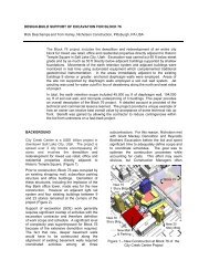
At present <strong>the</strong> Upper Scio<strong>to</strong> West Intercep<strong>to</strong>r Sewer (USWIS) is under construction <strong>in</strong> <strong>the</strong><br />
northwestern section <strong>of</strong> Frankl<strong>in</strong> County, Ohio. The sewer is be<strong>in</strong>g built us<strong>in</strong>g rock tunnel<strong>in</strong>g<br />
methods with <strong>the</strong> excavated diameter <strong>of</strong> <strong>the</strong> tunnel vary<strong>in</strong>g between 9.5 and 13.5 feet.<br />
The tunnel was designed for excavation by tunnel bor<strong>in</strong>g mach<strong>in</strong>e (TMB) and a Lovat s<strong>of</strong>t<br />
ground mach<strong>in</strong>e with Boretech rock head, 129 <strong>in</strong>. <strong>in</strong> diameter was selected by <strong>the</strong> Contrac<strong>to</strong>r<br />
<strong>to</strong> drill <strong>the</strong> bedrock limes<strong>to</strong>ne and <strong>in</strong>stall 24,000 l<strong>in</strong>ear feet <strong>of</strong> pipe. In addition ten shafts are <strong>to</strong><br />
be built along <strong>the</strong> tunnel alignment.<br />
REGIONAL/SITE GEOLOGY<br />
The subsurface exploration for <strong>the</strong> project revealed that <strong>the</strong> tunnel would be built generally<br />
with<strong>in</strong> <strong>the</strong> rocks <strong>of</strong> Middle Devonian formations represent<strong>in</strong>g <strong>the</strong> Paleozoic Era. The bedrock is<br />
generally covered by glacial and alluvial soils deposited by Ill<strong>in</strong>ois and Wiscons<strong>in</strong> glaciers<br />
dur<strong>in</strong>g <strong>the</strong> Pleis<strong>to</strong>cene and by streams dur<strong>in</strong>g recent times. Importantly valleys were cut deeply<br />
<strong>in</strong><strong>to</strong> <strong>the</strong> bedrock prior <strong>to</strong> glaciation. These tributary valleys were subsequently <strong>in</strong>-filled with<br />
glacially-derived sediments along <strong>the</strong> tunnel corridor. It was <strong>the</strong>refore anticipated that limited<br />
reaches <strong>of</strong> <strong>the</strong> tunnel alignment would have a mixed face. In <strong>the</strong>se areas hand m<strong>in</strong><strong>in</strong>g was<br />
specified at a larger diameter <strong>to</strong> allow <strong>the</strong> TBM <strong>to</strong> pass through <strong>the</strong> area.<br />
There are two dist<strong>in</strong>ct aquifer systems at <strong>the</strong> site. Discont<strong>in</strong>u<strong>in</strong>g unconsolidated soils and<br />
gravels <strong>in</strong>terbedded with glacial till, primarily conf<strong>in</strong>ed <strong>to</strong> <strong>the</strong> deep buried valleys and <strong>the</strong><br />
limes<strong>to</strong>ne aquifer. In general depths <strong>to</strong> water <strong>in</strong> wells along <strong>the</strong> tunnel alignment generally<br />
range from 25 <strong>to</strong> 50 feet below grade.<br />
One such possible area was identified <strong>in</strong> <strong>the</strong> Geotechnical Design Summary Report (GDSR)<br />
when a borehole revealed bedrock at 77 ft., close <strong>to</strong> <strong>the</strong> tunnel <strong>in</strong>vert elevation, with twelve<br />
feet <strong>of</strong> gravel over <strong>the</strong> bedrock. This depth <strong>of</strong> overburden was thirty feet deeper than that found