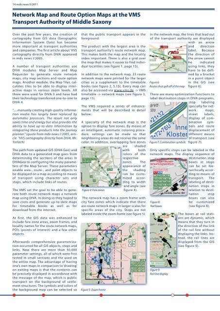
14 mdv news II/2011 Network Map <strong>and</strong> Route Option Maps <strong>at</strong> <strong>the</strong> VMS Transport Authority of Middle Saxony Over <strong>the</strong> past few years, <strong>the</strong> cre<strong>at</strong>ion of cartography from GIS d<strong>at</strong>a (Geographic Inform<strong>at</strong>ion System D<strong>at</strong>a) has become more important <strong>at</strong> transport authorities <strong>and</strong> companies. The first article about ‘<strong>VVS</strong> cartography directly from <strong>DIVA</strong>’ appeared in mdv news I/2005. A number of transport authorities use <strong>DIVA</strong> modules Map Server <strong>and</strong> Map Requester to gener<strong>at</strong>e route network maps, city map sections <strong>and</strong> route option maps. Ano<strong>the</strong>r module, <strong>the</strong> Map Tiler, calcul<strong>at</strong>es tiles to be able to display interactive maps in various zoom levels. All three were used for <strong>DIVA</strong> 3 <strong>and</strong> have had <strong>the</strong>ir technology transferred one-to-one to <strong>DIVA</strong> 4. ".... manually cre<strong>at</strong>ing high-quality inform<strong>at</strong>ion media has largely been replaced by autom<strong>at</strong>ic processes. The result not only saves time <strong>and</strong> energy but also provides <strong>the</strong> ability to have up-to-d<strong>at</strong>e inform<strong>at</strong>ion by integr<strong>at</strong>ing <strong>the</strong>se products into <strong>the</strong> journey planner." (quote from mdv news I/2005, article "<strong>VVS</strong> cartography directly from <strong>DIVA</strong>, Mr. Torlach) The p<strong>at</strong>h from upd<strong>at</strong>ed GIS (<strong>DIVA</strong> Geo) <strong>and</strong> <strong>DIVA</strong> d<strong>at</strong>a to a gener<strong>at</strong>ed map goes from determining <strong>the</strong> sections of <strong>the</strong> areas in <strong>DIVA</strong>Geo to configuring <strong>the</strong> many parameters of <strong>the</strong> Map Server. These parameters enable area-, route-, <strong>and</strong> point objects to be displayed on a map according to means of transport using character sets <strong>and</strong> stops, which include links of routes. The VMS set <strong>the</strong> goal to be able to gener<strong>at</strong>e both route network maps a network map using <strong>DIVA</strong>. In doing so <strong>the</strong>y hoped to save costs <strong>and</strong> gener<strong>at</strong>e up-to-d<strong>at</strong>e maps for timetable books as well as for download from <strong>the</strong> internet. At first, <strong>the</strong> GIS d<strong>at</strong>a was enhanced to include fare zone areas, zoom frames, <strong>and</strong> locality names for <strong>the</strong> route network maps, POIs (points of interest) <strong>and</strong> a few o<strong>the</strong>r objects. Afterwards comprehensive parametriz<strong>at</strong>ion occurred for all GIS objects, stops <strong>and</strong> links. Now <strong>the</strong>re are more than 50,000 parameter settings, all of which were first tested in small sections <strong>and</strong> <strong>the</strong> used on <strong>the</strong> entire map. The advantage of having one’s own maps in comparison to ‘drawing’ on exiting maps is th<strong>at</strong> <strong>the</strong> contents can be precisely displayed in accordance with <strong>the</strong> message of <strong>the</strong> map, which is public transport on <strong>the</strong> background of settlement structures. The symbols <strong>and</strong> colors of <strong>the</strong> background map can be selected so th<strong>at</strong> <strong>the</strong> public transport appears in <strong>the</strong> foreground. The product with <strong>the</strong> largest area is <strong>the</strong> transport authority’s route network map. This makes both <strong>the</strong> map <strong>and</strong> <strong>the</strong> locality index important. There is also a grid over <strong>the</strong> map th<strong>at</strong> makes it easier to find individual localities (see figure 1, page 15). In addition to <strong>the</strong> network map, 23 route network maps were printed for <strong>the</strong> larger cities as a supplement to <strong>the</strong> timetable books (see figure 2, S.15). Every map can also be accessed via www.vms.de -> VMS timetable -> network maps (see figure 3, page 15). The VMS required a series of enhancements th<strong>at</strong> will be described in detail below: A specialty of <strong>the</strong> network map is <strong>the</strong> option to display fare zones. By means of an intelligent, autom<strong>at</strong>ic coloring procedure, settings can be made so th<strong>at</strong> neighboring areas do not receive <strong>the</strong> same color. In addition, overlapping fare zones are shaded with both colors of <strong>the</strong> respective zones. The appearance of <strong>the</strong> shading can be customizedaccording to width <strong>and</strong> angle (see Figure 4: Fare zones figure 4). The network map has a zoom frame with city fare zones which indic<strong>at</strong>e th<strong>at</strong> <strong>the</strong>re are route network maps in larger scales for specific areas of <strong>the</strong> city. Stops are not labeled inside <strong>the</strong> zoom frame (see figure 5). Figure 5: Zoom frame In <strong>the</strong> network map, <strong>the</strong> lines th<strong>at</strong> lead out of <strong>the</strong> transport authority are displayed with an arrow <strong>and</strong> direction label. Because <strong>the</strong> direction of <strong>the</strong> arrow cannot be indic<strong>at</strong>ed using links, <strong>the</strong>y have to be defined by a bracket Figure 6: Routes th<strong>at</strong> spill off of <strong>the</strong> map in a point object in <strong>the</strong> GIS (see figure 6). There are many optimiz<strong>at</strong>ion functions to label destin<strong>at</strong>ion stops in <strong>DIVA</strong> programs, stop labeling specially for network maps, street labels, display of combin<strong>at</strong>ionsymbols <strong>and</strong> route displacement of different means of transport (see Figure 7: Combin<strong>at</strong>ion symbols figure 7). Only specific stops can be labeled in <strong>the</strong> network maps. The display sequence of destin<strong>at</strong>ion stop boxes <strong>at</strong> stops can be set hierarchicallyaccording to means of transport. The labeling of destin<strong>at</strong>ion stops in rel<strong>at</strong>ion to destin<strong>at</strong>ion stop Figure 8: Rail boxes Figure 9: Rail line display boxes can also be customized (see figure 8). The boxes <strong>at</strong> rail st<strong>at</strong>ions are dynamic, which means th<strong>at</strong> <strong>the</strong>y turn in <strong>the</strong> direction of <strong>the</strong> link of <strong>the</strong> rail line without displaying <strong>the</strong> links. Instead, <strong>the</strong> rail lines are displayed from <strong>the</strong> GIS (see figure 9).
mdv news II/2011 - 15 Adorf (Erzgeb) Dorfchemnitz Chemnitz-Siegmar ob Bf Altmittweida Zwickau Zentrum Oberlichtenau Erla Mittweida Cainsdorf Hartenstein Nassau (Erzgeb) Schweinsburg-Culten Hainichen Unterneudorf Chemnitz- Schönau Clausnitz Pockau-Lengefeld Fährbrücke Ber<strong>the</strong>lsdorf- Ort Zwönitz St. Egidien Chemnitz Hbf Aue (Sachs) Erzgebirgsstadion Ber<strong>the</strong>lsdorf (Erzgeb) Chemnitz-Riemenschneiderstr. Zwickau Stadthalle Niederwiesa Wiesenburg (Sachs) Kemtau Schwarzenberg Hp Floßmühle Niederschlag Lößnitz unt Bf Grüna (Sachs) Hp Chemnitz Süd Chemnitz-Harthau Burkhardtsdorf Limmritz (Sachs) Bad Schlema Witzschdorf Nennigmühle Gleisberg-Marbach Flöha-Plaue Bienenmühle Sehma Lauter (Sachs) Falkenau (Sachs) Süd Wittgensdorf Mitte Oelsnitz (Erzgeb) Niederwürschnitz Falkenau (Sachs) Hp Antonsthal Flöha Annaberg-Buchholz Mitte Annaberg-Buchholz unterer Bf Lößnitz ob Bf Döbeln Zentrum Rödlitz-Hohndorf Annaberg-Buchholz Süd Kleinschirma Dittersdorf Erdmannsdorf-Augustusburg Kretscham- Ro<strong>the</strong>nsehma Kurort Oberwiesenthal Wüstenbr<strong>and</strong> Werdau Nord Neudorf (Erzgeb) Frankenstein (Sachs) Hohndorf Mitte Holzhau-Skilift Rechenberg Holzhau Unterwiesenthal Waldkirchen (Erzgeb) Cranzahl Thalheim (Erzgeb) Thermalbad Wiesenbad Klaffenbach Hp Hetzdorf (Flöh<strong>at</strong>al) Wilkau- Haßlau Waldheim Hennersdorf (Sachs) Burkhardtsdorf Mitte Niederstriegis Steina Wilischthal Lichtenstein (Sachs) Niederzwönitz Meinersdorf (Erzgeb) Pfaffenhain Zöblitz-Pobershau Strobelmühle Chemnitz- Borna Hp Niederbobritzsch Einsiedel Vierenstr. Scharfenstein Lichtenstein Gewerbegebiet Mulda (Sachs) Johanngeorgenstadt Silberstr. Chemnitz Mitte Lichtenberg (Erzgeb) Reifl<strong>and</strong>- Wünschendorf Hohenstein-Ernstthal Voigtsgrün Hammerunterwiesenthal Glauchau- Schönbörnchen Ebersbrunn Stenn Lichtenstein E- Schneller-Siedl Mitteloelsnitz Burgstädt Chemnitz- Friedrichstr. Schwarzenberg- Neuwelt Dittersbach Erlau (Sachs) Ottendorf (Mittweida) Mosel Wiesa (Erzgeb) Grünhainichen-Borstendorf Bärenstein (Annaberg) Olbernhau Roßwein Zwickau-Pölbitz Olbernhau West Chemnitz Kinderwaldstätte Zwickau (Sachs) Hbf Chemnitz- Reichenhain Chemnitz Erfenschlag Schweikershain Erlabrunn (Erzgeb) Neukirchen- Klaffenbach Aue (Sachs) Wolkenstein Crimmitschau Hohenfichte Lengefeld-Rauenstein Niederdorf (Erzgeb) Chemnitz-Hilbersdorf Frankenberg (Sachs) Süd Oberro<strong>the</strong>nbach Blumenau Einsiedel Hp Gymnasium Zschopau B<strong>10</strong>7 Abzw Stein Milkau, Abzw Crossen Haselbacher See Speicher Borna Talsperre Koberbach Industrieabsetzanlage Helmsdorf Talsperre Pöhl Bockwitzer See Talsperre Schömbach Talsperre Schömbach Talsperre Kriebstein Unterbecken Talsperre Eibenstock Talsperre Klingenberg Vodni Nadrz Flaje Talsperre Lehnmühle Talsperre Neunzehnhain Talsperre Saidenbach Talsperre Rauschenbach Talsperre Lichtenb. Vodni Nadrz Kyjice Vodni Nadrz Prisecnice Talsperre Windischleuba Talsperre Malter Freiberger Mulde Elbe Elbe 15 1 2 6 18 23 30 5 38B 20 27 28 34 3 4 38 39 36 19 22 24 25 26 31 32 33 14 16 17 29 7 8 9 <strong>10</strong> 11 12 13 21 35 Rodewisch Gera Thonhausen Greiz Rodewisch Colditz Colditz Altenburg Grimma Colditz Rodewisch/ Plauen Rüsseina Meißen Dresden Meißen Dresden Dresden Thar<strong>and</strong>t Seyde Schmiedeberg Altenberg Autobahndreieck Nossen Wil de Weisseritz 50 53 55 61 62 65 66 67 Cho mutovka Weiss eritz E441 E55 E55 Bilina Bilina Bilina Flöha Hohenkirchen Mahlen Zettweil Nißma Penkwitz Döbitzschen Staschwitz Kö<strong>the</strong>l Nehmitz Kleinhermsdorf Hagenest Langenhain Me<strong>the</strong>witz Maltitz Blumroda Hemmendorf Kleinprießligk G<strong>at</strong>zen Michelwitz Berndorf Hohendorf Oellschütz Heuersdorf Wildenhain Reichstädt Frankenau Pöschwitz Zschöpel Kleinstöbnitz Pl<strong>at</strong>schütz Kleintauschwitz Großtauschwitz Göldschen Bohra Zschernitzsch Kleinmückern Kürbitz Greipzig Lehnitzsch Stunzhain Rautenberg Göllnitz Zschöpperitz Gödissa Jauern Dobraschütz Kraasa Zweitschen Kostitz Trebula Misselwitz Kaimnitz Selleris Lutschütz Breesen Lossen Saara Pöhla Kleinröda Mohlis Graicha Großröda Kröbern Prehna Meucha Hartroda Beerwalde Wieseberg Kleinstechau Fichtenhainichen Neubraunshain Waltersdorf Borgishain Kleintauscha Großstechau Gardschütz Neuposa Serbitz Primmelwitz Brossen Burkersdorf Schloßig Steinsdorf Untschen Löhmigen Münsa Breitenhain Prößdorf Altpoderschau Zechau Posa Bünauroda Wiesenmühle Wernsdorf Tanna Wildenbörten Zagkwitz Ingramsdorf Drosen Drogen Nödenitzsch Rolika Pontewitz Rodameuschel Mehna Kertschütz Schw<strong>and</strong>itz Kr<strong>at</strong>schütz Rö<strong>the</strong>nitz Illsitz Gleina Gimmel Schlauditz Kreutzen Tegkwitz Krebitschen Gödern Romschütz Kosma Löpitz Unterzetzscha Knau Molbitz Remsa Schelchwitz Lohma Dobra Sommeritz Kummer Merlach Nitzschka Taupadel Bornshain Maltis Zürchau Prisselberg Zschechwitz Burkersdorf Rödigen Großbraunshain Braunshain Oberkossa Thomas-Müntzer- Siedlung Nörditz Goldschau Paditz Kotteritz Plottendorf Gorma Zschaschelwitz Roda Großpillingsdorf Gospersgrün Altrottmannsdorf Römersgrün Dungersgrün Ziegelei Schwarzhammermühle Weißens<strong>and</strong> Brunn Mühlw<strong>and</strong> Lambzig Foschenroda Pechtelsgrün Rö<strong>the</strong>nbach Abhorn Buchwald Lauschgrün Schönbrunn Wolfspfütz Reimersgrün Eichmühle Plohn Gottesgrün Kahmer Reinsdorf Waltersdorf Thalbach Vogelsang Mennsdorf Kleinreinsdorf Schönfeld Chursdorf Irchwitz Raasdorf Herrenreuth Sorge Friedmannsdorf Haselbach Dreußen Stolzenberg Posterstein Heukewalde Jonaswalde Vollmershain Schönhaide Br<strong>and</strong>rübel Heyersdorf Grünberg Wettelswalde Sorge- Settendorf Hartmannsgrün Lottengrün Wetzelsgrün Perlas Neudorf Siebenhitz Oberwinn Altensalz Siehdichfür Hohofen Grünheide Bad Reiboldsgrün Albertsberg Dorfstadt Veitenhäuser Mahnbrück Altmannsgrün Brunn Rützengrün Hohengrün Schneckenstein Muldenberg Arnoldsgrün Willitzgrün Tirschendorf Raasdorf Zaulsdorf Brotenfeld Korna Droßdorf Helmsgrün Gansgrün Gospersgrün Buch Poppengrün Oberlauterbach Unterlauterbach Schönau Juchhöh Harthau Niederwinkel Röhrsdorf Schlagwitz Dürrengerbisdorf Niederwiera Oberdorf Wickersdorf Neukirchen Franken Uhlsdorf Neumilkau Gilsberg Rauschenthal Aschershain Wallbach Nauhain Töpelwinkel Saalbach Diedenhain Limmritz Neuhausen Ziegra Vierhäuser Schönerstädt An der Finkenmühle Benndorf Wüstenhain Nauenhain Raupenhain Pl<strong>at</strong>eka Siedlung Prießnitz Altmörbitz Bubendorf Neukirchen Neul<strong>and</strong>siedlung Wyhra Dolsenhain Pflug Rüdigsdorf Gn<strong>and</strong>stein Jahnshain Meusdorf Oberpickenhain R<strong>at</strong>hendorf Walditz Niederpickenhain Wenigossa Bruchheim Ossa Kolka Syhra Theusdorf Streitwald Roda Frauendorf Elbisbach Hopfgarten Trebishain Schönau Altottenhain Gröblitz Zöllnitz Seebitzschen Bernsdorf Neudörfchen Köttern Pürsten Zschauitz Gröbschütz Städten Winkeln Neuwerder Himmelhartha Siedlung Corba Seitenhain Zschoppelshain Göppersdorf Meusen Carsdorf Altzschillen Neuwallwitz Hoyersdorf Doberenz Weiditz Rüx Ceesewitz Hermsdorf Amerika Zinnberg Theesdorf Krumbach Biensdorf Sörnzig Steudten Beedeln Kralapp Schweizerthal Röllingshain Beerwalde Zschaagwitz Spernsdorf Haide Biesern Liebenhain Zetteritz Waldeshöh Leupahn Neugepülzig Methau Neuzschaagwitz Holzhausen Sachsendorf Leutenhain Weißbach Köttwitzsch Stollsdorf Wittgendorf Kolkau Topfseifersdorf Nöbeln Mutzscheroda Göhren Hartha Cossen Thierbaum Hohnbach Möseln Wolperndorf Oberleupten Zumroda Runsdorf Pfarrsdorf Zschaiga Oberarnsdorf Schömbach Niederleupten Garbus Thomas-Müntzer- Siedlung Kraschwitz Großmecka Gösdorf Mockzig Priefel Hauersdorf Dippelsdorf Neuenmörbitz Klausa Zschernichen Buscha Frohnsdorf Garbisdorf Flemmingen Beiern Jückelberg Göpfersdorf Heiersdorf Engertsdorf Gähsnitz Nirkendorf Niederarnsdorf Boderitz Lohma Gieba Pöppschen Bocka Pähnitz Pahna Uhlmannsdorf Richzenhain Schlunzig Siebenhöfen Burgstädtel Dittrich Kleinbernsdorf Hölzel Voigtlaide Oertelshain Oberwinkel Weidensdorf Rüsdorf Ebersbach Pfaffroda Wiltzsch Wilischthal Neueibenberg Oberschindmaas Niederschindmaas Ber<strong>the</strong>lsdorf Stein Grüna Kleinchursdorf Löbenhain Kühler Morgen Kleinrückerswalde Kühberg Kretscham-Ro<strong>the</strong>nsehma Weitersglashütte Oberwildenthal Neidhardsthal Halbemeile Burkhardtsgrün Cr<strong>and</strong>orf Antonshöhe Globenstein Ehrenzipfel Tellerhäuser Zweibach Rabenberg Steinheidel Lichtenau Schindlerswerk Wilzschhaus Jägerhaus Carol<strong>at</strong>hal Wildenthal Blauenthal Carolagrün Gottesberg Mühllei<strong>the</strong>n Unterscheibe Unterwiesenthal Zöllmen Steinbach Rennersdorf Leuteritz Oberranschütz Hohenlauft Grunau Naußlitz Niederforst Zweinig Ossig Maltitz Theeschütz Obersteinbach Leschen Ullrichsberg Seifersdorf Stockhausen Forchheim Knobelsdorf Rudelsdorf Otzdorf Littdorf Mannsdorf Neudorf Neugreußnig Mahlitzsch Heyda Juchhöh Choren Klinge Wetterwitz Wettersdorf Gertitzsch Neuseifersdorf Drehfeld Erlicht Haida Hohentanne Kobitzsch Lampersdorf Elgersdorf Karcha Hartha Lotzen Luga Wuhsen Bodenbach Saultitz Radewitz Mergenthal Mahlitzsch Wunschwitz Kottewitz Schrebitz Gallschütz Stahna Weitzschen Kettewitz Wildberg Wendischbora Soppen Roitzschen Sönitz Piskowitz Priesen Munzig Klessig Noßlitz Perne Groitzsch Kreißa Schmiedewalde Riemsdorf Wolkau Hühndorf Sora Kleinschönberg Neubodenbach Sachsdorf Gruna Pinkowitz Constappel Naustadt Ullendorf Pegenau Gohla Ilkendorf Zetta K<strong>at</strong>zenberg Oberstößwitz Göltzscha Röhrsdorf Rothschönberg Gersdorf Siegfried Kummersheim Grund Fördergersdorf Spechtshausen Grillenburg Herzogwalde- L<strong>and</strong>berg Kleinopitz Blankenstein Birkenhain Limbach Beerwalde Waldfrieden Paulsdorf Obercunnersdorf Herzogswalde Kaufbach Lübau Spechtritz Borlas Paulshain Pohrsdorf Großopitz Zschackwitz Teichhäuser Neudörfchen Got<strong>the</strong>lffriedrichsgrund Himmelmühle Oberschaar Oberschmiedeberg Mittelschmiedeberg Pl<strong>at</strong>tenthal Hammerleubsdorf Lößnitztal Heidelbach Hennersdorf Hinterer Grund Niederau Vorwerk Stolzenhain Drei Rosen Huth Grünau Reukersdorf Schönfeld Obervorwerk Rittersberg Wolfsberg Heinzebank Hüttengrund Kalkwerk Floßmühle Hutha Grundau Schindelbach Rauenstein Reifl<strong>and</strong> Ganshäuser Nennigmühle Gelobtl<strong>and</strong> Ammelsdorf Hennersdorf Rö<strong>the</strong>nbach Boden Süßenbach Mönchenfrei Schmalzgrube Brettmühle Schlössel Obernaundorf Neuhermsdorf Seyde Oberpöbel Naundorf Moldava v Krusných horách Langendorf Profen Bröckau Minkwitz Spora Kayna Pautzsch Auligk Löbnitz- Bennewitz Ramsdorf Deutzen Thräna Teuritz Dölzig Koblenz Selka Großstöbnitz Papiermühle Steinwitz Hainichen Naundorf Göhren Heukendorf Naundorf Löbichau Oberlödla Ruppersdorf Rositz Zipsendorf Lehndorf Nöbden Haselbach Treben Fockendorf Trebanz Gerstenberg Lehma Gröba Schnauderhainichen Falkenhain Mumsdorf Neupoderschau Pflichtendorf Kriebitzsch Unterlödla Monstab Hartha Dobitschen Gnadschütz Kö<strong>the</strong>nitz Altkirchen Mockern Oberzetzscha Nöbdenitz Starkenberg Podelwitz Zehma Ehrenberg Modelwitz Windischleuba Lumpzig Kauritz Wintersdorf Schelditz Oberplanitz Weißenborn Br<strong>and</strong> Neuplanitz Marienthal Waldsachsen Lauterbach Rudelswalde Langenbernsdorf Langenhessen Fraureuth Leubnitz- Forst Hirschfeld Ebersbrunn Stangengrün Schönfels Stenn Steinpleis Thanhof Beiersdorf Ruppertsgrün Niederalbertsdorf Blankenhain Mannichswalde Langenreinsdorf Dänkritz Dennheritz Gablenz Lauenhain Leubnitz Neukirchen/ Pleiße Trünzig Lichtentanne Oberheinsdorf Herlasgrün Hauptmannsgrün Neumark Reuth Schönbach Waldkirchen Schneidenbach Rotschau Brockau Limbach Hartmannsgrün Pfaffengrün Obermylau Irfersgrün Unterheinsdorf Reudnitz Braunichswalde Seelingstädt Paitzdorf Zahderlehde Mohlsdorf Teichwolframsdorf Rückersdorf Thonhausen Nischwitz Weißbach Schönhain Guteborn Ponitz Niederhohndorf Frankenhausen Eich/ Sa. Reumtengrün Schreiersgrün Neustadt/ Vogtl. Richardshöhe Sorga Schnarrtanne Vogelsgrün Rempesgrün Beerheide Hammerbrücke Grünbach Tirpersdorf Kottengrün Steinigt Werda Theuma Wildenau Zobes Jägersgrün Trieb/ Vogtl. Bergen Jahnsgrün Thoßfell Neuensalz Rebesgrün Mechelgrün Tannenbergsthal/ Vogtl. Wernesgrün Ellefeld Glösa- Draisdorf Röhrsdorf Heinersdorf Wittgensdorf Bräunsdorf Kaufungen Oberwiera Breitenbach Niederfrohna Eichlaide Schwaben Schönberg Tettau Kertzsch Dürrenuhlsdorf Wolkenburg/ Mulde Reinsdorf Langenau Steina Gersdorf Braunsdorf Lichtenwalde Teichhaus Eckartsberg Terpitz Neuhof Bahnhof Frauendorf Ottenhain Neul<strong>and</strong>siedlung Sommerhof Zedtlitz Niedergräfenhain Dölitzsch Eschefeld Narsdorf Wickershain Greifenhain Mark Ottenhain Tautenhain Frankenhain Prießnitz Flößberg Nenkersdorf Linda Rochsburg Ber<strong>the</strong>lsdorf Kö<strong>the</strong>nsdorf Reitzenhain Die<strong>the</strong>nsdorf Irbersdorf Schwarzbach Naundorf Kockisch Zettlitz Dittmannsdorf Niedersteinbach Wernsdorf Taura Arras Herrenhaide Zaßnitz Noßwitz Penna Elsdorf Auerswalde Zschöppichen Ottendorf Oberlichtenau Niederlichtenau Frankenau Thalheim Ringethal Weißthal Grünlichtenberg Kriebethal Mühlau Hermsdorf Falkenhain Seifersbach Dreiwerden Schönborn Erlau Crossen Schweikershain Tauscha Dittmannsdorf Aitzendorf Seupahn Claußnitz Obergräfenhain Tanneberg Breitenborn Weinsdorf Höckendorf Erlebach Ehrenberg Altgeringswalde Gepülzig Schönfeld Milkau Döhlen Königsfeld Seelitz Wechselburg Göritzhain Thierbach Arnsdorf Chursdorf Hartmannsdorf Kühnhaide Stein Altmittweida Garnsdorf Mühlbach Höfchen Sachsenburg Königshain Markersdorf Ebersbach Hausdorf Lastau Koltzschen Erlbach Neubauernsiedlung Heiersdorf Kleinmecka Wilchwitz Tautenhain Ziegelheim Ehrenhain Langenleuba- Niederhain Nobitz Furth Borna-Heinersdorf Ebersdorf Burkersdorf Heiersdorf Mohsdorf Lauenhain Rößgen Neudörfchen Niederrossau Euba Stelzendorf Mittelbach Grüna Altenhain Kleinolbersdorf Reichenbr<strong>and</strong> Siegmar Einsiedel Erfenschlag Klaffenbach Mosel Cainsdorf Bockwa Pölbitz Crossen Schneppendorf Schedewitz / Geinitzsiedlung Niederplanitz Dörfel Frohnau Jahnsbach Herold Tannenberg Neundorf Schwarzbach Hermannsdorf Wiesa Thermalbad Wiesenbad Gelenau/ Erzgeb. Schönfeld Geyersdorf Lobsdorf Pleißa Kuhschnappel Sankt Egidien Bernsdorf Gersdorf Remse Langenchursdorf Heinrichsort Hermsdorf Wüstenbr<strong>and</strong> Wernsdorf Grumbach Reichenbach Callenberg Falken Langenberg Kändler Niederwiesa Grießbach Spinnerei Schlößchen Falkenbach Dittmannsdorf Weißbach Dittersdorf Gornau/ Erzgeb. Hopfgarten Scharfenstein Venusberg Drebach Schönbrunn Neukirchen/ Erzgeb. Brünlos Niederwürschnitz Adorf/ Erzgeb. Dorfchemnitz Lenkersdorf Gornsdorf Hormersdorf Kemtau Niederdorf Eibenberg Sorge Meinersdorf Jahnsdorf Ursprung Seifersdorf Pfaffenhain Erlbach- Kirchberg Hohndorf Mitteldorf Oberdorf Gablenz Beutha Raum Auerbach Günsdorf Leukersdorf/ Erzgeb. Burkhardtsdorf Zschorlau Wildbach Lindenau Oberpfannenstiel Bernsbach Beierfeld Waschlei<strong>the</strong> Marienau Cunersdorf Wiesenburg Wulm Niedermülsen Thurm Stangendorf Ortmannsdorf Thierfeld Langenbach Weißbach Grünau Zschocken Härtensdorf Friedrichsgrün Schönau Wiesen Niedercrinitz Leutersbach Wolfersgrün Lauterhofen Bärenwalde Obercrinitz Saupersdorf Mülsen St. Jacob Hartmannsdorf b. Kirchberg Giegengrün Reinsdorf Burkersdorf Mülsen St Micheln Mülsen St Niclas Fährbrücke Affalter Dittersdorf Lippr<strong>and</strong>is Niederlungwitz Ro<strong>the</strong>nbach Altchemnitz Schloßchemnitz Zentrum Altendorf Kaßberg Hilbersdorf Kappel Rottluff Schönau Rabenstein Helbersdorf Kapellenberg Bernsdorf Markersdorf Morgenleite Harthau Hutholz Reichenhain Gablenz Lu<strong>the</strong>rviertel Adelsberg Yorckgebiet Rußdorf Rödlitz Gesau Jerisau Albertsthal Höckendorf Schönbörnchen Sonnenlei<strong>the</strong> Hoheneck Im Grund Kühnhaide Niederzwönitz Wal<strong>the</strong>rsdorf Königswalde Crottendorf Sehma Niederschlag Oberscheibe Cunersdorf Cranzahl Neudorf Hammerunterwiesenthal Bärenstein Schönheide Bockau Antonsthal Langenberg Erlabrunn Sosa Raschau Carlsfeld Stützengrün Albernau Pöhla Bermsgrün Erla Grünstädtel Markersbach Rittersgrün Breitenbrunn/ Erzgeb. Morgenrö<strong>the</strong>- Rautenkranz Sachsenfeld Wildenau/Brückenberg Steinbach Neustadt Hofgarten Altstadt Heide Rockelmann Vorstadt/Bärenackerweg Vejprty Merbitz Podemus Roitzsch Pennrich Gompitz Brabschütz Altfranken Unkersdorf Gebersbach Hermsdorf Leschen Haßlau Niederstriegis Gleisberg Neukirchen Dittmannsdorf Ber<strong>the</strong>lsdorf Falkenberg Conradsdorf Bahnhof Frankenstein Hirschfeld Steinbach Oberschaar Niederbobritzsch Krummenhennersdorf Bieberstein Obergruna Kleinvoigtsberg Burkersdorf Wegefarth Wingendorf Hartha Sohra Oberbobritzsch Linda Niederschöna Kleinwaltersdorf Schönerstadt Börnichen Kirchbach Hetzdorf Großvoigtsberg Reichenbach Seifersdorf Langhennersdorf Bräunsdorf Kleinschirma Reinsberg Tuttendorf Großschirma Ro<strong>the</strong>nfurth Zug Weißenborn/ Erzgeb. Memmendorf Frankenstein Oberschöna Halsbrücke Rhäsa Deutschenbora Heynitz Taubenheim Seeligstadt Burkhardswalde Starbach Tanneberg Weistropp Klipphausen Lehden Gauernitz Krögis Rüsseina Miltitz Hausdorf Schmalbach Kaltofen Eulendorf Bockendorf Marbach Böhrigen Dittersdorf Arnsdorf Naundorf Etzdorf Berbersdorf Pappendorf Mobendorf Moosheim Greifendorf Falkenau Gersdorf Dittersbach Goßberg Schlegel Reichenbach Riechberg Cunnersdorf Oberrossau Langenstriegis Somsdorf Helbigsdorf Weißig Klingenberg Colmnitz Ruppendorf Grumbach Mohorn Seifersdorf Braunsdorf Kesselsdorf Oberhermsdorf Wurgwitz Zauckerode Reichstädt Dorfhain Eula Herrndorf St Michaelis Kurort Hartha Rabenau Pretzschendorf Höckendorf Raußlitz Neukirchen Mildenau Arnsfeld Steinbach Zethau Frauenbach Oberreichenbach Breitenau Grünberg Lichtenberg/Erzgeb. Weigmannsdorf Müdisdorf Himmelsfürst Gränitz Niedersaida Helbigsdorf Mulda/ Sa. Wolfsgrund Voigtsdorf Kleinbobritzsch Dittersbach Deutschgeorgenthal Großhartmannsdorf Mittelsaida Ullersdorf Friedebach Nassau Dorfchemnitz Burkersdorf Rechenberg- Bienenmühle Holzhau Clausnitz/ Erzgeb. Cämmerswalde Rauschenbach Neuwernsdorf Obersaida Langenau Kleinhartmannsdorf Großwaltersdorf Eppendorf Gahlenz Leubsdorf Marbach Schellenberg Kunnersdorf Falkenau Hetzdorf Metzdorf Hohenfichte Niederlauterstein Ro<strong>the</strong>nthal Deutschneudorf Oberlochmühle Deutscheinsiedel Großolbersdorf Blumenau Krumhermersdorf Lauta Oberseiffenbach Heidelberg Heidersdorf Pfaffroda Dörnthal Haselbach Rübenau Kühnhaide Witzschdorf Waldkirchen/Erzgeb. Grünhainichen Börnichen/ Erzgeb. Lippersdorf Sorgau Forchheim Reitzenhain Hohndorf Ansprung Hallbach Dittmannsdorf Mauersberg Niederschmiedeberg Wünschendorf Borstendorf Deutsch- K<strong>at</strong>harinenberg Lauterbach Streckewalde Warmbad Gehringswalde Wernsdorf Pockau Seiffen/Erzgeb. Pobershau Gebirge Mooshaide Hartmannsdorf Hermsdorf/ Erzgeb. Sadisdorf Friedersdorf Reichenau Hirschberg Brüderwiese Plaue Pilsdorf Dörfel Hora Sv<strong>at</strong>é K<strong>at</strong>eriny Louka u Litvínova Nová Ves v Horách Meziborí u Litvínova Kalek Horní Jiretín Br<strong>and</strong>ov Neugrumbach S<strong>at</strong>zung Medenec Hora Sv<strong>at</strong>ého Sebestiána Havran Místo Drouzkovice Vysoká Pec Kovárská Výsluní Zelená Vrskman Sporice Bolebor Brezno u Chomutova Údlice Strupcice Berreuth Oelsa Ulberndorf Pesterwitz Malter Obercarsdorf Cotta Schönfeld Kipsdorf Bärenfels Schmiedeberg Mariánské Radcice Regis- Breitingen Meuselwitz Schmölln Lucka Gößnitz Crimmitschau Mylau Reichenbach im Vogtl<strong>and</strong> Lengenfeld Netzschkau Greiz Schöneck/ Vogtl. Auerbach/ Vogtl. Rodewisch Treuen Falkenstein/ Vogtl. Waldenburg Hartha Geithain Frohburg Kohren- Sahlis Borna Penig Sa. Geringswalde Burgstädt Mittweida Schlettau Ehrenfriedersdorf Thum Geyer Elterlein Lichtenstein/Sa. Oberlungwitz Hohenstein-Ernstthal Limbach- Oberfrohna Stollberg/ Erzgeb. Lugau/ Erzgeb. Oelsnitz/ Erzgeb. Thalheim/ Erzgeb. Zwönitz Grünhain Lauter/ Sa. Lößnitz Aue Schneeberg Wilkau- Haßlau Hartenstein Wildenfels Scheibenberg Oberwiesenthal Johanngeorgenstadt Schwarzenberg/ Erzgeb. Eibenstock Roßwein Flöha Siebenlehn Br<strong>and</strong>- Erbisdorf Radebeul Thar<strong>and</strong>t Wilsdruff Freital Nossen Oederan Frauenstein Sayda Augustusburg Zöblitz Lengefeld Zschopau Olbernhau Marienberg Litvínov Jöhstadt Jirkov Chomutov Dippoldiswalde Lom u Mostu Altenburg Zwickau Annaberg- Buchholz Freiberg Most Chemnitz 376 Lessingstr/Goe<strong>the</strong>str 742 Neudorf, Mitte 436 Karl-Kegel-Str/Ziolkowskistr 785 Dörnthal, Schulstr 458 Crottendorf, Annaberger Str 417 Neudorf, Gh Kaiserhof 436 Reinsdorf, Wendestelle 918 Hormersdf, Gemeindeverwaltung 190 Kö<strong>the</strong>nsd-Reitzenh,Doppelmoppel 638 Meinersdorf, R<strong>at</strong>haus 192 Gornsdorf, KSG 196 Topfseifersdorf, Wende 684 Burkhardtsdorf, Mittelschule 212 Schlettau, Markt 412 Tannenberg, Mitte 432 Ebersdorf 254 Hirschfeld, Kreuzung 761 Waldheim, Sportpl<strong>at</strong>z 951 Witzschdorf, Wendeschleife 242 Wolkenstein, Markt 489 Mildenau, Tankstelle 434 Otzdorf, Ortsmitte 933 Drebach, Abzw Herold 230 Dittersdorf, Gh Steinert 235 Schönberg, Goldene Höhe 924 Wiesa, Wendeschleife 433 Neundorf, Oberdorf 433 Schlettau, Schulbushst 412 Crottendorf, Gewerbegebiet 417 Talstr 238 Ebersdorf, Brettmühle 706 Altmittweida, Ritterhof 684 Warmbad, Silber-Therme 216 Niederwiesa, Gh Lamm 706 Grundschule am Zschopenberg 237 Erdmannsdorf, Schule 234 Am Lehngericht 212 Schwarzbach, Wendeschleife 419 Johannispl<strong>at</strong>z 164 Gösau, Mitte 160 Waldsachsen, Wendestelle <strong>10</strong>6 Bahnhofstr 619 161 Lobsdorf, Wendepl<strong>at</strong>z 118 Waldenburg, Freibad 120 Schneeberg,Str<strong>and</strong>bad Filzteich 359 Cr<strong>and</strong>orf, Bergidyll 338 Seifersdorf, Wendeschleife 201 Neuwürschnitz,Gh Würschnitztal 197 Lugau, Grundschule 191 Breitenbrunn, Güterbf. 335 Lunzenau, Elektro-Speck 659 Affalter, Grüna, Feuerwehrd. 368 Grünhain, Scharfe Ecke 343 Breitenbrunn, Wendeschleife 335 Oberlungwitz,Lindenhofsiedlung 193 Muldenschule 666 Wittgensdorf, Ortseingang 658 Adorf, Wendeschleife 201 Funkstr 235 Markersbach, Verwaltung PSW 332 Gelenau, Gh Hirsch 208 Nordstr 951 Kemtau, Wendeschleife 212 Neudorf, Schule 436 Hartha, R-Wagner-Str 926 Meinersdorf, Grundschule 212 Seelingstädt, Schule 171 Gymnasium 638 Mottelergymnasium Westberg <strong>10</strong>6 Eibenstock, Auersbergstr 373 Rittersgrün, Halbmeiler Str 330 Hartmannsdorf, A-Gün<strong>the</strong>r-Pl<strong>at</strong>z 658 Ursprung, Flockenstr/Bf. 192 Königswalde,Gemeindeverwaltung 161 Blankenhain, Caritas-Heim 171 Dittmannsdorf, Wendeschleife 234 Zethau, Wendeschleife 735 Halsbach, Talweg 774 Haselbach, Kaufmarkt 458 Paul-Müller-Str/Sparkasse 764 Oberbobritzsch, Abzw Burkersdf 775 Hilbersdorf,Dorfstr/Spielpl<strong>at</strong>z 774 Siebenlehn, An der Halde 755 Siebenlehn, Südstr 751 Siebenlehn, Einkaufszentrum 755 Don<strong>at</strong>sring/Meißner Tor 742 Choren, Wendestelle 892 Großwaltersdorf, Wendeschleife 712 Großschirma, Grundschule 751 Großvoigtsberg,Zellwald-Center 755 Hainichen, Sbh Feldstr 695 Dittersbach, Wendepl<strong>at</strong>z 775 Hallbach, Wendeschleife 472 Nossen, Dresdner Str 690 Br<strong>and</strong>-Erbisdorf, Gymnasium 727 Dittersbach, Warte 736 Friedebach, Schmiede 738 Lichtenberg, Feierabendheim 733 Hetzdorf, Mitte 770 Holzhau,Oberholzhau,Wendepl<strong>at</strong>z 736 Cämmerswalde, Gemeindeverw. 736 Schauwerkst<strong>at</strong>t 455 Weißenborn, OT Süßenbach 785 Naundorf, Wendepl<strong>at</strong>z 774 Dittmannsdorf, Wendeschleife 764 Falkenberg, Wendeschleife 768 Kleinbobritzsch 732 Holzhau, Teichhaus 733 Sayda, Markt 738 Oberlochmühle, Gasthof 737 KO Seiffen, Oberseiffenb,Wende 455 Gehringswalde, Oberdorf 489 Hilmersdorf, Gasthof 217 Bärenstein, R<strong>at</strong>haus 429 Massanei / Otzdorf, Krzg 951 Scharfenstein, Burgparkpl<strong>at</strong>z 233 Krumhermersdf, Wendeschleife 237 Arnsfeld, Abzw Nd.schmiedeberg 435 Körnerpl<strong>at</strong>z 889 Schönerstadt, Wendeschleife 713 Hausdorf, obere Wendeschleife 669 Wolkenstein, Freiberger Str 425 Grießbach, Wendeschleife 233 Gornau, Gemeindeverwaltung 242 Gornau, Kaufhalle 242 Schulbushst Mühlbacher Str 669 Grünlichtenberg, Ortsmitte 919 Bildungszentrum 669 Mildenau, Oberdorf 434 Pappendorf, Schule 691 Oberschöna, Wendepl<strong>at</strong>z 742 Pockau, Zentralhaltestelle 492 Gymnasium 489 Kühnhaide, Grundschule 487 Mobendorf, Wendeschleife 691 Oederan, Neubaugebiet 717 Wernsdorf, Warte 492 Lippersdorf, Wendeschleife 493 Lauta, Ortsmitte 489 Oberschmiedeberg, Talstr 422 Eulendorf, Gasthof 715 Arnsfeld, Kirche 435 Niederschmiedeberg, Feuerwehr 494 Oederan, Anger 714 Lößnitztal, Vliestextilien 729 Leubsdorf, Schule 729 Leubsdorf, Abzw Borstendf. Str 729 Silberallee, Grundschule 489 Schönheide, Schwarzwinkel 351 Mosel, Gelenkwellenwerk Buspl. 111 137 Meerane, Remser Weg Parkhaus <strong>10</strong>6 Raum, Abzw Beutha 194 Hundshübel, Gh Goldener Hirsch 372 Görbersdorf, Wendeschleife 714 Bärenwalde, Schule 147 Bärenwalde, Wendestelle 136 Oelsnitz, ehem Erholung 197 Kirchberg, Post 156 Neuwürschnitz, Grundschule 187 Gersdorf, Kaisergrube 198 Culitzsch, Wendestelle 148 Wilkau-Haßlau, Cainsdorfer Str 136 Altchemnitz 208 Oelsnitz, Abzw Neuwürschnitz 187 Johanngeorgenst., R-Jahn-Pl<strong>at</strong>z 64 Meinsdorf, Wendeschleife 113 Langenberg, Schule 122 Kirchberg, Th-Neubauer-Schule 149 Cunersdorf, Abzw Niedercrinitz 132 Johanngeorgenstadt, Erbgericht 350 Voigtlaide, L<strong>and</strong>gasthof <strong>10</strong>9 Wolkenburg, Gemeindeverwaltung 629 Pestalozzischule 115 Schneeberg, Neustädtel, Schule 364 Wildenthal, Verkaufsstelle 346 Schönau, Abzw Fährbrücke 182 Marienau, Wendestelle 138 Zschorlau, ECE 369 Bräunsdorf, Wendeschleife 256 Giegengrün, Wendestelle 154 Neuschönburg, Wendestelle 138 Schönheide, Pestel 354 Stützengrün, Grundschule 370 Bärenwalde, Noldenberg 177 Langenbach, Fährbrücke 182 Wildbach, Hauptstr 364 Albernau, Warte 369 Cainsdorf, Steinstr 137 Marbach, Gh Papagei 695 Goe<strong>the</strong>str 368 Alberoda, An den Teichen 353 Neuwürschnitz, Ortsgrenze 187 Silberstraße, Gemeindeverw. 156 Schönheide-Neuheide, Wendest. 351 Schönheide, Paradies 61 Oelsnitz, Bahnhof-/Lu<strong>the</strong>rstr 197 Klinikum/Schwimmhalle 380 Langenleuba-Oberhain, Schule 664 129 Zwönitz, Markt 184 Neudorf, Kretscham 428 Lauter, Endstelle 376 Burgstädt, Herrenhaide 652 163 Breitenbrunn, Dorfberg 338 Pleißa, Wendeschleife 256 Zufahrt Flenderguß 658 Zwönitz, Dorfchemnitzer Str 363 164 Glück-Auf-Str/Schule 190 Gößnitz, Bahnhofstr 133 Narsdorf, Bf. 661 Breitenbrunn, Bf. 335 Sonnenlei<strong>the</strong>,Sachsenfelder Str 375 Reichenbach, Bf. 181 Hartmannsdorf, Gerätehaus 161 Lindenbergstr 661 Gymnasium Hohensteiner Str 123 Hohnbach, Teich 666 Oederan, Bf. 715 Pockau-Lengefeld, Bf. 454 Jahnsdorf, Haltepunkt 192 Rochlitzer Berg 662 Dittersdorf, Abzw n Zwönitz 368 Meerane, Crotenlaide <strong>10</strong>6 143 Braunsdorf-Lichtenwalde, Bf 706 Beiersdorf, Gemeindeverwaltung 162 Ponitz, Kreuzung 170 R<strong>at</strong>haus 656 Affalter, Abzw Hartenstein 194 Süd 669 Meerane, Bf. 133 Falkenbach, Warte 217 425 Gymnasium Am S<strong>and</strong>berg 148 157 Langenbach, Wendestelle 141 182 Geyer, Busbf. 1 432 Garnsdorf, B<strong>10</strong>7 638 639 Heinrichshof <strong>10</strong>5 <strong>10</strong>9 Hetzdorf, Klinik R-333 770 Weißenborn, Kreuzung 732 786 Eibenstock, Mittelschule 346 355 Lindenau, Wendeschleife 357 364 Deutscheinsiedel, Warte 453 737 Schneeberg, Warte 357 359 Hartenstein, Bf / Burg Stein 141 142 Humboldtstr 640 669 Langenchursdorf, Goldene Aue 112 113 MülsenStJacob,Verwaltungszentr 139 140 Thermalbad Wiesenb.,RoteHäuser 433 499 Robert-Koch-Siedlung 111 112 Reichenbach, Oberdorf 749 751 FrauensteinerStr/Wendeschleife 747 750 Schönheide, Ost 61 370 Burkersdorf, KKH Kirchberg 149 156 Kirchberg, Gymnasium 147 149 Rübenau, Dorfpl<strong>at</strong>z 487 497 Kurort Seiffen,Haus des Gastes 453 455 A-Einstein-Str/Schule 755 770 Hutholz 200 201 Gahlenz, Wendeschleife 7<strong>10</strong> 712 Nossen, Gewerbepark 412 761 Nassau, Ölmühle 733 739 Zentralhaltestelle 704 705 Roßwein, Bf. 904 905 Rechenberg-Bienenmühle, Schule 738 739 Geithain, Bf. 628 629 Neumarkt 141 159 Großolbersdorf, Ob.Ortseingang 206 216 Nossen, Bf. 755 933 Grumbach, Grundschule 422 430 Frauenstein, Grundschule R-363 739 Mulda, Bf. 735 738 Neukirchen, Schule 761 765 Johanngeorgenstadt, Bf. 346 348 Meinersdorf, Bf. 212 247 Schönheide, Süd 345 354 Steinbach, Gh Preßnitztal 422 435 Bräunsdorf, Wendeschleife 742 747 Weißbach, Wendestelle 156 182 Sportpl<strong>at</strong>z 639 675 Waldenburg, Bahnhofstr 49 112 629 Elterlein, Markt 419 441 Wildenfels, Wartehalle 142 157 Penig, Gymnasium 629 664 Oelsnitz, R<strong>at</strong>haus 116 262 Sosa, Wendeschleife 355 366 Lichtenstein,H-v-Kleist-Schule <strong>10</strong>8 118 Lengefeld, Schule 493 704 S<strong>at</strong>zung, Kirche 431 487 Neumark, Markt 162 181 Obercrinitz, Abzw Stangengrün 147 177 Thalheim, Grundschule Kantstr 192 212 Großpillingsdorf, Wendestelle 165 171 Frankenhausen, Schule 159 160 Einkaufszentrum Nord 133 173 Scheibenberg, Markt 417 419 Stadthalle 640 642 Wiederau, Dorfpl<strong>at</strong>z 683 684 Hartenstein, Markt 142 157 Ehrenfriedersdorf, Neumarkt 238 441 Gelenau, Oberer Gasthof 212 239 Niederwiesa, Schulzentrum 705 706 Leukersdorf, L<strong>and</strong>warenhaus 192 195 Gymnasium Pleißaer Str 122 123 Kriebstein, Wendeschleife 642 678 Wildenfels, Wendestelle 149 182 Bockau, Oberdorf 367 379 Wildenfels, Gh Sächs. Hof 142 157 Neudorf 923 933 Tellerhäuser, Wendeschleife 330 414 Rittersgrün, Schule 330 414 Busbahnhof 234 7<strong>10</strong> Meerane, Wendestelle <strong>10</strong>5 133 Hirschfeld, Zentralschule 143 177 Pl<strong>at</strong>z der Einheit <strong>10</strong>8 <strong>10</strong>9 Nossen, Markt 412 418 690 Oelsnitz, Turleyr./Ascota-C. 187 195 197 Carlsfeld, Wendeschleife 345 346 371 Gelenau, Zentr Hst - Gh K<strong>at</strong>ze 208 239 240 Ehrenfriedersdorf, Markt 238 432 441 Langenchursdorf, Wolfsschlucht 113 123 124 Geringswalde, Busbf. 628 671 681 Reinsberg, Wendeschleife 761 764 765 Zwönitz, Bf. 211 342 413 Neuhausen, Bf. 452 736 737 Grünhain, Wendeschleife 342 343 375 Lu<strong>the</strong>rkirche 254 656 657 Hartha, Zentral-Haltestelle 622 922 926 Reitzenhain, Wendeschleife 431 487 497 136 143 181 Pölbitz 111 133 173 Br<strong>and</strong>-E,Str d.Friedens/Schule 733 738 786 Meerane, Markt <strong>10</strong>6 1<strong>10</strong> 170 Eibenstock, Badegärten 64 351 355 Börnichen, Wendeschleife 231 237 704 Halsbrücke, Siedlung 751 764 765 Penig, Bf. 629 650 664 Johanngeorgenstadt, Buspl<strong>at</strong>z 334 348 350 Bienenmühle, Bf. 733 738 739 Zwönitz, Gymnasium 184 211 413 Fraureuth, R<strong>at</strong>skeller 19 130 160 Großrückerswalde,Wendeschleife 216 230 494 Oelsnitz, Berufsschulzentrum 195 197 262 Kirchberg, Wartehalle 147 149 156 Thurm, Wendestelle <strong>10</strong>7 140 173 Steinbach, Wendeschleife 422 431 435 Thalheim, Bf. 183 196 361 Bahnhof 669 675 703 Jahnsbach, Wendeschleife 196 239 247 Ro<strong>the</strong>nkirchen, Omnibusbf. 64 136 385 Jöhstadt, Markt 422 429 430 Kühnhaide, Wendeschleife 184 211 377 Westend 123 253 254 256 Zwönitz, R<strong>at</strong>hausstr 184 194 363 377 Lunzenau, Markt 659 661 664 683 Augustusburg, Zum Schlossberg 703 704 705 725 Schönau 126 152 251 253 Waldheim, Schützenplan 918 922 923 924 Sachsenring Mittelschule 113 122 125 256 Kirchberg, R.-Luxemburg-Str 132 136 154 177 Bahnhof 626 638 652 657 659 Waldheim, Bf. 628 919 920 923 951 Eibenstock, Pl<strong>at</strong>z des Friedens 346 354 355 372 373 Thalheim, R<strong>at</strong>haus 183 192 196 211 212 Lengefeld, Markt 231 454 492 493 704 Am Bahnhof 2<strong>10</strong> 411 414 429 436 Mariengasse 431 432 433 434 490 Waldenburg, Markt 1<strong>10</strong> 112 120 123 325 Lugau, Bf. 139 191 193 195 198 Br<strong>and</strong>-Erbisdorf, Zuger Str 726 727 733 735 786 Lichtenstein, Bf. <strong>10</strong>8 115 117 118 139 251 Bahnhof 732 745 749 768 770 775 Wilkau-Haßlau, Stadtzentrum 132 135 137 148 156 157 Frauenstein, Markt R-363 R-365 465 732 739 775 Waldheim, Niedermarkt 628 918 920 921 922 923 951 Roßwein, Markt 616 640 695 750 904 905 933 R<strong>at</strong>hausstr 626 628 661 662 666 681 682 Busbahnhof 330 332 334 338 342 343 441 Eppendorf, Verkehrshof 236 705 712 725 726 727 729 Thum, Markt 196 238 239 240 247 412 432 Bahnhof <strong>10</strong>7 <strong>10</strong>8 111 112 119 629 Bahnhof 129 160 161 162 163 164 165 213 Bahnhof <strong>10</strong>6 119 158 159 170 171 354 Oederan, Markt 7<strong>10</strong> 711 712 713 714 715 716 717 Markt 206 216 489 490 492 494 497 499 Bahnhof 139 184 190 193 194 198 380 413 Hainichen, Bf. 616 640 677 690 691 695 715 747 920 Bahnhof 113 115 116 120 122 124 125 126 191 256 Omnibusbahnhof 206 207 2<strong>10</strong> 211 262 637 639 640 642 650 7<strong>10</strong> Olbernhau, Busbf. Busbahnhof 809 814 886 889 892 895 904 921 922 923 933 Busbahnhof 206 216 217 231 233 234 235 236 237 238 239 240 242 Busbahnhof 637 639 642 657 671 672 675 677 678 681 682 683 684 919 Busbahnhof 492 726 727 732 735 737 742 745 747 749 755 765 768 770 775 785 Busbahnhof 1 2<strong>10</strong> 400 411 413 415 417 419 425 428 430 431 432 433 434 435 490 499 Hauptbahnhof 66 111 129 130 133 135 136 138 139 140 141 143 152 156 159 173 213 360 Bahnhofsvorpl<strong>at</strong>z 351 357 359 360 361 362 363 365 366 367 370 371 372 373 375 376 378 379 380 385 415 Postpl<strong>at</strong>z 334 351 353 357 359 362 363 365 366 367 368 369 370 371 372 373 375 376 378 379 380 415 B180 B180 B180 B180 B180 B180 B180 B175 B175 B175 B175 B175 B175 B175 B174 B174 B6 B171 B171 B171 B<strong>10</strong>1 B<strong>10</strong>1 B<strong>10</strong>1 B<strong>10</strong>1 B<strong>10</strong>1 B<strong>10</strong>1 B<strong>10</strong>1 B94 B94 B95 B95 B95 B95 B95 B95 B169 B169 B169 B169 B169 B169 B169 B169 B173 B173 B173 B173 B173 B173 B173 B173 B173 B93 B93 B93 B93 B93 B283 B283 B7 B7 B7 B7 B<strong>10</strong>7 B<strong>10</strong>7 B<strong>10</strong>7 B176 B176 B170 A17 A4 A4 A4 A4 A4 A4 A4 A4 A4 A4 A72 A72 A72 A72 A72 A72 A14 B7N R-365 R-365 R-363 R-333 732 770 STL1 124 206 207 629 211 <strong>10</strong>8 216 217 238 206 207 216 489 120 124 656 196 192 195 132 132 200 138 119 119 133 260 261 162 181 162 125 737 453 737 415 417 2<strong>10</strong> 737 737 412 413 345 149 156 360 135 141 2<strong>10</strong> 411 429 136 156 736 332 415 489 365 342 343 234 703 235 208 196 235 235 400 499 2<strong>10</strong> <strong>10</strong>8 133 369 379 656 629 656 208 239 640 642 <strong>10</strong>8 118 217 712 727 458 458 465 472 458 465 452 737 414 431 712 737 497 332 415 428 425 433 431 334 516 516 516 46U 640 2<strong>10</strong> 432 441 517 125 123 124 192 262 2<strong>10</strong> 412 441 117 115 200 231 236 704 113 230 235 152 251 236 194 413 431 415 417 419 657 412 733 738 742 761 732 775 732 712 517 517 517 143 919 951 921 400 330 414 354 400 492 2<strong>10</strong> 412 400 425 499 400 732 733 775 616 672 637 650 453 400 492 422 431 364 351 366 452 343 376 690 695 642 678 526 732 738 733 732 733 775 616 640 640 920 640 640 626 659 422 359 62 72 639 519 519 519 737 360 362 370 370 458 737 737 351 355 371 458 431 435 350 637 639 431 435 471 454 471 342 375 435 136 216 217 173 165 164 213 112 163 207 499 159 159 236 242 <strong>10</strong>2 237 190 325 171 161 133 213 <strong>10</strong>5 747 751 750 919 920 892 761 765 745 7<strong>10</strong> 712 726 749 751 742 747 181 N18 111 133 173 922 926 926 640 905 918 761 761 761 412 412 711 716 715 705 733 735 732 785 735 745 951 750 905 921 761 764 765 616 626 626 662 626 661 662 661 184 377 657 683 672 677 506 506 775 703 738 919 666 666 626 626 683 715 619 626 691 691 657 192 115 671 671 678 681 677 919 231 236 242 211 212 136 154 683 684 129 130 705 725 725 732 775 <strong>10</strong>9 <strong>10</strong>7 <strong>10</strong>9 163 2<strong>10</strong> 211 212 184 152 251 <strong>10</strong>8 162 162 671 159 119 133 465 733 739 142 177 677 138 177 141 142 <strong>10</strong>8 200 201 677 736 706 764 764 750 905 933 768 735 690 695 736 727 661 664 629 664 626 683 951 452 664 626 683 669 196 334 524 524 524 535 535 640 642 435 338 216 490 519 519 454 371 373 493 231 493 368 364 465 736 738 739 376 2<strong>10</strong> 441 458 465 412 330 332 238 240 193 193 184 184 190 196 211 206 207 247 207 231 370 385 36 216 217 400 489 499 200 201 200 200 260 452 194 716 750 520 520 520 711 716 118 <strong>10</strong>8 200 262 770 770 733 736 705 725 254 21 43 650 254 650 <strong>10</strong>8 111 629 170 135 194 194 N16 637 681 681 639 703 626 629 626 629 747 677 629 626 750 905 933 695 733 726 920 691 400 492 726 727 691 770 400 343 441 436 422 430 216 490 494 490 494 745 2<strong>10</strong> 751 400 454 217 425 415 415 417 417 400 400 637 658 650 453 453 712 400 492 497 365 385 415 417 419 359 639 695 616 626 639 626 453 761 715 775 703 774 775 726 727 761 661 664 661 664 638 650 626 628 922 924 706 691 640 642 369 373 379 135 21 141 142 157 137 147 177 525 525 525 892 487 497 418 425 923 933 497 933 346 371 346 371 334 2<strong>10</strong> 411 430 431 434 435 490 334 430 761 764 640 629 626 629 664 684 750 129 <strong>10</strong>8 118 626 726 729 732 733 738 733 733 739 705 725 725 921 400 7<strong>10</strong> 715 716 716 755 919 733 738 739 736 736 727 726 926 117 139 926 622 122 659 642 642 642 675 675 675 650 657 657 659 628 629 626 629 626 672 677 211 733 739 183 400 492 726 236 725 727 46U 628 922 677 774 187 705 923 120 124 260 261 200 201 2<strong>10</strong> 212 184 190 1<strong>10</strong> 1<strong>10</strong> 240 238 208 235 2<strong>10</strong> 238 432 212 135 138 489 261 629 112 120 123 141 629 524 524 524 629 128 160 160 164 111 933 933 7<strong>10</strong> 892 751 747 745 726 640 628 669 703 412 640 640 629 664 656 666 683 684 628 681 691 715 619 628 628 681 691 715 747 715 629 732 733 705 725 690 695 750 933 622 628 726 727 732 733 775 400 770 626 206 217 233 190 206 191 117 120 124 196 238 193 195 194 737 192 376 254 487 497 370 526 200 201 262 190 138 139 152 535 1<strong>10</strong> 112 123 124 184 196 704 231 493 704 165 171 213 <strong>10</strong>8 <strong>10</strong>8 165 <strong>10</strong>6 119 158 198 187 143 200 260 126 235 239 206 2<strong>10</strong> 239 136 147 141 157 149 926 926 892 904 138 142 535 535 539 539 360 213 138 139 735 726 704 400 454 492 428 436 732 458 737 367 379 713 716 206 736 412 418 761 452 737 732 785 5<strong>10</strong> 452 737 400 726 626 455 751 749 751 751 765 904 892 217 230 368 380 194 380 661 518 518 518 430 351 366 367 379 750 N13 33 622 924 <strong>10</strong>7 112 190 196 247 194 253 230 238 113 <strong>10</strong>8 <strong>10</strong>8 430 494 458 160 429 217 425 425 425 419 129 139 120 124 125 115 139 187 256 122 239 43 198 256 774 775 742 733 747 775 400 705 725 705 733 737 159 111 236 725 732 7<strong>10</strong> 712 385 672 904 761 764 726 786 119 133 133 156 182 149 182 330 330 330 177 330 414 <strong>10</strong>7 177 177 642 684 626 683 684 683 684 626 642 706 684 616 640 683 616 661 662 650 652 156 638 355 366 334 657 683 234 703 703 704 7<strong>10</strong> 738 786 775 629 659 659 683 671 672 690 695 492 425 490 494 432 369 334 21 207 492 433 2<strong>10</strong> 364 465 738 453 737 364 364 712 415 417 712 31 138 177 156 360 164 164 216 217 216 217 235 141 171 171 171 <strong>10</strong>8 629 112 629 171 165 171 160 735 729 770 732 733 765 765 7<strong>10</strong> 712 62 181 181 715 924 181 115 1<strong>10</strong> 325 120 124 211 212 161 171 171 171 165 237 711 238 240 656 230 230 238 116 195 191 191 193 137 181 138 137 951 149 926 922 530 540 530 540111 111 133 182 923 141 157 141 156 360 454 492 419 419 400 492 727 735 2<strong>10</strong> 432 441 430 430 494 735 737 334 745 729 732 733 454 422 435 385 365 626 629 656 664 619 519 519 519 458 737 738 738 497 497 497 682 750 755 234 242 742 751 716 125 152 251 116 116 193 742 705 7<strong>10</strong> 742 747 742 7<strong>10</strong> 712 751 765 216 217 230 N14 43 115 N16 253 192 195 192 200 441 124 208 240 2<strong>10</strong> 490 494 400 492 217 425 116 193 2<strong>10</strong> 737 458 238 465 738 192 253 526 254 192 117 206 207 216 637 211 113 122 523 523 256 254 216 194 122 230 425 183 119 690 626 629 933 626 629 664 672 629 626 715 747 628 678 682 691 733 735 751 765 750 751 716 716 750 755 181 774 184 196 211 2<strong>10</strong> 211 234 452 453 490 195 357 359 364 370 2<strong>10</strong> 411 429 436 342 238 191 193 195 207 119 158 119 158 <strong>10</strong>6 217 231 111 <strong>10</strong>8 656 346 375 353 378 194 428 428 428 193 195 206 207 217 233 441 372 368 738 400 454 247 262 194 380 413 125 211 640 704 704 2<strong>10</strong> 211 764 765 768 727 770 727 400 770 774 705 628 705 725 729 775 755 729 711 716 751 765 761 764 761 764 7<strong>10</strong> 116 152 231 184 211 359 362 431 487 354 619 628 681 669 642 672 690 669 640 920 119 A/B 626 629 664 761 751 755 761 764 5<strong>10</strong> 5<strong>10</strong> 5<strong>10</strong> 512 512 512 711 465 739 750 751 750 751 755 514 514 750 434 343 343 370 418 750 669 626 659 640 933 640 715 747 677 671 678 5<strong>10</strong> 5<strong>10</strong> 512 512 669 637 749 924 691 7<strong>10</strong> 7<strong>10</strong> 774 184 165 213 458 465 173 190 200 171 165 128 430 129 422 430 216 233 66 143 16 66 23 16 64 21 32 21 22 28 32 16 23 16 20 14 17 21 53 83 43 61 53 26 26 31 14 66 13 18 16 66 64 351 354 16 66 63 83 36 64 66 22 28 29 29 64 19 61 56 32 43 16 66 86 64 346 371 56 56 C1 33 36 33 43 21 21 66143 53 93 20 66 64 61 64 351 27 16 61 351 86 53 23 53 41 41 22 41 66 22 64 346 64 51 83 D E A C F G G A C B A A 1 A A 1 C F 1 B F D B B A A C B 4 A 1 A 1 357 A B E 1 1 64 A F F G B 1 1 413 A B E F 6 R 2 1 1 B 1 D F B D 27 A 4 A B B 28 5 F D A D D E 1 D F H C F B 1 G B D 1 413 432 1 370 372 385 D C 1 1 1 1 B D 1 D D 1 D A B 1 1 B D E A 1 A 1 361 363 B 1 412 413 432 D A 1 370 385 D E 1 1 1 B E C E 1 G B A 1 412 413 F B D D B B 4 1 2 1 3 A A 4 1 A 1 357 359 360 1 413 419 B B B G B B E 1 D R B F H D E C C D 1 5 E 1 F C E B A C A D 1 194 361 1 1 F C 1 370 1 F E A A B H G 1 1 1 194 361 363 413 C E F 1 R 1 211 A A F 04 05 06 07 08 09 <strong>10</strong> 11 12 13 14 15 16 17 18 19 04 05 06 07 08 09 <strong>10</strong> 11 12 13 14 15 16 17 18 19 AA AB AC AD AE AF AG AH AI AJ AK AL AM AN AO AQ AP AR AS AT AA AB AC AD AE AF AG AH AI AJ AK AL AM AN AO AP AQ AR AS AT 2.5 km 5 km 7.5 km <strong>10</strong> km TSCHECHISCHE REPUBLIK Ebersbach Nossen Massanei Reichenbach, Ortseingang 920 Reichenbach, Gasthof 951 Meinsberg Waldheim Neuschönberg Heiligenborn 51 Stöbnig Rochlitz Fischheim 52 Dresden Hetzdorf-Hutha, Wendepl<strong>at</strong>z R-333 Hutha Naundorf Halsbach Hilbersdorf Wiederau Lunzenau Hohenkirchen Langenleuba- Oberhain Meerane 54 Frankenberg (Sachs) Merzdorf Frankenberg/ Karl-Kegel-Str/Forstweg 745 514 Muldenhütten Freiberg (Sachs) Freiberger Mulde Niederbobritzsch, Schule 774 Görbersdorf Oederan Oederan, Zur Stanze 717 Oederan, Schule 711 716 2 56 Braunsdorf- Lichtenwalde Altenhain Wittgensdorf Meinsdorf Wendeschleife 123 253 Meerane Gösau Gosel Glauchau (Sachs) Reinholdshain Glauchau <strong>10</strong>1 Sonnenberg DSB Erdmannsdorf Leubsdorf (Sachs) Neuclausnitz Berbisdorf 522 Jahnsdorf (Erzgeb) 59 57 58 Lichtenstein Hartensteiner Str Oelsnitz Bahnhofstr. Stollberg (Sachs) 522 Neuoelsnitz Thalheim, Volksbank 192 Thalheim, Untere Hauptstr 183 Stollberg Schlachthofstr. 60 Zschopau Ost Görsdorf Dittersbach Neuhausen/Erzgeb. 64 Warmbad Hilmersdorf Floßpl<strong>at</strong>z Neuschönburg 539 Zwickau-Schedewitz Auerbach Eckersbach Oberhohndorf Culitzsch ����������������������� ��������������� Voigtsgrün Kirchberg Hirschfeld, Gh Weißer Hirsch Lauter, Brethausstr Wolkenstein Großrückerswalde Wüstenschlette Bad Schlema Ro<strong>the</strong>nkirchen Hundshübel 68 Schwarzenberg (Erzg) Neuwelt Grumbach Wolfsgrün Breitenbrunn (Erzg) 69 ����� ����� Hainichen Markersdorf ������������������� ��������������� ����������������������� ����������� ����������� ����������� ����������� 530 540 530 540 530 540 Königswalde Friedenssiedlung Sportpl<strong>at</strong>z Langenhessen, Feuerwehrhaus 159 18 Werdau Städtisches Klinikum Leubnitz, Wendestelle 160 130 530 540 Werdau 168 160 Oberro<strong>the</strong>nbach Zentralhaltestelle B173 140 152 Pöhlau Vielau Gewerbegebiet Am Schmelzbach 135 132 20 13 Silberstraße Wilhelmshöhe Rottmannsdorf Hüttelsgrün Lichtentanne (Sachs) Steinpleis Hartmannsdorf B175 491 491 492 Bahnhof 491 491 Marienberg (Sachs) 207 453 454 458 465 471 472 473 497 499 Olbernhau, Bahnhof 452 63 ��������������� B Gleisberg-Marbach Limmritz (Sachs) Waldheim Steina Döbeln Zentrum Ostrau Klosterbuch Niederstriegis Zschaitz Döbeln Hbf Leisnig Freiberger Mulde 1 38 39 37 36 Grimma/Zeunitz Mügeln Colditz Colditz Mügeln 50 Zschopau Göldnitz Töllschütz Tronitz Nicollschwitz Zschockau Kalthausen Doberschwitz Korpitzsch Zeschwitz Görnitz Polditz Hetzdorf Wollsdorf Eichardt Bennewitz Wiesenthal Zaschwitz Seidewitz Muschau Motterwitz Leuterwitz Börtewitz Clennen Doberquitz Großpelsen Kleinpelsen Kroptewitz Sitten Graumnitz Strocken Querbitzsch Grauschwitz Pommlitz Kemmlitz Poischwitz Ostrau Draschwitz Dobernitz Neusornzig Lichteneichen Zävertitz Lüttnitz Grauschwitz Baderitz Neubaderitz Paschkowitz Poppitz Dürrweitzschen Gastewitz Jeesewitz Nauberg Köllmichen Prösitz Ragewitz Wiederoda Wetteritz Wadewitz Schleben Remsa Berntitz Wetitz Oetzsch Nebitzschen Gilsberg Massanei Aschershain Möckwitz Technitz Marschwitz Röda Kieselbach Neudörfchen Queckhain Wallbach Minkwitz Lauschka Tautendorf Altenhof Zollschwitz Kleinweitzschen Hochweitzschen Nauhain Pischwitz Töpeln Wöllsdorf Töpelwinkel Saalbach Diedenhain Limmritz Neuhausen Meinsberg Schweta Vierhäuser Schönerstädt Tautendorf Seifersdorf Meinitz Scheergrund Klosterbuch Paudritzsch Brösen Neuwallwitz Hoyersdorf Hermsdorf Methau Neuzschaagwitz Skoplau Bockwitz Fischendorf Tragnitz Richzenhain Münchhof Schlagwitz K<strong>at</strong>tnitz Merschütz Trebanitz Zunschwitz Beutig Ottewig Lützschnitz Glaucha Obersteina Birmenitz Neckanitz Krepta Mögen Poititz Pfarrsteina Dobernitz Binnewitz Clanzschwitz Delmschütz Döhlen Gaschütz Goldhausen Niederlützschera Oberlützschera Schmorren Sömnitz Zschochau Zeicha Gastewitz Hohenwussen Salbitz Stennschütz Zschannewitz Mahris Schlanzschwitz Wuhnitz Wilschwitz Trogen Treben Steudten Pöhsig Prositz Panitz Marschütz Ibanitz Gleina Dösitz Arntitz Alts<strong>at</strong>tel Pommlitz Miera Keuern Hohenlauft Grunau Naußlitz Niederforst Ossig Jessnitz Niederranschütz Döschütz Redemitz Gadewitz Mischütz Schallhausen Simselwitz Auterwitz Baderitz Möbertitz Dürrweitzschen Schweimnitz Gödelitz Beicha Dreißig Geleitshäuser Petersberg Lüttewitz Maltitz Theeschütz Obersteinbach Großsteinbach Prüfern Kleinmockritz Präbschütz Nöthschütz Zschepplitz Zschörnewitz Ullrichsberg Seifersdorf Forchheim Knobelsdorf Rudelsdorf Otzdorf Mannsdorf Neugreußnig Mahlitzsch Heyda Gärtitz Juchhöh Choren Nelkanitz Markritz Klinge Wetterwitz Wettersdorf Neuseifersdorf Meila Abend Priesen Gersdorf Kummersheim Zschackwitz Beiersdorf Altleisnig Naunhof Gallschütz Bockelwitz Polkenberg Böhlen Schrebitz Ablaß Zschoppach Sornzig Mügeln Glossen Langenau Gersdorf Minkwitz-Siedlung Naundorf Altenhof Großweitzschen Westewitz Wendishain Nauhain Steina Gersdorf Dittmannsdorf Aitzendorf Altgeringswalde Koltzschen Erlbach Raschütz Kaltenborn Meuselwitz Rittmitz Noschkowitz Goselitz Kiebitz Churschütz Auerschütz Jahna Ostrau Pulsitz Schweta Niedergoseln Hof Stauchitz Staucha Mochau Mockritz Gebersbach Hermsdorf Ebersbach Leschen Haßlau Niederstriegis Gleisberg Zschaitz Lüttewitz Leisnig Geringswalde Döbeln Massanei / Otzdorf, Krzg 951 Schönberg, Goldene Höhe 924 Leisnig, Bf. 924 Waldheim, Sportpl<strong>at</strong>z 951 Marschwitz 901 Schrebitz, Ostrauer Str 889 Choren, Wendestelle 892 Ottewig 886 Körnerpl<strong>at</strong>z 889 Otzdorf, Ortsmitte 933 Zschochau 886 Hartha, R-Wagner-Str 926 Hauptbahnhof 750 Klosterbuch, Bf. 901 Kleinpelsen 902 Leisnig, Krankenhaus 621 895 Neudorf 923 933 Geringswalde, Busbf. 628 671 681 Hartha, Zentral-Haltestelle 622 922 926 Zaschwitz 809 814 895 Leisnig, Würkertstr 895 901 902 918 922 923 924 Waldheim, Bf. 628 919 920 923 951 Waldheim, Niedermarkt 628 918 920 921 922 923 951 Roßwein, Markt 616 640 695 750 904 905 933 Busbahnhof 750 809 814 886 889 892 895 904 921 922 923 933 B175 B175 B169 B169 B176 A14 A14 901 506 506 889 901 621 926 901 889 628 922 924 904 902 926 922 905 814 889 921 886 921 886 506 506 520 520 892 921 621 901 918 889 886 933 809 889 901 923 671 750 889 621 628 922 886 889 889 622 923 926 750 905 933 924 901 892 889 901 809 889 951 889 889 520 520 681 886 892 750 933 889 889 901 892 621 901 901 902 622 926 892 628628 895 506 889 902 902 902 809 886 814 809 904 628 895 889 901 622 924 621 924 924 814 895 895 901 619 628 926 933 901 889 809 889 905 886 923 892 922 A A B A B A B B D C B C C D C 01 02 03 04 AJ AK AL AM AN 2.5 km 5 km ����� ����� ����� ����� Hartha Gorschmitz 924 A14 Strölla Obergoseln Bormitz 904 Oberranschütz Zweinig 923 933 Waldheim, Schützenplan Ziegra Stockhausen Masten Westewitz-Hochweitzschen Höckendorf Hartha, Nordstr 951 Waldheim Littdorf Neudorf Roßwein Gertitzsch Zschäschütz Maßstab ca. 1:117 500 /Döbeln: 1:130 000 Straßenbahnlinie mit Nummer und Haltestellen Stadtbuslinie mit Nummer und Haltestellen Regionalbus- Endhaltestelle mit Nummer Regionalbuslinie mit Nummer und Haltestellen L<strong>and</strong>kreisgrenze L<strong>and</strong>esgrenze Hauptstraße, Siedlungsstraßen Bahnlinie mit Kursbuchnummer und Bahnhof mit Bezeichnung Gemeinsame Haltestelle VMS-Tarifzone, Stadtverkehr Gültigkeitsbereich zweier Autobahn Bundesstraße Bebauung, Gewässer Sta<strong>at</strong>sgrenze Service-Nummer Grenze der Gültigkeit des VMS-Tarifs 2 Tarifzonen Stadt, Gemeinde 0371 4000888 B95 A72 Zeichenerklärung St<strong>and</strong>: Zwönitz Herausgeber und Gestaltung: Verkehrsverbund Mittelsachsen GmbH, Am R<strong>at</strong>haus 2, 09111Chemnitz Internet: www.vms.de, E-mail: info@vms.de Kartengrundlage: 20<strong>10</strong> NAVTEQ/PTV AG/Map&Guide © Zwischen diesem Gebiet u. dem Mitteldeutschen Verkehrsverbund ( MDV) kann zum Übergangstarif ( MDV-Tarif) gefahren werden Tarifzone im Übergangstarif ����� 50 Regionalbahnlinie im Chemnitzer- Modell mit Nr. und Haltestelle 27. September 2011 677 Lunzenau, Markt 659 A/B 6 Adorf (Erzgeb) Chemnitz Hbf 522 5<strong>10</strong> ������������� �������� ������������ �������������������� �������� ����������� �������� ����� �� � � �� �� �� ������� ���������������������������������������������������������������������������������� ��������������������������������������������������������������������������������� ������������������������������������������������������ ���������������������������������� ������� ������ ����� ���������� �� �� �� �� ����� ���� ��������� ������� ����� ����� ����� �������������������� ����� �������������������� �� ������������������������������� ������������������������������������������������������������������������������������������������� ����������������������������������������������������������������������������������������������������� ���������������������������������������������������������������������������������� ���������� ������������� ����������� ���������������� ���������� ���� ����������������� ����������� �������������� ����� ����������� �������������� ����� ���������������� ����� ����������������������� ������������� ������������������� ������������� ����������������� ������������� ��������������������� ������������� ������ ������ ������ ������ ������ ������ ������� ������� ������� ������� ������� ������� ������� ������� ����� ������� ������ ������ ������ ������ ������� ������� ������� ������� ������� ������ ������� ������� ������� ������� ������ ������ ������ ������ ������� ������� ������� �������� ������� ����� ������� ������� ������� ������� ������ ������ ������� ������ ������� ������� ������� �������� �������� �������� ������� �������� �������� �������� ���� ������ ������ ������� ������ ������� ������� ������� �������� �������� �������� �������� ������� �������� �������� ������� ������������ ������ ������ ������ ������ ������� ������ ������� ������� ������� ������� ������� ������� ������� ����� ������� ������ ������ ���������� ����������� ������ ����� ����������������������������������������������������� �������������������������� ������������������������ ����������������������������� ���������������������������� ������������������������������ ����������������������������� ����������������� ������������������������������ ������������������������� ���������������� ������� �������� �������� �������� ������������ �������� �������� ��������� ����������� ��������� ���������� �������������������������������� �������������������������� ������������ ������������������������� ������������������������� ����������������� ���������������������������� ��������������������� ������������������������������� ������������������������� ���������� ����������������� ���������� The route network maps have street inde- xes in which city districts can be displayed in <strong>the</strong> name, if <strong>the</strong> street name is <strong>the</strong> same in <strong>the</strong> various districts. Am Schmelzbach (Bockwa) AU63 Am Schmelzbach (Wilkau-Hasslau) AV64 Am Schnepfenberg AV56 Am Sportpl<strong>at</strong>z (Oberro<strong>the</strong>nbach) AS55 Am Stadtwald AP59 Am Steinbruch AR65 Am Str<strong>and</strong>bad AS64 Street indexes of a route network map can be output in a text file. In this way an entire street index can also be printed. Street labels have been optimized so th<strong>at</strong> even abbrevi<strong>at</strong>i- ons of <strong>the</strong>ir names are still recognizable <strong>and</strong> <strong>the</strong> labels are optimally placed (with line break, over, in <strong>the</strong> middle of <strong>and</strong> under <strong>the</strong> street) (see figure <strong>10</strong>). If <strong>the</strong> street name cannot be placed on <strong>the</strong> map, <strong>the</strong>n street name blocks are dis- played, which can also be configured (see figure 11). All in all <strong>the</strong>re has been a long line of close collabor<strong>at</strong>ion between <strong>the</strong> VMS <strong>and</strong> mdv until all details were resolved to <strong>the</strong> stan- dards set by <strong>the</strong> VMS. The VMS was happy when <strong>the</strong> maps went to print. Figure 3: Homepage e VMS timetable Figure <strong>10</strong>: Street labels Figure 11: Street name blocks Figure 1: Transport authority route network map: www.vms.de -> VMS timetable -> Network maps (here: last line) mdv contact: Kerstin Budig budig@mentzdv.de Tel.: +49 (0) 30 206 73 56 60 e Figure 2: Route network map