Integrated Urban Development Plan (pdf) - Make It Kilmarnock
Integrated Urban Development Plan (pdf) - Make It Kilmarnock
Integrated Urban Development Plan (pdf) - Make It Kilmarnock

Create successful ePaper yourself
Turn your PDF publications into a flip-book with our unique Google optimized e-Paper software.
• poor quality new building in the town centre<br />
• dislocation of the town centre from surrounding<br />
residential areas by roads infrastructure<br />
• contraction in the role of the town centre exacerbated<br />
by competing attractions<br />
• fragmentation of the urban fabric along High and Low<br />
Glencairn Street<br />
So in physical terms, there is a mismatch between the size<br />
of the centre and the roles that it can play in the early 21st<br />
century. Coupled with the current recession, this manifests<br />
itself as:<br />
eastern edge to a portion of the existing Conservation Area.<br />
Streets within the Conservation Area are a combination of<br />
some of the oldest and most historic streets in <strong>Kilmarnock</strong><br />
and some Victorian era additions, which are distinguished<br />
by their straight lines. Bank Street and John Finnie Street<br />
form twin spines of the Conservation Area, with most of the<br />
other streets within it bisecting one or both of these streets.<br />
The irregular street pattern of Bank Street and surrounding<br />
streets such as Strand, Croft, Cheapside, College Wynd and<br />
Low Church Lane provide a sharp contrast to the planned<br />
• an inability to achieve development on key sites,<br />
especially at the north end of the town centre<br />
• high levels of vacancy, especially in more recently<br />
constructed properties<br />
Appreciation:<br />
The commentary above has focused on some of the<br />
challenges that face the town centre and while there are<br />
many negative factors and difficulties to resolve, these<br />
is also much that is positive and helps to provide a good<br />
quality environment for people and businesses. There are<br />
many assets which at the moment are under-utilised and<br />
could provide the basis for substantial positive change in the<br />
character of the town centre and the way in which it relates<br />
to the rest of the town.<br />
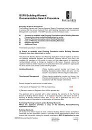
John Finnie Street, 1905 from “Ayrshire & Arran”, An illustrated Architectural<br />
Guide, Rob Close<br />
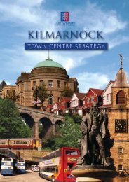
<strong>Kilmarnock</strong> Cross, late 19th century<br />
A rich heritage:<br />
Much of the west side of <strong>Kilmarnock</strong> town centre is covered<br />
by the John Finnie Street and Bank Street Outstanding<br />
Conservation Area. This area occupies a slightly sloping<br />
site running up to the base of Mount Pleasant, the hill that<br />
dominates the northern side of the town centre. The Railway<br />
line and 23 span Viaduct forms a definite edge to the northern<br />
part of the town centre. A stretch of the <strong>Kilmarnock</strong> Water,<br />
behind Bank Street, traverses the town centre and forms the<br />
10 | MAKE IT KILMARNOCK BOARD | EAST AYRSHIRE COUNCIL