Integrated Urban Development Plan (pdf) - Make It Kilmarnock
Integrated Urban Development Plan (pdf) - Make It Kilmarnock
Integrated Urban Development Plan (pdf) - Make It Kilmarnock

Create successful ePaper yourself
Turn your PDF publications into a flip-book with our unique Google optimized e-Paper software.
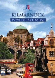
KILMARNOCK - INTEGRATED URBAN DEVELOPMENT PLAN<br />
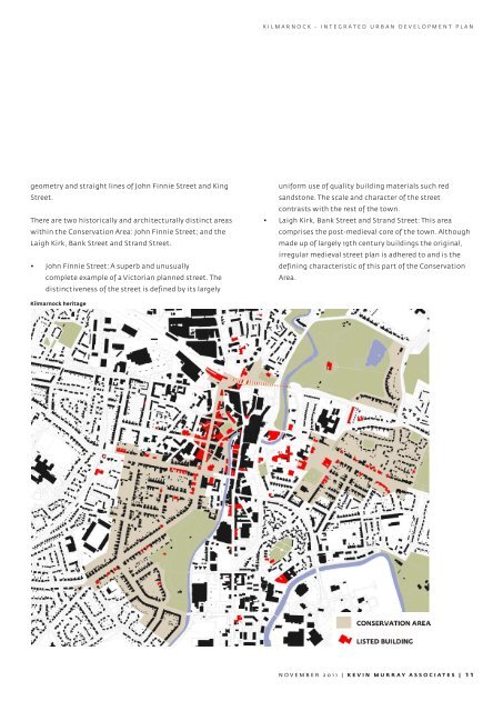
geometry and straight lines of John Finnie Street and King<br />
Street.<br />
There are two historically and architecturally distinct areas<br />
within the Conservation Area: John Finnie Street; and the<br />
Laigh Kirk, Bank Street and Strand Street.<br />
• John Finnie Street: A superb and unusually<br />
complete example of a Victorian planned street. The<br />
distinctiveness of the street is defined by its largely<br />
uniform use of quality building materials such red<br />
sandstone. The scale and character of the street<br />
contrasts with the rest of the town.<br />
• Laigh Kirk, Bank Street and Strand Street: This area<br />
comprises the post-medieval core of the town. Although<br />
made up of largely 19th century buildings the original,<br />
irregular medieval street plan is adhered to and is the<br />
defining characteristic of this part of the Conservation<br />
Area.<br />
<strong>Kilmarnock</strong> heritage<br />
NOVEMBER 2011 | KEVIN MURRAY ASSOCIATES | 11