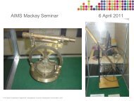
Surveying at Oyu Tolgoi Copper/Gold Mine - Chris Hutchison - AIMS
Surveying at Oyu Tolgoi Copper/Gold Mine - Chris Hutchison - AIMS
Surveying at Oyu Tolgoi Copper/Gold Mine - Chris Hutchison - AIMS

Create successful ePaper yourself
Turn your PDF publications into a flip-book with our unique Google optimized e-Paper software.
CONCLUSION (cont)<br />
The raise bore positions <strong>at</strong> surface, 512 level and 1300 level are affected by the<br />
combined projection and height scale factors <strong>at</strong> their levels. The projection scale<br />
factor is a constant but, because of the mine loc<strong>at</strong>ion in the zone and the l<strong>at</strong>itude of<br />
the mine, the height scale factor varied by about 200 mm per kilometre between the<br />
surface and the 1300 level.<br />
This fact is further complic<strong>at</strong>ed by the local <strong>Mine</strong> Surveyors not using either a<br />
projection or height scale factor in their traverses and the principal’s requirements<br />
th<strong>at</strong> we provide plane rectangular (mine grid) coordin<strong>at</strong>es for survey st<strong>at</strong>ions<br />
(including the raise bore sites) <strong>at</strong> each level.<br />
This led to there being a different local coordin<strong>at</strong>e <strong>at</strong> each mine level for the raise<br />
bore site to maintain a truly vertical shaft hftowards the centre of the earth.