Outline of Quino Recovery Plan - The Xerces Society
Outline of Quino Recovery Plan - The Xerces Society
Outline of Quino Recovery Plan - The Xerces Society

Create successful ePaper yourself
Turn your PDF publications into a flip-book with our unique Google optimized e-Paper software.
QUINO CHECKERSPOT BUTTERFLY<br />
(Euphydryas editha quino)<br />
DRAFT RECOVERY PLAN<br />
(January 2001)<br />
Region 1<br />
U.S. Fish and Wildlife Service<br />
Portland, Oregon<br />
Approved: XXXXXXXXXXXXXXXXXXXXXXXXXXXXXXXX<br />
Manager, California Nevada Operations Office,<br />
Region 1, U.S. Fish and Wildlife Service<br />
Date:<br />
XXXXXXXXXXXXXXXXXXXXXXXXXXXXXXXX
PRIMARY AUTHORS<br />
This recovery plan was prepared by:<br />
Alison Anderson<br />
Carlsbad Fish and Wildlife Office<br />
U.S. Fish and Wildlife Service<br />
<strong>The</strong> primary scientific authors <strong>of</strong> this recovery plan were the <strong>Quino</strong> Checkerspot<br />
Butterfly <strong>Recovery</strong> Team:<br />
Dr. Edith Allen, Team Chair<br />
Mark Dodero<br />
Dr. Travis Longcore<br />
Dr. Dennis Murphy<br />
Dr. Camille Parmesan<br />
Dr. Gordon Pratt<br />
Dr. Michael Singer<br />
i
DISCLAIMER<br />
<strong>Recovery</strong> plans delineate actions required to recover and protect federally listed<br />
plant and animal species. We (the U.S. Fish and Wildlife Service) publish<br />
recovery plans, sometimes preparing them with the assistance <strong>of</strong> recovery teams,<br />
contractors, State agencies, and other affected and interested parties. <strong>Recovery</strong><br />
teams serve as independent advisors to the Fish and Wildlife Service. Draft plans<br />
are published for public review and submitted to scientific peer review before we<br />
adopt them. Objectives <strong>of</strong> the recovery plan will be attained and any necessary<br />
funds made available subject to budgetary and other constraints affecting the<br />
parties involved, as well as the need to address other priorities. <strong>Recovery</strong> plans<br />
do not obligate other parties to undertake specific tasks and do not necessarily<br />
represent the view, <strong>of</strong>ficial position, or approval <strong>of</strong> any individuals or agencies<br />
involved in the plan formation other than our own. <strong>The</strong>y represent our <strong>of</strong>ficial<br />
position only after they have been signed by the Director, Regional Director, or<br />
California/Nevada Operations Manager as approved. Approved recovery plans<br />
are subject to modification as directed by new findings, changes in species status,<br />
and the completion <strong>of</strong> recovery tasks.<br />
Literature citation should read as follows:<br />
U.S. Fish and Wildlife Service. 2000. Draft <strong>Recovery</strong> <strong>Plan</strong> for the <strong>Quino</strong><br />
Checkerspot Butterfly (Euphydryas editha quino). Portland, Oregon. x + 123 pp.<br />
ii
ACKNOWLEDGMENTS<br />
We greatly appreciate the numerous individuals who, over the course <strong>of</strong> years,<br />
contributed to the conservation <strong>of</strong> the <strong>Quino</strong> checkerspot butterfly and the<br />
development <strong>of</strong> this recovery plan including members <strong>of</strong> the <strong>Recovery</strong> Team,<br />
Greg Ballmer, Ken Osborne, and David Faulkner. This draft recovery plan was<br />
prepared by Alison Anderson <strong>of</strong> the Carlsbad Fish and Wildlife Office with the<br />
assistance <strong>of</strong> Brenda McMillan and Nancy Kehoe. Tony McKinney, Stacey<br />
Love, Ed Turner, and Emilie Luciani assisted and advised on the use <strong>of</strong> the<br />
Geographic Information System (GIS) capabilities and development <strong>of</strong> <strong>Recovery</strong><br />
Unit maps. Other Fish and Wildlife Service staff, including Eric Hein,<br />
Christopher Nagano, Mark Elvin, Doug Kr<strong>of</strong>ta, Ken Berg, Andy Yuen, Nancy<br />
Gilbert, Jim Bartel, Michelle Shaughnessy, Susan Wynn, and Karin Cleary-Rose,<br />
have also contributed to the species’ conservation and recovery.<br />
iii
EXECUTIVE SUMMARY<br />
Current Status: <strong>The</strong> <strong>Quino</strong> checkerspot butterfly (Euphydryas editha quino,<br />
<strong>Quino</strong> checkerspot) is federally listed as endangered. This taxon occurs in San<br />
Diego and Riverside Counties and several localities in Baja California Norte,<br />
Mexico. Although some habitat is under public ownership, no known <strong>Quino</strong><br />
checkerspot habitat complexes are entirely protected, and the species continues<br />
to decline throughout its range.<br />
Habitat Requirements and Limiting Factors: <strong>The</strong> <strong>Quino</strong> checkerspot is found in<br />
association with topographically diverse landscapes that contain low to moderate<br />
levels <strong>of</strong> nonnative vegetation. Vegetation types that support the <strong>Quino</strong><br />
checkerspot are coastal sage scrub, open chaparral, juniper woodland, forblands,<br />
and native grassland. Soil and climatic conditions, as well as ecological and<br />
physical factors, affect the suitability <strong>of</strong> habitat within the species’ range. Urban<br />
and agricultural development, invasion <strong>of</strong> nonnative species, habitat<br />
fragmentation and degradation, increased fire frequency, and other humancaused<br />
disturbances have resulted in substantial losses <strong>of</strong> habitat throughout the<br />
species’ historic range. Conservation needs include protection and management<br />
<strong>of</strong> suitable and restorable habitat; habitat restoration and enhancement; and<br />
establishment <strong>of</strong> <strong>Quino</strong> checkerspot captive breeding program. This plan<br />
identifies six <strong>Recovery</strong> Units. <strong>Recovery</strong> Units are geographically bounded areas<br />
containing extant <strong>Quino</strong> checkerspot populations that are the focus <strong>of</strong> recovery<br />
actions or tasks. <strong>Recovery</strong> Units contain both lands that are considered essential<br />
to the long-term conservation <strong>of</strong> the <strong>Quino</strong> checkerspot (e.g., networks <strong>of</strong><br />
suitable habitat patches and connecting lands) and lands that are not considered<br />
essential (i.e. lands not used by the butterfly such as urban development).<br />
<strong>Recovery</strong> Priority: 6C, per criteria published in the Federal Register (48 FR<br />
43098; September 21, 1983). <strong>The</strong> priority is based on its being a subspecies<br />
(rather than a full species) with a high degree <strong>of</strong> threat, a moderate to low<br />
potential for recovery, and existing conflict between the species’ conservation<br />
and development.<br />
Objectives: <strong>The</strong> overall objective <strong>of</strong> this recovery plan is to reclassify the <strong>Quino</strong><br />
checkerspot to threatened and ensure the species’ long-term conservation.<br />
iv
Interim goals include (1) protecting habitat supporting known current population<br />
distributions (habitat complexes), (2) stabilizing populations within known<br />
population distributions (described habitat complexes), and (3) conducting<br />
research necessary to refine recovery criteria. Reclassification is appropriate<br />
when a taxon is no longer in danger throughout a significant portion <strong>of</strong> its range.<br />
Because data upon which to base decisions about reclassification are incomplete,<br />
downlisting criteria in this plan are necessarily preliminary. <strong>The</strong>re are<br />
insufficient data on which to base delisting criteria at this time.<br />
<strong>Recovery</strong> Criteria:<br />
1) Permanently protect habitat patches supporting known extant population<br />
distributions (habitat complexes) and possible landscape connectivity areas<br />
among them. Adequate habitat reserve area sizes are estimated to be between<br />
1,200-4,000 hectares (3,000-10,000 acres) total per habitat complex. <strong>Recovery</strong><br />
Units and habitat complexes described in this recovery plan are: Northwest<br />
Riverside <strong>Recovery</strong> Unit, containing the Gavilan Hills habitat complex;<br />
Southwest Riverside <strong>Recovery</strong> Unit, containing the Warm Springs Creek and<br />
Skinner/Johnson habitat complexes; South Riverside <strong>Recovery</strong> Unit, containing<br />
the Oak Mountain/Vail Lake, Sage Road/Billygoat Mountain, and Brown<br />
Canyon habitat complexes; South Riverside/North San Diego <strong>Recovery</strong> Unit,<br />
containing the Silverado and Dameron Valley/Oak Grove habitat complexes;<br />
Southwest San Diego <strong>Recovery</strong> Unit, containing the San Diego National<br />
Wildlife Refuge, Otay Lakes, Otay Foothills, Otay Mesa, Marron Valley, and<br />
Tecate habitat complexes; and Southeast San Diego <strong>Recovery</strong> Unit, containing<br />
the Jacumba Peak habitat complex.<br />
2) Permanently provide for and implement management <strong>of</strong> described habitat<br />
complexes to restore habitat quality, including maintenance <strong>of</strong> hostplant<br />
populations, maintenance <strong>of</strong> diverse nectar sources and pollinators, control <strong>of</strong><br />
nonnative plant invasion, and maintenance <strong>of</strong> internal landscape connectivity.<br />
<strong>The</strong> number <strong>of</strong> known occupied habitat patches and the density <strong>of</strong> butterflies<br />
within each <strong>Recovery</strong> Unit should be increased if declines are documented for 2<br />
consecutive years <strong>of</strong> average to high annual precipitation (based on the past 20<br />
years <strong>of</strong> local data). Management must be adaptive: i.e., ongoing surveys and<br />
monitoring must be conducted to refine management strategies and delimit<br />
v
temporal and geographic patterns <strong>of</strong> <strong>Quino</strong> checkerspot exchange among<br />
suitable habitat patches.<br />
3) Establish and maintain a captive propagation program for purposes <strong>of</strong> reintroduction<br />
and augmentation <strong>of</strong> wild populations, maintenance <strong>of</strong> refugia<br />
populations, and research.<br />
4) Initiate and implement a cooperative educational outreach program targeting<br />
areas where <strong>Quino</strong> checkerspot populations are most threatened.<br />
5) Two additional populations or metapopulations must be documented or<br />
introduced in the remaining undeveloped coastal areas <strong>of</strong> the <strong>Quino</strong><br />
checkerspot’s historic range. Undeveloped coastal areas include the western and<br />
northern slopes <strong>of</strong> the Santa Ana Mountains (northern slope, see proposed North<br />
Orange <strong>Recovery</strong> Unit description in <strong>Recovery</strong> Strategy section below), the<br />
northwest corner <strong>of</strong> San Diego County (see proposed Northwest San Diego<br />
<strong>Recovery</strong> Unit below), and undeveloped mesas and hills within the cities <strong>of</strong> San<br />
Diego, Poway, and Santee, and adjacent unincorporated land within San Diego<br />
County (see proposed South-central San Diego <strong>Recovery</strong> Unit below). Wellmanaged<br />
coastal preserves in San Diego or Orange County may be able to<br />
support stable populations <strong>of</strong> the <strong>Quino</strong> checkerspot butterfly. One <strong>of</strong> the two<br />
additional populations must include habitat within 10 kilometers (6 miles) <strong>of</strong> the<br />
ocean to maximize the stable marine climate influence and minimize<br />
susceptibility to drought. If new coastal populations are not documented by<br />
2004, experimental populations should be established and maintained until<br />
downlisting criteria are refined. Additional inland (east <strong>of</strong> coastal areas<br />
described above) habitat complexes documented outside <strong>of</strong> <strong>Recovery</strong> Units will<br />
not be counted as one <strong>of</strong> the two additional populations specified here, but<br />
should be considered important to recovery and addressed when delisting criteria<br />
are developed.<br />
6) <strong>The</strong> managed, protected population or metapopulation segments within<br />
currently described habitat complexes must demonstrate stability (constancy or<br />
resilience) without augmentation. When metapopulation distributions are<br />
determined by future research (one or more habitat complexes may belong to a<br />
single metapopulation) or defined by reserve boundaries, the unit monitored for<br />
vi
stability becomes the metapopulation. Stable <strong>Quino</strong> checkerspot populations are<br />
defined by this recovery plan as those in which decreases in the number <strong>of</strong><br />
occupied habitat patches are followed by increases <strong>of</strong> equal or greater magnitude<br />
within the 15 year period. <strong>The</strong> percent <strong>of</strong> patches that are occupied should be<br />
estimated by surveys for pre-diapause larval clusters (to demonstrate<br />
recruitment) in a sample <strong>of</strong> no less than 50 percent <strong>of</strong> the total number <strong>of</strong> patches<br />
identified within a population or metapopulation distribution. <strong>The</strong> surveyed<br />
sample <strong>of</strong> habitat patches must be distributed as equally as possible across the<br />
metapopulation distribution to avoid potential error caused by correlation <strong>of</strong><br />
suitability among nearby patches.<br />
7) Conduct research including: determining the distribution <strong>of</strong> extant<br />
metapopulations; conducting preliminary modeling <strong>of</strong> metapopulation dynamics;<br />
investigating the function <strong>of</strong> hilltops as a resource for <strong>Quino</strong> checkerspot<br />
populations; investigating the contribution <strong>of</strong> multiple-year diapause to<br />
metapopulation stability; monitoring populations for further evidence <strong>of</strong> climatedriven<br />
range shifts; determining the effects <strong>of</strong> elevated atmospheric carbon<br />
dioxide and nitrogen fertilization on the <strong>Quino</strong> checkerspot and its hostplant;<br />
determining the magnitude <strong>of</strong> threats from over-collection and non-native natural<br />
enemies.<br />
Actions needed:<br />
1) Protect habitat within the distribution <strong>of</strong> described habitat complexes.<br />
2) Restore habitat patches and enhance landscape connectivity within the<br />
distribution <strong>of</strong> the habitat complexes<br />
3) Erect barriers to prevent dispersal from habitat patches into adjacent<br />
high-traffic surface roads.<br />
4) Reduce <strong>of</strong>f-road vehicle activity within the distribution <strong>of</strong> habitat<br />
complexes and identified metapopulations<br />
5) Continue yearly reviews, monitoring and augmentation until stable<br />
metapopulations have been maintained for 15 years without<br />
augmentation.<br />
6) Establish and maintain a captive propagation program.<br />
7) Initiate and implement an educational outreach program.<br />
8) Conduct biological research needed to refine recovery criteria and guide<br />
conservation efforts.<br />
vii
9) Manage activity on trails where habitat occurs in recreational use areas,<br />
particularly during the active season for <strong>Quino</strong> checkerspot larvae and<br />
adults.<br />
10) Locate or introduce two populations or metapopulations in the remaining<br />
undeveloped coastal areas <strong>of</strong> the <strong>Quino</strong> checkerspot’s historic range.<br />
11) Survey for habitat and undocumented metapopulations in undeveloped<br />
areas outside <strong>of</strong> <strong>Recovery</strong> Units.<br />
12) Reduce fire frequency and illegal trash dumping in habitat areas<br />
13) Enter into a dialogue with governmental and nongovernmental<br />
organizations in Baja California, Mexico.<br />
14) Enter into dialogue with the Cahuilla Band <strong>of</strong> Mission Indians.<br />
Total Estimated Cost to Meet Interim <strong>Recovery</strong> Objectives: $7,678,000+. <strong>The</strong><br />
estimated costs for many tasks remain to be determined; therefore, total costs<br />
listed are lower than the total required to achieve recovery objectives. Some<br />
tasks (e.g, habitat protection) will benefit multiple listed species in addition to<br />
the <strong>Quino</strong> checkerspot, so their costs are not wholly attributable to this species.<br />
Date <strong>of</strong> <strong>Recovery</strong>: Downlisting could be initiated in 2020, if recovery criteria<br />
are met.<br />
viii
TABLE OF CONTENTS<br />
I. INTRODUCTION ........................................................................................................ 1<br />
A. Brief Overview ............................................................................................ 1<br />
B. Description and Taxonomy ........................................................................... 5<br />
C. Distribution and Habitat Considerations ........................................................ 7<br />
D. Life History ................................................................................................ 16<br />
1. Life Cycle ........................................................................................... 17<br />
2. Adult Behavior and Resource Use ....................................................... 20<br />
3. Climatic Effects ................................................................................... 25<br />
4. Metapopulation Structure .................................................................... 25<br />
E. Reasons for Decline and Current Threats .................................................... 30<br />
1. Loss and Fragmentation <strong>of</strong> Habitat and Landscape Connectivity ........... 31<br />
2. Invasion by Nonnative <strong>Plan</strong>ts ............................................................... 32<br />
3. Off-road Vehicle Activity .................................................................... 33<br />
4. Grazing ............................................................................................... 34<br />
5. Fire ..................................................................................................... 35<br />
6. Enhanced Soil Nitrogen ....................................................................... 36<br />
7. Effects <strong>of</strong> Increasing Atmospheric Carbon Dioxide Concentration<br />
.................................................................................................... 37<br />
8. Climate Change ................................................................................... 38<br />
F. Current and Evolving Conservation Measures ............................................ 40<br />
1. Regional <strong>Plan</strong>ning ................................................................................ 41<br />
2. San Diego National Wildlife Refuge ..................................................... 43<br />
3. Captive Propagation ............................................................................ 44<br />
4. California Department <strong>of</strong> Fish and Game .............................................. 44<br />
G. <strong>Recovery</strong> Strategy ..................................................................................... 45<br />
1. Modeling ............................................................................................ 47<br />
2. Restoring Landscape Connectivity ....................................................... 48<br />
3. Habitat Restoration ............................................................................. 48<br />
4. Surveys and Monitoring ...................................................................... 49<br />
5. Captive Propagation ............................................................................ 50<br />
6. Multiple Species Reserves and the <strong>Quino</strong> Checkerspot ....................... 50<br />
7. <strong>Recovery</strong> Units ................................................................................... 52<br />
8. Proposed <strong>Recovery</strong> Units .................................................................... 59<br />
II. RECOVERY .............................................................................................................. 70<br />
A. Objectives ................................................................................................. 70<br />
B. <strong>Recovery</strong> Criteria ....................................................................................... 70<br />
C. <strong>Recovery</strong> Task Narrative ........................................................................... 73<br />
D. Preliminary Recommendations for Proposed <strong>Recovery</strong> Units ....................... 78<br />
III. LITERATURE CITED .............................................................................................. 80<br />
ix
A. References ................................................................................................. 80<br />
B. Personal Communications ........................................................................... 91<br />
IV. IMPLEMENTATION SCHEDULE ......................................................................... 92<br />
APPENDIX I<br />
<strong>Quino</strong> Checkerspot Butterfly Life Cycle Diagram ........................................... 103<br />
APPENDIX II<br />
Habitat Restoration Methods ......................................................................... 105<br />
APPENDIX III<br />
<strong>The</strong> Annual Forbland Hypothesis: An extinct<br />
vegetation type in remnant <strong>Quino</strong> habitat? ....................................................... 120<br />
APPENDIX IV<br />
Glossary <strong>of</strong> Terms ......................................................................................... 122<br />
List <strong>of</strong> Tables<br />
Table 1. Bay checkerspot metapopulation distribution scales ............................ 30<br />
List <strong>of</strong> Figures<br />
Figure 1. <strong>Quino</strong> checkerspot butterfly ................................................................. 2<br />
Figure 2. <strong>Quino</strong> checkerspot <strong>Recovery</strong> Units and observations ........................... 3<br />
Figure 3. <strong>Quino</strong> checkerspot butterfly <strong>Recovery</strong> Unit index ................................ 4<br />
Figure 4. Northwest Riverside <strong>Recovery</strong> Unit .................................................. 64<br />
Figure 5. Southwest Riverside <strong>Recovery</strong> Unit .................................................. 65<br />
Figure 6. South Riverside <strong>Recovery</strong> Unit ......................................................... 66<br />
Figure 7. South Riverside/North San Diego <strong>Recovery</strong> Unit .............................. 67<br />
Figure 8. Southwest San Diego <strong>Recovery</strong> Unit ................................................ 68<br />
Figure 9. Southeast San Diego <strong>Recovery</strong> Unit ................................................. 69<br />
x
I. INTRODUCTION<br />
A. Brief Overview<br />
<strong>The</strong> distribution and abundance <strong>of</strong> the <strong>Quino</strong> checkerspot butterfly (Euphydryas<br />
editha quino) have been dramatically reduced during the past century as a result<br />
<strong>of</strong> agricultural and urban development and other land-use changes in southern<br />
California. Immediate protection and management <strong>of</strong> the habitats that support<br />
the species, initiation <strong>of</strong> a captive propagation program, and development <strong>of</strong> the<br />
monitoring scheme and research agenda described in this recovery plan will be<br />
necessary to prevent extinction <strong>of</strong> the <strong>Quino</strong> checkerspot.<br />
<strong>The</strong> <strong>Quino</strong> checkerspot (Figure 1) is now known only from western Riverside<br />
County, southern San Diego County, and northern Baja California, Mexico,<br />
although the historic range <strong>of</strong> this taxon included much <strong>of</strong> coastal California<br />
south <strong>of</strong> Ventura County and inland valleys south <strong>of</strong> the Tehachapi Mountains<br />
(U.S. Fish and Wildlife Service database). More than 75 percent <strong>of</strong> the <strong>Quino</strong><br />
checkerspot’s historic range has been lost (Brown 1991, U.S. Fish and Wildlife<br />
Service database), including more than 90 percent <strong>of</strong> the coastal mesa and bluff<br />
distribution. <strong>Quino</strong> checkerspot populations have been reduced in number and<br />
size by more than 95 percent range-wide primarily due to direct and indirect<br />
human impacts including habitat loss and fragmentation, invasion <strong>of</strong> nonnative<br />
plant species, and disrupted fire regimes (D. Bauer, D. Murphy, and M. Singer,<br />
pers. comm.).<br />
This recovery plan describes six geographic areas (<strong>Recovery</strong> Units) containing<br />
habitat that supports extant <strong>Quino</strong> checkerspot populations (Figure 2, Figure 3).<br />
<strong>Recovery</strong> Units contain both lands that are considered essential and lands that<br />
are not considered essential to the conservation <strong>of</strong> the species. Determination <strong>of</strong><br />
management needs and distribution <strong>of</strong> habitat required for long-term persistence<br />
<strong>of</strong> the species will require further surveys, monitoring, modeling, and other<br />
research described in the recovery task portion <strong>of</strong> this document. Habitat within<br />
the current known distribution <strong>of</strong> the species ranges from moderately to highly<br />
1
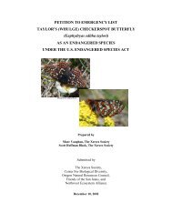
Figure 1. <strong>Quino</strong> checkerspot butterfly. Photo used by permission <strong>of</strong> Guy<br />
Bruyea.<br />
2
Insert Figure 2<br />
3
Insert Figure 3<br />
4
disturbed and invaded by nonnative species. No pristine habitat remains for the<br />
butterfly north <strong>of</strong> the international border (D. Murphy, G. Pratt, M. Dodero, and<br />
C. Parmesan, pers. comm.).<br />
We listed the <strong>Quino</strong> checkerspot butterfly as an endangered species on January<br />
16, 1997 (62 FR 2313). Because we concluded that designation <strong>of</strong> critical<br />
habitat was not prudent at that time, critical habitat has not been designated.<br />
However, the Ninth Circuit Court has ordered the U.S. Fish and Wildlife Service<br />
to reassess the finding <strong>of</strong> prudency and either publish a notice <strong>of</strong> determination<br />
reaffirming that critical habitat is not prudent by June 1, 2001, or to propose<br />
critical habitat by February 1, 2001, with a final determination due by October 1,<br />
2001.<br />
This species has a <strong>Recovery</strong> Priority <strong>of</strong> 6C, based on the classification system<br />
published in the Federal Register (48 FR 43098; September 21, 1983). This<br />
priority number reflects the subspecific status <strong>of</strong> the butterfly, a high degree <strong>of</strong><br />
threat, a low potential for recovery, and existing conflict with construction or<br />
other land development. This recovery plan attempts to reduce the risk <strong>of</strong><br />
species extinction by recommending protection and long-term management <strong>of</strong><br />
habitat necessary to support stable populations or metapopulations. Current<br />
habitat conditions are so degraded and population sizes are so low range-wide<br />
that long-term adaptive management will also be required. Protection <strong>of</strong> highquality<br />
habitats with stable <strong>Quino</strong> checkerspot populations or metapopulations in<br />
Baja California, Mexico, is also needed.<br />
B. Description and Taxonomy<br />
<strong>The</strong> <strong>Quino</strong> checkerspot butterfly is a member <strong>of</strong> the family Nymphalidae (brushfooted<br />
butterflies) and the subfamily Melitaeinae (checkerspots and fritillaries).<br />
<strong>The</strong> <strong>Quino</strong> checkerspot is a subspecies <strong>of</strong> Euphydryas editha; it differs from<br />
other subspecies in a variety <strong>of</strong> characteristics including size, wing coloration,<br />
and larval and pupal phenotype (Mattoni et al. 1997).<br />
<strong>The</strong> butterfly species now commonly called the <strong>Quino</strong> checkerspot has<br />
undergone several nomenclatural changes. It was originally described as<br />
Melitaea quino (Behr 1863). Gunder (1929) reduced it to a subspecies <strong>of</strong><br />
5
Euphydryas chalcedona. At the same time, he described Euphydryas editha<br />
wrighti from a checkerspot specimen collected in San Diego. After reexamining<br />
Behr’s descriptions and specimens, Emmel et al. (1998) concluded that the<br />
<strong>Quino</strong> checkerspot should be associated with E. editha, not E. chalcedona, and<br />
that it was synonymous with E. editha wrighti. Because E. editha wrighti is a<br />
junior synonym for the <strong>Quino</strong> checkerspot, E. editha quino is now the accepted<br />
scientific name.<br />
<strong>The</strong> adult <strong>Quino</strong> checkerspot butterfly (Figure 1), has a wingspan <strong>of</strong><br />
approximately 4 centimeters (1.5 inches). <strong>The</strong> dorsal (top) sides <strong>of</strong> the wings<br />
have a red, black, and cream colored checkered pattern; the ventral (bottom)<br />
sides are dominated by red and cream. <strong>The</strong> abdomen <strong>of</strong> <strong>Quino</strong> checkerspots has<br />
red stripes across the top. <strong>Quino</strong> checkerspot larvae are black with a row <strong>of</strong> nine<br />
orange tubercles (fleshy/hairy extensions) on their back. Pupae are mottled<br />
black on a pale blue-gray background, and extremely cryptic. Two butterflies<br />
that co-occur with the <strong>Quino</strong> checkerspot and are most morphologically similar<br />
are the chalcedon or variable checkerspot (Euphydryas chalcedona) and Gabb's<br />
checkerspot (Chlosyne gabbi). Inexperienced surveyors in the field may also<br />
confuse the <strong>Quino</strong> checkerspot with other butterfly species that have similar<br />
coloration and behavior patterns, such as Wright’s checkerspot (<strong>The</strong>ssalia<br />
leanira wrighti). Chalcedon checkerspot adults are darker and <strong>of</strong>ten larger than<br />
<strong>Quino</strong> checkerspots, and have white abdominal stripes and spots instead <strong>of</strong> red<br />
stripes. Male and female Gabb’s checkerspot adults have a more orange<br />
appearance than <strong>Quino</strong> checkerspots, but female coloration is higher contrast and<br />
may closely resemble <strong>Quino</strong> checkerspots. Gabb’s checkerspots may be<br />
differentiated from <strong>Quino</strong> checkerspots by silver-white spots on their<br />
underwings, the lack <strong>of</strong> red abdominal stripes, and a scalloped (slightly indented)<br />
forewing margin. Because adult morphology <strong>of</strong> Euphydryas butterfly species is<br />
variable, a combination <strong>of</strong> morphological characters should be used to<br />
distinguish them from similar species in the field.<br />
6
C. Distribution and Habitat Considerations<br />
<strong>The</strong> <strong>Quino</strong> checkerspot was historically distributed throughout the coastal slope<br />
<strong>of</strong> southern California, including Los Angeles, Orange, Riverside, San Diego,<br />
and San Bernardino counties, and northern Baja California, Mexico (Mattoni et<br />
al. 1997, U.S. Fish and Wildlife Service database). That distribution included<br />
the westernmost slopes <strong>of</strong> the Santa Monica Mountains, the Los Angeles plain<br />
and Transverse Ranges to the edge <strong>of</strong> the upper Anza-Borrego desert, and south<br />
to El Rosario in Baja California, Mexico (Emmel and Emmel 1973, Mattoni et<br />
al. 1997, U.S. Fish and Wildlife Service database). Although historical<br />
collection records allow for an estimate <strong>of</strong> a species’ range, such records usually<br />
underestimate the number <strong>of</strong> historical sites and extent <strong>of</strong> local distributions.<br />
Collectors tended to frequent well-known sites, and no systematic or<br />
comprehensive surveys for the <strong>Quino</strong> checkerspot have ever been conducted<br />
(Mattoni et al. 1997).<br />
As recently as the 1950's, collectors described the <strong>Quino</strong> checkerspot as<br />
occurring on every coastal bluff, inland mesa top, and lower mountain slope in<br />
San Diego County and coastal northern Baja California (D. Bauer, pers. comm.).<br />
<strong>The</strong>se observations indicate that the <strong>Quino</strong> checkerspot was historically<br />
widespread throughout the southern California landscape, and occurred in a<br />
variety <strong>of</strong> vegetation types, including coastal sage scrub, open chaparral, juniper<br />
woodland, forblands, and grasslands. By the 1970's, most <strong>of</strong> the coastal bluff<br />
and mesa habitats in southern California had been urbanized or otherwise<br />
disturbed. However, the butterfly still occupied known habitat locations inland<br />
and at higher elevations including Dictionary Hill, Otay Lakes, and San Miguel<br />
Mountain in San Diego County, and the Gavilan Hills in Riverside County. By<br />
the middle 1980's the species was thought to have disappeared from the known<br />
locations; the petition to list the species in 1988 suggested that it might be<br />
extinct. Nonetheless, new populations were discovered in Riverside County, the<br />
butterfly was rediscovered in San Diego County, and the species continued to<br />
survive in northern Baja California, Mexico (D. Murphy and M. Singer, pers.<br />
comm.). Current information suggests that the butterfly has been extirpated<br />
from Los Angeles, Orange, and San Bernardino Counties (Figure 2). Most<br />
California populations probably occur in marginal habitat on the periphery <strong>of</strong><br />
historic metapopulation centers (Parmesan 1996; D. Murphy, pers. comm.).<br />
7
<strong>The</strong> <strong>Quino</strong> checkerspot butterfly primarily inhabits grassland, forbland, juniper<br />
woodland, and open scrub and chaparral communities that support native species<br />
<strong>of</strong> plantain (<strong>Plan</strong>tago erecta and P. patagonica, its primary larval hostplants),<br />
and a variety <strong>of</strong> adult nectar resources. It is possible that some populations<br />
exclusively use other native plant species such as owl’s clover (Castilleja<br />
exserta) as primary hostplants when <strong>Plan</strong>tago is absent; however, this possibility<br />
has not been confirmed (G. Pratt, pers. comm.). <strong>The</strong>se areas tend to be<br />
distributed as patches in a mosaic <strong>of</strong> vegetation communities. Habitat patch<br />
suitability is determined primarily by larval host plant density, topographic<br />
diversity, nectar resource availability, and climatic conditions (Singer 1972,<br />
Murphy 1982, Weiss et al. 1988, Murphy et al. 1990). Combined, these varying<br />
habitat features result in local butterfly population density fluctuations and<br />
periodic extirpation events within patches <strong>of</strong> habitat (Ehrlich 1965). Osborne<br />
and Redak’s (2000) larval microhabitat use study indicated that patches <strong>of</strong><br />
exposed soil with abundant solar insolation and host plants, combined with<br />
interspersed shrub cover and topographic heterogeneity, provides additional<br />
long-term stability to <strong>Quino</strong> checkerspot populations.<br />
Occupancy <strong>of</strong> a network <strong>of</strong> habitat patches by Euphydryas editha populations<br />
over the long term requires a metapopulation dynamic - an exchange <strong>of</strong><br />
individuals between patches - allowing for recolonization <strong>of</strong> habitat patches that<br />
may be temporarily unoccupied by larvae following local extirpation events<br />
(Harrison et al. 1988, Harrison 1989, Thomas 1994, Singer and Thomas 1996).<br />
Destruction, isolation, or disturbance <strong>of</strong> habitat patches temporarily not occupied<br />
by larvae can disrupt metapopulation structure, reducing the likelihood <strong>of</strong><br />
recolonization and making extirpation events permanent (Hanski 1999).<br />
Metapopulation stability requires a minimum number <strong>of</strong> habitat patches<br />
connected by dispersal corridors (landscape connectivity), below which local<br />
persistence is no longer possible. Unfortunately, determining which, if any,<br />
habitat patches are not essential is a complex and time-consuming research<br />
question. All known <strong>Quino</strong> checkerspot habitat patch complexes (belonging to<br />
as yet undescribed metapopulation distributions) in southern California have<br />
been disrupted, resulting in instability and loss <strong>of</strong> metapopulations (Figure 2)<br />
(D. Murphy, pers. comm.).<br />
8
Disturbances that have compromised <strong>Quino</strong> checkerspot metapopulation<br />
integrity include conversion <strong>of</strong> habitat by development or vegetation-type<br />
changes, grazing, trampling, fragmentation <strong>of</strong> habitat, and reduction or<br />
constraining <strong>of</strong> the landscape connectivity that facilitates habitat recolonization.<br />
Linkage <strong>of</strong> suitable habitat patches by adult dispersal corridors (landscape<br />
connectivity) is crucial to metapopulation stability. Habitat linkage areas should<br />
connect as many habitat patches as possible to optimize metapopulation<br />
dynamics (Thomas 1994). Habitat patches with fewer and/or longer distance<br />
linkages to other patches have lower probability <strong>of</strong> natural recolonization<br />
following local extirpation events. Linkages greater than 1 kilometer (0.6 mile)<br />
are not likely to be used by dispersing Euphydryas editha adults (Harrison et al.<br />
1989). By definition, linkage areas do not support larval host plants in densities<br />
sufficient to be considered habitat, but may support nectar sources used by<br />
dispersing adult butterflies. Linkage areas must be free <strong>of</strong> dispersal barriers<br />
(artificial structures, dense stands <strong>of</strong> trees or tall shrubs) and mortality sinks (e.g.<br />
high-traffic roads).<br />
Simply preventing agricultural or urban development and grazing in occupied<br />
habitat will not be sufficient to protect resident populations. Undeveloped lands<br />
infused with or completely surrounded by development experience direct and<br />
indirect human disturbance including trampling, <strong>of</strong>f road vehicle use, dumping,<br />
pollution, and enhanced nonnative species invasion, all impacts that reduce<br />
population stability. Protected areas larger than habitat patch boundaries or<br />
highly managed interfaces between development and habitat patches are needed<br />
within the distribution <strong>of</strong> a metapopulation (<strong>of</strong>ten referred to as the<br />
metapopulation “footprint” [e.g. Launer and Murphy 1994]). <strong>The</strong> need to protect<br />
habitat from indirect effects <strong>of</strong> nearby or intruding development is evidenced by<br />
the apparent extirpation <strong>of</strong> local populations in the Lake Hodges and Dictionary<br />
Hill areas, where butterflies have not been recorded since the 1980's (Figure 2),<br />
despite focused efforts to find them (Caltrans 2000; City <strong>of</strong> San Diego 2000;<br />
Faulkner 1998; G. Pratt, pers. comm.) and periodic visits by local lepidopterists<br />
(D. Faulkner and K. Williams, pers. comm.). Lake Hodges and Dictionary Hill<br />
were large, primarily undeveloped areas with historical records indicating longterm<br />
stable occupancy prior to isolation by development (Figure 2). Habitat<br />
suitability may be conserved by preservation <strong>of</strong> undeveloped land between<br />
development and habitat areas requiring minimal management, or, if intervening<br />
9
natural lands are absent, by costly perpetual management to restrict human<br />
traffic, control nonnative species invasion, and augment butterfly populations.<br />
Spatially clustered <strong>Quino</strong> checkerspot observations (see Figure 2) are called<br />
habitat complexes in this recovery plan. Habitat complexes indicate the<br />
approximate distribution <strong>of</strong> linked habitat patch networks within the distribution<br />
<strong>of</strong> extant metapopulations. Metapopulation distributions (currently undescribed)<br />
may include more than one habitat complex and are likely to be greater than the<br />
distribution <strong>of</strong> the habitat complexes described below. Further research is<br />
required to determine the maximum distribution <strong>of</strong> metapopulations required for<br />
stability. Habitat considerations listed below are largely drawn from personal<br />
observations <strong>of</strong> our staff and the <strong>Recovery</strong> Team..<br />
Gavilan Hills habitat complex: <strong>Quino</strong> checkerspot individuals were observed in<br />
Harford Springs County Park in 1998, a site that was once part <strong>of</strong> a more<br />
extensive, well documented distribution (Figure 2). <strong>Quino</strong> checkerspot<br />
butterflies were last observed at the southern margin <strong>of</strong> Lake Mathews in 1986<br />
(Figure 2). <strong>The</strong> <strong>Quino</strong> checkerspot was historically abundant in this area, with<br />
consistently high densities reported by collectors from the 1950's to the mid<br />
1980's (Orsak 1978; K. Osborne and G. Pratt, pers. comm.). <strong>The</strong>refore the<br />
Gavilan Hills habitat complex distribution includes the vicinity <strong>of</strong> Harford<br />
Springs park and also habitat areas south <strong>of</strong> Lake Mathews that are part <strong>of</strong> the<br />
documented historical distribution (Figure 2).<br />
Habitat Considerations:<br />
<strong>The</strong> Gavilan Hills area is characterized by high-quality habitat patches with<br />
dense, extensive stands <strong>of</strong> plantain (<strong>Plan</strong>tago spp.) in open spaces, juniper<br />
woodland, coastal sage scrub, and grassland. Landscape connectivity is<br />
compromised primarily by Cajalco road. Landscape connectivity still exists<br />
between Harford Springs County Park and Lake Mathews, and apparently<br />
suitable habitat containing dense stands <strong>of</strong> plantain exists south <strong>of</strong> Lake<br />
Mathews in the vicinity <strong>of</strong> Black Rocks, west <strong>of</strong> Monument Peak (K. Osborne,<br />
pers. comm.). Stands <strong>of</strong> plantain also occur in the vicinities <strong>of</strong> Estelle Mountain,<br />
Railroad Canyon Reservoir, and the town <strong>of</strong> Sun City (G. Pratt, pers. comm.). It<br />
is possible that the Black Rocks habitat patch was a historical source <strong>of</strong><br />
butterflies for other habitat patches in the area (K. Osborne, pers. comm.).<br />
10
<strong>The</strong> Gavilan Hills area exhibits diverse topography and vegetation that is<br />
dominated by chamise chaparral and juniper woodlands. Clay soils are present<br />
throughout. Rounded hills provide gentle south- and northwest-facing slopes as<br />
well as shallow soils along rock faces where dwarf (or dot-seed) plantain<br />
(<strong>Plan</strong>tago erecta), the primary hostplant in this area, is locally abundant.<br />
Flattened ridge tops may also serve as suitable habitats. Nearby open juniper<br />
woodland provides additional habitat.<br />
Warm Springs Creek habitat complex: Recent <strong>Quino</strong> checkerspot observations<br />
are distributed between Interstate 215 and State Route 79 north <strong>of</strong> Murrieta Hot<br />
Springs Road to at least Scott Road concentrated in the vicinity <strong>of</strong> Warm Springs<br />
Creek (Figure 2), although much <strong>of</strong> the habitat at the southern end <strong>of</strong> the<br />
Hogbacks, where butterflies were recently observed, was disturbed in 1998.<br />
Habitat Considerations:<br />
Western connectivity is constrained by Interstate 215. Landscape connectivity is<br />
fragmented by ongoing development in this metapopulation, particularly in the<br />
vicinity <strong>of</strong> Murrieta Hot Springs Road. <strong>The</strong> extent <strong>of</strong> landscape connectivity to<br />
the north is not known. <strong>Quino</strong> checkerspot habitat is associated with openings in<br />
coastal sage scrub and typified by low rounded hills, clay soil lenses, and<br />
cryptogamic soil crusts. Dwarf plantain (<strong>Plan</strong>tago erecta) is the primary larval<br />
host plant in this area.<br />
Skinner/Johnson habitat complex: Recent <strong>Quino</strong> checkerspot observations are<br />
distributed throughout Southwest Riverside County Multiple Species Reserve,<br />
and are concentrated around Lake Skinner and south <strong>of</strong> Benton and Borel Roads<br />
(Johnson Ranch) (Figure 2). Although <strong>Quino</strong> checkerspots have also recently<br />
been observed in eastern Temecula, north and east <strong>of</strong> Butterfield Stage Road,<br />
primarily in the Crowne Hill area (Figure 2), this area is completely isolated by<br />
development and authorized for further development (U.S. Fish and Wildlife<br />
Service 2000).<br />
Habitat Considerations:<br />
Landscape connectivity within the habitat complex is compromised by surface<br />
roads such as Washington Street and Borel Road, which may now or in the<br />
future be mortality sinks during periods <strong>of</strong> high traffic. Any landscape<br />
11
connectivity that may have existed between other occupied habitat patches and<br />
the Crowne Hill habitat area has been constrained by development, leaving the<br />
habitat isolated and subject to rapid degradation. Landscape connectivity<br />
between the Warm Springs Creek and Skinner/Johnson habitat complexes has<br />
been constrained by State Route 79 and associated development. Although State<br />
Route 79 separates the Warm Springs Creek habitat complex from the<br />
Skinner/Johnson habitat complex, the two complexes might function as one<br />
metapopulation if landscape connectivity were restored. Restoration <strong>of</strong><br />
connectivity between the Skinner/Johnson and Warm Springs Creek habitat<br />
complexes could help stabilize populations associated with both habitat<br />
complexes. <strong>Quino</strong> habitat sites are in openings in coastal sage scrub and typified<br />
by low rounded hills, clay soil lenses, and soil crusts. Dwarf plantain (<strong>Plan</strong>tago<br />
erecta) is the primary host plant found in this area.<br />
Oak Mountain/Vail Lake, Sage Road/Billy Goat Mountain, and Brown Canyon<br />
habitat complexes: Recent <strong>Quino</strong> checkerspot butterfly observations are<br />
concentrated in the vicinities <strong>of</strong> Oak Mountain, Vail Lake, Pauba Valley (Figure<br />
2), and in the vicinity <strong>of</strong> Sage Road from Magee Hills and the town <strong>of</strong> Sage<br />
south and east to Wilson Valley and Billy Goat Mountain (Figure 2). One<br />
possibly isolated population occurs just southeast <strong>of</strong> Hemet in Brown Canyon<br />
(Figure 2).<br />
Habitat Considerations:<br />
<strong>The</strong> site just southeast <strong>of</strong> Hemet may be isolated from documented<br />
metapopulations to the south by intervening areas <strong>of</strong> contiguous dense chaparral.<br />
Landscape connectivity in the habitat complex areas is generally good, and<br />
habitat is largely unfragmented. Landscape connectivity most likely exists<br />
between the Oak Mountain/Vail Lake and Sage Road/Billy Goat Mountain<br />
habitat complexes. <strong>Quino</strong> checkerspot habitat in these areas is characterized by<br />
rounded hills with gabbro clay lenses and soils in the west blending with granitic<br />
soils to the east. Habitat patches also occur on stable soil crusts, especially in<br />
granitic soil areas, and red clay lenses (U.S. Fish and Wildlife Service 1997b).<br />
Dwarf plantain (<strong>Plan</strong>tago erecta) and woolly plantain (P. patagonica) are the<br />
primary host plants found in these areas.<br />
12
Silverado and Dameron Valley/Oak Grove habitat complexes: Recent <strong>Quino</strong><br />
checkerspot observations are distributed across Bureau <strong>of</strong> Land Management<br />
holdings and the Silverado Ranch Mitigation Bank south <strong>of</strong> the Cahuilla Indian<br />
Reservation (Figure 2). Increased survey efforts in 2000 expanded the Silverado<br />
habitat complex distribution, though much <strong>of</strong> the area remains to be surveyed.<br />
Two recent butterfly observation sites are found distant from the Silverado<br />
mitigation bank, one in northern Dameron Valley south <strong>of</strong> State Route 79, and<br />
one just south <strong>of</strong> that in Oak Grove Valley (Figure 2).<br />
Habitat Considerations:<br />
Habitat patches appear to be well connected in the Silverado Ranch area, and<br />
habitat patches are largely unfragmented. <strong>The</strong> known distribution <strong>of</strong> this<br />
metapopulation is relatively well protected. Habitat areas are primarily owned<br />
by the Bureau <strong>of</strong> Land Management and Silverado Ranch Mitigation Bank<br />
(Pratt, 2000). <strong>The</strong> Oak Grove Valley is highly invaded by nonnative grasses at<br />
lower elevations, but much habitat appears to remain on the hills and habitat in<br />
areas surrounding Oak Grove remains relatively undeveloped, including the<br />
adjacent Chihuahua Valley to the east. Elevation and other habitat elements in<br />
the Chihuahua Valley area resemble those found in habitat to the north.<br />
Landscape connectivity probably exists between the Dameron Valley/Oak Grove<br />
Valley and Silverado Ranch habitat complexes. Apparently suitable habitat has<br />
also been observed in the hills along Lost Valley Road just north <strong>of</strong> State Route<br />
79 near Warner Springs, and may also exist in the Chihuahua Valley. Habitat in<br />
these areas is characterized by rounded hills with gabbro clay lenses and soils on<br />
the west side blending with granitic soils to the east. Habitat patches also occur<br />
on red clay lenses and stable soil crusts (especially in granitic soil areas) (U.S.<br />
Fish and Wildlife Service 1997a). Woolly plantain (<strong>Plan</strong>tago patagonica) is the<br />
only primary host plant found in the Silverado area (Pratt 2000), although dwarf<br />
plantain (P. erecta) is found to the south and the east.<br />
Marron Valley and Tecate habitat complexes: Recent <strong>Quino</strong> checkerspot<br />
observations are concentrated on the eastern slope <strong>of</strong> Otay Mountain and<br />
ridgelines along the international border in the vicinity <strong>of</strong> Marron Valley (Figure<br />
2). Occupancy likely extends south across the international border, and it is<br />
possible that the majority <strong>of</strong> the population distribution is in Baja California,<br />
13
Mexico. Another recent record is located east <strong>of</strong> Marron Valley near the town <strong>of</strong><br />
Tecate (Figure 2).<br />
Habitat Considerations:<br />
Habitat patches within this complex remain relatively well connected. In<br />
addition, some degree <strong>of</strong> landscape connectivity may exist north and south <strong>of</strong><br />
Otay Mountain between the Otay Mesa and Marron Valley habitat complexes.<br />
Most occupied habitat in this area occur on public owned land. Generally, most<br />
occupancy is found along the upper rounded ridgelines, and soils that most <strong>of</strong>ten<br />
support the <strong>Quino</strong> checkerspot are red or gray colored clay. Dwarf plantain<br />
(<strong>Plan</strong>tago erecta) is the primary host plant found in this area.<br />
San Diego National Wildlife Refuge, Otay Lake, Otay Mesa, and Otay Mountain<br />
Foothills habitat complexes: Recent <strong>Quino</strong> checkerspot observations in the area<br />
are concentrated northeast and southeast <strong>of</strong> Otay Lakes (Figure 2), with a smaller<br />
cluster concentrated along the southwestern slope <strong>of</strong> Otay Mountain (Figure 2).<br />
Other recent butterfly observations are located on the San Diego National<br />
Wildlife Refuge northeast <strong>of</strong> Sweetwater Reservoir, and along the mesa rim<br />
above the Otay River and at the Salt Creek confluence (Figure 2). <strong>The</strong> Otay<br />
Lakes area historically supported a large population that extended south to Otay<br />
Mesa and across the international border (Figure 2, Murphy and White 1984).<br />
<strong>The</strong> historic population distribution extended across the entire mesa with high<br />
densities being reported from the vicinity <strong>of</strong> Brown Field. <strong>Quino</strong> checkerspot<br />
habitat restoration activities are currently being undertaken adjacent to a recent<br />
<strong>Quino</strong> checkerspot observation on the mesa rim just west <strong>of</strong> Johnson Canyon<br />
(Figure 2). Restoration <strong>of</strong> vernal pool habitat that includes essential elements <strong>of</strong><br />
<strong>Quino</strong> checkerspot habitat is also ongoing at the site <strong>of</strong> a collection record on the<br />
mesa top between Dennery and Spring canyons (U.S. Fish and Wildlife Service<br />
1997a). <strong>The</strong>refore the Otay Mesa habitat complex distribution includes Otay<br />
Valley from the Salt Creek confluence to Dennary Canyon, and the adjacent<br />
undeveloped mesa tops, canyons and ridges south <strong>of</strong> Otay Valley (in the vicinity<br />
<strong>of</strong> Brown Field).<br />
Habitat Considerations:<br />
Survival <strong>of</strong> local <strong>Quino</strong> checkerspot populations now occupying the Otay Lake<br />
habitat patch complex (Figure 2) is due, in part, to the lack <strong>of</strong> adjacent<br />
14
development. Protection <strong>of</strong> undeveloped areas along the eastern Otay Lake<br />
margin and within the habitat patches east <strong>of</strong> the lake are necessary for continued<br />
occupancy <strong>of</strong> nearby habitat patches (see Lake Hodges and Dictionary Hill<br />
discussion above). Habitat patches northeast <strong>of</strong> the lakes are still well connected.<br />
Landscape connectivity along the western margin <strong>of</strong> Otay Lake is constrained by<br />
the Olympic Training Center and other development, although some habitat<br />
remains along the Salt Creek drainage. Landscape connectivity on the eastern<br />
margin <strong>of</strong> Otay Lake is constrained by stands <strong>of</strong> woodland vegetation dominated<br />
by nonnative species. Historic records indicate that habitat (now in the San<br />
Diego National Wildlife Refuge) near Sweetwater River was, and appears to still<br />
be, connected to Proctor Valley, San Miguel Mountain, and thus to currently<br />
occupied habitat around Otay Lakes (Figure 2). Landscape connectivity on the<br />
mesas northeast <strong>of</strong> Brown Field and southwest <strong>of</strong> lower Otay Lake is reduced,<br />
although no significant dispersal barriers exist. <strong>The</strong>refore landscape connectivity<br />
could be restored where distance between habitat patches is now too great to<br />
provide adequate linkage. Mesa top habitats along the northern margin <strong>of</strong> Otay<br />
Mesa can also possibly be reconnected. Soils in the area that are most <strong>of</strong>ten<br />
observed to support <strong>Quino</strong> checkerspots are red or gray colored clay. Dwarf<br />
plantain (<strong>Plan</strong>tago erecta) is the primary host plant found in this area.<br />
Jacumba Peak habitat complex: Recent <strong>Quino</strong> checkerspot observations are<br />
concentrated northwest <strong>of</strong> the community <strong>of</strong> Jacumba (Figure 2). Sites in<br />
Jacumba and El Condor in Baja California, Mexico (see below) are about 6<br />
kilometers (4 miles) apart.<br />
Current habitat and landscape connectivity in the Jacumba area are relatively<br />
intact. A historic butterfly record occurs north <strong>of</strong> Interstate 8 in the Table<br />
Mountain area (Figure 2). <strong>The</strong> Table Mountain site and apparently suitable<br />
surrounding habitat areas (G. Pratt, pers. comm.) are within the Jacumba<br />
National Cooperative Land and Wildlife Management Area, therefore no habitat<br />
fragmentation or constraining <strong>of</strong> landscape connectivity has occurred or is likely<br />
to occur in that area. Landscape connectivity between Table Mountain and<br />
Jacumba Peak is constrained by Interstate 8. However, connectivity likely exists<br />
between the Jacumba Peak habitat complex and El Condor in Baja California,<br />
Mexico. Although degraded by grazing in some areas, apparently suitable<br />
habitat also exists in the vicinity <strong>of</strong> McCain Valley. Habitat patches containing<br />
15
dwarf plantain (<strong>Plan</strong>tago erecta) can be found on clay lenses scattered<br />
throughout open juniper woodland. Woolly plantain (P. patagonica) is also<br />
found in the area, primarily on granitic soils and along roadsides.<br />
Baja California, Mexico distribution: All populations <strong>of</strong> <strong>Quino</strong> checkerspot near<br />
the ocean in Baja California appear to have been extirpated by urban<br />
development. Many sites farther inland, however, appear to support excellent<br />
habitat and dense populations. Unlike most California populations, which<br />
probably occur in marginal habitat on the periphery <strong>of</strong> historic metapopulation<br />
centers, most <strong>of</strong> the extant Baja California populations occur in apparently highquality<br />
habitat.<br />
<strong>Quino</strong> checkerspot populations currently exist in suitable habitat in northern Baja<br />
California, Mexico. <strong>The</strong>re is one population south <strong>of</strong> El Testerazo along<br />
Highway 3. A second population exists at Mesa Redonda (also known as Table<br />
Mountain) just east <strong>of</strong> the city <strong>of</strong> Rosarita. <strong>The</strong> third population in Valle de<br />
Trinidad was known as “Los Aguajitos” in museum records, but the area is now<br />
called “Los Positos.” <strong>The</strong> three <strong>Quino</strong> checkerspot populations south <strong>of</strong> the Otay<br />
and Marron habitat complexes are distant from each other and probably<br />
independent populations. A population also exists south <strong>of</strong> the Jacumba area,<br />
about 6 kilometers (4 miles) south <strong>of</strong> the town <strong>of</strong> El Condor.<br />
D. Life History<br />
Few specific studies <strong>of</strong> <strong>Quino</strong> checkerspot biology have been conducted. A few<br />
older papers reported observations <strong>of</strong> <strong>Quino</strong> checkerspot population dynamics<br />
(e.g. Murphy and White 1984). More recently, only one quantitative larval<br />
habitat use study (Osborne and Redak 2000) and one distribution study<br />
(Parmesan 1996) have been published. <strong>The</strong>refore, most information in this<br />
section is drawn from the abundant literature reporting research on other<br />
subspecies <strong>of</strong> Euphydryas editha. Although it is generally true that different<br />
subspecies <strong>of</strong> Euphydryas editha have similar life histories, such assumptions<br />
must be made with caution, especially with regard to population dynamics<br />
(Ehrlich 1992).<br />
1. Life Cycle<br />
16
<strong>The</strong> life cycle <strong>of</strong> <strong>Quino</strong> checkerspot (Appendix I) typically includes one<br />
generation <strong>of</strong> adults per year, with a 4- to 6- week flight period beginning<br />
between late February and May, depending on weather conditions (Emmel and<br />
Emmel 1977). If sufficient rain falls in late summer or early fall, a rare second<br />
generation <strong>of</strong> reduced numbers may occur (Mattoni et al. 1997). Females are<br />
usually mated on the day they emerge from pupae, and lay one or two egg<br />
clusters per day for most <strong>of</strong> their adult life. Adults live from 10-14 days,<br />
however, adult emergence from pupae is staggered, resulting in a 1- to 2-month<br />
flight season. Peak emergence in most butterfly species (and probably for <strong>Quino</strong><br />
checkerspots as well) occurs shortly after the beginning <strong>of</strong> the flight season,<br />
usually in the second week (Zonneveld 1991). Eggs deposited by adults on<br />
hostplants hatch in 10- 14 days.<br />
<strong>The</strong> periods between molts (shedding skin) are called instars. Larvae that hatch<br />
from eggs are in the first instar, and may undergo as many as 7 instars prior to<br />
pupation. During the first two instars, prediapause larvae cannot move more<br />
than a few centimeters and are usually restricted to the plant on which the eggs<br />
were laid (primary hostplant species). Prediapause larvae spin a web and feed<br />
gregariously. Webs are fairly conspicuous and associated with visible feeding<br />
damage to the plant. During the third instar (about 10 days after hatching),<br />
larvae are able to move among individual hostplants. Third instar larvae usually<br />
wander independently in search <strong>of</strong> food, and may switch from feeding on the<br />
plant on which they hatched to another plant <strong>of</strong> the same species, or another<br />
hostplant species (secondary hostplant). During development, the hostplants<br />
age, eventually drying out and becoming inedible. At the time <strong>of</strong> hostplant<br />
senescence, if larvae have accumulated sufficient reserves, they are able to enter<br />
diapause. Larvae have been observed entering diapause in the lab as early as<br />
second instar, and surviving to the next season (K. Osborne and G. Pratt, pers.<br />
comm.)<br />
Diapause is a low-metabolic resting state that enables larvae to survive for<br />
months during the summer without feeding. While in diapause, larvae are much<br />
less sensitive to climatic extremes and can tolerate temperatures from over 49<br />
degrees Celsius (120 degrees Fahrenheit) to below freezing (M. Singer, pers.<br />
comm.). <strong>The</strong> larval exterior, or skin, is distinctive during diapause, becoming<br />
much blacker with denser “hairs” (setae) than earlier instars (Appendix I).<br />
17
Diapausing Euphydryas editha larvae have been observed curled up under rocks<br />
or sticks, and enclosed in a light webbing (C. Parmesan and M. Singer, pers.<br />
comm.). Although the location <strong>of</strong> diapausing <strong>Quino</strong> checkerspot larvae in the<br />
field is undocumented, the presence <strong>of</strong> clusters <strong>of</strong> post diapause larvae found<br />
near dense grass and shrub cover indicates they may diapause in these areas<br />
(Osborne and Redak 2000).<br />
Like many other related butterflies, Euphydryas editha larvae can live for several<br />
years. One mechanism that generates longevity is repeated diapause (Singer and<br />
Ehrlich 1979). This occurs when larvae emerge from diapause, feed, and then<br />
re-enter diapause, postponing development until the next year. It has been<br />
suggested that <strong>Quino</strong> checkerspot larvae may also be able to survive without<br />
breaking diapause in extremely dry years (G. Pratt, pers. comm.).<br />
It is not known if <strong>Quino</strong> checkerspot larvae can store enough energy reserves for<br />
prolonged diapause <strong>of</strong> more than a year. However, the <strong>Quino</strong> checkerspot’s<br />
ability to undergo repeated diapause is well-documented. Laboratory studies<br />
have repeatedly shown that post-diapause larvae feeding in early spring are able<br />
to re-enter diapause and postpone development another season if food resources<br />
are exhausted (G. Pratt and M. Singer, pers. comm.). However, repeated<br />
diapause in the field has not been studied, and the <strong>Recovery</strong> Team did not agree<br />
on how prevalent it might be under typical environmental conditions. <strong>The</strong>re<br />
have been rare field observations <strong>of</strong> larvae that had re-entered diapause (D.<br />
Murphy and M. Singer, pers. comm.). For example, M. Singer (pers. comm.)<br />
found more than 50 larvae that had re-entered diapause in the middle <strong>of</strong> a patch<br />
<strong>of</strong> host plants that had been totally consumed. Re-entering diapause may also<br />
occur under conditions when plants are unusually dry or developmentally<br />
advanced, because poor host plant conditions indicate high larval mortality. <strong>The</strong><br />
<strong>Recovery</strong> Team did agree that under exceptionally poor conditions, most or even<br />
all larvae at a site may re-enter diapause, although this occurrence has not been<br />
documented in the field. Larvae appear to have a narrow window <strong>of</strong> time during<br />
which diapause may be re-entered. Last instar larvae do not appear to be able to<br />
re-enter diapause, and repeated diapause has only rarely been observed in next-to<br />
last instar larvae (G. Pratt, pers. comm.). Also, there is probably a significant<br />
mortality risk during diapause (Moore 1989), so the likelihood <strong>of</strong> successful<br />
development and reproduction must be lower than the probability <strong>of</strong> surviving a<br />
18
second season <strong>of</strong> diapause for repeated diapause to have a fitness benefit.<br />
Because <strong>Quino</strong> checkerspot larvae can re-enter diapause, it is possible that an<br />
adult flight period may only include a portion <strong>of</strong> the original larval population or<br />
may not occur at all in some occupied sites under adverse conditions. From the<br />
perspective <strong>of</strong> judging whether a population has been extirpated, it is important<br />
to know that a robust population may generate no adults at all under poor<br />
environmental conditions.<br />
Sufficient rainfall, usually during November or December, causes larvae to break<br />
diapause. Records <strong>of</strong> late second flight seasons following unusual summer rains<br />
indicate that the <strong>Quino</strong> checkerspot does not require winter chilling to break<br />
diapause, and may not diapause at all under some circumstances (Mattoni et al.<br />
1997). Rain stimulates germination and growth <strong>of</strong> the hostplants fed upon by<br />
postdiapause larvae, which can crawl up to several meters in search <strong>of</strong> food.<br />
Postdiapause larval dispersal has been well documented in the bay checkerspot<br />
butterfly; larvae have been observed to travel up to 3.5 meters (11.5 feet)during a<br />
4-day period (Weiss et al. 1987). Greater dispersal distances were rare, but<br />
movement up to 10 meters (33 feet) per day has been recorded (Weiss et al.<br />
1988). Postdiapause larvae seek microclimates with high solar radiation, which<br />
helps speed development (White 1975, Weiss et al. 1987, Osborne and Redak<br />
2000).<br />
Because <strong>of</strong> variable weather during winter and early spring, the time between<br />
diapause termination and pupation can range from 2 weeks if conditions are<br />
warm and sunny, to 2 or 3 months if cold, rainy conditions prevail (G. Pratt,<br />
pers. comm.). Postdiapause larvae undergo three to as many as seven instars<br />
prior to pupating in silken shelters near ground level. Adults emerge from pupae<br />
after approximately 10 days, again depending on weather (Mattoni et al. 1997).<br />
2. Adult Behavior and Resource Use<br />
Adult <strong>Quino</strong> checkerspot butterflies spend time searching for mates, basking in<br />
the sun to thermoregulate, feeding on nectar, defending territories, and (in the<br />
case <strong>of</strong> females) searching for oviposition sites and depositing eggs. <strong>The</strong> <strong>Quino</strong><br />
checkerspot is ectothermic, using air temperatures and sunshine to increase body<br />
temperatures to levels required for flight. If air temperature is cool, clear skies<br />
and bright sunshine may provide enough thermal power for flight, but flight is<br />
19
not possible below about 16 degrees Celsius (60 degrees Fahrenheit). In warmer<br />
air temperatures, flight may still be possible with scattered clouds or light<br />
overcast conditions, but has not been observed in very cloudy, overcast, or foggy<br />
weather. Adults remain hidden (<strong>of</strong>ten roosting in bushes or trees) during fog,<br />
drizzle, or rain, and usually avoid flying in windy conditions (sustained winds<br />
greater than 24 kilometers (15 miles) per hour). <strong>Quino</strong> checkerspot butterflies<br />
generally fly close to the ground in a relatively slow, meandering flight pattern<br />
(M. Singer, pers. comm.).<br />
<strong>The</strong> <strong>Quino</strong> checkerspot, like other subspecies <strong>of</strong> Euphydryas editha, show a<br />
preference for barren spots in their habitat <strong>of</strong> low-growing vegetation (Osborne<br />
and Redak 2000). <strong>Quino</strong> checkerspots tend to avoid flying over trees, buildings,<br />
or other objects taller than 1.8-2.4 meters (6-8 feet) (G. Pratt, C. Parmesan, and<br />
K. Osborne, pers. comm.). <strong>Quino</strong> checkerspot thermodynamic requirements and<br />
natural avoidance <strong>of</strong> shaded areas deters flight in densely wooded areas and<br />
other types <strong>of</strong> closed-canopy vegetation (M. Singer, pers. comm.).<br />
Male <strong>Quino</strong> checkerspots, and to a lesser extent females, are frequently observed<br />
on hilltops and ridgelines (U.S. Fish and Wildlife Service database), and a<br />
number <strong>of</strong> behaviors characteristics <strong>of</strong> species known to hilltop have been<br />
documented (K. Osborne and G. Pratt, pers. comm.). Largely untested<br />
explanations for this behavior include: 1) the active dispersal <strong>of</strong> male and<br />
female butterflies to local hilltops or ridgelines during years <strong>of</strong> low adult density<br />
where the probability <strong>of</strong> finding mates is increased (facultative hilltopping<br />
behavior); 2) the presence <strong>of</strong> areas <strong>of</strong> exposed soil resulting in warmer<br />
microclimates and superior basking sites than surrounding vegetated slopes and<br />
valleys; and 3) the attraction <strong>of</strong> males to the activities <strong>of</strong> other butterfly species<br />
on hilltops. Hilltops may also represent centers <strong>of</strong> <strong>Quino</strong> checkerspot population<br />
density in some areas. Because <strong>Quino</strong> checkerspot adults are frequently<br />
observed on hilltops (U.S. Fish and Wildlife Service database), even in the<br />
absence <strong>of</strong> nearby larval hostplants (K. Osborne and G. Pratt, pers. comm.),<br />
hilltops and ridgelines should be searched during presence/absence surveys and<br />
considered for inclusion in reserve design.<br />
Data from mark-recapture studies indicate that long-distance dispersal (greater<br />
than 1 kilometer (0.6 miles)) in Euphydryas editha is rare. Nonetheless, Murphy<br />
20
and White (1984) suggested that long-distance dispersal events associated with<br />
population outbreaks may contribute significantly to colonization or<br />
recolonization <strong>of</strong> unoccupied areas and hence to long-term survival <strong>of</strong> the <strong>Quino</strong><br />
checkerspot.<br />
Most Euphydryas editha subspecies exhibit generally sedentary behavior, with<br />
adults frequently remaining in the same habitat patch in which they developed as<br />
larvae (Ehrlich 1961, 1965; Boughton 1999, 2000). However, female bay<br />
checkerspots were found to be more likely to emigrate than males (Ehrlich et al.<br />
1984). Adult dispersal by the bay checkerspot (Euphydryas editha bayensis), is<br />
typically less than 150 meters (490 feet) between recaptures (Ehrlich 1961,<br />
Ehrlich 1965, Gilbert and Singer 1973). Though a study <strong>of</strong> the <strong>Quino</strong><br />
checkerspot at Otay Lakes in San Diego County included an estimate <strong>of</strong> less than<br />
100-meter (330-foot) dispersal distances (White and Levin 1981), this study was<br />
not designed to detect long-distance dispersal. Harrison (1989) recaptured bay<br />
checkerspots greater than 1 kilometer (0.6 mile) from the point <strong>of</strong> release in only<br />
5 percent <strong>of</strong> cases. Long-distance dispersal in bay checkerspot butterflies has<br />
been documented as far as 7.6 km (4.7 miles) (D. Murphy pers. comm.), 5.6 km<br />
(3.5 miles) (1 male), and 3 km (2 miles) (1 female) (Harrison 1989).<br />
Long-distance habitat patch colonization may be achieved within a single season<br />
through long-distance dispersal <strong>of</strong> individual butterflies, or over several seasons<br />
through stepping-stone habitat patch colonization events. In a study <strong>of</strong> the<br />
Morgan Hill bay checkerspot island-mainland type metapopulation, no<br />
unoccupied habitat patches farther than 4.5 kilometers (2.8 miles) from the<br />
source population were colonized over a 10- year period (Harrison et al. 1988).<br />
A model, which was conservative with respect to extinction, predicted habitat<br />
patches at a distance greater than 7 to 8 kilometers (4 to 5 miles) from the<br />
primary source population were not likely to support populations (Harrison et<br />
al. 1988).<br />
<strong>The</strong> selection <strong>of</strong> specific plants by Euphydryas editha on which to oviposit<br />
(deposit eggs) is genetically determined and strong natural selection can lead to<br />
rapid changes in diet (Singer et al. 1993). <strong>The</strong> ability <strong>of</strong> Euphydryas editha<br />
larvae to grow and survive on particular hostplant species is variable among<br />
individual larvae (Singer et al. 1988) and among larval populations (Singer et al.<br />
21
1994, Rausher 1982). Singer et al. (1991) found that dwarf plantain (<strong>Plan</strong>tago<br />
erecta) was preferred over chinese houses (Collinsia tinctoria) by <strong>Quino</strong><br />
checkerspots from the lower Otay lakes area. When female Euphydryas editha<br />
butterflies fail to encounter preferred hostplants, the likelihood <strong>of</strong> emigration to<br />
other suitable habitat patches increases (Thomas and Singer 1987). Host<br />
preference in females can be quantified by measuring the amount <strong>of</strong> time a<br />
butterfly searches before it will deposit eggs on less preferred hostplants (Singer<br />
et al. 1992).<br />
Most <strong>Quino</strong> checkerspot oviposition has been documented on dwarf plantain<br />
(<strong>Plan</strong>tago erecta). However, egg clusters and pre-diapause larvae were recently<br />
documented on woolly plantain (P. patagonica), which appears to be the sole<br />
primary host for the Silverado metapopulation in southern Riverside County<br />
(Pratt 2000). Bird’s-beak (Cordylanthus rigidus) was observed on two occasions<br />
in 1999 to have received egg clusters in southern San Diego county (G. Pratt<br />
pers. comm.).<br />
Dwarf plantain (<strong>Plan</strong>tago erecta) occurs in annual forbland, coastal sage scrub,<br />
and open chaparral. It can be found on soils with and without cryptogamic<br />
crusts, and is <strong>of</strong>ten associated with fine-textured clay soils from gabbro and<br />
basalt parent materials. Whether the species has an affinity for these soils or<br />
whether the soils reduce competition from invasive nonnative annual forbs and<br />
grasses is unknown. Dwarf plantain does not appear to have any special<br />
requirements for germination associated with fire. For instance, its seed coat<br />
imbibes moisture and forms mucilage (A. Sanders, pers. comm.), which is not a<br />
trait <strong>of</strong> the hard-coated seeds typical <strong>of</strong> obligate fire-following species.<br />
However, it may become more abundant immediately after a fire because <strong>of</strong> the<br />
reduction <strong>of</strong> canopy cover and other changes that favor the species. Seed bank<br />
persistence and dynamics in dwarf plantain are not well understood, but seed set<br />
may have major impacts on <strong>Quino</strong> checkerspot populations and so warrants<br />
research. An apparent high degree <strong>of</strong> annual turnover <strong>of</strong> P. insularis seed was<br />
observed at Jasper Ridge (N. Chiariello, pers. comm.). However, there is little<br />
annual turnover in dwarf plantain (P. erecta) seed in southern San Diego County;<br />
at Lower Otay Lakes bouts <strong>of</strong> total defoliation prior to seed set were followed by<br />
dense germination the following year, demonstrating that the seed bank persists<br />
at least 2 years in that area (Murphy and White 1984).<br />
22
<strong>The</strong> two most important factors affecting the suitability <strong>of</strong> hostplants for <strong>Quino</strong><br />
checkerspot oviposition are exposure to solar radiation and phenology, (timing<br />
<strong>of</strong> the plant’s development). <strong>Quino</strong> checkerspots deposit eggs on plants located<br />
in full sun, preferably surrounded by bare ground or sparse, low vegetation.<br />
<strong>Plan</strong>ts shaded through the midday hours (1100 to 1400) or embedded in taller<br />
vegetation appear to be less likely targets for oviposition, probably because <strong>of</strong><br />
high temperature requirements <strong>of</strong> developing larvae (Weiss et al. 1987, 1988;<br />
Osborne and Redak 2000). Primary hostplants must remain edible for<br />
approximately 4 weeks after eggs are laid (2 weeks for egg maturation and 2<br />
weeks for larval feeding) (Singer 1972, Singer and Ehrlich 1979). Areas with<br />
hostplant populations that do not remain edible for sufficient time after<br />
oviposition can not provide suitable habitat that season. Adult female butterflies<br />
are adept at selecting those plants that receive adequate sunshine and will remain<br />
edible the longest (McKay 1985, Parmesan 1991, Singer 1994, Parmesan et al.<br />
1995).<br />
Euphydryas editha egg clusters typically contain 20-150 eggs (M. Singer, C.<br />
Parmesan, and G. Pratt, pers. comm.). Destruction <strong>of</strong> eggs by predators and<br />
physical disturbance can be substantial. Even so, it would be unusual for an<br />
individual <strong>Plan</strong>tago plant to support an entire larval cluster to diapause.<br />
Normally pre-diapause larvae consume the plant on which they hatch, and then<br />
migrate in search for new plants. <strong>The</strong>ir ability to search is quite limited,<br />
especially prior to the third instar. First and second instar larvae can find hosts<br />
within 30 centimeters (1 foot) <strong>of</strong> their original host plant. By mid-third instar,<br />
larvae can find hosts up to 1 meter (3.3 feet) away (G. Pratt, pers. comm.).<br />
<strong>The</strong>refore, high local host density is necessary for high larval survival, but<br />
hostplants must occur in sufficient open areas with high solar exposure (Osborne<br />
and Redak 2000). Where secondary hosts are nearby, the amount <strong>of</strong> primary<br />
host that is needed may be reduced, but must be sufficient for larvae to reach a<br />
size at which they can disperse to the secondary host.<br />
Secondary larval hosts may be important both before and after diapause. Some<br />
metapopulations <strong>of</strong> this subspecies may be dependent for persistence on<br />
secondary hosts, but thriving <strong>Quino</strong> checkerspot metapopulations in Baja<br />
California have persisted for long periods with no other possible host but<br />
<strong>Plan</strong>tago spp. (C. Parmesan and M. Singer, pers. comm.). Typically,<br />
23
prediapause secondary hosts are important when the primary hosts undergo<br />
senescence before larvae can respond by entering diapause. Such is the case in<br />
many populations <strong>of</strong> the bay checkerspot, where dwarf plantain (<strong>Plan</strong>tago<br />
erecta) is the primary host, but most larvae survive to diapause by migrating to<br />
owl’s-clover (Castilleja exserta). Prediapause larvae feed on C. exserta until<br />
diapause, then return to feeding on P. erecta when they break diapause in winter<br />
(Singer 1972, Ehrlich et al. 1975).<br />
Euphydryas editha butterflies use a much wider range <strong>of</strong> plants for adult nectar<br />
feeding than for larval foliage feeding. <strong>The</strong>se butterflies apparently learn to<br />
alight on and find nectar in particular flower species, demonstrating some degree<br />
<strong>of</strong> nectar source constancy (McNeely and Singer in press). Euphydryas editha<br />
has a short tongue, and cannot feed on flowers that have deep corolla tubes or<br />
flowers evolved to be opened by bees (M. Singer, pers. comm.). Euphydryas<br />
editha prefers flowers with a platform-like surface on which they can remain<br />
upright while feeding (D. Murphy, G. Pratt, and M. Singer, pers. comm.). <strong>The</strong><br />
butterflies frequently take nectar from lomatium (Lomatium spp.), goldenstar<br />
(Muilla spp.), milfoil or yarrow (Achillea millefolium), fiddleneck (Amsinckia<br />
spp.), goldfields (Lasthenia spp.), popcorn flowers (Plagiobothrys and<br />
Cryptantha spp.), gilia (Gilia spp), California buckwheat (Eriogonum<br />
fasciculatum), onion (Allium spp.), and yerba santa (Eriodictyon spp.) (D.<br />
Murphy and G. Pratt, pers. comm.). <strong>Quino</strong> checkerspots have been observed<br />
flying several hundred meters from the nearest larval habitat patch to nectar<br />
sources, however, bay checkerspot studies found butterflies tended to deposit<br />
eggs on hosts that are close to, rather than farther from, adult nectar sources<br />
(Murphy 1982, Murphy et al. 1983).<br />
3. Climatic Effects<br />
Lepidopterists have documented the extirpation <strong>of</strong> Euphydryas editha<br />
populations associated with unusual climatic events (Singer and Ehrlich 1979,<br />
Ehrlich et al. 1980, Singer and Thomas 1996). For example, the severe drought<br />
in California from 1975 through 1977 caused the apparent extirpation <strong>of</strong> 24<br />
percent <strong>of</strong> surveyed populations <strong>of</strong> Euphydryas editha (Singer and Ehrlich 1979,<br />
Ehrlich et al. 1980). Observations and experiments suggest that the relationship<br />
between weather and survival <strong>of</strong> Euphydryas editha is mediated by the timing <strong>of</strong><br />
its life cycle relative to that <strong>of</strong> its host and nectar plants (Singer 1972, Ehrlich et<br />
24
al. 1975, Boughton 2000). A phenological mismatch was observed in southern<br />
California in 1996 when first instar larvae were found on plants that were<br />
already dying, making it highly unlikely that they would support the larvae to<br />
diapause (Parmesan, in press). In general, weather conditions that speed the<br />
plant life cycle relative to that <strong>of</strong> the insect, such as warm, cloudy weather,<br />
causes increased larval mortality (Singer 1983, Boughton 1999). Conversely,<br />
conditions that slow the plant life cycle relative to that <strong>of</strong> the insect increase<br />
larval survival. Microtopographic heterogeneity and associated microclimate<br />
heterogeneity, on a scale that allows larvae and ovipositing adults to select<br />
among sites, should help prolong occupancy <strong>of</strong> habitat patches (Singer 1972;<br />
Singer and Ehrlich 1979; Weiss et al. 1987, 1988; Osborne and Redak 2000).<br />
4. Metapopulation Structure<br />
Distribution <strong>of</strong> the <strong>Quino</strong> checkerspot butterfly is patchy at many geographic<br />
scales. Local resources are not evenly distributed on the scale <strong>of</strong> meters, clusters<br />
<strong>of</strong> hostplant micro-patches are unevenly distributed to form habitat patches at the<br />
scale <strong>of</strong> kilometers, and these in turn are patchily distributed at even larger scales<br />
to form networks <strong>of</strong> connected habitat patches. Occupancy <strong>of</strong> habitats at each<br />
scale is influenced by habitat patch colonization and extirpation rates at that<br />
scale.<br />
Local habitat patch occupancy can be maintained on a set <strong>of</strong> small patches <strong>of</strong><br />
hostplant (micro-patches) within a habitat patch separated by open ground or<br />
chaparral, provided that the host micro-patches are within the typical flight range<br />
<strong>of</strong> the butterflies (about 50-200 meters (160-660 feet)). At this scale, adult<br />
butterflies could be expected to move among micro-patches each season. To<br />
estimate the amount <strong>of</strong> food resources necessary to maintain a local patch,<br />
assume that 100 adults, with a balanced sex ratio, might be typical within a<br />
habitat patch. Life-history data from the field (Singer 1972, Moore 1989)<br />
indicate that in a population that is neither increasing nor decreasing, each mated<br />
female would produce, on average, 3 to 4 adults, some <strong>of</strong> which would emigrate<br />
or fail to reproduce. If a mated female lays 3 to 4 clusters, then each egg cluster<br />
would generate, on average, a single adult. Based on these assumptions, in a<br />
population <strong>of</strong> 100 adults, 50 females would each need to find 3 to 4<br />
micro-patches, so a local habitat patch would need 50 x (3 to 4), or 150-200<br />
suitable micro-patches <strong>of</strong> 20 (or more) plants to support the habitat patch's<br />
25
population <strong>of</strong> prediapause larvae. Larger host patches could accommodate more<br />
egg clusters, but no evidence exists to suggest that Euphydryas edithas spatially<br />
distribute egg masses in a manner that would maximize <strong>of</strong>fspring survival. On<br />
the contrary, individual females <strong>of</strong>ten apparently independently select the same<br />
oviposition sites, leading to high mortality <strong>of</strong> larvae from competition (Rausher<br />
et al. 1981, Boughton 1999).<br />
Each successful post-diapause larva consumes several hundred <strong>Plan</strong>tago<br />
seedlings, and the impact on a plant population can be severe. Thus<br />
post-diapause larval feeding has three consequences for habitat assessments: 1)<br />
<strong>Plan</strong>tago density estimates made during seedling stages, when post-diapause<br />
larvae have not yet finished feeding, must consider future post-diapause feeding<br />
needs, 2) the number <strong>of</strong> plants in a <strong>Plan</strong>tago population that currently support<br />
<strong>Quino</strong> checkerspot larvae will be lower than the number in the same population<br />
without the butterflies, and 3) measurements <strong>of</strong> <strong>Plan</strong>tago density in unoccupied<br />
habitat may overestimate the ability <strong>of</strong> habitat patches to support a butterfly<br />
population. Also, if larvae commonly re-enter diapause during dry years,<br />
hostplant density (habitat suitability) may be underestimated due to low<br />
germination rates that do not affect the population <strong>of</strong> larvae. Note that a<br />
substantial amount <strong>of</strong> food, primary or secondary hostplants, must remain after<br />
the post-diapause larvae have finished feeding if a habitat patch is to support<br />
clusters <strong>of</strong> pre-diapause larvae clusters. If too few primary hostplants remain,<br />
adults must disperse to seek new habitat patches for oviposition.<br />
Local habitats alone are generally not sufficient to ensure the long-term<br />
persistence <strong>of</strong> the butterfly. A local population may be expected to persist on the<br />
time scale <strong>of</strong> years. Persistence for longer terms derives from the interaction <strong>of</strong><br />
sets <strong>of</strong> local habitat patch populations at larger geographic scales. <strong>The</strong>se sets <strong>of</strong><br />
populations are known as metapopulations. For the bay checkerspot butterfly, a<br />
metapopulation was described as: "...a set <strong>of</strong> populations (i.e., independent<br />
demographic units; Ehrlich 1965) that are interdependent over ecological time.<br />
That is, although member populations may change in size independently, their<br />
probabilities <strong>of</strong> existing at a given time are not independent <strong>of</strong> one another<br />
because they are linked by processes <strong>of</strong> extirpation and mutual recolonization,<br />
processes that occur, say, on the order <strong>of</strong> every 10 to 100 generations." (Harrison<br />
et al. 1988). <strong>The</strong> ability and propensity <strong>of</strong> larvae to undergo multiple-year<br />
26
diapause in the field, and survival rates during repeated diapause (currently<br />
unknown), will also affect the persistence time <strong>of</strong> local populations.<br />
<strong>The</strong> timescale <strong>of</strong> extirpation and recolonization depends on the geographic scale<br />
<strong>of</strong> the metapopulation. Smaller metapopulations, composed <strong>of</strong> sets <strong>of</strong> local<br />
habitat patches described above, should be stable over the course <strong>of</strong> decades,<br />
with habitat patches recolonized within a few years <strong>of</strong> extirpation. <strong>The</strong> distance<br />
between habitat patches determines the colonization rate, and for small<br />
metapopulations this distance is likely to be under 1 kilometer (0.6 mile). Larval<br />
occupancy blinks in and out within the habitat patches, but the metapopulation as<br />
a whole remains stable, provided extirpations <strong>of</strong>fset recolonizations. An<br />
example <strong>of</strong> a small bay checkerspot metapopulation is that at Jasper Ridge. At<br />
larger geographic scales, sets <strong>of</strong> small metapopulations can be nested within<br />
larger metapopulations. Networks <strong>of</strong> small metapopulations are separated by<br />
greater distances than habitat patches, and these networks experience extirpation<br />
and colonization on the scale <strong>of</strong> centuries rather than decades. However,<br />
long-term persistence <strong>of</strong> species with metapopulation dynamics depends on<br />
maintenance <strong>of</strong> the patches and sets <strong>of</strong> habitat patches or rare long-distance<br />
dispersal events that link larger metapopulations together.<br />
Rare examples exist <strong>of</strong> Euphydryas editha populations that apparently do not<br />
require a metapopulation structure for long-term persistence. One example is the<br />
small population at Surf, north <strong>of</strong> Santa Barbara near Point Sal. This local<br />
coastal population has persisted in apparent isolation for more than 50 years in a<br />
habitat patch no larger than 30 square meters (320 square feet) (Parmesan 1996),<br />
perhaps due to the stable marine climate influence. Although the Brown Canyon<br />
habitat complex may be small and largely independent (G. Pratt, pers. comm.),<br />
most current <strong>Quino</strong> checkerspot populations probably have a large<br />
metapopulation structure (<strong>Recovery</strong> Team, K. Osborne, pers. comm.).<br />
Two types <strong>of</strong> metapopulation structure have been described, the island-mainland<br />
and Levins types. <strong>The</strong> bay checkerspot Morgan Hill metapopulation represents<br />
an example <strong>of</strong> a small island-mainland type in which occupancy <strong>of</strong> a single large<br />
source habitat patch persists through time while surrounding small habitat<br />
patches regularly are extirpated and must be recolonized by the source<br />
population (Harrison et al. 1988). However, presence <strong>of</strong> a "source" habitat patch<br />
27
does not necessarily mean that small surrounding habitat patches are not required<br />
to have long-term viability. Non-source habitat patches may well act as<br />
temporary refugia during rare geographically specific catastrophic events such as<br />
fire, allowing recolonization <strong>of</strong> an extirpated source patch population. <strong>The</strong><br />
Euphydryas editha nubigena metapopulation along the General's Highway<br />
represents a Levins type structure in which each habitat patch (except those<br />
disturbed by logging) has a more or less equal probability <strong>of</strong> extirpation (Thomas<br />
et al. 1996). Not all larval habitat patches occupancy is extirpated<br />
simultaneously, and occupied patches regularly provide migrants for<br />
recolonization <strong>of</strong> empty habitat patches (Singer and Thomas 1996; Thomas et al.<br />
1996; Boughton 1999, 2000). When functioning naturally, both metapopulation<br />
structures result in a relatively constant number <strong>of</strong> habitat patches occupied by<br />
larvae. Of course it is possible for metapopulation structure to fall somewhere<br />
between the two extremes. It is not known which type <strong>of</strong> metapopulation<br />
structure is most common in the <strong>Quino</strong> checkerspot.<br />
Using metapopulation theory, reserves should be designed to provide sufficient<br />
numbers <strong>of</strong> habitat patches such that: 1) only a small number <strong>of</strong> habitat patches<br />
will likely be extirpated in a single year, and 2) patches are close enough that<br />
natural recolonization can occur at a rate sufficient to maintain a relatively<br />
constant number <strong>of</strong> patches occupied by larvae. In general, the more frequent<br />
the extirpations, the more patches that are necessary to support a metapopulation<br />
for a given length <strong>of</strong> time (Harrison and Quinn 1989). Environmental diversity<br />
among habitat patches should also reduce the probability <strong>of</strong> simultaneous<br />
extirpation <strong>of</strong> habitat patches (Harrison and Quinn 1989).<br />
Fragmentation <strong>of</strong> <strong>Quino</strong> checkerspot habitat has isolated many habitat patches<br />
and small networks by more than 5 kilometers (3 miles) from other habitat<br />
patches and networks. Extirpation <strong>of</strong> isolated populations is likely, given that<br />
periodic extirpations on a small scale are normal in Euphydryas editha (Ehrlich<br />
et al. 1975). All else being equal, the probability <strong>of</strong> a small metapopulation<br />
being extirpated within a few decades is higher than a larger one because <strong>of</strong> the<br />
increased probability <strong>of</strong> simultaneous extirpation <strong>of</strong> each habitat patch. Unless a<br />
stable mainland "source" population can be established, <strong>Quino</strong> checkerspot<br />
reserves should be designed to protect presumed Levins-style metapopulation<br />
dynamics, in which a relatively constant number <strong>of</strong> linked habitat patches<br />
28
occupied by larvae persist and natural recolonization <strong>of</strong> suitable and restored<br />
habitat patches occur. Where neither is possible, population augmentation will<br />
be necessary after widespread extirpation events.<br />
Table 1. Bay checkerspot metapopulations distribution scales.<br />
Habitat patch Small metapopulation Large metapopulation<br />
Example Area H Jasper Ridge Morgan Hill and<br />
environs<br />
Estimate<br />
<strong>of</strong><br />
example<br />
area<br />
less than 25<br />
hectares<br />
(0.10 square<br />
mile)<br />
25-400 hectares<br />
(0.10-1.5 square miles)<br />
400-40,000 hectares<br />
(1.5-150 square<br />
miles)<br />
Estimated<br />
number <strong>of</strong><br />
individuals<br />
Estimated<br />
persistence<br />
time<br />
50-500 500-2,000 over 2,000<br />
Years Decades Centuries<br />
E. Reasons for Decline and Current Threats<br />
<strong>The</strong> <strong>Quino</strong> checkerspot is threatened primarily by urban and agriculture<br />
development, invasive nonnative species, <strong>of</strong>f-road vehicle use, grazing, and fire<br />
management practices (62 FR 2313). <strong>Quino</strong> checkerspot population decline<br />
likely has been, and will continue to be, caused in part by enhanced nitrogen<br />
deposition (Allen et al. 1997), elevated atmospheric carbon dioxide<br />
concentrations (Coviella and Trumble 1998), and climate change (Parmesan<br />
1996, Field et al. 1999). Nonetheless, urban development poses the greatest<br />
threat and exacerbates other threats. As a result, careful planning that restricts<br />
development in the proximity <strong>of</strong> <strong>Quino</strong> checkerspot metapopulations will be the<br />
key to long-term conservation <strong>of</strong> the species. Any activity resulting in habitat<br />
fragmentation, or host or nectar plant removal reduces habitat quality and<br />
increases the probability <strong>of</strong> <strong>Quino</strong> checkerspot extinction. Stamp (1984) and<br />
White (1986) examined parasitism and predation <strong>of</strong> the genus Euphydryas,<br />
29
although it is not clear whether these mortality factors pose a significant threat to<br />
the species. Predation by Argentine ants (Iridomyrmex humilis) has been<br />
observed in <strong>Quino</strong> checkerspot laboratory colonies (G. Pratt, pers. comm.), and<br />
predation by imported Brazilian fire ants (Solenopsis invicta) is likely if they<br />
were to co-occur with <strong>Quino</strong> checkerspot (Porter and Savignano 1990).<br />
Brazilian fire ants were discovered in 1998 in the vicinity <strong>of</strong> historic <strong>Quino</strong><br />
checkerspot habitat in Orange County, and have subsequently been found in San<br />
Diego, Riverside and Los Angeles counties (California Department <strong>of</strong> Food and<br />
Agriculture, see http://www.cdfg.ca.gov). Illegal trash dumping is a problem for<br />
some populations (G. Pratt, pers. comm.). Over-collection by butterfly<br />
collectors is also a threat (62 FR 2313), although the current prevalence <strong>of</strong> this<br />
threat is unknown.<br />
1. Loss and Fragmentation <strong>of</strong> Habitat and Landscape Connectivity<br />
More than 90 percent <strong>of</strong> the <strong>Quino</strong> checkerspot’s historic range has been lost due<br />
to habitat degradation or destruction (D. Murphy, pers. comm.) Most <strong>of</strong> the<br />
species’ preferred habitat, mesa tops in particular, has been destroyed or is<br />
currently threatened by residential, urban, and industrial development and<br />
associated indirect impacts on adjacent undeveloped areas.<br />
<strong>The</strong> probability that suitable habitat patches not occupied by larvae will be<br />
recolonized is decreased as metapopulation distributions become smaller (fewer<br />
occupied larval habitat patches) and habitat becomes more fragmented. Low<br />
population densities also reduce dispersal rates and generally make<br />
metapopulations more vulnerable to extirpation. Small, isolated, or poorly<br />
interconnected metapopulations are subject to higher rates <strong>of</strong> genetic drift and<br />
inbreeding depression, resulting in reduced genetic variability. Inbreeding<br />
depression, or lowered fitness resulting from breeding among closely related<br />
individuals, has been documented in the Glanville fritillary (Melitaea cinxia), a<br />
relative <strong>of</strong> the <strong>Quino</strong> checkerspot (Sacchieri et al. 1998, Niemen et al. in press).<br />
Reduced genetic diversity usually decreases the ability <strong>of</strong> a species to adapt to<br />
changing environmental conditions. A large, well-connected metapopulation<br />
allows the genetic exchange among habitat patches needed to maintain a<br />
genetically diverse pool <strong>of</strong> individuals.<br />
30
Research has demonstrated that intact landscape and habitat connectivity<br />
promotes persistence <strong>of</strong> other subspecies <strong>of</strong> Euphydryas editha across a<br />
landscape (Murphy and White 1984, Harrison et al. 1988, Harrison 1989, Singer<br />
and Thomas 1996). Although a year <strong>of</strong> extremely high rainfall appears to have<br />
prompted active long-distance dispersal in <strong>Quino</strong> checkerspot (Murphy and<br />
White 1984), the apparent rarity <strong>of</strong> this event, generally sedentary nature <strong>of</strong> the<br />
butterfly, current low population numbers, and reduced population distribution<br />
(Figure 2), decrease the probability that such natural, long-distance dispersal<br />
could reestablish occupancy in most habitat patches.<br />
2. Invasion by Nonnative <strong>Plan</strong>ts<br />
Nonnative annual grasses and forbs have invaded <strong>Quino</strong> checkerspot habitat and<br />
dominate many areas throughout the range <strong>of</strong> the butterfly. Both native shrubs<br />
and forbs have been displaced (Freudenberger et al. 1987, Minnich and Dezzani<br />
1998, Stylinski and Allen 1999). Nonnative plants invade more rapidly<br />
following fire or other disturbance and can displace dwarf plantain (<strong>Plan</strong>tago<br />
erecta), which appears to be a poor competitor against nonnative grasses. <strong>The</strong><br />
few existing experimental studies on dwarf plantain have been carried out in<br />
northern California on serpentine grassland. After early fall rains dwarf plantain<br />
germinated later than a nonnative grass, s<strong>of</strong>t chess (Bromus mollis (=B.<br />
hordeaceus)) (Gulmon 1992). Similarly, dwarf plantain decreased during years<br />
<strong>of</strong> high rainfall, correlated with high productivity <strong>of</strong> s<strong>of</strong>t chess (Hobbs and<br />
Mooney 1991). S<strong>of</strong>t chess was more competitive than dwarf plantain in<br />
greenhouse experiments (Koide et al. 1987), and nitrogen fertilization decreased<br />
the size and density <strong>of</strong> dwarf plantain (Koide et al. 1988). <strong>The</strong>se studies indicate<br />
that weed competition will reduce the occurrence <strong>of</strong> dwarf plantain in exotic<br />
annual grassland. <strong>The</strong> most abundant nonnatives include species <strong>of</strong> brome grass<br />
(Bromus), oat grass (Avena), foxtail barley (Hordeum), mustard (Brassica), and<br />
red-stem filaree (Erodium). In addition to displacing larval hostplants, nonnative<br />
annuals have been replacing nectar plants, including dominant shrubs <strong>of</strong> coastal<br />
sage scrub, throughout the historic range <strong>of</strong> <strong>Quino</strong> checkerspot (Freudenberger et<br />
al. 1984, Minnich and Dezzani 1998, Stylinski and Allen 1999).<br />
Conversion from native vegetation to nonnative annual grassland will be the<br />
greatest threat to <strong>Quino</strong> checkerspot reserves based on observations <strong>of</strong> the large<br />
scale invasions throughout the range (Freudenberger et al. 1984, Minnich and<br />
31
Dezzani 1998, Stylinski and Allen 1999). <strong>The</strong> increased dominance <strong>of</strong> nonnative<br />
species may reduce the abundance <strong>of</strong> <strong>Quino</strong> checkerspot foodplants (Koide et al.<br />
1987), and habitat fragmentation exacerbates vegetation type conversion because<br />
ground disturbance and edge effects in fragments with large edge-to-area ratios<br />
experience higher rates <strong>of</strong> invasion. Corridors <strong>of</strong> human activity through<br />
unfragmented natural areas such as unpaved roads, trails, and pipelines are also<br />
conduits <strong>of</strong> nonnative seed dispersal (Zink et al. 1995). Other causes <strong>of</strong><br />
vegetation type conversion include fire, grazing, <strong>of</strong>f-road vehicle activity, and<br />
increased nitrogen deposition (Allen et al. 2000).<br />
Once invasion by nonnatives has occurred, natural succession likely will not<br />
allow for the complete recovery <strong>of</strong> the site to a pre-disturbance state. For<br />
example, after surveying 25 coastal sage scrub and chaparral sites disturbed up<br />
to 70 years ago in San Diego County, Stylinski and Allen (1999) concluded that<br />
all the original plant communities were significantly altered by nonnative plant<br />
invasion. <strong>The</strong>se sites were primarily disturbed by mechanical means such as<br />
agriculture, landfills, and grading, but sites that have been subject to disturbances<br />
that remove vegetation without disrupting the soil, such as frequent fire, also<br />
contain persistent stands <strong>of</strong> nonnative vegetation (Freudenberger et al. 1984,<br />
Minnich and Dezzani 1998). <strong>The</strong>se kinds <strong>of</strong> studies indicate that active<br />
restoration will be required to control nonnative annuals and reestablish native<br />
vegetation. Even disturbance events that do not directly threaten <strong>Quino</strong><br />
checkerspot populations do so indirectly by exacerbating nonnative invasion, as<br />
explained below.<br />
3. Off-road Vehicle Activity<br />
<strong>Quino</strong> checkerspot populations are threatened in some areas by frequent <strong>of</strong>f-road<br />
vehicle use, both for recreational and pr<strong>of</strong>essional (such as Border Patrol<br />
activity) purposes. <strong>The</strong> level <strong>of</strong> <strong>of</strong>f-road vehicle damage and its effects on <strong>Quino</strong><br />
checkerspot populations are increasing as the amount <strong>of</strong> available undeveloped<br />
land decreases. Off-road vehicle use compacts soil, destroys hostplants,<br />
increases erosion and fire frequency, creates trails that are conduits <strong>of</strong> nonnative<br />
plant invasion (Frenkel 1970), and greatly increases the probability <strong>of</strong> egg and<br />
larval mortality. Although <strong>of</strong>f-road vehicles can destroy suitable habitat and<br />
damage butterfly populations, they can also create habitat if the traffic reduces<br />
canopy cover in unoccupied areas (Osborne and Redak 2000; G. Pratt, pers.<br />
32
comm.). However, continued use <strong>of</strong> subsequently occupied habitat created by<br />
<strong>of</strong>f-road vehicles is likely to create a mortality sink. Destruction <strong>of</strong> eggs and<br />
larvae is <strong>of</strong> particular concern because the occurrence <strong>of</strong> <strong>Quino</strong> checkerspot<br />
larval and egg distribution is correlated with bare or sparsely vegetated areas<br />
(Osborne and Redak 2000, Pratt 2000) where <strong>of</strong>f-road vehicle and other traffic is<br />
most likely to occur.<br />
<strong>The</strong> primary problem is the combination <strong>of</strong> <strong>of</strong>f-road vehicle use patterns and<br />
<strong>Quino</strong> checkerspot behavior. Off-road vehicle users like to travel along<br />
preexisting dirt paths and/or form new ones, particularly along ridgelines. Adult<br />
<strong>Quino</strong> checkerspots also fly up and down these open trails, especially those<br />
along ridges. Females also prefer to deposit eggs on <strong>Plan</strong>tago growing in open<br />
soil, the same type <strong>of</strong> soil created by <strong>of</strong>f-road vehicle disturbance (Pratt, 2000).<br />
Eggs, which take 2 weeks to develop, and prediapause larvae, which can take an<br />
additional 2 weeks, are susceptible to being crushed by <strong>of</strong>f-road vehicle traffic.<br />
Prediapause larvae cannot travel great distances and are restricted to a small area<br />
near the plant where their mother deposited her eggs. Since postdiapause larvae<br />
also tend to bask on open soils and pupate in this type <strong>of</strong> habitat (Osborne and<br />
Redak, 2000), they are also susceptible to being crushed.<br />
Detrimental effects <strong>of</strong> <strong>of</strong>f-road vehicle use have been observed at the Wilson<br />
Valley site in Riverside County where motorcycles destroyed plants with egg<br />
and larval clusters. At Oak Mountain, one clay lens habitat where <strong>Quino</strong><br />
checkerspot females had been observed the previous spring was thoroughly<br />
destroyed by <strong>of</strong>f-road vehicles (as evidenced by many tire-tracks), and no<br />
<strong>Plan</strong>tago could be found there the following spring (G. Pratt, pers. comm.).<br />
4. Grazing<br />
<strong>The</strong> impacts <strong>of</strong> grazing on <strong>Quino</strong> checkerspot habitat vary depending on the<br />
species <strong>of</strong> grazer and the timing, intensity, and duration <strong>of</strong> grazing. Generally<br />
impacts include larval hostplant destruction, soil compaction, cryptogamic crust<br />
degradation, and egg and larval trampling (M. Dodero, pers. comm.). Sheep and<br />
goat grazing precludes <strong>Quino</strong> checkerspot survival, although grazing may be <strong>of</strong><br />
some short-term benefit to <strong>Plan</strong>tago populations, presumably through<br />
preferential feeding on nonnatives (G. Pratt, pers. comm.).<br />
33
Consumption <strong>of</strong> nonnative plants by domestic animals has been used as a tool to<br />
prevent further deterioration <strong>of</strong> already degraded bay checkerspot habitat<br />
(restricted to serpentine soils). In the short term, cattle may reduce non-native<br />
grass invasion rates in already degraded habitat through preferential grazing and<br />
enhanced nitrogen exportation (Weiss 1999). However, in <strong>Quino</strong> checkerspot<br />
habitat cattle have also been observed to cause disturbance to soil crusts that<br />
contributes to initial invasion rates (M. Dodero, pers. comm.). Livestock have<br />
been found to contribute to non-native plant invasion in the arid western U.S. by:<br />
1) transporting seeds into uninfested sites, 2) preferentially grazing native plant<br />
species (although this has not been observed in Euphydryas editha habitat), 3)<br />
creating bare, disturbed patches <strong>of</strong> soil and destroying crusts, 4) increasing soil<br />
nitrogen concentration (if they are not managed to enhance exportation), 5)<br />
reducing soil mycorrhizae, and 6) accelerating soil erosion (Belsky and Gelbard<br />
2000). Observations <strong>of</strong> coastal sage scrub in the Western Riverside County<br />
Multiple Species Reserve found that native forbs were readily consumed if<br />
grazing was done at the time <strong>of</strong> year when they were abundant and flowering<br />
(E. Allen, pers. comm.). It is doubtful that even carefully controlled grazing can<br />
effectively reduce nonnative plant invasion in the variety <strong>of</strong> habitats that harbor<br />
the <strong>Quino</strong> checkerspot, and it should be phased out and replaced by other less<br />
destructive nonnative plant control methods. Intact cryptogamic crusts appear to<br />
exclude nonnative plant invasion better than cattle grazing (M. Dodero, pers.<br />
comm.)<br />
5. Fire<br />
Increased fire frequency is a cause <strong>of</strong> native California plant community decline,<br />
and therefore a threat to <strong>Quino</strong> checkerspot survival. Frequent fire is caused by<br />
increased human populations (increased ignition sources), and by increased<br />
habitat fragmentation and transportation corridors that allow highly flammable<br />
nonnative plants to penetrate undeveloped lands. Studies have shown that short<br />
fire intervals <strong>of</strong> 5 years or less cause conversion <strong>of</strong> shrubland to grassland,<br />
enhancing nonnative grass invasion (Zedler et al. 1983, Malanson 1985,<br />
Calloway and Davis 1993). <strong>The</strong> typical fire return interval in coastal sage scrub<br />
is approximately 30 years (Keeley and Keeley 1984, Westman and O'Leary<br />
1986). Under shorter fire intervals, shrubs, unlike annuals, cannot grow to<br />
maturity and reproduce. Urban parks in western Riverside County (such as Box<br />
Springs Mountain and Mount Rubidoux, which were dominated by coastal sage<br />
34
scrub 20 years ago) are now largely annual grasslands because <strong>of</strong> fires that<br />
burned at 2- or 3-year intervals (Minnich 1988). Thus, frequent fire results in the<br />
loss <strong>of</strong> shrubland in urban reserves where ignitions are frequent. Nonnative<br />
annual grasses contribute to increased fire frequency by forming continuous fuel<br />
more flammable than native shrublands.<br />
<strong>The</strong> overall impact <strong>of</strong> fire on <strong>Quino</strong> checkerspot habitat depends on the intensity,<br />
frequency, season <strong>of</strong> occurrence, and size <strong>of</strong> the invasive nonnative seed bank<br />
(Mattoni et al. 1997). Given the restricted and fragmented <strong>Quino</strong> checkerspot<br />
distribution, and low population densities, even historic natural fire frequency<br />
could extirpate occupancy <strong>of</strong> remaining isolated habitat patches that have little<br />
chance <strong>of</strong> natural recolonization. Although fire may have historically played a<br />
positive role in metapopulation dynamics by creating openings for new habitat<br />
patches, this situation does not apply where weed invasion follows fire. Also,<br />
dense populations <strong>of</strong> dwarf plantain (<strong>Plan</strong>tago erecta) have not been observed<br />
following fire, indicating the species either lacks a dormant seed bank or requires<br />
a light burn for seed survival (J. Keeley, pers. comm.). Fires are particularly<br />
common near southern <strong>Quino</strong> checkerspot populations near the international<br />
border.<br />
6. Enhanced Soil Nitrogen<br />
Another factor that influences nonnative plant invasion is soil fertility, as<br />
invasive species are <strong>of</strong>ten better competitors for soil nutrients than native plant<br />
species (Allen et al. 1998). Soils in urbanized and agricultural regions are being<br />
fertilized by excess nitrogen generated by human activities. Burning <strong>of</strong> fossil<br />
fuels, production <strong>of</strong> fertilizer, and cultivation <strong>of</strong> nitrogen-fixing crops now add<br />
as much nitrogen to global terrestrial ecosystems as do all natural processes<br />
combined (Vitousek et al. 1997).<br />
Nitrogen deposition has been found to cause conversions from high-diversity<br />
shrub-grasslands to low-diversity grasslands in other regions <strong>of</strong> the world,<br />
notably the Netherlands where as much as 90 kilograms <strong>of</strong> nitrogen is deposited<br />
per hectare per year (80 pounds per acre per year) (Bobbink and Willems 1987).<br />
Southern California currently experiences up to 45 kilograms per hectare per<br />
year (40 pounds per acre per year) <strong>of</strong> nitrogen deposition, compared to the<br />
background level <strong>of</strong> about 1 kilogram per hectare per year (0.9 pounds per acre<br />
35
per year) (Bytnerowicz et al. 1987, Fenn et al. 1996). Most nitrogen arrives<br />
during the dry season as nitrate dryfall (particulate and ion deposition to<br />
surfaces) produced by internal combustion engines. Soils in the most polluted<br />
regions near Riverside have more than 80 parts per million (weight) extractable<br />
nitrogen, a value more than 4 times that detected in natural, unpolluted soils<br />
(Allen et al. 1998, Padgett et al. 1999).<br />
Nitrogen fertilization experiments near Lake Skinner (where air pollution is<br />
relatively low) demonstrated that after 4 years the cover and biomass <strong>of</strong><br />
nonnative grasses increased and native shrub canopy decreased (Allen et al.<br />
2000). <strong>The</strong>se experiments suggest that the rate <strong>of</strong> loss and degradation <strong>of</strong> <strong>Quino</strong><br />
checkerspot habitat will continue, and may increase, in and near nitrogen<br />
polluted lands. Nitrogen deposition in southern California is less severe in<br />
coastal than inland areas because prevailing winds move pollution inland<br />
(Padgett et al. 1999). High emissions from nitrogen sources in Mexico could<br />
threaten adjacent <strong>Quino</strong> checkerspot populations in California.<br />
7. Effects <strong>of</strong> Increasing Atmospheric Carbon Dioxide Concentration<br />
Increasing carbon dioxide gas has direct effects upon the vegetation and indirect<br />
effects on associated insects. Atmospheric concentrations <strong>of</strong> carbon dioxide<br />
have risen from a stable 270 parts per million volume prior to the 1900's, to 364<br />
parts per million volume today, and continue to rise at a rate <strong>of</strong> 0.4 percent per<br />
year (IPCC 1996). Unlike atmospheric nitrate or ammonium that deposit along<br />
gradients from the source <strong>of</strong> emissions, carbon dioxide is globally mixed and<br />
thus has global impacts (IPCC 1996). Carbon dioxide has been shown to affect<br />
plants primarily through increased growth and photosynthesis rates, an increase<br />
in leaf tissue (foliar) carbon to nitrogen ratio (C:N), and increased production <strong>of</strong><br />
carbon-based defense compounds (IPCC 1996, Coviella and Trumble 1999).<br />
Increased plant productivity and biomass in chaparral (Oechel et al. 1995) and<br />
coastal sage scrub will likely contribute to increased canopy closure and<br />
reduction <strong>of</strong> habitat favored by the <strong>Quino</strong> checkerspot. Chemical changes in<br />
plant tissue have been found to affect food quality for herbivores, and <strong>of</strong>ten<br />
resulted in reduced performance <strong>of</strong> leaf-eating insects (reviews by Lindroth<br />
1995, Bezemer and Jones 1998, Coviella and Trumble 1999, and Whittaker<br />
1999).<br />
36
Responses to carbon dioxide increases by larvae <strong>of</strong> the buckeye butterfly<br />
(Junonia coenia, a co-occurring relative <strong>of</strong> the <strong>Quino</strong> checkerspot), feeding on<br />
English plantain (<strong>Plan</strong>tago lanceolata, a co-occurring close relative <strong>of</strong> P.<br />
erecta), are particularly relevant. When the current atmospheric carbon dioxide<br />
concentration was approximately doubled, recorded effects included a 36 percent<br />
increase in larval mortality, increased development time, and decreased biomass<br />
(Fajer 1989, 1991; Fajer et al. 1989). Growth <strong>of</strong> early instar (younger) larvae<br />
was more reduced than that <strong>of</strong> later instars (Fajer 1989, Fajer et al. 1989).<br />
Buckeye butterfly results are generally consistent with those <strong>of</strong> other studies<br />
encompassing taxonomically diverse representatives <strong>of</strong> the order Lepidoptera,<br />
suggesting similarly negative effects on <strong>Quino</strong> checkerspot populations. An<br />
extended development time in early instar prediapause larvae would increase<br />
probability <strong>of</strong> mortality factors prior to reproduction due to early hostplant<br />
decline (see Climate Effects section above and Climate Change section directly<br />
below).<br />
8. Climate Change<br />
Climate change is likely affecting the <strong>Quino</strong> checkerspot. A trend toward global<br />
warming in the last century has been linked to elevated greenhouse gases (Karl<br />
et al. 1996, IPCC 1996, Easterling et al. 1997). For Mexico and southern<br />
California, the first warming appears to have started in the 1930's (Parmesan in<br />
press). Despite increased El Niño event frequency and intensity (IPCC 1996),<br />
southern California is one <strong>of</strong> the few regions apparently receiving less overall<br />
precipitation (Karl et al. 1996). Even if more frequent El Niño events eventually<br />
result in increased total precipitation, warmer temperatures and increased<br />
evaporation rates could still cause habitats to be drier during the crucial late<br />
spring months, and hostplants would decline more quickly than in the past (Field<br />
et al. 1999).<br />
Using historical records and recent field surveys, Parmesan (1996) compared the<br />
distribution <strong>of</strong> Euphydryas editha in the early part <strong>of</strong> the twentieth century to<br />
that in 1994-1996. She found the southernmost populations had the highest<br />
apparent extinction rate (80 percent) while northernmost populations had the<br />
lowest (less than 20 percent) Populations had apparently been extirpated in areas<br />
where habitat patches were otherwise (at least currently) suitable. This skewed<br />
extirpation pattern resulted in the apparent contraction <strong>of</strong> the southern boundary<br />
37
y almost 100 miles, and shifted the average location <strong>of</strong> a Euphydryas editha<br />
population northward by 92 km, closely matching the shift in mean yearly<br />
temperature. Apparent extirpation rates were also reduced at the highest<br />
elevations. <strong>The</strong>se observations suggest that the <strong>Quino</strong> checkerspot may be at<br />
substantial risk to the effects <strong>of</strong> continuing regional warming and drying. A<br />
likely explanation for the apparent extirpation patterns is that climate trends<br />
contributed to increased prediapause larval death due to early hostplant aging at<br />
the southern range edge, and that this process is contributing to the apparent high<br />
<strong>Quino</strong> checkerspot extirpation rate.<br />
It is difficult to conclusively demonstrate butterfly absence, although Parmesan’s<br />
(1996) census method was designed to maximize detection and included<br />
searching for all life stages. <strong>The</strong> possibility <strong>of</strong> multiple-year diapause further<br />
complicates interpretation <strong>of</strong> negative survey results. Nonetheless, Parmesan’s<br />
conclusions with regard to a range contraction are valid whether data reflect<br />
actual extirpations or declining population densities, and whether or not they are<br />
attributable to climate change. Even if <strong>Quino</strong> checkerspot butterflies are more<br />
likely to re-enter and survive diapause than other sub-species <strong>of</strong> Euphydryas<br />
editha, the population mortality rate would still be higher in years the majority<br />
re-enter diapause than it would be in favorable years when they do not.<br />
<strong>The</strong>refore, undetectable adult densities indicate a decline in local population<br />
density even if most larvae remain in or return to diapause. <strong>The</strong> likelihood <strong>of</strong><br />
range shifts occurring in North American butterfly species is also supported by<br />
the recent documentation <strong>of</strong> range-shifts by one-third <strong>of</strong> European butterfly<br />
species with a much more extensive monitoring history (Parmesan et al. 1999).<br />
<strong>The</strong>se European species are similar to the <strong>Quino</strong> checkerspot in being generally<br />
non-migratory, fairly sedentary, and host plant specialists.<br />
In light <strong>of</strong> the probability <strong>of</strong> future range shifts, prudent design <strong>of</strong> reserves<br />
should include protected corridors for range shifts northward and upward in<br />
elevation. Populations inhabiting large undeveloped areas with a stable<br />
(typically marine influenced) climate and a high degree <strong>of</strong> topographic diversity<br />
should be the least affected by climate change. Should the current climate and<br />
extirpation trends continue, <strong>Quino</strong> checkerspot populations along the<br />
southernmost boundary (in Mexico) are at the greatest risk. Unfortunately, these<br />
38
are also the habitats that appear to have the greatest hostplant density and the<br />
lowest degree <strong>of</strong> threat from development.<br />
F. Current and Evolving Conservation Measures<br />
Since the 1997 listing <strong>of</strong> the <strong>Quino</strong> checkerspot butterfly, several conservation<br />
efforts have been undertaken by various Federal, State, and local agencies and<br />
private organizations. <strong>The</strong> following briefly describe statutory protections and a<br />
variety <strong>of</strong> on-the-ground conservation efforts.<br />
Section 9 <strong>of</strong> the Endangered Species Act <strong>of</strong> 1973 (the Act), as amended,<br />
prohibits any person subject to the jurisdiction <strong>of</strong> the United States from taking<br />
(i.e., harassing, harming, pursuing, hunting, shooting, wounding, killing,<br />
trapping, capturing, or collecting) listed wildlife species. It is also unlawful to<br />
attempt such acts, solicit another to commit such acts, or cause such acts to be<br />
committed. Regulations implementing the Endangered Species Act (50 CFR<br />
17.3) define "harm" to include significant habitat modification or degradation<br />
that results in the killing or injury <strong>of</strong> wildlife, and intentional or negligent<br />
"harassment" as acts that significantly impair essential behavioral patterns (i.e.,<br />
breeding, feeding).<br />
Section l0(a)(1)(A) <strong>of</strong> the Endangered Species Act and related regulations<br />
provide for permits that may be granted to authorize activities otherwise<br />
prohibited under section 9, for scientific purposes or to enhance the propagation<br />
or survival <strong>of</strong> a listed species. Section 10(a)(l)(B) <strong>of</strong> the Act allows permits to<br />
be issued for take that is "incidental to, and not the purpose <strong>of</strong>, carrying out an<br />
otherwise lawful activity" if we determine that certain conditions have been met<br />
that will minimize the impacts to the listed species. Under this section, an<br />
applicant must prepare a habitat conservation plan that specifies the impacts <strong>of</strong><br />
the proposed project and the steps the applicant will take to minimize and<br />
mitigate the impacts. <strong>The</strong> <strong>Quino</strong> checkerspot is currently addressed in four<br />
approved habitat conservation plans: the Orange County Central-Coastal<br />
Natural Community Conservation <strong>Plan</strong> (described below), the Lake Mathews<br />
Habitat Conservation and Impact Mitigation Program, the Assessment District<br />
161 Subregional Habitat Conservation <strong>Plan</strong>, and the Rancho Bella Vista Habitat<br />
39
Conservation <strong>Plan</strong>. Several other plans that include measures to protect the<br />
<strong>Quino</strong> checkerspot are being developed.<br />
Section 7(a)(2) <strong>of</strong> the Endangered Species Act requires Federal agencies to<br />
consult with the U.S. Fish and Wildlife Service prior to authorizing, funding, or<br />
carrying out activities that may affect listed species. <strong>The</strong> section 7(a)(2)<br />
consultation process is designed to ensure that Federal actions do not jeopardize<br />
the continued existence <strong>of</strong> the species and provides protection for the <strong>Quino</strong><br />
checkerspot through reasonable and prudent measures that minimize the adverse<br />
effects <strong>of</strong> take <strong>of</strong> the species due to project impacts.<br />
Measures generated through formal section 7 consultation for State Route 125<br />
South construction in the Otay area identified several activities to be undertaken,<br />
including habitat protection and restoration and a captive breeding program<br />
(Service 1999). <strong>The</strong>se activities are currently being implemented. <strong>The</strong><br />
Riverside County Assessment District 161 Subregional Habitat Conservation<br />
<strong>Plan</strong> mitigation package includes a general program integrating habitat<br />
protection, habitat restoration research, educational outreach, and captive<br />
propagation (Service 2000). Although it is not currently known from within the<br />
reserve boundaries, the <strong>Quino</strong> checkerspot is conditionally covered by the Lake<br />
Mathews Multiple Species Habitat Conservation <strong>Plan</strong>/Natural Community<br />
Conservation <strong>Plan</strong>.<br />
<strong>Recovery</strong> Units (see <strong>Recovery</strong> Strategy section below and Figure 2) serve only<br />
to focus recovery actions or tasks; they do not designate essential <strong>Quino</strong><br />
checkerspot habitat that must be protected or preserved.<br />
1. Regional <strong>Plan</strong>ning<br />
In 1991, the State <strong>of</strong> California enacted the Natural Community Conservation<br />
<strong>Plan</strong>ning Act to address regional conservation needs throughout the State. <strong>The</strong><br />
San Diego Multiple Species Conservation Program and Multiple Habitat<br />
Conservation Program, initiated by the local jurisdictions including the City <strong>of</strong><br />
San Diego, County <strong>of</strong> San Diego, other cities, and private interests are being<br />
integrated as a component <strong>of</strong> the Natural Community Conservation <strong>Plan</strong> and will<br />
extend protection to many natural habitat communities. <strong>The</strong> Multiple Species<br />
Conservation Program encompasses approximately 236,000 hectares (582,000<br />
40
acres) <strong>of</strong> southwestern San Diego County, and involves multiple jurisdictions.<br />
Approximately 69,600 hectares (172,000 acres) are targeted to be conserved<br />
within the preserve. <strong>The</strong> U.S. Fish and Wildlife Service and California<br />
Department <strong>of</strong> Fish and Game approved the overall Multiple Species<br />
Conservation Program and the City <strong>of</strong> San Diego’s Subarea <strong>Plan</strong> in July 1997.<br />
<strong>The</strong> City <strong>of</strong> Poway’s plan was approved in 1996; the County <strong>of</strong> San Diego’s in<br />
1998; San Diego Gas and Electric in 1995; and the City <strong>of</strong> La Mesa in 2000.<br />
Other jurisdictions, including the City <strong>of</strong> Chula Vista, are expected to complete<br />
their subarea planning processes in the future. <strong>The</strong> <strong>Quino</strong> checkerspot is not a<br />
covered species for any <strong>of</strong> the subarea plans within the Multiple Species<br />
Conservation Program, although both the County <strong>of</strong> San Diego and San Diego<br />
Gas and Electric are developing amendments to their permits to gain permit<br />
coverage for the <strong>Quino</strong> checkerspot. <strong>The</strong> Multiple Habitat Conservation<br />
Program encompasses roughly 48,118 hectares (118,852 acres) in northwestern<br />
San Diego County, and involves seven jurisdictions. This plan is still being<br />
developed, although the City <strong>of</strong> Carlsbad has proceeded ahead <strong>of</strong> the overall plan<br />
and has applied for permits from the Fish and Wildlife Service and California<br />
Department <strong>of</strong> Fish and Game. An estimated 8,100 hectares (20,000 acres) are<br />
targeted for conservation within the proposed preserve for the Multiple Habitat<br />
Conservation Program. <strong>The</strong> <strong>Quino</strong> checkerspot is one <strong>of</strong> the species being<br />
evaluated for permit coverage, however no final determination has been made at<br />
this time. <strong>The</strong> <strong>Quino</strong> checkerspot is also a target species for the County <strong>of</strong> San<br />
Diego North Multiple Species Conservation Program plan which encompasses<br />
unincorporated lands east <strong>of</strong> the existing Multiple Habitat Conservation Program<br />
and north <strong>of</strong> the Multiple Species Conservation Program planning areas.<br />
<strong>The</strong> Western Riverside Multiple Species Habitat Conservation <strong>Plan</strong> was initiated<br />
by the County <strong>of</strong> Riverside on October 8, 1998. <strong>The</strong> planning area encompasses<br />
530,000 hectares (1.3 million acres) and is proposed to include conservation<br />
measures for over 100 species, including the <strong>Quino</strong> checkerspot. Currently, 12<br />
cities within the western portion <strong>of</strong> the County have endorsed the planning effort<br />
and will participate in the planning efforts. A draft Multiple Species Habitat<br />
Conservation <strong>Plan</strong> is proposed to be released for public review in late 2001.<br />
<strong>The</strong> U.S. Fish and Wildlife Service and California Department <strong>of</strong> Fish and Game<br />
approved the Orange County Central-Coastal Natural Community Conservation<br />
41
<strong>Plan</strong> in July <strong>of</strong> 1996. No extant <strong>Quino</strong> checkerspot populations are known in the<br />
subregion, and the <strong>Quino</strong> checkerspot is conditionally covered by the Natural<br />
Community Conservation <strong>Plan</strong>. <strong>The</strong> Natural Community Conservation <strong>Plan</strong><br />
authorizes the loss <strong>of</strong> habitat occupied by small and/or satellite populations,<br />
reintroduced populations, or populations that have expanded due to Natural<br />
Community Conservation <strong>Plan</strong> management. Loss <strong>of</strong> habitat supporting<br />
populations that play an essential role in the distribution <strong>of</strong> the <strong>Quino</strong><br />
checkerspot in the subregion and adjoining areas is not authorized by the Natural<br />
Community Conservation <strong>Plan</strong>. Should planned activities affect <strong>Quino</strong><br />
checkerspot habitat, the Natural Community Conservation <strong>Plan</strong> requires that a<br />
mitigation plan be prepared that includes design modifications and other on site<br />
measures, compensation for habitat losses, and monitoring and adaptive<br />
management <strong>of</strong> <strong>Quino</strong> checkerspot and its habitat in a manner that meets the<br />
approval <strong>of</strong> the U.S. Fish and Wildlife Service.<br />
2. San Diego National Wildlife Refuge<br />
Habitat conservation efforts include protection <strong>of</strong> resident <strong>Quino</strong> checkerspot<br />
populations on the San Diego National Wildlife Refuge. <strong>The</strong> San Diego<br />
National Wildlife Refuge was established in 1996 with the acquisition <strong>of</strong> 745<br />
hectares (1840 acres) at Rancho San Diego in San Diego County. Acquisitions<br />
average about 490 hectares (1,200 acres) per year, with 2941 hectares (7,268<br />
acres) currently owned by the U.S. Fish and Wildlife Service. Funding for<br />
acquisition from the Land and Water Conservation Fund has remained steady at<br />
about $3 million per year. Our staff have conducted annual <strong>Quino</strong> checkerspot<br />
surveys on the Refuge, with assistance from other certified volunteers, at<br />
selected locations. <strong>The</strong>se locations are primarily hilltops and areas with known<br />
concentrations <strong>of</strong> hostplants. Habitat assessments for the <strong>Quino</strong> checkerspot are<br />
generally conducted in conjunction with other surveys, and during some focused<br />
surveys for host and nectar sources in the spring. Locations with hostplants are<br />
mapped whenever they are found. Surveys to date indicate that the San Diego<br />
National Wildlife Refuge has a small <strong>Quino</strong> checkerspot population on the<br />
Rancho San Diego tract, although no adults or larvae were observed in 2000.<br />
In addition to surveying <strong>of</strong> the Refuge for the <strong>Quino</strong> checkerspot and its habitat,<br />
we are storing host plant and other native plant seeds in a seed bank for future<br />
enhancement projects. A small greenhouse is planned to produce more seed<br />
42
from this stock. Refuge Operating Needs System projects for <strong>Quino</strong> checkerspot<br />
habitat restoration funding have been submitted. We anticipate that future <strong>Quino</strong><br />
checkerspot conservation efforts will increase as staff and volunteer resources<br />
grow, and new lands are acquired. Past efforts include a small enhancement<br />
project where nonnative grasses were removed, and hostplant and nectar sources<br />
were planted. Research needed to identify <strong>Quino</strong> checkerspot habitat restoration<br />
methods for the Refuge have been identified, including a plan written by the U.S.<br />
Fish and Wildlife Service and the <strong>Recovery</strong> Team.<br />
3. Captive Propagation<br />
Captive propagation efforts to date consist <strong>of</strong> a small population maintained by<br />
Dr. Gordon Pratt at University <strong>of</strong> California Riverside. This population consists<br />
<strong>of</strong> stock from Marron Valley collected in 1996. We are currently working with<br />
Dr. Pratt and Dr. Mike Singer to expand and improve current efforts and<br />
establish a formal program. <strong>Plan</strong>s include collecting stock (older males and<br />
females late in the flight season) and maintaining lines from all possible<br />
metapopulations, providing new quality facilities in Riverside County, and<br />
establishing a second captive propagation site. Butterfly “ranching” within the<br />
distribution <strong>of</strong> an extant population, possibly Southwest Riverside County<br />
Multiple Species Reserve, has also been proposed (U.S. Fish and Wildlife<br />
Service 1999). Ranching involves wild adults that lay eggs on host plant in<br />
managed habitat. Only the larvae are captive, and are reared in a protected<br />
situation, traditional propagation methods use captive adults and are referred to<br />
as “farming”(B. Toon, pers. comm.).<br />
4. California Department <strong>of</strong> Fish and Game<br />
<strong>The</strong> California Department <strong>of</strong> Fish and Game funds <strong>Quino</strong> population and<br />
habitat monitoring activities using funds allocated by the U.S. Fish and Wildlife<br />
Service under section 6 <strong>of</strong> the Endangered Species Act. Also, under the<br />
California Environmental Quality Act an analysis <strong>of</strong> direct, indirect, and<br />
cumulative project impacts to biological resources, including the <strong>Quino</strong><br />
checkerspot, occurs. <strong>The</strong> California Environmental Quality Act sometimes<br />
requires development and implementation <strong>of</strong> mitigation plans for projects that<br />
result in loss <strong>of</strong> habitat.<br />
43
G. <strong>Recovery</strong> Strategy<br />
<strong>The</strong> survival and recovery <strong>of</strong> the <strong>Quino</strong> checkerspot depends on protection and<br />
restoration <strong>of</strong> habitat patches within the distribution <strong>of</strong> metapopulations,<br />
augmentation <strong>of</strong> extant populations, and reintroduction or discovery <strong>of</strong><br />
metapopulations in areas not known to be currently occupied. <strong>Recovery</strong> efforts<br />
would be greatly facilitated, and ongoing threats reduced, by the advent <strong>of</strong> a<br />
large-scale educational outreach program involving local cooperative<br />
partnerships. Because extant metapopulations are unique, and their dynamics<br />
and distributions have not been studied, adaptive management practices and<br />
monitoring will be key aspects <strong>of</strong> recovery. Due primarily to the high degree <strong>of</strong><br />
threat imposed by nonnative plant species invasion, management <strong>of</strong> all<br />
populations will be required into the foreseeable future (Foin et al. 1998).<br />
Habitat areas that need protection consist <strong>of</strong> all areas occupied by the butterflies,<br />
including patches <strong>of</strong> larval hostplants and sites used by adults during breeding,<br />
oviposition, nectaring, and dispersal. Stable metapopulation structure requires<br />
preservation <strong>of</strong> habitat patches that may be temporarily unoccupied by larvae so<br />
they can continue to support local populations in the future. By the time habitat<br />
patches are naturally recolonized, larval occupancy <strong>of</strong> other patches is likely to<br />
have been naturally extirpated (see Metapopulation Structure section above).<br />
<strong>The</strong> best available information indicates the <strong>Quino</strong> checkerspot is highly<br />
endangered: it was at such low densities prior to listing that it was thought to<br />
possibly be extinct (62 FR 2315), it currently is only known from approximately<br />
10 percent <strong>of</strong> its former distribution, it is known to undergo large population<br />
fluctuations related to weather (Murphy and White 1984, see Climate Change<br />
section above), and most current populations are threatened by ongoing<br />
development (see Threats section above). Under current conditions the <strong>Quino</strong><br />
checkerspot may go extinct in the foreseeable future. <strong>The</strong>refore, further losses <strong>of</strong><br />
suitable or restorable habitat patches that are near or within the distribution <strong>of</strong><br />
habitat complexes identified in this plan likely will adversely affect the longterm<br />
conservation <strong>of</strong> the <strong>Quino</strong> checkerspot (see Distribution and Habitat<br />
Considerations section above and Figure 2).<br />
Any proposed project that might reduce the area <strong>of</strong> suitable or restorable habitat<br />
should be carefully evaluated, and conservation measures that fully protect<br />
44
and/or restore habitat <strong>of</strong> greater value should be included in the design. Project<br />
proponents are encouraged to begin working with us in the early stages <strong>of</strong><br />
project design to avoid and minimize project impacts and time delays. A crucial<br />
aspect <strong>of</strong> conserving existing metapopulations is the protection <strong>of</strong> linkage areas<br />
between habitat patches, especially given the high degree <strong>of</strong> urbanization<br />
throughout the current <strong>Quino</strong> checkerspot range. Protection <strong>of</strong> landscape<br />
connectivity in a configuration that assures metapopulation stability is essential.<br />
All habitat areas that support extant <strong>Quino</strong> checkerspot metapopulations will<br />
require management and some degree <strong>of</strong> restoration. Restoration efforts should<br />
be guided in part by modeling efforts to predict metapopulation stability in<br />
alternative habitat patch networks. <strong>The</strong> final management program for a<br />
particular habitat complex or metapopulation must be preceded by:<br />
• Creation <strong>of</strong> detailed maps <strong>of</strong> habitat patches and linkage areas on a spatial<br />
scale that captures the essential landscape connectivity and known distribution<br />
<strong>of</strong> each populations or metapopulation (habitat complex).<br />
• Modeling <strong>of</strong> metapopulation dynamics for each habitat complex.<br />
• Assessment <strong>of</strong> varying restoration needs among <strong>Recovery</strong> Units and habitat<br />
patches.<br />
• Identification <strong>of</strong> significant mortality sinks, such as high-traffic roads.<br />
• Design <strong>of</strong> management tools and practices to reconstruct essential landscape<br />
connectivity and prevent dispersal into mortality sinks.<br />
• Estimation <strong>of</strong> costs associated with alternative metapopulation management<br />
designs.<br />
As management plans are implemented, monitoring will provide the ultimate test<br />
<strong>of</strong> effectiveness. Census surveys should be coordinated to extend over at least a<br />
sub-sample <strong>of</strong> habitat patches throughout the entire metapopulation distribution<br />
(see Murphy and Weiss 1988 and <strong>Recovery</strong> Criteria below), and may be<br />
combined with presence-absence surveys to determine habitat patch occupancy<br />
patterns. Collection <strong>of</strong> census data over a period <strong>of</strong> several years (approximately<br />
15) will be required to reasonably encompass variability <strong>of</strong> current<br />
environmental conditions experienced by the species and associated density<br />
fluctuations (Murphy et al. 1990).<br />
45
Along with protecting habitat, equally high priority is assigned to the urgently<br />
needed program to augment existing metapopulations and to establish new ones.<br />
<strong>The</strong> likelihood <strong>of</strong> extinction remains high unless habitat protection, captive<br />
breeding, and population augmentation programs are initiated without delay.<br />
1. Modeling<br />
Spatially explicit theoretical models have been successfully used to guide<br />
conservation efforts in the Glanville fritillary (Melitaea cinxia),a close relative <strong>of</strong><br />
the <strong>Quino</strong> checkerspot (Hanski et al. 1996, Wahlberg et al. 1996). This<br />
approach used the incidence function model to predict specific habitat patches<br />
crucial to metapopulation stability (Wahlberg et al. 1996), and habitat patch<br />
structure resulting in the highest probability <strong>of</strong> metapopulation persistence<br />
(Thomas and Hanski 1997). Other types <strong>of</strong> spatially explicit models that require<br />
less detailed biological data may be more appropriate for <strong>Quino</strong> checkerspot<br />
recovery. Models should not assume that extirpation probabilities <strong>of</strong> habitat<br />
patches are independent, and should incorporate environmental correlation<br />
whenever possible (Harrison and Quinn 1989). <strong>The</strong> specific type and<br />
complexity <strong>of</strong> the model used will be dependant on available data and time<br />
constraints for recovery implementation.<br />
With habitat quality and local climate varying from the location <strong>of</strong> one<br />
metapopulation to another, acreage needed to sustain stable metapopulations will<br />
also vary. Additional analyses <strong>of</strong> conditions contributing to metapopulation<br />
stability (from modeling) and restoration potential <strong>of</strong> each habitat area must be<br />
made before further refinement <strong>of</strong> metapopulation preserve design and analyses<br />
<strong>of</strong> population viability can be accomplished. Complete data needed to determine<br />
specific habitat acreage objectives for each (as yet undescribed) metapopulation<br />
are not yet available. It is possible that modeling efforts may require some<br />
additional data on site-specific population and life history characteristics <strong>of</strong> the<br />
<strong>Quino</strong> checkerspot.<br />
2. Restoring Landscape Connectivity<br />
Habitat patches should be connected to as many other patches as possible to<br />
enhance dispersal and increase the probability <strong>of</strong> recolonization following<br />
extirpation events. Habitat networks should also be buffered (i.e., imbedded in<br />
natural areas as large as possible) to reduce indirect impacts <strong>of</strong> development and<br />
46
the need for future or ongoing restoration in occupied habitat. Restoration <strong>of</strong><br />
connectivity in developed areas that still sustain the species will require<br />
innovative technology or perpetual management. Obstacles <strong>of</strong> particular concern<br />
are high-traffic roads. <strong>The</strong> Transportation Equity Act for the 21st Century<br />
(TEA-21) <strong>of</strong>fers an opportunity for Federal agencies to facilitate reduction <strong>of</strong><br />
highway impacts on wildlife, particularly through innovative dispersal corridor<br />
technology. Technology that may enhance <strong>Quino</strong> checkerspot landscape<br />
connectivity includes road overpasses coupled with barriers to prevent mortality<br />
and channel dispersal. Similar road overpasses and barriers have been used<br />
successfully to reduce vertebrate wildlife mortality (e.g. Page et al. 1996, Keller<br />
and Pfister 1997). A dual recreational use and habitat corridor overpass that<br />
would serve as a reasonable model for butterfly overpasses is currently under<br />
construction in Florida (Berrios 2000). Possible barriers include tall (3- to 10-<br />
meter (10- to 33-foot) fences or tall, dense, woody vegetation (G. Pratt, pers.<br />
comm.). Overpass linkages should require little more than nectar resources and<br />
relatively bare ground resembling habitat areas including hilltops. It may be<br />
possible to manipulate butterfly behavior and direct <strong>Quino</strong> checkerspot dispersal<br />
across overpasses (G. Pratt, C. Parmesan, and M. Singer, pers. comm.).<br />
Underpasses are less likely to improve dispersal because <strong>Quino</strong> checkerspots<br />
tend to avoid shaded areas (see Adult Behavior and Resource Use above).<br />
3. Habitat Restoration<br />
<strong>The</strong> ultimate goal <strong>of</strong> restoration efforts will be self-sustaining functional native<br />
ecosystems similar to those that historically supported <strong>Quino</strong> checkerspot<br />
metapopulations. Restoration efforts must focus on restoring as many habitat<br />
components as possible. Effort can range from minimum, such as adding seed <strong>of</strong><br />
larval food and adult nectar plants to enhance existing resources, to extensive,<br />
such as reestablishing native plant communities in fallow agricultural fields.<br />
Site-specific ecosystem restoration planning should include data on natural<br />
vegetation community composition and physical habitat structure in the vicinity.<br />
Other habitat attributes that should be considered include soils and associated<br />
plant and animal populations (Osborne and Redak 2000). This information can<br />
<strong>of</strong>ten be obtained through historical notes and records, maps, photographs, and<br />
analyses <strong>of</strong> nearby relatively unaltered native communities. Data on historic<br />
conditions should be used to determine the species composition <strong>of</strong> each site<br />
whenever possible.<br />
47
In areas targeted for <strong>Quino</strong> checkerspot habitat restoration, natural physical and<br />
biological attributes must be restored. Large-scale monoculture planting <strong>of</strong><br />
<strong>Plan</strong>tago is unlikely to be successful because other vegetation components are<br />
essential, including nectar plants and pollinators. Other habitat components,<br />
such as appropriate larval diapause and pupation sites (see Osborne and Redak<br />
2000), are also essential. High potential for recolonization exists particularly<br />
where native vegetation and historic topography has already been restored.<br />
Habitat can be partially or wholly restored using methods that vary in labor<br />
intensity, disruption to existing vegetation and soils, and potential for impacts on<br />
nontarget plants and animals. Methods should be specifically chosen to meet the<br />
needs <strong>of</strong> each habitat patch (Appendix II). Research may provide additional<br />
methods and successful combinations <strong>of</strong> existing ones. Only locally collected<br />
<strong>Plan</strong>tago seed should be used for restoration until a better understanding <strong>of</strong><br />
<strong>Plan</strong>tago ecology and genetics is available. Commercial supplies may not be<br />
reliable (M. Dodero and B. McMillan, pers. comm.).<br />
4. Surveys and Monitoring<br />
Butterfly conservation biologists have developed a variety <strong>of</strong> non-destructive<br />
monitoring methods for estimating population numbers and long-term density<br />
trends (Pollard 1977, Thomas 1983, Murphy and Weiss 1988, Zonneveld 1991,<br />
Van Strien et al. 1997). <strong>The</strong>se monitoring techniques do not rely on standard<br />
mark-recapture methods, but on either adult or on egg cluster/larval web<br />
observations. Two different techniques should be adopted, one to measure<br />
changes in local densities, and another to determine habitat patch occupancy<br />
patterns. <strong>The</strong> second technique would focus on presence/absence rather than<br />
density and maximize area covered in a given time (see <strong>Recovery</strong> Criteria<br />
below).<br />
5. Captive Propagation<br />
<strong>The</strong> <strong>Quino</strong> checkerspot butterfly captive propagation program should consist <strong>of</strong><br />
two separate laboratory facilities (65 FR 56916); and, if possible, include lines<br />
from all described habitat complexes. Genetic stock from each habitat complex<br />
should be kept separate until further research determines extent <strong>of</strong> historic or<br />
appropriate gene flow between them. Annual augmentation <strong>of</strong> captive stock<br />
with a small number <strong>of</strong> wild-captured individuals will be necessary to reduce<br />
selection for captive conditions and inbreeding depression. Collection <strong>of</strong> older<br />
48
females and males at the end <strong>of</strong> the adult flight season is recommended, and<br />
should not significantly affect metapopulation persistence (Cushman et al.<br />
1994). Captured females that have already deposited most <strong>of</strong> their eggs can be<br />
induced to produce and deposit more eggs than would naturally occur (G. Pratt,<br />
pers. comm.). Captive augmentation facilities should also include butterfly<br />
ranches within the distribution <strong>of</strong> extant metapopulations. Butterfly ranches<br />
would consist <strong>of</strong> semi-natural areas designed and managed to produce high<br />
density populations that could disperse naturally or be manually distributed to<br />
augment extant metapopulations (B. Toon, pers. comm.).<br />
6. Multiple Species Reserves and the <strong>Quino</strong> Checkerspot<br />
For invertebrates, including the vast number <strong>of</strong> poorly described or undescribed<br />
species that are undoubtedly also endangered but not listed (Redak 2000), the<br />
quality <strong>of</strong> habitat preserved is more crucial than the extent (Ehrlich 1992). Thus<br />
mitigation ratios based solely on acreage are not likely to be valid. However,<br />
losses <strong>of</strong> lower quality <strong>Quino</strong> checkerspot habitat may threaten the preservation<br />
<strong>of</strong> other species, even if butterfly populations are not likely to be jeopardized.<br />
Euphydryas editha butterflies are good indicators <strong>of</strong> biodiversity and habitat<br />
quality because they are closely tied to the taxonomic diversity <strong>of</strong> vegetation<br />
(Launer and Murphy 1994); more so than, for example, birds (Ehrlich 1992).<br />
Euphydryas editha is probably sensitive to pesticides and responsive to various<br />
other general aspects <strong>of</strong> habitat quality that are not always apparent (Ehrlich<br />
1992). Launer and Murphy (1994) found that if only sites supporting the largest<br />
Euphydryas editha populations were preserved, or if portions <strong>of</strong> a site classified<br />
as “marginal” butterfly habitat were lost, the proportion <strong>of</strong> protected plant<br />
species dropped substantially. Also, although it is true that insect populations<br />
typically require smaller habitat areas than populations <strong>of</strong> large vertebrates<br />
(Ehrlich 1992), Euphydryas editha requires relatively large areas <strong>of</strong> conserved<br />
landscape connectivity. That is, maintenance <strong>of</strong> dispersal corridors linking a<br />
network <strong>of</strong> habitat patches over a large area will be required to conserve <strong>Quino</strong><br />
checkerspot metapopulations.<br />
Undeveloped wildlands adjacent to and among <strong>Quino</strong> checkerspot<br />
metapopulation distributions (or habitat complexes if metapopulation<br />
distributions are not described) should be maintained because they contain<br />
landscape connectivity essential to other species that are part <strong>of</strong> the <strong>Quino</strong><br />
49
checkerspot habitat community. Areas <strong>of</strong> interface between developed and<br />
undeveloped lands require active management to reduce direct and indirect<br />
impacts <strong>of</strong> development on fragmented wildlands.<br />
Restoration <strong>of</strong> <strong>Quino</strong> checkerspot habitat patch networks within a multi-species<br />
reserve systems can be accomplished, but it will require: 1) ensuring that the<br />
reserve system contains a sufficient number <strong>of</strong> linked suitable or restorable<br />
habitat patches; 2) coordinated adaptive management; 3) regulation <strong>of</strong> activities<br />
that affect all habitat patches including those temporarily unoccupied by larvae<br />
essential to long-term metapopulation survival (Murphy and Rehm 1990,<br />
Murphy and White 1984); and 4) coordination <strong>of</strong> habitat restoration to reduce<br />
and resolve potential biological conflicts. Conflicts may arise when<br />
management strategies for different sensitive species, such as coastal California<br />
gnatcatchers (Polioptila californica), require somewhat denser shrub cover than<br />
the <strong>Quino</strong> checkerspot. <strong>Plan</strong>s should be designed to include a mosaic <strong>of</strong> shrubdominated<br />
areas interspersed with open habitat patches occupied by native<br />
annual and perennial herbs, which together can support multiple sensitive<br />
species. Development permits should include provisions allowing or requiring<br />
opportunities for salvage <strong>of</strong> biological material from habitat that will be<br />
destroyed. To assure appropriate mitigation, habitat acquisitions should occur<br />
within the same <strong>Recovery</strong> Unit in which take is authorized.<br />
7. <strong>Recovery</strong> Units<br />
<strong>Recovery</strong> Units identified in this recovery plan are geographically bounded areas<br />
that are the focus <strong>of</strong> recovery actions or tasks. <strong>The</strong>se <strong>Recovery</strong> Units contain<br />
known occupied habitat and intervening and adjacent lands that may be<br />
periodically used by the <strong>Quino</strong> checkerspot in the future, including linkage areas<br />
for dispersal and habitat patches that may be restored or enhanced for the longterm<br />
conservation <strong>of</strong> the species. However, <strong>Recovery</strong> Units also contain areas<br />
that do not support the <strong>Quino</strong> checkerspot, including large areas <strong>of</strong> closed<br />
canopy chaparral, coniferous forests, agricultural fields, urban development, and<br />
other lands not suitable for the species. As a result, <strong>Recovery</strong> Units include<br />
lands both essential and not essential to the long-term conservation <strong>of</strong> the <strong>Quino</strong><br />
checkerspot. <strong>Recovery</strong> Unit boundaries may change if and when additional<br />
populations are documented or introduced.<br />
50
Based on unique components <strong>of</strong> habitat suitability essential to <strong>Quino</strong> checkerspot<br />
protection and recovery, the six <strong>Recovery</strong> Units are assigned to four regional<br />
environmental groupings. General descriptions <strong>of</strong> ecological regions and<br />
<strong>Recovery</strong> Units are based on the personal observations <strong>of</strong> <strong>Recovery</strong> Team<br />
members and our staff who are most familiar with the geographic areas.<br />
Western Riverside County Region<br />
This region includes two <strong>Recovery</strong> Units divided by Interstate 215, and is<br />
located in western Riverside County east <strong>of</strong> Interstate 15 (Figure 2). <strong>Quino</strong><br />
checkerspot metapopulations in this region are most commonly, but not<br />
exclusively, associated with low rounded, gently sloped, and open exposed<br />
southern slopes. Openings in grassland and coastal sage scrub provide habitats<br />
for <strong>Quino</strong> checkerspot throughout most <strong>of</strong> the region. <strong>The</strong>se habitats typically<br />
support scattered shrubs and abundant dwarf plantain (<strong>Plan</strong>tago erecta) on<br />
exposed soil patches. <strong>The</strong> Northwest Riverside <strong>Recovery</strong> Unit exhibits diverse<br />
vegetation types including chamise chaparral and juniper woodlands.<br />
<strong>Quino</strong> checkerspot occupancy is <strong>of</strong>ten associated with clay and red soils in this<br />
region, particularly dark clay gabbro soils. Cryptogamic crusts have become<br />
rare in the region. Acarospora schleicheri (a thick yellow lichen) and<br />
Acarospora thelococcoides (a cream white, donut-shaped lichen) are commonly<br />
associated with cryptogamic crusts in <strong>Quino</strong> checkerspot habitat. A.<br />
thelococcoides is rare in southern California, but is <strong>of</strong>ten found at known <strong>Quino</strong><br />
checkerspot sites. Bulb species such as blue dicks (Dichelostemma capitatum)<br />
and chocolate lilies (Fritillaria biflora), and the annuals peppergrass (Lepidium<br />
nitidum), tidy-tips (Layia platyglossa), goldfields (Lasthenia californica), pygmy<br />
weed (Crassula connata), and tarplant (Hemizonia sp.) are commonly found on<br />
occupied habitat in this region. Tarplant may be a good field reference for clay<br />
lens habitat because it forms dense stands visible at great distances long after<br />
senescence. Another species associated with clay soil is many-stemmed dudleya<br />
(Dudleya multicaulis).<br />
Yellow composites such as goldfields (Lasthenia spp.), goldenbush (Ericameria<br />
spp.), and golden yarrow (Eriophyllum spp.) are probably among the most<br />
important genera used as nectar sources. Early blooming individuals <strong>of</strong> yerba<br />
santa (Eriodictyon spp.) may also be used. Nectaring on sugar bush (Rhus<br />
51
ovata), fiddleneck (Amsinckia spp.), and phacelia (Phacelia spp.) has also been<br />
observed. Dwarf plantain (<strong>Plan</strong>tago erecta) is the primary hostplant in this<br />
region.<br />
Northwest Riverside <strong>Recovery</strong> Unit:<br />
<strong>The</strong> <strong>Recovery</strong> Unit is located south <strong>of</strong> Lake Mathews, East <strong>of</strong> Interstate 15, and<br />
west <strong>of</strong> Interstate 215 as mapped (Figure 4). It contains one habitat complex,<br />
Gavilan Hills, distributed from the south margin <strong>of</strong> Lake Mathews into the<br />
Gavilan Hills (Figure 2). <strong>The</strong> closest other <strong>Recovery</strong> Units are the adjacent<br />
Southwest Riverside <strong>Recovery</strong> Unit to the south, and the proposed North Orange<br />
<strong>Recovery</strong> Unit to the north west. Landscape connectivity may be restorable<br />
from the Gavilan Hills to the Southwest Riverside <strong>Recovery</strong> Unit border,<br />
although dispersal is currently constrained by Interstate 215.<br />
Threats: High; primarily habitat destruction and fragmentation due to<br />
development, and habitat degradation due to nonnative plant invasion.<br />
Southwest Riverside <strong>Recovery</strong> Unit:<br />
This <strong>Recovery</strong> Unit is located in southwestern Riverside County east <strong>of</strong><br />
Interstate 15 and Interstate 215, north <strong>of</strong> the east-west oriented section <strong>of</strong> State<br />
Route 79, south <strong>of</strong> the Santa Fe Railroad line and Scott road (south <strong>of</strong> State<br />
Route 74), and west <strong>of</strong> Sage Road and Oak Mountain areas as mapped (Figure<br />
5). It contains two habitat complexes, Warm Springs Creek and<br />
Skinner/Johnson, divided by State Route 79 (Figure 2). State Route 79 is<br />
probably a significant mortality sink, but not currently an impassable barrier<br />
between remaining habitat patches on either side. This <strong>Recovery</strong> Unit is<br />
generally contiguous with the South Riverside <strong>Recovery</strong> Unit to the east.<br />
Potential landscape and ecological connections with the Northwest Riverside<br />
<strong>Recovery</strong> Unit are constrained primarily by Interstate 215 and associated<br />
development.<br />
Threats: High; primarily habitat destruction, degradation, and fragmentation<br />
associated with development outside <strong>of</strong> Southwest Riverside County Multiple<br />
Species Reserve. Within Southwest Riverside County Multiple Species Reserve,<br />
nonnative plant species invasion poses the greatest threat.<br />
52
South Riverside Region<br />
This region contains two <strong>Recovery</strong> Units, separated by State Route 371 as<br />
mapped (Figure 2). In this region <strong>Quino</strong> checkerspots are generally associated<br />
with gently sloped, and open southern exposures. Most <strong>Quino</strong> checkerspot<br />
occupancy is along the upper rounded ridgelines. Habitat occurs in the coastal<br />
sage scrub openings in the west, and at higher elevations in the east, habitat<br />
opening are in chamise or red shank chaparral. <strong>The</strong>se open habitats principally<br />
contain annuals and California buckwheat (Eriogonum fasciculatum). Blue dicks<br />
(Dichelostemma capitatum) is common at most <strong>of</strong> the sites. California<br />
buckwheat, sugar bush (Rhus ovata), and jojoba (Simmondsia chinensis) are the<br />
dominant shrubs in the western portions <strong>of</strong> the region below 920 meters (3000<br />
feet) in elevation and red shank (Adenostoma sparsifolium) and California<br />
buckwheat are the dominant shrubs above 920 meters (3000 feet) in elevation.<br />
Rainfall in the Silverado habitat complex is higher than at any other known<br />
<strong>Quino</strong> checkerspot sites (G. Pratt unpubl. data), averaging approximately 50<br />
centimeters (20 inches) per year (Oregon Climate Service 1995; see<br />
http://www.nws.mbay.net/CA_SOUTH.GIF).<br />
Goldenbush (Ericameria linearis), popcorn flowers (Cryptantha and<br />
Plagiobothrys spp.), goldfields (Lasthenia sp.), sugar bush (Rhus ovata), onion<br />
(Allium spp.), linanthus (Linanthus spp.), layia (Layia spp.), goldenbush<br />
(Ericameria spp.), golden yarrow (Eriophyllum spp.), and species <strong>of</strong> Asteracae<br />
are probably most frequently used as nectar sources. Clay soils and gabbro clay<br />
lens habitat in the west transition into granitic soils in the east (U.S. Fish and<br />
Wildlife Service 1998). Below 920 meters (3000 feet) in elevation, lichens are<br />
associated with the cryptogamic crusts, but are rare at higher elevations, where<br />
spike-moss (Selaginella bigelovii) is more common. <strong>The</strong> granitic soil crusts in<br />
this region are more easily disturbed than those on clay soils. <strong>The</strong> eastern sites<br />
extend to above 1220 meters (4000 feet) in elevation, where known larval habitat<br />
is characterized by undisturbed low ridges and broad washes lacking a clay soil<br />
component.<br />
Dwarf plantain (<strong>Plan</strong>tago erecta) is the primary larval hostplant species at<br />
western sites, transitioning to woolly plantain (P. patagonica) in the east above<br />
920 meters (3000 feet). Secondary use <strong>of</strong> owl’s clover (Castilleja exserta)<br />
occurs at certain localities, particularly Oak Mountain. Chinese houses<br />
53
(Collinsia concolor) occurs in small numbers in the Vail Lake area just south <strong>of</strong><br />
Oak Mountain and may also be used.<br />
South Riverside <strong>Recovery</strong> Unit:<br />
This <strong>Recovery</strong> Unit is located south <strong>of</strong> State Route 74, east <strong>of</strong> Sage Road and<br />
Oak Mountain, west <strong>of</strong> State Route 371, and west <strong>of</strong> the desert’s edge as mapped<br />
(Figure 6). This <strong>Recovery</strong> Unit contains three habitat complexes, Oak<br />
Mountain/Vail Lake, Sage Road/Billygoat Mountain, and Brown Canyon to the<br />
north (Figure 2). <strong>The</strong> closest <strong>Recovery</strong> Units are the Southwest Riverside<br />
<strong>Recovery</strong> Unit and the South Riverside/North San Diego <strong>Recovery</strong> Unit.<br />
Landscape and ecological connectivity with the Southwest Riverside <strong>Recovery</strong><br />
Unit to the west is threatened by increasing development. <strong>The</strong> <strong>Recovery</strong> Unit is<br />
contiguous with the South Riverside/North San Diego <strong>Recovery</strong> Unit and with<br />
relatively undeveloped areas to the south including the north slope <strong>of</strong> Mount<br />
Palomar.<br />
Threats: Medium; this area is threatened by proposed development, <strong>of</strong>f road<br />
vehicle activity, and illegal trash dumping (G. Pratt, pers. comm.).<br />
South Riverside/North San Diego <strong>Recovery</strong> Unit:<br />
This <strong>Recovery</strong> Unit is located south <strong>of</strong> State Route 371 in Riverside and San<br />
Diego Counties, east <strong>of</strong> Aguanga and Mount Palomar, north <strong>of</strong> Warner Springs,<br />
and west <strong>of</strong> the Anza Borrego Desert as mapped (Figure 7). This <strong>Recovery</strong> Unit<br />
contains two habitat complexes: the Silverado habitat complex, distributed on a<br />
proposed mitigation bank and Bureau <strong>of</strong> Land Management property south <strong>of</strong> the<br />
Cahuilla Indian Reservation; and the Dameron Valley/Oak Grove habitat<br />
complex (Figure 2). This <strong>Recovery</strong> Unit is contiguous with the South Riverside<br />
<strong>Recovery</strong> Unit to the west, and also has southern ecological connectivity with<br />
surrounding undeveloped areas.<br />
Distribution <strong>of</strong> historic <strong>Quino</strong> checkerspot records and habitat characteristics to<br />
the south indicate the likelihood <strong>of</strong> landscape connectivity well into San Diego<br />
County. On the southwest side <strong>of</strong> Mount Palomar between 1220 and 1520<br />
meters (4000 and 5000 feet) in elevation there are two historic <strong>Quino</strong><br />
checkerspot records, one from 1952 and another 23 years later in 1975 (Figure<br />
54
2), suggesting the presence <strong>of</strong> a historically persistent metapopulation in<br />
northern San Diego County.<br />
Threats: Low; primarily nonnative plant invasion and fire.<br />
Southwestern San Diego Region<br />
This region contains one <strong>Recovery</strong> Unit, centered around Otay Mountain,<br />
bounded to the south by the international border and to the north by State Route<br />
94 as mapped (Figure 2). Habitat in this region primarily consists <strong>of</strong> low<br />
rounded hills and gently sloped open southern exposures. <strong>Quino</strong> checkerspot<br />
habitats in this region are largely clay soil openings in coastal sage scrub and<br />
chamise chaparral. Historically the <strong>Quino</strong> checkerspot widely used grasslands<br />
associated with vernal pools and mima mounds, ridge tops, and mountain slopes<br />
supporting stands <strong>of</strong> dwarf plantain (P. erecta). <strong>The</strong> vegetation <strong>of</strong> clay lens<br />
habitats commonly occupied by the <strong>Quino</strong> checkerspot includes many bulbs:<br />
wavy-leaf soap plant (Chlorogalum parviflorum), brodiaea (Brodiaea spp.), blue<br />
dicks (Dichelostemma capitatum), San Diego goldenstar (Muilla clevelandii),<br />
red-skinned onion (Allium hematochiton), and fritillary (Fritillaria biflora).<br />
Annual herbaceous plants include shooting star (Dodecatheon clevelandii) and<br />
mesa saxifrage (Jepsonia parryi). Other species associated with clay habitat<br />
include variegated dudleya (Dudleya variegata), a clay lens endemic that ranges<br />
from central coastal San Diego County south into northern Baja California.<br />
Tarplants (Deinandra and Centromadia spp.) may prove to be good indicators <strong>of</strong><br />
habitat in southern San Diego County. Most current <strong>Quino</strong> checkerspot<br />
occupancy is found along the upper rounded ridgelines. Soils in this region most<br />
<strong>of</strong>ten observed to support the <strong>Quino</strong> checkerspot are red or gray clay soils.<br />
Onion (Allium spp.), goldfields (Lasthenia spp.), and linanthus (Linanthus spp.)<br />
are the most commonly observed nectar sources in the region. Dwarf plantain<br />
(<strong>Plan</strong>tago erecta) is the primary hostplant in this region. Owl’s-clover<br />
(Castilleja exserta) is also abundant around the remaining Otay Mesa vernal<br />
pool areas. Bird’s-beak (Cordylanthus rigidus) and chinese houses (Collinsia<br />
heterophylla) may be infrequently used as secondary hosts.<br />
Southwest San Diego <strong>Recovery</strong> Unit:<br />
55
This <strong>Recovery</strong> Unit is located in southern San Diego County south <strong>of</strong> State<br />
Route 94, east <strong>of</strong> Interstate 805 and associated urban areas, and west <strong>of</strong> the city<br />
<strong>of</strong> Tecate as mapped (Figure 8). It contains six habitat complexes: San Diego<br />
National Wildlife Refuge near Sweetwater Reservoir, Otay Lakes, Otay Foothills<br />
(western slope <strong>of</strong> Otay Mountain), Otay Mesa (northern rim <strong>of</strong> the mesa<br />
including Otay Valley), Marron Valley, and Tecate (Figure 2). <strong>The</strong> closest<br />
<strong>Recovery</strong> Units are the Proposed South-central San Diego <strong>Recovery</strong> Unit to the<br />
north and the Southeast San Diego <strong>Recovery</strong> Unit to the east. <strong>The</strong>re may be<br />
some degree <strong>of</strong> landscape connectivity with the Proposed South-central San<br />
Diego <strong>Recovery</strong> Unit through undeveloped lands in central and eastern portions<br />
<strong>of</strong> the county. <strong>The</strong>re may also be landscape connectivity to the Southeast San<br />
Diego <strong>Recovery</strong> Unit through lands in Baja California, Mexico, restricted<br />
primarily by development in the Tecate area, and through undeveloped land<br />
north <strong>of</strong> State Route 94. <strong>The</strong>re may be suitable and/or occupied <strong>Quino</strong><br />
checkerspot habitat in relatively undeveloped lands north <strong>of</strong> State Route 94.<br />
Currently State Route 94 is only a two-lane highway in that area, and would not<br />
preclude <strong>Quino</strong> checkerspot dispersal.<br />
Threats: High; primarily habitat destruction, degradation, and fragmentation<br />
associated with development in the western Otay area. Most historical habitats<br />
have been developed or heavily disturbed by agriculture, grazing, road grading,<br />
<strong>of</strong>f-road vehicle and Border Patrol activity, and pipeline construction. <strong>The</strong>se<br />
disturbances have also resulted in serious nonnative plant invasion problems.<br />
Eastern San Diego Region<br />
This region contains one <strong>Recovery</strong> Unit located in the southeastern corner <strong>of</strong> San<br />
Diego County near the community <strong>of</strong> Jacumba (Figure 2). <strong>The</strong> habitats in this<br />
region are composed primarily, but not exclusively, <strong>of</strong> dark brown clay lenses<br />
and adjoining sandy, rockier areas on open gentle north-facing slopes. Habitat<br />
patches are in open juniper woodlands characterized by scattered shrubs. Barren<br />
soils in more exposed areas (i.e. without the woodland vegetation), do not<br />
support hostplants. <strong>The</strong> vegetation in this area is a diverse mixture <strong>of</strong> desert and<br />
coastal slope communities. California buckwheat (Eriogonum fasciculatum),<br />
catclaw (Acacia greggii), California juniper (Juniperus californica), holly-leaf<br />
cherry (Prunus fremontii), sugar bush (Rhus ovata), and jojoba (Simmondsia<br />
chinensis) are the dominant trees and shrubs. Soils associated with <strong>Quino</strong><br />
56
checkerspot occupancy in this ecoregion are composed <strong>of</strong> brown clay lenses and<br />
sandy soil. Habitat appears to be characterized by cryptogamic crusts with<br />
associated (unidentified) lichen and moss species and open patches <strong>of</strong> barren soil<br />
lacking vegetation.<br />
Goldenbush (Ericameria linearis) appears to be the major nectar resource<br />
throughout most <strong>of</strong> this region. Sugar bush and holly-leaf cherry may be<br />
important nectar sources in drier years. Dwarf plantain (<strong>Plan</strong>tago erecta) is the<br />
only documented primary hostplant in this region, but woolly plantain (P.<br />
patagonica) is also present.<br />
Southeast San Diego <strong>Recovery</strong> Unit:<br />
<strong>The</strong> location <strong>of</strong> this <strong>Recovery</strong> Unit is centered around the community <strong>of</strong><br />
Jacumba in southeastern San Diego County east <strong>of</strong> the Imperial County line and<br />
north <strong>of</strong> the International Border, south <strong>of</strong> State Route 94 and Interstate 8 and<br />
east <strong>of</strong> Campo as mapped. This <strong>Recovery</strong> Unit also includes the Table Mountain<br />
area north <strong>of</strong> Interstate 8 (Figure 9). It contains one habitat complex, Jacumba<br />
Peak in the vicinity <strong>of</strong> Jacumba and Table Mountain (Figure 2). <strong>The</strong> closest<br />
other <strong>Recovery</strong> Unit is the Southwest San Diego <strong>Recovery</strong> Unit; landscape<br />
connectivity between them is restricted primarily by Interstate 8, State Route 94,<br />
and development in the Tecate and Campo areas. <strong>The</strong>re may be a landscape<br />
connection with the South Riverside/North San Diego <strong>Recovery</strong> Unit to the north<br />
along the western slope <strong>of</strong> the Laguna Mountains.<br />
Threats: Medium; primarily habitat destruction, degradation, and fragmentation<br />
associated with development, <strong>of</strong>f-road vehicles, and Border Patrol activities.<br />
8. Proposed <strong>Recovery</strong> Units<br />
<strong>The</strong> three <strong>Recovery</strong> Units described below are proposed to contain the two<br />
additional metapopulations specified by recovery criteria below. <strong>The</strong> two<br />
populations or metapopulations may be located in one or two future <strong>Recovery</strong><br />
Units. <strong>The</strong> proposed <strong>Recovery</strong> Units do not appear to be currently occupied by<br />
the <strong>Quino</strong> checkerspot, but either historically supported populations (Figure 2) or<br />
appear to have high potential to support stable metapopulations based on general<br />
habitat characteristics. <strong>The</strong> proposed <strong>Recovery</strong> Units are within the only<br />
remaining large undeveloped coastal areas <strong>of</strong> Orange and San Diego Counties,<br />
57
ut research is needed to determine the extent and location <strong>of</strong> undocumented<br />
populations and suitable or restorable habitat for reintroduction. Although<br />
unlikely, it is possible that surveys may identify occupied or restorable habitat<br />
patch networks partially or entirely outside the proposed <strong>Recovery</strong> Unit locations<br />
described below, however they must fall within the western coastal areas to meet<br />
recovery criteria (see <strong>Recovery</strong> Criteria below). <strong>The</strong> purpose <strong>of</strong> adding the two<br />
additional populations is to re-establish a portion <strong>of</strong> the former coastal <strong>Quino</strong><br />
checkerspot distribution where the more stable maritime climate should promote<br />
population stability.<br />
Proposed South-central San Diego <strong>Recovery</strong> Unit:<br />
This proposed <strong>Recovery</strong> Unit in San Diego County includes the vernal pool<br />
habitat on Kearny Mesa, Mira Mesa, Del Mar Mesa, and Lopez Ridge; and<br />
Sycamore and Little Sycamore Canyons, Iron Mountain and San Vicente<br />
Reservoir areas east <strong>of</strong> State Route 67, and the Fortuna Mountain area. <strong>The</strong>re<br />
are historic records <strong>of</strong> <strong>Quino</strong> checkerspot scattered throughout this <strong>Recovery</strong><br />
Unit, however no occupancy has been confirmed in recent years (Figure 2).<br />
This proposed <strong>Recovery</strong> Unit contains high-quality, historic habitat <strong>of</strong> the <strong>Quino</strong><br />
checkerspot similar to the historic condition <strong>of</strong> Otay Mesa (see Murphy and<br />
White 1984). Recent surveys reported cryptogamic crusts and vernal pool<br />
complexes supporting extensive dwarf plantain (<strong>Plan</strong>tago erecta) stands on mesa<br />
tops east <strong>of</strong> Interstate 805 (Osborne 2000). Maritime climatic influence should<br />
help protect larval food plants from heat and drought, thus allowing higher<br />
pre-diapause larval survival than in more variable inland regions (see Life<br />
History section).<br />
<strong>The</strong> general ecological description <strong>of</strong> the Southwestern San Diego region above<br />
also describes this proposed <strong>Recovery</strong> Unit. <strong>The</strong> mesa areas contain high quality<br />
vernal pool and mima mound habitat patches on predominantly reddish and clays<br />
soils. Habitat areas in the eastern portions contain cryptogamic crusts and dense<br />
patches <strong>of</strong> dwarf plantain (<strong>Plan</strong>tago erecta) mixed with abundant owl’s-clover<br />
(Castilleja exserta). In northeastern areas <strong>of</strong> this <strong>Recovery</strong> Unit, apparently<br />
suitable <strong>Quino</strong> checkerspot habitat can be found distributed extensively across<br />
open ridge tops <strong>of</strong> mixed chaparral/coastal sage scrub. Ridge top habitat in the<br />
eastern portions <strong>of</strong> the proposed <strong>Recovery</strong> Unit may be difficult to detect and<br />
58
access because surrounding slopes are sometimes covered with dense chaparral.<br />
However, such relatively narrow zones (several meters) <strong>of</strong> closed-canopy<br />
chaparral are not considered to pose a significant barrier to <strong>Quino</strong> checkerspot<br />
dispersal (K. Osborne, G. Pratt, C. Parmesan, and M. Singer, pers. comm.).<br />
<strong>The</strong> proposed <strong>Recovery</strong> Unit is designed to provide landscape connectivity<br />
within the least developed central-coastal San Diego mesas and foothills, and is<br />
entirely within the San Diego County Multiple Species Habitat <strong>Plan</strong>ning Area.<br />
Interstates 5, 805, and 15, State Routes 52 and 67; and development in Mira<br />
Mesa, Ranch Penasquitos, and Scripps Miramar Ranch constrain the landscape<br />
connectivity <strong>of</strong> a network <strong>of</strong> otherwise suitable or restorable habitat patches. It<br />
may be possible to maintain landscape connectivity between Del Mar Mesa and<br />
Marine Corps Air Station Miramar via Los Penasquitos Canyon. Restoration <strong>of</strong><br />
landscape connectivity (or the equivalent <strong>of</strong> it) throughout the proposed<br />
<strong>Recovery</strong> Unit would require either technological solutions (see Restoration <strong>of</strong><br />
Landscape Connectivity section above), or very active management in<br />
perpetuity. <strong>The</strong> possibility <strong>of</strong> landscape connectivity with <strong>Recovery</strong> Units to the<br />
south and east depends on: protection <strong>of</strong> open space and enhancement <strong>of</strong><br />
landscape connectivity east <strong>of</strong> the proposed <strong>Recovery</strong> Unit in the vicinity <strong>of</strong><br />
State Route 67, San Vicente Reservoir, and Black Mountain, and the unknown<br />
condition <strong>of</strong> landscape connectivity to the southeast <strong>of</strong> the proposed <strong>Recovery</strong><br />
Unit (may require restoration). Most lowland areas from San Vicente Reservoir<br />
north to Iron Mountain and Mount Woodson are currently proposed for land<br />
development. To the maximum extent possible, the ecological connectivity <strong>of</strong><br />
this <strong>Recovery</strong> Unit to eastern wildlands should also be maintained to protect<br />
against indirect effects <strong>of</strong> nearby human occupancy and decrease the need for<br />
active management.<br />
Proposed Northwest San Diego <strong>Recovery</strong> Unit:<br />
This proposed <strong>Recovery</strong> Unit is located in northwestern San Diego and southern<br />
Orange Counties, including Marine Corps Base Camp Pendleton and adjacent<br />
reserve lands and undeveloped areas. No records <strong>of</strong> the <strong>Quino</strong> checkerspot are<br />
known from this proposed <strong>Recovery</strong> Unit; however, it has (or formerly had)<br />
characteristics <strong>of</strong> habitats that appear to have historically supported high<br />
densities <strong>of</strong> the <strong>Quino</strong> checkerspot in Southwestern San Diego County (Murphy<br />
and White 1984). <strong>The</strong> possibility <strong>of</strong> former occupancy by the <strong>Quino</strong> checkerspot<br />
59
within the proposed <strong>Recovery</strong> Unit is suggested by historical records and<br />
accounts (see Distribution and Habitat Considerations section above). Historical<br />
collection records near the proposed <strong>Recovery</strong> Unit (to the northwest in Dana<br />
Point, and to the south in Vista) suggest the proposed <strong>Recovery</strong> Unit lands<br />
between them were also formerly occupied (Figure 2).<br />
<strong>The</strong> lack <strong>of</strong> historical records is to be expected; Camp Pendleton has been<br />
restricted from amateur biological collection since its establishment in 1942.<br />
Camp Pendleton management contracted a general base-wide habitat survey in<br />
1996 and 1997, as well as several subsequent site-specific butterfly surveys<br />
(Redak 1999). Surveyors stated they found abundant “optimal and adequate<br />
<strong>Quino</strong> checkerspot habitat.” However, surveyors did not detect butterflies, and<br />
did not conduct comprehensive surveys base-wide.<br />
Huerero soils and clay lenses support vernal pools on coastal terraces in the<br />
western portion <strong>of</strong> this proposed <strong>Recovery</strong> Unit. Historically, the coastal terrace<br />
area also supported mima mounds and vernal pools. Although most vernal pool<br />
topography has been degraded or destroyed, it is restorable (M. Dodero, pers.<br />
comm.). Other topographic features indicative <strong>of</strong> <strong>Quino</strong> checkerspot habitat<br />
include mesas, rolling hills, and ridge lines. Vegetation consists <strong>of</strong> mixed<br />
coastal sage scrub and chaparral, with grassland inclusions. Dwarf plantain<br />
(<strong>Plan</strong>tago erecta) is abundant in patches (Redak 1999, Osborne 2000), but the<br />
extent <strong>of</strong> <strong>Quino</strong> checkerspot hostplant distribution within the proposed <strong>Recovery</strong><br />
Unit is unknown. <strong>Quino</strong> checkerspot nectar plants are also abundant (Redak<br />
1999, Osborne 2000). Similar to the Southwest San Diego <strong>Recovery</strong> Unit, this<br />
proposed <strong>Recovery</strong> Unit should provide a more stable marine climate influence.<br />
Amelioration <strong>of</strong> hot, dry climatic conditions and its diverse unfragmented<br />
topography should make the Proposed Northwest San Diego <strong>Recovery</strong> Unit a<br />
crucial one with regard to climate (see Life History section above).<br />
Efforts to restore habitat or establish experimental populations <strong>of</strong> the <strong>Quino</strong><br />
checkerspot could be undertaken on the coastal terrace from the Santa Margarita<br />
River north to San Mateo Creek. <strong>The</strong> interior <strong>of</strong> the <strong>Recovery</strong> Unit should be<br />
surveyed for <strong>Quino</strong> checkerspot habitat and occupancy. <strong>The</strong> coastal sage scrub<br />
and mixed chaparral <strong>of</strong> Camp Pendleton and the area where Orange, Riverside,<br />
60
and San Diego counties intersect have interstitial native grasslands that could<br />
currently harbor, or be reintroduction sites for the species.<br />
<strong>The</strong> closest <strong>Recovery</strong> Units are the Southwest Riverside <strong>Recovery</strong> Unit to the<br />
east, and the proposed North Orange <strong>Recovery</strong> Unit to the north. <strong>The</strong>re may be<br />
landscape connectivity to the eastern slope <strong>of</strong> the Santa Ana Mountains,<br />
particularly through the lower Santa Margarita River watershed, however no<br />
habitat surveys have been done. Murphy and Bomkamp (1999) found small<br />
patches <strong>of</strong> <strong>Plan</strong>tago scattered across the southern sub-region <strong>of</strong> Orange County,<br />
including the transportation corridor option. <strong>The</strong>y concluded that resources are<br />
currently insufficient to support <strong>Quino</strong> checkerspot populations, however<br />
restoration potential exists. <strong>The</strong> western slope <strong>of</strong> the Santa Ana Mountains<br />
appears to hold the possibility <strong>of</strong> landscape connectivity with the proposed North<br />
Orange <strong>Recovery</strong> Unit and would include land in and along the lower elevation<br />
portions <strong>of</strong> the Cleveland National Forest. Habitat buffering and possibly<br />
metapopulation augmentation could be achieved by using public open space<br />
areas such as the Limestone Canyon Regional Park site, Whiting Ranch<br />
Wilderness Park, Oneill Regional Park, and Ronald W. Caspers Wilderness Park.<br />
This buffering and connectivity could be further enhanced using private lands<br />
associated with the National Audubon <strong>Society</strong> Starr Ranch Sanctuary, Rancho<br />
Mission Viejo Land Conservancy and land in the Foothill Trabuco area.<br />
Proposed North Orange <strong>Recovery</strong> Unit:<br />
This proposed <strong>Recovery</strong> Unit is located on the northern slope <strong>of</strong> the Santa Ana<br />
Mountains in Orange County, including the area around Irvine Lake, Black Star<br />
Canyon, Gypsum Canyon, Fremont Canyon, Baker Canyon, Weir Canyon, Coal<br />
Canyon, Windy Ridge, Upper Blind Canyon and all intervening ridge lines. <strong>The</strong><br />
<strong>Recovery</strong> Unit is located west <strong>of</strong> the Riverside/Orange County line and north <strong>of</strong><br />
Loma Ridge-Limestone Canyon area. <strong>The</strong> area around Irvine Lake is the site <strong>of</strong><br />
a historically stable <strong>Quino</strong> checkerspot population (Orsak 1978, Figure 2).<br />
Occupancy was most recently documented in 1967 in Black Star Canyon (Figure<br />
2), but was apparently extirpated by a fire soon thereafter (Orsak 1978).<br />
Informal private re-introduction efforts using <strong>Quino</strong> checkerspot butterflies from<br />
the Gavilan Hills were conducted in there in 1974 (Orsak 1978). It is unknown<br />
whether any <strong>of</strong> the transplanted butterflies released in 1974 established<br />
61
occupancy. Most <strong>of</strong> the upper canyons have been historically poorly surveyed<br />
for wildlife.<br />
<strong>The</strong> Irvine Lake area no longer supports sustainable resources due to habitat<br />
degradation, and restoration is needed before <strong>Quino</strong> checkerspot<br />
metapopulations can be reestablished (D. Murphy, pers. comm.). However, the<br />
diverse, unfragmented montane topography in much <strong>of</strong> this proposed <strong>Recovery</strong><br />
Unit make the area a good candidate to support a reintroduced population (see<br />
Life History section above).<br />
62
Insert Figure 4<br />
63
Insert Figure 5<br />
64
Insert Figure 6<br />
65
Insert Figure 7<br />
66
Insert Figure 8<br />
67
Insert Figure 9<br />
68
A. Objectives<br />
II. RECOVERY<br />
<strong>The</strong> overall objective <strong>of</strong> this recovery plan is to reclassify the <strong>Quino</strong> checkerspot<br />
to threatened and ensure the species’ long-term conservation. Interim goals<br />
include (1) protect habitat supporting known current population distributions<br />
(habitat complexes), and (2) stabilize populations within the described habitat<br />
complexes, and (3) conduct research necessary to refine recovery criteria.<br />
Reclassification is appropriate when a taxon is no longer in danger throughout a<br />
significant portion <strong>of</strong> its range. Because data upon which to base decisions about<br />
reclassification is incomplete, downlisting criteria in this plan are necessarily<br />
preliminary. <strong>The</strong>re are insufficient data on which to base delisting criteria at this<br />
time.<br />
B. <strong>Recovery</strong> Criteria<br />
1) Permanently protect habitat patches supporting known extant population<br />
distributions (habitat complexes) and possible landscape connectivity areas<br />
among them. Adequate habitat reserve area sizes are estimated to be between<br />
1,200-4,000 hectares (3,000-10,000 acres) total per habitat complex. <strong>Recovery</strong><br />
Units and habitat complexes described in this recovery plan are: Northwest<br />
Riverside <strong>Recovery</strong> Unit containing the Gavilan Hills habitat complex,<br />
Southwest Riverside <strong>Recovery</strong> Unit containing the Warm Springs Creek and<br />
Skinner/Johnson habitat complexes, South Riverside <strong>Recovery</strong> Unit containing<br />
the Oak Mountain/Vail Lake, Sage Road/Billygoat Mountain, and Brown<br />
Canyon habitat complexes, South Riverside/North San Diego <strong>Recovery</strong> Unit<br />
containing the Silverado and Dameron Valley/Oak Grove habitat complexes,<br />
Southwest San Diego <strong>Recovery</strong> Unit containing the San Diego National Wildlife<br />
Refuge, Otay Lakes, Otay Foothills, Otay Mesa, Marron Valley, and Tecate<br />
habitat complexes, and Southeast San Diego <strong>Recovery</strong> Unit containing the<br />
Jacumba Peak habitat complex.<br />
2) Permanently provide for and implement management <strong>of</strong> described habitat<br />
complexes to restore habitat quality, including maintenance <strong>of</strong> hostplant<br />
populations, maintenance <strong>of</strong> diverse nectar sources and pollinators, control <strong>of</strong><br />
nonnative plant invasion, and maintenance <strong>of</strong> internal landscape connectivity.<br />
69
<strong>The</strong> number <strong>of</strong> known occupied habitat patches and the density <strong>of</strong> butterflies<br />
within each <strong>Recovery</strong> Unit should be increased if declines are documented for 2<br />
consecutive years <strong>of</strong> average to high annual precipitation (based on the past 20<br />
years <strong>of</strong> local data). Management must be adaptive: i.e., ongoing surveys and<br />
monitoring must be conducted to refine management strategies and delimit<br />
temporal and geographic patterns <strong>of</strong> <strong>Quino</strong> checkerspot exchange among<br />
suitable habitat patches.<br />
3) Establish and maintain a captive propagation program for purposes <strong>of</strong> reintroduction<br />
and augmentation <strong>of</strong> wild populations, maintenance <strong>of</strong> refugia<br />
populations, and research.<br />
4) Initiate and implement a cooperative educational outreach program targeting<br />
areas where <strong>Quino</strong> checkerspot populations are most threatened.<br />
5) Two additional populations or metapopulations must be documented or<br />
introduced in the remaining undeveloped coastal areas <strong>of</strong> the <strong>Quino</strong><br />
checkerspot’s historic range. Undeveloped coastal areas include the western and<br />
northern slopes <strong>of</strong> the Santa Ana Mountains (northern slope, see proposed North<br />
Orange <strong>Recovery</strong> Unit description in <strong>Recovery</strong> Strategy section), the northwest<br />
corner <strong>of</strong> San Diego County (see proposed Northwest San Diego <strong>Recovery</strong> Unit<br />
in <strong>Recovery</strong> Strategy section), and undeveloped mesas and hills within the cities<br />
<strong>of</strong> San Diego, Poway, and Santee, and adjacent unincorporated land within San<br />
Diego County (see proposed South-central San Diego <strong>Recovery</strong> Unit in<br />
<strong>Recovery</strong> Strategy section). It is possible that well-managed coastal preserves<br />
in San Diego or Orange County may be able to support stable populations <strong>of</strong> the<br />
<strong>Quino</strong> checkerspot butterfly. One <strong>of</strong> the two additional population distributions<br />
must include habitat within 10 kilometers (6 miles) <strong>of</strong> the ocean to maximize the<br />
stable marine climate influence and reduce susceptibility to drought. If new<br />
coastal populations are not documented by 2004, experimental populations<br />
should be established and maintained until downlisting criteria are refined.<br />
Additional inland (east <strong>of</strong> coastal areas described above) habitat complexes<br />
documented outside <strong>of</strong> <strong>Recovery</strong> Units will not be counted as one <strong>of</strong> the two<br />
additional populations specified here, but should be considered important to<br />
recovery and addressed when delisting criteria are developed.<br />
70
6) <strong>The</strong> managed, protected population or metapopulation segments within<br />
currently described habitat complexes must demonstrate stability (constancy or<br />
resilience) without augmentation. When metapopulation distributions are<br />
determined by future research (one or more habitat complexes may belong to a<br />
single metapopulation) or defined by reserve boundaries, the unit monitored for<br />
stability becomes the metapopulation. Stable <strong>Quino</strong> checkerspot populations are<br />
defined by this recovery plan as those in which decreases in the number <strong>of</strong><br />
occupied habitat patches are followed by increases <strong>of</strong> equal or greater magnitude<br />
within the 15 year period. <strong>The</strong> percent <strong>of</strong> patches that are occupied should be<br />
estimated by surveys for pre-diapause larval clusters (to demonstrate<br />
recruitment) in a sample <strong>of</strong> no less than 50 percent <strong>of</strong> the total number <strong>of</strong> patches<br />
identified within a population or metapopulation distribution. <strong>The</strong> surveyed<br />
sample <strong>of</strong> habitat patches must be distributed as equally as possible across the<br />
metapopulation distribution to avoid error from possible correlation <strong>of</strong> suitability<br />
among patches that are near each other.<br />
7) Conduct research including: determining the distribution <strong>of</strong> extant<br />
metapopulations; conducting preliminary modeling <strong>of</strong> metapopulation dynamics;<br />
investigating the function <strong>of</strong> hilltops as a resource for <strong>Quino</strong> checkerspot<br />
populations; investigating the contribution <strong>of</strong> multiple-year diapause to<br />
metapopulation stability; monitoring populations for further evidence <strong>of</strong> climatedriven<br />
range shifts; determining the effects <strong>of</strong> elevated atmospheric carbon<br />
dioxide and nitrogen fertilization on the <strong>Quino</strong> checkerspot and its hostplant;<br />
determining the magnitude <strong>of</strong> threats from over-collection and non-native natural<br />
enemies.<br />
Downlisting <strong>of</strong> the <strong>Quino</strong> checkerspot butterfly is conditioned on the above<br />
criteria and the rules set forth under section 4 <strong>of</strong> the Endangered Species Act. In<br />
making any downlisting determinations the Service will consider the following:<br />
(1) present or threatened destruction, modification, or fragmentation <strong>of</strong> its<br />
habitat or range; (2) invasion <strong>of</strong> non-native plant and animal species; (3)<br />
overcollection; (4) <strong>of</strong>f-road vehicle use and other recreational activities; (5)<br />
detrimental fire management practices; (6) anthropogenic global change factors<br />
(i.e. enhanced nitrogen deposition, elevated atmospheric carbon dioxide<br />
concentrations, and climate change).<br />
71
C. <strong>Recovery</strong> Task Narrative<br />
Priority 1 recommendations:<br />
1. Protect via acquisition, conservation easement, or other means and provide<br />
management in perpetuity to enhance habitat and stabilize populations within<br />
described habitat complexes.<br />
1.1. Protect habitat within the distribution <strong>of</strong> described habitat complexes.<br />
1.1.1. Northwest Riverside <strong>Recovery</strong> Unit: protect as much remaining<br />
undeveloped suitable and restorable habitat that is part <strong>of</strong> the known<br />
historic Gavilan Hills/Lake Mathews metapopulation distribution (Figure<br />
2) as possible in a configuration designed to support a stable<br />
metapopulation (approximately 3,600 additional hectares (9,000 acres)<br />
are needed).<br />
1.1.2. Southwest Riverside <strong>Recovery</strong> Unit: Develop a comprehensive<br />
plan for Southwest Riverside County Multiple Species Reserve and an<br />
additional reserve in the vicinity <strong>of</strong> Warm Springs Creek to preserve<br />
dynamics <strong>of</strong> the existing populations (2 or more). Current needs include<br />
continued reserve expansion.<br />
1.1.2.1. Warm Springs Creek area between the Hogbacks and<br />
State Route 79: protect as much remaining undeveloped suitable<br />
and restorable linked habitat patches (Figure 2) as possible<br />
(approximately 1,600 additional hectares (4,000 acres) excluding<br />
Assessment District 161 mitigation acquisitions).<br />
1.1.2.2. Lake Skinner and Johnson Ranch area: protect as much<br />
remaining undeveloped suitable and restorable linked habitat<br />
patches (Figure 2) as possible (approximately 800 additional<br />
hectares (2,000 acres) excluding Assessment District 161<br />
mitigation acquisitions).<br />
1.1.3. South Riverside <strong>Recovery</strong> Unit: protect as much remaining<br />
undeveloped suitable and restorable linked habitat patches within and<br />
between the three habitat complexes (Figure 2) as possible<br />
(Sage/Billygoat Mountain, Oak Mountain/Vail Lake, and Brown<br />
Canyon).<br />
1.1.4. South Riverside/North San Diego <strong>Recovery</strong> Unit: protect as much<br />
remaining undeveloped suitable and restorable linked habitat patches<br />
72
within and between the two habitat complexes (Figure 2) as possible<br />
(Silverado and Dameron Valley/Oak Grove).<br />
1.1.5. Southwest San Diego <strong>Recovery</strong> Unit: protect and manage as much<br />
remaining undeveloped suitable and restorable linked habitat patches<br />
within and between the six habitat complexes (Figure 2) as possible.<br />
1.1.5.1. San Diego National Wildlife Refuge habitat complex:<br />
Protect and manage landscape connectivity through Proctor<br />
Valley between the habitats in San Diego National Wildlife<br />
Refuge and the Otay Lakes area.<br />
1.1.5.2. Otay Lakes habitat complex: Protect and manage as<br />
much remaining undeveloped suitable and restorable habitat that<br />
is part <strong>of</strong> the known historic population distribution (Figure 2), as<br />
possible, in a configuration designed to support a stable<br />
population. Enhance landscape connectivity along the western<br />
and eastern margins <strong>of</strong> Otay Lake.<br />
1.1.5.3. Otay Mesa habitat complex: Protect and manage mesa<br />
areas contiguous with the Otay River Valley. Enhance landscape<br />
connectivity between the north rim (above the Otay River) and<br />
western mesa top <strong>of</strong> Otay Mesa.<br />
1.1.5.4. Otay Mountain Foothills habitat complex: protect and<br />
manage as much remaining suitable and restorable habitat that is<br />
part <strong>of</strong> the known population distribution.<br />
1.1.5.5. Marron habitat complex: protect and manage, in<br />
cooperation with public land owners, as much remaining suitable<br />
and restorable habitat that is part <strong>of</strong> the known population<br />
distribution.<br />
1.1.5.6. Tecate: protect and manage as much remaining suitable<br />
and restorable habitat that is part <strong>of</strong> the known population<br />
distribution.<br />
1.1.6. Southeast San Diego <strong>Recovery</strong> Unit: protect and manage as much<br />
remaining undeveloped suitable and restorable linked habitat patches in<br />
the vicinity <strong>of</strong> Jacumba Peak and Table Mountain (Figure 2) as possible<br />
(Jacumba habitat complex).<br />
1.2. Restore habitat patches and enhance landscape connectivity within and<br />
between the distribution <strong>of</strong> the habitat complexes.<br />
73
1.2.1. Enhance or restore landscape connectivity between isolated habitat<br />
patches in developed areas <strong>of</strong> habitat complexes (primarily Southwestern<br />
Riverside and Southwestern San Diego <strong>Recovery</strong> Units).<br />
1.2.1.1. Determine where habitat patches and linkage areas would<br />
most effectively connect occupied habitat patches.<br />
1.2.1.2. Restore intervening habitat patches and remove any<br />
barriers from linkage areas.<br />
1.2.2. Remove cattle and phase in weed control where habitat is currently<br />
grazed.<br />
1.2.3. Restore degraded habitat patches occupied by larvae.<br />
1.3. Erect barriers to prevent dispersal from habitat patches into adjacent<br />
high-traffic surface roads.<br />
1.4. Reduce <strong>of</strong>f-road vehicle activity within the distribution <strong>of</strong> described<br />
habitat complexes.<br />
2. Continue yearly reviews, monitoring and augmentation until stable habitat<br />
complexes, populations, or metapopulations have been maintained for 15 years<br />
without augmentation.<br />
2.1. Design and conduct yearly status reviews/monitoring <strong>of</strong> habitat<br />
complexes or identified metapopulations for 15 or more years (see criteria<br />
above).<br />
2.2. Augment lowest density populations as needed to help establish stability.<br />
3. Establish and maintain a captive propagation program using genetically<br />
diverse butterfly cultures in two separate facilities to provide butterflies for<br />
research, population augmentation, and re-introduction (65 FR 56916).<br />
Priority 2 recommendations:<br />
4. Initiate and implement an educational outreach program to inform the public<br />
about the biology <strong>of</strong> the <strong>Quino</strong> checkerspot and the ecological significance <strong>of</strong> its<br />
decline (that is, as an indicator <strong>of</strong> ecosystem decline, Ehrlich 1992). Other<br />
important educational subjects include the ecosystem services concept (Ehrlich<br />
1992, Field et al. 1999), regulatory incentives such as Safe Harbor Agreements<br />
and local cooperative partnerships, and habitat restoration techniques. It is<br />
important that educational outreach efforts focus on research results over<br />
anecdotal accounts in order to remain unbiased and credible. Integration with<br />
biological curricula <strong>of</strong> local high schools emphasizing scientific ecological<br />
methodology and hands-on restoration activities is advised.<br />
74
4.1. Develop and implement the proposed Vista Murrieta High School project<br />
(Helix 2000), in the Murrieta area. Restore and maintain occupied habitat<br />
adjacent to the high school, augment and monitor populations.<br />
4.2. Initiate a pilot program similar to that proposed for Vista Murrieta High<br />
School in the Otay area, associated with the San Diego National Wildlife<br />
Refuge complex.<br />
4.3. Initiate further cooperative outreach efforts with local nongovernmental<br />
organizations, educational institutions, and local museums.<br />
5. Conduct biological research needed to refine recovery criteria and guide<br />
conservation efforts.<br />
5.1. Conduct preliminary modeling <strong>of</strong> metapopulation dynamics for the<br />
Southwest Riverside and Southwest San Diego <strong>Recovery</strong> Unit habitat<br />
complexes.<br />
5.2. Investigate the function <strong>of</strong> hilltops as a resource for <strong>Quino</strong> checkerspot<br />
populations.<br />
5.3. Investigate the contribution <strong>of</strong> multiple-year diapause to metapopulation<br />
stability.<br />
5.4. Monitor populations for further evidence <strong>of</strong> climate-driven range shifts.<br />
5.5. Determine the effect <strong>of</strong> elevated atmospheric carbon dioxide and nitrogen<br />
fertilization on the <strong>Quino</strong> checkerspot and its hostplant.<br />
5.6. Survey areas between and around habitat complexes to determine where<br />
there is intervening and/or additional landscape connectivity (a possible<br />
greater metapopulation distribution). Surveys should be conducted in all<br />
areas within 7.5 kilometers (4.7 miles) <strong>of</strong> recent butterfly observations<br />
because: 1) <strong>The</strong> existence <strong>of</strong> undocumented occupied habitat patches is<br />
highly probable, and 2) current population distributions are greatly reduced<br />
relative to historic densities and distributions, and occupied habitat patches<br />
will be sources <strong>of</strong> former and future population expansions needed for<br />
metapopulation stability (see metapopulation footprint model estimates in<br />
Harrison 1989).<br />
5.7. Map habitat complex attributes. Areas that need to be mapped are:<br />
habitat patches occupied by larvae, suitable or restorable habitat patches not<br />
currently occupied by larvae, habitat linkage areas needed for landscape<br />
connectivity, and buffer areas needed to insulate habitat patches from impacts<br />
<strong>of</strong> nearby development. Information gathered concurrently during surveys<br />
75
should include, degree <strong>of</strong> nonnative species invasion, presence <strong>of</strong> local<br />
threats.<br />
5.8. Northwest Riverside <strong>Recovery</strong> Unit: Investigate the possibility <strong>of</strong><br />
remaining occupied or suitable habitat near the (now developed) <strong>Quino</strong><br />
checkerspot location near Murrieta (Figure 2).<br />
6. Manage activity on trails where habitat occurs in recreational use areas,<br />
particularly during the active season for <strong>Quino</strong> checkerspot larvae and adults (i.e.<br />
November through May).<br />
7. Locate or introduce two populations or metapopulations in the remaining<br />
undeveloped coastal areas <strong>of</strong> the <strong>Quino</strong> checkerspot’s historic range.<br />
Populations may be reintroduced experimental ones or newly documented.<br />
8. Reduce fire frequency and illegal trash dumping in habitat areas.<br />
Priority 3 recommendations:<br />
9. Survey for habitat and undocumented populations in undeveloped areas<br />
outside <strong>of</strong> <strong>Recovery</strong> Units.<br />
9.1. Between the South Riverside/North San Diego <strong>Recovery</strong> Unit and the<br />
Southeast San Diego <strong>Recovery</strong> Unit in eastern San Diego County, particularly<br />
the slopes <strong>of</strong> the Laguna Mountains and the slopes <strong>of</strong> Mount Palomar.<br />
9.2. Between State Route 94 and Interstate 8 in southern San Diego County.<br />
9.3. In proposed <strong>Recovery</strong> Units.<br />
9.4. <strong>The</strong> eastern slope <strong>of</strong> the Santa Ana Mountains, south <strong>of</strong> Lake Elsinore on<br />
and around the vicinity <strong>of</strong> the Santa Rosa Plateau.<br />
10. Survey other areas within <strong>Recovery</strong> Units (not covered by surveys to<br />
determine the extent <strong>of</strong> metapopulation distributions) to determine whether there<br />
is suitable habitat or undocumented populations.<br />
10.1. Northwest and Southwest Riverside <strong>Recovery</strong> Units: Survey<br />
undeveloped areas in the southern portion <strong>of</strong> the <strong>Recovery</strong> Unit.<br />
10.2. Southwest and South Riverside <strong>Recovery</strong> Units: Survey areas between<br />
the Brown Canyon site (near Hemet) and the Silverado and Skinner/Johnson<br />
habitat complexes.<br />
10.3. South Riverside/North San Diego <strong>Recovery</strong> Unit: Survey areas south <strong>of</strong><br />
the Silverado habitat complex and the Oak Grove site.<br />
10.4. Southeast San Diego <strong>Recovery</strong> Unit: Survey areas west, north, and east<br />
<strong>of</strong> the Jacumba habitat complex.<br />
76
11. Enter into dialogue with Baja California, Mexico nongovernmental<br />
organizations and local governments. Discussion topics include beginning<br />
surveys to determine the extent <strong>of</strong> the Otay foothills, Marron Valley, and<br />
Jacumba habitat complex population distributions across the border, and<br />
discussing possible protective measures for all Mexican populations.<br />
12. Enter into dialogue with the Cahuilla Band <strong>of</strong> Mission Indians. Discussion<br />
topics include investigating the extent <strong>of</strong> the Silverado habitat complex<br />
population distribution within the Cahuilla Indian Reservation and possible<br />
protective measures.<br />
D. Preliminary Recommendations for Proposed <strong>Recovery</strong> Units<br />
Proposed South-central San Diego <strong>Recovery</strong> Unit:<br />
1. Map distribution and suitability <strong>of</strong> habitat.<br />
2. Restore vernal pools and other habitat where needed.<br />
3. Survey for butterflies in the highest-quality habitat sites during years <strong>of</strong><br />
confirmed high <strong>Quino</strong> checkerspot density in nearby reference metapopulations.<br />
4. Maintain connectivity with undeveloped areas to reduce indirect impacts <strong>of</strong><br />
development.<br />
5. Determine habitat distribution and landscape connectivity potential in<br />
undeveloped areas between the <strong>Recovery</strong> Unit and the Laguna Mountains.<br />
Proposed Northwest San Diego <strong>Recovery</strong> Unit:<br />
6. Map distribution and suitability <strong>of</strong> habitat.<br />
7. Conduct focused surveys for butterflies in the highest-quality habitat sites<br />
during years <strong>of</strong> confirmed high <strong>Quino</strong> checkerspot density in Riverside County<br />
reference populations.<br />
8. Determine what military activities are most likely to affect <strong>Quino</strong> checkerspot<br />
populations and how best to minimize conflict between metapopulation<br />
management and essential ongoing military training.<br />
9. Determine extent <strong>of</strong> imported fire ant (Solenopsis invicta) distribution and<br />
possible impacts on the native community.<br />
10. Determine extent <strong>of</strong> landscape habitat connectivity with Proposed North<br />
Orange <strong>Recovery</strong> Unit through the eastern slope <strong>of</strong> the Santa Ana Mountains.<br />
Proposed North Orange <strong>Recovery</strong> Unit:<br />
77
11. Protect the remaining undeveloped suitable habitat areas in higher elevations.<br />
12. Remove cattle grazing from Black Star Canyon and phase in weed control.<br />
13. Restore habitat around Irvine Lake and reintroduce the <strong>Quino</strong> checkerspot.<br />
14. Determine extent, suitability, and landscape connectivity <strong>of</strong> habitat along the<br />
western slope <strong>of</strong> the Santa Ana Mountains south <strong>of</strong> the <strong>Recovery</strong> Unit as far as<br />
the proposed Northwest San Diego <strong>Recovery</strong> Unit..<br />
15. Conduct focused surveys for butterflies in the highest-quality habitat sites<br />
during years <strong>of</strong> confirmed high <strong>Quino</strong> checkerspot density in reference<br />
populations.<br />
16. Determine extent <strong>of</strong> imported fire ant distribution and possible impacts on<br />
native communities.<br />
78
III. LITERATURE CITED<br />
A. References<br />
Allen, E. B., P. E. Padgett, A. Bytnerowicz, R. Minnich. 1998. Nitrogen<br />
deposition effects on coastal sage vegetation <strong>of</strong> southern California.<br />
Proceedings <strong>of</strong> the International Symposium on Air Pollution and<br />
Climate Change Effects on Forest Ecosystems, Riverside, CA February<br />
5-9, 1996. USDA Forest Service, Pacific Southwest Research Station,<br />
PSW-GTR-166, 131-140. [http://www.rfl.psw.fs.fed.us/pubs/psw-gtr-164<br />
/fulltext/allen/allen.html#anchor1473574]<br />
Allen, E. B., S. A. Eliason, V. J. Marquez, G. P. Schultz, N. K. Storms, C. D.<br />
Stylinski, T. A. Zink, and M. F. Allen. 2000. What are the Limits to<br />
Restoration <strong>of</strong> Coastal Sage Scrub in Southern California? 2nd Interface<br />
Between Ecology and Land Development in California. J. E. Keeley,<br />
M. B. Keeley and C. J. Fotheringham, eds. USGS Open-File Report<br />
00-62, Sacramento, California.<br />
Behr, H. 1863. Proceedings <strong>of</strong> the California Academy <strong>of</strong> Natural Sciences<br />
3:90.<br />
Berrios, M. 2000. Florida Constructs First “Land Bridge” in the United States.<br />
Florida Dept. <strong>of</strong> Transportation, Environmental Management Office,<br />
Tallahassee, Fla.<br />
Belsky, A. J. and J. L. Gelbard. 2000. Livestock grazing and weed invasion in<br />
the arid west. Oregon Natural Desert Association, Bend, OR.<br />
Bezemer, T. J. and T. H. Jones. 1998. <strong>Plan</strong>t-insect herbivore interactions in<br />
elevated atmospheric CO 2 : quantitative analyses and guild effects. Oikos<br />
82:212-222.<br />
Bobbink, R., and J. H. Willems. 1987. Increasing dominance <strong>of</strong> Brachypodium<br />
pinnatum (L.) Beauv. in chalk grasslands: a threat to a species-rich<br />
ecosystem. Biological Conservation 40:301-314.<br />
Bolton, H. E. 1930. Anza's California expeditions. v.5. Font's complete diary<br />
<strong>of</strong> the Second Anza expedition. Berkeley, Calif., University <strong>of</strong> California<br />
Press.<br />
Boughton, D. A. 1999. Empirical evidence for complex source-sink dynamics<br />
with alternative states in a butterfly metapopulation. Ecology 80:2727-<br />
2739.<br />
79
Boughton, D. A. 2000. <strong>The</strong> Dispersal System <strong>of</strong> a Butterfly: A test <strong>of</strong><br />
source-sink theory suggests the intermediate-scale hypothesis. American<br />
Naturalist 156:131-144.<br />
Brown, J. 1991. Sensitive and Declining Butterfly Species (Insecta:<br />
Lepidoptera) in San Diego County, California. Dudek and Associates,<br />
encinitas, California.<br />
Bytnerowicz, A., P. R. Miller, D. M. Olszyk, P. J. Dawson, and C. A. Fox. 1987.<br />
Gaseous and particulate air pollution in the San Gabriel mountains <strong>of</strong><br />
southern California. Atmospheric Environment 21:1805-1814.<br />
Callaway, R. M. and F. W. Davis. 1993. Vegetation dynamics, fire, and the<br />
physical environment in coastal central California. Ecology<br />
74:1567-1578.<br />
California Department <strong>of</strong> Transportation. 2000. Surveys for the <strong>Quino</strong><br />
checkerspot butterfly, I-15 from SR-163 to SR 78. Submitted to the<br />
Carlsbad Fish and Wildlife Office, Carlsbad, California.<br />
City <strong>of</strong> San Diego. 2000. Survey for the <strong>Quino</strong> Checkerspot butterfly at Lake<br />
Hodges. Submitted to the Carlsbad Fish and Wildlife Office, Carlsbad,<br />
California.<br />
Coviella, C. E. and J. T. Trumble. 1998. Effects <strong>of</strong> elevated atmospheric carbon<br />
dioxide on insect-plant interactions. Conservation Biology 13:700-712.<br />
Cushman, J. H., C. L. Boggs, S. B. Weiss, D. D. Murphy, A. W. Harvey, and P.<br />
R. Ehrlich. 1994. Estimating female reproductive success <strong>of</strong> a<br />
threatened butterfly: influence <strong>of</strong> emergence time and hostplant<br />
phenology. Oecologia 99:194-200.<br />
Easterling, D. R., B. Horton, P. D. Jones, T. D. Peterson, T. R. Karl, D. E.<br />
Parker, M. J. Salinger, V. Razuvayev, N. Plummer, P. Jamason, and C.<br />
K. Folland. 1997. Maximum and minimum temperature trends for the<br />
globe. Science 277:364-367.<br />
Easterling, D. R., J. L. Evans, J. L., P. Y. Groisman, T. R. Karl, K. E. Kunkel,<br />
and P. Ambenje. 2000a. Observed variability and trends in extreme<br />
climate events: a brief review. Bulletin <strong>of</strong> the American Meteorological<br />
<strong>Society</strong> 81:417-425.<br />
Easterling, D. R., G. A. Meehl, C. Parmesan, S. Chagnon, T. Karl, L. Mearns.<br />
2000b. Climate extremes: observations, modeling, and impacts. Science<br />
289: 2068-2074.<br />
80
Ehrlich, P. R. 1961. Intrinsic barriers to dispersal in a checkerspot butterfly.<br />
Science 134:108-109.<br />
Ehrlich, P. R. 1965. <strong>The</strong> population biology <strong>of</strong> the butterfly, Euphydryas<br />
editha. II. <strong>The</strong> structure <strong>of</strong> the Jasper Ridge colony. Evolution 19:<br />
327-336.<br />
Ehrlich, P. R. 1992. Population biology <strong>of</strong> checkerspot butterflies and the<br />
preservation <strong>of</strong> global biodiversity. Oikos 63:6-12.<br />
Ehrlich, P. R., D. D. Murphy, M. C. Singer, C. B. Sherwood, R. R. White, and<br />
I. L. Brown. 1980. Extinction, reduction, stability and increase: the<br />
responses <strong>of</strong> checkerspot butterfly (Euphydryas) populations to the<br />
California drought. Oecologia 46:101-105.<br />
Ehrlich, P. R., R. R. White, M. C. Singer, S. W. McKechnie, and L. E. Gilbert.<br />
1975. Checkerspot butterflies: a historical perspective. Science 118:<br />
221-228.<br />
Emmel, T. C., and J. F. Emmel. 1973. <strong>The</strong> butterflies <strong>of</strong> southern California<br />
Natural History Museum <strong>of</strong> Los Angeles County, Science Series 26:148<br />
pp.<br />
Emmel, J. J., T. C. Emmel, and S. Mattoon. 1998. <strong>The</strong> types <strong>of</strong> California<br />
butterflies named by Herman Behr: designation <strong>of</strong> neotypes and fixation<br />
<strong>of</strong> type localities. In: Systematics <strong>of</strong> Western North American<br />
Butterflies, T. C. Emmel, (ed.). Mariposa Press, Florida. pp. 95-115.<br />
Fajer, E. D., M. D. Bowers, and F. A. Bazzaz. 1989. <strong>The</strong> effects <strong>of</strong> enriched<br />
carbon dioxide atmospheres on plant-insect herbivore interactions.<br />
Science 243:1198-1200.<br />
Fajer, E. D. 1989. <strong>The</strong> effects <strong>of</strong> enriched CO 2 atmospheres on plant-insect<br />
herbivore interactions: growth responses <strong>of</strong> larvae <strong>of</strong> the specialist<br />
butterfly, Junonia coenia (Lepidoptera, Nymphalidae). Oecologia<br />
81:514-520.<br />
Fajer, E. D., M. D. Bowers, and F. A. Bazzaz. 1991. <strong>The</strong> effects <strong>of</strong> enriched<br />
CO 2 atmosphere on the buckeye butterfly, Junonia coenia. Ecology 72:<br />
751-754.<br />
Faulkner, D. 1998. Highland ranch, Dictionary Hill <strong>Quino</strong> Checkerspot Survey.<br />
Submitted to the Carlsbad Fish and Wildlife Service Office.<br />
Field, C. B., G. C. Daily, F. W. Davis, S. Gaines, P. A. Matson, J. Melack, and<br />
N. L. Miller. 1999. Confronting Climate Change in California:<br />
81
Ecological Impacts on the Golden State. Union <strong>of</strong> Concerned Scientists,<br />
Cambridge, MA and Ecological <strong>Society</strong> <strong>of</strong> America, Washington, D.C.<br />
Fenn, M. E., M. A. Poth, and D. W. Johnson. 1996. Evidence for nitrogen<br />
saturation in the San Bernardino Mountains in southern California.<br />
Forest Ecology and Management 82:211-230.<br />
Foin, T. C., S. P. D. Riley, A. L. Pawley, D. R. Ayres, T. M. Carlson, P. J.<br />
Hodum, and P. V. Switzer. 1998. Improving recovery planning for<br />
threatened and endangered species. Bioscience 48:177-184.<br />
Frenkel, R. E. 1970. Ruderal Vegetation Along Some California Roadsides.<br />
University <strong>of</strong> California Publications in Geography, v. 20. Berkeley,<br />
University <strong>of</strong> California Press.<br />
Freudenberger, D. O., B. E. Fish, and Keeley J. E. 1987. Distribution and<br />
stability <strong>of</strong> grasslands in the Los Angeles basin. Bulletin <strong>of</strong> Southern<br />
California Academy <strong>of</strong> Sciences 86:13-26.<br />
Gilbert, L. E. and M. C. Singer. 1973. Dispersal and gene flow in a butterfly<br />
species. American Naturalist 107:58-72.<br />
Gulmon, S. L. 1992. Patterns <strong>of</strong> seed germination in Californian serpentine<br />
grassland species. Oecologia 89:27-31.<br />
Gunder, J. D. 1929. <strong>The</strong> genus Euphydryas Scud. <strong>of</strong> Boreal America<br />
(Lepidoptera Nymphalidae). Pan-Pacific Entomologist 6:1-8.<br />
Hanski, I. 1999. Metapopulation Ecology. Oxford University Press, Oxford.<br />
Hanski, I., A. Moilanen, T. Pakkala, and M. Kuussaari. 1996. <strong>The</strong> quantitative<br />
incidence function model and persistence <strong>of</strong> an endangered butterfly<br />
metapopulation. Conservation Biology 10:578-590.<br />
Harrison, S. 1989. Long-distance dispersal and colonization in the bay<br />
checkerspot butterfly, Euphydryas editha bayensis. Ecology 70: 1236-<br />
1243.<br />
Harrison, S., D. D. Murphy, and P. R. Ehrlich. 1988. Distribution <strong>of</strong> the bay<br />
checkerspot butterfly, Euphydryas editha bayensis: Evidence for a<br />
metapopulation model. American Naturalist 132:360-382.<br />
Harrison, S., and J. F. Quinn. 1989. Correlated environments and the<br />
persistence <strong>of</strong> metapopulations. Oikos 56: 293-298.<br />
Helix Environmental <strong>Plan</strong>ning Inc. 2000. Assessment District 161 Draft<br />
Multiple Species Subarea Habitat Conservation <strong>Plan</strong>. Submitted to<br />
Carlsbad Fish and Wildlife Office.<br />
82
Hobbs, R. J. and H. A. Mooney. 1991. Effects <strong>of</strong> rainfall variability and gopher<br />
disturbance on serpentine annual grassland dynamics. Ecology 72:59-68.<br />
Intergovernmental Panel on Climate Change. 1996. Climate Change 1995<br />
Report <strong>of</strong> Working Group I. (J. T. Houghton. et al., eds). Cambridge<br />
University Press, Cambridge.<br />
Karl, T. R., Knight, R. W., Easterling, D. R. and Quayle, R. G. 1996. Indices <strong>of</strong><br />
climate change for the United States. Bulletin <strong>of</strong> the American<br />
Meteorological <strong>Society</strong> 77:279-292.<br />
Keeley, J. E. and S. C. Keeley. 1984. Postfire recovery <strong>of</strong> California coastal<br />
sage scrub. American Midland Naturalist 111:105-117.<br />
Keller, V., and H. P. Pfister. 1997. Wildlife passages as a means <strong>of</strong> mitigating<br />
effects <strong>of</strong> habitat fragmentation by roads and railway lines. Pages 70-80,<br />
in: Canters, K. (Ed.), Proceedings <strong>of</strong> the international conference on<br />
habitat fragmentation, infrastructure and the role <strong>of</strong> ecological<br />
engineering. Ministry <strong>of</strong> Transportation, Public Works and Water<br />
Management, Delft, <strong>The</strong> Netherlands.<br />
Koide, R. T., L. F. Huenneke, S. P. Hamburg, and H. A. Mooney. 1988. Effects<br />
<strong>of</strong> applications <strong>of</strong> fungicide, phosphorus and nitrogen on the structure<br />
and productivity <strong>of</strong> an annual serpentine plant community. Functional<br />
Ecology 2:335-345.<br />
Koide, R. T., L. F. Huenneke, and H. A. Mooney 1987. Gopher mound soil<br />
reduces growth and affects ion uptake <strong>of</strong> two annual grassland species.<br />
Oecologia 72:284-290.<br />
Launer, A. E., and D. D. Murphy. 1994. Umbrella species and the conservation<br />
<strong>of</strong> habitat fragments: A case <strong>of</strong> a threatened butterfly and a vanishing<br />
grassland ecosystem. Biological Conservation 42:145-153.<br />
Lindroth, R. L. 1996. CO 2 -mediated Changes in Tree Chemistry and Tree-<br />
Lepidoptera Interactions. In: Carbon Dioxide and Terrestrial<br />
Ecosystems. Academic Press, Inc. San Diego.<br />
Mackay, D. A. 1985. Prealighting search behavior and host plant selection in<br />
ovipositing Euphydryas editha butterflies. Ecology 66:142-151.<br />
Malanson, G. P. 1985. Simulation <strong>of</strong> competition between alternative shrub<br />
life history strategies through recurrent fires. Ecological Modelling<br />
27:271-283.<br />
83
Malo, J. E., and F. Suarez. 1995. Cattle dung and the fate <strong>of</strong> Biserrula pelecinus<br />
L. (Leguminosae) in a Mediterranean pasture: seed dispersal, germination<br />
and recruitment. Botanical Journal <strong>of</strong> the Linnean <strong>Society</strong> 118:139-148.<br />
Mattoni, R., G. F. Pratt, T. R. Longcore, J. F. Emmel and J. N. George. 1997.<br />
<strong>The</strong> endangered <strong>Quino</strong> checkerspot, Euphydryas editha <strong>Quino</strong><br />
(Lepidoptera: Nymphalidae). Journal <strong>of</strong> Research on the Lepidoptera<br />
34:99-118.<br />
McNeely, C. and M. C. Singer. Contrasting roles <strong>of</strong> learning in butterflies<br />
foraging for nectar and oviposition sites. Animal Behaviour, in press.<br />
Minnich, R. A. 1988. <strong>The</strong> biogeography <strong>of</strong> fire in the San Bernardino<br />
Mountains <strong>of</strong> California. University <strong>of</strong> California Publications,<br />
Geography 28:36-40.<br />
Minnich, R. A. and R. J. Dezzani. 1998. Historical decline <strong>of</strong> coastal sage scrub<br />
in the Riverside-Perris Plain, California. Western Birds 29:366-391.<br />
Minnich, R. A., and E. F. Vizcaíno. 1998. Land <strong>of</strong> chamise and pines :<br />
historical accounts and current status <strong>of</strong> northern Baja California's<br />
vegetation. Berkeley: University <strong>of</strong> California Press.<br />
Moore, S. D. 1989. Patterns <strong>of</strong> juvenile mortality within an oligophagous<br />
butterfly population. Ecology 70:1726-1731.<br />
Murphy, D. D. 1982. Nectar sources as constraints on the distribution <strong>of</strong> egg<br />
masses by the checkerspot butterfly Euphydryas chalcedona<br />
(Lepidoptera: Nymphalidae). Environmental Entomology 12:463-466.<br />
Murphy, D. D., A. E. Launer, and P. R. Ehrlich. 1983. <strong>The</strong> role <strong>of</strong> adult feeding<br />
in egg production and population dynamics <strong>of</strong> the checkerspot butterfly<br />
Euphydryas editha. Oecologia 56:257-263.<br />
Murphy, D.D. and T. Bomkamp. 1999. Habitat assessment and focused survey<br />
results for <strong>Quino</strong> checkerspot butterfly, Rancho Mission Viejo 1995-<br />
1999. Prepared in support <strong>of</strong> the Foothill Transportation Corridor-South<br />
and Southern Subregion NCCP planning efforts. Submitted to the<br />
Carlsbad Fish and Wildlife Office, Carlsbad, California.<br />
Murphy, D. D. and K. M. Rehm. 1990. Unoccupied habitats and endangered<br />
species protection. Endangered Species Update, School <strong>of</strong> Natural<br />
Resources, University <strong>of</strong> Michigan 7:10.<br />
Murphy, D. D., K. E. Freas, and S. B. Weiss. 1990. An environmentmetapopulation<br />
approach to population viability analysis for a threatened<br />
invertebrate. Conservation Biology 4:41-51.<br />
84
Murphy, D. D. and S. B. Weiss. 1988. A long-term monitoring plan for a<br />
threatened butterfly. Conservation Biology 2:367-374.<br />
Murphy, D. D., and R. R. White. 1984. Rainfall, Resources, and Dispersal in<br />
Southern populations <strong>of</strong> Euphydryas editha (Lepidoptera: Nymphalidae).<br />
Pan-Pacific Entomologist 60:350-355.<br />
Niemen, M., M. C. Singer, W. Fortelius, K. Schops, and I. Hanski.<br />
Experimental confirmation that inbreeding depression increases<br />
extinction risk in butterfly populations. American Naturalist, in press.<br />
Oechel, W. C., S. J. Hastings, G. L. Vourlitis, M. A. Jenkins, and C. L. Hinkson.<br />
1995. Direct Effects <strong>of</strong> Elevated CO 2 in Chaparral and Mediterranean-<br />
Type Ecosystems. In: J. Moreno and W. Oechel (eds.) Global Change<br />
and Mediterranean-Type Ecosystems. Ecological Studies, 117:58-75<br />
Orsak, L. J. 1978. <strong>The</strong> butterflies <strong>of</strong> Orange County, California. University <strong>of</strong><br />
California, Irvine.<br />
Osborne, K. 2000. Habitat Assessment and Focused Adult Surveys for <strong>Quino</strong><br />
checkerspot Checkerspot Butterfly (Euphydryas editha quino) for Three<br />
Alternative East Miramar Housing Project Sites on MCAS Miramar, San<br />
Diego County. Prepared for KEA Environmental. Submitted to U.S.<br />
Fish and Wildlife Service, Carlsbad Fish and Wildlife Office.<br />
Osborne, K. H. and R. A. Redak. 2000. Microhabitat conditions associated with<br />
the distribution <strong>of</strong> post-diapause larvae <strong>of</strong> Euphydryas editha quino<br />
(Behr) (Lepidoptera: Nymphalidae). Annals <strong>of</strong> the Entomological<br />
<strong>Society</strong> <strong>of</strong> America 93:110-114.<br />
Padgett, P. E., E. B. Allen, A. Bytnerowicz, and R. A. Minnich. 1999. Changes<br />
in soil inorganic nitrogen as related to atmospheric nitrogenous<br />
pollutants. So. Ca. Atmos. Environ. 33:769-781.<br />
Page, R., S. Bayley, J. D. Cook., J. E. Green, and J. R. Ritchie. 1996. Banff-<br />
Bow Valley: at the crossroads. Technical Report to the Minister <strong>of</strong><br />
Canadian Heritage.<br />
Parmesan, C. 1991. Evidence against plant apparency as a constraint on<br />
evolution <strong>of</strong> insect search behavior. Journal <strong>of</strong> Insect Behavior 4:417-<br />
430.<br />
Parmesan, C. 1996. Climate and species’ range. Nature 382:765-766.<br />
Parmesan, C. In press. Butterflies as bio-indicators <strong>of</strong> climate change impacts.<br />
In: C. L. Boggs, W. B. Watt, and P. R. Ehrlich (eds). Evolution and<br />
85
Ecology Taking Flight: Butterflies as Model Systems. University <strong>of</strong><br />
Chicago Press, Chicago.<br />
Parmesan, C., M. C. Singer, and I. Harris. 1995. Absence <strong>of</strong> adaptive learning<br />
from the oviposition foraging behavior <strong>of</strong> a checkerspot butterfly. Animal<br />
Behaviour 50:161-175.<br />
Parmesan, C., T. L. Root, and M. R. Willig. 2000. Impacts <strong>of</strong> extreme weather<br />
and climate on terrestrial biota. Bulletin <strong>of</strong> the American Meteorological<br />
<strong>Society</strong> 81:443-450.<br />
Parmesan, C., N. Ryrholm, C. Stefanescus, J. K. Hill, C. D. Thomas, H.<br />
Descimon, B. Huntley, L. Kaila, J. Kullberg, T. Tammaru, W. J. Tennent,<br />
J. A. Thomas, and M. Warren. 1999. Poleward shifts in geographic<br />
ranges <strong>of</strong> butterfly species associated with regional warming. Nature<br />
399:579-584.<br />
Pollard, E. 1977. A method for assessing change in the abundance <strong>of</strong><br />
butterflies. Biological Conservation 12:115–132.<br />
Porter, S. D., and D. A. Savignano. 1990. Invasion <strong>of</strong> polygyne fire ants<br />
decimates native ants and disrupts arthropod community. Ecology<br />
71:2095-2106.<br />
Pratt, G. 2000. Silverado Ranch Survey 2000: Survey and Monitoring <strong>of</strong> the<br />
<strong>Quino</strong> checkerspot. Report submitted to the Carlsbad Fish and Wildlife<br />
Office.<br />
Rausher, M. D., D. A. Mackay, and M. C. Singer. 1981. Pre- and post-alighting<br />
host discrimination by Euphydryas editha butterflies: the behavioral<br />
mechanisms causing clumped distributions <strong>of</strong> egg clusters. Animal<br />
Behaviour 29:1220-1228.<br />
Rausher, M. D. 1982. Population differentiation in Euphydryas editha<br />
butterflies: Larval adaptation to different hosts. Evolution 36:581-590.<br />
Redak, R. 1998. Report <strong>of</strong> Surveys for the <strong>Quino</strong> Checkerspot Butterfly at<br />
Marine Corps Base Camp Pendleton. Submitted to the Carlsbad Fish and<br />
Wildlife Office, Carlsbad, California.<br />
Redak, R. 2000. Arthropods and multispecies habitat conservation plans: are we<br />
missing something? Environmental Management 26:97-107.<br />
Saccheri, I. J., M. Kuussaari, M. Kankare, P. Vikman, W. Fortelius, and I.<br />
Hanski. 1998. Inbreeding depression and extinction in a butterfly<br />
metapopulation. Nature 392:491-494.<br />
86
Singer, M. C. 1972. Complex components <strong>of</strong> habitat suitability within a<br />
butterfly colony. Science 176:75-77.<br />
Singer, M. C. 1983. Determinants <strong>of</strong> multiple host use by a phytophagous<br />
insect population. Evolution 37:389-403.<br />
Singer, M. C. 1994. Behavioral constraints on the evolutionary expansion <strong>of</strong><br />
insect diet: a case history from checkerspot butterflies. In: Behavioral<br />
Mechanisms in Evolutionary Ecology, L. Real (ed). University <strong>of</strong><br />
Chicago Press, Chicago.<br />
Singer, M. C., and P. R. Ehrlich. 1979. Population dynamics <strong>of</strong> the checkerspot<br />
butterfly Euphydryas editha. Fortschritte der Zoologie 25:53-60.<br />
Singer, M. C., R. A. Moore, and D. Ng. 1991. Genetic variation in oviposition<br />
preference between butterfly populations. Journal <strong>of</strong> Insect Behavior<br />
4:531-535.<br />
Singer, M. C., D. Ng and C. D. Thomas. 1988. Heritability <strong>of</strong> oviposition<br />
preference and its relationship to <strong>of</strong>fspring performance within a single<br />
insect population. Evolution 42:977-985.<br />
Singer, M. C., C. D. Thomas, H. L. Billington, C. Parmesan. 1994. Correlates<br />
<strong>of</strong> speed <strong>of</strong> evolution <strong>of</strong> host preference in a set <strong>of</strong> twelve populations <strong>of</strong><br />
the butterfly Euphydryas editha. Ecoscience 1:107-114.<br />
Singer, M. C., and C. D. Thomas. 1996. Evolutionary responses <strong>of</strong> a butterfly<br />
metapopulation to human and climate-caused environmental variation.<br />
American Naturalist 148:9-39.<br />
Singer, M. C., D. Vasco, C. Parmesan, C. D. Thomas and D. Ng. 1992.<br />
Distinguishing between preference and motivation in food choice: an<br />
example from insect oviposition. Animal Behaviour 44:463-471.<br />
Stamp, N. E. 1984. Interactions <strong>of</strong> parasitoids and checkerspot caterpillars<br />
Euphydryas spp. (Nymphalidae). Journal <strong>of</strong> Research on the<br />
Lepidoptera 23:2-18.<br />
Stylinski, C. D. and E. B. Allen. 1999. Lack <strong>of</strong> native species recovery<br />
following severe exotic disturbance in southern California shrublands.<br />
Journal <strong>of</strong> Applied Ecology 36:544-554.<br />
Thomas, J. A. 1983. A quick method for estimating butterfly numbers during<br />
surveys. Biological Conservation 27:195–211.<br />
Thomas, C. D. 1994. Extinction, colonization, and metapopulations:<br />
Environmental tracking by a rare species. Conservation Biology 8:373-<br />
378.<br />
87
Thomas, C. D. and I. Hanski. 1997. Butterfly metapopulations. In<br />
Metapopulation Biology. I. A. Hanski and M. E. Gilpin, (eds.) Academic<br />
Press, San Diego. Pp. 359-386.<br />
Thomas, C. D. 1994. Extinction, Colonization, and Metapopulations:<br />
environmental tracking by rare species. Conservation Biology 8:373-<br />
378.<br />
Thomas, C. D. and M. C. Singer. 1987. Variation in host preference affects<br />
movement patterns in a butterfly population. Ecology 68:1262-1267.<br />
U.S. Fish and Wildlife Service. 1997a. Biological opinion/Conference Opinion<br />
(1-6-95-F-35) for Pardee Construction Company (File No. 95-20130-<br />
DZ), Otay Mesa, San Diego County, California. Carlsbad Fish and<br />
Wildlife Office, Carlsbad, California.<br />
U.S. Fish and Wildlife Service. 1997b. Survey for Listed, Proposed, and<br />
Sensitive Species on Selected Federally Owned Lands in Western<br />
Riverside County 1997-1998. Prepared for U.S. Bureau <strong>of</strong> Land<br />
Management.<br />
U.S. Fish and Wildlife Service. 1999. Programmatic biological opinion on the<br />
effects <strong>of</strong> State Route 125 South, San Diego County, California (1-6-99-<br />
F-14). Carlsbad Fish and Wildlife Office, Carlsbad, California.<br />
U.S. Fish and Wildlife Service. 2000. Programmatic biological opinion on for<br />
the Assessment District 161 Subregional Habitat Conservation <strong>Plan</strong>,<br />
Western Riverside County (1-6-01-F-725.2). Carlsbad Fish and Wildlife<br />
Office, Carlsbad, California.<br />
Van Strien, A. J., R. Van De Pavert, D. Moss, T. J. Yates, C. A. M. Van Swaay,<br />
and P. Vos. 1997. <strong>The</strong> statistical power <strong>of</strong> two butterfly monitoring<br />
schemes to detect trends. Journal <strong>of</strong> Applied Ecology 34:817–828.<br />
Vitousek, P. M., Aber, J. R. W. Howarth, G. E. Likens, P. A. Matson, D. W.<br />
Schindler, W. H. Schlesinger, and G. D. Tilman. 1997. Human<br />
alteration <strong>of</strong> the global nitrogen cycle: Causes and consequences. Issues<br />
in Ecology No. 1, Ecological <strong>Society</strong> <strong>of</strong> America.<br />
Wahlberg, N, A. Moilanen, I. Hanski. 1996. Predicting the occurrence <strong>of</strong><br />
endangered species in fragmented landscapes. Science, 273:1536-1538.<br />
Weiss, S. B. 1999. Cars, cows, and butterflies: Nitrogen deposition and<br />
management <strong>of</strong> nutrient-poor grasslands for a threatened species.<br />
Conservation Biology 13:1476-1486.<br />
88
Weiss, S. B., R. R. White, D. D. Murphy, and P. R. Ehrlich. 1987. Growth and<br />
dispersal <strong>of</strong> larvae <strong>of</strong> the checkerspot butterfly Euphydryas editha. Oikos<br />
50:161-166.<br />
Weiss, S. B., D. D. Murphy, and R. R. White. 1988. Sun, slope, and butterflies:<br />
Topographic determinants <strong>of</strong> habitat quality for Euphydryas editha.<br />
Ecology 69:1486-1496.<br />
Westman, W. E., and J. F. O'Leary. 1986. Measures <strong>of</strong> resilience: the response<br />
<strong>of</strong> coastal sage scrub to fire. Vegetatio 65:179-189.<br />
White, R. R. 1975. Food plant defoliation and larval starvation <strong>of</strong> Euphydryas<br />
editha. Oecologia 14:307-315.<br />
White, R. R. and M. P. Levin. 1981. Temporal variation in vagility:<br />
Implications for evolutionary studies. American Midland Naturalist<br />
105:348-357.<br />
Whittaker, J. B. 1999. Impacts and responses at population level <strong>of</strong> herbivorous<br />
insects to elevated CO 2 . European Journal <strong>of</strong> Entomology 96:149-156.<br />
Zedler, P.H., C.R. Gautier, and G.S. McMaster. 1983. Vegetation change in<br />
response to extreme events: the effect <strong>of</strong> a short interval between fires in<br />
California chaparral and coastal sage scrub. Ecology 64:809-818.<br />
Zink, T. A., M. F. Allen, B. I. Heindl-Tenhunen, and E. B. Allen. 1995. <strong>The</strong><br />
effect <strong>of</strong> a disturbance corridor on an ecological reserve. Restoration<br />
Ecology 3:304-311.<br />
Zonneveld, C. 1991. Estimating death rates from transect counts. Ecological<br />
Entomology 16:115–121.<br />
89
B. Personal Communications<br />
Bauer, D. University <strong>of</strong> Colorado - Boulder. Boulder, Colorado<br />
Chiariello, N. Stanford University. Stanford, California<br />
Dodero, M. RECON, Inc. San Diego, California.<br />
Faulkner, D. San Diego Natural History Museum. San Diego, California.<br />
Keeley, J. U.S. Geological Survey. Riverside, California.<br />
Murphy, D. University <strong>of</strong> Nevada - Reno. Reno, Nevada.<br />
Osborne, K. Independent Lepidopterist. Riverside, California.<br />
Parmesan, C. University <strong>of</strong> Texas. Austin, Texas.<br />
Pratt, G. University <strong>of</strong> California - Riverside. Riverside, California.<br />
Sanders, A. University <strong>of</strong> California - Riverside. Riverside, California.<br />
Singer, M. University <strong>of</strong> Texas. Austin, Texas.<br />
Toon, B. San Diego Zoological <strong>Society</strong>. San Diego, California.<br />
Williams, K. San Diego State University. San Diego, California.<br />
90
IV. IMPLEMENTATION SCHEDULE<br />
<strong>The</strong> schedule that follows is a summary <strong>of</strong> actions and estimated costs for the<br />
<strong>Quino</strong> checkerspot recovery program. It is a guide to meet the objectives <strong>of</strong> the<br />
draft recovery plan as elaborated in Part II, Step-Down Narrative section. This<br />
schedule indicates task priorities, task numbers, task descriptions, duration <strong>of</strong><br />
tasks, responsible agencies, and estimated costs. <strong>The</strong>se actions, when<br />
accomplished, should achieve the recovery objectives. <strong>The</strong> estimated costs for<br />
many tasks remain to be determined; therefore, total costs listed are lower than<br />
the total required to achieve recovery objectives. Some tasks (e.g., habitat<br />
protection) will benefit multiple listed species in addition to the <strong>Quino</strong><br />
checkerspot, so their costs are not wholly attributable to this species. Service<br />
staff salary is not included in cost estimates. Responsible party listings are based<br />
primarily on recent (1997 and later) <strong>Quino</strong> observation site land ownership data,<br />
jurisdictional authority, and responsibility for road and highway construction.<br />
Cost is not separated by responsible agency, cost distribution is to be determined.<br />
<strong>The</strong> list <strong>of</strong> responsible parties is not exhaustive. Any party that is a proponent <strong>of</strong><br />
or has authority over projects that affect the <strong>Quino</strong> checkerspot has some<br />
responsibility under the Endangered Species Act for listed tasks related to their<br />
project.<br />
91
Definitions and Abbreviations Used in the Implementation Schedule:<br />
Priorities in column one were assigned as follows:<br />
1 = An action that must be taken to prevent extinction or to prevent the species<br />
from declining irreversibly in the foreseeable future.<br />
2 = An action that must be taken to prevent a significant decline in species’<br />
population, habitat quality, or some other significant negative impact short <strong>of</strong><br />
extinction.<br />
3 = All other actions necessary to meet the recovery objectives.<br />
Key to Acronyms used in the Implementation Schedule:<br />
BLM<br />
BP<br />
CalTrans<br />
CCH<br />
CDF<br />
CDPR<br />
CSD<br />
LMRMC<br />
RC<br />
SDC<br />
SDSU<br />
TNC<br />
UCR<br />
USFWS<br />
USMCCP<br />
USMCASM<br />
TBD<br />
Bureau <strong>of</strong> Land Management<br />
Border Patrol<br />
California Department <strong>of</strong> Transportation<br />
City <strong>of</strong> Chula Vista<br />
California Department <strong>of</strong> Forestry<br />
California Department <strong>of</strong> Parks and Recreation<br />
City <strong>of</strong> San Diego<br />
Lake Mathews Reserve Management Committee<br />
Riverside County<br />
San Diego County<br />
San Diego State University<br />
<strong>The</strong> Nature Conservancy<br />
University <strong>of</strong> California at Riverside<br />
U.S. Fish and Wildlife Service<br />
U.S. Marine Corps - Camp Pendleton<br />
U.S. Marine Corps - Air Station Miramar<br />
To be determined.<br />
92
IMPLEMENTATION SCHEDULE FOR QUINO CHECKERSPOT RECOVERY PLAN<br />
Task<br />
Total<br />
Cost ($1,000's)<br />
Priority Task Task Description<br />
Duration<br />
Responsible<br />
Estimated<br />
Cost<br />
# # (Years) Agencies ($1,000's) FY<br />
FY<br />
FY<br />
FY<br />
FY<br />
01<br />
02<br />
03<br />
04<br />
05<br />
1 1.1.1 Northwest Riverside <strong>Recovery</strong><br />
3 USFWS*,<br />
TBD TBD TBD TBD<br />
Unit: protect as much remaining<br />
LMRMC, RC<br />
undeveloped suitable and<br />
restorable habitat that is part <strong>of</strong> the<br />
known historic Gavilan Hills/Lake<br />
93<br />
Mathews metapopulation<br />
distribution as possible<br />
1 1.1.2.1 Warm Springs Creek area between<br />
the Hogbacks and State Route 79:<br />
protect as much remaining<br />
undeveloped suitable and<br />
restorable linked habitat patches as<br />
possible.<br />
3 USFWS*, RC TBD TBD TBD TBD
IMPLEMENTATION SCHEDULE FOR QUINO CHECKERSPOT RECOVERY PLAN<br />
Task<br />
Total<br />
Cost ($1,000's)<br />
Priority Task Task Description<br />
Duration<br />
Responsible<br />
Estimated<br />
Cost<br />
# # (Years) Agencies ($1,000's) FY<br />
FY<br />
FY<br />
FY<br />
FY<br />
01<br />
02<br />
03<br />
04<br />
05<br />
94<br />
1 1.1.2.2. Lake Skinner and Johnson Ranch<br />
area: protect as much remaining<br />
undeveloped suitable and<br />
restorable linked habitat patches as<br />
possible.<br />
1 1.1.3. South Riverside <strong>Recovery</strong> Unit:<br />
protect as much remaining<br />
undeveloped suitable and restorable<br />
linked habitat patches within and<br />
between the two habitat complexes as<br />
possible<br />
3 USFWS*, RC, UCR TBD TBD TBD TBD<br />
3 USFWS*, BLM, SDC TBD TBD TBD TBD<br />
1 1.1.4. South Riverside/North San Diego<br />
<strong>Recovery</strong> Unit: protect as much as<br />
remaining undeveloped suitable and<br />
restorable habitat patches within and<br />
between the two habitat complexes as<br />
possible.<br />
3 USFWS*, BLM, RC,<br />
SDC<br />
TBD TBD TBD TBD<br />
1 1.1.5.1. Protect and manage landscape<br />
connectivity through Proctor Valley<br />
between the habitats in San Diego<br />
National Wildlife Refuge and the Otay<br />
Lakes area.<br />
2 USFWS*, SDC TBD TBD TBD
IMPLEMENTATION SCHEDULE FOR QUINO CHECKERSPOT RECOVERY PLAN<br />
Task<br />
Total<br />
Cost ($1,000's)<br />
Priority Task Task Description<br />
Duration<br />
Responsible<br />
Estimated<br />
Cost<br />
# # (Years) Agencies ($1,000's) FY<br />
FY<br />
FY<br />
FY<br />
FY<br />
01<br />
02<br />
03<br />
04<br />
05<br />
95<br />
1 1.1.5.2. Otay Lakes habitat complex: Protect<br />
and manage as much remaining<br />
undeveloped suitable and restorable<br />
habitat that is part <strong>of</strong> the known<br />
historic population distribution (Figure<br />
2) as possible, in a configuration<br />
designed to support a stable<br />
population. Enhance landscape<br />
connectivity along the western and<br />
eastern margins <strong>of</strong> Otay Lake.<br />
1 1.1.5.3. Otay Mesa habitat complex: Protect<br />
and manage mesa areas contiguous<br />
with the Otay River Valley. Enhance<br />
landscape connectivity between the<br />
north rim (above the Otay River) and<br />
western mesa top <strong>of</strong> Otay Mesa.<br />
1 1.1.5.4. Otay Mountain Foothills habitat<br />
complex: protect and manage as much<br />
remaining suitable and restorable<br />
habitat that is part <strong>of</strong> the known<br />
population distribution.<br />
4 USFWS*, SDC TBD TBD TBD TBD TBD<br />
TBD USFWS*, SDC TBD<br />
3 USFWS*, SDC TBD TBD TBD TBD
IMPLEMENTATION SCHEDULE FOR QUINO CHECKERSPOT RECOVERY PLAN<br />
Task<br />
Total<br />
Cost ($1,000's)<br />
Priority Task Task Description<br />
Duration<br />
Responsible<br />
Estimated<br />
Cost<br />
# # (Years) Agencies ($1,000's) FY<br />
FY<br />
FY<br />
FY<br />
FY<br />
01<br />
02<br />
03<br />
04<br />
05<br />
1 1.1.5.5. Marron Habitat Complex: protect and<br />
manage, in cooperation with public<br />
landowners, as much remaining<br />
suitable and restorable habitat that is<br />
part <strong>of</strong> the known population<br />
distribution as possible.<br />
3 USFWS*, SDC,<br />
USFS, CSD, BLM<br />
TBD TBD TBD TBD<br />
96<br />
1 1.1.5.6. Tecate habitat complex: protect and<br />
manage as much remaining suitable<br />
and restorable habitat that is part <strong>of</strong> the<br />
known population distribution as<br />
possible.<br />
2 USFWS*, SDC TBD TBD TBD<br />
1 1.1.6. Southeast San Diego <strong>Recovery</strong> Unit:<br />
protect as much remaining<br />
undeveloped suitable and restorable<br />
linked habitat patches as possible<br />
3 USFWS*, CDPR,<br />
SDC<br />
TBD TBD TBD TBD<br />
1 1.2.1.1. All <strong>Recovery</strong> Units: Determine where<br />
habitat patches and linkage areas<br />
would most effectively connect<br />
occupied habitat patches.<br />
1 1.2.1.2. Restore intervening habitat patches and<br />
remove any barriers from linkage<br />
areas. Start with Vista Murrieta High<br />
School and Johnson Ranch areas (in 2-<br />
3 years).<br />
TBD USFWS*, SDC TBD<br />
TBD USFWS*, SDC TBD TBD TBD TBD TBD TBD
IMPLEMENTATION SCHEDULE FOR QUINO CHECKERSPOT RECOVERY PLAN<br />
Task<br />
Total<br />
Cost ($1,000's)<br />
Priority Task Task Description<br />
Duration<br />
Responsible<br />
Estimated<br />
Cost<br />
# # (Years) Agencies ($1,000's) FY<br />
FY<br />
FY<br />
FY<br />
FY<br />
01<br />
02<br />
03<br />
04<br />
05<br />
1 1.2.2. Remove cattle and phase in weed<br />
control where habitat is currently<br />
grazed.<br />
2 USFWS*, CSD, CDF,<br />
BLM<br />
TBD TBD TBD<br />
1 1.2.3. Restore and manage degraded habitat<br />
Ongoing<br />
USFWS*, CDF,<br />
TBD TBD TBD TBD TBD TBD<br />
patches occupied by larvae.<br />
CDPR, BLM,<br />
LMRMC, RC, SDC<br />
1 1.3. Erect barriers to prevent dispersal from<br />
habitat patches into adjacent<br />
3 CalTrans*, RC, SDC,<br />
USFWS<br />
TBD TBD TBD TBD<br />
97<br />
high-traffic surface roads.<br />
1 1.4. Reduce <strong>of</strong>f-road vehicle activity within<br />
Ongoing<br />
USFWS*, CDF,<br />
TBD TBD TBD TBD TBD TBD<br />
the distribution <strong>of</strong> described habitat<br />
CDPR, BLM,<br />
complexes.<br />
LMRMC, RC, SDC<br />
1 2.1. Design and conduct yearly status<br />
reviews/monitoring <strong>of</strong> habitat<br />
complexes or identified<br />
metapopulations for 15 or more years.<br />
1 2.2. Augment lowest density populations as<br />
needed to help establish stability.<br />
1. 3. Establish and maintain a captive<br />
propagation program.<br />
Ongoing USFWS*, CDFG 200 10 10 10 10 10<br />
3 USFWS*, UCR TBD TBD TBD TBD<br />
Ongoing USFWS*, UCR 1,162 6 6 130 60 60<br />
1 4.1. Develop and implement the proposed<br />
Ongoing<br />
USFWS*, UCR, Vista<br />
2,150 130 130 105 105 105<br />
Vista Murrieta High School education<br />
project.<br />
Murrieta High School
IMPLEMENTATION SCHEDULE FOR QUINO CHECKERSPOT RECOVERY PLAN<br />
Task<br />
Total<br />
Cost ($1,000's)<br />
Priority Task Task Description<br />
Duration<br />
Responsible<br />
Estimated<br />
Cost<br />
# # (Years) Agencies ($1,000's) FY<br />
FY<br />
FY<br />
FY<br />
FY<br />
01<br />
02<br />
03<br />
04<br />
05<br />
1 4.2. Initiate a pilot program similar to that<br />
Ongoing<br />
USFWS*, UCR, Vista<br />
2,150 130 130 105 105 105<br />
proposed for Vista Murrieta High<br />
Murrieta High School<br />
School in the Otay area, associated<br />
with the San Diego National Wildlife<br />
Refuge complex.<br />
98<br />
1 4.3. Initiate further cooperative outreach<br />
efforts with local nongovernmental<br />
organizations, educational institutions,<br />
and local museums.<br />
1 5.1 Conduct preliminary modeling <strong>of</strong><br />
metapopulation dynamics for the<br />
Southwest Riverside and Southwest<br />
San Diego <strong>Recovery</strong> Unit habitat<br />
complexes.<br />
2 5.2. Investigate the function <strong>of</strong> hilltops as a<br />
resource for <strong>Quino</strong> checkerspot<br />
populations.<br />
2 5.3. Investigate the contribution <strong>of</strong><br />
multiple-year diapause to<br />
metapopulation stability.<br />
2 5.4. Monitor populations for further<br />
evidence <strong>of</strong> climate-driven range<br />
shifts.<br />
Ongoing USFWS*, UCR 0 0 0 0 0 0<br />
3 USFWS* 20 10 5 5<br />
2 USFWS* 8 0 8<br />
6 USFWS* 35 10 5 5 5 5<br />
Ongoing USFWS* TBD TBD TBD TBD TBD TBD
IMPLEMENTATION SCHEDULE FOR QUINO CHECKERSPOT RECOVERY PLAN<br />
Task<br />
Total<br />
Cost ($1,000's)<br />
Priority Task Task Description<br />
Duration<br />
Responsible<br />
Estimated<br />
Cost<br />
# # (Years) Agencies ($1,000's) FY<br />
FY<br />
FY<br />
FY<br />
FY<br />
01<br />
02<br />
03<br />
04<br />
05<br />
2 5.5. Determine the effect <strong>of</strong> elevated<br />
atmospheric carbon dioxide and<br />
nitrogen.<br />
2 5.6. Survey areas between and around<br />
habitat complexes to determine where<br />
there is intervening and/or additional<br />
landscape connectivity.<br />
3 USFWS* 120 40 40 40<br />
TBD USFWS* TBD<br />
2 5.7. Map habitat complex attributes TBD USFWS* TBD<br />
99<br />
2 5.8. Northwest Riverside <strong>Recovery</strong> Unit:<br />
Investigate the possibility <strong>of</strong> remaining<br />
occupied or suitable habitat proximal<br />
to the (subsequently developed) <strong>Quino</strong><br />
checkerspot population near Murrieta<br />
3 USFWS* 36 12 12 12<br />
2 6 Manage activity on trails where habitat<br />
occurs in recreational use areas,<br />
Ongoing<br />
USFWS*, RC,<br />
LMRMC, SC, CDPR<br />
TBD TBD TBD TBD TBD TBD<br />
particularly during the active season<br />
for <strong>Quino</strong> checkerspot larvae and<br />
adults (i.e. November through May)<br />
2 7. Locate or introduce two populations or<br />
metapopulations in the remaining<br />
TBD<br />
USFWS*, USMCCP,<br />
USMCASM, CSD<br />
TBD<br />
undeveloped coastal areas <strong>of</strong> the <strong>Quino</strong><br />
checkerspot’s historic range.<br />
2 8. Reduce fire frequency and illegal trash<br />
Ongoing<br />
USFWS*, RC, SDC,<br />
TBD TBD TBD TBD TBD TBD<br />
dumping in habitat areas<br />
BLM
IMPLEMENTATION SCHEDULE FOR QUINO CHECKERSPOT RECOVERY PLAN<br />
Task<br />
Total<br />
Cost ($1,000's)<br />
Priority Task Task Description<br />
Duration<br />
Responsible<br />
Estimated<br />
Cost<br />
# # (Years) Agencies ($1,000's) FY<br />
FY<br />
FY<br />
FY<br />
FY<br />
01<br />
02<br />
03<br />
04<br />
05<br />
3 9.1. Survey for butterflies and habitat<br />
TBD<br />
USFWS*, BLM,<br />
TBD<br />
between the South Riverside/North<br />
USFS, SDC, RC,<br />
San Diego <strong>Recovery</strong> Unit and the<br />
SDSU<br />
Southeast San Diego <strong>Recovery</strong> Unit in<br />
eastern San Diego County.<br />
3 9.2. Survey for butterflies and habitat<br />
between State Route 94 and Interstate<br />
TBD<br />
USFWS*<br />
BLM, USFS, CSD,<br />
TBD<br />
8 in southern San Diego County.<br />
SDC<br />
100<br />
3 9.3. Survey for butterflies and habitat in<br />
proposed <strong>Recovery</strong> Units<br />
4 USFWS*<br />
USFS, USMCCP,<br />
USMCASM, CSD,<br />
OC, SDC<br />
TBD TBD TBD TBD TBD<br />
3 9.4. Survey for butterflies and habitat along<br />
the eastern slope <strong>of</strong> the Santa Ana<br />
4 USFWS*,<br />
USFS, SDSU, TNC<br />
TBD TBD TBD TBD TBD<br />
Mountains, south <strong>of</strong> Lake Elsinore<br />
3 10.1. Northwest Riverside <strong>Recovery</strong> Unit:<br />
3 USFWS*, SDC, BLM,<br />
506 169 169 168<br />
Survey undeveloped areas in the<br />
CSD<br />
southern portion <strong>of</strong> the <strong>Recovery</strong> Unit.<br />
3 10.2. Southwest and South Riverside<br />
<strong>Recovery</strong> Units: Survey areas between<br />
the Brown Canyon site (near Hemet)<br />
and the Silverado and Skinner/Johnson<br />
habitat complexes.<br />
3 USFWS*, RC 700 234 233 233
IMPLEMENTATION SCHEDULE FOR QUINO CHECKERSPOT RECOVERY PLAN<br />
Task<br />
Total<br />
Cost ($1,000's)<br />
Priority Task Task Description<br />
Duration<br />
Responsible<br />
Estimated<br />
Cost<br />
# # (Years) Agencies ($1,000's) FY<br />
FY<br />
FY<br />
FY<br />
FY<br />
01<br />
02<br />
03<br />
04<br />
05<br />
101<br />
3 10.3. South Riverside/North San Diego<br />
<strong>Recovery</strong> Unit: Survey areas south <strong>of</strong><br />
the Silverado habitat complex and the<br />
Oak Grove site.<br />
3 10.4. Southeast San Diego <strong>Recovery</strong> Unit:<br />
Survey areas west, north, and east <strong>of</strong><br />
the Jacumba habitat complex.<br />
3 11. Enter into dialogue with Baja<br />
California, Mexico nongovernmental<br />
organizations and local governments.<br />
3 12. Enter into dialogue with the Cahuilla<br />
Band <strong>of</strong> Mission Indians<br />
2 USFWS*, RC, BLM 363 182 181<br />
2 USFWS*, RC, BLM 228 114 114<br />
2 USFWS TBD TBD TBD<br />
2 USFWS TBD TBD TBD<br />
Total Estimated Cost <strong>of</strong> <strong>Recovery</strong> Through FY 2020: $7,678,000 +
APPENDIX I<br />
<strong>Quino</strong> Checkerspot Butterfly Life Cycle Diagram<br />
Prepared by Dr. Gordon Pratt.<br />
Photographs by Greg Ballmer.<br />
Reproduced with permission from the authors.<br />
This diagram represents the typical life cycle. <strong>The</strong>re is overlap in the life stages<br />
due to population variability. Seasonal timing is also variable, depending on<br />
annual fluctuations in climate (particularly precipitation). Photographs are not to<br />
scale.<br />
102
Insert life cycle picture. (Pdf tif)<br />
103
APPENDIX II<br />
Habitat Restoration Methods<br />
Prepared by Mark Dodero<br />
<strong>The</strong> conservation and recovery <strong>of</strong> the <strong>Quino</strong> checkerspot butterfly requires not<br />
only the preservation <strong>of</strong> currently suitable, but also the restoration <strong>of</strong> degraded,<br />
habitat for re-establishment <strong>of</strong> fully functioning metapopulations. Stabilization<br />
and re-establishment <strong>of</strong> the species (within even a small fraction <strong>of</strong> its historic<br />
range) will require long-term restoration and management efforts, possibly in<br />
perpetuity. This article discusses a variety <strong>of</strong> methods involved in, and issues<br />
related to, restoration, including: restoring occupied habitat; removing and<br />
controlling nonnative (or native) plant species; preparing the site; selecting<br />
native plant species; collecting native plant seed; restoring cryptogamic crusts;<br />
using salvaged materials; monitoring and maintaining the restored habitat,<br />
implementing adaptive management techniques; and the potential costs<br />
associated with these activities.<br />
Restoring Occupied Habitat<br />
A primary goal <strong>of</strong> most habitat restoration programs is to connect and enlarge<br />
suitable habitat patches by removing nonnative plants in adjacent areas. Special<br />
precautions need to be taken if the site is occupied by the <strong>Quino</strong> checkerspot or<br />
other listed species. Usually, workers should begin removing nonnative plants at<br />
the center <strong>of</strong> occupied habitat patches and work outward, concentrically<br />
enlarging and connecting the habitat patches. This work will require on-site<br />
monitoring by a biologist familiar with the distribution <strong>of</strong> <strong>Quino</strong> checkerspot and<br />
other listed or sensitive plant and animal species.<br />
Nonnative plant removal strategies should be site-specific to take advantage <strong>of</strong><br />
habitat breaks such as those created by large shrub patches, canyon edges, rock<br />
outcrops, or roads. <strong>The</strong>se breaks can serve as buffer zones from adjacent areas<br />
that are dominated by nonnative plants. Designing the complete restoration <strong>of</strong><br />
metapopulation habitat patch networks by taking advantage <strong>of</strong> existing breaks<br />
will enable managers to use nonnative plant removal funds most efficiently.<br />
Initially concentrating efforts in occupied habitat patches will improve the<br />
104
habitat quality until resources are available to restore larger areas. After<br />
nonnative plant removal, populations <strong>of</strong> native annuals may be enhanced or<br />
re-established in and between existing habitat patches by hand seeding.<br />
Restoring Occupied Habitat Dominated by Nonnative <strong>Plan</strong>ts when Native<br />
Species are Still Present<br />
Native plant communities invaded by nonnative species can be weeded using<br />
different methods, depending on the site conditions and the presence <strong>of</strong> sensitive<br />
resources. Some habitat patches will require only spot herbicide spraying, and<br />
possibly hand removal <strong>of</strong> individual nonnative plants. Other methods can also<br />
be used, although some nonnative plant control methods, such as the use <strong>of</strong><br />
pre-emergent or other herbicides, may not be appropriate in <strong>Quino</strong> checkerspot<br />
habitat. Site-specific nonnative plant control strategies will be needed. Timing<br />
<strong>of</strong> nonnative plant control efforts is crucial to success. If nonnative plants are<br />
not killed prior to seed set, then removal effort and cost will remain high over<br />
time. Another crucial component <strong>of</strong> the nonnative plant removal method<br />
described below is that workers must be trained to distinguish between native<br />
and nonnative plants for restoration to be successful.<br />
This method <strong>of</strong> restoring native plant communities described below, involving<br />
removal <strong>of</strong> dead plant thatch using hand tools and “weed eaters,” and return<br />
visits for spraying with glyphosate (a selective herbicide), appears to be<br />
successful on sites in central and southern San Diego County. Thick thatch can<br />
prevent native species from germinating and/or competing successfully for light<br />
and space with nonnatives.<br />
If nonnative plants are present at moderate to high levels in areas that still have<br />
significant numbers <strong>of</strong> native species present, the following de-thatching<br />
technique can be used to restore or enhance these sites. De-thatching should be<br />
used in areas that have a buildup <strong>of</strong> organic matter on the soil surface, such as<br />
dead mustard or annual grasses.<br />
De-thatch and Repeat Spray Method (in order):<br />
105
• Cut thatch and dead nonnative plants with "weedeaters." This cutting can be<br />
done during the summer or early fall.<br />
• Rake up and collect nonnative plant thatch.<br />
• Remove thatch from site and dispose <strong>of</strong> it in dumpsters, a landfill, or an area<br />
where it can be composted nearby to reduce disposal costs.<br />
• Return to site and spray Roundup (or more selective herbicide) on nonnative<br />
plant seedlings after sufficient rains have fallen in winter and spring.<br />
• Repeat spraying as necessary to prevent seed set. Other options include the<br />
use <strong>of</strong> pre-emergent herbicide prior to the first significant rain.<br />
• Repeat spraying as necessary to maintain nonnative plant density to a low<br />
level. If nonnative plants are controlled each season prior to flowering and<br />
setting seed, the level <strong>of</strong> effort required should decrease.<br />
<strong>The</strong> nonnative plant removal process must be carefully monitored because<br />
frequently, as the dominant nonnative plant species are removed, other nonnative<br />
plant species multiply rapidly and replace the formerly dominant nonnative<br />
species. Repeated nonnative plant removal visits are necessary, and adaptive<br />
management strategies must quickly address control <strong>of</strong> newly dominant<br />
nonnative species. Frequent site visits are necessary during the growing season<br />
to assess nonnative plant removal efforts and to determine whether changes are<br />
needed in the strategy being used or the intensity <strong>of</strong> nonnative plant removal<br />
efforts. This type <strong>of</strong> nonnative plant removal effort requires control efforts prior<br />
to flowering and seed development. As nonnative plants are controlled over the<br />
first few years, natives will return to dominance. Removal <strong>of</strong> nonnative plants<br />
by hand may be required around small populations <strong>of</strong> herbaceous natives.<br />
Expansion <strong>of</strong> herbaceous annuals, including goldfields (Lasthenia) and plantain<br />
(<strong>Plan</strong>tago), which may be locally rare because <strong>of</strong> nonnative plant competition,<br />
may require population augmentation and careful hand removal <strong>of</strong> nonnatives.<br />
Restoring Unoccupied Habitat Completely Dominated by Nonnative <strong>Plan</strong>ts<br />
If nonnative plants dominate a heavily disturbed restoration site completely (few<br />
or no native plant species occur) and the thatch is well incorporated into the soil,<br />
it can be more cost-effective to use heavy equipment over a large area to remove<br />
thatch and nonnative plant seed banks. Soil scraping probably works best if<br />
there are existing patches <strong>of</strong> native habitat adjacent to the site to allow<br />
106
immigration <strong>of</strong> native flora and fauna. This type <strong>of</strong> nonnative plant control<br />
technique can be used for fallow agricultural fields. Bulldozers or other<br />
mechanical scraping equipment can be used to remove the top organic thatchcovered<br />
layers <strong>of</strong> soil (a few inches or more if necessary. <strong>The</strong> goal <strong>of</strong> scraping is<br />
to reach the upper sub-soil, which does not have organic buildup, unnaturally<br />
high nutrient levels, or nonnative plant seeds. Soil can be removed from the site<br />
and used as fill. If the soil cannot be removed from the site, it should be deeply<br />
buried to reduce the likelihood <strong>of</strong> nonnative plant seed dispersal.<br />
After scraping away the thatch and the top organic layers <strong>of</strong> soil, salvaged<br />
topsoil with a minimal nonnative seedbank can be obtained from other areas and<br />
can be spread over the restoration site. This procedure will provide the site with<br />
soil microorganisms, fungi, invertebrates, and seeds <strong>of</strong> native species. After<br />
scraping, winter rains will cause nonnative weed seeds to germinate, requiring<br />
nonnative plant control efforts. Repeat spraying visits can be used as described<br />
above and can be very effective, especially if used in conjunction with<br />
high-quality salvaged topsoil.<br />
Heavily disturbed habitats that have not been used for agriculture may contain<br />
native plant species such as bunchgrasses and bulbs. To evaluate what methods<br />
should be used to remove weed thatch from a site, it is important to visit the site<br />
during the spring prior to scraping to determine whether native bulbs or other<br />
species are present. <strong>The</strong>se native plants might be missed during a summer visit.<br />
This problem should not exist for agricultural fields, only for heavily disturbed<br />
areas that were not farmed and may still have natives. If small numbers <strong>of</strong> native<br />
plants are present, they can be avoided or salvaged prior to scraping and then<br />
replanted or used for propagation. If no undisturbed areas exist adjacent to the<br />
site, or if significant numbers <strong>of</strong> native species are present, the area should be<br />
de-thatched with hand tools as described above to reduce the impacts <strong>of</strong> weed<br />
removal on the soil fauna. It is important that nonnative plant control methods<br />
minimize impacts to the native invertebrate fauna.<br />
107
Native <strong>Plan</strong>ts for Habitat Restoration and Enhancement<br />
Seeds <strong>of</strong> native plant species used in each restoration project should be locally<br />
collected whenever possible. If a plant species was historically present in an<br />
area but can no longer be found, it should be reintroduced from the locality<br />
nearest the restoration site. Local collection <strong>of</strong> seed is especially important with<br />
regard to <strong>Quino</strong> checkerspot host and nectar plants, but should be done for as<br />
many other species as possible. Locally adapted plants are better competitors<br />
than plants introduced from a different climate zone. Seed collection should<br />
generally occur within 8 kilometers (5 miles) <strong>of</strong> a proposed restoration or<br />
enhancement site. If collecting within this distance is not possible, it is best to<br />
collect seeds as close as possible within the same general climate zone. General<br />
climate zones outlined in the Sunset Western Garden Book (Sunset Publishing<br />
Corporation 1995) can be used as a guide. Reciprocal transplant experiments<br />
have shown that plants <strong>of</strong> genotypes that are not locally adapted are inferior<br />
competitors when they are moved to a different climate zone. In addition,<br />
introducing plants that are not locally adapted can be detrimental to local<br />
herbivorous insects.<br />
Much <strong>of</strong> the plant material required for restoration <strong>of</strong> <strong>Quino</strong> checkerspot habitat<br />
will include annuals and bulbs. Many <strong>of</strong> these species will be difficult to collect<br />
from the wild in sufficient quantity to seed the restored areas. Collecting from<br />
the wild must be limited so it will not adversely affect source plant populations.<br />
To ensure that adequate seed is available, seed bulking (growing seed in<br />
cultivation to increase the amount <strong>of</strong> seeds) <strong>of</strong> annuals, including <strong>Plan</strong>tago and<br />
nectar plants, will be necessary. This seed bulking should be done at growing<br />
areas that can provide reproductive isolation from related plants from different<br />
regions. <strong>Plan</strong>ts from different source regions should not be allowed to hybridize<br />
at a common growing facility, but locally adapted genotypes for plants should be<br />
maintained as much as possible. It can take 3 years to grow bulbs from seed to a<br />
size large enough to plant and still have high survivorship when they are planted<br />
out. <strong>The</strong>refore, restoration <strong>of</strong> diverse grassland sites, for instance, can require<br />
several years <strong>of</strong> planting.<br />
108
Enhancement <strong>of</strong> Pollinator Populations<br />
Providing adequate habitat for pollinator assemblages is crucial to the success <strong>of</strong><br />
any <strong>Quino</strong> checkerspot restoration project. Pollinators are required to ensure that<br />
<strong>Quino</strong> checkerspot nectar plants have high seed set and persist over the long<br />
term. In arid environments, many potential pollinators, including native bee<br />
species, require open ground for nesting (Buchmann and Nabhan 1996).<br />
Extensive nonnative plant cover continues to invade and dominate current and<br />
historic <strong>Quino</strong> checkerspot habitat in Southern California, resulting in a loss <strong>of</strong><br />
open ground suitable for ground nesting pollinators. By reducing available<br />
nesting sites, the nonnative plant growth is causing a decline in pollinator<br />
numbers and diversity, with negative implications for the entire ecosystem.<br />
As well as reducing the extent <strong>of</strong> open areas required for ground nesting<br />
pollinators, competitive interactions between nonnative and native plant species,<br />
including dwarf plantain (<strong>Plan</strong>tago erecta), goldfields (Lasthenia sp.), bulbs, and<br />
rare plants are causing declines in the biological diversity <strong>of</strong> natural<br />
communities. In order to support a diverse assemblage <strong>of</strong> potential pollinators<br />
and native plant species, areas <strong>of</strong> open ground within associated native plant<br />
communities must be restored to support ground nesting bees and other<br />
invertebrates. <strong>The</strong> goal <strong>of</strong> having open ground for pollinators is compatible with<br />
<strong>Quino</strong> checkerspot restoration efforts because <strong>Quino</strong> checkerspot larval food and<br />
adult nectar plants require open ground for successful reproduction and<br />
long-term persistence.<br />
Restoration plantings should include nectar-producing plant species with<br />
overlapping flowering periods that extend throughout the typical Southern<br />
California growing season. Although there are exceptions, in general many <strong>of</strong><br />
the nectar producing plants <strong>of</strong> arid Southwest environments (including coastal<br />
sage, grasslands and vernal pools habitats in Southern California) are visited by<br />
generalist pollinating insects (Buchmann and Nabhan 1996). Generalist<br />
pollinators visit more than one plant species for their nectar and pollen. To<br />
support pollinator assemblages throughout the flowering season,<br />
re-establishment and enhancement <strong>of</strong> nectar-producing plant populations may be<br />
required as part <strong>of</strong> restoration efforts. Even though a primary goal <strong>of</strong> <strong>Quino</strong><br />
checkerspot habitat restoration is to enhance nectar resources specifically used<br />
109
y <strong>Quino</strong> checkerspot, generalist pollinators may require additional temporally<br />
overlapping nectar resources to support their populations throughout the year.<br />
At a minimum, restoration should include several nectar-producing plant species<br />
that in combination flower from early spring through late summer, as seen in<br />
relatively undisturbed natural ecosystems in Southern California.<br />
For example, species that provide good nectar resources include goldfields<br />
(Lasthenia sp.) and tidy tips (Layia sp.), which flower in early spring; gumplant<br />
(Grindelia sp.), which flowers later but overlaps with goldfields; and other herbs<br />
such as tarplants (Hemizonia sp.) and shrubby species such as goldenbush<br />
(Isocoma sp.), which flower in late spring and during the summer. <strong>The</strong><br />
re-establishment <strong>of</strong> these or other appropriate species on a restoration project site<br />
will provide a continuous nectar source to keep local pollinator assemblages<br />
supplied with resources until the fall, when many pollinating insects become<br />
dormant or enter another phase <strong>of</strong> their life cycle. Each region will has its own<br />
set <strong>of</strong> nectar-producing plants, and restoration projects should be designed on a<br />
site-specific basis with the goal <strong>of</strong> supporting viable populations <strong>of</strong> potential<br />
pollinators.<br />
Restoration <strong>of</strong> Cryptogamic Crusts<br />
Although the science <strong>of</strong> restoring cryptogamic crusts is still in its infancy and the<br />
regeneration process requires a long time for full development, there are known<br />
techniques to promote conditions that are appropriate for the growth <strong>of</strong> these<br />
biotic crusts. Observations <strong>of</strong> older disturbed habitat in San Diego County and<br />
elsewhere indicate that soil crusts can recover following a disturbance. <strong>The</strong><br />
process takes many years and proceeds more slowly in xeric environments than<br />
in more mesic sites. Redevelopment <strong>of</strong> biotic crust on disturbed sites is likely to<br />
produce more species diversity when intact soil crusts exist adjacent to the<br />
disturbed area. Moisture and soil conditions are the most important factors to<br />
consider when promoting crust growth.<br />
Belnap et al. (1999) listed five factors that increase moisture on the soil surface<br />
and therefore promote crust development: 1) closely spaced plants; 2) flat areas<br />
(depositional surfaces rather than erosional surfaces); 3) limited surface rocks,<br />
roots, or light plant litter to slow water and wind; 4) soils with inherently high<br />
110
stability (silt/clay>sandy>shrink-swell clay); and 5) stable microhabitats (under<br />
shrubs, away from small washes). As soil stability increases and human-related<br />
disturbances decrease, rich communities <strong>of</strong> cyanobacteria, mosses, and lichens<br />
become more widespread, covering all surfaces not occupied by vascular plants<br />
and rocks.<br />
Recent attempts have been made to reintroduce soil crust organisms to<br />
restoration sites on Otay Mesa, in San Diego County. Crust organisms such as<br />
ashy spike-moss (Selaginella cinerascens) and other associated crust flora such<br />
as liverworts, mosses, fungi, and lichens have been salvaged from recently<br />
developed areas and planted into restoration sites. One way to translocate spikemoss<br />
is to cut it into squares about the size <strong>of</strong> a greenhouse flat using hand tools<br />
and place the squares into the flats for transport or temporary storage. When<br />
soils at the restoration site are moist, the spike-moss can be planted into shallow<br />
holes excavated in the shape <strong>of</strong> the flat. <strong>The</strong> spike-moss is planted in the hole so<br />
that it is flush with or slightly below the surrounding soil surface. This<br />
placement reduces the chance that erosion will break apart the crust. New crust<br />
organisms have been grown on a small scale by placing salvaged native topsoil<br />
in greenhouse flats and then keeping them continually moist in a shaded growing<br />
structure.<br />
<strong>The</strong>se small-scale biotic crust restoration trials have produced actively growing<br />
liverworts, mosses, and ashy spike-moss. Large-scale production could be used<br />
to grow many units <strong>of</strong> crust, which can be planted at the restoration sites after<br />
nonnative plants are removed or under control. Salvaged brush is also being<br />
used to promote the growth <strong>of</strong> crusts by placing branches on open ground after<br />
the site is well weeded. <strong>The</strong> branches alter the soil moisture conditions by<br />
reducing evaporation. Mosses and algae have been observed growing under the<br />
branches within 1 year after the branches have been put in place. Future efforts<br />
to promote crust development will include salvaging crust from development<br />
impact sites during the summer dry season and then using the powdered dry soils<br />
to sprinkle over stable soil areas that are lightly covered with branches.<br />
Using Salvaged Materials<br />
Topsoil<br />
111
Salvaged topsoil can also be used from nearby construction sites to enhance the<br />
restoration areas, including bringing in native plant propagules and soil fauna.<br />
Topsoil should only be salvaged from areas that are not infested with nonnative<br />
plants. Salvaged topsoil must be placed at the recipient site as soon as possible<br />
to maintain the maximum diversity <strong>of</strong> seeds and other soil organisms. <strong>The</strong><br />
greatest chance <strong>of</strong> success in using salvaged topsoil is to collect soil in the<br />
summer or early fall dry period. If soils are wet when moved and spread greater<br />
damage to the native seed bank and soil organisms will occur than if the soil is<br />
dry and organisms are dormant. Soil should be stockpiled only if absolutely<br />
necessary because the longer the soil is stored the greater the loss <strong>of</strong> seeds and<br />
soil fauna. If soil must be stockpiled, it should be kept dry. <strong>The</strong> depth <strong>of</strong> piles in<br />
storage should not exceed 90 centimeters (3 feet) to avoid composting effects,<br />
and a depth <strong>of</strong> 30 to 60 centimeters (1 to 2 feet) is preferable for maintaining<br />
seed banks. <strong>The</strong> topsoil translocation site should be prepared prior to topsoil<br />
delivery.<br />
Brush and Rocks<br />
<strong>The</strong> following techniques can be used to increase the structural diversity <strong>of</strong> the<br />
restoration area to provide cover sites for invertebrates, including <strong>Quino</strong><br />
checkerspot. Brush piles, scattered sticks, branches, and rock cobbles can be<br />
brought to the restoration site to increase the available cover for many animals,<br />
and will provide potential diapause and pupation sites for <strong>Quino</strong> checkerspot.<br />
Brush can be obtained from nearby construction sites, either from brush habitat<br />
affected by development or from brush management activities adjacent to<br />
structures. Because brush material is considered a waste product and has to be<br />
chipped and removed to a landfill, most construction supervisors will truck the<br />
material to your restoration site if it is near the construction area. This approach<br />
can save the developer costs associated with trucking the material to a landfill.<br />
Creative partnerships with developers can result in increased structural diversity<br />
<strong>of</strong> your restoration site.<br />
Placement <strong>of</strong> decaying wood and brush in the restoration site can provide<br />
immediate cover for many animals, including larvae and pupae <strong>of</strong> <strong>Quino</strong><br />
checkerspot. By bringing in brush and rocks (if appropriate to the specific site)<br />
it is possible to "jump start" restoration by providing cover that would take many<br />
112
years to develop or accumulate otherwise. <strong>The</strong> use <strong>of</strong> one or two restoration<br />
enhancement techniques, such as placement <strong>of</strong> brush and rocks, can benefit<br />
multiple species when done using an integrated ecosystem approach. For<br />
example, brush piles and sticks, which should benefit <strong>Quino</strong> checkerspot, can<br />
also provide food for termites that are the primary food source for orangethroated<br />
whiptails, a sensitive species likely to be included in a multiple species<br />
conservation program. <strong>The</strong> use <strong>of</strong> structural enhancement techniques that<br />
benefit multiple species will increase the chance <strong>of</strong> successful implementation <strong>of</strong><br />
restoration for multiple species habitat conservation plans.<br />
Native <strong>Plan</strong>ts<br />
Many species <strong>of</strong> native plants can be salvaged from construction impact areas<br />
prior to development. Translocation <strong>of</strong> native shrubs and herbaceous perennials<br />
is most successful under cool moist weather conditions after rains have started<br />
native plant growth and just prior to anticipated rainfall. Bulbs can be excavated<br />
from the soil as they become dormant in late spring after flowering has ceased.<br />
Bulbs can be stored until the fall when they can be planted after significant rains.<br />
Restoration Costs<br />
Habitat restoration costs vary per site, depending on site preparation costs,<br />
maintenance and monitoring requirements and the number <strong>of</strong> sensitive species<br />
needed to be present reintroduced and managed for to meet specific project<br />
standards. For <strong>Quino</strong> checkerspot restoration, maintenance <strong>of</strong> the site should last<br />
a minimum <strong>of</strong> 5 years, probably longer for converted agricultural fields, with a<br />
monitoring period <strong>of</strong> 10 years before determination <strong>of</strong> project success for<br />
mitigation purposes. Many <strong>of</strong> the degraded habitats will require at least 3 years<br />
<strong>of</strong> restoration work before reintroduction <strong>of</strong> the <strong>Quino</strong> checkerspot can be<br />
initiated. In sites that have been completely reconstructed, such as former<br />
agricultural fields, at least 15 years will be required to determine if efforts to<br />
re-establish <strong>Quino</strong> checkerspot have been successful.<br />
De-thatching and Herbicide Spraying<br />
113
Costs associated with removing thatch and spraying nonnative plants with a<br />
selective herbicide vary among restoration sites, but depend primarily on the<br />
degree to which the natural habitat has been degraded, including the extent <strong>of</strong><br />
nonnative plant invasion. <strong>The</strong> cost <strong>of</strong> removing nonnatives is generally lowest<br />
for areas that require only spot spraying <strong>of</strong> individual plants. Removing plants<br />
by hand is costly, especially for large areas. However, hand "weeding" may be<br />
necessary for sites occupied by <strong>Quino</strong> checkerspot. <strong>The</strong> de-thatching technique<br />
can be used in conjunction with return visits to spray individual nonnative plants;<br />
and in some instances a “weed eater” can be used instead <strong>of</strong> spraying.<br />
<strong>The</strong> de-thatching technique is typically used only during the first year as part <strong>of</strong><br />
the site preparation. A crew <strong>of</strong> approximately ten workers has been used to dethatch<br />
nonnative plants, accomplishing several tasks simultaneously. Activities<br />
include weed-whipping the site (4-5 weed-whips can work at one time), raking<br />
thatch into piles, collecting thatch and placing it into burlap bundles, and taking<br />
the bundles to trucks for removal from the site. Estimated costs per unit area are<br />
given below for using the de-thatch and repeat spraying method for sites<br />
dominated by nonnative plants, but which still have native plants present.<br />
Using this method, 10 workers can de-thatch approximately 0.4 hectare (1 acre)<br />
per day. Costs for the de-thatching range from $4,000 to $5,000 per hectare<br />
($1,600 to $2,000 per acre) (based on a average $20 per hour billing rate for the<br />
laborers and supervision time). <strong>The</strong> work can be physically demanding,<br />
especially if the thatch material has to be hauled out <strong>of</strong> steep canyons. If<br />
removing the material is not possible, it can be placed into piles and composted<br />
on the site. <strong>The</strong> nonnative plants that germinate later from the piles will need to<br />
be controlled because some nonnative plant seeds will remain. After sufficient<br />
rains have fallen in winter, nonnative plant seedlings will require control by<br />
return visits to spray Roundup© or other, more selective, herbicides to prevent<br />
the plants from maturing and producing seeds. Care must be taken to minimize<br />
over-spray onto native species. It is imperative that workers are able to<br />
recognize nonnative plants and distinguish them from native plants.<br />
For the first 2 seasons after de-thatching, repeat spraying with an appropriate<br />
herbicide up to five times in a season costs approximately $8,400 per hectare<br />
($3,400 per acre)in labor (four workers making five spraying visits) and an<br />
114
additional cost <strong>of</strong> approximately $500 per hectare ($200 per acre) for herbicide<br />
(to spray the entire area once). <strong>The</strong> amount <strong>of</strong> spray required will be reduced as<br />
the season progresses and fewer nonnative plants are present. After the first 2<br />
years, weeding costs decrease each year if the spraying program is timed to kill<br />
the nonnative plants before they set seed. Approximate costs <strong>of</strong> subsequent<br />
years relative to the first year <strong>of</strong> restoration activities are as follows: year 3, 75<br />
percent; year 4, 50 percent; year 5, 33 percent. <strong>The</strong>se proportions <strong>of</strong> decreasing<br />
costs are approximate and will depend on how weedy the site is initially and how<br />
diligently follow-up nonnative plant control efforts are completed. If nonnatives<br />
are not killed prior to seeding, costs will not decrease as anticipated. <strong>The</strong><br />
biologist monitoring the project must ensure that subcontractors or volunteers<br />
complete work on schedule and that nonnative plants are controlled prior to seed<br />
set for the effort to be effective.<br />
For <strong>Quino</strong> checkerspot preserve areas, periodic maintenance will likely be<br />
required at low levels in perpetuity after the area is turned over to a long-term<br />
site manager. <strong>The</strong> ultimate goal <strong>of</strong> restoration efforts is to create self-sustaining<br />
<strong>Quino</strong> checkerspot habitat areas. However, management endowments will<br />
likely be needed indefinitely to fund periodic nonnative plant control activities<br />
and other habitat management tasks.<br />
One restoration planning strategy to reduce long-term management costs is<br />
ensuring that native species occupy the newly opened ground as nonnative plants<br />
are controlled. Established native plants provide resistance to nonnative plant<br />
invasion because the space is already occupied, but careful planning is required<br />
to ensure that appropriate plant species are selected for the restoration sites. For<br />
example, certain native shrub species can quickly outcompete small herbaceous<br />
annuals such as plantain (<strong>Plan</strong>tago) and goldenbush (Lasthenia), which are<br />
important to <strong>Quino</strong> checkerspots. Shrubs, including California sagebrush<br />
(Artemisia californica), can quickly dominate a restoration site recently opened<br />
up by nonnative plant control efforts if the sagebrush are seeded densely or are<br />
present in adjacent areas.<br />
Many restoration projects tend to encourage growth <strong>of</strong> native species that<br />
provide fast-growing shrub cover. Many restoration and revegetation projects<br />
require quick cover to minimize erosion. However, the goal <strong>of</strong> providing dense<br />
115
cover is quite different from the goals <strong>of</strong> a <strong>Quino</strong> checkerspot restoration project<br />
because areas intended for <strong>Quino</strong> checkerspot must remain open. <strong>The</strong>refore,<br />
careful selection <strong>of</strong> plant material must be incorporated early in the restoration<br />
planning process. If not carefully planned, a restoration site can be inadvertently<br />
directed toward rapid succession from open ground to dense shrub cover, a<br />
habitat unsuitable for <strong>Quino</strong> checkerspot. Long-term needs <strong>of</strong> the <strong>Quino</strong><br />
checkerspot must be considered in the restoration planning process. For<br />
example, a site that appears suitable for <strong>Quino</strong> checkerspot after 2 or 3 years<br />
could be completely dominated by shrubs in 10 years if the project is not planned<br />
correctly or appropriate maintenance is not conducted. In this situation, the site<br />
would no longer provide suitable habitat because shrub density would be<br />
excessive. To avoid losing recently restored habitat, long-term monitoring <strong>of</strong><br />
<strong>Quino</strong> checkerspot restoration sites and remedial measures implemented to slow<br />
or reverse succession will be needed.<br />
Total Costs Of Habitat Restoration Maintenance and Monitoring<br />
In addition to nonnative plant removal and control costs, restoration efforts for<br />
heavily disturbed sites may also include costs for additional site preparation.<br />
This preparation may include grading or recontouring the soil to reconstruct<br />
mima mound topography in former vernal pool areas that have been disturbed by<br />
agricultural activities, <strong>of</strong>f-road vehicle traffic, or grazing. Costs for the transport<br />
and placement <strong>of</strong> rock cobbles may be included if appropriate to the site. For<br />
complete reconstruction <strong>of</strong> <strong>Quino</strong> checkerspot habitat (site preparation and<br />
implementation, plant production, planting, weeding, monitoring and annual<br />
reporting) the costs can range from $75,000 to $125,000 per hectare ($30,000 to<br />
$50,000 per acre) (or possibly more for agricultural fields) for 5 years <strong>of</strong><br />
maintenance and monitoring. Existing occupied or unoccupied habitat that is<br />
relatively intact (with mostly native species) will be less expensive and may<br />
range from $12,000 to $50,000 per hectare ($5,000 to $20,000 per acre)<br />
depending on the specific site conditions.<br />
Adaptive Management<br />
Adaptive management strategies should be used to deal with unforeseen<br />
circumstances. This flexibility is especially important in restoration sites that<br />
116
equire complete reconstruction from old agricultural fields. Adaptive<br />
management can include management/control <strong>of</strong> selected native species, such as<br />
California sagebrush or other native plant species in <strong>Quino</strong> checkerspot<br />
restoration sites, so that they don't dominate the vegetation. Until the<br />
appropriate <strong>Quino</strong> checkerspot larval food and adult nectar plants are fully<br />
established, monitoring and control <strong>of</strong> aggressive native species may be required<br />
in addition to controlling nonnative nonnative plants. Rapid succession from an<br />
open-ground habitat to a dense shrub-dominated community can exclude <strong>Quino</strong><br />
checkerspot food plants through competition.<br />
Restoration techniques such as heavy mulching <strong>of</strong> newly planted containers or<br />
entire sites are promoted by some ecologists but are usually inappropriate for<br />
small native annuals. Similarly, a heavy mulching strategy is not appropriate for<br />
restoration <strong>of</strong> most rare annual and perennial herbs, or for <strong>Quino</strong> checkerspot<br />
food plants, such as <strong>Plan</strong>tago and Lasthenia. <strong>The</strong> use <strong>of</strong> light, natural mulch<br />
made up <strong>of</strong> salvaged native sticks and branches is acceptable, but a thick mulch<br />
is unnecessary to grow many <strong>of</strong> the native shrubs and annuals.<br />
Selected Literature<br />
Belnap, J., J. Williams, and J. Kaltenecker. 1999. Structure and function <strong>of</strong><br />
biological soil crusts. In Proceedings: Pacific Northwest Forest and Rangeland<br />
Soil Organism Symposium. R. Meurisse et al. (eds.). U.S.D.A. Pacific<br />
Northwest Research Station, Portland, Oregon. PNW-GTR-461.<br />
Buchmann, S. L., and G. P. Nabhan. 1996. <strong>The</strong> Forgotten Pollinators. Island<br />
Press/Shearwater Books, Washington D.C. and Covelo, California.<br />
Read, E. A. 1994. <strong>The</strong> importance <strong>of</strong> community classification to mitigation<br />
and restoration <strong>of</strong> coastal sage scrub. Restoration Ecology 2:80-86.<br />
Sunset Book and Magazine Editors. 1995. Sunset Western Garden Book.<br />
Sunset Publishing Corporation, Menlo Park, California.<br />
117
APPENDIX III<br />
<strong>The</strong> Annual Forbland Hypothesis: An extinct<br />
vegetation type in remnant <strong>Quino</strong> habitat?<br />
Prepared by Dr. Edith Allen.<br />
<strong>The</strong> <strong>Quino</strong> checkerspot uses exotic annual grasslands that still have a component<br />
<strong>of</strong> native forbs. It is likely that the bottomlands that have mostly been disturbed<br />
by agriculture and continuous grazing were once dominated by native forbs<br />
rather than exotic grasses. This hypothesis is controversial, as the potential<br />
natural vegetation <strong>of</strong> the Los Angeles Basin and the Riverside-Perris plain was<br />
considered by Küchler to be coastal sage scrub (Barbour and Major 1977).<br />
However, early Spanish explorers such as de Anza in 1775 (from the diary <strong>of</strong><br />
Friar Font, translated by Bolton 1930) noted that this region had colorful fields<br />
<strong>of</strong> flowers. Similar observations were made during the late 1700's in northern<br />
Baja California; springtime brought a large diversity <strong>of</strong> colorful flowers to the<br />
bottomlands, while shrubs were mentioned for the hillier uplands (Minnich and<br />
Franco 1998). It is apparent that if these forblands once existed, they are now a<br />
virtually extinct vegetation type. A present day analogue to these forblands<br />
exists in the California Poppy Reserve on the west edge <strong>of</strong> the Antelope Valley,<br />
and in the Carrizo Plain <strong>of</strong> the San Joaquin Valley. <strong>The</strong>se areas are still<br />
dominated by native wildflowers in the spring rather than shrubs or grassland,<br />
although exotics are a large component <strong>of</strong> the vegetation. By contrast, in the<br />
Perris Plain, Otay Mesa, and Marron Valley the exotic annuals dominate in the<br />
lowlands. Dwarf plantain (<strong>Plan</strong>tago erecta) is <strong>of</strong>ten considered a plant <strong>of</strong> clay<br />
soils (although Jepson states that it ranges from sand to clay, and it occurs<br />
locally in decomposed granites). In areas where dwarf plantain is restricted to<br />
clay outcrops, it would be interesting to test the hypothesis that it is restricted<br />
there by weed competition.<br />
Literature Cited<br />
Barbour, M. G., and J. Major [Editors]. 1977. Terrestrial Vegetation <strong>of</strong><br />
California. Wiley-Interscience. New York. 1002 pp.<br />
118
Bolton, H. E. 1930. Anza's California expeditions. v.4. Font's complete diary<br />
<strong>of</strong> the Second Anza expedition Berkeley, Calif., University <strong>of</strong> California Press.<br />
Minnich, R. A., and E. F. Vizcaíno. 1998. Land <strong>of</strong> chamise and pines: historical<br />
accounts and current status <strong>of</strong> northern Baja California's vegetation. University<br />
<strong>of</strong> California Press. Berkeley, California.<br />
119
APPENDIX IV<br />
Glossary <strong>of</strong> Terms<br />
Diapause: A low-metabolic resting state similar to hibernation that enables<br />
larvae to survive for months during the summer without feeding.<br />
Ecological connectivity: <strong>The</strong> amount <strong>of</strong> undeveloped wildlands between two<br />
areas. May or may not include landscape connectivity between habitat patches.<br />
Habitat areas or populations lacking ecological connectivity are termed<br />
completely isolated.<br />
Extinction: Global disappearance <strong>of</strong> a species (or subspecies as used in this<br />
recovery plan).<br />
Extirpation: Disappearance <strong>of</strong> a local population.<br />
Forbland: A vegetation community dominated by forbs (broad-leaved<br />
herbaceous plants).<br />
Habitat connectivity: <strong>The</strong> degree <strong>of</strong> fragmentation within habitat patches. If<br />
roads or other development occurs within a habitat patch to the point that adults<br />
cannot move freely between micro-patches <strong>of</strong> larval hostplants and other<br />
required resources, then one habitat patch may effectively become two or more<br />
with intervening areas becoming dispersal corridors or linkage areas that support<br />
limited exchange between habitat patches. Habitat patches with poor habitat<br />
connectivity are termed fragmented, and are generally prone to higher levels <strong>of</strong><br />
ongoing degradation.<br />
Habitat complex: A spatially clustered set <strong>of</strong> confirmed <strong>Quino</strong> checkerspot<br />
observation or collection records that delineate at least part <strong>of</strong> a currently<br />
undescribed population or metapopulation distribution.<br />
Instar: <strong>The</strong> period between hatching from the egg to first molt (shedding skin) in<br />
larvae, and between molts after that.<br />
120
Landscape connectivity: <strong>The</strong> degree <strong>of</strong> linkage between habitat patches joined<br />
by dispersal corridors or linkage areas. <strong>The</strong> number <strong>of</strong> linked habitat patches<br />
and their distance from each other determines the landscape connectivity <strong>of</strong> an<br />
area or a metapopulation. Habitat patches completely lacking landscape<br />
connectivity are termed isolated.<br />
Larva: A caterpillar.<br />
Larval hostplant: Any plant that caterpillars consume.<br />
Metapopulation distribution: <strong>The</strong> maximum long-term “footprint” <strong>of</strong> a<br />
metapopulation. This is the area covered by a network <strong>of</strong> habitat patches (both<br />
occupied and temporarily not occupied by larvae), including all the habitat<br />
patches that could be occupied by larvae over an approximate time-scale <strong>of</strong> 50<br />
years. It is assumed that long-term metapopulation stability requires butterfly<br />
densities periodically to reach their maximum, and therefore the maximum<br />
number <strong>of</strong> occupied habitat patches. <strong>The</strong> location <strong>of</strong> occupied habitat patches<br />
will shift from year-to-year, changing the shape <strong>of</strong> the extant footprint over time,<br />
but the metapopulation distribution does not change.<br />
Mortality sink: A location where butterflies experience a high death rate.<br />
Primary hostplant species: Species <strong>of</strong> hostplant on which adult female<br />
butterflies deposit eggs, and which caterpillars consume when they hatch.<br />
Pupa: A chrysalis, sometimes mistakenly called a cocoon (cocoons are pupae<br />
with an outer silken layer spun by moth caterpillars).<br />
Secondary hostplant species: Species <strong>of</strong> hostplants that caterpillars consume, but<br />
adult female butterflies do not deposit eggs on.<br />
121