The evolution of Jumpinpin Inlet - OzCoasts
The evolution of Jumpinpin Inlet - OzCoasts
The evolution of Jumpinpin Inlet - OzCoasts

You also want an ePaper? Increase the reach of your titles
YUMPU automatically turns print PDFs into web optimized ePapers that Google loves.
<strong>The</strong> <strong>evolution</strong> <strong>of</strong> <strong>Jumpinpin</strong> <strong>Inlet</strong><br />
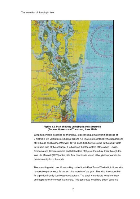
Figure 3.2. Plan showing <strong>Jumpinpin</strong> and surrounds<br />
(Source: Queensland Transport, June 1986)<br />
<strong>Jumpinpin</strong> <strong>Inlet</strong> is classified as microtidal, experiencing a maximum tidal range <strong>of</strong><br />
2 metres. Flow velocities are high at around 4.5 knots as recorded by the Department<br />
<strong>of</strong> Harbours and Marine (Maxwell, 1970). Such high flows are due to the small width<br />
to volume ratio at the entrance. It is believed that the waters <strong>of</strong> the Albert, Logan,<br />
Pimpama and Coomera rivers and tidal waters <strong>of</strong> the southern bay drain through the<br />
inlet. As Maxwell (1970) notes, tide flow direction is varied although it appears to be<br />
predominantly from the north.<br />
<strong>The</strong> prevailing wind over Moreton Bay is the South-East Trade Wind which blows with<br />
remarkable persistence for almost nine months <strong>of</strong> the year. <strong>The</strong> wind is responsible<br />
for a predominantly southeast wave pattern. <strong>The</strong> swell is moderate to high energy<br />
and approaches the coast at an angle. This generates longshore drift <strong>of</strong> sand in a<br />
7