The evolution of Jumpinpin Inlet - OzCoasts
The evolution of Jumpinpin Inlet - OzCoasts
The evolution of Jumpinpin Inlet - OzCoasts

Create successful ePaper yourself
Turn your PDF publications into a flip-book with our unique Google optimized e-Paper software.
<strong>The</strong> <strong>evolution</strong> <strong>of</strong> <strong>Jumpinpin</strong> <strong>Inlet</strong><br />
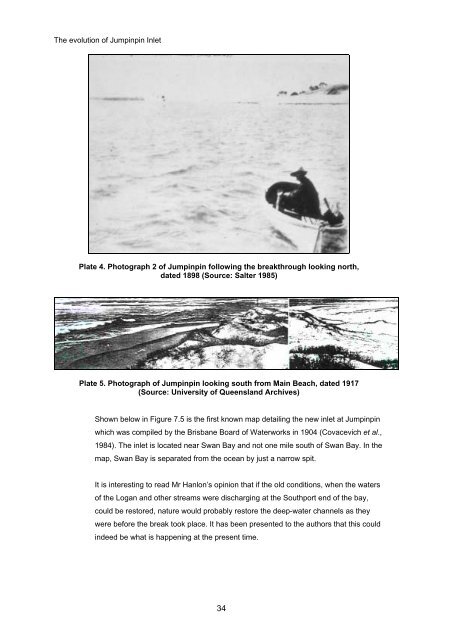
Plate 4. Photograph 2 <strong>of</strong> <strong>Jumpinpin</strong> following the breakthrough looking north,<br />
dated 1898 (Source: Salter 1985)<br />
Plate 5. Photograph <strong>of</strong> <strong>Jumpinpin</strong> looking south from Main Beach, dated 1917<br />
(Source: University <strong>of</strong> Queensland Archives)<br />
Shown below in Figure 7.5 is the first known map detailing the new inlet at <strong>Jumpinpin</strong><br />
which was compiled by the Brisbane Board <strong>of</strong> Waterworks in 1904 (Covacevich et al.,<br />
1984). <strong>The</strong> inlet is located near Swan Bay and not one mile south <strong>of</strong> Swan Bay. In the<br />
map, Swan Bay is separated from the ocean by just a narrow spit.<br />
It is interesting to read Mr Hanlon’s opinion that if the old conditions, when the waters<br />
<strong>of</strong> the Logan and other streams were discharging at the Southport end <strong>of</strong> the bay,<br />
could be restored, nature would probably restore the deep-water channels as they<br />
were before the break took place. It has been presented to the authors that this could<br />
indeed be what is happening at the present time.<br />
34