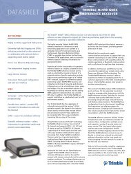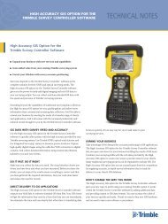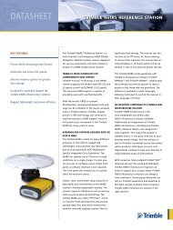
Trimble Survey Controller Software - Accupoint
Trimble Survey Controller Software - Accupoint
Trimble Survey Controller Software - Accupoint

Create successful ePaper yourself
Turn your PDF publications into a flip-book with our unique Google optimized e-Paper software.
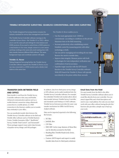
TRIMBLE INTEGRATED SURVEYING: SEAMLESS CONVENTIONAL AND GNSS SURVEYING<br />
The <strong>Trimble</strong> Integrated <strong>Survey</strong>ing solution remains the<br />
industry standard for survey data management and transfer.<br />
The <strong>Trimble</strong> <strong>Survey</strong> <strong>Controller</strong> software running on the<br />
controller of your choice—the <strong>Trimble</strong> CU or TSC2—allows<br />
you to use the same job and settings for total stations and<br />
GNSS receivers. If you need to switch from a GNSS system to<br />
a total station or vice versa, simply connect to a new sensor<br />
and keep working in the same job; avoid wasting time with<br />
data transfer between different field software. The same<br />
background maps and coordinate systems will apply.<br />
<strong>Trimble</strong> I.S. Rover<br />
Taking Integrated <strong>Survey</strong>ing further, the <strong>Trimble</strong> <strong>Survey</strong><br />
<strong>Controller</strong> software supports the <strong>Trimble</strong> I.S. Rover, so you<br />
can stay connected to a GNSS receiver and a robotic total<br />
station at the same time.<br />
The <strong>Trimble</strong> I.S. Rover enables you to:<br />
• Use the most appropriate tool—GNSS or<br />
conventional—according to conditions on the job site:<br />
Maximize time in the field measuring.<br />
• Increase productivity when establishing control:<br />
Establish control by measuring points with either<br />
technology, or both.<br />
• Use one job for managing and recording all your data:<br />
Remove the need to transfer data.<br />
• Improve data integrity: Measure points with both<br />
technologies for truly independent verification and<br />
confirmation of survey accuracy.<br />
• Expedite target searches with the GPS Search<br />
function in the <strong>Trimble</strong> <strong>Survey</strong> <strong>Controller</strong> software:<br />
With GPS Search the <strong>Trimble</strong> I.S. Rover will typically<br />
turn directly to the prism within three seconds.<br />
TRANSFER DATA BETWEEN FIELD<br />
AND OFFICE<br />
Data transfer to and from the <strong>Trimble</strong> <strong>Survey</strong><br />
<strong>Controller</strong> software is fast, easy, and flexible.<br />
Advanced communication options such as a<br />
mobile Internet connection using a Bluetooth<br />
connection to a mobile phone, or a WiFi<br />
connection to the Internet, enables you to transfer<br />
data wirelessly to your office.<br />
You can seamlessly transfer data between the<br />
<strong>Trimble</strong> <strong>Survey</strong> <strong>Controller</strong> software in the field and<br />
<strong>Trimble</strong> office software such as <strong>Trimble</strong> Business<br />
Center, <strong>Trimble</strong> Geomatics Office, RealWorks®<br />
<strong>Survey</strong>, <strong>Trimble</strong> Total Control, and Terramodel®.<br />
These packages support many native data formats<br />
of popular survey, design, and GIS packages.<br />
In addition, data from third-party survey, design<br />
or GIS software can be easily transferred into the<br />
<strong>Trimble</strong> <strong>Survey</strong> <strong>Controller</strong> software. For example,<br />
the embedded <strong>Trimble</strong> Link module allows direct<br />
data transfer between <strong>Trimble</strong> <strong>Survey</strong> <strong>Controller</strong><br />
and Autodesk Land Desktop or CAiCE software.<br />
<strong>Trimble</strong> <strong>Survey</strong> Extension provides the same easy<br />
transfer mechanism for ESRI’s ArcGIS <strong>Survey</strong><br />
Analyst software.<br />
Data can be imported/exported in the following<br />
file formats:<br />
• DC files<br />
• JobXML files<br />
• CSV files<br />
• DXF, SHP: Active map, features of these files<br />
can be directly accessed in the field.<br />
• Roading files: <strong>Trimble</strong> Roads (rxl), Genio,<br />
LandXML<br />
• Custom ASCII import and export to easily<br />
transfer data from/to third-party solutions<br />
Email Data from the Field<br />
For easy transfer from the field to the office<br />
<strong>Trimble</strong> <strong>Survey</strong> <strong>Controller</strong> software allows you to<br />
email files directly from your controller. You can<br />
attach zipped files and a brief description and<br />
send to any e-mail address. Not only can you share<br />
work with your office without leaving the job; this<br />
function also provides a simple way to back up<br />
your work.<br />
2